MAESTR0
-
Posts
94 -
Joined
-
Last visited
-
Days Won
10


-
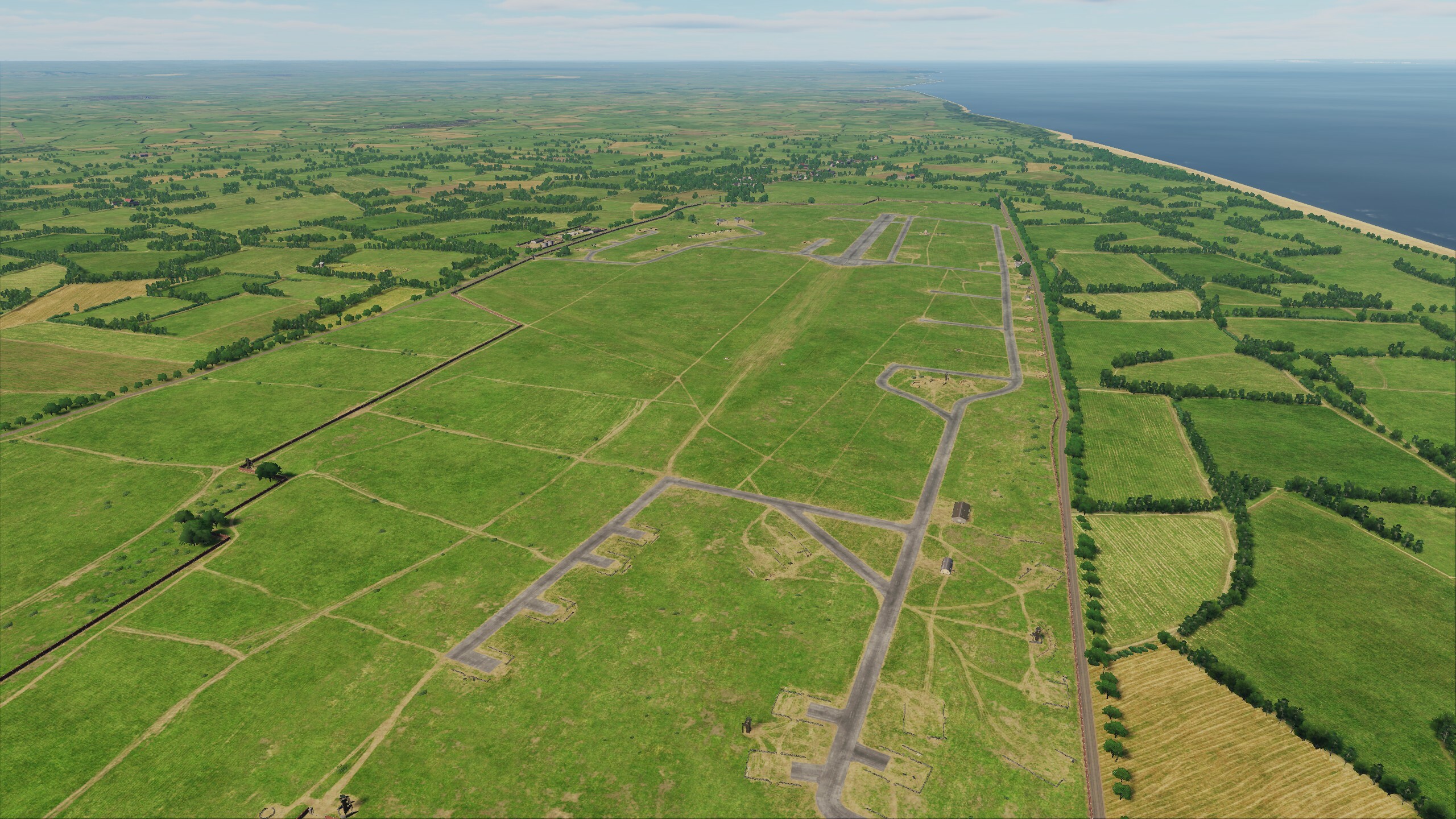
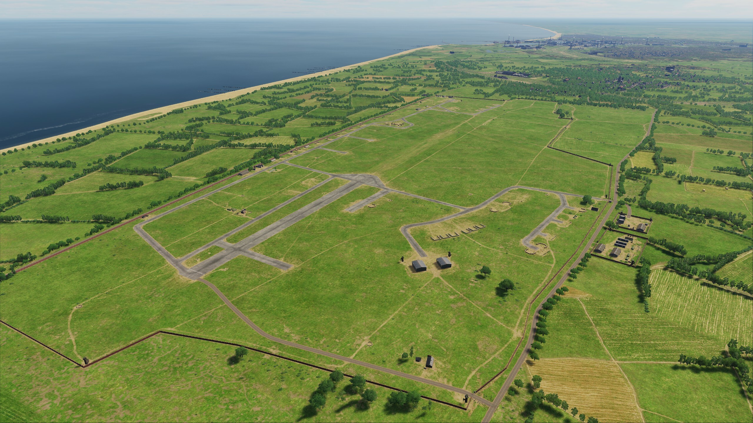
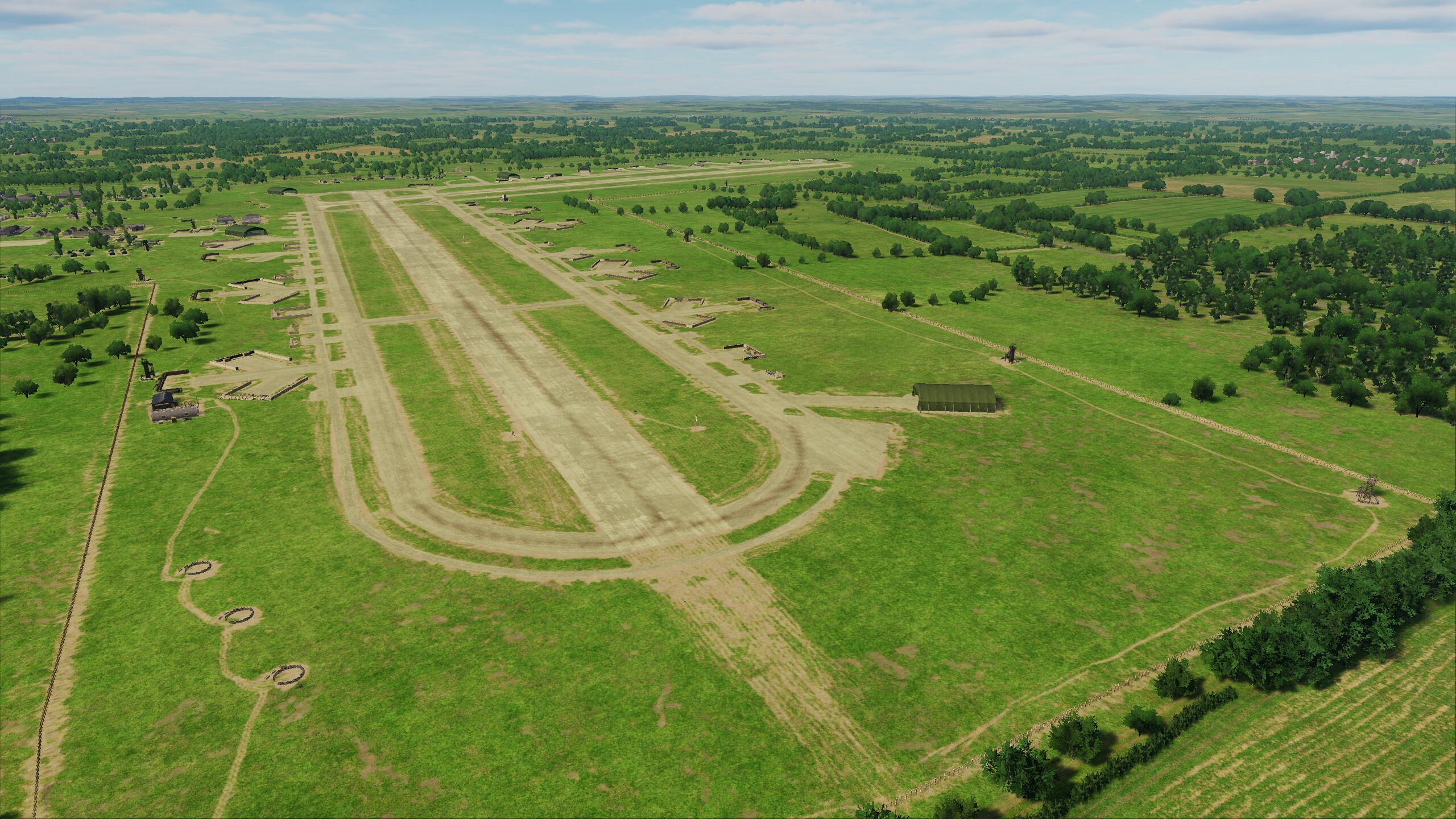
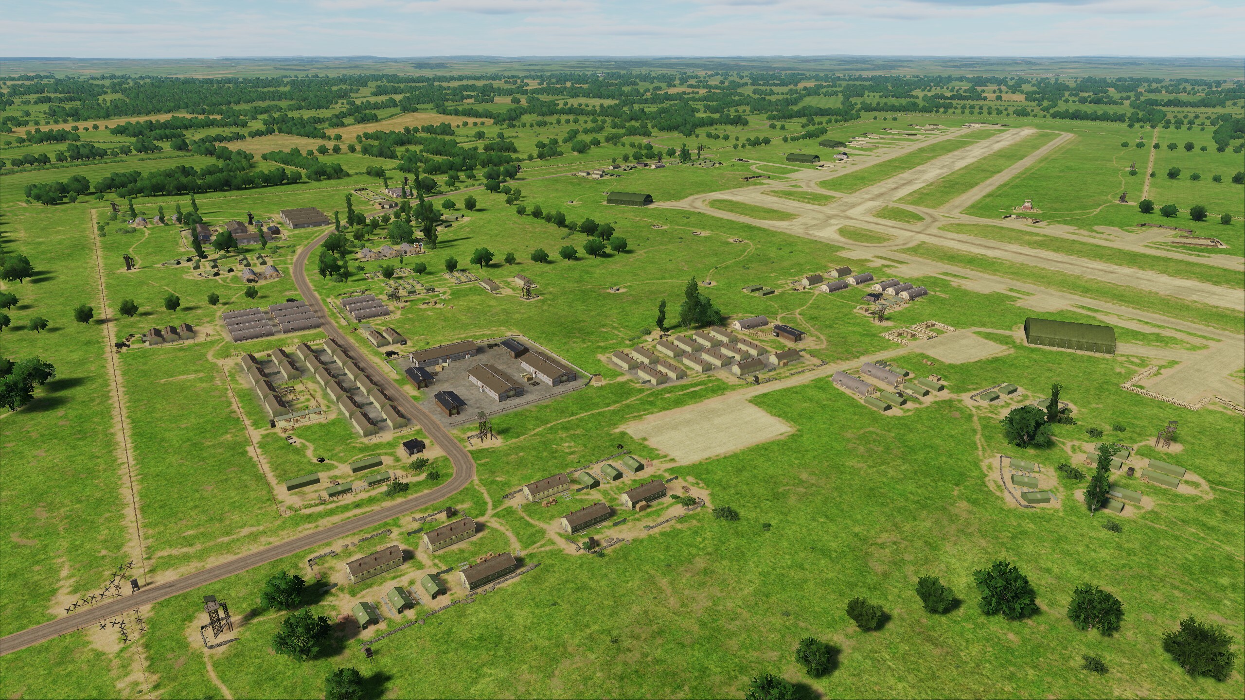
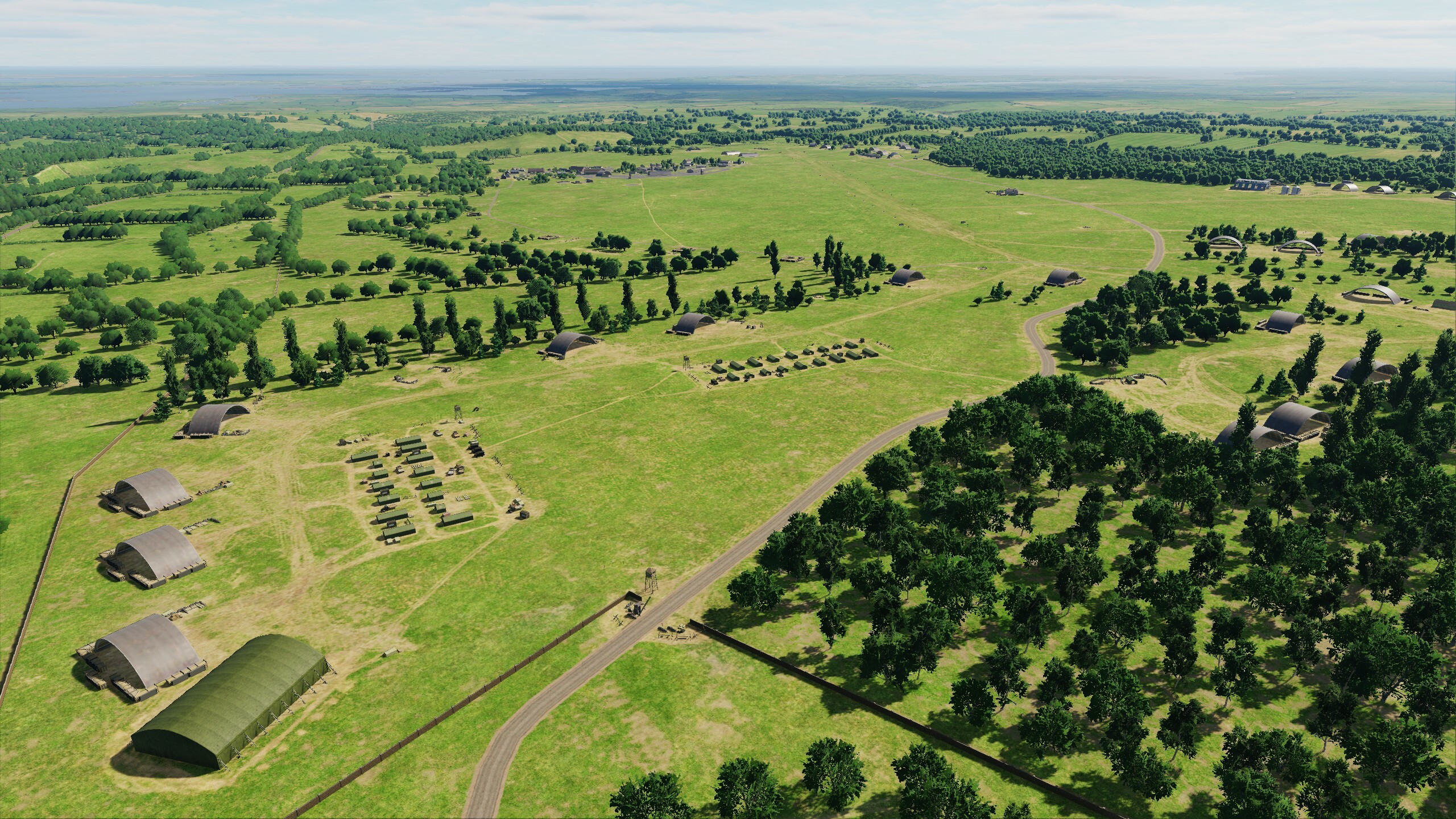
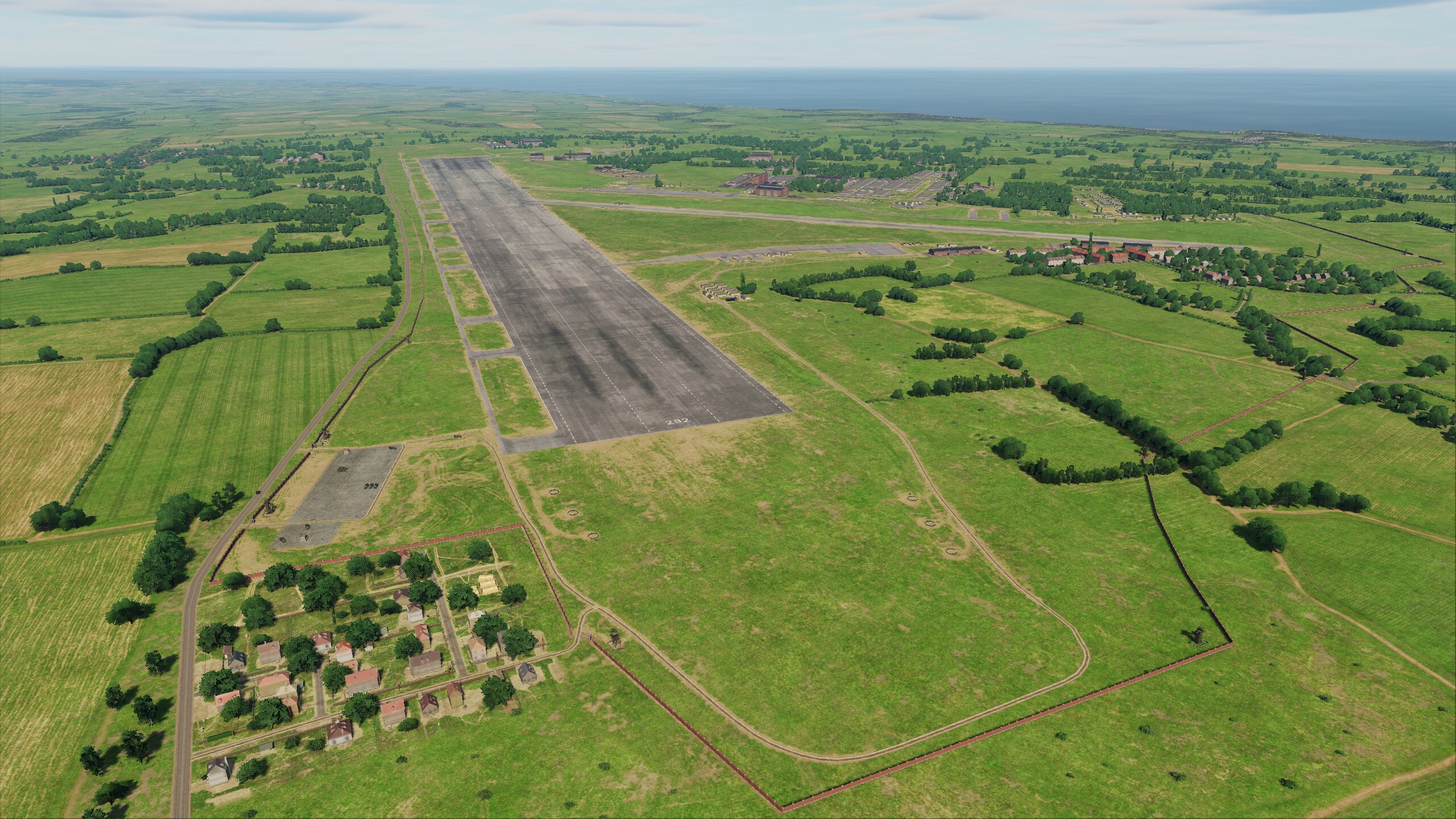
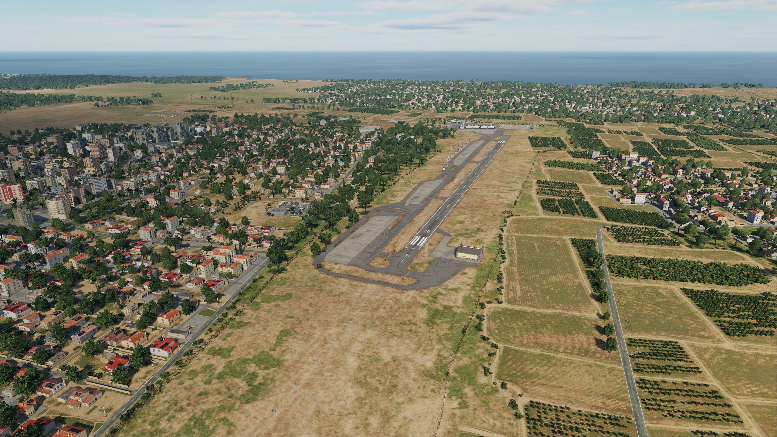
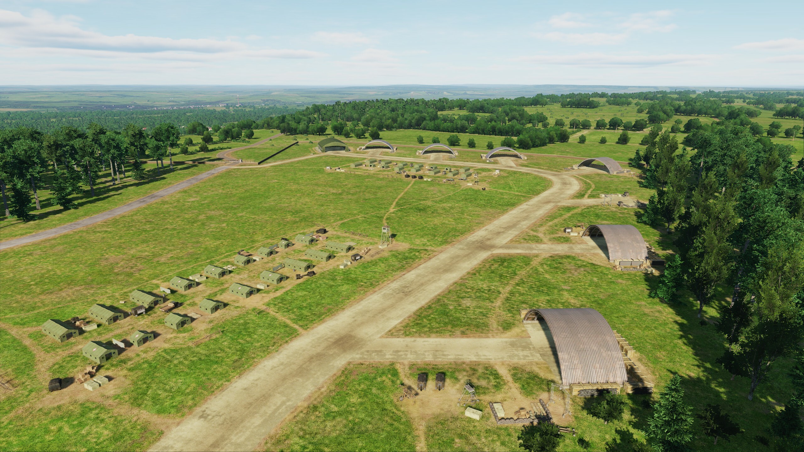
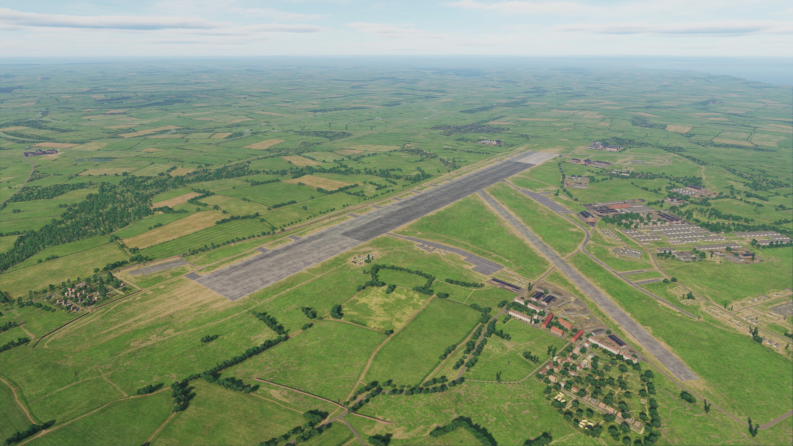
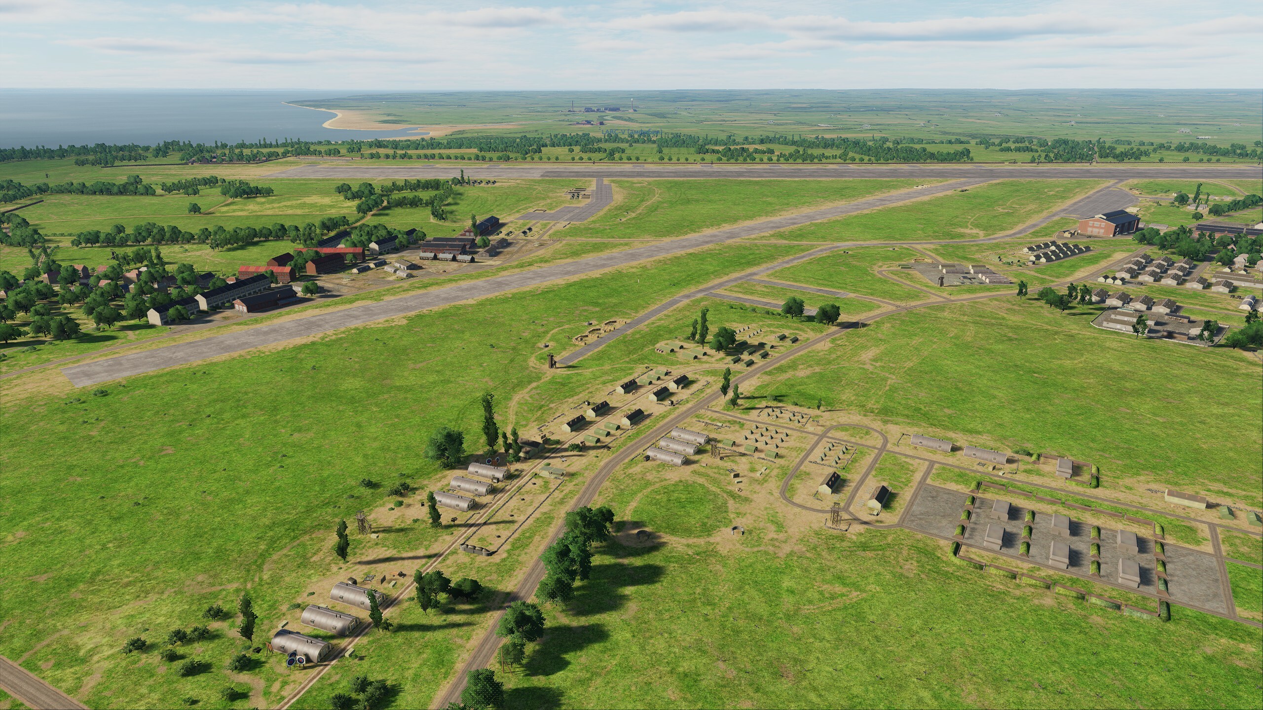
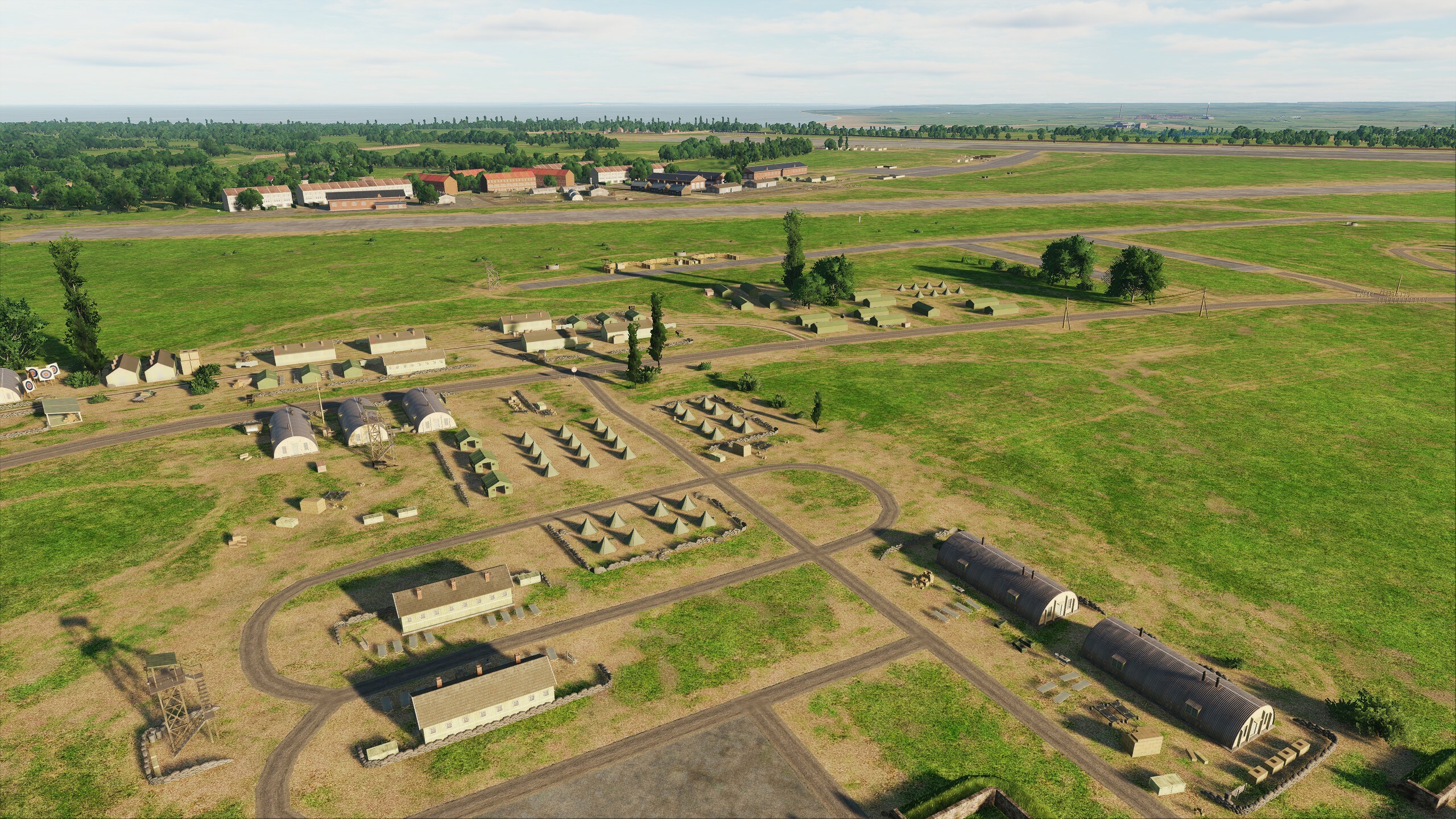
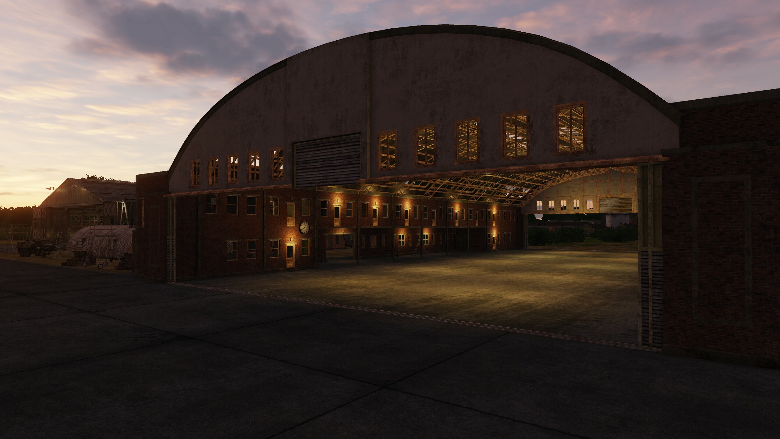
Hi We would like to thank the community for its attention to the project. Today we will show you a small update of Normandy. We've added two new airfields that you may be familiar with: Dunkirk & High Halden - so there are now 79 military airfields on the Normandy map. And we have made small changes to three existing airfields: Detling, Lympne, Manston - for you it will be as if you have returned from vacation, you see everything the same, but at the same time everything has become noticeably better. The specifics of historical maps require constant attention to references, and in this regard you help us a lot: @DD_Fenrir the runway was left, the global restructuring of Manston will be in the next iteration. Everyone will be able to see these results. Keep checking back for updates soon Dunkirk High Halden Detling Lympne Manston

- 49 replies
-
- 17
-

-

-
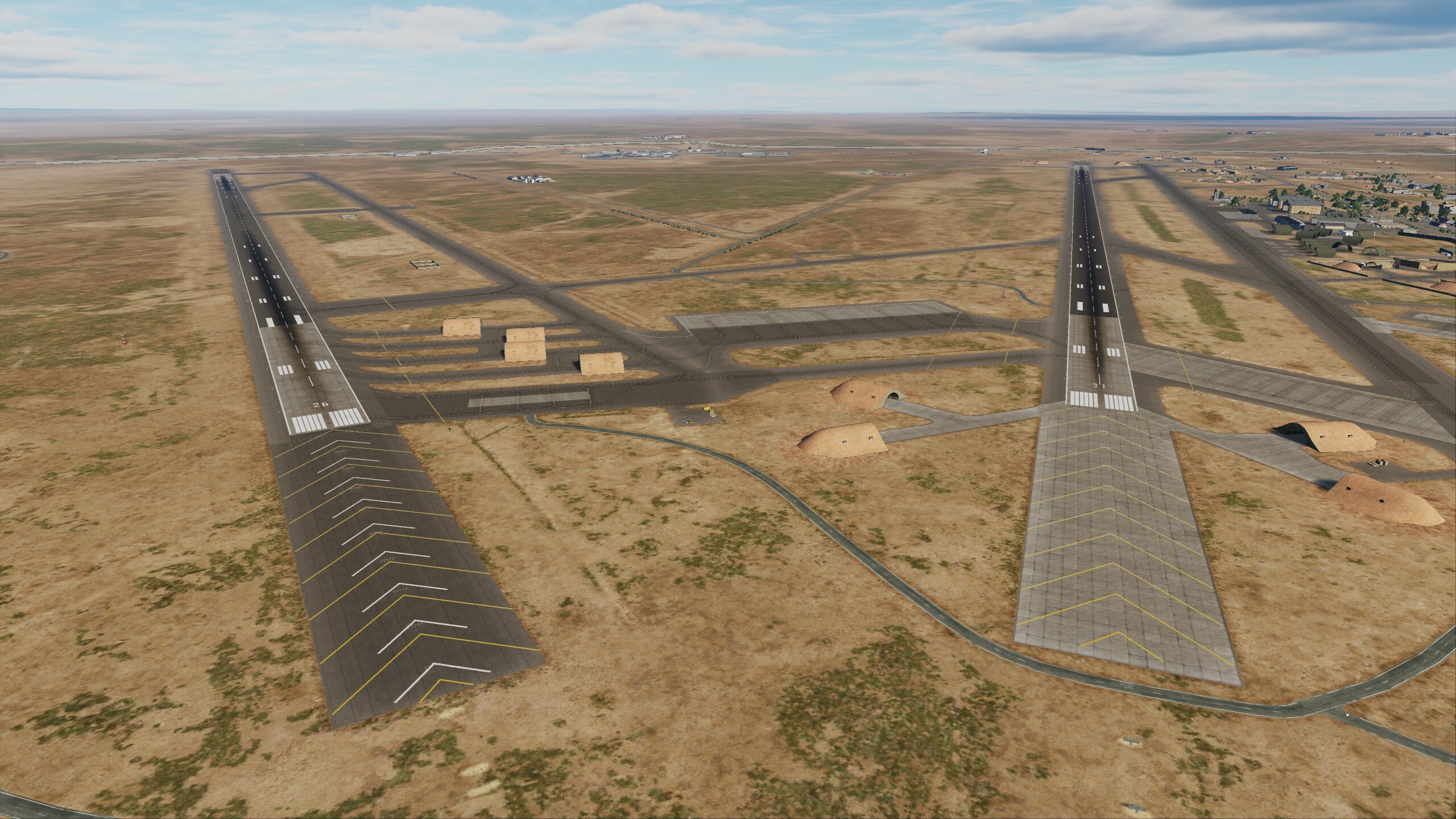
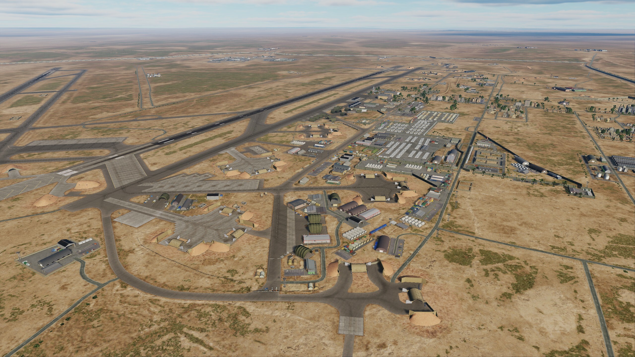
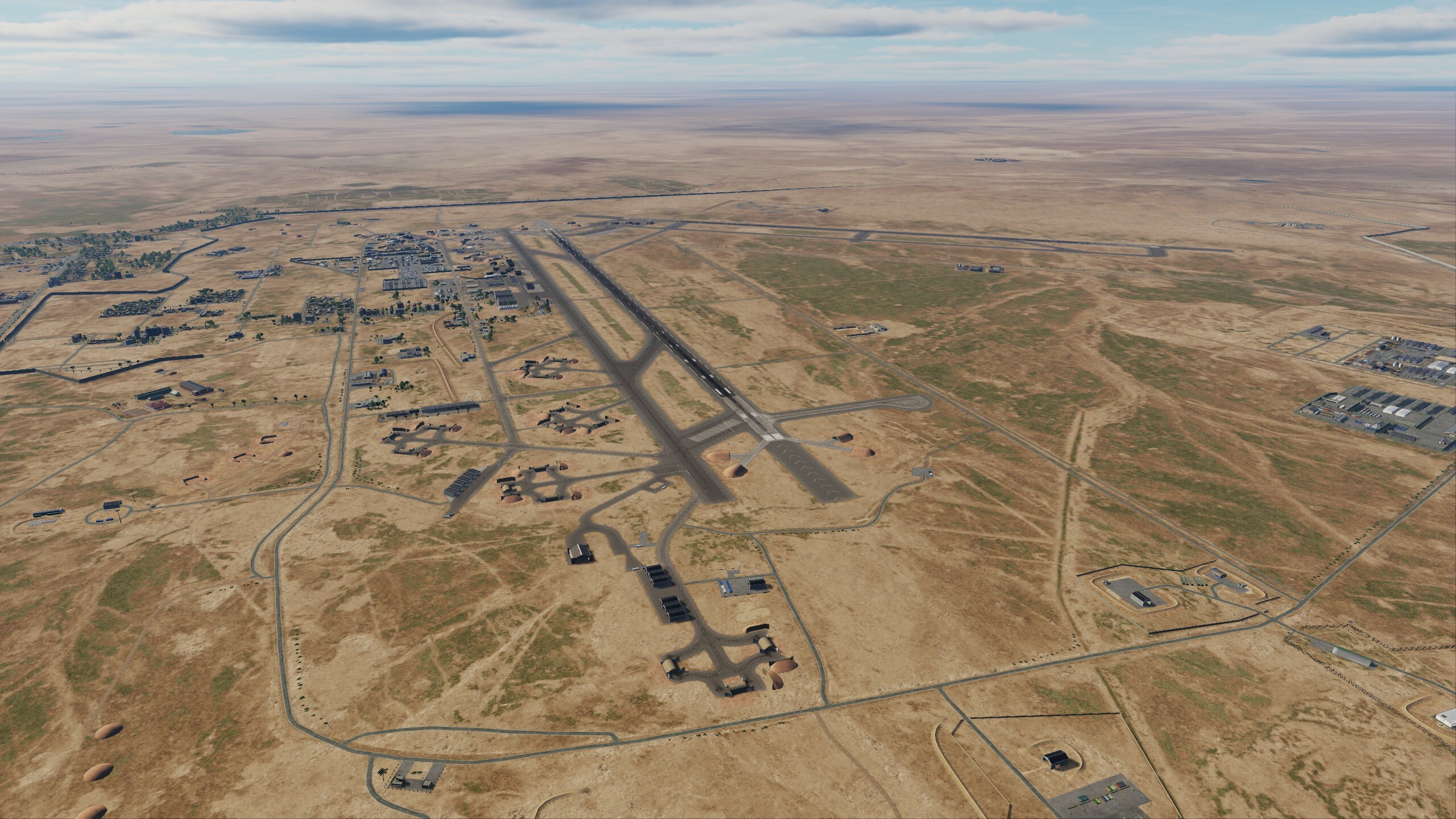
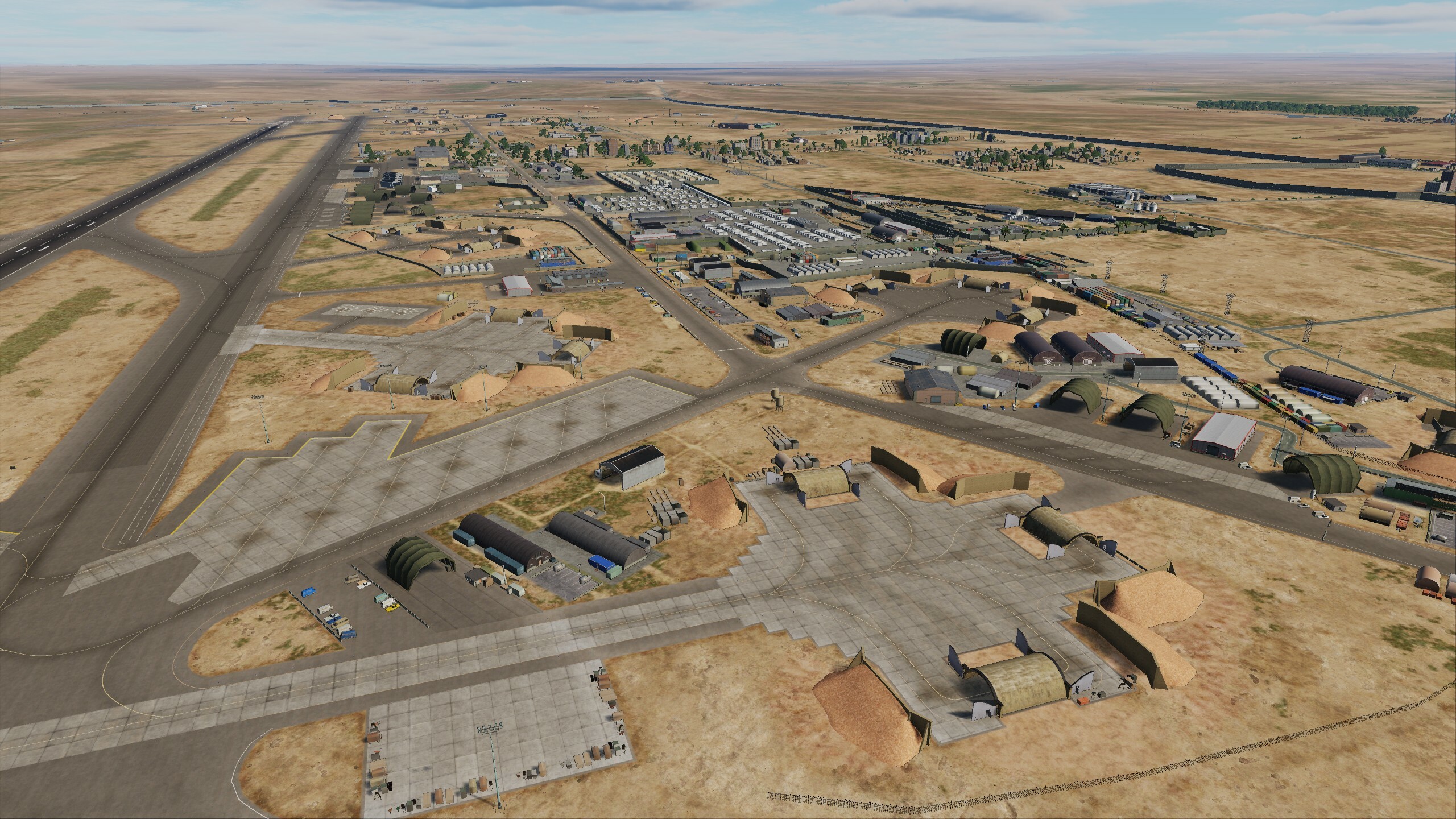
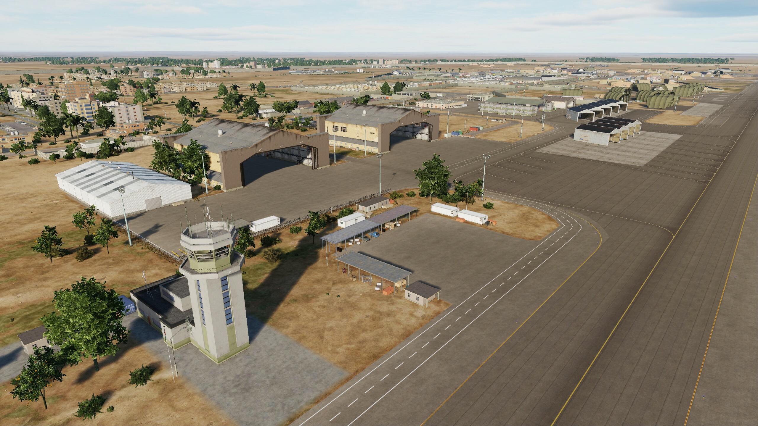
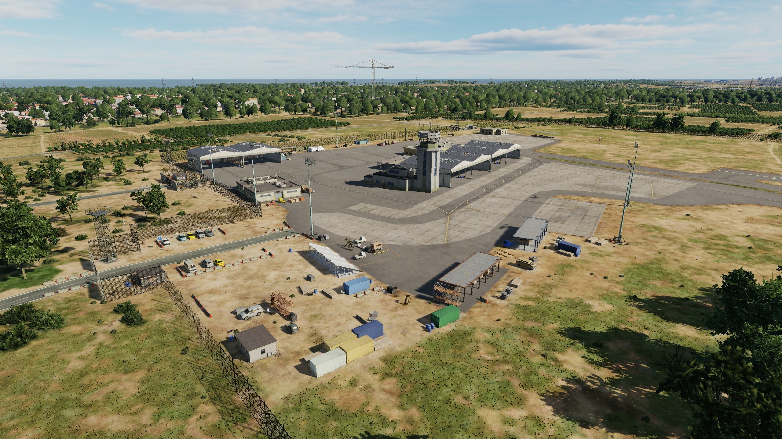
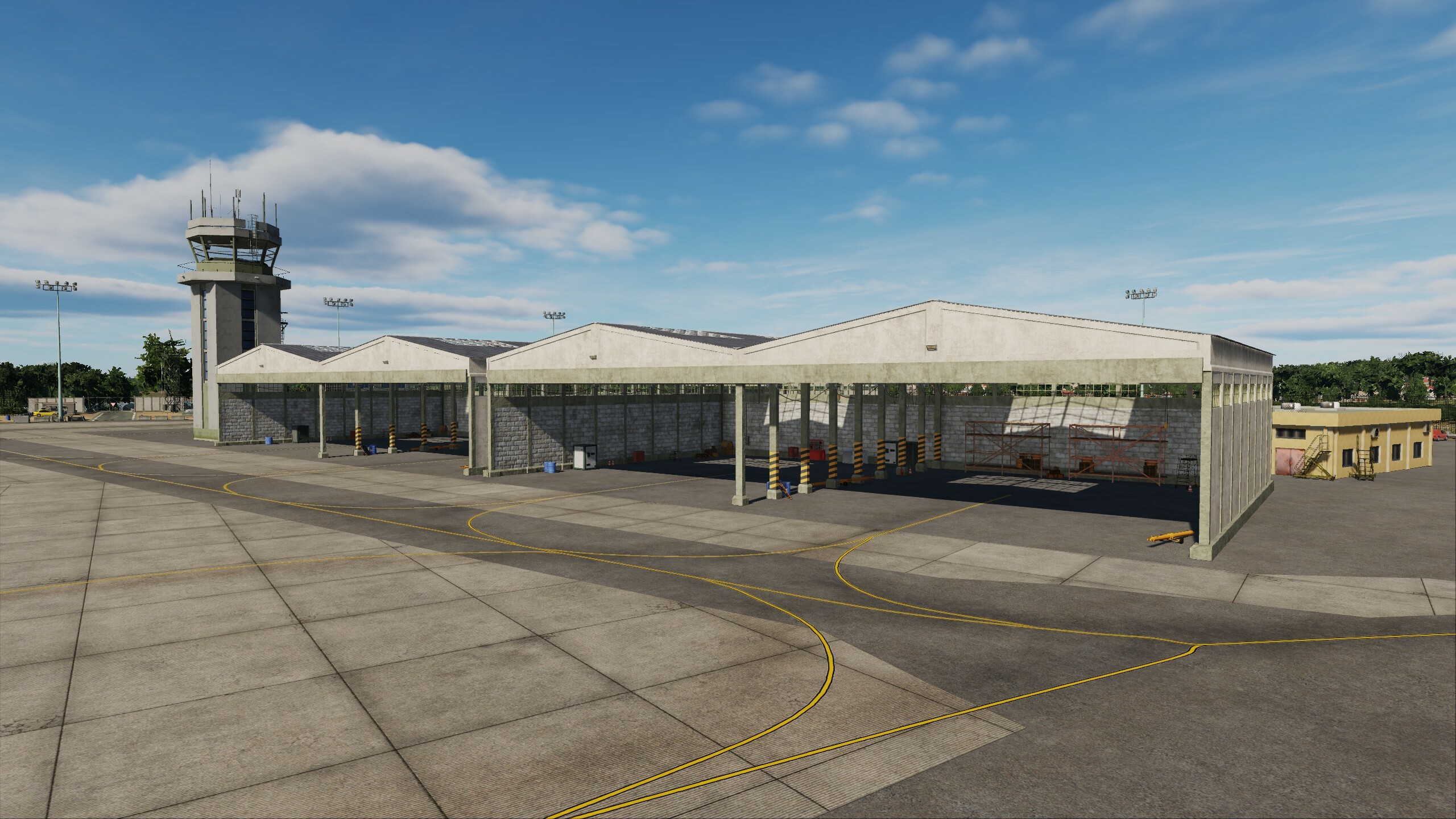
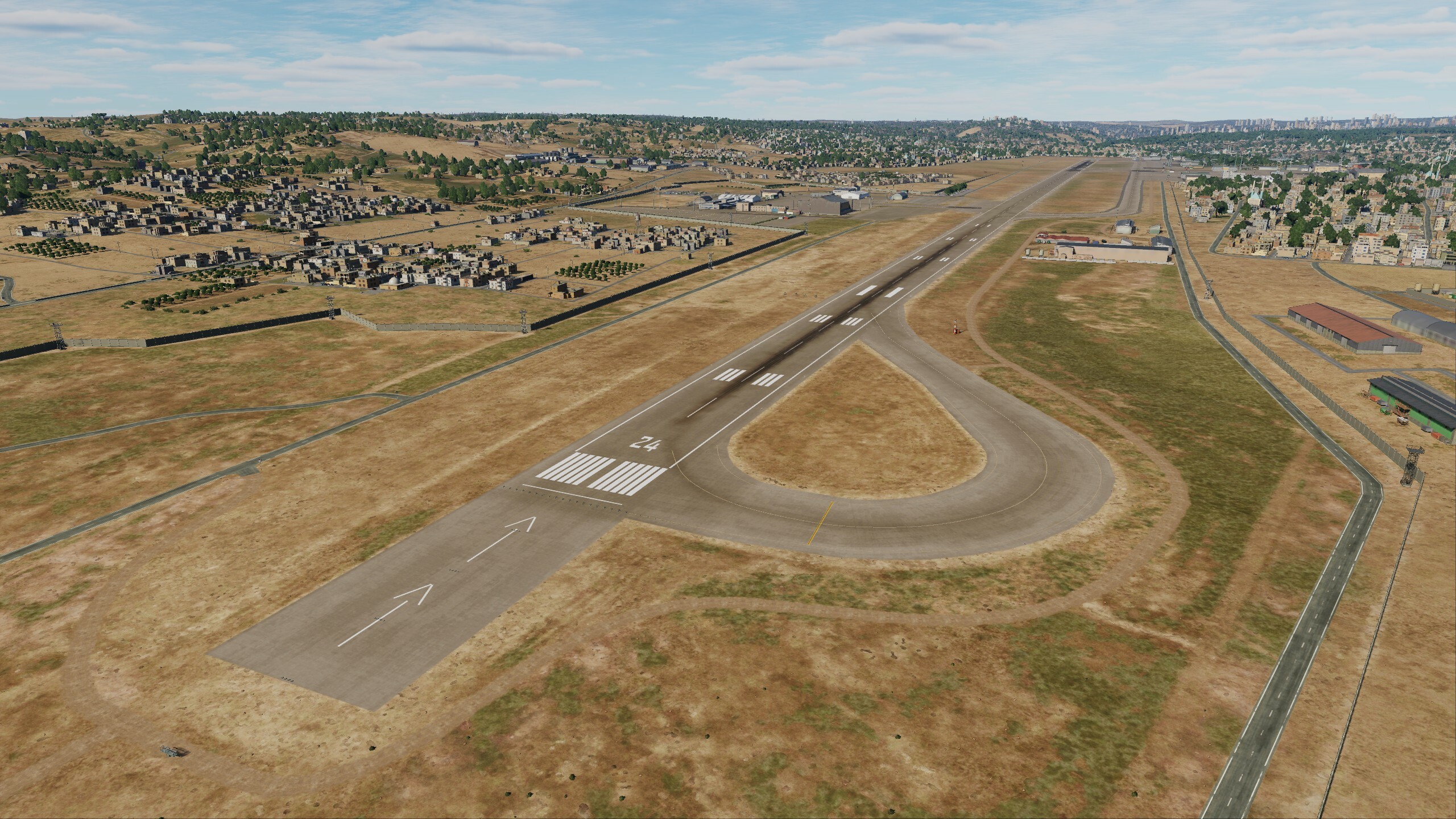
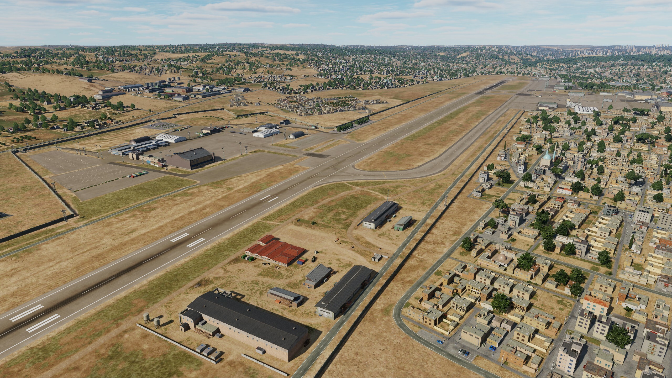
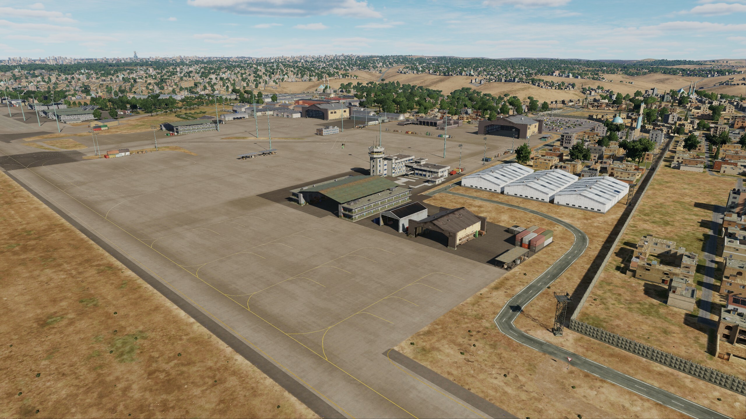
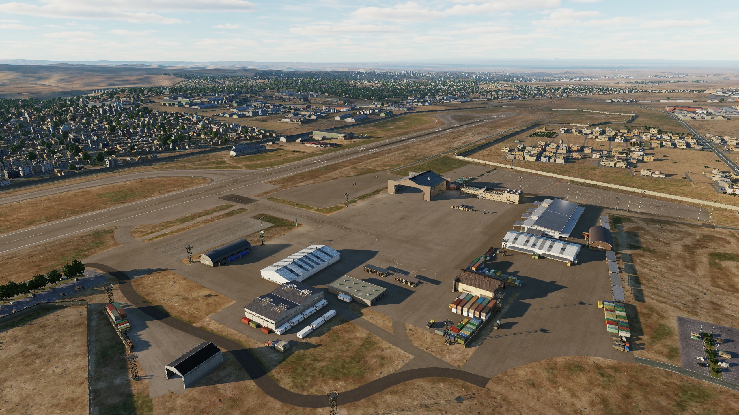
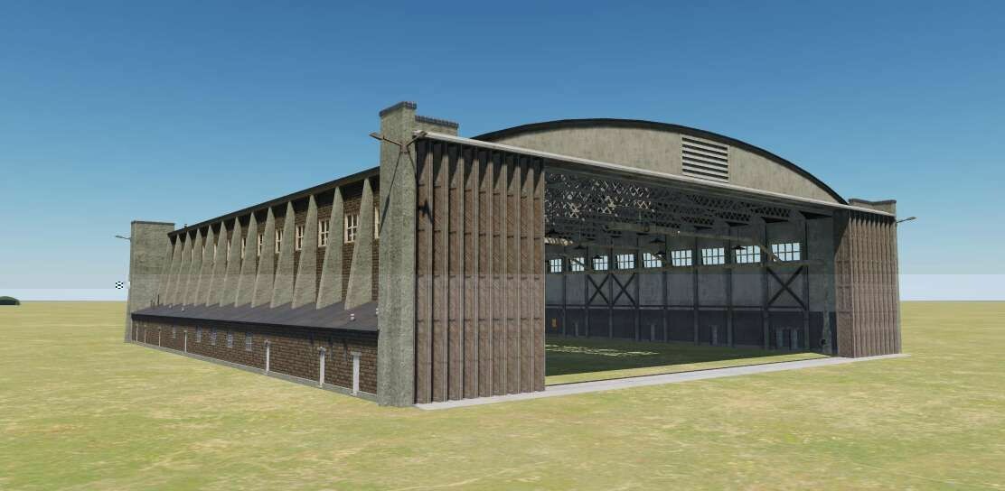
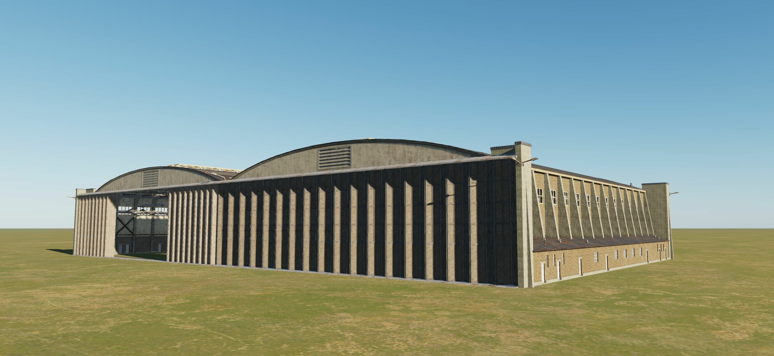
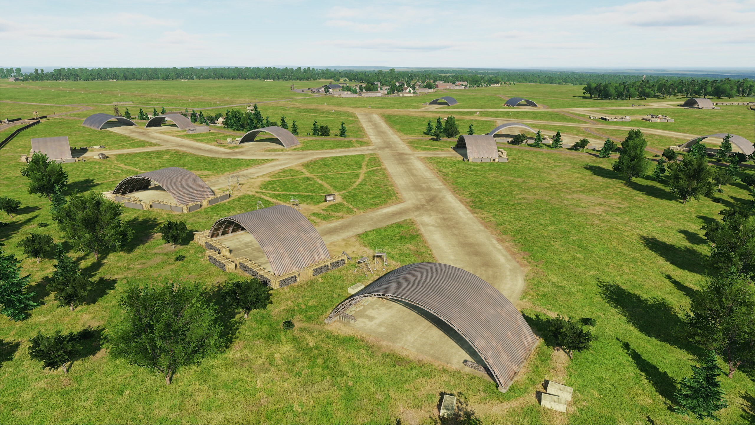
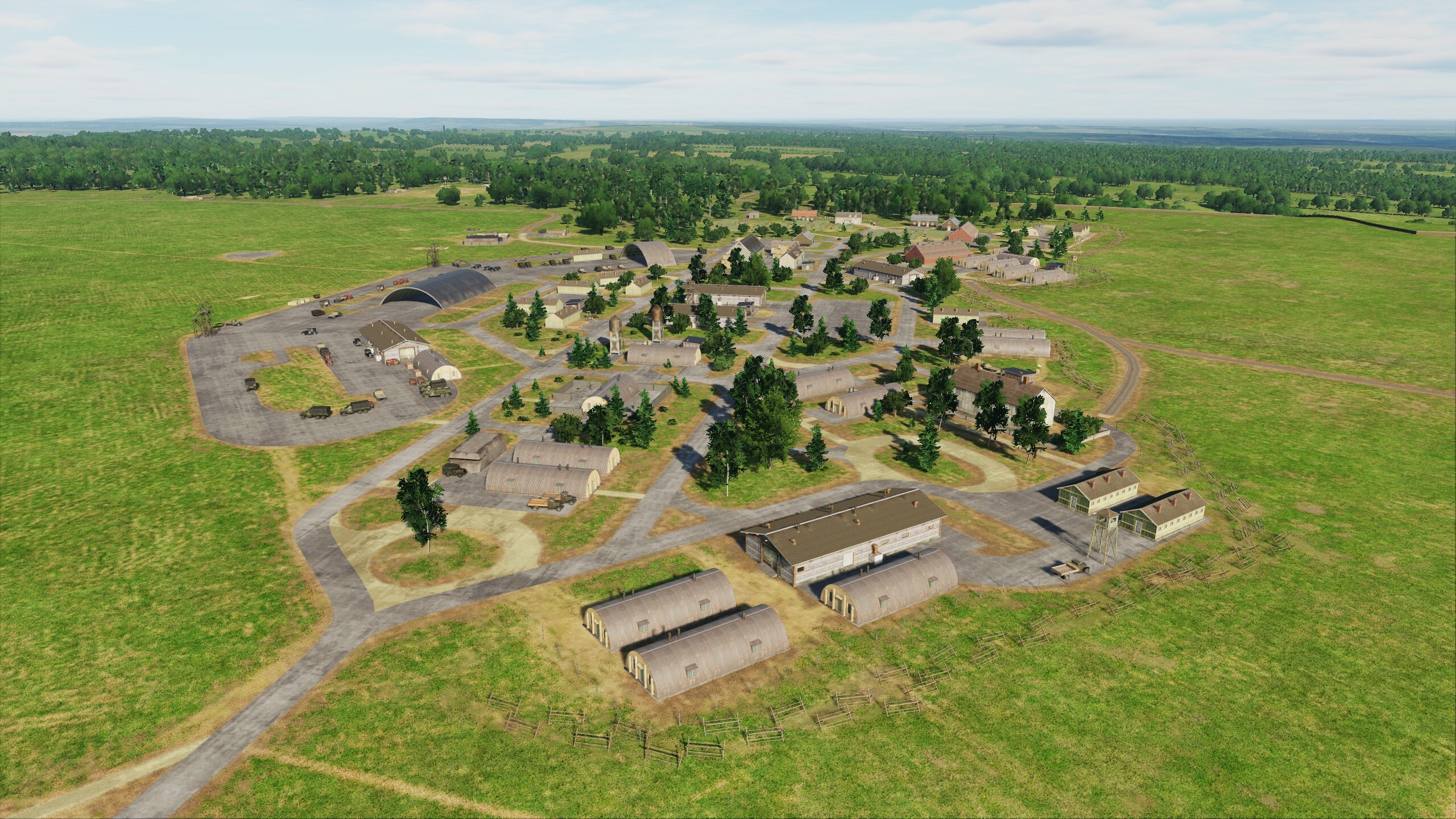
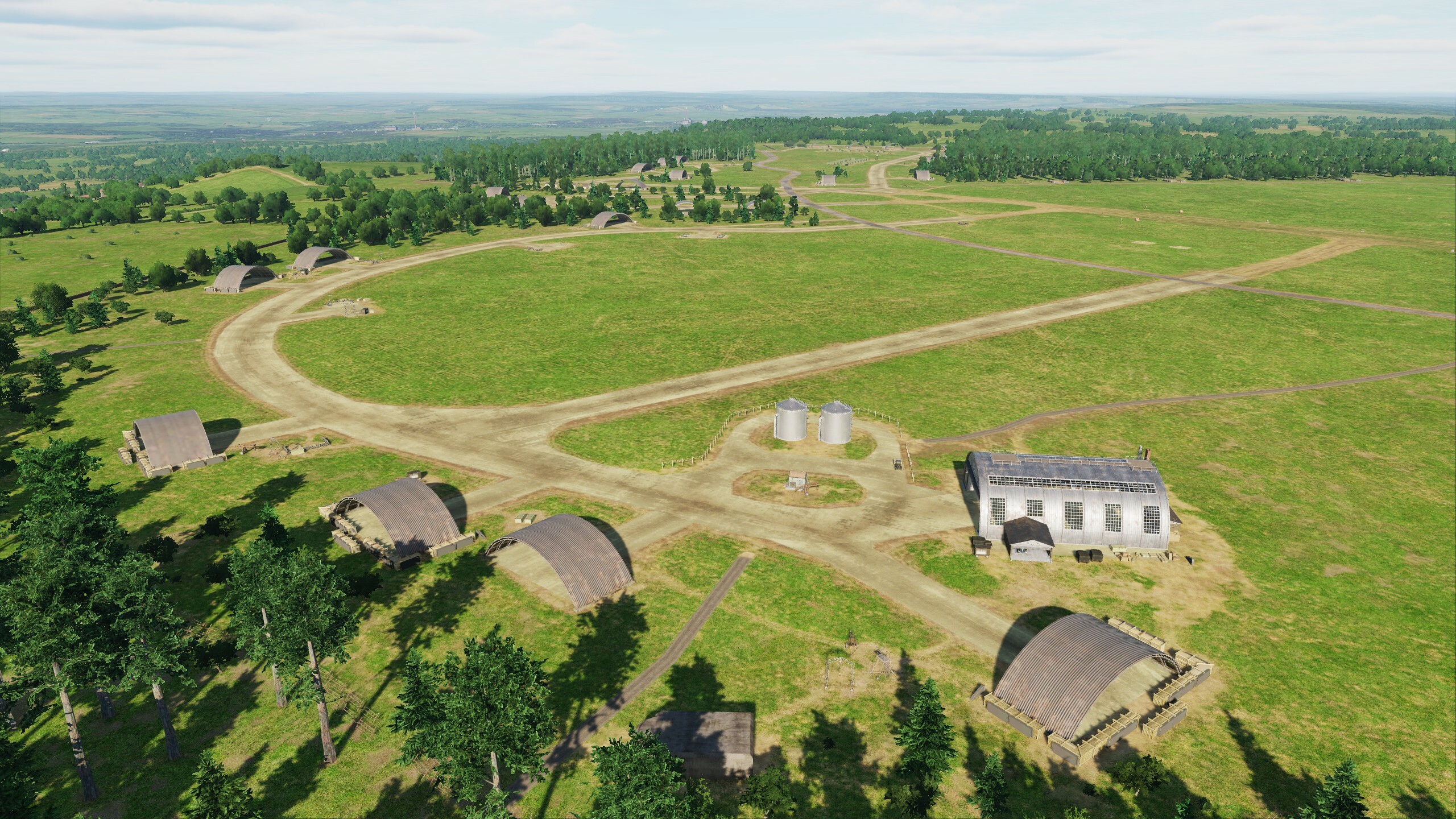
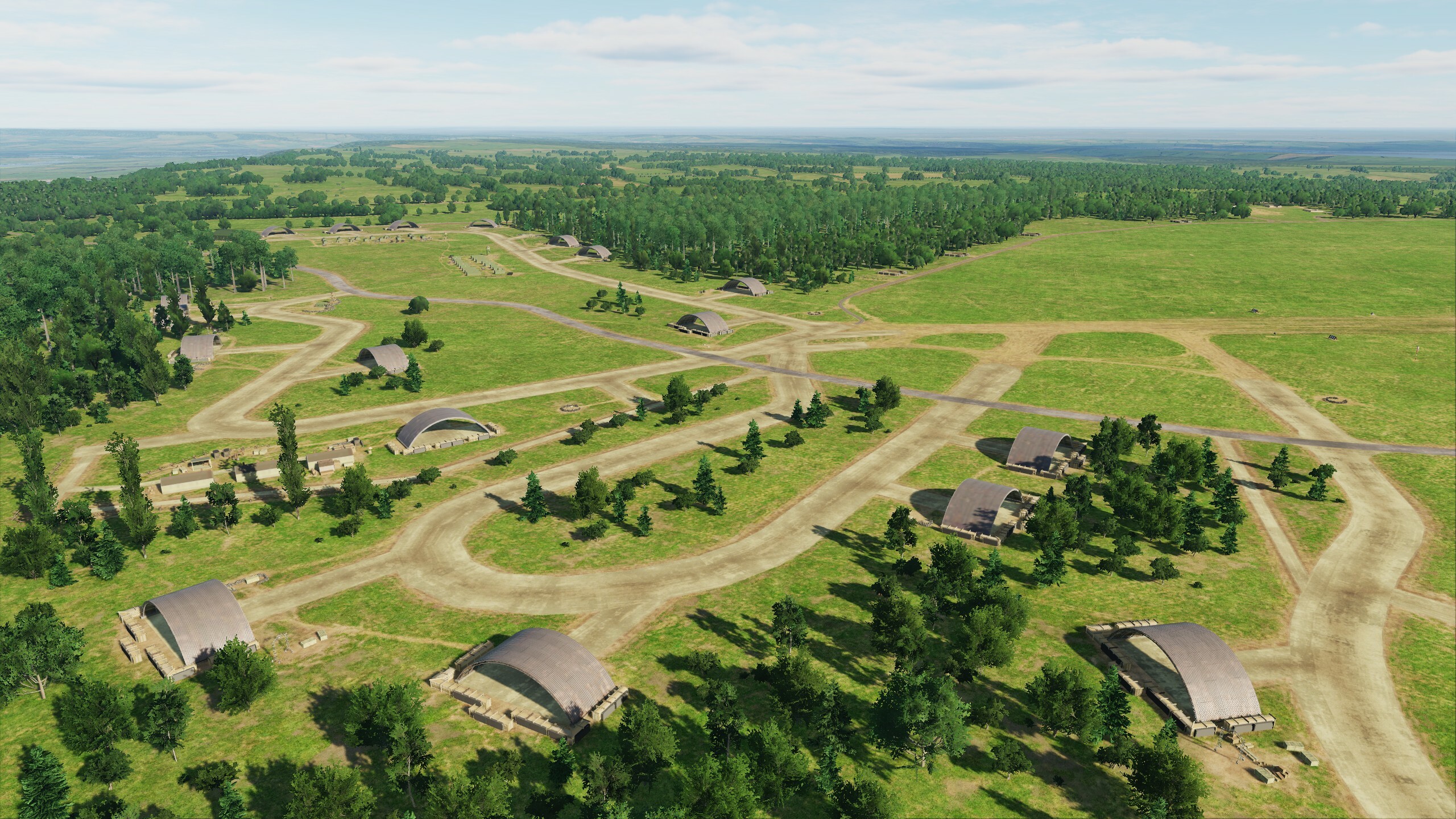
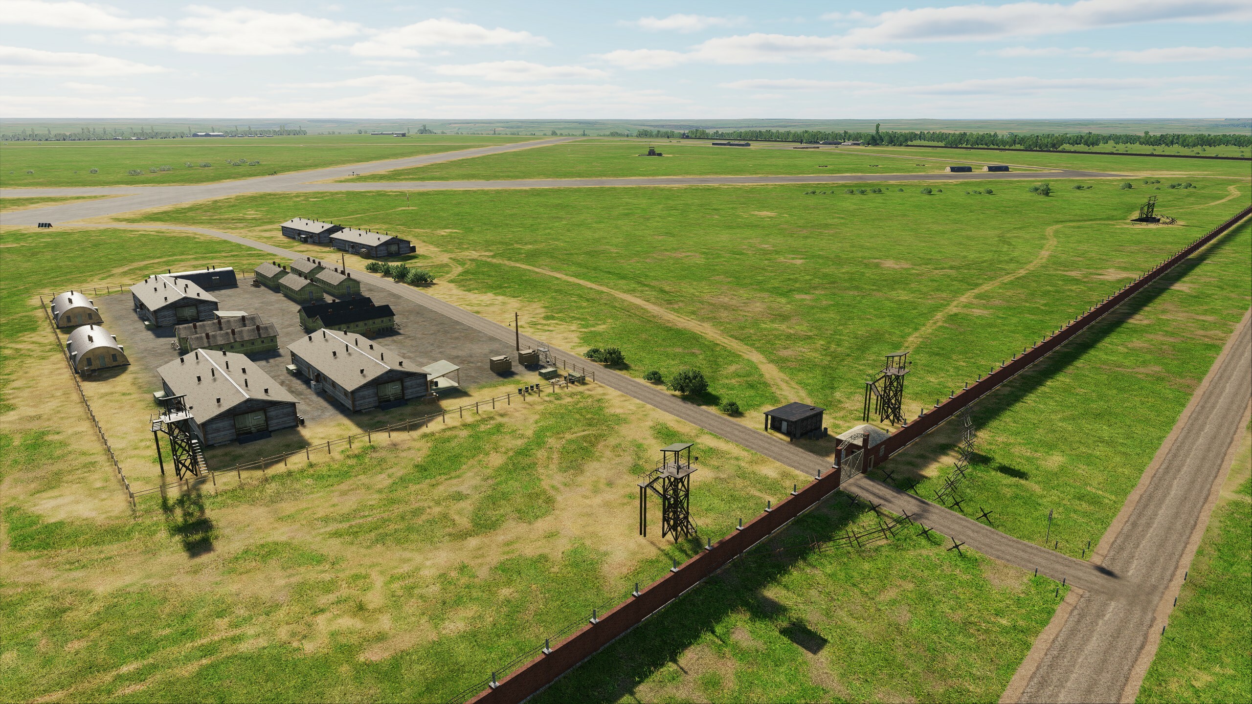
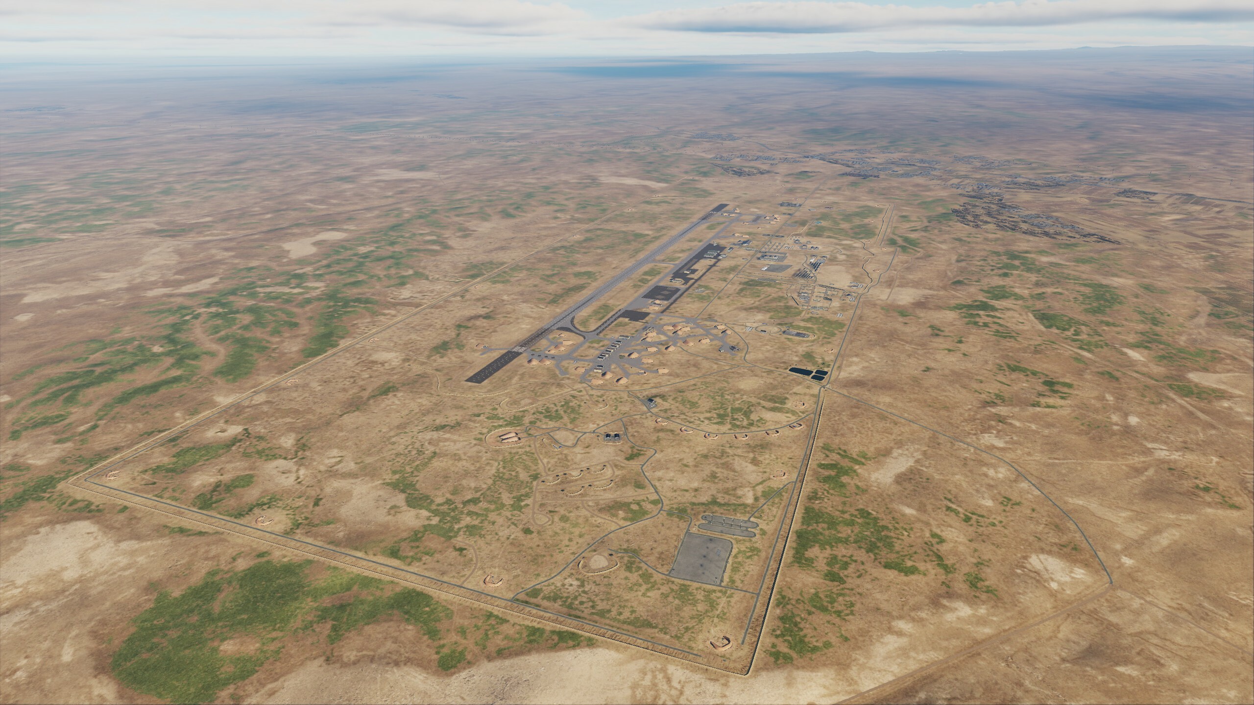
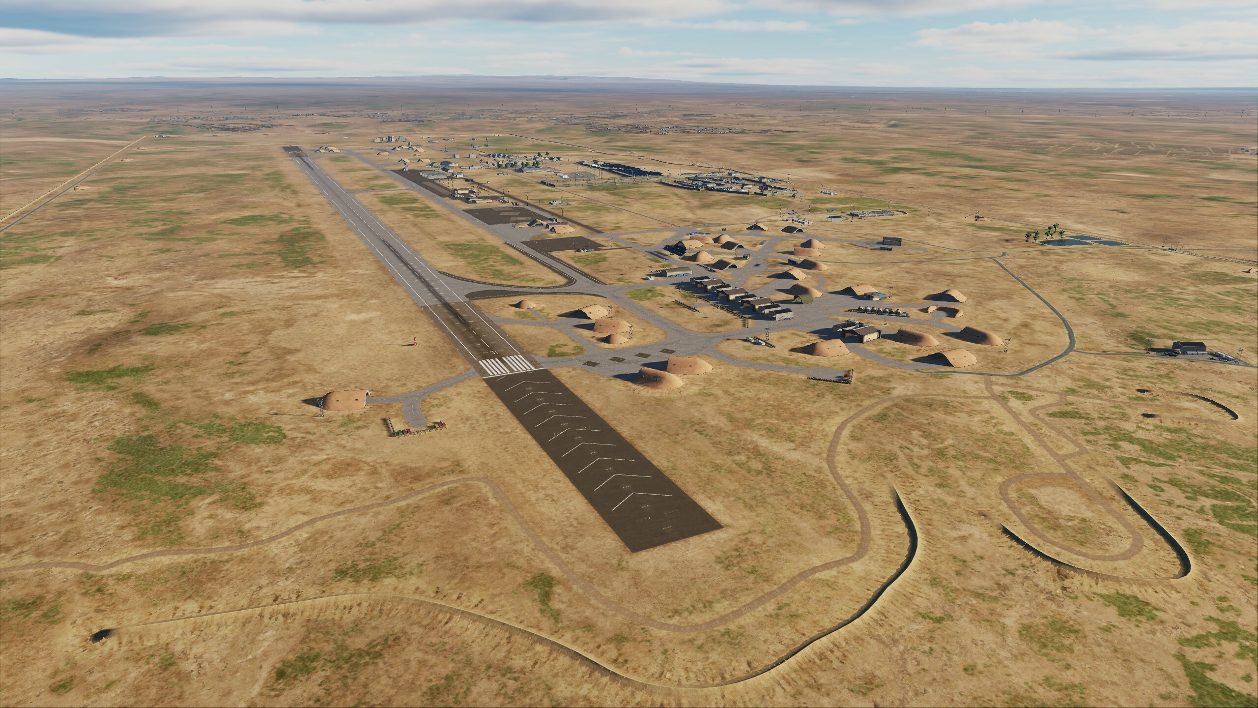
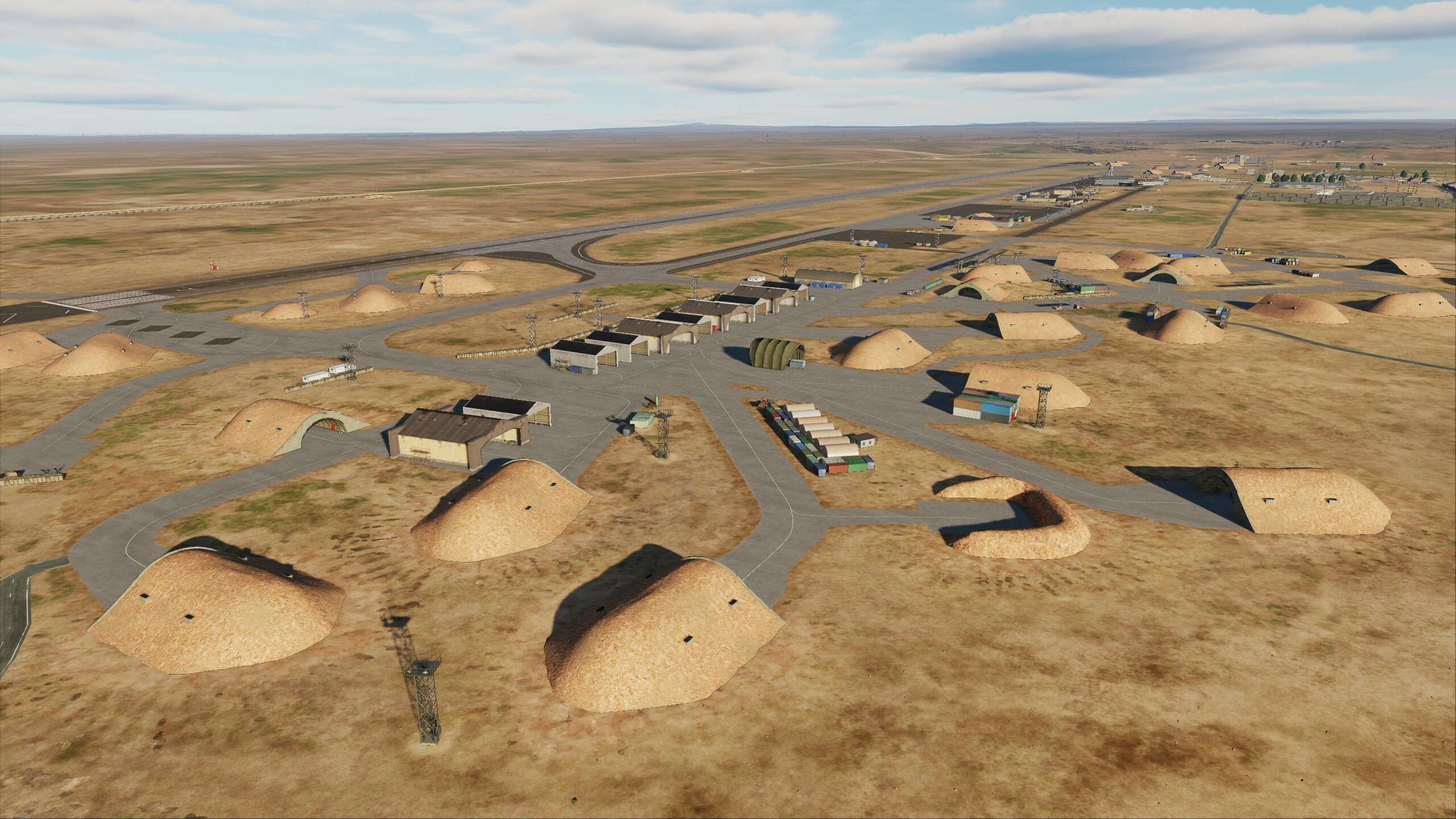
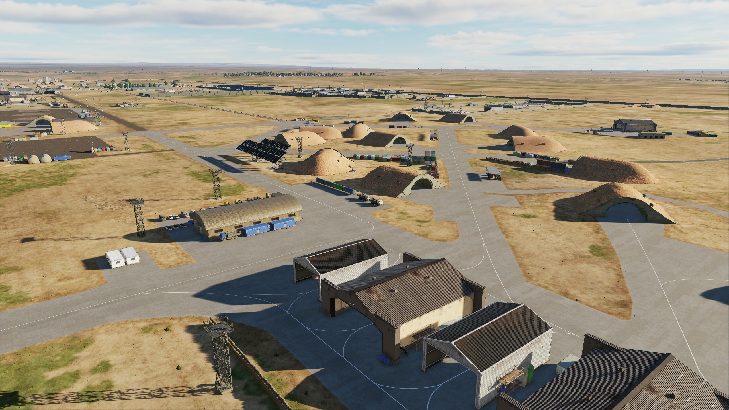
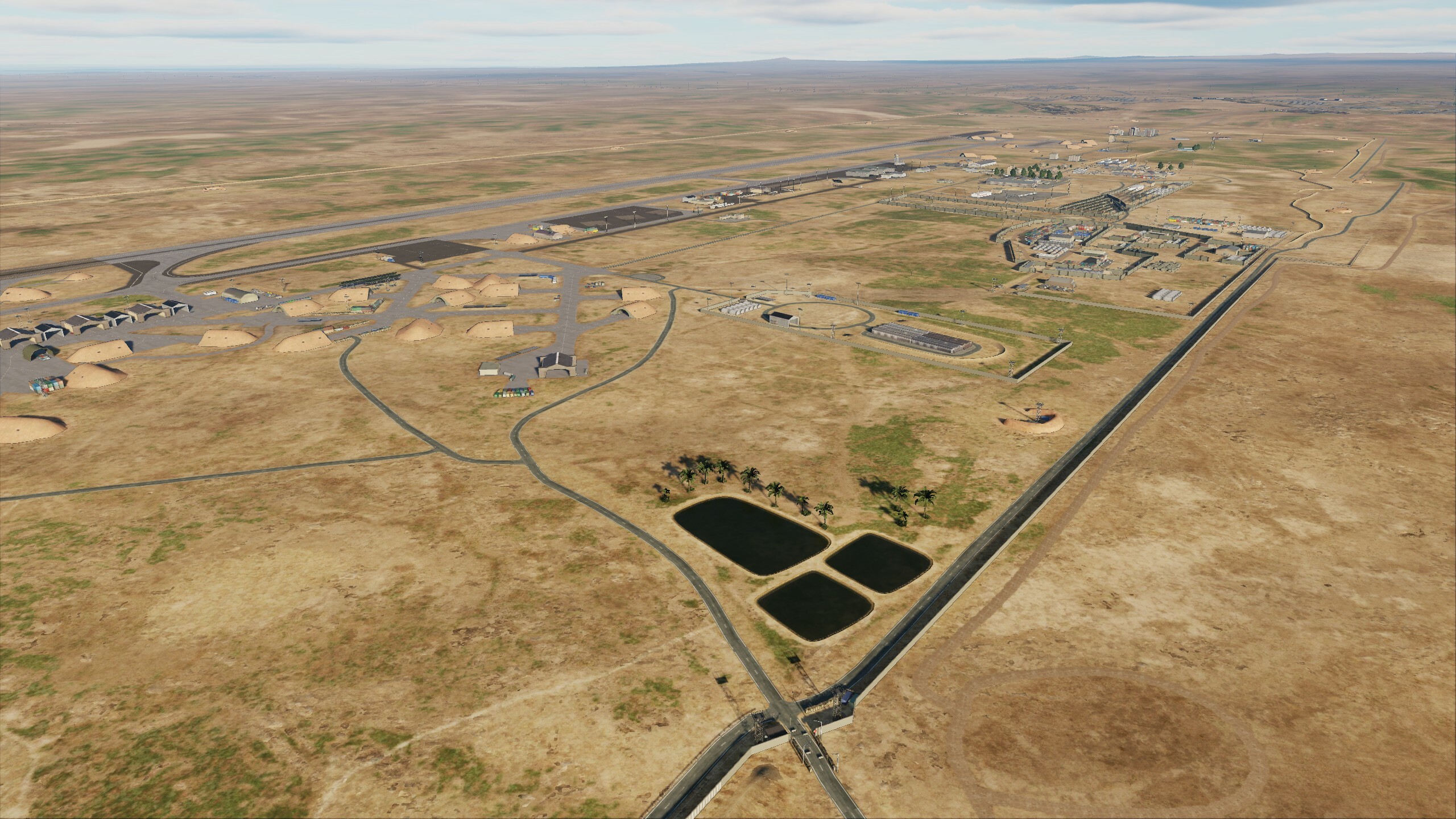
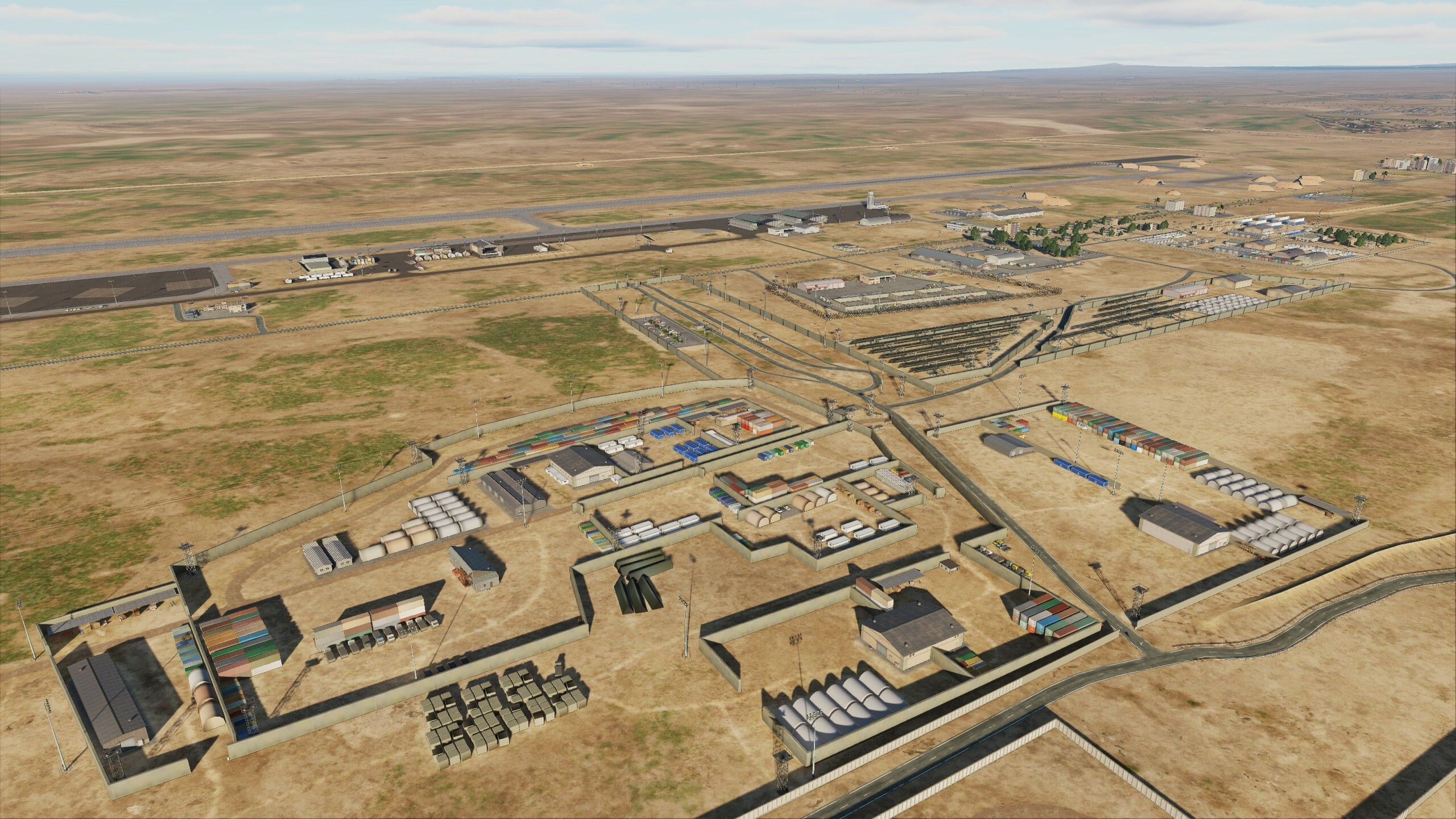
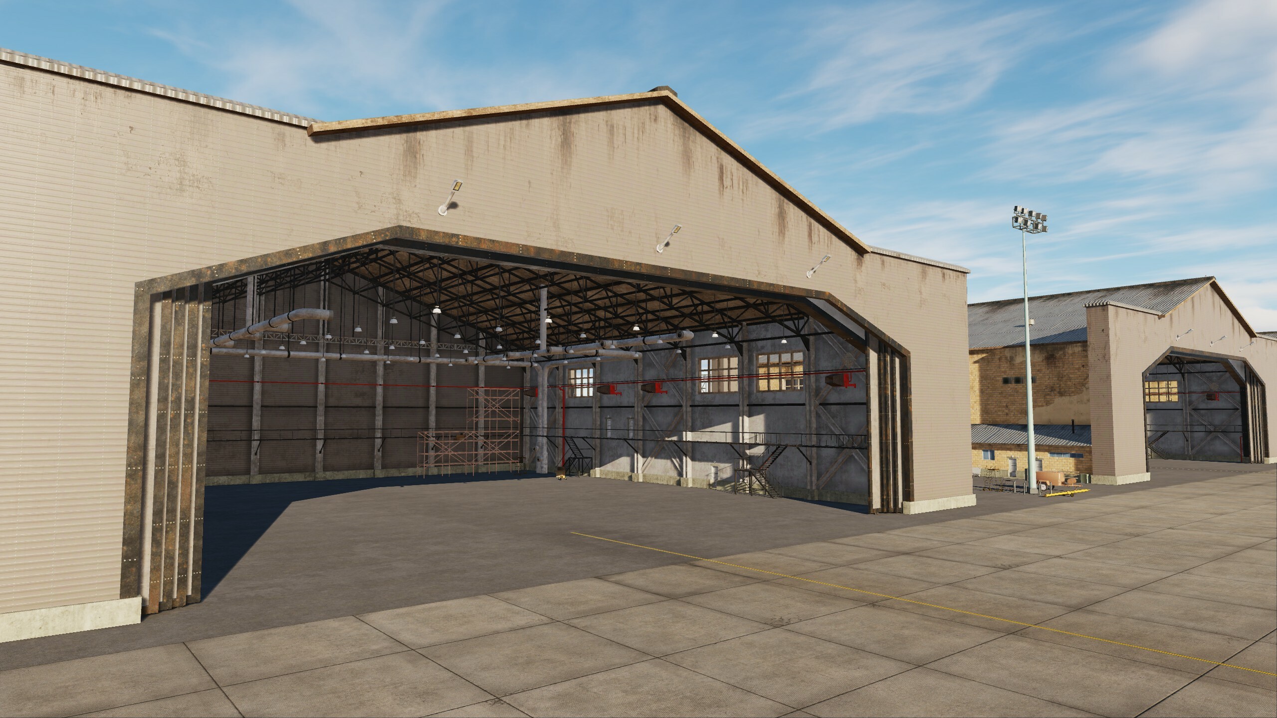
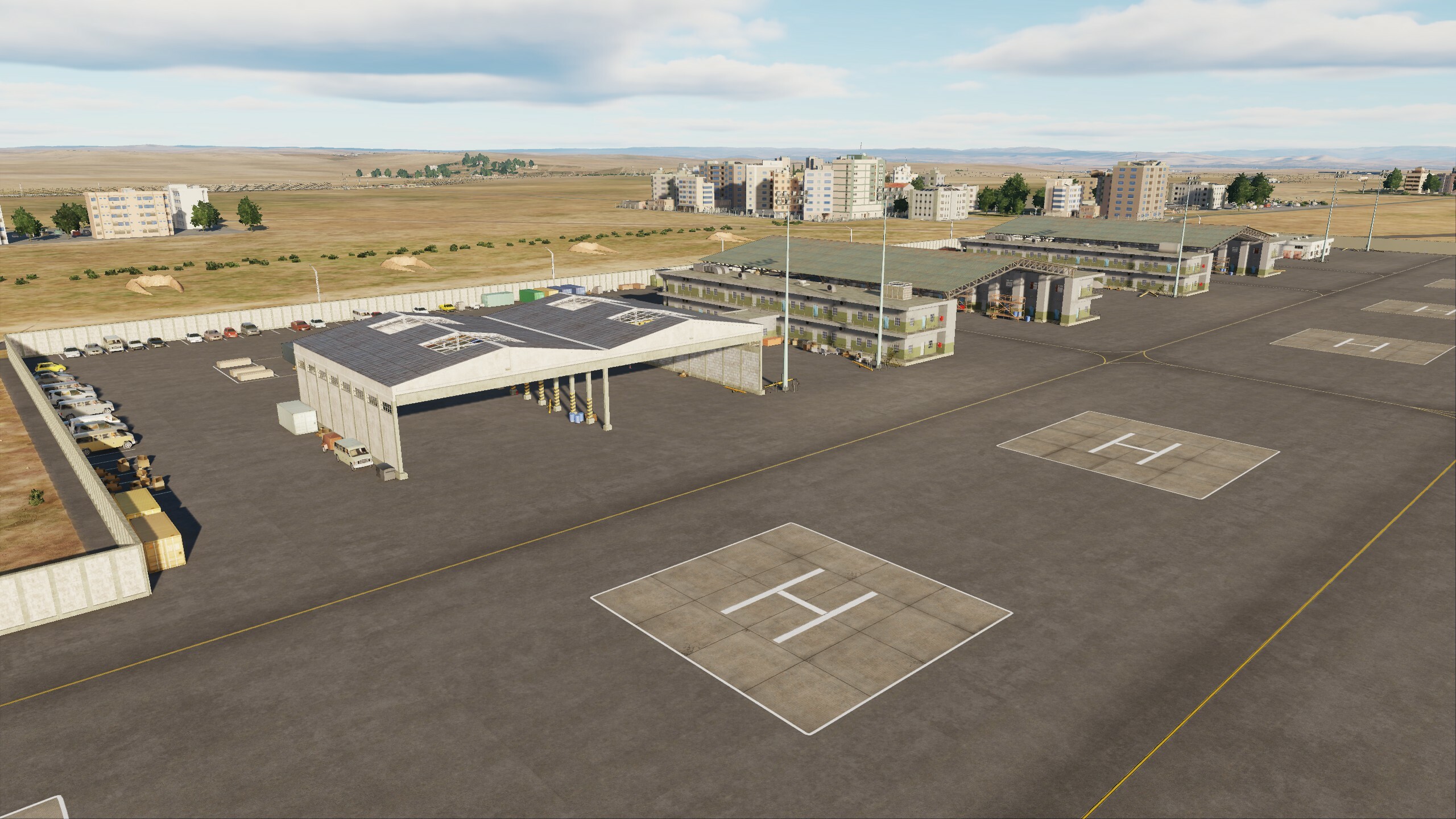
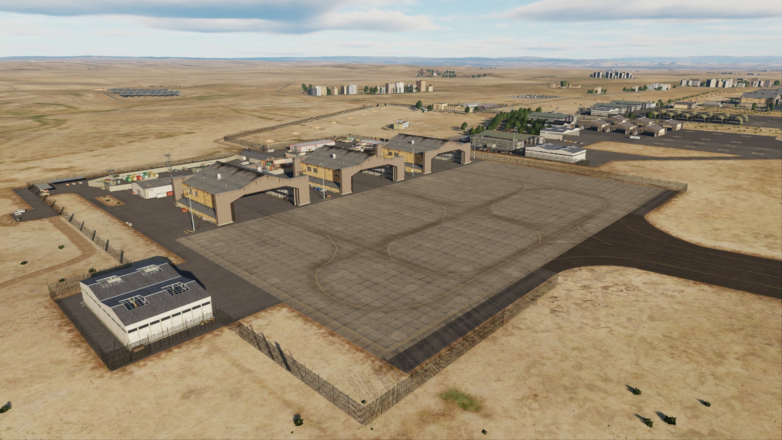
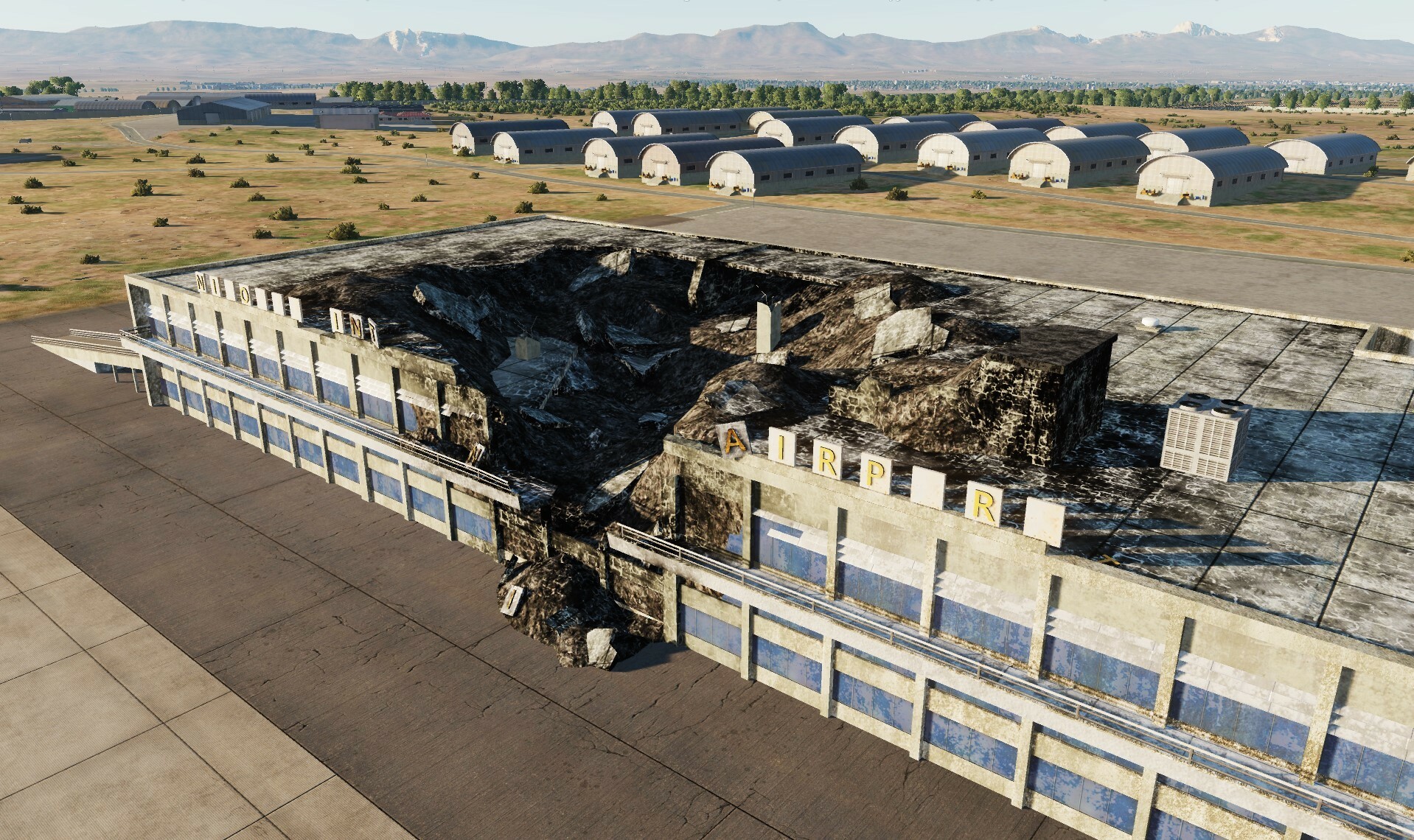
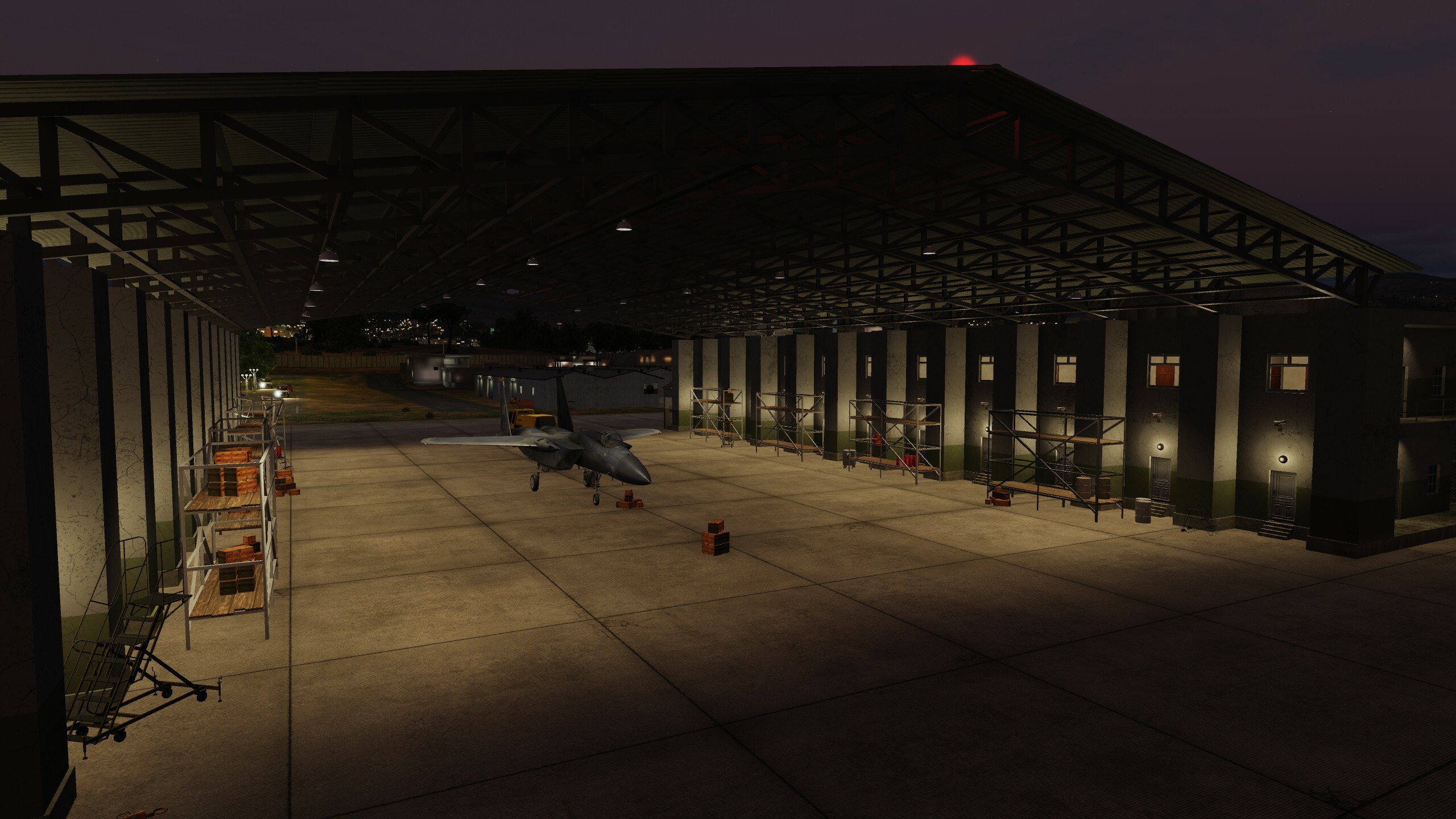
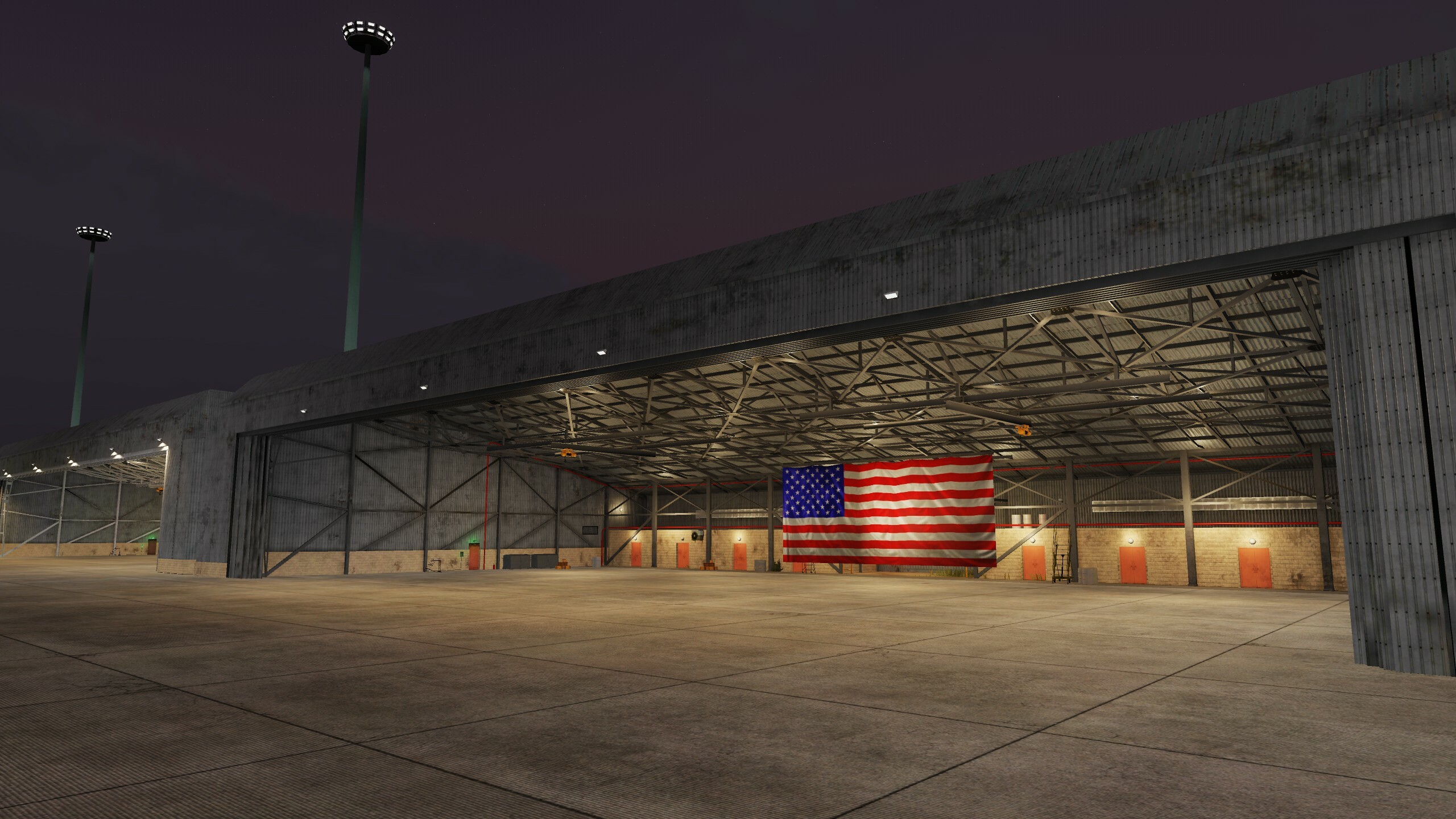
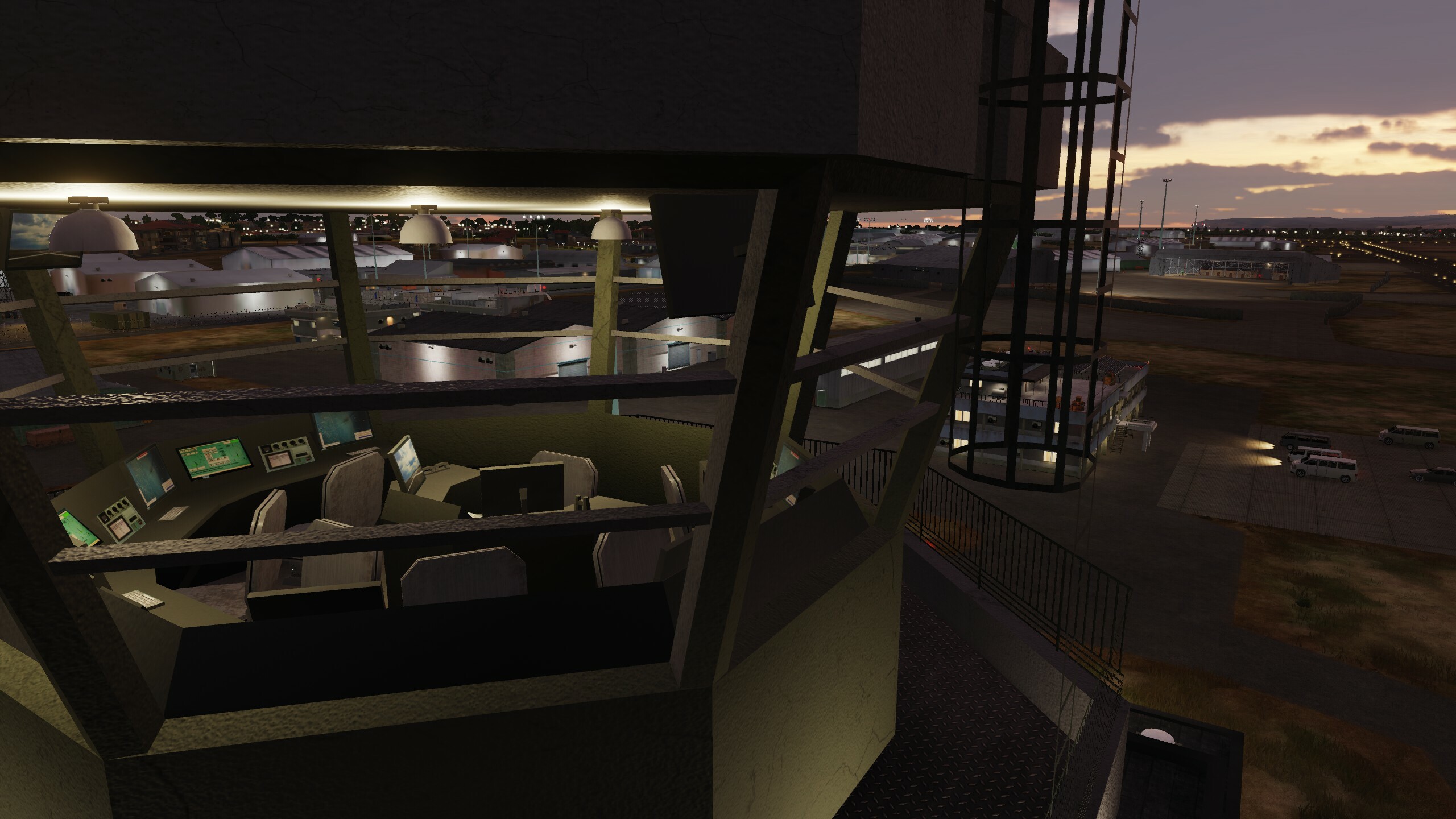
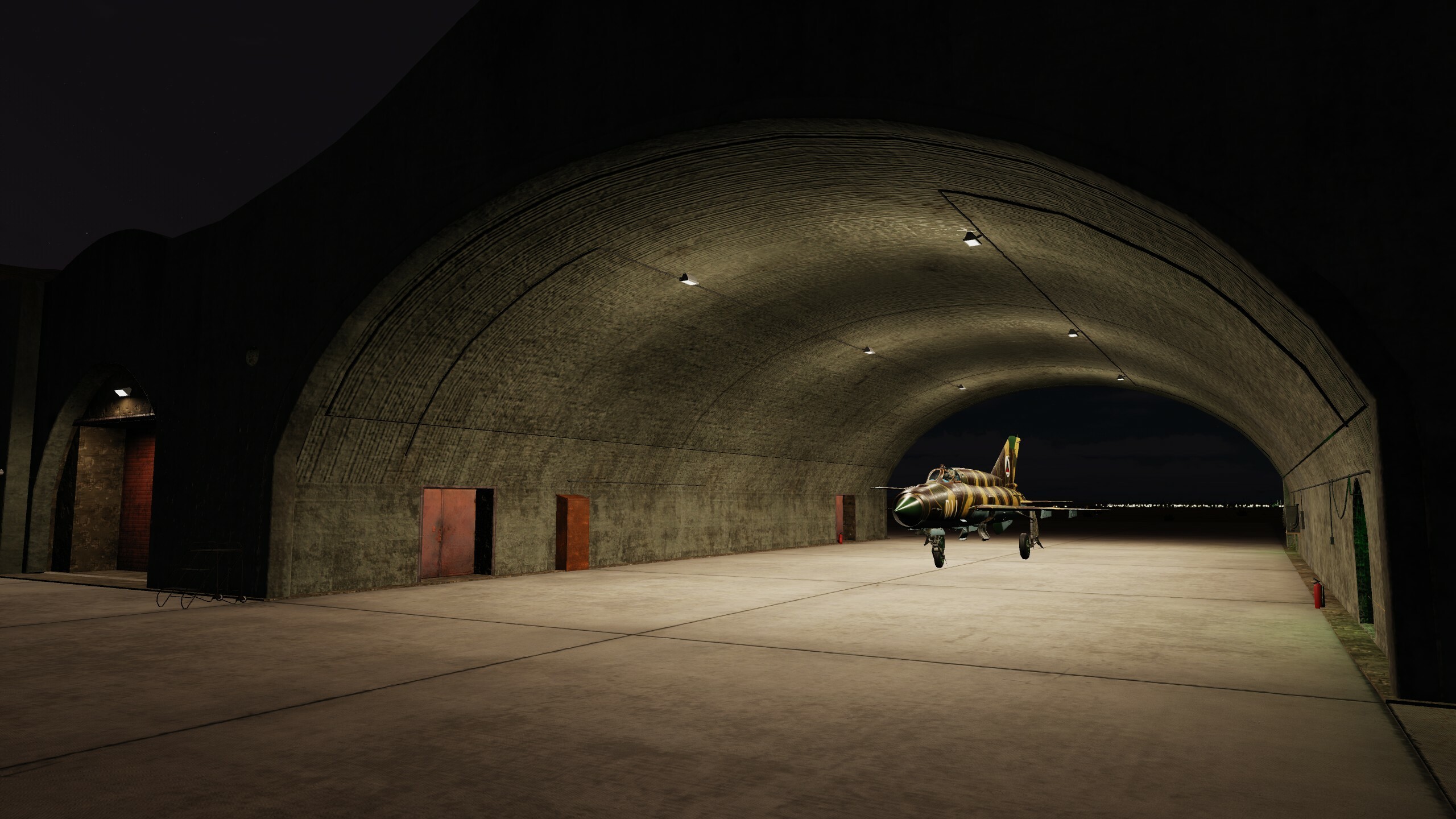
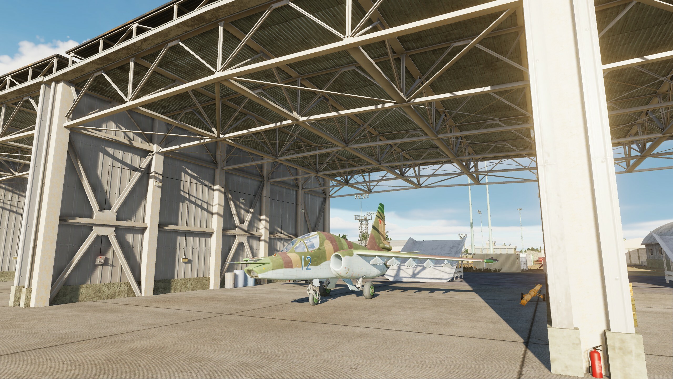
Hi fighters! Thank you for your interest in our project. As promised before, we continue to support and develop it! If you are familiar with the symbols: "F-16", then you will be pleased with today's news. Previously, this place was inaccessible to you, but we have prepared a surprise for you. Get ready for your military trip to Muwaffaq Salti Airbase. The aviation history of this place dates back to the First World War. It was home to the Royal Jordanian Air Force, Belgian Air Component and United States Air Force. Helicopters, transport aircrafts, fighter aircraft, drones - everyone was here. By the way, we made new unique hangars for this airbase, now your birds will be safe. Even though the canteen (DFAC) is no longer as tasty as experienced fighters say, the rule of three drinks has been preserved and you will be covered by MFR (the Morale, Welfare, and Recreation program). The Internet is available, but may fail, so be sure to take a hard drive with your favorite movies with you. When you arrive at the location, tell us whether you liked it or not, we tried to provide all the conditions for you. Here's a little review for you
- 29 replies
-
- 41
-
-
-
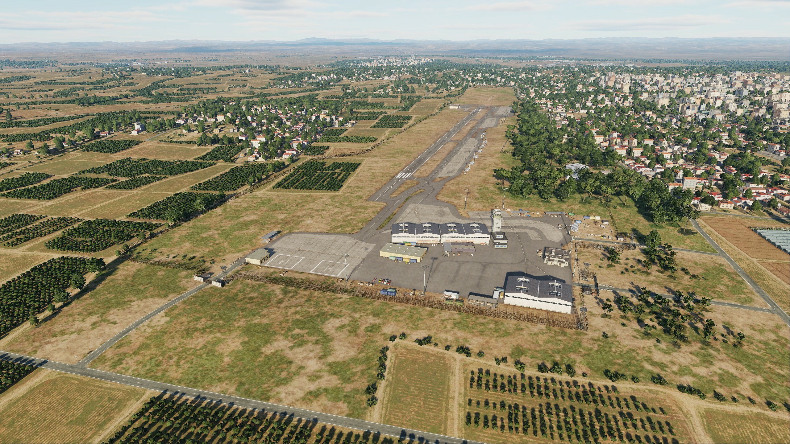
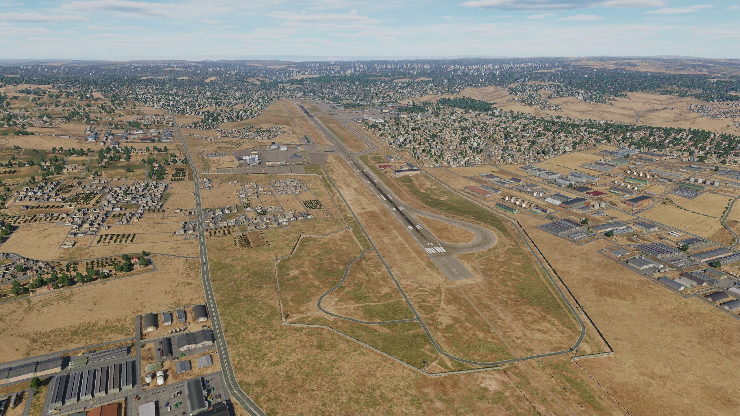
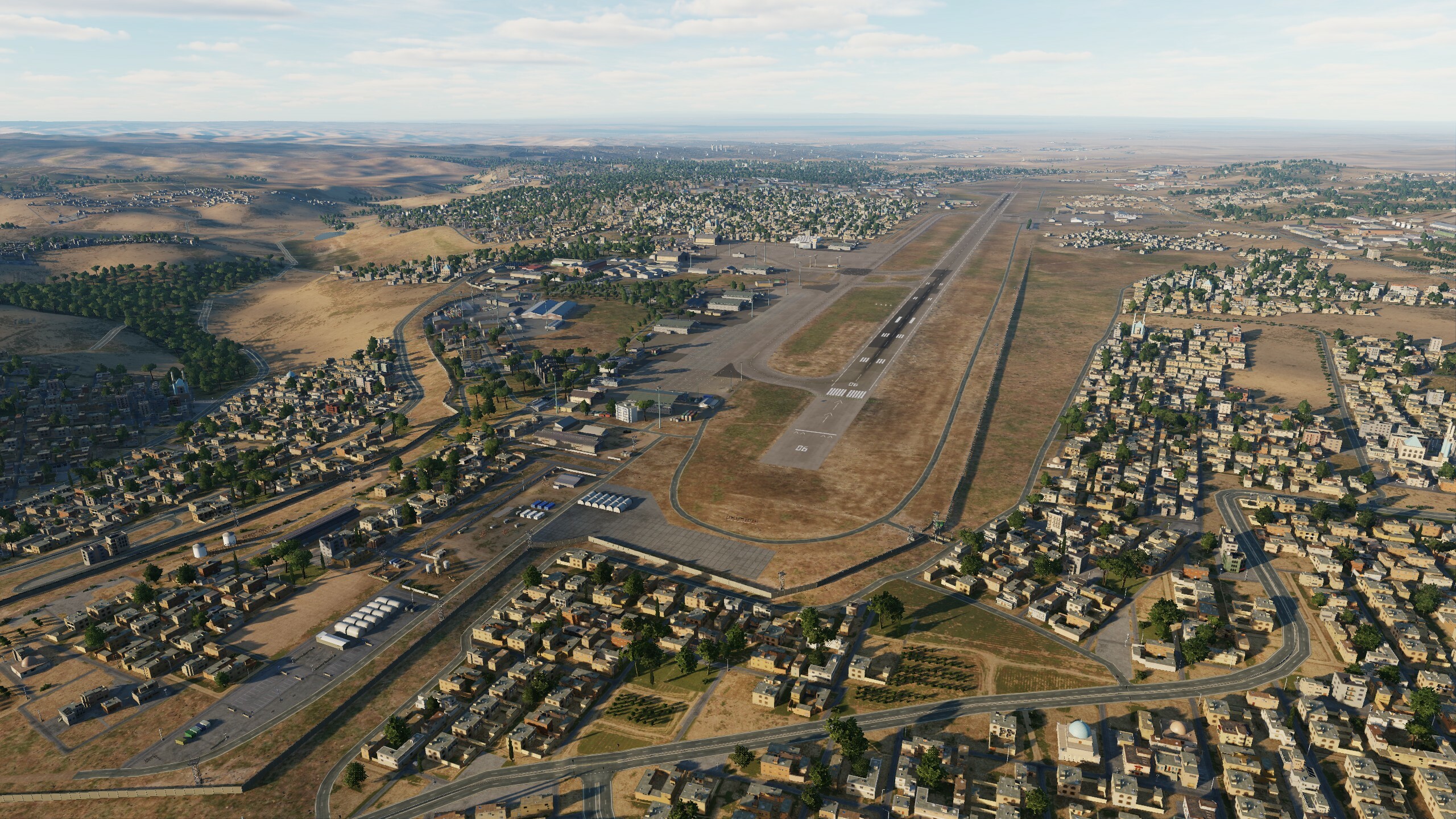
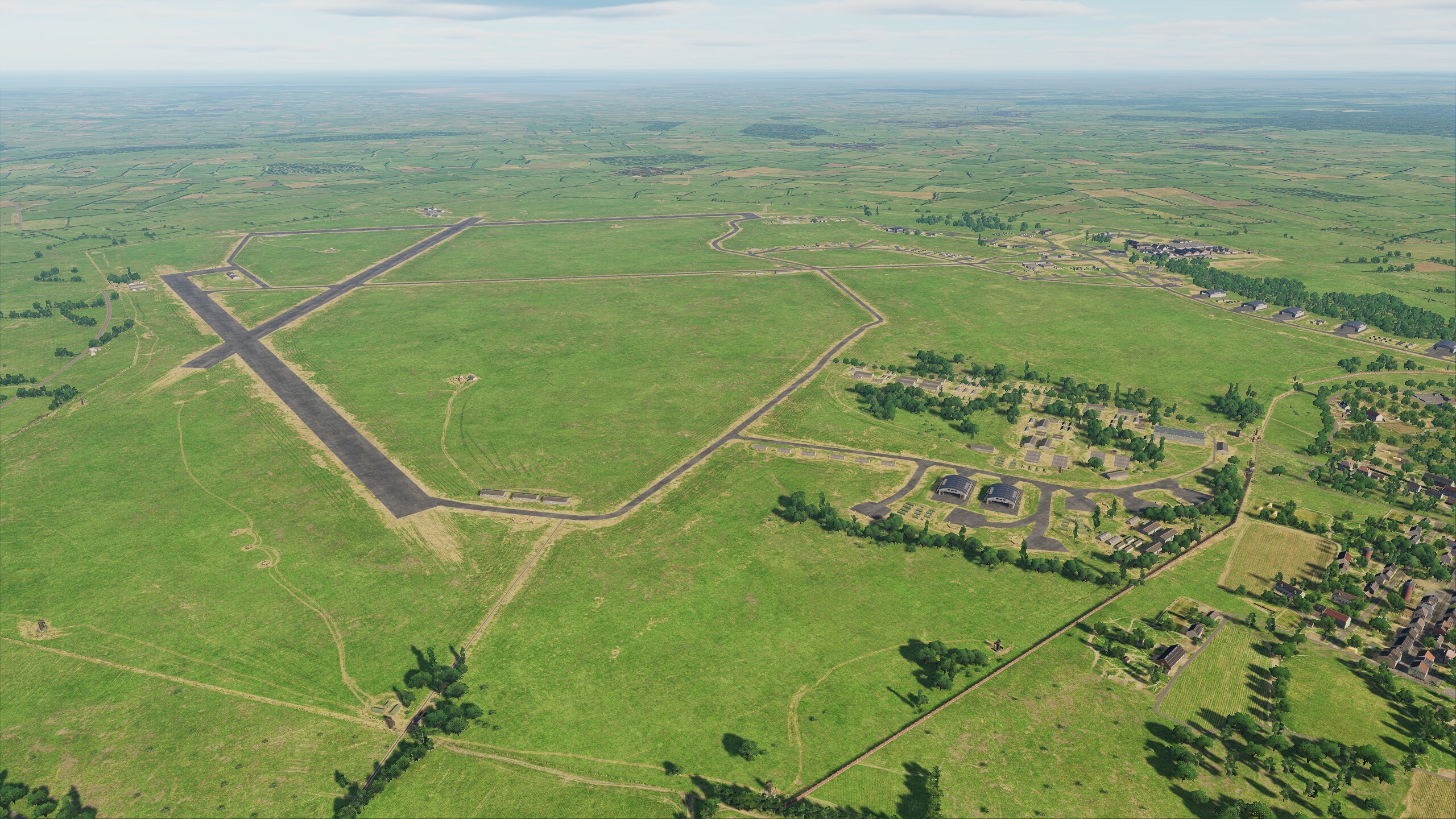
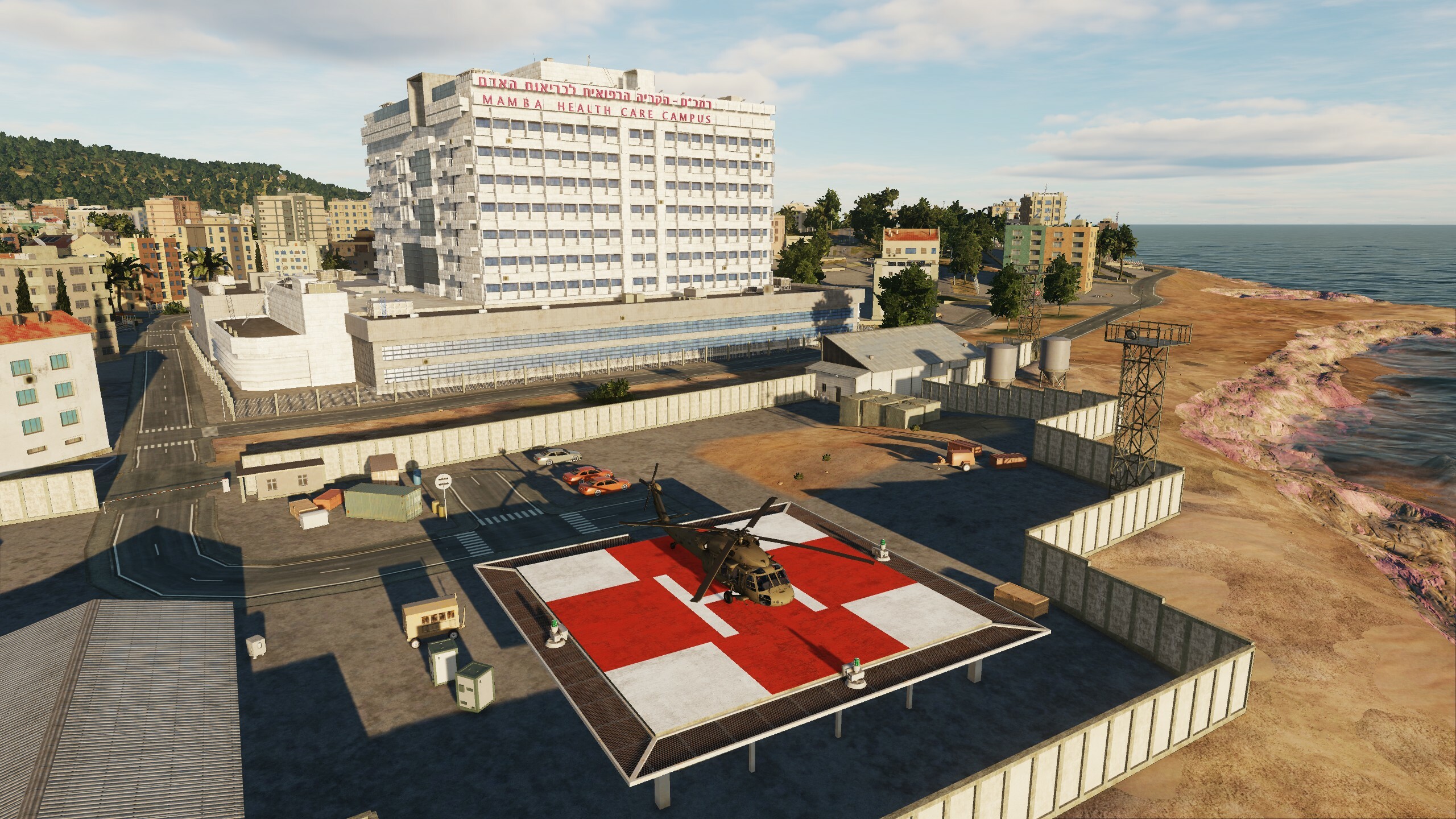
Hi fighters Today we will show 2 airfields Herzliya (Israel) and Amman (Jordan). Since the first post about the update, many events have happened: new airfields have been upgraded, changes have been made to old ones. If you see corrections to your requests on the forum, be sure to write in your topic. I hope that we will see the next screenshots of this update from you Herzliya (Israel) Amman (Jordan) (over there on the highway to the left of the airport you can drink good Arabic coffee)
- 125 replies
-
- 21
-
-
-
@DD_Fenrir @Fred901 Experts need to stay, because... It is the opinion of users that evaluates the work and corrects the development vector. I want to remind you that thanks to users, we made adjustments to French airfields, thanks to you, English hangars and caponiers were made, and the French one was slightly changed. fr At the same time, the engine’s resources are not unlimited; we made sure that “London” and “Paris” differ not only in buildings but also in airfield infrastructure. We created products as close as possible to historical content, but the capabilities of the engine and large maps impose restrictions on the variety of objects - they have narrow time intervals for working in war. The map is constantly being developed, corrected and expanded. In the studio we compared screenshots of what was and what has become - amazing changes. We have now come to the point that we cannot focus only on 1944, primarily because when new airfields are added to the Normandy map, 1940 scenarios become available to users: Dunkirk Retreat Scenarios and Battle of Britain Scenarios. You once wrote to us that there is no need to limit yourself to a certain period, but now this moment has come: the map has expanded both in space and time. Therefore, experts, stay with us, keep your finger on the pulse. And we will do everything possible to take into account your opinion and your wishes in our work.
- 49 replies
-
- 17
-
-
-
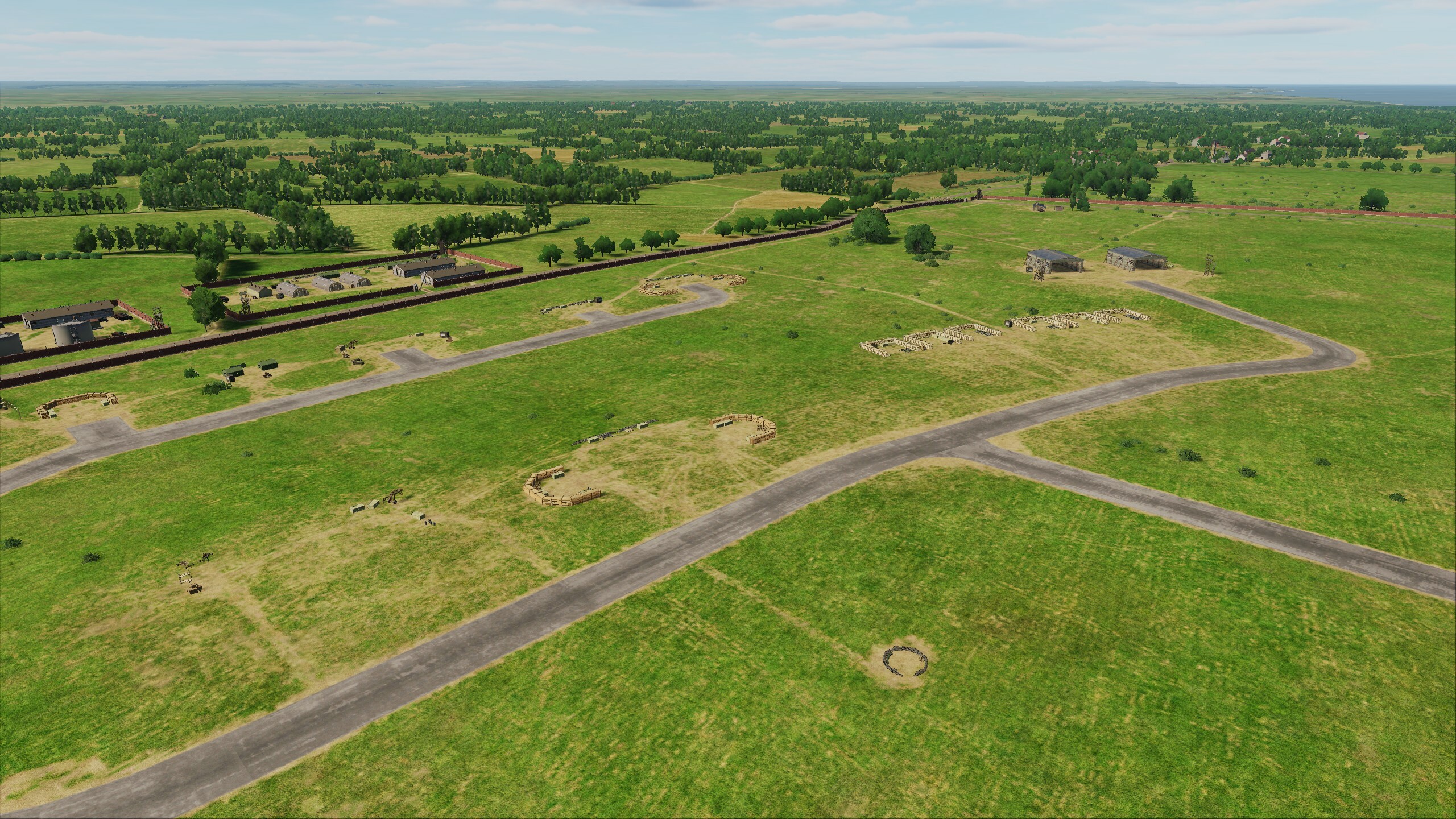
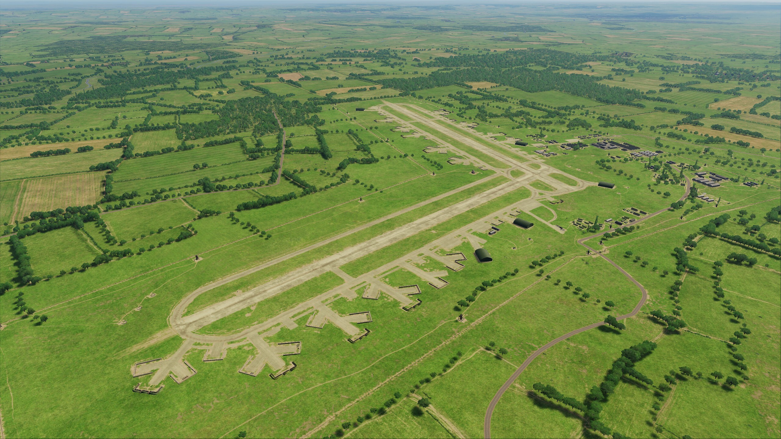
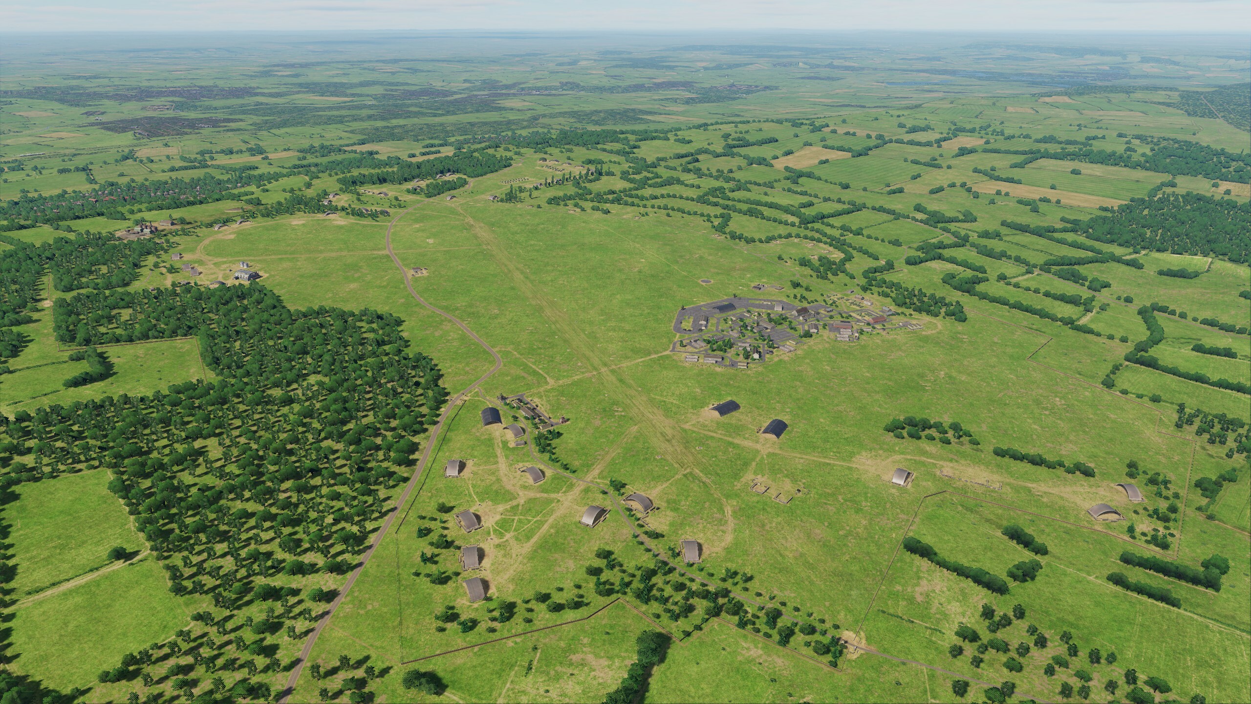
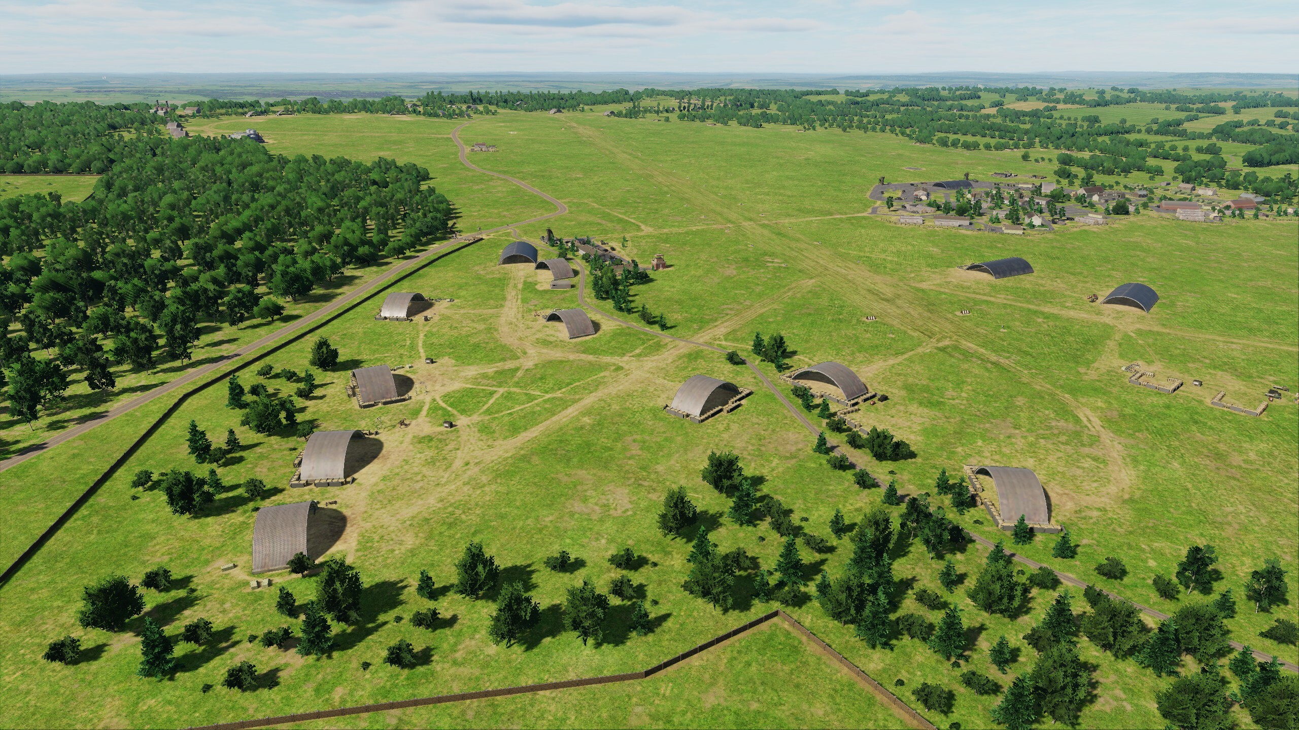
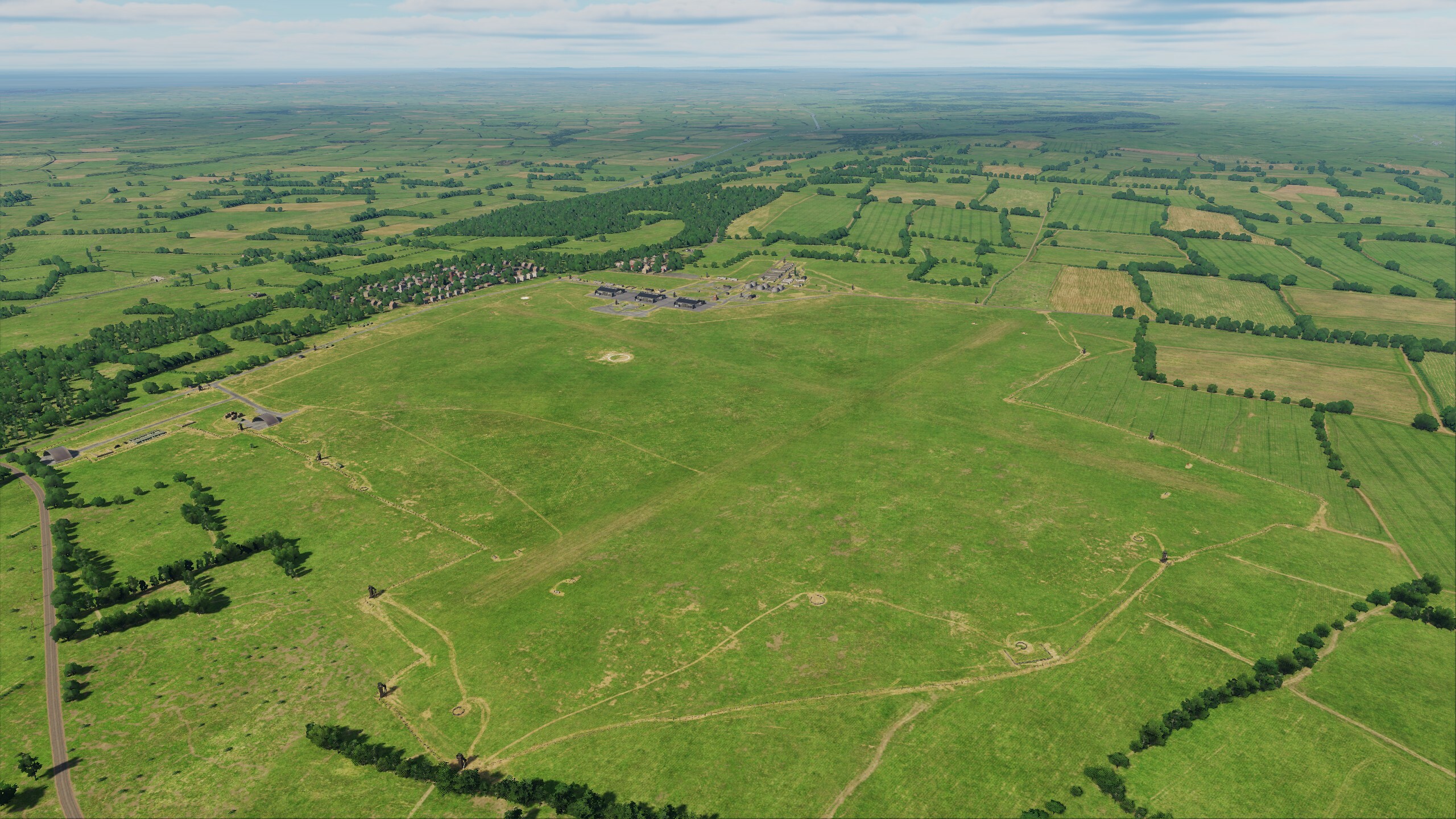
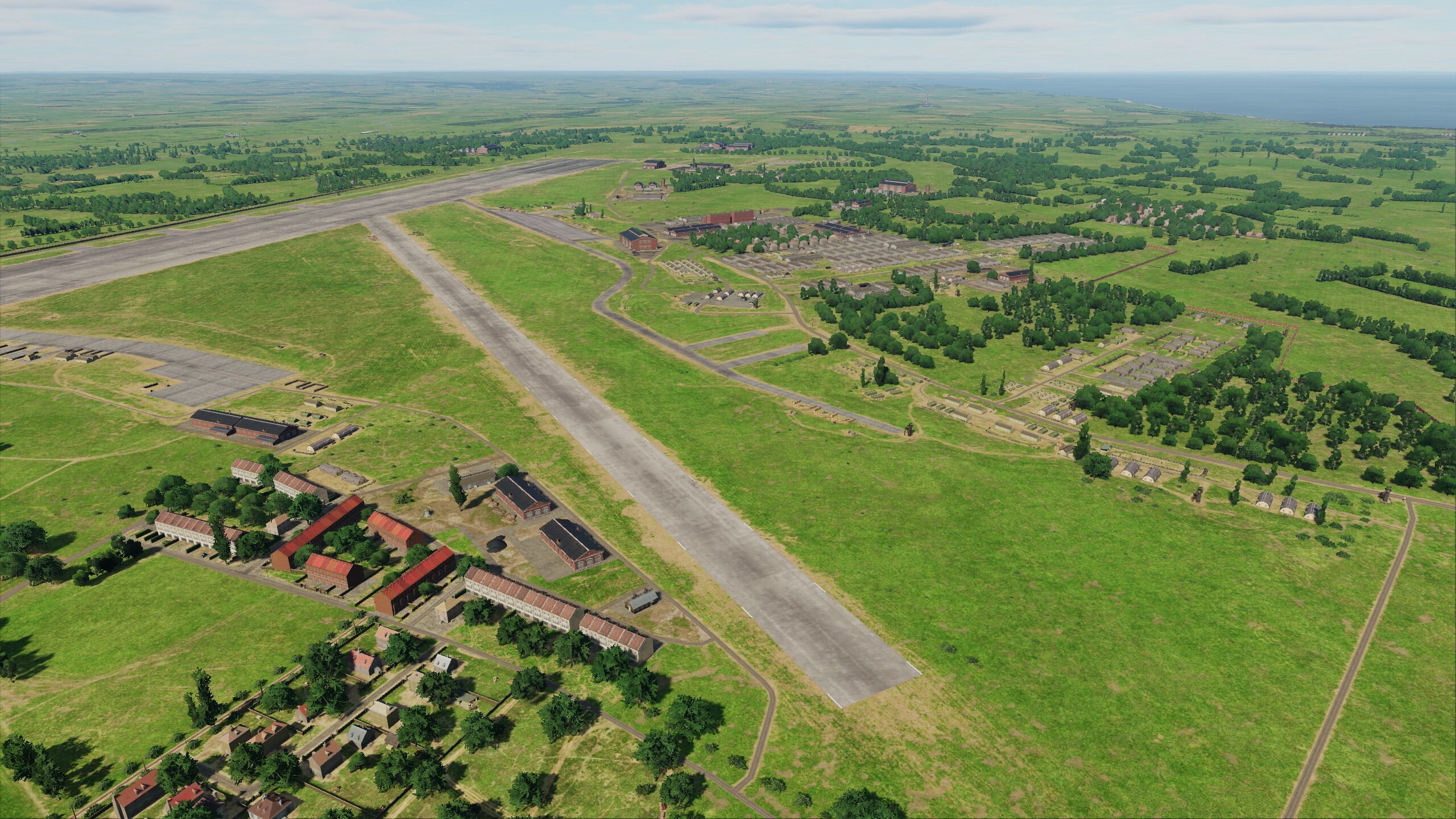
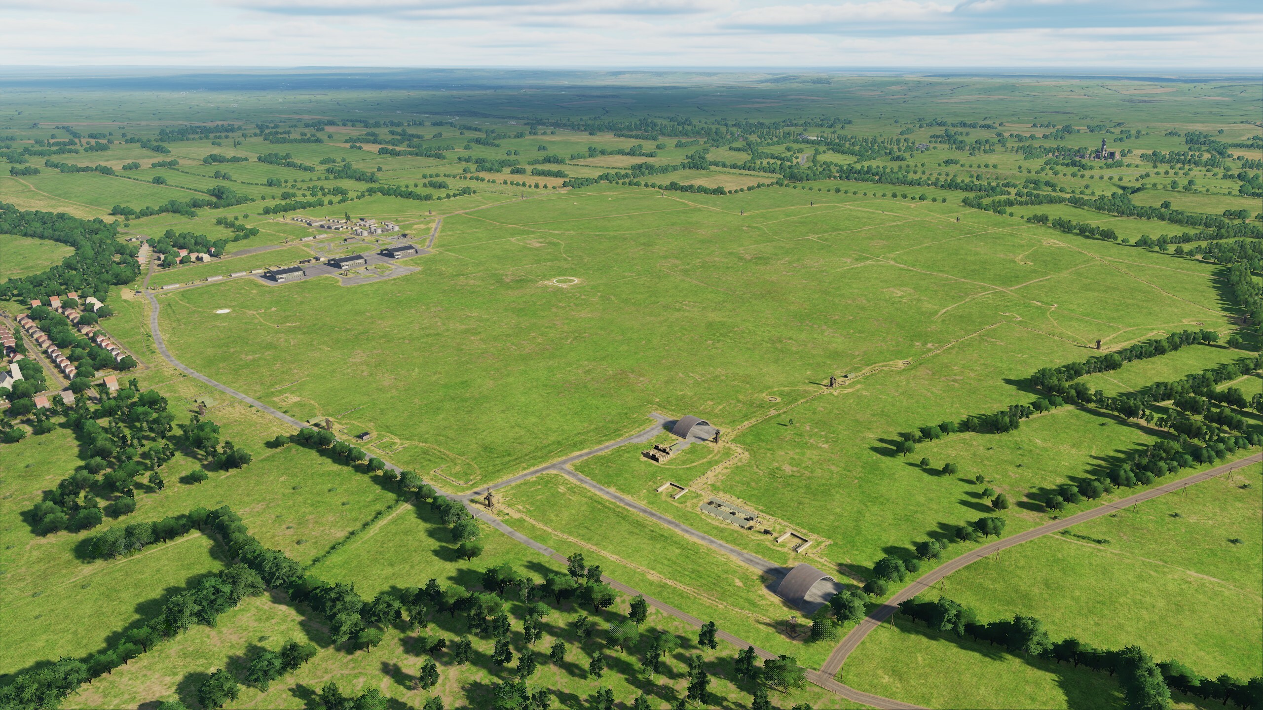
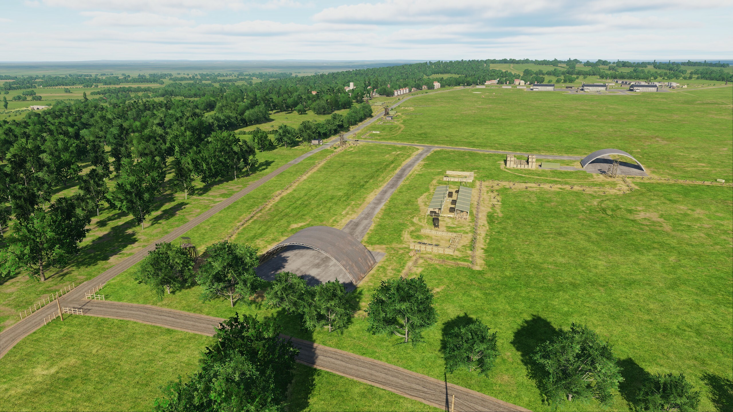
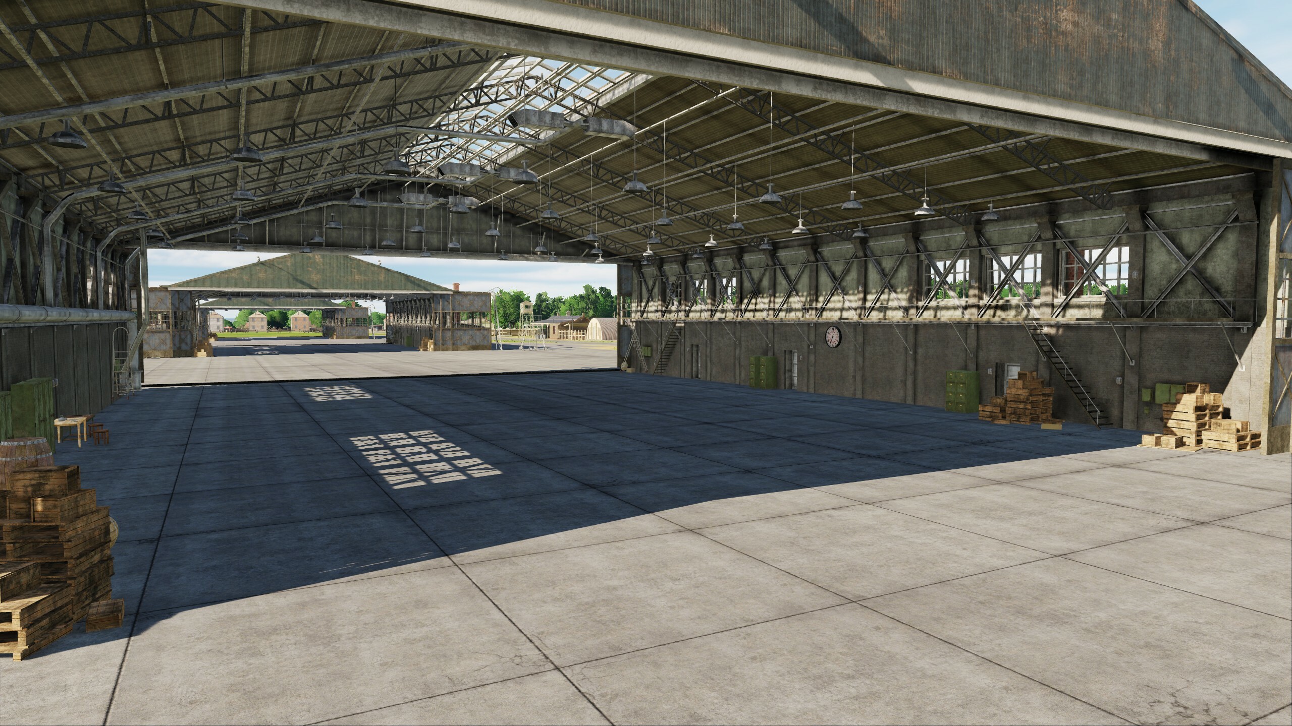
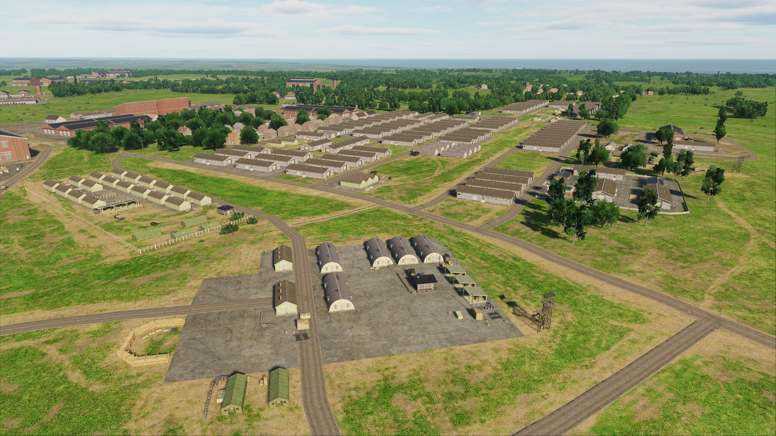
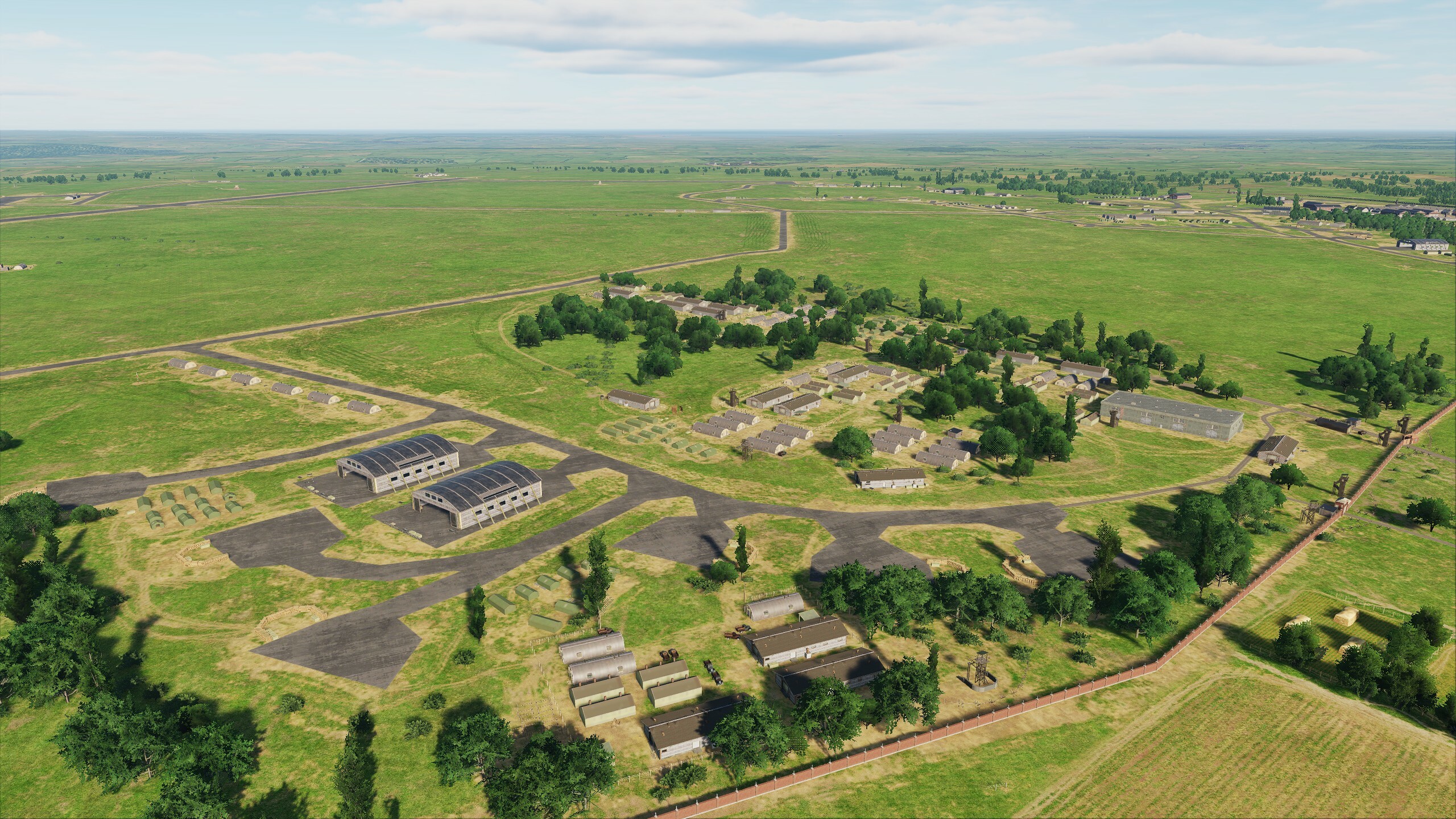
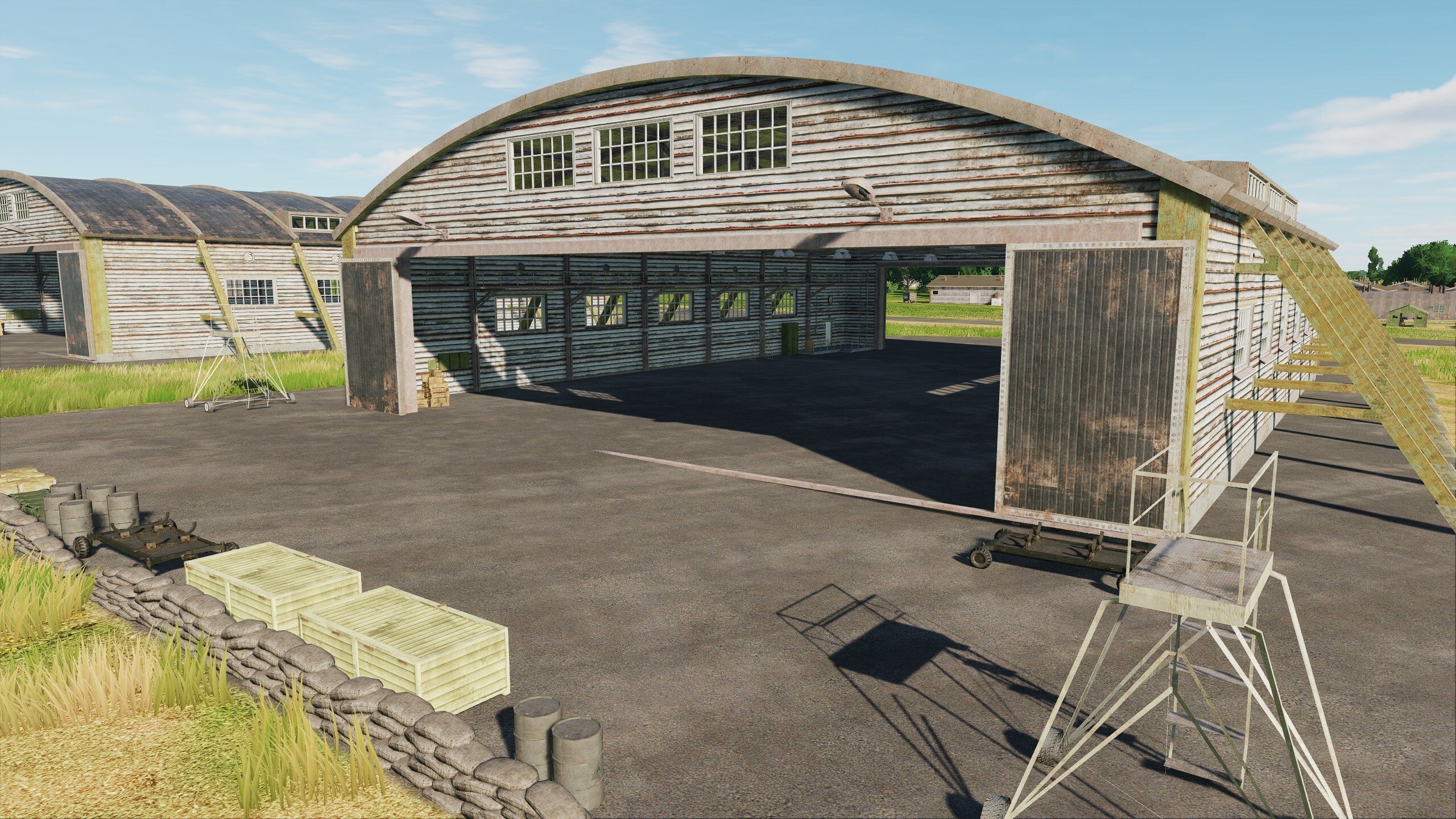
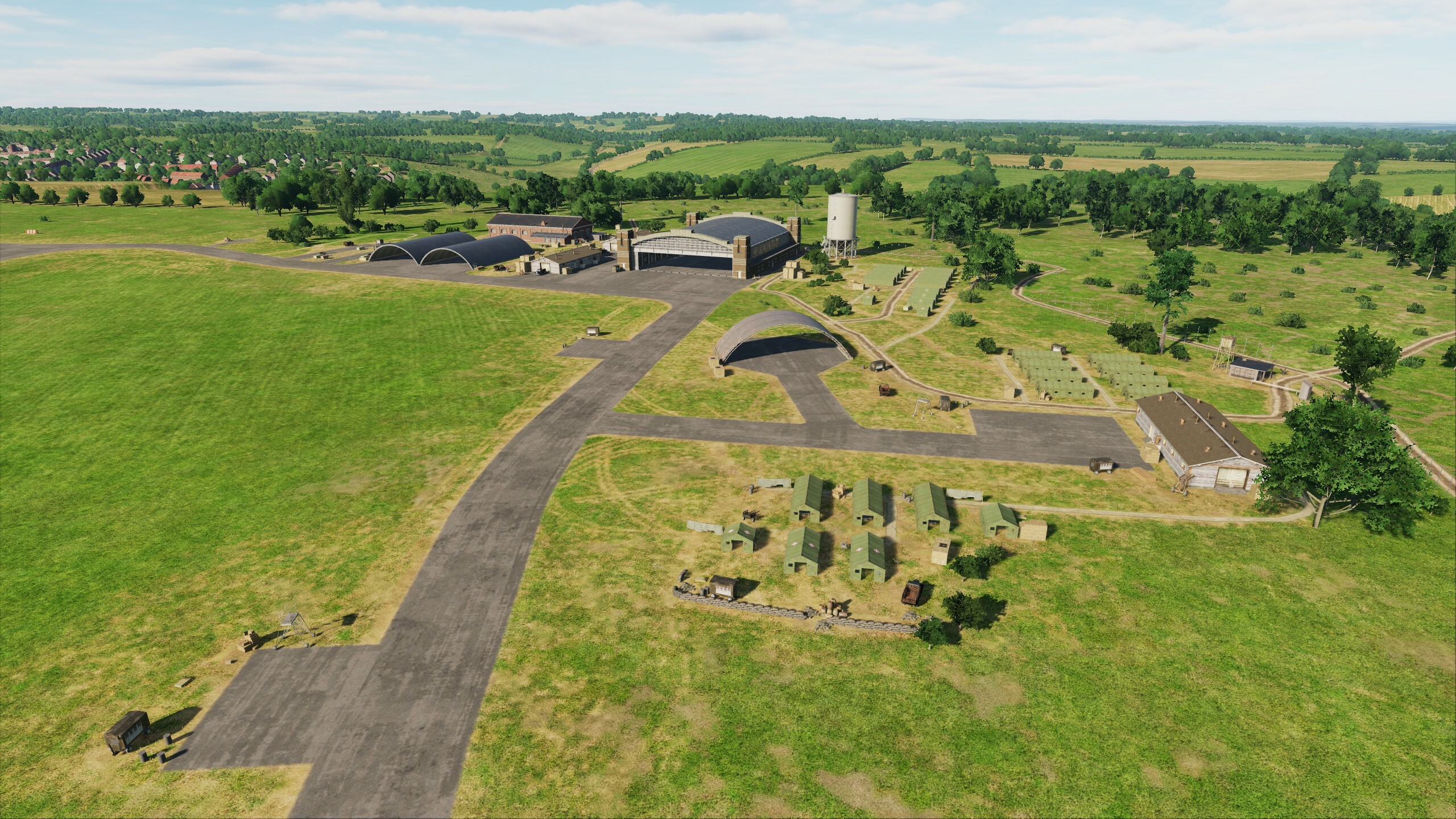
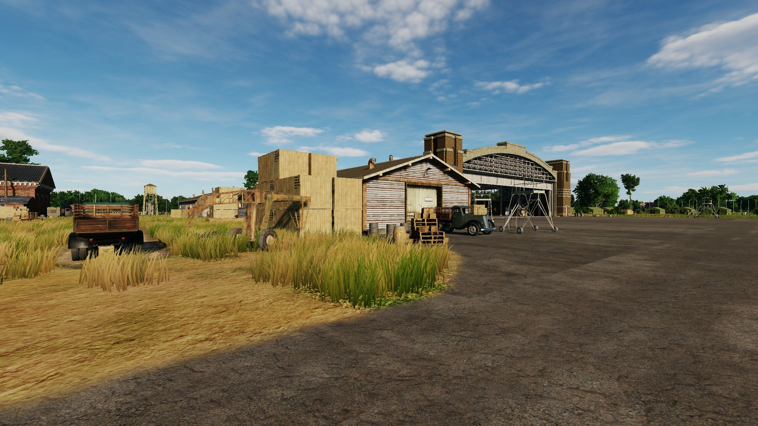
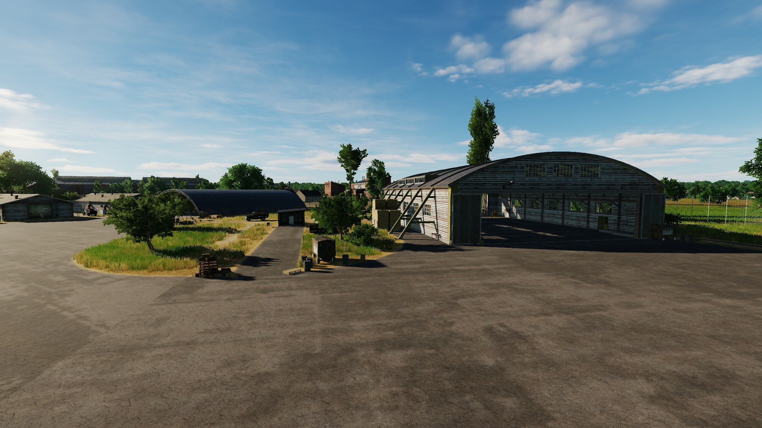
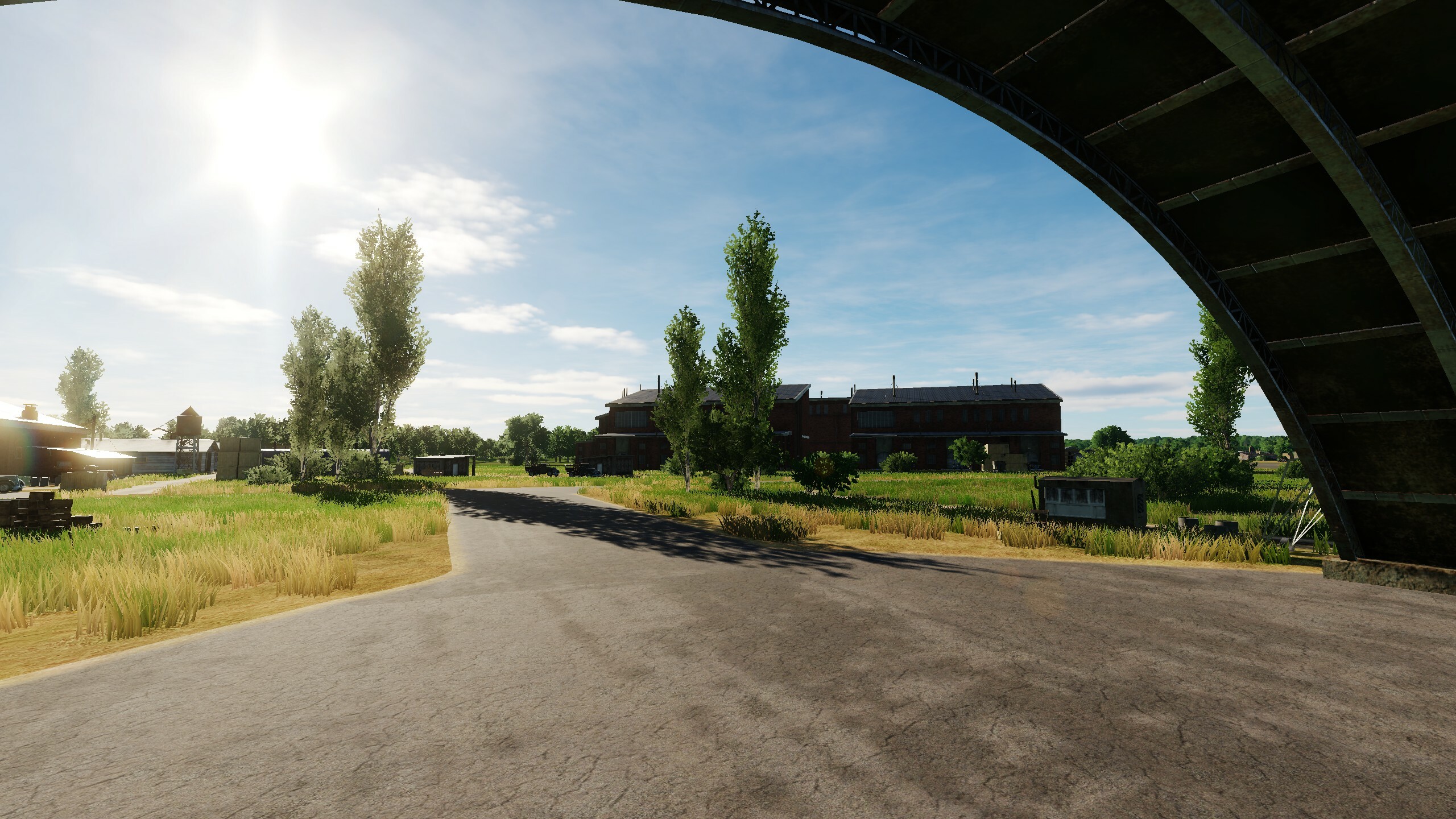
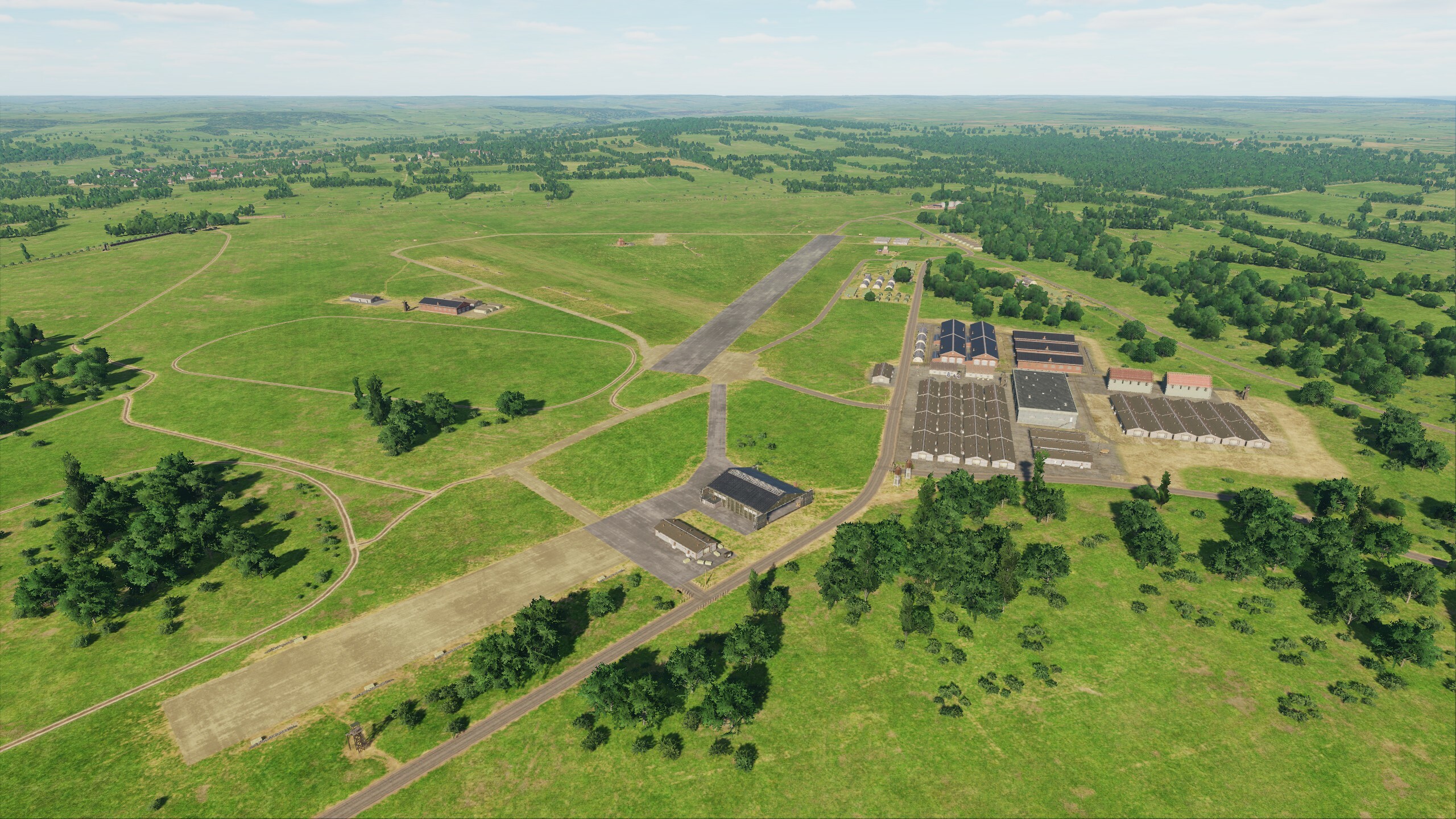
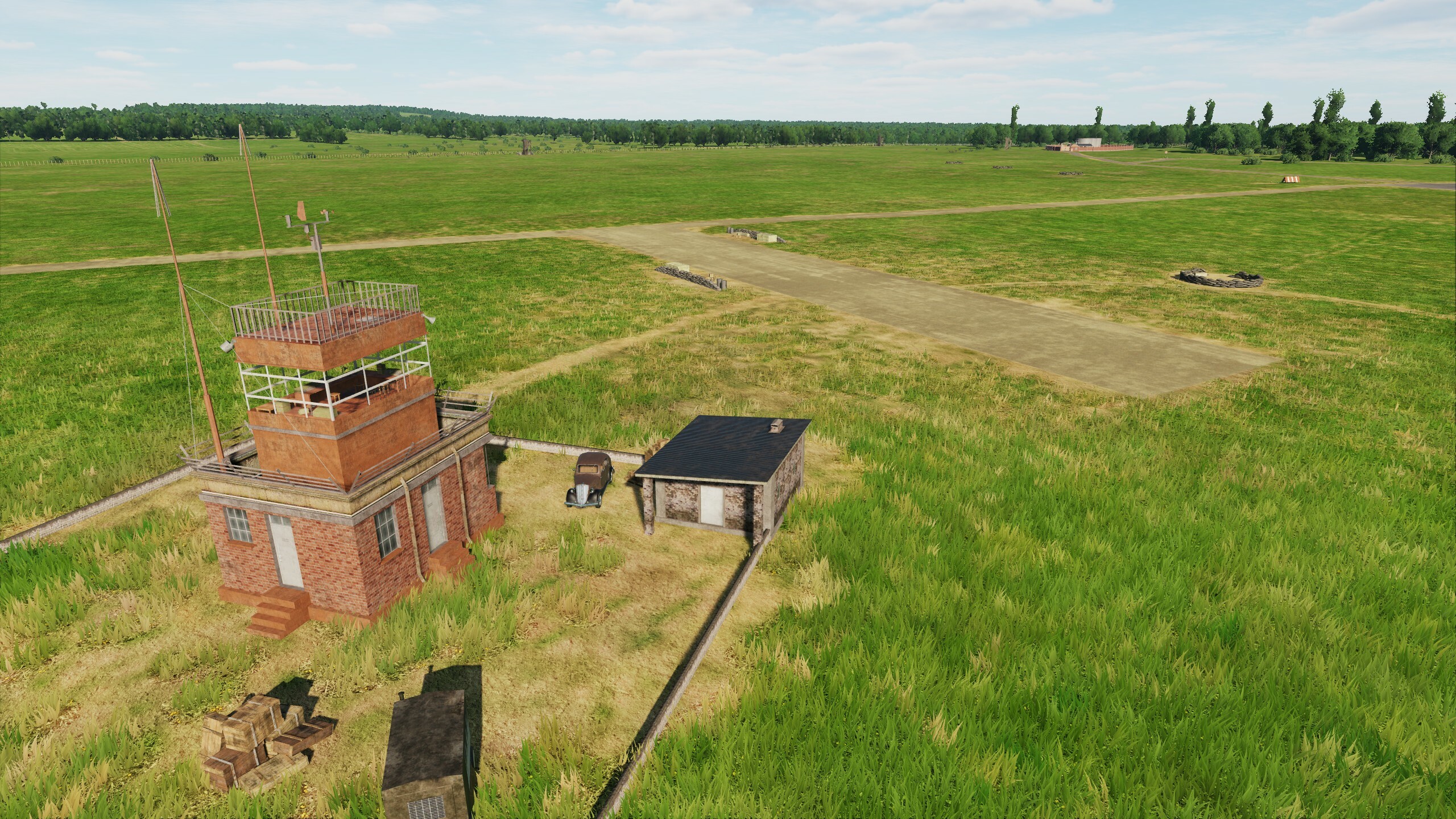
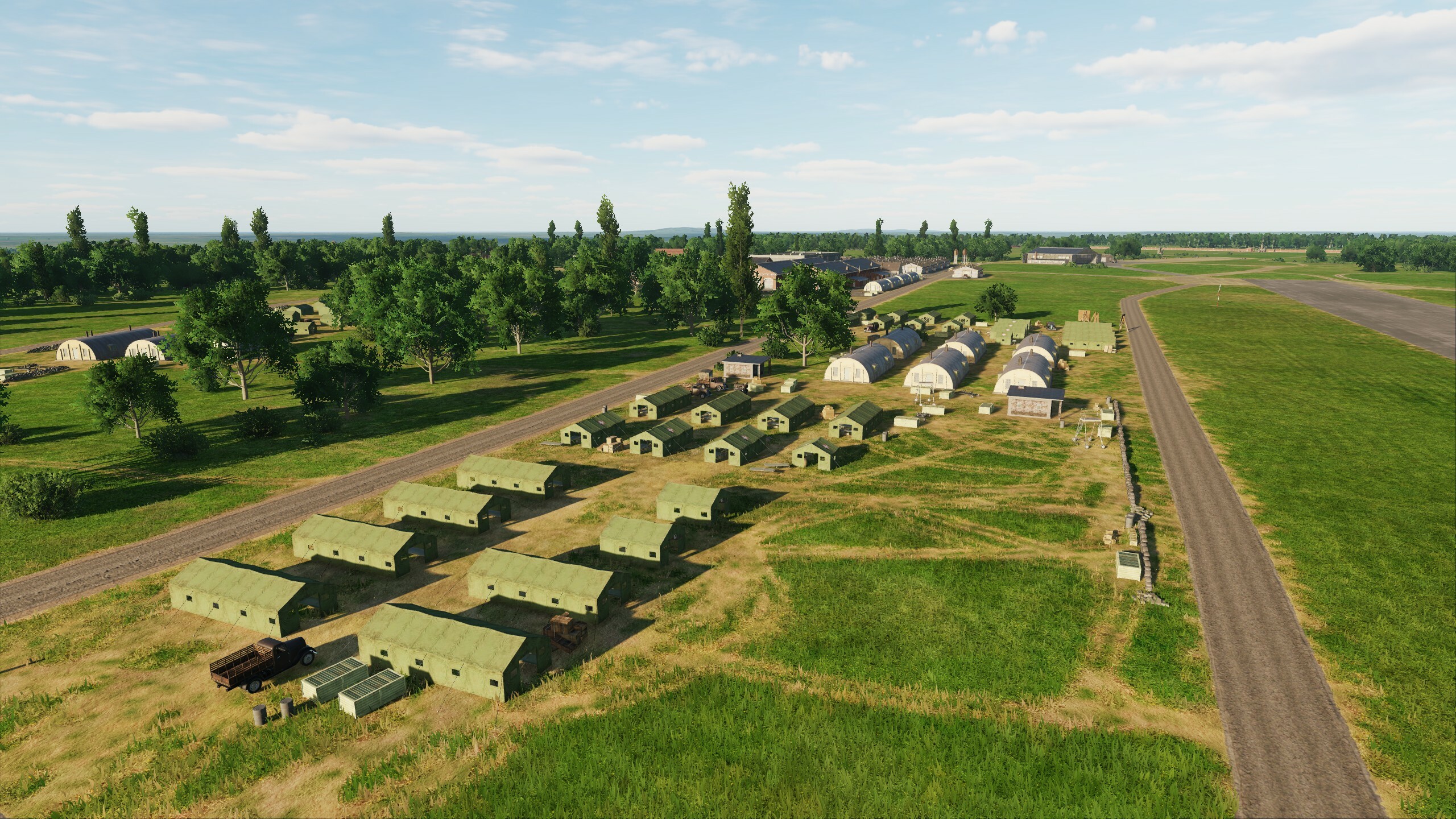
Hi, while the update is coming to you, we will make a small preview: Today our heroes are two airfields: Detling and Lympne. Both have taken their place in history, associated with the events of the Battle of Britain and D-Day. The runways are covered with the chassis of bombers, Typhoons and Hurricanes, Spitfires and Mustangs. Detling Lympne
- 49 replies
-
- 10
-
-
-
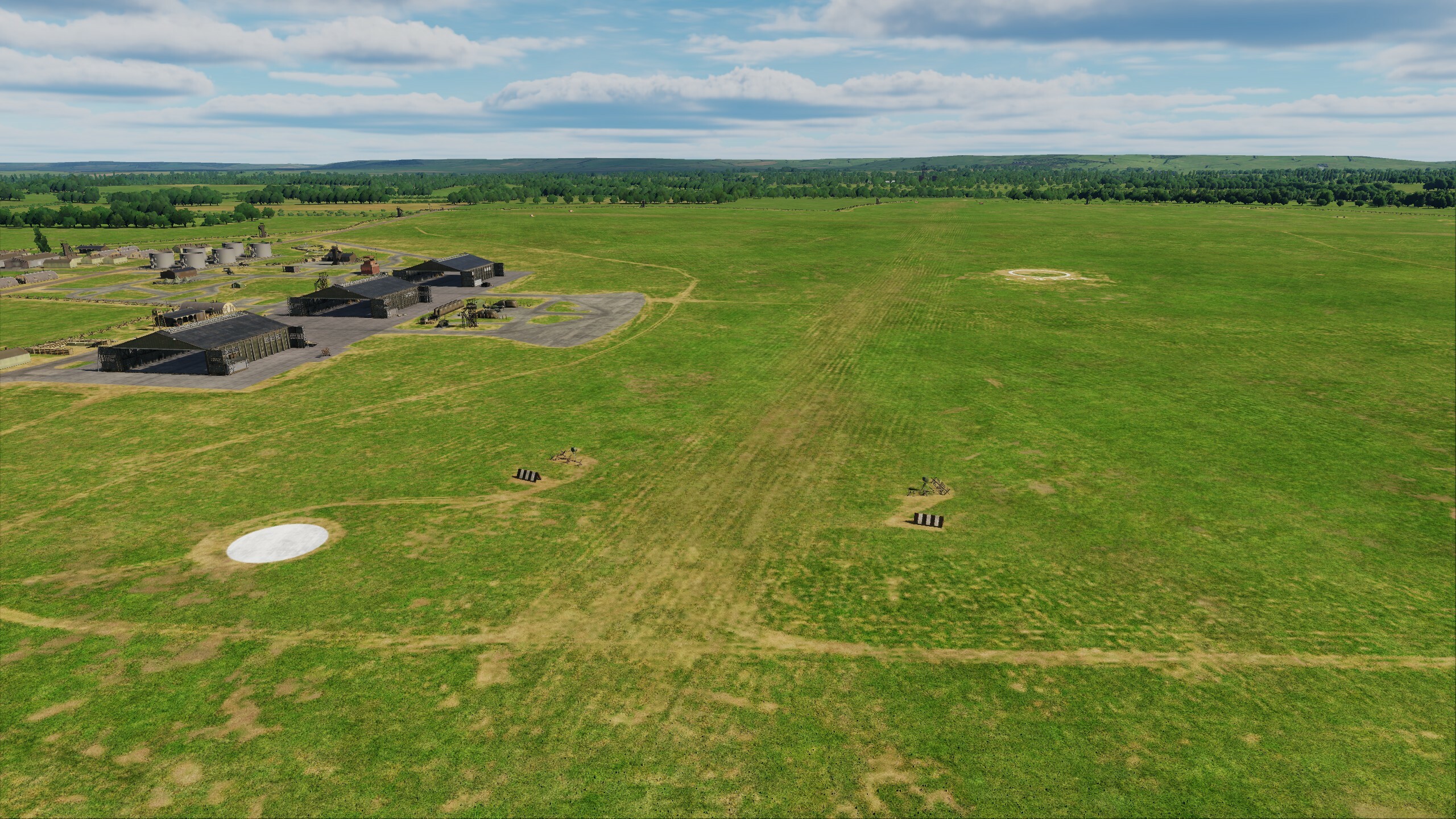
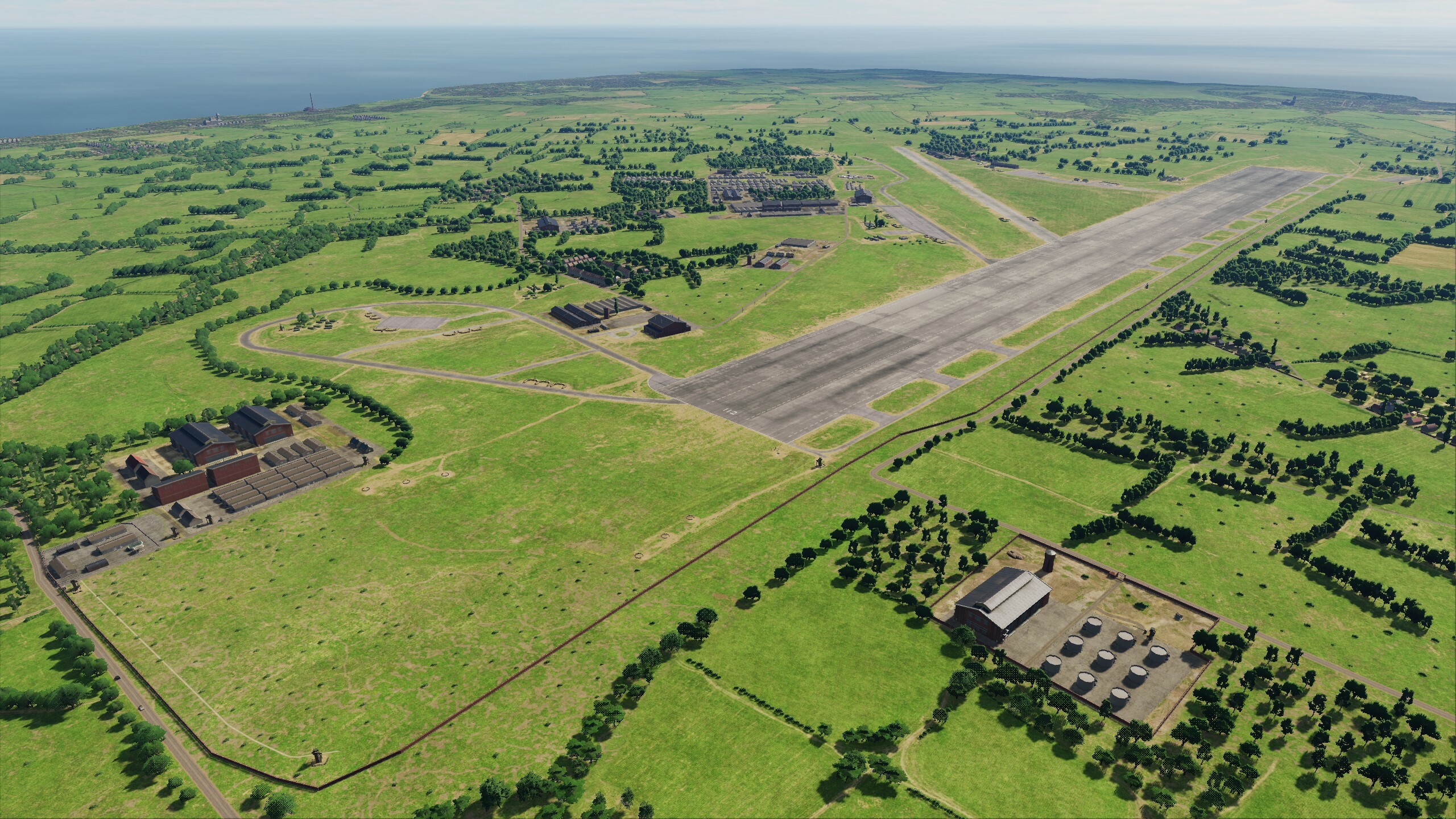
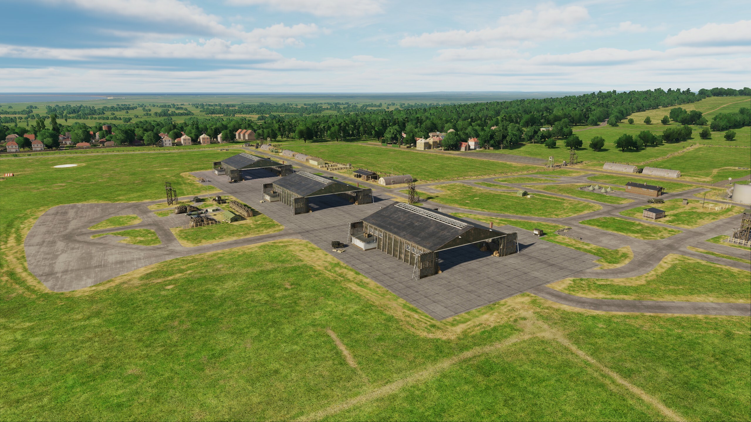
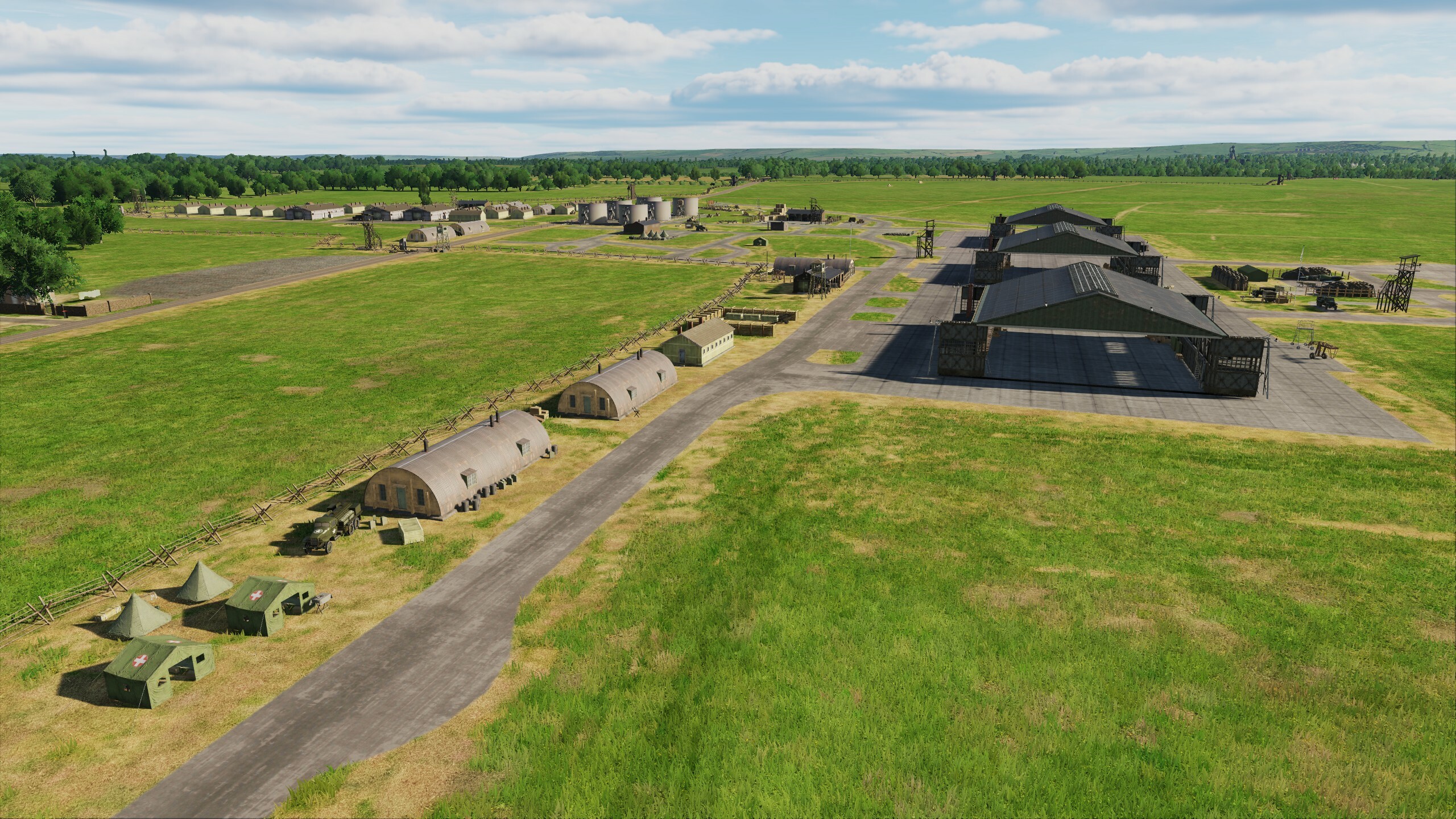
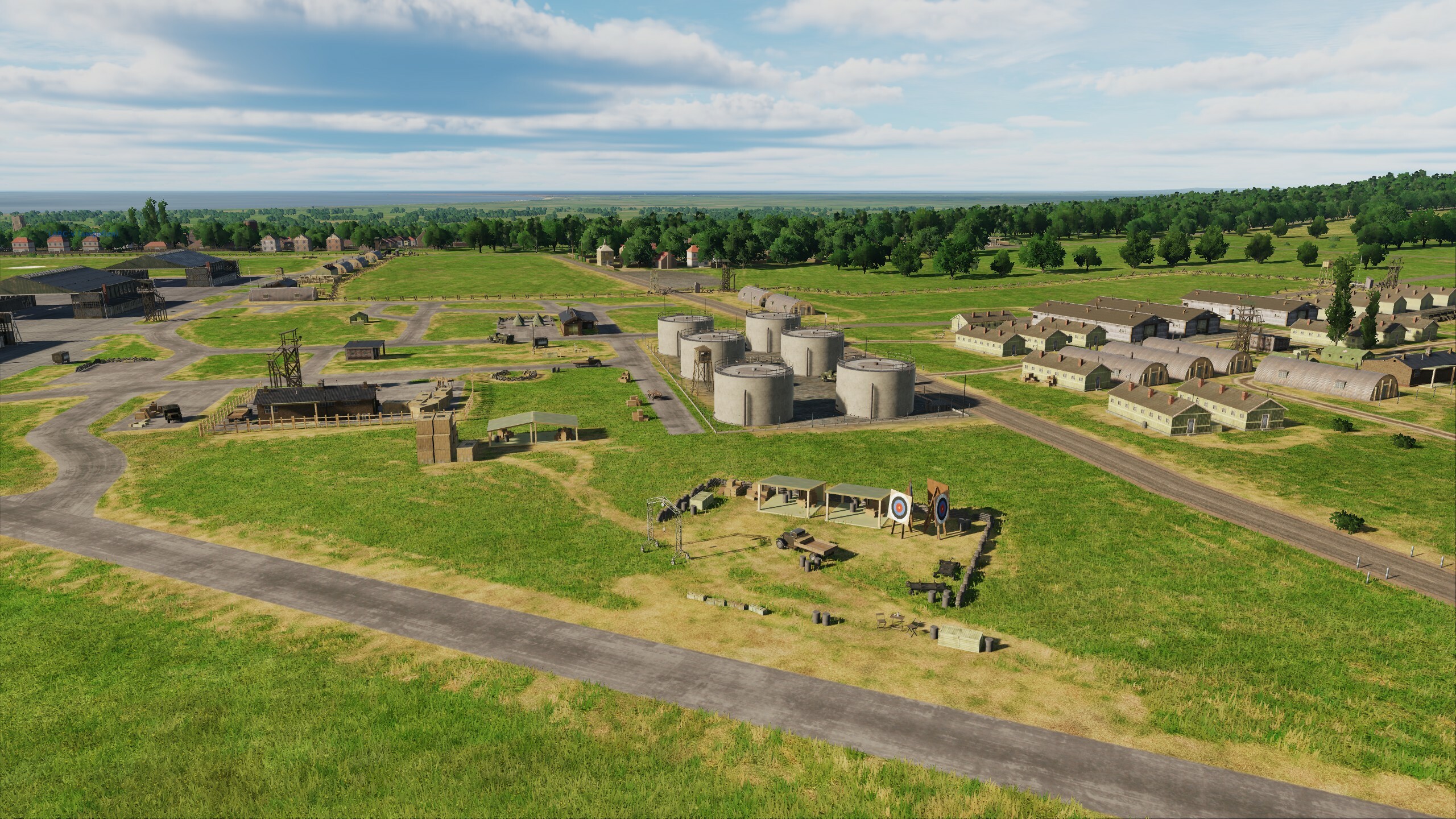
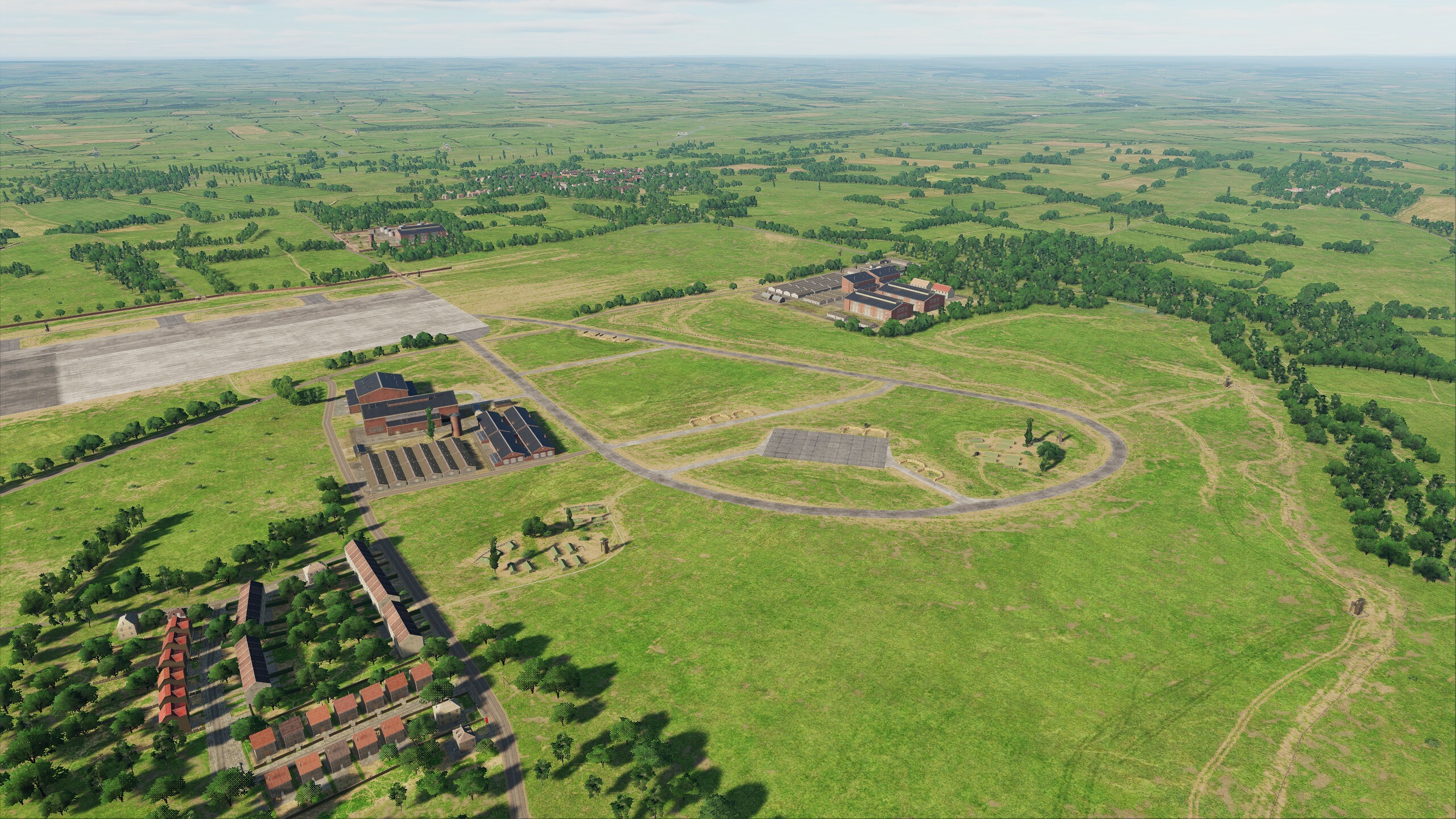
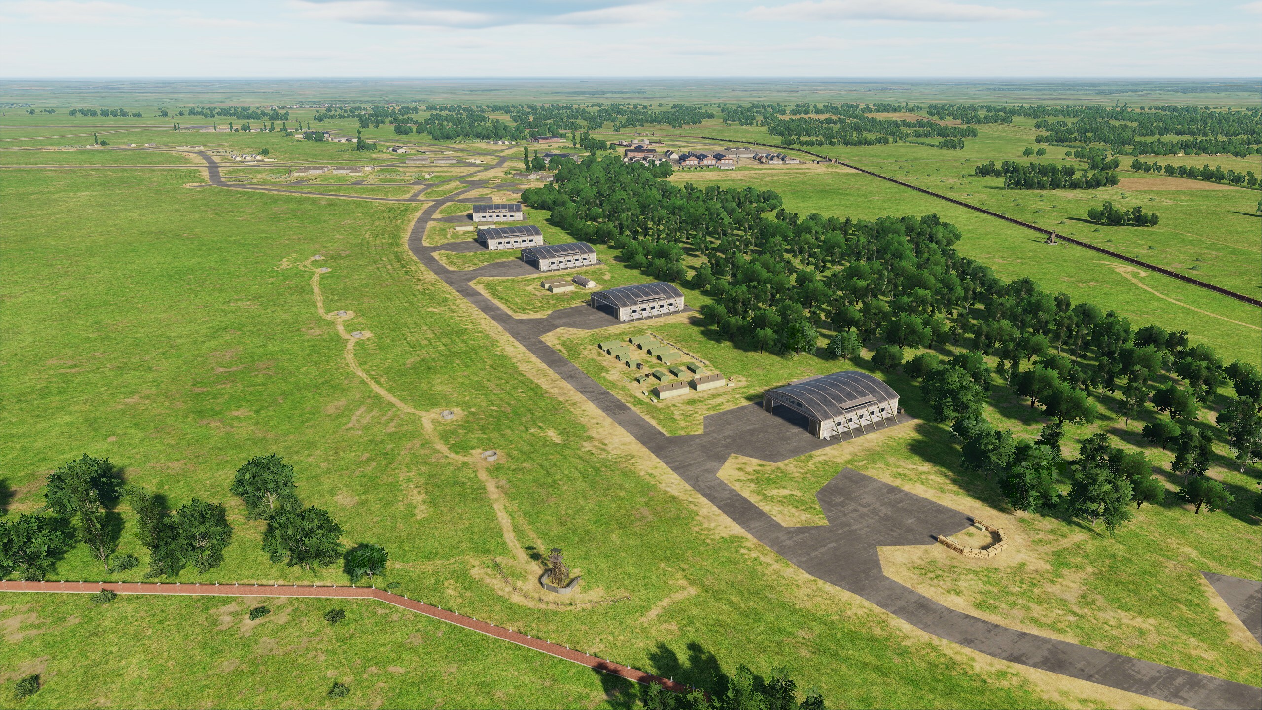
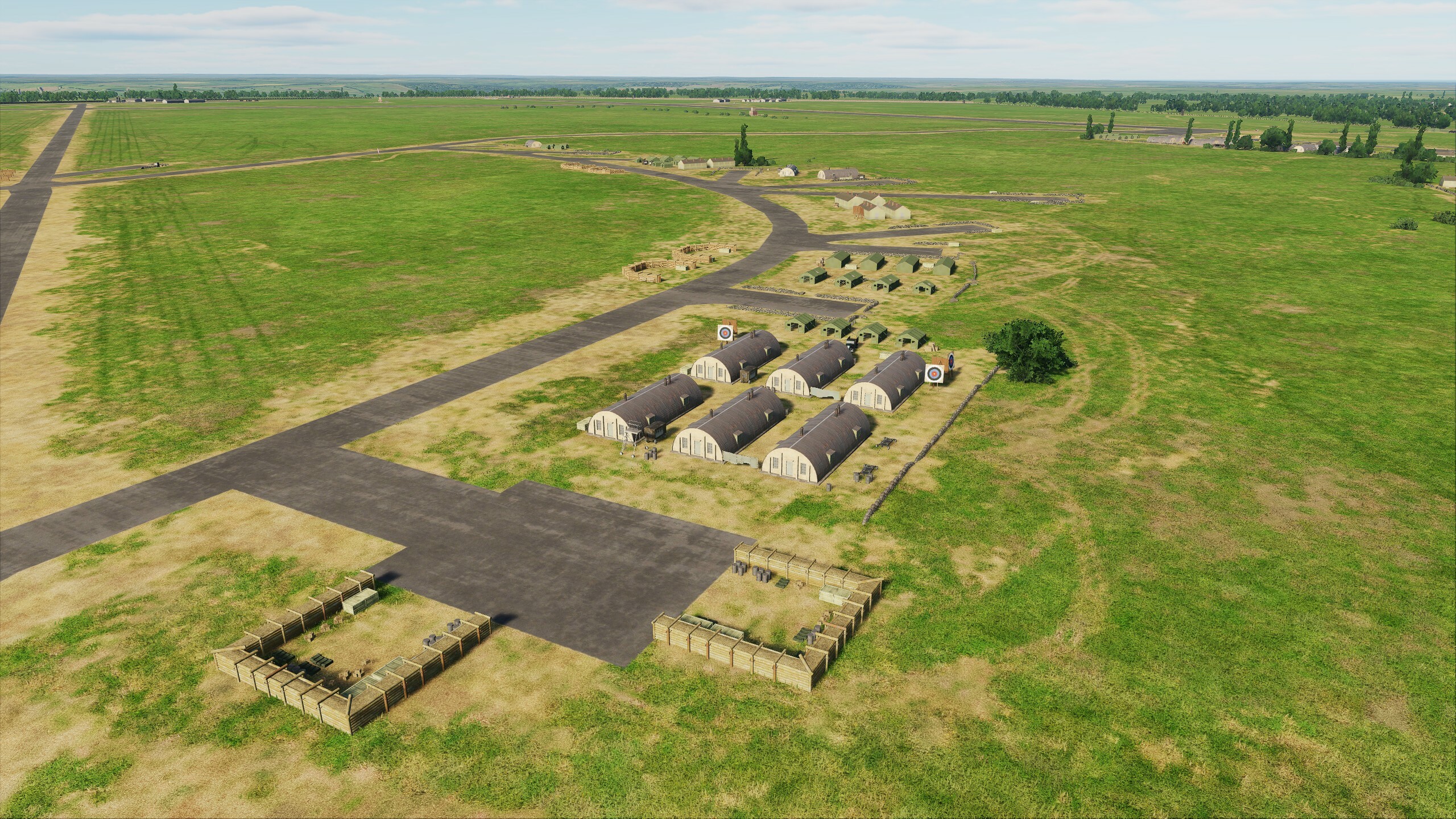
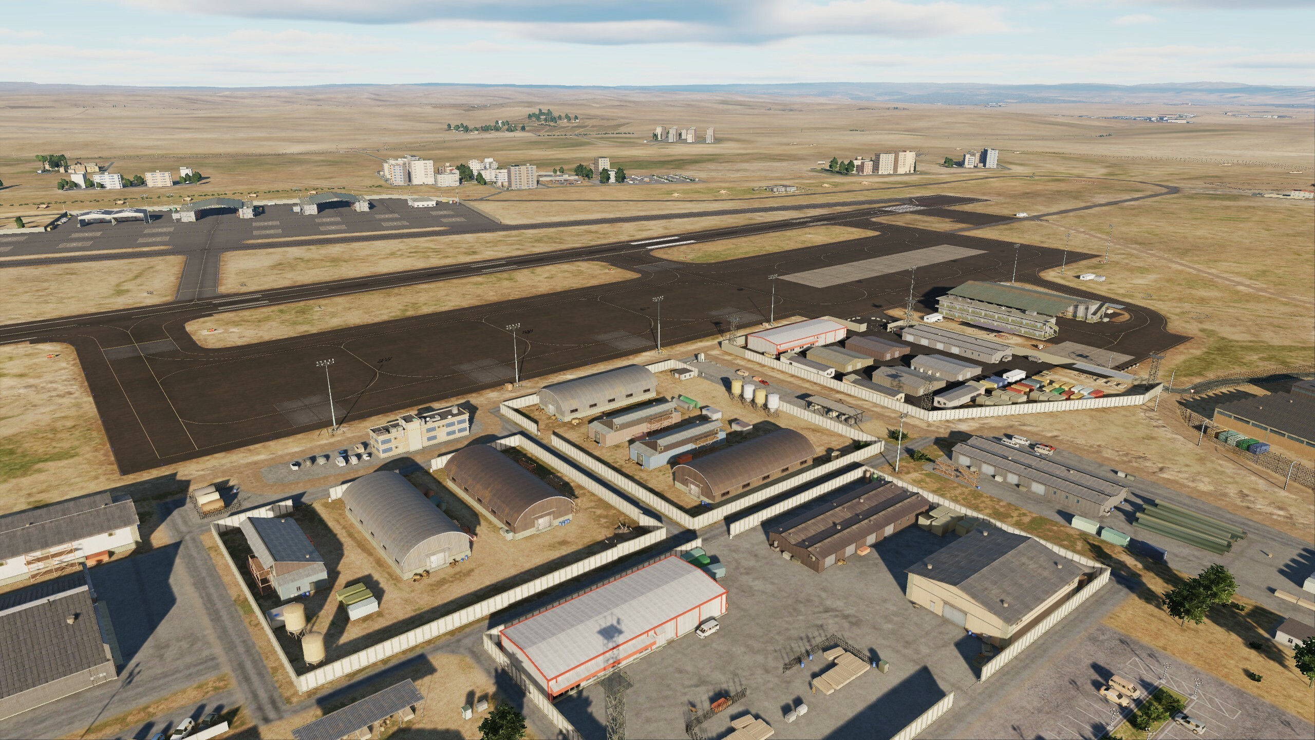
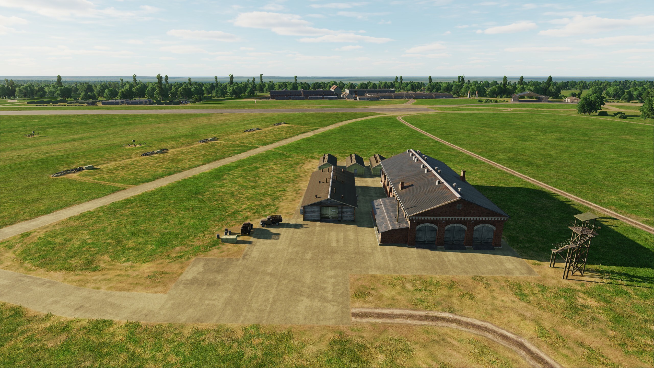
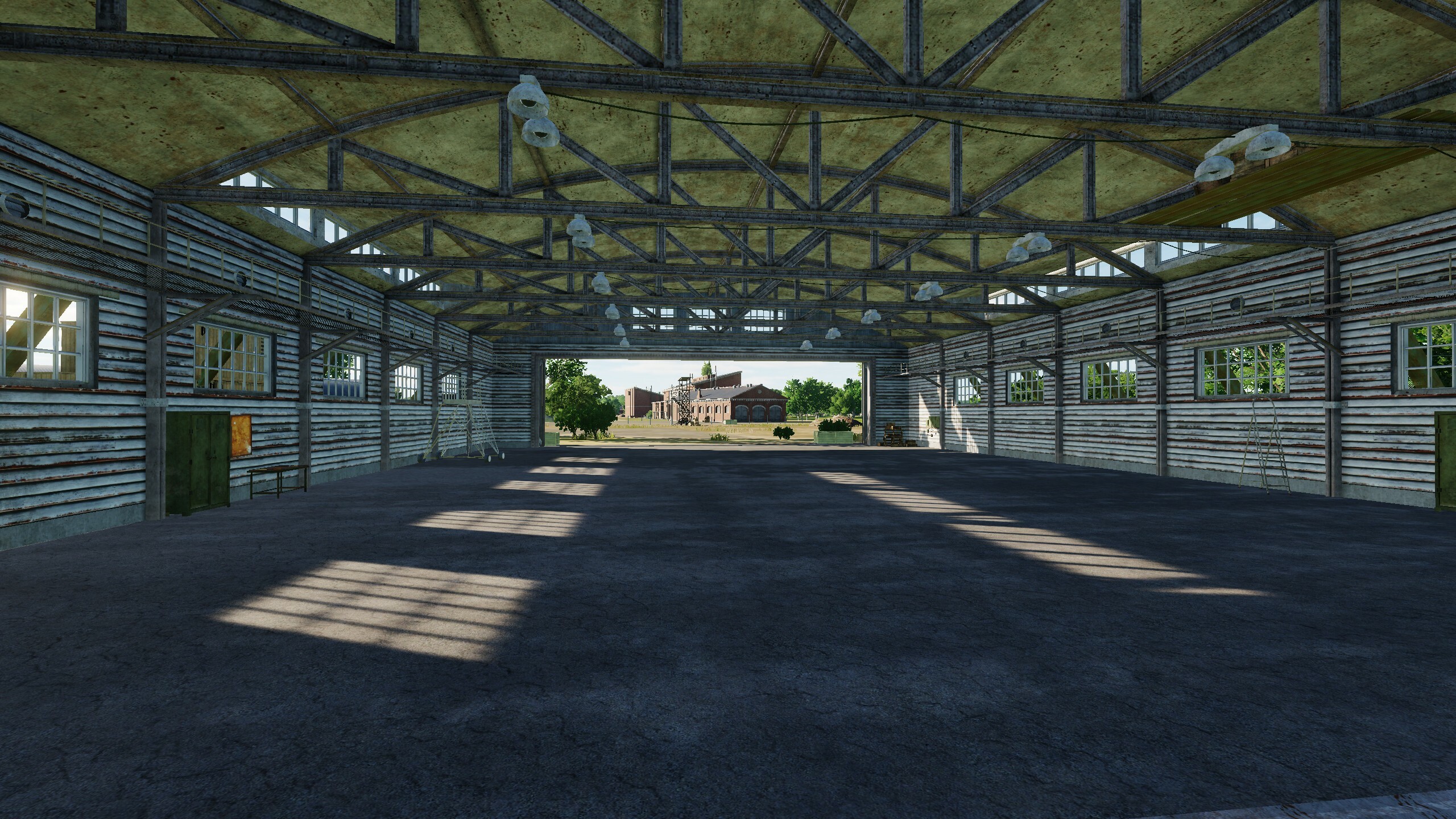
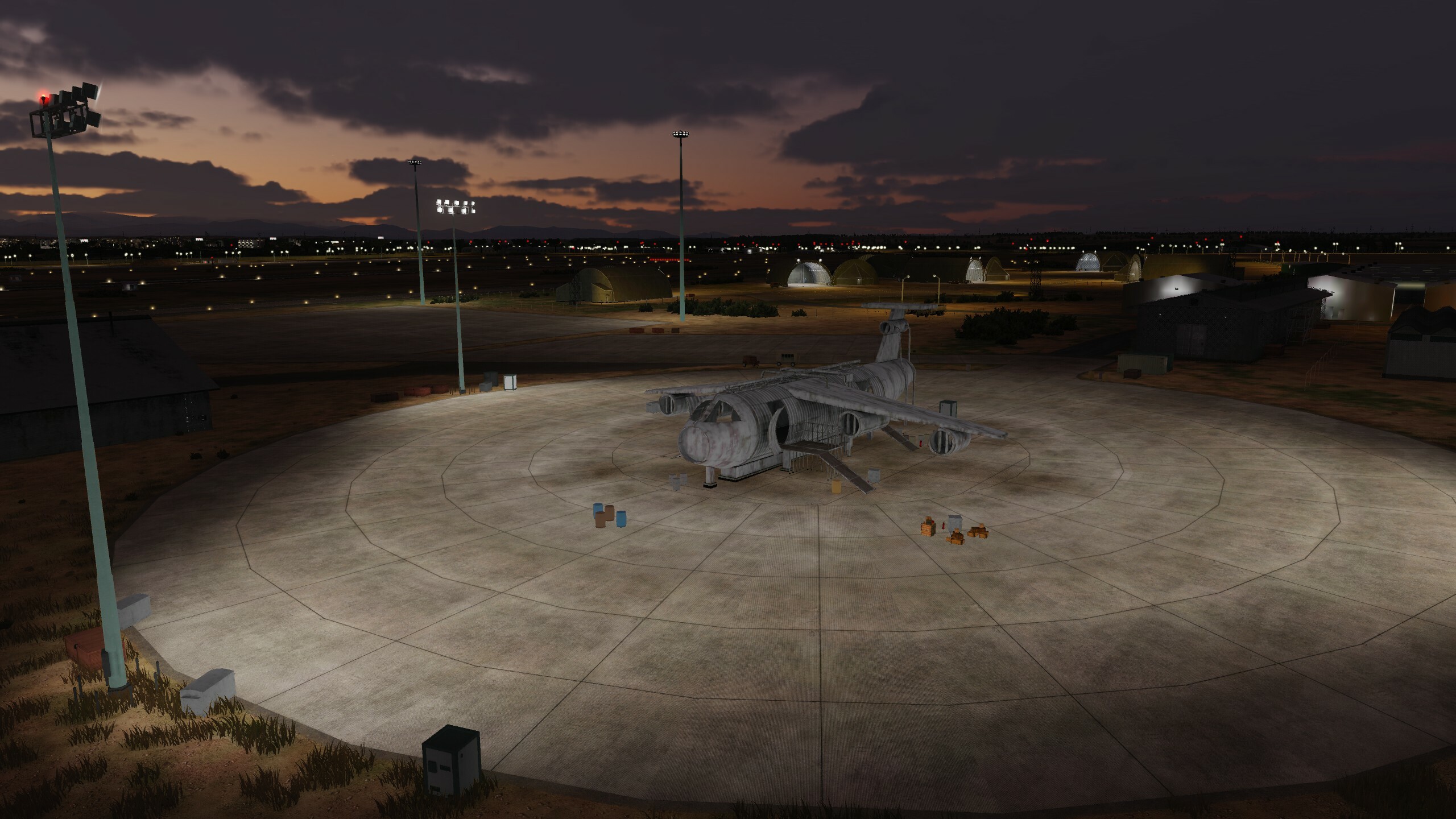
Hi! Let's continue. The airfields are already on the map, today we will show several screenshots including Manston. As always, we look forward to your feedback, thanks to you we are making the map better. Thanks for the information on antennas, it was very helpful. They are scheduled for the next update. Current updates are uploaded The planes are waiting on the field. Fighters, prepare for takeoff! Manston Abbeville Drucat
-
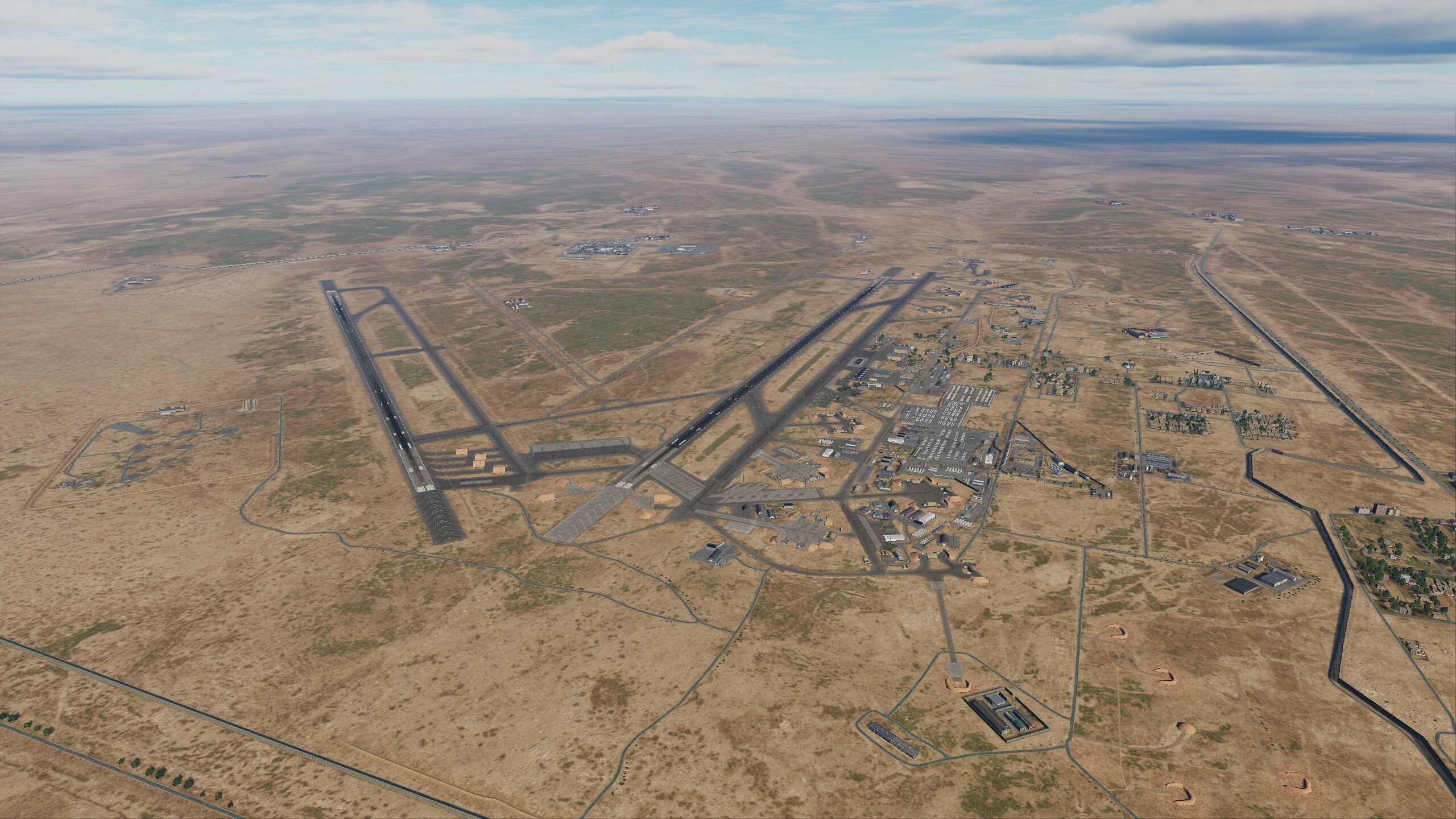
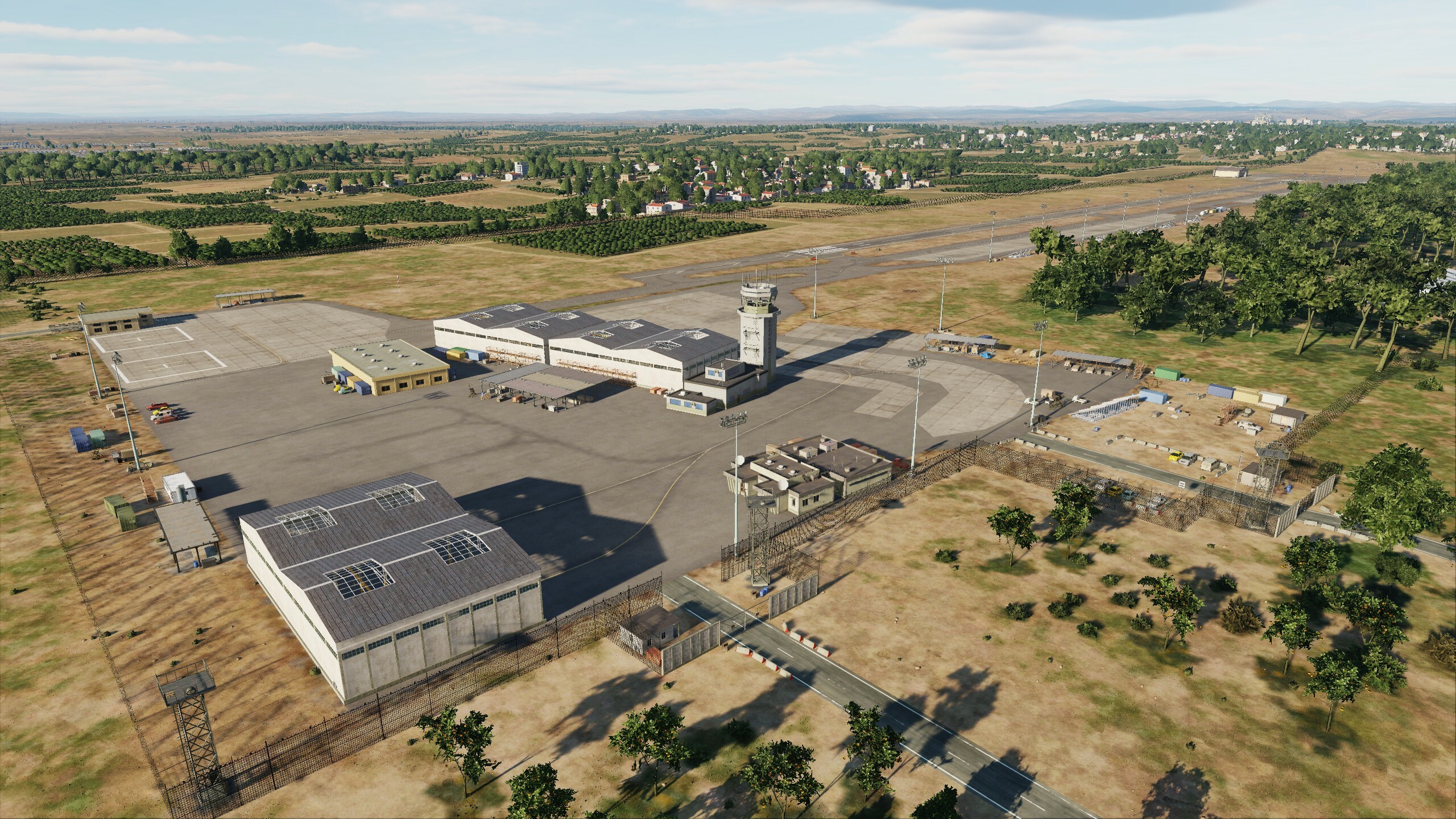
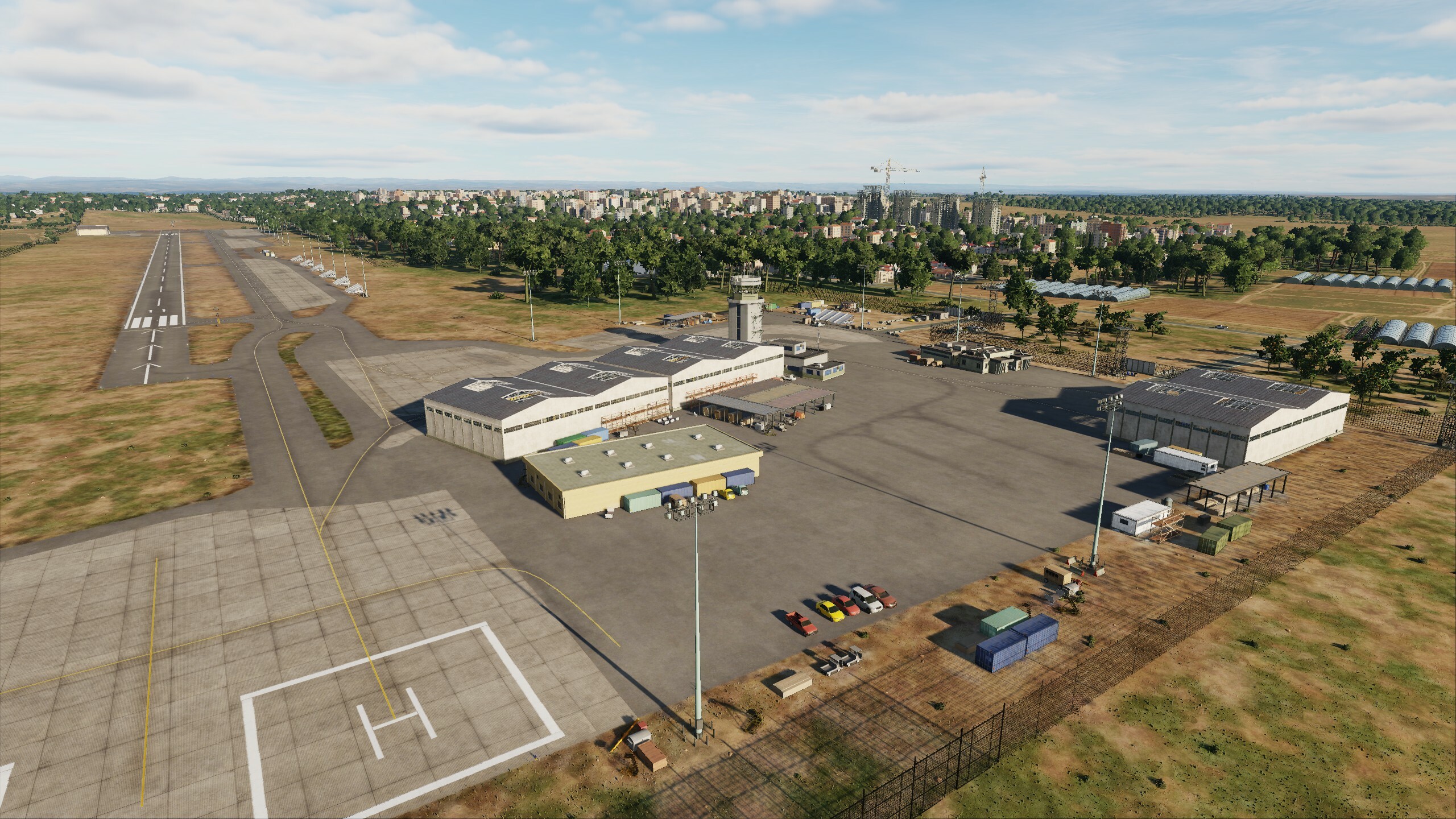
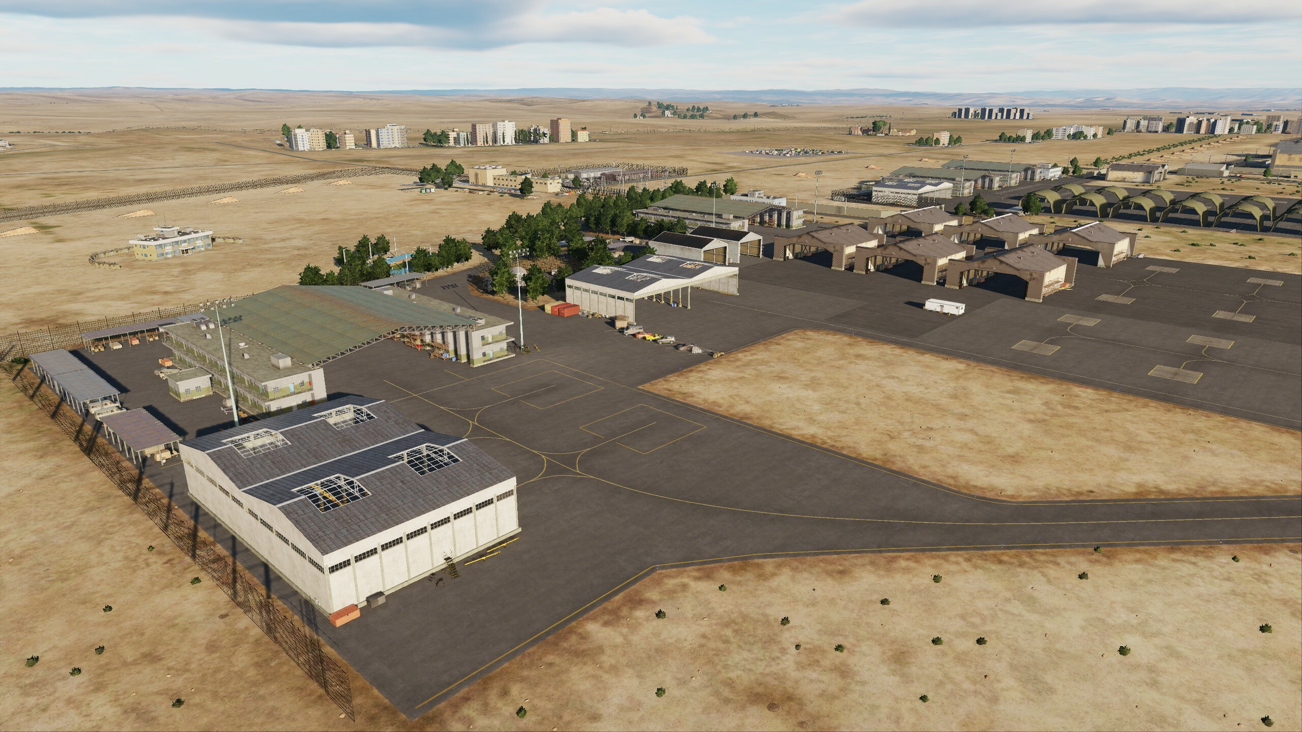
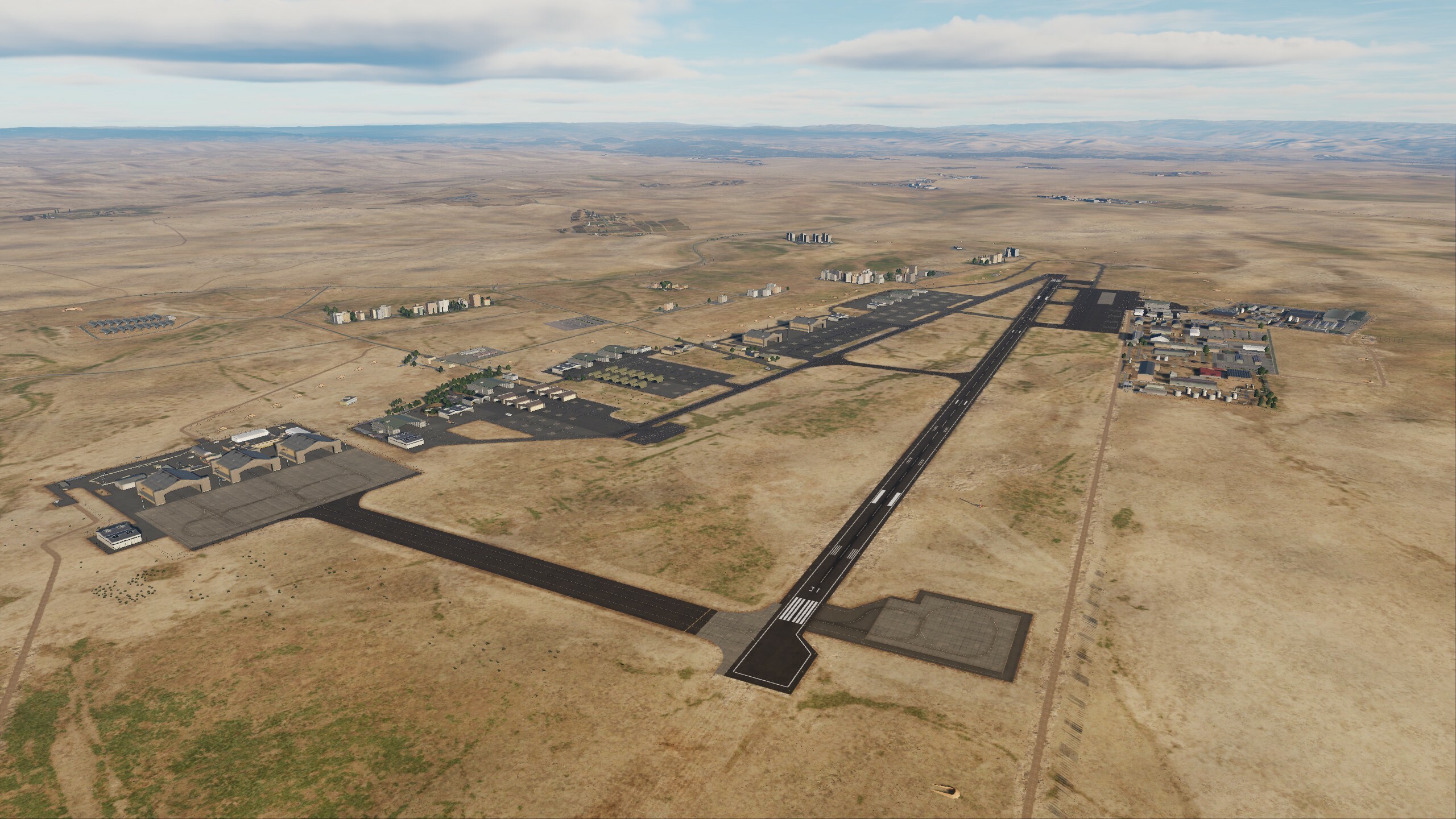
Hi fighters! Today we will look at optimization. The team is working on improvements to the map, but the more detail and uniqueness we add, the more effort it takes to optimize. Hard work has been done on all areas of the map: models have been optimized, textures have been reassembled, vector data rendering on clipmaps has been updated - all this has had a positive effect! We conducted tests on two systems: AMD Ryzen 7 3700x / RTX 2080Ti and i9-10850K / RTX 4080 When flying over a city, FPS increased by an incredible 20%, and while on a system with a 2080ti the average FPS was at 85, now it confidently remains around 110. When flying over a forest, FPS increased from 5% to 20% compared to the previous build. When testing the 2080ti system, the fps was always above 105. One does not simply release an update with optimization. We have added 4 airfields: Amman Civil Airport Herzliya Airport (NOTAM: RWY LENGTH 1500M) King Abdullah II Air Base Prince Hussein Air Base This will increase your flight geography and diversify your missions. Explore new airfields and get ready to take off Prince Hassan Airbase King Abdullah II Airbase
- 125 replies
-
- 77
-
-
-
Pilots will be able to see these airfields on the Normandy 2.0 in one of the upcoming DCS updates. You just need to be patient and wait for messages from ED.
-
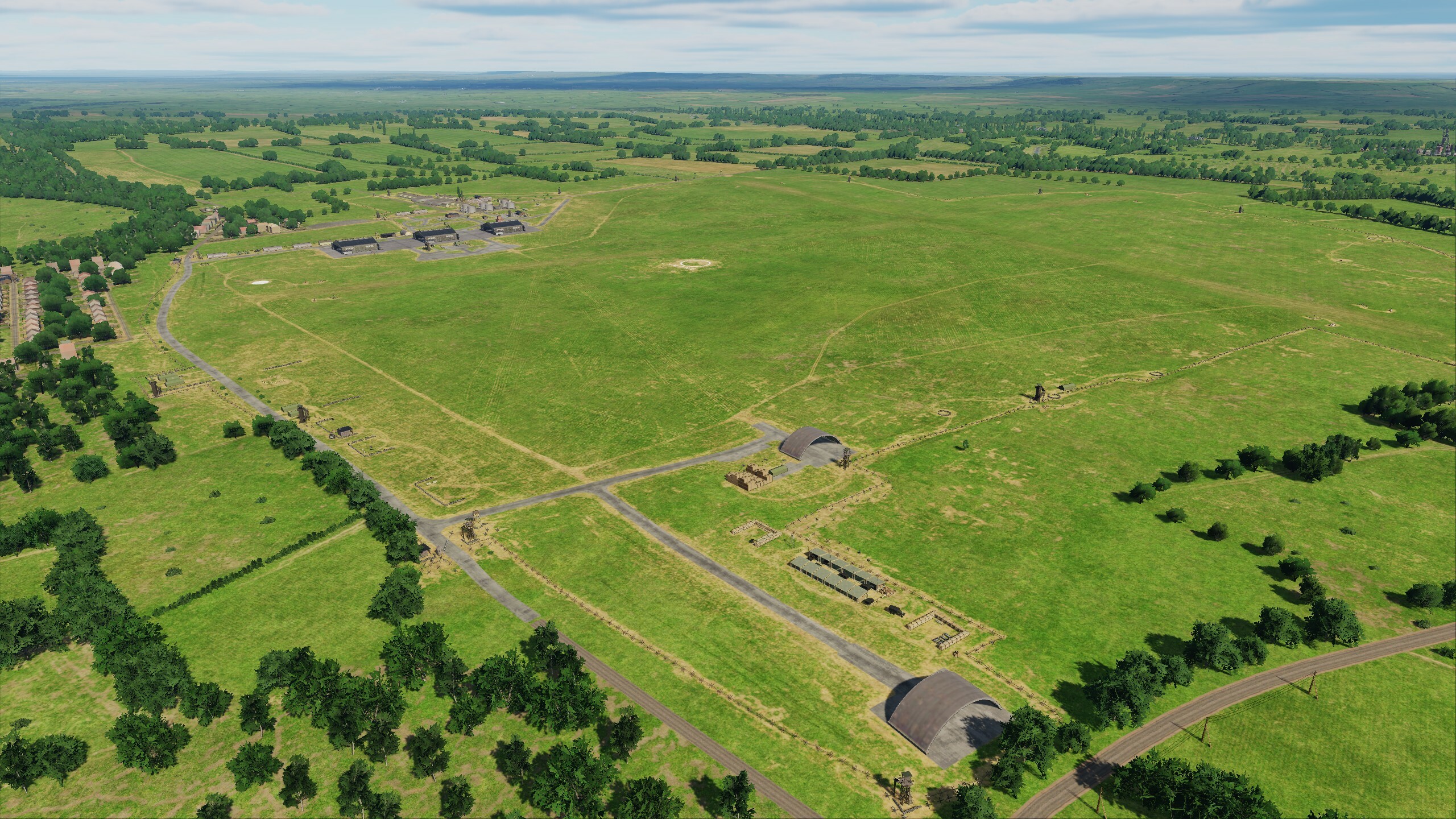
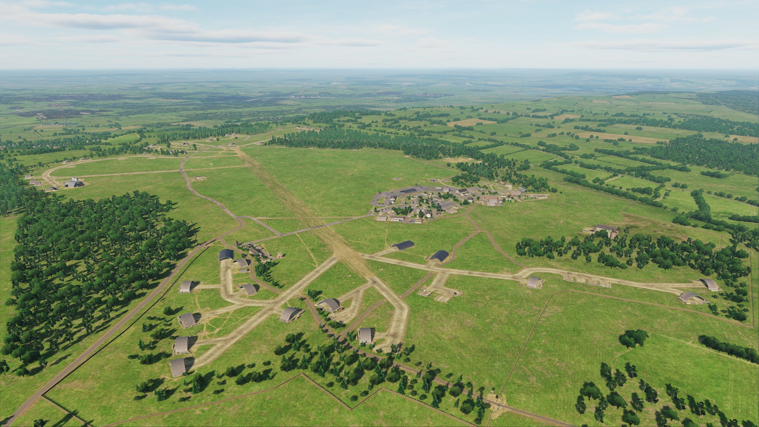
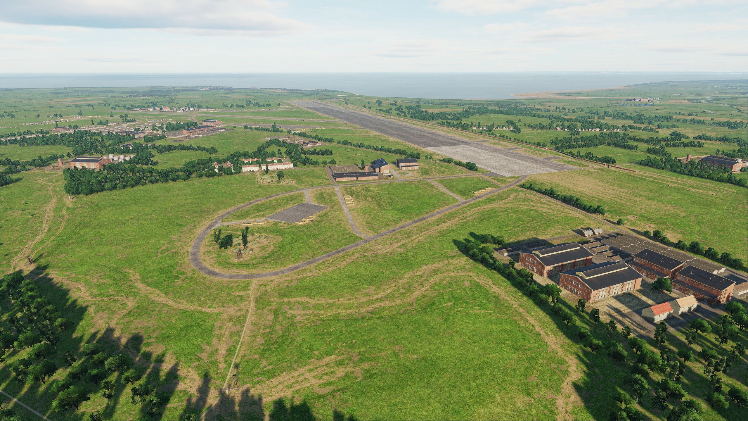
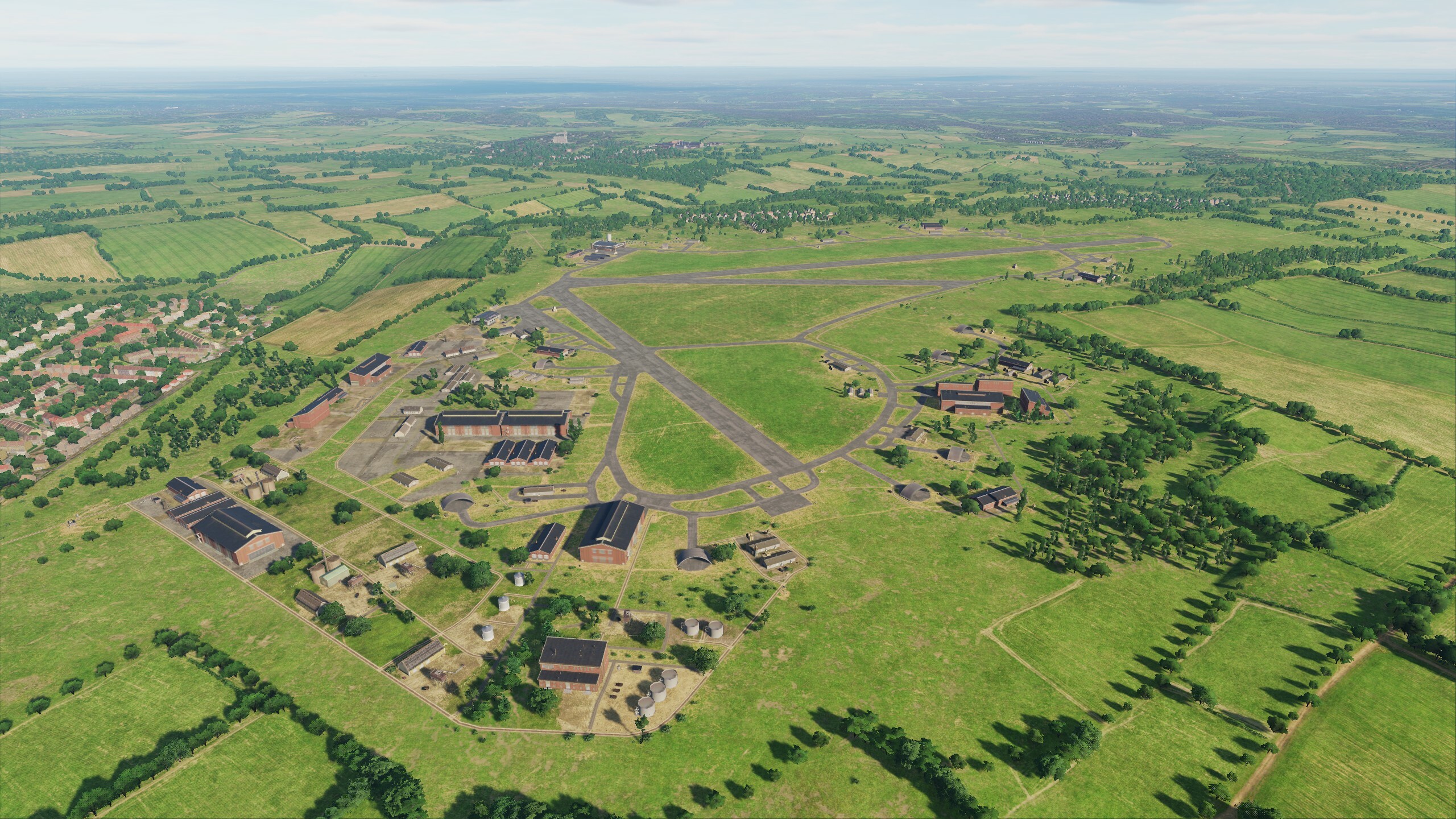
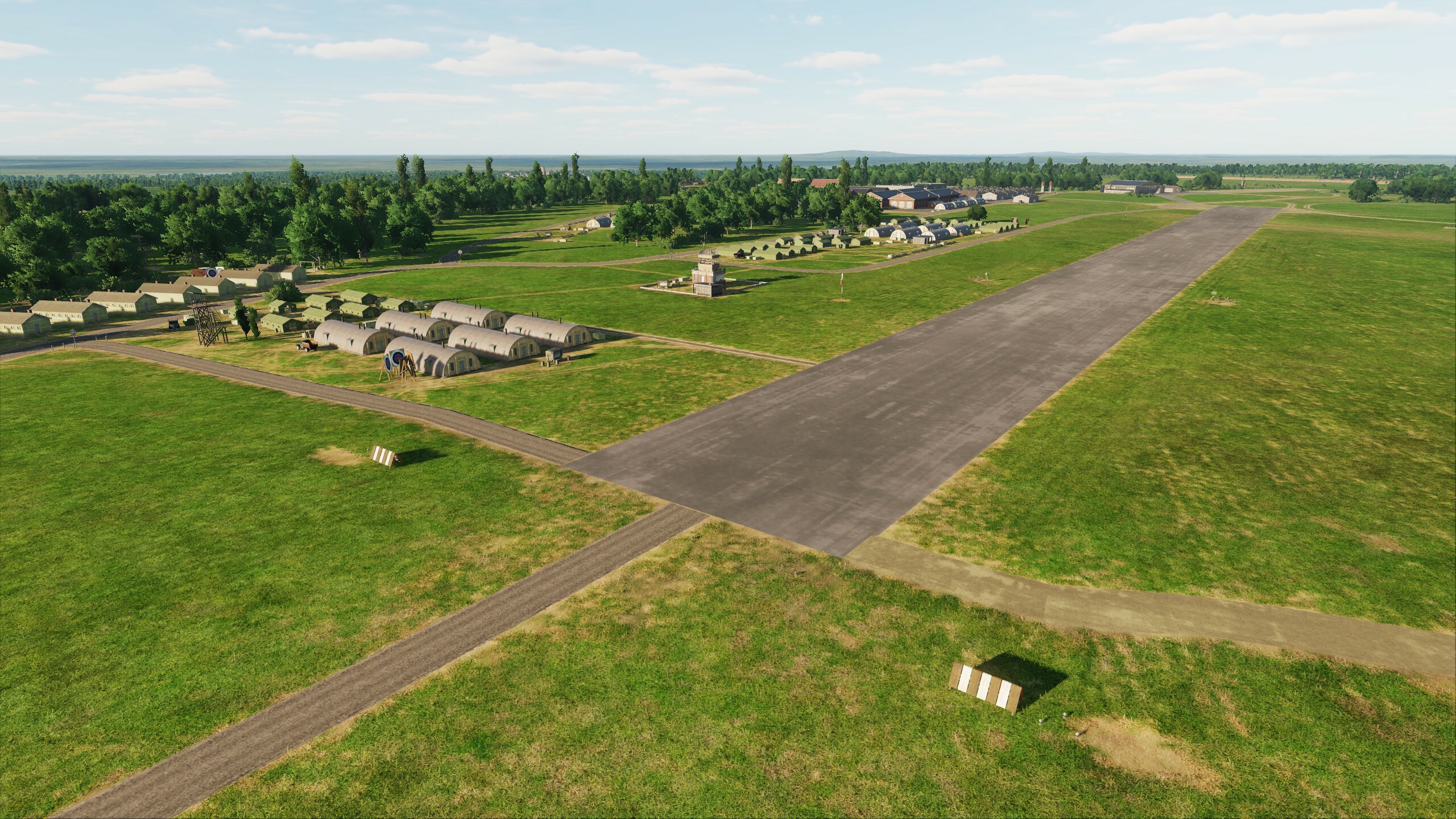
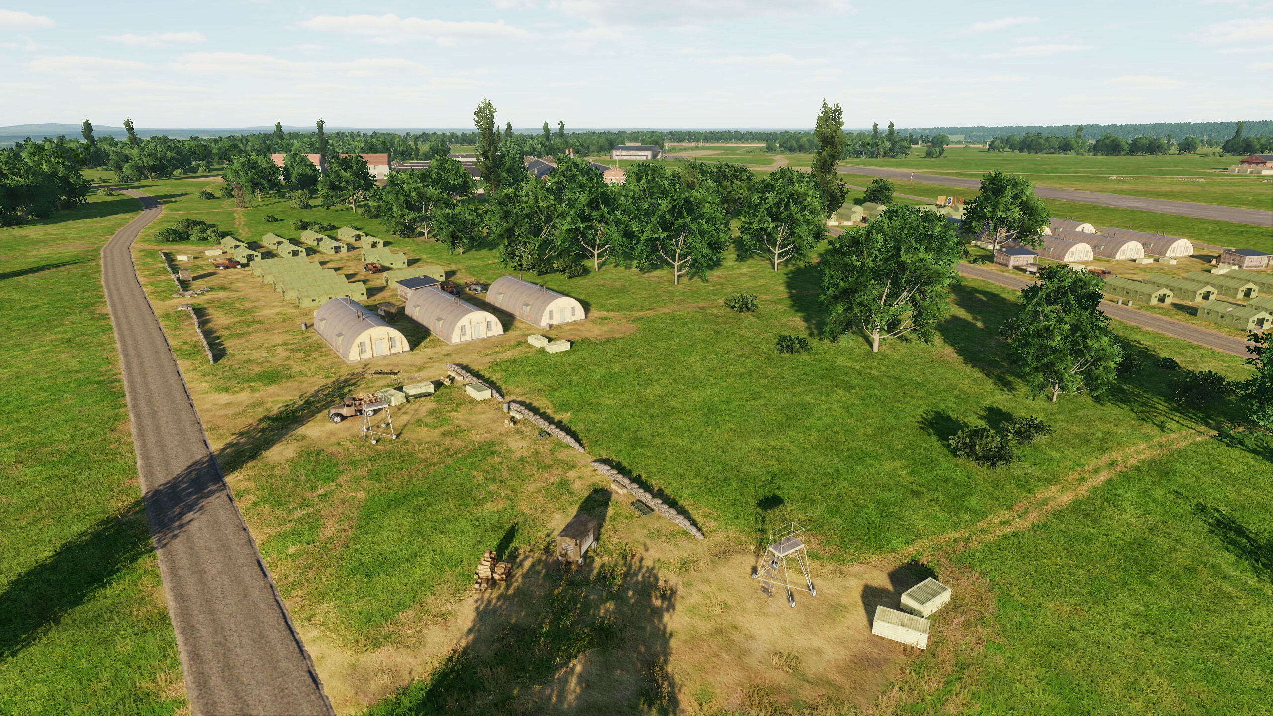
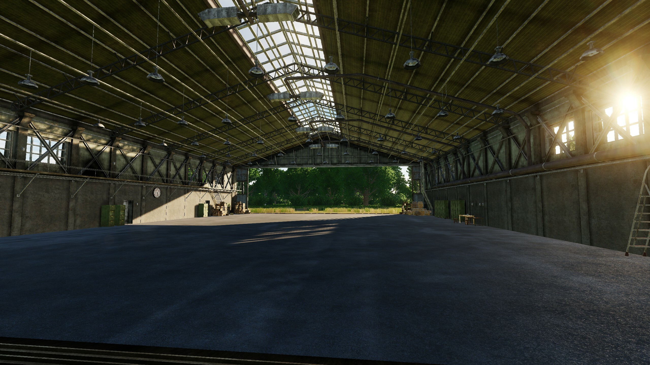
Hi fighters Long time no see. All this time, the team worked hard and today we will show you something. You know that Normandy2.0 is significantly larger than Normandy1944 and the Channel map, and provides users with significantly more opportunities to implement scenarios of the World War II. And the Ugra-Media team is happy to share the results of the development of the map, which allow you to realize the scenarios of the initial period of this war, including the Battle of Britain - the greatest battle in the sky of all times and nations. In this update, we add 7 airfields that you know: - Biggin Hill - Manston - Detling - Lympne - Abbeville Drucat - Merville Calonne - Saint-Omer Longuenesse - Wizernes This will allow you to adapt your missions and campaigns and supplement them with completely new historical scenarios. Now the distances have increased, build new routes, choose spare airfields and watch the fuel. We know your wishes for additional airfields on this territory. Stay tuned! Look at the first results of the work that is in full swing. Biggin Hill Saint-Omer Wizernes
- 49 replies
-
- 37
-
-
-
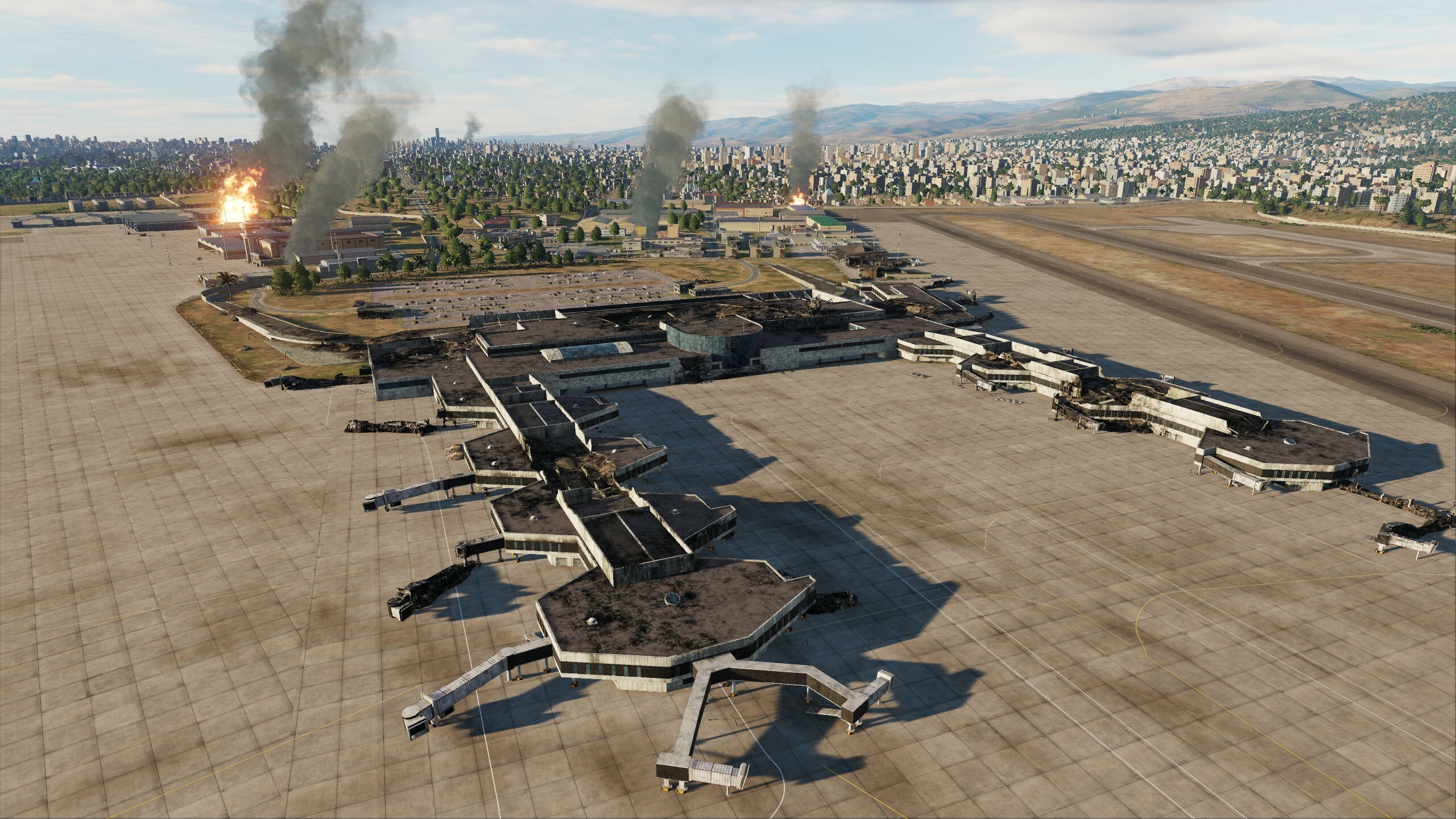
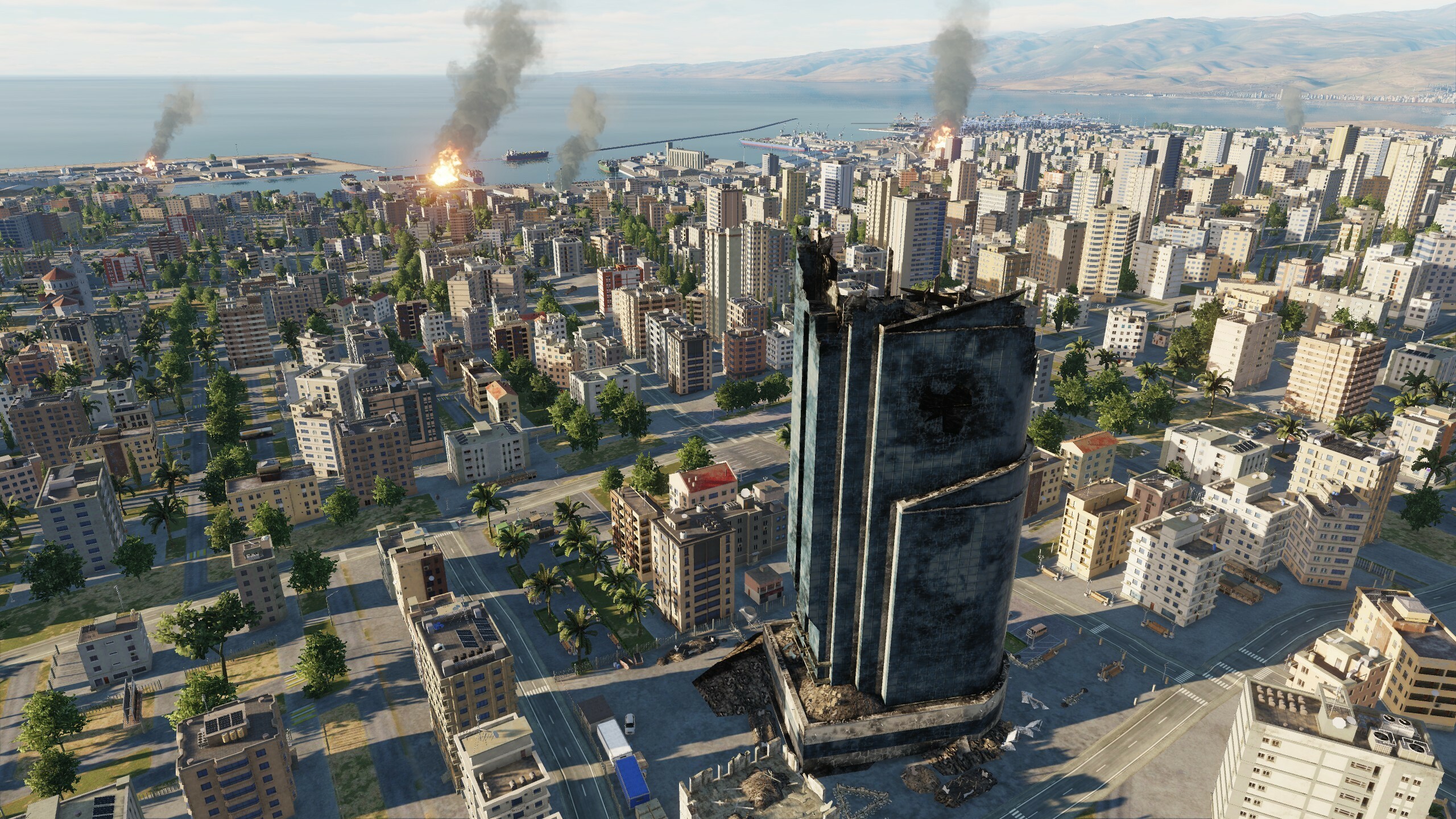
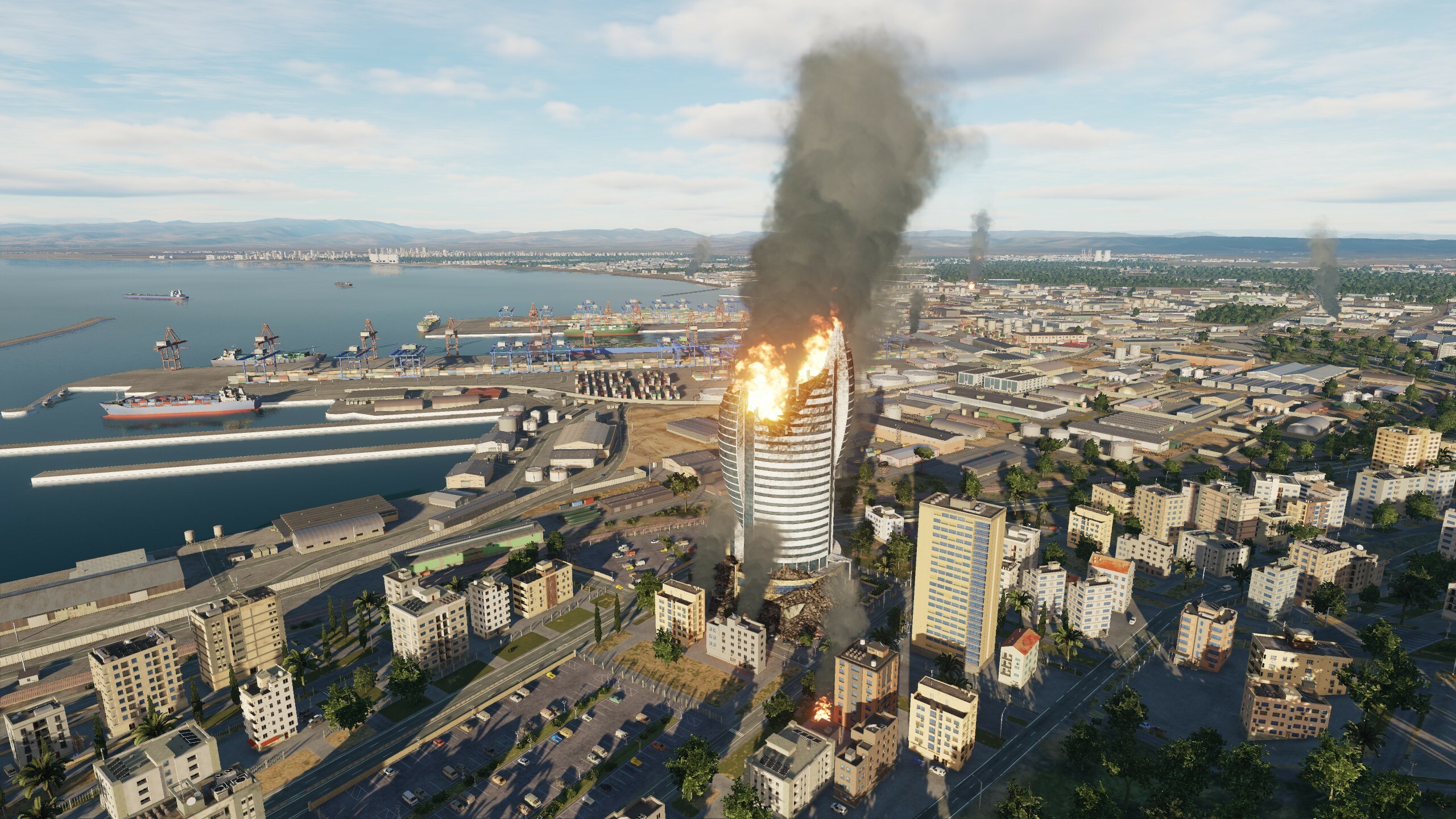
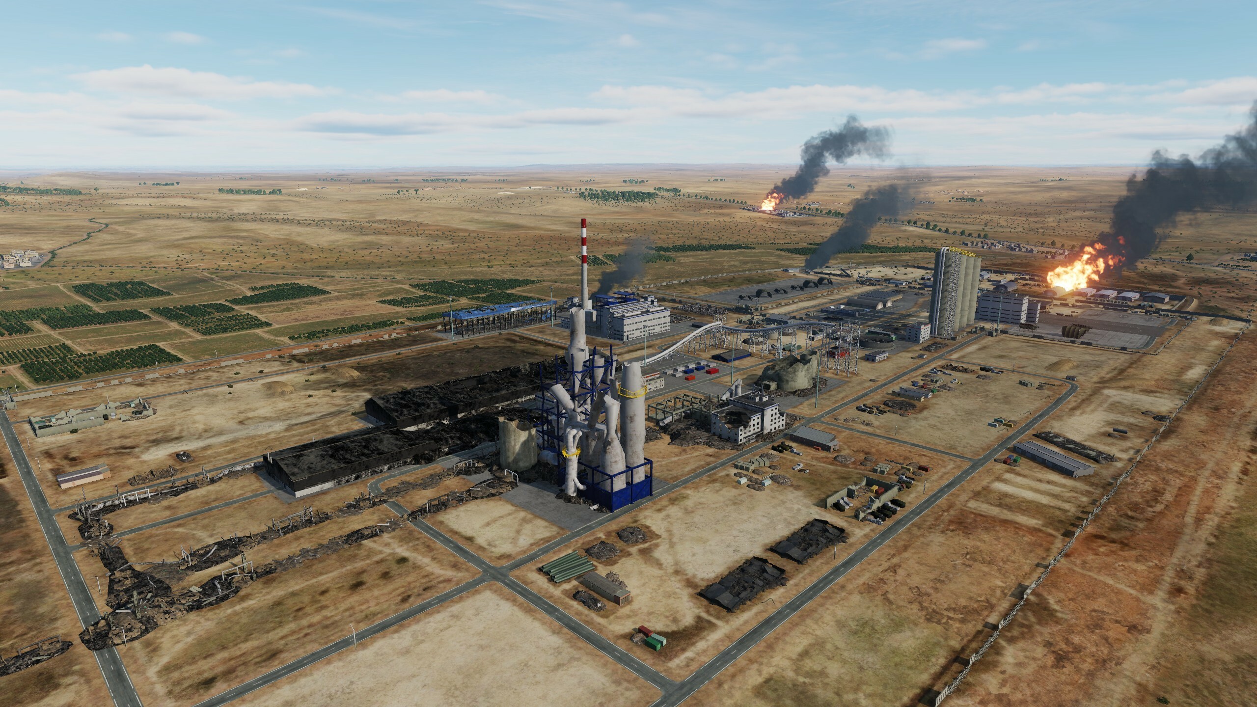
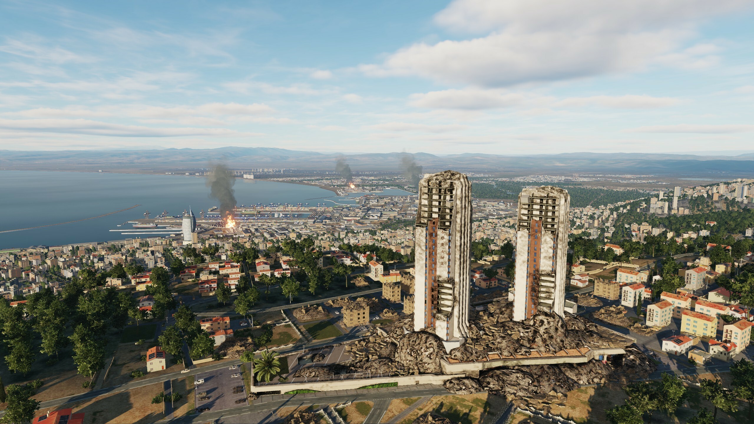
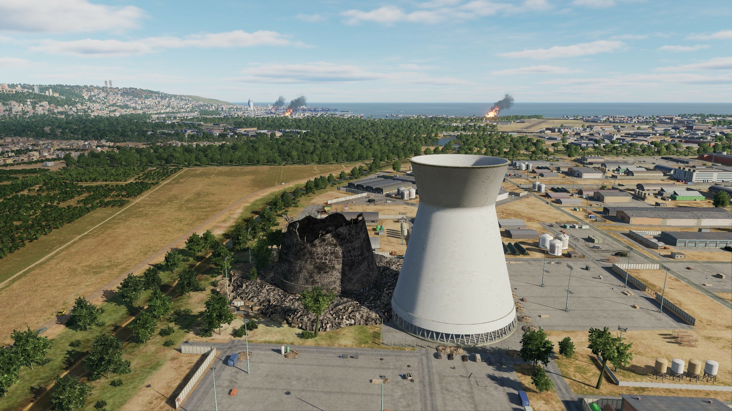
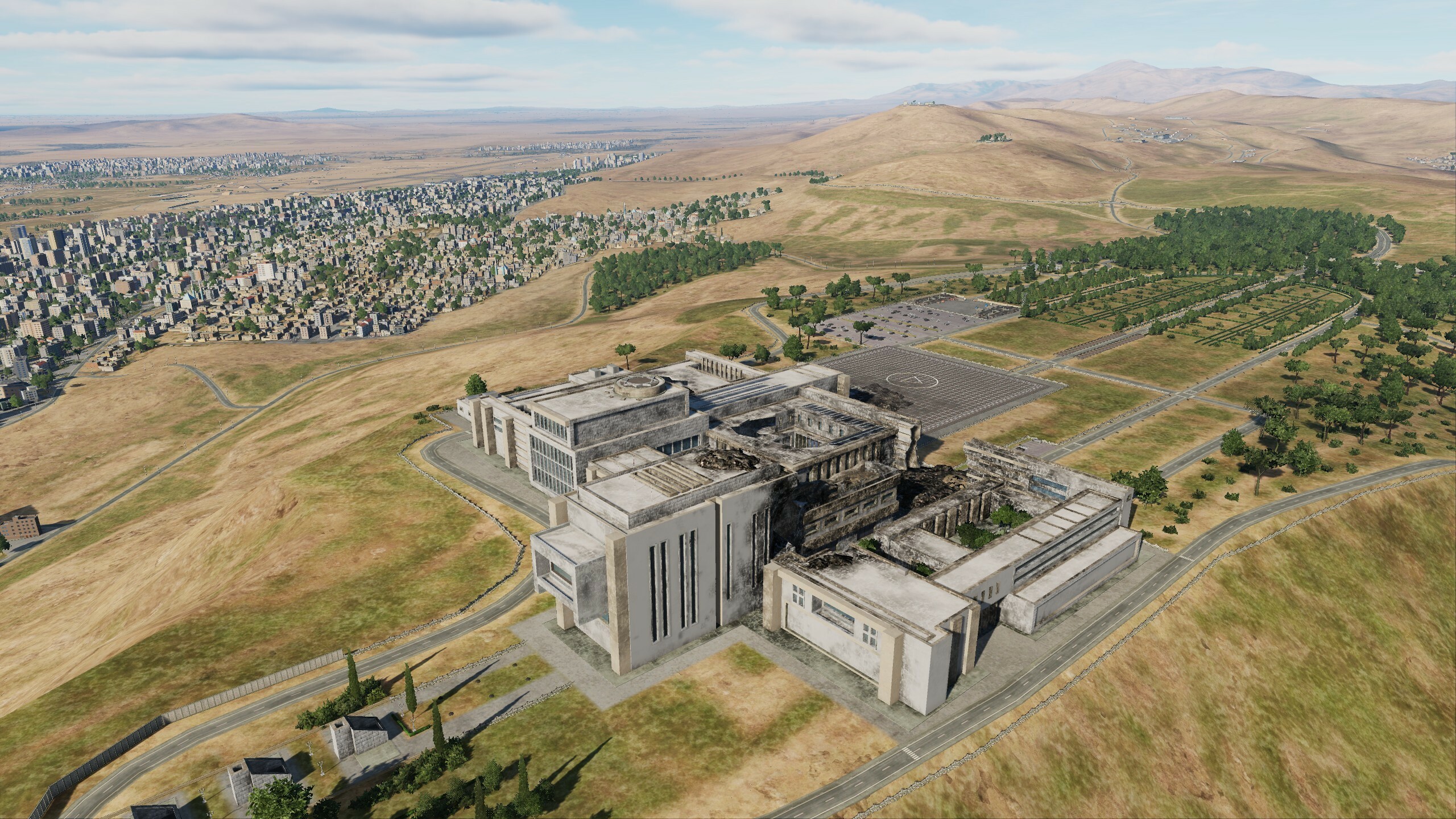
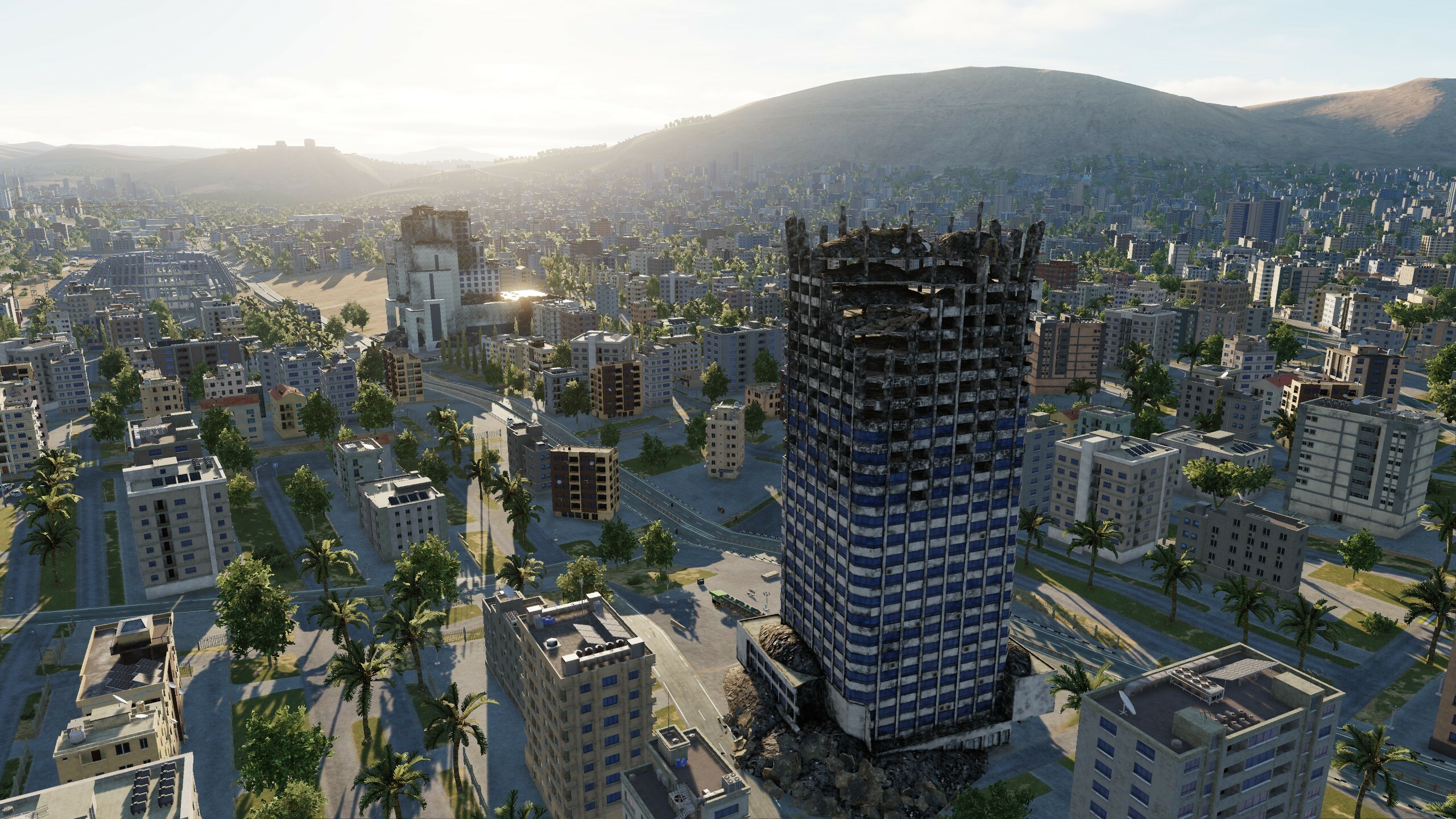
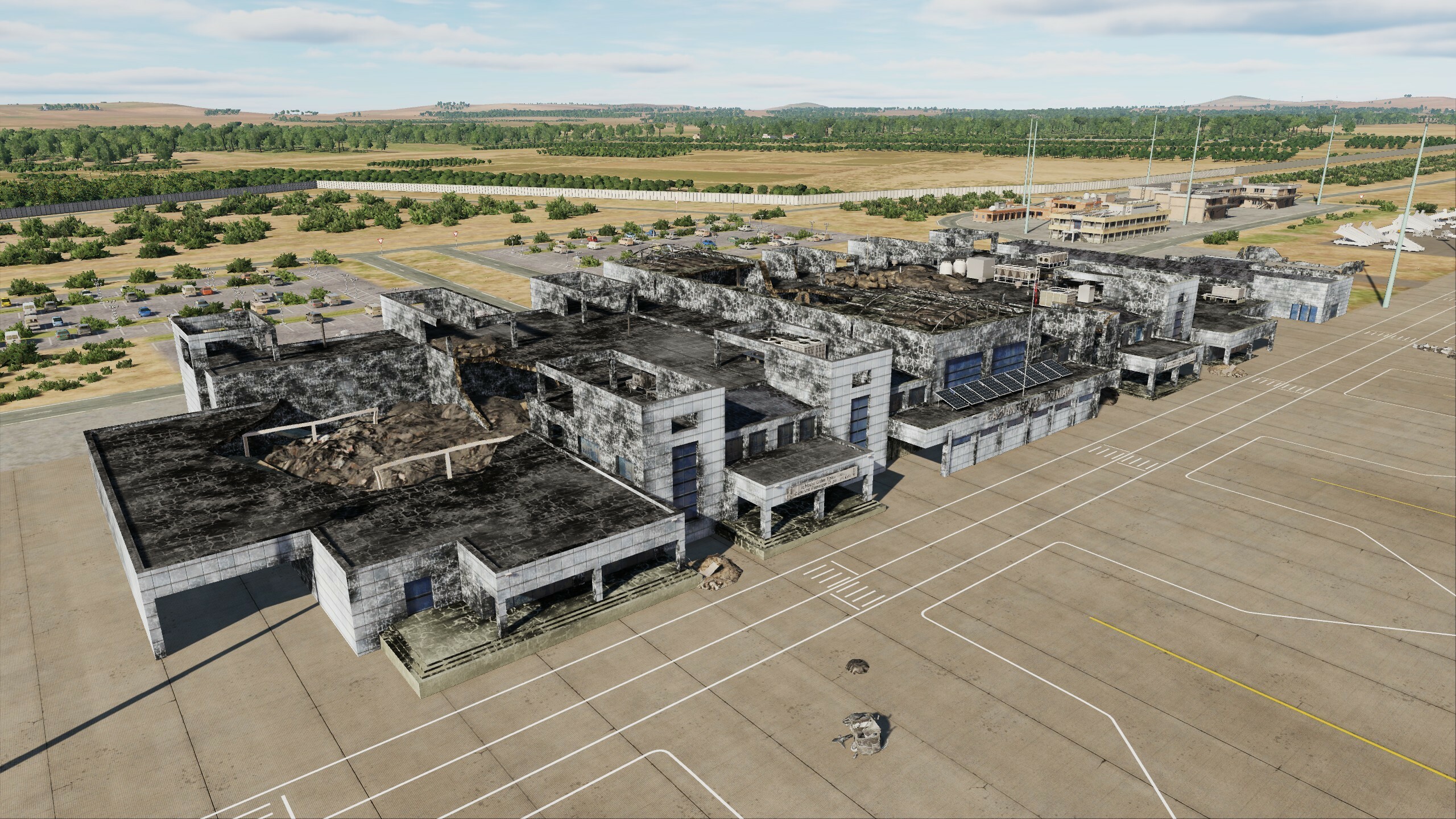
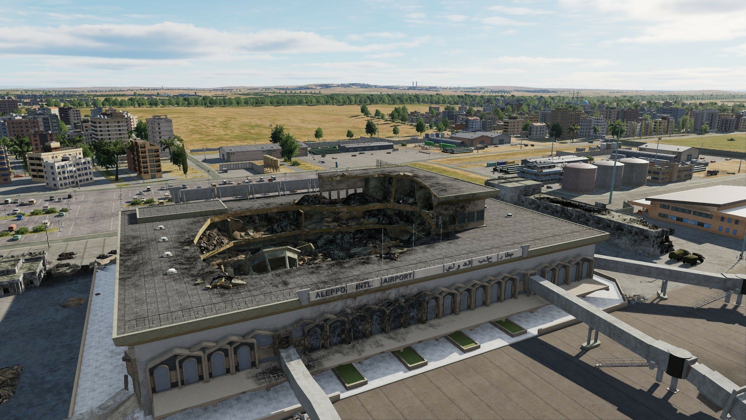
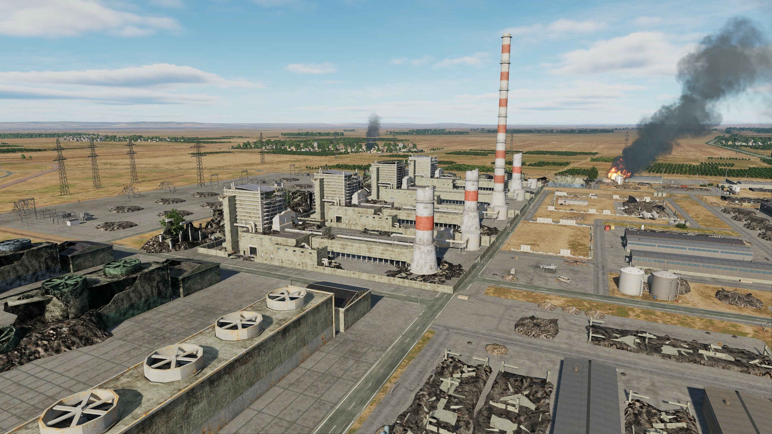
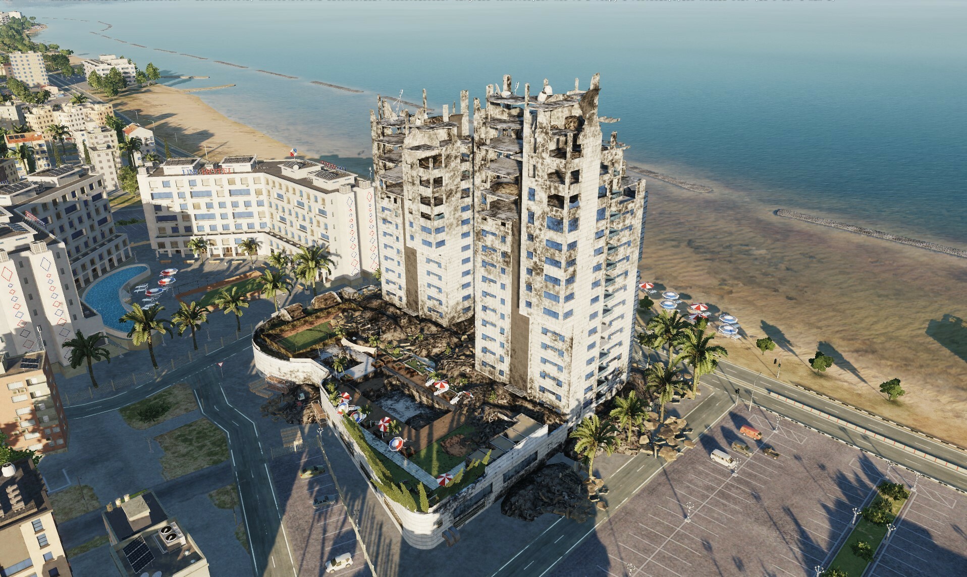
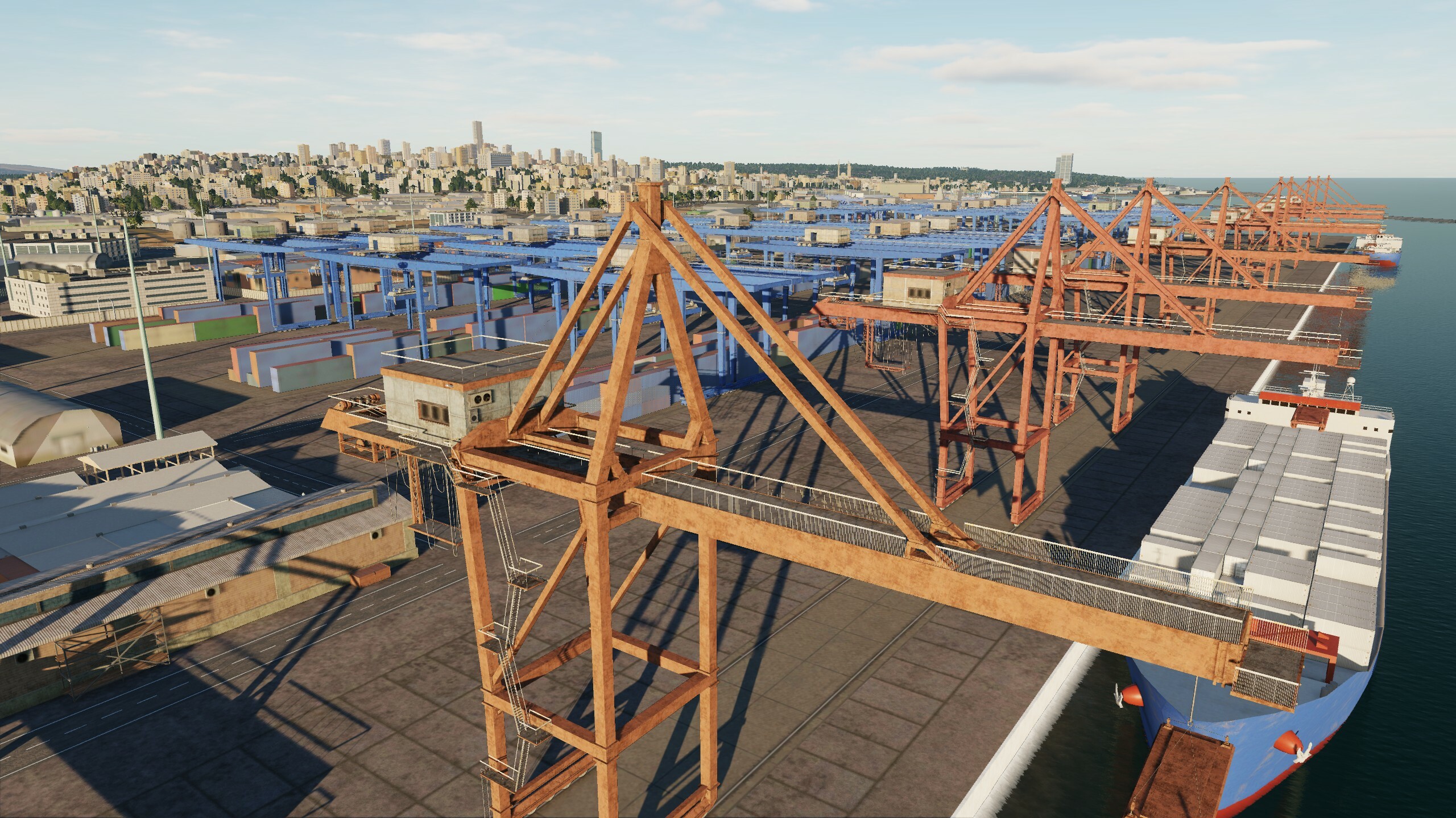
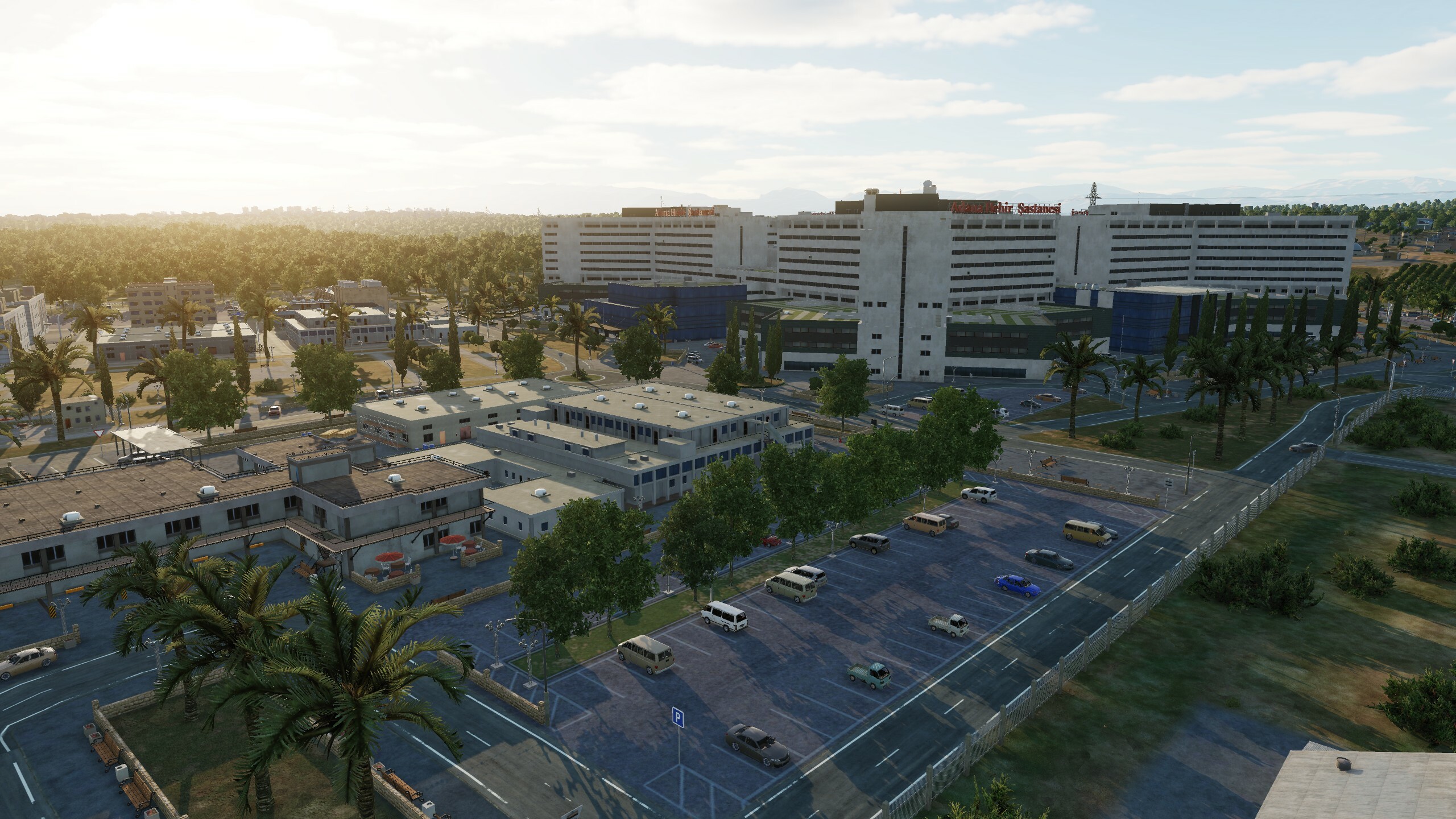
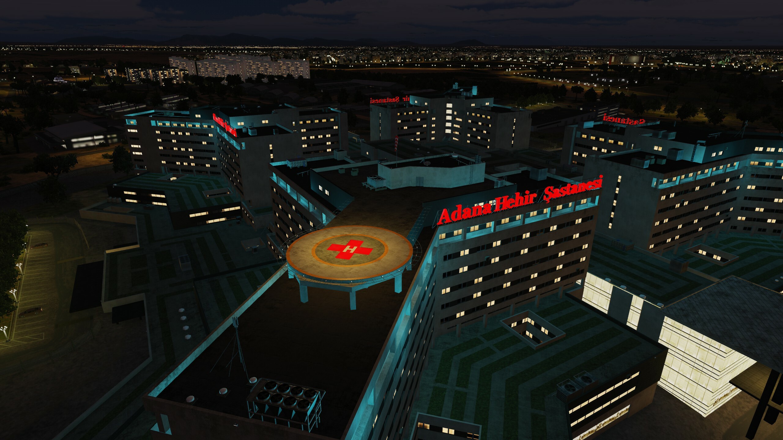
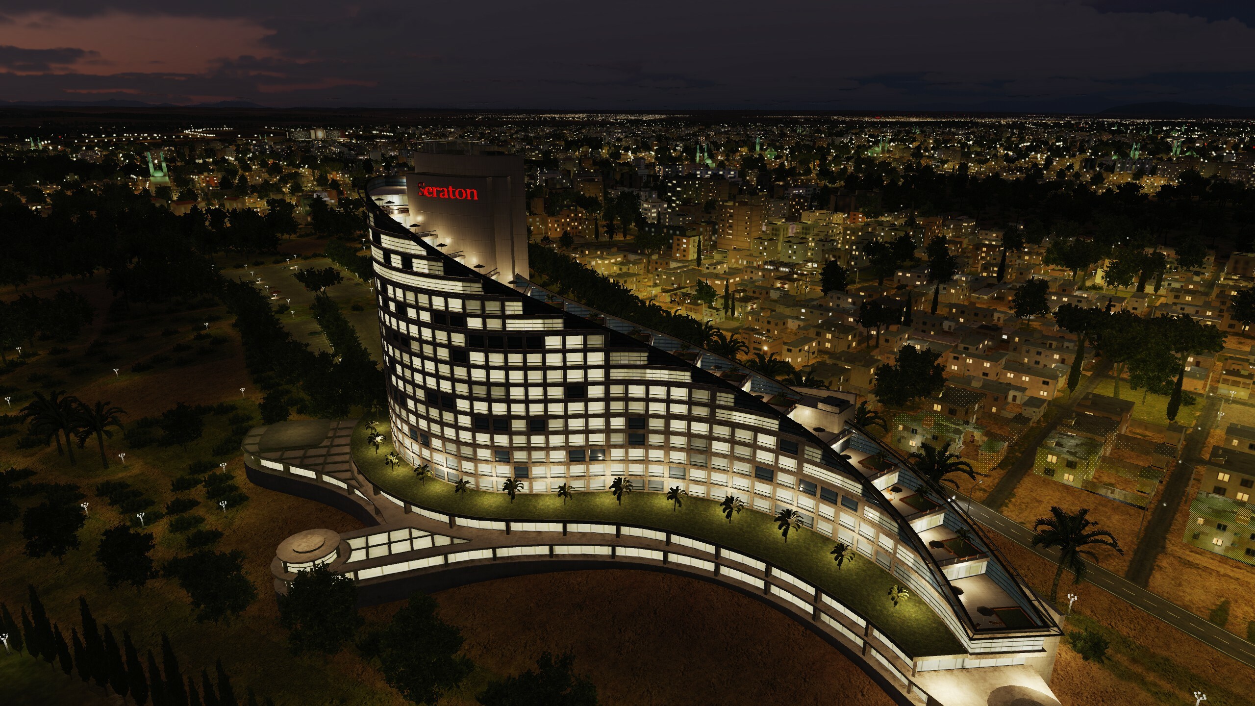
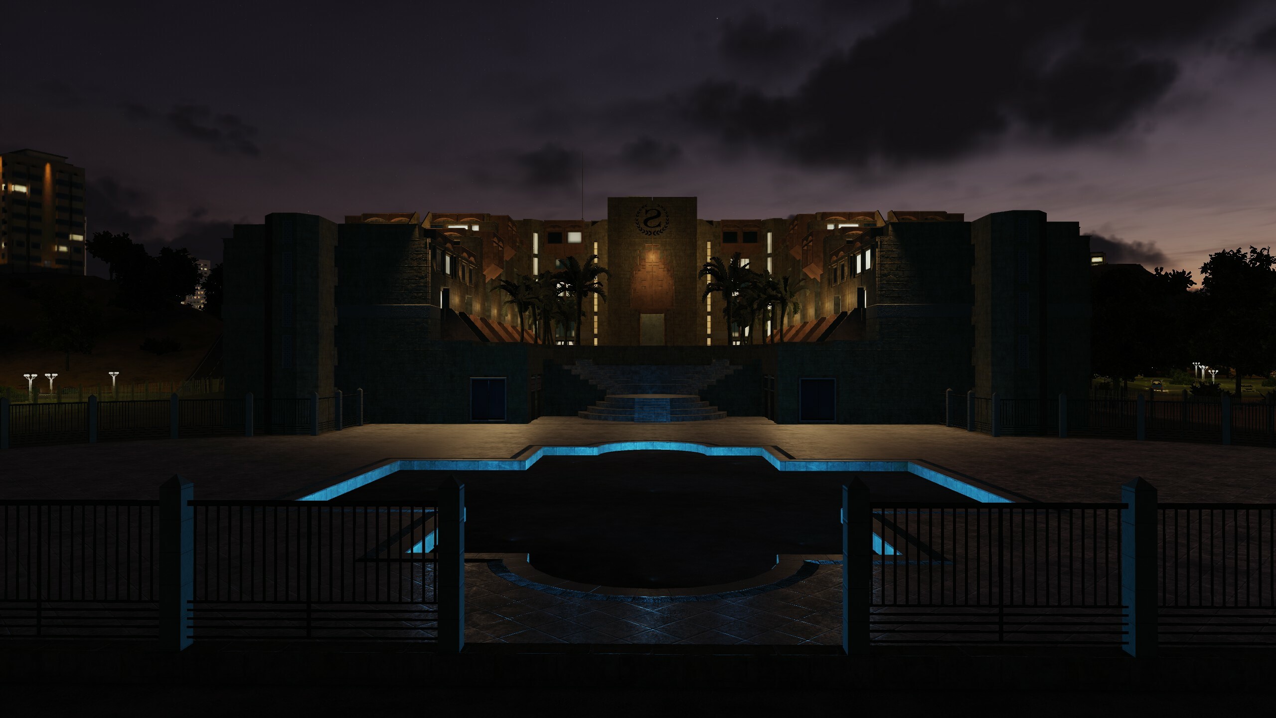
Hi destroyers! "Add damage models to objects" - this was one of the most popular requests for the Syria map. The peculiarity of modern buildings is that they are large in size or height. To make the destruction look more or less realistic, we divided large objects into parts and made a separate "damage" for each. When technology allows, we will be happy to make fully destructible building models. but already now you can diversify your flight missions thanks to this update You know that we do not do for some unique objects of the destruction model, but there were so many requests that demags are now available for the original objects - the terminals of Beirut, Damascus, Aleppo, Gaziantep, Paphos, Nicosia, Adana Hilton, Sheraton Adana, Haifa Tower hotels Panorama, Haifa Tower Sail, Damascus Tower, Limassol Olympic Residence, Platinum Tower Beirut, Sama Beirut, Assad Palace, Haifa Cooling Tower, Aleppo Power Plant and La Farge Factory. In addition to the damage, we have optimized night lighting and optimized city blocks, so that all the additions will definitely not degrade your performance. While your plane is being prepared, check out the pictures
- 125 replies
-
- 26
-
-
-
Hi Work on the night lighting was not stopped. We are looking for a balance between performance and beauty. Even now some of the new lights are switched off at a distance, somewhere they are replaced at the lod1 level by standard lights. All this will be available in the next update.
- 125 replies
-
- 10
-
-
-

Runway lights at Ramat David 90 degrees off
MAESTR0 replied to Beta Sokol's topic in Bugs and Problems
Hi @Beta Sokol @REDEYE_CVW-66 we quickly checked how it works for us. Waiting for update)
-
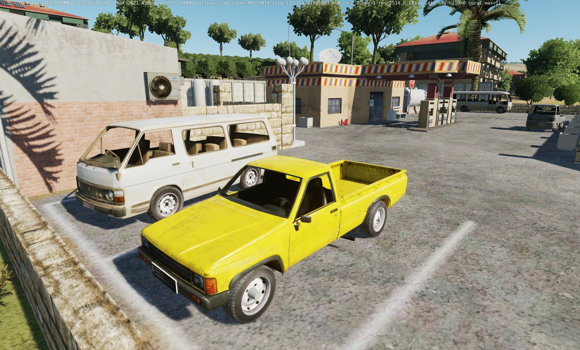
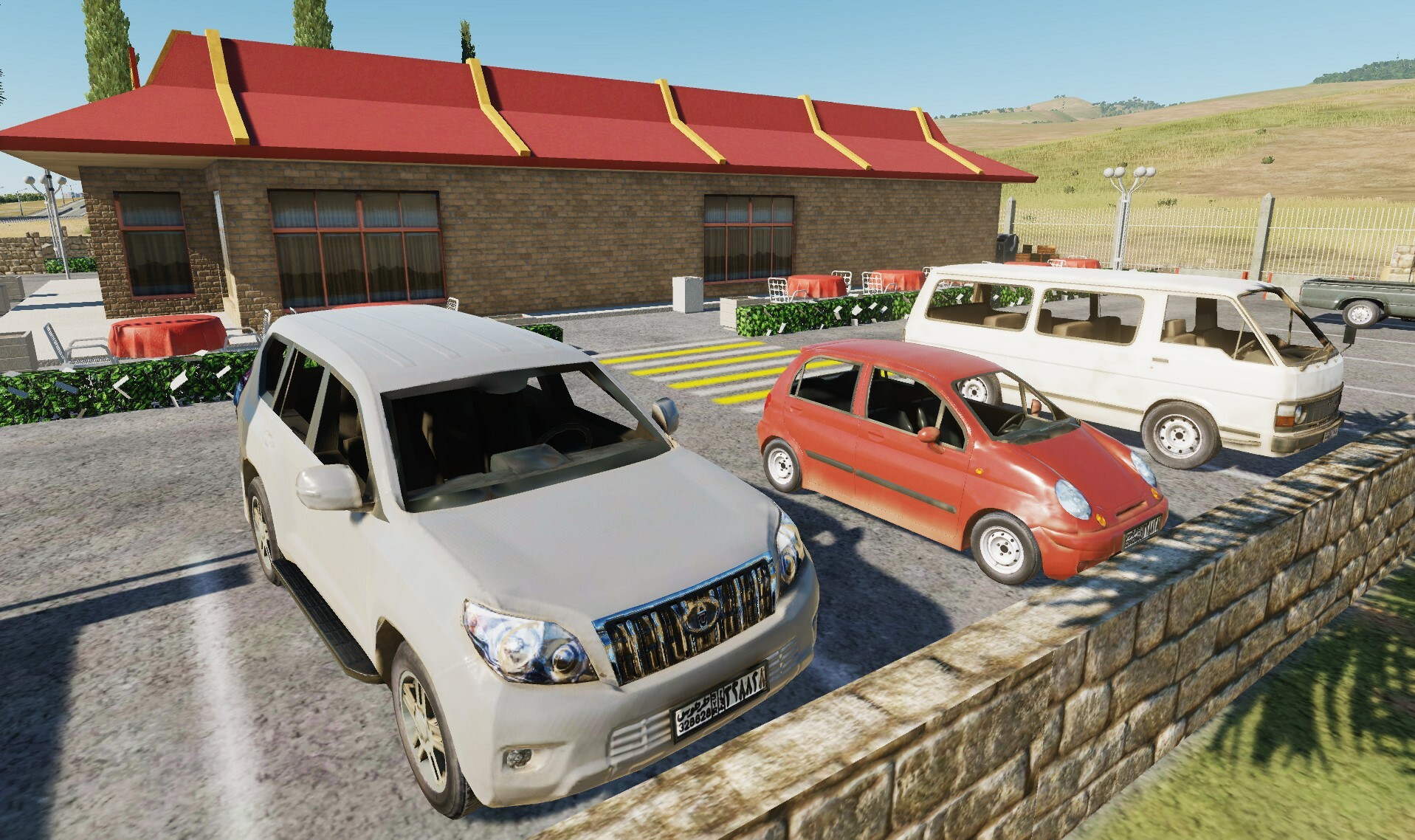
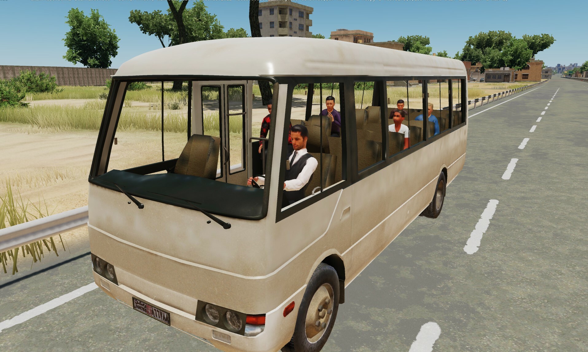
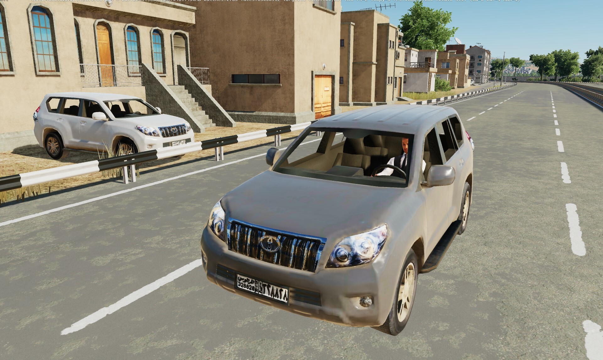
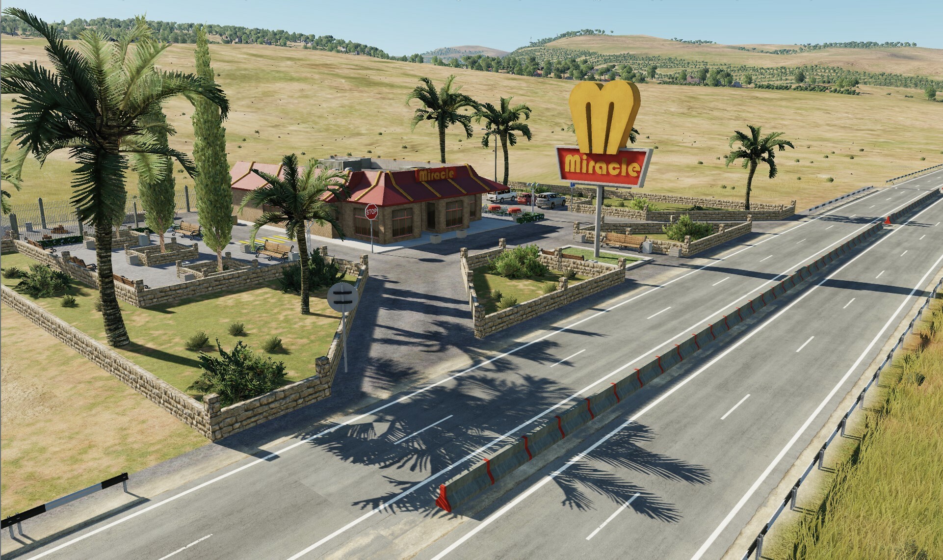
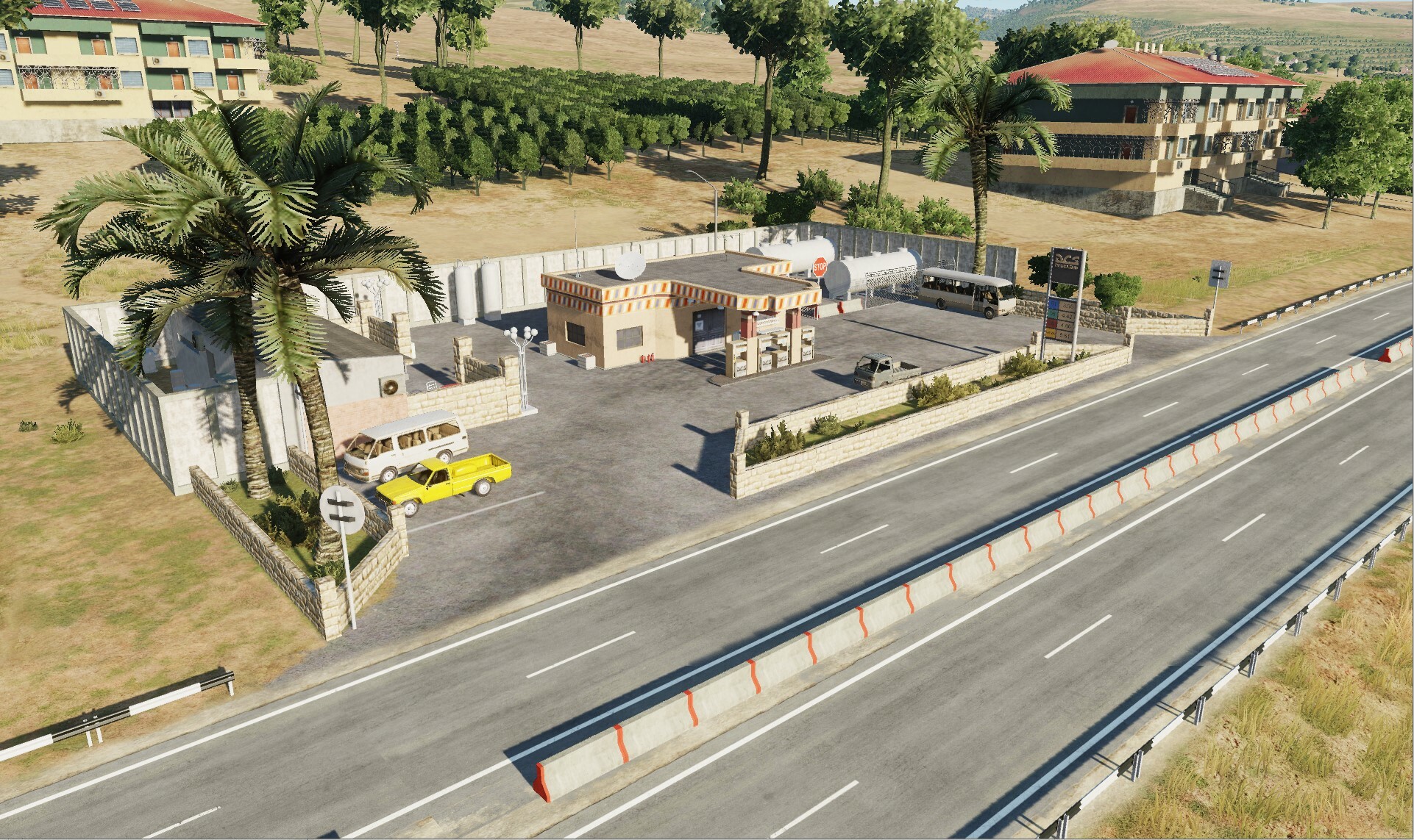
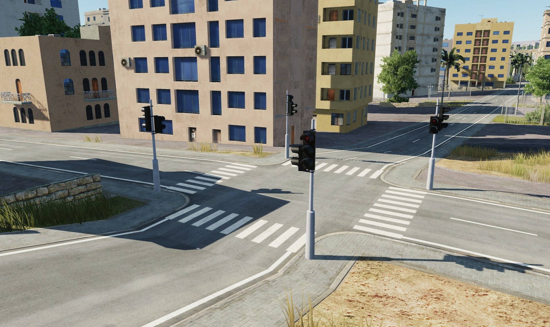
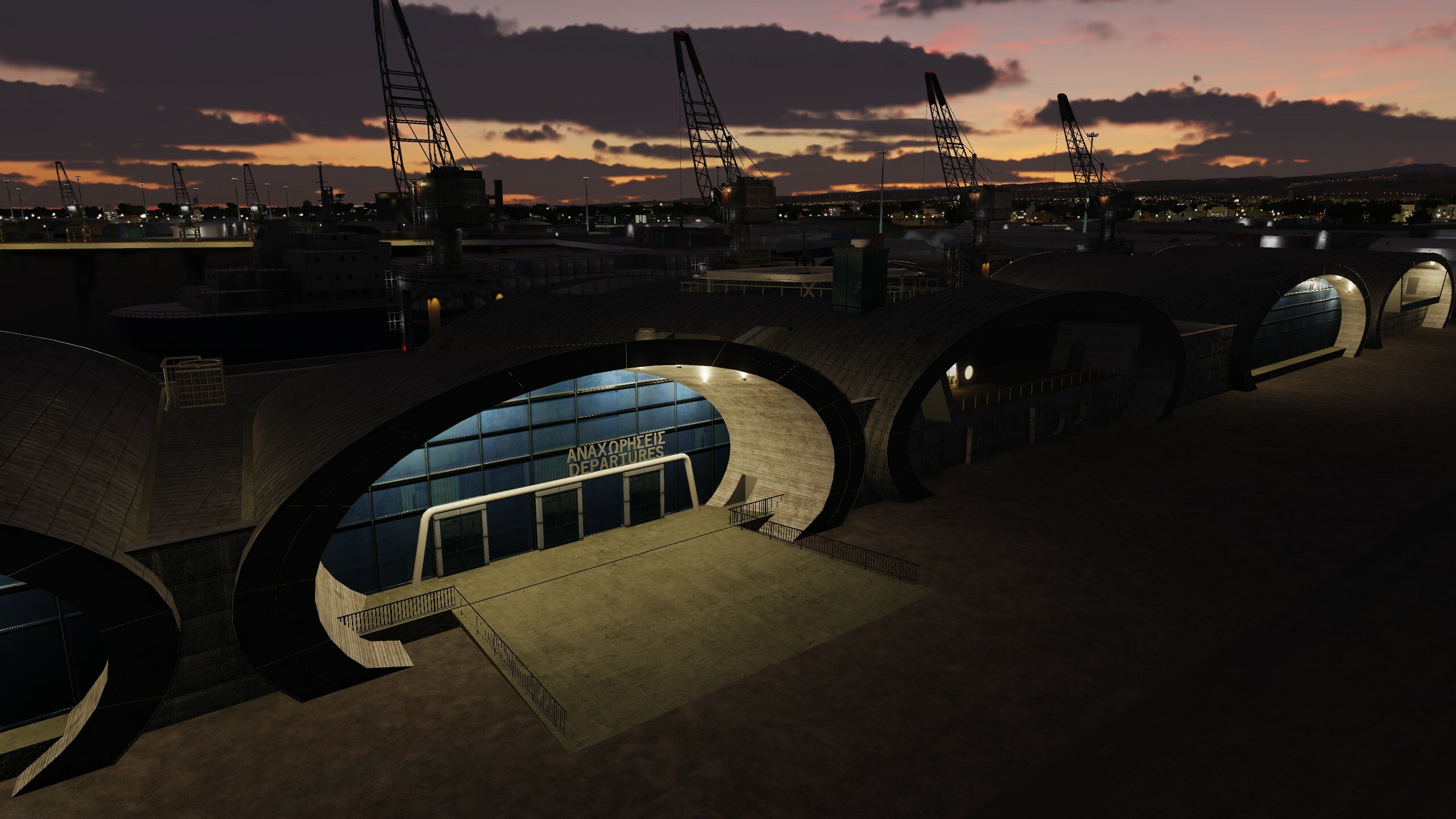
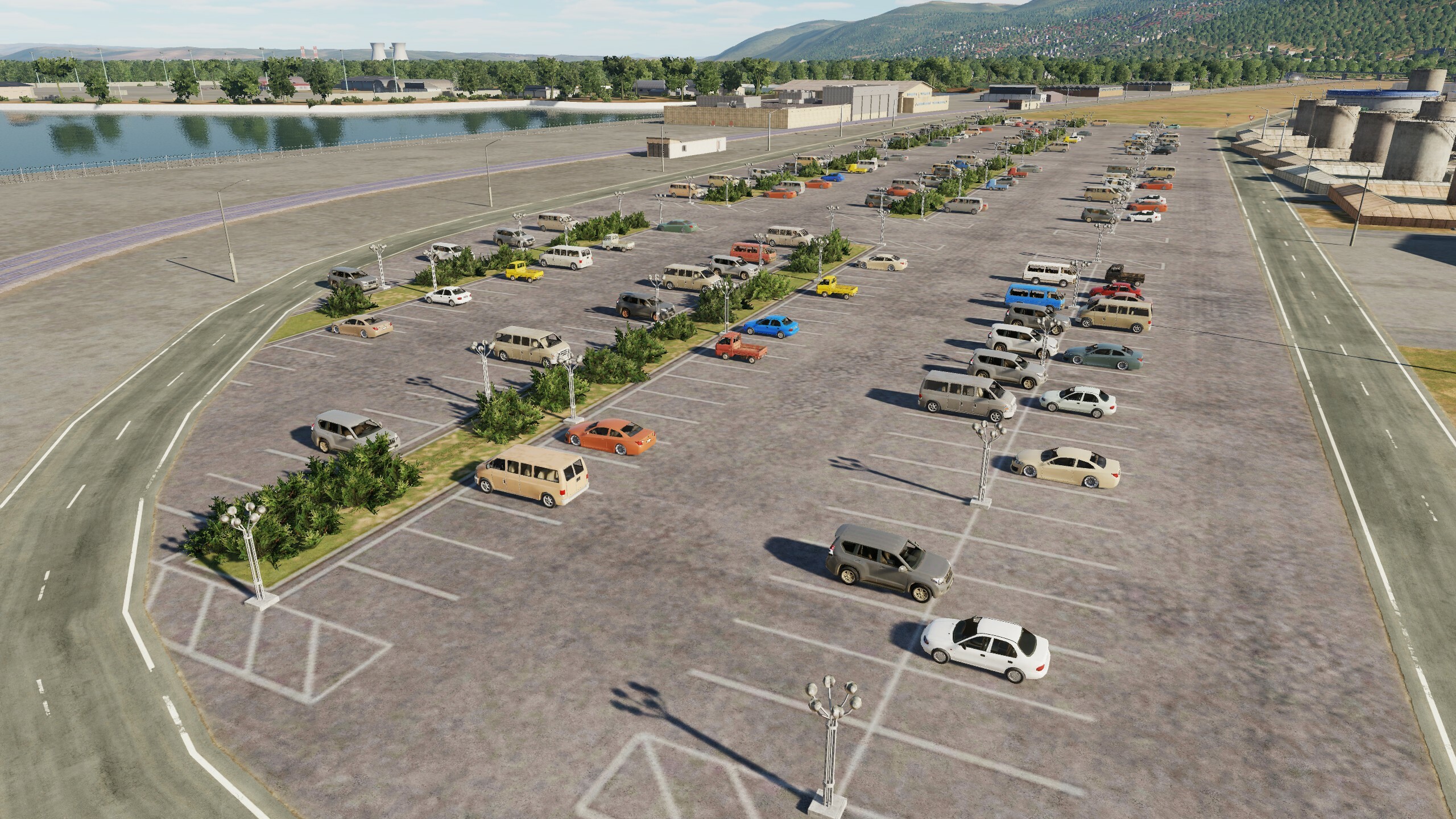
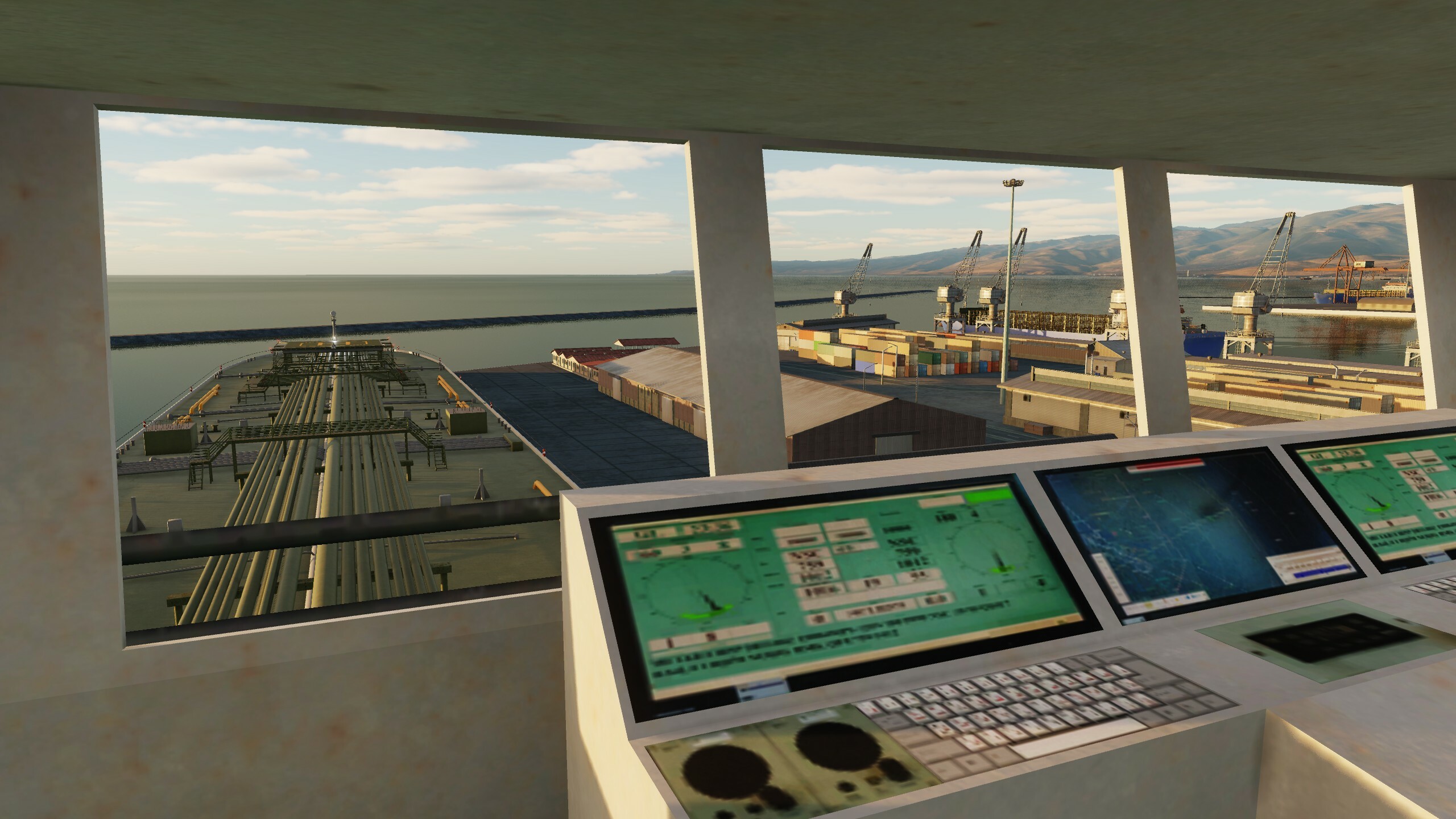
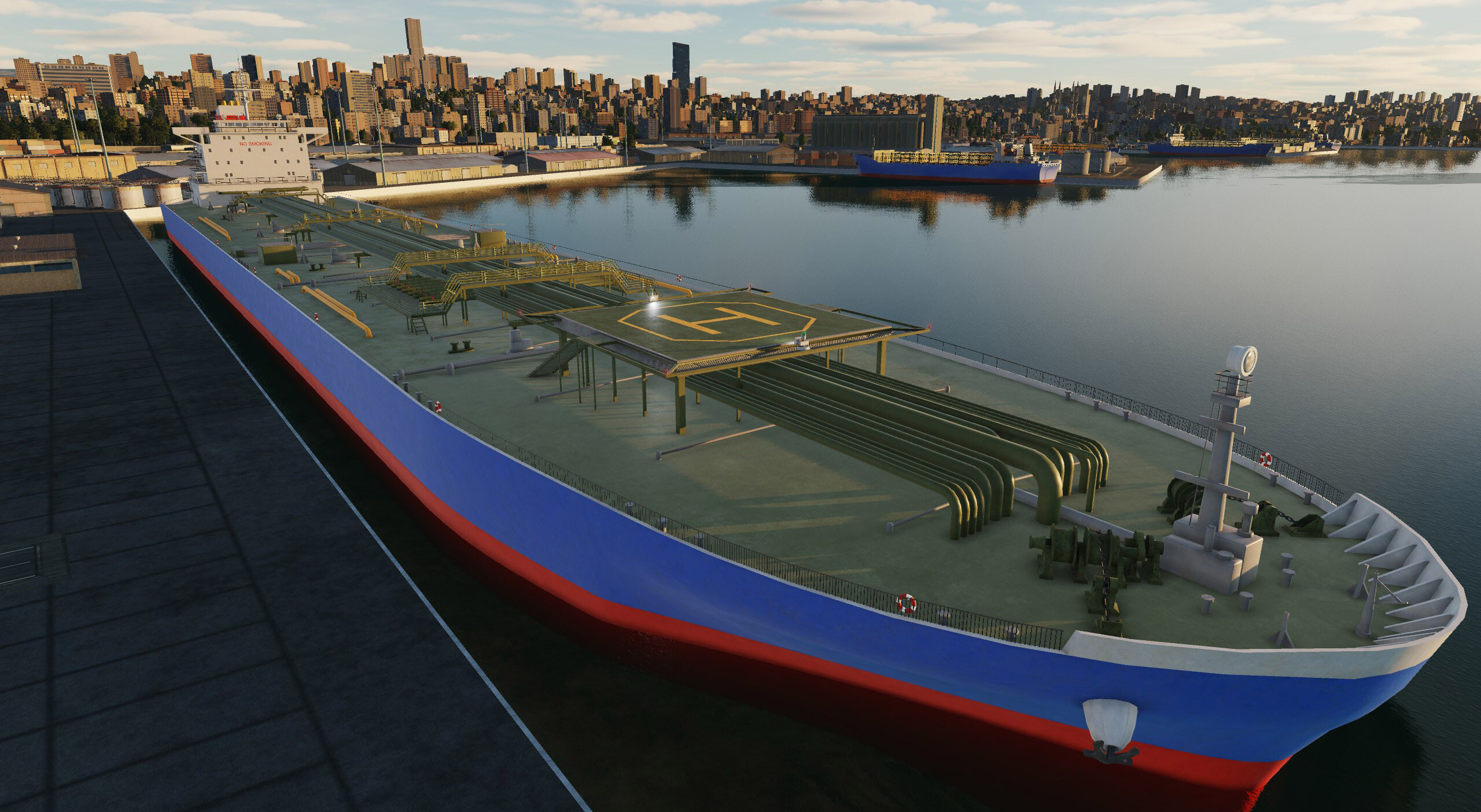
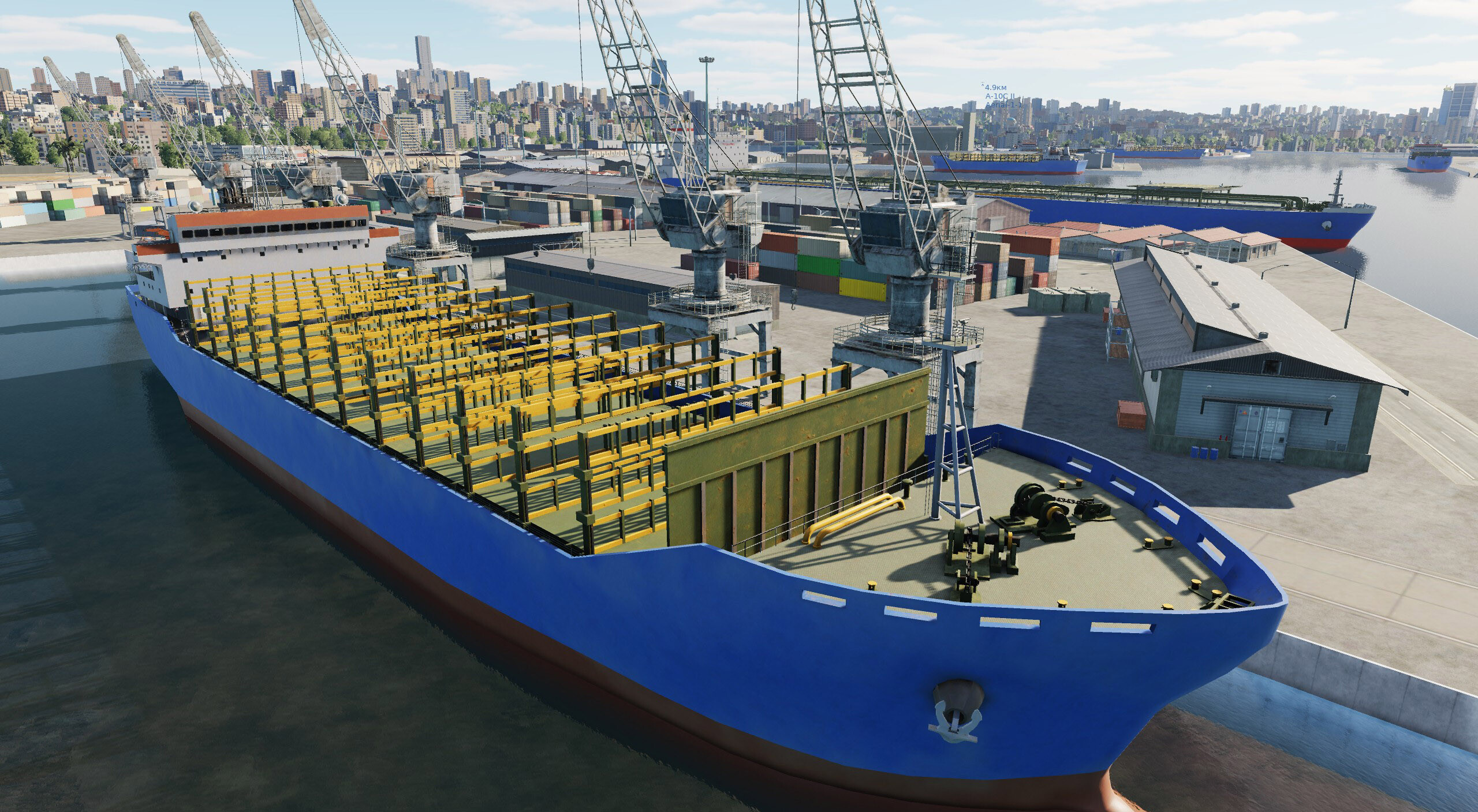
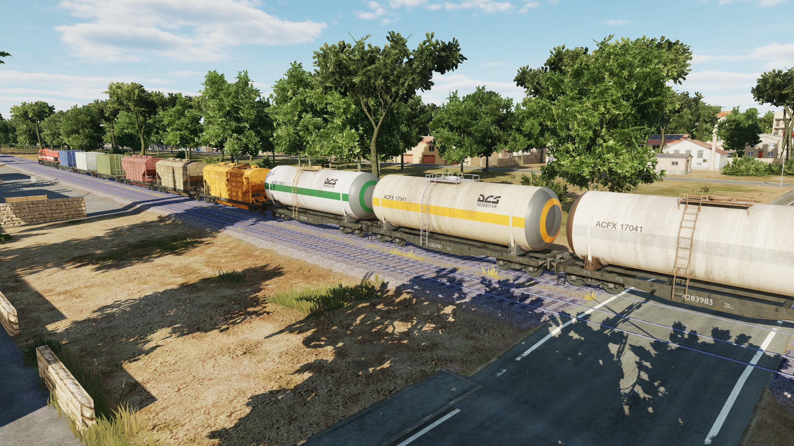
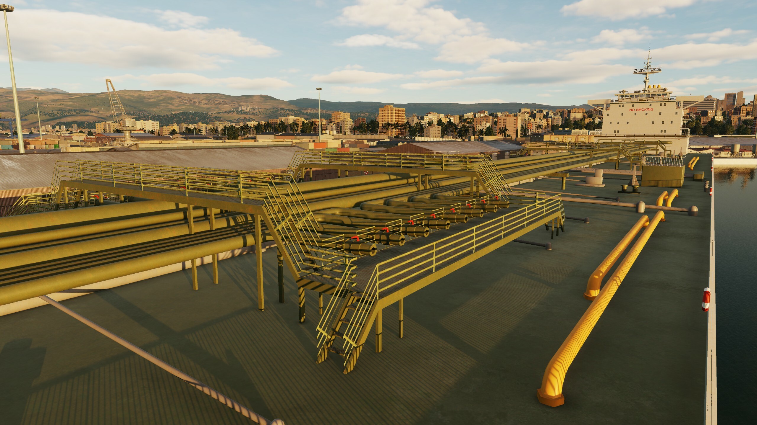
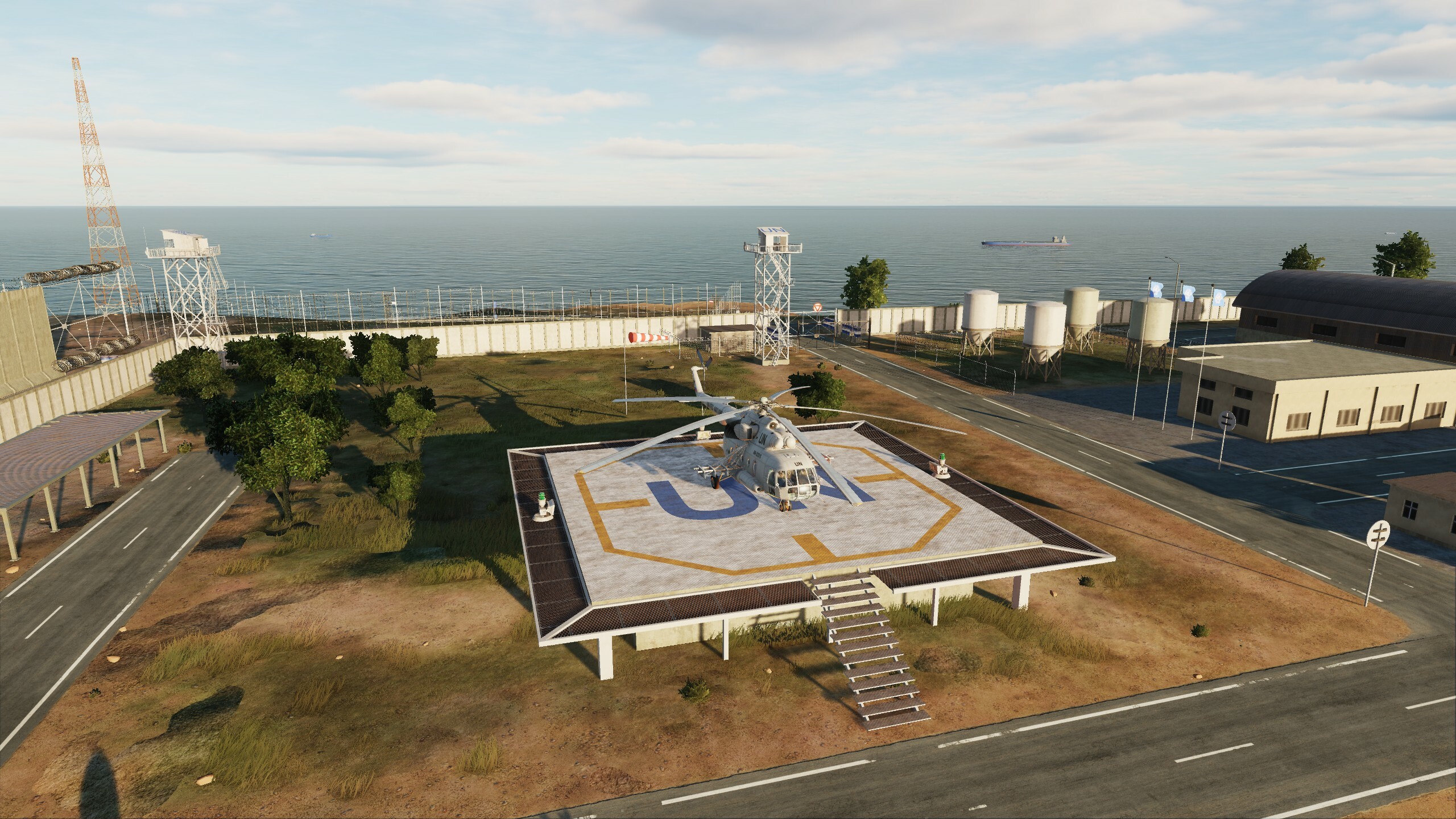
Hi! Today we will show some screenshots and videos from the new update and a list of changes. We continue to improve "DCS: Syria map" thanks to you, we read all your messages. Work on "Syria" continues, the map will be improved and developed along with the DCS. You already know that the map has received a global update on night lighting, as well as work has been done on optimization. In addition to this, the changes affected all areas of the map: UI, VD, airfields, models, assets and scenes. List of updates: Added lighting using a new real-time technology. Added left-hand traffic in Cyprus. Added kneeboard (tablet). Updated mission generator. Added helipads on GUI map. Added parking for large aircraft. Optimized and improved city building models. Improved airfield hangar models. Improved models of original objects. Added destruction models for Aleppo Power Plant and Lafarge Factory. Improved the scenes of the original buildings in Haifa, Beirut, Adana and Damascus. Trees in the forest have been optimized. Tree collisions have been simplified. Added parking for MiG-23 Marj Ruhayyil, Shayrat, Tiyas. Fixed frequency settings for Gazipasa, Rene Mouawad, Ramat David, Ercan, Beirut, HATAY airfields. Taxiing Tal Siman, Beirut fixed. Fixed lighting for Sanliurfa, Adana, Khmeimim, Haifa. Fixed plates Akrotir, Incirlik. Removed objects from Rene Mouawad parking lots. Removed objects from Kingsfield glide path. Fixed bugs in vectordata and scenes. Updated map description. Added objects at road intersections and railway crossings. Added two types of gas stations. Added two types of roadside cafes. Improved cars and ships. Added new trains. Added cars for left-hand traffic. Improved city and field assets. Improved road and railway assets. Improved the original scenes of Adana. Fixing bugs in airfield scenes. Improving the substrate and the stadium model. Changed Normandy1944 and Normandy2 banners. Improved container ship and tanker models. Ok let's see what we got New gas stations & roadside cafes and added objects at road intersections and railway crossings. New new New train (cargo&pass) & ships Improved the original scenes And night Some of the cars
- 125 replies
-
- 27
-
-
-
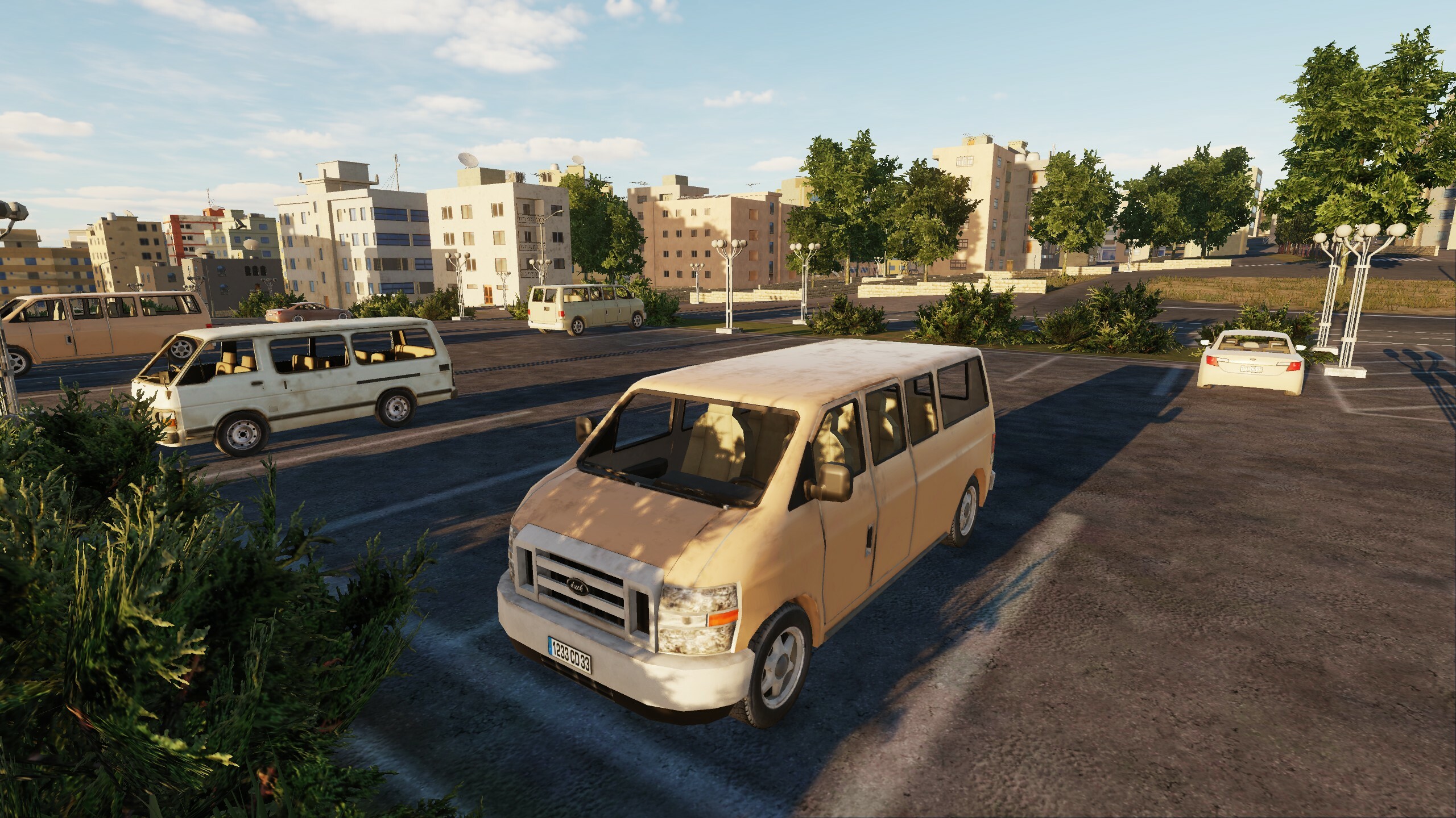
Radiocheck... Hi fighters! For a long time we did not get in touch, but all this time the work did not stop. Improving, optimizing, adding, introducing something new - everything we worked on was connected with these words. Today we will show new night lighting and some hangars. The update includes many minor improvements - we made sure that the map is relevant and fresh. So what's most interesting: New lighting technology added. Added right-hand traffic in Cyprus. Map description updated. Added kneeboard (yeah, this fix has long been waiting in the wings) Mission generator updated. Added helicopter landing sites on GUI map. Optimized trees in forest. Simplified trees collisions. Optimized and improved building models. Added objects at road and railroad crossings. Two types of gas stations have been added. Two types of road-side cafes added. Improved cars. Added right-hand drive vehicles. Improved city and field assets. Improved road and railroad assemblies.
- 125 replies
-
- 81
-
-
-
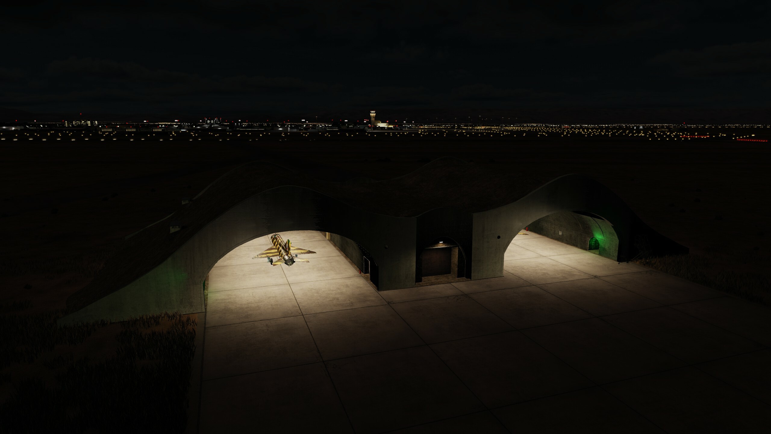
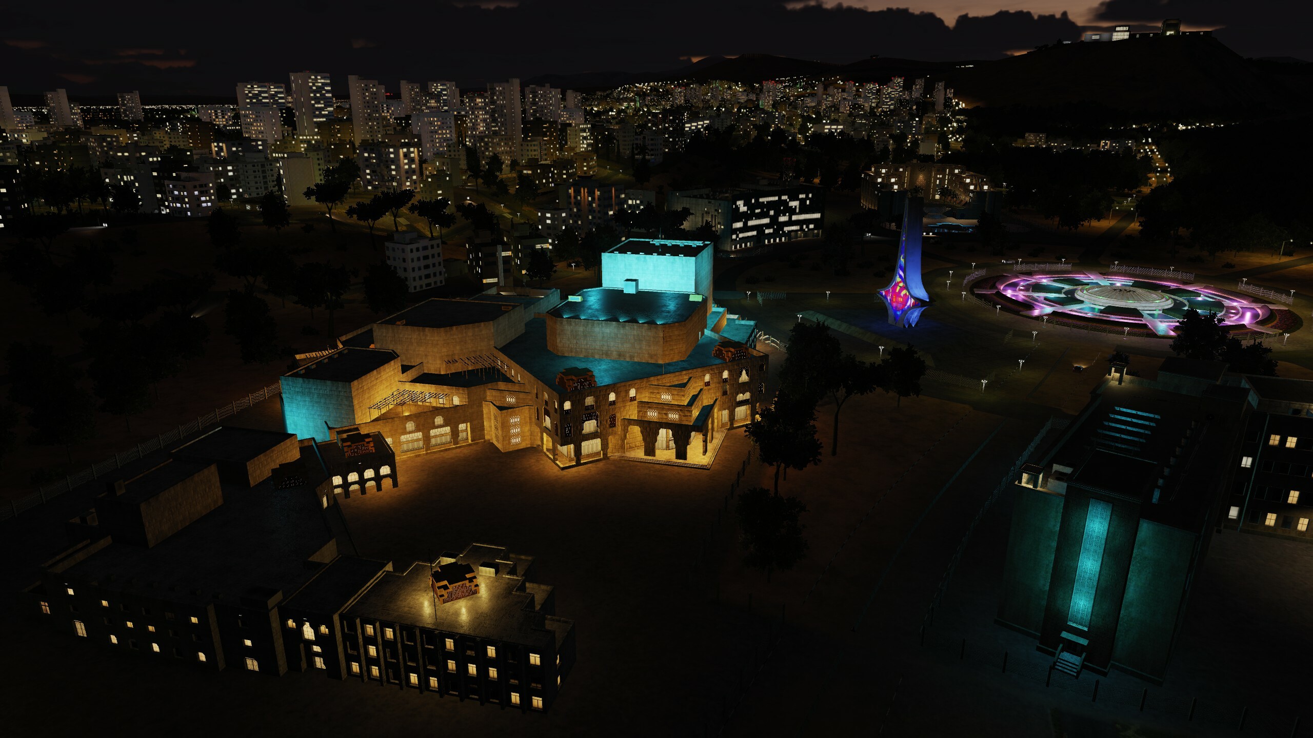
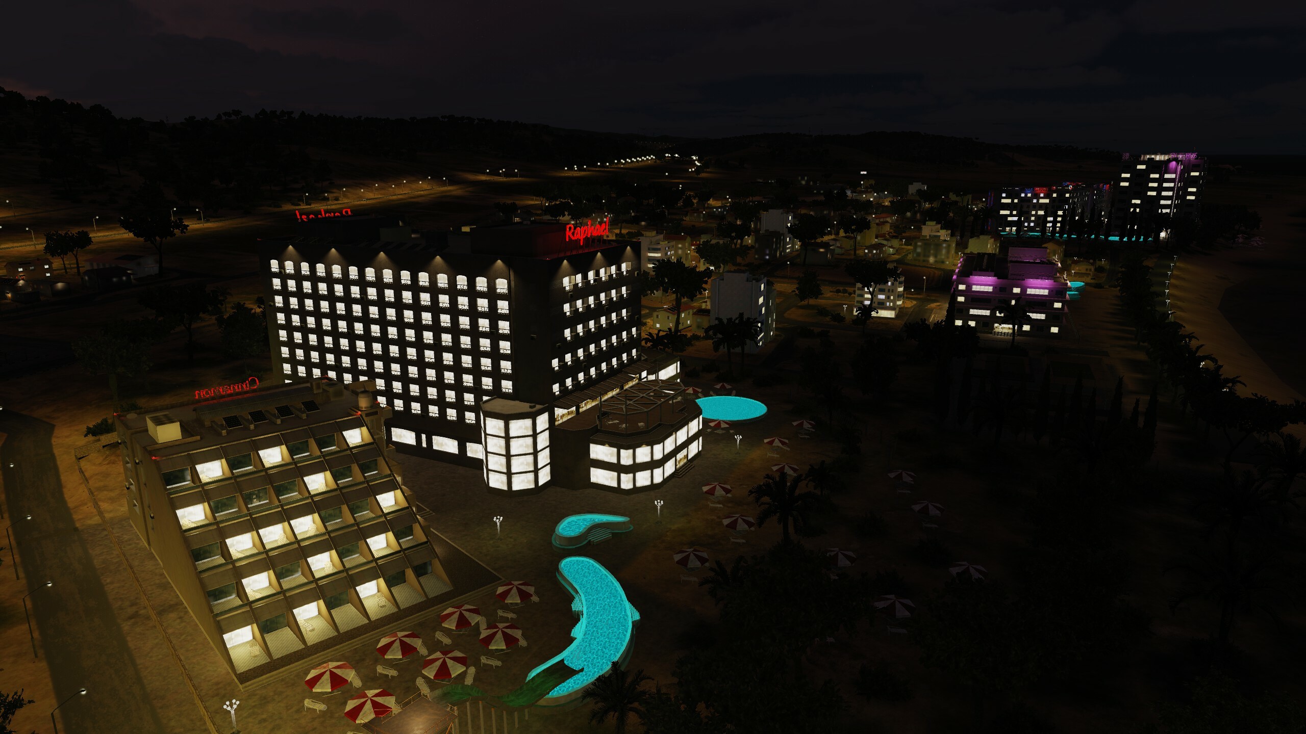
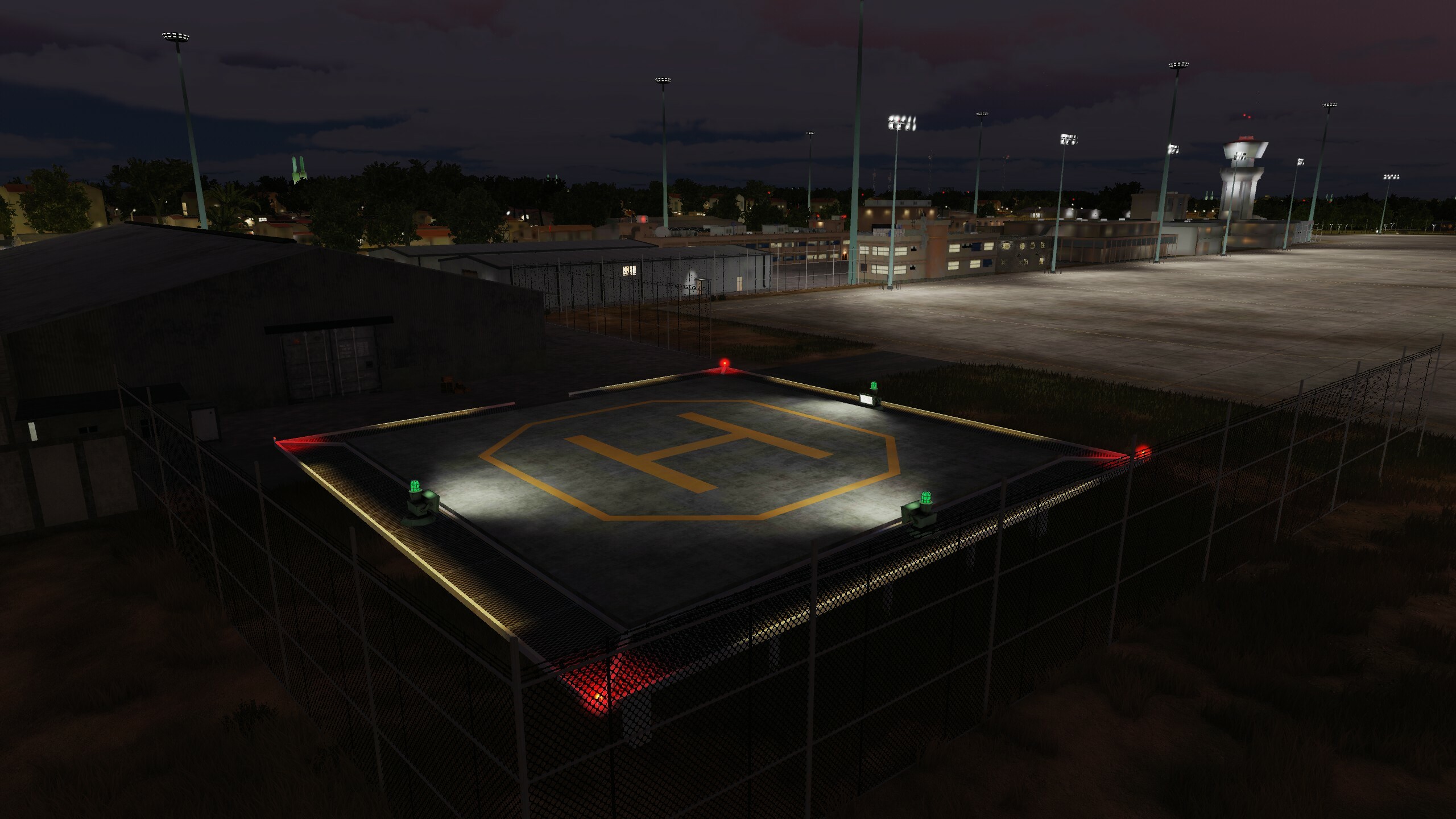
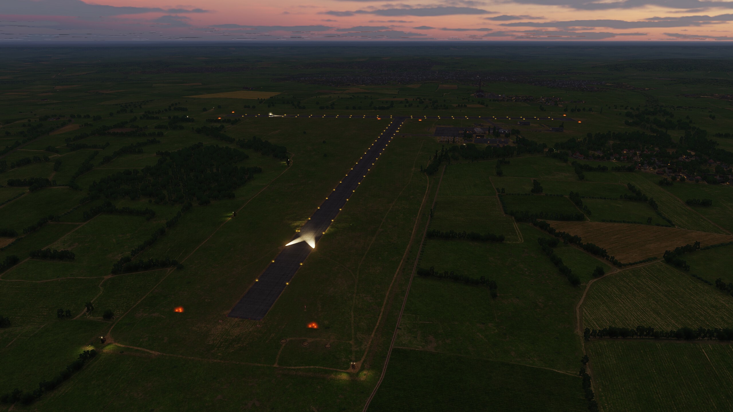
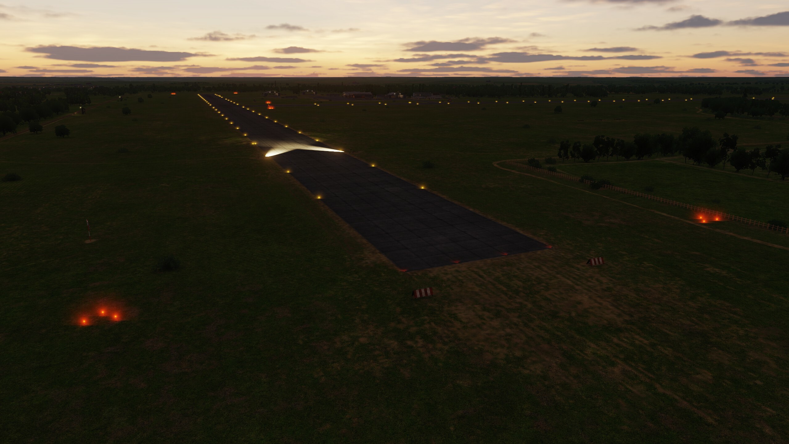
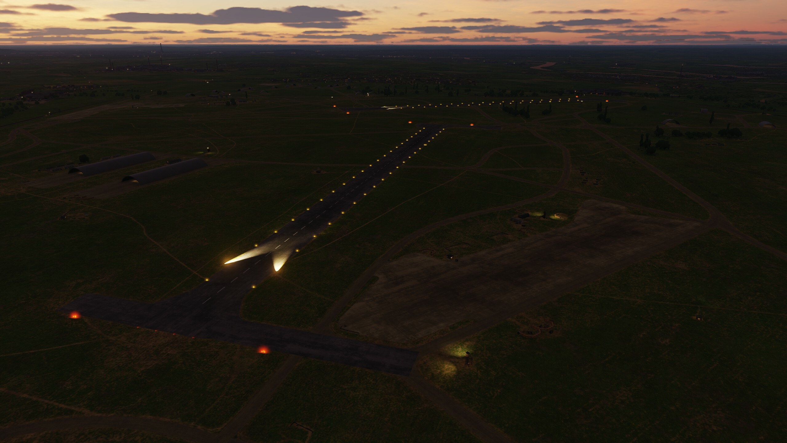
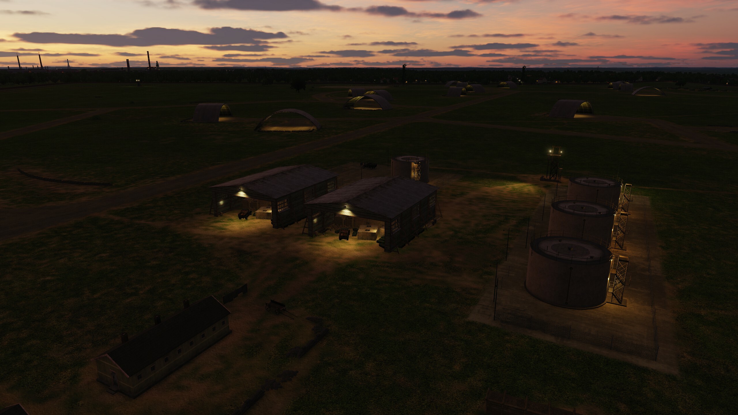
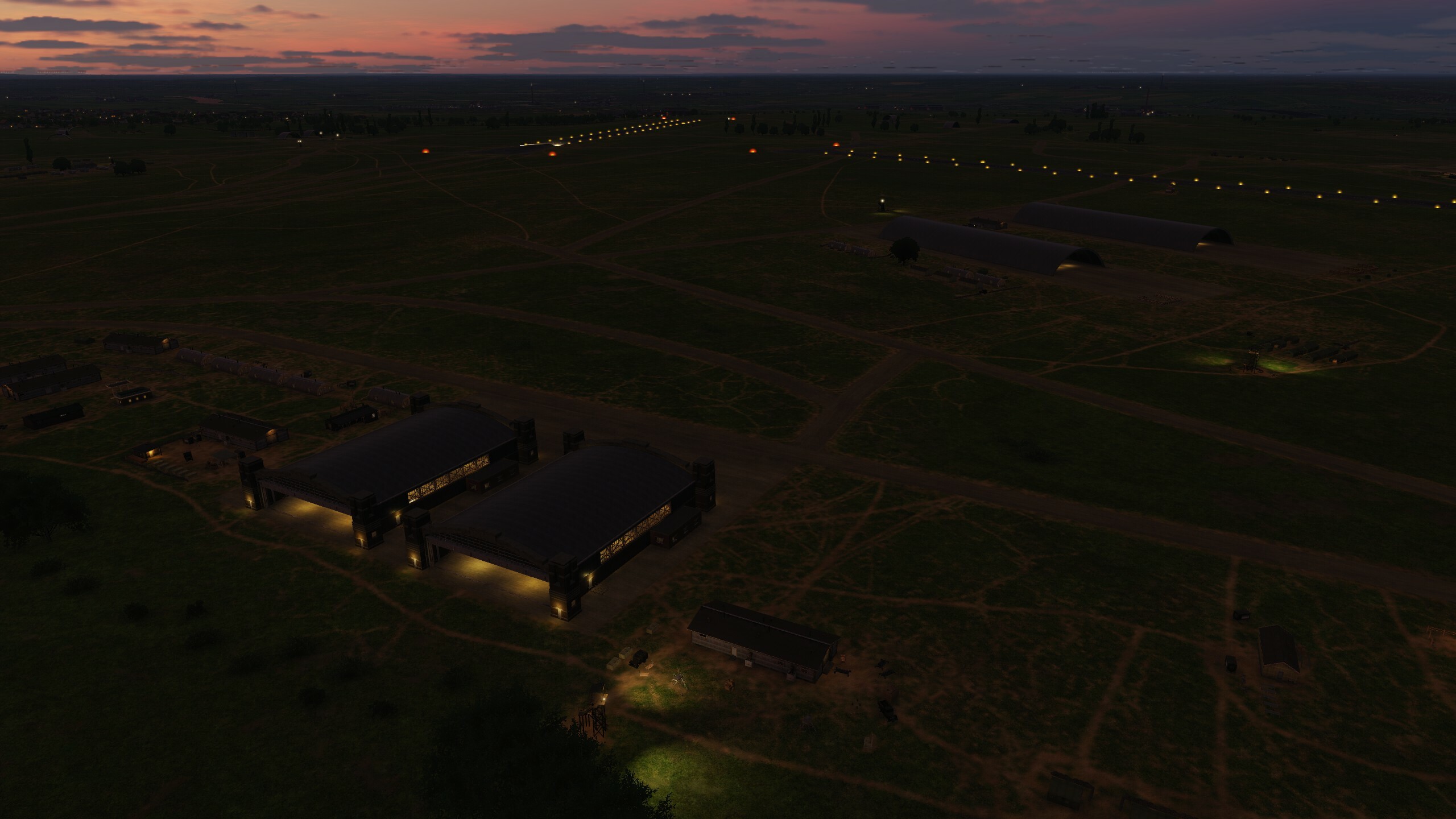
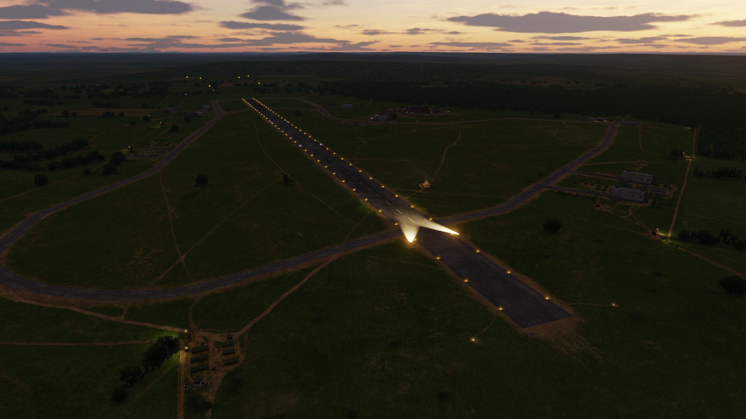
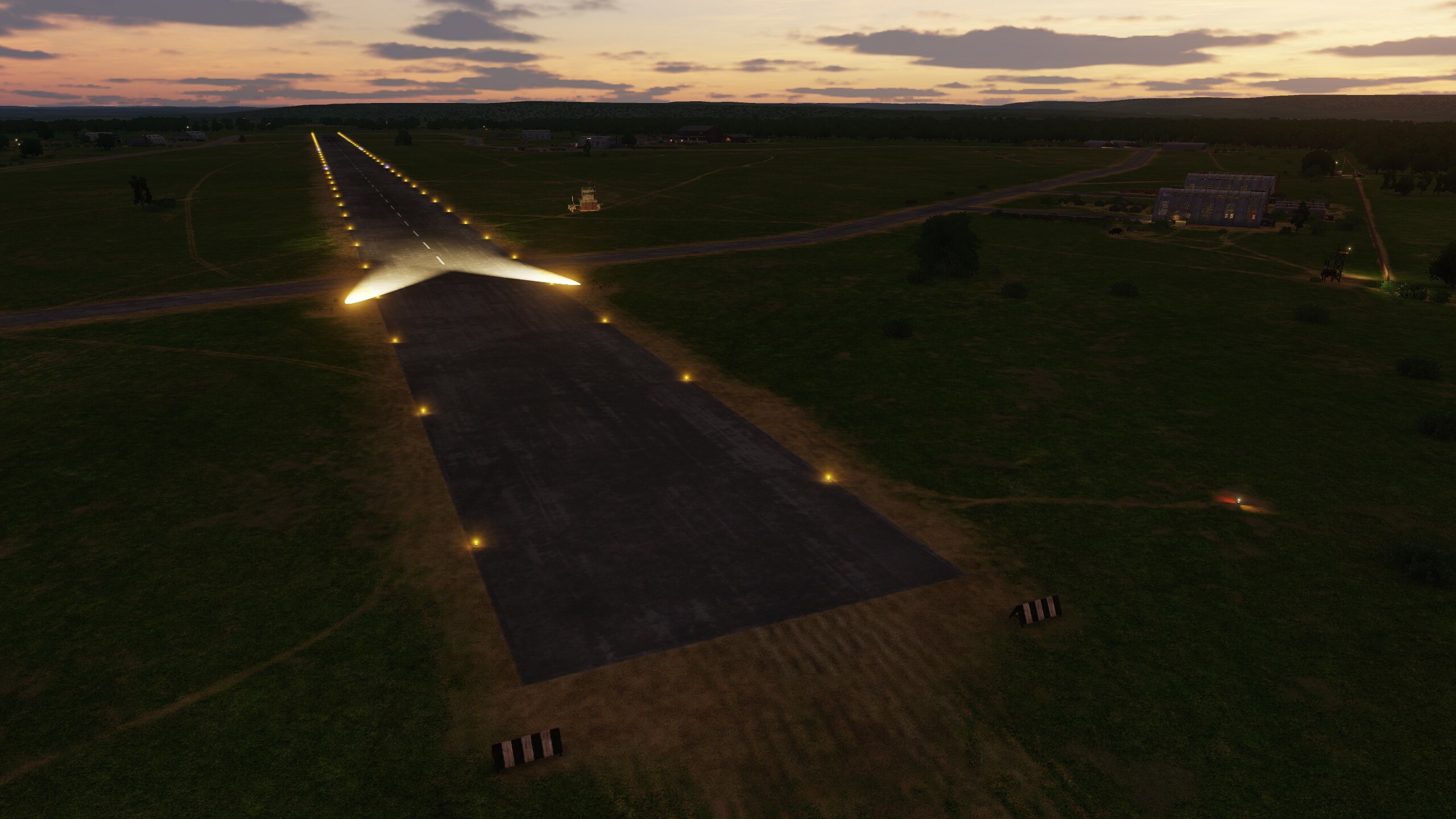
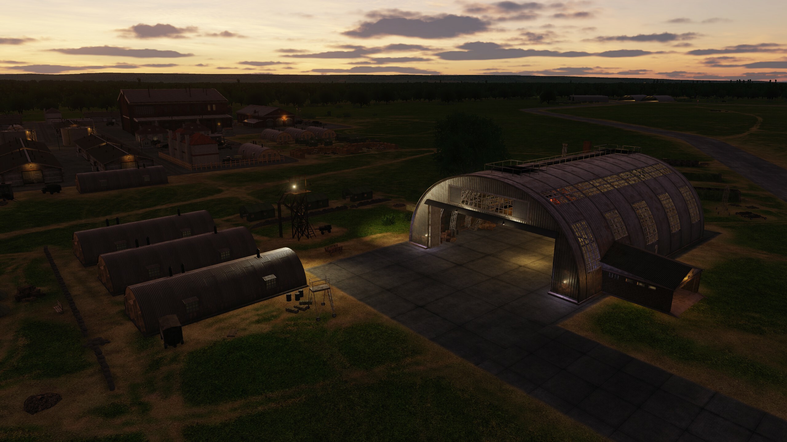
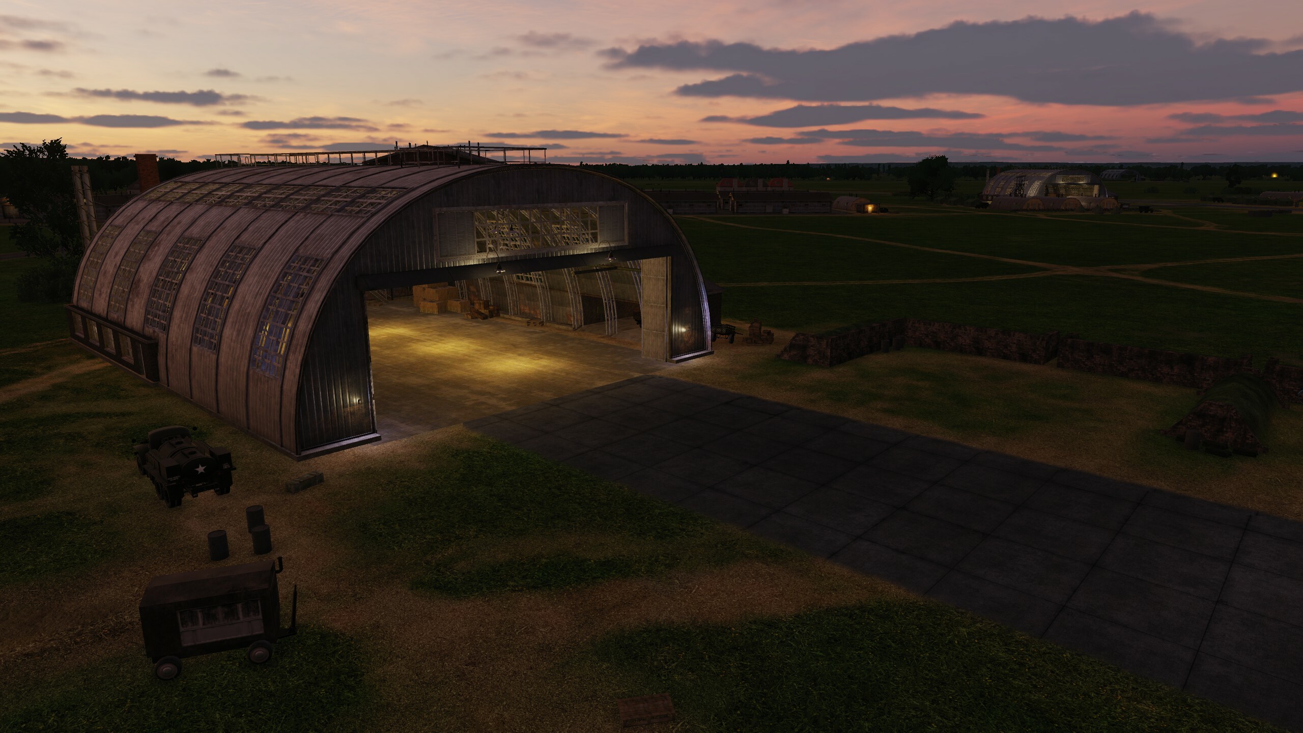
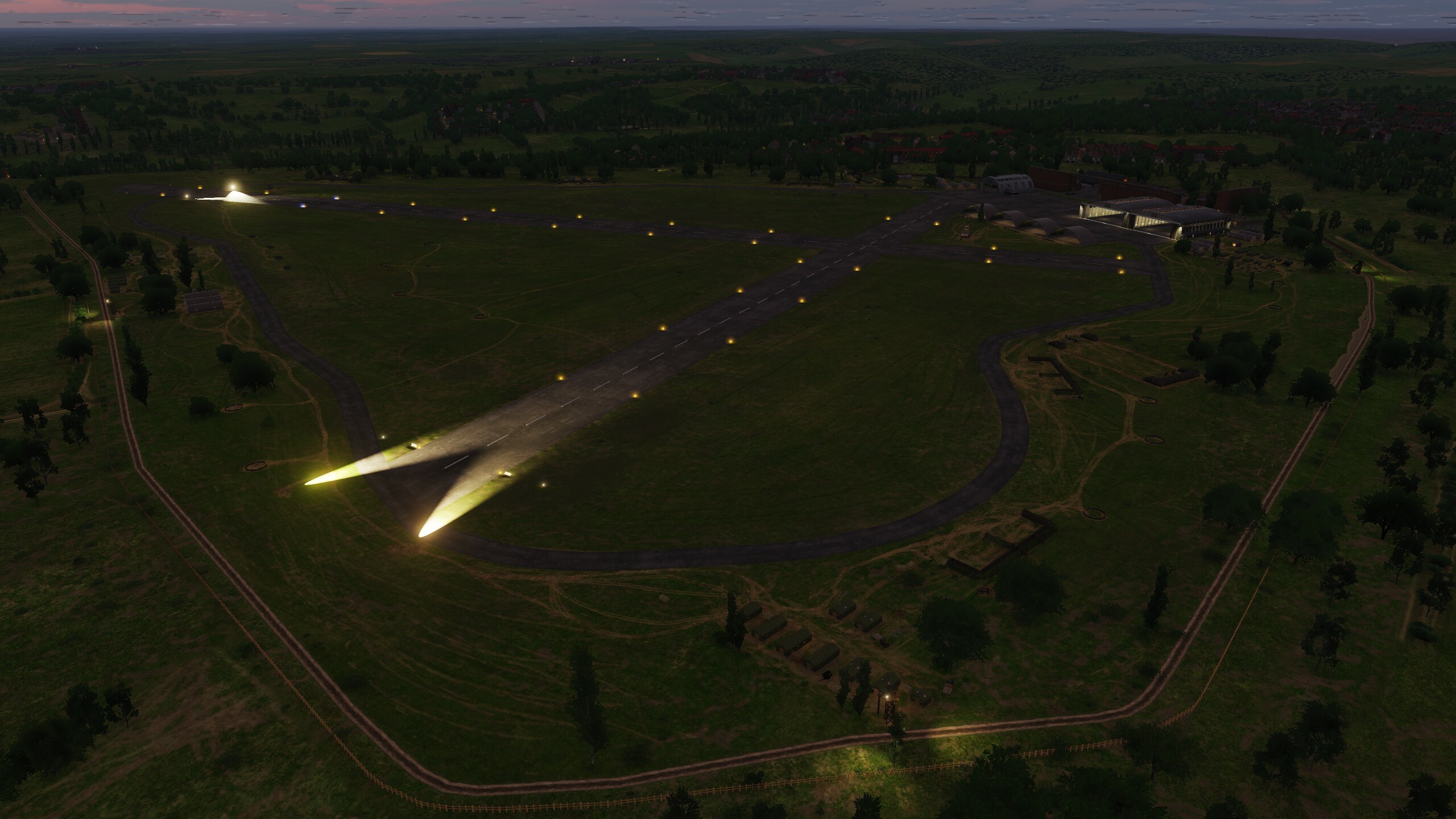
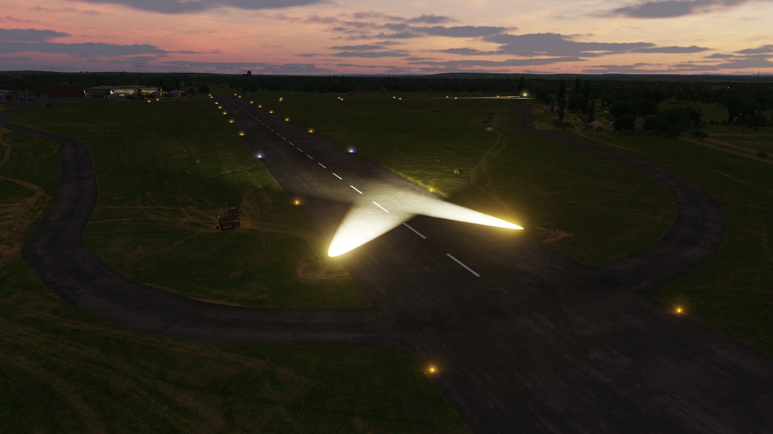
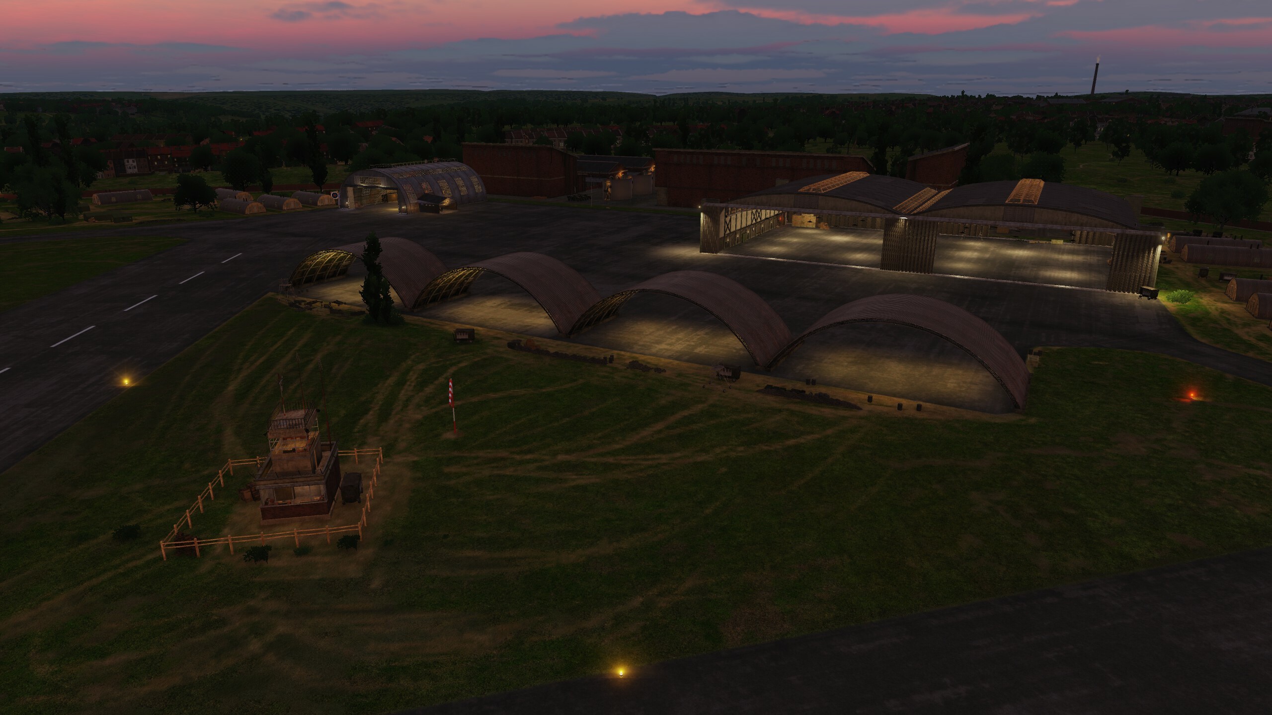
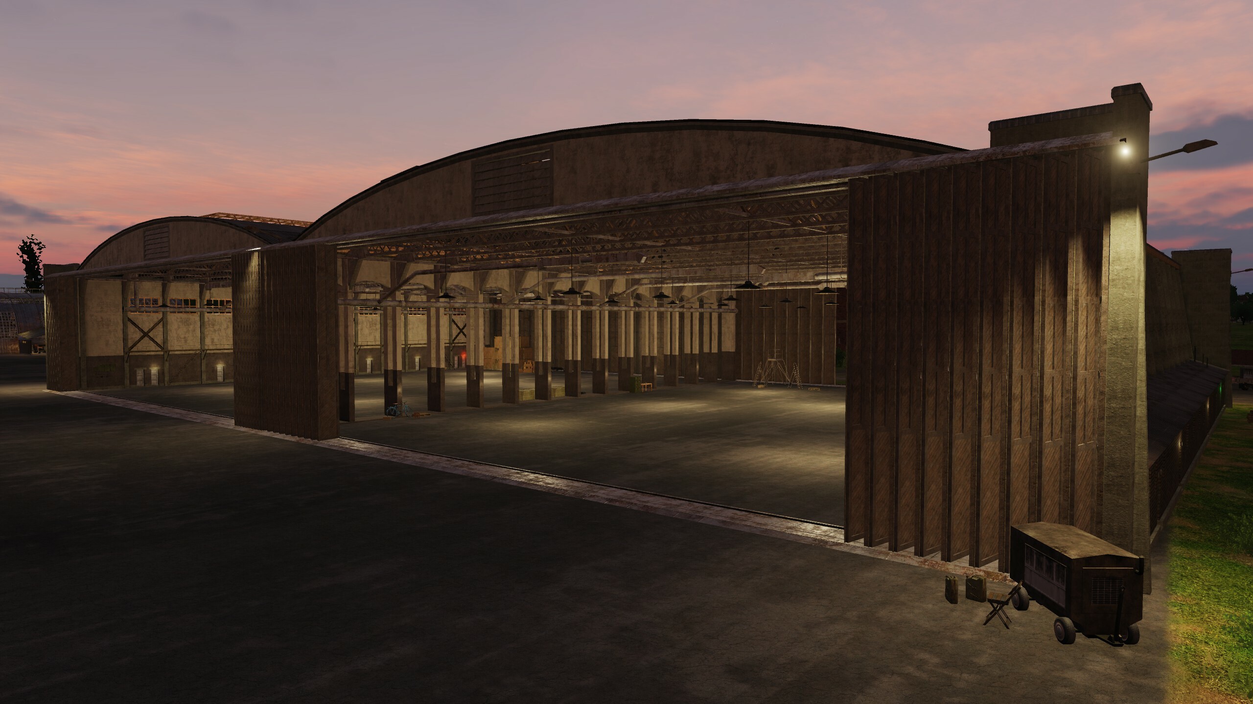
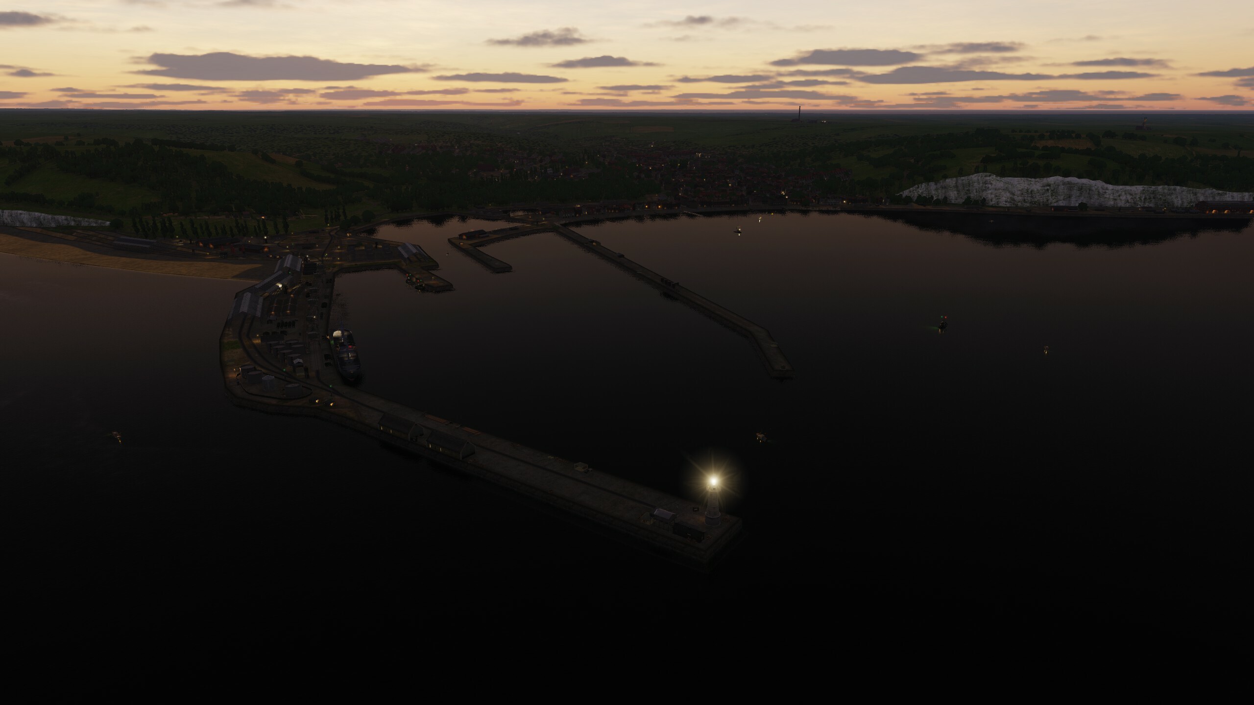
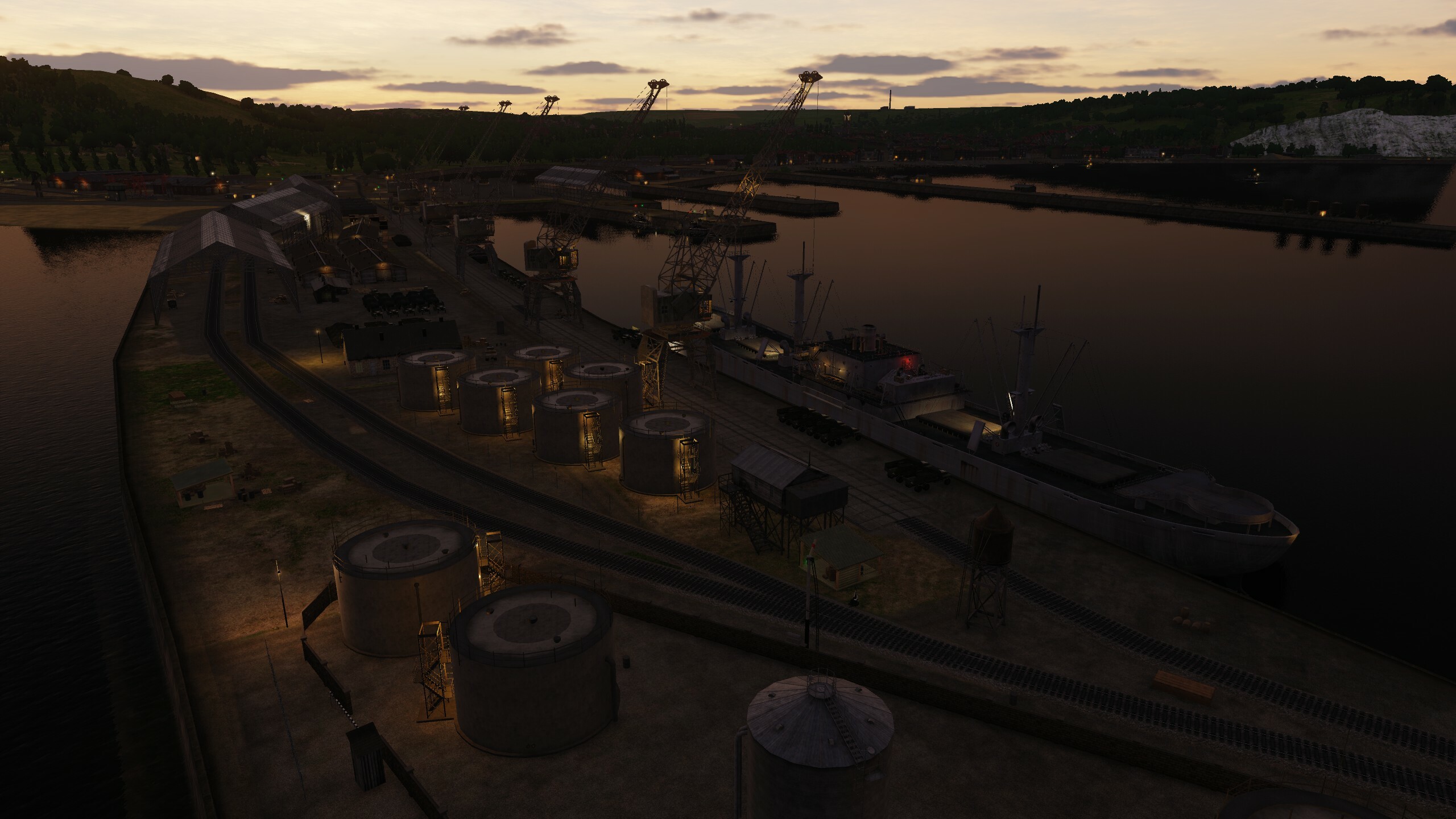
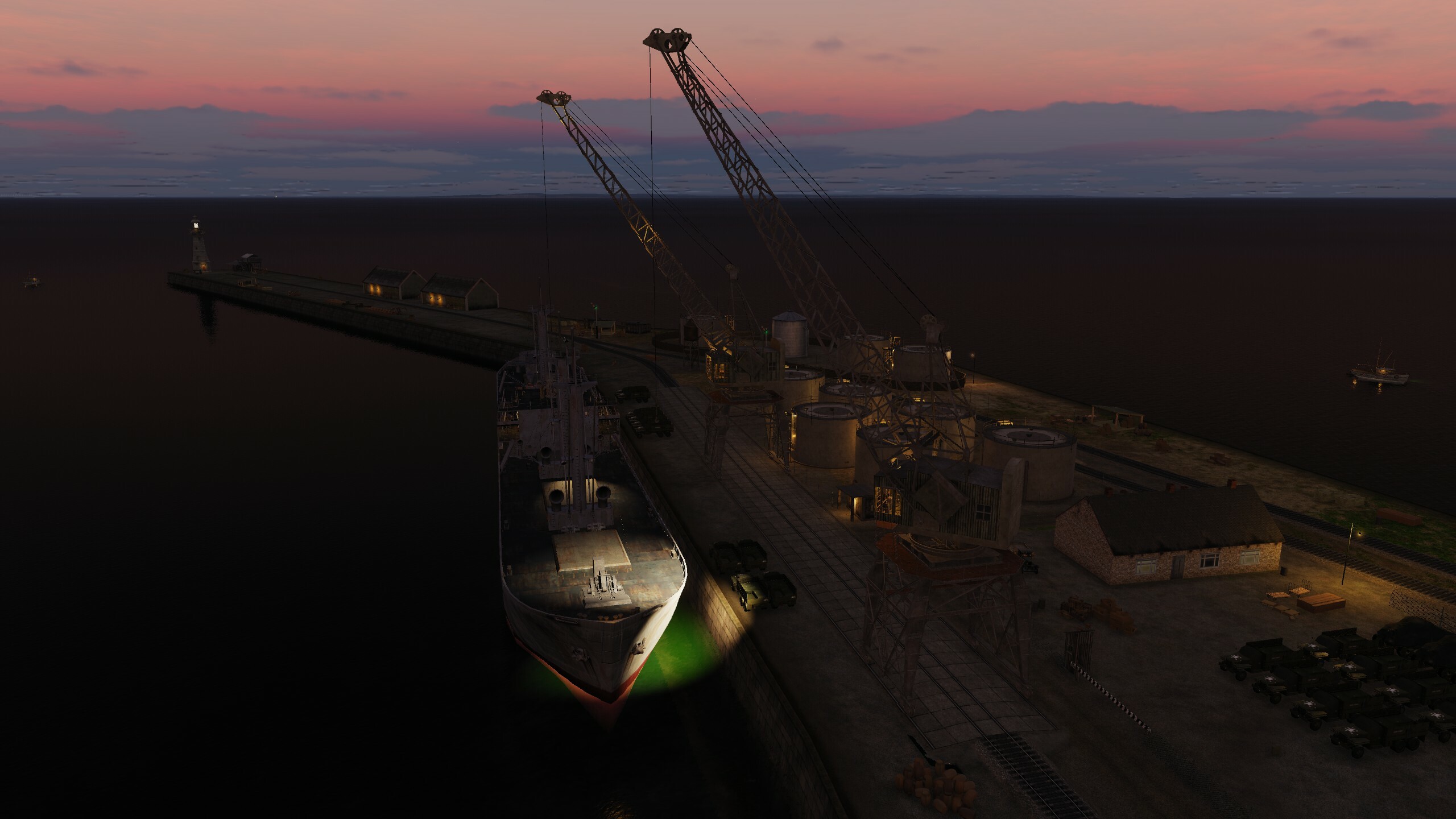
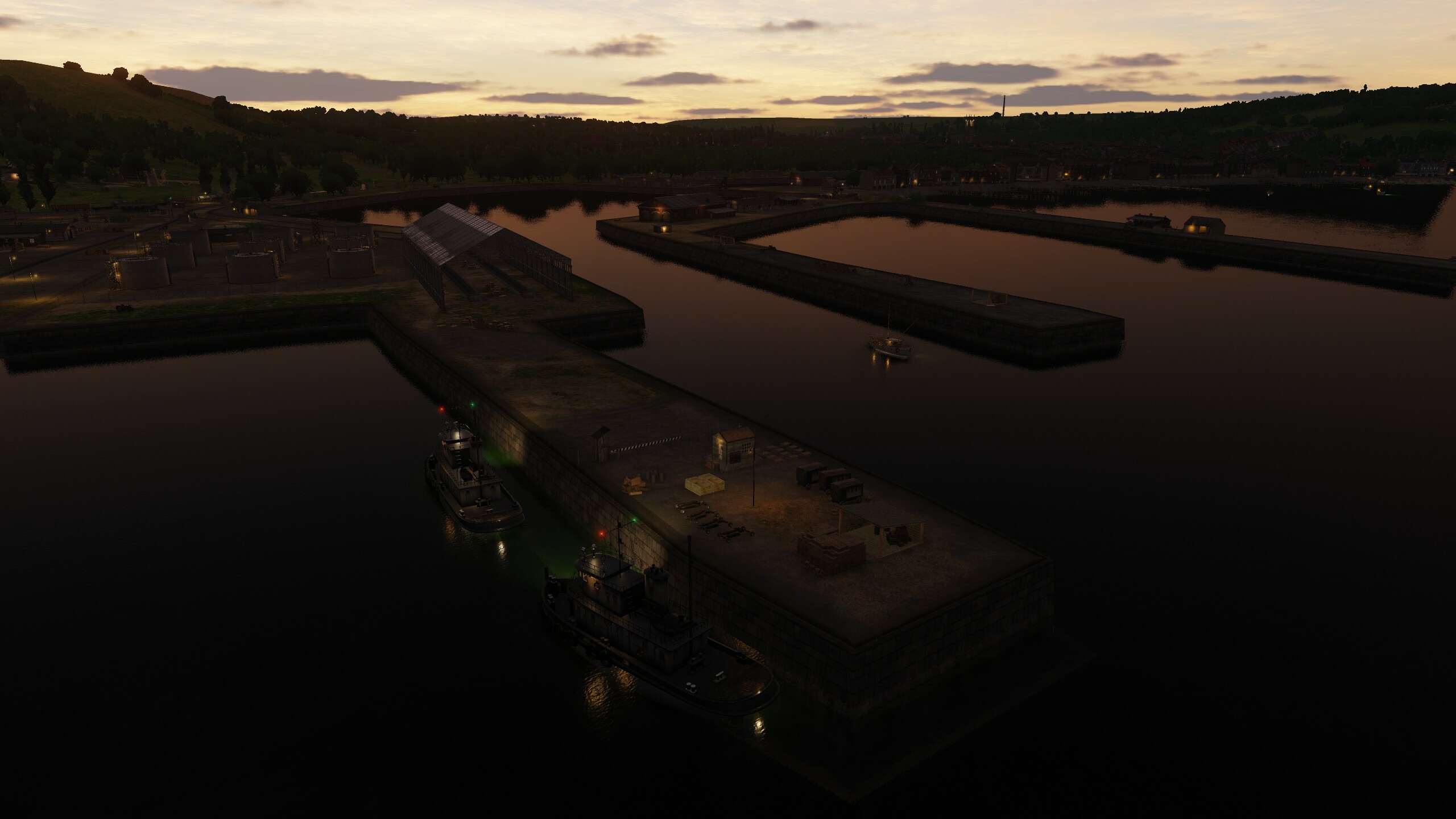
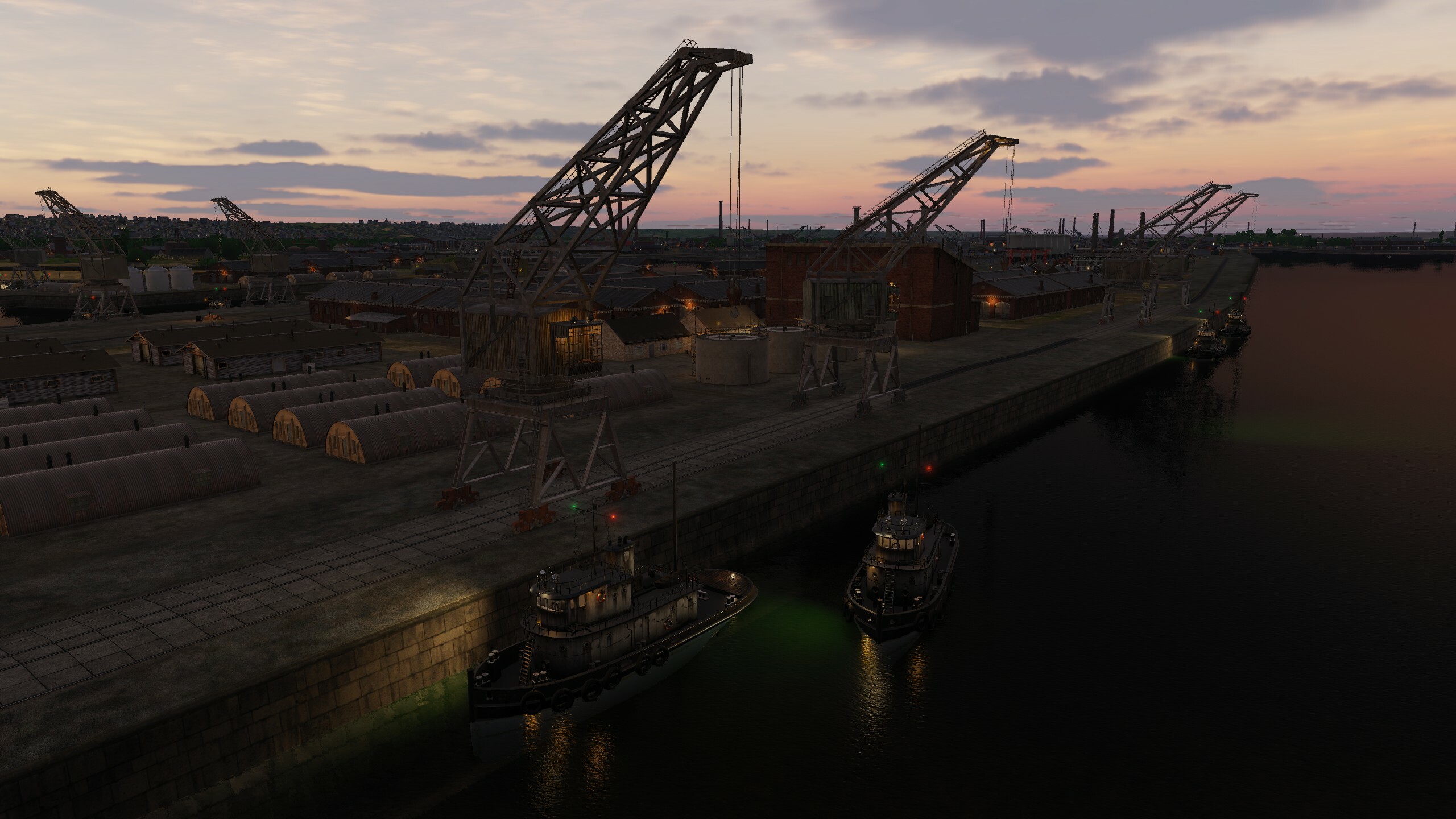
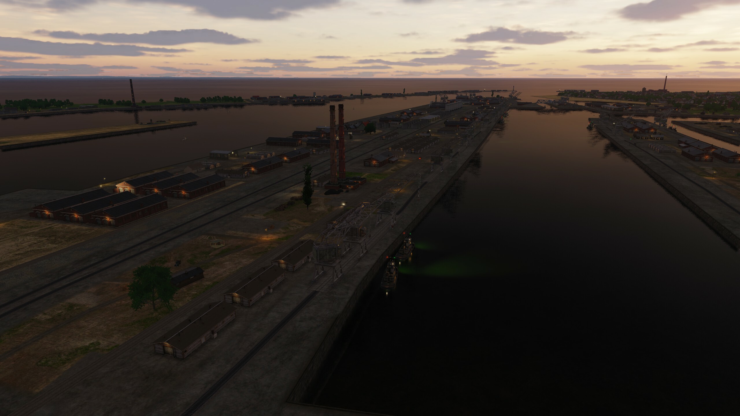
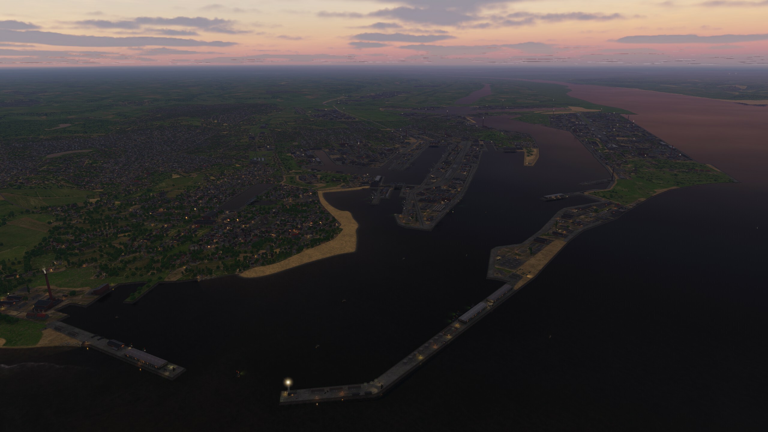
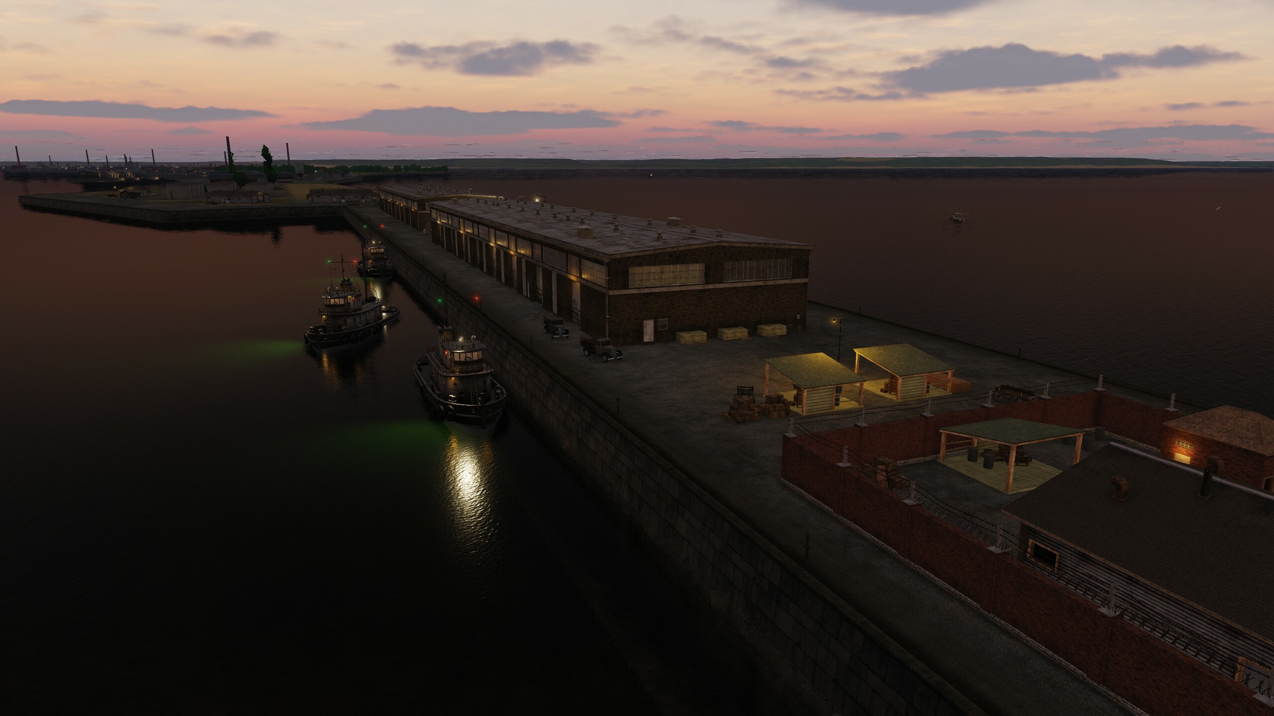
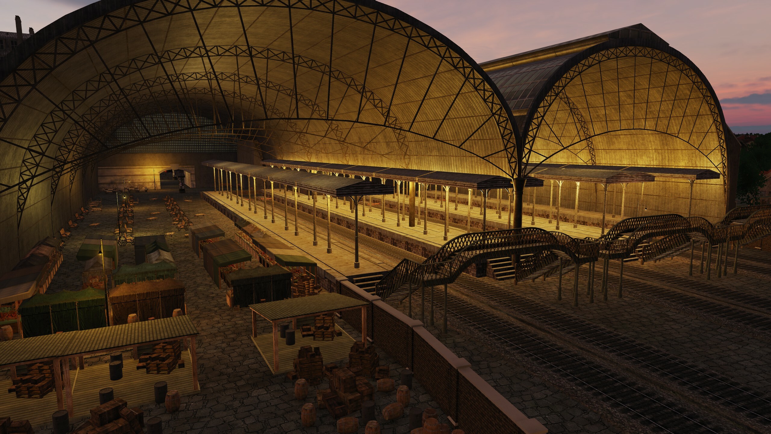
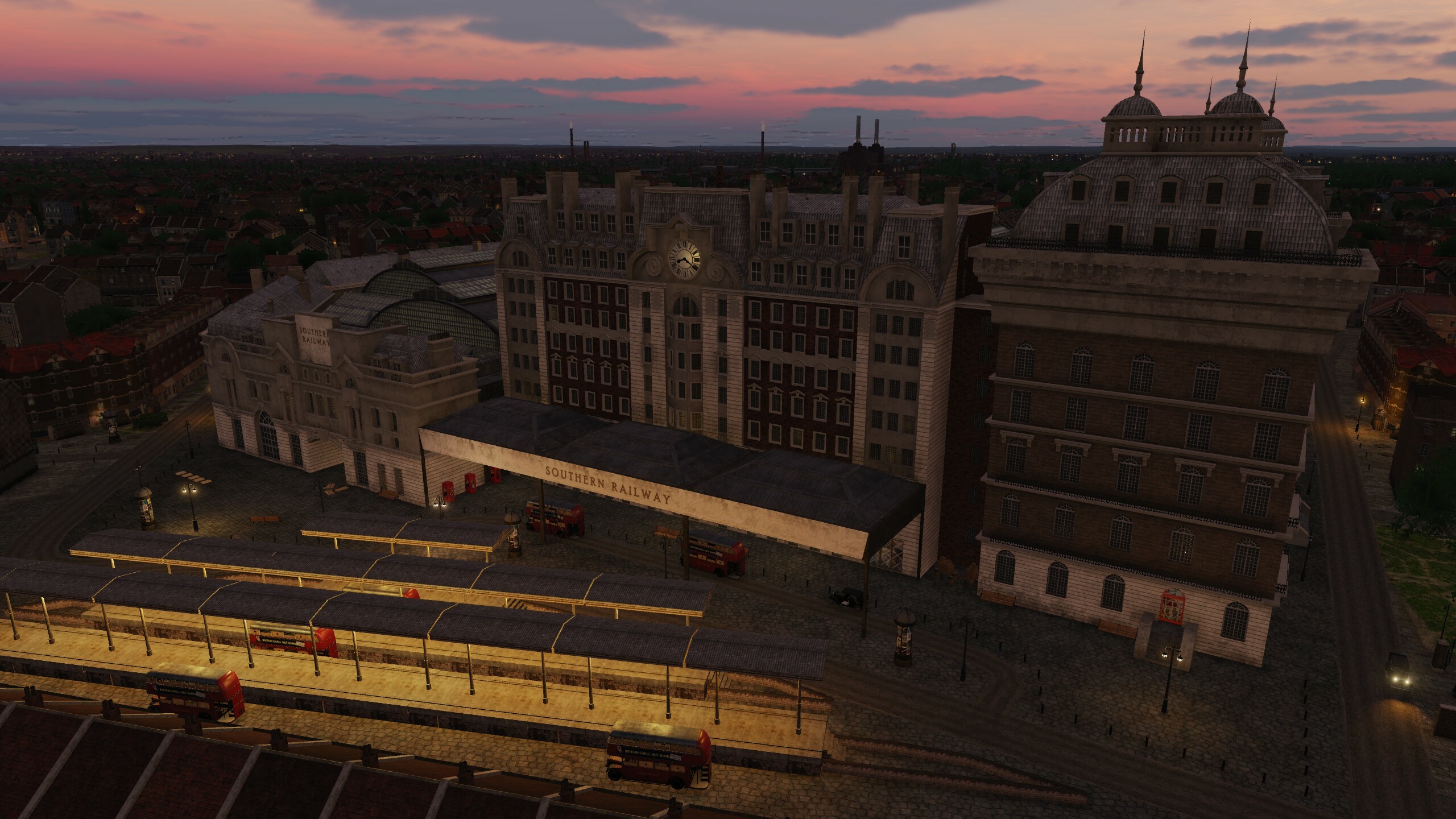
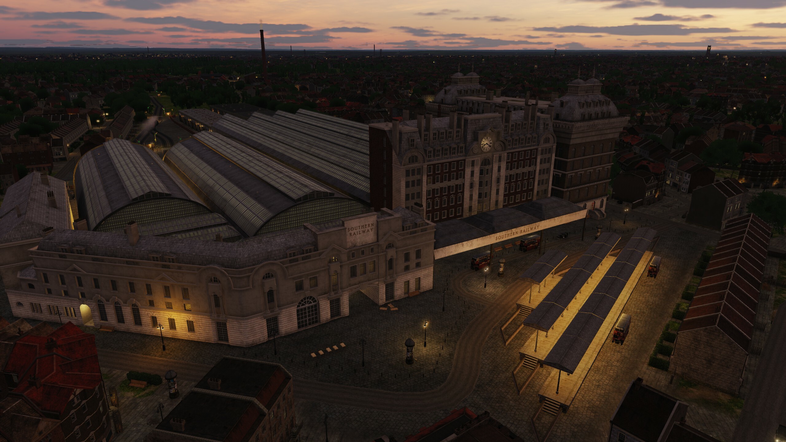
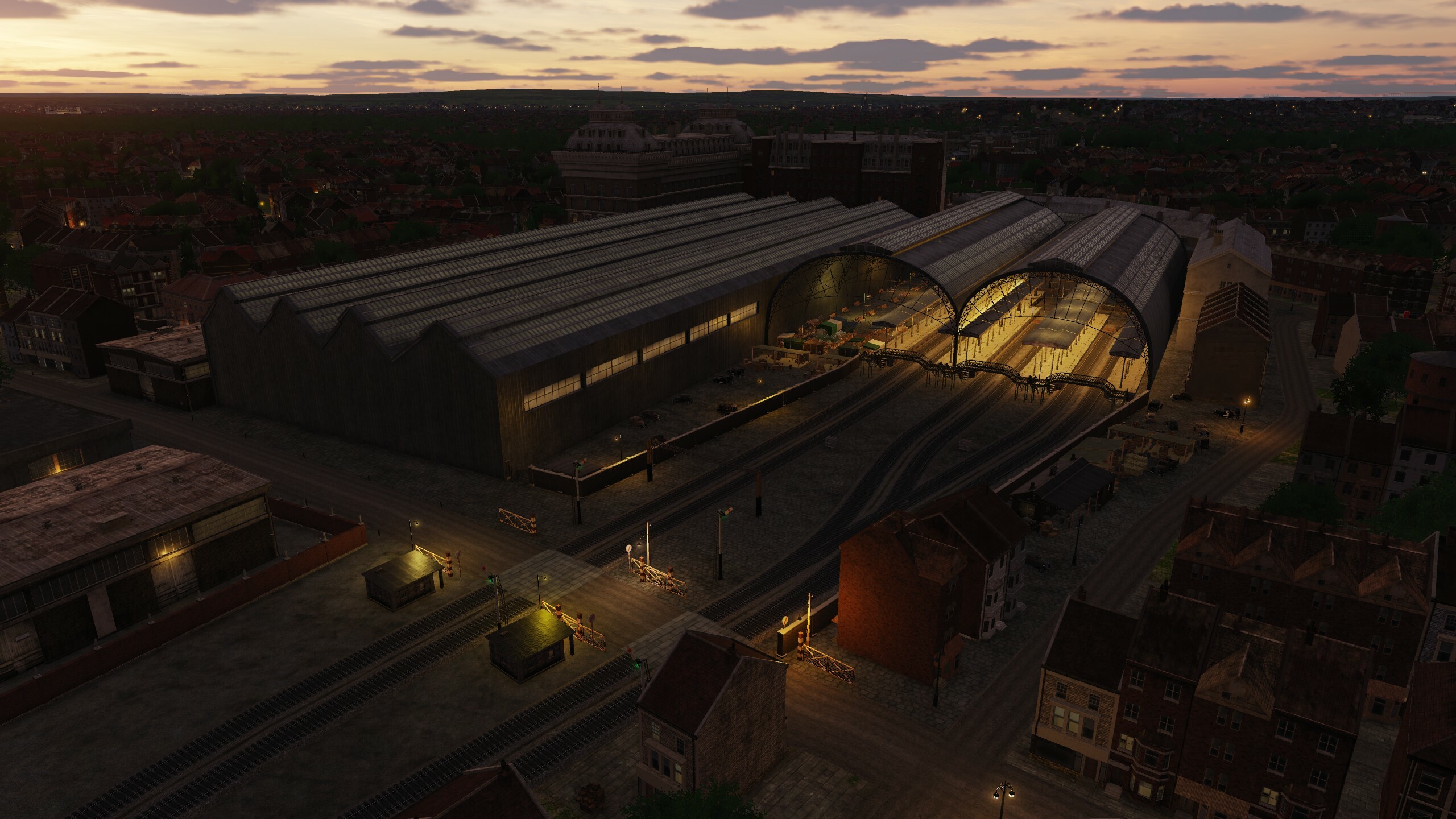
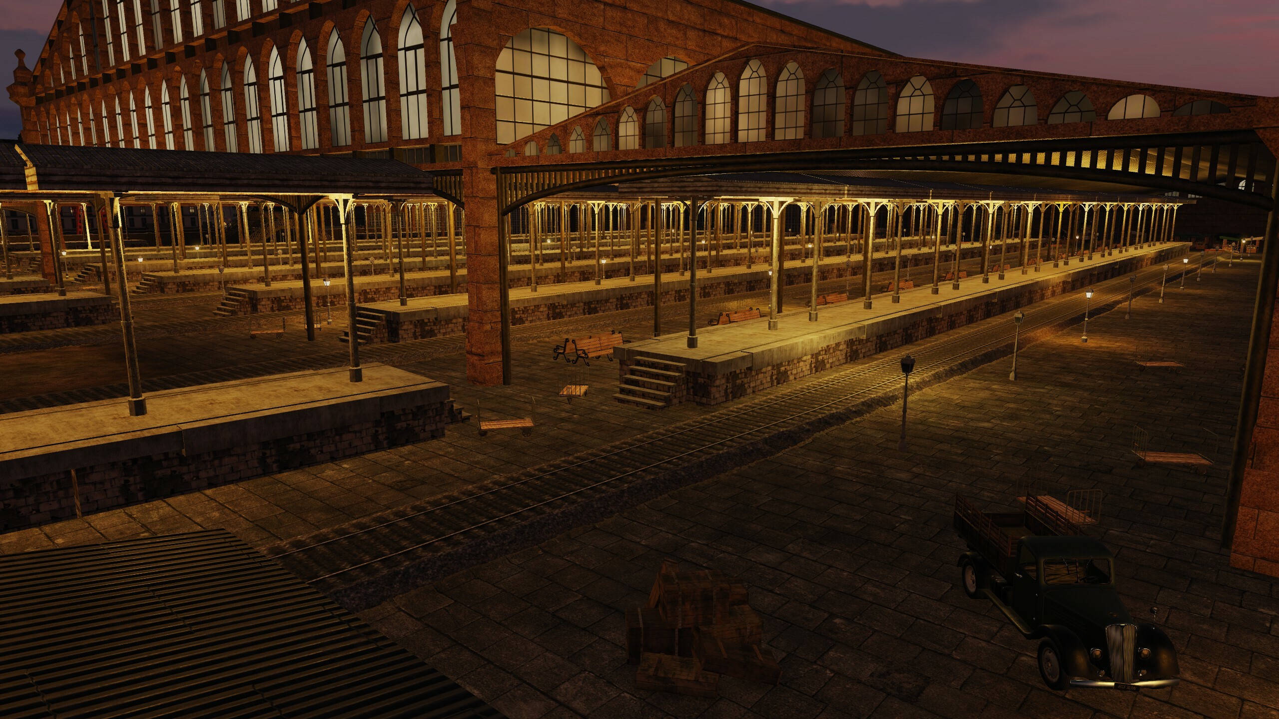
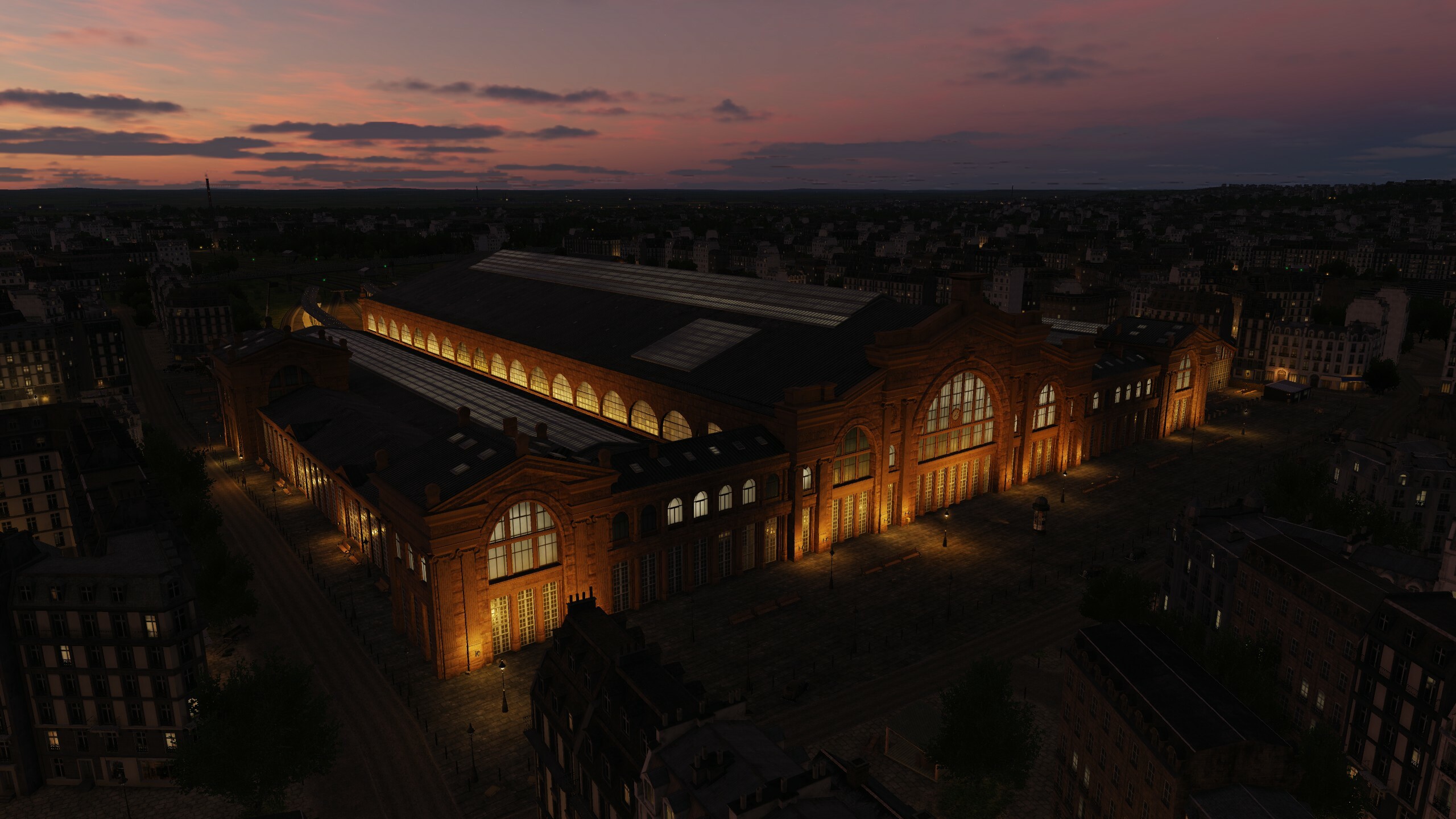
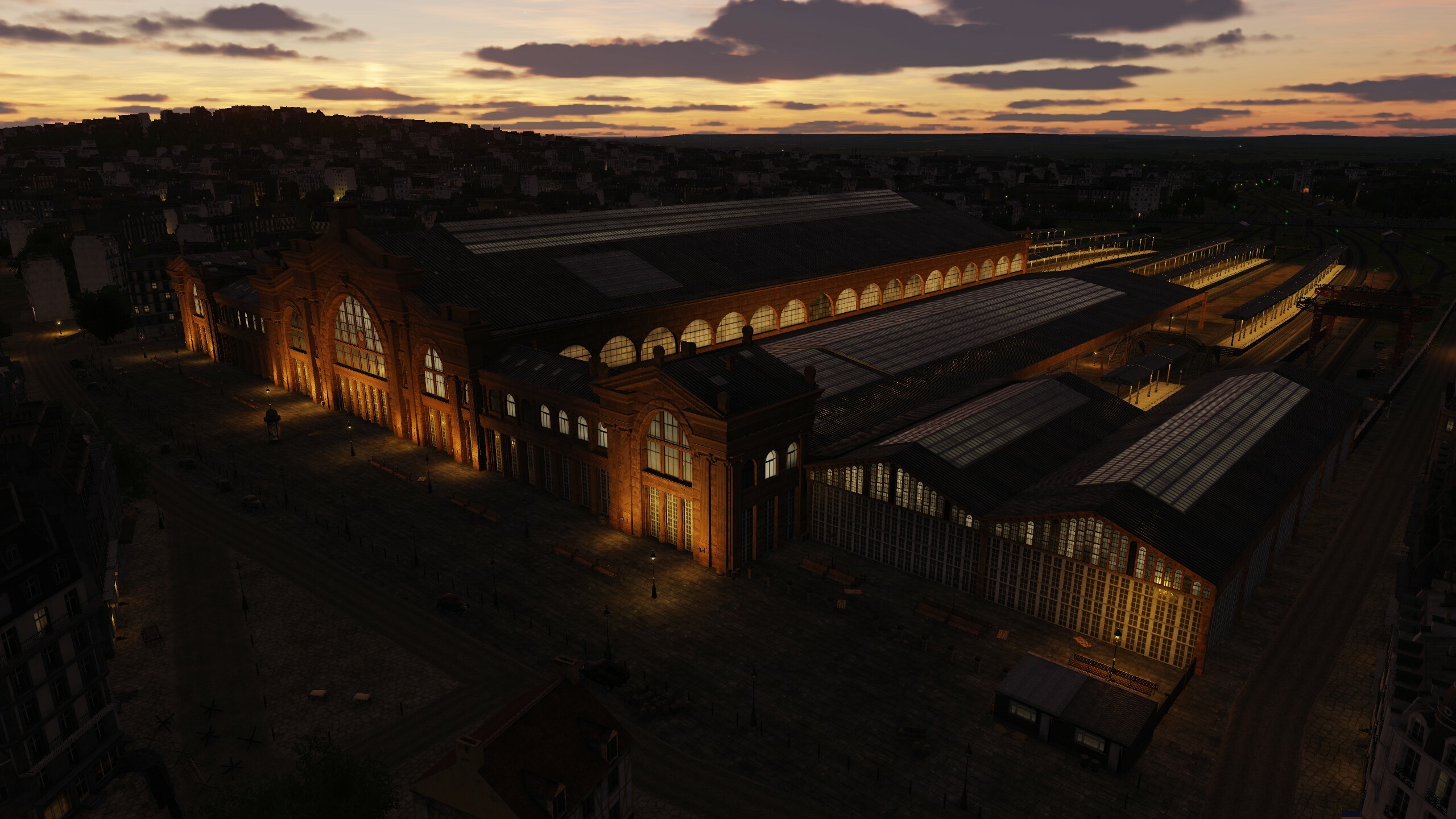
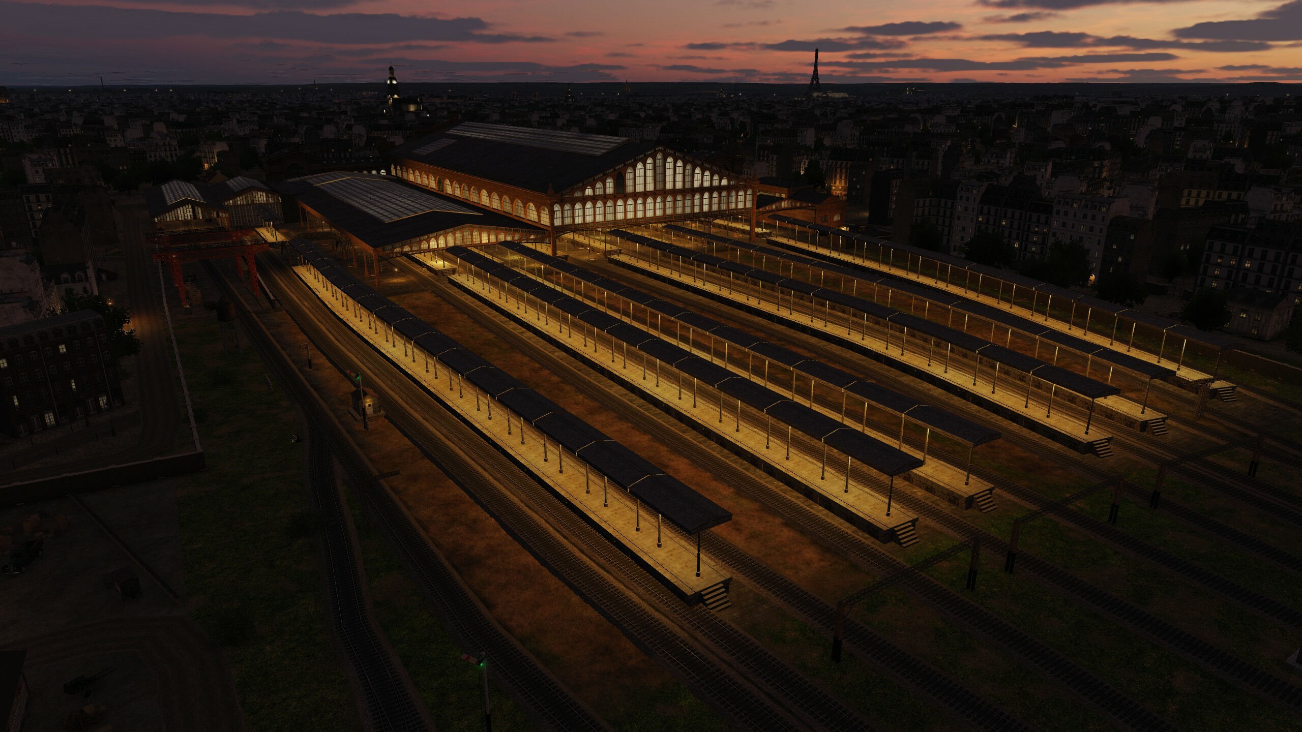
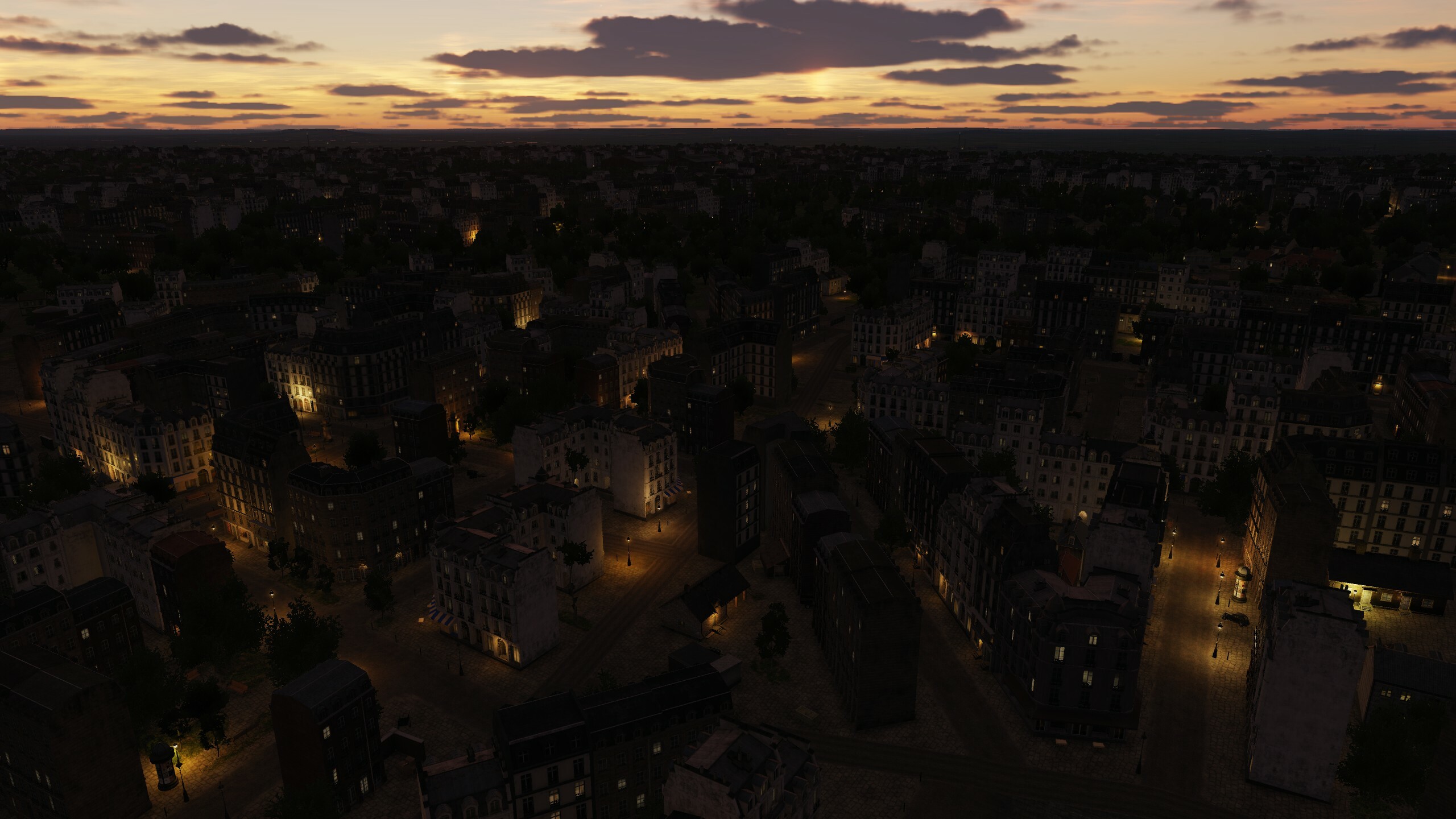
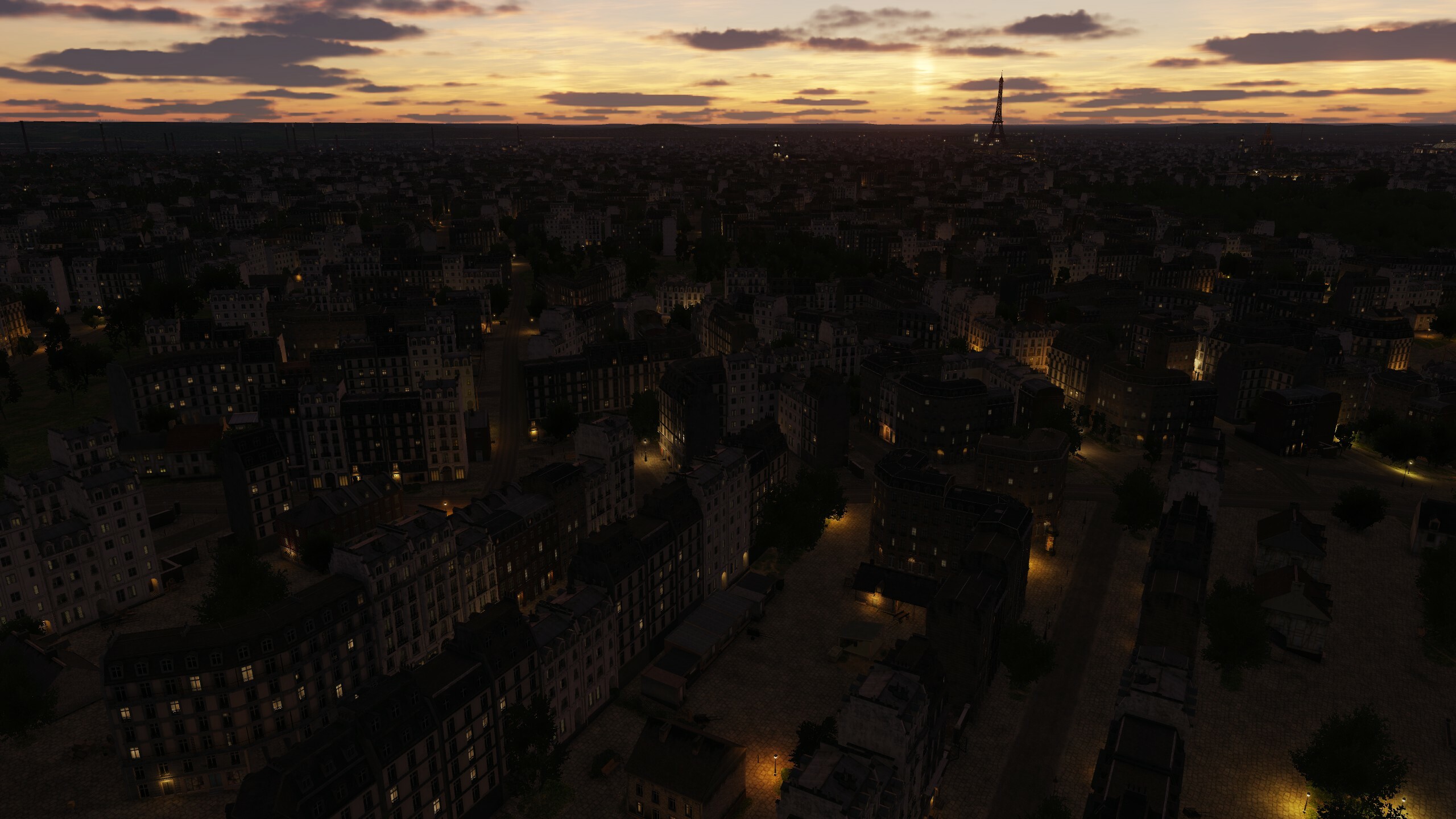
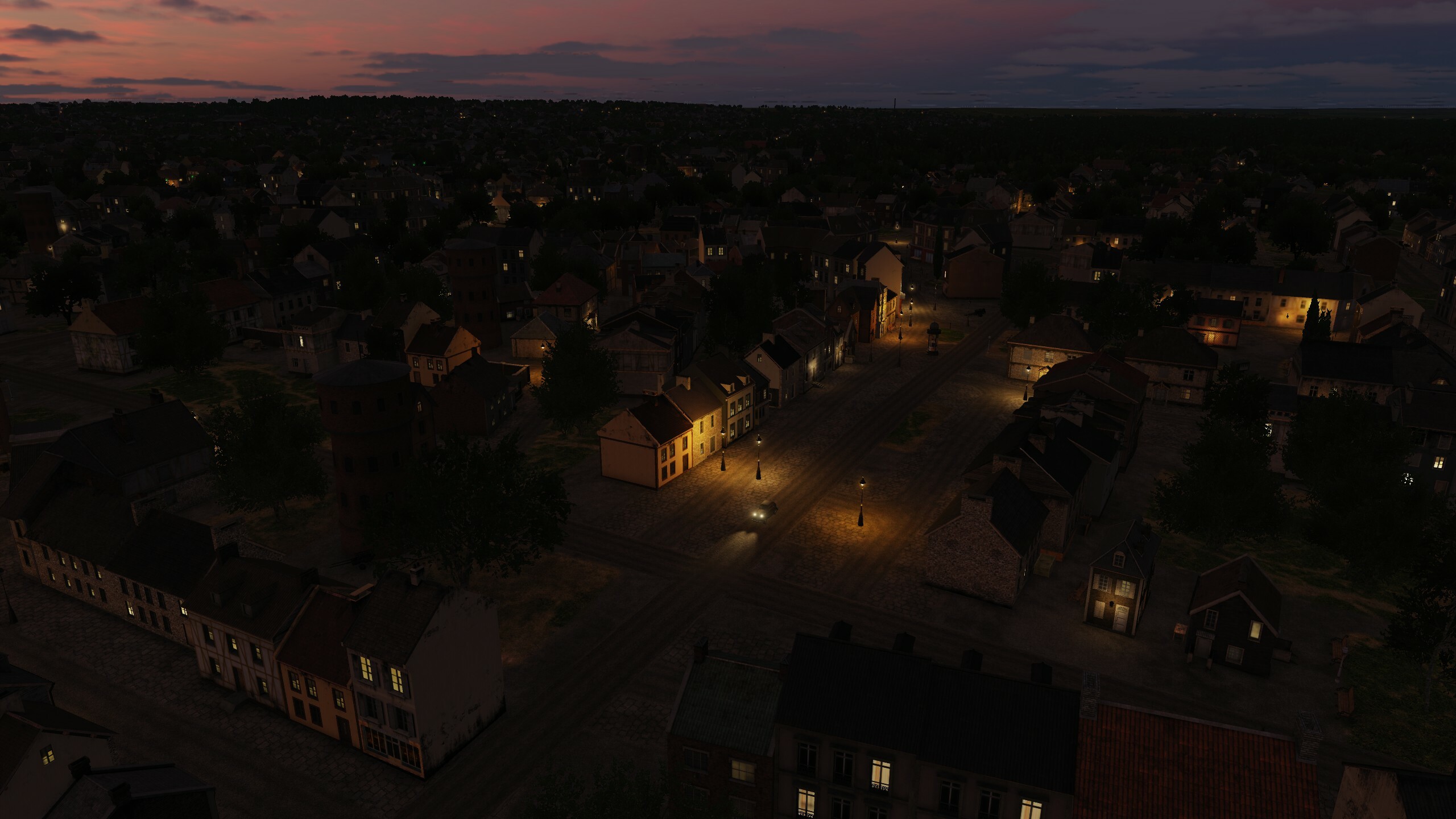
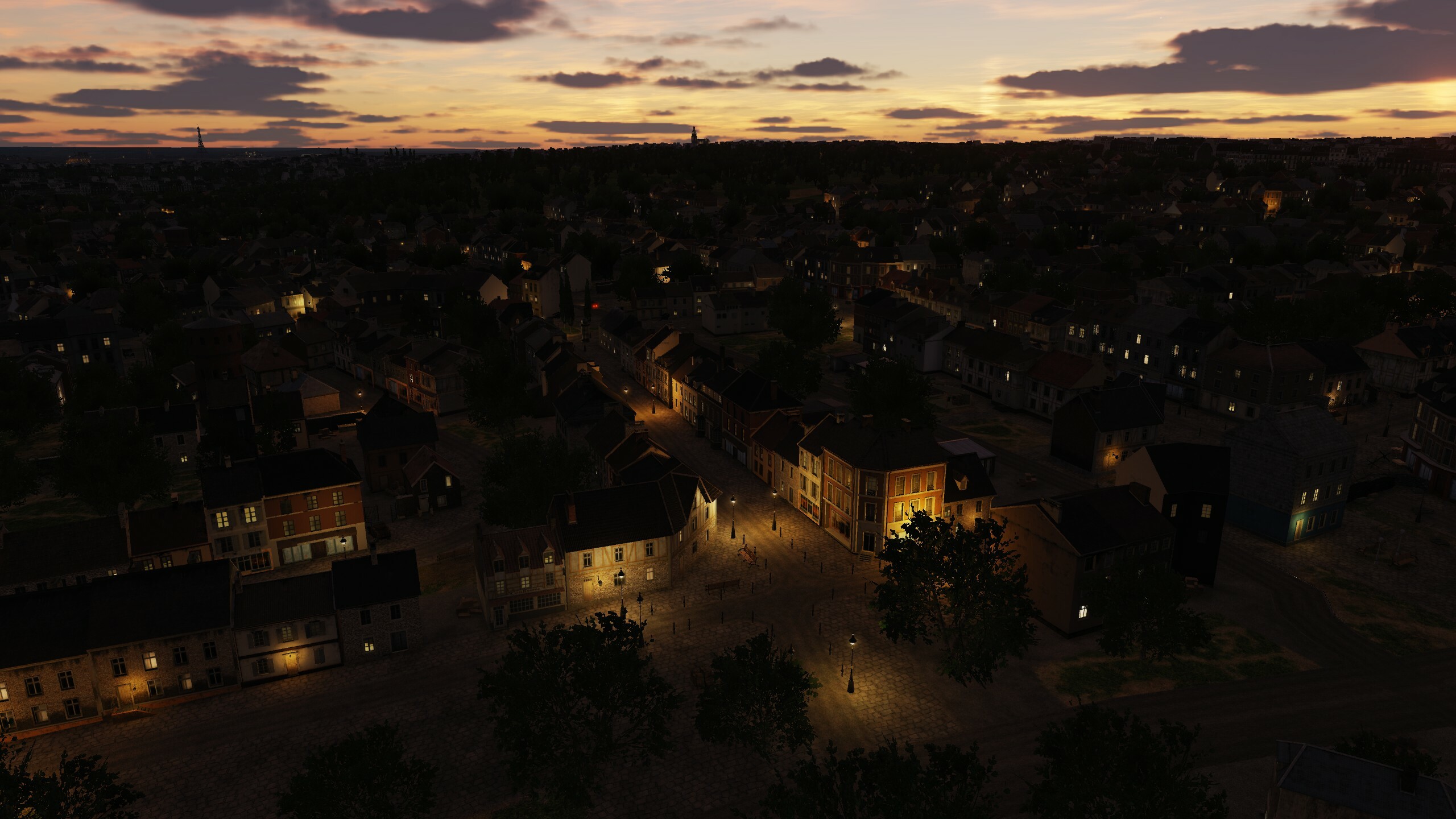
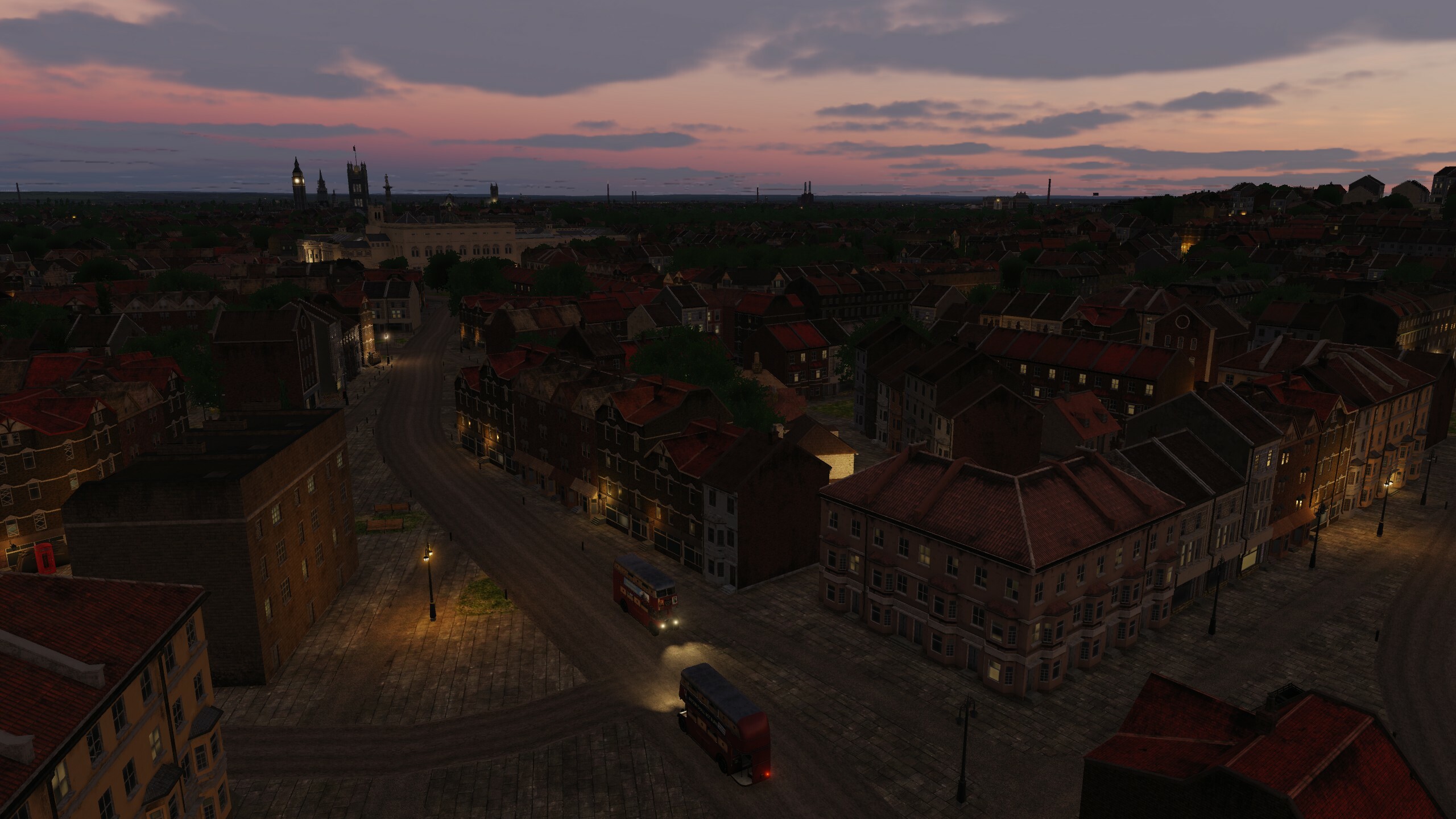
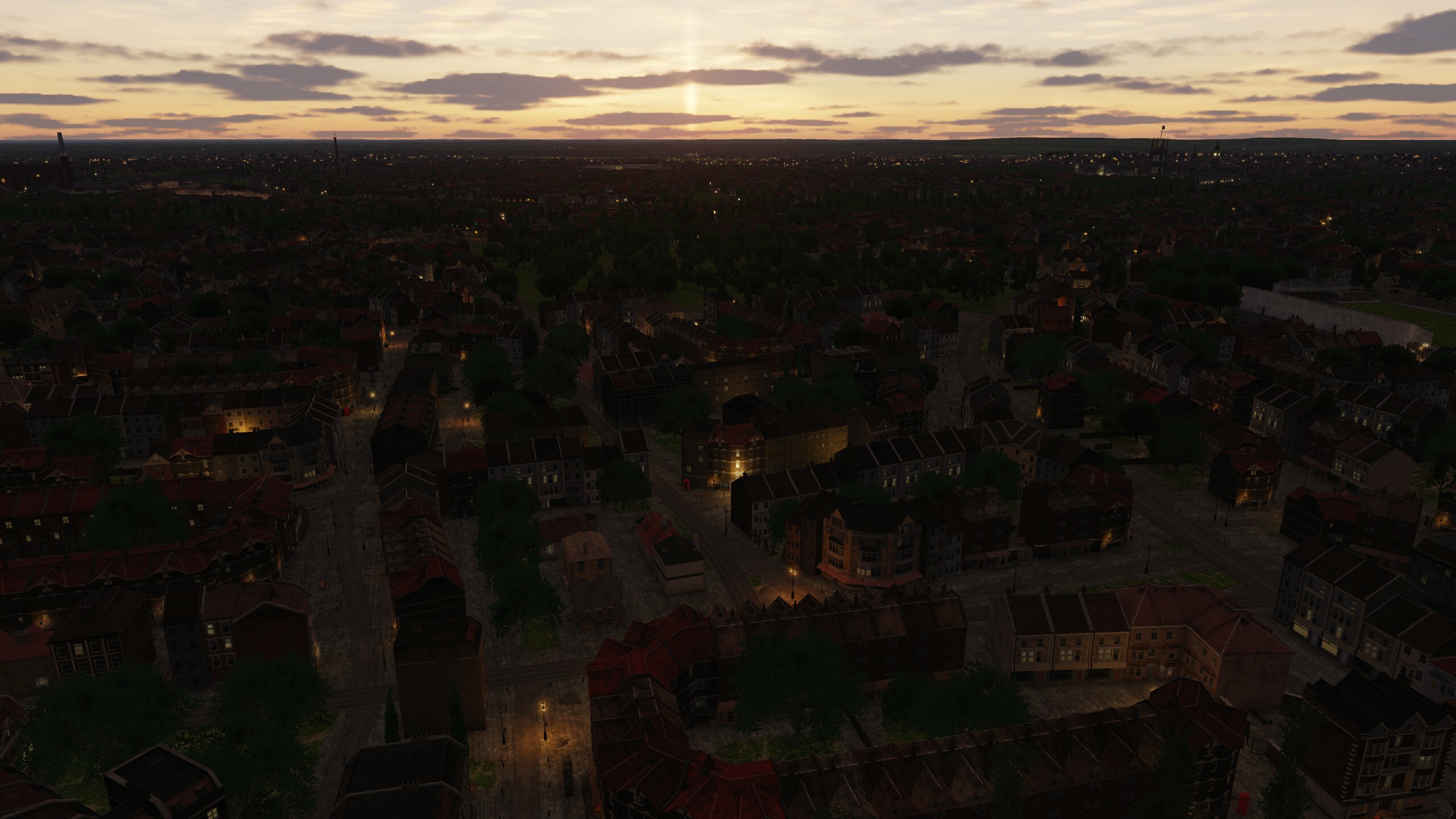
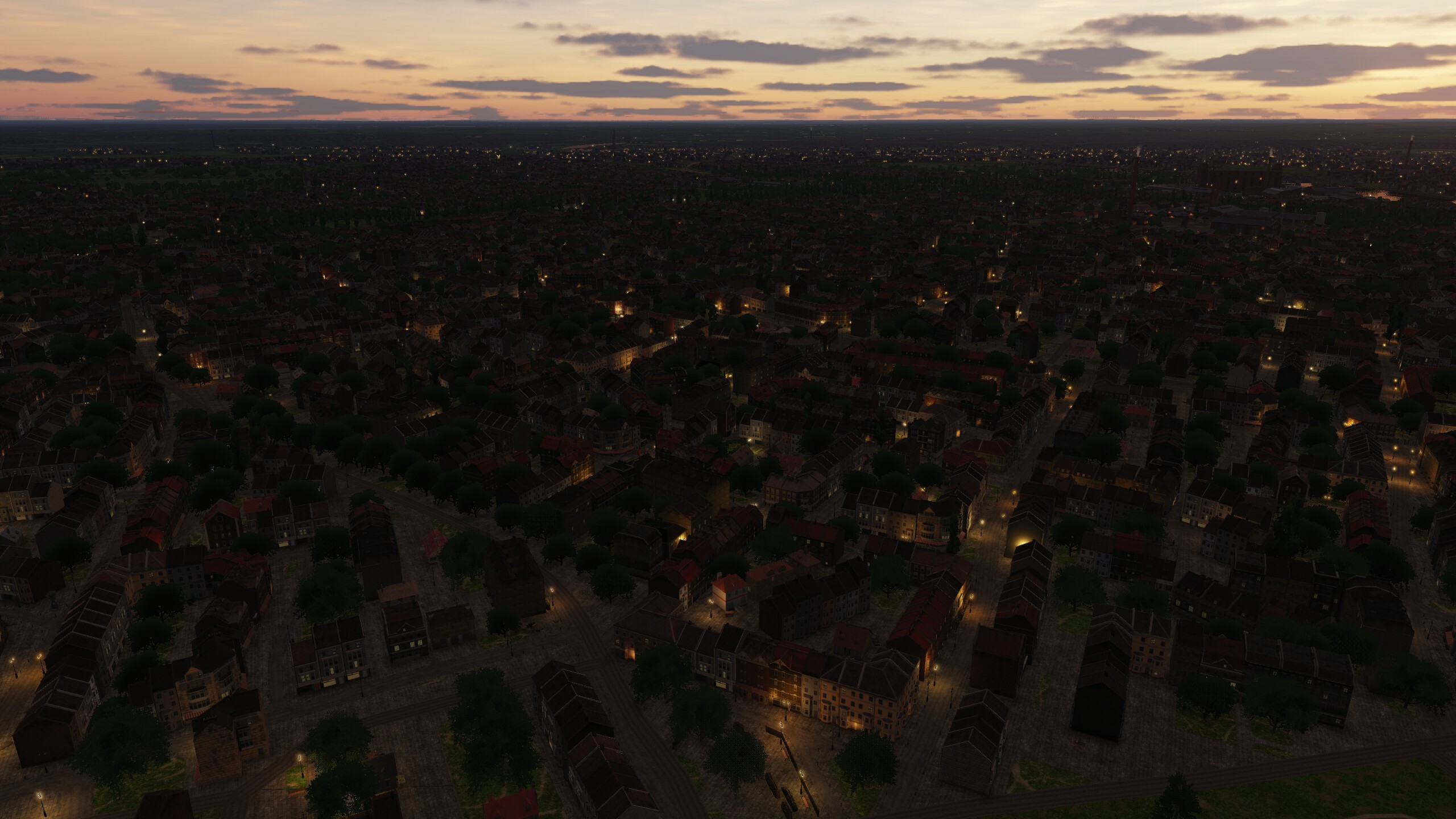
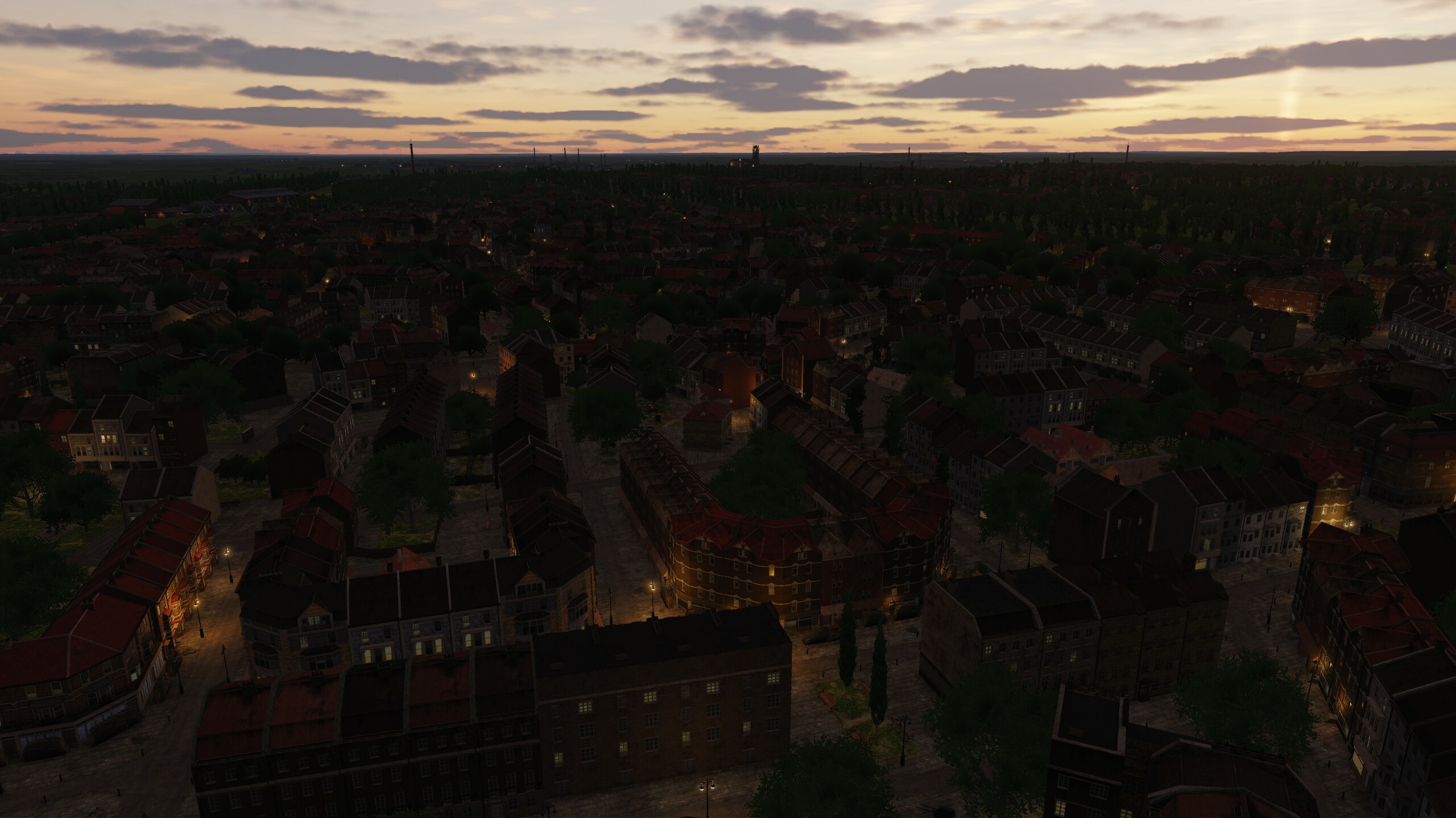
Hi In this topic, we will separately talk about lighting. We carefully approached the fact that flights at night would be interesting and tried to create a balance between the complete darkness that was during the war and peacetime, when Paris and London at night were the most beautiful cities in the world. Light is important, it creates atmosphere. When creating airfields, various types of airfield lighting systems were used. Germany and the Allies used different systems. If on the original objects the light emphasizes the beauty and visibility of the building, then in the ports it shows what hard and continuous work goes on when loading goods and equipment. Lighthouses and railway stations are brightly lit and you can navigate them. 1944 - war, so blackout rules were applied on the territory. To accommodate various scenarios, we have made it so that the night lighting is turned on by setting the date in the mission: June 1945 and later. Keep this in mind when creating missions and when creating a free flight. ---- before June 1945 - lights OFF after June 1945 - lights ON ---- We use "dynamic light" that illuminates objects in real time, it gives a little more realism and is just beautiful. The main types of light sources are omni and spotlights with physically correct attenuation. To reduce the load on the GPU, working distances were assigned to each type of light source: -City lights 3-6km -Searchlights on towers 8km -Lighthouse 42km -Lights on the runway 15km -Airfield lights 30km So, if you want to implement a scenario of approaching territories that have not yet introduced a blackout mode or just want to fly over a cozy night city - choose the date "June 1945 and later" and Normandy will light up with lights. We read all your messages and appreciate your comments and ratings. Beauvais-Tille airfield. France Orly airfield. France West Malling Airfield. UK Kenley airfield. UK Port of Dover Port of Le Havre Victoria Station London Paris Gare du Nord City lights in France City lights in UK