
DD_Fenrir
-
Posts
1968 -
Joined
-
Last visited
-
Days Won
3
4 Followers


-
@NineLine @BIGNEWY Gents, could you shed some light on the OPs original question. Would like to know what the future holds for my investment in this map; will it be backdated and/or expanded to provide greater variety for those of us who brought in to it?
-
For a Battle of Britain scenario Hornchurch is a must. Even up till late 1943 it’s an important fighter airfield. However by the time we hit the DCS WW2 fighter meta which is firmly 1944, Hornchurch along with other such luminary airfields like Biggin Hill and Kenley, becomes second line, being primarily Ballon Command support fields as Allied intelligence see the V-1 threat coming. As such there are a number of other airfields I would suggest should take priority; currently there are no prototypical Mustang airfields in the UK for the 2x 9th air force FGs that flew them and only one P-47 base. In an ideal world all the appropriate bases would be present but would it not make sense to prioritise the introduction of airfields that are chronologically appropriate to the planeset we have?
-
I suspect a double binding somewhere - you're pressing a button to accomplish a task that's also been assigned to the Jester Menu > STT lock > target ahead function.
-
TBH, I have never had Jester go STT uncommanded. Anytime I want an STT I have to ask specifically for it via the Jester menu. Seems most peculiar.
-

Why Don't WWII Fighters Explode In the Air?
DD_Fenrir replied to Bowie's topic in Western Europe 1944-1945
Full on explosive detonation of fuel within an aircrafts fuel tanks is not that common; to get the exact fuel/air mixture required for a fuel explosion is actually a pretty tight ratio. Not to say it never happened, but when aircraft are reported as exploded in combat reports I would tend to suspect ordnance, ammo or oxygen bottles for sudden explosive dissassembly of an airframe on probablilities alone. Sometimes even the pilots description of exploding the belly tank is suspicious - they may have set the tank ablaze, sure, but actually detonating it to cause it and it's parent aircraft to suddenly become aluminium confetti....? Yeah, nah. Not likely. Though agreed, any of those is a bit lacking in the DCS WW2 airframes currently. The degradation of structural strength through prolonged exposure to fire is a separate issue, but one that too seems only to affect the Mosquito in DCS currently. Needs improving. -
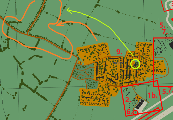
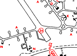
9. Yapton village in wrong position,too developed for 1940s and is taking the place of airfield admin buildings. Yapton village as shown in Normnady 2.0 map is too far East and too developed. It should be clustered around the inverted T road formation to the West. The church location, circled green is a good reference, see the 1939 ordnance survey map detail below: The black circular dot with the cross attached to the top (just above the "Y" in "Yapton") indicated the churches actual location. This means that the village in Normandy 2.0 is actually occupying land that should be within the airfield perimeter and be supporting admin and airfield accomodation buildings.

-
8. Residential development on South Side of airfield is anachronistic (appeared in the 1960's): This is a post-war housing development and should not be present on the 1944 map. There were some scattered domicles and on the Southwestern edge of that road but what is there currently in the Normandy 2.0 map looks like a small town. Omit this please. Annotated 1939 map for proof: Link to map: https://maps.nls.uk/view/103673623
-
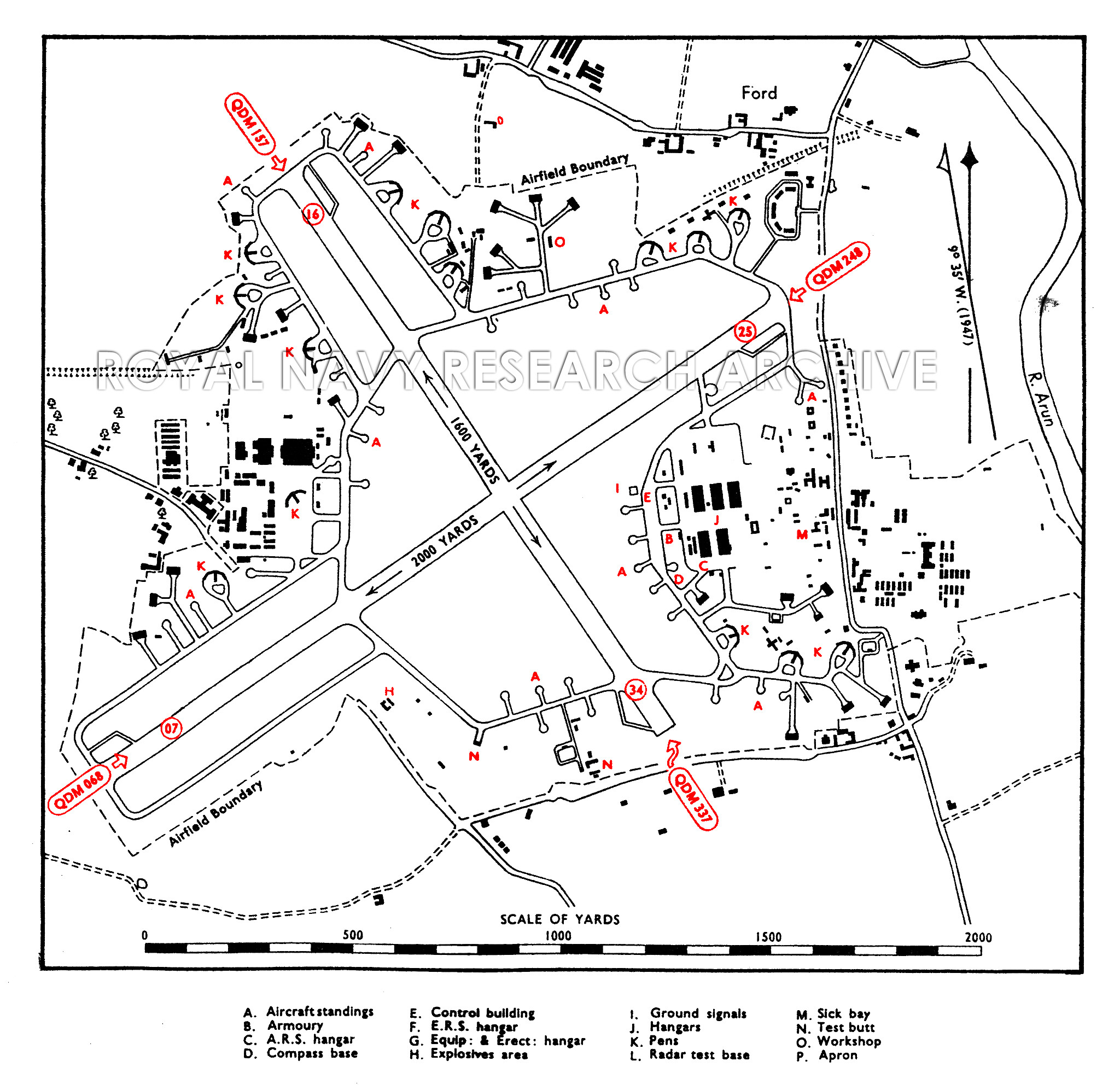
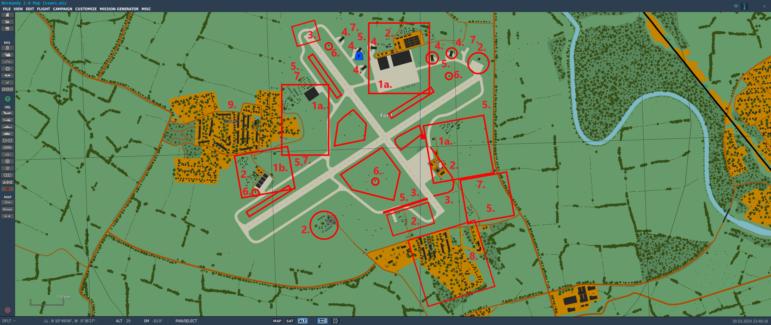
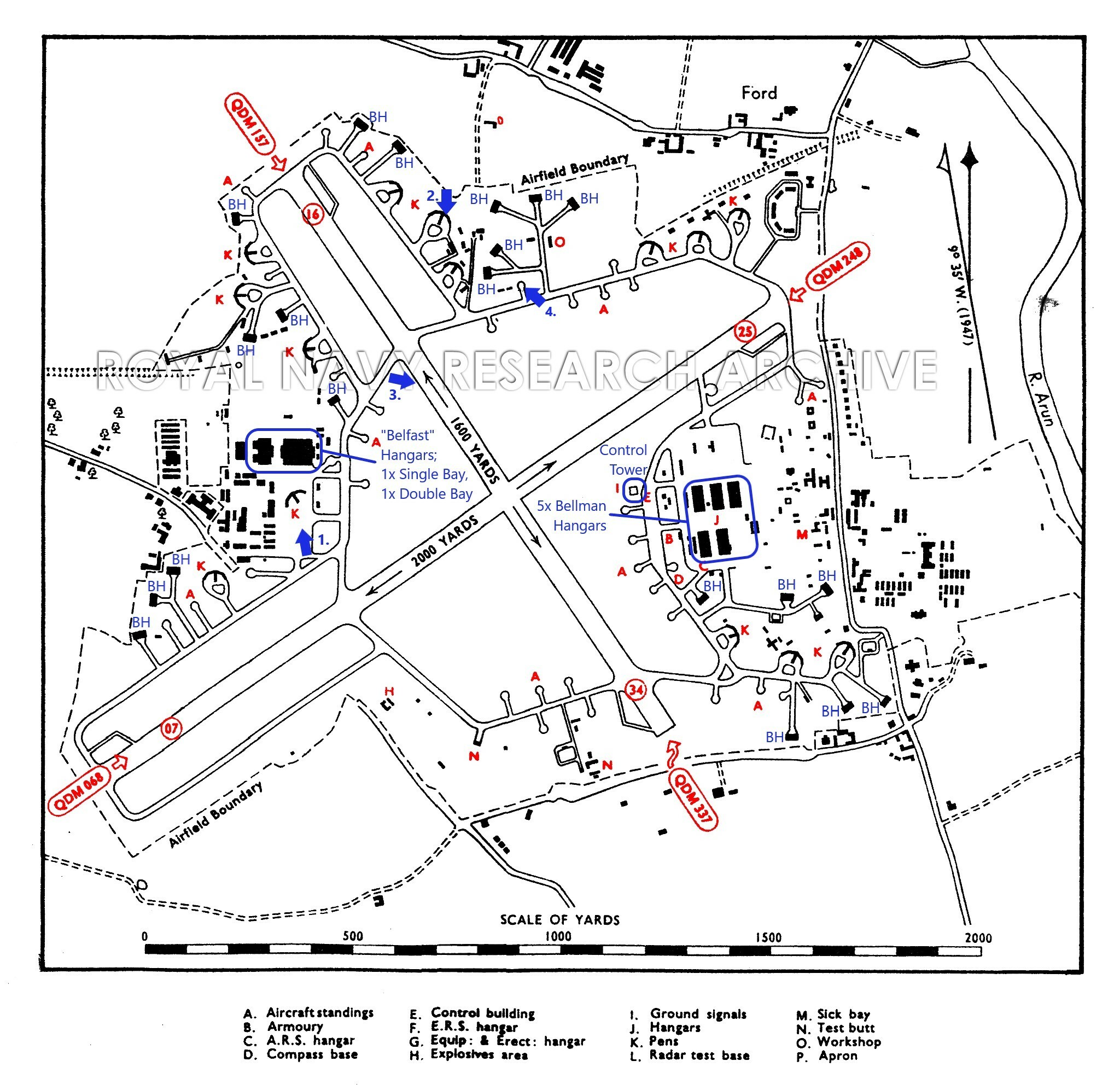
7. Lack of prototypical type B Blast Pens There should be 14 of these distinctive structures on the airfield; in the Normandy 2.0 map all are missing. Annotated with a red "K" on the diagram below.
-
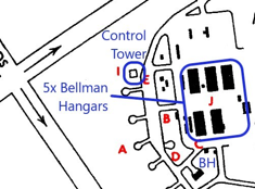
5. Lack of disperal hardstands in the correct locations A quick glance shows the many, many disperals stands and stub perimeter tracks leading to blister hangars or simple circular hardstandings that should be in evidence across the perimeter of the airfield, but particularly in the Southeastern corner, are conspicuoulsy absent on the Normandy 2.0 rendition of this airfield. 4 x Control Towers (should only be one) and all in the incorrect locations These all need to go: There should be one, single Control tower and it should be located here:
-
4. Blister Hangars in incorrect locations Current DCS Normandy 2.0 map modelled blister hangar locations are incorrect and there are too few. There should be 20 locations, as outlined by the blue "BH" annotation below: Currently they have been placed in locations which should have a type-B Blast pen; see section 7.
-
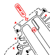
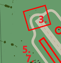
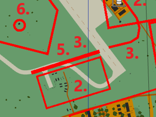
3. Incomplete/inaccurate Taxiway arrangement There are two main areas where the taxiway arrangement of the airfield on the Normandy 2.0 map differs from the protoytype; the first is at the Northwestern end of the NW-SE runway and the second is at the Southeastern and Southwestern end of the same runway.
-
2. Incorrect location of admin & workshops clusters The difference between the historical and DCS map versions should be self explanatory given the difference between the apron positions and the layouts already provided above but to re-iterate: This: Should not be present. Or this: And this: Is, as discussed, incorrectly placed and looks completely unlike any RAF airfield I have ever seen. The near structures are far too close together, the buildings, whilst a vague approximation of what could be there, should be brick or concrete, and generally painted in camoflage or green. The Nissen huts (the buildings with the semi-circular profile) were more prevalent on the USAAF bases in East Anglia and should be far more sparingly used on the bases in the South of the UK and the two blocks at the far end look like continental farm buildings. Why is there above ground fuel storage so close to major structures? All fuel reserves on actual RAF bases were stored in underground tanks located away from major structures, to a) camouflage them from the enemy and b) make sure if they did get hit the ensuing conflagration would not engulf surrounding buildings. This has been pointed out a few times, across a good few years. I seem to recall having to say the same thing on the release of Normandy '44 many, many moons ago.... And then there's the chainlink fence! What purpose does it serve? On an already protected airbase? It's completely logically superfluous (as are so many fences on of so many of airfields modelled across the map). Get rid of them! The watchtowers too. I have never, ever, seen any photo - ever - of a British or American WW2 airfield with these present. And yet they are plastered liberally on all bases across the map. Get rid of them!
-
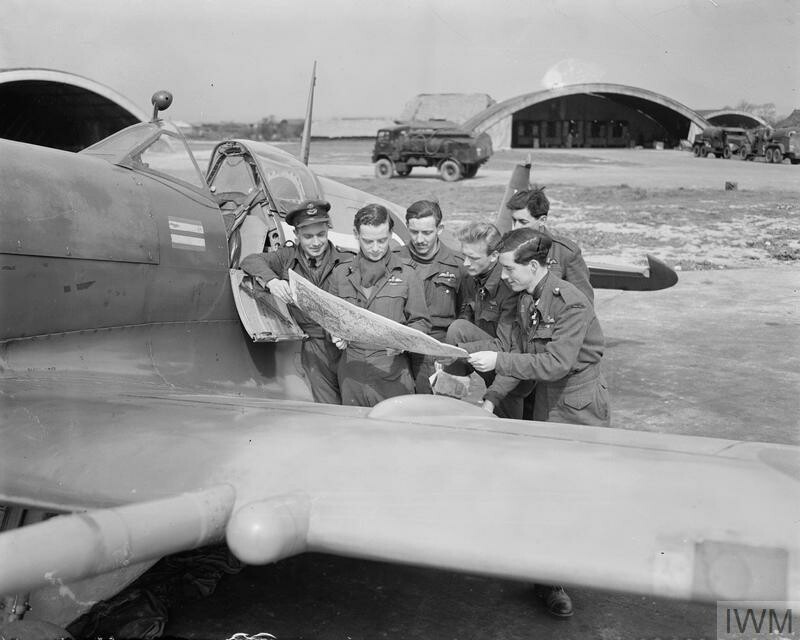
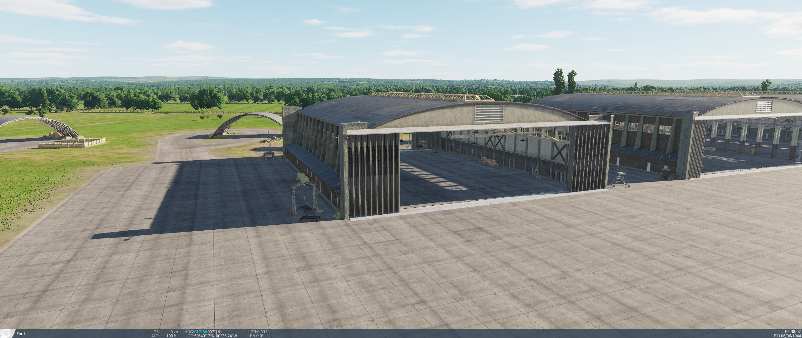
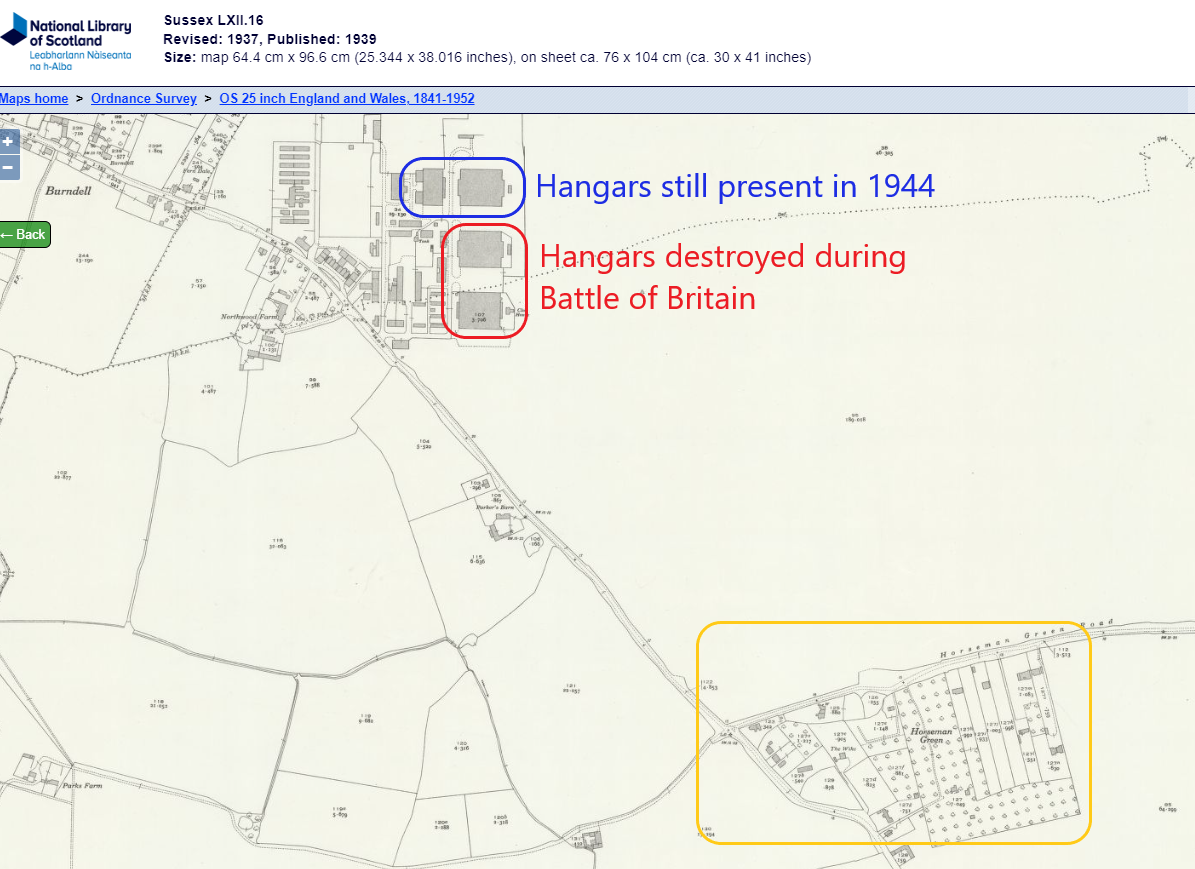
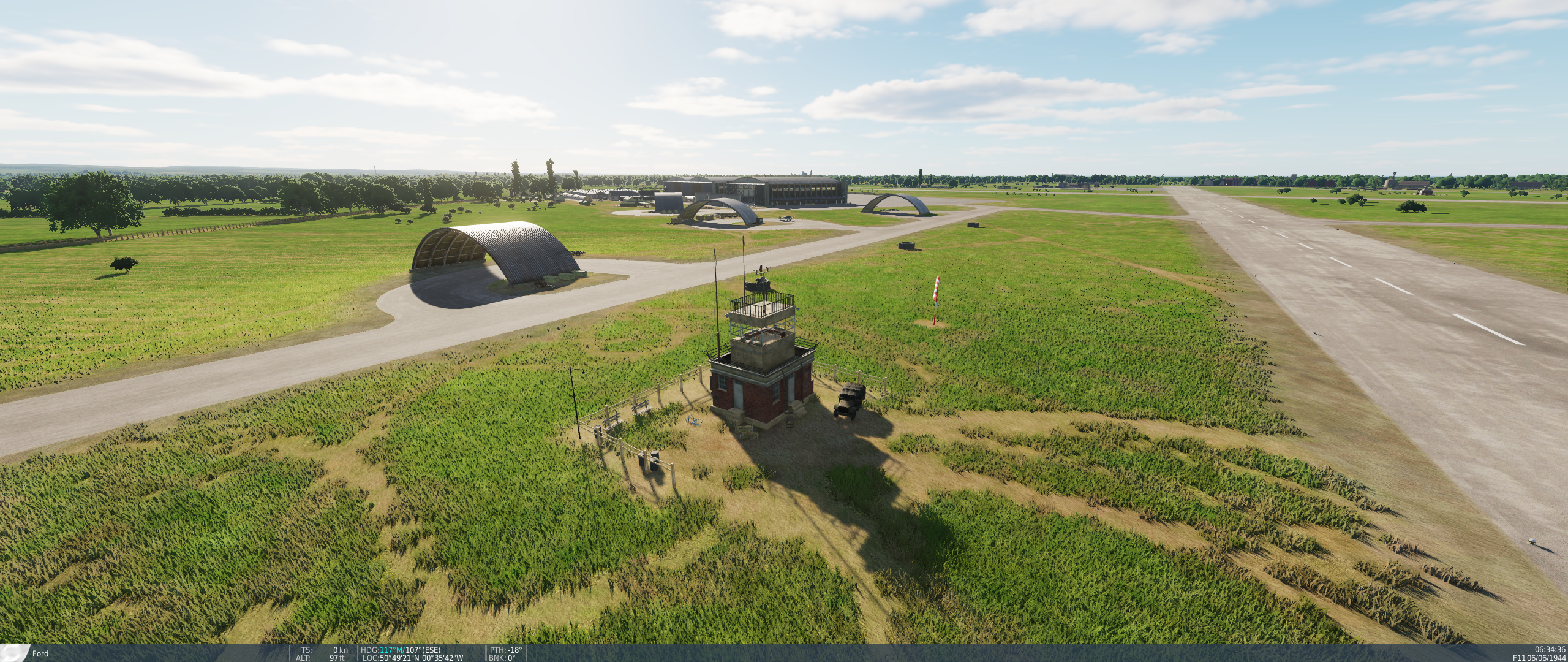
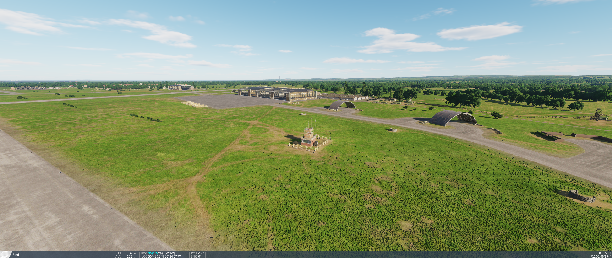
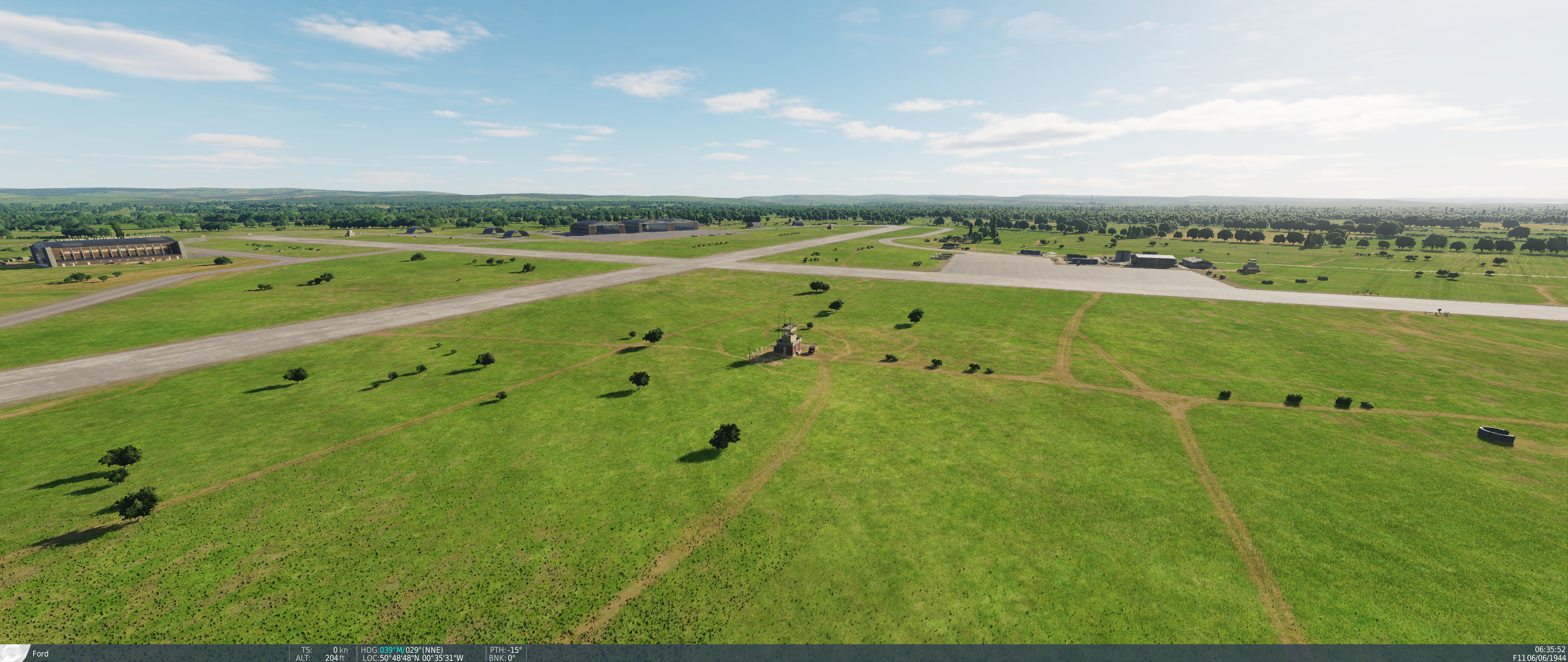
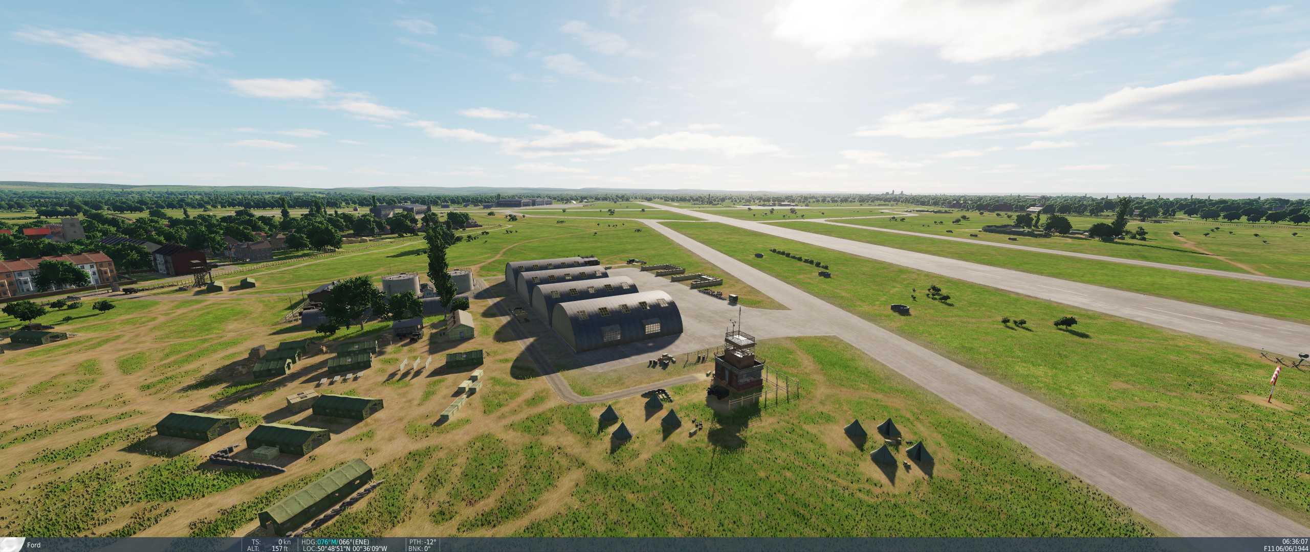
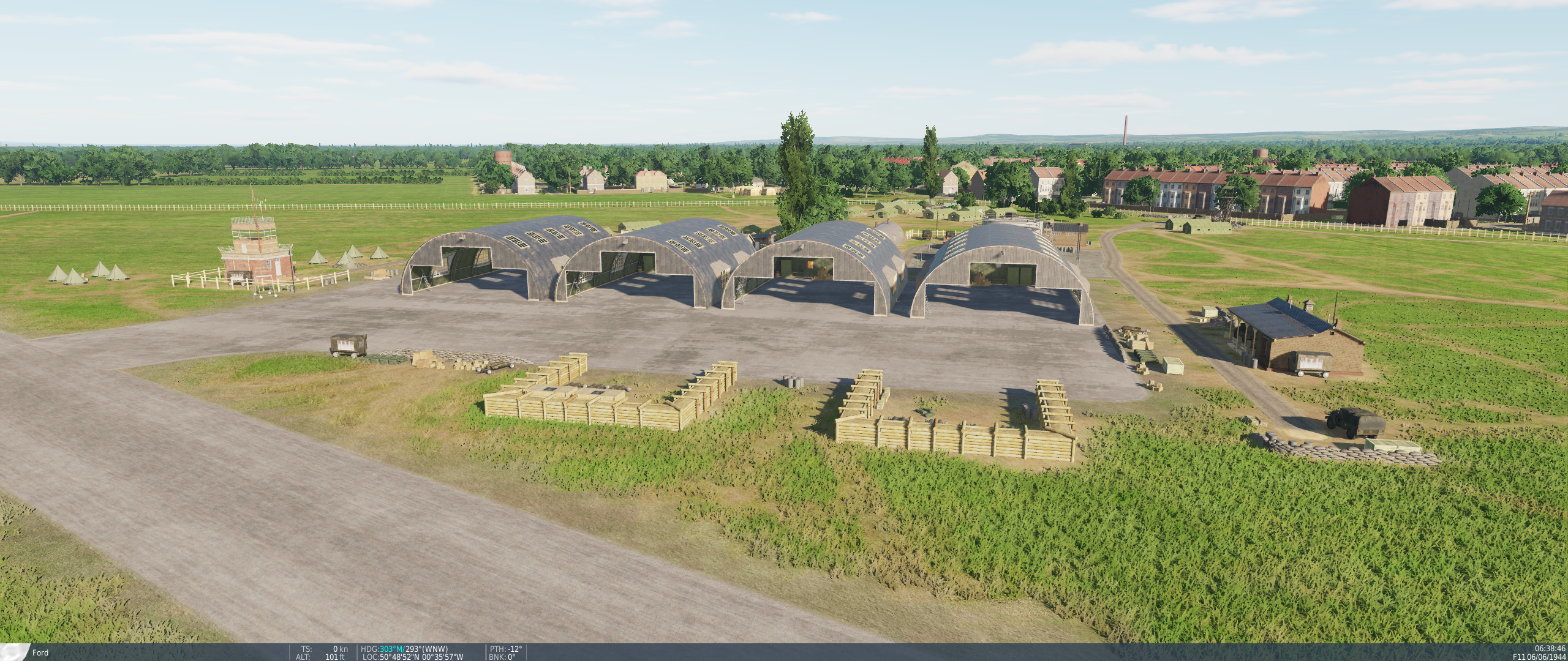
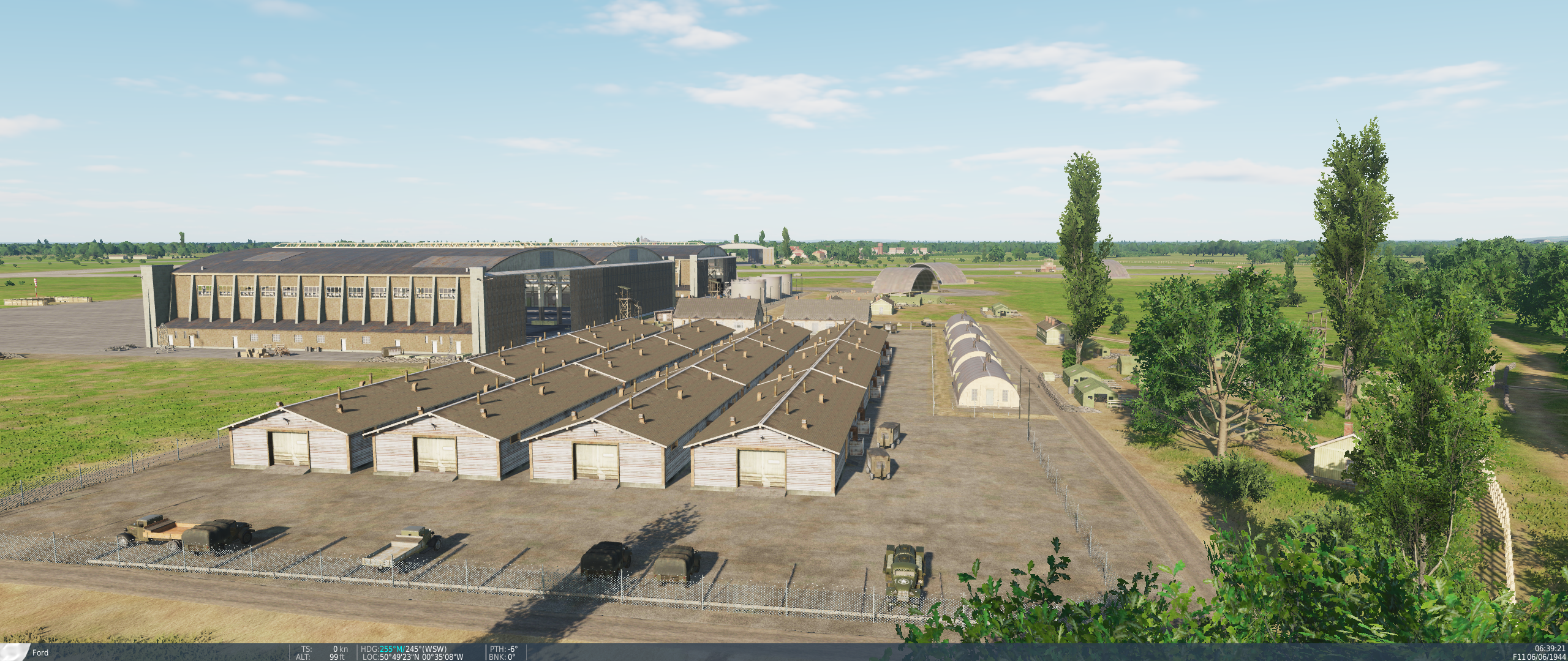
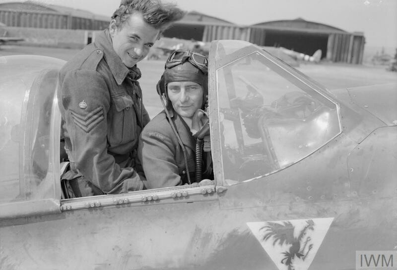
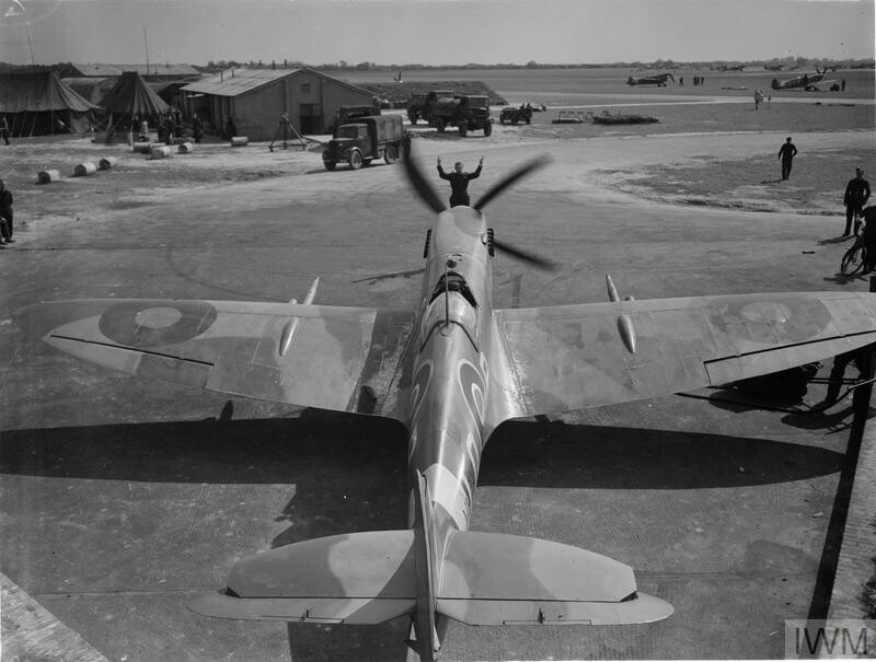
As part of this research I have attempted to Geolocate several period Photographs with the airfield map. The Blue numbered arrows annotated by me on to the diagram map correspond with the numbered pictures below: 1. 2. 3. 4. In Photo 1 we can clearly see the 2x Belfast Truss type hangars (1x single bay, 1x double bay) and the Type B Blast pen with it's distinctive air raid shelter door opening. In Photo 2 we see how clean the general surface of the airfield is and how uncluttered the areas around and beteween the taxiways are, with some limited equipment located around the workshops. There is little evidence of sandbags or ad-hoc berms and the tents are distributed in small clearings between the permanent workshops and other structures. In Photo 3 we see across the airfield the lack of spurious vegetation and the Bellman type hangars on the Eastern Apron; also the row of 10x civilian type houses (could be base officers married quarters accomodation) on the road off the eastern side of the airfield. You can also just make out the control tower. In Photo 4 we see the clutch of Blister Hangars on the North side of the field, and again how little general clutter, foliage, fences or embellishments there are.
-
1b. Hangar types incorrect/misplaced The Belfast truss type: is protoypical, but should only be present on the Western Apron, with a single bay and a double bay variant next to each other, doors facing North-South: On the Eastern Side should be 5 no. Bellman type Hangars, of which a suitable equivalent exists in DCS (Normandy 2.0 RAF Lympne shown): Whilst not quite the right width/length ratio, they would stand in well as representations. The following types should not be present as they do not relect a hangar type found anywhere on any wartime RAF airfiled in the UK; these are far too american/continental and should be restricted to airbases in the France:
-
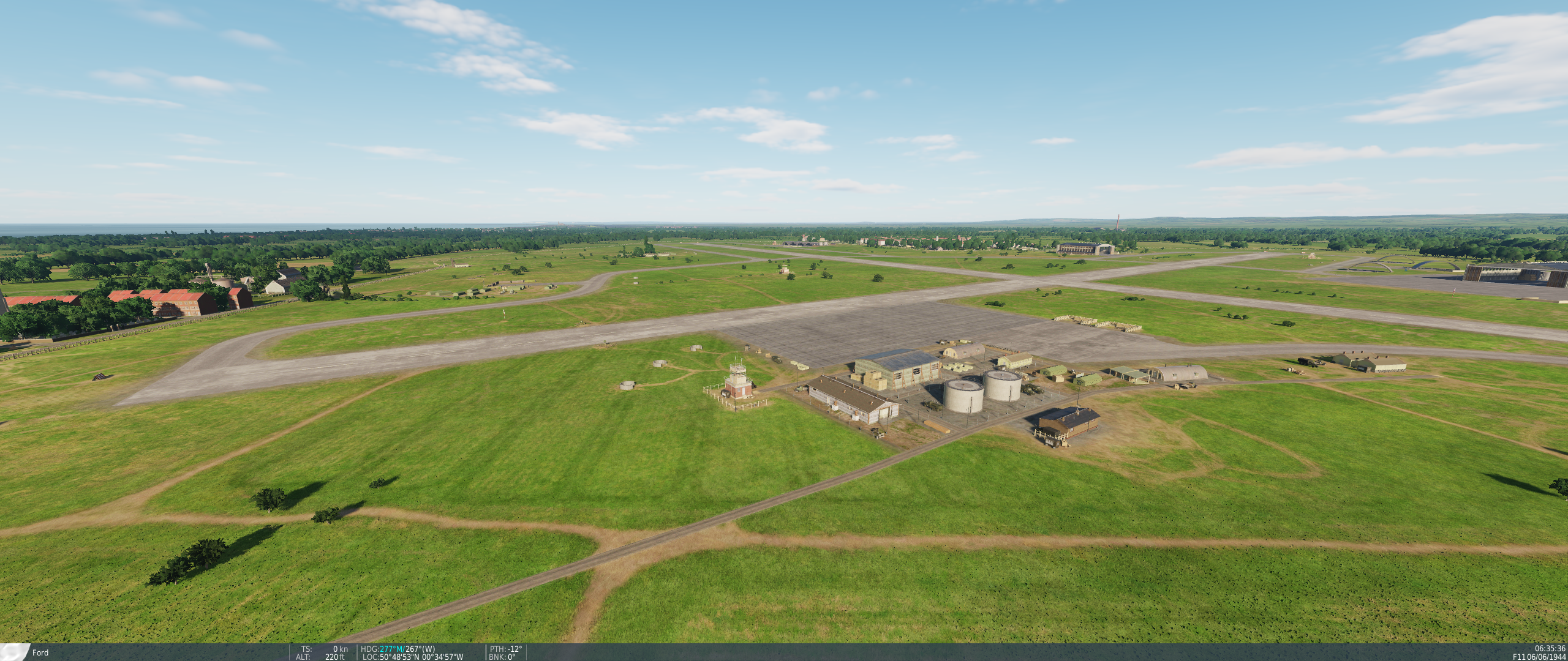
RAF Ford represents one of the major airfields in Southern England on the run up to D-Day. It hosted a significant number of units on the run-up to and during Operation Overlord and the subsequent Battle of Normandy: 2nd Tactical Air Force 122 Wing (Mustang III) 19 Squadron 65 Squadron 122 Squadron 125 Wing (Spitfire IX) 132 Squadron 602 Squadron 453 (RAAF) Squadron 131 (Polish) Wing (Spitfire IX) 302 (Polish) Squadron 308 (Polish) Squadron 317 (Polish) Squadron 132 (Norwegian) Wing (Spitfire IX) 66 Squadron 331 (RNoAF) Squadron 332 (RNoAF) Squadron 133 (Polish) Wing (Mustang III) 129 Squadron 306 (Polish) Squadron 315 (Polish) Squadron 144 Wing (Spitfire IX) 441 (RCAF) Squadron 442 (RCAF) Squadron 443 (RCAF) Squadron Air Defence Great Britain 456 (RAAF) Squadron (Mosquito NF.XVII) Given the historical importance of this airfield it is a shame it is so poorly represented in the Normandy 2.0 map. Here are the issues I will be addressing: 1a. Main hangar aprons in incorrect locations 1b. Hangar types incorrect/misplaced 2. Incorrect location of admin & workshop clusters 3. Incomplete/inaccurate Taxiway arrangement 4. Blister Hangars in incorrect locations 5. Lack of disperal hardstands in the correct locations 6. 4 x Control Towers (should only be one) and all in the incorrect locations 7. Lack of prototypical type-B Blast Pens 8. Residential development on South Side of airfield is anachronistic (appeared in the 1960's) 9. Yapton village in wrong position,too developed for 1940s and is taking the place of airfield admin buildings We shall start progrees with these in numerocal order: 1a. Main hangar aprons in incorrect locations When compared to the historical map we see that the main aprons and hangar locations are in the wrong locations. Historical: Compared to the DCS Normandy 2.o map note the areas labelled 1a.: We see that these are almost completely different. The East apron (with hangers marked by the letter 'J' in the diagram) is missing, the Apron on the North is not present in the 1940's layout (though one would appear there in the 1960's) and the Western apron is also missing with a hangar present but in the incorrect location and orientation. There are also small aprons at each end on the North Side of the SW-NE Runway which should not be present.


.jpg.b4803422214c1c44dd26b37f4f3f7b3c.jpg)