Search the Community
Showing results for tags 'f10 map'.
Found 10 results
-
I was wondering what the community thinks about using the F10 maps for missions. Clearly in the real world, a pilot will spend x3 of total mission time in the briefing room planning, learning the mission, the maps, routes, enemies, etc In DCS there is no briefing room to my knowledge, and we only have the F10 map that can be used while in the plane. But it makes me fill like I fake it when I look at the map, since it shows my location and sometimes the enemy location and more data then what would have been available in the briefing room pre-flight. Any thoughts? What is the best way to make everything fill real
-
 As title says. If a moving object (aircraft, carrier/ship, vehicle) has a set of waypoints for it's route, and you select that unit on the F10 map you are able to see them in yellow dashed lines connected by the waypoints, represented by circles with the waypoint number to the right of them. If you have previously selected the object and seen those waypoints, when those waypoints change (via a scripting or mission editor event 'setTask') the new waypoints are NOT DISPLAYED and the old, now irrelevant waypoints remain. This happens even if you resetTask() or popTask() and the either pushTask(newTask) or setTask(newTask). The F10 map never changes the waypoints visible for the object/unit from those very first ones.
 -
Since it's easiest to create DTCs or Datacartridges for the Mirage from F10 Map Markers, I've developed a small Moose-based script to create DTC files from those markers. Enjoy! You can find the script here: https://github.com/FlightControl-Master/Moose_Community_Scripts/blob/main/Scripts/M2K_Datacartridge_Creator.lua Use a newer Moose build from here: https://github.com/FlightControl-Master/MOOSE_INCLUDE/blob/develop/Moose_Include_Static/Moose_.lua Description: Mirage 2000C Datacartridge Generator v1.0 Author: Applevangelist Prerequisites * Familiarize yourself with M2K data cartridges or DTCSs in the flight manual, section 19-6 * Desanitize the mission scripting environment in here C:\Program Files\Eagle Dynamics\DCS World.Openbeta\Scripts\MissionScripting.lua or here C:\Program Files\Eagle Dynamics\DCS World\Scripts\MissionScripting.lua depending on which version of DCS you are running Add two minus signs in front of the sanitizeModule lines, they should look like this: --sanitizeModule('os') --sanitizeModule('io') --sanitizeModule('lfs') This is necessary, so the file can be written to disk * Ensure that the directory Datacartridges exists here C:\Users\<yourname>\Saved Games\DCS\Datacartridges or C:\Users\<yourname>\Saved Games\DCS.openbeta\Datacartridges depending on which version of DCS you are running * Note - Currently the Mirage does not detect freshly created DTCs in-game. It will find the cartrige after the next restart, however. Creating a data cartridge While in-game, press F10 to bring up the map. Place a marker on the map and enter this text: "M2K New CAP_Kutaisi". This will create a new data set called "CAP_Kutaisi" - this will show up on the cartridge in-game later on when selecting a cartride. Mission names must not contain spaces or pattern matching magic characters (http://www.easyuo.com/openeuo/wiki/index.php/Lua_Patterns_and_Captures_(Regular_Expressions)), i.e. none of these: %,-,.,?,+,* "M2K" is the keyword which always needs to come first to detect an entry. Creating a new data set deletes existing entries, so if you made a mistake you can start anew. Assuming we are starting from Kutaisi, let's create our first waypoint. Put a marker on the start of the runway 07 in Kutaisi and enter this text: "M2K BUT1 name=Kutaisi cp=67". This will create our first waypoint (BUT) with the number one. The runway heading is cp, in this case 67 degrees true. The altitude is automatically taken as land height at this point. With cp as a parameter, rd (route desiree) is automatically set to equal cp, and pd (glidepath) is set to 3.5. Create another waypoint on the map, by placing a new marker on the map, e.g. "M2K BUT2 alt=5000". This creates waypoint two, with an altitude of 5000 meters. You may create up to 20 waypoints for a single plan. 1-10 waypoints will be stored the the Mirage's INS system under BUT 11-20. If you use more than 10 waypoints, the Mirage will start adding waypoints at BUT1, overwriting whatever is there. Known keywords (all optional) for BUT creation are: "alt", "cp", "pd", "rd" and "name". The format is always (except for name) "key=xxxx.xx" where x are numbers and . the decimal separator, e.g. alt=5000.23. The format for "name" is "name=abc" where abc is alphanumeric, no spaces, no special characters. Entries are separated by spaces. Special keywords are "FT" to switch to foot for altitude entries and "KM" to switch back to meters. Example with multiple parameters given "M2K BUT4 alt=25000 FT rd=267" - BUT four, altitude 25000ft, route desiree 267 degrees. Creating a new BUT with an existing number will overwrite the existing BUT, i.e. you can correct entries this way. Creating BAD entries If you want e.g. to use this system to plan for a preplanned strike, you can amend a BUT with BAD (delta deviation) information. This is done like so: Let's assume you have created BUT3 to be your ingress point for the strike: "M2K BUT3 alt=150 FT rd=90". Now put a marker on the target area in the map and add this text: "M2K BAD3". This will amend the info for BUT3 with the delta distance information and delta altitude (ground height automatically assumed). Optionally you can use the keyword "dalt" to give the delta altitude yourself: "M2K BAD3 dalt=-56" (foot in this case, because we switched to imperial prior. Creating a new BAD with an existing number will overwrite the existing BAD information, i.e. you can correct entries this way. Saving Place a marker and add this text: "M2K Save". This will save the DTC data to your directory. The filname will be "mapname_missionname.dtc", e.g. "Caucasus_CAP_Kutaisi.dtc"
- 4 replies
-
- 4
-

-

-
- mirage 2000
- datacartridge
- (and 3 more)
-
 It would be very helpful to make a realistic mission when you can find special emplacements for SAM sites easier on the f10 map or in mission editor.
 -
Dear Eagle Dynamics, I would like you to add the feature to add / set waypoints on the F10 map. This feature already exist and works, with Combine Arms. If you set path (waypoints) to your own plane, after restarting NAV mode, waypoints will refreshed and display the new waypoints. Please ED allow us in multiplayer to add waypoints on F10 map. Thanks in advance. Sincerely, Null.
-
 I want to export the currently selected unit on the F10 map. I have found `LoGetObjectById()` by browsing `Export.lua`, but I don't know how to get the ID of the object I have clicked on. I would like to get at least the position (lat, long, alt). coalition and name (typename) would be helpful but is not strictly required. Alternatively the object ID so I can get all that with the LoGetObjectById function mentioned above. I would also enjoy those things for when the user clicks on an airfields. If it's possible, the left alt + left mouse button marker would also be nice to export, is that possible? Is there some kind of comprehensive API documentation that I can search through?
 -
Hi ED, When using F10 view option Fog of War, the map shows enemy ground units, missiles, rockets, etc. in addition to enemy air units. In an PvP MP scenarios in particular this can feel quite gamey in numerous ways: - Drive ground unit fast through town, marking on map where units were spotted before they have any chance of engaging and clean up - Use SU25-T Fantasmagoria (in particular) to show precise locations of many EN SAM systems on F10 and follow up with PP JDAMs without risk - knowing when a specific type of missile is inbound, near-real time position updates allowing precise calls for calls for flare / chaff to be made - Providing exact clock-position in dogfights with near perfect SA It would be great to have two features to help mitigate this behavior 1) An additional Fog of War setting that would only show air units and no missiles, etc. 2) If there could be a configurable F10 refresh interval to further remove the near-realtime perfect picture. Thanks, Martin
-
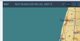
.thumb.png.f4901cc275acf4b33f415f8f6e2f1a83.png) I am seeking the F10 Map shows in the different monitor, and I have seen few topics mentioned about the LotAtc client may be able to fulfill the feature. I am trying to ask questions and hope I ask the right way: 1. I guess that LotAtc client can display any real-time active in the F10 map? 2. if item 1 is correct, any feedback for using the product (or should I try it)? Thanks.
I am seeking the F10 Map shows in the different monitor, and I have seen few topics mentioned about the LotAtc client may be able to fulfill the feature. I am trying to ask questions and hope I ask the right way: 1. I guess that LotAtc client can display any real-time active in the F10 map? 2. if item 1 is correct, any feedback for using the product (or should I try it)? Thanks. -
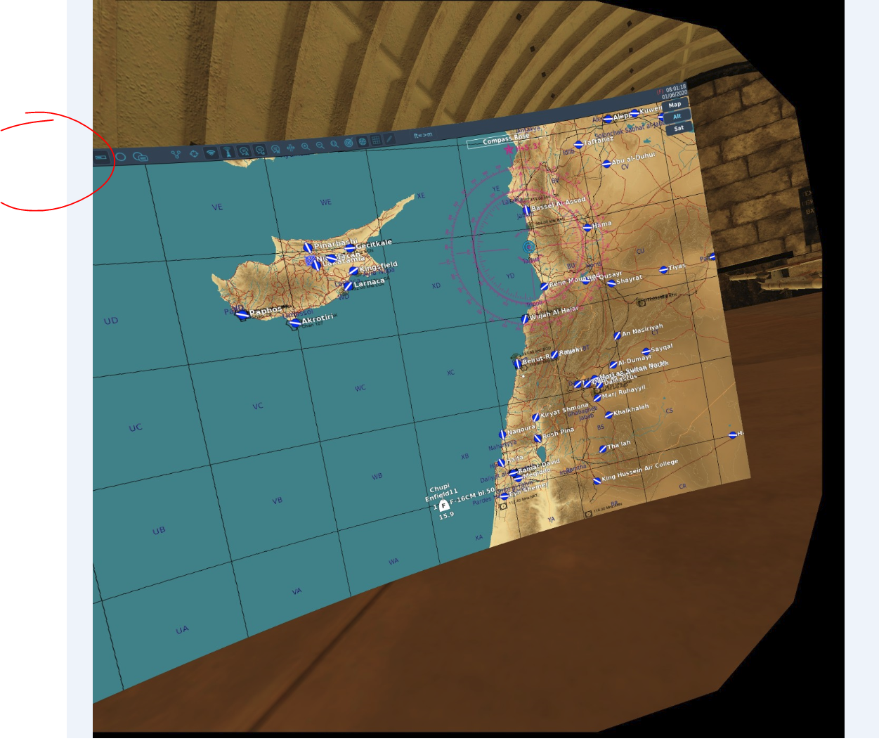
 Hi, I read this post: this link which talks about exporting the "Mouse Hover" Map Coords and i was able to implement a simple C# code, using OSC to get the map Coord however it does not work in VR. When not using VR, the Coords appear on teh top left and my code can pick them up after I take a snapshot. null When using VR the Coords may no be there at all like here: nullI also saw this post which also does not work in VR but will not help me since I need something to implement in my code. So, is there a way to export mouse Coords, perhaps via lua script or in any other way which will also work in VR?
-
Would like to see an Thermal Night mode for night Ops F2 screen ,as well a Night mode for map to lower the and bring realistic vibe of map night ops