Search the Community
Showing results for tags 'navigation'.
Found 15 results
-
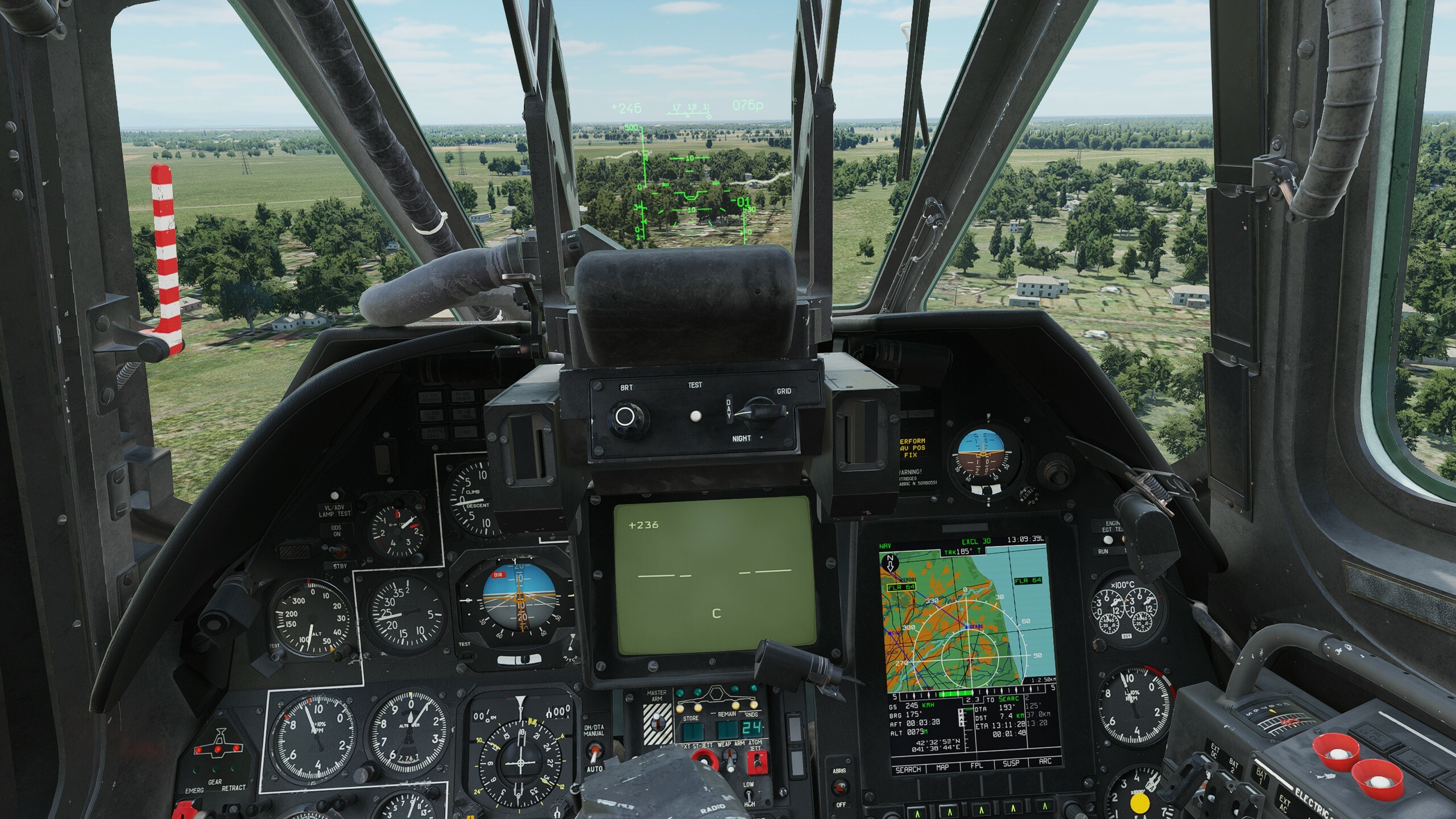
I am having a lot of problems with navigation systems of Ka-50 BS3 (latest open beta MT 2.9.0.47168). INU begins to drift right after takeoff, often losing heading completely. That makes use of datalink and marking up targets useless as all markings will be way off the real location. Here I have flown just 02:33 and navigation system thinks that I should go 5 degrees left from real heading. Got also 'missile 3 o'clock low' warning from EKRAN when INU FIX error appeared. Same mission, second attempt. Here navigation system would guide me 10 degree to the right.

-
Attached is a link to a Description and Usage Guide for the DISS-15 by couple of GUY's that i translated, it has some interesting info on how to integrate Radio and Doppler Navigation. and use them together for complicated flights where one of the systems is insufficient for correct Navigation. https://drive.google.com/file/d/1H_CmM3D8N1kXuQgGZemPBjSjJmgKrwfw/view?usp=sharing the original post on DCS World User Files is here: https://www.digitalcombatsimulator.com/en/files/3328257/
- 2 replies
-
- 3
-

-
- navigation
- diss-15
- (and 1 more)
-
Tried to enter offset to a particular waypoint, all the info gets entered normally (distance and elevation) except bearing. I replicated this issue many times on missions and instant action free flight. I wasn't able to enter bearing to an OAP any time I tested it. It stays at 00 degrees. Switching from True to Magnetic only adds the magnetic deviation difference in degrees, but still doesn't change the bearing that is inputted through the UFC. Offset Bearing Bug.trk
- 3 replies
-
- 1
-
-
- navigation
- offset aimpoint
- (and 2 more)
-
Hi everyone, In the absolutely stellar update for the Viggen, a fairly major issue has unfortunately been introduced. Regardless of whether you're starting cold, hot or airborne, waypoints cannot be selected using B1-B9 keys, only LS, L1, L2 and Bx points (including undefined Bx points - not sure if that's right) can be selected (using mission editor defined waypoints). In the air however, B1 gets automatically selected, however, pressing B1-B9 results in LS being selected, at which point only the aforementioned points can be selected. I have a hunch this might be related to this issue, that has also appeared this update. AJS_37_Cant_select_waypoints_cold.trk AJS_37_Cant_select_waypoints_airborne.trk AJS_37_Cant_select_waypoints_hot.trk
- 3 replies
-
- 1
-
-
- bug
- navigation
- (and 1 more)
-
Anyone know if the Mirage has anything similar to the Time on Target functionality in the Hornet?
-
What DCS really lacks for VR Pilots is an update to the out-dated knee board. A real make-over! DCS needs a virtual EFB on our virtual lap. Like we do in the real world - we have an iPad on our lap. (EFB=Electronic Flight Bag). On that EFB we can run whatever apps we want. Here are some examples: Be it an aerial maps app (one that lets us slew the map around, zoom in and out, display or remove data layers such as different coordinate systems [MGRS,LAT/LONG], waypoints, terrain, Satellite imagery, terrain data, obstacles data, points of interest, Navids, routes, SAM and threat rings, weather data (dangerous thunderstorms, severe turbulence, winds aloft, etc..), and even mark something on the map freehand with an apple pen our finger, and much more. To that app you can add sensors like GPS, thus turning it into a moving map app, and even ADS-B data that turns it into a portable TCAS and updates the weather in real time. Be it a mission computer app or a portable data link app Be it a documents managing app that let us view PDF’s with our checklists, lists, aircraft manuals, mission data such as intel, objectives, coordinates, frequency lists, airport and approach charts, you name it. Be it Weight and Balance apps that would help us decide how to load the aircraft with payloads. I would suggest it to allow us to run real world apps on the virtual tablet (sort of like a virtual machine), for example ForeFlite, and be open to the public to write apps to this virtual tablet.. this could open up a market of apps for the virtual EFB, and lead to devs from the community write amazing apps for it. This EFB can also be linked to a real world iPad that would run a DCS EFB app on it that will allow us to freehand on the real life iPad with a real apple pen, and see it appear on the virtual tablet on our virtual lap in-game. Although the pilots in the 70’s didn’t have tablets and EFB’s in the cockpits, and it’s not realistic, they did have real hands and real maps and real pens and real knee boards that they could use to get all of this data that VR pilots just cannot access once the VR “helmets” goes on and limits our world to the DCS eco system. A virtual EFB could compensate all that and help us immerse into that virtual world. And of course one could limit the use of some of the EFB’s features through the mission editor, so WWII pilots won’t be able to cheat with a moving map or a portable data link app…. I also see an opportunity for Eagle Dynamics to make more income out of this - selling apps for the virtual EFB (a virtual App Store?), collaboration with real world vendors such as ForeFlite subscriptions, Navigraph subscription, and much more, even selling the real iPad app that would interface our real iPad/Tablet to the virtual EFB.. VR is the future of simming and It’s time for a makeover of that knee board. The sooner ED improves the immersion in VR - the better. The sky is the limit!
-
 If you enter coordinates in the wrong format when creating an SLMR turnpoint (STP) and the message ERADA appears on the UFC, it will cause that I can no longer enter any coordinates into aircraft systems (not only STP) because even if I enter the correct format on the HSI page it still appears on UFC message ERADA. So if you make a mistake in entering STP SLMR coordinates, it is no longer possible to enter any coordinates into the aircraft system !!! I checked if this is not a problem only in the navigation system. Unfortunately, no. If I enter the wrong coordinate format on the HSI, the message ERADA will appear on the UFC, of course, but then the system will receive the coordinates. So it works correctly. Therefore, the problem is caused by the AGM-84 SLAM-ER. Coordinate input in the wrong format SLMR turnpoint(STP) causes can not enter coordinates on the HSI page.trk
 -
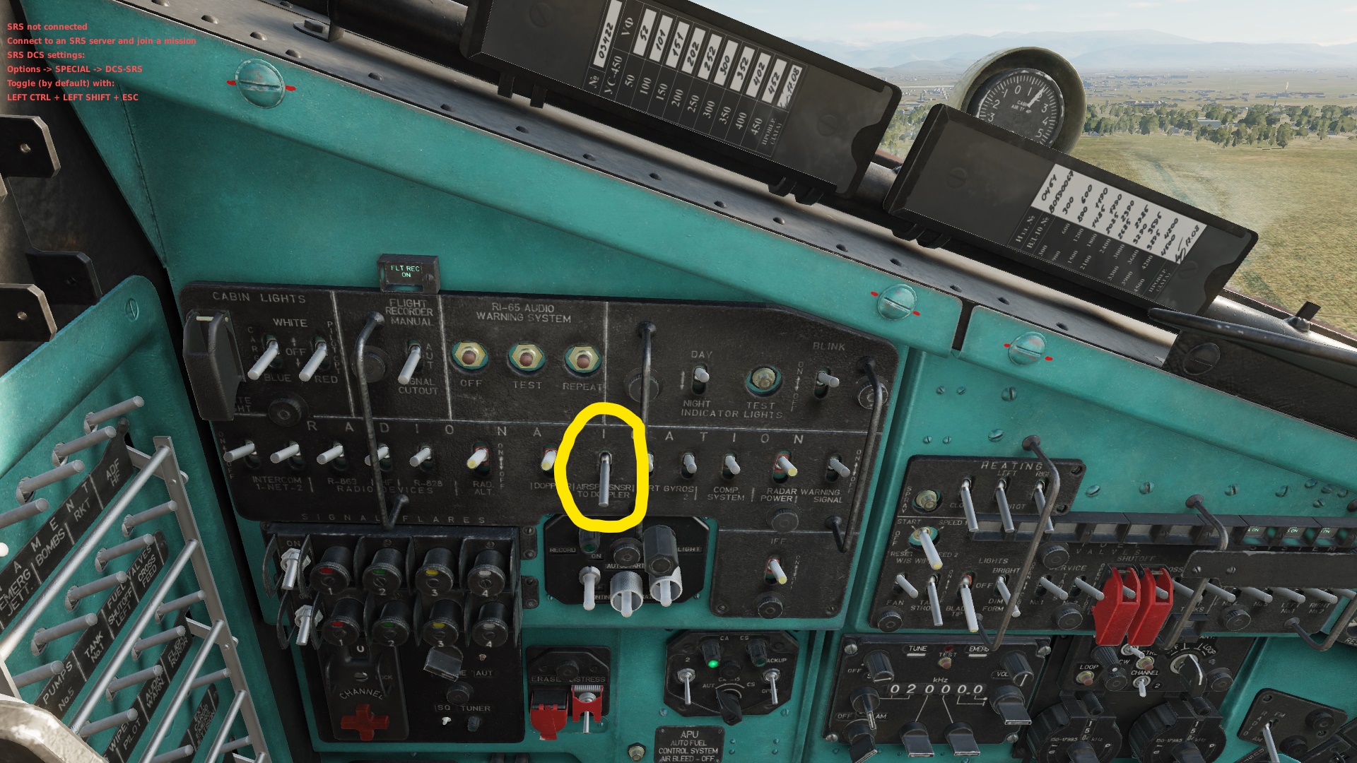
Hello, I am not new to DCS but I made a mistake repeatedly without realizing it. It took me many startups and references to the training, videos, and manual, to realize my mistake. Unsurprisingly my error was the flipping of an unnecessary switch. Armed with this knowledge I now have the power to screw up my navigation system if I want to. But to save others from this trouble I wish to share my knowledge. I don't have a perfect understanding but turning on the "AIRSPD SNSR TO DOPPLER" will effectively "invert" your navigation. If I had memorized the startup training I would not have made this mistake. Here is a picture of the left wall of the pilot seat:
-
Does someone have a kneeboard image file for DST points, including especially the DST ranges for the different points, what they're used for (which weapons and how many points are supported) and what you enter on the f10 map to have the ground crew enter them into the DTC? Maybe fill the extra space with some instructions on other navigation stuff
-
The ADF bearing circle on the HSI works fine in Track Up, but it doesn't follow the magnetic bearing when you switch to North Up. Instead it maintains the same position on the outside of the compass rose. I.e., if it is at the 12 o'clock position in Track Up flying west, it remains at the 12 o'clock position in North Up instead of moving to the 9 o'clock position to maintain the correct magnetic bearing. Track attached. adftest.trk
-
 With the recent patch DCS 2.7.14.23966 Open Beta (and maybe the one before) the Paper Map indicator for the DISS-15 has stopped working in Multiplayer while the DISS-15 itself is working reliably. The map indicator is not moving after takeoff, even with Airspeed2Doppler on (which causes drift), no movement. Any takeoff, fresh airframe, no damage, green OPER light, DISS-15 directional readout working, Doppler "Hover and Low Speed Control indicator" working correctly. If the airframe is moved above a certain "trigger" altitude at any point during a sortie, the map indicator will suddenly "snap" into the correct positon (which is technically impossible) at the time and move. If the "trigger angels" are a fixed AGL or ASL altitude is unclear at this point, especially as terrain masking seems to also influence bug manifestation. Which does not make sense in a systemic context but hints as a coincidental bug manifestation maybe related to DCS "radar" odditities overall. If the airframe is moved back into usual Crocodile angels (treetop, below treeop, terrain) at correct attitude for the DISS-15 to work, the indicator will stop moving again. The "snap" can be repeated then in a different position. This means that the module has currently lost its only means of navigation (since placeable beacons, radio truck NDBs are bugged for years by now on all available terrain modules) and the airframe has to operate in VFR, a correctly preset DISS-15 oneway Doppler and a maybe available ARK-15 beacon direction to find a FARP, a target, a destination.
- 7 replies
-
- 1
-
-
- map indicator
- papermap
- (and 6 more)
-
Abstract: I am talking about the ability to place various marks on F10 map that are for the user only and are not sent over the internet. The need: We need the ability to plan a route in MP while in the mission - typically on the ground before takeoff, but also in the air, especially in planes like the Mosquito that actually have a navigator. This is critical especially in warbirds and cold-war era servers. Since there is no nav computer much of the navigation is map-compass-watch style and require planning: timing, landmarks to spot en-route, etc. Cold war may use VOR/DME/TACAN (or the Soviet equivalents) and that also requires a bit of planning. My focus is the Mosquito, and 0 altitude navigation in MP requires a certain amount of dead reckoning, and visual navigation that are very difficult with the current tools - i have to memorize my plan and visual check points and then move the F10 ruler to the next leg before I start it. Suggested implementation: The markers can be very basic: “leg” which is basically the current ruler, except we can keep a few of them on the map. “Point” which is a circle to indicate landmarks we need to observe or the target/ip point/etc. “tag” just a small box of text we can write a few numbers/words in them. The markers are local-only and are are not shared with other players. Keep it simple. Extra mile: Indicate the magnetic variation somewhere on F10 map.
-
 I can't be completely sure that is what's happening, but I am getting a strangely large deviation in my waypoint locations after using the RB75, specifically when hitting the sequence T1, slewing to a target, then TV to lock. Hitting the RENSA button a few times clears the deviations and returns my waypoints to the expected positions, as would be expected to clear an erroneous nav fix. Does anyone else see this?
 -
Before everyone hit's their targets, they first must navigate to the target and home again. We need more navigation videos. Options for navigation. How to navigate. Problems encountered. Dealing with wind. Navigating home after a dog fight. Night navigation. For all models. For WWII, where are the "Wiz Wheel" videos? Basic radar navigation. Navigating when you do not have way points. Navigating to a collection or inverse point. Navigating to secondary targets. Navigating to hidden airfields.
-
Add option to ask ATC "where am I relative to field" or have ATC volunteer this info. Example. Called "Inbound" west of Batumi (see image), it directs to rwy 13. It gives contra course, which might seem odd. What is happening, I believe, is that anytime I call "[F1] Inbound", or keep calling "[F2] Request Azimuth", it keeps directing me to a point outside of the field in the runways extension (for runway 13, extension is to about 9 nm NW Batumi I surmise looking at F10 map). As experiment I kept calling "[F2] Request Azimuth" (Navigation assistance), it kept giving me any and all directions 75, 250, 179, 56 ... whatever (because I kept passing the point it directed me too). In daylight, you can ignore this and just keep heading for the field until it calls "cleared for visual, contact tower". In pitch black night time on the other hand ... you can keep running around forever getting new directions, never seeing the field or even being told you should see the field. One can infer I guess, if one keeps getting contradictory directions but remembering it's for rwy 13, that must mean you are NW of Batumi. One could then steer 130 hoping to see the rwy and getting the "cleared for visual, contact tower". It would be a help, especially at night, if ATC actually told you where you are relative to the field: "you are NW Batumi" followed by "steer 297" (or whatever) for "landing inception point". If ATC AI was really intelligent, of course, it would never say "297" in this situation, it would suggest a course (and altitude?) that asymptotically approaches the correct RWY approach. But adding human judgement to ATC AI is extremely complicated and will not happen. But adding an option to have ATC AI volunteer where you are relative to the field or adding an option to straight up ask "ATC where am I relative to the field?", that could be done. Following real world vocabulary of course. This brought about because I've never seen RWY lights in multiplayer ever, that I can remember so I tried an night offline mission. Yes, the RWY lights do come on when calling inbound (and goes off if you call abort landing). So then I tried some pitch black navigation and discovered I can run around forever, never seeing the field, if I keep following "[F2] Request Azimuth" directions.