

Howzzat
-
Posts
25 -
Joined
-
Last visited
Content Type
Profiles
Forums
Events
Posts posted by Howzzat
-
-
16 minutes ago, TOViper said:
Just a small guess (but TBH not knowing about this module too much so far): have you applied the role "Anti-Ship" for this group?
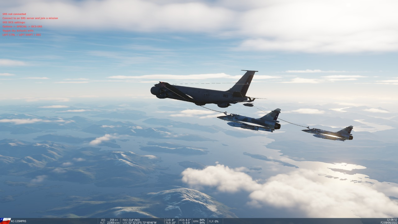
Yup and also set the advanced waypoint action weapon type to both auto, didnt work tried setting weapon to anti ship missiles, guided missiles not on missile fired which is wierd .
-
11 hours ago, RustyGunner said:
Howzzat,
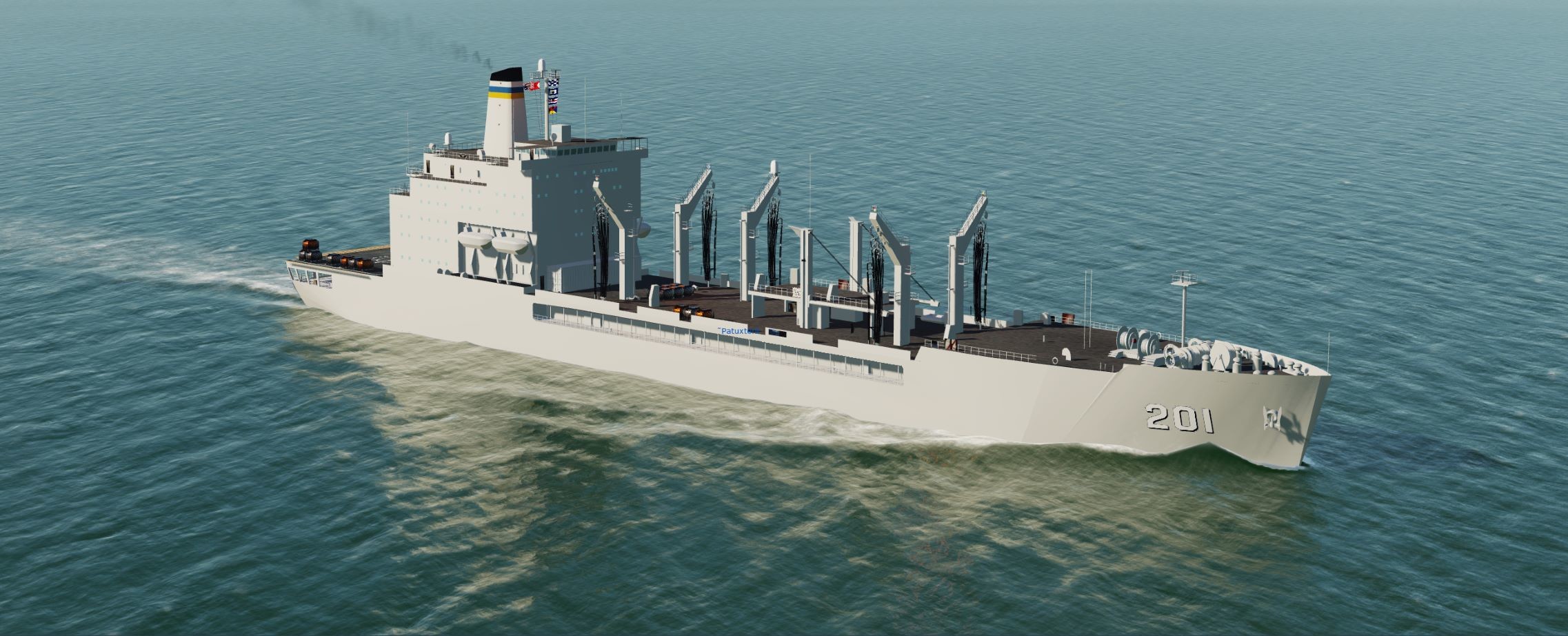
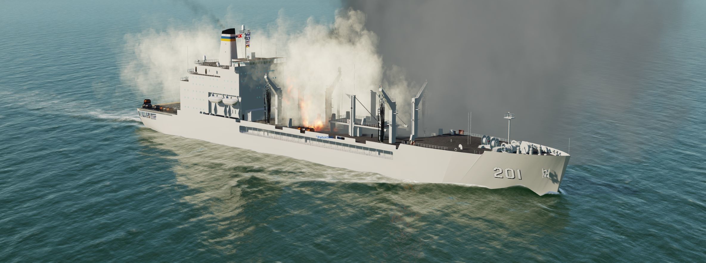
The version I have seems to work fine for taking damage. Here's the Patuxtent taking a couple of missile hits from another ship.
RustyGunner

Wierd I have the latest version from the front page and mine looks different to yours
-
 1
1
-
-
Hi I am trying to create a mission but for some reason the AI , with an antiship strike mission will not fire the RBS-15 I have tried both versions including the one with AI at the end, under weapons in The group attack advanced waypoint i have tried Auto and Anti Ship missiles any ideas?
-
3 hours ago, Gierasimov said:
This video is making it very clear -
Good potential for people intereted only in as realistic scenarios as they can get,
bad for aesthetics, as once Wags commented about MSFS that - it looks great from up high but bit so much down low - I wonder what promoted ED to allow this map to base it's terrain on satellite imaginery only. Well, you hate it or you love it seems like it by the community feedback.
Video is very good for those who want to make informed decision on development effort support:
TP pretty much nailed it on the head, very close to my original post, the opportunities are endless. Have been hunting round for mods and skins for some mini campaign / missions problem is trying to use existing Modules in them for example you would have to use the AV8B for harriers (Love the module warts and all) We dont have a Tornado, phantom or Typhoon for more recent scenarios. There are some awesome community Mods out there for it, its just a case of trying to balance it all out which is fun in itself. Despite my misgivings on some of the issues i still think this map had awesome opportunities.
-
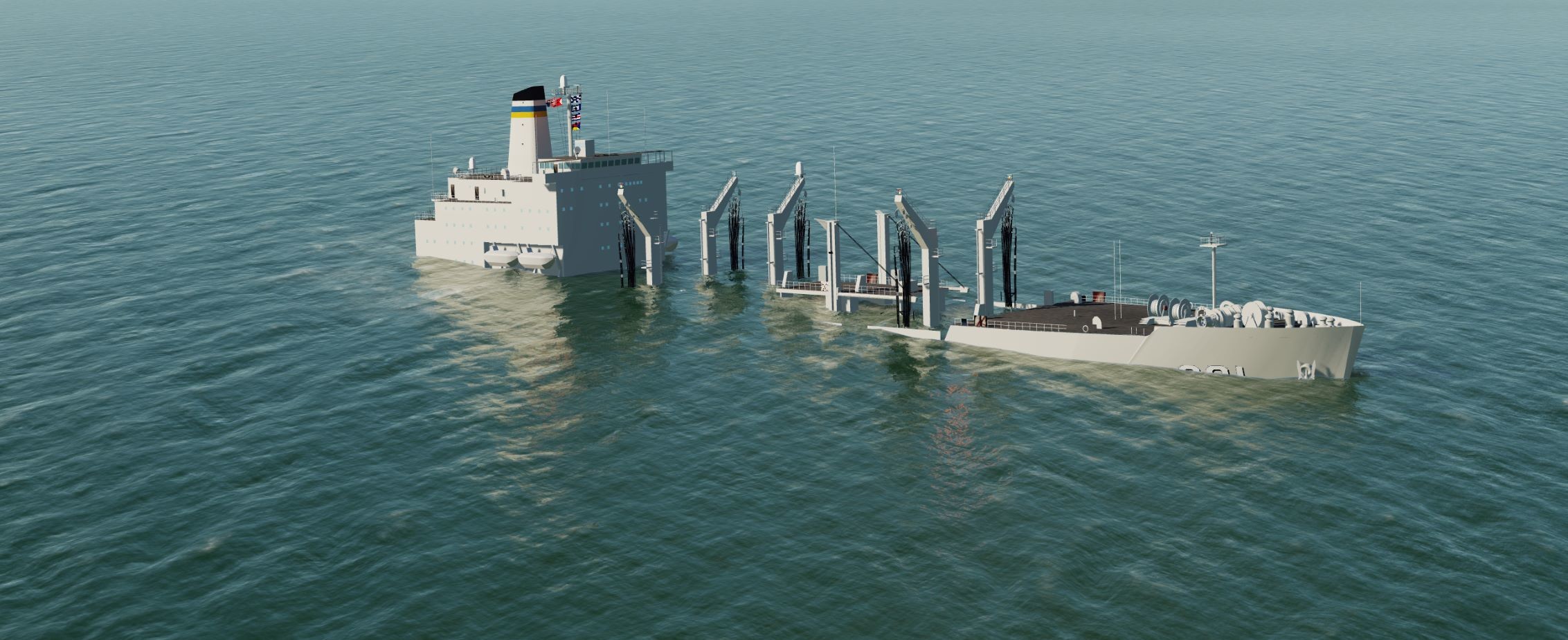
Hi There, am working on a mission and set The Paxtuxtent. I think this is related to the collision box but no sure, When hit by some weapons you see the weapon splash into the water although the hit registers in the mission result screen, but even multip[le hits from bombs, excocets and other antiship weapons it doesnt sink. Any ideas?
-
33 minutes ago, Beirut said:
At this point I think it's the banana split community.

It's binary - fly on the lo-res server or fly on the hi-res server. If making a choice between all of two options causes fear and loathing in the community, and risk splitting them like an aberrant atom, then the community has far deeper issues to deal with.
No decision by any developer should ever, ever, ever put "will it split the MP community" ahead of "will paying customers enjoy this premium product".
If its down to textures only Then As far as I know using the require_pure_textures set to false, allows custom textures to be installed so there must be a way to check texture sets for say high def and std def and allow both to run on the same mission somehow. Unless other changes were made between the HD version and SD Version
-
2
-
-
31 minutes ago, deeleyer said:
Aren't they Jeppesen charts with the trademark cutted off?
Maybe they licensed them.
-
I have no idea how they can say the falklands islands at that far complete
-
1
-
-
As I said in my original Post I dont regret getting this, I was just highlighting the current issues so people could make an informed choice as to if they wanted to purchase it Now.
The map offers a lot of opportunities given it's large size, I for one have two other modules from them The AV8B and the Mirage 2000C and the AV8B is one of my favourite modules along with the Tomcat, FA-18C and Apache 64D. The reason I mentioned the issues with the Falkland Islands in particular was Razbam mentioned this area is the furthest along.
They have created what could be one of my favourite Landscapes when it gets further down the road development wise.
-
1
-
-
Have you tried the same in the full mission editor rather than using the quick mission option? I have never used the quick mission option personally but havent had an issue yet on creating missions from the editor yet using the mainland bases.
-
50 minutes ago, Raz_Specter said:
people have managed to take some really cool shots. but as I mention in our dev post all of your concerns will be addressed during EA. our goal is to make this the best map for DCS
examples below
No one is disputing it looks great from altitude, down low below 5k Alt you see a different story, below 1k and it is pixelated like crazy, even in the falkland islands issues remain like clouds from satellite imagery are on the landscape. The Sim I work on see;s the same issues wuith scenery created by people using satellite imagery, for high altitude VFR style flying its amazing, for low level strike missions or helo ops it's a totally different story. The other issue is if you go with a higher res Sattelite image other than the increased File Size is you end up with loads of pancake Buildings that need covering up because on the high res images buildings are much more visible.
I am not bashing this scenery as I said for missions and campaign possibilities this Module offers endless possibilities, just offering some perspective from someone who has seen sceneries go down the same satellite image base route and had a nightmare trying to fix things, for example terrain mesh resolution not matching the textures so the textures for roads rivers etc wont match the actual terrain.
-
1
-
-
On 6/9/2022 at 1:03 AM, Beirut said:
I'm at 385GB with the SA map. Biggest game I've ever owned, that's for sure.
372 for me and 48GB in my saved games folder.
-
2
-
-
Before I get bashed let me say this, overall impression this map has huge potential. (Secondly have been working on the dev team for a leading flight sim for around 10 years)
Good points:- Finally a map big enough for opposing naval forces without being too close together great map for Naval Ops.
- from medium to High Altitude looks pretty good.
- Loads of potential for a wide spectrum of missions and campaigns due to the amount of playable area.
Not so good points and yeah I know its in Early access. (Hope these get fixed)
1. The use of satellite imagery as a texture base.Down low satellite imagery loses all fidelity it's too low res and requires massive amounts of work to get right, for example flying over the Falkland islands you see clouds on ground textures still,
shadows in valleys that are "Baked" into the scenery from the satallite imagery so give a false sense of time of day, sun direction etc clash with shadows from DCS itself.
Valleys etc that are in the satellite imagery dont match up with the terrain in places due to the resolution of the terrain mesh so can be decieving when dropping down from a high altitude.
2. Grass an awesome Idea but in place looks way out of scale compared to some static objects. or buries things like helipads, take a look at FOB San Carlos for example.
3. Some textures of Structures etc very low detail, kind of a pitty as this map offers a great opportunity for Combined Arms as well.
4. The waterline round lakes and the coasts (even the falkland islands) needs a lot of work at the moment there is no real transition (Example the free Mariana's Islands coast line is the best out there at this.)
5. Currently Cant get seasons to change textures snow in winter, change of colour of ground etc.
Overall impression.
Love the Potential this map has, with a "But" Finish wise it's lower quality than some of the new free / paid Sceneries Like Syria and Marianas. Would love to see some kind of roadmap as to when realistically we can see what is being updated and when.
Bang for Buck?
For Mission and Campaign creation well worth the money. 10/10
Visually 6/10
Do I regret buying it no, but feel its a bit overpriced for the current state it's in. When compared to Syria on release.
One final question to Razbam What settings did you use for the promo video for example. time, date and weather settings?
Finally thanks Razbam for what I hope will be a kick ass playground down the road.-
16
-
 3
3
-
Will ACLS finally be fixed in this update?
-
Hi There, was the Raven Skin added at some point? Checked user files etc. Many thanks for the awesome campaign ended up picking up all 3 of the audio book versions of the Raven one series
Ok ignore this was looking for VFA 64 just saw it under VFA 400 in my huge long list of skins in Mission Editor.
-
I Know i see errors when trying to add the tip effect on the wing tip connector
FLOW_001/002
Added the two connectors named FLOW_001 and FLOW_002 and in Custom Attribute TYPE="connector"; but get error message connector not found even though I can see the connectors in MV.
Same goes for the dust on wheels for touch down.
-
The saddest news I have seen in a while see their discord for latest info....
-
Latest version of the tools for 3ds max 2017
-
Just had new helper appear in 3DS max, Did not create it myself any ideas?
-
Ok so have found some awesome references after digging through for most things now just need to work on the animations for wolding wings like hornet etc.
-
Yup Confirmed I had to reinstall my old 2017 for this to work
-
Nice I have a few of mine in Condor 2 :thumbup:
-
I come from a 3D modelling Background, is there any hierarchy or naming convention needed example for flaps, airbrakes, folding wings (especially) I work in 3DS Max (2017) so have the edm exporter installed. Just want to make sure I have everything set up properly.
Many thanks in advance

ADMIRAL189'S CORNER - INCOMING SHIP MODELS
in Static/AI Mods for DCS World
Posted
Any Anytiship missles just fly straight through the model and spash in to the water.