
shagrat
-
Posts
13343 -
Joined
-
Last visited
-
Days Won
6
Content Type
Profiles
Forums
Events
Posts posted by shagrat
-
-
Not sure this is easy to implement, but here's the idea.
I would love to "hide" a concealed sniper or certain static objects (weapons cache) from George AI in missions.
Currently if George has LOS and is close enough, he seems to spot ANY unit easily from 4-5 km whereas a human CP/G find it quite challenging to identify the Infantry AK-47, kneeling behind the mudwall on a building with his head barely showing.
I know it's a bit contradictory, as often we complain, that George fails to see the enemy, as well.
So if possible, can we use the Mission Editor options:
Hidden / Hidden on MFD / Hide on F10 map
and if "Hidden" is selected George needs to be commanded to point search and only if the unit is in a narrow cone (2° ? ) and close < 4 km George will "find" it and show in the target list.
This would allow incredibly interesting search mission design, surprise ambush scenarios where you could preemptively search a "suspicious" compound or orchard and find the BRDM waiting for you, but if you look at the wrong compound a bit left, you may miss it and get attacked...
Sniper searches, where finding the target in build up areas or hidden between bushes or orchards is actually challenging, despite using George.
-
 1
1
-
-
Add an option to have George only list identified enemy (red) targets show in search list.
I suspect in real life Apaches the CP/G won't announce any friendly car, or building he sees on the TADS unless the pilot explicitly told him so.
Currently, we can set red as priority, but if commanded to search and no red units are found blue units still populate the list, so we need to cancel the list, search again, rinse and repeat.
We can deactivate "Air Targets" in the Mission Editor, but it would be nice to have an option to ensure all neutral and blue units found are NOT populating the target list (of course a blue unit "misidentified" as red would still show).
What we currently encounter regularly, is George searching PHS LOS, not seeing any of the red units despite the tracer fire clearly visible in the TADS FLIR, instead finding the blue Outpost 3-4 km behind the engagement and constantly listing the outpost in the target list!
So either we need to
- adjust the George menu (Target list) to switch between "ALL", "RED PRIO" and a new "RED ONLY"
or
- add an option to the Mission Editor to select "Show in Target list" and check red, blue, neutral.
-
He does prioritize targets, already. He just doesn't magically see everything, so he may see the couple dozen Infantry AK-47 and a HL DShk, but not the MANPAD behind the building and prioritizes the HL DShk, until you command a new search...
But that should get better, with the updates planned in the mini update thread.
-
1
-
-
+100 With the new statics we can create the COP and fortifications, but the iconic hill and corkscrew road leading to the top need to be modeled as terrain.
-
1
-
 1
1
-
-
Keybinds have been added with 1st July 2025 update! Thank you ED team.

-
vor 7 Stunden schrieb GrafRotz:
Ich verpasse es leider immer wieder den Download Ordner zu beobachten, aber alles, was irgendwie verschlüsselt ist, scheint jedes Mal mit geupdated zu werden.
Jupp, die müssen soweit ich weiß mit dem jeweils aktuellen Schlüssel versehen werden. Leider ist das zum Schutz des Intellectual Property mittlerweile notwendig.
 vor 1 Minute schrieb QuiGon:
Also das ist definitiv nicht der Fall. Der DCS Updater zieht jedes Update in einem Rutsch durch und wenn man mal ein Update verpasst hat, dann kombiniert er das sogar mit dem darauffolgenden Update in einen einzigen Download. Es ist also eher sogar das Gegenteil der Fall von dem was du da sagst.
Jepp. Es stände ihm gut zu Gesicht einfach mal im autoupdate_log.txt nachzuvollziehen was der Updater wirklich tut, anstatt wild zu spekulieren.

-
vor 1 Stunde schrieb Yurgon:
Meines Wissens überträgt der DCS-Updater Daten komprimiert, um das Transfervolumen klein zu halten, und meines Wissens überträgt der Updater geänderte Dateien, aber nicht alle. Also grob gesagt, wenn sich irgendwas am Fahrwerksmechanismus der Corsair ändert, wird trotzdem nicht das ganze Modul beim Update neu übertragen, und das gilt analog auch für Terrains.
Oder anders gesagt, das meiste von dem, was hier gefordert wird, ist meines Wissens längst der Fall. Ich bin mir sicher, dass man das weiter verbessern könnte, um die Downloads kleiner zu machen oder das Entpacken zu beschleunigen. Aber ED hat nunmal auch nur begrenzte Ressourcen zur Verfügung und kann nicht alles gleichzeitig machen.
Absolut richtig, man kann das sogar mitlesen, beim Updater, wenn zuerst alle Dateien die aktuell auf dem Rechner sind überprüft werden, dann die geänderten zu der Update Version identifiziert und nur diese dann komprimiert (und in einzelnen Paketen) heruntergeladen werden. Oben sieht man im Updater dann auch schön, wie die ersten Pakete, parallel zum Downloaden bereits entpackt (de-komprimiert) werden.
Was tatsächlich vorkommt ist, daß erst der eigentliche Updater upgedatet wird, dann das Update geladen wird, und wenn man bspw. im Sale 3-4 Module neu hat und diese mit ausgewählt hat, werden die als separate Pakete mit derselben Methode, sequentiell runtergeladen und installiert, innerhalb des Updaters.
Steht im Prinzip auch alles im autoupdate_log.txt im DCS World root Verzeichnis.
-
1
-
-
Am 2.7.2025 um 03:50 schrieb Nealius:
Yes, if only all the -34 tables with such parameters weren't classified. And if ED doesn't provide us with in-game parameters, then how are we expetected to do such planning?
Yes and no. There's some information in the GICHD documents. The RED describes 10% and 0,1% ranges for damage to human bodies, so we can assume there's fragmentation, at least up to that distance.
The problem I see, with the current increased blast model, is fragments will slow down faster than the blast wave and that's why we end up in the outer edge of the damage zone from the blast.
So your observation is definitely valid.
Guess, there's still some tweaking needed. But it's better than before.
-
1
-
-
vor 11 Stunden schrieb Raven (Elysian Angel):
There was probably a reason for the increasing focus on limiting collateral damage and development of systems such as Small Diameter Bomb.
☝

-
vor 8 Stunden schrieb Py:
Something doesn't seem right though, I haven't managed to drop high drag MK-84 at any reasonably low altitude without damaging myself, even just below supersonic, and that's specifically what they are designed for.
Looks like part of the problem is, the blast traveling faster than fragmentation would after the initial lethal zone.
But in general this is still an improvement, though it needs a bit of fine tuning.
IRL the whole process of a bomb explosion is even more complex. Blast waves in urban areas do produce additional damage, through reflection of house fronts, funneling along streets and alleys and enhanced fragmentation from material propelled by the blast. Whereas in an open field, with little to no obstruction the blast disperses evenly and even a small mound of dirt can deflect a blast wave "over" a human lying prone... but I guess this will take CPU power from a distant future to do on a home PC.
-
2
-
-
Am 28.6.2025 um 01:09 schrieb Esac_mirmidon:
Then we need some information or values to calculate safe bombing radius to not be damaged by the blast
I just looked up an old reference for the F-5E that has the fragmentation envelope of a Mk82 and Mk83
The maximum height is 2520 ft, 9 sec after the explosion, for the MK82
and 2820 ft, 9 sec for the Mk83.
I guess the adjusted blast damage is similar to the damage on the ground so below 1000 ft?
Assuming the real life fragmentation heights, and planning for a safe escape maneuver above 3500 ft, should keep us out of harms way... though I still need to test/verify this assumption.

-
1
-
-
vor 55 Minuten schrieb Esac_mirmidon:
The thing i want to know is if the HUD cues below the Pipper to show you the danger zone are updated to take in count the new blast radius
Hm, those reflect, what you program in your aircrafts mission computer, IIRC, at least for the A-10C.
You enter the abort altitude and that's what calculates the HUD abort cue, based on your current flight envelope.
...and, again IIRC, it doesn't know the height above ground, but you need to plan your mission, figure the height of the target above MSL and calculate the correct safe barometric abort altitude. This is what you enter into the profile.
-
2
-
-
Am 27.6.2025 um 15:48 schrieb SalakauHeadman:
hmm.. interesting... but is it really that damaging in real life? in the video i posted 1 pair of mk83s could destroy trucks that are almost 500ft away
You mean finally manage to destroy an unarmored truck that's as close as 500ft (~150m) to a 1,000 lbs bomb?
That's actually good news. Thank you ED.
For some context, according to statistics compiled by the GICHD (Geneva International Centre for Humanitarian Demining) the typical lethal area of an Mk82 (500 lbs) is 80m by 30m (260ft by 100ft) with RED (Risk Estimate Distance) of 250m(!) for 10% (one in ten) people incapacitated! ...and that's just the "small" 500 lbs Mk82.
Here is a link to the GICHD website for research: https://www.gichd.org/our-response/policy/explosive-weapons-in-populated-areas/
Direct PDF download link for the MK82 study (Annex-E): https://www.gichd.org/fileadmin/uploads/gichd/Publications/Explosive_weapon_effects_web.pdf
Am 28.6.2025 um 01:09 schrieb Esac_mirmidon:Then we need some information or values to calculate safe bombing radius to not be damaged by the blast
Seems they are now quite close to real life, so proper parameters and planning matters.

-
4
-
-
You may try using two overlapping buildings of the same type. But it looks like the broken rotor blades will still stick outside the buildings.
-
vor 2 Stunden schrieb Tom Kazansky:
Stimmt wohl. Ich hab mal "Virga Studio" gegoogelt und das gefunden:
https://secure.simmarket.com/virgastudio-(de_2443).mhtml
Da und auf deren FB-Seite steht noch nichts von DCS. Müsste ja auch nicht. Bin gespannt was da kommt, und auch wie und wann.
Ich interpretiere das so, daß Dassault sich flexibel Partner sucht/nimmt, die Erfahrung mit der angepeilten Flugsimulation haben und denen die Daten, 3D-Modelle (die haben ja die Originale im CAD) zur Verfügung stellen, etc.
Natürlich würde es vermutlich Sinn machen, wenn ein Partner, der ein Flugzeug bereits im MSFS realisiert hat, dasselbe auch in DCS oder X-Plane portiert. Aber es kann auch sein, daß Dassault sich dafür neue Partner gesucht hat.
Die Aussage "DCS and X-Plane coming soon", deutet aber darauf hin, daß sie hoffentlich schon über die reine Idee das zu tun hinaus sind.

-
3
-
-
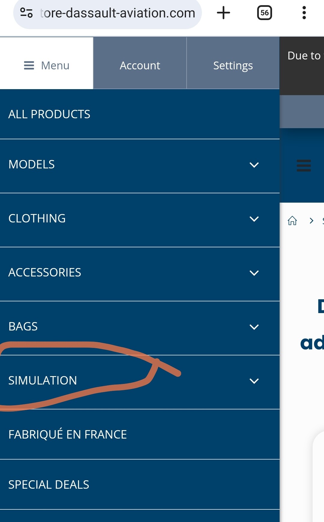
vor 1 Stunde schrieb Yurgon:
Wohl nur für Mobile. Am Desktop aktuell noch nicht:
 Was für ein professionelles Webdesign... ok, wer also MSFS auf seinem Smartphone fliegt, kann sich im Store bei Dassault unter "Simulation" die neuesten Module anschauen.
-
2
-
-
vor 50 Minuten schrieb Yurgon:
Dassault scheint in die Simulationswelt einzusteigen und kündigt an, bald auch Module in/für DCS verfügbar zu machen:
Wobei es auf der Store-Seite von Dassault noch keine Sektion "Simulation" gibt, da wurde wohl die Mitteilung ohne Rücksprache mit dem Webseiten-Team veröffentlicht...

Dem Screenshot nach zu urteilen wird der Alphajet wohl den Auftakt machen.
Doch ist aber im Store-Menü versteckt...
Und der Link direkt zur Simulation Sektion:
https://www.thestore-dassault-aviation.com/en/simulation
AlphaJet und SEPECAT Jaguar; die Rafale angekündigt.

-
1
-
-
Yes, it's fixed. Could reinstall through the launcher - available - terrain
-
Same issue here! Exact same error message.
-
1
-
-
We don't need a "community mod" that will break and require a complete rebind, when ED implements their real keybinds!
What we need is a basic(!) support for the MFD/CDU keybinds in the core module.
I totally agree with Hawkeye_UK.
I put the CH-47F on the shelf, waiting for those keybinds, as this is the first or second thing I usually do in a new module.
Now, after the second update for the Chinook dropping and the paramount of features is "more liveries", it seems the development roadmap is in dire need of a re-priorization.
We now have basic flight controls incl. sophisticated stability augmentation systems and helpers modeled.
We have a basic cargo system in place.
We have operational AI door gunners.
We have basic navigation, radio, engine monitoring and flight computer... but only a damn mouse pointer to operate the gazillion pushbuttons on the multiple MFDs and CDUs, that are required to make use of the systems?!
So ED please, either spend an afternoon on creating the keybinds or kindly ask the community mod creator to use his keybinds and put it into the core module, maybe?
-
vor einer Stunde schrieb The_Fragger:
[UPDATE – ENTWICKLUNGSSTAND DER BO-105]
Es ist an der Zeit für ein richtiges Update.
Seit 2013 arbeite ich daran, die BO-105 in DCS zum Leben zu erwecken – und der Weg dorthin war alles andere als einfach.
Ich bin durch die technische Hölle gegangen: komplette Neuprogrammierungen, System-Redesigns, Hardwareprobleme – und mindestens ebenso viele Herausforderungen, die nicht durch Technik, sondern durch Menschen verursacht wurden.Um es klar zu sagen:
Es gab Personen, die aktiv daran gearbeitet haben, dieses Modul zu verhindern.
Statt Unterstützung gab es bewusste Blockade, zurückgehaltenes Wissen und Egotrips von sogenannten „Experten“, die helfen konnten, aber sich entschieden, es nicht zu tun.Aber ich habe nicht aufgegeben. Ich bin weitergegangen.
Ein echter Wendepunkt war der Zugriff auf die originale technische Dokumentation aus Lager Lechfeld.
Diese Unterlagen haben nicht nur die Systemarchitektur bestätigt – sie lieferten jeden einzelnen Wert, der notwendig ist, um das Triebwerk exakt zu simulieren:
Durchflussmengen, Drücke, Temperaturgrenzen, Regelkurven, Reaktionszeiten – alles.
Diese Detailtiefe hat das gesamte Projekt auf ein neues Niveau gehoben.Derzeit liegt der volle Fokus auf der Verbesserung und Finalisierung des Fuel Control Systems, das direkt mit dem GPFC (Gas Producer Fuel Control) verknüpft ist – dem Herzstück der Triebwerksregelung der BO-105.
Die aktuelle Implementierung umfasst:
– Logik des Kraftstoffflusses und das Verhalten der Druckdynamik
– Ohmsche Widerstände, Spannungs-, Stromstärken- und Lastverhalten
– Reaktionslogik des Hydrauliksystems sowie das komplette Bordstromsystem
– Alles eingebettet in eine integrierte SimulationsumgebungDas Triebwerk wird 1:1 simuliert – basierend auf realen Parametern.
Keine Annahmen, keine Platzhalter – sondern rohe, systemgenaue Simulation.Und das ist noch nicht alles:
Auch das gesamte Rotorsystem wird vollständig modelliert, inklusive des gelenklosen, starren Rotorkopfes mit seiner charakteristischen Phasenverschiebung von 78°.
Dieser fundamentale Unterschied zu herkömmlichen Rotorsystemen hat einen massiven Einfluss auf das Steuerverhalten – und wird im Flugmodell exakt so abgebildet.Warum dieser Aufwand?
Weil die BO-105 die Liebe meines Lebens ist.
Es geht nicht einfach nur darum, dass sie „fliegt“ –
es geht darum, einer Maschine gerecht zu werden, die es verdient, in DCS in all ihrer technischen Brillanz zu existieren.An alle, die dieses Projekt über die Jahre unterstützt haben – vielen Dank.
An die, die es erschwert haben – Glückwunsch. Ihr habt es verzögert.
Aber ihr habt es nicht aufgehalten.Das hier ist kein Helikopter-Mod.
Das ist eine Mission, die 2013 begann – geschärft durch Widerstände, angetrieben durch Besessenheit und gebaut mit absoluter Liebe und tiefem Respekt für dieses Luftfahrzeug.Und ja – ich weiß, dass die ersten Kommentare zum Flight Model nicht lange auf sich warten lassen.
Ich werde sie alle lesen... mit Popcorn.
Danke Olli, das du das durchziehst. Die Bo-105 ist immer noch einer der spannendsten Hubschrauber, die ich mir für DCS wünsche.
Es freut mich sehr zu hören, daß trotz der Widrigkeiten, oder vielleicht auch gerade deswegen, es weiter voran geht.
Deine Liebe zum Detail ist ja gut nachvollziehbar, wenn man den Screenshots und Entwicklungs-News in den vergangenen Jahren gefolgt ist.
Ich warte geduldig und wünsche dir von ganzem Herzen viel Erfolg und Energie, auf den letzten Metern.

-
5
-
-
Am 24.4.2025 um 12:30 schrieb Eugel:
Ja, aber ich denke, gerade deswegen ist (berechtigte) Kritik und Feedback im Early Access auch gut und wichtig.
Klar, im deutschsprachigen Teil des Forums liest wohl kaum jemand von Ugra mit und es wäre, wie mein Vorredner schon schrieb, gut auch im "Wishlist" Unterforum zu posten.Das Zauberwort ist halt "Konstruktive Kritik" und "helfendes Feedback".
Wichtig ist, denke ich z.B. zwischen "Bugs" / Fehlern (Dinge die aktuell falsch dargestellt oder platziert sind) und "Wishlist" / Fehlendem (Dinge die "noch" nicht auf der Map sind und in DCS sinnvoll sind).
Bspw. ein Industriegebiet mit rauchenden Schloten, oder ein Agrar-Kombinat, wo eine generische Kaserne hingehört (bug/Fehler) oder eine fehlende Porta-Westfalica oder eine "hübschere Autobahn" (Wishlist/Wünschenswert).
Priorität sollte, meiner Meinung nach, auch auf militärische Anlagen, kritische Infrastruktur und Navigation (markante Geländepunkte, Hohe, gut sichtbare Gebäude, etc.) liegen.
Letztlich kann es nur hilfreich sein, kurze, präzise Hinweise, am besten mit einem Bild/Koordinaten im englischen Ugra-Media / Cold War Germany Forenteil zu posten und dann Geduld mitzubringen und die Daumen zu drücken.
Die Map ist ja auch nicht gerade klein und für Phase 2 und 3 haben sie sich ja auch einiges vorgenommen.
-
2
-
-
vor 21 Stunden schrieb Tom Kazansky:
Gibt's denn in DCS Maps wo die Städte näher an der Realität sind? Ich mein die Frage ernst.
Nein, i.d.R. sind markante Points Of Interest (Gebäude, Denkmäler, etc.) an den richtigen Stellen, dazu wird ein, ungefähres Strassennetz erzeugt und die Bereiche innerhalb Städten mit generierten Gebäuden gefüllt. Das Ambiente einer "Altstadt" oder einer "Plattenbausiedlung", aber auch einer ländlichen Siedlungen mit Lehmbauten und Bewässerungsgräben in Afghanistan wird glaubwürdig und ich finde, für eine Flugsimulation, sehr detailliert abgebildet.
Es ist immer eine Balance aus Performance, visuellen Details und Speicherbedarf.
Gebäude in DCS sind fast alle zerstörbar, müssen also in einer Tabelle gespeichert werden, auf Kollision mit Waffen oder Flugobjekten geprüft und entsprechend als zerstört "geflagt" werden. Das braucht Rechenleistung und Speicher. Deutschland zählt zu den dicht besiedelten Ländern auf dem Planeten und mit dem Wissen, um die Performance, bin ich von der Map und der Menge an Gebäuden und Details, echt angetan! Das ist bereits jetzt verdammt gut optimiert, finde ich.
Nicht zu vergessen, irgendwer muss das auch alles erstellen und platzieren. Klar, wären akkurate Gebäude, überall, mit absolut realem Straßennetz, bis runter auf die Gassen in den Altstädten, der absolute Traum, aber die Zeit und der Aufwand, stehen dazu in keinem Verhältnis.
Selbst der FS2024 nutzt aus gutem Grund "procedural Generation" für die Gebäude und Stadtteile (oder Photogrammetrie, was aber nur ab 6.000ft Flughöhe erträglich aussieht).
Mein Eindruck ist bisher sehr positiv. Man kann Landschaft, Orte, Strassen und POIs die bereits drin sind gut erkennen und danach navigieren, auch wenn manches (noch) fragwürdig ist - eine kleine militärische Anlage mit Heliport, mitten in der Eilenriede in Hannover, wüsste ich jetzt nicht - aber dafür passt die A2, die Heide inkl. Truppenübungsplatz Bergen-Hohne und Lager Oerbke ist, wo es sein sollte, auch wenn nicht jede Barracke/ jedes Kompaniegebäude abgebildet ist.
Der Harz ist großartig, auch Fulda erkennt man, mit dem Dom, Bahnhof und Aueweiher, Petersberg und Stadion. Dafür sind Schlitz und Bad Salzschlirf eher generisch, aber da wo sie hingehören.
Ich habe noch nicht alles erkundet, was ich von Deutschland kenne, aber mein persönliches Fazit: Die Map ist für einen Early Access fantastisch! Das Look and feel ist toll und man findet sich gut zurecht und kann Städte, Ortschaften und Wegenetz gut identifizieren.
Ist jetzt alles perfekt? Nein, natürlich nicht, es gibt die üblichen, notwendigen Kompromisse, auch fehlt sicher das ein oder andere markante Gebäude und an der einen oder anderen Stelle ist der ein oder andere Heißluftballon oder mittelalterliche Wehrturm zuviel.
Aber hey, das ist Early Access, gerade man ein paar Tage raus und wir haben noch Phase 2 und 3 vor uns nachdem diese erste Phase abgeschlossen ist.
Nach der Erfahrung mit Normandie und Syria ist Ugra-Media auch sehr offen für konstruktive Kritik und ehrliches Feedback, auch wenn es nicht immer gleich im nächsten update passiert (an diser Stelle nochmal danke für Afrin
).
Ich freue mich auf jeden Fall, daß wir diese Map in DCS haben. Genau wie über Iraq und Afghanistan, Kola, Sinai, Syria, South Atlantic, Normandy, Channel, Marianas und Caucasus. Auch wenn ich gerade nicht weiß, wo ich zuerst Missionen bauen soll...

-
8
-
2
-
-
vor 21 Stunden schrieb Meerschweinmann:
Trabi, Tatsache.

Ättenschn tu Dietähl! Wie der Engländer sagen würde...
-
2
-

Option to hide targets from George until point search is "on top" of it
in Wish List
Posted
Nope! "Invisible" only affects the spot logic of the core AI, as a way to switch, between automatically engaging everything that's enemy coalition. George is a separate logic and ignores that one. Currently there's no way in DCS to "hide" units from George.
Even late activation won't work if set to "visible before activation"...
Also the idea isn't to have George completely ignore "hidden" units, but require a deliberate scan by the player on the suspected location to "find" a concealed enemy unit.