Balse
-
Posts
8 -
Joined
-
Last visited
Content Type
Profiles
Forums
Events
Everything posted by Balse
-
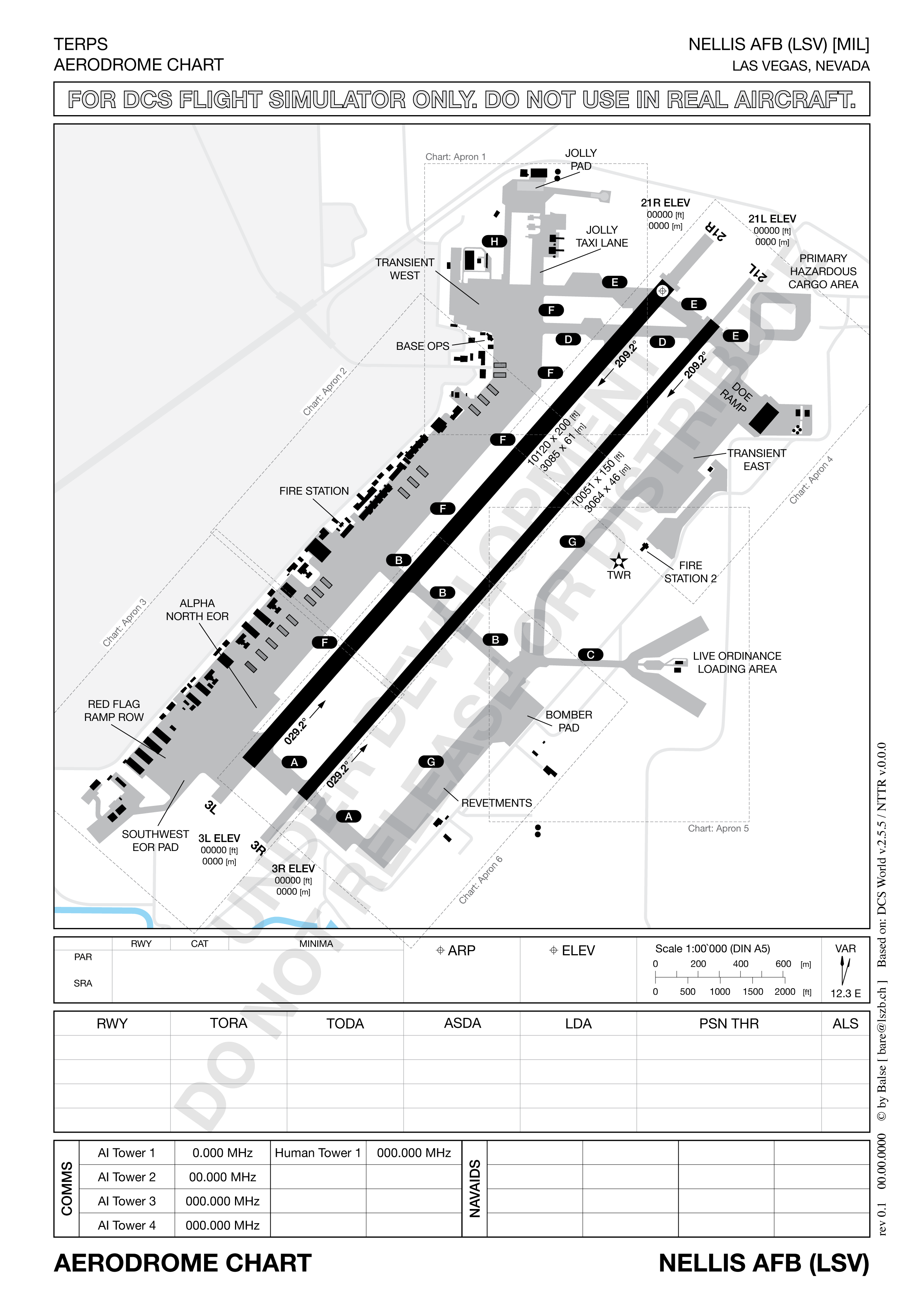
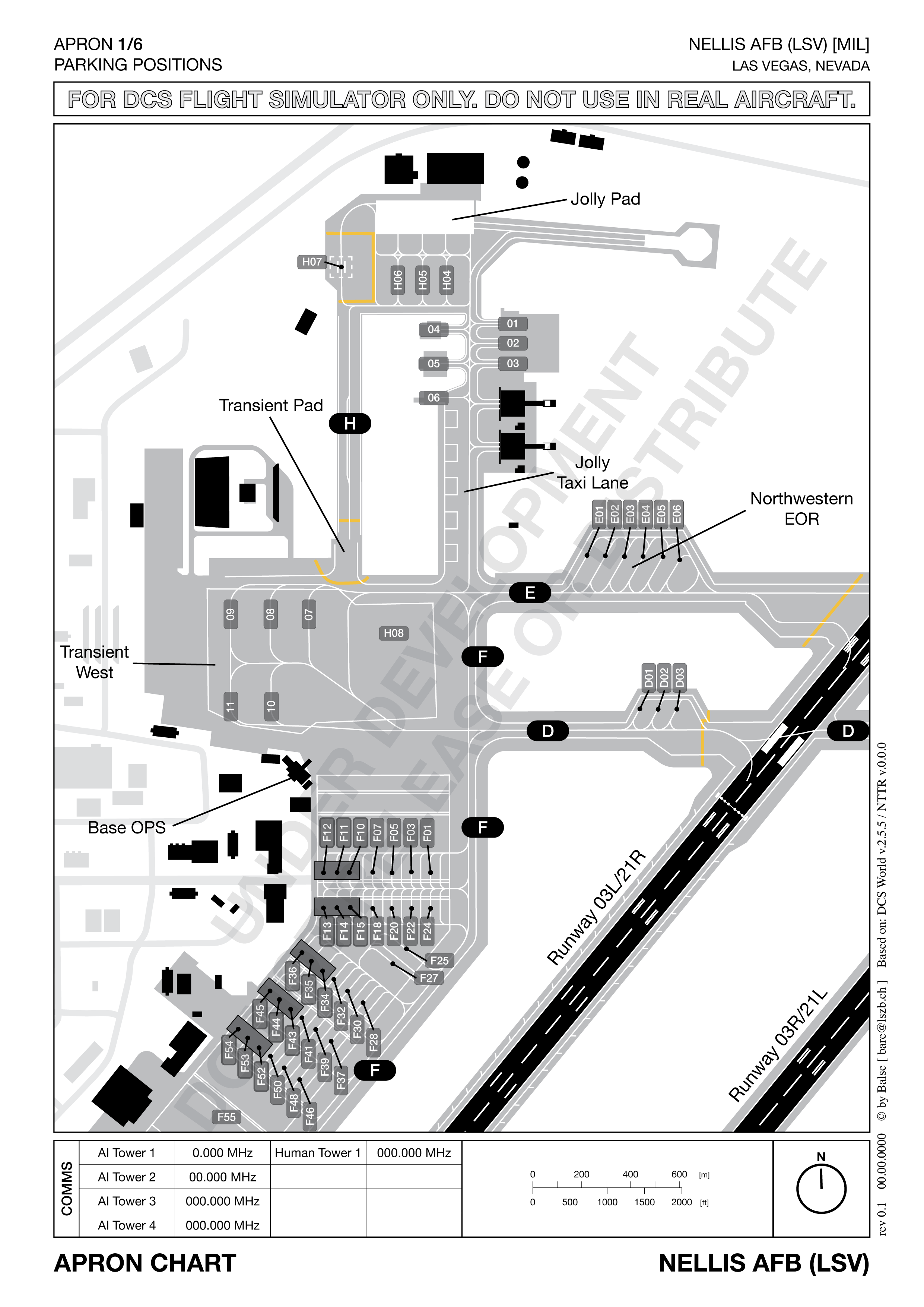
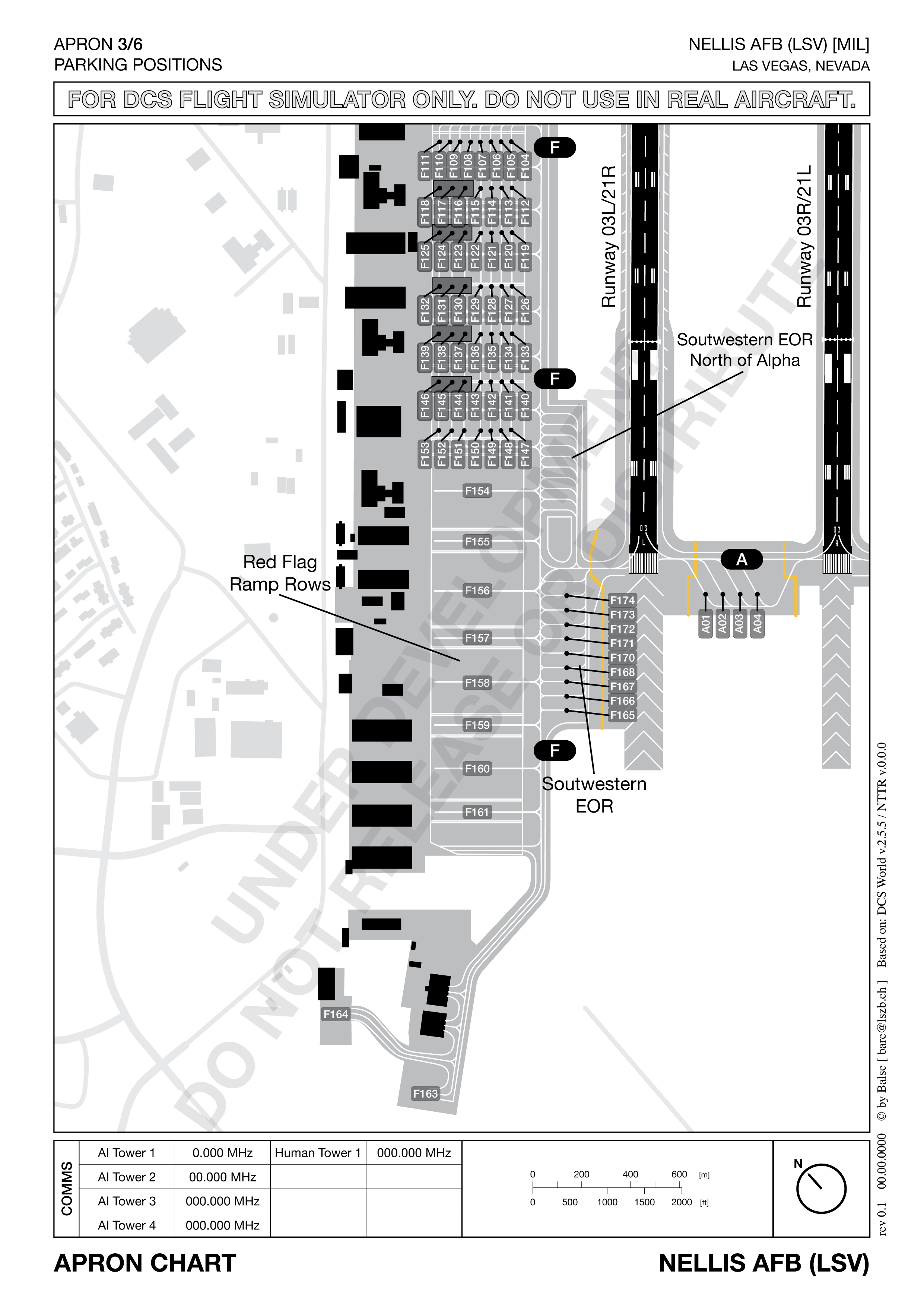
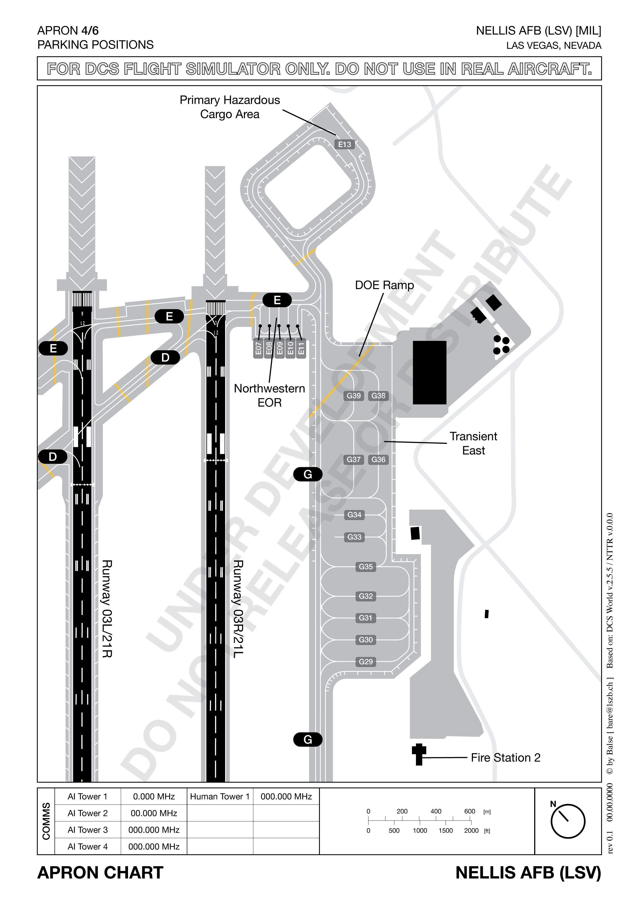
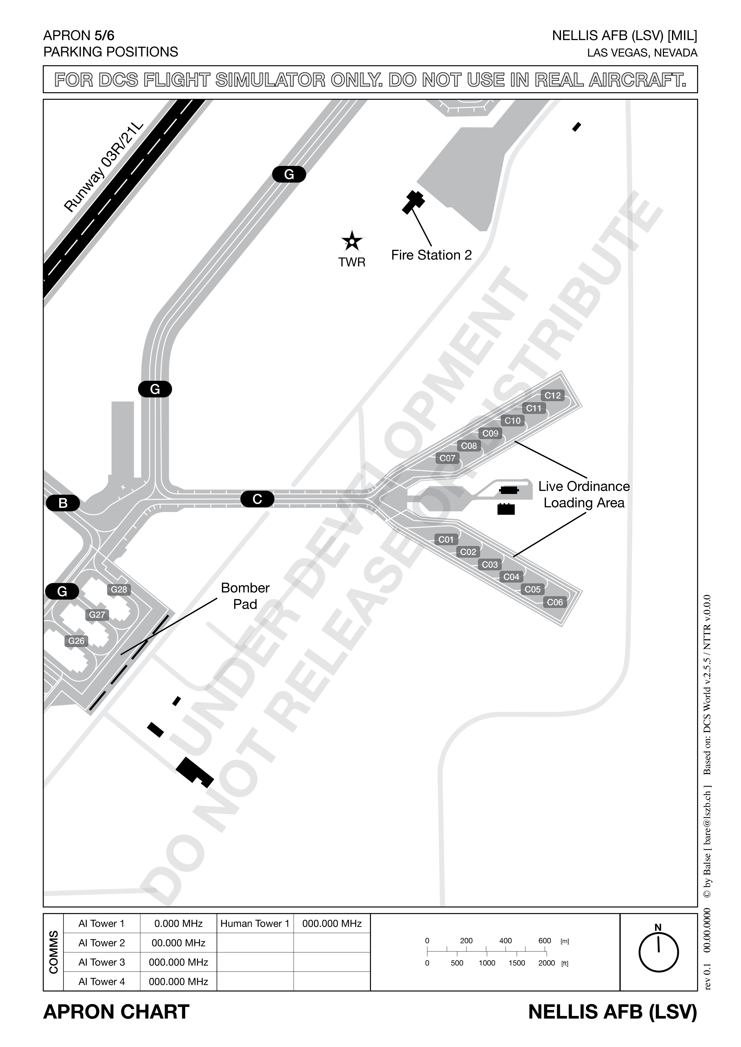
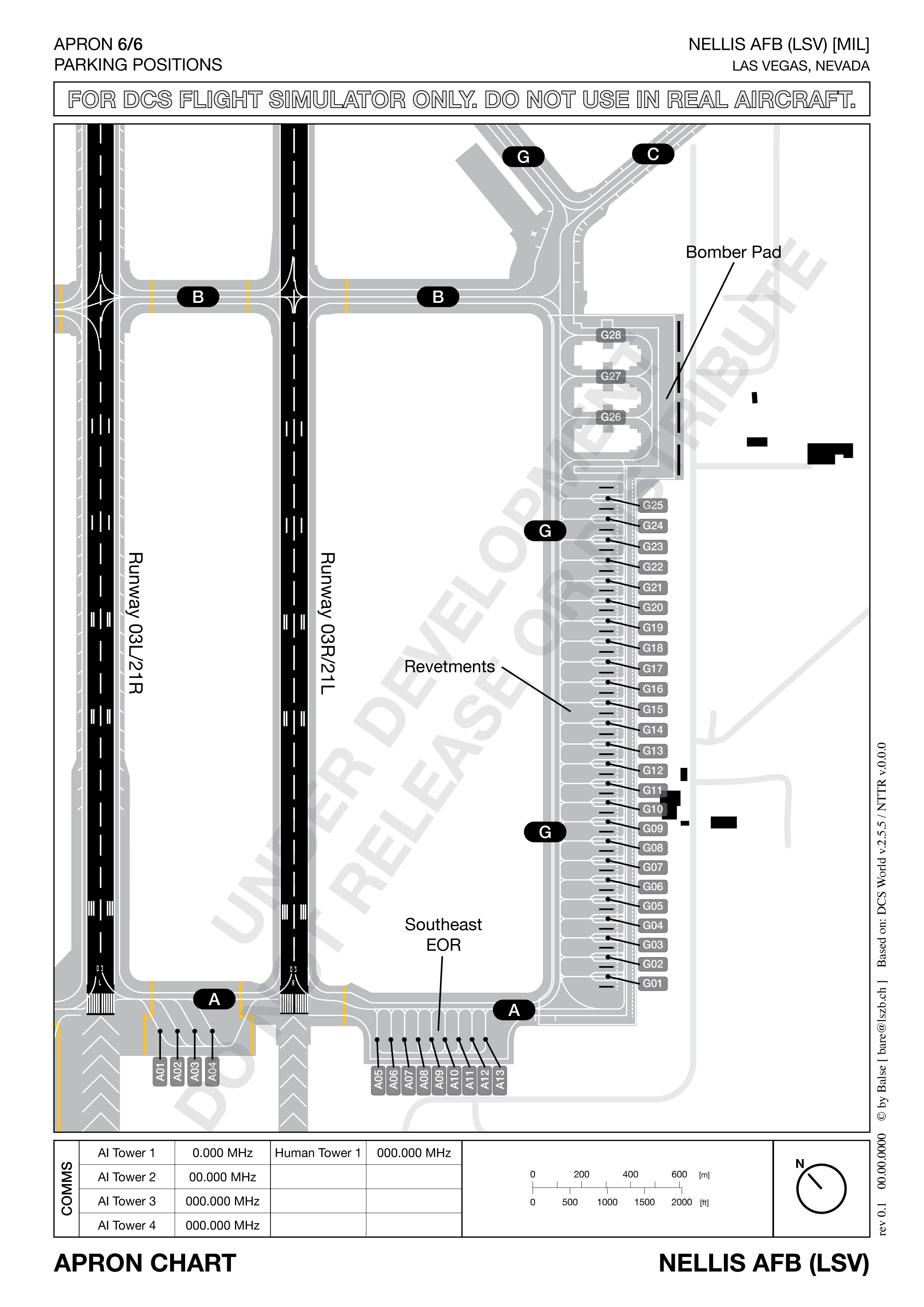
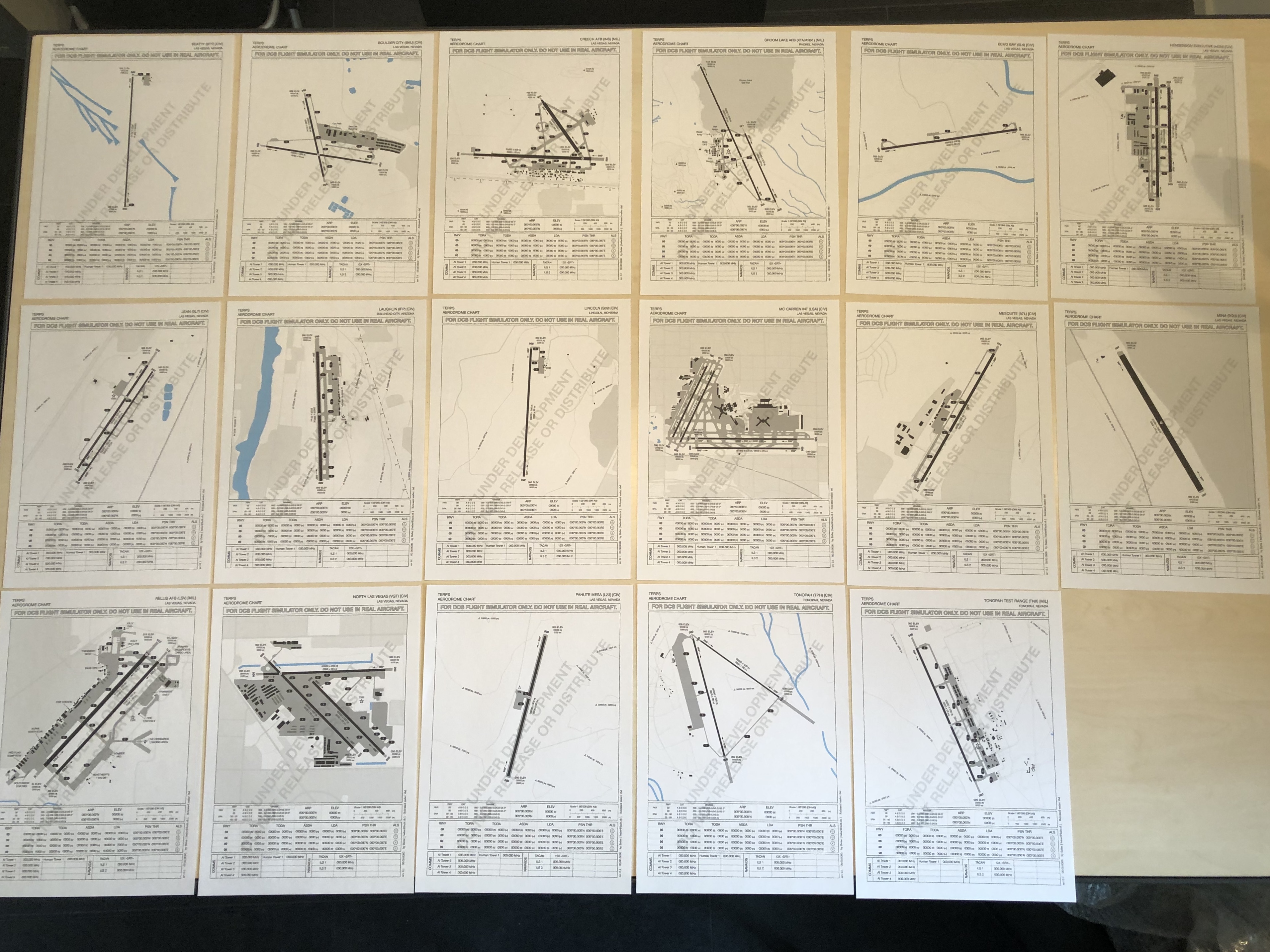
Just a quick update. I spend the last few days drawing the Charts for the mother of all Airports (at least on the Nevada Map). Nellis AFB. As of now, there is a lot of data missing, but the Charts are drawn. I'm also working on a big (about DIN A1) overview Map. I hope I can share some samples of that soon. As always, any input or feedback is much appreciated.

-
And if you need to know exactly where the runway and taxiways are, check out my map project: https://forums.eagle.ru/showthread.php?t=263706 coming soon ;-)
-
I used the 476 vFG maps quite a lot now, its a great reference for everything who is not in DCS. Like taxiway numbers, for example. I would love to do App/Dep procedures charts once I finished all the Apron charts. But I would definitely need help with that. Since we would have to adapt the FAA procedures to DCS, and maybe develop whole new ones for the Airports who have none.
-
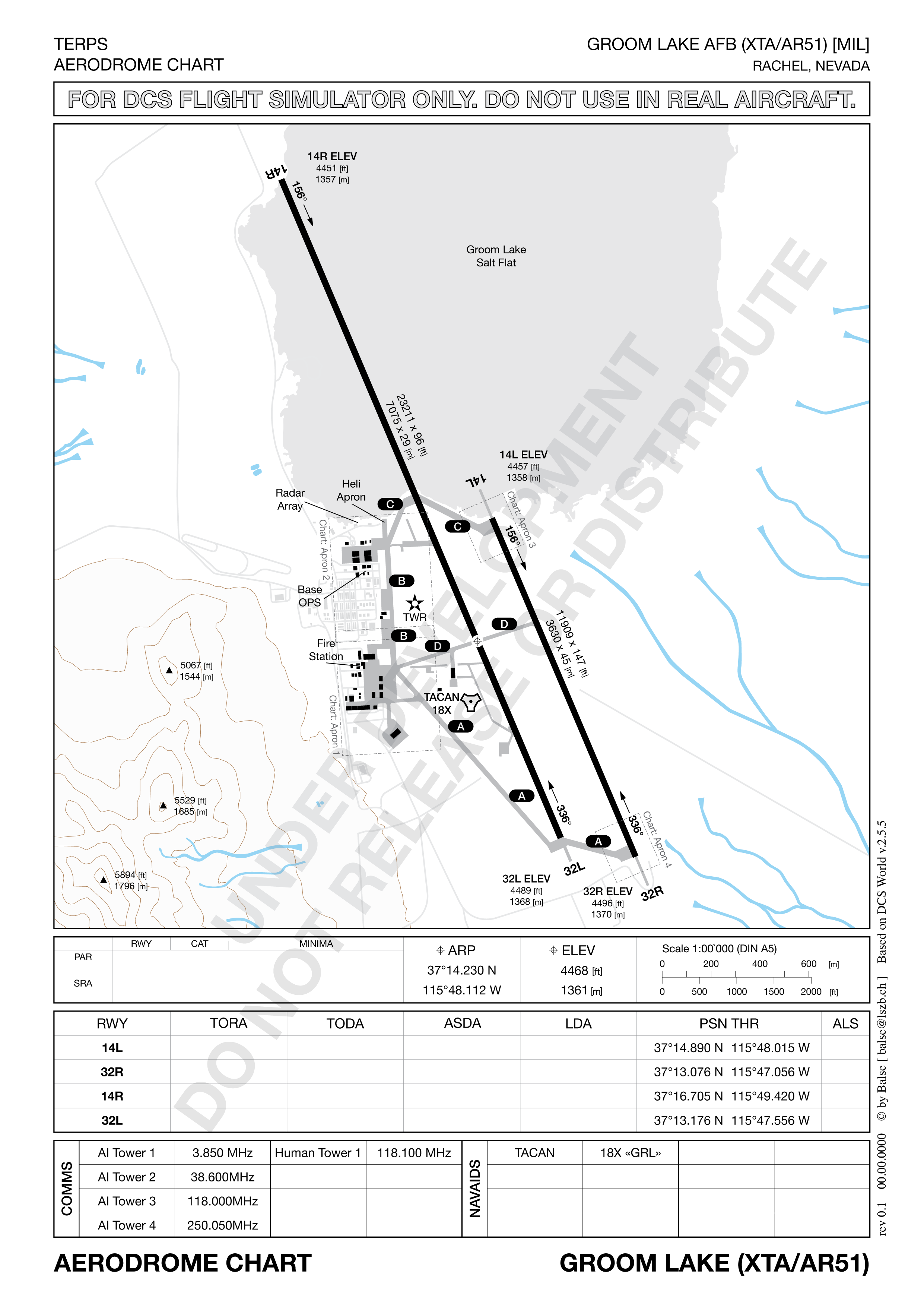
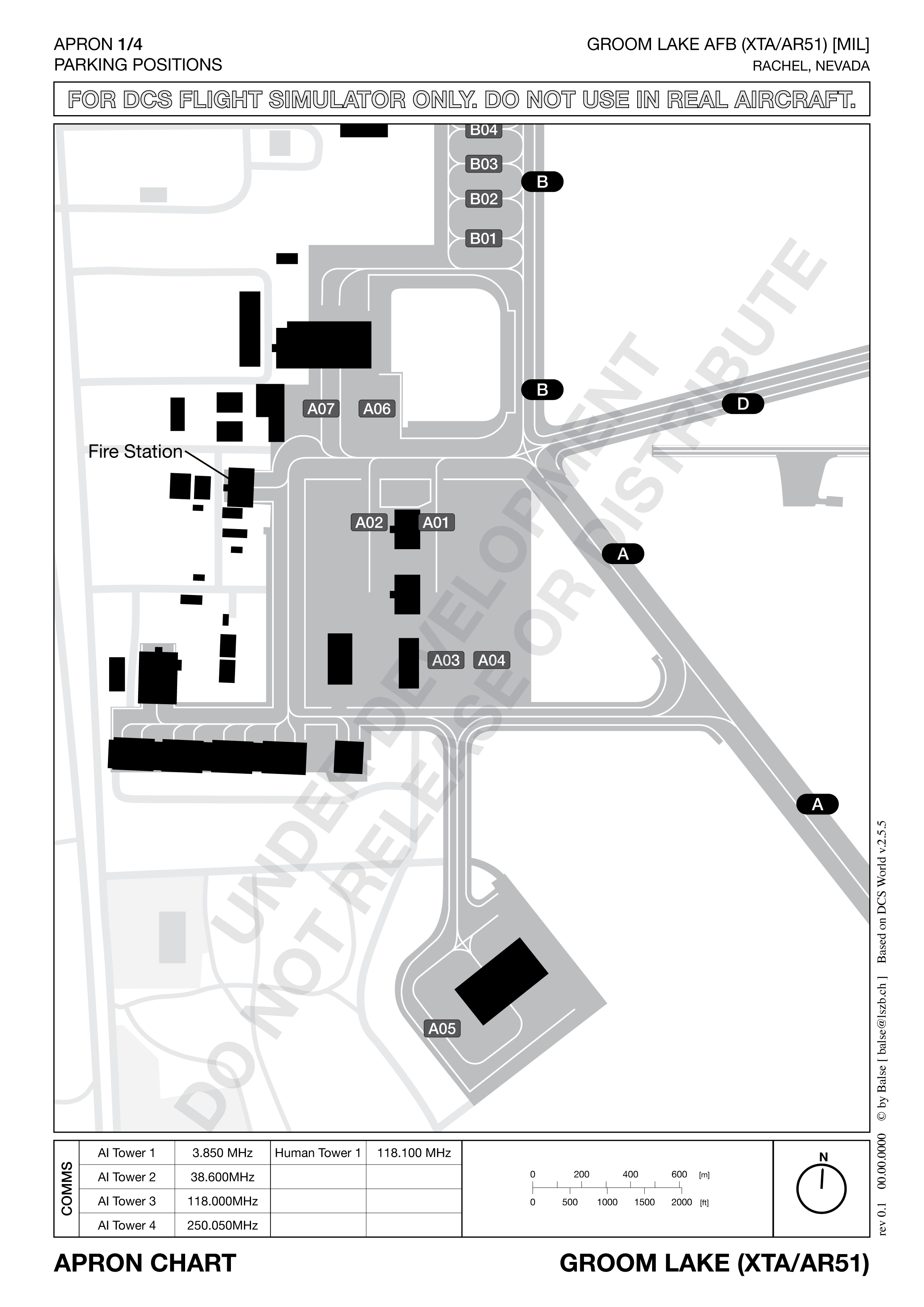
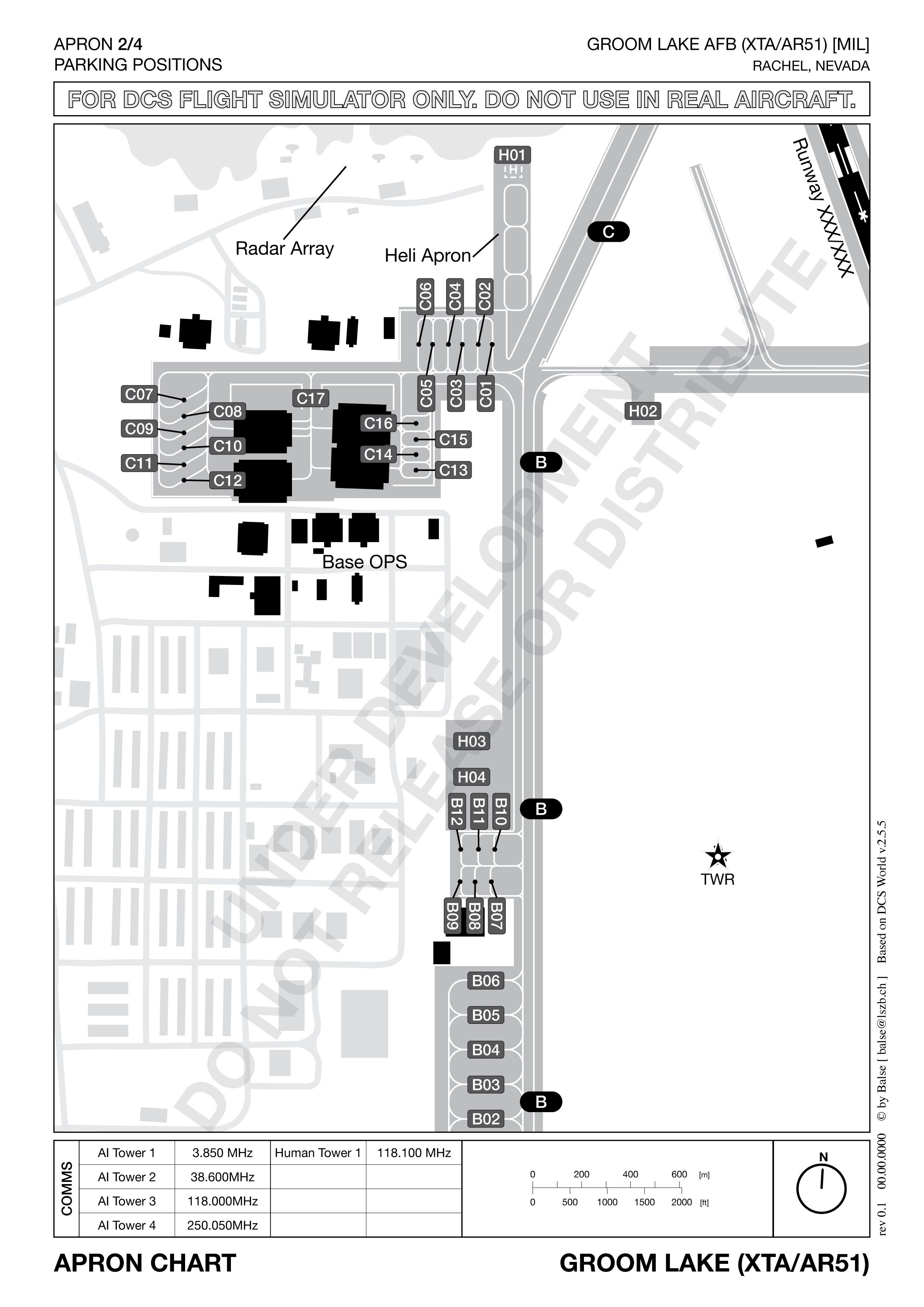
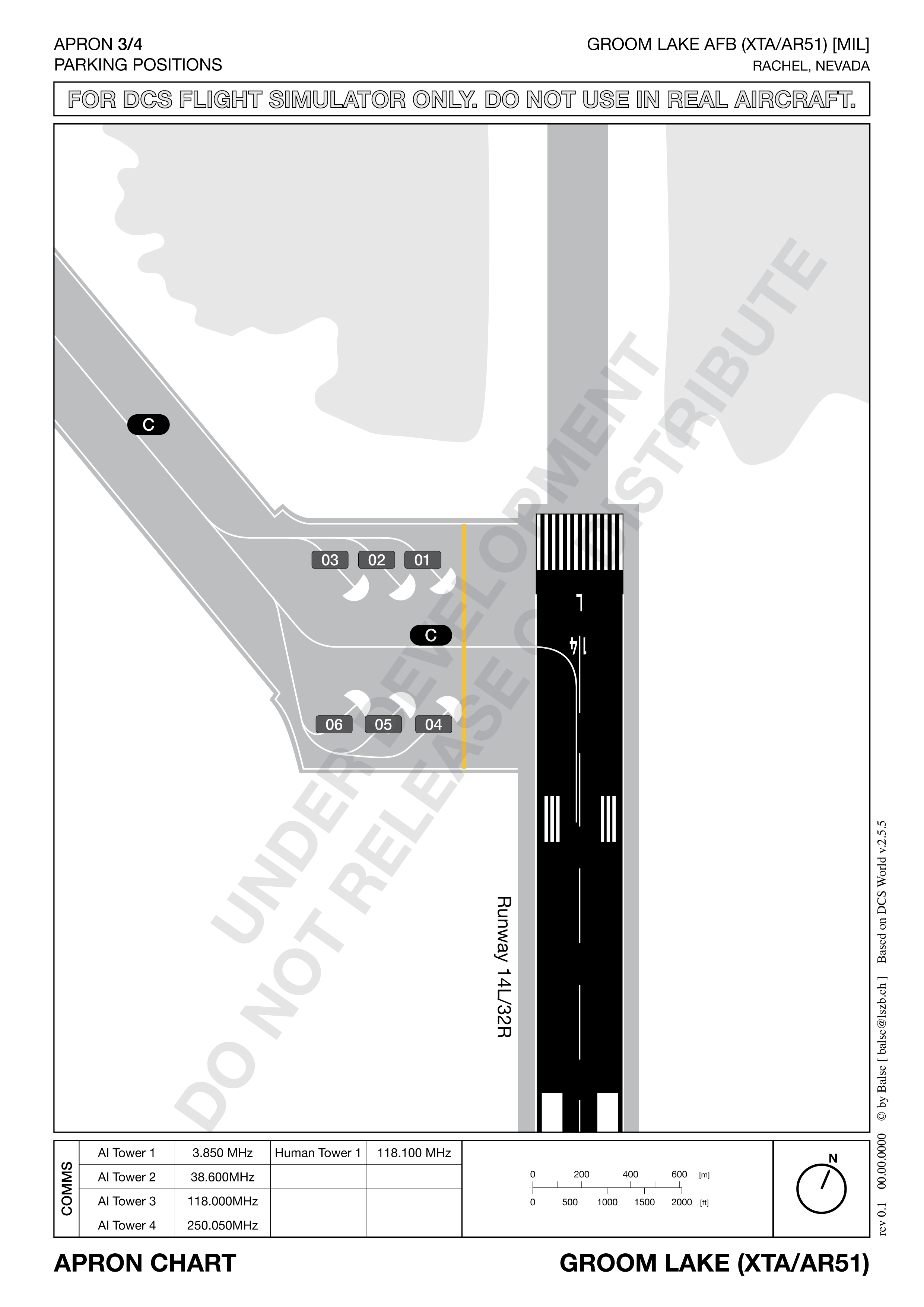
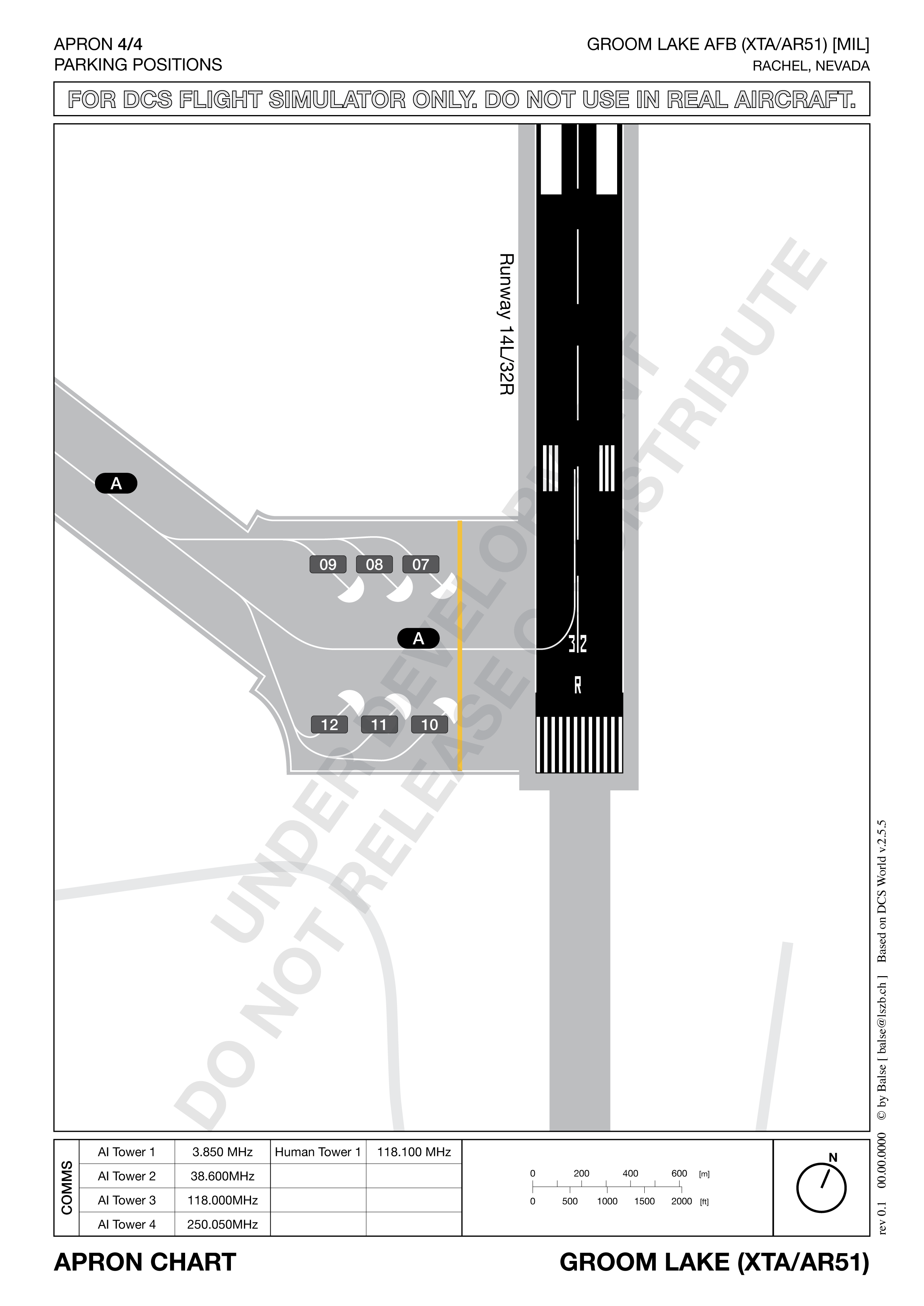
Here a sample map set for Groom Lake AFB. For now, this includes the TERPS "overview" map and Apron charts for all places where there are parking positions. The charts are still pretty beta and there is some data missing. Any input is much appreciated.
-
Thanks for the feedback. As you sed, I base the maps on DCS and not real world. All data should, therefore, come directly from DCS. So I basically need help with gathering data inside DCS. Measuring things is the mission editor and/or the F10 map. There is some data who is not in DCS. For example, the taxiway numbers, what building does what, or designated areas on the apron, and so on. I will have to search that together from real world maps. I'm always thinking about simplification. But I also want the maps to be usable for complex and realistic multiplayer gaming. But you might be right about the scale. On the other hand, it is a nice way to see what distances you are looking at at a glance. I think I will remove the navaids. You are right, they aren't needed here. Maybe place the scale where they are now? White X on a black pill is a taxiway no. I just didn't got around to find the real numbers (could also use some help on that). So those are placeholders. The rest are the DCS parking positions. I will include a legend in the release.
-
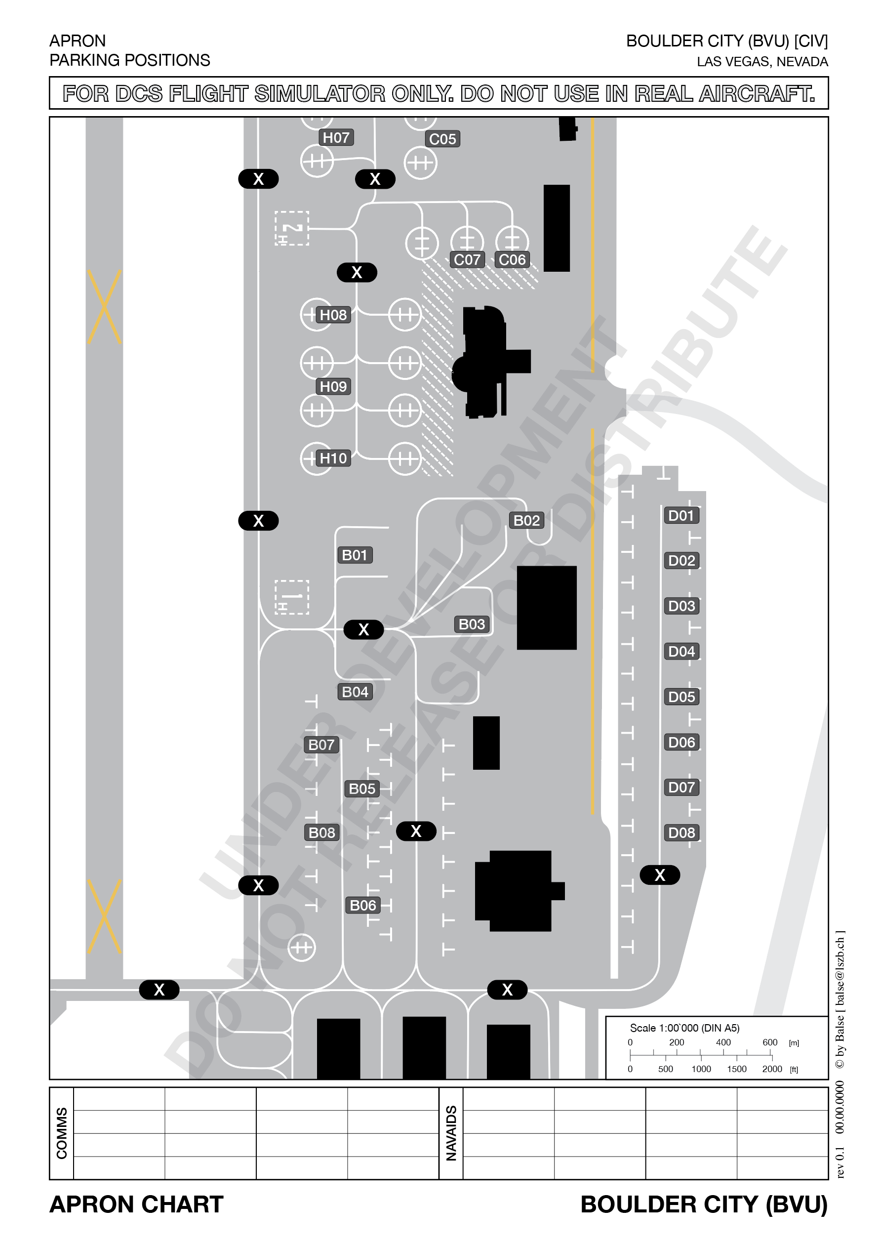
I finished the first draft of an Apron Chart. This one is one half of Boulder City Airport. What do you guys think? Any inputs?
-
I'm aware of those. They are great. But I think I can improve on them. What I want is a totally uniform set of maps with all the needed DCS data in it. After drawing all the TERPS Charts, I'm now working on the Apron Charts with all the Taxiways and DCS Parking positions. Still, no-one, who is as obsessed with maps as I am, and has some time to help me with data collection?
-
I'm currently working on a complete set of maps for all Nevada Airports. They are based on the awesome Caucasus maps of the "Virtuelles Jagdbombergeschwader 32", so props to them! I already drew all the Maps. But now I have a whole lot of data points to collect. And I could really need some help with that. If anyone wants to help, please join my Discord Server (https://discord.gg/bdXGBx). The maps are based on DCS, not real world. So what you see on the map is what you get in DCS. And of course, I plan to release them all for free, once finished. If I successfully finish the Nevada set, I plan to tackle the Persian Gulf next. Or maybe the new Marianas map, if that is out till I finish Nevada. A photo of the set and one preview airport are attached.