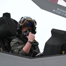
Jaku Posted April 25 Posted April 25 Polish pilots from the 28. PLM stationed on the Słupsk airbase taking a look at Su-27's from 159. Gv.IAP stationed on the Kluczewo airbase, 1987-1990. 5
sokol0210 Posted April 28 Posted April 28 Polish Fulcrums DOL Kliniska null 2 1 I am the guy who paints Fulcrums and serve a coffee 36k ft over your head.
Jaku Posted April 28 Posted April 28 (edited) Polish roadbase exercises Kliniska 2003 Edited April 28 by Jaku 2
Robsonek Posted April 29 Posted April 29 (edited) 14 hours ago, sokol0210 said: Polish Fulcrums DOL Kliniska null The last photo with 92 is probably from Bydgoszcz ;)) Edited April 29 by Robsonek 3 1
Jaku Posted April 29 Posted April 29 An interesting detail that could have been on the map. The BARS system (from the Russian word “Leopard”) was a military tropospheric communication system of the Warsaw Pact countries, it was put into service in December 1987, It included 26 hubs (in 29 directions) in the USSR, Poland, East Germany, Czechoslovakia, Hungary, Bulgaria. Most of the BARS system links used R-417 Baget-S equipment, which operated at 4.435-4.555 GHz and 4.630-4.750 GHz (S-band), transmitting power could reach 1.5 kW - 2.5 kW. The system provided 60 digital voice channels or a data throughput of 480 kbit/s. The maximum length of a single R-417 link was 200 km. Two BARS system links whose distance exceeded 200 km used R-420S equipment, which had parabolic antennas with a diameter of 16 meters. BARS communications support systems were autonomous: they had food and water supplies, generators, air filters and oxygen supplies. Object 207, Suchowo village 53°19′56,51″N 15°49′39,12″E Object 202 Chocianów, patera 51°25′16,13″N 15°50′52,33″E 3
sokol0210 Posted April 29 Posted April 29 8 hours ago, Robsonek said: The last photo with 92 is probably from Bydgoszcz ;)) One click in my gallery gone too far 3 I am the guy who paints Fulcrums and serve a coffee 36k ft over your head.
Robsonek Posted April 30 Posted April 30 (edited) Some photos over Bagicz Airport by "Hesja" Edited April 30 by Robsonek 2 1
Cornpop Posted April 30 Posted April 30 Yes, please. Expanding Easy is just as smart as expanding west and south! 2
Jaku Posted April 30 Posted April 30 2 hours ago, Cornpop said: Expanding Easy is just as smart as expanding west and s we did what we could here to help, we will see what Ugra-media will do, i have a big hope 4
Robsonek Posted May 23 Posted May 23 Dębica Airfield - an airport used until the mid-1980s (?) by the Soviet Air Force. It was probably an alternate airport for aircraft such as MiG-15, MiG-17 and MiG-21. The airport had a grass runway 11/29 with a length of 2,500 m. 20 kilometers from the airport in Dębica is the airport in Świdwin. Currently, there is a garbage dump on the site of the former airport. https://www.mil-airfields.de/pl/debica-lotnisko.htm 2
Jaku Posted June 4 Posted June 4 Pieniężnica "The Pieniężnica Airfield was established in the mid-1950s as a typical backup airport for combat regiments of the Polish Army. The layout of the airfield was typical for airports of that period. The runway was 1,900 m long and 40 m wide, with a concrete surface. The runway was located in the 084/264 direction, i.e. almost east-west. On the south side of the runway, an emergency runway with a dirt surface (grass) was marked out. On the north side of the runway, the main taxiway, approximately 2,000 m long, was located. The main taxiway was connected to the runway by four connectors. The width of the taxiways was 10-15 m. All taxiways had a concrete surface. At the eastern and western connectors, there were aircraft parking areas, also with a concrete surface. The airport had two combat aircraft dispersal areas. One was in the eastern part of the airport (among trees) and the other in the western part. At the beginning of the 1970s, 10 AU-11 class shelters/hangars were built in the western dispersal area for Mikoyan and Gurievich MiG-21 aircraft. The Pieniężnica airport was surrounded by forests on all sides. In the north-eastern part, an MPS (fuel and lubricant storage facility, fully equipped) and airport administration and barracks buildings were located in the forest. In the north-western part, a bomb storage facility (weapons warehouse for aircraft) was located in the forest. The Pieniężnica airport did not have a permanent host. Regiments such as the 6th PLM from Piła, the 26th PLM from Zegrze Pomorskie, the 28th PLM from Słupsk, the 41st PLM from Malbork, and others were temporarily based here. The following aircraft landed at the airport: MiG-21, MiG-23, TS-8 Bies, TS-11 Iskra. By the end of the 1980s, the airport was underfunded and fell into disrepair. At that time, there was already a surplus of military airports in relation to the needs. Since the 1990s, planes have landed here sporadically. Probably the last landing of a civilian aircraft took place in 2004. At that time, a Cessna 172 aircraft made an emergency landing. At that time, only the eastern part of the RWY, 1,000 m long, was suitable for landing." Some informations (from mil-airfields.de) Coordinates N535216 E0165954 (WGS84) Google Maps Elevation 530' Location Pieniężnica is located 60 km southeast of Koszalin. Location of airfield The airfield is located 2 km northeast of Pieniężnica. Runways 08/26: ca. 2000 m Radio beacons Data for the year 1970: LOM: 625 "BM" LMM: 302 "B" Data for the year 1980: LOM 26: 370 "DA" LMM 26: 760 "D" Radio communication Call sign: "BALSAM" (1970), "DEKADA" (1980) Installations Railway to the track 4 km north. 2
Jaku Posted July 14 Posted July 14 Śniatowo "A disused airport that served as a backup for the 2nd Fighter Aviation Regiment from Goleniów. It was used jointly by the Polish People's Army Air Force and the Red Army. On April 18, 1991, it was transferred to the exclusive management of the Republic of Poland and finally closed. Currently, the airport site is home to a wind farm launched in 2009, consisting of 16 wind turbines. It also hosts regular car rallies." "Airport area – 287 ha – 2 parking areas for 15 aircraft each. 24 underground shelters for aircraft (space for 1 aircraft surrounded by earth embankments on 3 sides) and 4 single-chamber shelters." Some informations (from mil-airfields.de) Coordinates N535242 E0145152 (WGS84) Google Maps Elevation 65 ft Usage during the Cold War Reserve airfield, shared use between Polish and Soviet forces. Use today Transfered to Polish authorities on April 18th, 1991 (Source: www.bicc.de). Closed. Runways Data for the year 1980: 11/29: approx. 2500 m Radio beacons Data for the year 1980: LOM 29: 858 "FA" LMM 29: 419 "F" Radio communication Call sign: "FIRMA" / "ФИРМА" (1980) Installations "Surface of 287 hectares" 3
Jaku Posted August 9 Posted August 9 (edited) Legnica HQ and airfield of the soviet northern group of forces "When the Red Army front commands were dissolved in early June 1945, the military command posts were subordinated to the Northern Group of Forces command in Legnica (abbreviations used: PGW, PGWAR, PG W FR), commanded by Marshal Rokossowski. At that time, they lost their “war” character. In the following months, a significant part of the command posts (249 units) were liquidated, mainly those located in provincial and county towns. Another 244 units were liquidated between August and November 1945. Only 43 commandant's offices remained, which were liquidated in mid-1946. After surviving the most difficult months of 1945, when Poles did not have access to the city center, political parties and associations began their activities, the first Polish school year began, and health care and service points were organized. The difficulties faced by the Polish authorities affected almost all spheres of life. These included poor security, staff shortages, and most annoyingly, financial shortages. Regular salaries began to be paid to employees only in September. Until then, the most common means of payment was vodka, which is why distilleries were among the first enterprises to be launched. One of the greatest difficulties faced by the first Polish authorities in Legnica was the inability to fully launch the city's infrastructure due to the division of Legnica into Polish and Soviet parts. The city was divided in July 1947. As a result of a series of conferences between representatives of the City Council and the Group's command, a demarcation line was established between the districts inhabited by Polish citizens and the quarters under Soviet administration. The Russians reserved the newest, southern part of the city, known as the Square, for their exclusive use and created Soviet enclaves around many public buildings in the center (e.g., they occupied the Drama Theater, the Knights' Academy, the city park, and many others). After this division of Legnica, into the part of the city under Polish administration and closed military sectors, one of the most important and at the same time most feared complexes in the city became the buildings within Gwarna, Muzealna and Złotoryjska Streets. The Soviet Garrison Command, Military Prison, Military Court with jurisdiction over the entire PGWAR and the Garrison Hotel were located there. These buildings have not changed their function, for which they were built in the 1870s, with the difference that until 1945 they were an important element in the social and political structure of the city and served the local community, and after 1945 they became a completely separate part of the city. The decision on the location of the Group's headquarters was made relatively late, probably not until early July. On July 11, 1945, Rokossowski's deputy for political affairs informed Governor Piaskowski of this, as well as of the need for Polish institutions and Polish residents to leave the left bank of Legnica. Everything was supposed to have been agreed with Bolesław Bierut by that time. The choice of Legnica was not, as mentioned, a coincidence: a large modern barracks base, hospital and warehouse facilities, the city's convenient location on transport routes, a military airport, large districts, and well-equipped residential houses that could accommodate a large number of staff with their families — were excellent and probably sufficient justification. The composition of the Northern Group of Forces of the Soviet Army at the time of its creation was as follows: 65th Army, 43rd Army, 52nd Army, 3rd Guards Cavalry Corps, 3rd Guards Armored Corps, 5th Armored Corps, 10th Armored Corps Army, 20th Tank Corps, 4th Air Army consisting of 3 air corps. Bolesław Potyrała gives a slightly different composition of the Northern Group of Forces: 65th Army of General Paweł I. Batow, 49th Army of General Iwan T. Griszin, 70th Army of General Wasilij S. Popow and 4th Air Army of General Konstantin A. Wierszynina. Of the generals mentioned, P. Batow served the longest in Legnica (until 1948). While in the period 1945-1953, the military groups were headed by 14 marshals and generals with significant achievements during the war, in the following years, the positions of commanders-in-chief and commanders were held by lesser-known generals. There was significant rotation in the highest positions, and among the lesser-known figures who were sent to Legnica were Gen. K. Konstantinov, Gen. A.I. Radziewski, and Gen. K.P. Trubnikov. in 1945, the PG W consisted of a total of 4 armored corps, 30 rifle divisions, 12 air divisions, 10 artillery divisions, and 1 cavalry corps, and numbered at least 300,000 soldiers deployed in fifteen provinces (according to the administrative division prior to 1998) in 59 locations belonging to 35 garrisons." null View from the roof of the Soviet school number 30 "It is impossible to determine the exact number of PGW soldiers stationed in Poland until 1956. Representatives of the Polish administration were not allowed to enter the barracks, and the Polish authorities did not have any list or register of them. The best known are the locations of the PGW from the period after 1956, because most of the Soviet bases existing at that time functioned until the withdrawal of the Group's troops from Poland in 1993. It is also impossible to determine the exact number and location of garrisons, except for those that can be located on the basis of reports from administrative bodies and reports from the Delegation of the Government of the Republic of Poland/Polish People's Republic at the PGWAR, which operated from 1946. According to estimates, at the time of its creation (June 1945), the PGW had over half a million people. In addition to military facilities, the Group occupied thousands of hectares of agricultural estates and industrial facilities. In total, the PGW forces used 15 airports (nine for their own needs — eight where military units were stationed and one spare; six as spare airports, which the Russians used jointly with the Polish army), 11 port basins, 4,340 m of sea coast; 12 large fuel depots, three of which functioned as independent facilities; 6,517 buildings, of which 3,800 were owned by the State Treasury and 2,717 were built by the Russians for their own needs. Eighteen facilities were located outside the area of greatest concentration of PGW units: four airports, four communication stations, three tropospheric communication stations, and military postal units. For the period before 1956, three stages of PGW transformation can be distinguished: • The period of demobilization after the end of the war, which began on June 23, 1945, and lasted until 1948. The return of Red Army soldiers to the USSR was particularly intense from mid-1945 to mid-1946. • 1947, when General P. Batov's 65th Army was withdrawn from Poland. The withdrawal of the 65th Army was connected with the transfer of the facilities it had occupied to the Polish side. In total, in 1947, Soviet troops handed over 2,440 buildings to the Polish authorities, including three gymnasiums, a number of houses and shops in Legnica. • The years 1948-1956, when the structure of the Group became more stable and there were fewer changes, both in terms of numbers and deployment. During this time, the structure of Soviet bases in Poland also took shape." "The locations of PGW units are therefore only known from the period after 1956, when, under the signed agreements, the Polish authorities carried out inventory checks. The checks did not cover all of the facilities owned by PGWAR (it is estimated that approximately 85% of the facilities were inventoried; the Polish commission was not allowed access to the remaining 15%, the so-called special facilities, and the inventory was carried out unilaterally by a Soviet delegation). The list of PGW bases did not include all the locations where Soviet troops were stationed. Among the places not covered by the inventory, it is worth mentioning Malbork, Elbląg, Olsztyn, Gorzów, Bydgoszcz, Siedlce, and Poznań, where Soviet troops were stationed until the mid-1950s. In addition, in many cities, the Group had so-called seconded soldiers, e.g., for the purpose of supervising communications, cooperating with Polish military units, subunits for special tasks, etc. According to estimates, between 1946 and 1949, there were approximately 300,000 Soviet soldiers in Poland (in Legnica alone, there were approximately 50,000 in 1949). This number gradually decreased, but even after the signing of the agreements in 1956, it did not reach the agreed ceiling of 62,000-66,000. Probably the Group did not reach this number until the 1980s. Interestingly, the Russians achieved the highest rate of evacuation was achieved by the Russians in 1956-1958. During these two years, they left almost a hundred localities." officer's quarters "Soviet troops were often stationed at various locations within the same town or used facilities that were far apart from each other. For example, in Legnica, barracks complexes were scattered throughout the city. This forced the Russians to use the entire urban infrastructure, not just a designated area, and it was necessary to use public roads, which consequently contributed to both traffic accidents and damage to the road surface by heavy military vehicles. Soviet units stationed in Poland were under the command of the Group, while the commander-in-chief (later commanders) of the PGW reported directly to the Minister of Defense of the USSR. After the creation of the United Command of the Warsaw Pact in 1955 here were numerous disputes over jurisdiction between the heads of these forces. The disputes between the commander-in-chief of the United Armed Forces of the Warsaw Pact, Marshal Ivan Konev, and the then commander of the PGW, General Kuzma Galicki, were particularly fierce. Ultimately, this conflict led to Galicki's dismissal from his command position in February 1958and his transfer to the post of commander of the Transcaucasian Military District 10. The troops comprising the Group initially had an army structure, then a divisional structure. In addition to its role as guardian of Soviet interests in Poland, the Group also performed tasks resulting from the prevailing military doctrine. It was to develop an offensive after the enemy front on the Elbe was broken by the East German Army Group in the event of a war of aggression or, in the event of a breakthrough of the Soviet defenses, to launch a counterattack. It was also to create conditions for further operations by operational units that would arrive in such a case from border military districts. The operational tasks of the PGWAR were thus closely linked to the role that the Soviet high command assigned, in the event of an armed conflict, to the much larger, first-line Western Group of Forces, stationed in the GDR , and to the activities of border military districts, including the Belarusian Military District. The PGWAR was to serve as a base and secure the conditions for the formation of a second front, which was to be created only by large tactical units from the western districts of the USSR." "Next to the PGWAR headquarters, and since 1984 the Western Operational Direction (ZKO), there was also the headquarters of the 4th Air Army (AL) in Legnica on Chojnowska Street, subordinate to the Group, but with a certain degree of independence due to its strategic tasks. It was one of the independent air armies of the Soviet Air Force and was intended to improve the effectiveness of aviation. The composition of the 4th AL, with which it entered the PGWAR according to Directive No. 269 of the Stavka WK of May 29, 1945, was as follows: 5th Bomber Aviation Corps (132nd and 327th Bomber Aviation Divisions), 4th Assault Aviation Corps (196th and 199th Assault Aviation Divisions), Fighter Aviation Corps (215th and 323rd Fighter Aviation Regiments), 230th, 233rd, 260th and 332nd Assault Aviation Divisions, 229th, 269th, 309th and 329th Fighter Aviation Divisions, 325th Night Bomber Aviation Division, 47th and 164th Guard Reconnaissance Aviation Regiments, 209th Aviation Regiment for Reconnaissance and Artillery Fire Correction, 213th Medical Aviation Regiment, 184th Air Communications Regiment, 844th Transport Aviation Regiment, 69th Civil Aviation Fleet Aviation Regiment, 1550th, 1559th, 1584th, 1601st, 1606th, 1607th, and 1655th Anti-Aircraft Artillery Regiments. From the moment of its creation, the Northern Army Group maintained full combat strength: a complete complement of personnel, armaments, and equipment corresponding to the needs of warfare." "PGWAR units occupied an area of approximately 17 km² in the city of Legnica. This huge area contained over 1,200 facilities that were in constant use by the Russians. In addition to typically military facilities (barracks, military airport, storage bases), they also occupied hospitals, educational and cultural facilities (the occupation of the Drama Theater building was most painful for the residents), sports facilities, and residential buildings. The Russians also occupied the most beautiful, villa-filled part of the city, known as Kwadrat (the Square). The facilities belonging to the Russian army constituted about 1/3 of the old, Art Nouveau, central part of the city. In total, there were 482 residential buildings and 721 non-residential facilities." "The garrison character of the city was reminded to its residents by a wall separating the western districts. Guarded by Soviet military patrols, these quarters of the city constituted a “city within a city.” The following military formations were stationed in Legnica: the Command Headquarters of the Northern Group of Soviet Forces, 4th Air Army, 19th Communications Regiment, 137th Communications Battalion, 91st Support Battalion, 25th Helicopter Squadron, Armored Unit, Communications Equipment, Military Hospital, Post Office, and Telecommunications. Together, they occupied an area of 608.8 hectares." "Barracks complexes were scattered throughout the city. The Russians not only used existing facilities, but also built their own. Between 1946 and 1990, they built 211 facilities in Legnica alone (in the former Legnica Province, there were a total of 510 buildings). The most important barracks complexes were located as follows: • barracks on Złotoryjska Street — the complex covered an area of 29 hectares and housed an armored unit and workshops, • barracks on Słubicka Street — they were a vehicle base for the communications troops, • barracks on Poznańska and Bydgoska Streets (also a vehicle base, covering an area of 11.82 hectares), • sanitary and epidemiological station and laboratory at Rzeczypospolitej Avenue, • “Igla” communications station, located outside the city, occupied 5.4 hectares, • barracks at Chojnowska Street — it was an entire barracks and residential complex with an area of 12.91 hectares." Soviet checkpoints in Legnica Airfield in Legnica "From February 21, 1945, the regiment became part of the 4th AL II FB, continuing to supply the fighting units. On July 22, together with the entire 4th AL, it was transferred to the airport in Legnica. The regiment was awarded the Order of the Red Star for its contribution to combat operations. On January 1, 1946, its name was changed to 844th Independent Mixed Air Regiment, and in 1948 it was reorganized into the 245th Independent Mixed Air Squadron. The aircraft used earlier were Po-2, Yak-6, Li-2, and C-47. In the 1950s, the worn-out Li-2s were replaced with Il-12s and Il-14s. The unit was also equipped with Mi-1 and Mi-4 helicopters. In the following years, the aircraft and helicopters were replaced with more modern ones. The Russians mainly used helicopters (Mi-6, Mi-8), and from 1969 they also used An-12. The helicopters were used for transport and lifting by civil aviation and military aviation in the USSR and Warsaw Pact countries. The An-12 served as a transport aircraft for parachute jumpers, some of them were adapted for electronic warfare, and one was converted into a flying command post. The squadron served primarily as logistical support for the 4th Air Force and the PGWAR command. It consisted of a helicopter squadron (5 Mi-8) and two transport aircraft squadrons (6 An-26, 4 An-12). In addition, it had one Il-20 aircraft to secure passenger flights. It was the last PGWAR air unit to leave Poland. The airport had the following facilities: a 1,600 m long and 40 m wide runway, paved taxiways and a grassy area, aircraft hangars, missile warehouses, a railway siding, a radar station, guard buildings, and military barracks. The 4th Air Army had several military airports at its disposal, as well as an air training ground. Eight PGW airports in Poland were first strike facilities, while the rest were backup facilities. The army consisted of two divisions: bomber and fighter, both divided into regiments, as well as several independent air regiments for various purposes. These formations were directly subordinate to the headquarters of the 4th Air Army in Legnica. The 4th Air Army also included the 132nd Czerniachowsk Bomber Division, stationed outside Polish territory. The army's reserve airfields were located in the following towns: Oława-Stanowice, Wschowa-Łysiny, Namysłów, Stargard Szczeciński (Burzykowo and Słotnica), Dębica, Nadarzyce, and Brochocin." Some informations from mil-airfields.de Legnica: Airfield Fliegerhorst Liegnitz, Аэродром Легница Coordinates N511058 E0161044 (WGS84) Google Maps Elevation 407 ft Location indicator EPLE Location of airfield Southern edge of Legnica. Usage until 1945 Luftwaffe air base Liegnitz. Usage during the Cold War Soviet air base, transport aircrafts. Use today Transfered to Polish authorities on September 15th, 1993 (Source: www.bicc.de). General aviation. Runways 08/26: 1600 m x 40 m Concrete Radio beacons Data for the year 1990: LOM 26: 315 LMM 26: 650 RSDN, N511212 E0160637, Long range navigation system Radio communication Call sign: "JENNISSEJ" (1965), "OTKRITKA" (ОТКРЫТКА) (1980) Units 245 OSAE 4 An-12, An-24, 6 An-26, An-72, 5 Mi-8 (1990). The unit left Legnica on August 19th, 1993. Installations "Garrison and aiport of total surface of 608,8 hectares. 981 buildings (habitation, barracks, stores, garages, workshops) which form a separated part of the town, from which they are divided by a wall. Fuel station of 10,6 thousand meters3 capacity." Political transformation and preparations for the withdrawal of Soviet troops from Legnica "In the 1980s, there was a rapidly growing desire in the countries of the Soviet bloc to free themselves from the political and military tutelage of the USSR. As a result,the Soviet military leadership began to consider the possibility ofmoving its troops from neighboring countries deeper into the USSR. In Poland, the political changes that had been taking place since 1989 undoubtedly accelerated this process. At the beginning of the 1990s, the Russians began to consider the necessity of completely leaving Poland.The last show of force by the communist authorities, supported by the Kremlin, towards the Polish people was the introduction of martial law, which ultimately also marked the beginning of the end of the existing order. Changes began in Poland, the impact of which on neighboring countries led to the collapse of the socialist system during the so-called Autumn of Nations. These changes lasted 10 years in Poland, 10 months in Hungary, 10 weeks in East Germany, and 10 days in Czechoslovakia — this is how Timothy Garton Ash summed up the process of the collapse of the socialist bloc in November 1989. The avalanche of processes that contributed to the political transformation of the countries of Central and Eastern Europe began in the fall of 1989. In September, the Hungarian authorities opened the border with Austria to emigrants from East Germany . A month later, a spokesman for the Central Committee of the Communist Party of the Soviet Union said in an official statement that “the USSR is not afraid of changes in the structure of the Warsaw Pact” and “will respect the decisions of its members.” The countries' efforts focused on achieving complete sovereignty. One of the priorities of Polish foreign policy at that time was to build and participate in a European collective security system and regional cooperation. The Russians were very slow to get used to Poland's independence. This was reflected in the difficulties encountered by Polish foreign policy in its relations with the USSR, particularly the issue of the withdrawal of Soviet troops from Polish territory. Polish-Soviet talks on the withdrawal of Soviet troops from Poland, which began in December 1990, were concluded on May 22, 1992, after fifteen rounds of negotiations. The agreement on the withdrawal of Soviet troops was initialled in Moscow in November 1991, while the Soviet Union was still in power. The initialed agreement paved the way for the signing of a Polish-Soviet treaty comprehensively regulating mutual relations. The agreement was initialed by Deputy Foreign Ministers Jerzy Makarczyk on the Polish side and Yuri Dieriabin on the Soviet side. At the same time, documents concerning the transit of Russian troops from Germany were also initialled. They specified train routes, rules for crossing the border, and jurisdiction regarding liability for any damage caused during the transit through Polish territory. The most important achievement, however, was the agreement that no nuclear or chemical weapons would be transported through Poland. It was finally agreed that all combat units would leave Poland by November 15, 1992, and the remaining formations by the end of 1993, with their numbers, which at the beginning of 1993 were to amount to 6,000 soldiers, and at the beginning of the fourth quarter of 1993 — to 2,000." Exodus of the soviet forces Source: "PODWÓJNIE STRZEŻENI ARMIA RADZIECKA W LEGNICY" (1945- 1993)" - Joanna Lilla Swiącik Wrocław 2010 Soviet BTR driving through flooded Legnica in 1977 Edited August 9 by Jaku 6
Robsonek Posted August 11 Posted August 11 (edited) Borne Sulinowo "In 1933 the new German authorities bought all of the area and started the construction of a large military base, a training ground and various testing grounds there. The inhabitants were resettled and their homes razed to the ground. In place of the village of Linde, a small military garrison and a town was built. Paradoxically, it was given the name of the nearby village of Gross Born (which was also levelled), despite the fact that the actual namesake was located several kilometres to the south-east. All facilities were officially opened on August 18, 1938. Soon afterwards the Artillery School of the Wehrmacht was moved there." "After the war, the area of two military bases and the town itself was taken over by the Red Army. There the Soviet military established one of the biggest military camps of the Northern Group of Forces. The town was excluded from Polish jurisdiction and erased from all maps, even though officially part of the People's Republic of Poland. In official documents of the surrounding communes, the area of Borne Sulinowo and the surrounding 180 square kilometres (69 sq mi) were called forest areas and remained a secret for almost 50 years." "Near Borne Sulinowo, in a closed area in Brzeźnica, was located one of the warehouses of Soviet nuclear weapons stored in Poland, intended for use (according to operational plans) during the war with the West – including by the Polish Army. The shelters of the SS-20 mobile launchers remain in the surrounding forests to this day." Borne Sulinowo Airfield "Borne Sulinowo Airport was established when the garrison was established. Small transport aircraft landed here, usually carrying high-ranking German officers and mail. After 1945, when the territory was taken over by the Soviet Union, the airport was primarily used by helicopters (Mi-1, Mi-2, Mi-4, Mi-8), transporting cargo, mail, and passengers. The helicopters were also used to coordinate and evaluate range exercises. In 2013, a multi-purpose landing strip was opened. The airport is purely civilian, intended for general aviation traffic." Edited August 11 by Robsonek 2 1
Jaku Posted August 11 Posted August 11 3 hours ago, Robsonek said: Borne Sulinowo "In 1933 the new German authorities bought all of the area and started the construction of a large military base, a training ground and various testing grounds there. The inhabitants were resettled and their homes razed to the ground. In place of the village of Linde, a small military garrison and a town was built. Paradoxically, it was given the name of the nearby village of Gross Born (which was also levelled), despite the fact that the actual namesake was located several kilometres to the south-east. All facilities were officially opened on August 18, 1938. Soon afterwards the Artillery School of the Wehrmacht was moved there." "After the war, the area of two military bases and the town itself was taken over by the Red Army. There the Soviet military established one of the biggest military camps of the Northern Group of Forces. The town was excluded from Polish jurisdiction and erased from all maps, even though officially part of the People's Republic of Poland. In official documents of the surrounding communes, the area of Borne Sulinowo and the surrounding 180 square kilometres (69 sq mi) were called forest areas and remained a secret for almost 50 years." "Near Borne Sulinowo, in a closed area in Brzeźnica, was located one of the warehouses of Soviet nuclear weapons stored in Poland, intended for use (according to operational plans) during the war with the West – including by the Polish Army. The shelters of the SS-20 mobile launchers remain in the surrounding forests to this day." Borne Sulinowo Airfield "Borne Sulinowo Airport was established when the garrison was established. Small transport aircraft landed here, usually carrying high-ranking German officers and mail. After 1945, when the territory was taken over by the Soviet Union, the airport was primarily used by helicopters (Mi-1, Mi-2, Mi-4, Mi-8), transporting cargo, mail, and passengers. The helicopters were also used to coordinate and evaluate range exercises. In 2013, a multi-purpose landing strip was opened. The airport is purely civilian, intended for general aviation traffic." Polish documentary from 1994 showing Borne Sulinowo and interviewing some of its soldiers, also Kluczewo airfield is shown aswell 2 1
Robsonek Posted August 14 Posted August 14 (edited) Aviation monuments in western Poland (during cold war) 1. MiG-17PF at Świdwin (https://maps.app.goo.gl/mYXTwKBcCzmteryJ6) (Since 1976, a MiG-19 has stood as a monument, but after some time it was severely damaged by a storm. A MiG-17PF was erected in its place...) (There is also a Ts-11 Iskra monument in Świdwin, but it was built in 2013) 2. MiG-15 at Łobez (https://maps.app.goo.gl/mjCC3bAGmQsqQ8oX7) (In the early 2000s, the monument was destroyed and the plane was transferred to the 21st BLT in Świdwin.) (lamusy z Łobza, Świdwin górą) 3. MiG-17PF at Mirosławiec Górny (https://maps.app.goo.gl/fLSWj4DNwj3Ra5yi8) (currently in Mirosławiec there is also a monument to Su-22um3k, but it was made around 2010/11) 4. MiG-17PF at Czaplinek (https://maps.app.goo.gl/eLbHM1VZfhY4rsSB6) 5. MiG-15 at Piła (https://maps.app.goo.gl/gwaSwK4AopGzZy4N7) 6. Lim-6Bis at Babimost (https://maps.app.goo.gl/64v2B5cGjbkKn6dP6) 7. MiG-21F at Szprotawa (https://maps.app.goo.gl/9epDTg4fZxkBG91S9) Edited August 14 by Robsonek 2 1
Robsonek Posted August 30 Posted August 30 (edited) Shelters at Polish air bases The first shelters began to be built at Polish Air Force airfields in the 1980s. Typically, airfields had two or three shelter zones. Each zone contained about 10 standard shelters and one or two larger technical shelters. Shelters were usually absent at alternate airfields (Śniatowo, Płoty, Kąkolewo, etc.). After the withdrawal of post-Soviet aircraft, shelters began to be demolished to make way for new shelters or modernized to FA-50s and other aircraft. (Świdwin AFB) (old Piła AFB) Edited August 30 by Robsonek 5
Robsonek Posted September 21 Posted September 21 Zielona Góra - Przylep Aeroclub The airport was established in 1957. It is home to Polish Border Guard planes and helicopters, numerous gliders, and light aircraft, and is also a popular location for parachute jumps. In 1983, an An-2 "SP-ANK" was hijacked and the pilot safely landed at Berlin-Tempelhof Airport. From 2000 to 2007, the legendary Polish aerobatic team "Żelazny" was stationed there. 2 1
Jaku Posted October 5 Posted October 5 Polish SAM sites during cold war (that could be added to the cold war germany map phase 2/3) Map showing dislocations of Air defense units, Aviation regiments, and some other informations i couldnt decipher. 40 Dywizjon Rakietowy Obrony Powietrznej "The process of forming the squadron began on March 18, 1969, at the 36th Air Defense Regiment. On August 16, 1969, the squadron left Dobra Szczecińska and moved to its final place of service in Kołczewo. The squadron was equipped with the then-modern S-75M Volkhov anti-aircraft missile system and was assigned to combat enemy air attacks at low and medium altitudes, regardless of weather conditions and time of day. In July 1970, the first combat firing took place at the Aszuluk training ground in the USSR, followed by further firings in 1974, 1979, and 1986. The squadron took part in exercises such as GRANIT-80, OCELOT-82, OCELOT-91, and on May 4-29, 1999, together with other squadrons of the 26th Air Defense Brigade, in the first international exercise codenamed OCELOT-99. Soldiers from the Czech and German armies also took part in the exercise. In 2000, the squadron was disbanded." Coordinates of the place: 53°59'14.9"N 14°36'35.5"E 36 Dywizjon Rakietowy Obrony Powietrznej "In accordance with Order No. 0146 of the Commander of the National Air Defense Forces of December 13, 1967, and on the basis of Organizational Order No. 043 of the WOPK Command, on April 25, 1968, professional staff and conscripts under the command of Major Bronisław Rokicki arrived in Dobra Szczecińska from Bemowo Piskie, forming the 36th OPK artillery squadron. On September 9, 1968, the unit deployed an S-75 Volchov medium-range surface-to-air missile system and began preparing personnel for combat duty. Pursuant to Order No. 0148 of the Commander of the 2nd KOP dated November 6, 1968, the squadron achieved combat readiness on January 3, 1969. From March 18, 1969, to August 16, 1969, the process of forming the 40th OP Squadron began in the squadron. At the turn of May and June 1969, together with the 37th OP Squadron and the 38th OP Squadron, the unit participated in a training camp in Pieniężnica. Preparations for training exercises were underway. On July 10, 1969, the first combat firing took place at the Aszuluk training ground in the USSR, followed by further firings in 1973, 1976, 1980, and 1989. On April 24, 1978, on the 10th anniversary of the creation of the 36th Air Defense Artillery Regiment, the squadron took patronage over Primary School No. 72 in Szczecin, which on that day was named after the National Air Defense Forces. In 1993, the squadron was rearmed with the new PZR S-125M Newa. The squadron took part in exercises such as ZENIT 70, ARGON 80, OCELOT 82, PUMA 92, and KARAT 94. The unit was disbanded on October 31, 1999." Coordinates of the place: 53°28'33.3"N 14°24'16.0"E 39 Dywizjon Rakietowy Obrony Powietrznej "The squadron was formed in 1968 in Czarnówek near Gryfino and was subordinate to the commander of the 26th Air Defense Missile Brigade. The unit was disbanded in 2000. Pursuant to Order No. 0146 of the Commander of the National Air Defense Forces of December 13, 1967, the 39th National Air Defense Artillery Squadron was established. The main task of the squadron was to defend the northwestern borders of the country against a possible enemy attack from the air. In the fall of 1969, the unit received its main armament – the S-75M Volkhov anti-aircraft system. In 1970, the first combat firing took place at the Ashuluk training ground in the USSR, followed by further firings in 1974, 1978, and 1983." Coordinates of the place: 53°08'24.8"N 14°30'09.9"E 38 Dywizjon Rakietowy Obrony Powietrznej "The squadron was formed in 1968 in Stargard Szczeciński and was subordinate to the commander of the 26th Air Defense Missile Brigade. The unit was disbanded in September 2000. Pursuant to Order No. 0146 of the Commander of the WOPK (Air Defense Forces) of December 13, 1967, the 38th OPK (Air Defense Forces) Artillery Squadron was established. Pursuant to Order No. 0148 of the Commander of the 2nd KOP of November 6, 1968, the squadron achieved combat readiness on January 3, 1969. From April 20, 1969, to August 11, 1969, the squadron began the process of forming the 42nd dr OP. At the turn of May and June 1969, together with the 36th dr OP and 37th dr OP, the unit participated in a training camp in Pieniężnica and prepared personnel for field firing exercises. On July 10, 1969, the first combat firing took place at the Aszuluk training ground in the USSR, followed by further firings in 1973, 1977, and 1981. In 1986, the squadron changed its name to the 38th OP missile squadron. On May 4-29, 1999, all forces and resources of the 26th BR OP took part in the first international exercise codenamed OCELOT-99. Soldiers from the Polish, Czech, and German armies took part in the exercise. The 38th, 39th, 40th, 41st, 70th, and 71st OP Squadrons performed the firing. This was the last combat firing of the 38th OP Squadron." Coordinates of the place: 53°18'37.6"N 14°52'17.4"E 37 Dywizjon Rakietowy Obrony Powietrznej "Formed in 1968 in Glick, within the structure of the 26th Air Defense Missile Brigade. The unit was disbanded on April 30, 1990. Pursuant to Order No. 0146 of the Commander of the WOPK (Air Defense Forces) of December 13, 1967, the 36th Air Defense Artillery Squadron was formed. Pursuant to Order No. 0148 of the Commander of the 2nd KOP of November 6, 1968, the squadron achieved combat readiness on January 3, 1969. From April 20, 1969, to August 11, 1969, the process of forming the 41st OP Squadron began in the squadron. At the turn of May and June 1969, together with the 36th OP Squadron and the 38th OP Squadron, the unit participated in a training camp in Pieniężnica and prepared its personnel for field firing exercises. On July 10, 1969, the first combat firing took place at the Aszuluk training ground in the USSR. The squadron conducted subsequent firing exercises in 1973, 1977, and 1981. In 1986, the squadron changed its name to the 37th OP missile squadron. On April 30, 1990, as part of the restructuring of the Armed Forces and as a result of the end of the technical service life of the S-75 missile system, the 37th OP Squadron was disbanded." Coordinates of the place: 53°44'03.0"N 15°04'35.7"E 41 Dywizjon Rakietowy Obrony Powietrznej "The squadron was formed in 1969 in Glick and was subordinate to the commander of the 26th Air Defense Missile Brigade. It was disbanded in 2008. Pursuant to WOPK Commander's Order No. 0013 of December 6, 1968, on April 20, 1969, the process of forming the squadron began at the 37th Air Defense Brigade. On August 11, 1969, the 41st OPK Fire Squadron left Glicko and moved to its final place of service in Mrzeżyno. In June 1970, the first combat firing took place at the Aszuluk training ground in the USSR, followed by further firing in 1974 and 1983 with the PZR S-75M Volchov. In August 1986, the squadron was rearmed from the S-75 Volchov SAM to the S-125M Neva SAM. In 1989, 1994, 1995, 1999, and 2005, combat firing took place with the S-125M Neva and S-125M Neva-SC SAM systems. In the spring of 1993, the squadron was re-armed once again, this time with self-propelled S-125M Neva-SC SAMs. In October 2001, the 41st and 71st Air Defense Regiments were organizationally subordinated to the commander of the 78th Air Defense Missile Regiment in Mrzeżyno. Pursuant to Air Force Commander Order No. Z-0117 of May 30, 2008, the squadron was disbanded by the end of 2008 and, on January 1, 2009, incorporated into the organizational structure of the 78th Air Defense Missile Regiment as the 3rd Fire Squadron." Coordinates of the place: 54°07'08.2"N 15°12'54.0"E 42 Dywizjon Rakietowy Obrony Powietrznej "The squadron was formed in 1969 in Stargard Szczeciński and was subordinate to the commander of the 26th Air Defense Missile Brigade. It was disbanded in 1995. Pursuant to Order No. 0013 of the Commander of the Air Defense Forces dated December 6, 1968, on April 20, 1969, the process of forming the 42nd Air Defense Fire Squadron began in the 38th Air Defense Brigade. The unit was equipped with the S-75M Volkhov medium-range missile system. The main task of the squadron was to defend part of the Baltic Sea coast and the northern border of the country, as well as the port of Kołobrzeg, in cooperation with neighboring squadrons of the brigade. On August 8, 1969, the 42nd OPK fire squadron left Stargard Szczeciński and moved to its final place of service in Ustronie Morskie. On April 25, 1970, the formation of the 43rd Air Defense Missile Squadron began. In April 1971, the first combat firing took place at the Aszuluk training ground in the USSR, followed by further firings in 1975, 1979, and 1986. In 1991, the squadron changed its name to the 42nd Air Defense Missile Squadron. On October 5, 1995, the squadron was disbanded." Coordinates of the place: 54°13'49.0"N 15°48'29.8"E 70 Dywizjon Rakietowy Obrony Powietrznej "The squadron was formed on October 22, 1974, in Łunów as the 70th OPK Fire Squadron. It was subordinate to the commander of the 26th Air Defense Missile Brigade. It was one of four newly formed missile squadrons of the 26th Brigade. On May 10, 1975, an S-125 Neva anti-aircraft system, which was the squadron's main combat equipment, was received from a railway transport at the Trzebiatów station. In September 1976, the first combat firing took place at the Aszuluk training ground in the Soviet Union, followed by another in 1986. On May 4-29, 1999, together with other squadrons of the 26th Air Defense Brigade, it took part in the first international exercise codenamed OCELOT-99. Soldiers from the Czech and German armies also participated in the exercise. In November 2000, the squadron was disbanded." Coordinates of the place: 53°54'27.7"N 14°21'46.0"E 71 Dywizjon Rakietowy Obrony Powietrznej "The squadron was formed in 1974 in Pobierowo and was subordinate to the commander of the 26th Air Defense Missile Brigade. It was disbanded in 2008. The 71st Air Defense Missile Squadron was established by order of the Chief of the General Staff of the Polish Army on October 4, 1974, as the 71st OPK Fire Squadron. On May 10, 1975, the combat equipment of the PZR S-125 Newa squadron was collected from a railway transport at the Trzebiatów station. In October 1975, the squadron took up its first combat duty. On September 21, 1976, it conducted its first combat firing at the Aszuluk training ground in the USSR, followed by further firings in 1980 and 1989. Subsequently, firings took place at the Training Ground Training Center in Ustka in 1995, 1999, 2002, and 2005. In October 2001, the 71st Air Defense Squadron and the 41st Air Defense Squadron were organizationally subordinated to the commander of the 78th Air Defense Missile Regiment in Mrzeżyno, and from November 2003, the squadron's permanent location was Mrzeżyno. The squadron's main combat equipment was the S-125 Neva-SC short-range anti-aircraft missile system. Pursuant to Air Force Commander Order No. Z-0117 of May 30, 2008, the squadron was disbanded by the end of 2008 and, on January 1, 2009, incorporated into the organizational structure of the 78th Air Defense Regiment as the 4th Fire Squadron." null nullCoordinates of the place: 54°03'12.3"N 14°55'55.9"E 26. Brygada Artylerii Obrony Powietrznej Kraju - JW 3692 (1968 - 1990) 26. Brygada Artylerii Rakietowej Obrony Powietrznej Kraju - JW 3692 (1990 - 1991) 26. Brygada Rakietowa Obrony Powietrznej - JW 3692 (1991 - 2001) "The 26th OPK Artillery Brigade was formed at the end of 1967 and the beginning of 1968, when, pursuant to OPK Commander's Order No. 0146 of December 13, 1967, the 129th Independent Anti-Aircraft Artillery Regiment from Szczecin was disbanded and used as a basis for forming the 26th OPK Artillery Brigade, which operated until 1970. Independent Anti-Aircraft Artillery Regiment from Szczecin was disbanded on the basis of Order No. 0146 of the OPK commander dated December 13, 1967, and the 26th OPK Artillery Brigade was formed on its basis. Until 1970, the brigade headquarters was located in Szczecin, and from 1970 to 2001, the brigade headquarters was stationed in Gryfice. The first four OPK squadrons were formed in 1968, with more being created in 1969 and 1970. In 1985, the 78th OP Missile Regiment, equipped with S-200 “Wega” missile systems, was formed as part of the brigade. In 1989, the unit was renamed the 26th Air Defense Missile Brigade. In total, the brigade had 13 squadrons and a regiment under its command, some of which were disbanded after the political changes in the country, and some were disbanded shortly before the brigade was disbanded. The 78th Air Defense Missile Regiment remained in the brigade's composition, and it included the 41st and 71st missile squadrons. Here is what the brigade's forces looked like during its existence: 82nd OPK Command Squadron – Gryfice – 1968-2001 36th OPK Missile Squadron – Dobra Szczecińska – 1968-1999 37th OPK Missile Squadron – Glicko – 1968-1990 38th OPK Missile Squadron – Bielkowo – 1968-2000 39th OPK Missile Squadron – Czarnówek – 1968-2000 40th OPK Missile Squadron – Kołczewo – 1969-2000 41st OPK missile squadron – Mrzeżyno – 1969- later within the structures of the 78th prOP 42nd OPK missile squadron – Ustronie Morskie – 1969-1995 43rd OPK missile squadron – Dąbki – 1970-1995 66th OPK missile squadron – Wicko Morskie – 1973-1990 67th OPK missile squadron – Unieście – 1973-1995 70th OPK Missile Squadron – Łunowo – 1974-2000 71st OPK Missile Squadron – Pobierowo – 1974- transferred to Mrzeżyno to the 78th prOP The task of the 26th OPK Artillery Brigade was to provide anti-aircraft cover for the western part of the coast from Szczecin to Słupsk. It was equipped with various types of missile systems. At the beginning of its operation, the brigade had S-75M Volchov systems (NATO code SA-2 Guideline). In later years, the S-200WE Vega system (NATO code SA-5 Gammon) also appeared, which later served in the squadron in Mrzeżyno. In 1973-74, squadrons equipped with S-125M Neva systems (NATO code SA-3 Goa) joined the brigade. On December 31, 2001, the 26th OP Missile Brigade was disbanded." S-75M Volkhov sets at launch sites. 5W28 (SA-5) missile on a transport and loading tractor. Some videos from the Air defense exercises: https://www.youtube.com/watch?v=SJEbYo2aUGA https://www.youtube.com/watch?v=DD73zmVMsAo 3
zerO_crash Posted October 5 Posted October 5 Poland should be included, not the least, because the German-Polish border forms historically a very important divide between "East" and "West". It's not only about The Cold War, but also about deeper subjects like politics and social standards. Nowadays central Europe, actually has different cultural standards, hence why most wars in the history of Europe, have been conflicts on a lateral scale, as opposed to longitudal. Ottoman empire's ambitions of conquest are practically the only major detract from that rule, where Ottoman's moved north. A low poly inclusion of Kaliningrad would be the dream, but still. Time-wise, the map makes sense as is, though it can be used for simulating late 20th century, early 21st, hence why moving the combat from Berlin to the border between Poland-Germany would be awesome. I hope Ugra can reconsider this, as it would be a truly welcome addition to an absolute masterpiece of a map! 3 [sIGPIC][/sIGPIC]
Silver_Dragon Posted October 5 Posted October 5 Let's face it, we have to be realistic: the technology doesn't allow for more. We can't keep expanding an already considerable area just because it means more and more. Sooner or later, we have to stop. We can't think of a map from England to Russia, because it's impossible. This will be two or three maps at the very least; remember, it's quite possible that ORBX will make the Baltic for us. I think those sizes will only be possible when "Whole Earth" arrives and maps start being added one after the other. For Work / Gaming: 28" Philips 246E Monitor - Ryzen 7 1800X - 32 GB DDR4 - nVidia RTX1080 - SSD 860 EVO 1 TB / 860 QVO 1 TB / 860 QVO 2 TB - Win10 Pro - TM HOTAS Warthog / TPR / 2xMDF Missing modules: Mig-29A / C-130J / F4UD-1 / F-5E Remastered / OH-58D / CH-47F / F-16C / F-14 / Mi-24P / JF-17 / Fw-190 A-8 / I-16 / CE-2 / Yak-52 / FC2024 Cold War Germany / Afganistan / Iraq
Jaku Posted October 5 Posted October 5 23 minutes ago, Silver_Dragon said: Let's face it, we have to be realistic: the technology doesn't allow for more. We can't keep expanding an already considerable area just because it means more and more. Sooner or later, we have to stop. We can't think of a map from England to Russia, because it's impossible. This will be two or three maps at the very least; remember, it's quite possible that ORBX will make the Baltic for us. I think those sizes will only be possible when "Whole Earth" arrives and maps start being added one after the other. Its up for Ugra Media to set the boundaries of their maps, they know the limitations the best, we can only help them with providing valuable informations and just let them do their great work on the map. 3
Jaku Posted October 5 Posted October 5 36 minutes ago, zerO_crash said: Poland should be included, not the least, because the German-Polish border forms historically a very important divide between "East" and "West". It's not only about The Cold War, but also about deeper subjects like politics and social standards. Nowadays central Europe, actually has different cultural standards, hence why most wars in the history of Europe, have been conflicts on a lateral scale, as opposed to longitudal. Ottoman empire's ambitions of conquest are practically the only major detract from that rule, where Ottoman's moved north. A low poly inclusion of Kaliningrad would be the dream, but still. Time-wise, the map makes sense as is, though it can be used for simulating late 20th century, early 21st, hence why moving the combat from Berlin to the border between Poland-Germany would be awesome. I hope Ugra can reconsider this, as it would be a truly welcome addition to an absolute masterpiece of a map! Agreed sir, and as it was mentioned in this forum topic, on the Polish territory Soviets dislocated many air units, ground units, nuclear weapons, balistic missiles, served as a logistical hub for the soviet forces in the east germany ect. Western Poland played a crucial role in the cold war, so it would be quite lovely to see it being modeled on the map. 5
zerO_crash Posted October 6 Posted October 6 (edited) 9 hours ago, Silver_Dragon said: Let's face it, we have to be realistic: the technology doesn't allow for more. We can't keep expanding an already considerable area just because it means more and more. Sooner or later, we have to stop. We can't think of a map from England to Russia, because it's impossible. This will be two or three maps at the very least; remember, it's quite possible that ORBX will make the Baltic for us. I think those sizes will only be possible when "Whole Earth" arrives and maps start being added one after the other. I am not entirely sure about the aspect of size, hence why I leave it to the devs to decide. Considering pure size of the terrains covered, here are the numbers: South Atlantic (granted, there is some sea) (approx.) - 3.100.000 km2 (113 GB) Afghanistan (all three parts once they are done) - 2.290.264 km2 (139 GB) Iraq (once complete) - 1.820.000 km2 (120 GB) Kola (approx.) - 1.350.000 km2 (157 GB) Cold War Germany - 784.000 km2 (102 GB) Now, the maps are constructed in different ways, and using different technologies, which is why I add the size (GB) as a reference to the physical size of the map (km2). With Kola not being the biggest map physically, it certainly shows just how spacious it is. That, taking into consideration that it is of varying terrain quality in different zones. It's worth mentioning, that phase 3 will indeed cover parts of Poland, Czechoslovakia, France, Belgium and Netherlands. The point is then, even if whole of Poland were to be added (low or high poly), there is still much to go both on in terms of size of the map and of the installation, comparing to the bigger maps. We don´t even know what the practical maximum is. The only real question here is, if Ugra would be interested in such an expansion. Of course, the cherry of the deal is that they don't do it for free. Make it a paid extension, and I'll buy a license for my parakeet and cat, which I don't have. I am also thinking forward. With a dynamic campaign (AI vs AI for ground forces), it's almost criminal not to do it. Consider how expanding the map eastwards, would allow the actual war-time border to move, and with meaning. The map would be spacious for both sides in an era of jets. I am frankly very happy without the maps that we have, but this here, is a real opportunity for Ugra. $$$ is to be made. 8 hours ago, Jaku said: Agreed sir, and as it was mentioned in this forum topic, on the Polish territory Soviets dislocated many air units, ground units, nuclear weapons, balistic missiles, served as a logistical hub for the soviet forces in the east germany ect. Western Poland played a crucial role in the cold war, so it would be quite lovely to see it being modeled on the map. Absolutely Edited October 6 by zerO_crash 5 [sIGPIC][/sIGPIC]
Jaku Posted October 24 Posted October 24 (edited) Dębica airfield "The history of Dębica-Kalina Airport. Dębica-Kalina Airport is a now defunct airport. It was established during the German occupation. After World War II, it served as a backup airport for Soviet units stationed at Bagicz Airport near Kołobrzeg and the Białogard Garrison. In fact, the airport is located in the towns of Poradz and Mirowo. Poradz (Poradż or Petersfelde), postal code 78-314. Between 1975 and 1998, the village belonged administratively to the Koszalin Province. Another village with the same name, Poradz, is located in the Łebsko County. The Dębica-Kalina airport belonged to the 871st Pomeranian Fighter Aviation Regiment. The unit had the number JW. PP 35517. It was part of the 239th Baranovichi Fighter Aviation Division. After the 871st Pomeranian Fighter Aviation Regiment was transferred to Bagicz, the Dębica Airport was reclassified as a reserve airport. No combat units were stationed there anymore. Transport planes used by the assault brigade from Białogard landed there sporadically. The question of the surface of the Dębica-Kalina Airport runway remains. There was no concrete runway at the airport. Although MiG-15, MiG-17, MiG-19, MiG-21, and even Su-7 aircraft are adapted to use dirt runways, operation in such conditions causes numerous additional failures. First of all, the hydraulic system of the landing gear is damaged. The landing gear compartments become clogged with mud and grass. Engine failures are much more dangerous. Numerous foreign objects sucked into the engine cause a drop in engine thrust and even engine failure. Therefore, it is possible that the Soviets used nets spread out on the takeoff field at this airport. The Soviets were already familiar with this type of runway preparation. During World War II, they received such technical equipment from the USAF in order to prepare backup airfields in areas already “liberated” by the Red Army, where USAF bombers could land. There were few permanent buildings at the airport, so social conditions were difficult. Presumably, all this was the main reason for the regiment's relocation. Currently (2018), there is a production plant on the site of the former Dębica-Kalina airport." some informations from https://www.mil-airfields.de/pl/debica-lotnisko.htm In the 1980s and early 1990s Runways 11/29: 2500 m x 400 m Grass Radio beacons LOM: 605 "LJ / SG" LMM: 295 "L / S" Radio communication Call sign: "LEDJANOY" (ЛЕДЯНОЙ) Installations Area: 730 ha (Source: www.bicc.de). Today Use today Closed. Transfered to Polish Authorities on 19APR1991 Edited November 12 by Jaku 4 1
Recommended Posts