
Fred901
-
Posts
158 -
Joined
-
Last visited
Content Type
Profiles
Forums
Events
Posts posted by Fred901
-
-
Hello everyone,
I did not have time to provide photos and plans of the airfields present on the Normandy 2 maps. I will try to do my best.
In the DCS newsletter of Friday May 26, 2023, I learned that the developers are improving the airfields.
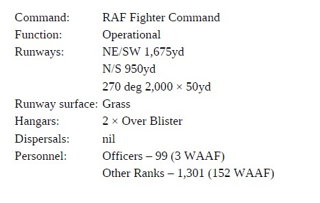
In the meantime, it would be necessary, if it is not in progress, to remove all the trees and bushes which are on the airfields ! It would also be necessary not to place so many control towers! In general, there was only one on the permanent airfields or not at all like on the English and American ALGs in England and Normandy! This would free up some space on the map. (to create other important airfields for example!) I will provide a map of the airfields in England that were used for the Normandy landings.
I think this map has a lot of potential ! She is very beautiful. But I sincerely think that making the most historic airfields possible would be of great interest and would make it the most beautiful WW2 map of DCS!
Thank you to the developers for this magnificent map and good luck for the future !
-
 3
3
-
-
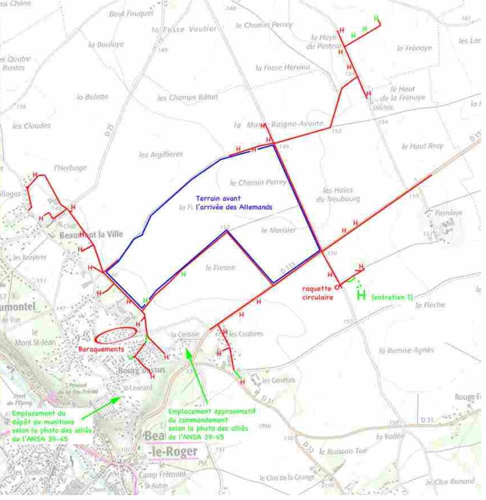
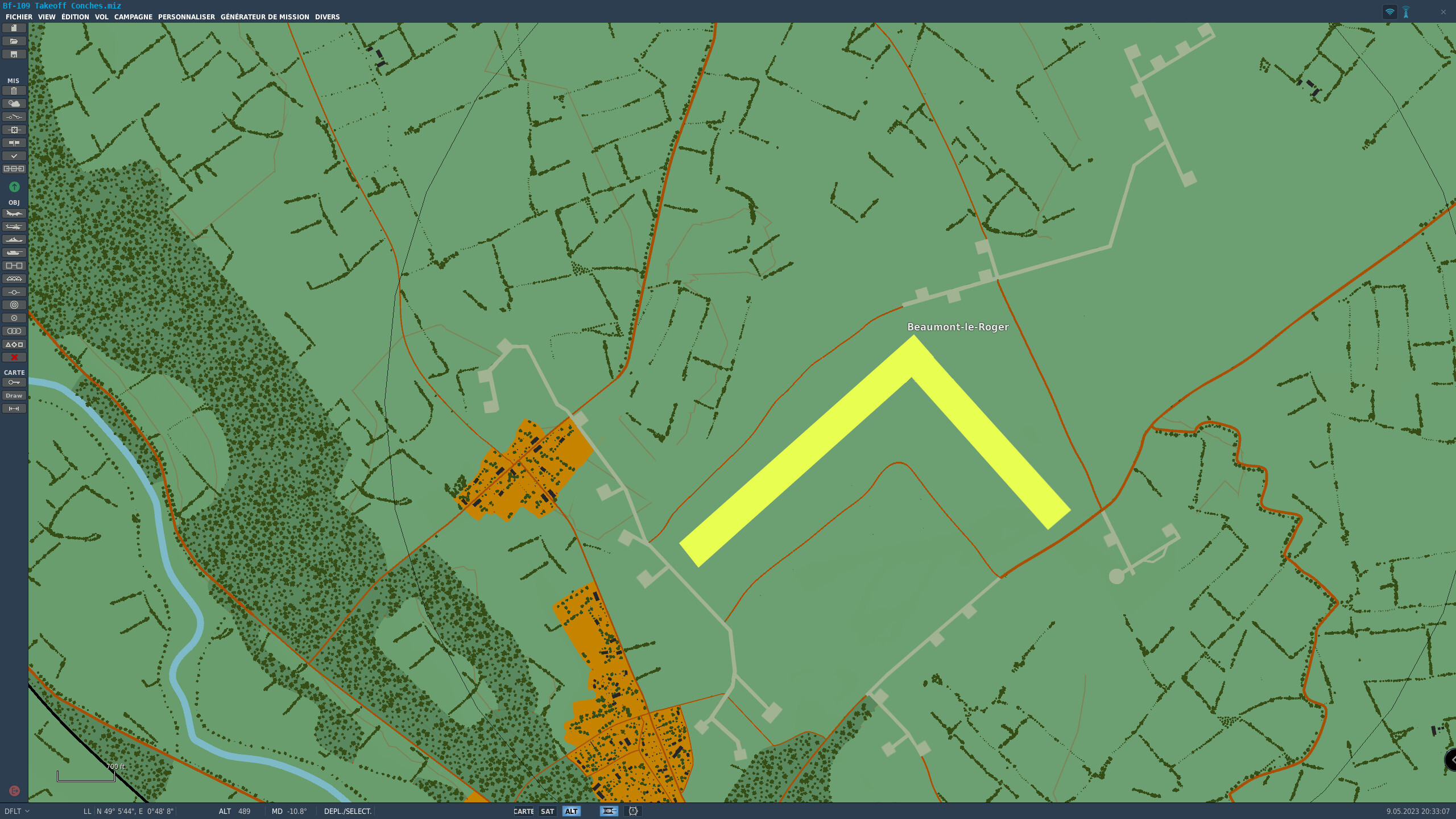
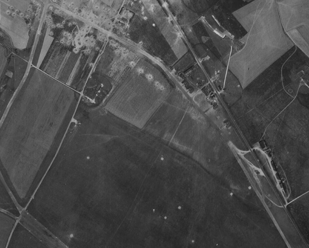
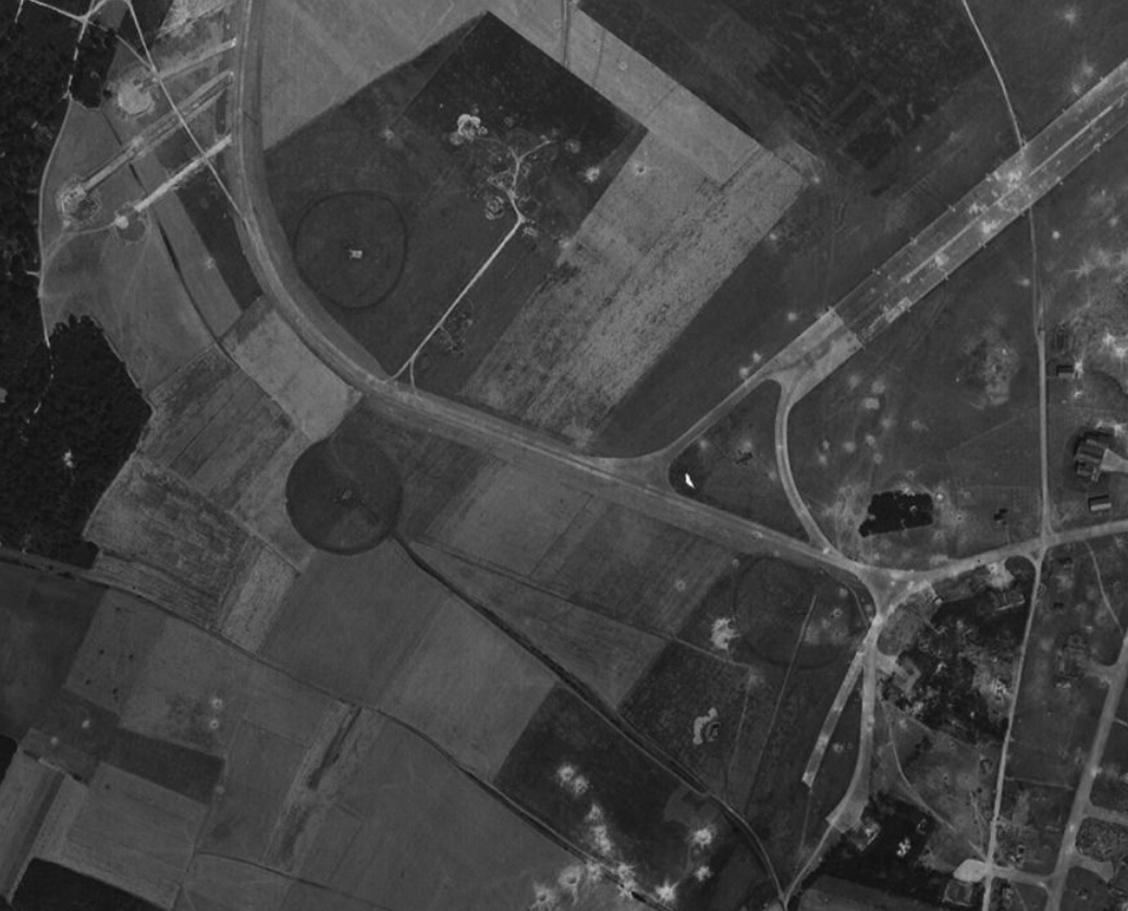
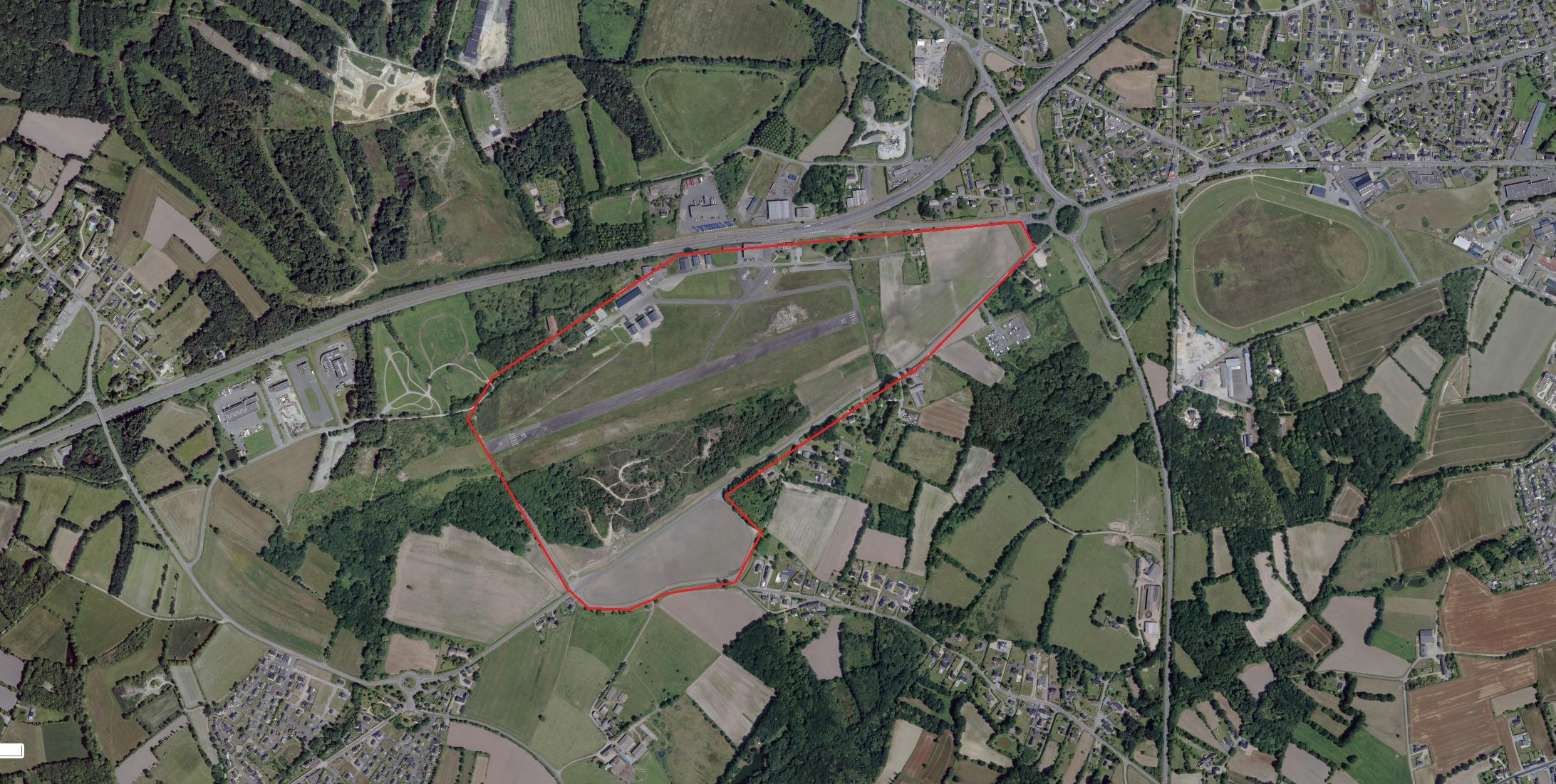
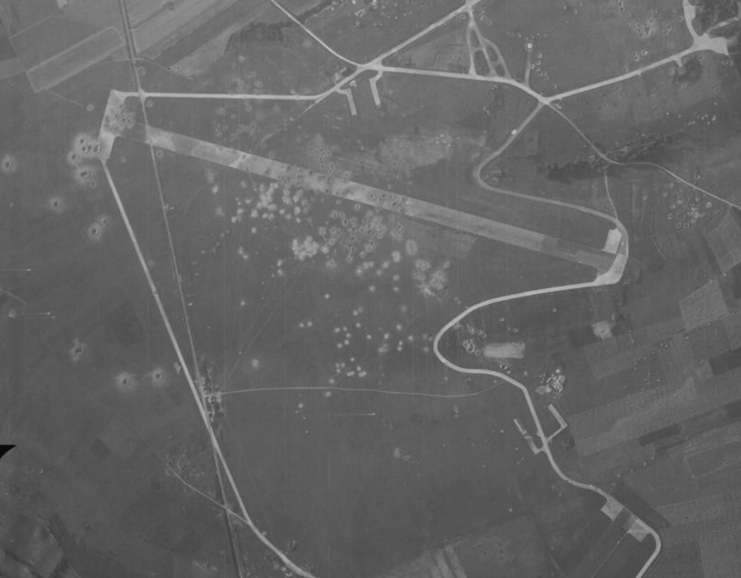
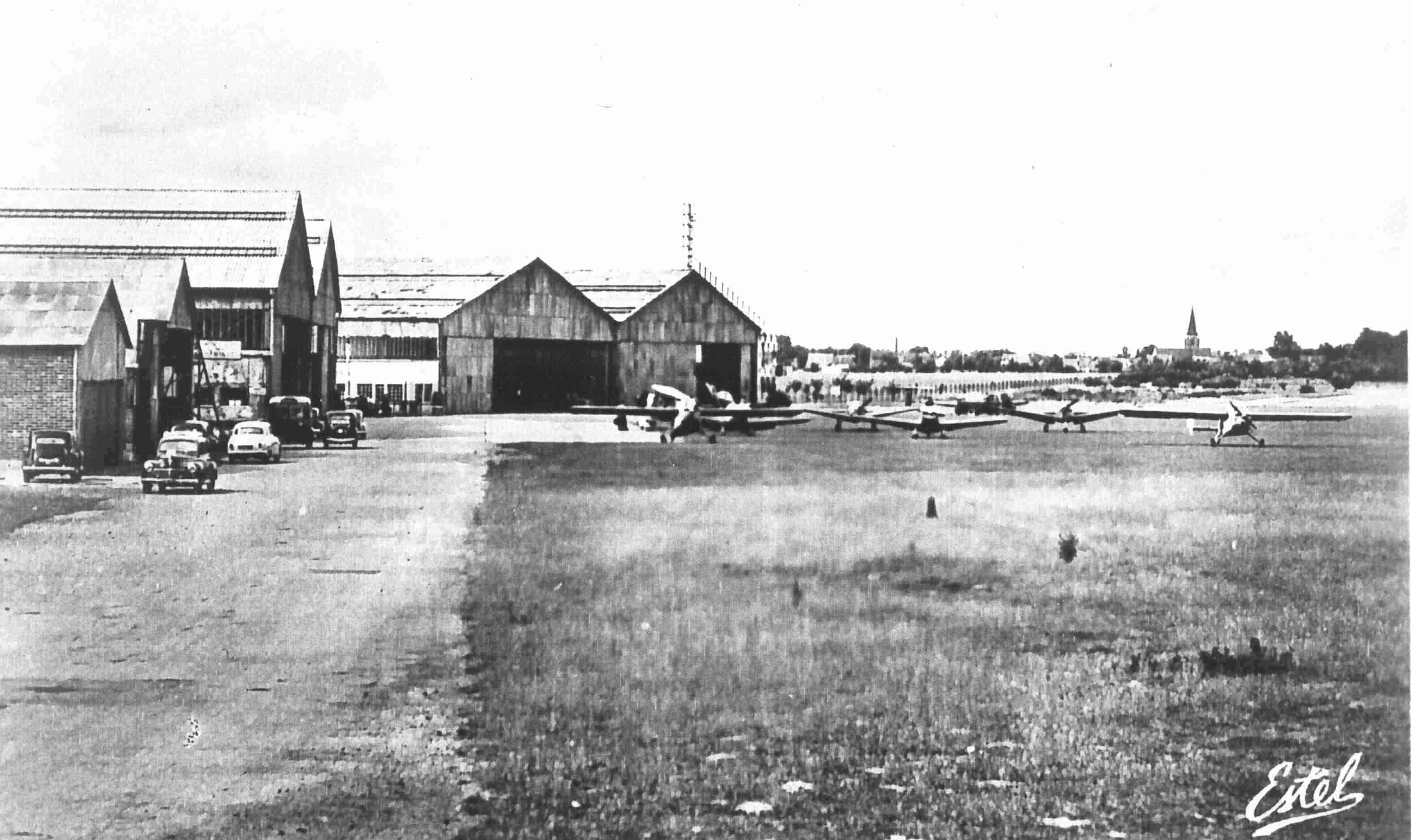
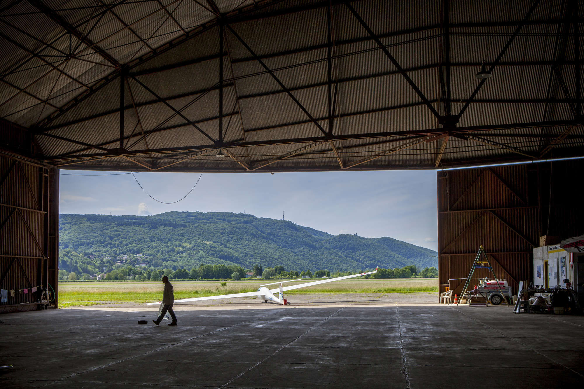
Beaumont-Le-Roger:

In yellow grass runways. Aircraft parking areas and taxiways in cement pavement.
-
4
-
-
Yes you are right, runways of Evreux are misdirected. I will talk about it in my next post.
I would also like Ugra Media to make us airfields as faithfully as possible! I have already given a lot of information in this post. and I have quite a few others to provide on all the airfields on the map.
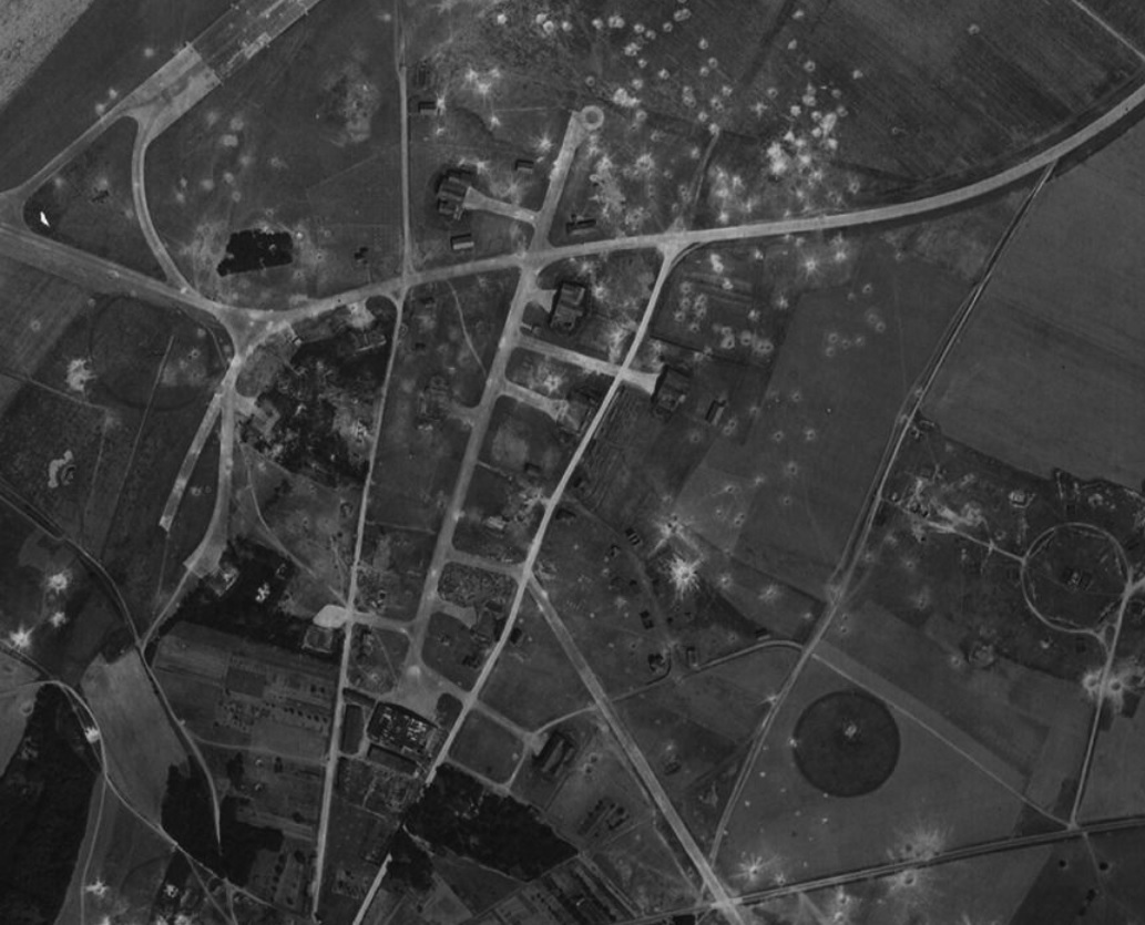
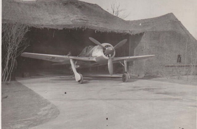
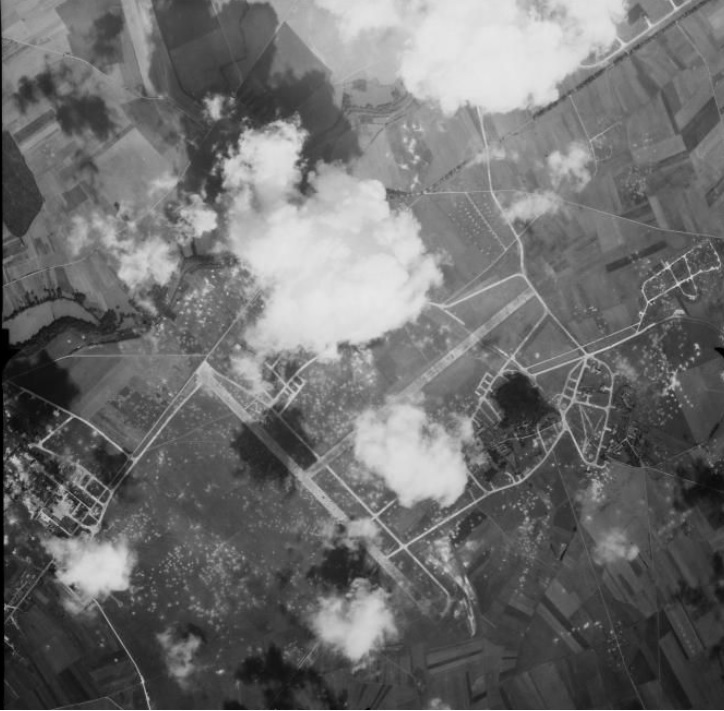
In 1944, many airfields in France were simple fields without hard construction, without convenience, they were filled aerodromes after the landing of the allies. German's planes were parked at the edge of forests or under camouflage nets.
-
5
-
-
Hello everyone,
Of course, I bought the Normandy 2 map and I find it magnificent!
I also notice that the English and French airfields are not all correctly made.
On a map like Syria or Persian gulf for example, i.e. a map nowadays it is easy to represent the runways and taxiways of each airfield, it is true on old maps it is not always easy to find plans or photos, but I think I have provided a lot of them so that these aerodromes are made as historically as possible!
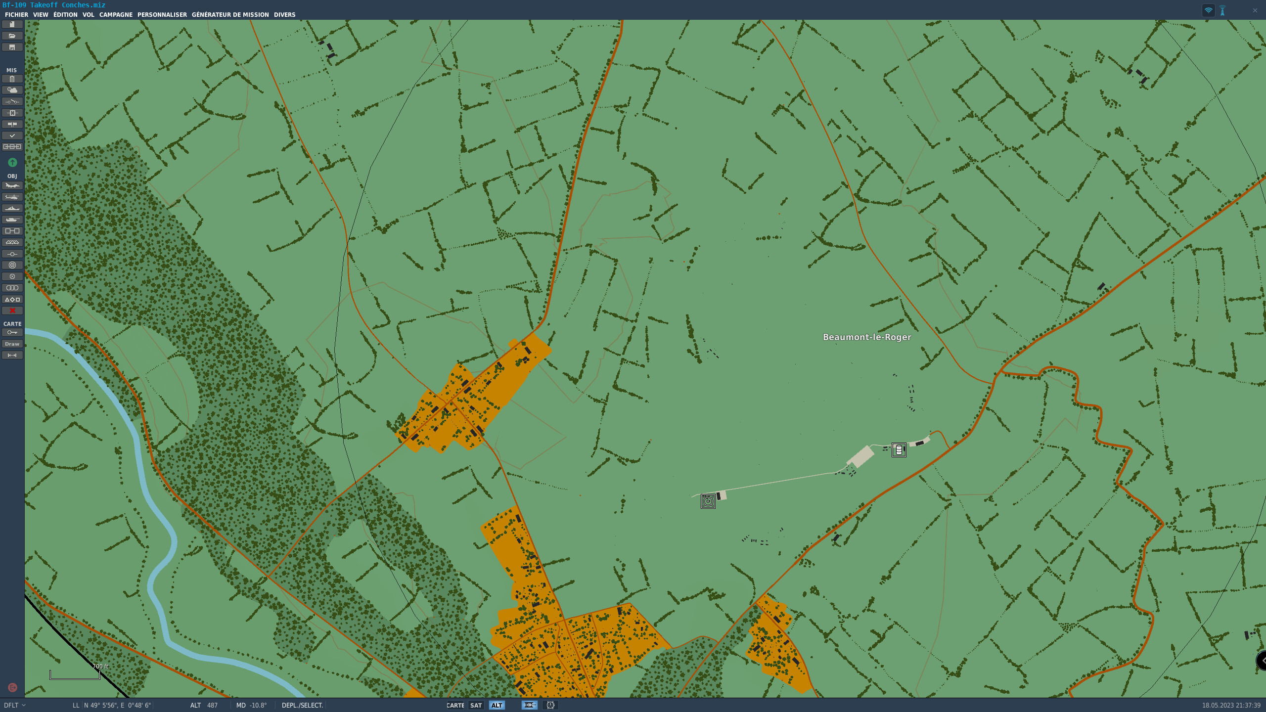
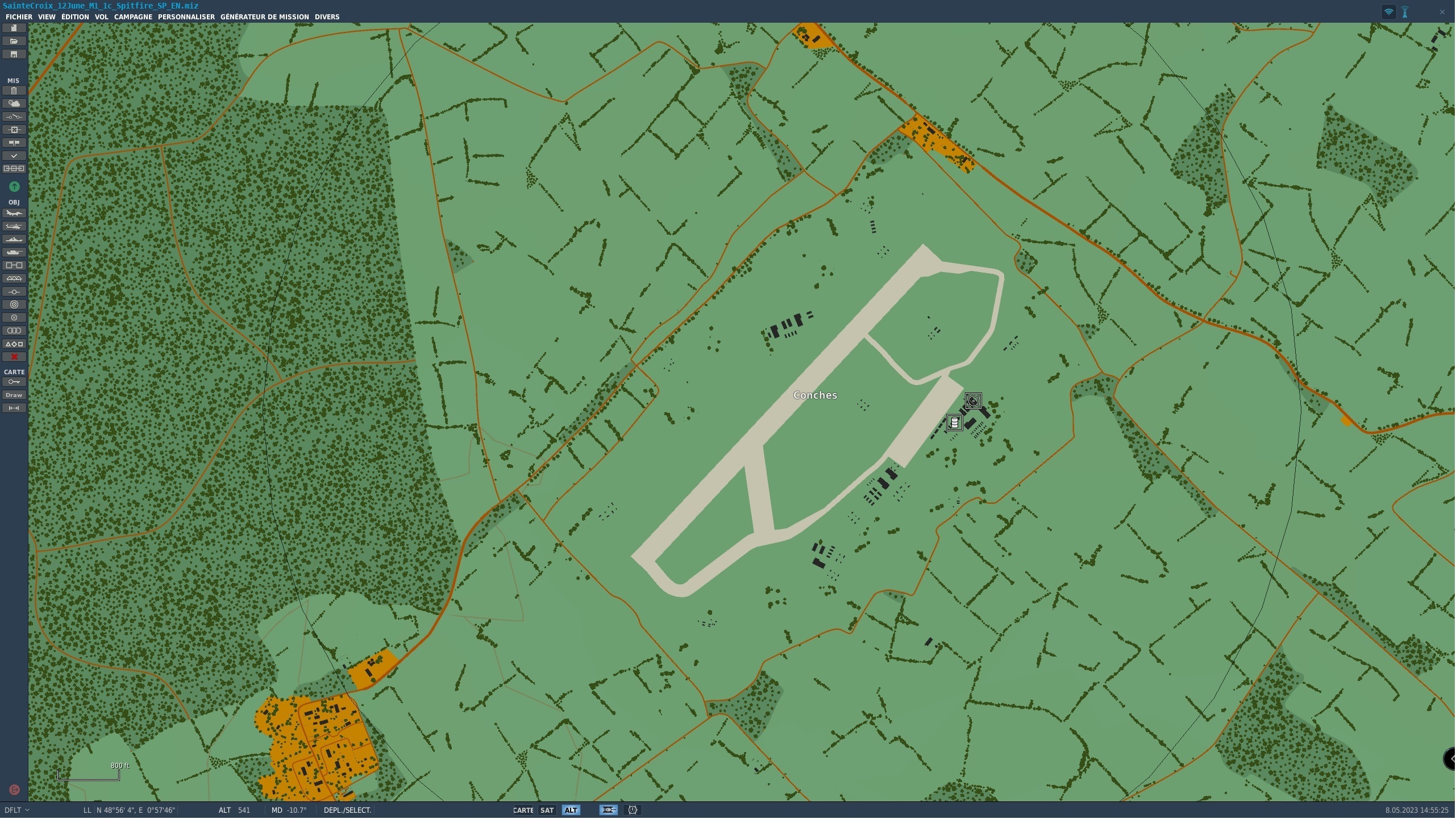
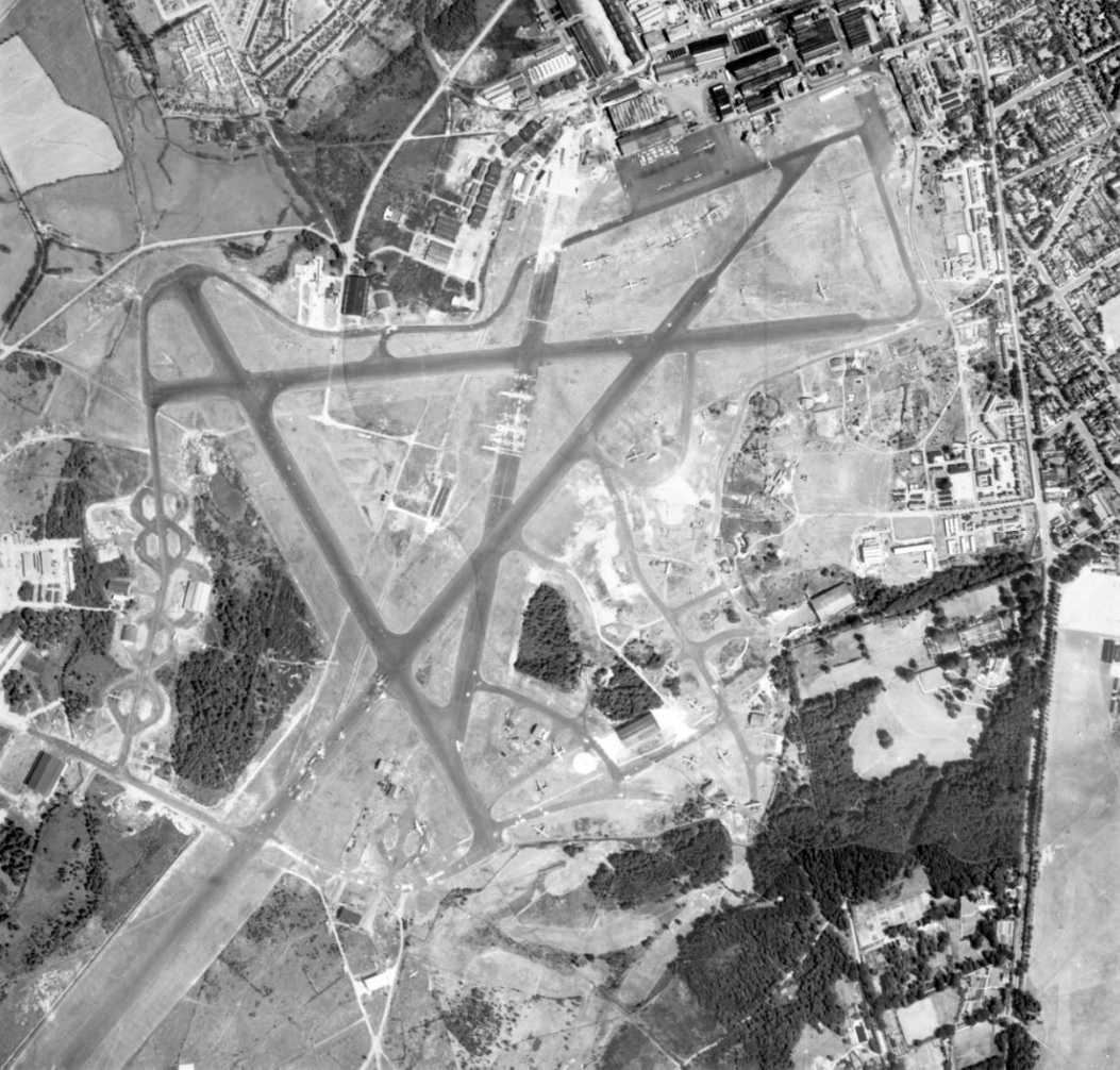
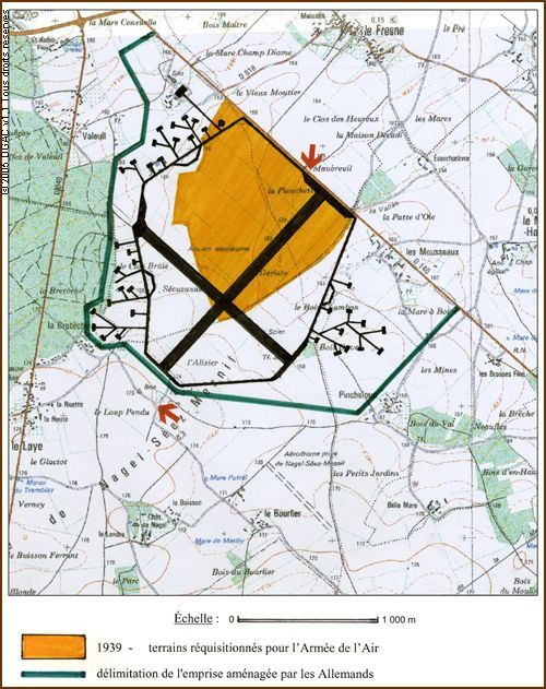
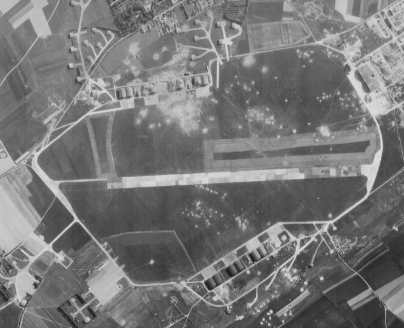
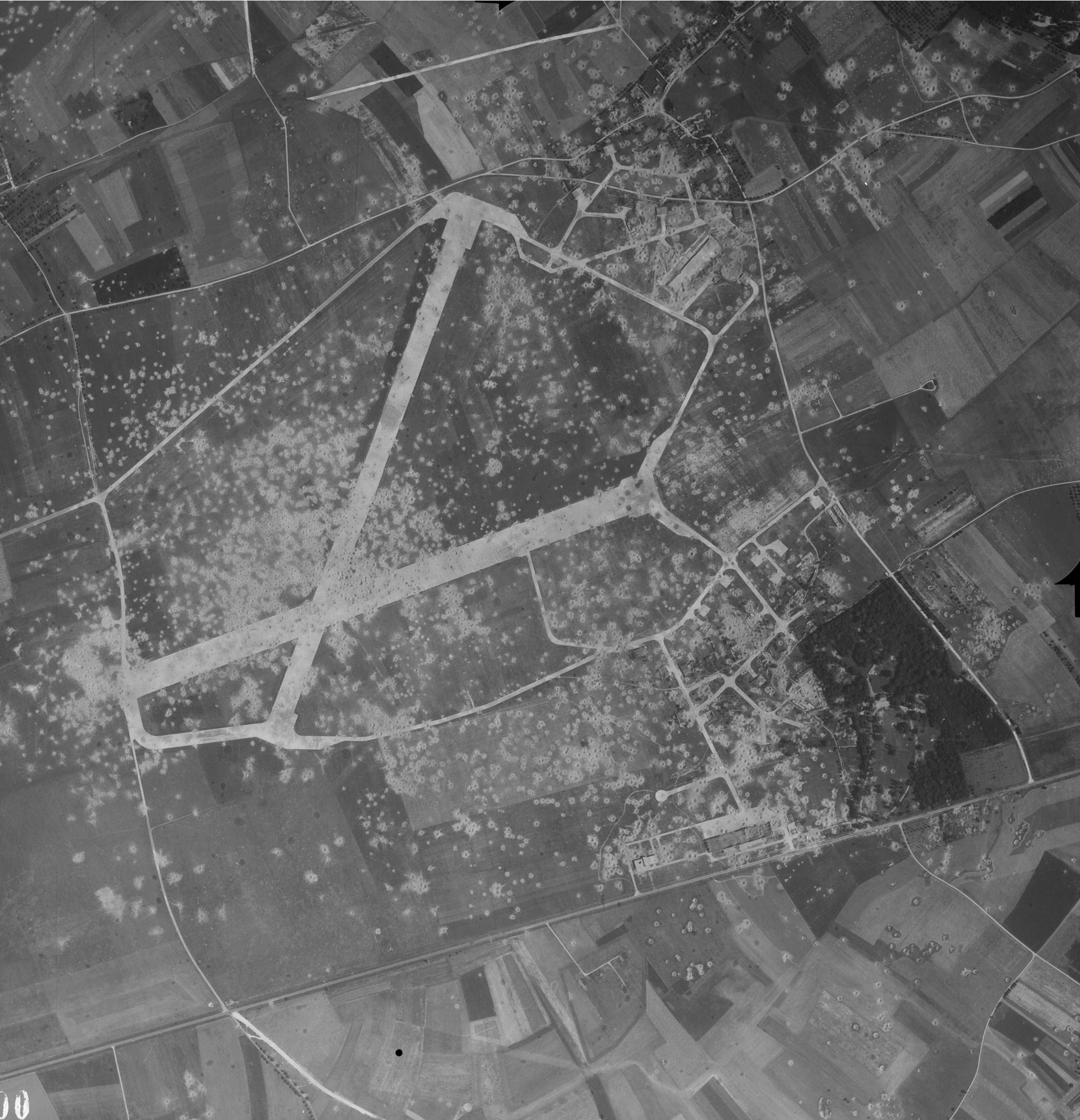
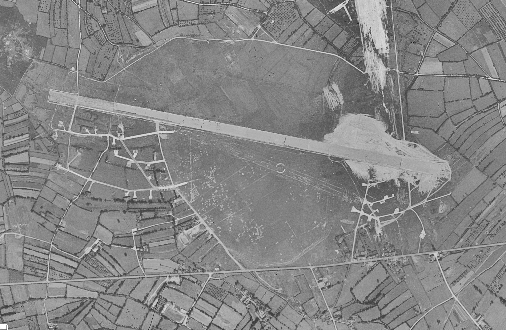
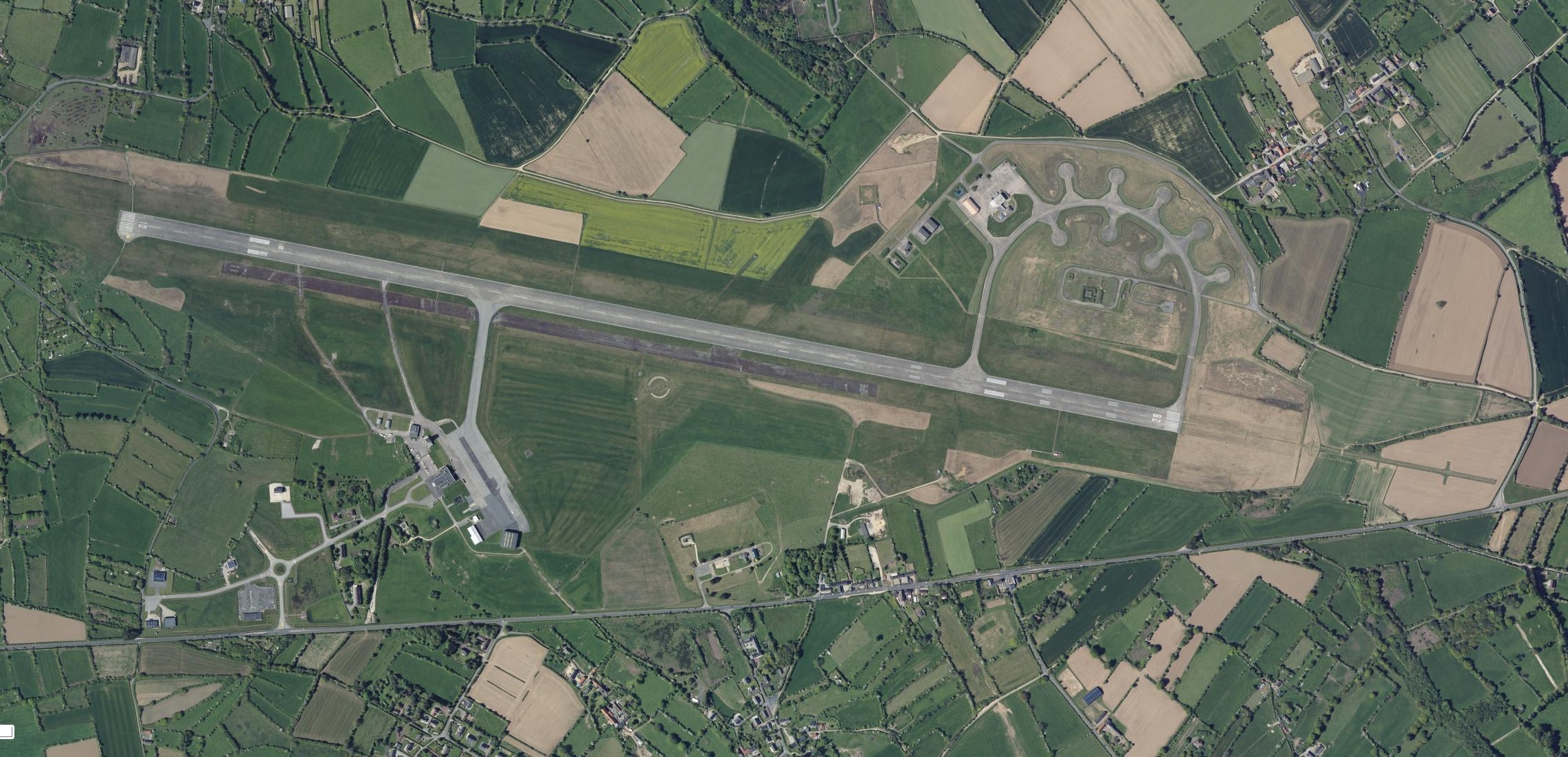
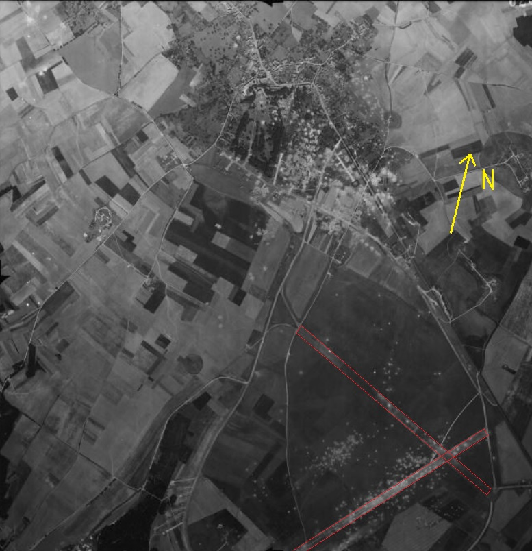
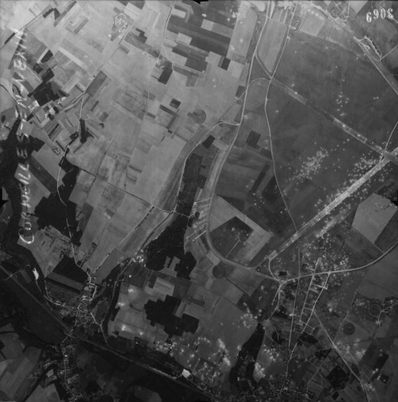
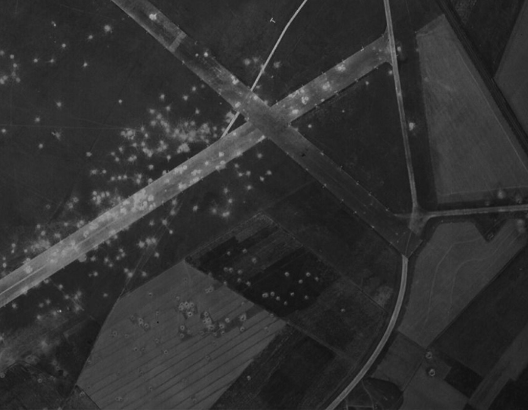
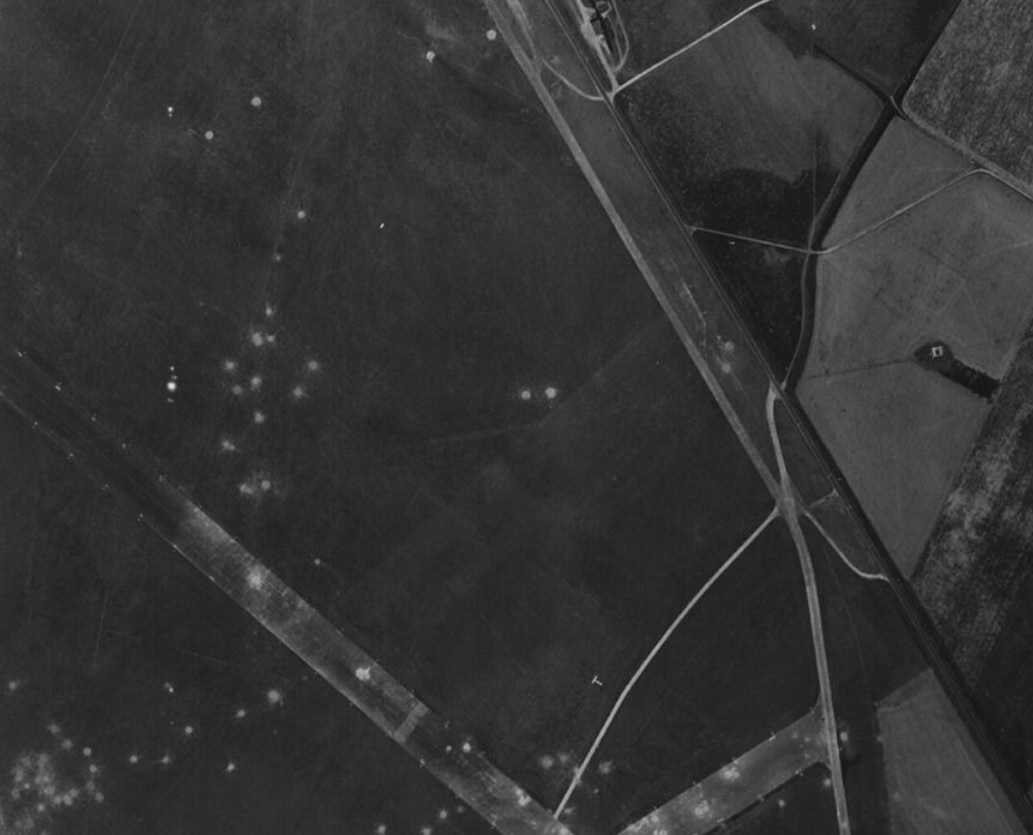
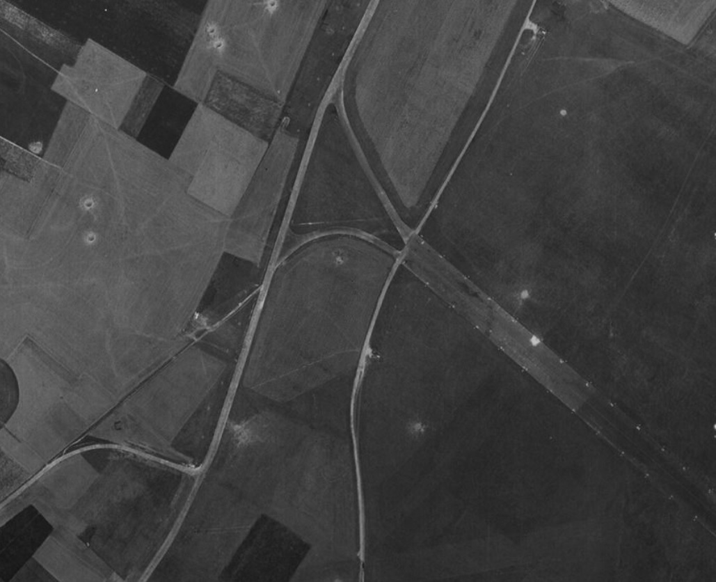
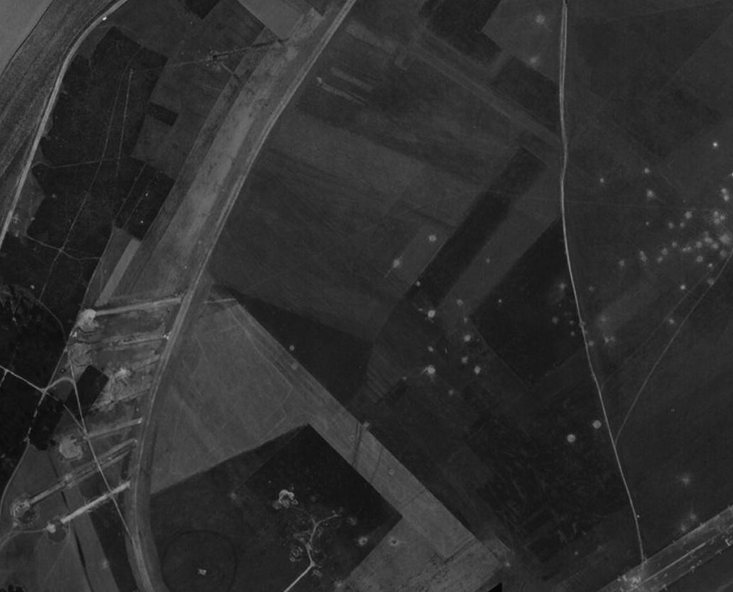
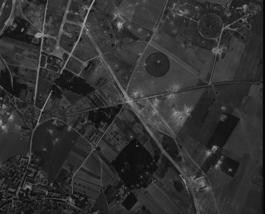
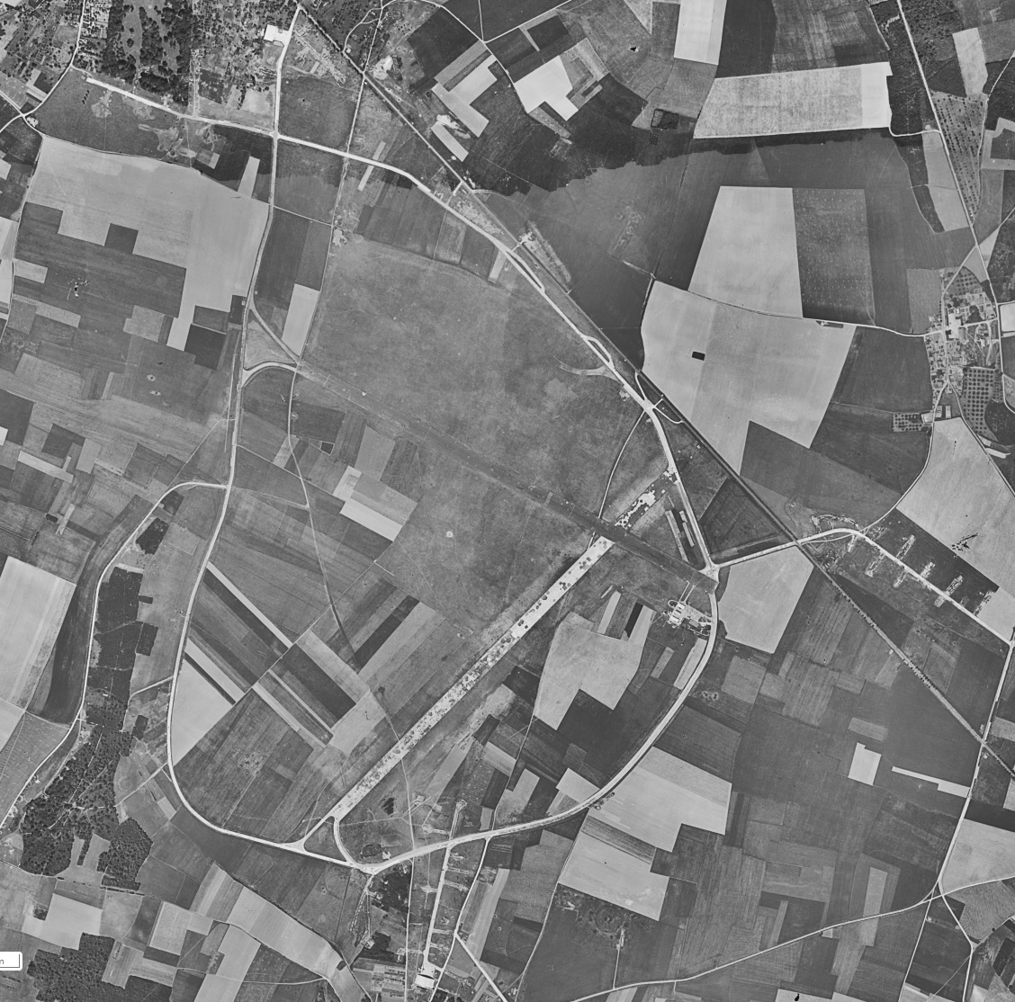
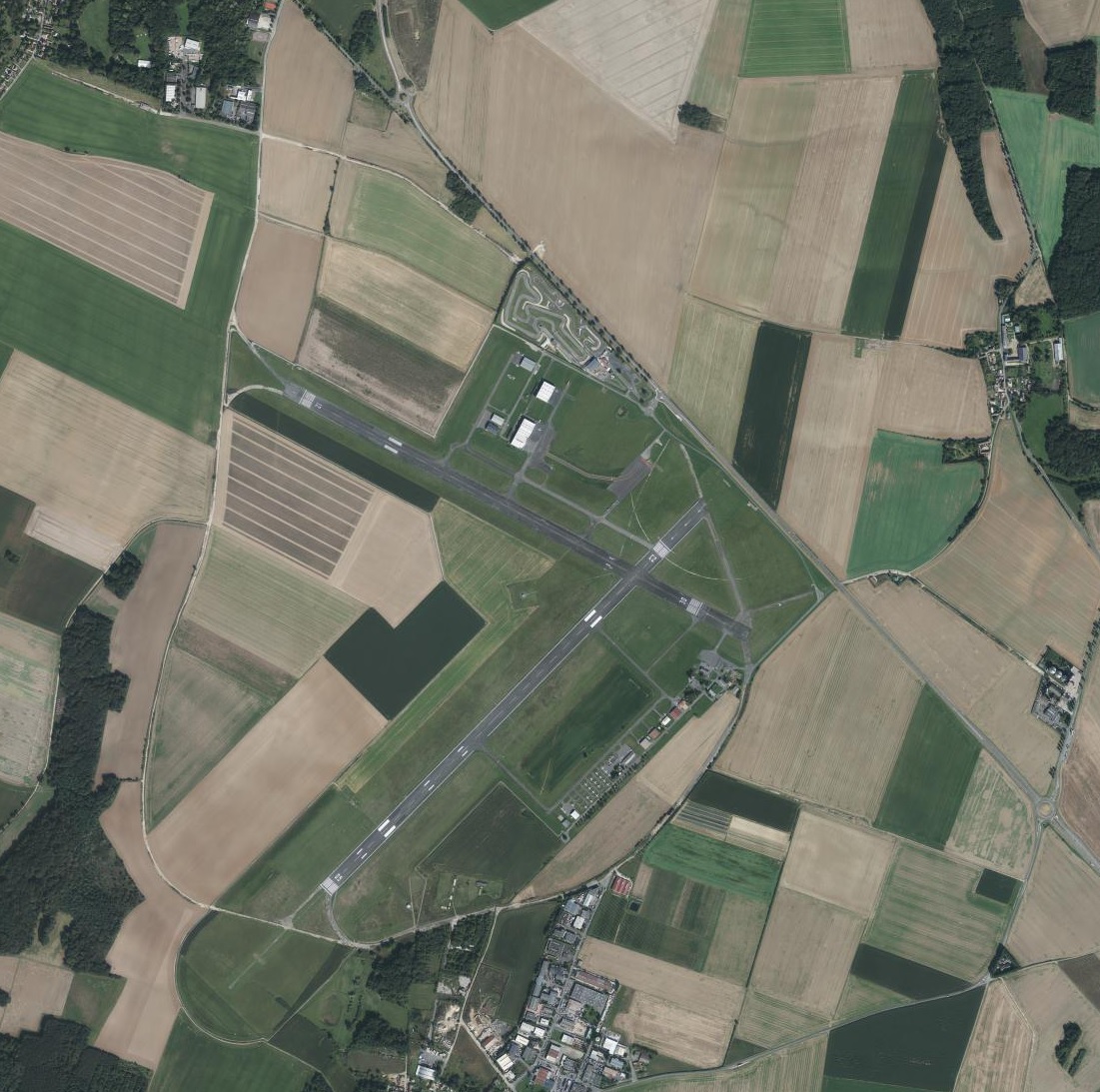
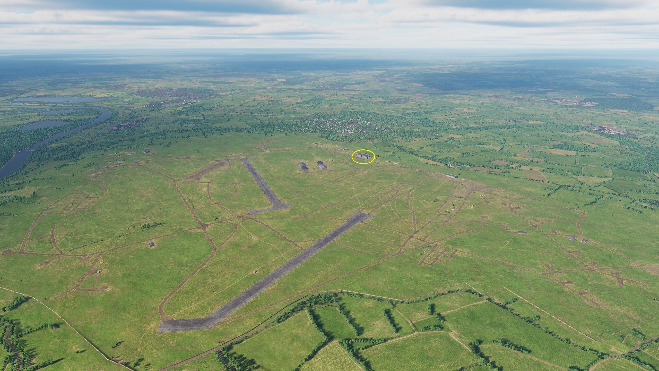
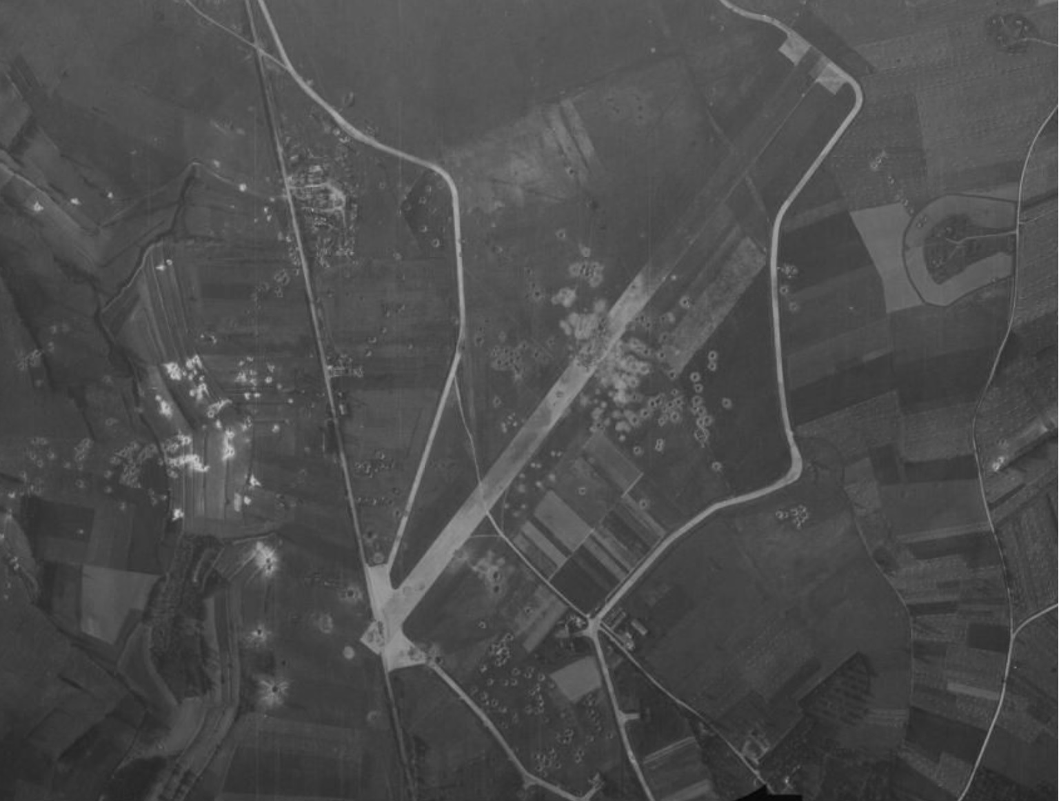
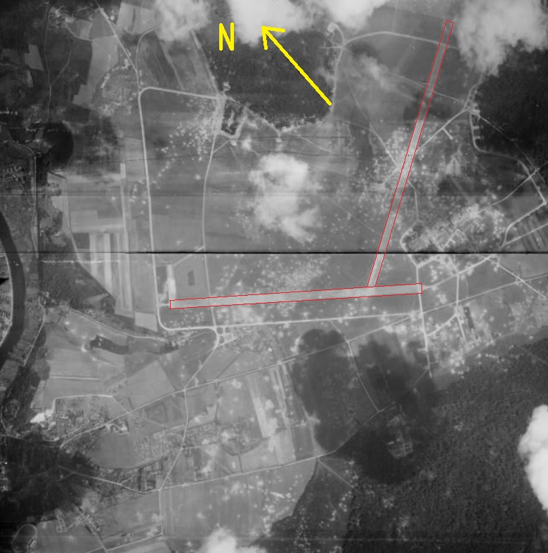
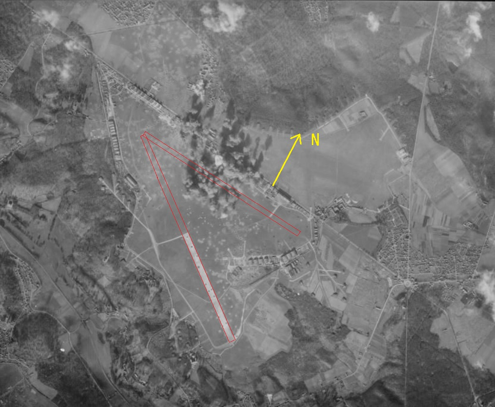
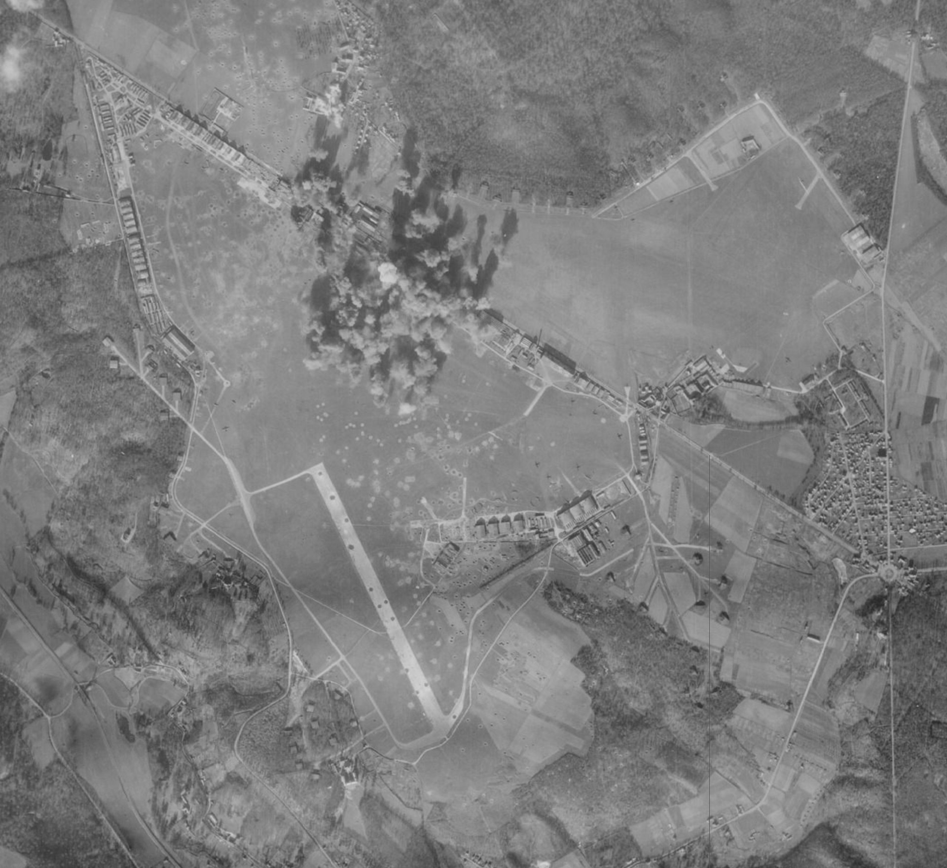
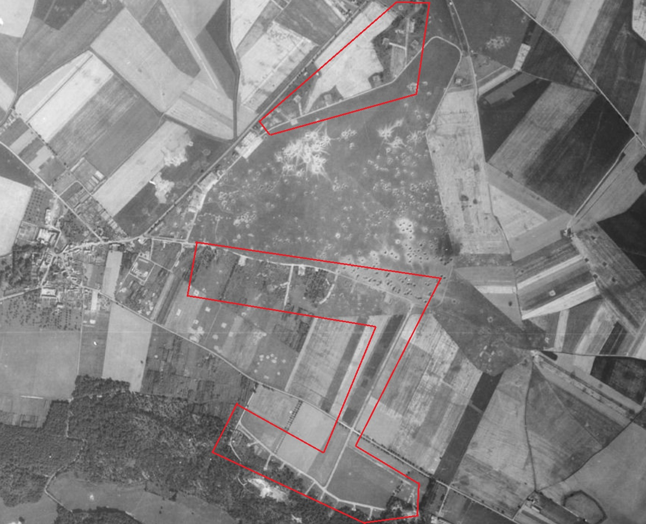
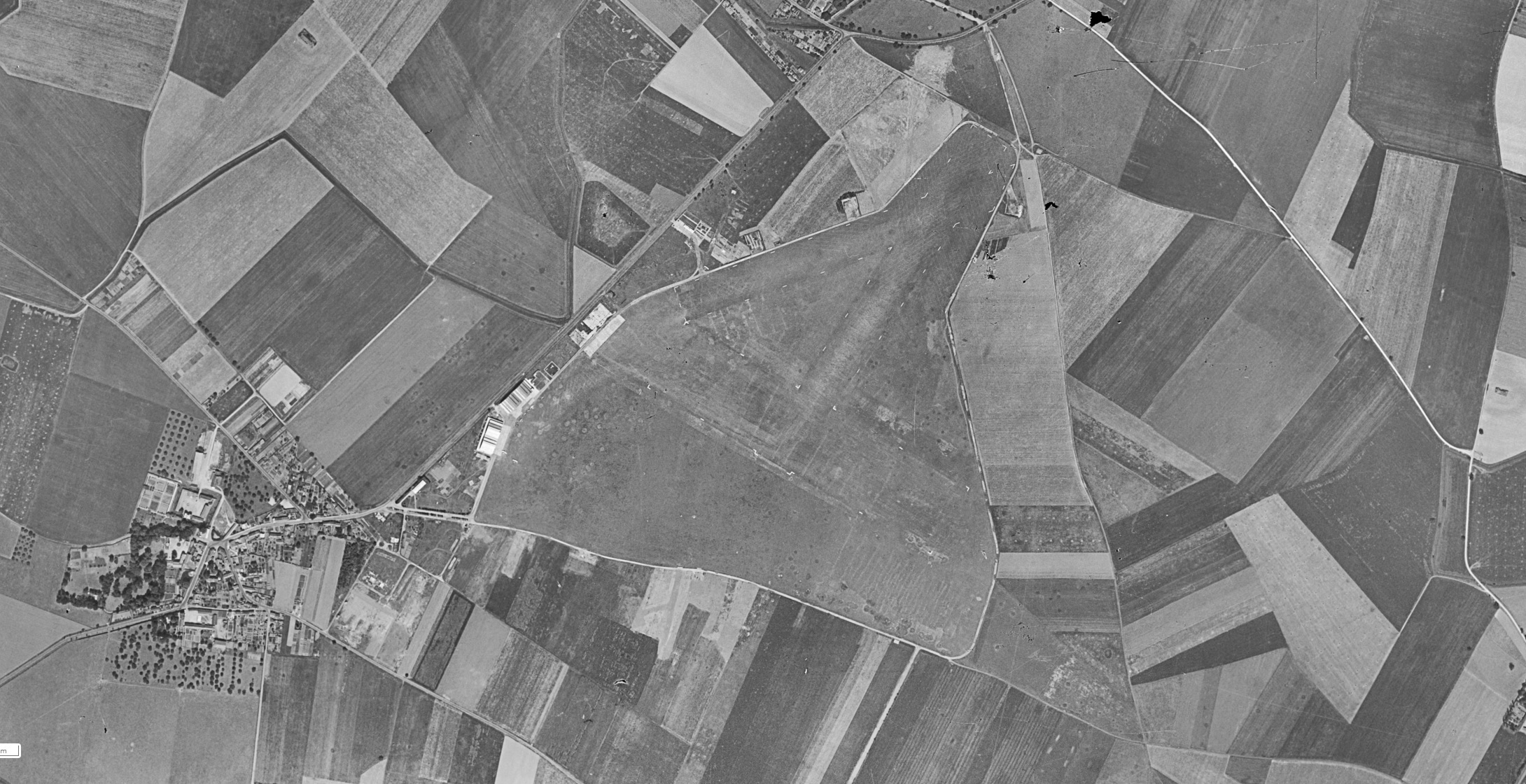
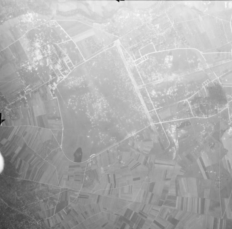
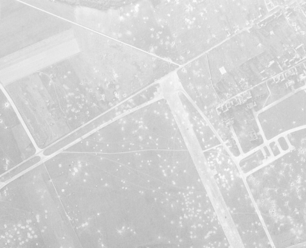
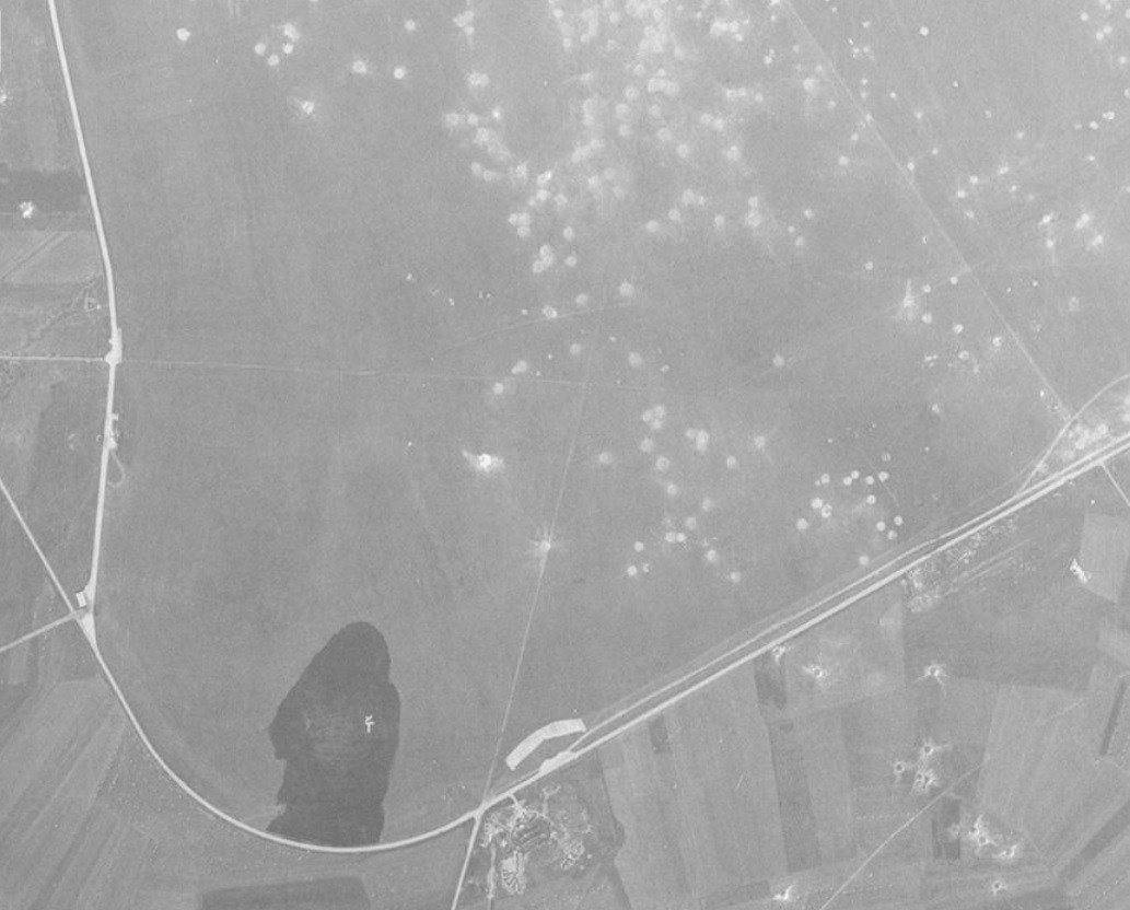
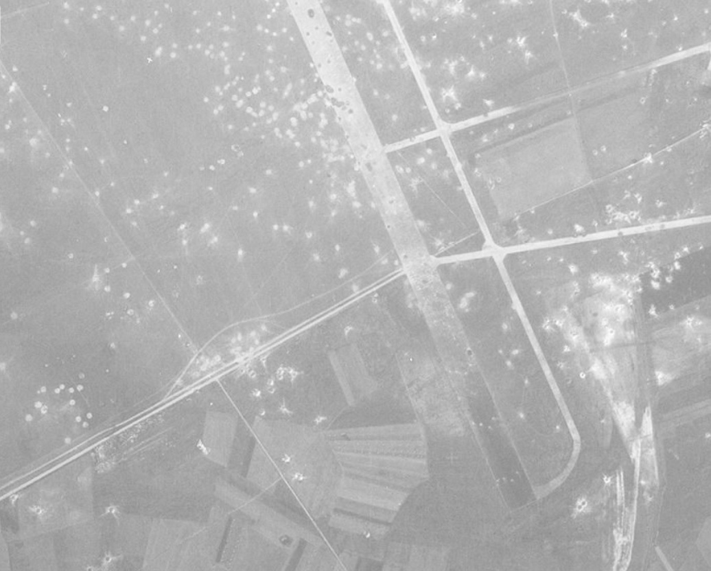
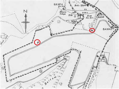
It's really a shame and I urge the developers to correct this flaw!First let's see "Conches-en Ouches" airfield:
The layout of the runways and taxiways is downright wrong! This is a southern part of the Evreux Fauville aerodrome!!
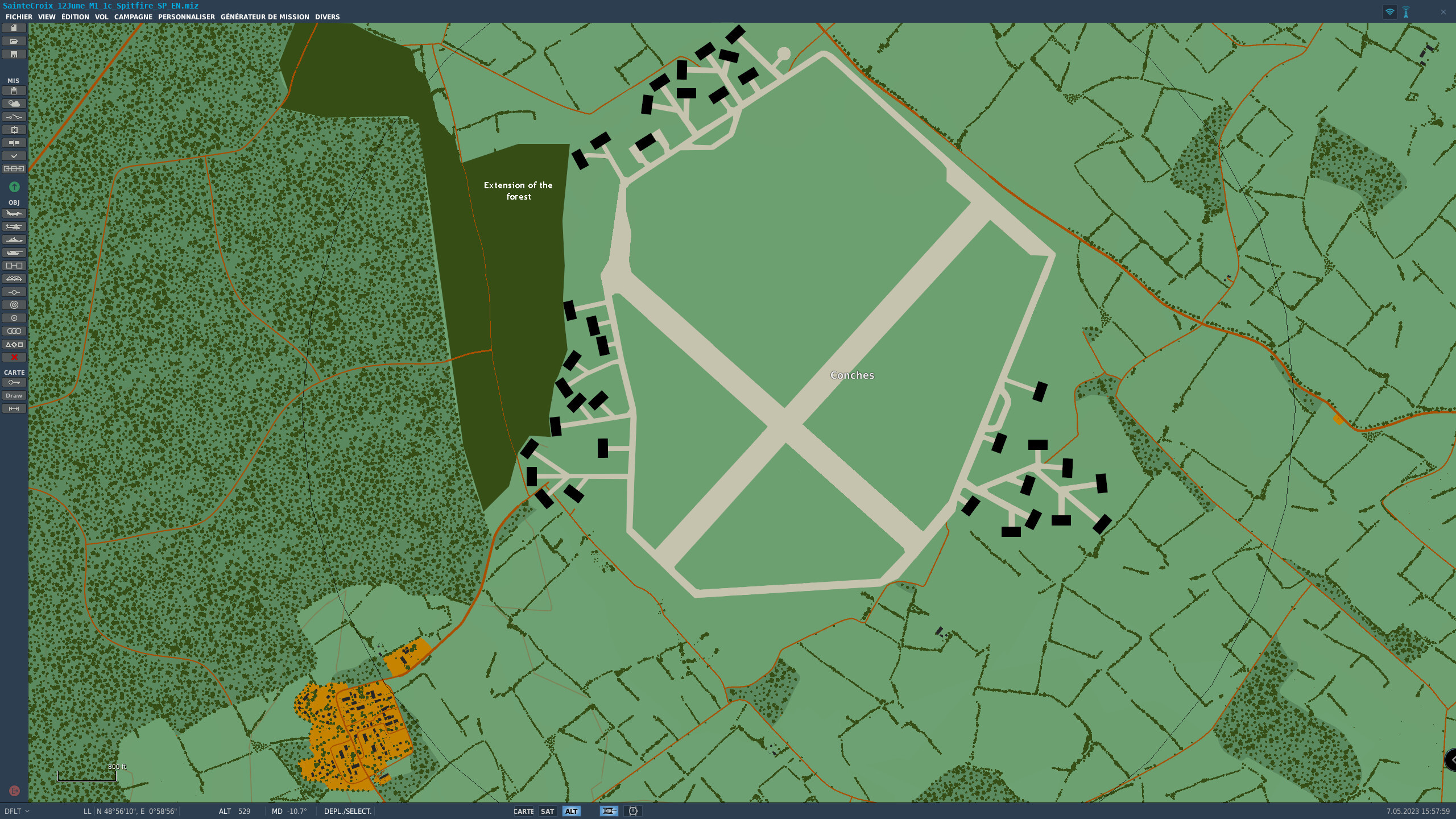
This is what Conches should look like:
Attention ! Runways, taxiways and aircraft parking areas were made of concrete slabs.
It should also be noted that there were no trees or bushes between the runways and the taxiways as you did in Saint-Andre-De-l'Eure. It's wrong !
I also noticed that on most runways there are white lines in the middle, there weren't any on all these airfields at that time.
-
5
-
-
Listen Sandman24: the area where the airfields you mention are located is a low resolution area, very sparsely populated and no airfields because ED has defined some like that!
Think a bit: what would be the point of buying the Channel map if all airfields and cities and... were on the Normandy 2 map??? Players would only buy the Normandy 2 map and no longer the Channel map! You understand now ?
-
1
-
-
That would actually be good! But these airfields are already on the Channel map, that's why they are not present on the Normandy 2 map.
We can only hope that when the technology is ready, ED will perhaps be able to put these 2 maps together.
-
This map is very beautiful ! Only there are a lot of things to review.
By helping the devs we have a better chance of getting good improvements!
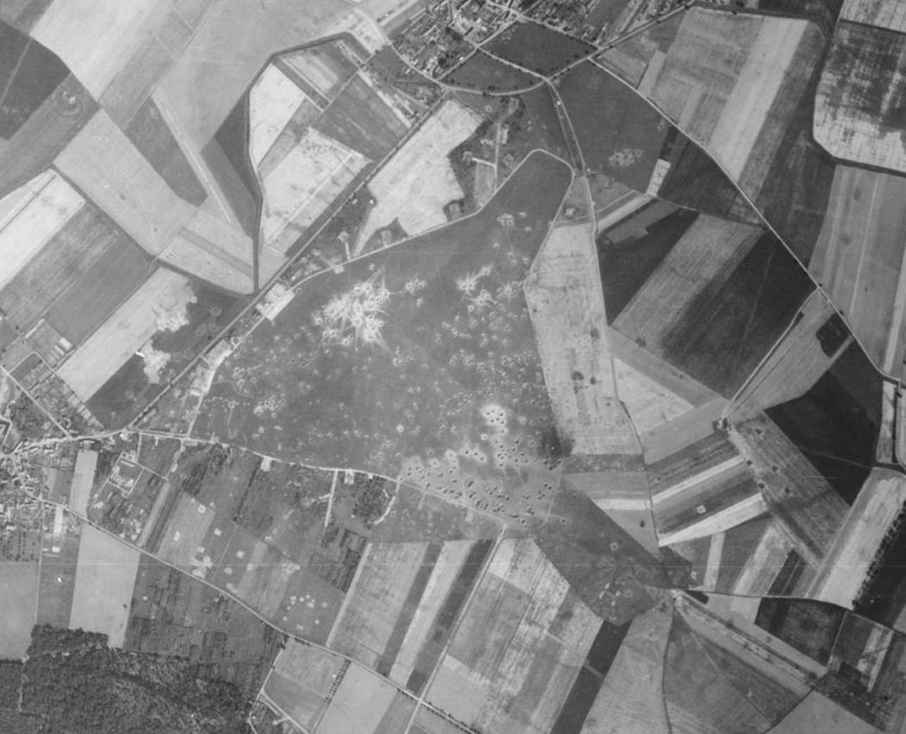
For example, there are quite a few airfields like Lornai or Broglie which were just fields with no hard construction: no hangars, just the minimum! The planes were hidden under trees to hide from Allied reconnaissance.
For those who are interested, go to this post for information on the airfields on the maps. I will take the time to add other information on other aerodromes. Hoping it helps!
-
1
-
-
I have already provided the layout of Odiham to the devs as well as a good number of airfields present on the map. maybe they didn't have time to get the map out as soon as possible? I don't know !
-
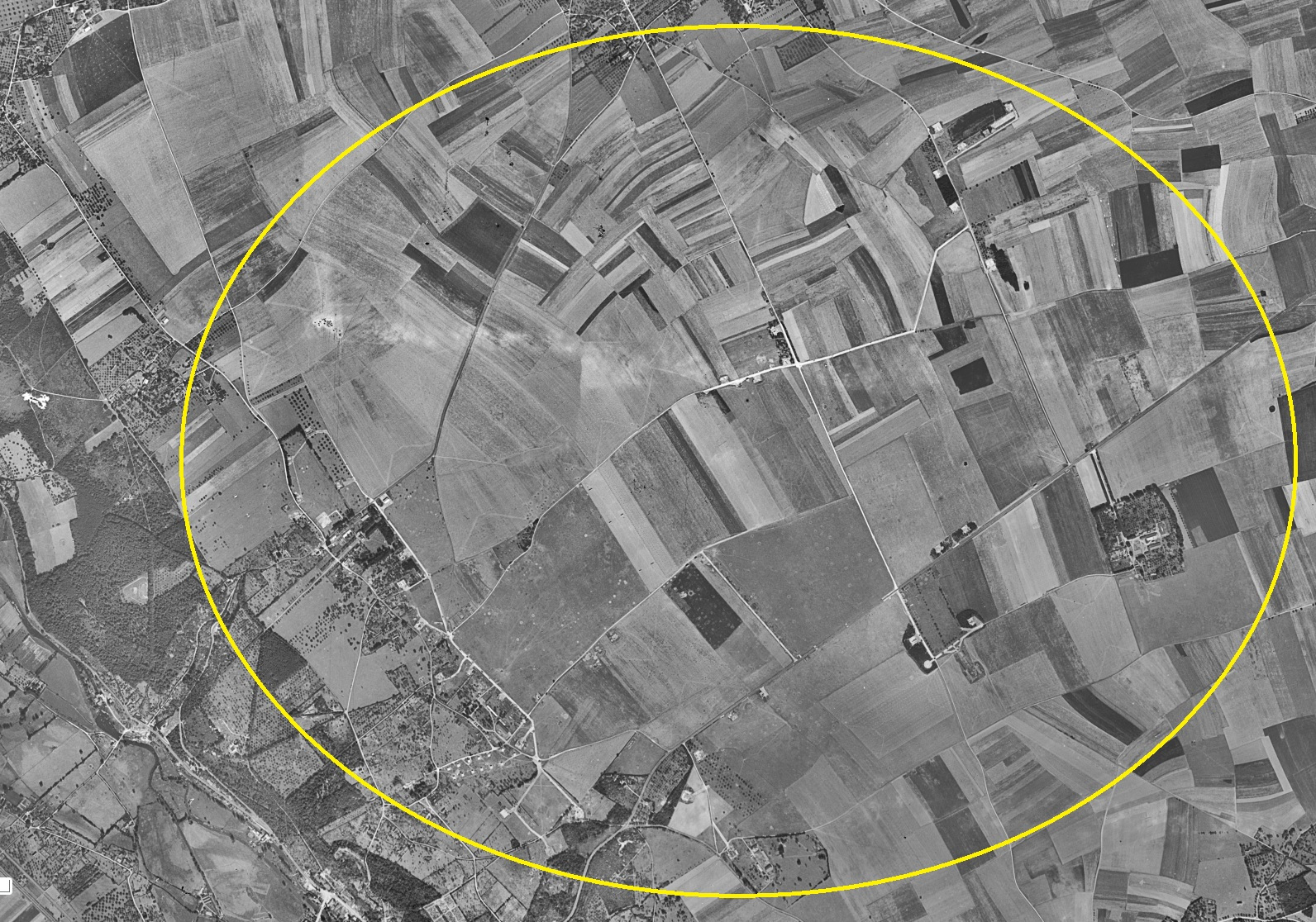
Couches airfield on the map is not at all representative of the real one of the time! On the map it is part of the layout of the Evreux aerodrome!
Moreover Evreux is badly oriented.
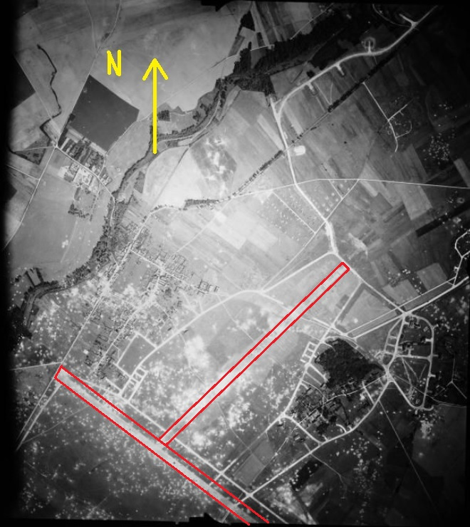
Beauvais Tille had 2 tracks just like that of Amiens Glisy.....
I'm quite disappointed with all these vintage aerodromes!
https://forgottenairfields.com/airfield-conches-en-ouche-closed-1112.html
-
I totally agree !!!

-
3
-
 1
1
-
-
Yes, it's true ! Moreover, there are many aerodromes which are not in conformity with the time!
however, I created a post to provide information on airfields:
In addition, there are many generic airfields with no similarities to period airfields. It's really a shame for such a beautiful map... I hope the devs fix the flaws!
-
1
-
-
I think ED's World War II team is small. I too would like to have new maps, like a Rhemania map and new planes like the Hawker Typhoon (my favorite WW2 plane). But I don't think ED will be able to make everyone's dream come true. We have to make concessions in our mission scenarios.
Although we are not all we can have a lot of fun playing the magnificent campaigns that the campaign designers offer us, like, for example, the campaigns of Reflected which are very immersive.
Merry Christmas to everyone !
-
Farnborough 1950:
Deanland:
Heathrow:
http://exceptthekylesandwesternisles.blogspot.com/2015/09/heathrow-in-1950s-60s.html
-
3
-
-
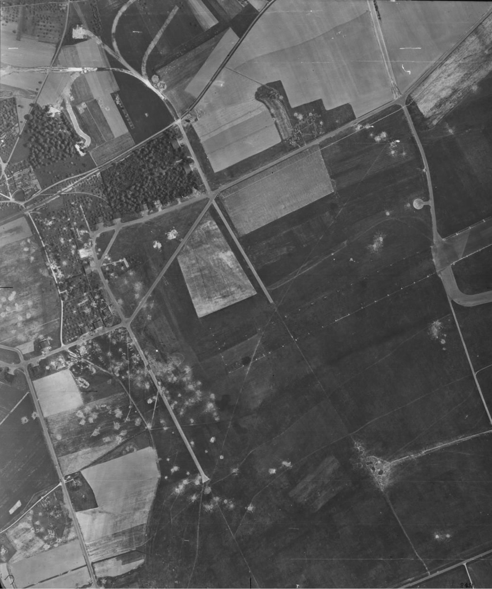
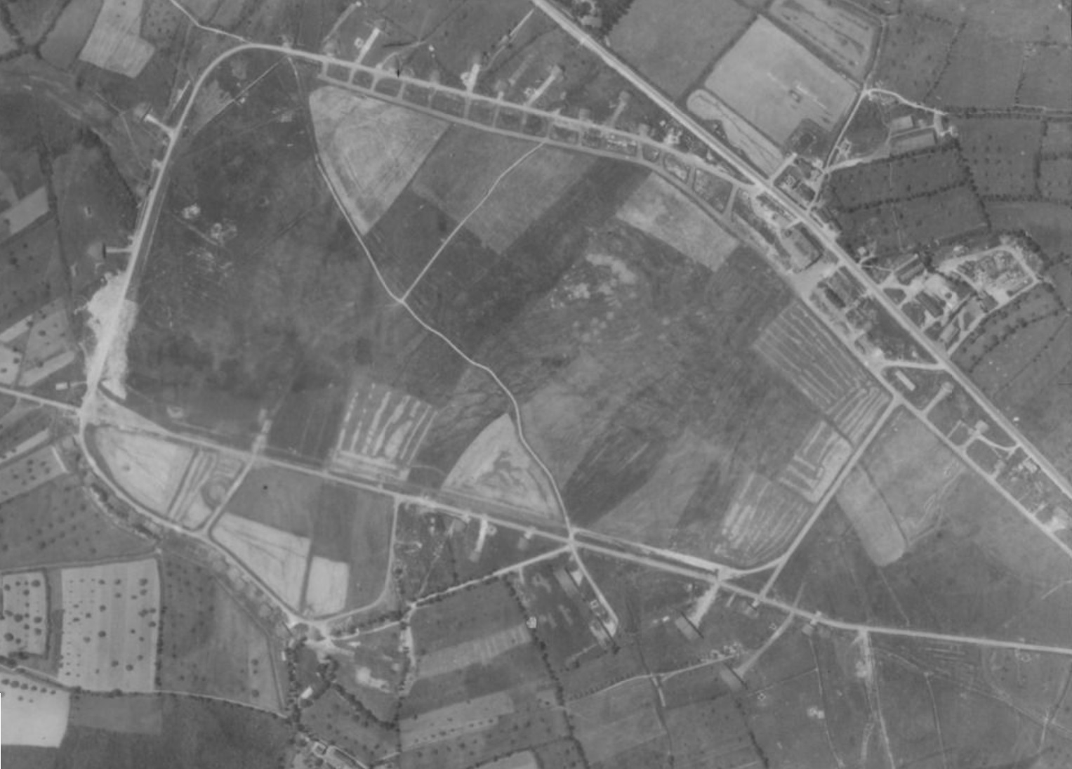
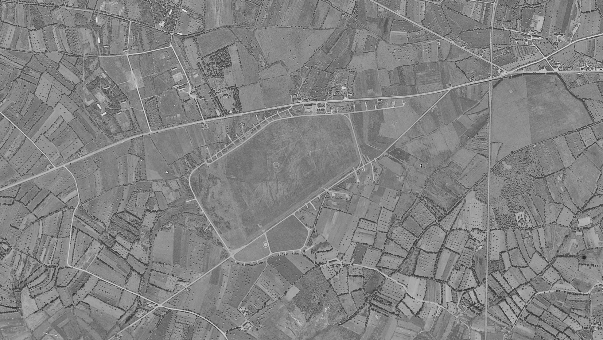
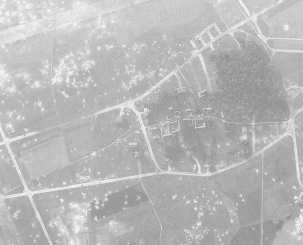
Hi,
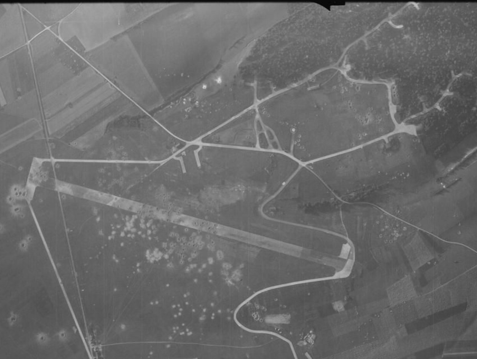
Conches-en-Ouche:
https://www.anciens-aerodromes.com/?p=25045
https://forgottenairfields.com/airfield-conches-en-ouche-closed-1112.html
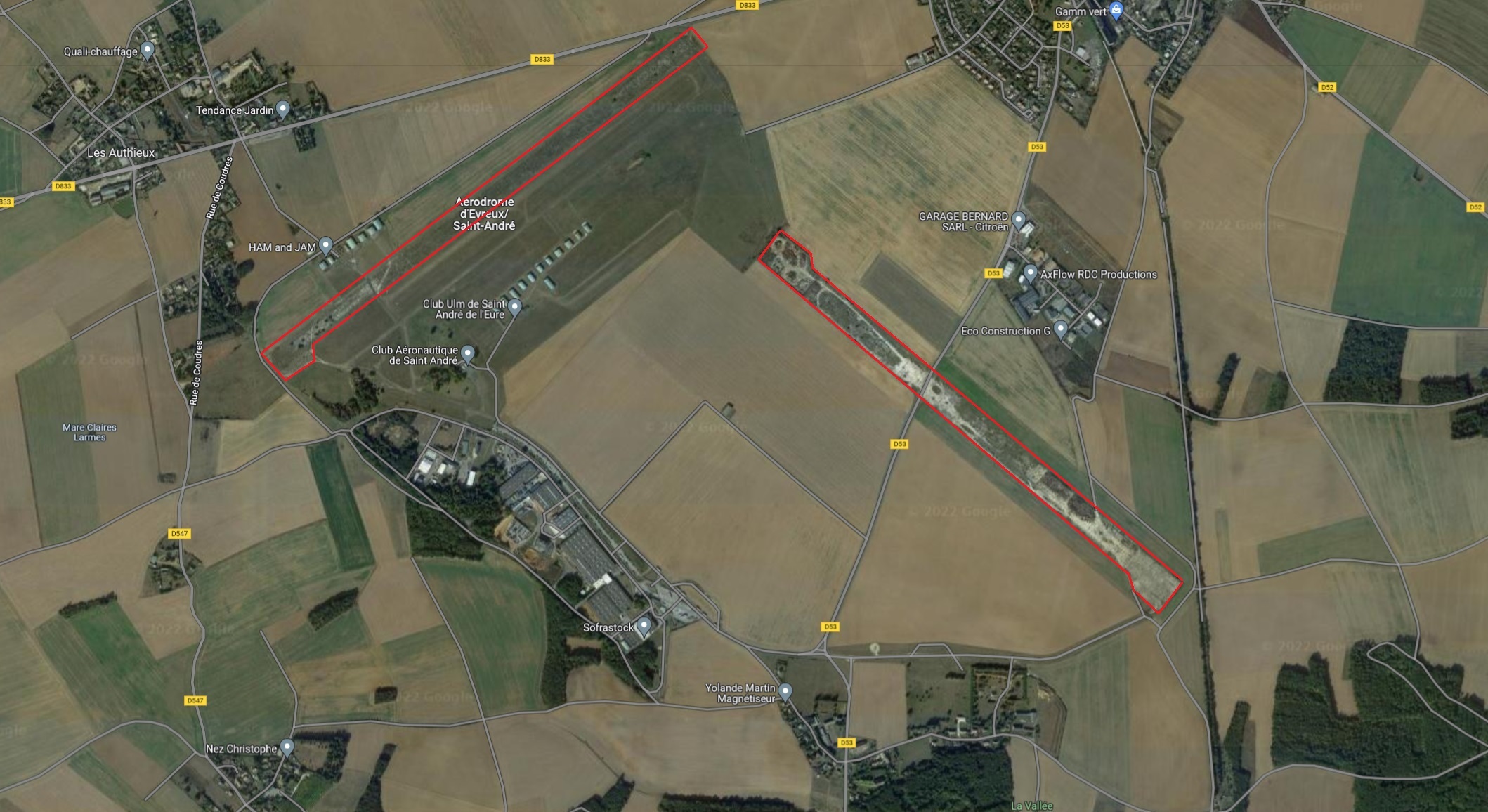
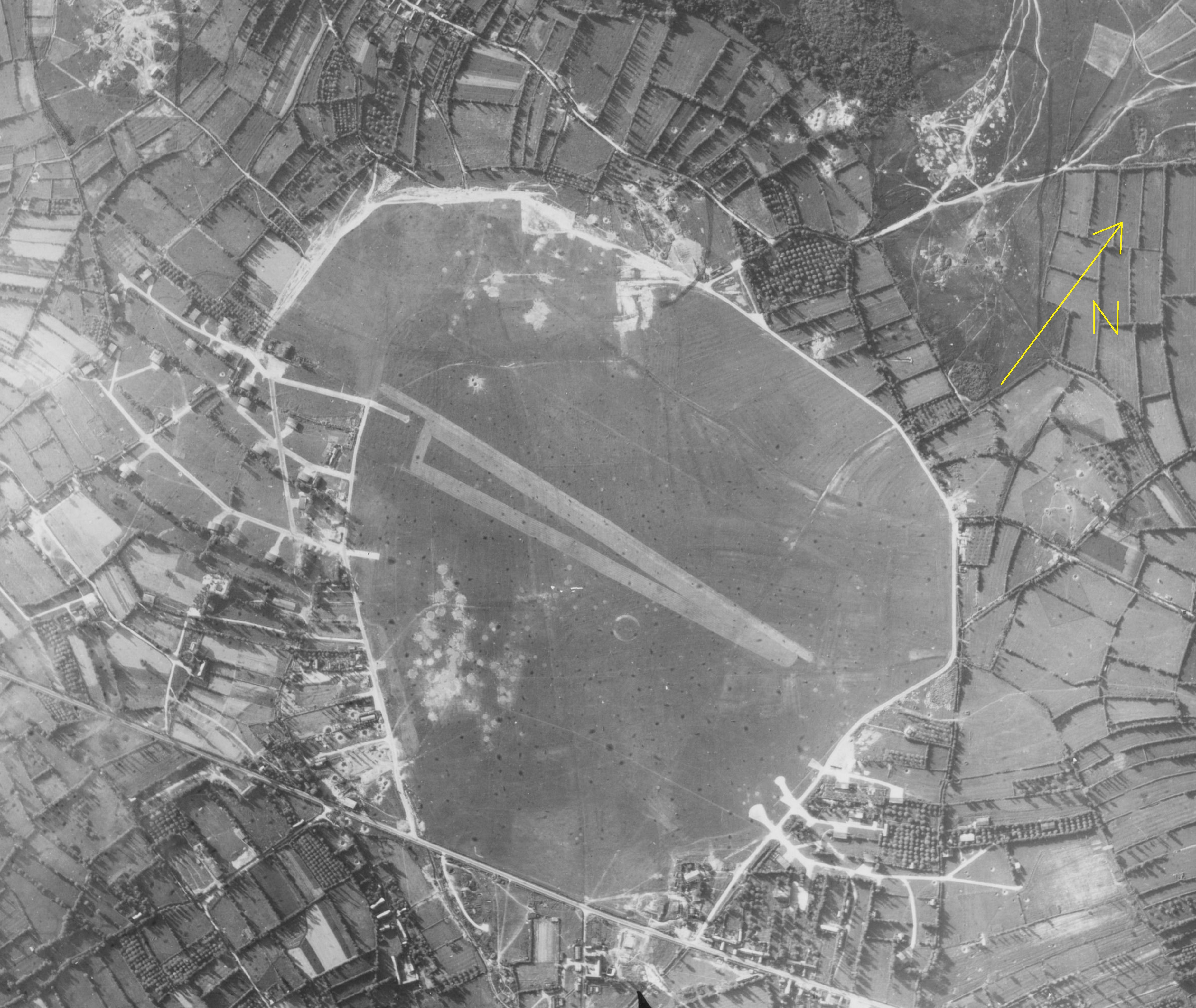
Suggestion: Saint-Andre-de l'Eure:
At the end of May 1944, the aerodrome welcomed part of the I/KG51 equipped with Ju-88.
https://forgottenairfields.com/airfield-saint-andree-de-leure-1113.html
Saint-Andre de l'Eure today:
-
1
-
-
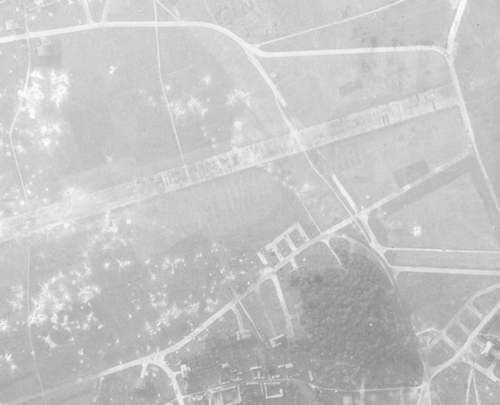
Hi,
Caen-Carpiquet:
May 28th, 1944:
Hangars type "Double-Tonneaux":
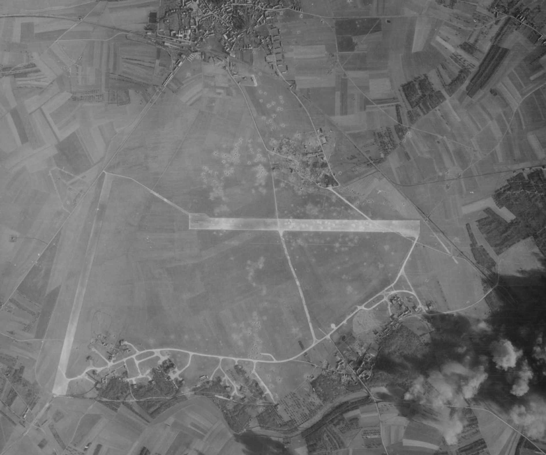
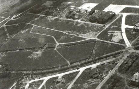
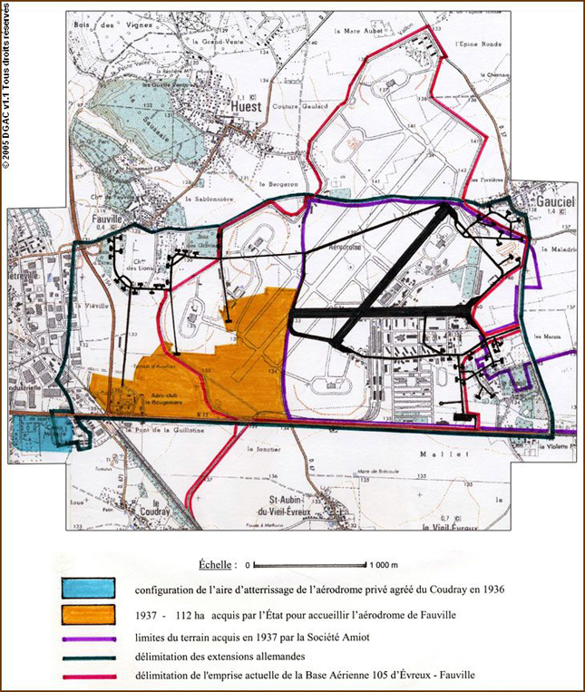
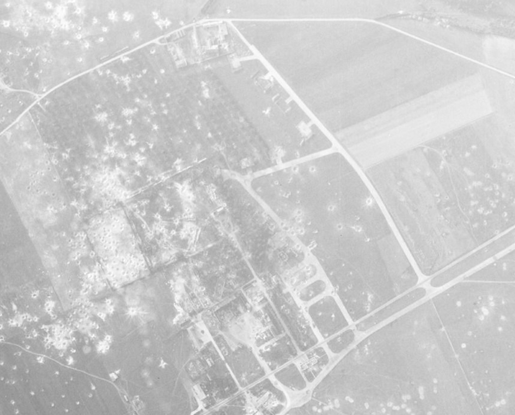
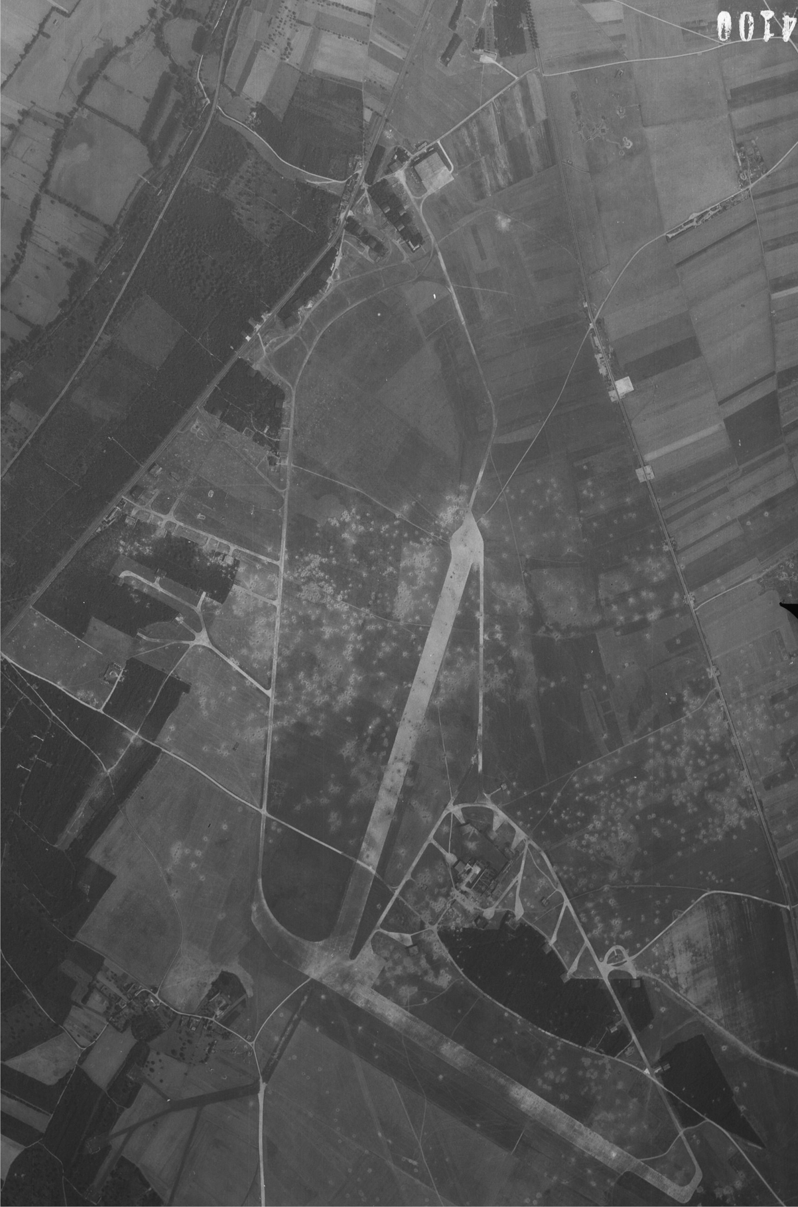
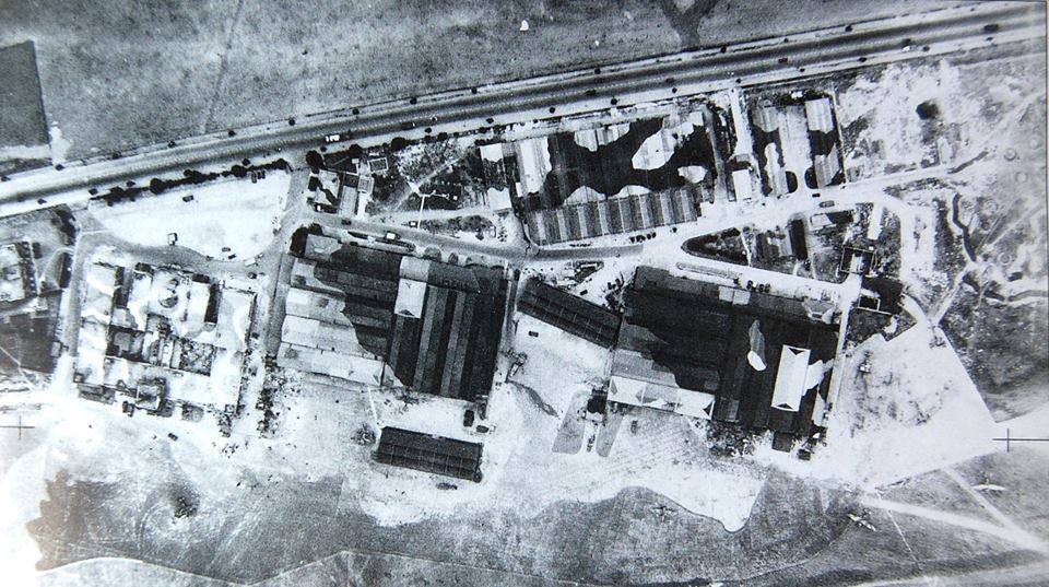
Evreux-Fauville:
https://www.anciens-aerodromes.com/?p=25057
West part of the airfield:
-
1
-
-
Hi,
Maupertus June 14th, 1944:
Maupertus 1950's:
Maupertus today:
Cormeilles-en-Vexin August 14th, 1944:
In red, runways in service today:
Cormeilles-en-Vexin 1950's:
Cormeilles-en-Vexin today:
-
3
-
-
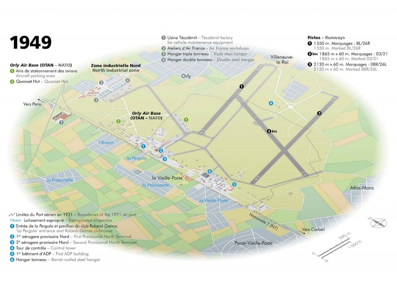
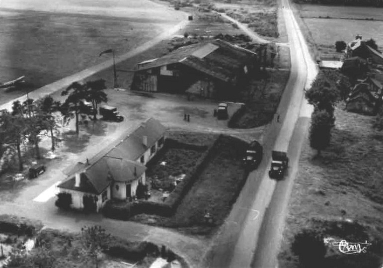
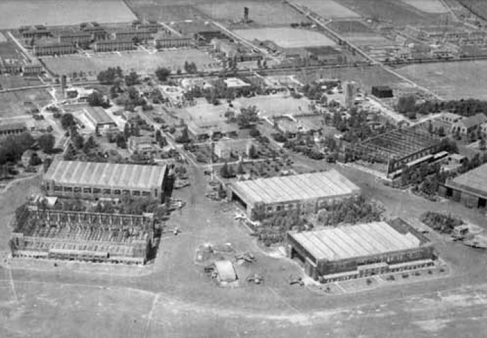
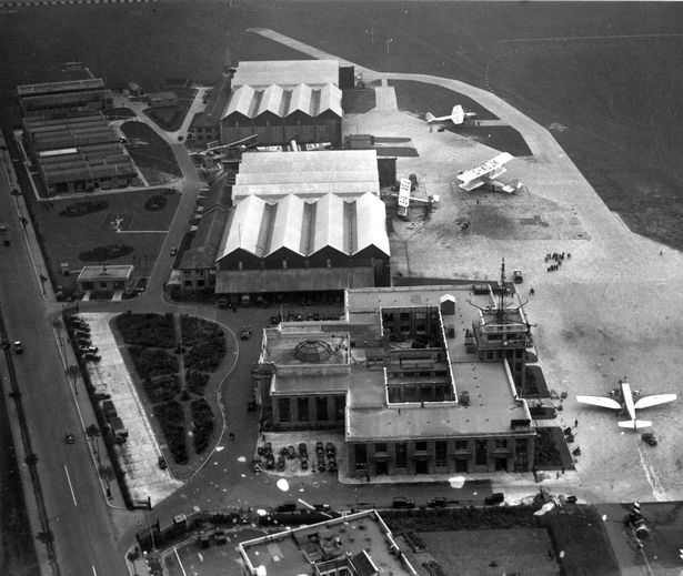
Hi,
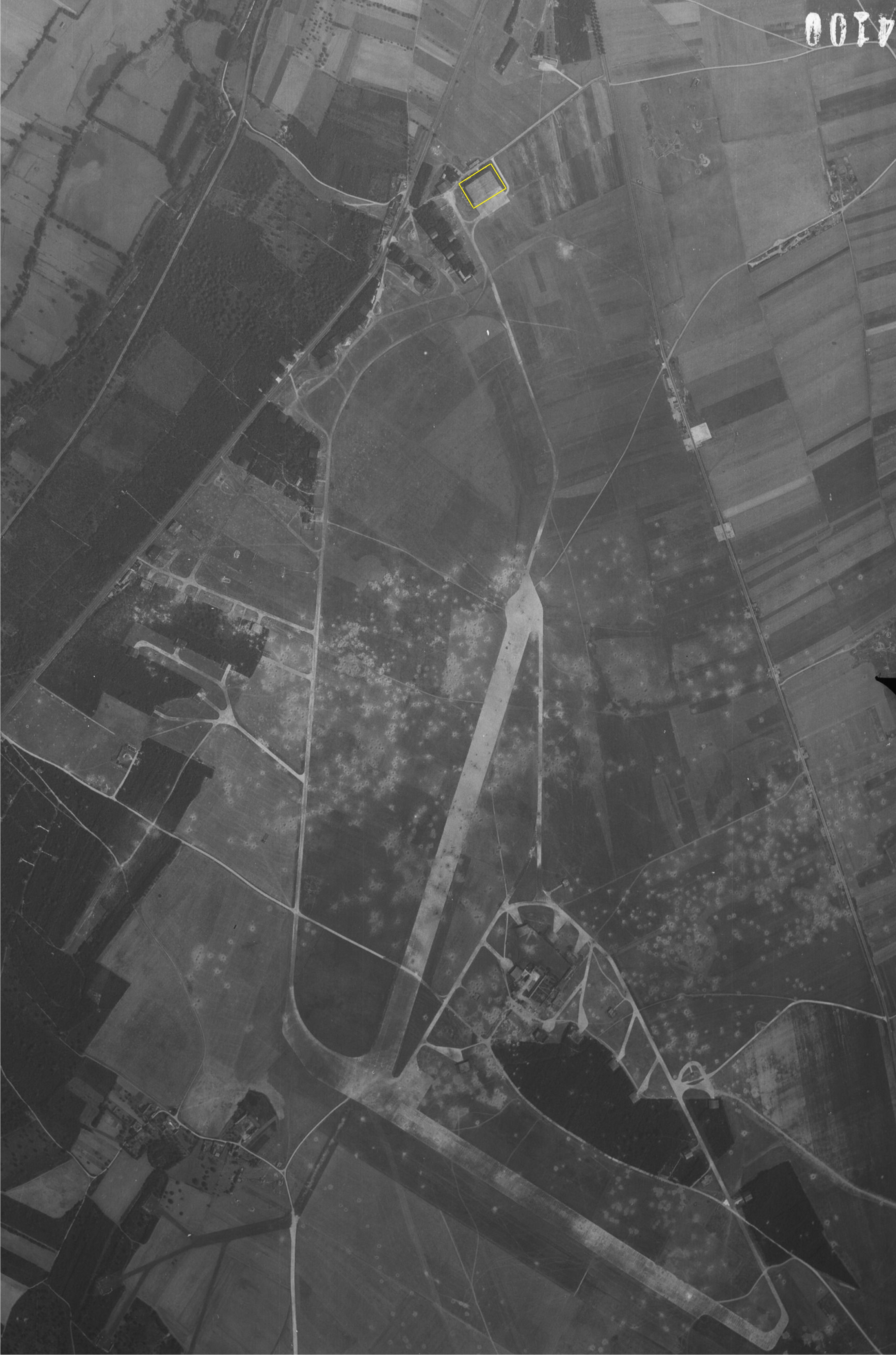
I would like to come back to Orly: The layout of the tracks is well done, well done! On the screenshot at the bottom I added a yellow oval where 2 hangars are located. In reality, these sheds were of the "Double-Tonneaux" type (see Dreux above).
In 1949, this "Double-tonneaux" hangar is visible in "6" on the lower diagram:
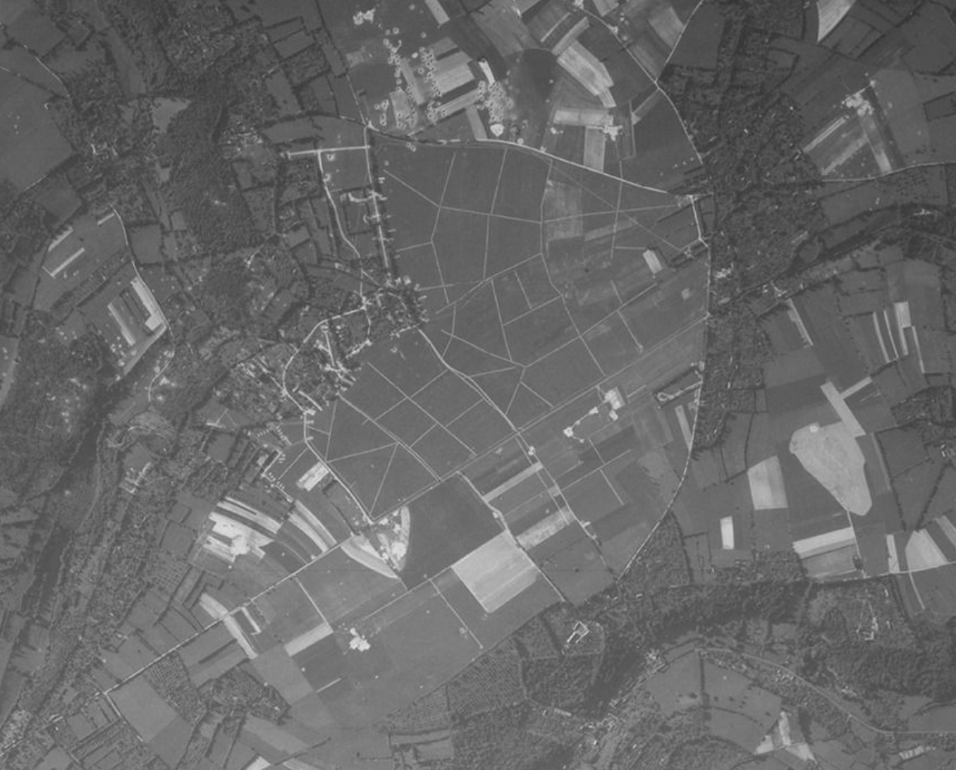
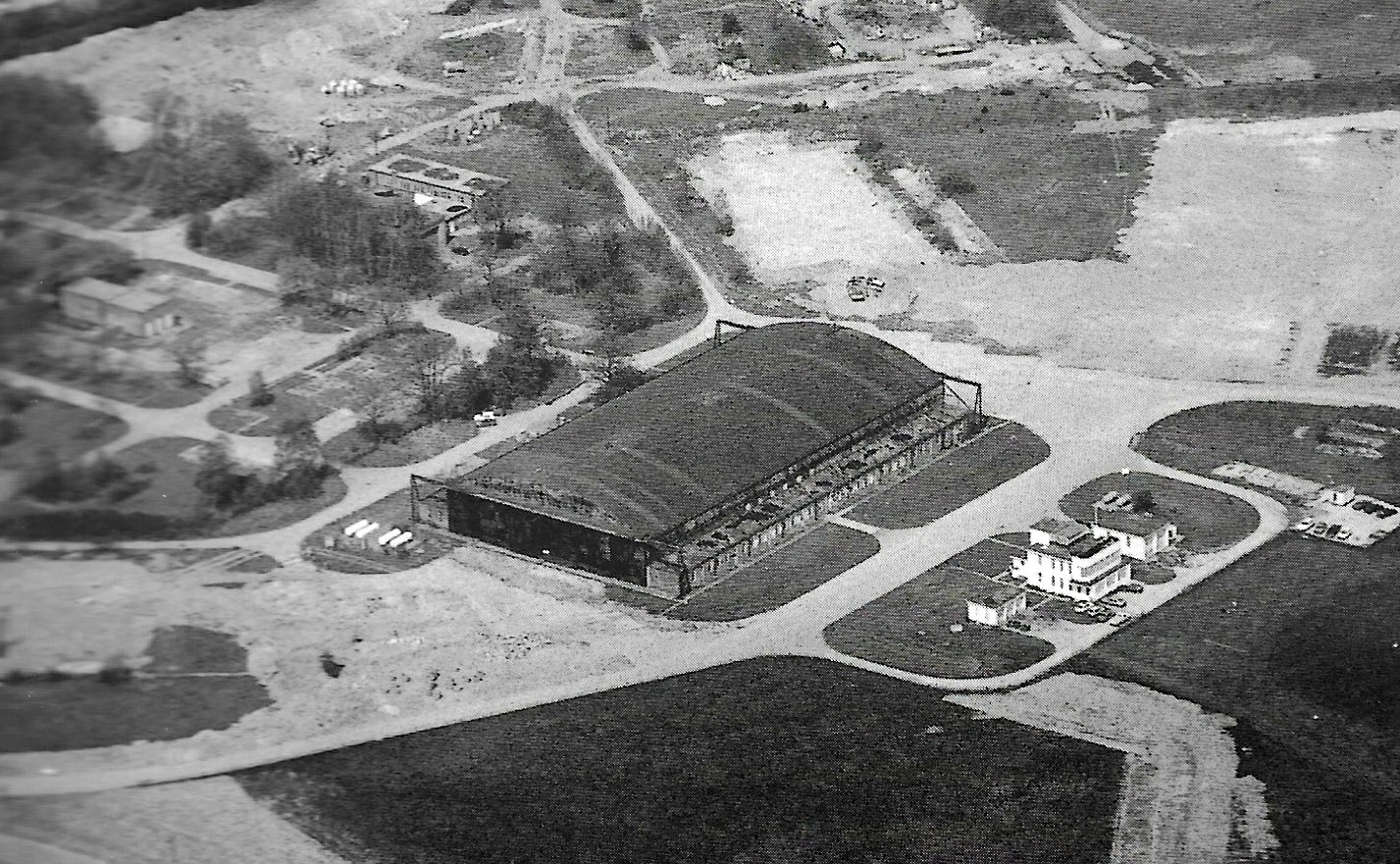
Dinan-Trelivan:
June 1942:
Before war:
1950's:
null
Airfield today:
-
2
-
-
-
Hi,
Creil:
In red runways in service today
Hangars covered with camouflage nets used on most Luftwaffe airfields in France:
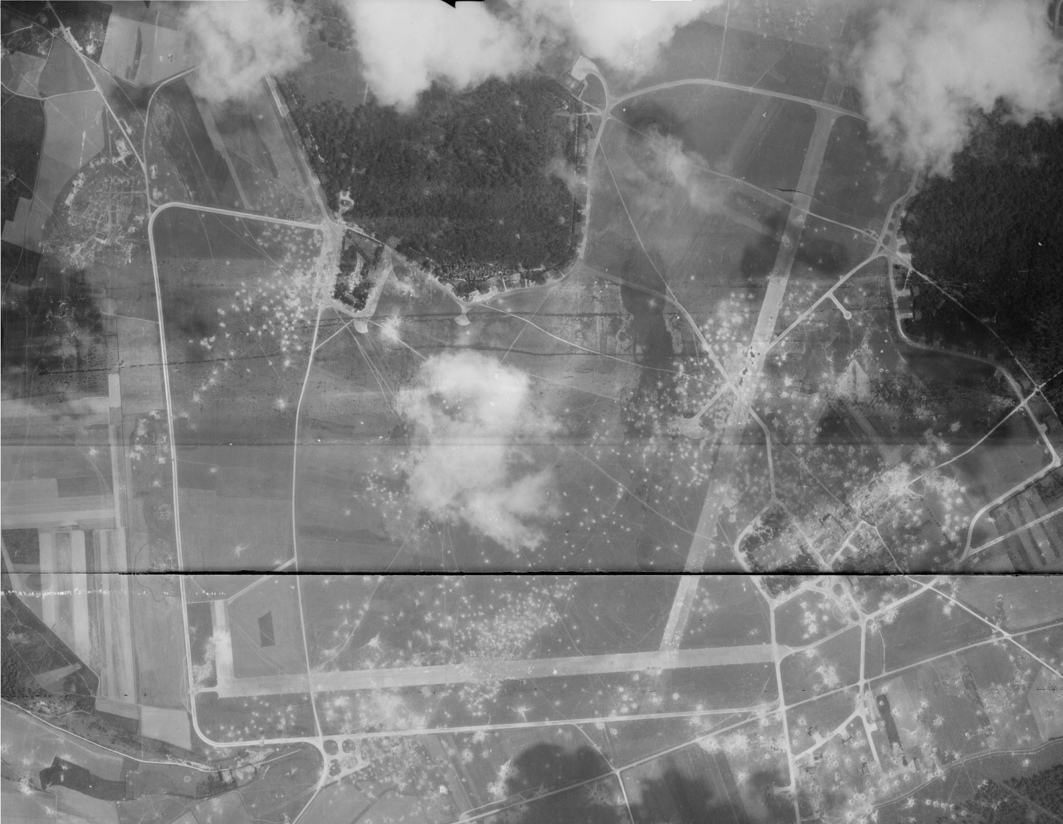
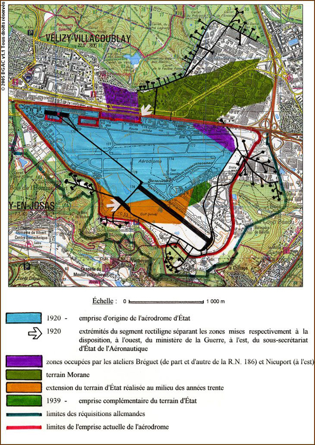
Velizy-Villacoublay:
https://www.anciens-aerodromes.com/?p=25475
In red runways in service today :
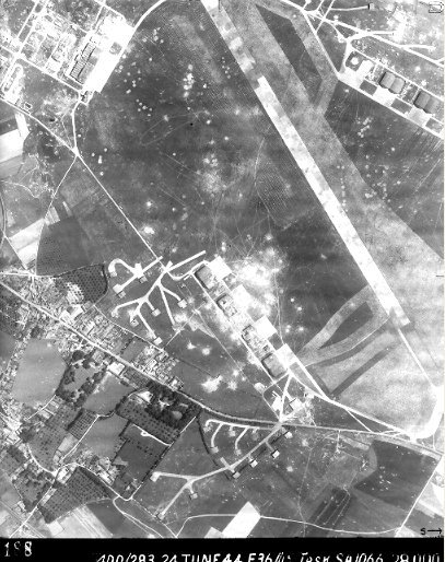
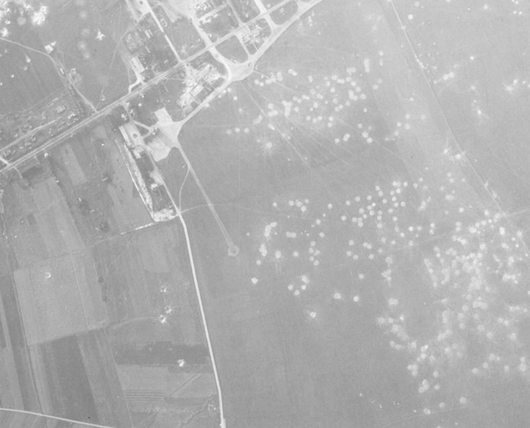
Guyancourt:
https://forgottenairfields.com/airfield-guyancourt-1515.html
circa 1930's:
September 1945:
In the red frames, dispersal areas for aircraft:
1955:
Beauvais-Tille:
In red, runways in service today:
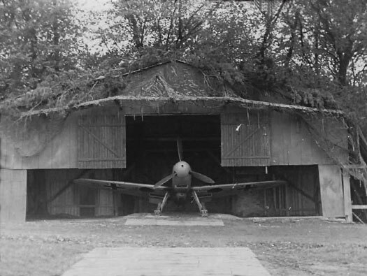
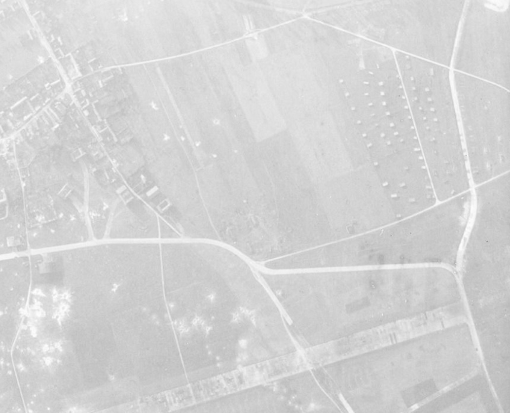
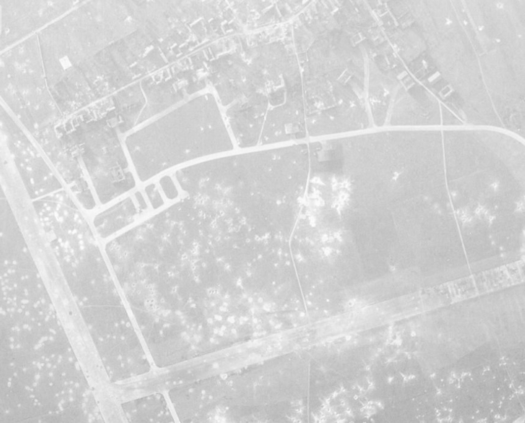
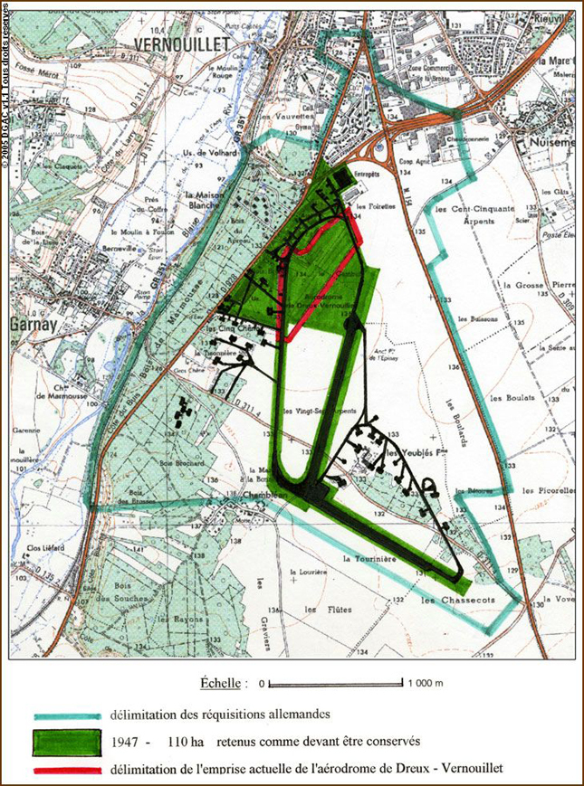
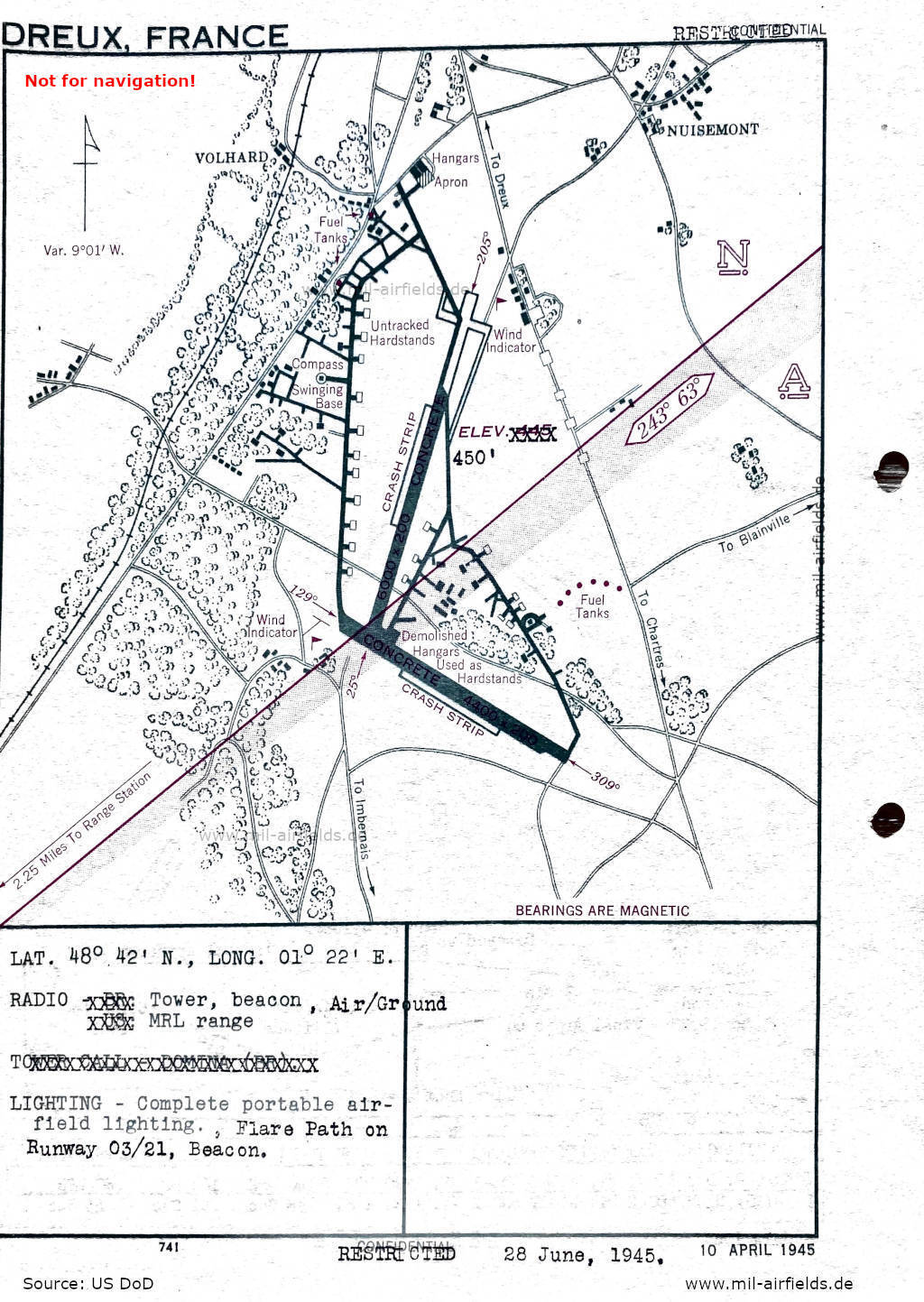
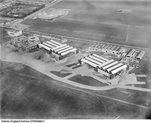
Dreux-Vernouillet:
https://www.anciens-aerodromes.com/AtlasDGACOct16/html/aero213.htm
Dreux on August 8, 1944:
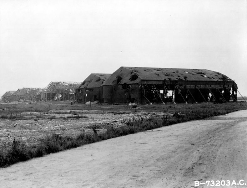
In yellow, Hangar Type "Double-Tonneaux"
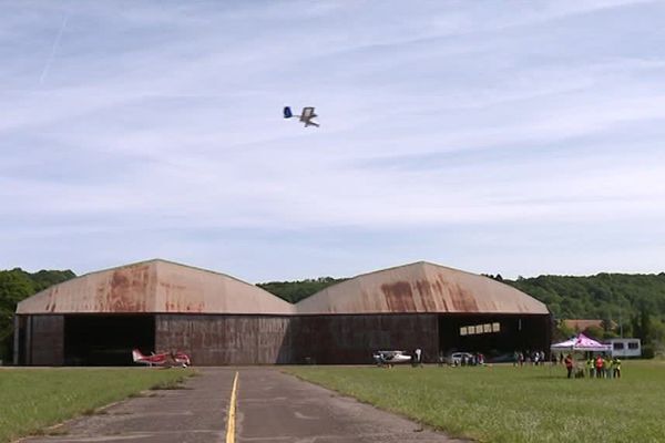
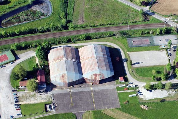
This type of hangar was very common on French airfields during the Second World War.
"Double-Tonneaux" type hangar seen here at Besançon-Thise aerodrome not far from my home:
Hangar structure:
-
2
-
-
The city of Paris and its monuments are very well done! Congratulations ! I worked for a year in Paris and visited all these buildings and I can say that you did a good job!
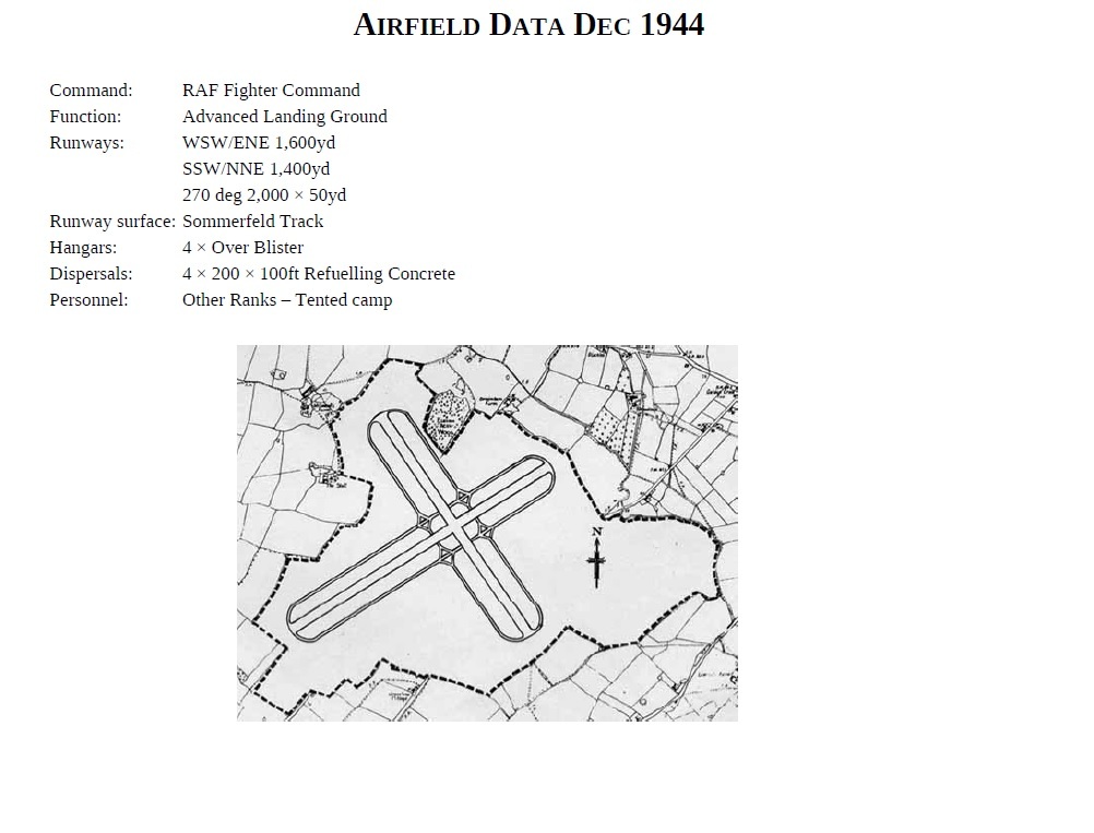
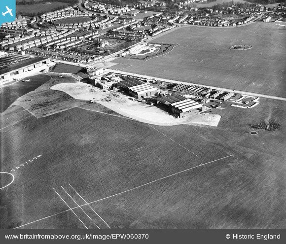
For Paris-Orly it is well done. For Friston it's not quite that. Friston was an ELG (Emergency Landing Ground) so no hangar and no fence around the airfield, just temporary facilities (tents, wooden barracks) and two Over Blister Hangar for aircraft maintenance.RAF Friston:
In red, Blister Hangar
-
4
-
1
-
-
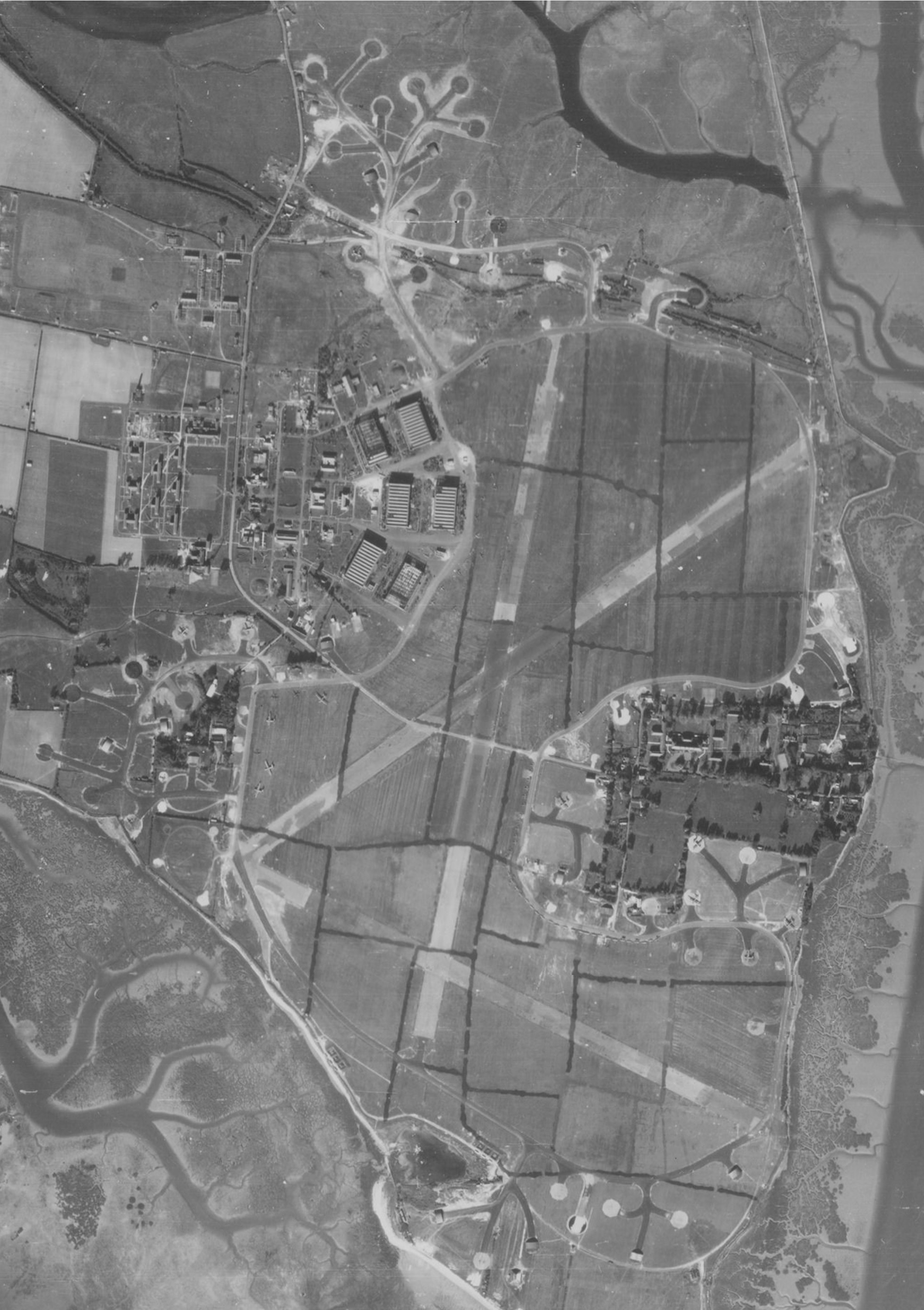
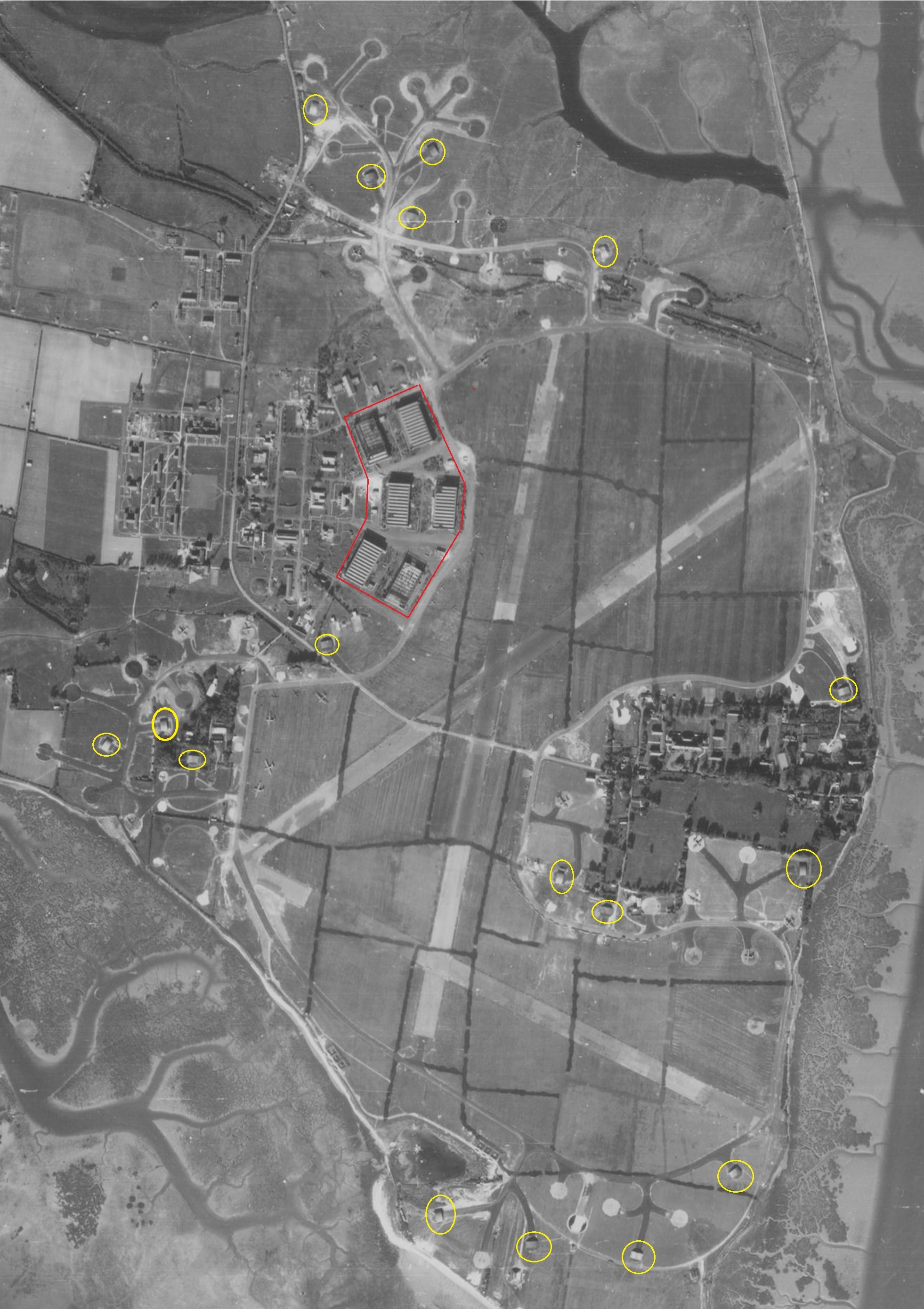
Hi,
Thorney Island June 1943:
In yellow, Blister Hangar
In red, Hangar type C
Hangar type C Thorney Island:
Thorney Island 1976:
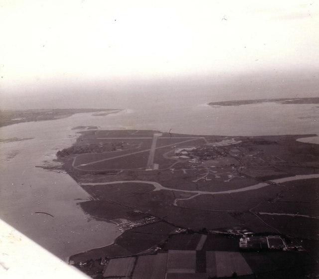
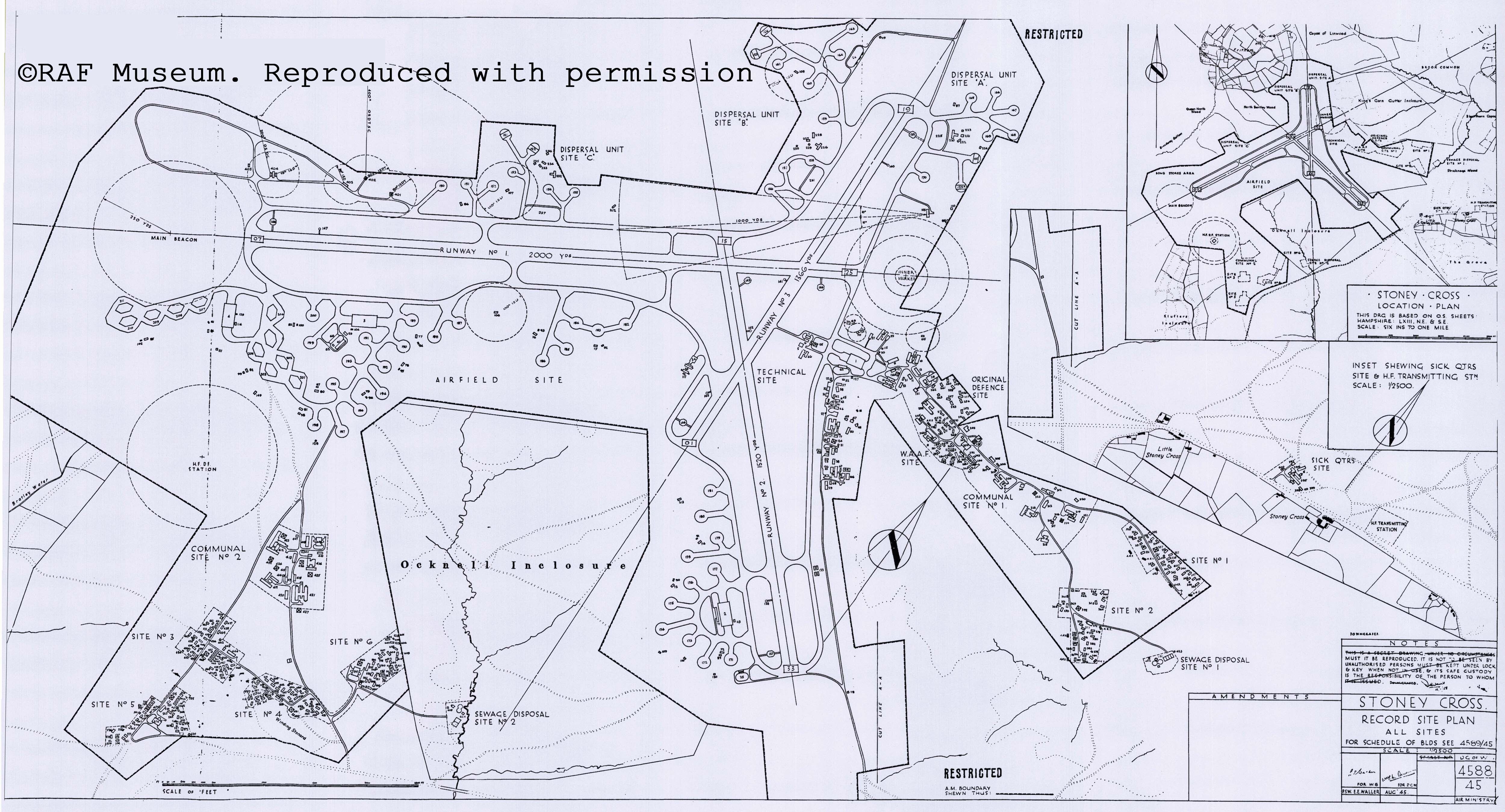
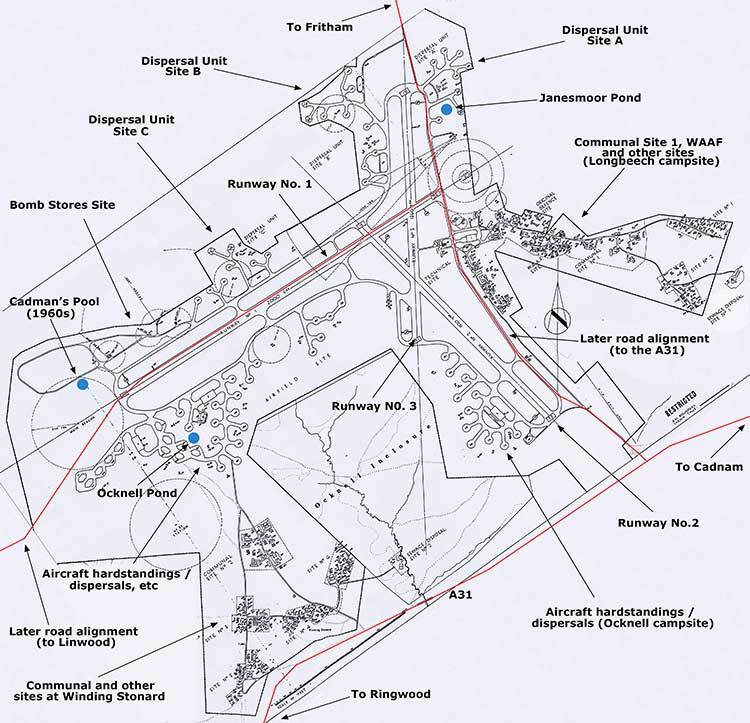
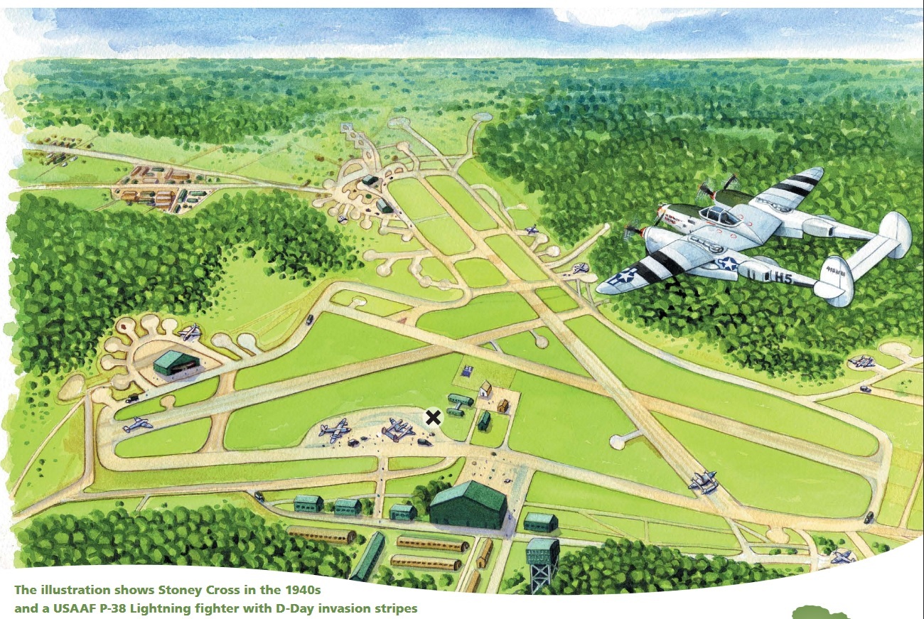
Stoney Cross:
https://newforestguide.uk/history/new-forest-airfields/stoney-cross/raf-stoney-cross/
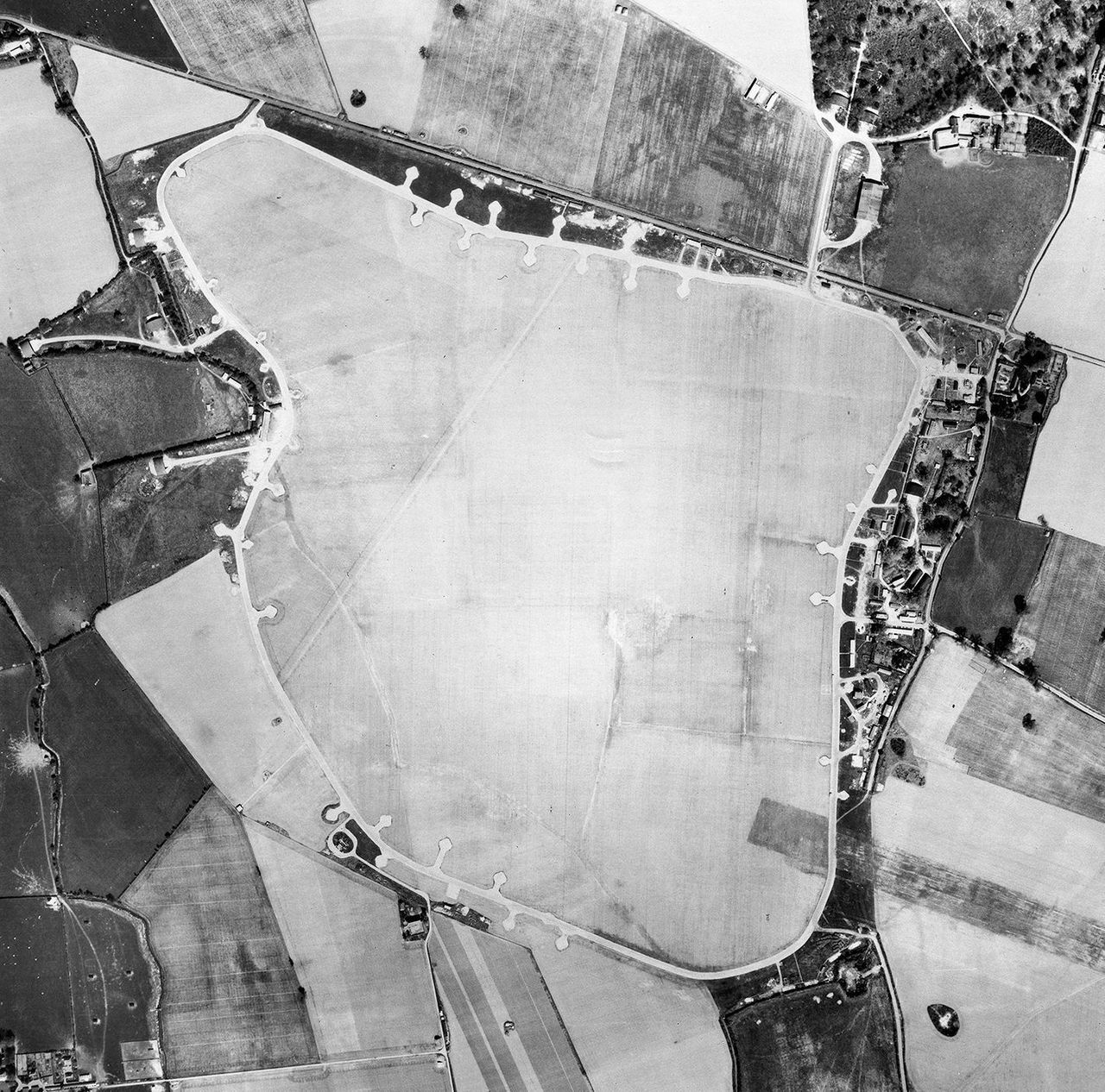
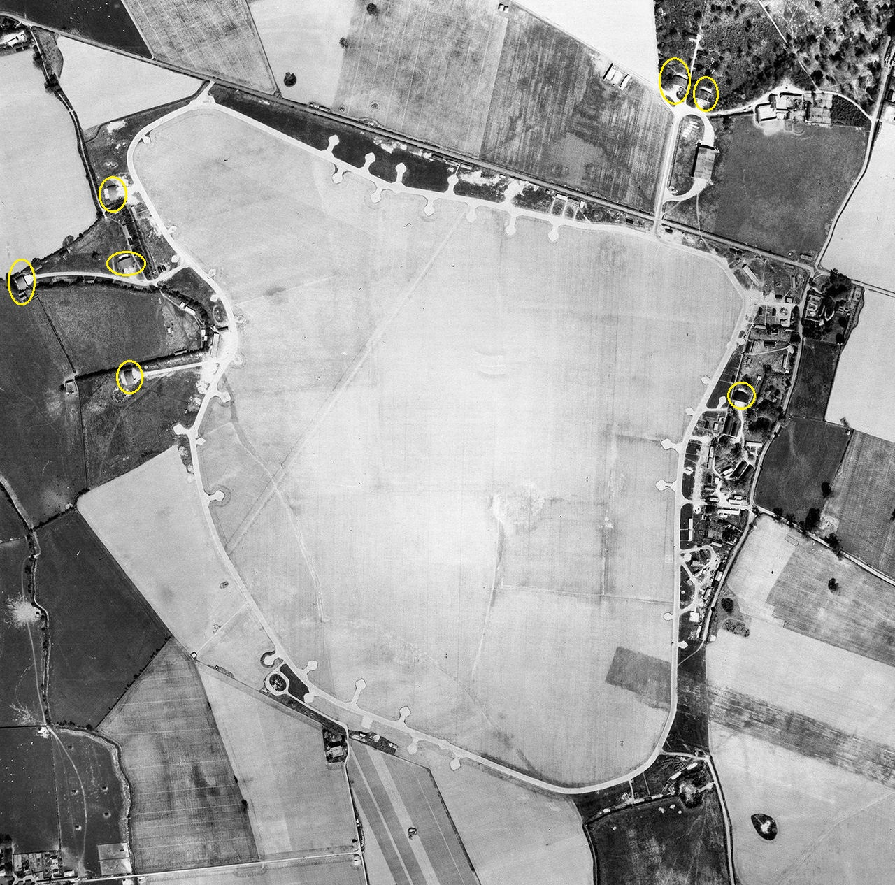
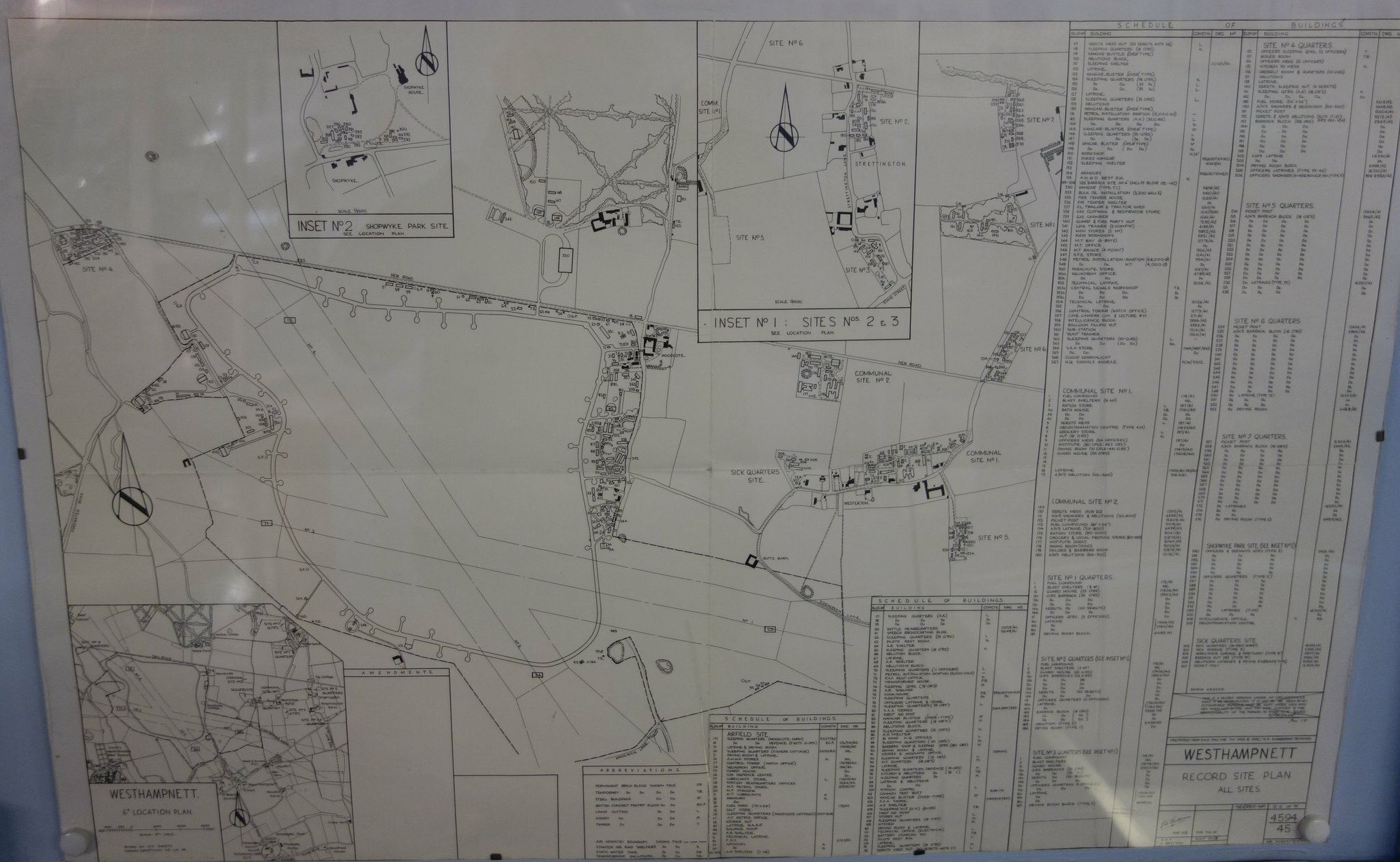
Suggestion: Westhampnett
Westhampnett was a satellite airfield of RAF Tangmere during the Battle of Britain. This airfield was used throughout the Second World War. In June 1944 it housed the 184 squadron equipped with Typhoon MK1b. I think it would be interesting to model it on the Normandy 2 map.
In yellow Blister hangar
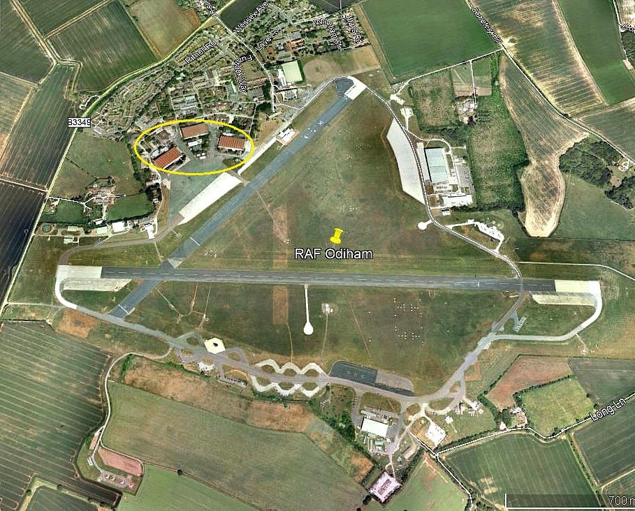
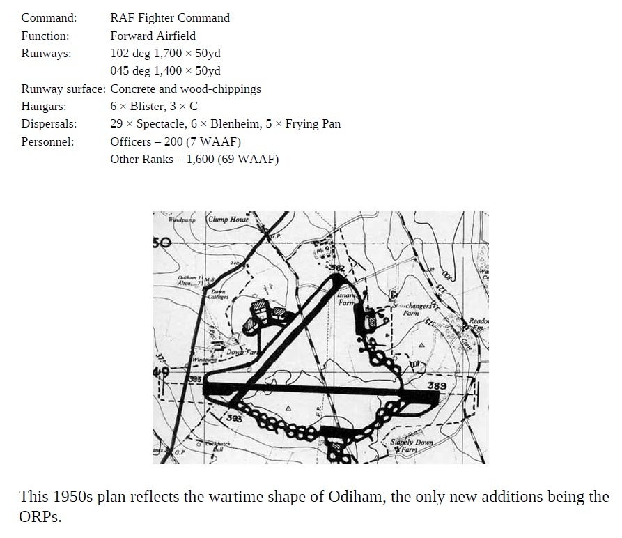
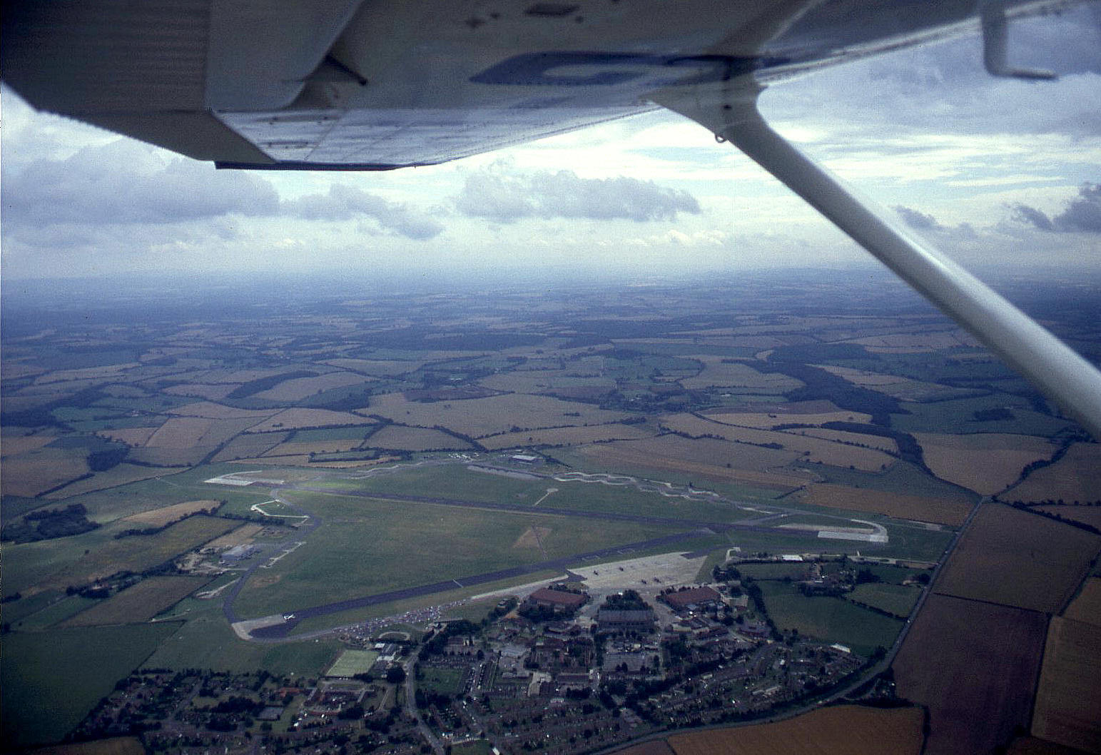
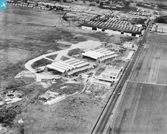
RAF Odiham:
In yelow, three Hangars Type C
RAF Odiham 1993:
RAF Friston:
In red, Blister Hangar
-
3
-
-
Ok, thanks Reflected.
-
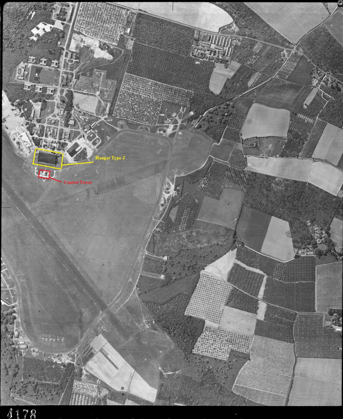
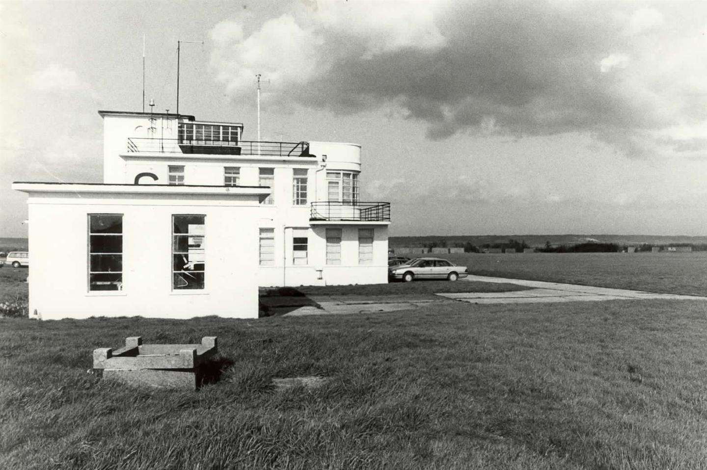
Hello,
Today, West Malling:
Hangar type J and control tower:
Control Tower:
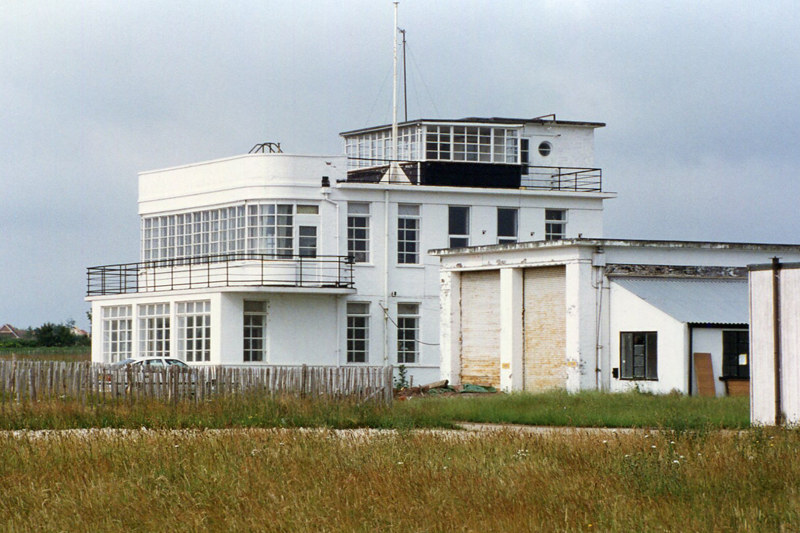
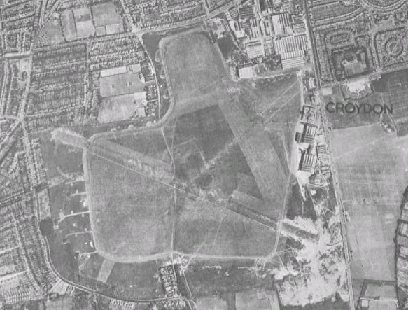
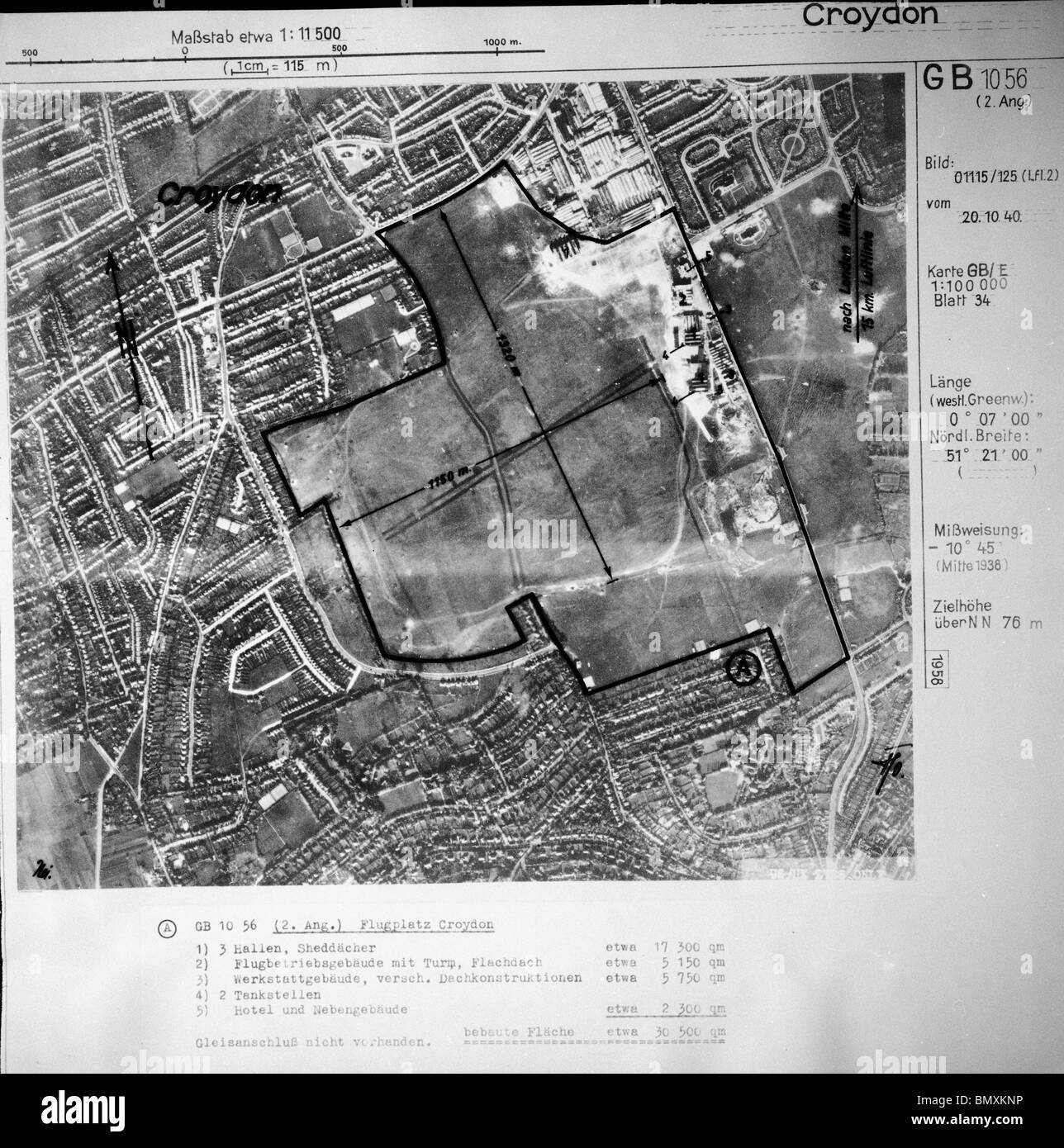
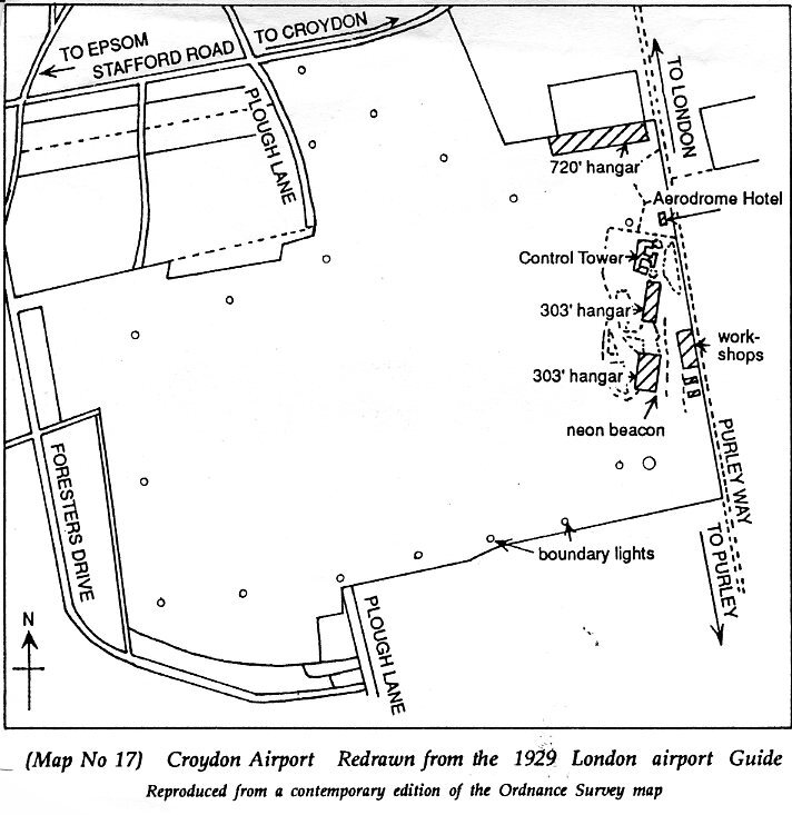
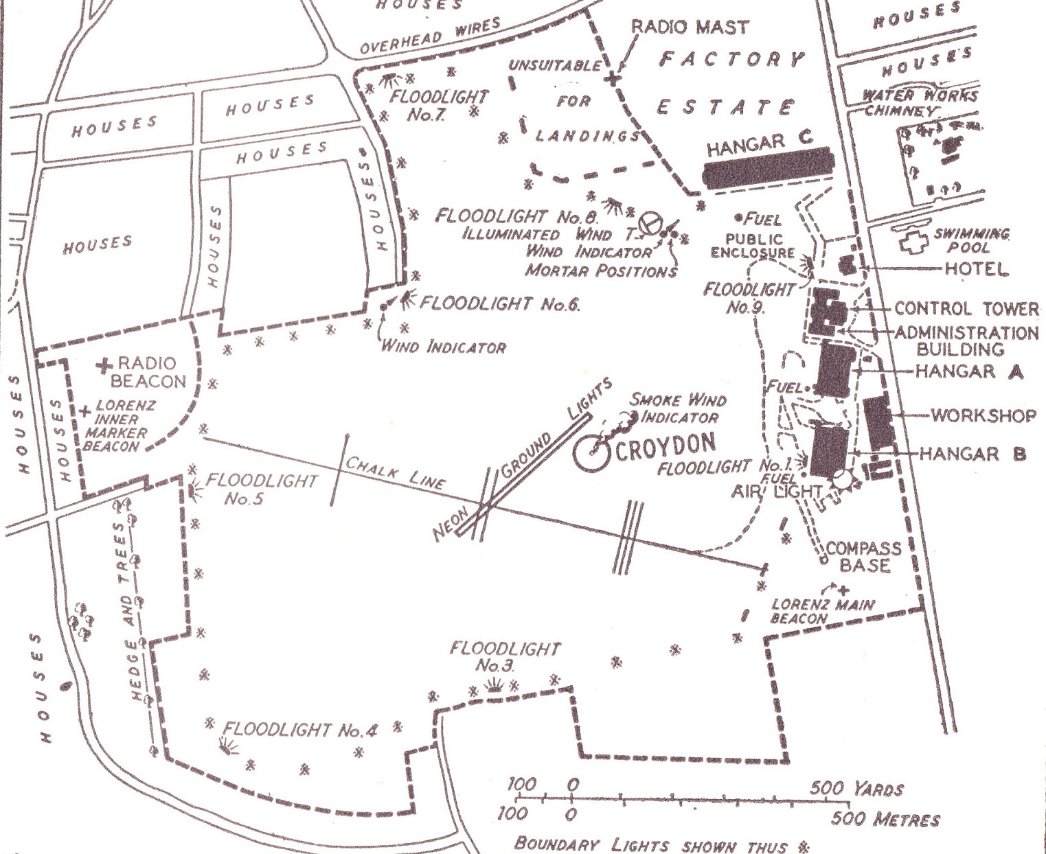
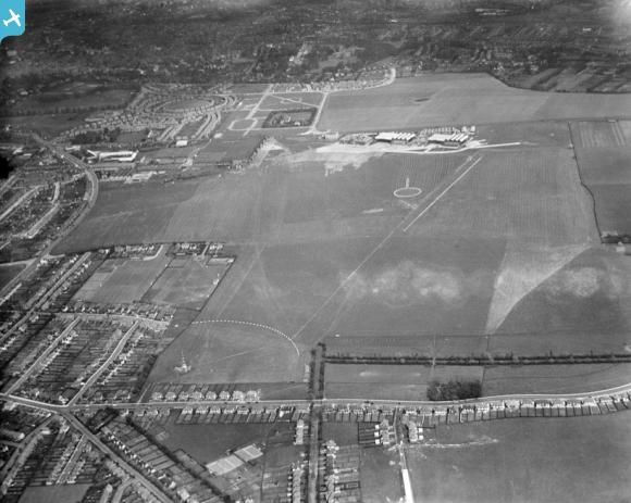
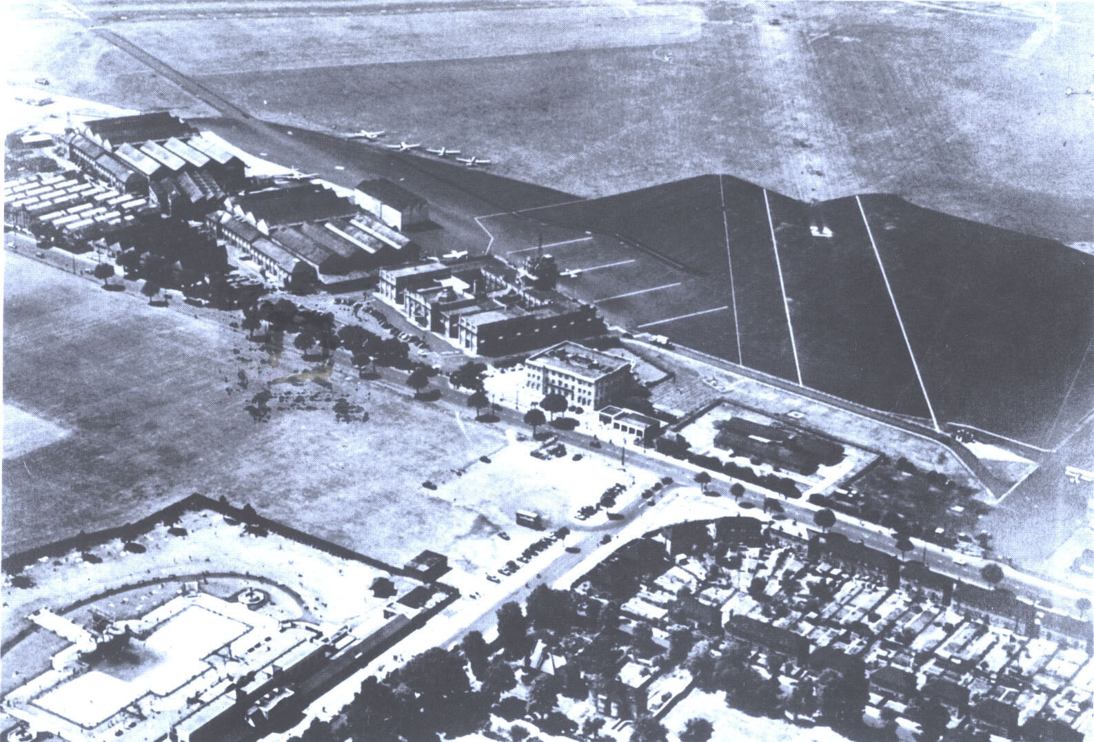
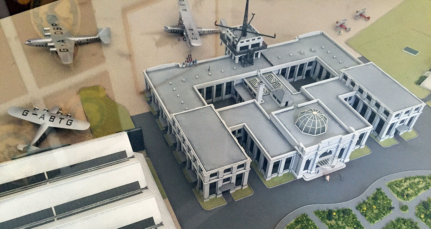
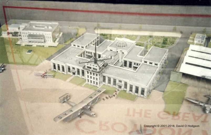
Croydon:
Control Tower:
-
1
-
-
Hi,
In mission 4, I am the leader of White Transport. I take off and begin to orbit above the airfield. My wingmen took off but the blue transport and yellow transport planes were on the runway threshold but did not take off.
Informations about airfields for devs
in DCS: Normandy 2.0
Posted · Edited by Fred901
Hello everyone,
As promised the airfields map of the 2nd TAF and the ADGB (Air Defence of Great Britain) on D-Day: