ienatom
-
Posts
105 -
Joined
-
Last visited
Content Type
Profiles
Forums
Events
Everything posted by ienatom
-

Intended behavior for F10 map view option
ienatom replied to Maverick87Shaka's topic in General Bugs
Did you discover anything new about this? I am basically trying to set a mission as you described: allies only for pilots and fog of war for tactical commanders but for now I haven't found a workaround.- 1 reply
-
- 1
-

-
investigating Cat 2 Blast Deflector won’t get down
ienatom replied to Avalon66's topic in Bugs and Problems
Any news about this? I also had this issue in MP on one of our servers and it was pretty annoying -
It would be great to have the chance to either pick a callsign from a very long list or create a custom one. Not all callsigns have the audio version as of today so even something similar would be a needed addition to the sim, especially for mission editors.
-
fixed ME - Crashes when copying and pasting units
ienatom replied to Kanelbolle's topic in Mission Editor Bugs
Same issue happening to me. I am trying to make a very large missions and now I cannot place any more blue groups because of the lack of options for callsigns. LuaGUI (Main): error, can not create new callsign, groupId > 9 On an unrelated note (but not too much), it would be great to introduce custom callsigns to DCS, even without any text to speech in the radio callouts. Maybe this could also help with the issue? -
Thanks man This kind of things just make me laugh at this point. I will reverse all the order but I guess if that's it the issue is now solved and the script works flawlessly. Thank you both for the help guys, really appreciated!
-
Funny enough, for some reason now it doesn't fill all the shapes with the specified colors

-
It would be nice indeed Thanks for the help man, at this point it would probably be easier to use trigger points, although the coords thing could be useful! Regarding this, do you think you could use more than 1 quad zone to make up for a shaped polygon with a lot of vertices?
-
Fantastic! So using this you could get absolute x and y positions for each polygon and insert them instead of triggers. Is it also getting any other polygons and keep them "in store" so that you could call their position easily instead of writing point by point? Like: local Polygon1points: {coordinates from your script} And then trigger.action.markupToAll(7, -1, 1001, Polygon1points, {1, 0, 0, 0.5}, {1, 0, 0, 0.07}, 3)
-
Thank man, if you want you can use that shape that I shared as a reference
-
Yes all the shapes I inserted have a unique name and as you can see from my previous message, the ID can be identified opening the mission file inside the miz. At this point the question becomes: how do i define markupToAll so that it uses an existing shape as a "template"?
-
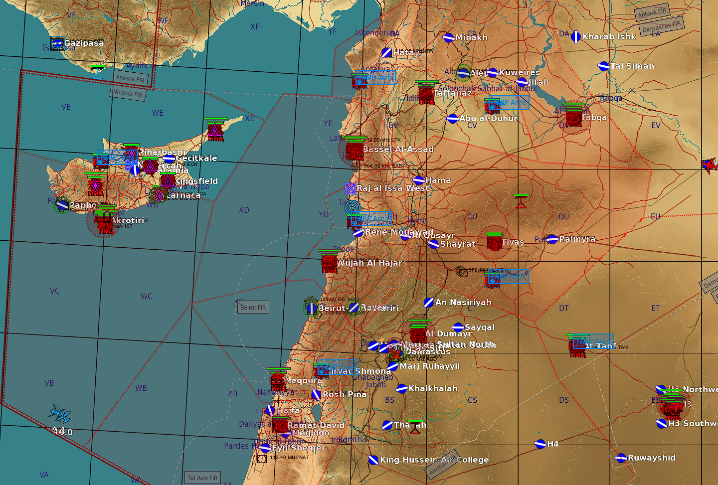
Had a look in the mission file and here is an example of a shape with it's ID [61] = { ["visible"] = true, ["mapY"] = -377006.59612449, ["primitiveType"] = "Polygon", ["polygonMode"] = "free", ["thickness"] = 10, ["colorString"] = "0xff00007d", ["name"] = "CYPRUS SOUTH", ["mapX"] = -232028.82264409, ["fillColorString"] = "0xff000014", ["points"] = { [6] = { ["y"] = 15224.170096805, ["x"] = 271638.47032932, }, -- end of [6] [2] = { ["y"] = -1149.6427492402, ["x"] = -1061.2086916062, }, -- end of [2] [3] = { ["y"] = 86076.385372972, ["x"] = -50729.000034843, }, -- end of [3] [1] = { ["y"] = -1149.6427492402, ["x"] = -1149.6427492402, }, -- end of [1] [4] = { ["y"] = 202233.60168, ["x"] = 106390.48659608, }, -- end of [4] [5] = { ["y"] = 227612.13615673, ["x"] = 217329.21873408, }, -- end of [5] [7] = { ["y"] = -1149.6427492402, ["x"] = -1149.6427492402, }, -- end of [7] }, -- end of ["points"] ["layerName"] = "Common", ["style"] = "dot", }, -- end of [61] It would be great if the coords of the shape could be called in the script instead of using 10000 trigger zones
-
I'll have a look at that then! In the meantime I tried what @cfrag suggested and it works well, although it's not ideal if you have a lot of polygons with a lot of vertices as you need to add A LOT of trigger points for your shapes.
-
I had a look at your but it's creating a circle from scratch and not using an existing circle already drawn in the editor if I'm not mistaken. Also, I'm trying to use an existing free form shape instead. It will be very useful for other things I plan to do so thanks! By the way, absolutely no worries if you cannot test it! I am glad you are taking the time to help me so again, thank you for the help.
-
I tried forcing for example id 1005 but nothing is happening (as you suggested in your previuous reply). I also tried with various zoom levels on F10 and changing slot. I am losing hope
-
Yeah but then if I want to hard code the ID of the shape I need to know the one of the existing shape, which I don't right? Or is that script saying "hey, assign id 1005 to the shape named "zonename"? I changed the value to decimal now
-
Yeah I will find one and read it soon, the more I try to script the more I realize that it's hard without a basic knowledge It's so easy to get lost in these stupid mistakes... Anyway, now I don't have any error in the log so I guess that the script is formally correct, but the color doesn't change anyways
-
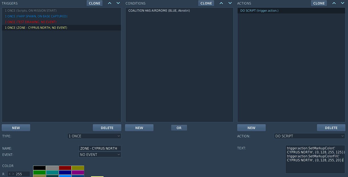
Ah gotcha, so initial the script runs without issues. I created the polygon with the defined name CYPRUS NORTH and made it "common", so of course I can see it on the map. When the selected aerodrome switches function though, the log returns an error: 2023-05-21 22:55:29.199 ERROR SCRIPTING (Main): Mission script error: [string "local trigger.action.SetMarkupColor(1, {0, 128, 255, 12})..."]:1: unexpected symbol near '.' The second part of the script where this error is located goes like this: local trigger.action.SetMarkupColor(1, {0, 128, 255, 12}) local trigger.action.SetMarkupColorFill(1, {0, 128, 255, 20})
-
2023-05-19 13:45:32.552 ERROR SCRIPTING (Main): Mission script error: [string "local myzoneid = mist.marker.getNextId()..."]:5: '}' expected (to close '{' at line 3) near 'ignoreColor' local myzoneid = mist.marker.getNextId() local dzvars = { id = myzoneid ignoreColor = true, markForCoa = "all", color = {255,0,0,125}, fillColor = {255,0,0,20}, lineType = 2, readOnly = true, } mist.marker.drawZone("CYPRUS NORTH", dzvars) This is what I modified, taking into consideration that the zone I drew is called CYPRUS NORTH
-
So to define it as zone with name CYPRUS NORTH, defined as ID 1 and visible to all it would be something like this? mist.marker.drawZone('CYPRUS NORTH', 1) Then, in another action define the trigger to change the color like I did before
-
So do I need to define the drawings ID first via markerDrawZone?
-
So now the question is: how do I find the ID of a drawing?
-
Would this work? (the rgb color is actually blue and the default, ME defined color is red) It doesn't work, can anyone correct my mistake? 2023-05-19 13:10:53.445 ERROR SCRIPTING (Main): Mission script error: [string "trigger.action.SetMarkupColor('CYPRUS NORTH', {0, 128, 255, 125})..."]:1: attempt to call field 'SetMarkupColor' (a nil value) stack traceback: [C]: in function 'SetMarkupColor' [string "trigger.action.SetMarkupColor('CYPRUS NORTH', {0, 128, 255, 125})..."]:1: in main chunk
-
Thanks, I will try something and hopefully get the result you described! I'm not very good at lua scripting so I expect many mistakes
-
Gotcha, so I can use mist.marker.drawZone to use a ME polygon and then trigger.action.setMarkupColor and trigger.action.setMarkupColorFill to respectively change the color of the border and the fill. Correct?
-
Ah sorry I missed that part, I'll try with that. So it would be a combination of what you suggested + what cfrag said regarding removal of the zones?