
Mongol193
-
Posts
18 -
Joined
-
Last visited
Content Type
Profiles
Forums
Events
Everything posted by Mongol193
-
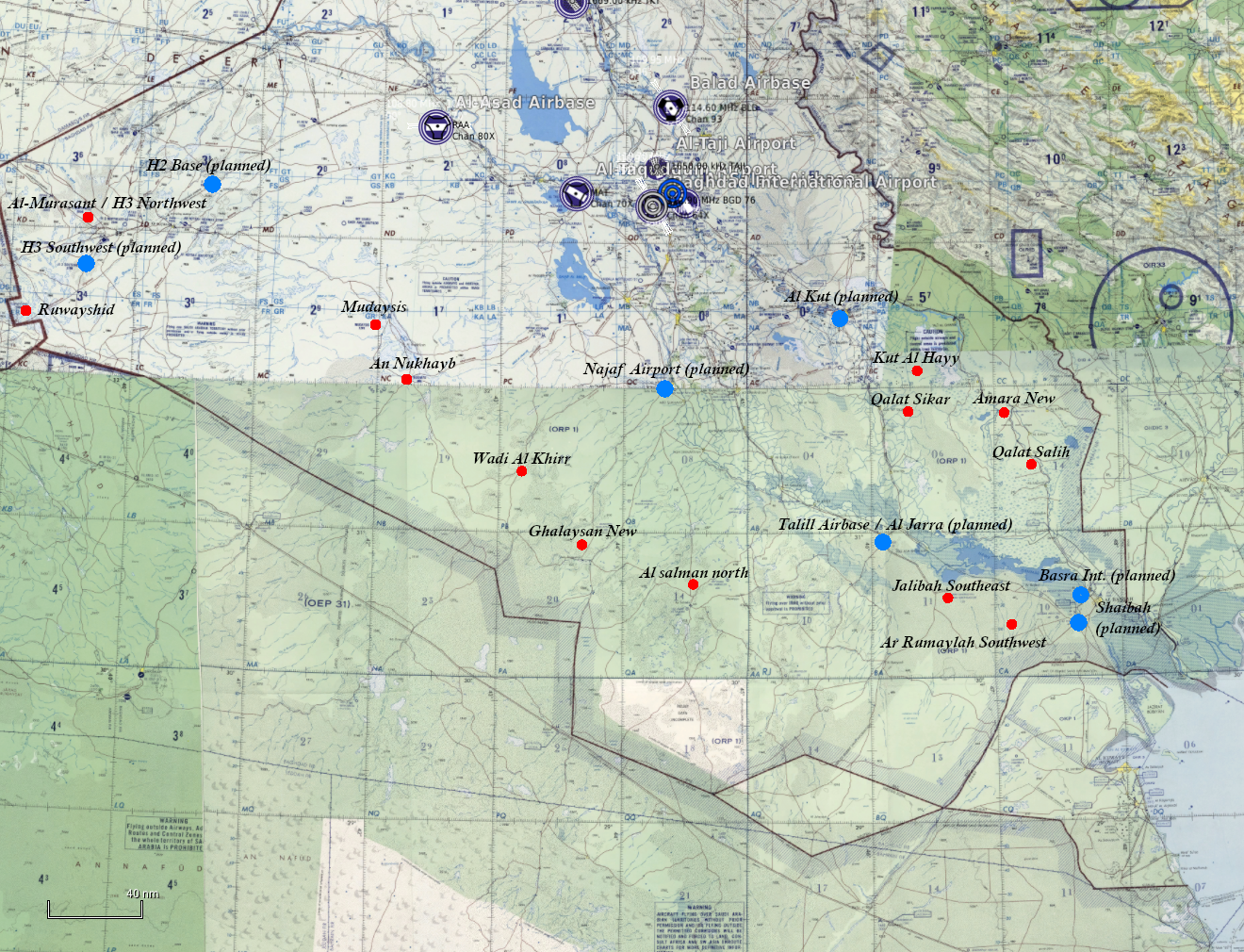
I also hope they listen to the very large amount of community feedback and add alot more Airbases and POIs to the planned list. They did respond to feedback very fast regarding Afghanistan, but not so for Iraq so far... very disappointing in my opinion, I own both Afghanistan and Iraq and I think that Iraq has a lot more potential for DCS as a whole, but does not get treated as such. Lets hope they have been cooking in the background. Latest Videos from Wags (F-16C ATP introduction) showed atleast the already confirmed Mosul Airbase to be WIP/finished. Still, southern Iraq(country) having only 4 airbases confirmed is very lackluster.
-
I do not know how much the A and B version differ from one another in terms of performance, guidance and CCM, but an A version would be historically relevant for whenever the southern Part of Iraq gets released. Both Operation Desert Storm and Operation Southern watch had Aircraft equipped with the AIM-120A, although only it only saw combat in the latter.(National Museum of the USAF)
-
Hi, the official A-50 Livery template is missing a crucial .psd file. The .zip file comes with the A50-SKIN01-01.psd and the A50-SKIN01-03.psd files. But the A50-SKIN01-02.psd file is missing. This one is crucial, because that one is for the wings. With the Russian AF Star on them, it makes it very difficult to create a new livery from another country. Please add this .psd file to the template so I can create Iraqi A-50 Liveries. Thanks!
-
- 1
-

-
Hi, I have also made a small list Air Bases in south and southwest Iraq that were targeted or used during one or more Operations (Iran-Iraq War, Desert storm, and Iraqi freedom). To add to this topic I have also made some visual comparisons between current satellite imagery and what textures we already have ingame. I also added a source for most air bases mentioned, that tell us if these bases had any shelters, and if known, when they were used, abandonend or targeted. I really hope some of them get added. I initially made this post because of the rather large vacuum of air bases in that region, but with further research I found out that these played a major role in several conflicts which makes them vital for making missions on this map.
-
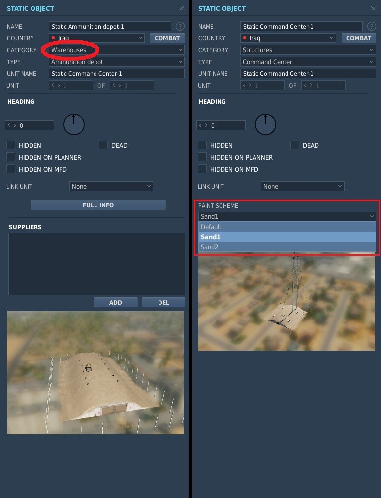
Certain Categories of static units/objects are missing their paint scheme selection drop down menu. This is even the case for units, that have different liveries as AI units (like the FFG Oliver Hazard Perry Frigate). This also makes creating liveries for static units like the Ammunition Depot in my example, not possible as there is no way to change it back to the default livery. Categories that do not show the paint scheme selector: -Airfield and deck equipment -Cargos -Heliports -Sea Shelf Objects -Ships -Warehouses Thanks.

-
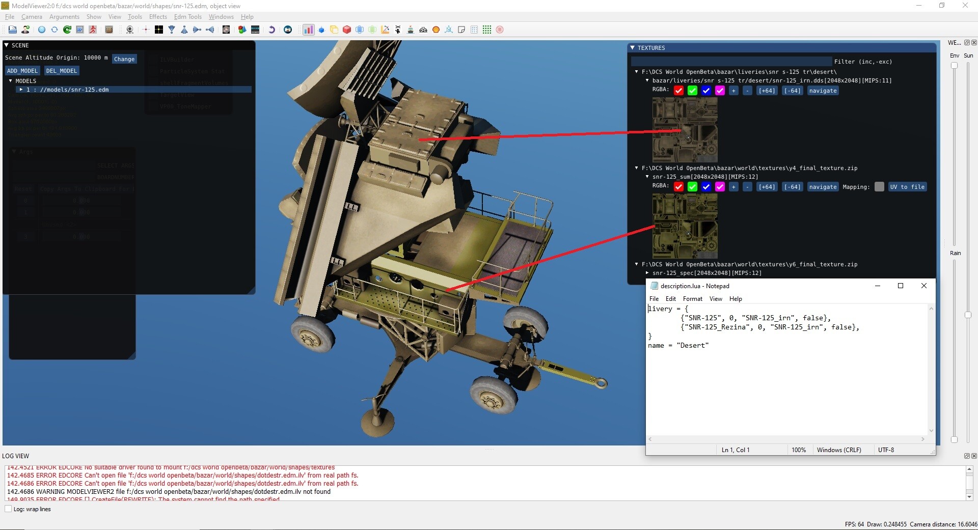
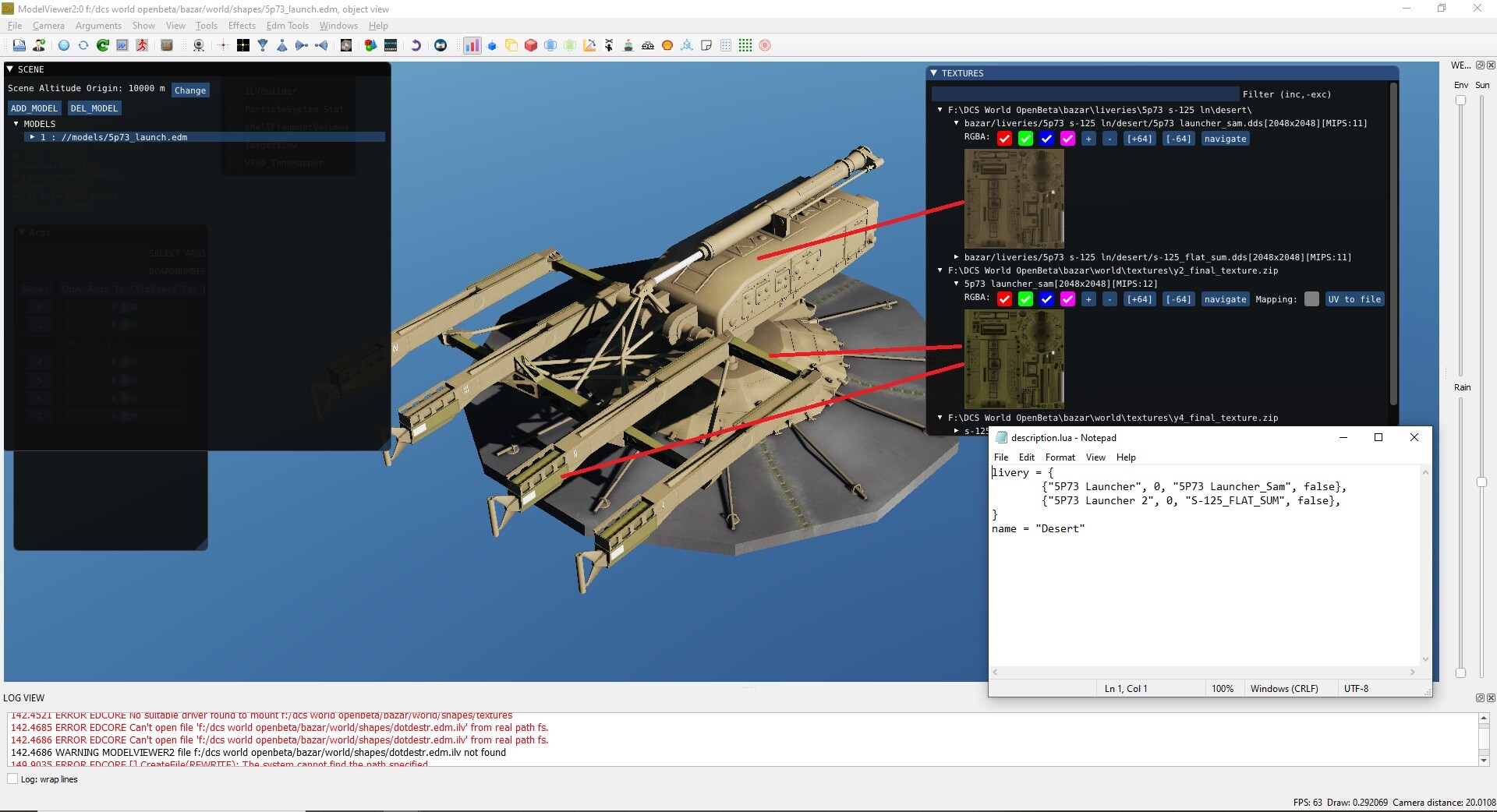
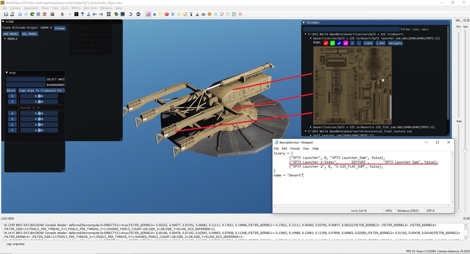
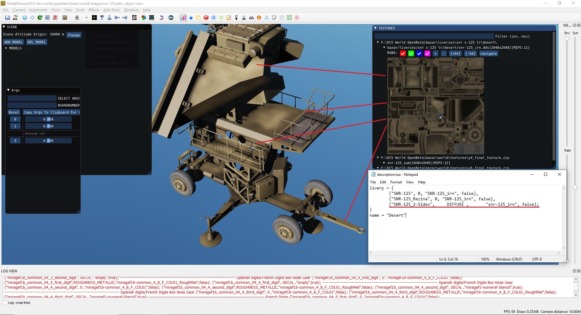
I was making a livery pack when I noticed a bug with the description.lua files from the SA-3 Launcher and SA-3 Tracking Radar. With the current .lua files, certain parts of the models stay in their default textures. Most noticeable with winter and desert liveries. Here are screenshots from Modelviewer: Bugged Desert Livery: Bugged Winter Livery: Bugged Desert Livery: Here is how to fix the issue, you need to add the red underlined line in every description.lua of any livery that is different from the default livery: Desert livery after fix: Desert livery after fix: Thanks.
-
Thanks for the suggestions! I have added them to the original forum post. As for H3 and Ruwayshid, ED has already planned to add Air Bases in that Region. We are getting H2-Base and H3 Southwest in the future! As for Mudaisis and An Nukhib they would be great to fill the void between the H2/H3/Ruwayshid Region and the already planned Najaf Airport!
-
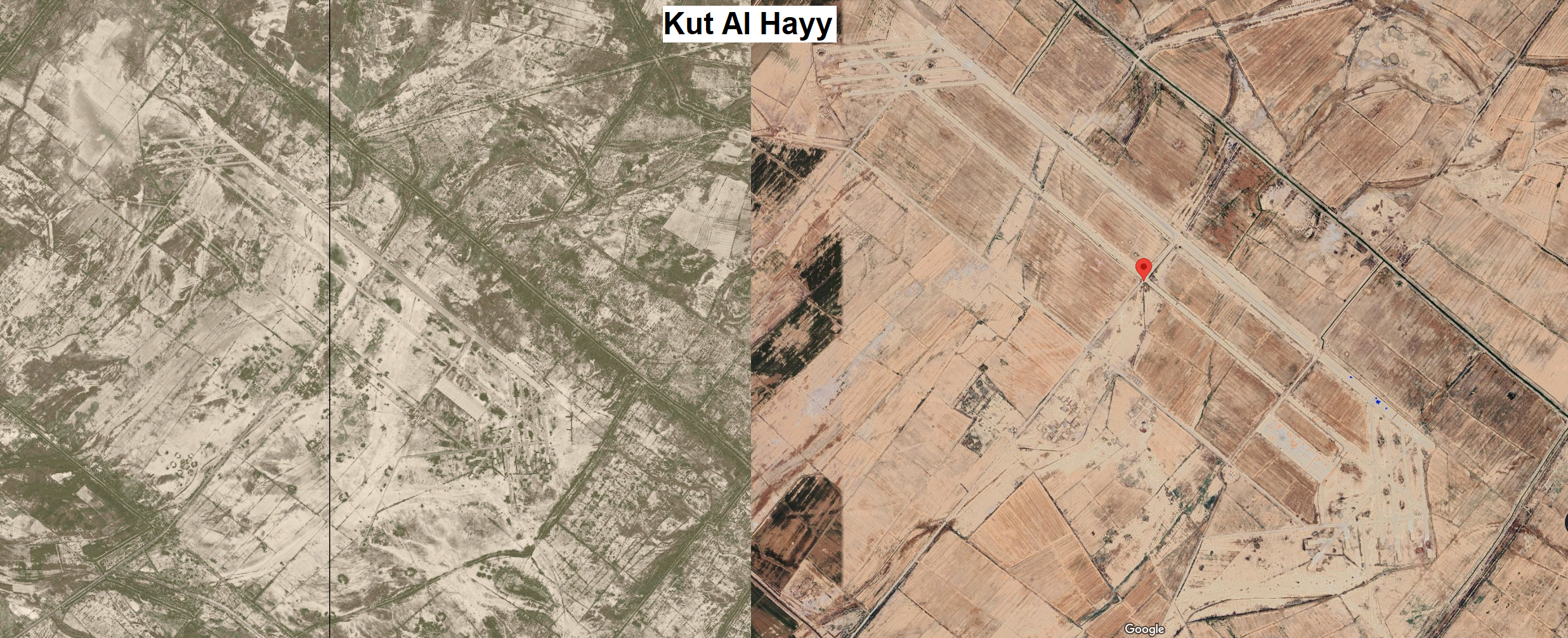
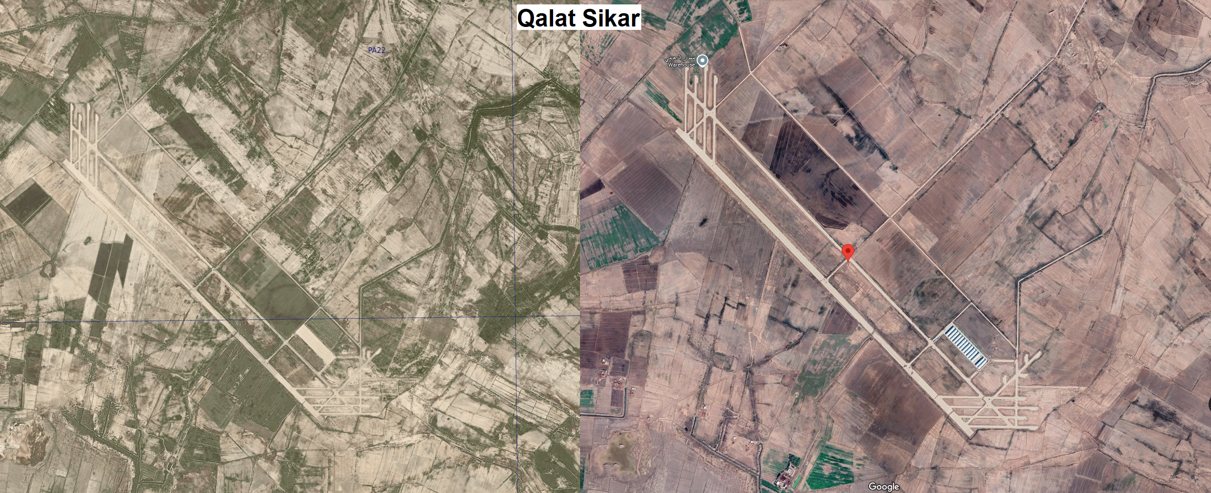
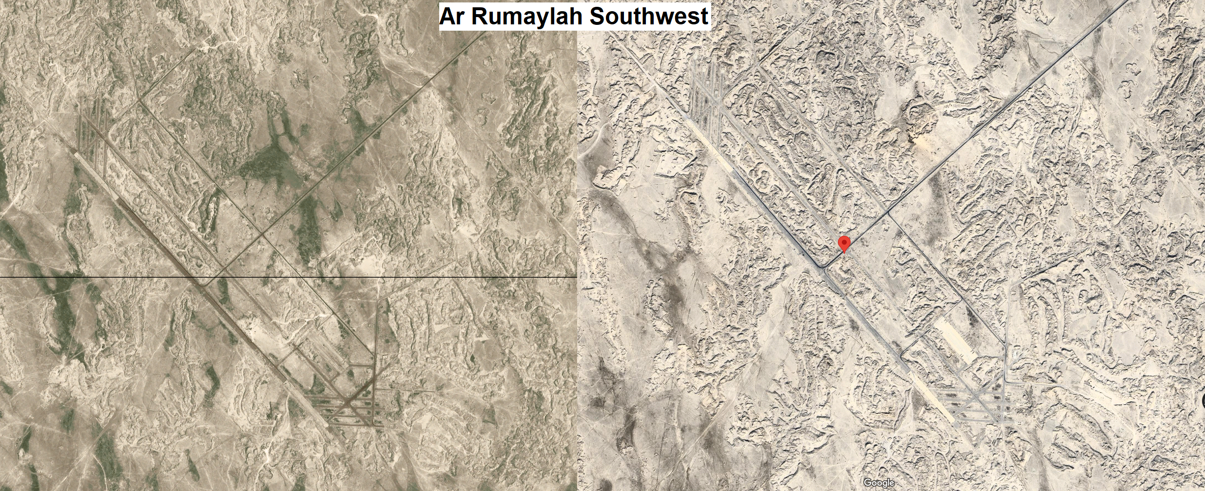
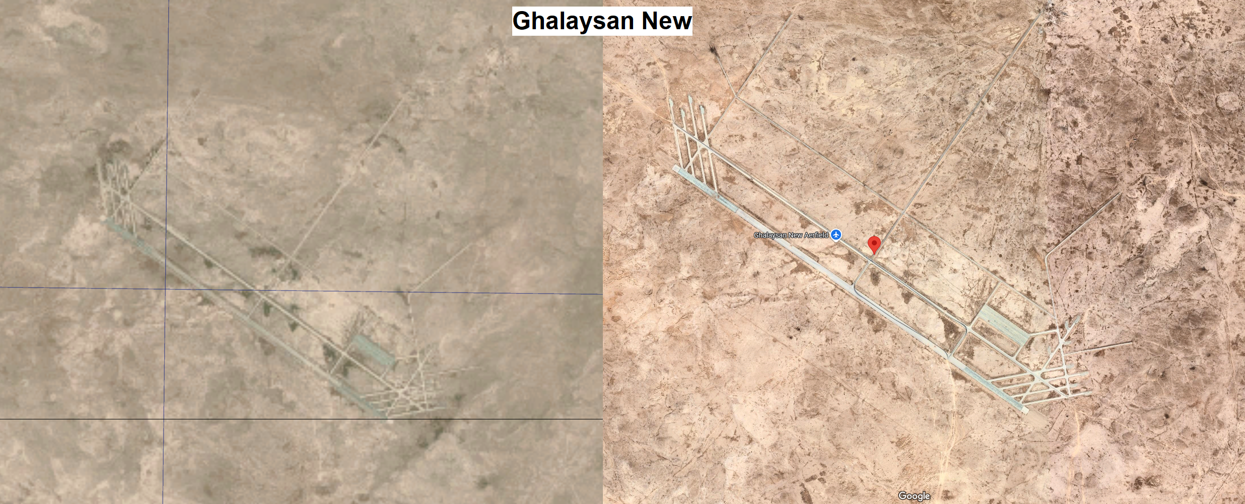
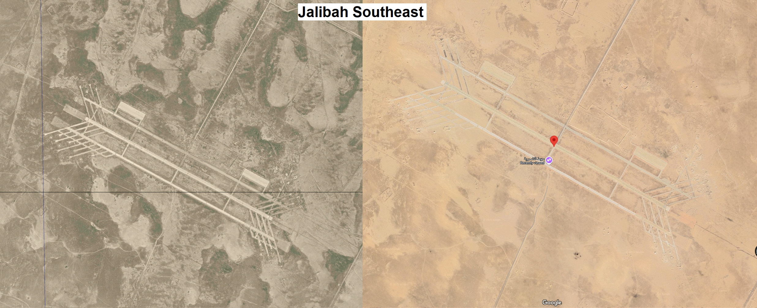
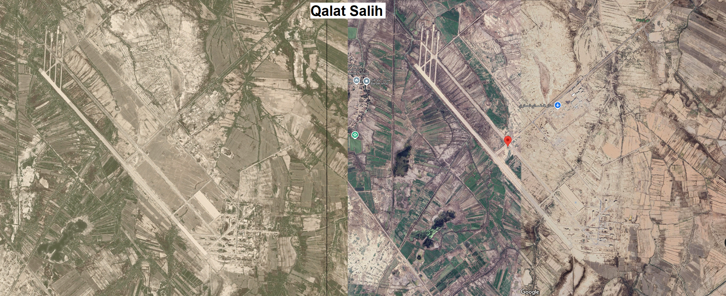
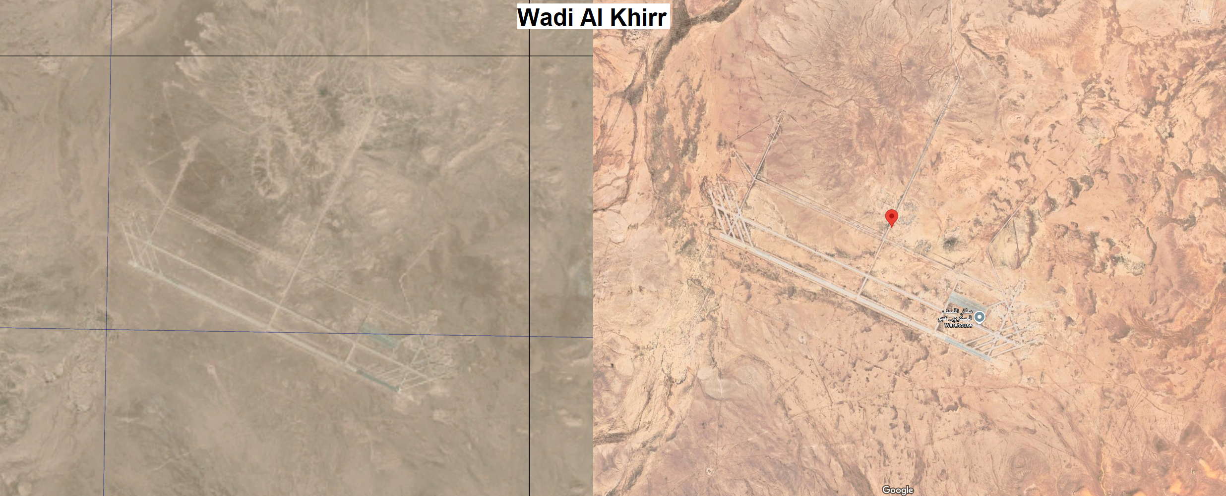
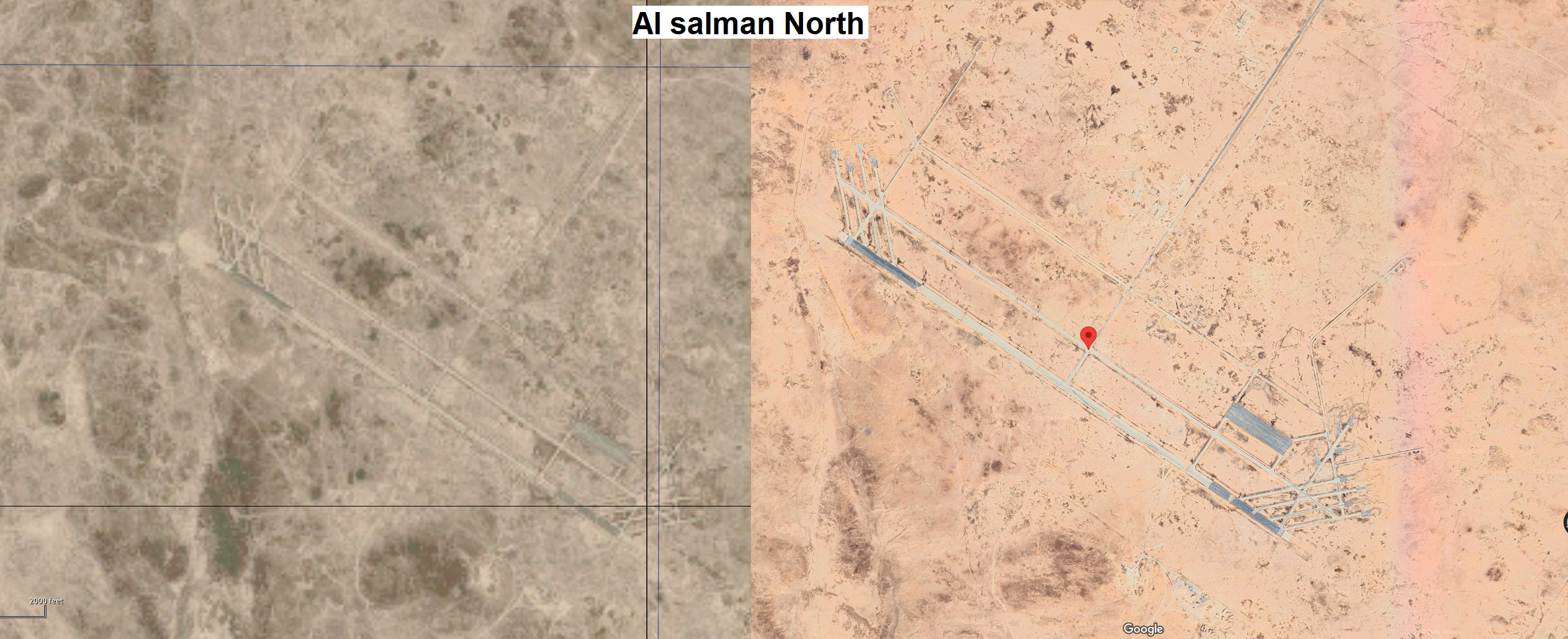
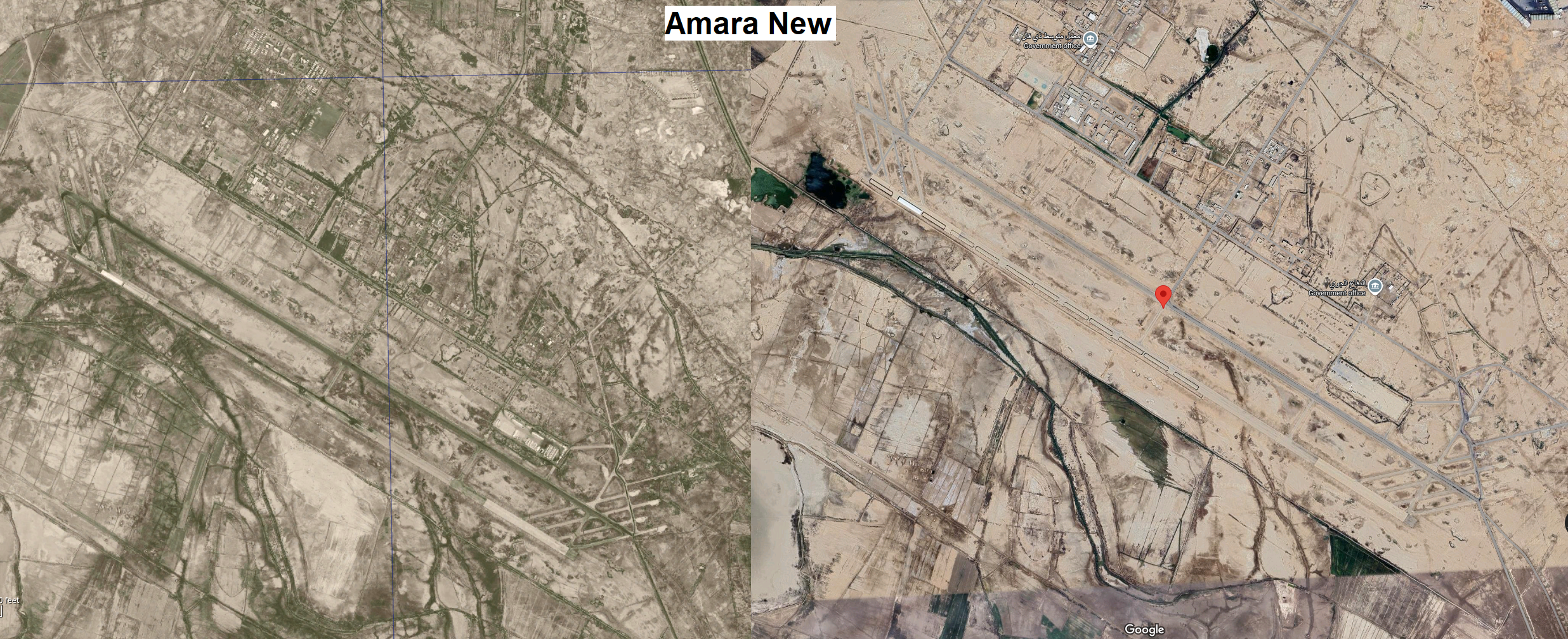
Here is a further visualization from our version in DCS and a quick Google Maps screenshot of these Air Bases with coordinates and notes: Kut Al Hayy, (32°06'56.0"N 46°22'49.0"E), with hardened shelters still visible in 2003 photos from Source above. Qalat Sikar, (31°50'13.0"N 46°18'23.0"E), with hardened shelters visible in 1995 from source above. Amara New, (31°49'11.0"N 47°04'51.0"E), with hardened shelters as per source above. Abandoned after Desert Storm. Qalat Salih, (31°27'28.0"N 47°17'28.0"E), still have not found a Source for this one. Google Maps show rounded Shelters, these could be Coaltion installations and not Iraqi ones with their distinct trapezoid shape. These can very well be Iraqi Installations as per this source. Wadi Al Khirr, (31°25'25.0"N 43°11'15.0"E), with 12 hardened shelters in 1991 as per source above. Silhouettes still visible today on Google Maps. Ghalaysan New, (30°55'00.0"N 43°40'33.0"E), faint silhouettes of possible hardened shelters are visible today on Google Maps. Al Salman North, (30°38'59.0"N 44°34'10.0"E), silhouettes of hardened shelters visible today on Google Maps. Jalibah Southeast, (30°32'44.0"N 46°36'14.0"E), with hardened shelters as per source above, silhouettes of shelters still visible today on Google Maps. Ar Rumaylah Southwest, (30°21'19.0"N 47°06'36.0"E), with hardened shelters as per source above.
-
The southern part of the Iraq Map in DCS has lots and lots of Air Bases planned in Saudi Arabia, Kuwait and Qatar, but very few inside Iraq. I created a Map which shows planned (blue) Air Bases, and missing Air Bases (red) that were operated by the Iraqi Airforce during the Gulf War period (1991-2003) There is a huge vacuum in the Southwest portion of Iraq, and also North of Basra, eventhough there are historical Air Bases to fill these voids. All of the aforementioned are single Runway Air Bases with Taxiways, Parking spaces and sometimes with "trapezoids" Bunker installations. Example from the Jalibah Southeast Air Base: Most were also Targets during both Operation Desert Storm and Operation Iraqi Freedom. Some even played a role during the Iran-Iraq War, notably the ones North of Basra. The ones I am unsure of are Amara new and Qalat Salih, because I could not find any source of them being attacked or used in that Time period. Updated Map with 4 additional Air Bases suggested by other users. (Runwayshid, Al-Murasant / H3 Northwest, Mudaysis, An Nukhayb) Below are a couple of sources for these Air Bases, they are all already marked on the graphical Map inside DCS, and are also already textured as per the satellite imagery: Kut Al Hayy (globalsecurity) Qalat Sikar (Wikipedia) Jalibah Southeast (Wikipedia) Al salman North (mentioned in this Wikipedia Article as "Al salman some 150km inside Iraqi territory") Ghalaysan New (Mentioned in Page 4 of this Article from arsof-history) Wadi Al Khirr (globalsecurity) Ar Rumaylah Southwest (Wikipedia) Amara New / Amara Air Base (Wikipedia) Qalat Salih (only mentioned by name in this list from globalsecurity) Additional Air Bases suggested by other users: Ruwayshid (Wikipedia) Mudaysis (Wikipedia) Al-Murasant / H3 Northwest (Wikipedia) An Nukhayb (only mentioned by name in this list from globalsecurity)
-
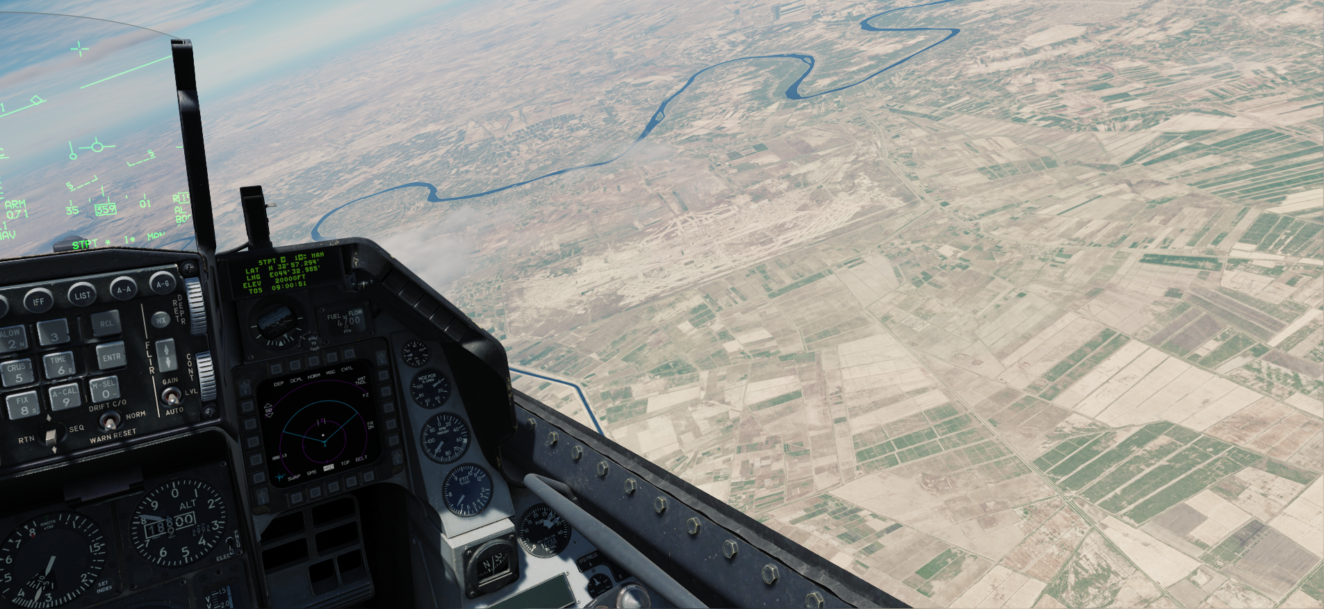
This is a screenshot from about a thirds of the distance to the city border of Baghdad (7.5nm, 20.000feet):
-
This Air Base not far south of Baghdad is not yet included (as of 26/01/2025) in the Iraq Release FAQ. The Air Base is already on the Map, but just as part of the satellite scenery. It's a pretty big and distinct spot in an Area that will be trafficked alot, since it is just 18 miles SSE of Baghdad. It would be a shame to be reminded of what could have been by the flat plane and textures, everytime you pass Baghdad or operate near future POIs in the area of Salman Pak. It would be great to have it included for whenever the south region of the map will be released, since it played a role in the defence against Iranian Air Raids, Operation Desert Storm and Operation Iraqi freedom.
-
Hi. I had the same impression at first. I played around with Syria, Caucasus and Afghanistan to understand what is going on and I think I found out why it appears that the new Fog and Dust storm do not work. Simply put the new System takes 0ft at sea as its base and since afghanistan is a rather elevated map, even at its lowest points in the southwest, the Fog/dust is "too far below the terrain" to appear above the surface. You would have to use manual Fog settings to make it work properly. Since duststorm has no thickness option, its pretty much useless on the map. Also Afghanistan seems to not have received the new lighting maps that make cities glow in Fog and illuminate clouds above them.
-
Iraq is currently lacking in liveries for aircraft such as the MiG-23, MiG-29, MiG il-76, Su's, etc., that will be crucial for mission making and easy sync between players for force on force scenarios. I used this as a quick reference as what aircraft Iraq used in the Gulf war (1991).
-
After doing the loop in the F16 Cold and Dark instant action mission, I landed and taxied to the exact same place you spawn at. My AI wingman lands on Kandahar Heliport. I assume due to flight lead being closer to the heliport at that parking spot, than to the main airfield. Video:
-
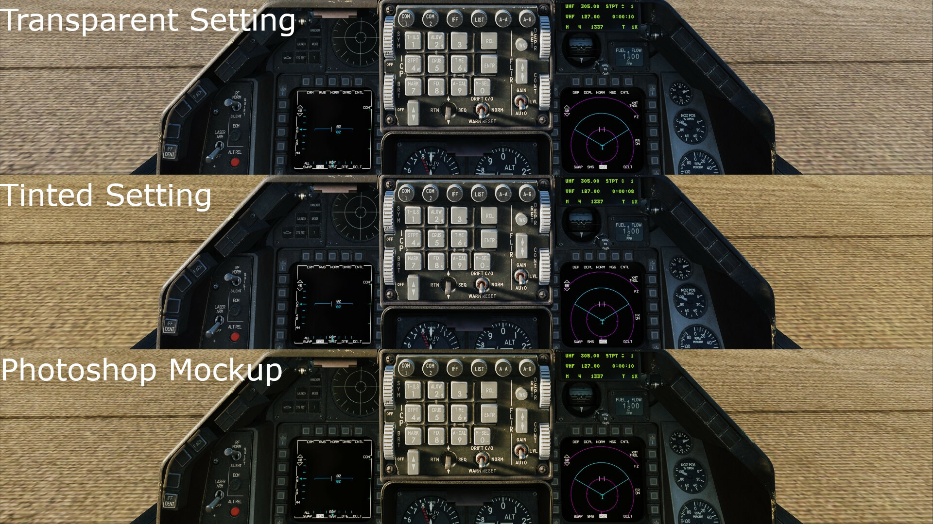
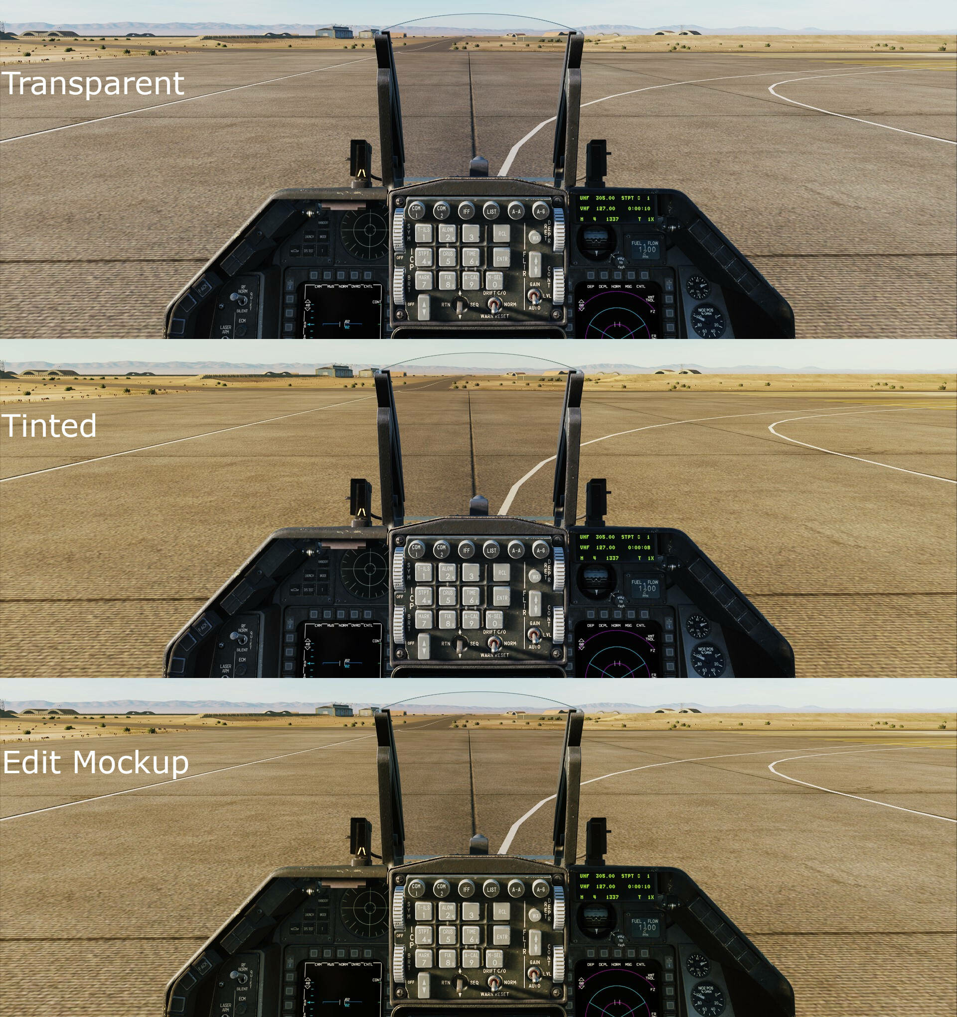
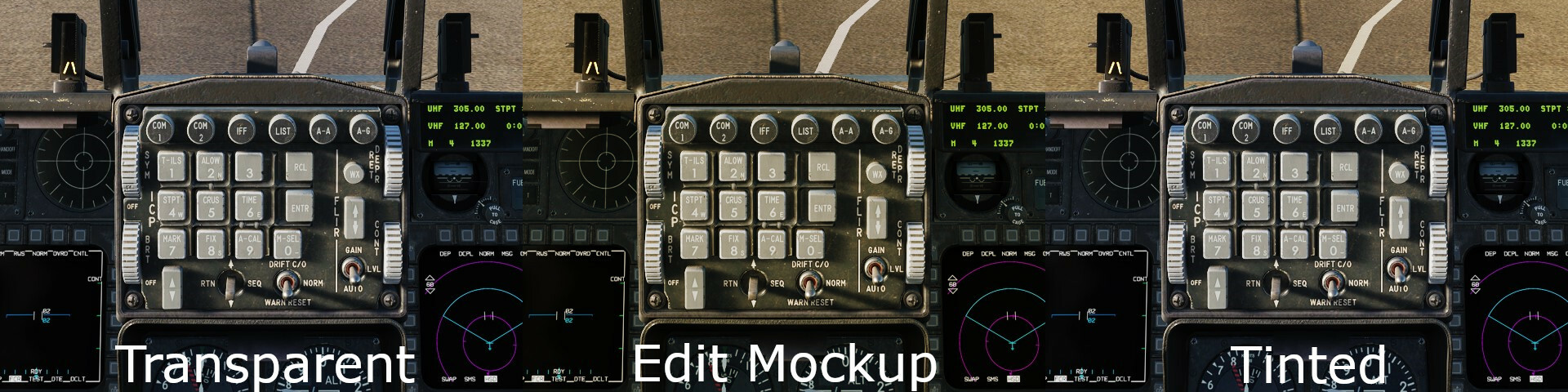
Currently the yellow canopy Tint only affects how the outside world is viewed, but does not change color of the sunlight coming into the Cockpit. This makes the interior look alot more blue-ish in comparison. I made a quick Comparison and Mockup Edit in Photoshop to better bring across my point. The Mockup Edit was created by taking the Transparent Screenshot, and adjusting the Yellow Levels to achieve a similar outside color as the Tinted option.
- 1 reply
-
- 3
-