trujillostm
-
Posts
162 -
Joined
-
Last visited
Content Type
Profiles
Forums
Events
Everything posted by trujillostm
-
Error in AssembleScenes.exe "This application has failed to start because edCore.dll was not found. Re-installing the application may fix this problem."
-
How to put trees over the terrain?
-
ModMan to my scenery... I'm making my own scenery. You can see in other thread of mine. I'm using new .cdds files (textures), land.lsa2 (terrain) and some .sup (maps). Can I create a ModMan installer to that files? Without overwrite default files.
-
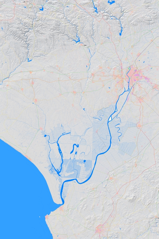
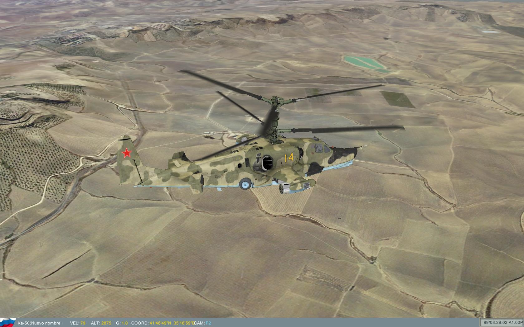
This is the map that I have actually. They are 80 x 120 km. And some images of scenery in action.

-
This is the content of my "run_RELEASE_x86.bat" file: call "C:\Program Files (x86)\Autodesk\3ds Max 2008\3dsmax.exe" -p "D:\SERGIO\JUEGOS\BLACKSHARK\CrearNuevosEscenarios\Software\MaxPlagins\EagleDynamicsPlugins_RELEASE_x86\Eagle3dmaxPlugin.ini" This is the content of my "Eagle3dmaxPlugin.ini" file: [Directories] EagleDynamics=D:\SERGIO\JUEGOS\BLACKSHARK\CrearNuevosEscenarios\Software\MaxPlagins\EagleDynamicsPlugins_RELEASE_x86\ Be careful with the quotes and bars in the path. See the last \ in ini file.
-
I'm making my own 3dsmax template. I think my template is better for test and production than documentation. I'm creating my own script in a 3dsmax window, with buttons and text. It's better than simple run script... One problem to actual documentation is in apply textures. 3dsmax bad fit textures to 10010 m instead of 10000 m...
-
My aero-photos are of public domain in Spain. I can't make money with it, and I can't modify it. I think Eagle Dinamics can't use real photos, because they are private and make money... This is the reason because you can see general textures in the game... But for personal use, We can use our photos and our terrain... For test my scenery, I need to make a ModMan installer... Do you know what to do it?
-
There are many things to know. You need to know Photoshop and 3dsmax. I'm using IrfanView and XnView too. For example, to join 1600 images of 256x256 that I obtain in Spain, and crop to a big image of 10000x10000 pixels...
-
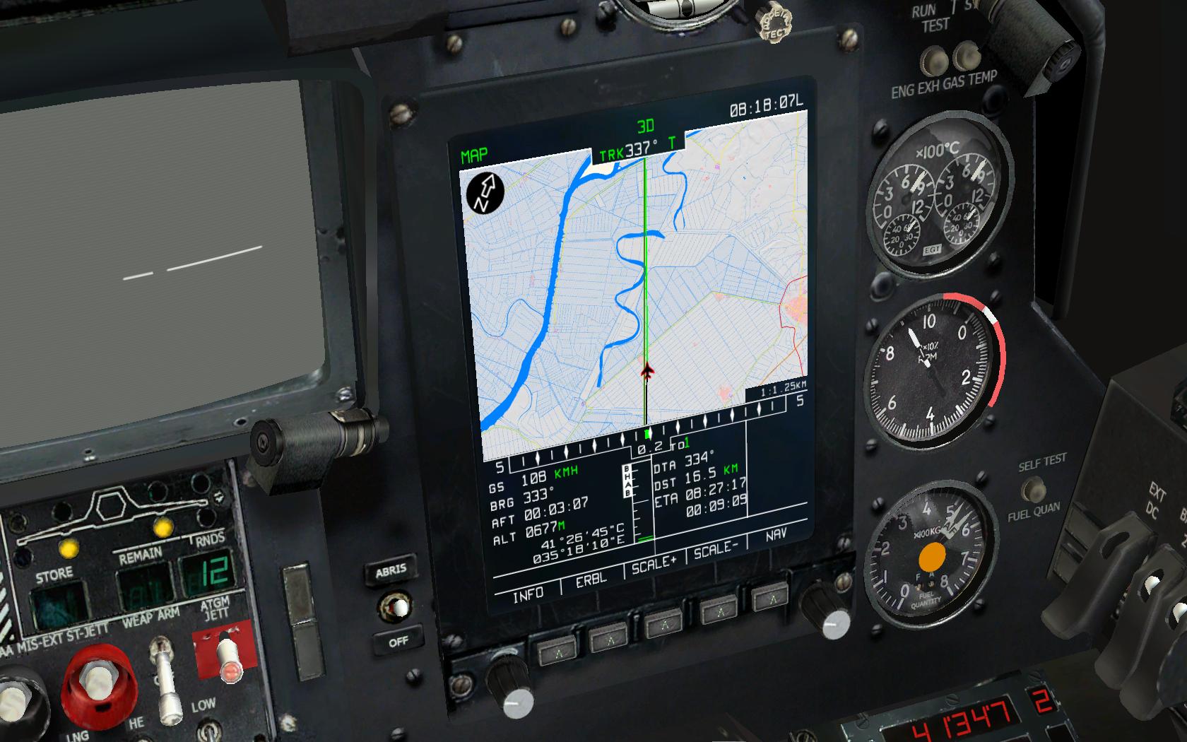
Land, ABRIS and Map, all together in my scenery.
-
The map of the Mission Editor is proyected. I have the Photoshop PSD file of the official map. But it's in Lat-Long coordinates... not in UTM with 10x10 km squares. By now, I only can use the ABRIS and F10 map to create my missions.
-
The image map of the Mission Editor. I need to test the real join with my coordinates.
-
On my folder "C:\Program Files (x86)\Eagle Dynamics\Ka-50\Config\Map". I found the file "MapCoords.lua". I think that is the system calibration about meters and degrees. I need more information... -- Zero point (meters) zeroX = 5000000.0 zeroZ = 6600000.0 -- Internal relative values for map projection corners (meters) centerX = 11465000.0 - zeroX centerZ = 6500000.0 - zeroZ pnSxW_X = 4468608.57 - zeroX pnSxW_Z = 5730893.72 - zeroZ pnNxW_X = 5357858.31 - zeroX pnNxW_Z = 5828649.53 - zeroZ pnSxE_X = 4468608.57 - zeroX pnSxE_Z = 7269106.20 - zeroZ pnNxE_X = 5357858.31 - zeroX pnNxE_Z = 7171350.0 - zeroZ -- Map borders (degrees) EndWest = 24.0 EndEast = 42.0 EndSouth = 40.0 EndNorth = 48.0 -- Used for the sky position LatitudeCenter = (EndNorth + EndSouth) * 0.5 LongitudeCenter = (EndEast + EndWest) * 0.5 -- Greenwich time displacement (hours) for the Sun, stars, etc. WinterTimeDelta = 2.2 SummerTimeDelta = 3.2
-
How can I converse between UTM and Lat. Long. coordinates? Is DCS is based on UTM? I have read this in documentation...
-
I respond myself... The map of the Mission Editor is on: C:\Program Files (x86)\Eagle Dynamics\Ka-50\BlackShark\data\map\relief\1024
-
I have deleted land_map_L0.sup and land_map_L2.sup, and the game runs. In the Mission Editor I can see the original map. Where is the real *.sup files I need to change? I think textures of map in the Mission Editor is in a CDDS file...
-
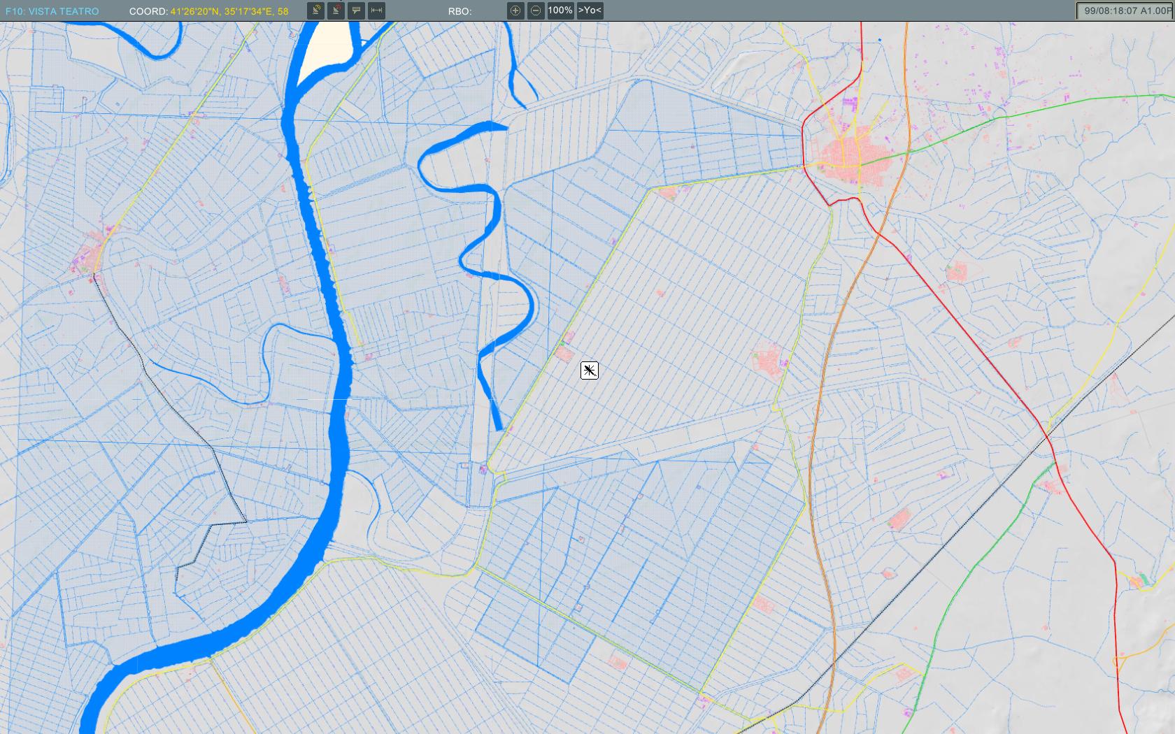
¿Can you send me a template? I have do it but I see again the original map. I have pasted "land_map_L0.sup" and "land_map_L2.sup" to my game folder: C:\Program Files (x86)\Eagle Dynamics\Ka-50\Bazar\Terrain\Map You can see here the map of the Mission Editor.
-
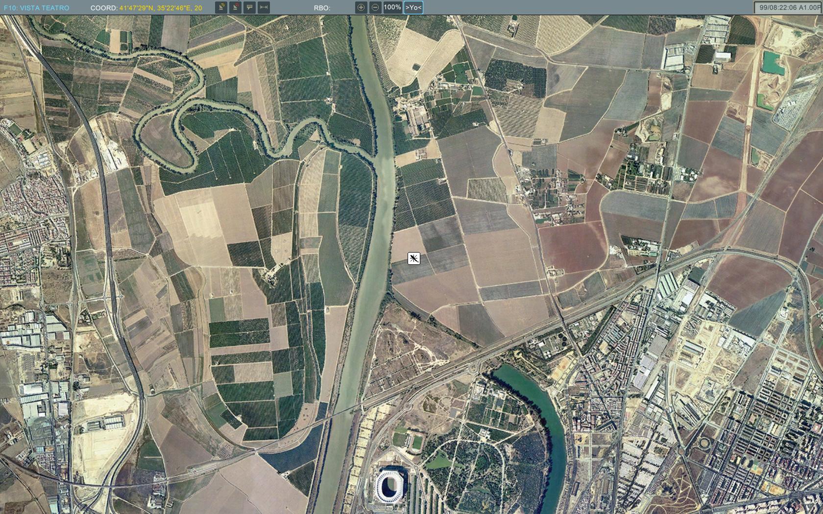
More images... I'm researching for use real coordinates in Lat. and Long. My map is based on UTM 30S.
-
Can you say me how to do this? Importing land.lsa2? or importing .sup files? What tool in 3dsmax?
-
Here, the maps for ABRIS and Mission Editor. All layers are 10x10km.
-
But, What files I need to change? What's the name of every bitmap I need to replace? I think they are divided into squares... But, What size and order?
-
Where is the file CDDS with the map of the mission editor? I want to create new missions on my new scenery's map.
-
Yes. 1024x1024 px are better than 4096x4096 px ? 1024 px on 2500 m is the same that 4096 px on 10000 m. The resolution is 2,44 m/px. in both cases.
-
I know unlink tool of 3dsmax. I mean the small piece of Mesh can I create. I have pieces of 256x256 pixels, with 1 m/px resolution.
-
How small can I detach the Mesh?
-
Can you apply a small map to a part of the 10x10 km EditableMesh?