MAESTR0
-
Posts
154 -
Joined
-
Last visited
-
Days Won
21
Content Type
Profiles
Forums
Events
Everything posted by MAESTR0
-
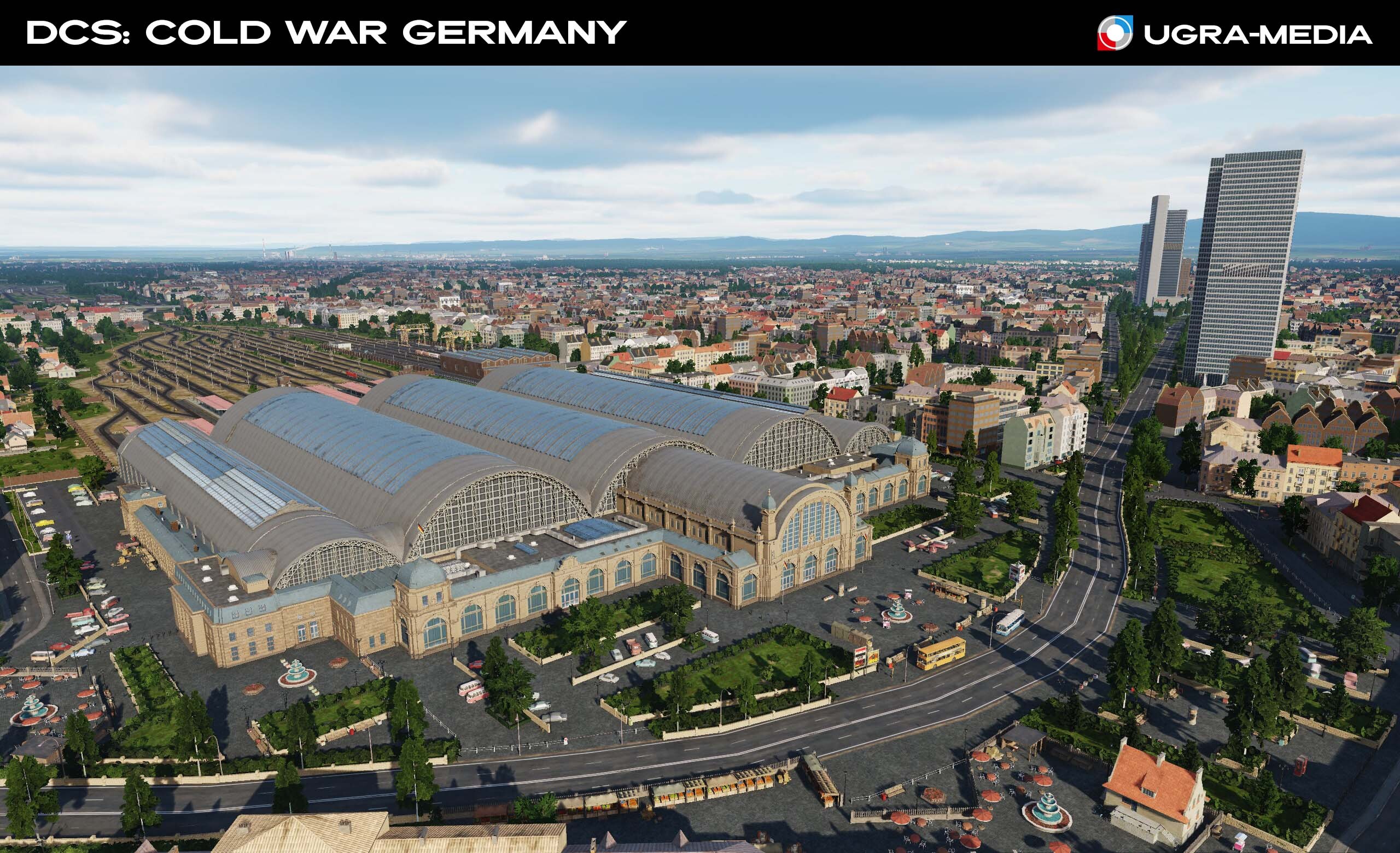
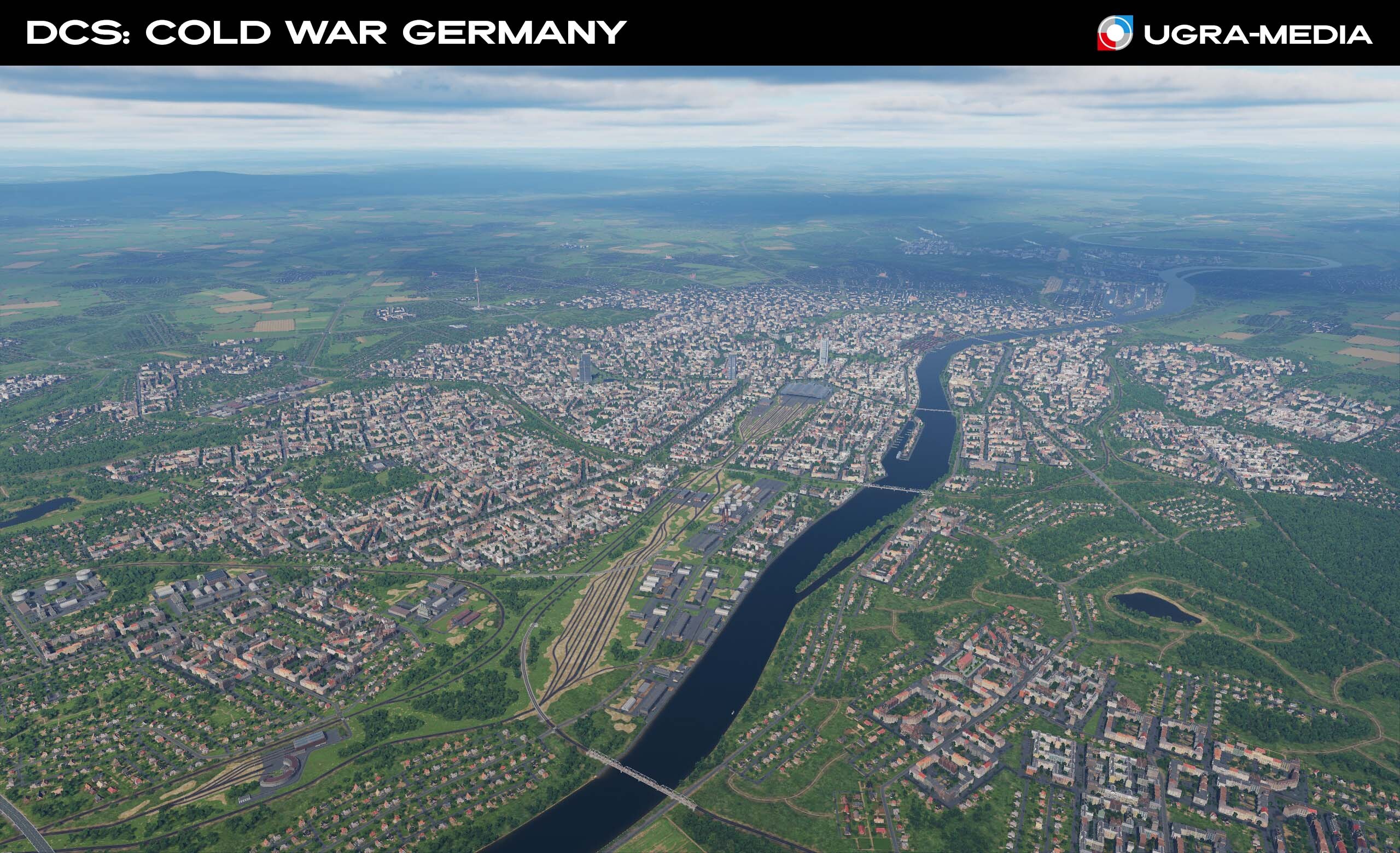
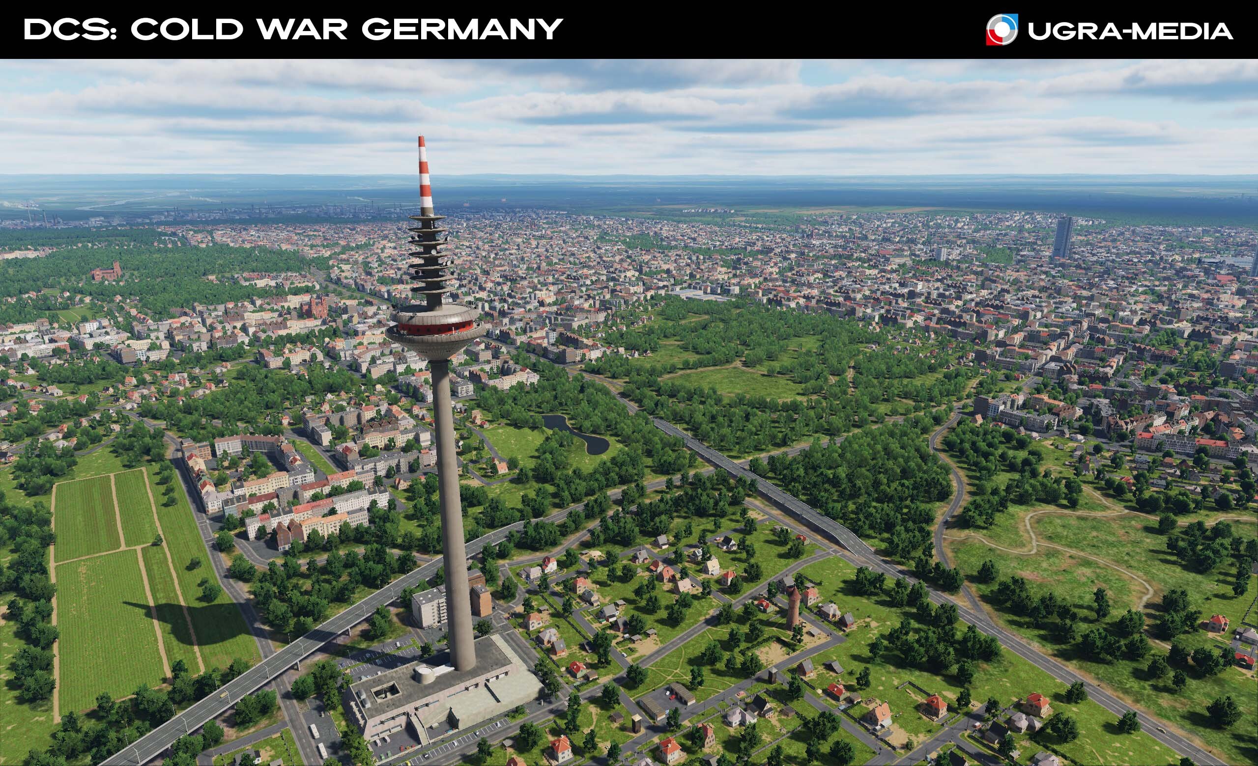
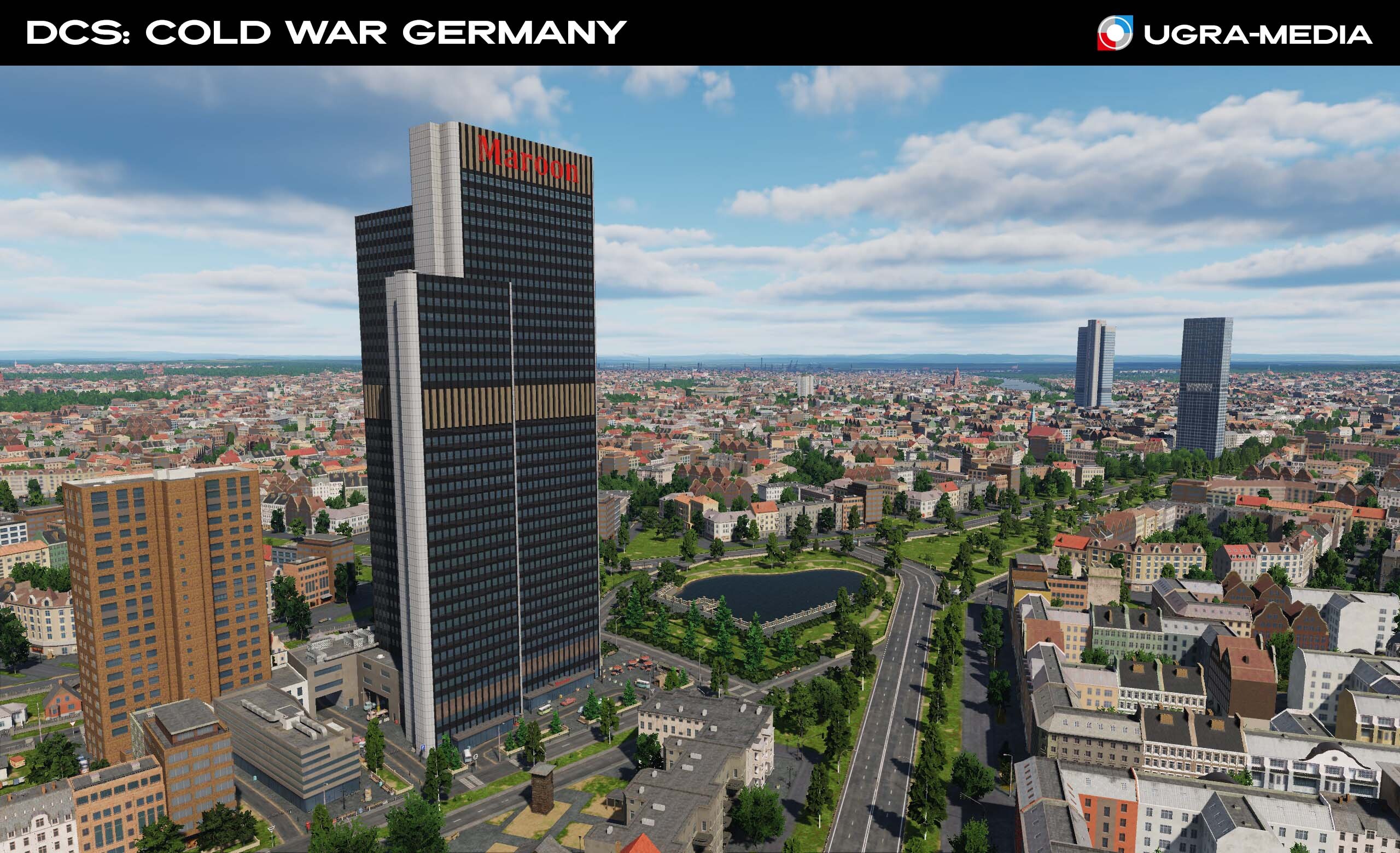
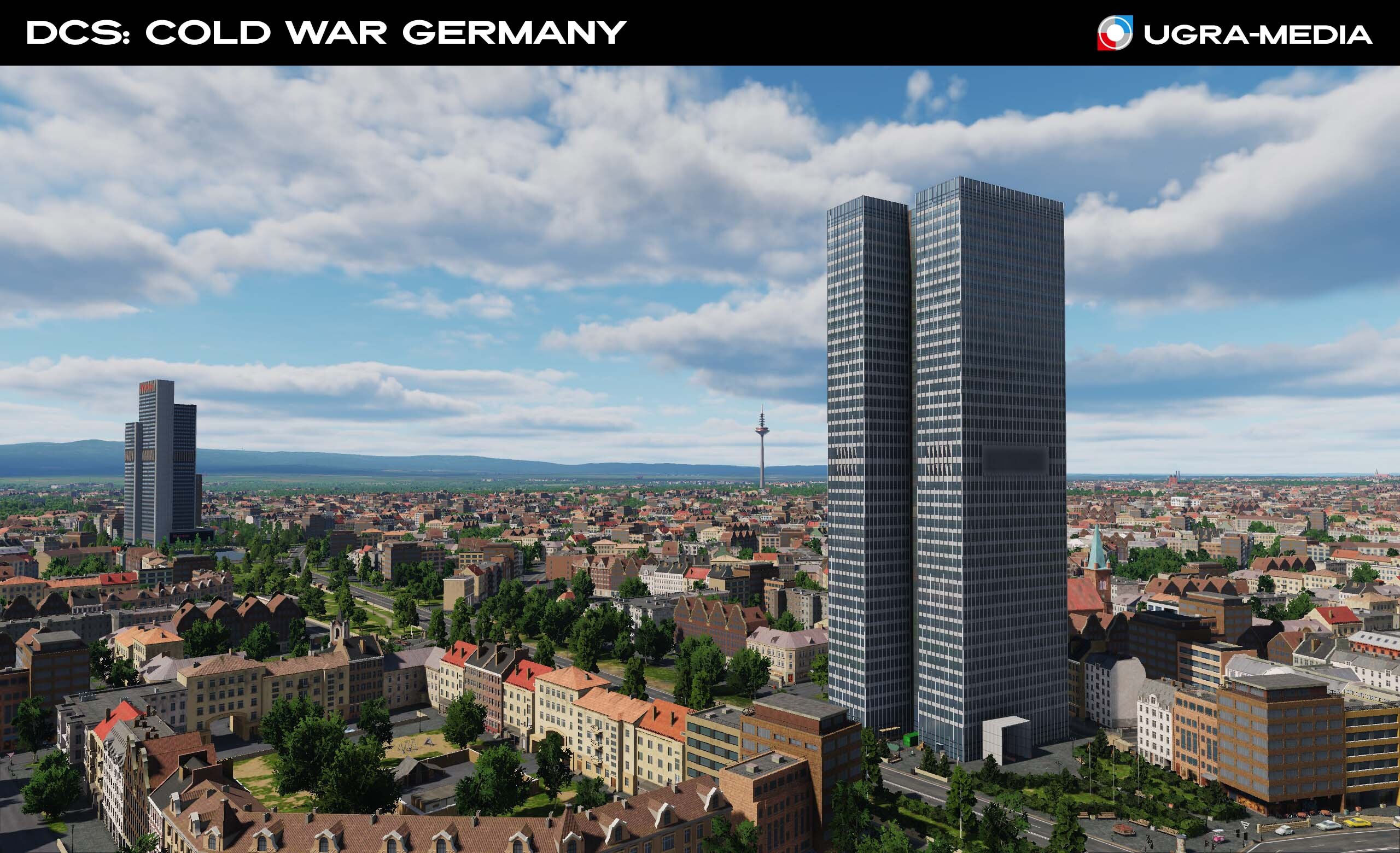
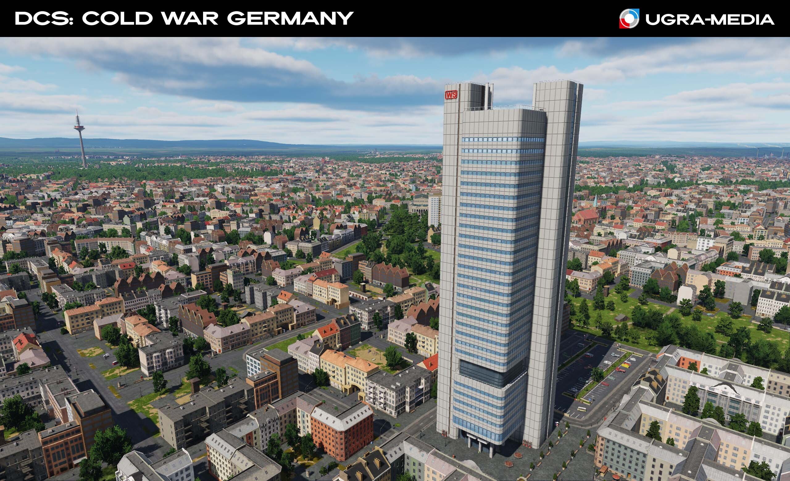
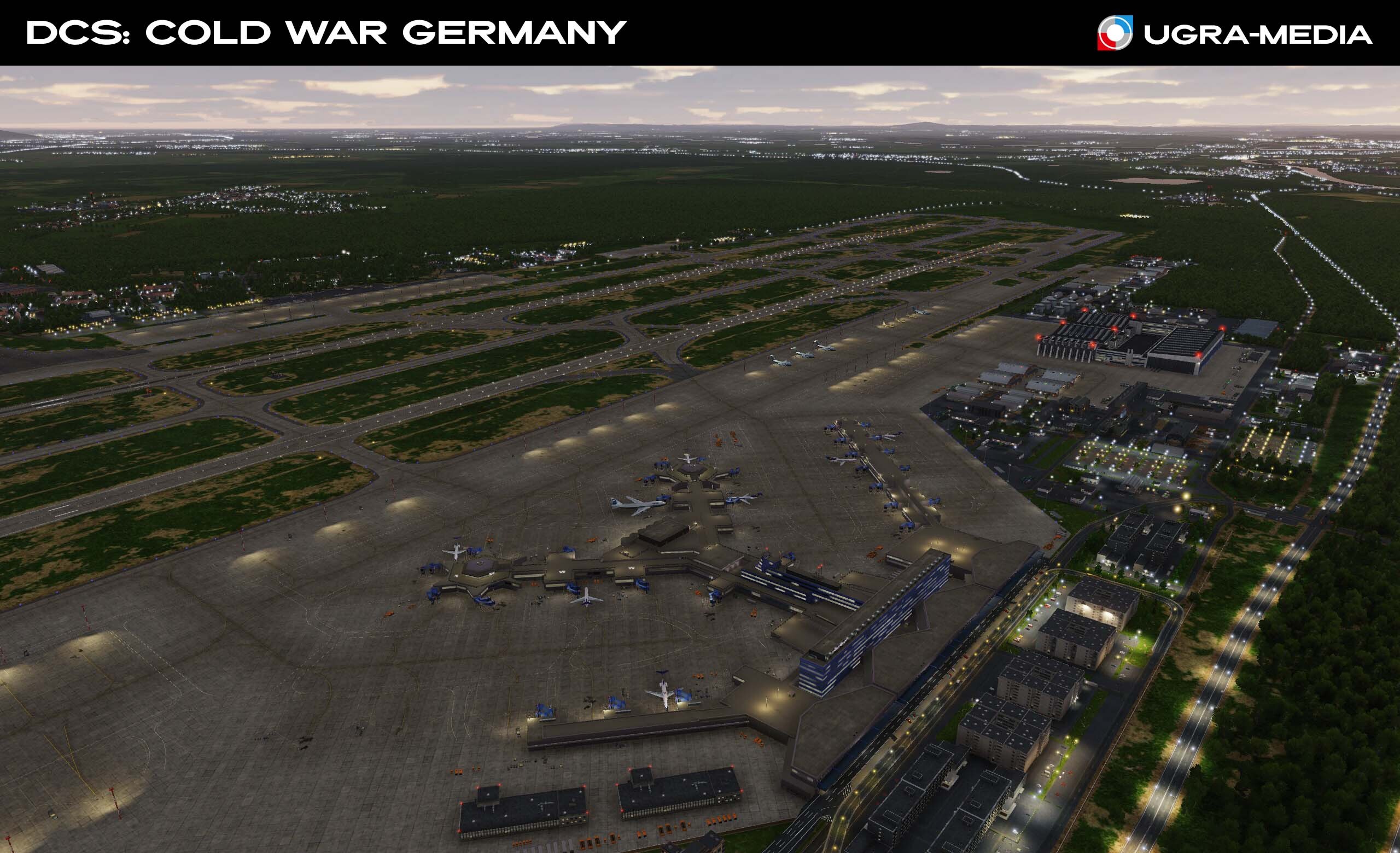
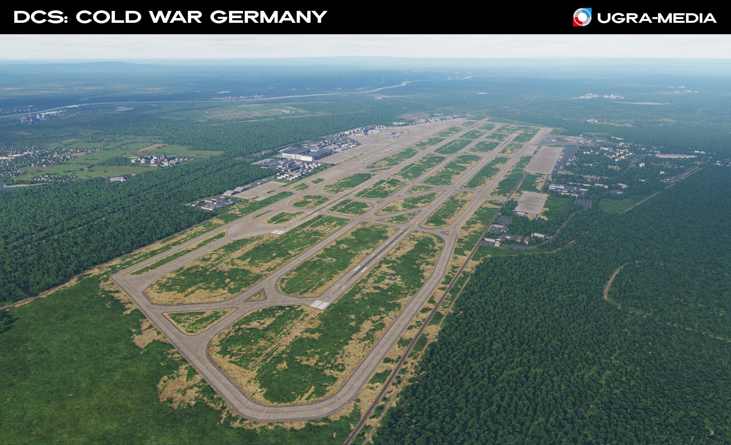
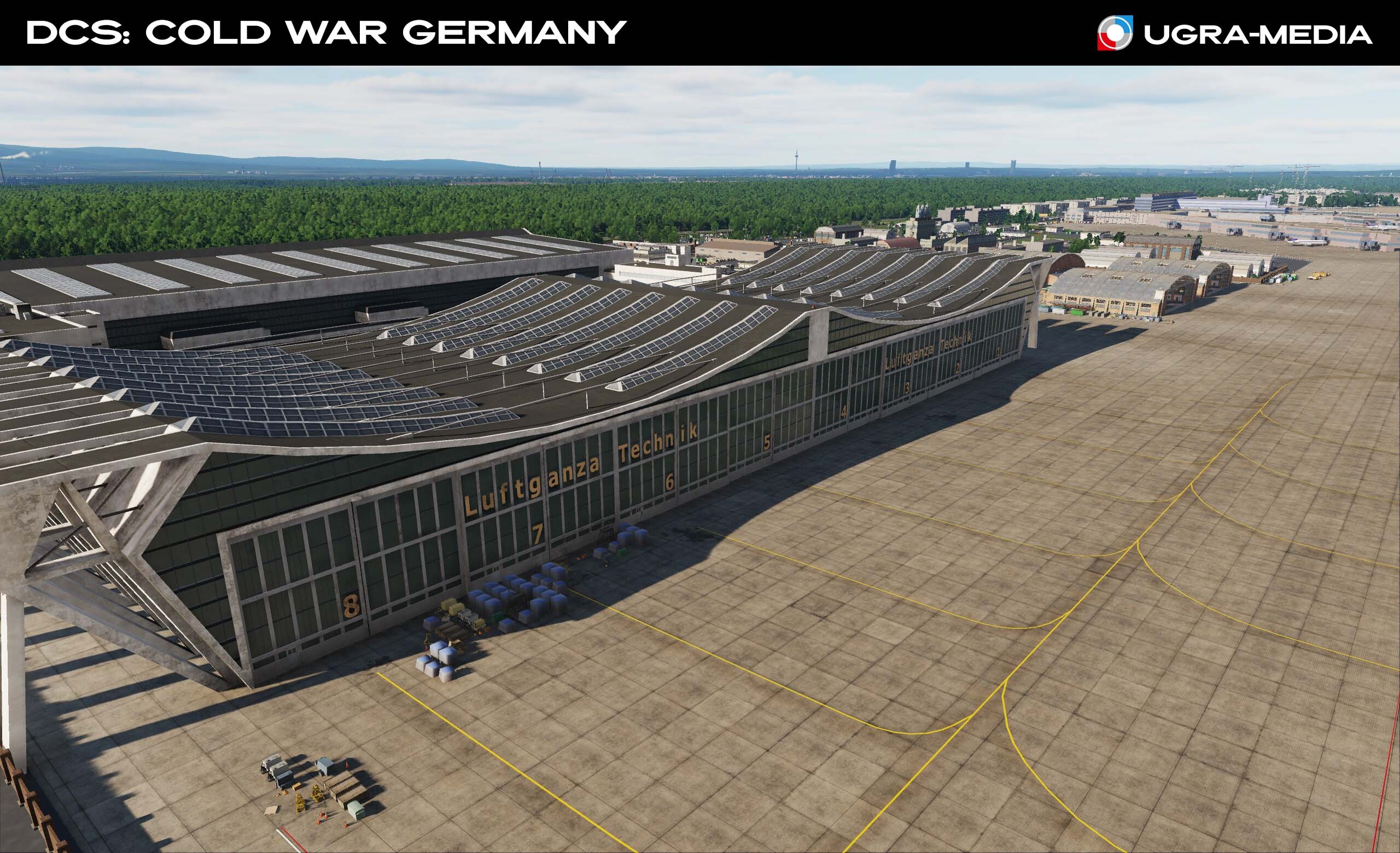
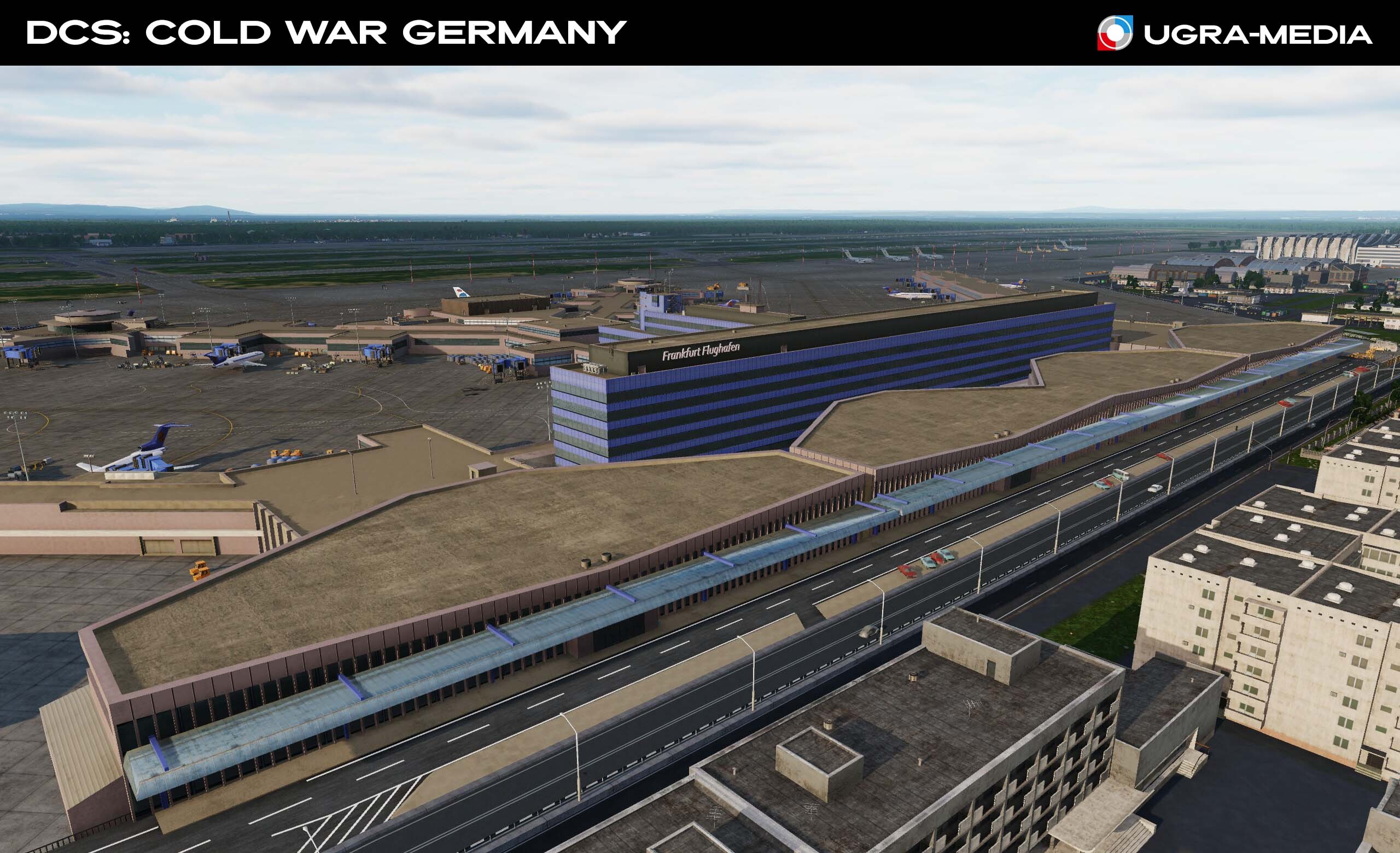
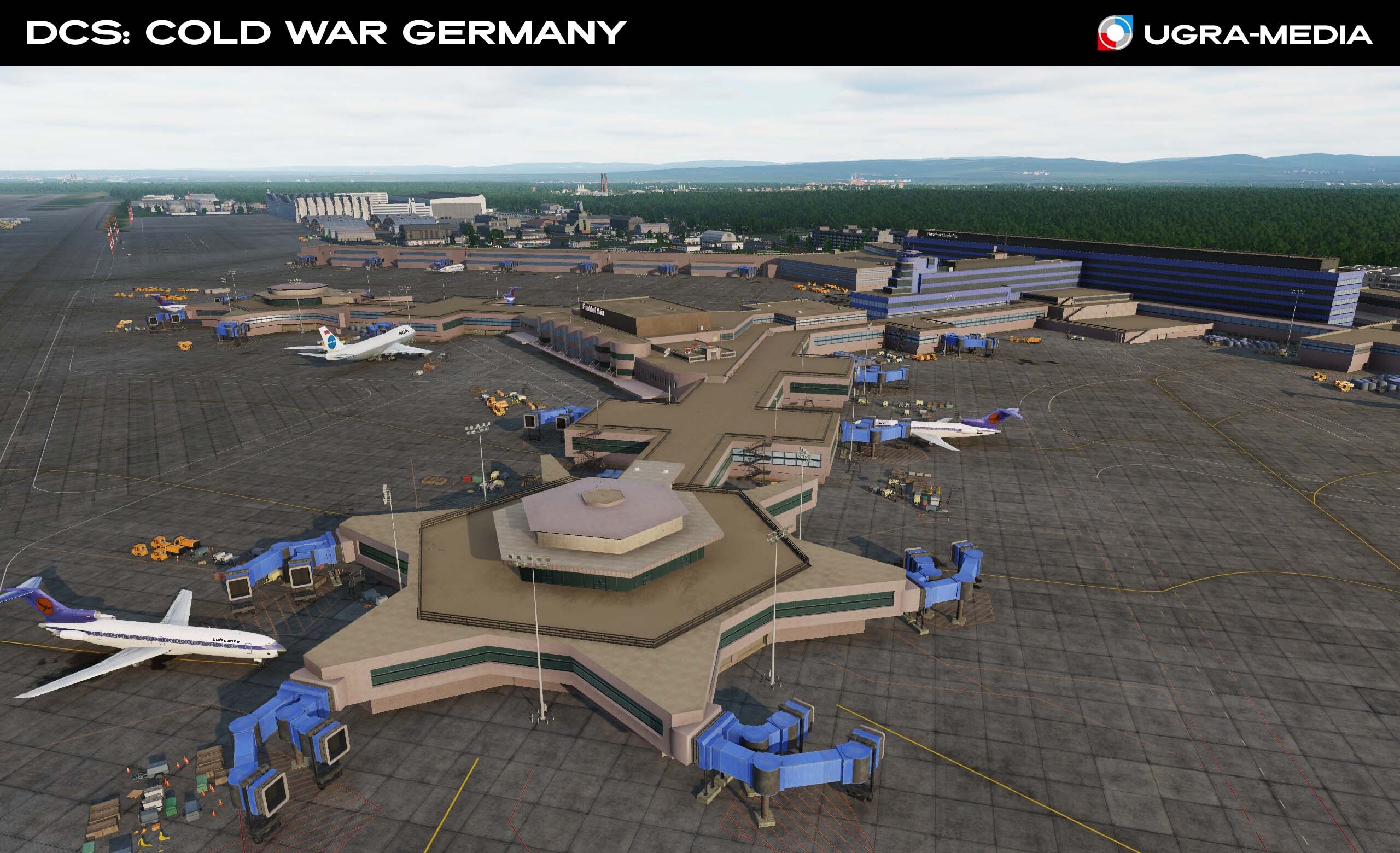
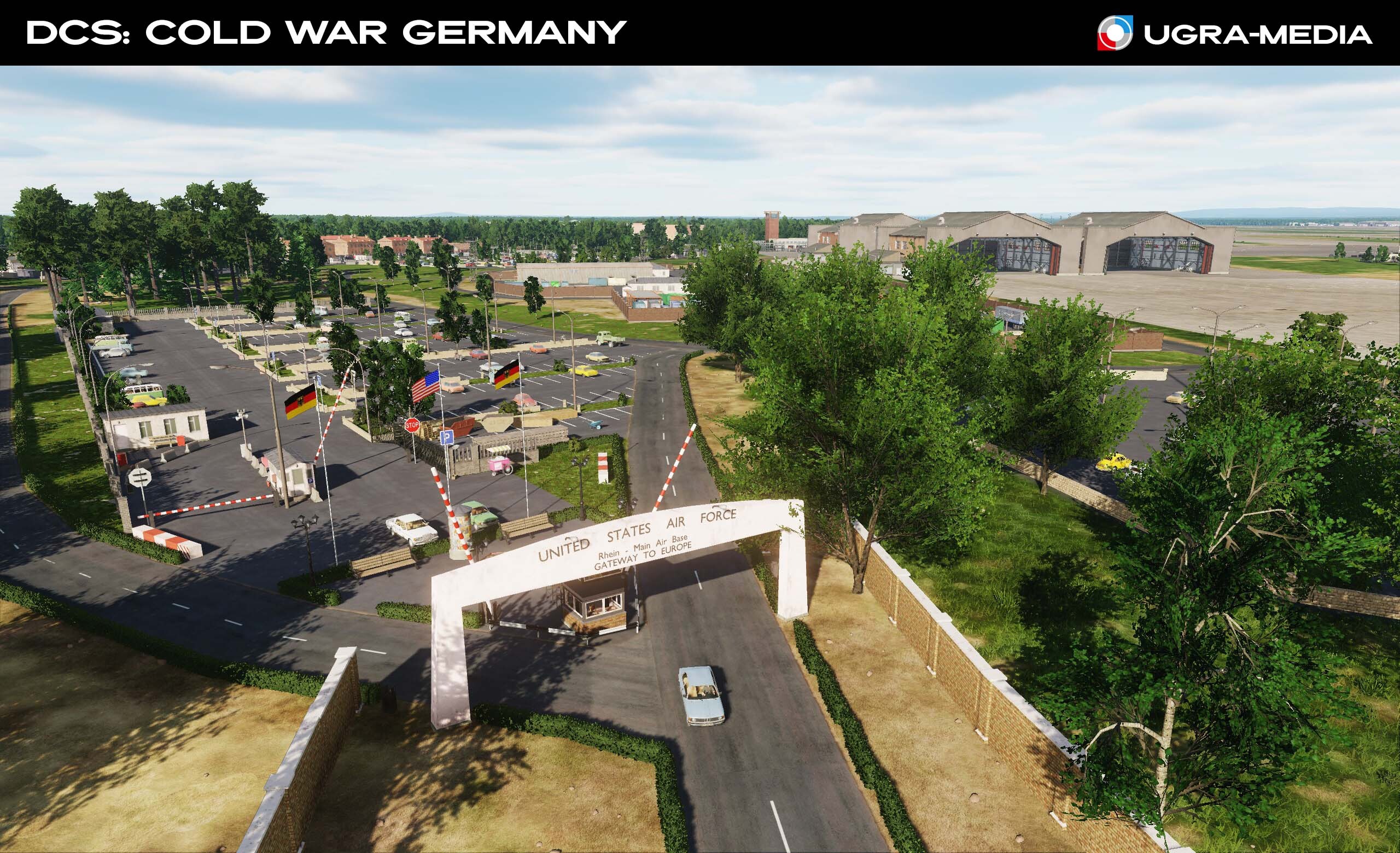
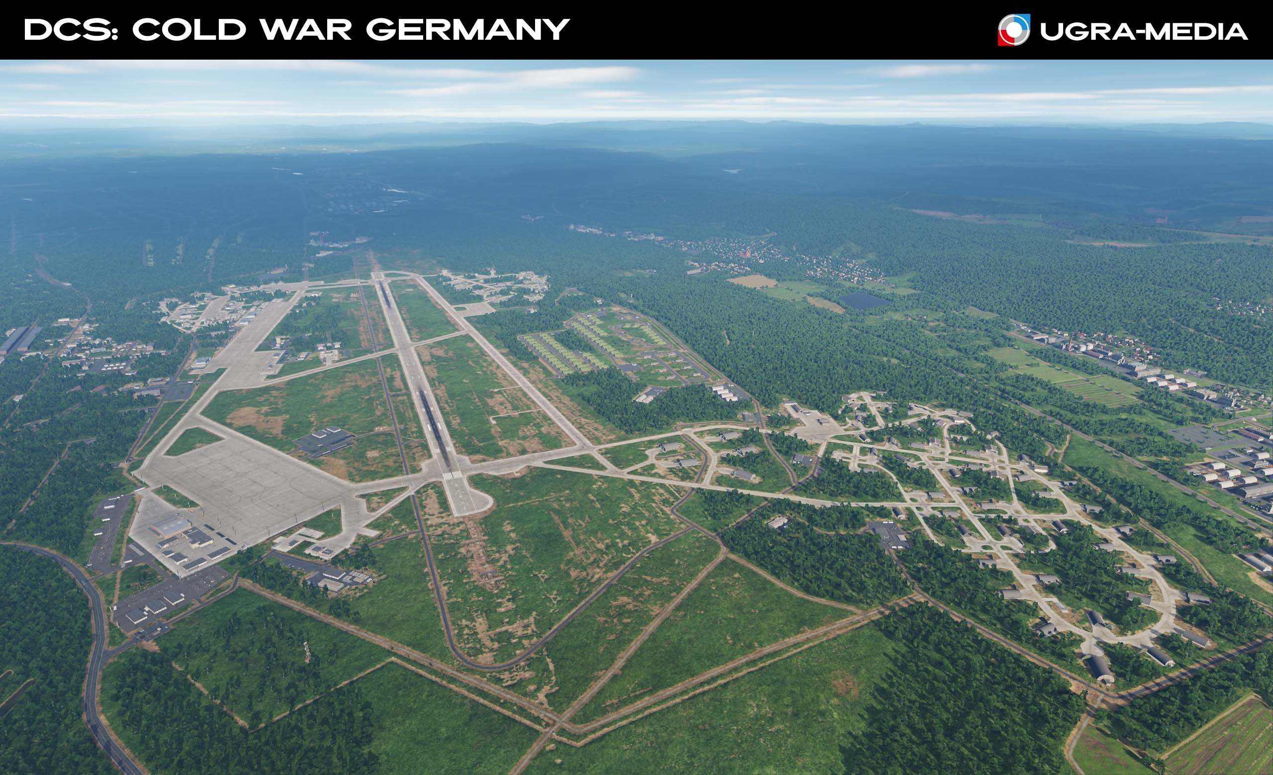
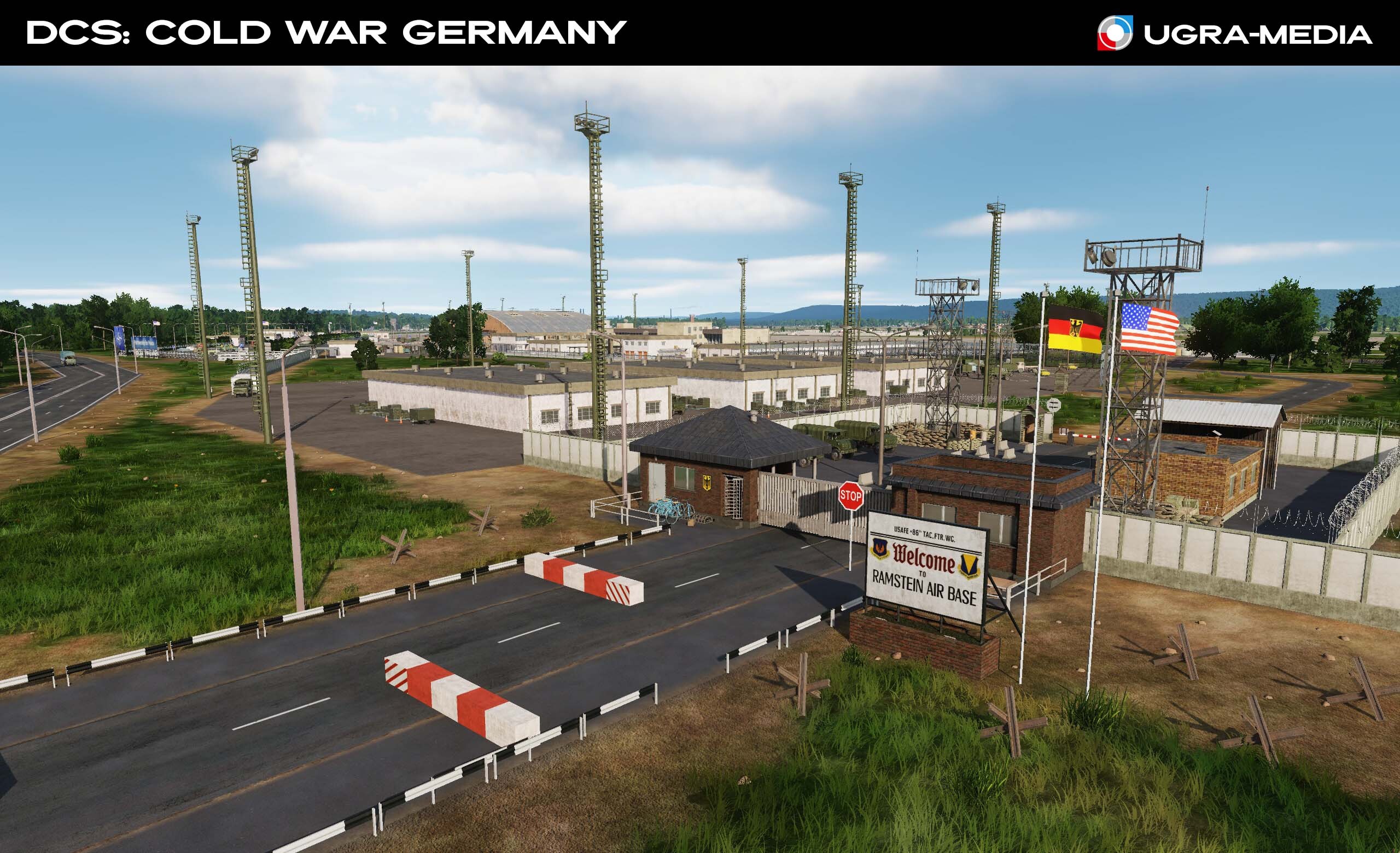
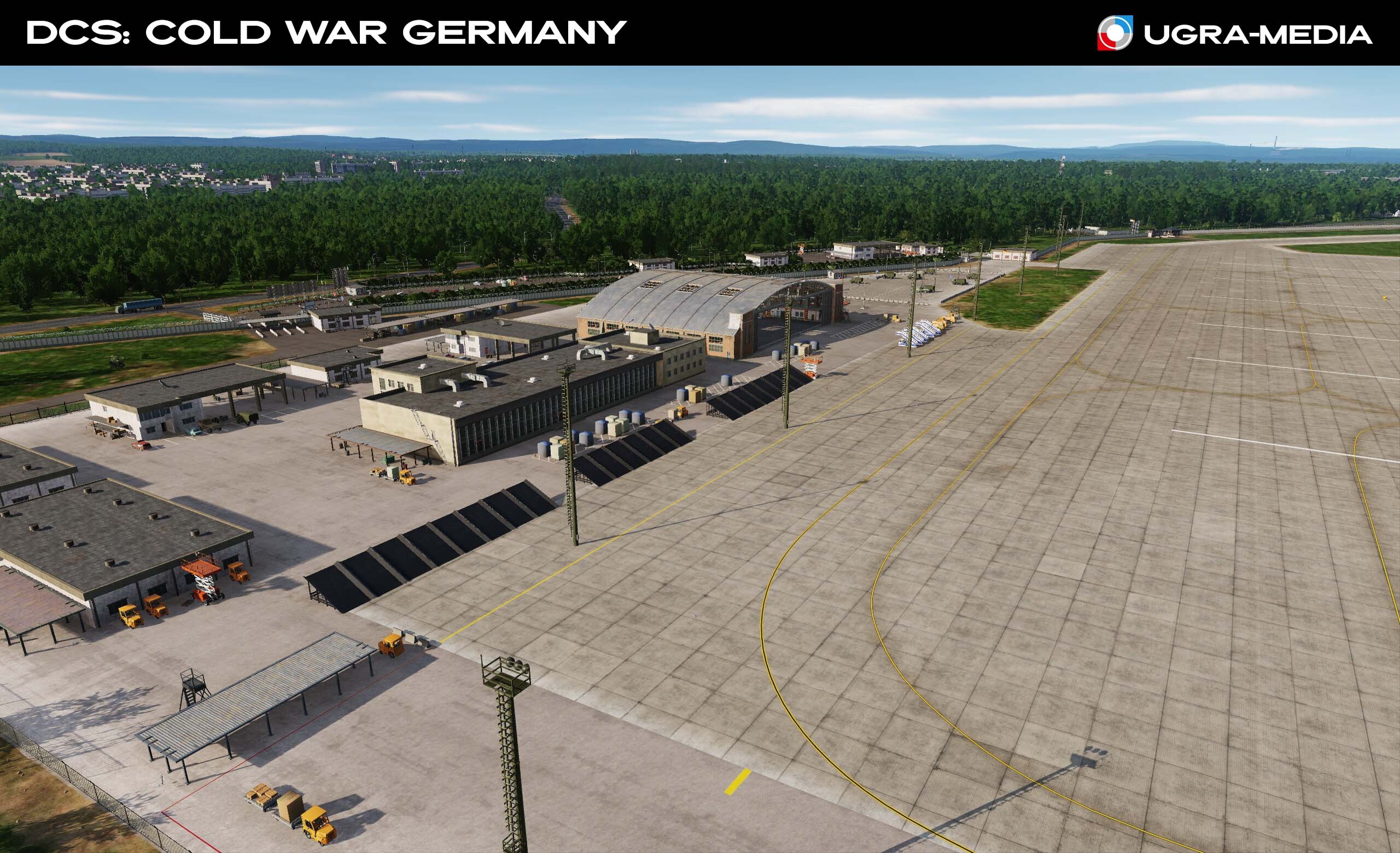
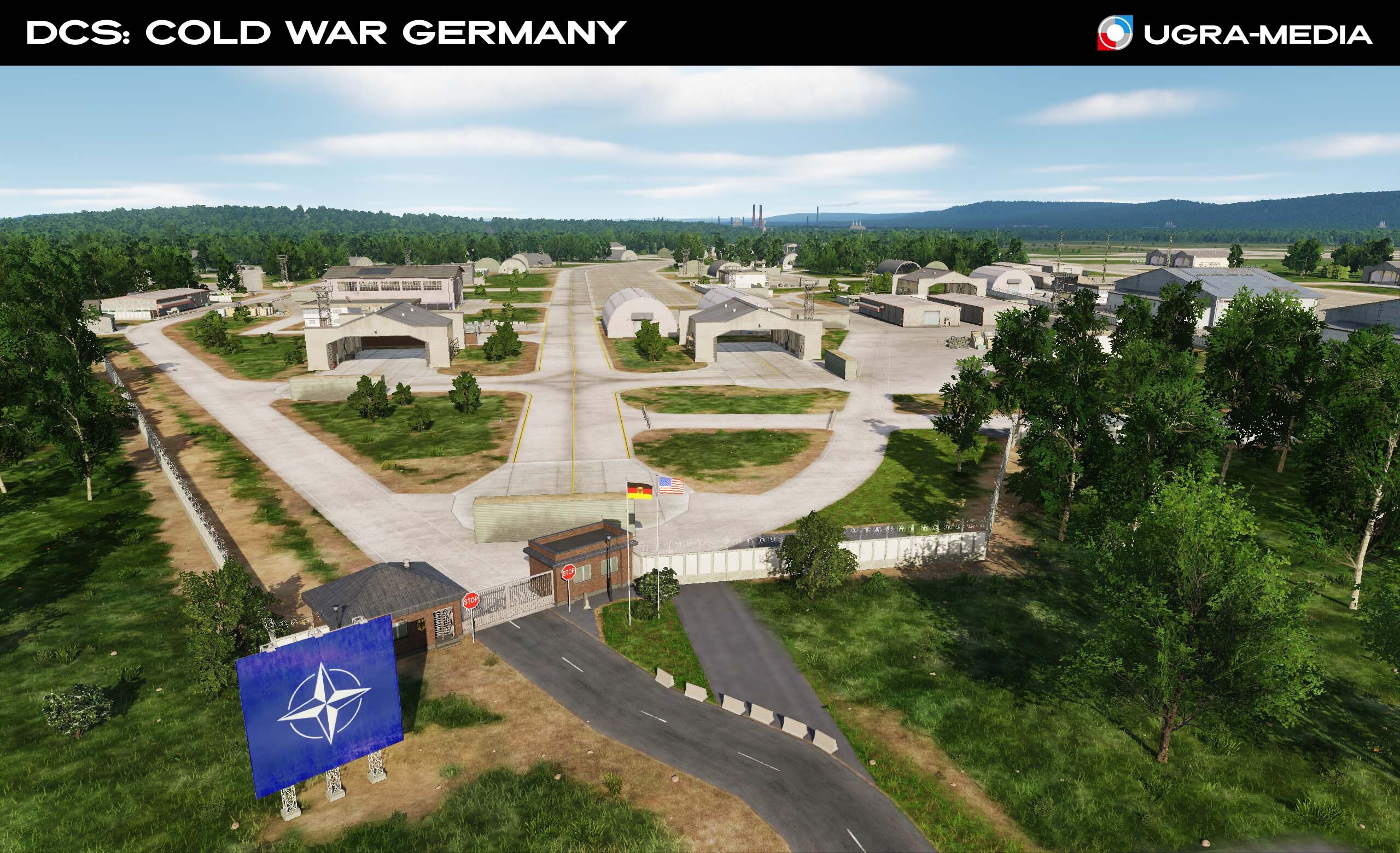
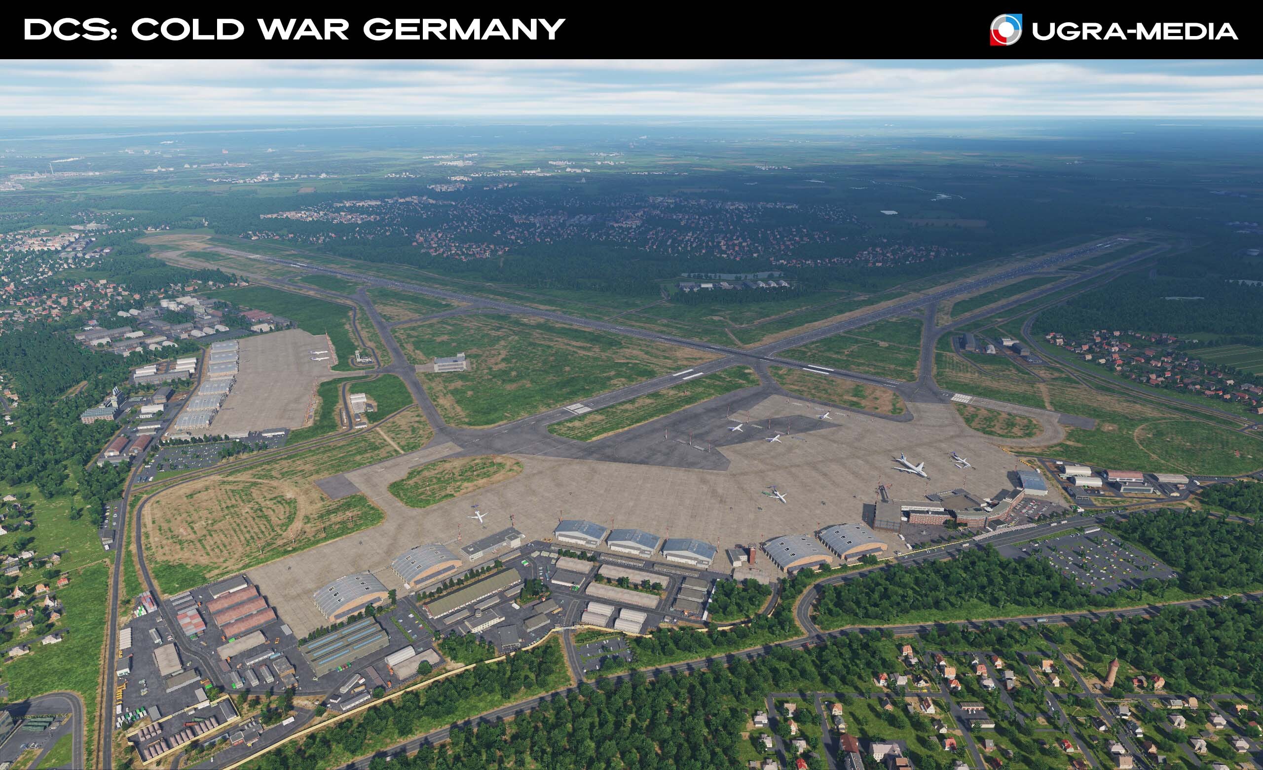
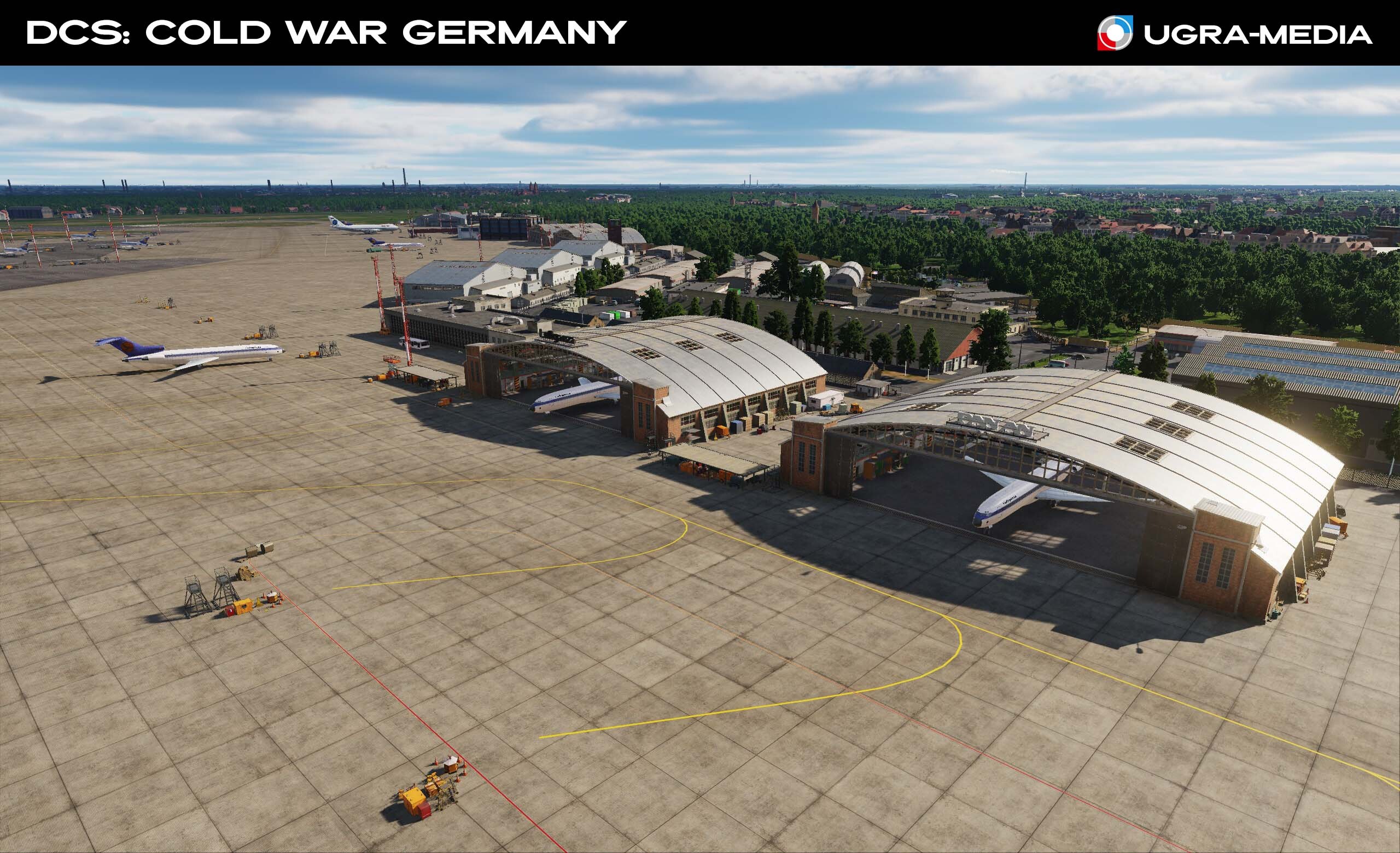
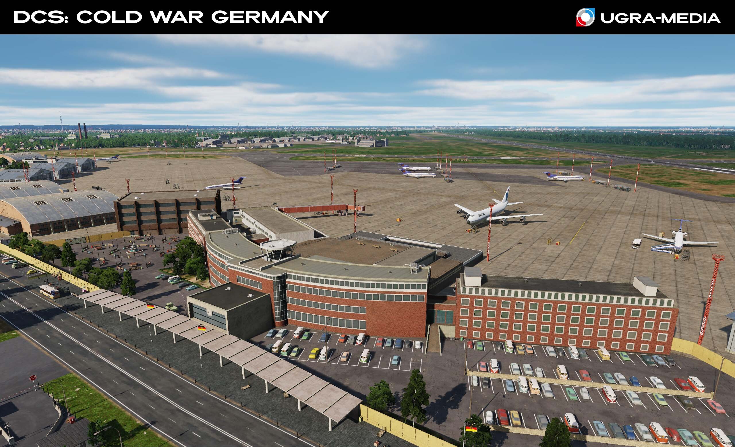
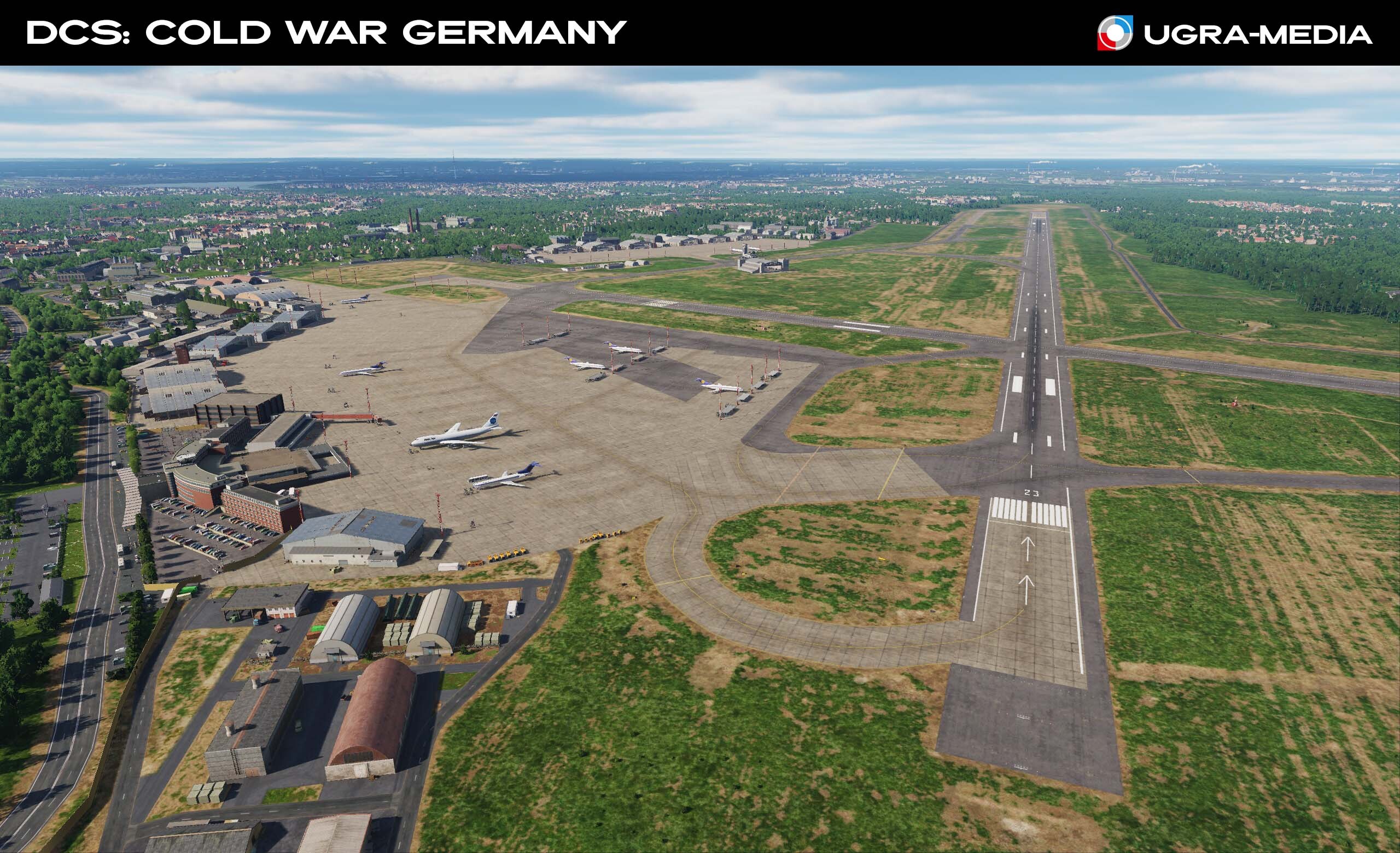
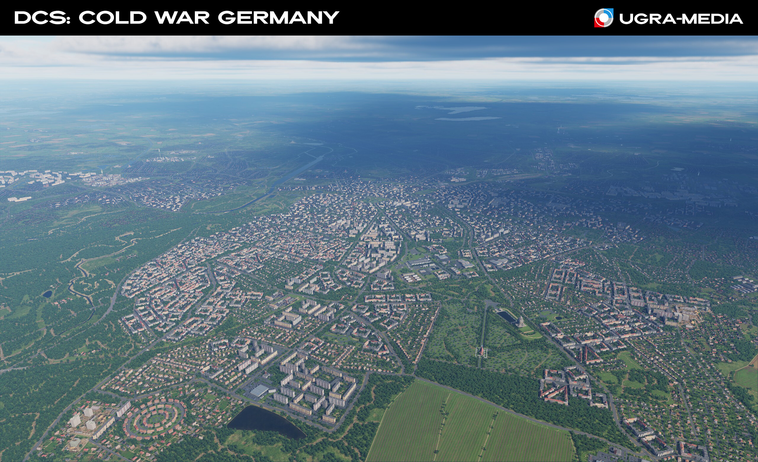
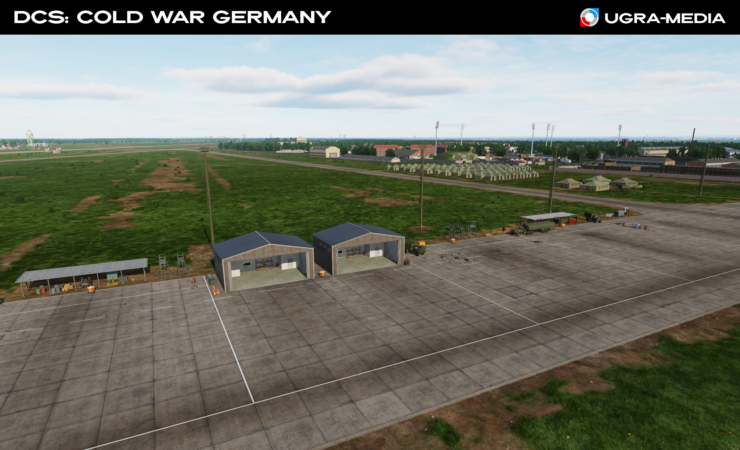
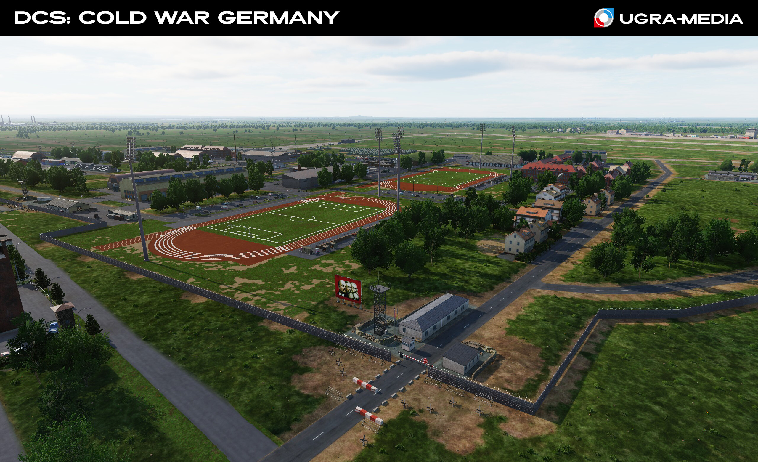
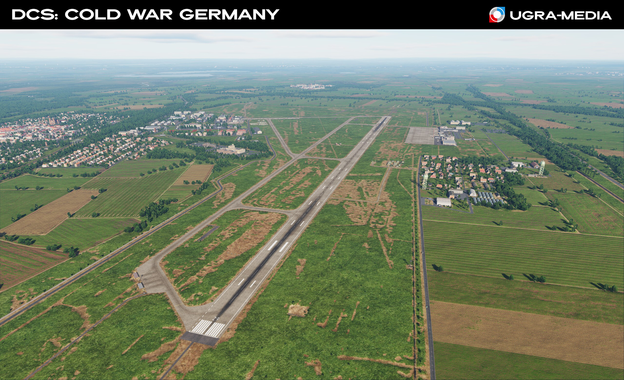
Hi Alphas! Today we show the main metropolis of our map, the "Alpha city" - Frankfurt am Main, "Alpha airport" - the largest airport in Germany and "Alpha airbase" - the legendary NATO base Ramstein - the heart of Europe in the fire of the Cold War! Frankfurt am Main is the center of commerce, culture, education, tourism and transport hub of Germany. All the best here. Frankfurt Railway - a key railway hub of continental Europe (an ideal target for strikes on logistics). Europaturm is a television and radio broadcasting tower located in Frankfurt am Main. Height - 337.5 meters. Westend_Gate - one of the first skyscrapers of the FRG (1976) - 159 m Silberturm (Silver Tower), 166.3 m futurist skyscraper City-Haus. (142.1 m) Frankfurt Airport (EDDF) – the largest airport in Europe in the 1980s, is a dual-base airfield: cargo for NATO was transported through EDFF General plan – giant runways and terminals. Terminal with statics – Lufthansa, Pan Am and other legends. and most importantly Ramstein is the main US Air Force base in Europe. This is where they decide where the bombers will sow democracy. From here you will have the most flights. BUT if you look at the world through the sights of a Sukhoi or MiG, then this base will be the place where the final boss sits. Ready to fly? It's time to put this world in order.

- 489 replies
-
- 28
-

-

-
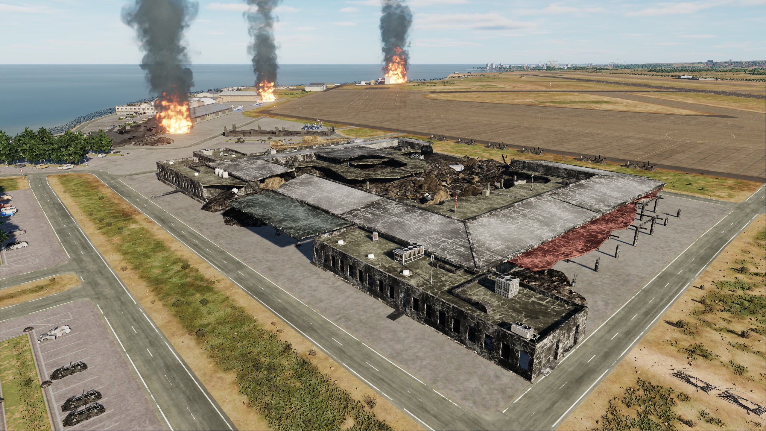
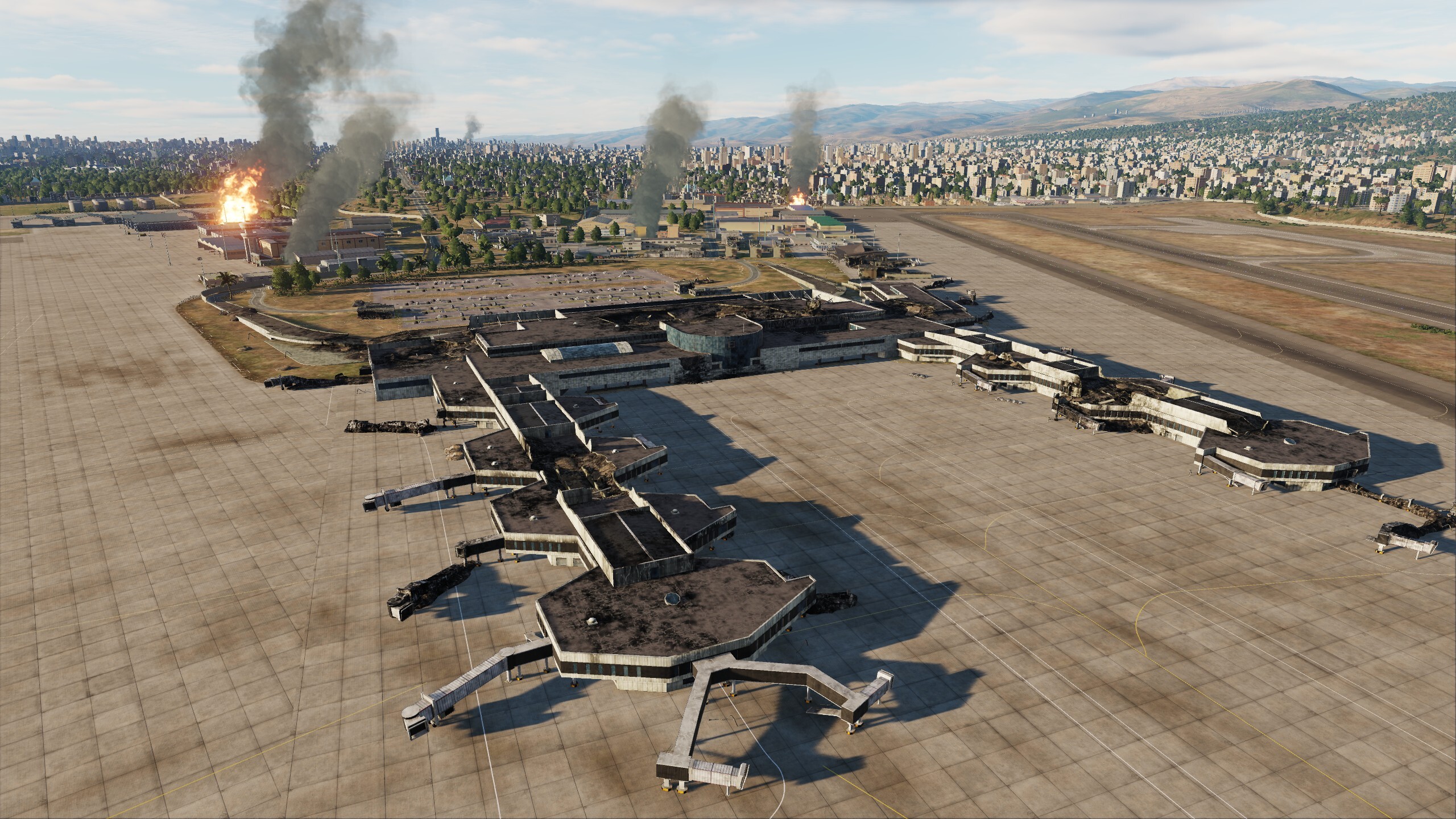
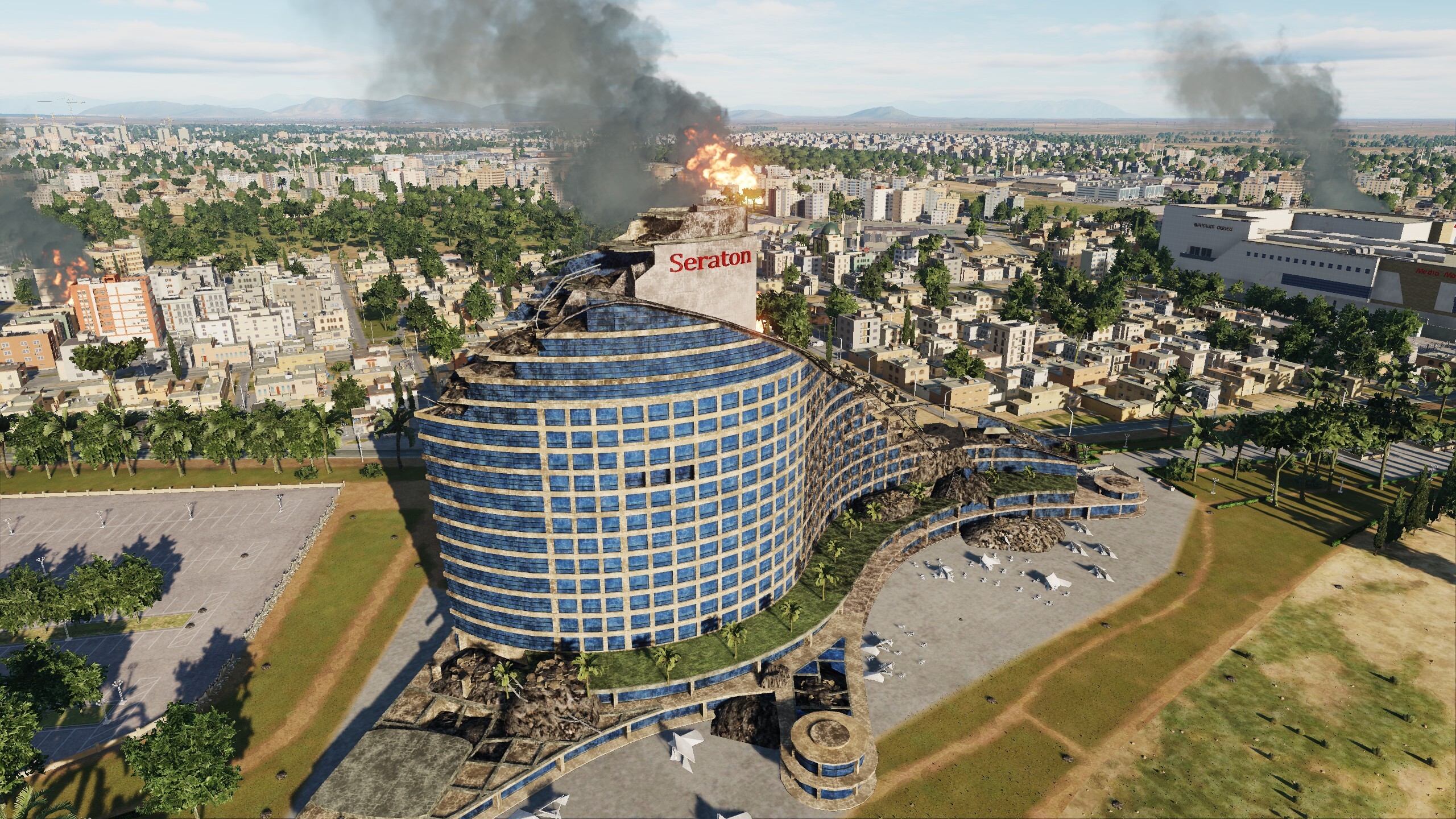
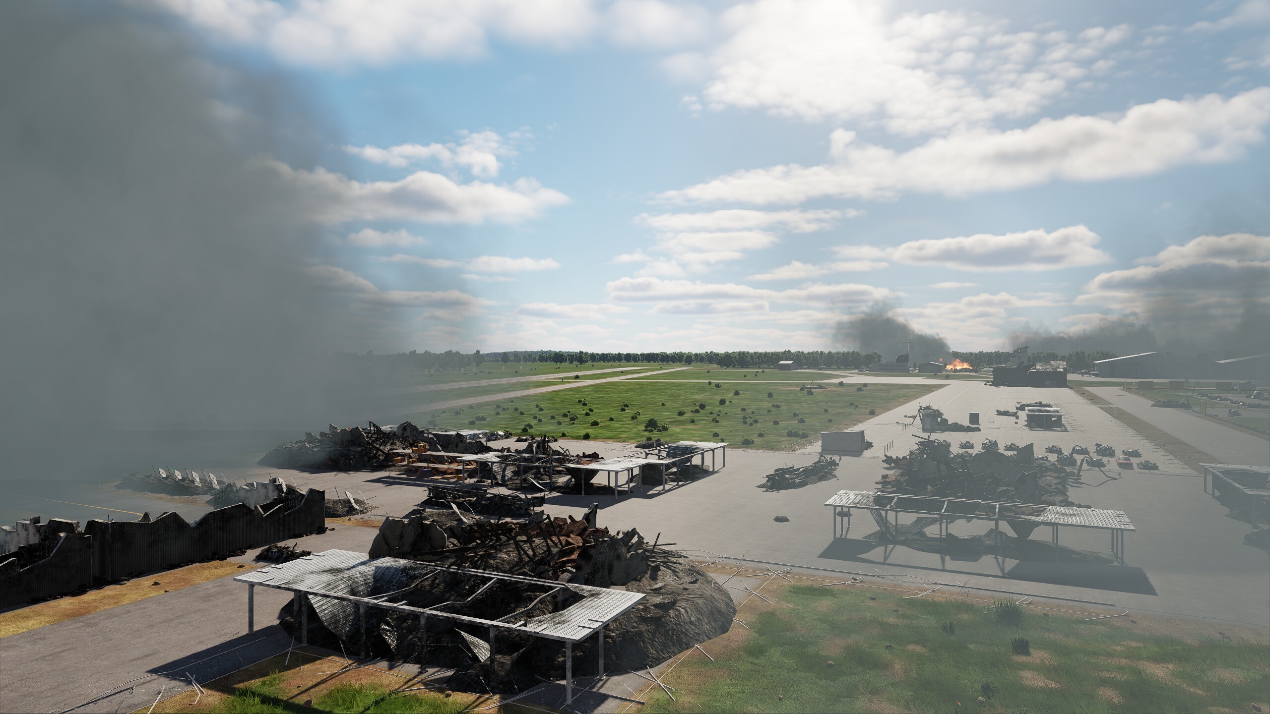
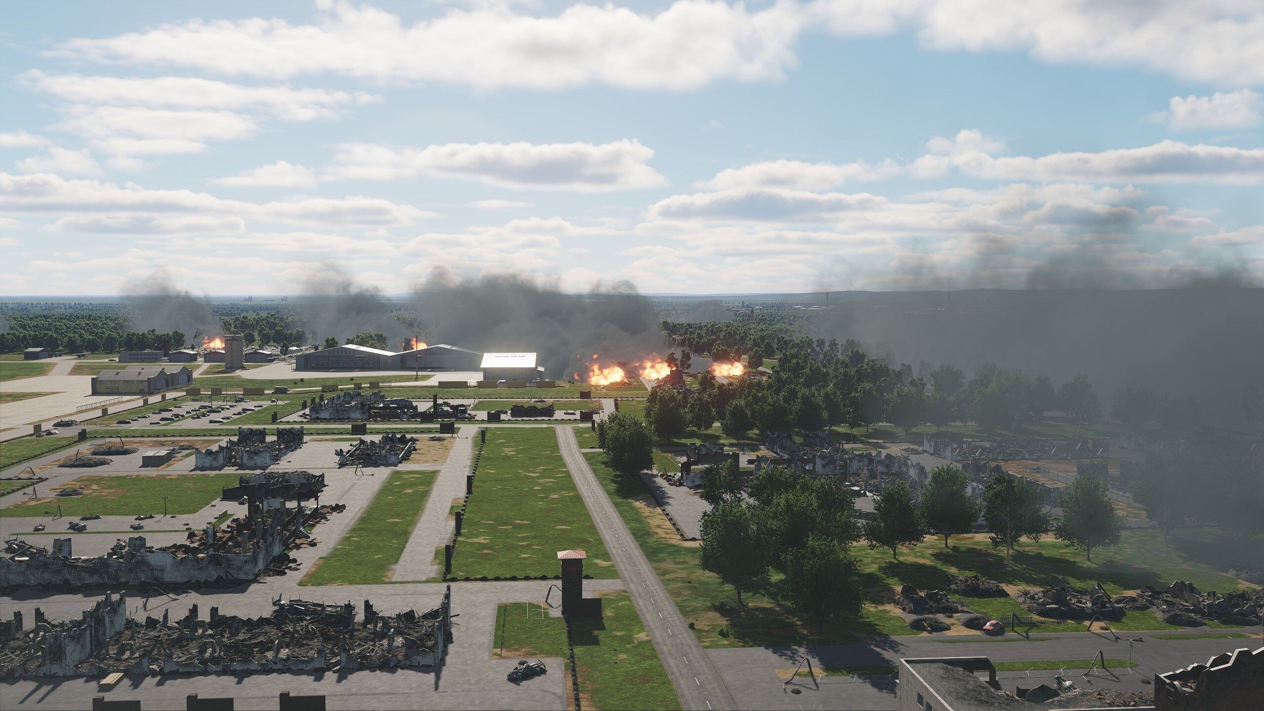
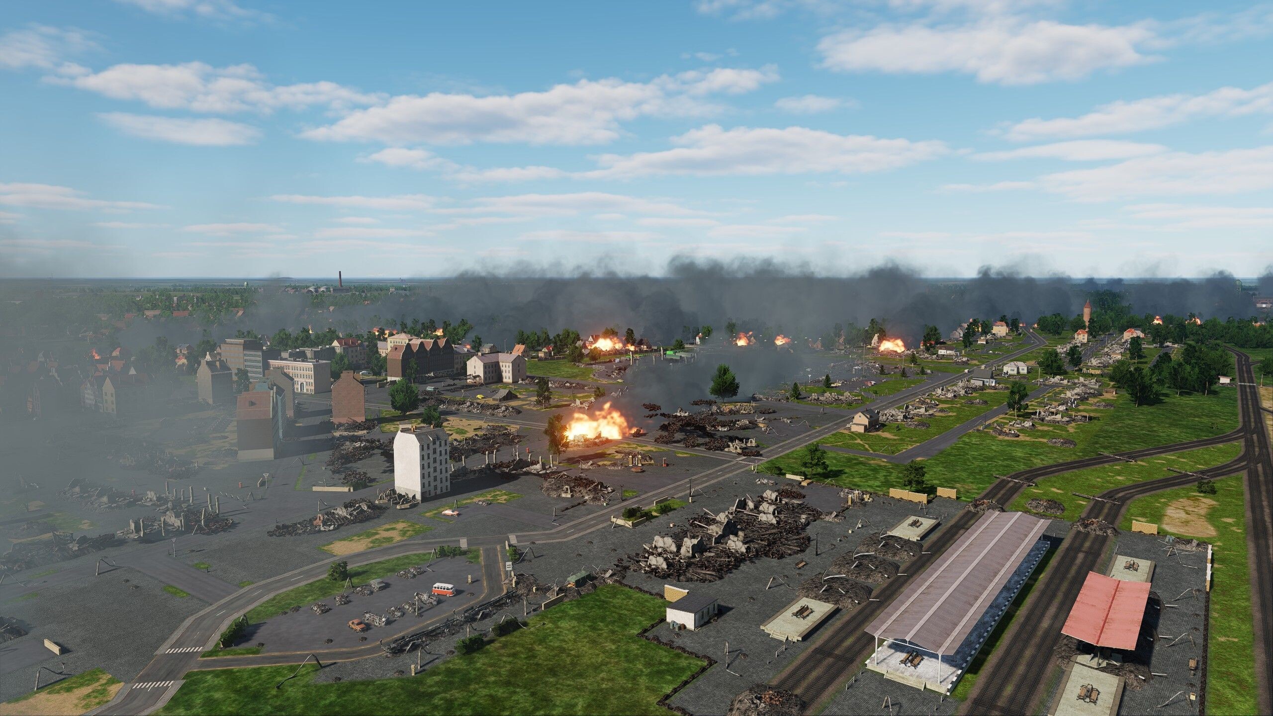
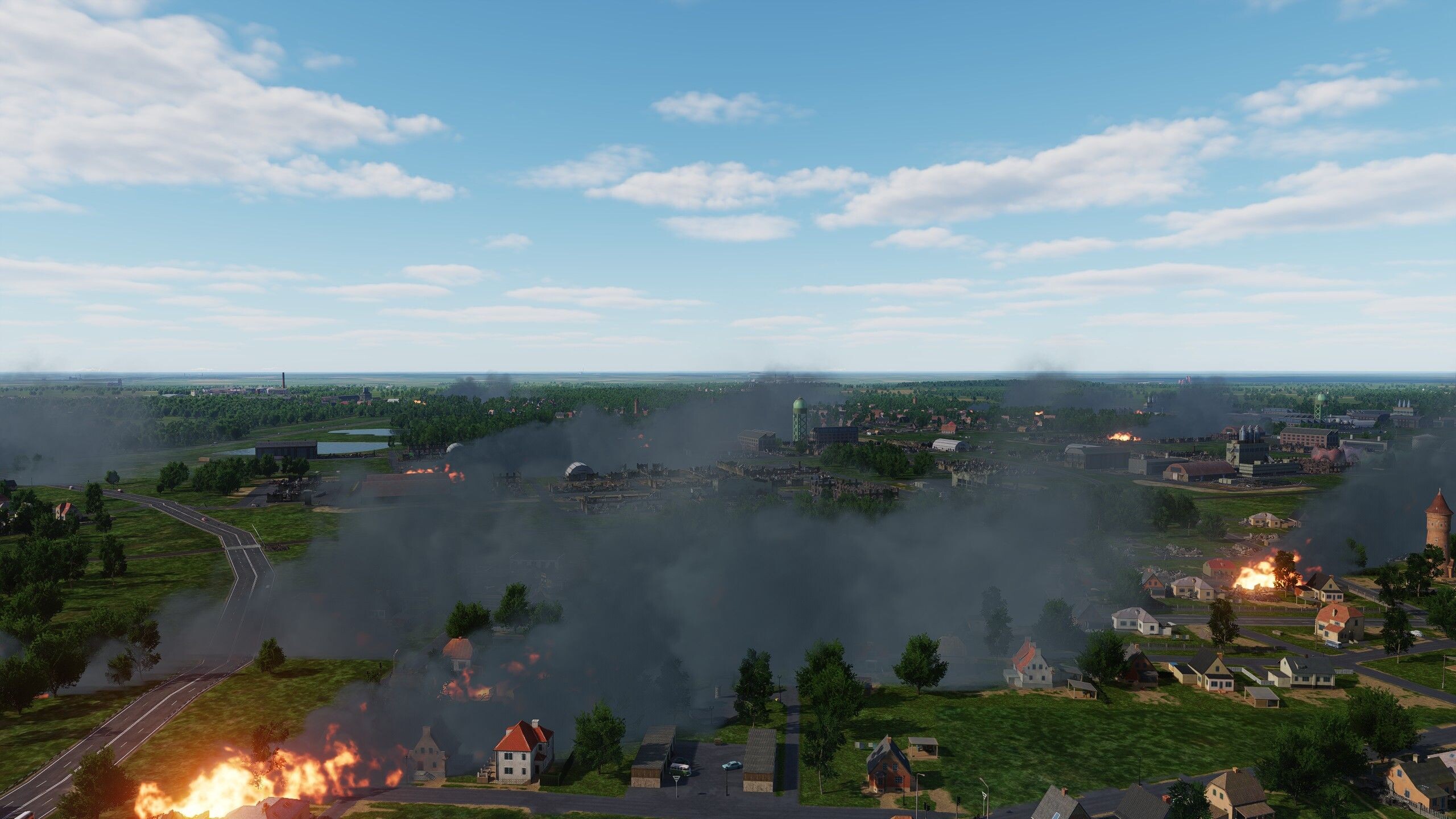
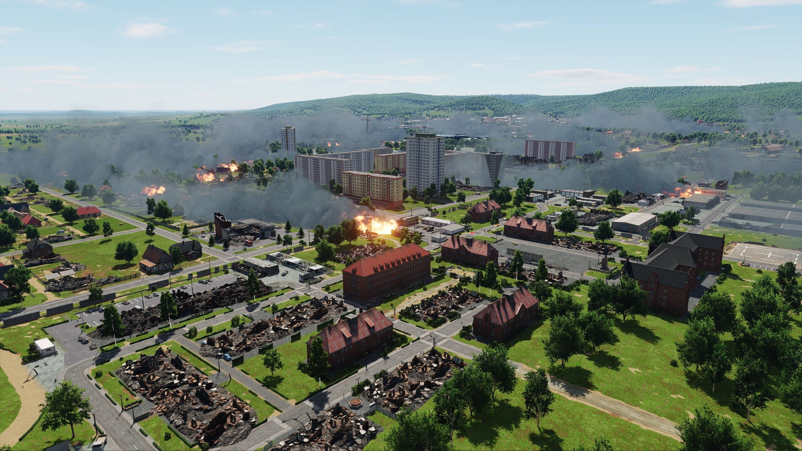
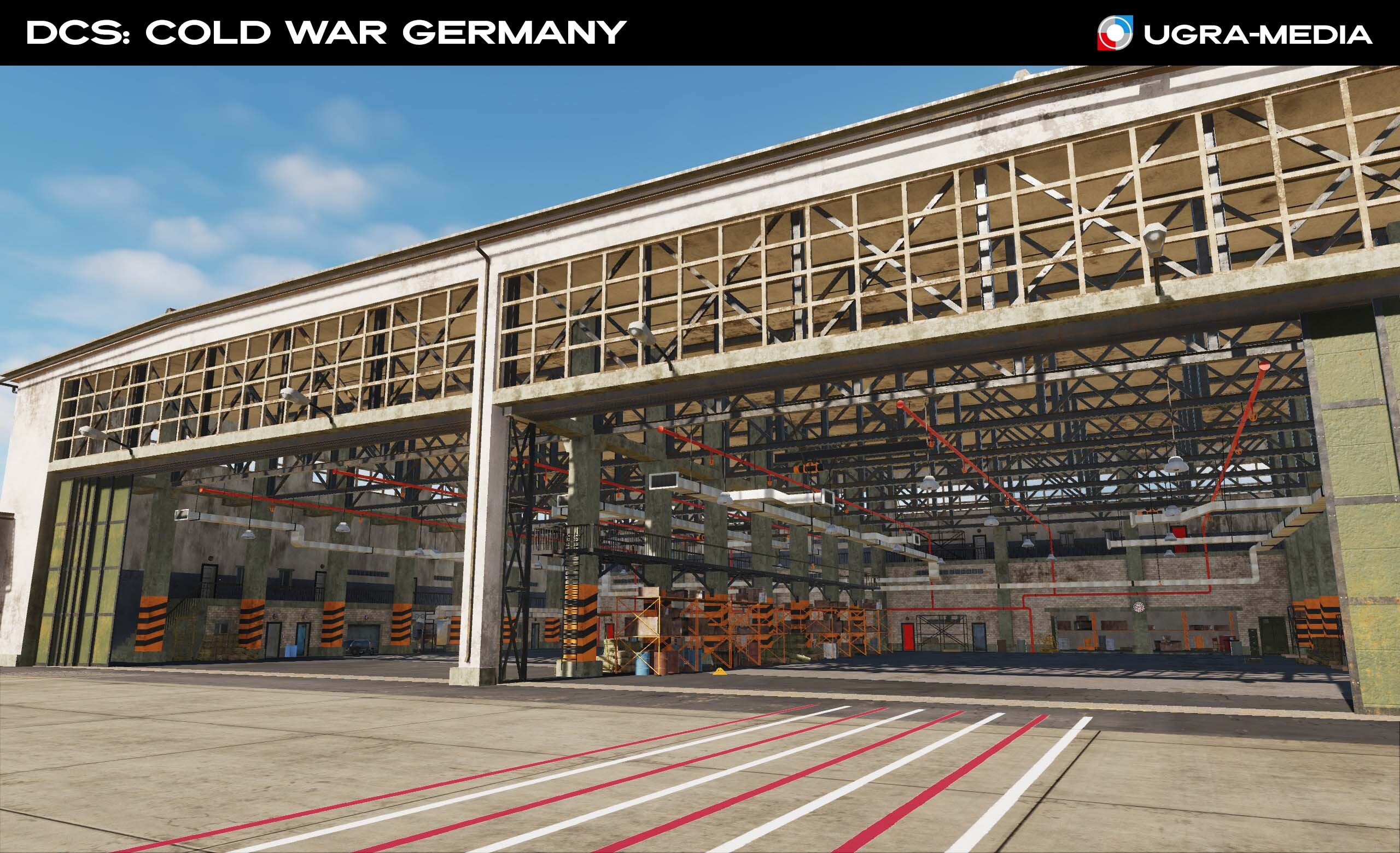
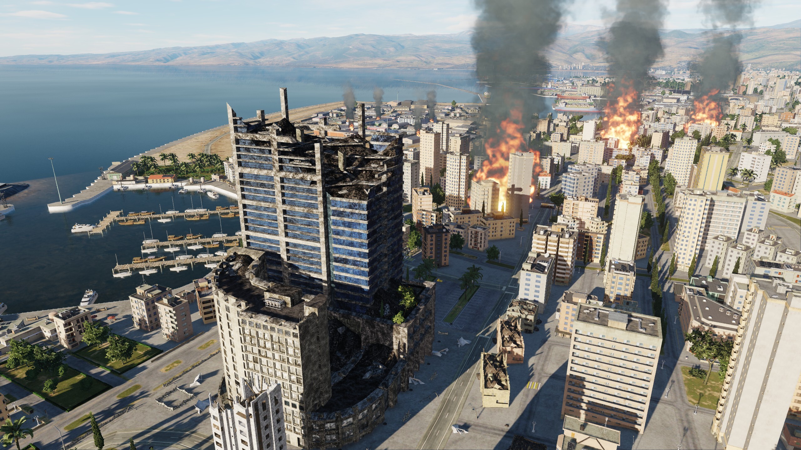
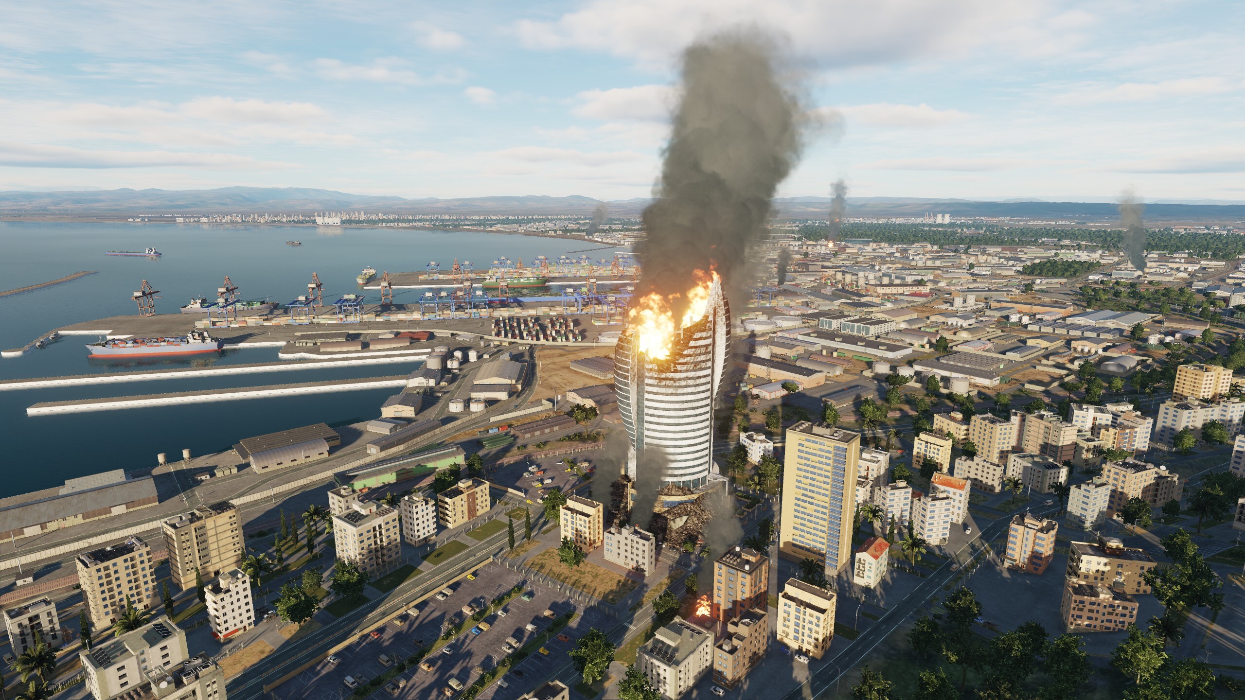
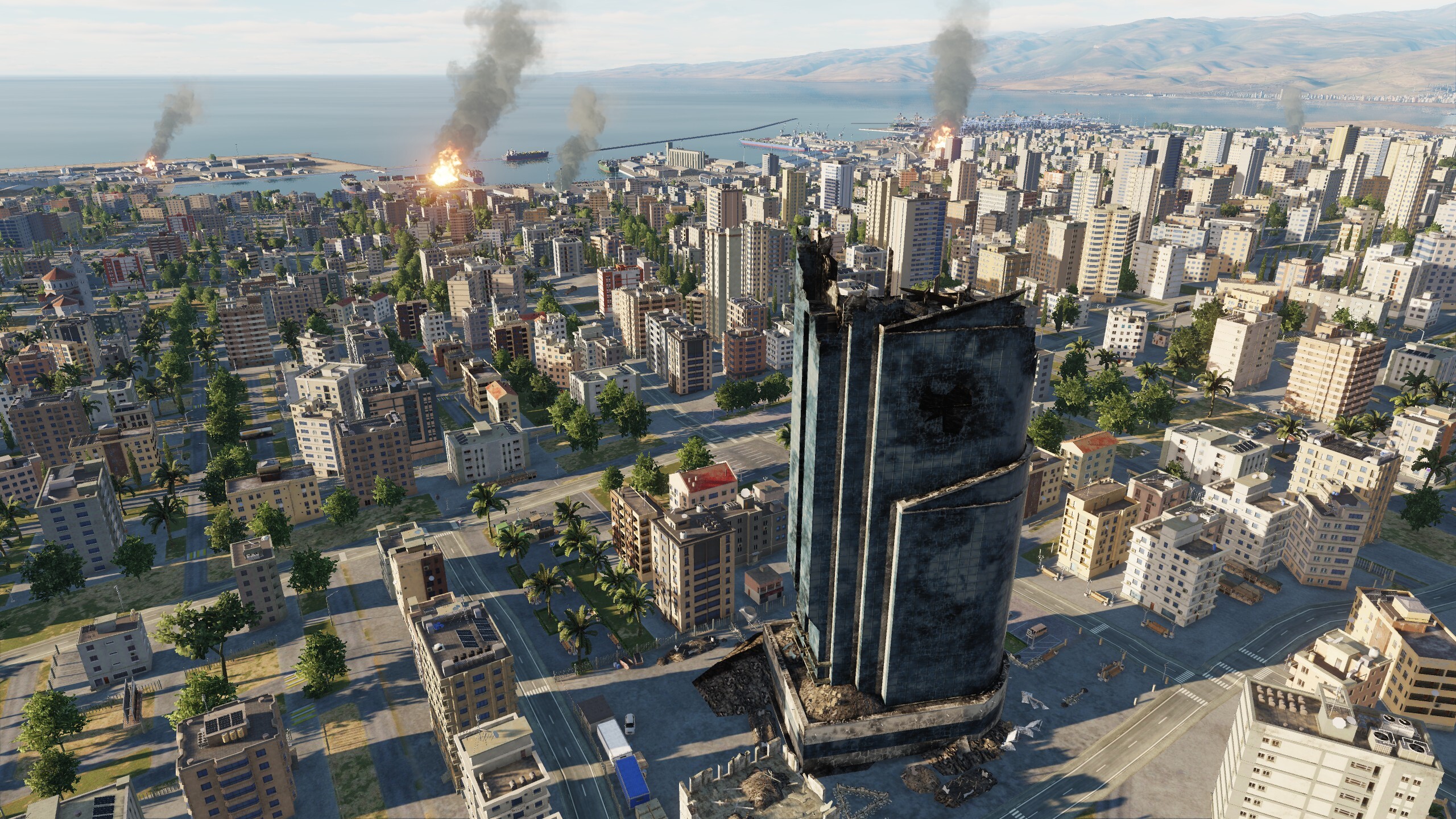
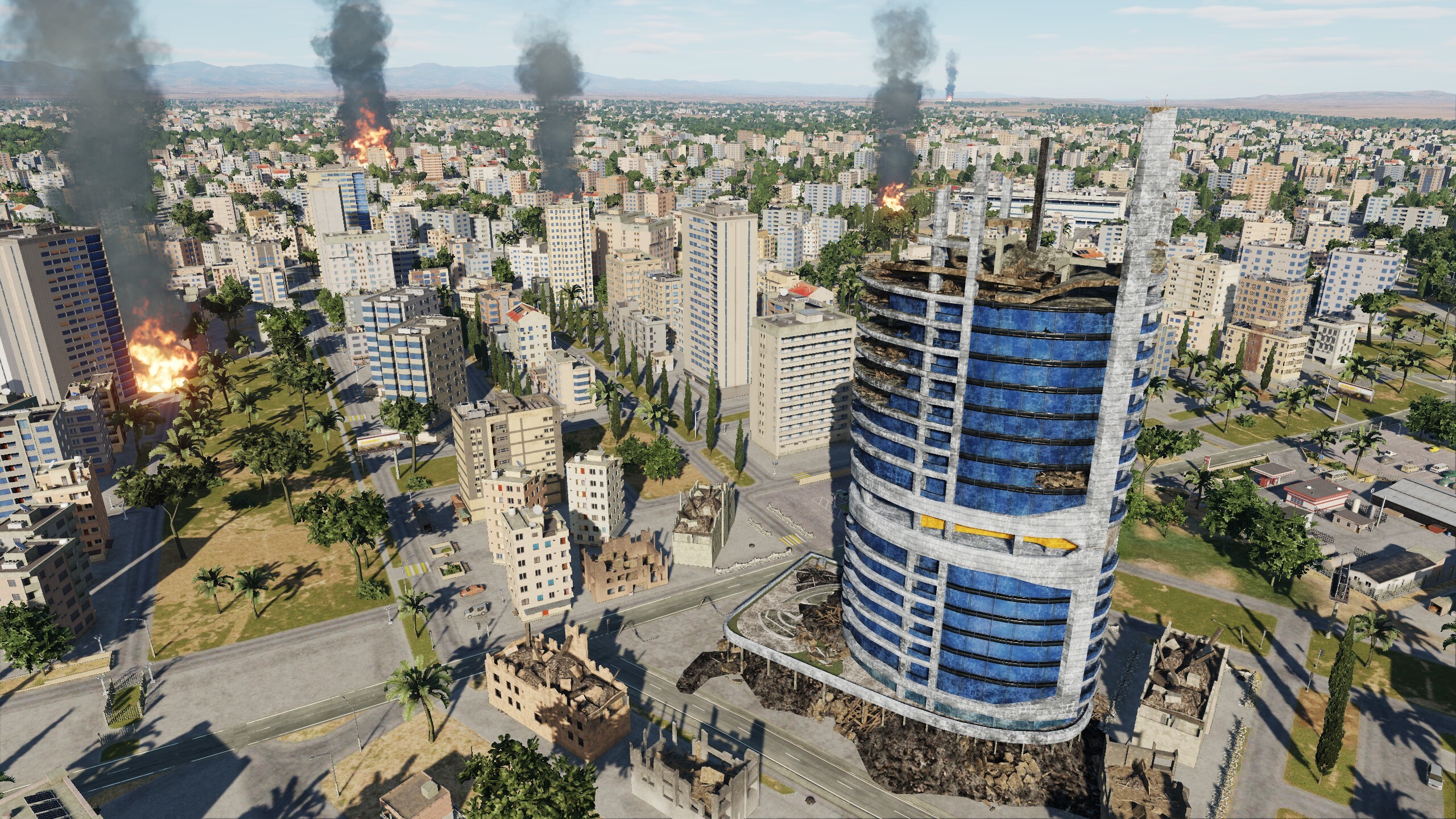
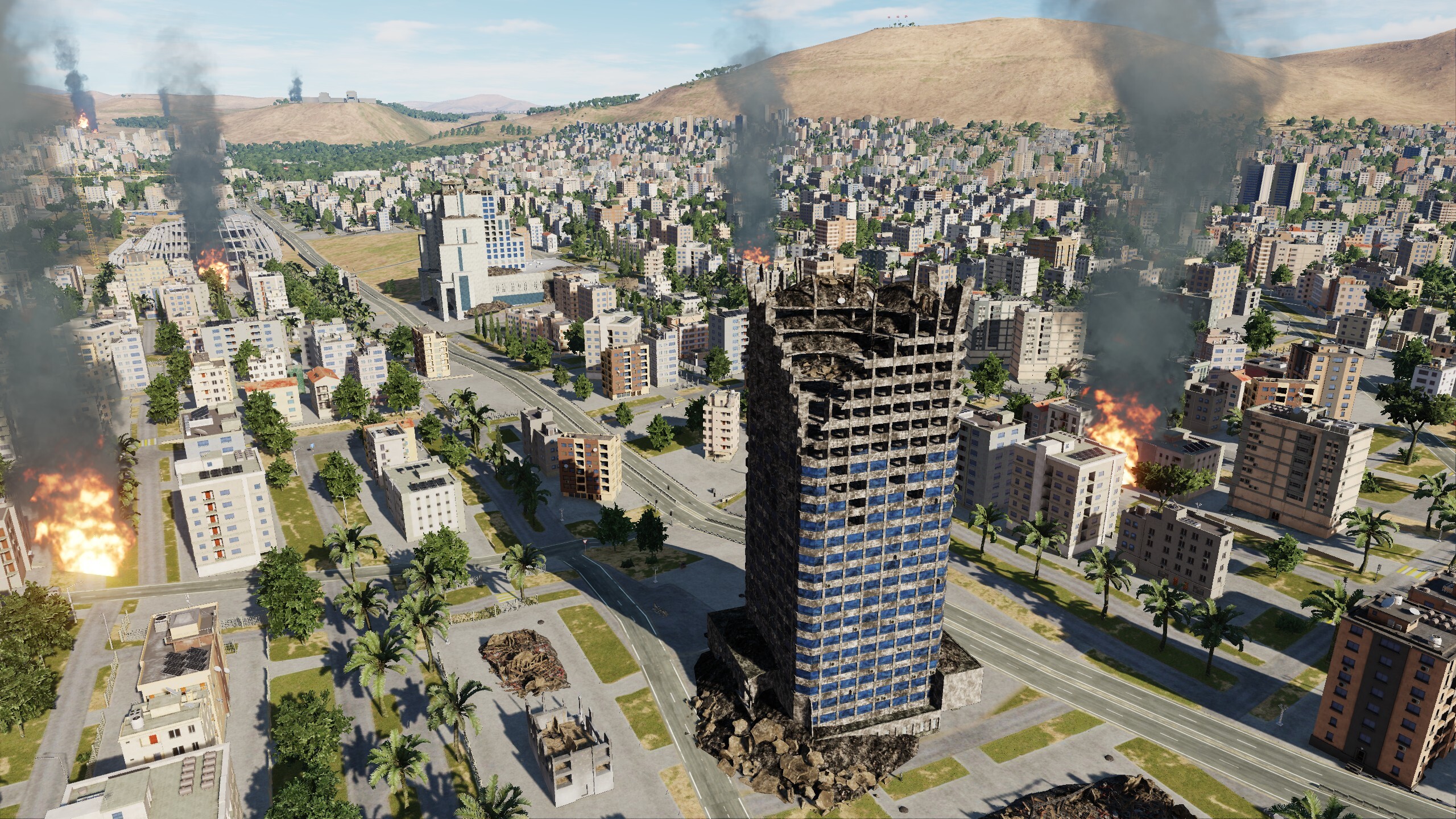
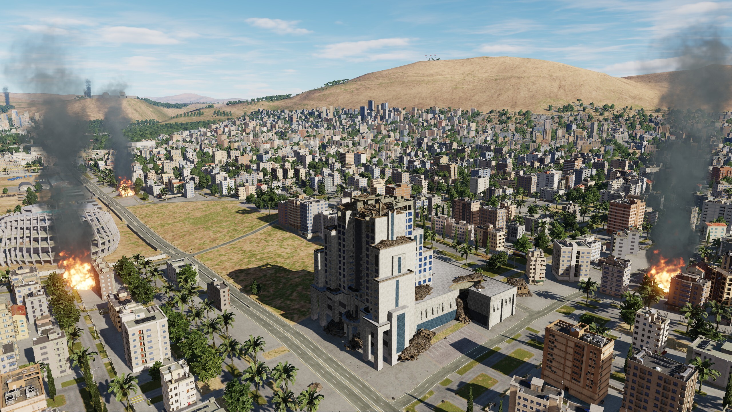
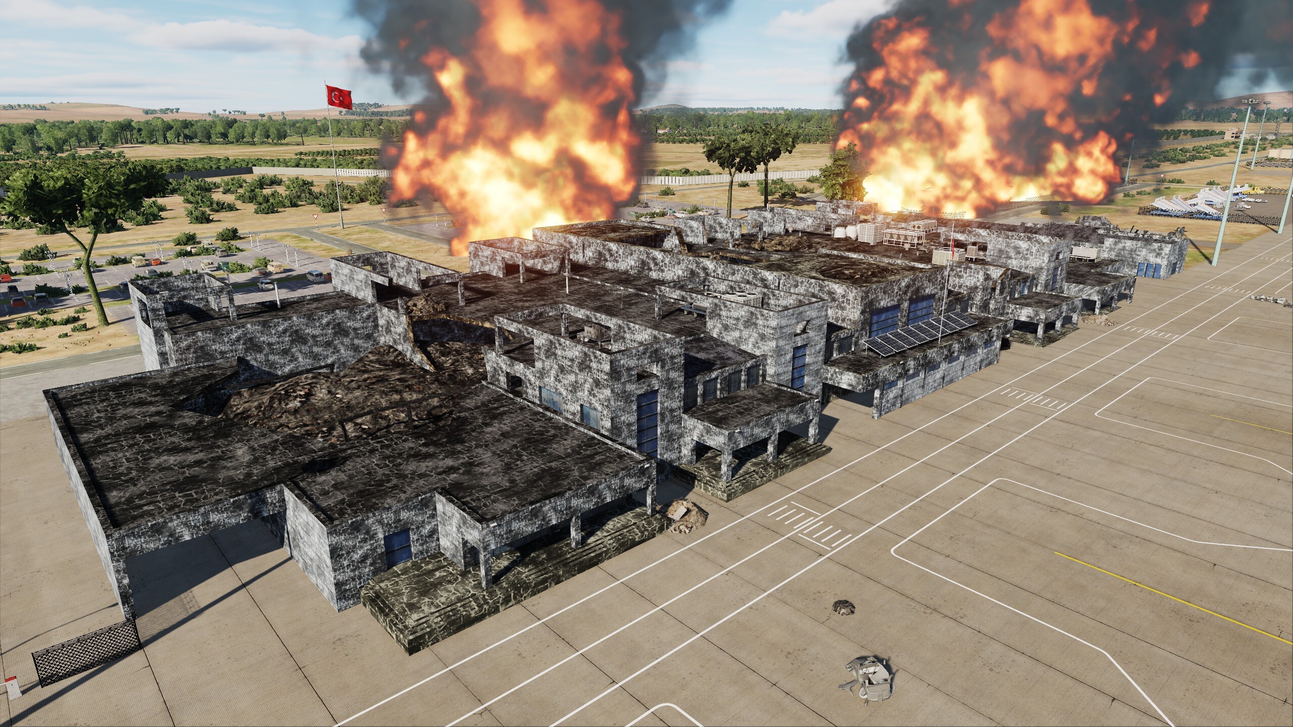
We get a lot of questions about destruction models, although we said they will be there. We got the hint. A picture is worth a thousand words. - Damage... - Say no more. UPD
- 489 replies
-
- 26
-
-
-
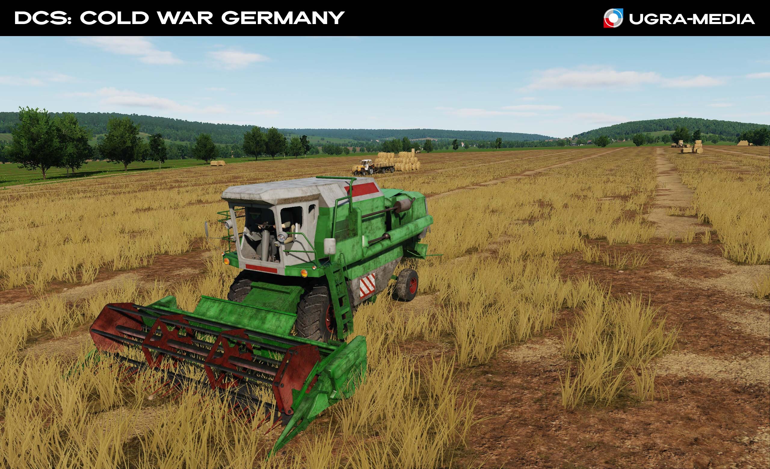
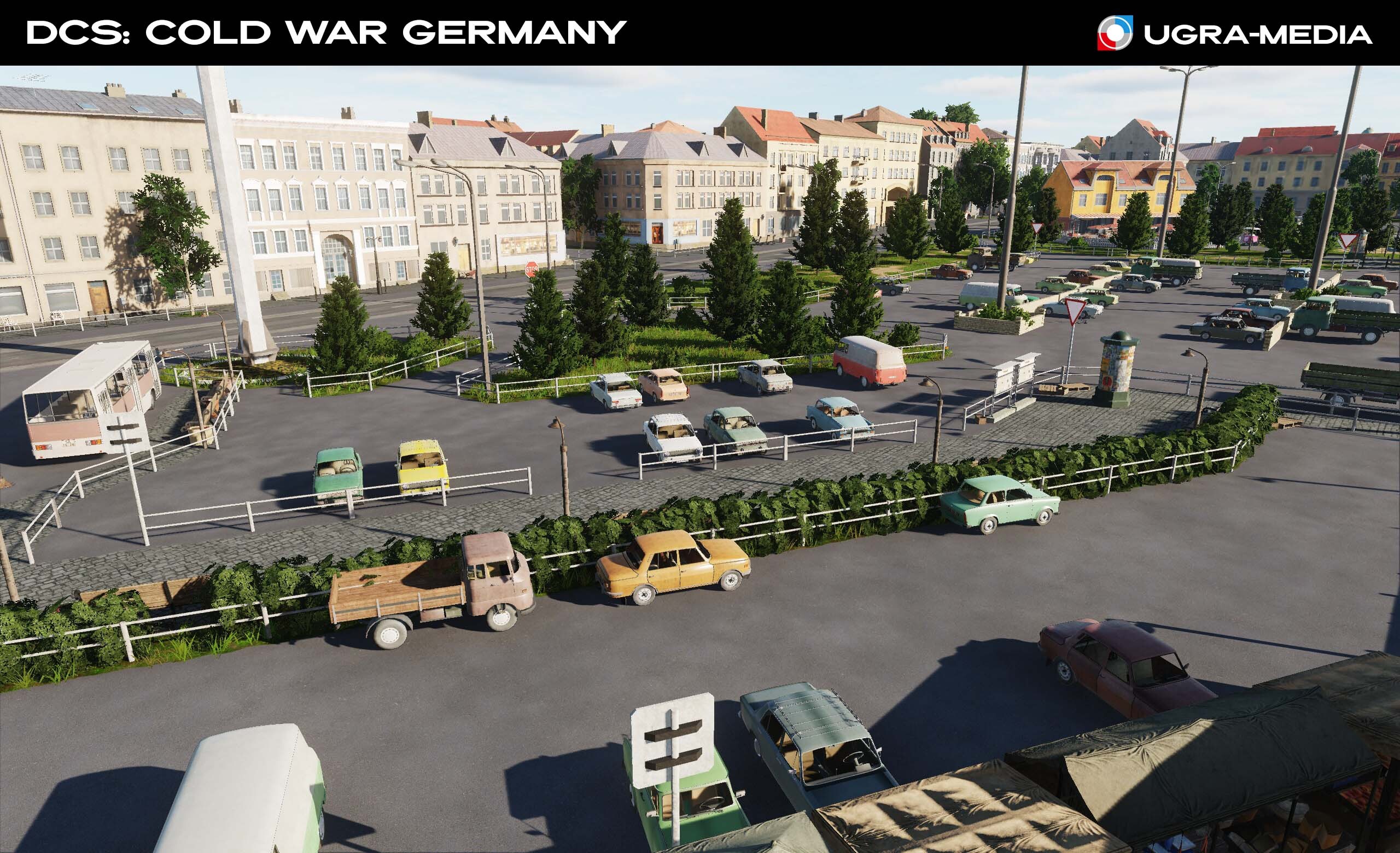
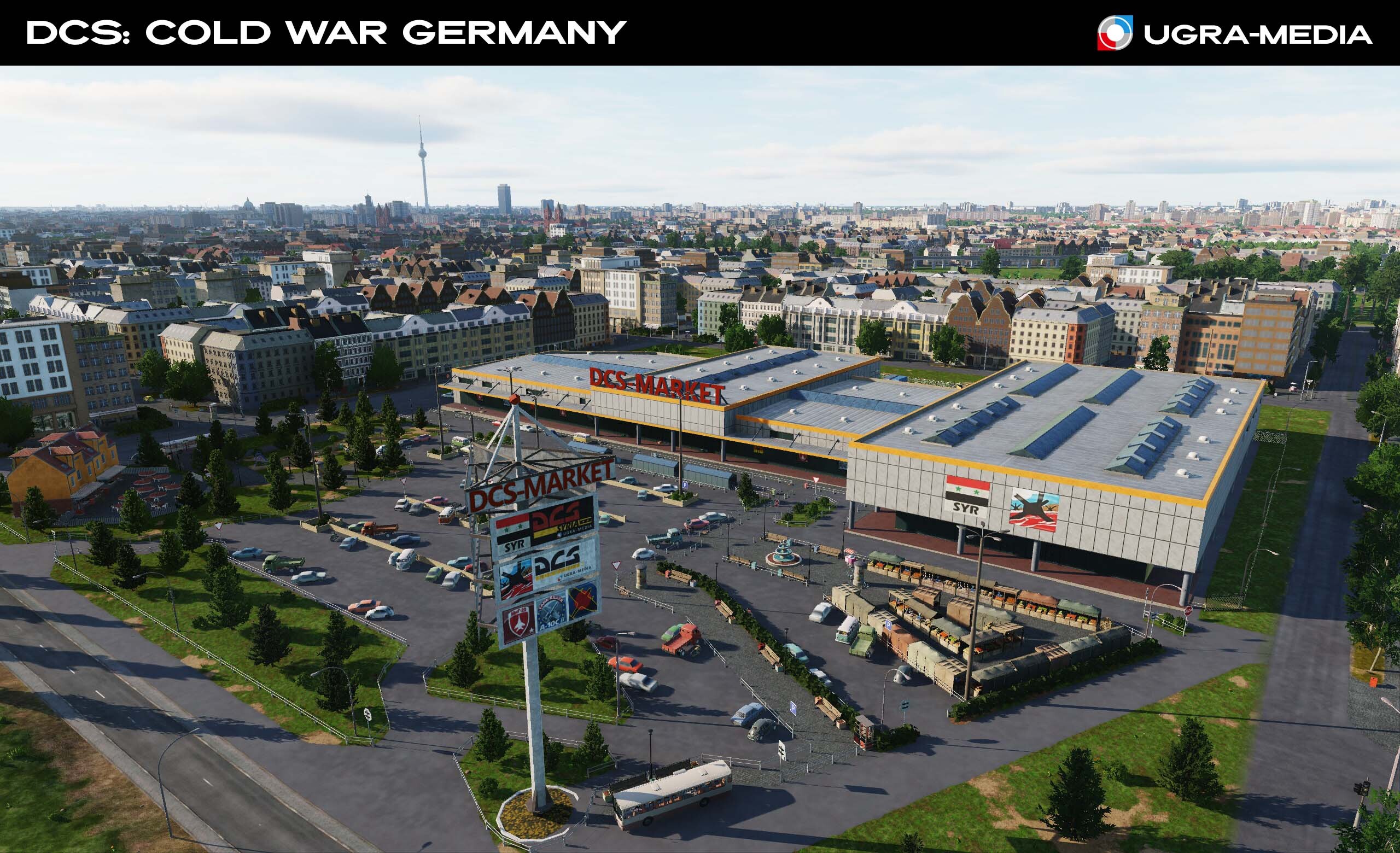
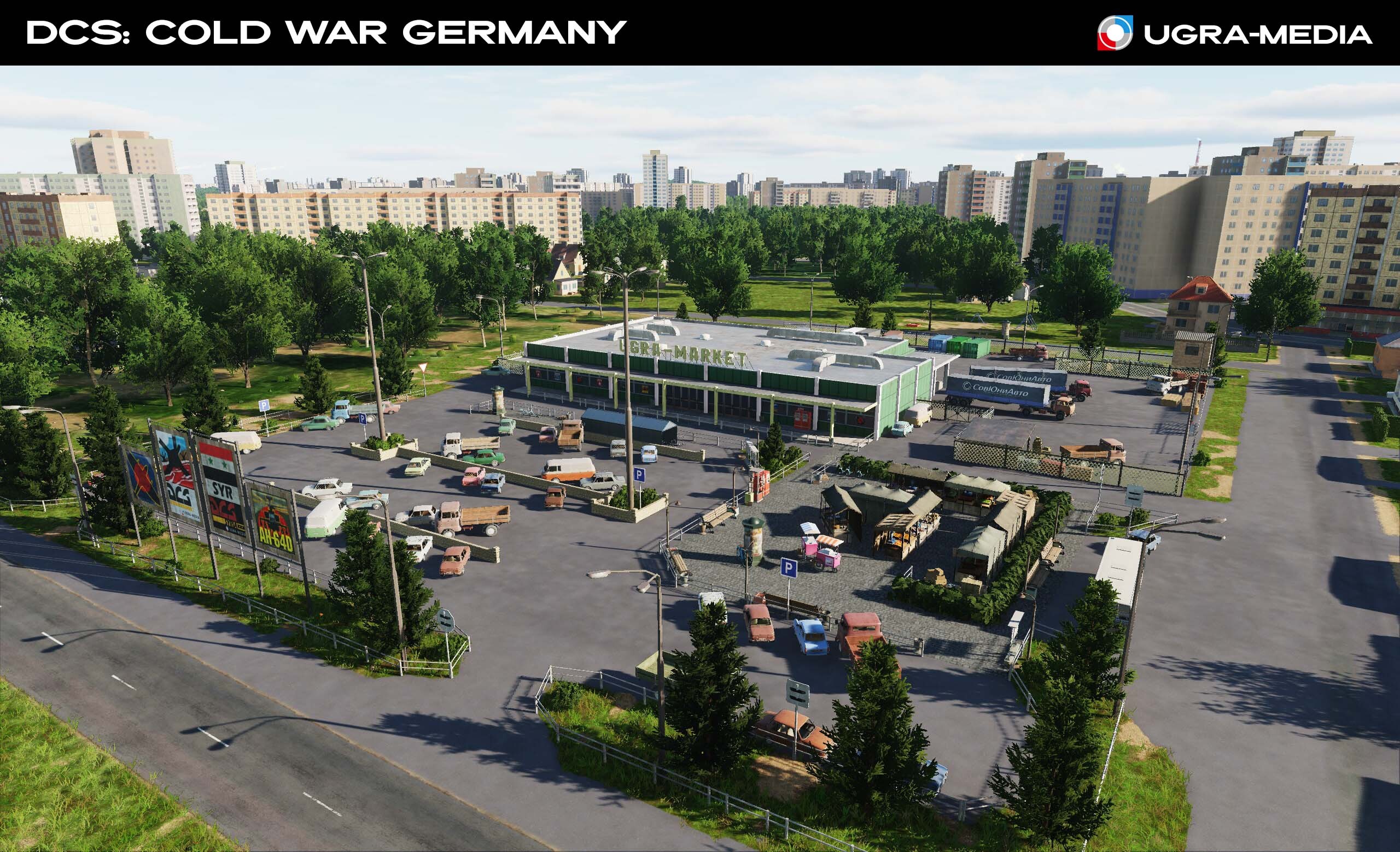
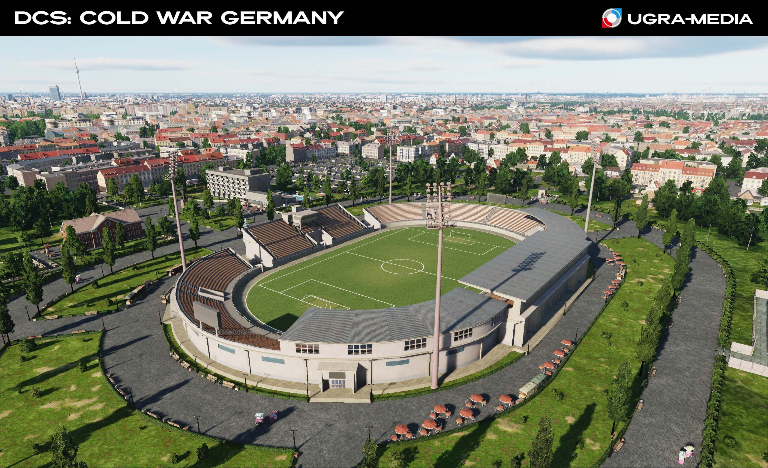
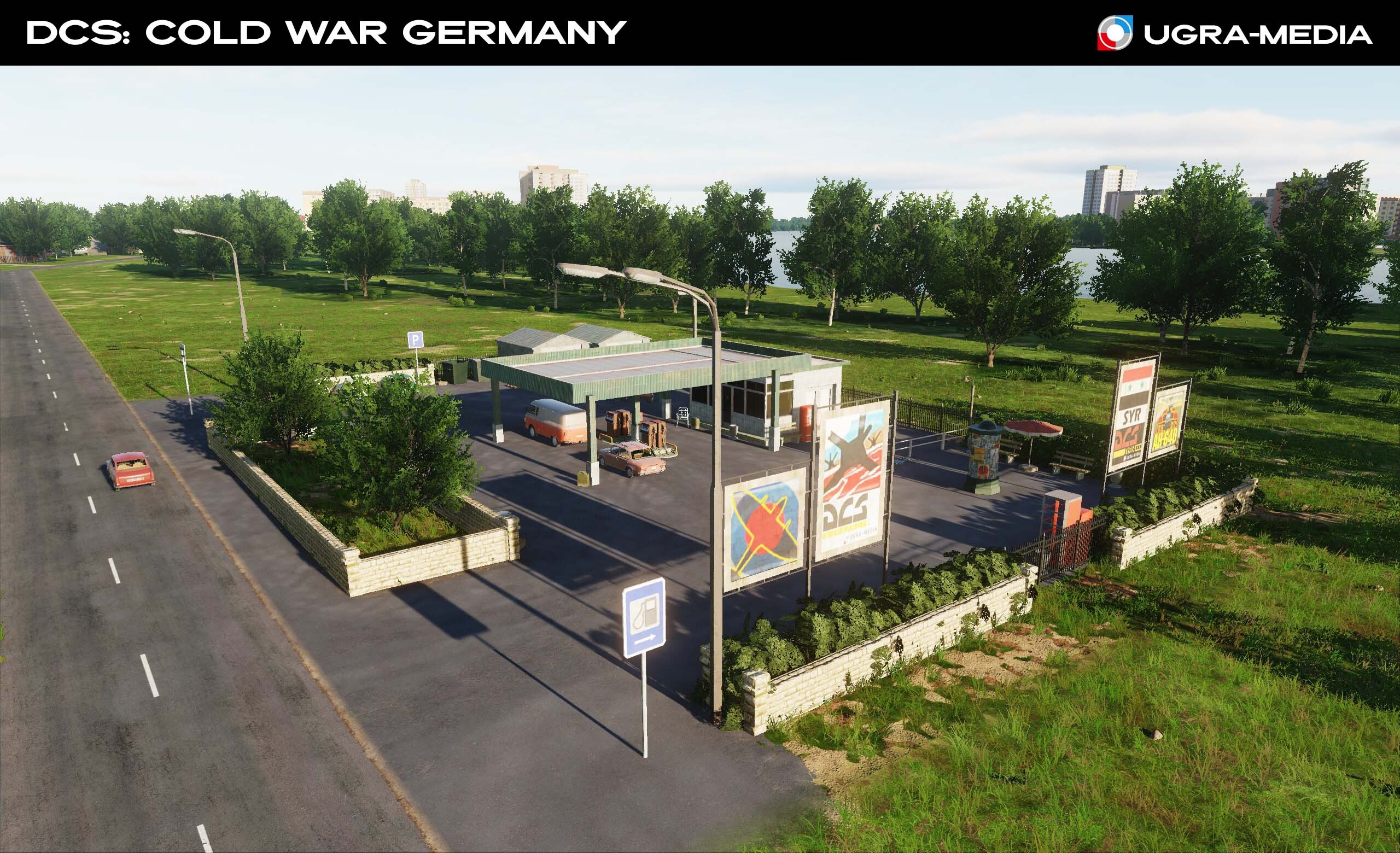
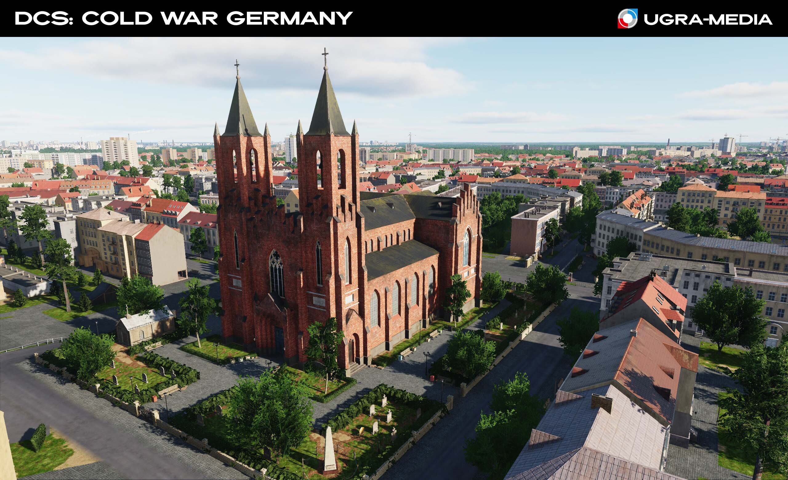
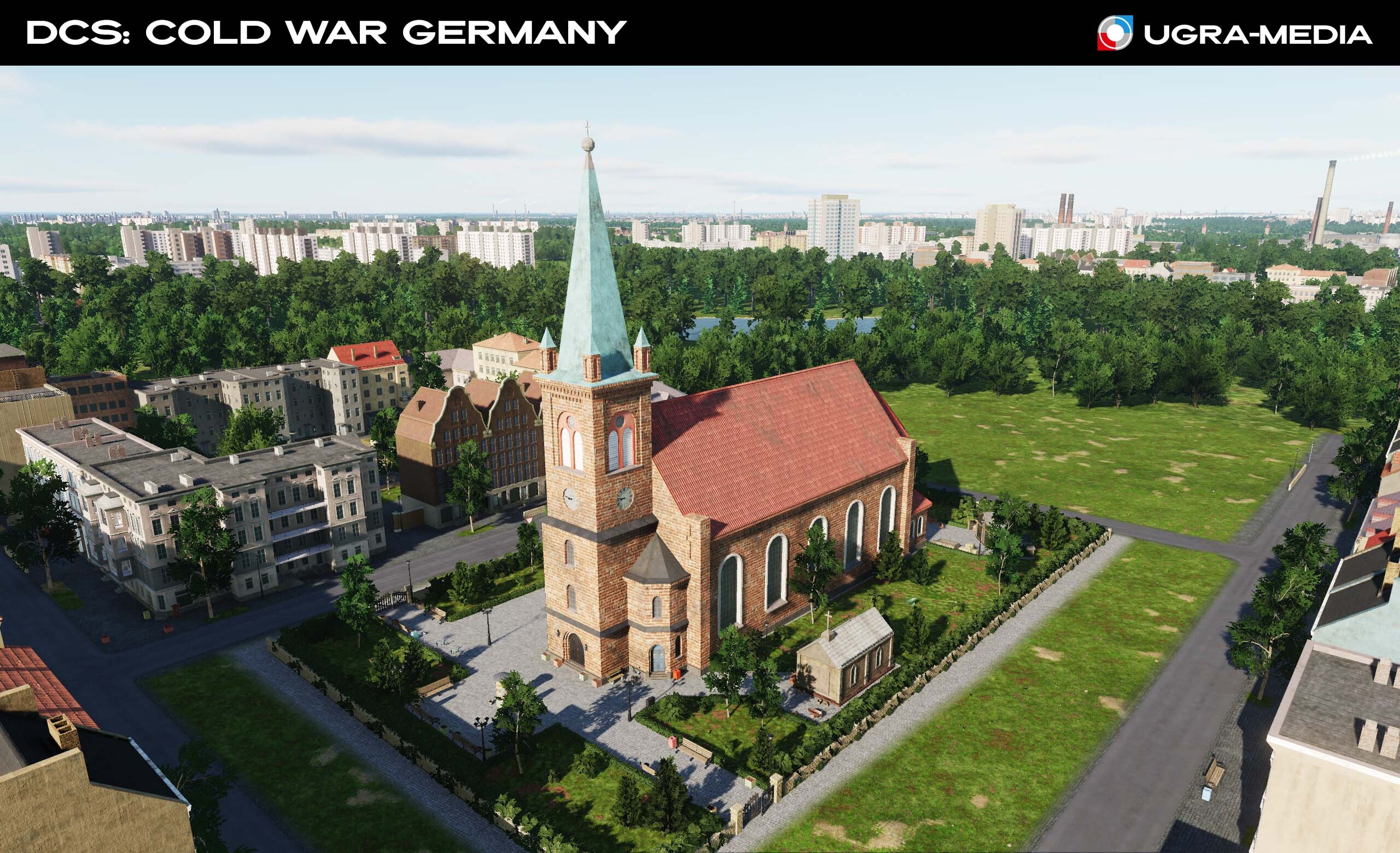
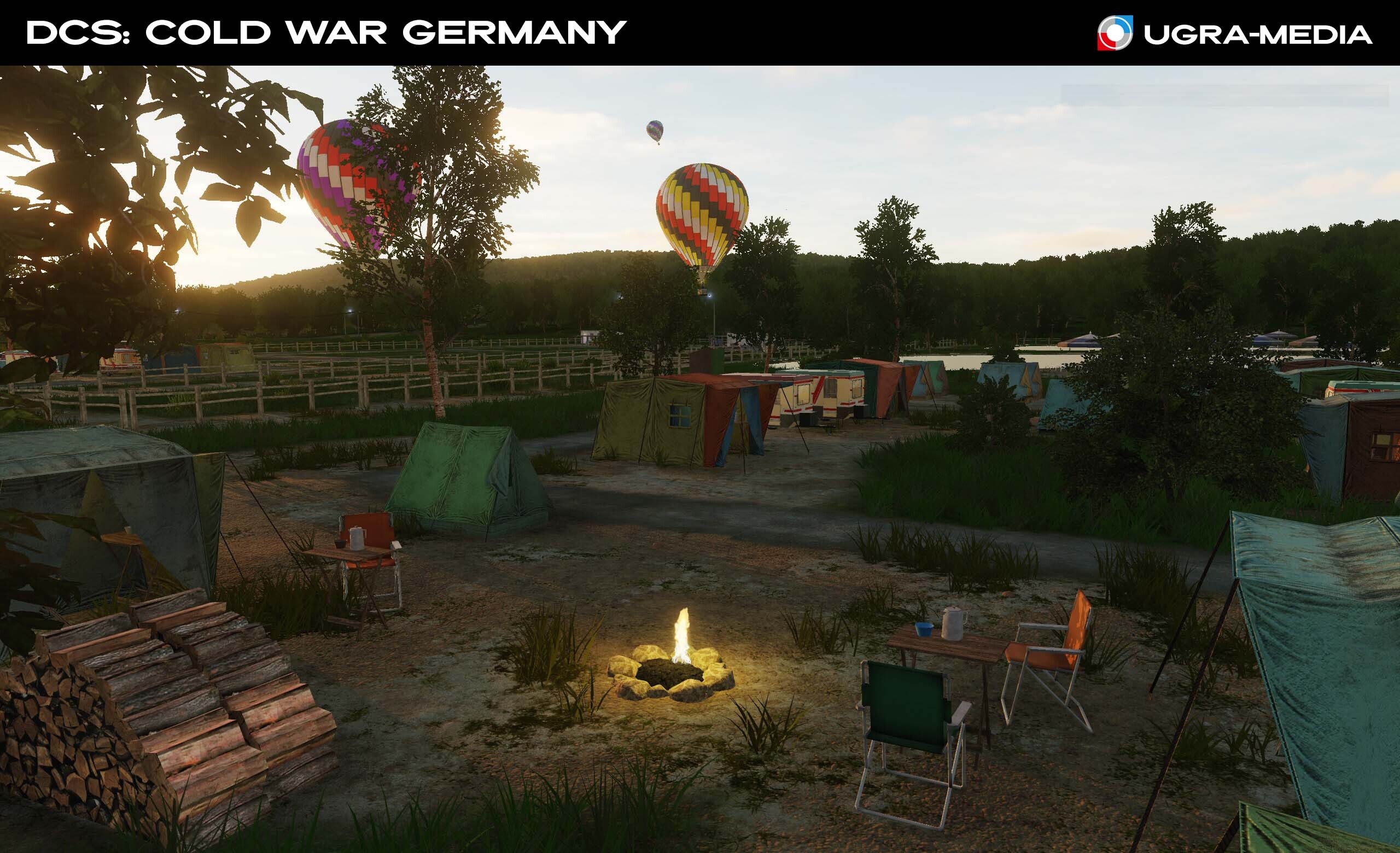
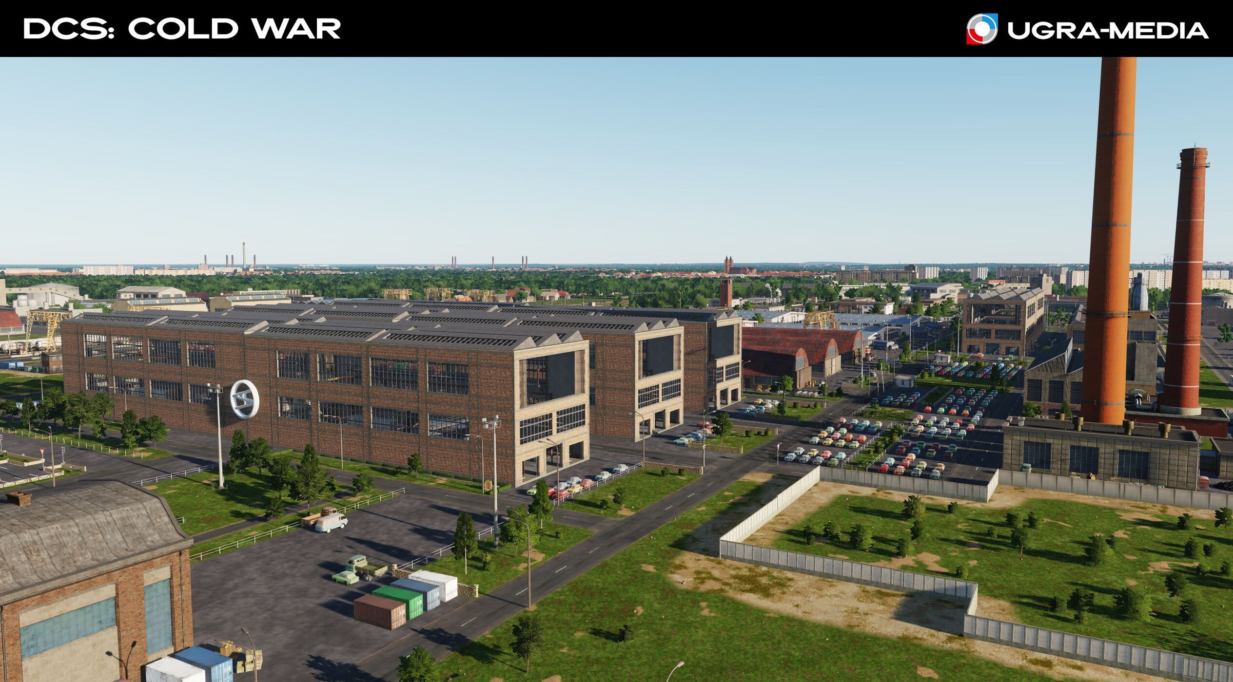
Life beyond the airfields. Today we will look at what creates the atmosphere of the map. These are the little things that turn the picture on your monitor into a living world with the atmosphere of the 1980s! Thanks to them, you will be able to understand where you are (East/West Germany), and maybe remember something. Cars of the era: GDR: "Trabants", "Wartburgs", IFA trucks / FRG: "VW", "Mercedes", BMW In Germany, they know about the "three K" "die drei K" (Kinder, Küche, Kirche) - Children, Kitchen, Church. So, we made several typical churches - these are beautiful objects with recognizable architecture and good landmarks that will help you not to get lost in the sky. We took care of the little things, so that even flying high you understand that there is life below. Supermarkets and gas stations - it is impossible to imagine the world without them The German national team is one of the most successful national teams in the world. Railway bridges and trains are strategic objects and unique moving targets for each side. Cranes - it is impossible to imagine a port city without them - an excellent landmark and a reason for a challenge. Ferries on rivers are excellent targets, who knows what they carry? Combine harvesters. There is life outside the cities. Special transport - flying over the city you will definitely see police cars, fire trucks, ambulances rushing about - life in cities does not stop.
- 489 replies
-
- 24
-
-
-
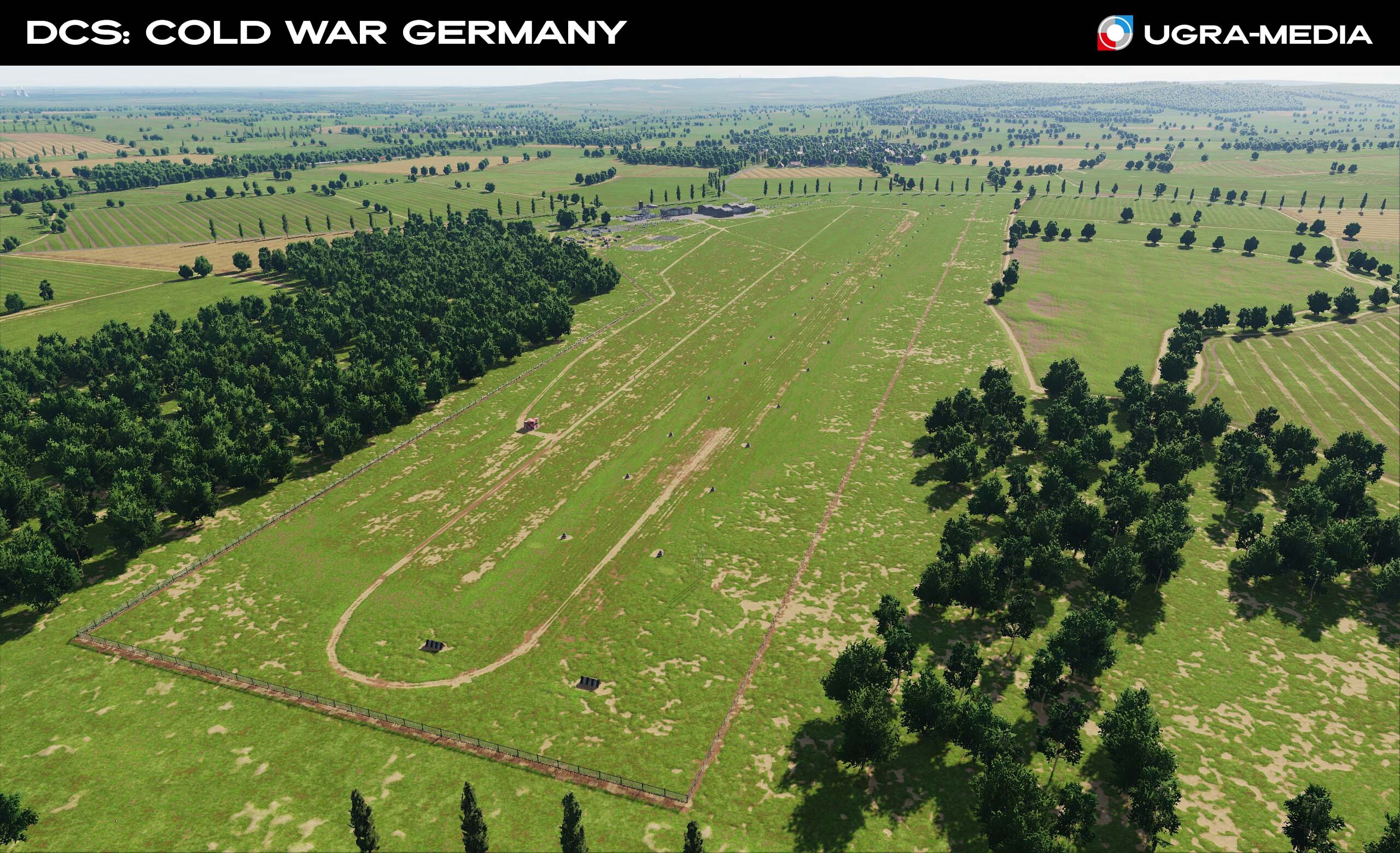
Yes, our sources match those posted on the forum, thanks again for the help. We were guided by these sources. Several types of SAM sites were made - they differ in size. In addition to them, some airbases have unique elevations for installing radars - these objects are merged with the terrain and were placed according to photos or airfield schemes. Yes, they are empty and will allow you to install your equipment. Look at the screenshots: SAMs, radars are installed in the mission editor - you can install your in these places.
- 489 replies
-
- 20
-
-
-
Thank you for your support. We are glad to see that you like the map and this gives us even more desire to improve it. It is very nice when you remember the places where you served or walked as a child. The map is very large and we want to recreate everything, but we have to think about resources and your SSD/HDD. And like any of our maps, it does not stand still and is constantly evolving: it will be improved and refined, including according to user requests. Today we will answer some questions and tell you a little about what we added: @Swiso Yes, most of the buildings are destructible. Many with detailed damage models. The rule with original objects is the same - we don't bomb them @KarlRadek thanks for the information about the quarries. I want to say that this place is already under reconstruction: water is pumped out of the lakes and instead of them there will be quarries, like at that time. There were many requests from you about air defense locations. We had them, but at your requests we increased the number of these places and now they will not only be near large bases. Thanks to everyone who sent in SAM info @Rick Mave Ersatzpisten - they are located mostly south of phase 1, in phase 3 territory, but we can already say - don't worry, you'll be able to land on the road. @C525 today the shelters in Büchel look like this:
- 489 replies
-
- 22
-
-
-
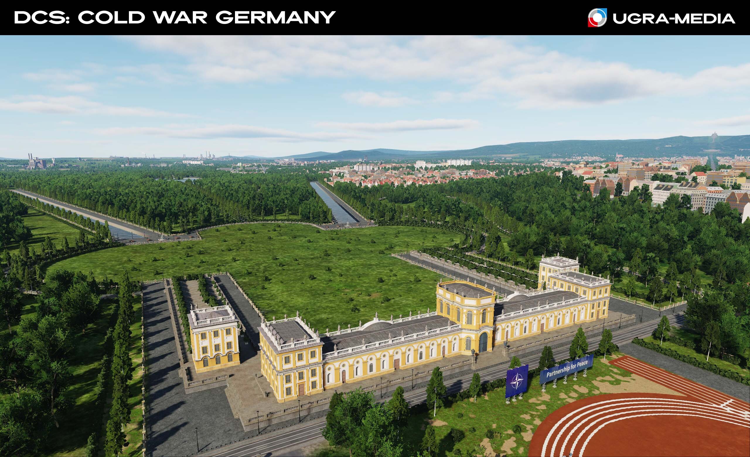
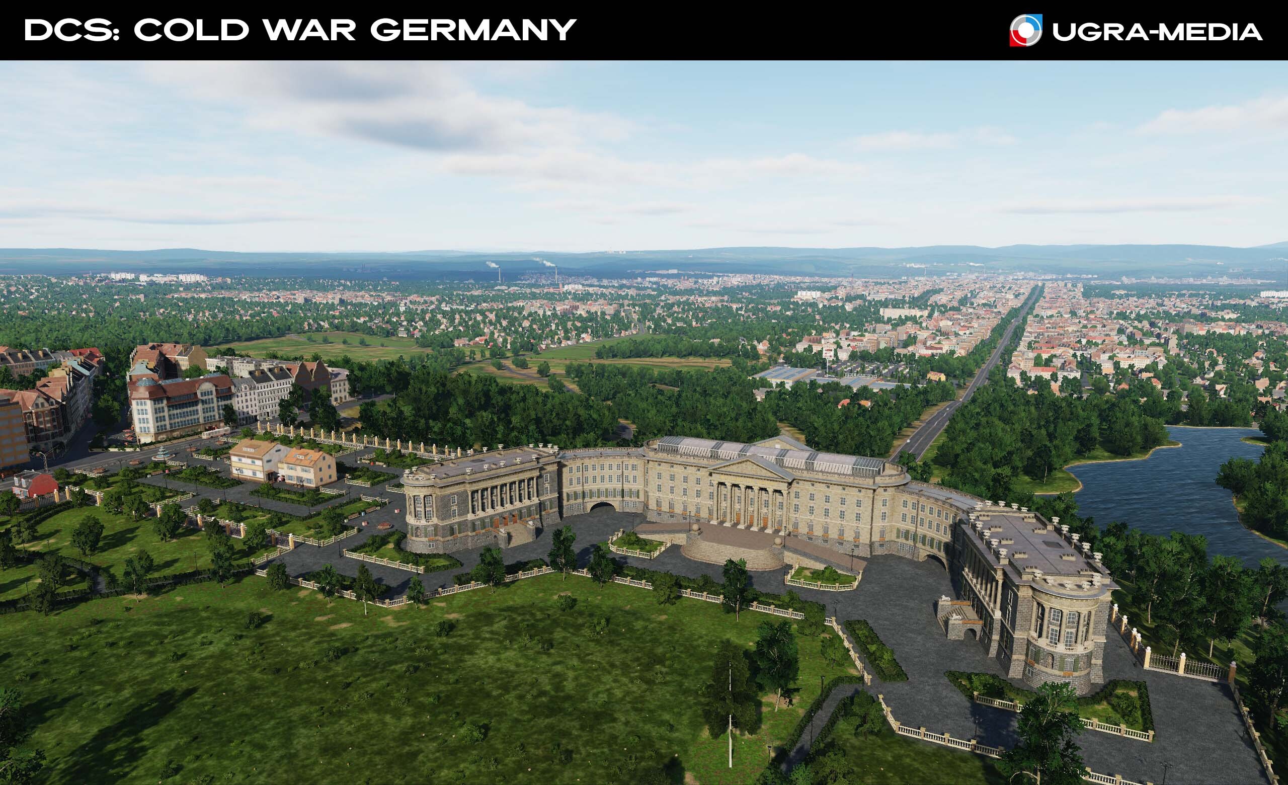
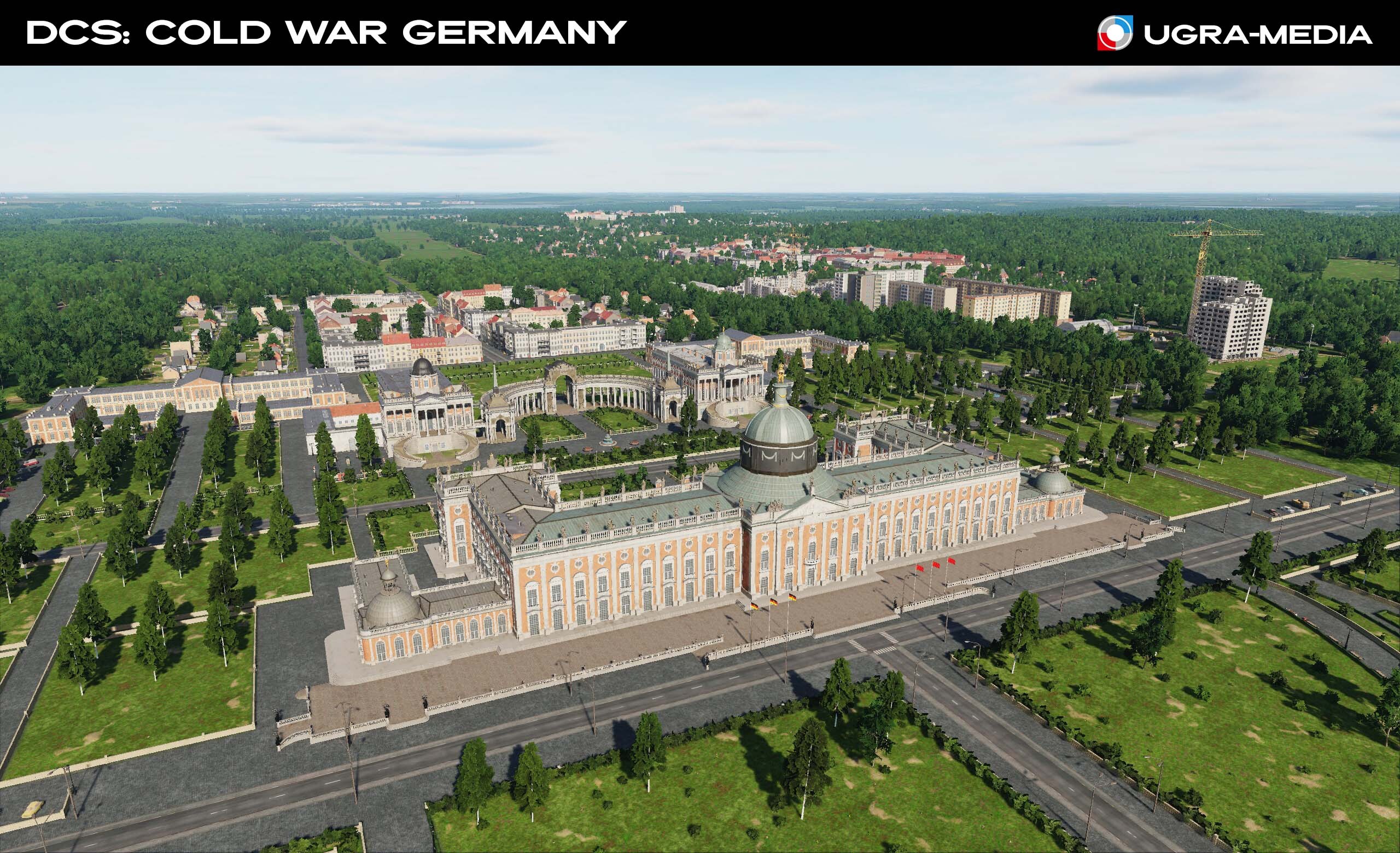
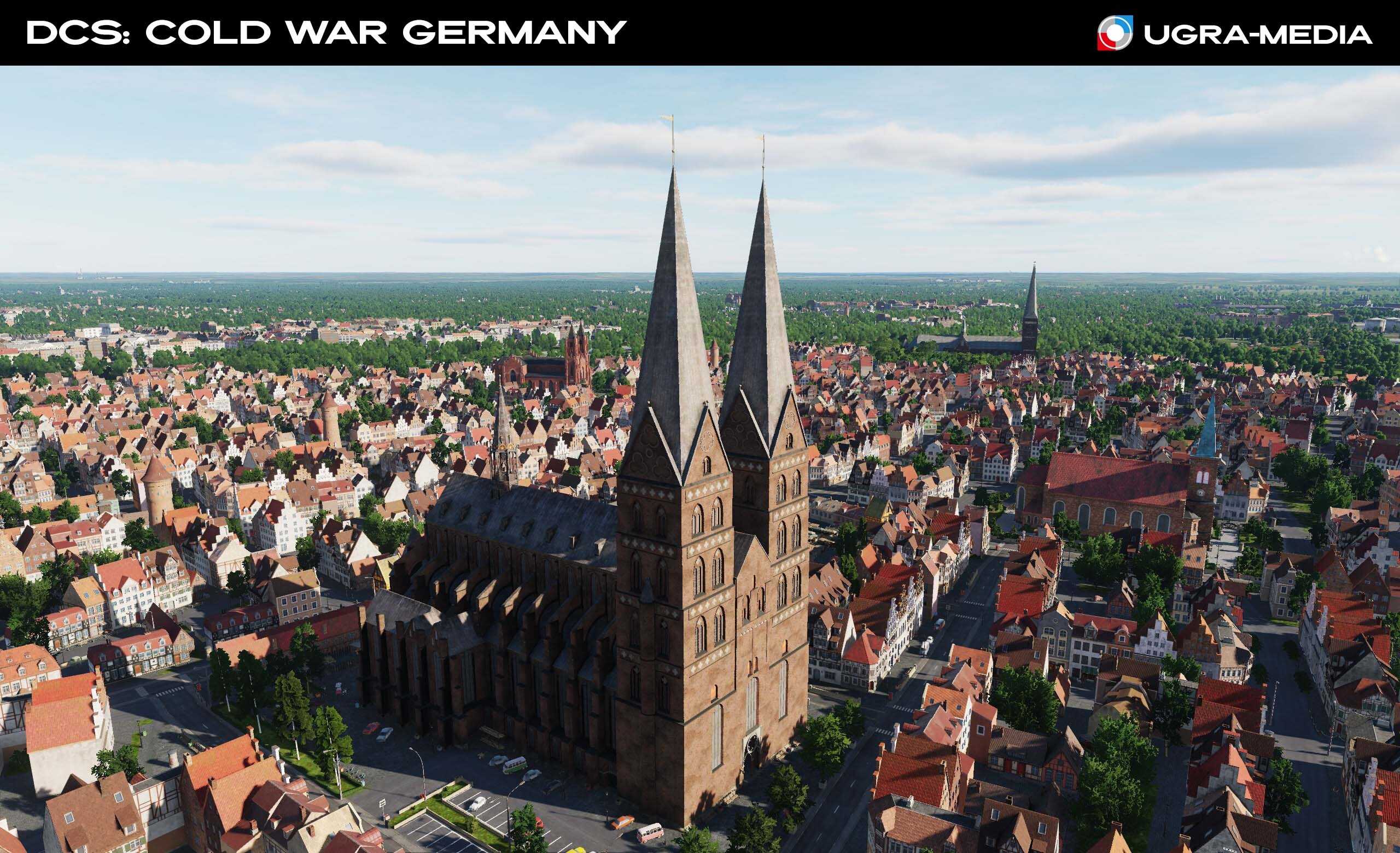
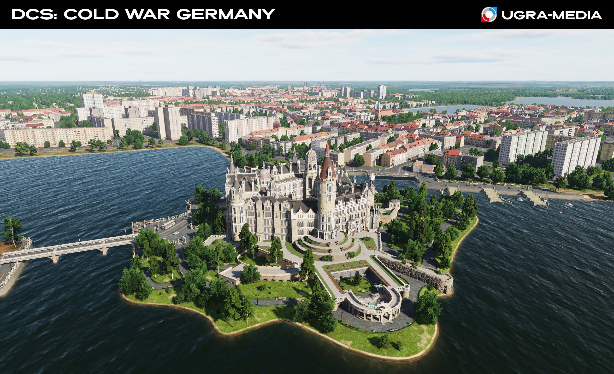
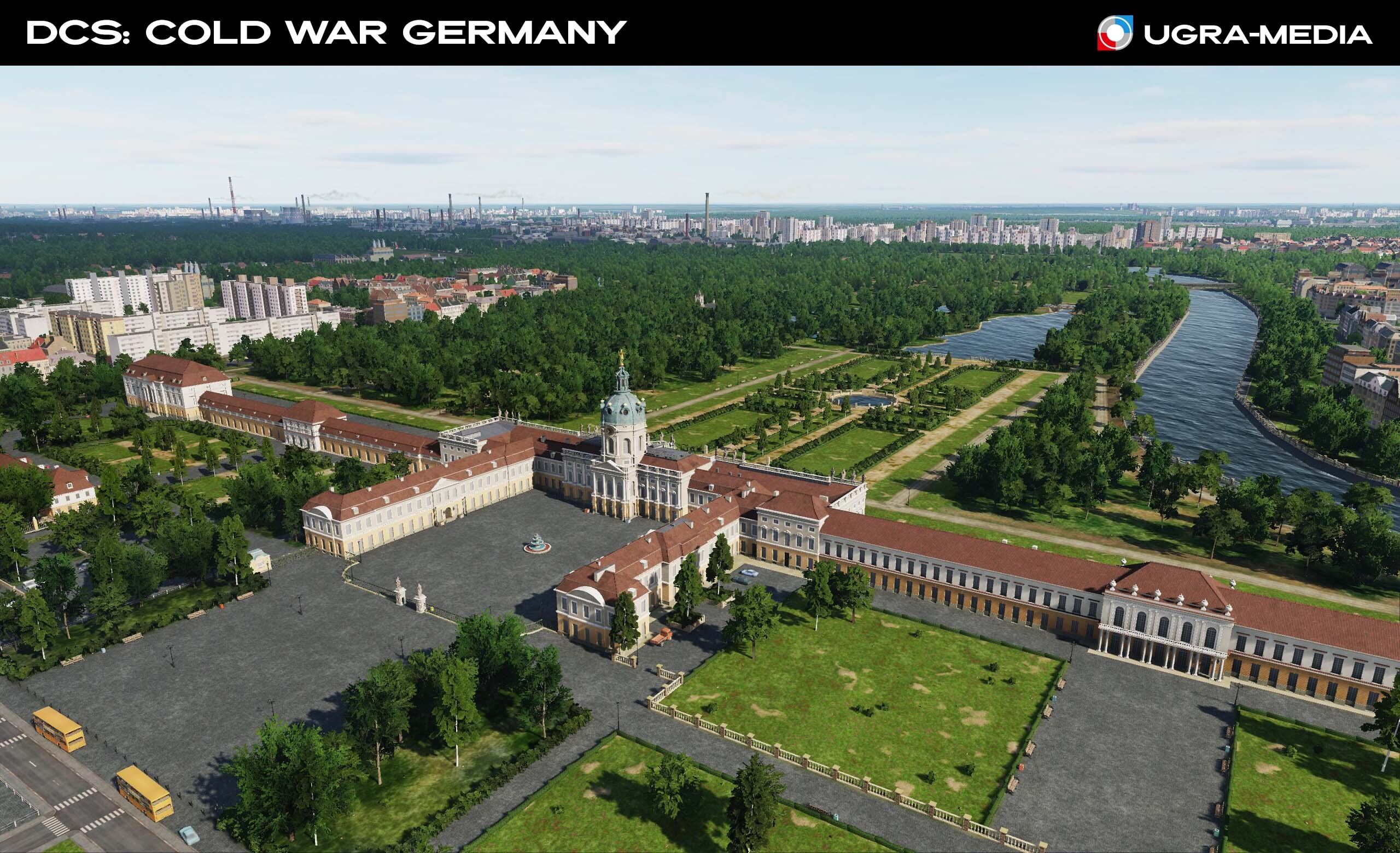
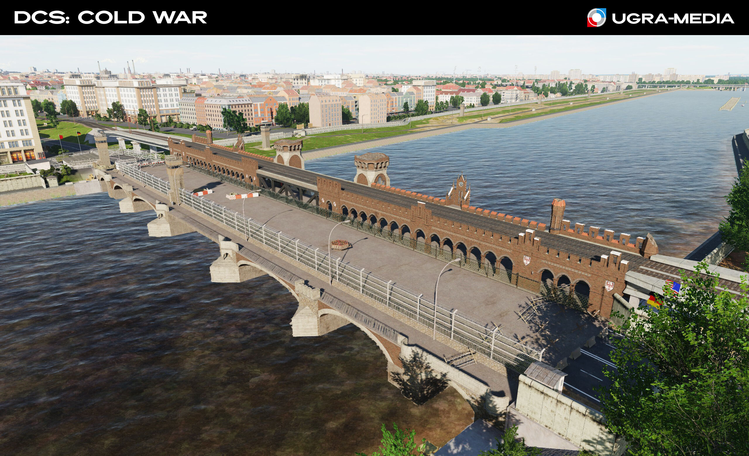
Hi fighters! Today we have an architectural tour "From Rostock to Potsdam: Architectural gems on your map" of small towns in Germany. We will walk from the Baltic Sea to the central lands, from strict Hanseatic Gothic to lush Baroque. Fulda - a Baroque treasury Fulda city palace The cathedral constitutes the high point of the Baroque district of Fulda, and is a symbol of the town. Rostock was the largest port in the GDR and the center of East German shipbuilding. St. Mary's Church Kassel - the Fairytale capital of Germany. The city was made famous throughout the world by the Brothers Grimm. Kassel and its surroundings became the very treasury from which the famous fairy tales arose. A gigantic bronze statue of Hercules, 8.25 metres high and weighing 3 tons Kassel Lowenburg. The castle stands on a hill 92 meters high in the Bavarian Alps. Wilhelmshöhe Palace is a Neoclassical palace Orangery (Kassel) Potsdam. Situated on the Havel River and on the banks of several interconnected lakes, 20 km southwest of central Berlin. University of Potsdam and the New Palace Lübeck is a city in northern Germany. A port on the Baltic Sea near the mouth of the Trave River. Historically known as the largest center of the Hanseatic League. Major landmarks are included in the UNESCO World Heritage List @M-Flux get the helicopter ready! St. Mary's Church (Lübeck) Schwerin Castle is a fairytale island castle (1845-1857) — the "Neuschwanstein of the North" Schloss Charlottenburg (Berlin) - one of the most exquisite examples of Baroque architecture in Germany. We won't let you go without airbases: Sperenberg was as a key location for the Soviet forces in East Germany. The airport was a designated transport airfield, and so was equipped with heavy transport types such as the IL-76 and AN-22. The airfield also housed attack helicopters for defensive purposes, as well as out-stationed and transiting bombers. Great location, lots of forest, beyond which only the tails of the planes are visible. Hahn Air Base, a military airbase operated by the US Air Force. (USAF 50th Tactical Fighter Wing) Your F-16 will be based here. NOTAM: FLLW CHNNL, THEY SHW EXTRA STFF
- 489 replies
-
- 23
-
-
-
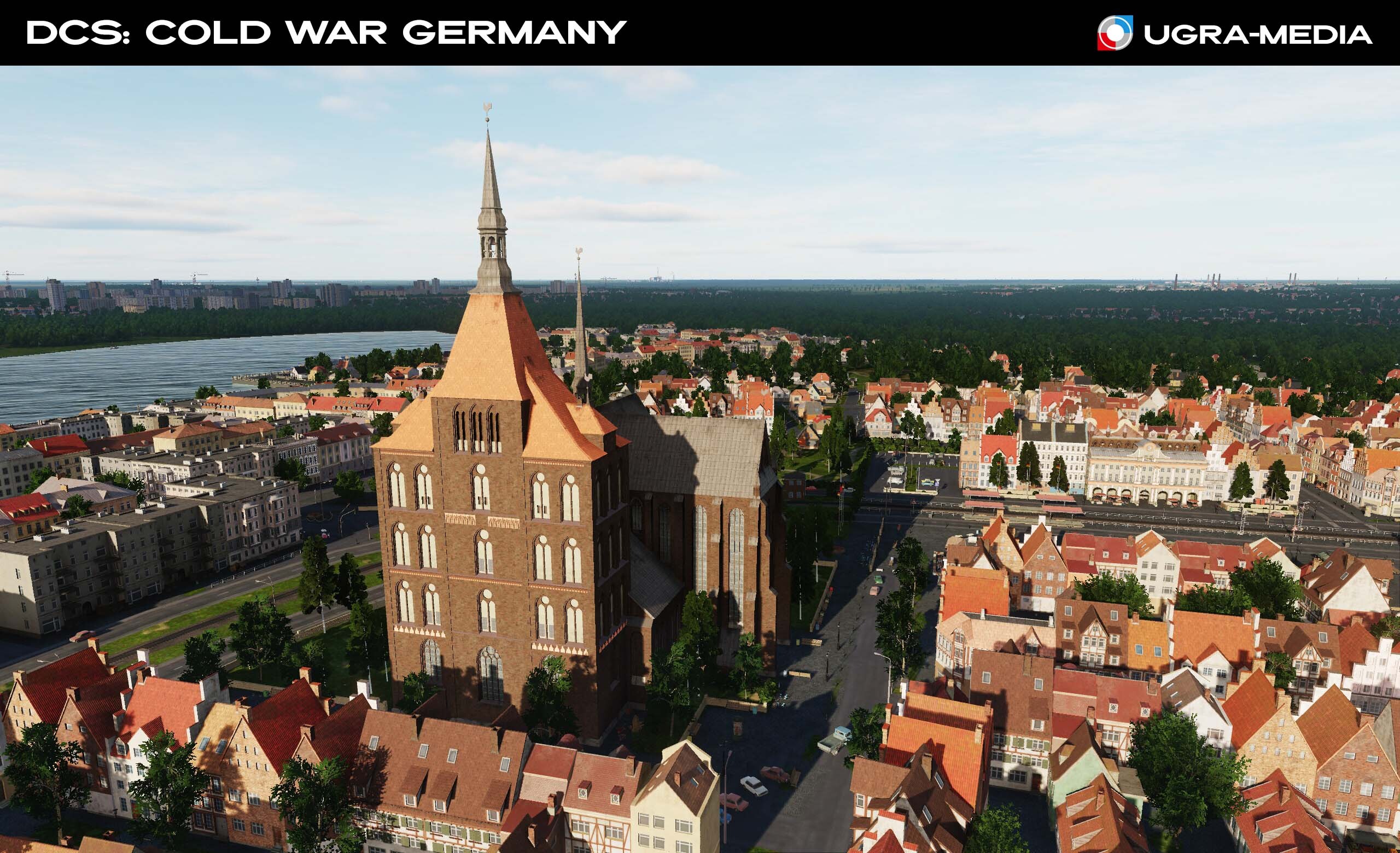
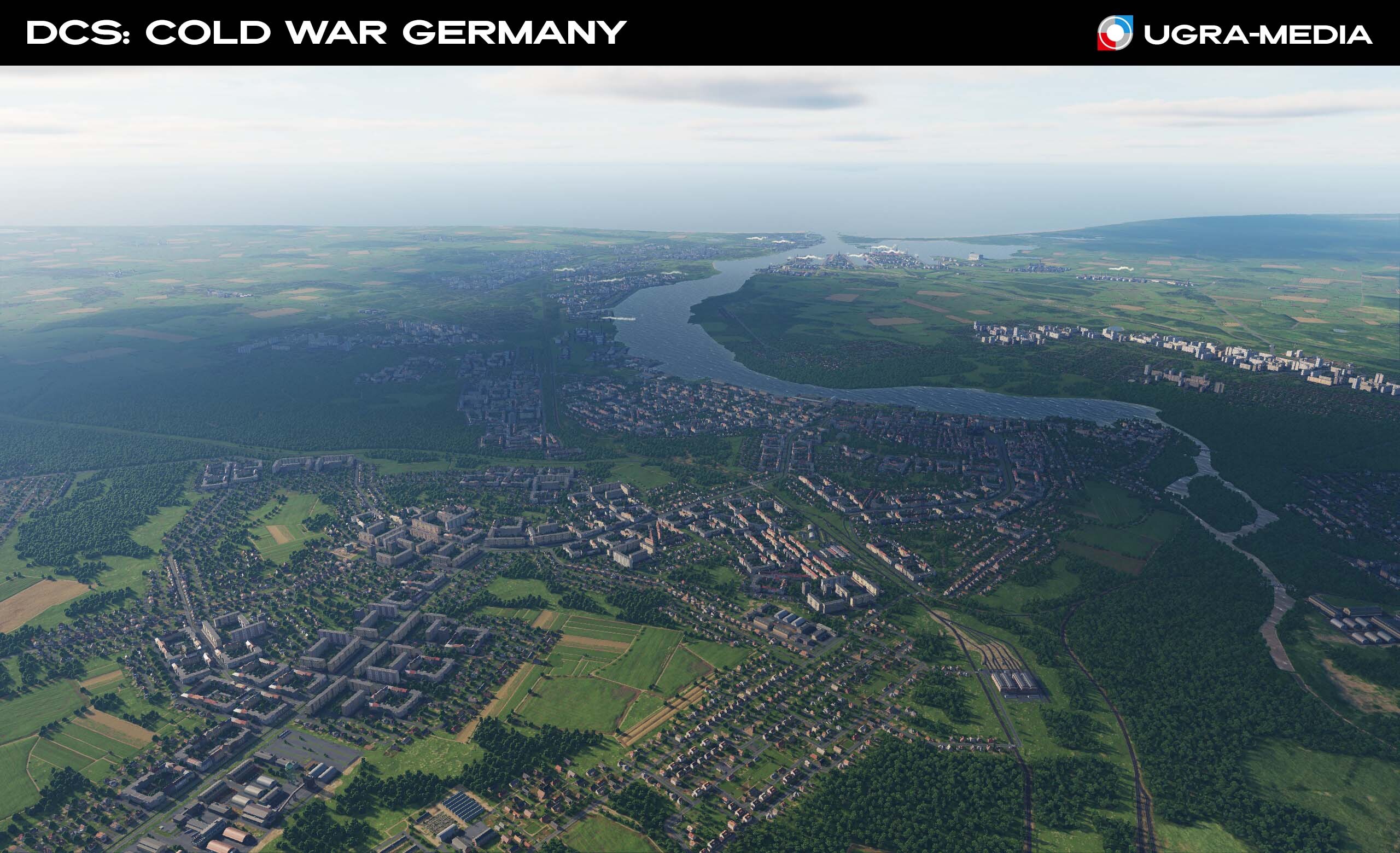
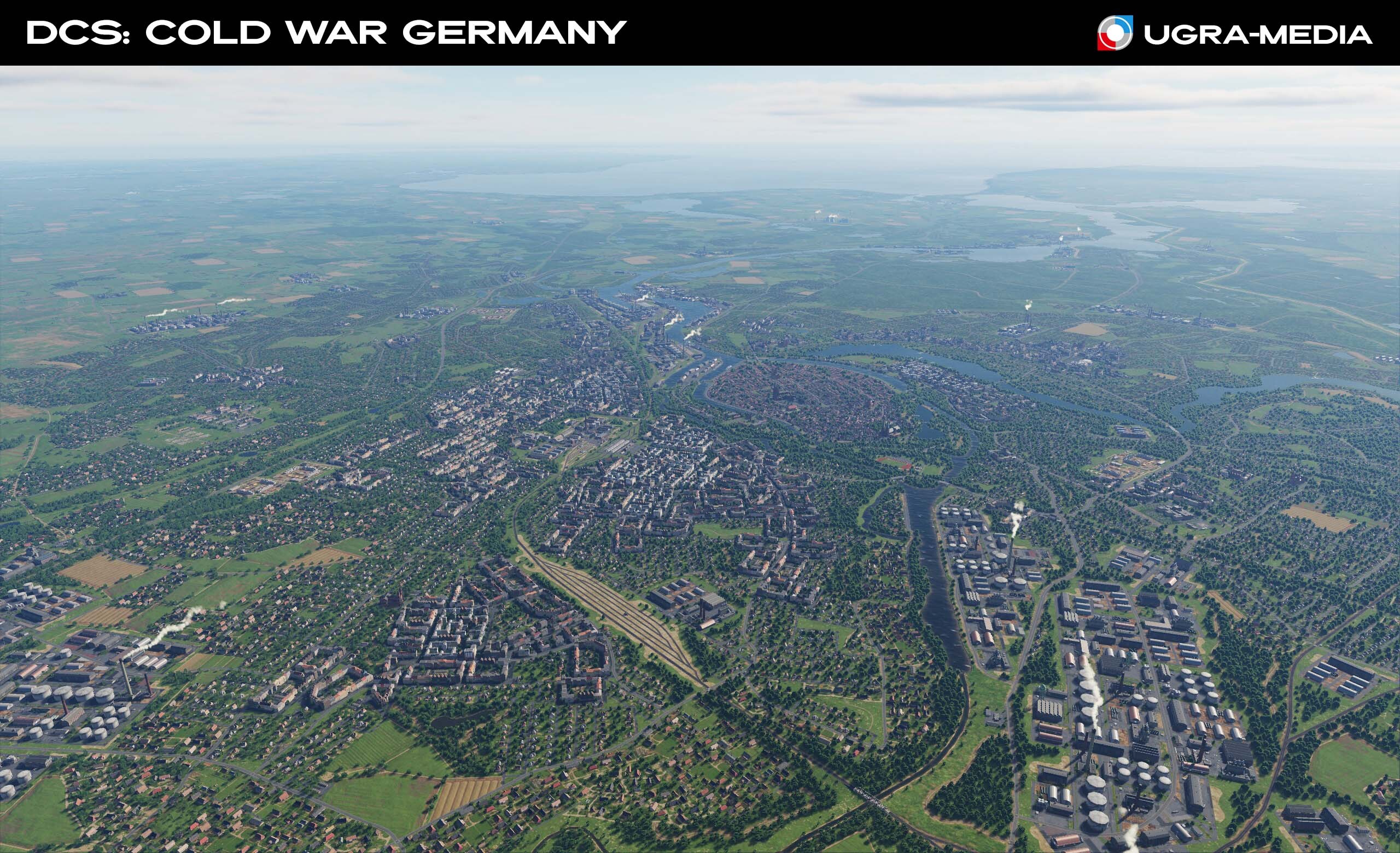
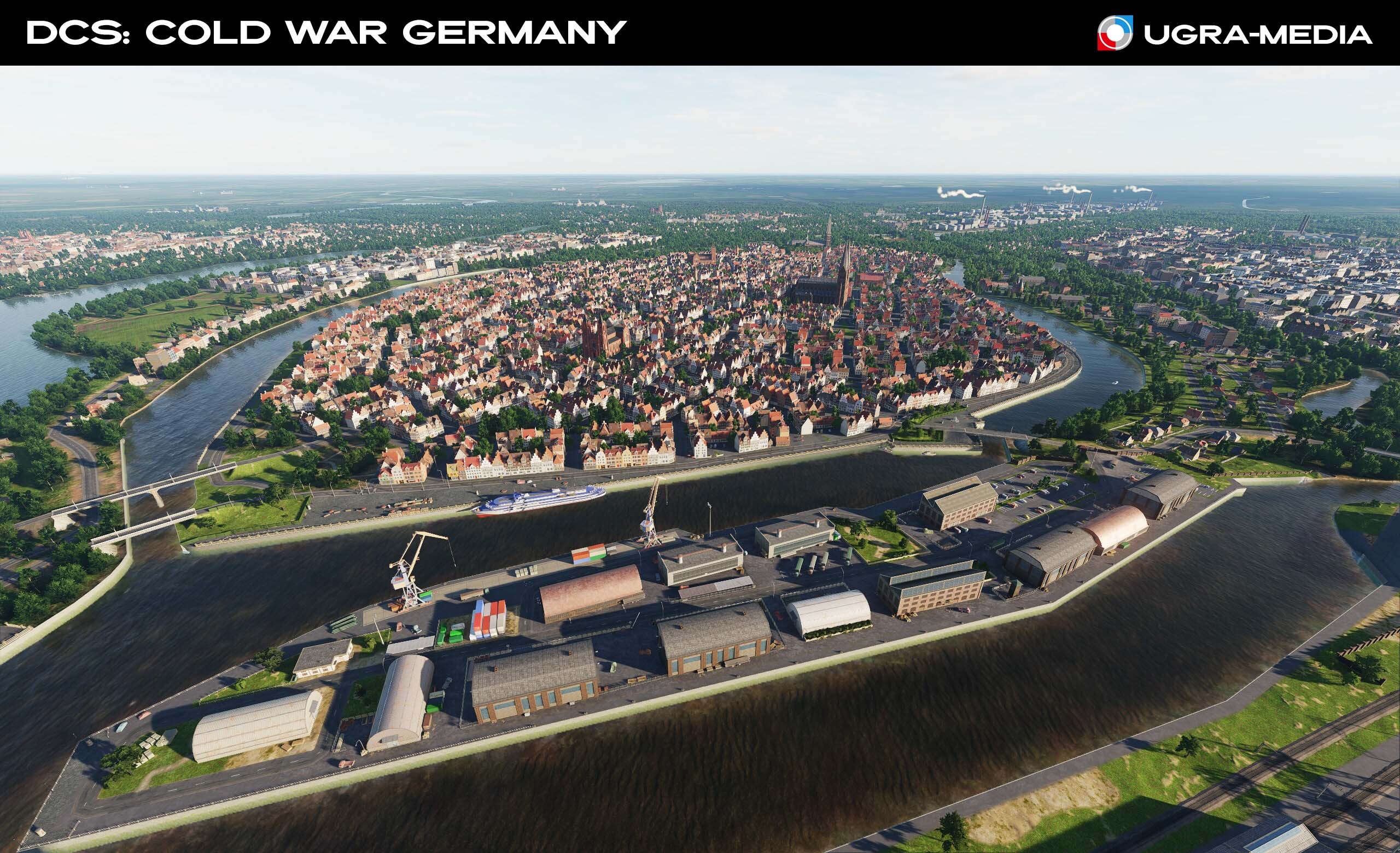
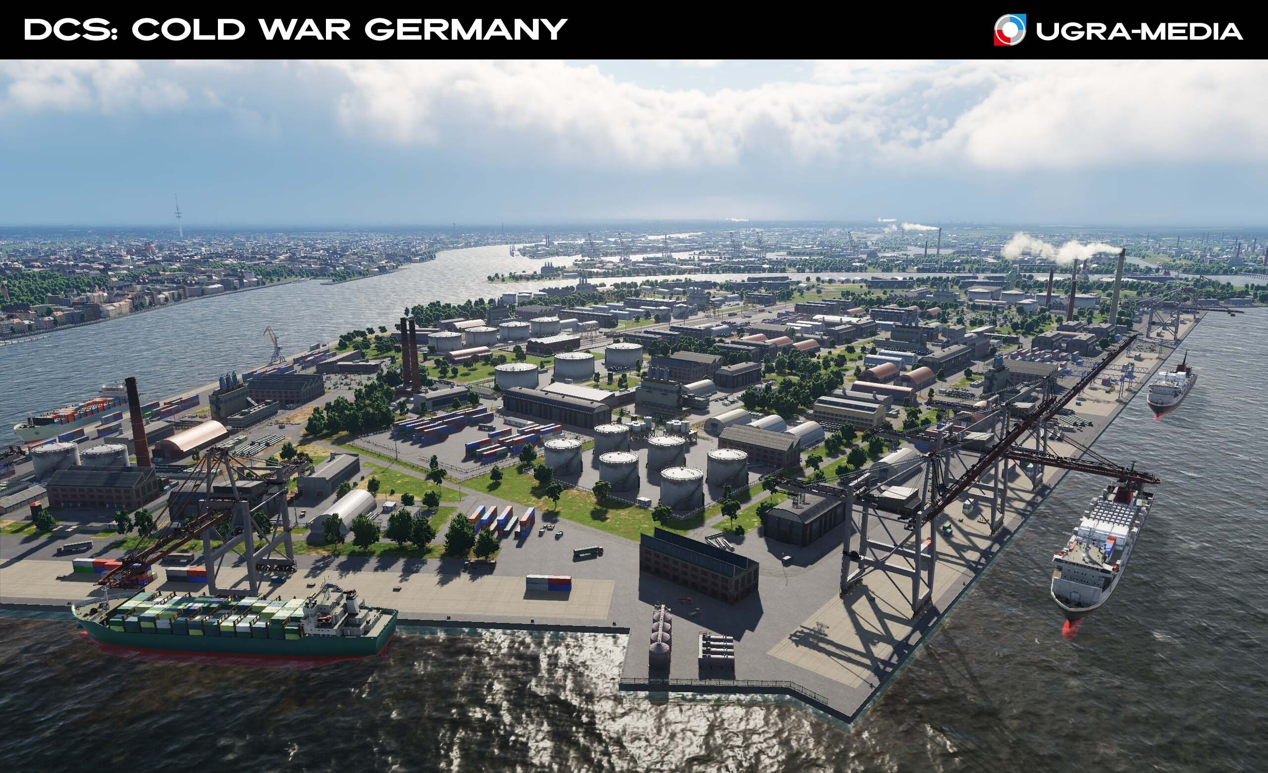
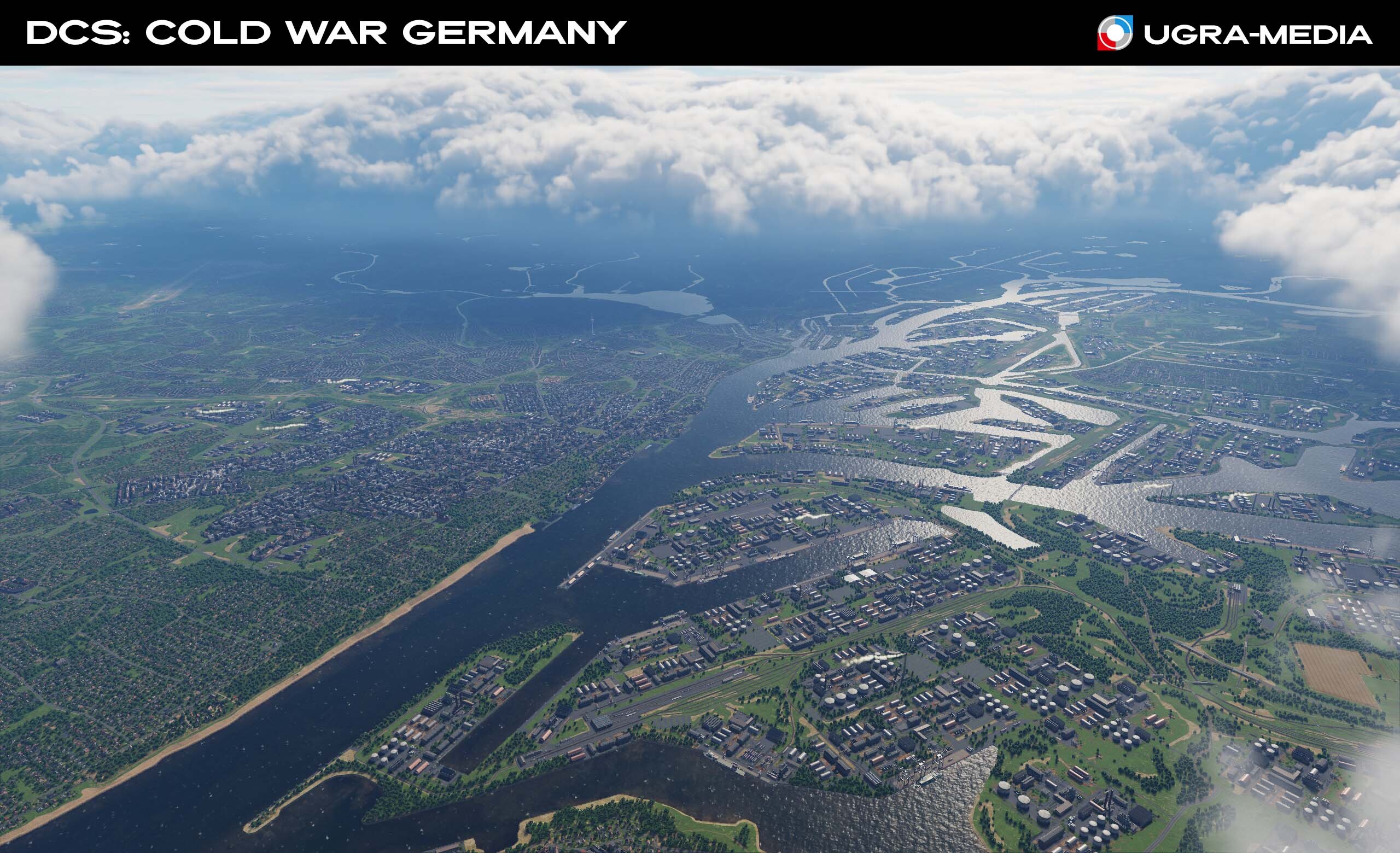
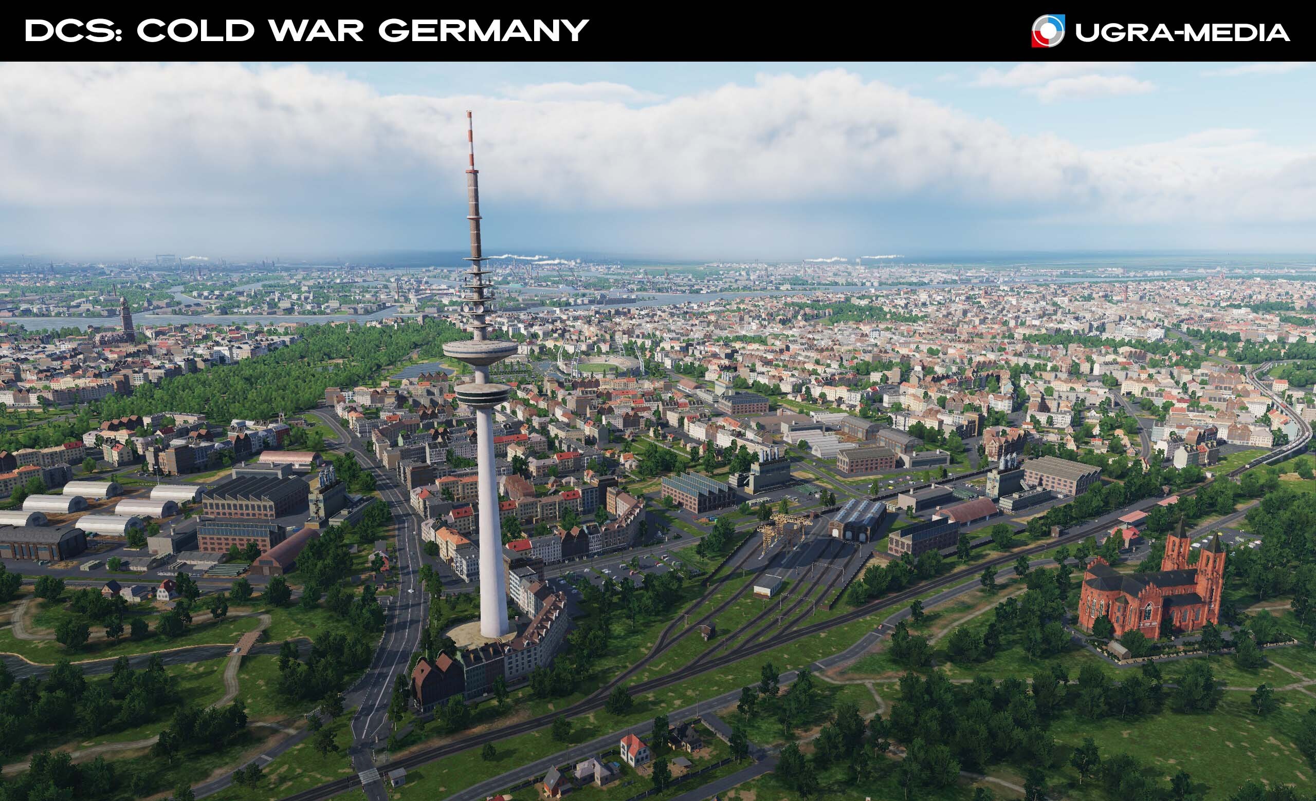
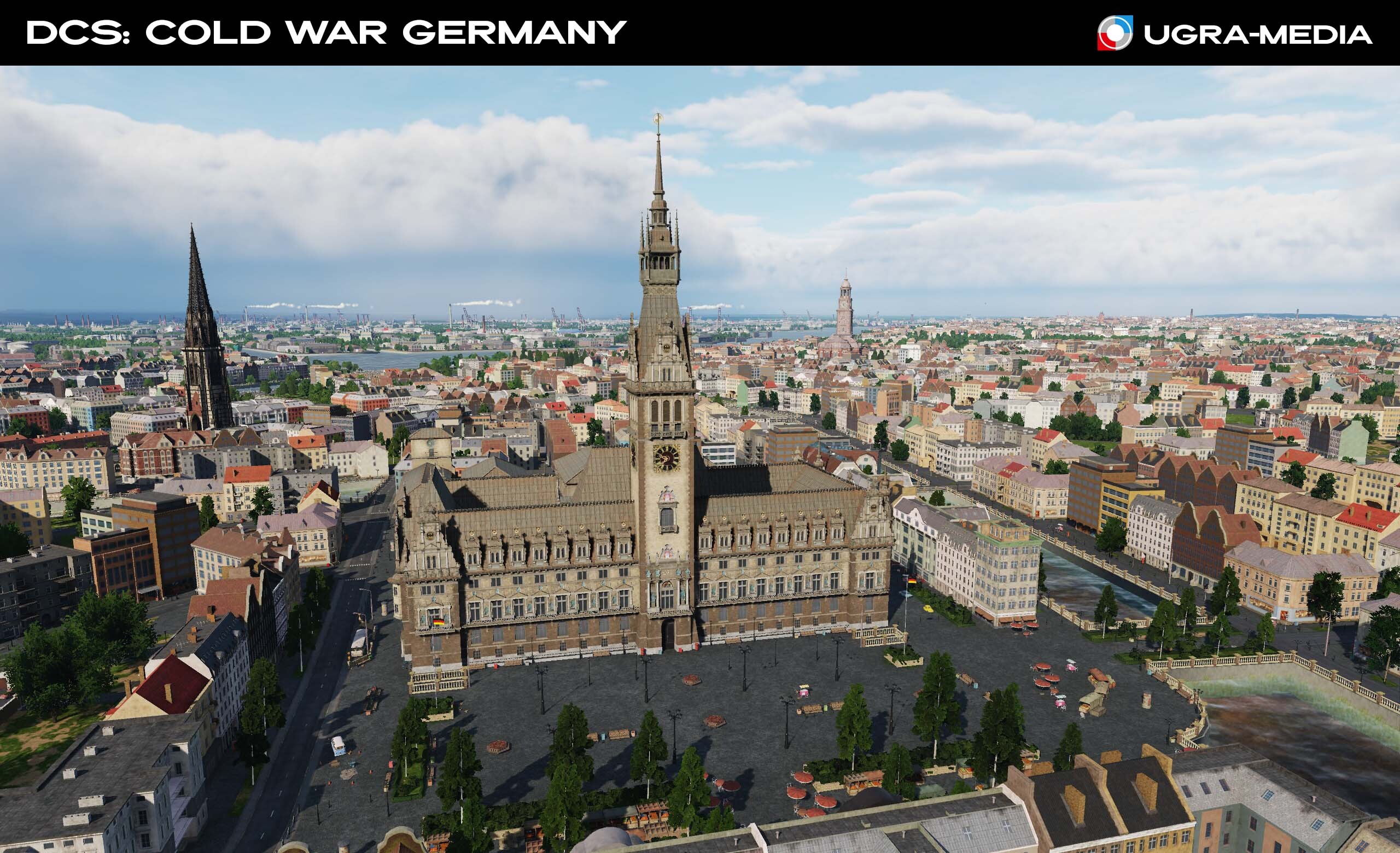
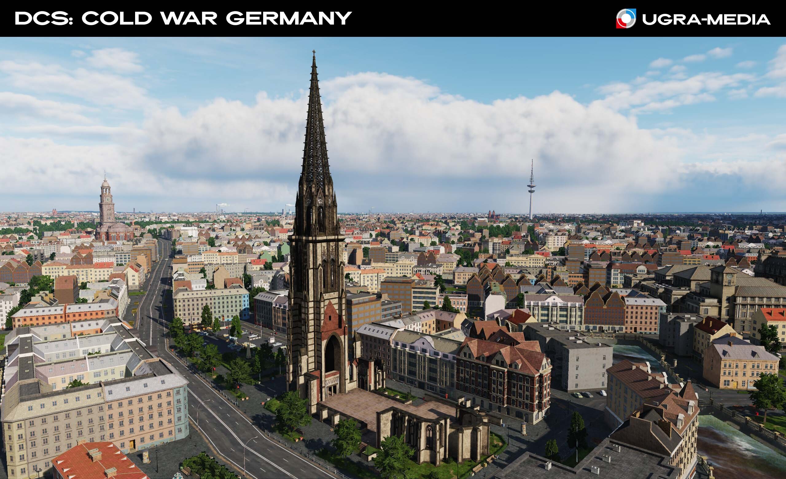
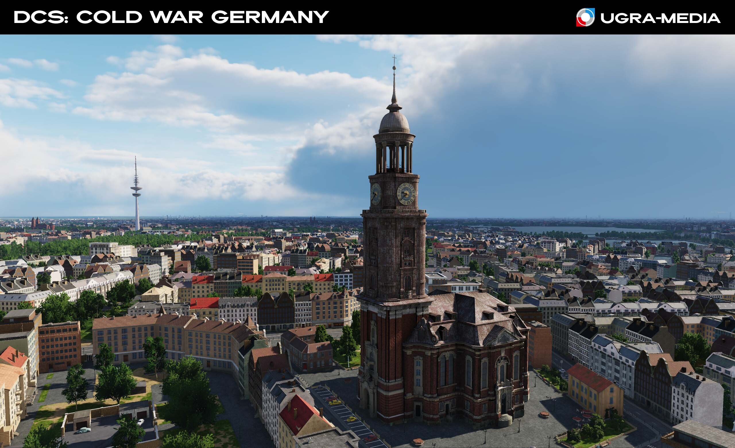
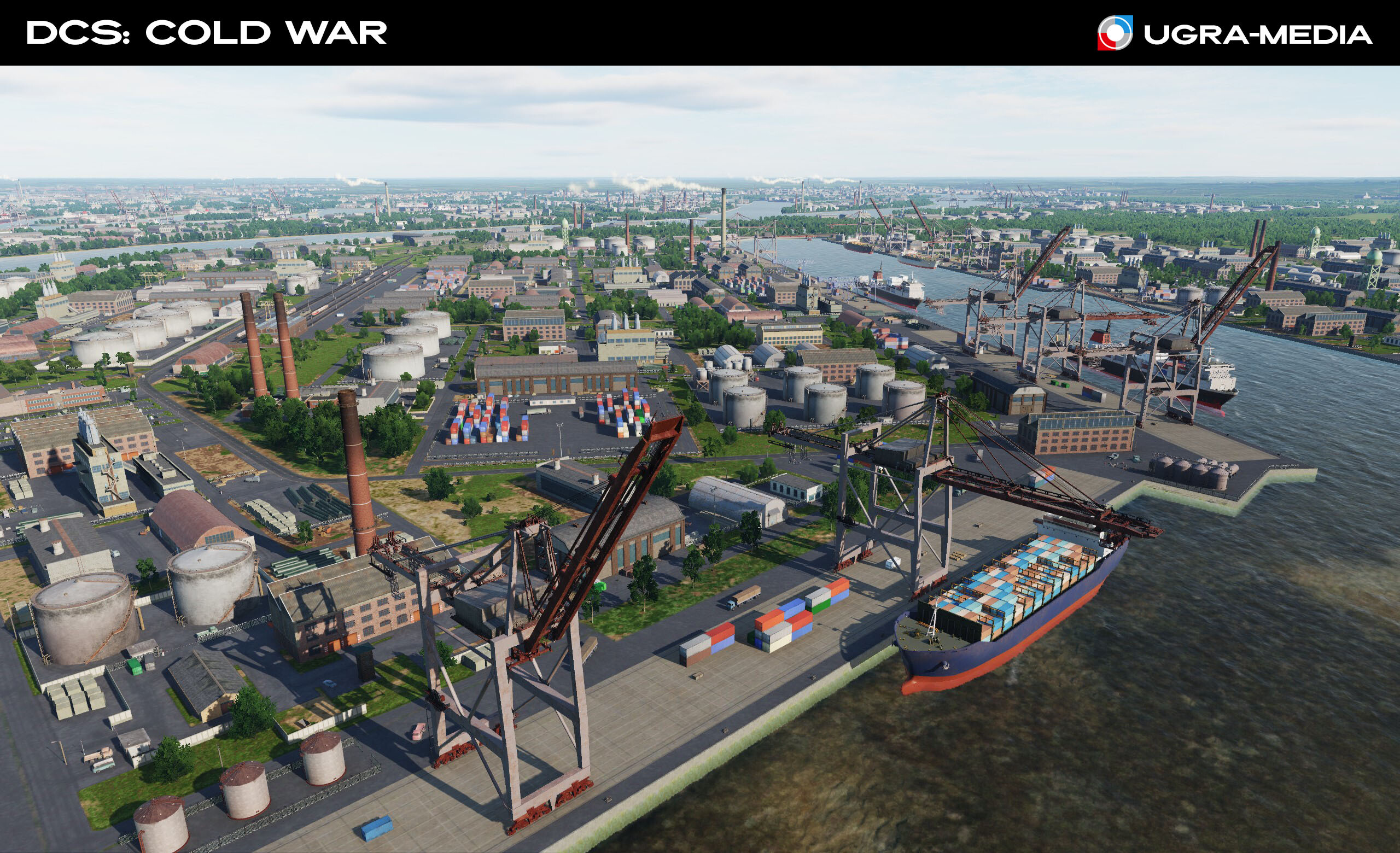
Hi fighters! Today we are going to Hamburg — the second-largest city in Germany, is one of the largest port cities in Europe, located at the mouth of the Elbe River into the North Sea. The Heinrich Hertz Tower (German: Heinrich-Hertz-Turm) is a landmark radio telecommunication tower in the city of Hamburg. Its height is 279.2 meters and it is the tallest building in the city. Heinrich Hertz is a native of Hamburg, who made an important contribution to the development of electrodynamics / Yes, the unit is named after him - Hz. St. Michael's Church is one of the most significant architectural structures in Northern Germany, which is the "calling card" of the city (132-meter baroque tower) Hamburg City Hall (Hamburger Rathaus) is the seat of the local government (senate) and parliament of the city of Hamburg. St. Nicholas Church (German: ehemalige Hauptkirche St. Nikolai - "former main church of St. Nicholas", also German: Mahnmal St. Nikolai - "Memorial of St. Nicholas") is a neo-Gothic church. The second tallest building in Hamburg (147.3 m) and one of the tallest churches in the world - ranks 5th. Hamburg Airport (ICAO: EDDH / IATA: HAM) - everything about this city reminds me of food ) The airport opened in January 1911, making it the oldest international airport in the world that is still in operation. And now we'll move to East Germany The capitalists will be watching this place, finishing their and looking for communist blips on their radars, and the communists will be watching the capitalists. One mistake and in a moment a group of MiGs will be in the air. Garz (The callsign was GESETZ) Airfield of the East German Air Force. It was used for the temporary deployment of wings with construction measures at the home airfields. It was also used by the East German Interflug airlines as "Heringsdorf" A beautiful takeoff/landing over the sea is guaranteed.
- 489 replies
-
- 30
-
-
-
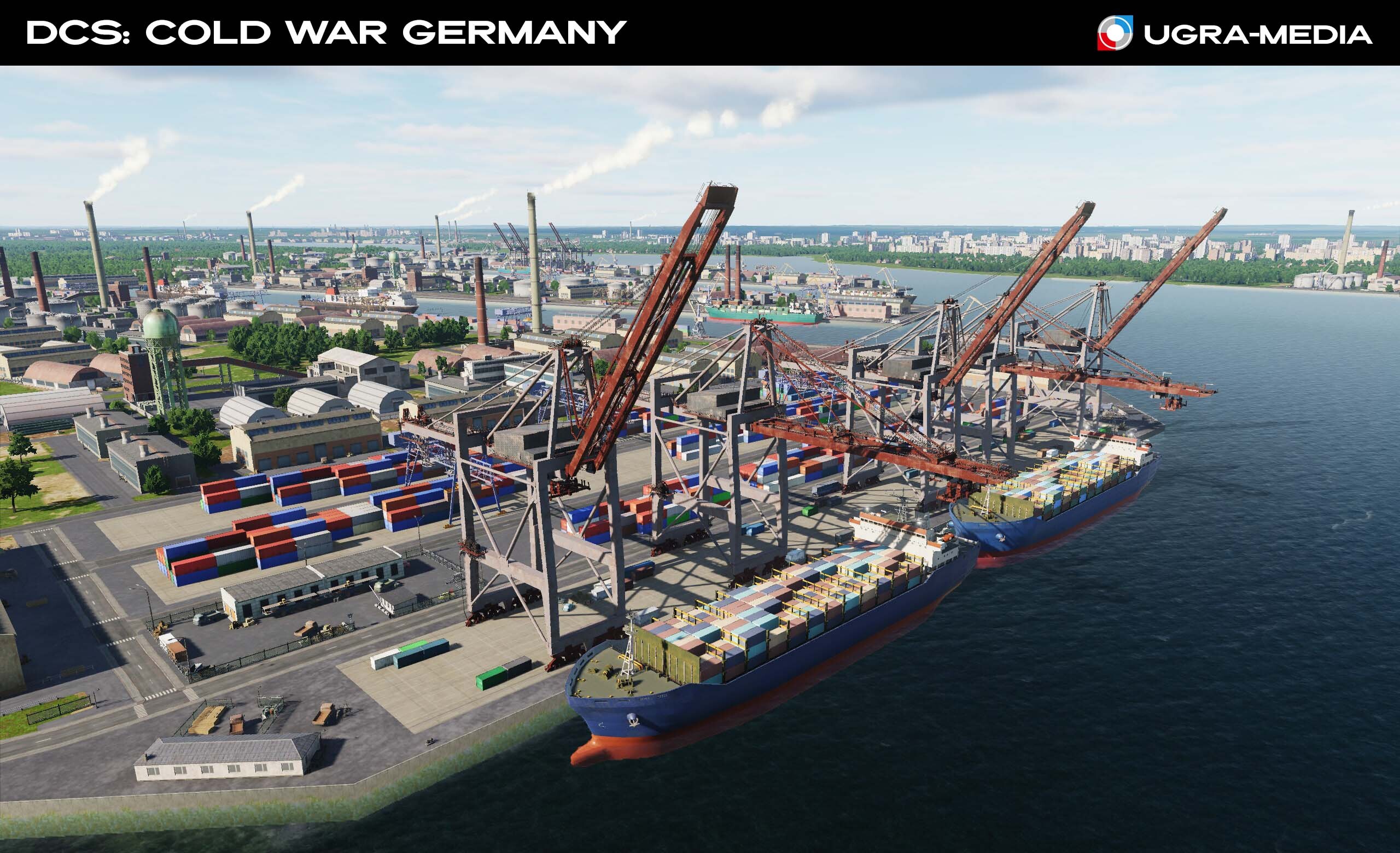
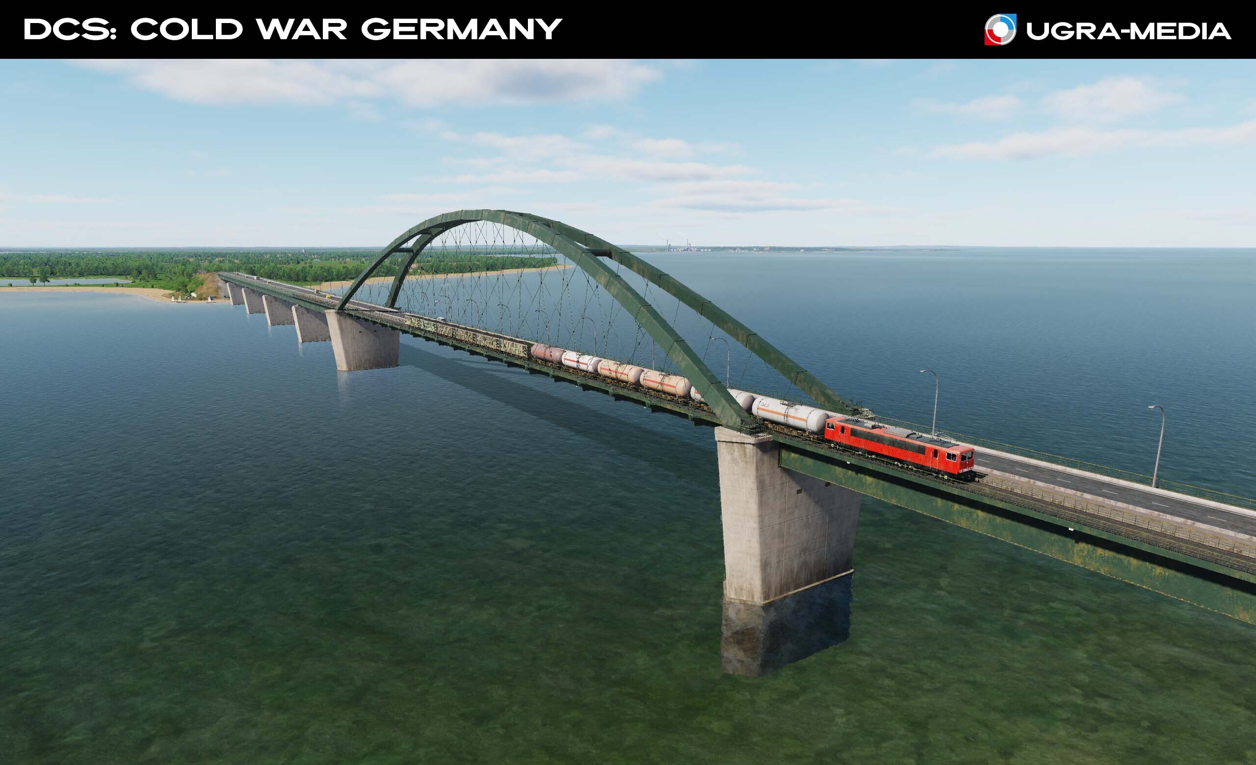
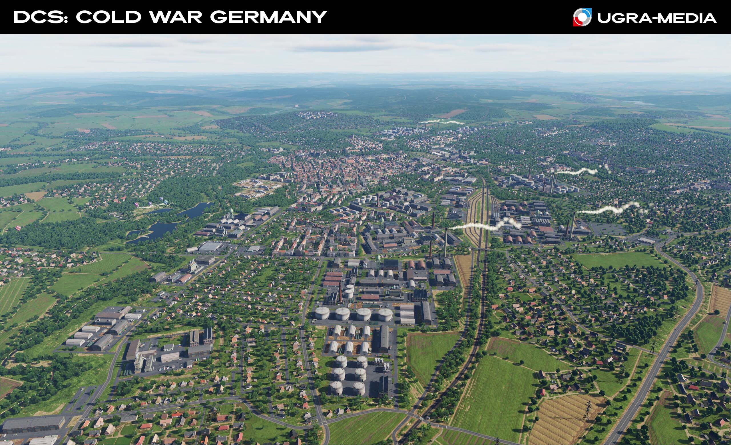
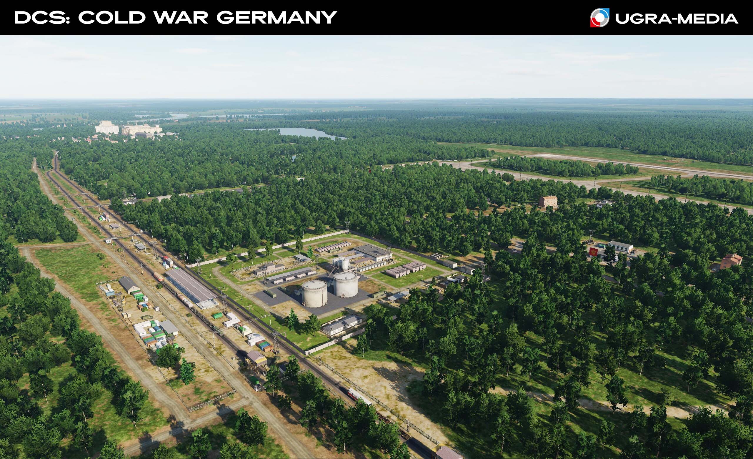
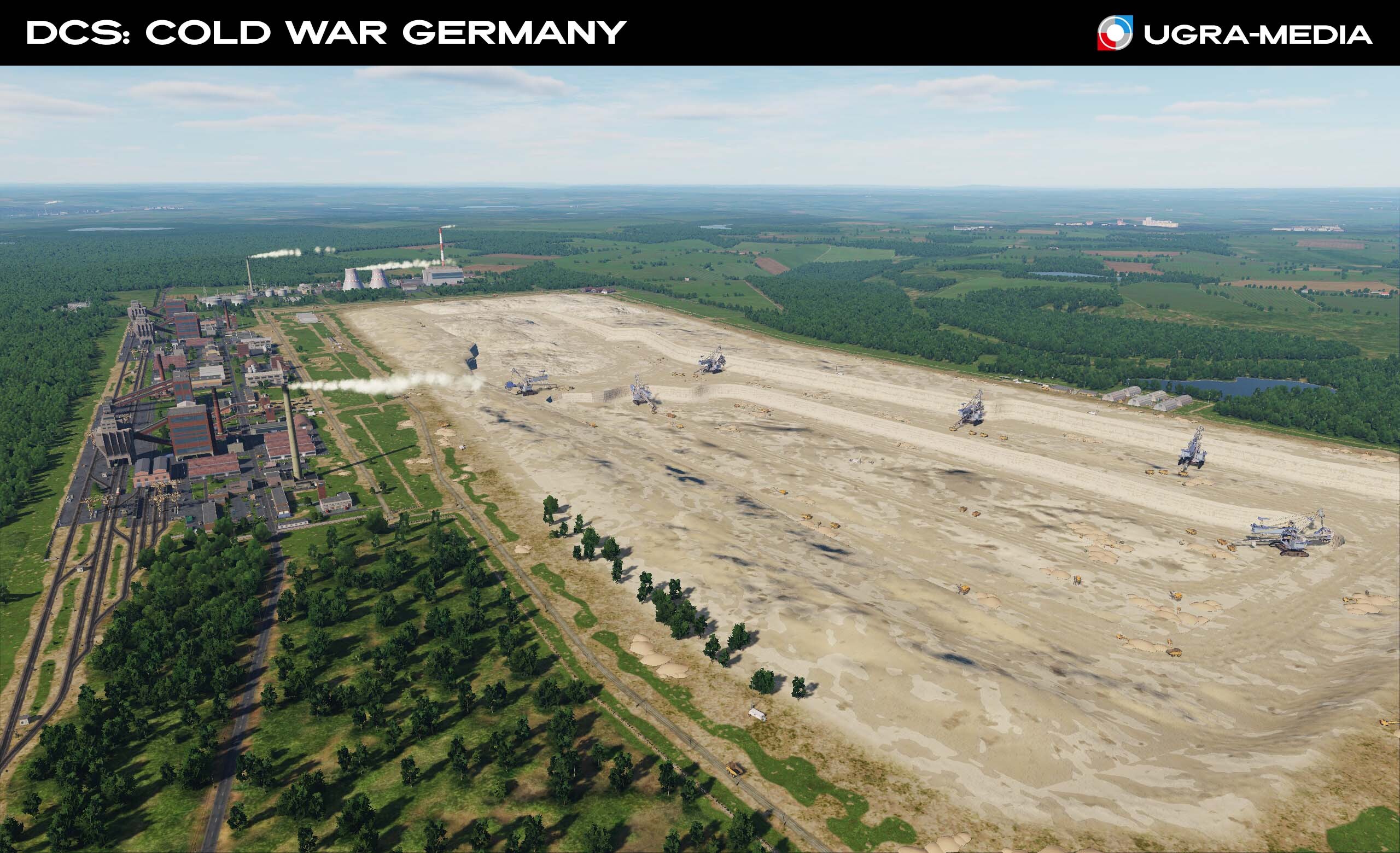
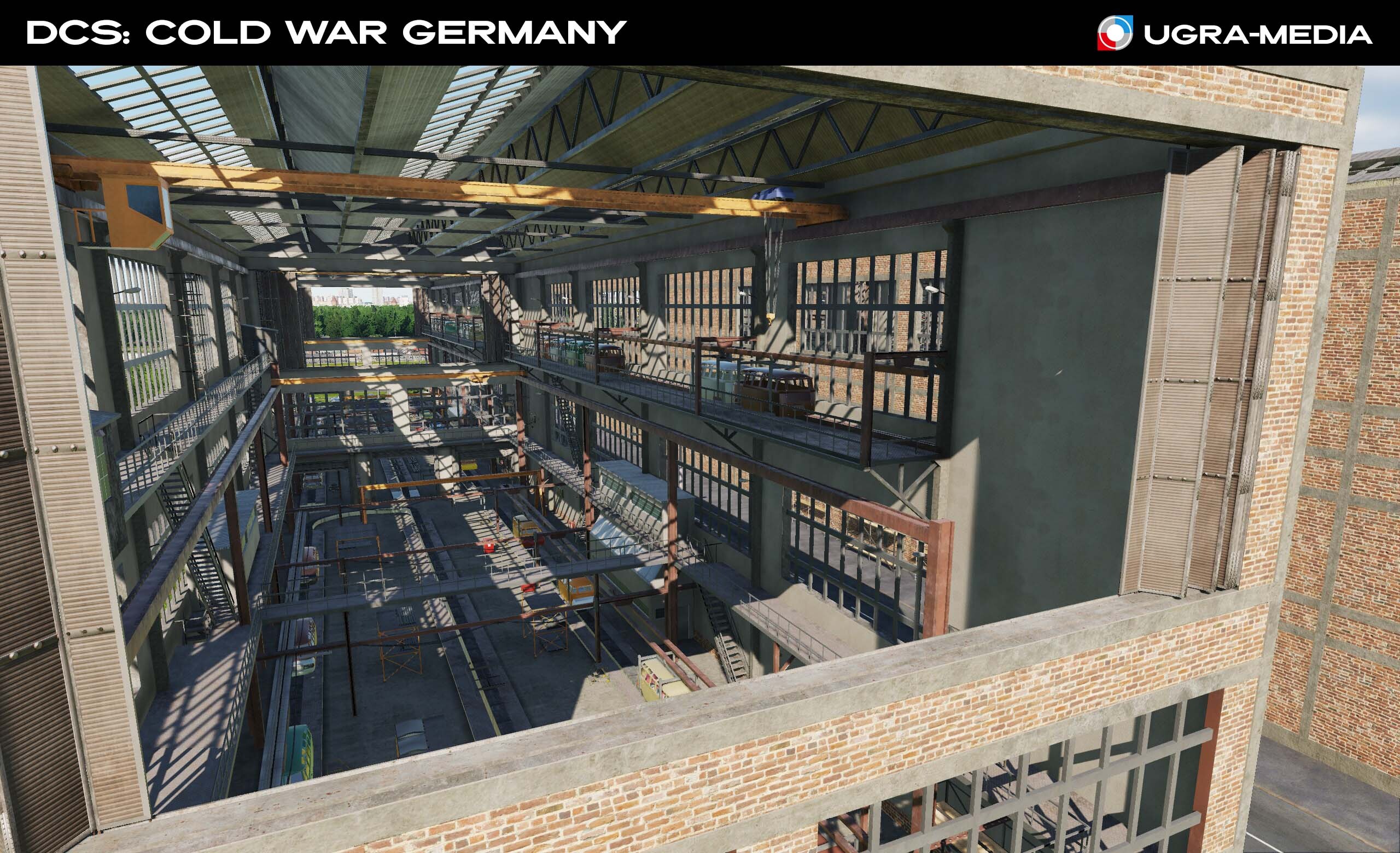
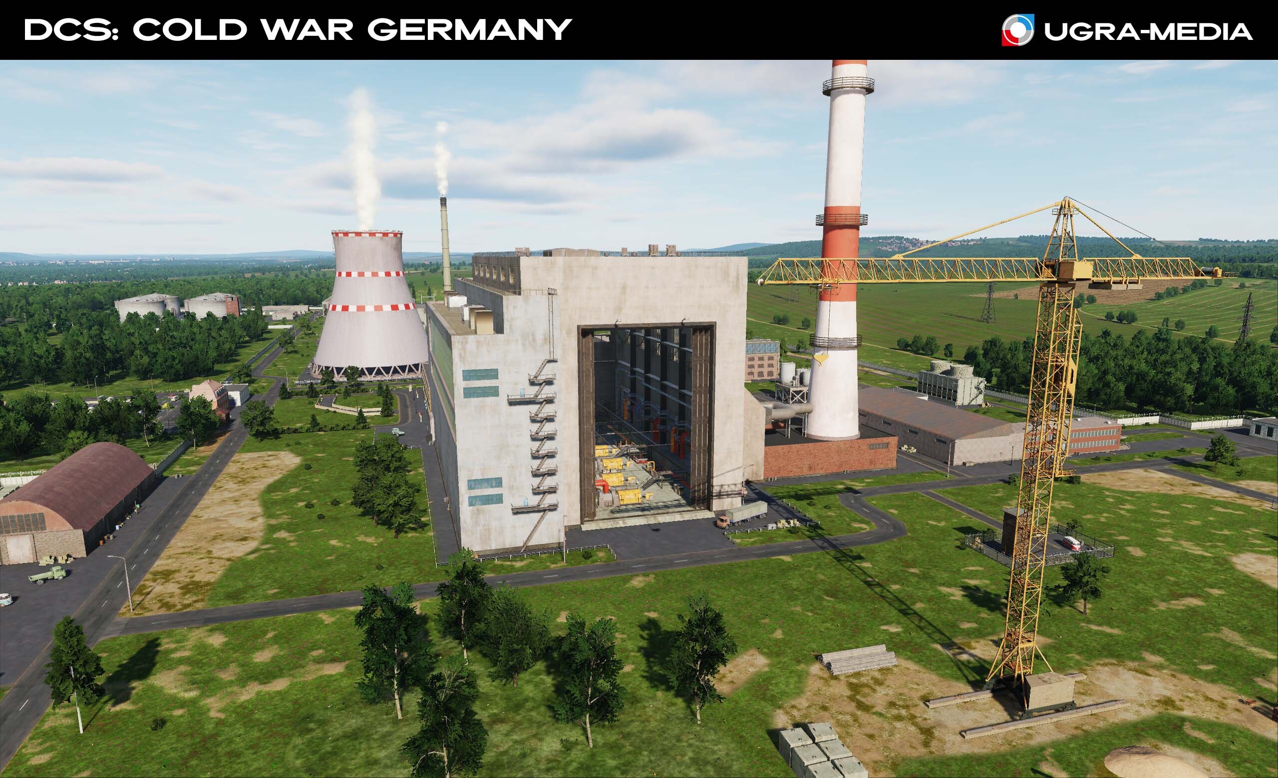
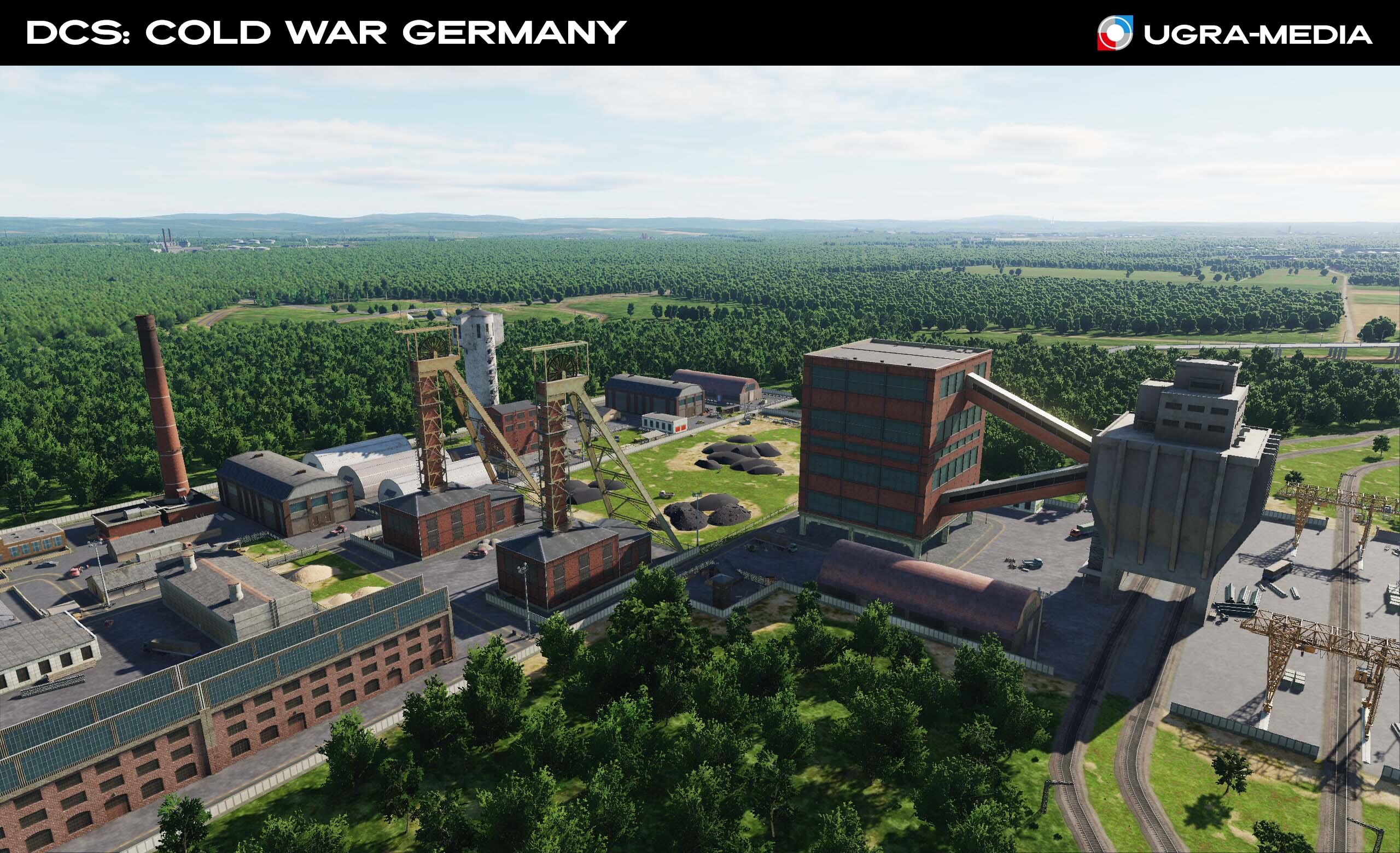
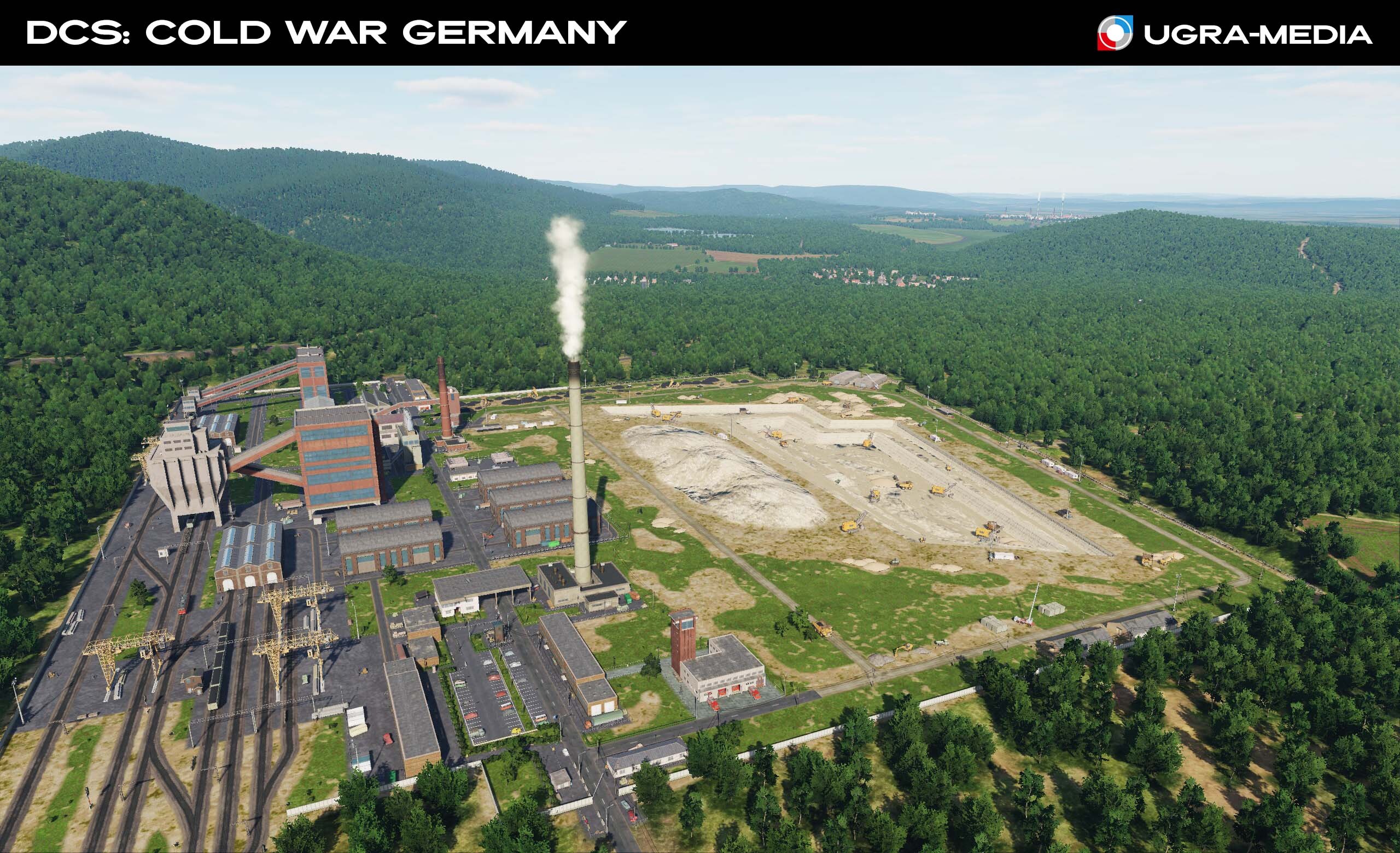
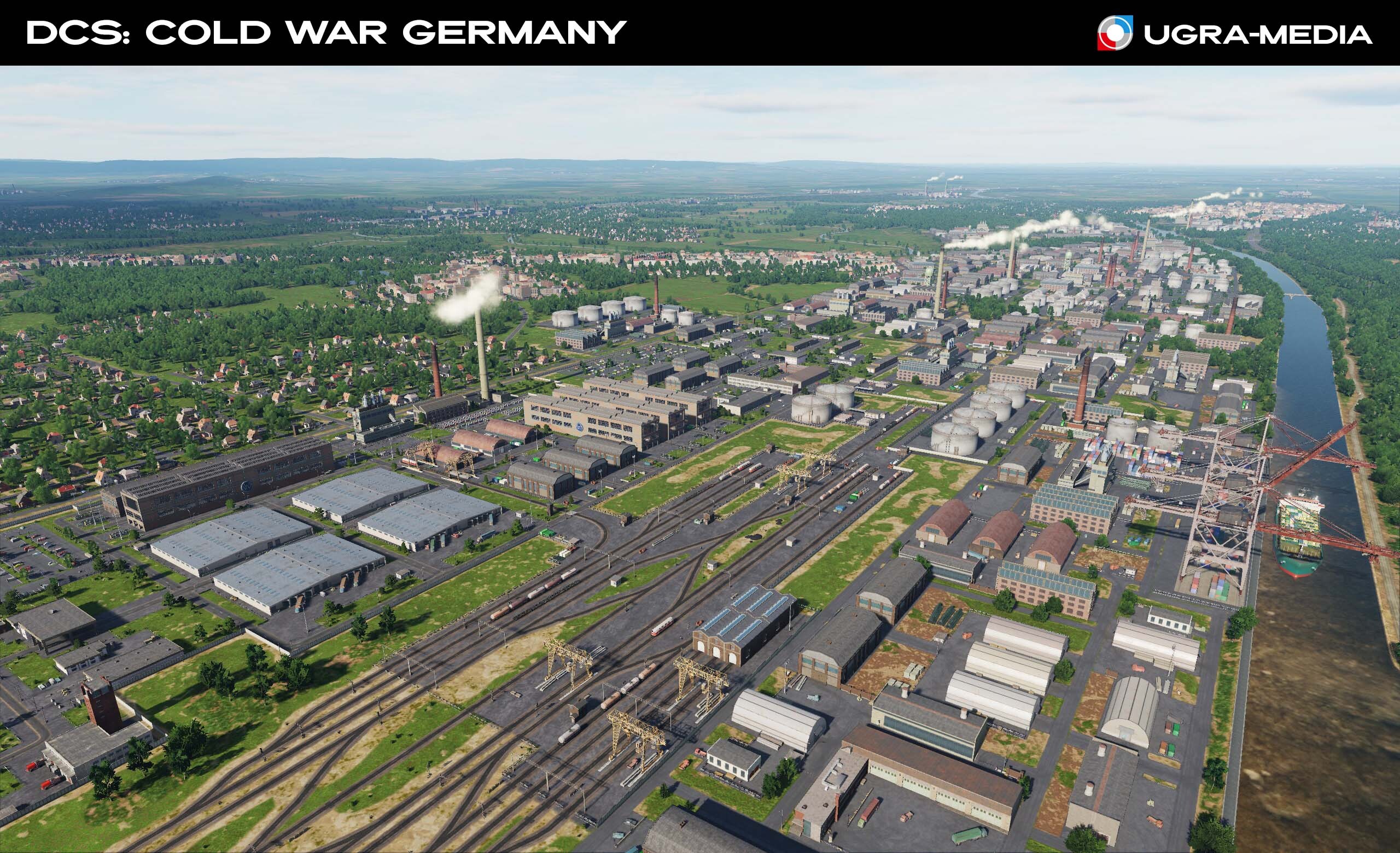
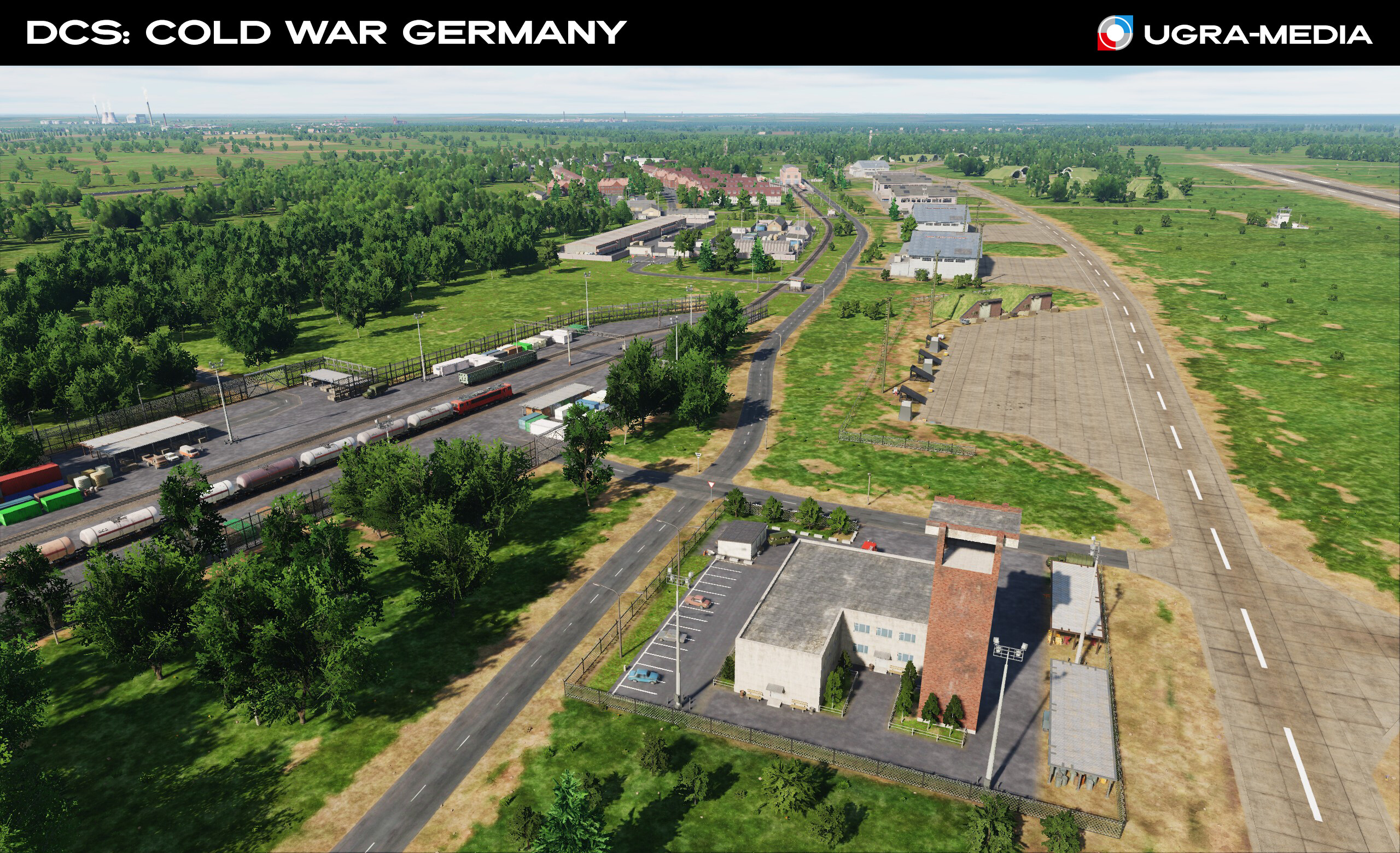
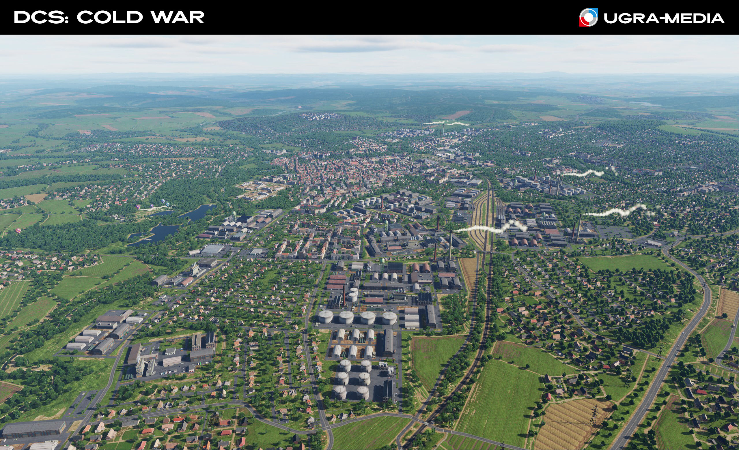
Hi Thanks guys! Lots of useful information. Here you go When creating the Cold War Germany map, we also paid attention to the industrial infrastructure, which will be the key to your campaigns! They are always good landmarks and important targets. The Port of Hamburg is the largest trade hub in Northern Europe. In wartime, it becomes a point for unloading NATO reinforcements or a target for logistics strikes. Power plants - can be seen from very far away, you won't get lost. / Destroy the power grid to weaken the enemy industry. Car factories - in wartime, they can switch to the production of military equipment - accordingly, these are your targets, and it looks like this is a place for the challenge Quarries are good landmarks. Mines
- 489 replies
-
- 24
-
-
-
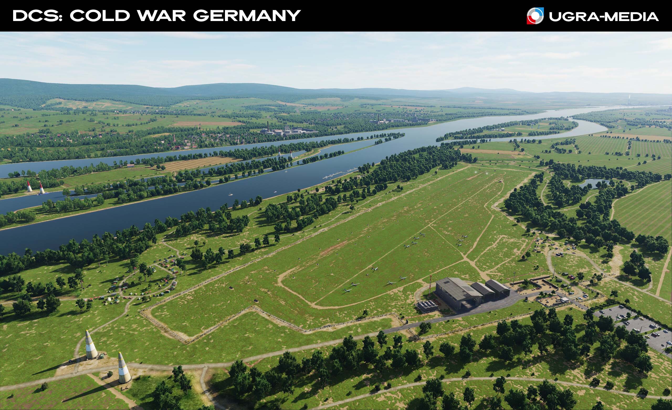
What if you have a day off, no missions, a combat buddy is being serviced, and you want to fly? On the map, you can take a break from combat sorties and visit small airfields scattered throughout the territory. Meditate while admiring the hot air balloons at dawn or sunset — or join their flight. There are also aerobatic routes and even a special area for practicing aerobatics. Visit the flying club with friends, take a Yak-52 / Eagle — and off to new adventures! Make a map for: fighters..............OK attack aircraft.......OK helicopters...........OK transport aircraft....OK ground vehicles.......OK general aviation......OK
- 489 replies
-
- 28
-
-
-
Hi fighters Let's continue getting to know the map. Hannover is the capital of Lower Saxony and one of the main cities in central Germany. The city is a major junction for railway lines and autobahns, connecting major European lines in the east–west (Berlin–Ruhr area/Düsseldorf/Cologne) and north–south (Hamburg–Frankfurt/Stuttgart/Munich) directions. The landmark of Hanover is the New Town Hall (Neues Rathaus). The height of the dome of the town hall with an observation deck is almost 100 meters (97.73 m). An elevator ascends to the observation deck at the top of the large dome along a variable angle of up to 17 degrees, thought to be unique in the world. One of Hanover's most grandiose sights is the Royal Gardens of Herrenhausen, consisting of four parts, which are known as the Grosser Garten, Berggarten, Georgengarten and Welfengarten. Hannover Airport A large civilian hub with long runways. Located 11 km north of central Hannover From 1957 to 1990, the airport hosted the Internationale Luft und Raumfahrtausstellung, Germany's largest air show. In a conflict, it could have become a strategic point for the transfer of NATO forces. Wunstorf Air Base, 30 km west of Hannover. A key hub for the transfer of troops, equipment and supplies in the event of a conflict with the Warsaw Pact. It will add scenarios for you: from protecting transport aircraft to attacks deep into enemy territory, and maybe one day you will take a seat in a C130 and personally deliver cargo to this base. Make a map for: fighters..............OK attack aircraft.......OK helicopters...........OK transport aircraft....OK ground vehicles.......OK ...
- 489 replies
-
- 23
-
-
-
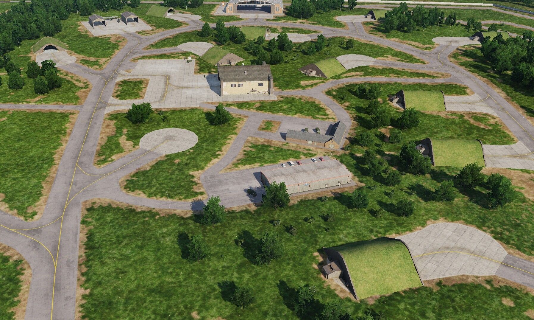
Hi fighters There were questions about air defense locations. @Northstar98Yes, on the map you will find places for installing air defense systems: somewhere it will be a cleared area, somewhere hills for radar or prepared territory for an air defense complex. This is done so that you (or mission designers) can place air defense objects and interact with them. @Stratos we wrote about this: if we do this, then after phase 3 - all efforts are now directed to the map. Add wishes, what units are needed, as NineLine recommended. @draconus yes, flags react to the wind, so you will always know its direction Lass uns ein bisschen fliegen
- 489 replies
-
- 19
-
-
-
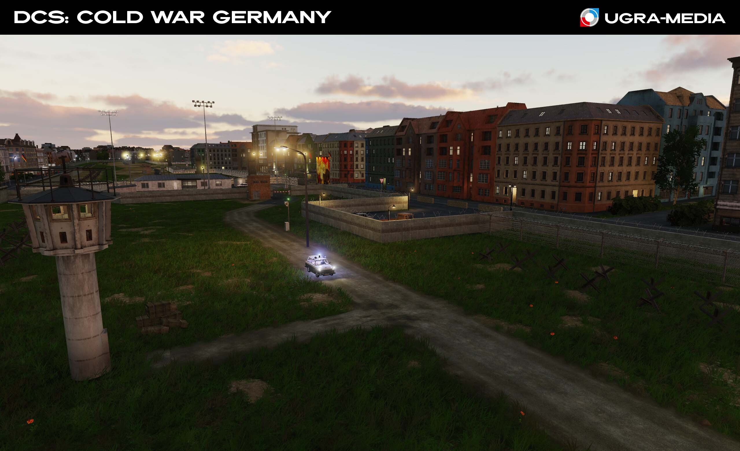
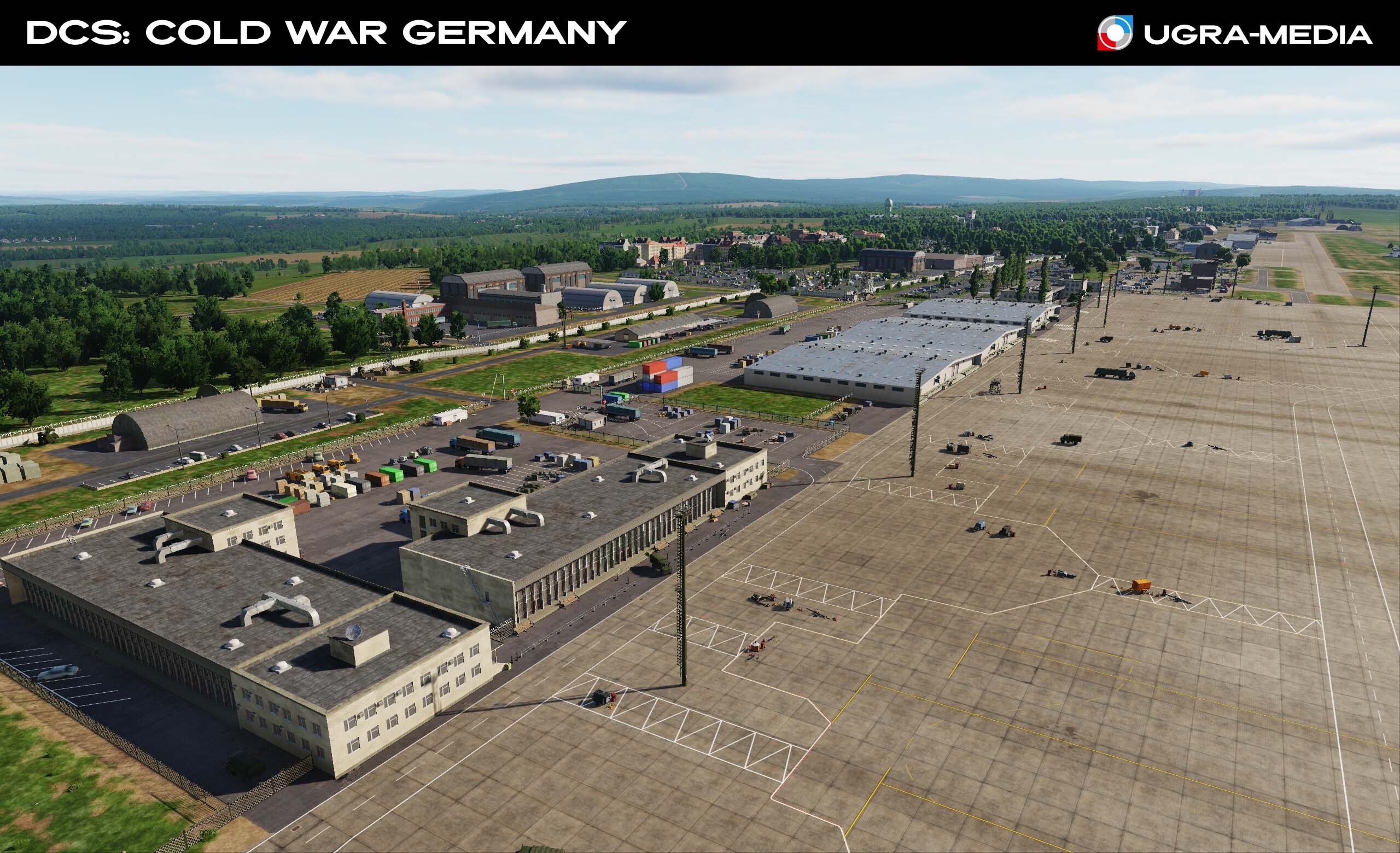
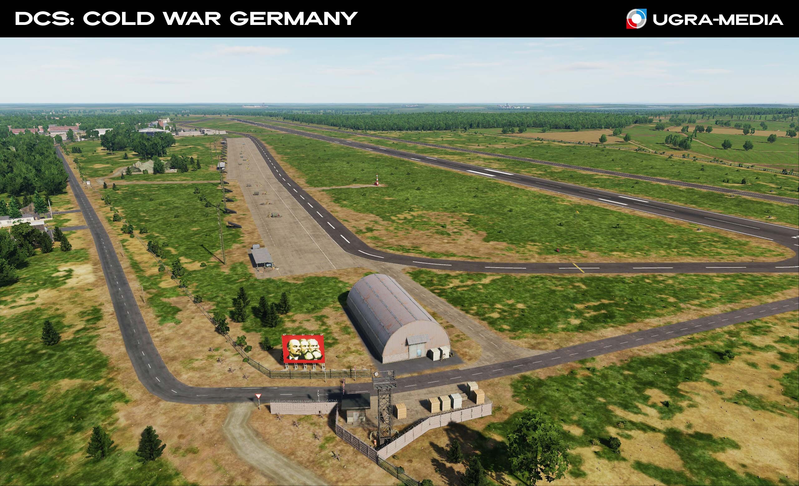
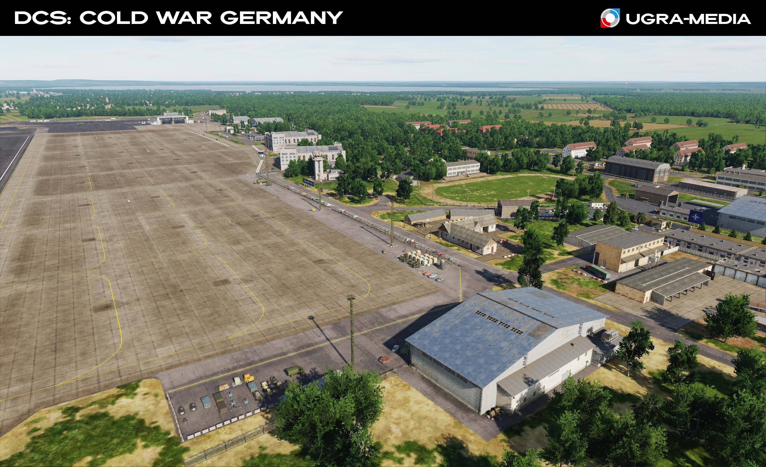
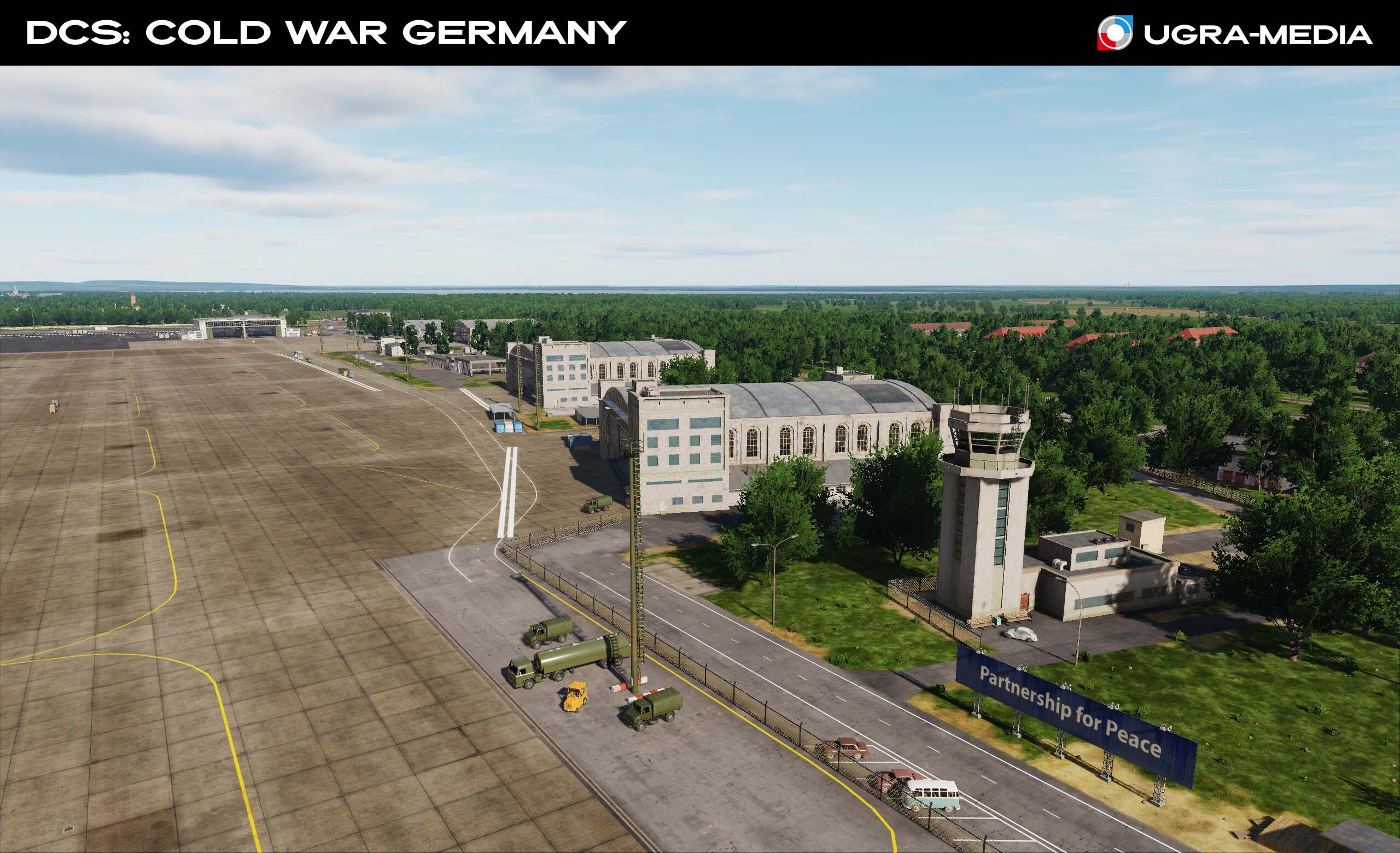
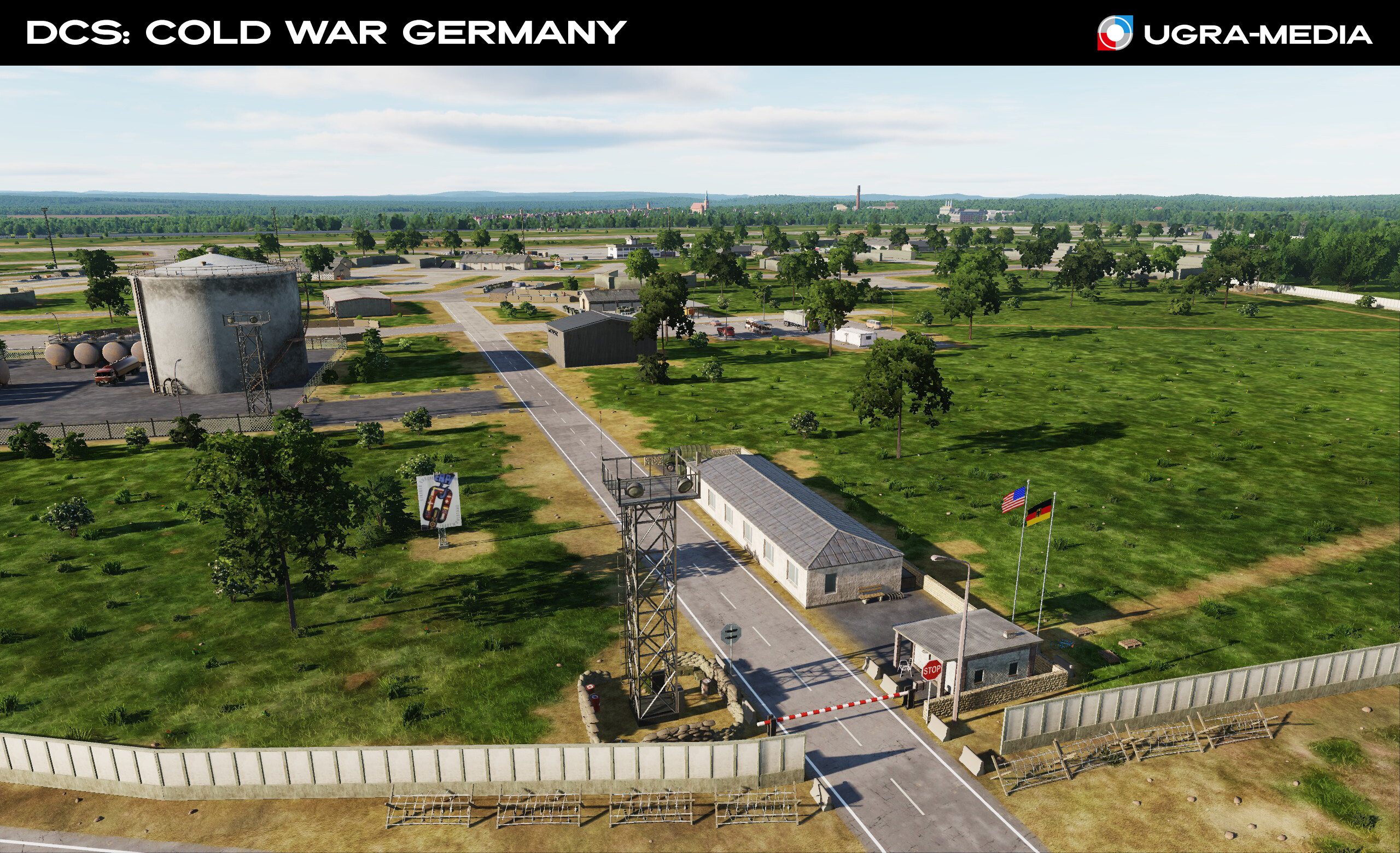
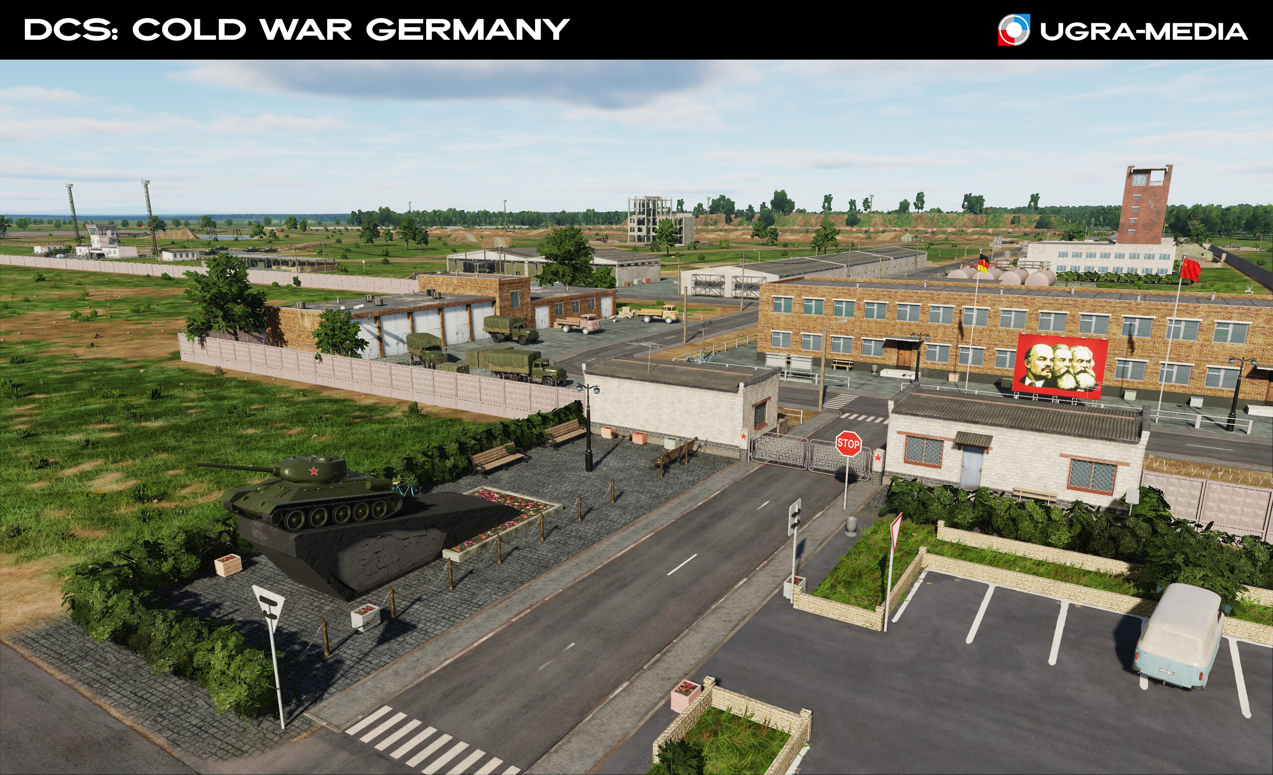
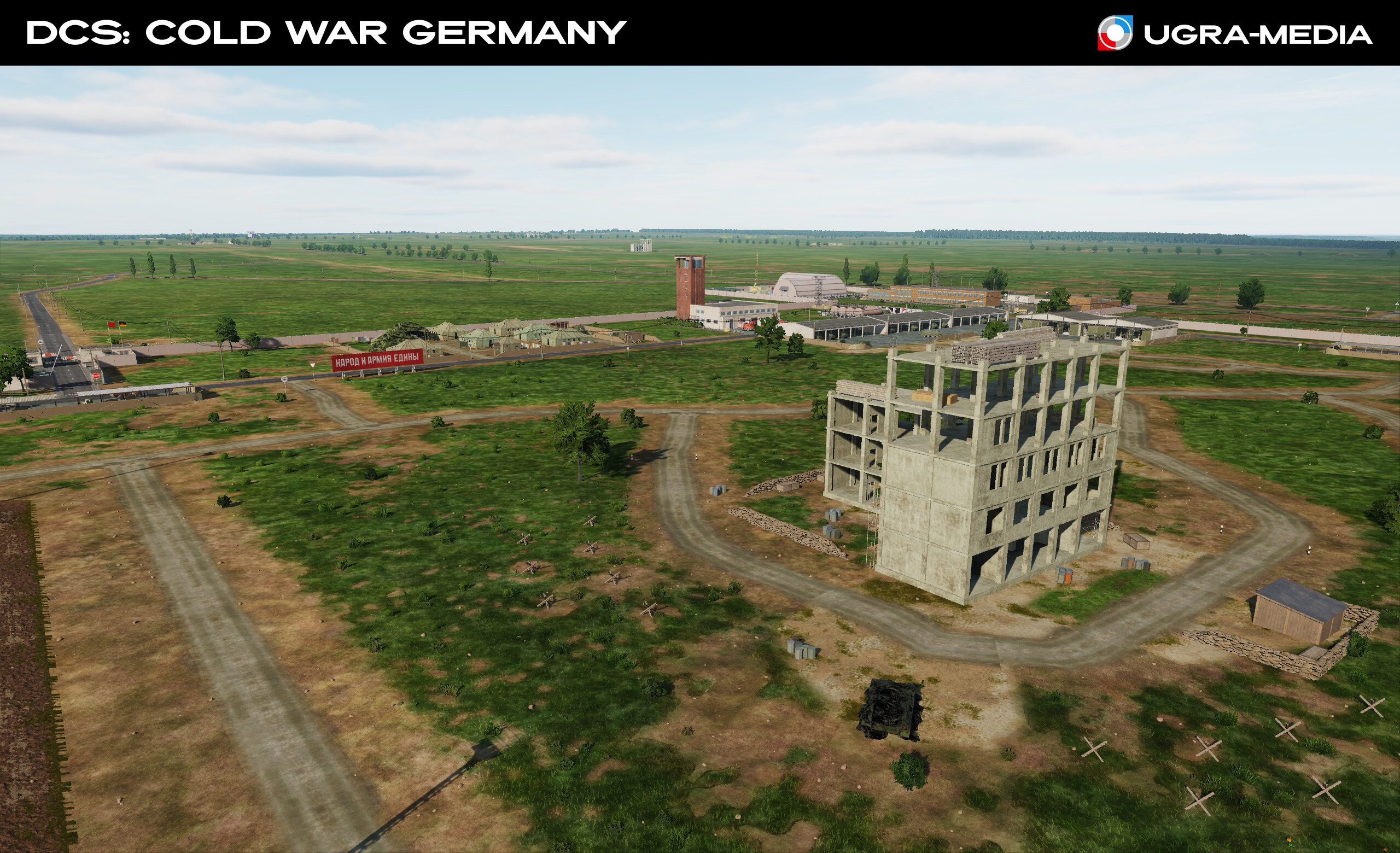
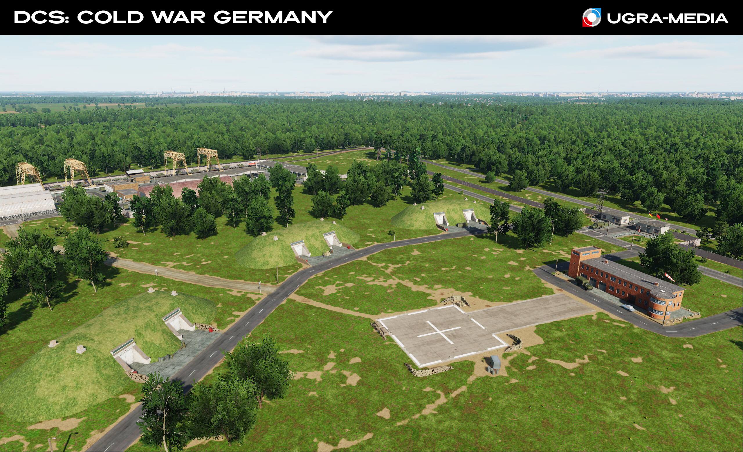
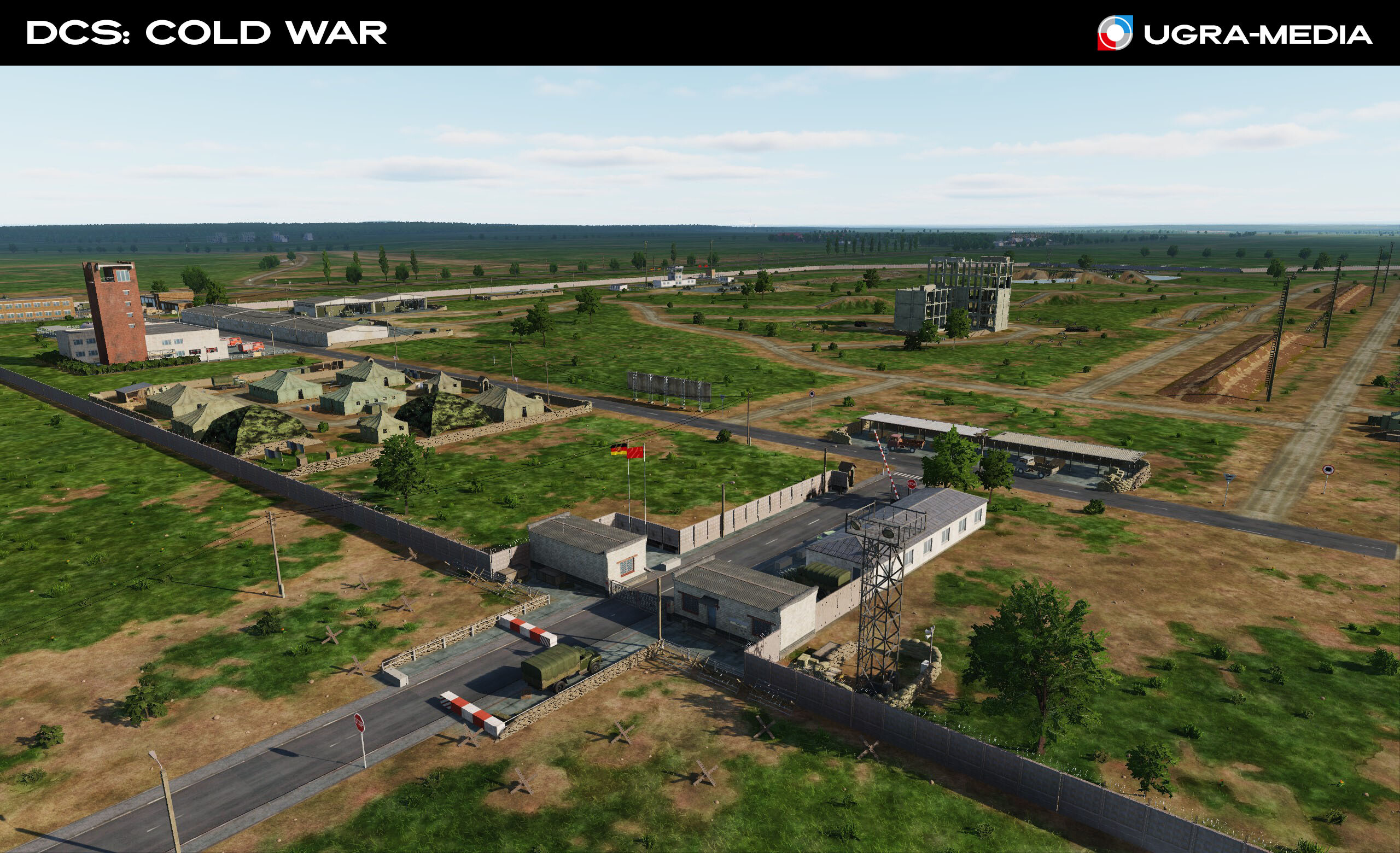
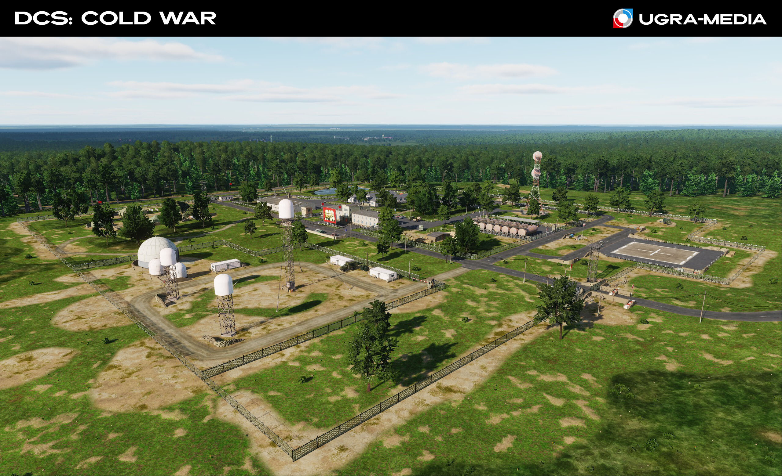
And now we are going to the very heart of the Cold War - to the military bases of the GDR and FRG, as well as to the legendary Teufelsberg. On the map "Cold War" you will find dozens of military bases, placed based on historical data. These are your starting points, landmarks or targets. Teufelsberg is not just a hill in West Berlin (all the garbage from all over Berlin was dumped there, which is how this mountain was formed), but a legendary radio interception station. Here the Americans set up their radar and listened to "conversations behind the Iron Curtain". Military base FRG Military base GDR The Helmstedt–Marienborn border crossing by the German Democratic Republic (GDR), was the largest and most important border crossing on the Inner German border during the division of Germany. Rügen is Germany's largest island. During the Cold War, it was a strategically important site for the GDR and the USSR. It housed military installations that played a key role in the defense and surveillance of the Baltic Sea. ---------------------------------------------- und - Schenk mir einen Bitburger ein Get your "BT" stencils ready to apply these letters to the tails of your F-15s Bitbutg Air Base From 1952 until 1994, Bitburg Air Base was a front-line NATO air base. It was the home of the United States Air Force's 36th Tactical Fighter Wing for over 40 years as part of the United States Air Forces in Europe (USAFE)
- 489 replies
-
- 24
-
-
-
Hi Watch the videos. They show everything from different heights and angles. @RhineHornet thanks! This is really helpful. In the meantime, let's go for a ride and look at the map from ground level.
- 489 replies
-
- 16
-
-
-
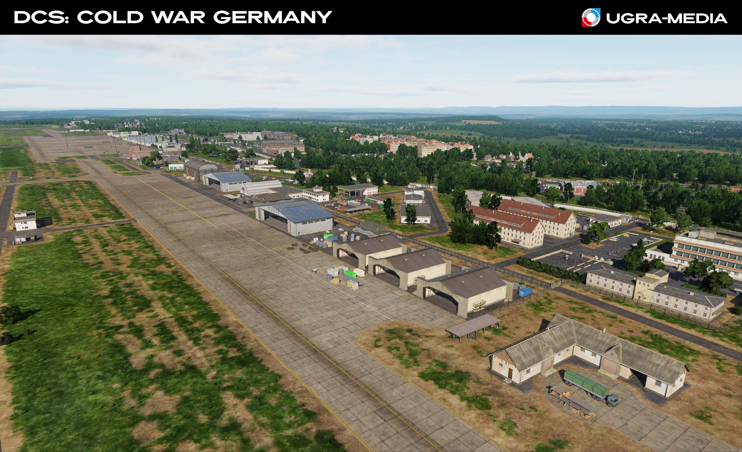
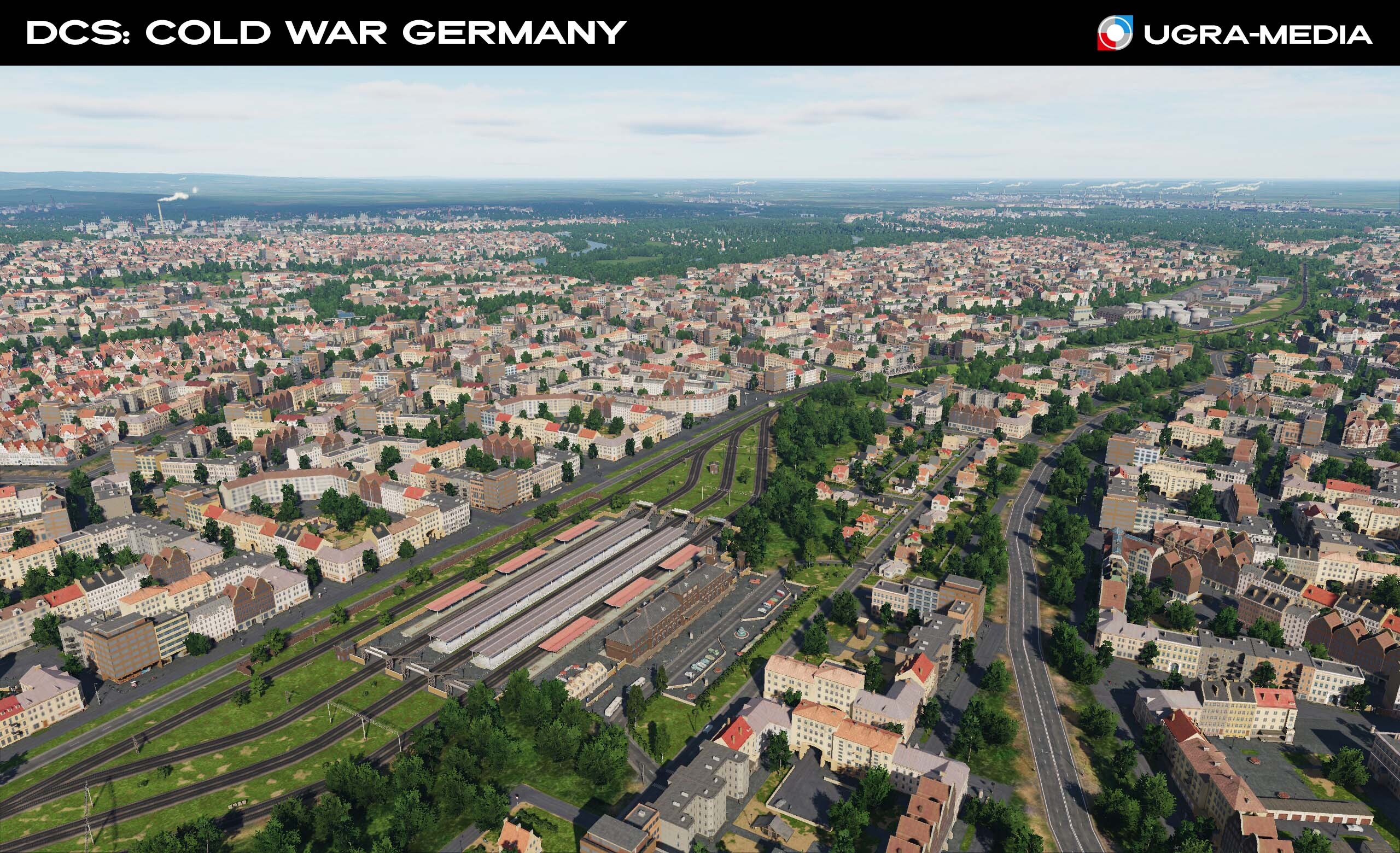
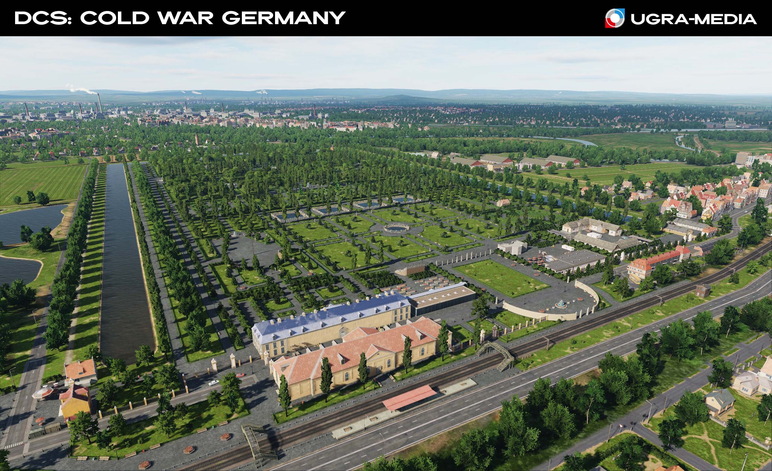
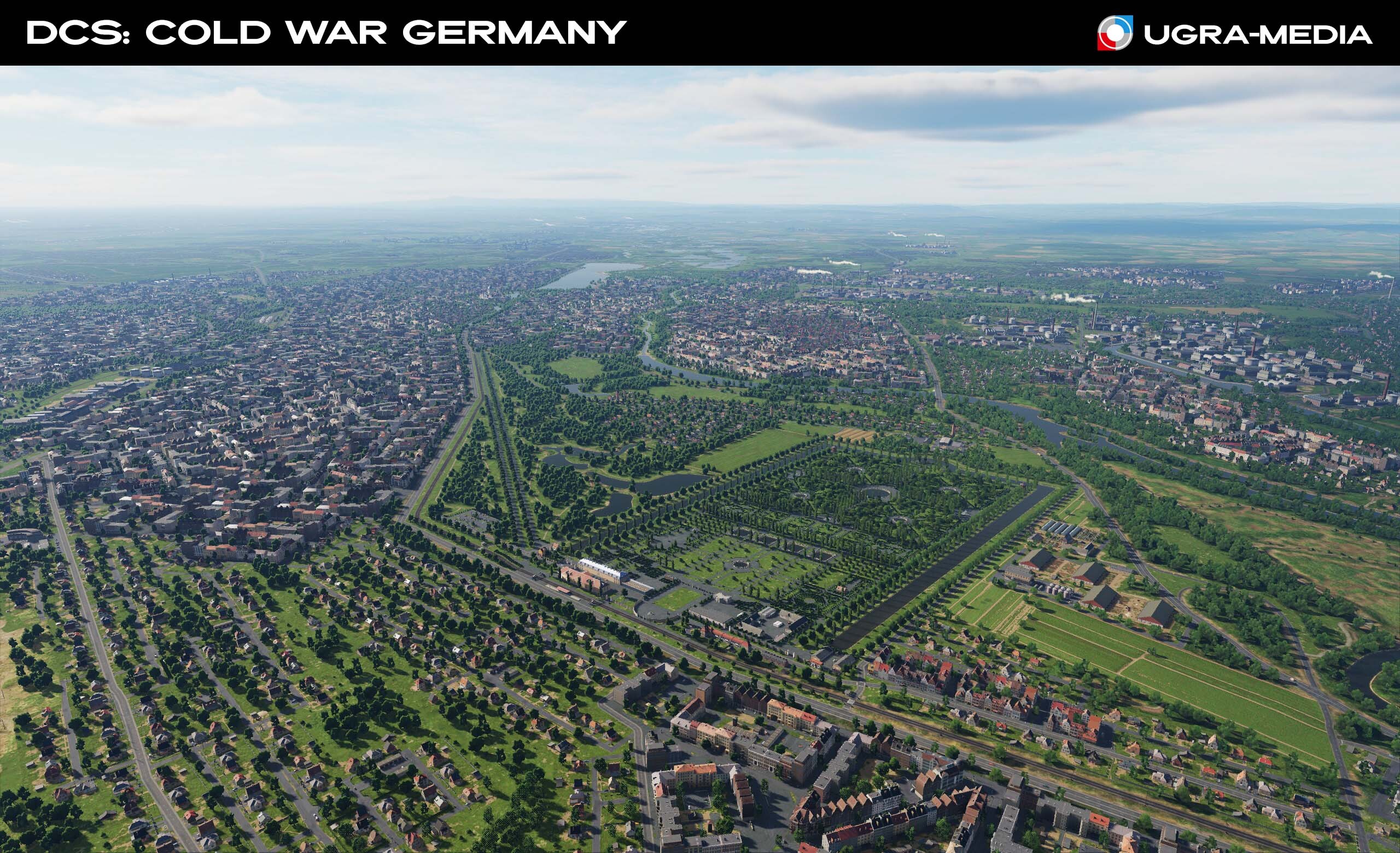
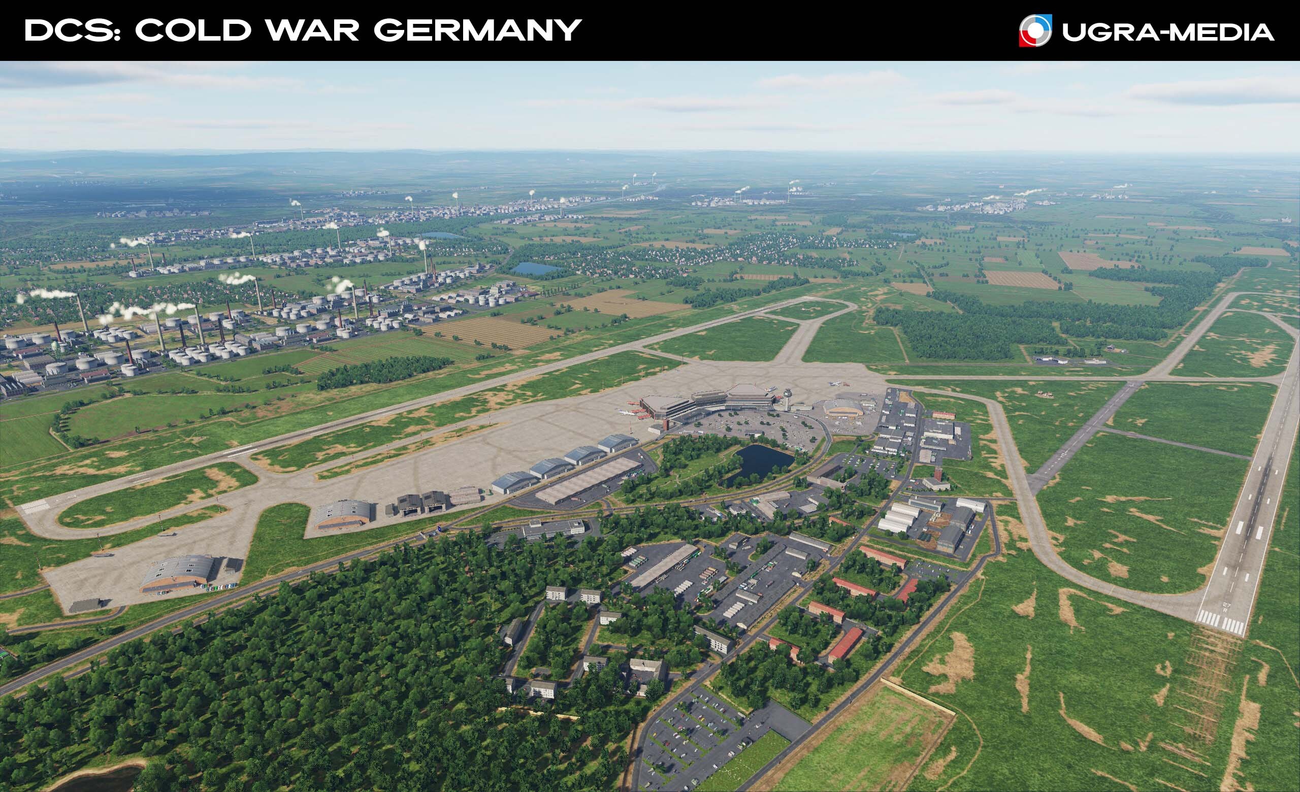
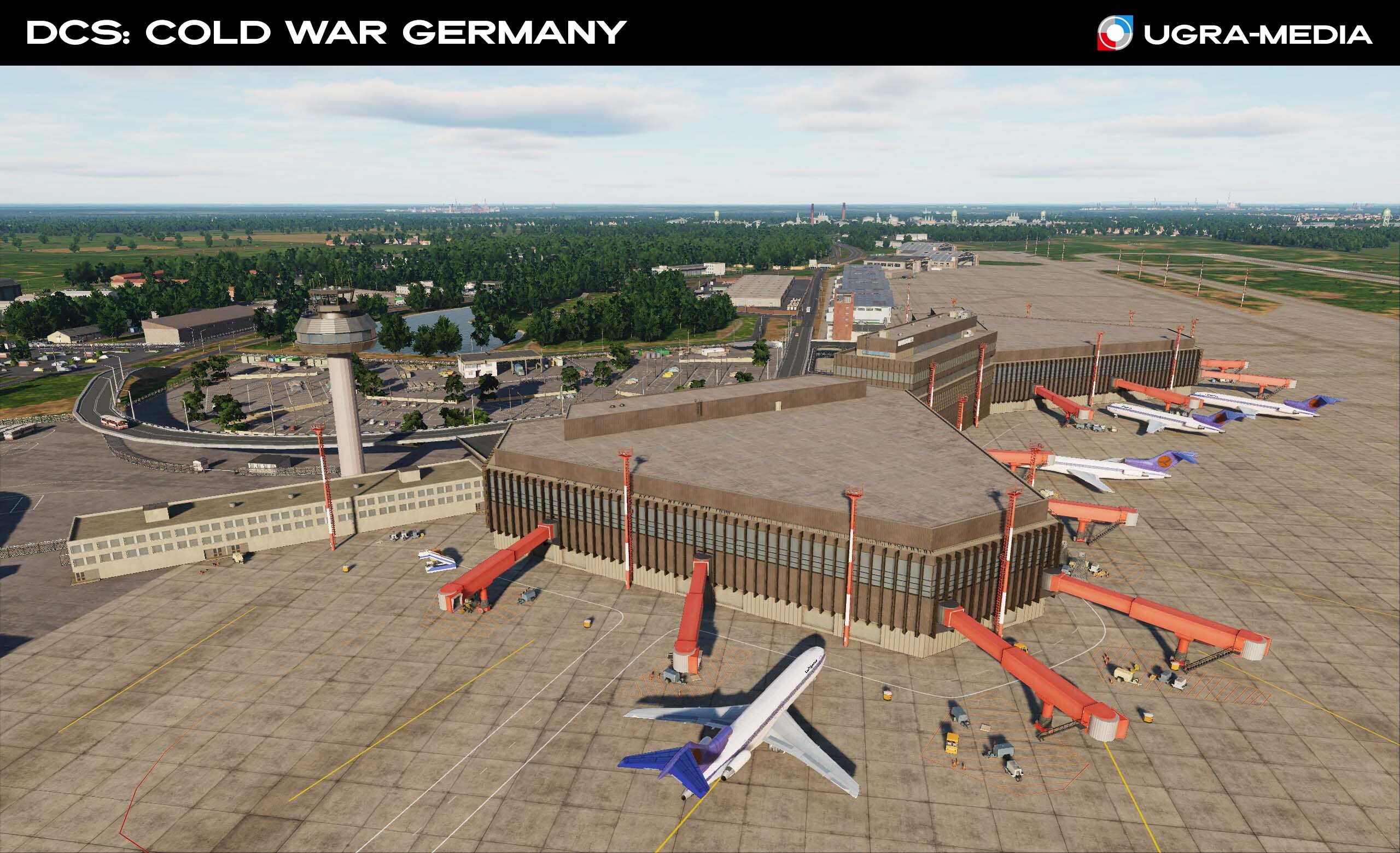
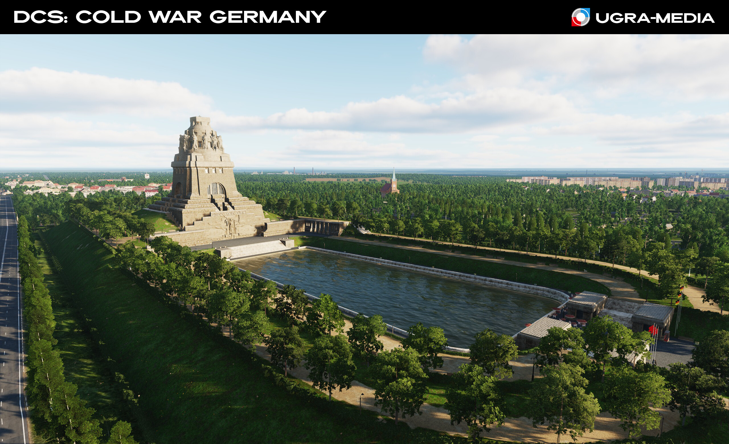
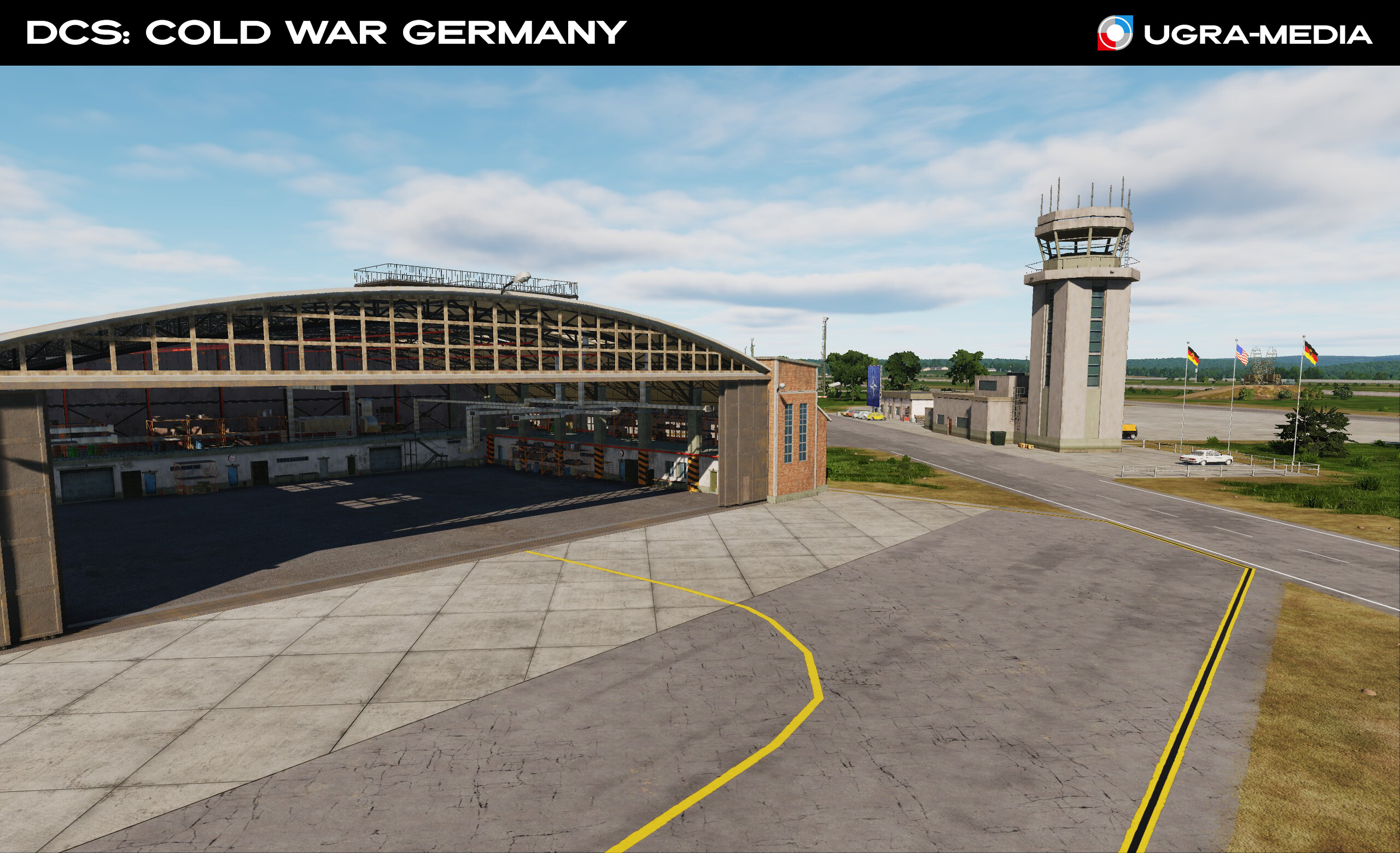
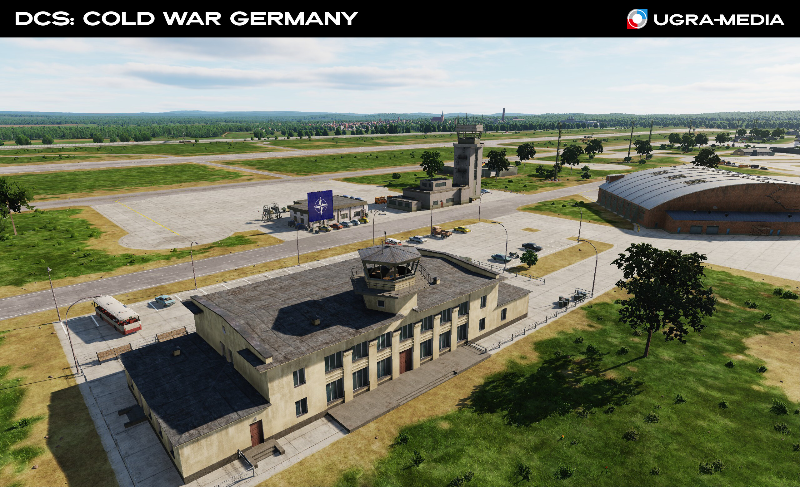
Hallo, Genossen! Today we continue our journey along the Cold War map and head to Leipzig, a city where socialist reality meets history, and the Soviet pavilion reminds us of the times when Trabants were a dream, and a line for bananas was a real adventure. When there was a happy childhood and comrades all around. As part of the GDR, Leipzig was the second most populous city and, thanks to the annual trade and industrial exhibition, served as a kind of calling card of the republic. Leipzig is not only a large industrial center of the GDR, but also an important strategic hub - from here you can quickly get to the Fulda Gap or key targets deep in enemy territory. Comrades, you are flying to Leipzig: at the same time, take a look at the airport, look at the monument to the Battle of the Nations (Völkerschlachtdenkmal) - a huge monument dedicated to the Battle of Leipzig in 1813. This is a great landmark for navigation. Meet at the Soviet Pavilion (Achilleion) - the Soviet Pavilion was not just an exhibition hall, but a real symbol of the Soviet presence in the GDR ------------------------------------------------------- Leipzig/Halle Airport - Gateway to the GDR Skies Leipzig Airport is a true symbol of the era. One of the key airports of the GDR, where both civilian and military aircraft were based. Interflug Tu-134s landed here, Air France and British Airways operated Concorde flights from Paris and London when the Leipzig fair was held. Leipzig Airport awaits you! -------------------------------------------------- Sembach Air Base Now we move west to Germany, where Sembach Air Base (Sembach Kaserne) awaits you. Situated about 19 miles (31 km) east of Ramstein Air Base, it is one of NATO's key bases and played an important role in protecting Western European airspace. If you are no stranger to the A-10, this base will feel like home to you. Here you can take your F-4 Phantom or A-10 Thunderbolt II into the sky and enjoy the beautiful views - the base is surrounded by picturesque forests, making it not only strategically important, but also visually impressive.
- 489 replies
-
- 27
-
-
-
Hallo, Kampfpiloten. We are glad that you are interested in the map and liked the chosen territory. Thank you for your feedback and information, this is very valuable to us. We do not hide the territory of development, we immediately opened the list of airfields and showed the map so that you know what to expect. But some questions and wishes have appeared (you are so insatiable! ), so we will answer some of them. Many asked about the date (I will not list them all) for now we can answer that we are planning the release of the map within a year. @Geschirre, yes, there is Bibturg, it is included in the first phase and, moreover, you will see it this week. There are a lot of wishes about adding phase 3 airfields and bases located outside the map boundaries. We are happy with this, it means that we have covered all the most important things in phase 1. It is too early to talk about expanding the map (spare your SSDs), but we are analyzing all your suggestions and arguments, when the time comes to update the map boundaries, we will announce it. @cfrag about German Asset Pack: we will think about it, if we release it, it will be after phase 3. Cold War Germany map is our priority. You can create a topic and specify the models that you would like us to move to the pack. We will try to keep you updated and publish reviews of the map every week on Friday and Saturday. Follow the forum and subscribe to the Youtube channel (at your request, we renamed it), sometimes short videos may appear there. Also, at the end of this or next week, our joint FAQ post with ED will be published Ich bin weggeflogen!
- 489 replies
-
- 24
-
-
-
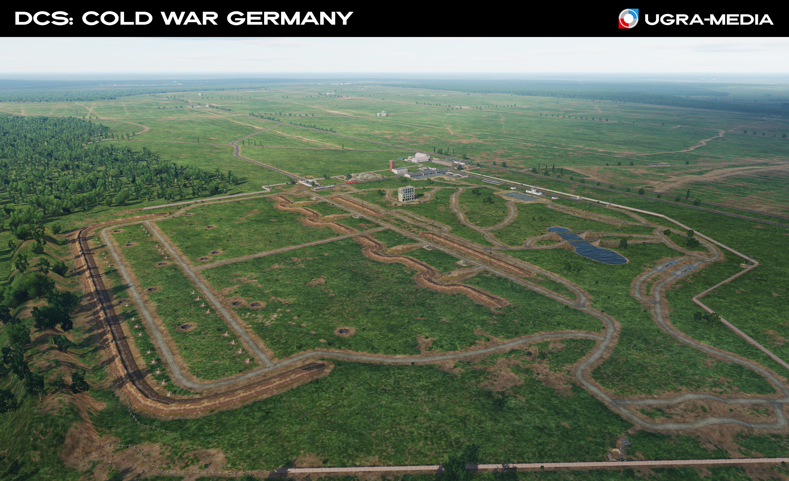
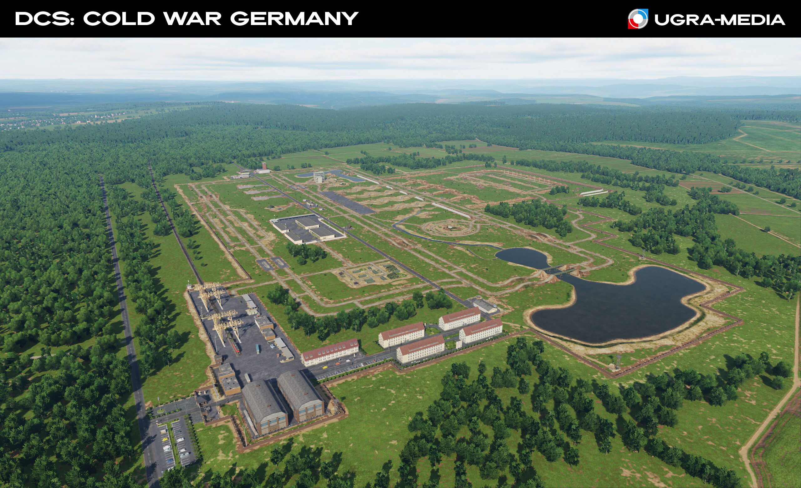
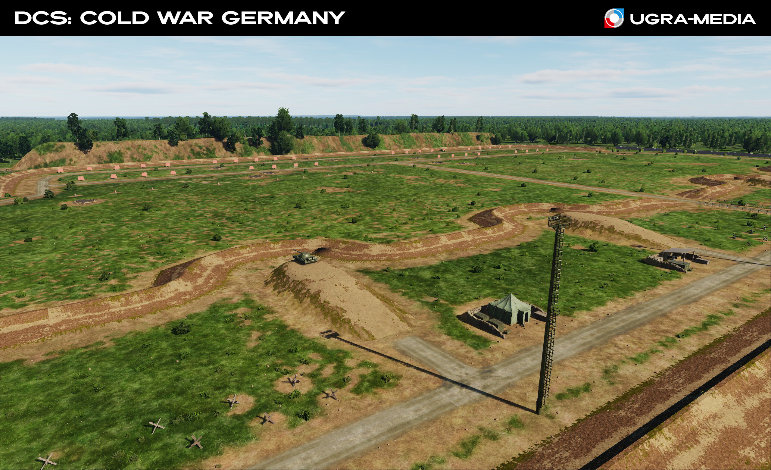
Now you know that DCS: Cold War Germany will be interesting not only for users of the aviation part of DCS World, but also for users of military ground vehicles and allows you to implement a huge number of scenarios: - Confrontation of the Warsaw Pact and NATO countries with the possibility of reconstructing the war between the socialist camp and the collective West. - Implementation of exercises of the Warsaw Pact and NATO countries (Brotherhood in Arms (1980), Shield (1984), Able Archer 83. - Possible scenarios of the third world war. A separate important component of the map will be the implementation of military training grounds, where scenarios of interaction between different types of ground vehicles and air groups were practiced, this will allow players to implement scenarios of military exercises simultaneously for aviation and ground vehicles. Large Magdeburg training ground Infrastructure of tank ranges of the GDR and FRG Next week we will show the city of the Peaceful Revolution - Leipzig. Auf Wiedersehen!
- 489 replies
-
- 43
-
-
-
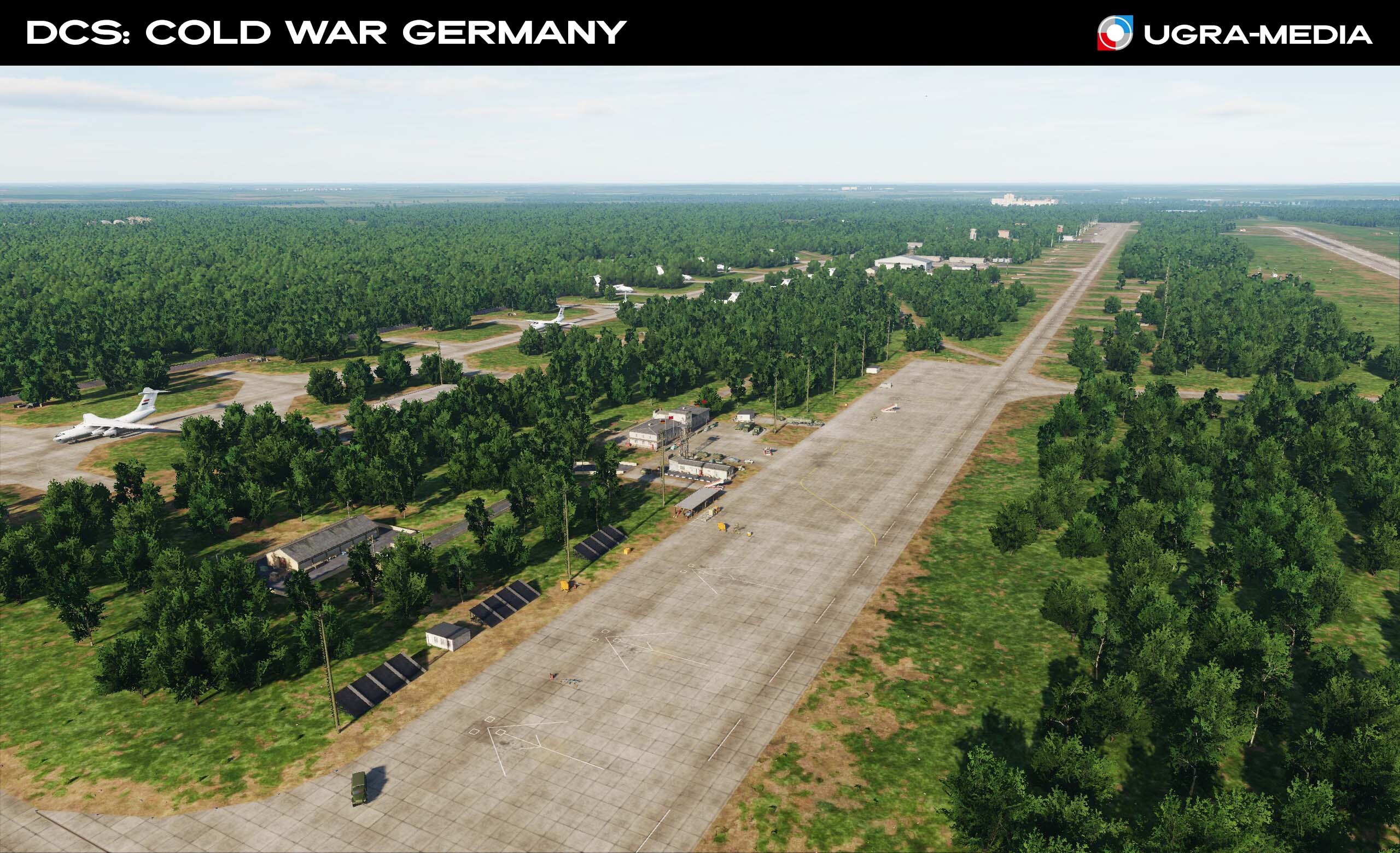
DСS Cold War Germany for Helicopter Pilots. It seems to me that helicopter pilots now have unlimited opportunities to use the map. In addition to airfields, there are now more than 70 equipped helipads from which you can take off. Helicopter ferrying, cargo and personnel delivery, medical flight, sightseeing flight, attacking targets - all this is available. The sites are located everywhere: in the city, on the plain, in the mountains. In some places, you will have to fly carefully taking into account obstacles and the curvature of the terrain. We also made real heliports, they are great for training and as a center for the beginning of joint combat operations. Hospital helipads Helipad at the training ground and at the military base Helipad in the mountains (you were worried about the Transmitter - everything is fine, it is in place ) Heliports: Fulda - US Army airfield. It was located on the strategically important Fulda Gorge, which the West considered a likely place for a Soviet tank attack. Therefore, numerous transport, observation and attack helicopters were stationed in Fulda. Schweinfurt Army Heliport - is used by the US Army located in Bavaria (ger: Bayern) Bückeburg Air Base is used by the German Army's School of Army Aviation Malwinkel Air Base (joint) - major Soviet air / helicopter base
- 489 replies
-
- 30
-
-
-
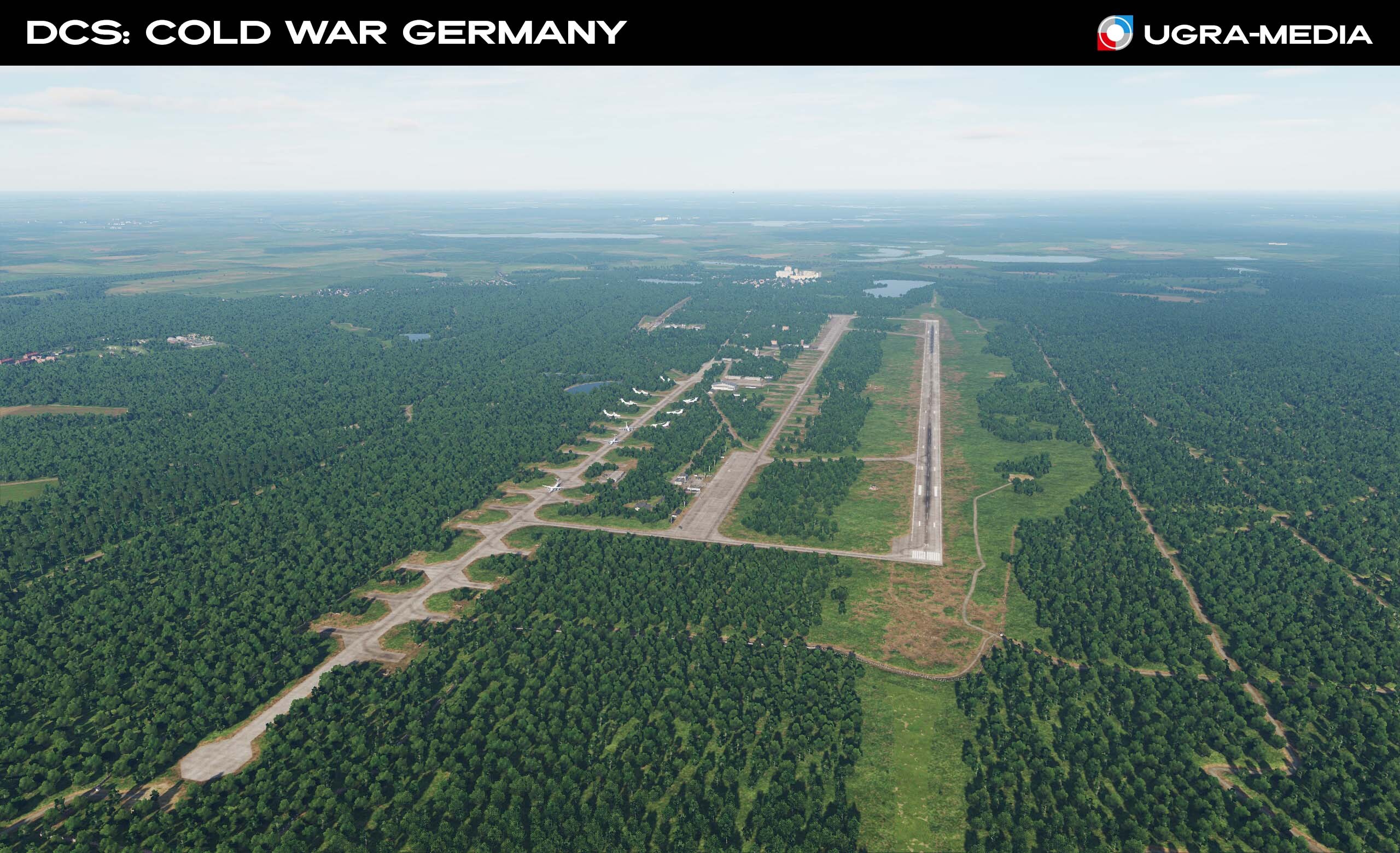
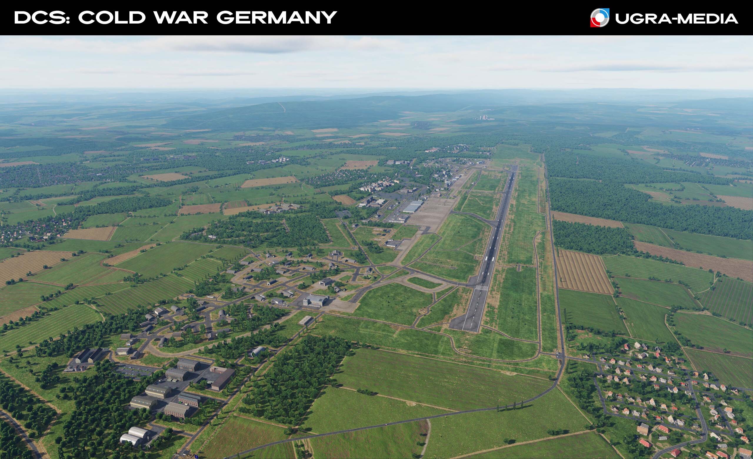
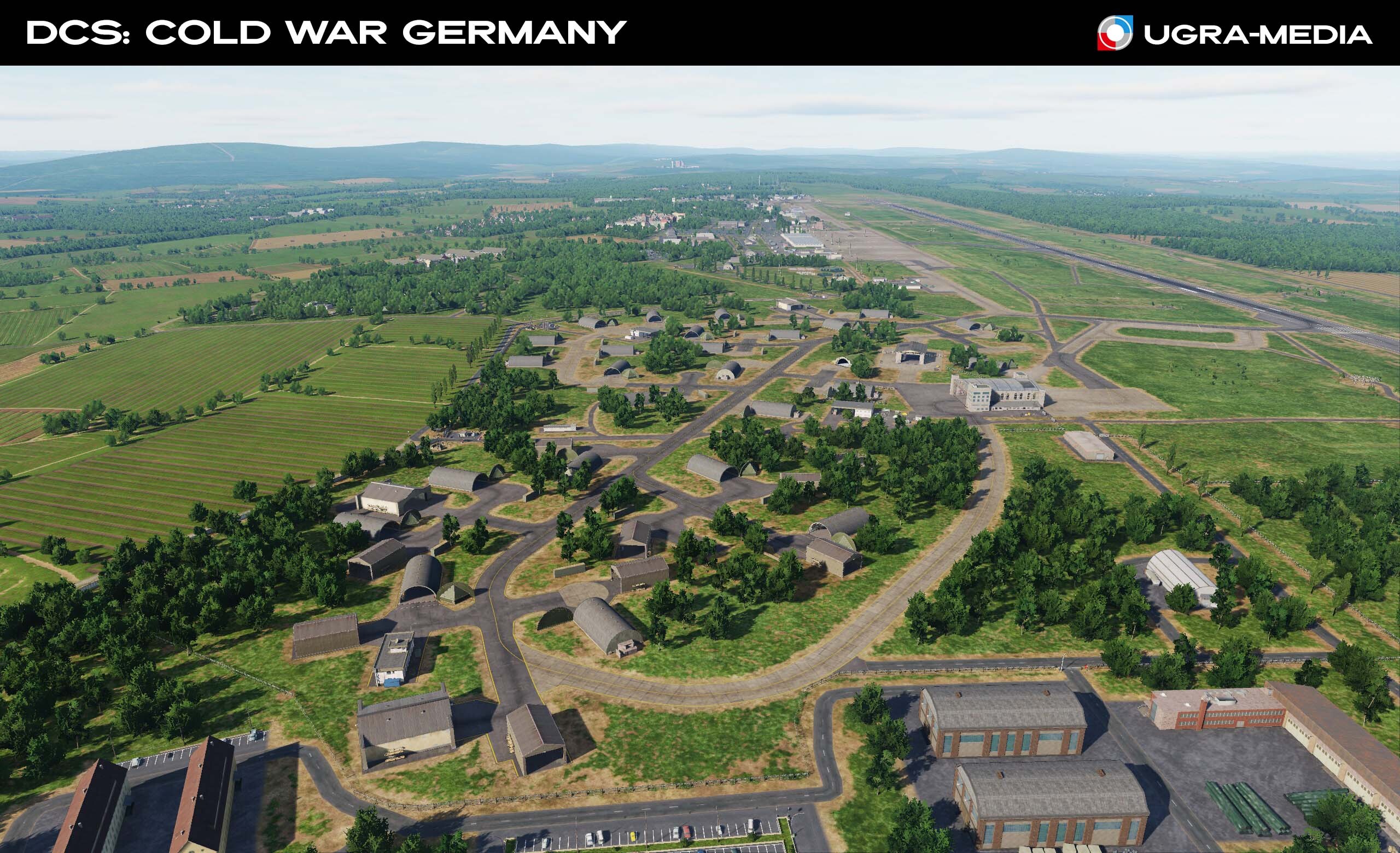
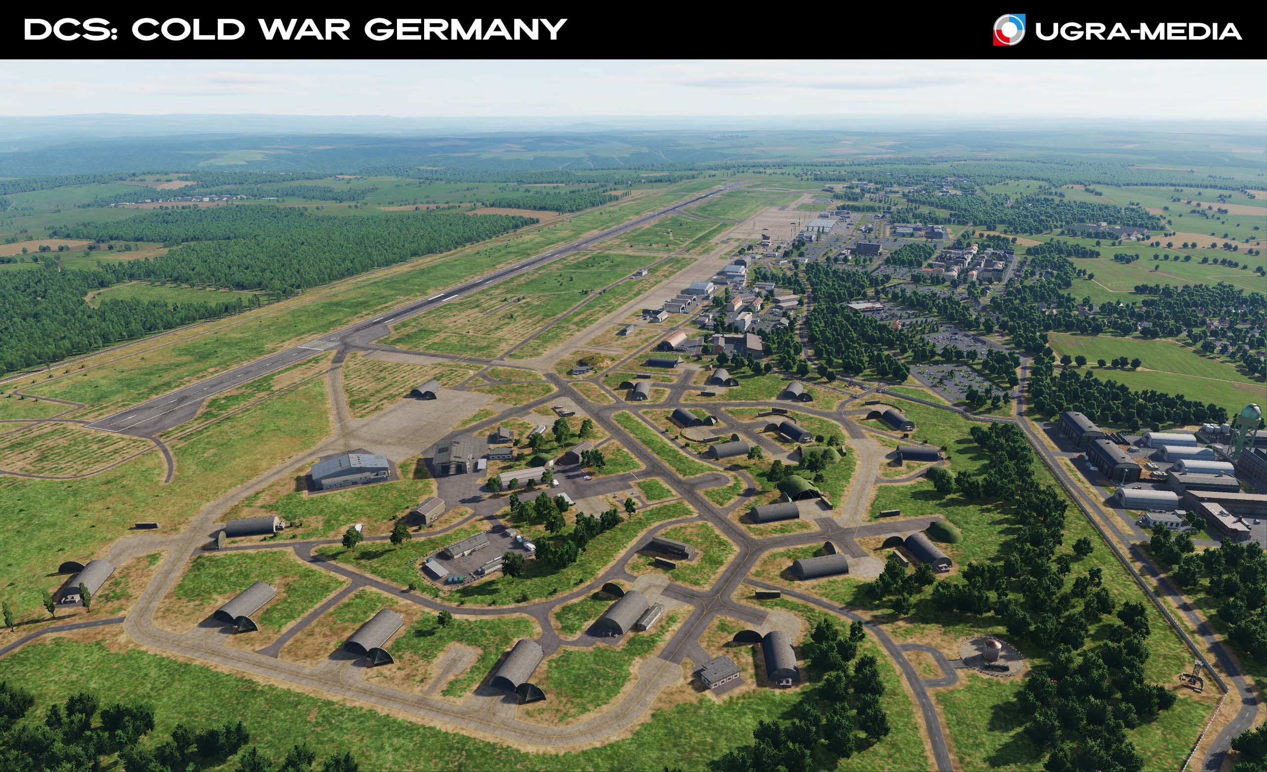
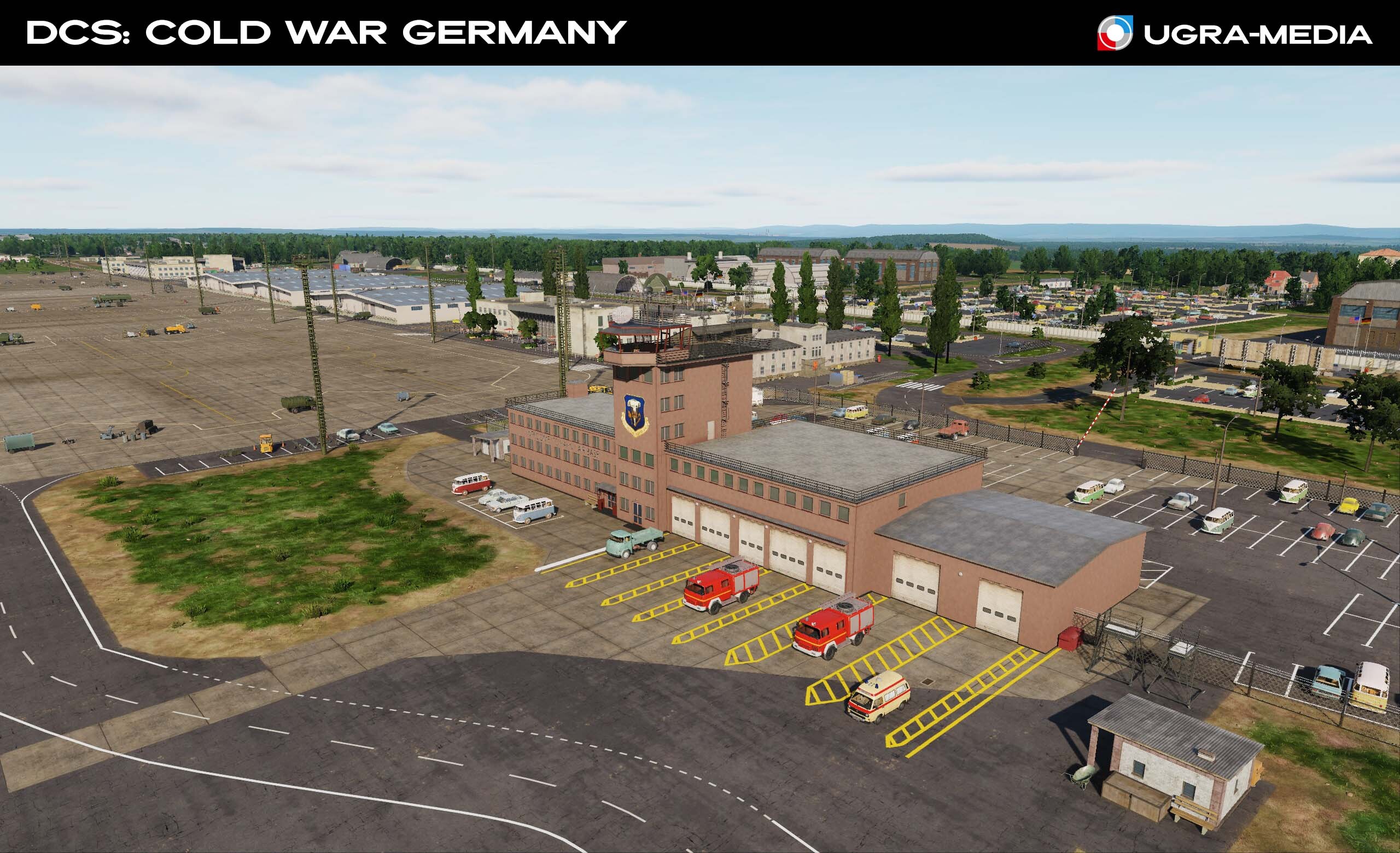
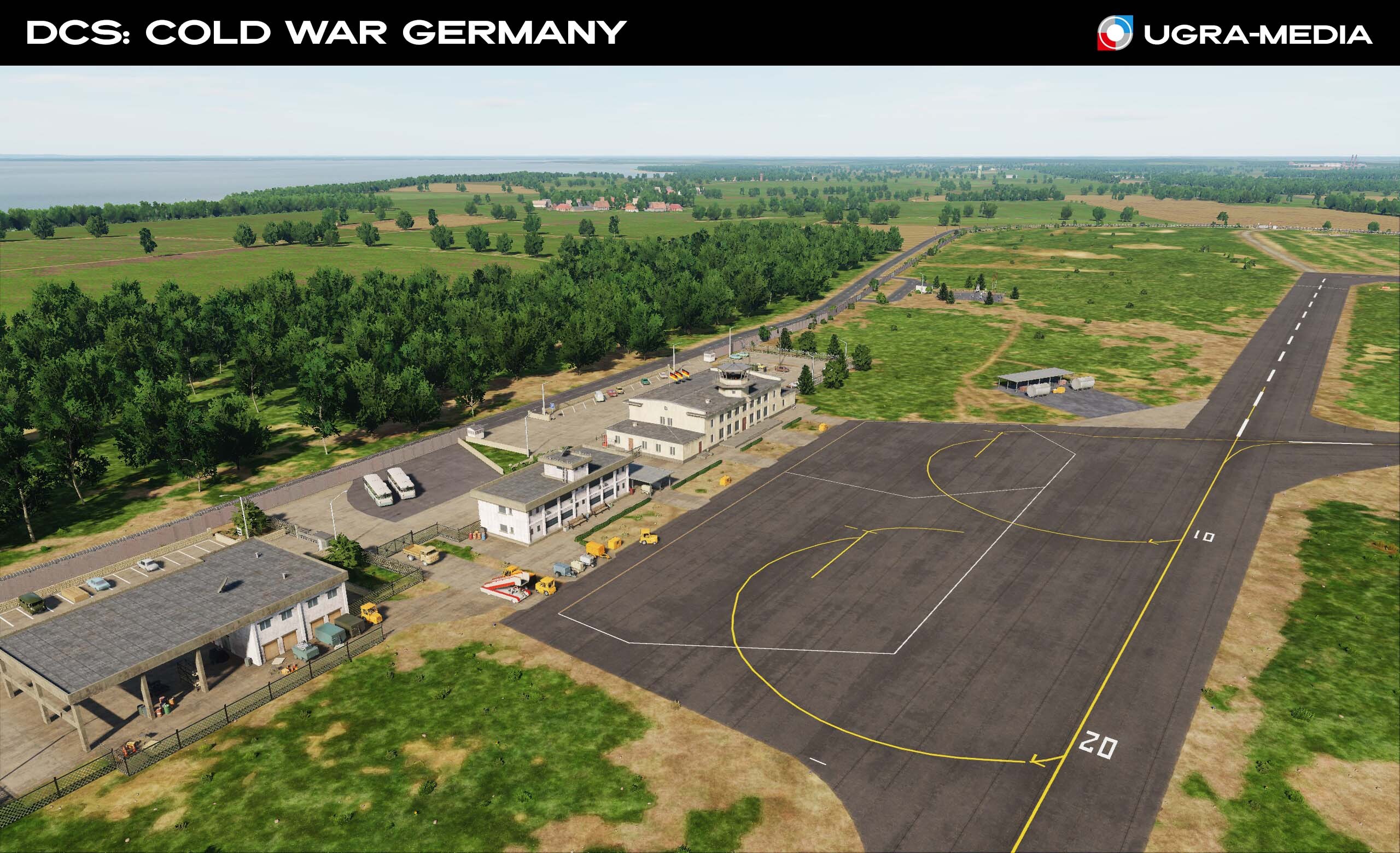
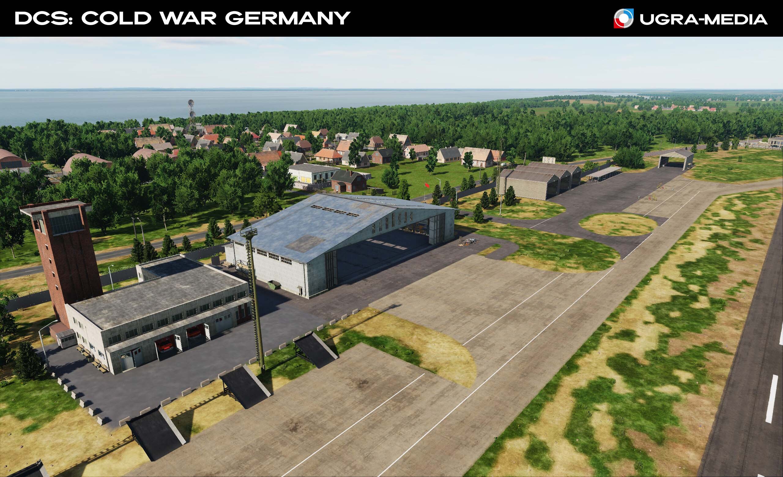
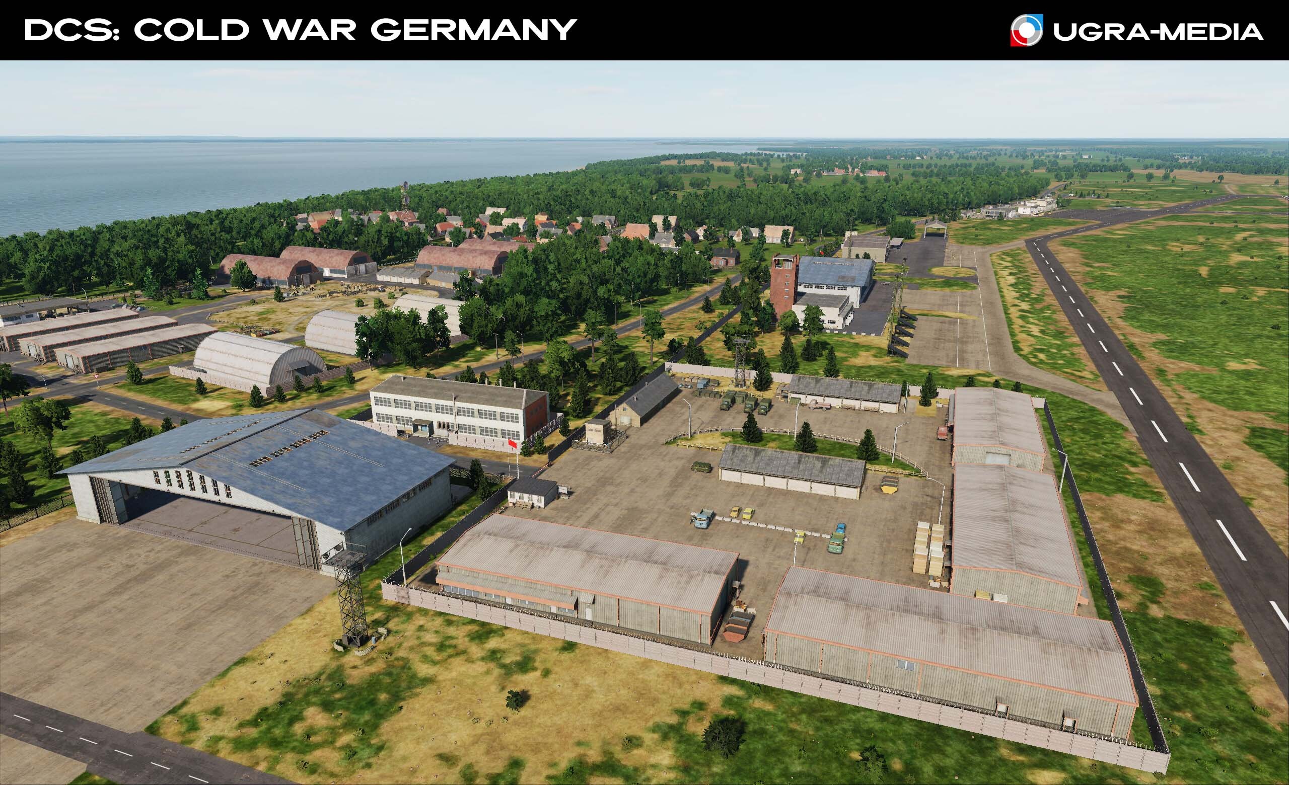
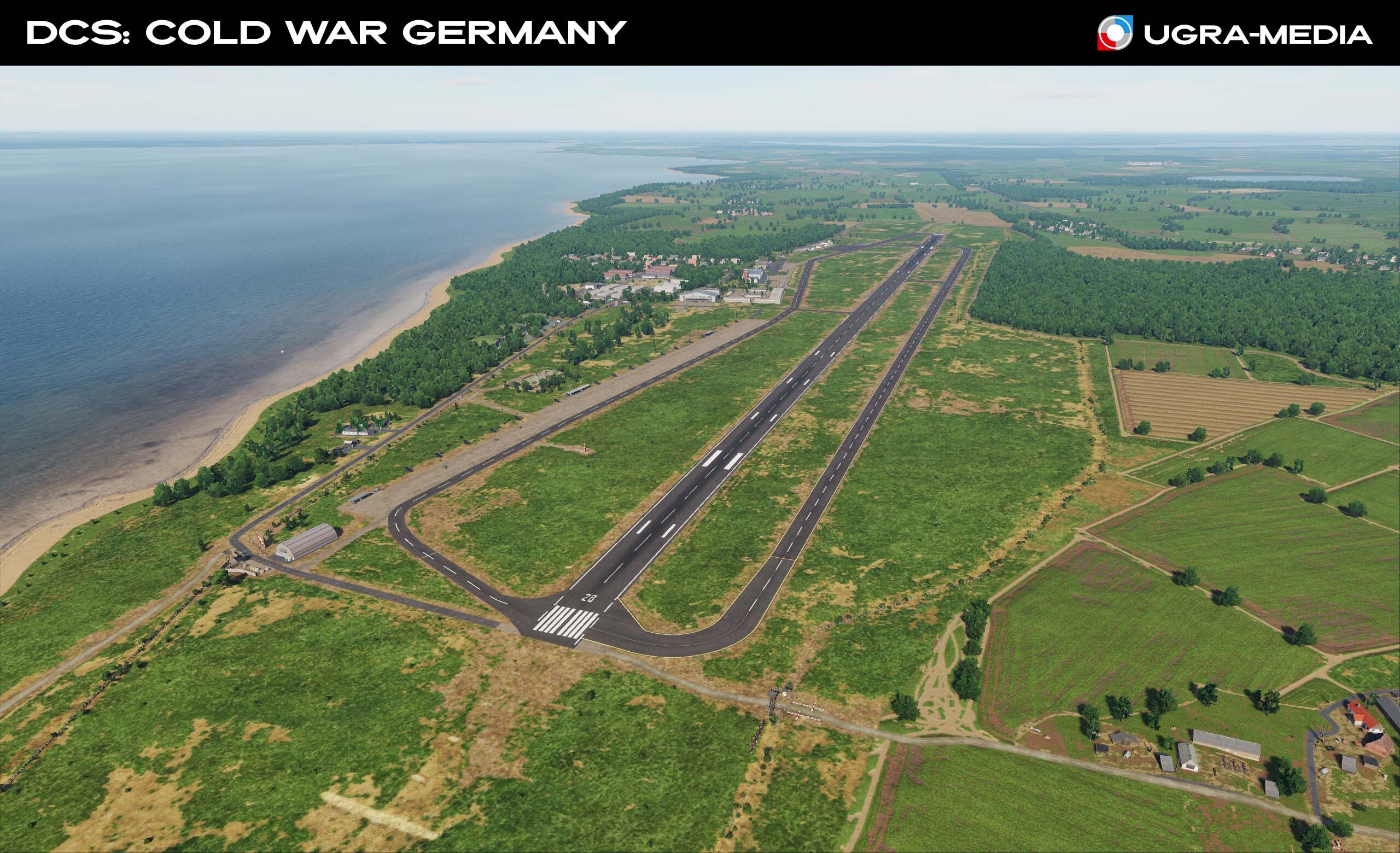
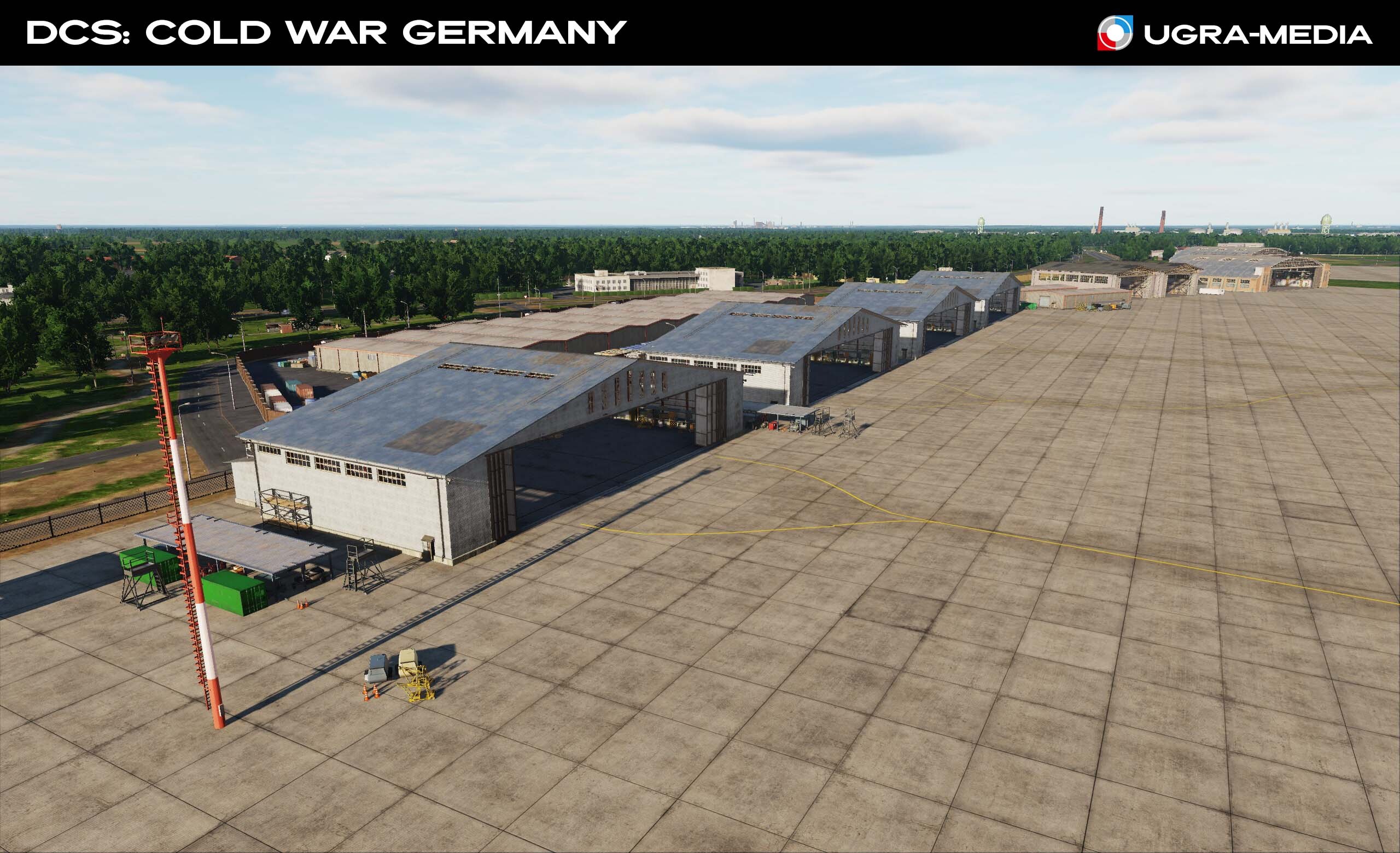
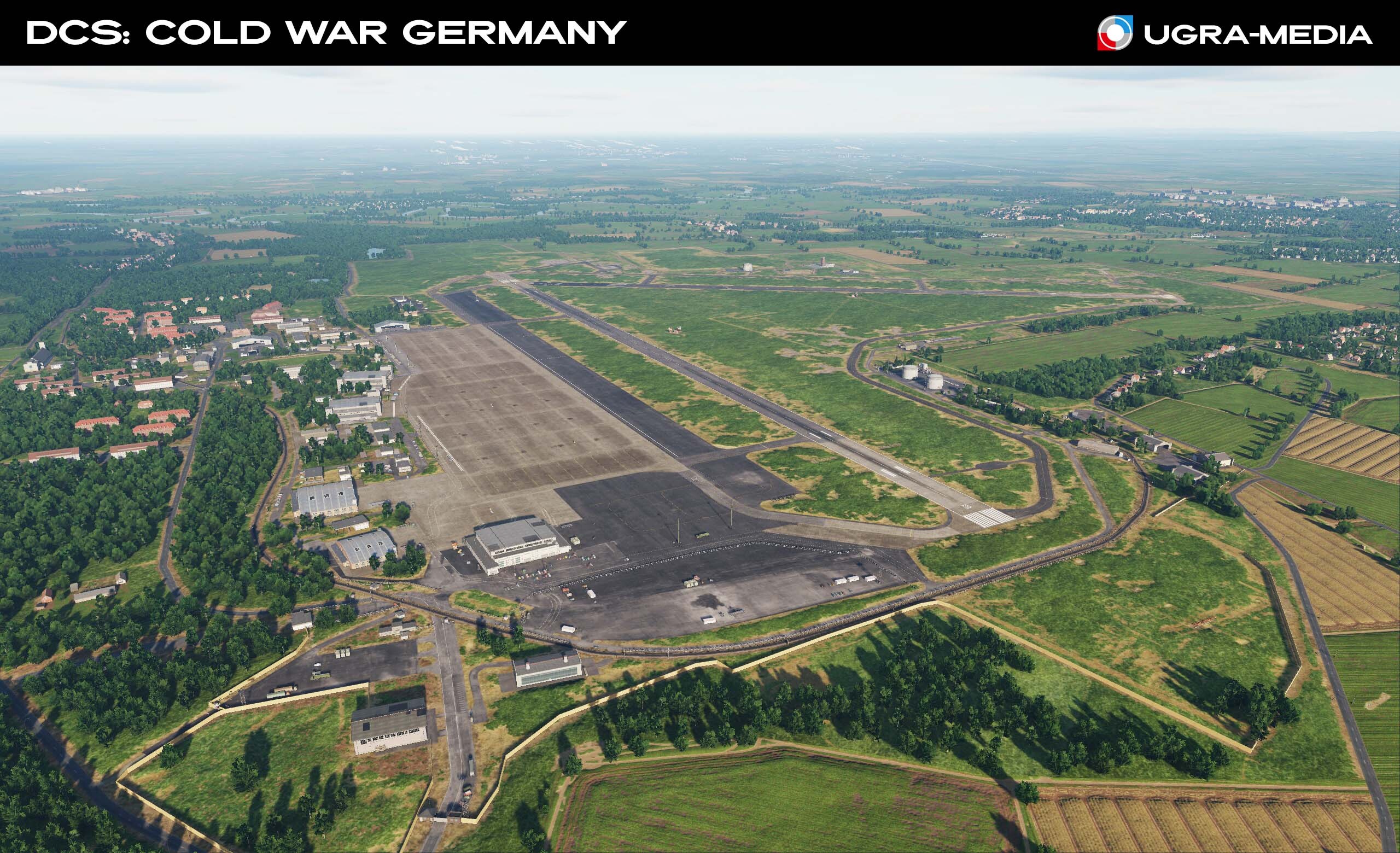
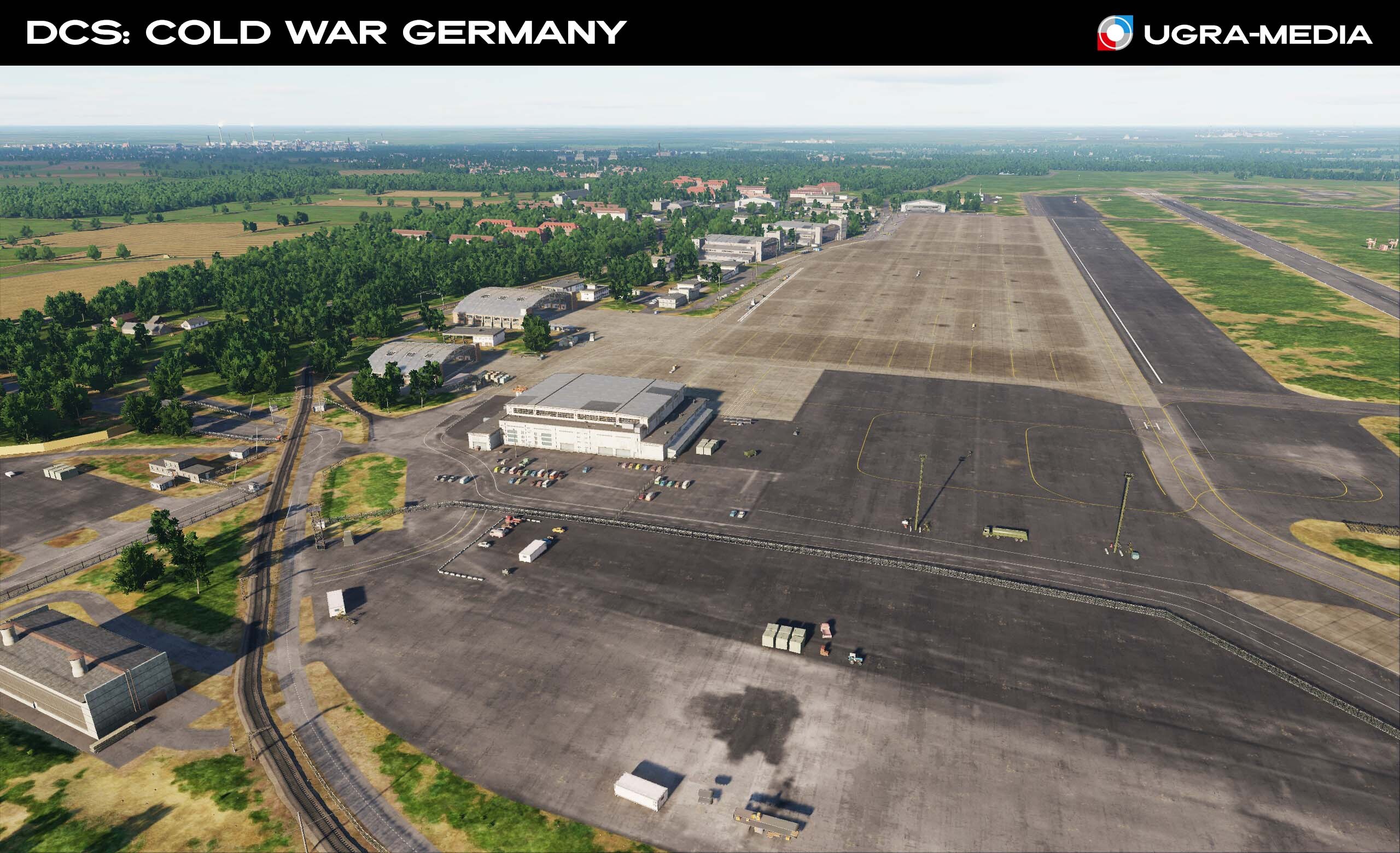
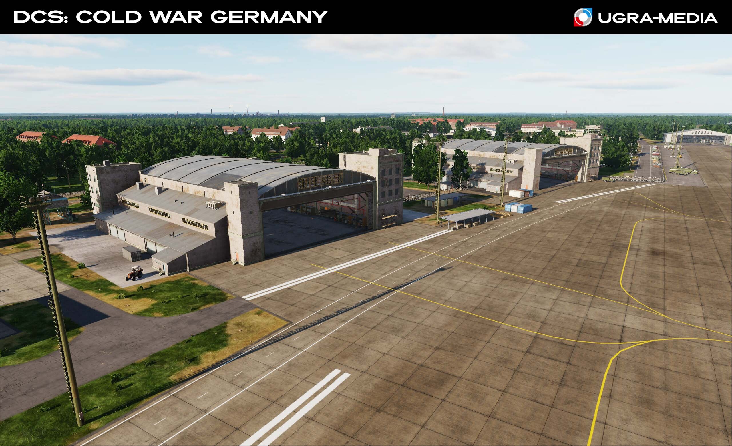
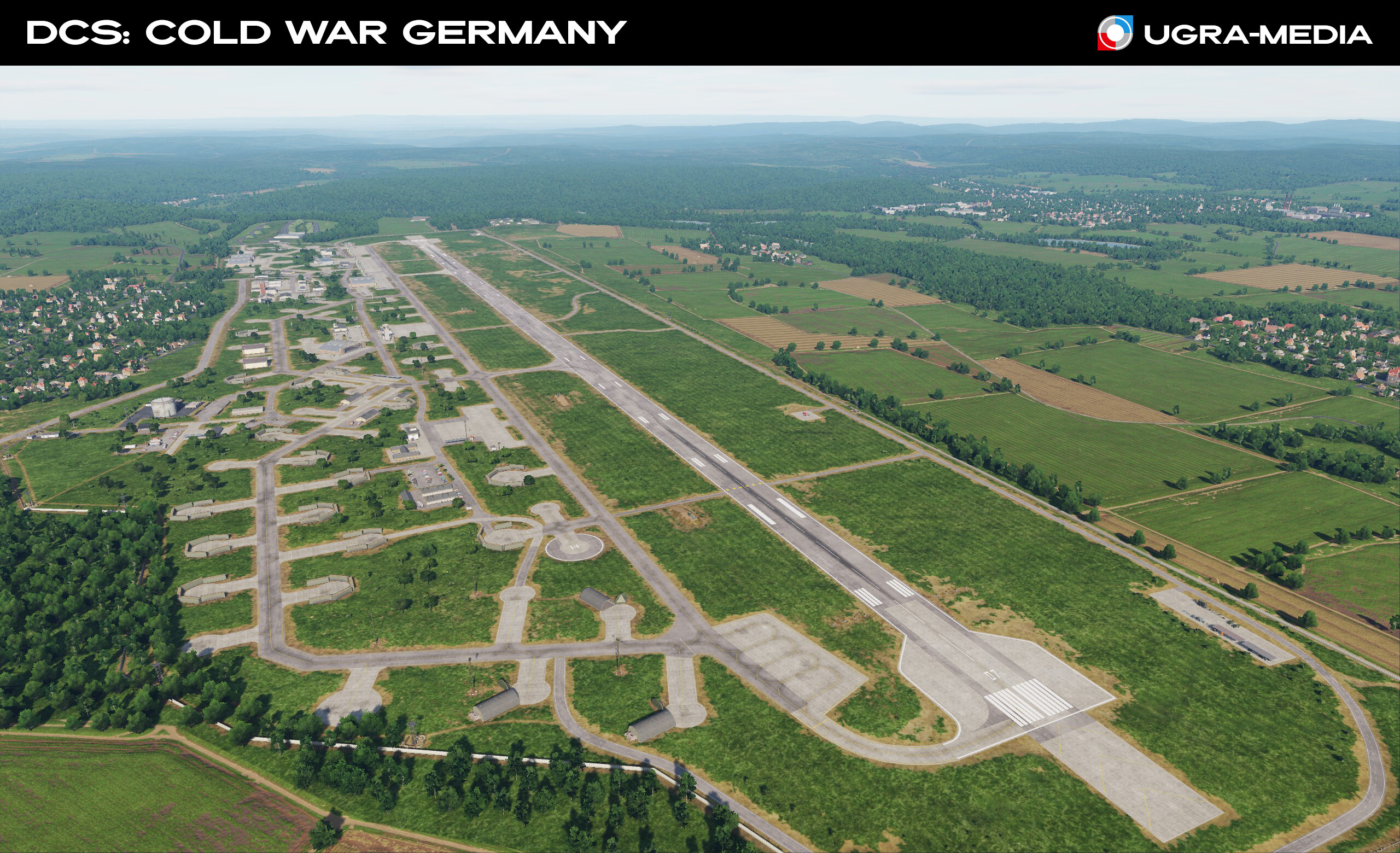
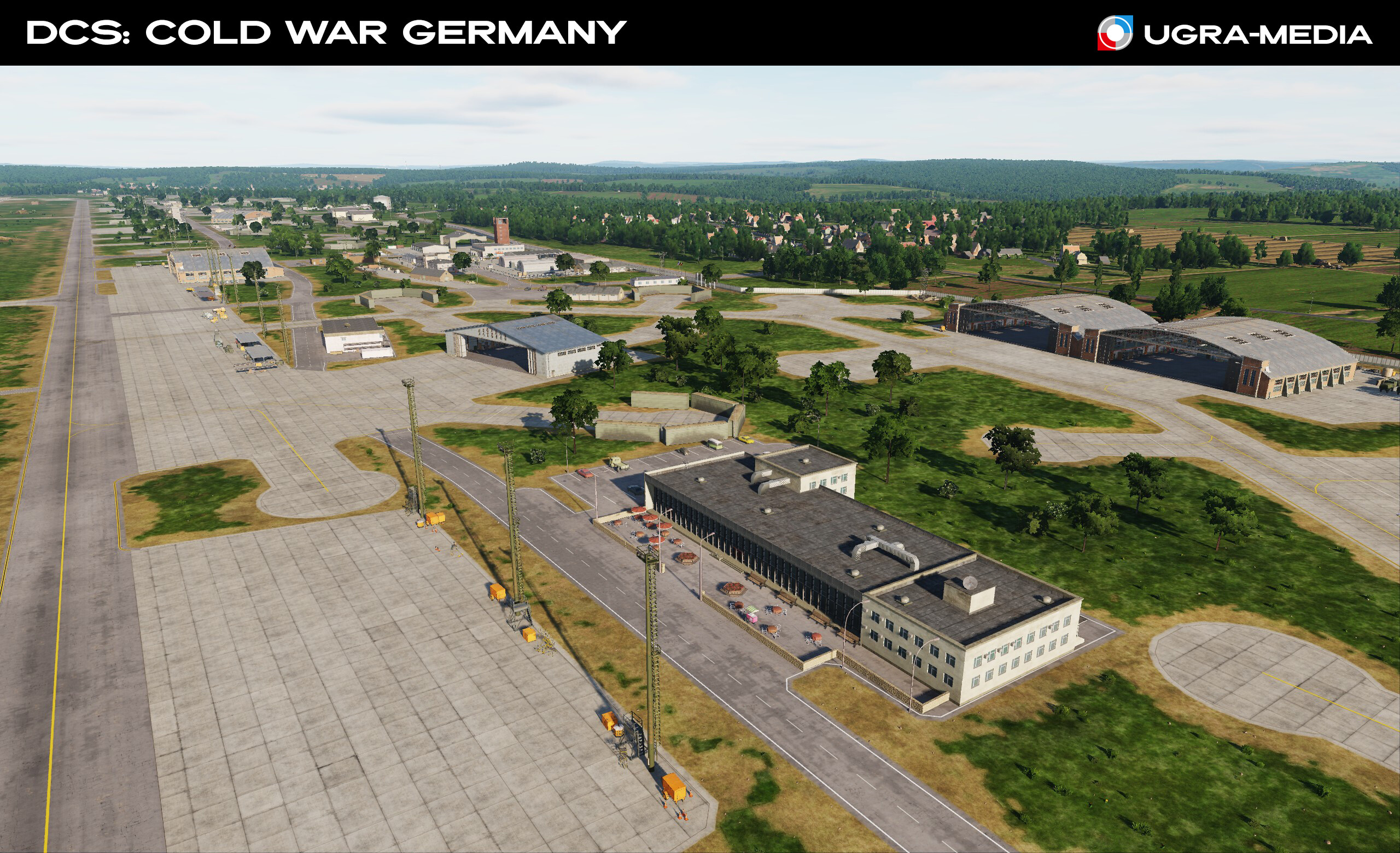
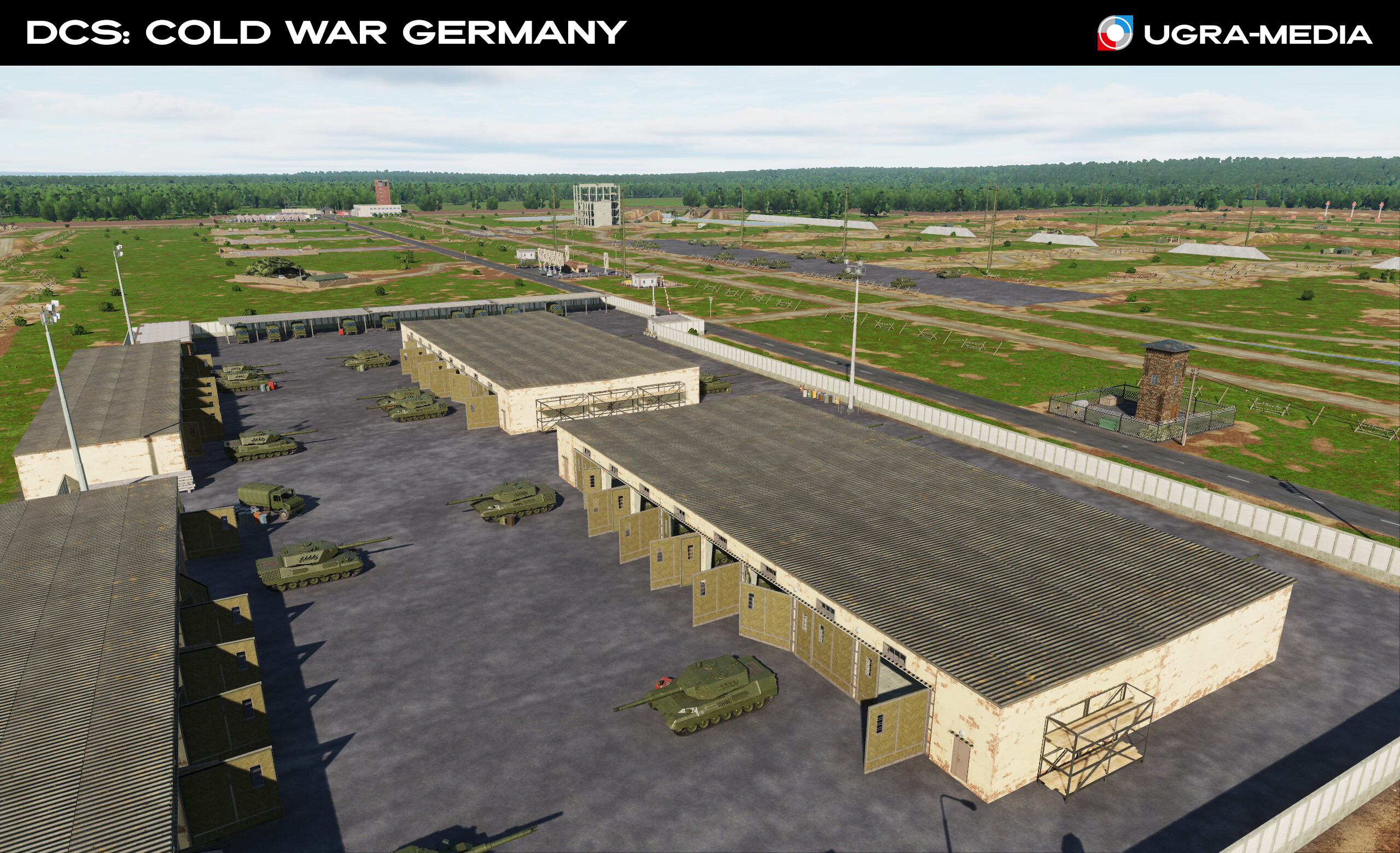
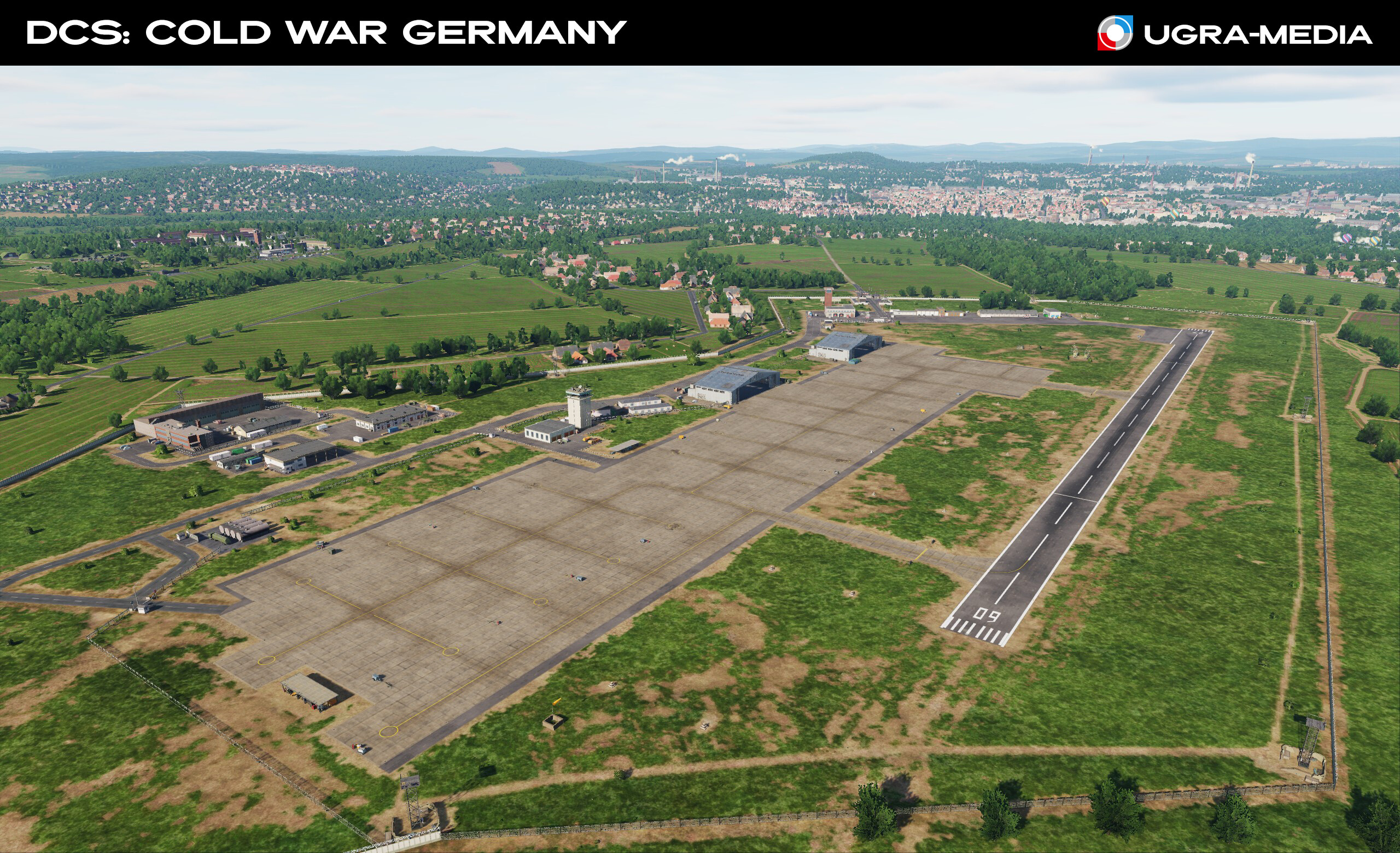
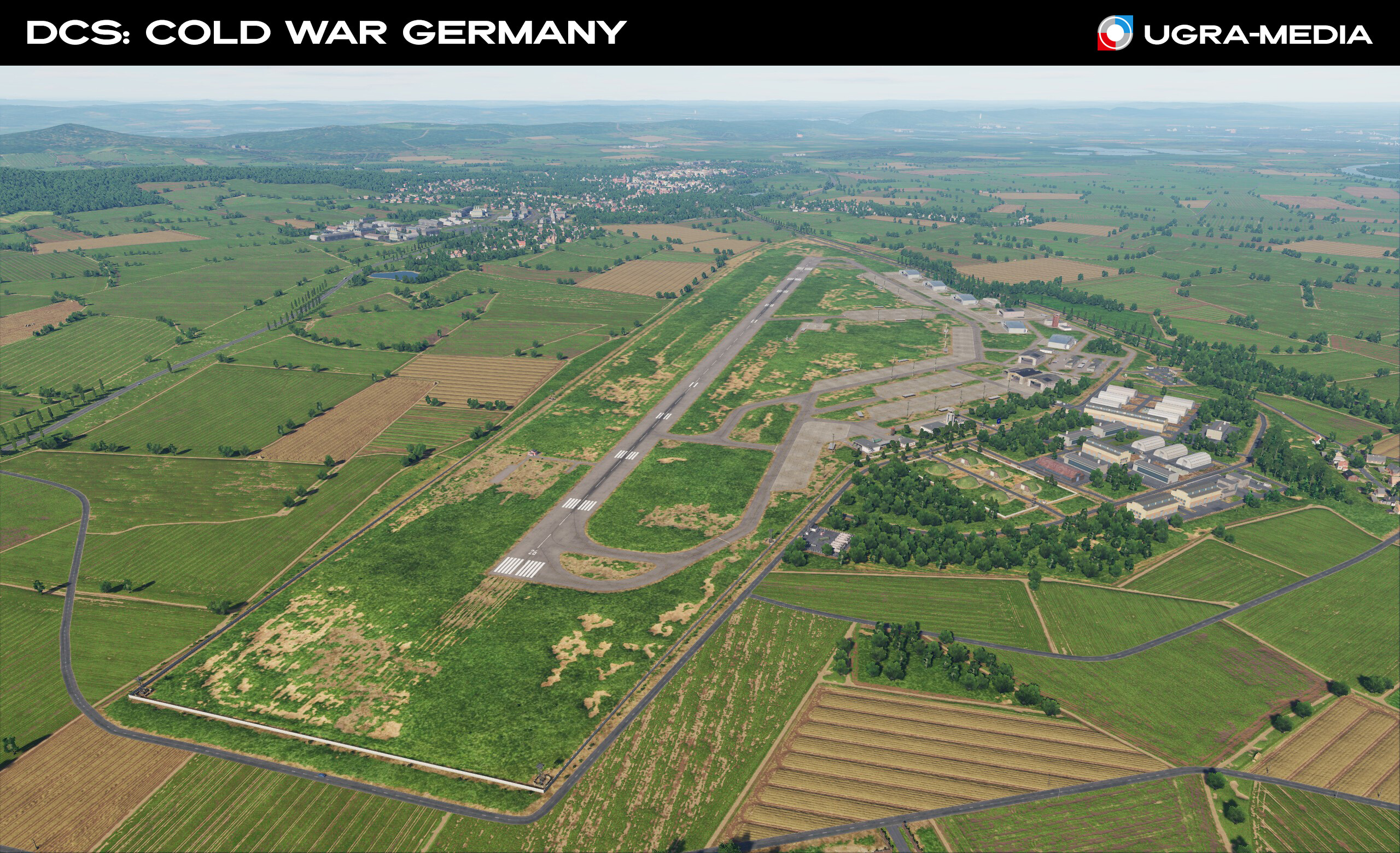
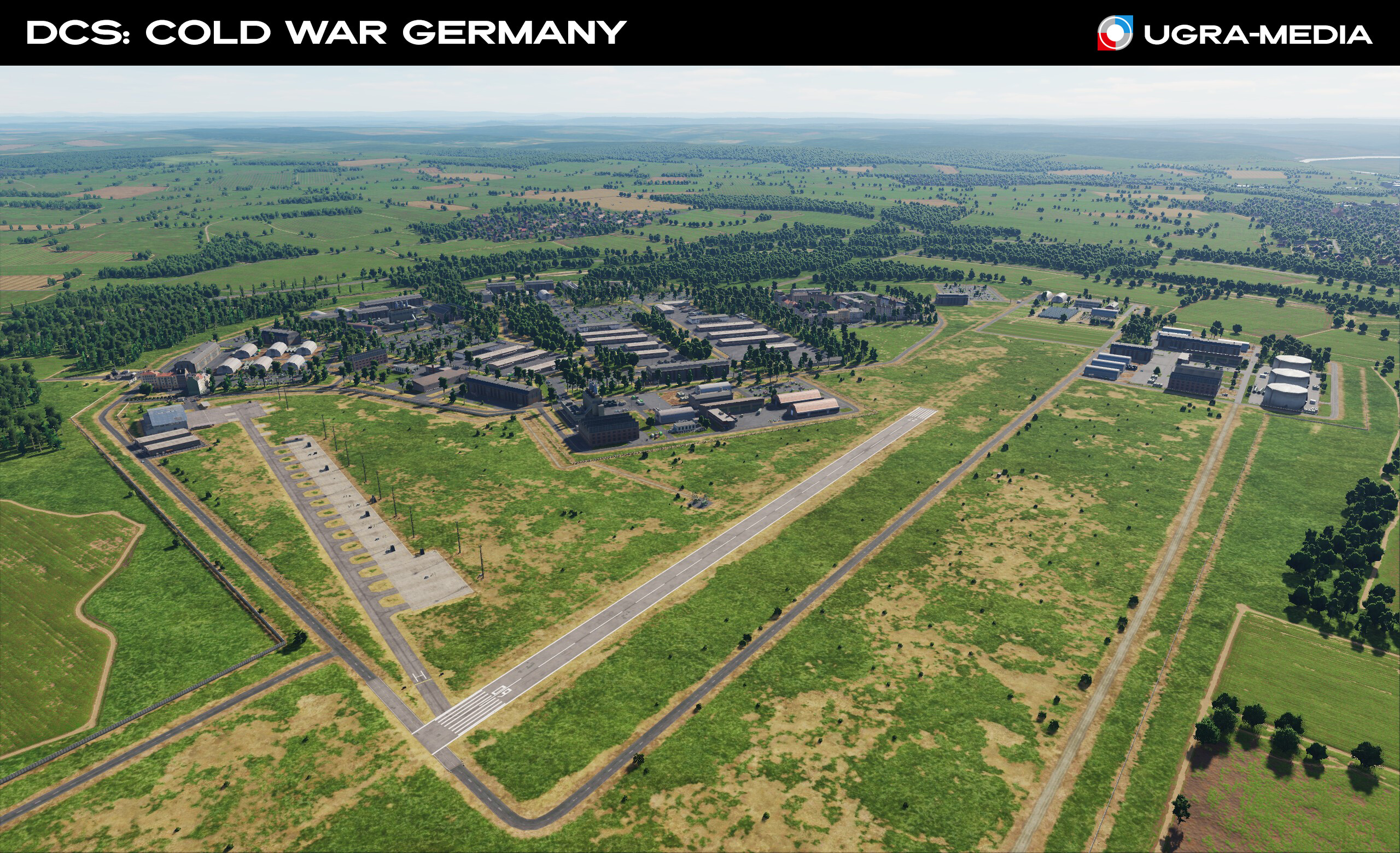
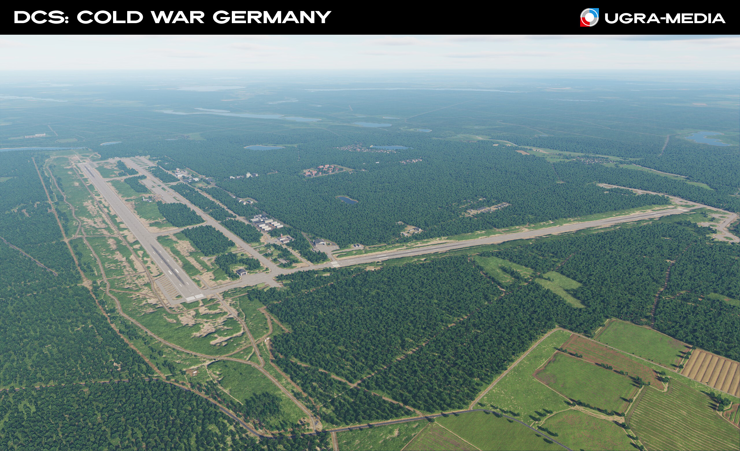
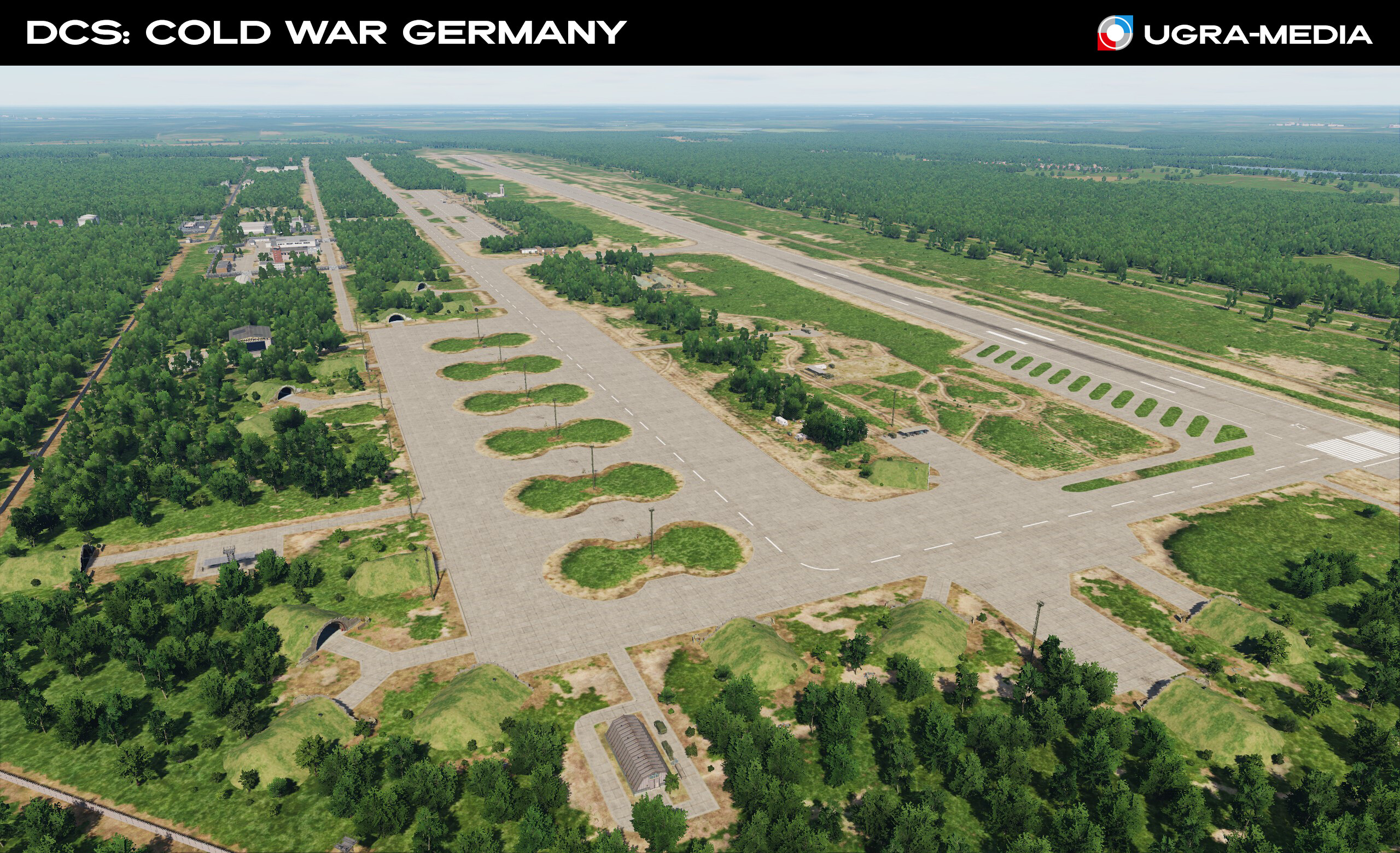
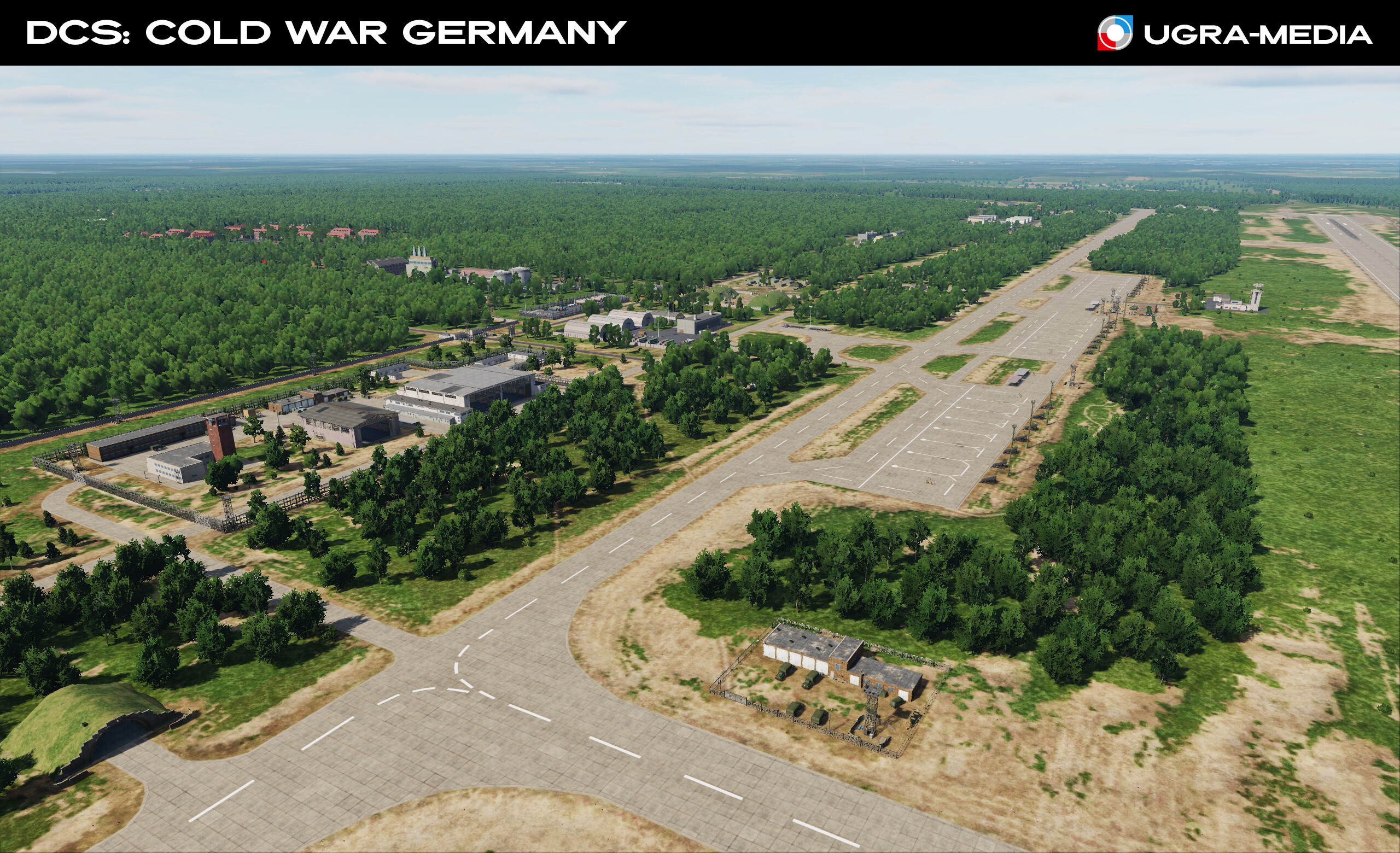
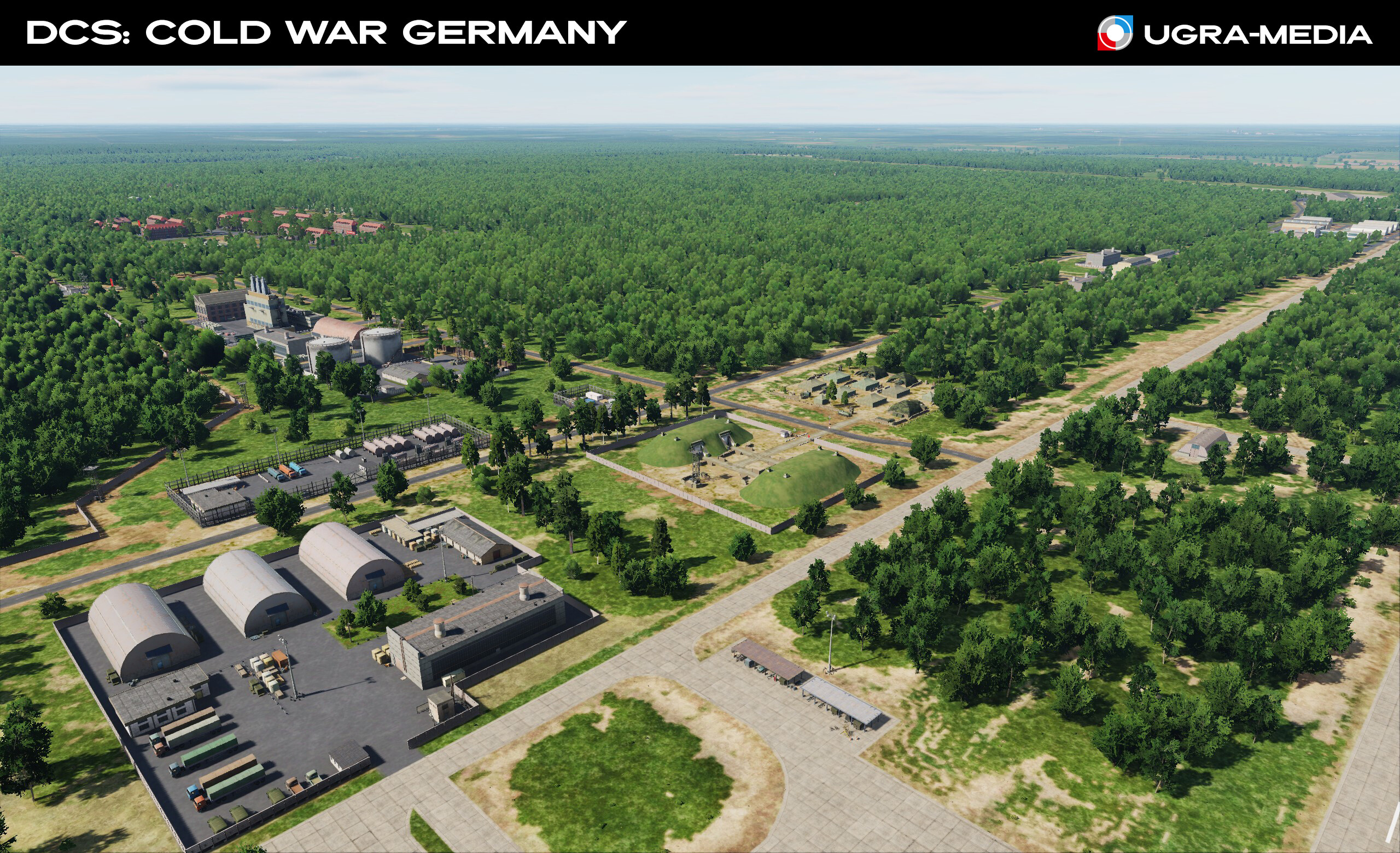
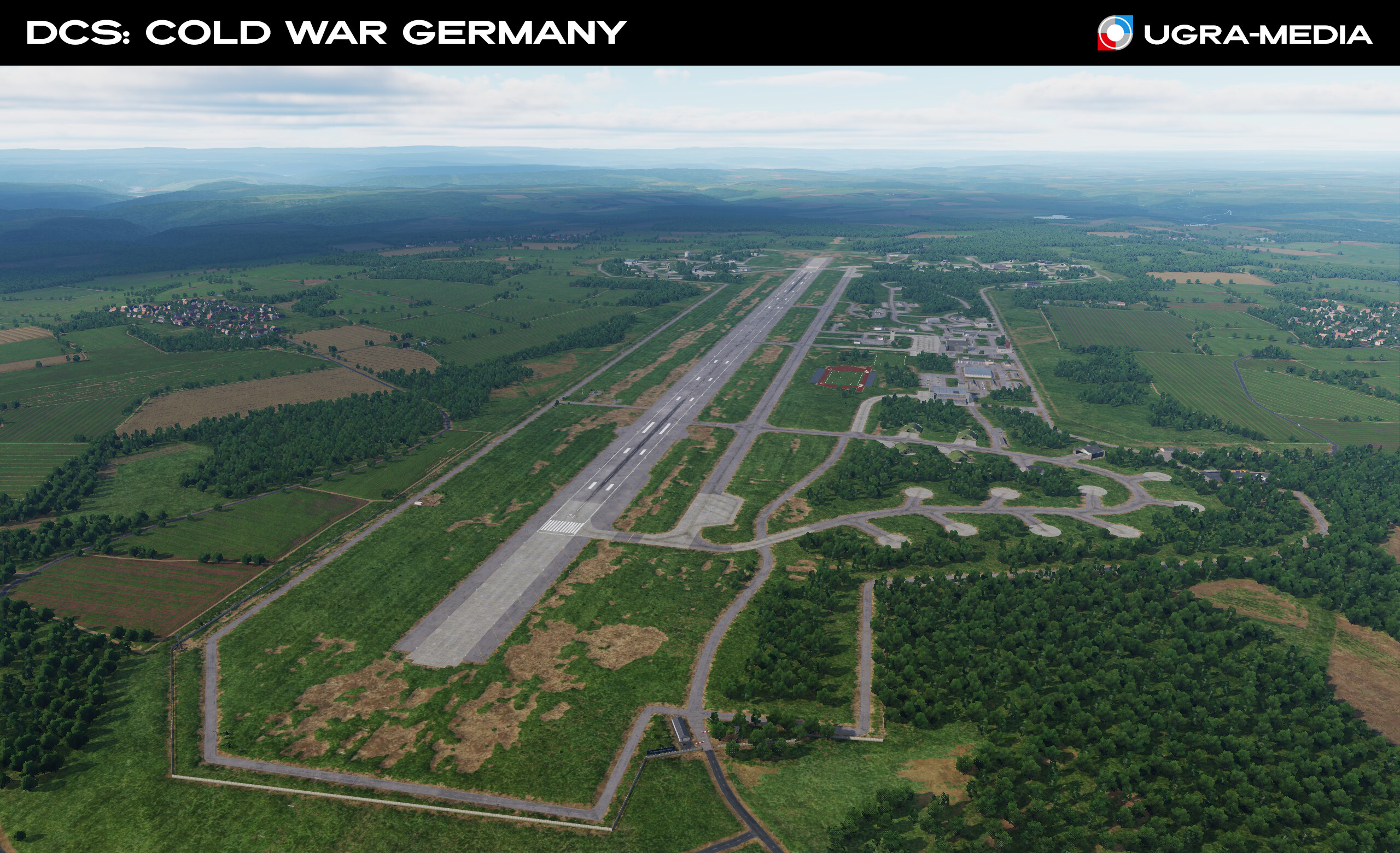
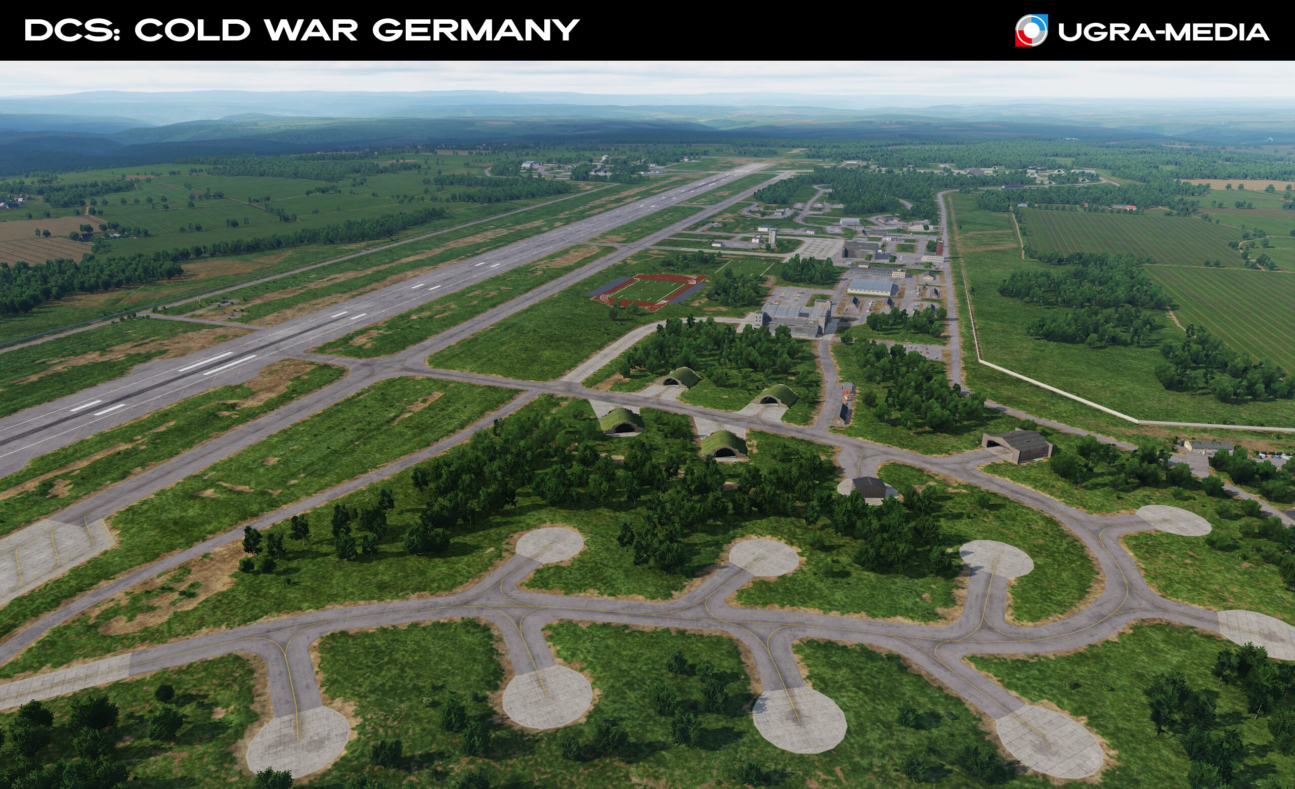
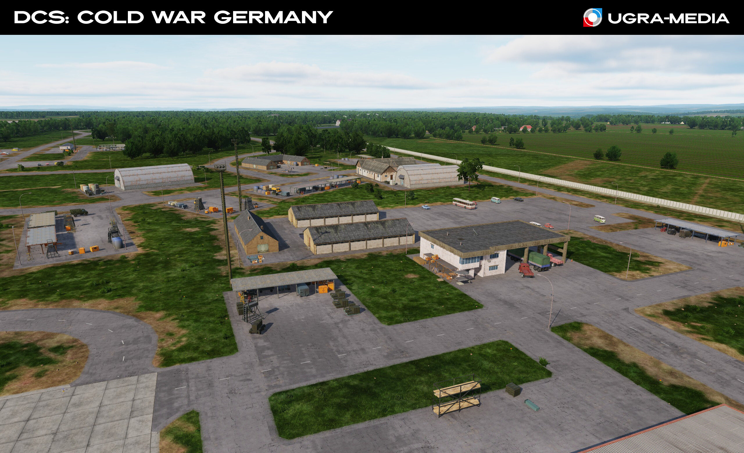
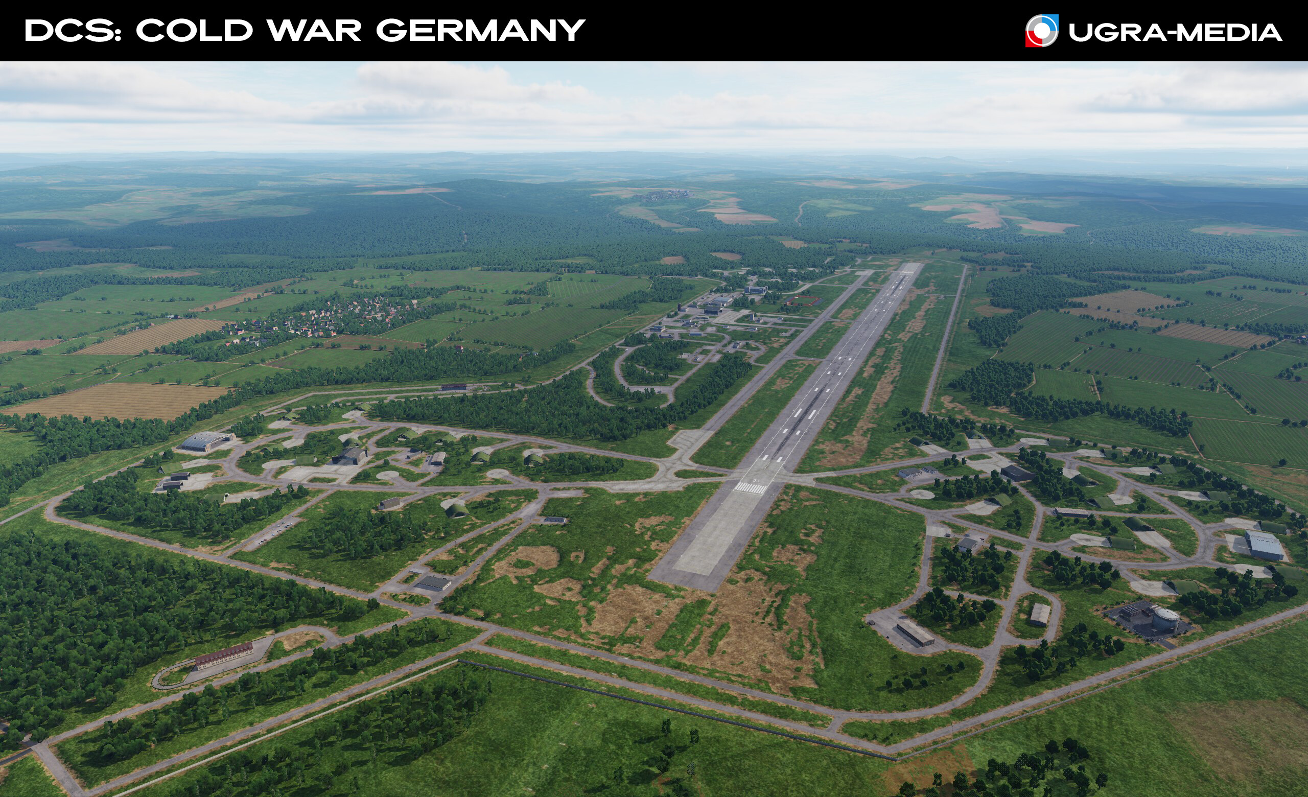
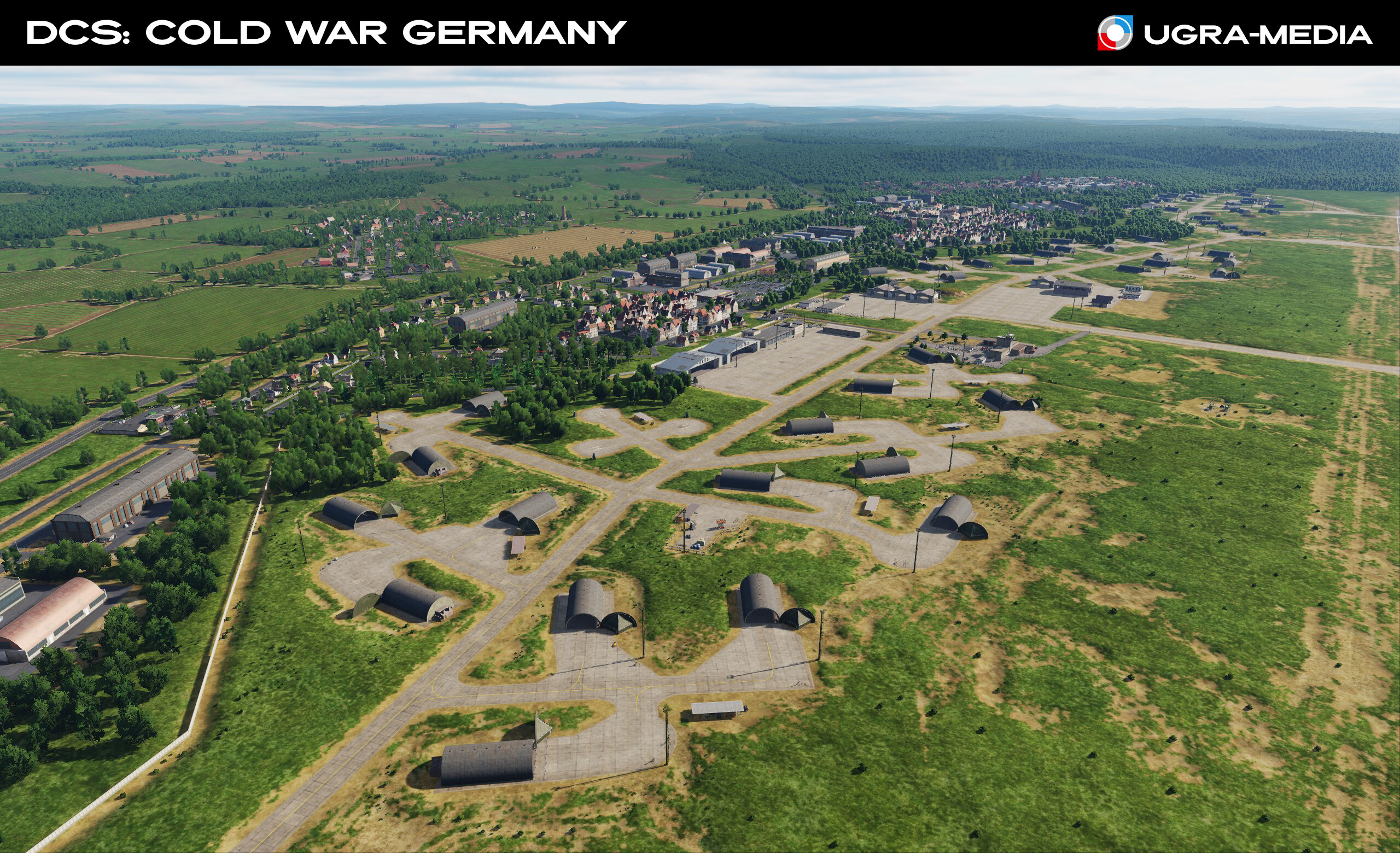
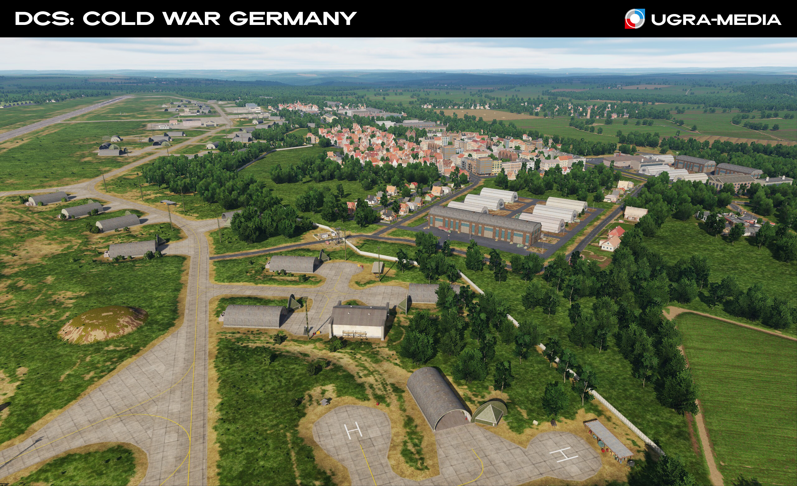
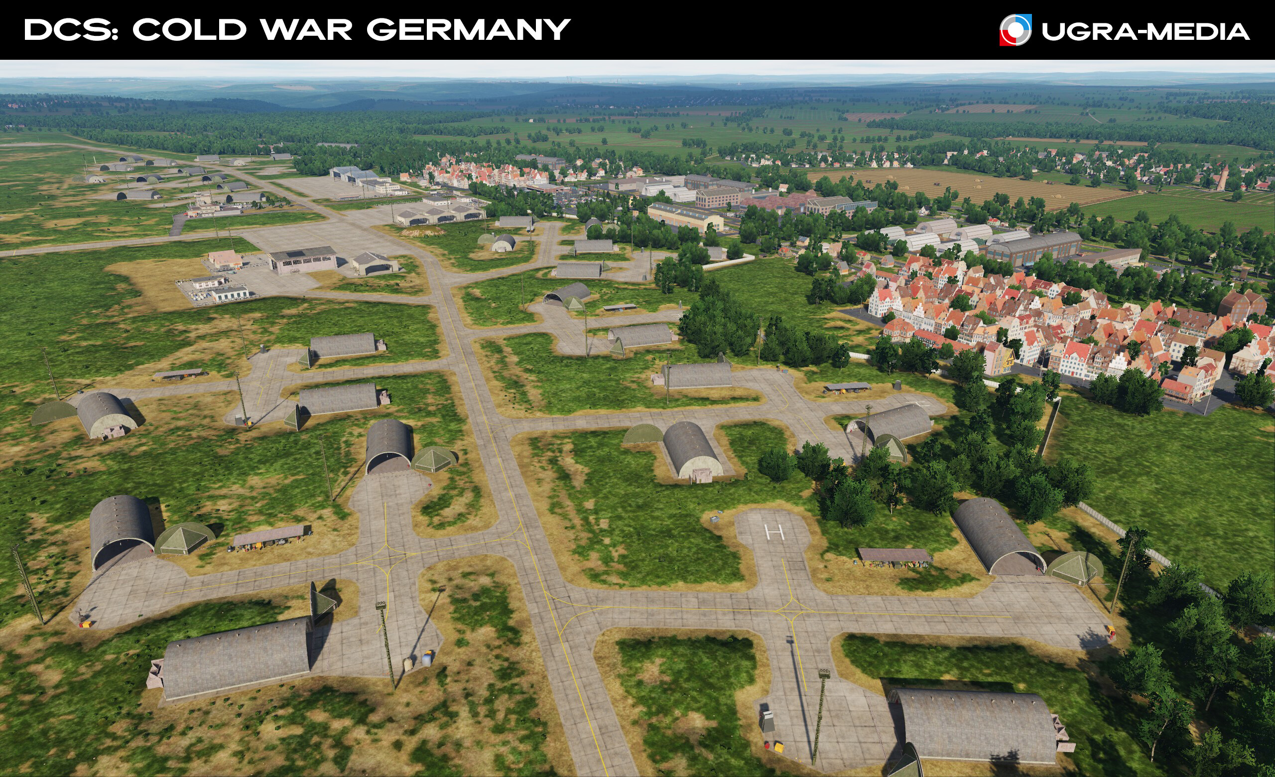
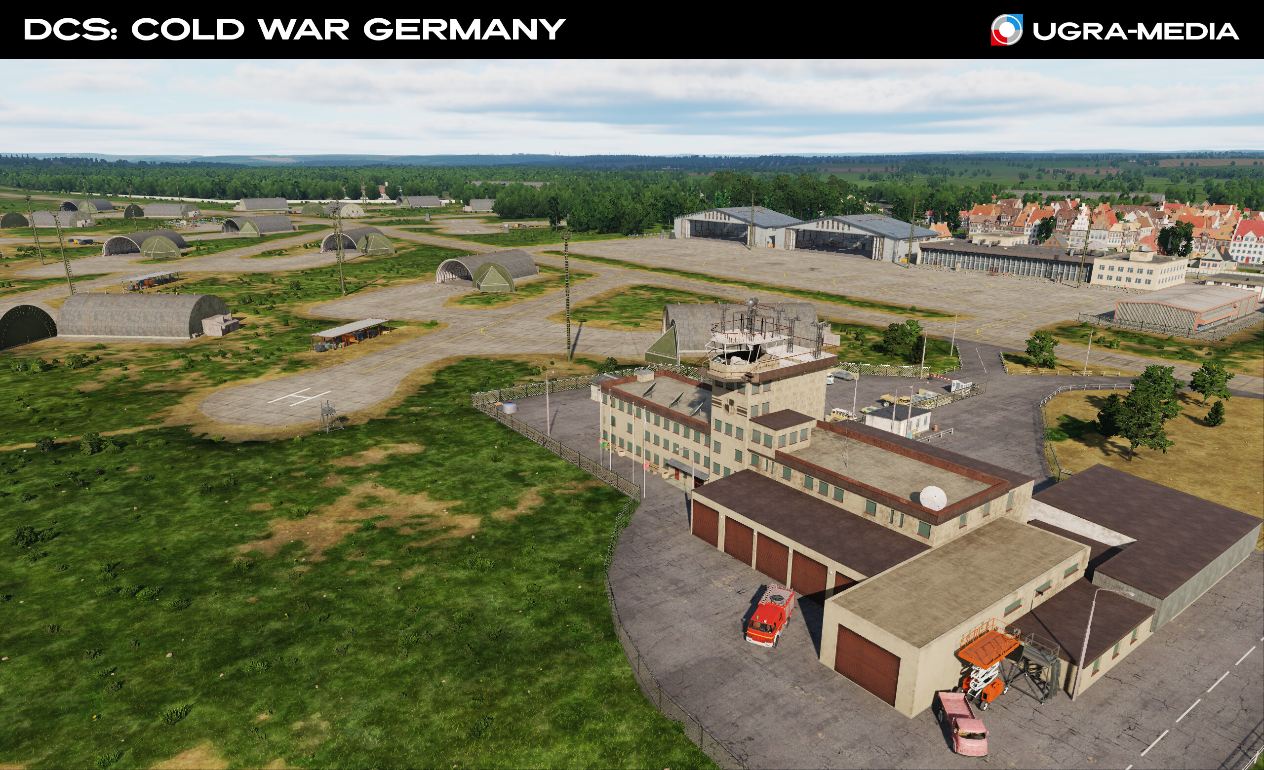
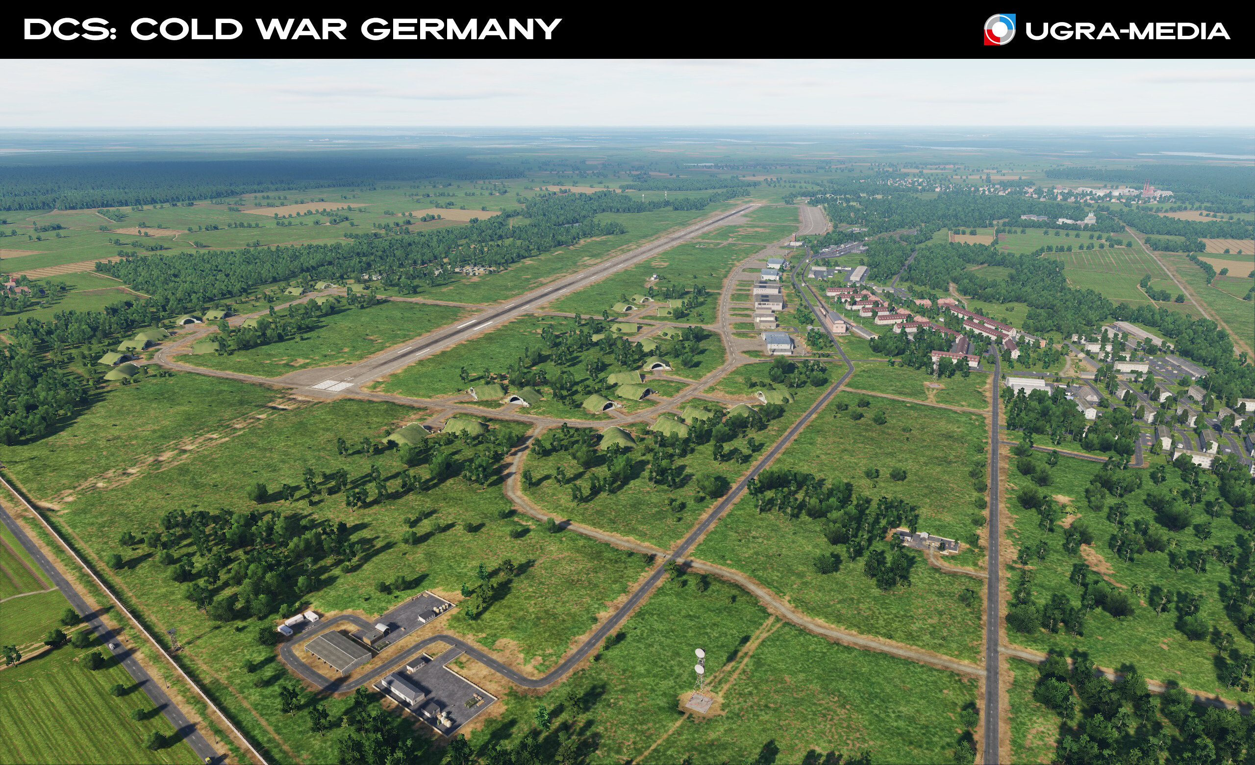
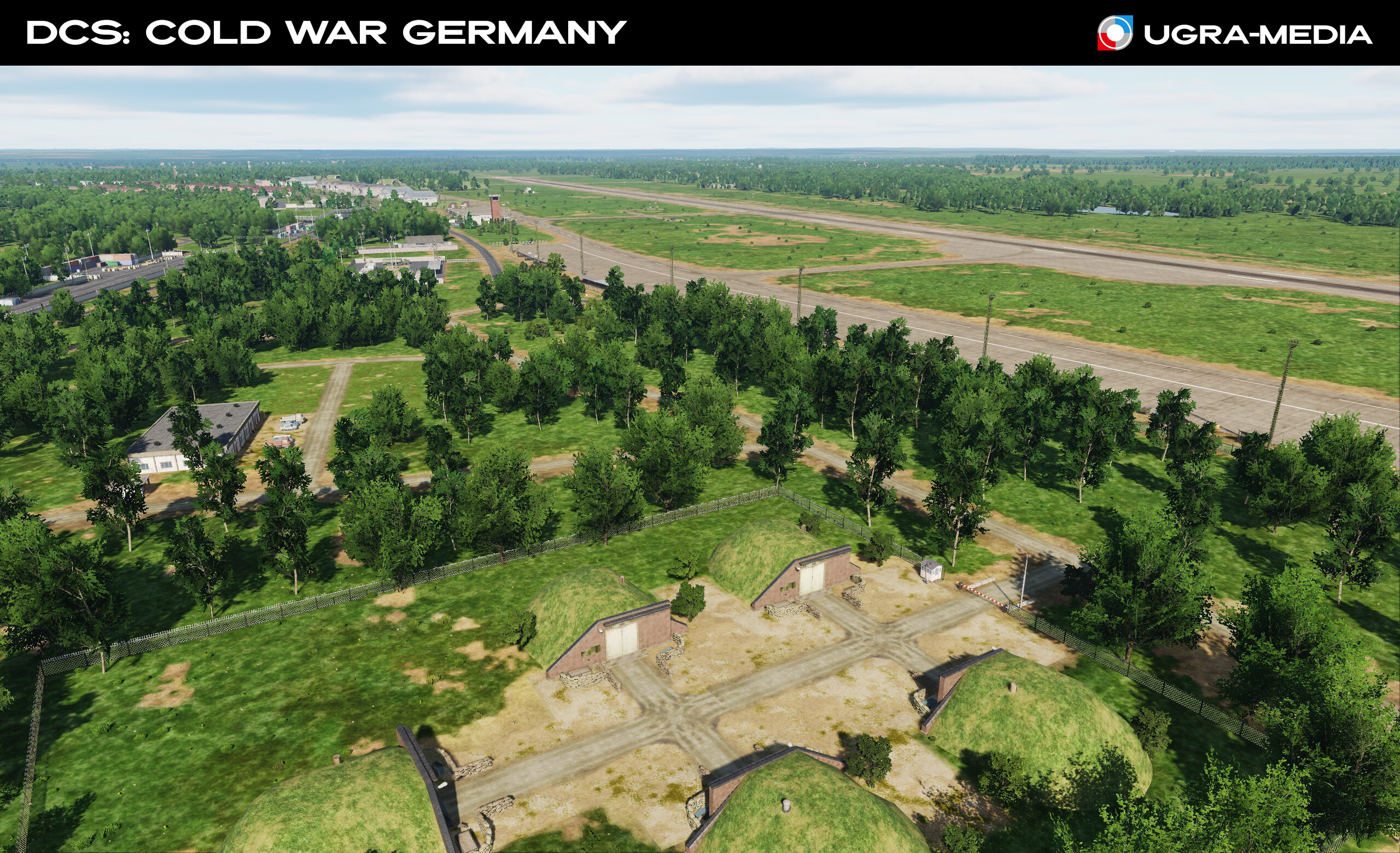
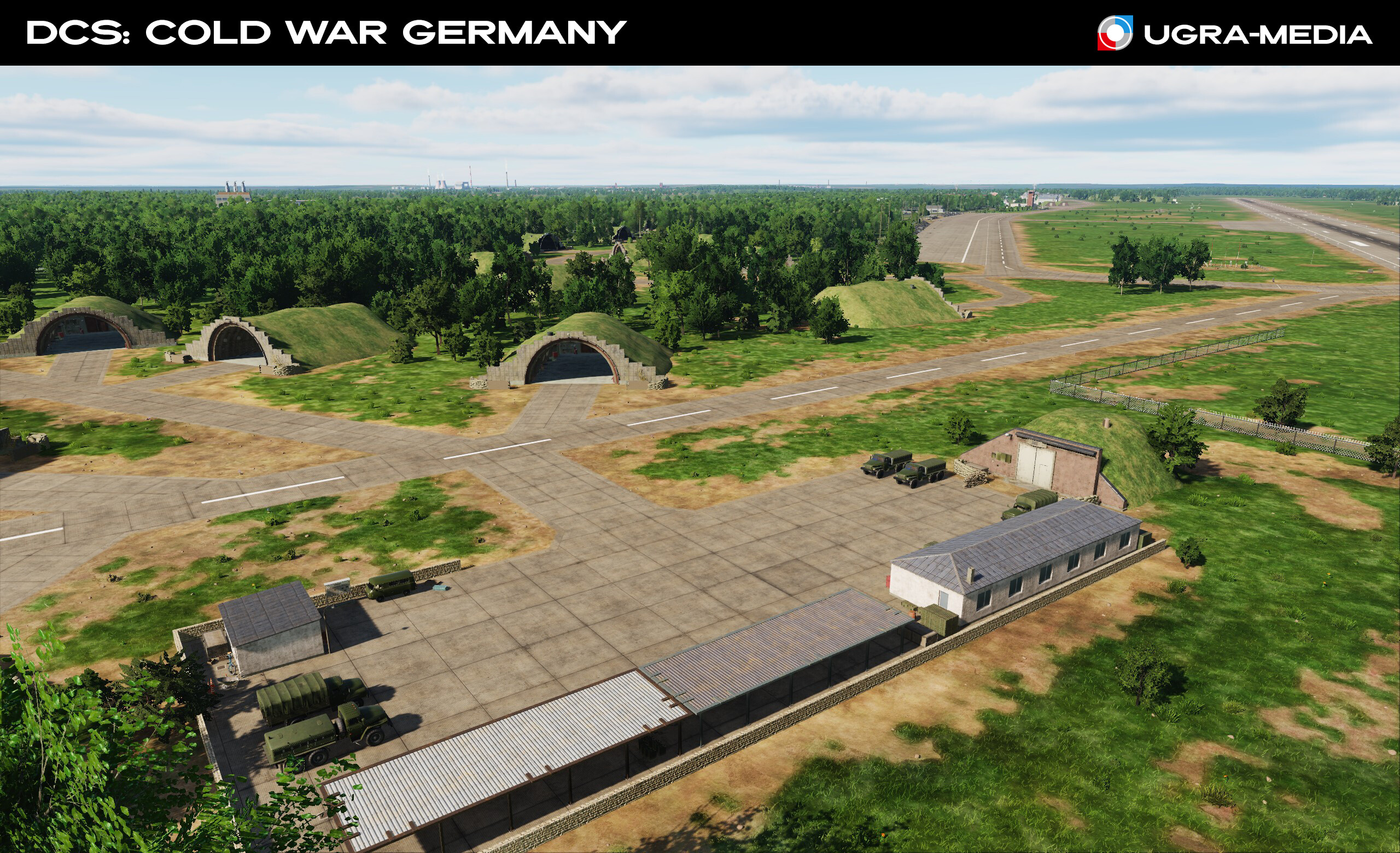
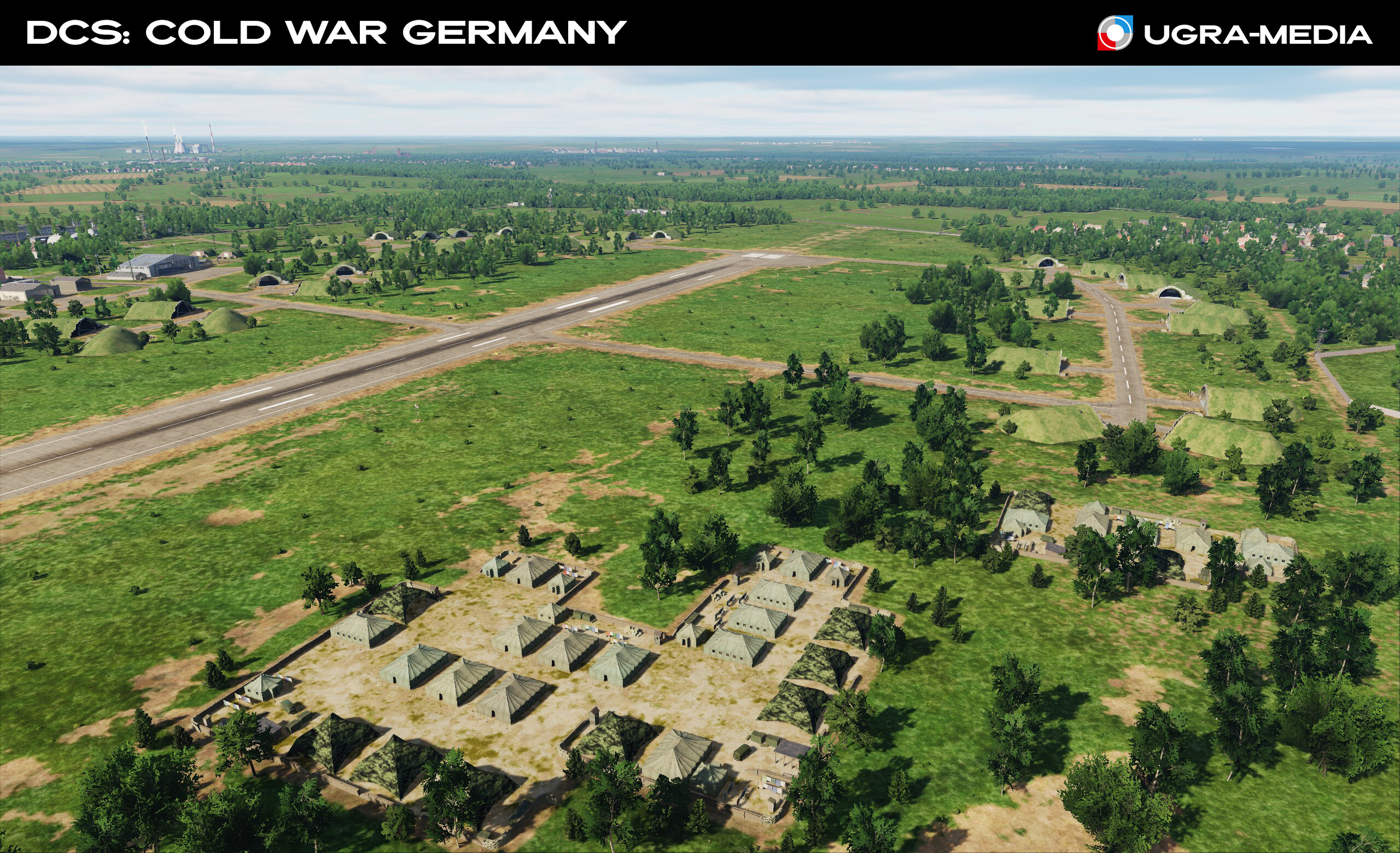
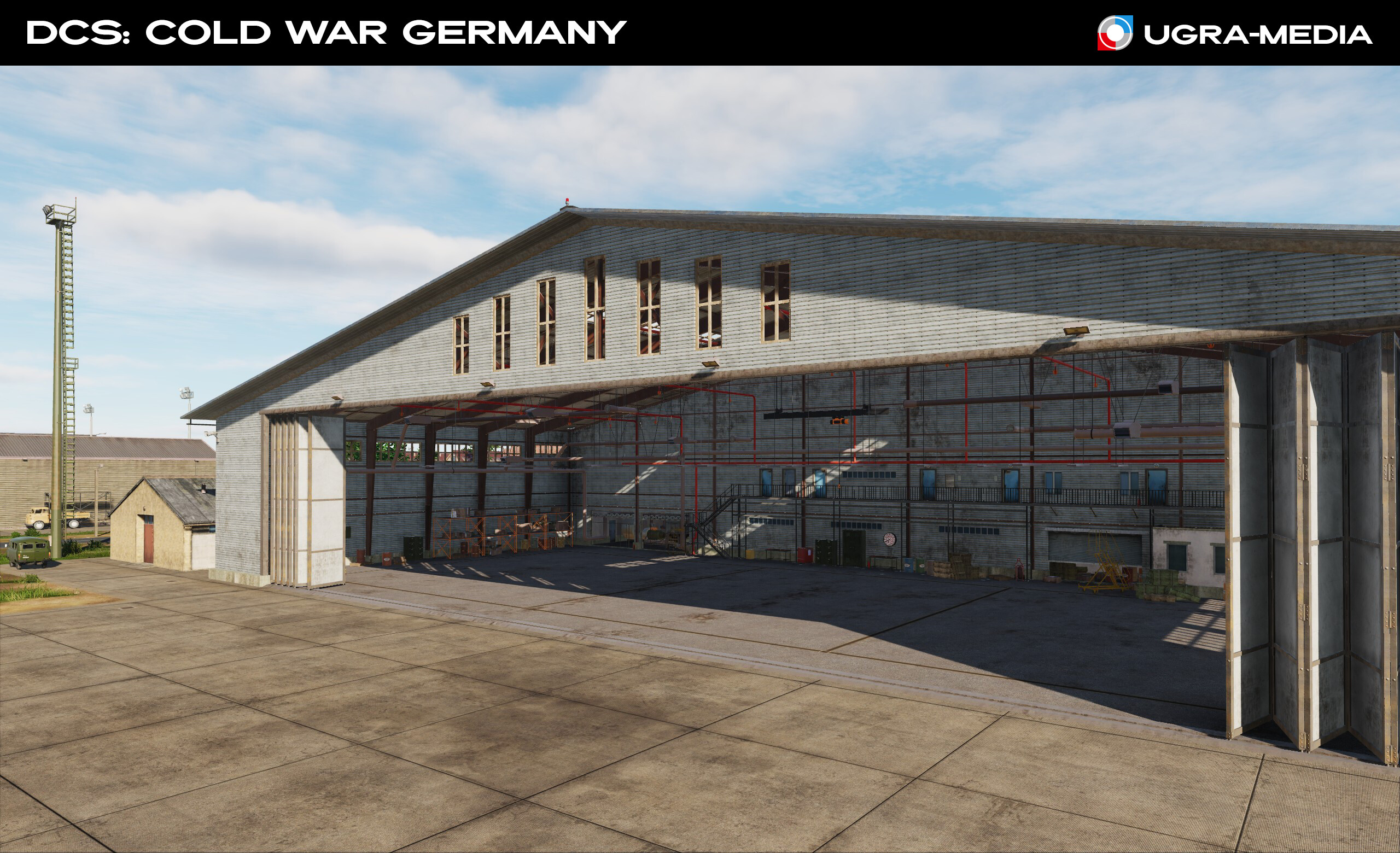
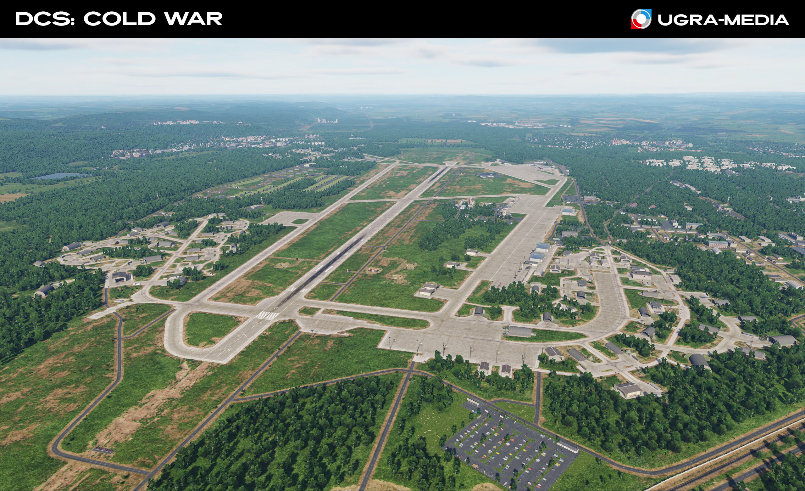
Guten Abend, Europa! / Guten Morgen, Amerika! When we were just planning "Cold War Germany", it was immediately clear that we needed to make not just a map, but something more: a place where you can realize all the possibilities of the DСS World. In addition to the fact that we made a large number of airfields on the map (more than 59), we scattered many helipads throughout the map, so it will be equally interesting for airplane and helicopter pilots. Access to all points of interest is maximum - you can take a short flight. And this seemed not enough ... Some real Cold War scenarios assumed massive ground battles, so we tried to make the map interesting for tanks as well: tank military bases and training grounds were added, where you can practice tactics and shooting. Get ready, we will show you a lot today. Let's start with the basis of our map - the airbase. The place from where you go on a mission and where you will definitely return. Airbases are the heart of any military campaign, and on the "Cold War" map they are recreated with historical accuracy. Our screenshots show key NATO and Warsaw Pact bases. Experience the atmosphere of West Germany (FRG - Federal Republic of Germany) and East Germany (GDR - German Democratic Republic). Get ready to take off! Gross-Dolln (Templin Air Base) (GDR) - Soviet air base. The field was special not only because of the very spacious facilities. It also had an auxiliary runway, which ran from the airfield in a southwestern direction, with a remote dispersal area at the end. Buchel (FRG) - Büchel Air Base is a military air base of the Luftwaffe. Spangdahlem (FRG) - is a NATO air base is used by the United States Air Force (some of you know her well). Wittstock (Alt Daber) (GDR) - Soviet air base. Soviet pilots had warm memories of this place. The Soviet pilots had warm memories of this place. And of course the children who lived nearby.
- 489 replies
-
- 42
-
-
-
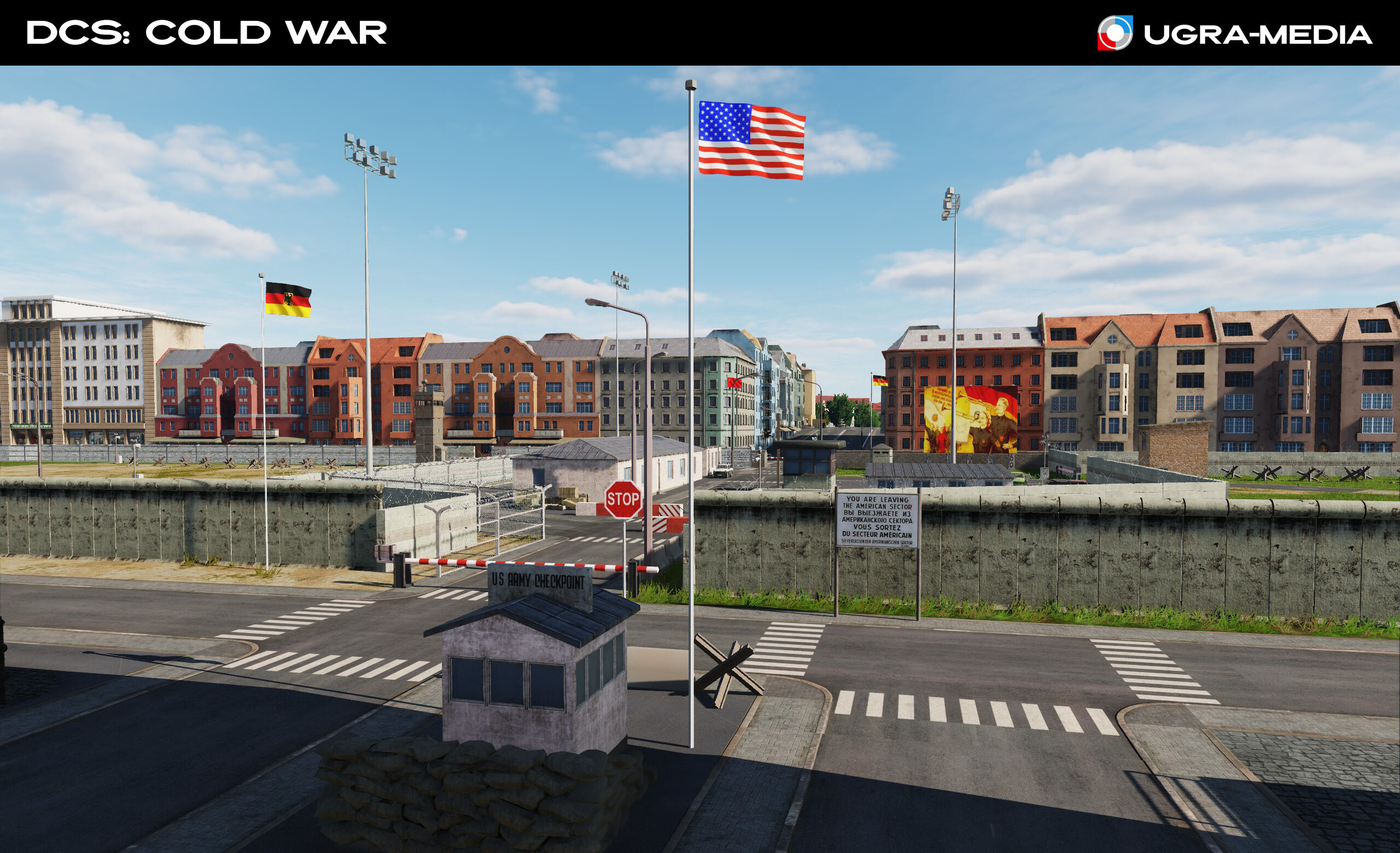
Hallo! Wie geht's? We are pleased to present our new project — the Cold War map, which will take you to Central Europe during the confrontation between NATO and the Warsaw Pact. Expect historical accuracy, unique locations, and the atmosphere of the era! Central Europe was the epicenter of the Cold War. We recreated the key locations of this period and tried to convey the atmosphere of that time, and we have big plans for this territory. Take a look at the first screenshots of the Cold War map. On this map, you will find historically accurate locations, including Berlin — a symbol of the Cold War, divided by a wall, dense forests of the Fulda Gap, key airfields and military bases. Immerse yourself in the atmosphere of the era when the world was balancing on the brink of a global conflict. Stay tuned — there is still a lot of interesting things ahead! We are just getting started. Tomorrow we will tell you about some airfields and opportunities for you. Let's start, of course, with Berlin — a symbol of the Cold War The Berlin Wall (Checkpoint Charlie). The wall that divided families, the nation and the world Barbed wire "decorated" the border area of Berlin Berlin at night. Look at the color of the street lighting in the western and eastern parts weiter... Fulda (here begins the Fulda Gap - the probable place of movement of the ground forces of the opposing sides) There are many military facilities located on the map. Military training areas Port of Hamburg Automobilwerk und natürlich Ramstein Air Base - the main NATO air base. You will be a frequent guest here ... or will this be your target The Brocken Transmitter on the Brocken, the highest mountain in Northern Germany Nun, tschüss!
- 489 replies
-
- 87
-
-
-
@draconus yes, these objects are just big, we need another parameter for effects or support for small destructions. We hope all this will be. @Red_Dragon That's right. We try to get the maximum quality, without forgetting about your FPS. And imagine what happens when we want to add something new )
-
-
Hi We decided to separate the destruction topic into a separate thread. We plan to tell you a little more about the destruction and get your feedback. Here you will learn how the destruction models work, and will be able to suggest improvements on this topic. I will duplicate the list of original damage models from the review. Stay tune
- 11 replies
-
- 15
-
-
-
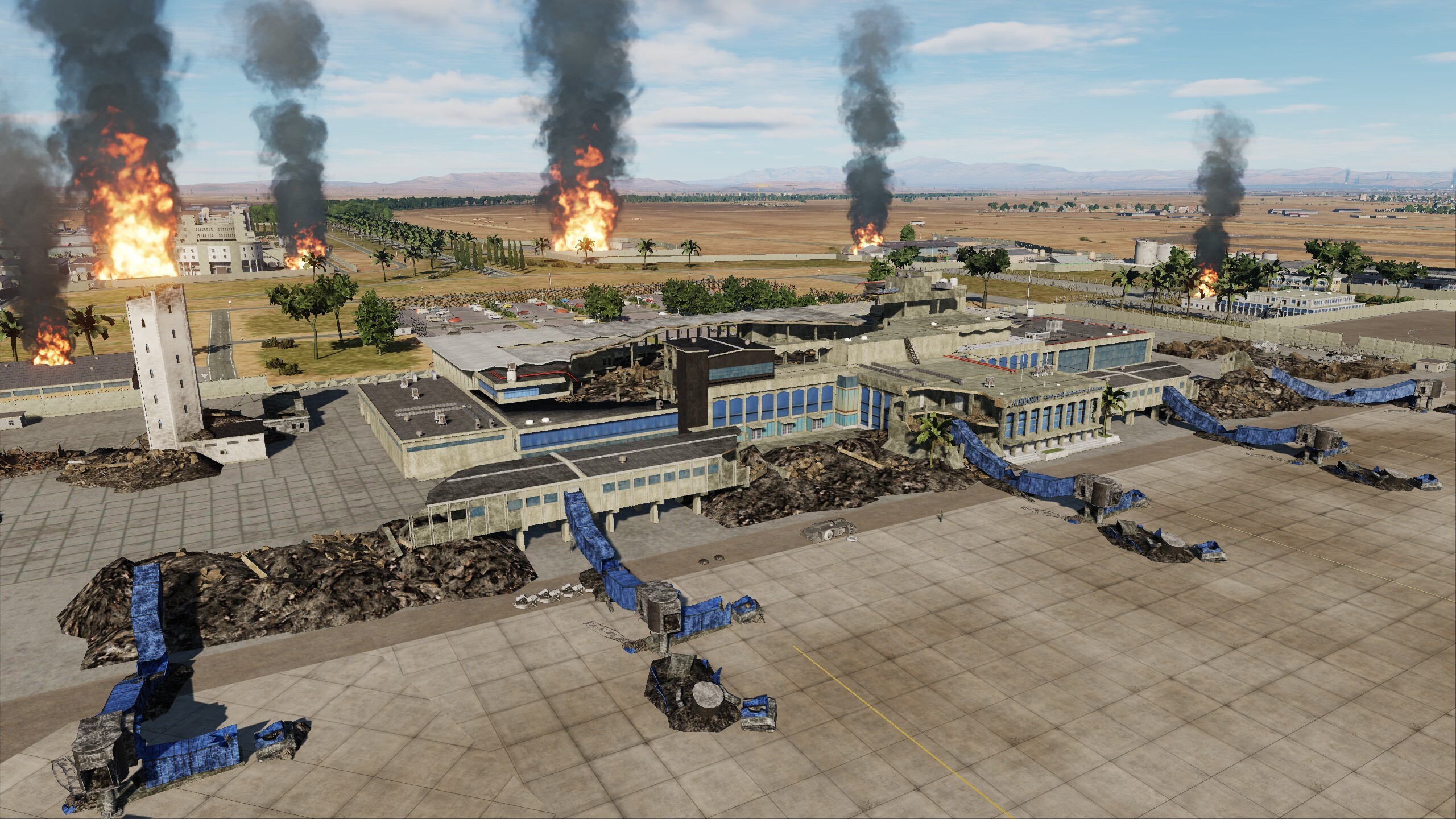
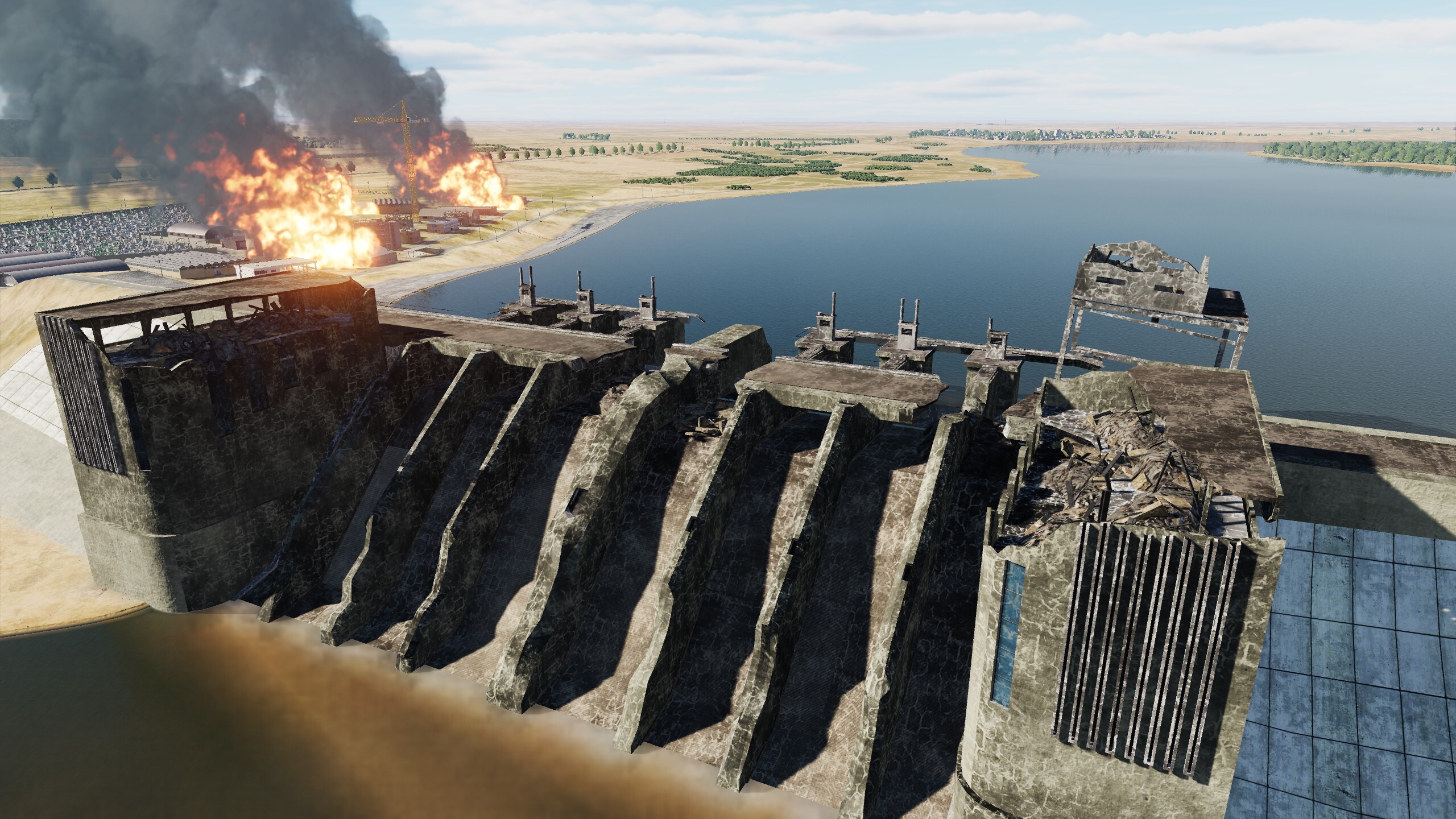
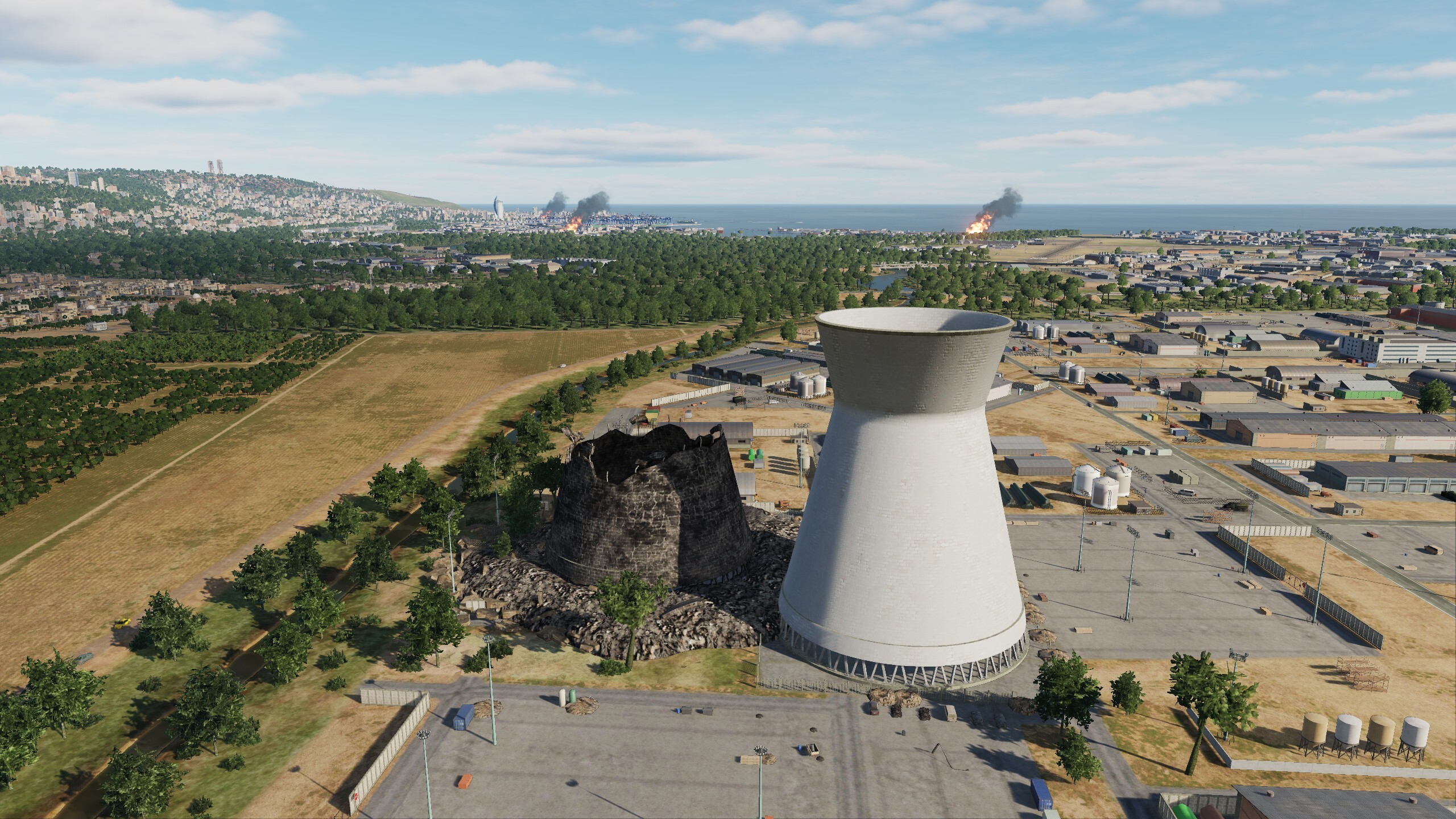
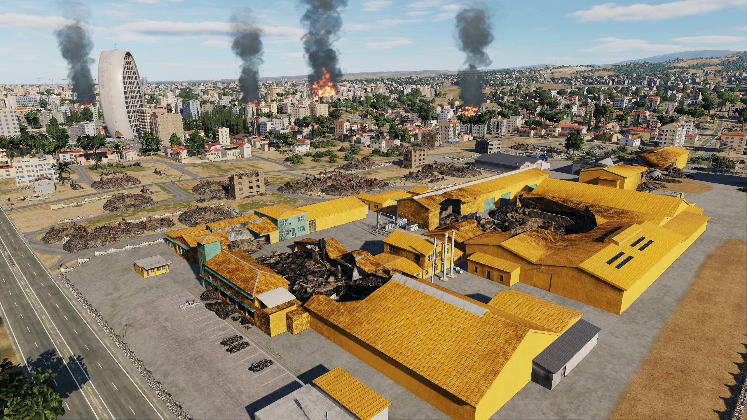
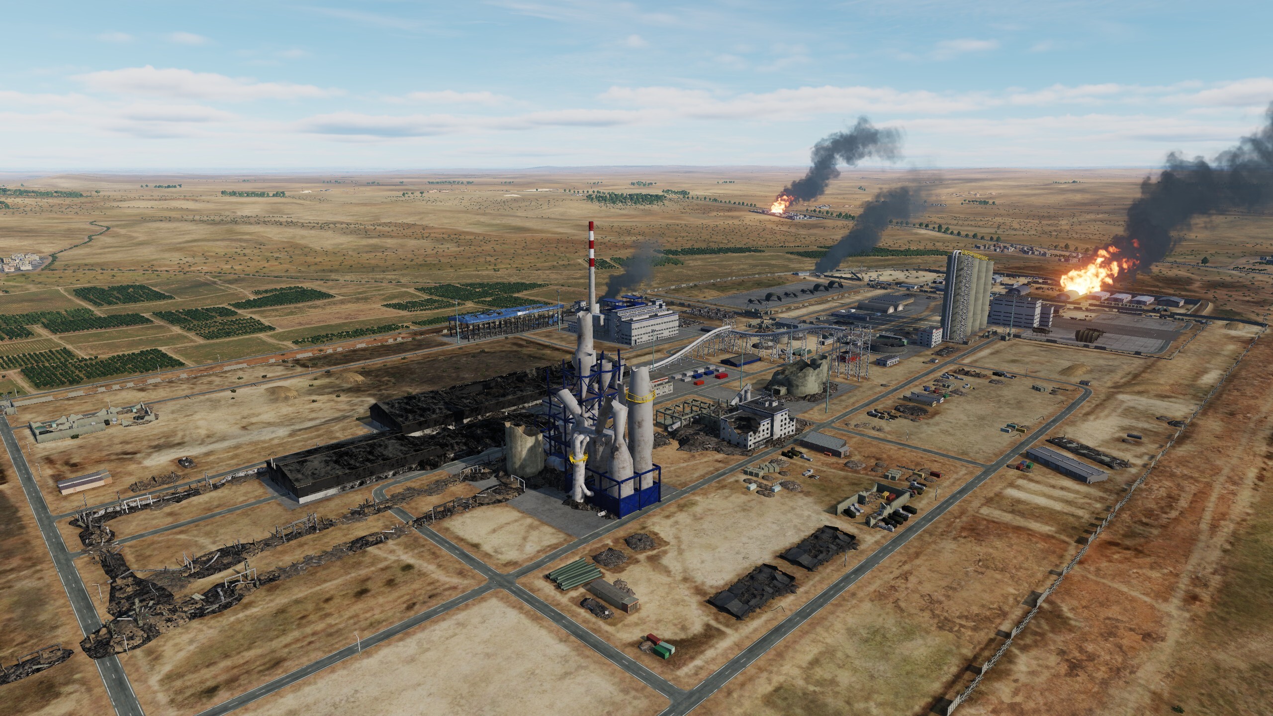
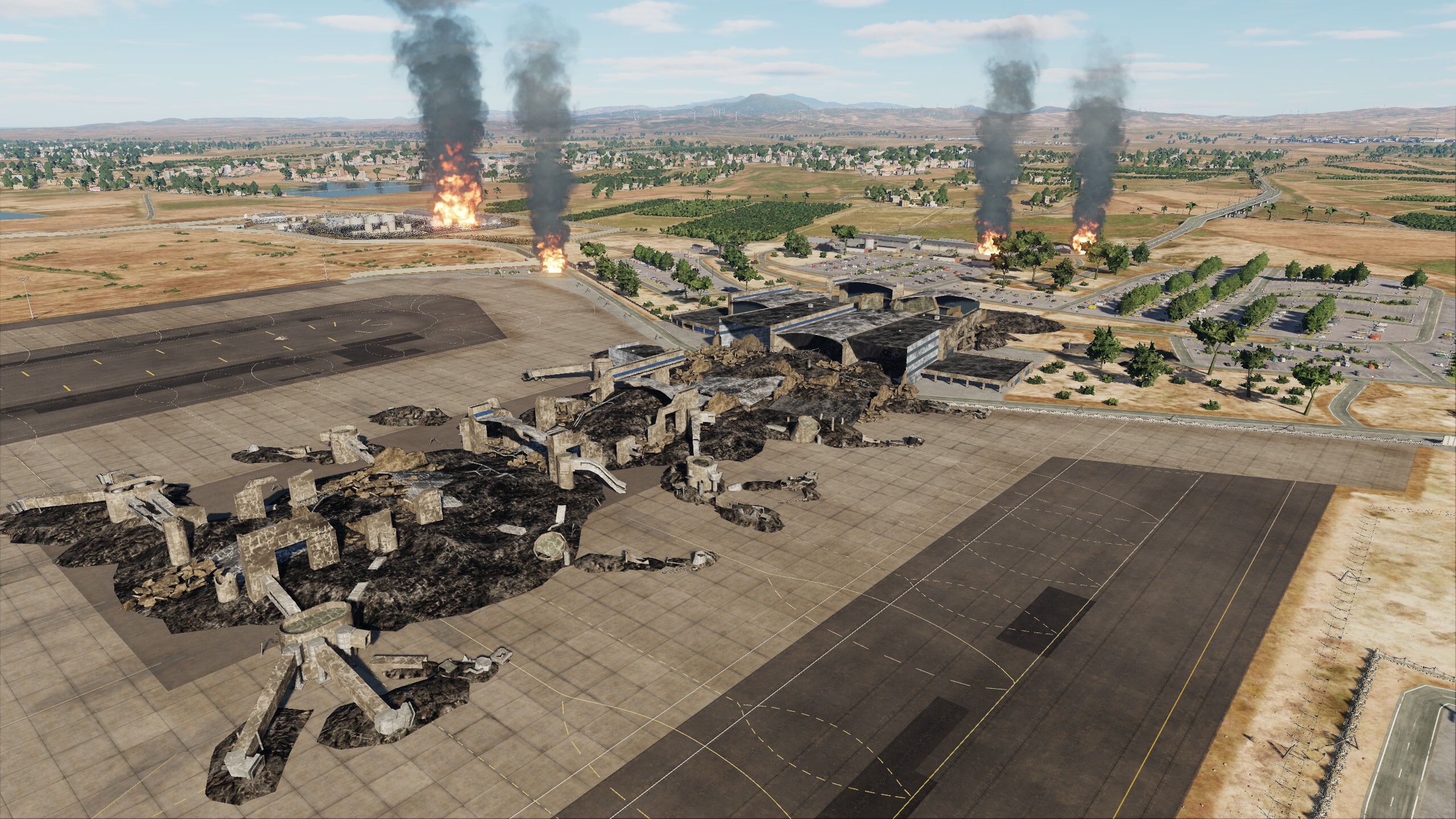
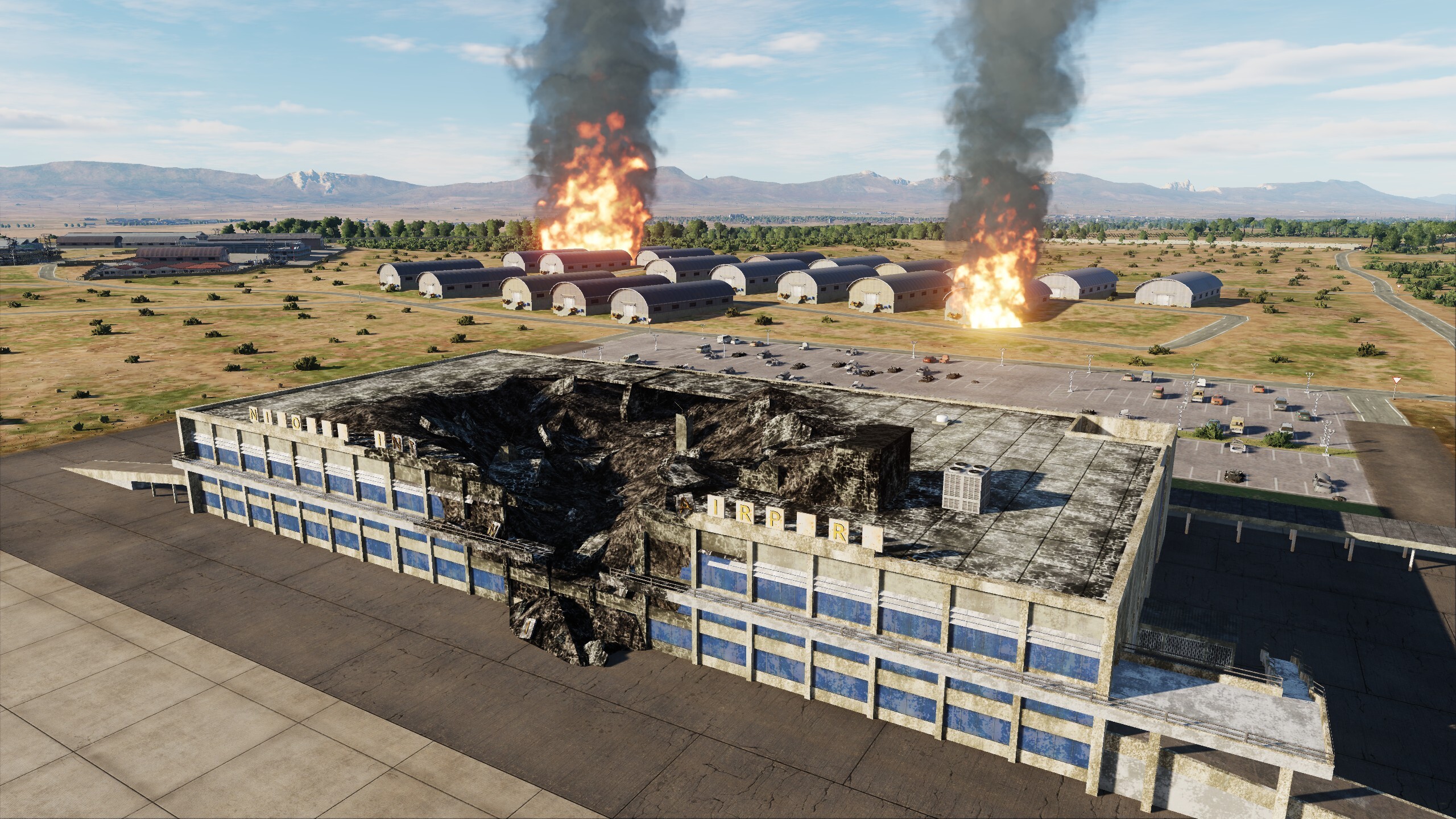
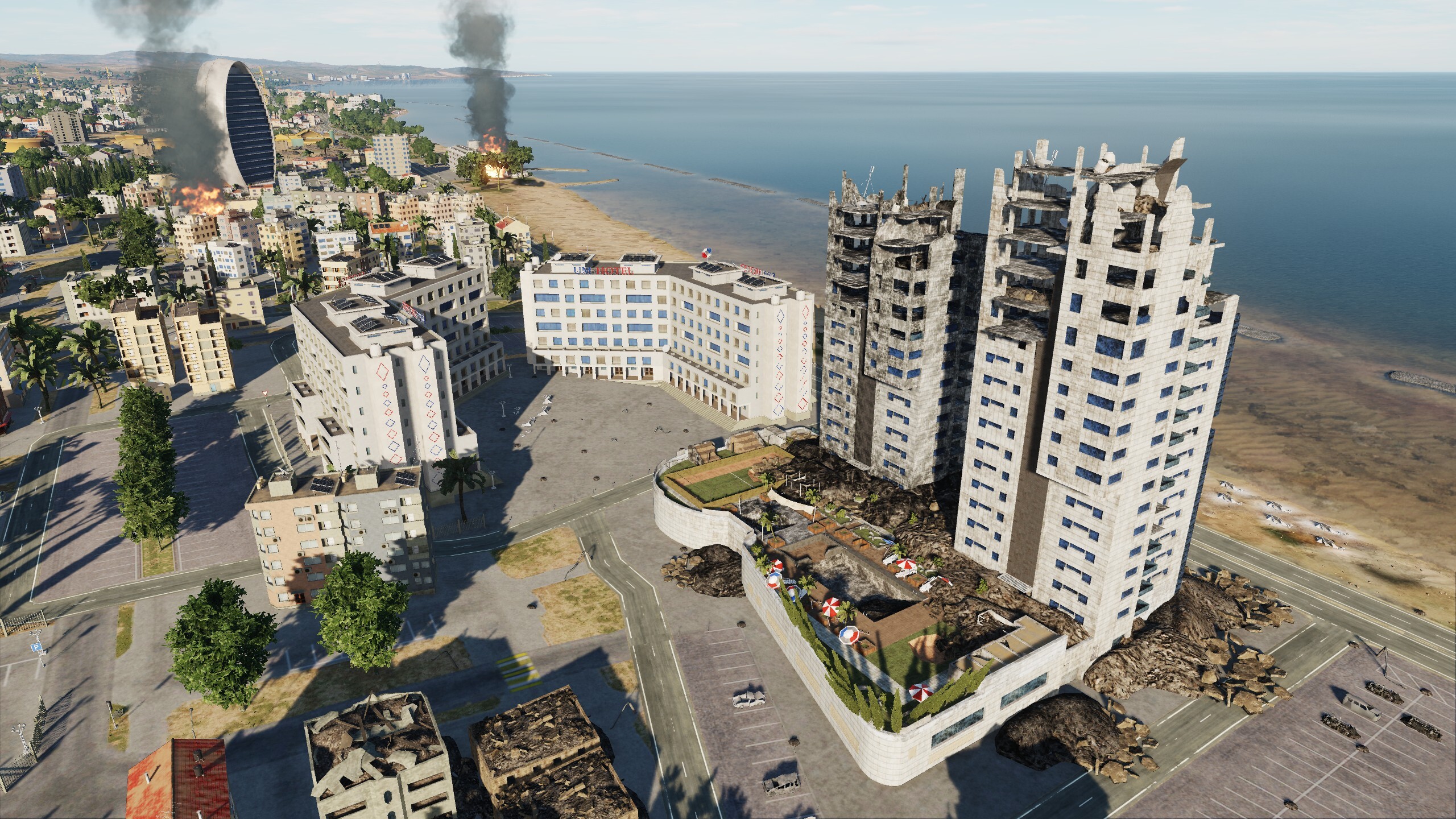
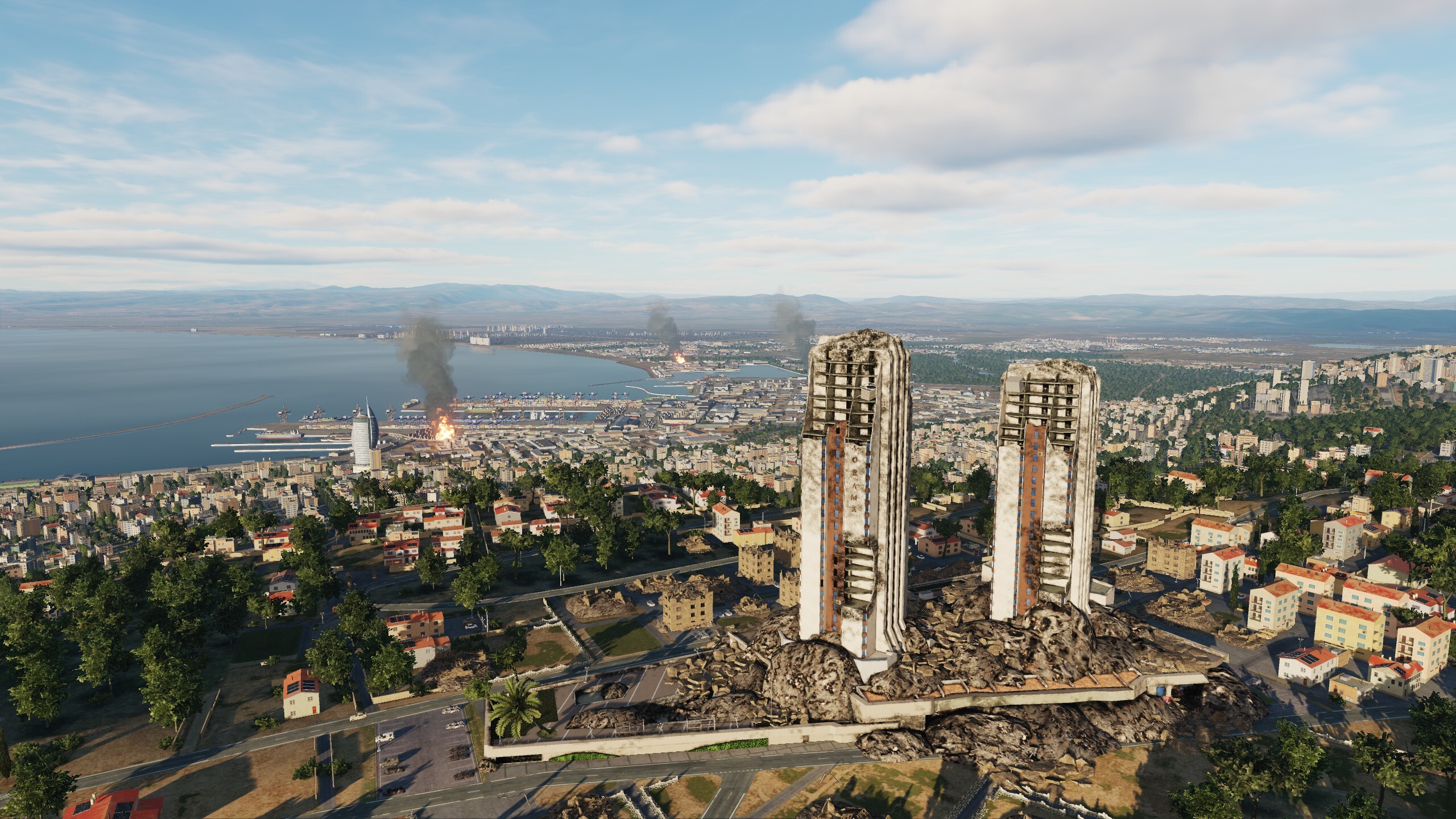
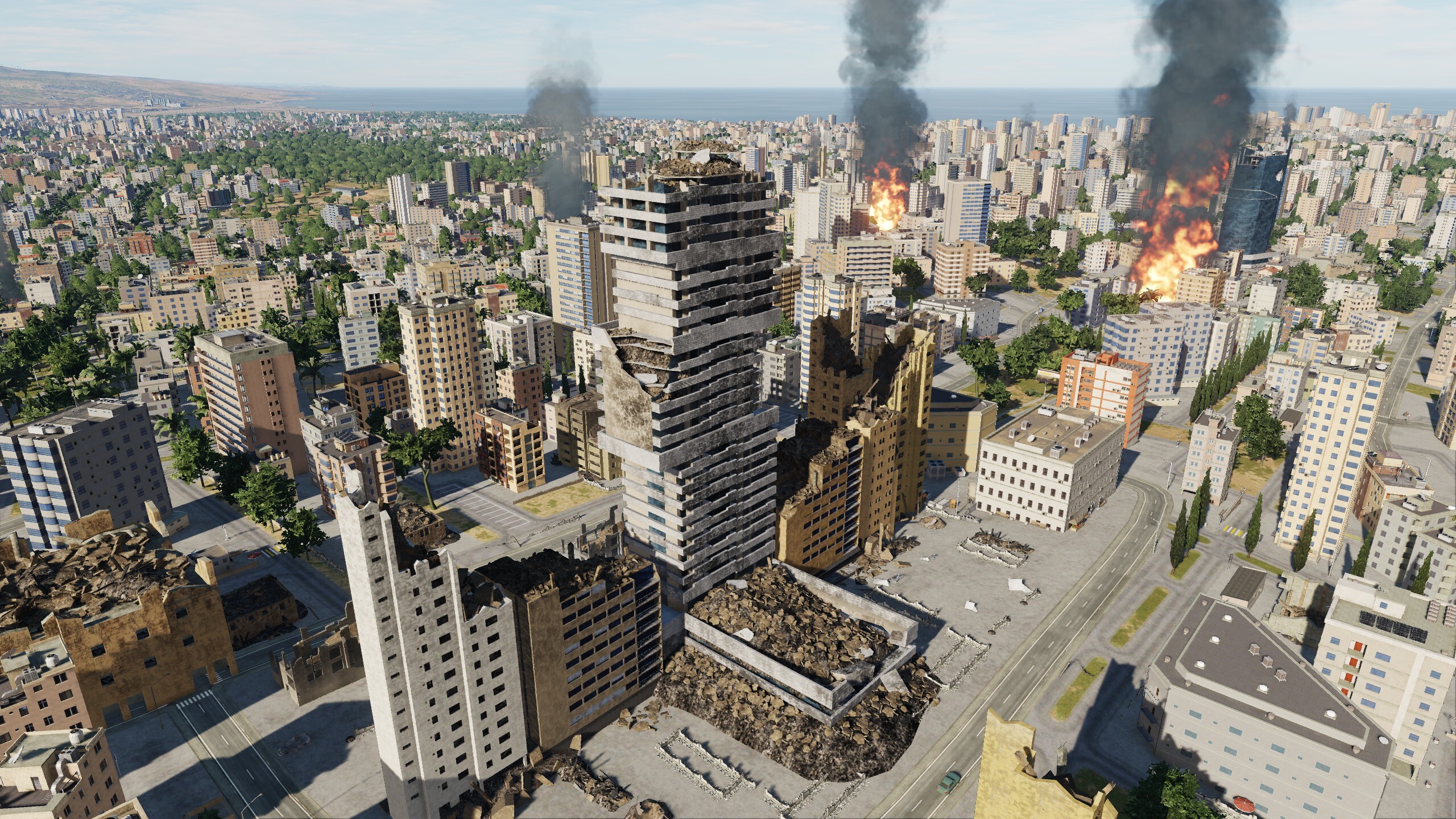
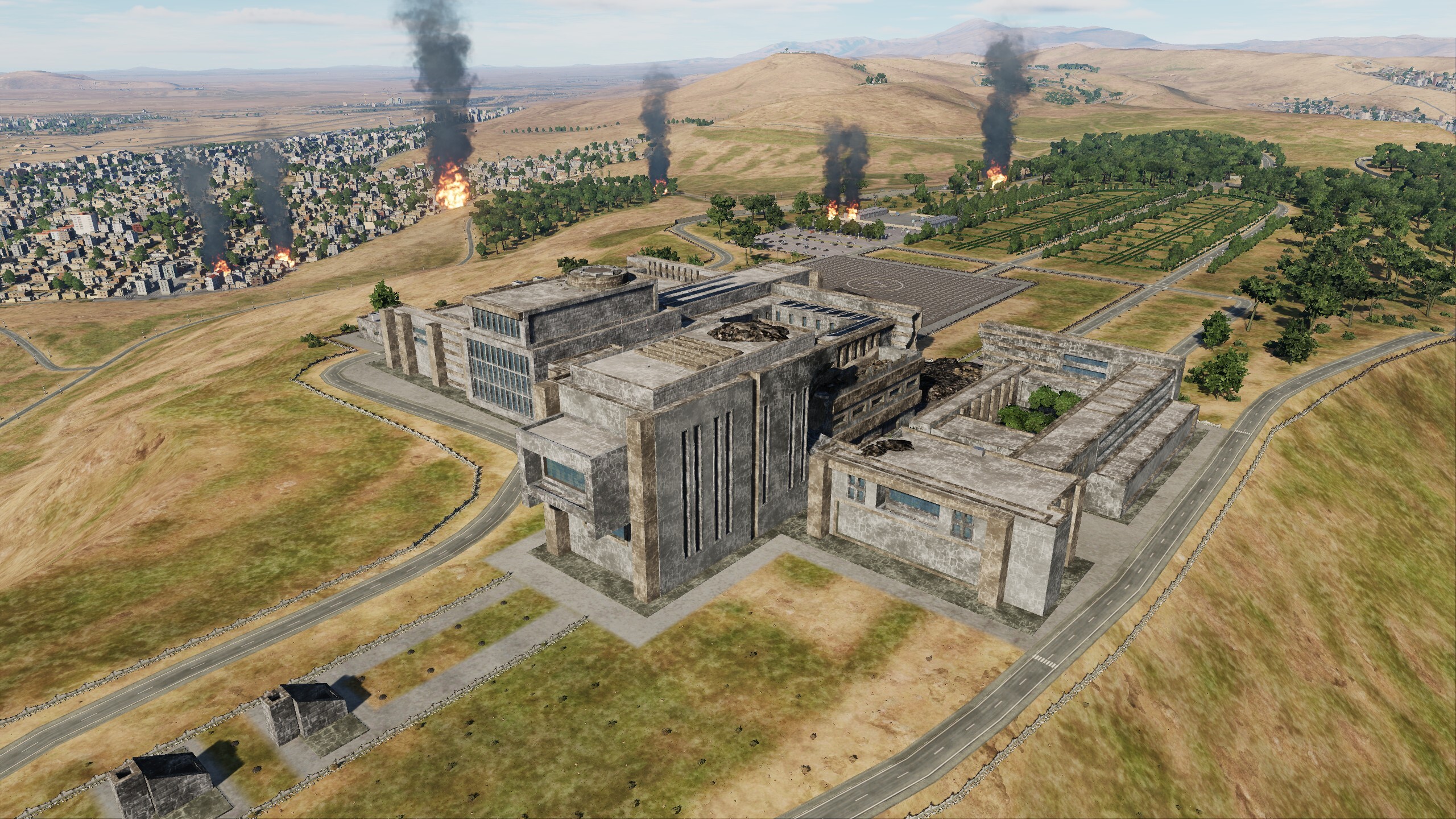
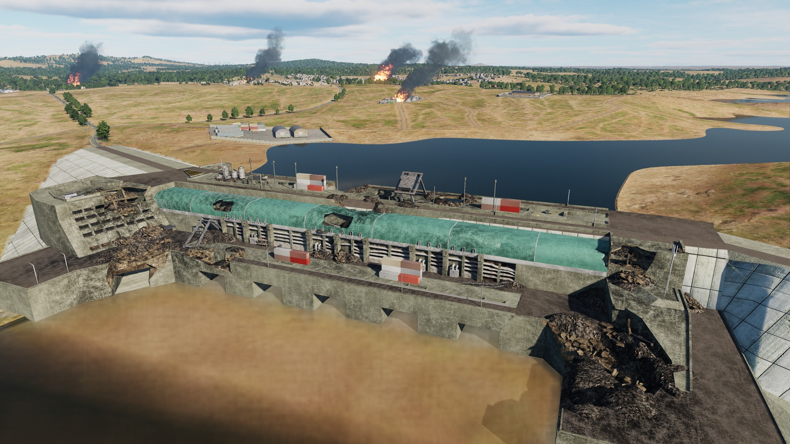
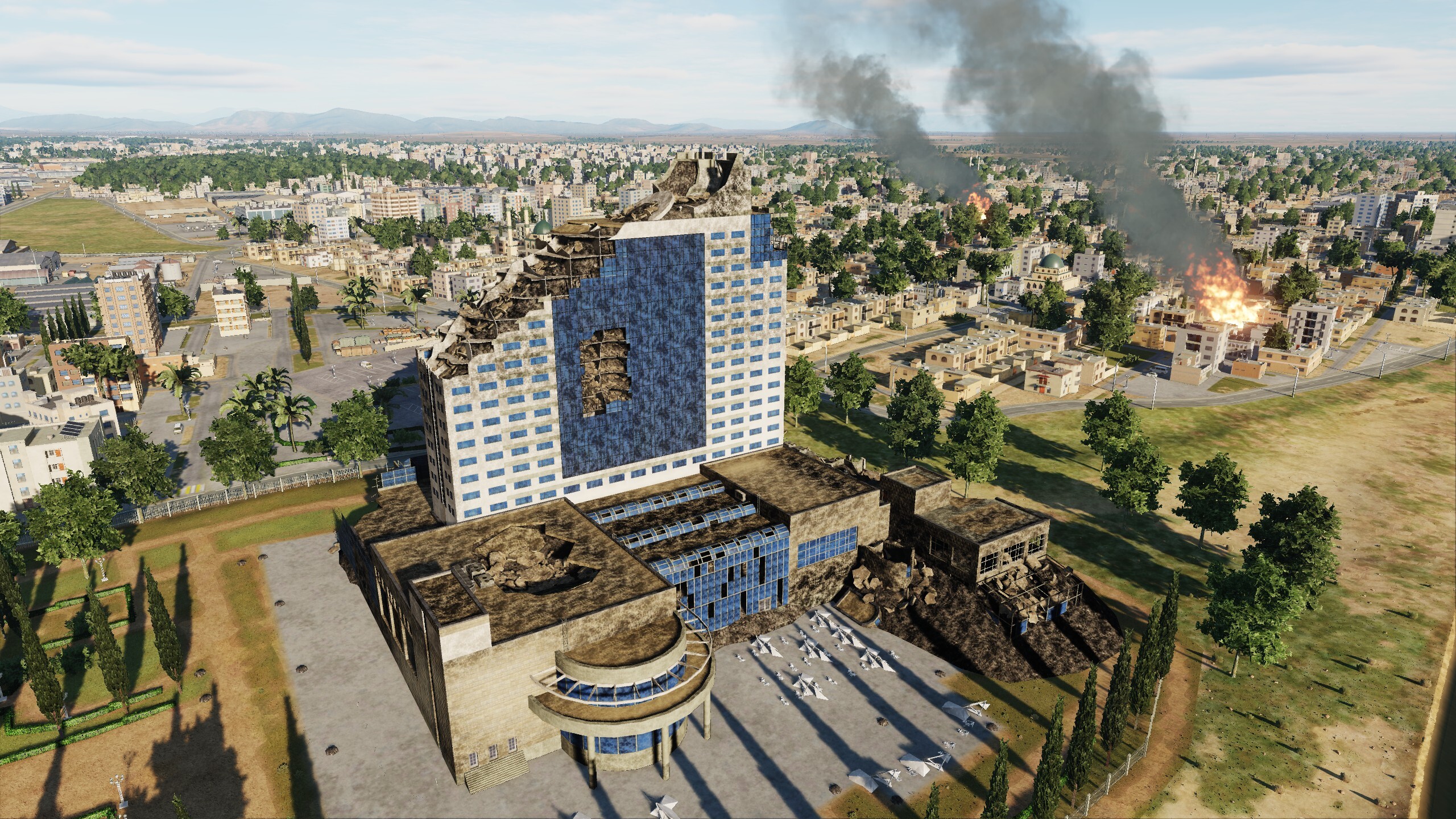
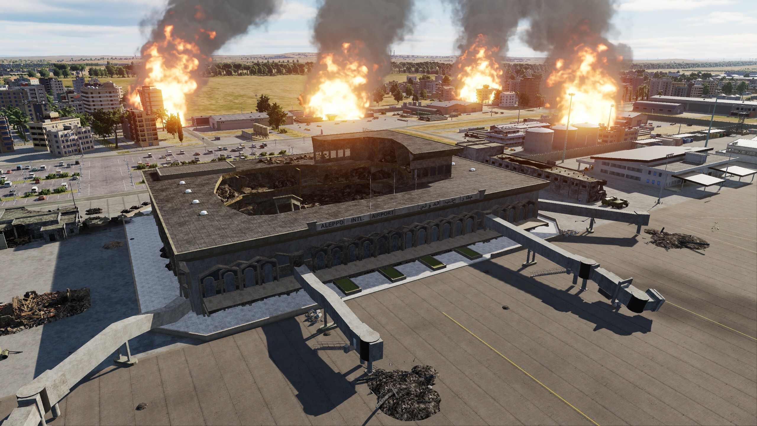
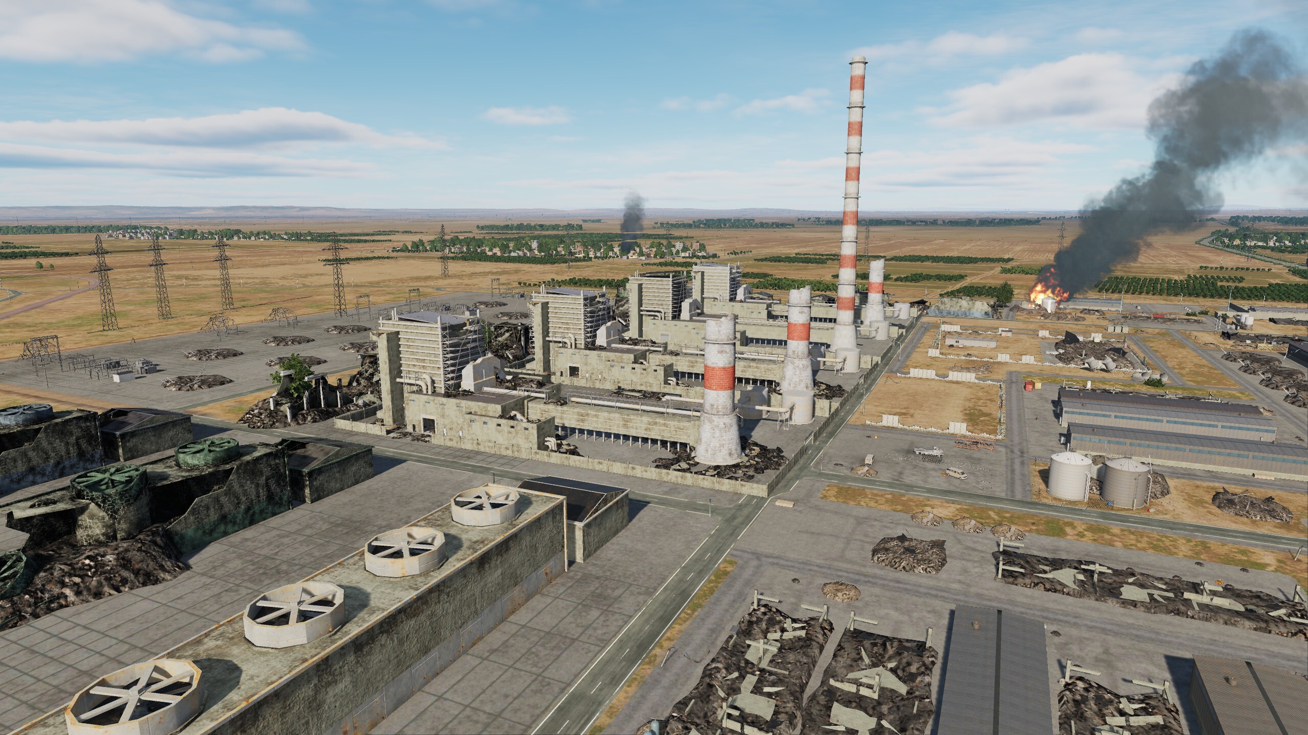
Hi As promised, we have dropped a list of original destructible objects. And now we will supplement it with screenshots and coordinates. Wipe your sights! Open list: 360 Building Adana HiltonSA Aleppo International Airport Terminal Aleppo thermal power plant Atatürk Barajı (Dam Ataturk) 1 Atatürk Barajı (Dam Ataturk) 2 Damascus International Airport Terminal Damascus Tower Euphrates dam Four Seasons Hotel Damascus Gaziantep Havalimanı Airport Terminal Haifa Refinery Cooling Towers KEAN Soft Drinks Factory Lafarge cement plant Larnaca International Airport Terminal Nicosia International Airport Terminal Olympic Residence Panorama Towers Paphos International Airport Terminal Rafik Hariri International Airport Terminal Sail Tower Sama Beirut Sheraton Grand Adana SkyGate Syrian Presidential Palace Tishrin Dam Platinum Tower P.S.: watched the video - it turned out to be a fiery video response
- 99 replies
-
- 12
-
-
-
 Hi In order to offer new opportunities we had to take this step. For logic, the main reference point is the airfield ID, and the name is made the same so as not to clutter the map (initially, we have more complex names H_s_01, etc.) - When viewing the map, this is too inconvenient, since there is no separate type of helipads in the DCS and the names merge with the airfields. We are solving this problem, if you have any ideas, write. It is important to us that the map is equally convenient for players and mission creators
 -
"UM001, RADIO CHECK" Hi Today will not be an ordinary review. I want to show you a video created by our team of testers Ugra-Media, for which we are very grateful. This is the first experience of creating videos, we wish you good luck and look forward to new works. By creating this video, we wanted to draw the attention of users of the Syria map to the new features that appeared on it in the latest and upcoming updates on October 30. Among them, we first of all want to highlight the new Israeli airfields Ben Gurion, Hatzor, Palmaсhim and Tel Nof. The appearance on the Syria map of more than 100 military bases and helipads. The ability to destroy most of the original objects, including the tolls on the Euphrates. And hundreds of other improvements that we added to the Syria map.
- 99 replies
-
- 19
-
-


.jpg.b14cc404b63b65eed659d368106fd494.jpg)


.jpg.edc5f90bb5fe9ff3eb7c0e7c9bbb4aa8.jpg)


1.jpg.fa531ffb2c45072f297c9743cf680806.jpg)
2.jpg.cb7013e0e26c2ac7f81abceedcced7d3.jpg)


1.jpg.431ec16bf5aa2fcd2639c6e6be71b2b8.jpg)
2.jpg.6c8c7be756c9d4fb114e6d1e9c4e96d7.jpg)