MAESTR0
-
Posts
154 -
Joined
-
Last visited
-
Days Won
22
Content Type
Profiles
Forums
Events
Everything posted by MAESTR0
-
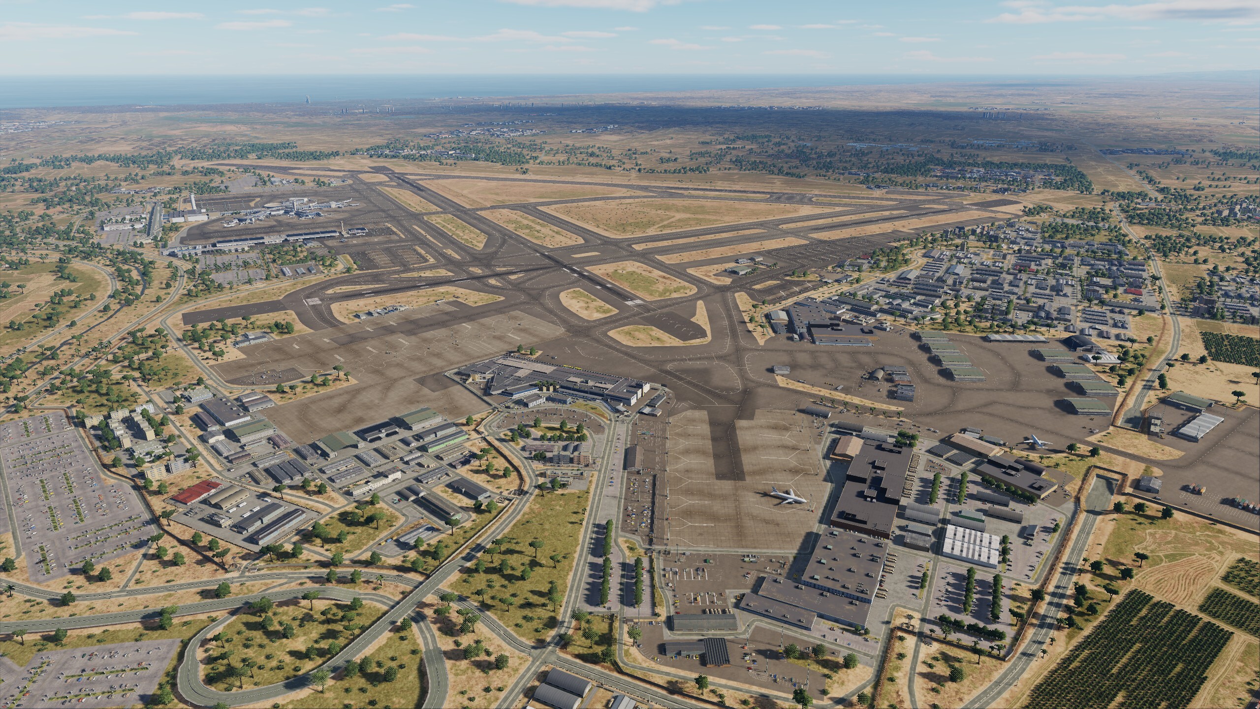
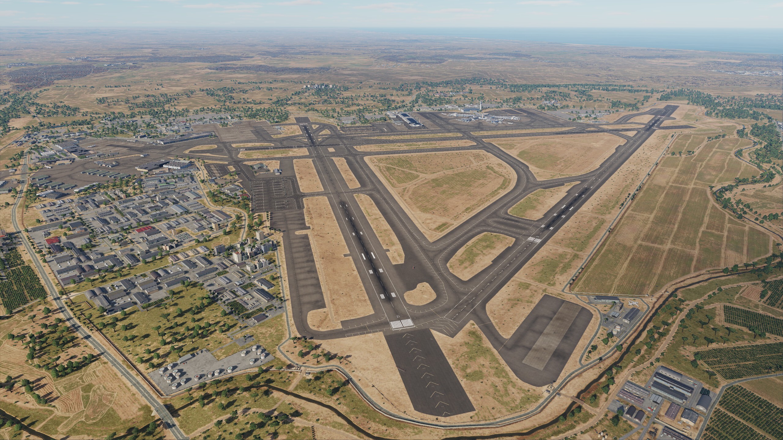
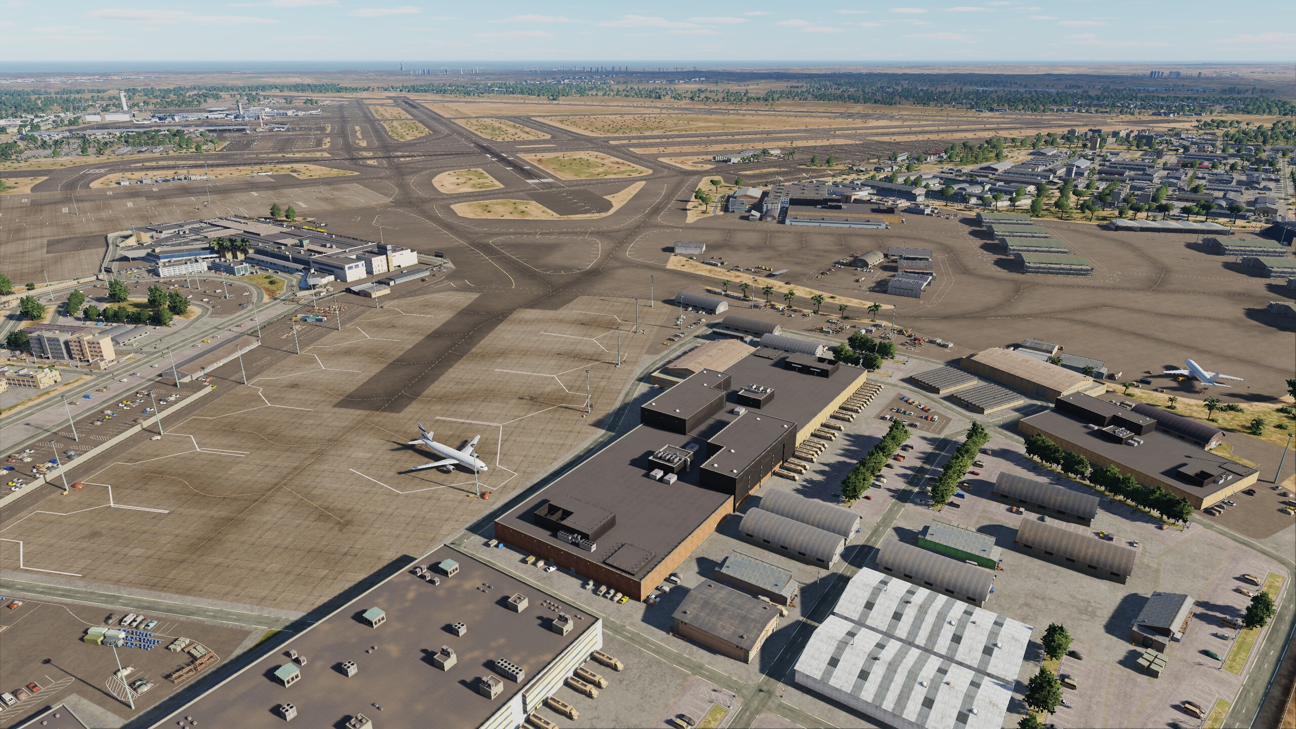
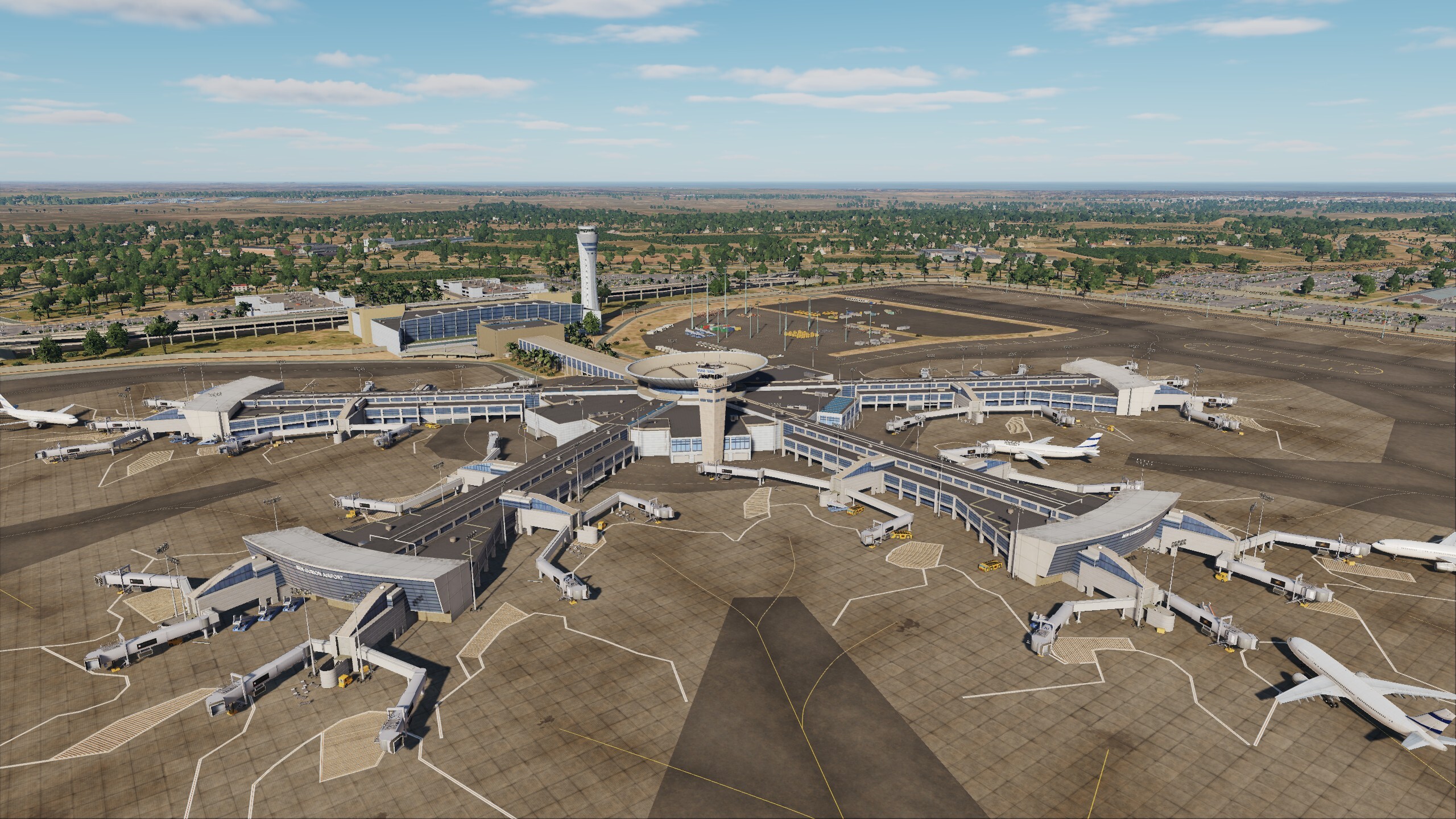
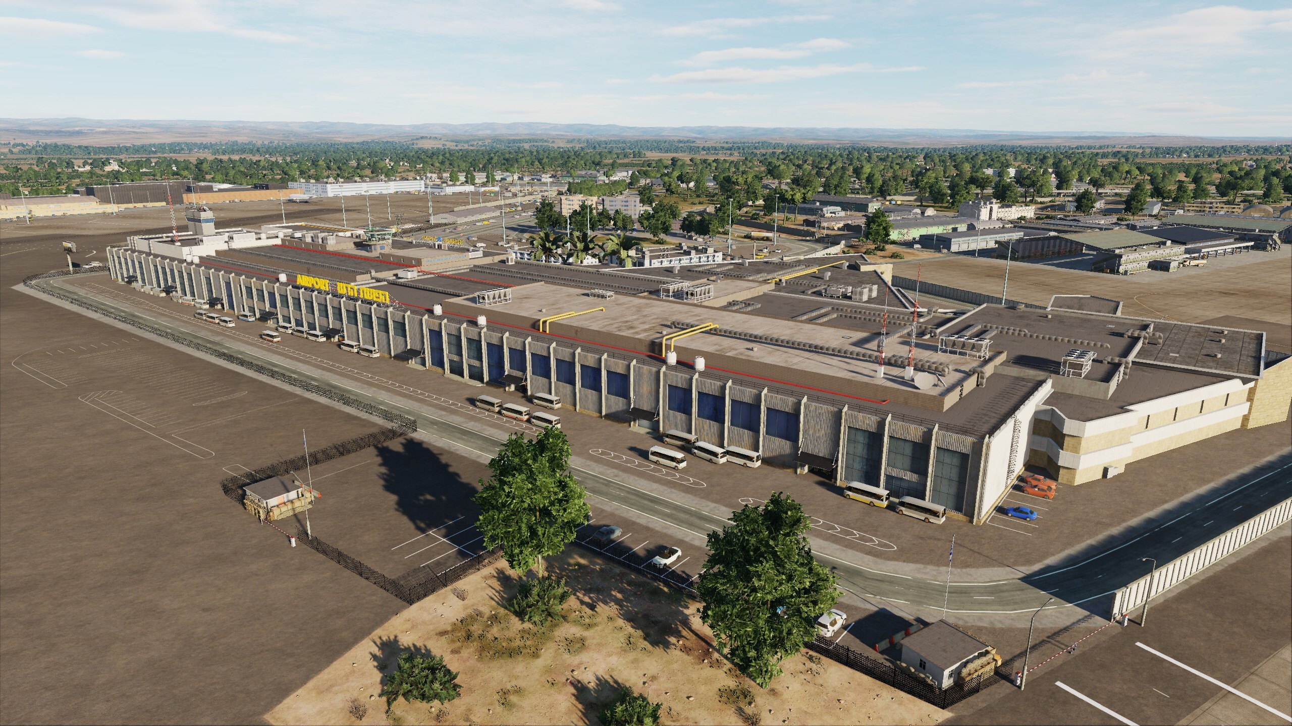
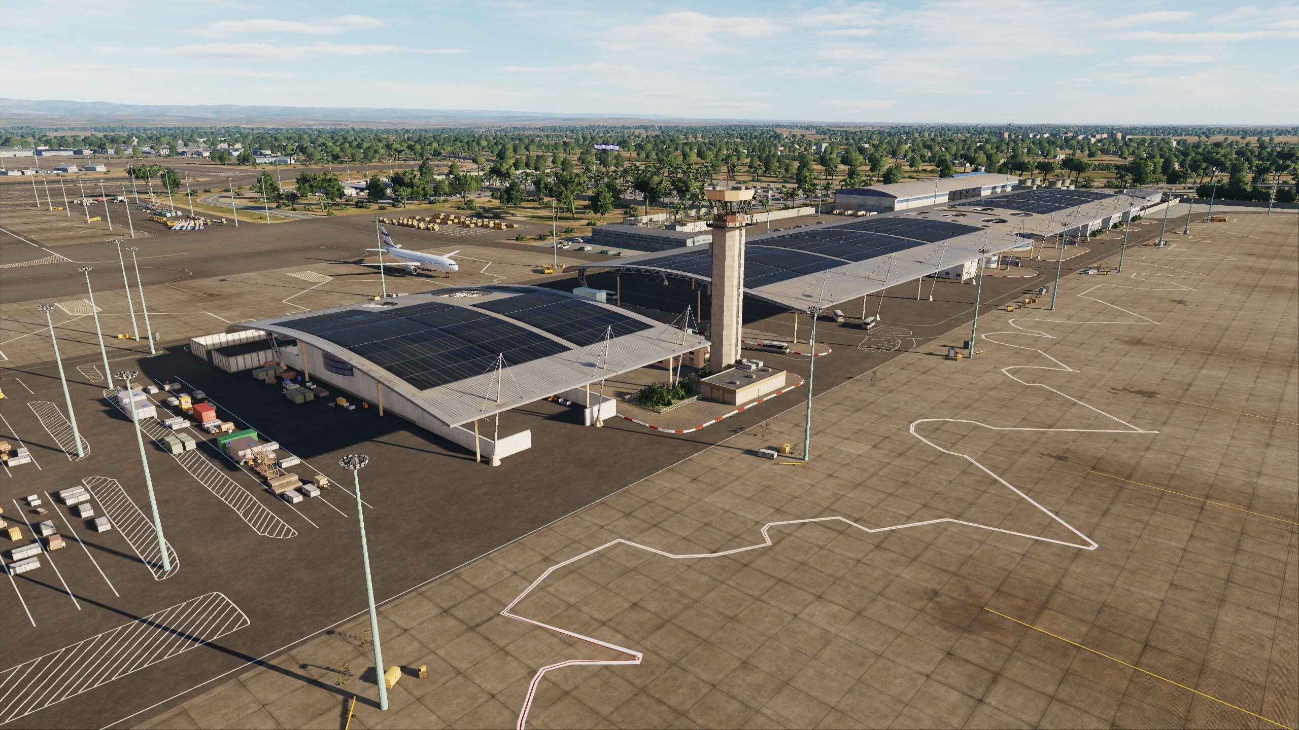
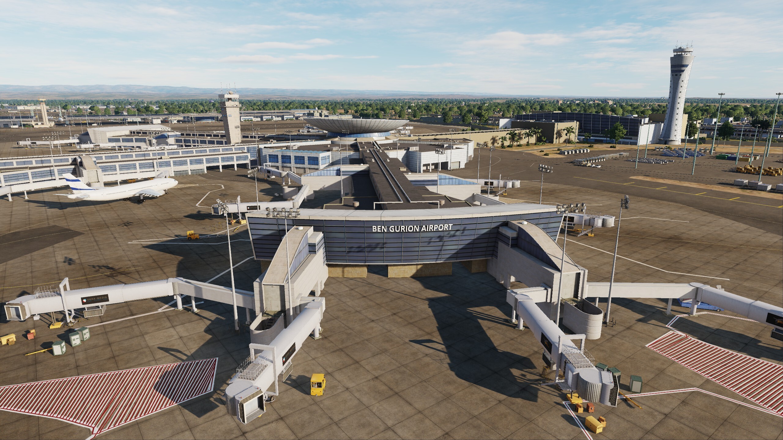
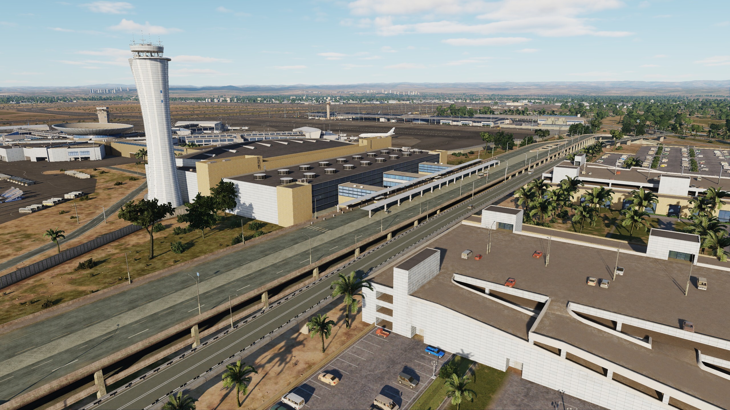
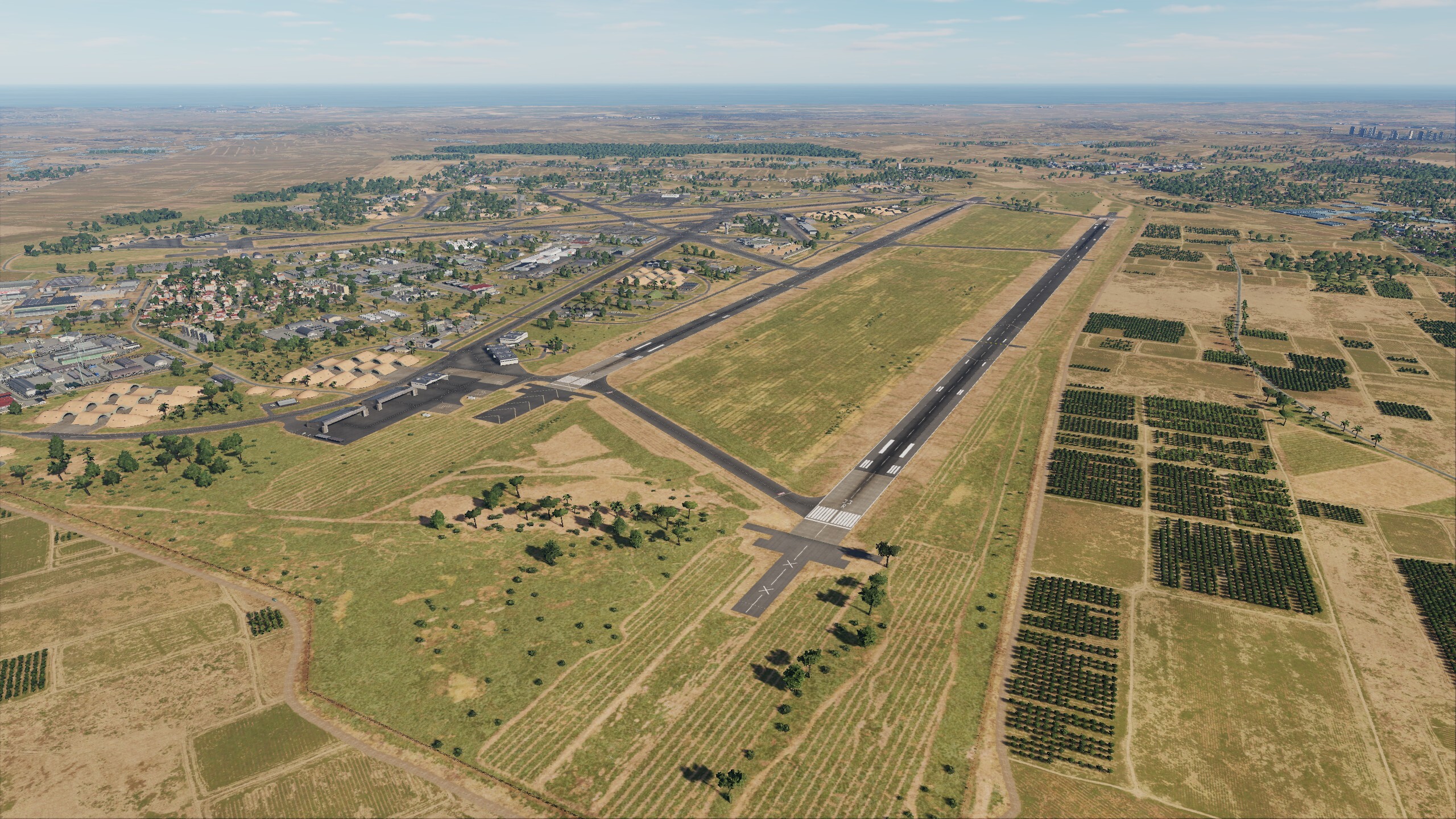
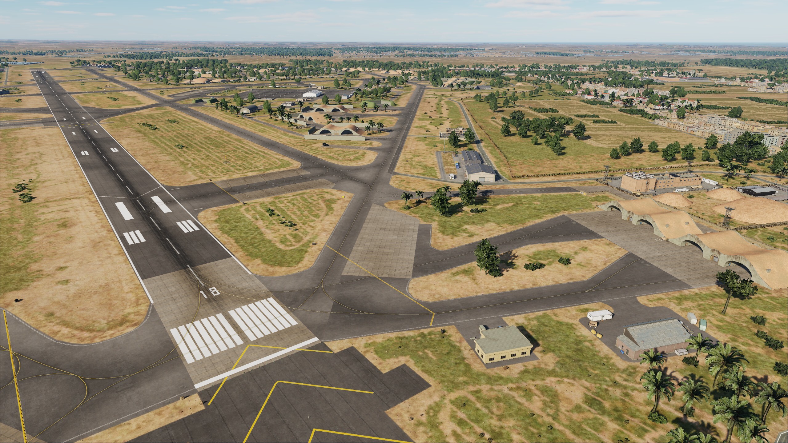
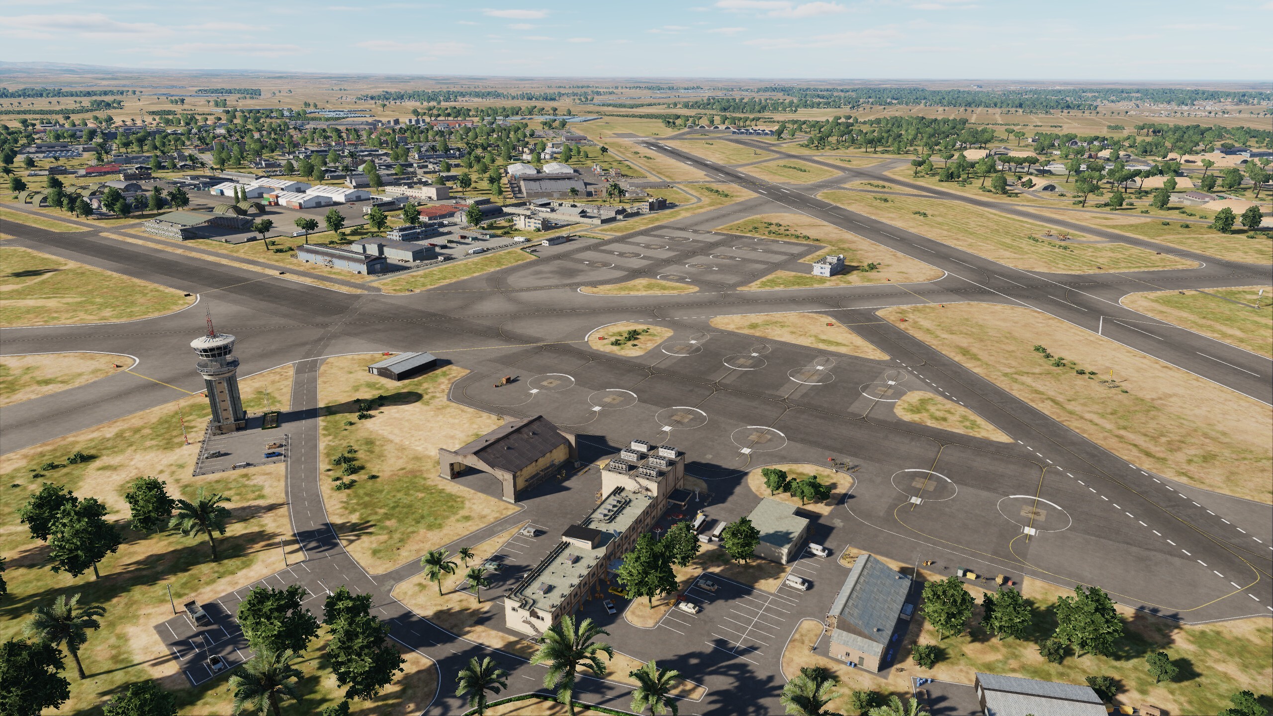
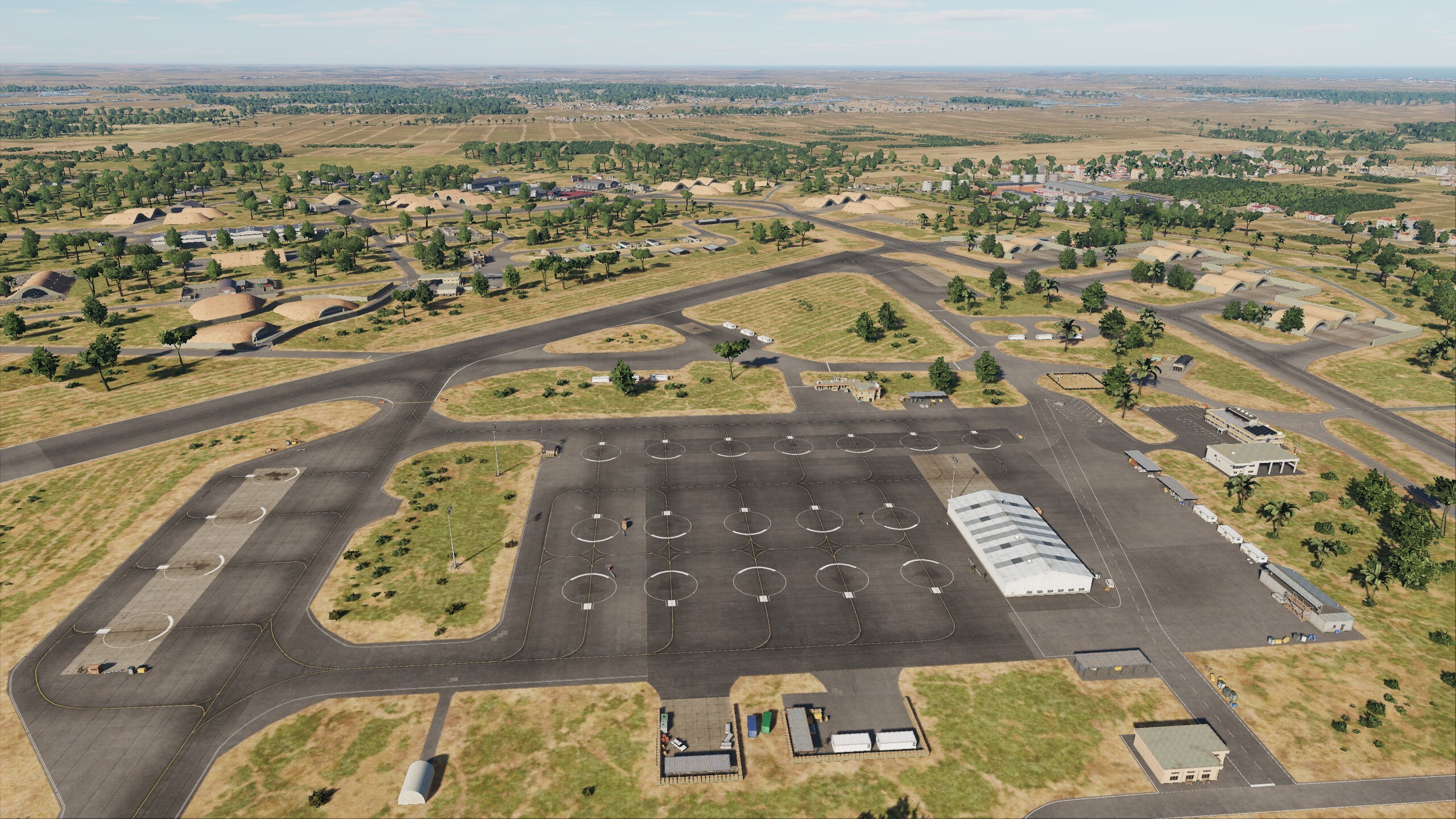
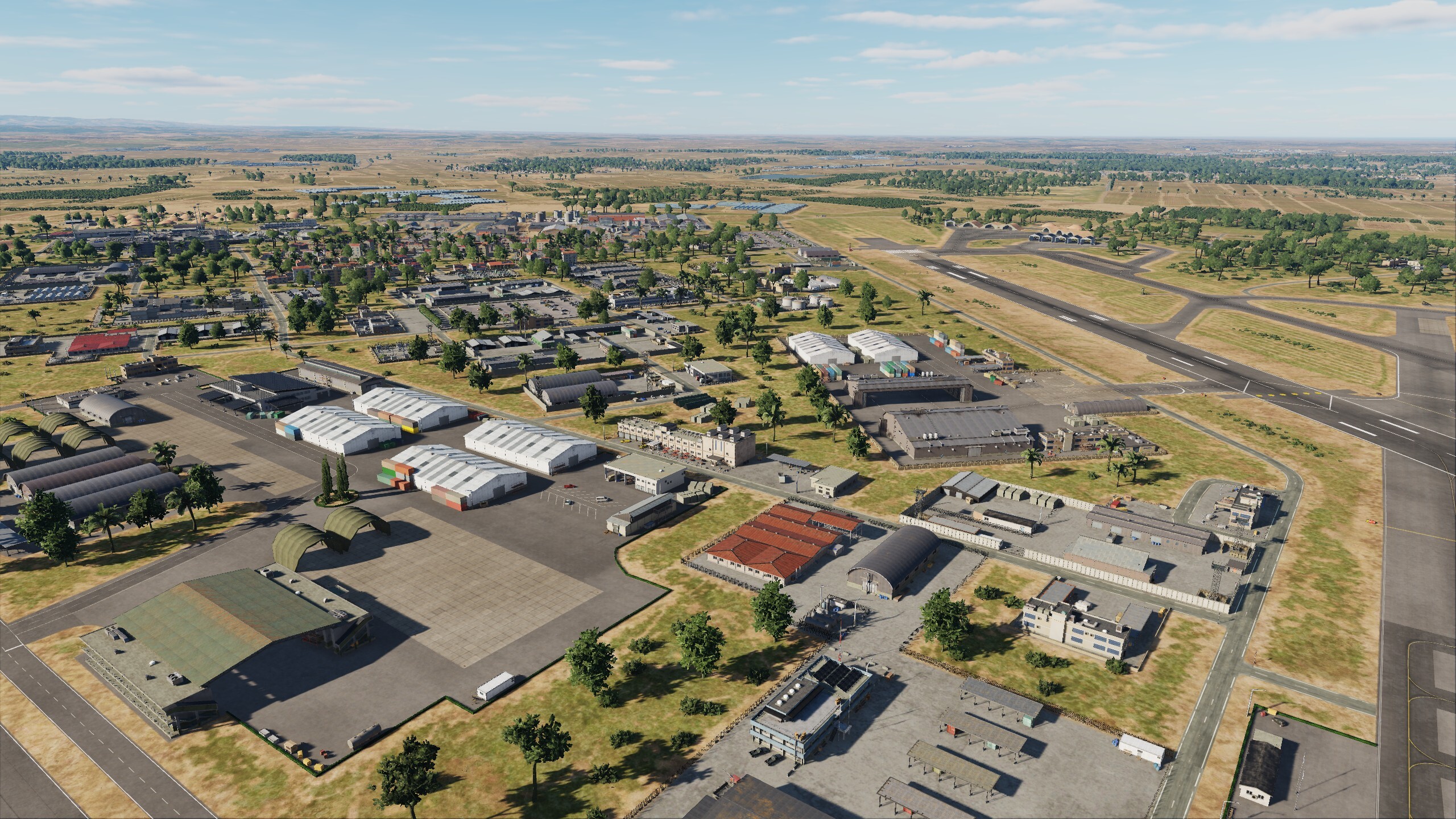
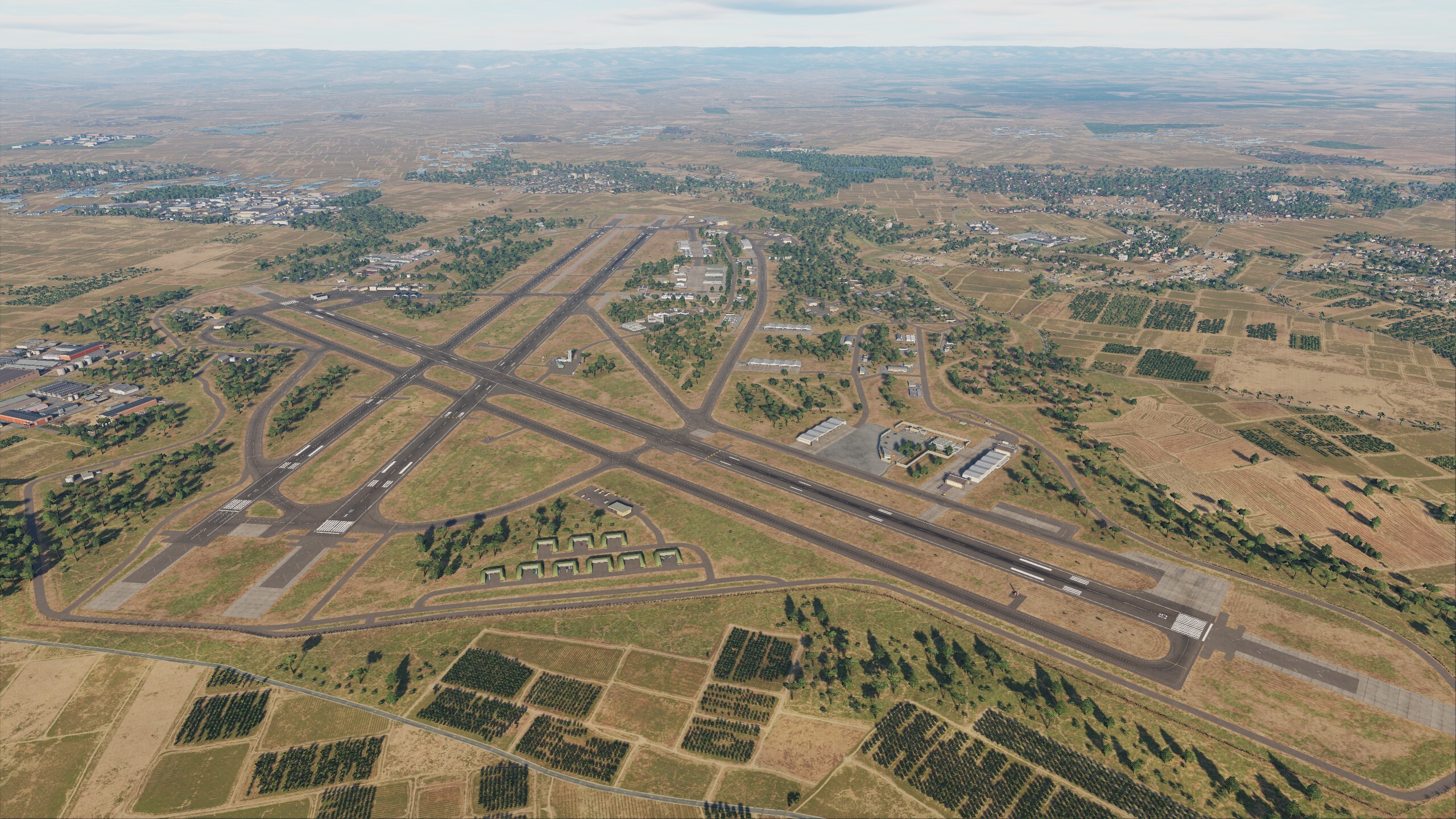
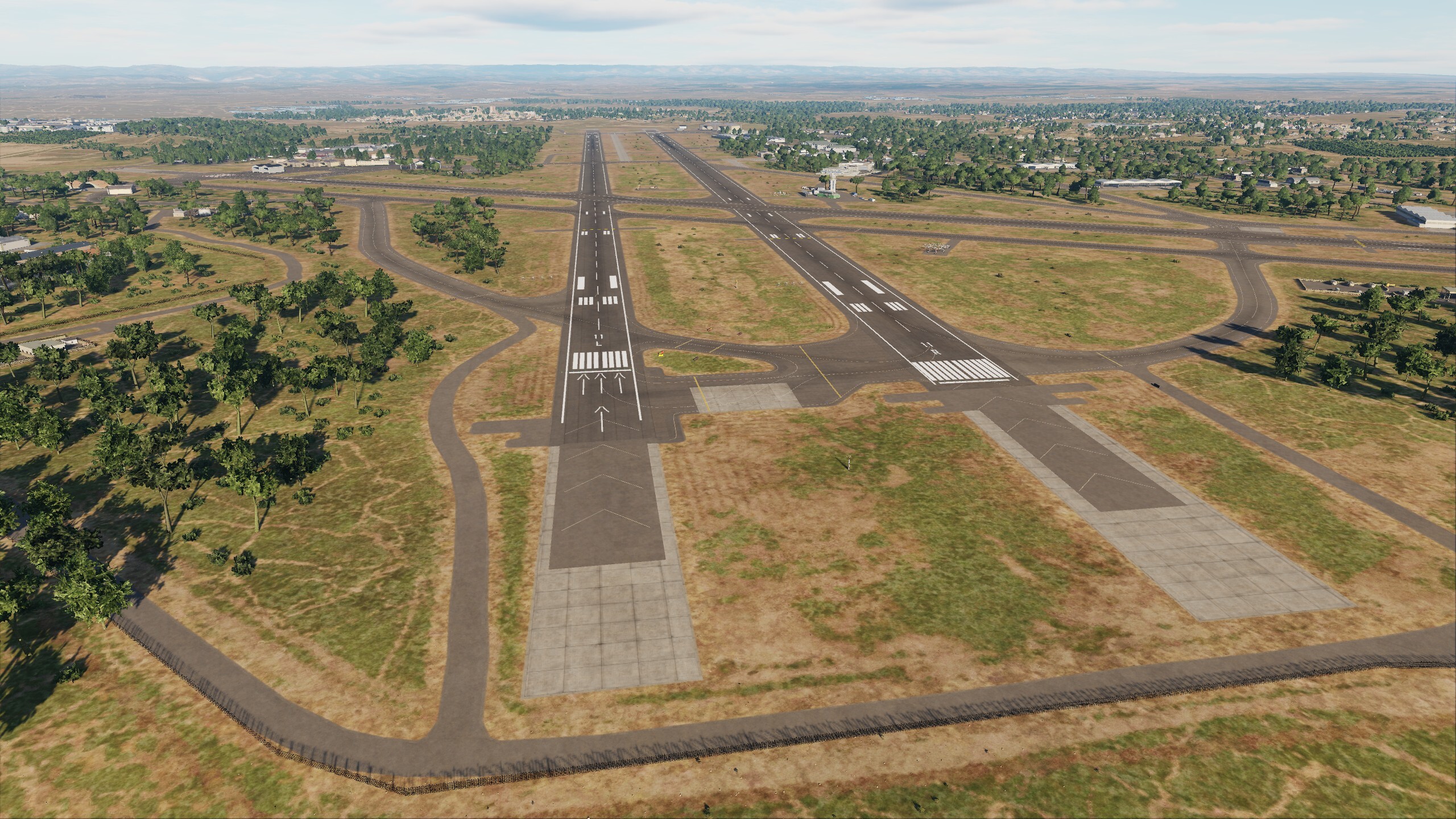
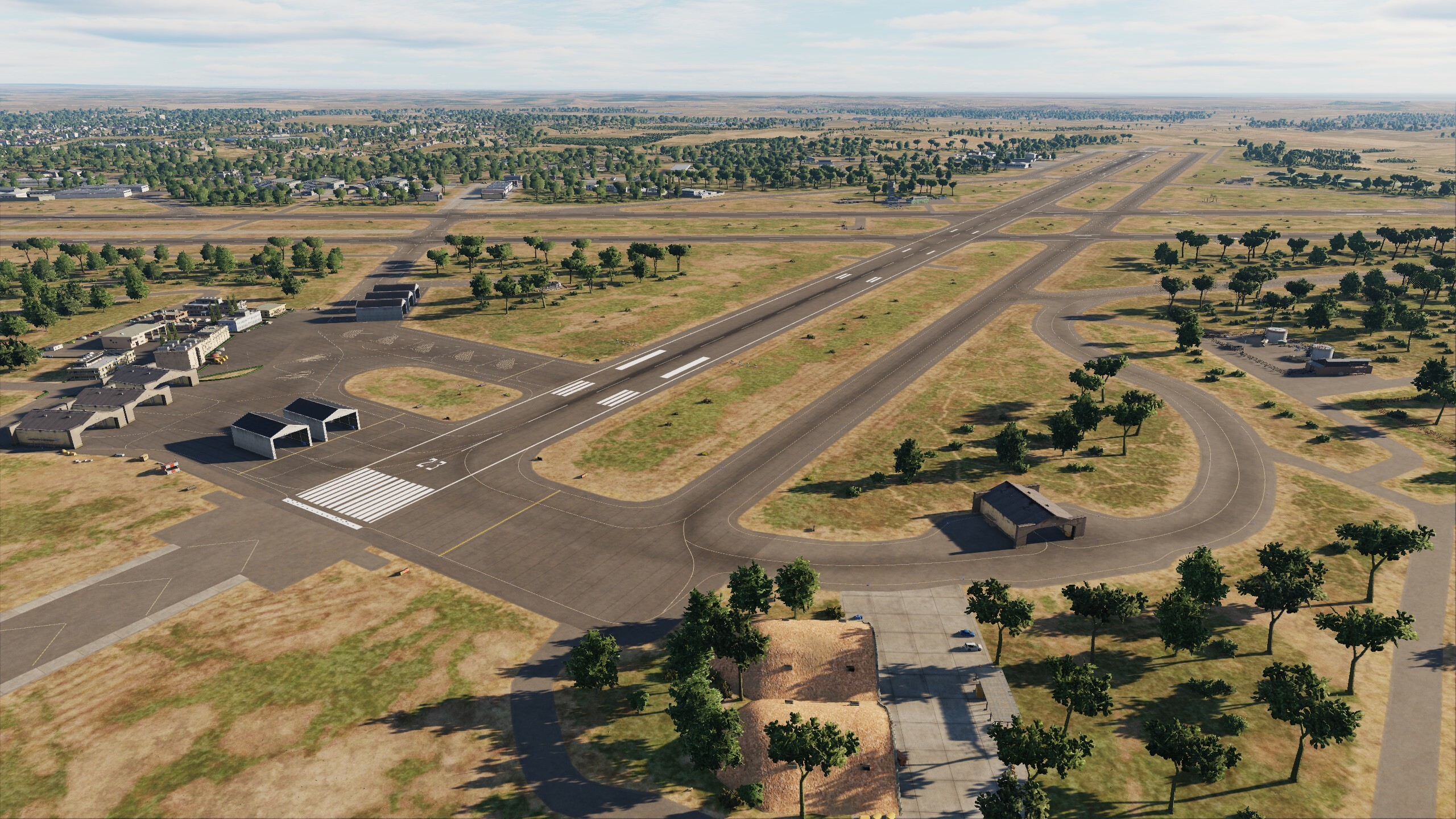
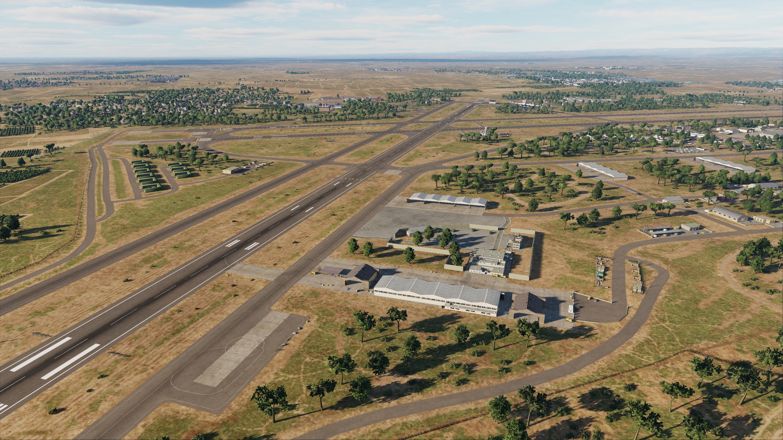
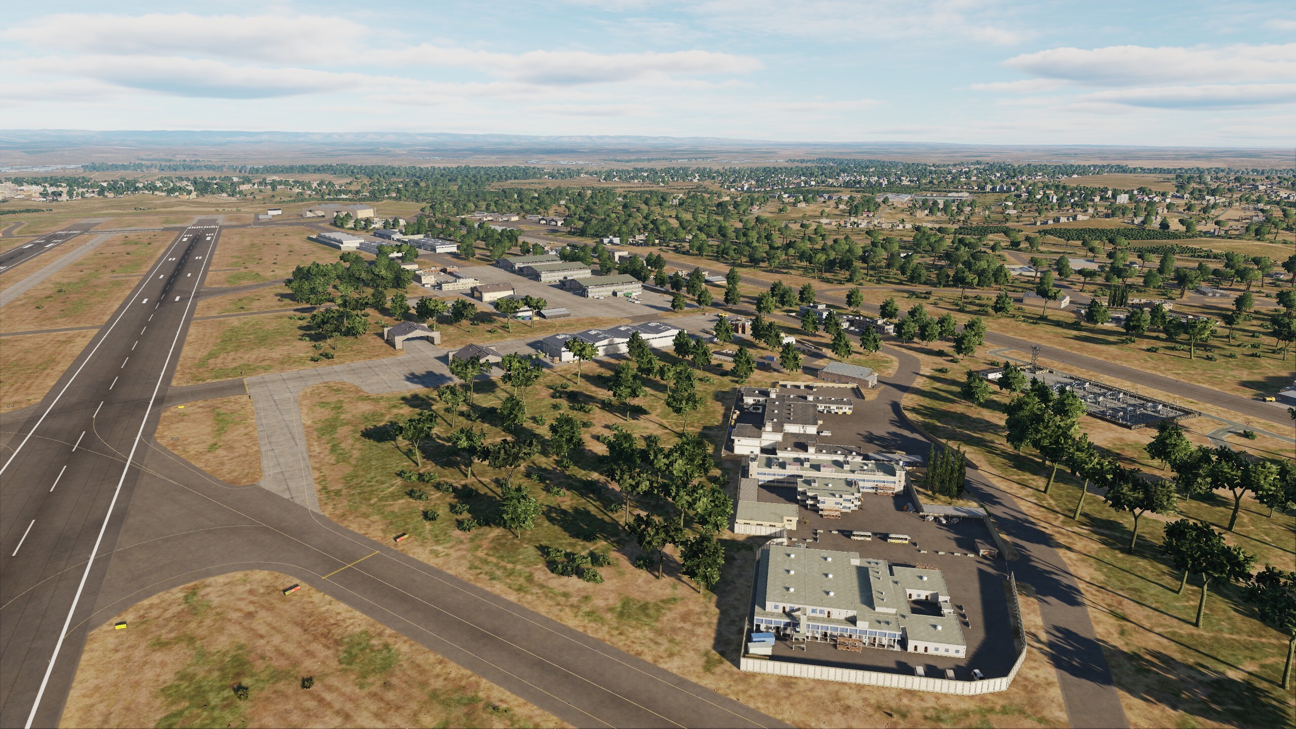
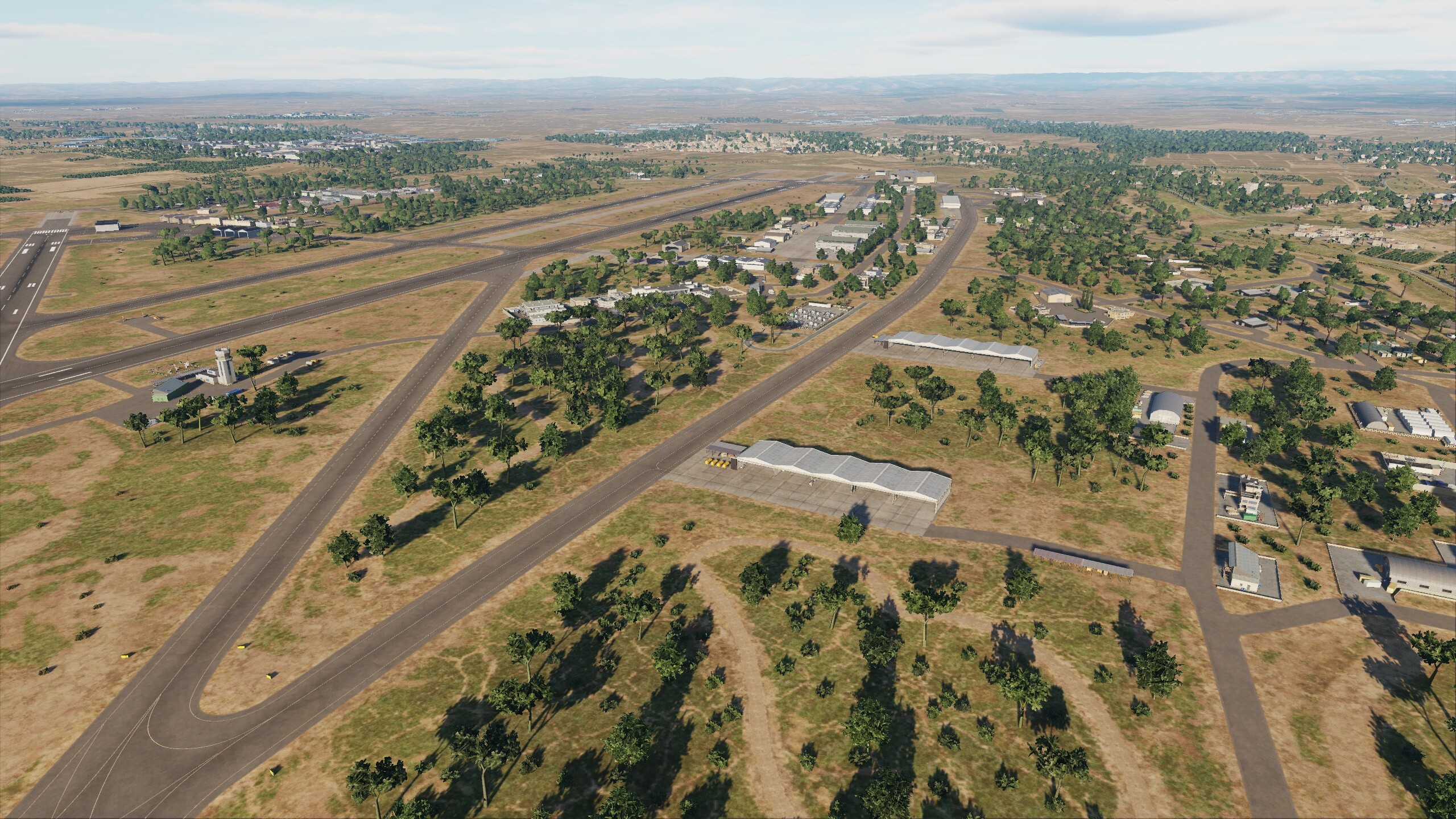
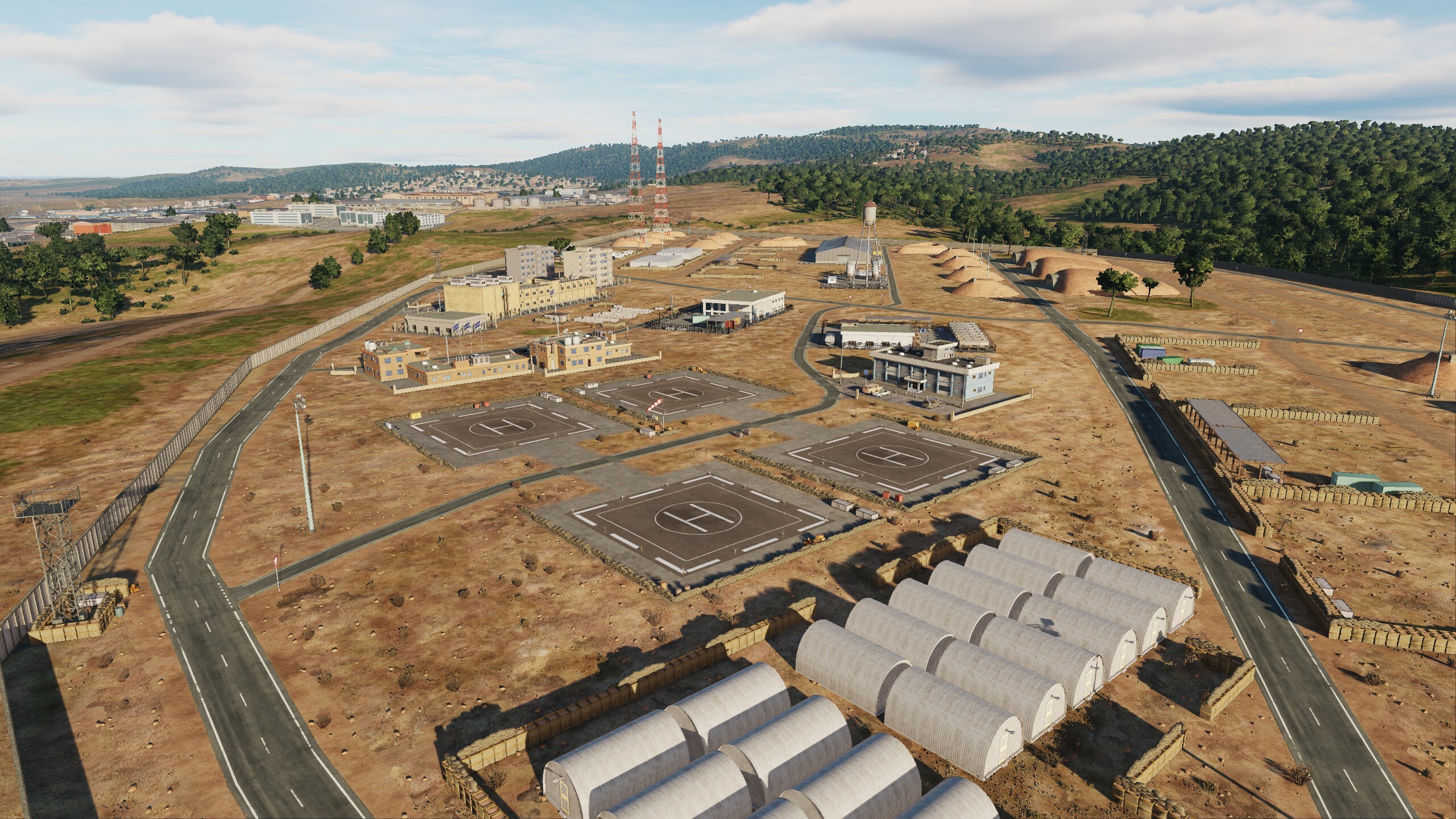
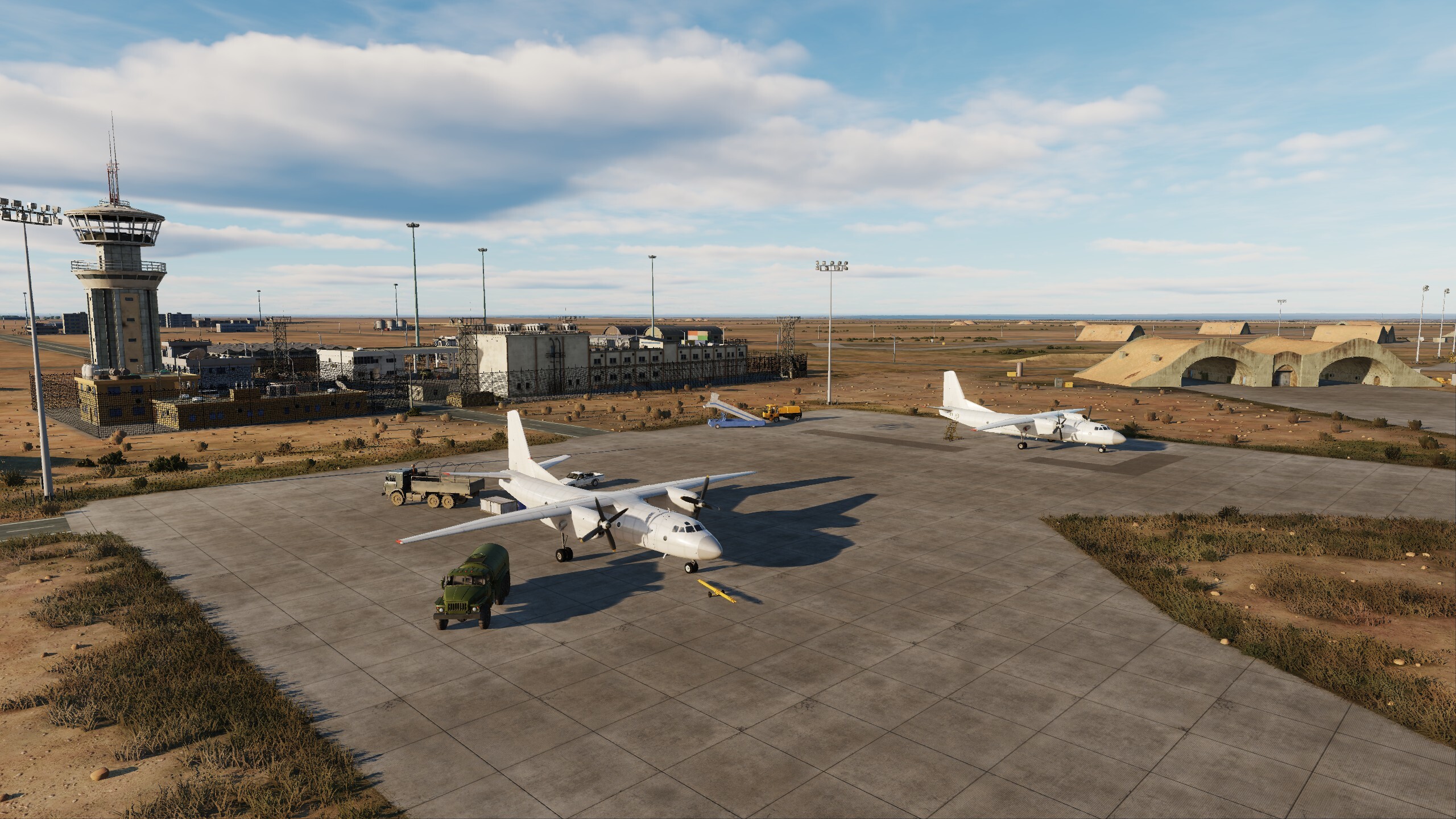
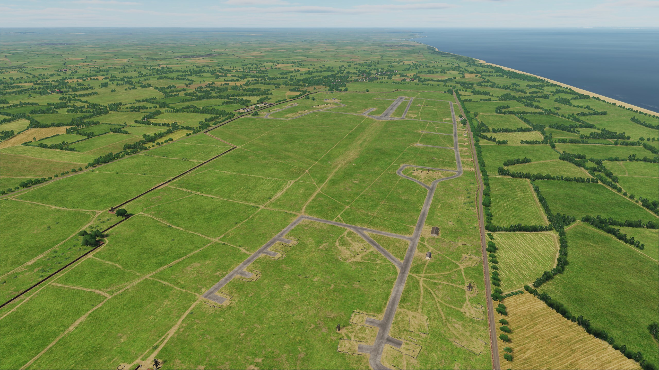
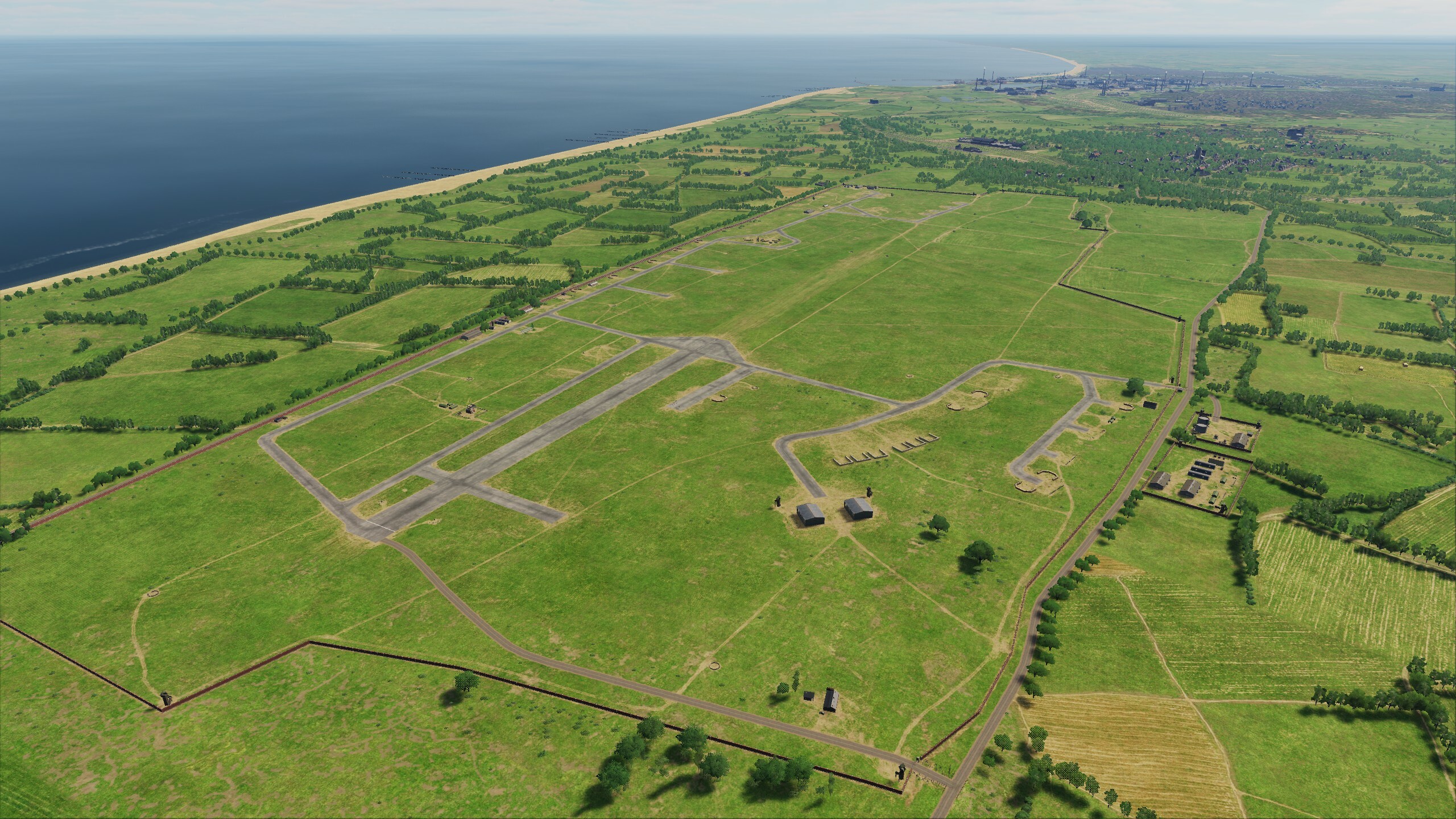
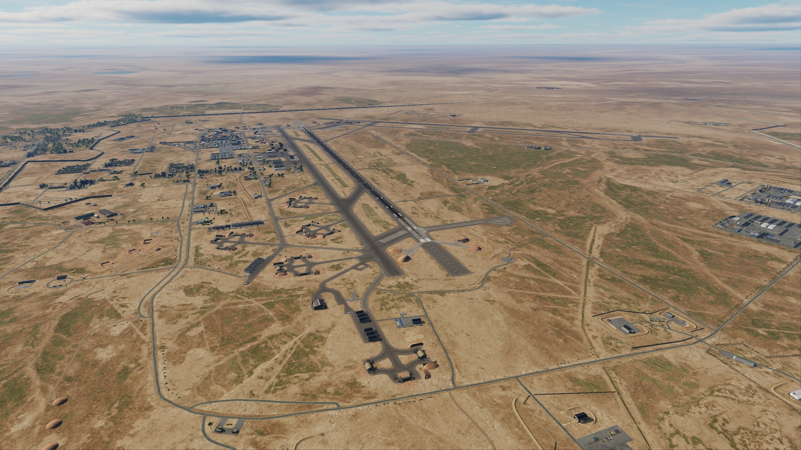
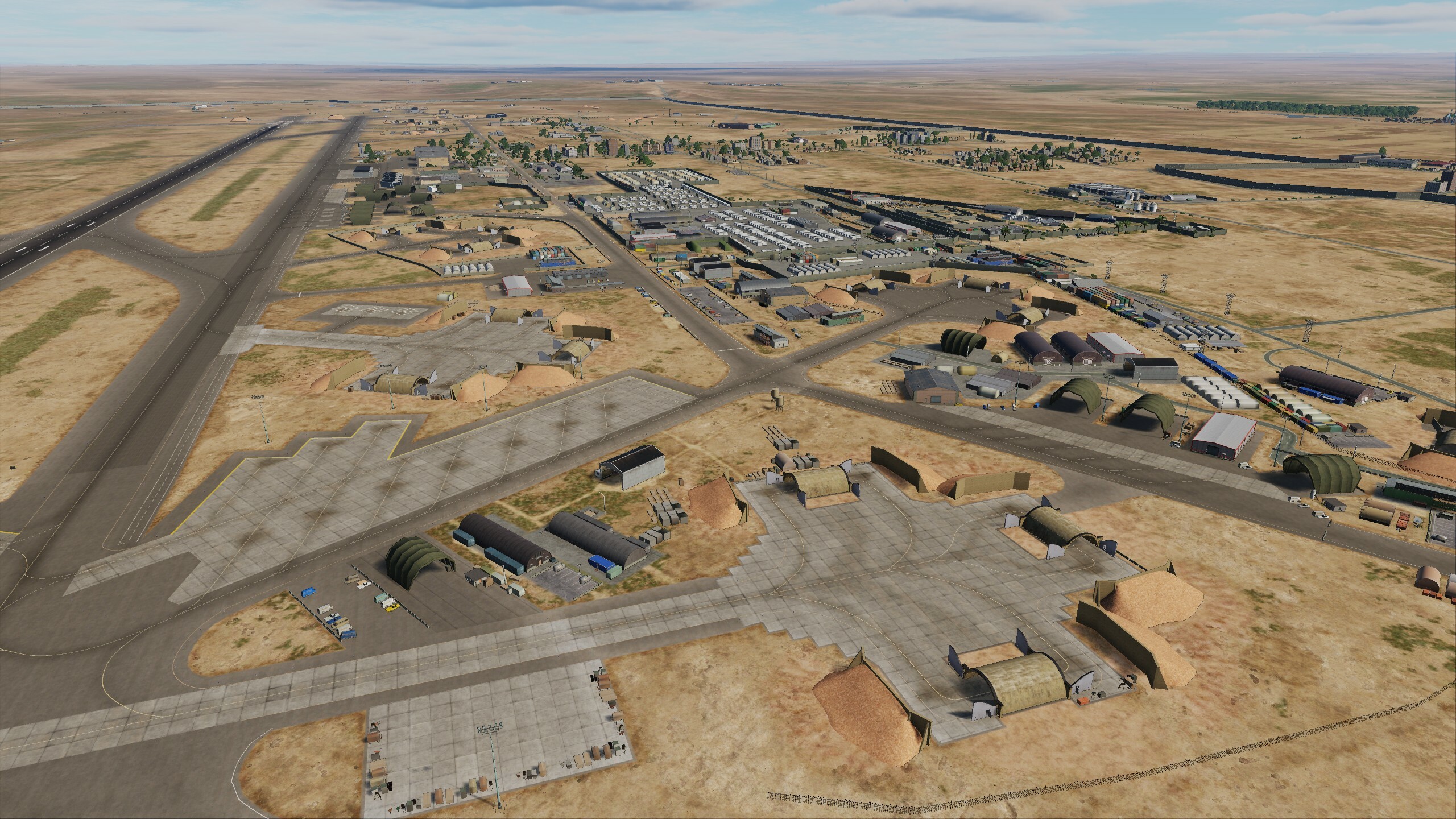
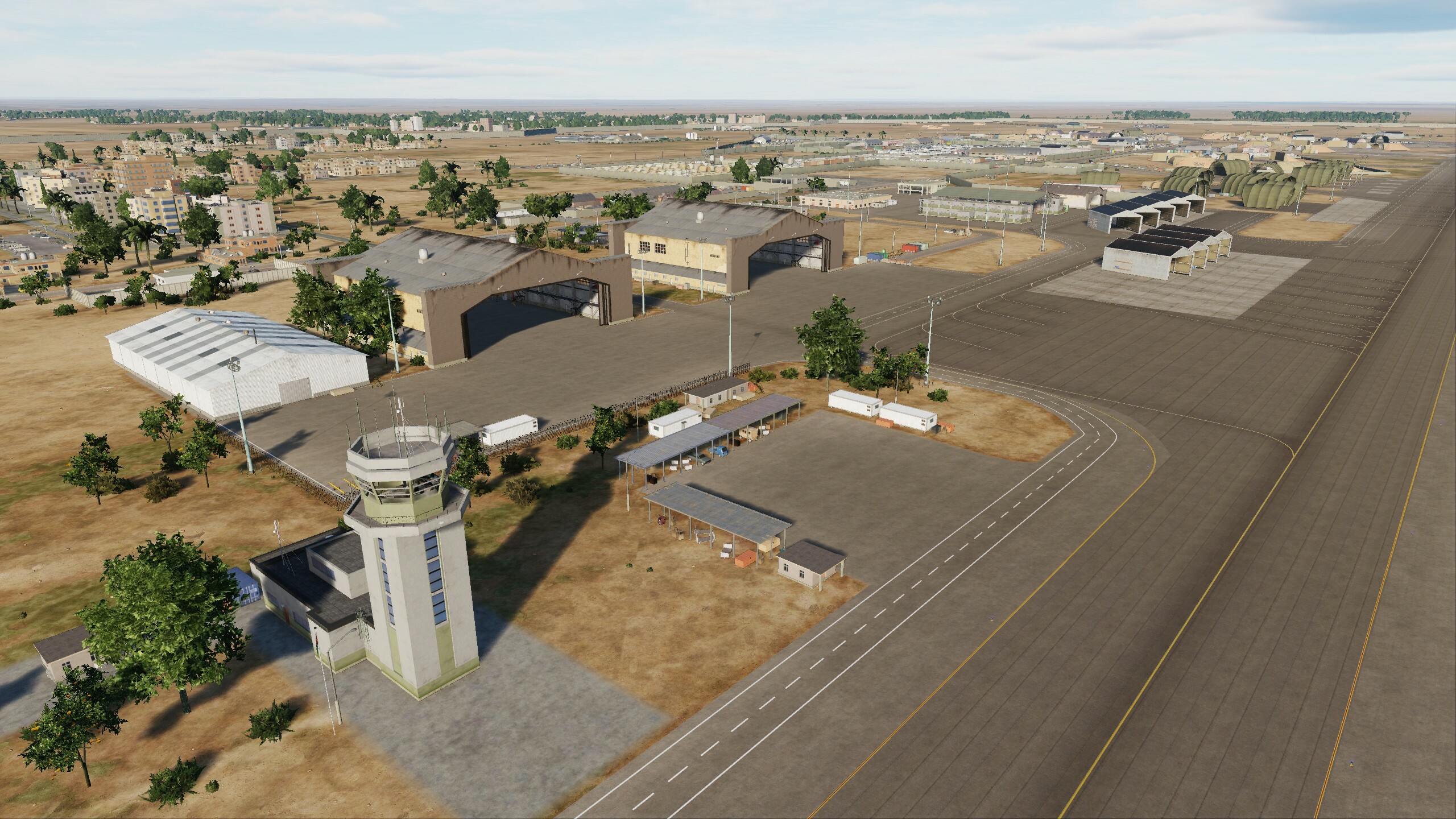
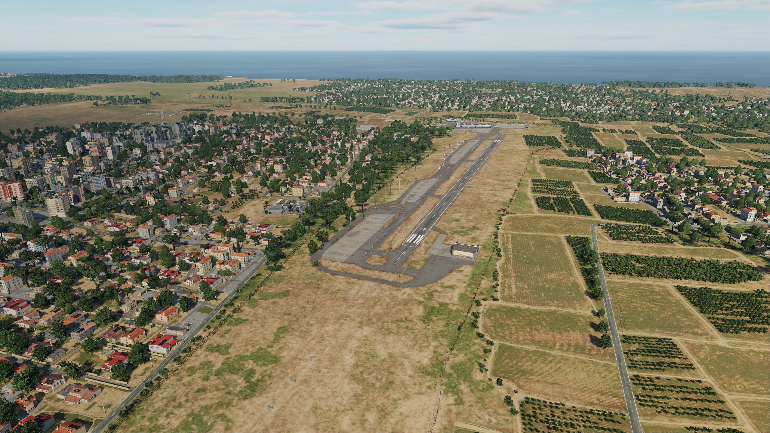
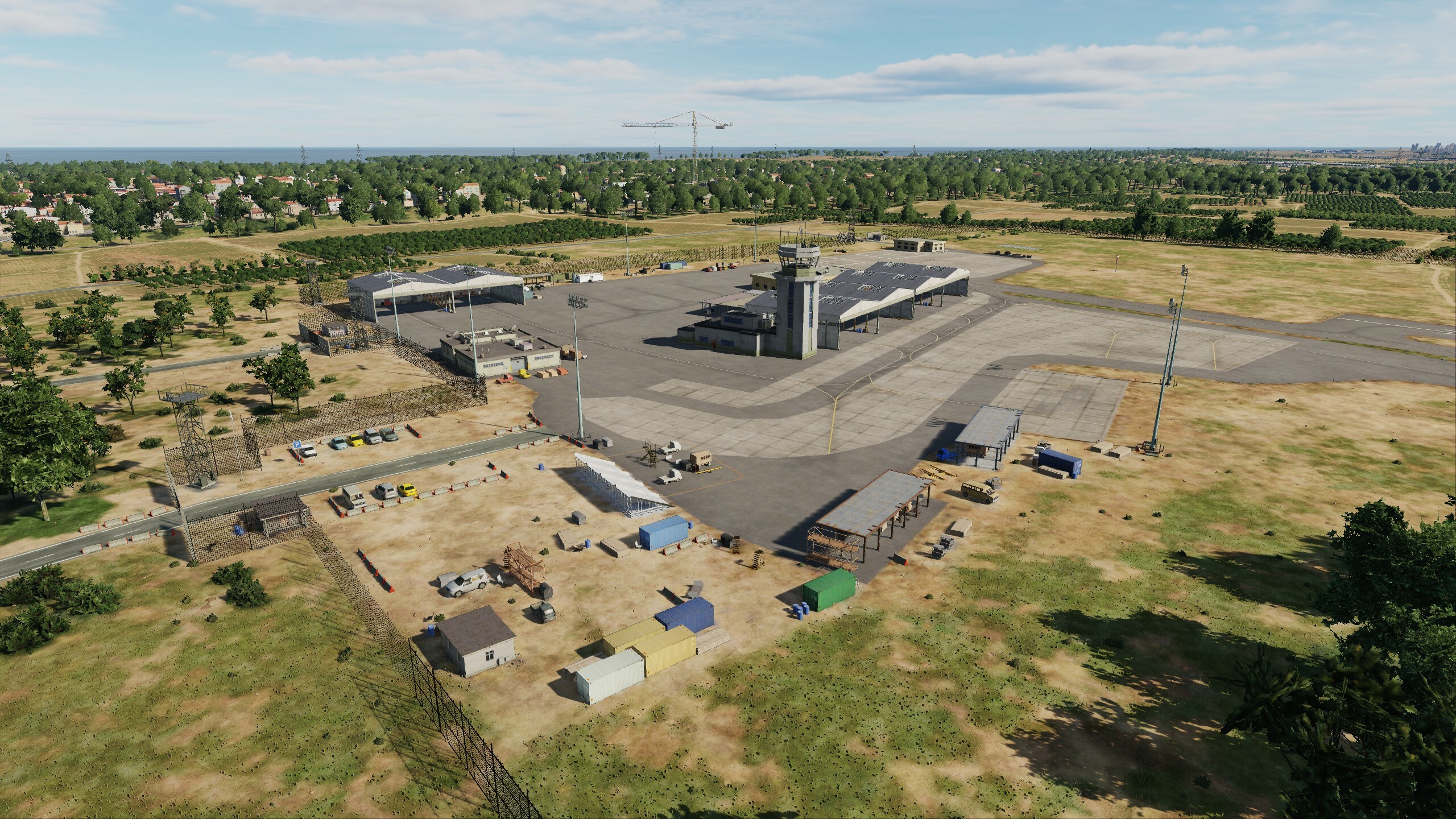
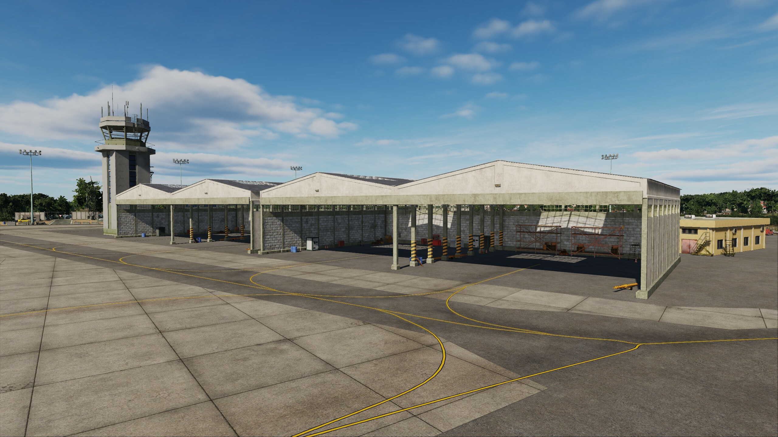
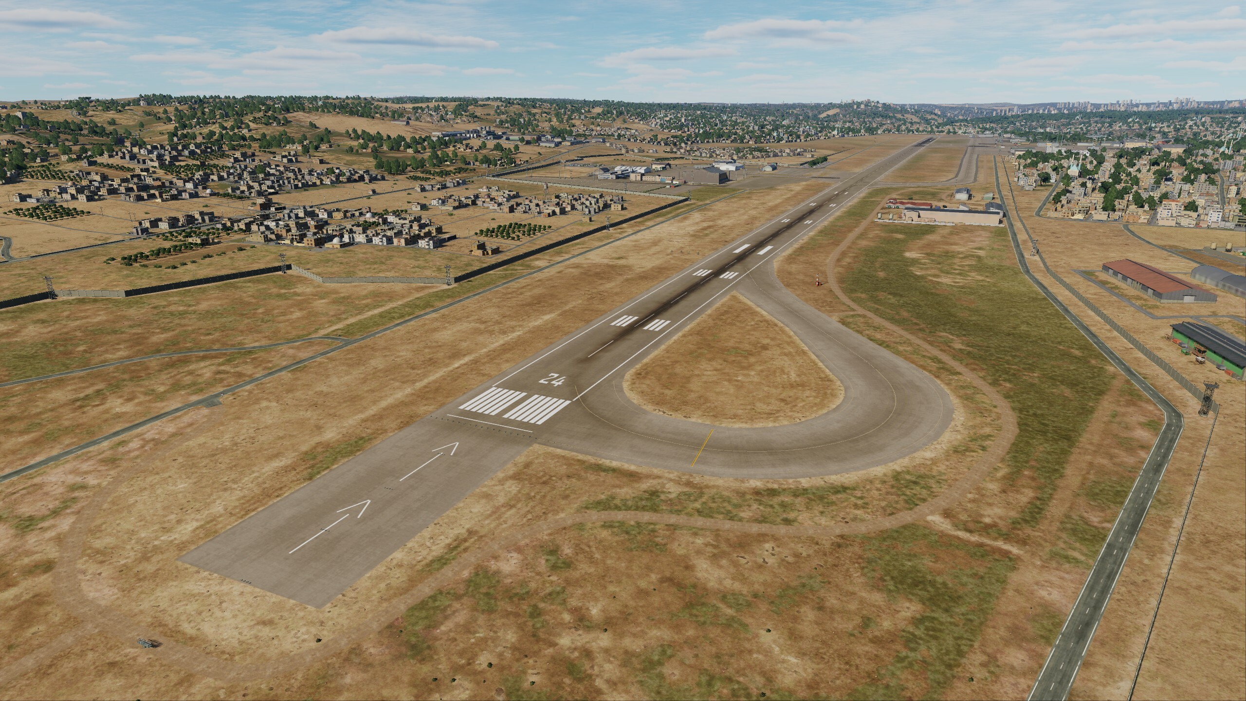
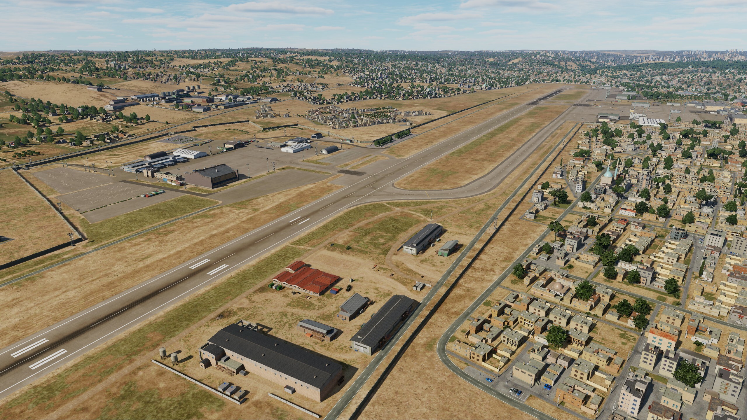
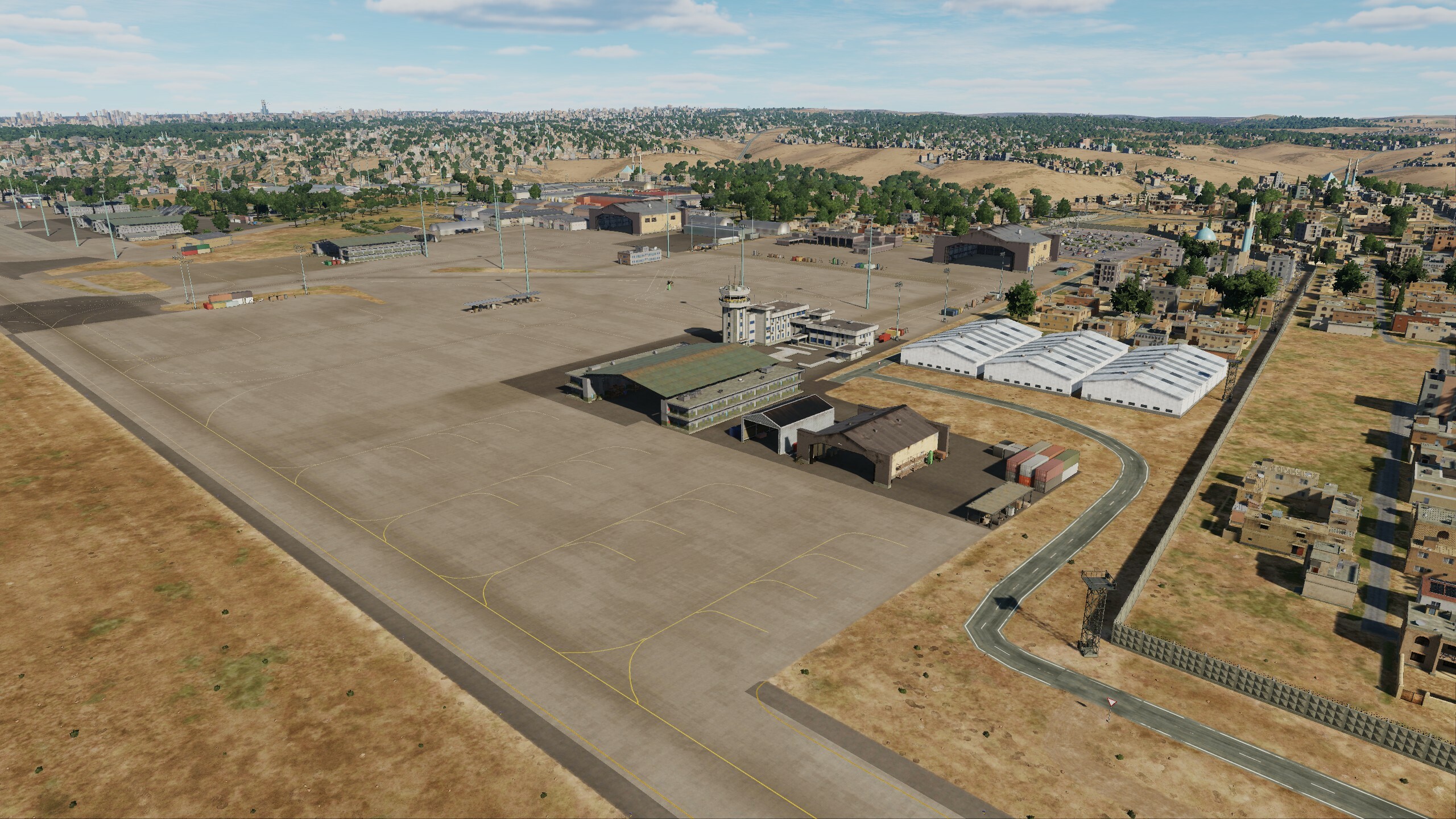
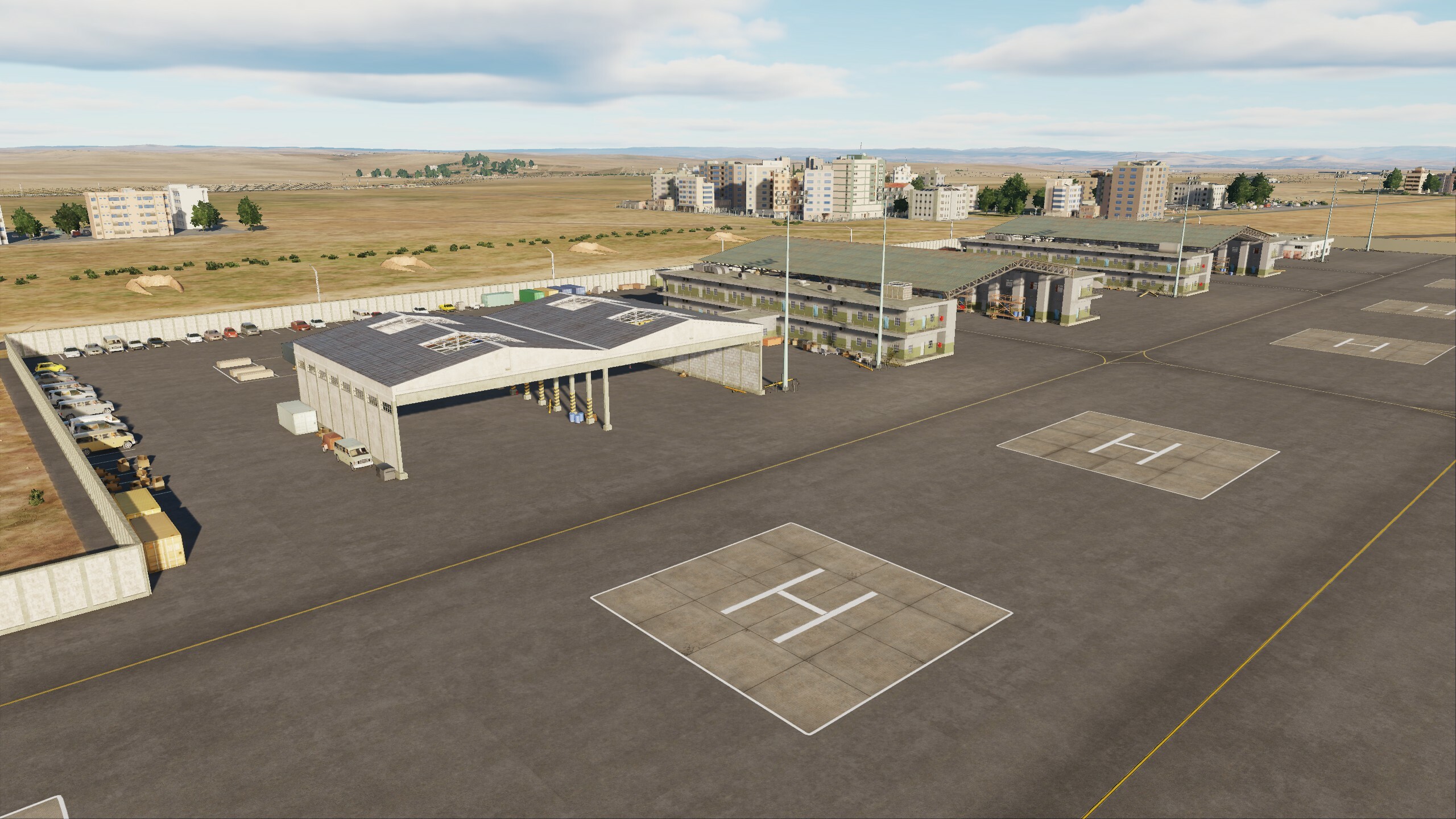
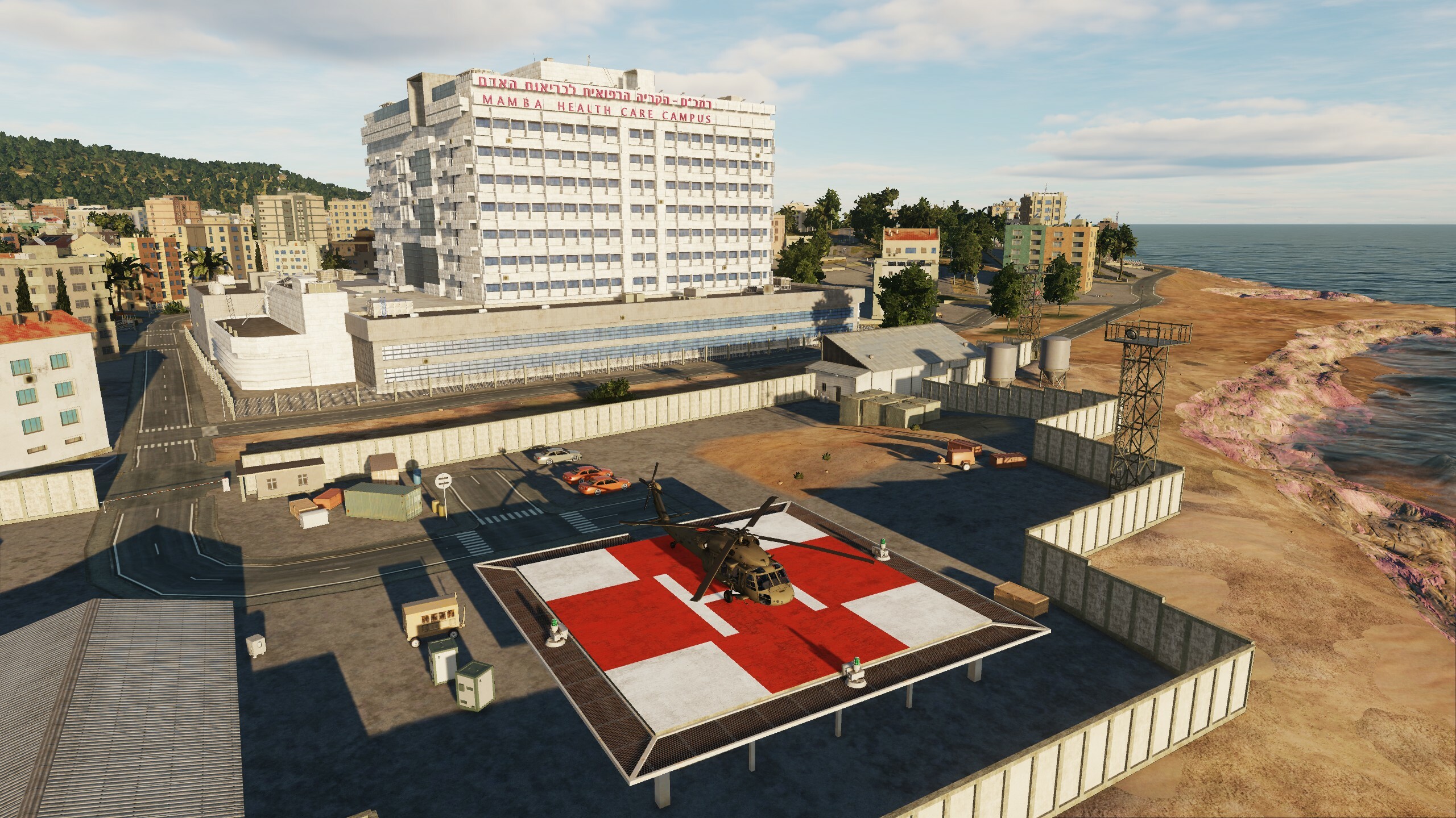
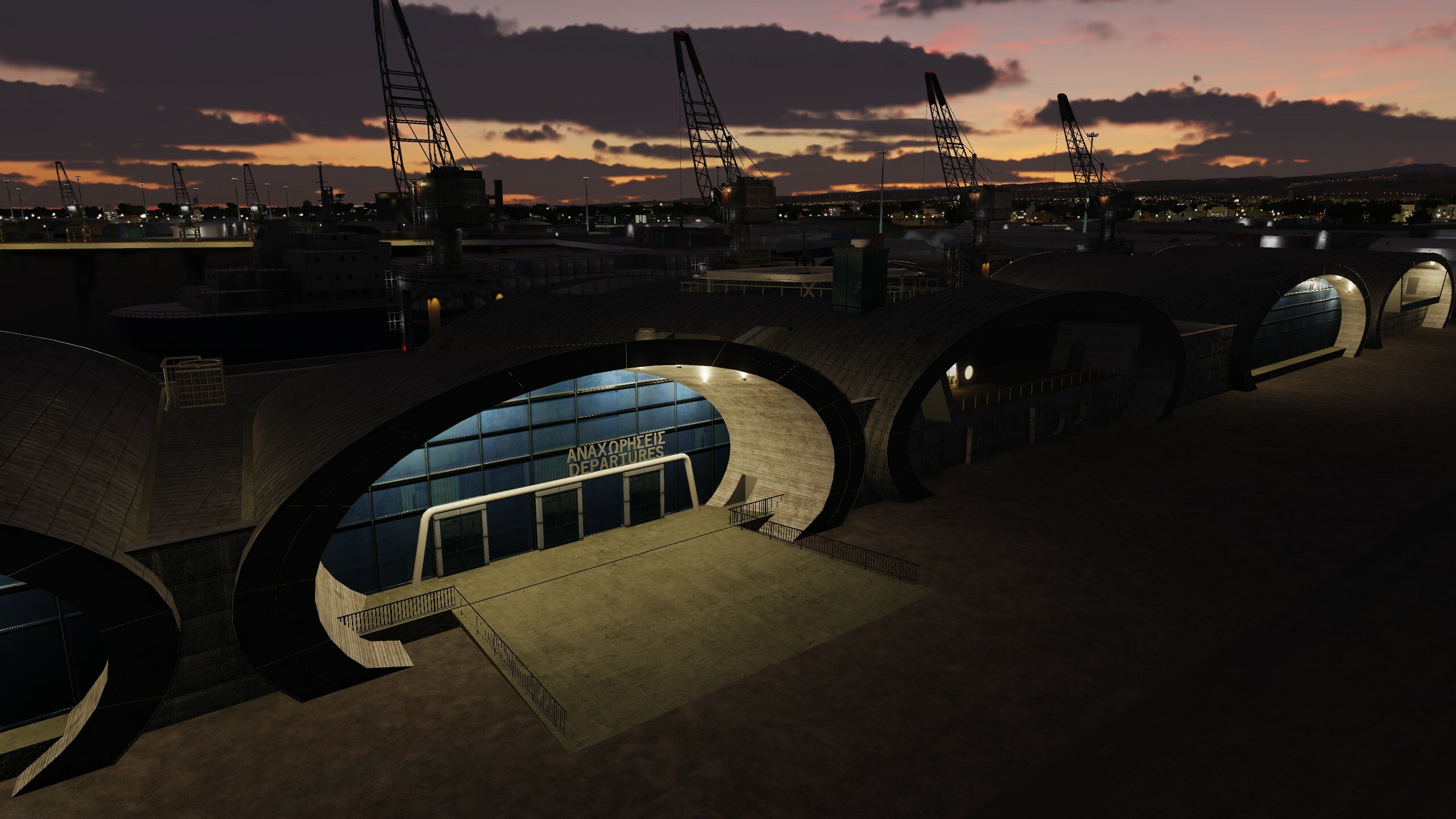
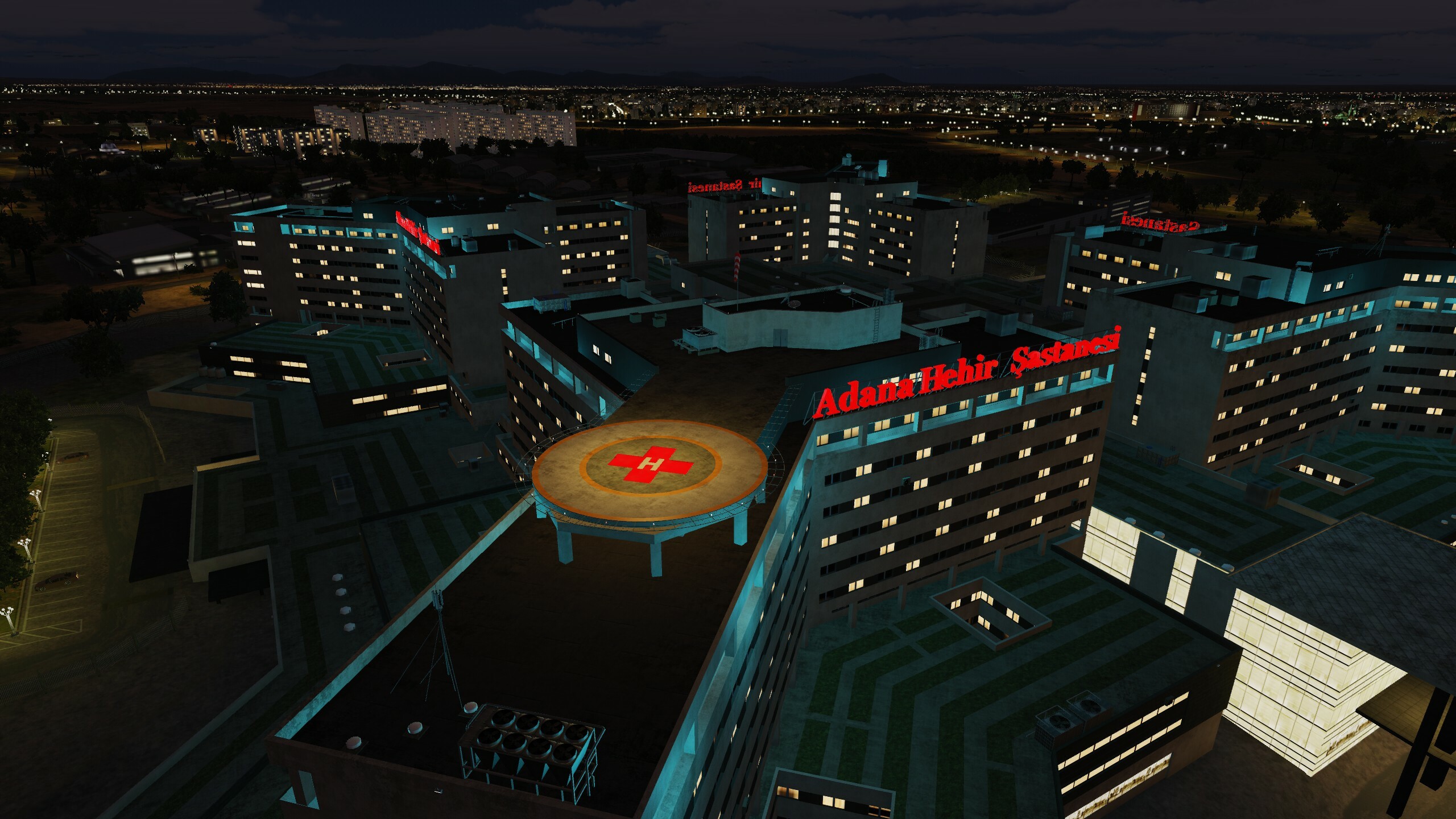
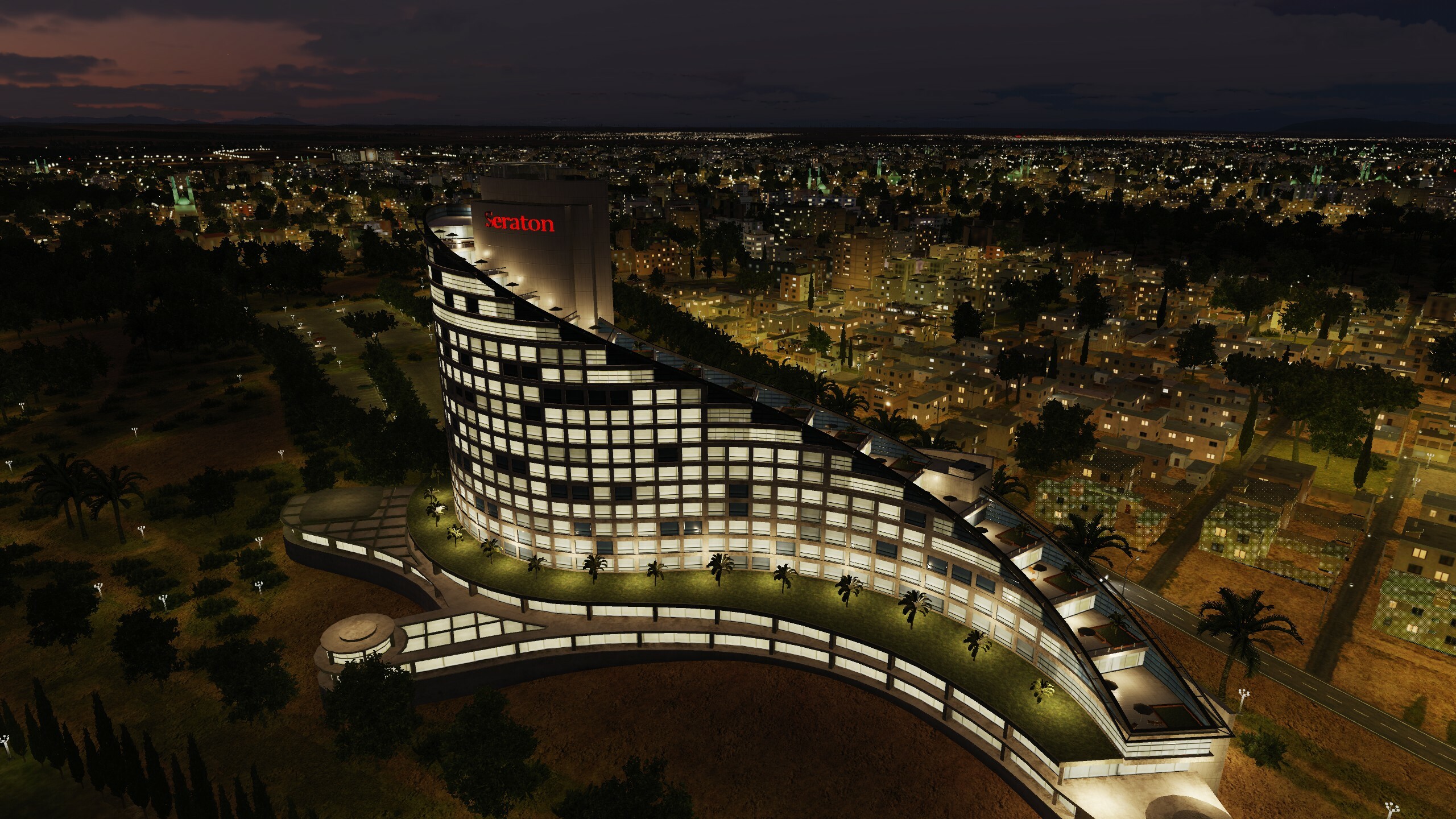
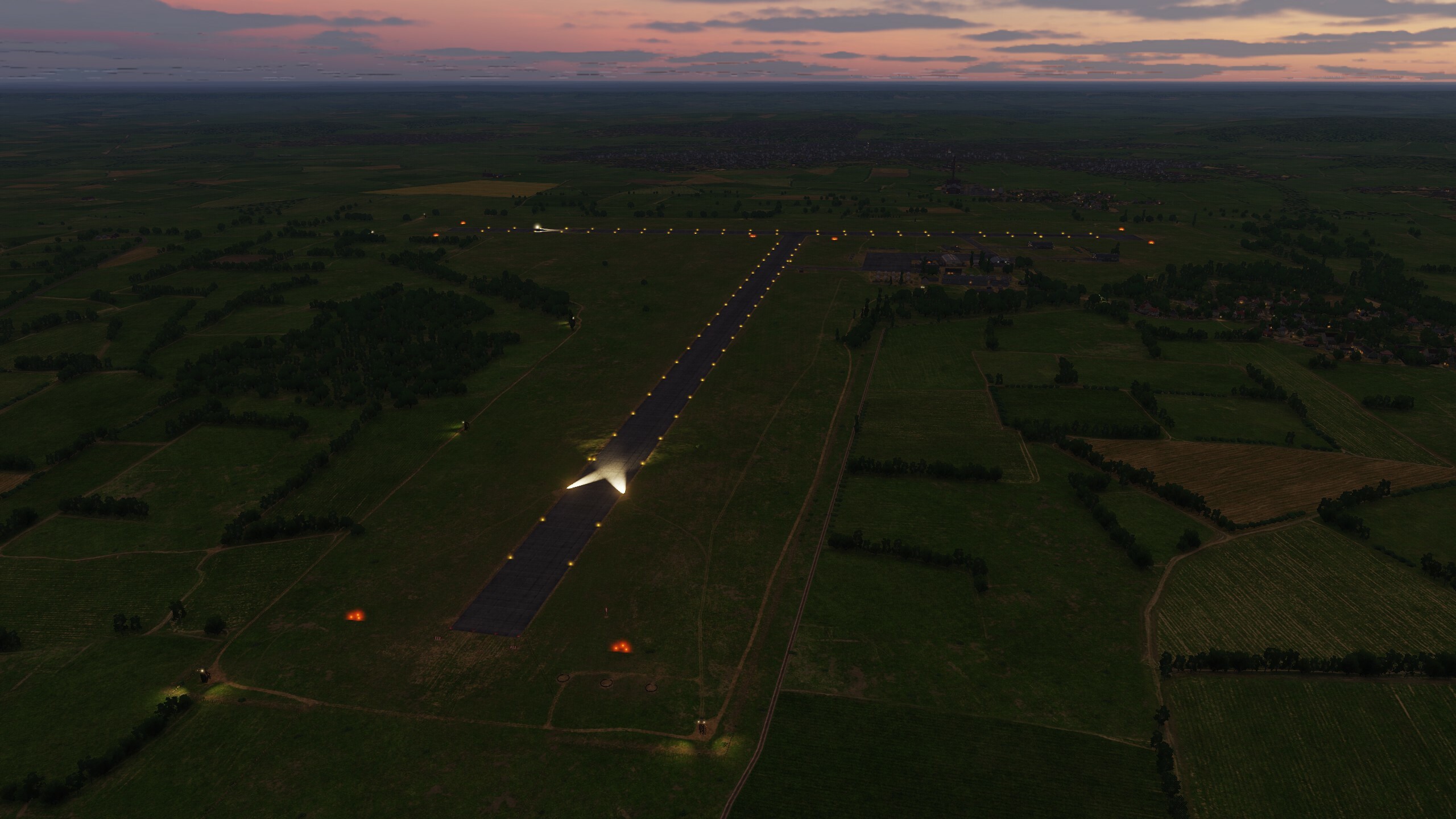
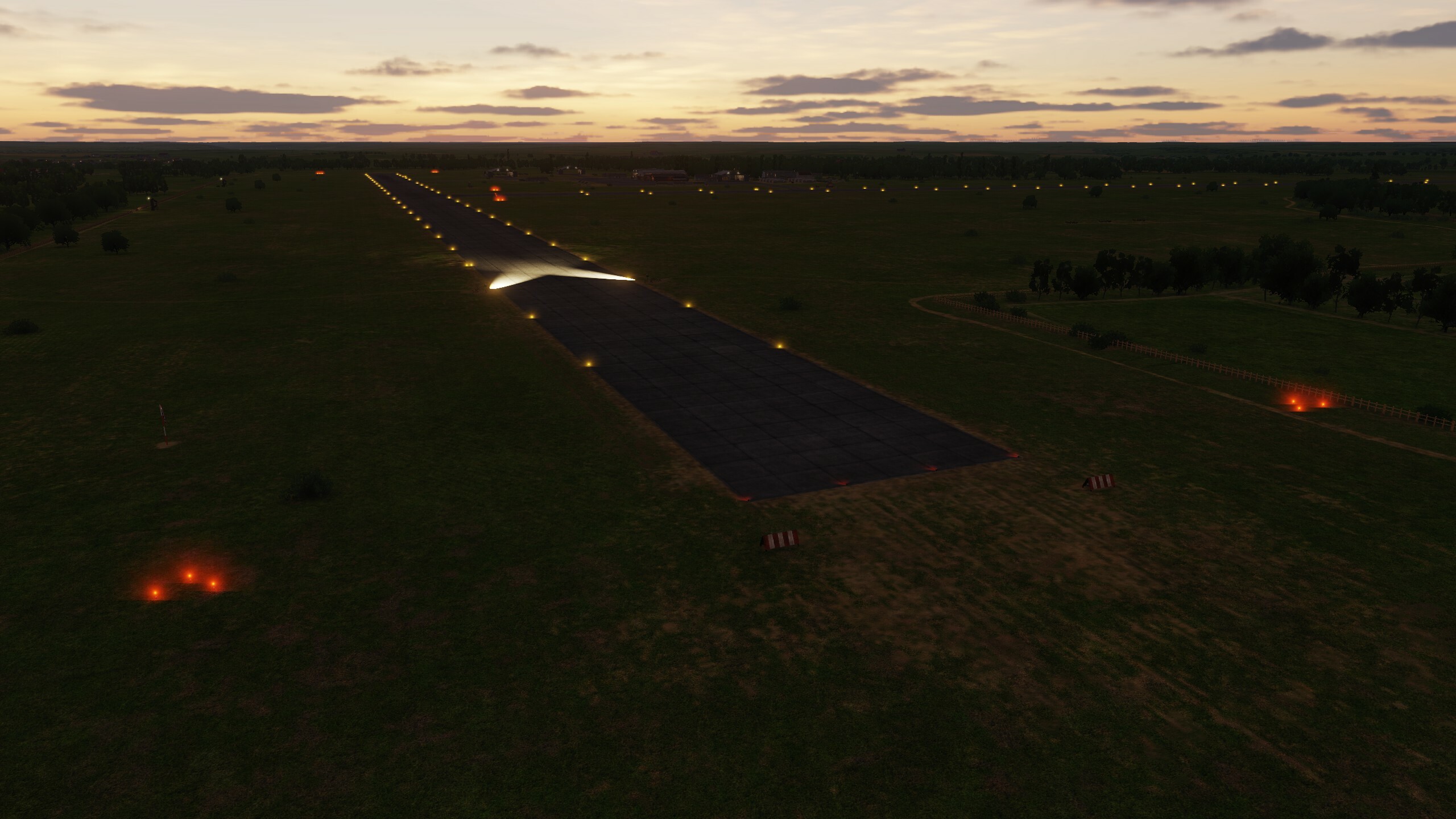
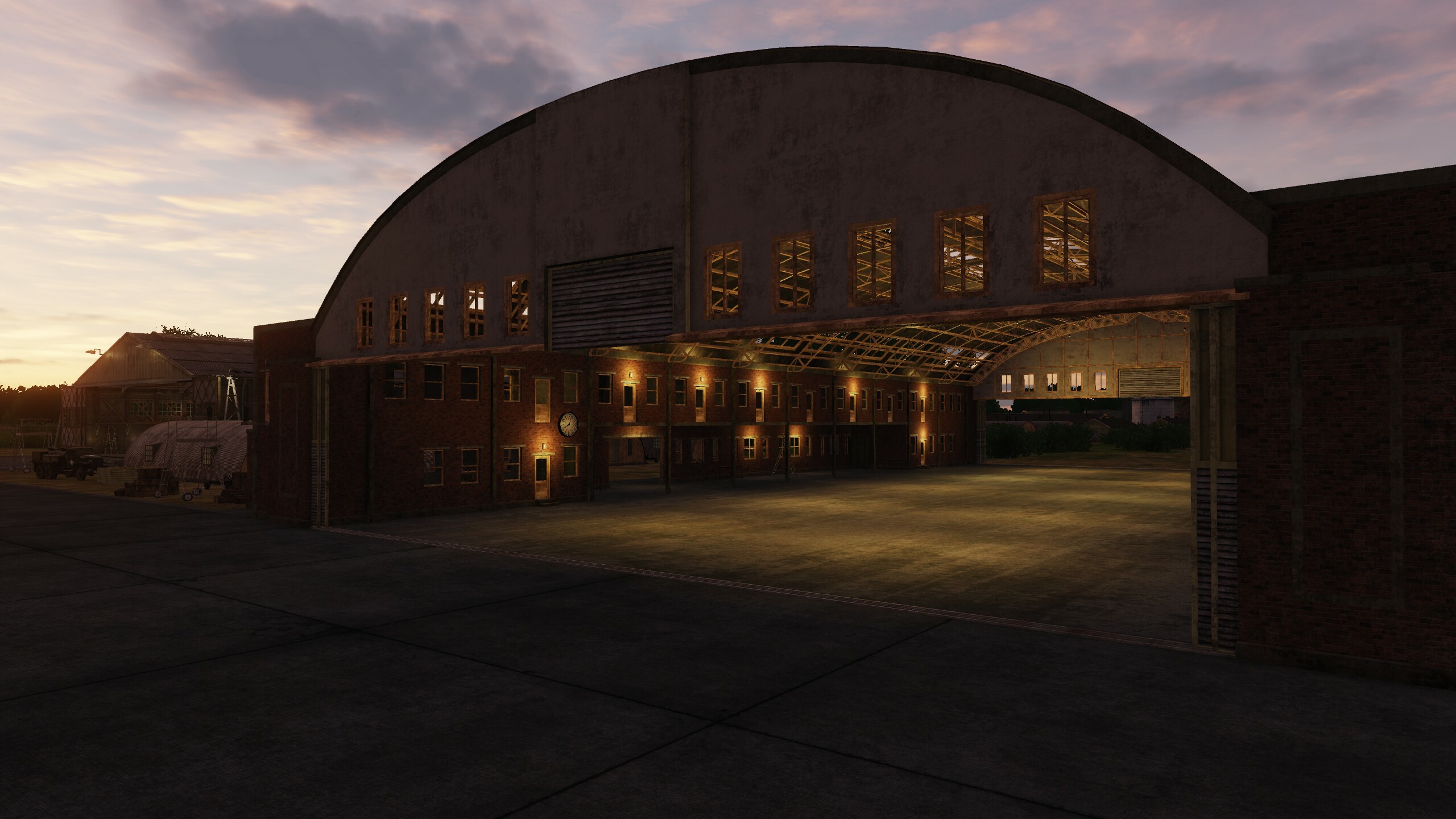
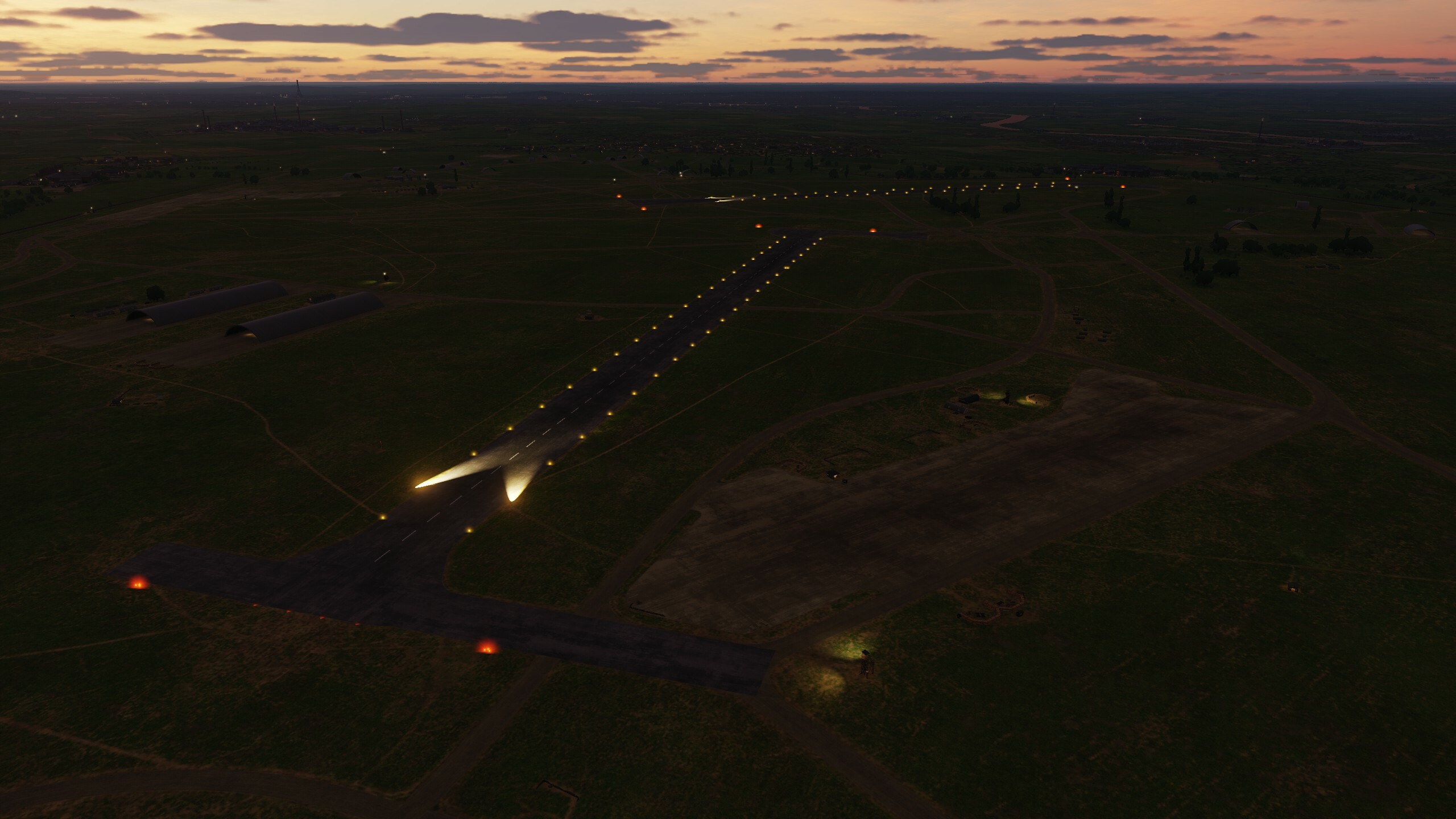
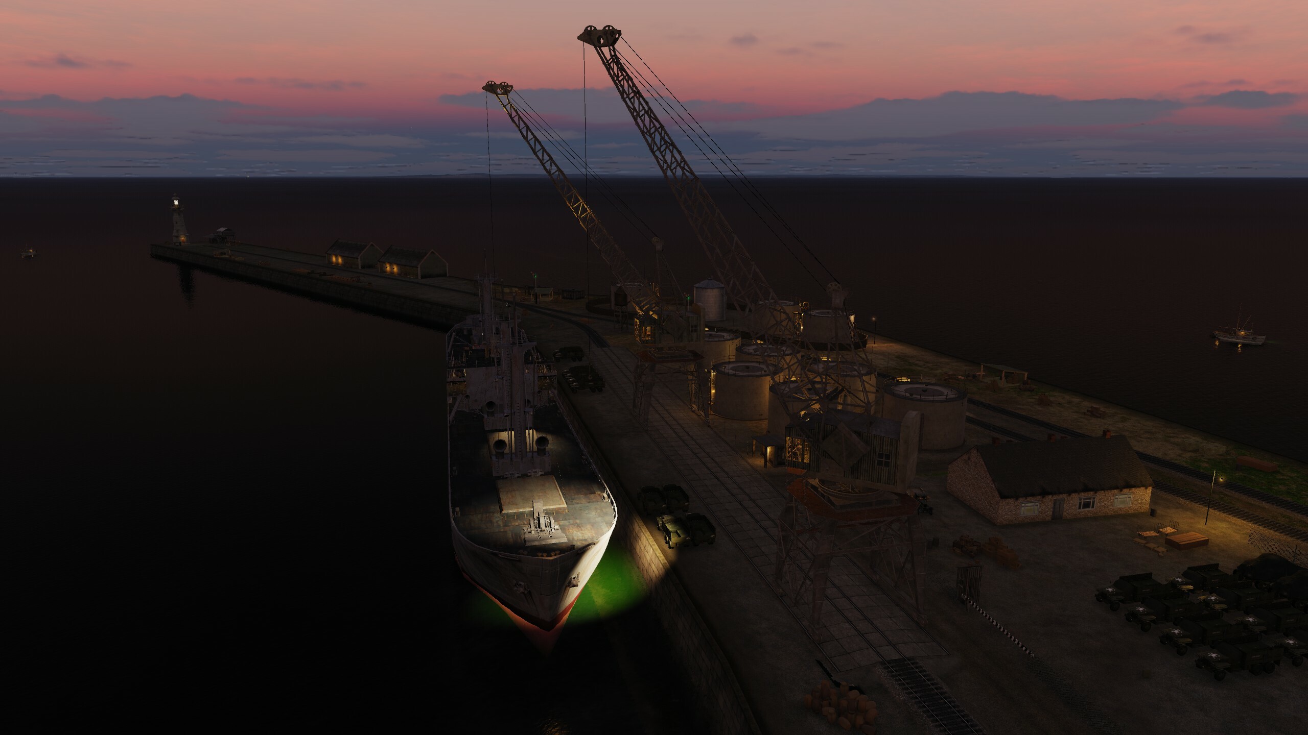
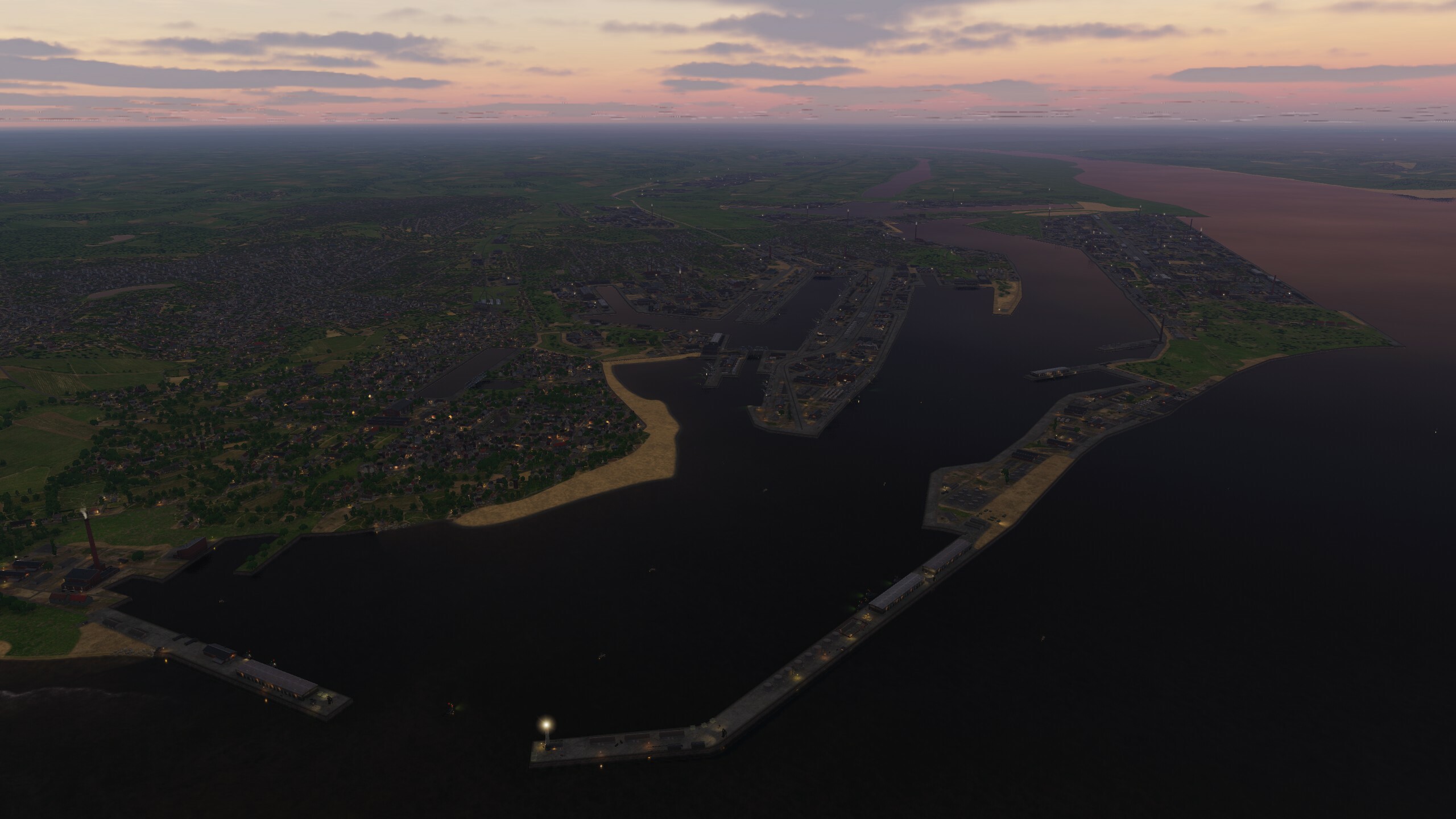
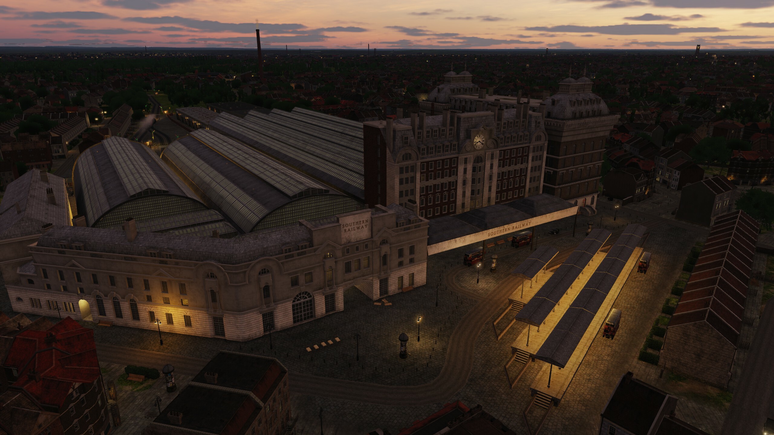
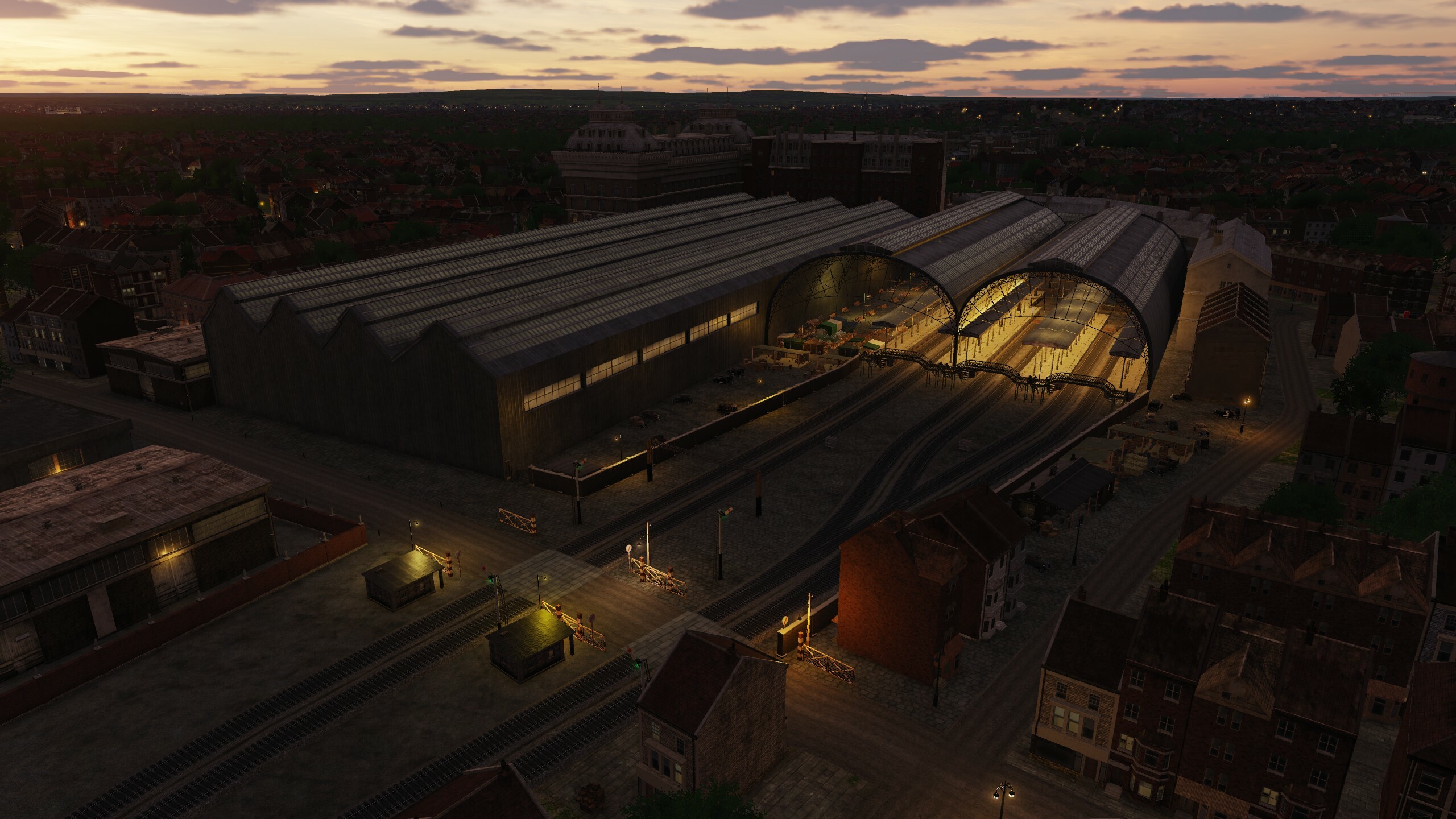
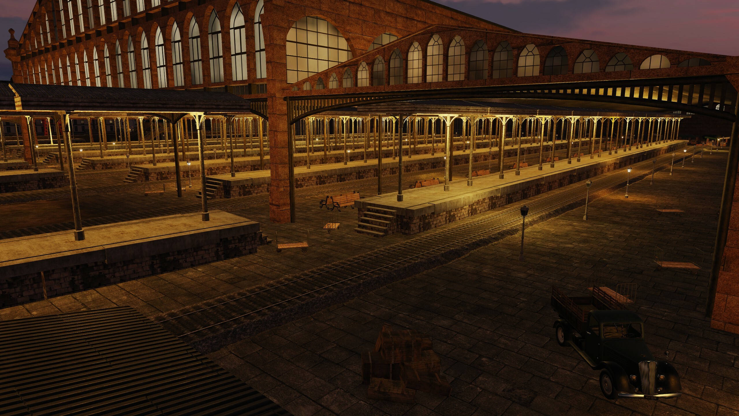
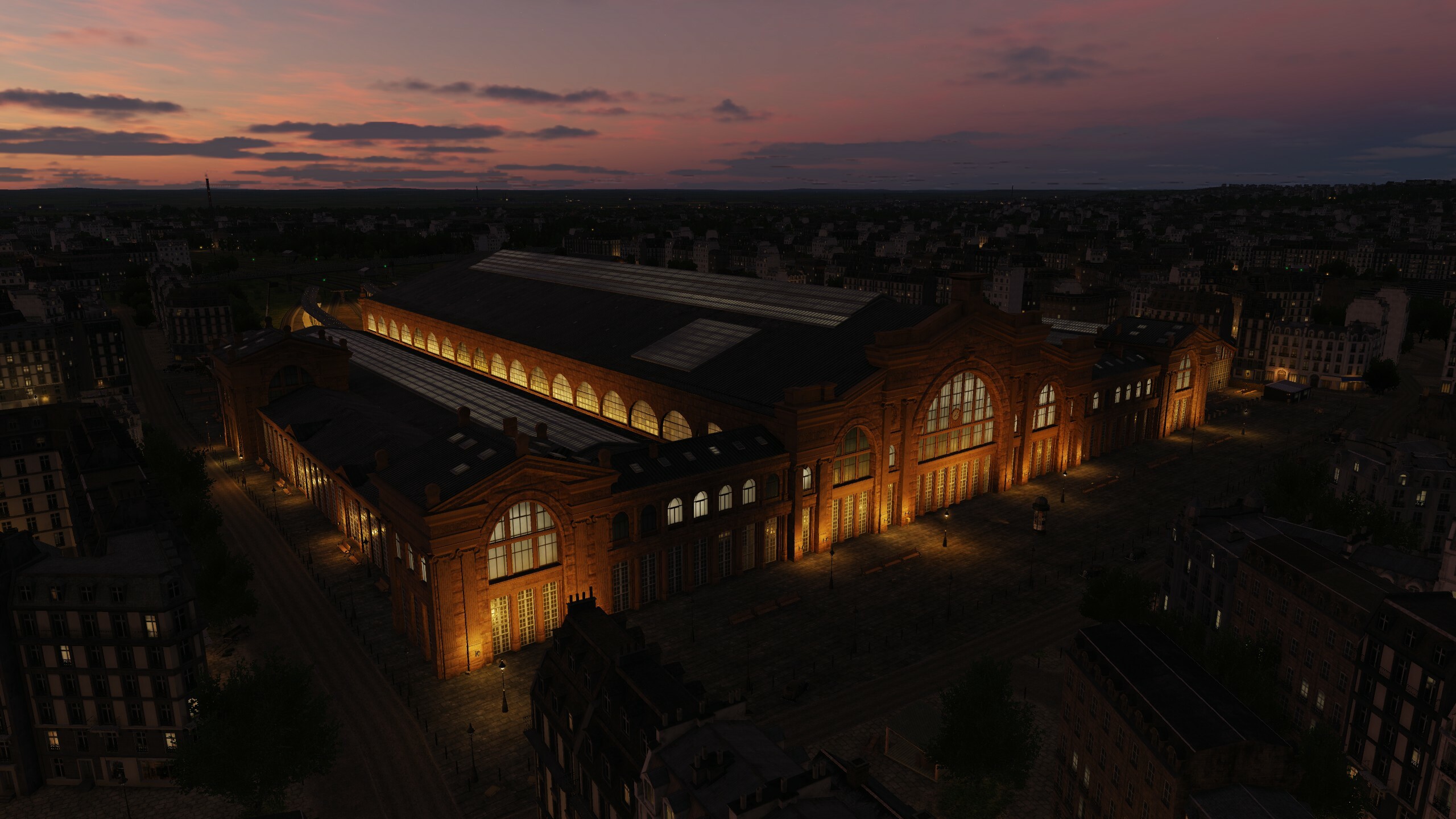
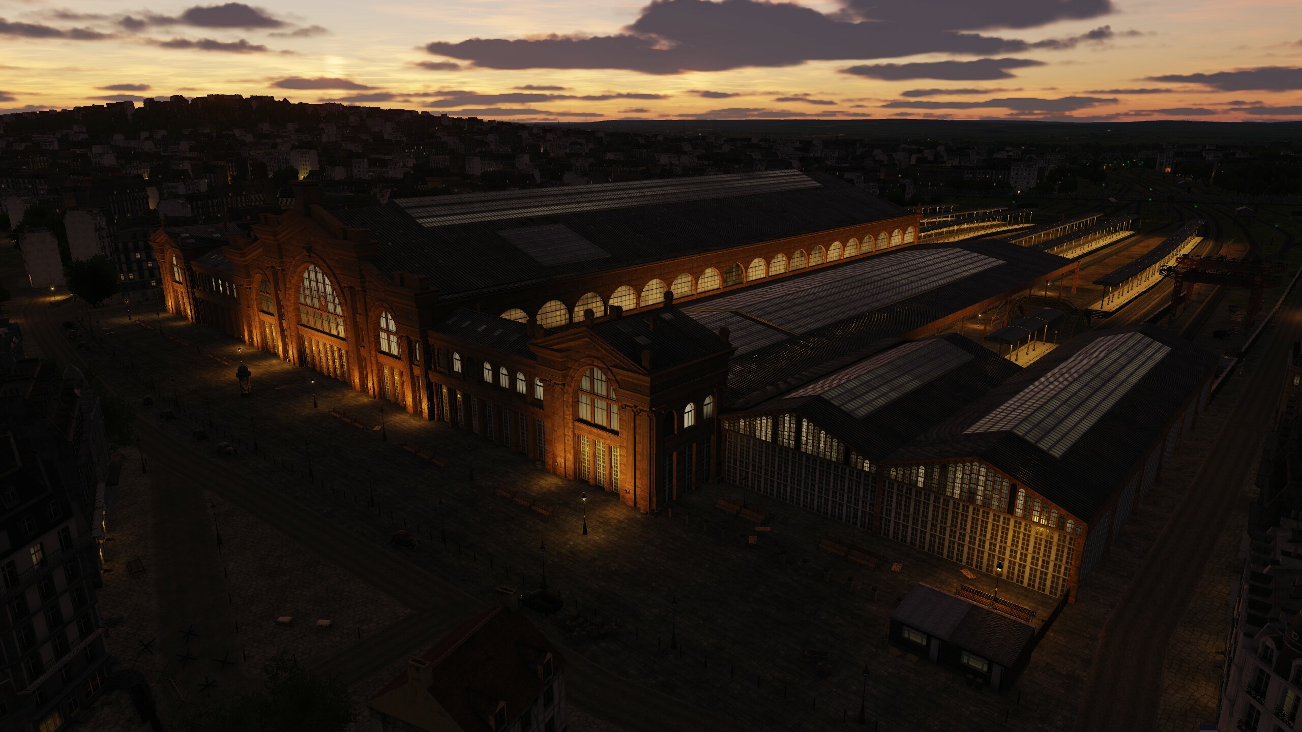
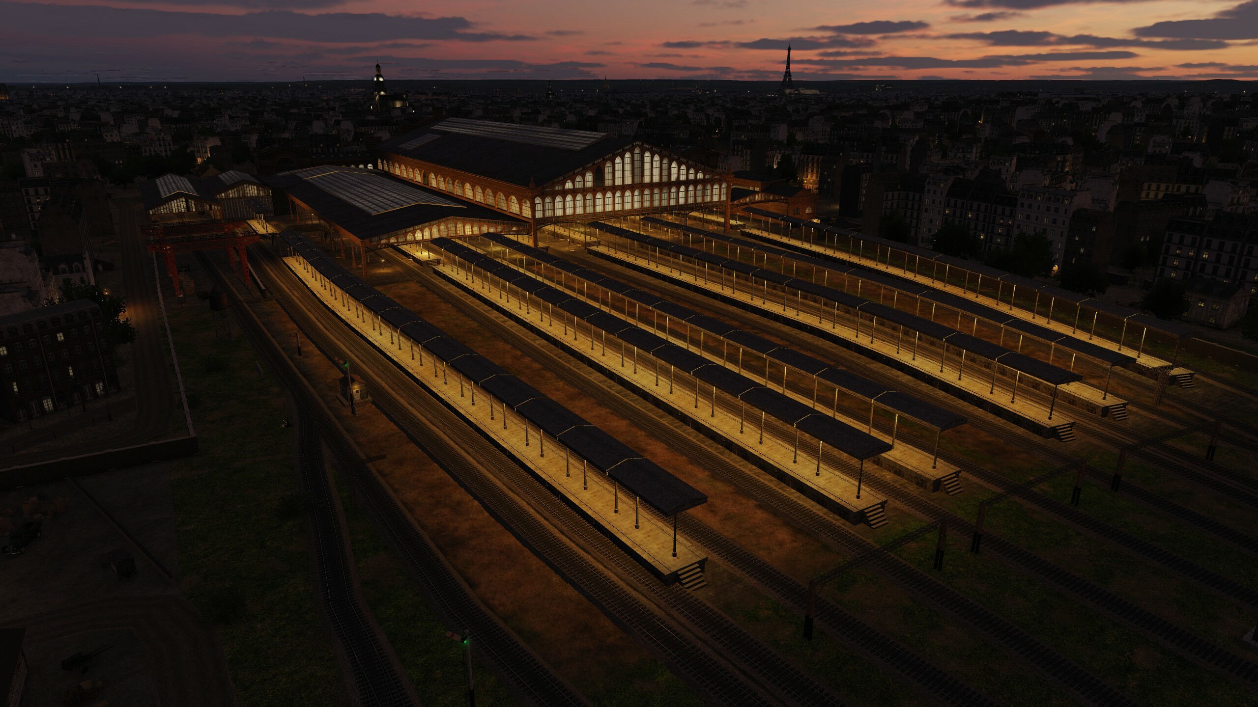
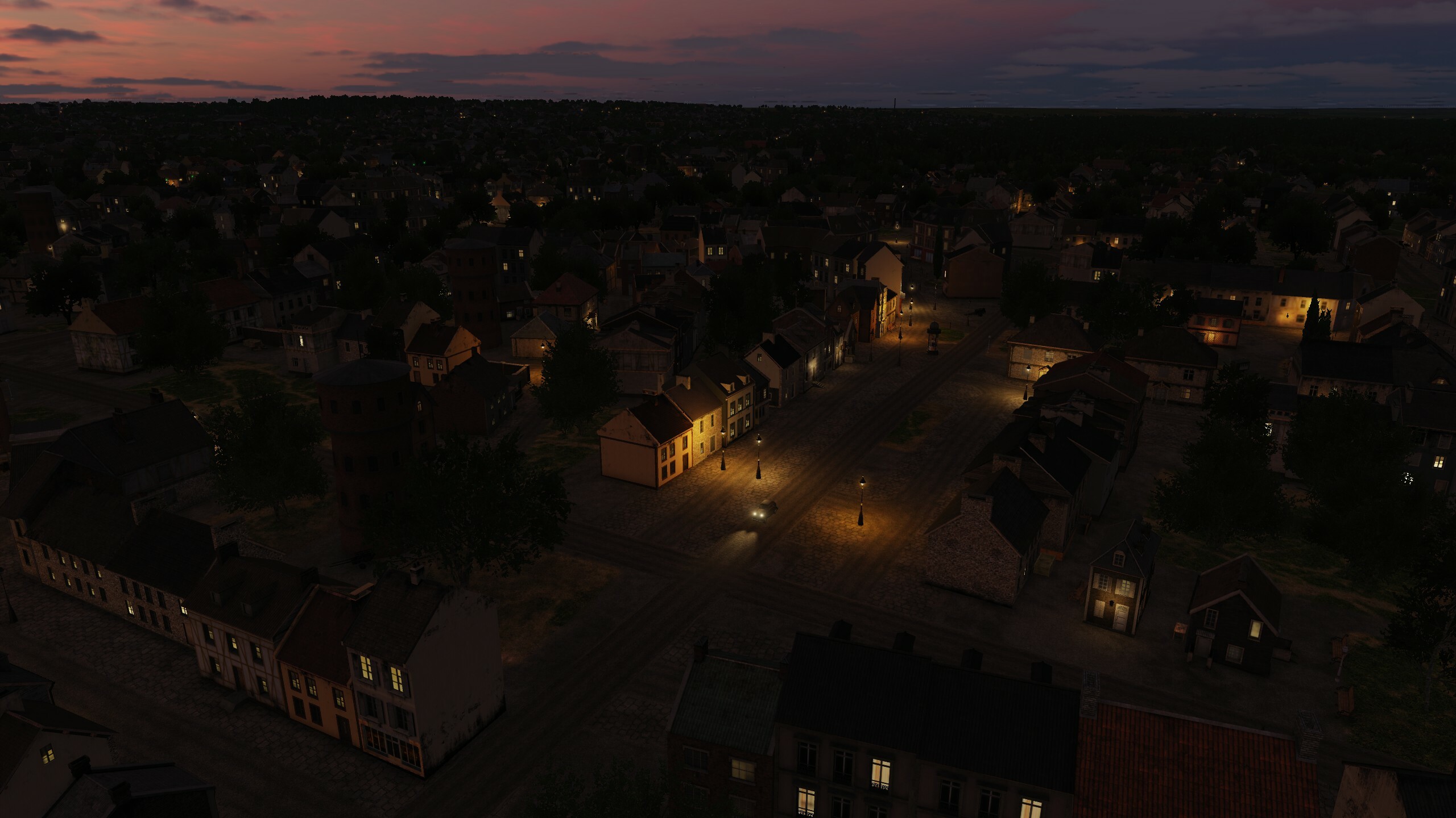
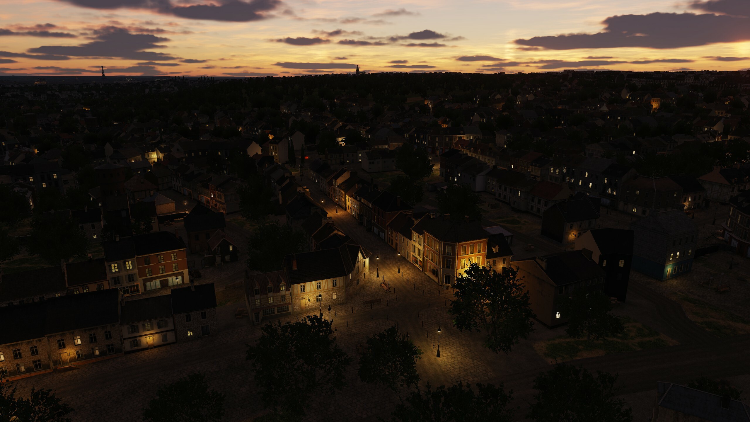
Hi fighters Today we continue the story about our update. The words "Main", "most", "largest" best suit this message, and all this applies to our new airfields: Ben Gurion International Airport and Tel Nof Airbase. These are the main runways of Israel for civilians and military. A little information: Ben Gurion International Airport (ICAO: LLBG), is the main international airport of Israel. Situated on outskirts north of the city of Lod and directly south of the city of Or Yehuda, it is the busiest airport in the country. It is located 45 km to the northwest of Jerusalem and 20 km to the southeast of Tel Aviv. Tel Nof Airbase (ICAO: LLEK), also known as Air Force Base 8, is the oldest and main base of the Israeli Air Force (IAF) located 5 km south of Rehovot, Israel. Tel Nof houses two strike fighter, two helicopter and a UAV squadron. Also located on the base are the Flight Test Center Manat and several special units of the Israel Defense Forces (IDF), among others Unit 669 (heliborne Combat Search and Rescue, CSAR) and the Paratroopers Brigade training center and its headquarters Plan a business trip to Ben Gurion, you will be met there and taken to Tel Nof to get acquainted with the new territory List of changes: - Added new airfields Ben Gurion, Hatzor, Palmaсhim, Tel Nof. - Optimized models of small objects. - Improved models of Airbus A300 and An-26 airplanes. - Improved min textures on the texture of the ground and objects. - Improved two military bases with helipads. - Improved refinery scene south of Palmashim. - Added new terminal models and Ben Gurion tower. - Added Airbus A300 and An-26 airplanes in the airfield scenes of Deir ez-Zor, Latakia, Marj Ruhayyil, Nejrab, Beirut, Damascus, Tabqa, Ben Gurion. - Added destruction models for original objects: Bank of Cyprus, Beirut SkyGate, Limasol KEAN Factory, Paphos Terminal, Sheraton Adana Hotel, Dam Ataturk, Dam Tishrin, Ben Gurion terminal. - Fixed bugs in Akrotiri Paphos airfields - Fixed bugs in terrain and scenes of veon bases. - Fixed bugs in terrain, vectordata and common scenes. - Fixed a bug with the collision of helipads on the roofs of the Bank of Cyprus and Sheraton Adana Hotel. - Fixed license plates on cars and inscriptions on buildings. Ben Gurion International Airport Tel Nof Airbase

- 99 replies
-
- 22
-

-

-
List of unique objects with moles of destruction: Bank of Cyprus Beirut SkyGate Limasol KEAN Factory Paphos Terminal Sheraton Adana Hotel Dam Ataturk Dam Tishrin Adana Hilton SA Aleppo Electrostation Asad Building Beirut Terminal Damascus Terminal Damascus Hotel FourSeasons Gaziantep Terminal Haifa Cooling Towers Haifa Tower Panorama Haifa Tower Sail Lafarge cement factory Larnaca Terminal Limassol olympic residence Nicosia Terminal Platinum Tower Beirut Sama Beirut Will add screenshots of all unique demages later on
- 99 replies
-
- 14
-
-
-
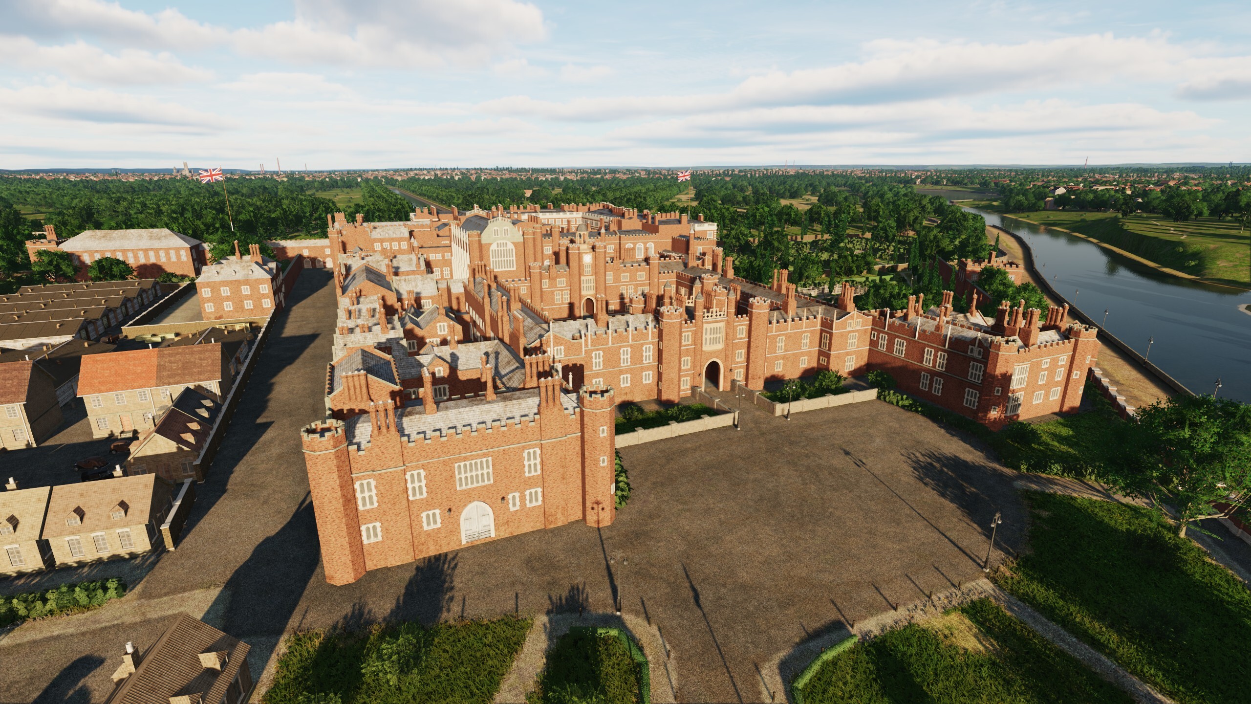
Hi Fighters We continue to introduce you to the upcoming map update, work on which is in full swing. First of all, we want to thank you for your feedback: Thank you for this! We are glad that you liked the idea and the new functionality of the map. The Ugra-Media team is making every effort to make the map even more interesting and continues to take into account the opinions and requests of DCS users. Recently, we expanded the functionality of the map, you asked to add new locations and we did it. Now you have even more opportunities for new flights and missions. Let's take a look at one of the new features: Hatzor is an Israeli military base built in 1942 for the British Royal Air Force (hello Normandy 2.0). The Combined Operations Center for the US military and Israel is located here. It is interesting that the base has simulators for training F-15 and F-16 pilots and the 420th Squadron or "Fighter Aircraft Simulator Squadron" is stationed here - these guys understand us better than anyone. something new
- 99 replies
-
- 35
-
-
-
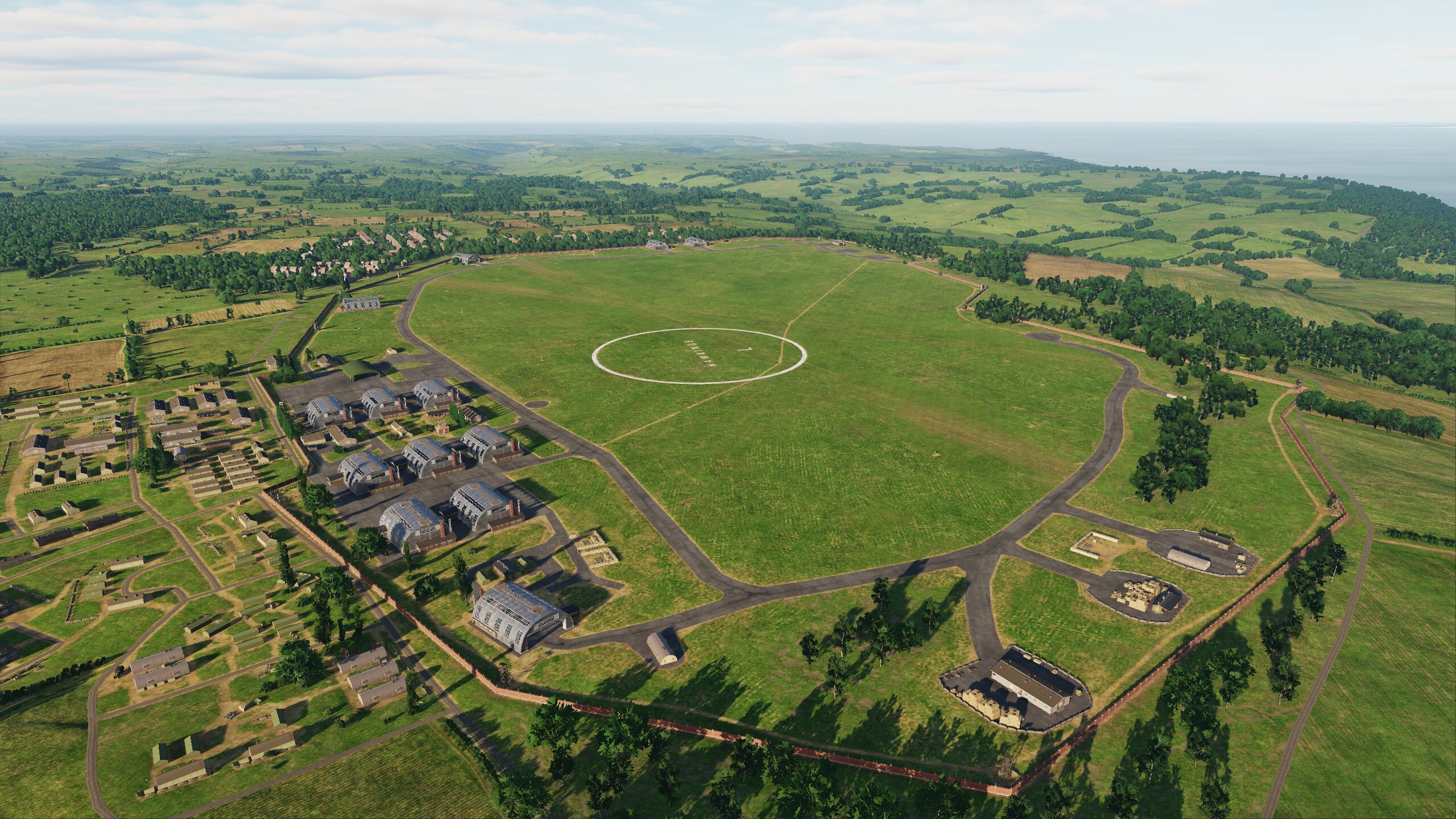
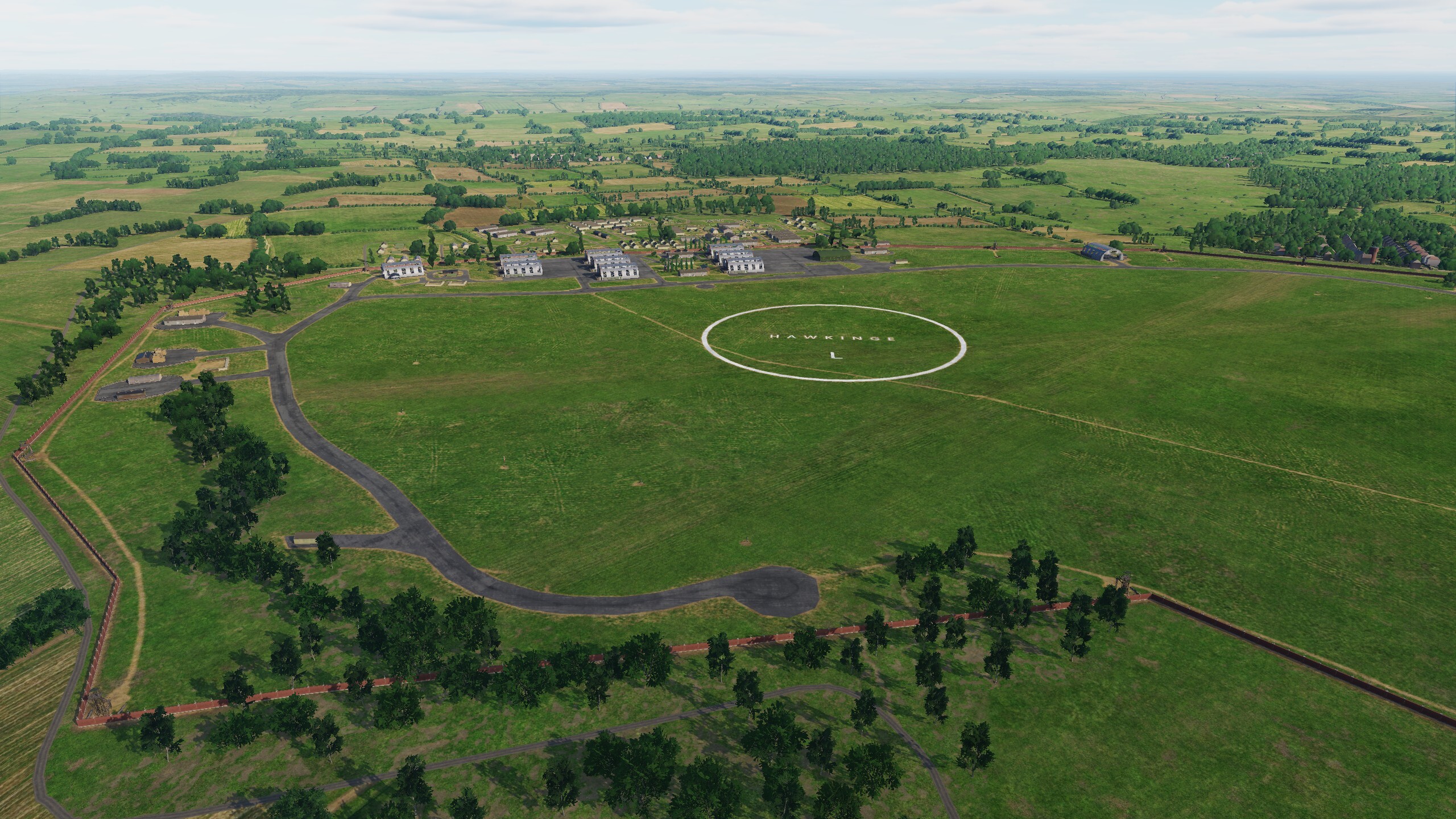
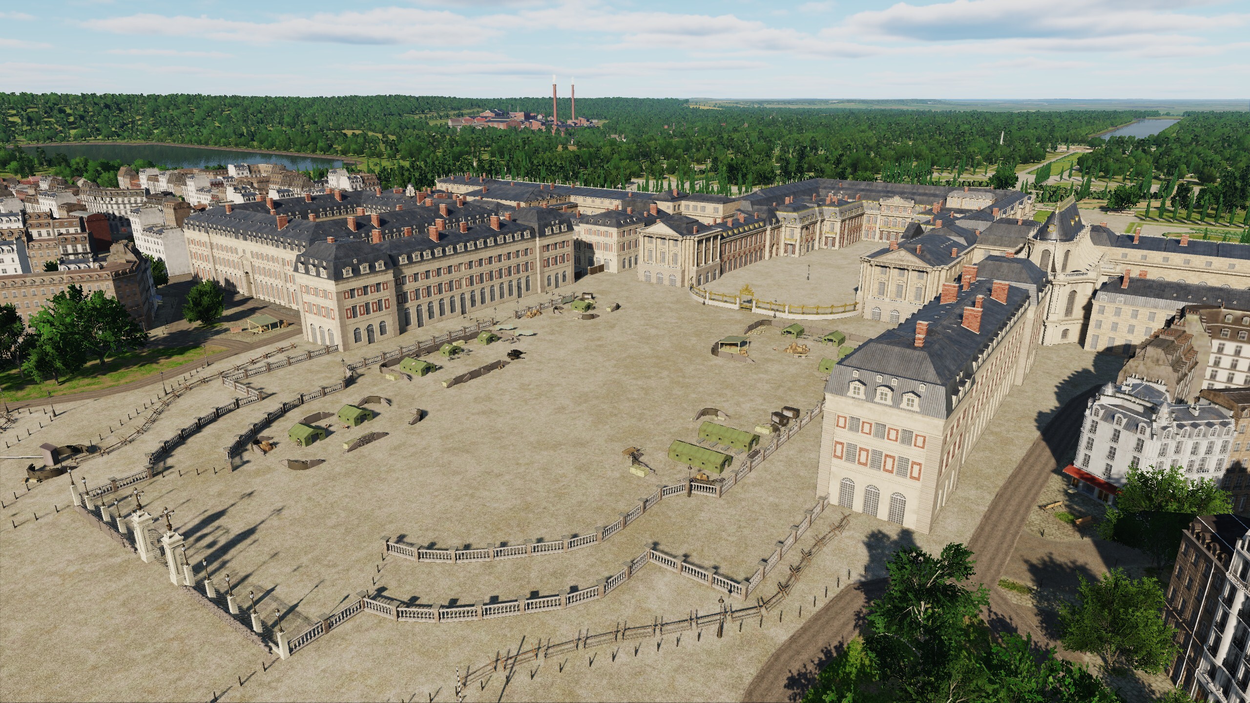
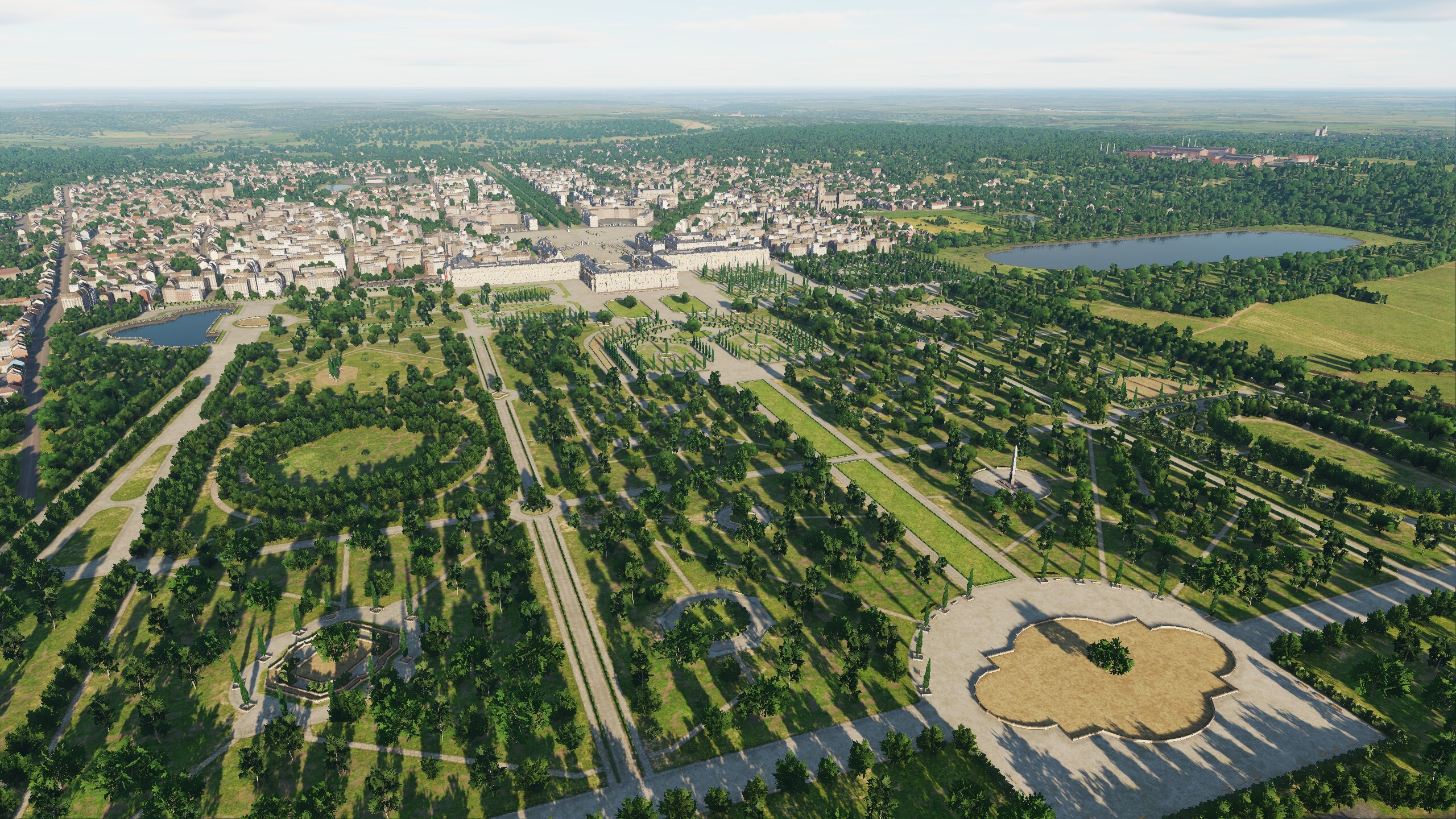
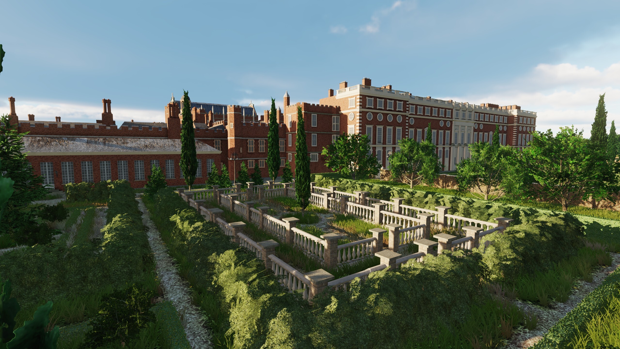
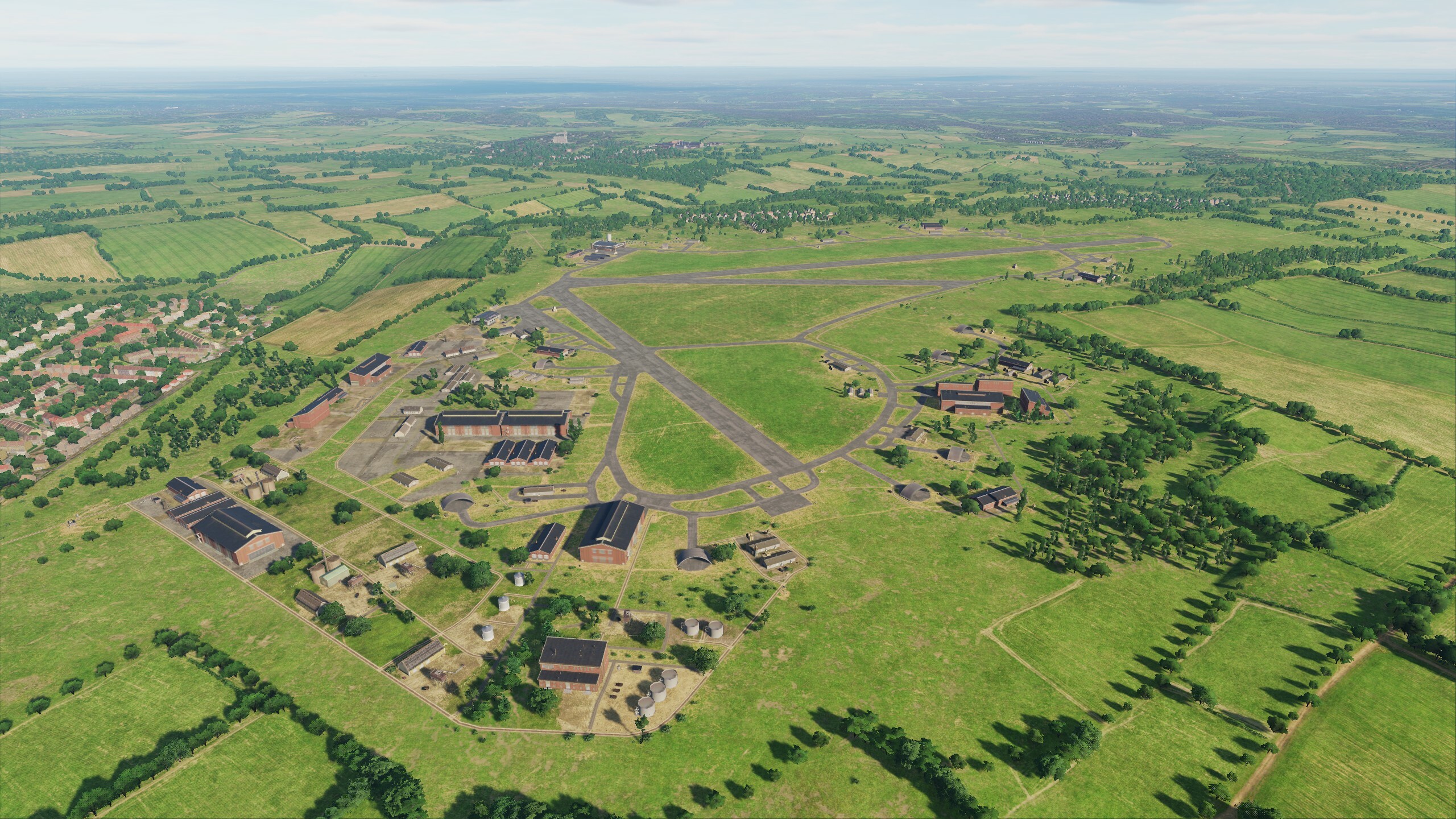
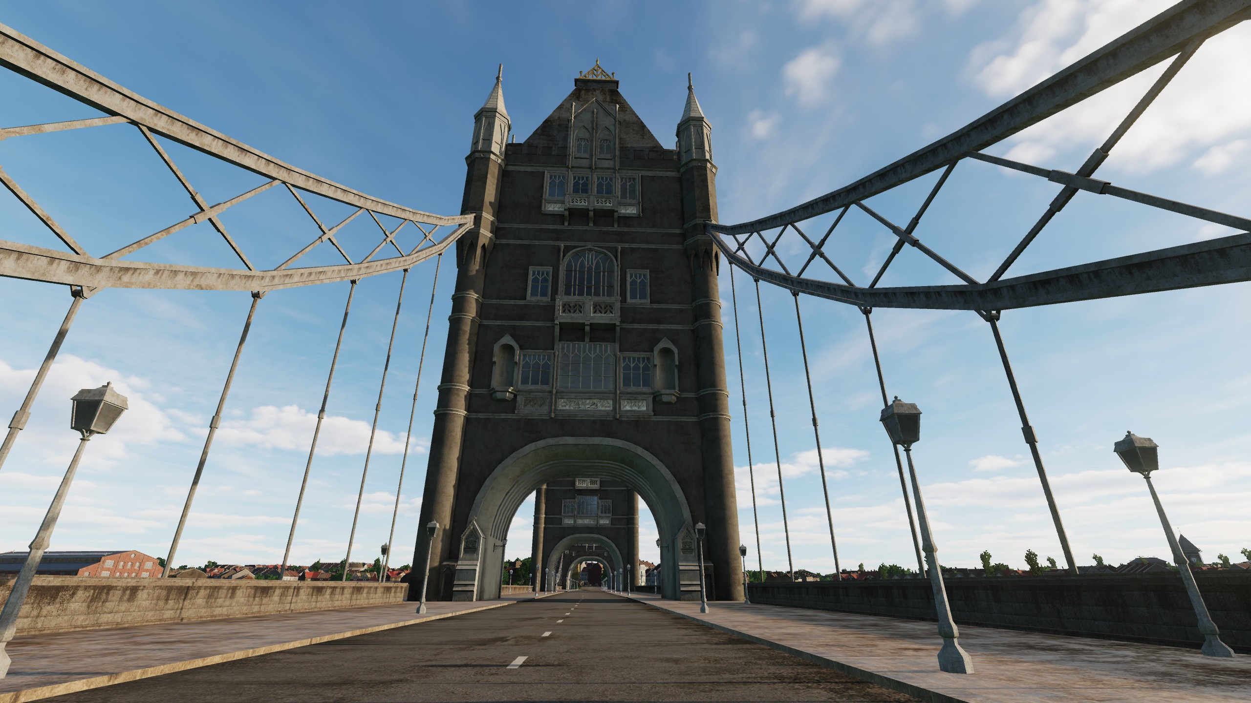
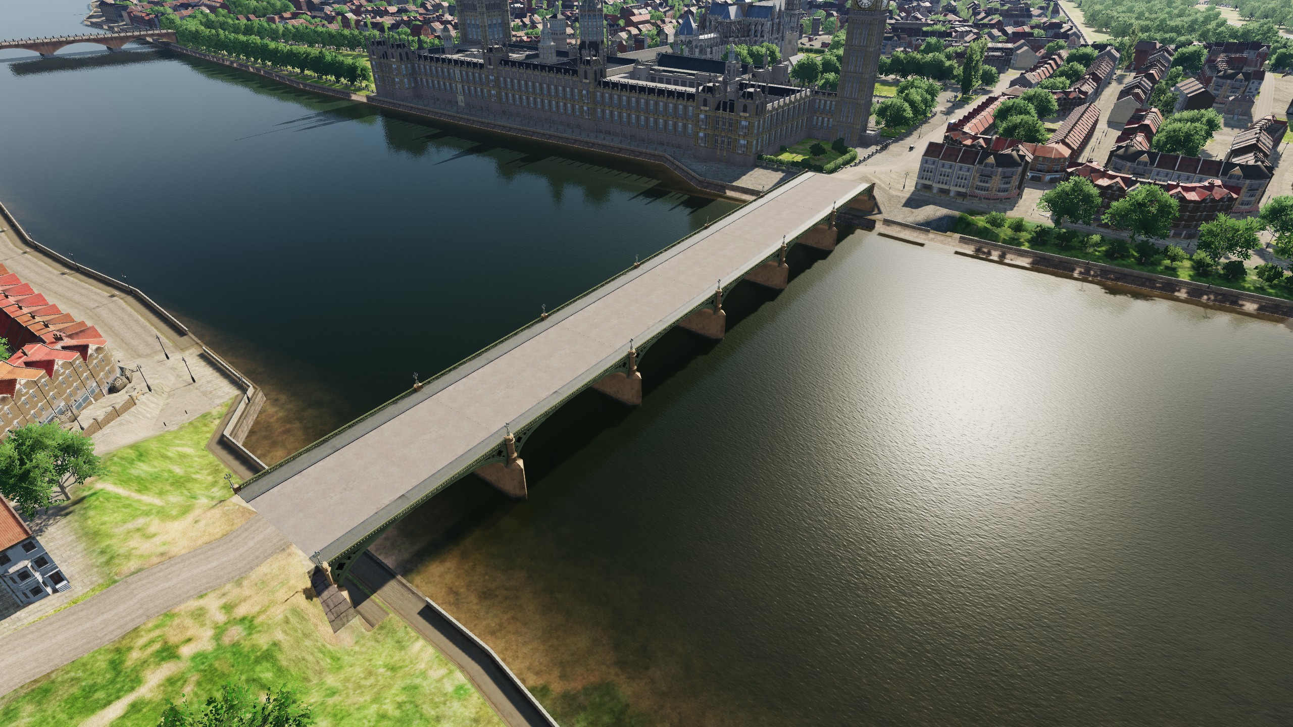
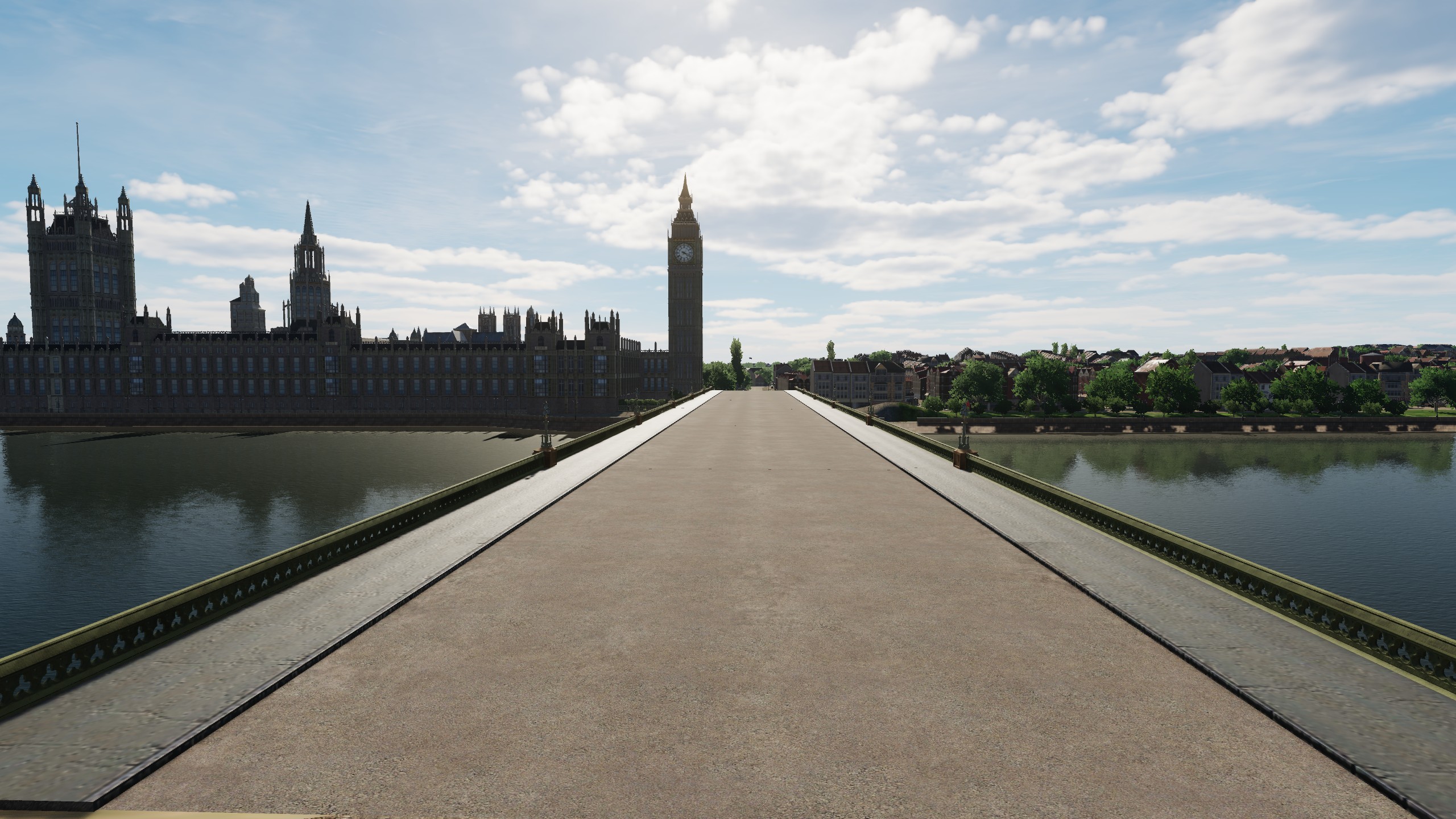
Hi! We continue working on Normandy 2.0. The main goal of the current update is optimization. Adhering to the strategy "Never stop improving" along with optimization, we made local improvements to objects and something new. We added three airfields: Eastchurch, Headcorn and Hawkinge. And three original objects: Basilica of the Sacre Coeur, Palace of Versailles and Hampton Court Palace. Now there will be places where you can start your career in the training center or complete a mission as part of a squadron. Fly, explore and conquer List of changes in Normandy: - Optimization of building and structure models. - Optimization of scenes. - Improved scene of the bridge near the Palace of Westminster. - Improved model of Notre-Dame de Paris. - Added airfields Eastchurch, Headcorn and Hawkinge. - Added three original objects: Basilica Sacré Coeur, Palace of Versailles and Hampton Court Palace. - Added tall flags at forts and major cities. - Fixed errors in airfields with the same callsign. - Fixed errors in terrain, vectordata and scenes. Headcorn Hawkinge Palace of Versailles Hampton Court Palace
- 33 replies
-
- 51
-
-
-

New Manston Airfield Normandy 2.0, ATC does not respond.
MAESTR0 replied to ac5's topic in Bugs & Problems
Hi My ATC is working, so the controller should contact you in the next update. Write at which airfields it still doesn't work for you. I selectively loaded airfields and there was communication with the control tower. P.S.: Keep in mind that if you selected a "hot start" in the mission editor, then permission to taxi has already been given. To continue the dialogue with the controller, select "abort takeoff" and start again - then it will work.
-
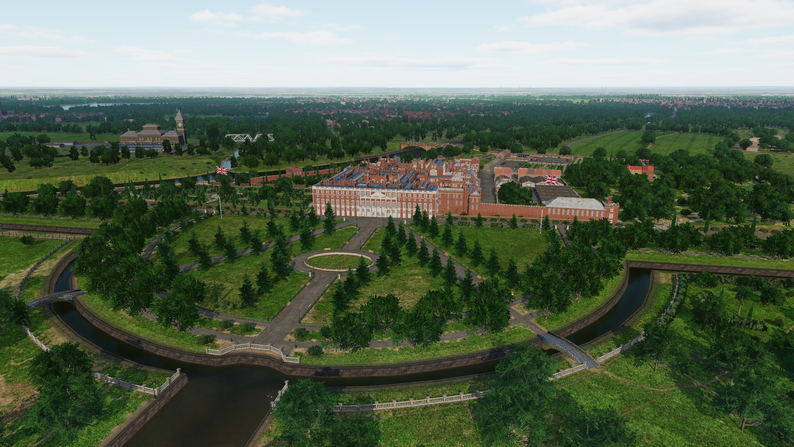
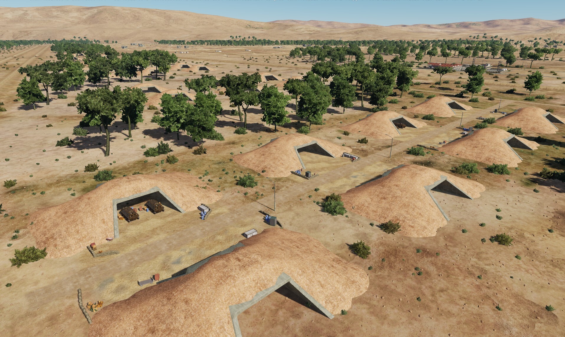
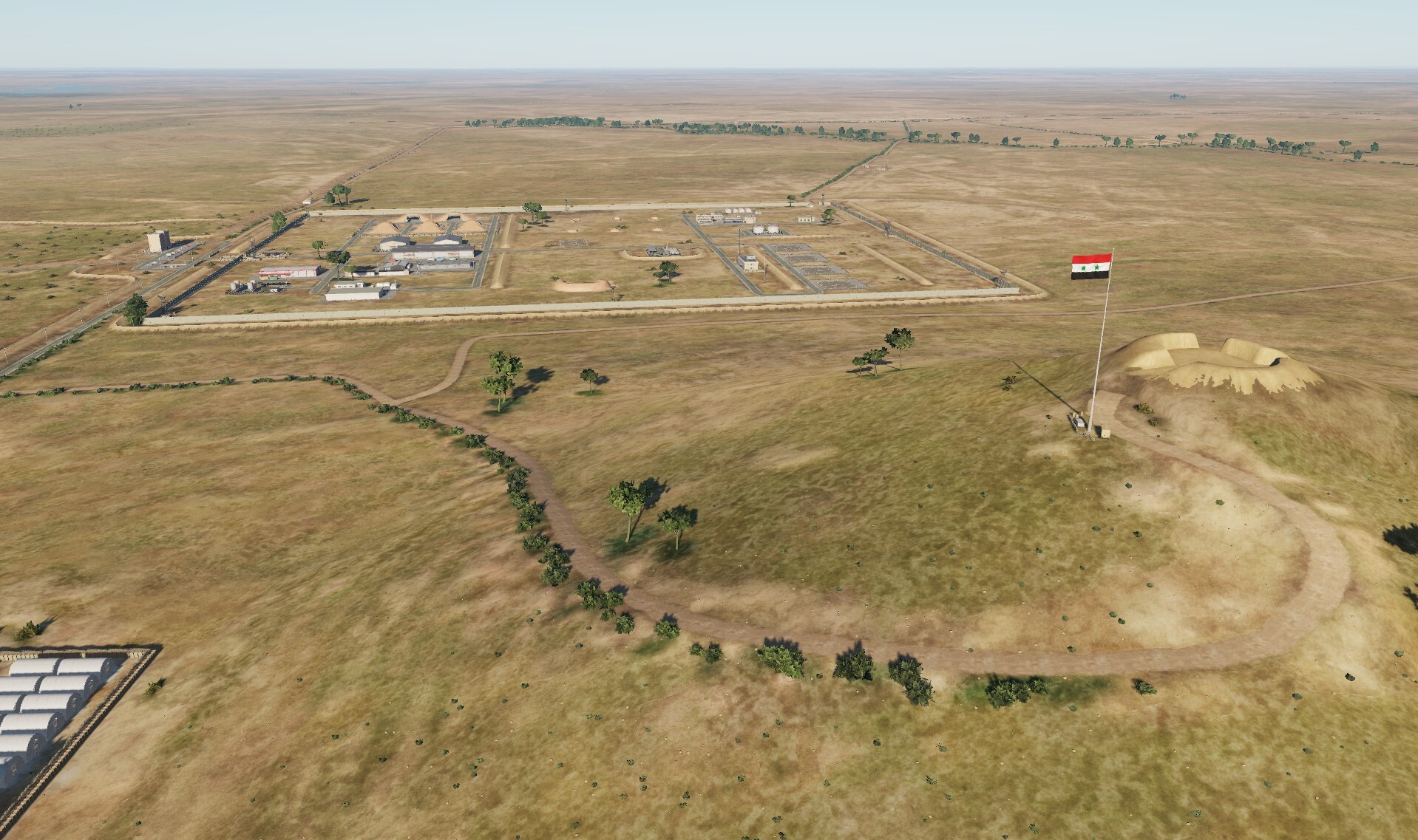
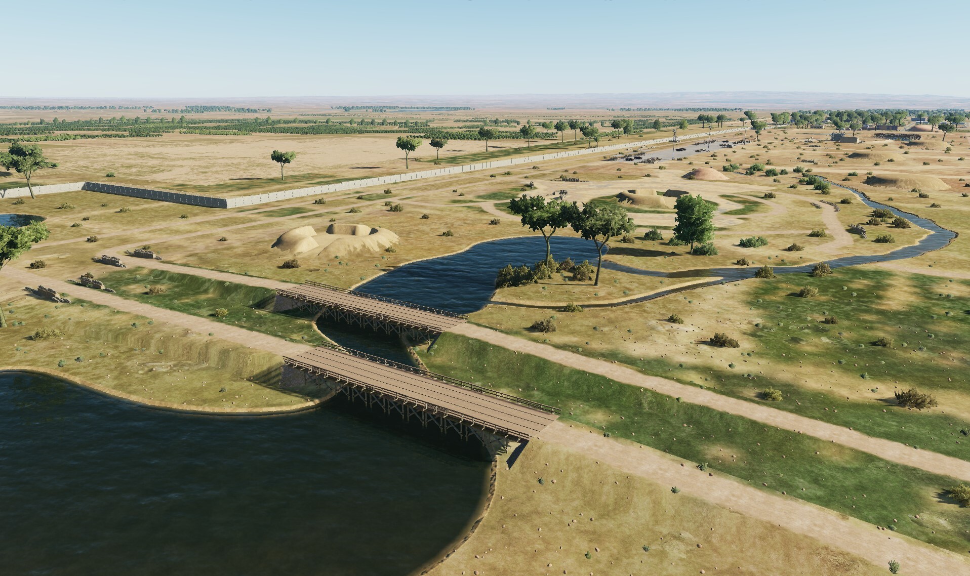
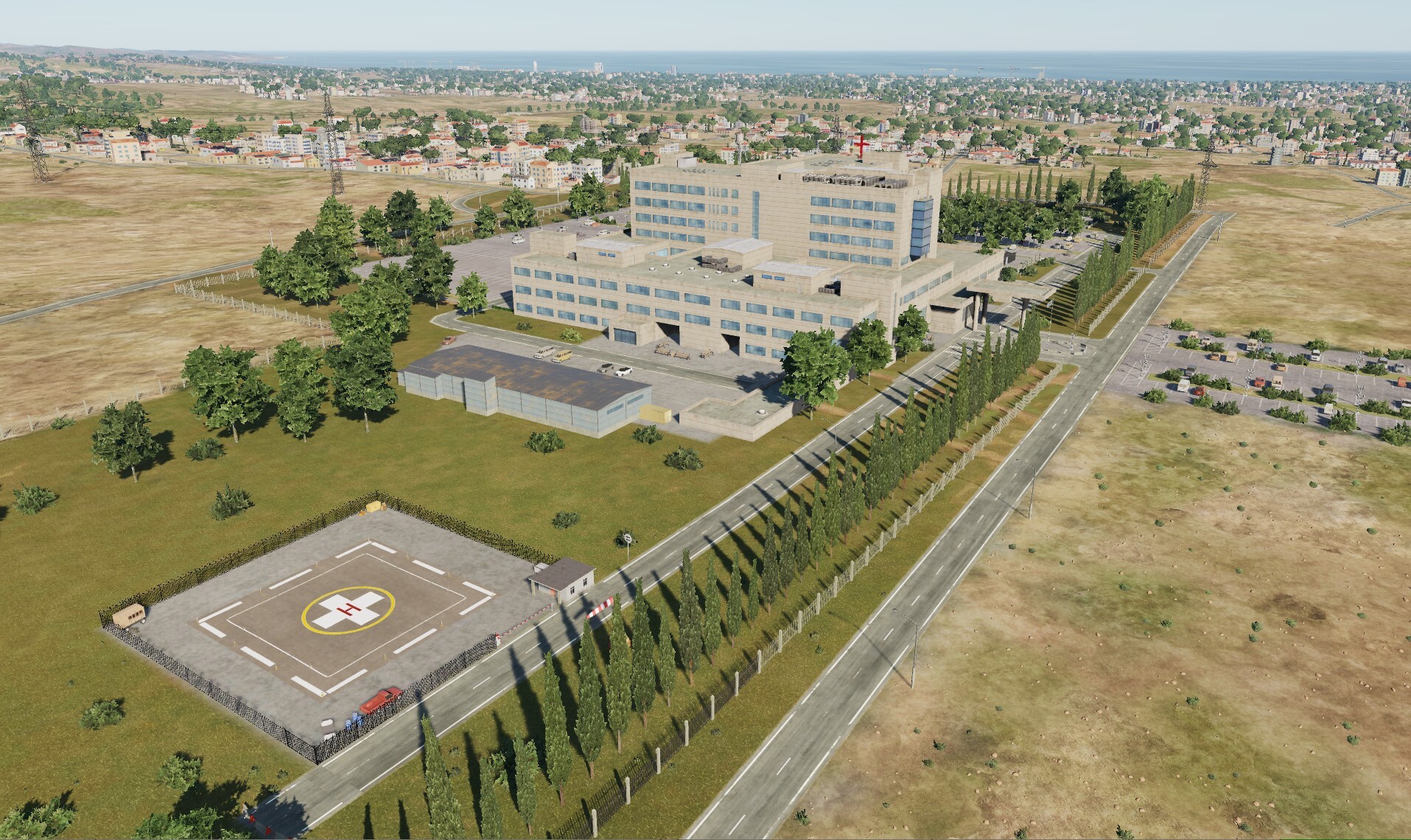
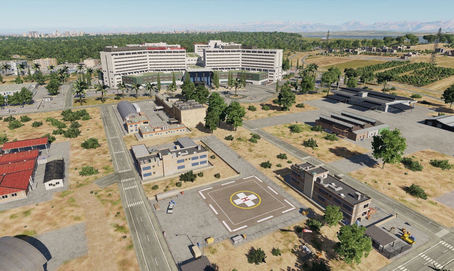
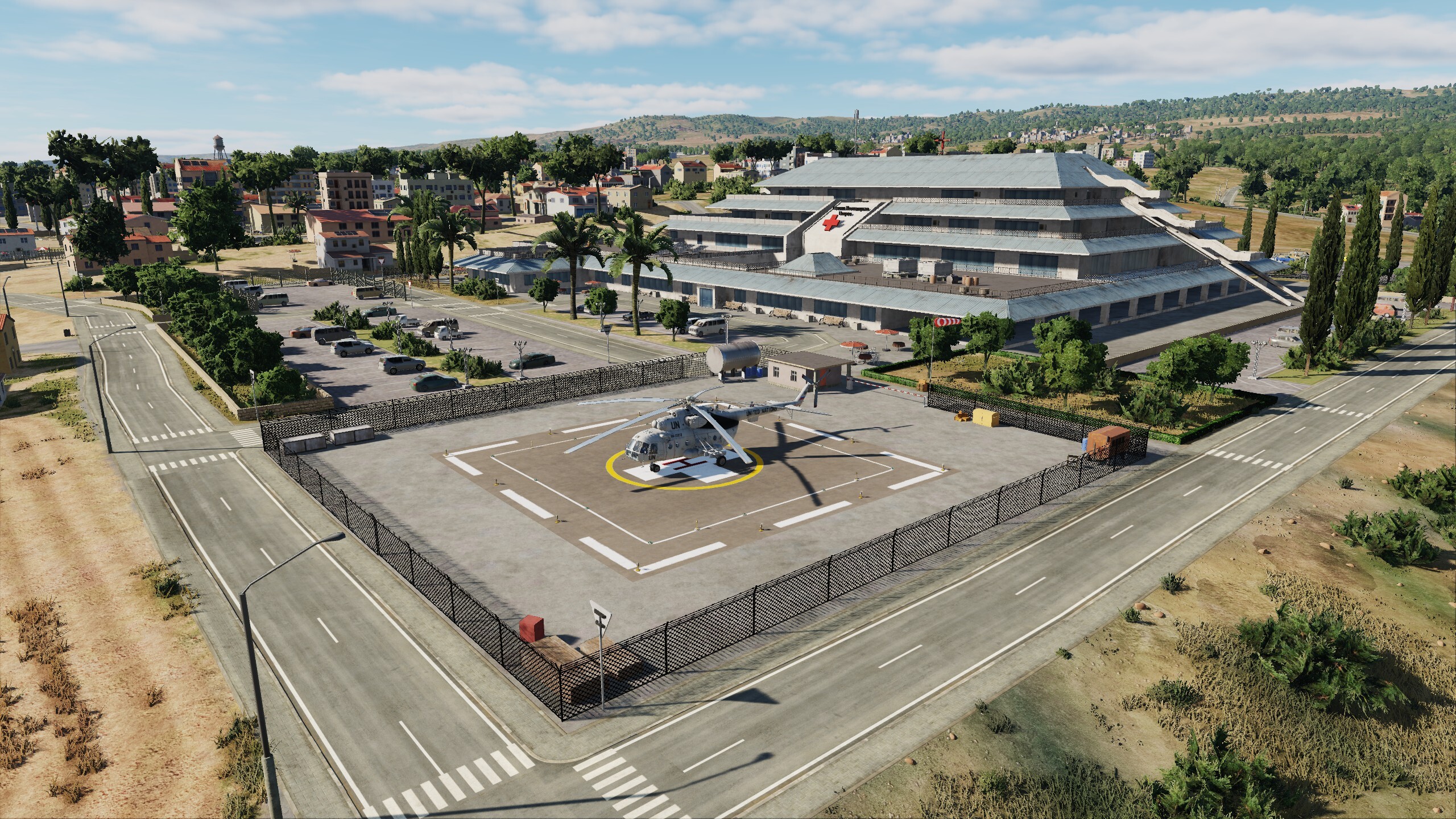
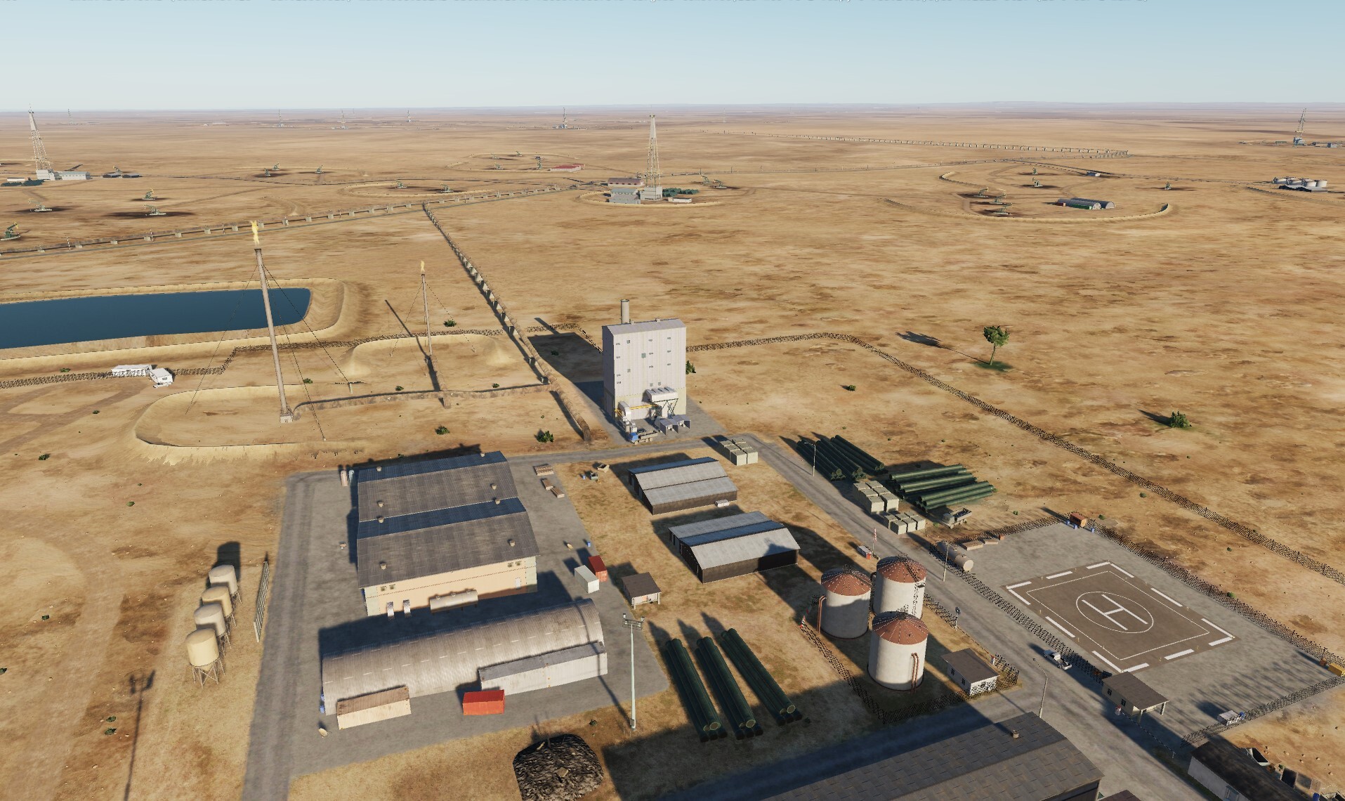
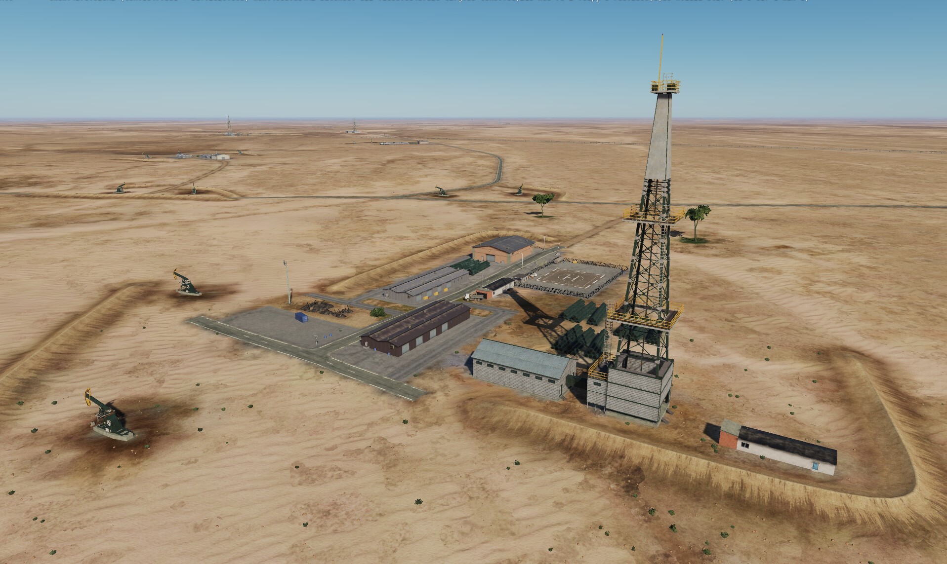
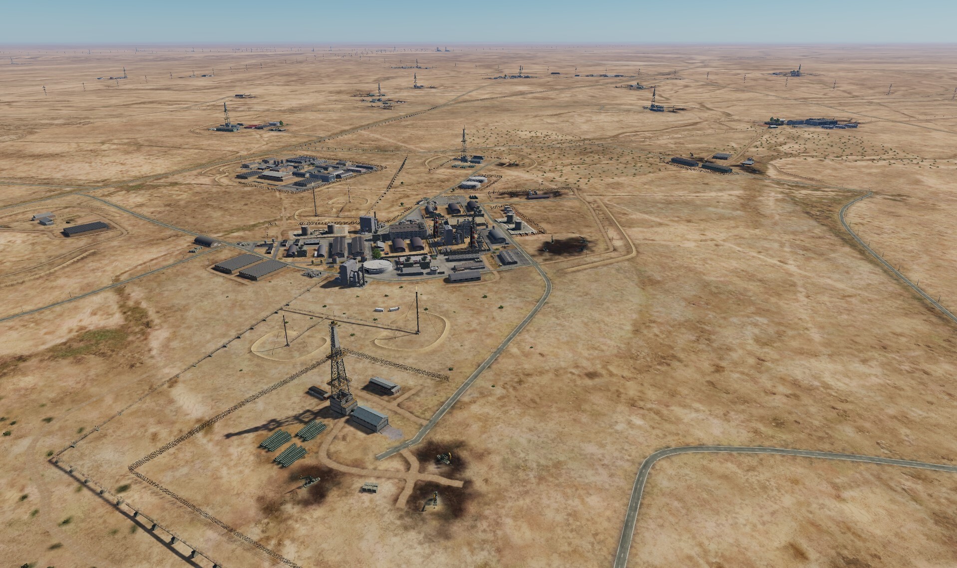
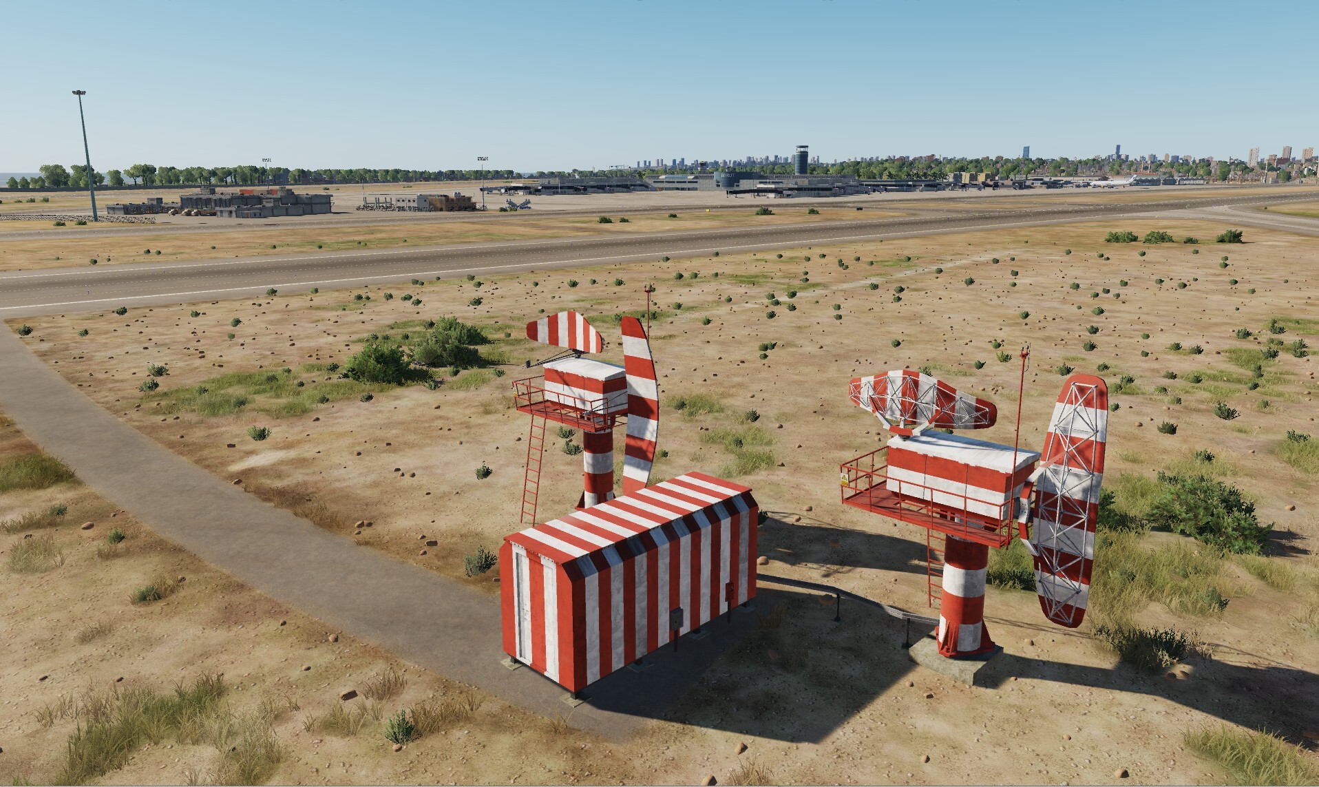
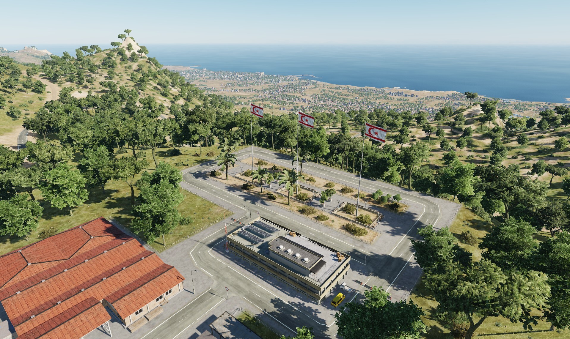
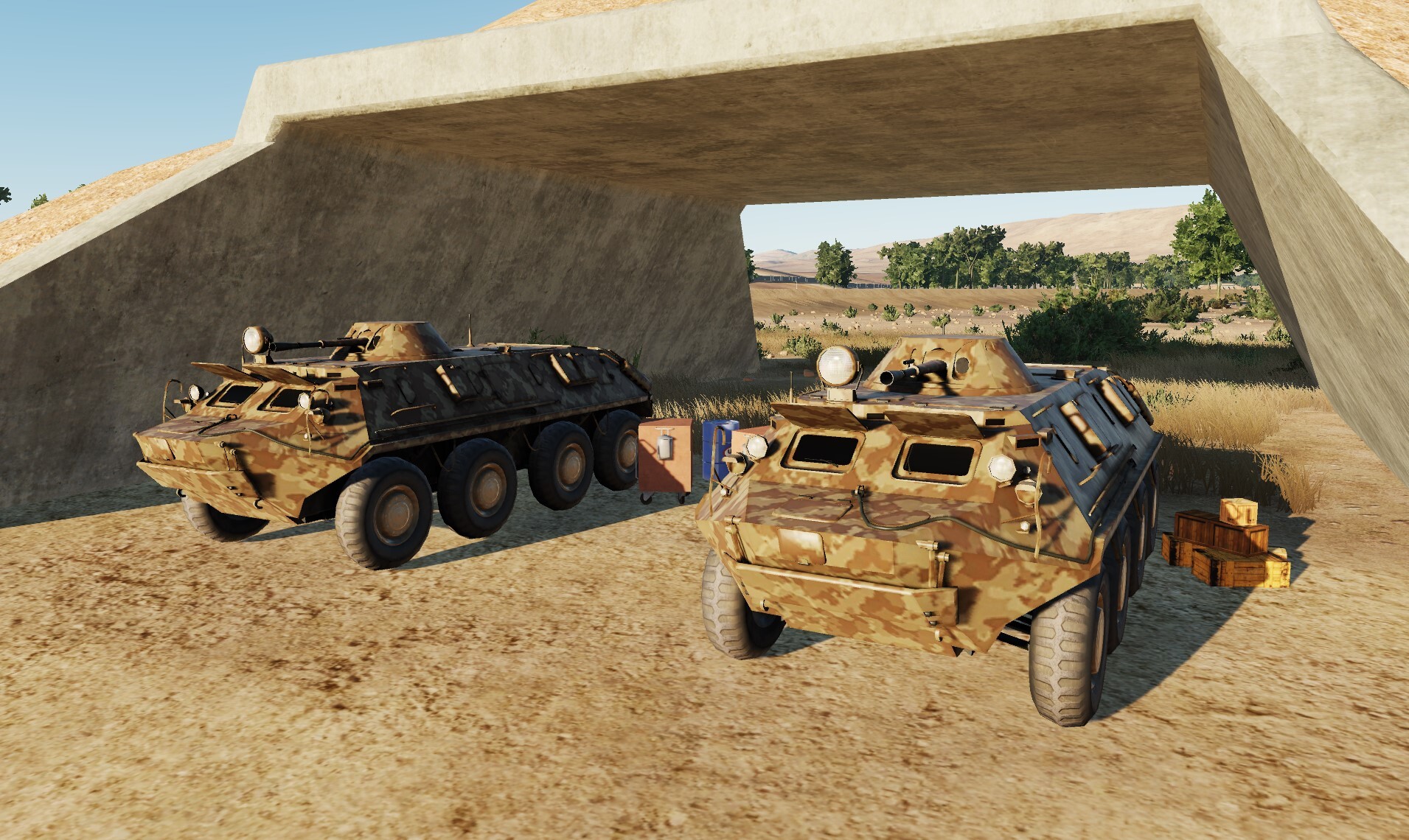
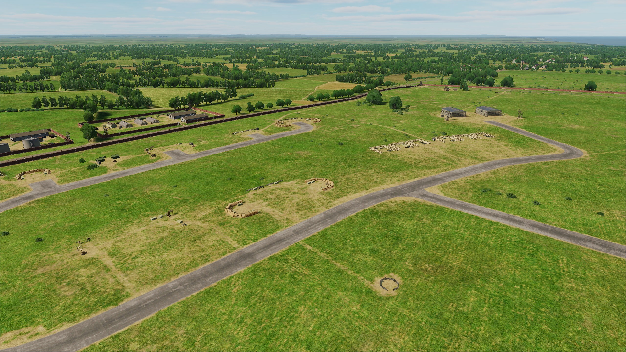
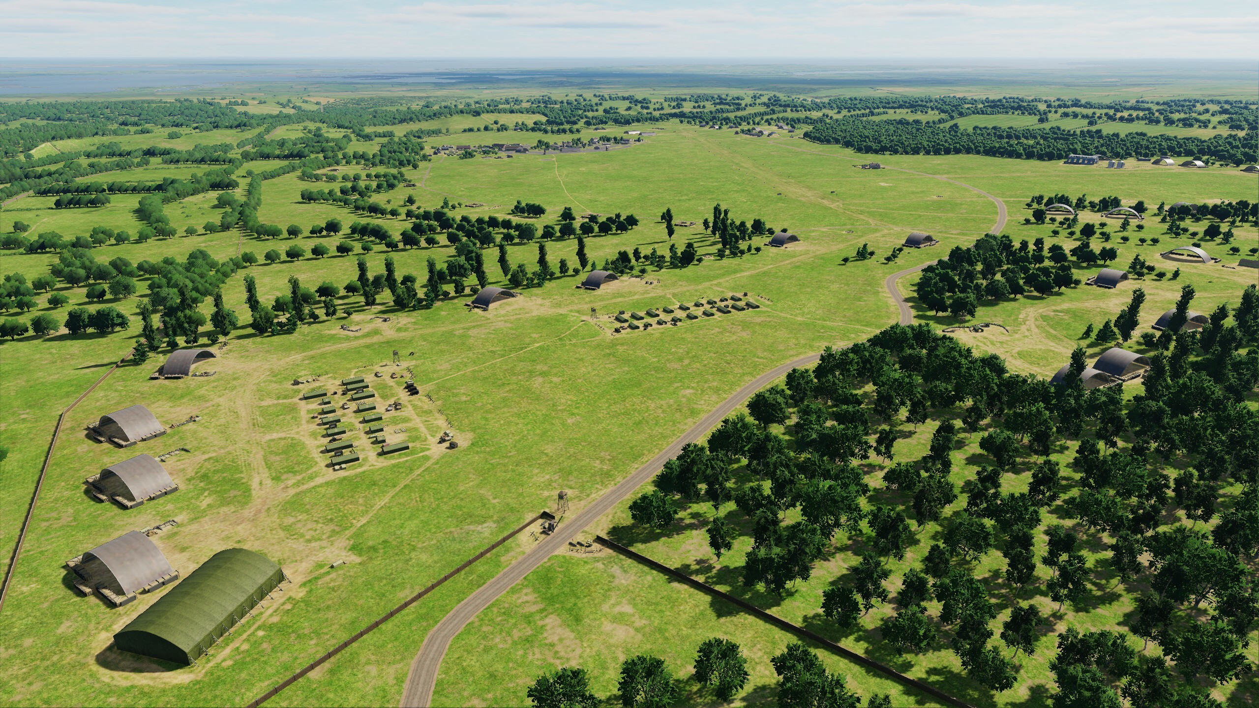
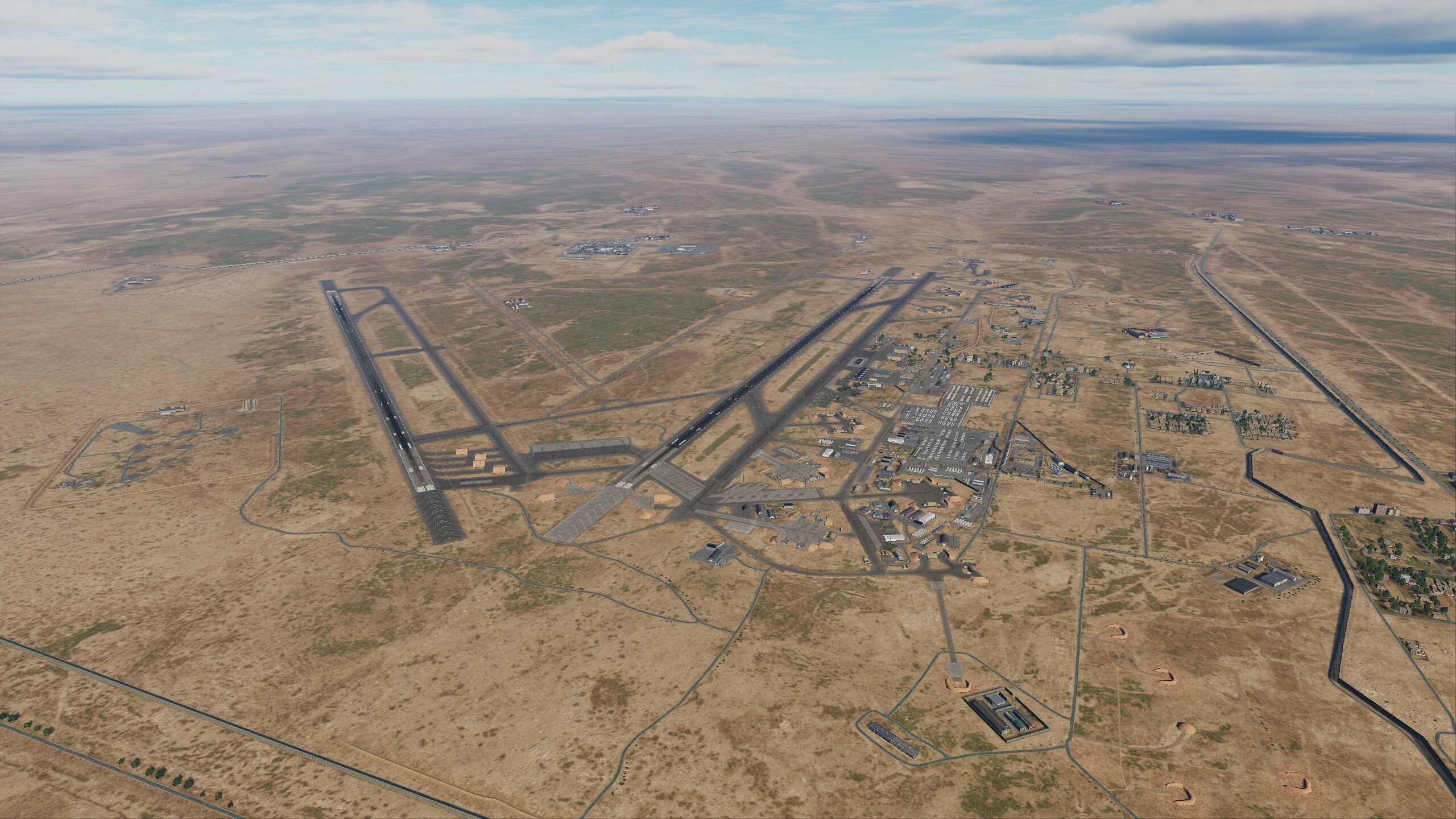
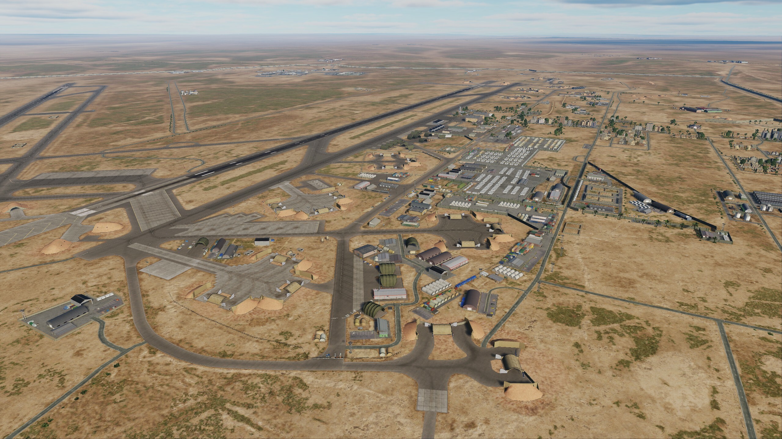
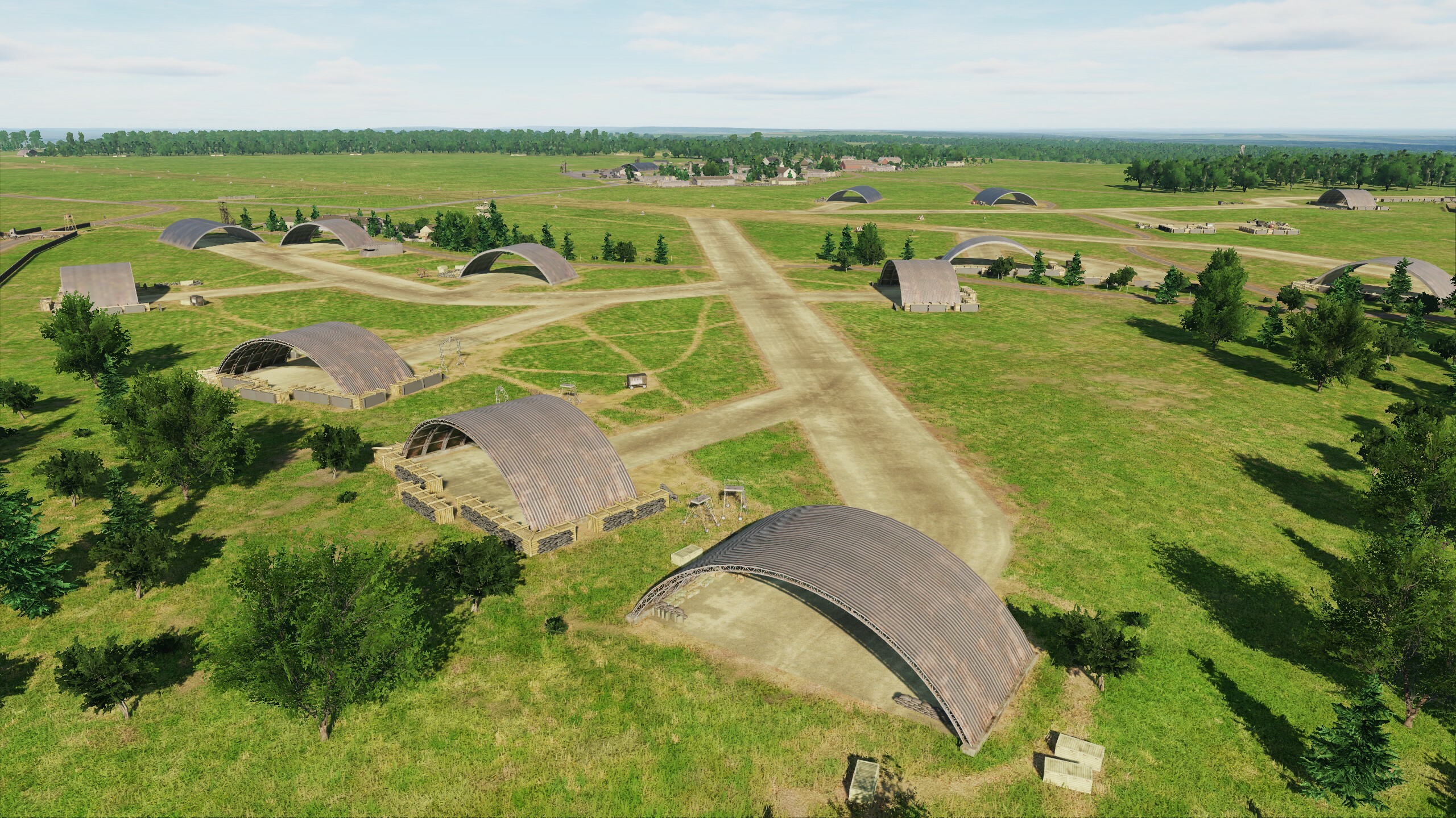
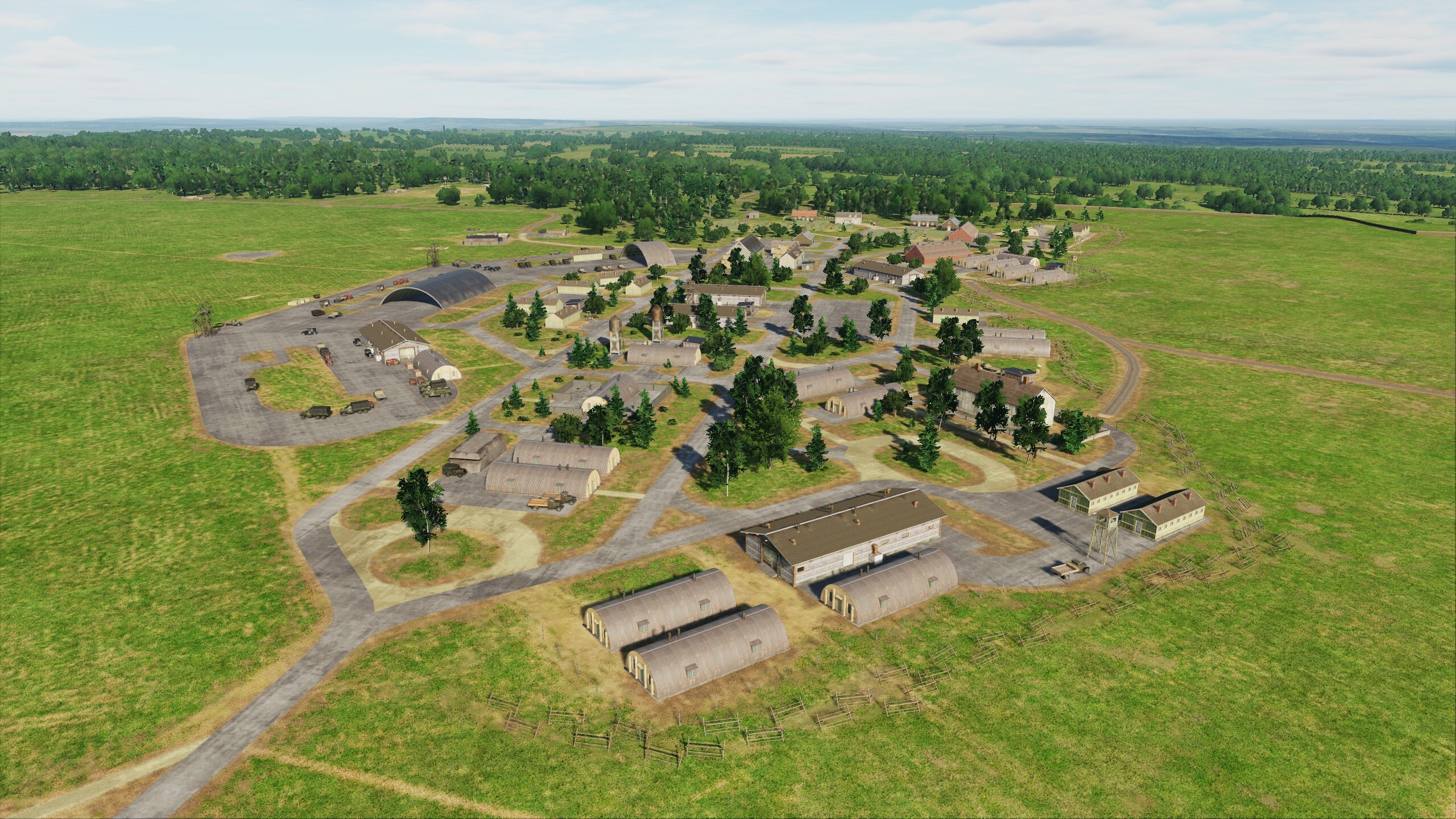
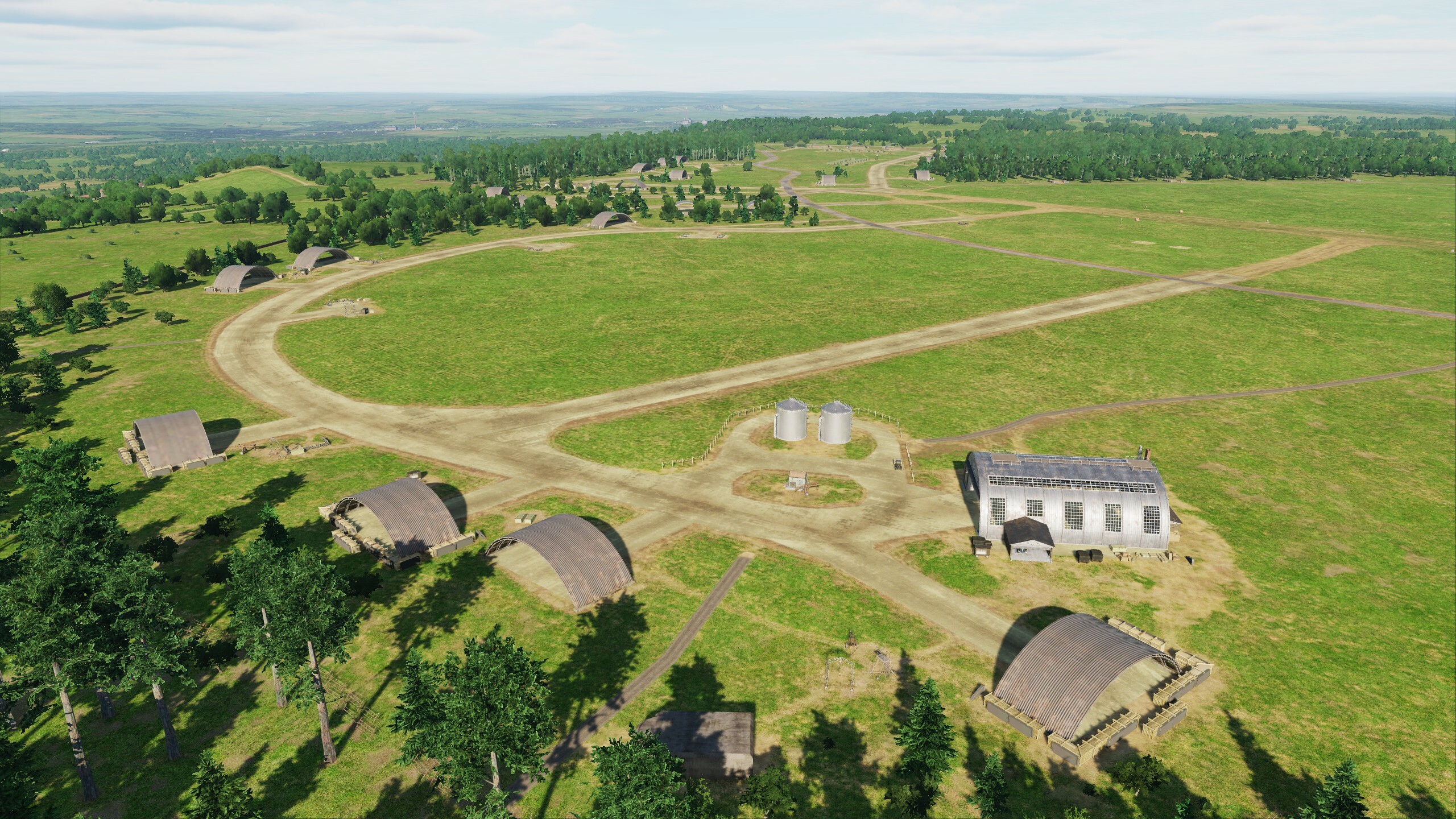
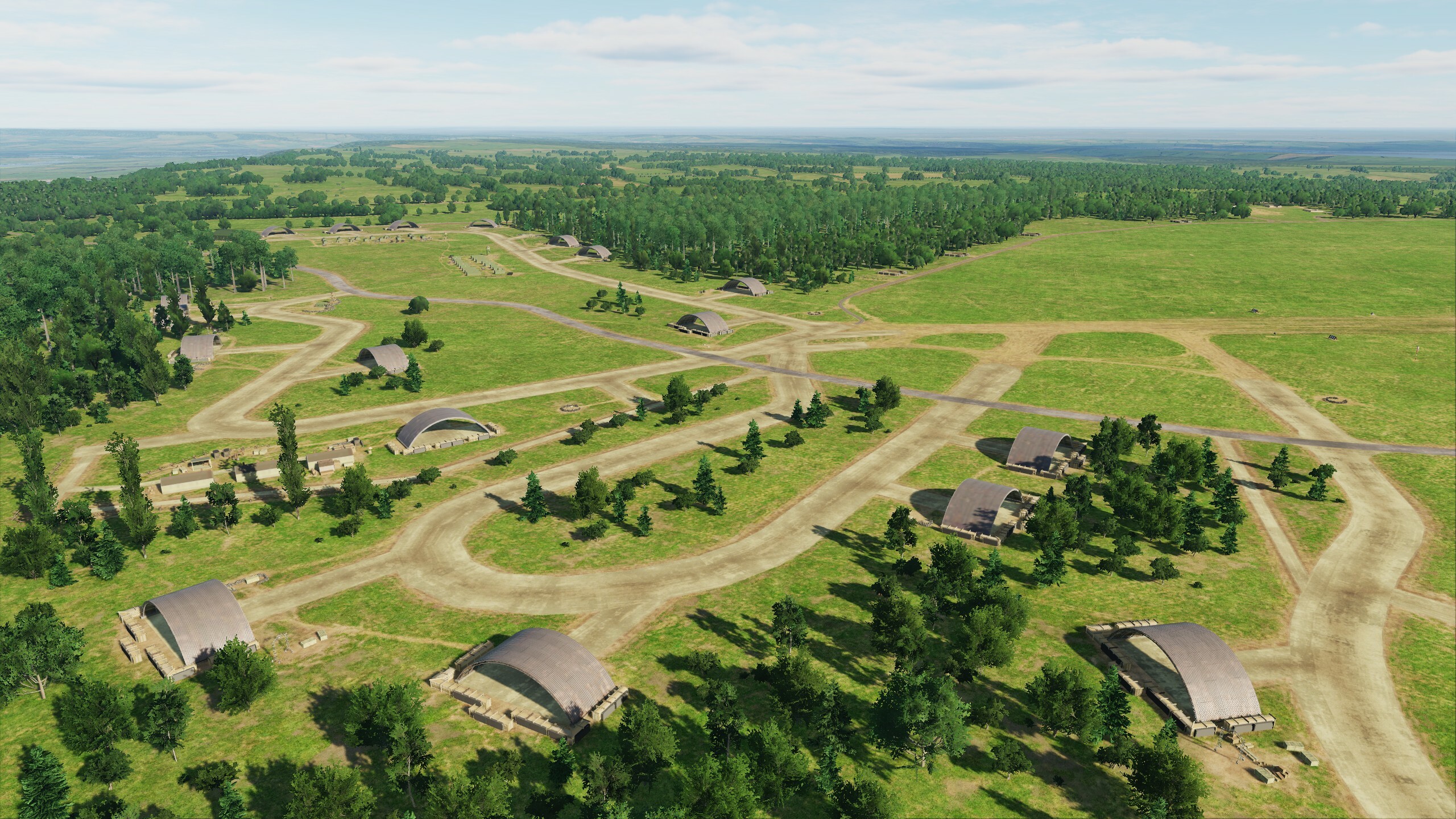
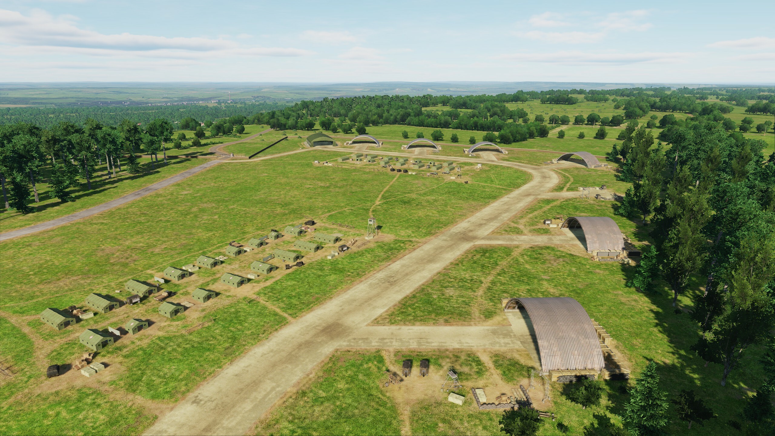
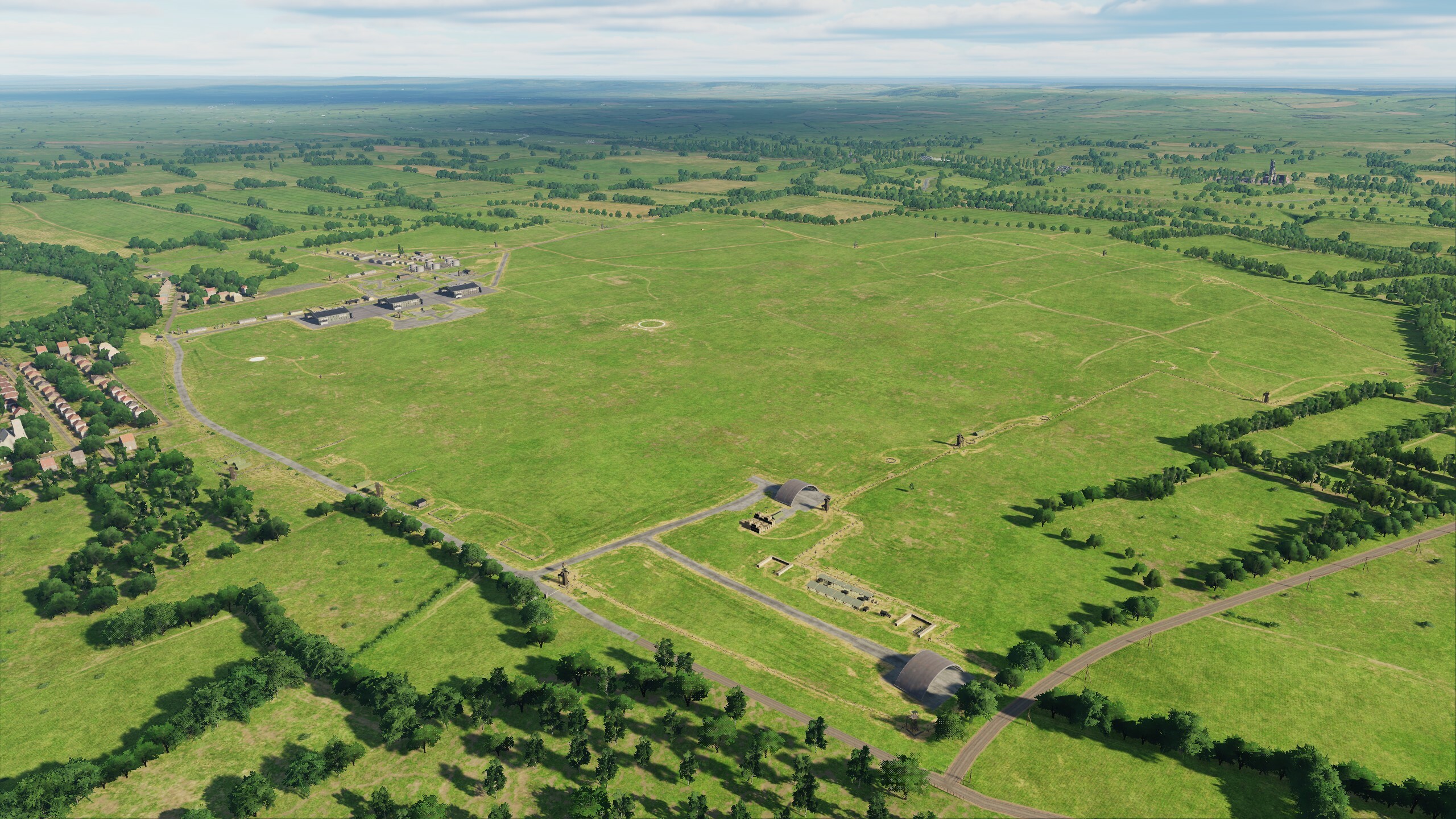
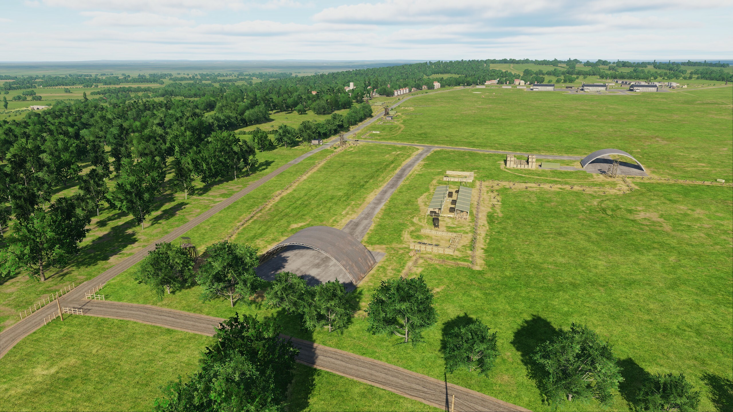
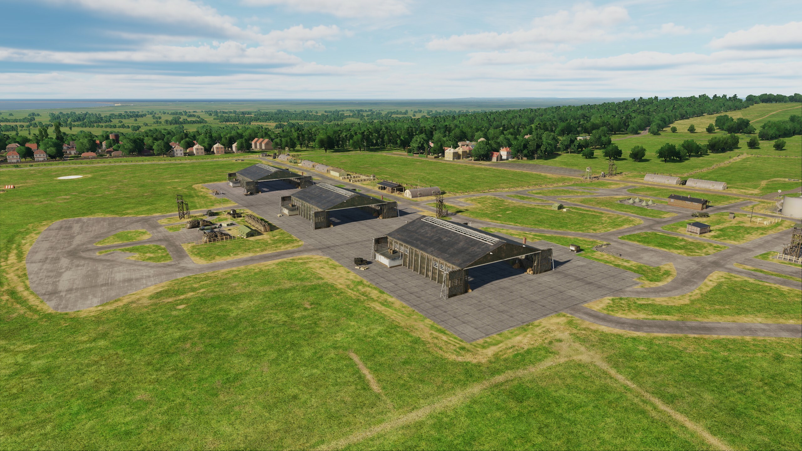
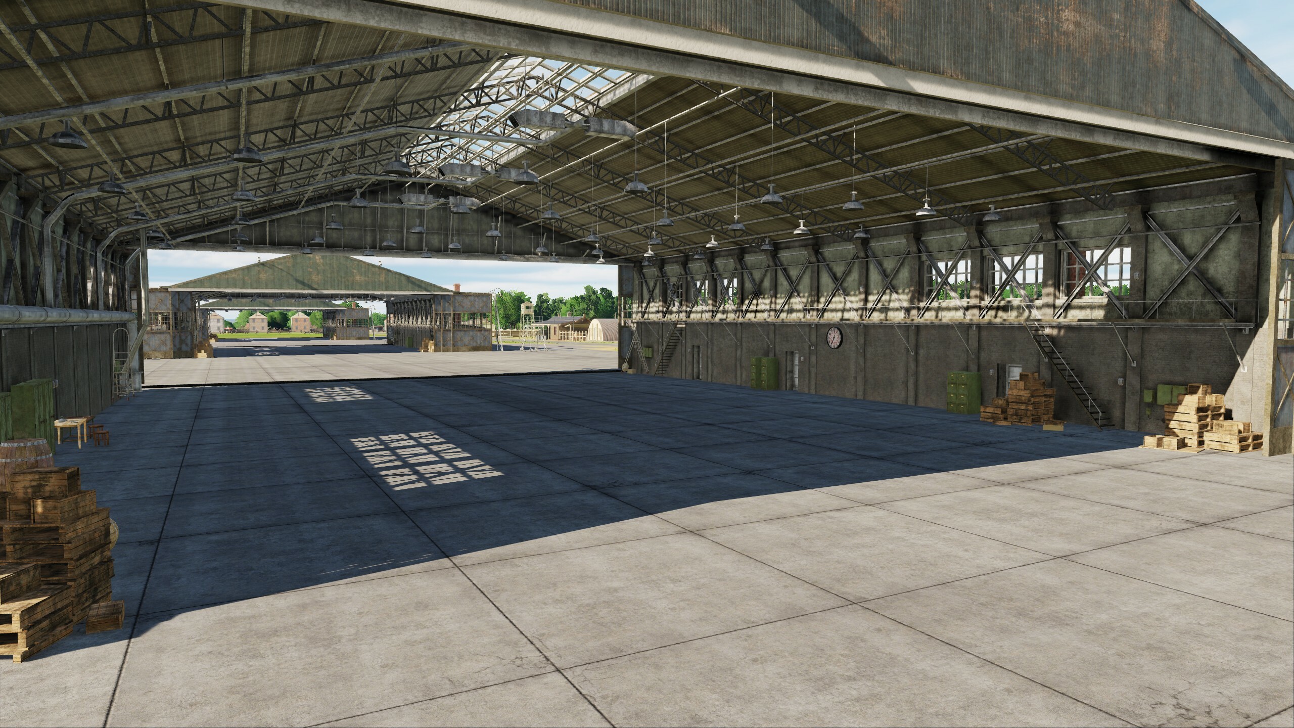
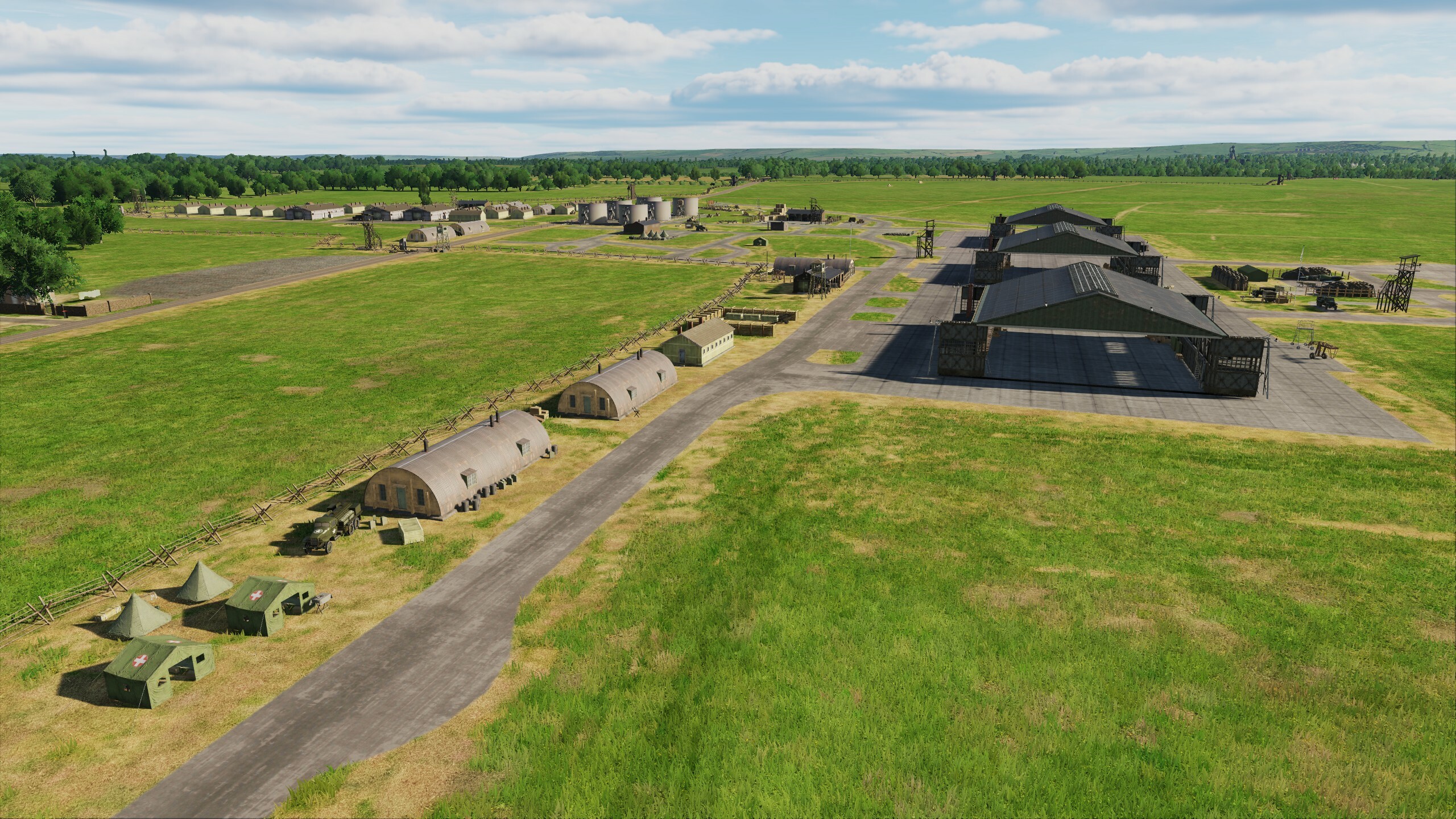
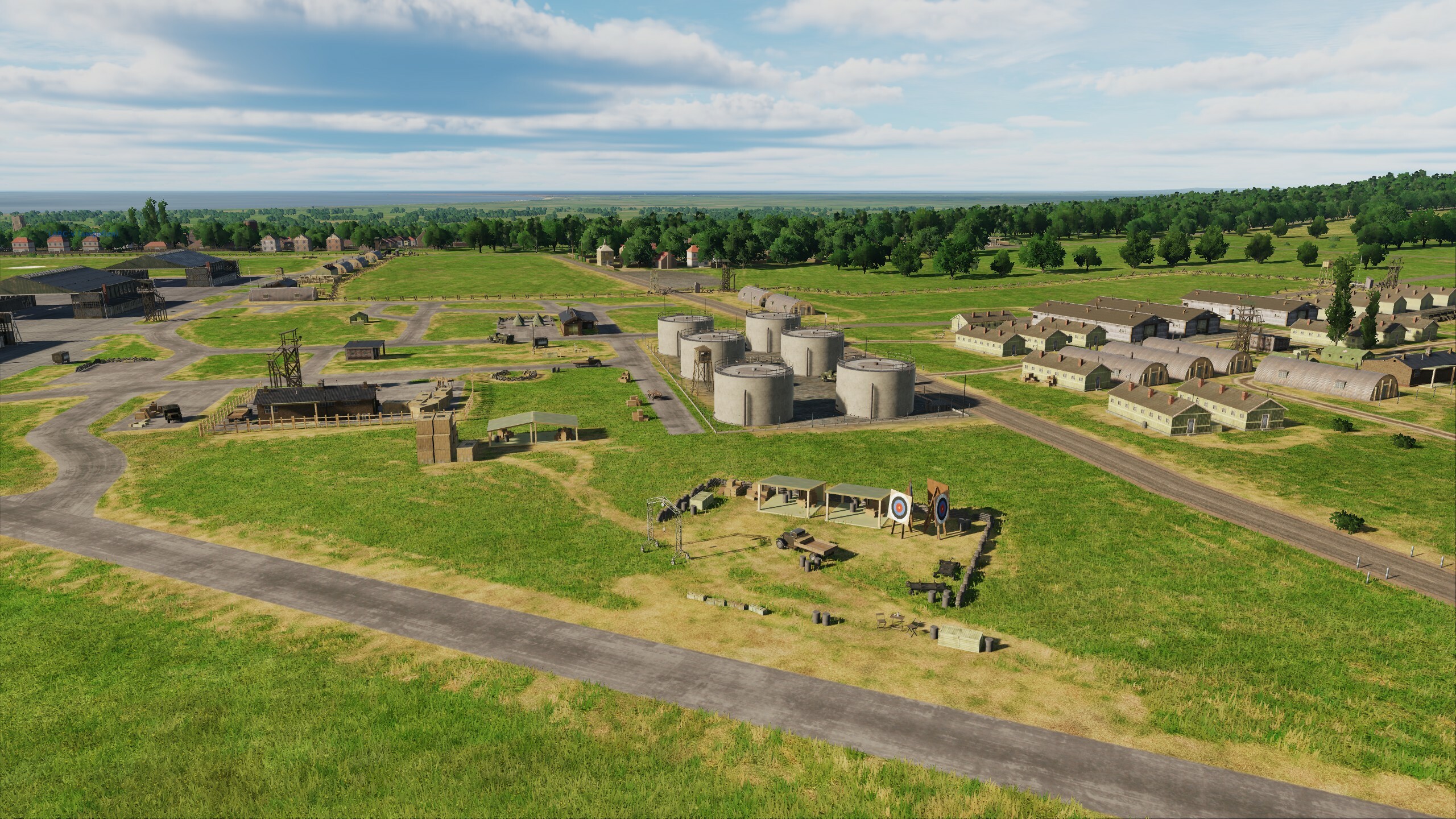
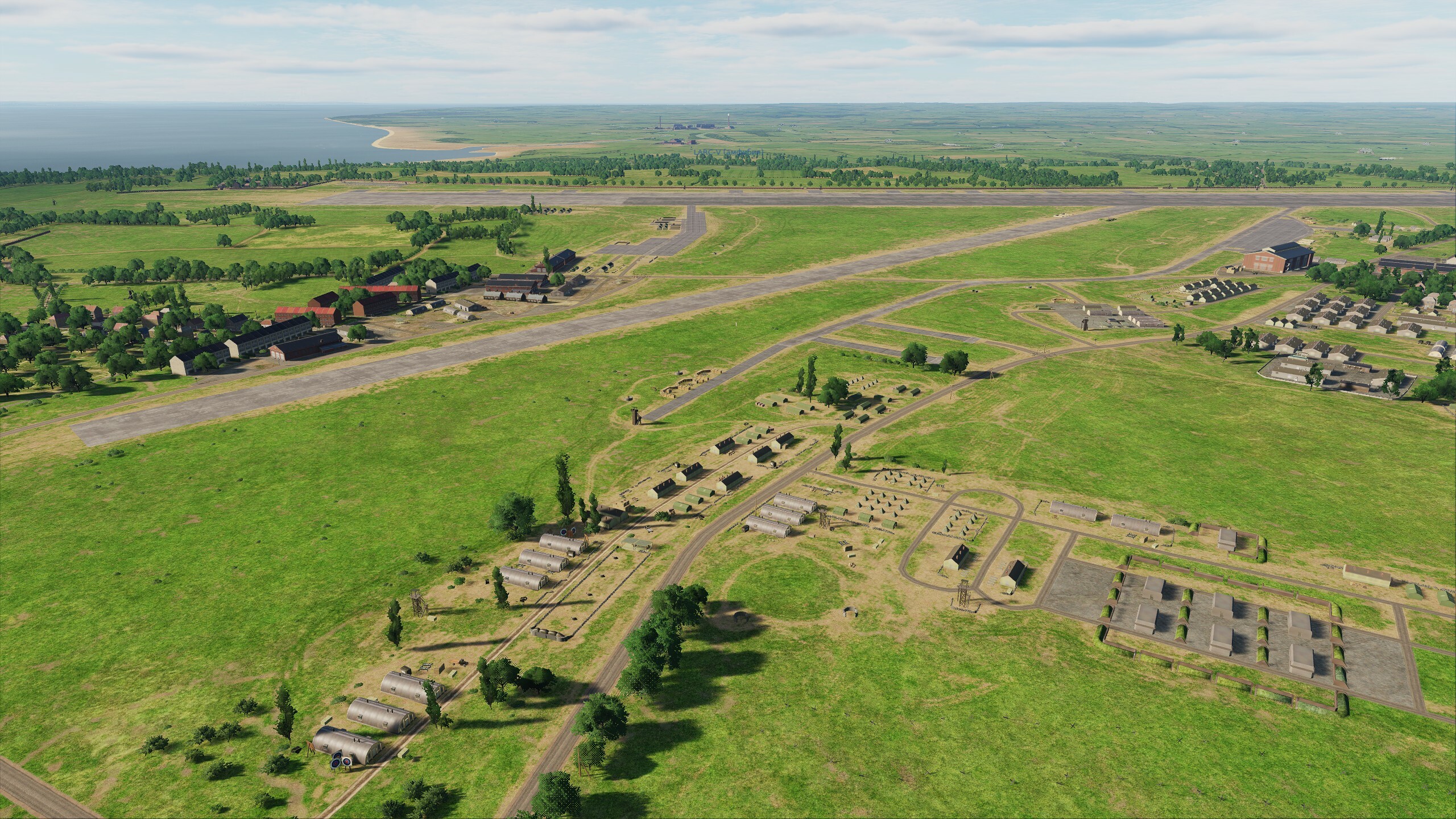
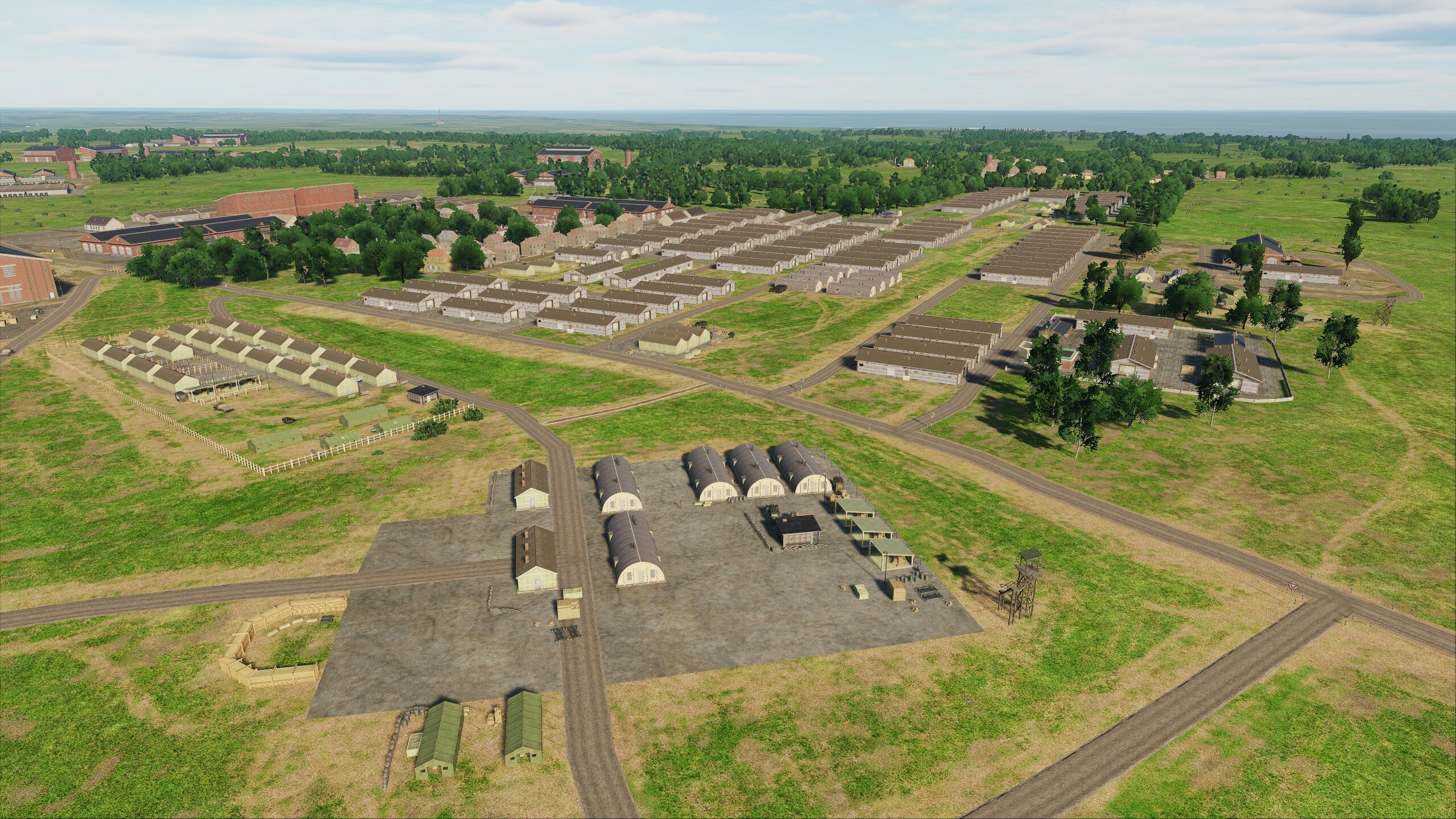
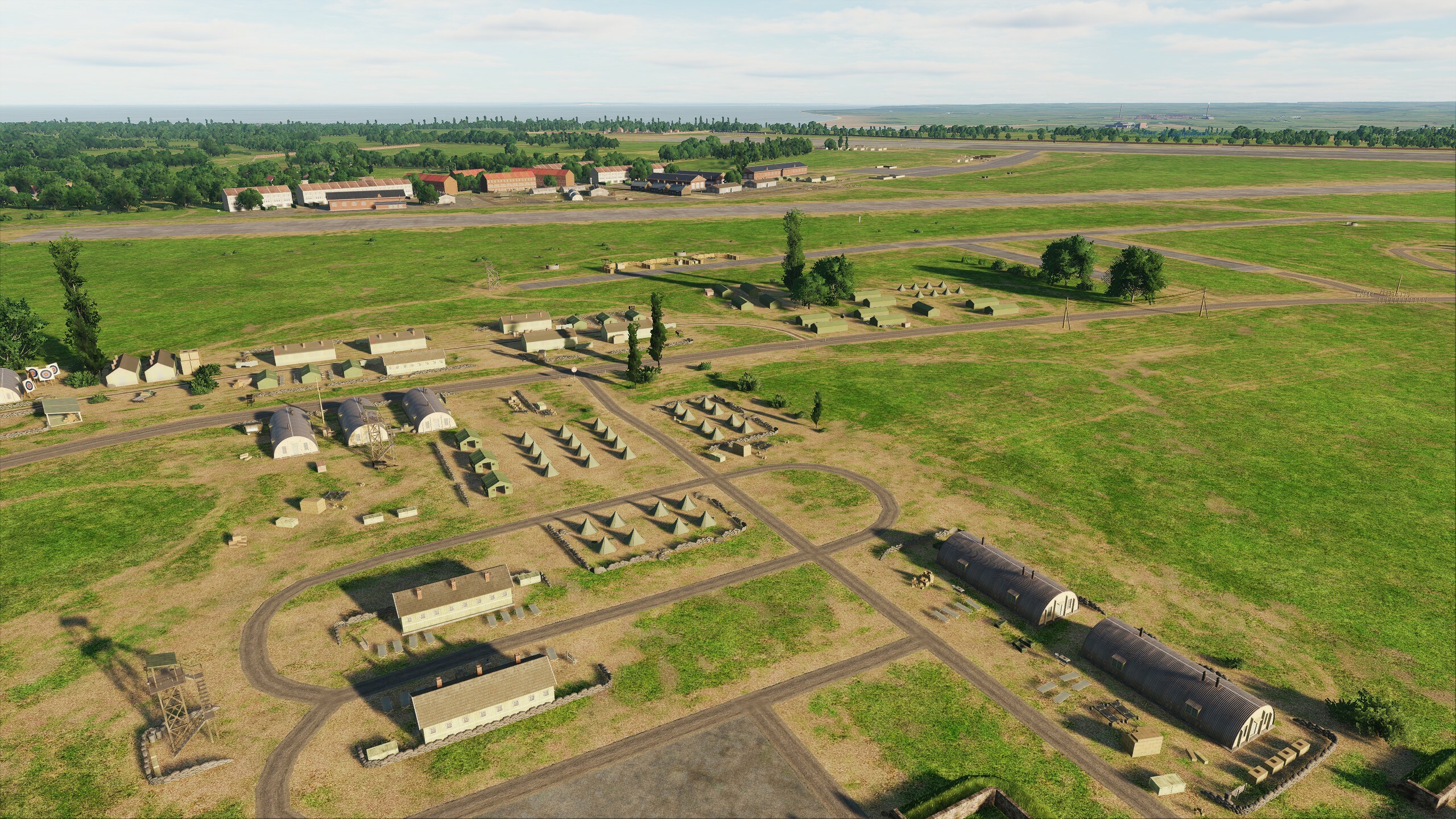
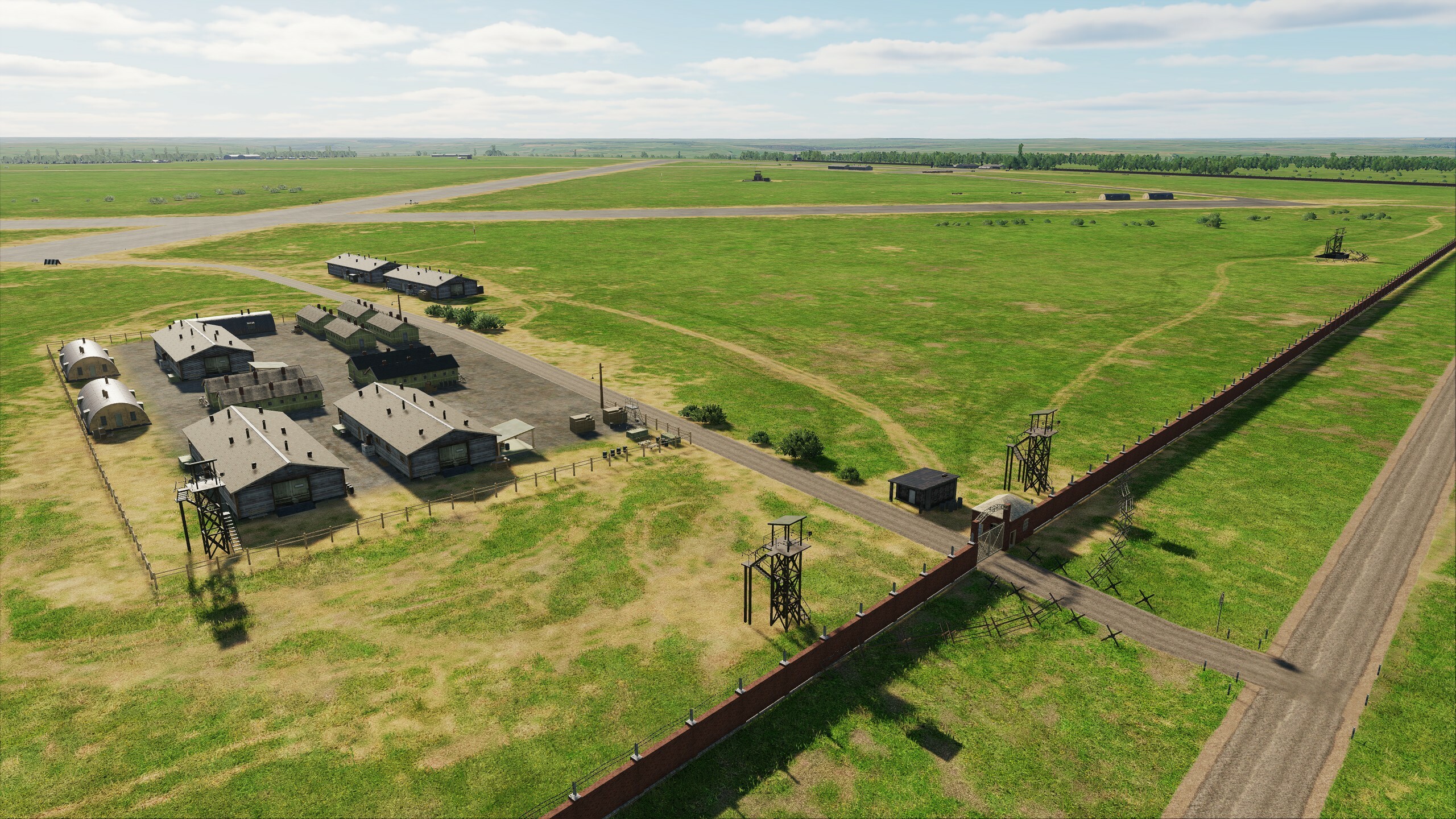
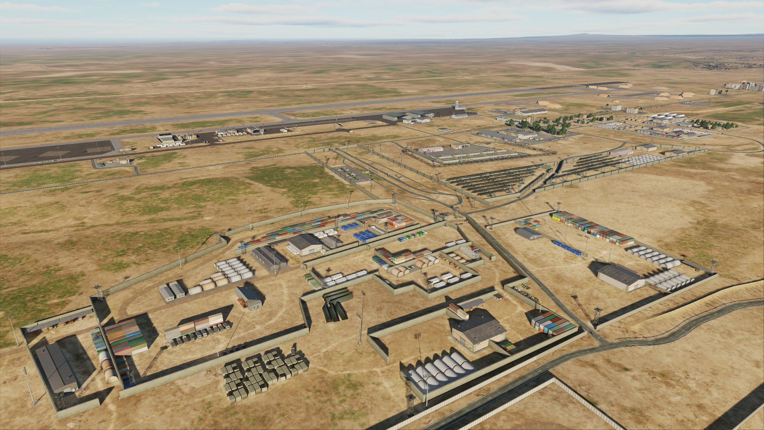
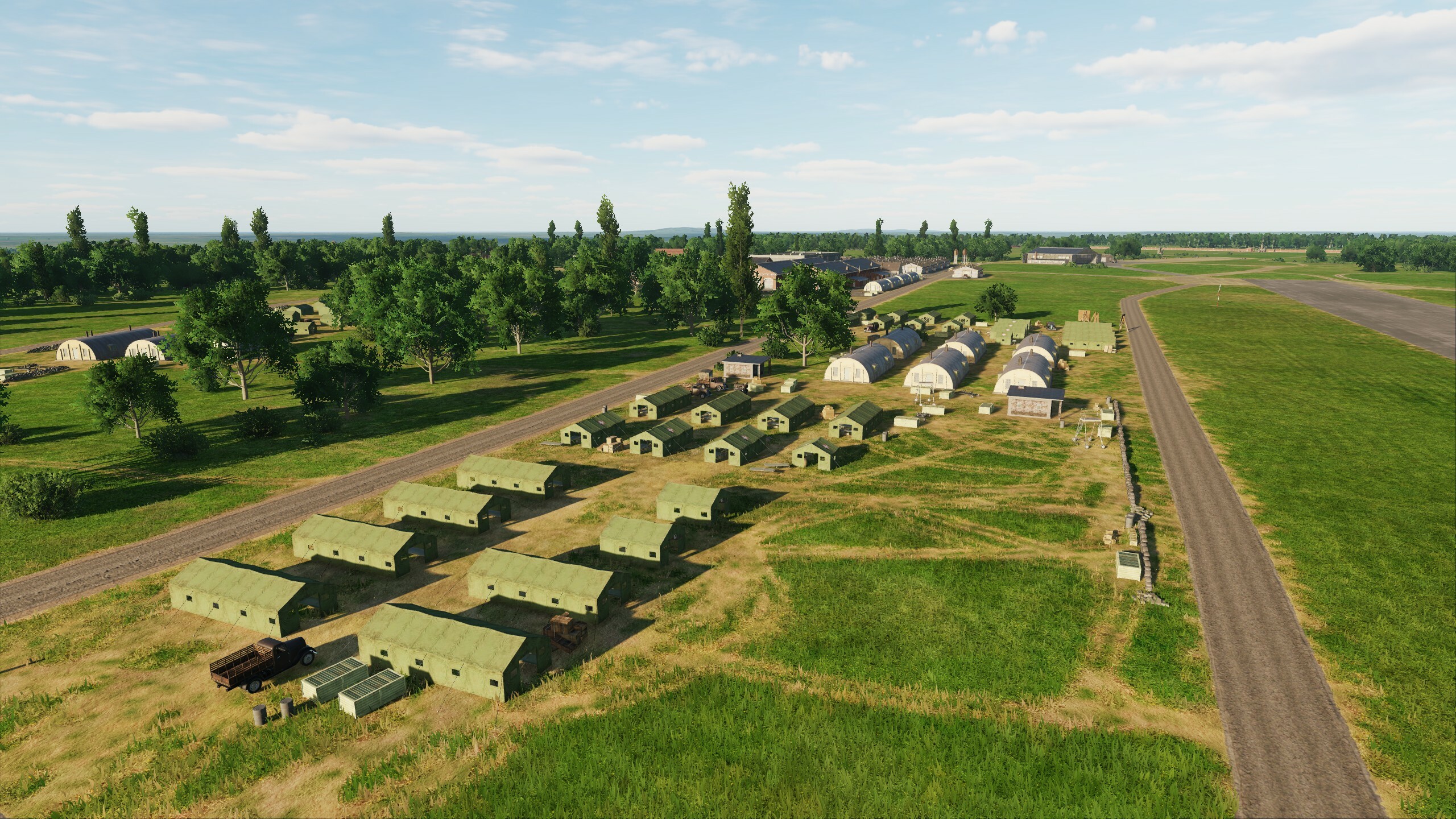
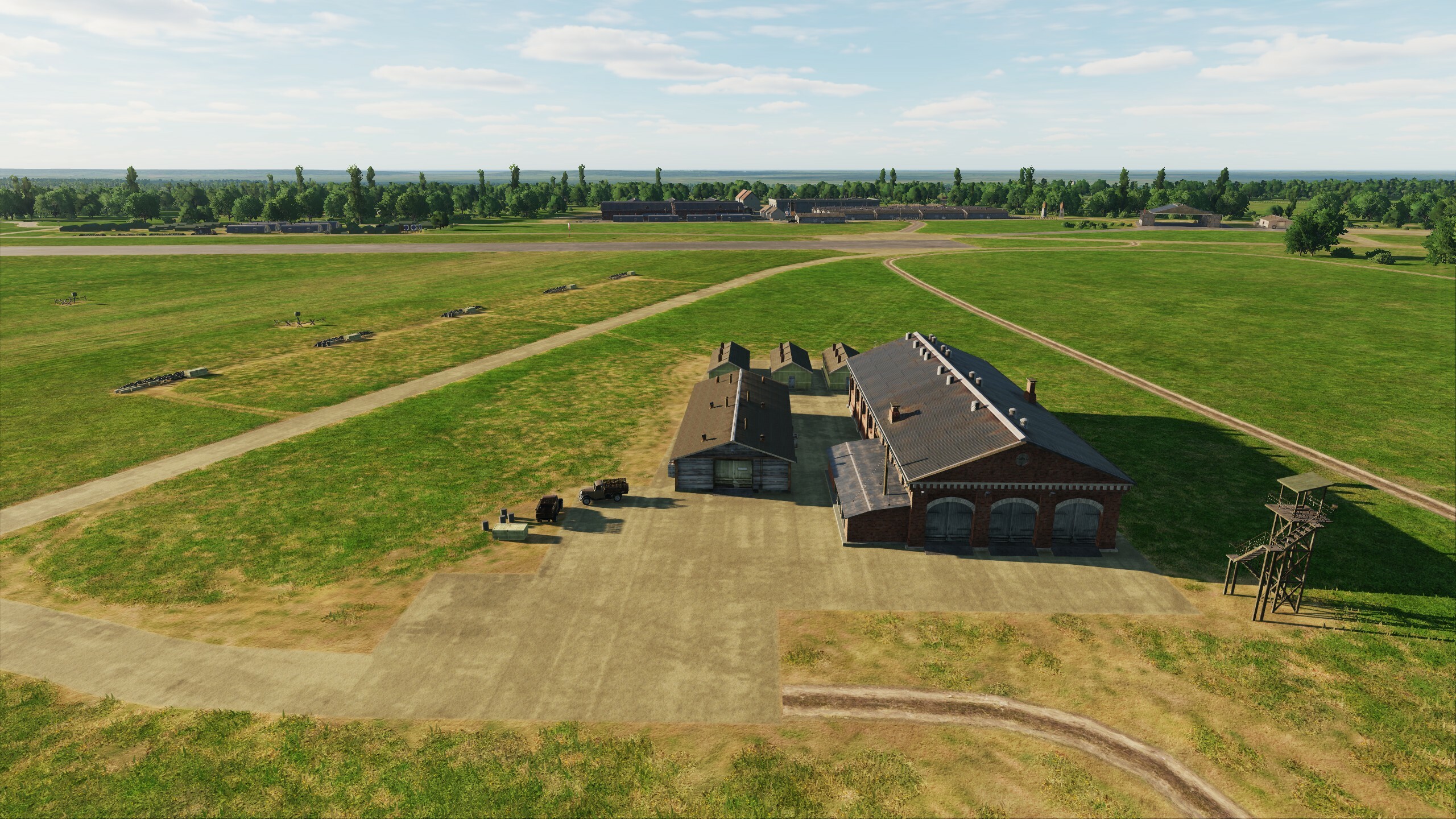
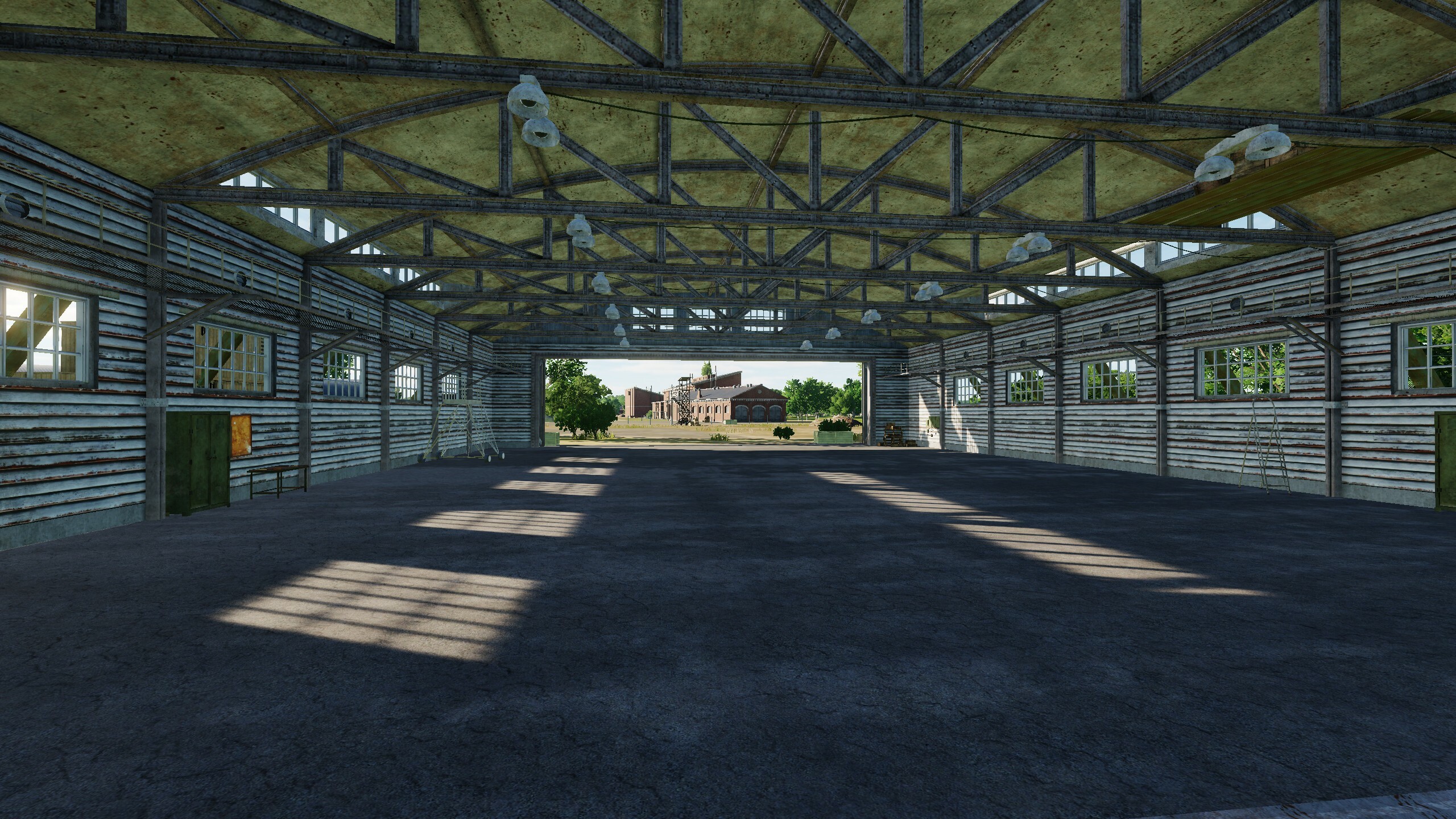
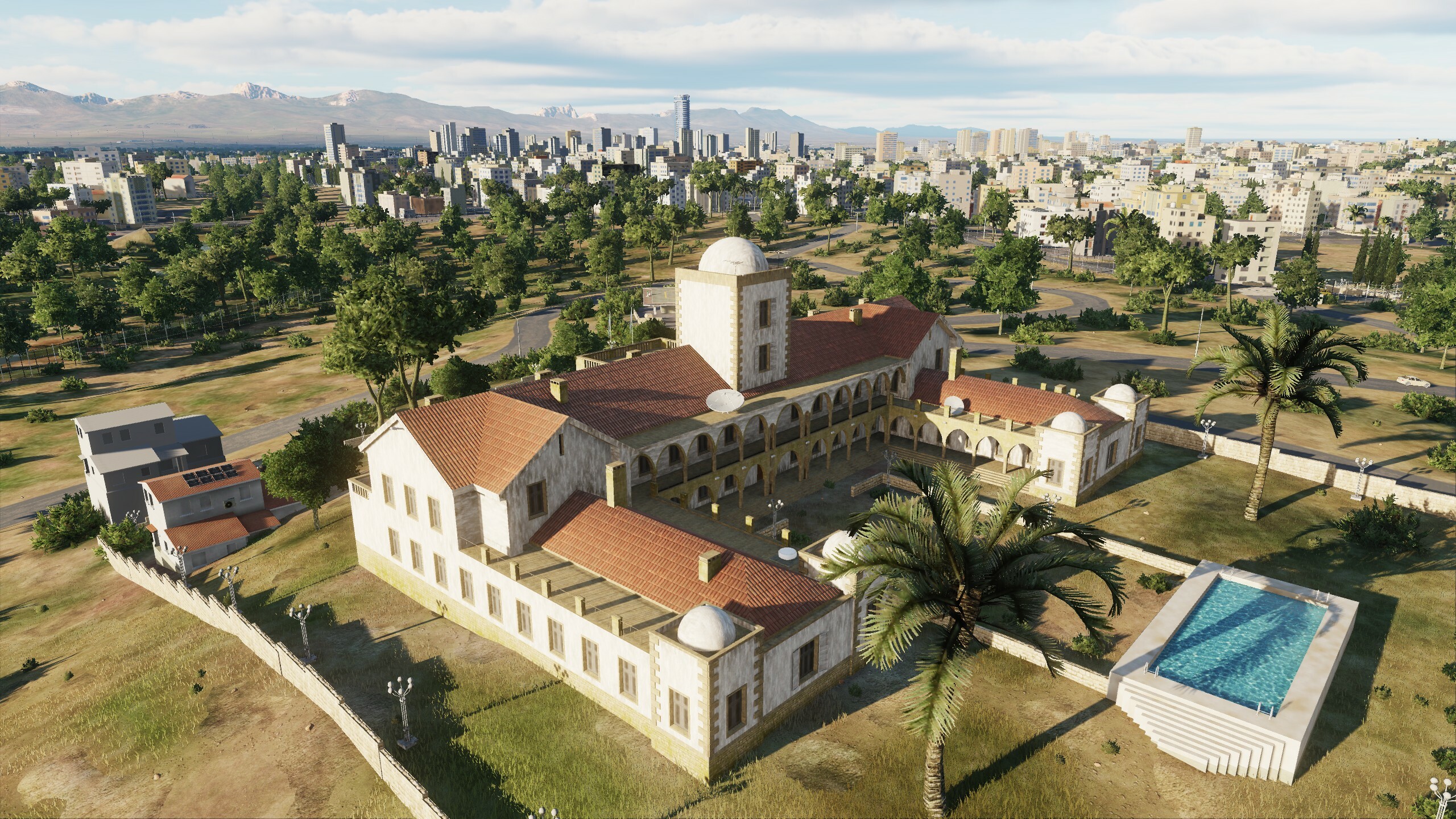
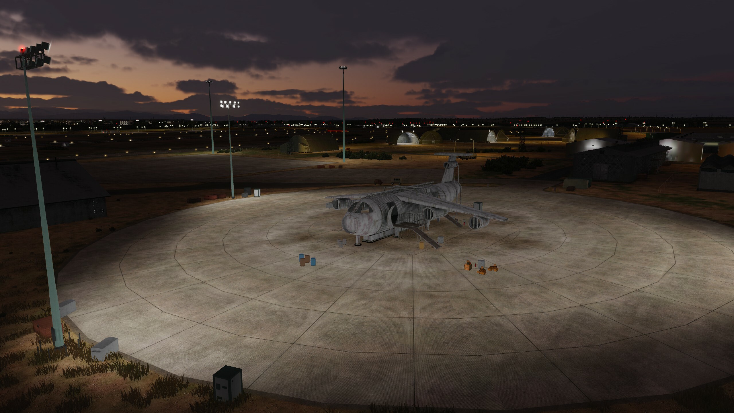
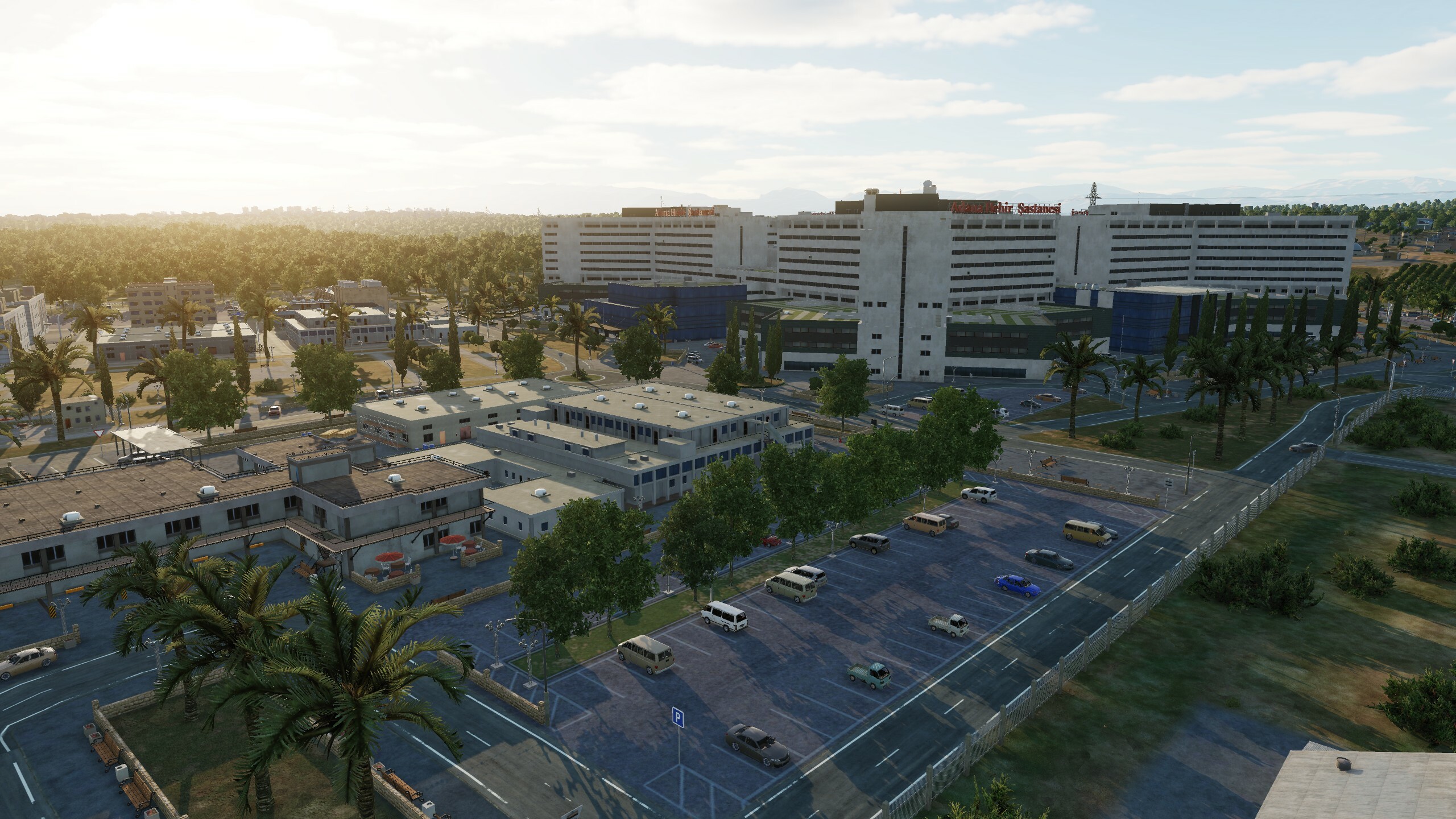
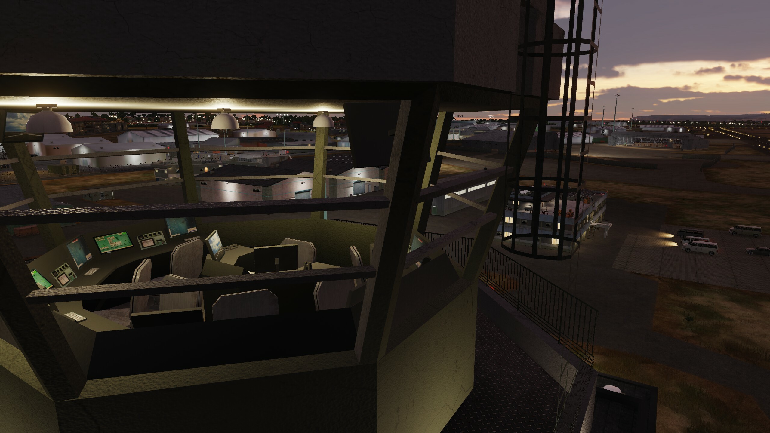
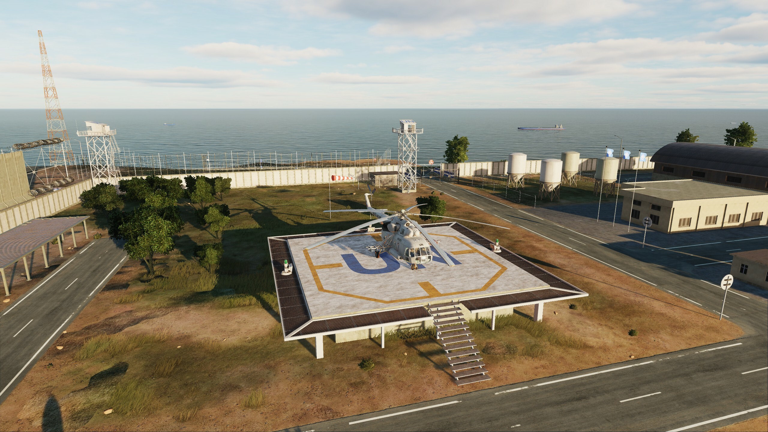
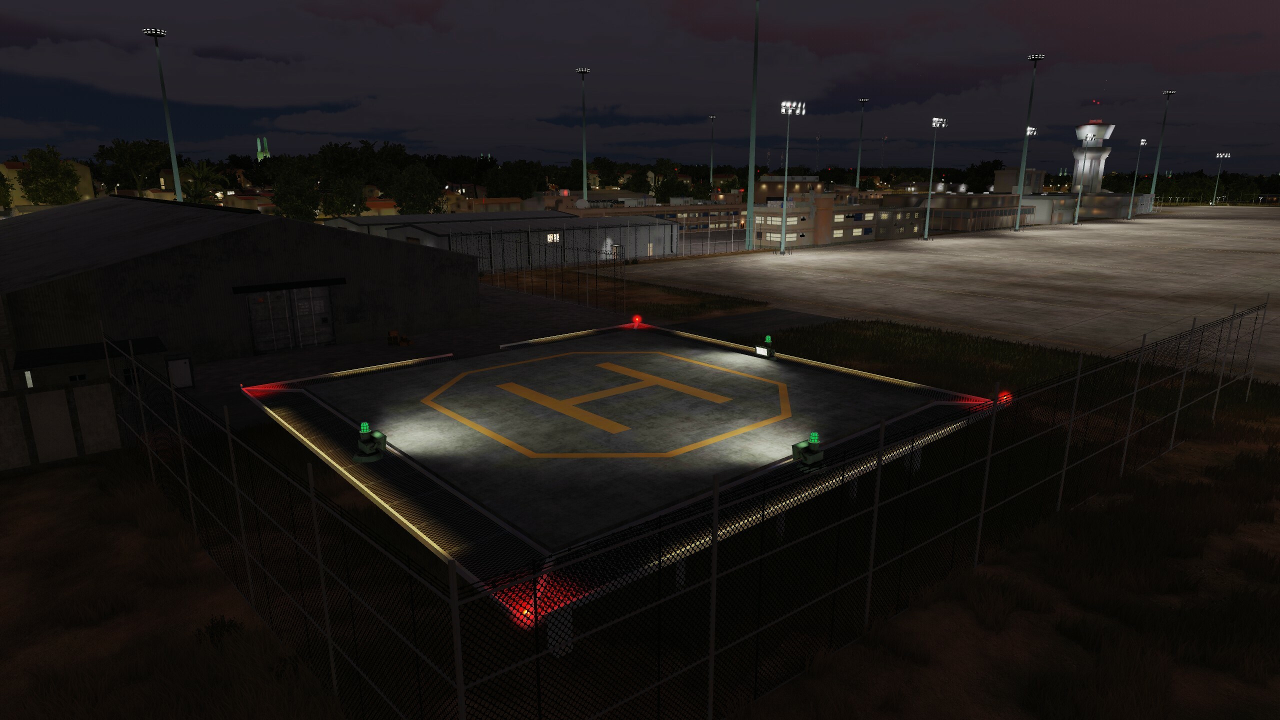
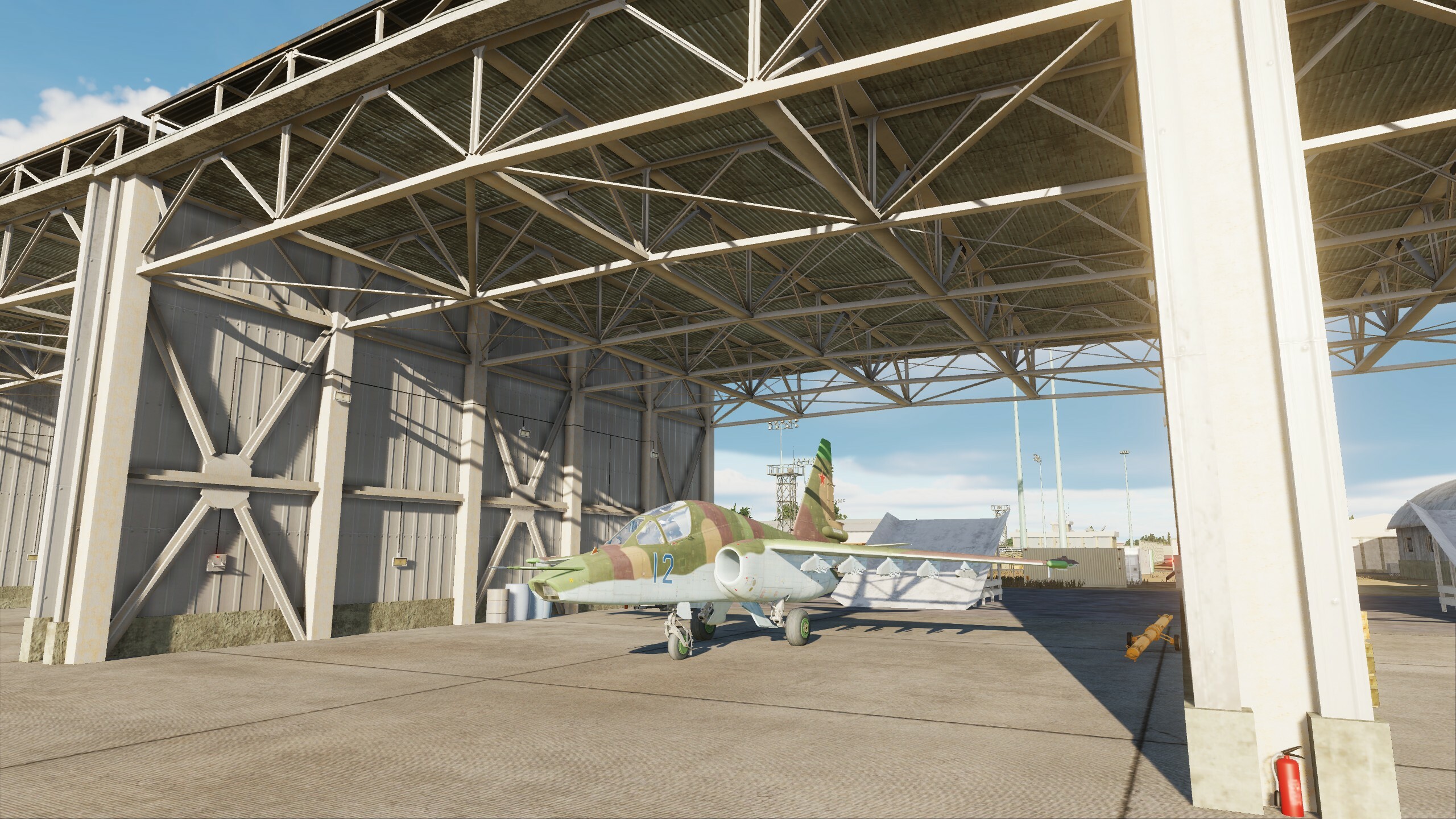
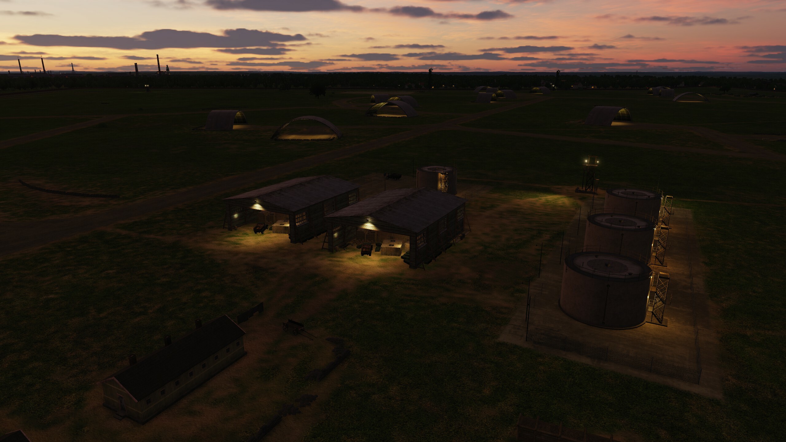
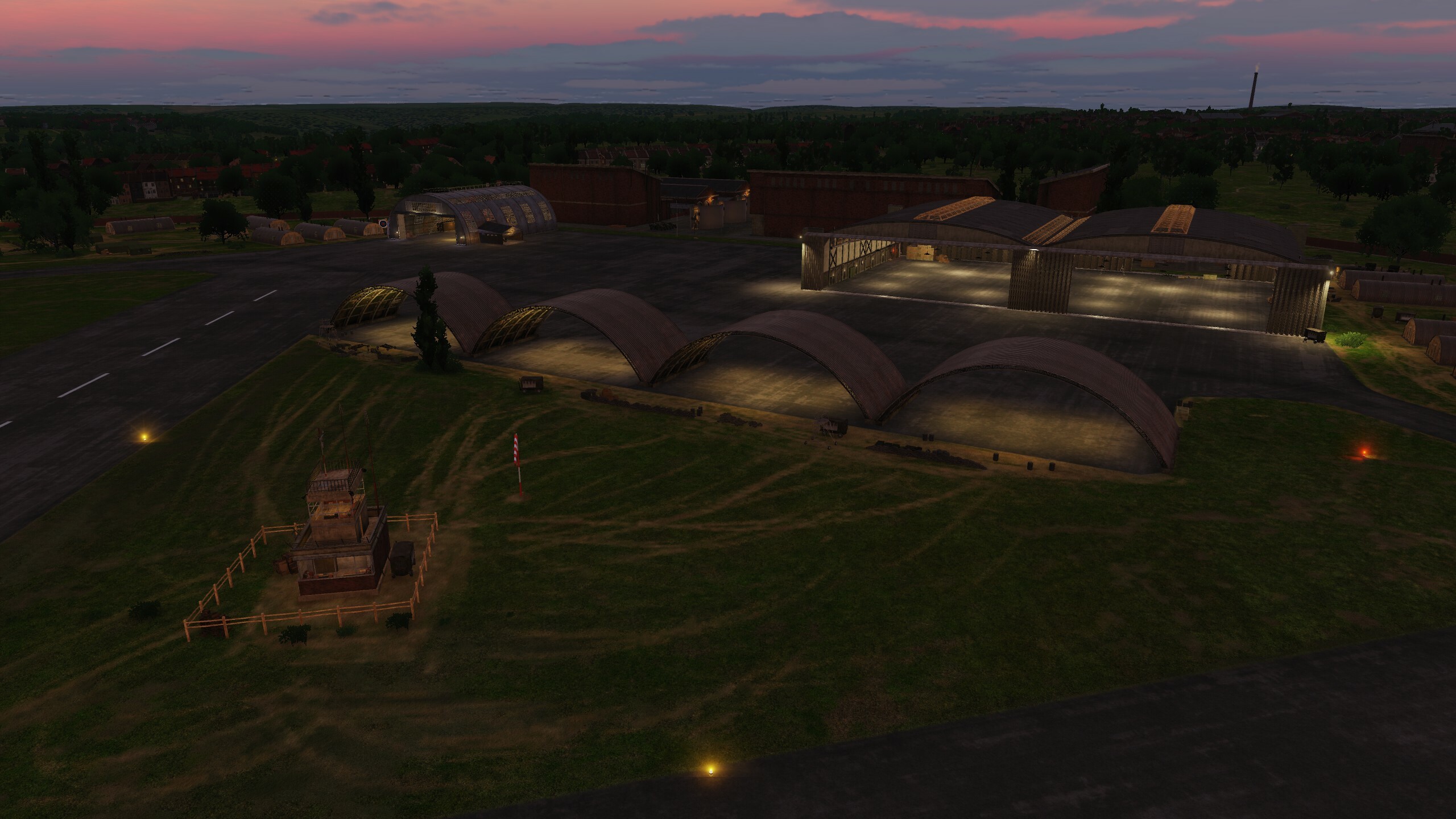
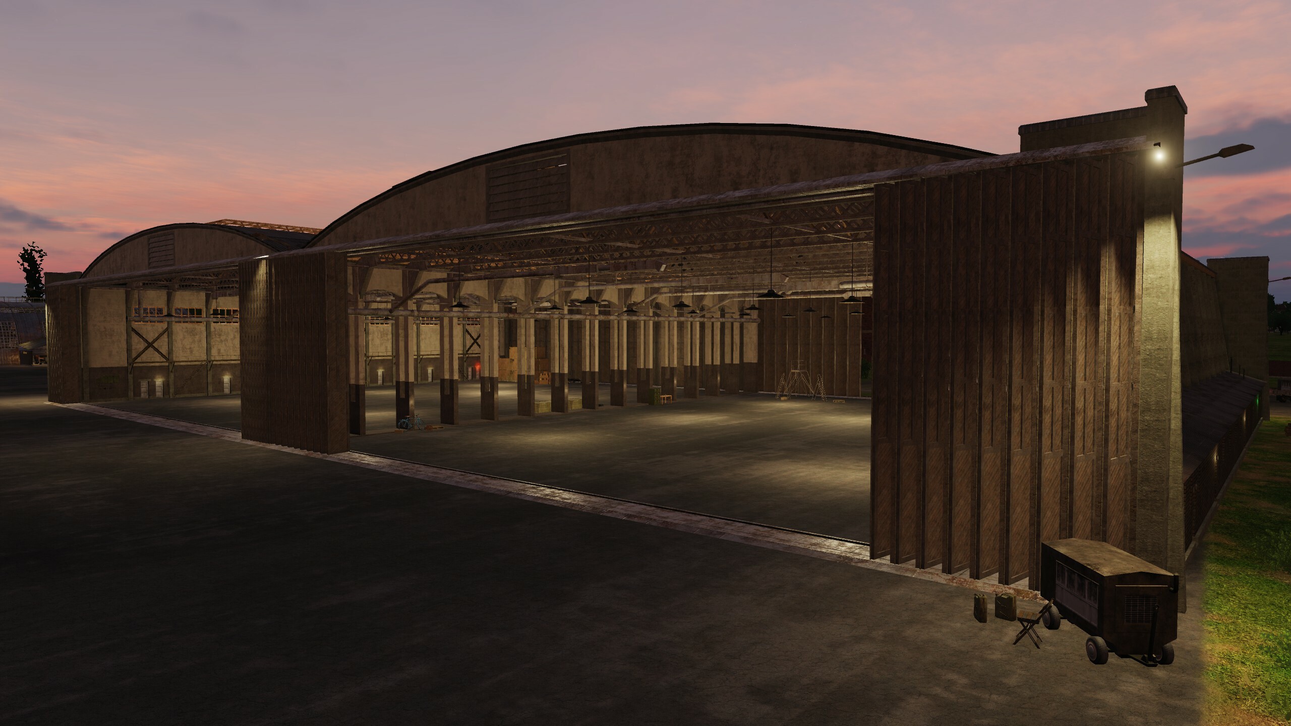
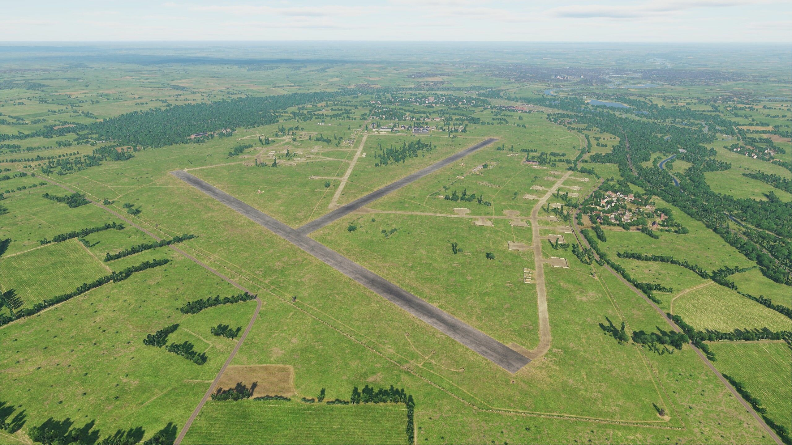
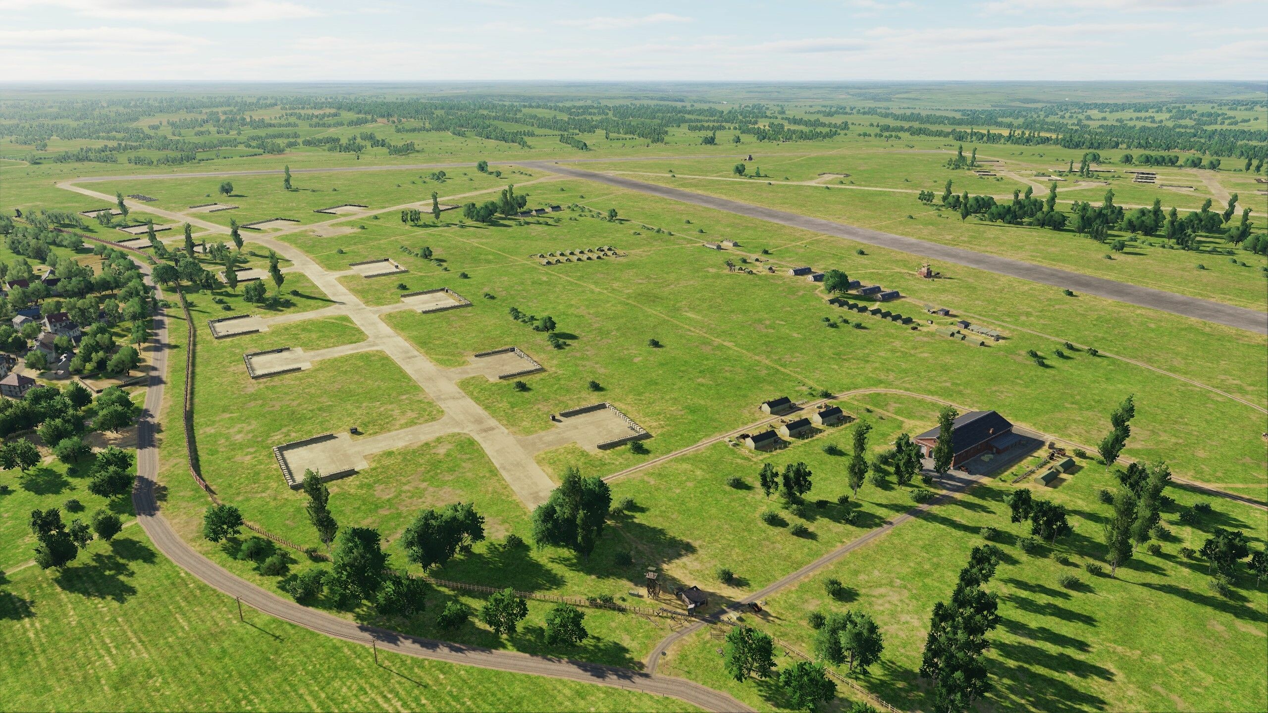
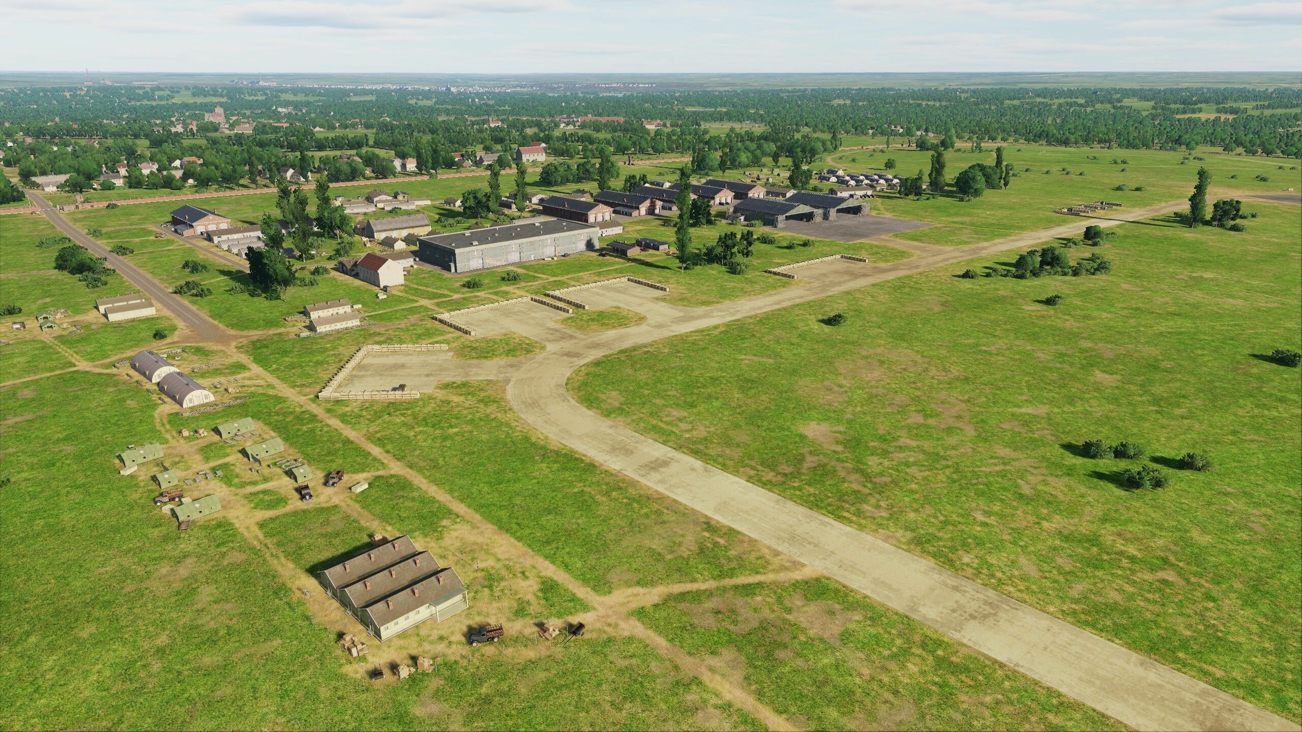
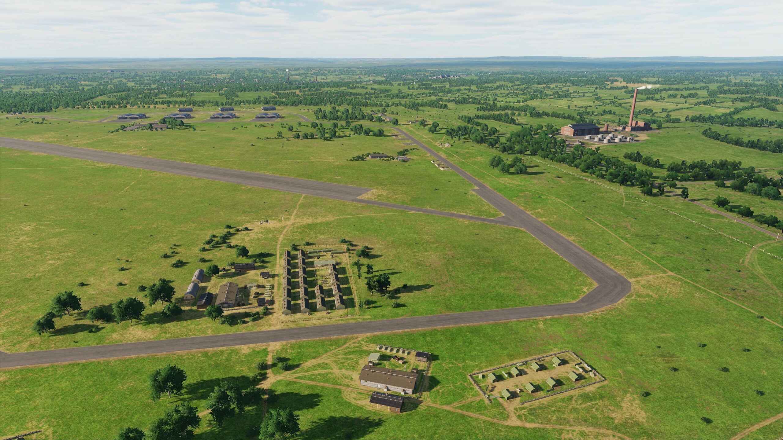
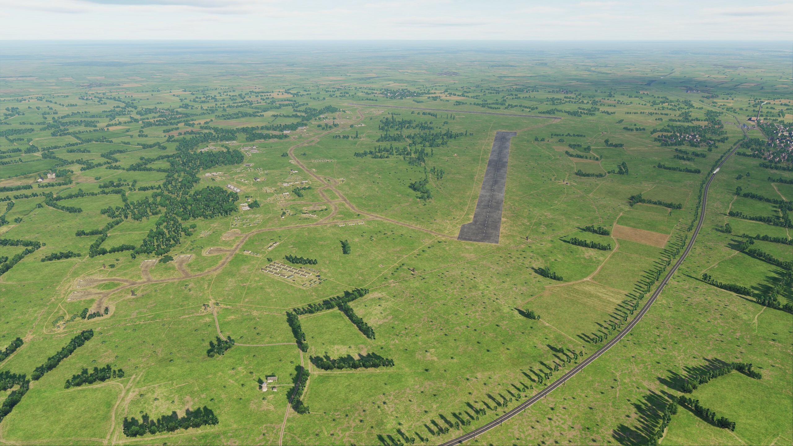
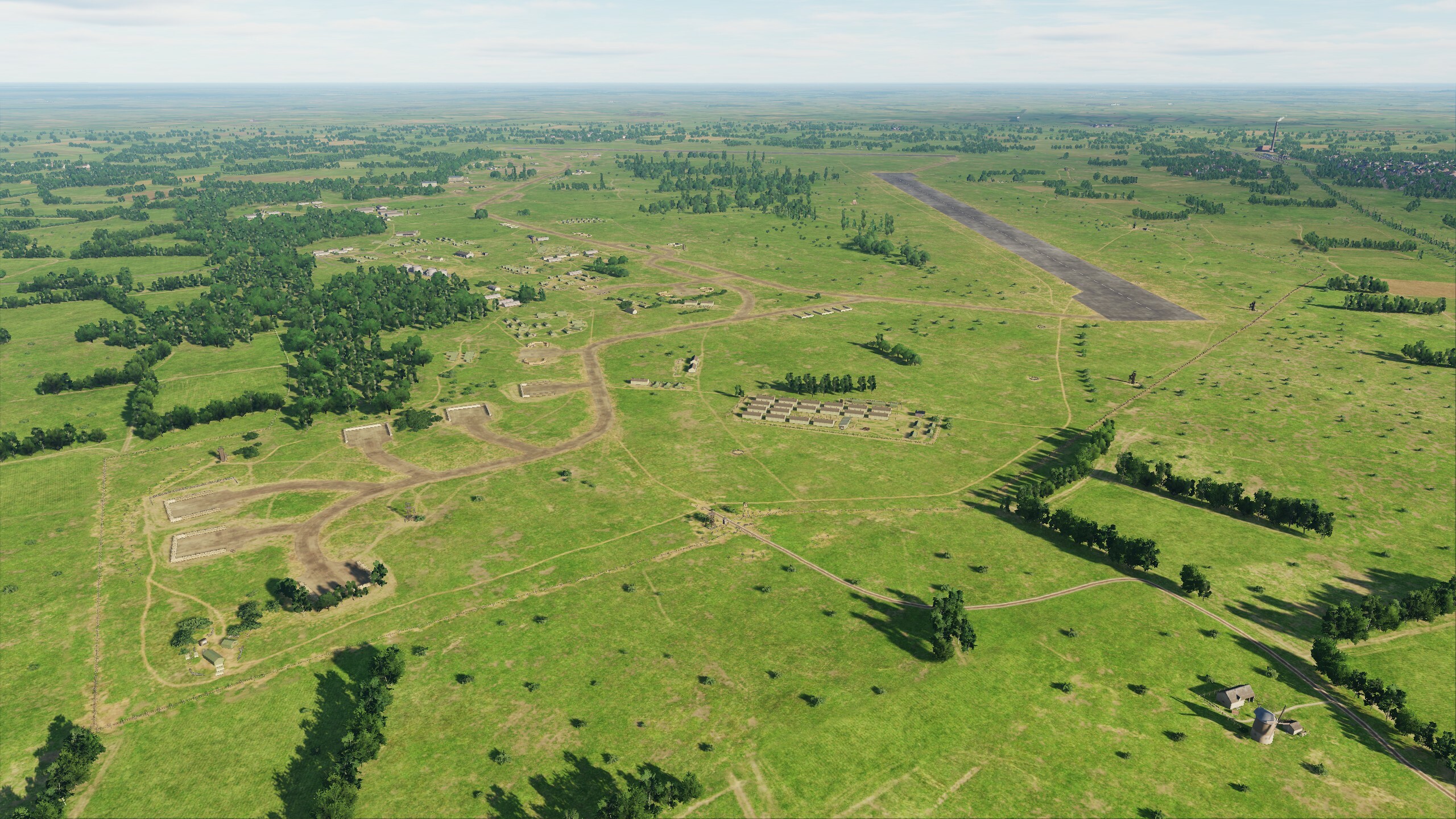
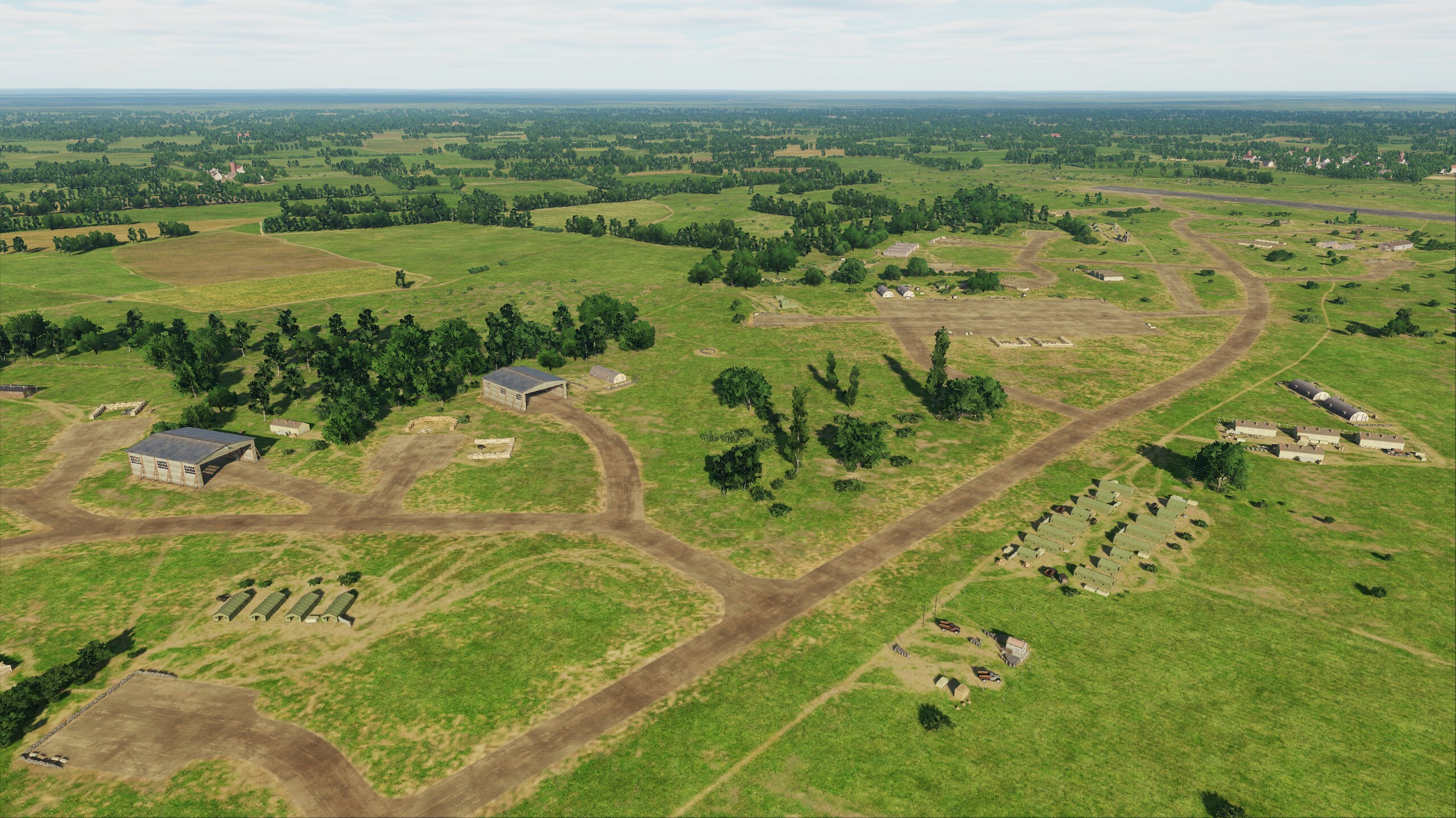
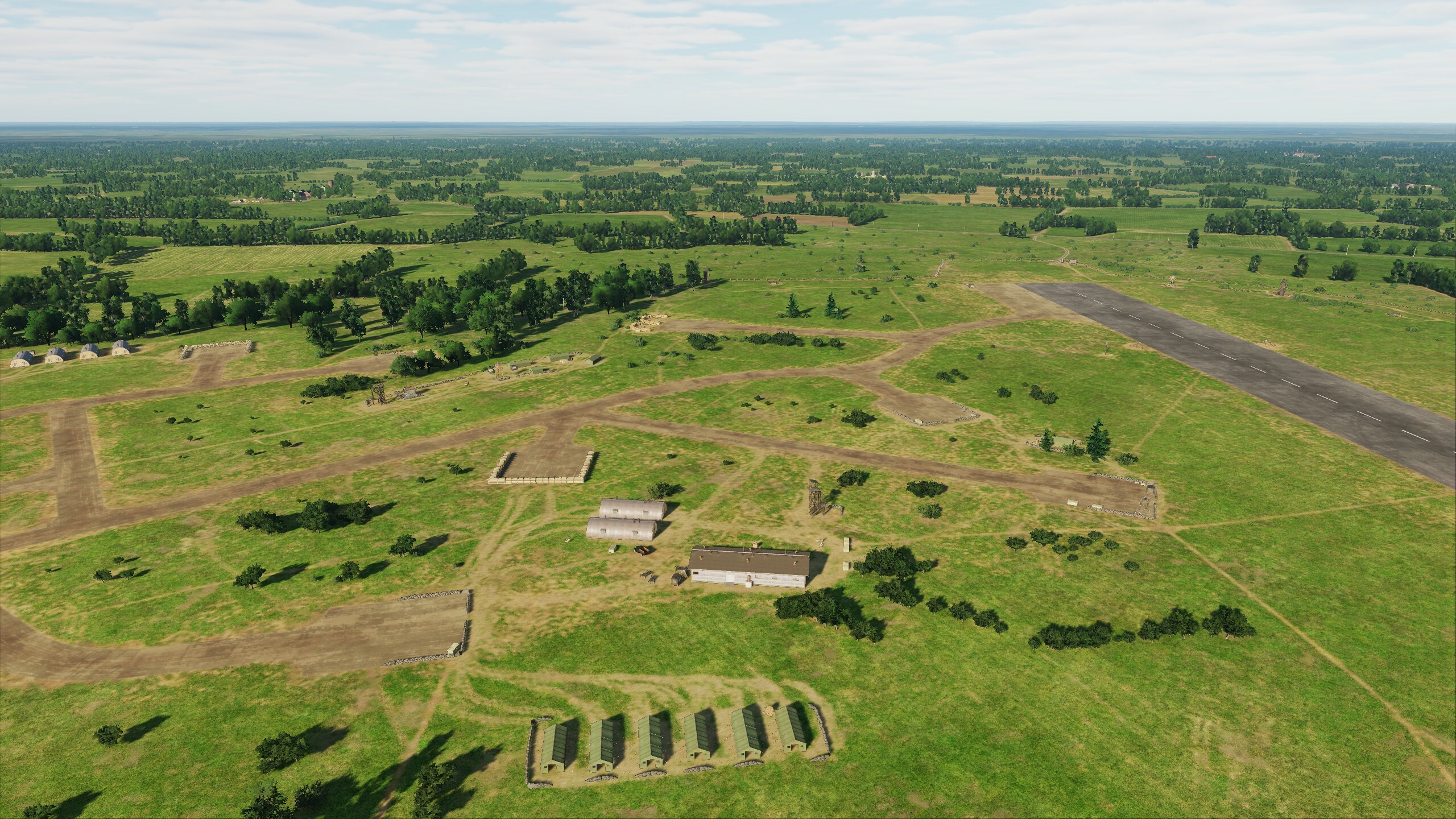
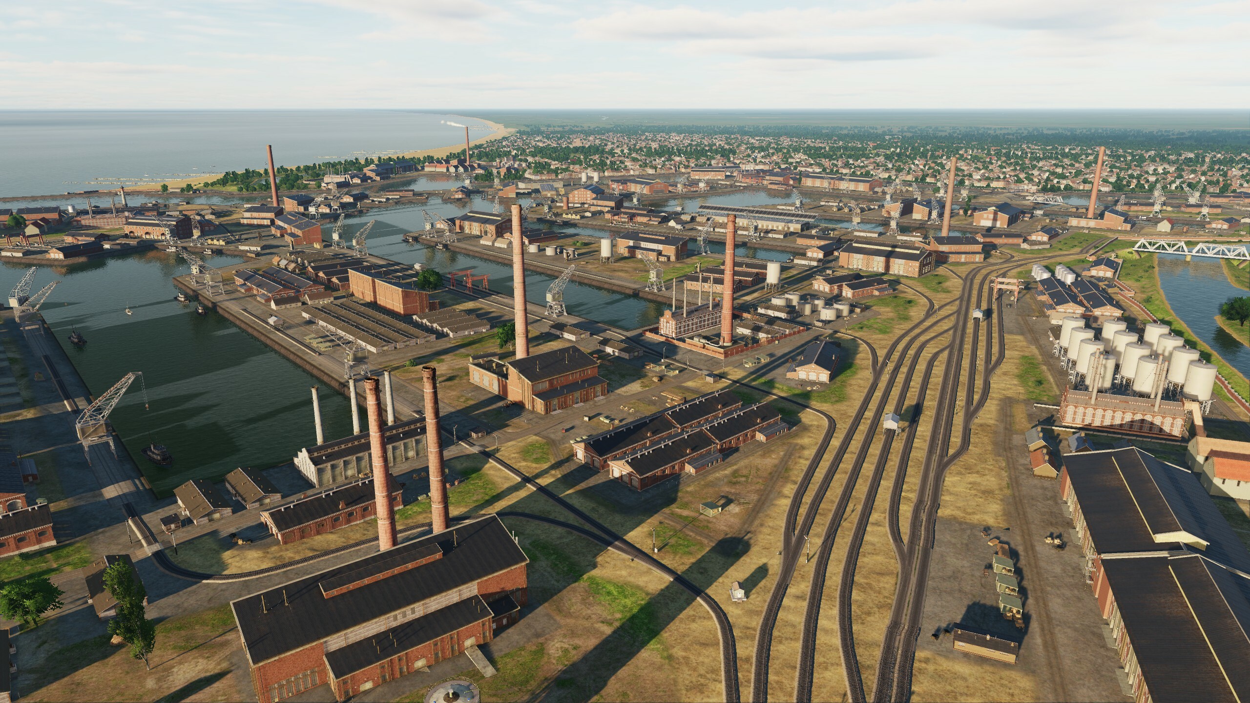
Hi fighters! Congratulations on the map update. Let's see what's new. The update was conceived as a minor one: we first collected your wishes on the forum and worked on them, while simultaneously conducting optimization. But in the end, we decided to add new objects and expand the functionality for pilots and mission creators: Attack aircraft, new targets have been prepared for you: many military bases have been added. Helicopter pilots, many opportunities are open to you, your flight geography has been increased. Check out the map: you need to deliver personnel and cargo to military bases, pick up a general from a new training ground, or make a difficult landing at a stadium. What we have in the release: The scenes of 51 airfields have been improved. Improved scenes of 50 military bases: - Syria 30 - Israel 8 - Lebanon 3 (UN bases) - Turkey 2 - Cyprus 7 61 new military bases have been added: - Syria 24 - Israel 17 - Jordan 5 - Lebanon 15 Helicopter pads have been added to 93 military bases. Helicopter pads have been added to standard hospitals, stadiums, and oil fields. New facilities have been added: a typical hospital, T-55, BTR-60, a gas torch, large flags, liveries for the a300, airfield radars, a weather site. The territory of the central part of Israel has been added. Missing parts of the aeronautical charts have been added. The models were optimized. Scenes have been optimized. Fixed: - increased parking size for F-4E aircraft at Sayqal Air Base; - lighting in the hangar of the Incirlik Air Base; - taxiways at Muwaffak Salti airfield; - the size of parking lots for C-130 and Il-76 aircraft at the Amman airfield has been increased; - changed the Amman airfield icon in the mission editor; - part of the fence has been moved away from RUNWAY 26 at Gazipasa airfield; - Added an air traffic control tower at the King Hussein Air College; - added an air traffic control tower at the King Abdullah II Air Base; - objects on Patriot launch pads at Muwaffaq Salti Air Base have been removed; - added runway and taxiway signs at Prince Hassan Air Base; - TACAN upgraded to VORTAC at Prince Hassan Air Base; - ILS identifier and frequency at Prince Hassan Air Base; - relief of the monument to the unknown soldier in Damascus; - relief Sanctuary of Notre Dame du Lebanon in Beirut; - broken road and bridge near Latakia; - many visible joints of earth textures; - a lot of minor flaws in the relief of the map. - the size of parking lots at Dumayr, King_Abdullah_II_Air_Base, Shayrat, H3 Southwest, Damascus, Adana, Abu_Ad_Duhur, Al_Qusayr, Aleppo, Herzliya airfields has been increased. 1. Military bases. More than 100 bases across the map. 2. Tank training grounds. In addition to the training ground, they include a military town, warehouses and garages for equipment, and helipads. 3. Hospitals with helipads. Try yourself in the difficult conditions of the city. Watch your altitude! 4. Torches and helipads at oil and gas fields. "It's not personal. It's just business" - fuel is always needed. You will have to transport a team of workers or guard these objects. 5. New objects. Surely you have seen such flags, now you will have no doubts over which territory you are. Added civilian airfield equipment and diversified static liveries. 6. Night. It's just beautiful Fly, have fun, leave reviews - we read everything, but do not relax: we hope that in October we will be able to please map users with news about another update.
- 99 replies
-
- 51
-
-
-
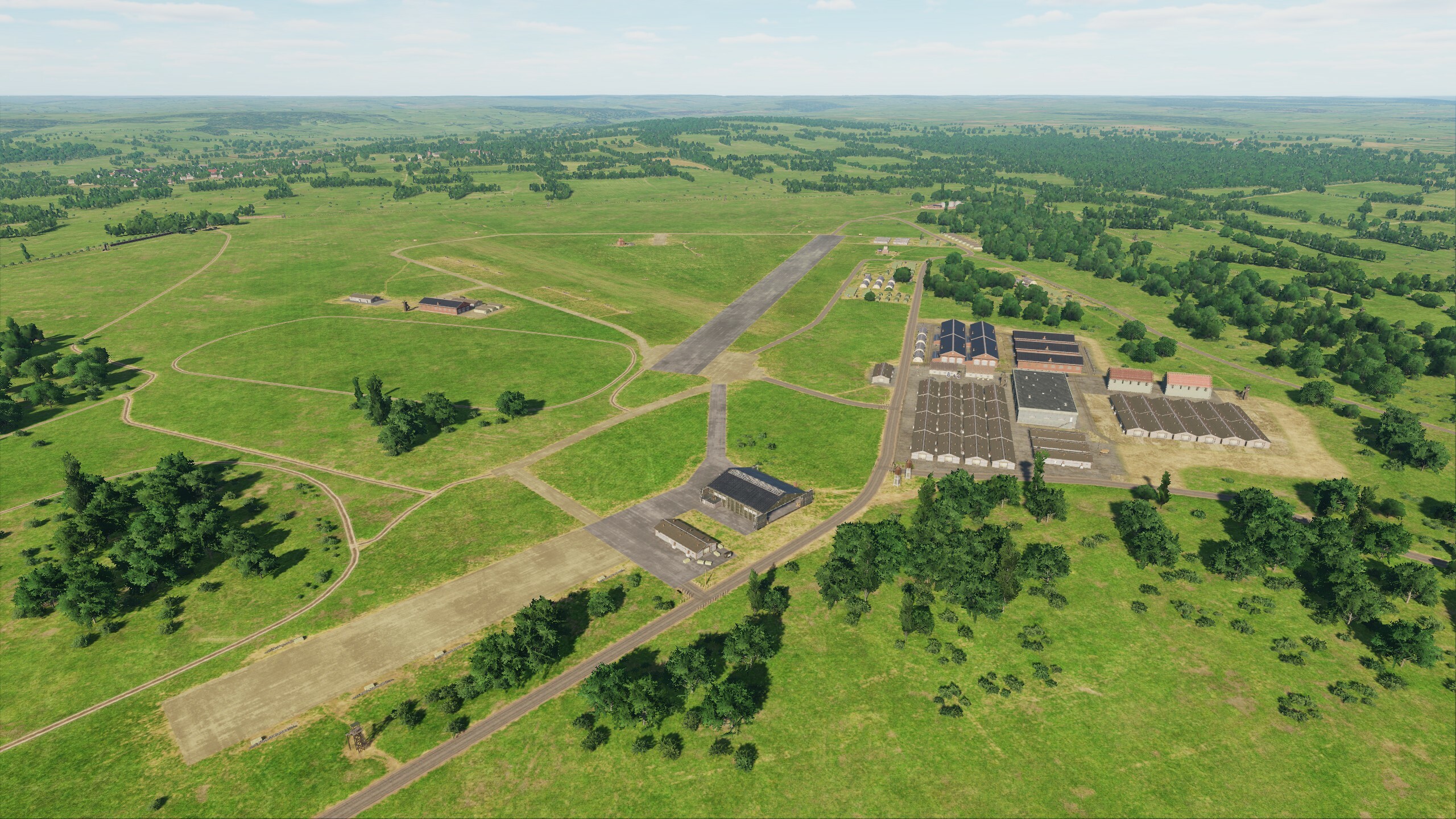
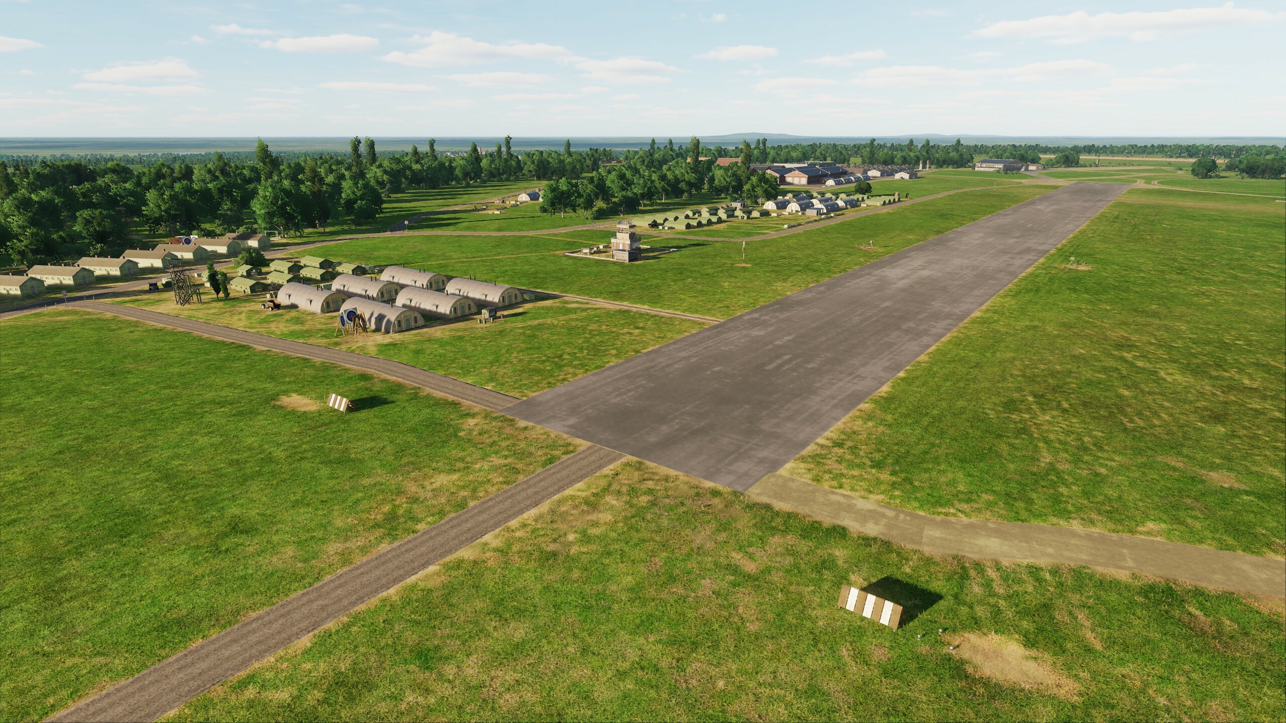
Hi We would like to thank the community for its attention to the project. Today we will show you a small update of Normandy. We've added two new airfields that you may be familiar with: Dunkirk & High Halden - so there are now 79 military airfields on the Normandy map. And we have made small changes to three existing airfields: Detling, Lympne, Manston - for you it will be as if you have returned from vacation, you see everything the same, but at the same time everything has become noticeably better. The specifics of historical maps require constant attention to references, and in this regard you help us a lot: @DD_Fenrir the runway was left, the global restructuring of Manston will be in the next iteration. Everyone will be able to see these results. Keep checking back for updates soon Dunkirk High Halden Detling Lympne Manston
- 49 replies
-
- 17
-
-
-
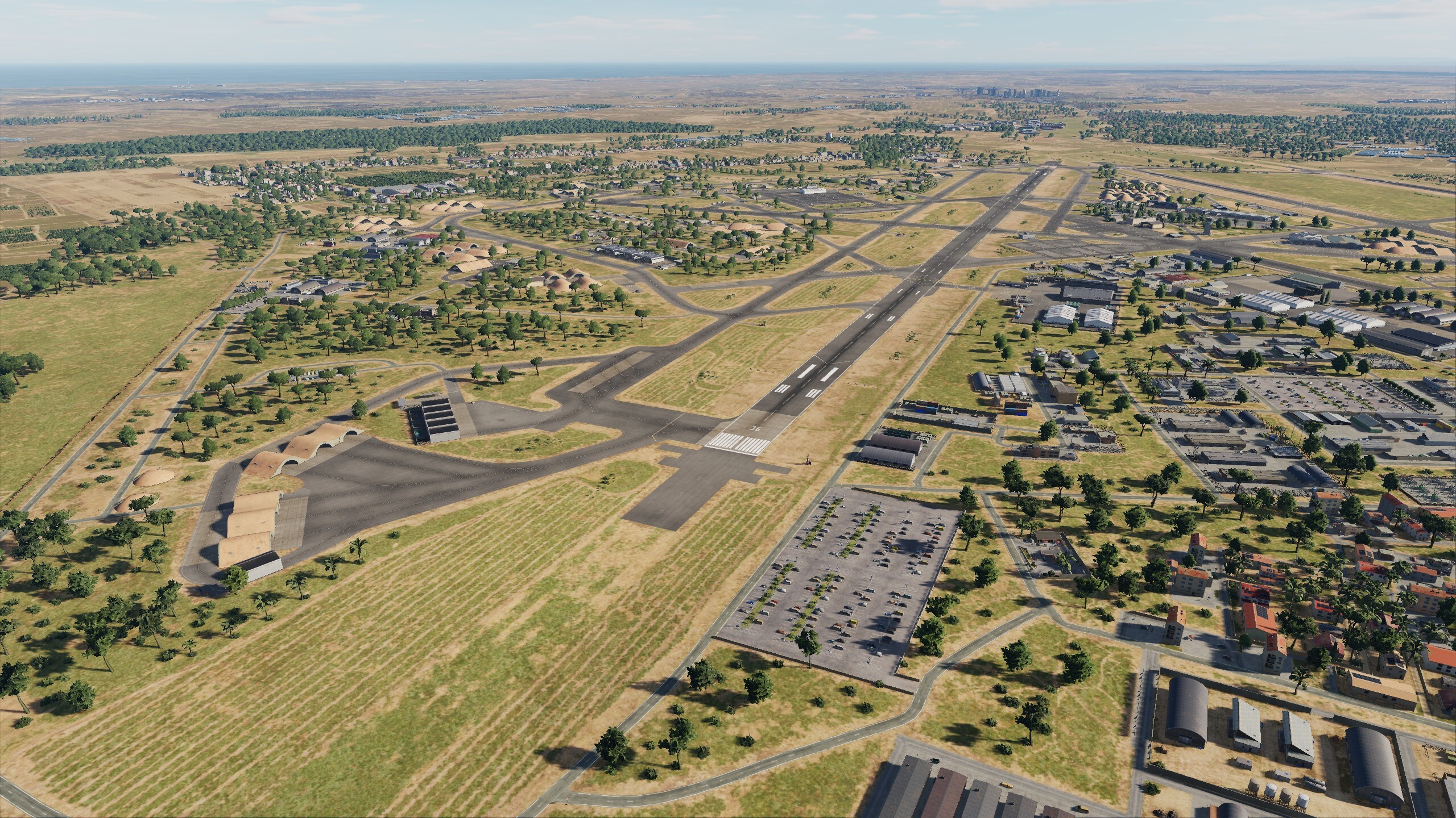
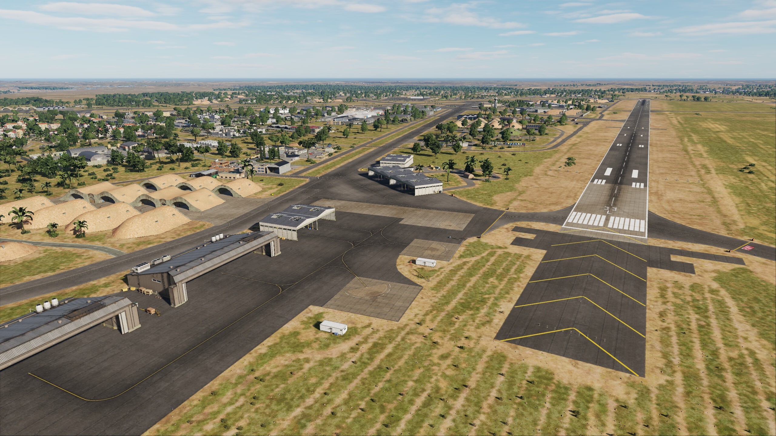
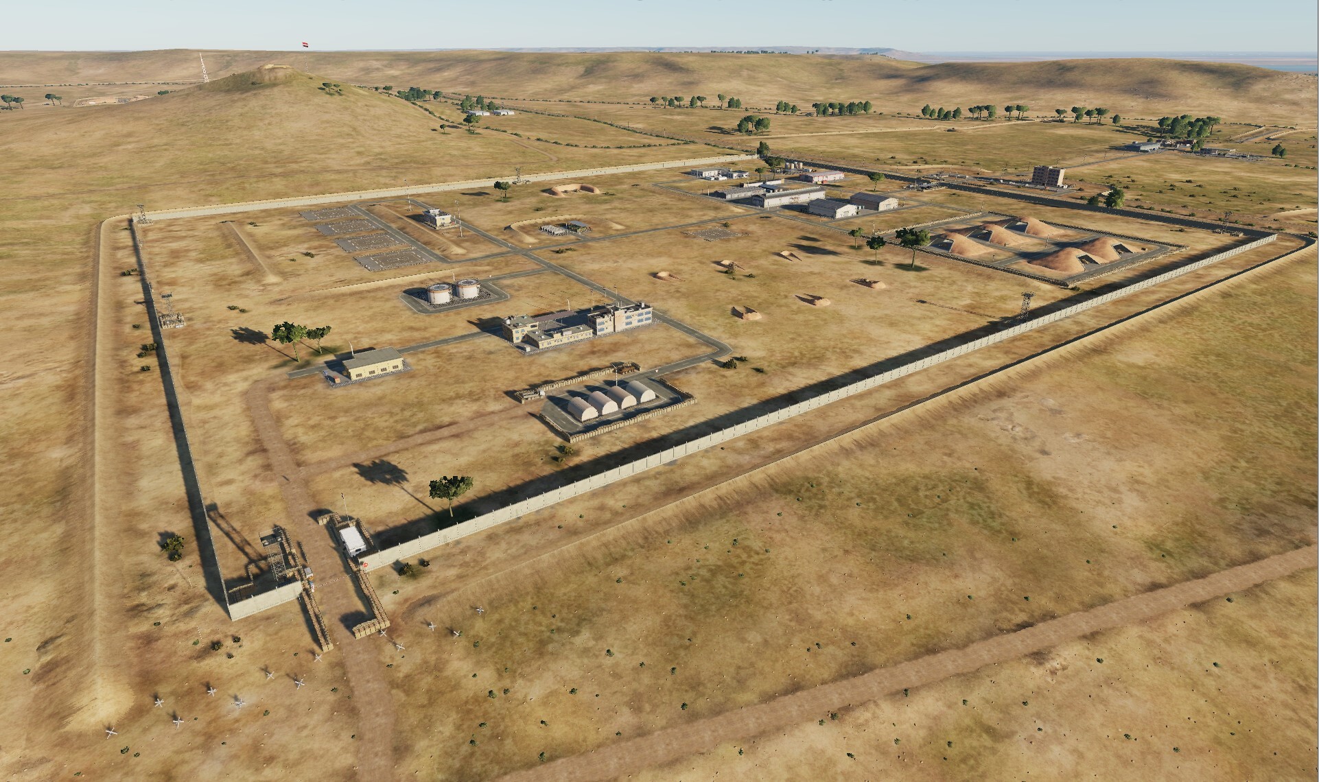
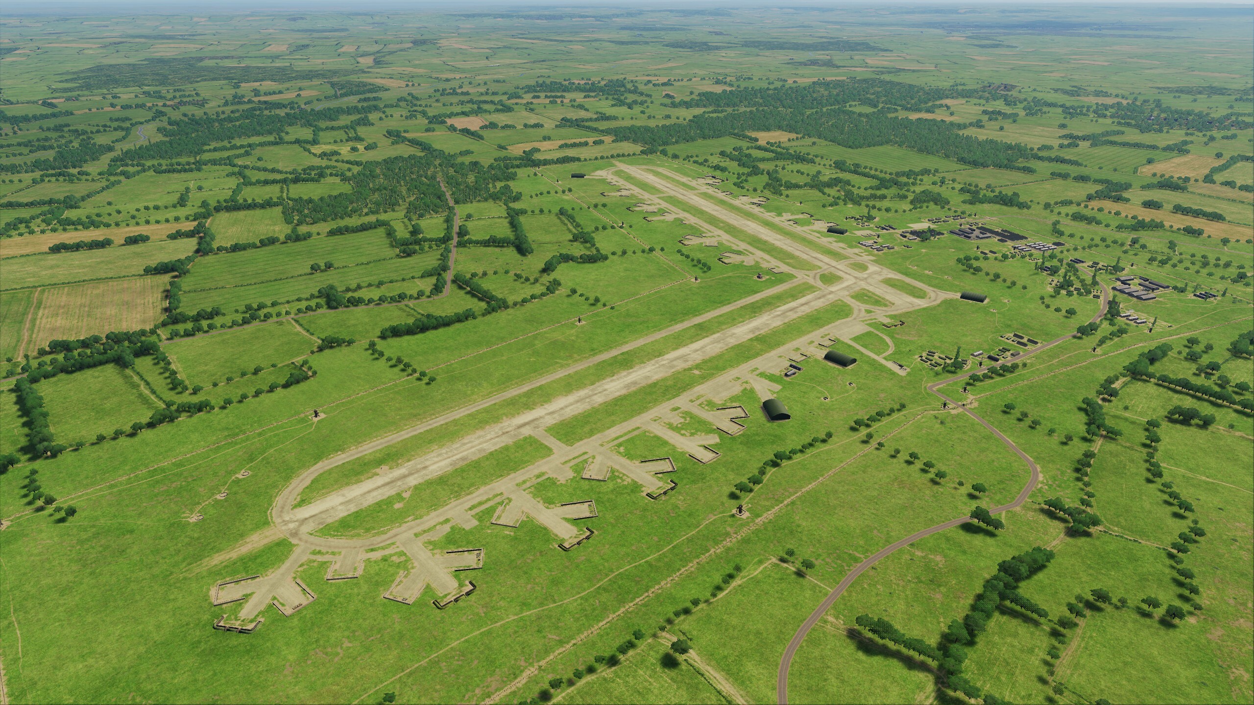
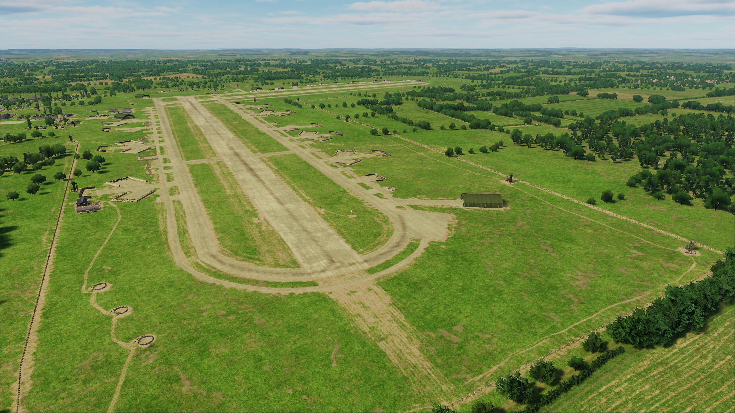
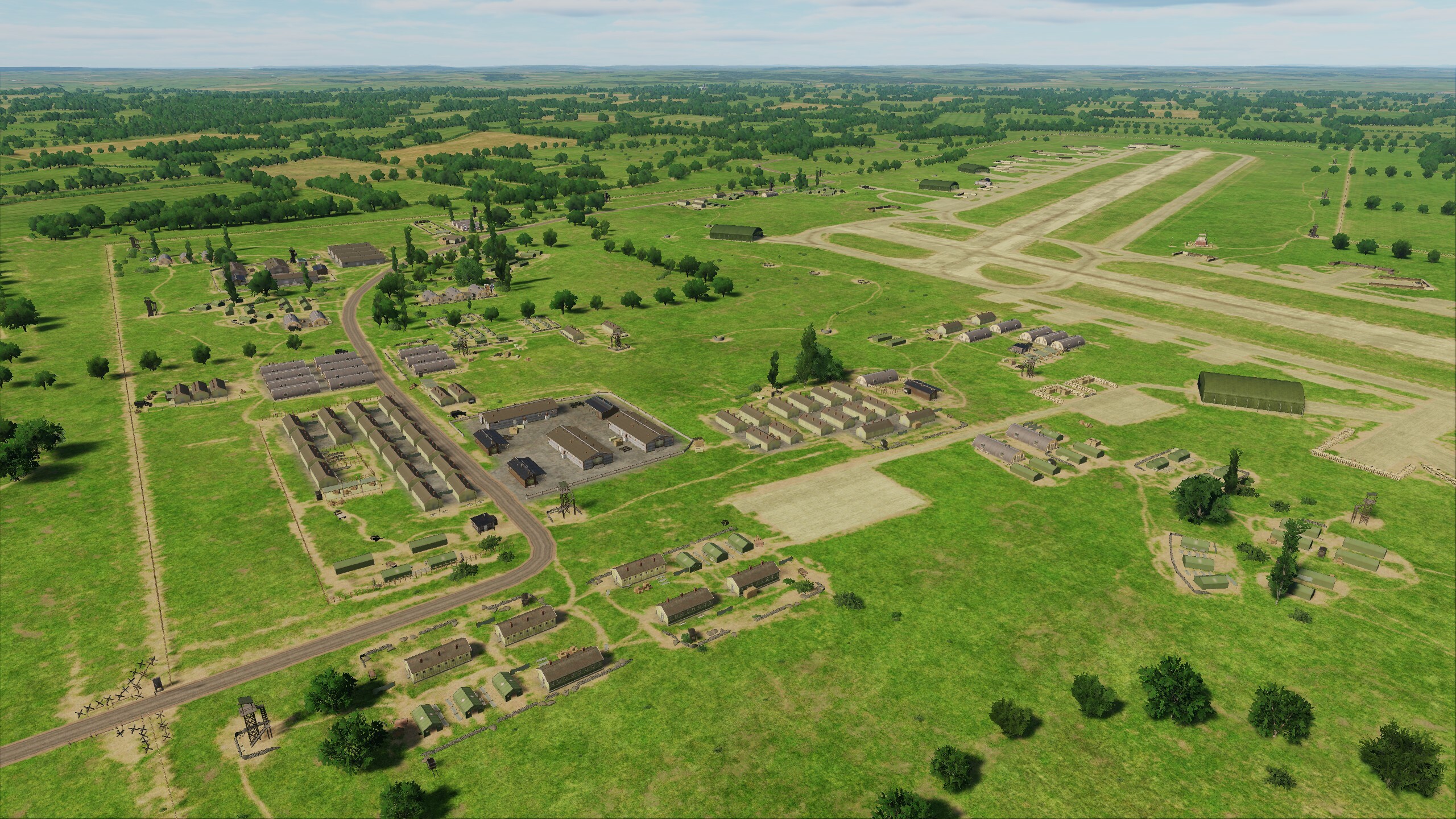
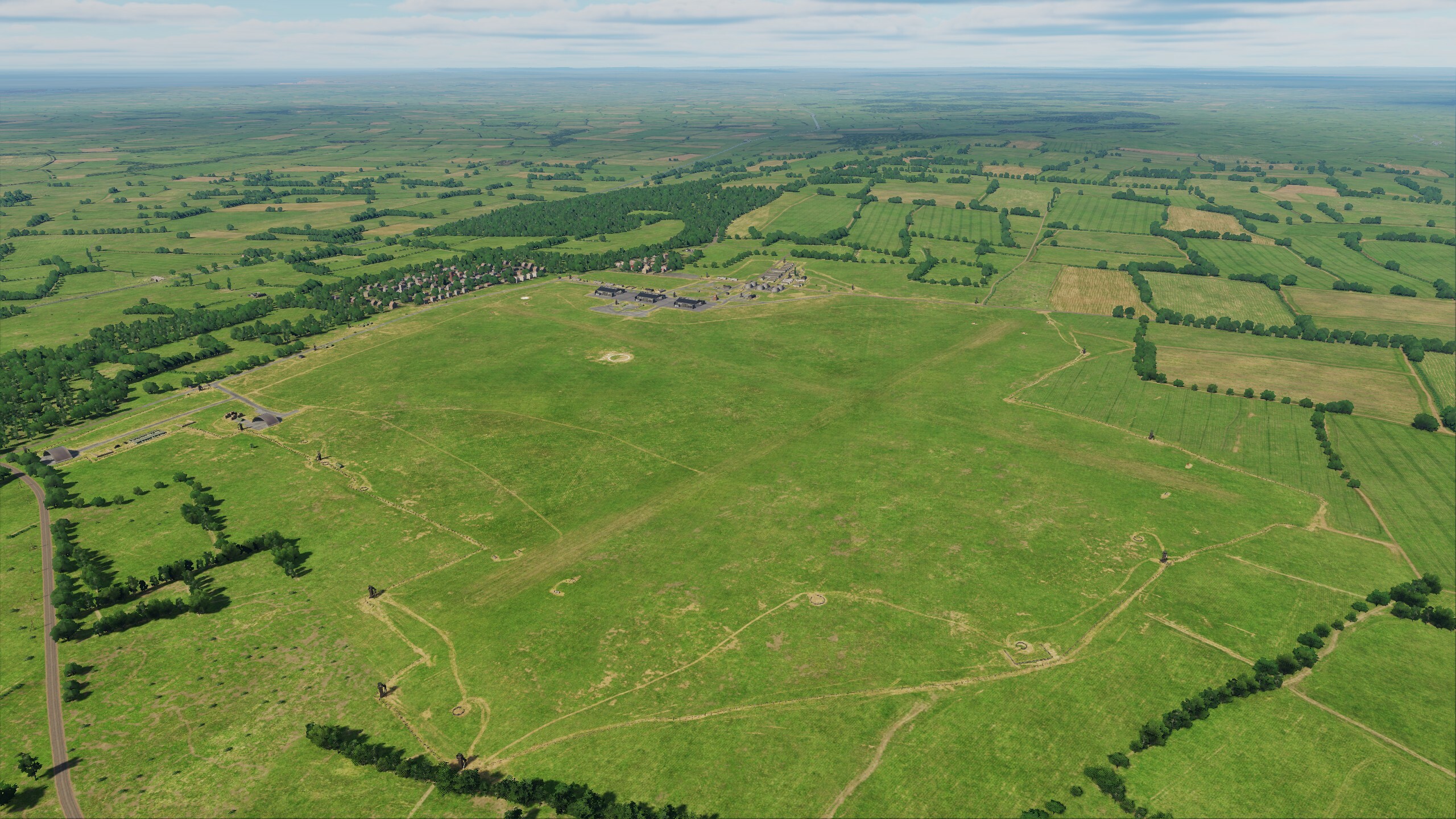
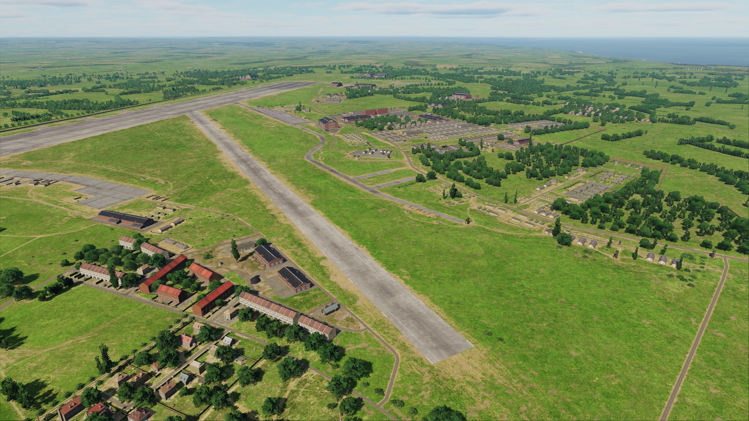
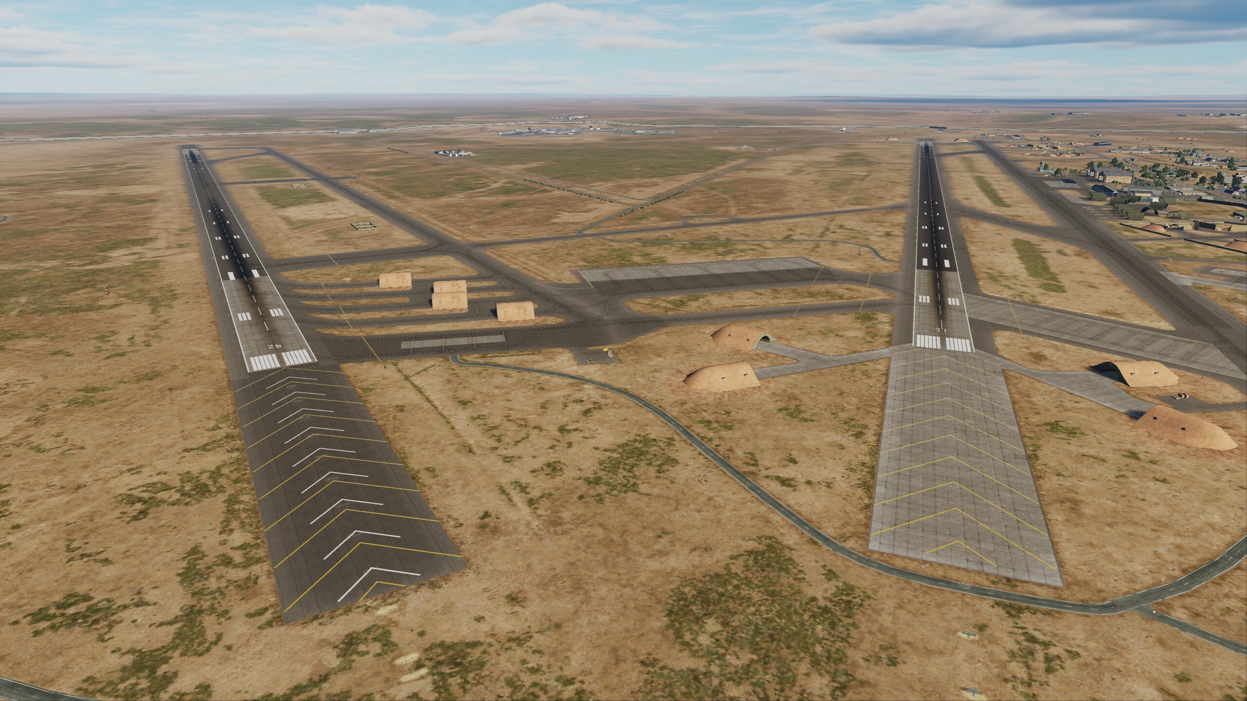
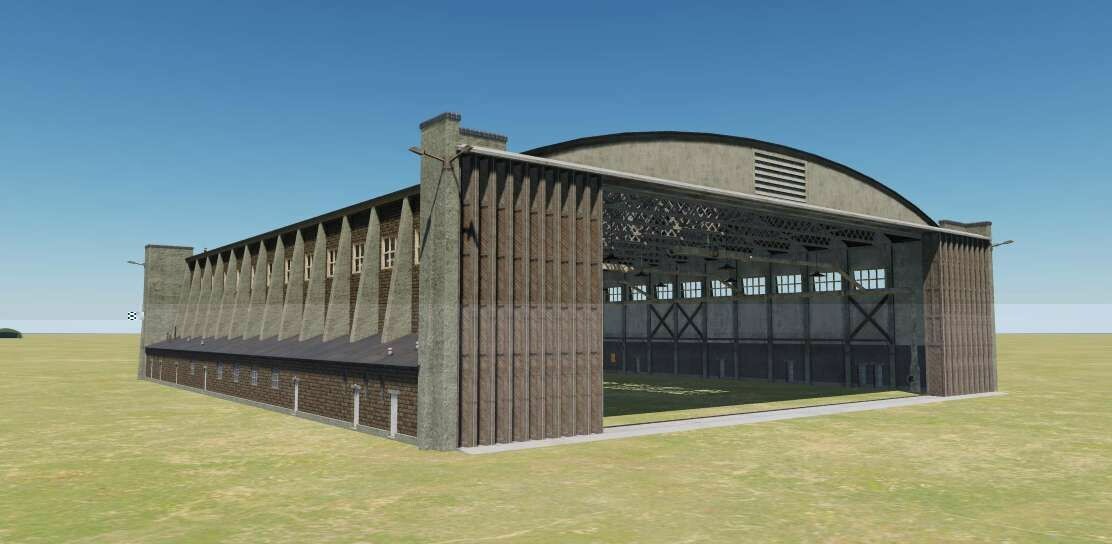
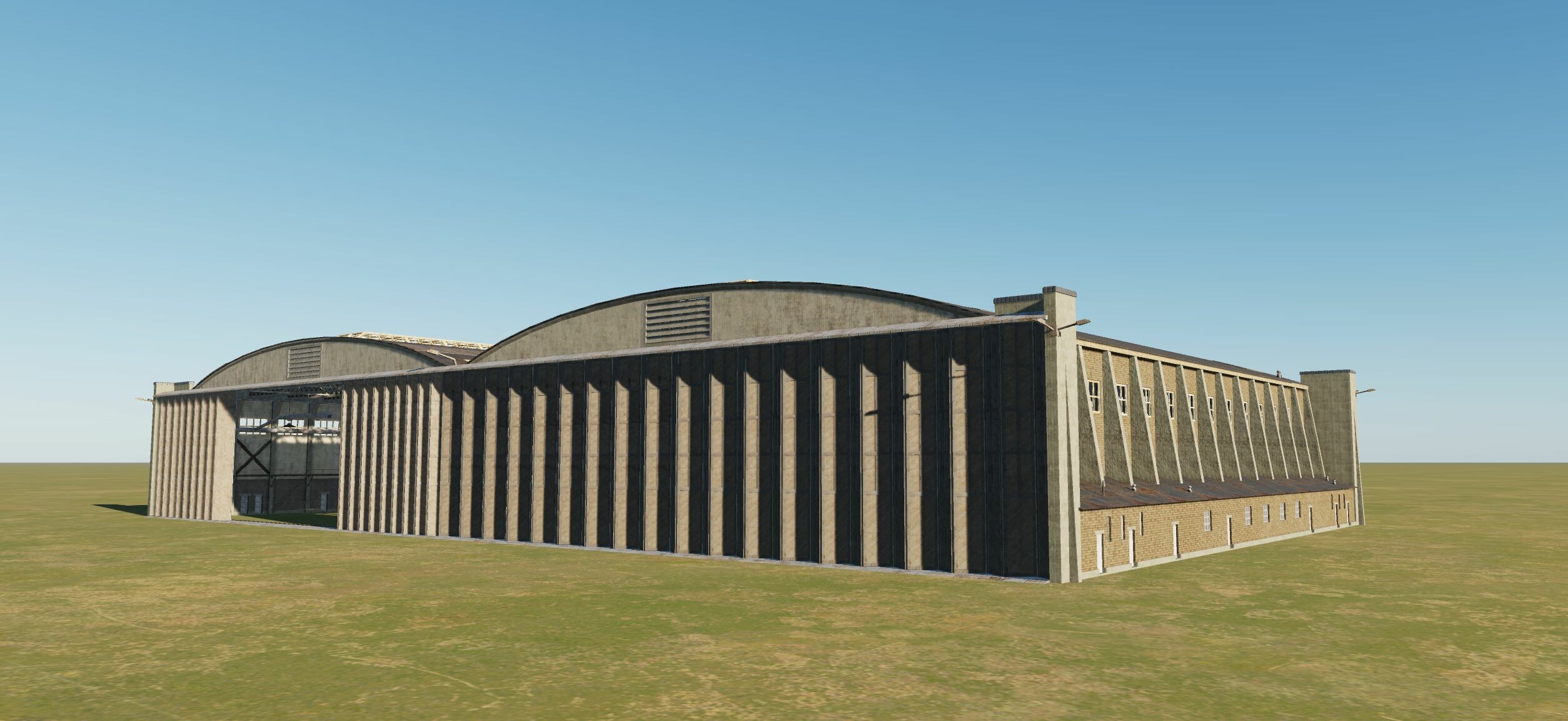
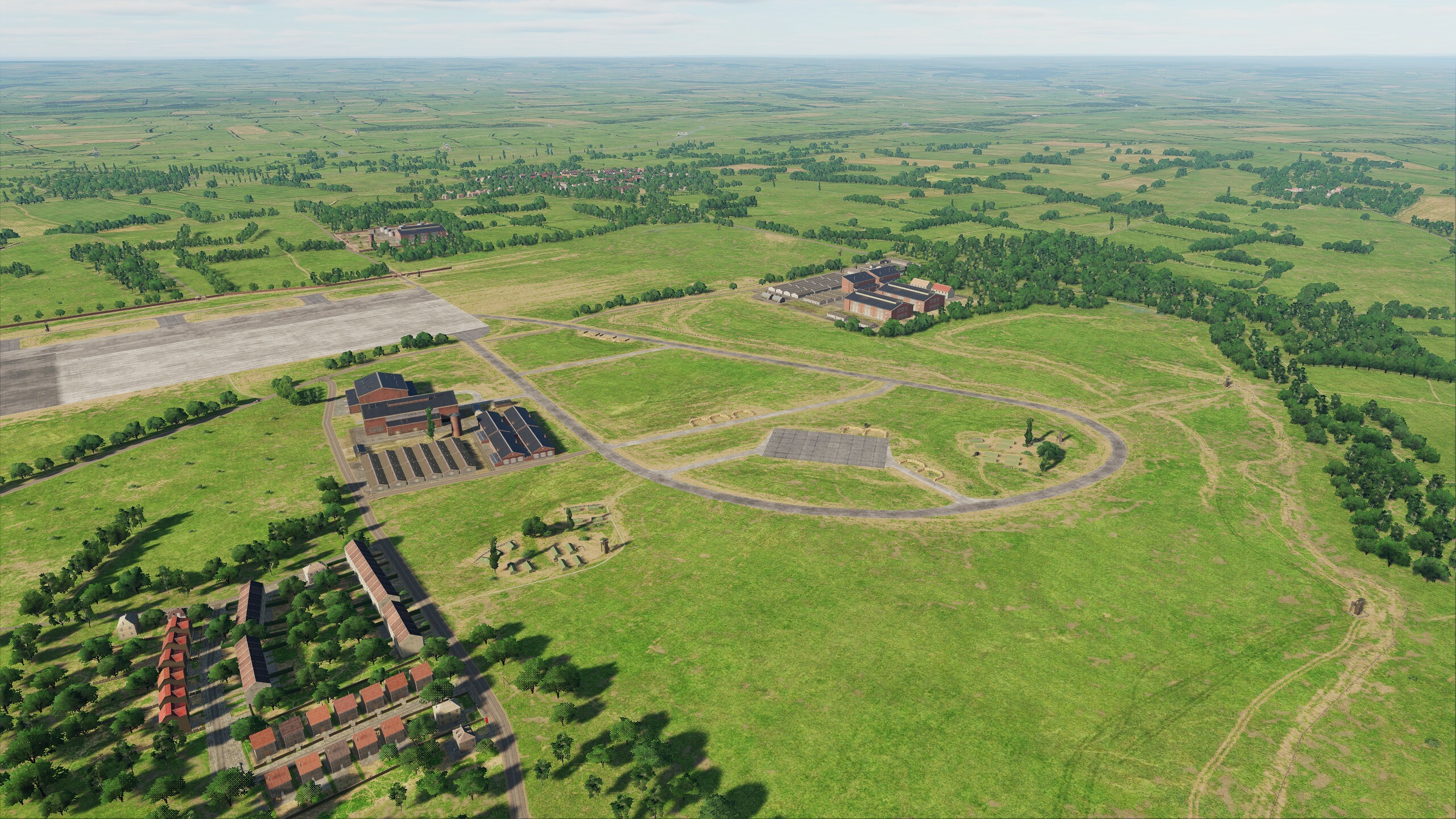
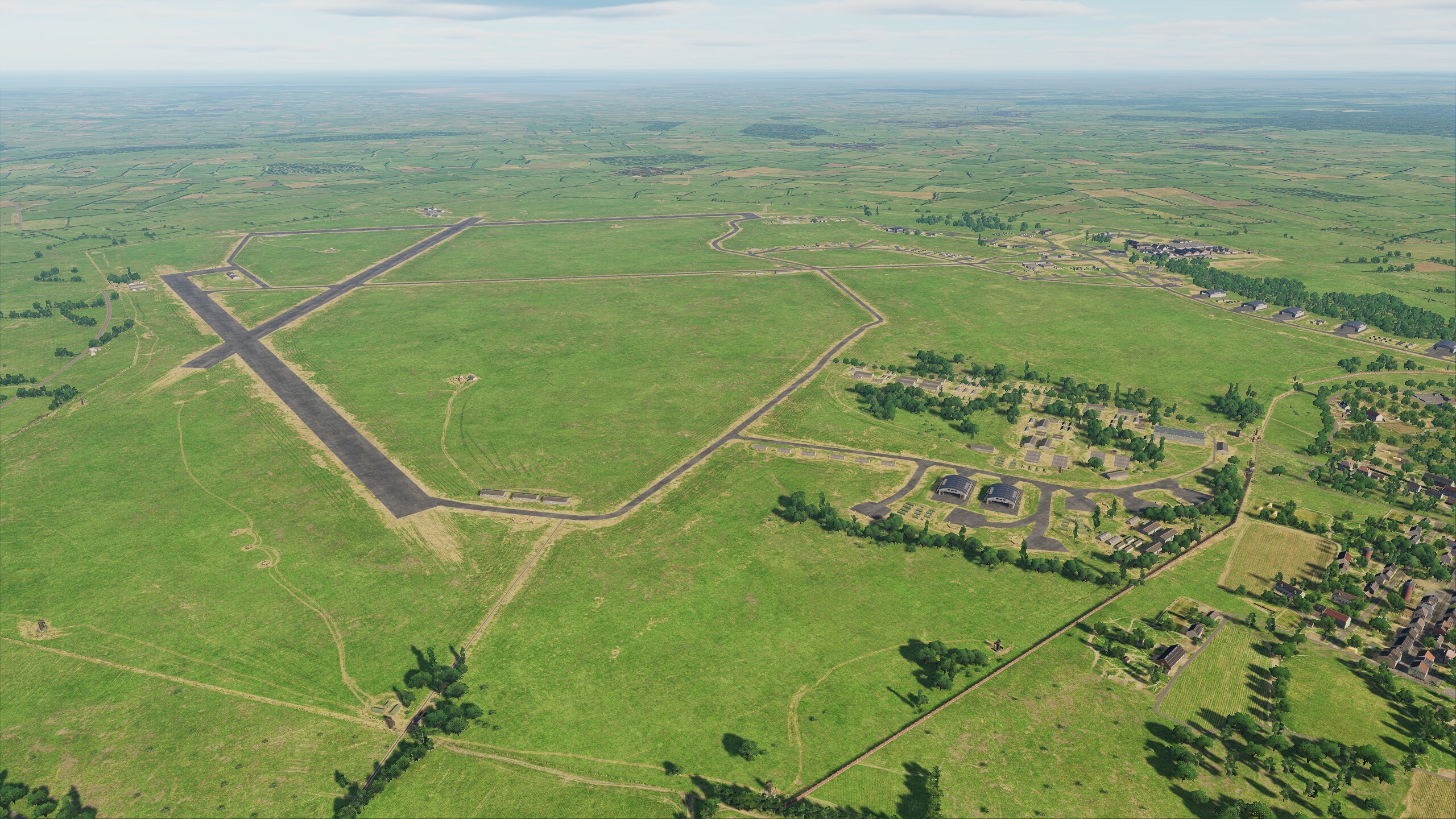
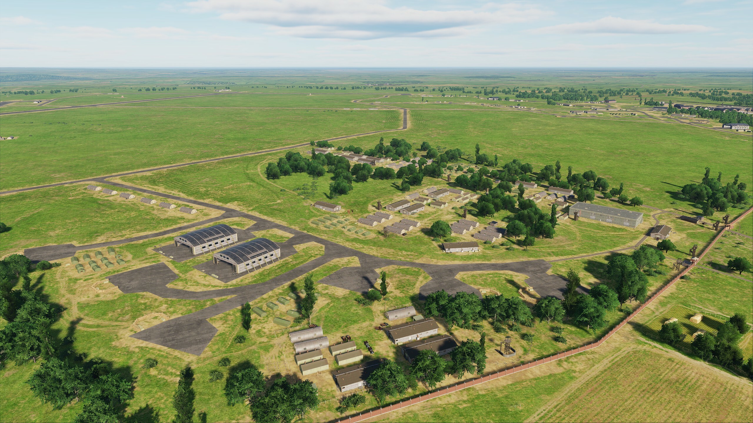
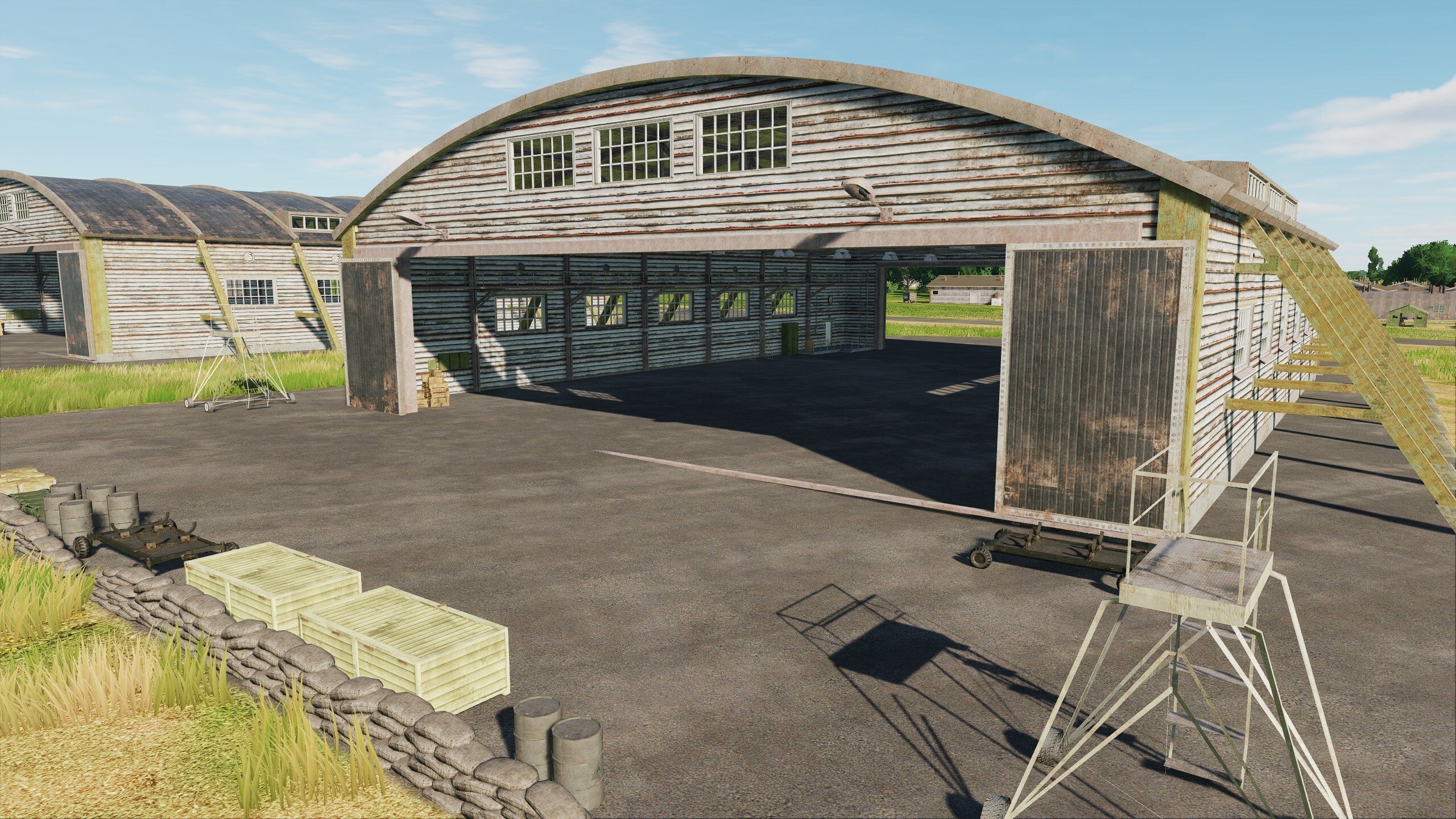
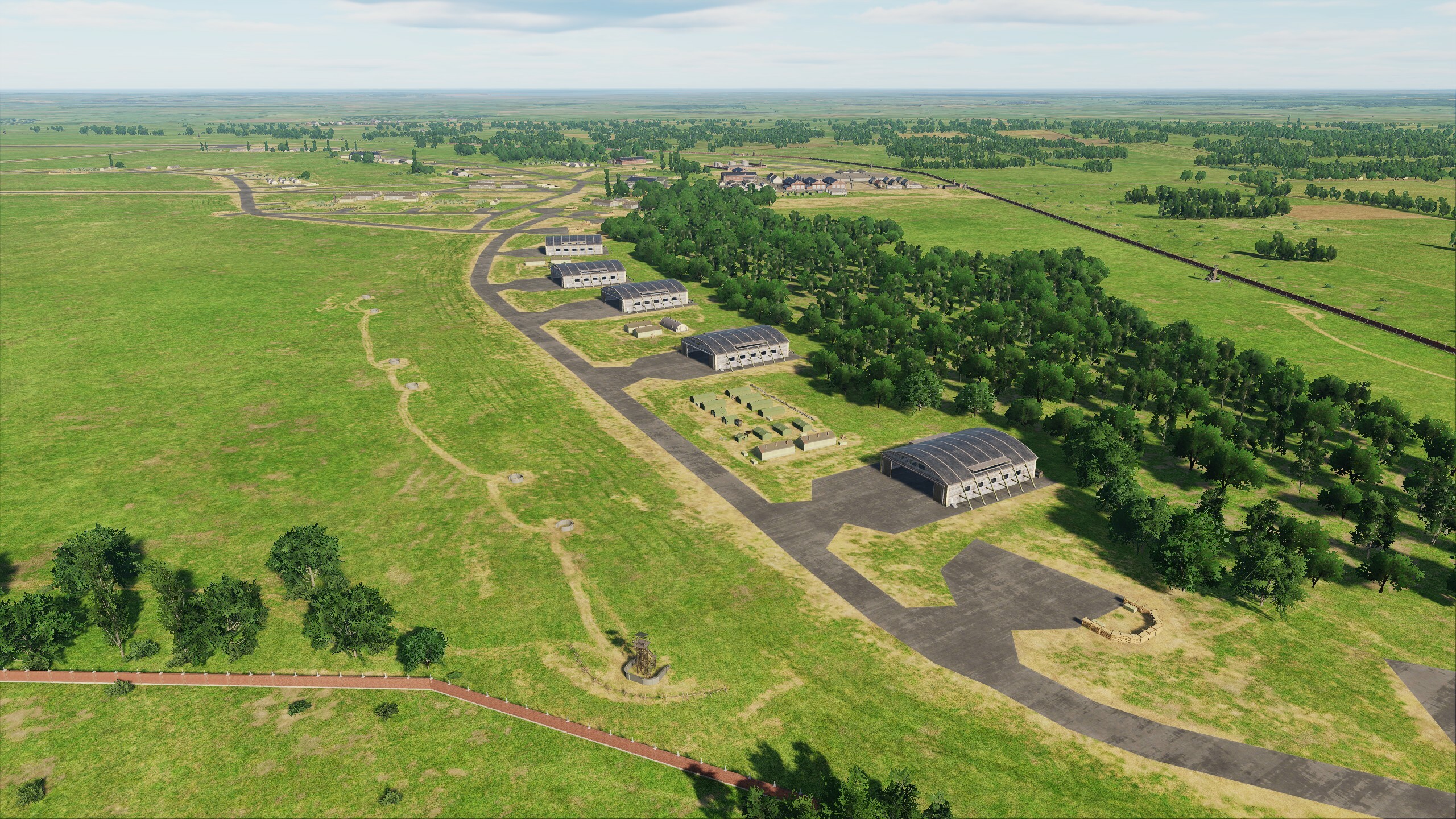
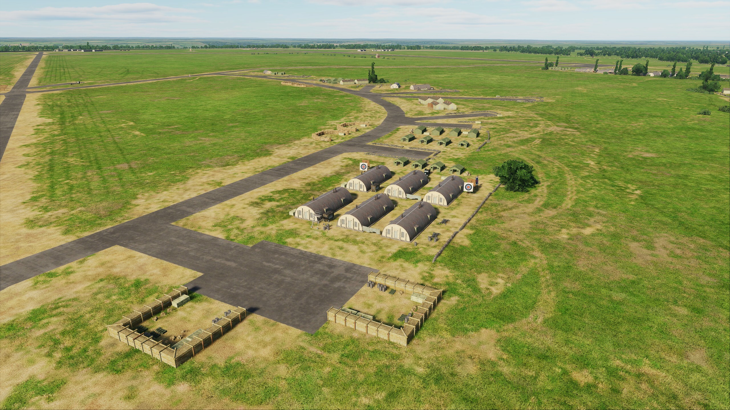
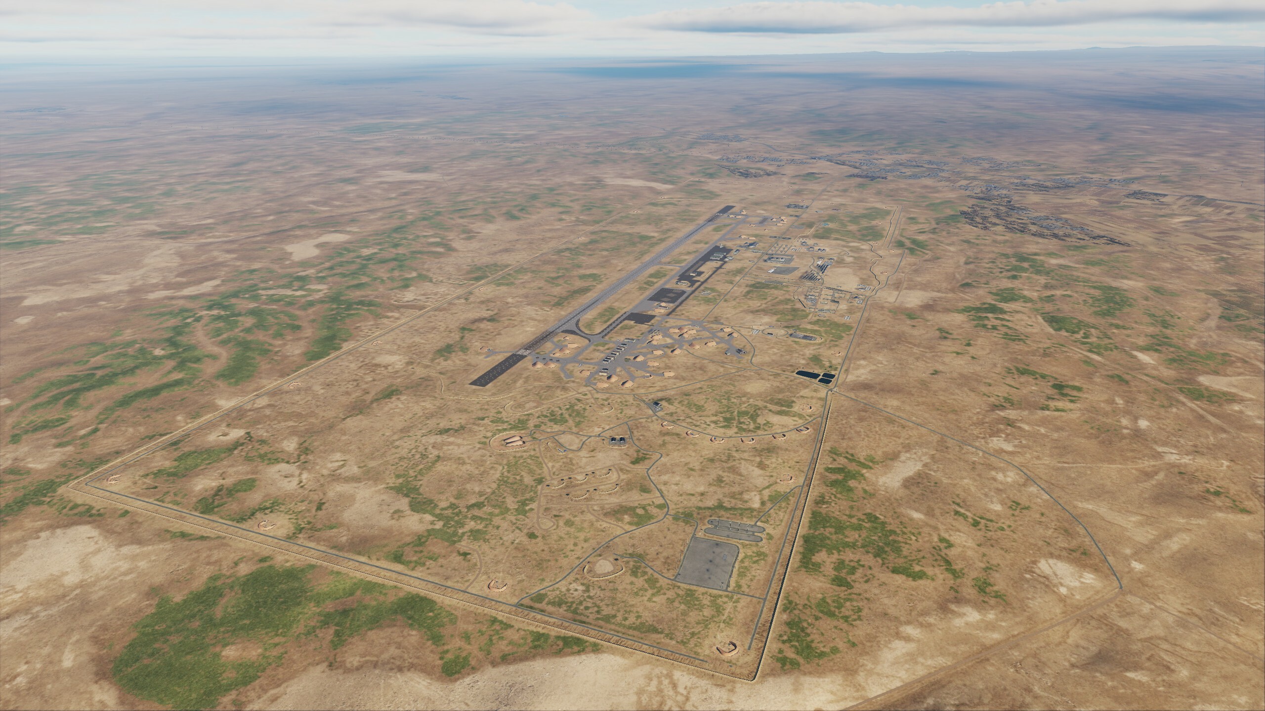
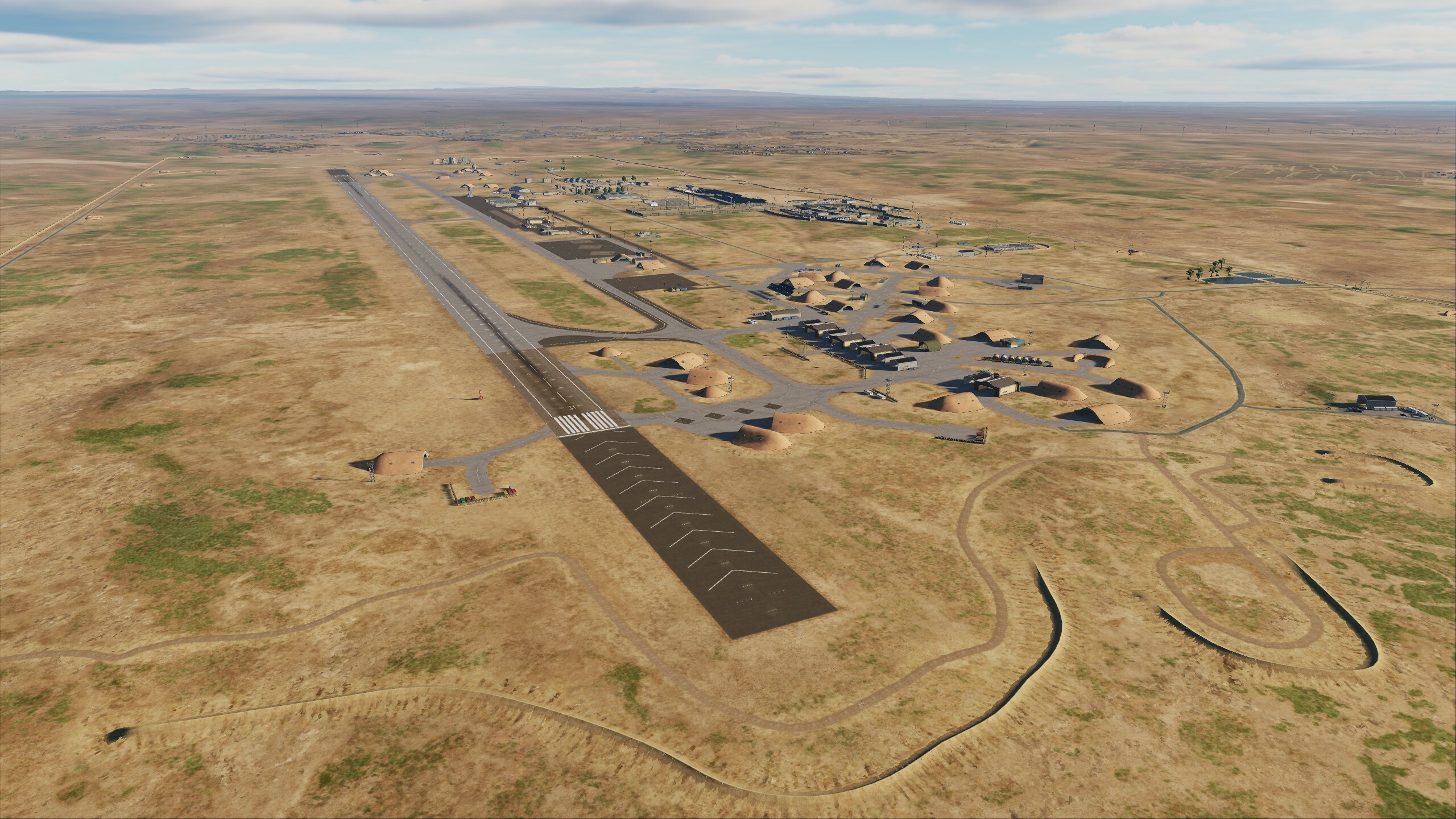
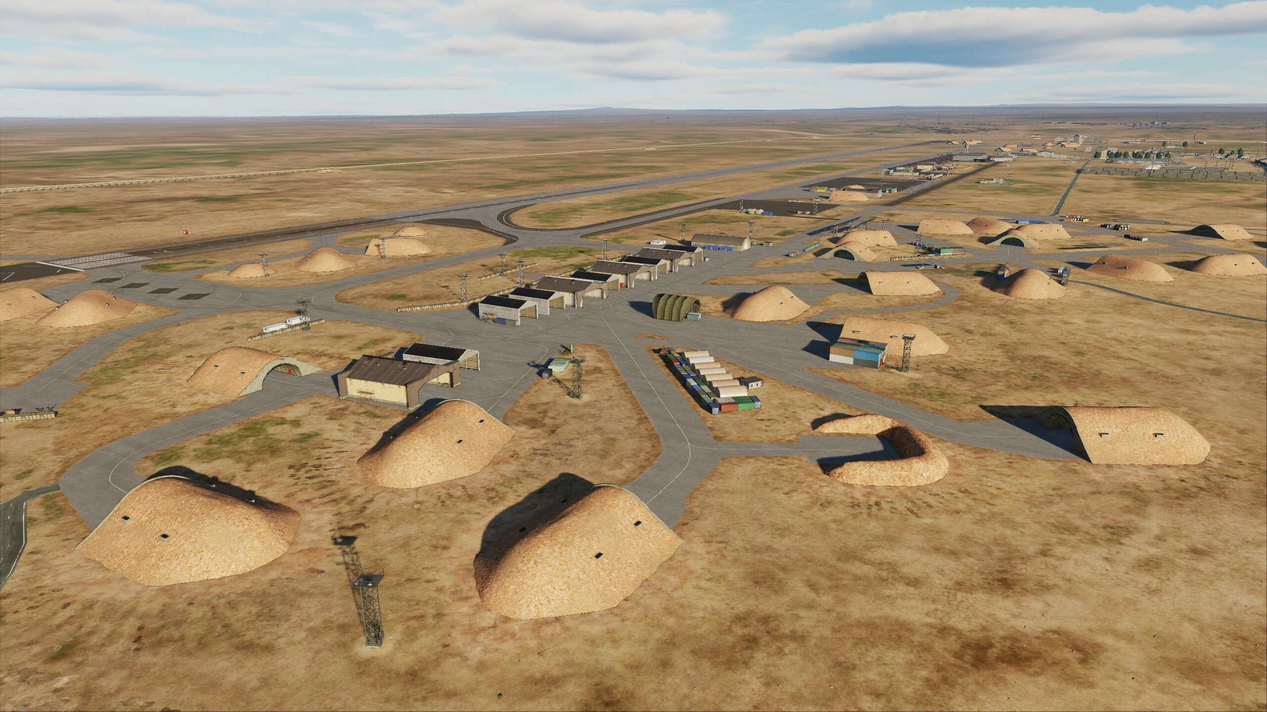
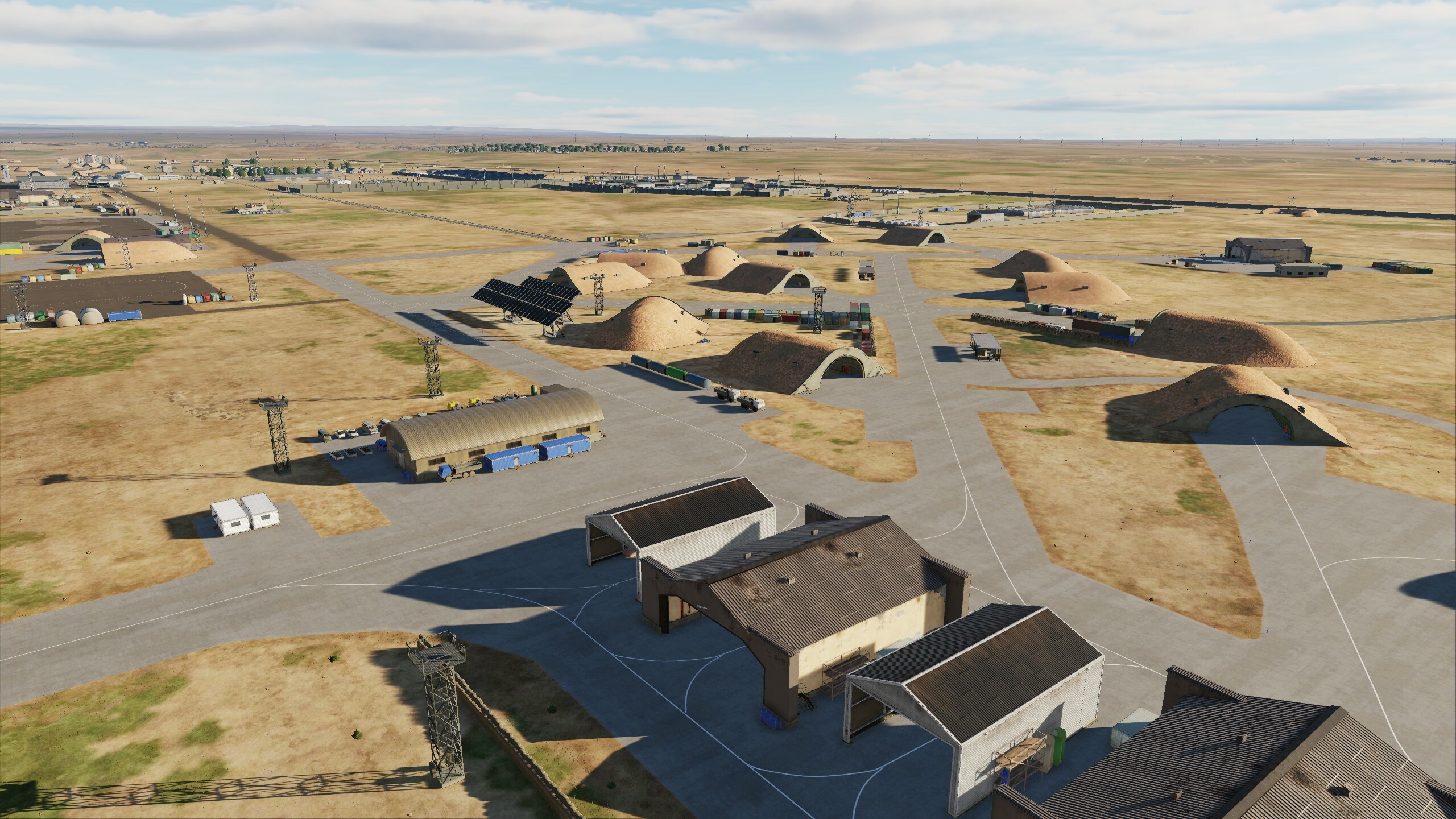
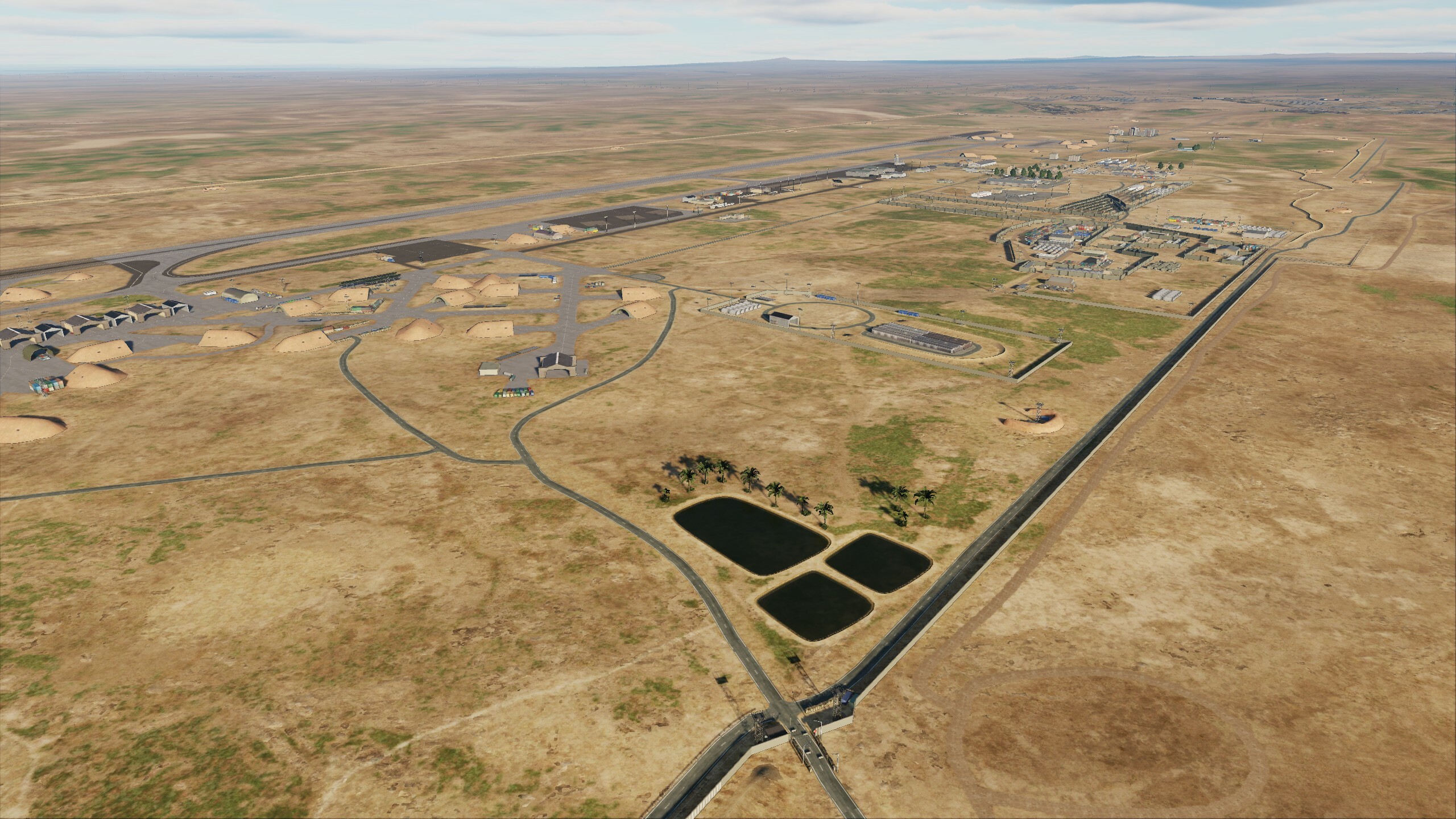
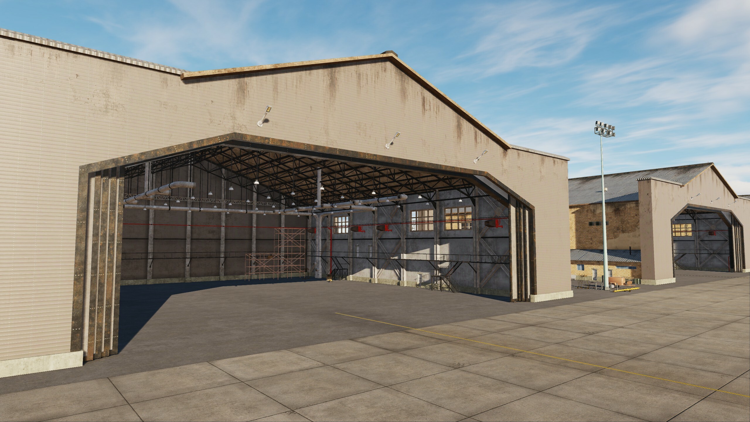
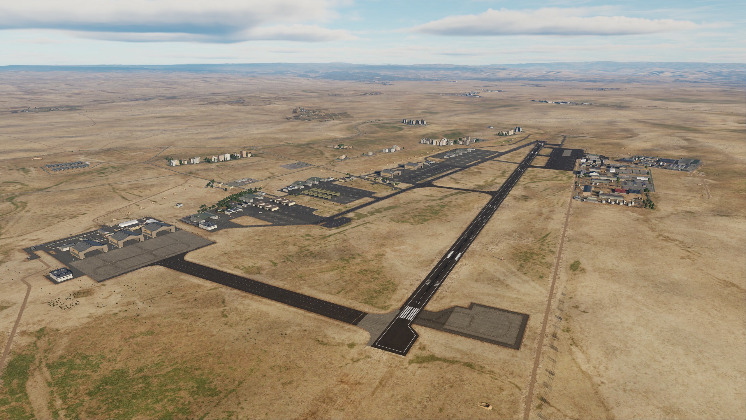
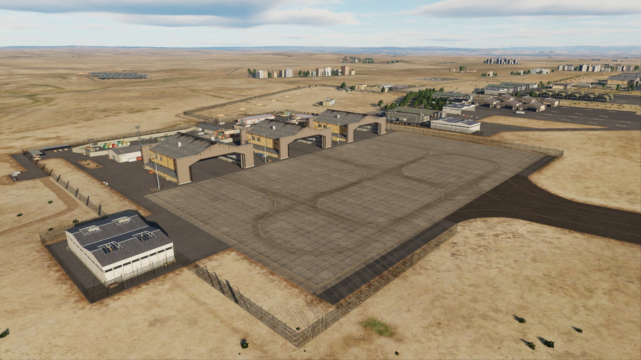
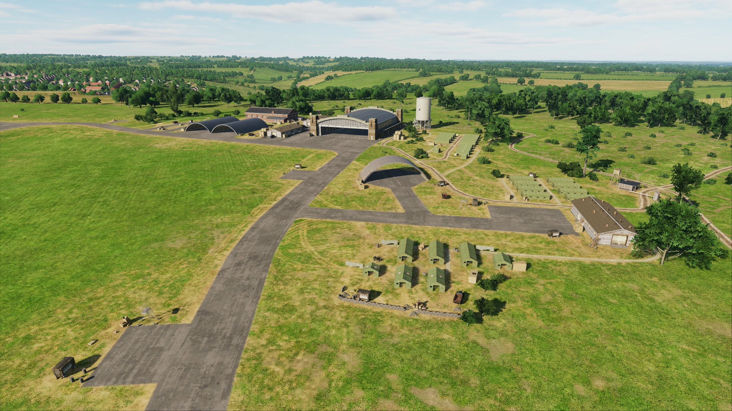
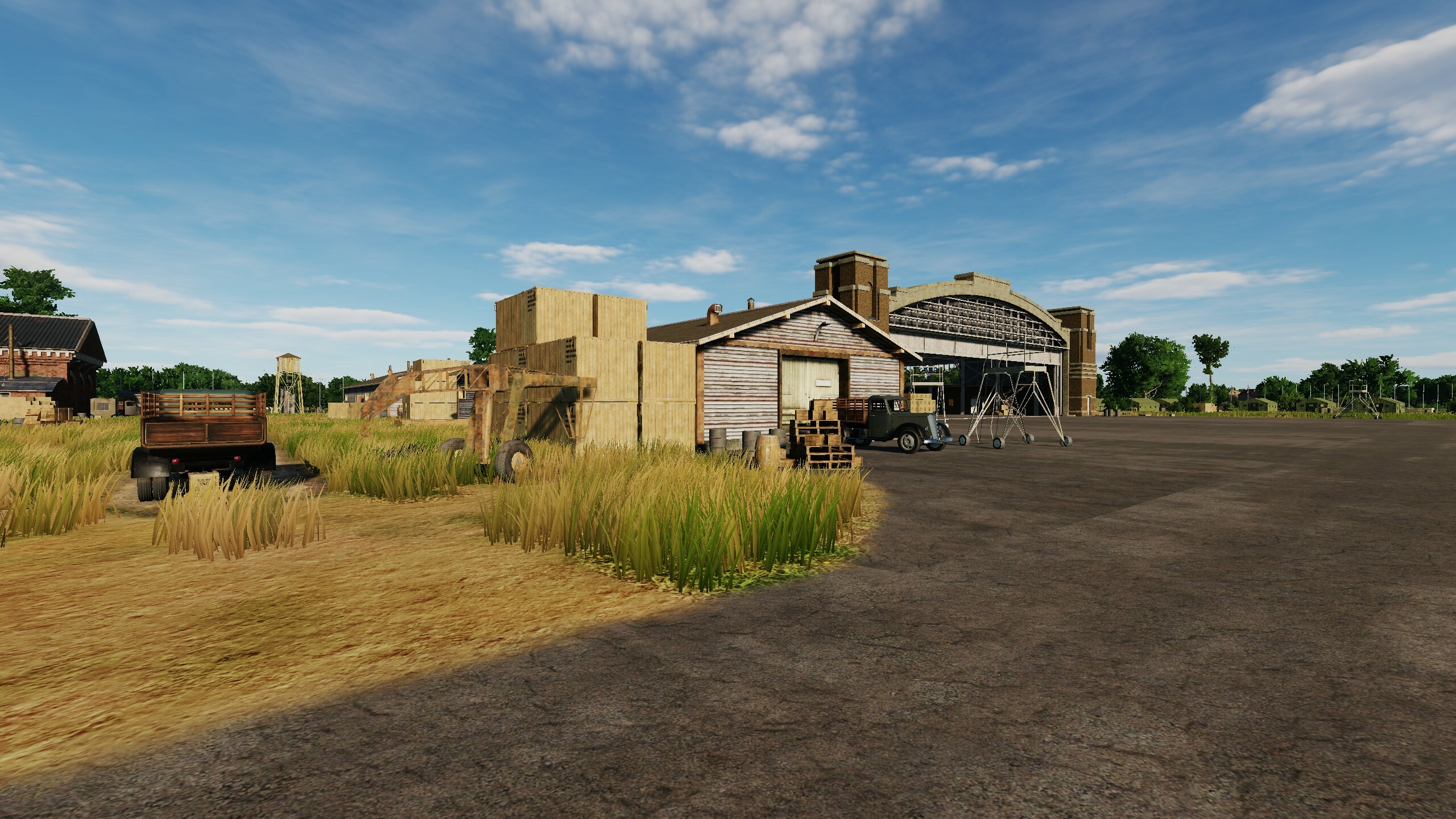
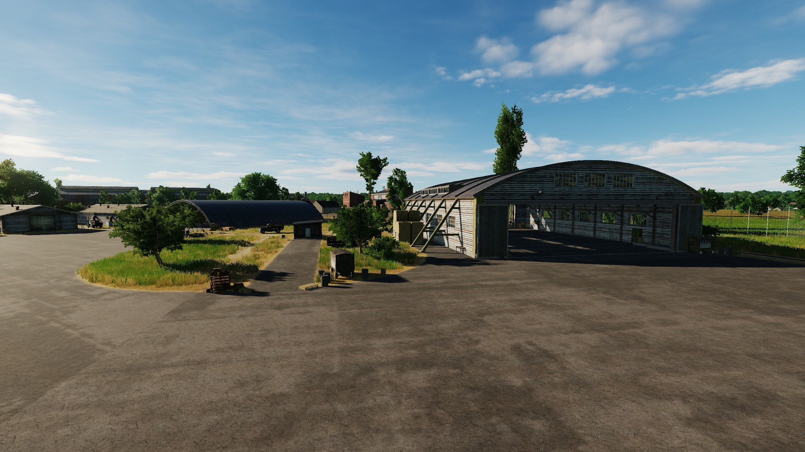
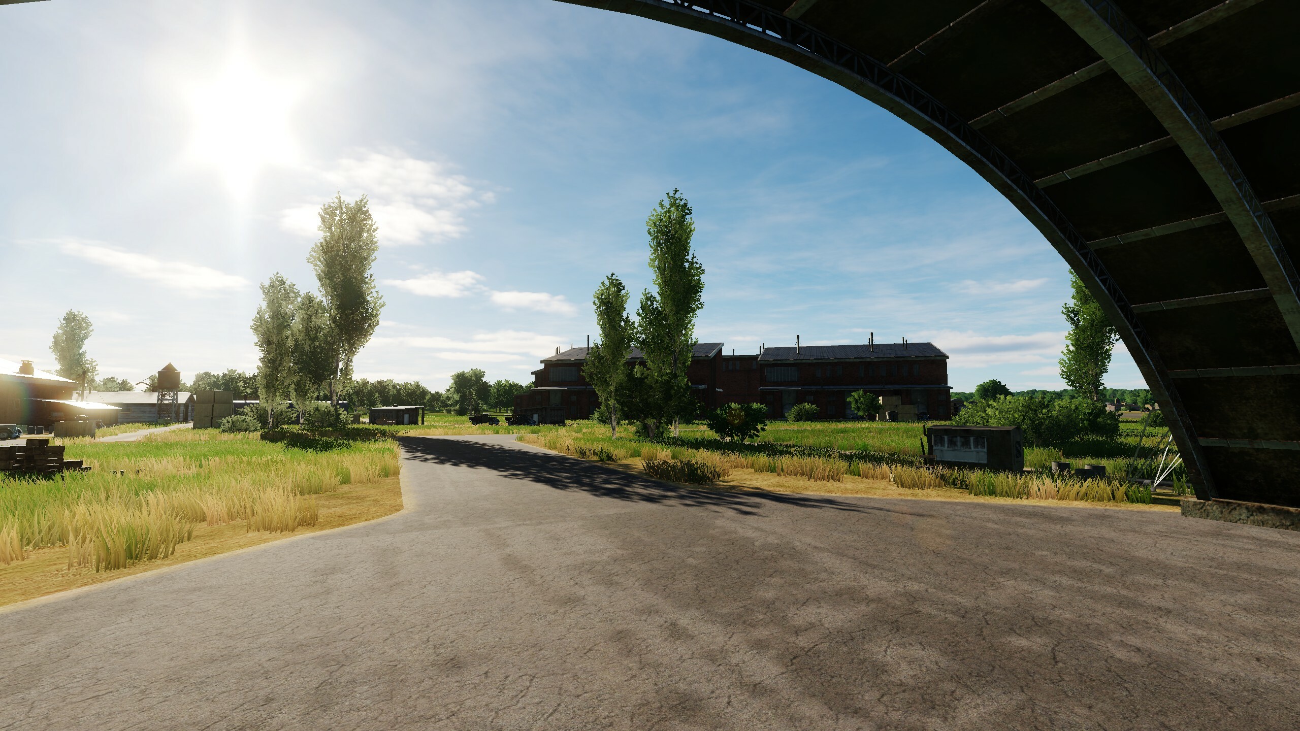
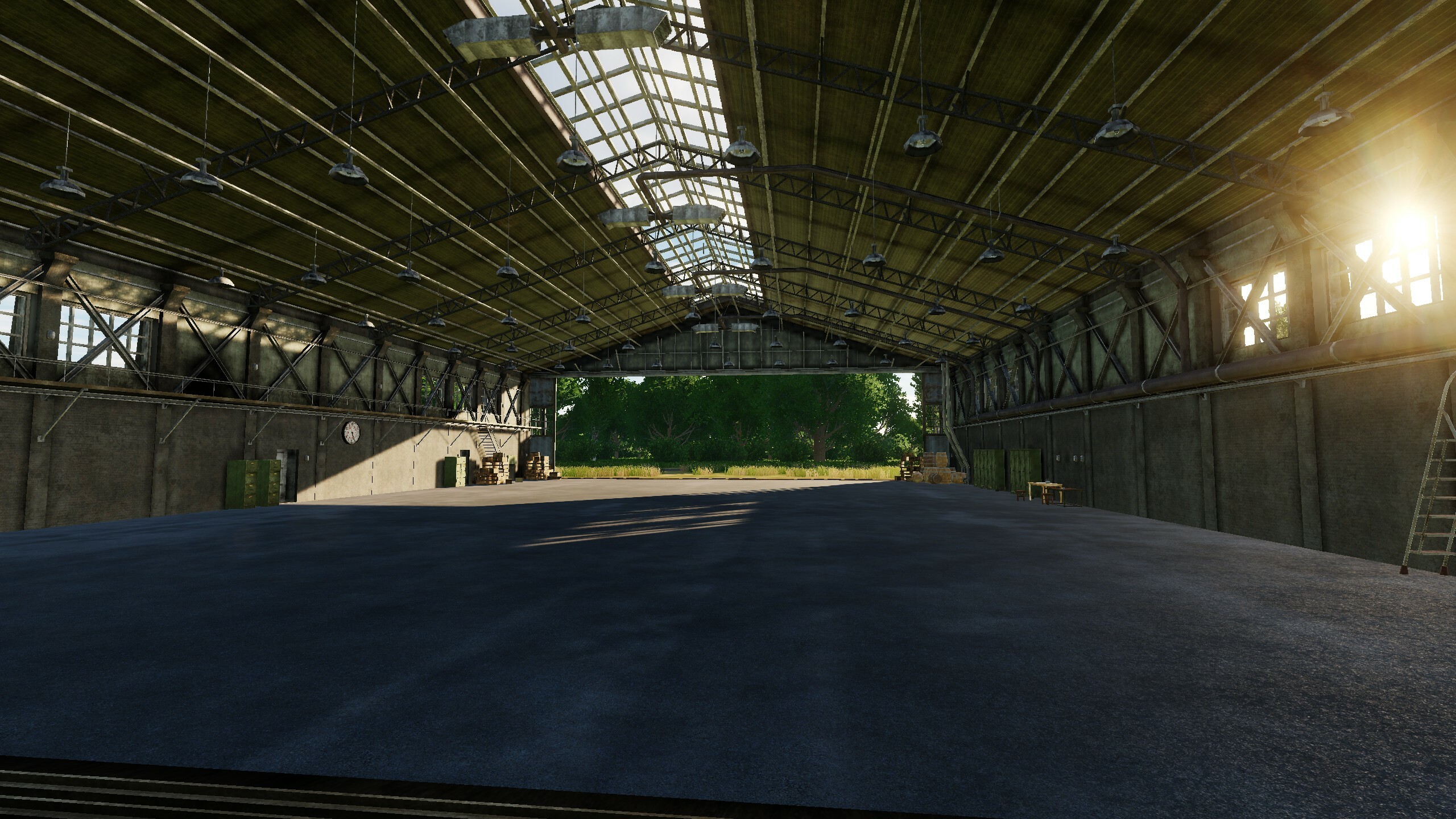
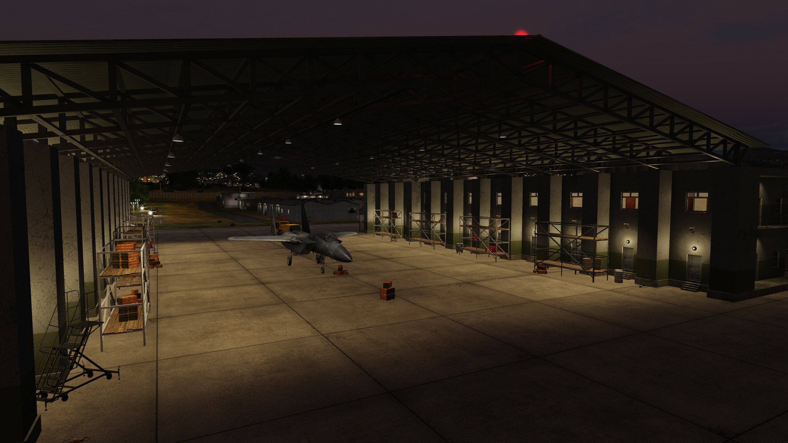
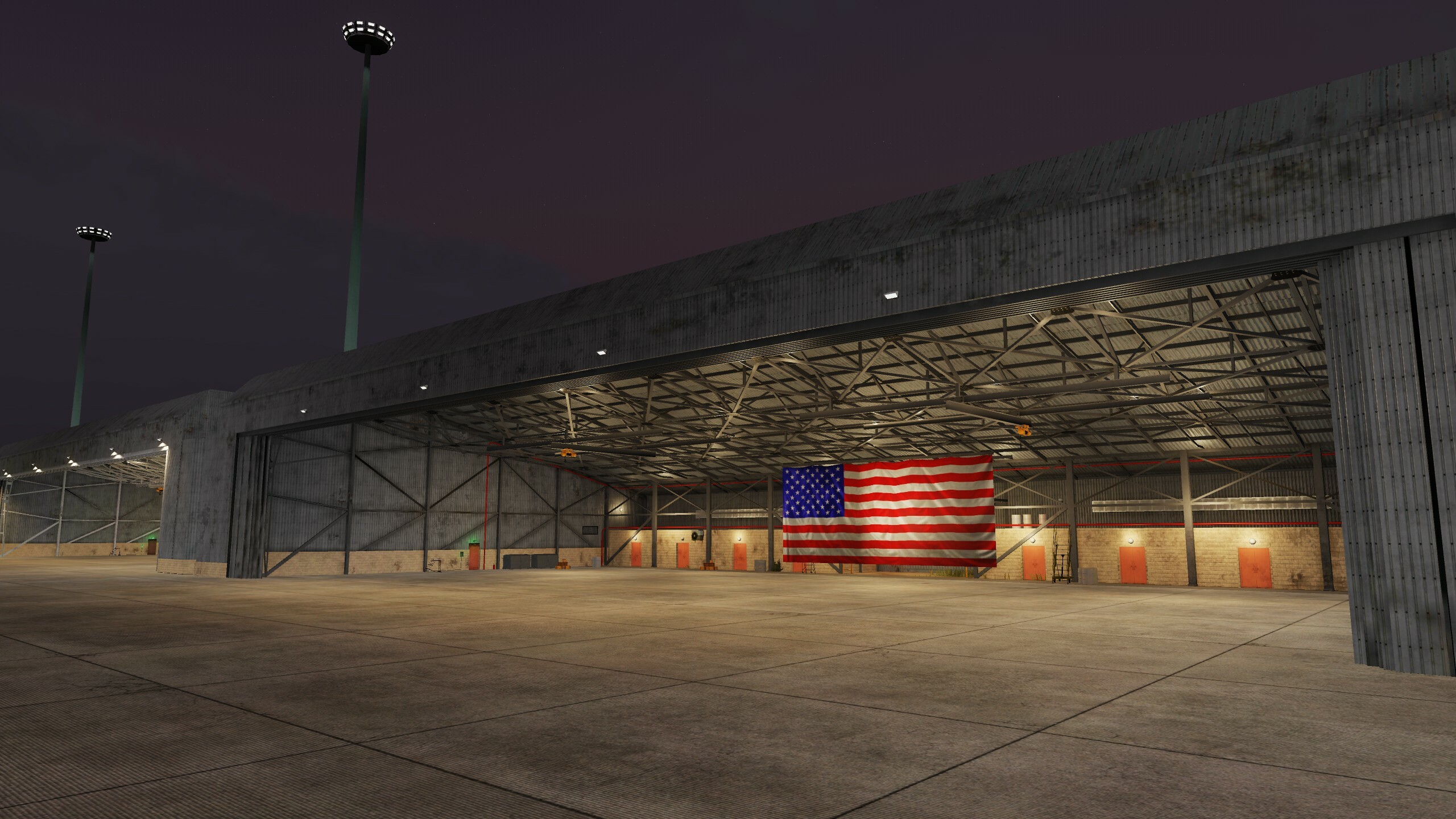
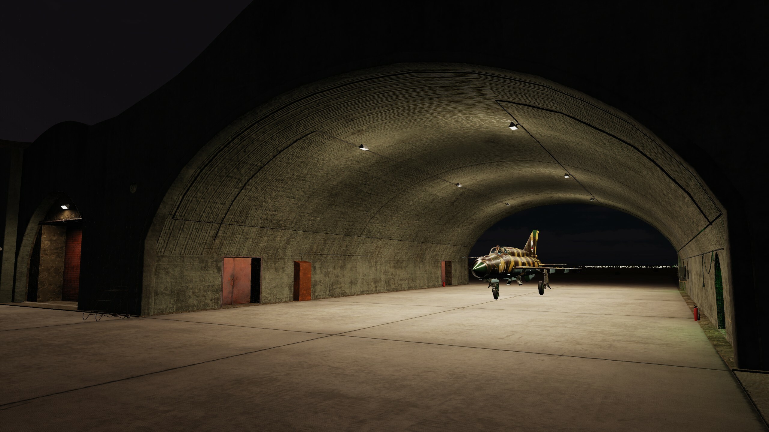
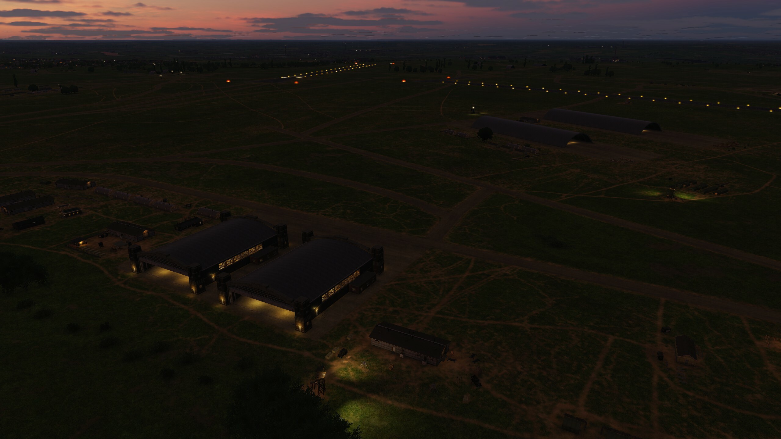
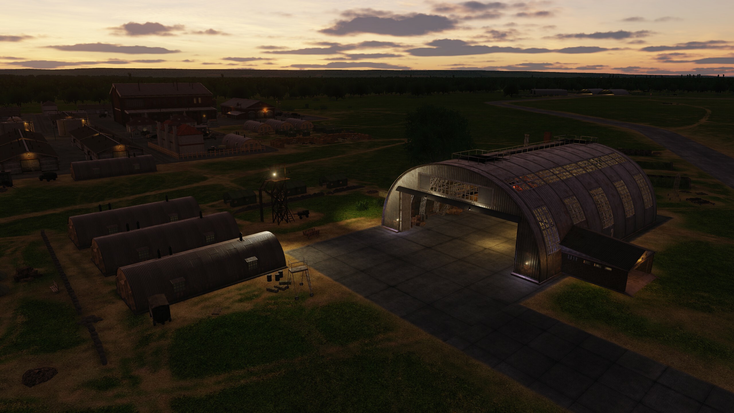
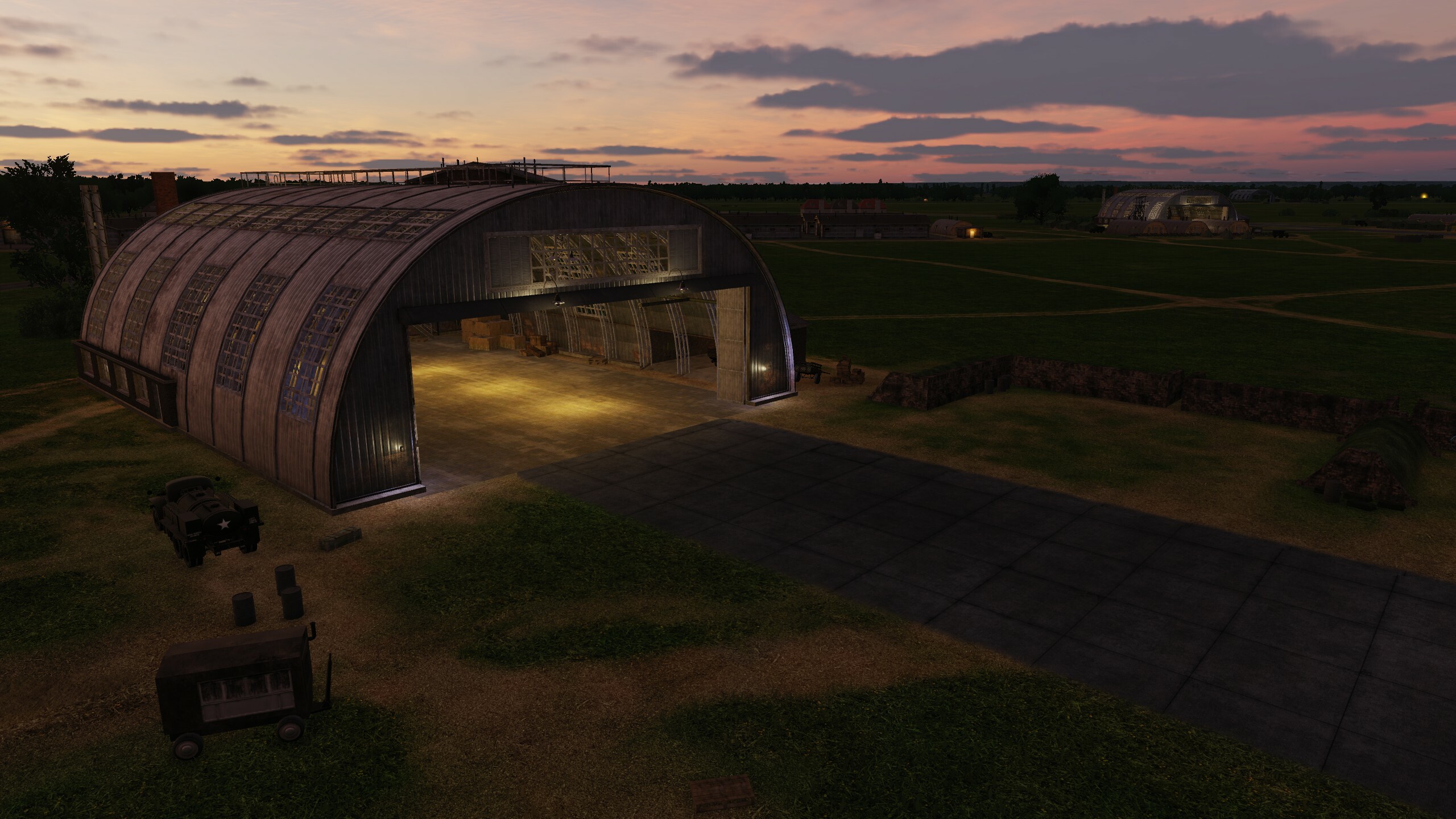
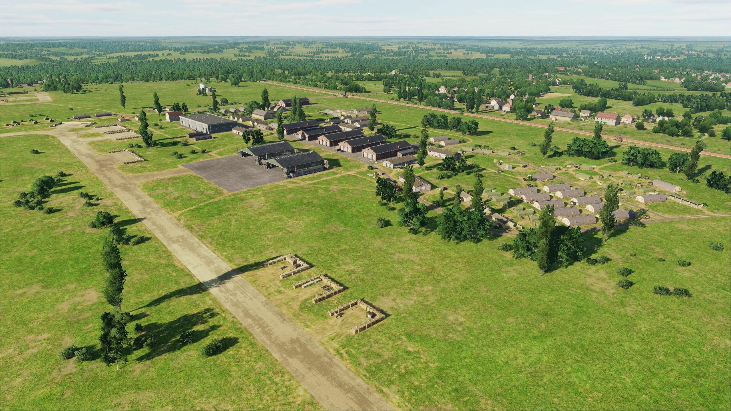
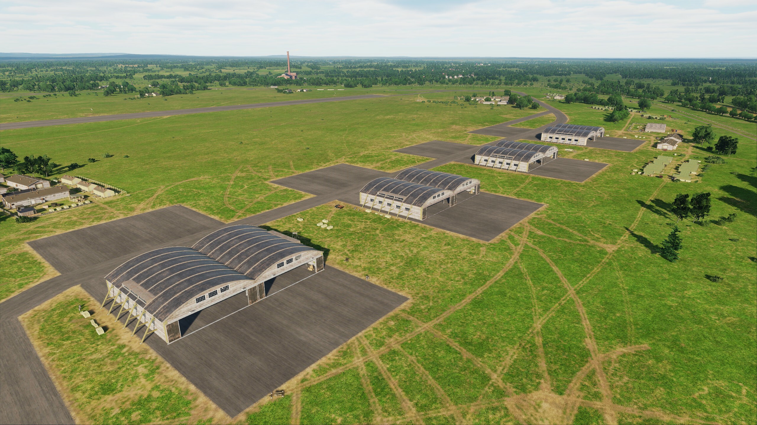
Hi fighters! Thank you for your interest in our project. As promised before, we continue to support and develop it! If you are familiar with the symbols: "F-16", then you will be pleased with today's news. Previously, this place was inaccessible to you, but we have prepared a surprise for you. Get ready for your military trip to Muwaffaq Salti Airbase. The aviation history of this place dates back to the First World War. It was home to the Royal Jordanian Air Force, Belgian Air Component and United States Air Force. Helicopters, transport aircrafts, fighter aircraft, drones - everyone was here. By the way, we made new unique hangars for this airbase, now your birds will be safe. Even though the canteen (DFAC) is no longer as tasty as experienced fighters say, the rule of three drinks has been preserved and you will be covered by MFR (the Morale, Welfare, and Recreation program). The Internet is available, but may fail, so be sure to take a hard drive with your favorite movies with you. When you arrive at the location, tell us whether you liked it or not, we tried to provide all the conditions for you. Here's a little review for you
- 29 replies
-
- 43
-
-
-
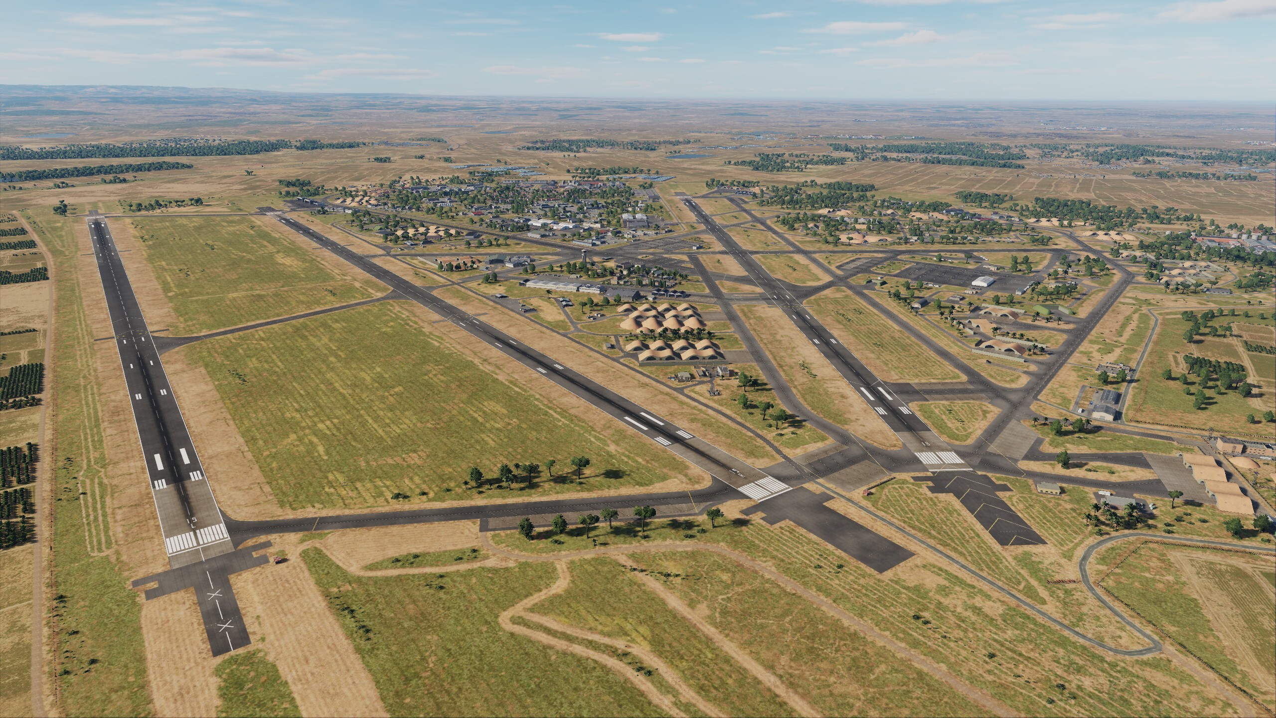
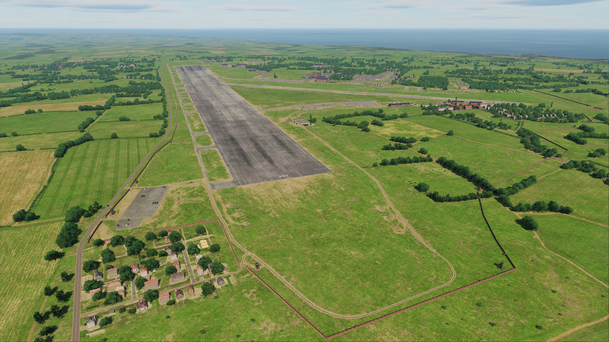
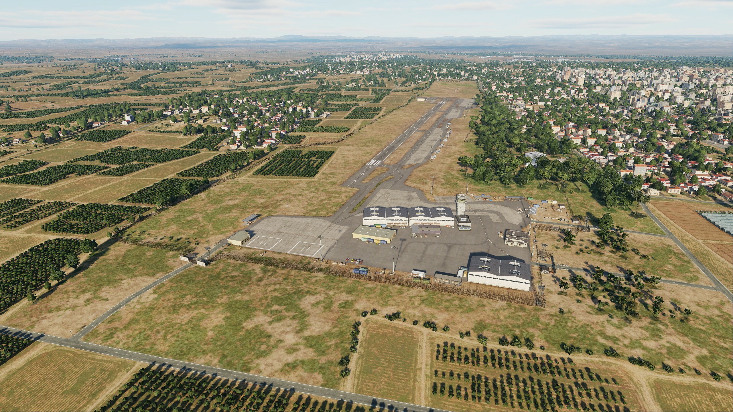
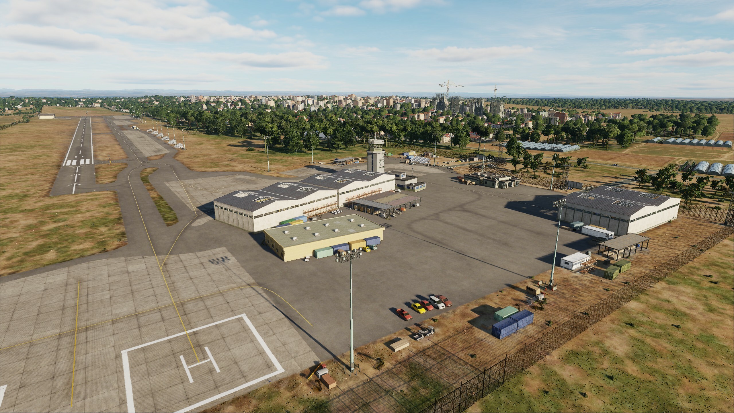
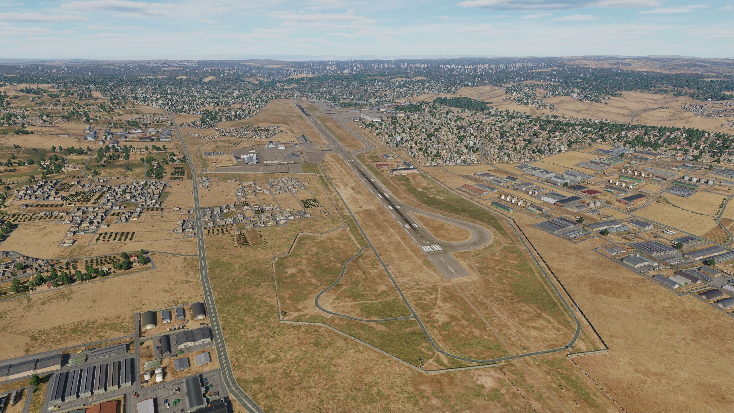
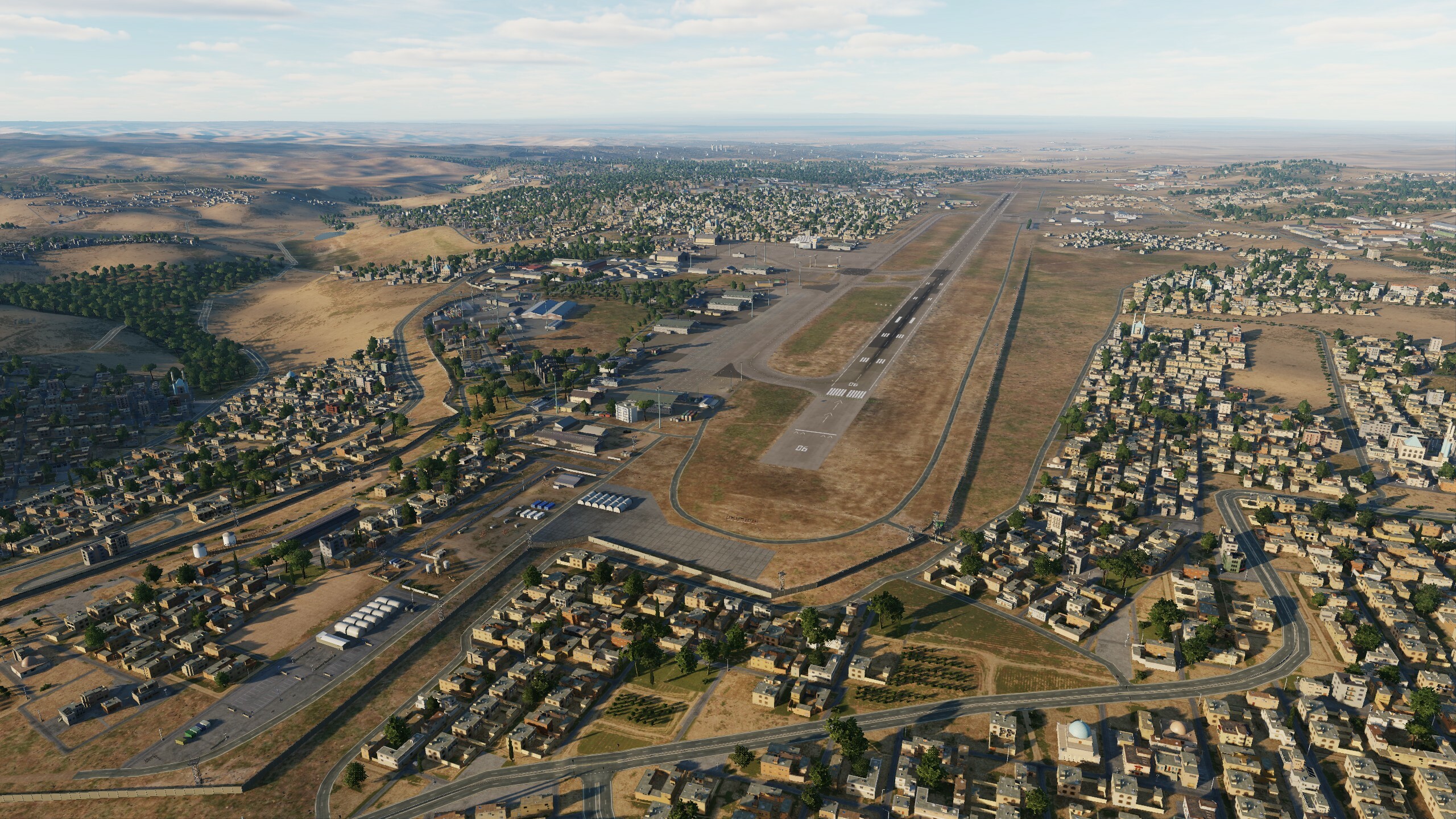
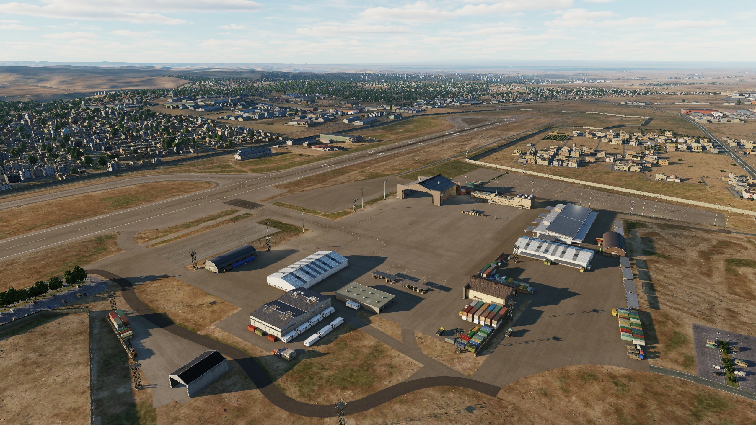
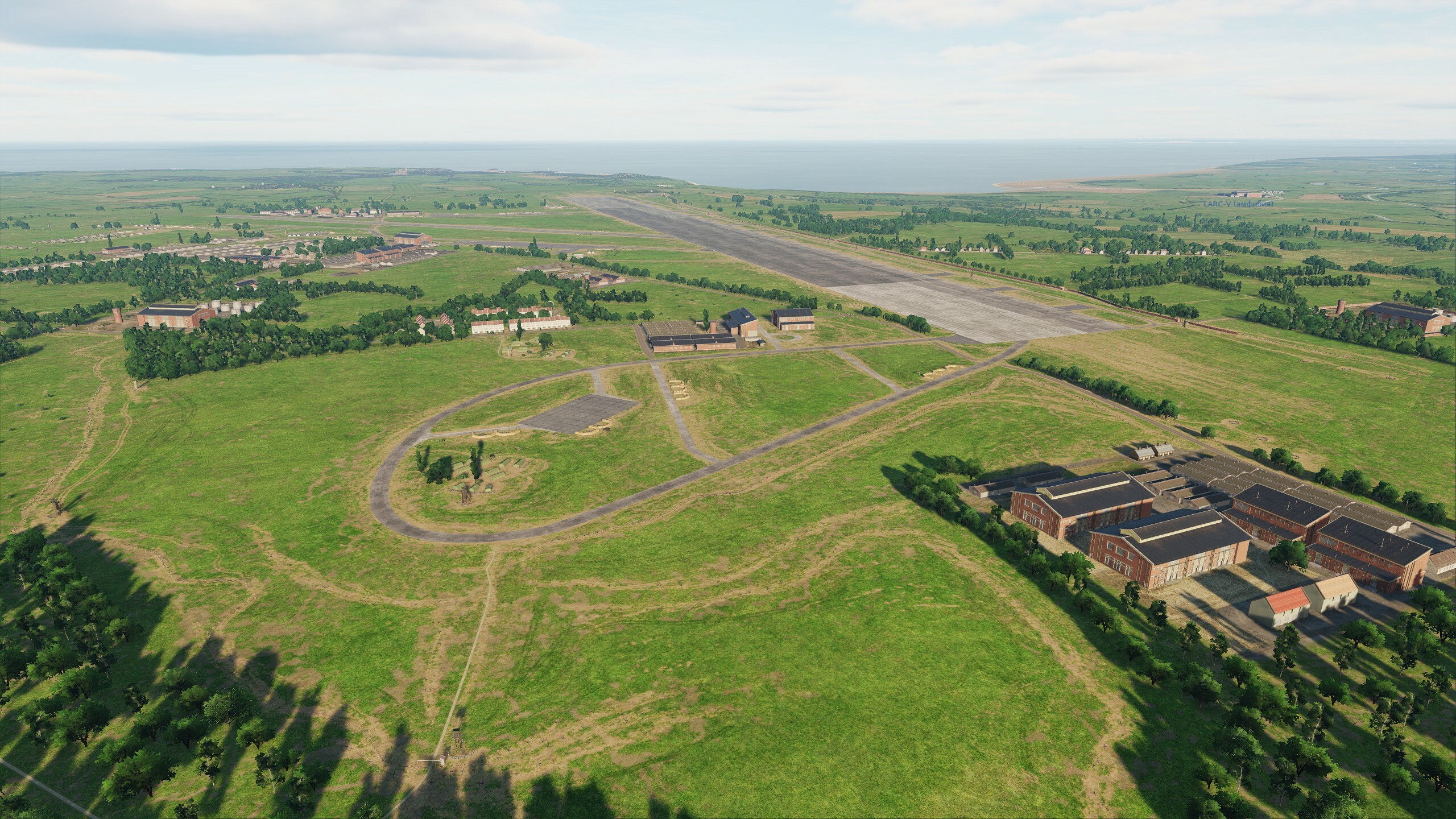
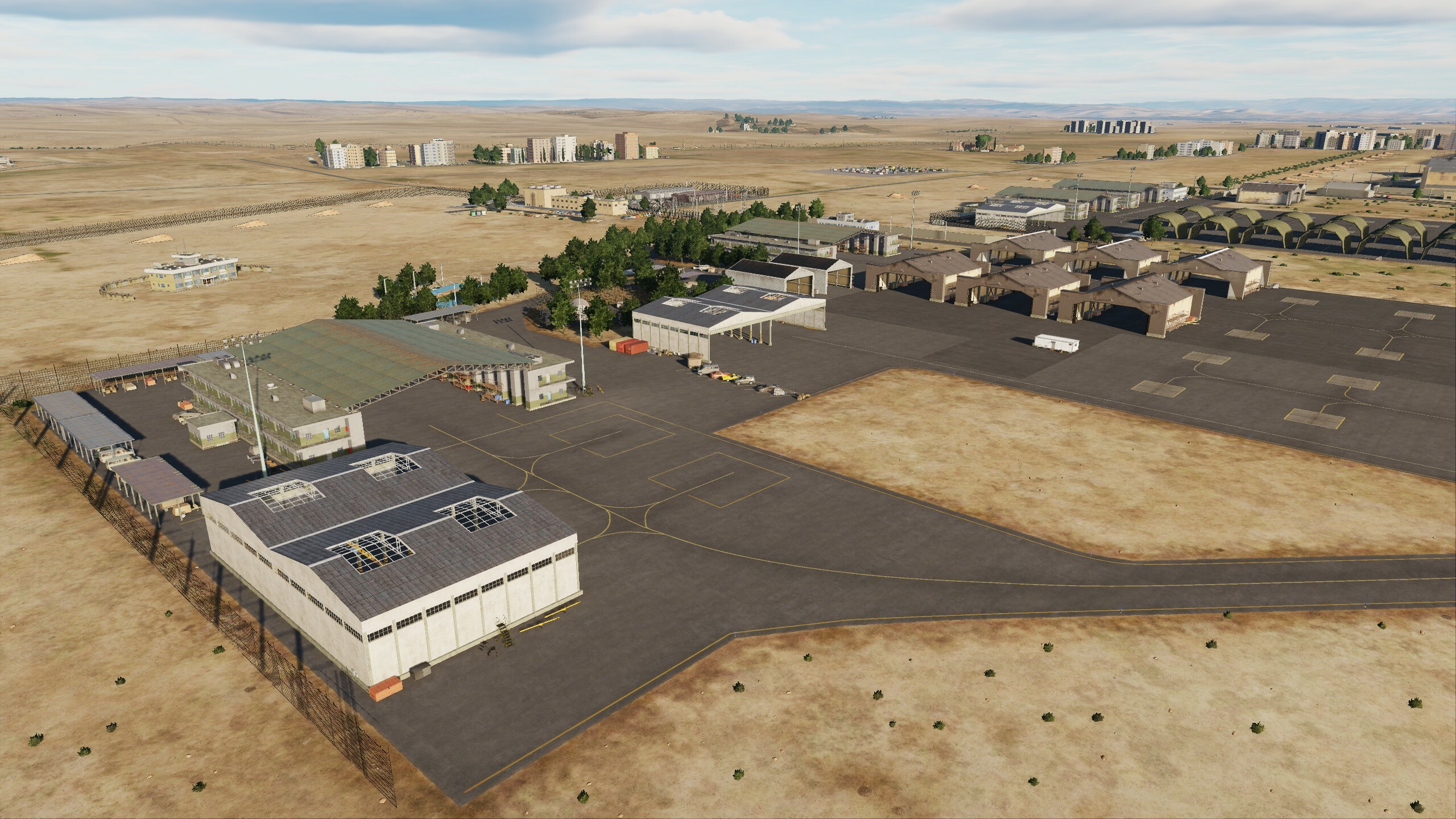
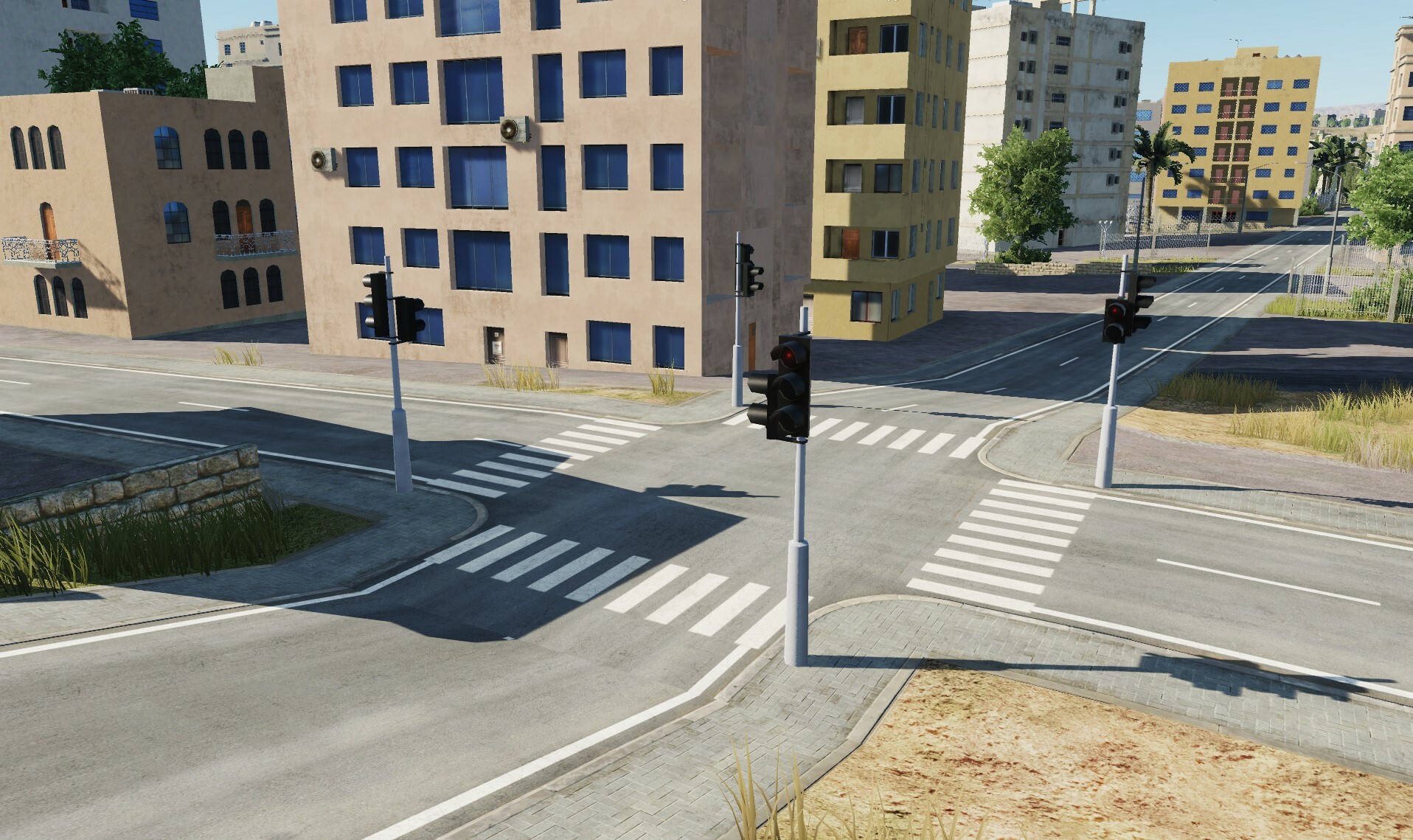
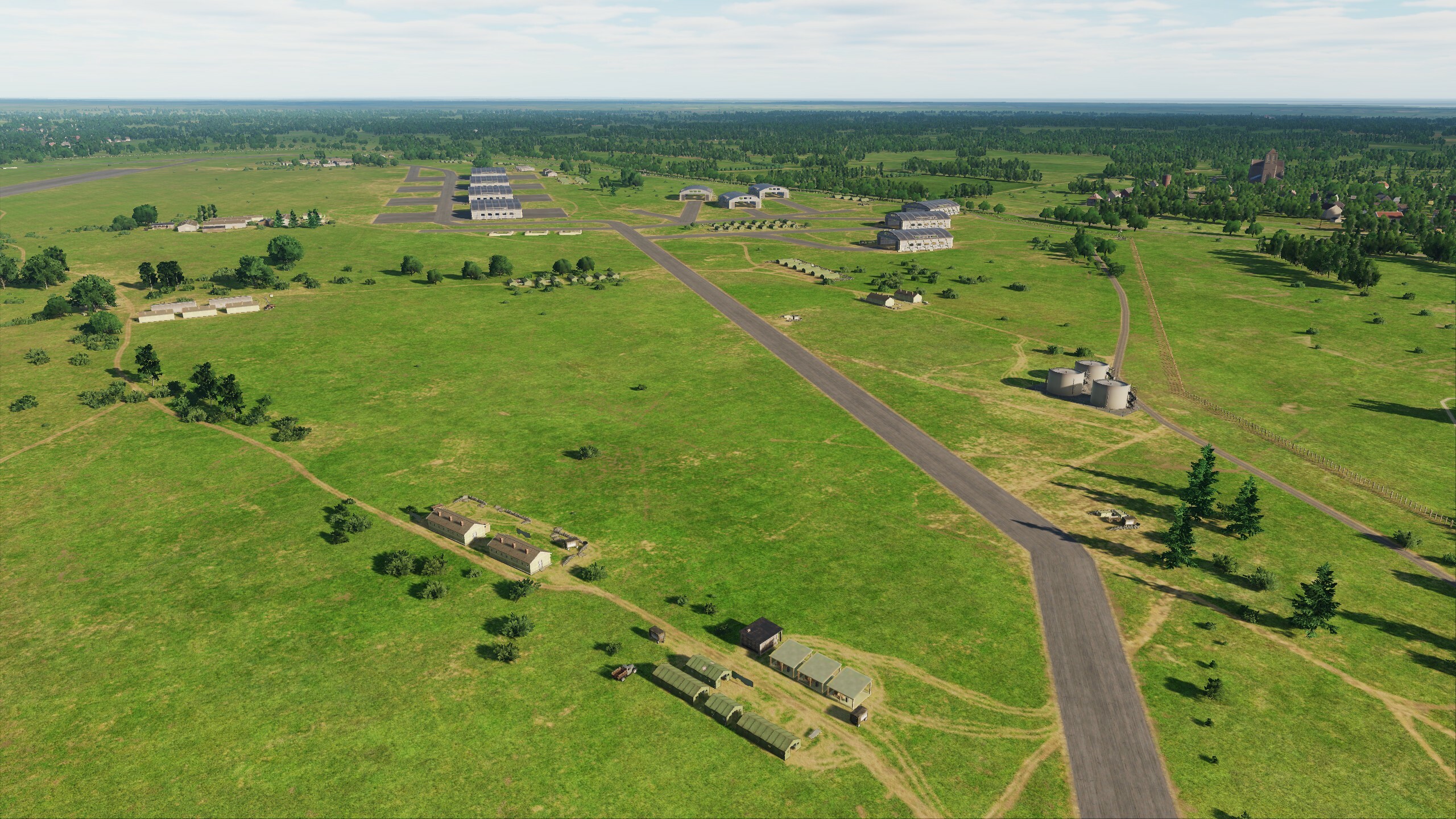
Hi fighters Today we will show 2 airfields Herzliya (Israel) and Amman (Jordan). Since the first post about the update, many events have happened: new airfields have been upgraded, changes have been made to old ones. If you see corrections to your requests on the forum, be sure to write in your topic. I hope that we will see the next screenshots of this update from you Herzliya (Israel) Amman (Jordan) (over there on the highway to the left of the airport you can drink good Arabic coffee)
- 125 replies
-
- 21
-
-
-
@DD_Fenrir @Fred901 Experts need to stay, because... It is the opinion of users that evaluates the work and corrects the development vector. I want to remind you that thanks to users, we made adjustments to French airfields, thanks to you, English hangars and caponiers were made, and the French one was slightly changed. fr At the same time, the engine’s resources are not unlimited; we made sure that “London” and “Paris” differ not only in buildings but also in airfield infrastructure. We created products as close as possible to historical content, but the capabilities of the engine and large maps impose restrictions on the variety of objects - they have narrow time intervals for working in war. The map is constantly being developed, corrected and expanded. In the studio we compared screenshots of what was and what has become - amazing changes. We have now come to the point that we cannot focus only on 1944, primarily because when new airfields are added to the Normandy map, 1940 scenarios become available to users: Dunkirk Retreat Scenarios and Battle of Britain Scenarios. You once wrote to us that there is no need to limit yourself to a certain period, but now this moment has come: the map has expanded both in space and time. Therefore, experts, stay with us, keep your finger on the pulse. And we will do everything possible to take into account your opinion and your wishes in our work.
- 49 replies
-
- 18
-
-
-
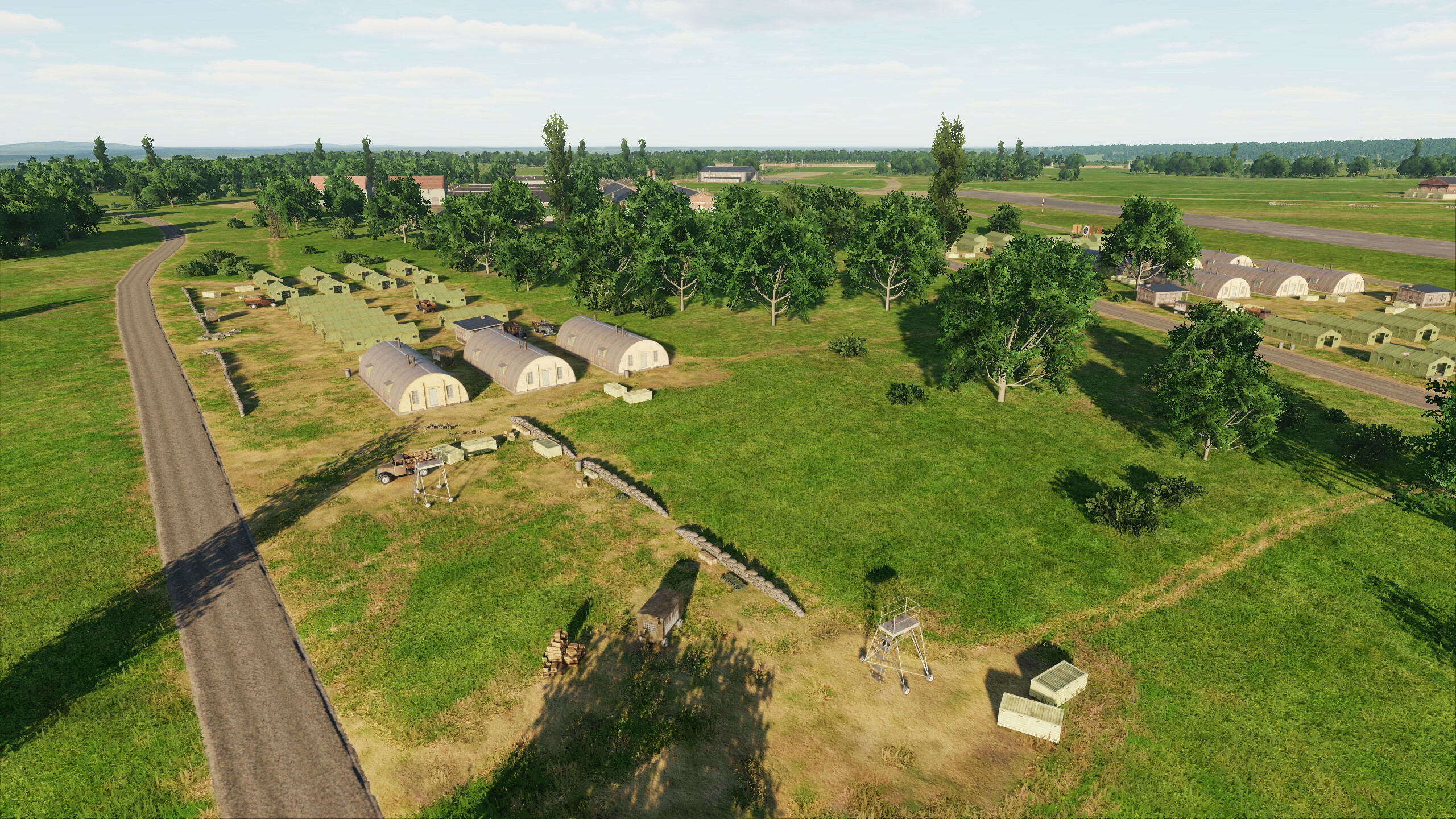
Hi, while the update is coming to you, we will make a small preview: Today our heroes are two airfields: Detling and Lympne. Both have taken their place in history, associated with the events of the Battle of Britain and D-Day. The runways are covered with the chassis of bombers, Typhoons and Hurricanes, Spitfires and Mustangs. Detling Lympne
- 49 replies
-
- 10
-
-
-
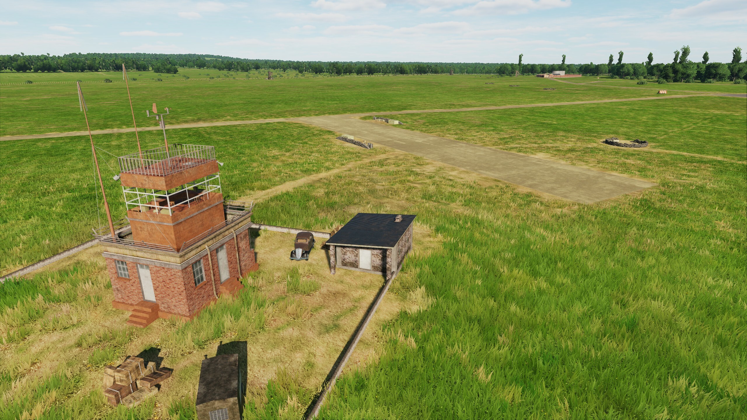
Hi! Let's continue. The airfields are already on the map, today we will show several screenshots including Manston. As always, we look forward to your feedback, thanks to you we are making the map better. Thanks for the information on antennas, it was very helpful. They are scheduled for the next update. Current updates are uploaded The planes are waiting on the field. Fighters, prepare for takeoff! Manston Abbeville Drucat
-
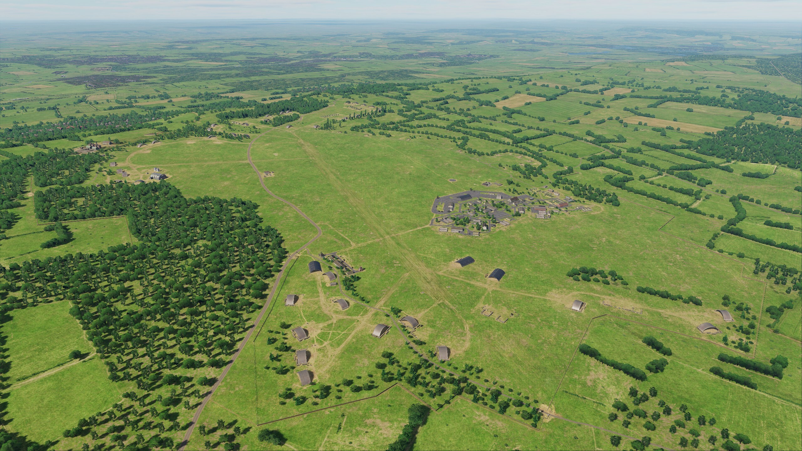
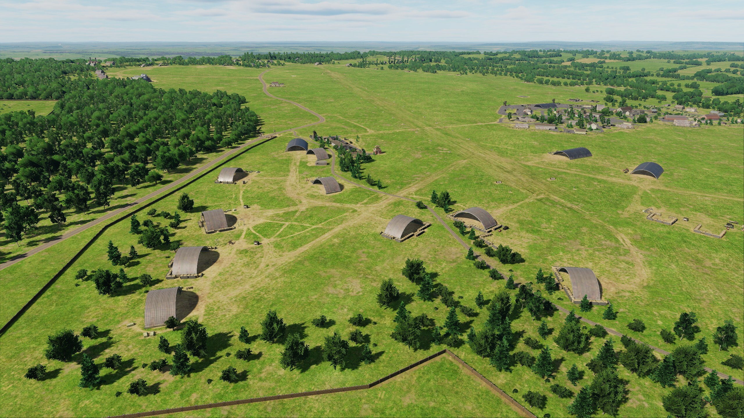
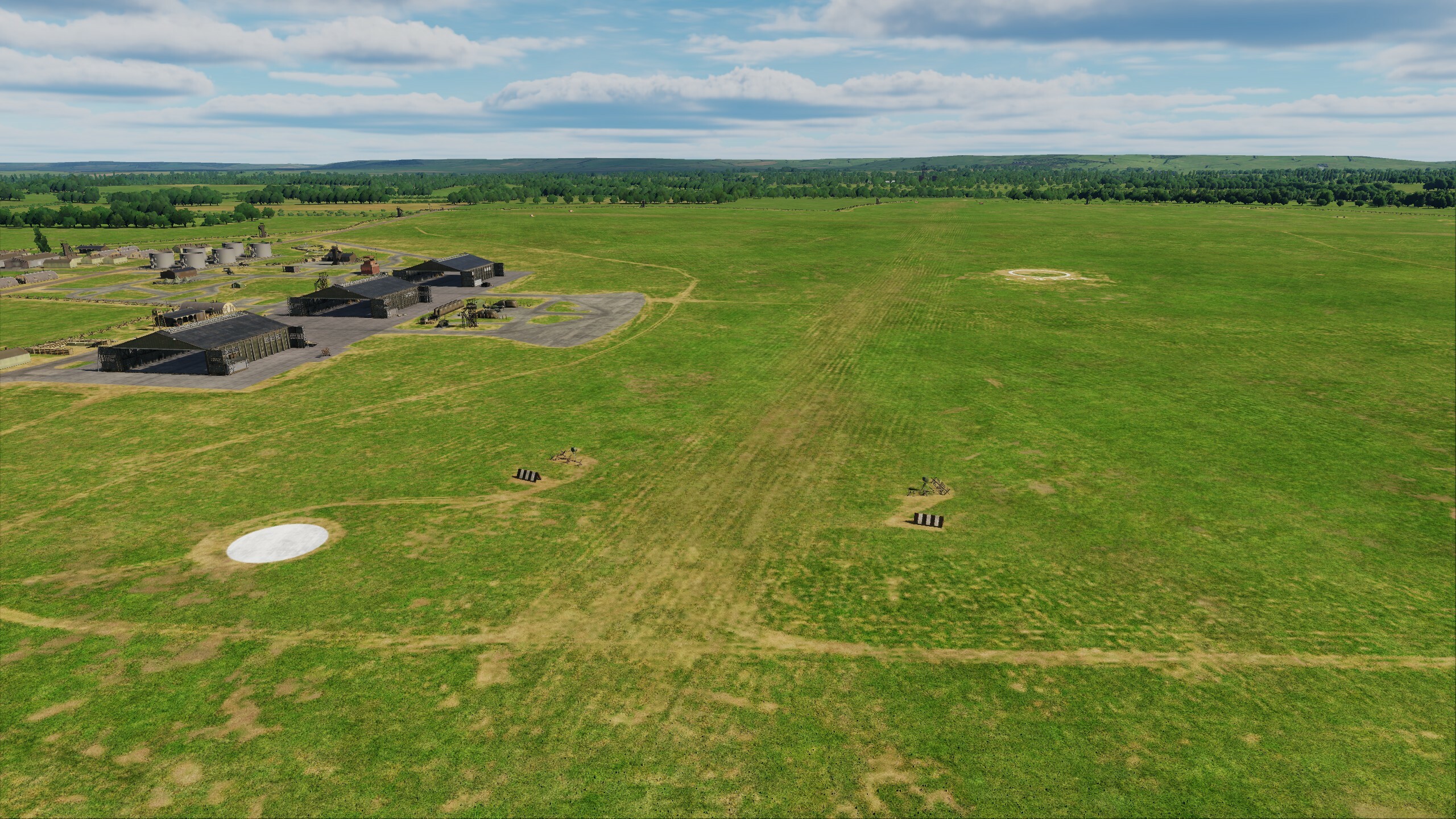
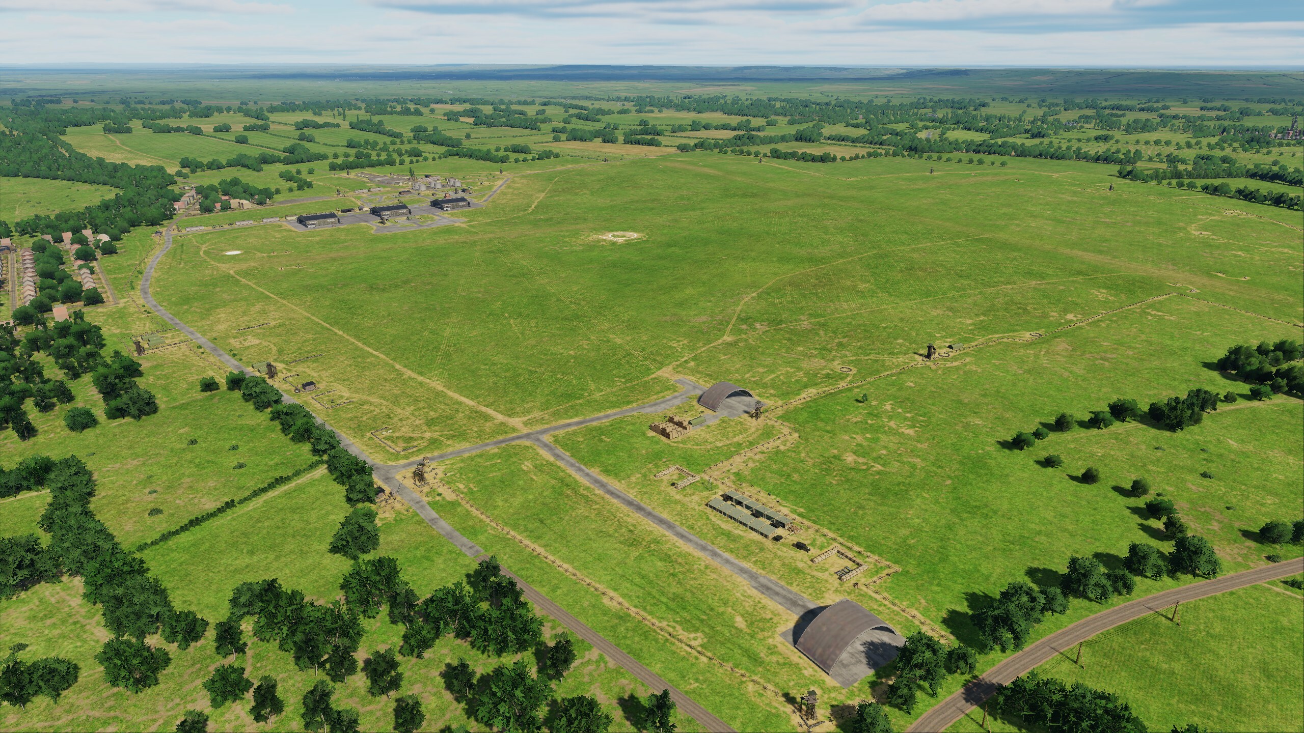
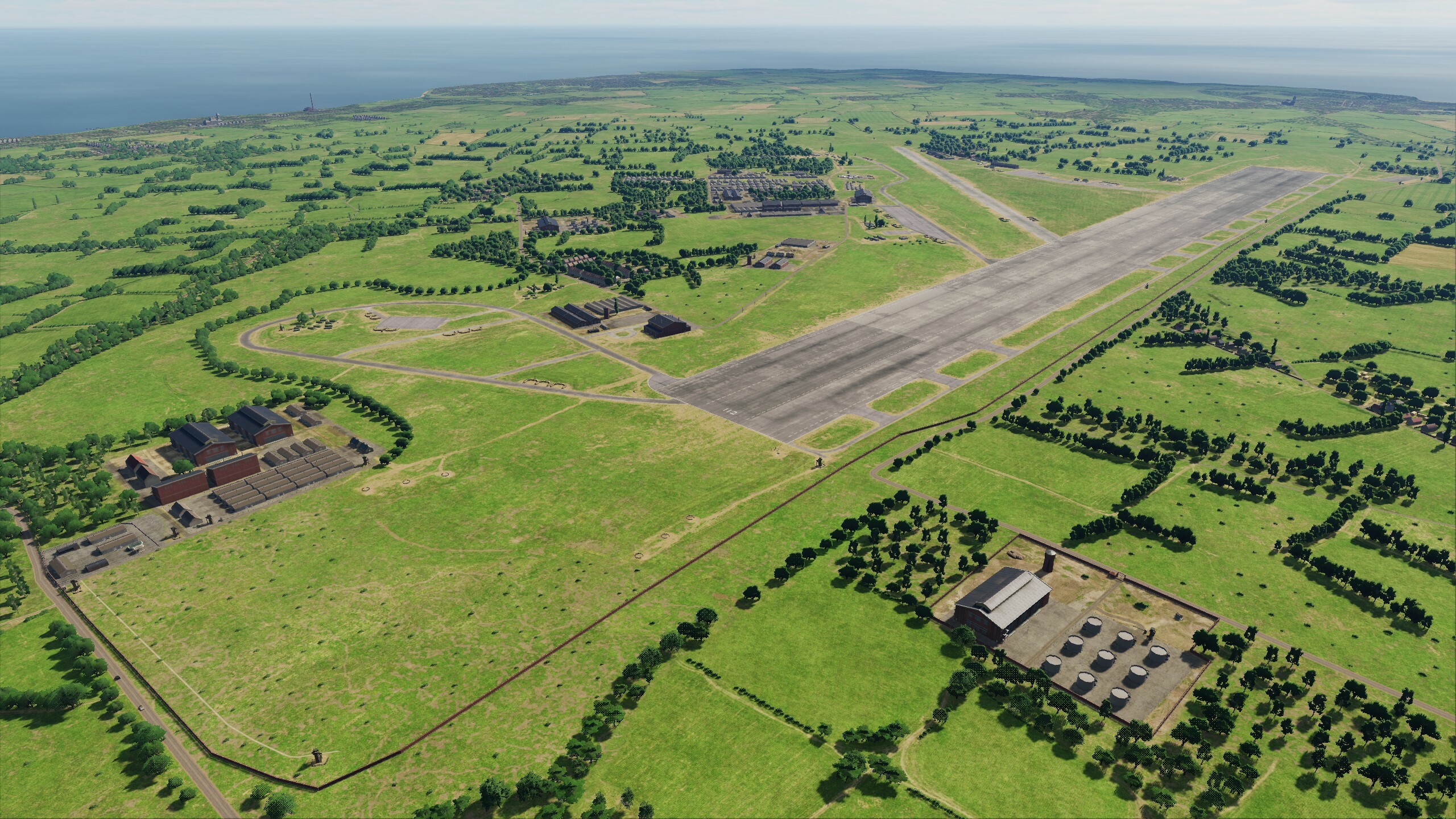
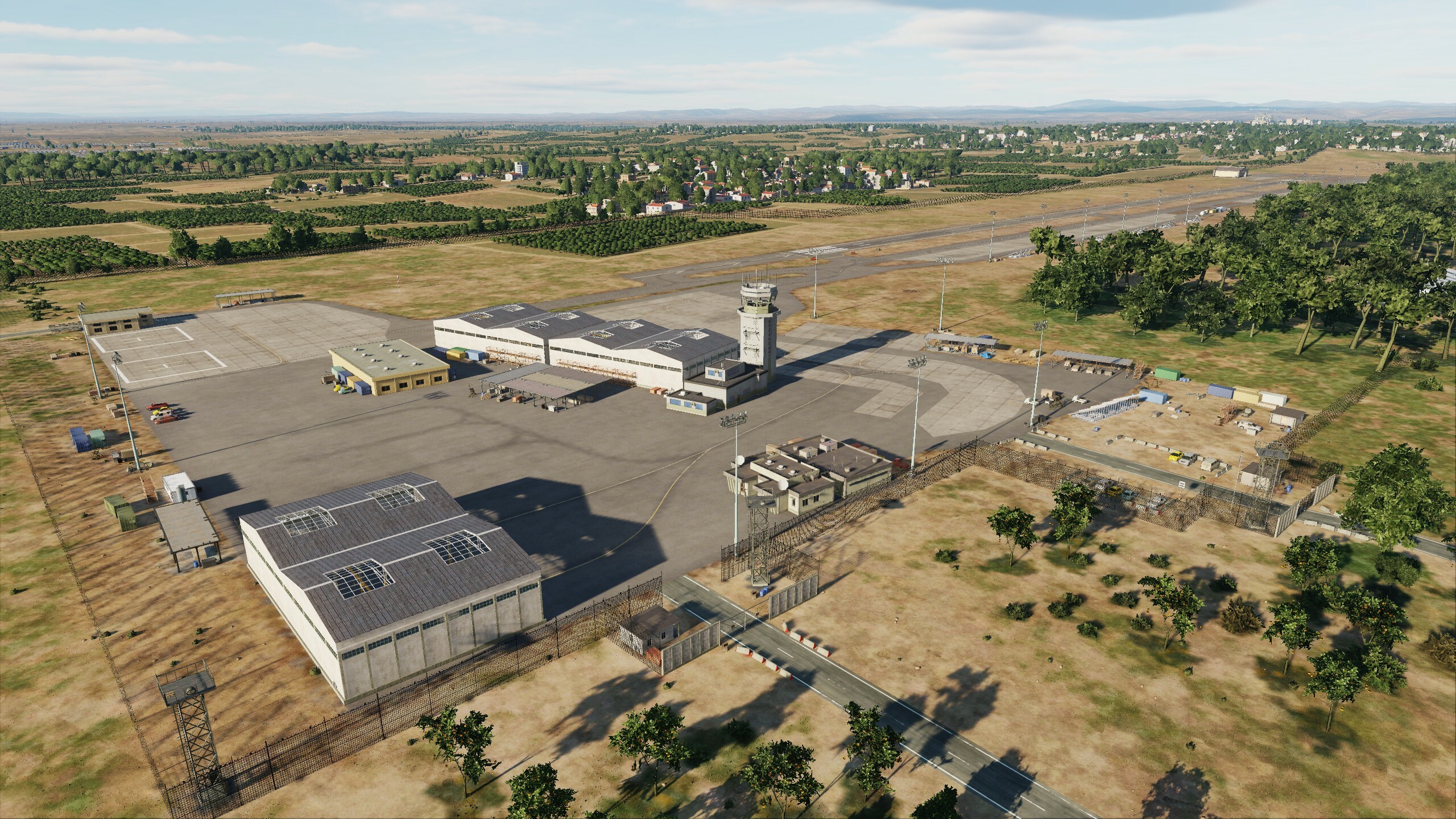
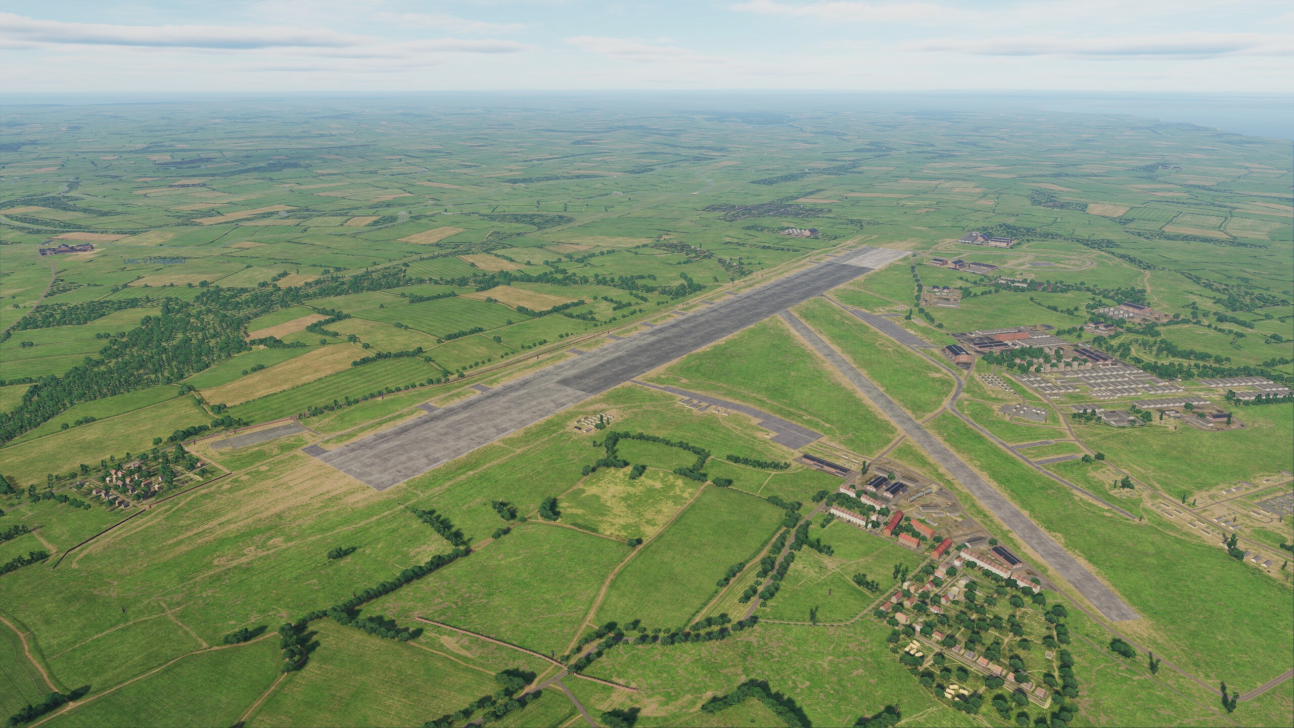
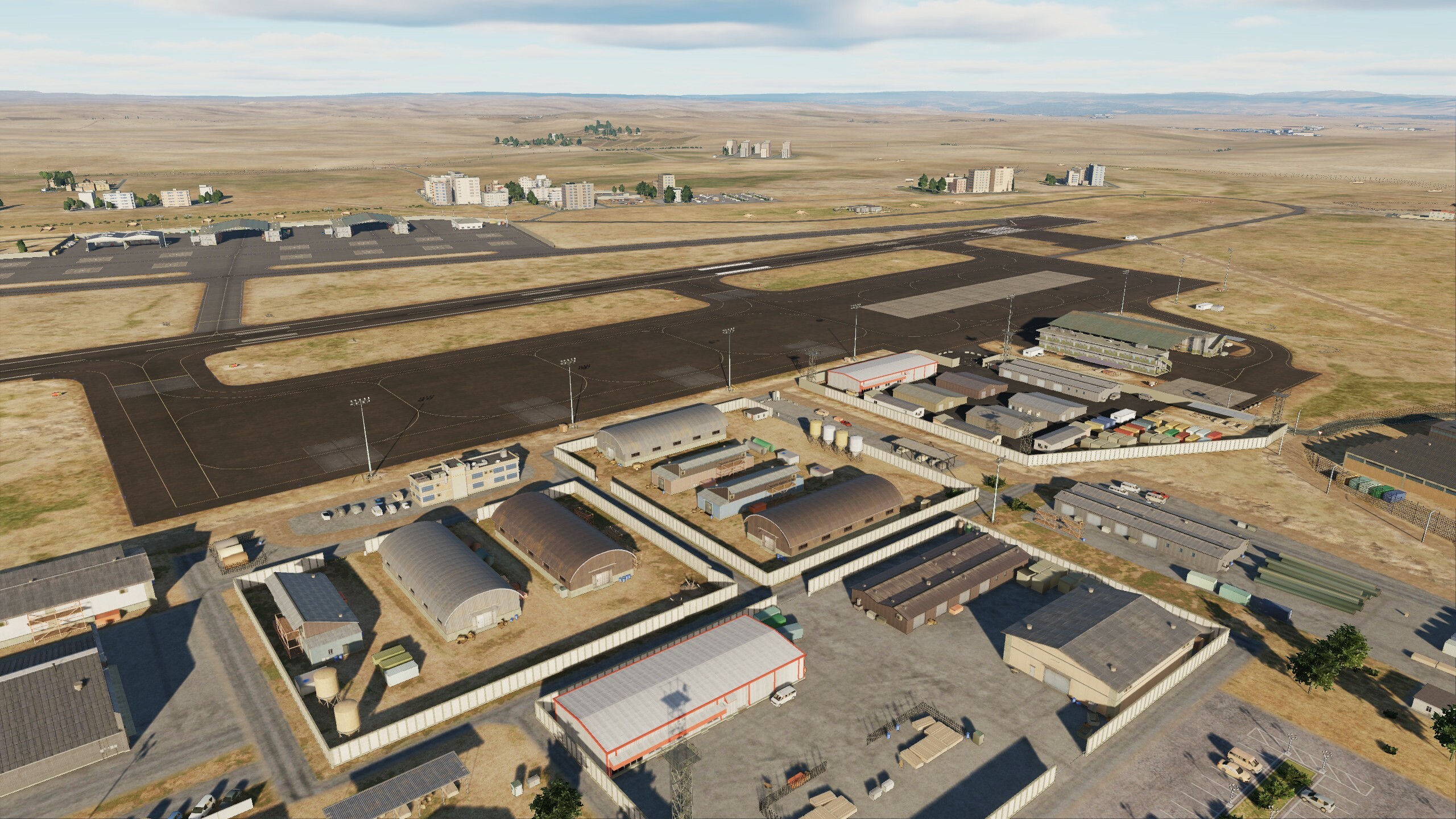
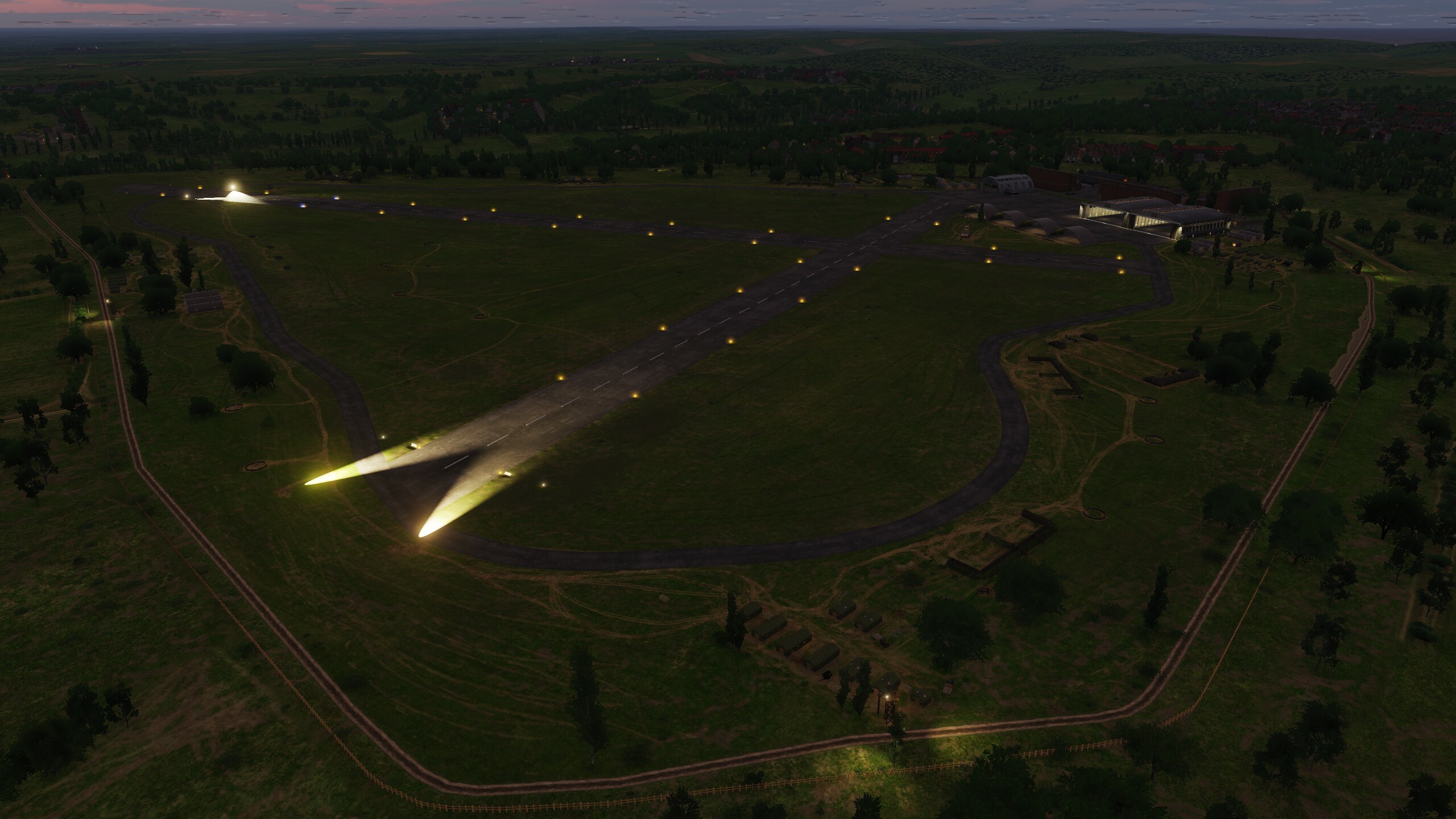
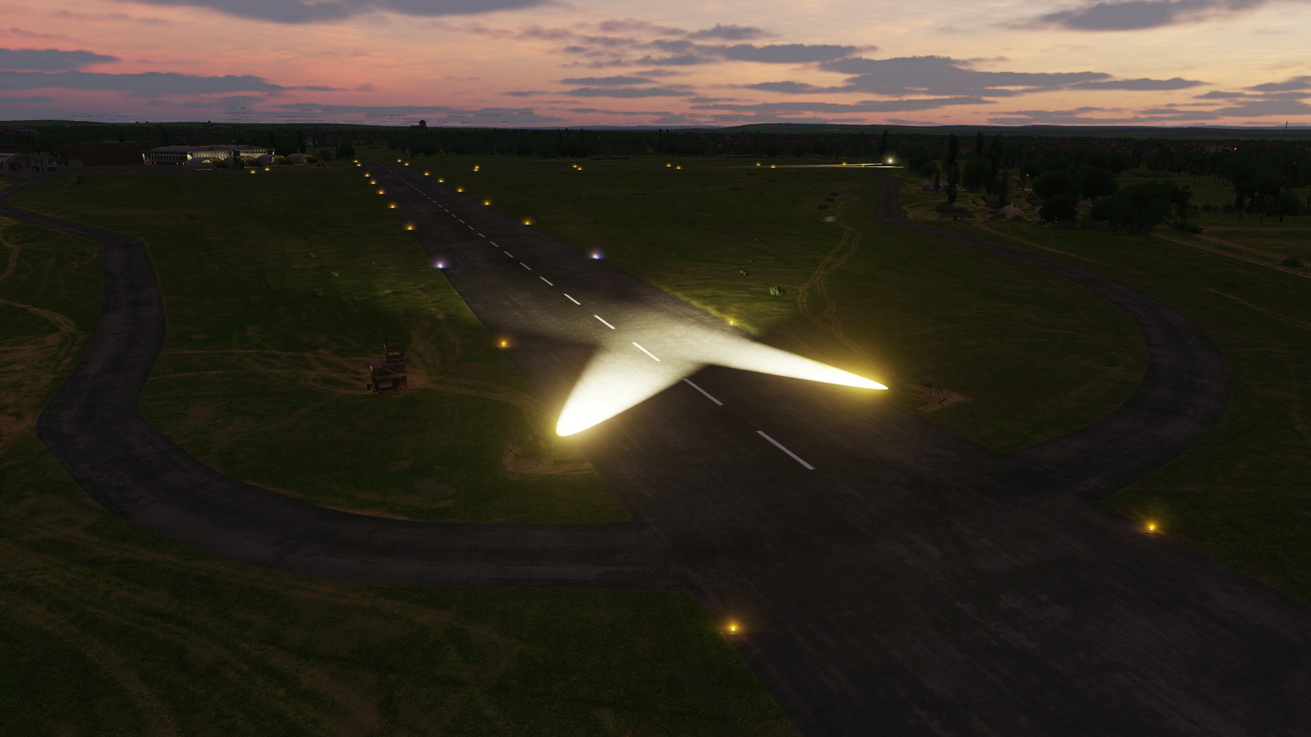
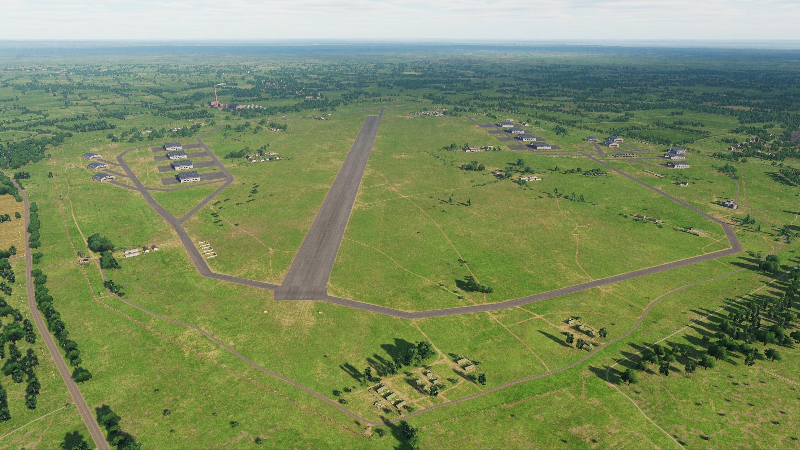
Hi fighters! Today we will look at optimization. The team is working on improvements to the map, but the more detail and uniqueness we add, the more effort it takes to optimize. Hard work has been done on all areas of the map: models have been optimized, textures have been reassembled, vector data rendering on clipmaps has been updated - all this has had a positive effect! We conducted tests on two systems: AMD Ryzen 7 3700x / RTX 2080Ti and i9-10850K / RTX 4080 When flying over a city, FPS increased by an incredible 20%, and while on a system with a 2080ti the average FPS was at 85, now it confidently remains around 110. When flying over a forest, FPS increased from 5% to 20% compared to the previous build. When testing the 2080ti system, the fps was always above 105. One does not simply release an update with optimization. We have added 4 airfields: Amman Civil Airport Herzliya Airport (NOTAM: RWY LENGTH 1500M) King Abdullah II Air Base Prince Hussein Air Base This will increase your flight geography and diversify your missions. Explore new airfields and get ready to take off Prince Hassan Airbase King Abdullah II Airbase
- 125 replies
-
- 77
-
-
-
Pilots will be able to see these airfields on the Normandy 2.0 in one of the upcoming DCS updates. You just need to be patient and wait for messages from ED.
-
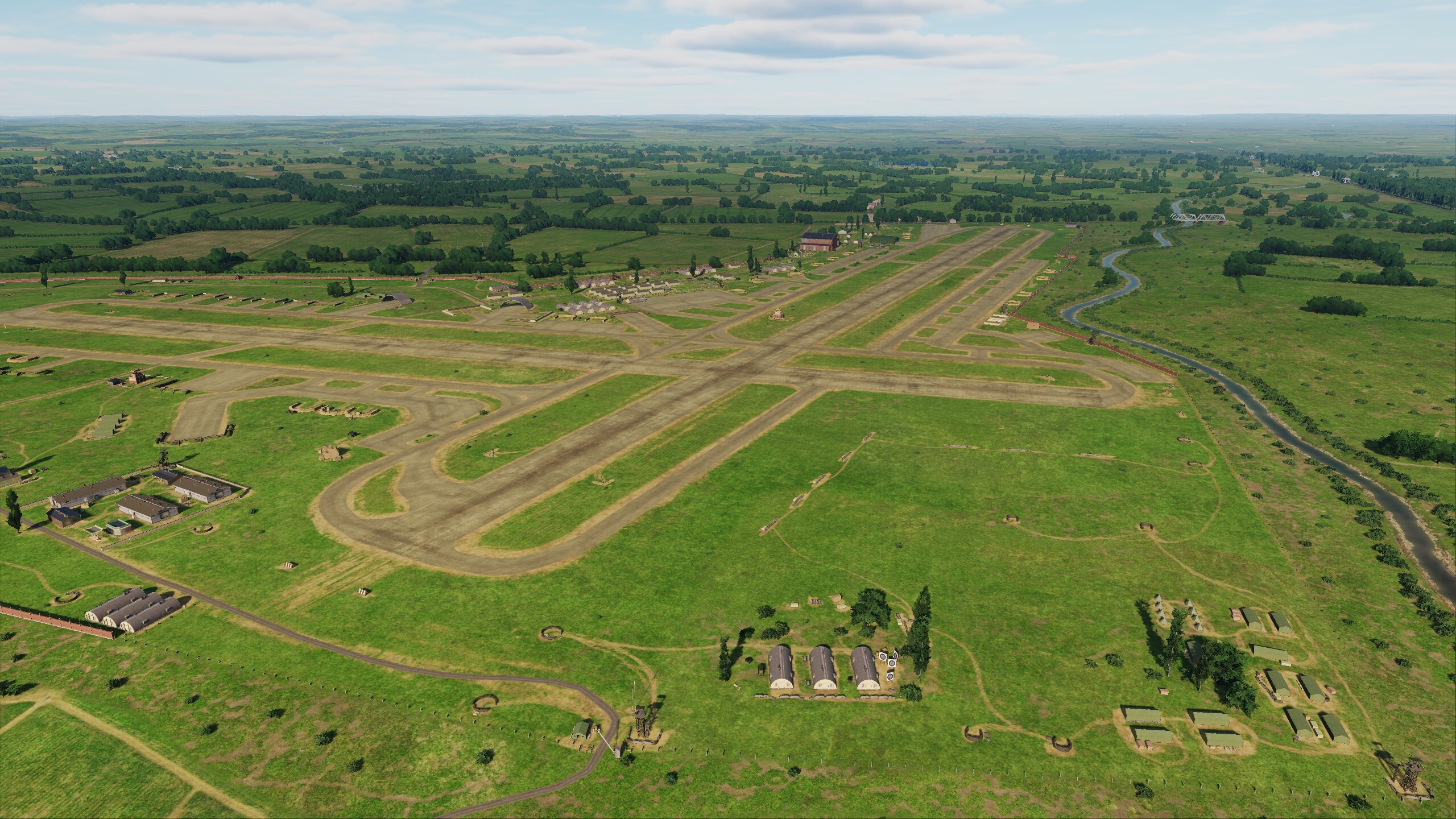
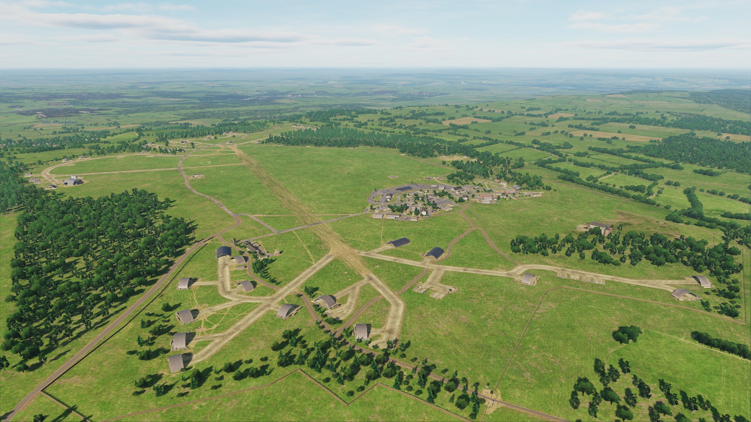
Hi fighters Long time no see. All this time, the team worked hard and today we will show you something. You know that Normandy2.0 is significantly larger than Normandy1944 and the Channel map, and provides users with significantly more opportunities to implement scenarios of the World War II. And the Ugra-Media team is happy to share the results of the development of the map, which allow you to realize the scenarios of the initial period of this war, including the Battle of Britain - the greatest battle in the sky of all times and nations. In this update, we add 7 airfields that you know: - Biggin Hill - Manston - Detling - Lympne - Abbeville Drucat - Merville Calonne - Saint-Omer Longuenesse - Wizernes This will allow you to adapt your missions and campaigns and supplement them with completely new historical scenarios. Now the distances have increased, build new routes, choose spare airfields and watch the fuel. We know your wishes for additional airfields on this territory. Stay tuned! Look at the first results of the work that is in full swing. Biggin Hill Saint-Omer Wizernes
- 49 replies
-
- 37
-
-
-
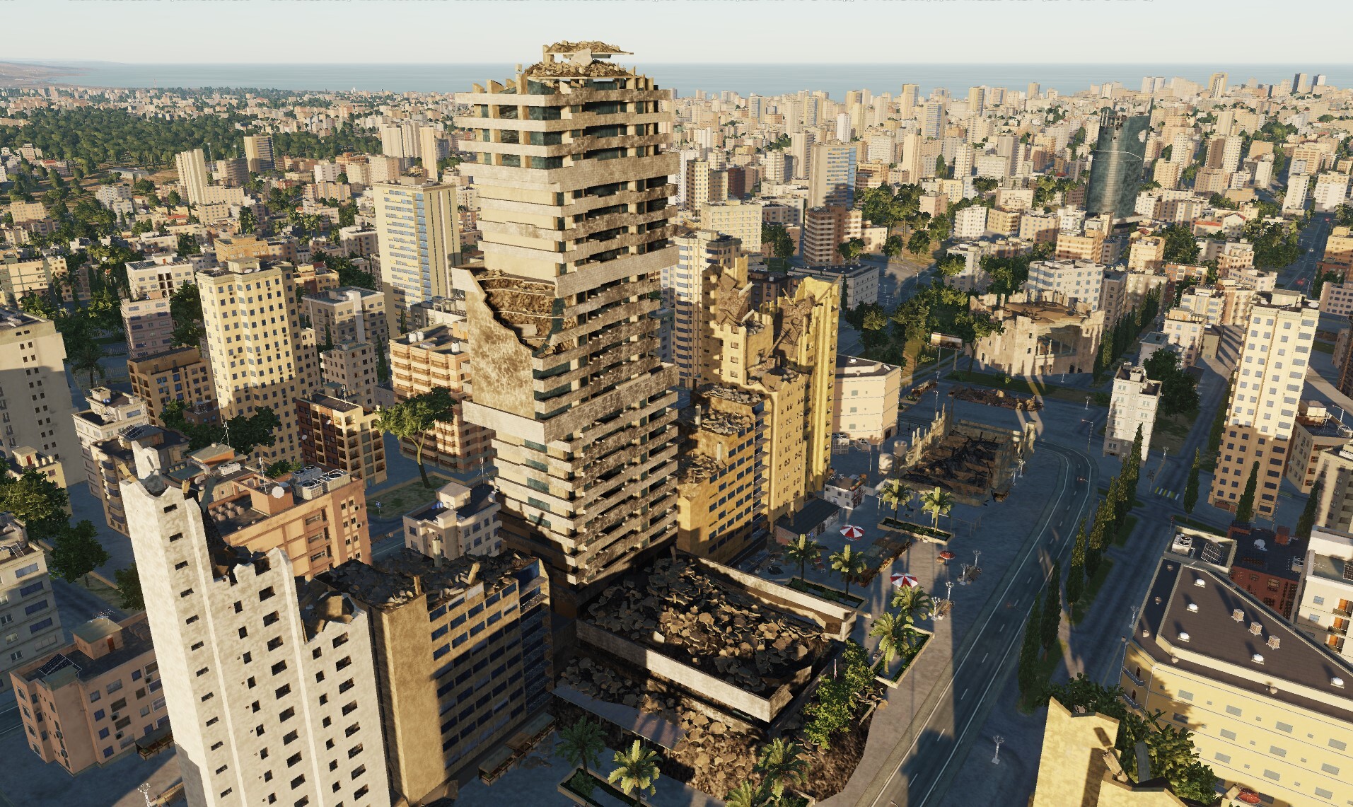
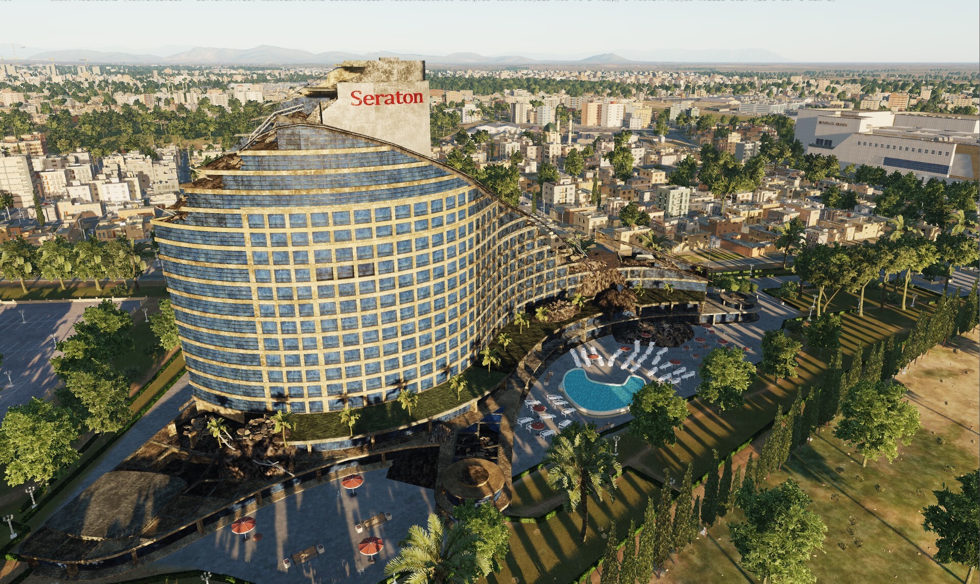
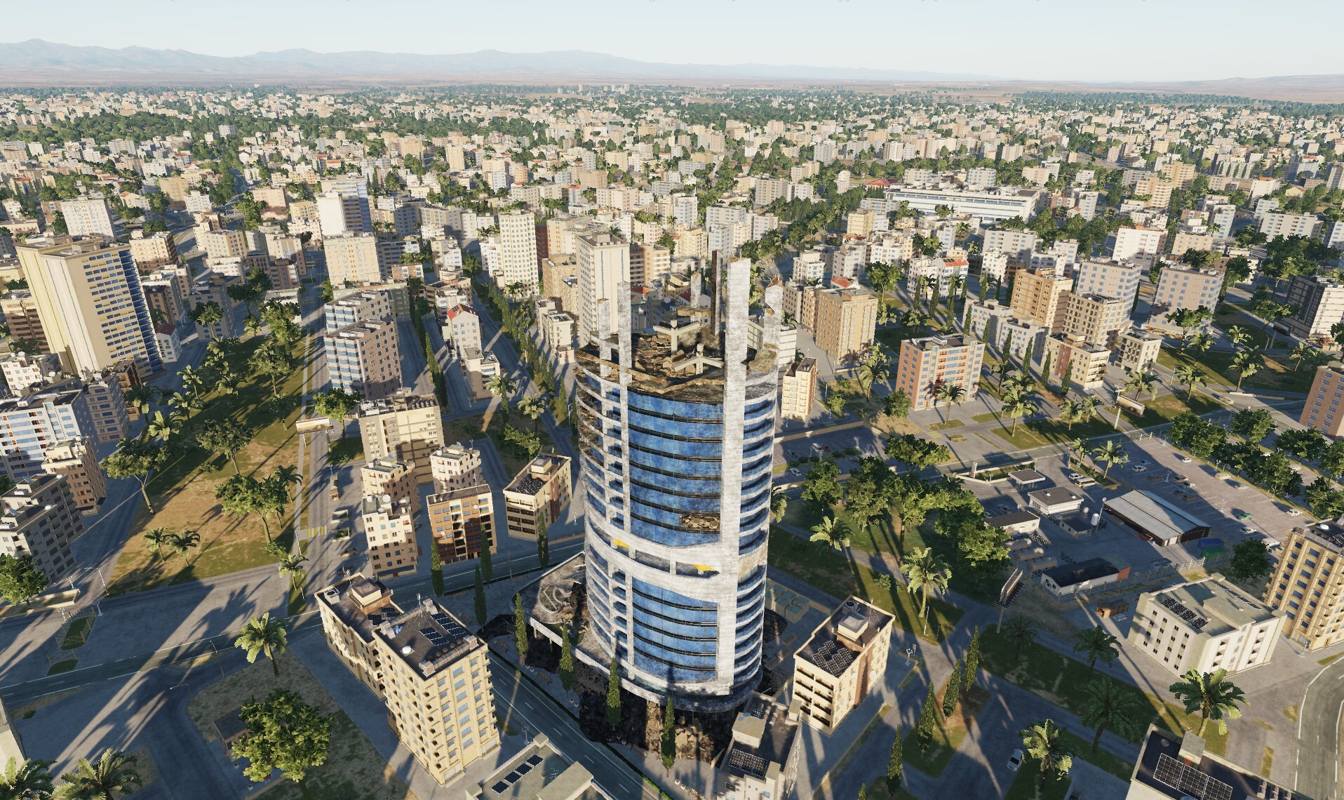
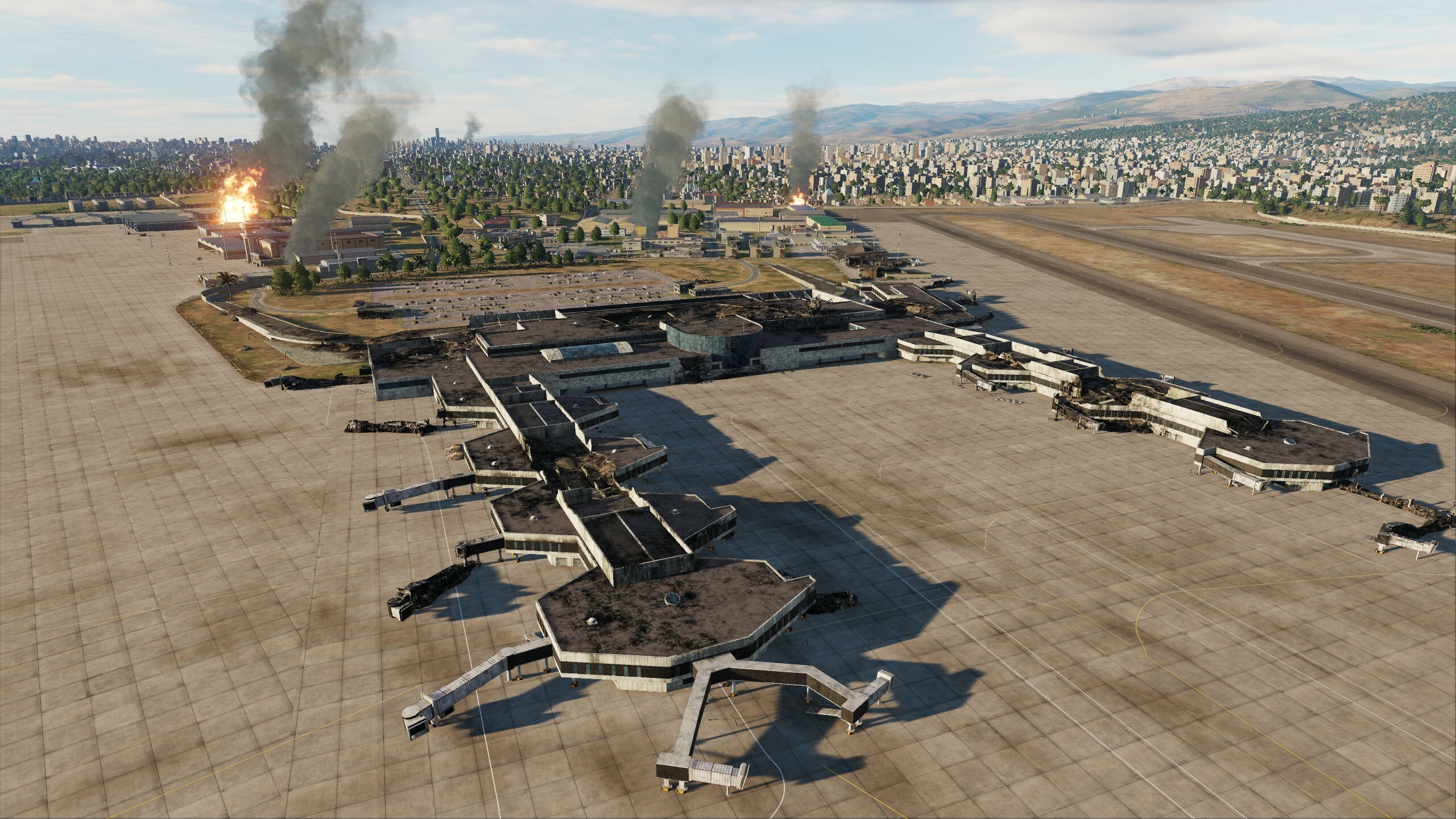
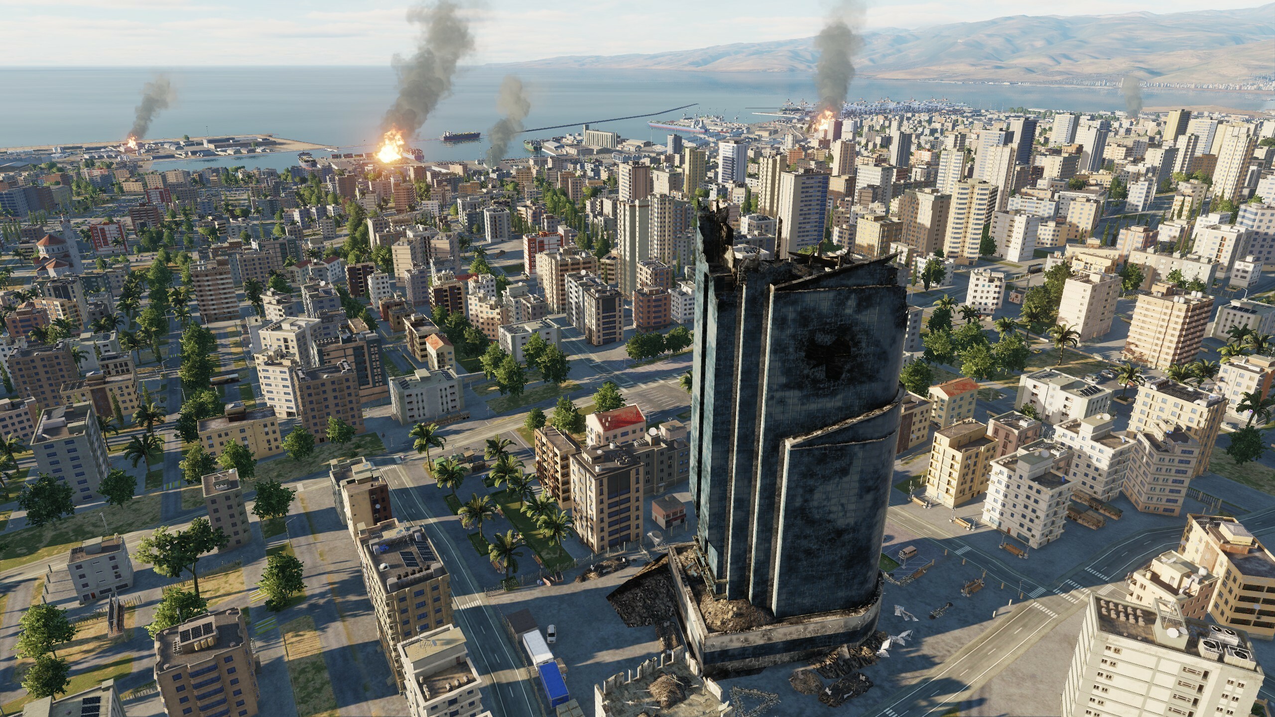
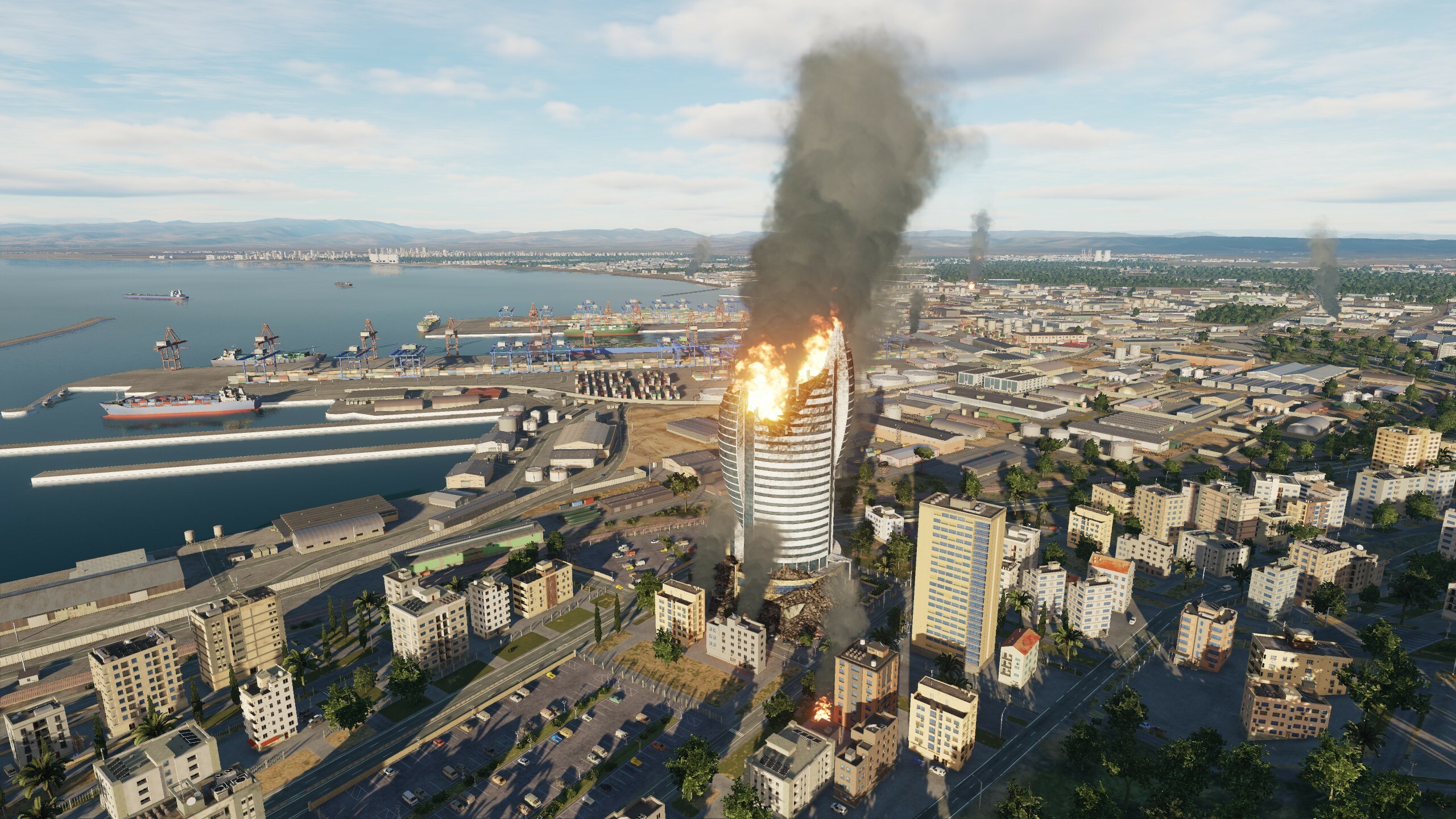
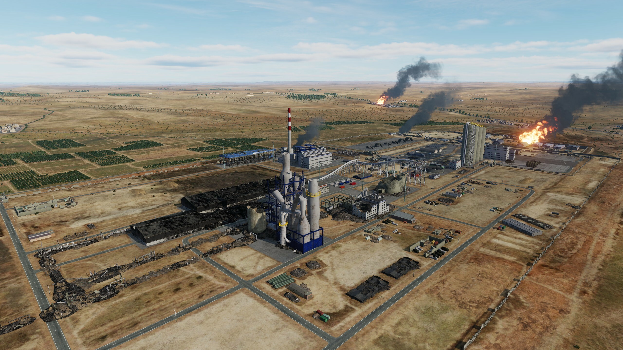
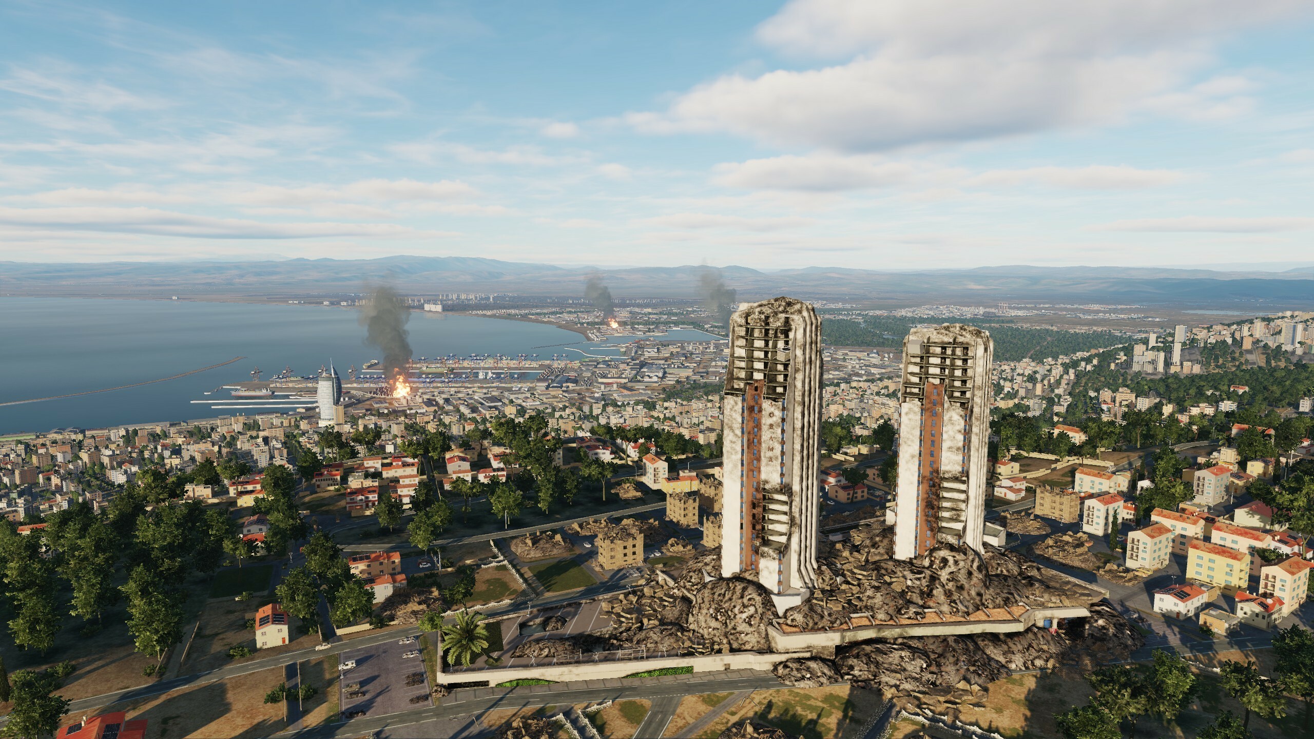
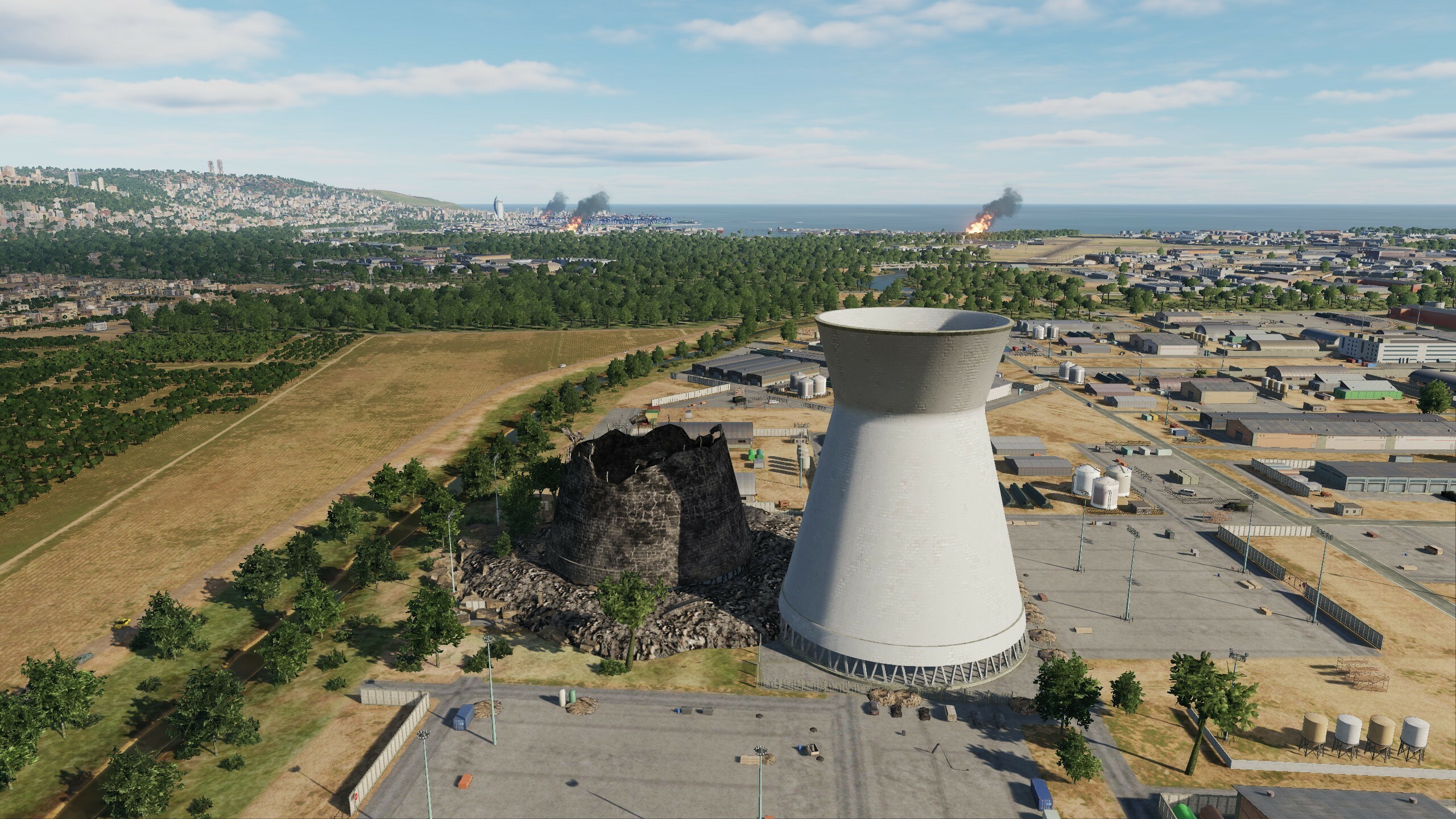
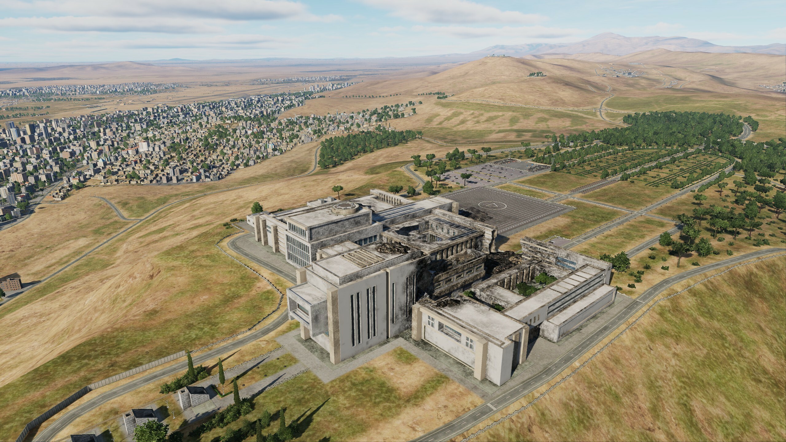
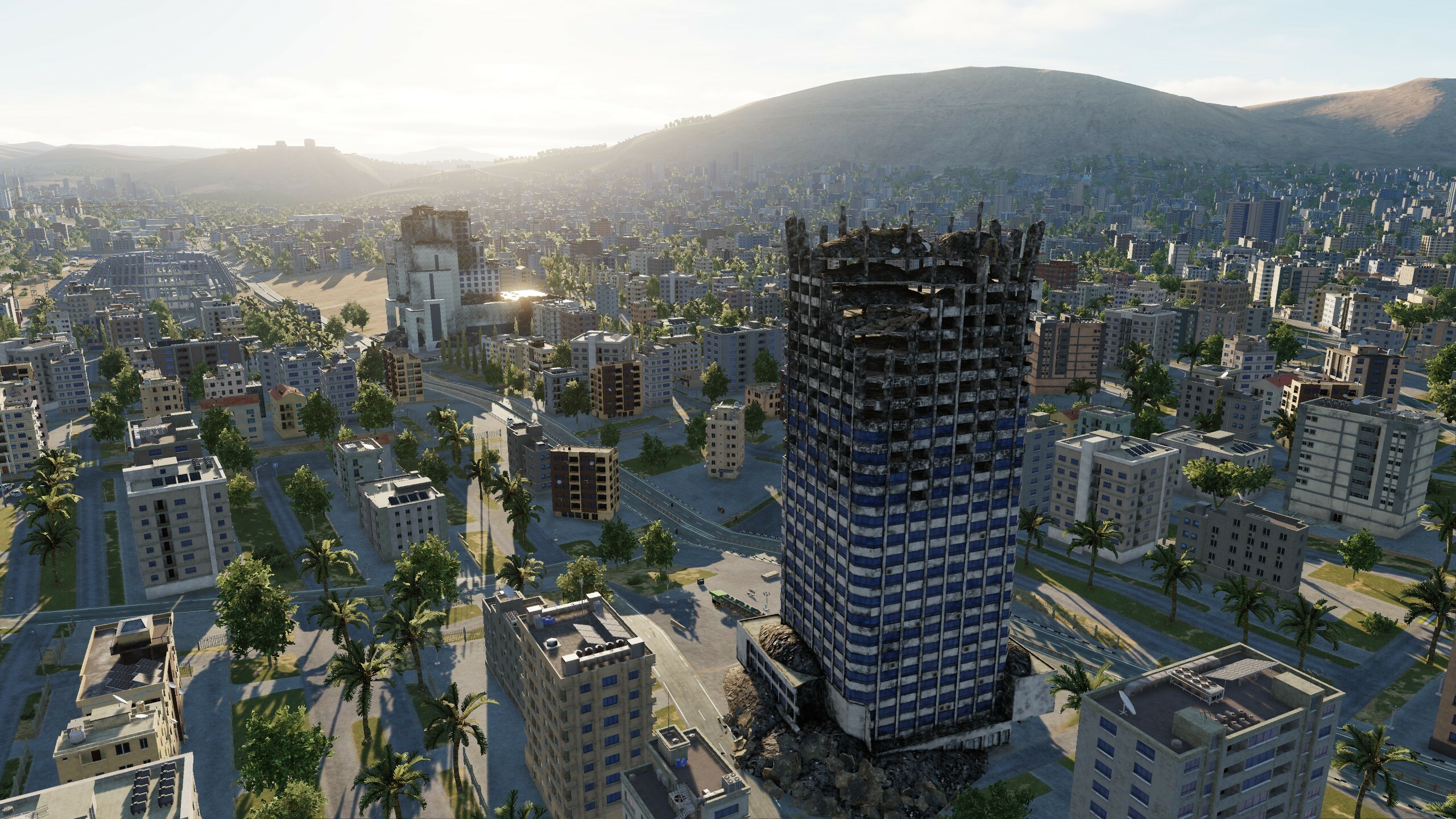
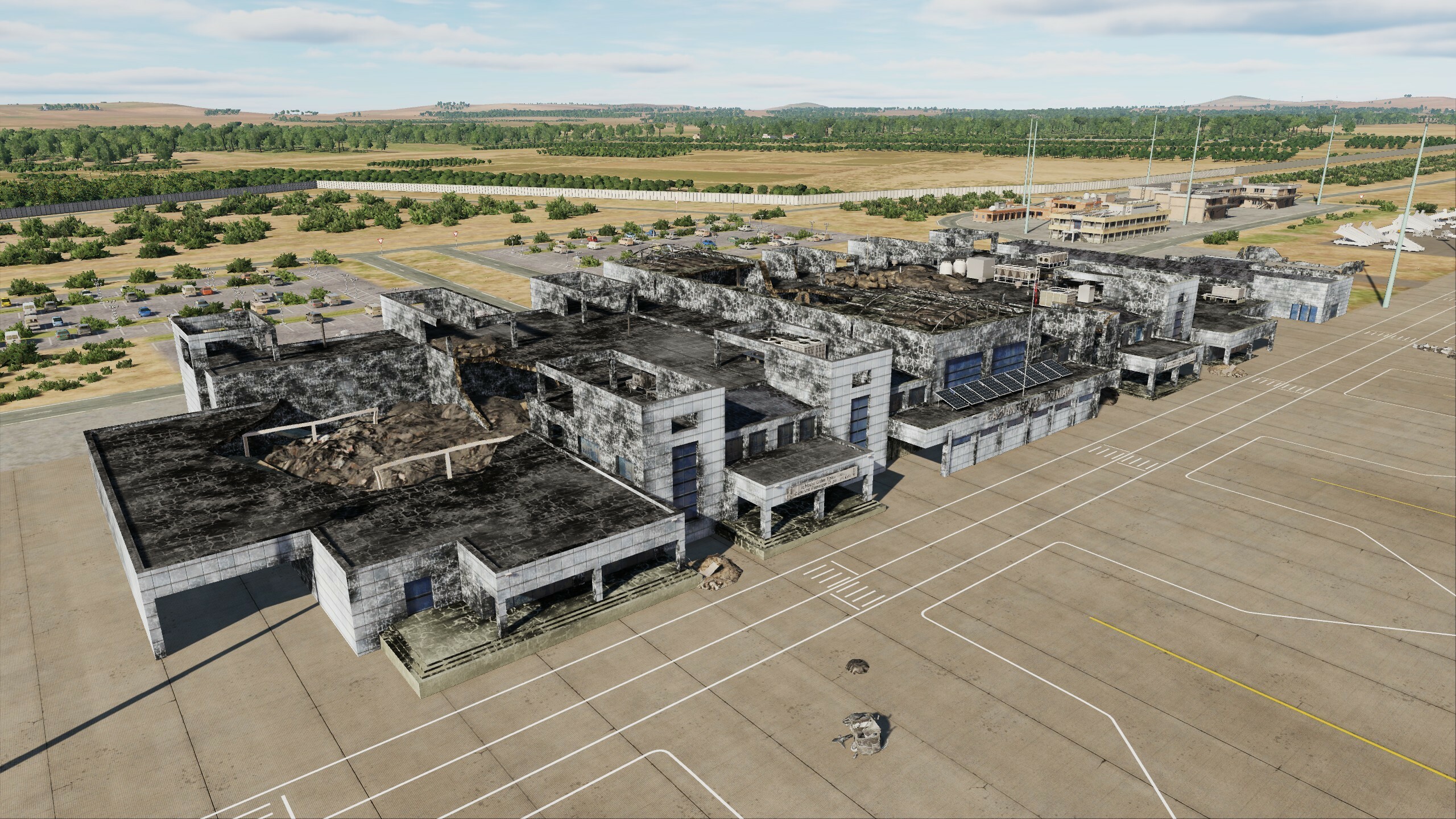
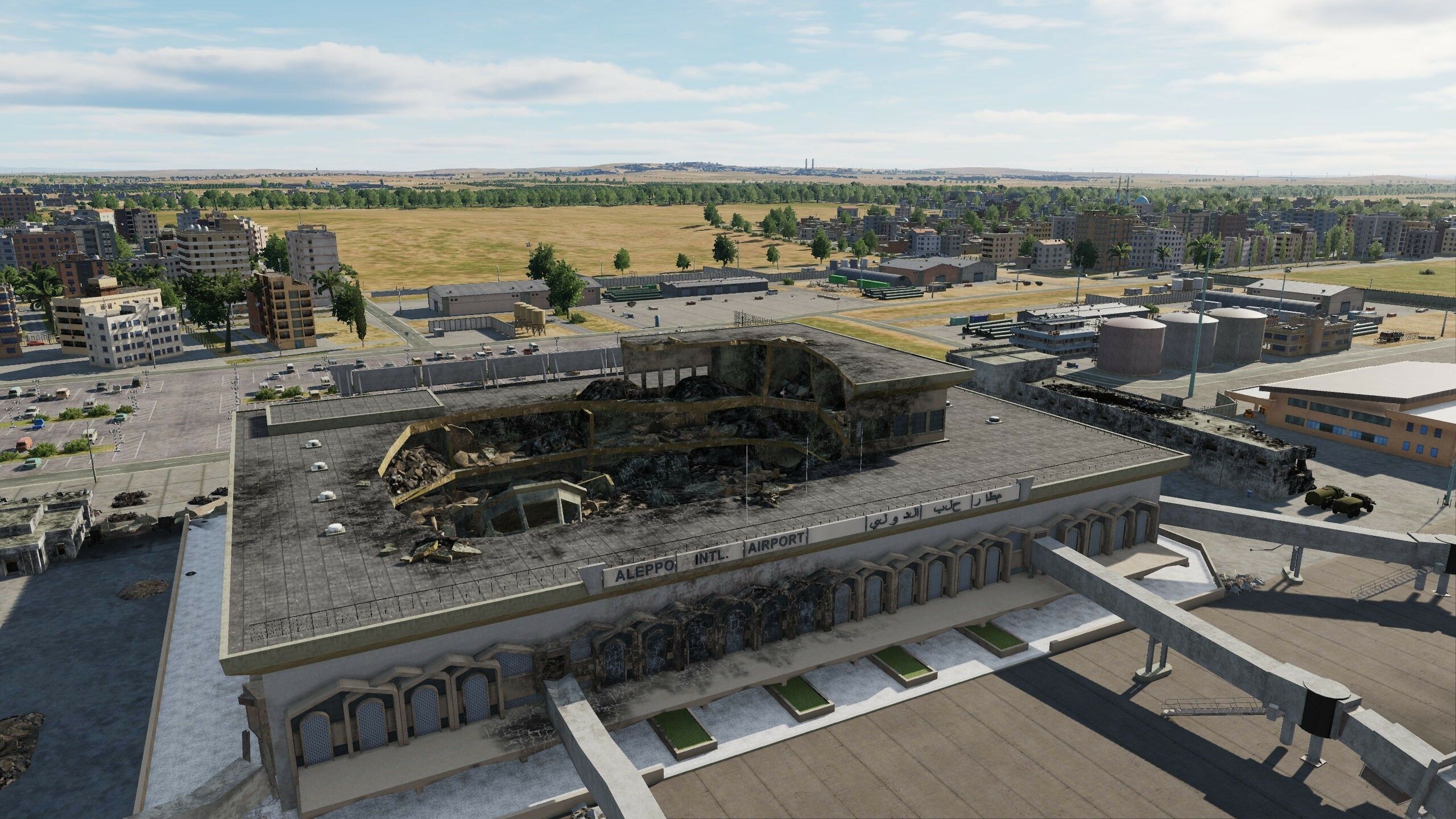
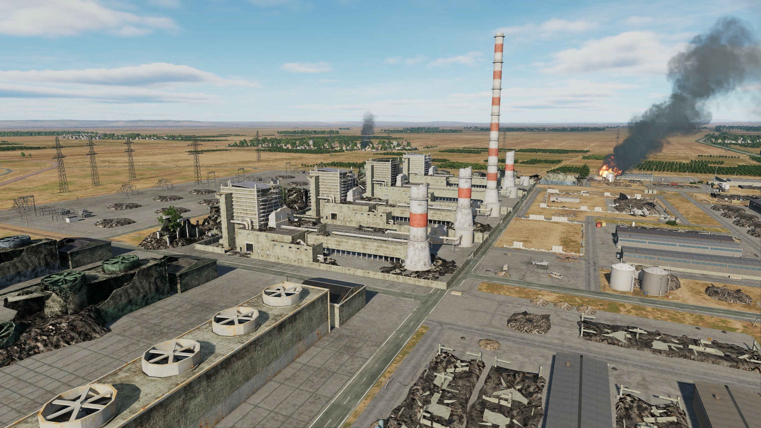
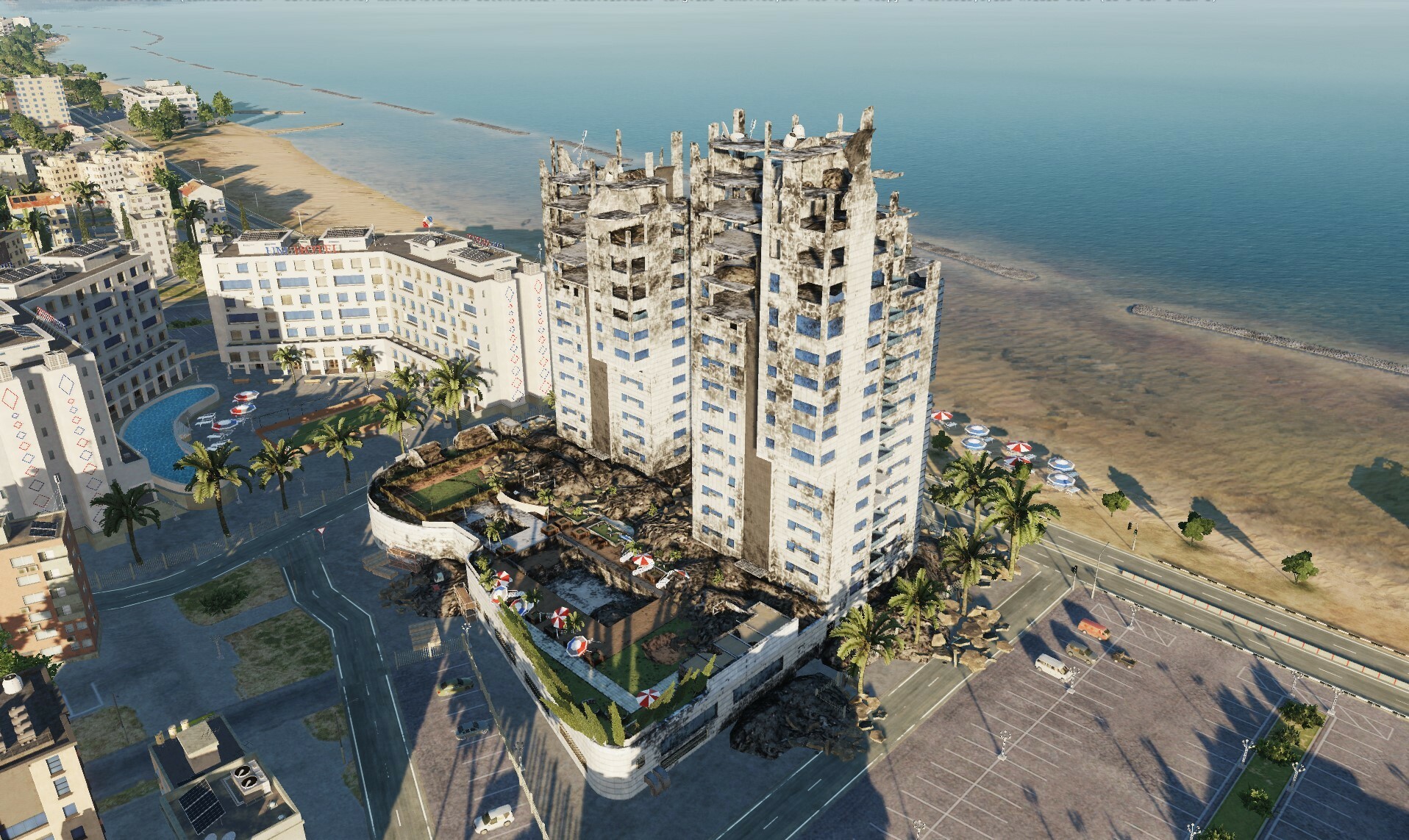
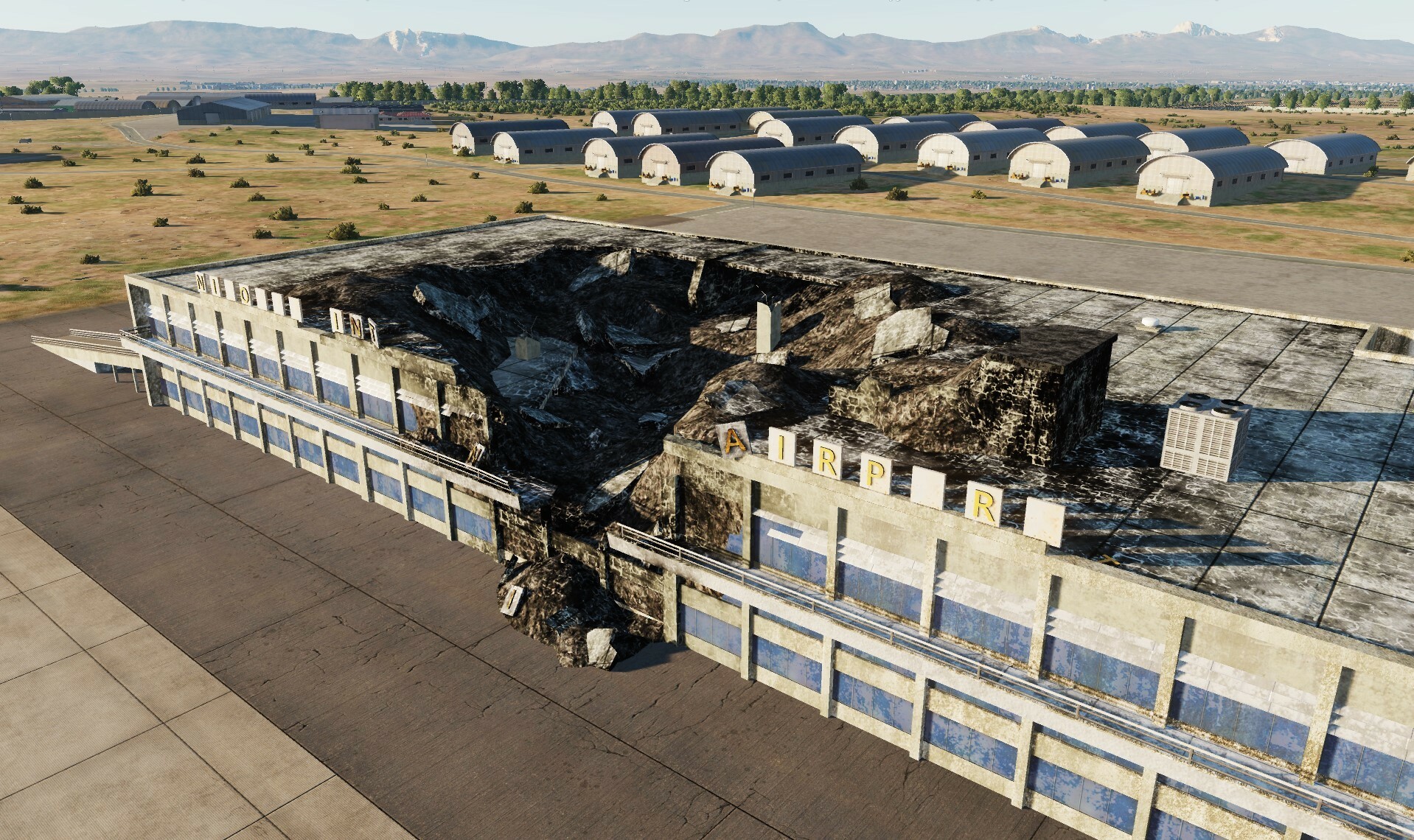
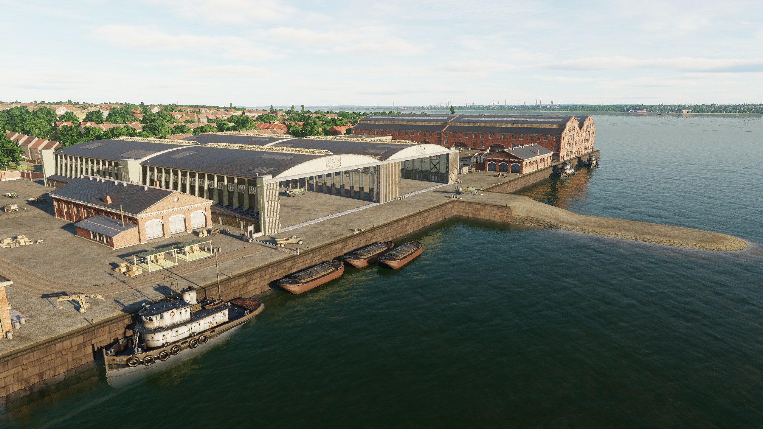
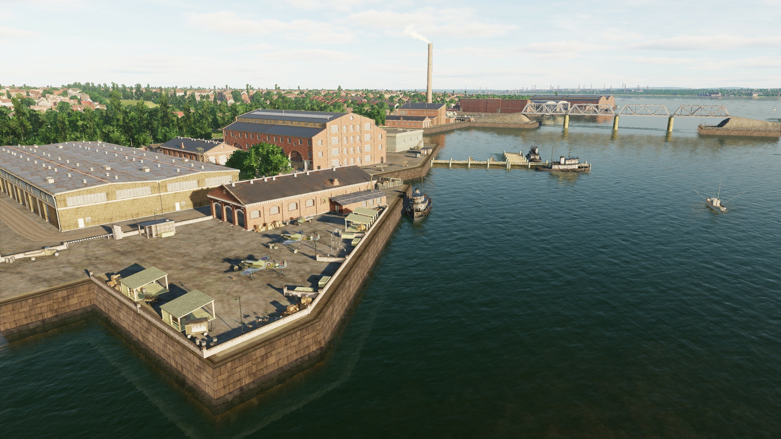
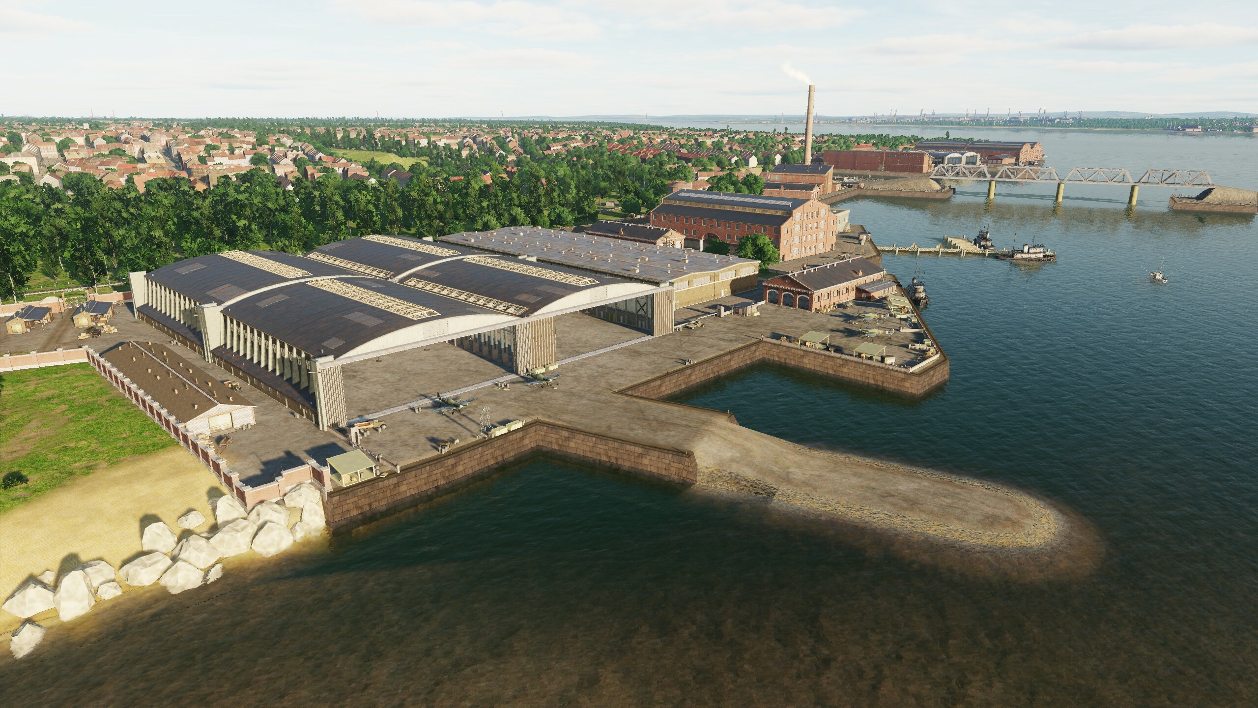
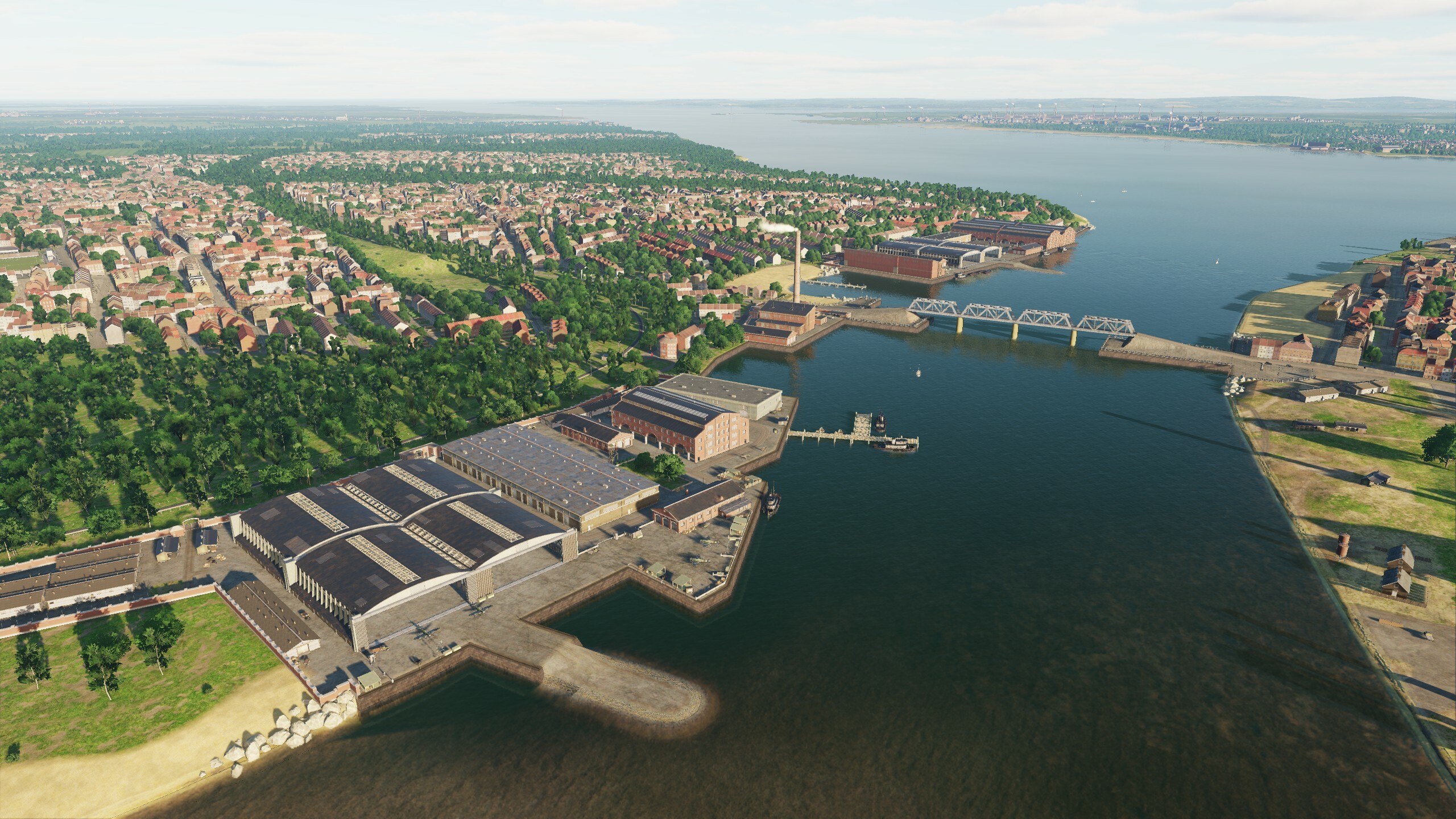
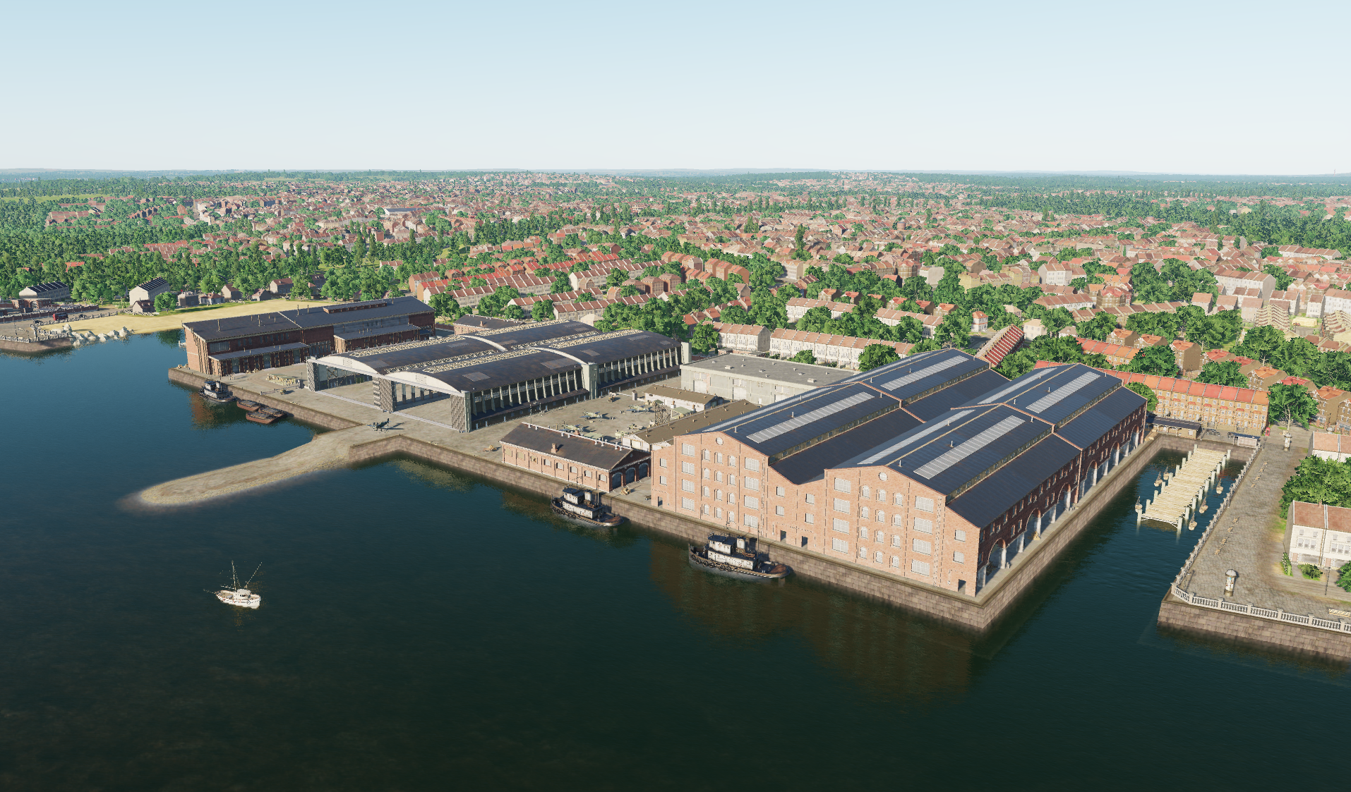
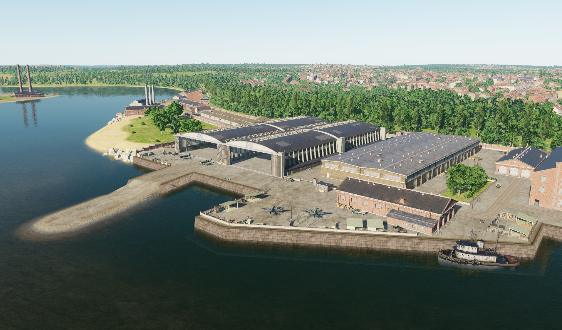
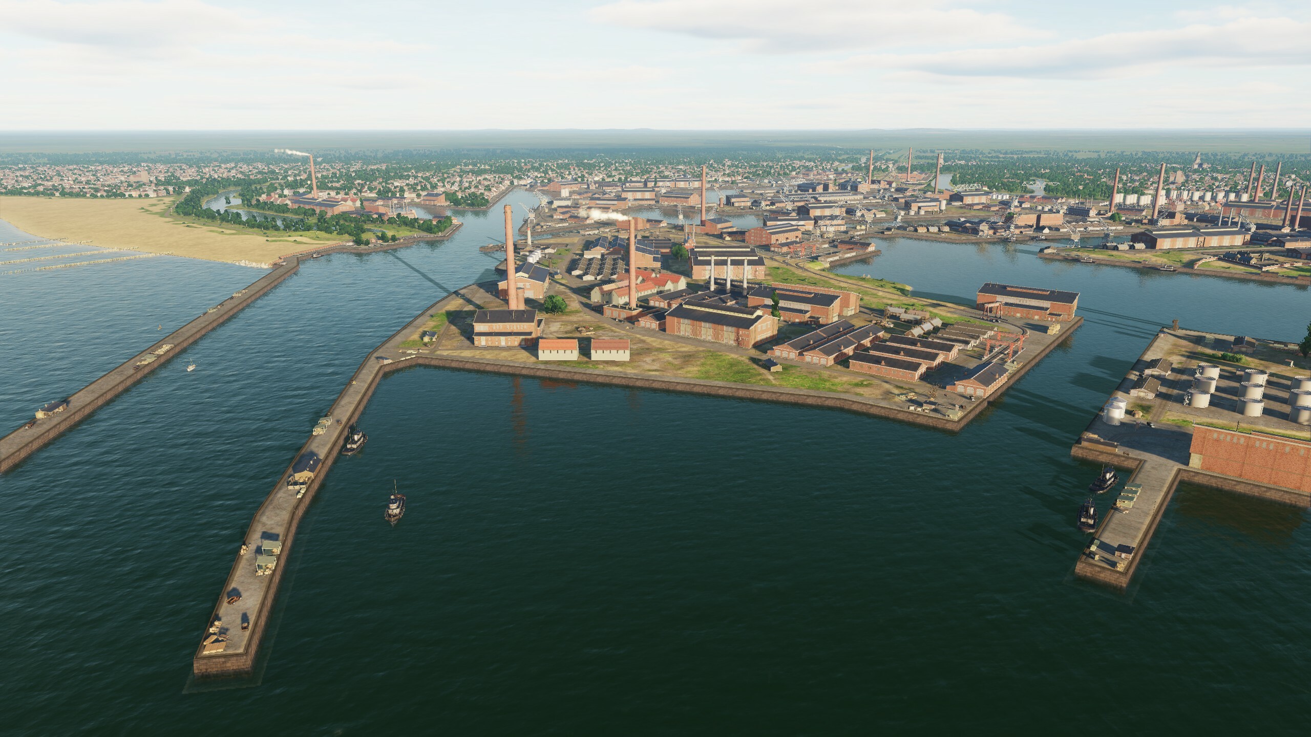
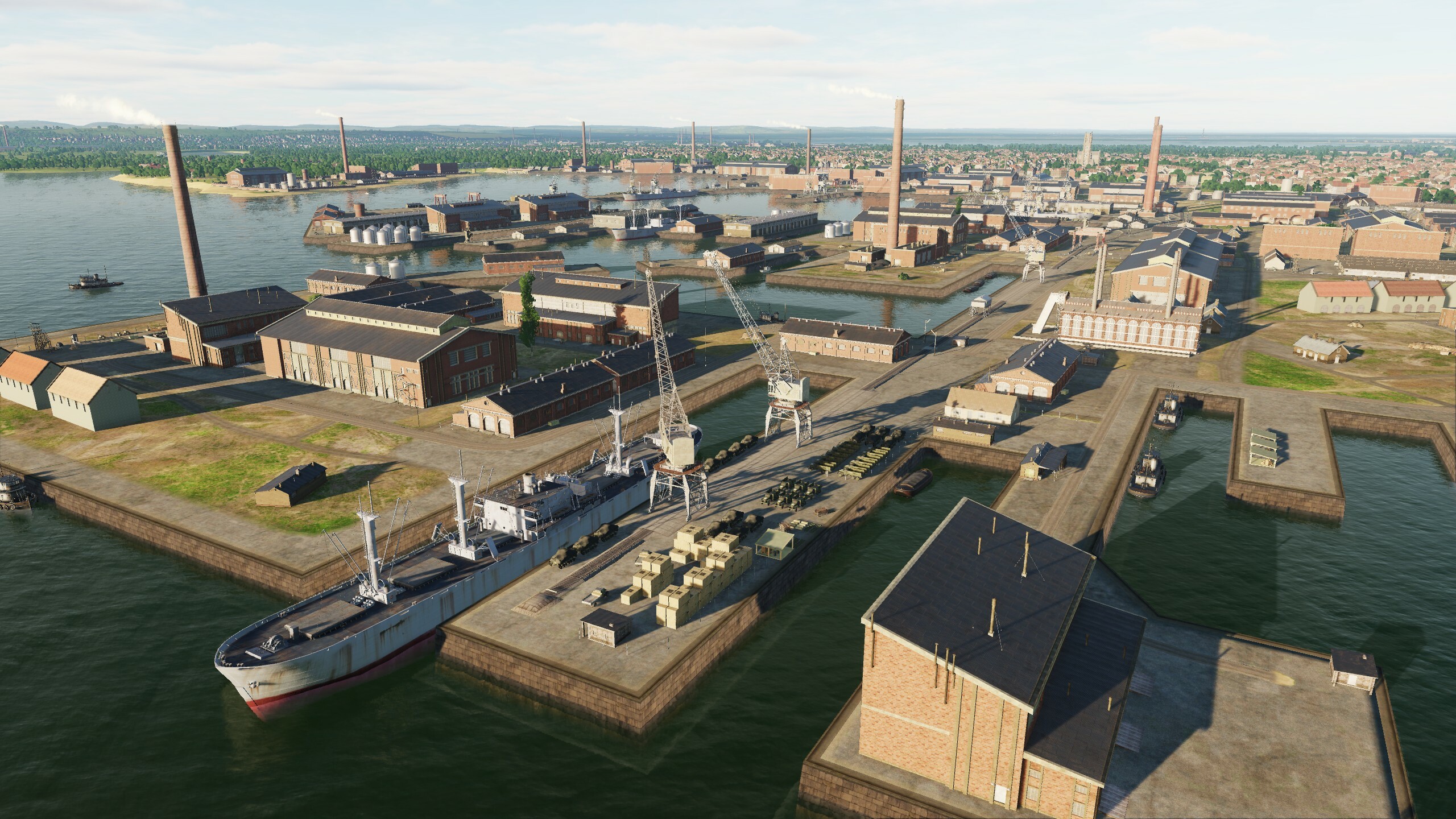
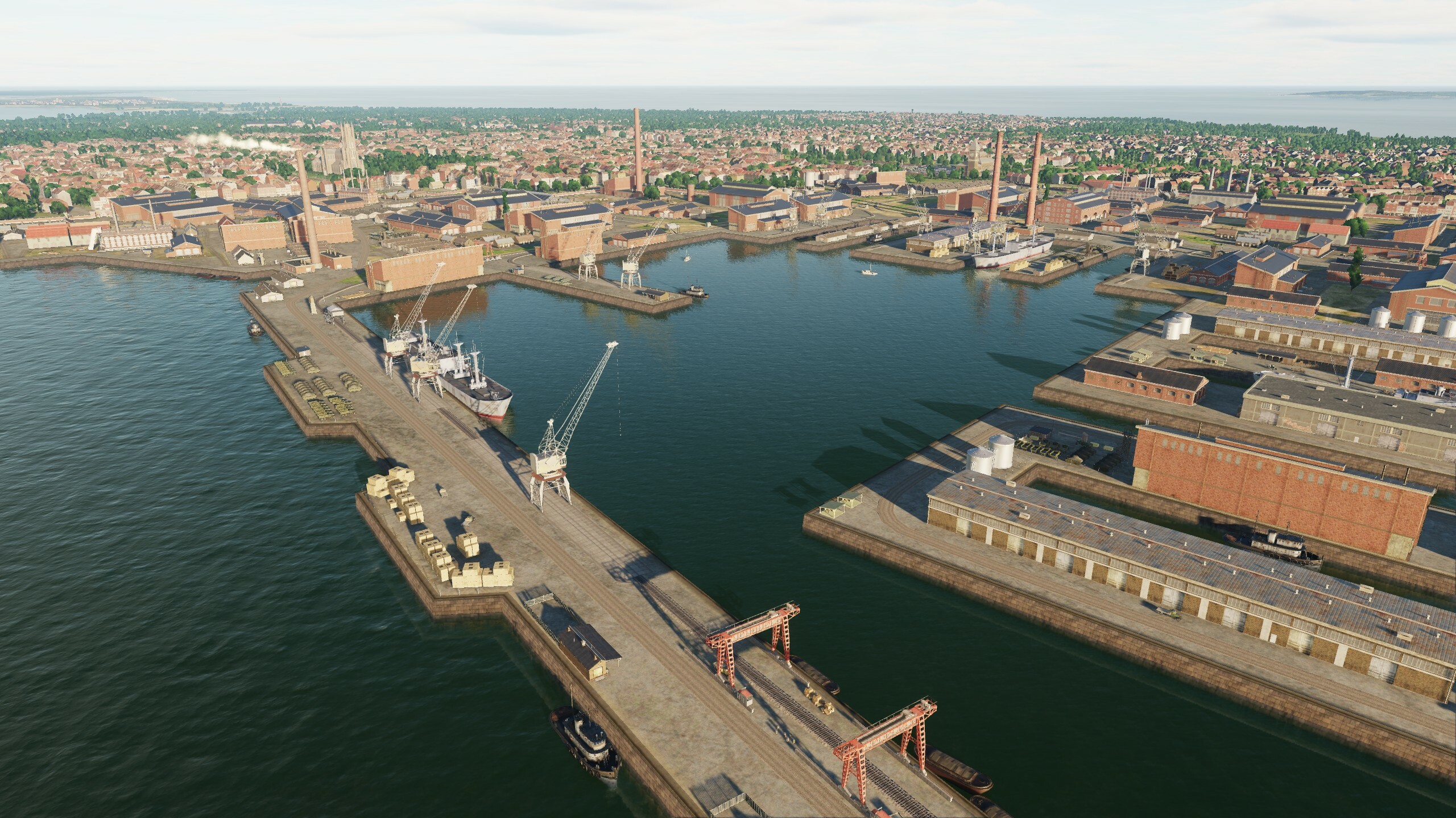
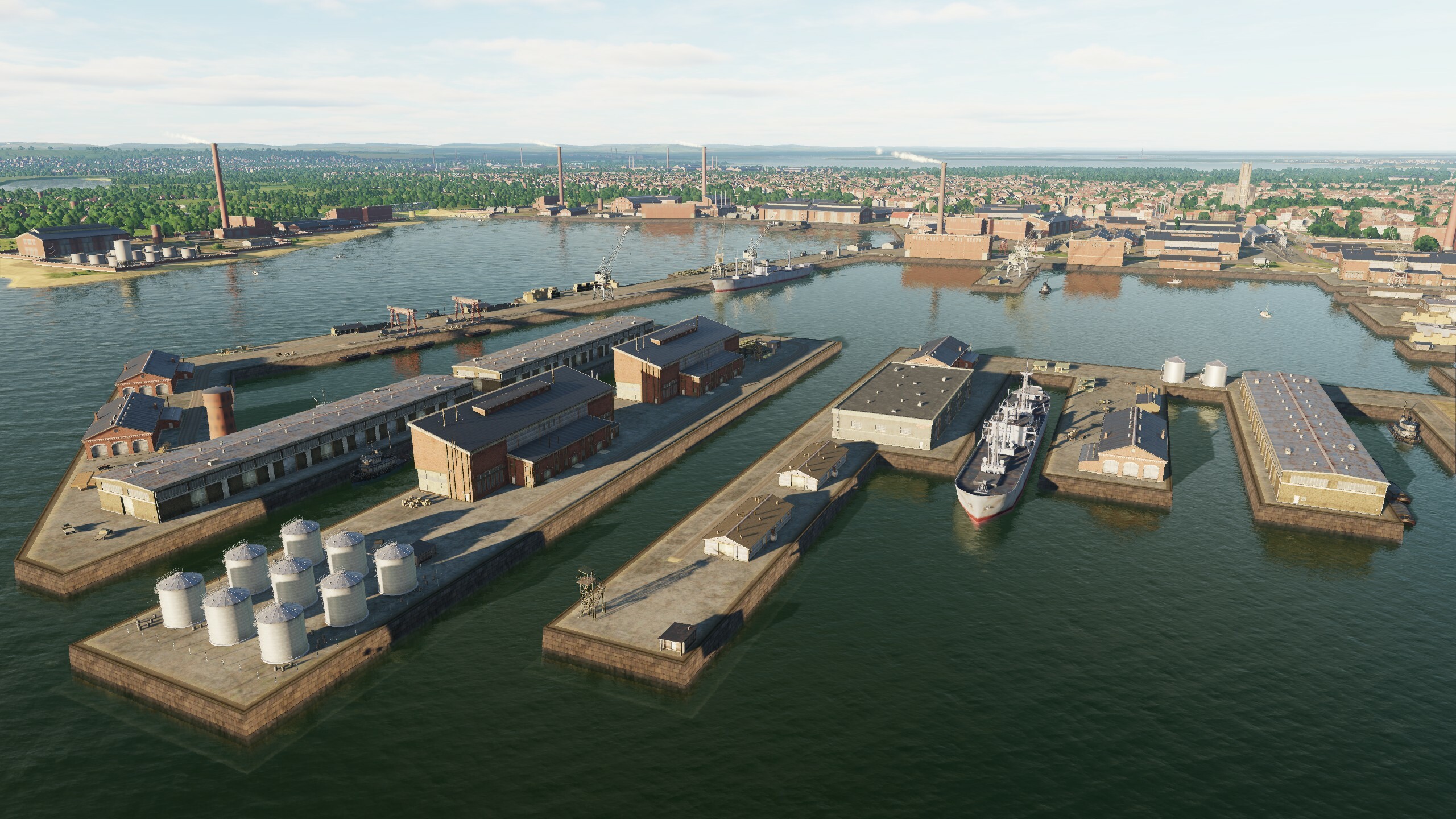
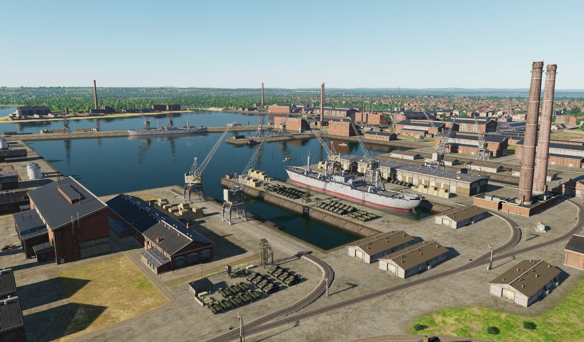
Hi destroyers! "Add damage models to objects" - this was one of the most popular requests for the Syria map. The peculiarity of modern buildings is that they are large in size or height. To make the destruction look more or less realistic, we divided large objects into parts and made a separate "damage" for each. When technology allows, we will be happy to make fully destructible building models. but already now you can diversify your flight missions thanks to this update You know that we do not do for some unique objects of the destruction model, but there were so many requests that demags are now available for the original objects - the terminals of Beirut, Damascus, Aleppo, Gaziantep, Paphos, Nicosia, Adana Hilton, Sheraton Adana, Haifa Tower hotels Panorama, Haifa Tower Sail, Damascus Tower, Limassol Olympic Residence, Platinum Tower Beirut, Sama Beirut, Assad Palace, Haifa Cooling Tower, Aleppo Power Plant and La Farge Factory. In addition to the damage, we have optimized night lighting and optimized city blocks, so that all the additions will definitely not degrade your performance. While your plane is being prepared, check out the pictures
- 125 replies
-
- 26
-
-
-
Hi Work on the night lighting was not stopped. We are looking for a balance between performance and beauty. Even now some of the new lights are switched off at a distance, somewhere they are replaced at the lod1 level by standard lights. All this will be available in the next update.
- 125 replies
-
- 10
-
-
-
Runway lights at Ramat David 90 degrees off
MAESTR0 replied to Beta Sokol's topic in Bugs and Problems
Hi @Beta Sokol @REDEYE_CVW-66 we quickly checked how it works for us. Waiting for update)
-
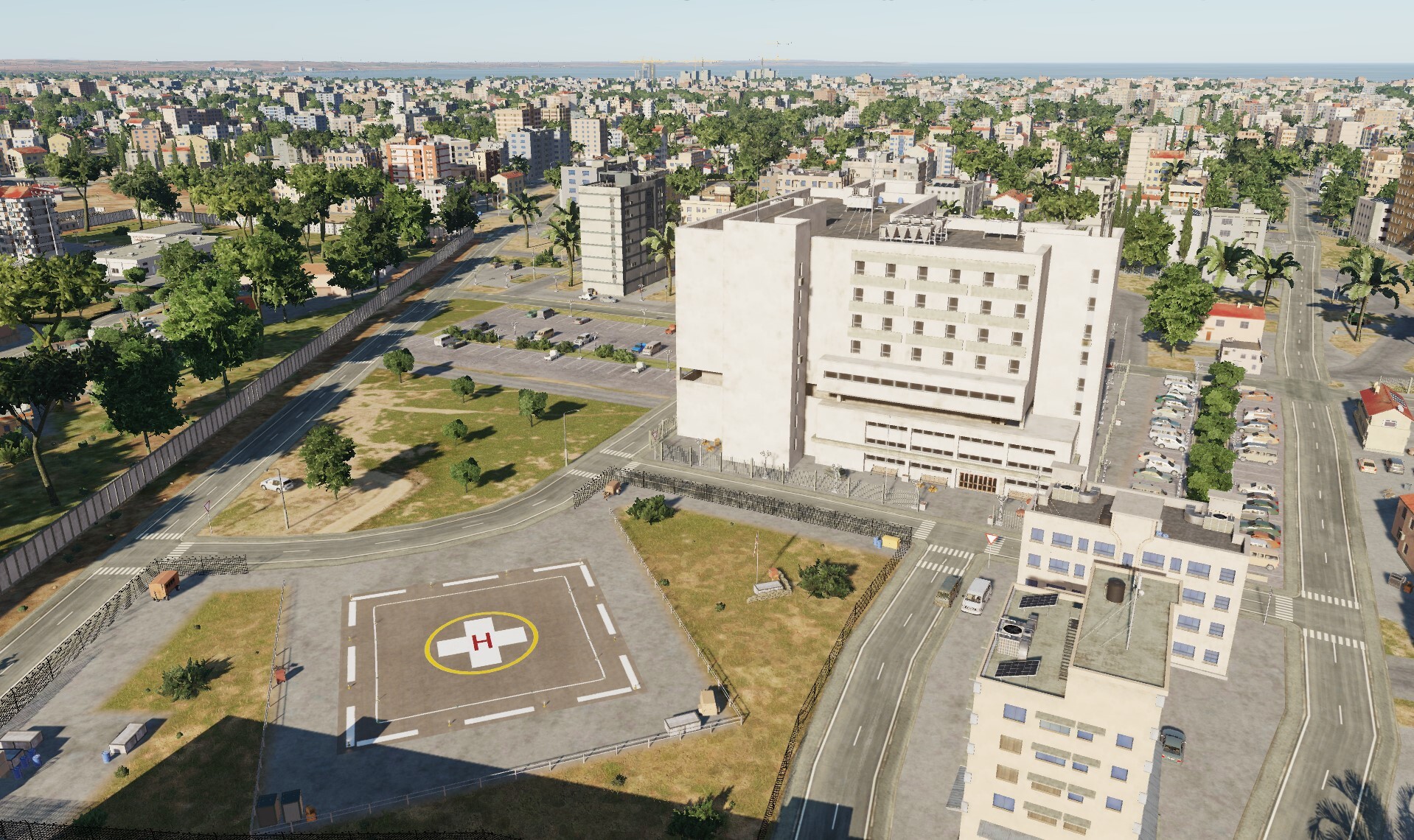
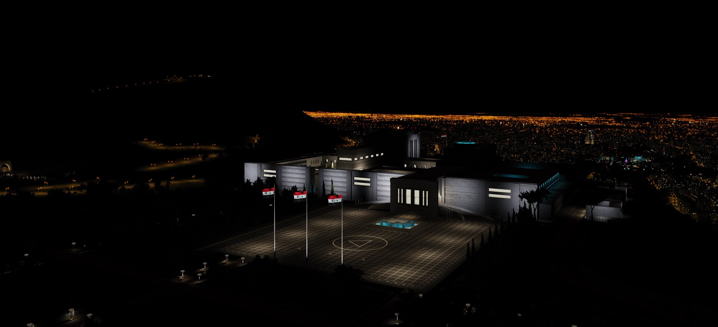
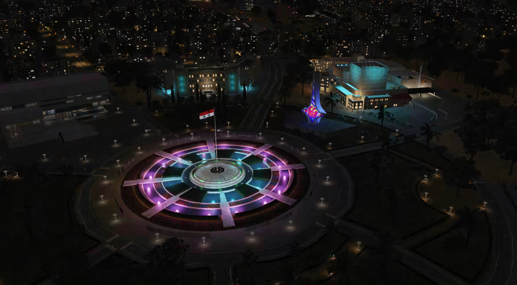
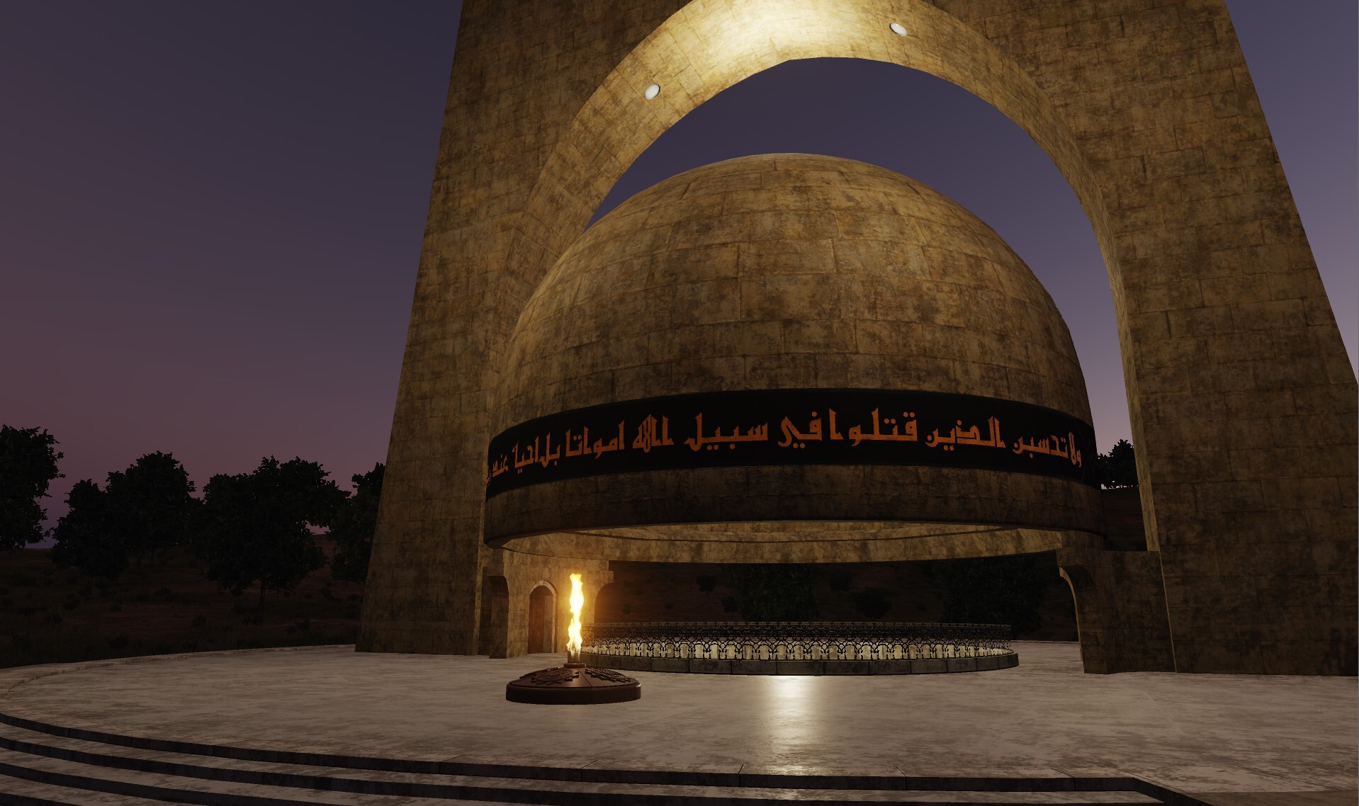
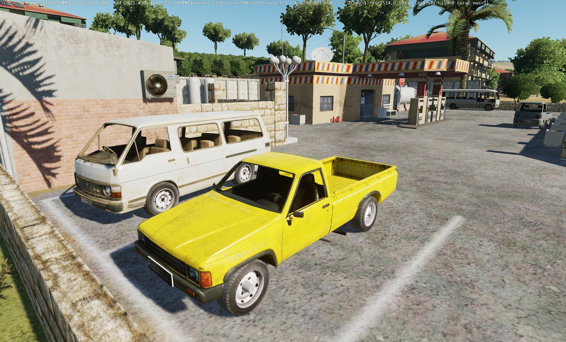
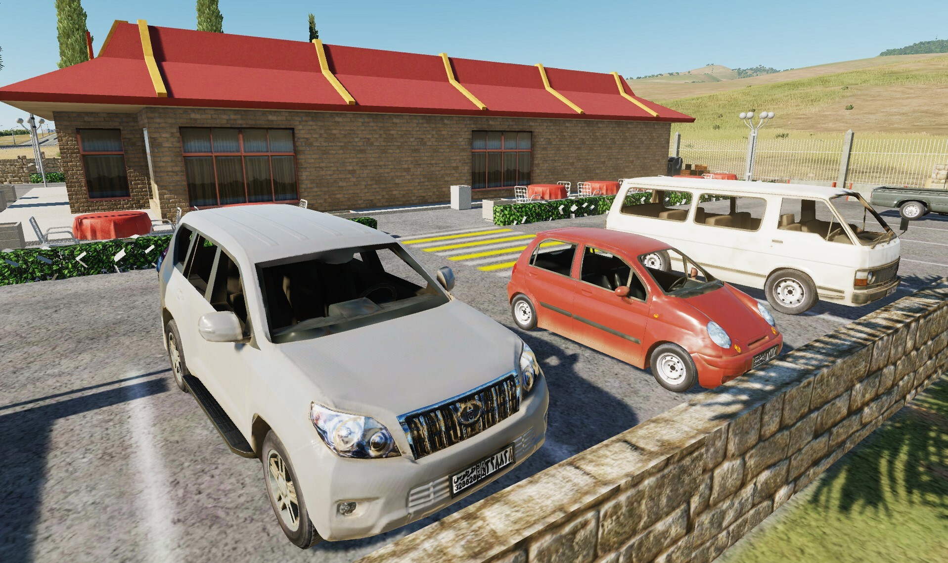
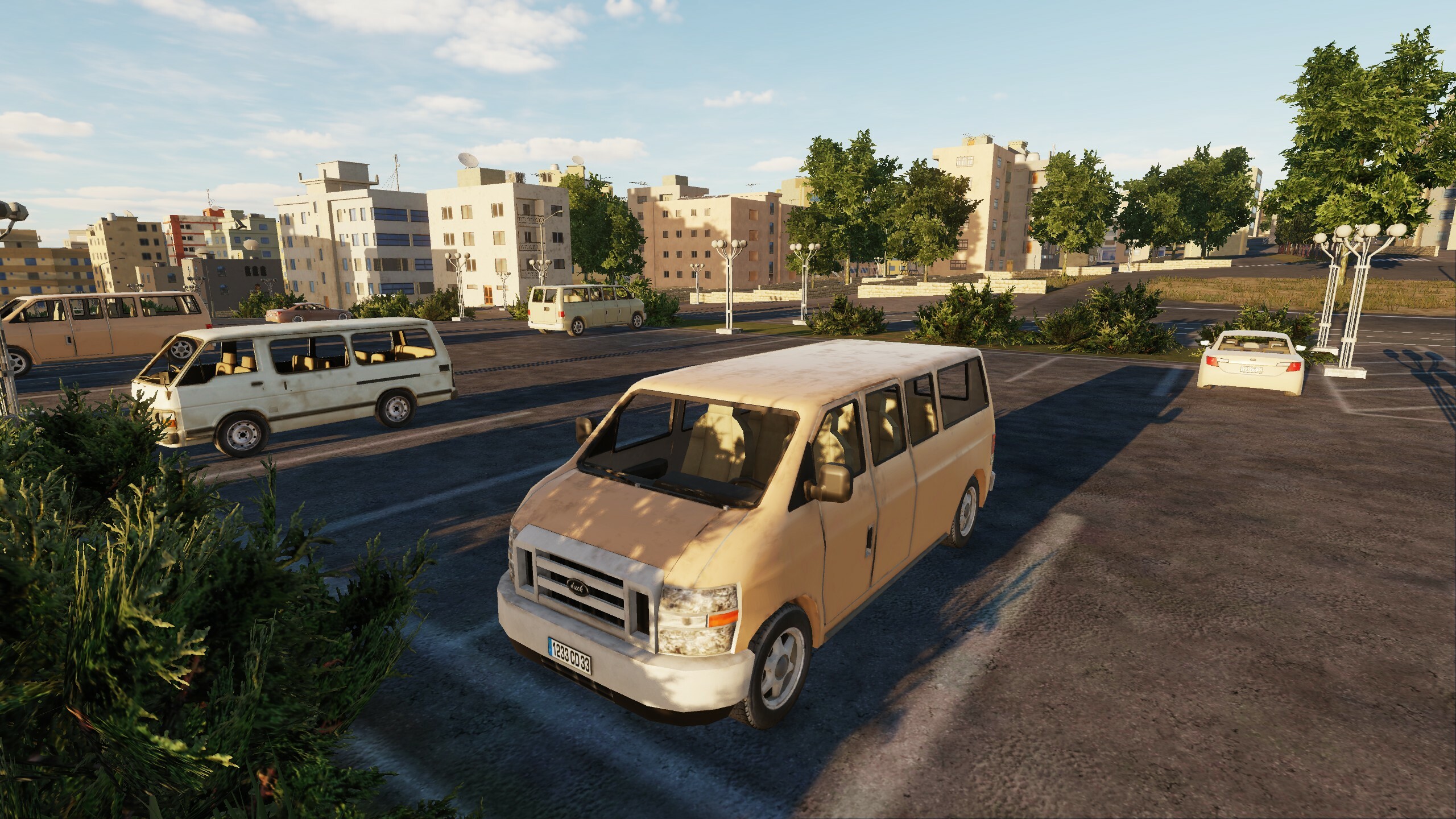
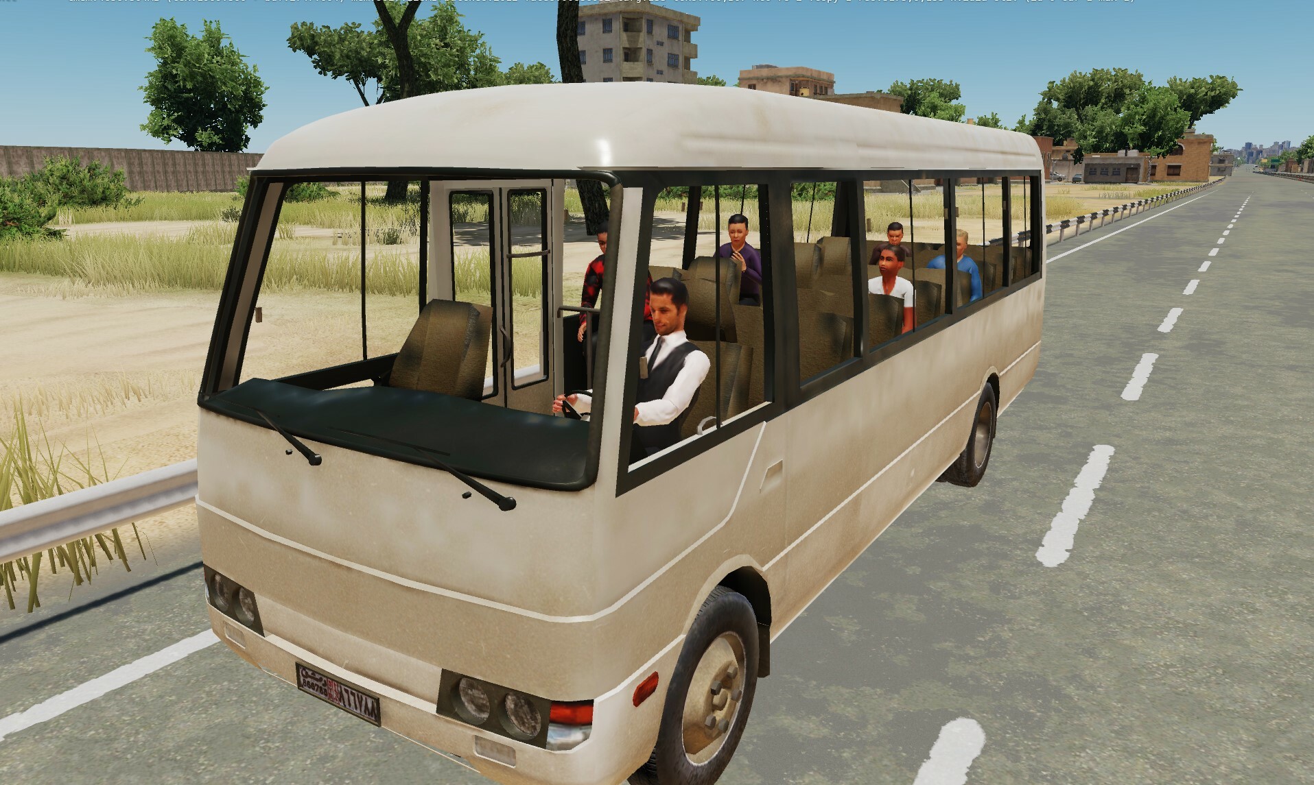
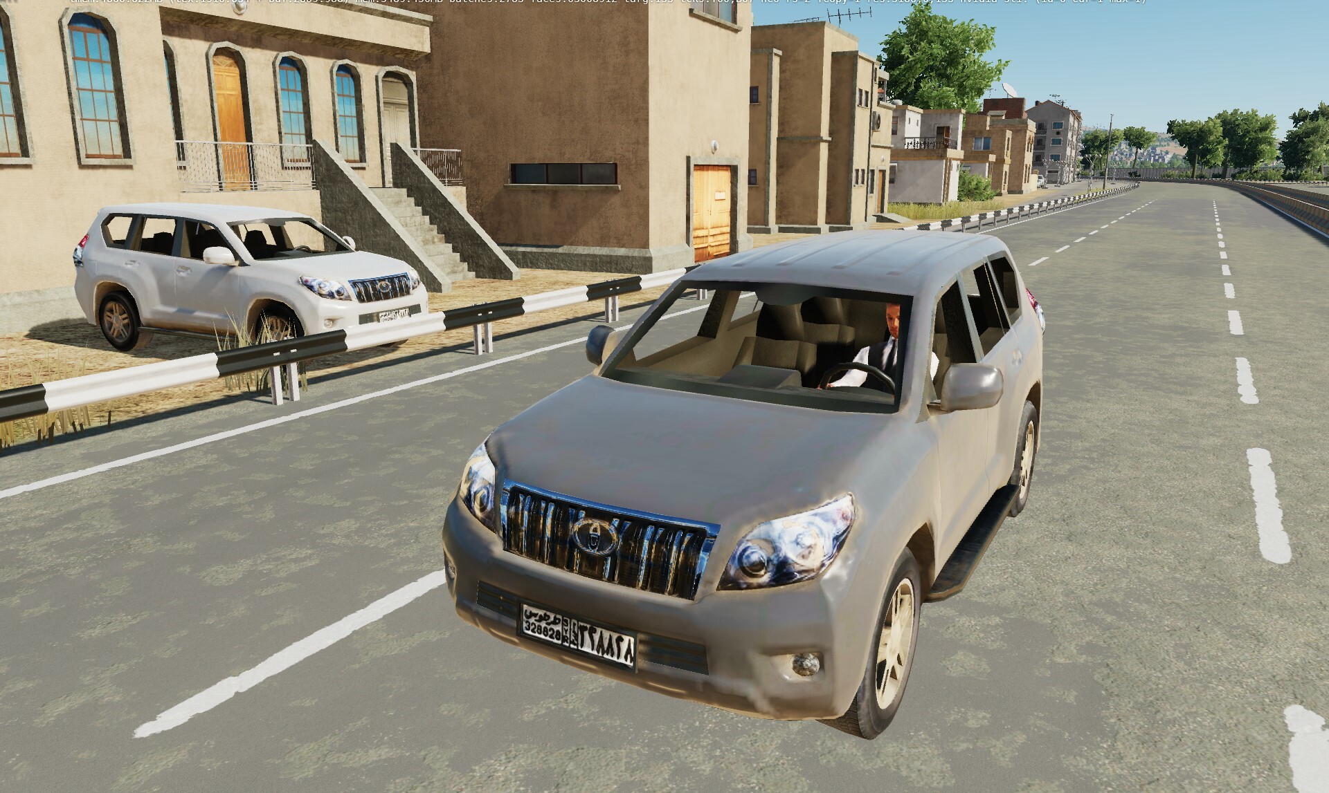
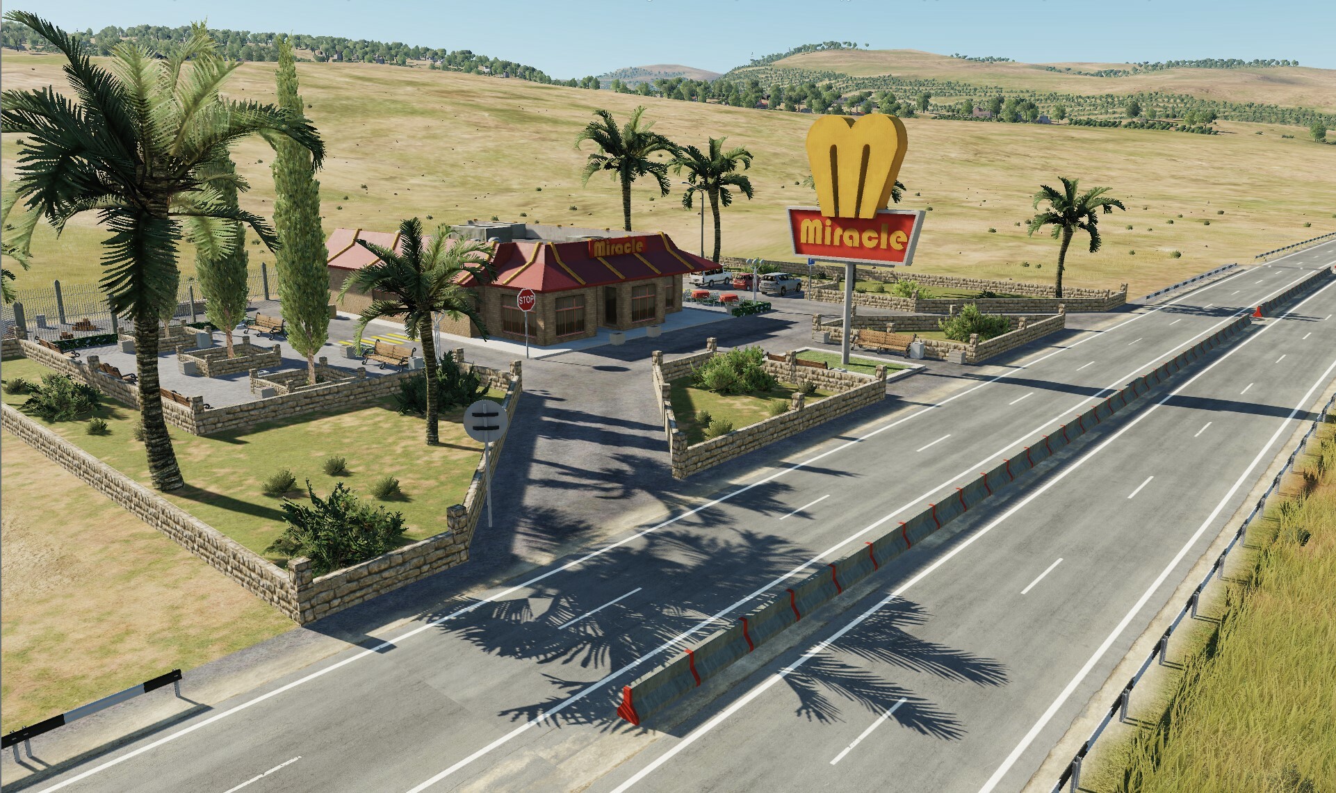
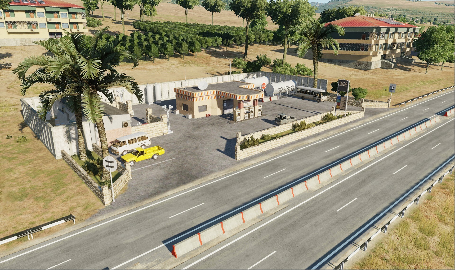
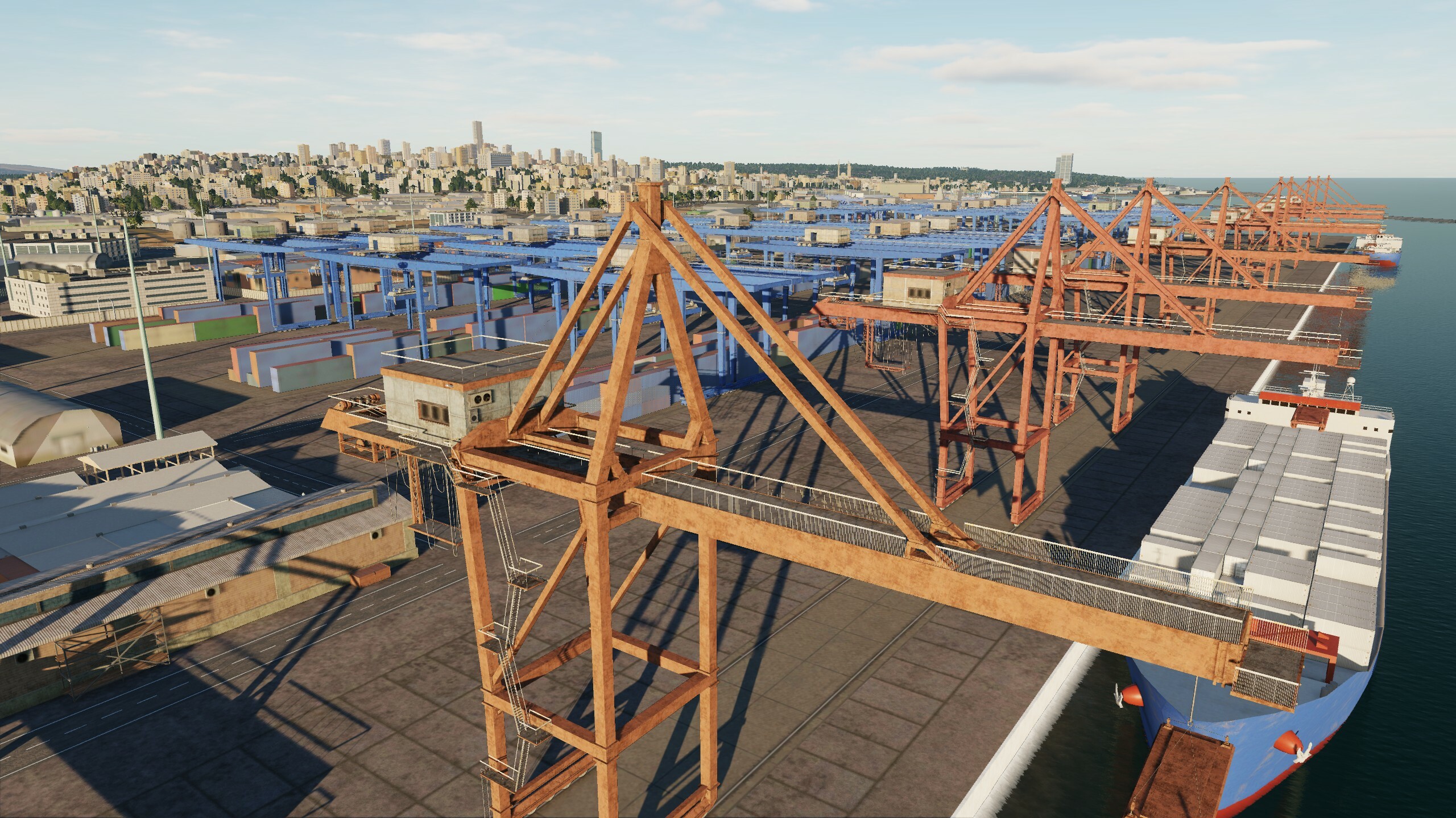
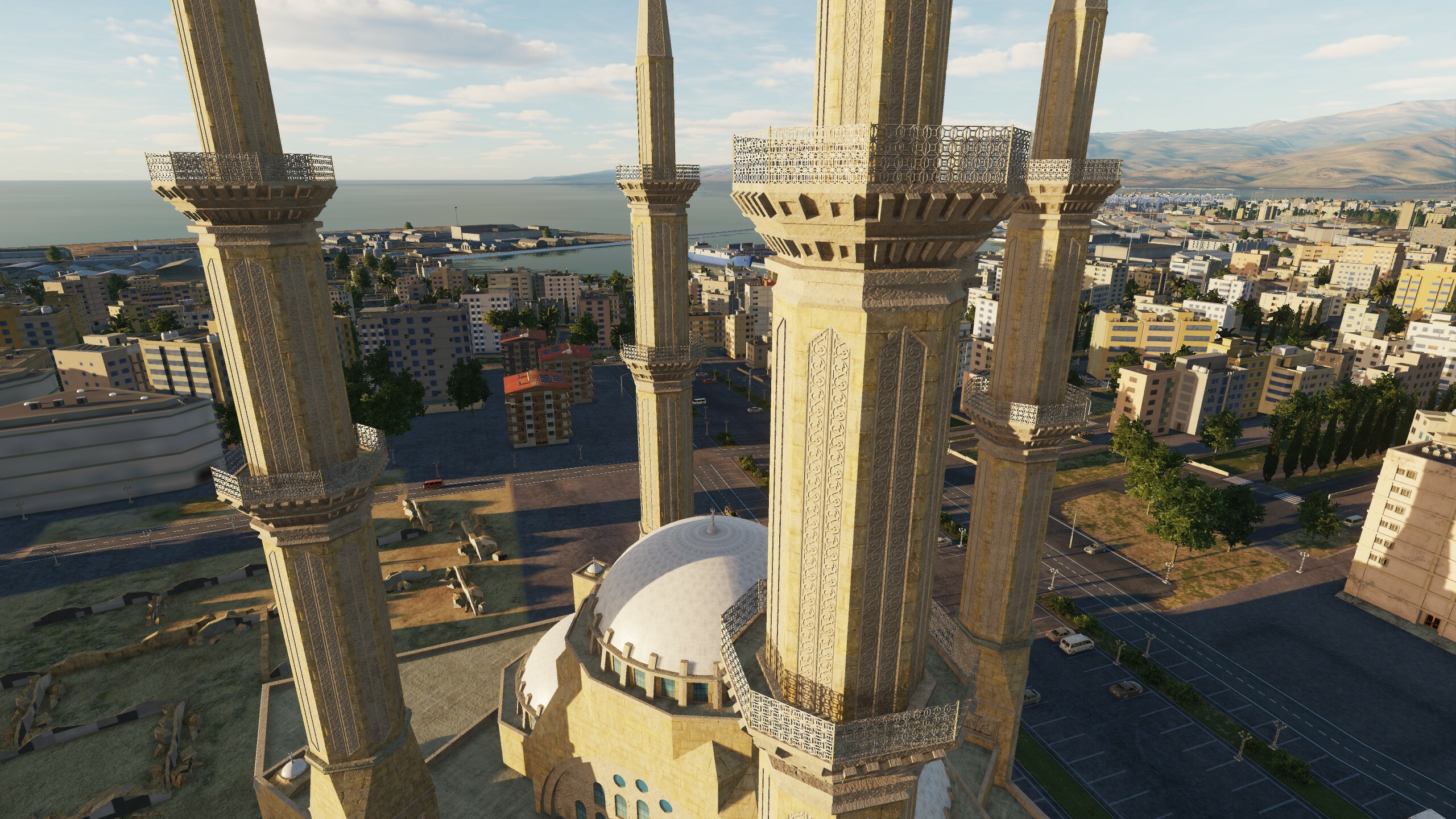
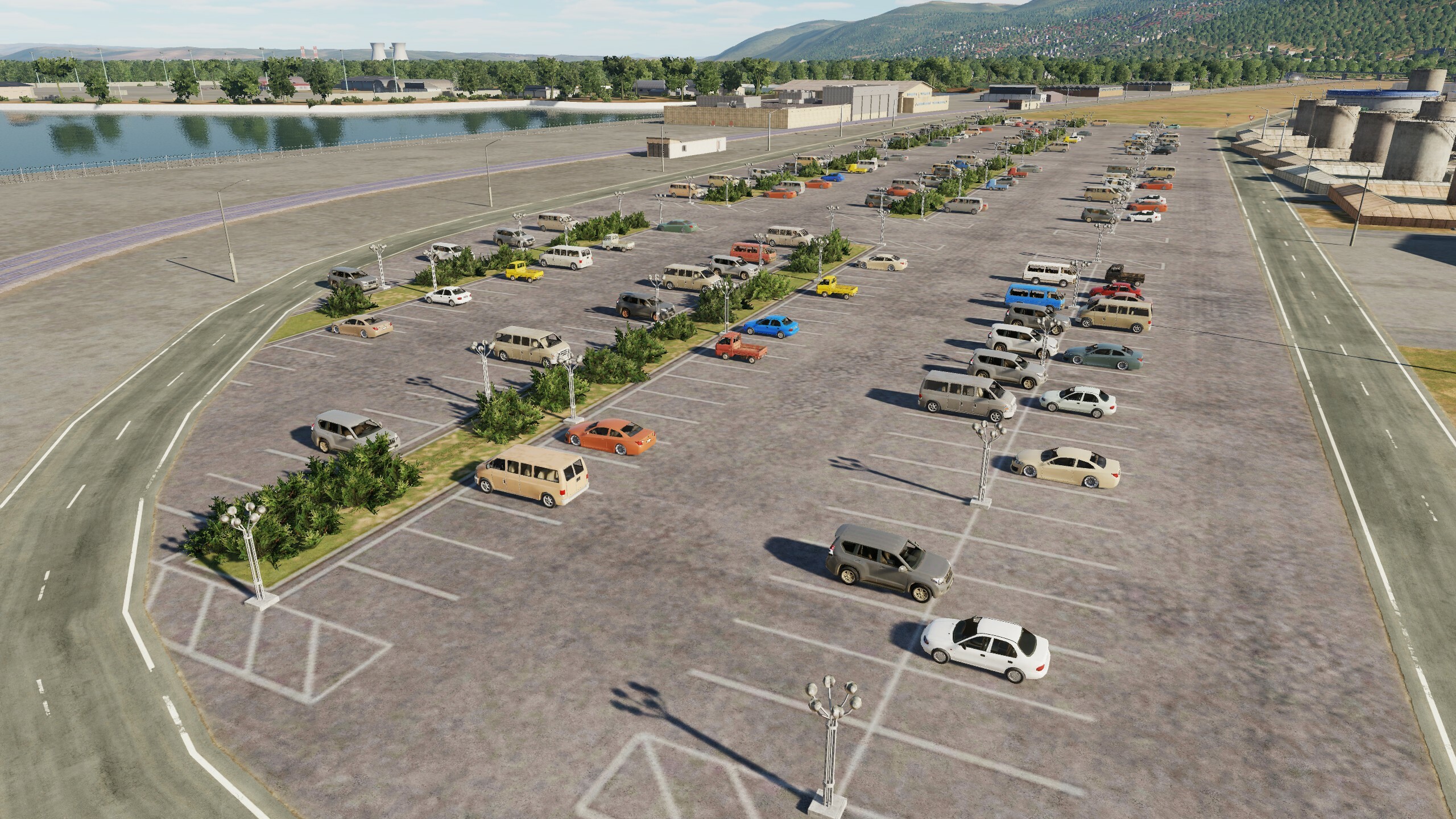
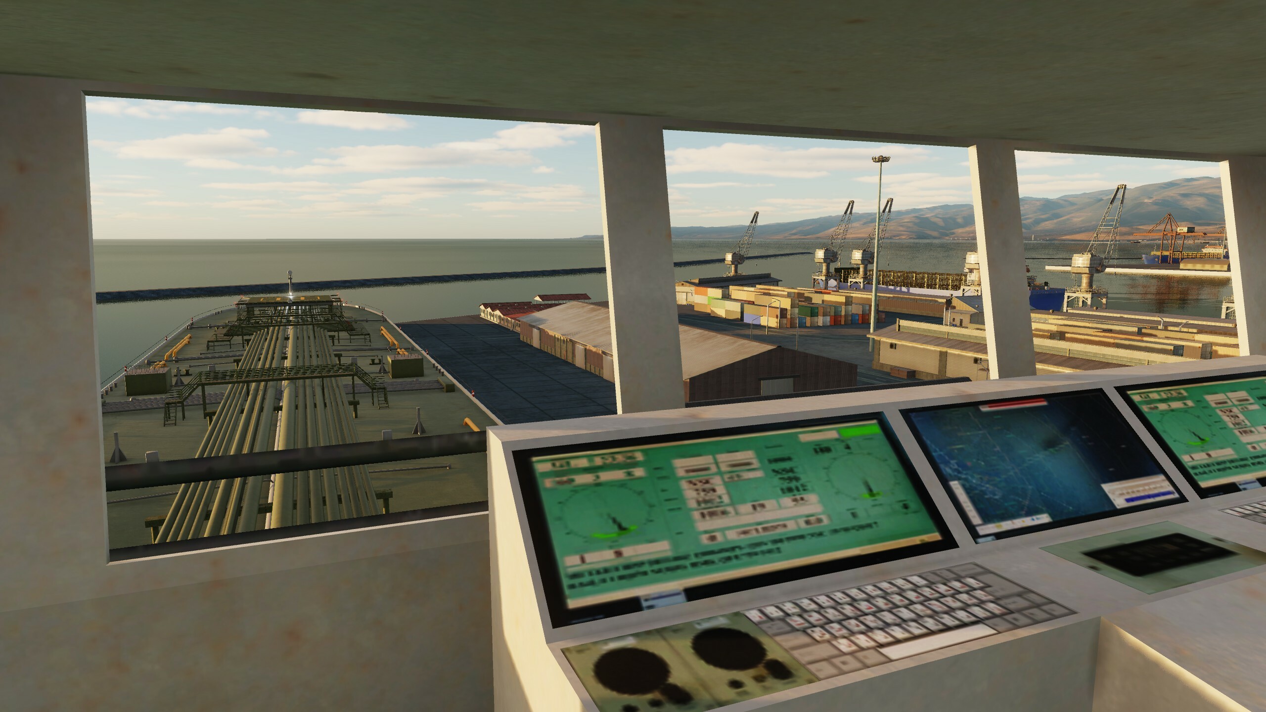
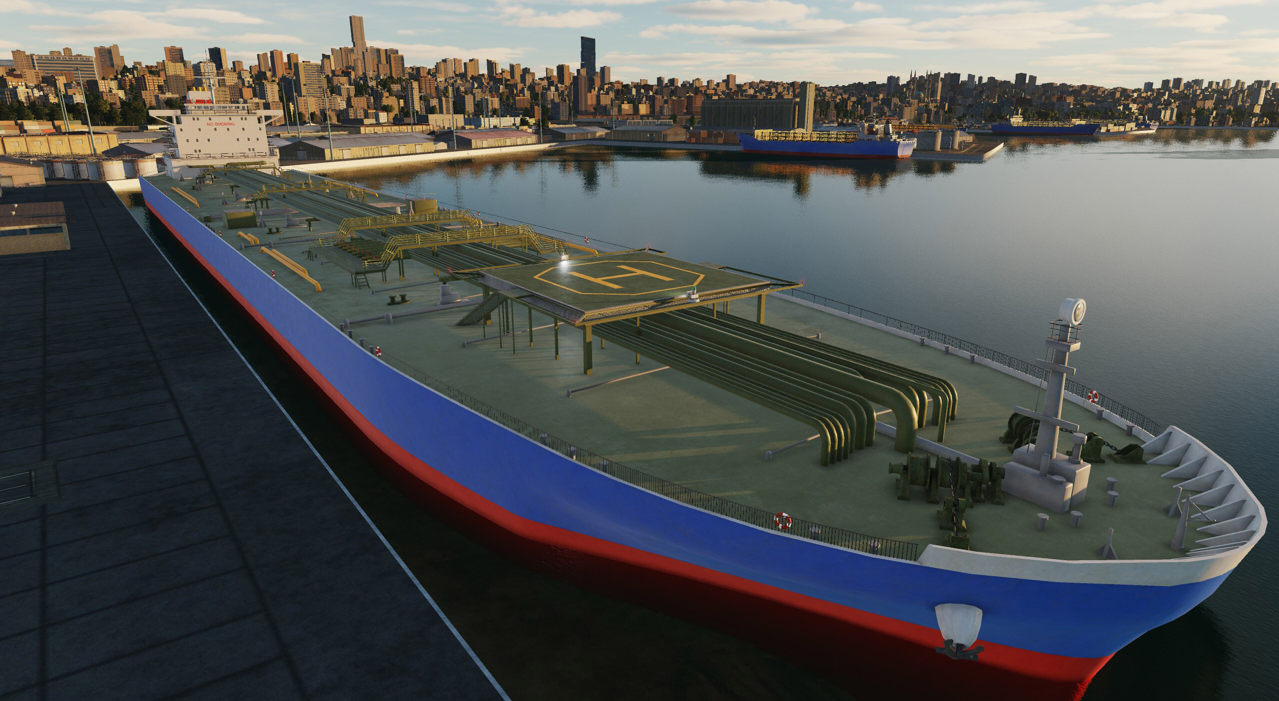
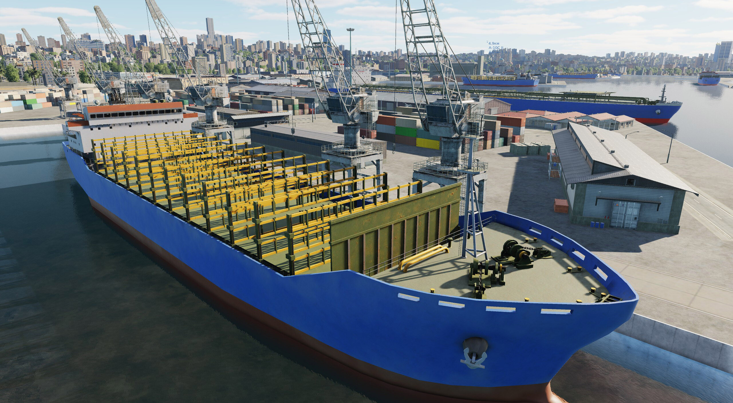
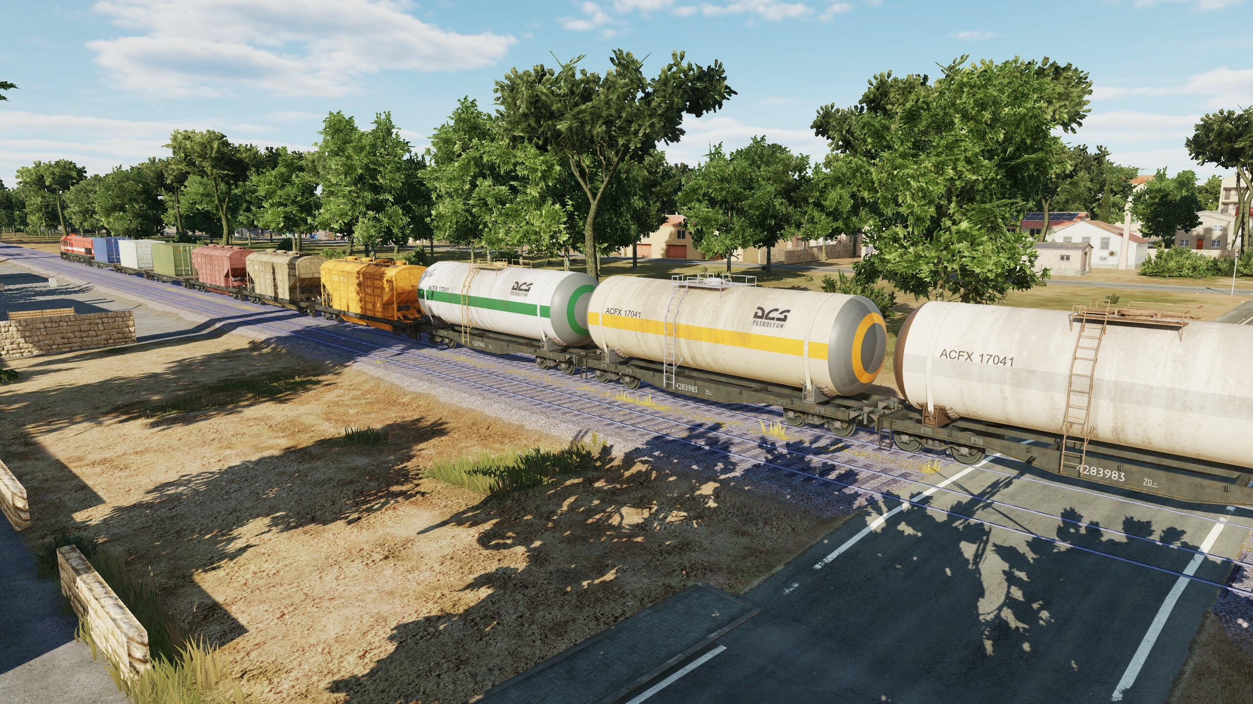
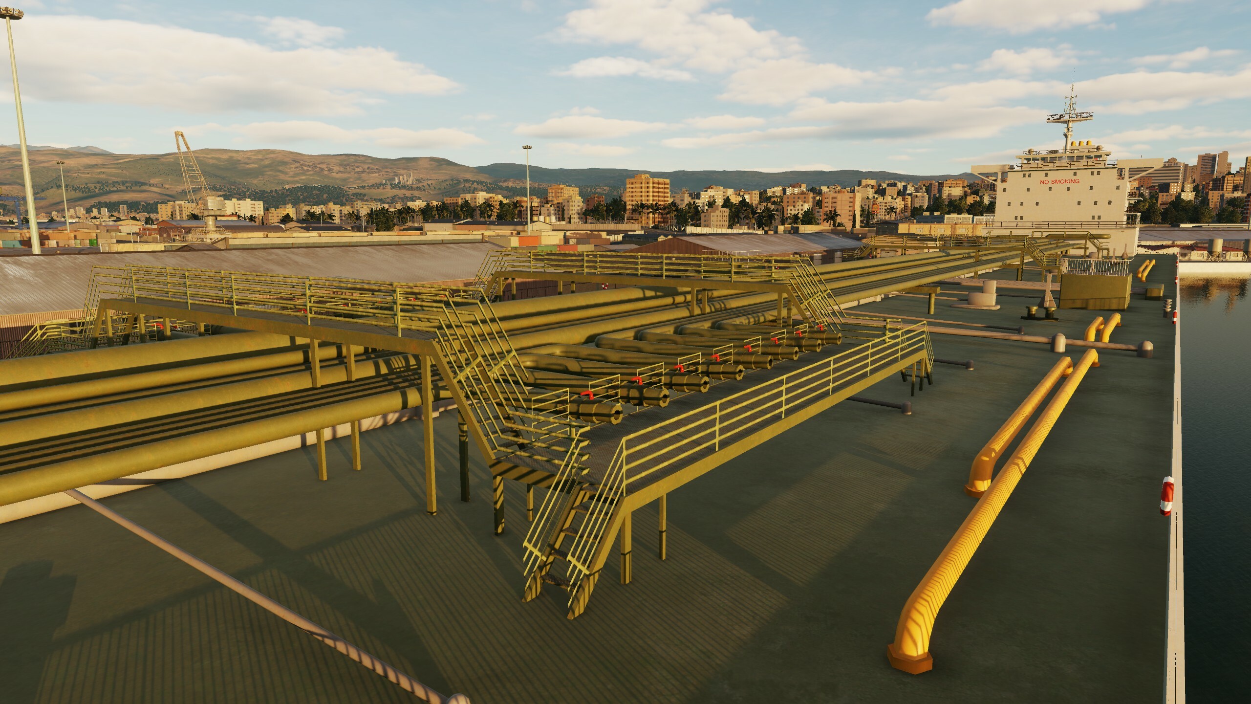
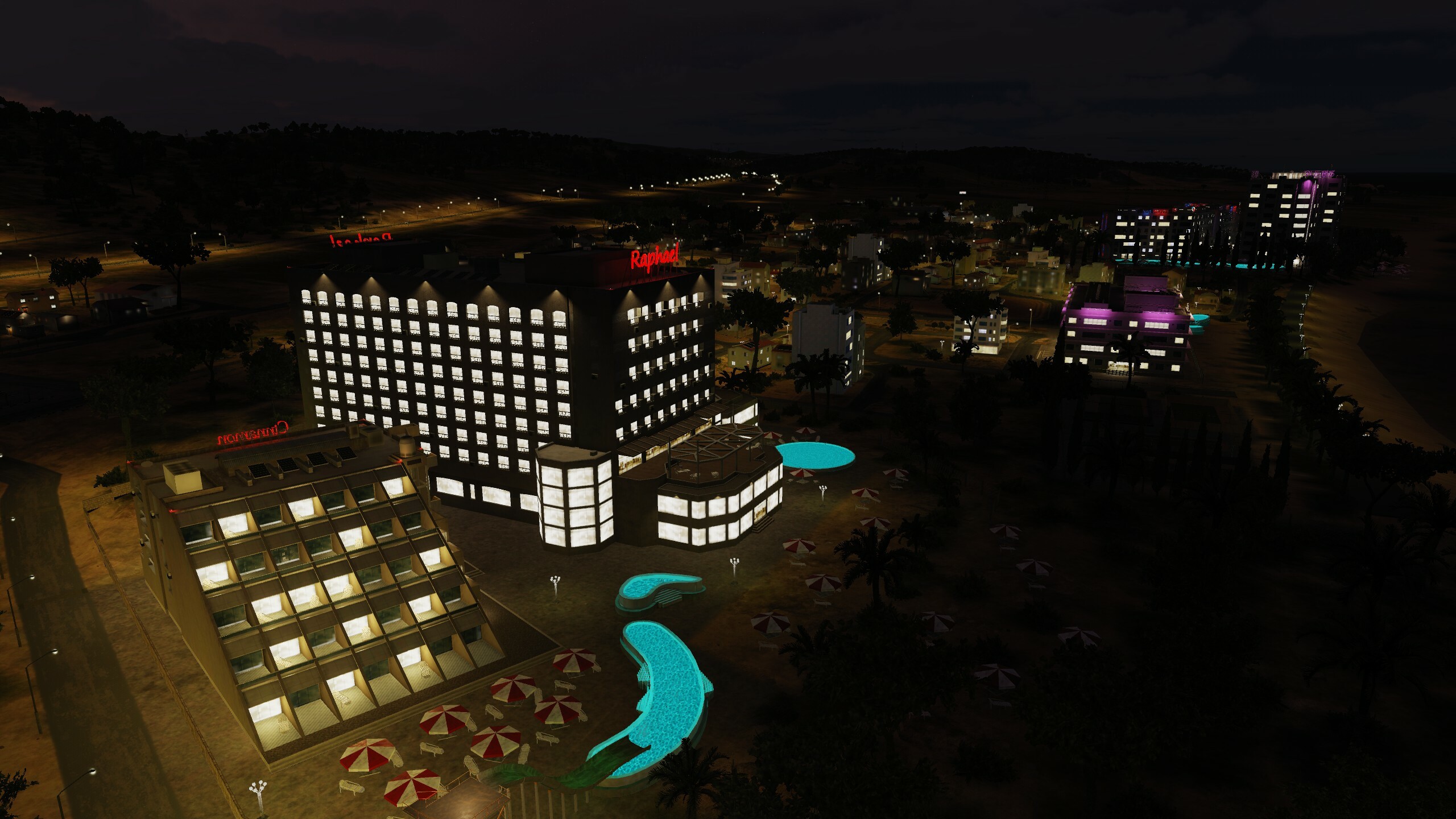
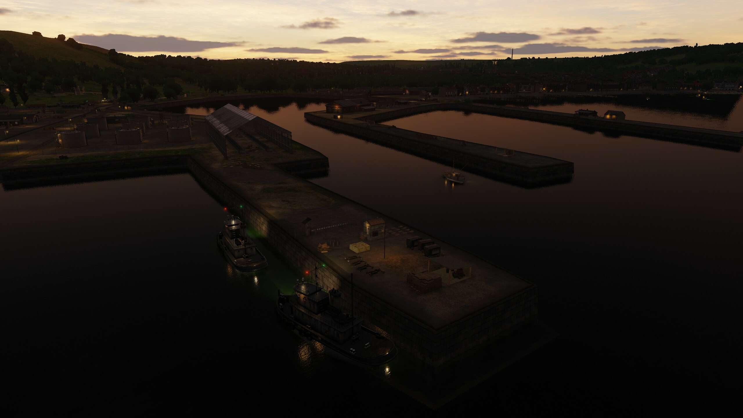
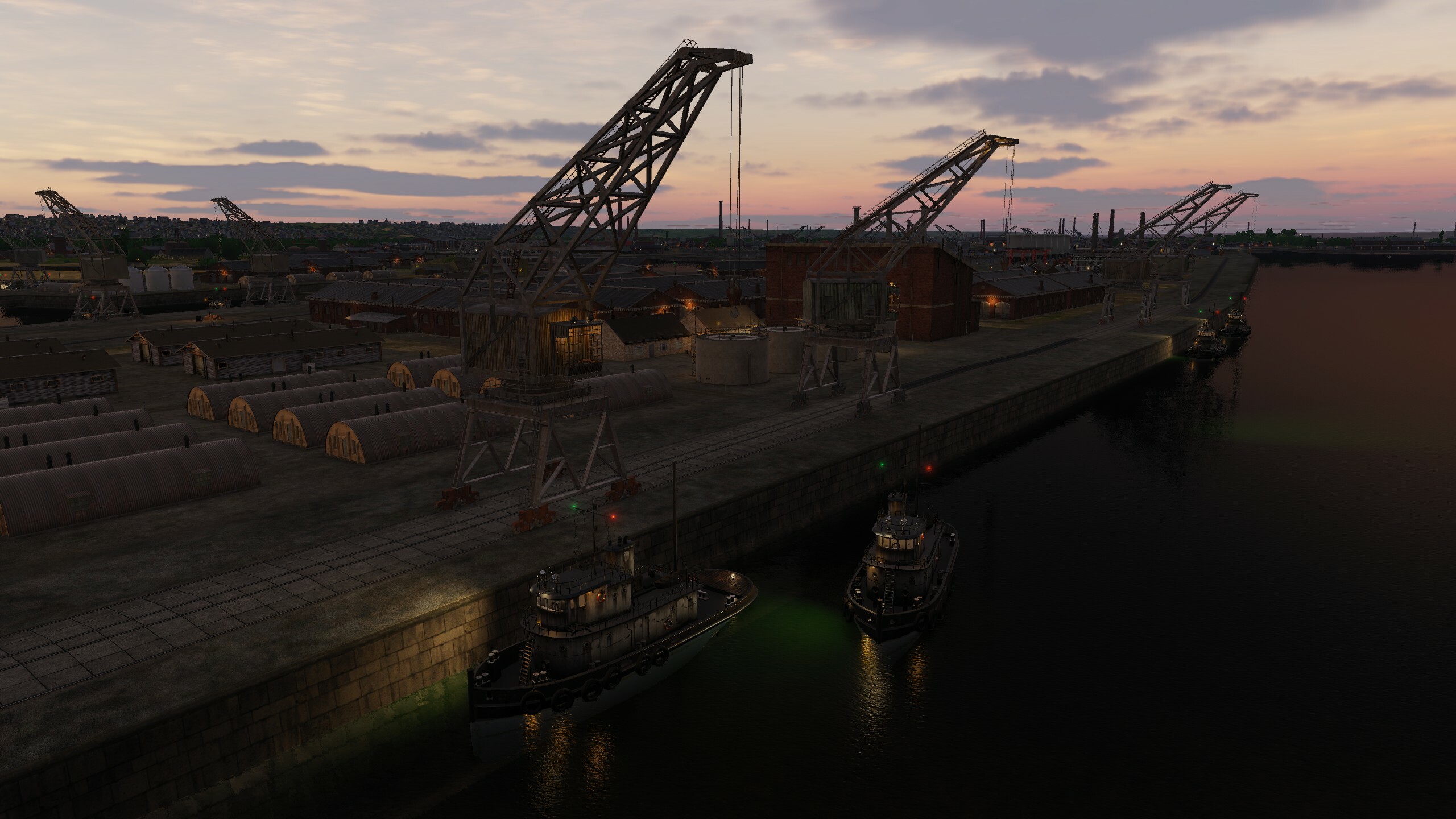
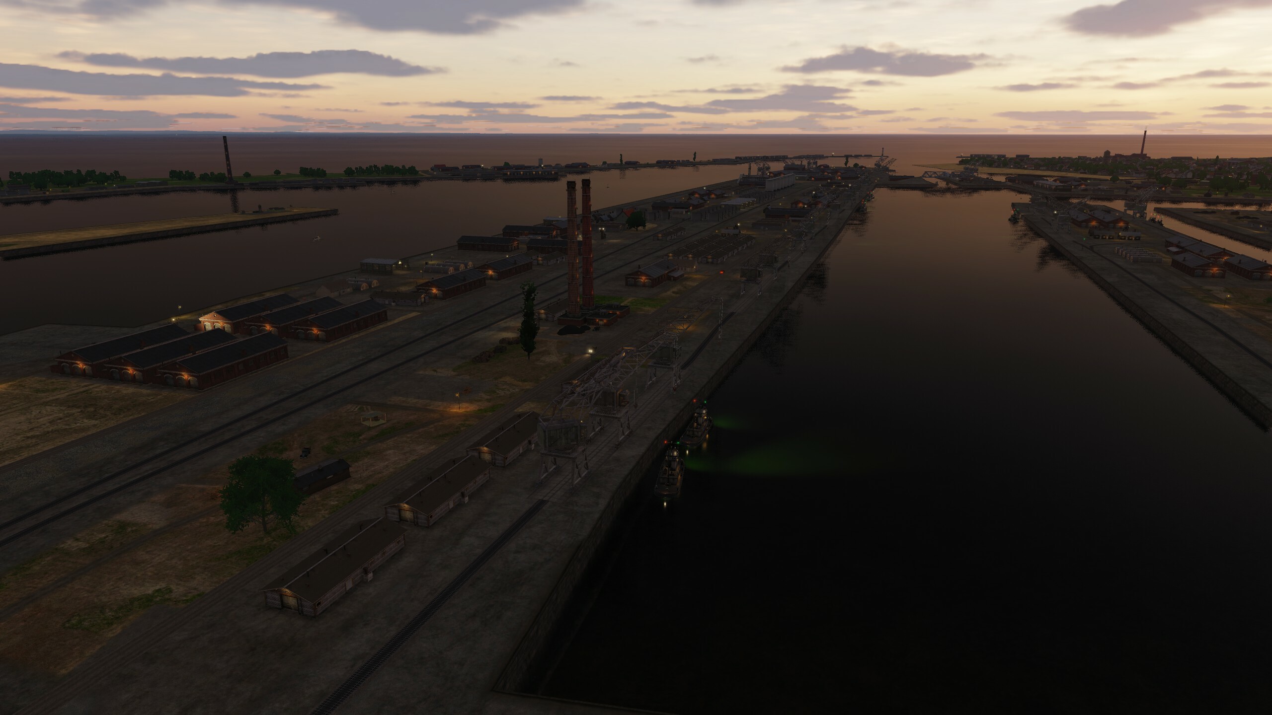
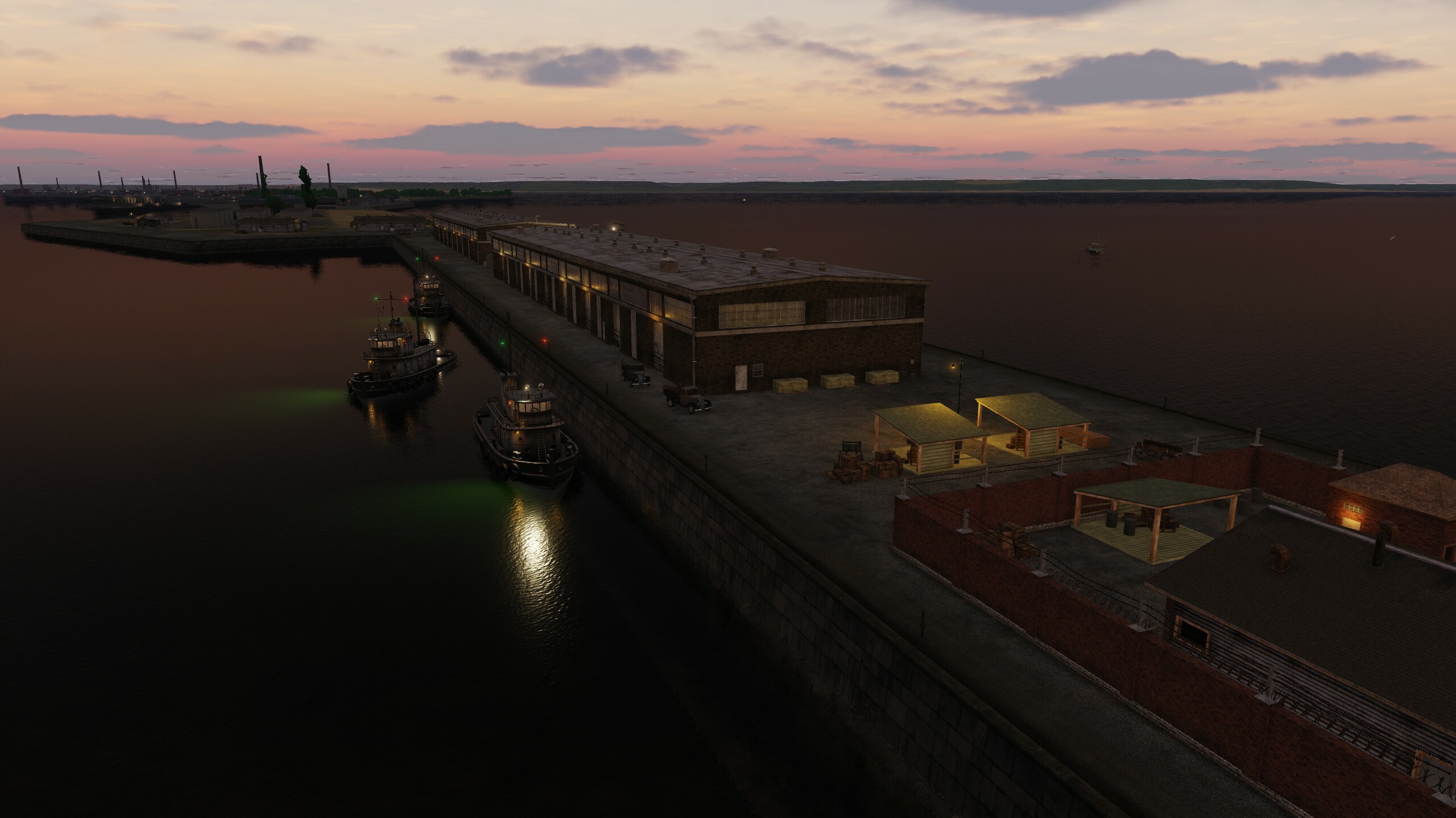
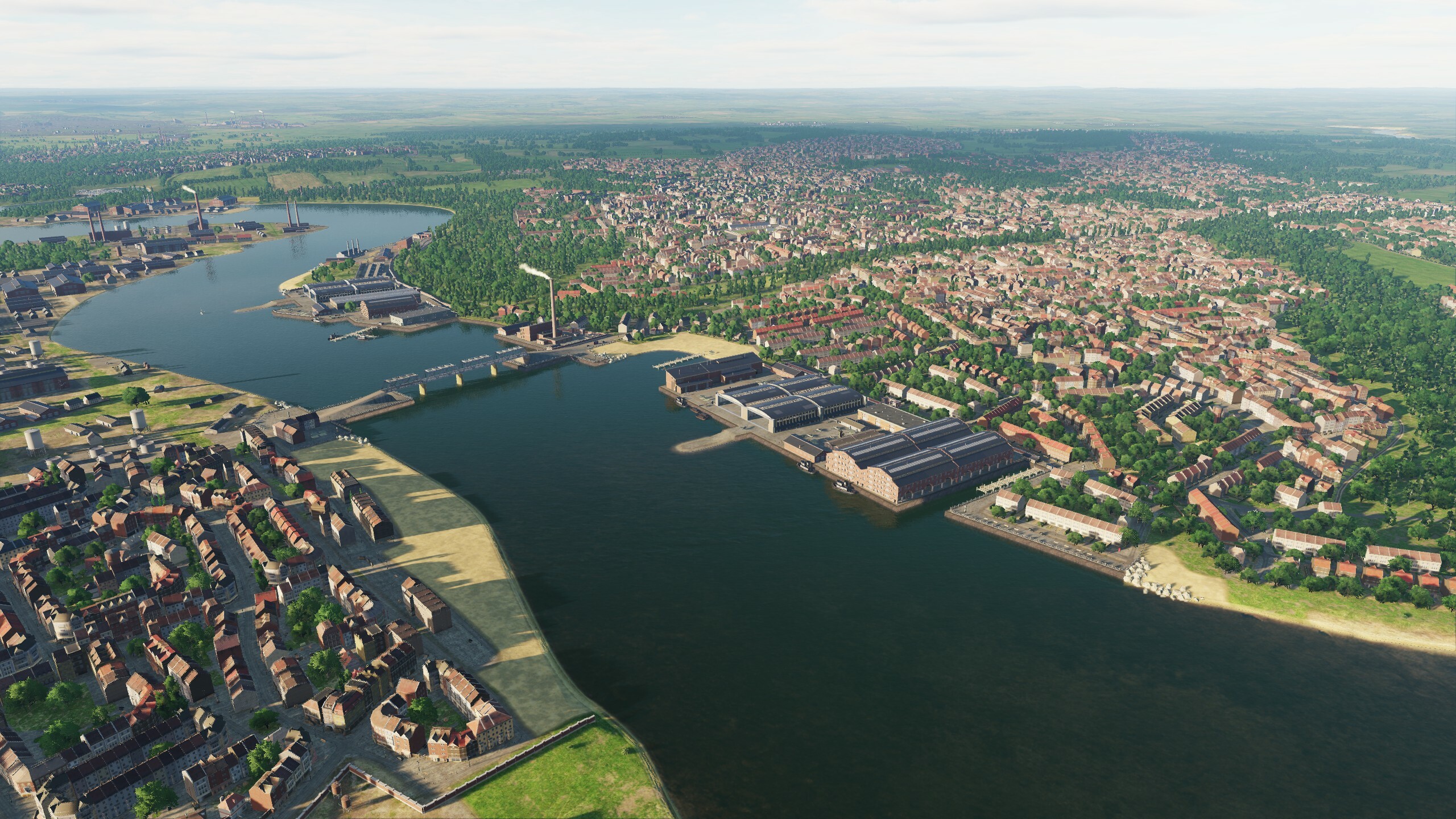
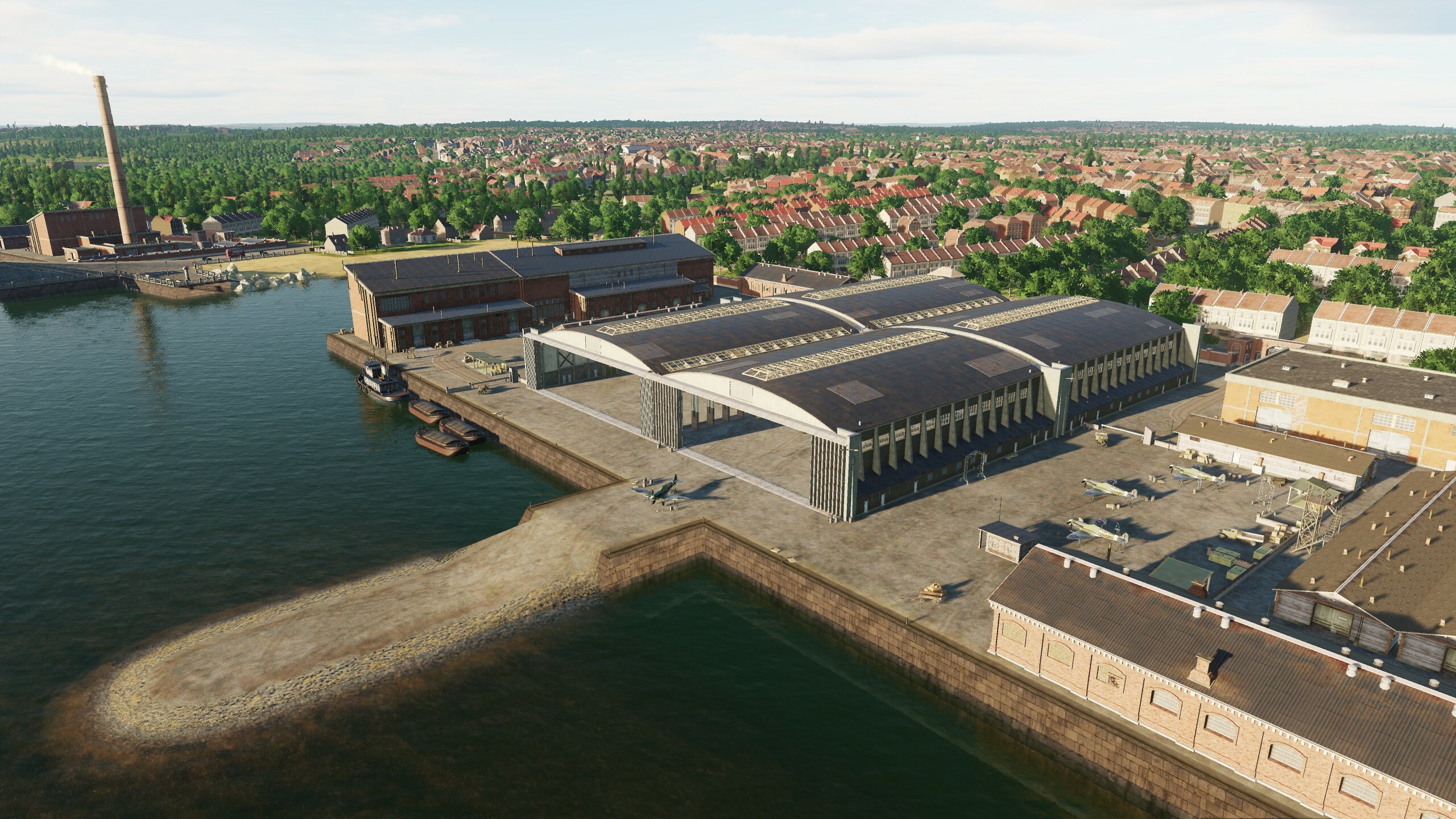
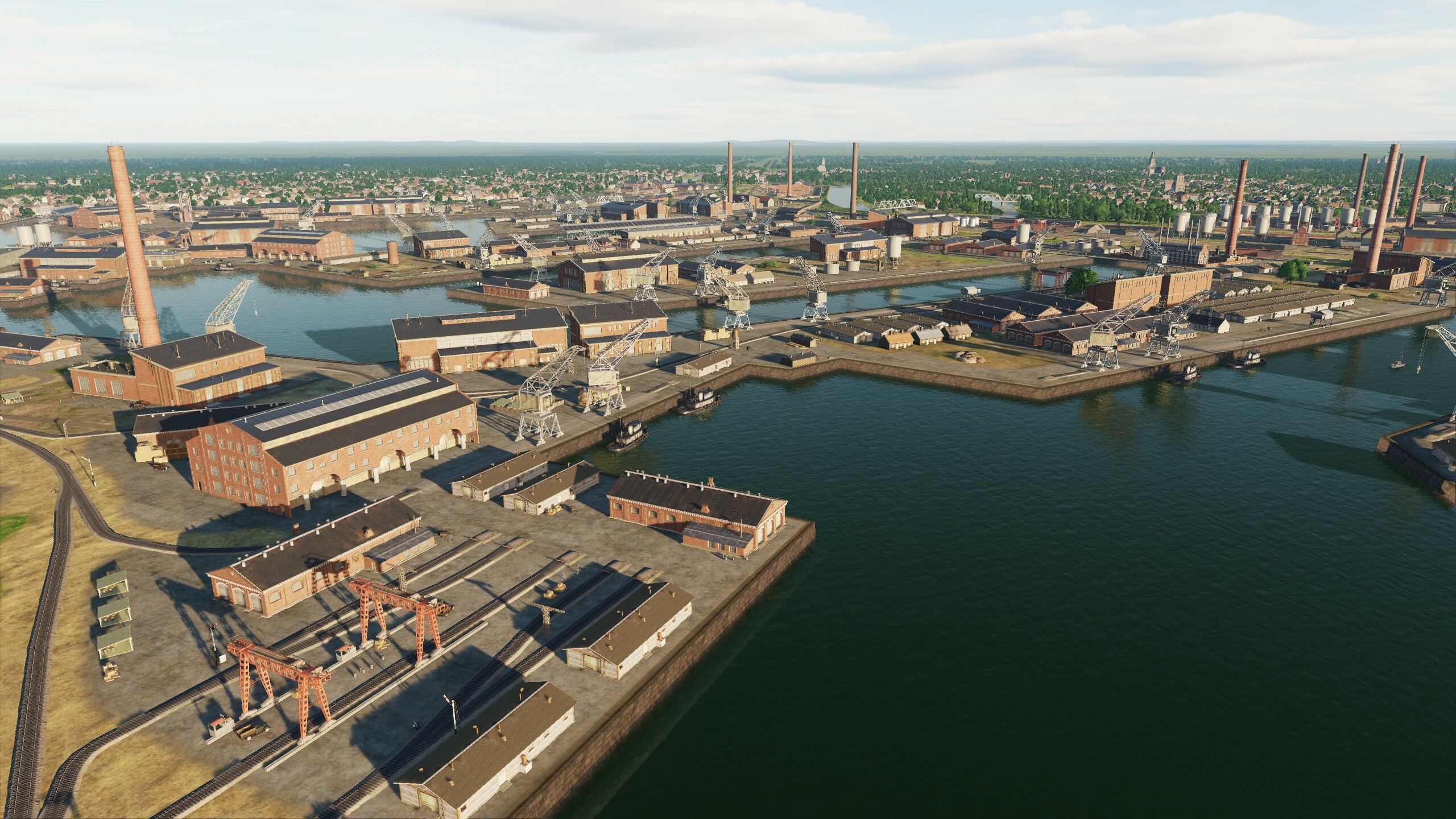
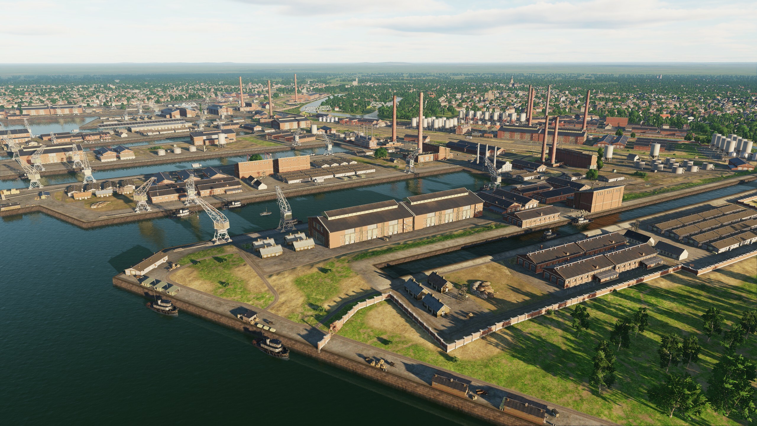
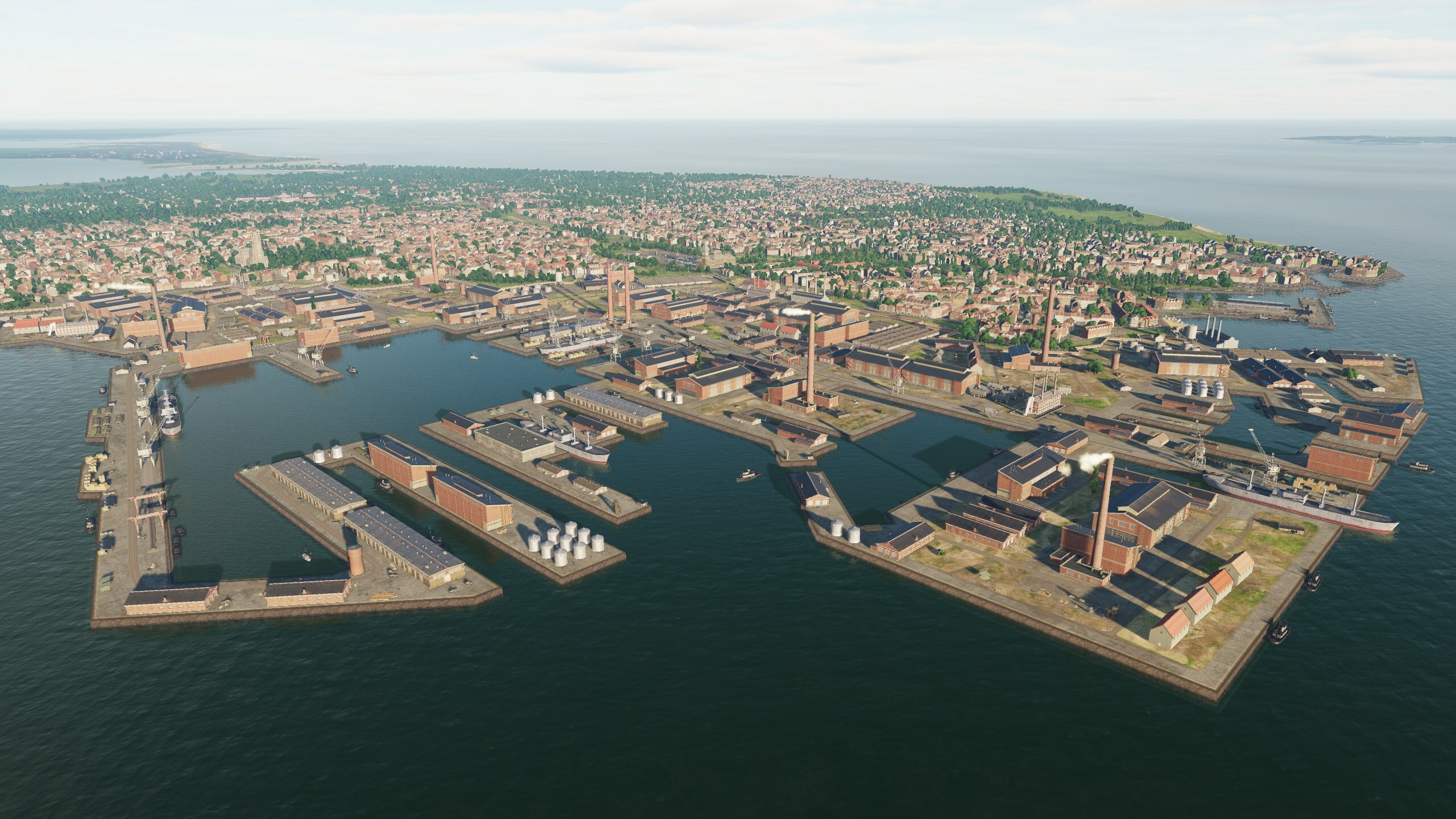
Hi! Today we will show some screenshots and videos from the new update and a list of changes. We continue to improve "DCS: Syria map" thanks to you, we read all your messages. Work on "Syria" continues, the map will be improved and developed along with the DCS. You already know that the map has received a global update on night lighting, as well as work has been done on optimization. In addition to this, the changes affected all areas of the map: UI, VD, airfields, models, assets and scenes. List of updates: Added lighting using a new real-time technology. Added left-hand traffic in Cyprus. Added kneeboard (tablet). Updated mission generator. Added helipads on GUI map. Added parking for large aircraft. Optimized and improved city building models. Improved airfield hangar models. Improved models of original objects. Added destruction models for Aleppo Power Plant and Lafarge Factory. Improved the scenes of the original buildings in Haifa, Beirut, Adana and Damascus. Trees in the forest have been optimized. Tree collisions have been simplified. Added parking for MiG-23 Marj Ruhayyil, Shayrat, Tiyas. Fixed frequency settings for Gazipasa, Rene Mouawad, Ramat David, Ercan, Beirut, HATAY airfields. Taxiing Tal Siman, Beirut fixed. Fixed lighting for Sanliurfa, Adana, Khmeimim, Haifa. Fixed plates Akrotir, Incirlik. Removed objects from Rene Mouawad parking lots. Removed objects from Kingsfield glide path. Fixed bugs in vectordata and scenes. Updated map description. Added objects at road intersections and railway crossings. Added two types of gas stations. Added two types of roadside cafes. Improved cars and ships. Added new trains. Added cars for left-hand traffic. Improved city and field assets. Improved road and railway assets. Improved the original scenes of Adana. Fixing bugs in airfield scenes. Improving the substrate and the stadium model. Changed Normandy1944 and Normandy2 banners. Improved container ship and tanker models. Ok let's see what we got New gas stations & roadside cafes and added objects at road intersections and railway crossings. New new New train (cargo&pass) & ships Improved the original scenes And night Some of the cars
- 125 replies
-
- 27
-
-
-
Radiocheck... Hi fighters! For a long time we did not get in touch, but all this time the work did not stop. Improving, optimizing, adding, introducing something new - everything we worked on was connected with these words. Today we will show new night lighting and some hangars. The update includes many minor improvements - we made sure that the map is relevant and fresh. So what's most interesting: New lighting technology added. Added right-hand traffic in Cyprus. Map description updated. Added kneeboard (yeah, this fix has long been waiting in the wings) Mission generator updated. Added helicopter landing sites on GUI map. Optimized trees in forest. Simplified trees collisions. Optimized and improved building models. Added objects at road and railroad crossings. Two types of gas stations have been added. Two types of road-side cafes added. Improved cars. Added right-hand drive vehicles. Improved city and field assets. Improved road and railroad assemblies.
- 125 replies
-
- 81
-
-
-
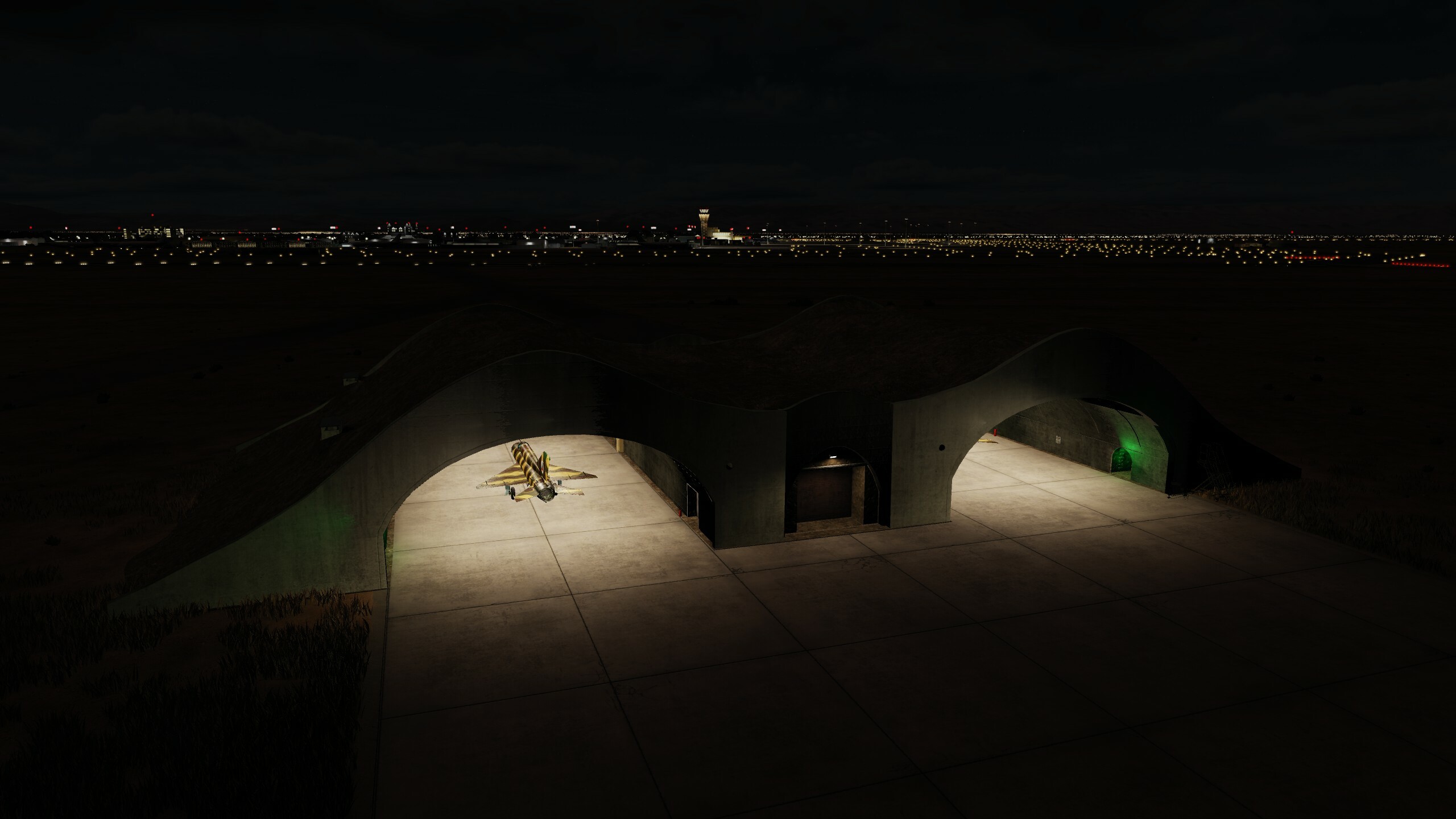
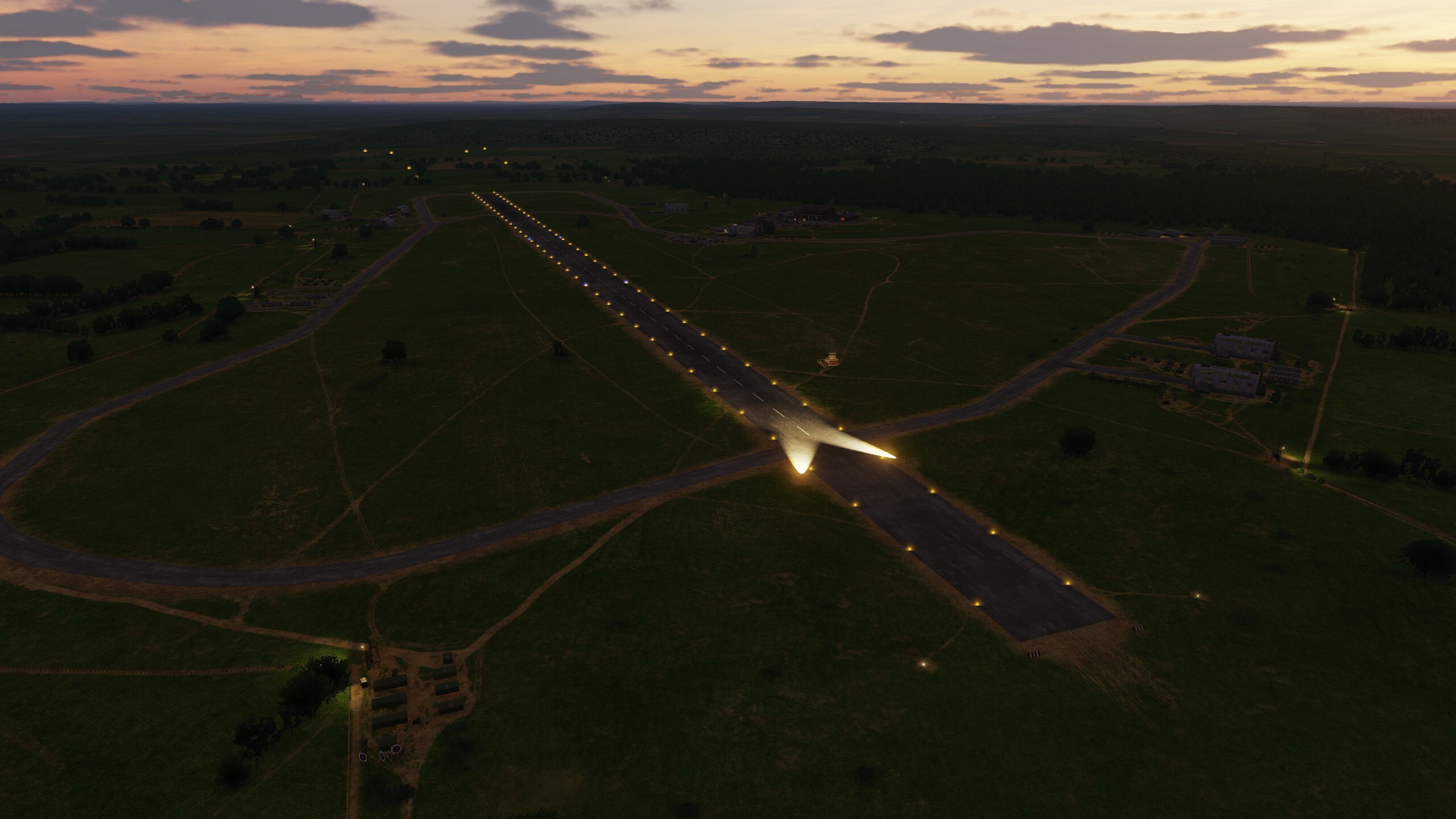
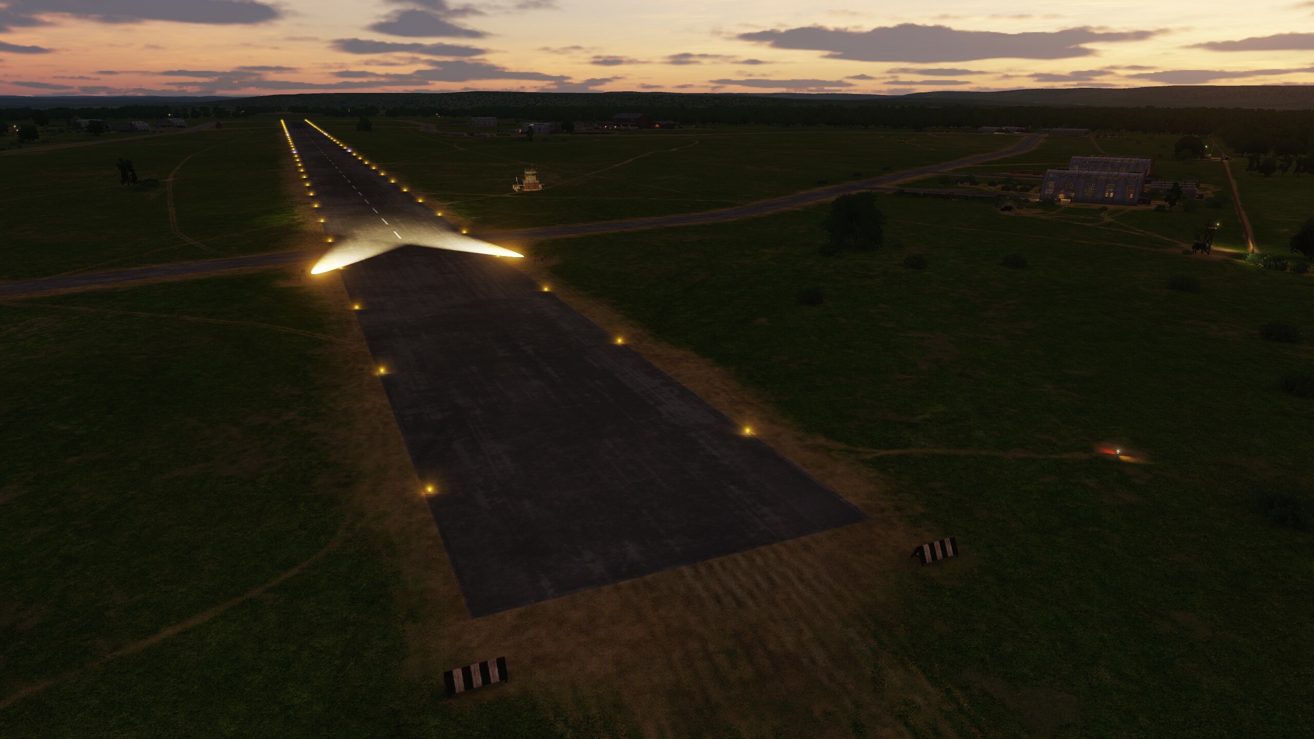
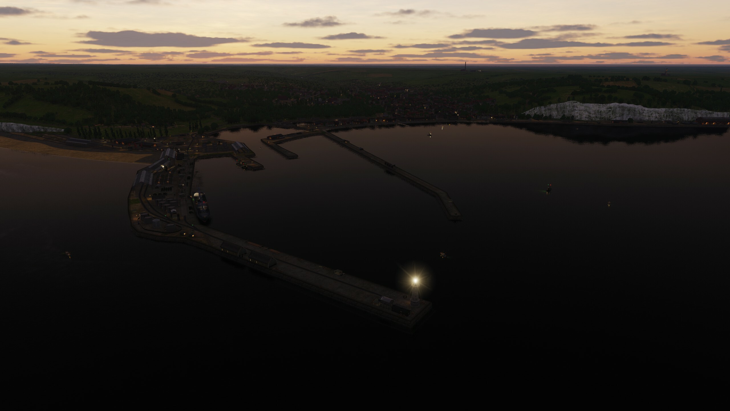
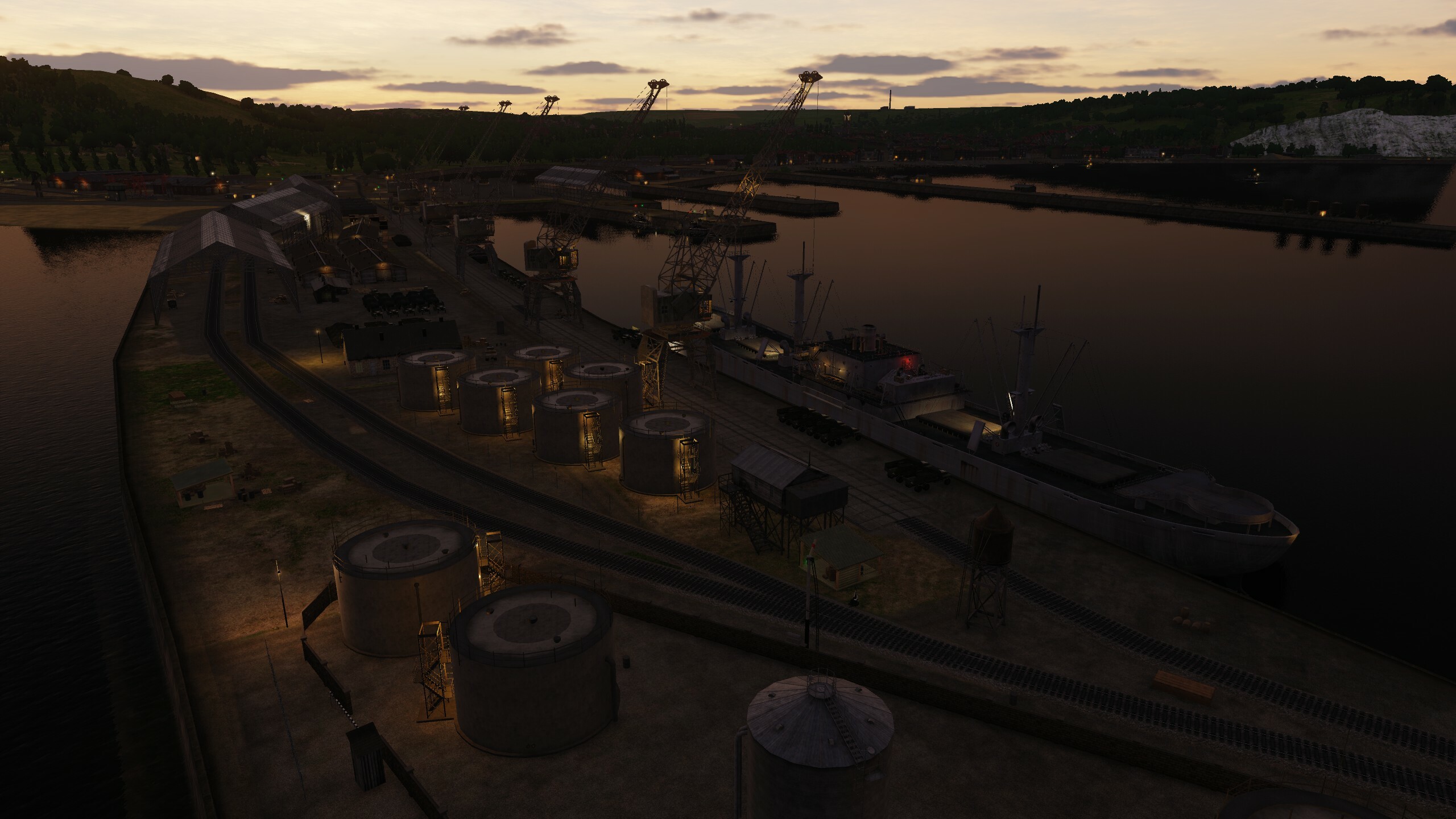
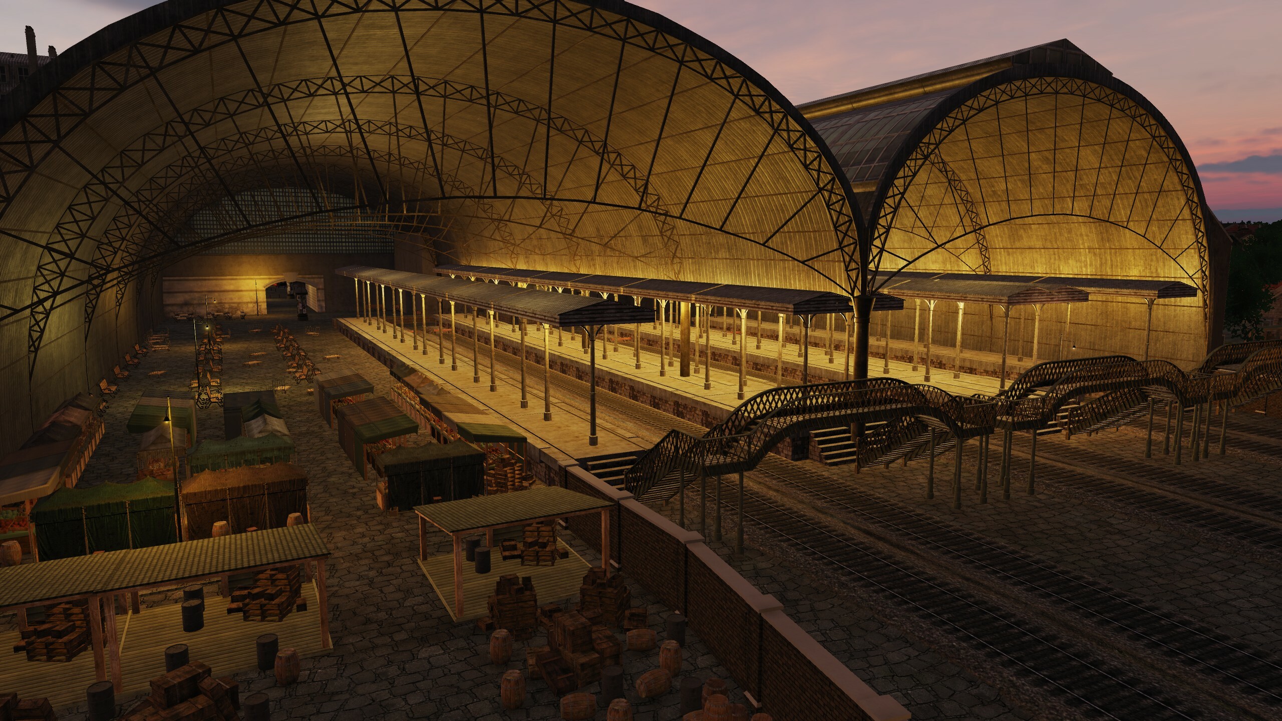
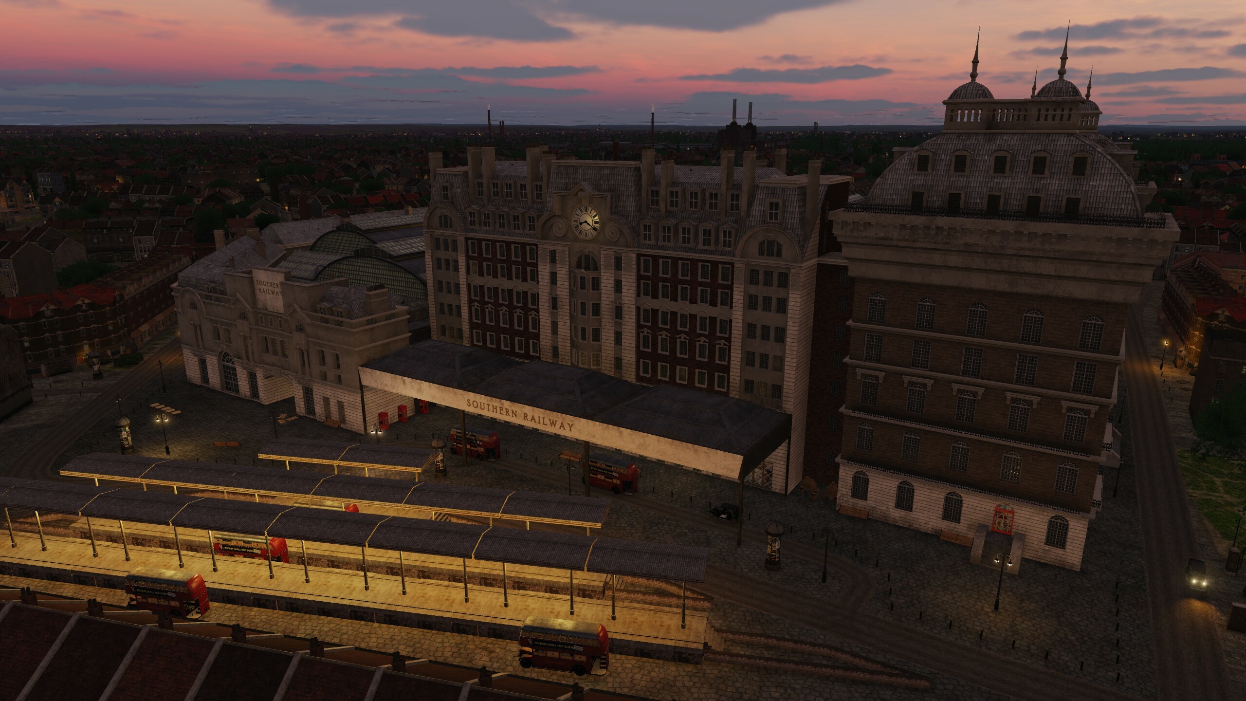
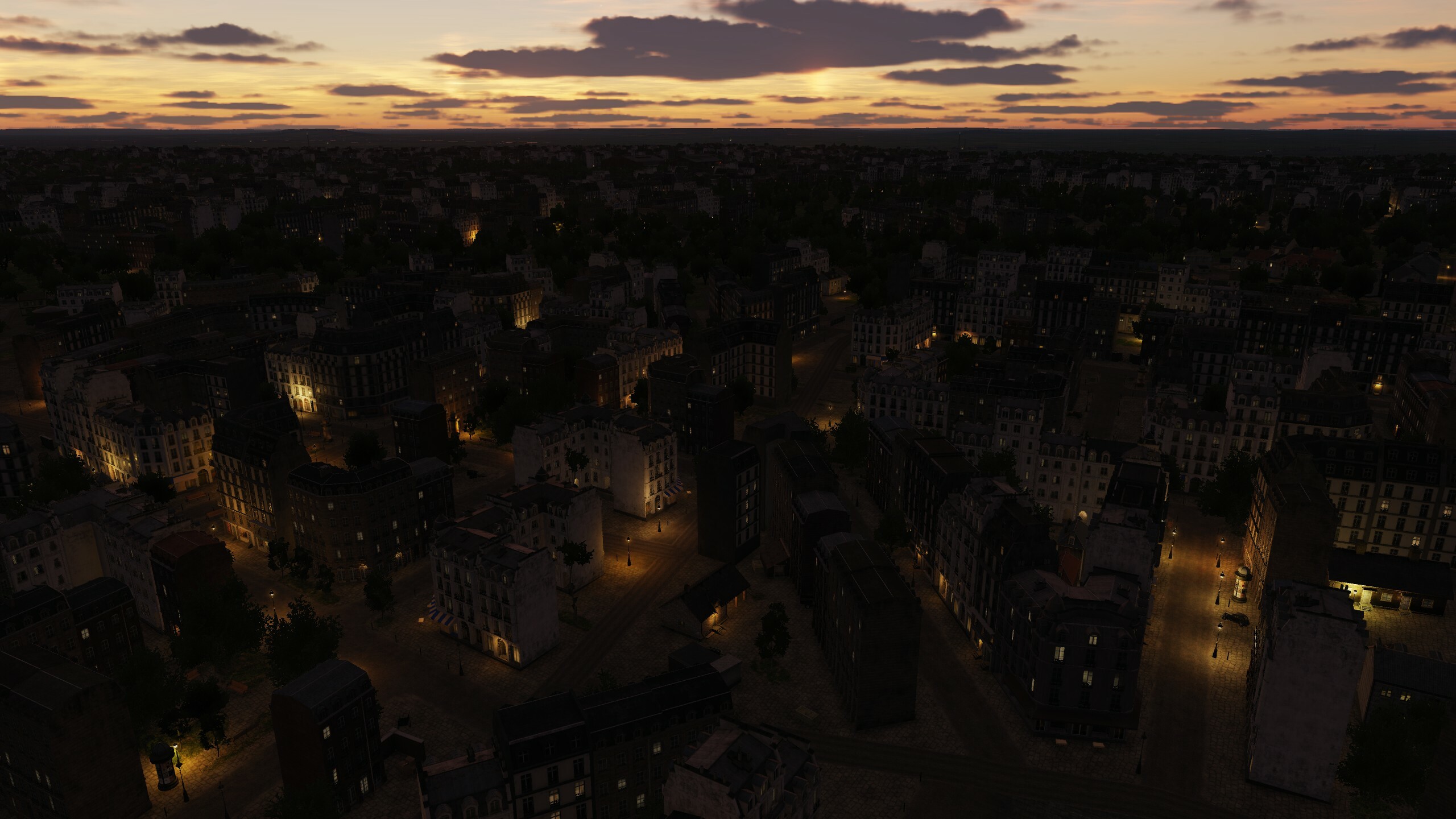
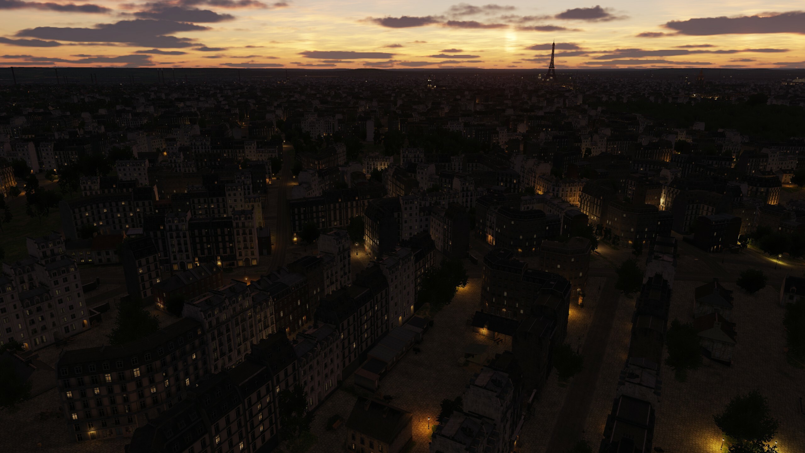
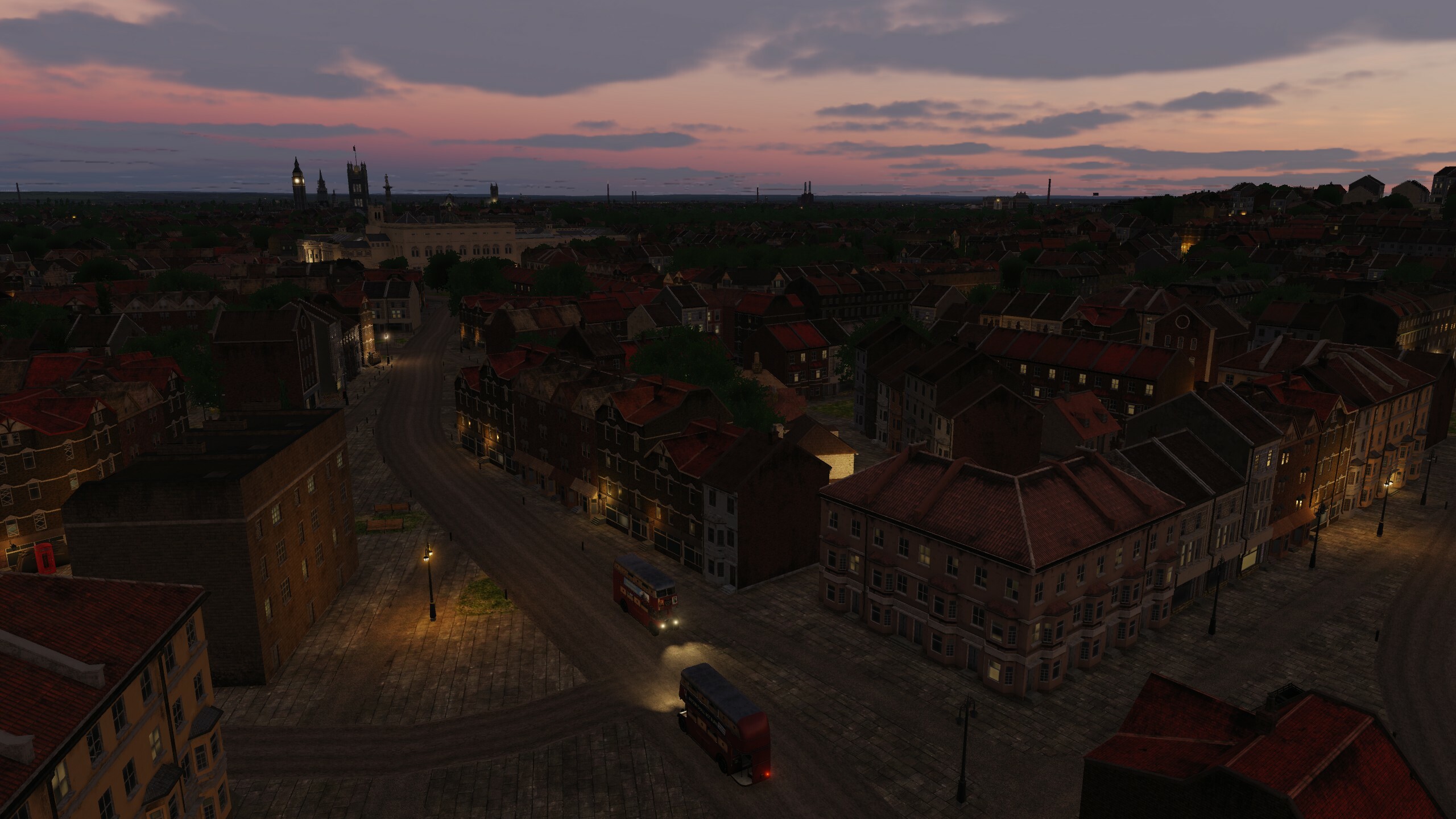
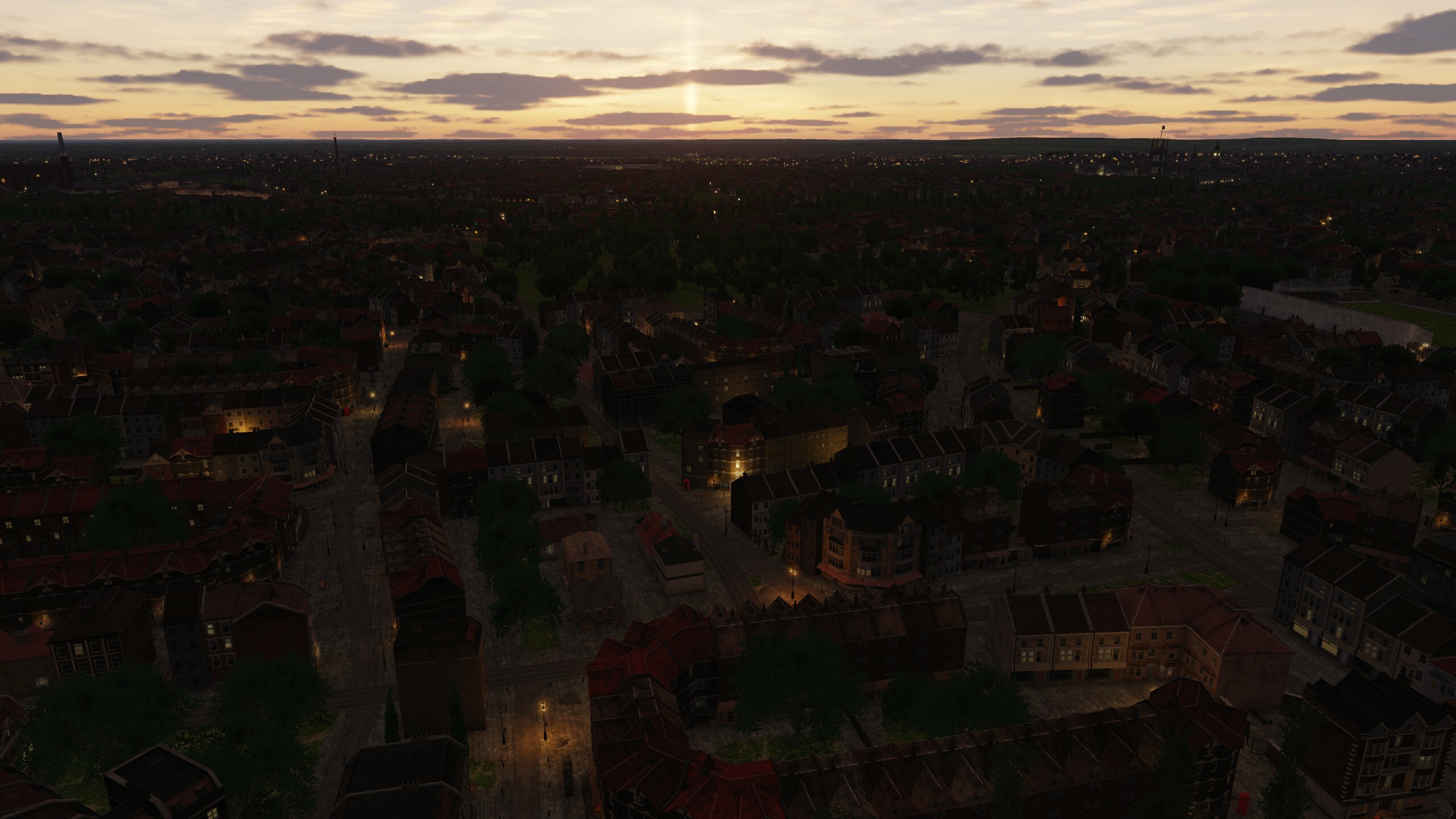
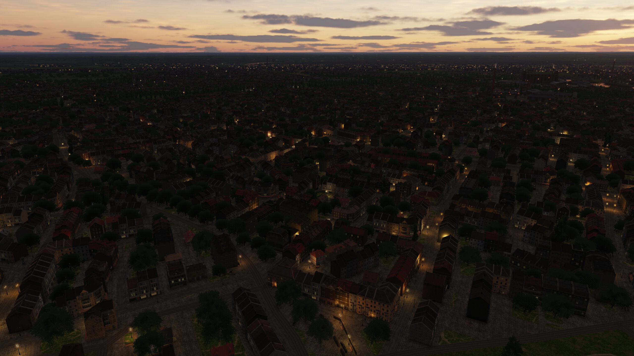
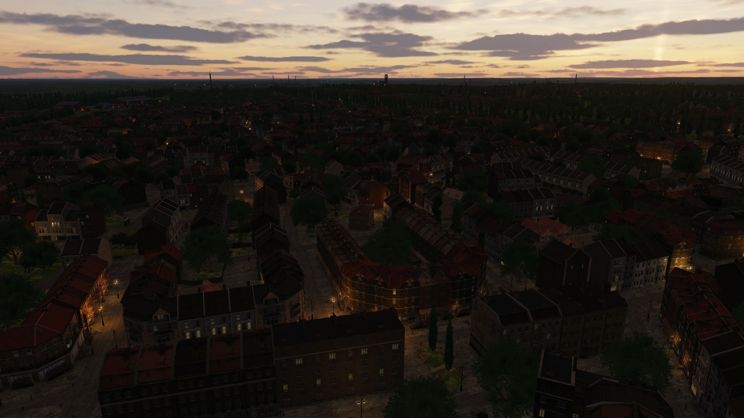
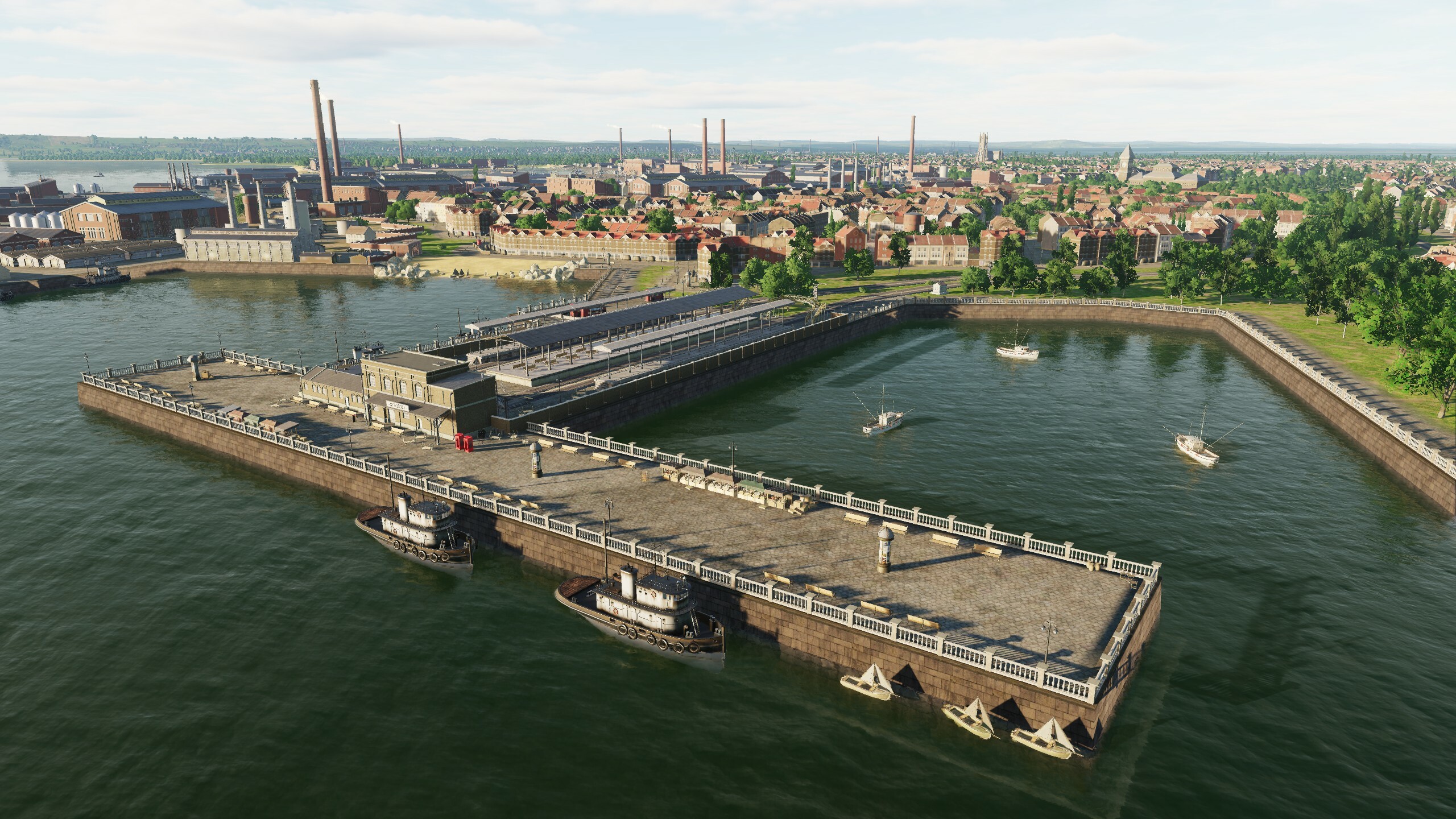
Hi In this topic, we will separately talk about lighting. We carefully approached the fact that flights at night would be interesting and tried to create a balance between the complete darkness that was during the war and peacetime, when Paris and London at night were the most beautiful cities in the world. Light is important, it creates atmosphere. When creating airfields, various types of airfield lighting systems were used. Germany and the Allies used different systems. If on the original objects the light emphasizes the beauty and visibility of the building, then in the ports it shows what hard and continuous work goes on when loading goods and equipment. Lighthouses and railway stations are brightly lit and you can navigate them. 1944 - war, so blackout rules were applied on the territory. To accommodate various scenarios, we have made it so that the night lighting is turned on by setting the date in the mission: June 1945 and later. Keep this in mind when creating missions and when creating a free flight. ---- before June 1945 - lights OFF after June 1945 - lights ON ---- We use "dynamic light" that illuminates objects in real time, it gives a little more realism and is just beautiful. The main types of light sources are omni and spotlights with physically correct attenuation. To reduce the load on the GPU, working distances were assigned to each type of light source: -City lights 3-6km -Searchlights on towers 8km -Lighthouse 42km -Lights on the runway 15km -Airfield lights 30km So, if you want to implement a scenario of approaching territories that have not yet introduced a blackout mode or just want to fly over a cozy night city - choose the date "June 1945 and later" and Normandy will light up with lights. We read all your messages and appreciate your comments and ratings. Beauvais-Tille airfield. France Orly airfield. France West Malling Airfield. UK Kenley airfield. UK Port of Dover Port of Le Havre Victoria Station London Paris Gare du Nord City lights in France City lights in UK
-
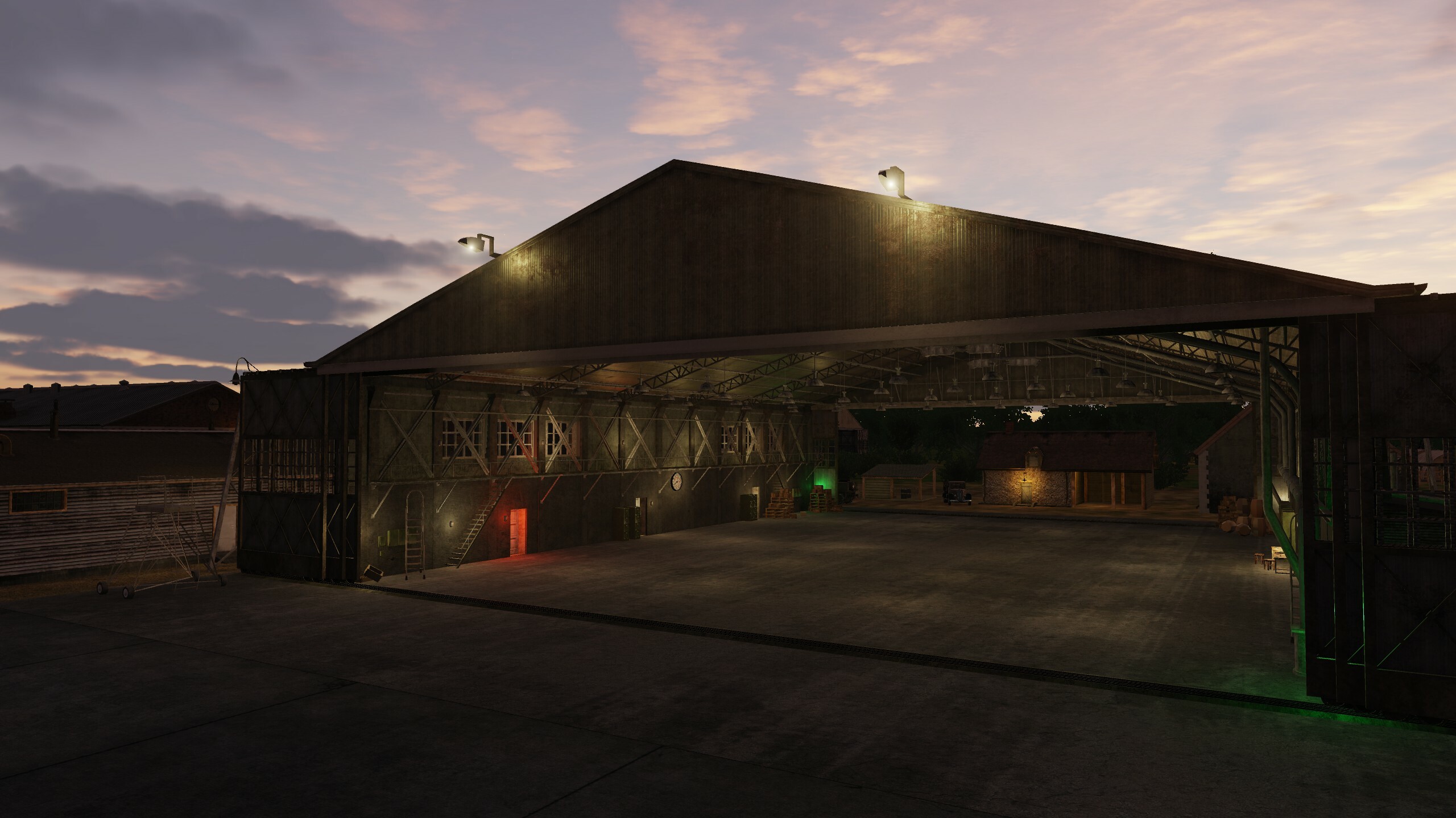
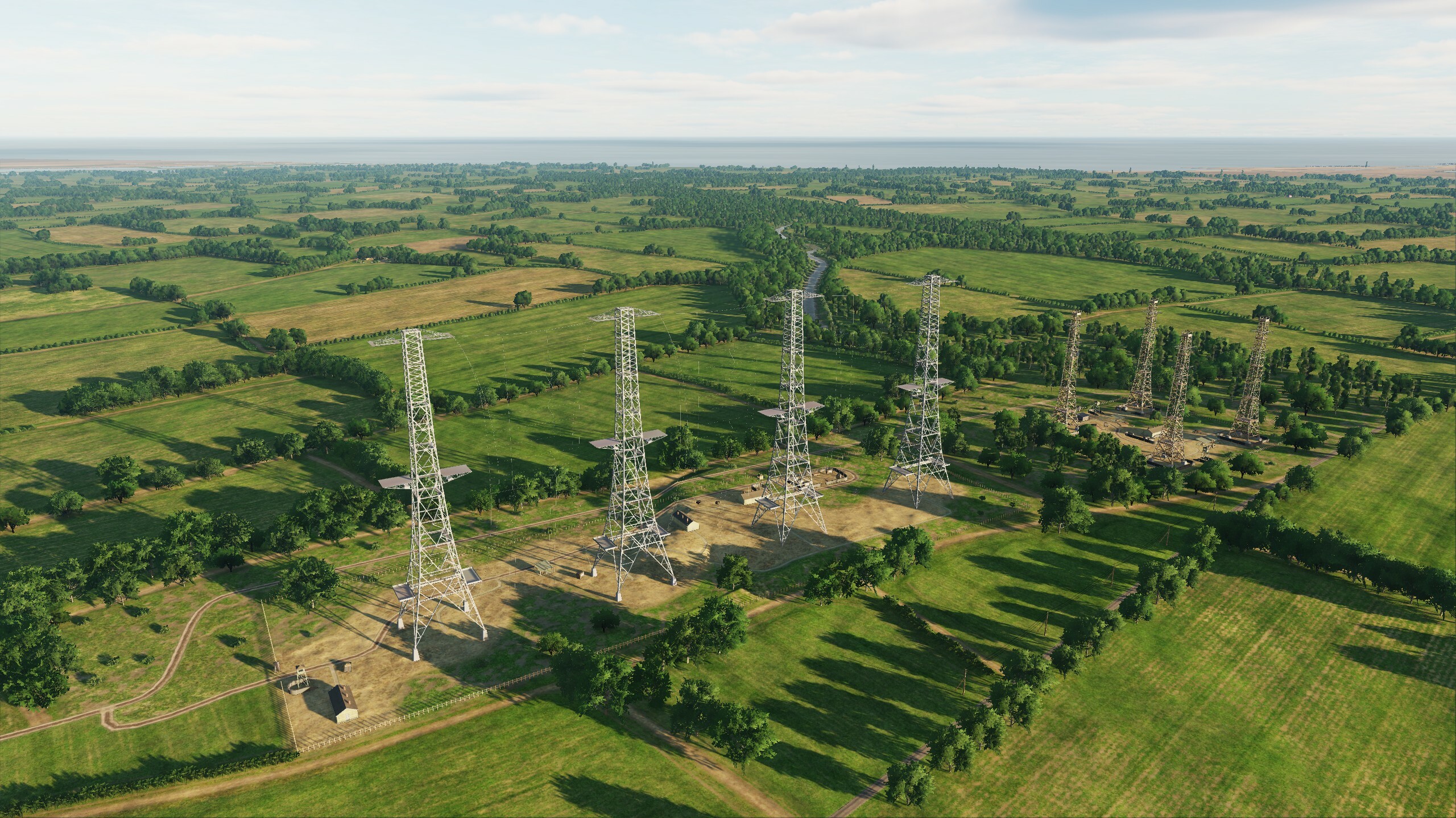
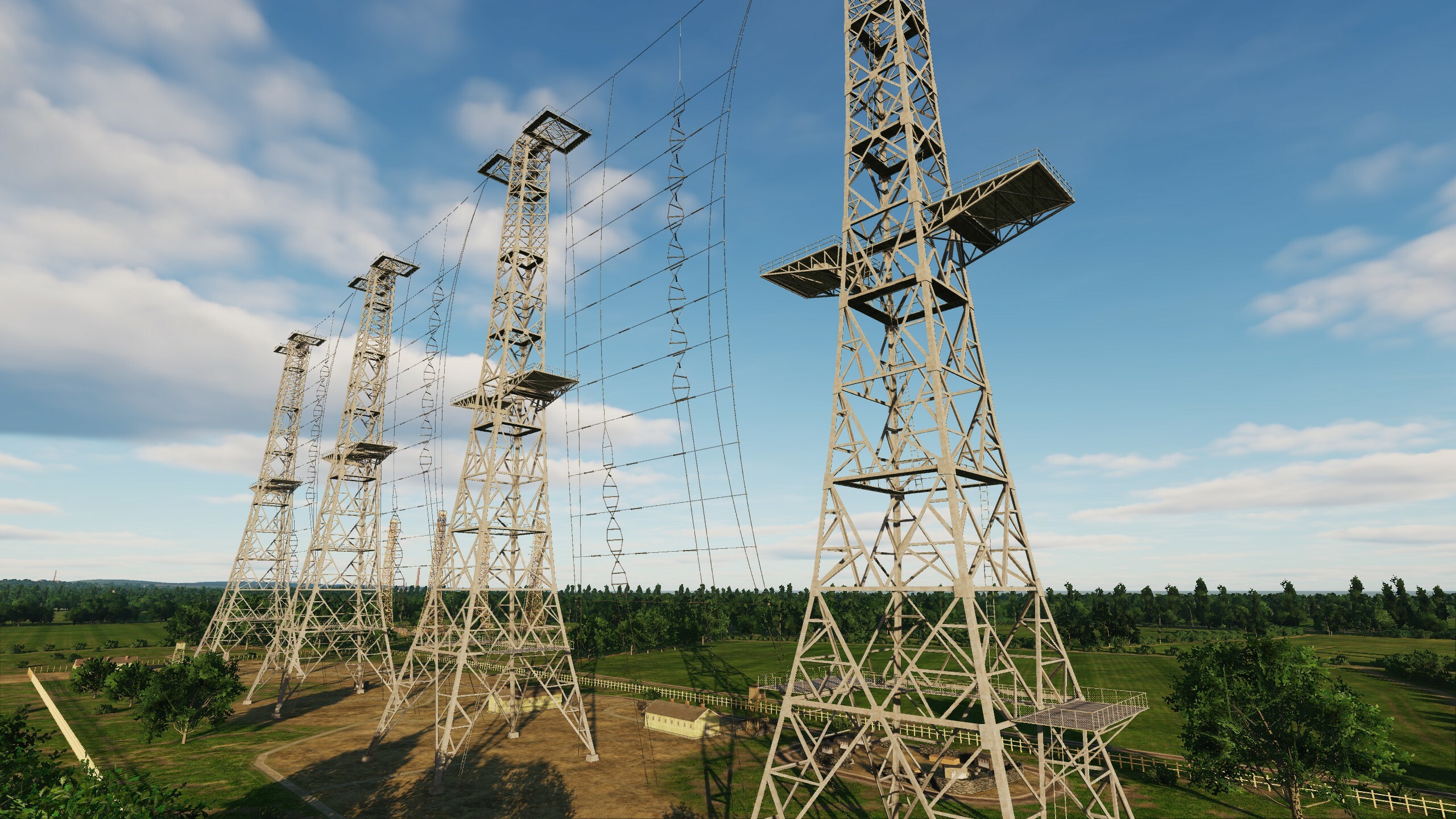
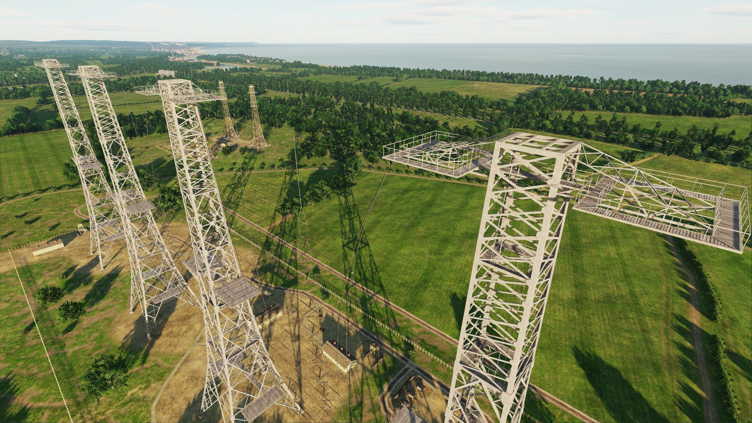
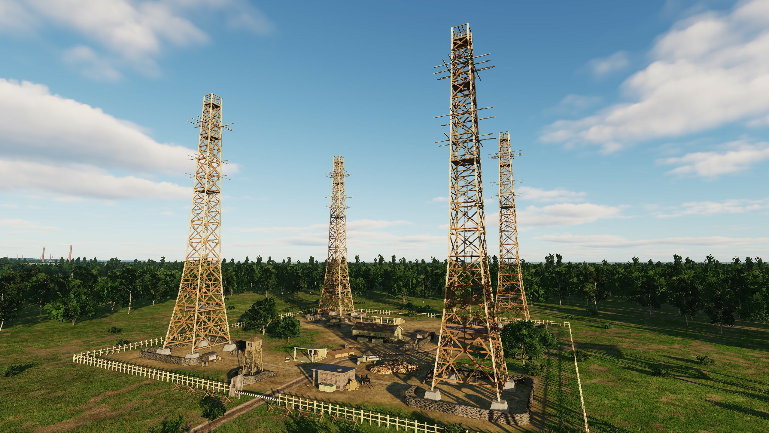
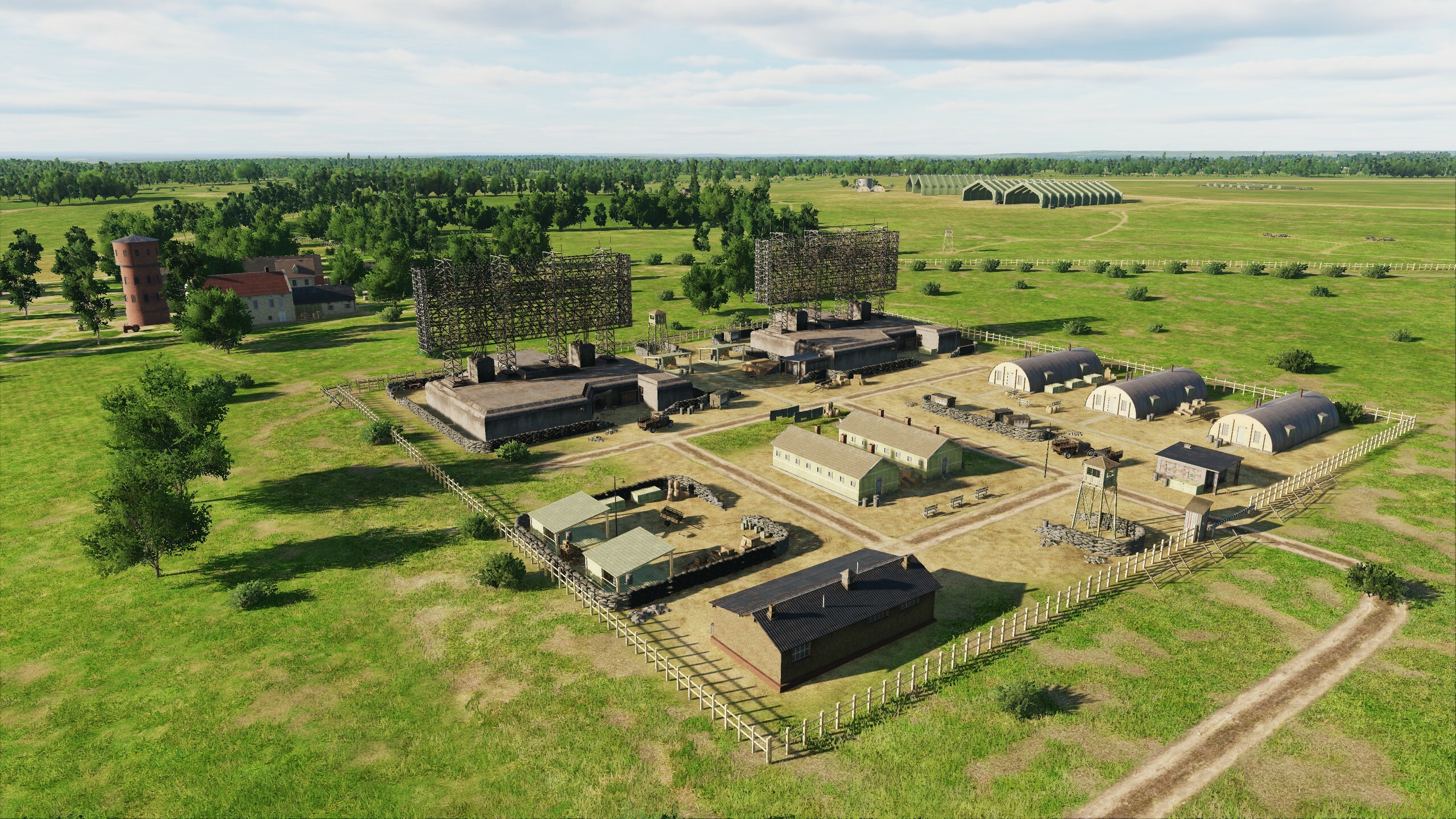
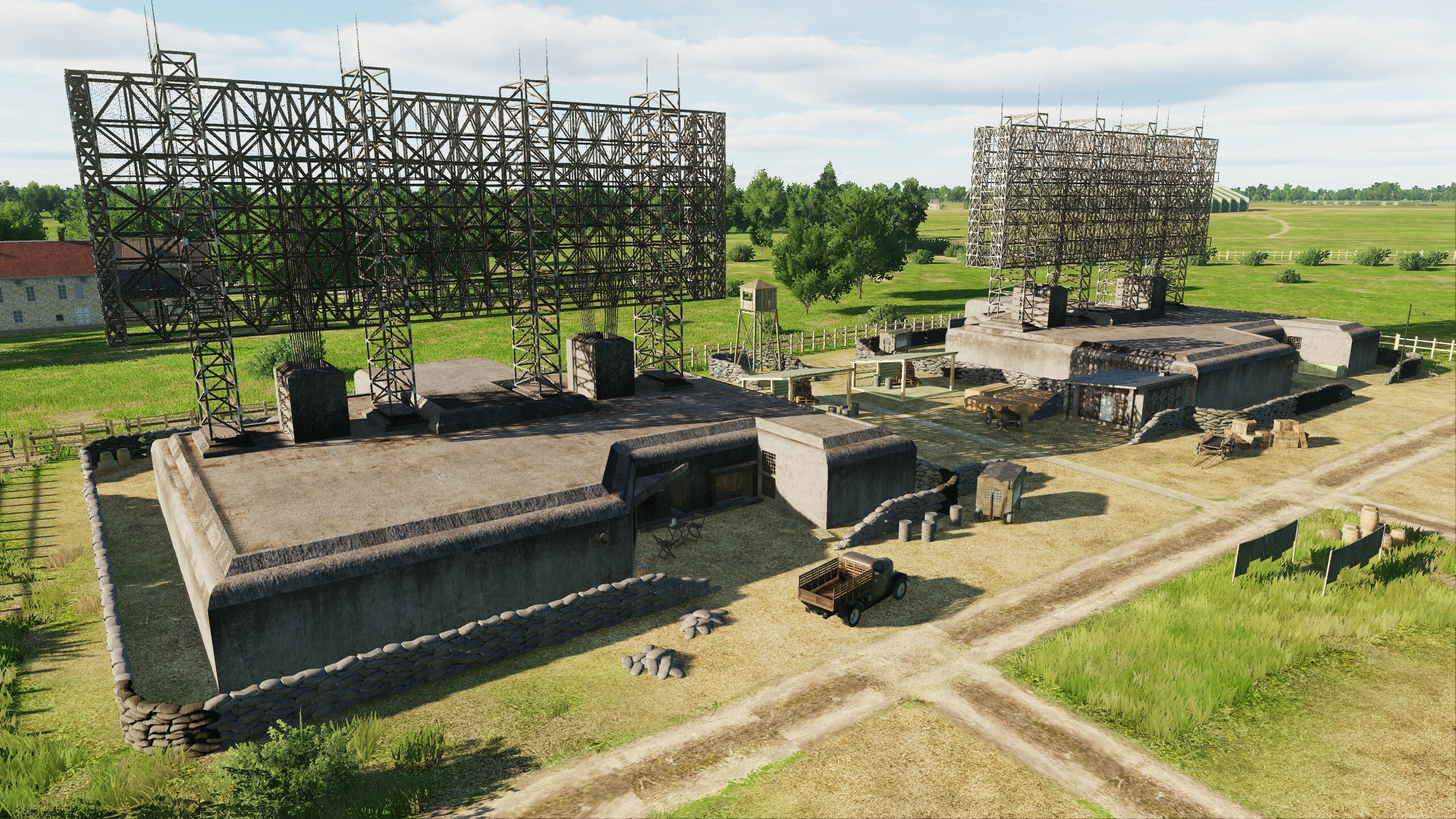
Hello fighters! In June, we are planning a small update that includes improvements and fixes to airfields, objects, scenes and terrain, model optimization and much more. Let's look at the list and screenshots: Updated list of changes: - Added scene of Spitfires factories in Hampshire. - Added scene with flags and warehouses from machinery at Heathrow Airfield. - Added the port of Le Trepor. - Added two fishing boats. - Added fishing boat routes. - Added underground tunnels in Paris. - Added new tram routes in London. - Added wooden piers. - Improved radar tower scenes in England and France. - Improved port scenes for Portsmouth, Dunkirk, London. - Improved traffic of trains and cars. - Added earthworks at English airfields Kenley, Ford, Chailey, Needs Oar Point, West Malling, Gravesend. - Improved scenes of Orly, Saint-Andre-de-lEure, Amiens-Glisy, Carpiquet, Gravesend, Kenley airfields. - Improved tent and sandbag shelter scenes at Ford, Chailey, Gravesend, Kenley airfields. - Improved settings of city objects' disconnect range. - Improved life settings for objects. - Improved cliffs on French coast. - Improved lighting of objects (due to light cloaking during war, available when selecting mission time 1946). - Increased texture resolution for minimum settings. - Part of metal car bridges replaced by stone ones. - Destruction models are optimized. - Added steps on Tower Bridge, Mirabeau Bridge, Alexander III Bridge. - Added oversized EDM flags. - Fixed errors in the Chailey, Farnborough, Ford, Kenley, Beny-sur-Mer, Bazenville, Deux Jumeaux airfield scenes. - Fixed errors in taxiways and car parks at Chailey, Farnborough, Ford, Kenley, Lymington, Orly, Villacoublay, Saint-Andre-de-lEure, Creil, Cormeilles-en-Vexin, Carpiquet, Sainte-Laurent-sur-Mer. - Terrain errors on the French coast have been fixed. - Leveled terrain in the ports of Portsmouth, Dunkirk, London, Boulogne-sur-Mer. - Fixed errors in land textures near the Isle of Wight and on the coast of the landing zone. - Corrected collisions in Louvre Museum arches, military school in Paris, Luxembourg Palace, Tower, Victoria Station, Liverpool Street Station, Kensington Palace, Buckingham Palace. - Fixed errors at Cumberland and Newhaven Forts. - Fixed the hands on the clocks at Victoria Station, Big Ben and model churches. Airfields Amiens-Glisy: Carpiquet Saint-Andre-de-lEure Spitfires factories in Hampshire Port of Dunkirk Port of Portsmouth And my favorite "Chain Home" and "Mammut" These big things are the pinnacles of the then high-tech, which gave a powerful impetus to all radio electronics.
- 10 replies
-
- 30
-
-
-
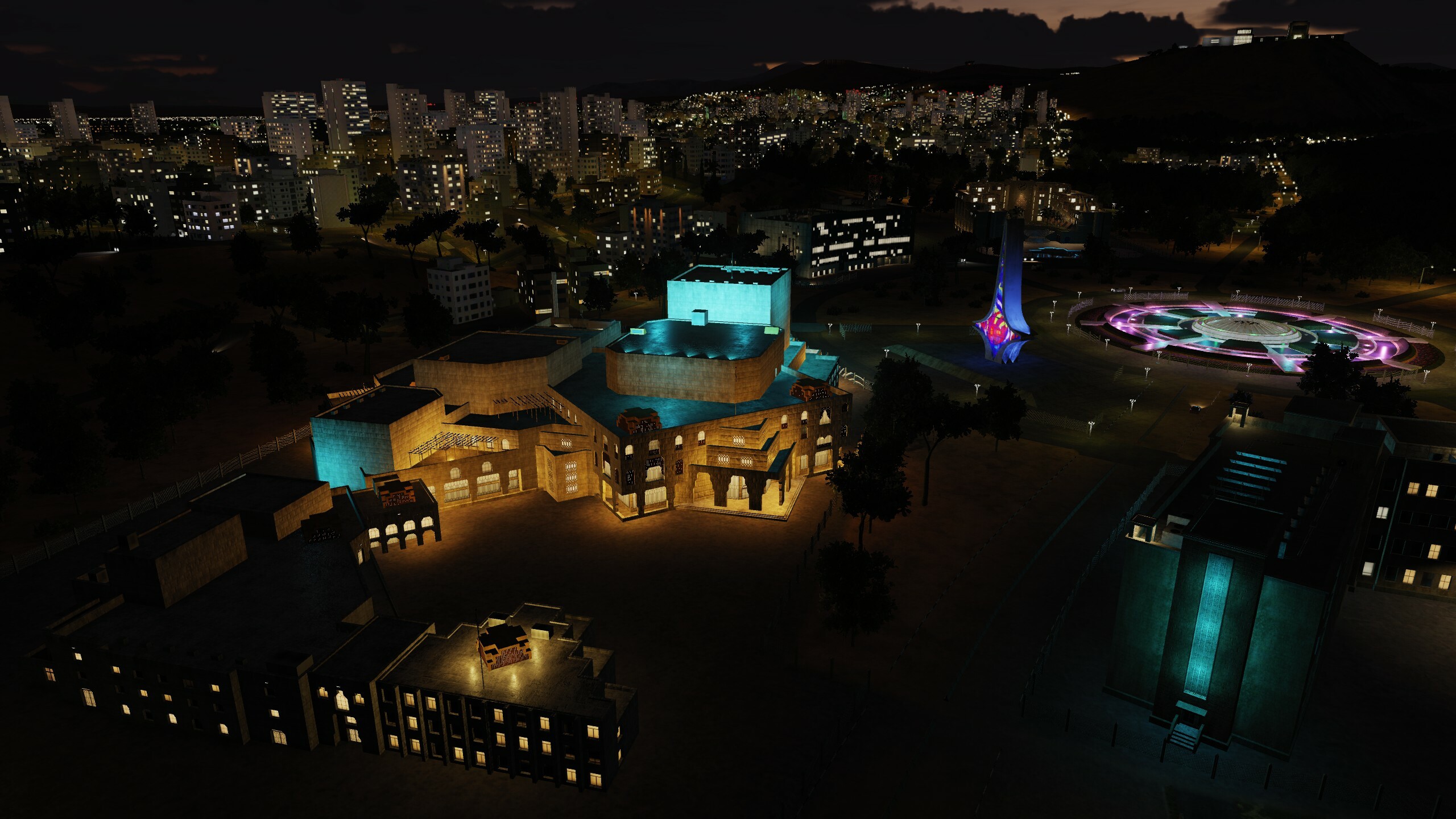
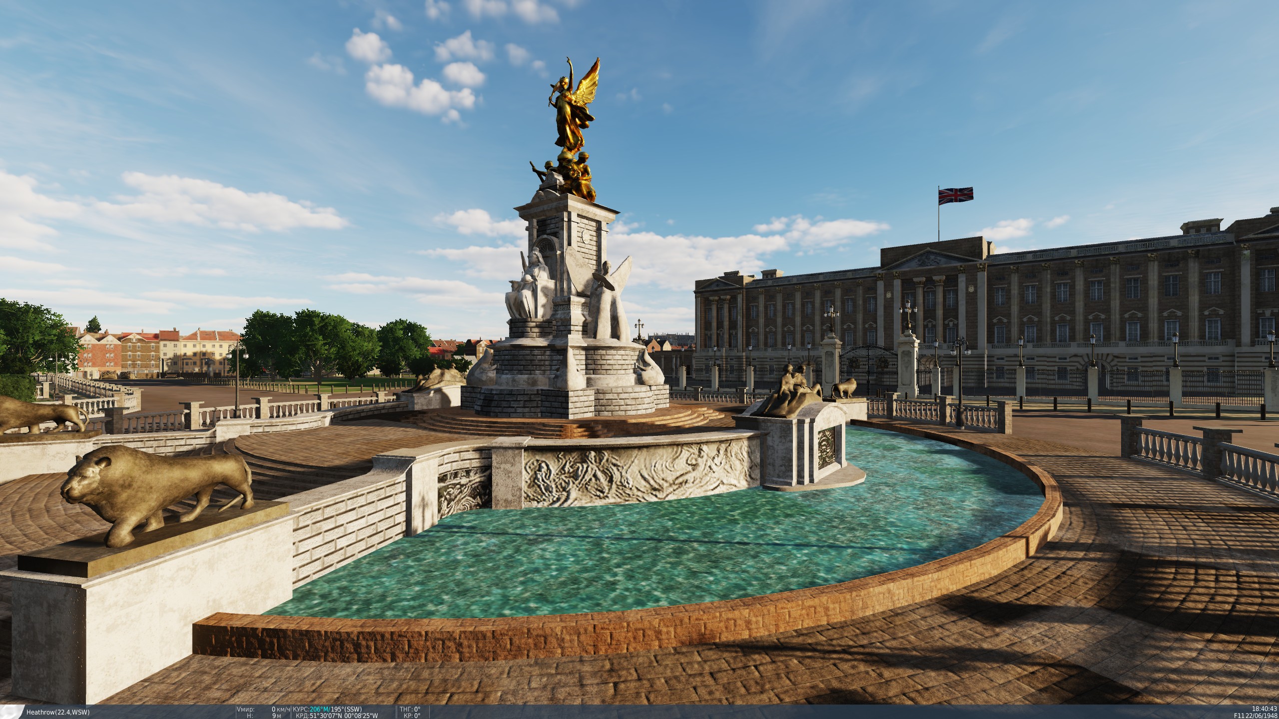
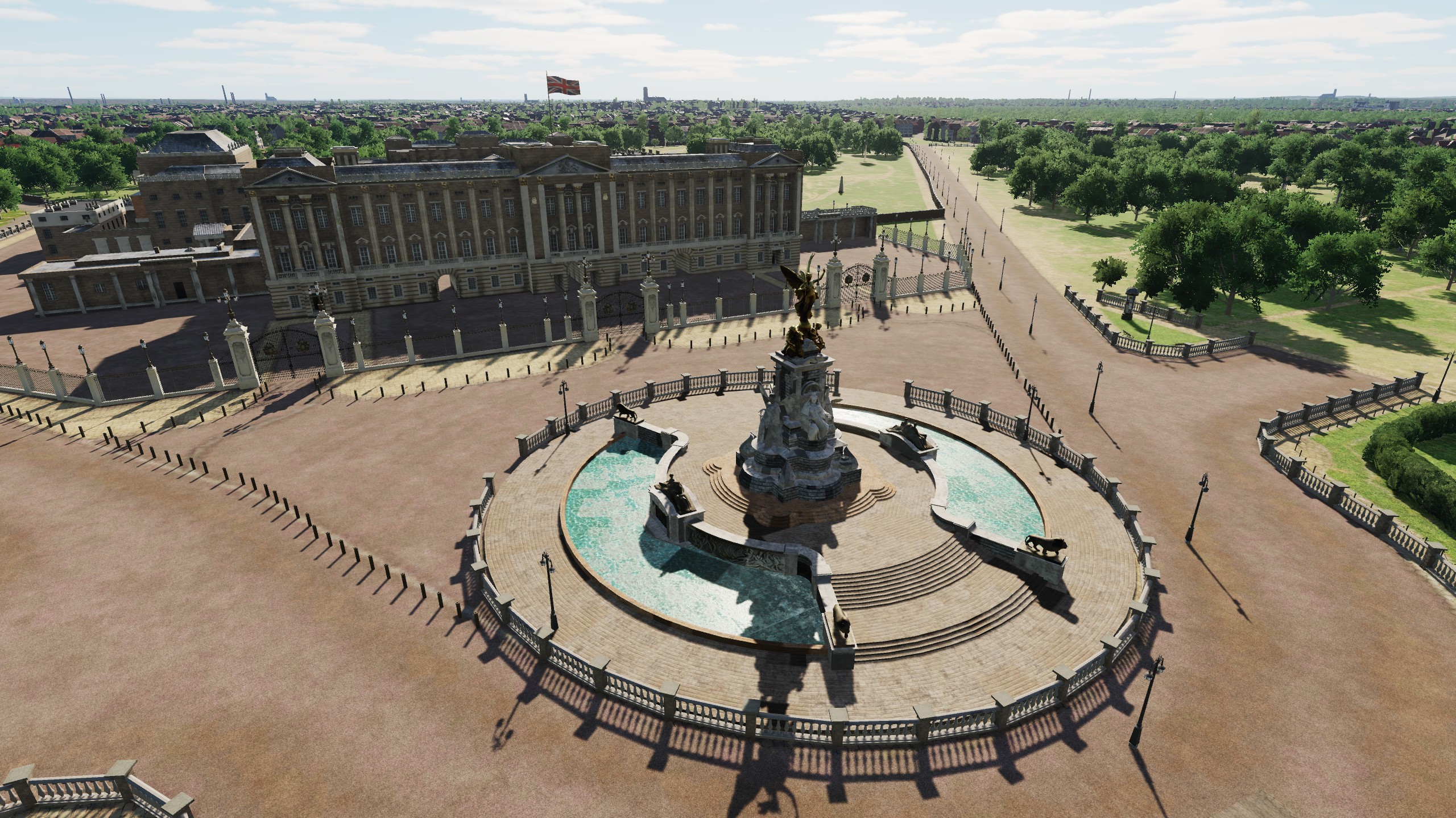
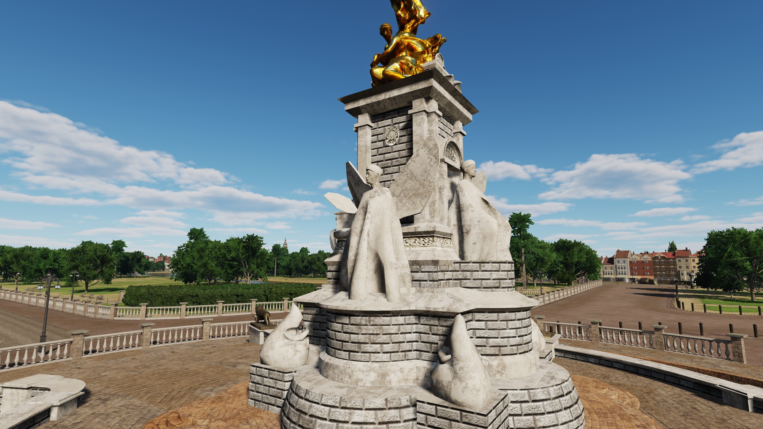
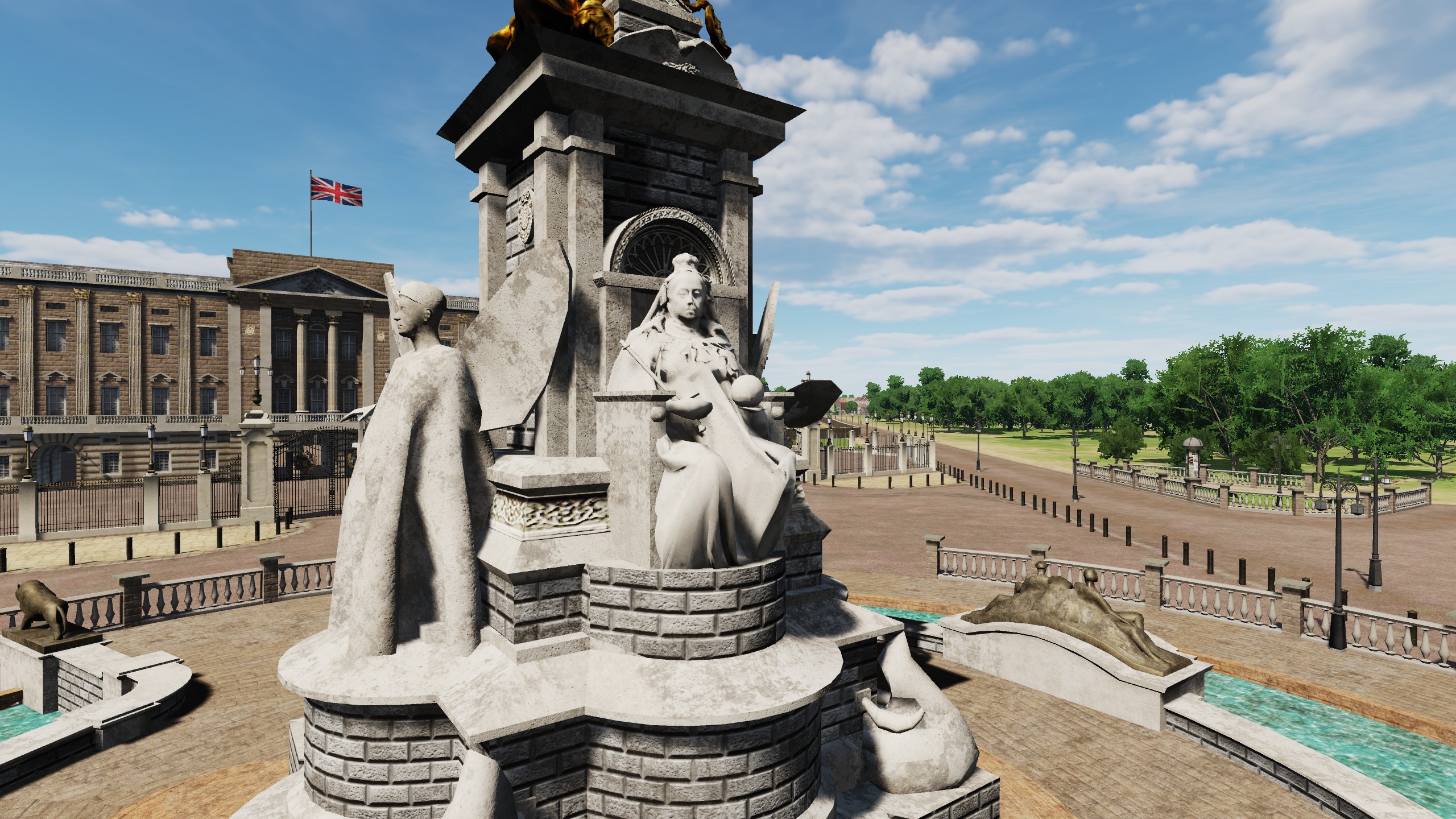
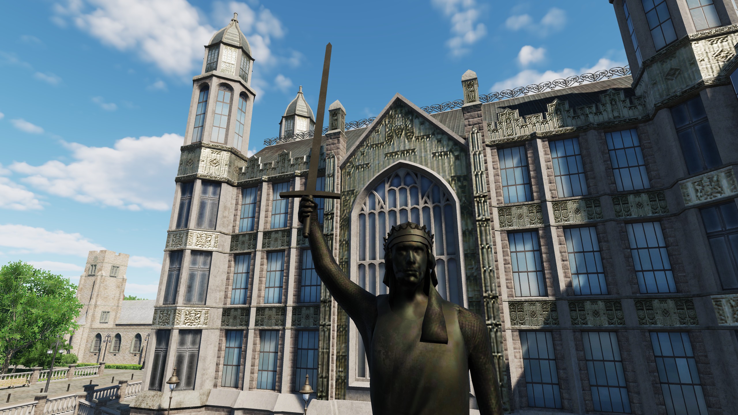
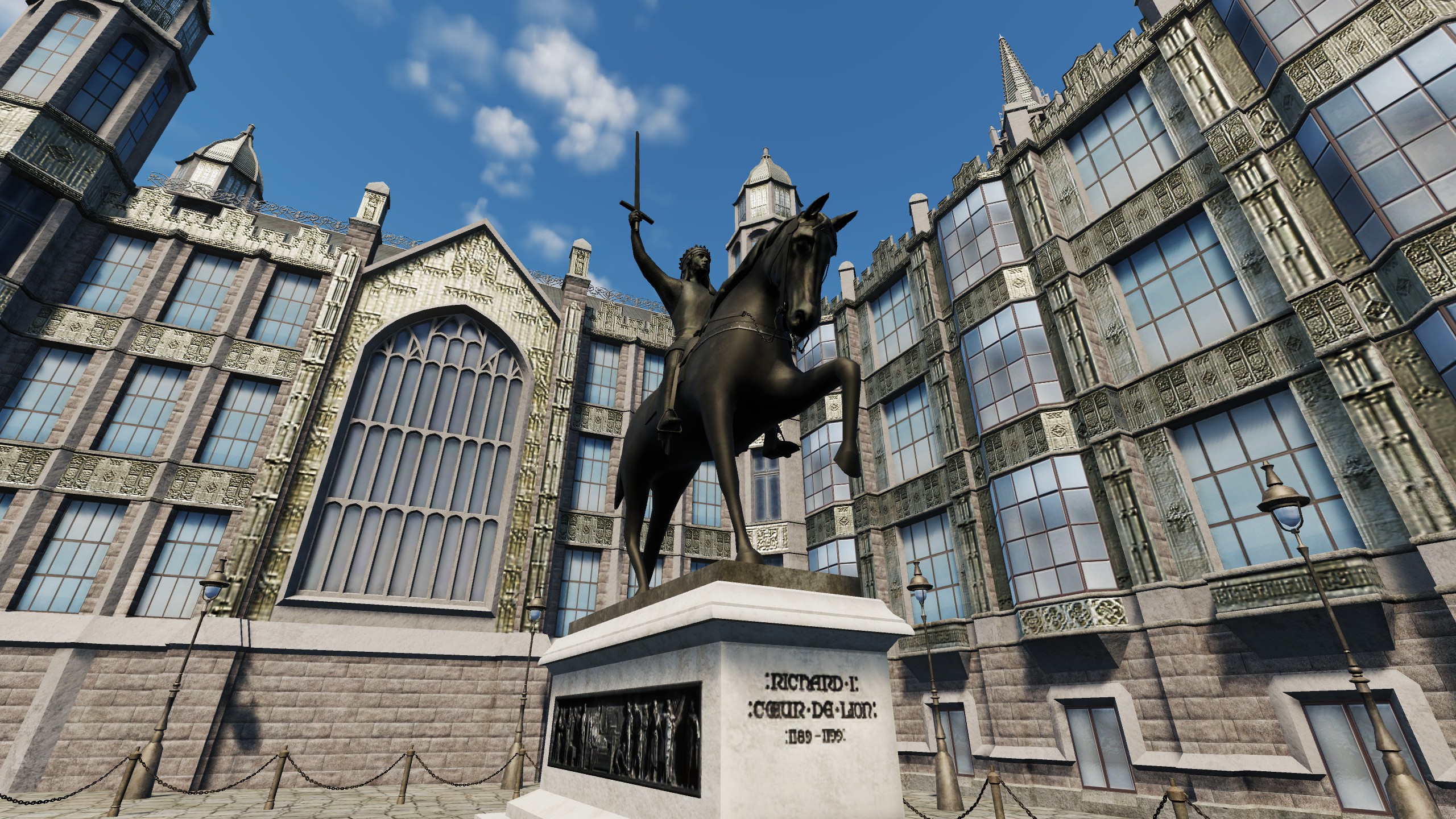
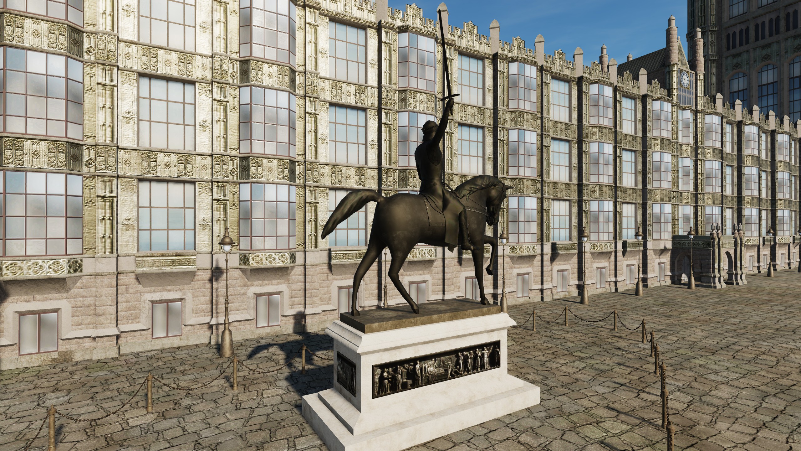
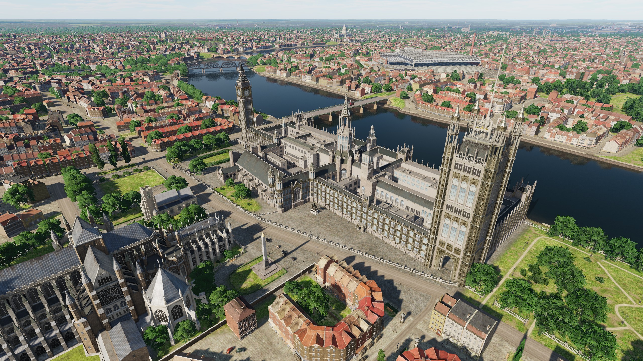
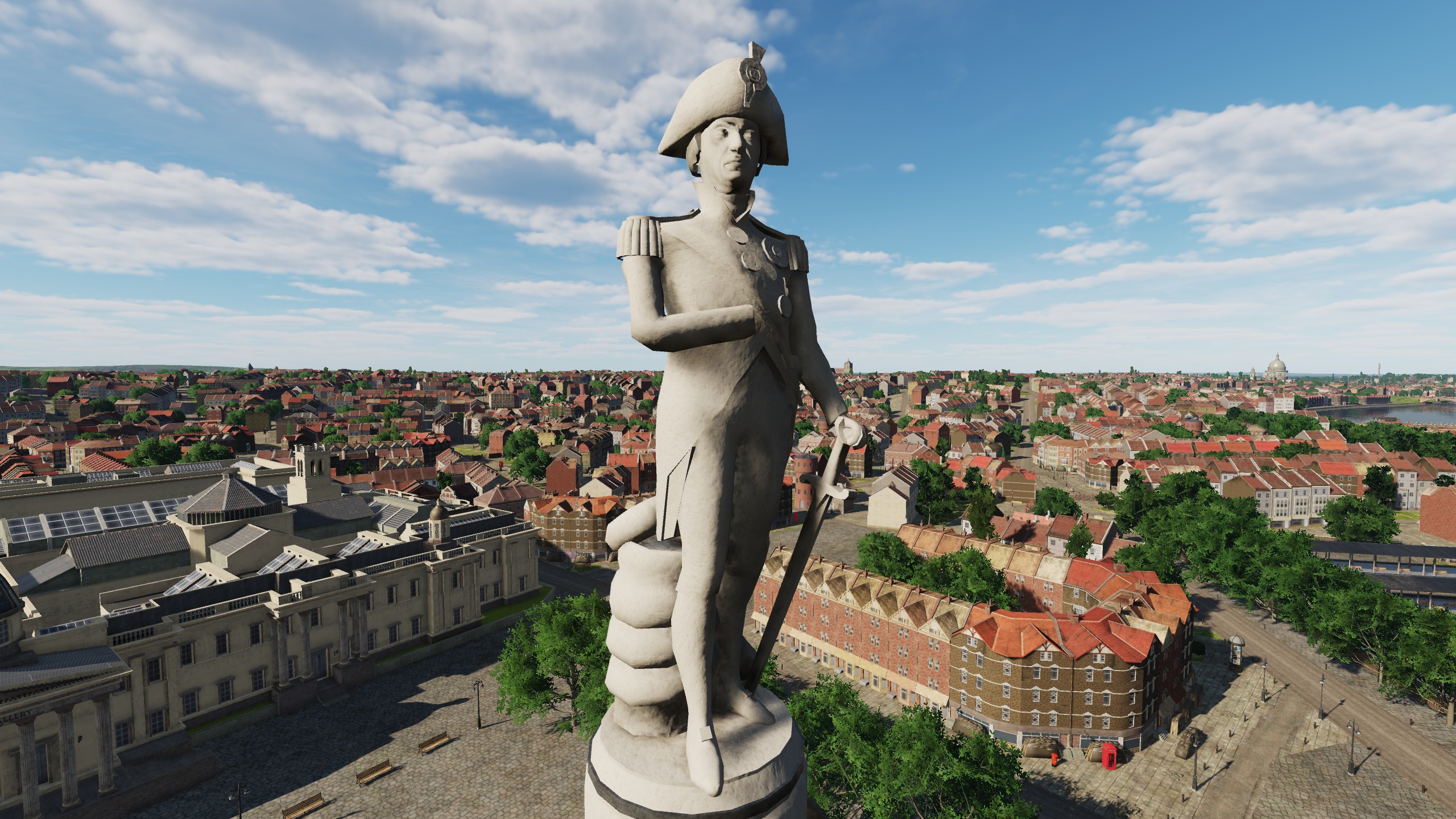
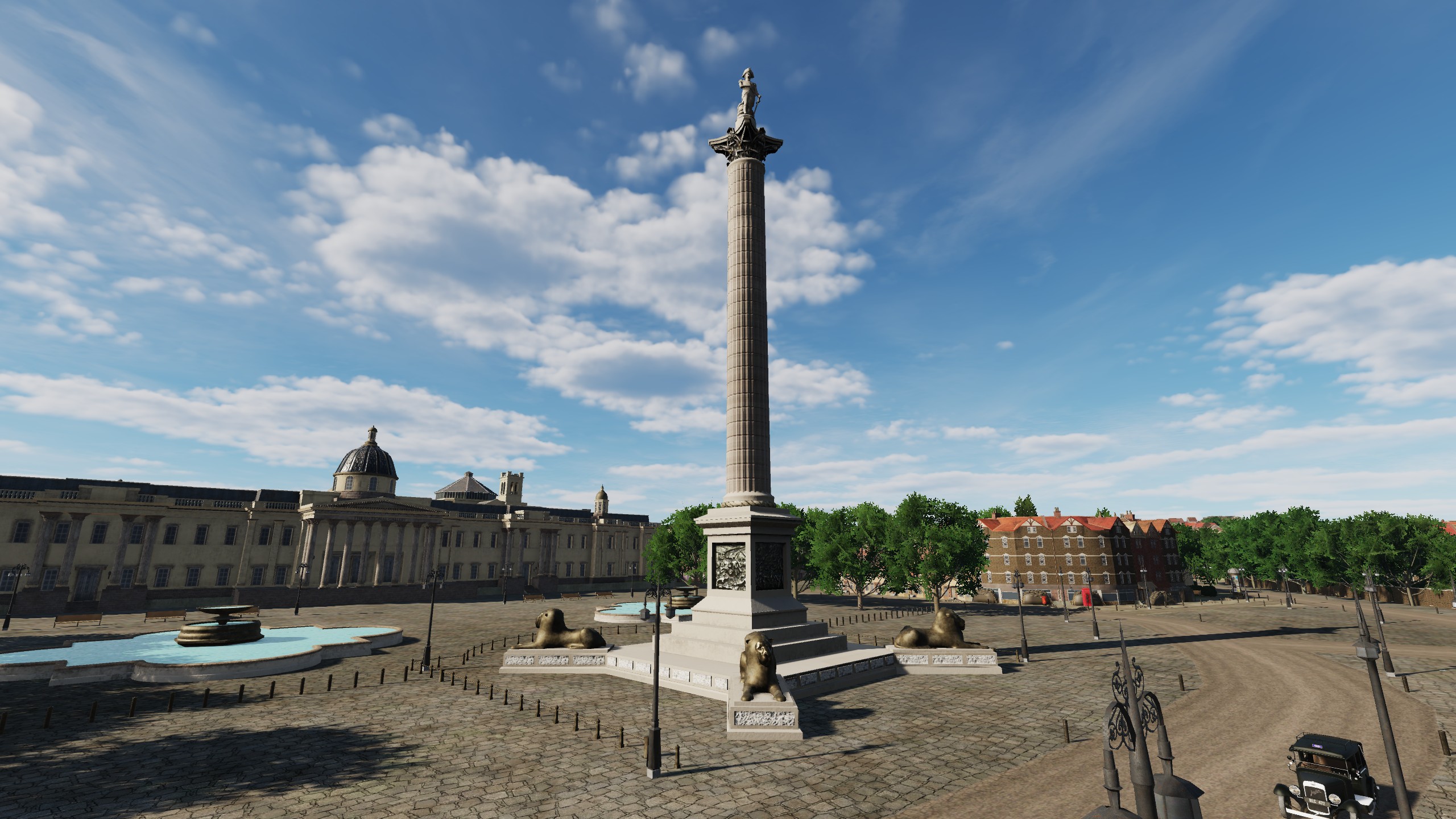
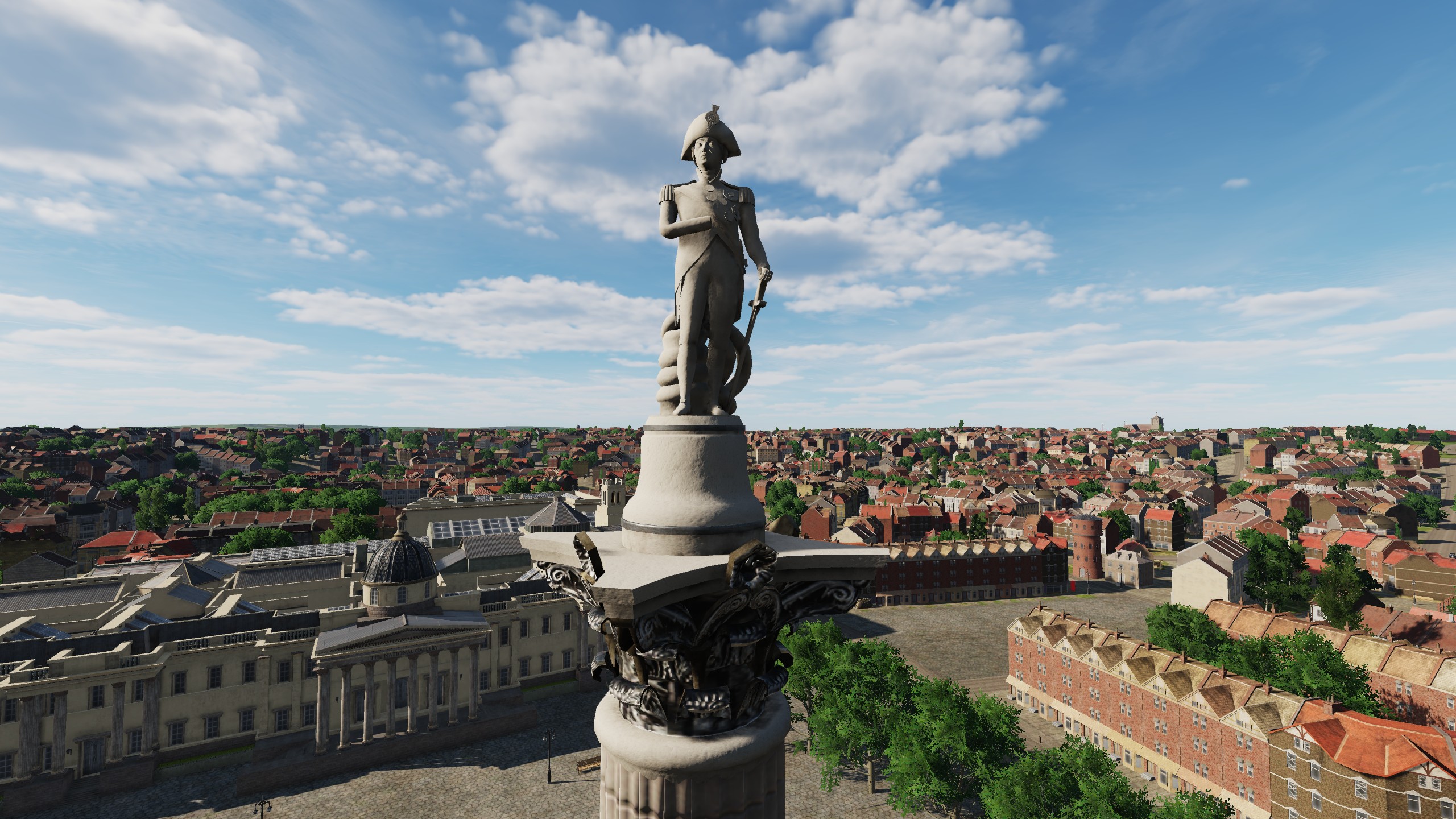
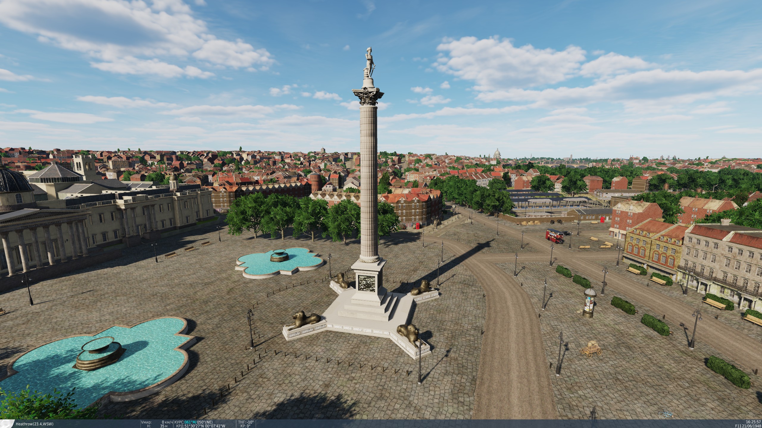
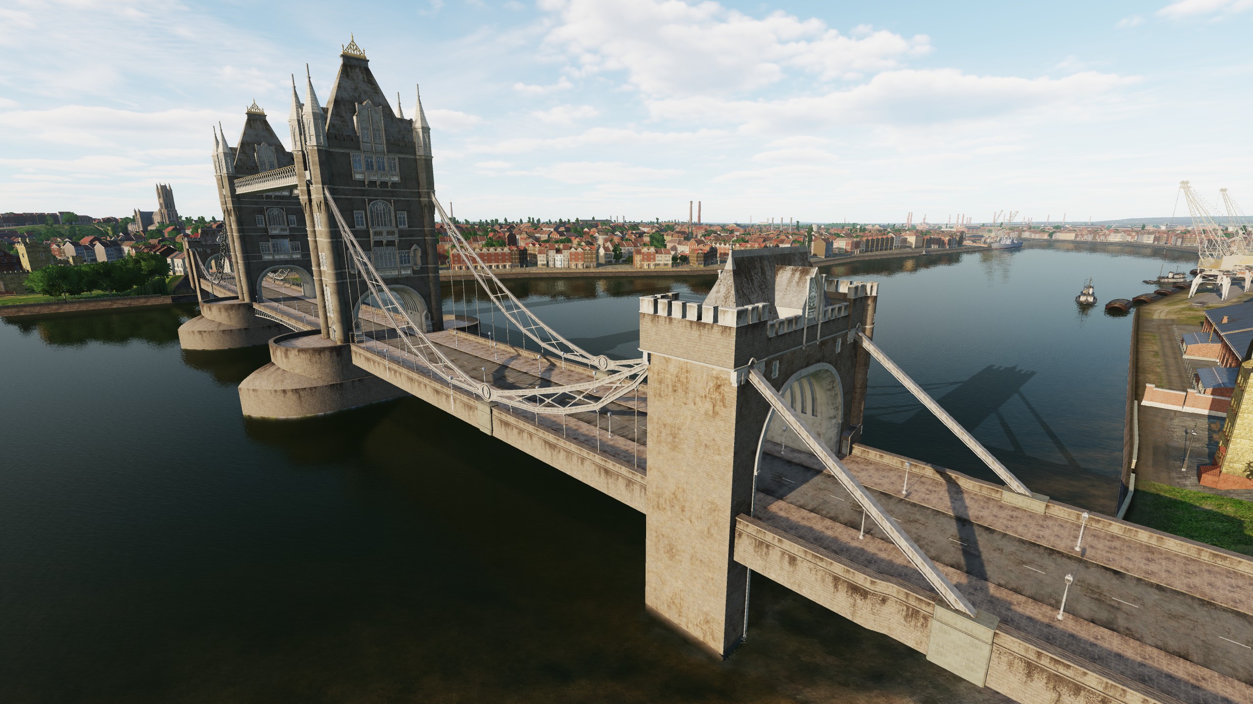
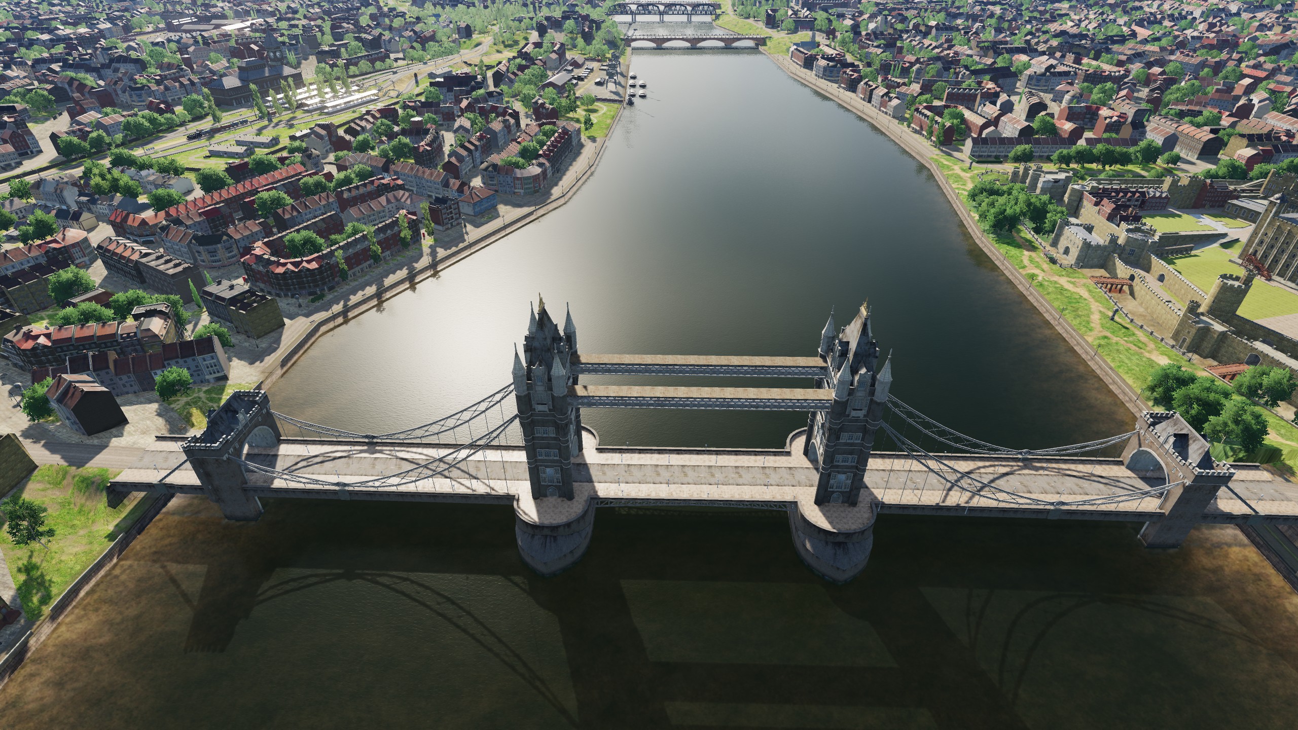
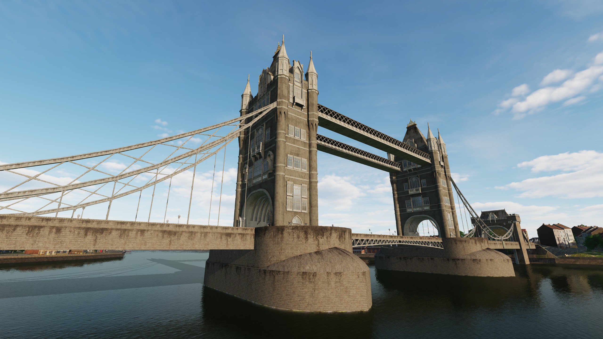
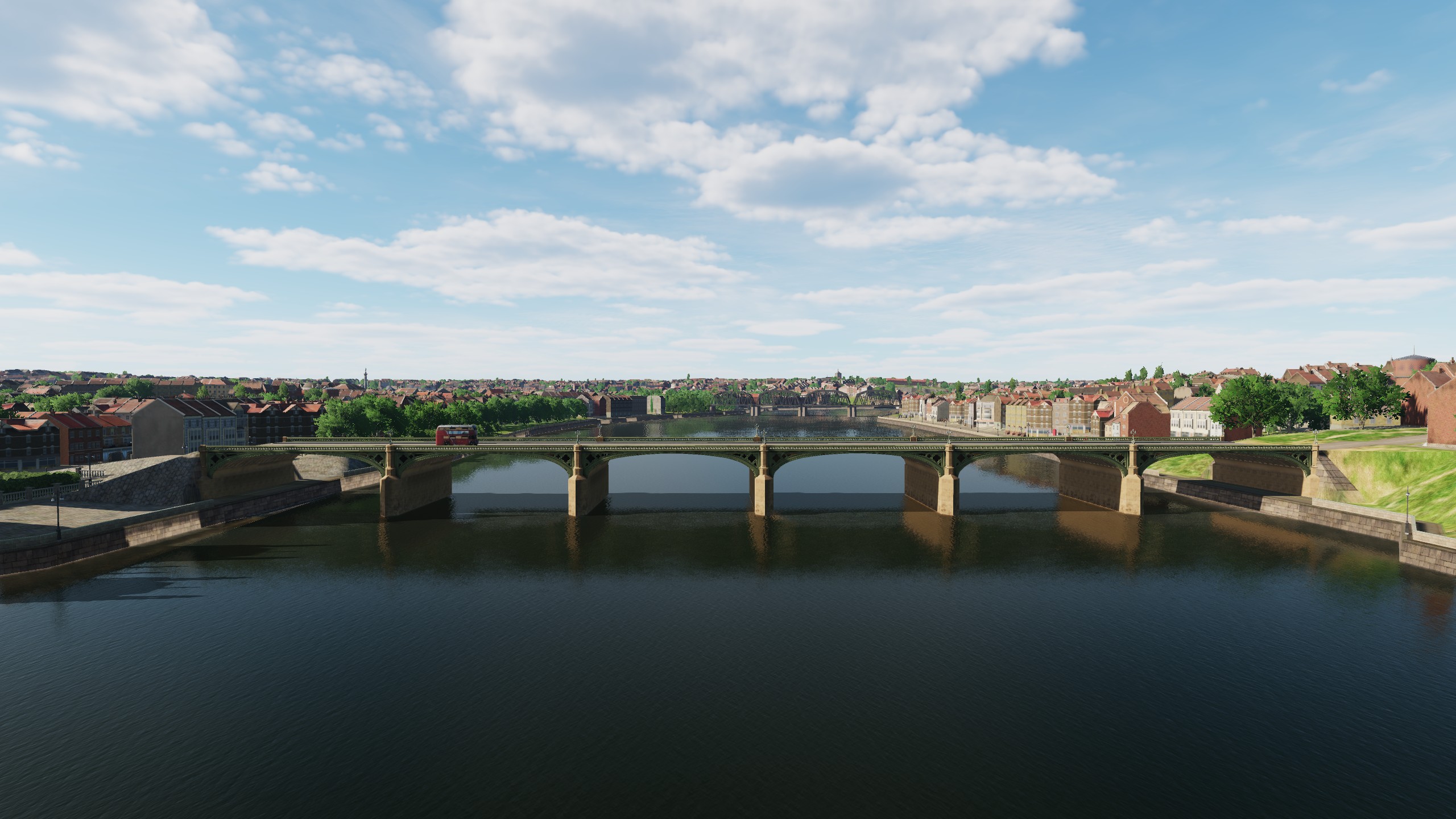
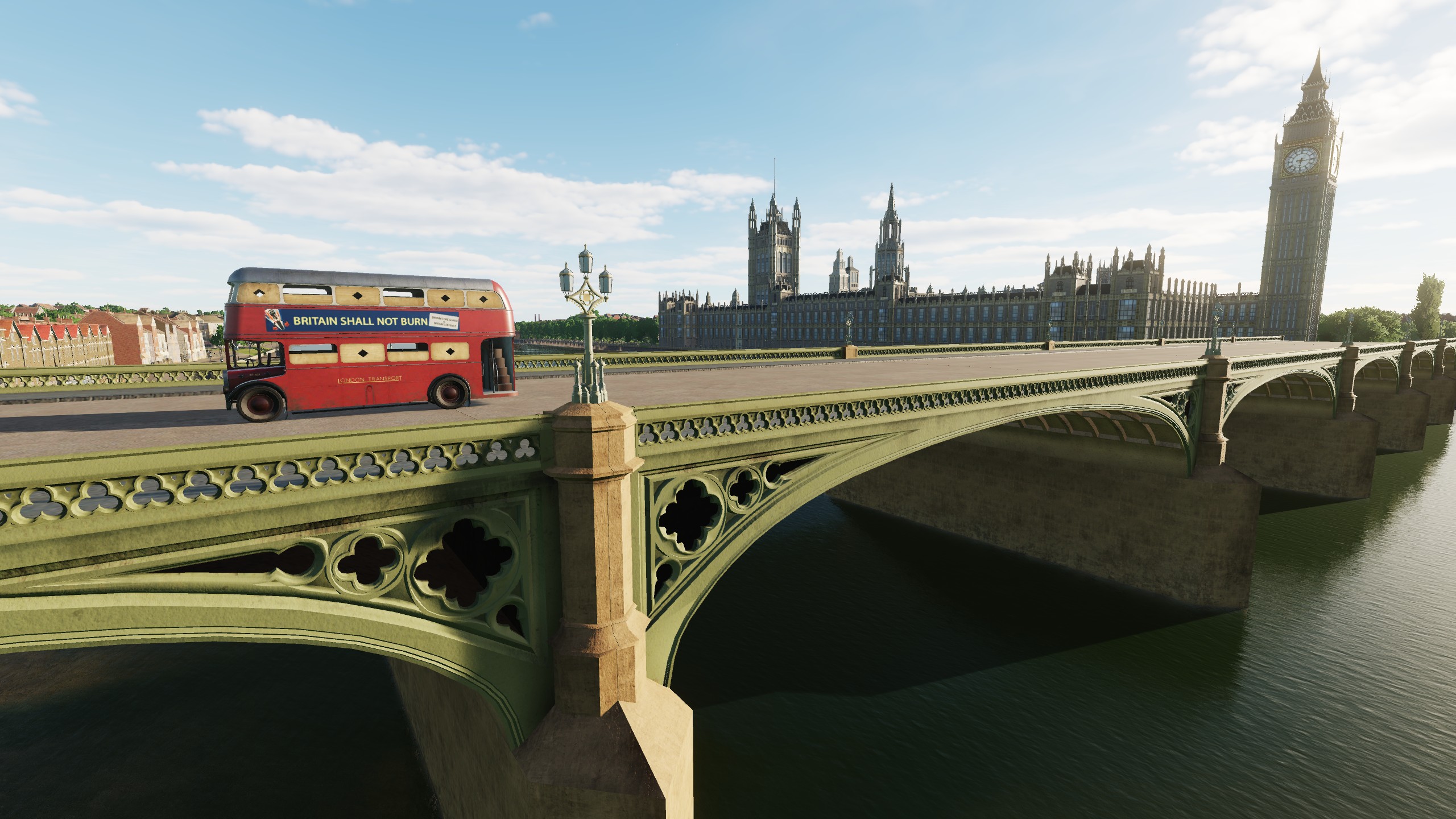
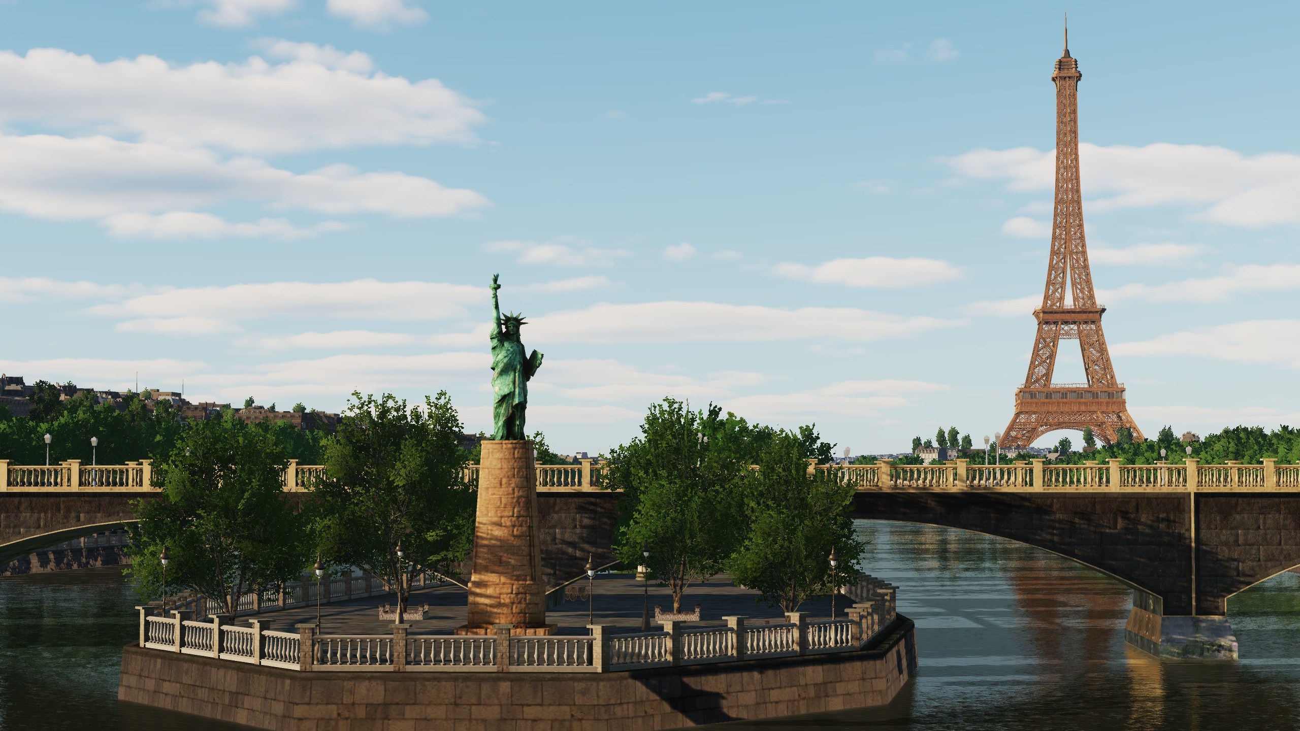
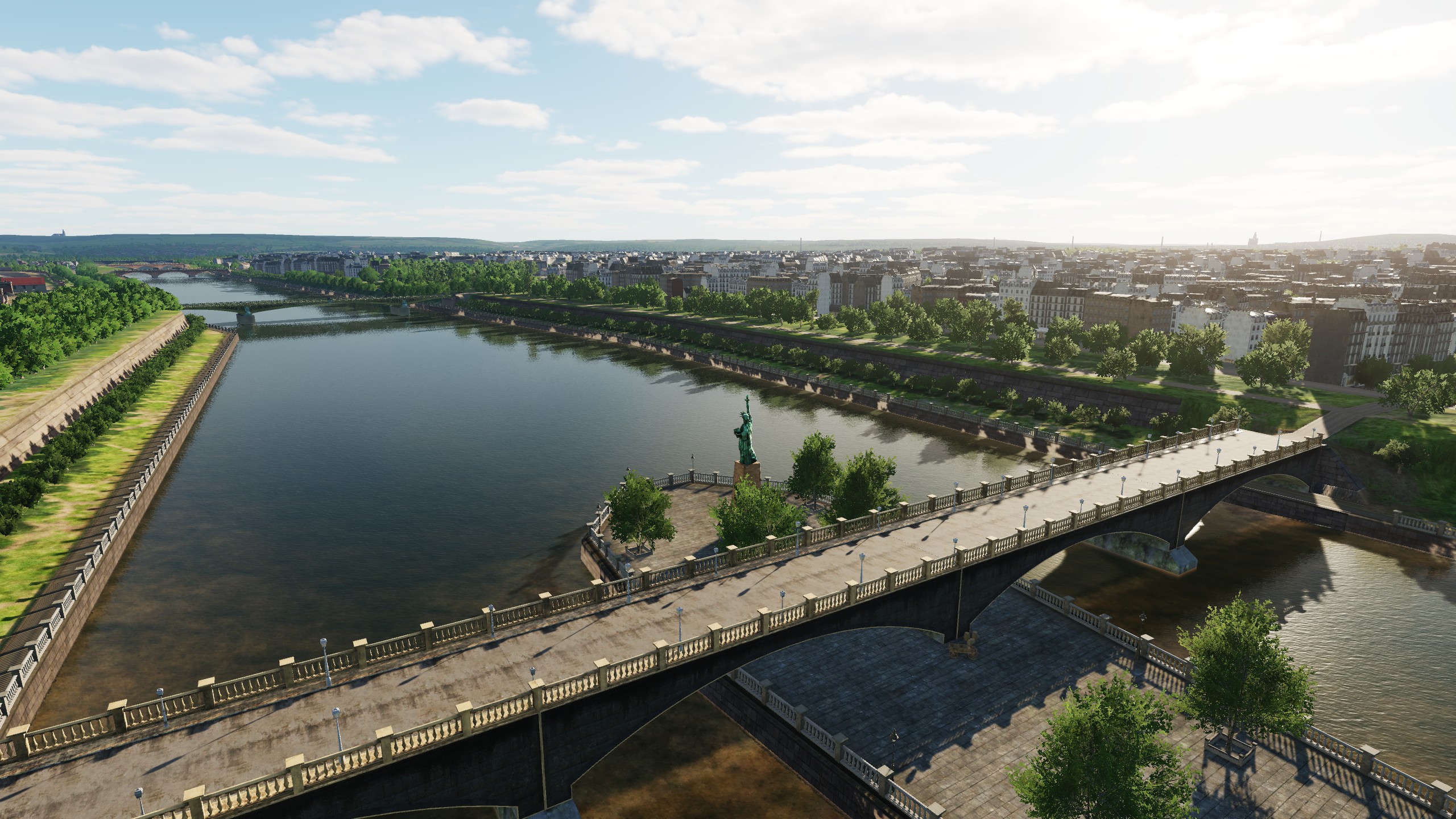
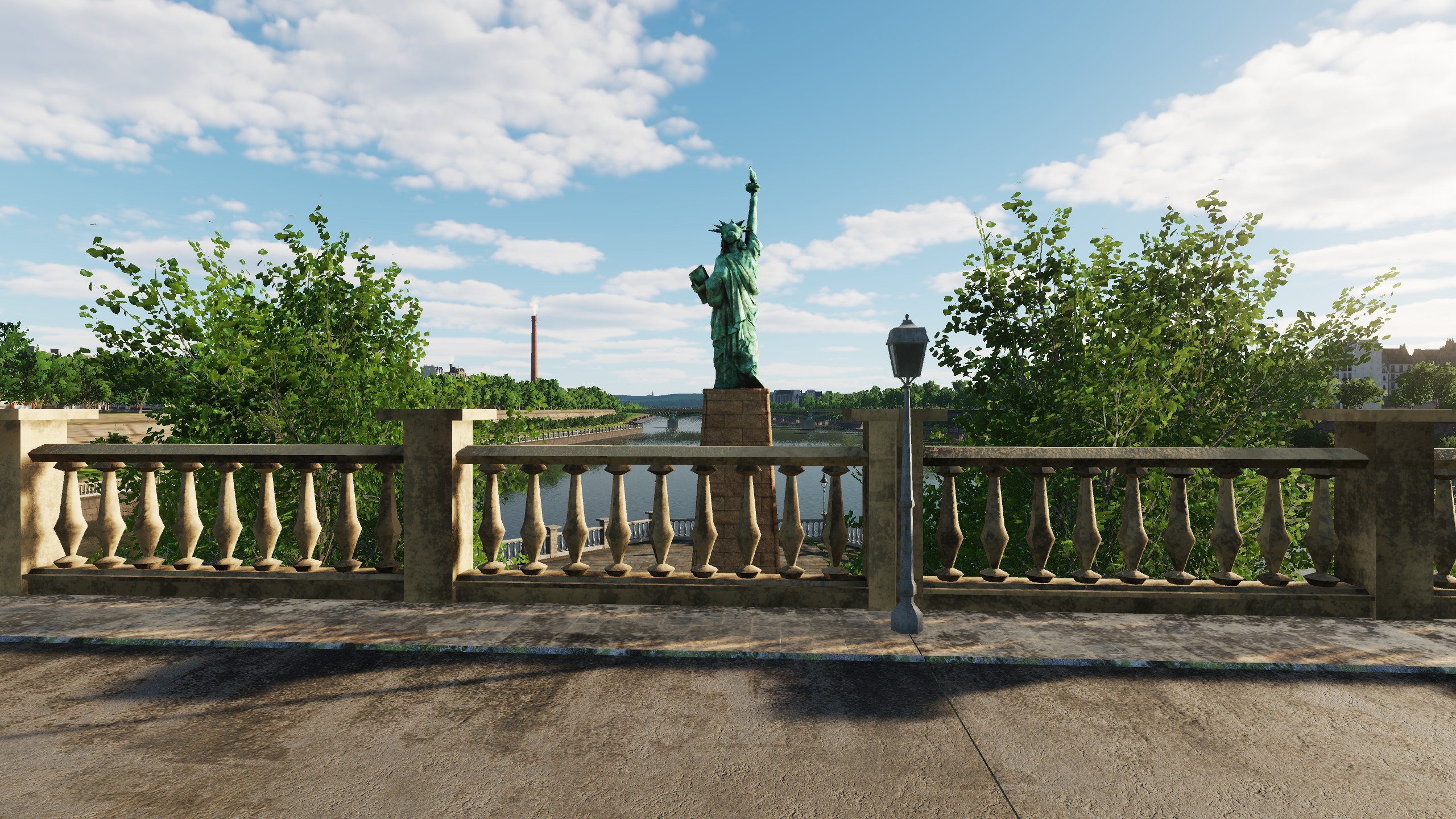
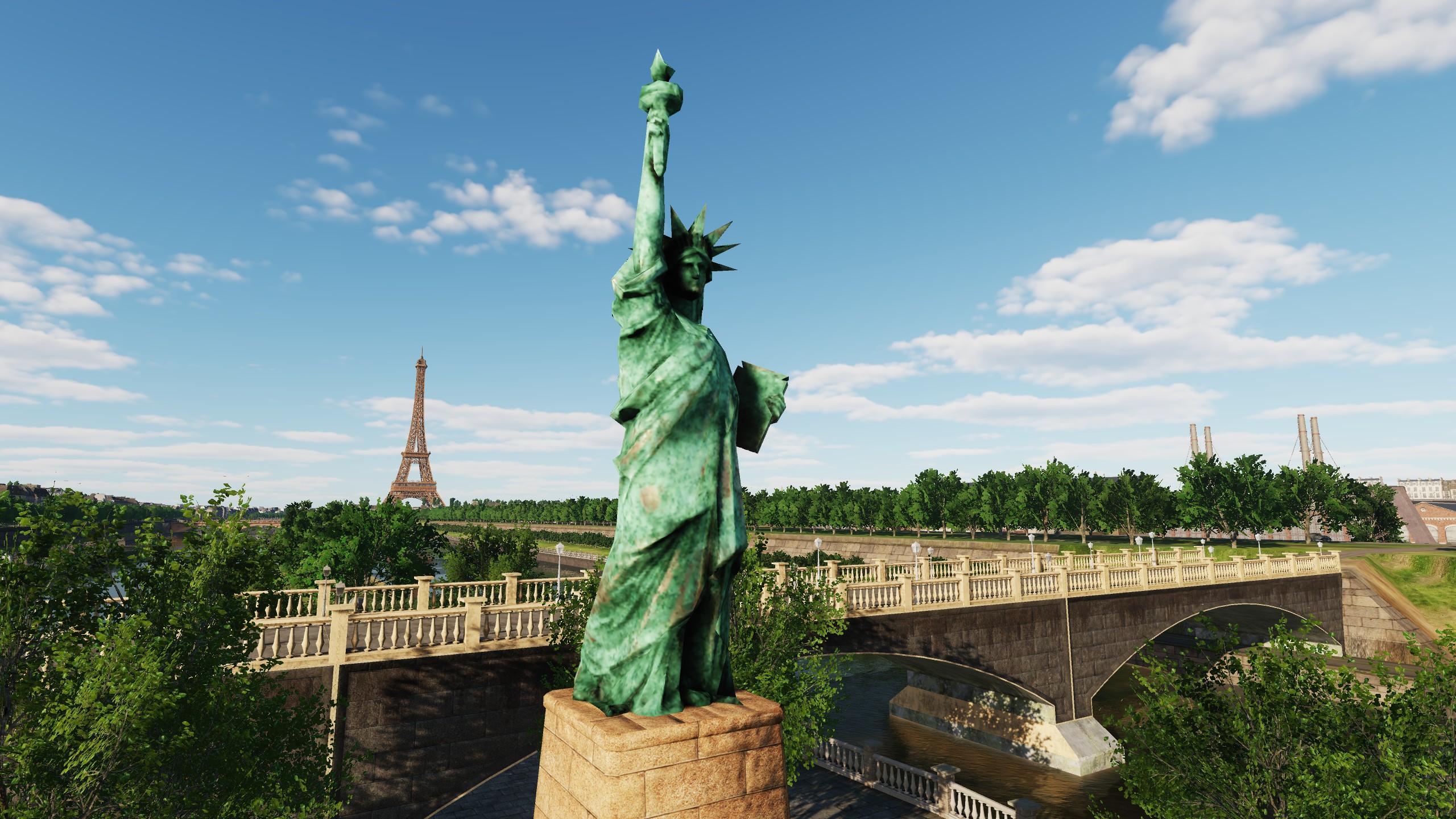
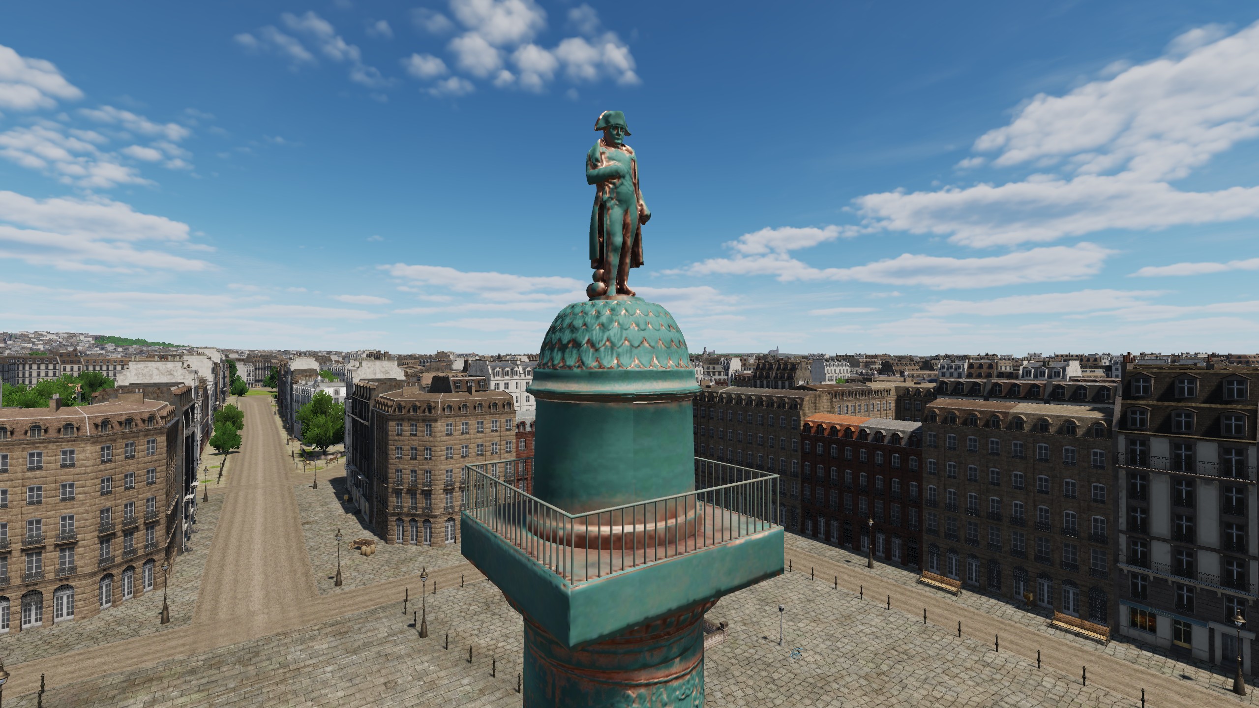
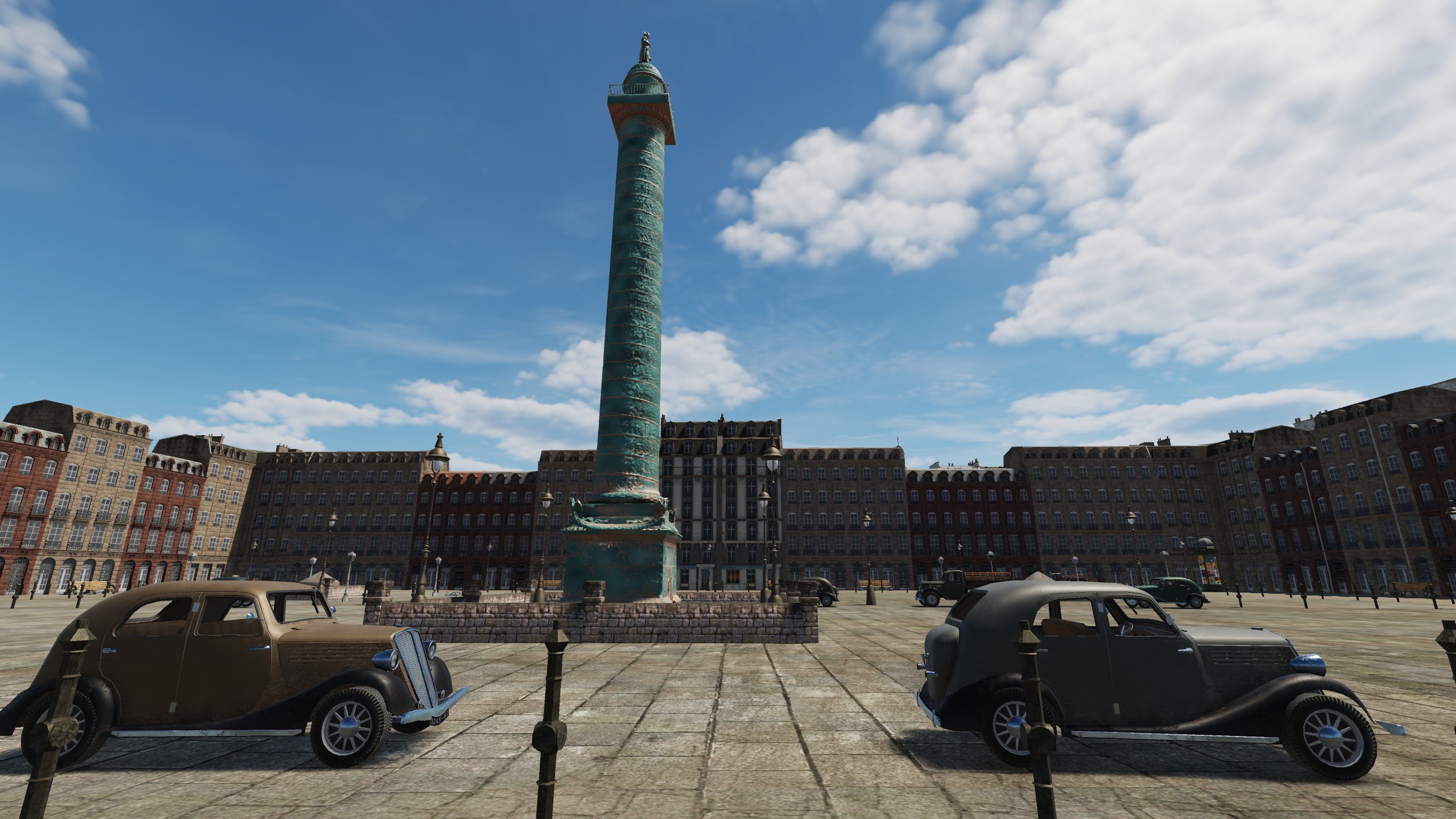
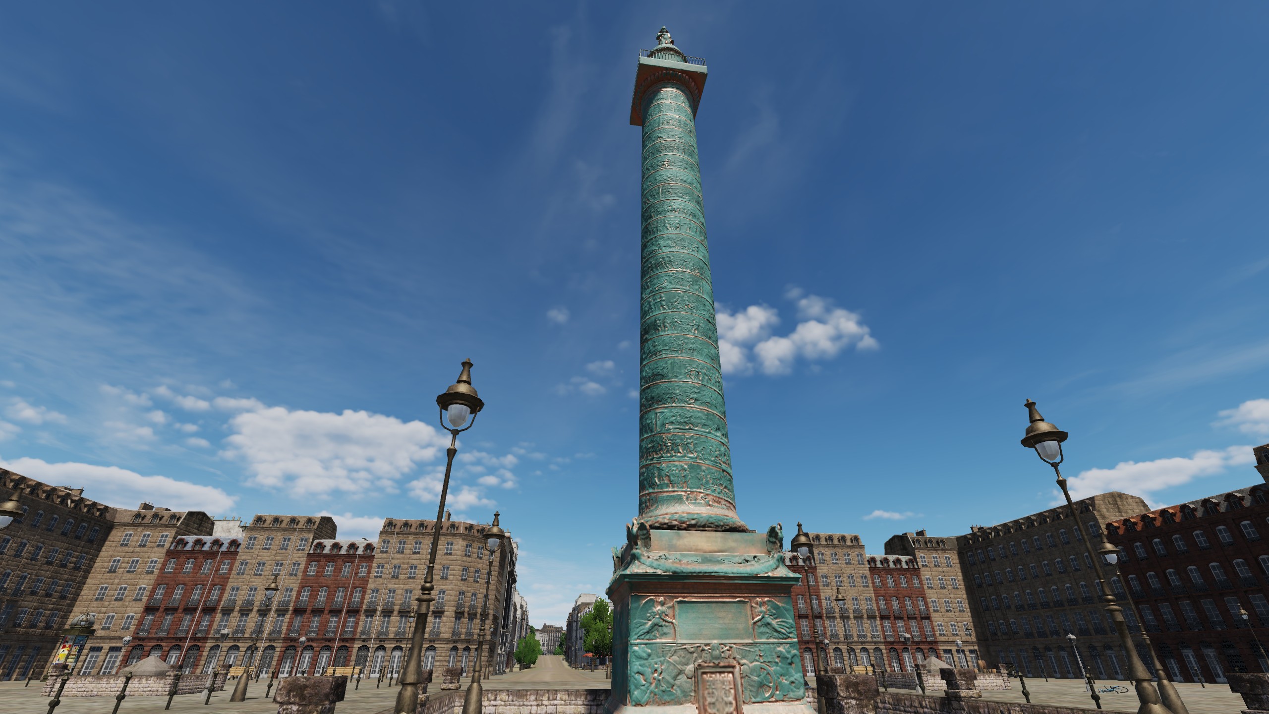
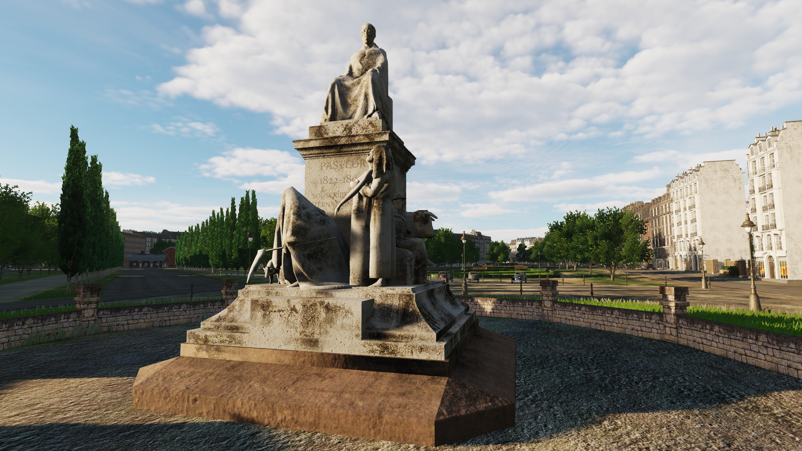
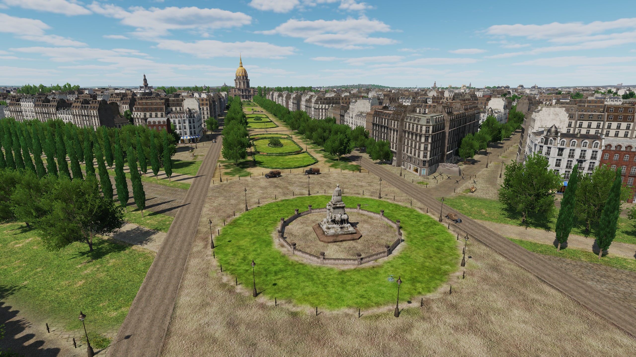
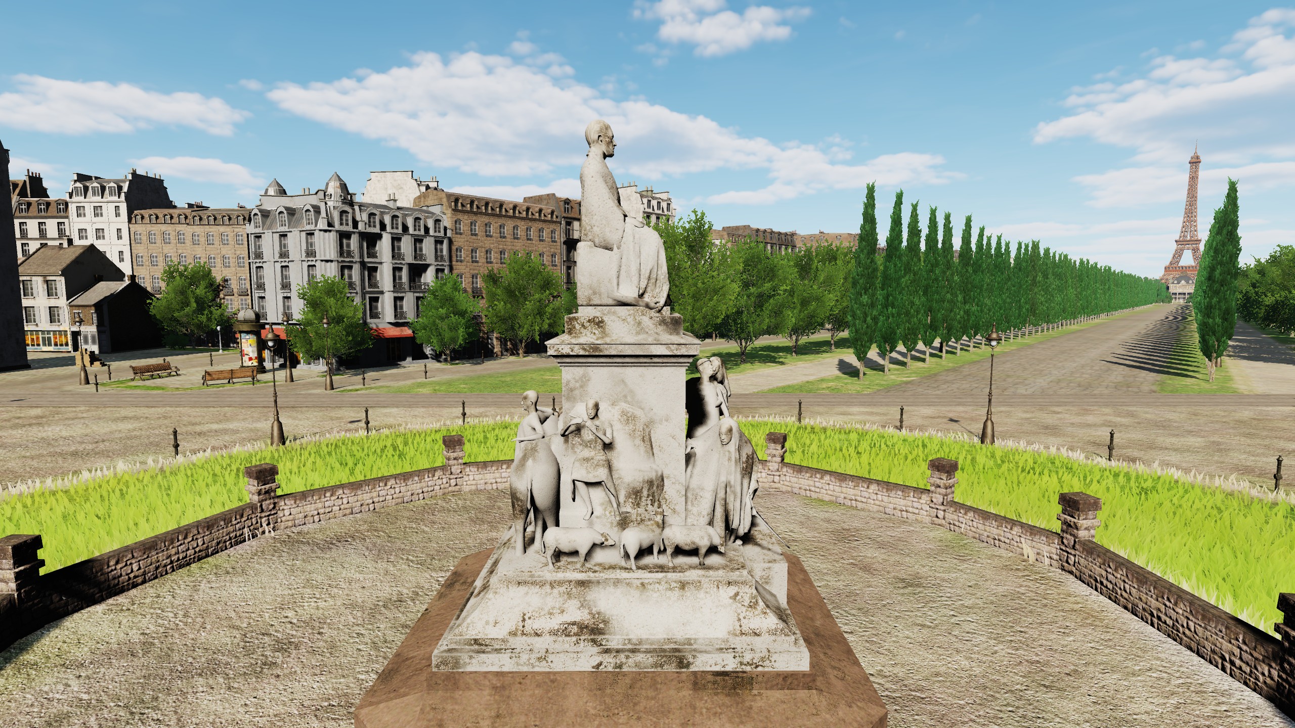
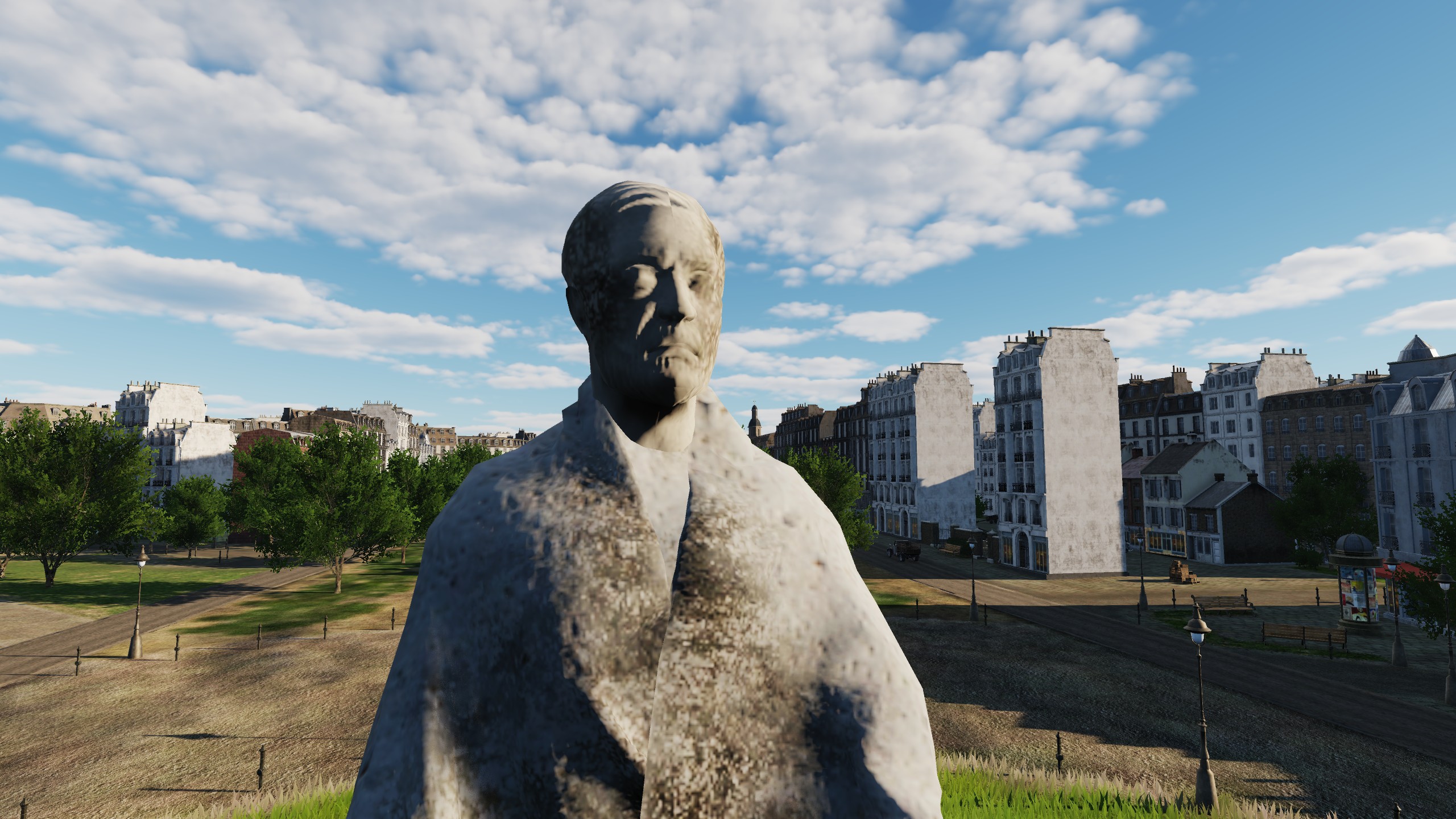
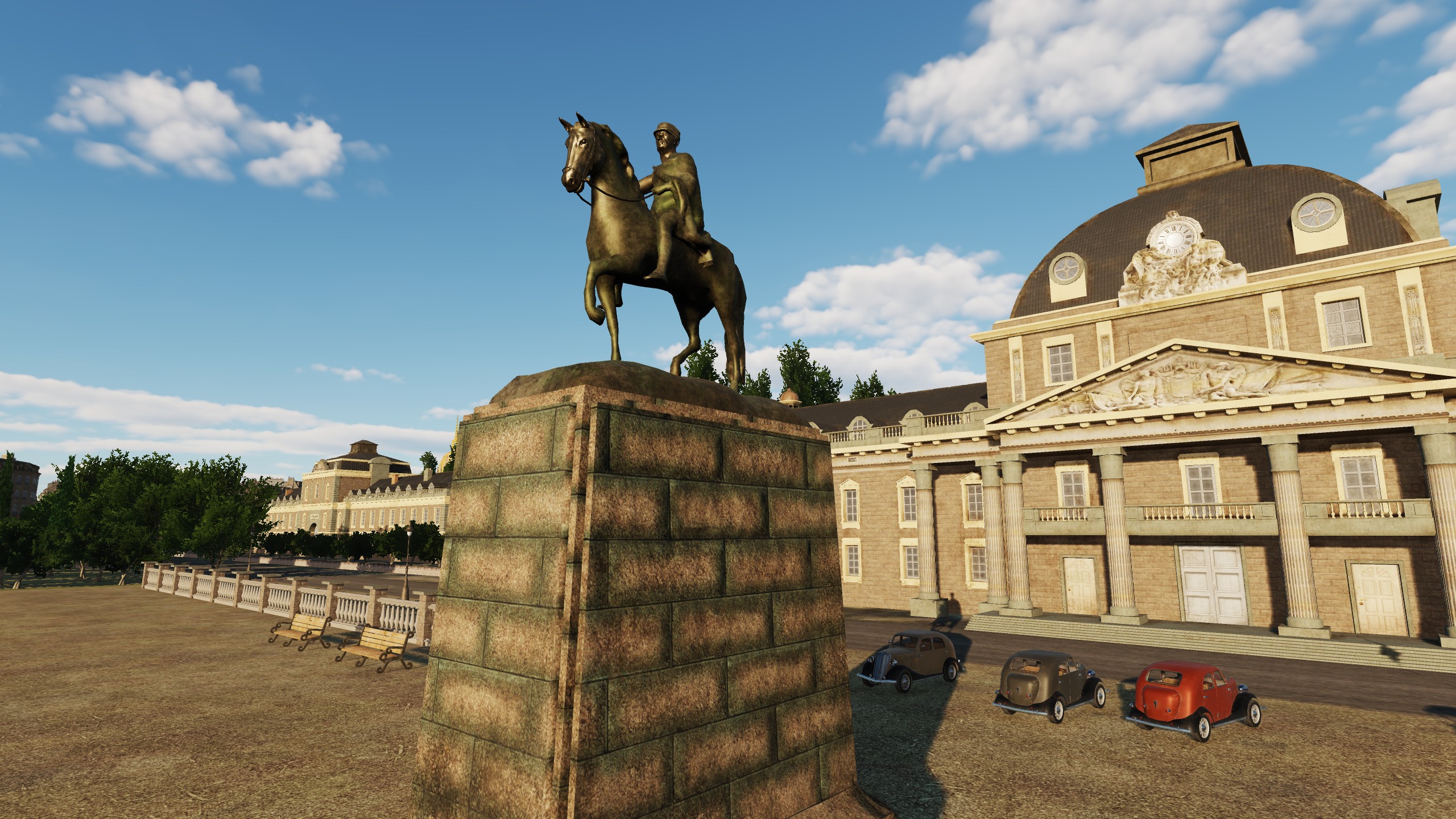
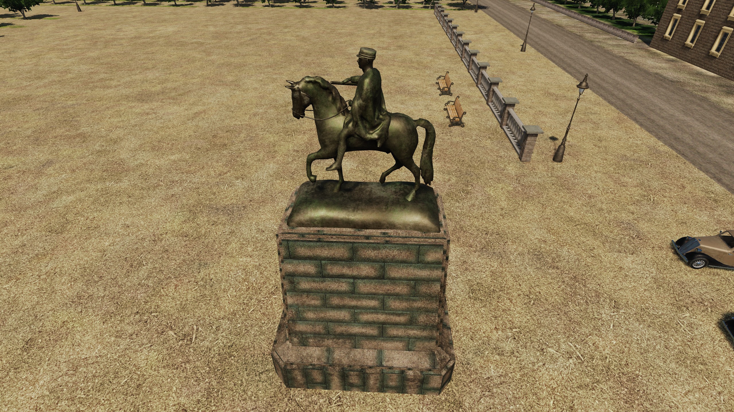
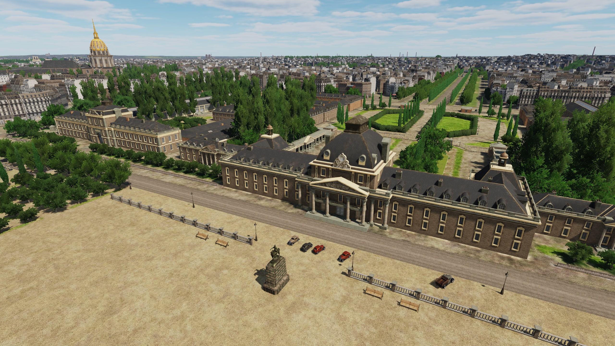
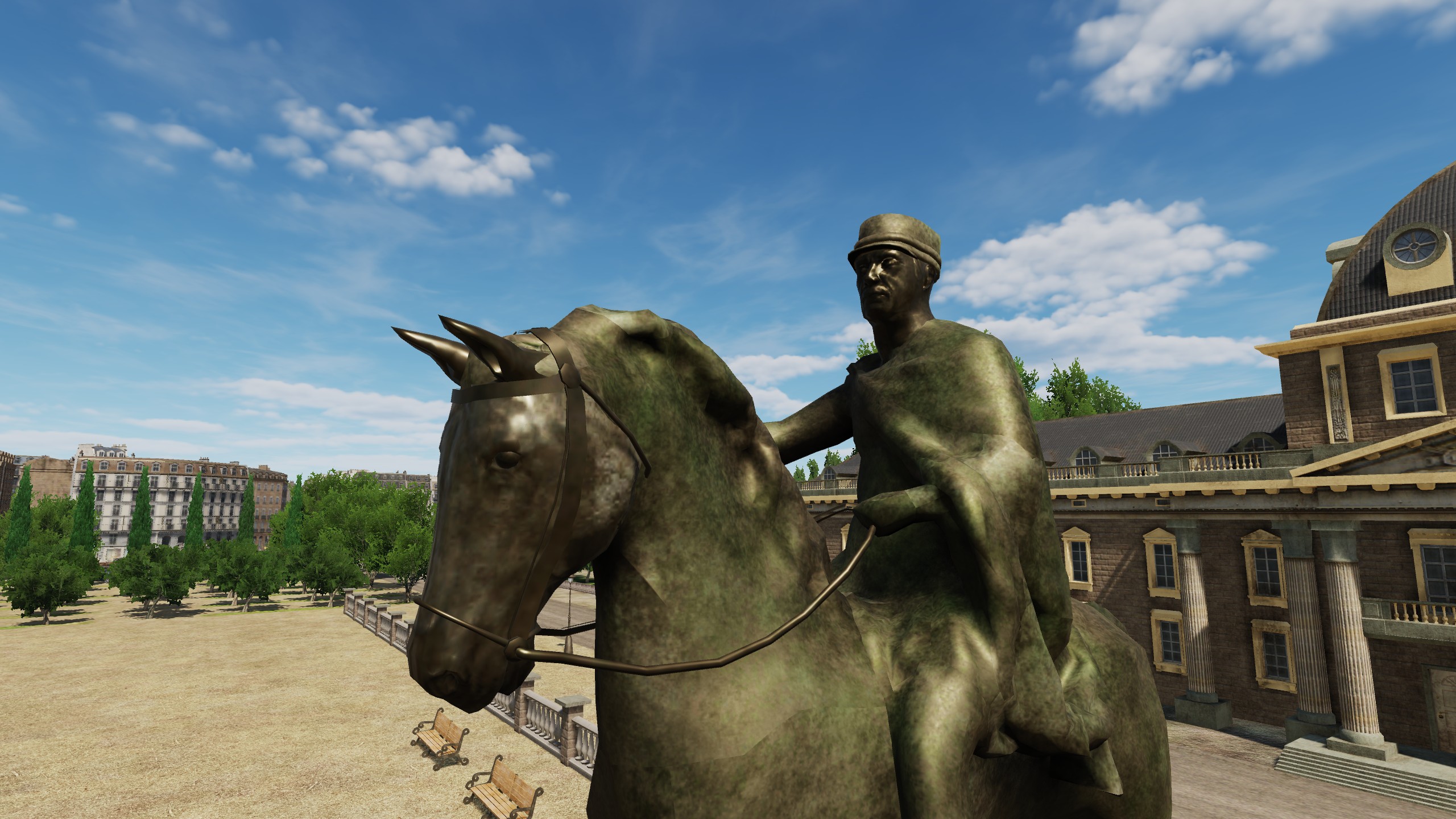
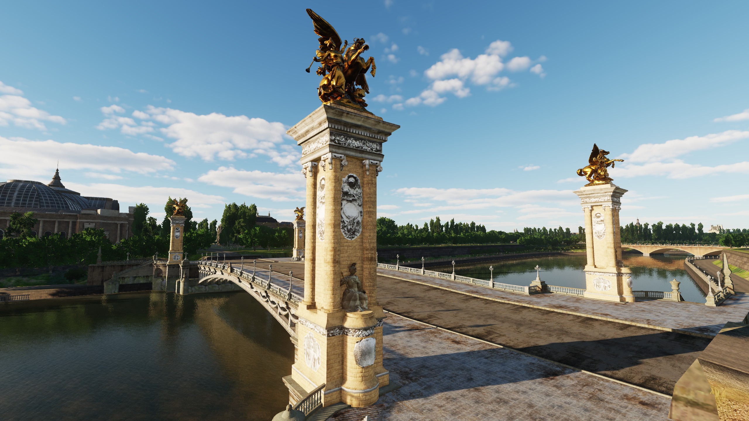
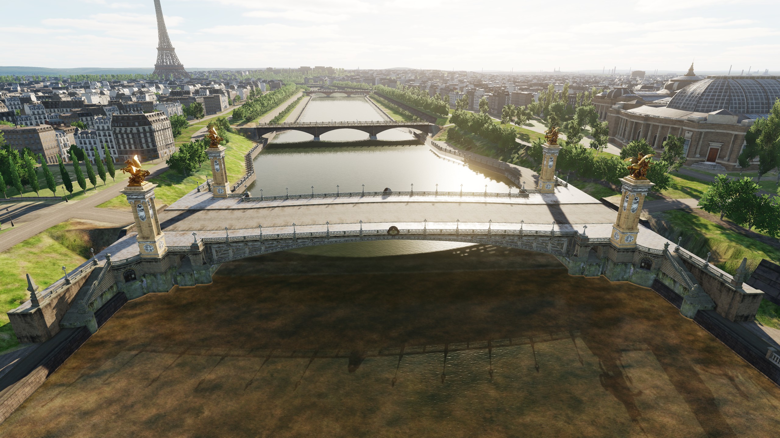
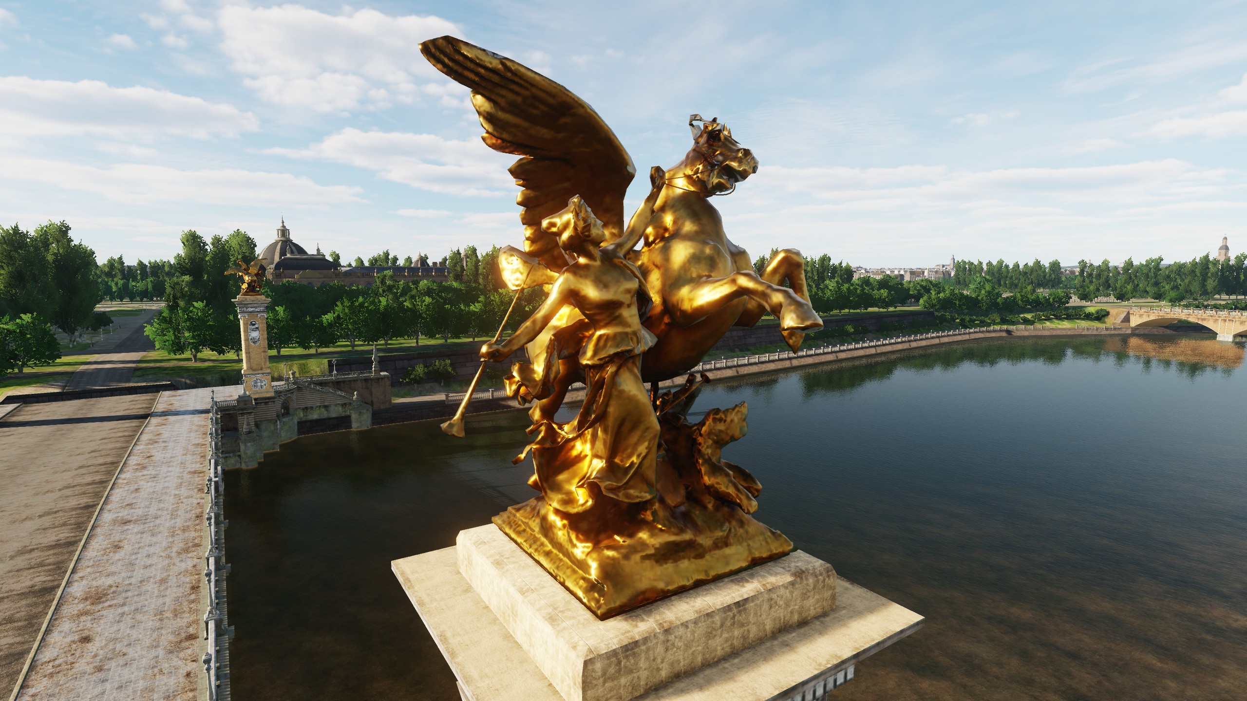
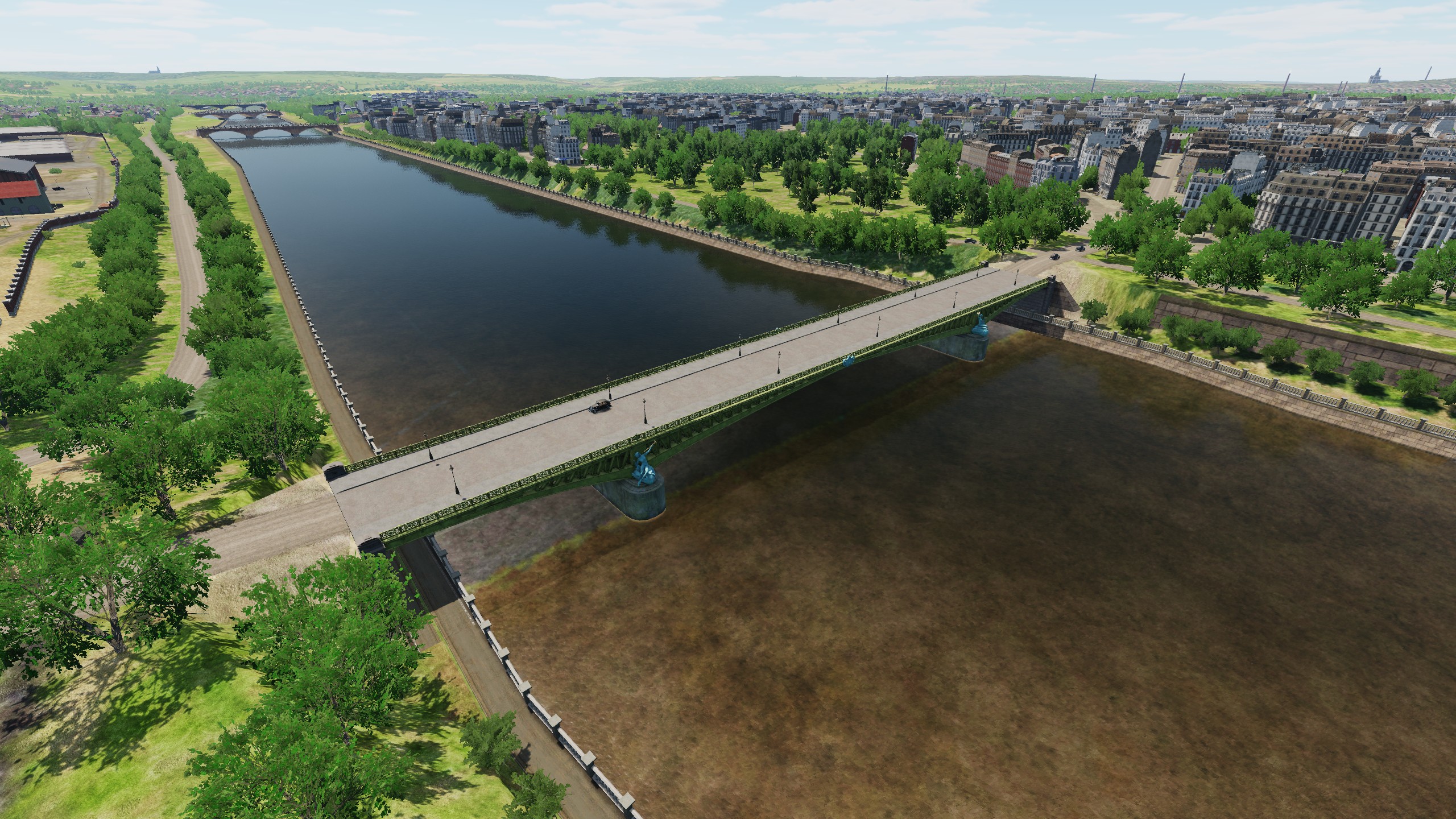
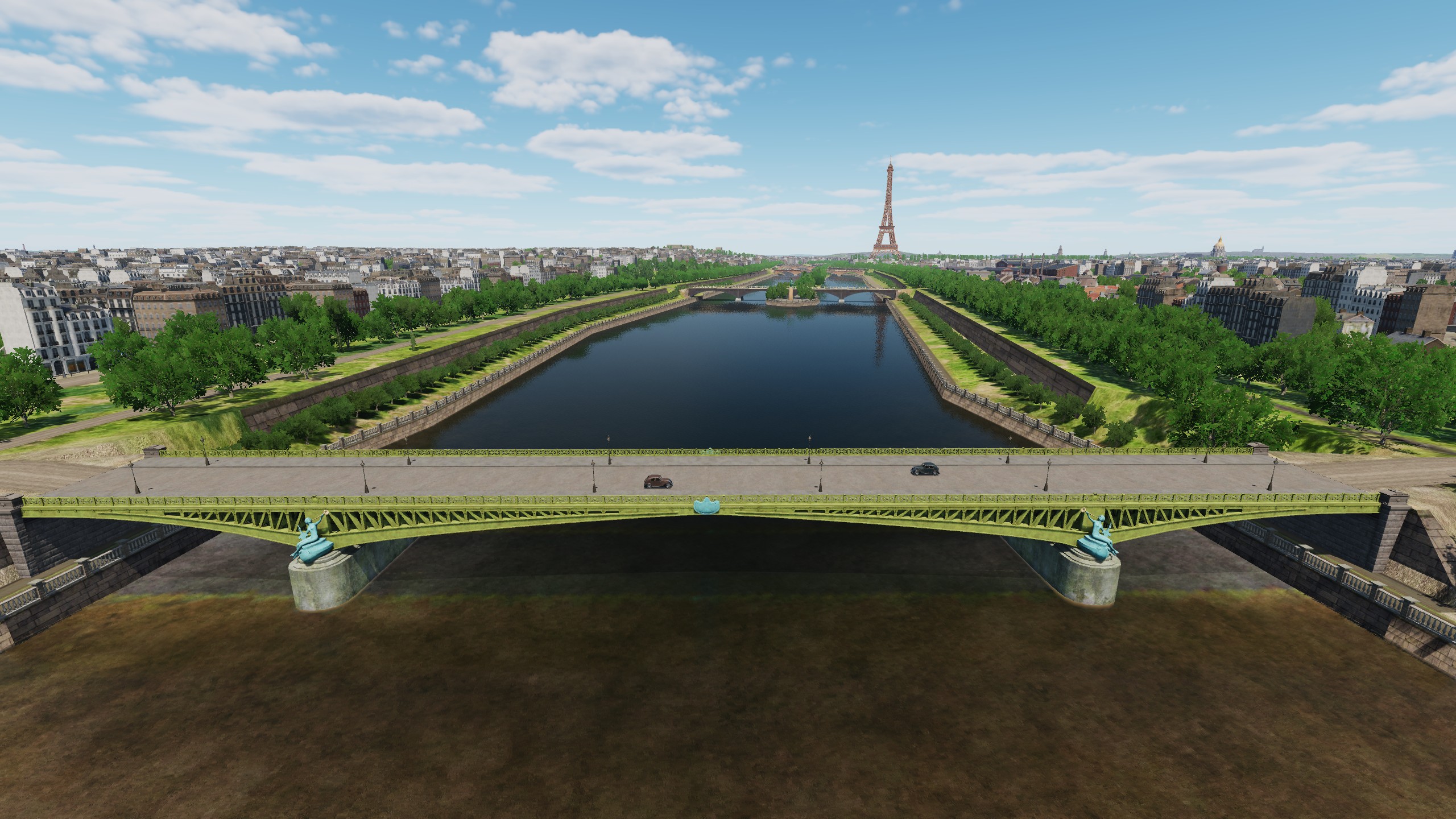
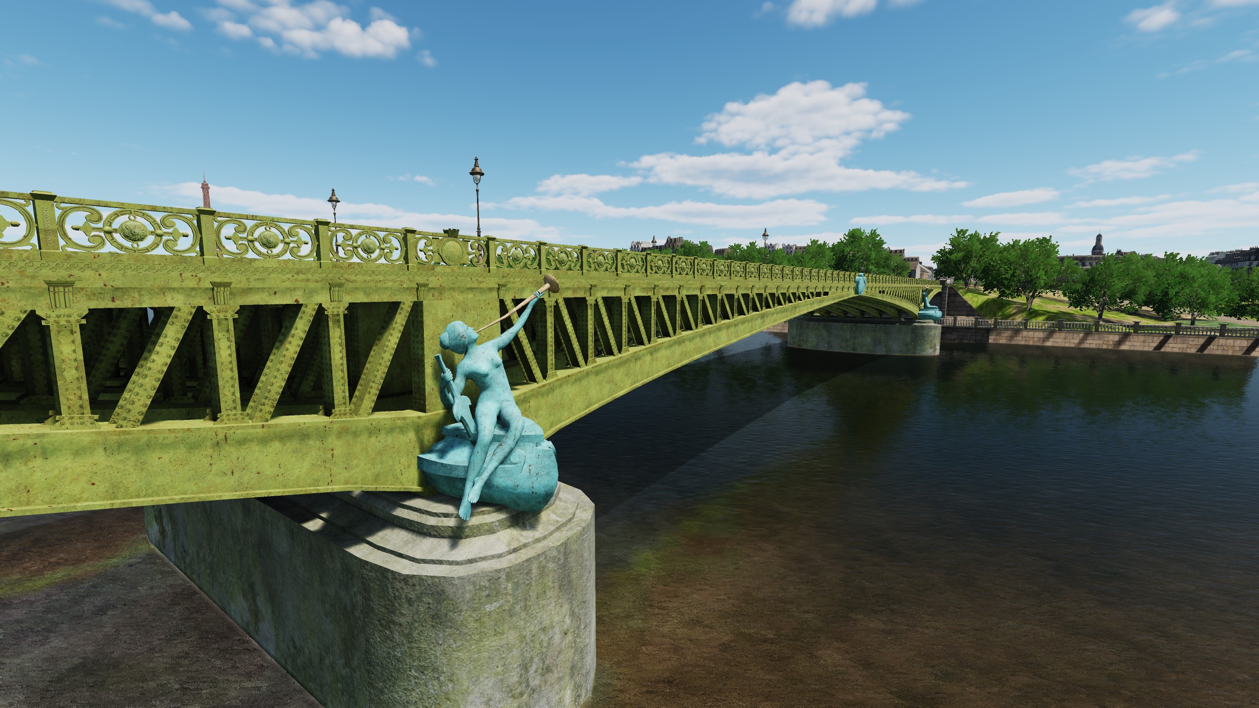
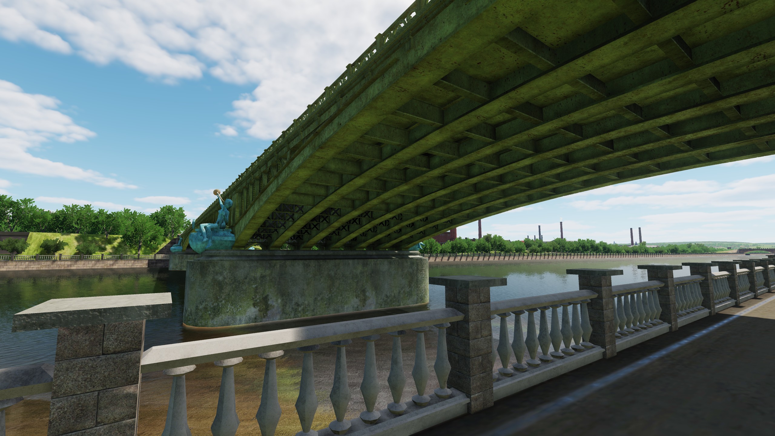
Hi At all times, people made monuments to their kings, heroes, or tried to build something monumental and unusual. France and the UK are countries with a rich history, so we had to work on recreating what they did 100 or more years ago. We would like you - DCS users not only to be able to fly over the capitals of England and France, but also to be able to conduct tours of London and Paris for your friends. ---London--- Queen Victoria memorial The Victoria Memorial is a monument to Queen Victoria, located in London. Designed in 1901, it was unveiled on 16 May 1911, though it was not completed until 1924. At nearly 25 metres (82 ft) tall, the Victoria Memorial remains the tallest monument to a King or Queen in England. Richard lion Heart The statue was created by Baron Carlo Marochetti and is located in Old Palace Yard outside the Palace of Westminster, opposite Westminster Abbey in London. With its pedestal, it stands 9 metres (30 ft) high, showing King Richard I on horseback. The king is depicted wearing a crowned helmet and a chainmail shirt with a surcoat, and lifting a sword into the air. The horse paws the ground, as if preparing for a charge into battle. Marochetti described his work as being inspired by Richard I rather than accurately depicting a 12th-century knight. Nelson's Column Nelson's Column is a monument in Trafalgar Square in the City of Westminster, Central London, built to commemorate Vice-Admiral Horatio Nelson's decisive victory at the Battle of Trafalgar over the combined French and Spanish navies, during which he lost his life. The monument was constructed between 1840 and 1843. Tower Bridge is a combined bascule and suspension bridge in London, built between 1886 and 1894. It crosses the River Thames close to the Tower of London. The bridge is 800 feet (240 m) in length and consists of two 213-foot (65 m) bridge towers connected at the upper level by two horizontal walkways, and a central pair of bascules that can open to allow shipping. Tower Bridge has become a recognisable London landmark. Westminster Bridge is a road-and-foot-traffic bridge over the River Thames in London, linking Westminster on the west side and Lambeth on the east side. The current bridge was designed by Thomas Page and opened on 24 May 1862. With a length of 820 feet (250 m) and a width of 85 feet (26 m). ---Paris--- Statue of liberty The quarter-scale replica sits on the southern end of Île aux Cygnes, an artificial island built in the Seine in 1827 to separate river traffic from the busy port of Grenelle. The statue itself was given to the city of Paris in 1889 by the American community in Paris to commemorate the centennial of the French Revolution. In characteristic American fashion, the statue was officially inaugurated on the Fourth of July. The gift was given to highlight the historically close bond between France and the United States, and reaffirm the dedication of the two nations to the republican ideal on which they were founded. la colonne Vendôme The original column was started in 1806 at Napoleon's direction and completed in 1810. It was modelled after Trajan's Column, to celebrate the victory of Austerlitz; its veneer of 425 spiralling bas-relief bronze plates was made out of cannon taken from the combined armies of Europe Its height is 44.3 m, diameter is 3.6 m. The column is helical - a strip 280 m long, with 22 turns - is overlaid with bronze from 425 bas-reliefs. Les monuments à Louis Pasteur The monument to Louis Pasteur by Alexandre Falguière (1831-1900) was installed in 1904 in Place de Breteuil by the architect Charles Girault on the site of the old tower of the artesian well in Breteuil. Do you remember the word "pasteurization"? Statue Maréchal Joffre Equestrian sculpture of Marshal Joseph Joffre by sculptor Maxime Real del Sarte and unveiled on June 10, 1939. The work is located at the end of the Champ de Mars. Pont_Alexandre_III a single-arch bridge spanning the Seine in Paris between Les Invalides and the Champs Elysees. The total length of the bridge is 160 meters (the metal arch is 107 meters), the width is about 33 meters. In order not to obscure the panorama of the Champs Elysees, the height of the structure does not exceed six meters, which at the time of its creation was considered an amazing achievement. The bridge was founded to commemorate the Franco-Russian Union by Emperor Nicholas II in October 1896 and named after his father, Emperor Alexander III. Pont Mirabeau Built in 1895-1897. The bridge is named after the French politician Honore Gabriel Mirabeau. The bridge is a three-span metal arch. The main arch of the bridge is 93.2 m long, the two side arches are 32.4 m long. The middle span is covered with three-hinged arches. The outer spans are covered with consoles resting at the ends on longitudinally movable supporting parts. The length of the bridge is 173 m, width - 20 m (of which the width of the carriageway is 12 m and two sidewalks are 4 m each).
- 377 replies
-
- 23
-
-