MAESTR0
-
Posts
154 -
Joined
-
Last visited
-
Days Won
22
Content Type
Profiles
Forums
Events
Everything posted by MAESTR0
-
Hi, today, some screenshots may seem familiar to you, even if you are not a resident of these territories or a participant in peacekeeping missions. Meet Cyprus! Like everything in this region, this island is steeped in history.

- 487 replies
-
- 28
-

-

-
@Lurker seasons are not planned yet (UPD: there will be no seasons until release) Avenger31 Diyarbakir airport not planned
-
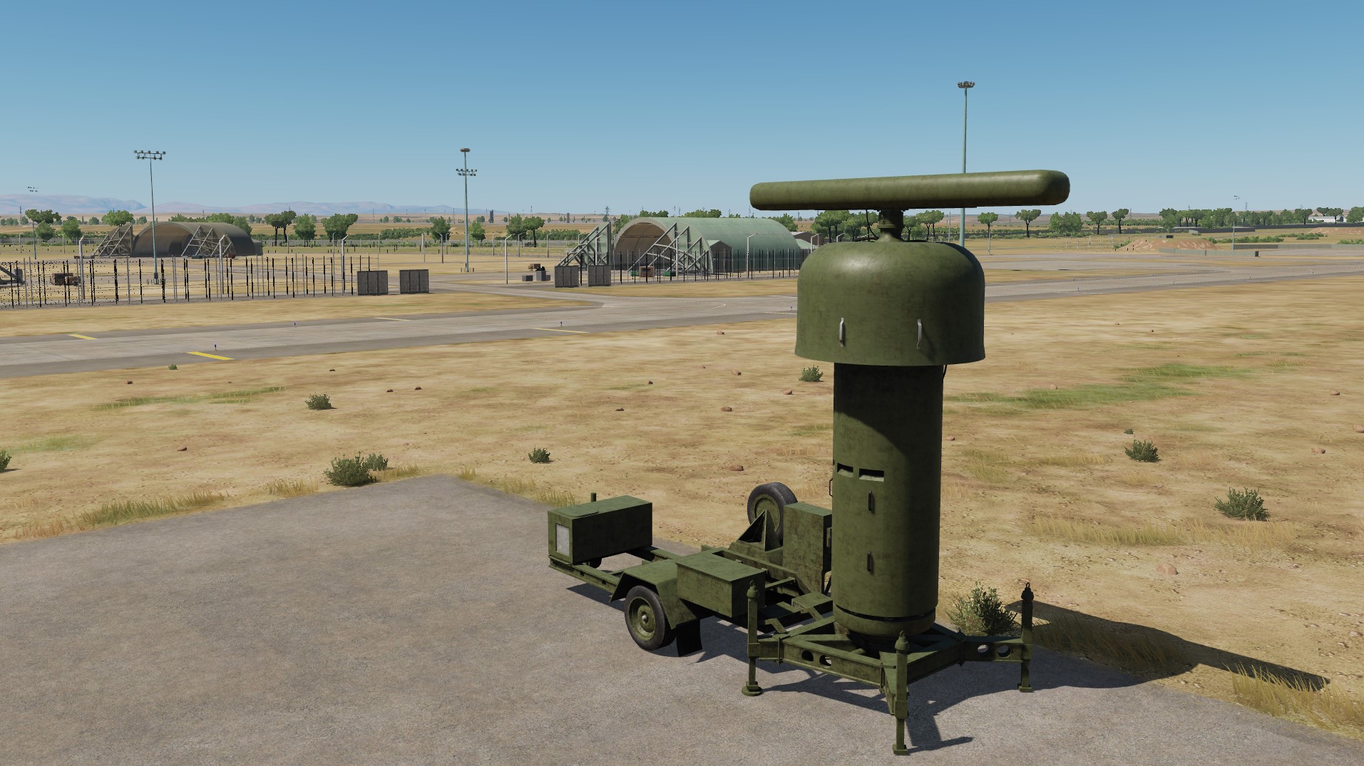
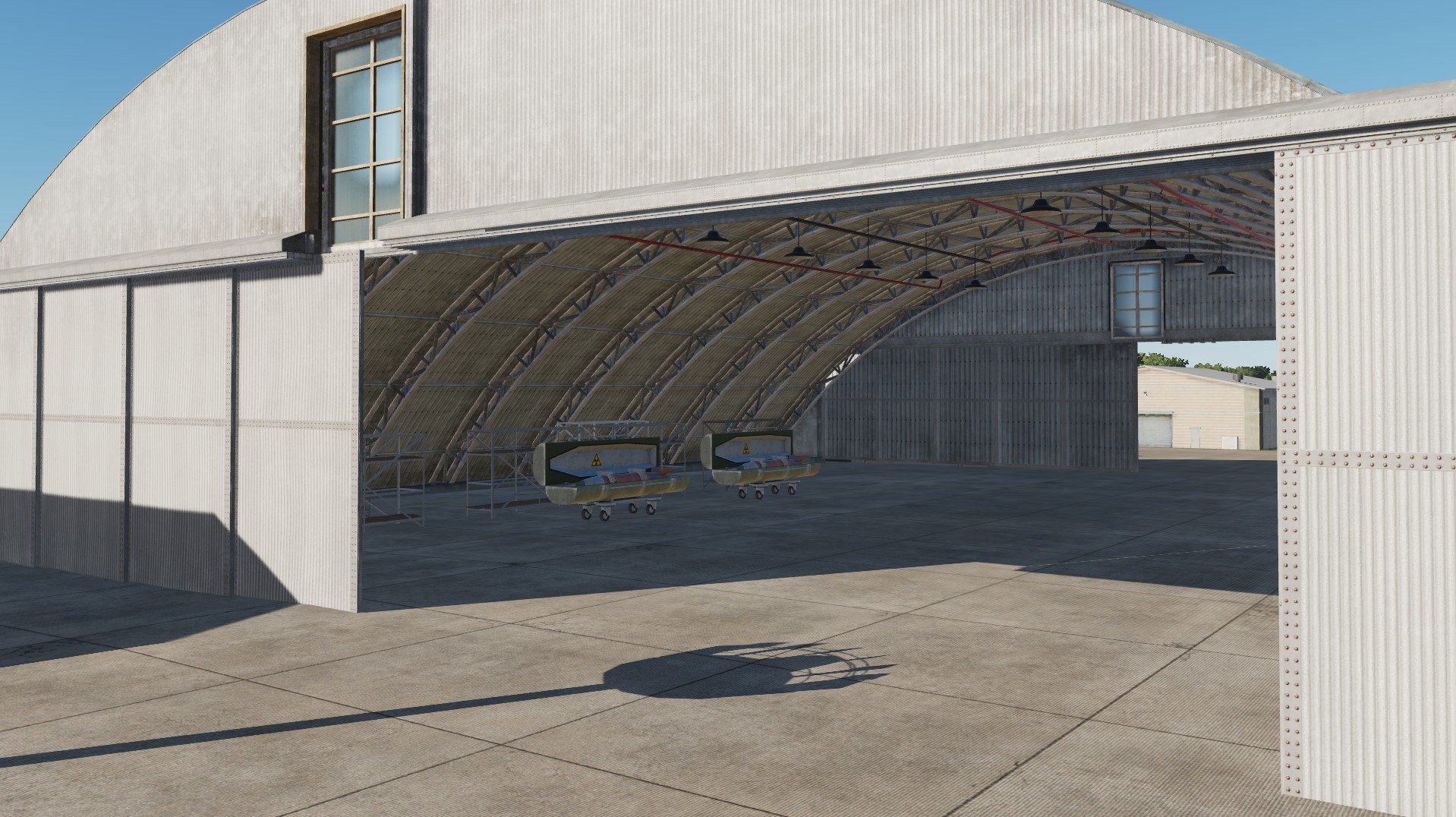
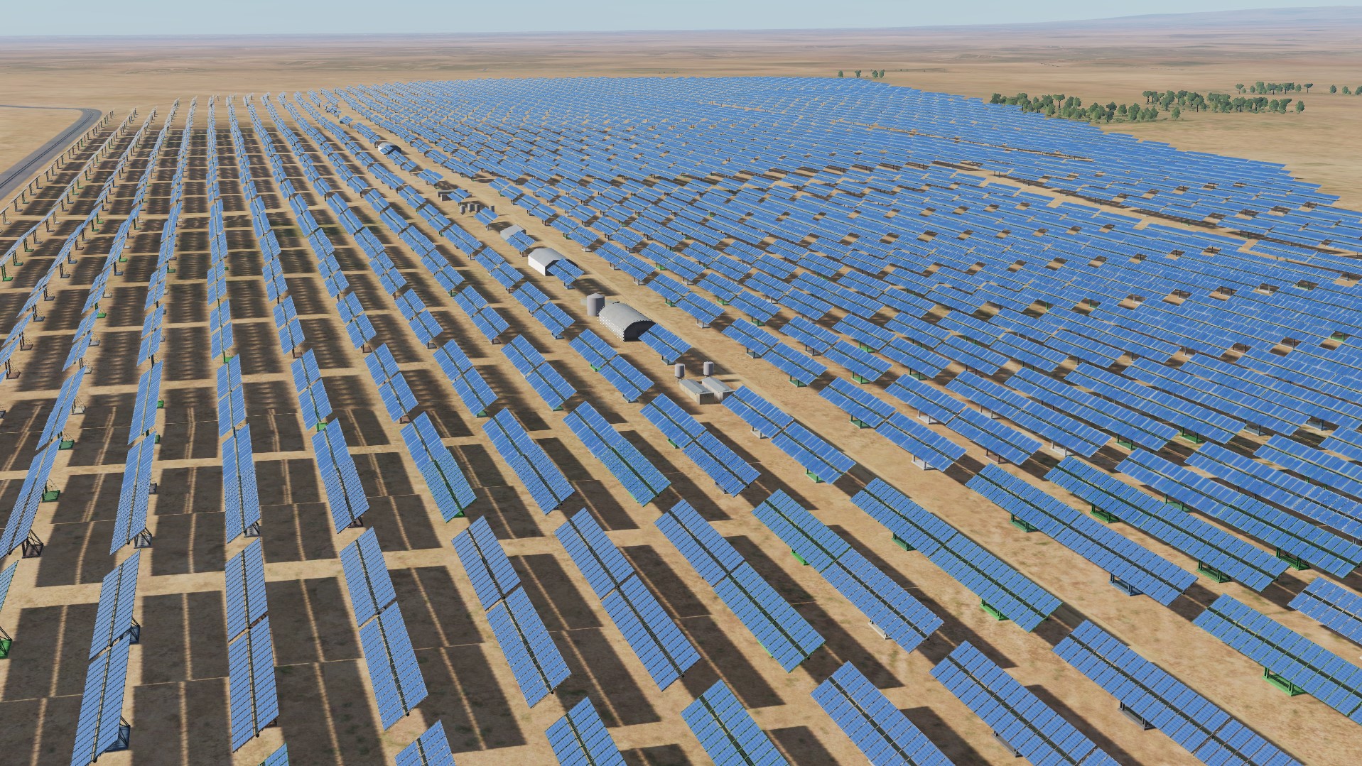
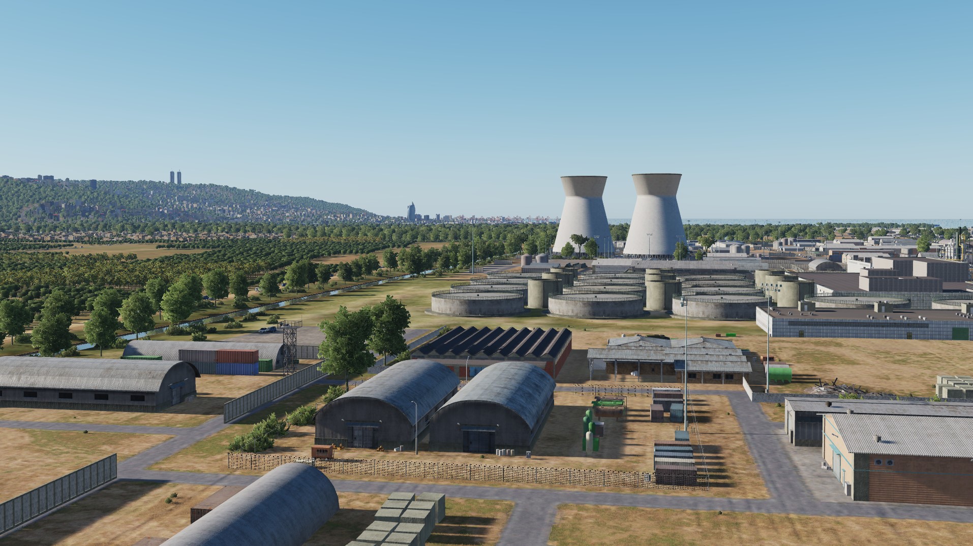
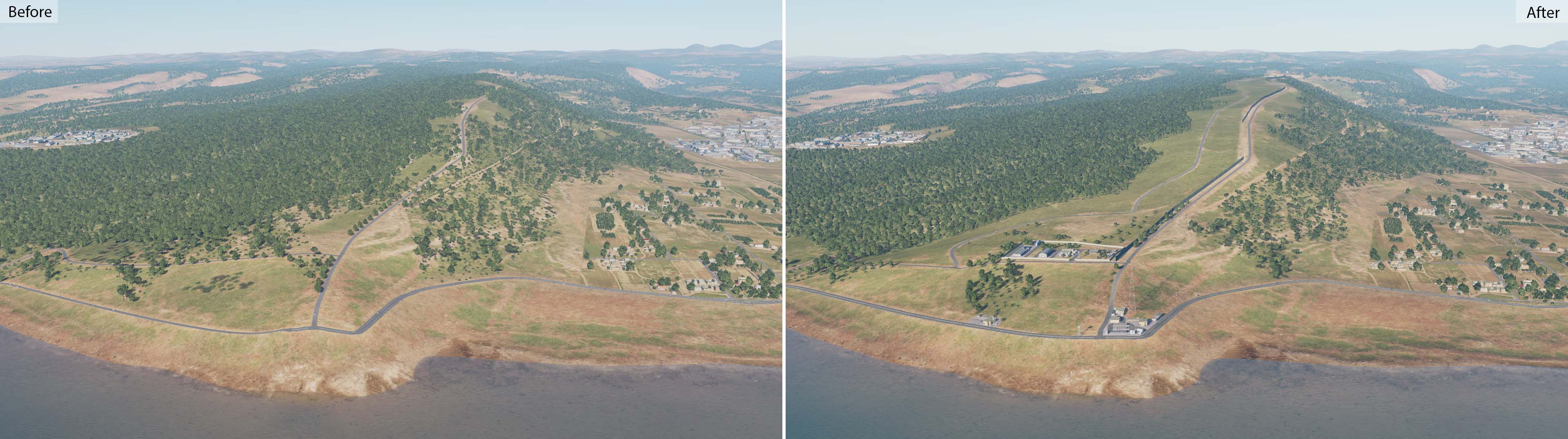
We respect the wishes of users and can say that in the future there will be a big update that will capture the territories east of the Euphrates, including airfields: Russian (former US) base - Tal Siman Military base "Kharab-Ishk" (Where are Apaches) Sanliurfa Airport Turkey * @shu77 @Aarnoman @Toriy we can say that we already have in our plans and ready-made airfields and territories that you asked for earlier and now, but in order to release them, you need to carefully work out the entire adjacent territory and test it. Therefore, you will learn about the emergence of these airfields and territories from the news. @ViFF We hope that this important historical part of Jordan will be presented for release. @Shadow KT we will discuss this issue. Thank you all for your attention to our map. We are finalizing a major mainland map update. It aims to optimize and improve performance on midrange systems. (Yes, this is your credit: a meeting was held and some solutions were found that allow you to increase productivity without any visible degradation of quality). At the same time, the development team did everything to improve the visual component of the map. UNIFIL base located in southern Lebanon (Nakura city), on the border with Israel Heliport Nukura. Solar power plant near the King Hussein airfield Oil Terminal for Tankers Nuclear warheads at Inzhirlik airfield Radar at the Inzhirlik airfield We have always tried to make the map interesting. For this, more than 200 original objects and more than 100 historical structures have been made. We also tried to make the map a challenge for free-flying master pilots. After work, our developers had some fun. (Do you remember their epic helicopter landing at the stadium? (We signed the coordinates of the objects, some of them you will see soon)
- 487 replies
-
- 27
-
-
-
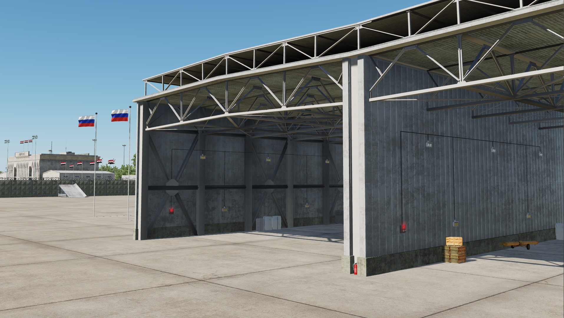
New hangars in Latakia Khmeimim airbase, Syria Flying over the state border Fly over Haifa
- 487 replies
-
- 14
-
-
-
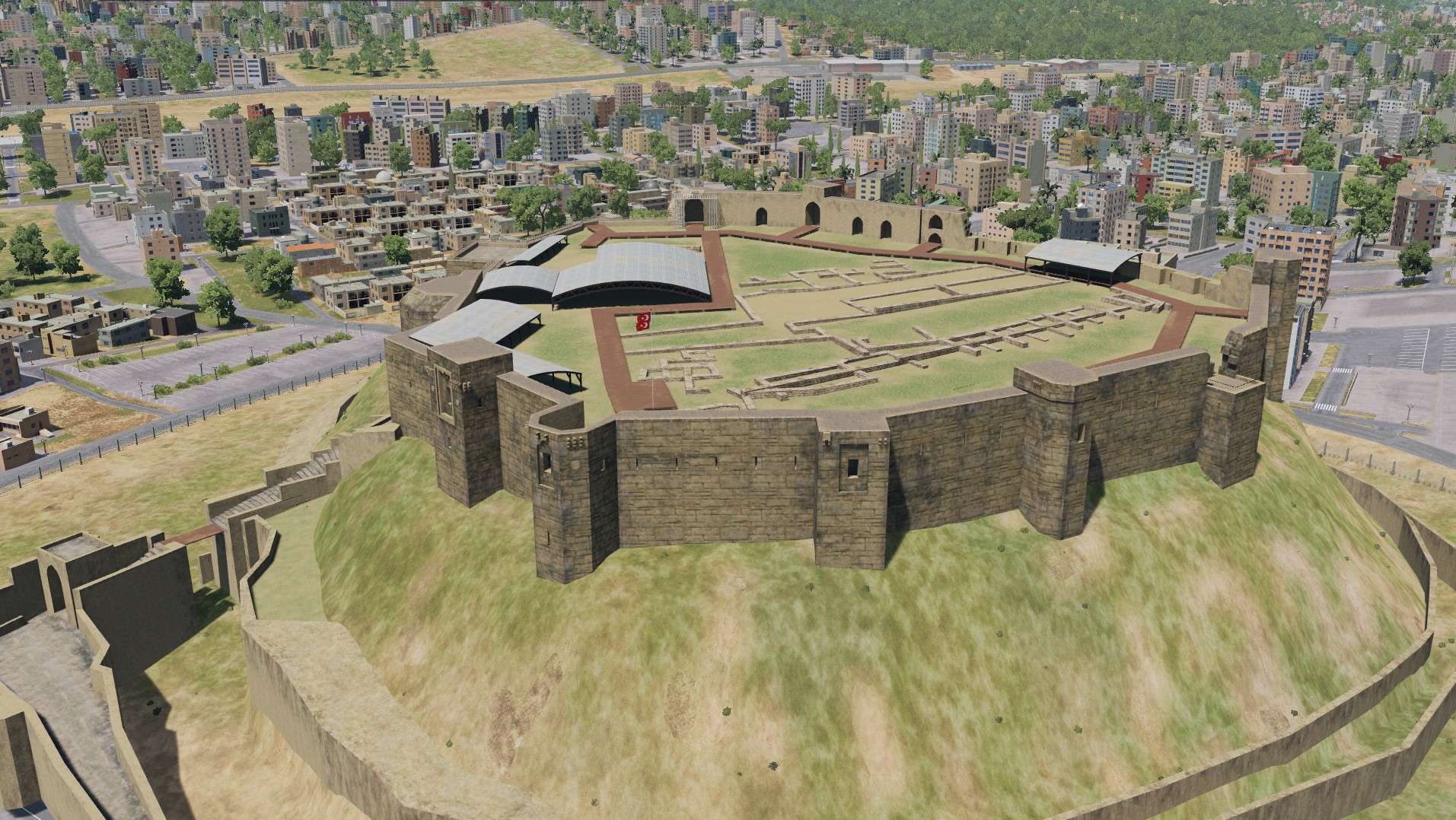
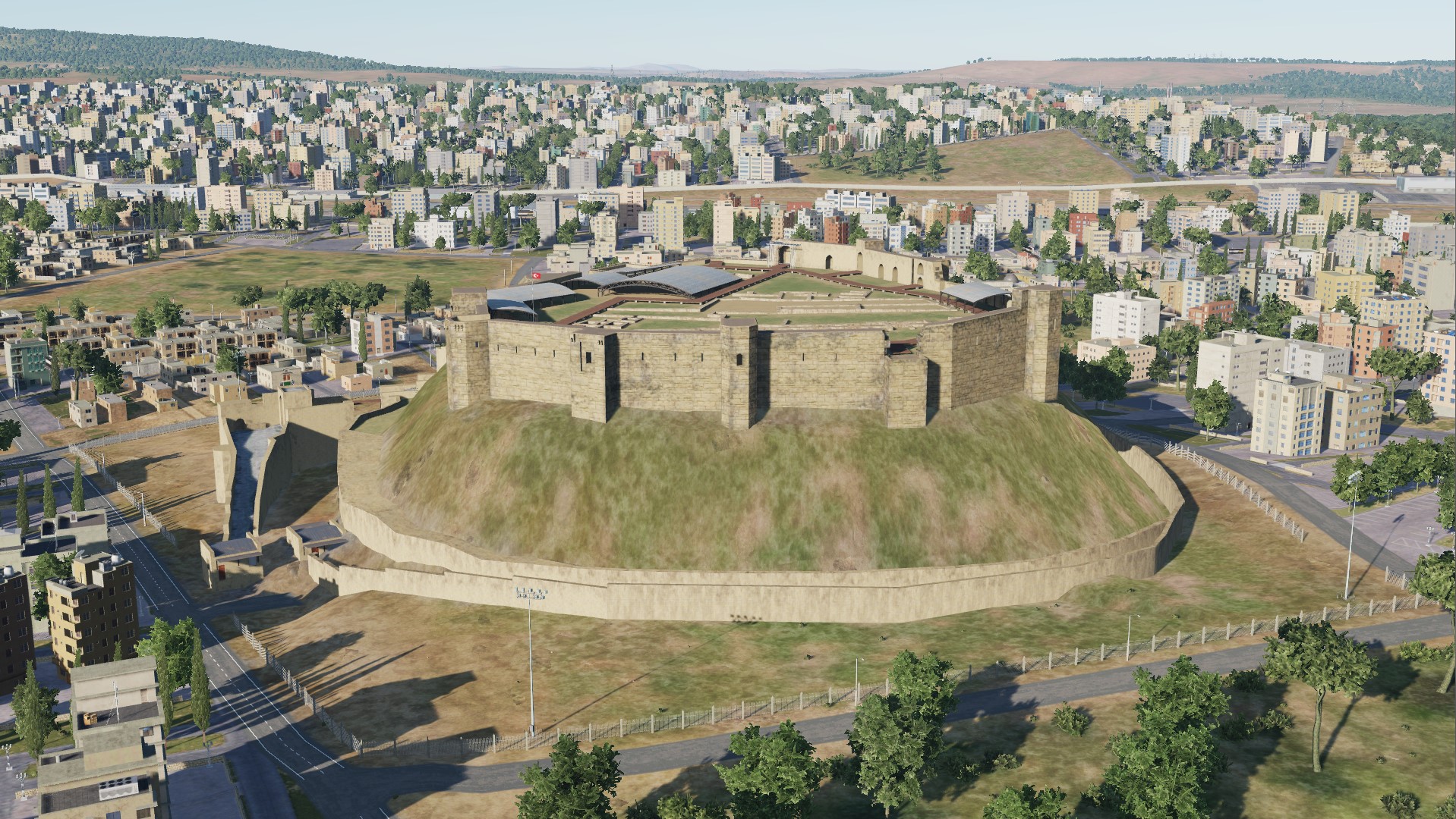
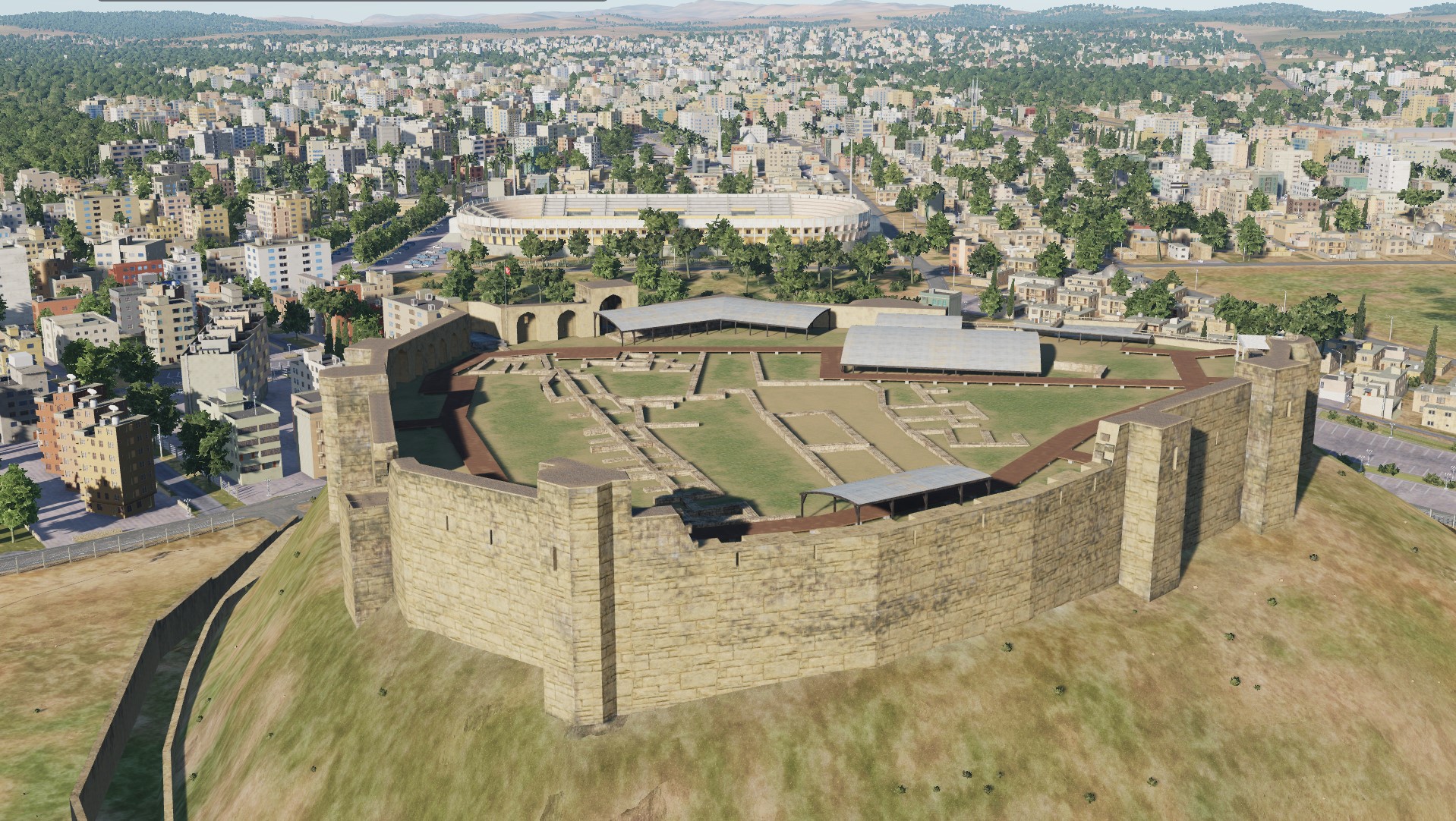
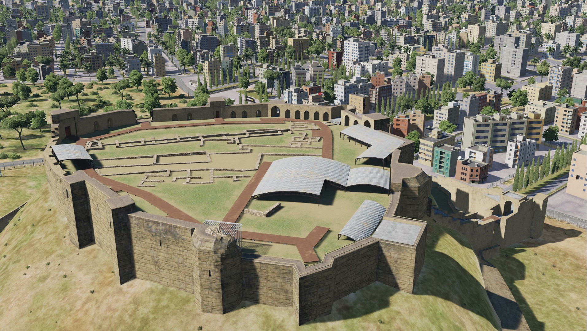
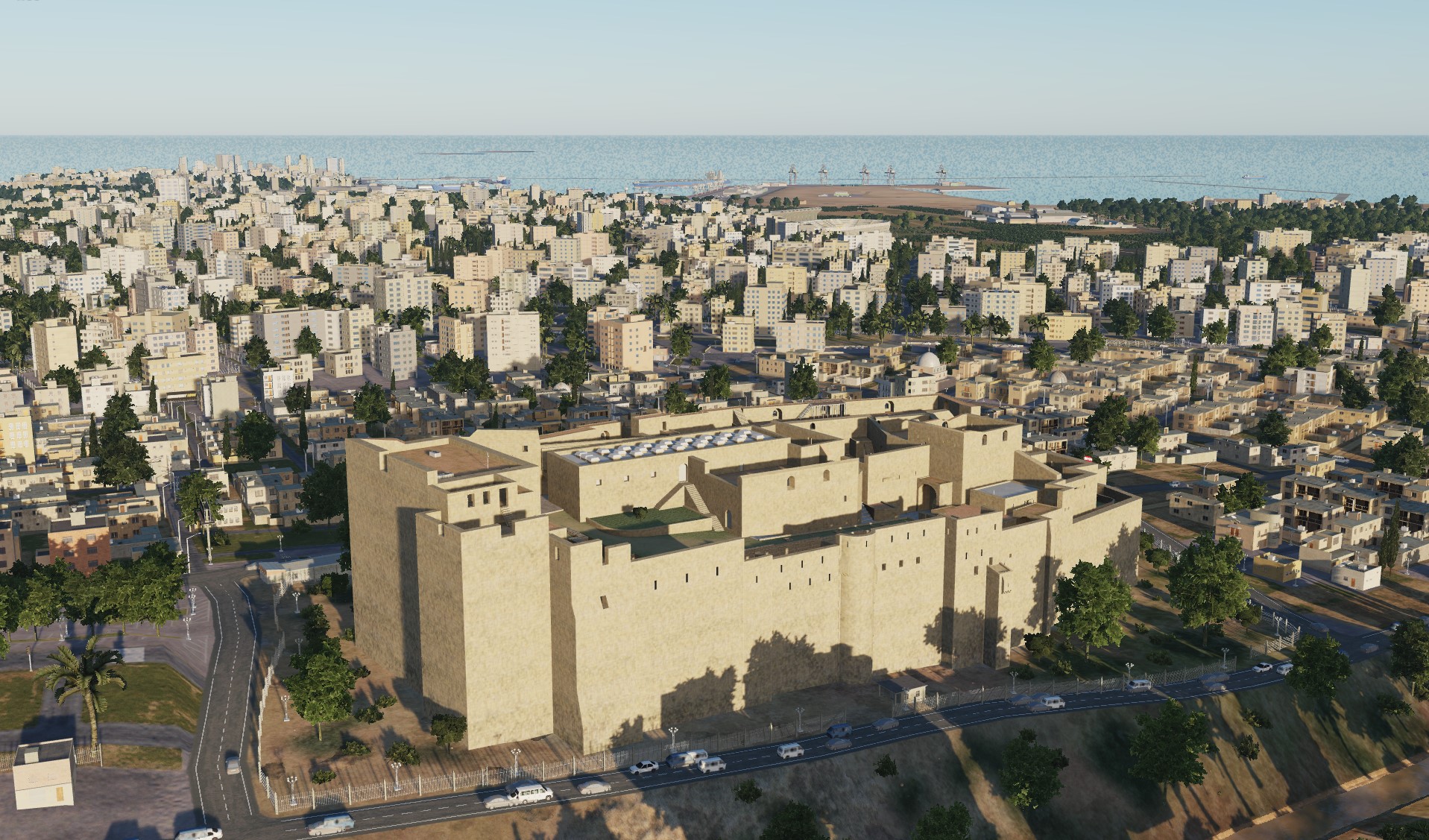
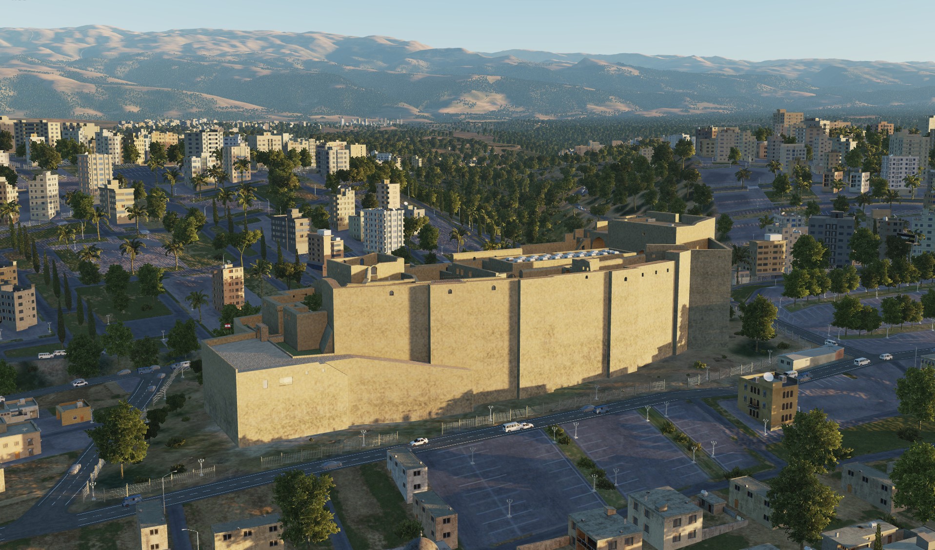
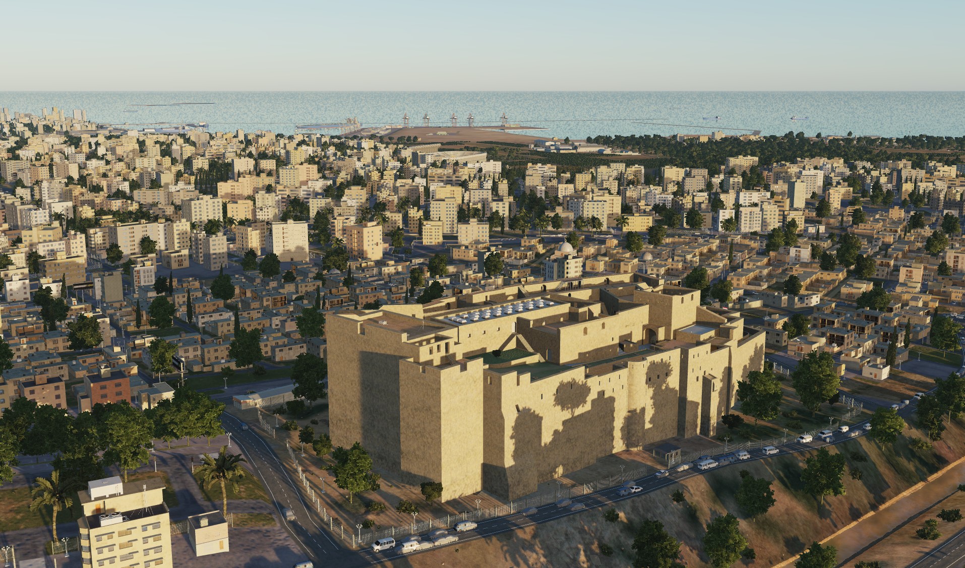
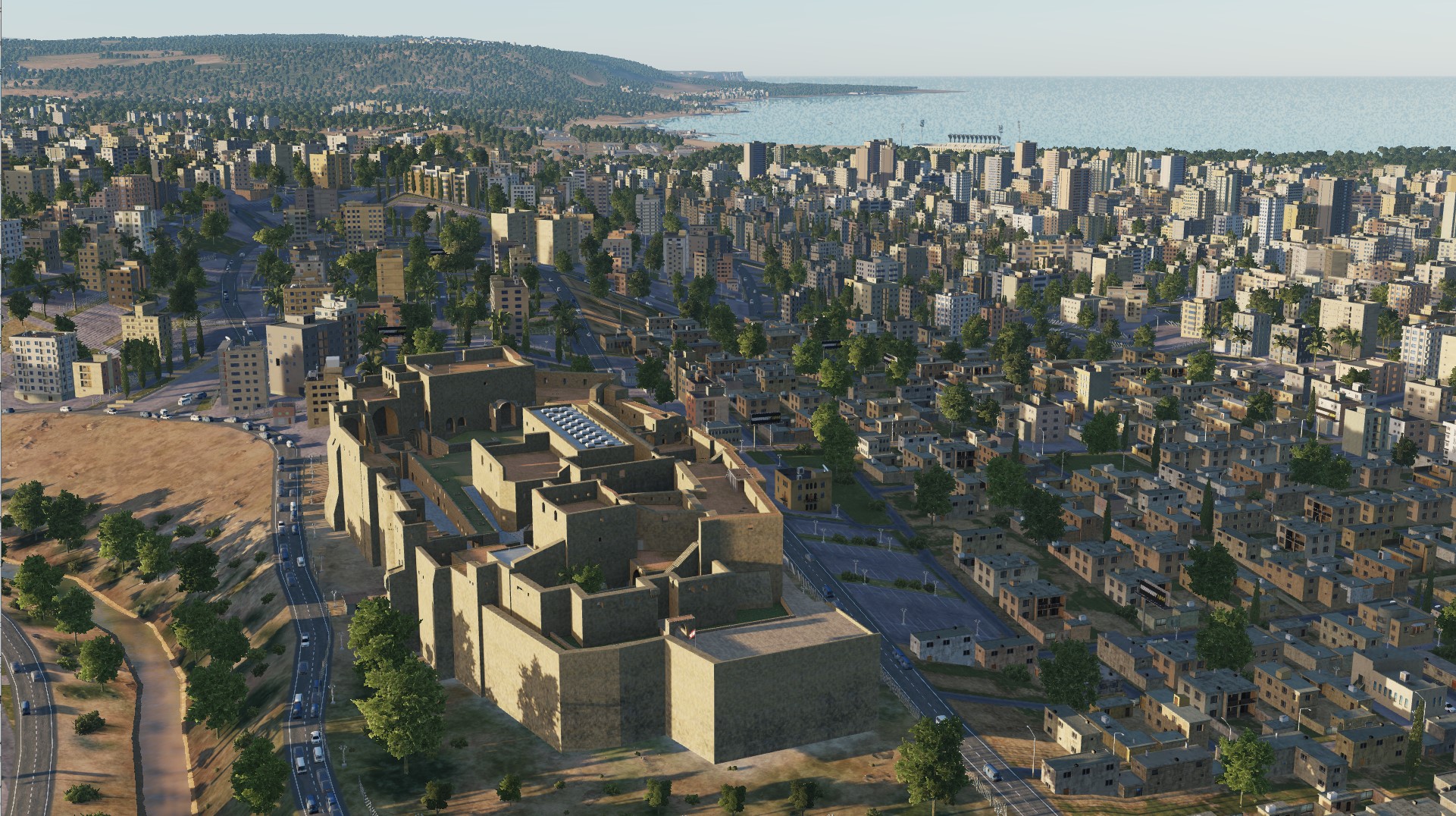
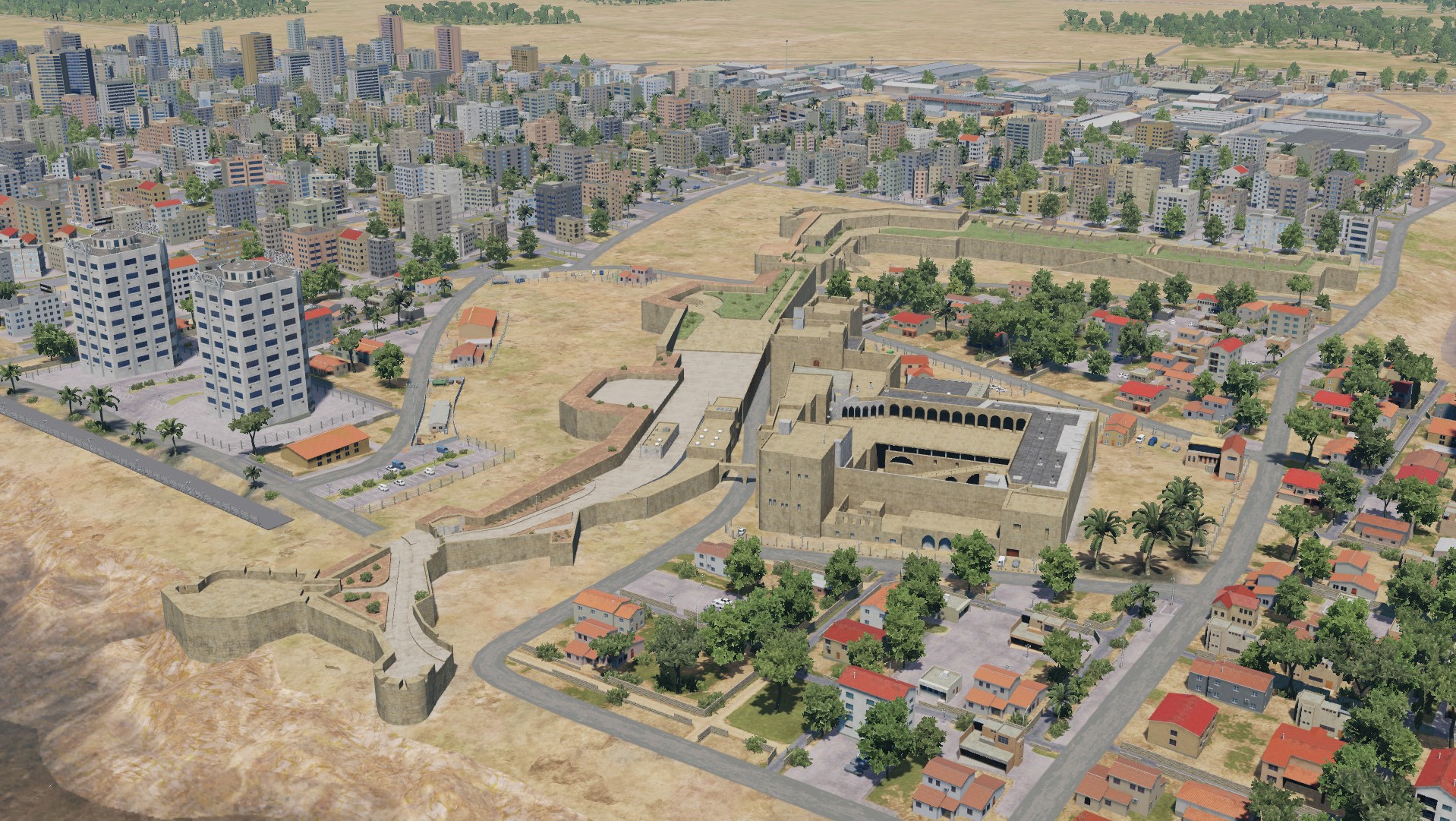
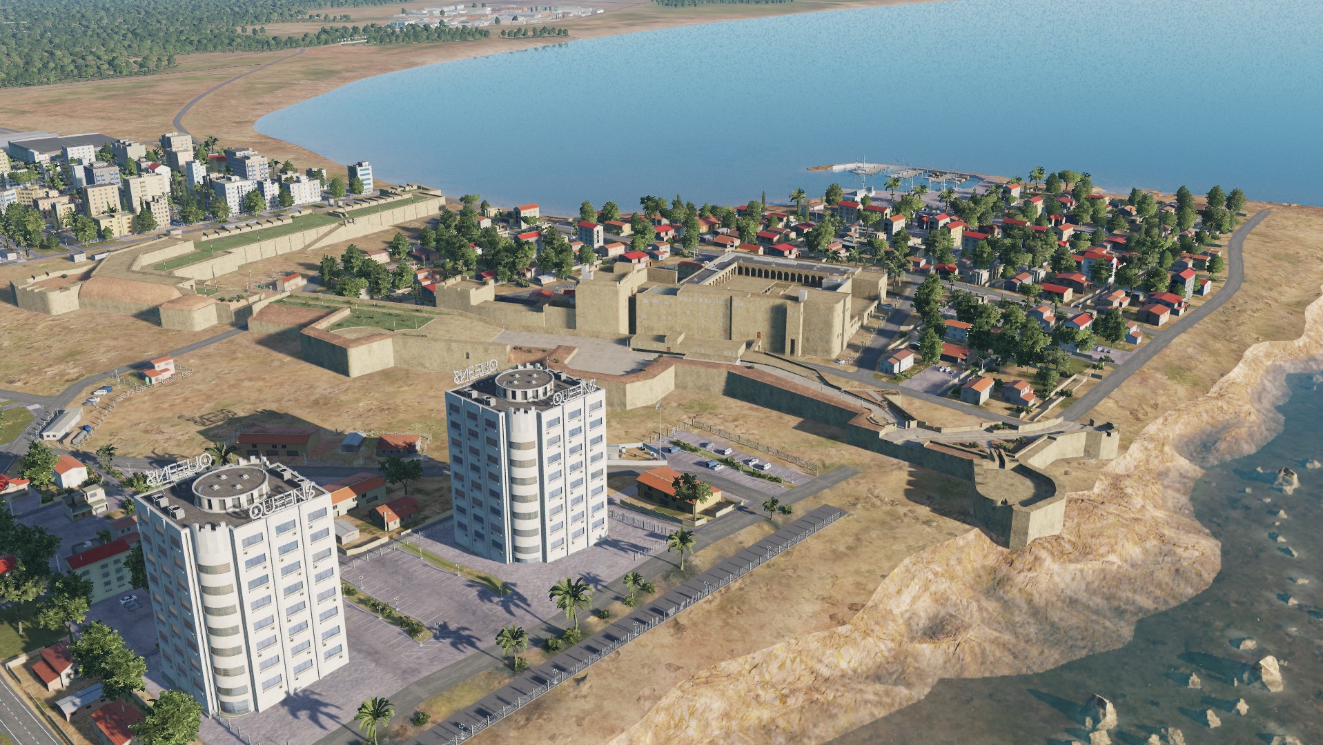
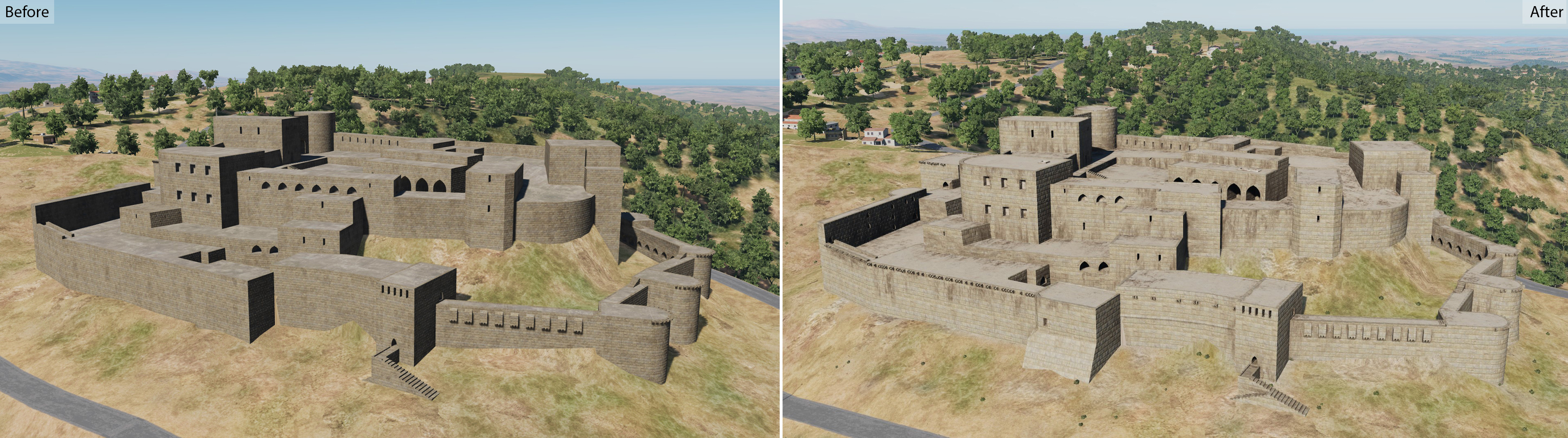
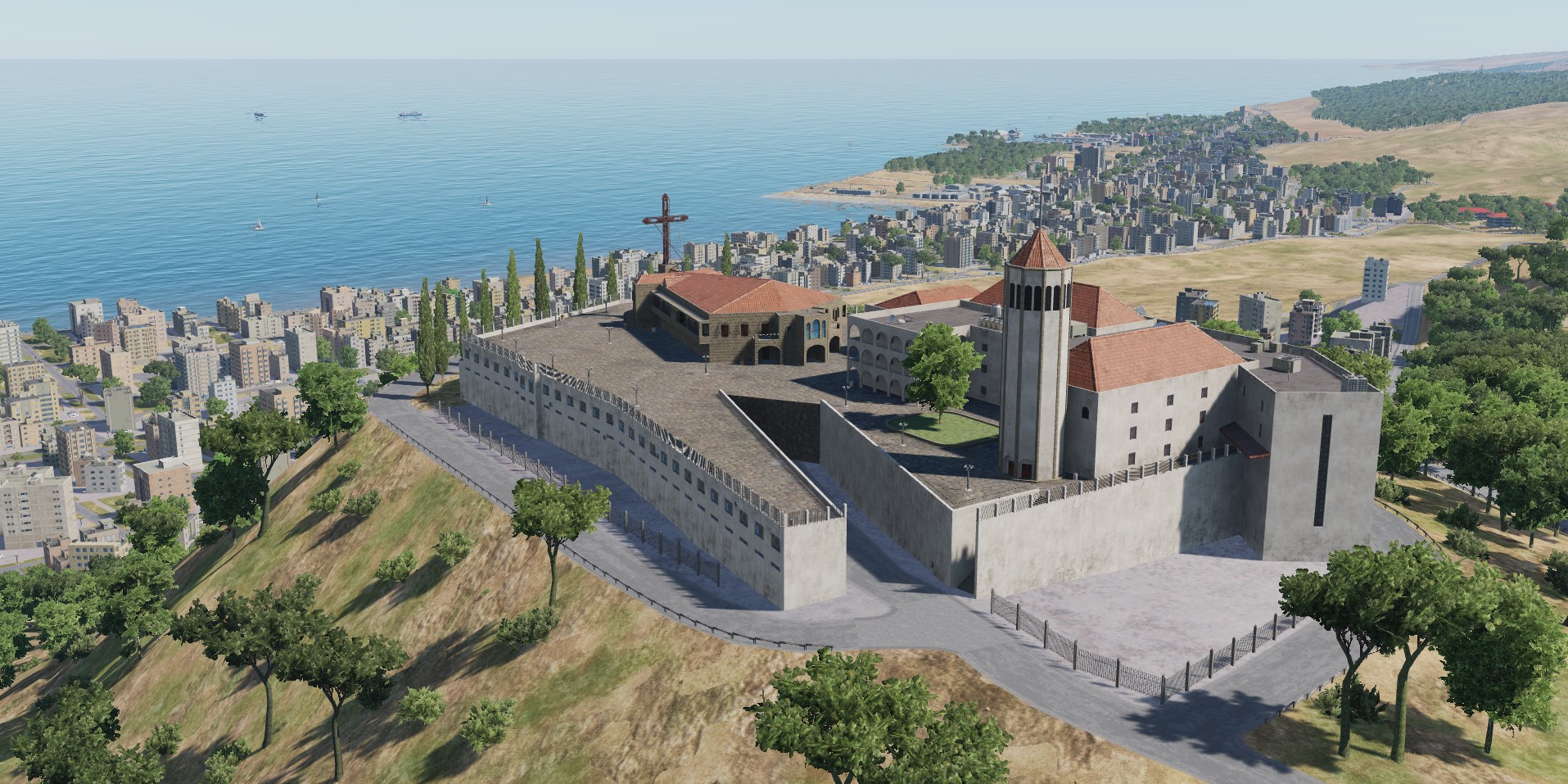
Gaziantep fortress Gaziantep, Turkey Citadel Tripoli Tripoli, Lebanon
-
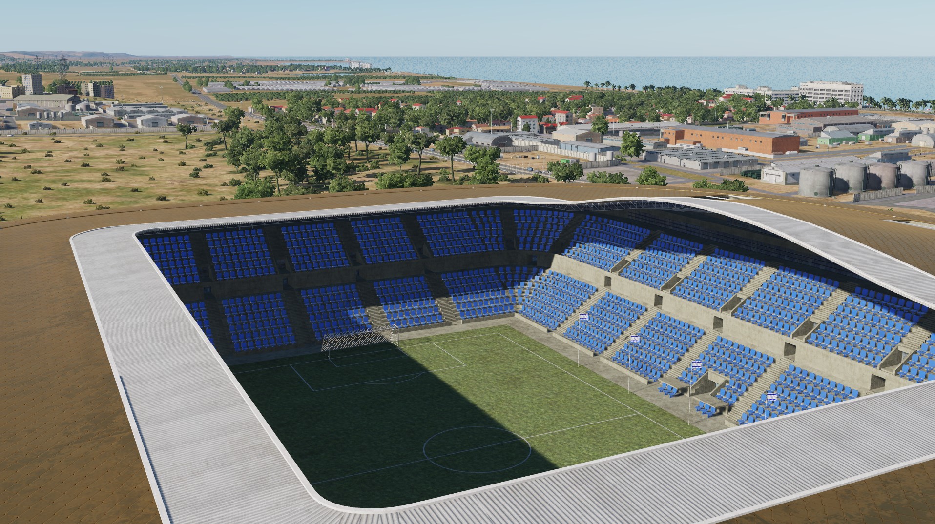
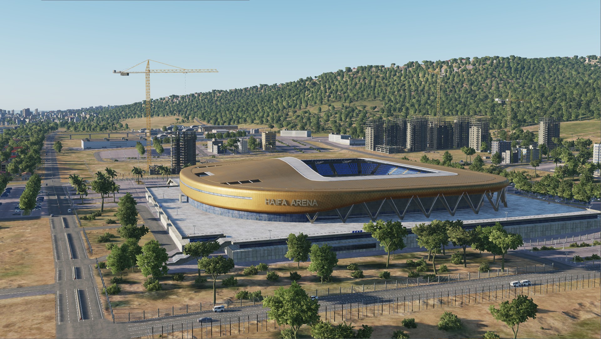
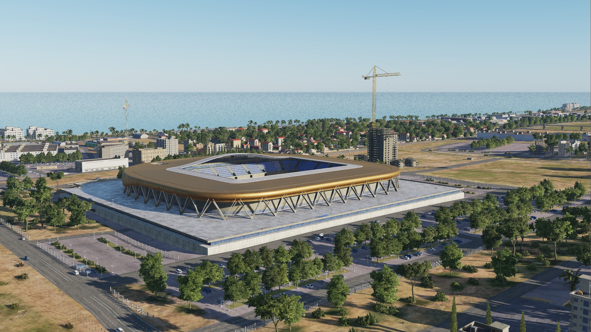
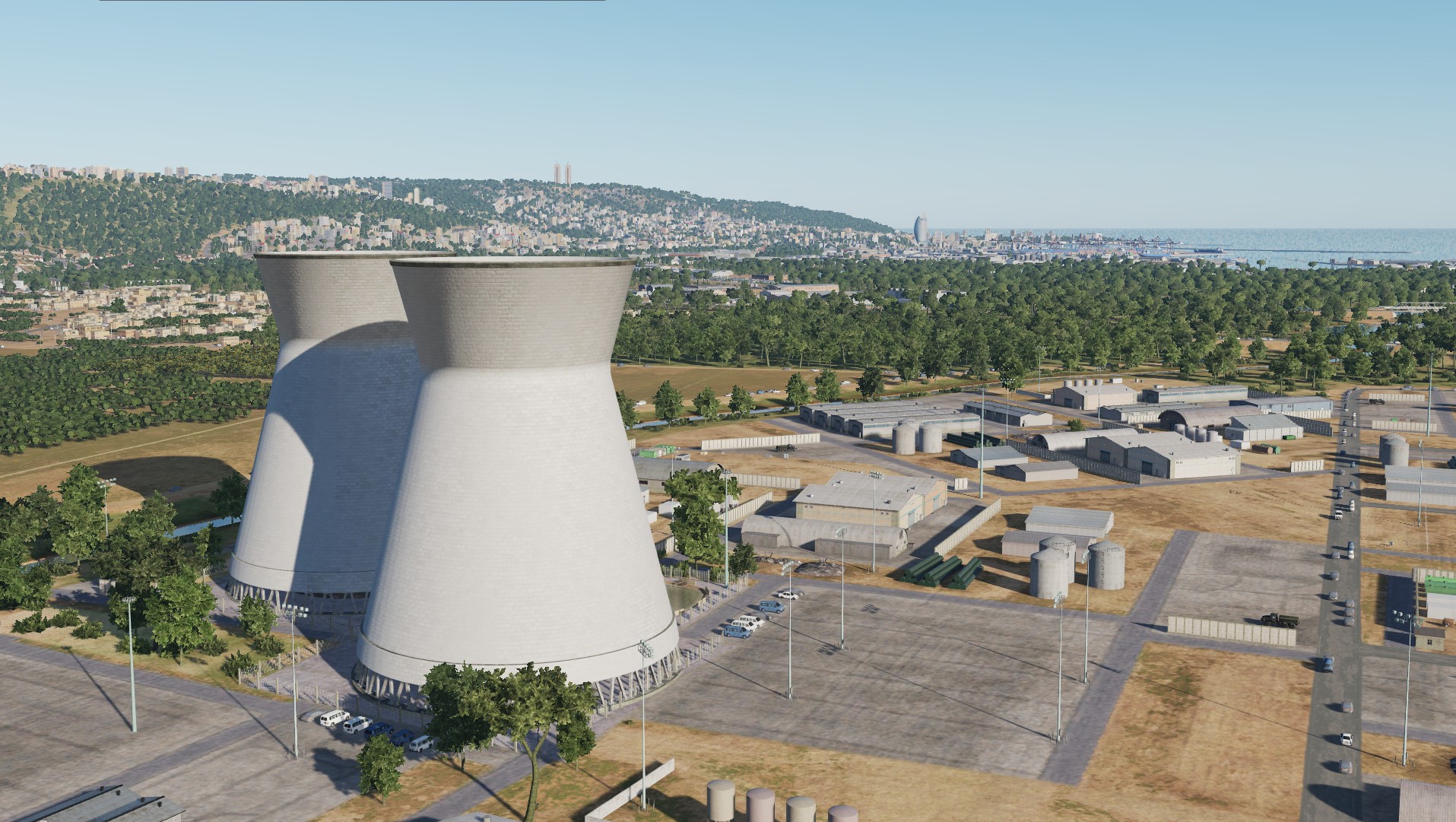
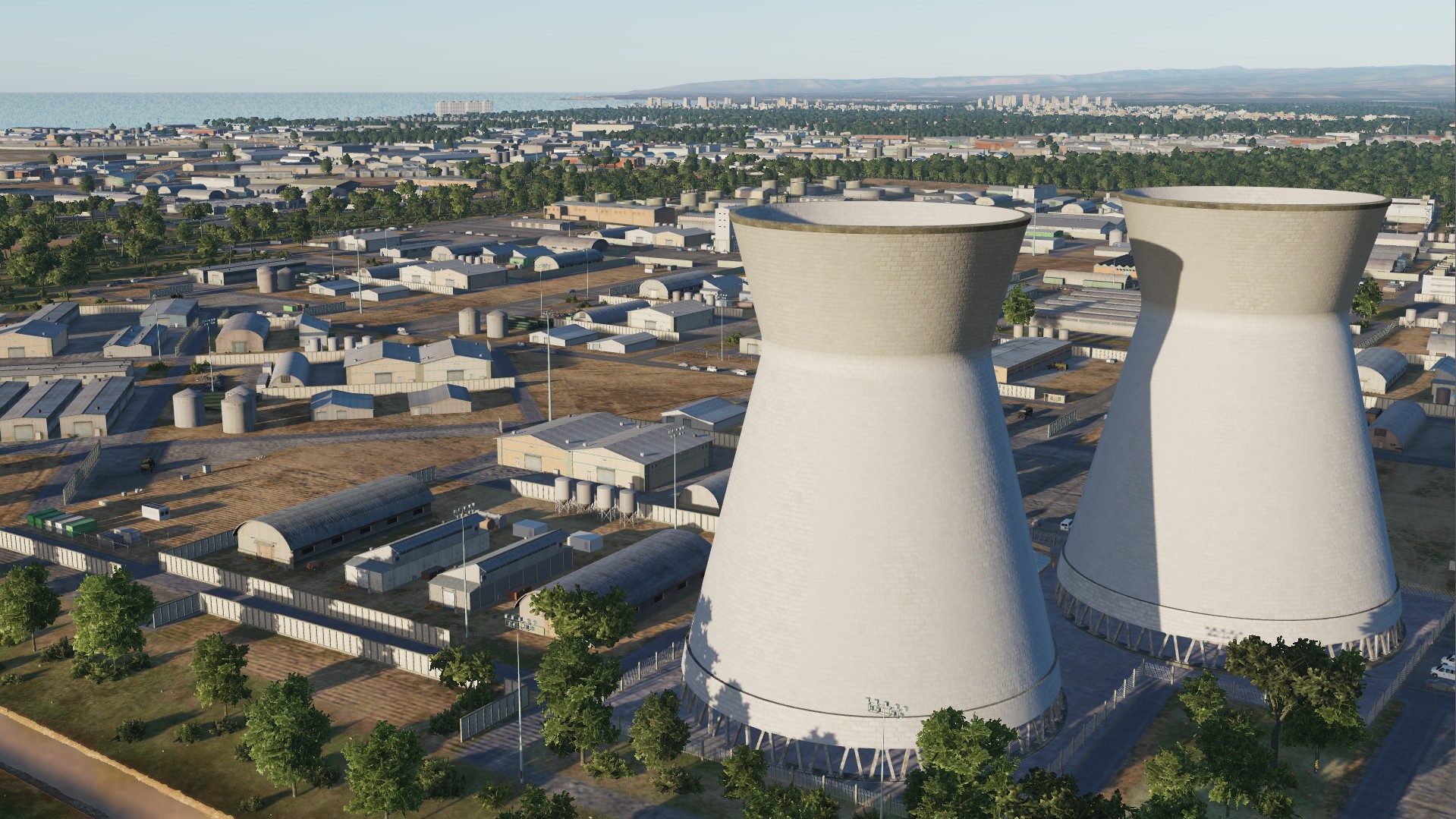
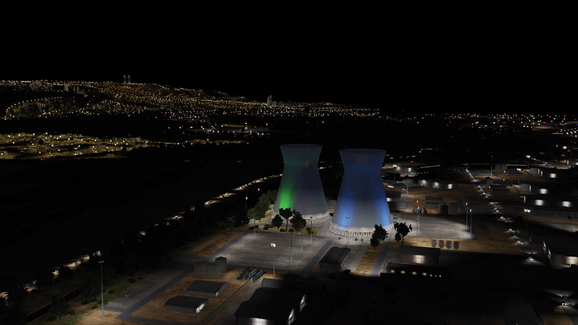
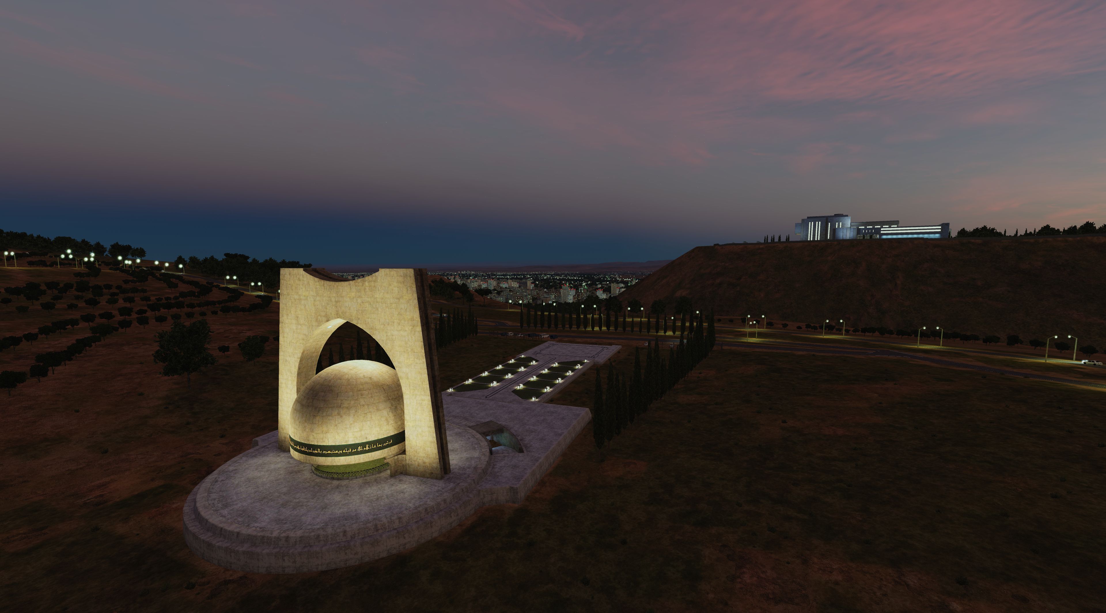
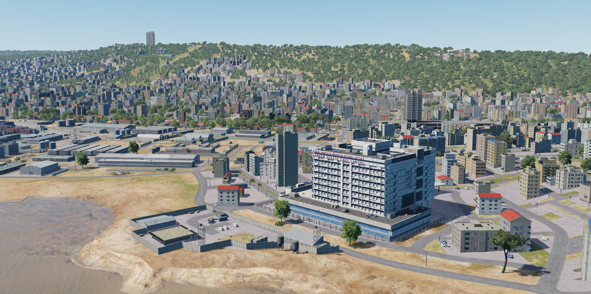
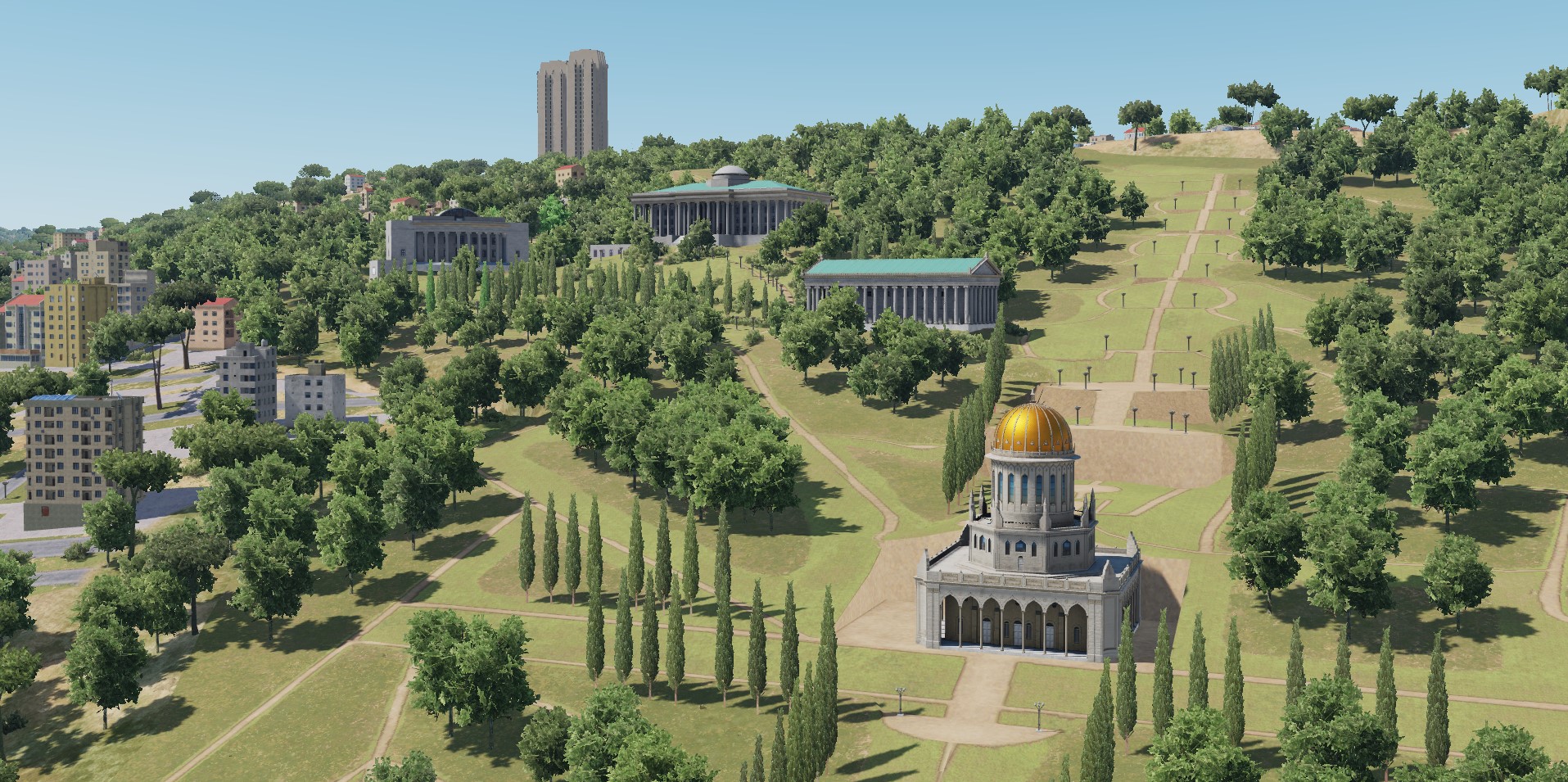
Hi, of course they will. Right now) Syria map developers have traditionally paid great attention to original and historical sites. Many observations of our users help us to make the map even more interesting and informative. Sammy Ofer Stadium Haifa city, Israel Cooling towers in Haifa Haifa, Israel Citadel Akko Old city of Akko, Israel
- 487 replies
-
- 12
-
-
-
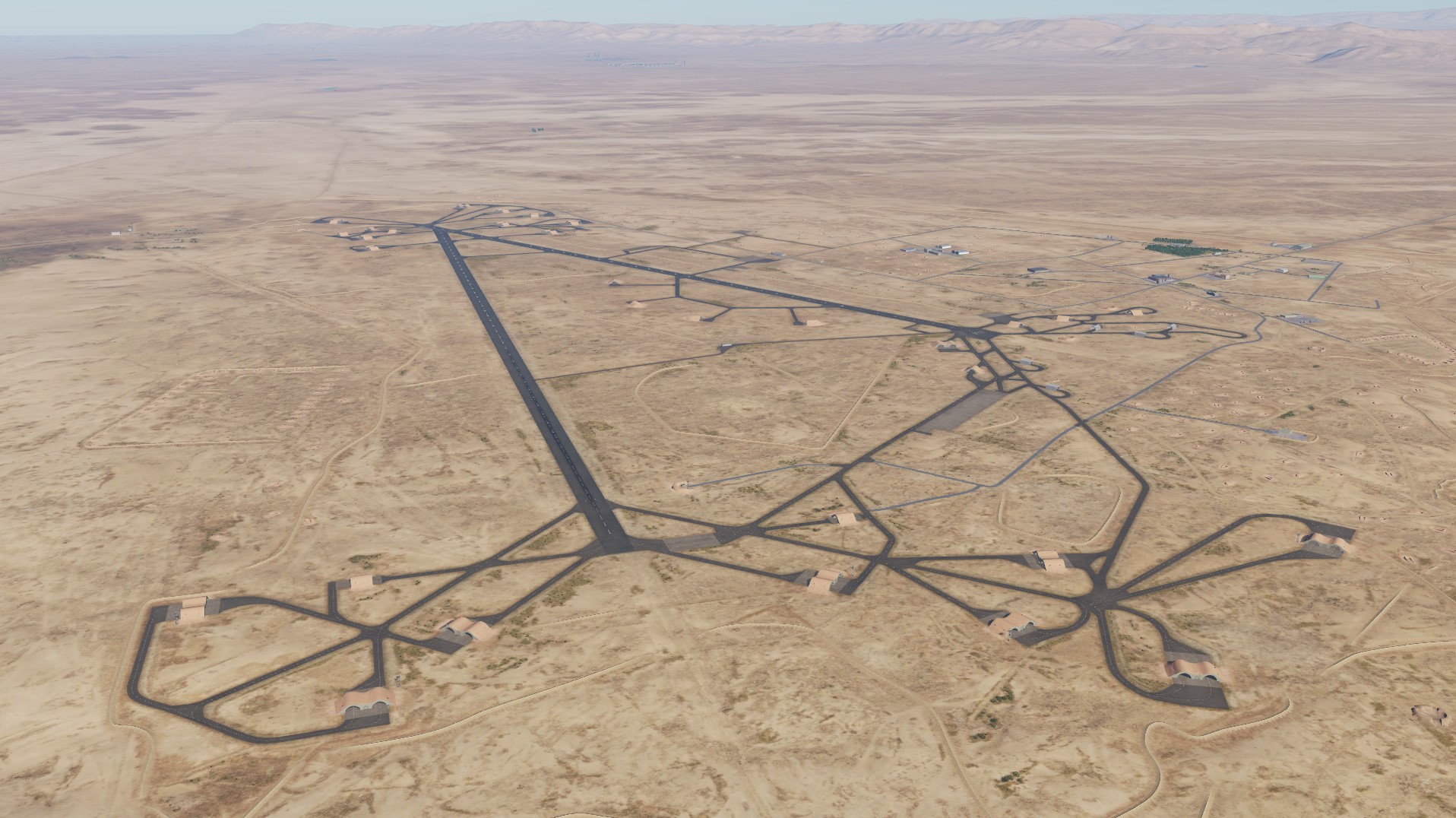
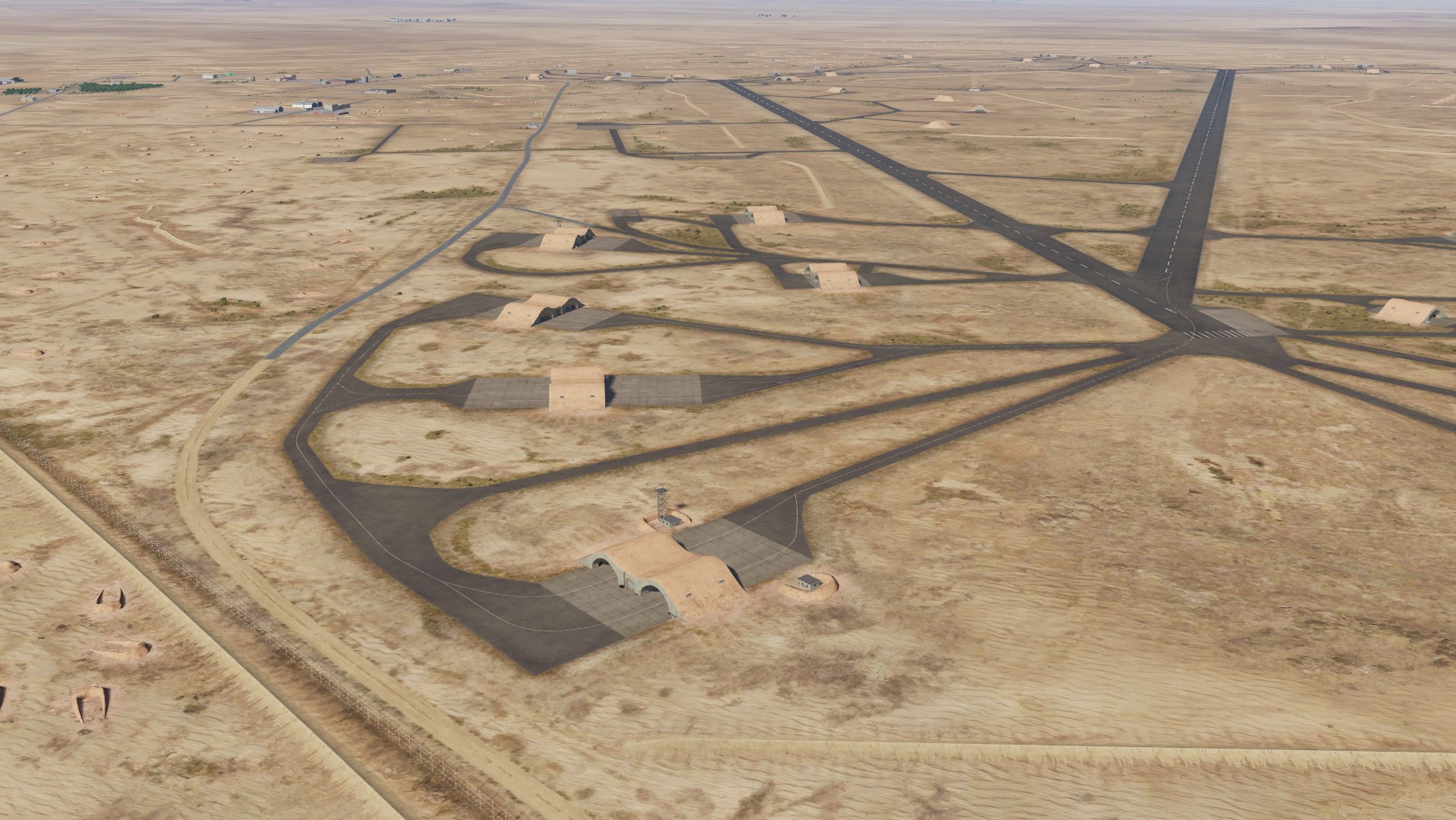
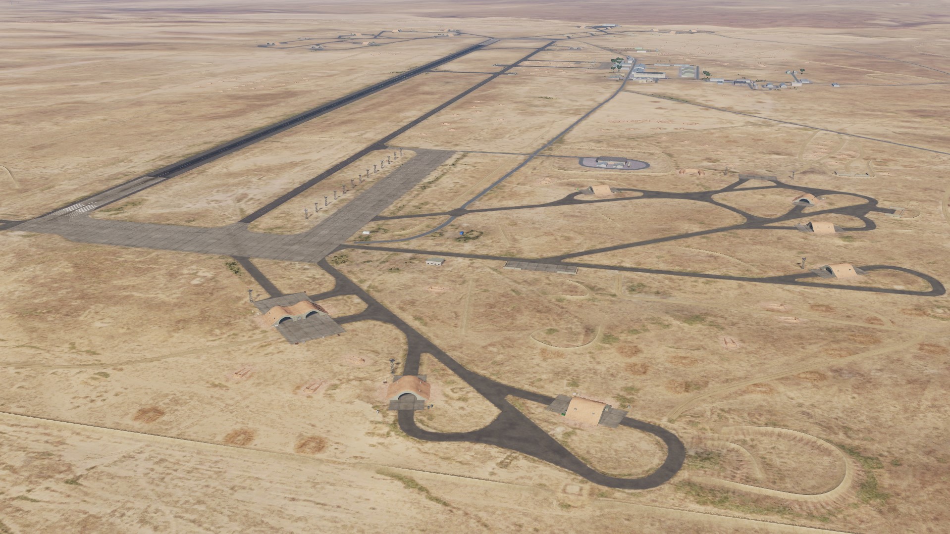
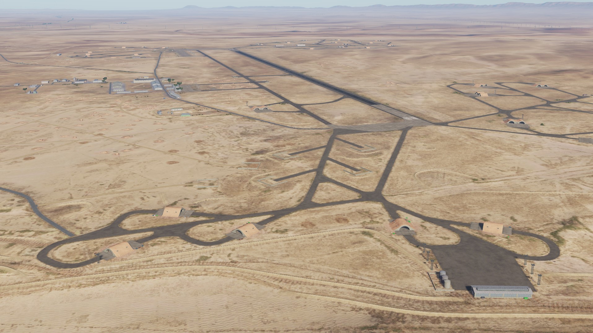
Sayqal Airbase Shayrat Airbase is home to the Syrian Air Force 50th Air Brigade located in Homs. It has two runways and around 40 hardened aircraft shelters. (wiki) Tiyas Airbase The Tiyas Military Airbase is the largest airbase in Syria.
- 487 replies
-
- 31
-
-
-
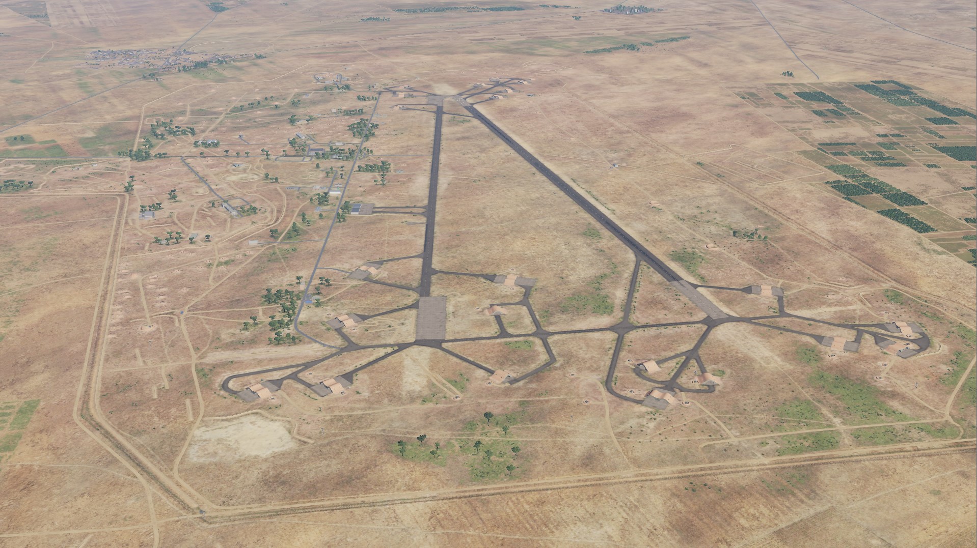
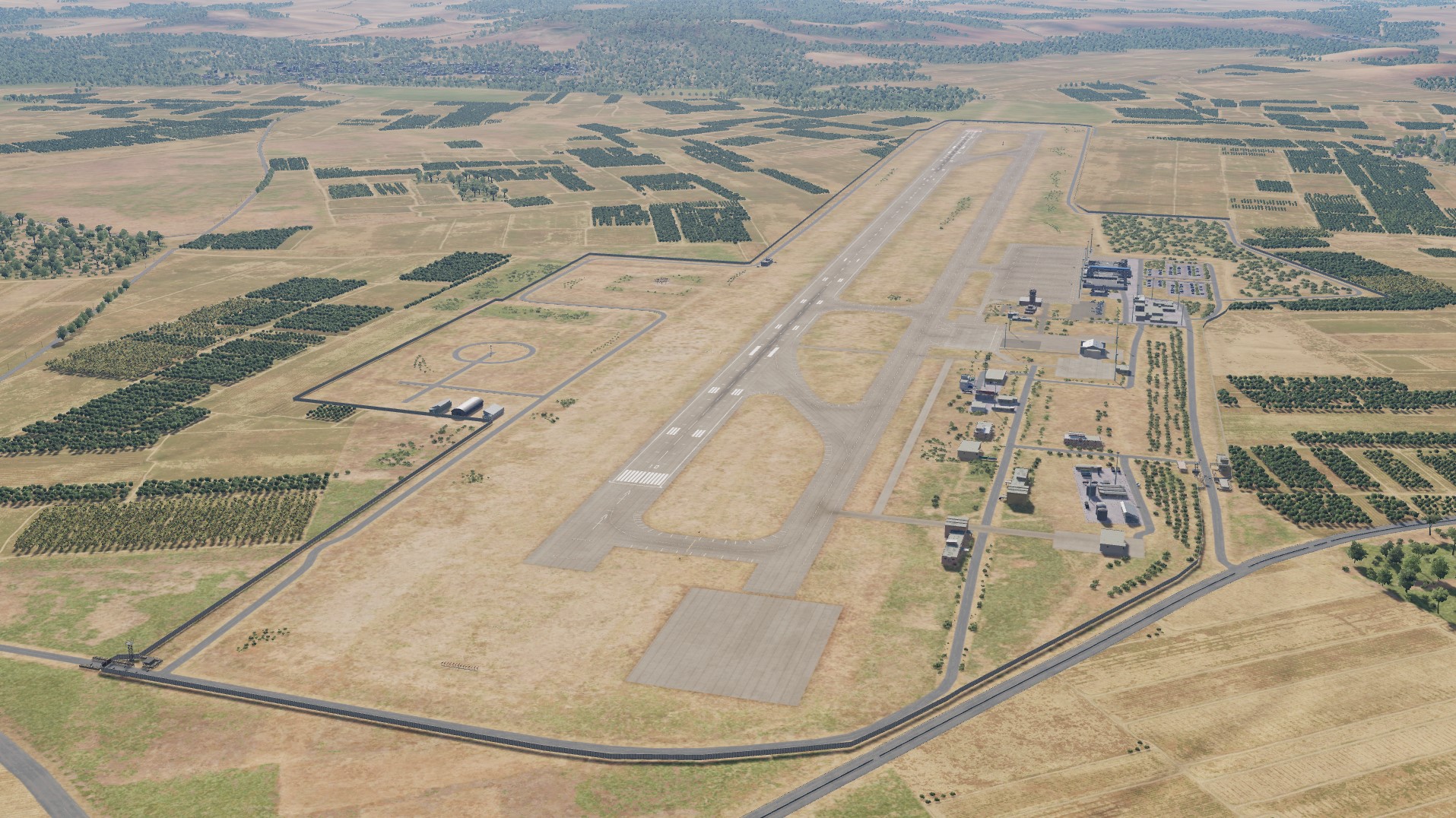
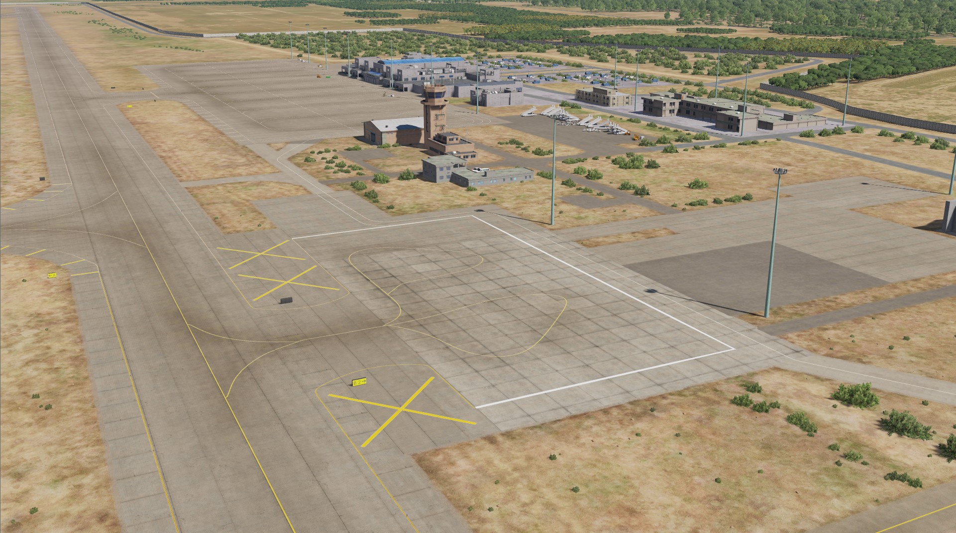
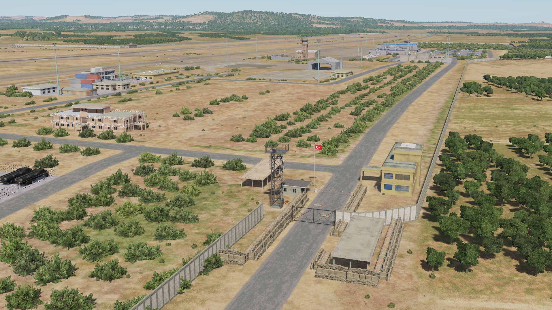
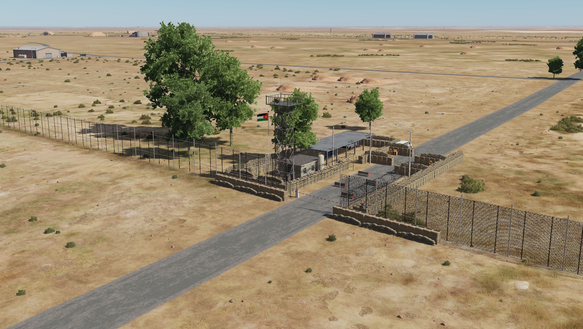
Hello pilots of the DCS: World! We continue to highlight work to improve Syria Map. Today we will show you several airfields. Gaziantep Havalimani (Turkey) H-4 Air Base is a Royal Jordanian Air Force base located near Ruwaished in Mafraq Governorate, Jordan. Rosh Pina Airport (Israel)
- 487 replies
-
- 17
-
-
-
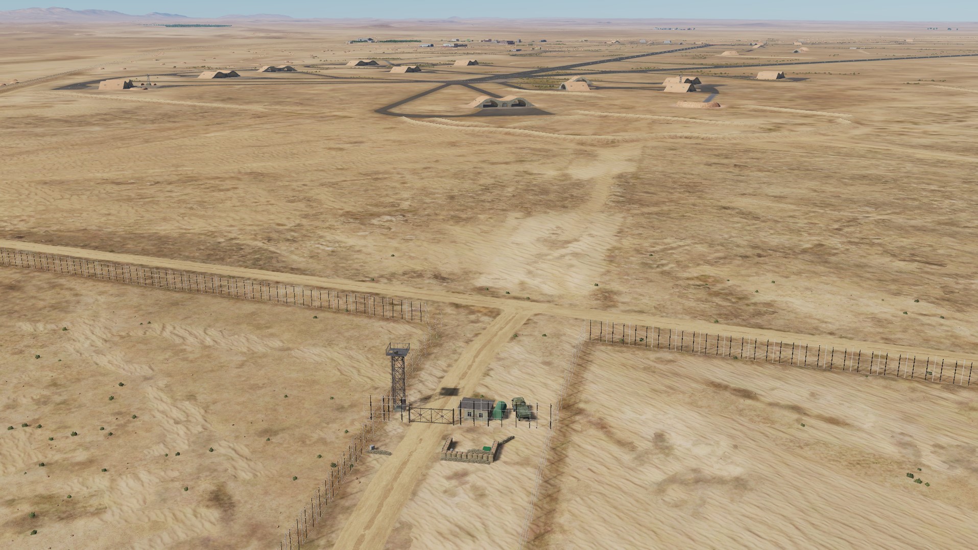
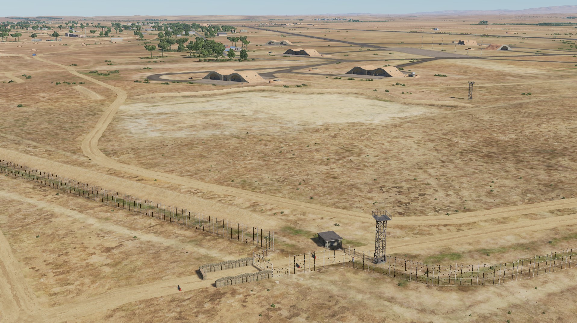
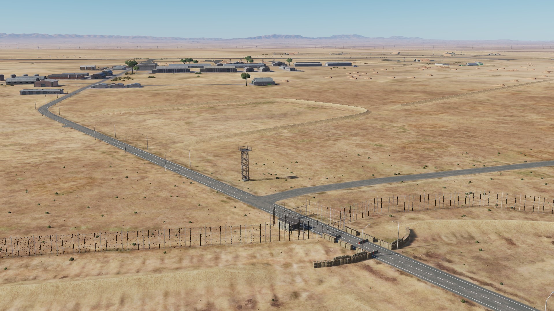
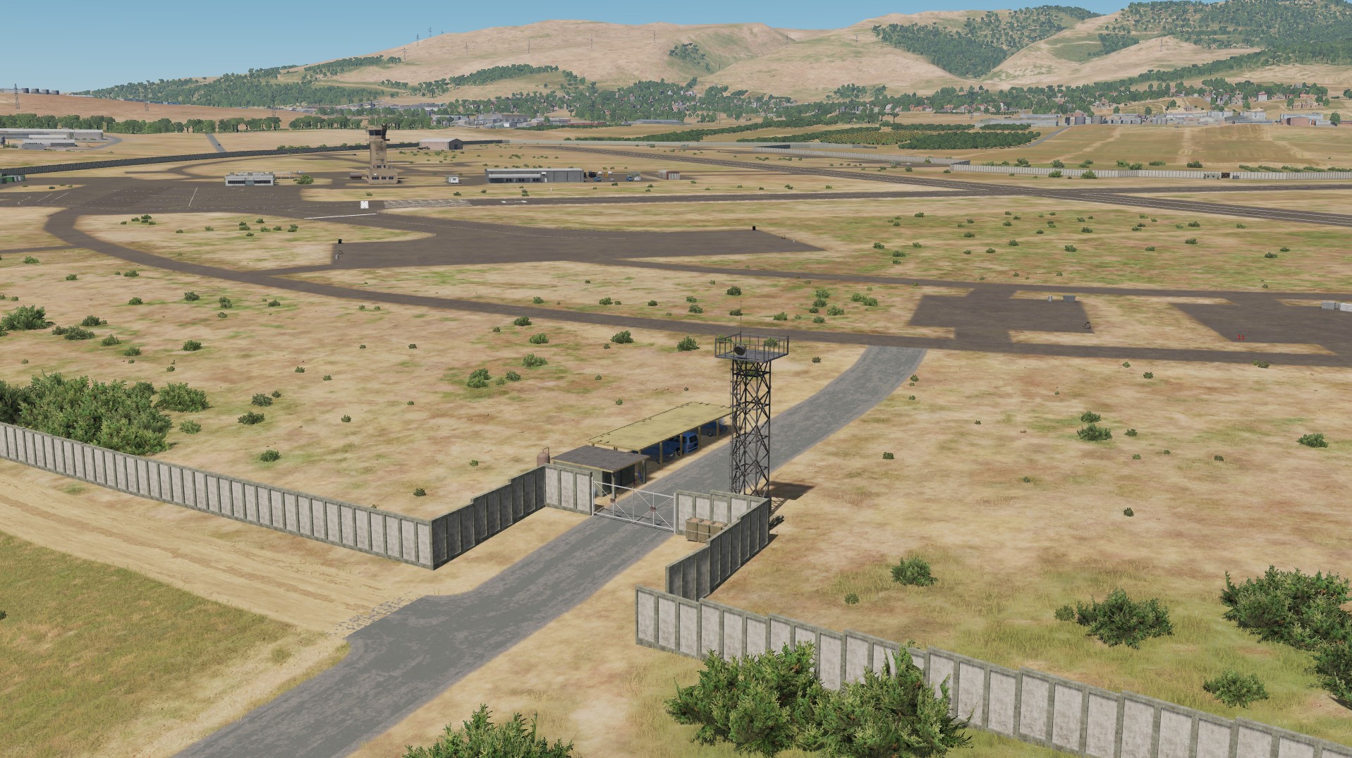
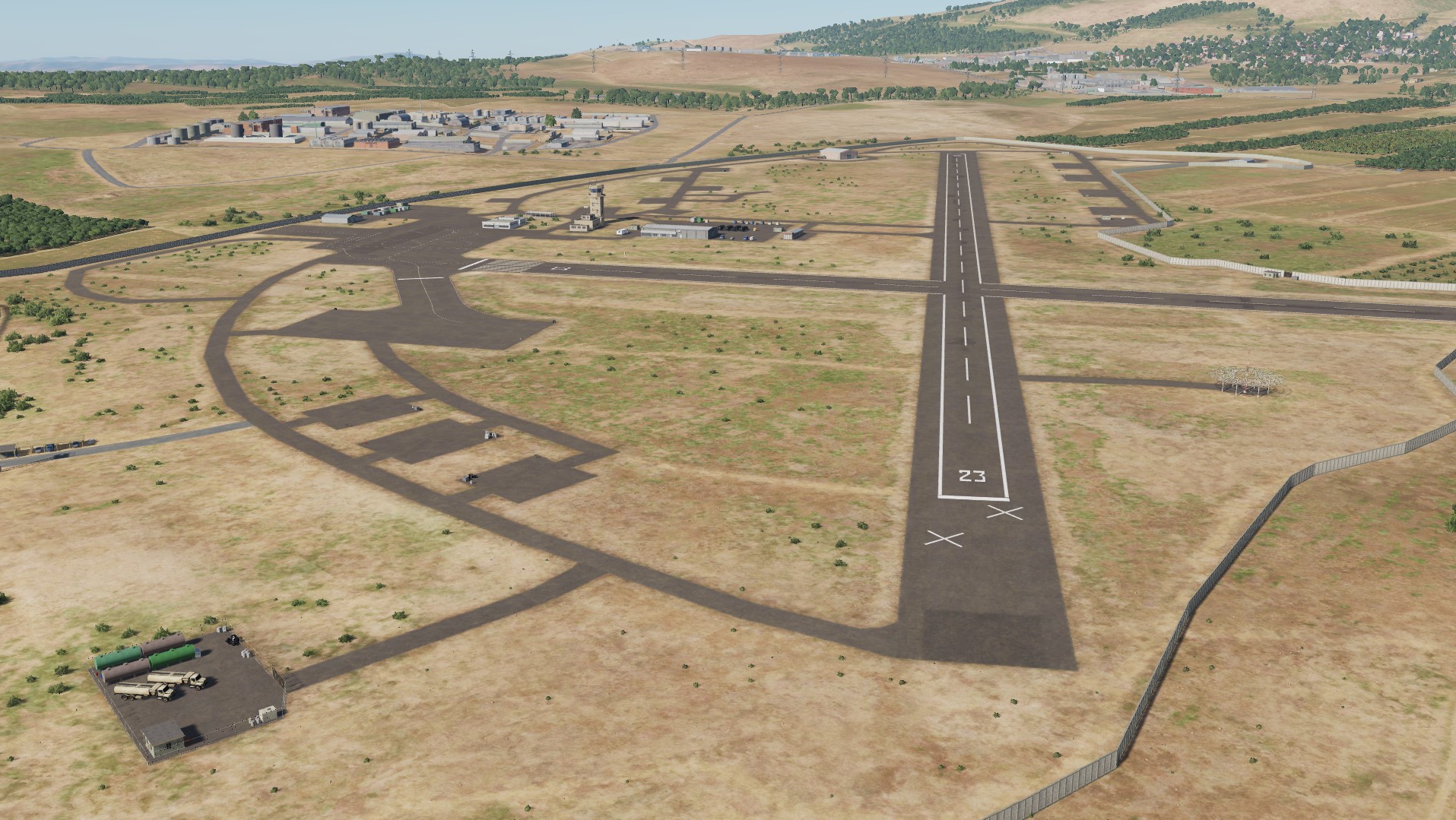
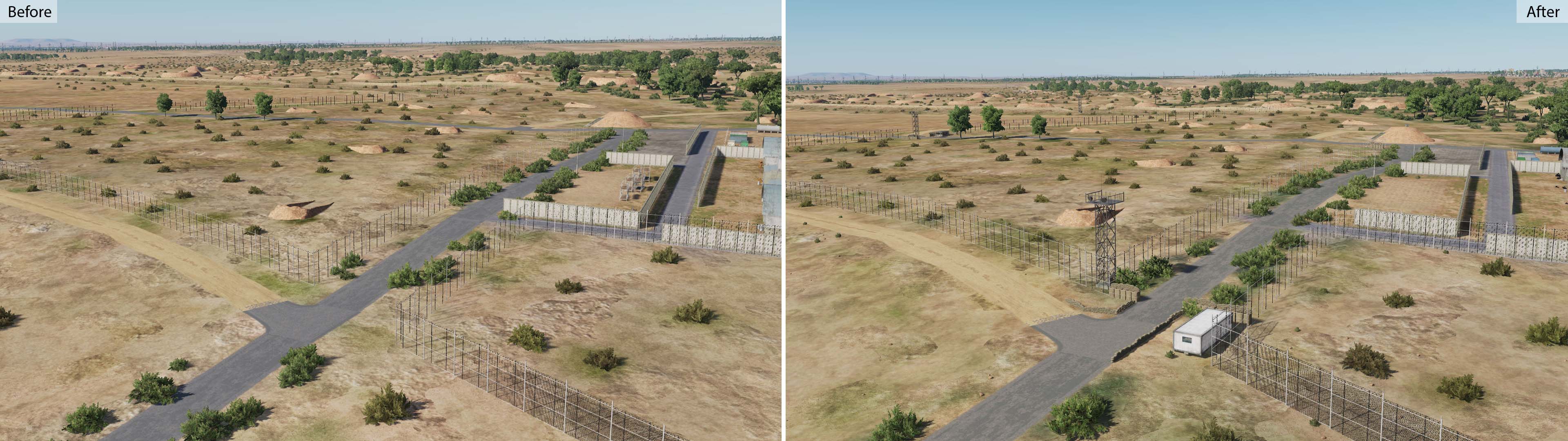
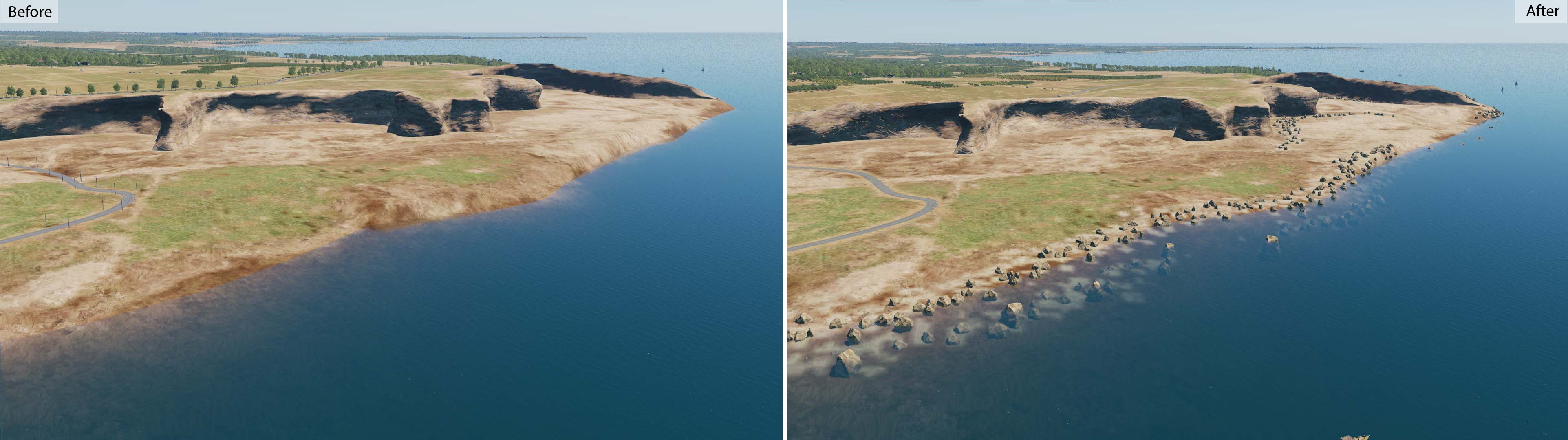
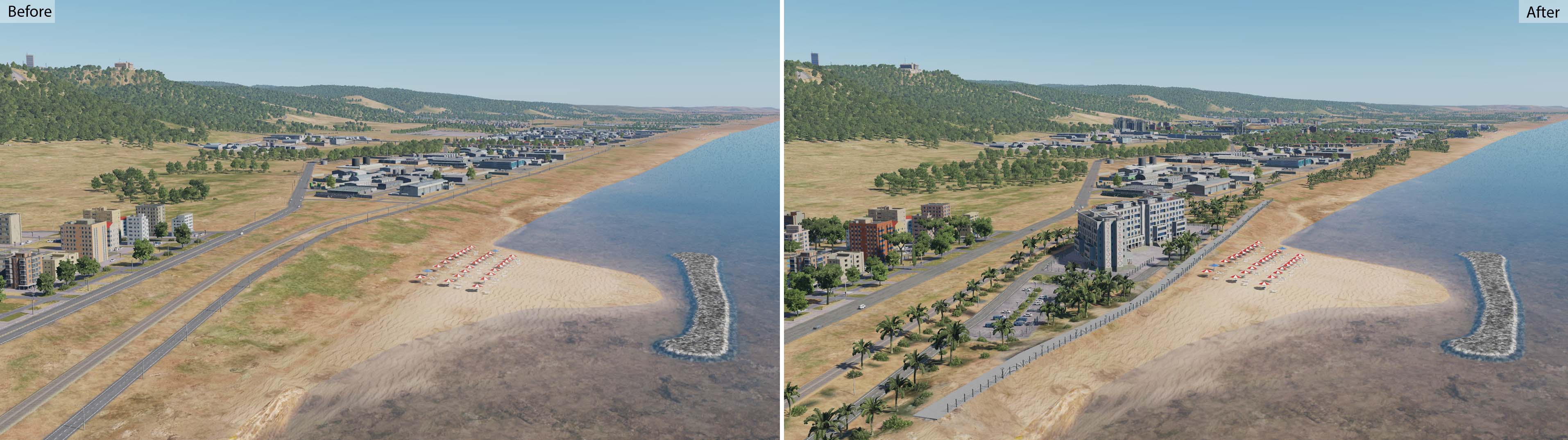
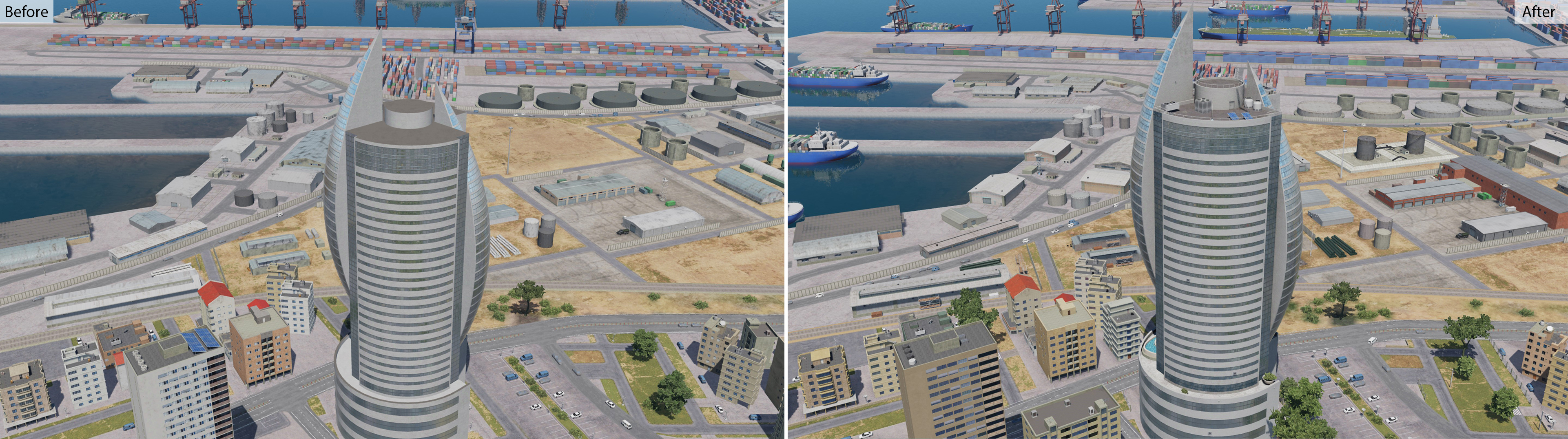
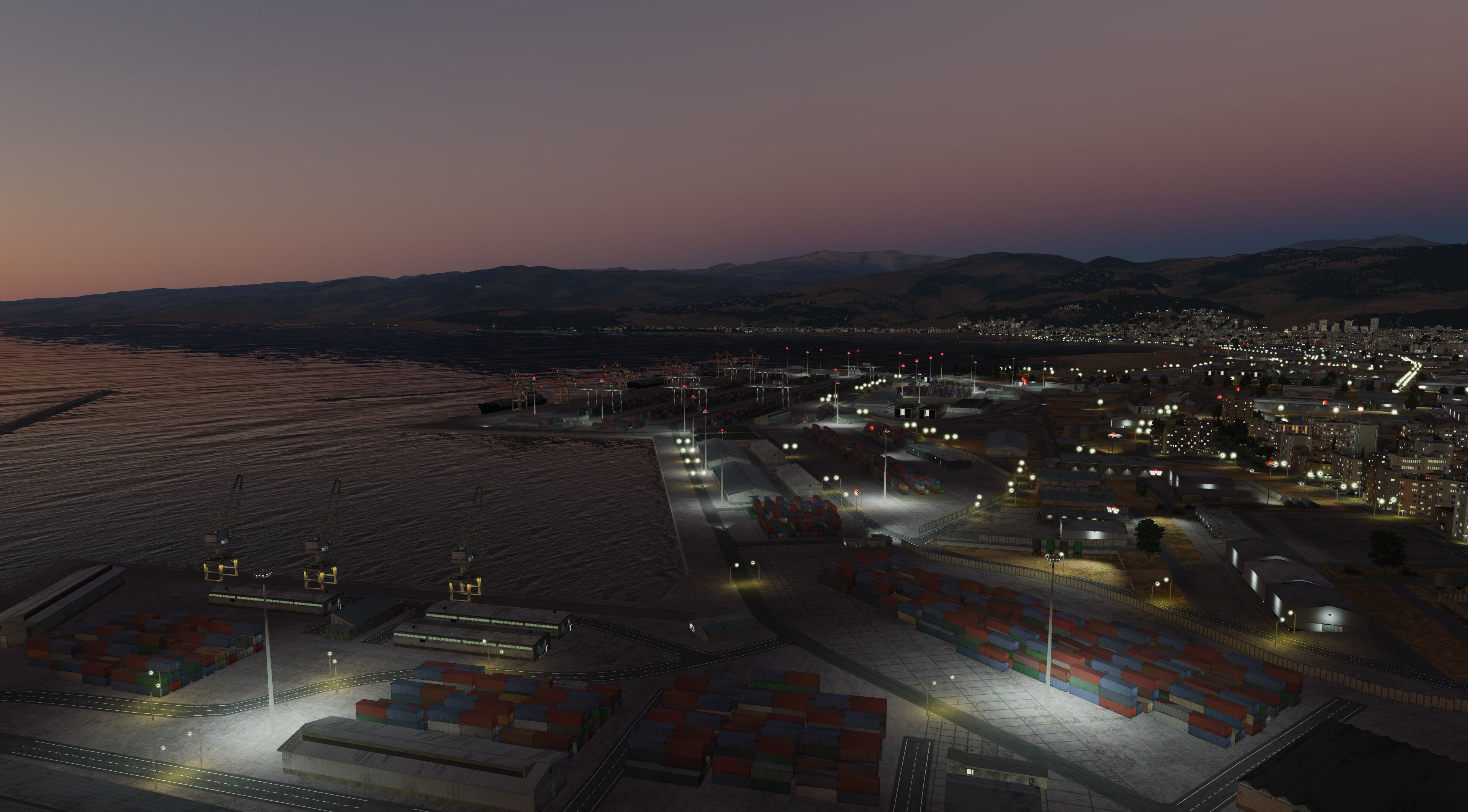
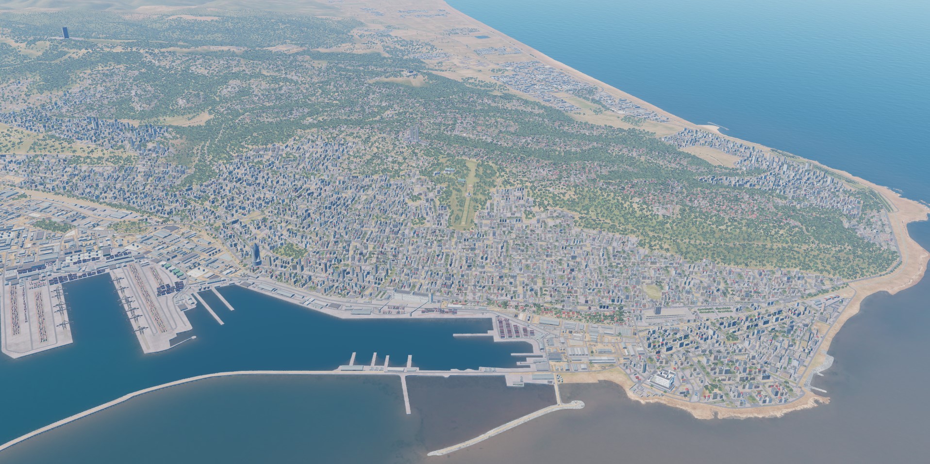
We are continuing to improve the map. Updated coastlines to support new DCS technologies. State borders and demarcation zones have been worked out, including under the protection of UN troops.
- 487 replies
-
- 50
-
-
-

So what's your critical opinion on the new map
MAESTR0 replied to twistking's topic in DCS: Syria Map
Rest assured: all bugs you find are listed, each is assigned a status and fixed. We see all the reports and are working on them. -
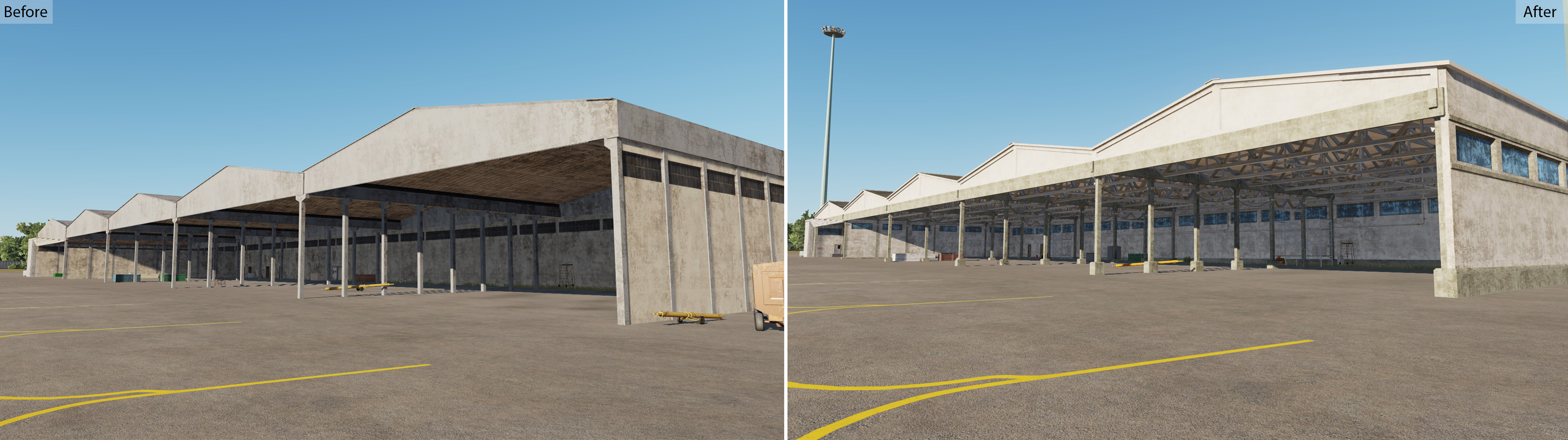
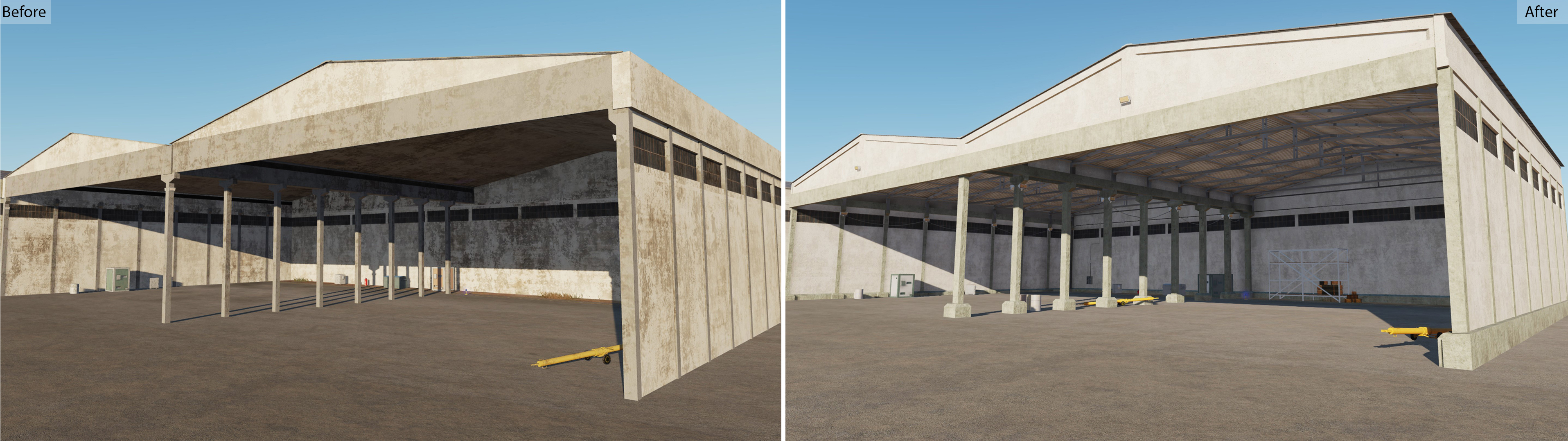
All airfield facilities in the Syria project are destructible and have a damage model. Even the airfield fence can be destroyed and users will see the fittings sticking out. But as far as the original objects are concerned, due to their ideological significance and their historical significance, it was decided that the possibility of their destruction would not be available. UPD: Nevertheless, we are working on various solutions in this direction and hope that by the time the work on the Syria map is completed, traces of cannon fire or missile and bomb strikes will be visible on all objects, except religious.
-
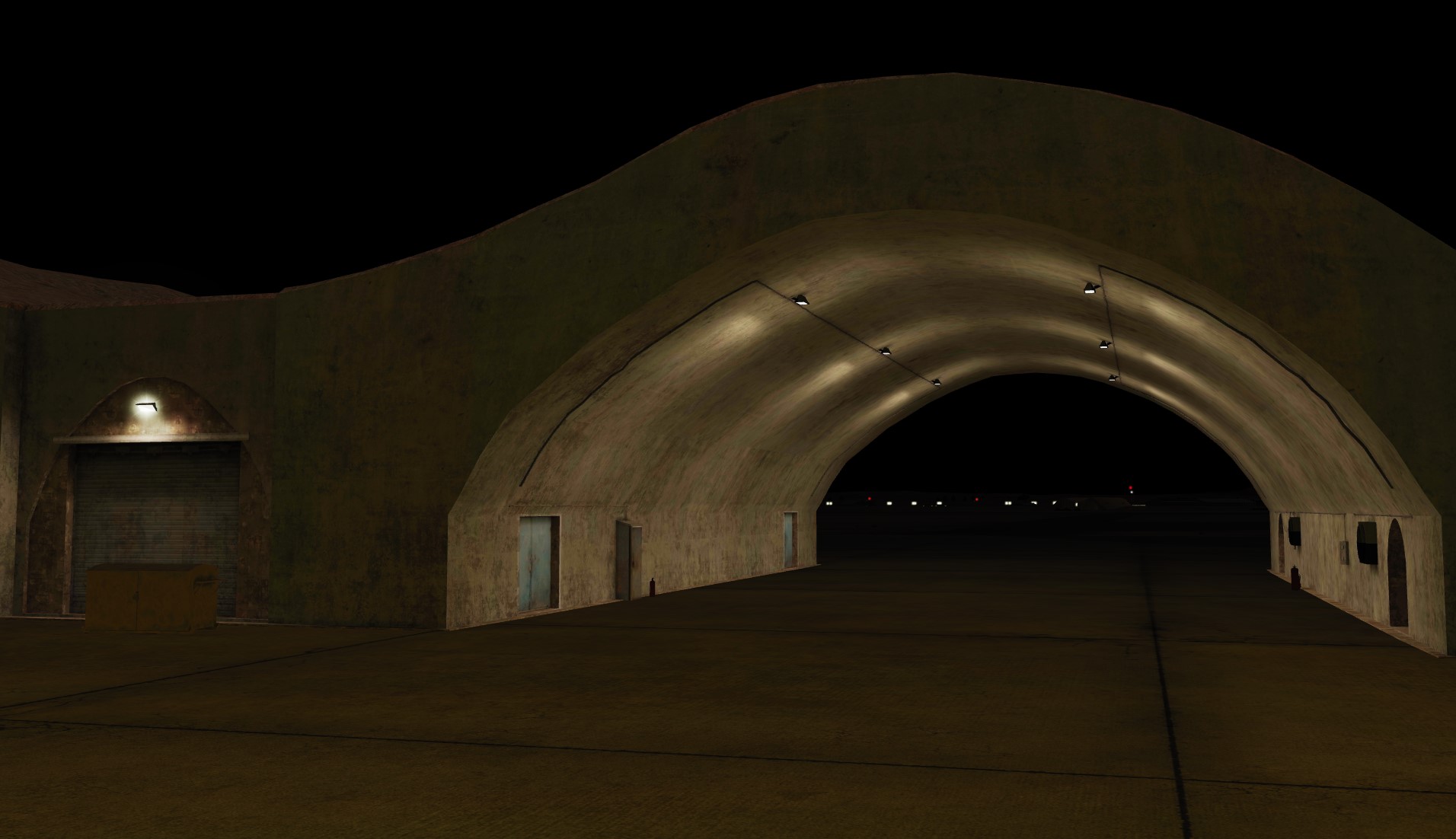
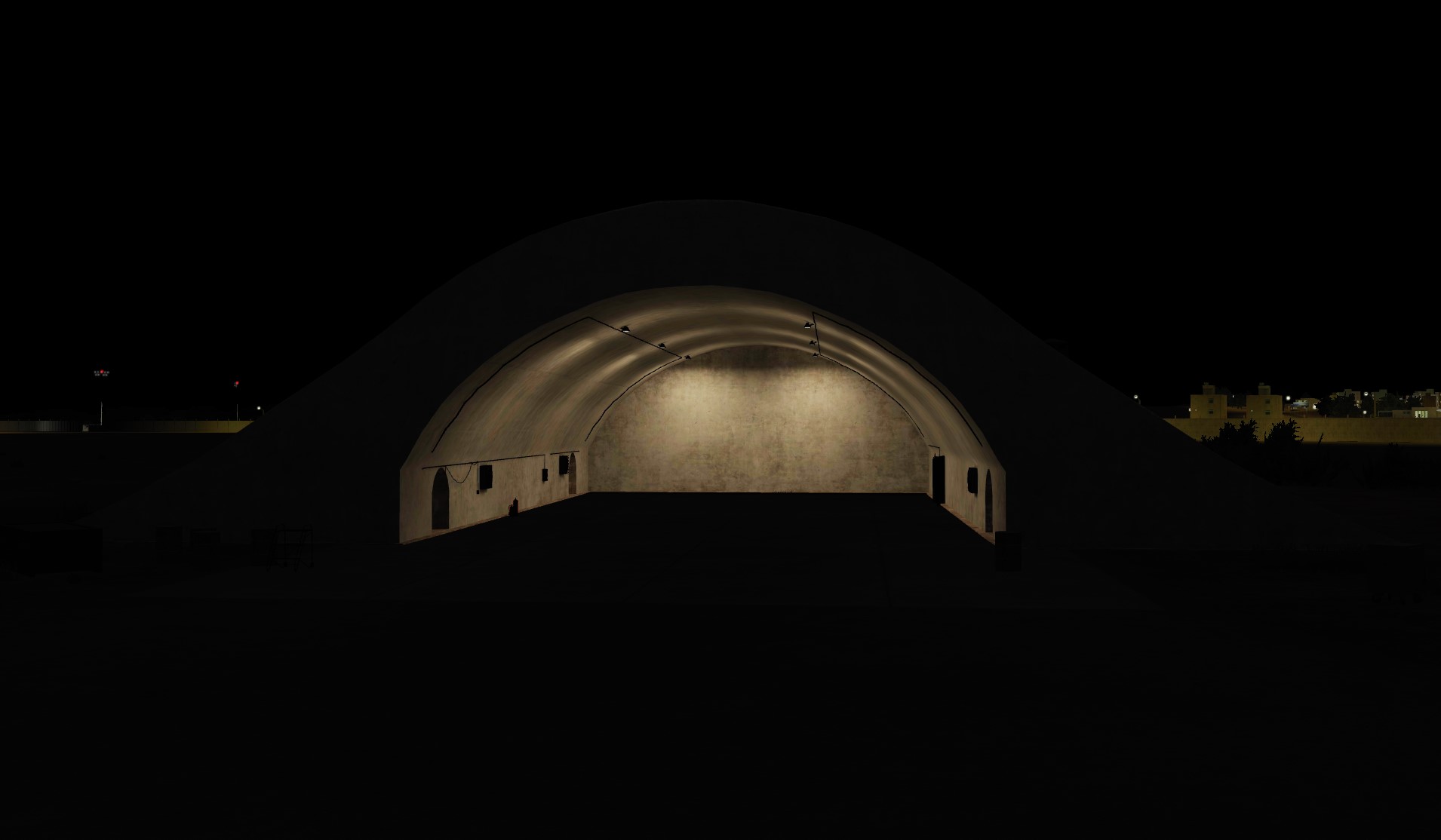
The team knows the special attitude of users to night flights. Therefore, a lot of effort is put into making the launching and taxiing of aircraft from airfields a pleasure for DCS pilots.
- 487 replies
-
- 28
-
-
-
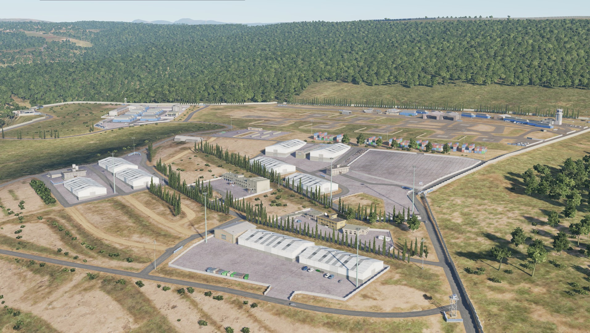
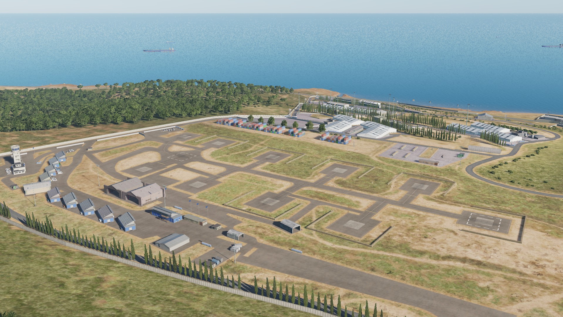
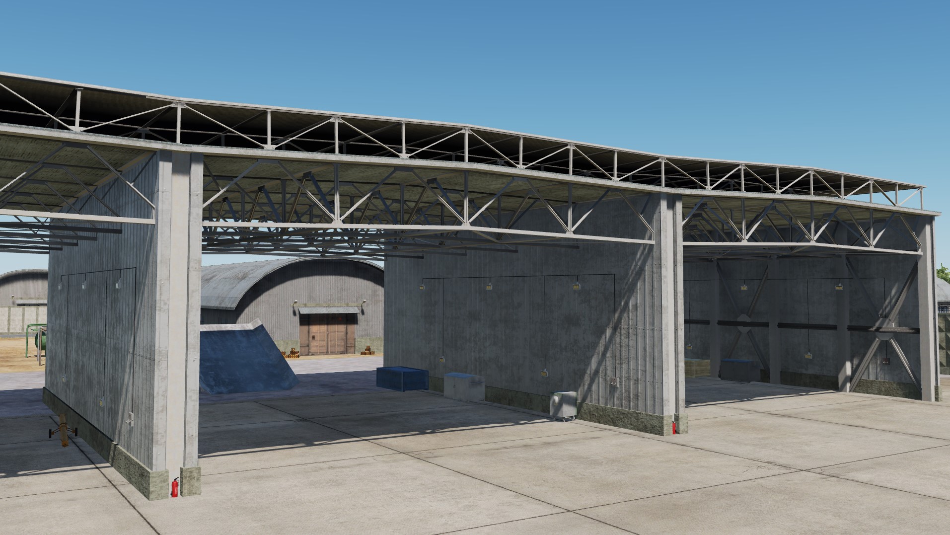
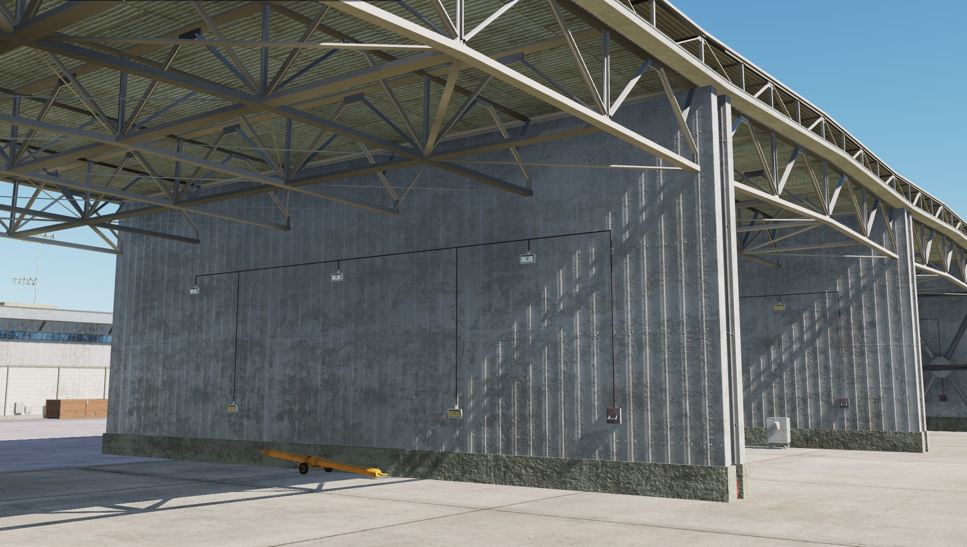
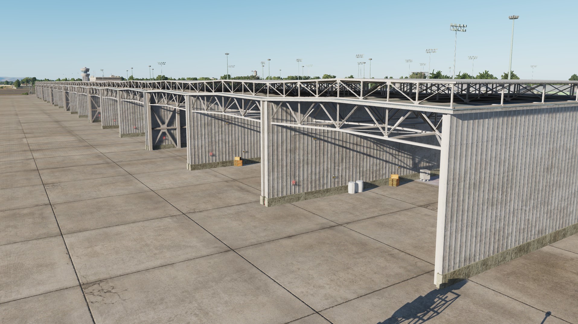
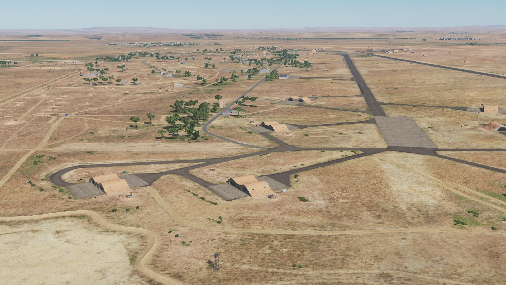
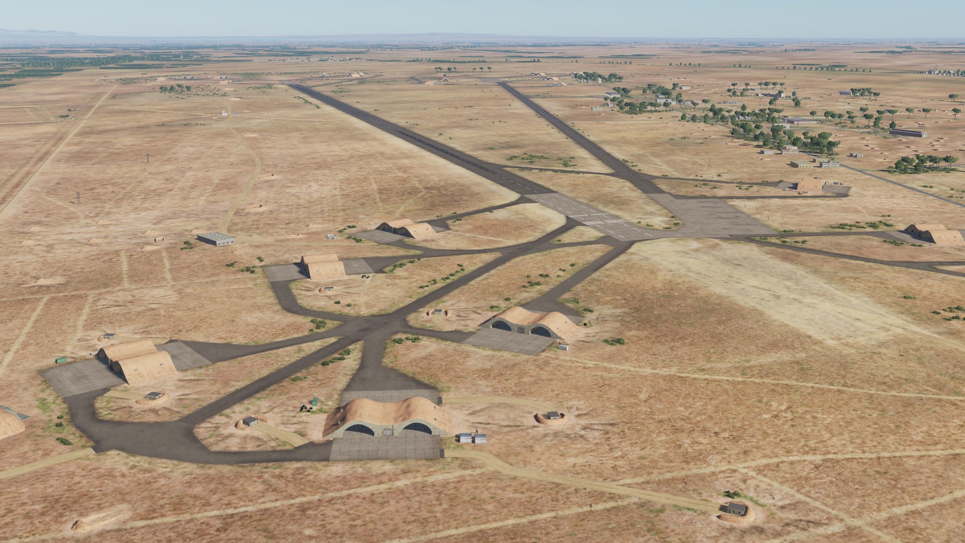
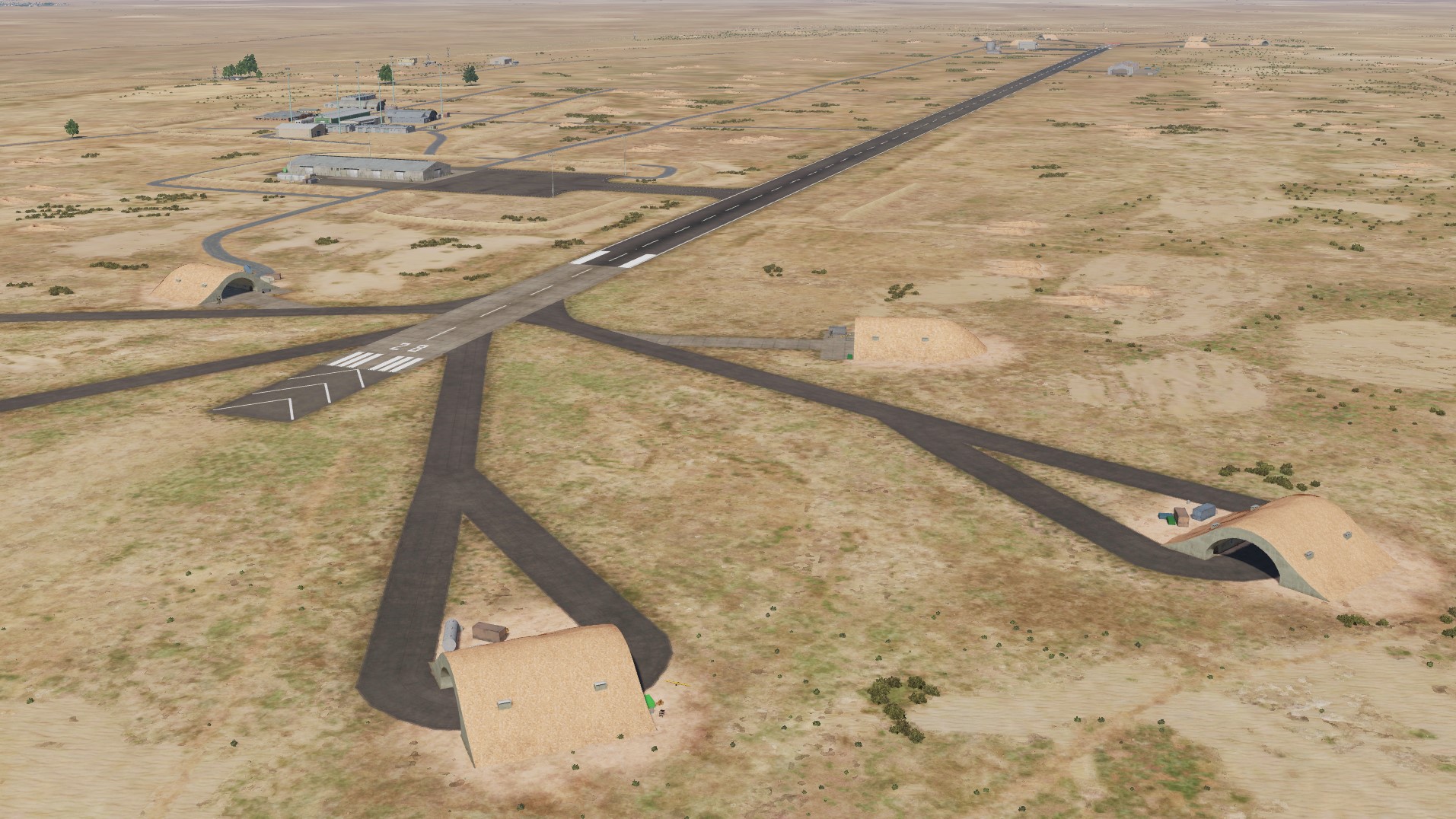
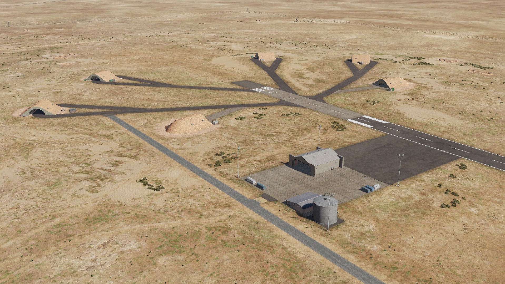
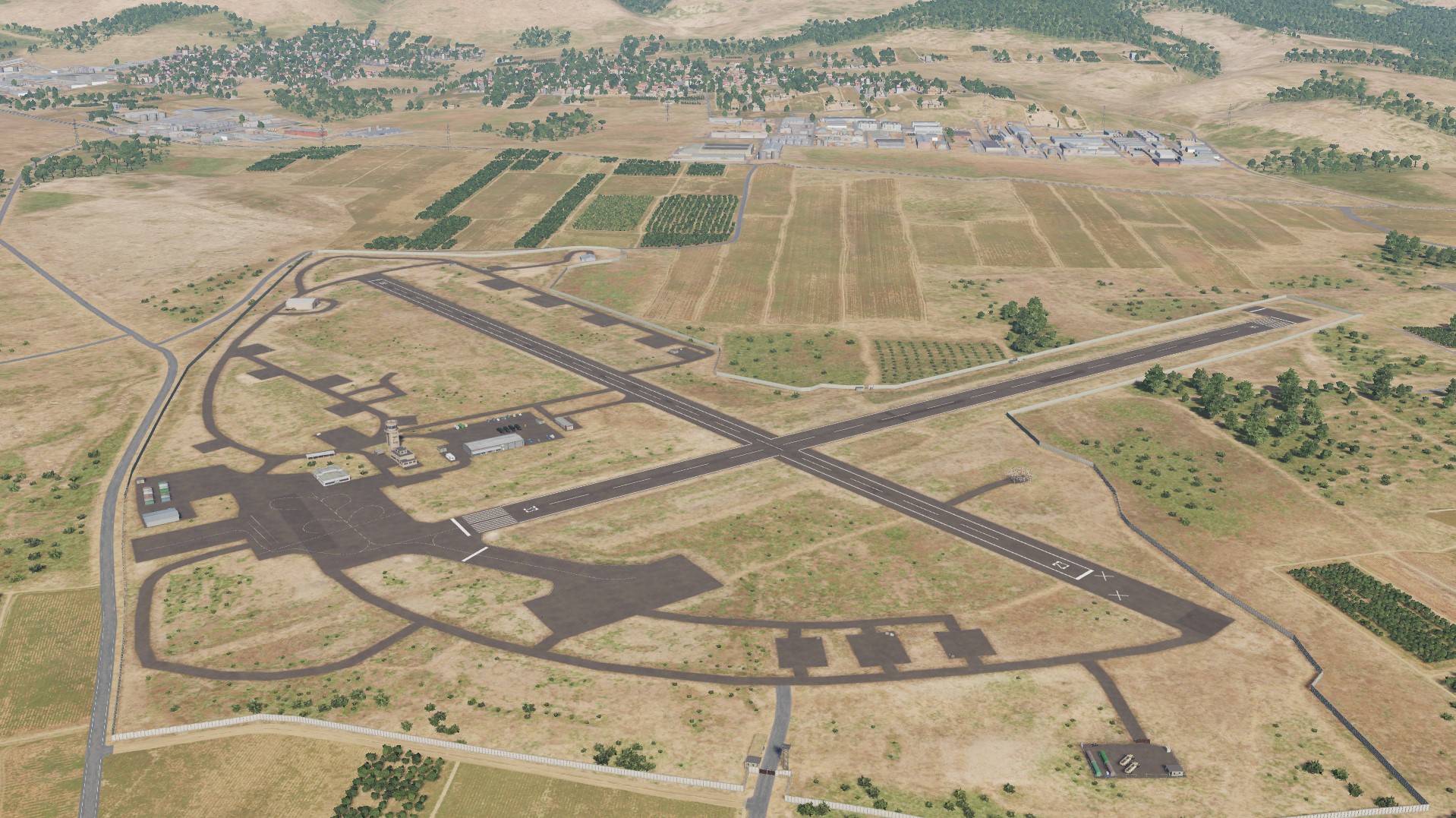
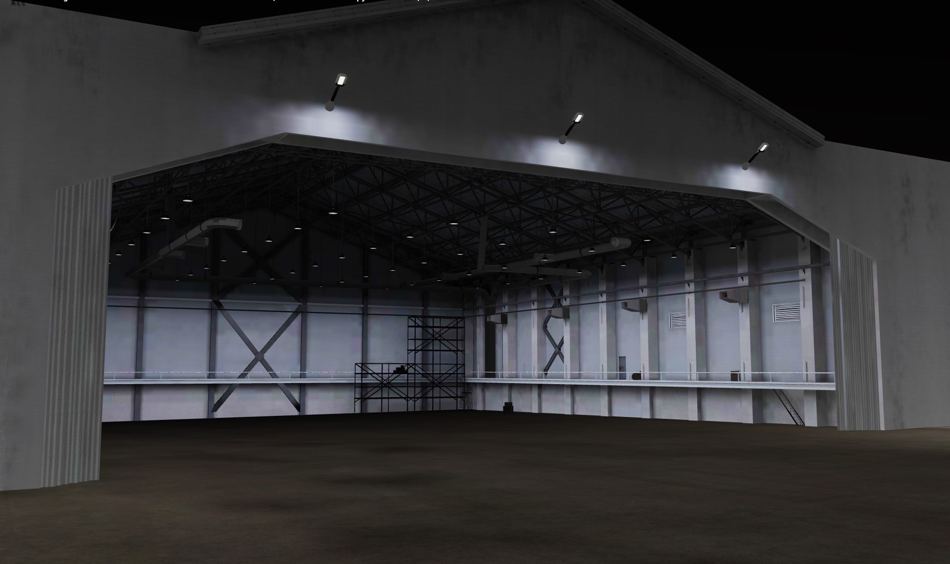
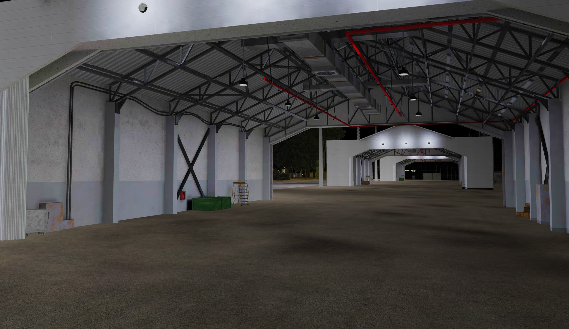
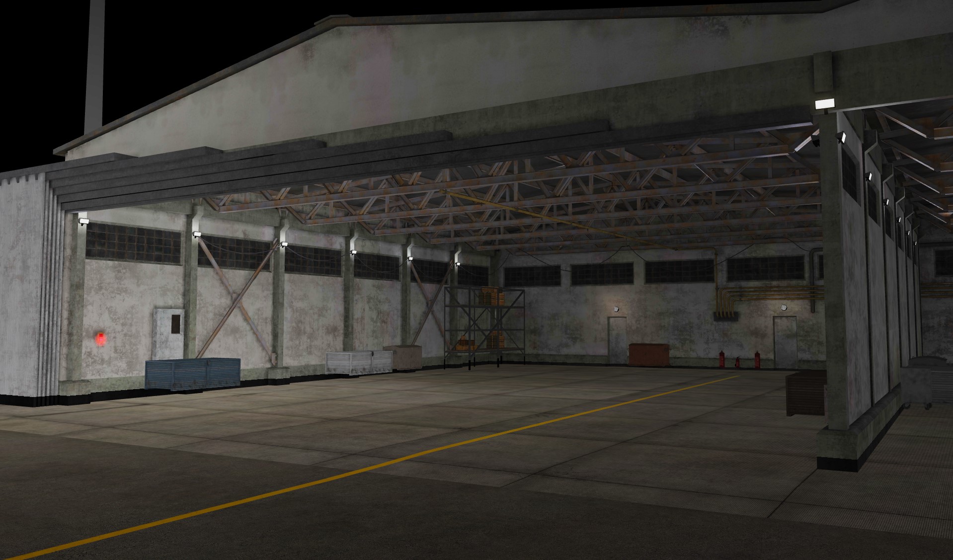
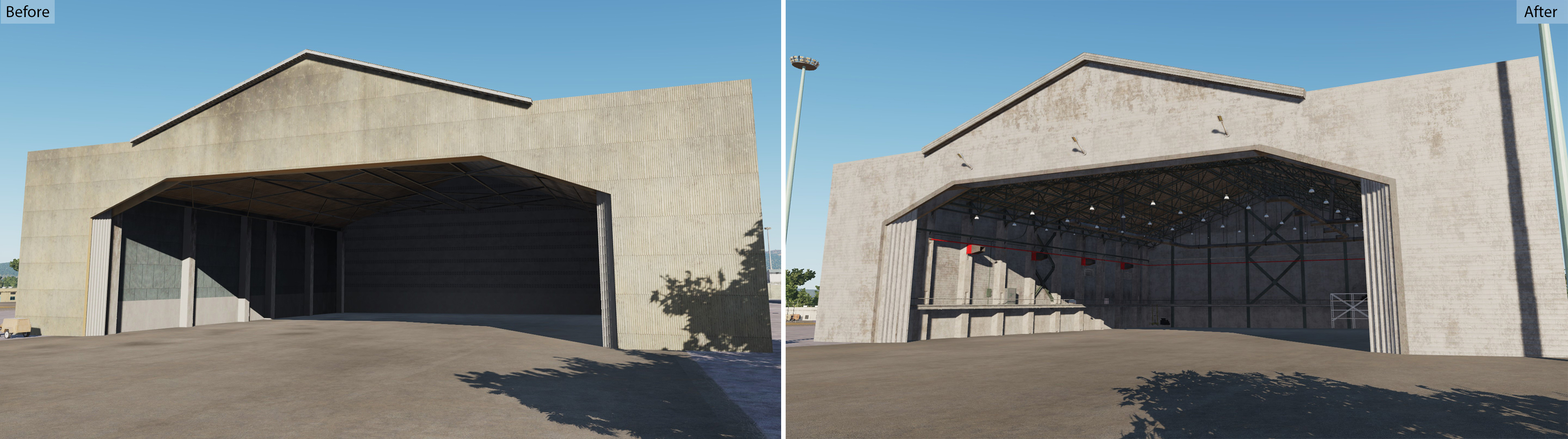
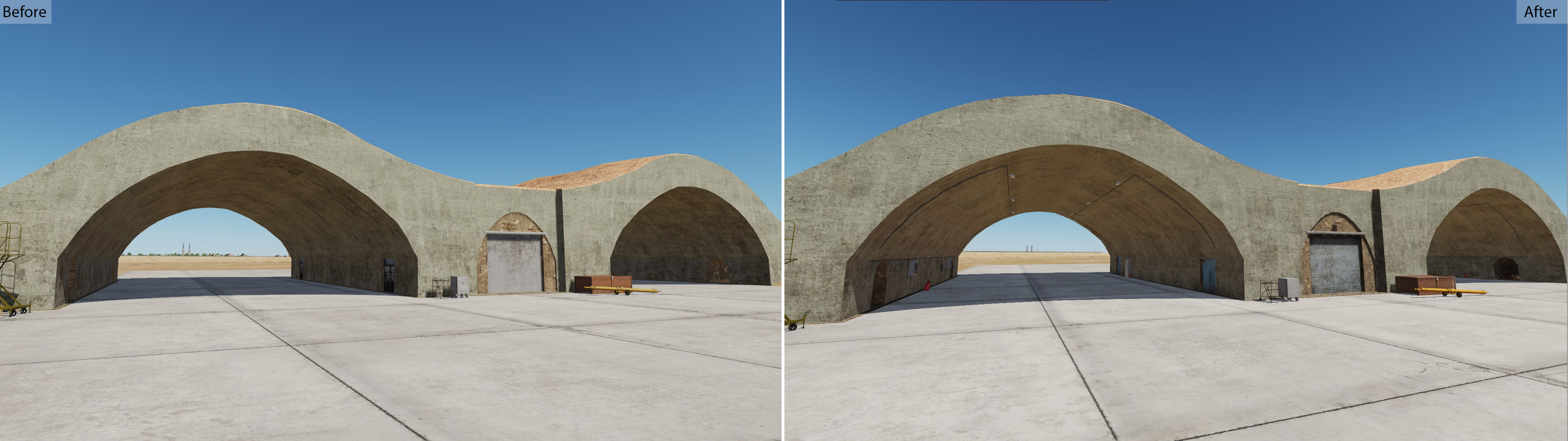
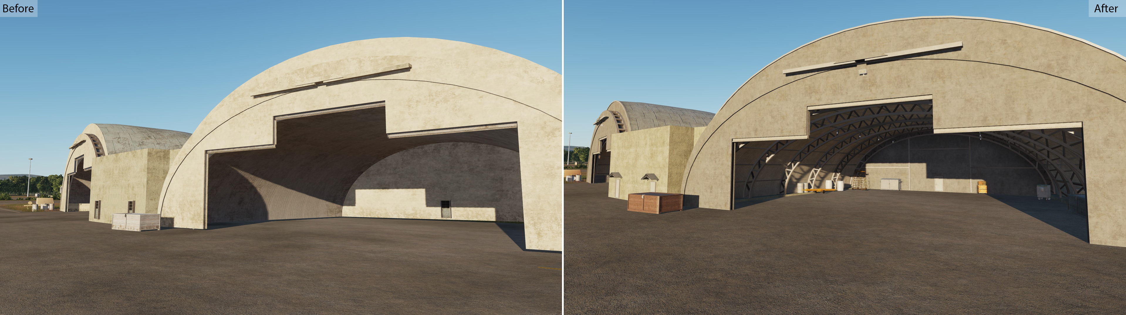
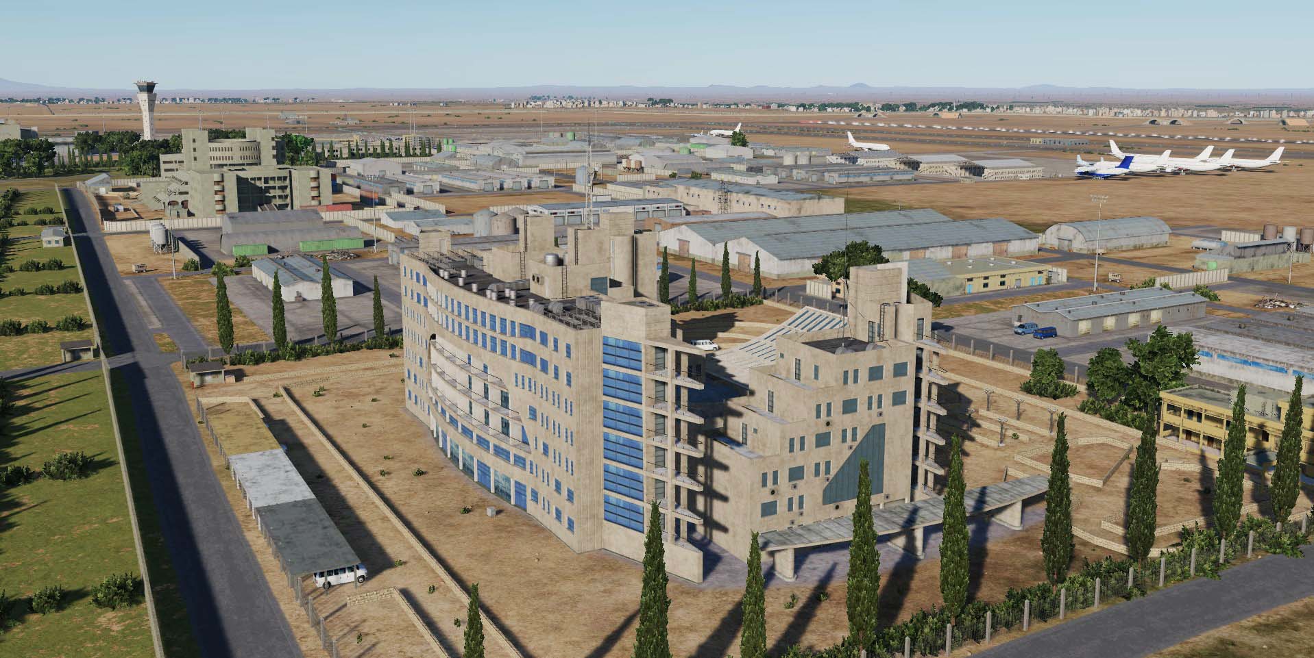
An important area of work for the developers of the DCS: Syria map is the detailed study of the airfield infrastructure and the maximum detail of the airfield hangars with the mission start places. * Guys, the task of optimizing the map is an important part of the development team's work. Significant results have already been achieved in this direction: when we recorded this video, then on the RTX 2070, less than 69 fps did not fall (basically 90-110Fps). Send me your configuration in the PM and the places where the maximum FPS drawdown occurs.
- 487 replies
-
- 16
-
-
-
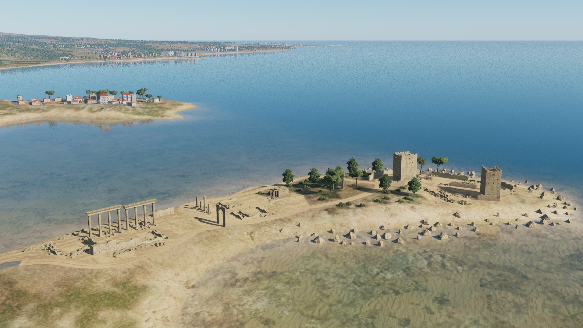
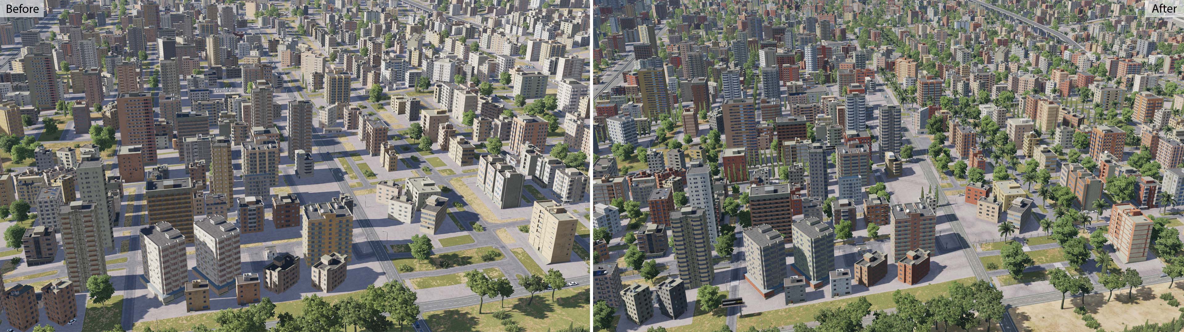
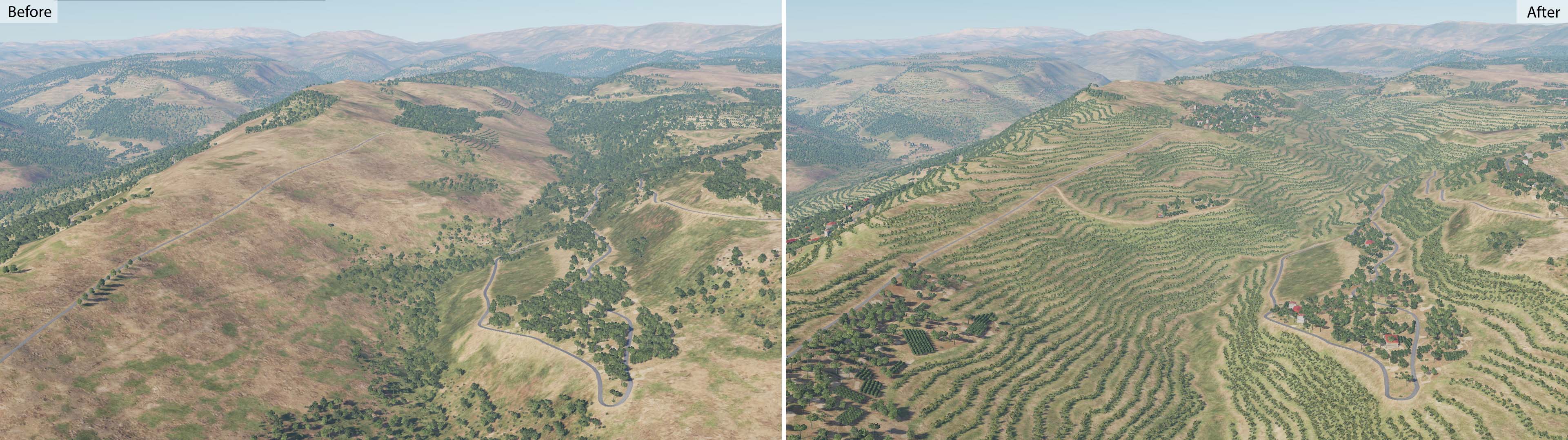
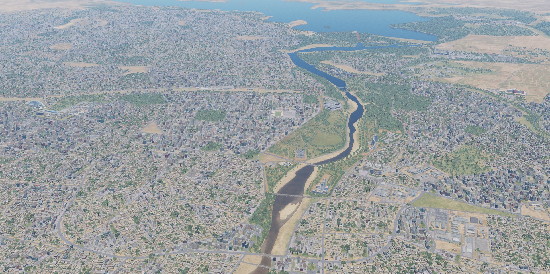
We continue to work on the map of Syria. DCS: Syria Map Developers are working hard to ensure that users receive a completed Syria map as soon as possible. In addition to increasing the number of airfields on the mainland and adding the island of Cyprus to the map, the Ugra Media team is making great efforts to improve the content already available to users.
- 487 replies
-
- 34
-
-
-
Syria Map early access is open! Congratulations! We hope you enjoy flying! https://www.digitalcombatsimulator.com/ru/products/terrains/
-
All such sites will be highlighted in the release.
-
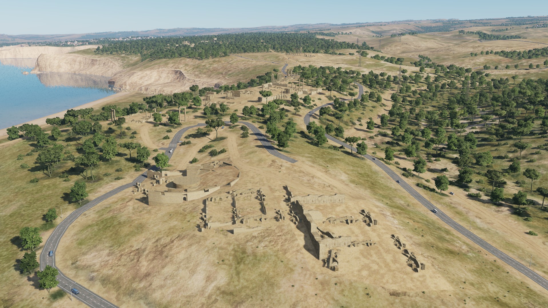
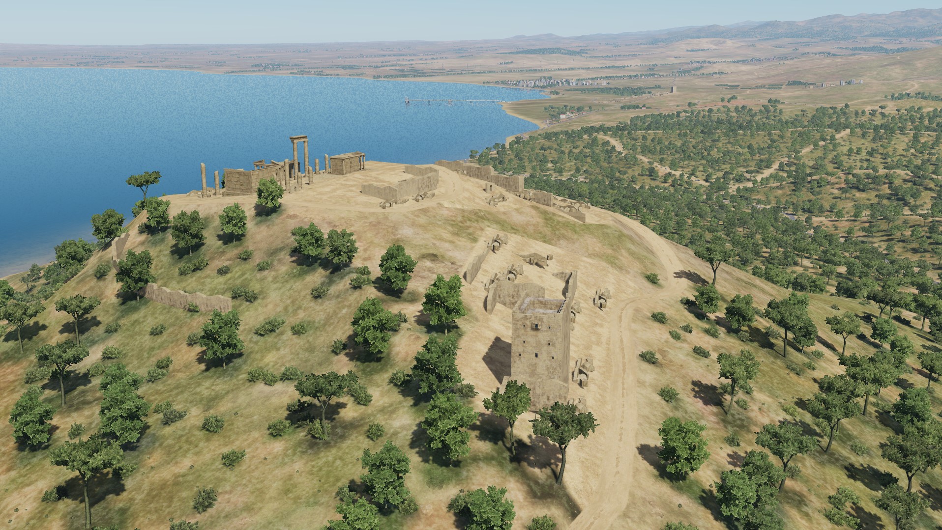
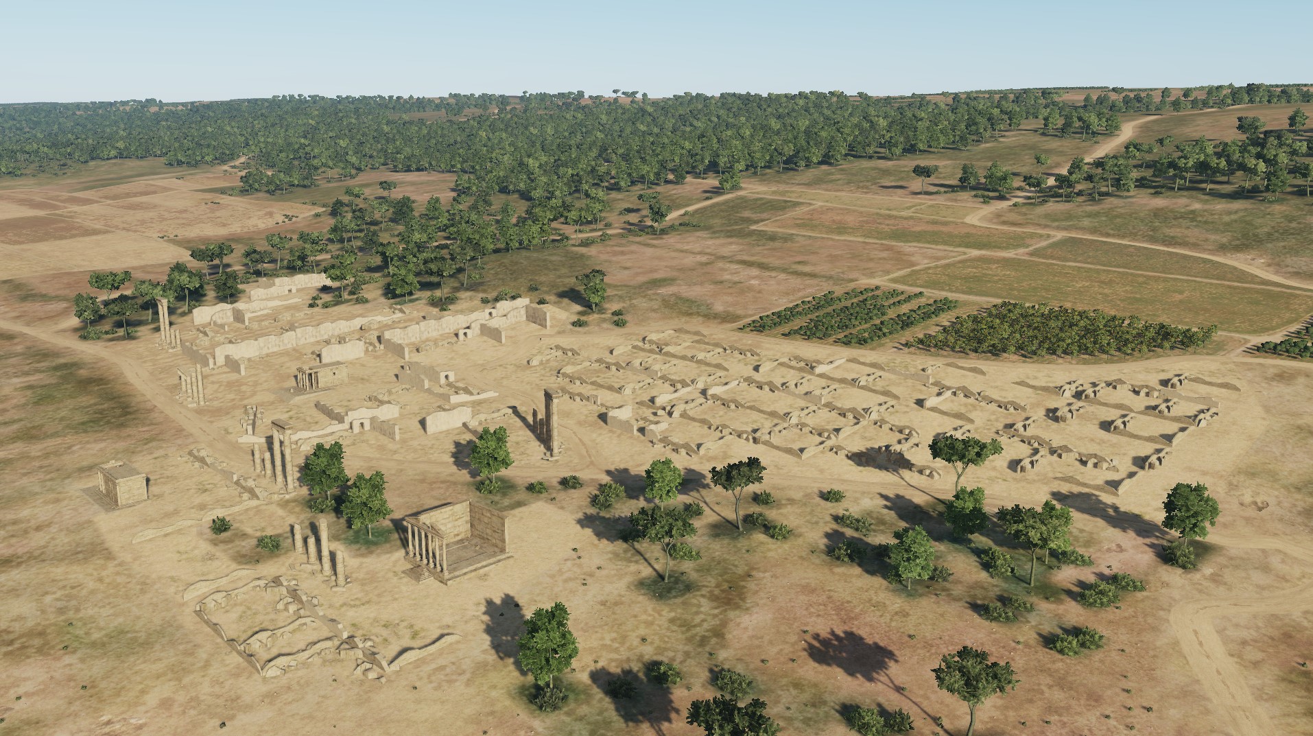
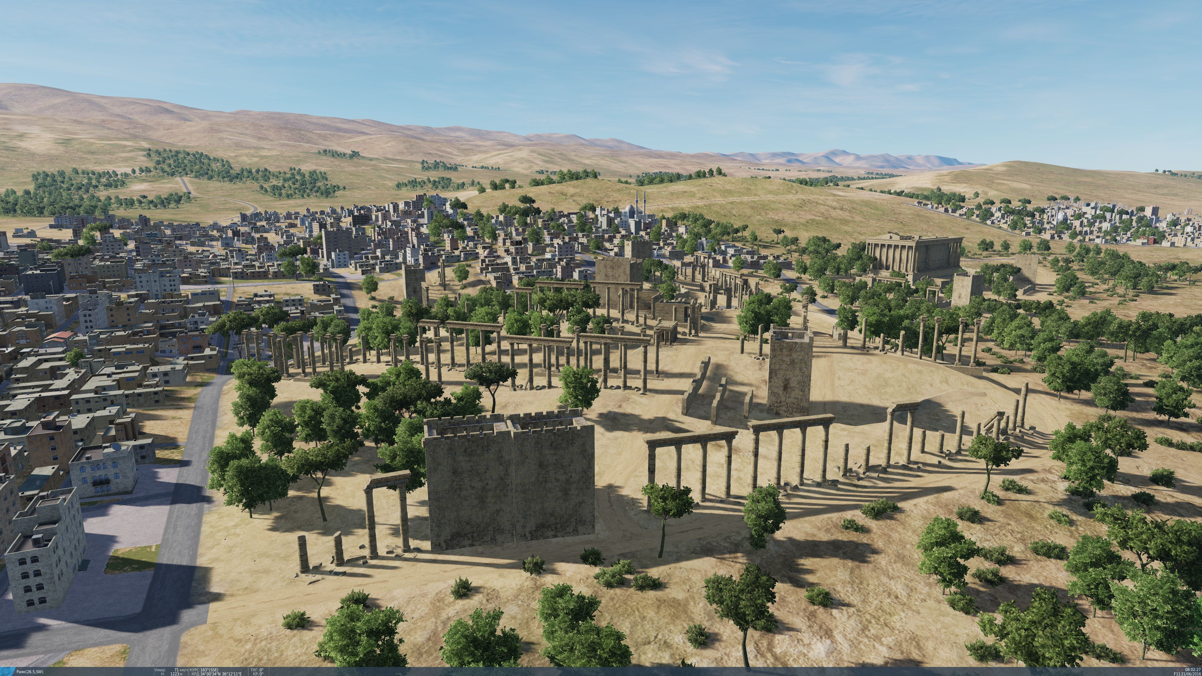
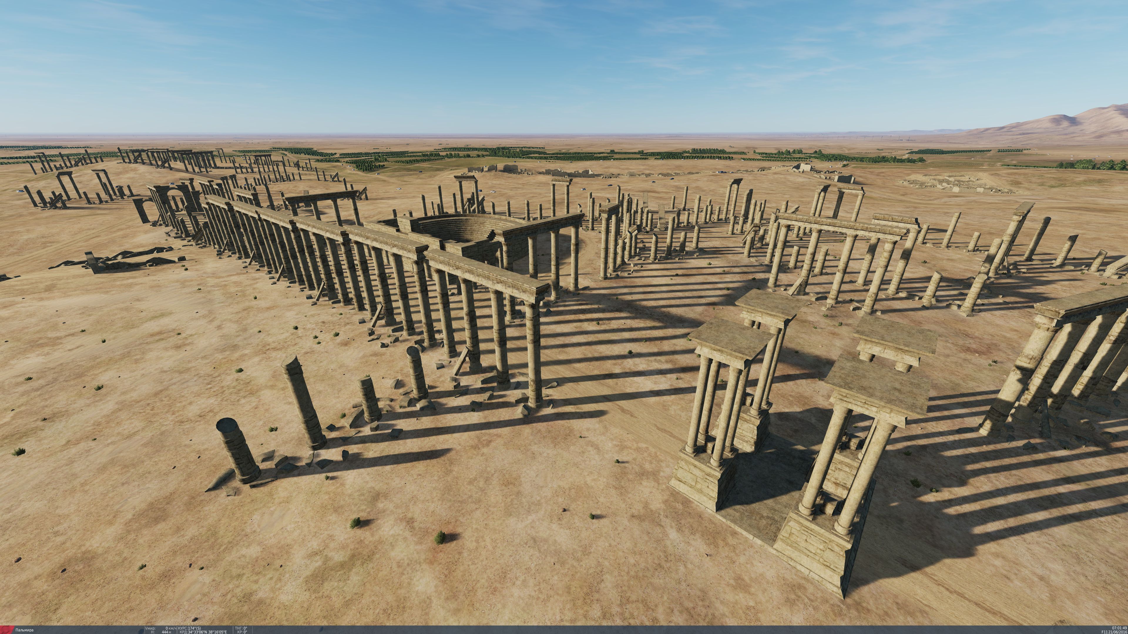
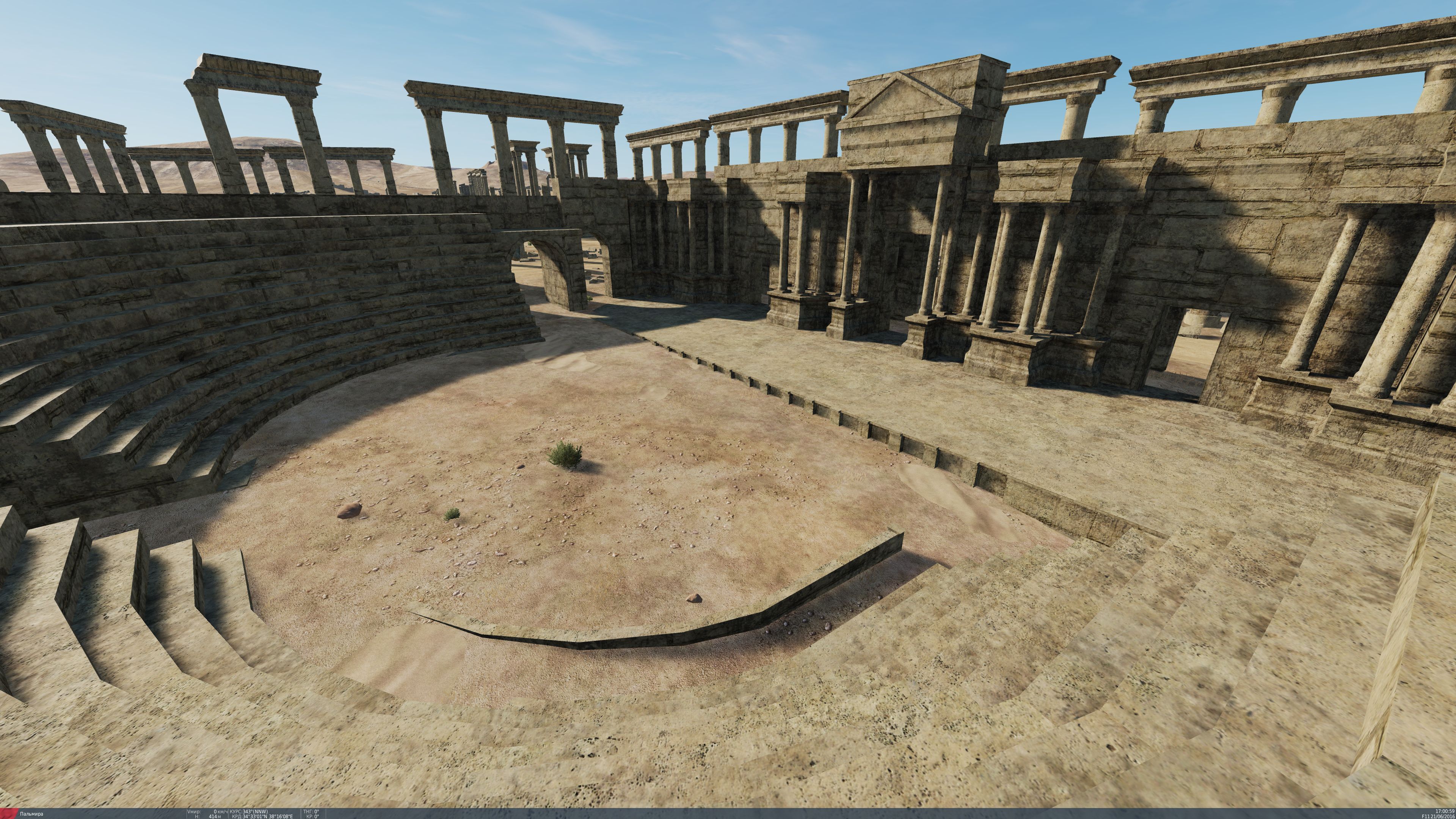
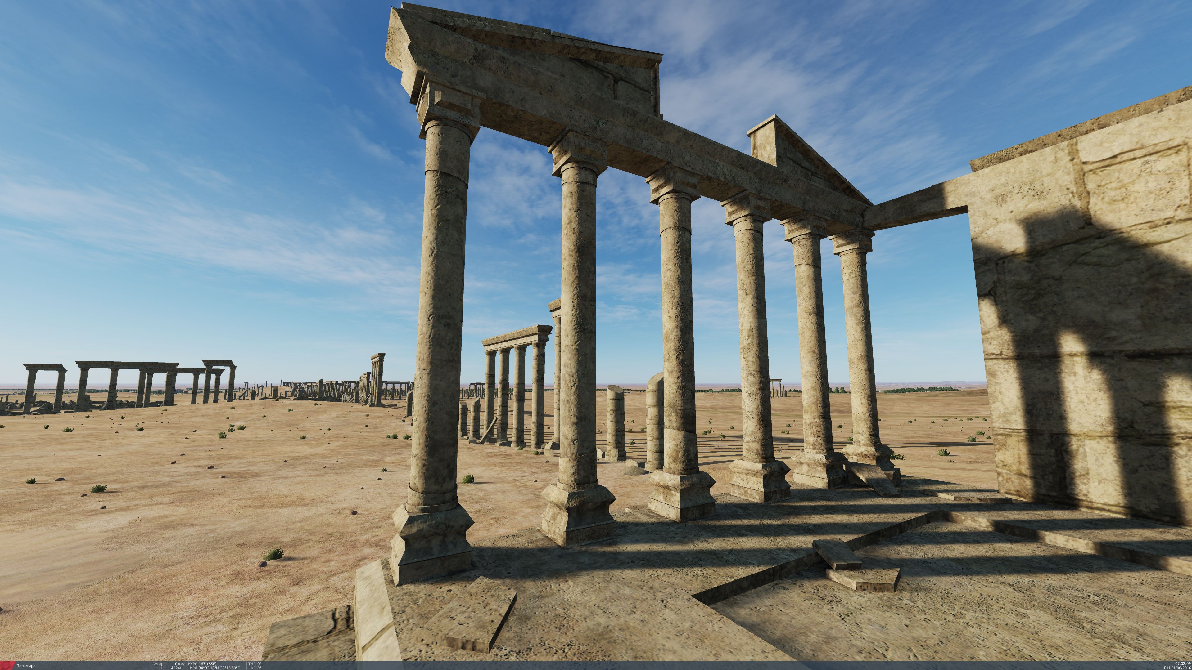
Ciao! Stiamo seguendo il tuo argomento. È stata la più attiva nella sezione internazionale. Grazie per il supporto! Questo è il ponte romano su di esso nel primo millennio, le legioni romane andarono in Persia e Palestina. Screenshot di Palmyra, che è strettamente collegata con l'Italia - le rovine dei maestosi edifici di Palmyra, sono tra i migliori esempi di architettura romana antica. Li abbiamo pubblicati nell'argomento "Syria Review" https://forums.eagle.ru/showpost.php?p=4455536&postcount=151
-
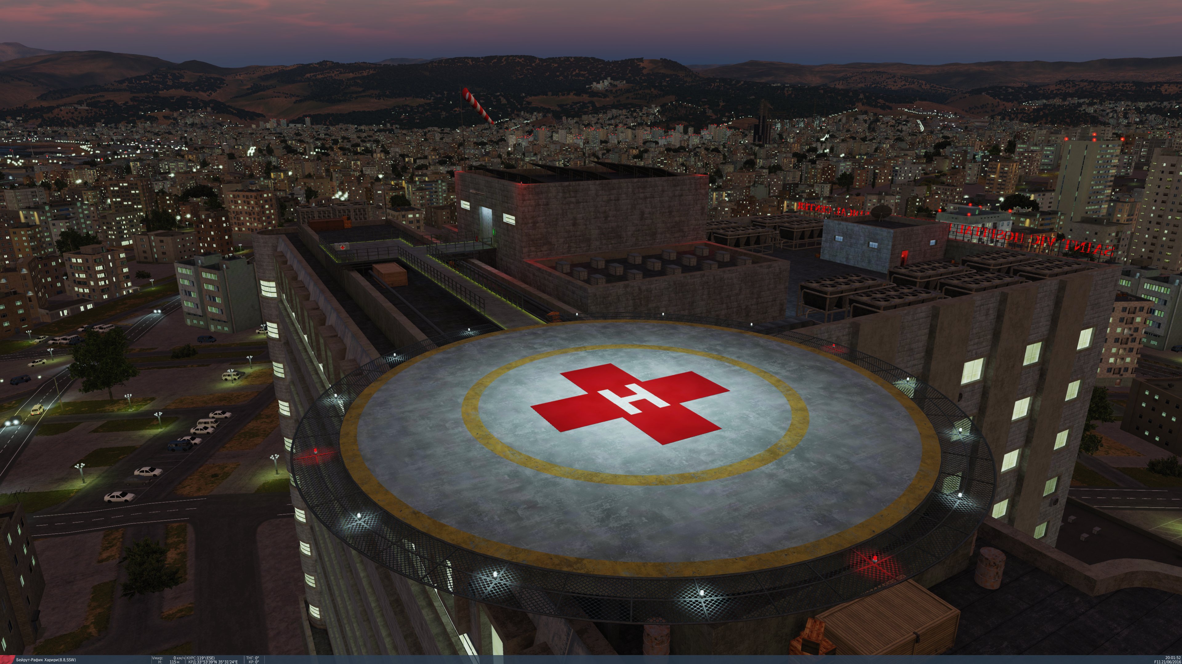
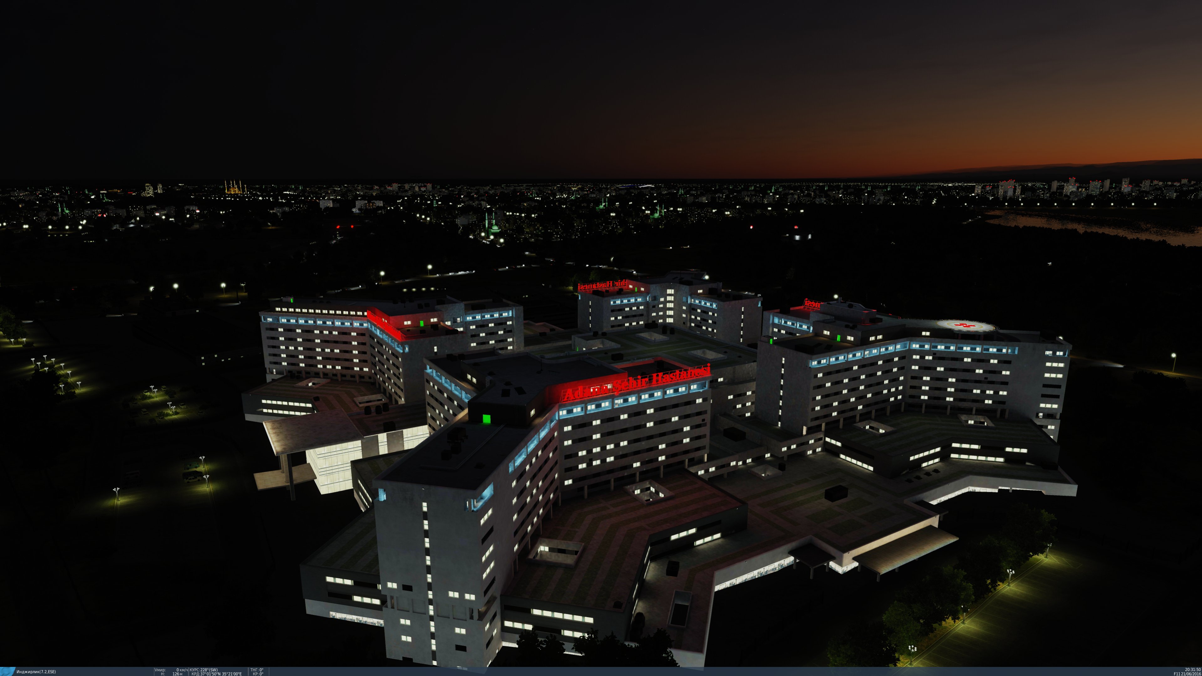
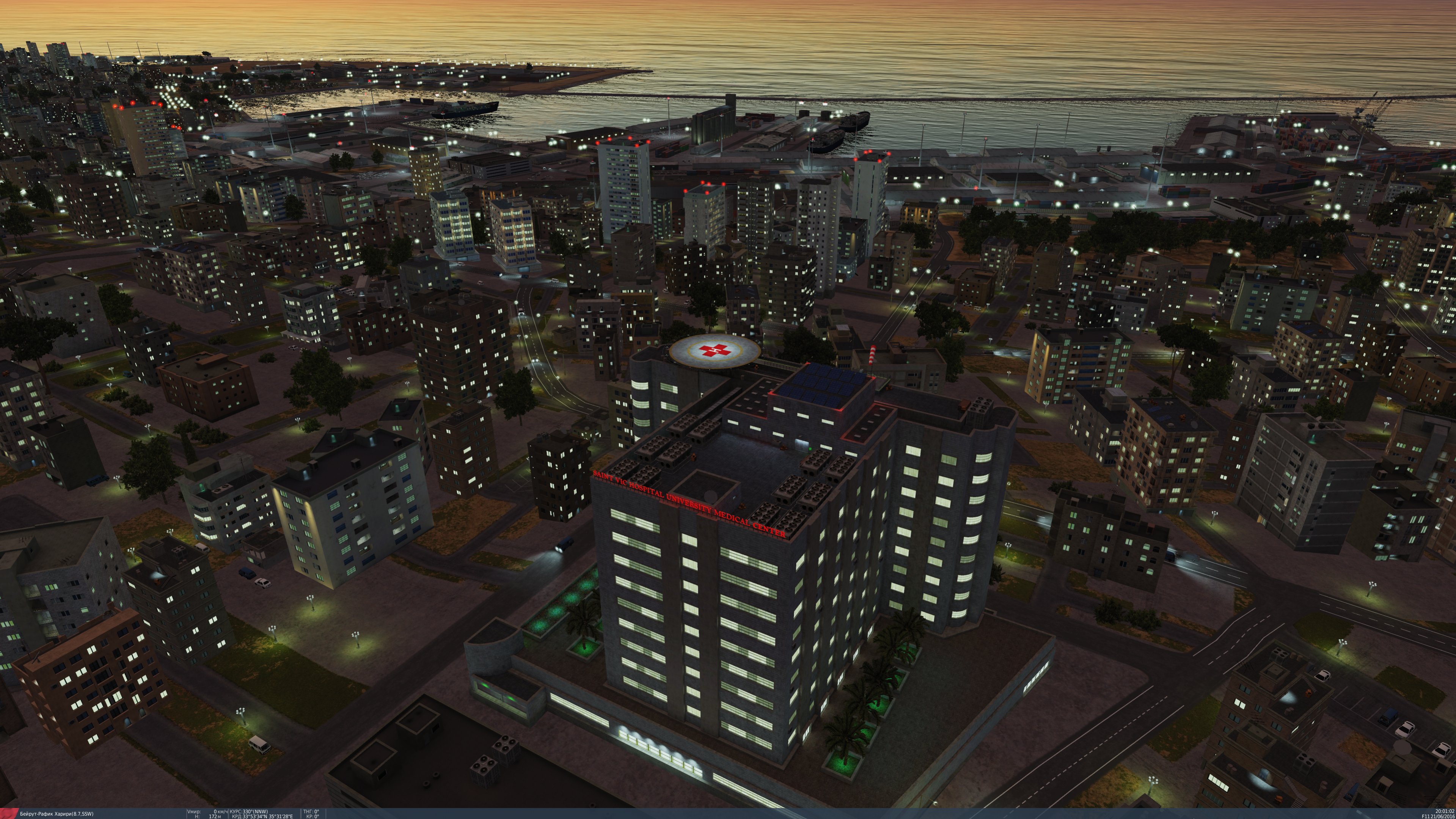
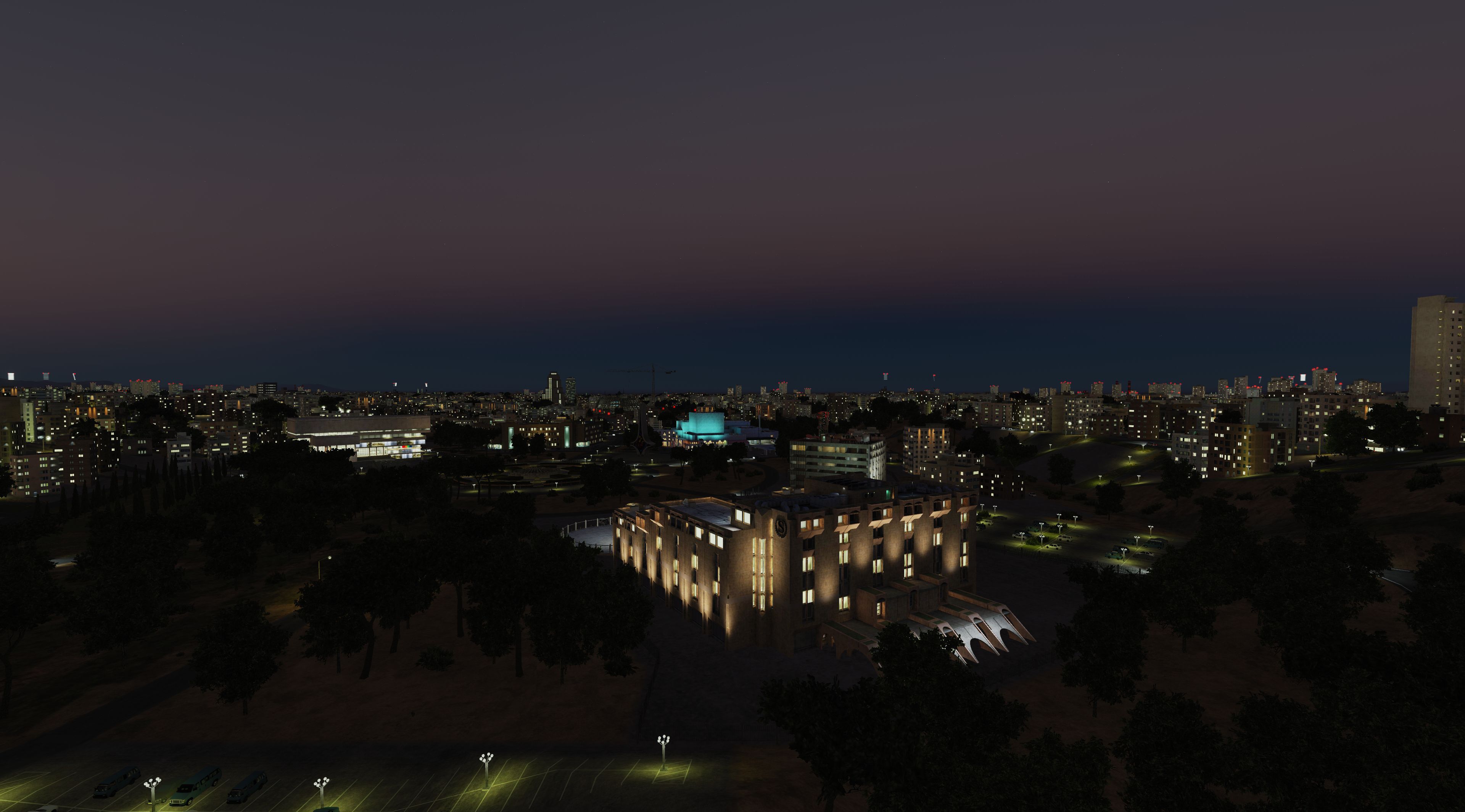
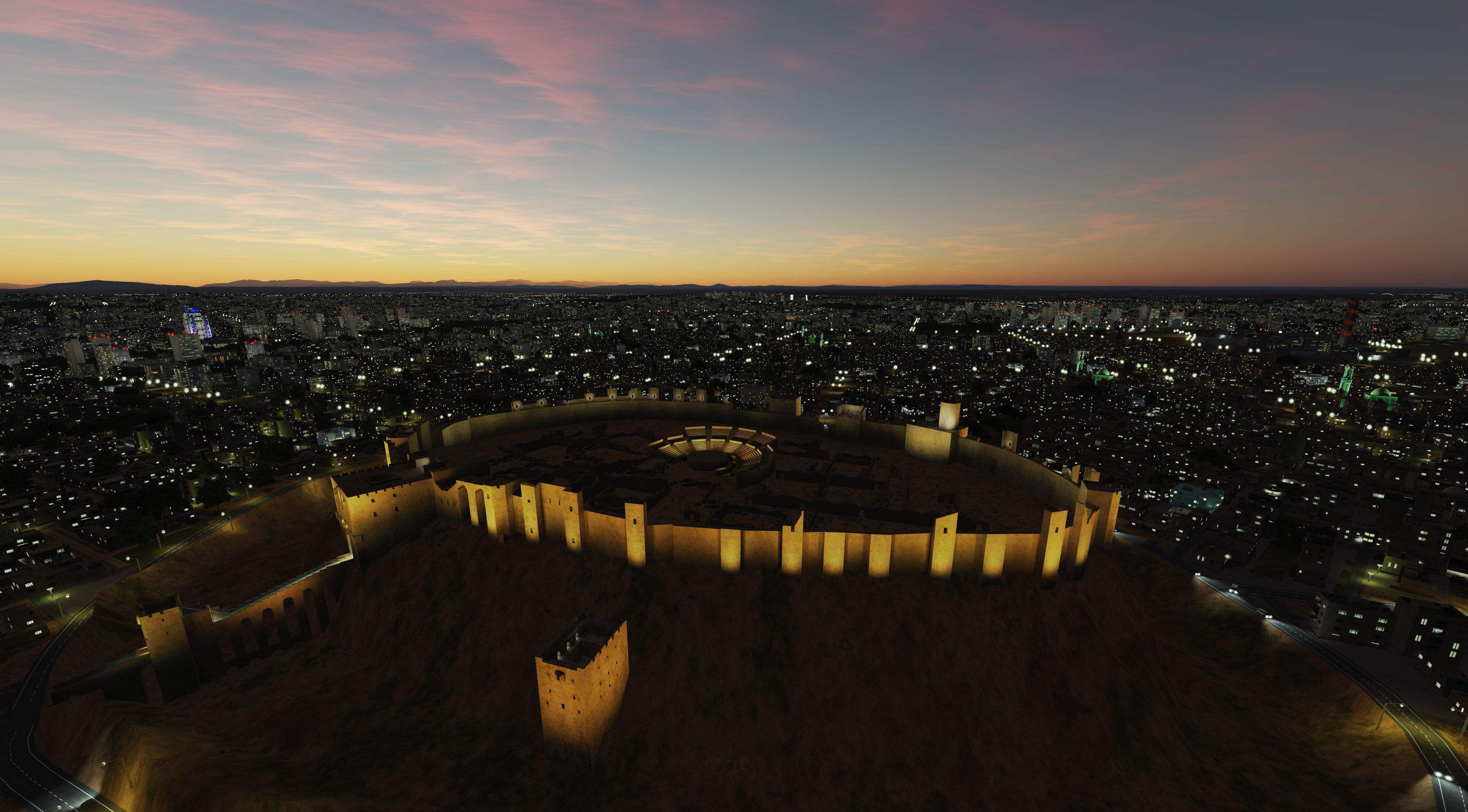
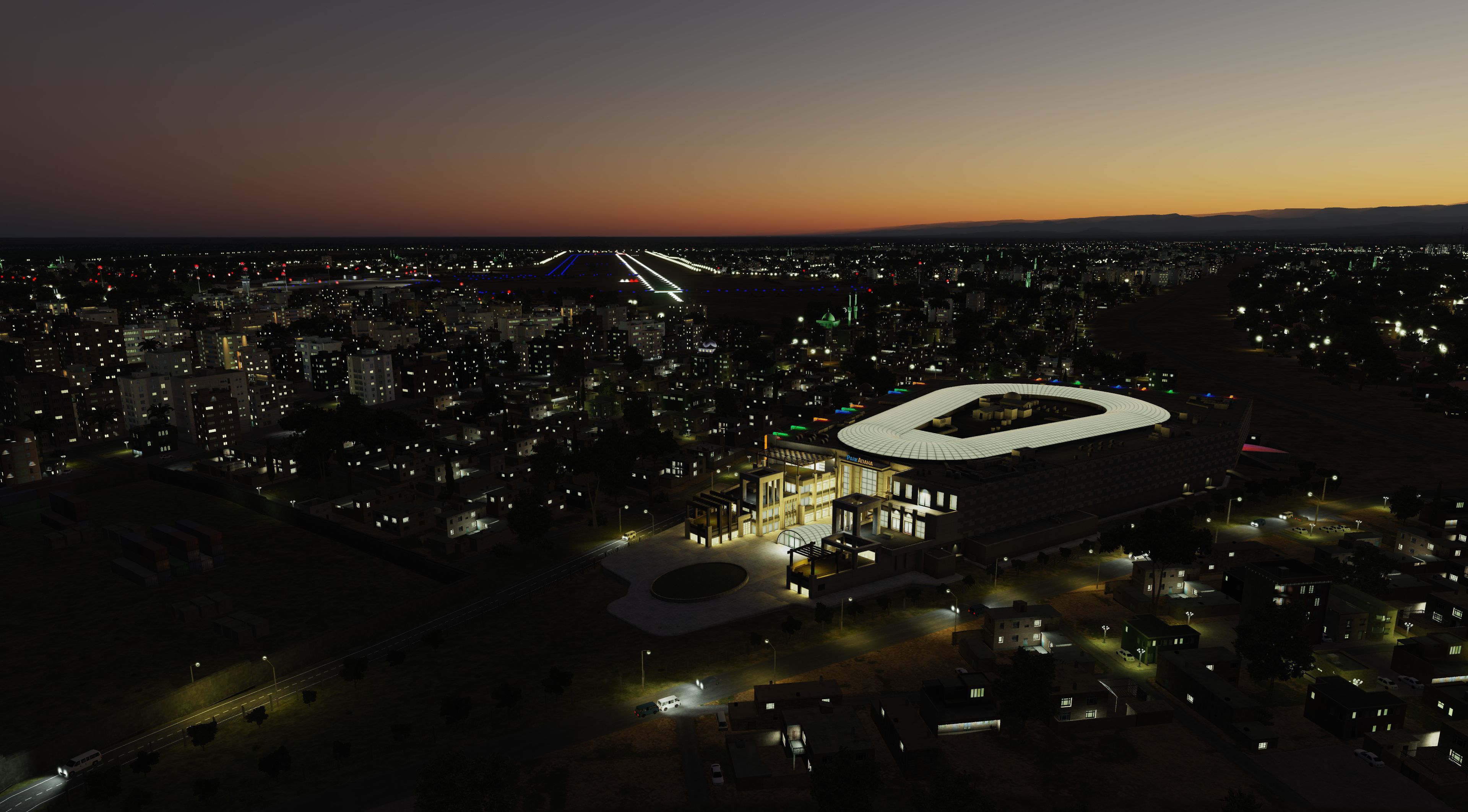
We thank everyone who supports the project and writes their comments and suggestions. The developers tried to take into account most of them. And especially for you, we publish screenshots of the night illumination of the map of Syria.
-
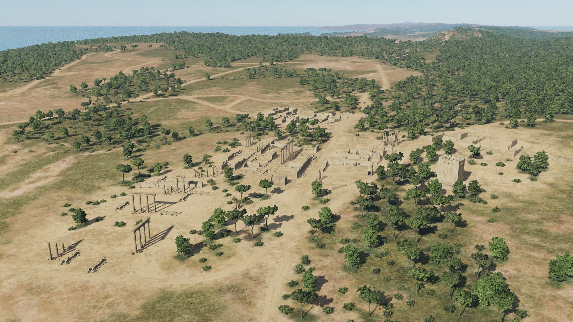
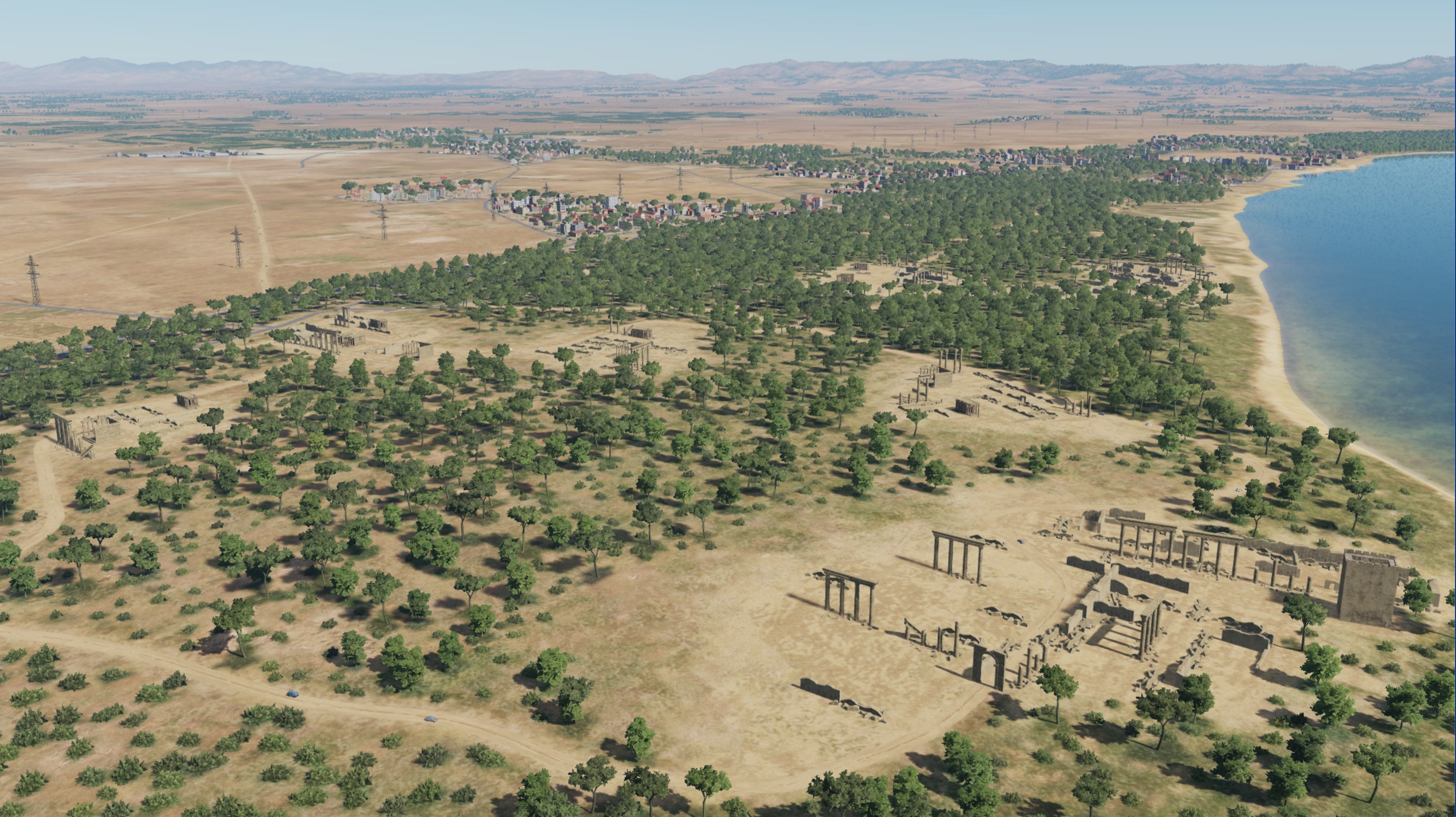
Palmyra (Tadmor)
-
Damascus
-
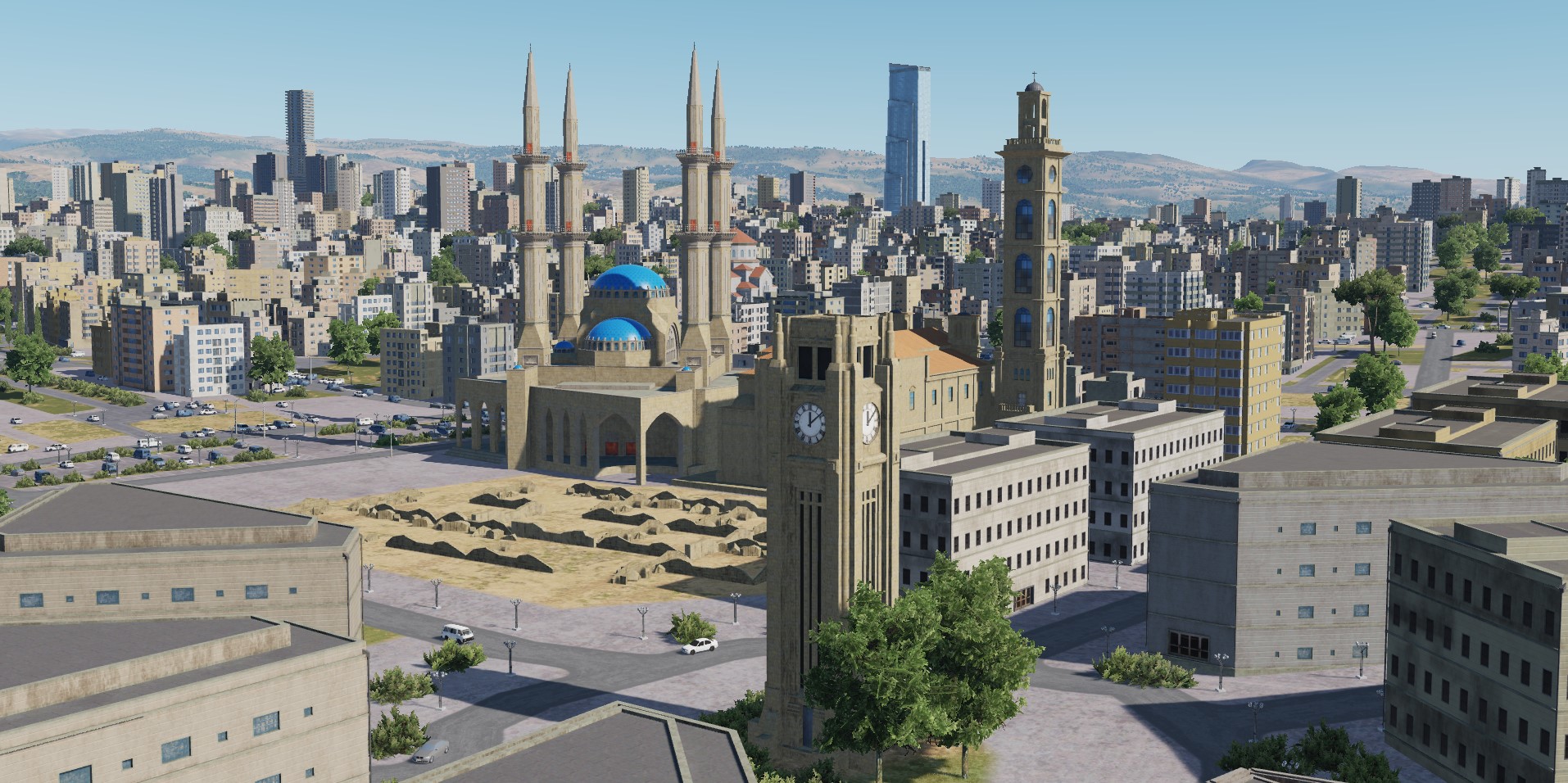
Beirut
-
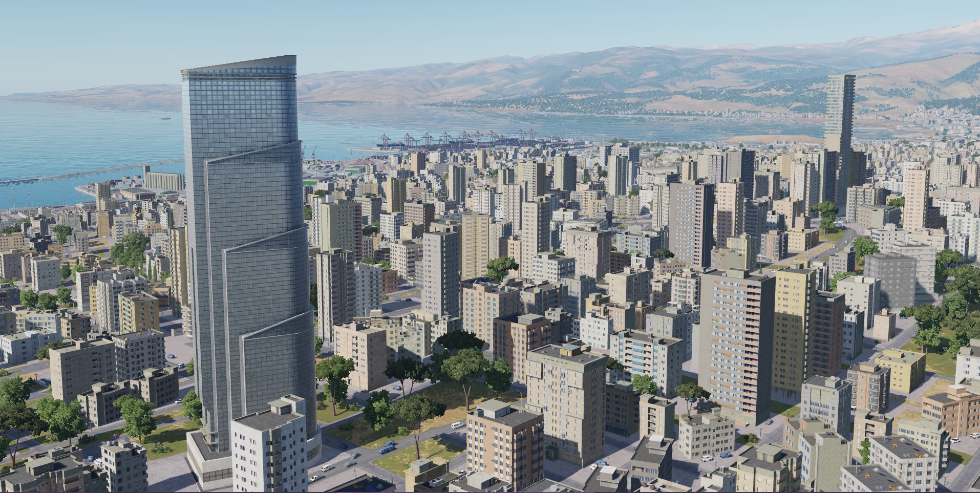
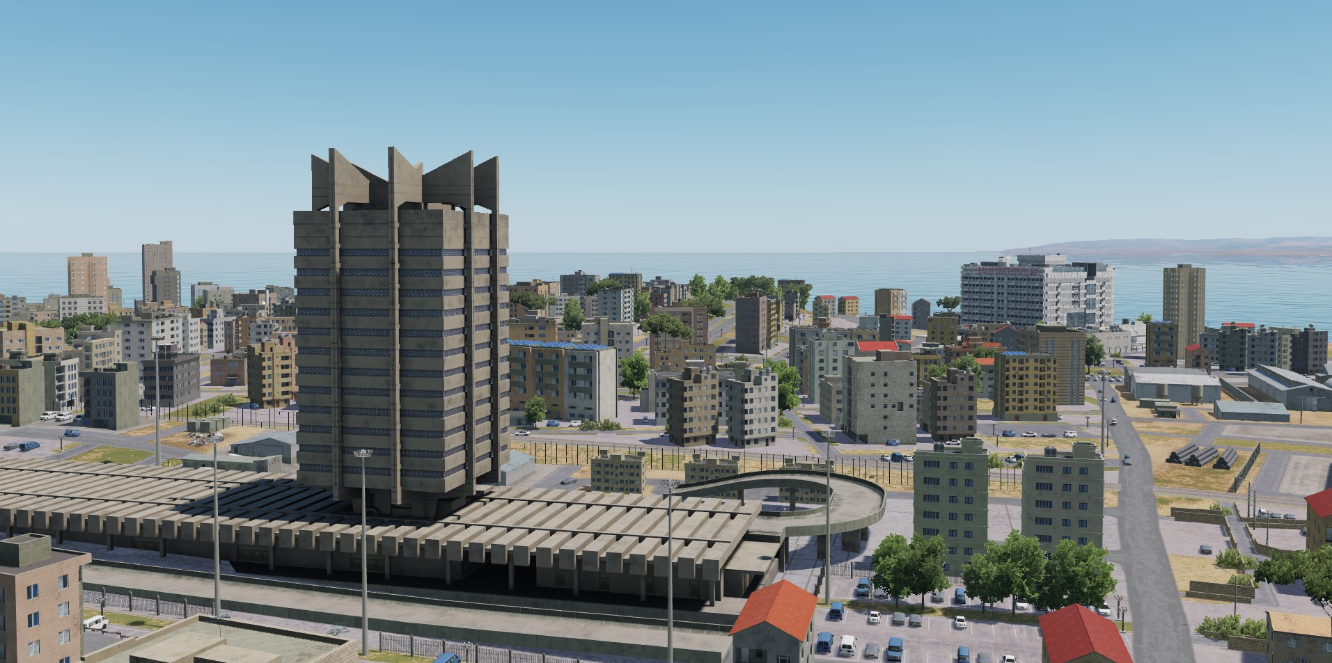
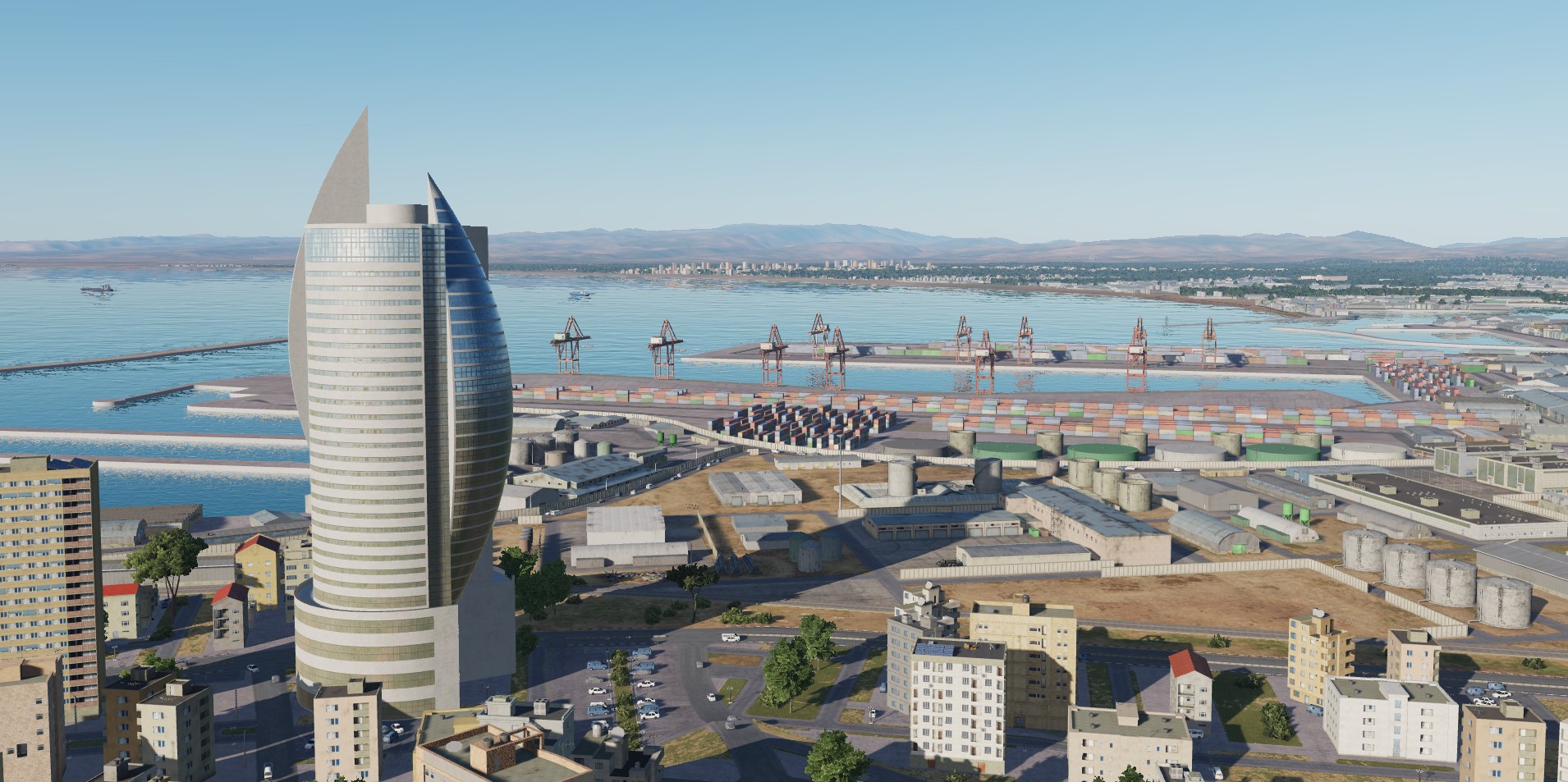
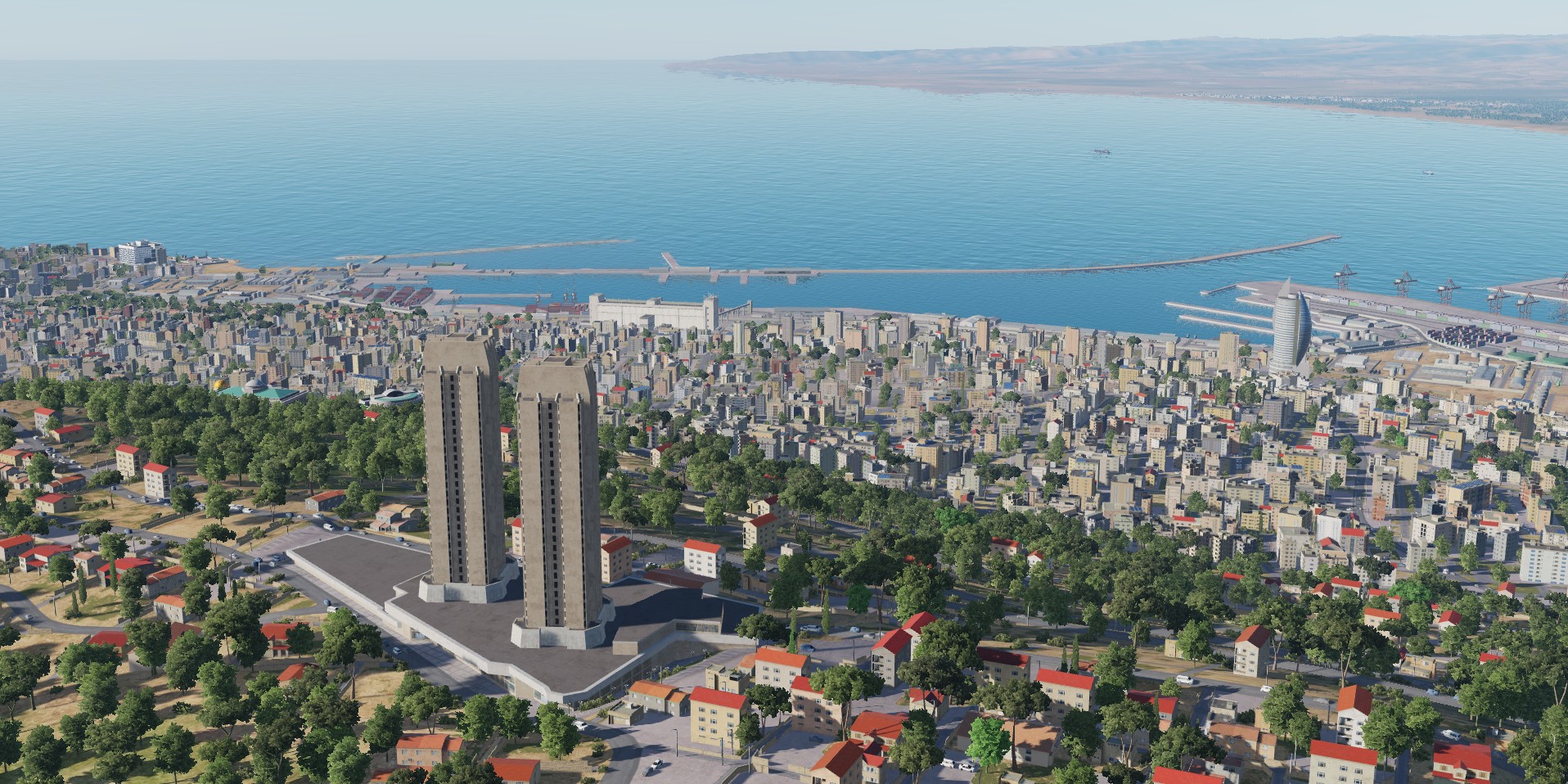
Haifa
-
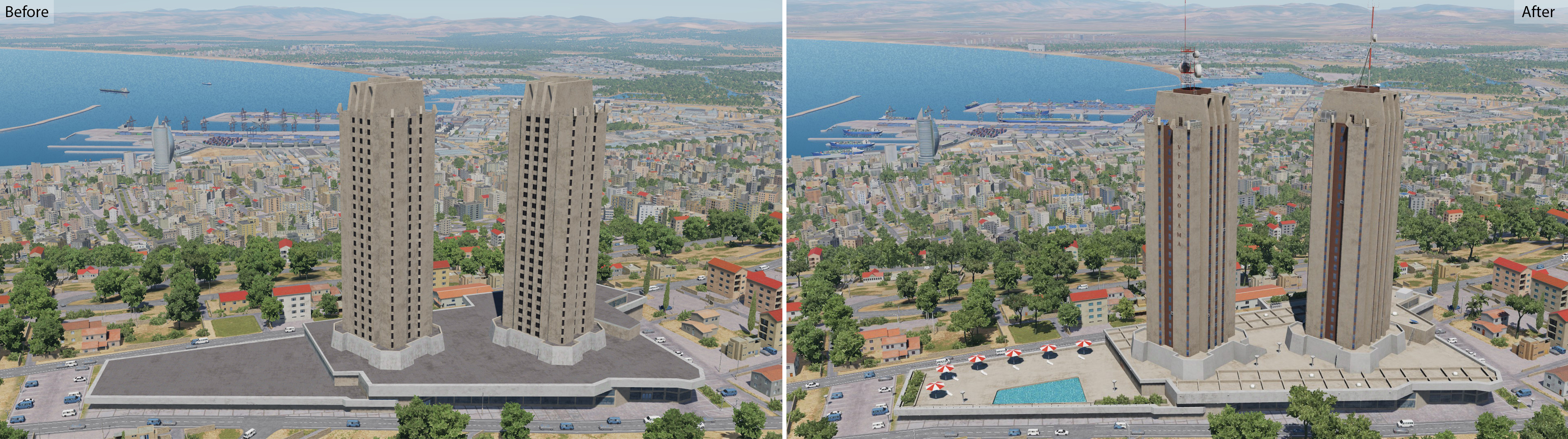
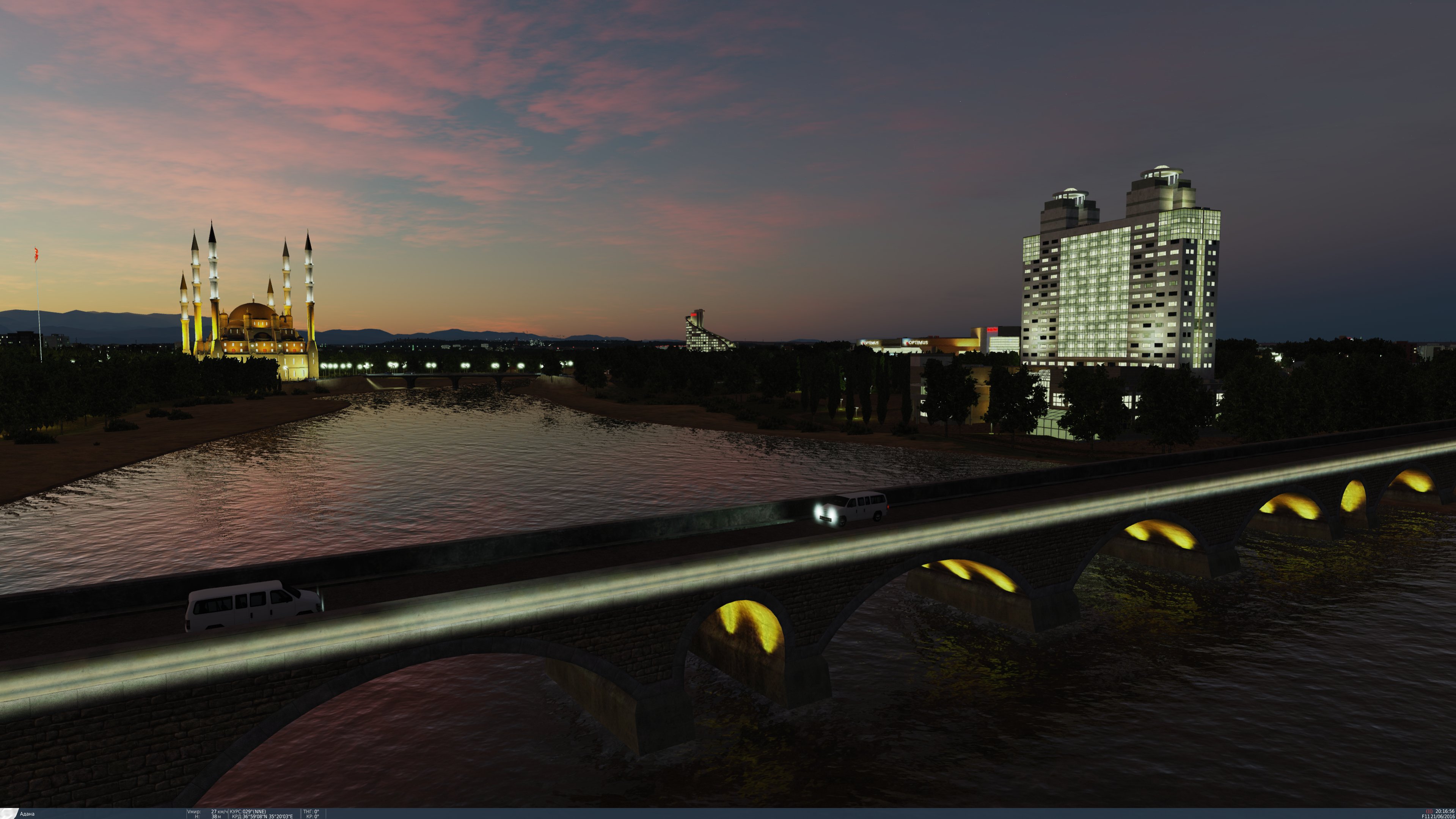
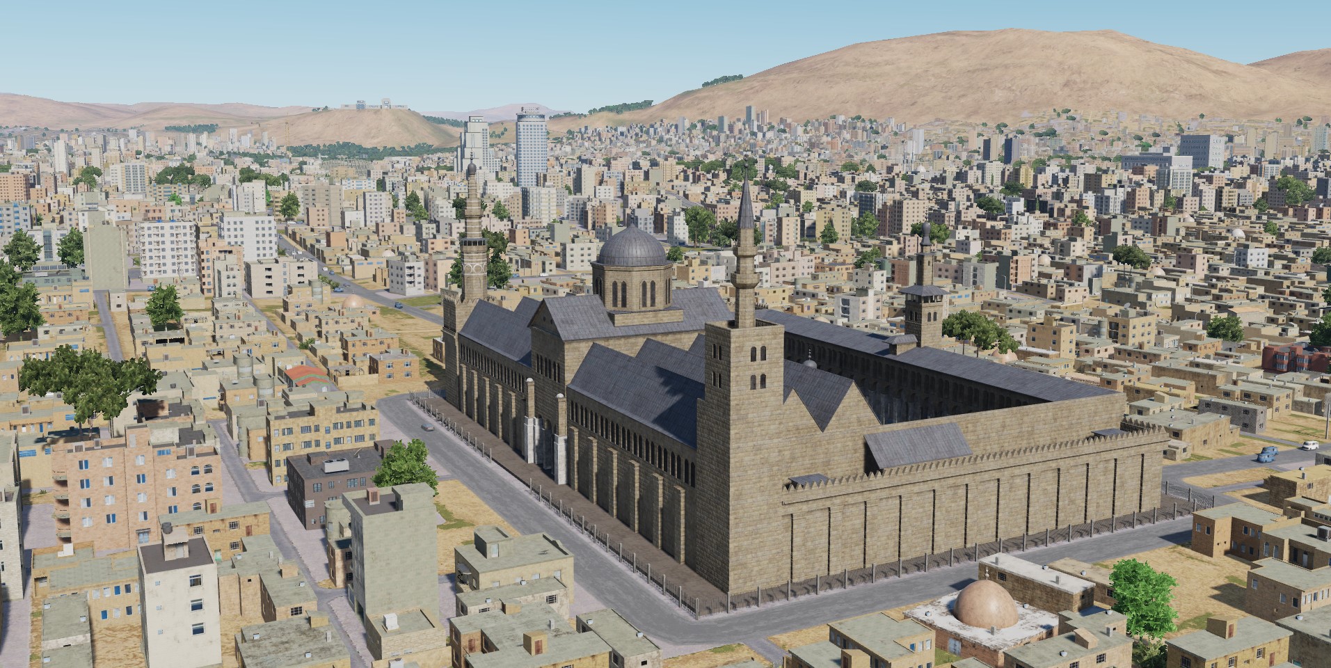
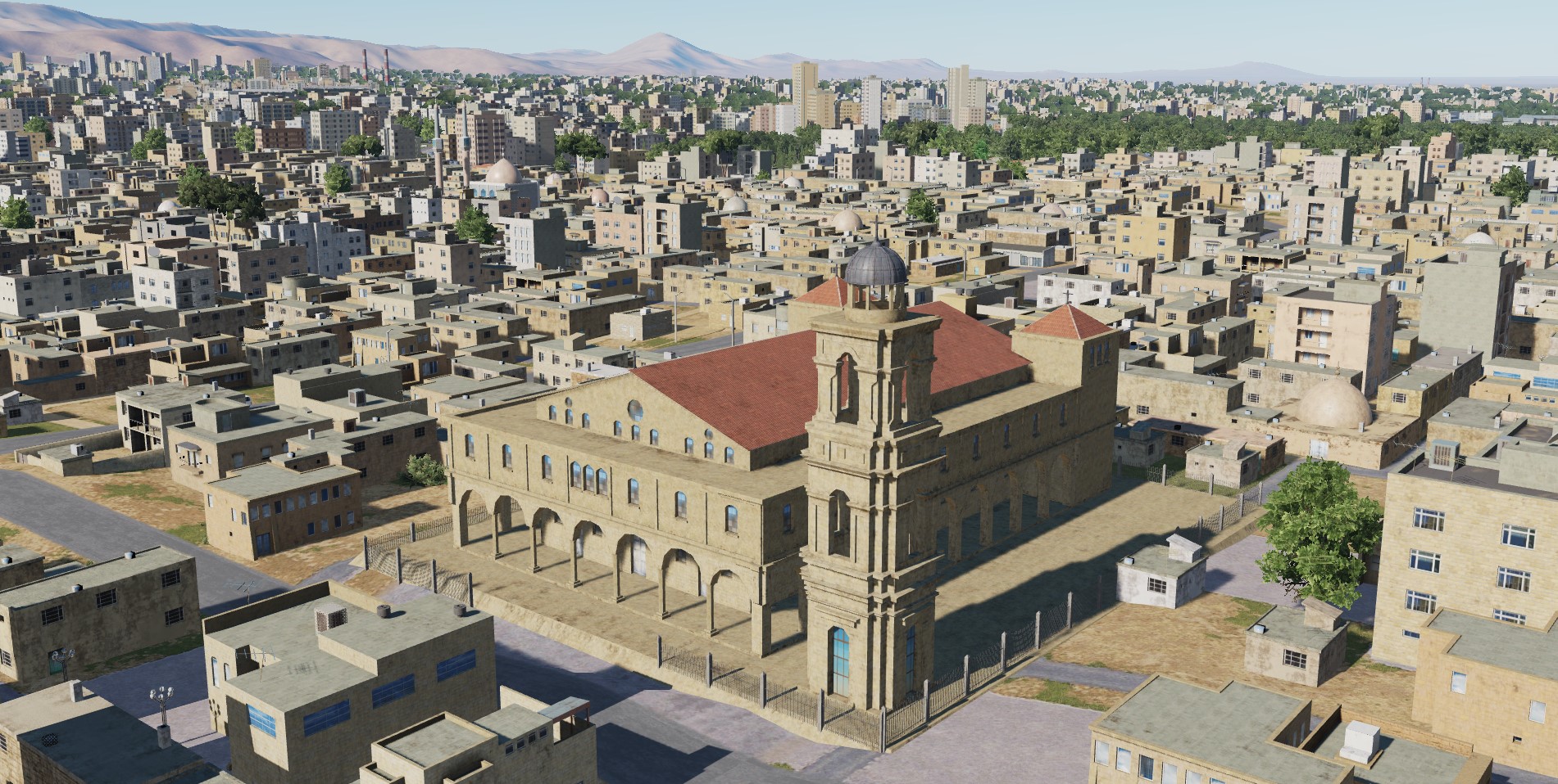
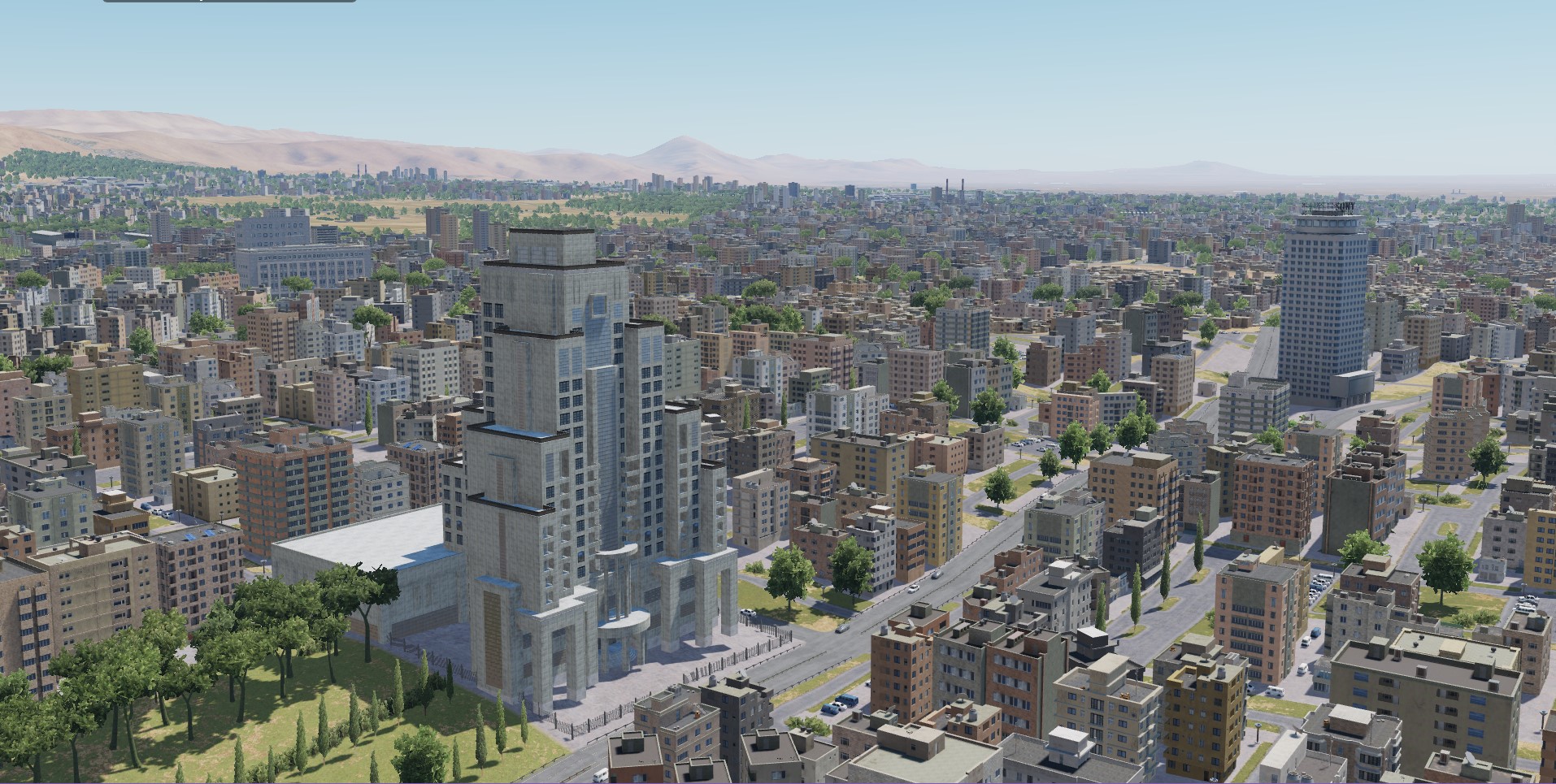
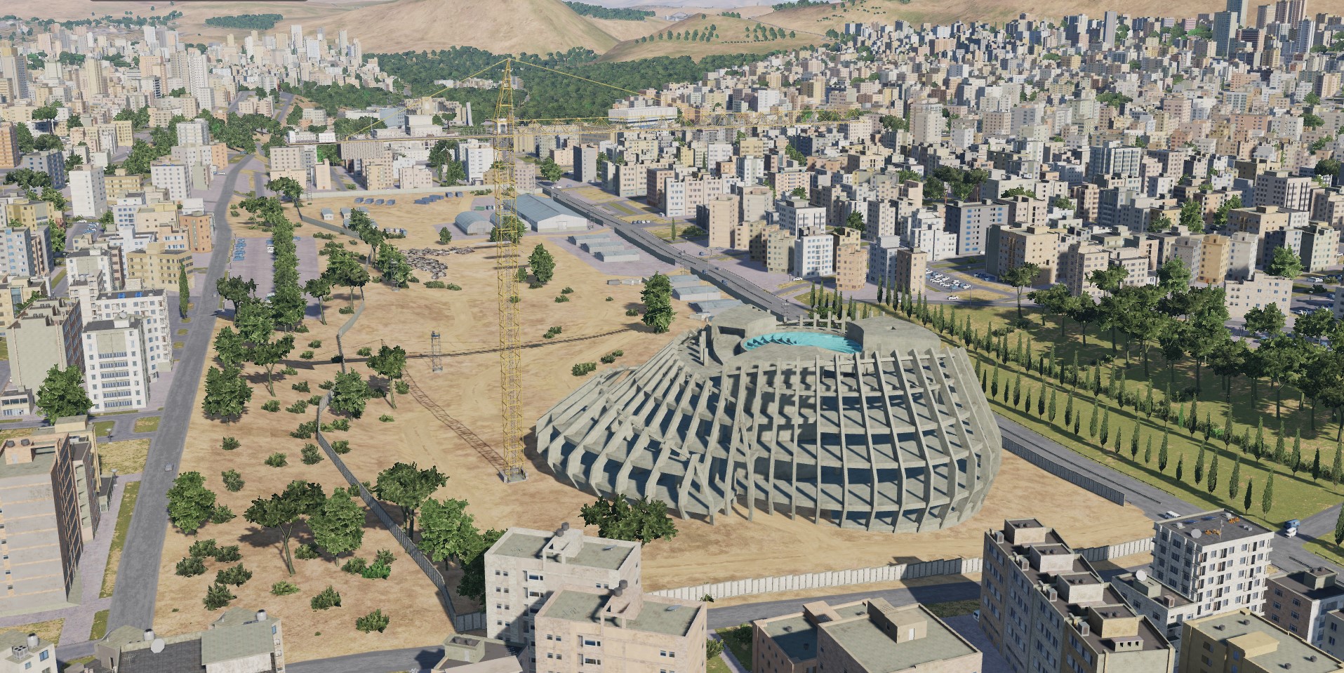
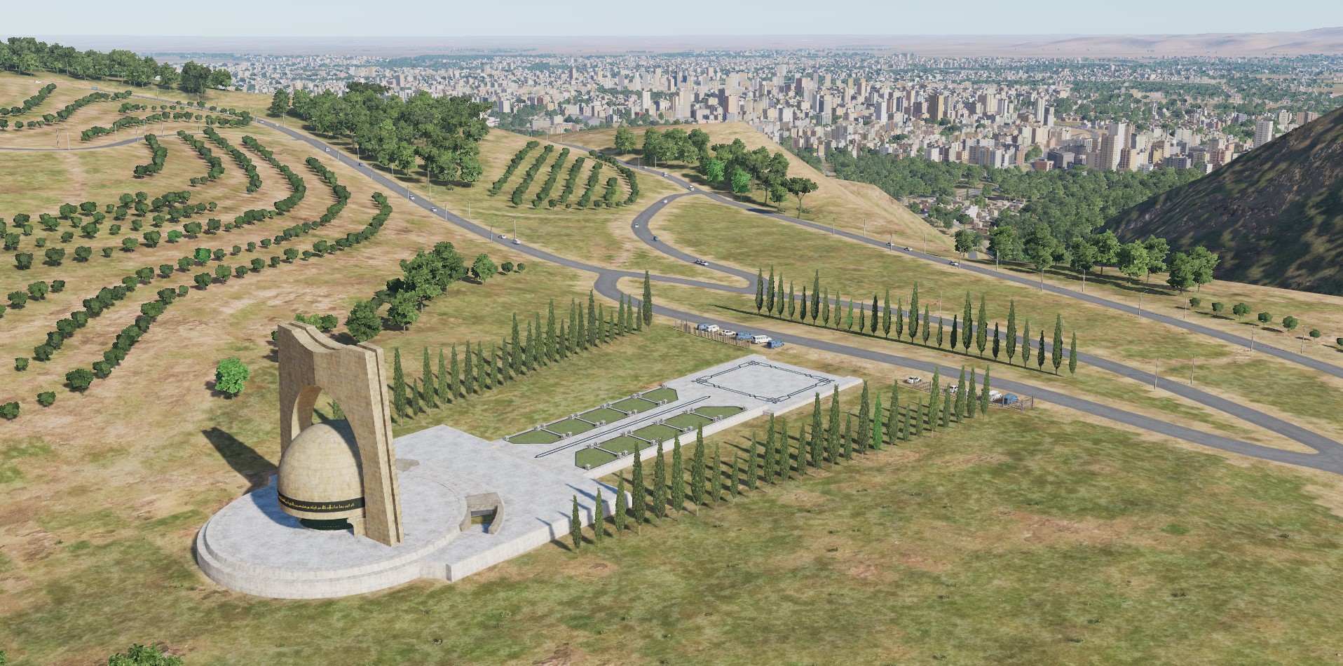
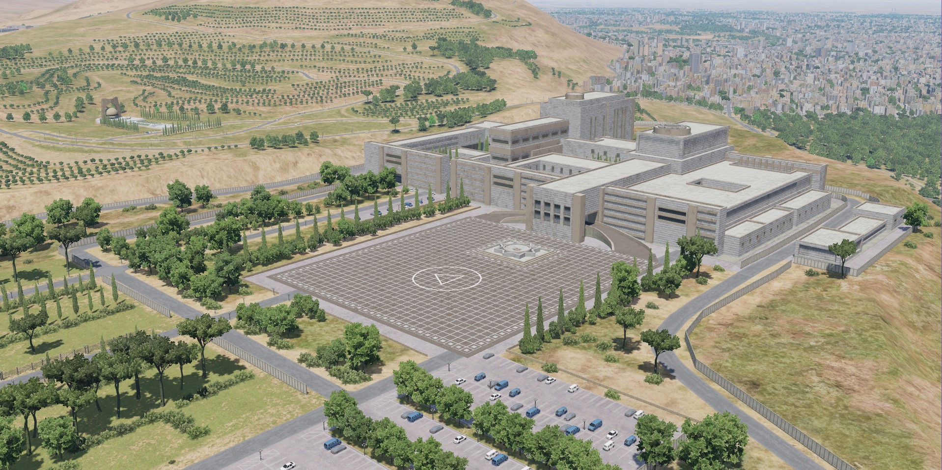
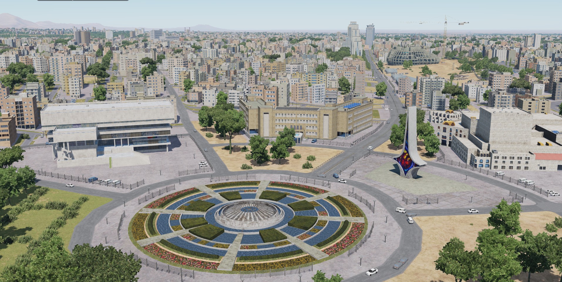
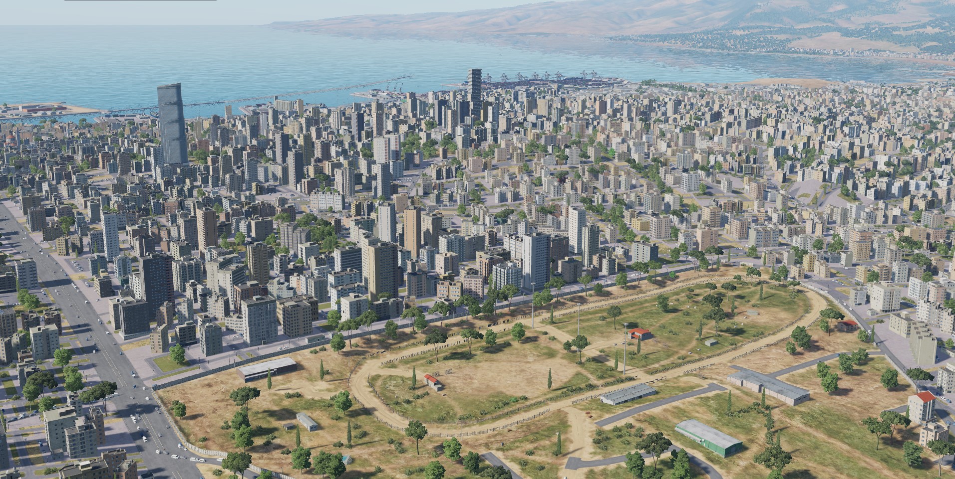
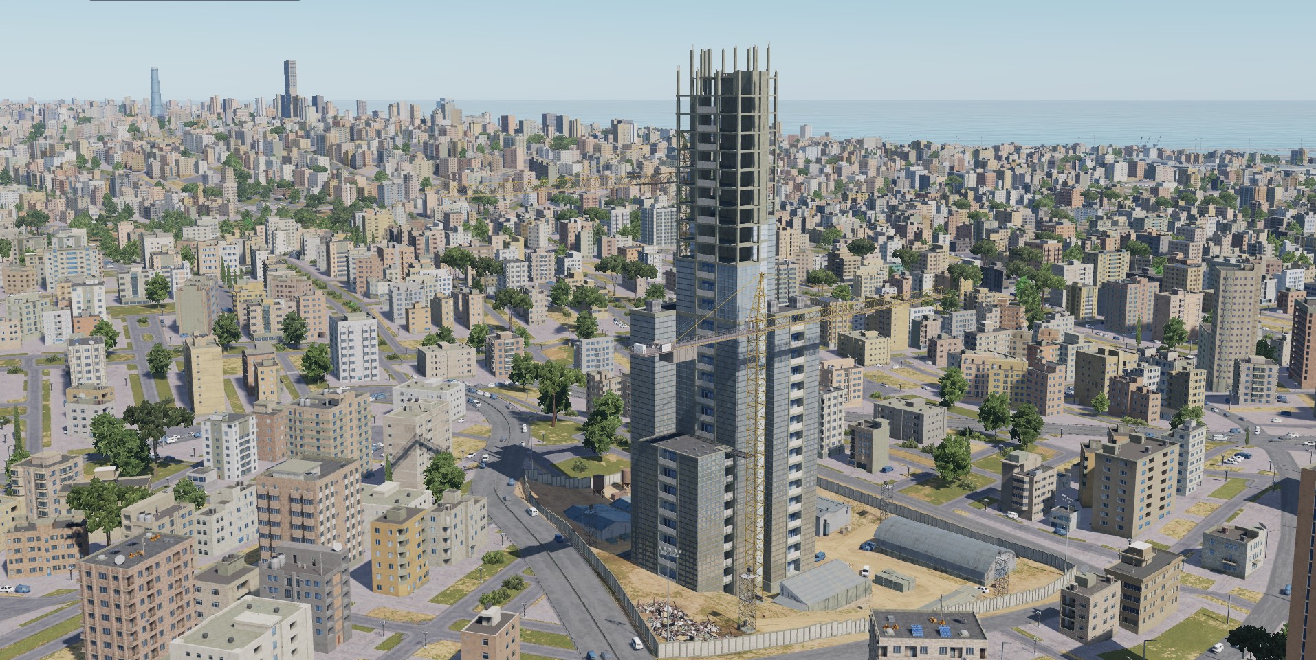
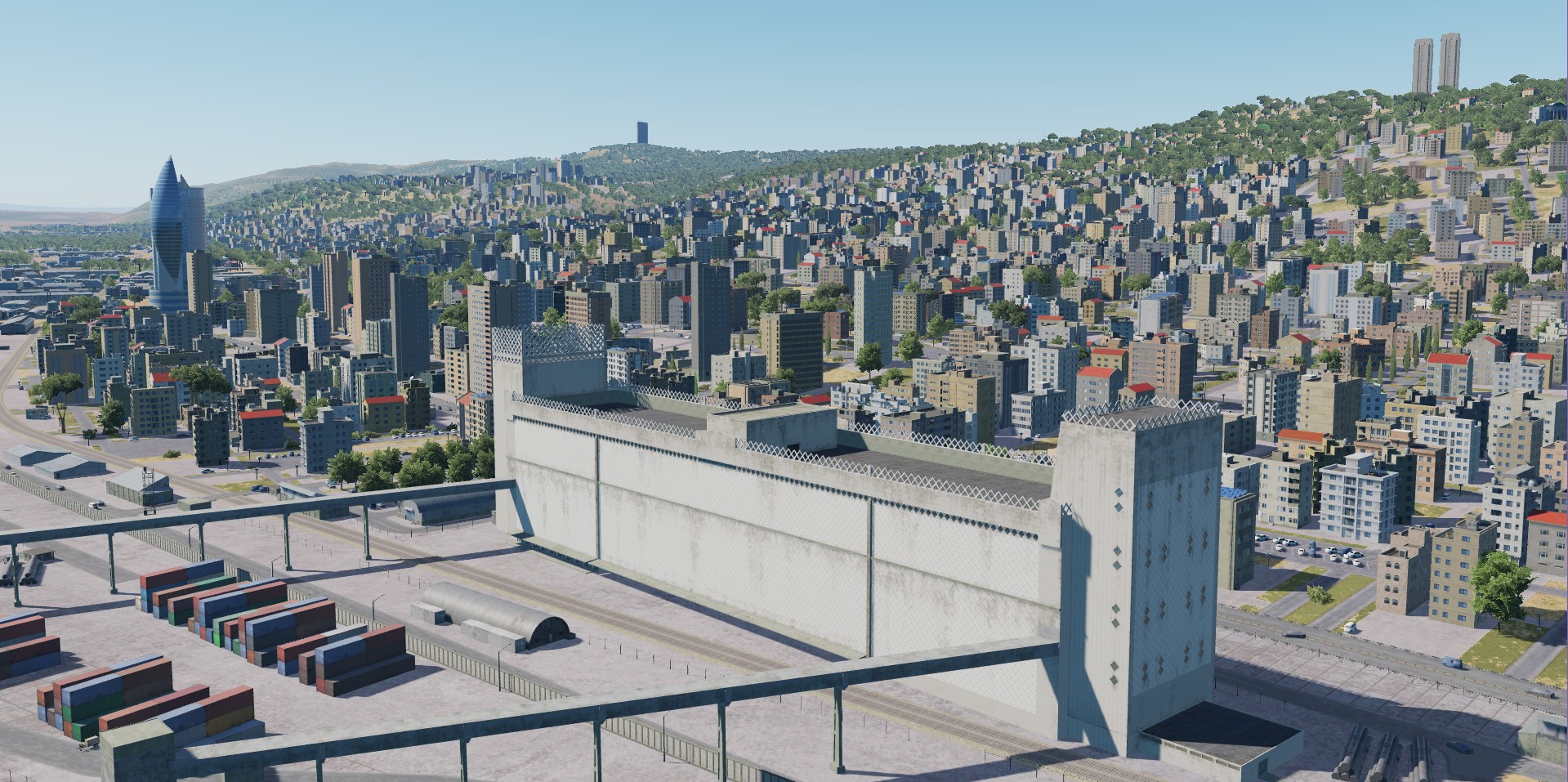
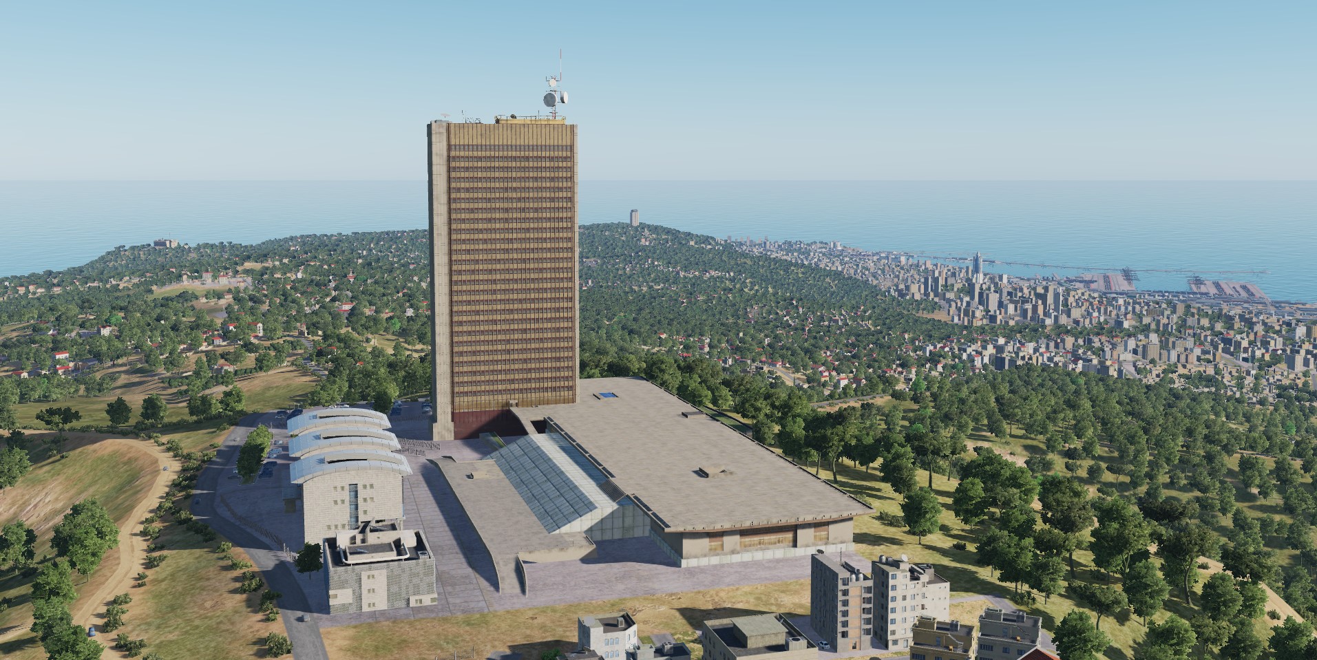
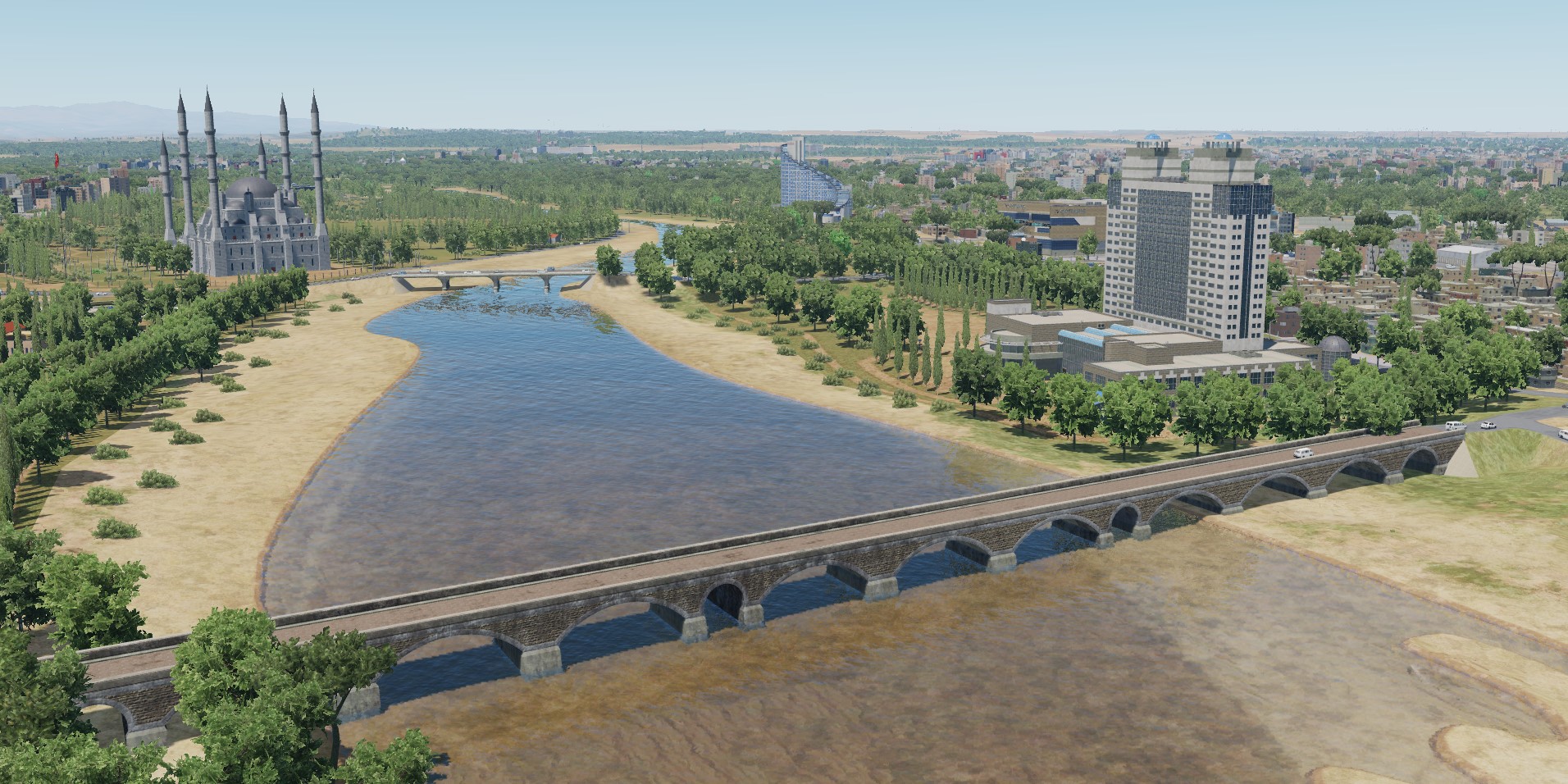
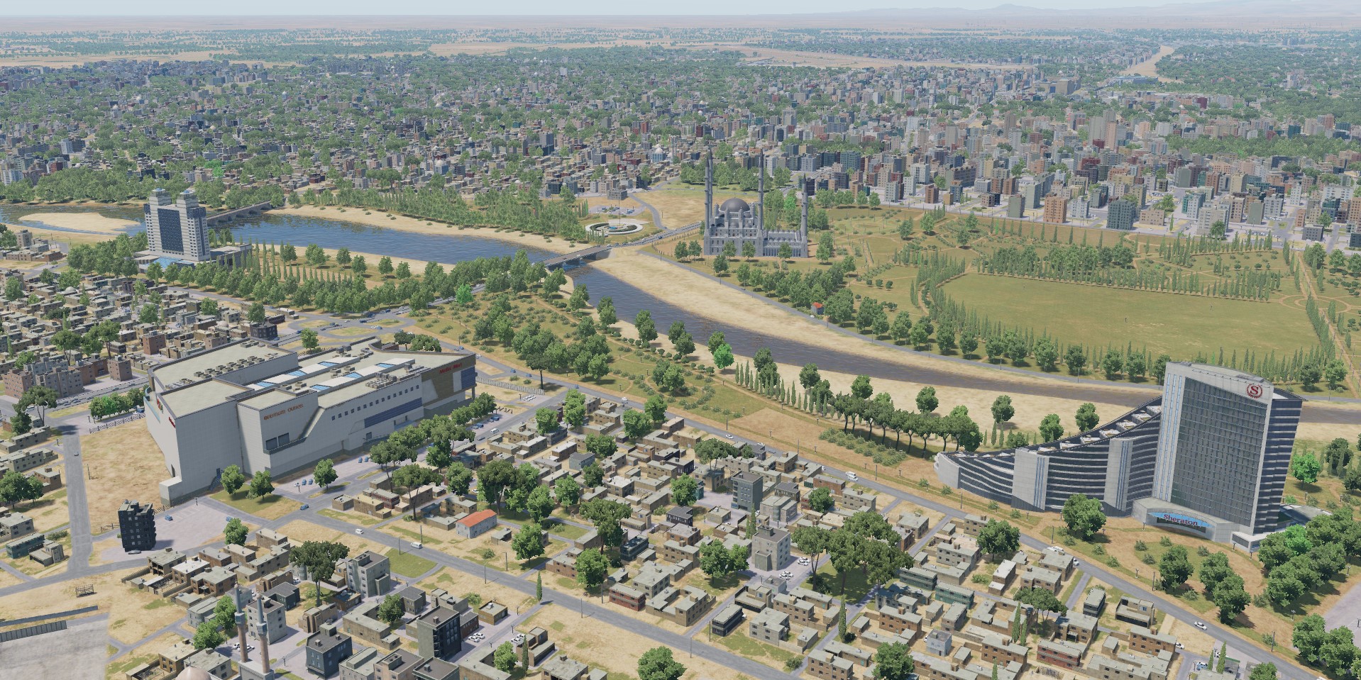
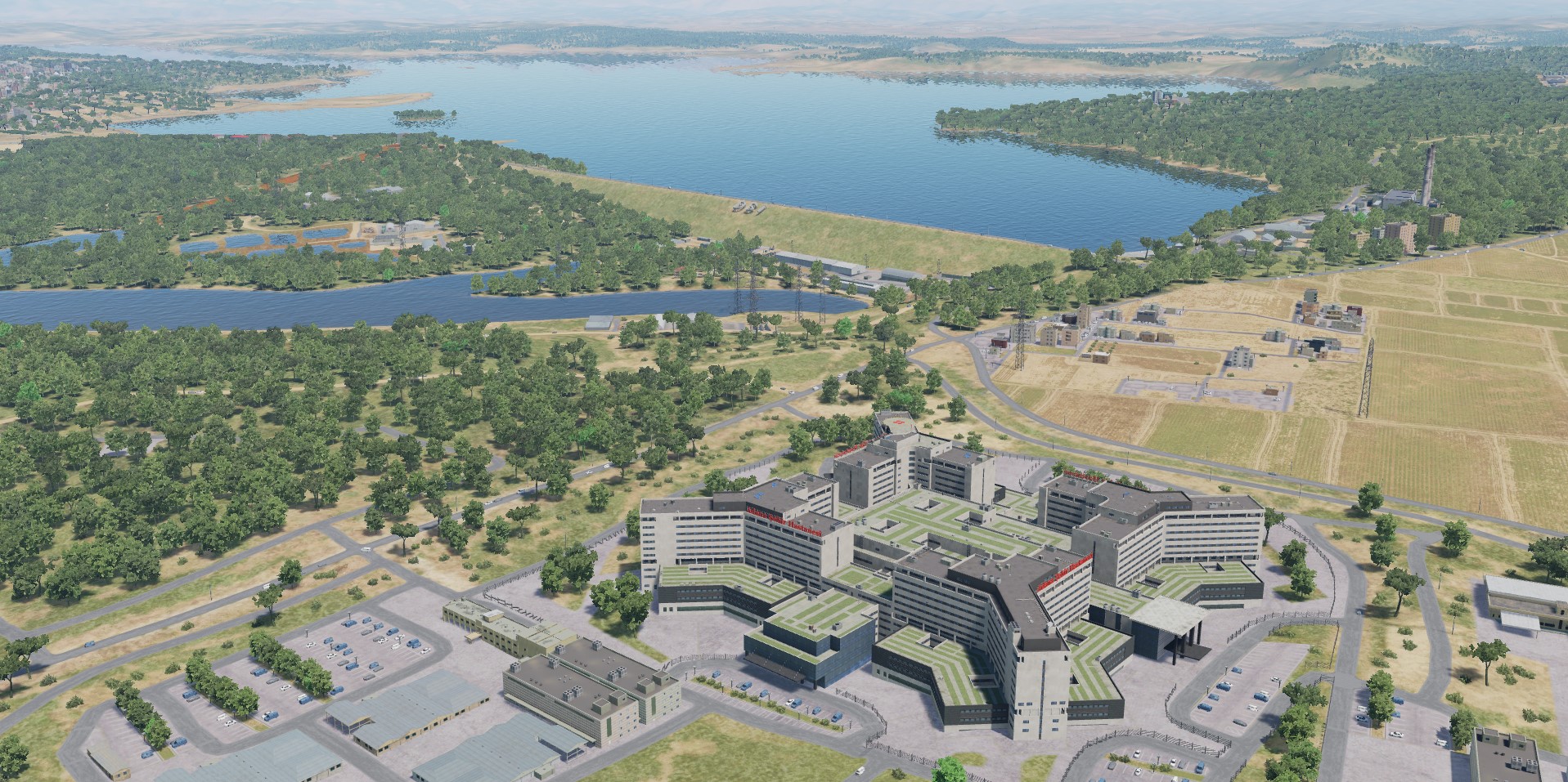
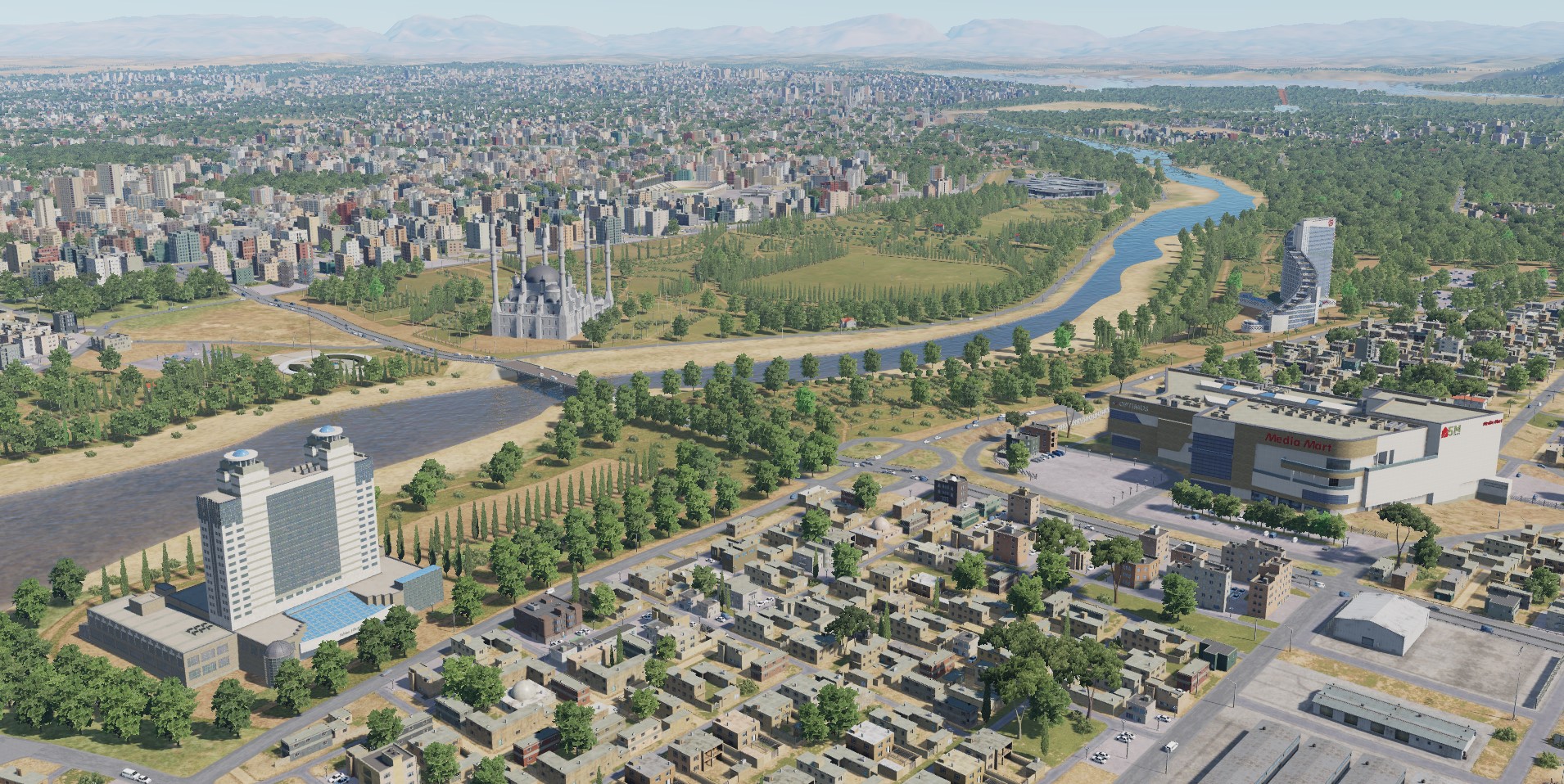
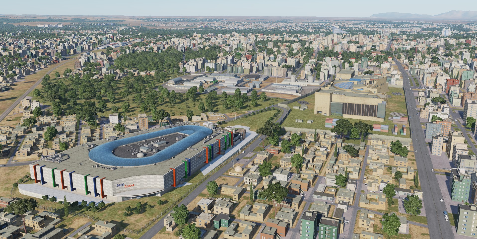
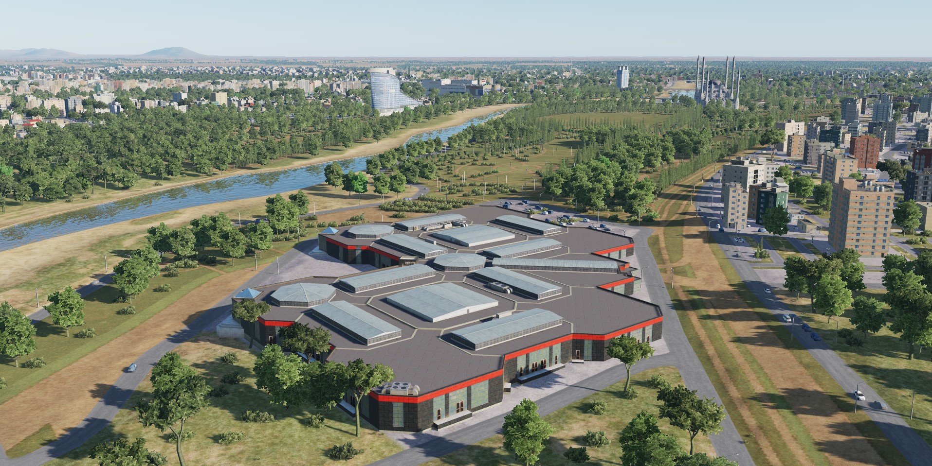
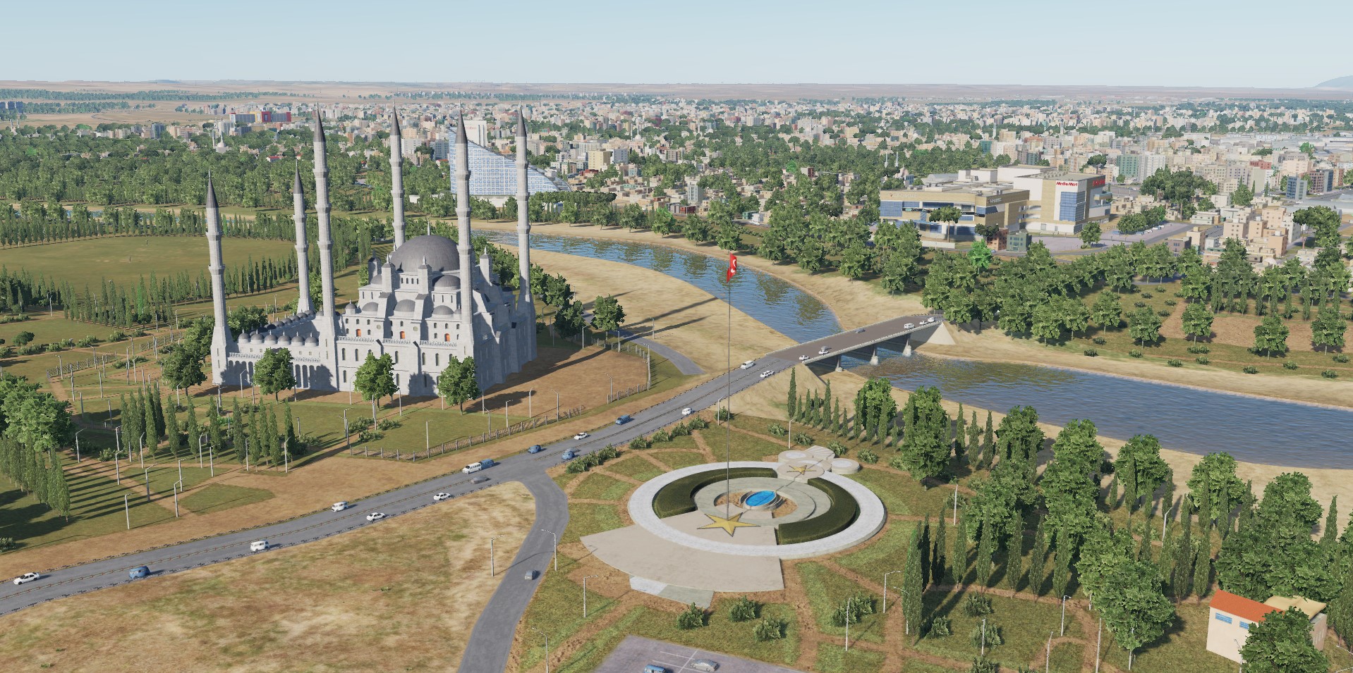
More than 500 airfield, industrial and residential buildings were specially created for the map of Syria. This allows you to convey the specifics of the architecture of Israel, Lebanon, Syria and Turkey, to recreate in detail the cities of these countries, industry and airfields. During the development of the map of Syria, special attention was paid to the reconstruction of the original modern and historical objects. More than 100 original structures and objects have been reconstructed in detail. Today we publish screenshots of some of them. Adana
-
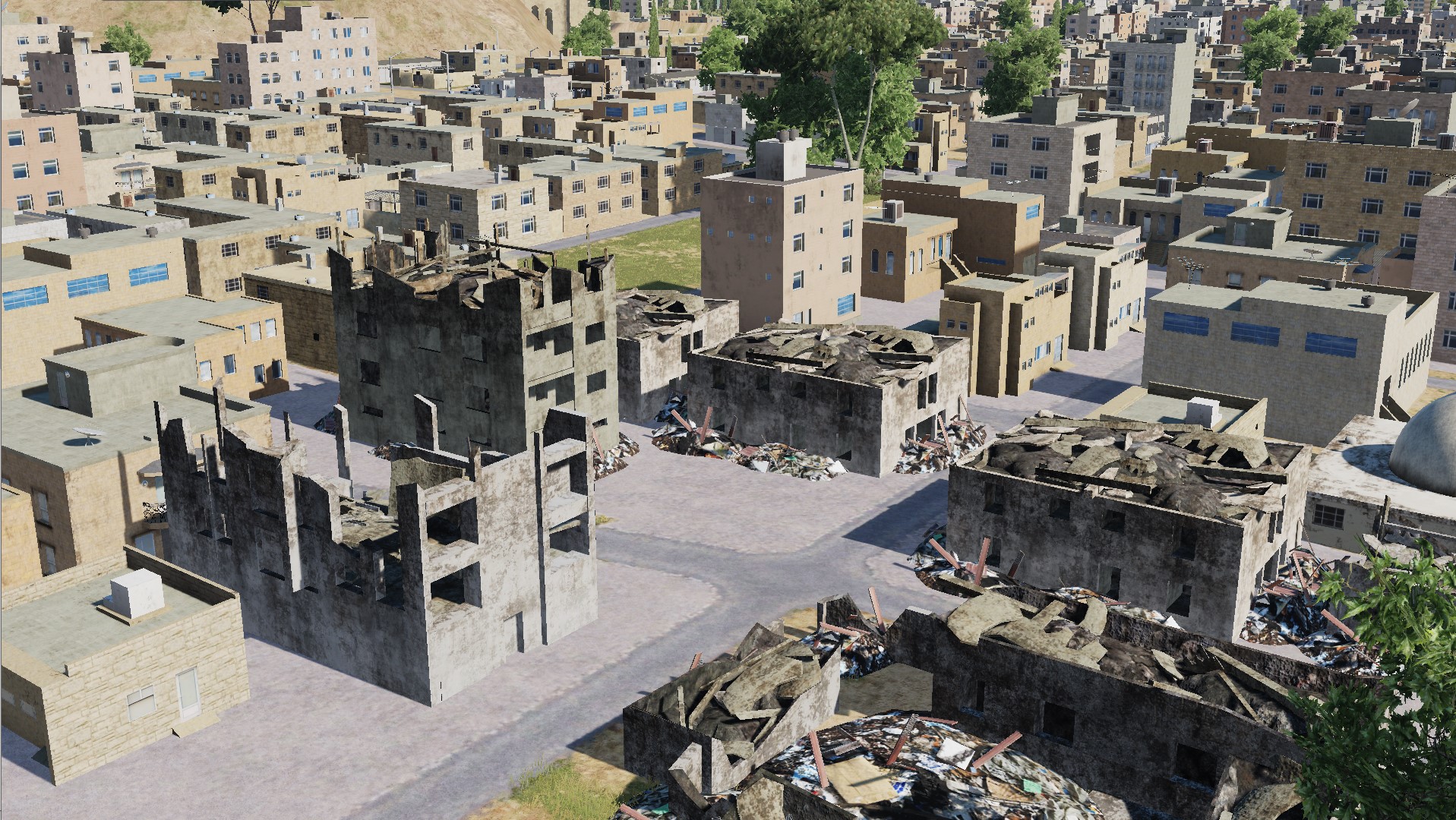
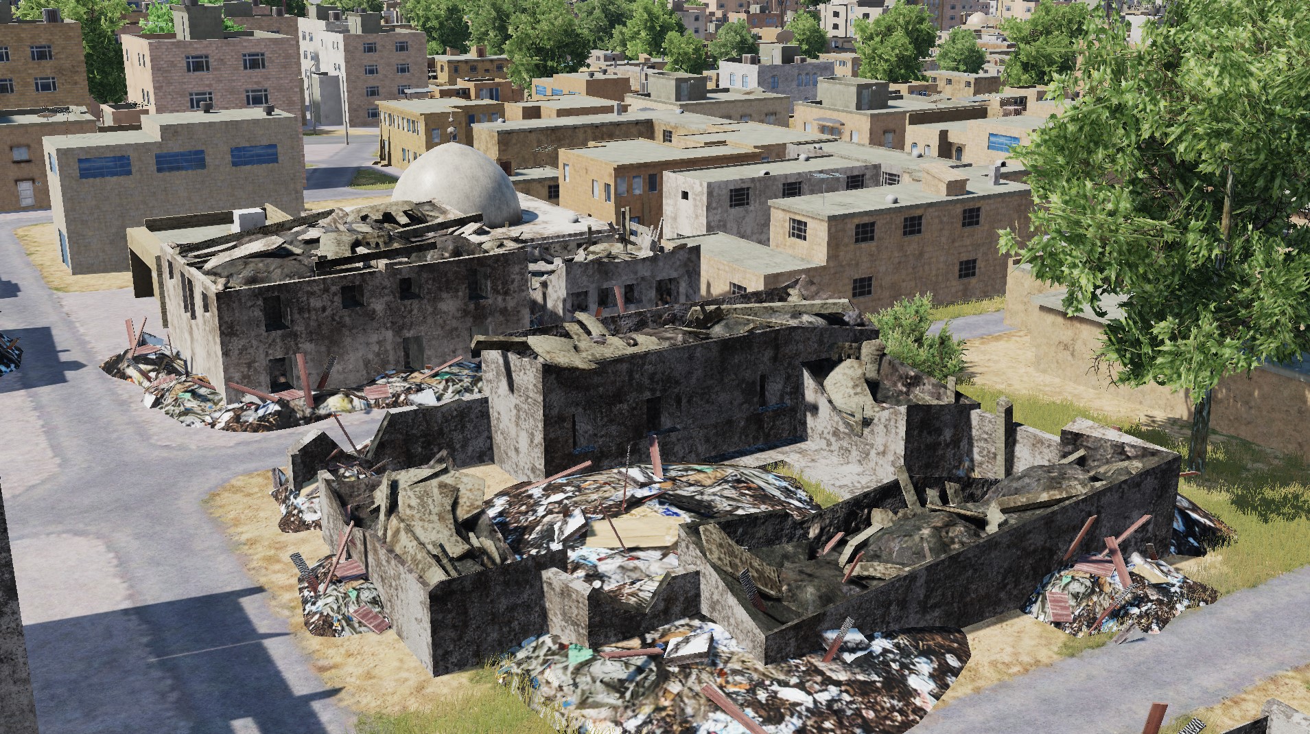
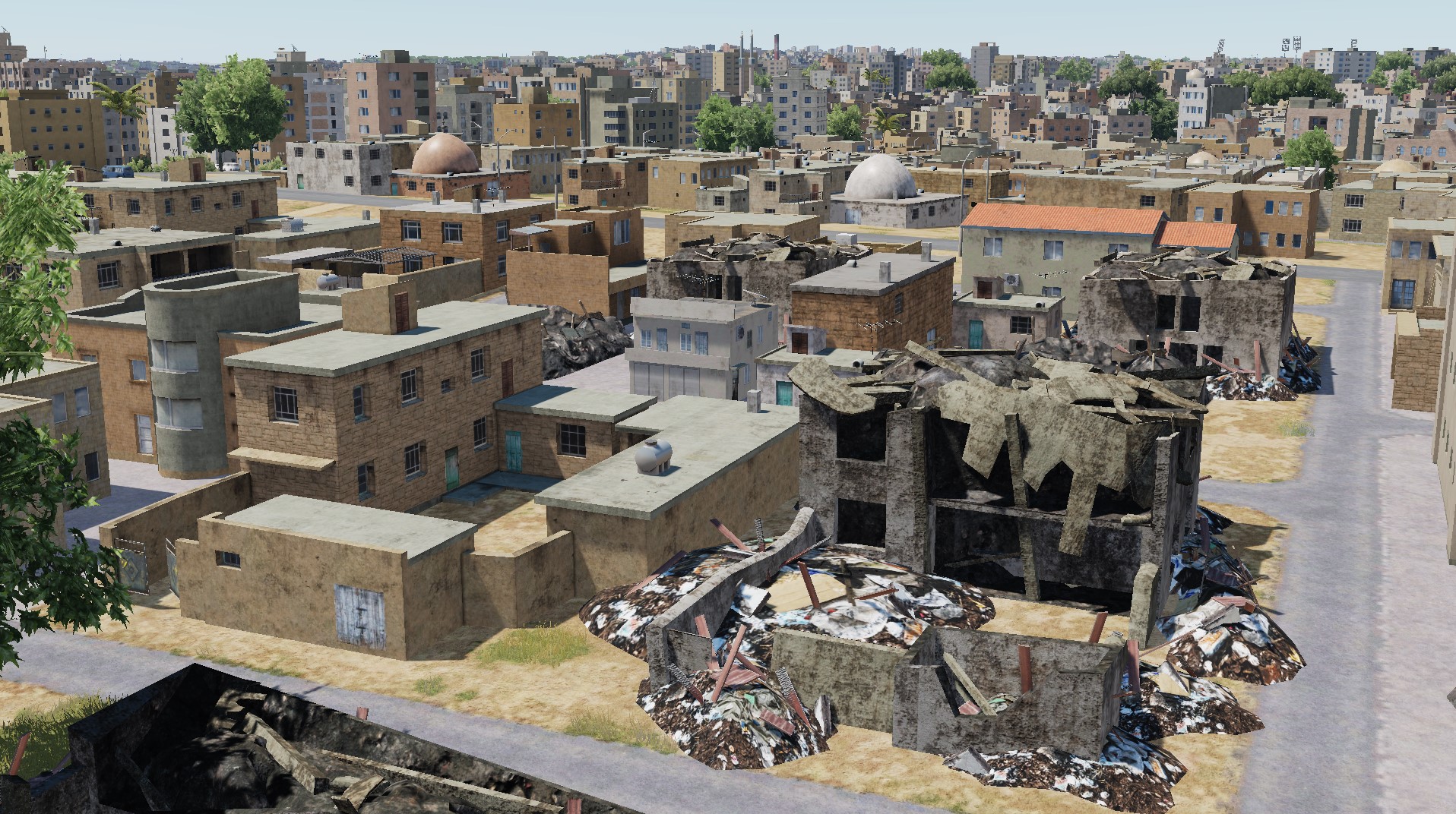
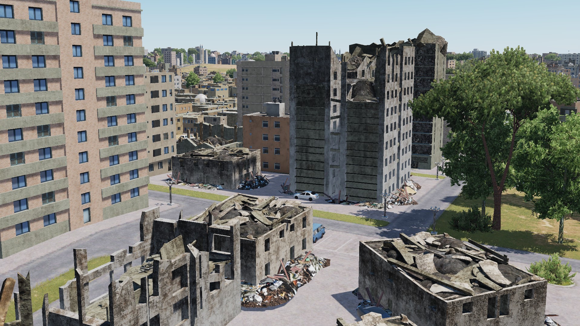
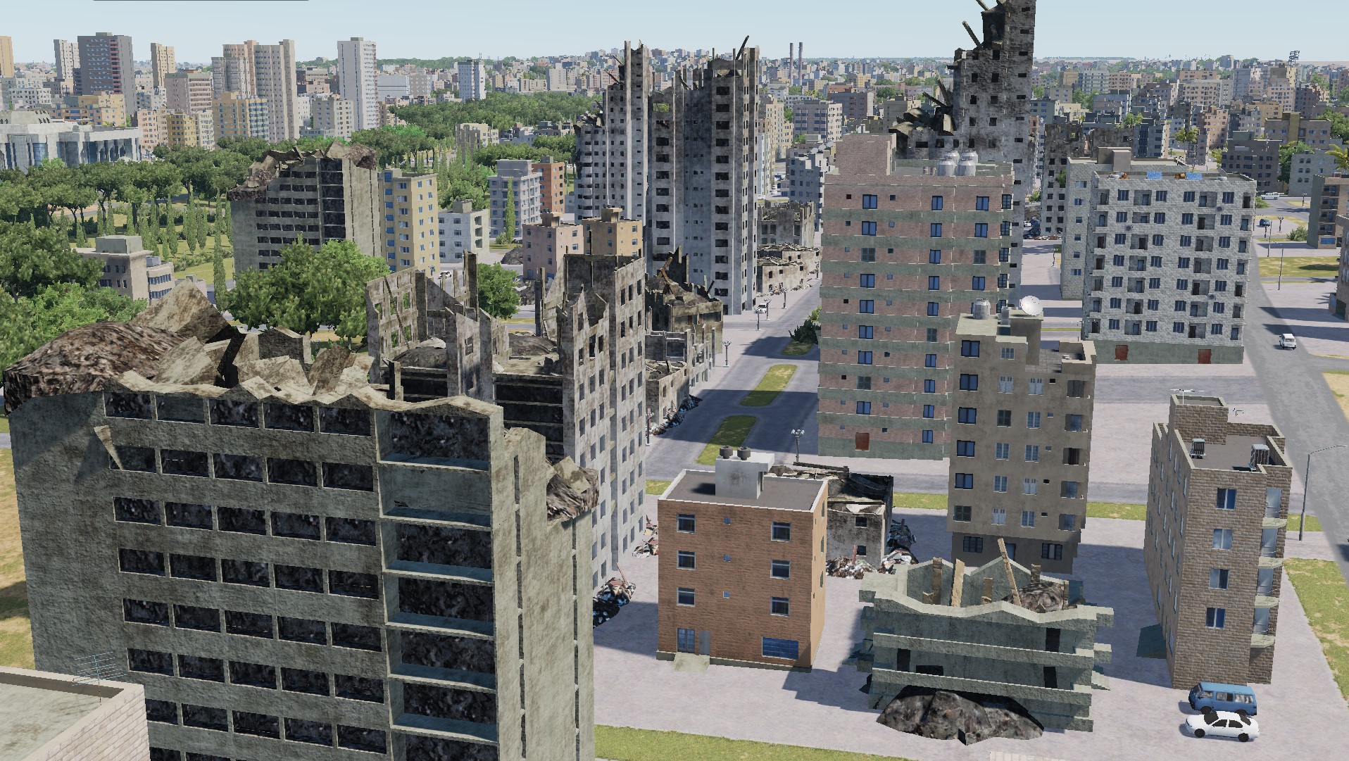
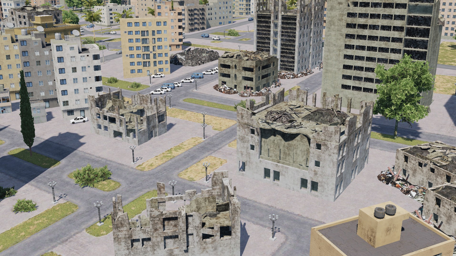
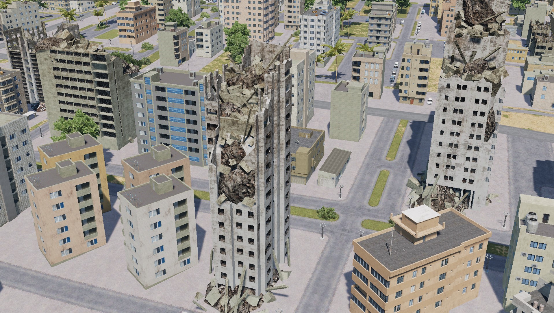
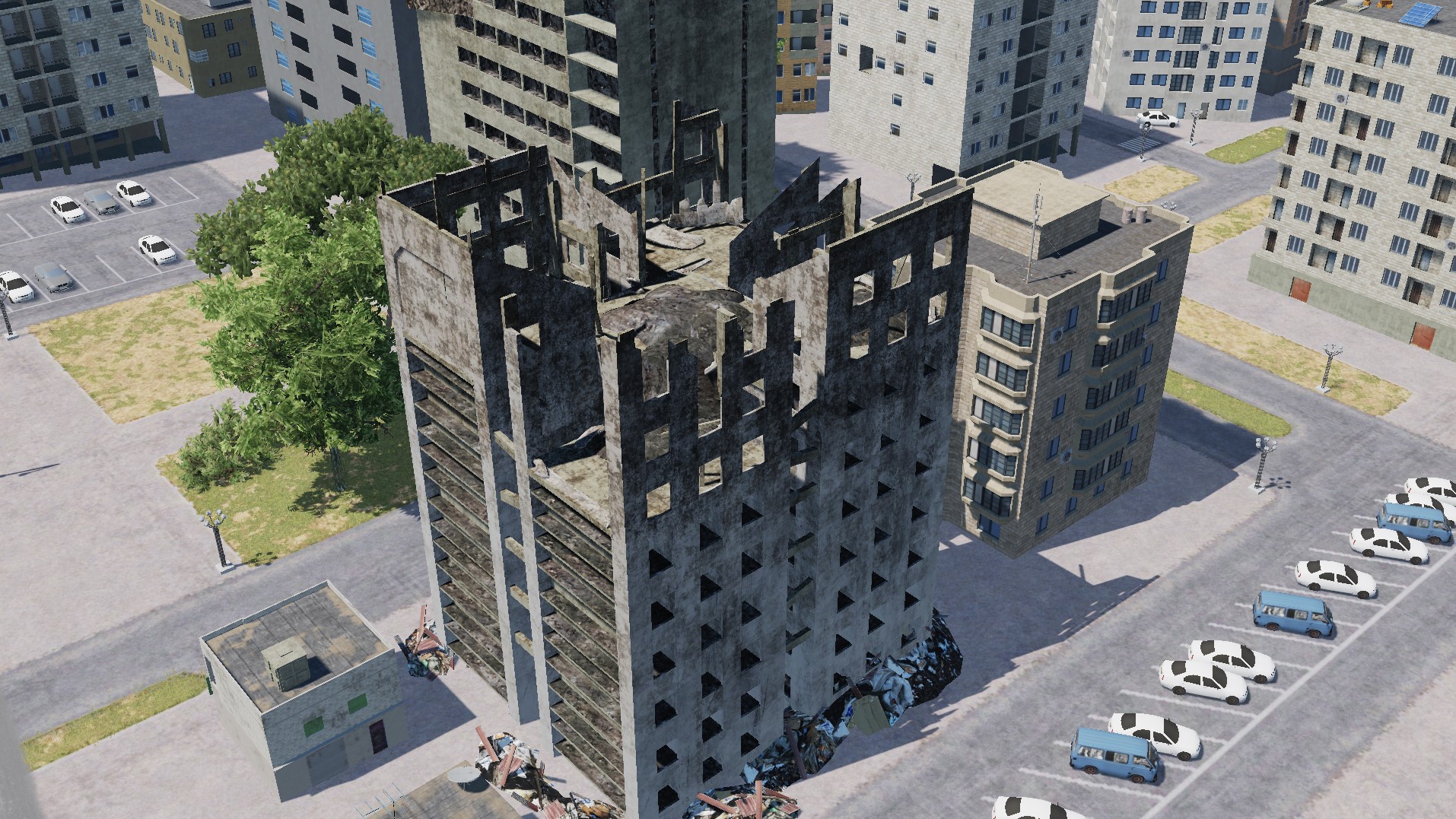
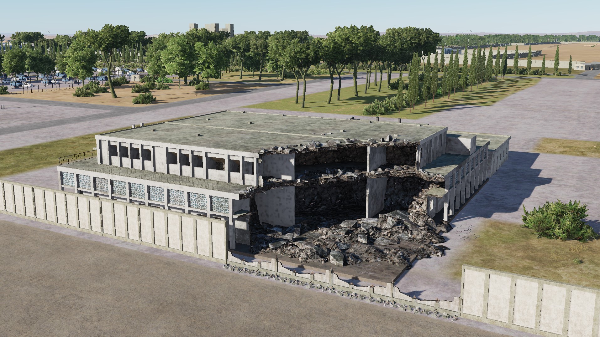
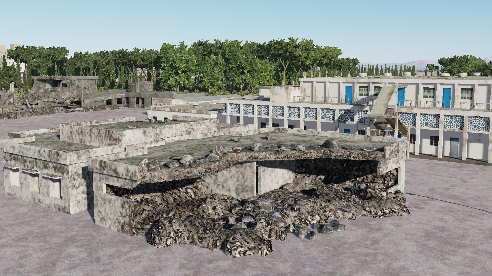
Models of destruction of urban facilities:
-
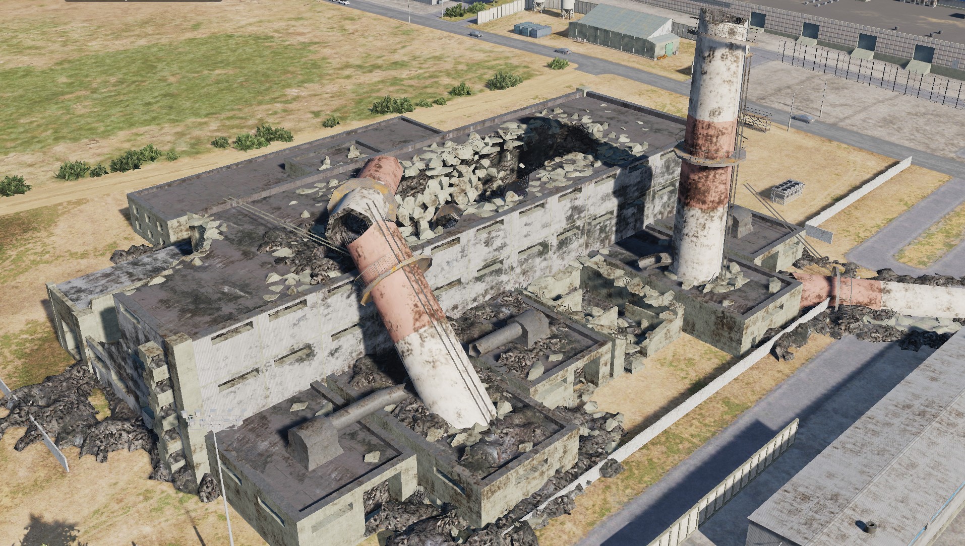
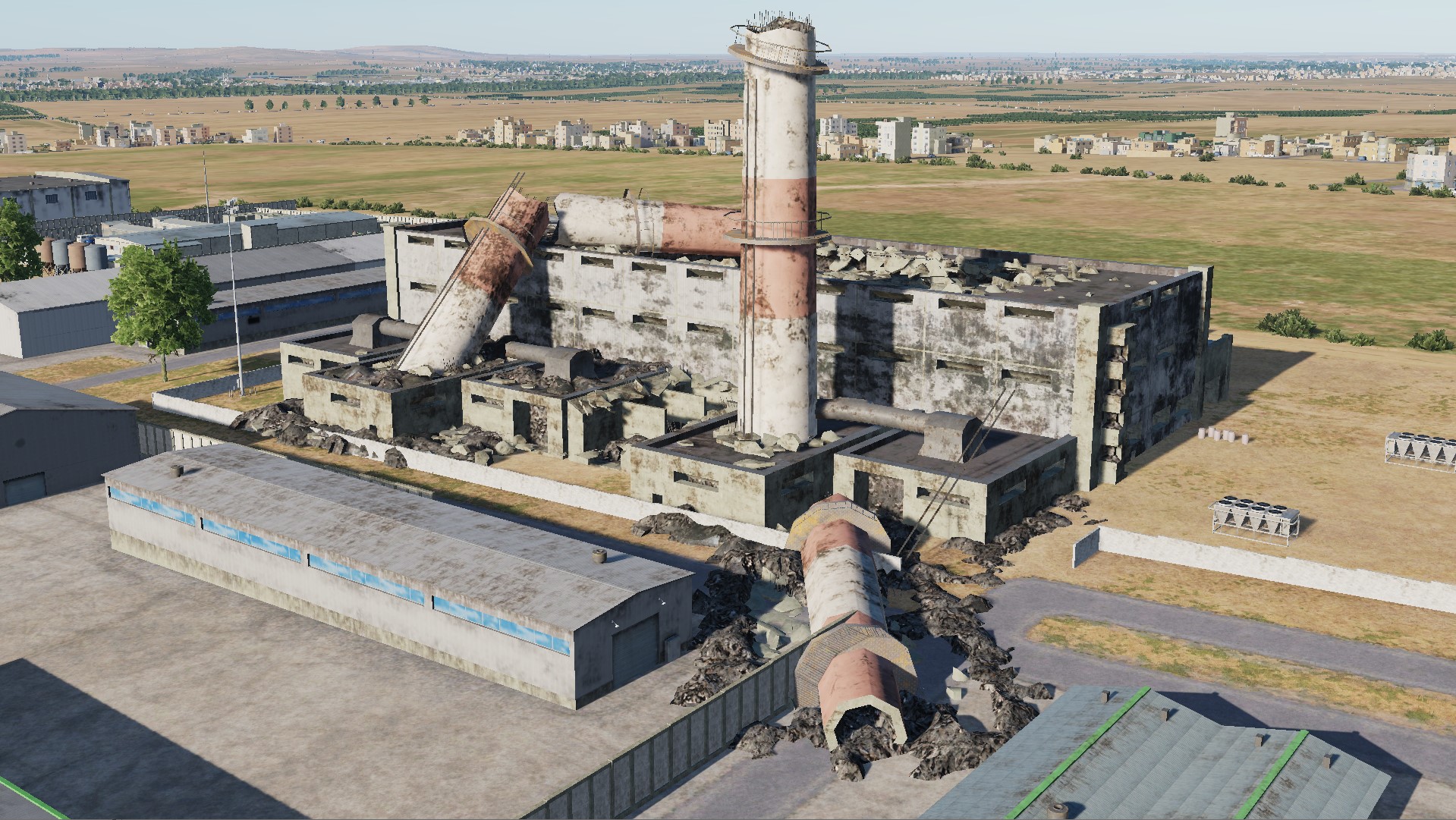
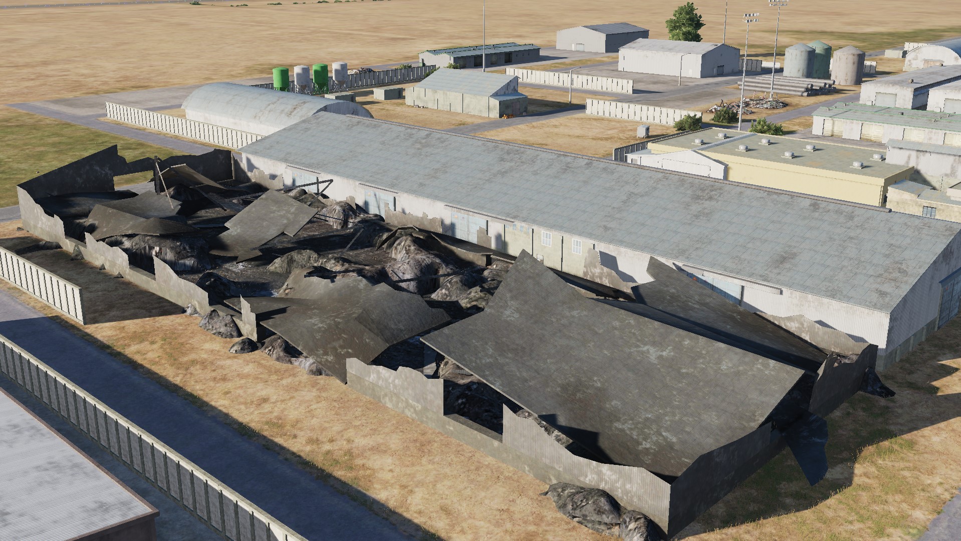
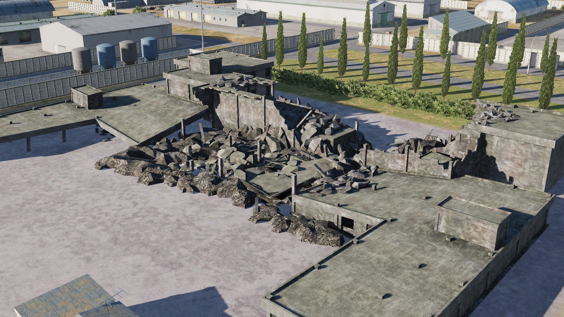
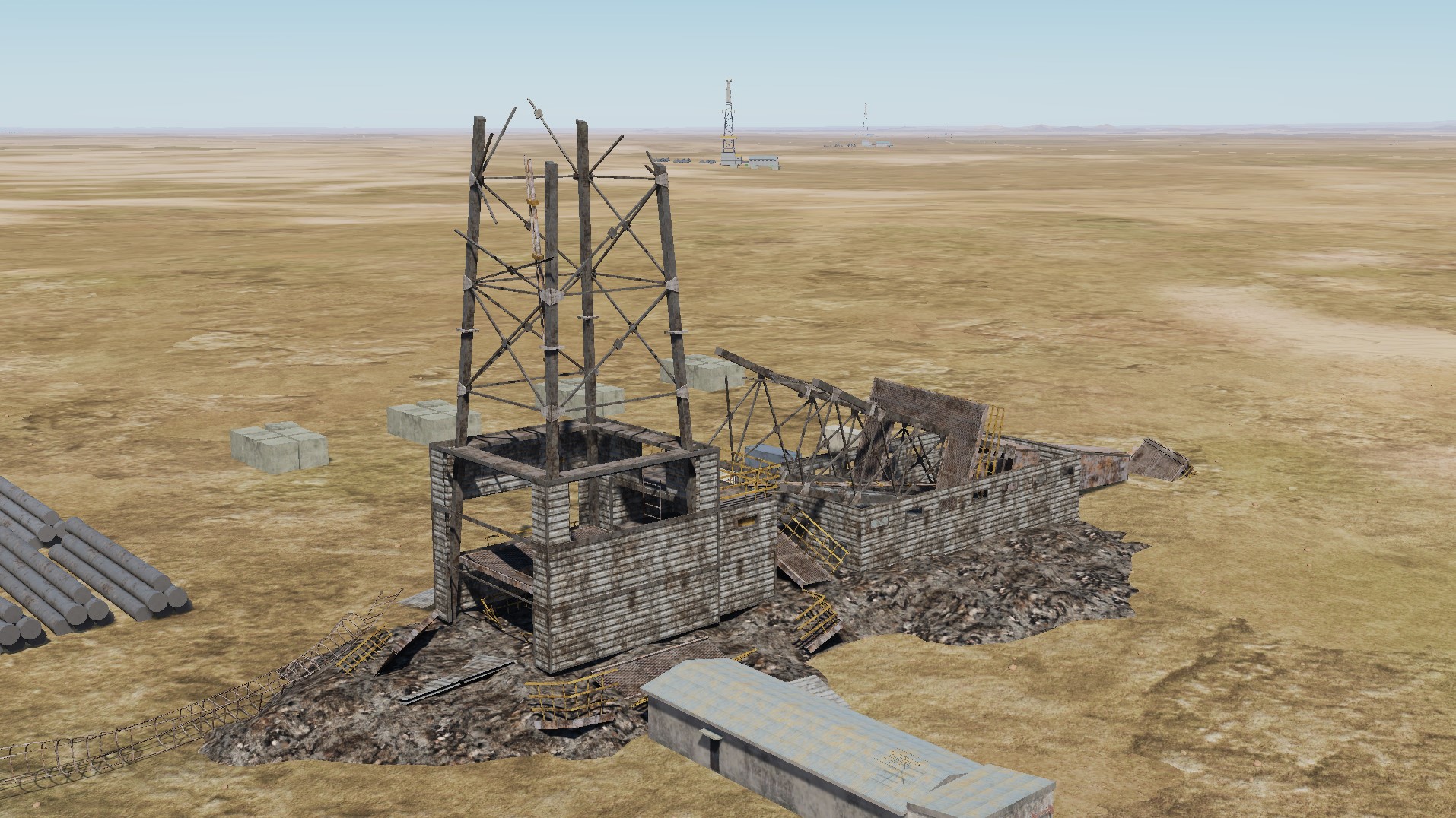
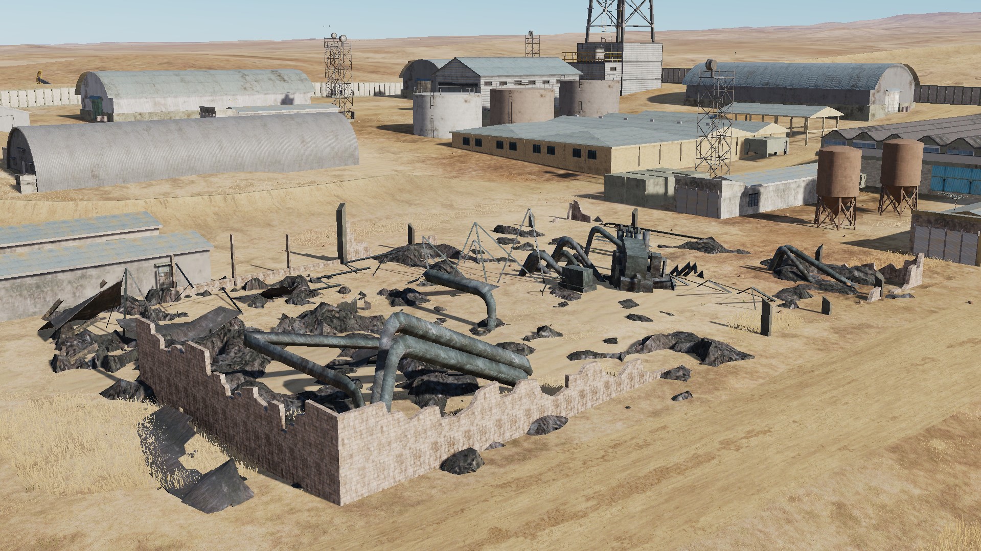
Models of destruction of industrial facilities: