GrafRotz
-
Posts
209 -
Joined
-
Last visited
3 Followers


Recent Profile Visitors
2687 profile views


-
Glaubensfrage. Das Portmonee entscheidet da, wie stark Dein Glaube ist. Ich bin seit immer schon Intel Nutzer und habe vor zwei Jahren auf AMD gewechselt. Frag mich nicht nach Zahlen, aber der alte war ein I7 um die 10 Jahre alt. Was mir aufgefallen ist, das subjektiv Spiele super laufen, aber wenn ich mit Adobe unterwegs war, alles sich ein wenig langsamer anfühlte. Haben die noch immer die Temperaturunterschiede? Ein AMD will traditionell besser gekühlt werden, aber auch das ist heute nicht wirklich ein Thema, wenn groß genug dimensioniert. Persönliche Empfehlung: Kaufe, was Du Dir leisten willst.
-
same here for the Warthog, toggle is not toggeling. OFF and ON are working.
-
also grundsätzlich nicht, weder A2A noch A2G. Danke für die Info, ich dachte, dass ich wenigstens Bombs und Rockets mixen kann.
-
Ehemals Lotus, dann IBM, jetzt HCL Notes, letzte Version April 2025. Und wer Outlook wirklich kennt, weiß, dass es nicht für Kolaboratives Arbeiten gedacht ist. Die Krücke über Sharepoint ist zwar nett, aber ... eben nett.
-
- Autopilot geht, aber das lassen wir lieber bis zum nächsten Patch! - Handbuch gefunden, ich Horst dachte, dass wäre das für die FC3, nicht nachfragen, es muss spät gewesen sein. - Bomben gehen. Achtung, die Zünder sind - ich glaube es waren 27 Sekunden - per default ETWAS hoch eingestellt. € - und die Kurven passen auch, besten DANK! weiß wer, wie sich das mit Ground mixed loadaut verhält? Air und Ground lässt sich ja nicht mixen, dass ist klar, aber z.B. S24 innen und Rockets aussen?
-
das stand aber in den PatchNotes, auf die Geschwindigkeit achten! Bei mir waren gestern die Flaps nicht drin, obwohl ich den switch am Throttle umgelegt hatte. Ich schiebe das auf Dummheit, aber sie schüttelte sich ein wenig
-
Ich möchte behaupten, dass ich alle Kombinationen durchgehämmert habe, aber muss beim Attitude nicht ein Lämpchen nebenan leuchten, wenn dieser aktiv ist? Da war jedenfalls nix. Trotzdem werde ich es nochmal probieren, dass waren gestern eben nur ein paar wenige Stündchen zum probieren.
-
wo sie immer liegen... Knöppe aufe Augen undso. Danke!
-
Naja komm, so sehr, wie die gepushed haben, war das auch absehbar. Wobei ich nicht mit mitte September gerechnet habe, insofern... Glückwunsch, der Kandidat hat einen Gummipunkt gewonnen ^^ Nächster: Release der C-130 Um nicht den Thread zu derailen, 1. hat irgendwer den Autopiloten aktiviert bekommen? Dampener klappt, aber Altitude Hold will nicht. 2. AG bomben über den CCIP pipper will irgendwie nicht und die Bomben an den äusseren Stationen waren einfach "weg", Wie wähle ich die inneren aus? Auch über den Kipphebel an der Linken Boardwand für die Raketen? Und Die Symbolik ändert sich in etwas, was für mich - noch jedenfalls - unverständlich ist. Das runde auf das eckige und drücken ist wohl nicht, oder? Führt aber auch zu 3. Wo ist das Handbuch? Im Installationsordner hab ich nicht finden können, hab gelesen, dass es wohl eines gibt, der Fulcrum Ordner ist aber leer, was die Doku angeht. 4. Wie verschiebe ich den Afterburner Detend? Bei fast allen 3rd Party Flugzeugen kann ich den unter Special Options verschieben, ED hält es aber nicht für nötig, oder ich bin zu dumm. Auf dem Warthog beginnt der AB bei - sagen wir - 80% Schubweg, im Flieger springt der aber bei 70% schon an. Ist übrigens bei den FC3 Fliegern auch so. Löse ich das über die manuellen Kurven? Dann verschiebt er aber auch Werte, die ich eben nicht ändern möchte.... 5. Radar/IR Lock. Habt ihr das auch, dass er mal aufschaltet, mal nicht, mal sofort wieder rausspringt? IR könnte ich noch verstehen, aber Radar, direkt vor der Nase sollte doch sofort aufschalten. (Geschwindigkeitsdifferenz und andere Parameter beachtet.) Da kommt bestimmt noch mehr
-
finished right now just finde. Also the speed went higher again. But something else. Anyone recognize the Aircraft, Wags is shooting at in the latest video? Just asking... Hun? Draken?
-
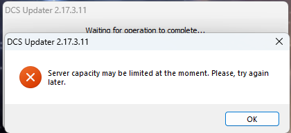
works fine by me now, except the 1MB/s... I guess, CDN servers went warm a bit ^^
-
nullnever had that one before....

-
nope, never did and I recommend no one to do that, because... aviation things. There is no need to be anything in ye ole deutsche sprache. Beside your english is not the yellow from the egg and you use the tutorials a lot. So, thats not the reason for having german Bettyin Mig-29G(!)
-
Mig-29G from FC3 has German Betty, tried yesterday. Achtung Höhe, Treibstoff 1500, Maximale Geschwindigkeit. oderso If there was any settings to change, I do not rember, if so, I did decades before.
-
Not gonna happen, ED stated more than once. Its a ethical thing if i remember correctly. Nevertheless, at least dummys would be nice to have. A Impact of these could just end the mission.