Pribs86
-
Posts
172 -
Joined
-
Last visited
Content Type
Profiles
Forums
Events
Everything posted by Pribs86
-
Man, you guys have gotten so used to being disappointed, skeptical, and negative... do any of you even remember what genuine excitement feels like anymore? Don't crush other people's creativity just because you've lost yours.
-
fixed internally M282 MPP APKWS not reflecting ammo spent
Pribs86 replied to Pribs86's topic in Bugs and Problems
Bump. -
Oh no, I want to be VERY clear. I absolutely LOVE it. I also think it could be a bit darker as well. I was just wondering if they had a clear visor IRL to be able to use the HMD IRL. I've grown to really like the HMD, even at night, for maintaining situational awareness/direction and hardly ever use the NVGs anymore unless the jet already has them like the A-10. I definitely do not want them to be removed. This was not my intention.
-
Thank you for the clarification. I greatly appreciate it! Fine as is!
-
Thank you! But like I said in the initial post, IF the visors have to be swapped on the ground then scratch it. But IF pilots can push a button or snap them on and off quick, in the jet, while flying, then it would be super sweet to do, IF that's what they do IRL. But then again, IF it has to be installed on the ground it might be more of a pain in the ass than what it's worth.
-
BINGO! Thank you!
-
I wasn't asking how to USE the visor. If you toggle the visor off you cannot use the HMD at all. IF you had a clear visor then you could still use the JHMCS at night, without the tint(which is wonderful for daytime use in sunlight).... it's like wearing sunglasses at night and wondering why you can't see anything. Reread the initial post again.
-
The squeaky wheel gets the grease.
-
Secret? Don't be so negative about everything - keep dreaming BIG! Negativity ages you faster than anything and is completely unproductive to growth.
-
I don't drink pop, but a strawberry milkshake would do. Did I post this in the wrong place? Thought this section was specifically for wish list items or are we not supposed to do that anymore? Why are you raining on my parade?
-
Hey ED! It would be great to see the following A/C added to the sim as full fidelity, flyable, aircraft! Thank you for your consideration in advance! - C-47 Skytrain : Normandy Invasion - B-24 Liberator - B-25 Mitchell : this might be "easier" to do with only 2x engines to see if it will generate interest for the rest of the multi engine bombers/cargo A/C - B-29 Superfortress : Enola Gay - KC-135 Stratotanker - KC-10 Extender - B-52 Stratofortress - C-17 Globemaster III - C-5 Galaxy - C-2 Greyhound : cargo version - S-3B Viking - UH-60 Blackhawk / MH-60 Seahawk - CH-53 Sea Stallion / MH-53 Pave Low / CH-53E Super Stallion - MD 500 Defender - AH-1 Cobra / AH-1Z Viper - SR-71 Blackbird - F-117 Nighthawk - V-22 Osprey / CMV-22B Osprey - SDB Dauntless - T-6 Texan II : Trainer - T-45C Goshawk : Trainer - P-8A Poseidon : Anti submarine - T-1 Jayhawk : Trainer Before anyone jumps on me and says "there are already mods out there for some of these"... I don't do any mods, ever, for my own reasons. These would be an instant buy for me *when* they come out. I do realize that some aircraft would be an OPSEC nightmare like the SR-71, but a guy can dream, right? Thank you again for all that you do. Love the sim and the modules. Excited to see you guys continue to grow! Edit: I forgot the B-1 Lancer and P-38 Lightning!!!
-
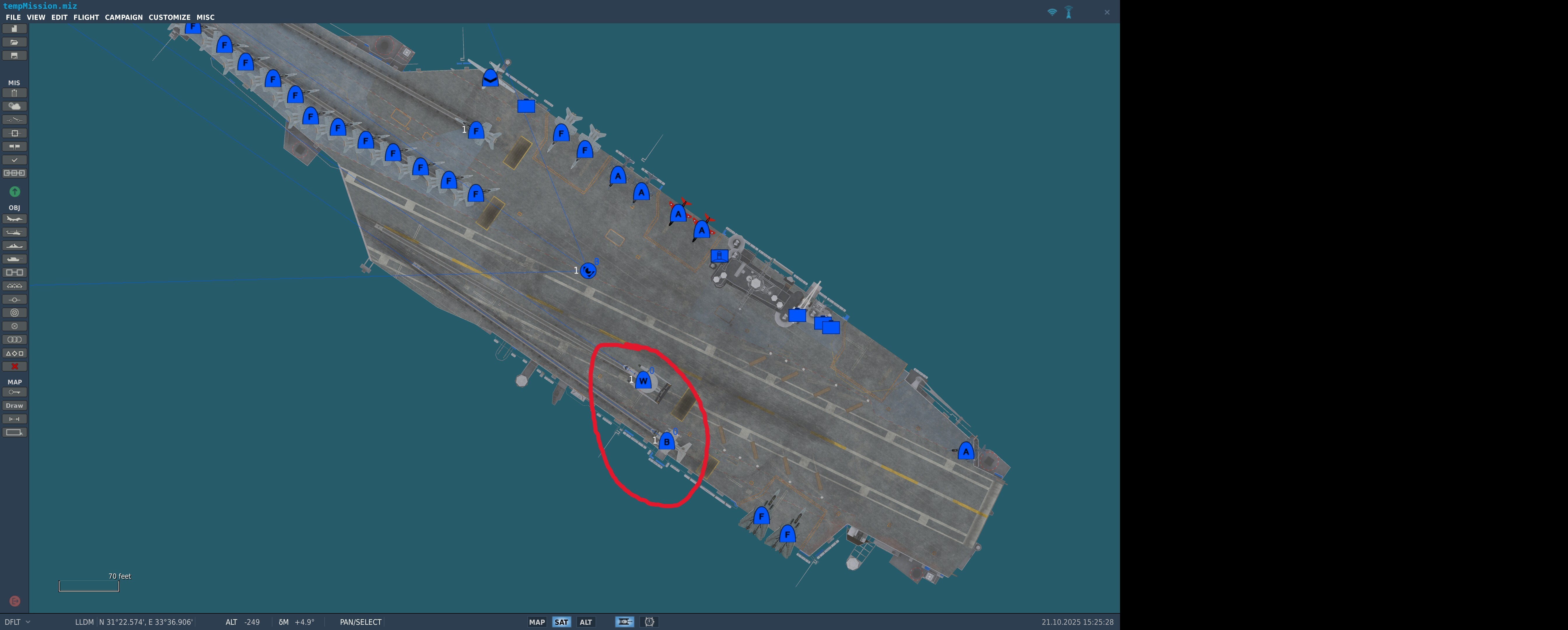
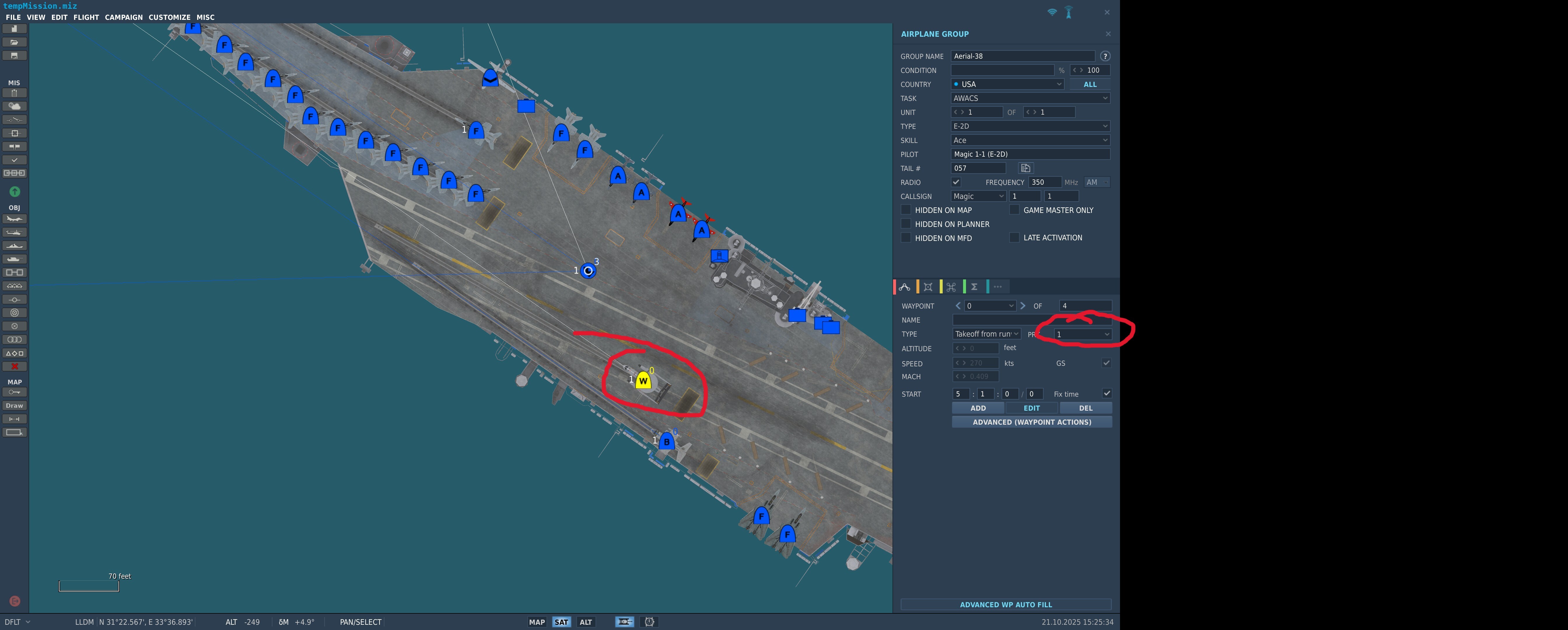
Deactivate Cat if deck spotted aircraft are parked on it.
Pribs86 replied to DmitriKozlowsky's topic in Wish List
I second this. I have a mission set up where cat 2 is blocked but the AI ground crew still instructs me to line up on.- 1 reply
-
- 1
-

-
No possible to have LSO contact after a bolter
Pribs86 replied to Supersym's topic in Bugs and Problems
This is my request for implementation then. -
Hi, I would like to request a clear visor option/addition for night flying for use with the JHMCS/HMD to allow in more ambient light in to be able to see more. Unless this isn't realistic and what they do IRL. Seems to me they would have a clear option that works with the HMD. IF it is not IRL realistic or if it has to be installed on the ground then scratch it. I'll be honest I didn't do much research on this before posting.
-
Pretty, pretty please... with a cherry on top!
-
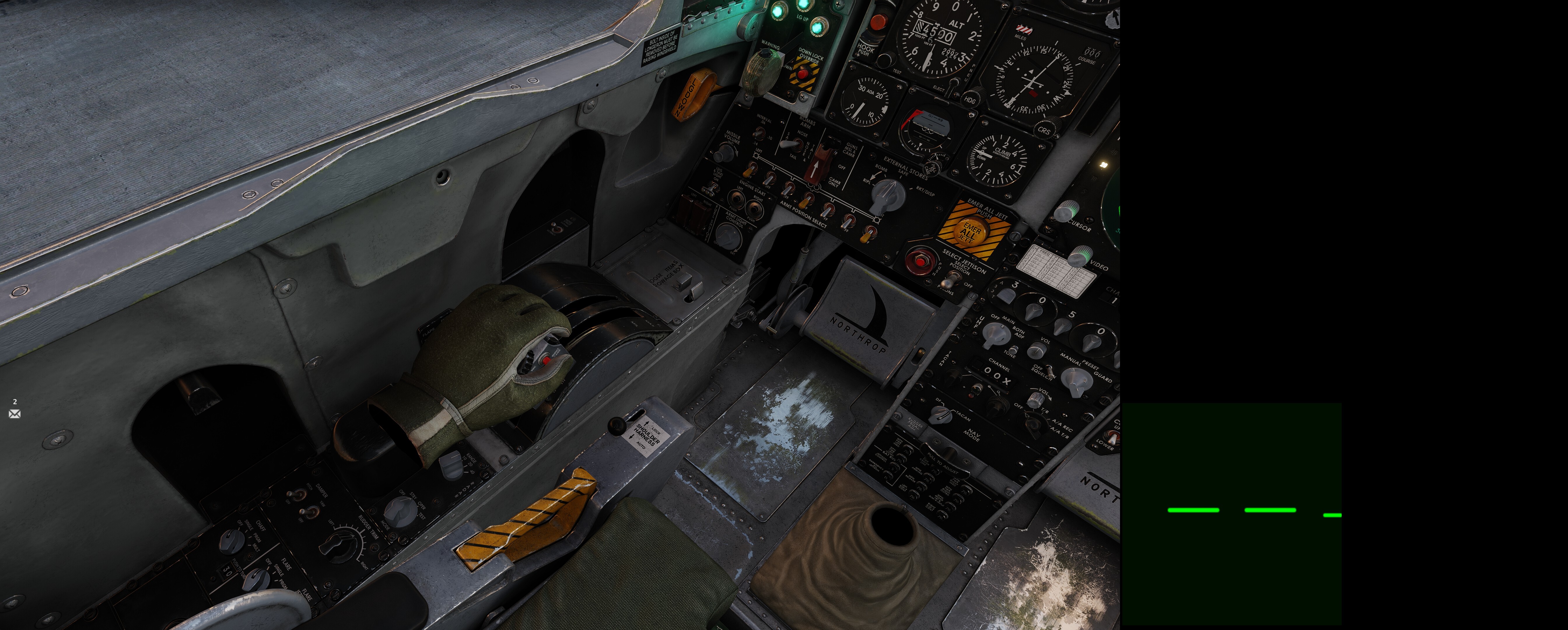
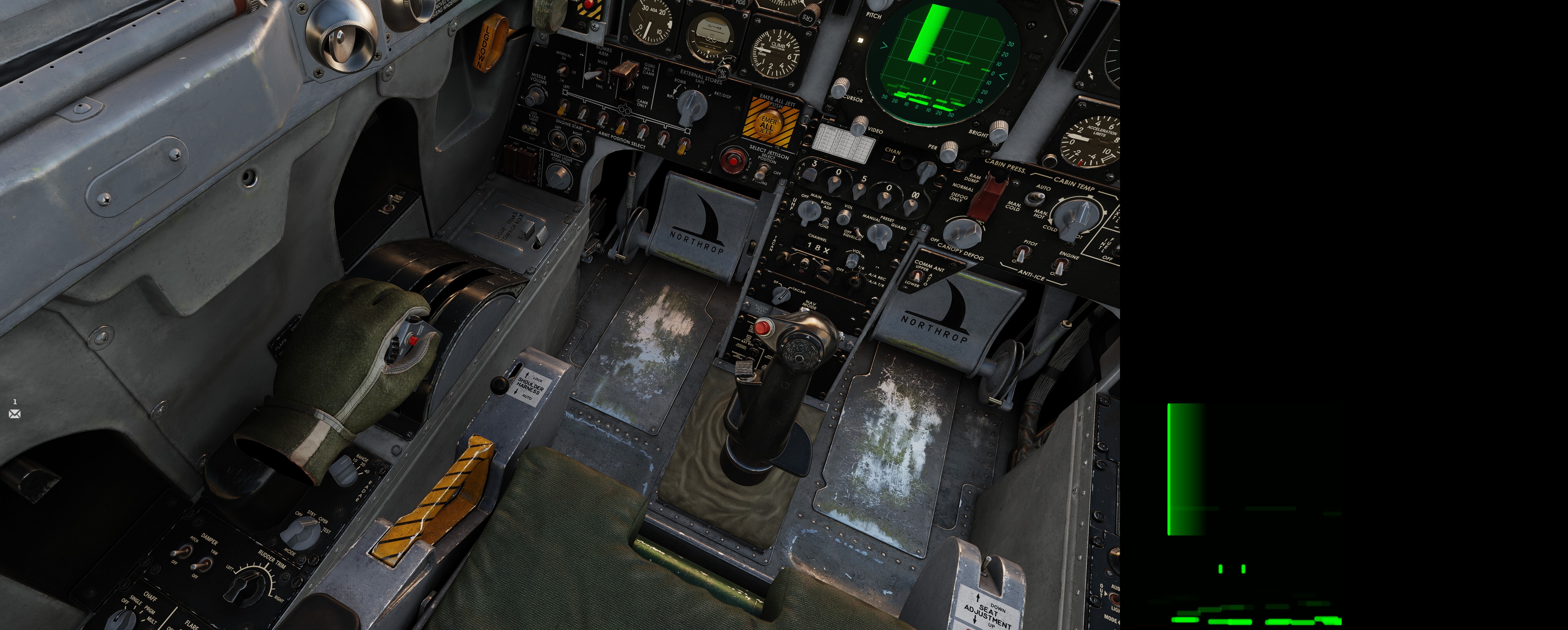
After the update yesterday there is now a hand on the throttle. Pilot body off, with or without stick showing. Just a hand. Groom Lake, Nevada map. Hand.

-
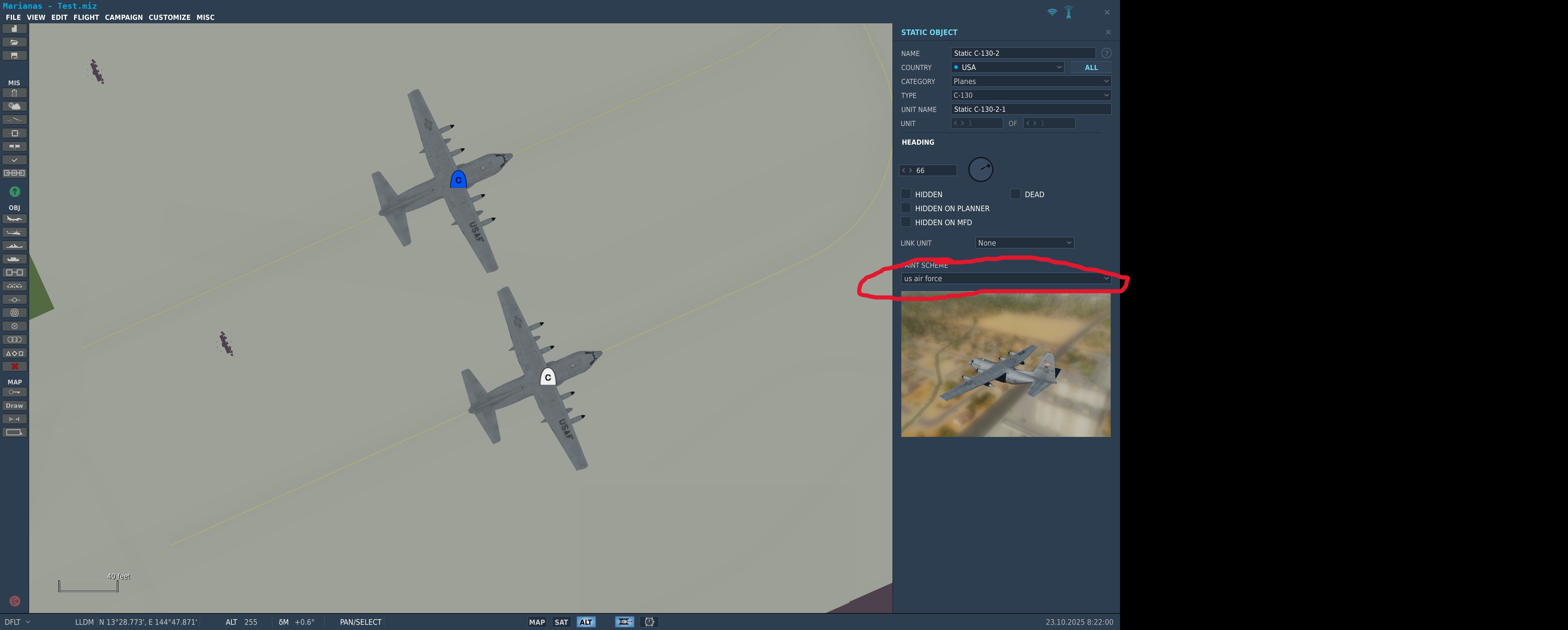
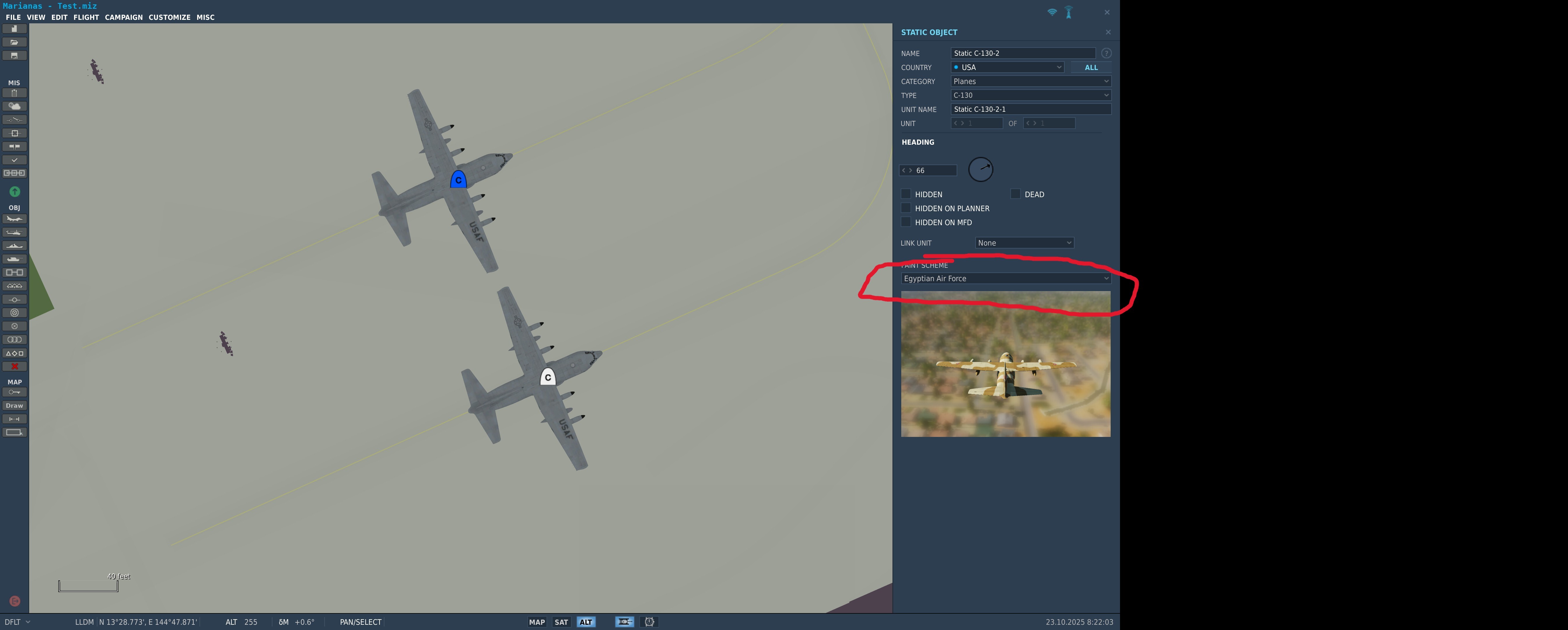
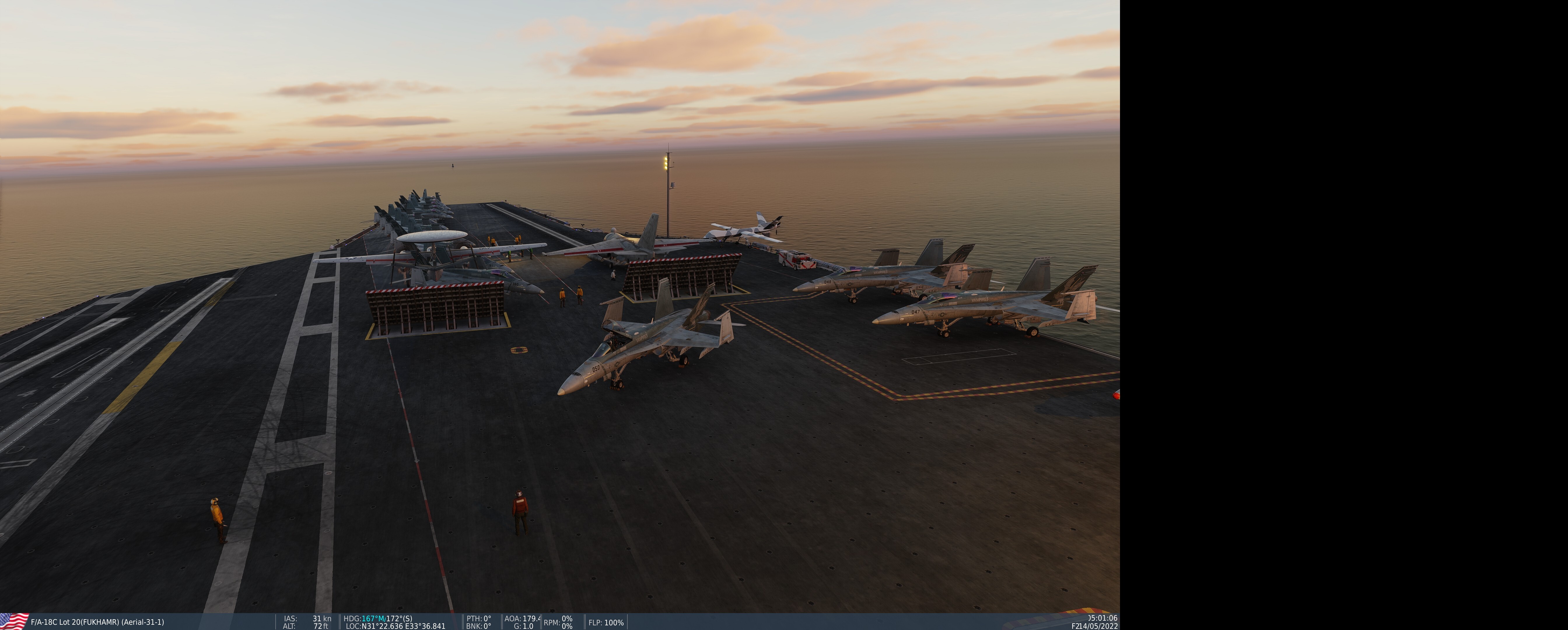
HI! I placed several static C-130 on multiple airfields on all maps with the US skin and a LOT of times it changes to the Egyptian skin automatically some how, even though I save it. I'm not sure why it's happening but doesn't seem to be map or airfield dependent. The other issue is with AI aircraft on the carriers. Again, on all maps and all carriers regardless of CVN-#, these two AI aircraft constantly change to the #1 spot even though I specifically save them to spot #3 and #4... and they even show up on the map on the #3 and #4 spots, they are actually on the #1 spot. I'll go make changes somewhere else on the map or load a different map entirely then come back and they will be back on spot #1.
-
Bump. For those of us who don't know how to code. DCS please! Thank you in advance!
-
new news when available DCS: F-16C Viper Manual
Pribs86 replied to =BoB= David's topic in DCS: F-16C Viper
Yes, I agree. The information was ALREADY there. Why not simply just add the ATP rather than remove and replace the information.... it was already in there. -
Bump.
-
For now. They did say it would depend upon sales, so it's a possibility. Not a no.