Emacs
-
Posts
104 -
Joined
-
Last visited
1 Follower

-
Is it only me, or is the update mechanism of DCS maybe not the most optimized one possible? I understand particularly included map updates (=texture) are huge. Ok. But come on... 50 gigabyte? Nearly every time nowadays? That's more or less a full download for a fresh install of Elden Ring. There has to be a more streamlined way to do this. At least let me de-select updates for maps I'm currently not using. Nice to see that some players get 115 MB/s. Where I live 10 MB/s is pretty much the fastest option available.
-
Yep. The twin towers of Deutsche Bank and the Messetor appear to not be there. Both were completed in 1984 (Wikipedia).
-
 "Tire Strut Suspension Modelling" get's some love !!! Finally! Yeay. Boy, have I waited for this! One of the most requested features, if I remember correctly. Now, please bring the F5 remaster back to usable fps in the next patch (like, soon) and I will be a happy camper.
 -
[2.9.10.3948 MT] F-5E Remaster - window reflections ( turn it off? )
Emacs replied to LizardKingYB's topic in DCS: F-5E
Ah, general settings ! Thank you I was only looking at the F5 specific settings. -
[2.9.10.3948 MT] F-5E Remaster - window reflections ( turn it off? )
Emacs replied to LizardKingYB's topic in DCS: F-5E
Where? I'm looking for that setting too! -
Nice update! The new fog looks really great and much better than the one we had so far. But.. > This highly immersive solution, which took more than 8’500 man hours to develop, allows both automatic and manual fog generation and accounts for sensor and AI line-of-sight blocking. 8500 hours is a team of 4 developers working 8 hours a day, 5 days a week for one full year. I understand that it's not just the fog, but the effect of it on visual and sensor line of sight, but 8500 hours? I can't imagine that to be right.
-
I've just searched through all the patch descriptions of 2024. Besides one entry for Reflected's campaign, there is only one single line for the Mossie in there: FIXED: Tail wheel too sensitive I guess all the other updates will come in the next patch then... Right? Cheers, Emacs
-
Ok, found a solution in another thread: "use clear command on the "red" assignments, reboot DCS, only then reassign them as you wish. That should fix the issue." That worked for me. Cheers, Emacs
-
I have that dreaded exclamation mark now at the "Throttle" command for the P-51, Spitfire and the Dora. P-47, 109, and Anton are fine. The axis are no longer used at all. The exclamation mark even stays when I assign nothing to the Throttle action at all. I haven't changed anything, neither hardware nor configs over the last months. Just the updates from the last few days. A bit frustrating I must admit...
-
No matter if WWII or modern jet, the animation where both wingtips are on fire and the plane is spiralling to the ground may be spectacular to look at, but it feels like this one is done way too often. And that's not even asking what could cause both wingtips - and only those - catch fire on any WWII fighter.
-
Great book !
-
I love 2.9 ! Flying warbirds over the channel map mostly. I have a Radeon 6800 XT, so no DLSS/DLAA for me. But I can run DCS now with TSAA and pretty much everything maxed out in 4K (native, no FSR needed) and get stable 60 fps over the English coast. The Spitfire cockpit is great and the color grading "CineColor2" matches the scenario perfectly. Very impressed and very happy here !
-
A neues Gwand für die Dora! - Hi Res Textures for the Dora
Emacs replied to Doughguy's topic in DCS: Fw 190 D-9 Dora
See above https://www.digitalcombatsimulator.com/en/files/3330251/ Cheers, Emacs -
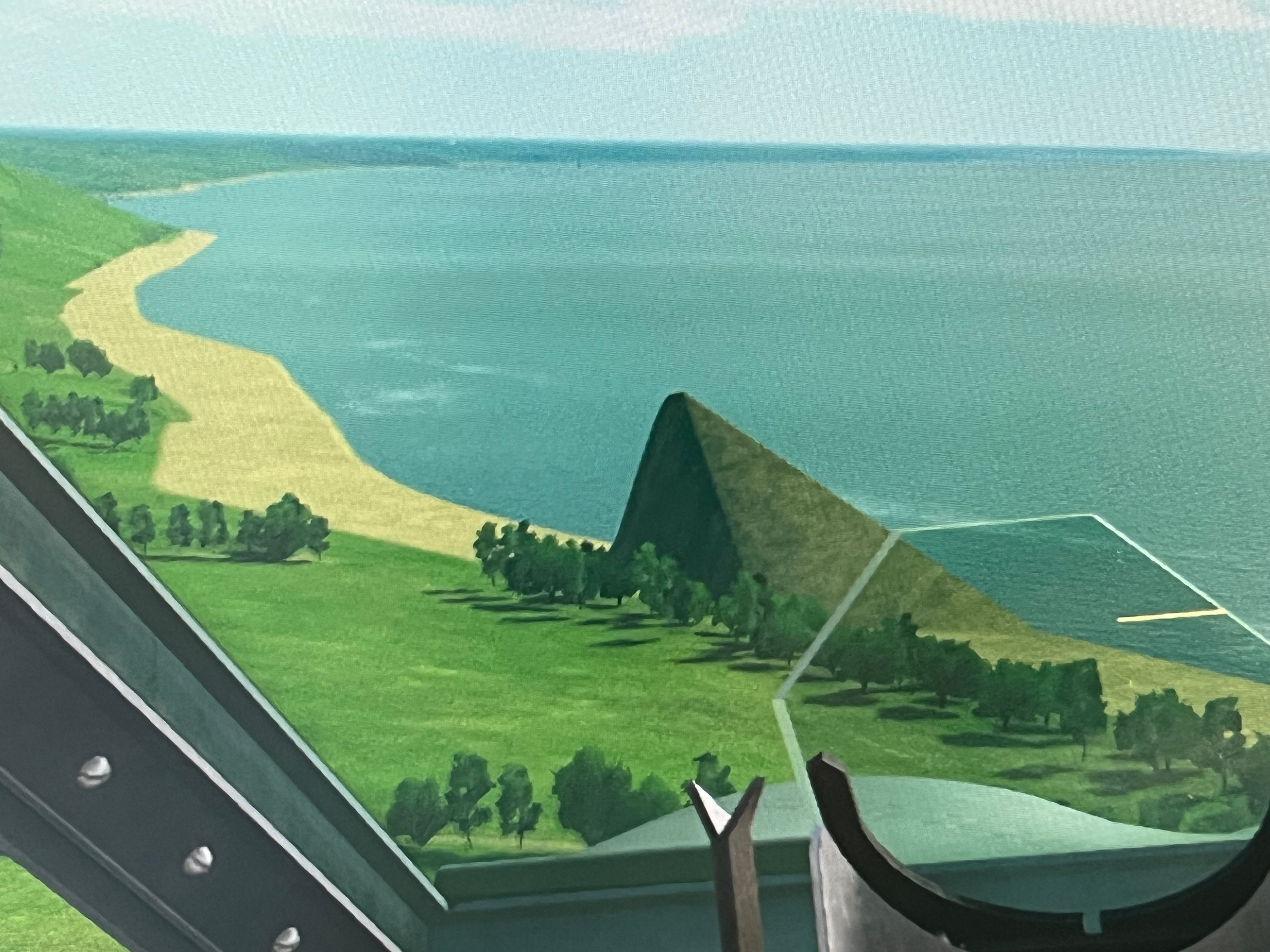
The area around Le Havre is fine. Lots of cliffs. Coastline looks fine there. But as as soon as you leave Le Havre to the North East the coastline becomes totally flat. Brightened only by the occasional sand pyramid (I guess that's a preview for Sinai ?). Looks to me as if something went wrong with the mesh in that area.