OnReTech
-
Posts
528 -
Joined
-
Last visited
-
Days Won
13
Content Type
Profiles
Forums
Events
Everything posted by OnReTech
-
I'll talk with ED about it, but I won't promise that it will work
-
asset for SAM system is ready: it will be located in places that are freely available as mentioned above, thanks. As such:

- 122 replies
-
- 19
-

-
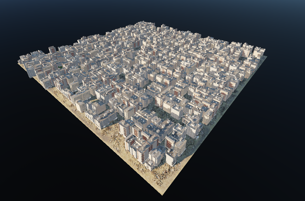
We tried to separate the assets by country, Egypt and Israel have their own buildings and assets. Of course, there are same objects for both such as industrial buildings, ports, etc... When flying, I am absolutely sure that everyone will understand in whose sky and on whose territory you are) We tried to separate the assets by country, Egypt and Israel have their own buildings and assets. Of course, there are same objects for both such as industrial buildings, ports, etc... When flying, I am absolutely sure that everyone will understand in whose sky and on whose territory you are)
- 629 replies
-
- 31
-
-

-
Thanks for the info, it will help a lot! We will make an asset for Egypt, it will consist of mounds and support objects. Like this: There will be a place to put the air defense objects in the mission editor. Do you think it's worth making an icon for the mission editor for such places? So that everyone can see on the map?
- 122 replies
-
- 13
-
-
-
Thanks, now I understand what it's about. I think that we are able to add it, i added to to do list. Thanks guys! It would be nice to get a .kmz file, in this case we will place them exactly at the coordinates. Thank you in advance!
-
just static? they do not work? are they visible as an object in the mission editor?
-
hm... so we don't know about this technology, thanks, I'll clarify how to do it
-
Egyptian SAM will not be included in the map. This is not possible with map tools (TDK).
-
Ah No, Cairo West will be unique, I mean airfields that are not included in our plan. All airfields that we declared will be unique. List of airfields here:
-
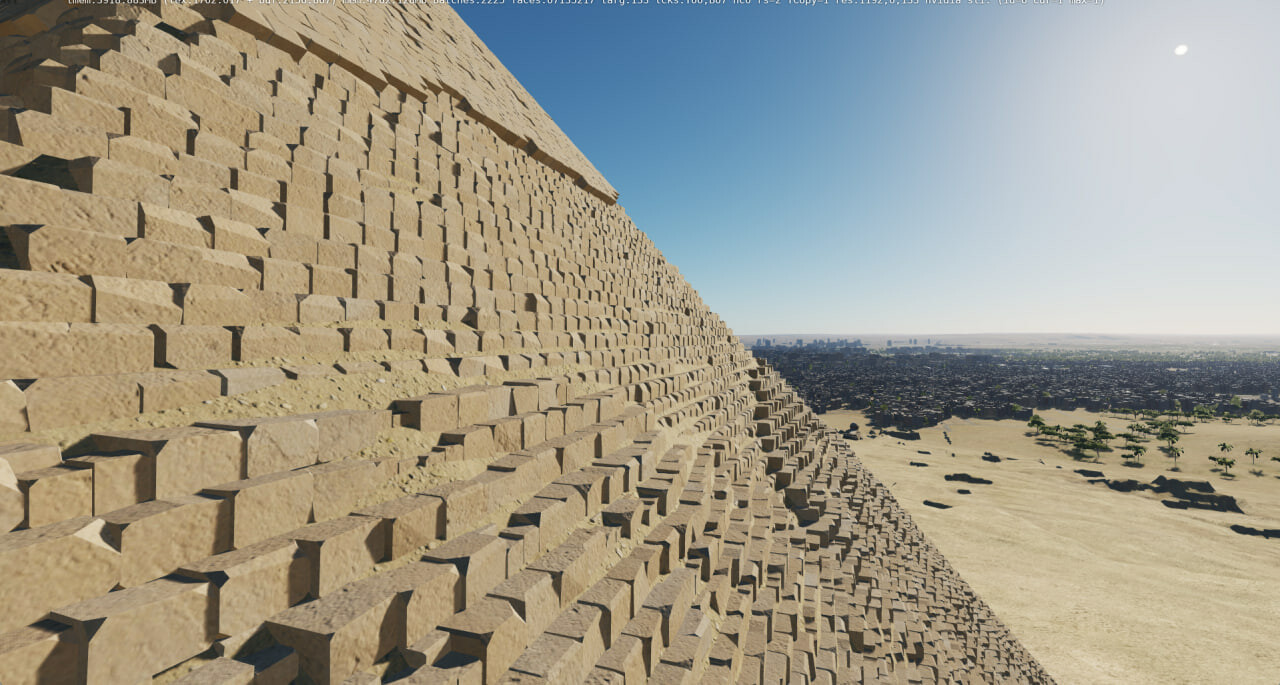
It all depends on the original height map at the initial stage. The world map of heights is 38 meters per pixel (US 10 m.px). Theoretically, you can get a surface mesh with an average edge length of 40-60 meters, but I can’t even imagine how many triangles the Sinai map will occupy (100M + I think), I think that no other game engine will be able to collect and render it. Therefore, various methods are used. We made a heightmap of 4 meters per pixel and use it to generate normal map textures etc. We are now making a utility that will be able to build a ground mesh from an improved heightmap - this should fix the problem of long edges on mountains. The second option, to make adaptive subdivision, is to completely solve the issue of the mountain grid in the foreground. I think the ED team will implement this in the future!
-
does not have yet
-
cheers
-
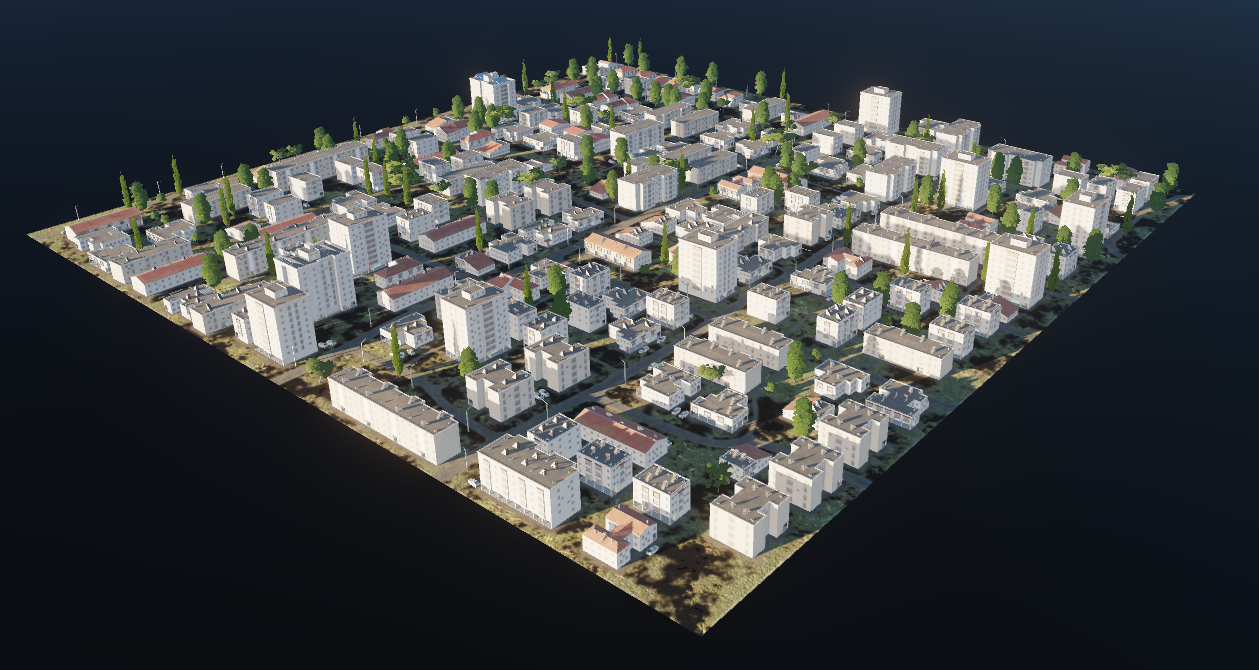
Cairo, Tel Aviv will be included in early access. Jerusalem - the city is made, including several unique buildings! But we will continue to work on Jerusalem in the future.
-
Thank you. There is no exact release date yet. Let me just say that we are at the final stage of the 2nd phase. As soon as we finish it, we will start testing the map with the second phase enabled... I don't think it will take much time
- 629 replies
-
- 17
-
-
-
Thank you. I found good historical maps here: https://maps.lib.utexas.edu/maps/africa.html there is a lot of information here for many years, but I still can not find anything regarding Israel, advise ...
-
We want to do even better)) There is still a lot of work, we try to do it as efficiently and quickly as possible )
-
This is not related to the development of the terrain, I think this will be the next step for our team.
-
we think about it, everything will depend on open information and references on the Internet
-
@Spudknocker made a great first flight, I want to share it here:
-
google, bing textures, etc.. this is the easiest thing to do, we are trying to do something new in the development of the location. Soon you will see for yourself... Thanks for your thought!
-
this is a secret development, unfortunately we cannot provide any diagrams (we will just fix this bug so that fishermen can fish safely)