OnReTech
-
Posts
528 -
Joined
-
Last visited
-
Days Won
13
Content Type
Profiles
Forums
Events
Everything posted by OnReTech
-
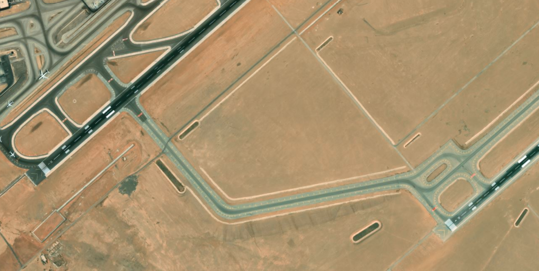
Аirfields use 4 pavement options, these are new asphalt, old asphalt, new and old concrete. At the Cairo airfield, this strip turned out to be new, as I understand it, this is new asphalt. And it seems dark, but the albedo of the new asphalt is about the same as that of coal - 4-5%. I agree that the 05R-23L lane looks more like old asphalt, it will be fixed, thanks!

-
This is a requirement for the map, wherever AI traffic can go - you can not do civilian traffic (this only applies to the sea) Requirements may change in the future.
-
 Eltam AB (el Gora) - in progress and 5 more that will help make the missions even more interesting. Oops, I think I said a lot...
- 5 replies
-
- 10
-

-

-
no, only on the Nile (2 types of civilian boats)
-
These icons will only map on the Sinai map. Maybe other map developers will add them too, I don't know.
- 1 reply
-
- 6
-
-
St Catherine International Airport
-
yes, sure. Thks
-
sorry man, i didn't think all the videos would come out at the same time
-
now is ~55 GB some more videos
-
After early access, I plan to create a separate topic on the forum -> to-do list and link it to our project planning system. Because there are a lot of requests. I'm still thinking about how to do it, but I think it will be cool! I think that's what this forum is for. Agree it's hard. But ED guys are professional. It's a pleasure to work with them.
- 629 replies
-
- 10
-
-
Thank you Pedro Navarro
-
no problem many thanks many thanks
-
Included are several objects planned for early access. The rest of the unique objects will be included in phase 3, I think we will discuss them separately on the forum (we forgot about helicopters and helipads on tall buildings, they will be made) Tel Aviv https://www.instagram.com/p/Cne6k5LrcnX/?utm_source=ig_web_copy_link No more screenshots, we wrote about it, but I'll find time to take them
-
It looks good, but the problem is in the heights, I haven't figured out how to do it yet. But we made helipads as 3d models + destruction model. The problem is that in TDK there is no concept of a helipad, but I intend to talk to the ED to resolve this issue. Need time! Unfortunately, the current solution does not support negative heights, i.e. in this place the heights are minus, and the top of the mountain is 22 meters above sea level. But be sure that I always write to the UD support when it can be done, because I have a height map ready for this.
-
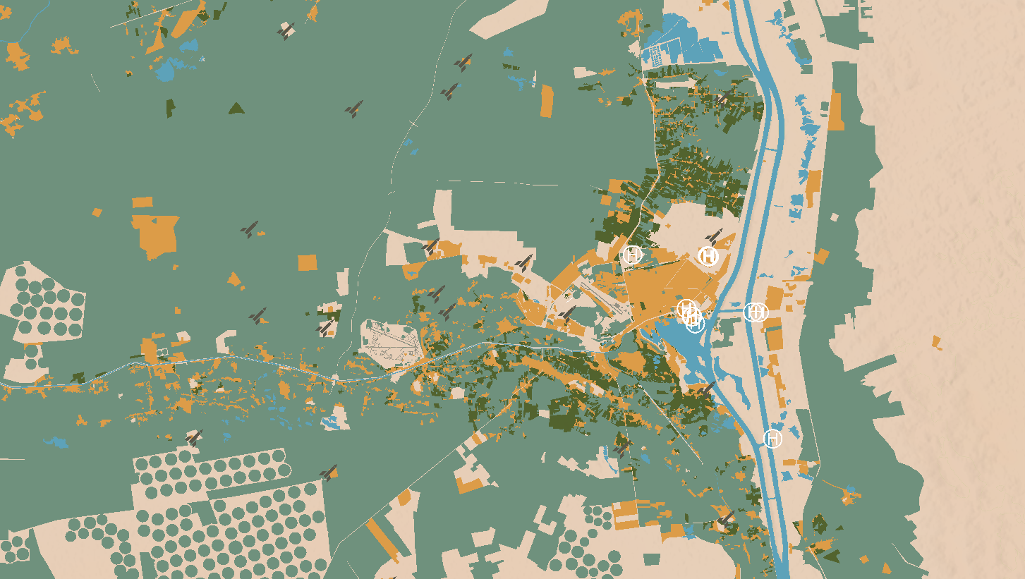
SAM and helipads icons: nullnull
- 629 replies
-
- 19
-
-
Now Sinai map ~ 55 GB, but I think that this value will increase, I can’t say by how much
-
HDD storage? or RAM? how big is Syria map?
-
looks correct
-
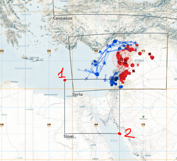
1 - Point location: -193510.000 3849601.000 (Lat/Lon: 34° 33' 14.5757" N, 25° 26' 55.1112" E) 2 - Point location: 1379354.000 2801025.000 (Lat/Lon: 25° 04' 08.7548" N, 41° 41' 51.2221" E)
-
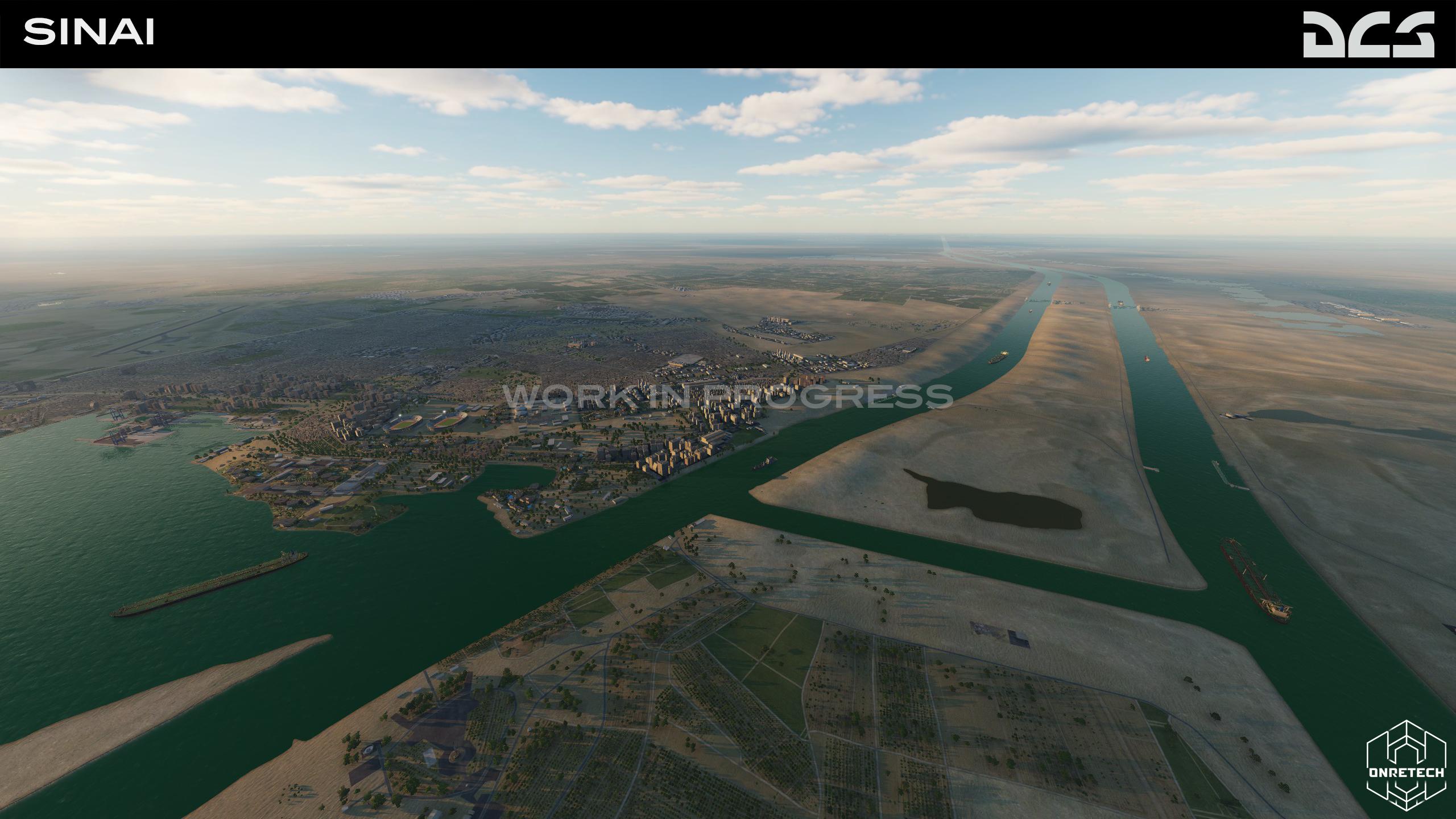
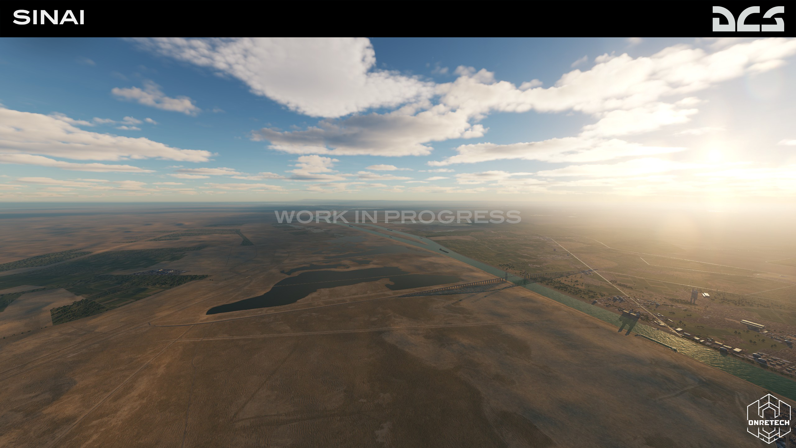
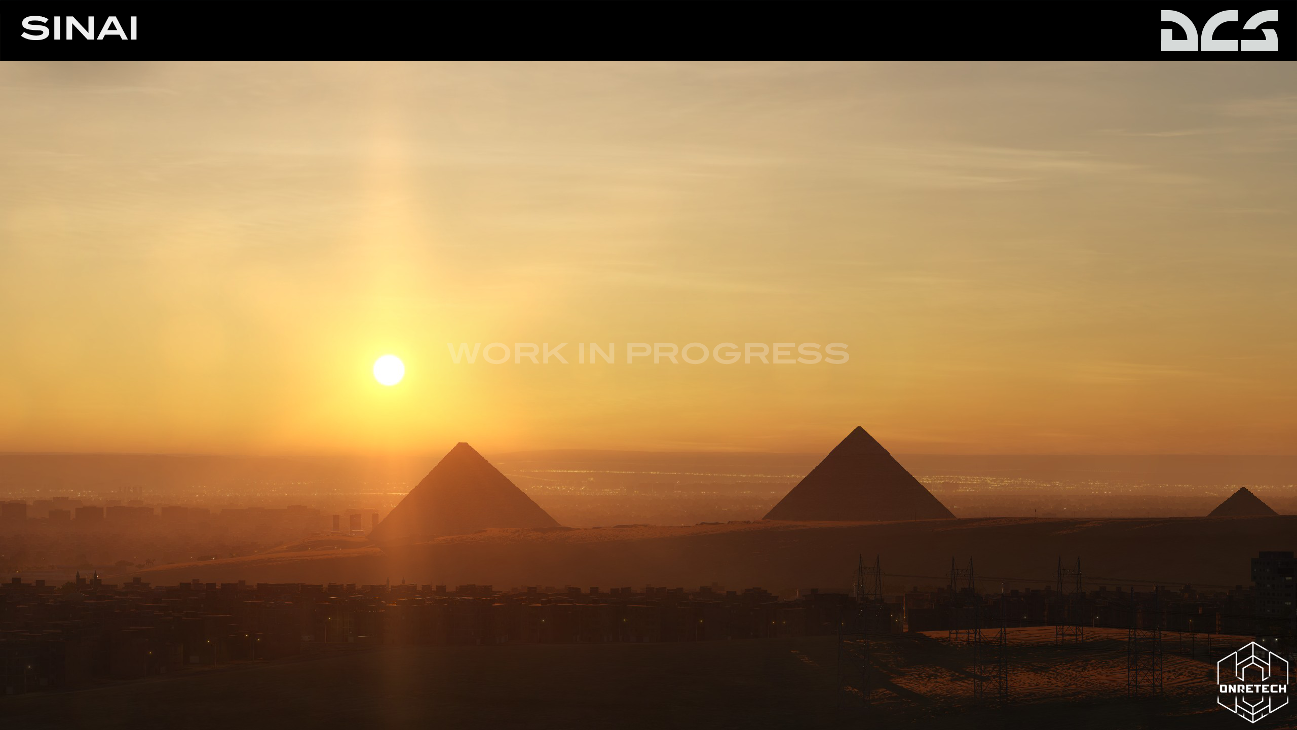
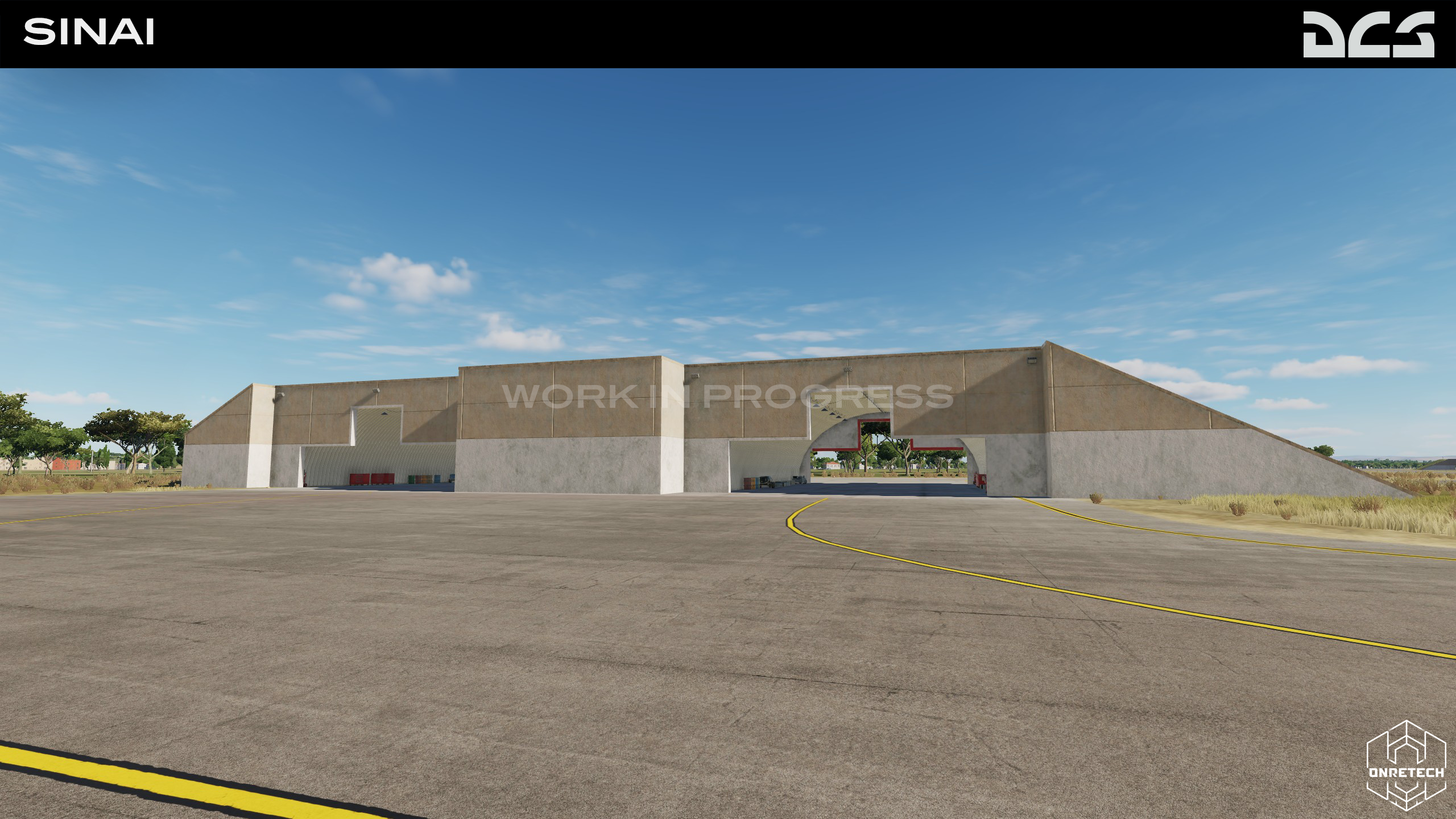
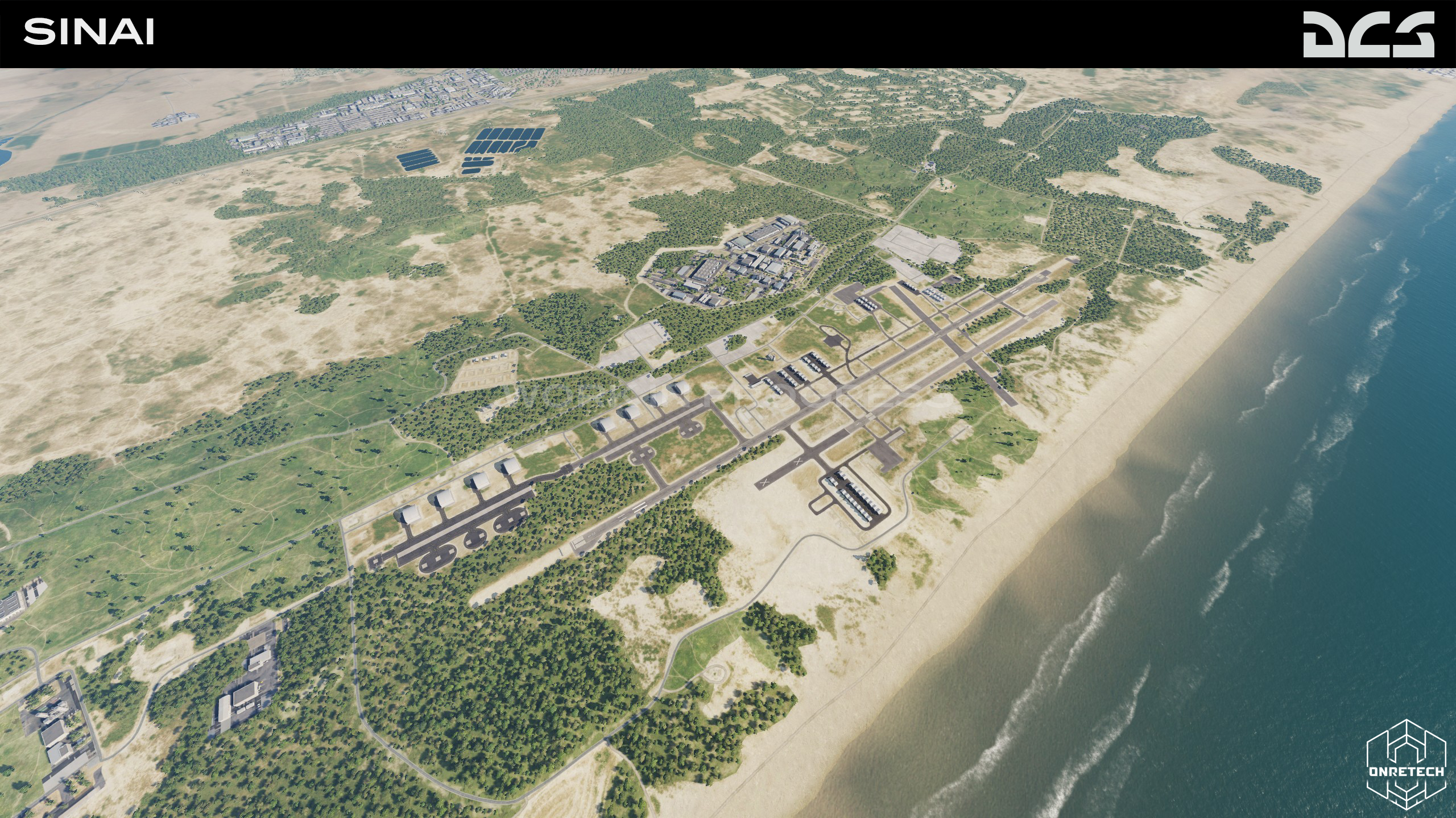
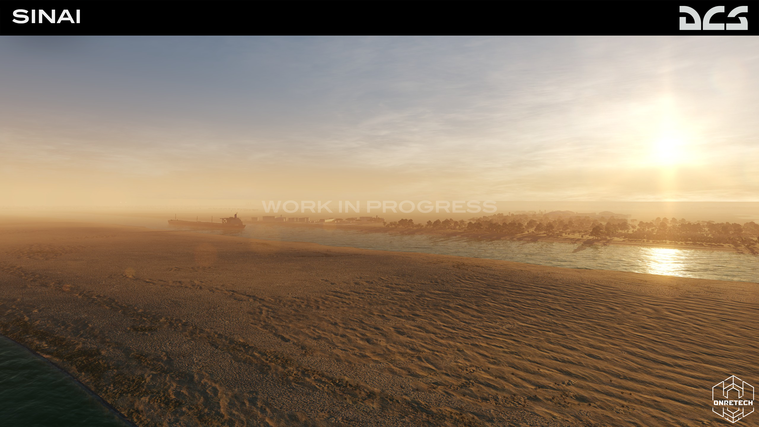
Hello dear friends. We are still doing the latest testing and improvements to the Sinai map for early access. I think that these will be the last screenshots before early access, it is impossible to convey in screenshots huge amount of work done. Thank you all again for your support and feedback - it really helps to move forward and make the map even better!
- 629 replies
-
- 22
-
-
-
That's right, we've already discussed this. It's a good idea, I totally agree.