OnReTech
-
Posts
528 -
Joined
-
Last visited
-
Days Won
13
Content Type
Profiles
Forums
Events
Everything posted by OnReTech
-
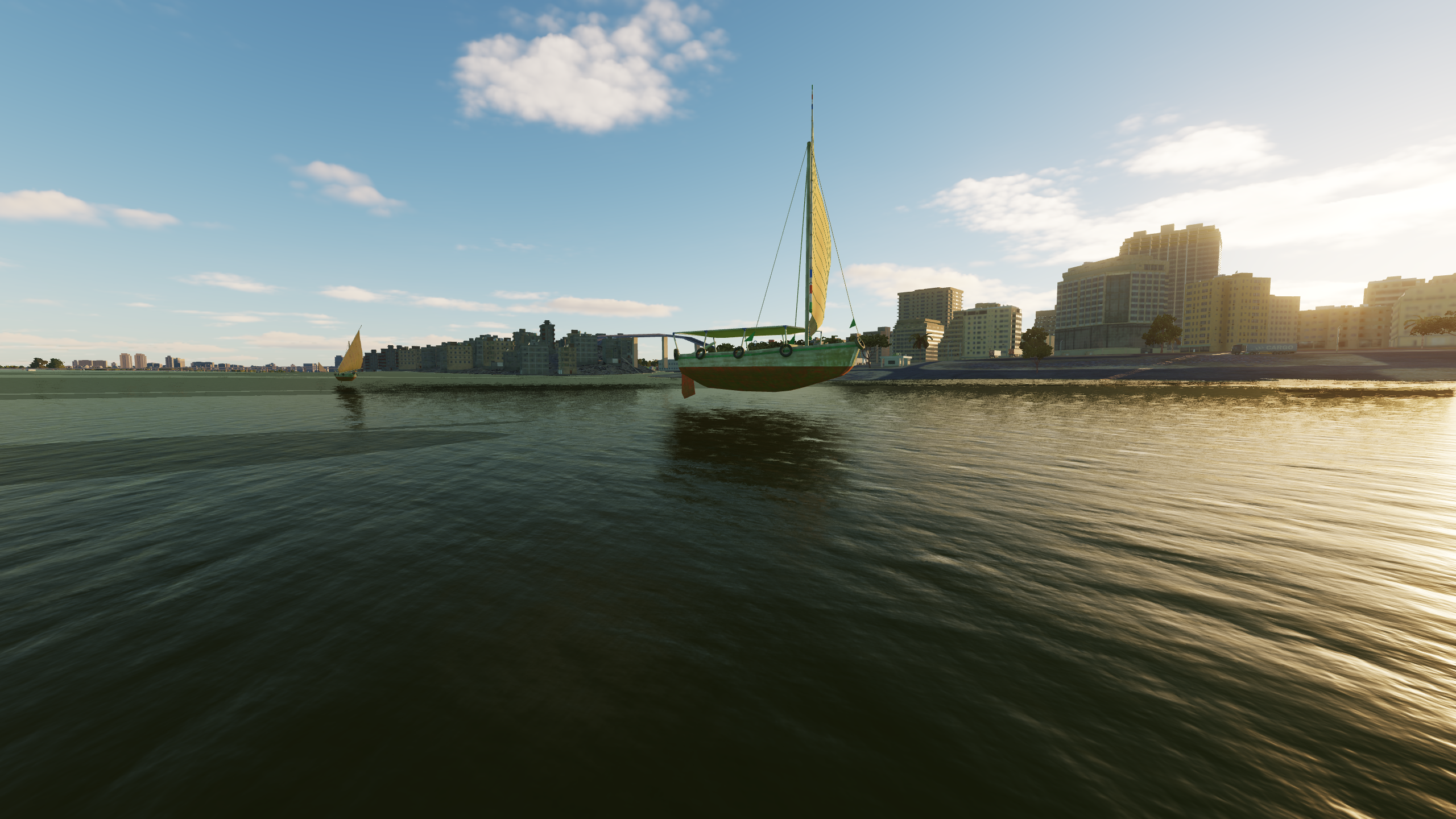
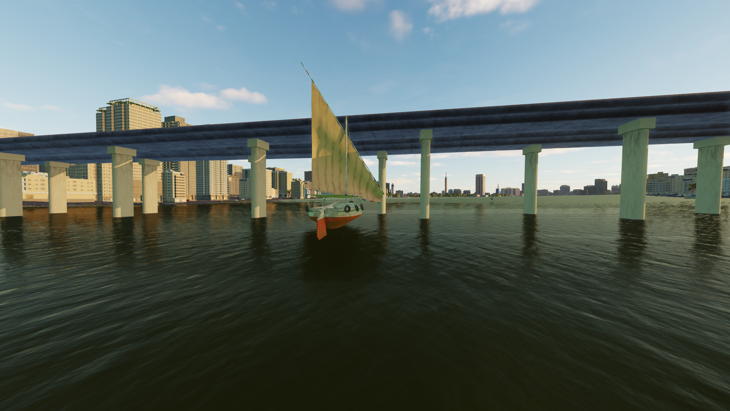
New flight model announcement. Fishing boat burns the Nile river, feature: flies at especially low altitudes ))))

- 5 replies
-
- 12
-

-
I think we are implementing standard airfields throughout the entire territory (1000x1500 km), we have already come up with a technology for how to do this. They will not look like airfields in real life. I think it will be a good solution for AI to use them in missions. Typical airfield - runway, taxiways, hangars. I didn't think how they would look, but I think we'll find a solution. I think that we will deal with this after early access.
-
We can't compare with another map, because Sinai map uses different technologies, different number and quality of objects and textures, etc.. Now we are checking and optimizing performance on different hardware configurations and with different graphics settings.
-
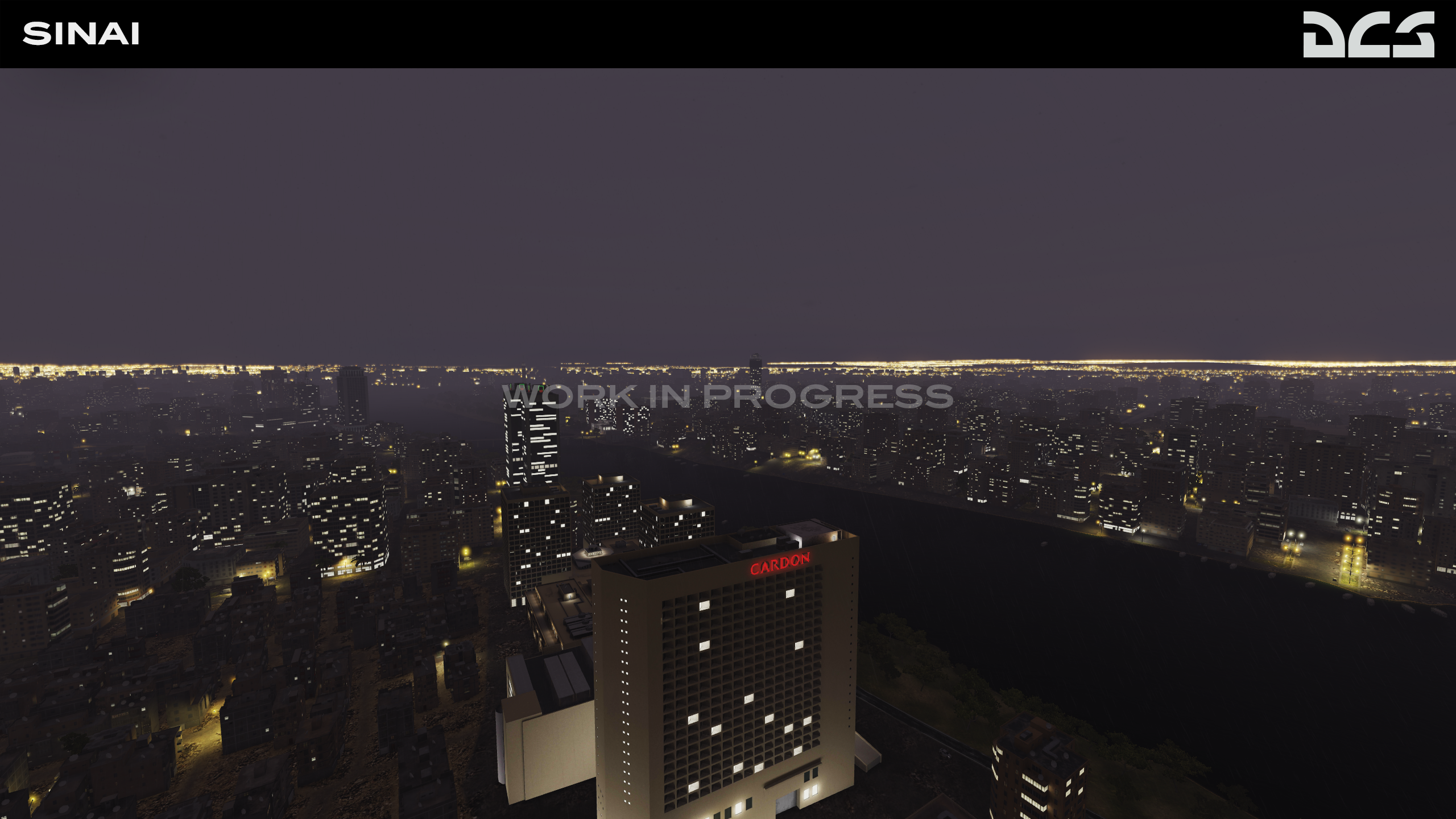
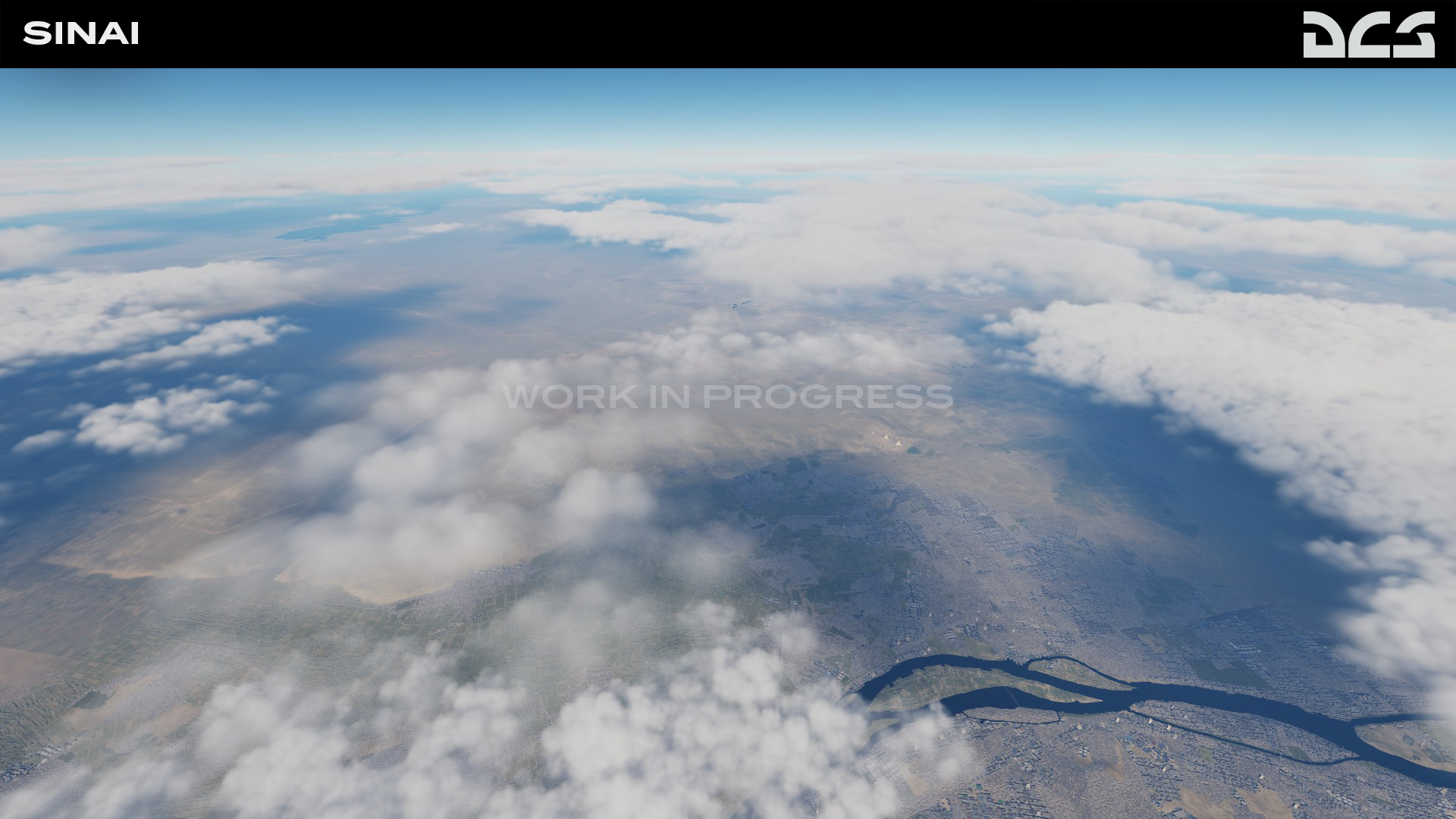
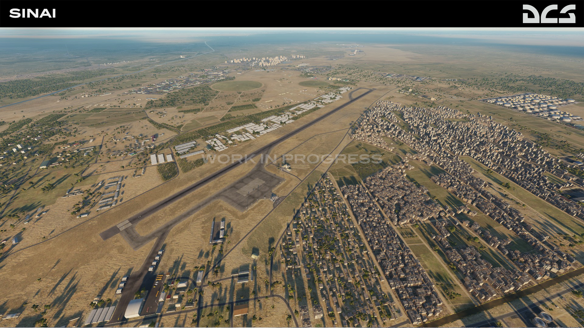
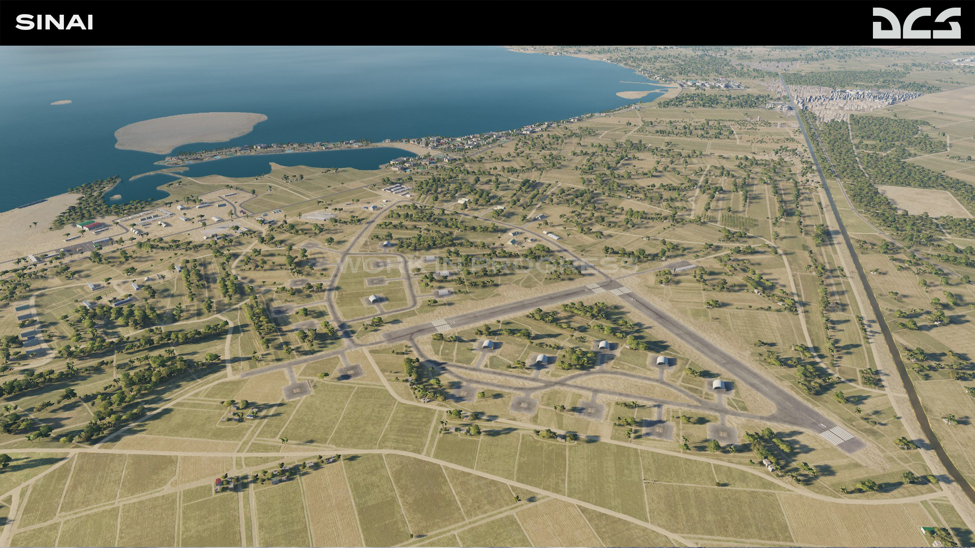
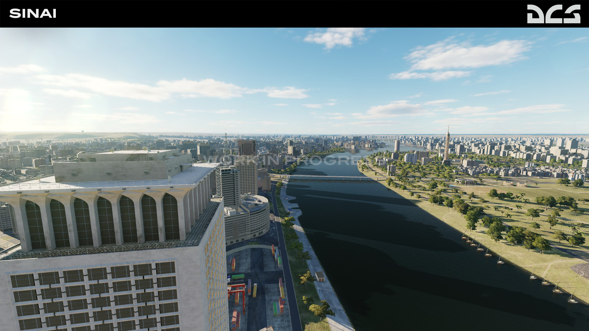
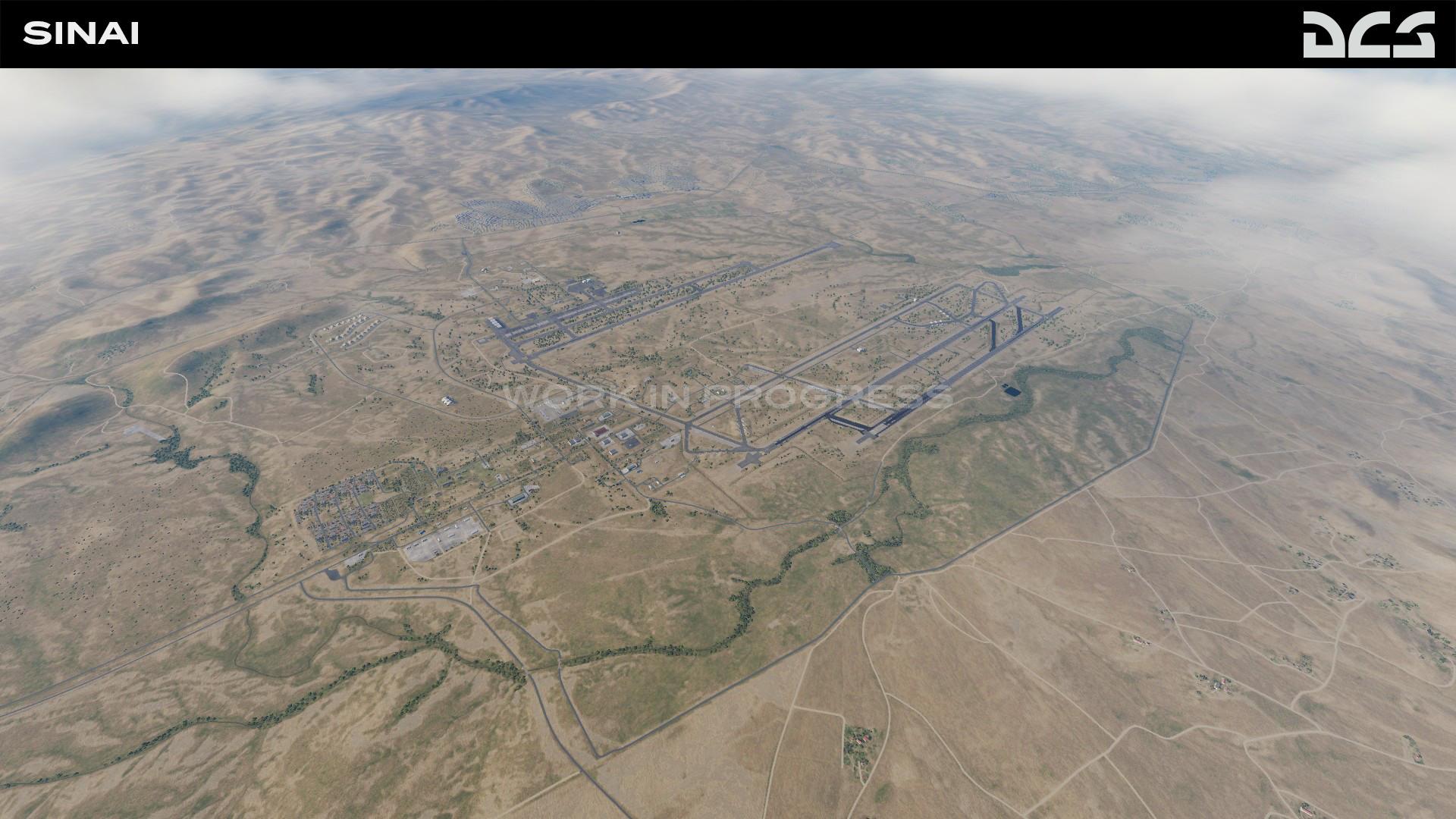
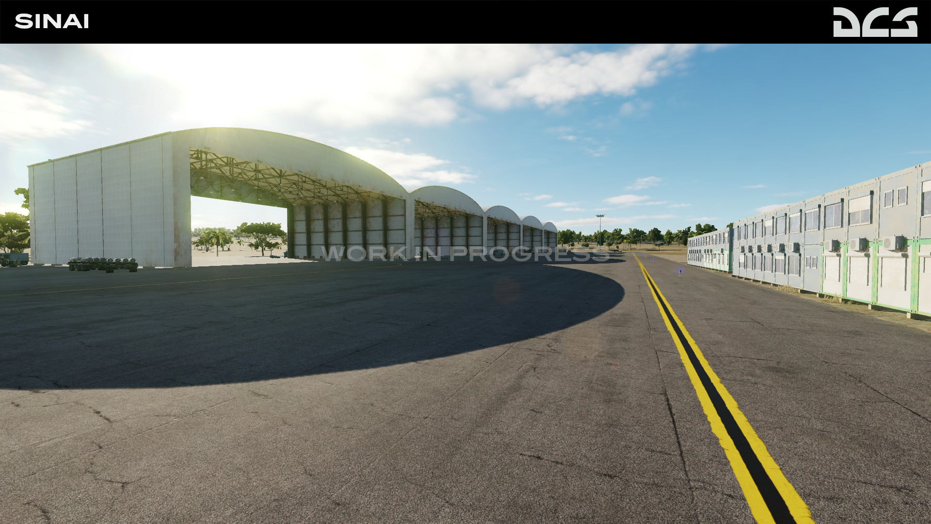
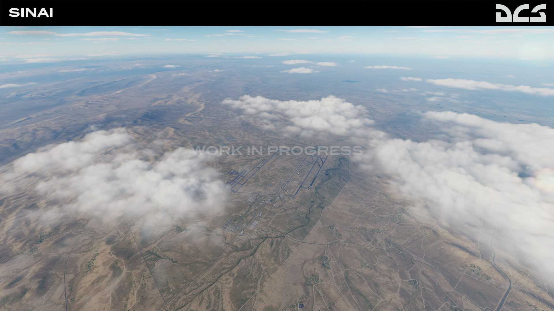
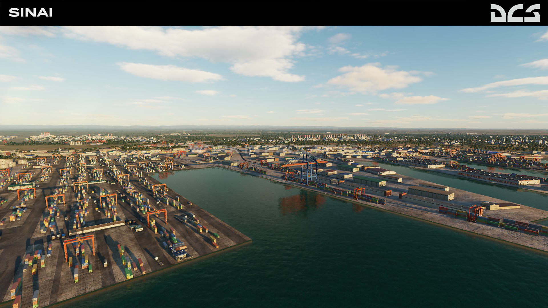
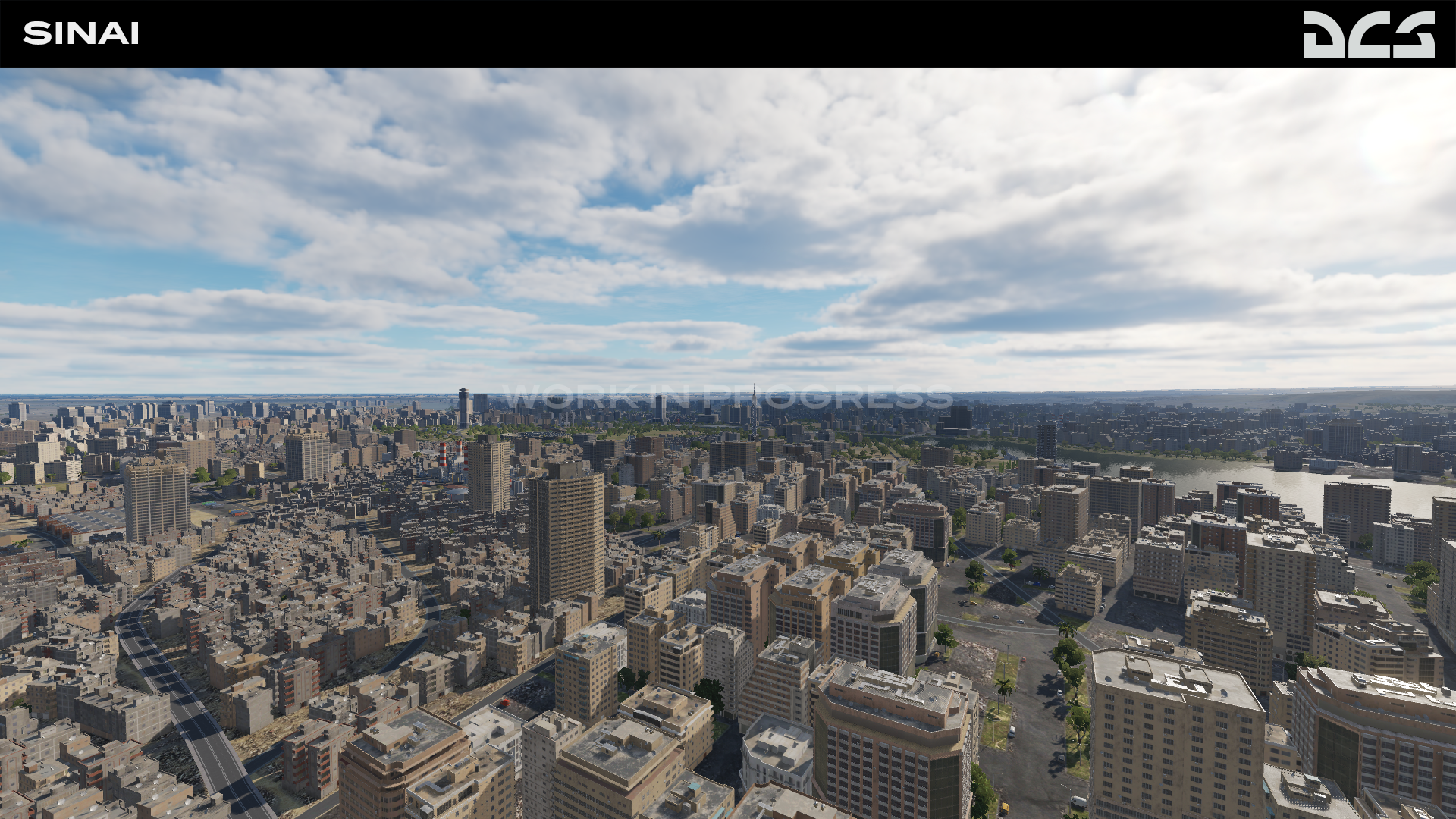
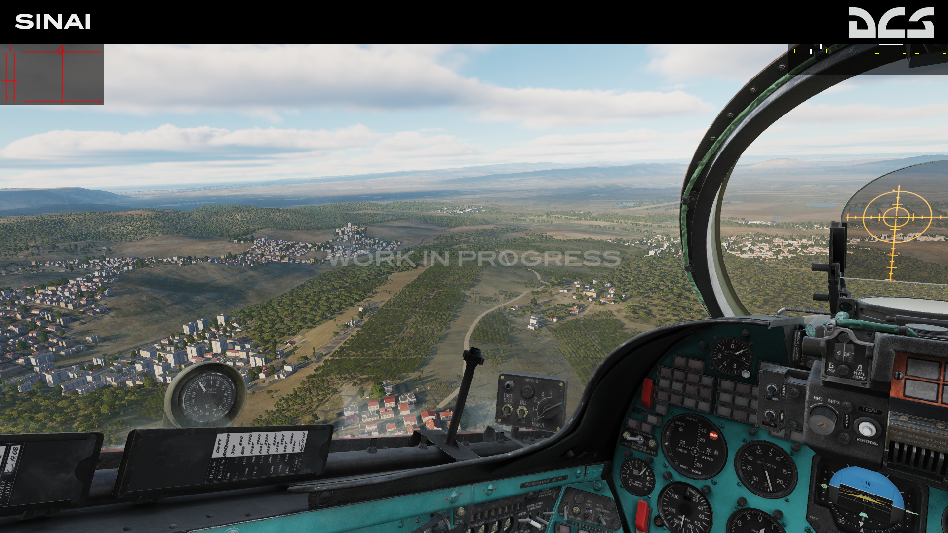
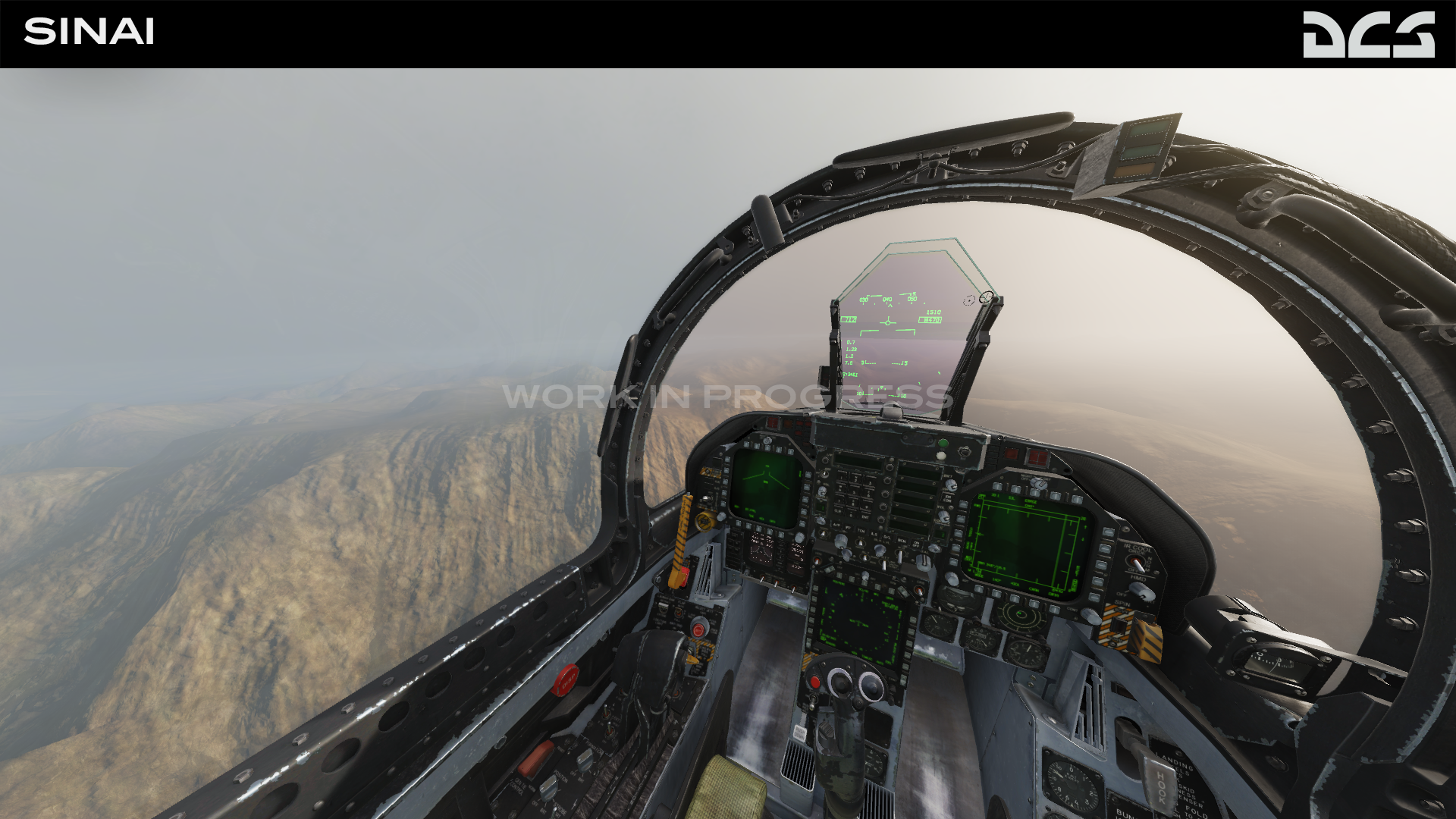
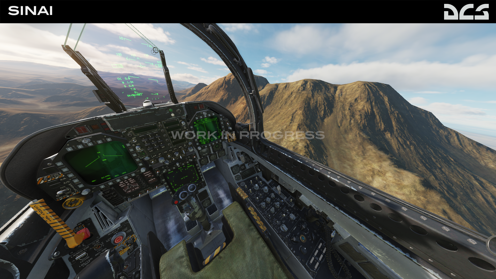
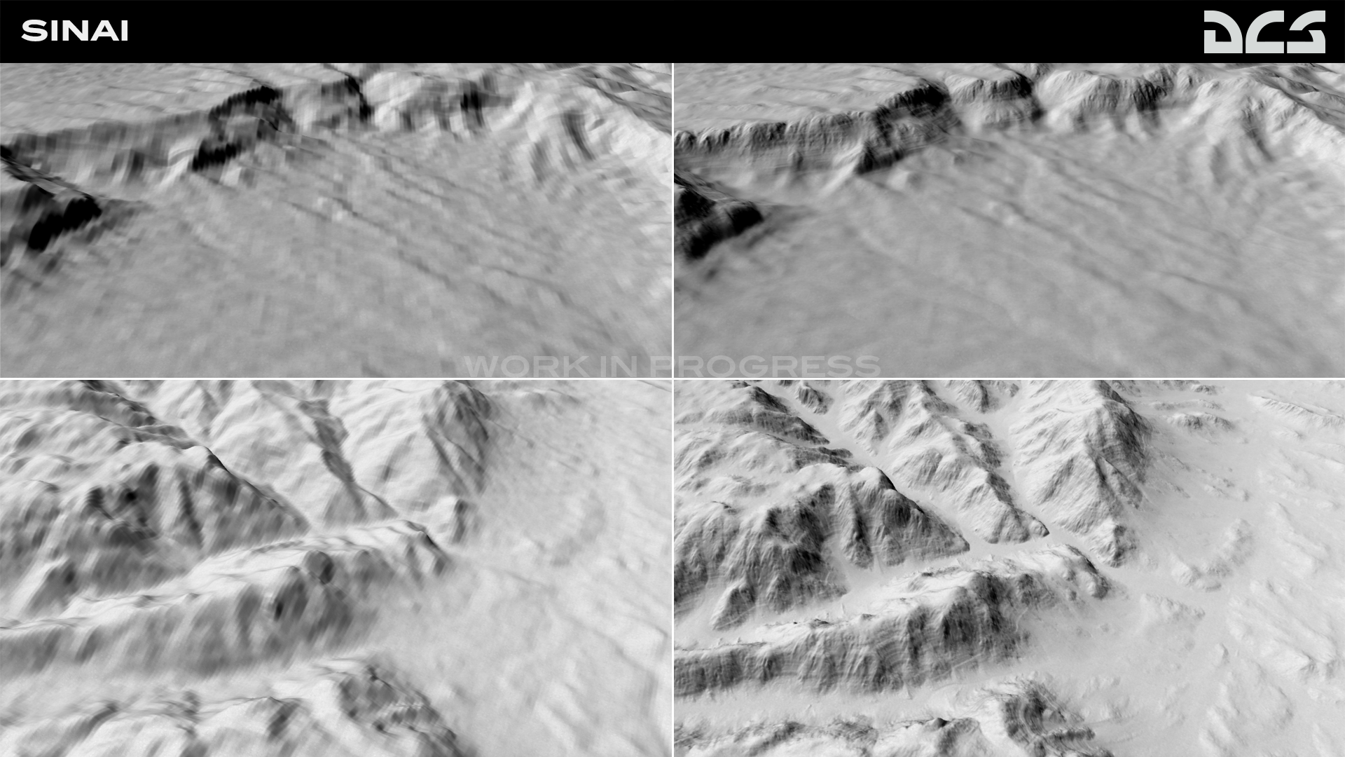
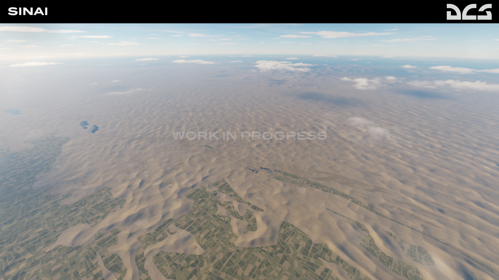
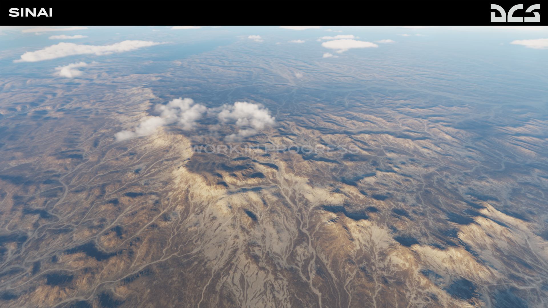
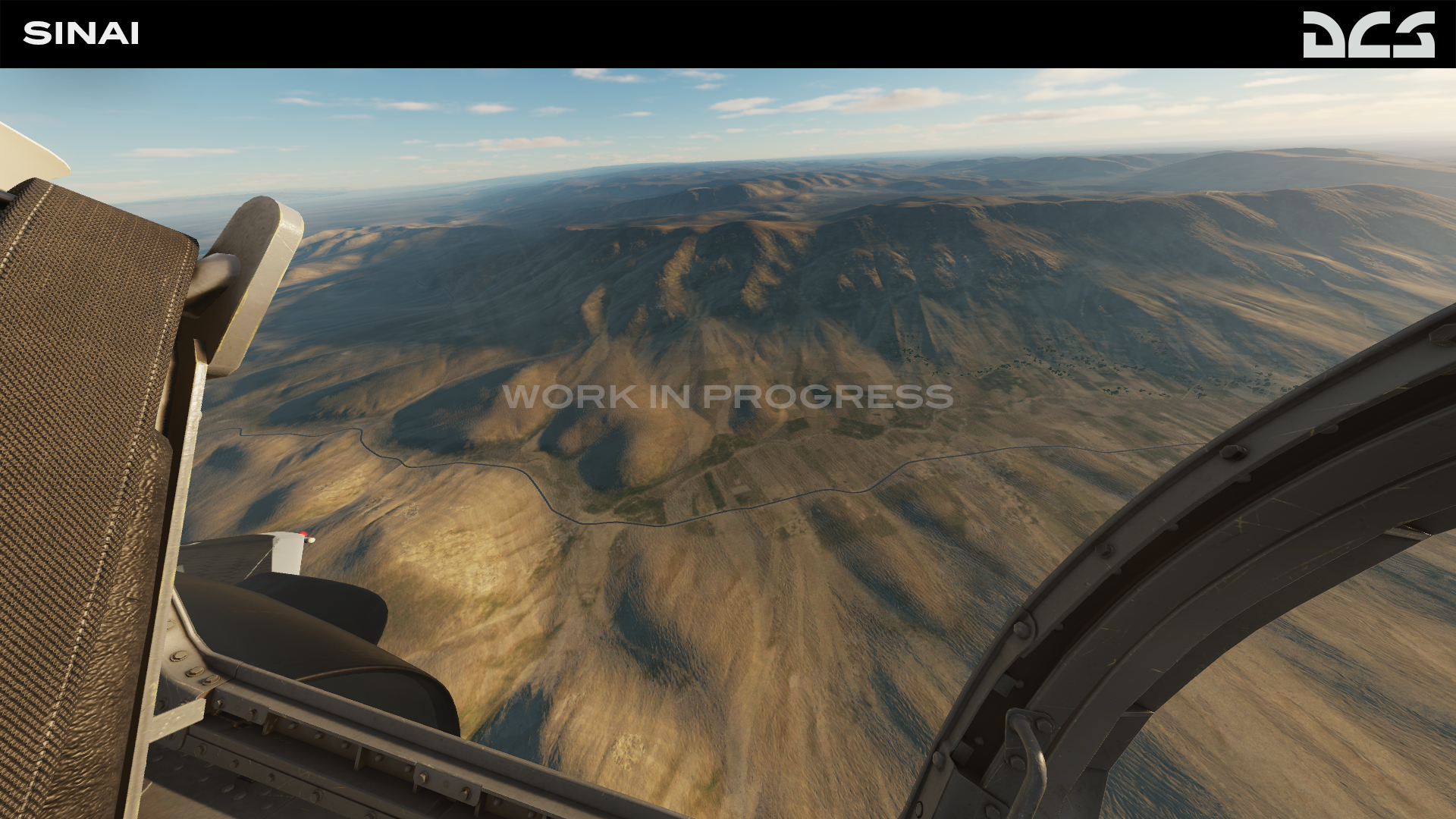
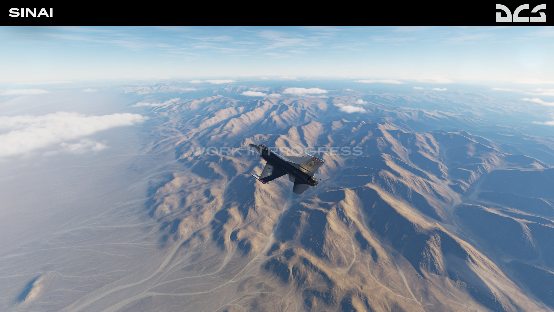
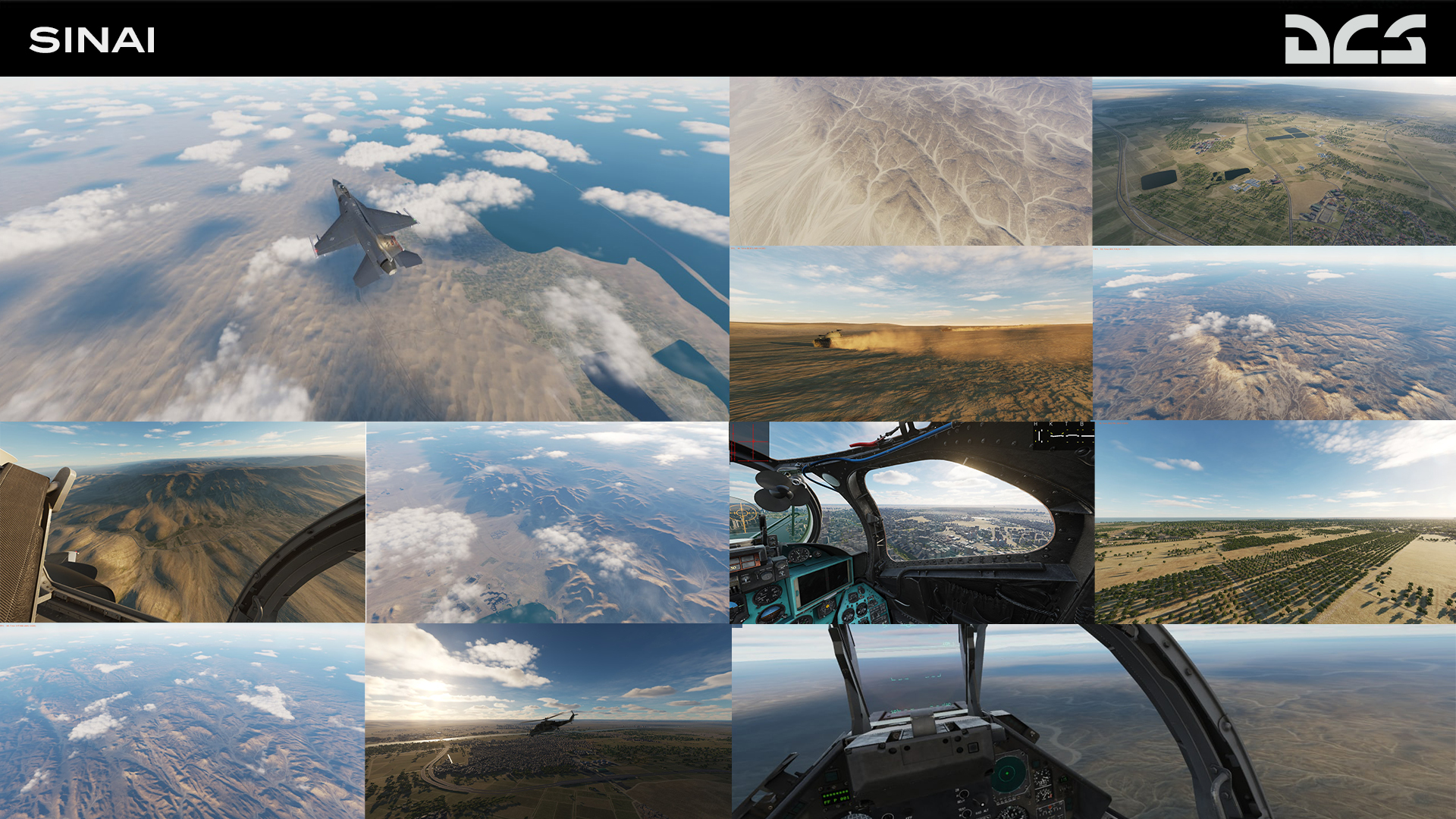
Hello pilots and friends. We've been working on real time lighting and improving terrain textures, a couple of screenshots of progress:
- 629 replies
-
- 27
-
-
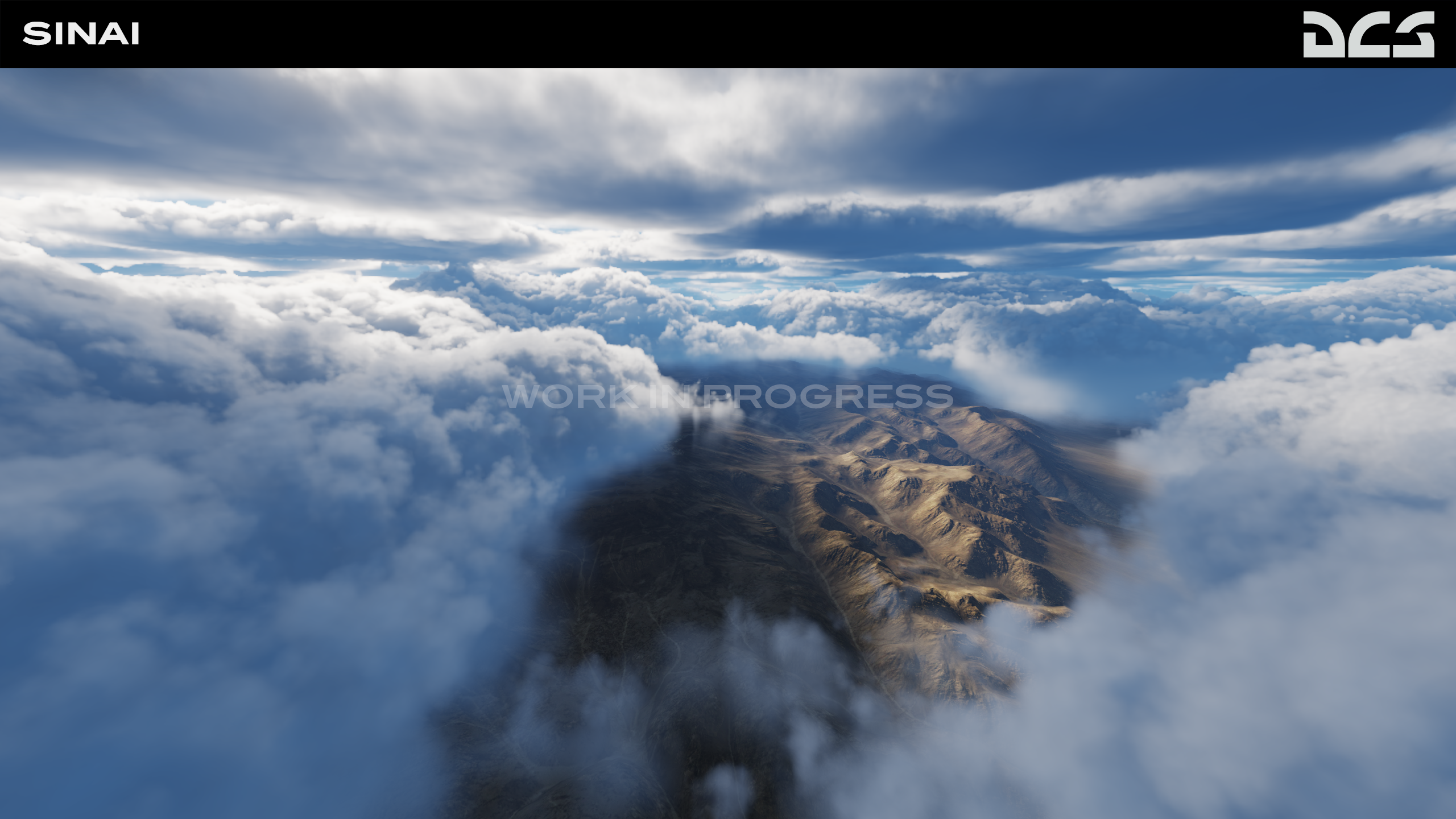
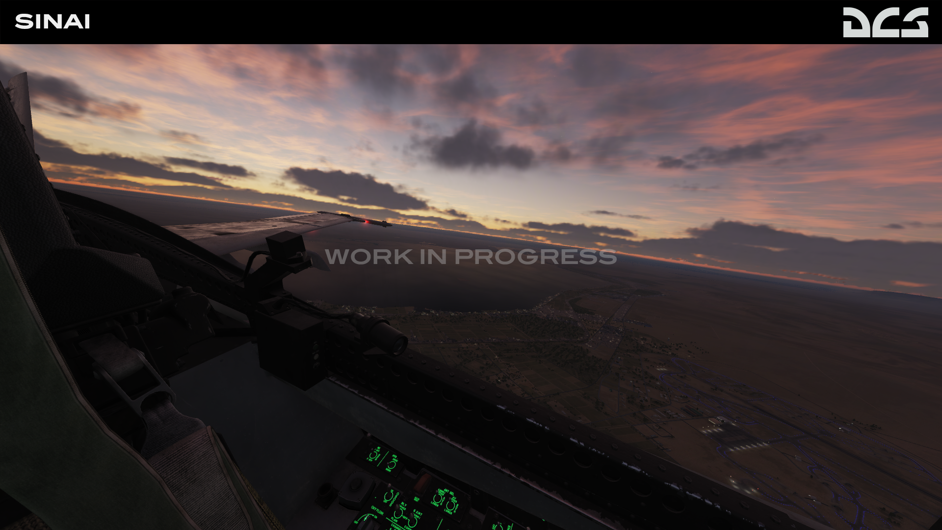
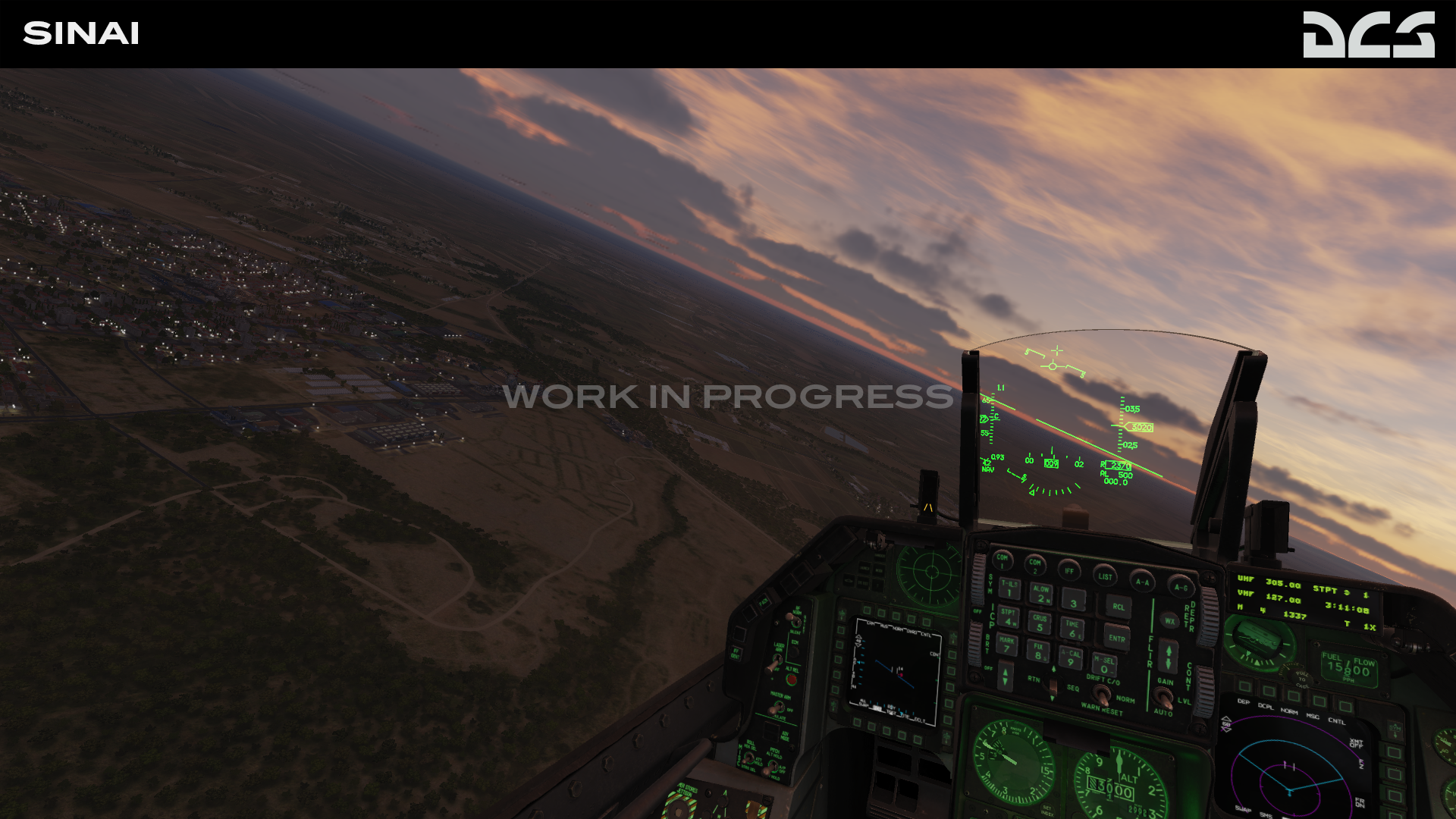
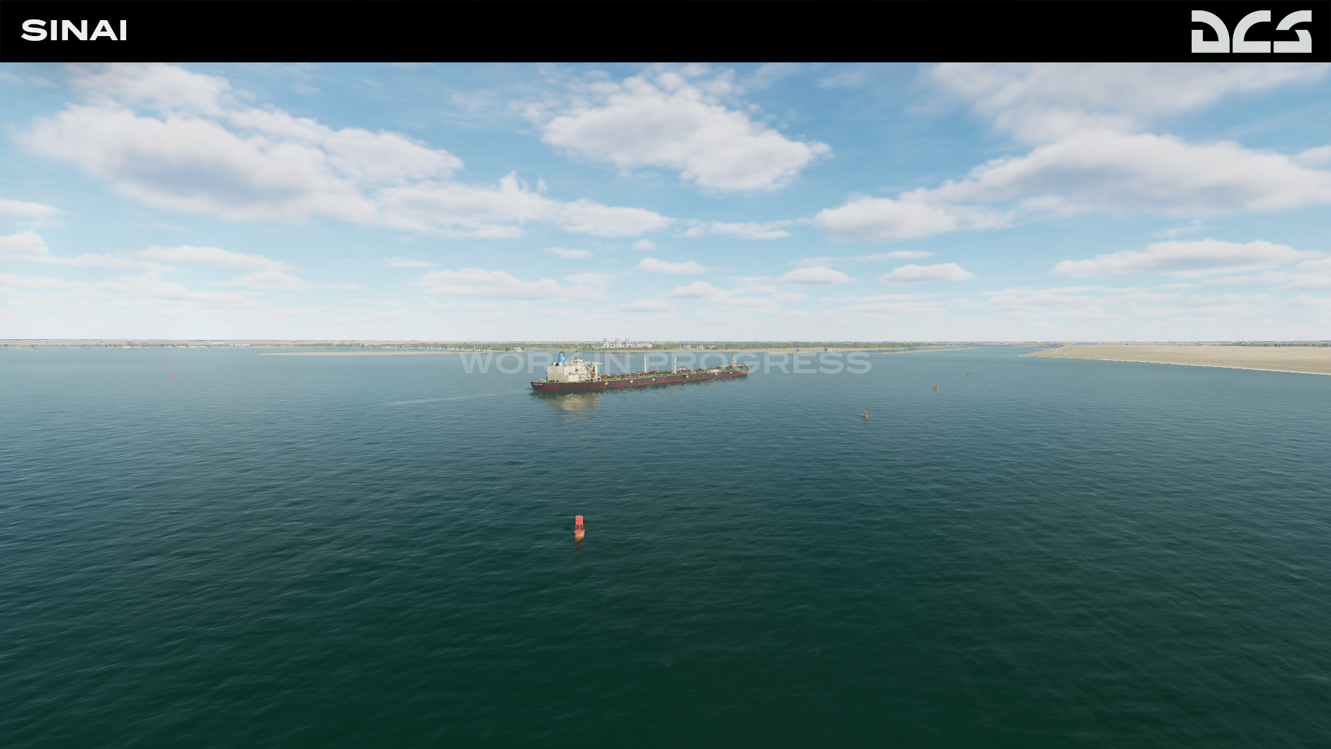
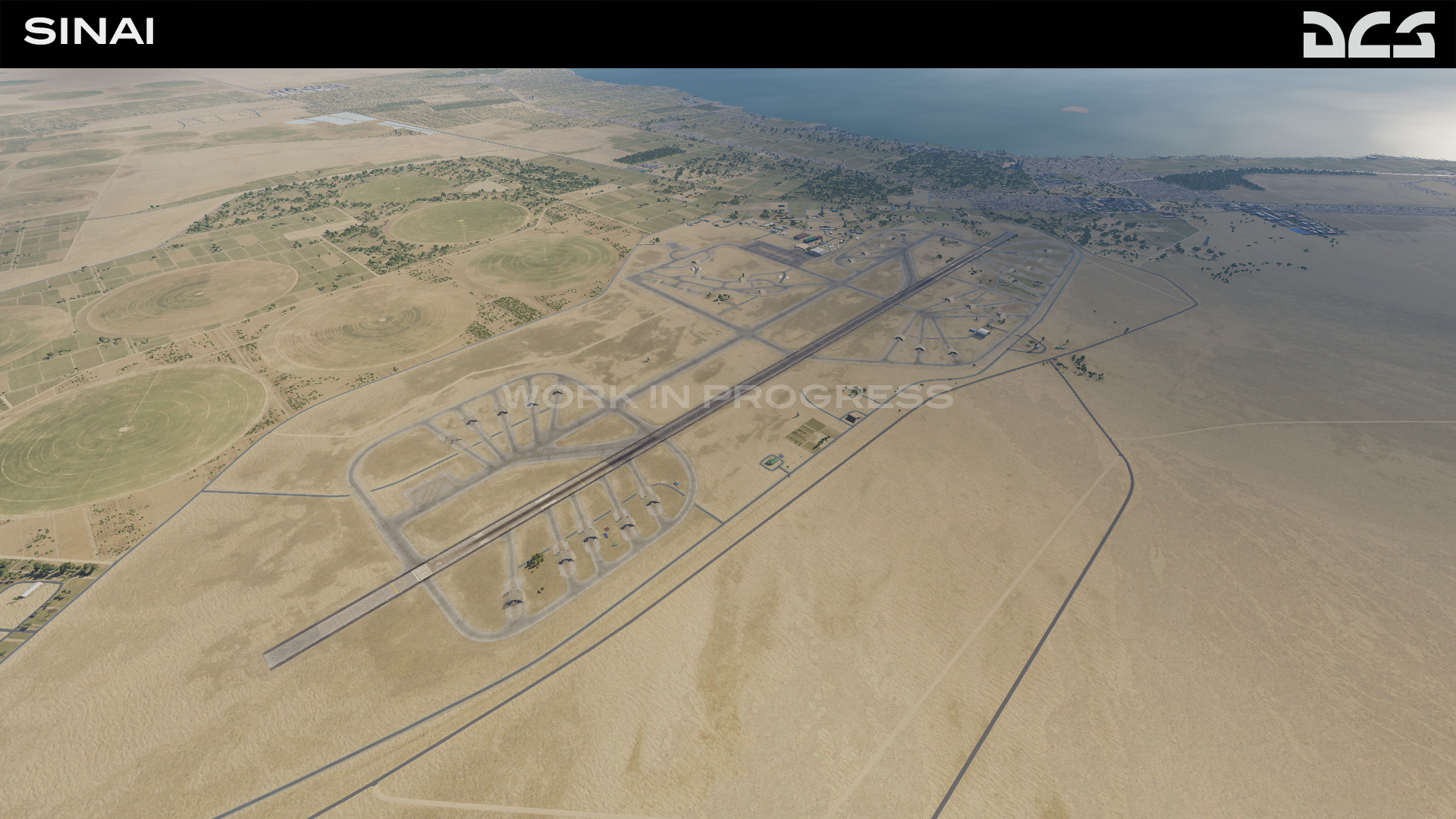
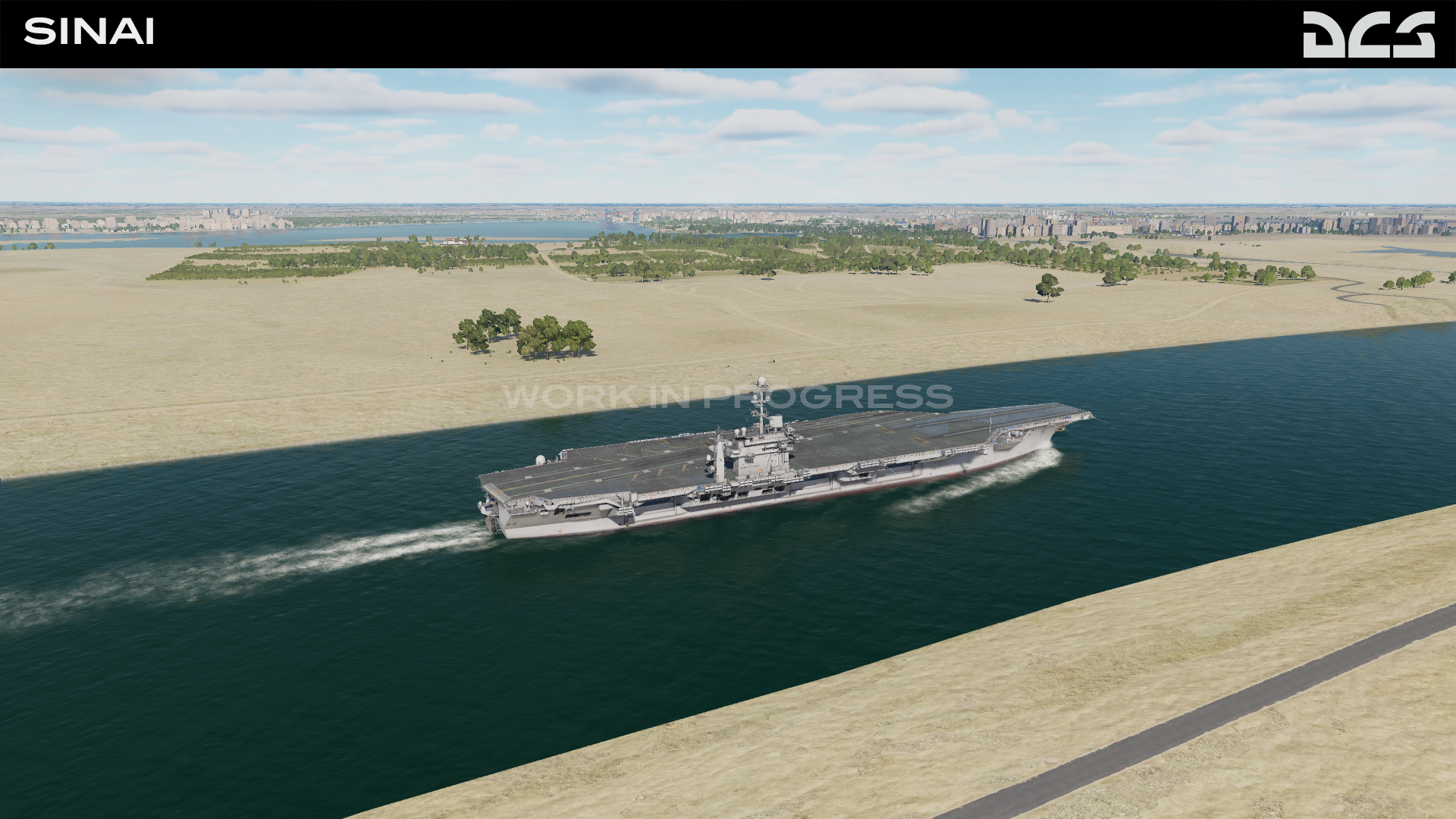
When we testing a Sinai Map, it's impossible not to take a few screenshots and share them... Still work in progress...
- 629 replies
-
- 29
-
-

-
We will be making a big update very soon, but I want to share the progress. FPS is very good. See screenshots below. We also made an Instagram @OnReTech , where we will try to regularly update our progress. Thanks for your support!
- 629 replies
-
- 14
-
-
-
I'm not sure, but it seems there is a technology for switching the date in the development tools. I think we will have a discussion about this in the future. We thought about the date for a long time, but after studying the material, we realized that it was very small data even for 1973. There are photographs and maps of those times, but they are not enough to make a complete picture of the map. I mean the airfields and military bases. But the terrain development kit (tdk) allows you to make maps of any time and this is very good.
-
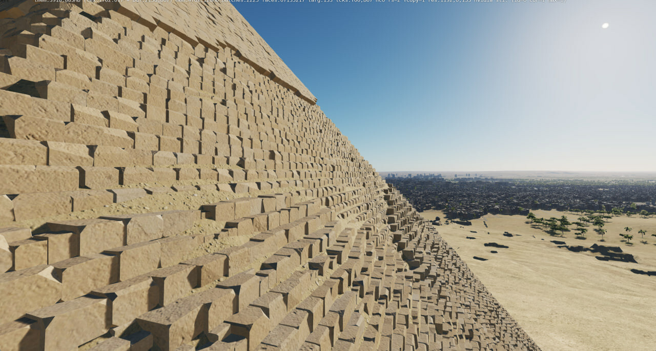
Cairo International Airport. I think the ladies want to visit the pyramids of Giza before going to the sea to Hurghada. Maybe by this time Sharm El-Sheikh airport will appear on the map. But it is not exactly)
-
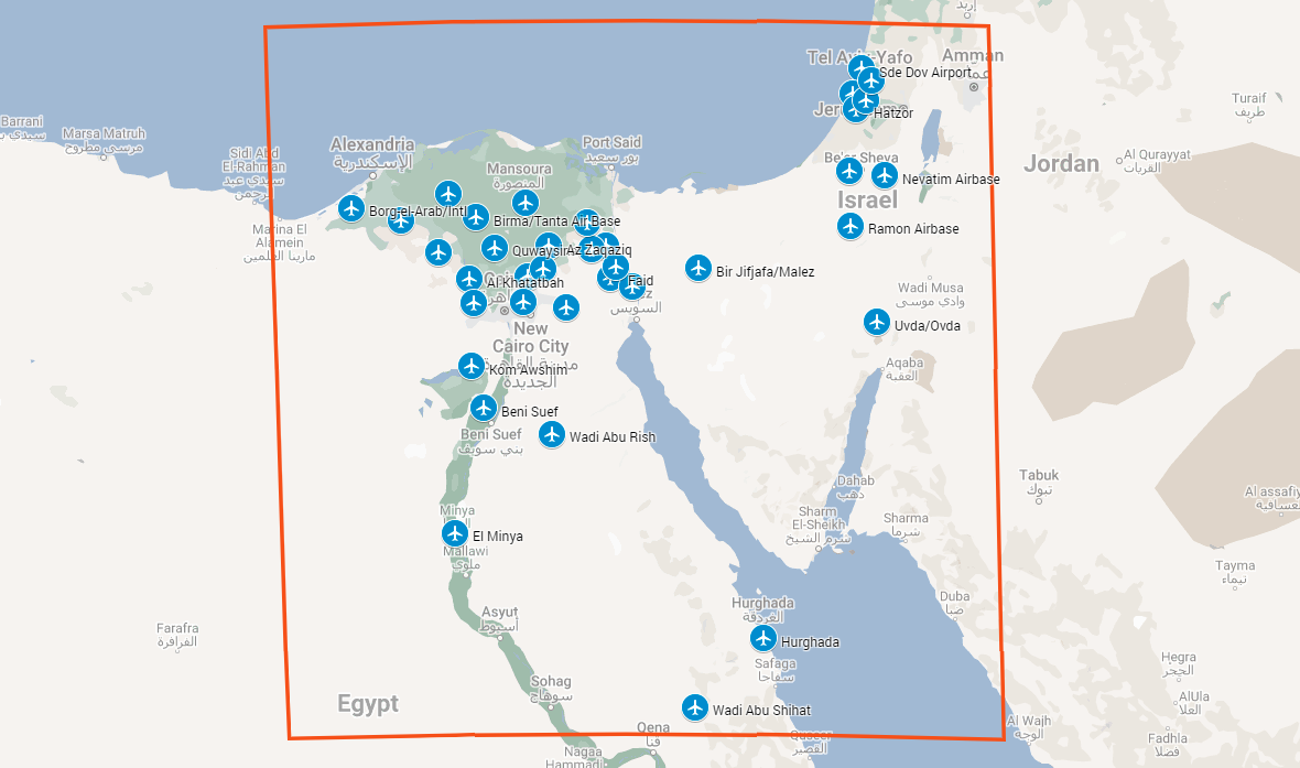
In the future we will have a map extension, this will be a decision based on user feedback we marked the planned airfields on the map for clarity:
- 629 replies
-
- 11
-
-
-
Hi, thanks. The list of airports can be found here:
- 1 reply
-
- 2
-
-
the canal will be navigable
-
Thanks for the advice, we'll definitely think about it.
-
One of the members of our team, participated in the development of all DCS maps starting from the Caucasus, as well as consulting third-party maps. Many of the team were engaged in the development of models and terrains for flight simulators lot of time. completely agree Part of Cyprus climbed by accident, because it is a rectangle (mean all map). Territory of Cyprus is not included in our plans.
-
We will be able to model, but unfortunately the current version of the TDK does not support a surface mesh below 0 meters in areas where there is a sea or ocean.
-
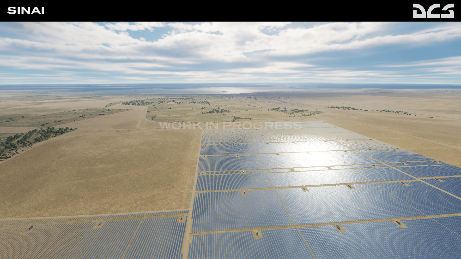
Dear pilots and friends. The OnReTech team continues to work on the module. In addition to facilities and airfields, we are working to improve the quality of the terrain surface. We have implemented procedural texturing technology. We worked on the color balance and improved the visibility of details at high altitudes. Now we are testing flights at high altitude and latest updates made the view as close to the view in real flight as it can be. In the next step, we will focus on the foreground, add small vegetation and stones. We will add traffic and details to the roads and rivers, such as poles and trees along the roads, rivers and canals.
- 629 replies
-
- 23
-
-
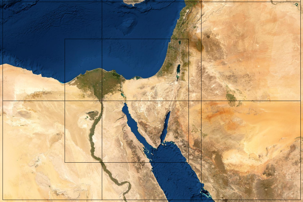
FAQ Note: This FAQ is very much subject to change, and nothing should be construed as a "promise". This the current intention as of 27 September 2022. Who is developing this map? OnReTech was formed in October 2021 to develop terrains. With more than seven years of experience creating terrains for flight simulators, including DCS, we have assembled a team of dedicated artists, engineers, researchers, and managers to create new and interesting battlefields for DCS World. Why Sinai? The Sinai map is of great historical importance that includes several past conflicts. The map will include different types of surfaces, large and small rivers, forests, fields, and mountains. Large and small cities, many military airfields, road and rail networks, ports will also be included. Despite large portions of desert, the map will also include greenery and forests along the Nile Delta and in Israel. What does the Sinai roadmap include? The project is divided into three phases in total. Early access: first + second phase. Map update: bonus phase with expansion of the detailed territory with 3-4 additional airfields (it's a secret for now; we're still considering which ones). Final release: third phase First phase This will Include a 1500 x 1000 km area. Of this, a 700 by 700 km will be created in high detail and accuracy. Phase 1 will include many large and small cities like Cairo and include landmarks like the pyramids of Giza. Both natural and manmade features will be included. Airfields of the first phase: Egypt: Al Ismailiyah Air Base Faid Kibrit Air Base Abu Sultan Abu Suwayr As Salihiyah Bir Jifjafa/Malez Wadi al Jandali Israel: Nevatim Airbase Hatzerim Airbase Ramon Airbase Uvda/Ovda Second phase. Additional unique objects and scenery for Israel and Egypt will be added. Airfields of the second phase: Egypt: Al Mansurah Az Zaqaziq Inshas Airbase Cairo International Airport Cairo West (Almaza) Bilbeis Air Base Israel: Sde Dov Airport Palmachim Airbase Hatzor Tel Nof Ben Gurion Third phase. Airfields of the third phase: Egypt: Quwaysina Birma/Tanta Air Base Al Rahmaniyah Borg-el-Arab/Intl Jiyanklis New Gebel el Basur Al Khatatbah Kom Awshim Beni Suef Wadi Abu Rish El Minya Hurghada Wadi Abu Shihat When will this map be available? We are planning an early access release in the first quarter of 2023. This is subject to change. How much will this map cost? Base price - $49.99 USD Early access - $39.99 USD What period is this map based on? The map is being designed to represent the 2000s to the present.
- 629 replies
-
- 45
-
-
-
-
It is very hard to make a map that covers all historical events, we have just started working with ED and we really admire the graphics engine (TDK) they have made. Our team starts performance testing - this is very important, but sometimes we forget about it when you start flying over what you created.
-
@everyone Thank you for your interest. In the near future we will make a FAQ with answers to all your questions.
- 42 replies
-
- 16
-
-
-
all this area will be included in early access, but red area will be more detail (high detail zone)
- 42 replies
-
- 10
-
-