Blackbahia
-
Posts
63 -
Joined
-
Last visited
Content Type
Profiles
Forums
Events
Everything posted by Blackbahia
-
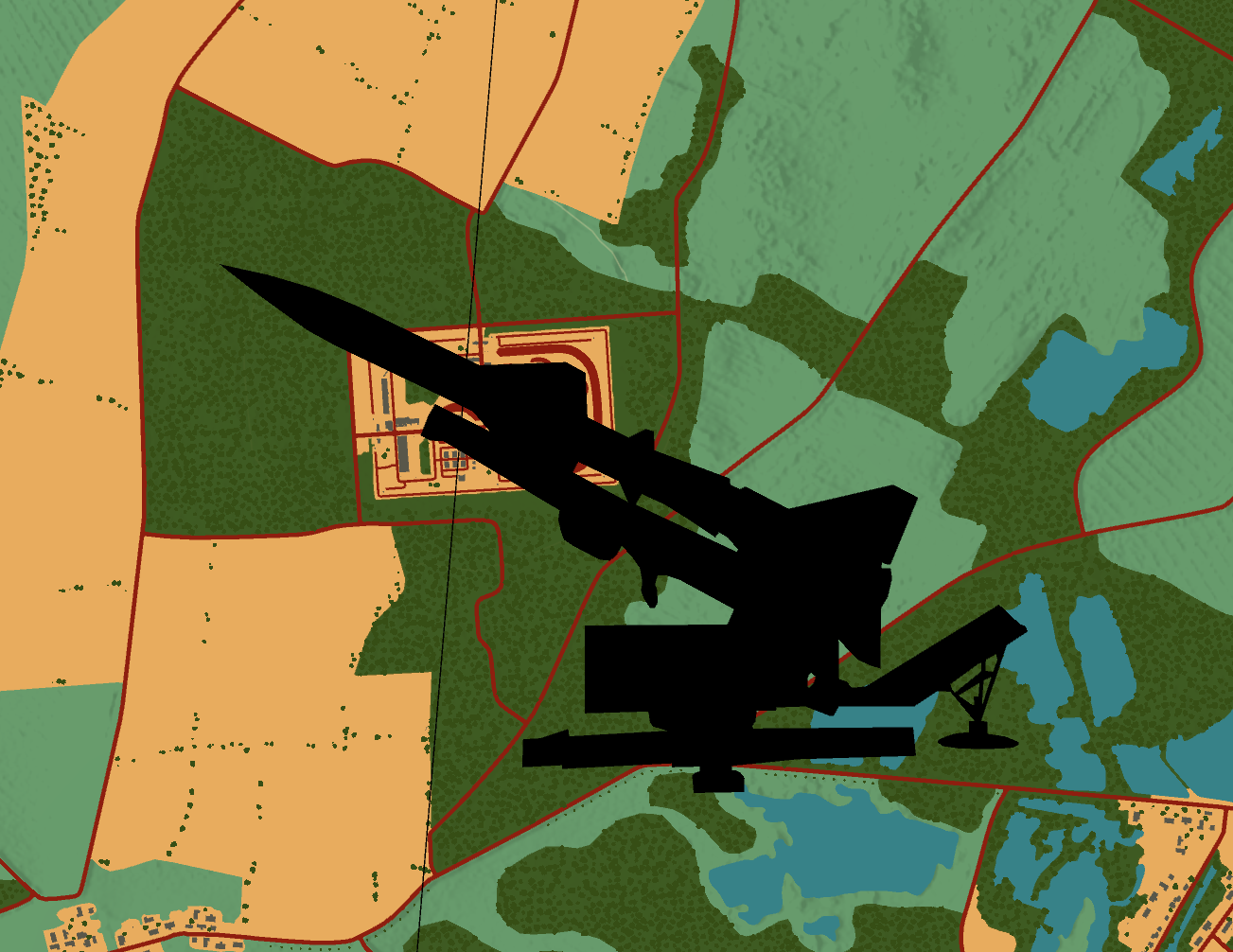
I think that with the new Balkans map, the Nike Hercules will be needed more than ever before. This is because several Nike sites were stationed in the Veneto region. However, it would also be very useful for the CW Germany map at this point...
-

use wish list for desired features DCS: Balkans Updates
Blackbahia replied to OnReTech's topic in DCS: Balkans
Very very cool...but can you please tell us, what we can see on these pictures? Are these mountains only the Alps or some mountains on Balkans too? -
I'm very curious to see if air bases in southern Germany, Hungary, Slovakia, Romania, and Bulgaria are also included. It could be really nice for Cold War missions...
-
I have often wished for scalable national flags that I can use in the Mission Editor's Draw tool, to assign areas to countries on the F10 map. All countries should be available that I can also assign to coalitions in the Mission Editor. I have created a purely fictional example here to show how I imagine it working.

- 1 reply
-
- 2
-

-
Of course, I hope so too, but Lake Eder is particularly close to my heart because it's practically on my doorstep.
-
Wow, very impressive! With the Choyna air base, the SU-27 finally has a home too. @MAESTR0 I really like the picture of the Ennepe Dam. Are there any plans to correct the Lake Eder (Edersee) on the current map? It is also a reservoir with a dam that is used for power generation and is one of the largest reservoirs in Germany. Incidentally, the dam was one of those destroyed during Operation Chastise in May 1943.
-
VVI and Radar ALT gauges - English cockpit only
Blackbahia replied to LCO489's topic in Bugs and Problems
I've this issue with both cockpit, the english and the default (russian, or?)...and also the radar altimeter doesn't work -
VVI and Radar ALT gauges - English cockpit only
Blackbahia replied to LCO489's topic in Bugs and Problems
The Vertical speed indicator in the Mig-29A Fulcrum no longer works since the update on 22. October. I emptied the fxo and metashaders2 folder, performed DCS repair, restarted the PC, but the needle remains on neutral. Is this a general issue, or is it just me? -
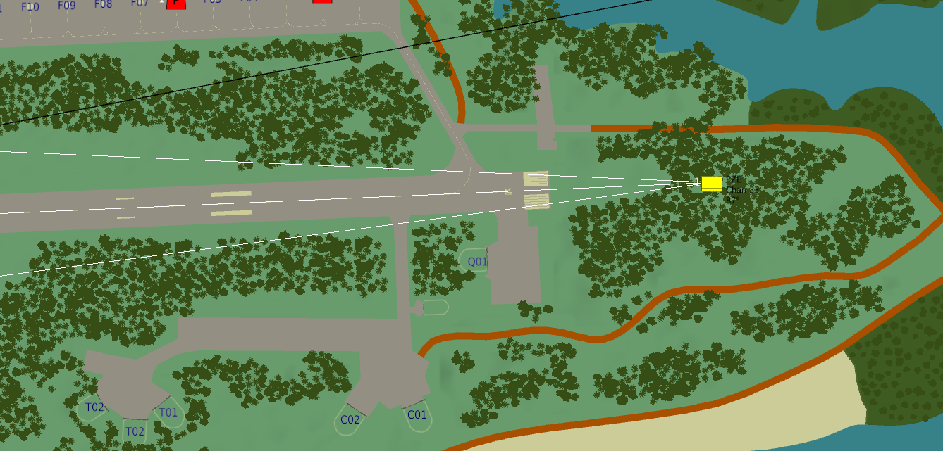
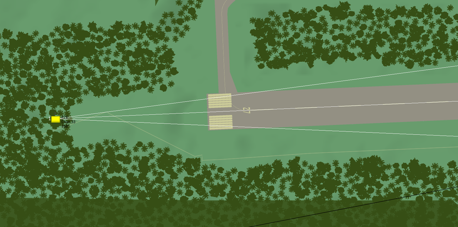
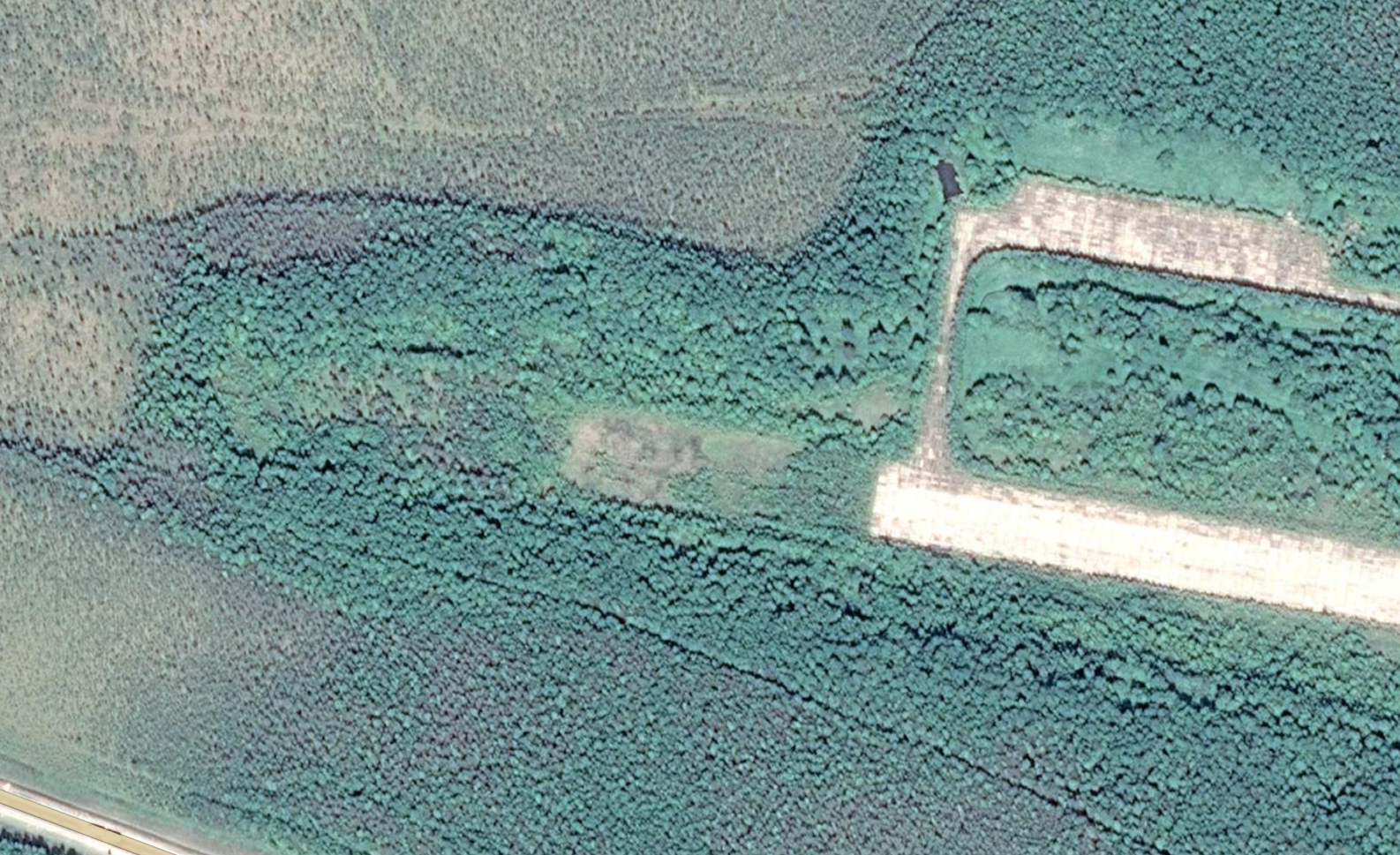
Hello everyone, at Poduzhemye airfield, the trees at the beginning and end of the runway are too close to the runway to be able to place the new PRMG units. The localiser car must be positioned 600 metres from the end of the runway, and this is not possible on either side here. The trees are also a problem when following the glide path during instrument flight. I interpret the satellite images to mean that the trees at the beginning and end of the runway only grew after the base was decommissioned, because they are much thinner than the rest of the trees.
-
- 2
-
-
Wow! Ingenious!
-
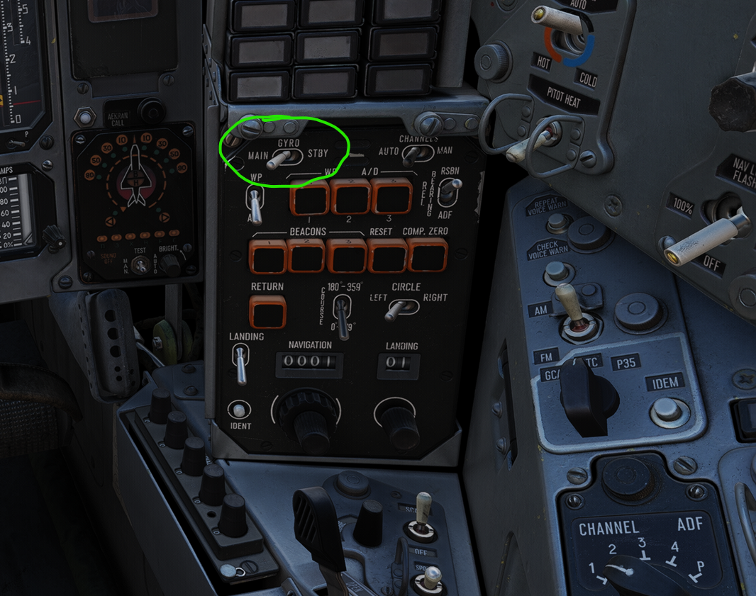
incorrect channel selection Cold Start Radio Not Working + Gyro bug
Blackbahia replied to Drona's topic in Bugs and Problems
Wags showed the wrong switch in his video. Please use this one: @BIGNEWY maybe this should be corrected!
-
Hello currenthill, first of all, thank you for your feedback and an even bigger thank you for your asset pack. Great work! My problem is that I miss a bomb truck like the TU-95 or TU-16 from the cold war era on the red side. The Kh-101 and Kh-555 are hyper-modern and don't really fit into cold war scenarios. I definitely don't want nukes in DCS. I think the TU-95M with the massive FAB-9000 bomb or the 48 FAB-250 bombs would be something special. As for missiles, it would be possible to use the Kh-22 you mentioned. Are the TU-95M and TU-95MS so different, or would it be possible to have both in DCS without too much effort? greetings Blackbahia
-
The new TU-95MS from CH is great and a win for the core game., but I would like to see more weapon options. I'm missing free-fall bombs or older cruise missiles like the AS-4 ‘Kitchen’ so that the TU-95MS can also be used in Cold War scenarios. Could there be something coming in the future?
-
I would like to see the French Crotale SHORAD system from CH in DCS. Yes, we have the Chinese HQ-7, but that's not the Crotale. The widespread use of Crotale also makes it interesting for mission building.
-
- 3
-
-
I miss a repair function for units and groups in the editor. Currently, this can only be solved with scripts, for example by deactivating the damaged group and spawning it again. I would welcome such a function in the Mission Editor, where I can determine after what time and up to what degree of damage a group or unit is ‘repaired’.
-
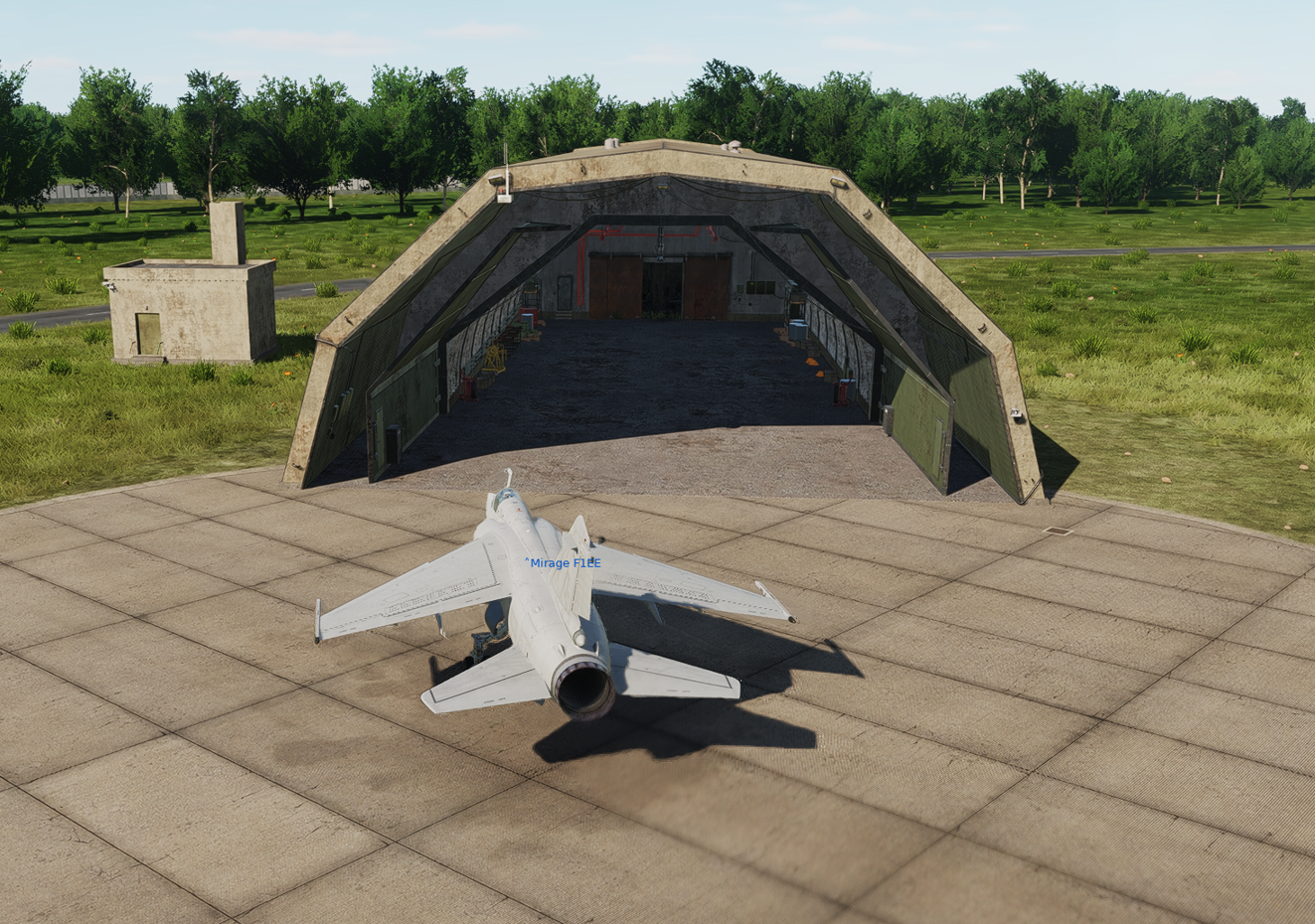
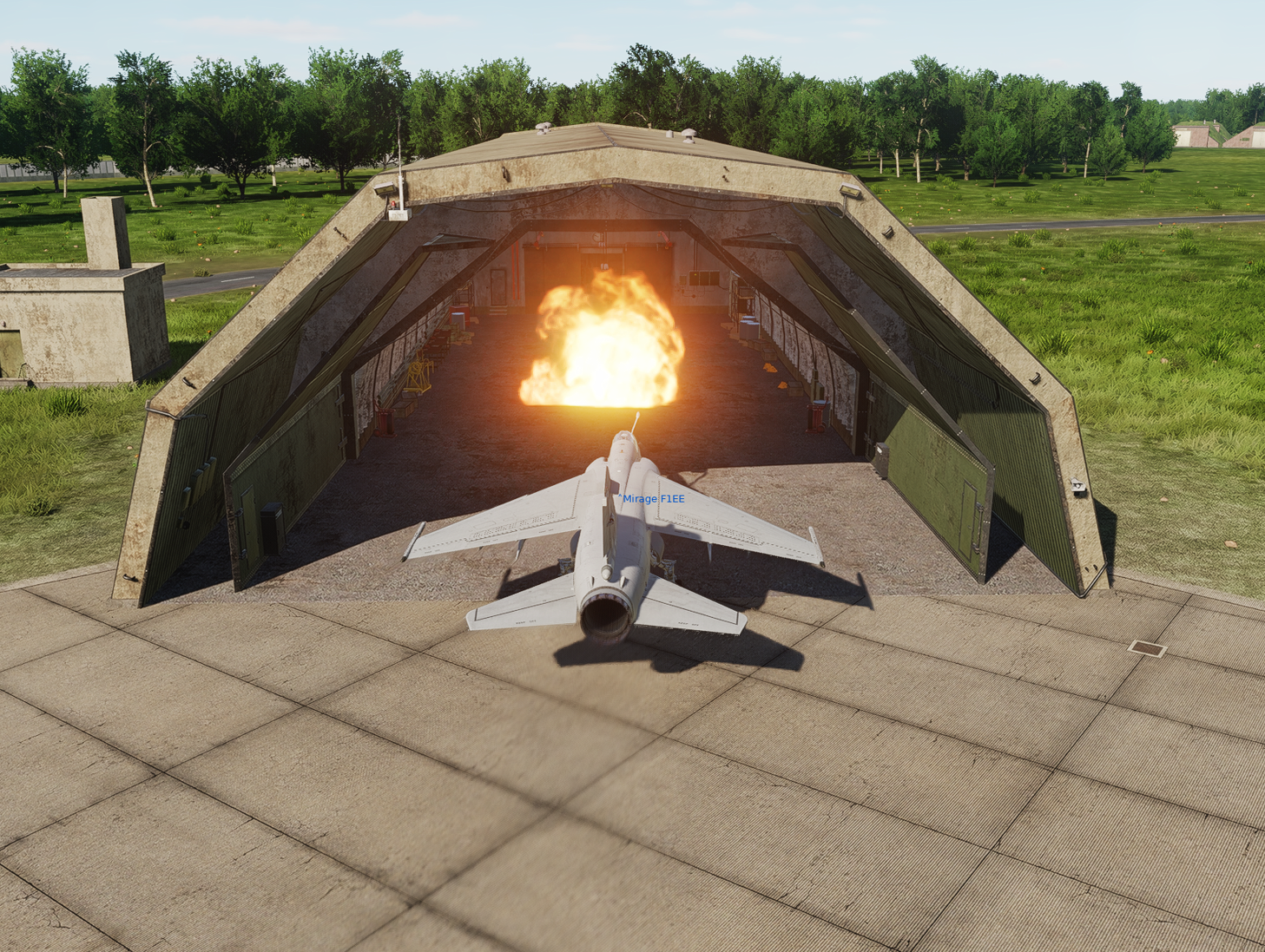
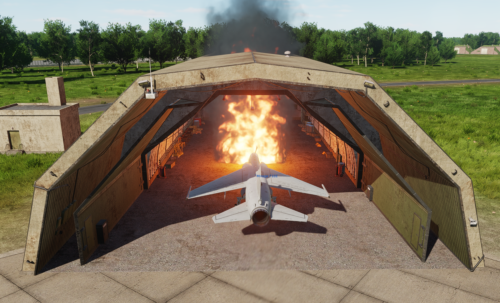
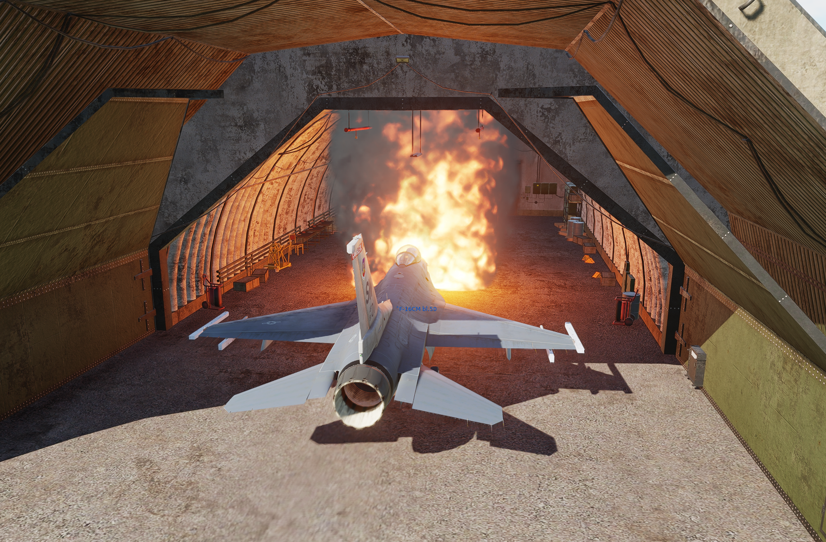
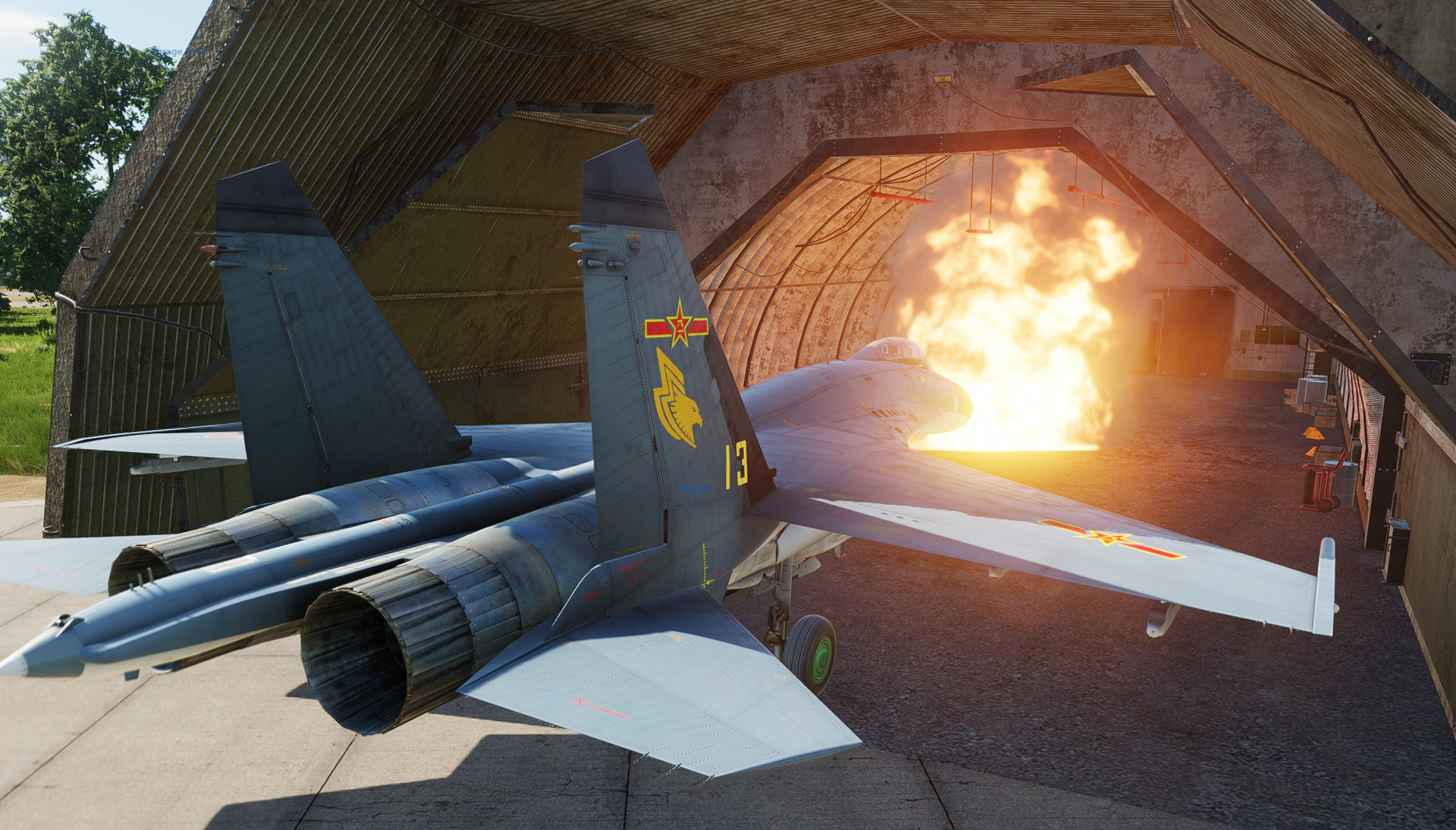
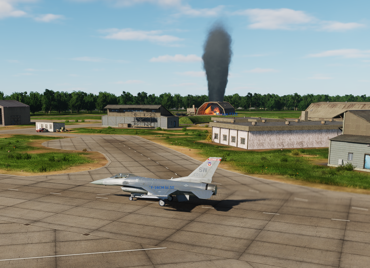
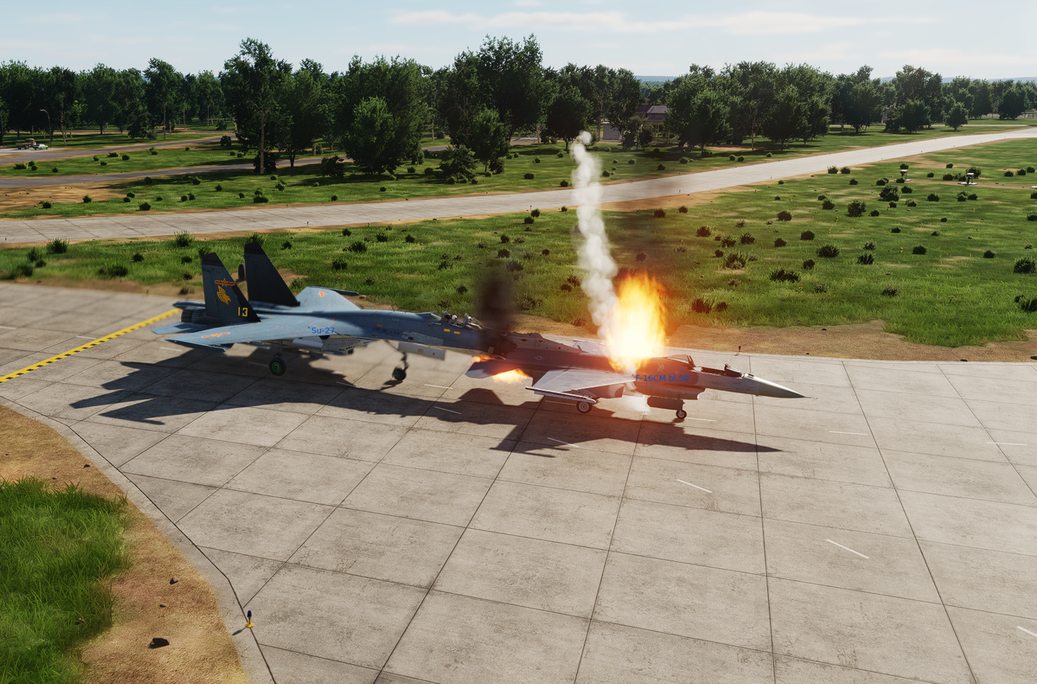
I wanted to test the new landing options for AI aircraft and chose Gütersloh Air Base for this purpose. After landing, the aircraft taxi to a shelter, but just before entering, the shelter suddenly catches fire and the aircraft drive into it. So far, I have only encountered this at Gütersloh AB. The type of aircraft is irrelevant. I found this problem yesterday after the update and tested it again today...same result. In addition, aircraft crash sometimes into waiting aircraft there.
-
I've deleted the fxo and metashaders and proceed a DCS repair. Maybe the problem is solved with this action....We will see....
-
I kept getting back into the same aircraft in the same mission. That went well a few times and then the autopilot problem occurred.
-
Very strange....in the Track you see, that the AP is active, but for me it was not visible...I couldn't hear the AP alarm either... M1.trk
-
Is there currently a problem with the autopilot? I've noticed that I sometimes can't activate the autopilot at air start. If I restart DCS, it works perfectly again in the same mission. I've noticed this several times now on different maps. I've now had this with Kola, CWG and Syria.
-
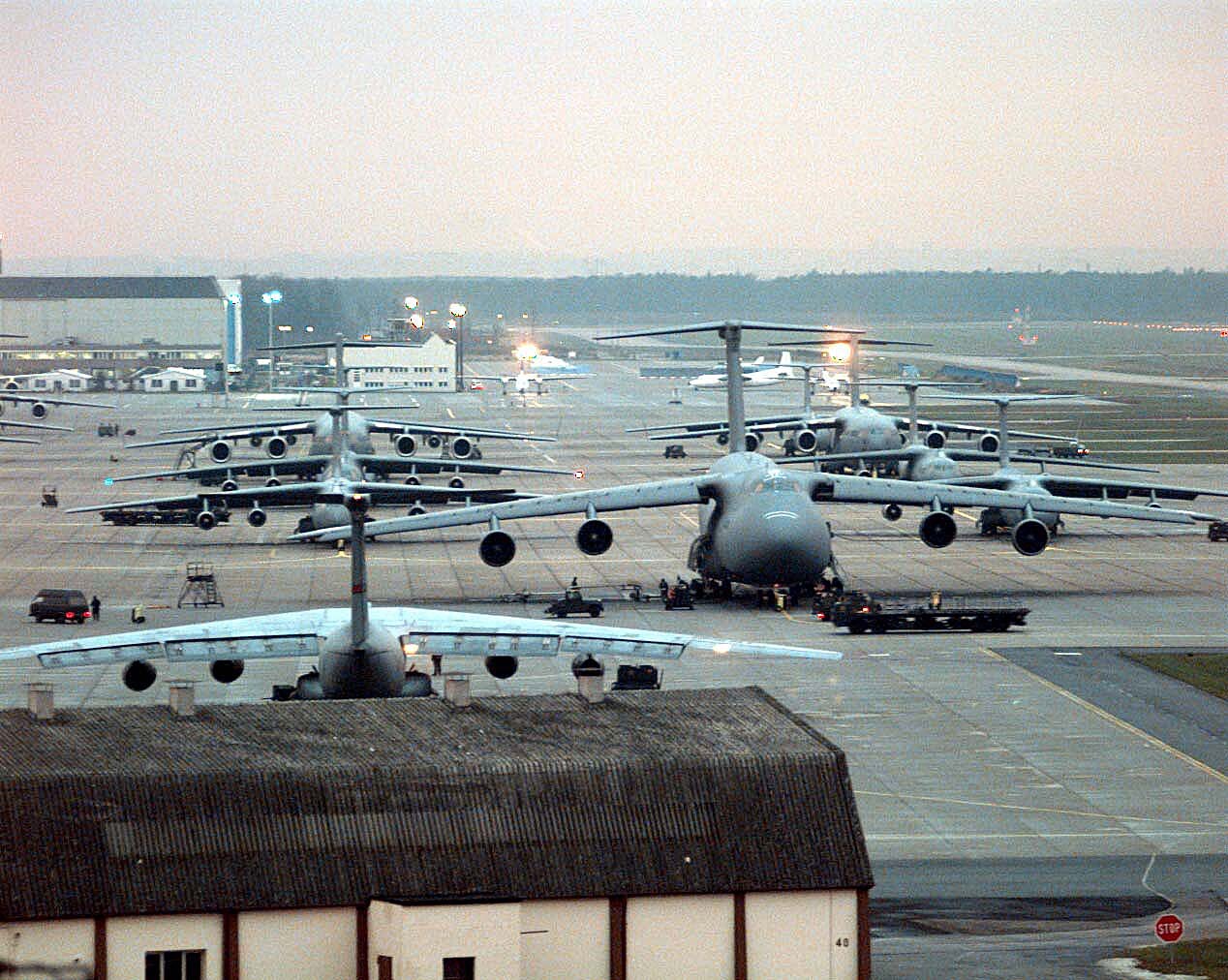
Rhein-Main air base, was the southern part of Frankfurt Airport. I can still remember very well how the C5 Galaxy or the C-17 took off and landed there. Unfortunately, it is not possible to place large cargo aircraft like the C-17 on the south part of the RM AB in CW Germany map. You can only place them on the northern part (civil part) of the airport. Can this be fixed please? (picture from Wikipedia)
-
- 6
-
-

-
What can't we release Cold War Germany Phase 2 without?
Blackbahia replied to MAESTR0's topic in Wish List
If you bring the Wittmundshafen Air Base in Phase 3, I have almost no more wishes! Edit: I would still have an addendum, maybe the missing SAM positions could still be integrated. The HAWK belt in western Germany in particular is currently still very full of holes -
New AAW and Hospital point marks clutter up the map
Blackbahia replied to InsaneHexe's topic in DCS: Cold War Germany
I can't find any information on the SAM site in NB80 either -
After today's update, the symbols for SAM and Radar block the location. How can I hide them? I can no longer place units in this position!
-
Hello ED and CH, I think the Italo/French SAMP/T NG SAM system is a good addition to the existing long range SAM systems we have in DCS and with regard to the new European maps like Kola and Germany also a nice alternative in mission building. I would be very happy if this wish came true! pictures from: www.italiandefencetechnologies.com
- 1 reply
-
- 4
-
-