
LimePartician
-
Posts
155 -
Joined
-
Last visited
Content Type
Profiles
Forums
Events
Everything posted by LimePartician
-
 I know that they are in the /Models directory but I tried everything to export it as a tech mod and it just won't work. Is there a way to get these hangars to be placeable? Thanks
-
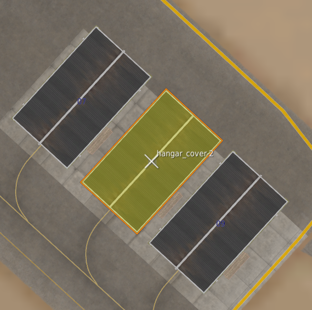
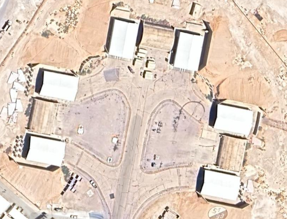
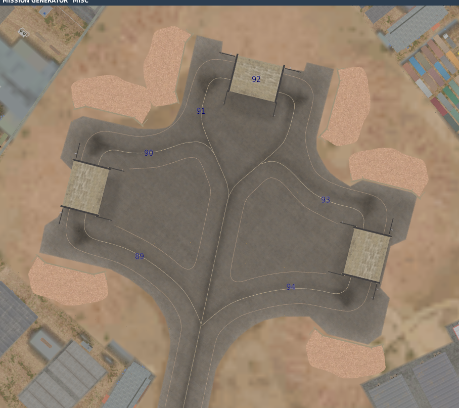
Parking 89-94 is missing hangars for F-16s as seen below; Real life: In game:
-
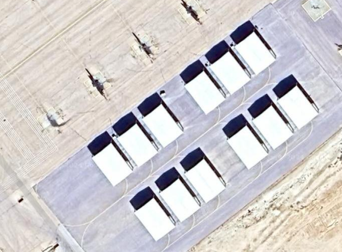
Currently in game the hangars are represented as the Eurofighter hangars at Akrotiri. This is incorrect. They should be a square metal tent hangar as seen below: In game: Another issue I noticed with the hangars is the missing taxiways behind the hangars 76-81. Thanks for your passion and support.
-
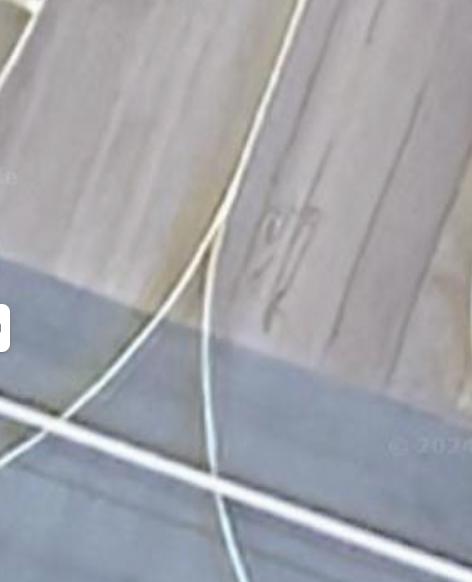
All taxiway junctions and connections weirdly done
LimePartician replied to LimePartician's topic in Bugs and Problems
So will the taxiways be fixed or nah -
All taxiway junctions and connections weirdly done
LimePartician posted a topic in Bugs and Problems
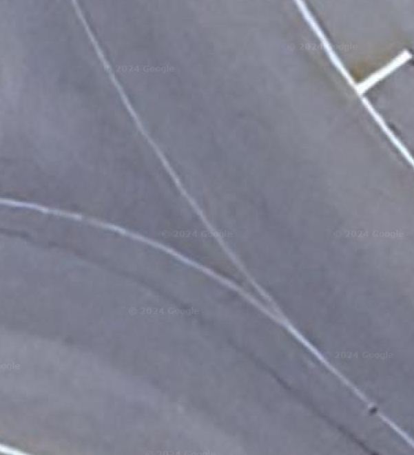
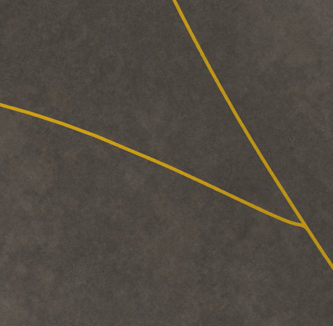
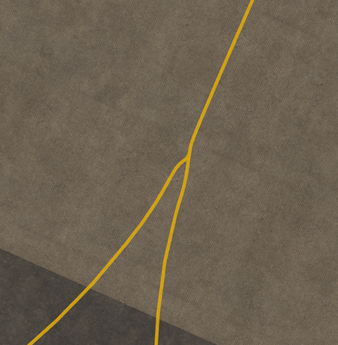
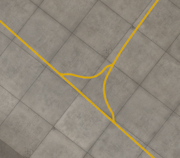
I don't know if this an AI or game limitation but the taxiways on the Syria map connect in a strange way. Instead of a smooth connection it's a rapid connection:
-
Will we see Ramat David? It's currently a part of the terrain in the high res area.
-
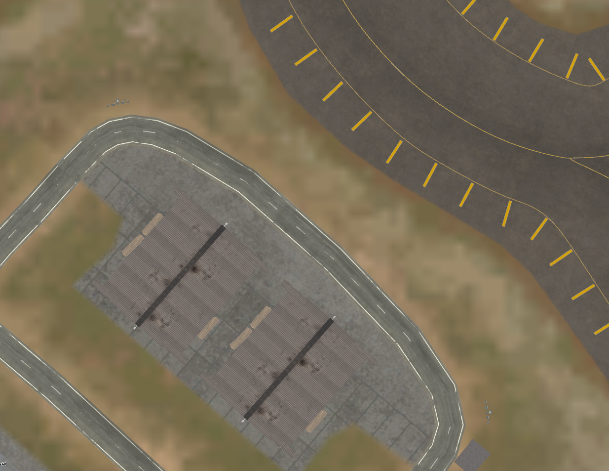
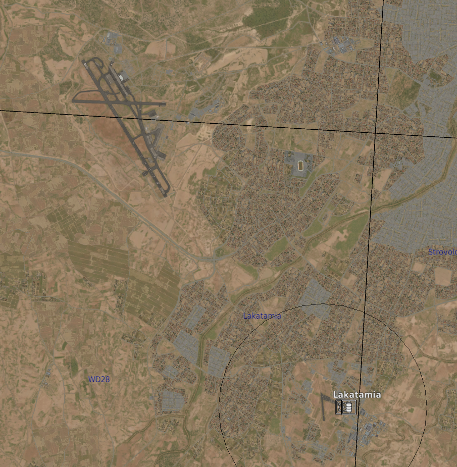
Unmarked airport next to Lakatamia airstrip.
LimePartician replied to LimePartician's topic in Bugs and Problems
No but it has no parking spots and it's just unmarked on Syria, not KOLA -
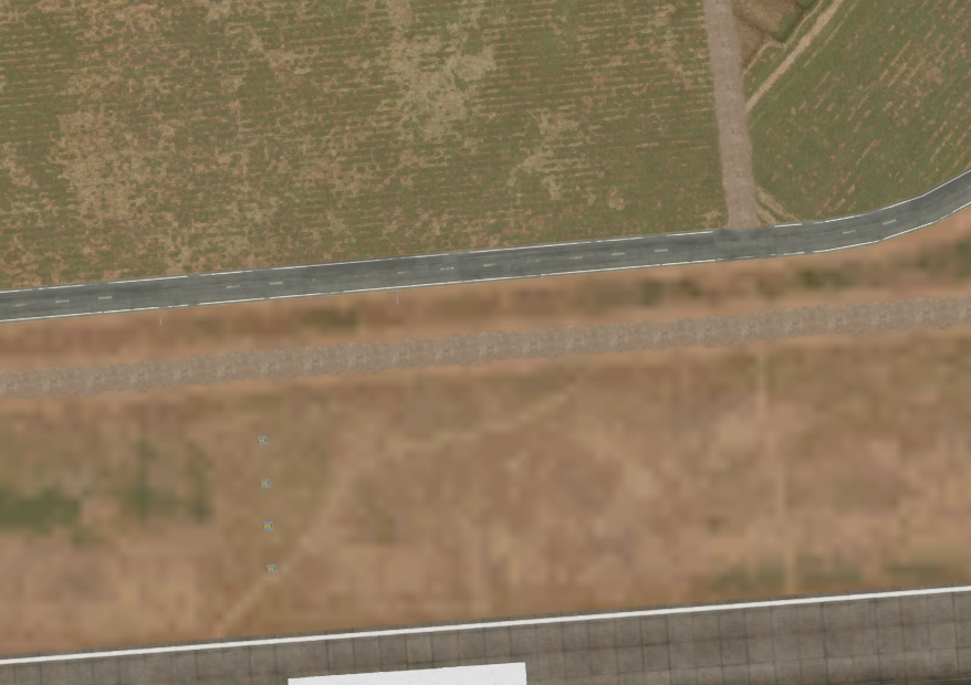
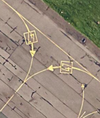
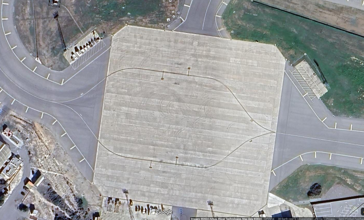
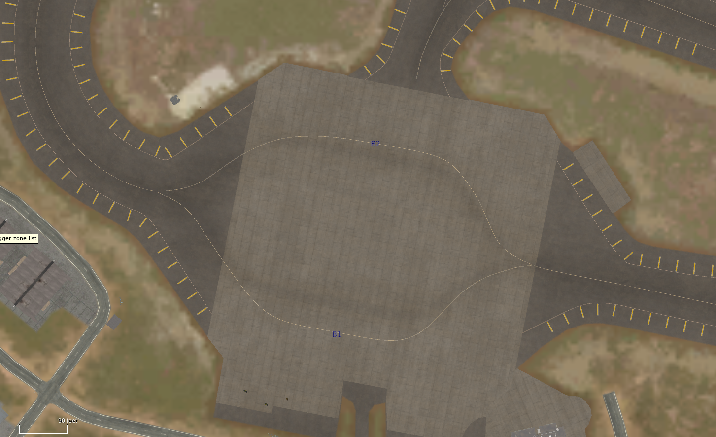
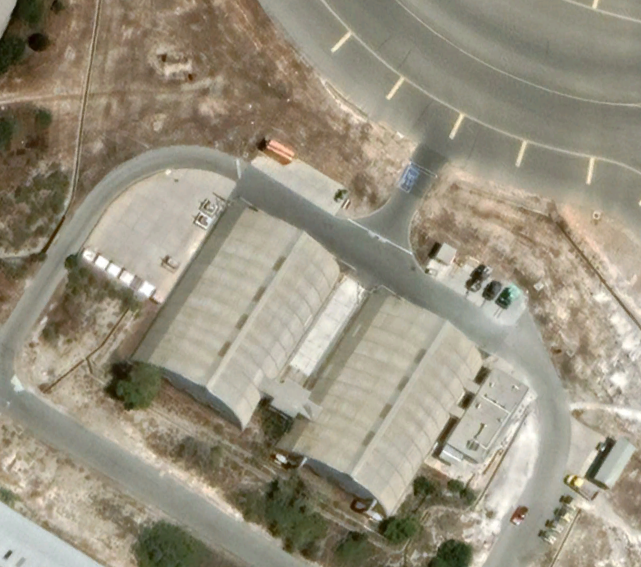
The taxiways are not straight and slightly misplaced, the ground equipment parking is a white spot on the terrain: The storage hangars are modelled as open aircraft hangars and are missing a connecting road:
-
- 2
-

-
-
Better navigation features (read my explanation)
LimePartician replied to LimePartician's topic in DCS: CH-47F
I read something else on that NS340 -
Where is out P3 and P4
-
So with the Chinook and C-130 coming, one question has risen that I must know an answer to. With the modern navigational systems in these aircraft, will we be getting navpoints in the game? null
-
It's pretty needed for airports with one way entrance hangars etc. I think it's not too hard to add and it would be pretty neat for carrier ops+roleplay on the airfields
-
Flaming Cliffs 2024 | Supercarrier Updates | Launcher
LimePartician replied to Graphics's topic in Official Newsletters
-
The Caucasus map currently is pretty lacklustre. On the undetailed zone we have northern Turkey, Moldova, eastern Romania, southern Ukraine, South eastern Russia and a bit of kazachstan and the aral sea. Would be neat to see these parts on the map as a optional update to the map in order to not compromise file size of the base DCS.
-
This is a must but knowing ED, they probably won't.
-
What product? Got a link for it?
-
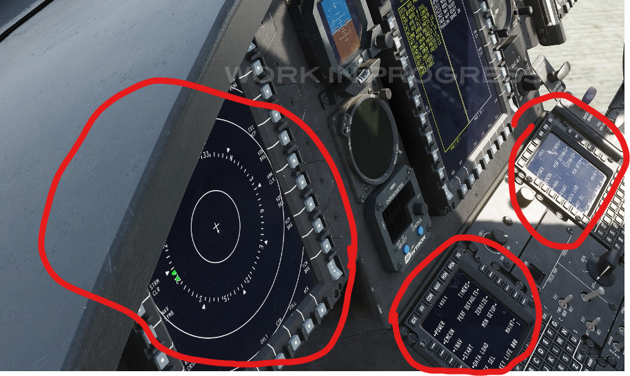
kinda like the CMDS for the F-16 I want to save time and have the MFDs preprogrammed
-
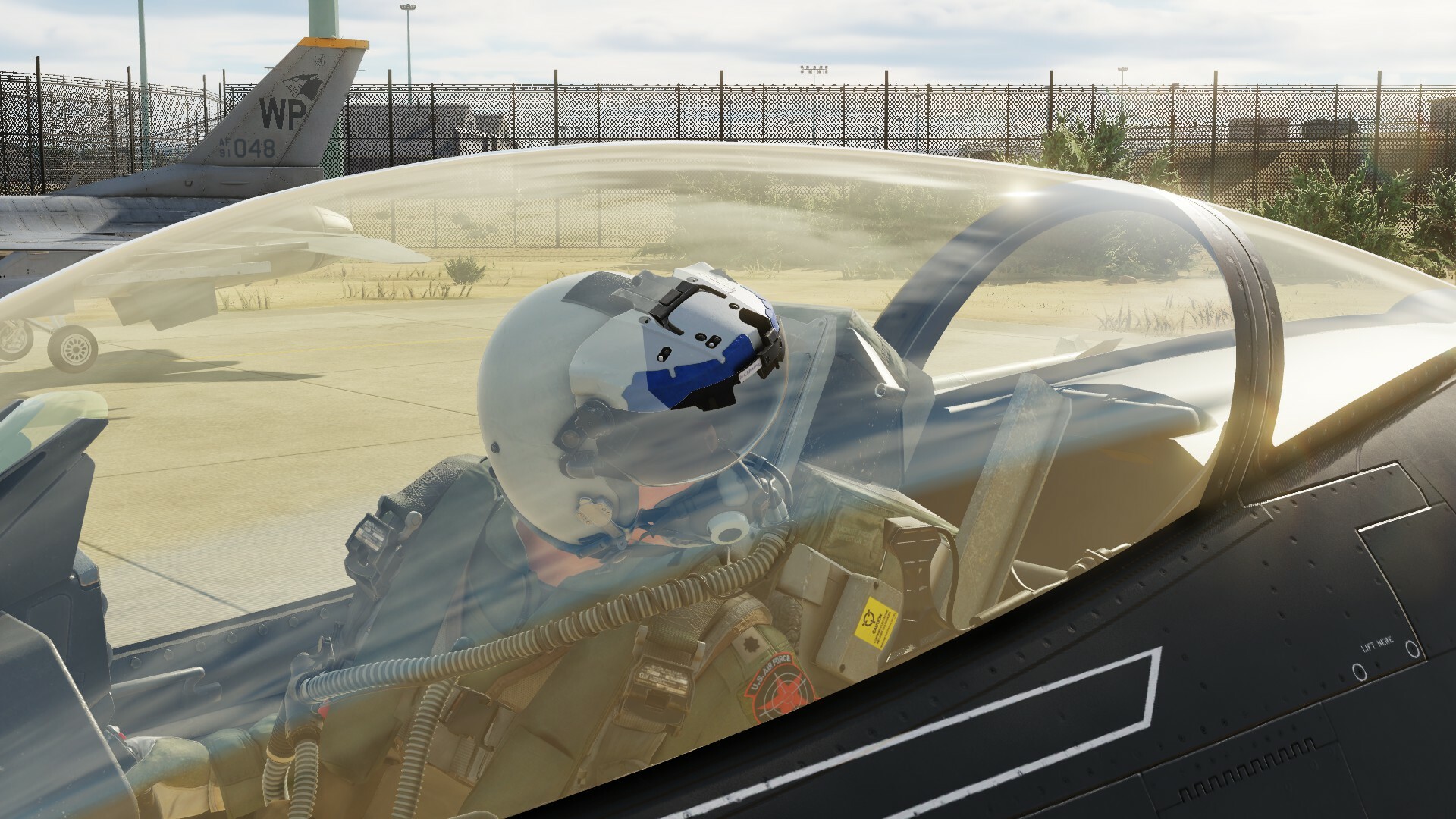
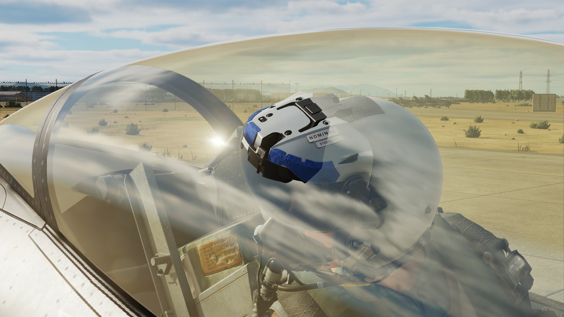
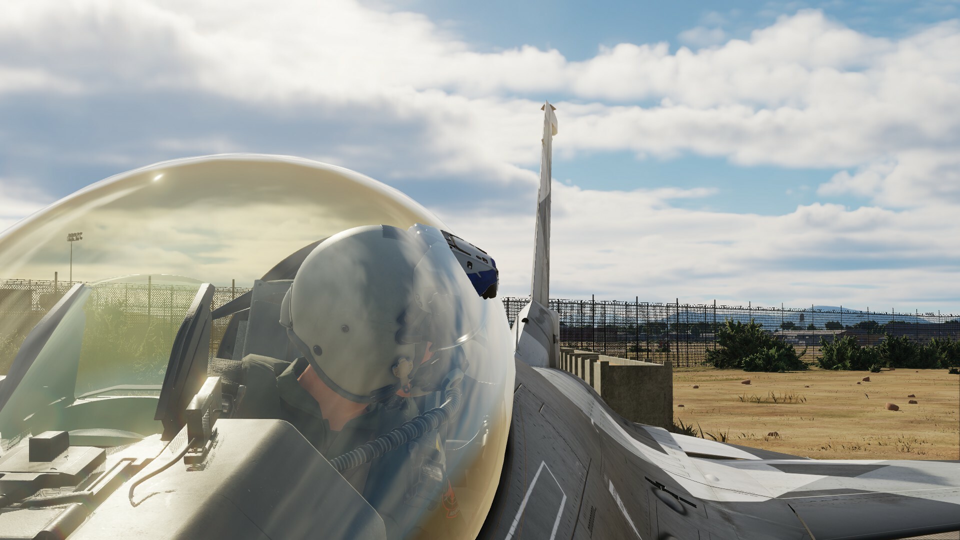
Since the new pilot model dropped for the F-16, it has come to my attention that the new pilot model switches to the old pilot model once the ejection sequence occurs. Clip: https://medal.tv/games/dcs-world/clips/2eR1i2nycNt9gh/d1337CcwL2Zz?invite=cr-MSxyS3AsMjIzOTk0NTQ0LA If more info is needed I will provide in accordance with instructions, thanks.
-
investigating F-16 Pilot Model Feedback
LimePartician replied to Viper33's topic in Bugs and Problems
-
I'm relatively new to this and would like to know if anyone has made a tutorial on this. Thanks.
-
145GB for a ULQ version of what was promised:
-
Bro... what?