Winger
-
Posts
308 -
Joined
-
Last visited
Content Type
Profiles
Forums
Events
Everything posted by Winger
-
Thanks for you kind words. But I am nothing more than a mere helper. All the KUDOS belog to Walmis at VPForce for developing this great thing, the community for contributing with the development and Protomaker964 for sharing the files on Github. i am really glad you like it Wofei!
-
Thanks for your Kind words Bert. I am very glad you Like it. But i told you youll love it All kudos Go to Walmis for developing this awesome Joystick Base, the Community and Walmis for their ongoing improved awesome Software and protomaker964 that shared the DIY Plans this Base ist bult upon on GitHub. I am nothing more than a helper for fellow simmers that want to also Go the DIY Route but can for whatever reason. Cheers Winger
-
hey, i dont sell that mod. I just replicated it from smitty on VPForce Discord. Was kind of problematic cause some of the parts are in inch and i live in germany so i couldnt get the parts. Only got them with lots of difficulties. @ LuseKofte yepp. the Rhino is an awesome piece of equipment. Must havve for Flightsimmers just like VR IMHO.
-
cant see the image.
-
this! EDIT: I can also only recommend anyone who wants one to build one yourself. Its such a great piece of hardware and increases immersion and quality of your flying by such a big margin! I learned a lot building mine and hada lot of fun doing so. AND its great to have a joystick base that you can replace every single part of in case something breaks and not having to worry about warranty and stuff. So if anyone wants to build one and has questions - feel free to ask. Ill gladly help.
-
I am absolutely happy with mine. Built one for 3 friends already. Its almost as much of a revelation as VR was back in the day IMHO. I even converted my TM TPRs to Rhino pedals and i love both. exactly

-
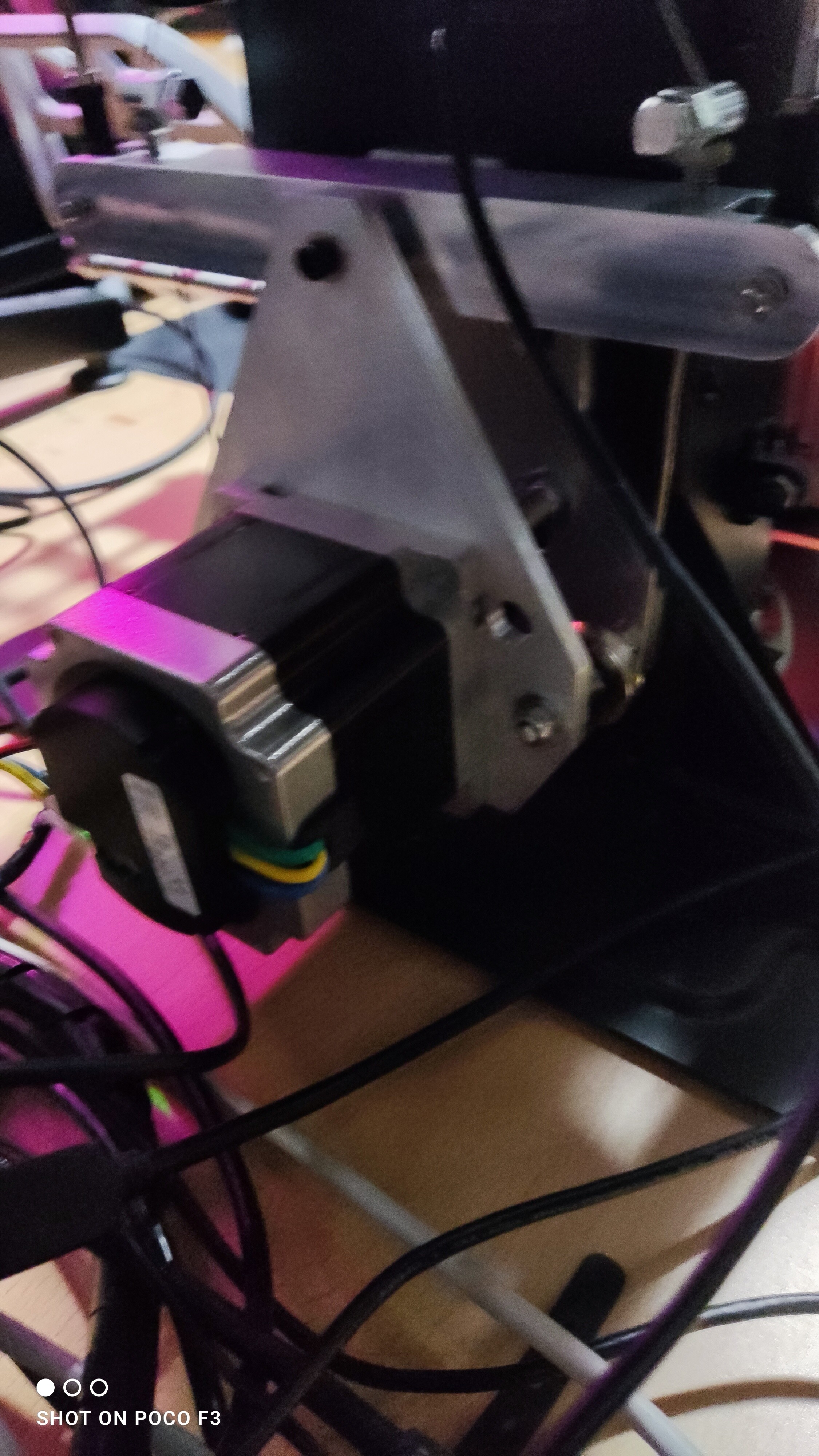
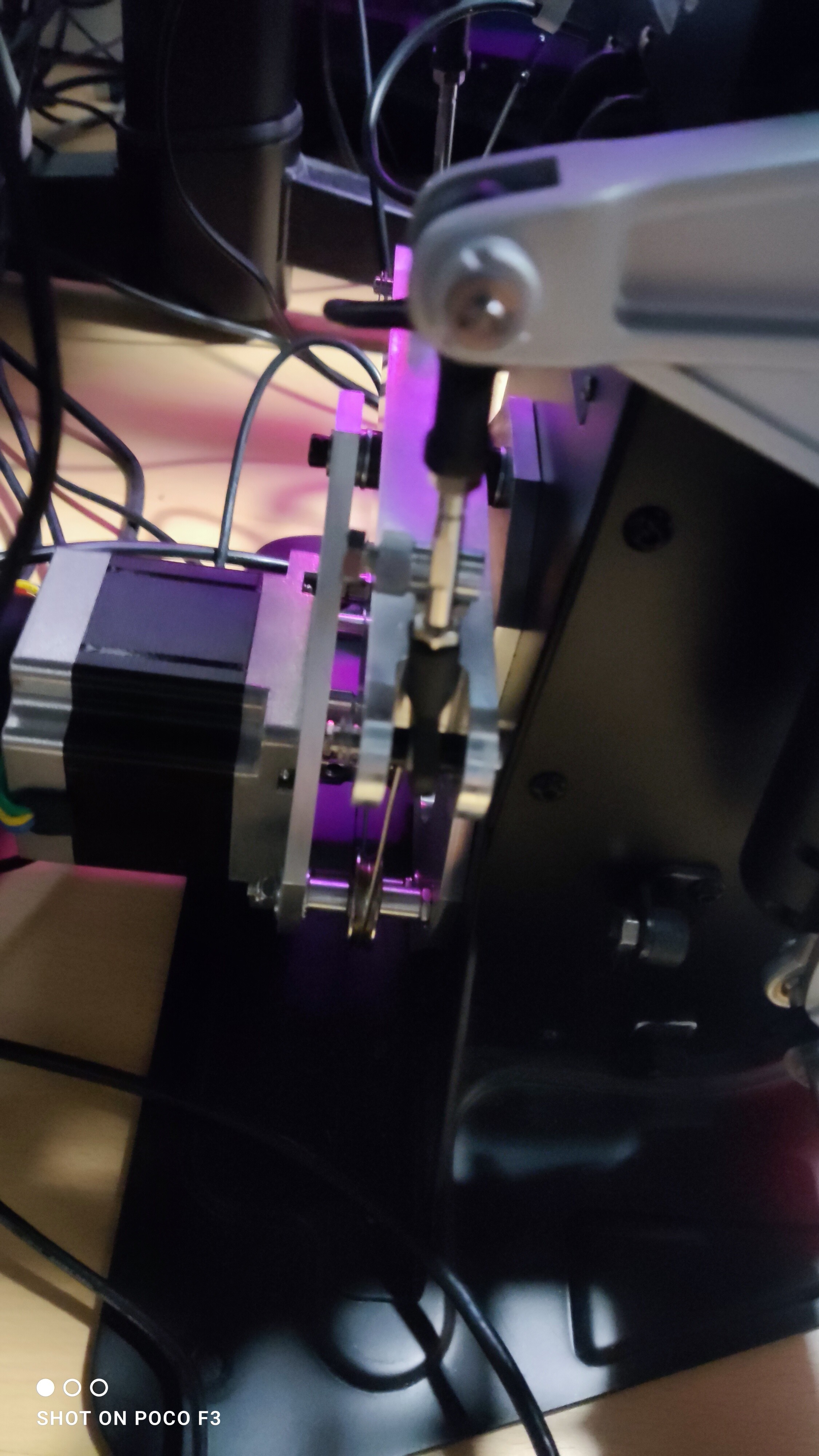
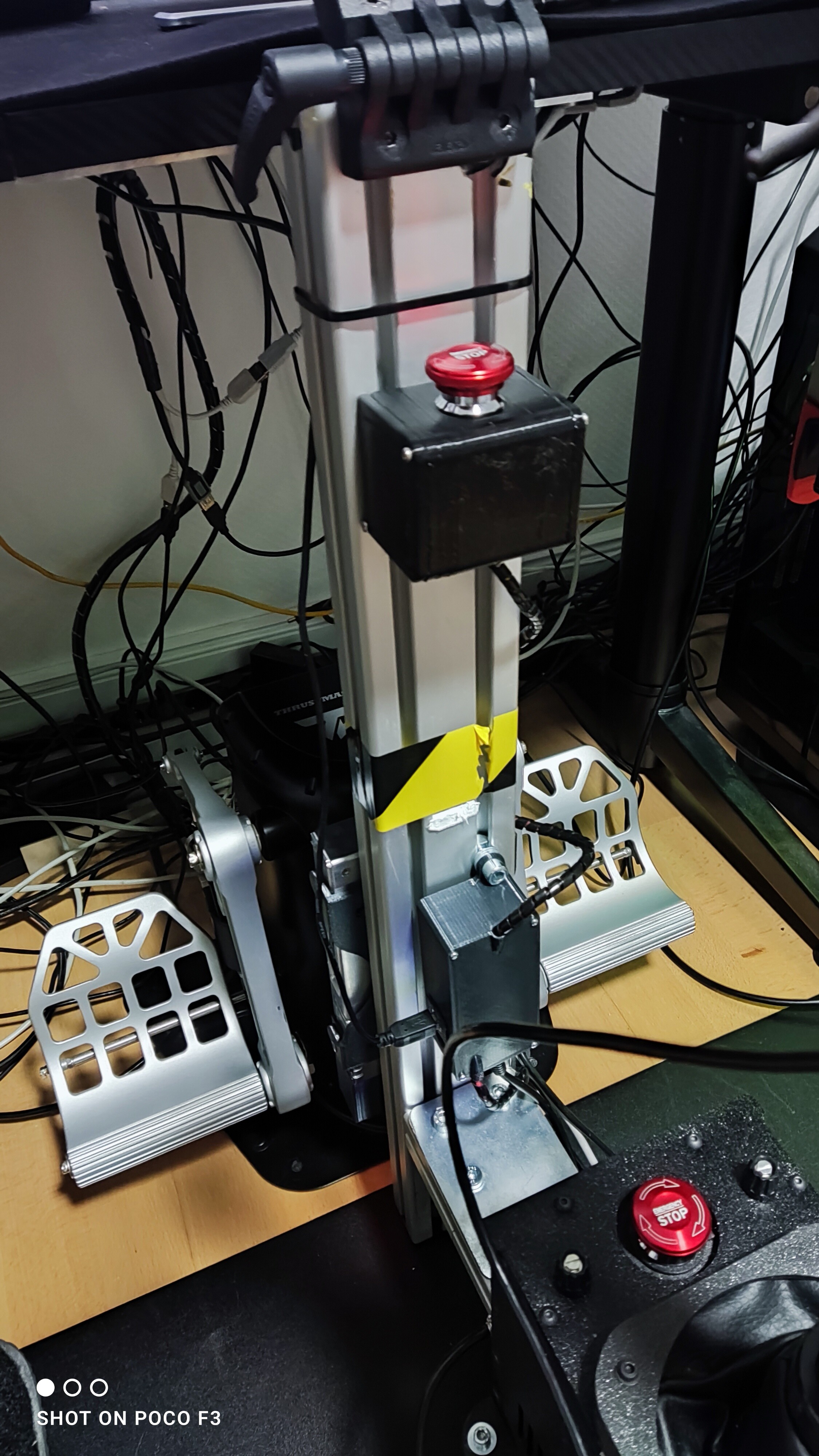
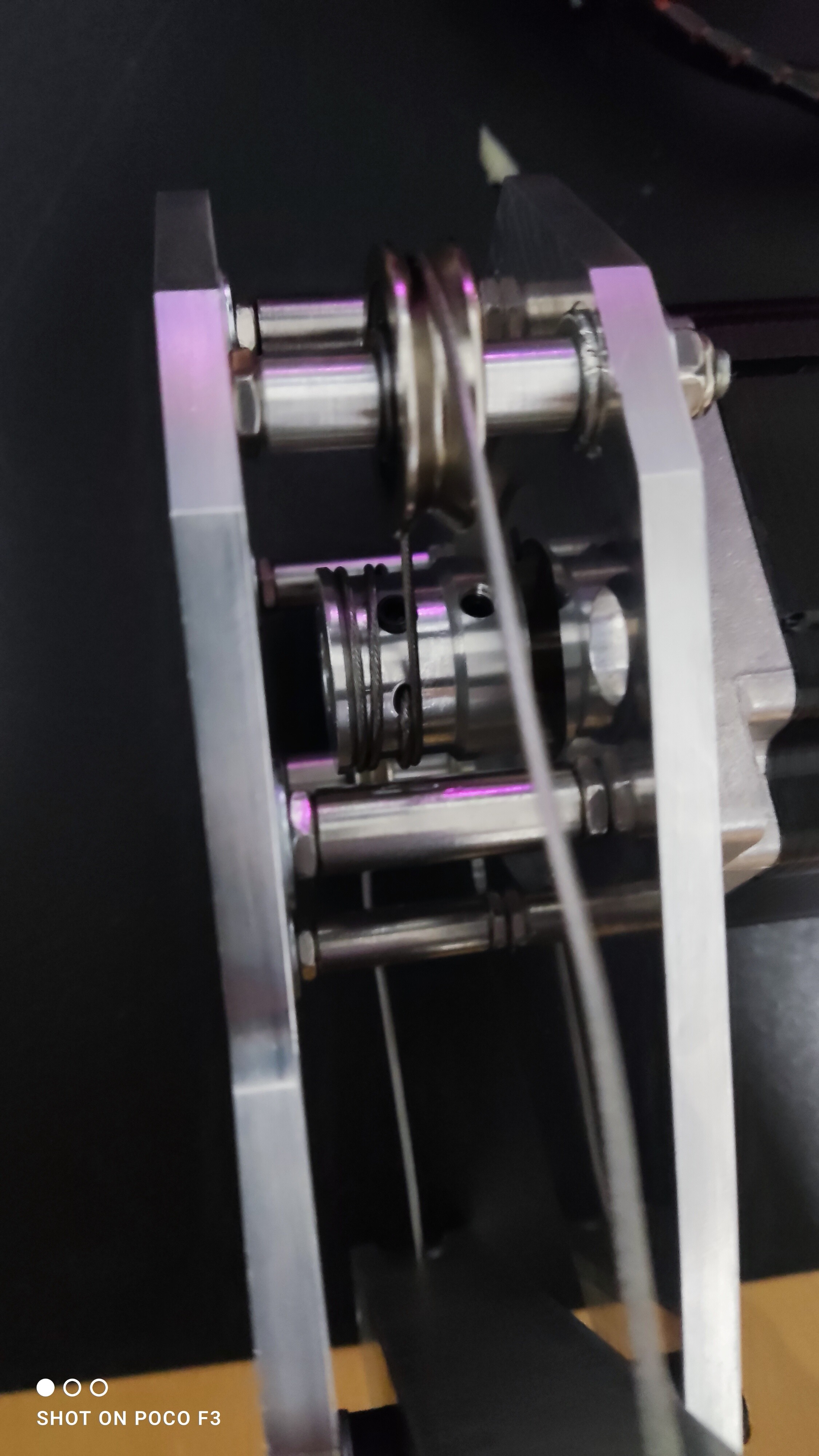
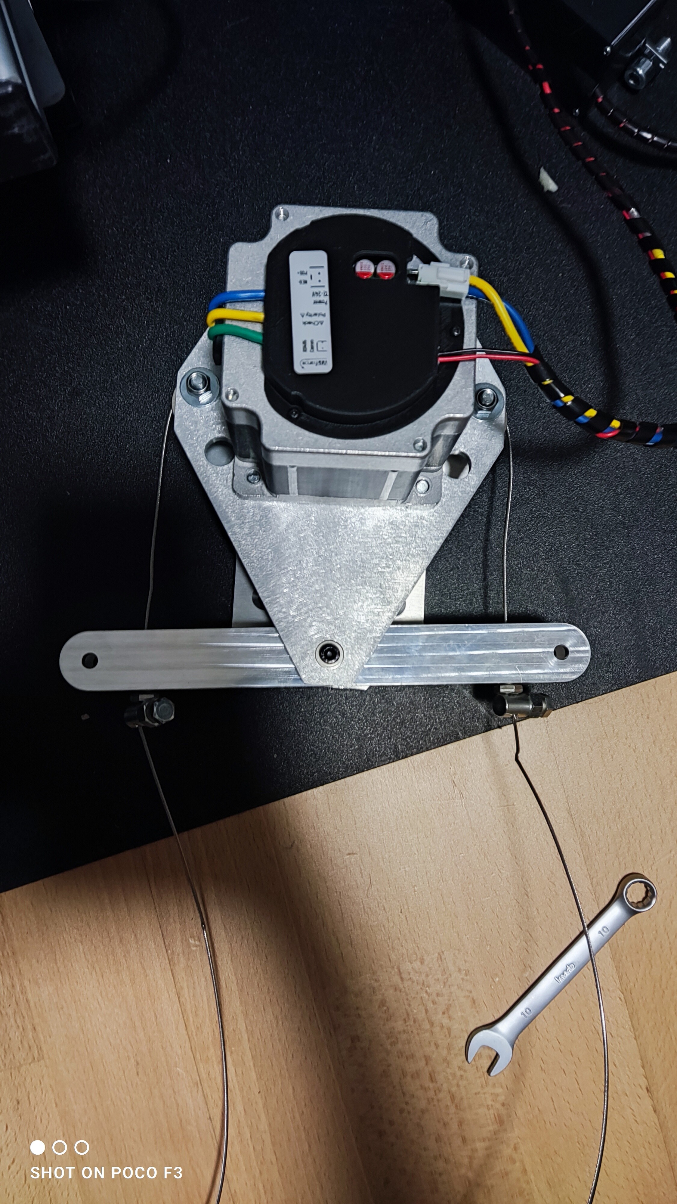
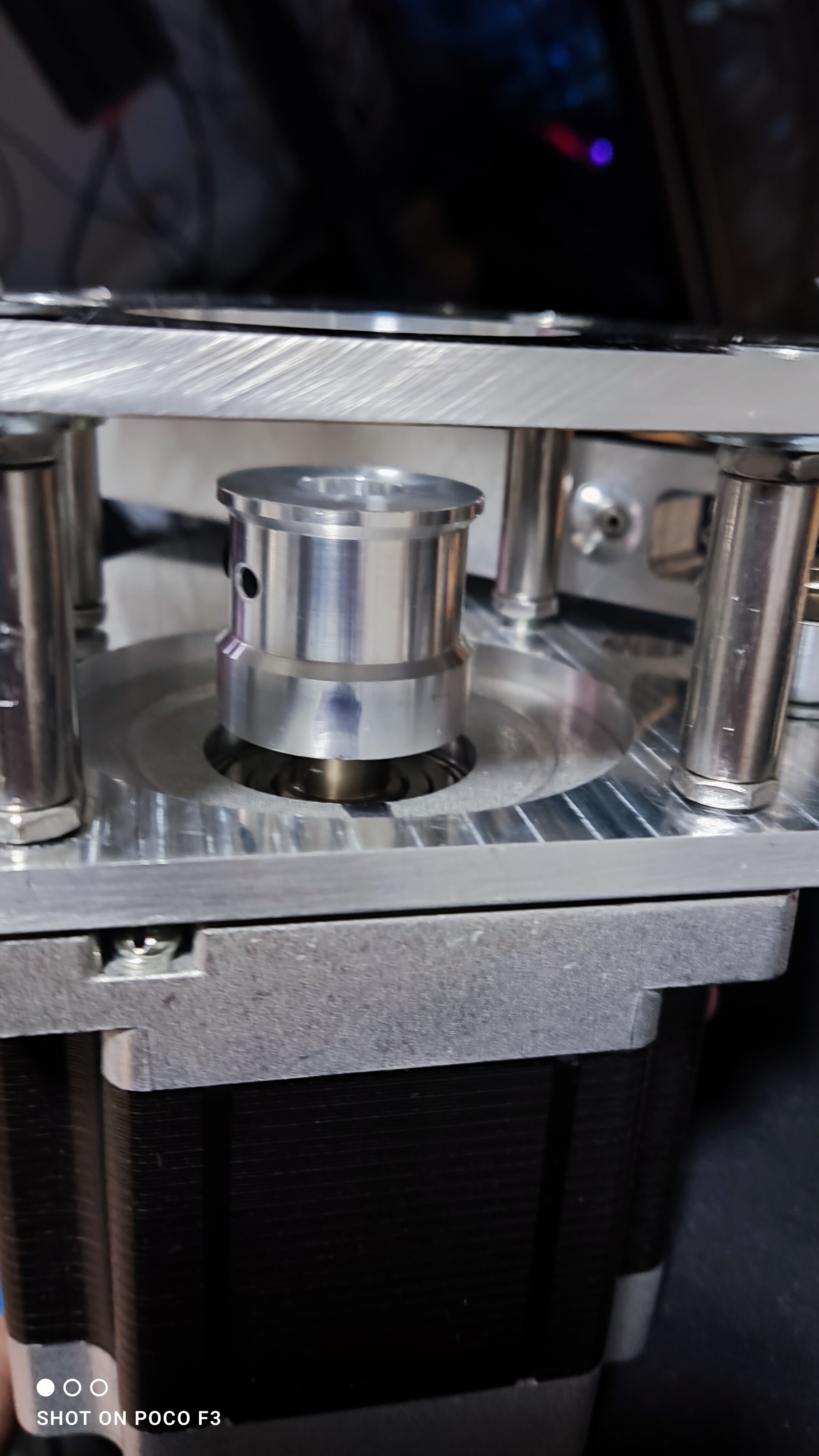
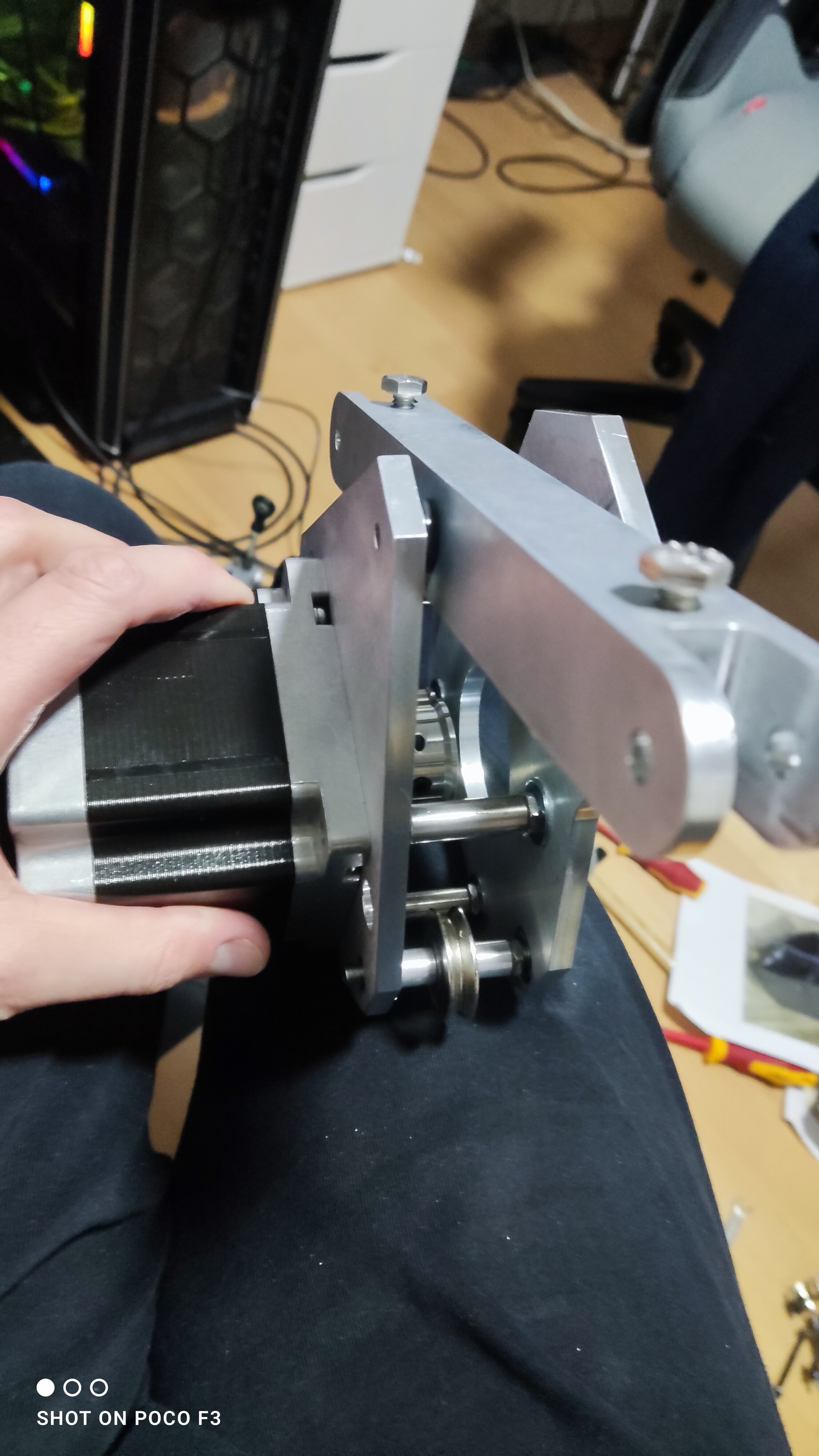
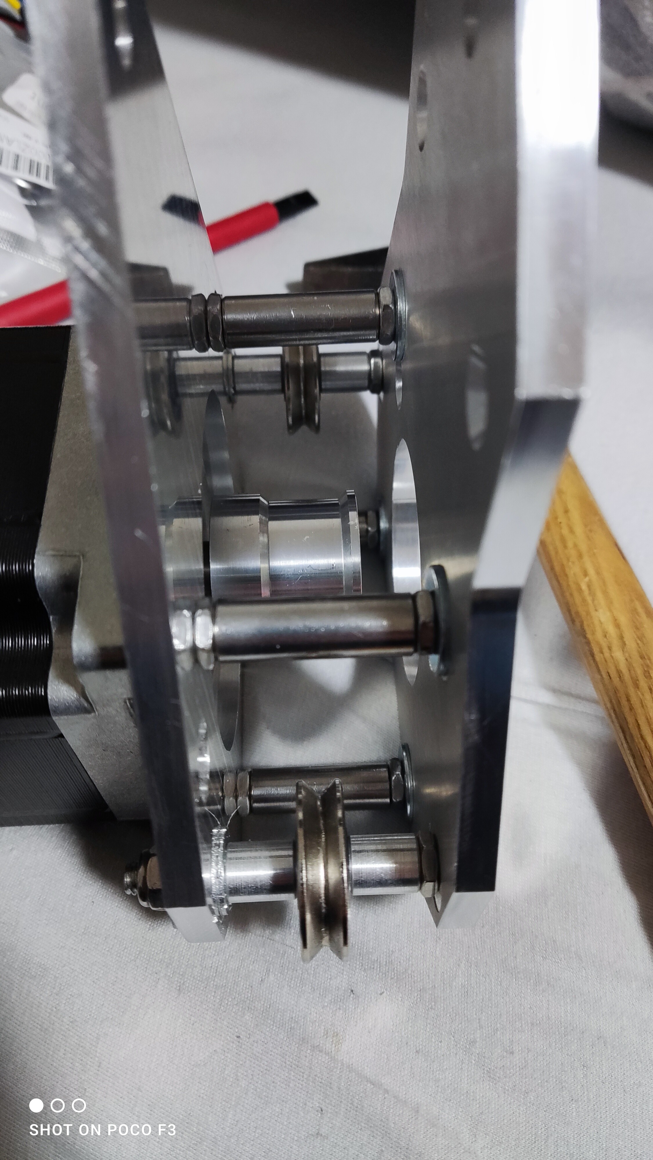
Hello Guys, i found an associate that will be taking over the bigger part of the Kit work. He will be preparing the kits like before. He will be taking over the packing of the parts and partial preassembly. Also Customer relations as well as sales and all responsibilities that come with it. I will be there in the background providing the 3D printed parts in the learned quality. His name is Rolf (kaltokri). He will be introducing himself in this thread. Now for some facts on the kit: The kit is based on the awesome work of @Protomaker964 and for sure Walmis from VPForce - so big Kudos and thanks for your work and allowing for providing the kits to the community! The Kit comes with a two part Gimbal design (just like the original Rhino). The lower part comes printed in 100% Infill material from carbon reinforced PETG-CF. The lower part is connectzed to the upper Stick connector using a 20x20 aluminium profile. The DIN Connector block and cable are riginal VPForce parts. The Uppoer Stick connector comes printed from laser sinteres PA12 plastick wich is very durable and not prone to break. This connector is an official VPForce 3D model and therefor is directly compatible with the Upgrade CNC machined connector that is available as an optional upgrade in the VPForce store. The Housing comes printed from PETG with 5 Walls, Roofs and bottom layers with 35% infill wich provides for a very sturdy structure. The kit includes all needed screws neatly bagged in labeled plastic bags. The internal power wiring comes pre crimped and pre assembled to the complete assembly is SOLDER FREE! Other than this kit and the VPForce motor kit you will need a psu. There is good cheap solutions for around 50 to 80 bucks all around the world. Closer information on specifications and connector needed can be found in the assembly instructions. All you need to complete the Rhino assembly in a day is: Basic tools like allen keys and screw drivers 2x57BLF03 + USB Kit from VPForce store a wire end ferrule crimper (all cables in the kit come pre crimped but the power cables of the motor kit have to be crimped with wire end ferrules). Some patience. The Assembly can be done in one evening. Price of the kit is 449,- plus shipping. Shipping worldwide is possible. Together with the Price for the VPForce motor kit following over all price (roughly) the rhino will set you back 678,- 299,- Motor Kit 449,- DIY Kit Additional you will face the cost for shipping (depending on your location varying) and depending on your needs a PSU (roughly 60-80 Bucks) So if you want to be part of the "VPForce Forced flying community" in roughly 2 weeks (deliverytimes may vary) contact kaltokri CHEERS and happy flying! The Belt covers shown in the picture are an optional upgrade. For more info contact Rolf please.
-
Bump
-
Parts are also available separately. Still available
-
PM sent.
-
Selling Vpc DESKMOUNT L with Adapter for cm3 Base 80,- Vpc Keyboard mount 40,-
-
YAY, I am in!
-
 that was quick...
 -
Thanks! greatly apprechiated! Saw a test on youtube and it made some pretty big diffrence in the tested game. EDIT: In case of interest
-
Anyone know if DCS is in the pipeline to be supported? Thanks Winger
-
I am mainly flying on 4YA Operation overlord. My gamplay experience is extremely unsatisfying since patch 2.9 Comrades describe the same problems. Extreme periodic lagging during sorties (that all players on discord experience at the same time). Those lags are sometimes so severe that airplanes stick in the air but remain shootable. I hope the issues will be sorted soon so we can all fly our beloved sim;) Salute Winger
-
Also sent a PM. Response apprechiated
-
Just a suggestion: VPC offers lots of diffrent bases, Grips and also 2 diffrent Pedals. Secifying and some pixtures will help selling your stuff.
-
I am having an eye on the Somnium guys as well. But I dont think my Aero will be replaced anytime soon.
-
Honey, I developed FFB joystick (DIY)
Winger replied to propeler's topic in PC Hardware and Related Software
thanks -
Honey, I developed FFB joystick (DIY)
Winger replied to propeler's topic in PC Hardware and Related Software
Does anyone sell these Sticks? Yould you point me int he right direction please? -
The F10 map currenty does kind of a good job. But there are 2 huge problems with it: 1. Colors dont have enough contrast for fields and woods (both green) and the woods only get another color when you zoom in very far. 2. Its fullscreen... every time i try to navigate in a more historical and non cheaty way (mark position on kneeboard) i find myself upside down and in a 90° dive;) If we had this map without any fuctionality, just the pure map with possibility to move around and zoom in and out it would be awesome. The other solution would be to simply add a level autopilot to WWII planes;) wich is not very historically accurate.
-
What I would love to see would just be a map that concentrates on whats important for navigation: Railroads, Streets, Rivers/Lakes and most importantly woods. Having this illustrated in a visible contrast rich way would allow for very good navigation. I can only mention IL2 again. The map there is VERY good for navigation. No icons or markers needed. You can open it easy and on the fly and manage it while in flight. DCS should take a peek at that. Not talking Flightmodels or anything else. (except for maybe airplane variety when it comes to WWII;)).
-
Simpeds.... Raises memories. My very first pedals ages ago. They are quite good while kind of aged. Very good beginner setup! If the price is right a very good setup! You had any problem with the Stick? My gimbal broke almost instantly when i had this stick back in the day.