MAESTR0
-
Posts
154 -
Joined
-
Last visited
-
Days Won
21
Content Type
Profiles
Forums
Events
Everything posted by MAESTR0
-
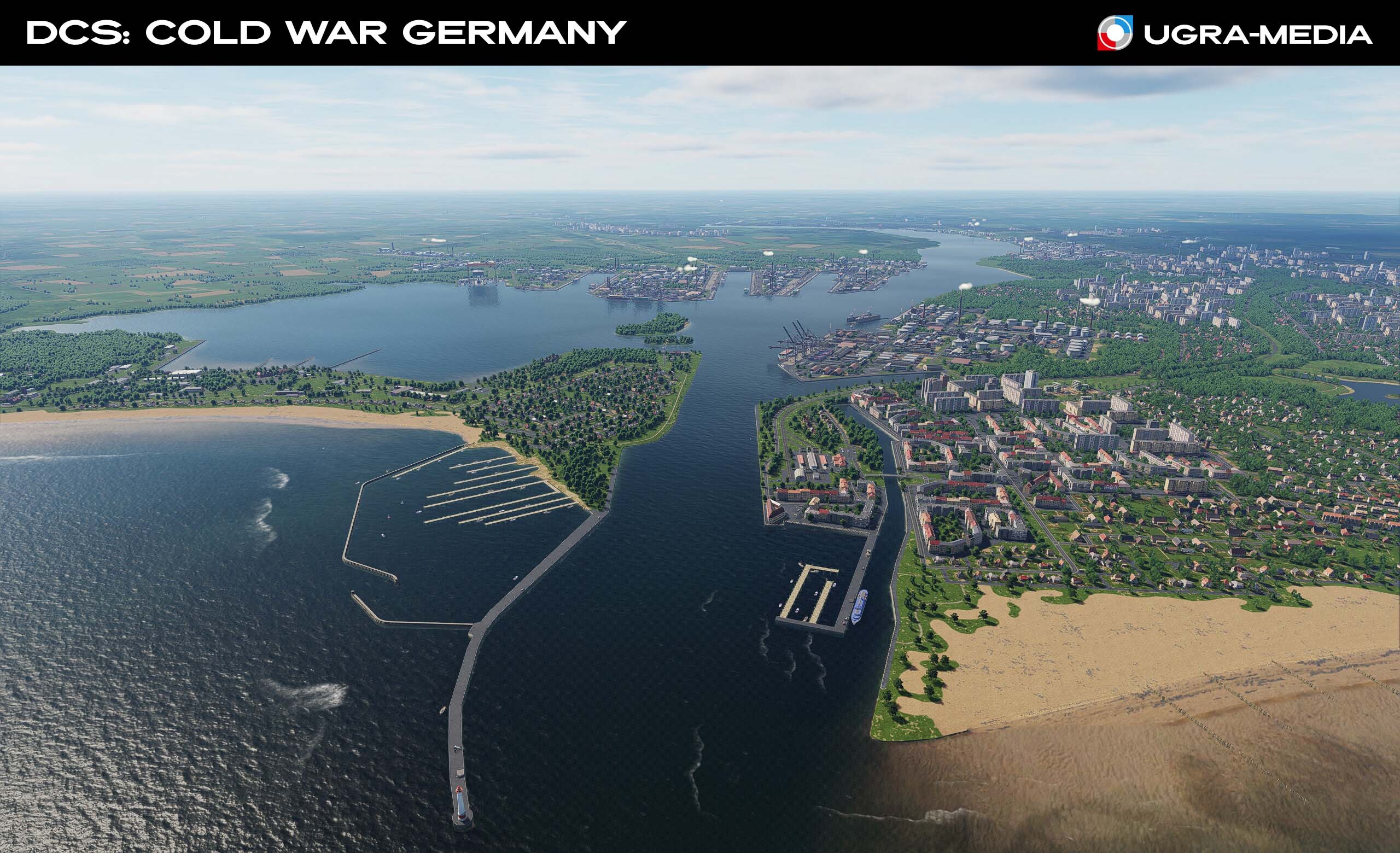
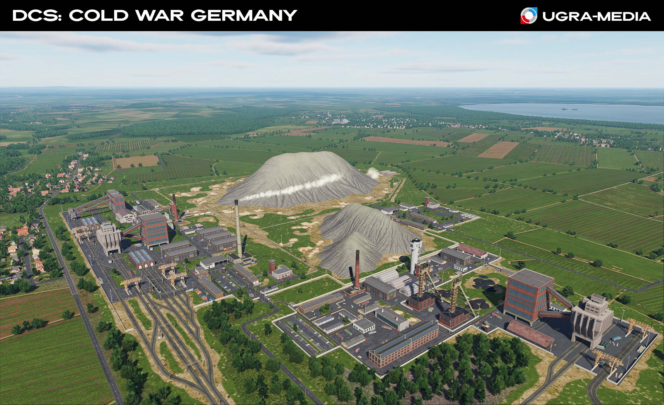
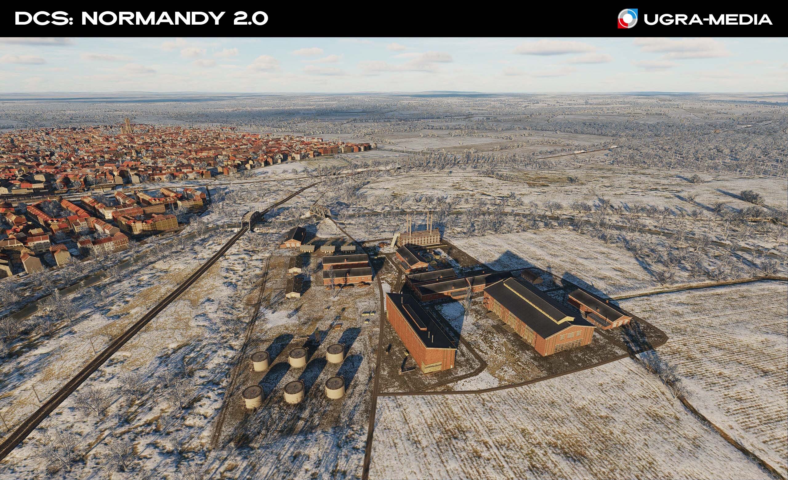
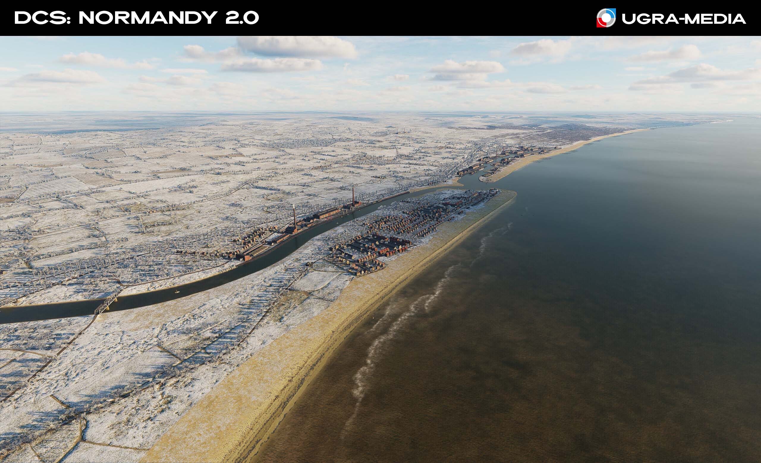
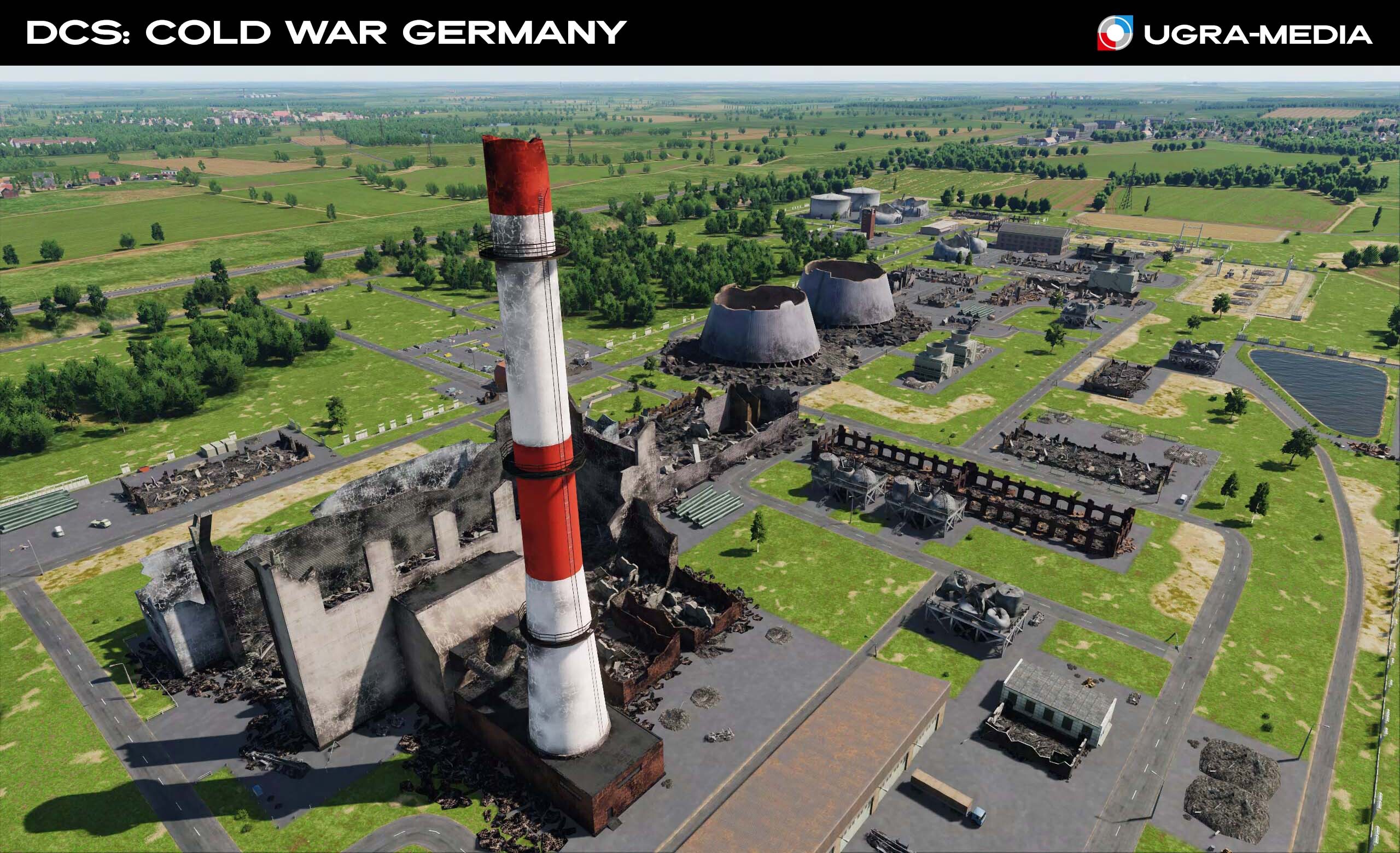
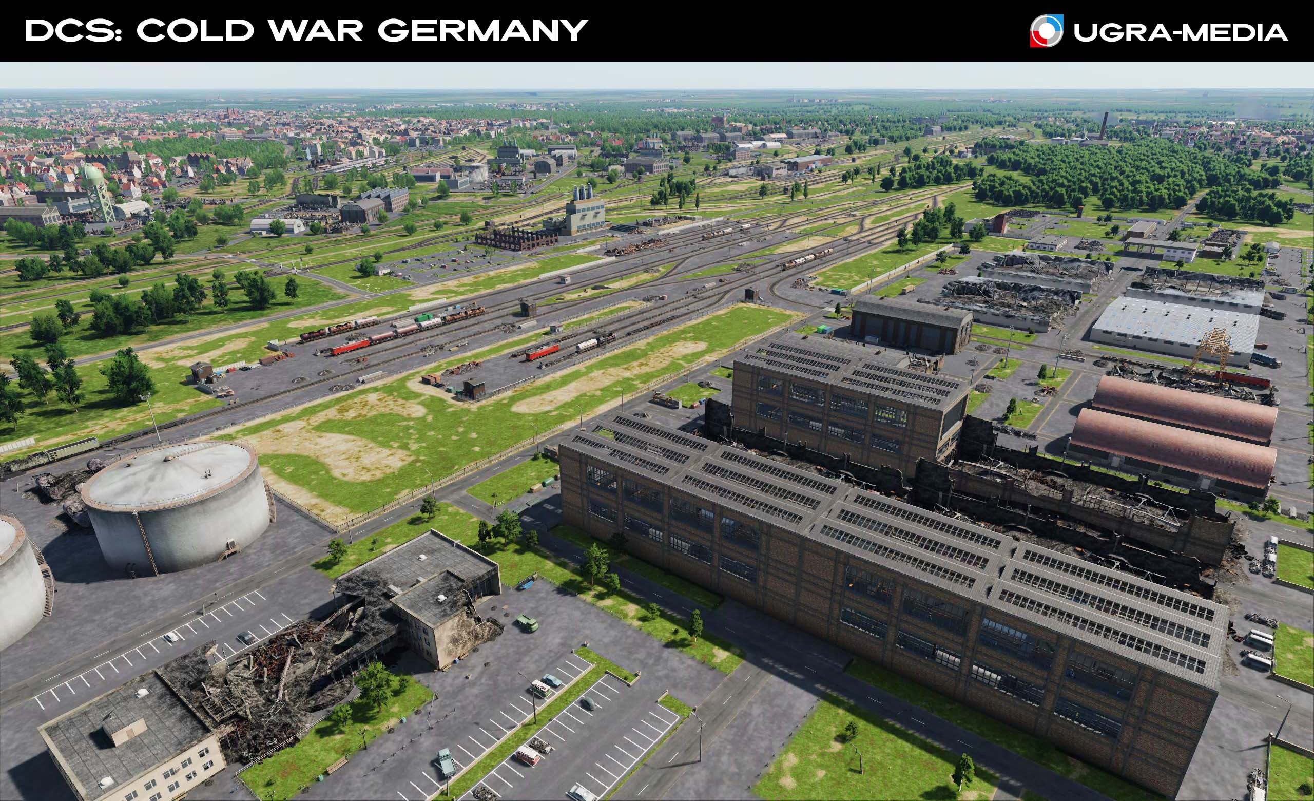
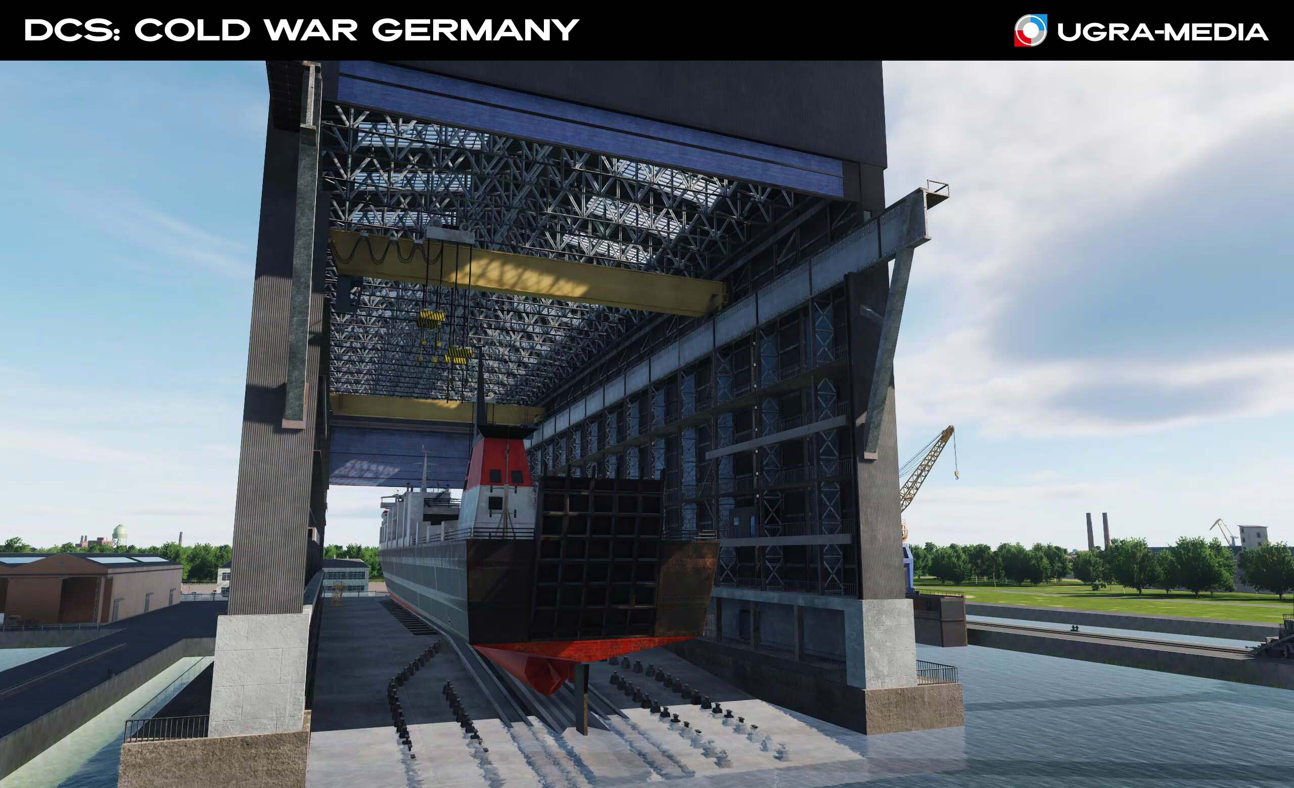
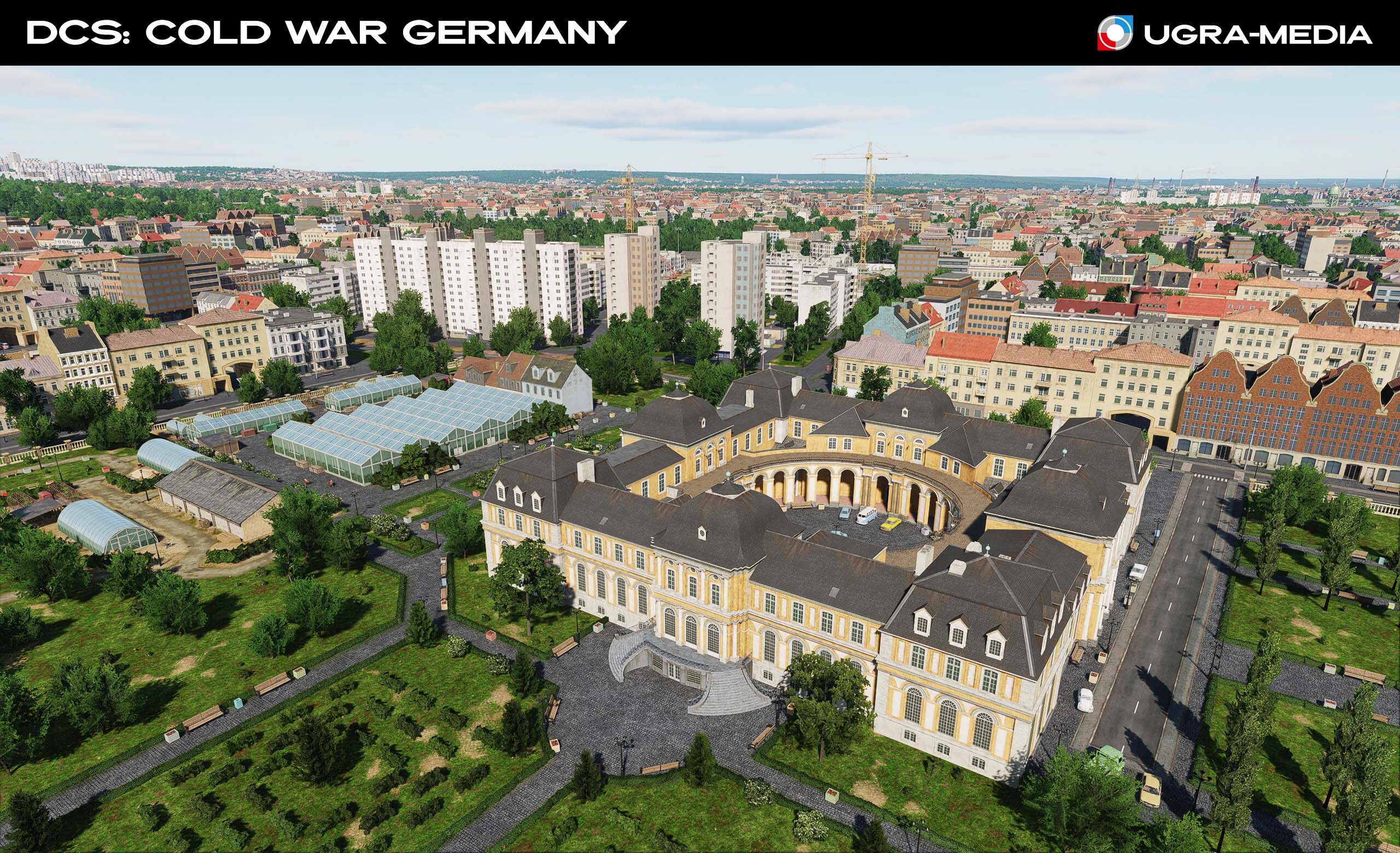
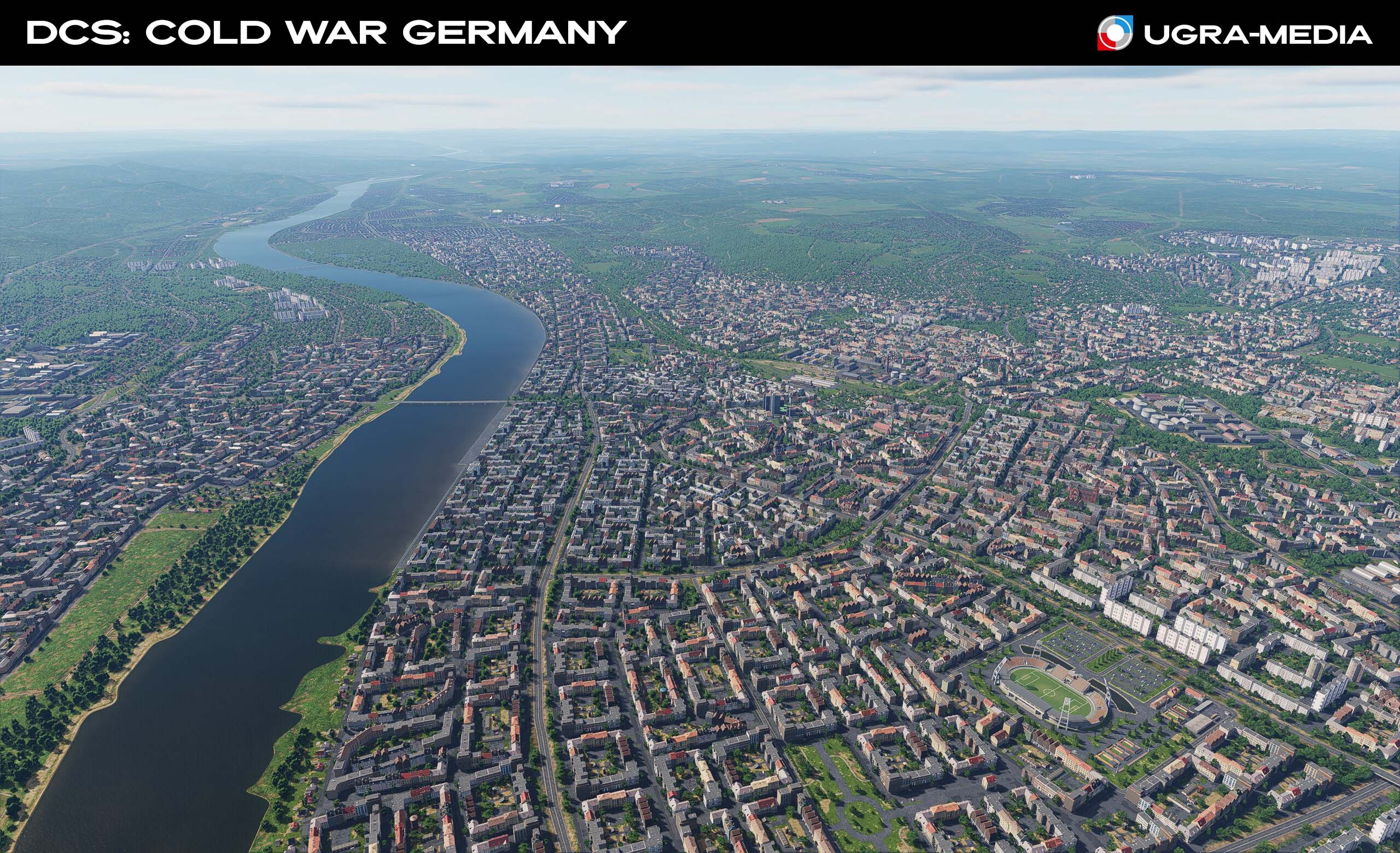
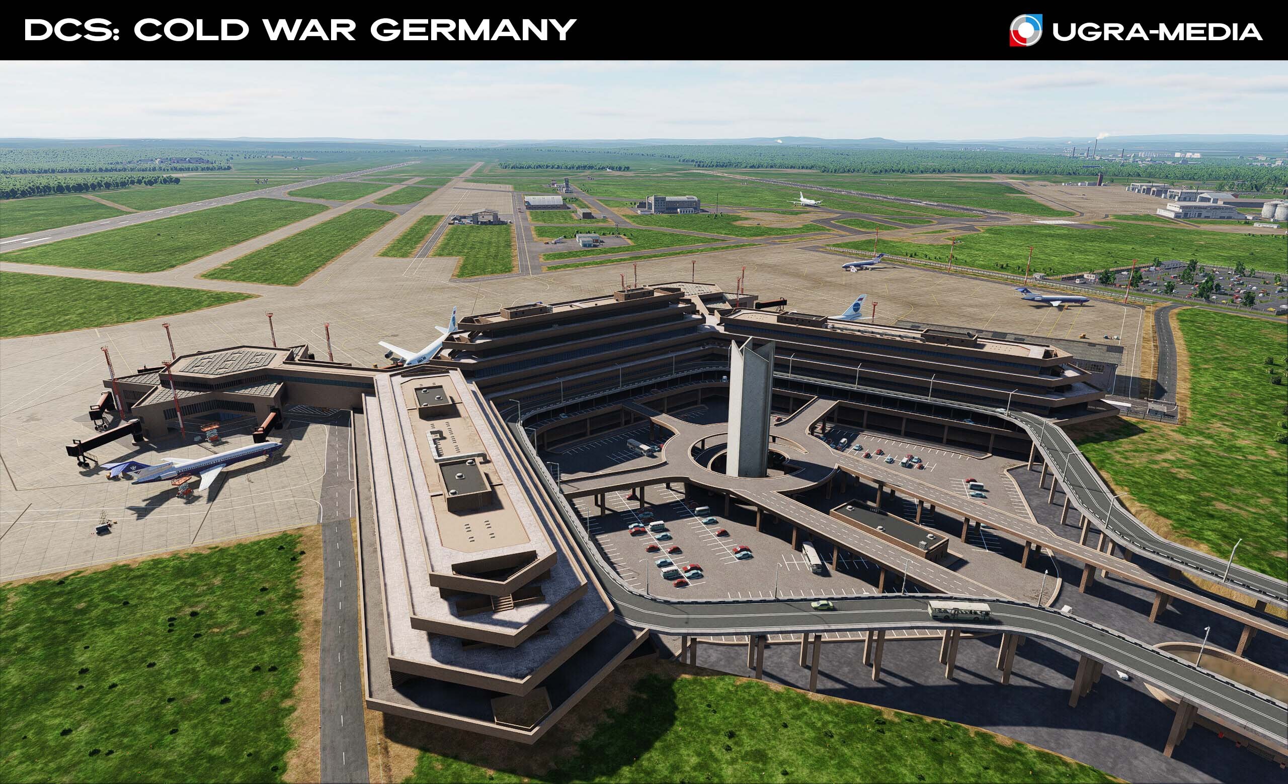
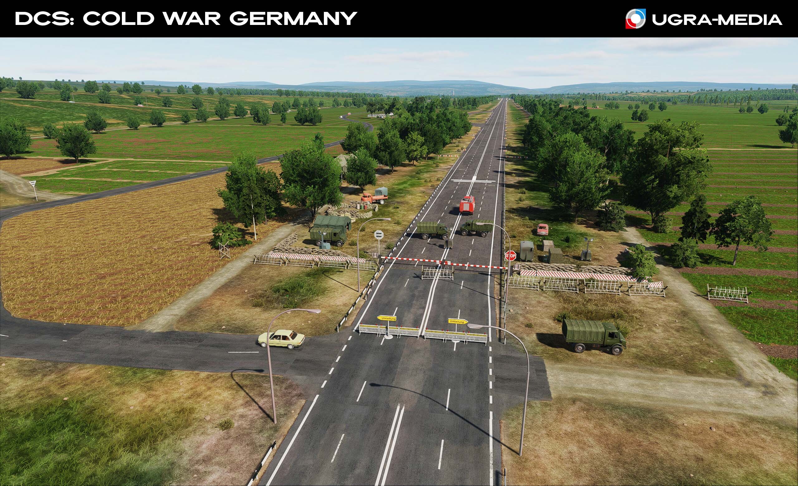
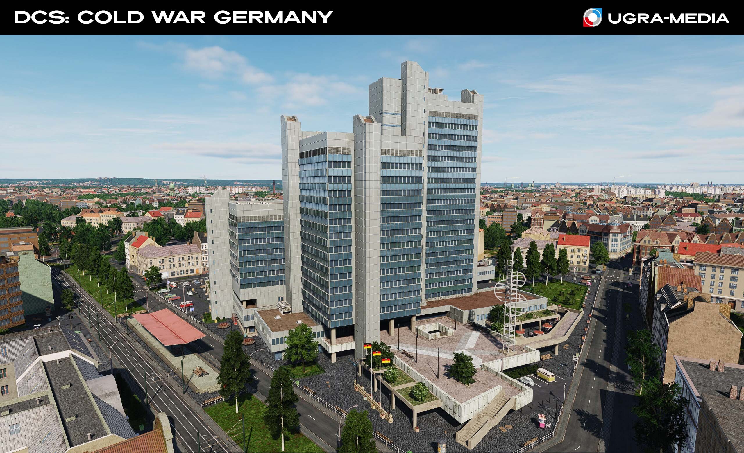
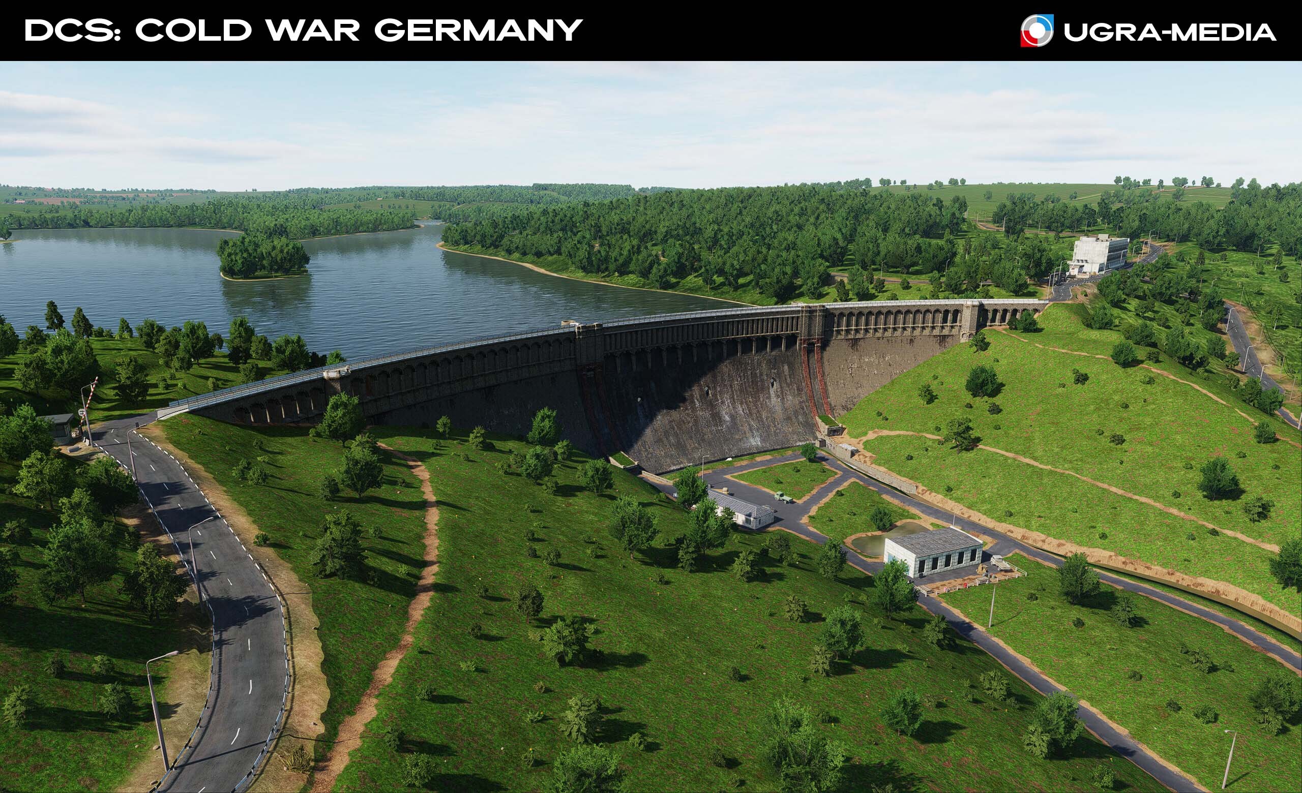
Hallo, ihr Jagdflieger! We're returning to the DCS: Cold War Germany map. A small but action-packed update is in the works, adding new locations, important tactical objectives, and new services to the map: During the Cold War, Bonn became the temporary capital of West Germany. We've added the city, including the famous "Bonn Pentagon" —the complex of buildings housing the Federal Ministry of Defense, a key military objective in any conflict scenario. We've also added the 72-meter-tall Stadthaus (city administration) building and the Poppelsdorf Palace. The Federal Ministry of Defense ("Bonn Pentagon") Stadthaus Poppelsdorf Palace Valentin Submarine Facility We've recreated one of the most impressive and macabre sites of the Third Reich—a gigantic concrete bunker on the banks of the Weser. It was the largest fortified U-boat facility in Germany. Most of the roof is around 4.5 meters (15 ft) thick, but part of it is 7 meters (23 ft) thick. In the realities of the Cold War, this monumental complex could have served as a highly secure storage facility or a secret factory. A target of the highest priority. Rostock Port The largest port of the German Democratic Republic (GDR) on the Baltic Sea. During the Cold War, it was a key hub for Soviet and East German maritime transport, a logistics hub, and a potential base for Warsaw Pact warships and submarines. One of the key strategic targets in the update is the Ennepe Dam – a hydroelectric power station in North Rhine-Westphalia, built in the early 20th century. NATO and Warsaw Pact military doctrines considered hydraulic structures to be top-priority targets. Industrial area with waste heaps: we've added Terricones SA-2 Air Defense Zone: Consider deployment locations when planning missions. Cologne-Bonn Airport (Terminal): A major hub ready to receive your aircraft. Autobahn Runway: Using sections of highway as runways is a legendary practice. New opportunities for you. Flights to such runways require pilots with precision takeoff and landing skills. Stay tuned, we'll show you and tell you more about the upcoming update. Don't forget to get your new certification!

- 11 replies
-
- 40
-

-

-
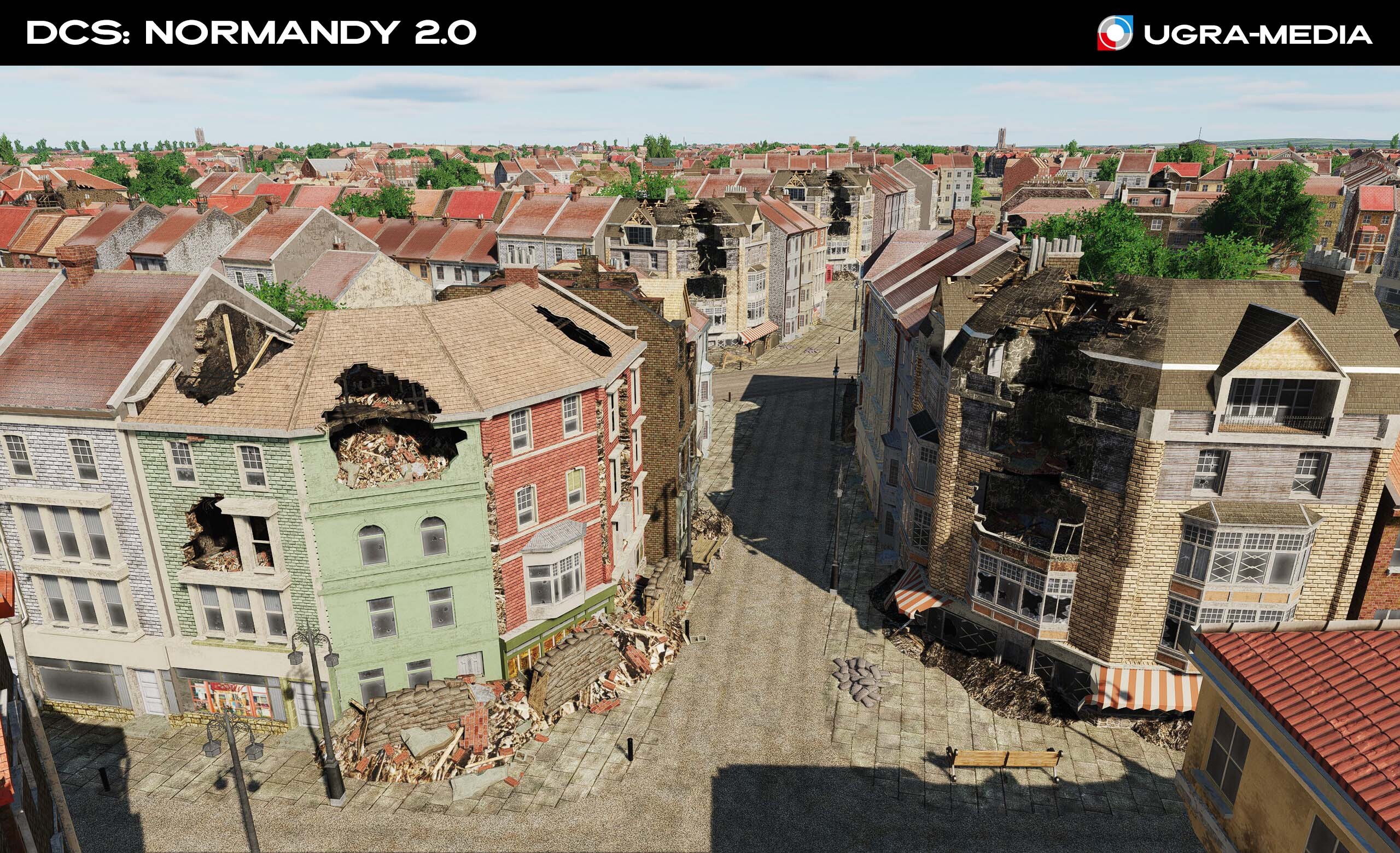
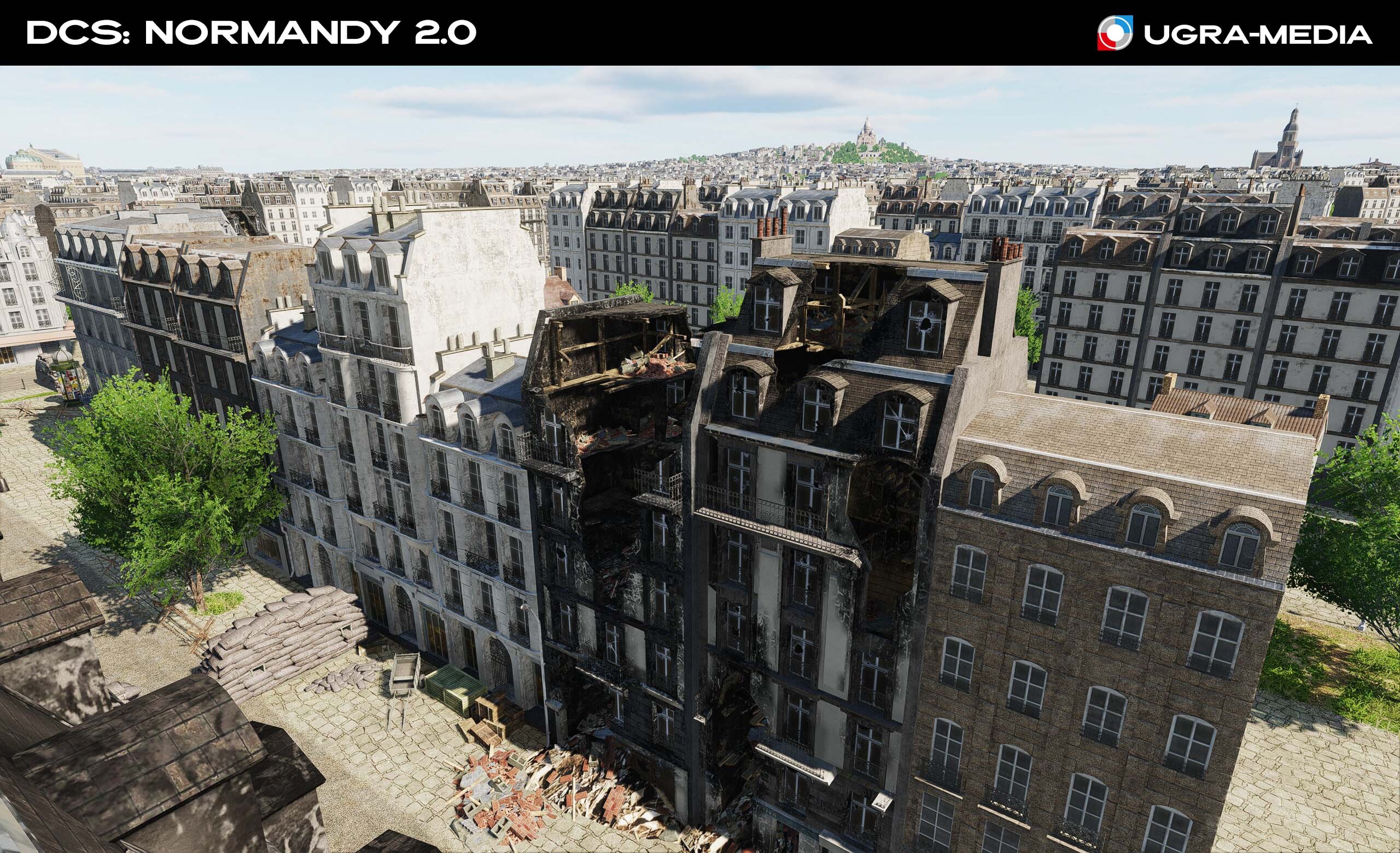
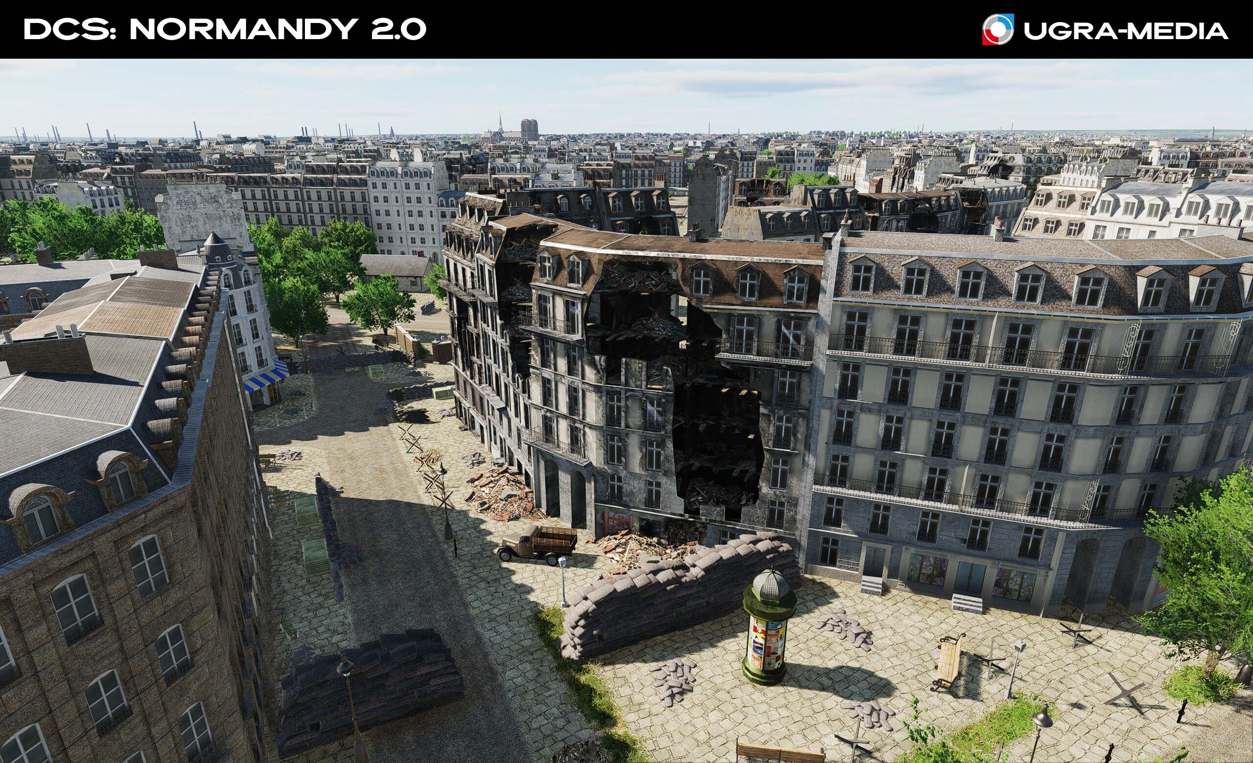
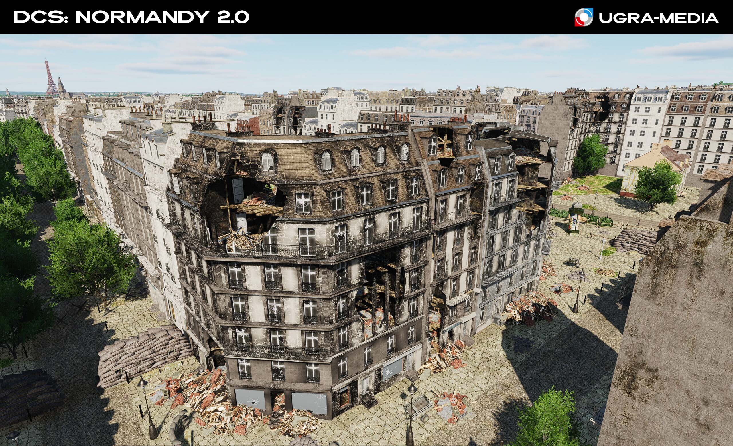
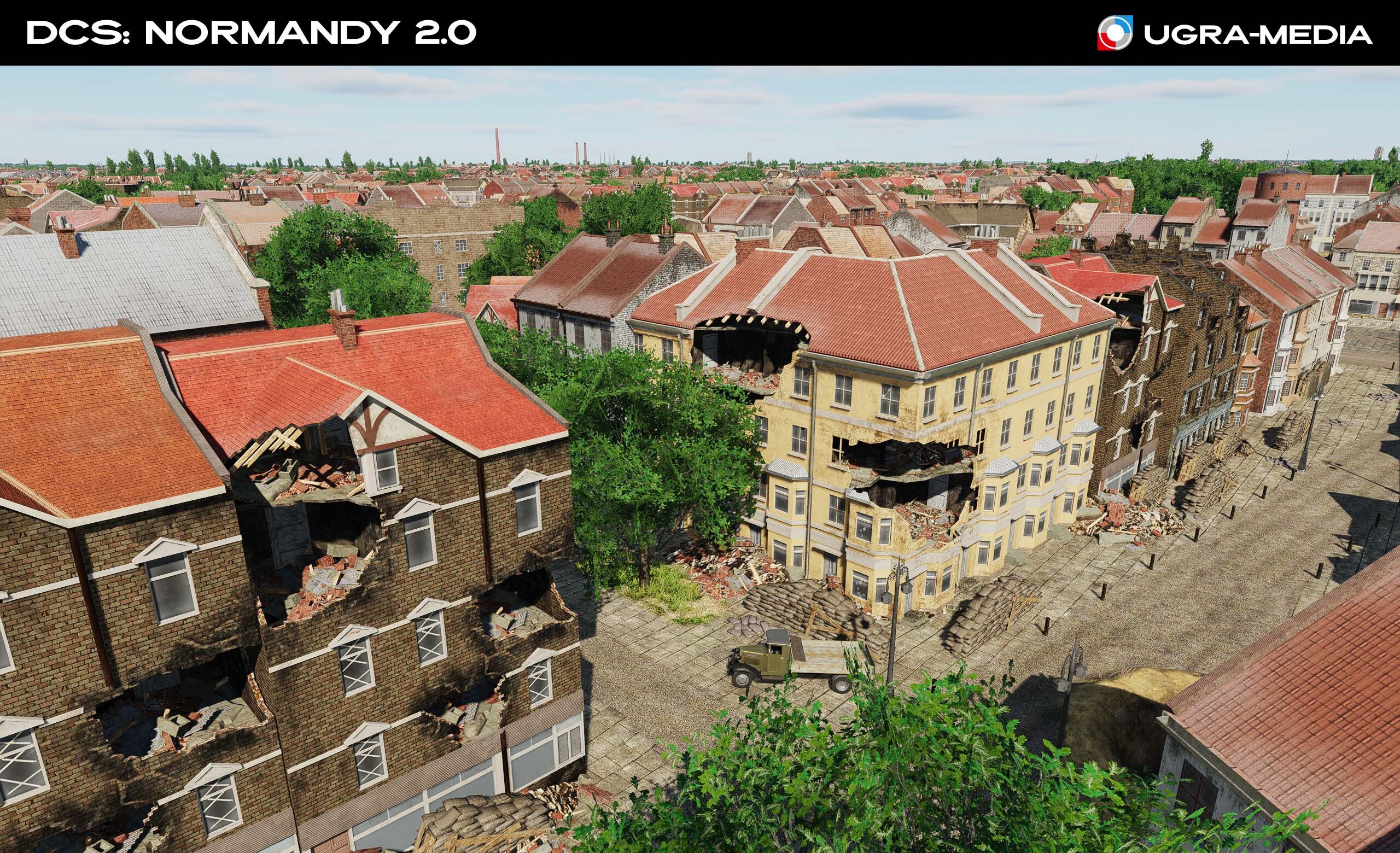
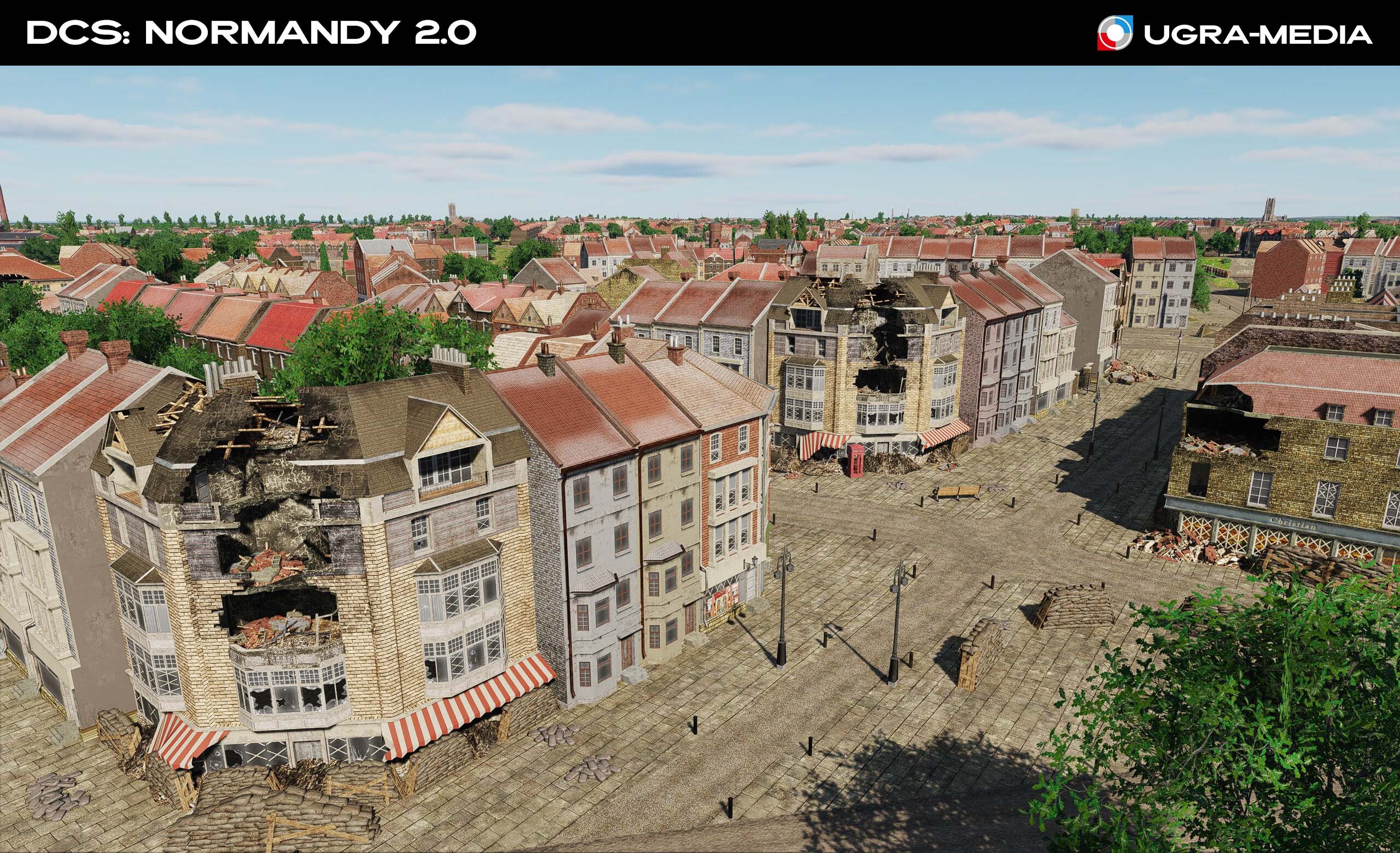
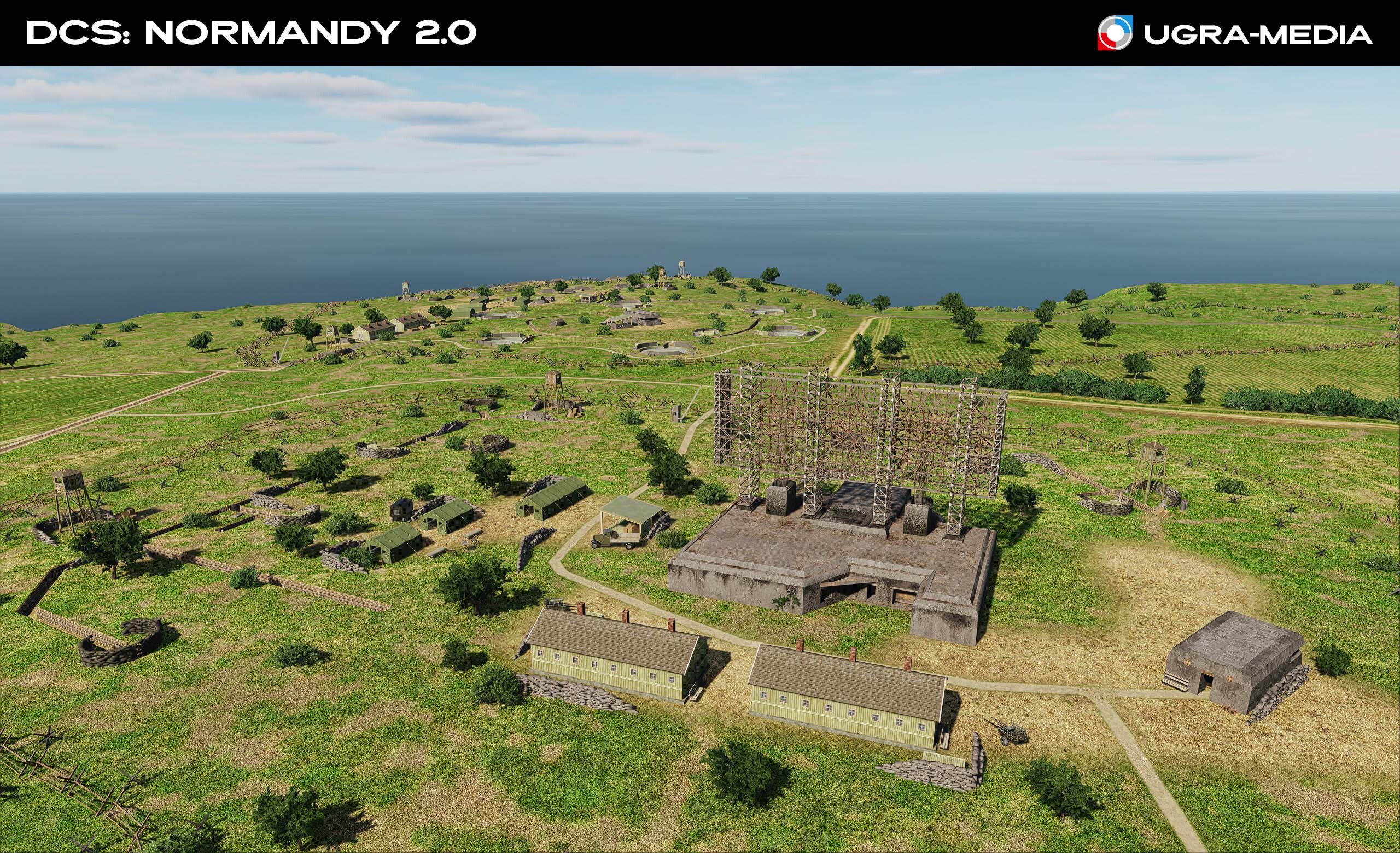
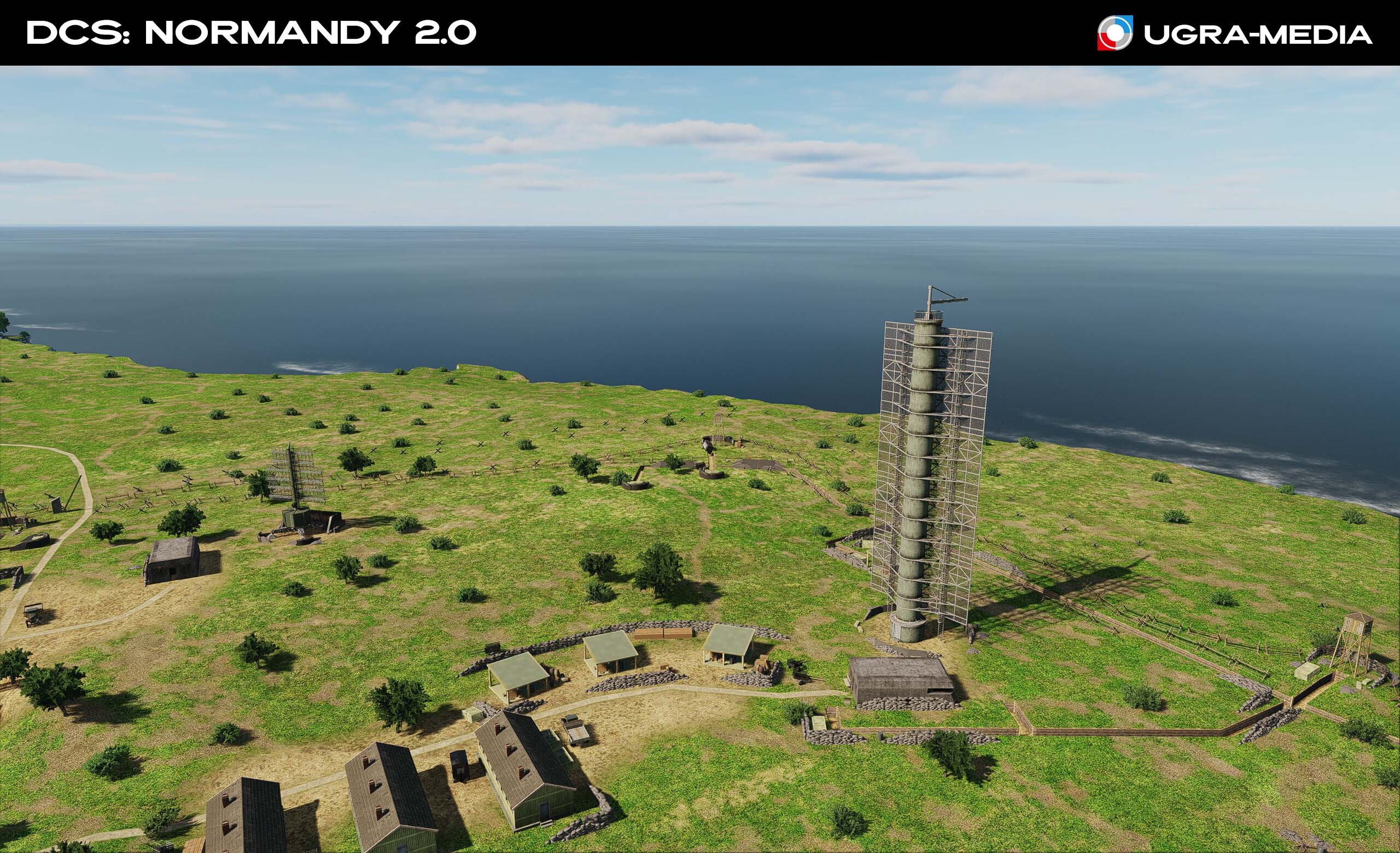
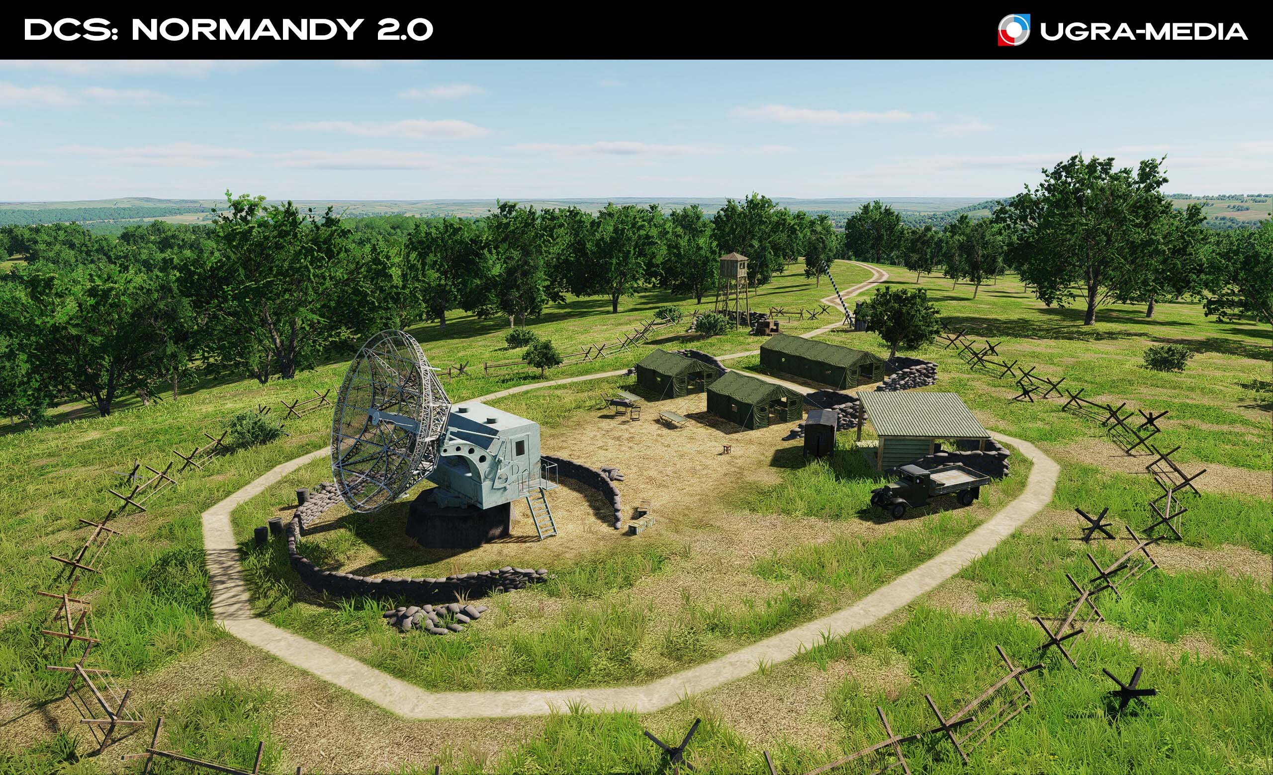
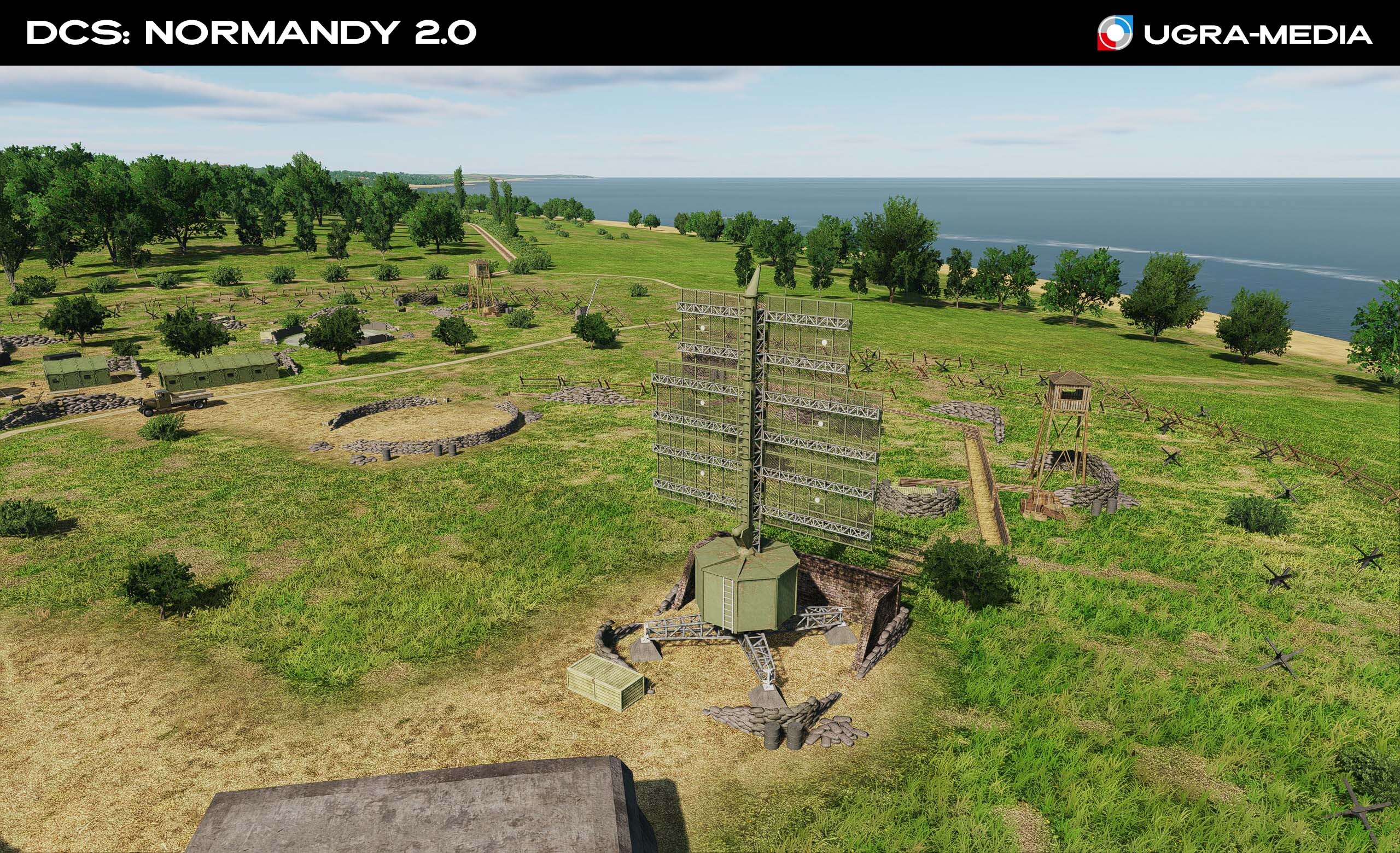
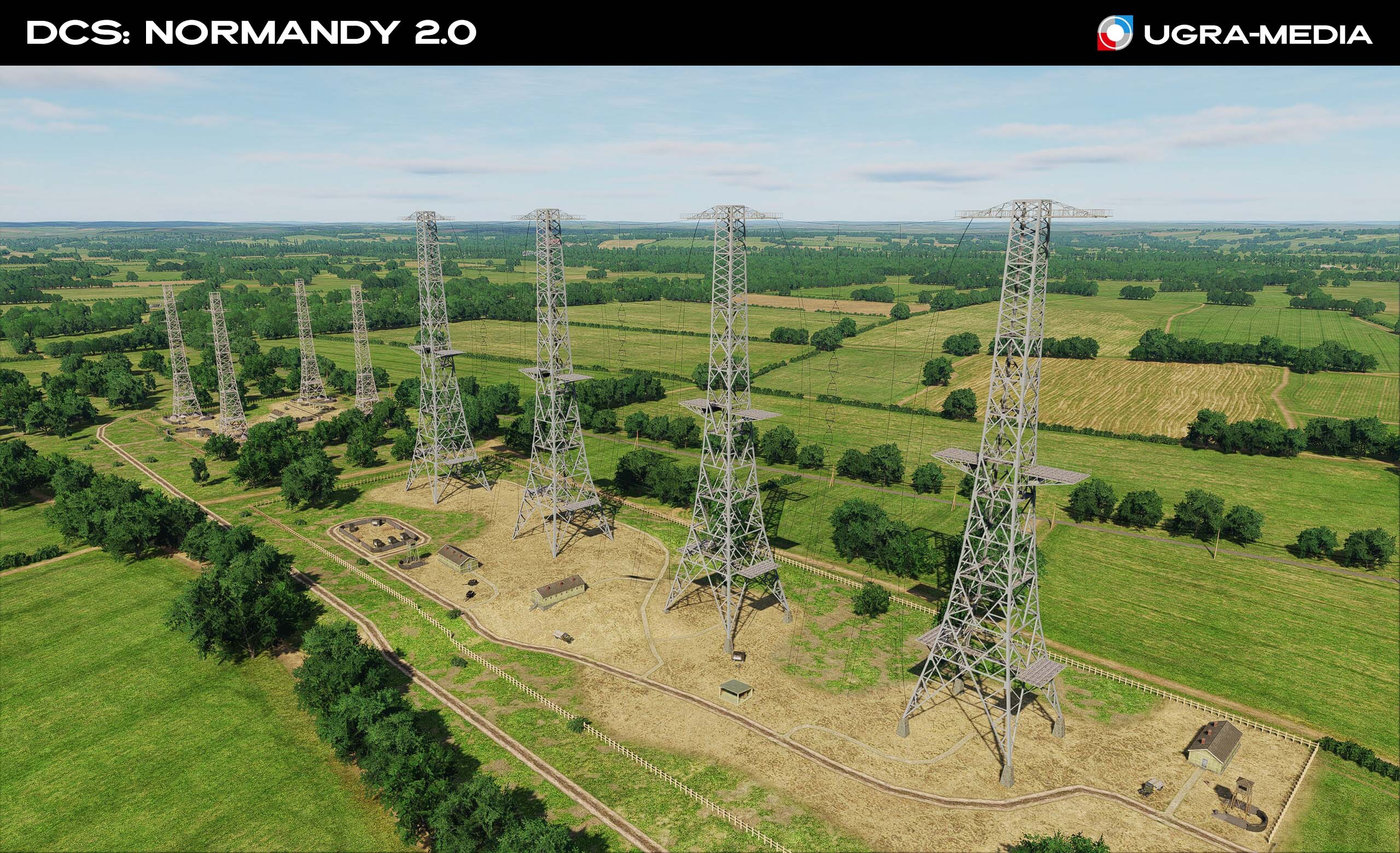
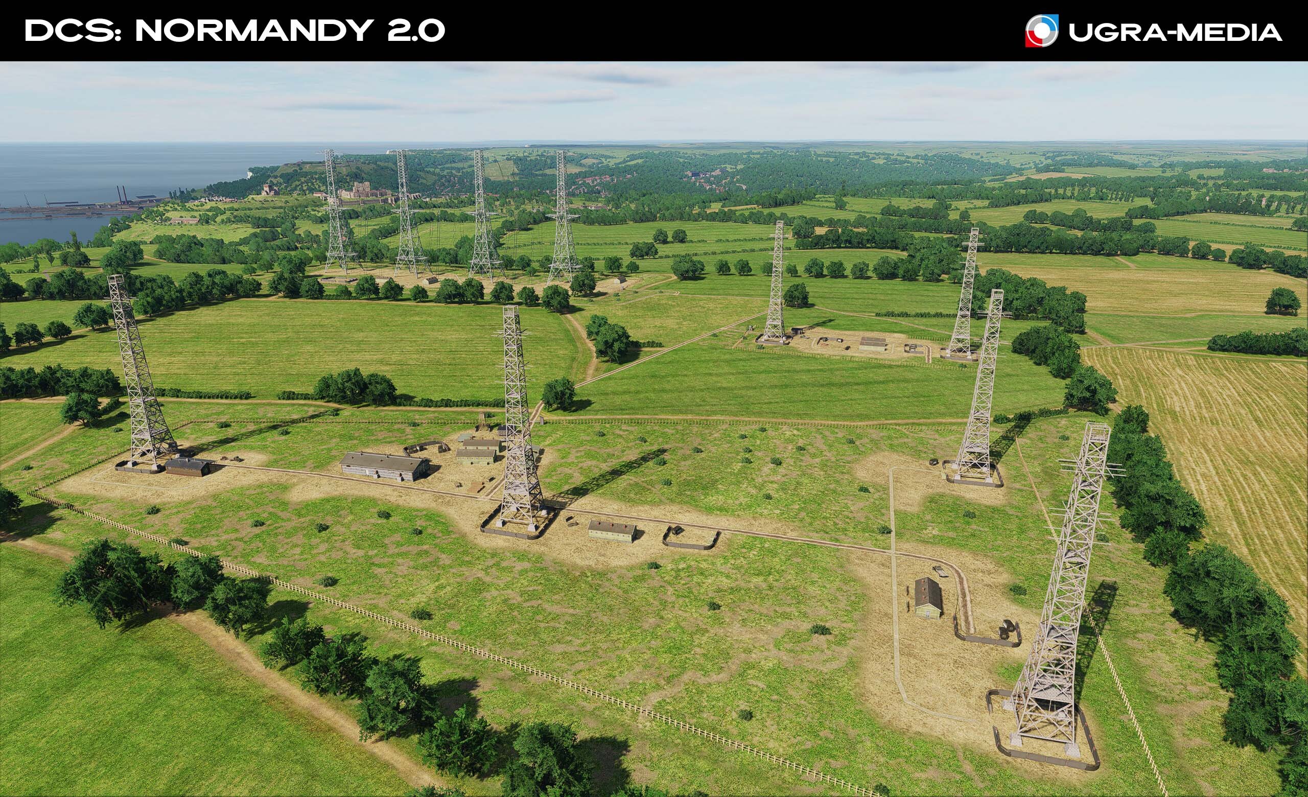
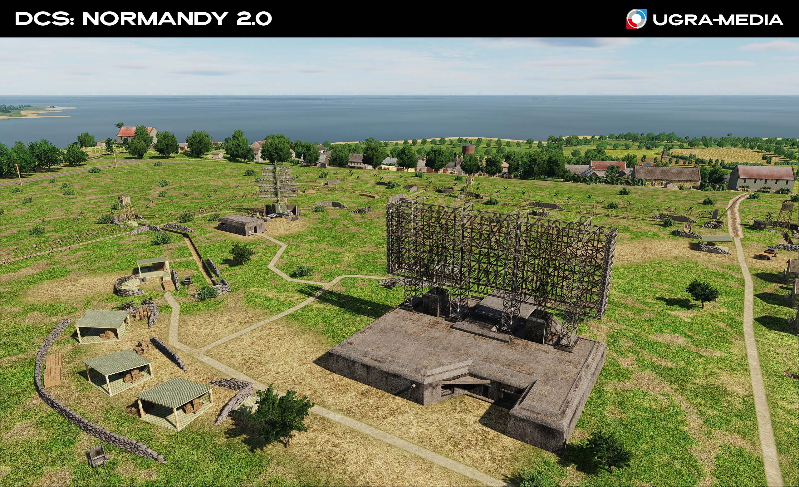
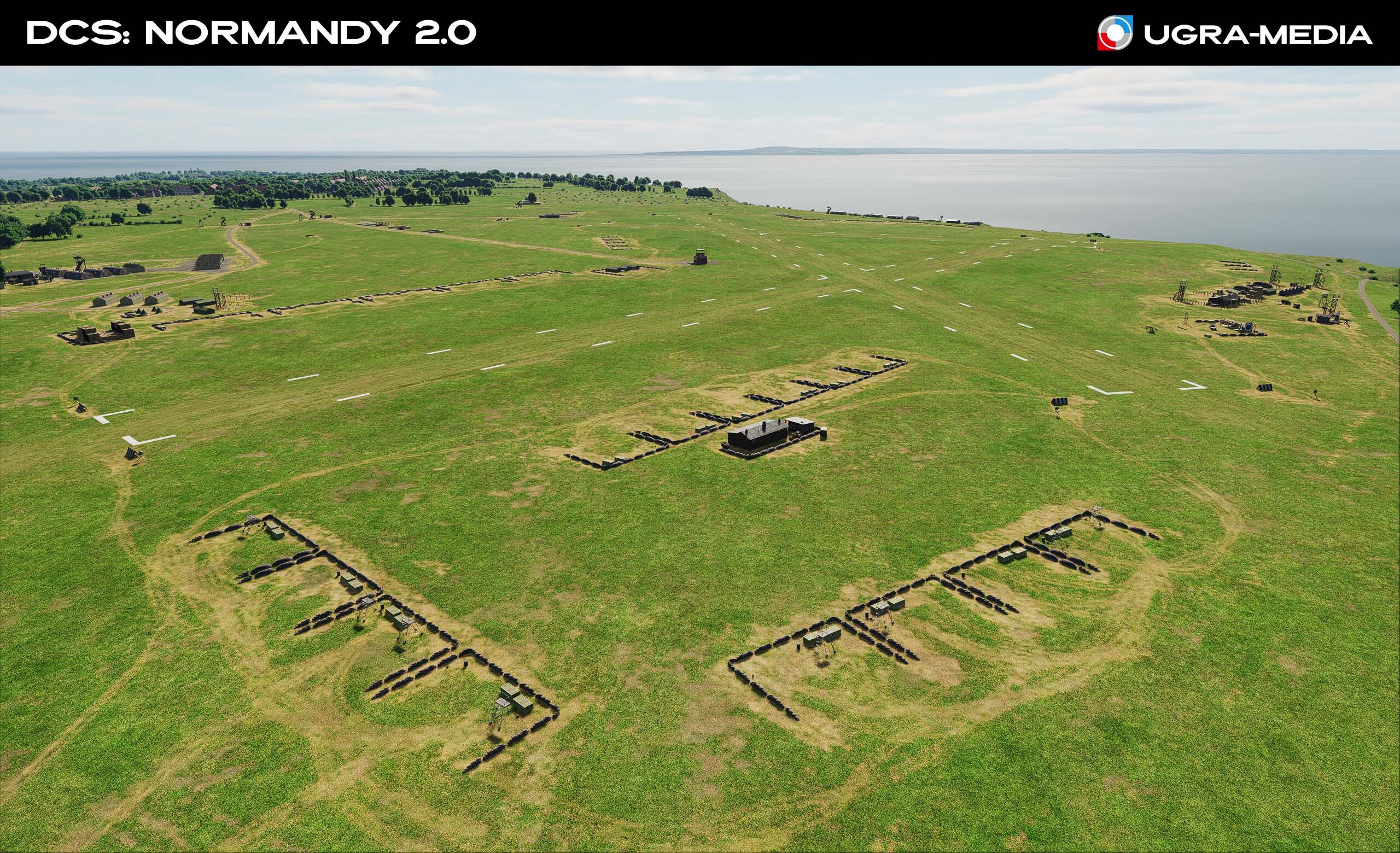
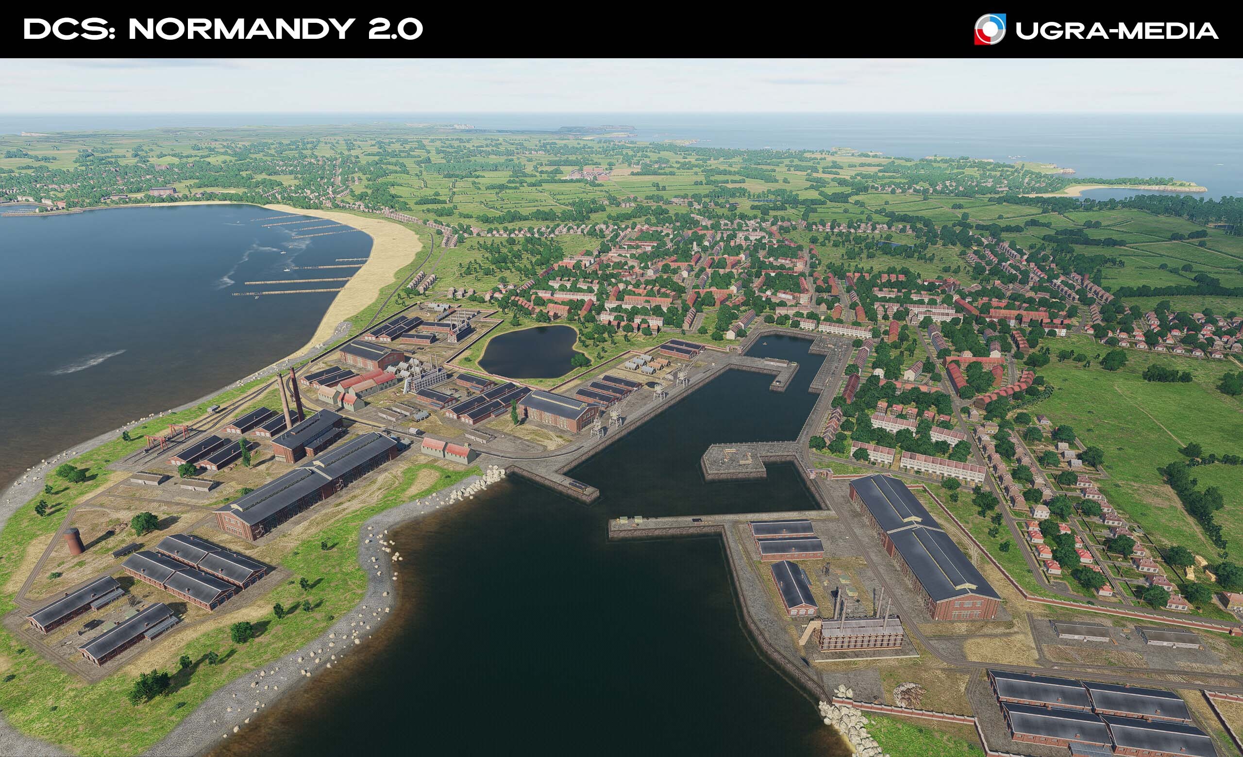
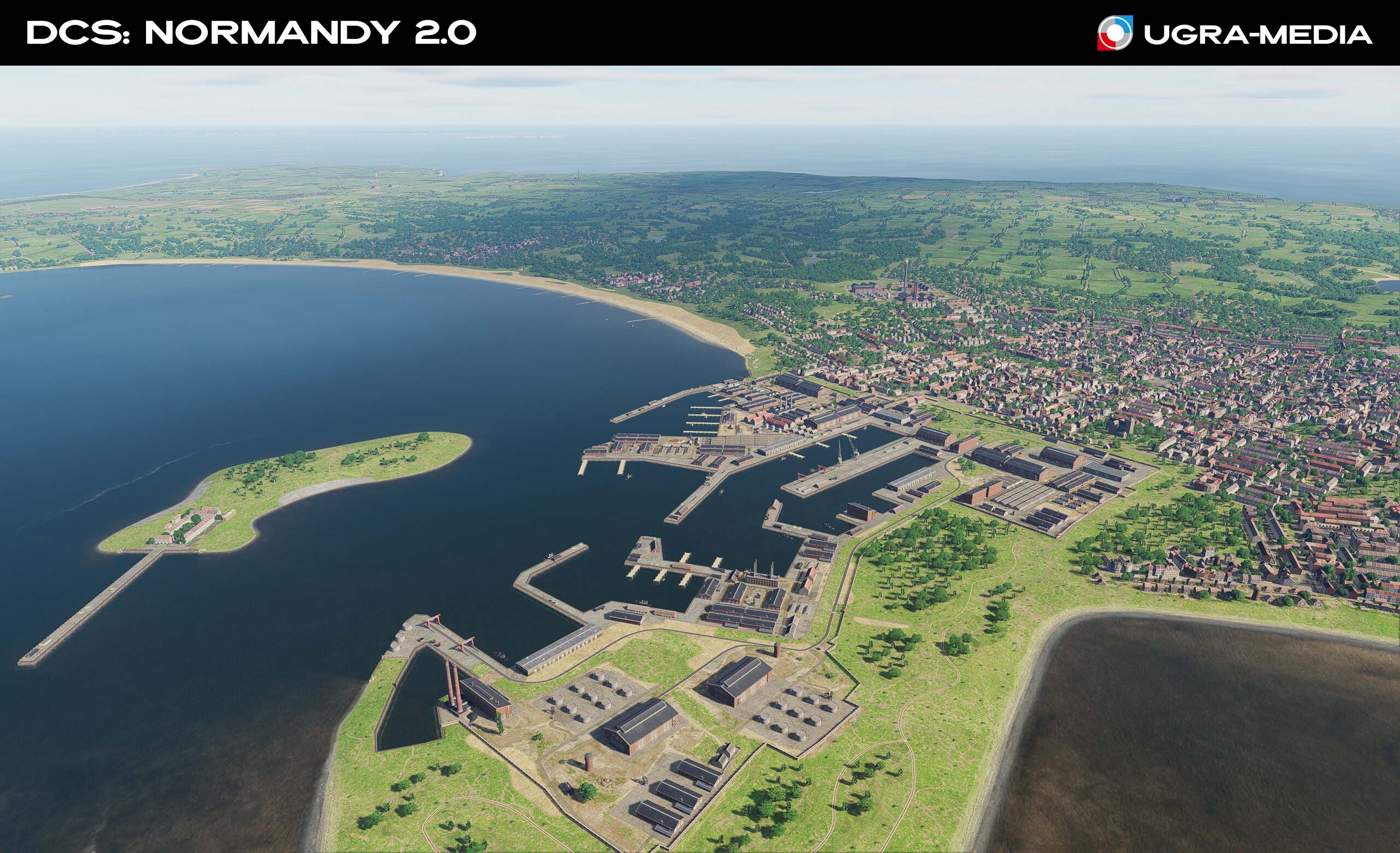
Hi fighters War leaves scars not only on the battlefields but also on the streets of great cities. We’ve added new ruin objects in London and Paris that will make your flights over the cities even more atmospheric. Get ready for new challenges in DCS: Normandy 2.0! We added German radar points and air defense positions. The radars were laid out based on historical data, maps and reports including materials kindly provided by our community. Get ready to take off! … and check your flight plans so you don’t become a target yourself.
-
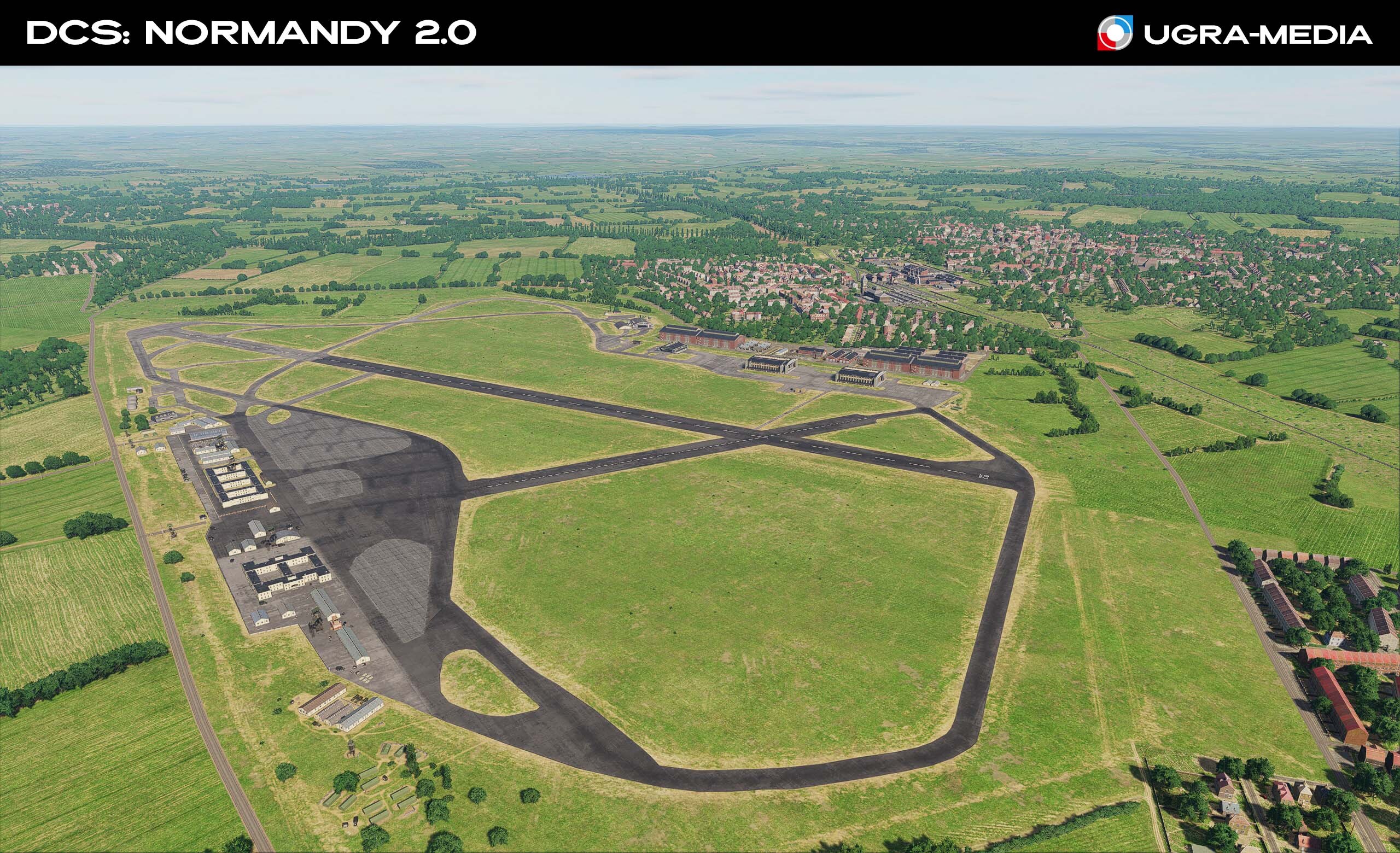
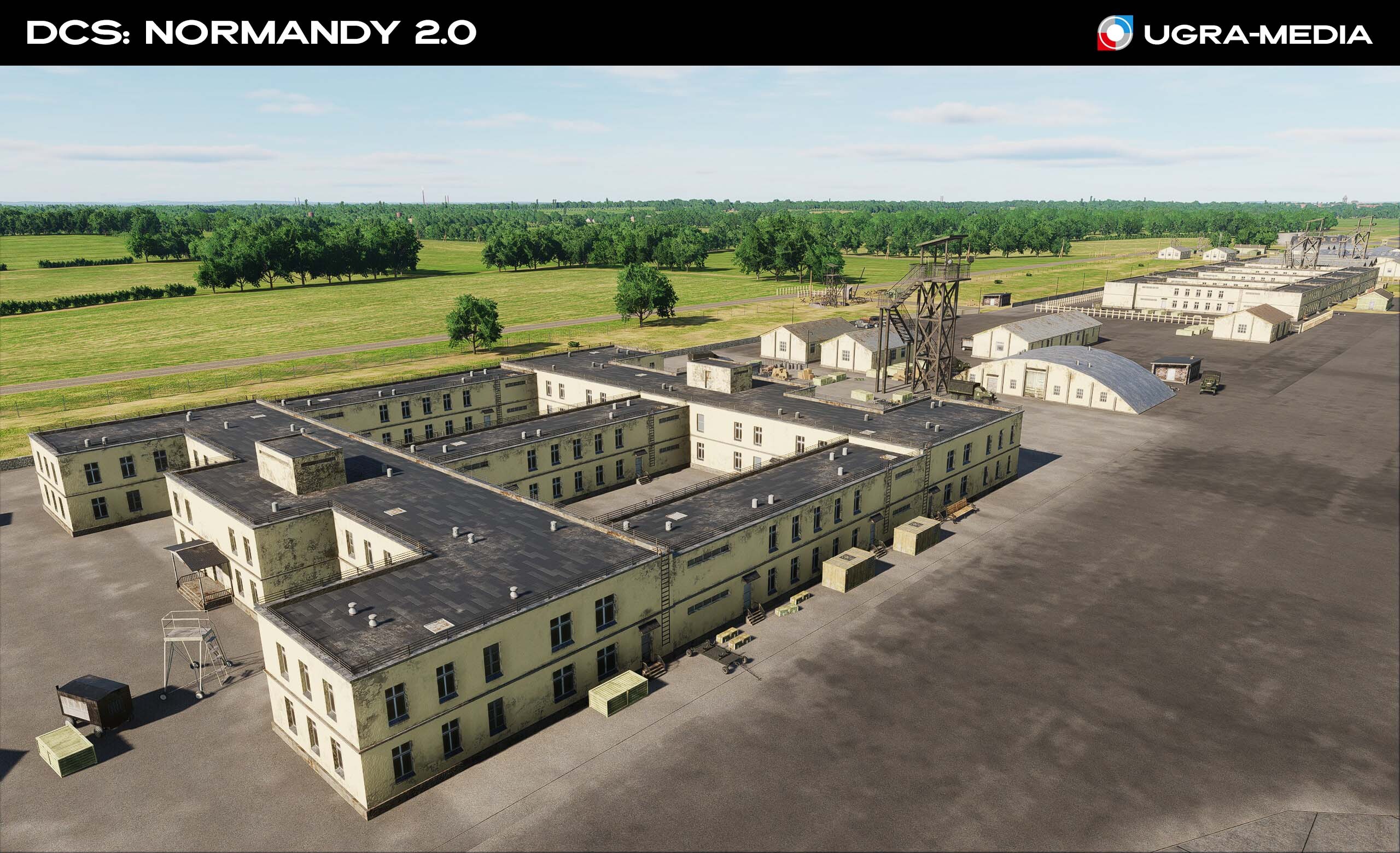
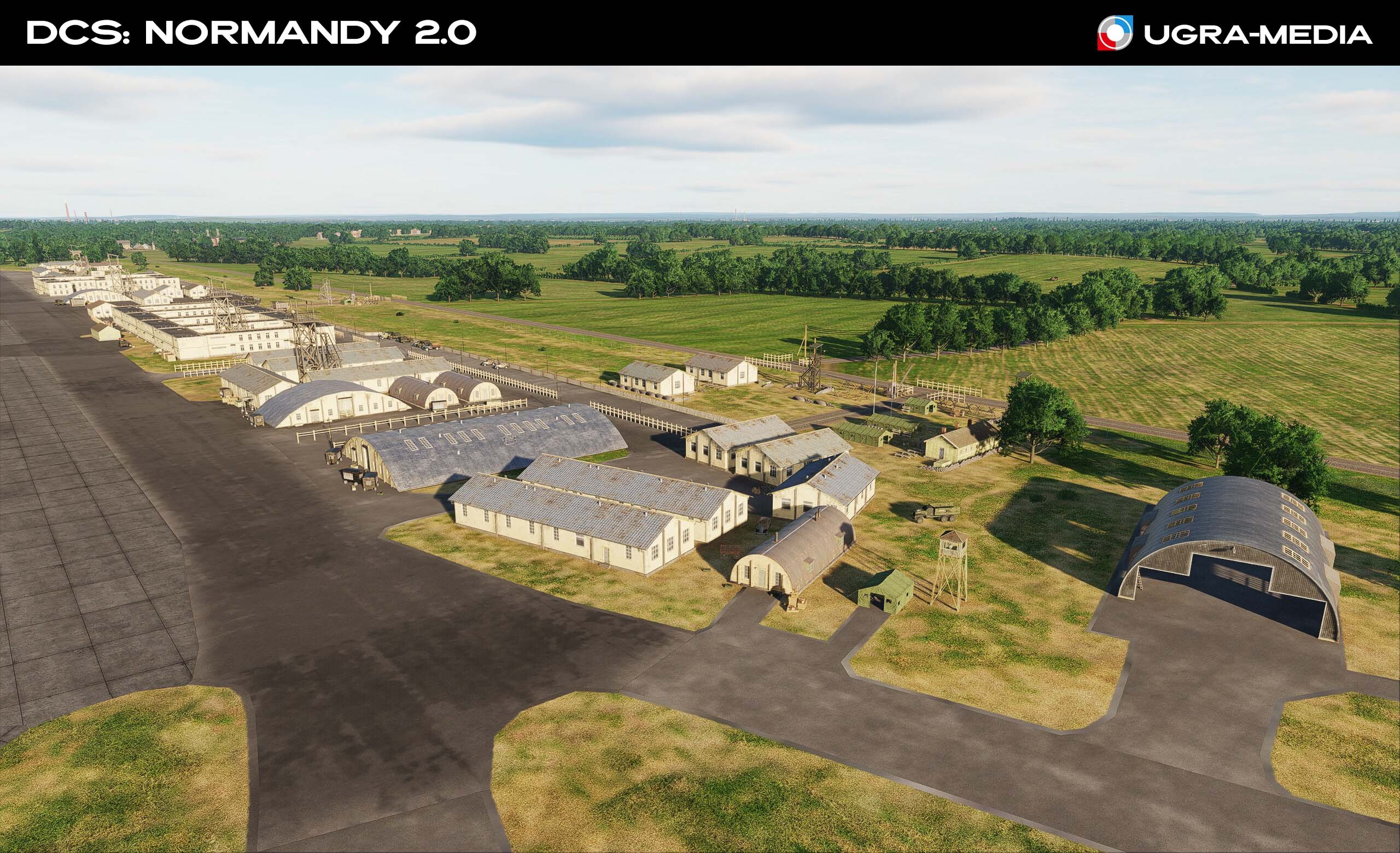
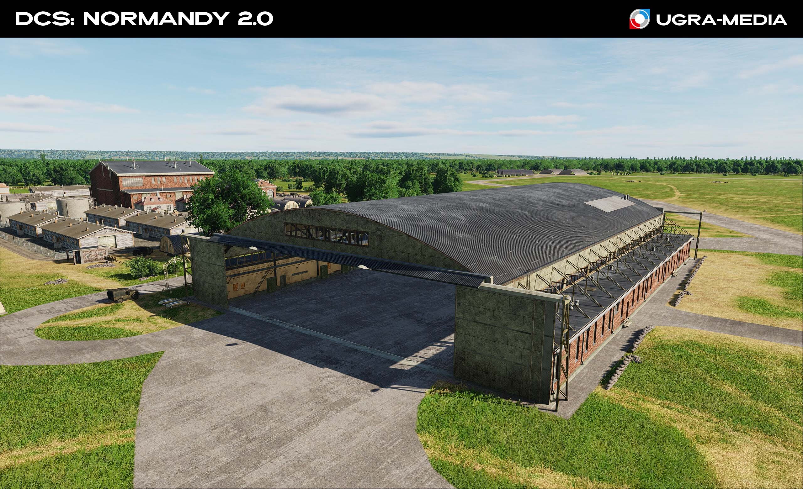
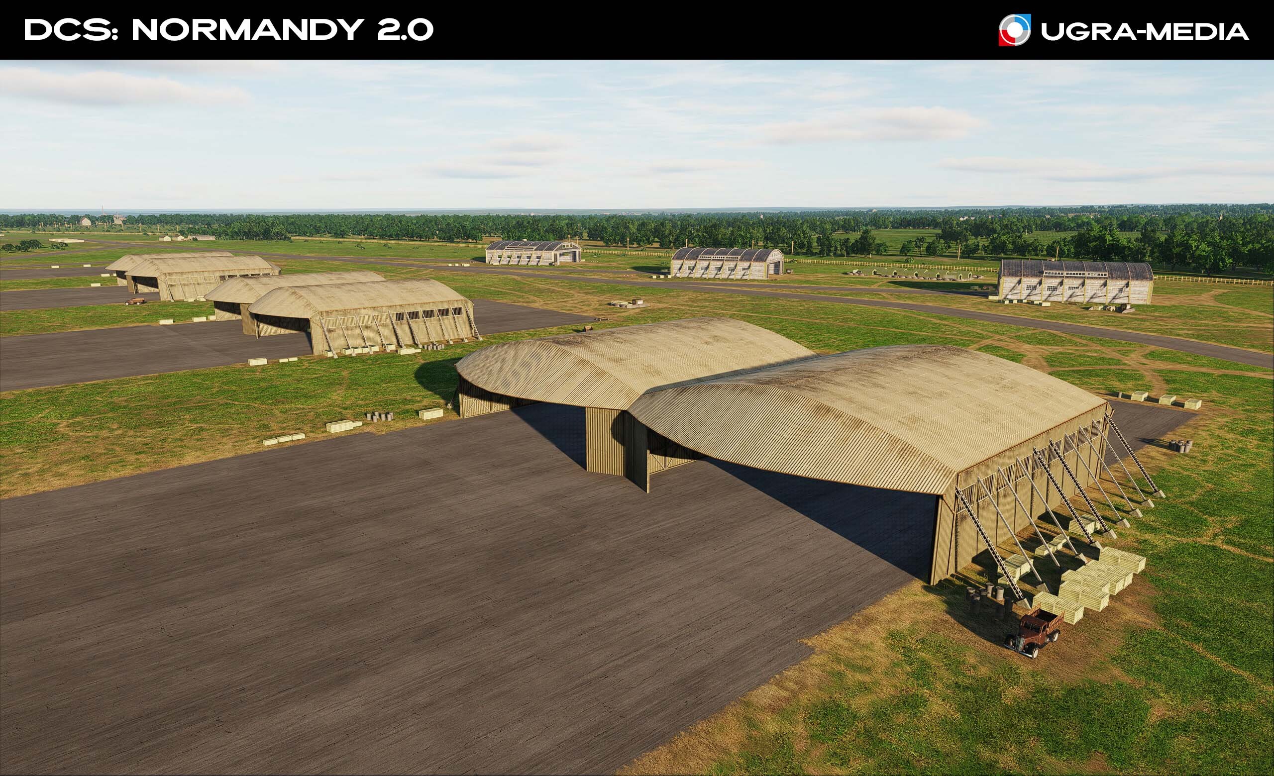
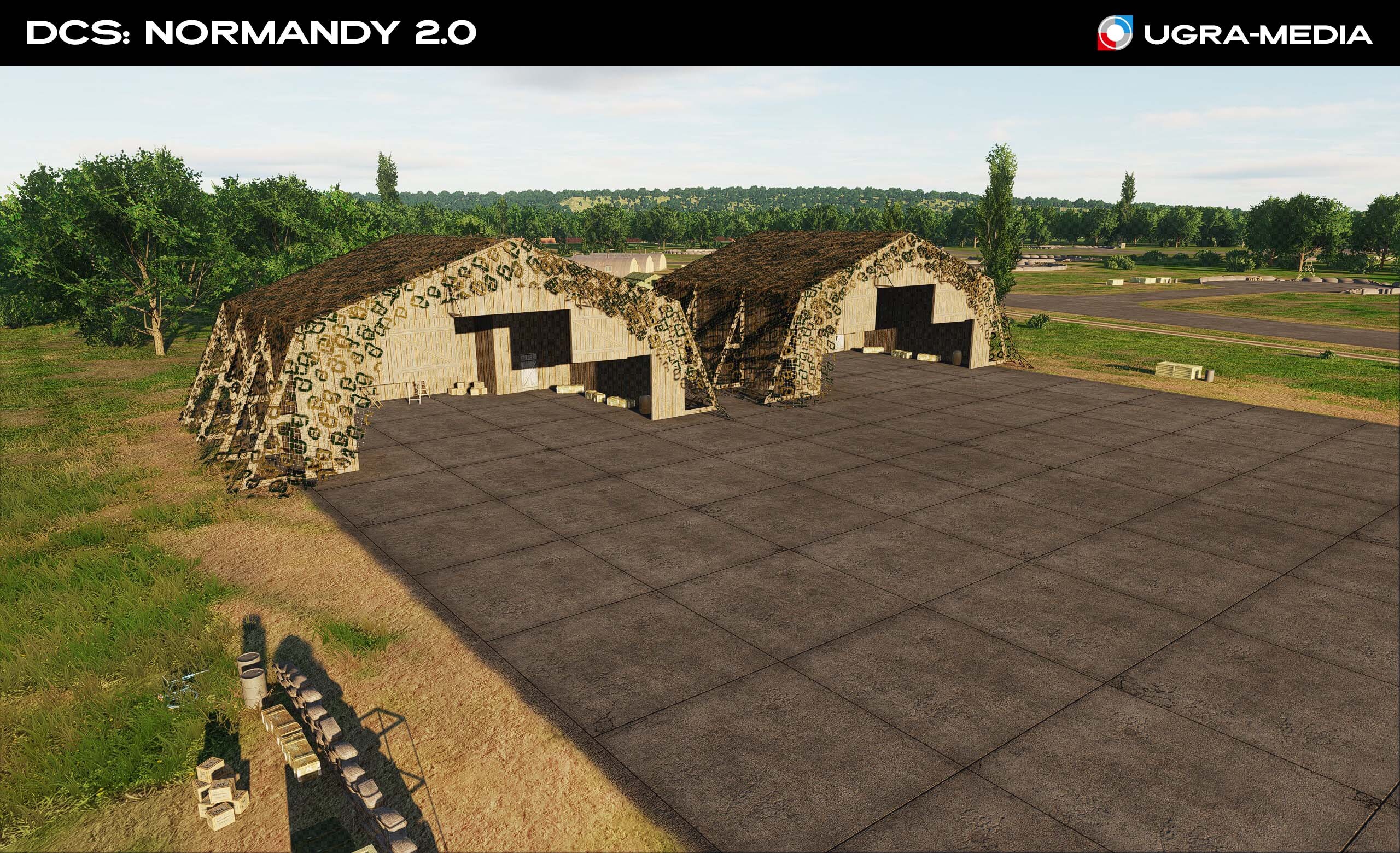
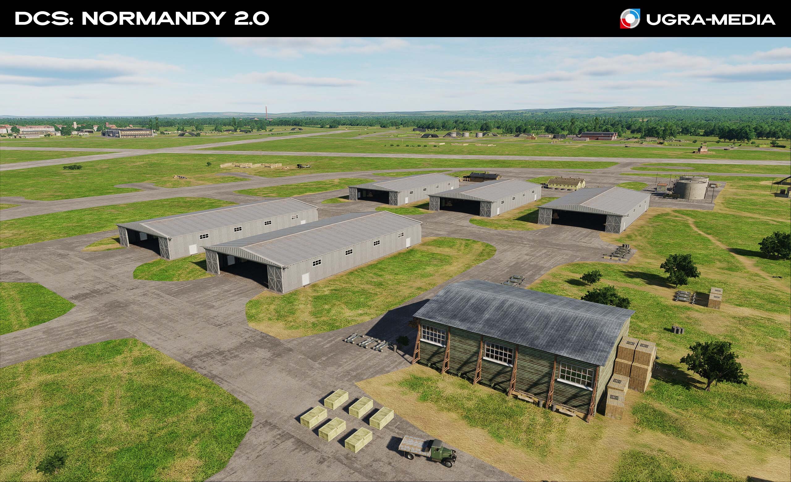
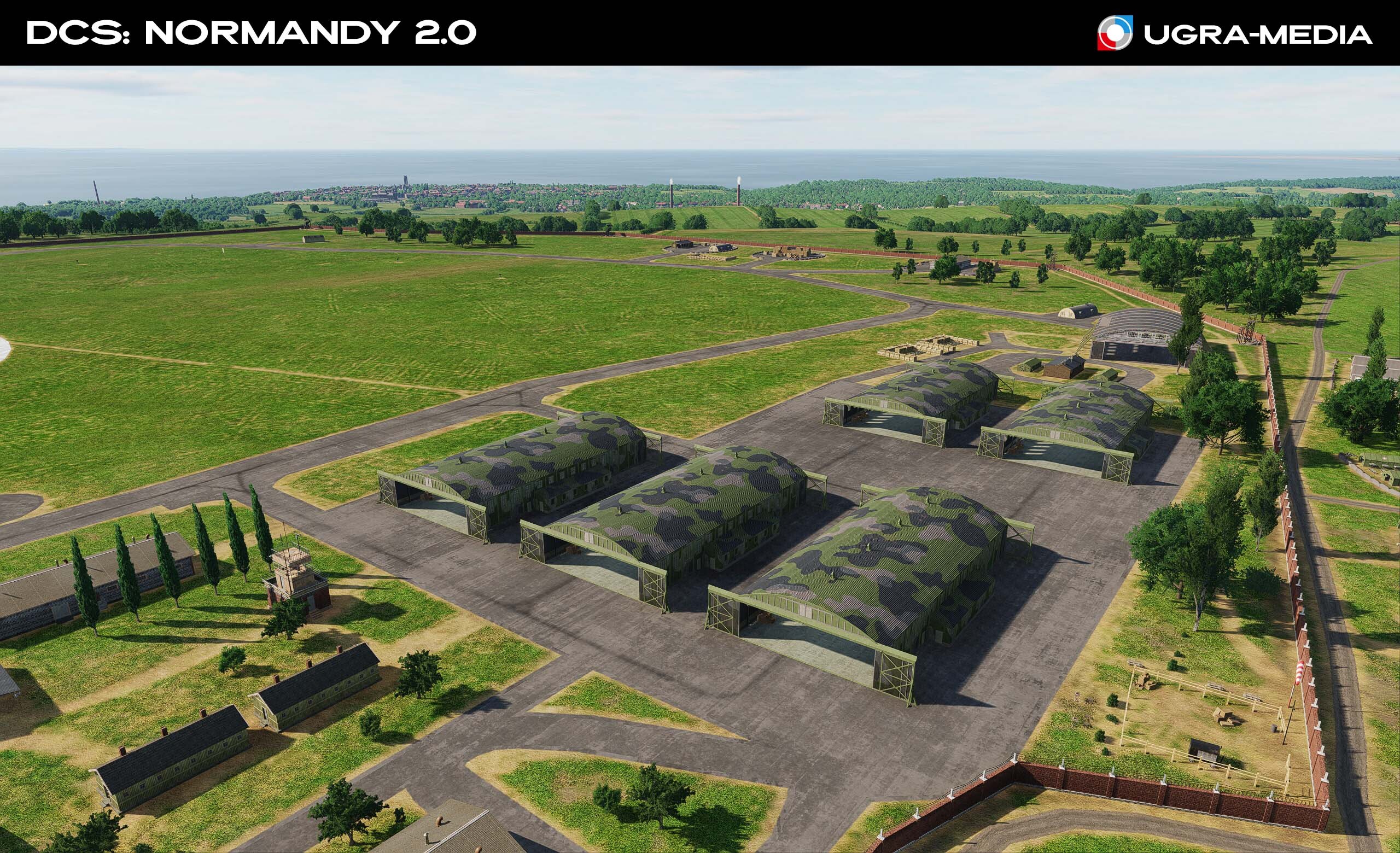
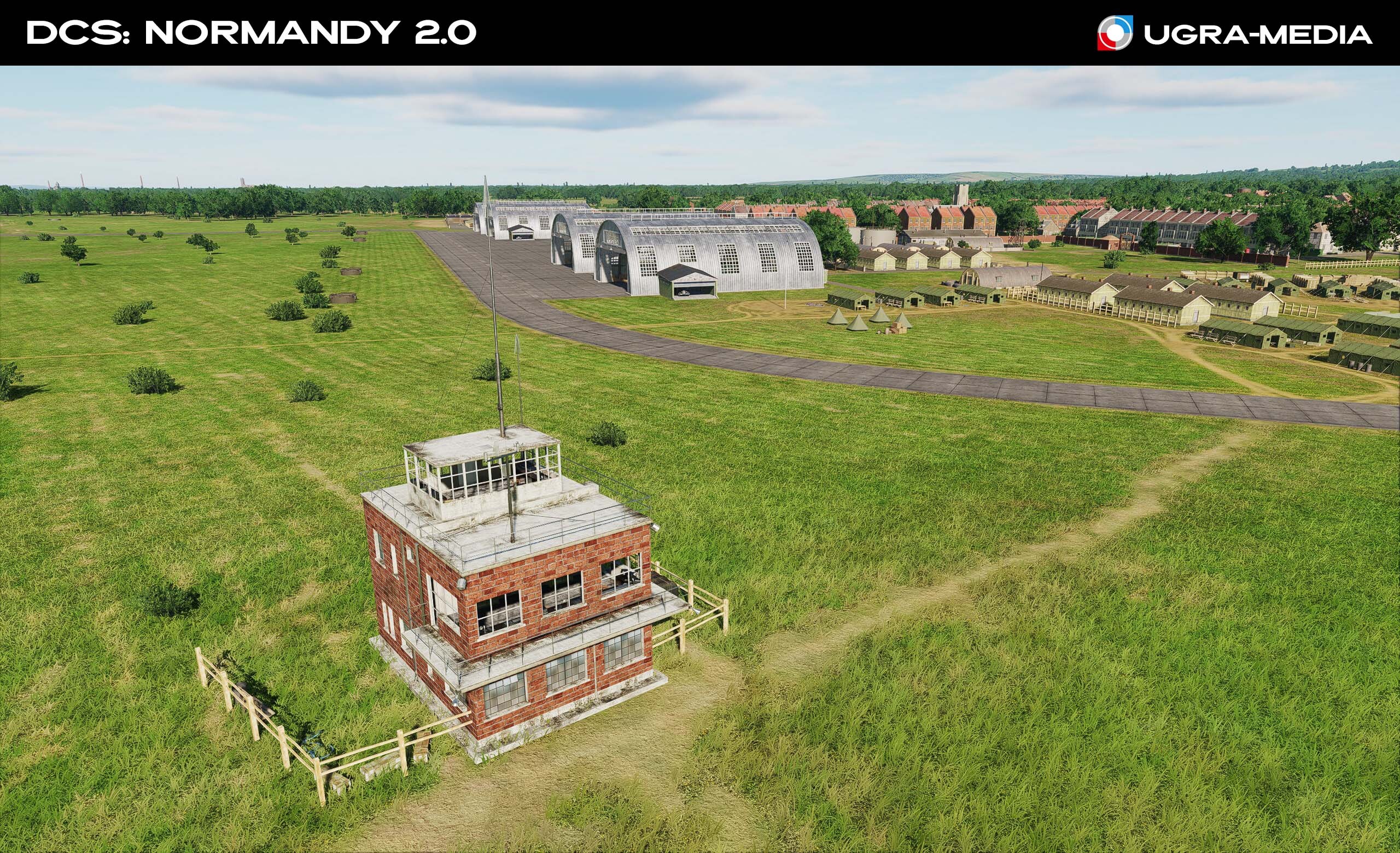
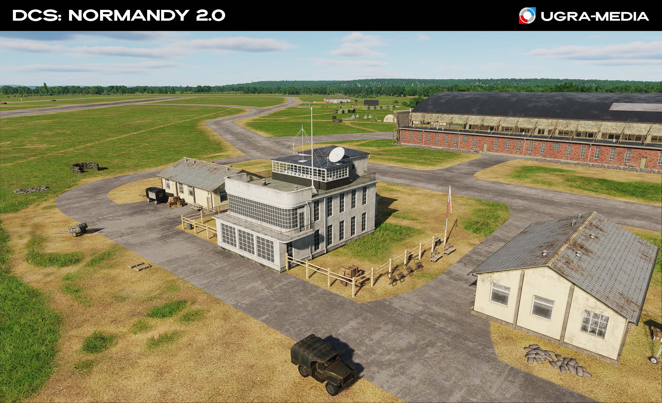
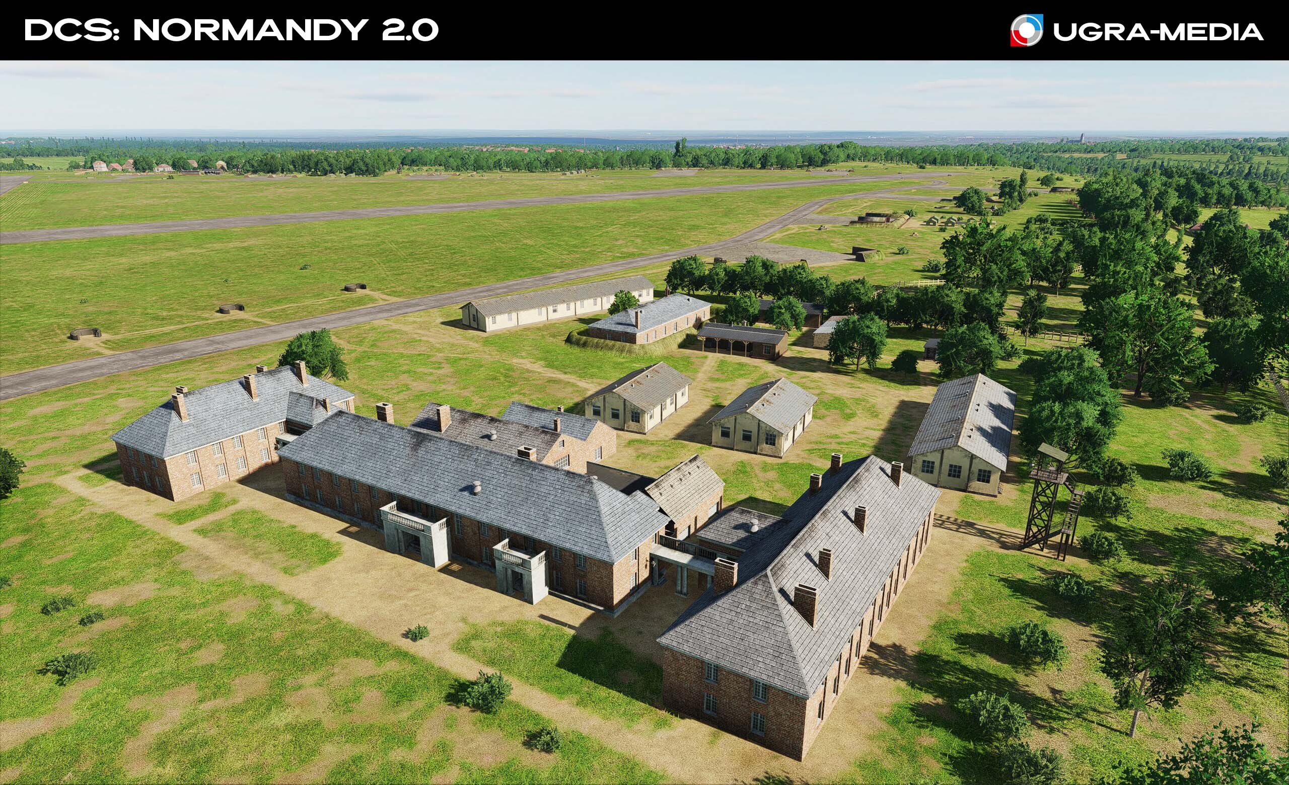
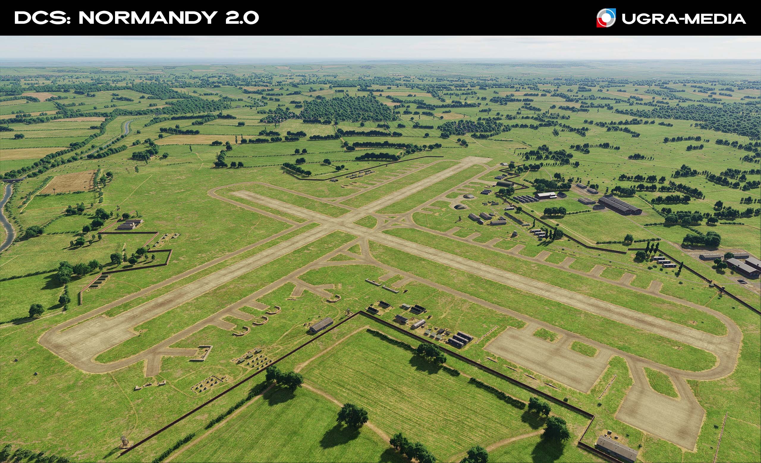
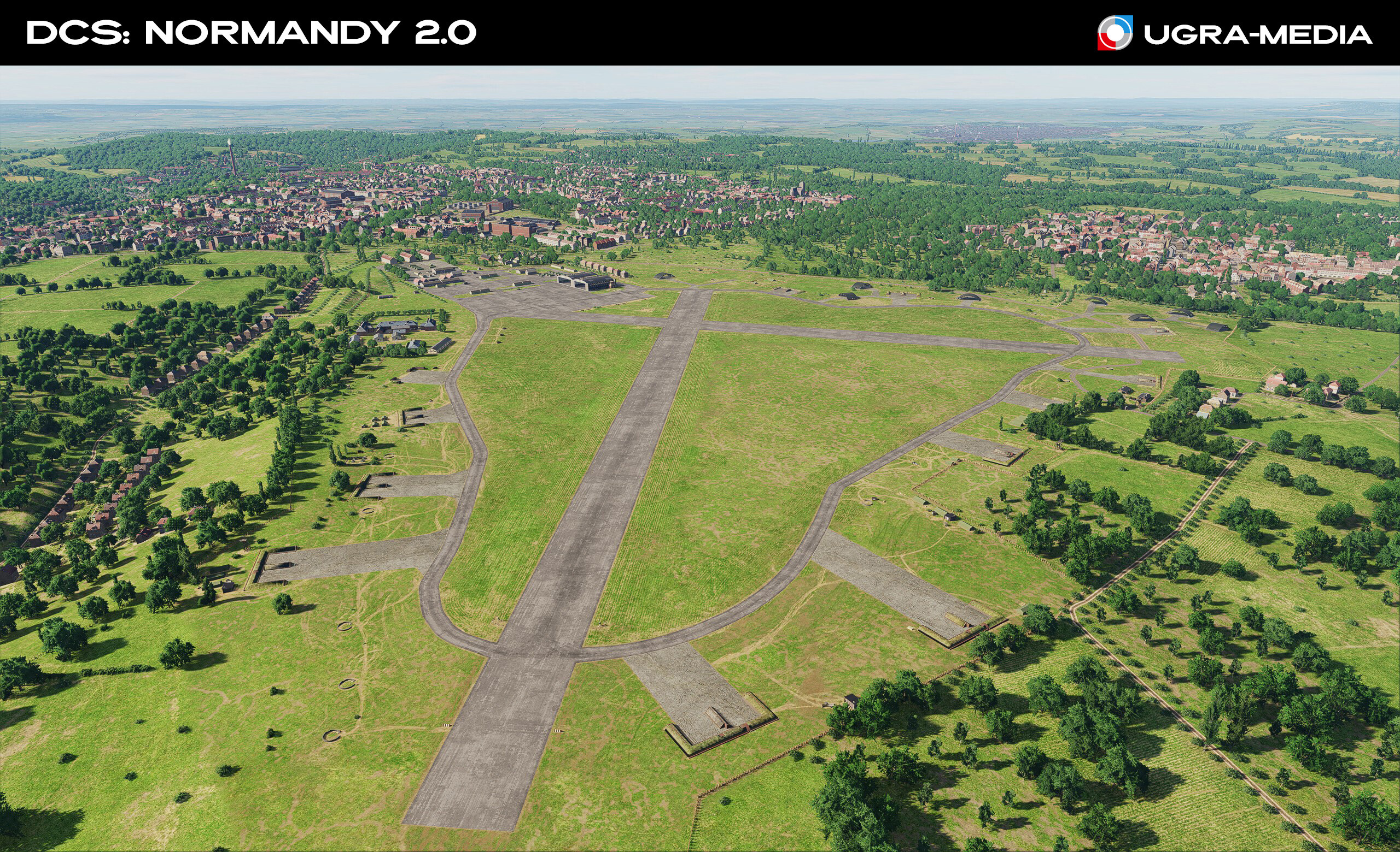
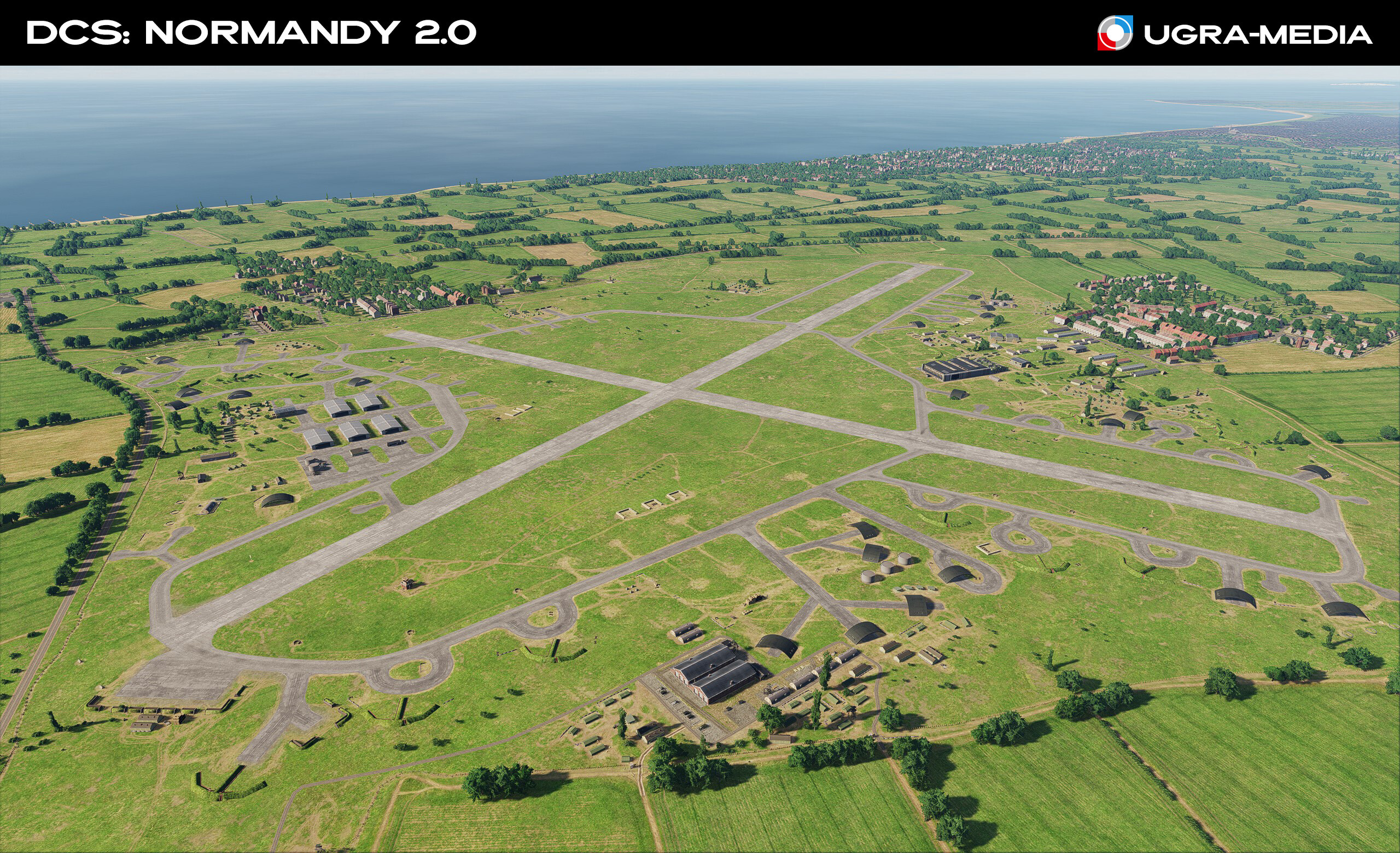
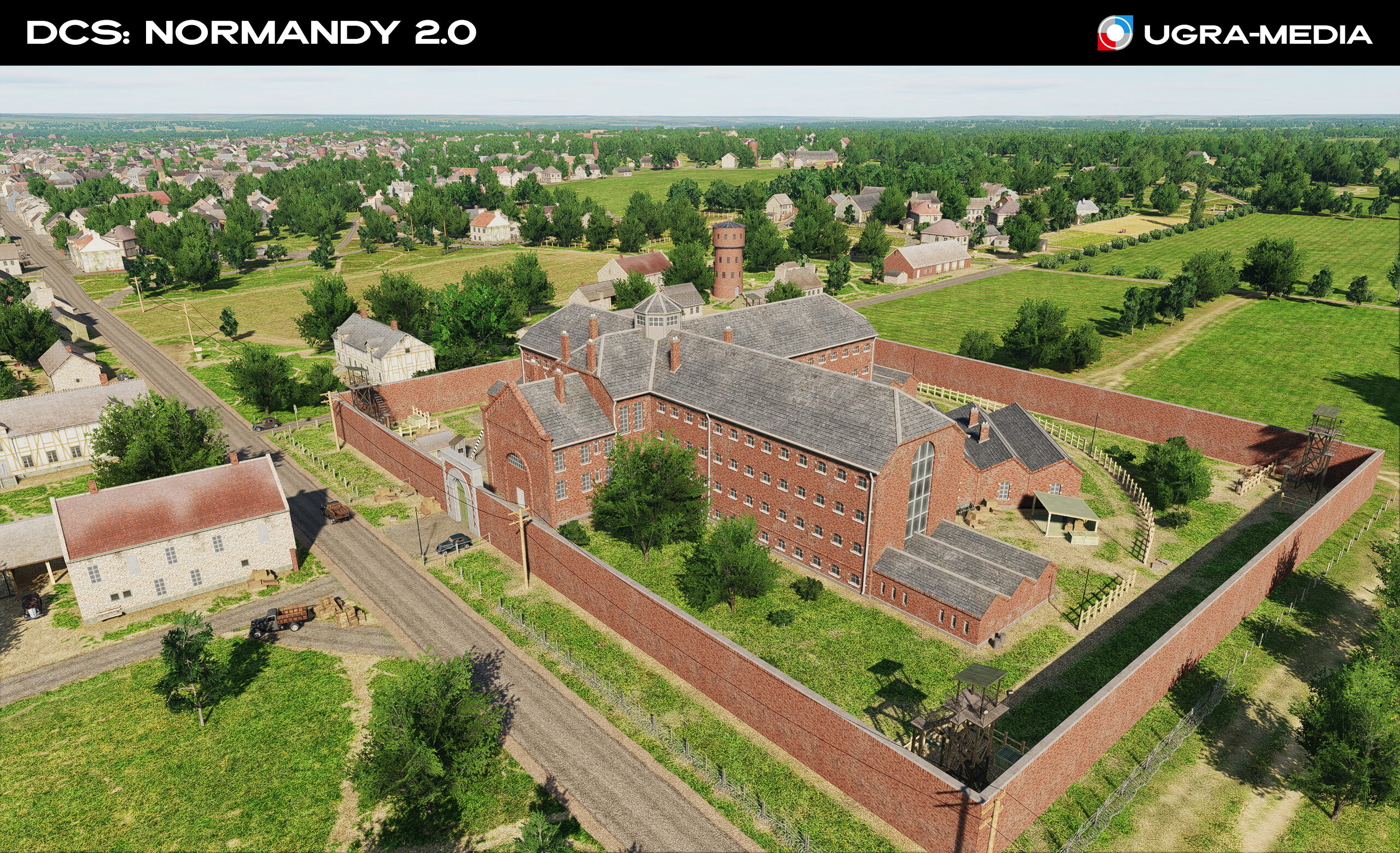
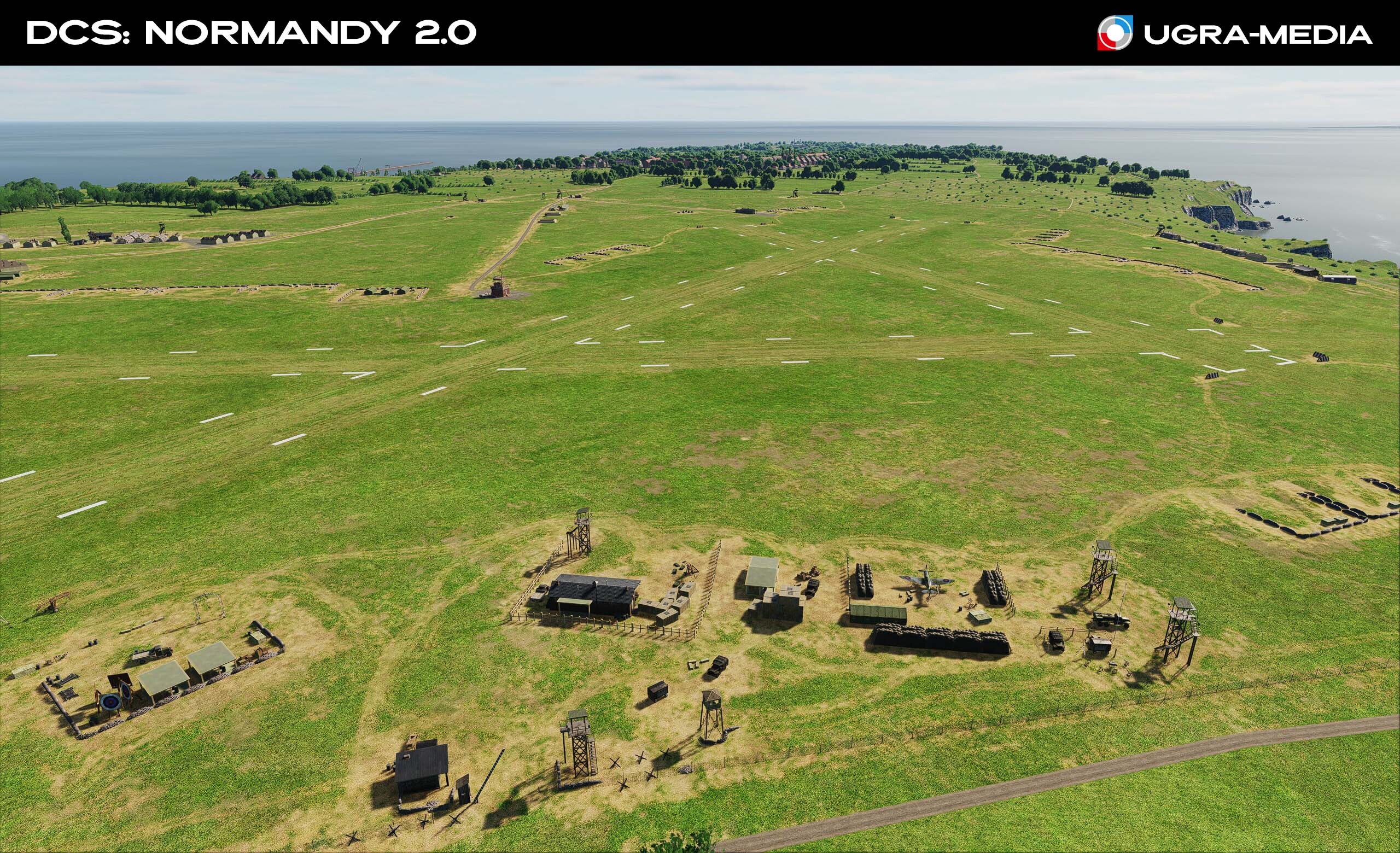
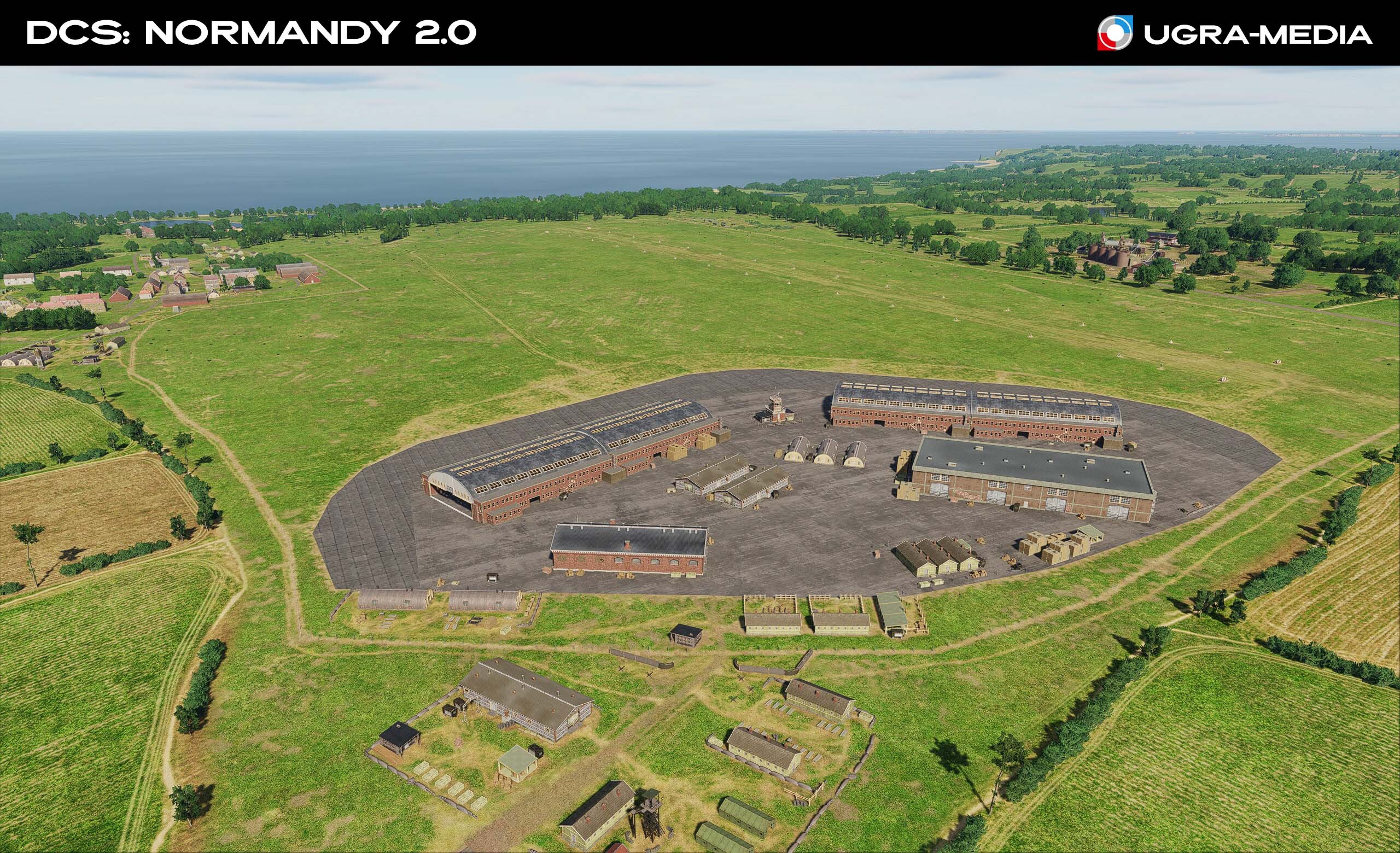
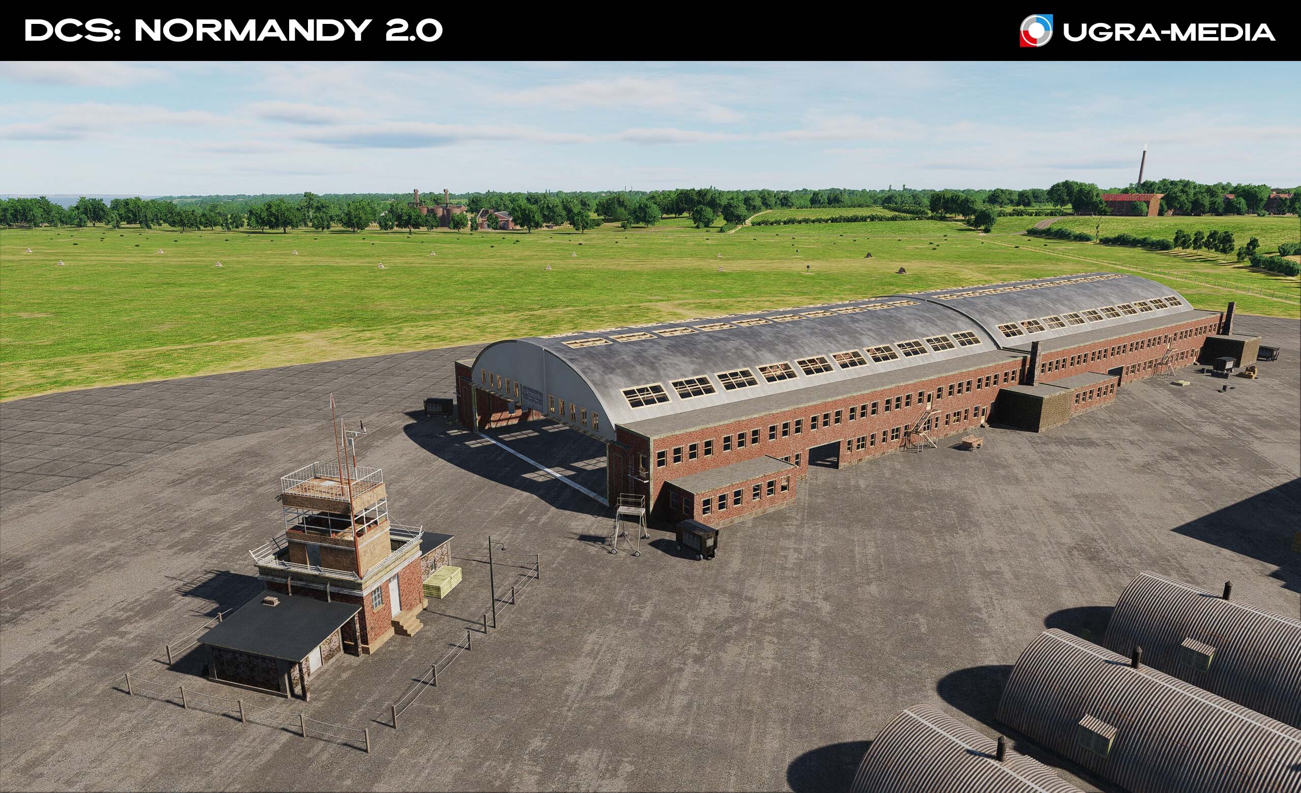
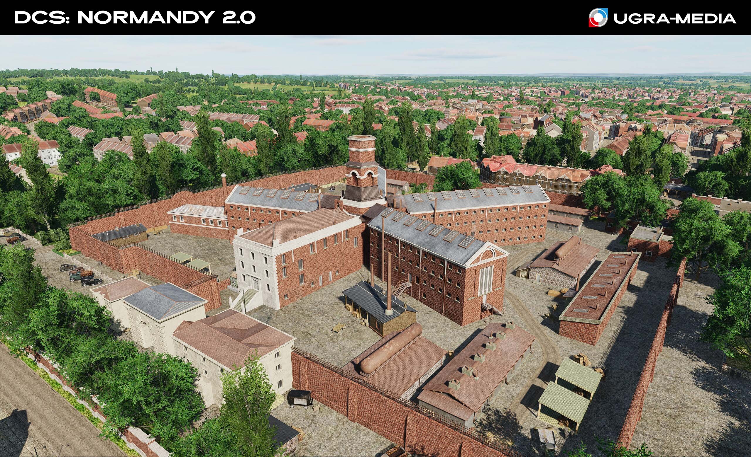
Hi fighters We're always closely monitoring your feedback and discussions on the forum. Thank you for every suggestion and bug report! Today's post is largely thanks to you, and we're ready to show you what we've fixed and added based on your requests. Amiens Prison Le pont de Solférino Major Feature: RAF Northolt You asked for this iconic Royal Air Force base—and here it is! Northolt played a huge role in the Battle of Britain, and now you can use it in your missions. We've overhauled many airfields. You asked for more hangars and unique buildings—here you go! We've added and updated hangars at key airfields. Historic features have been recreated to make the airfields unique. Tangmere West Malling Kenley: The officers' mess and operations rooms are the heart of the airfield. We've improved Ford, Kenley, Lashenden, and Headcorn airfields. ( @Fred901 @DD_Fenrir - thank you) We've decided not to wait and include the airfield changes in this update. Work on the airfields is ongoing, so stay tuned. Continue sharing your discoveries and ideas on the forum. Together, we'll make this project even better!
-
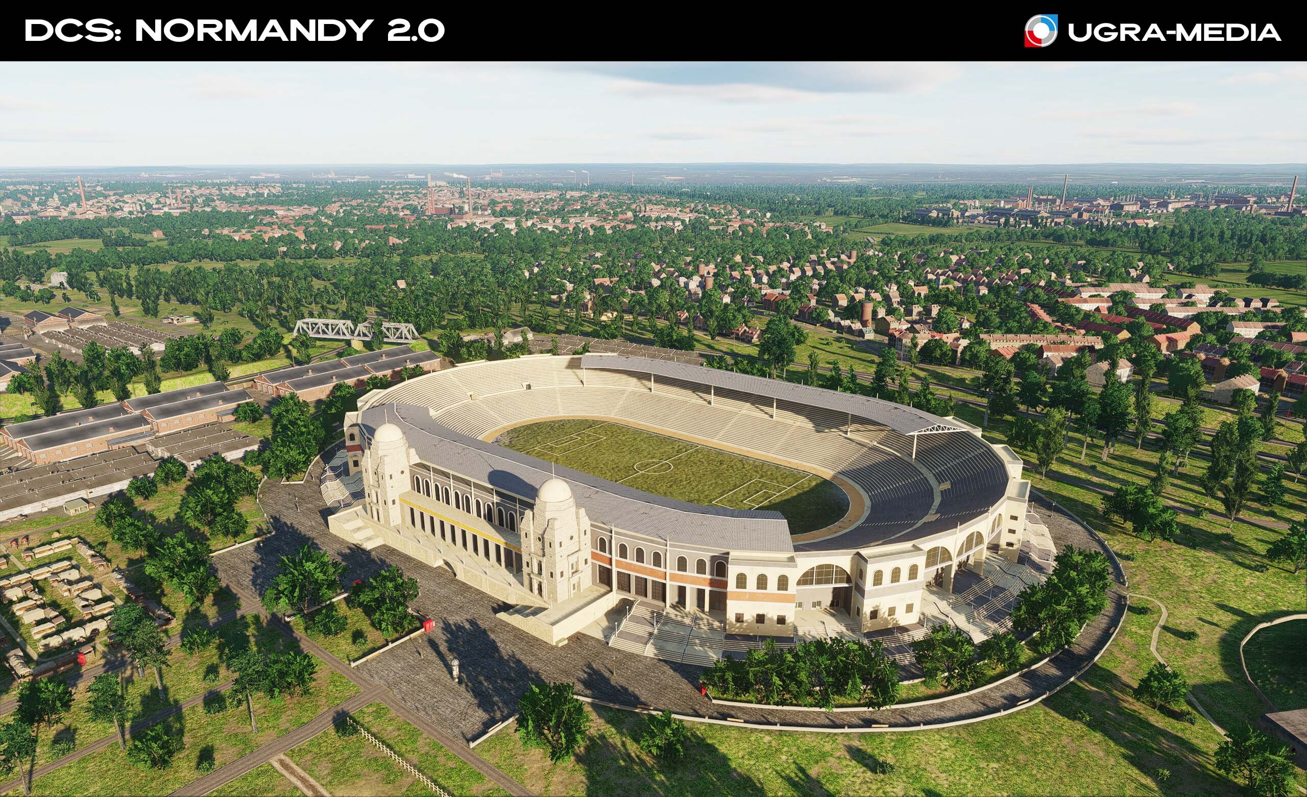
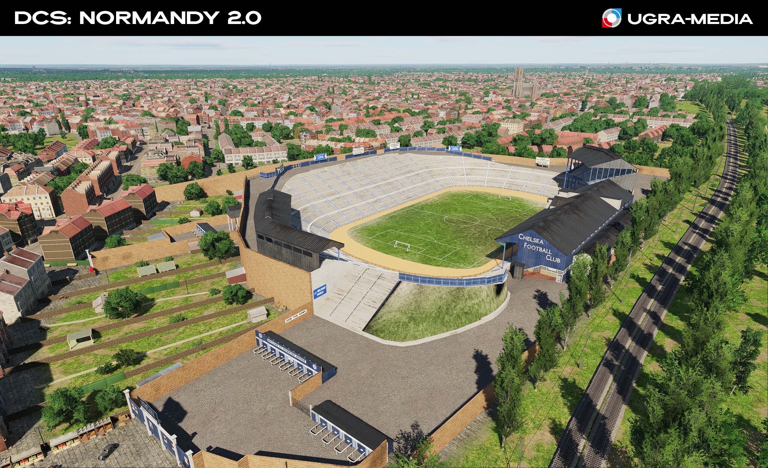
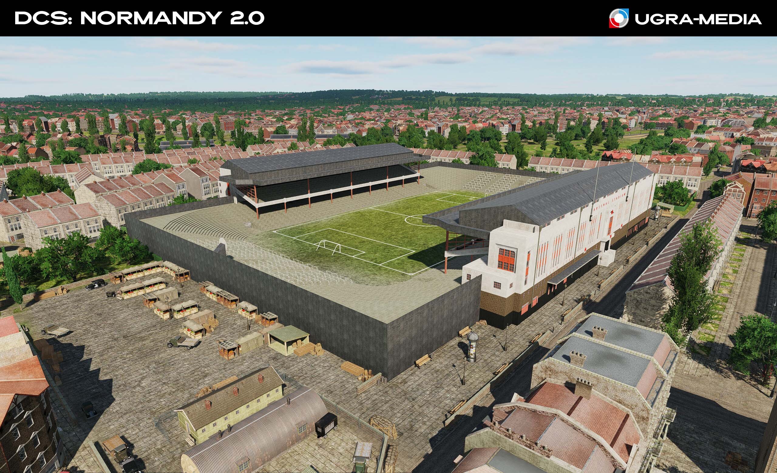
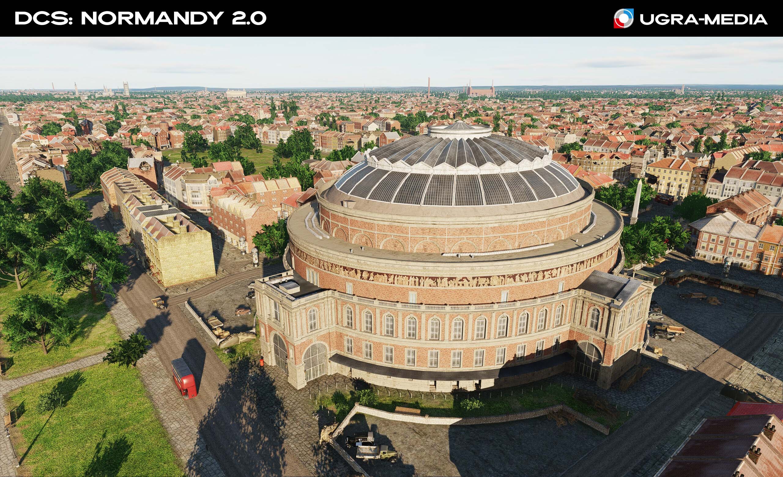
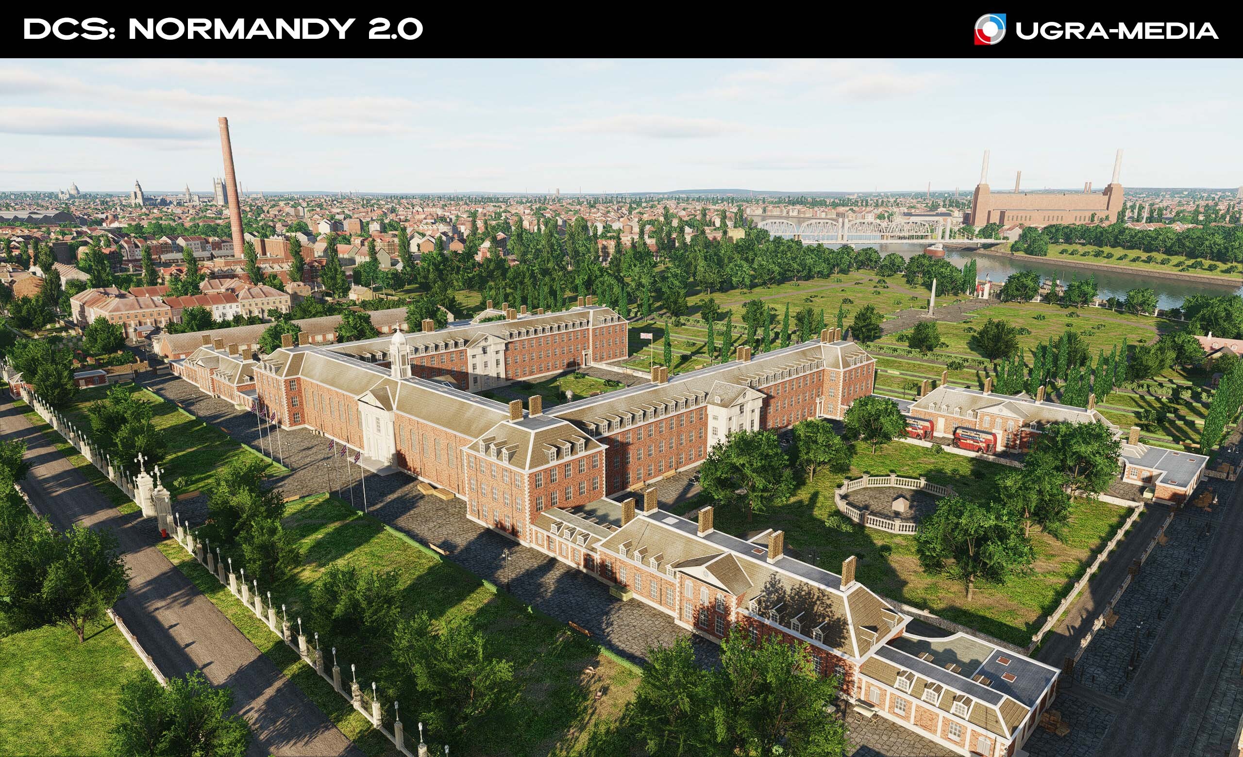
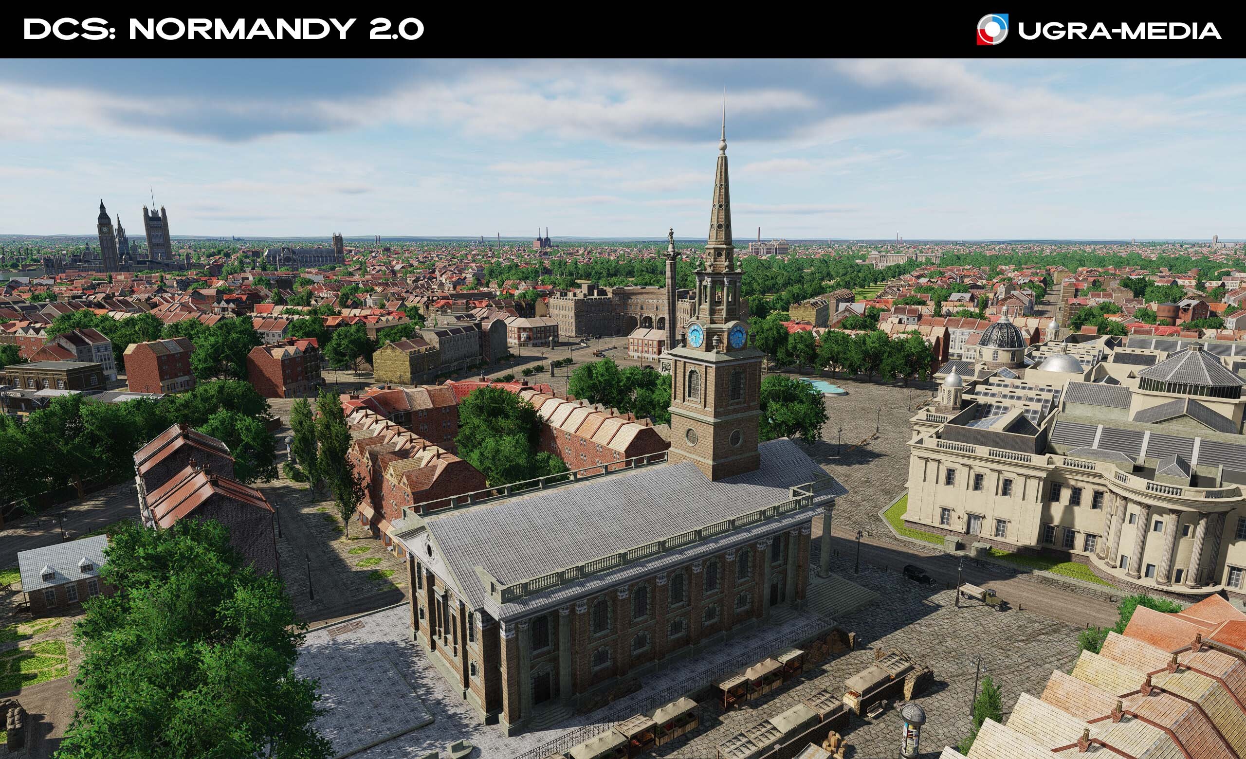
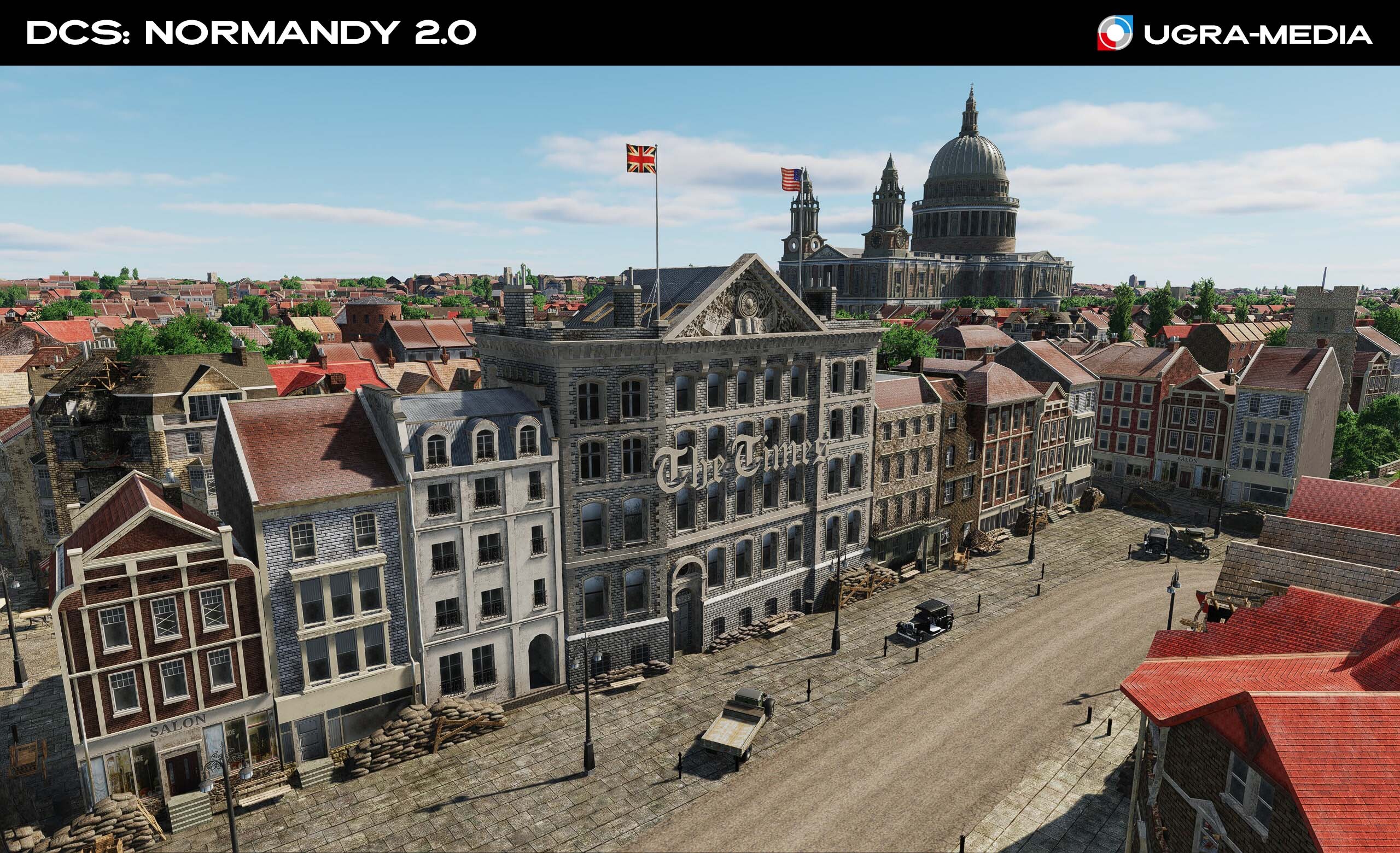
Hi fighters We continue the overview of the update "Normandy 2.0". After Paris, it's time for London! Today we will show new original places of the capital of Great Britain, which will become for you not just a beautiful background, but important historical landmarks and a source of inspiration for new missions. The mention of London is always intertwined with the weather, politics and football. Today is no exception. Stamford Bridge (Chelsea Arena) During World War II, Stamford Bridge experienced German bombing and was the site of a historic 1945 friendly match between Chelsea and the Soviet club FC Dynamo Moscow, attracting an estimated crowd of over 100,000 people in a celebration of Allied solidarity after the war. The song Kalinka was sung here long before the 2000s Chelsea Bridge A suspension bridge across the Thames connecting Chelsea and Battersea. Highbury Stadium Arsenal football club stadium, its home from 1913 to 2006. During World War II, Highbury Stadium was used as an Air Raid Precautions center Royal Albert Hall One of the most prestigious concert halls in the world. It is distinguished by a huge glass and forged dome roof, which was innovative for its time. Its basement corridors served as bomb shelters. Royal Hospital Chelsea Established by decree of Charles II in Chelsea in December 1681, in the image and likeness of the Paris Home for the Invalids (you can compare). The Royal Hospital has endured significant challenges, particularly during the two World Wars. The North-Eastern wing was also seriously damaged by a V2 rocket in 1945. StMartin-in-the-Fields is a Church of England parish church at the north-east corner of Trafalgar Square. Spire height 59 m Times Building Home for The Times is a British daily national newspaper. The historic Printing House Square was the center of London's newspaper district. Wembley Stadium Also known as Empire Stadium, it was opened in 1923 and lasted exactly 80 years During the war, it was used for various military purposes. The stadium functioned as a warehouse for postal items, and the civil defense department was located in its premises. EXTRA:
-
... Amuse-bouche. A little surprise for you. This isn't just a video—it's the result of painstaking work recreating architectural heritage, transforming the map from a collection of landscapes into a living, breathing world of history. France under your wing!
-
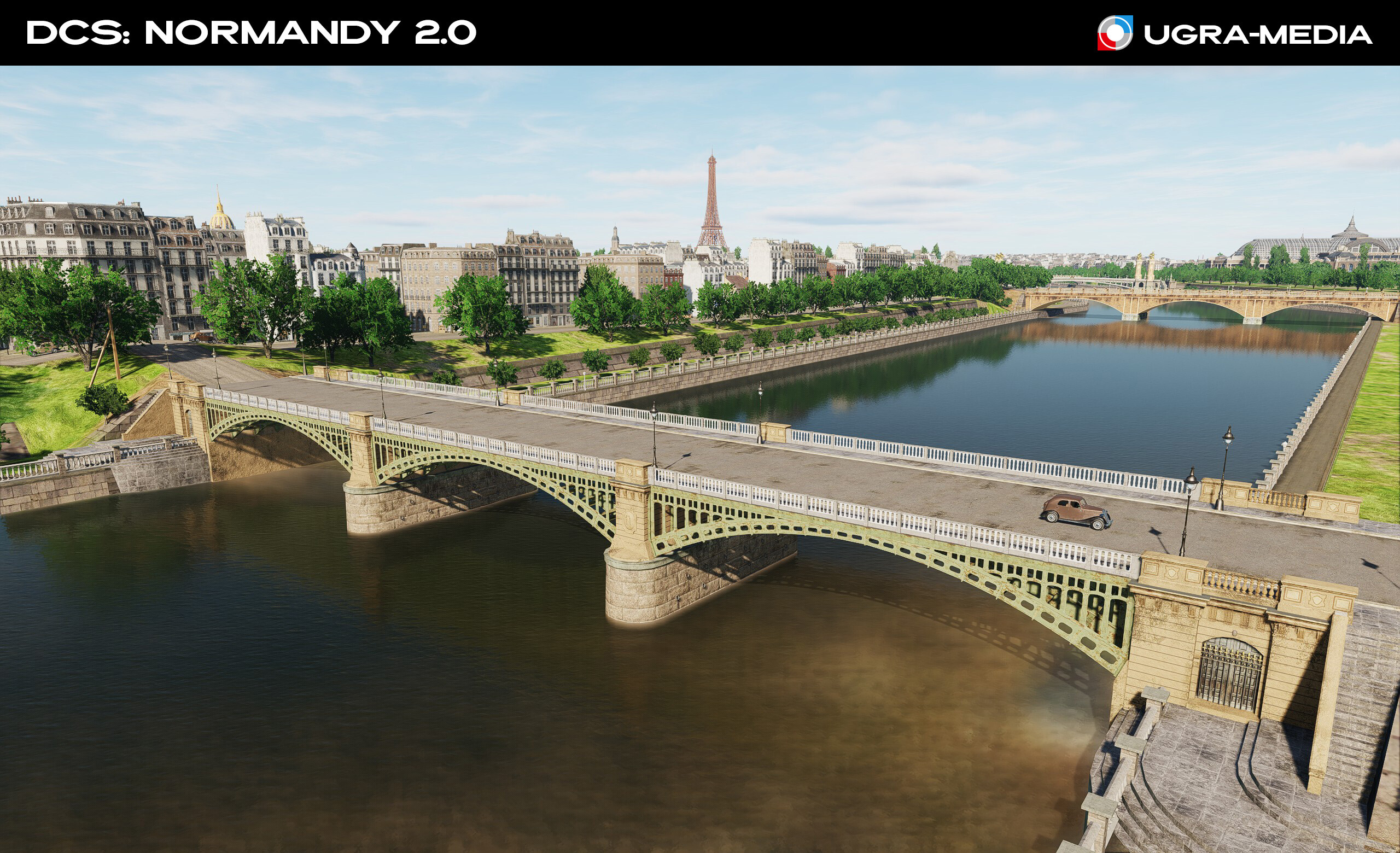
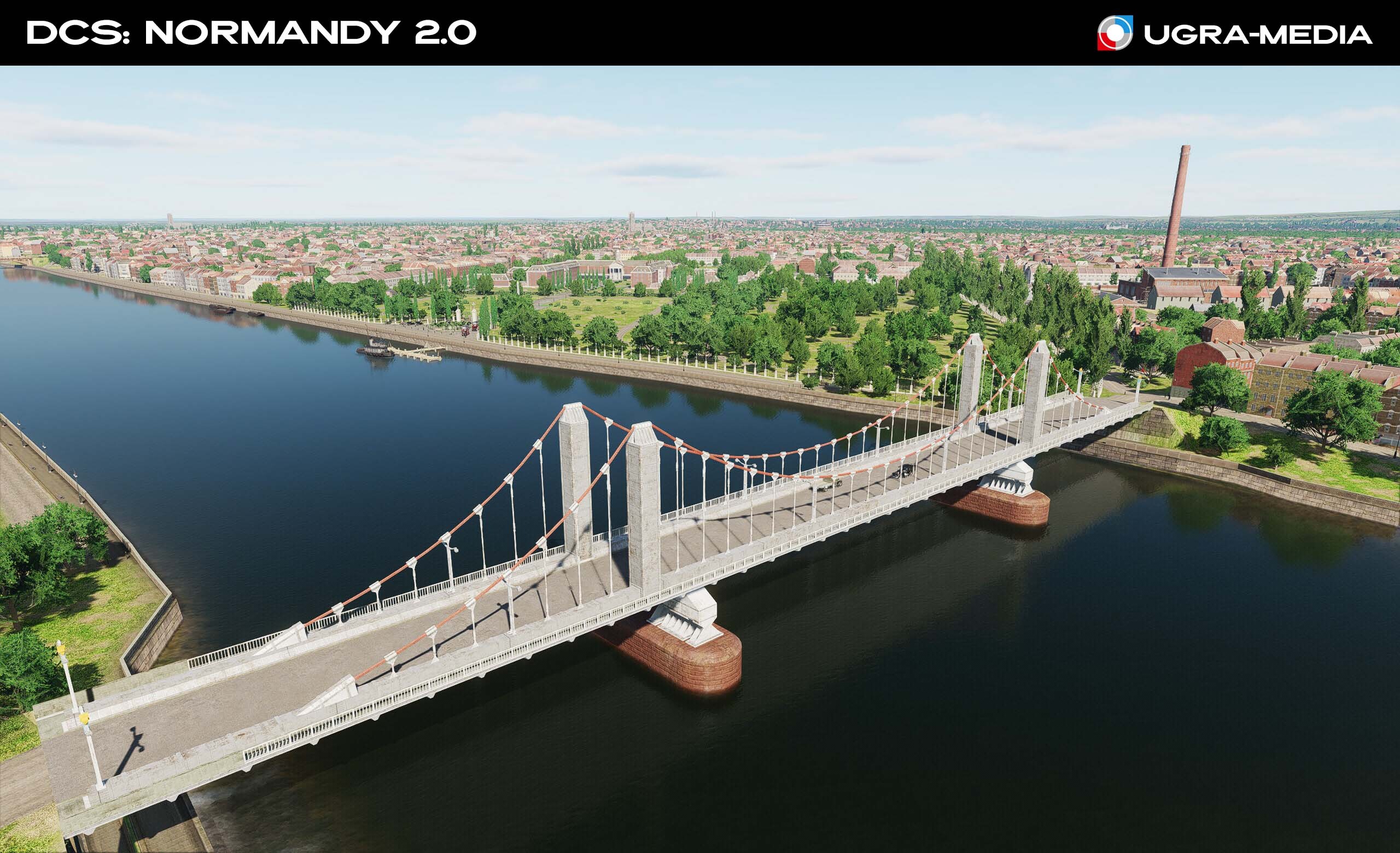
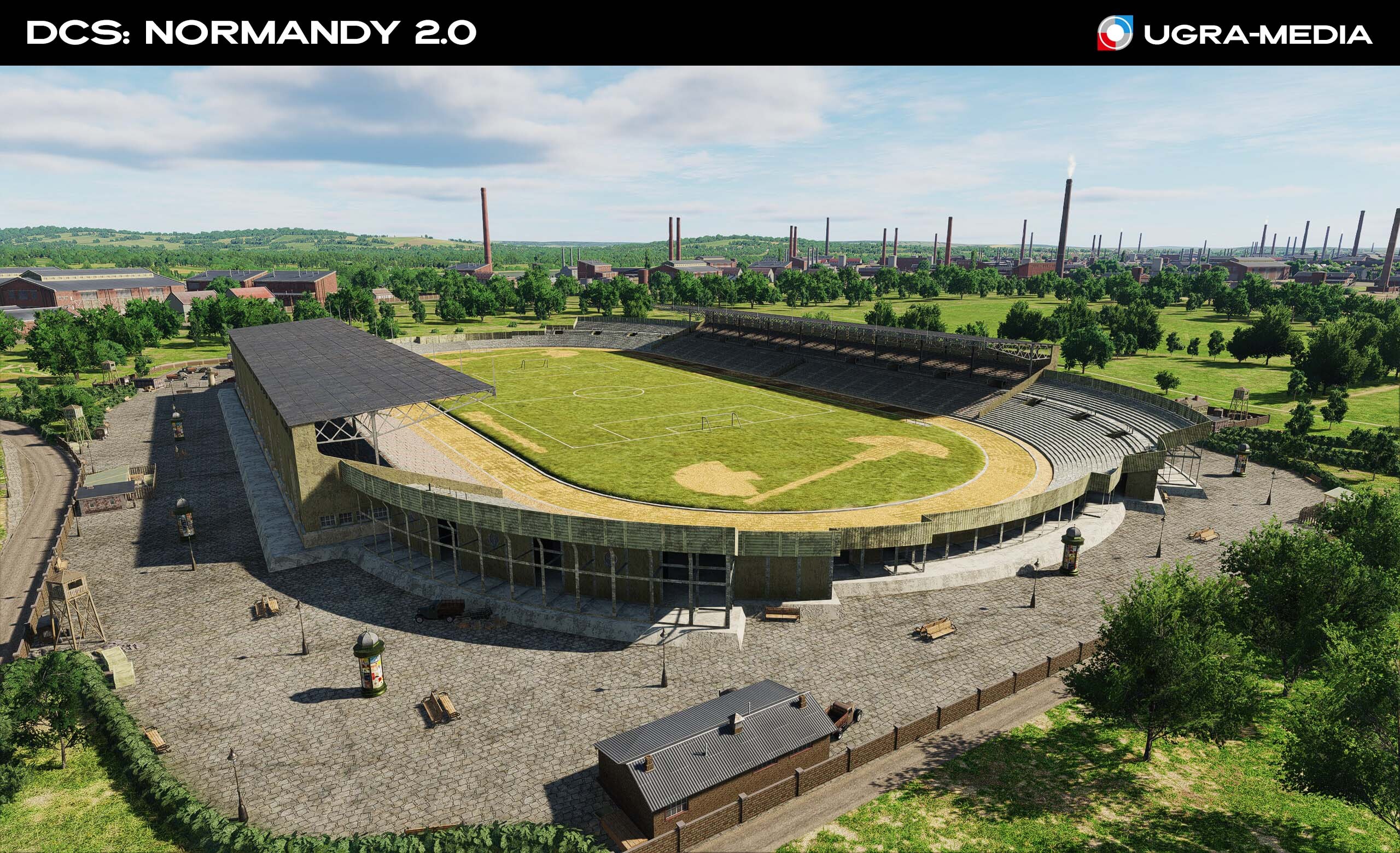
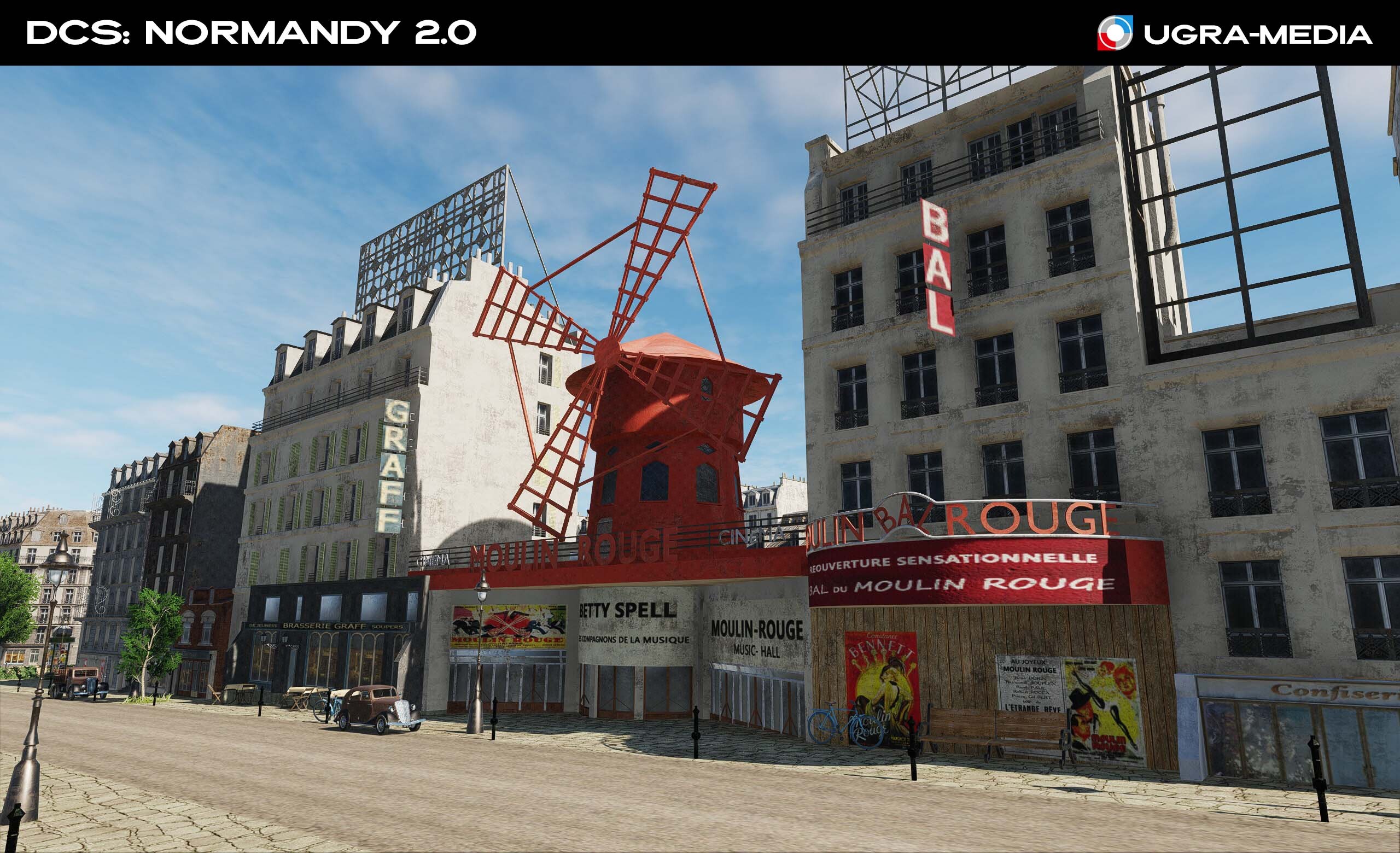
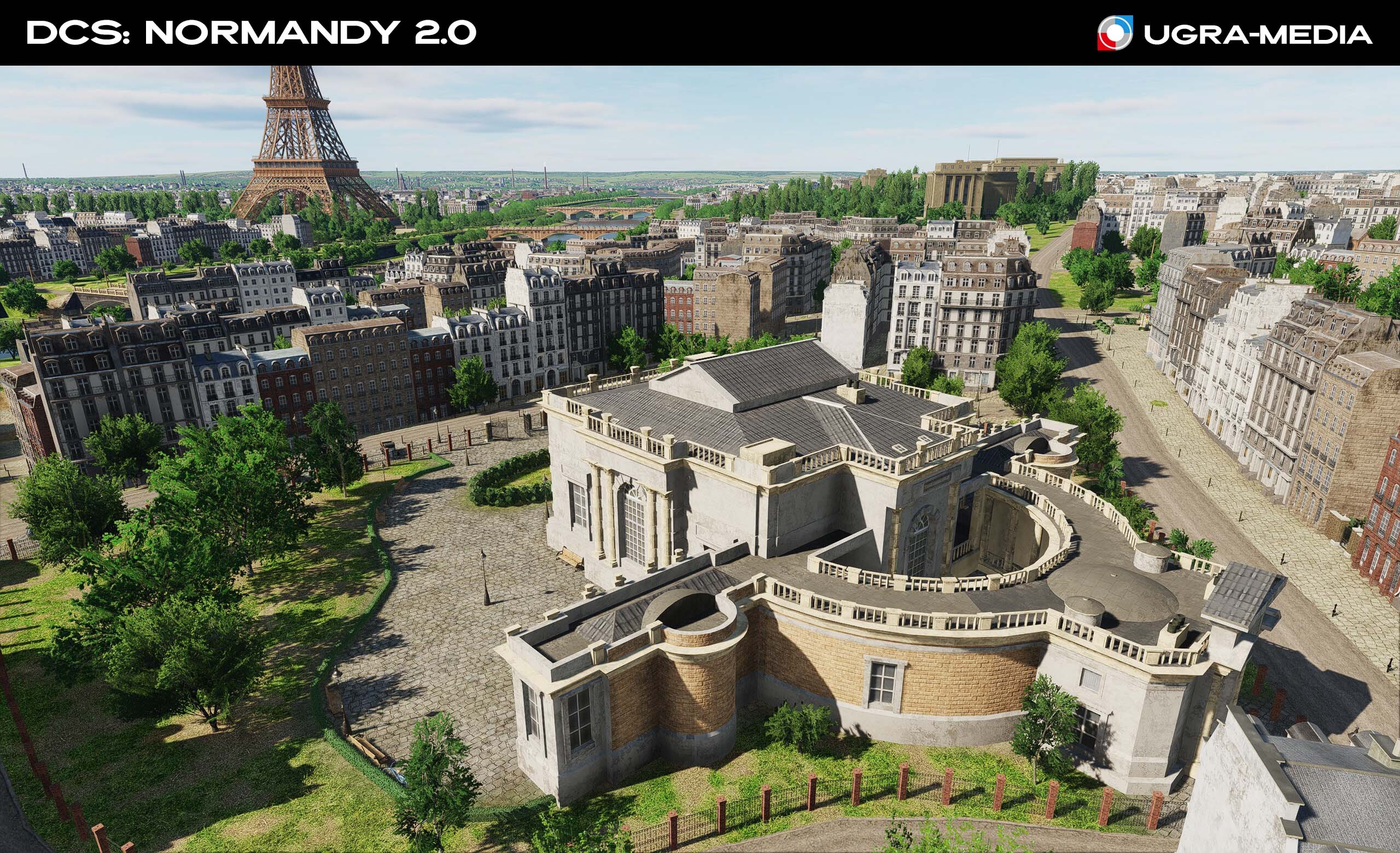
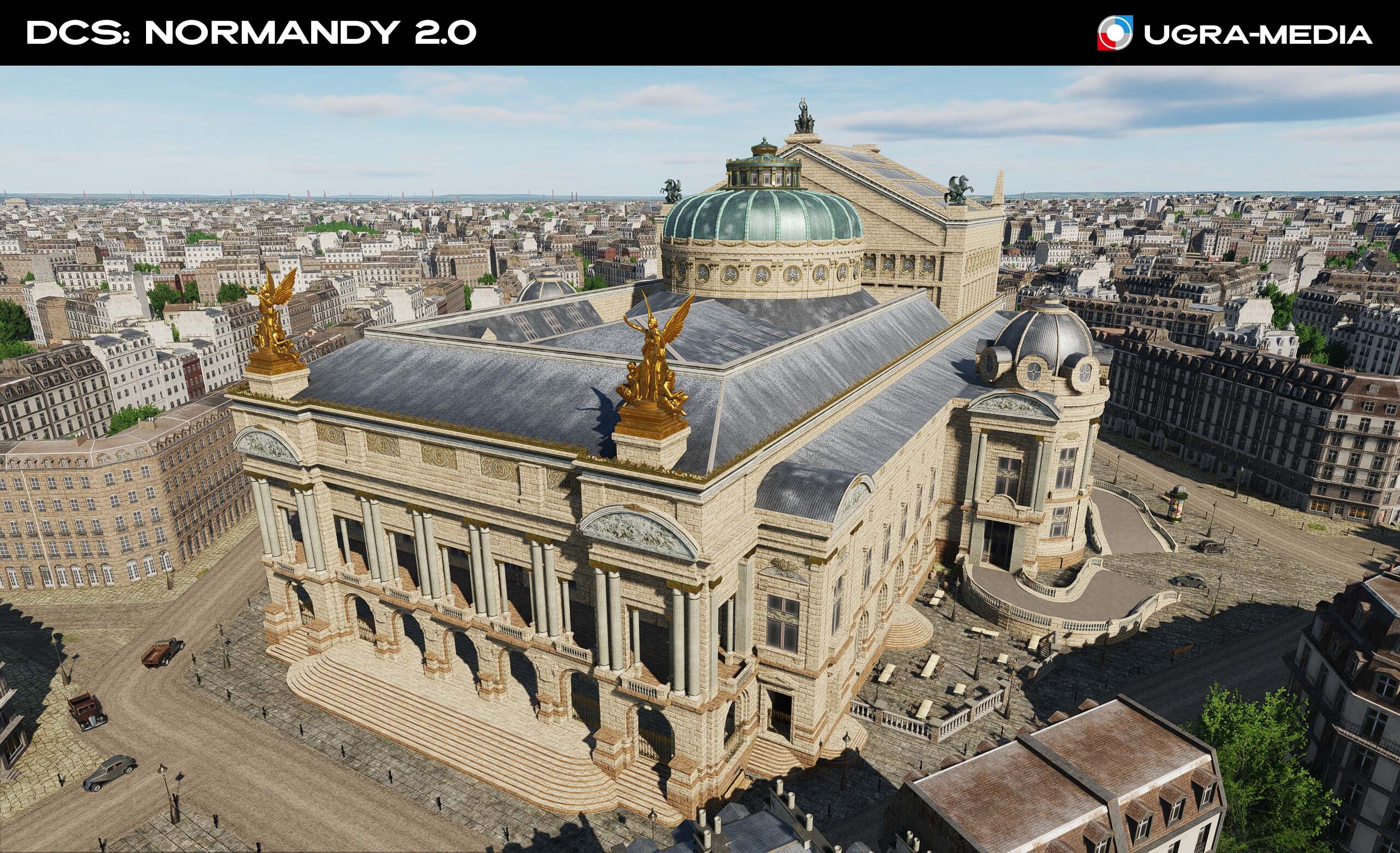
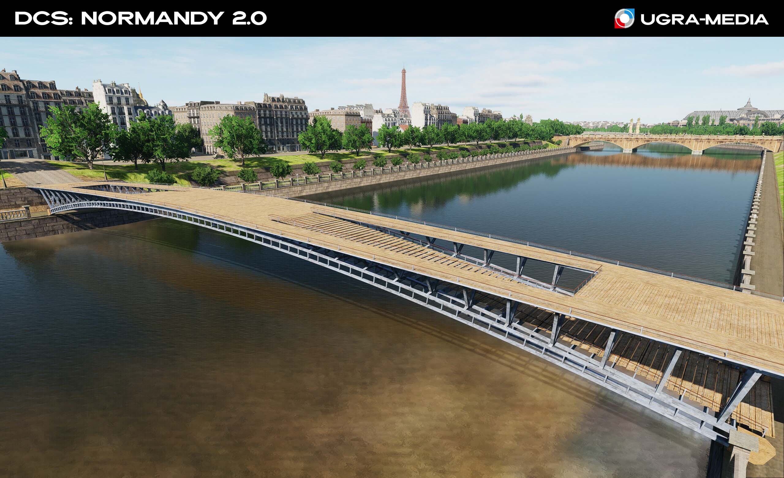
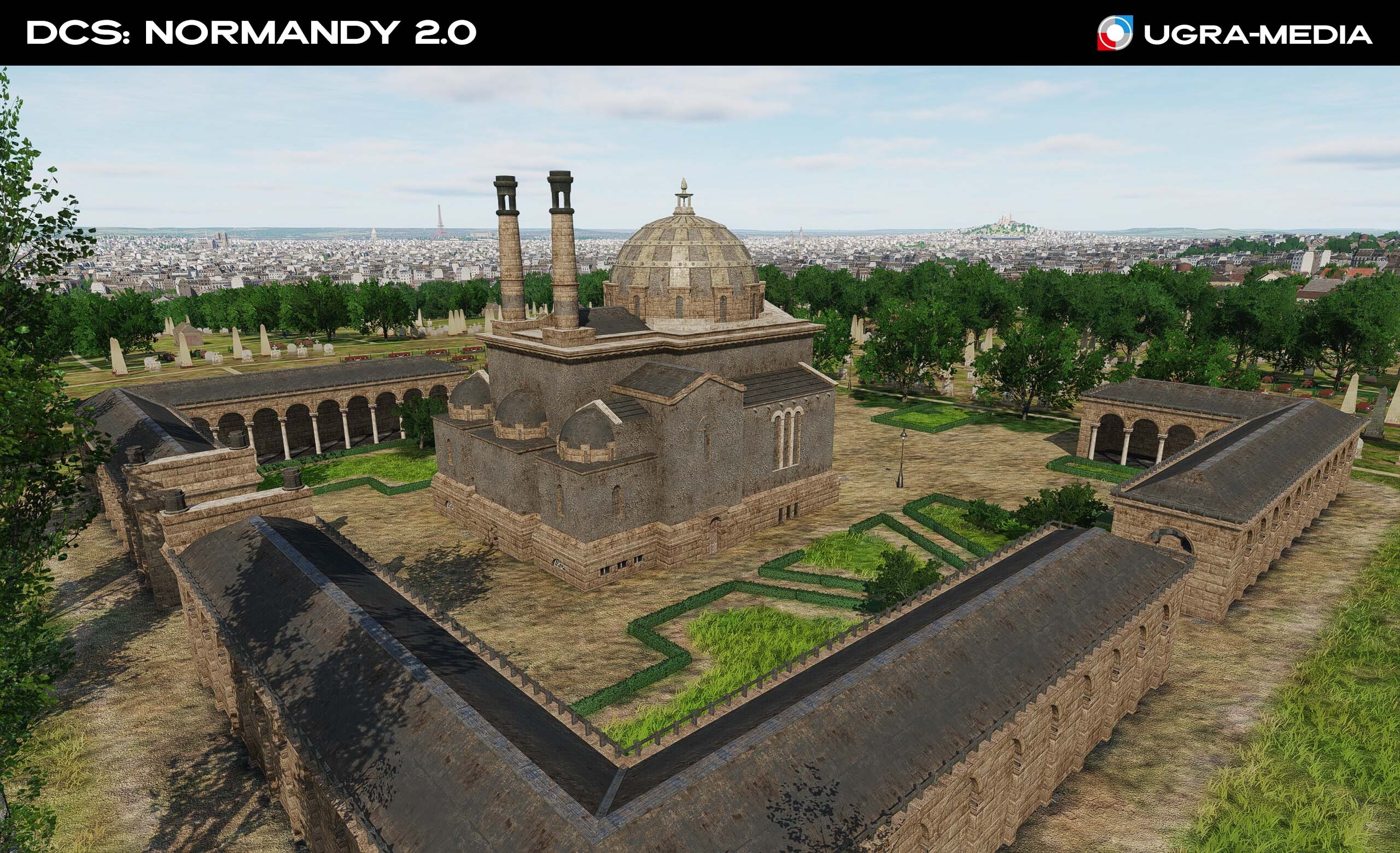
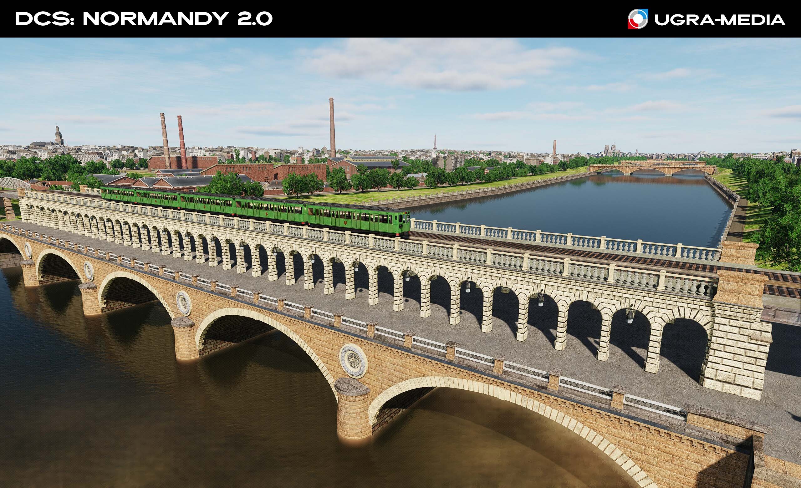
Hi fighters Today we invite you on a virtual tour of the streets of Paris, which we had the pleasure of creating for DCS: Normandy 2.0. These pieces of living history will make your flights over the French capital truly unique. Moulin Rouge A legendary cabaret, a symbol of Parisian nightlife and cancan. A striking landmark in the Pigalle district. You've seen it in films, heard it in songs, and now you can stop by during breaks between flights. Or maybe it's your mission target – during the war, performances were held here for German officers. Palis Garnier (Grand Opera) One of the most famous opera houses in the world. Its gigantic stage and underground lake inspired Gaston Leroux's novel "The Phantom of the Opera." During the war, its cellars housed works of art from the Louvre. Palis Galliera A neo-Renaissance palace, today home to the Fashion Museum of the City of Paris. Pont de Bercy A bridge reminiscent of a Roman aqueduct, built in the late 19th century. An important transportation link in Paris. Passerelle Léopold-Sédar-Senghor. An elegant pedestrian bridge over the Seine, a favorite place for strolls. Originally called the "Solferino Bridge." Père-Lachaise Crematorium on the grounds of the famous cemetery of the same name. It was the first crematorium built in France (1889). Its chimney, stylized as a bell tower, was a unique architectural feature. Stade olympique Yves-du-Manoir (also known as Colombes) is a rugby, track, and association football stadium in Colombes, near Paris. From the 1930s to the 1970s, it was one of the main stadiums in France.
-
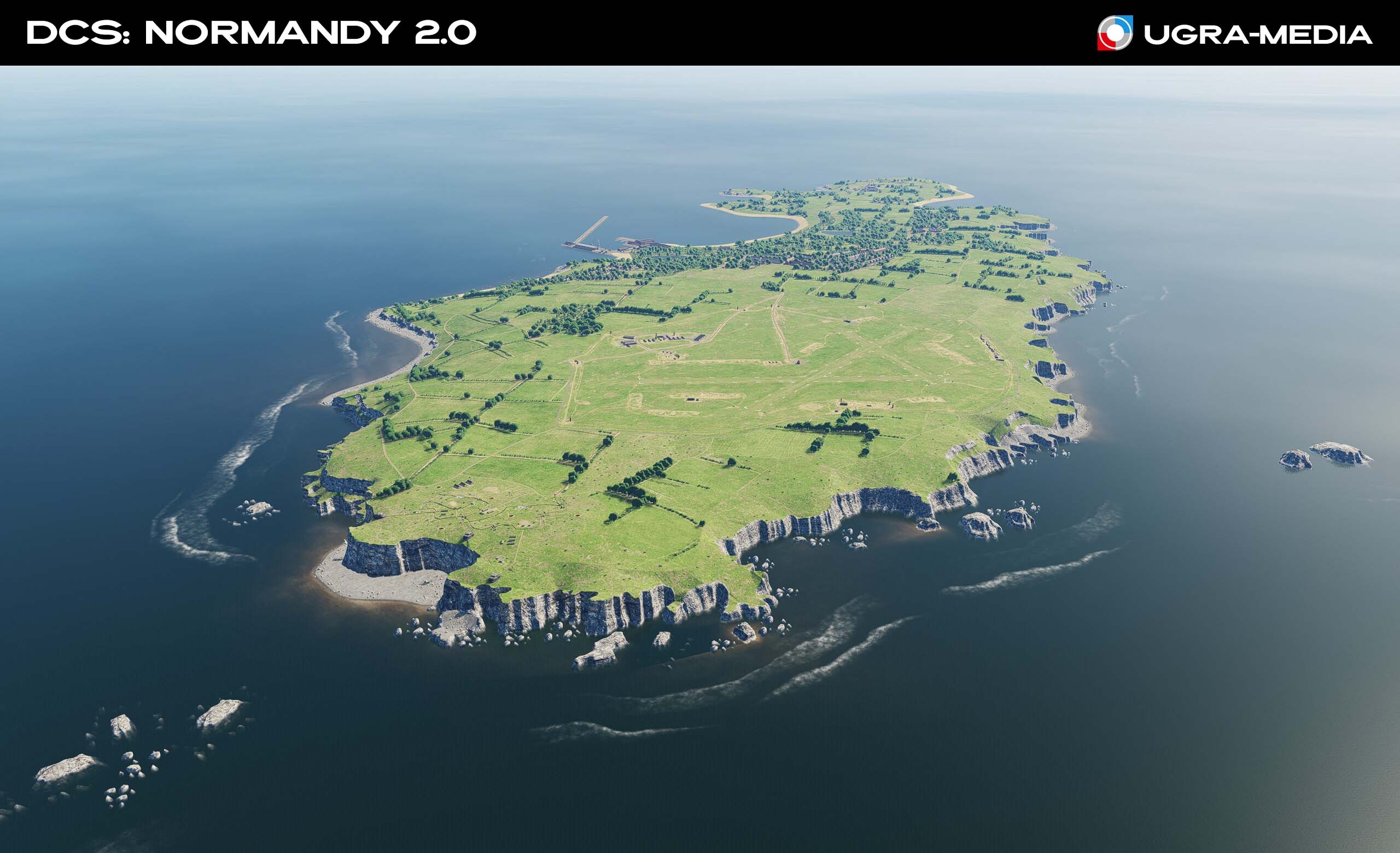
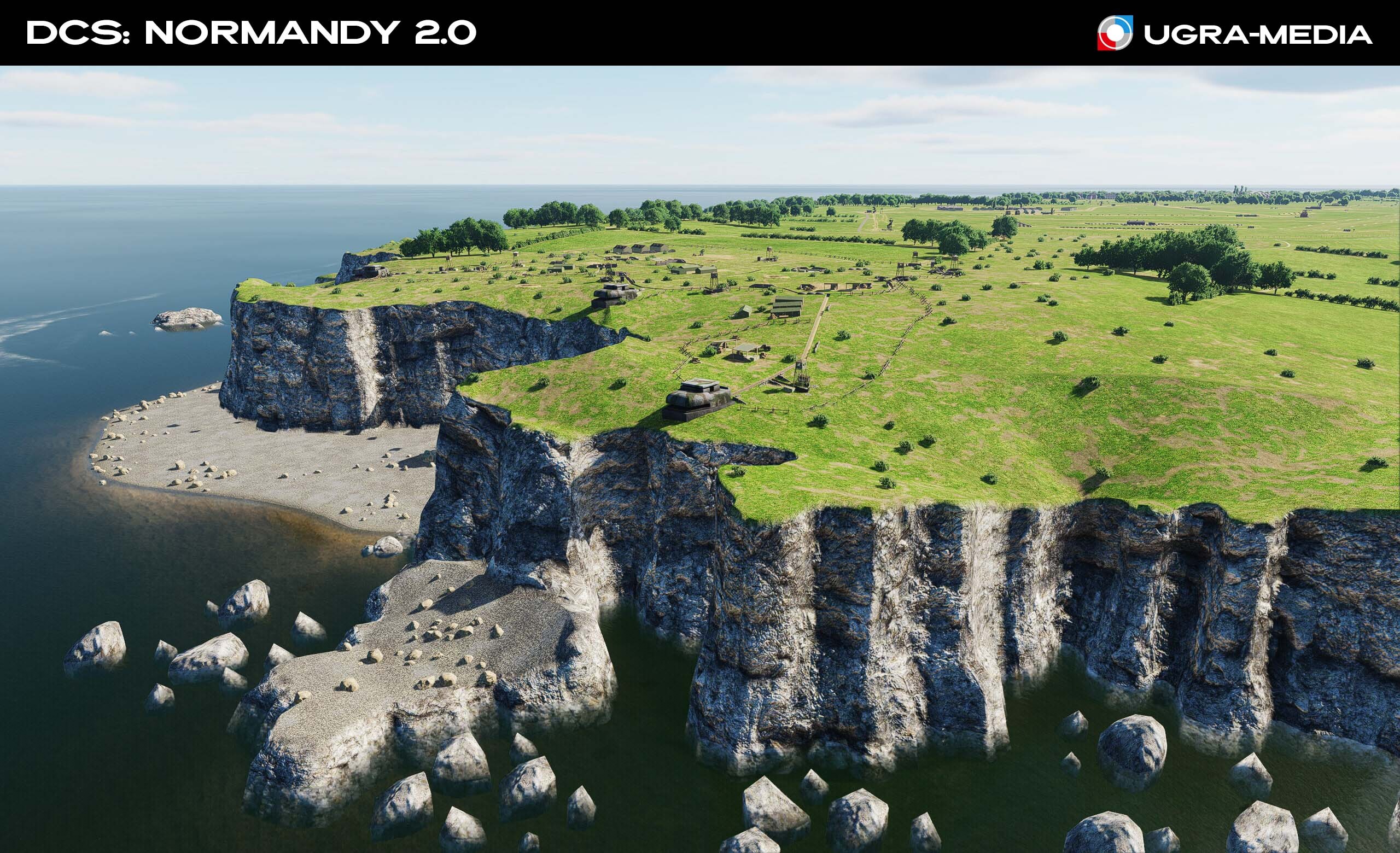
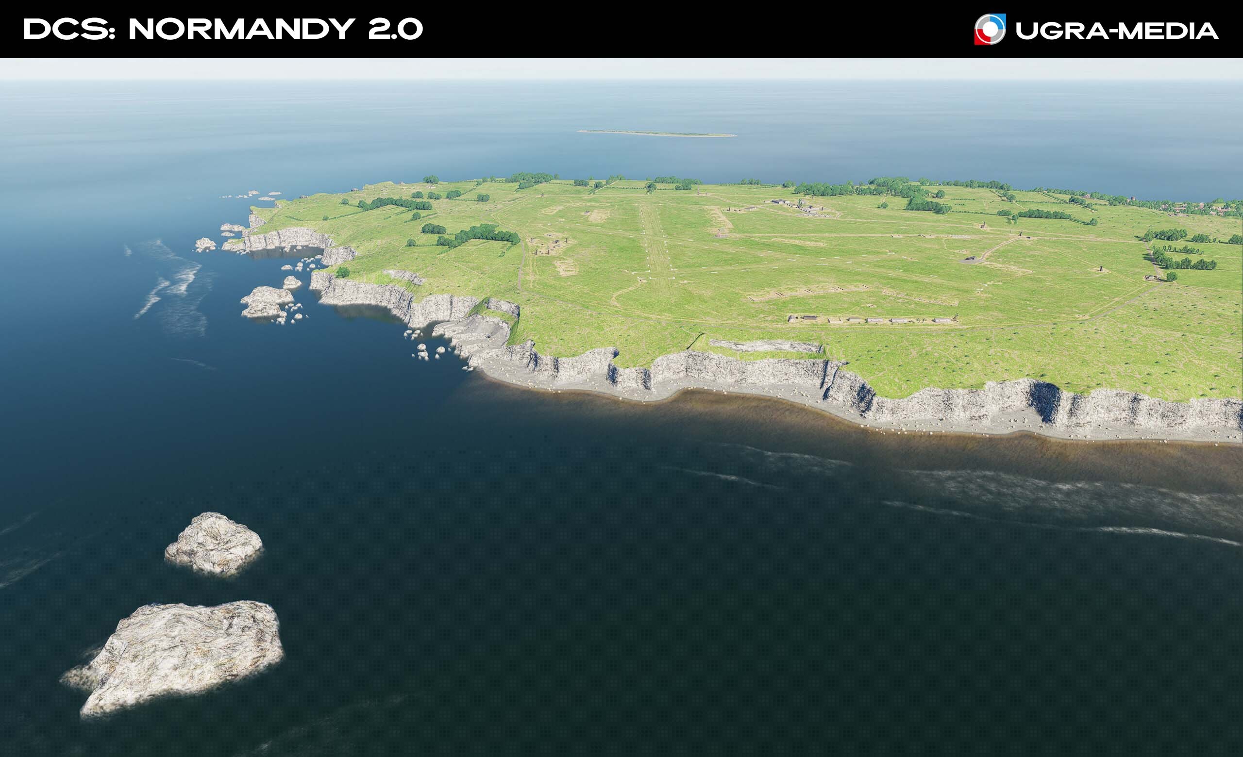
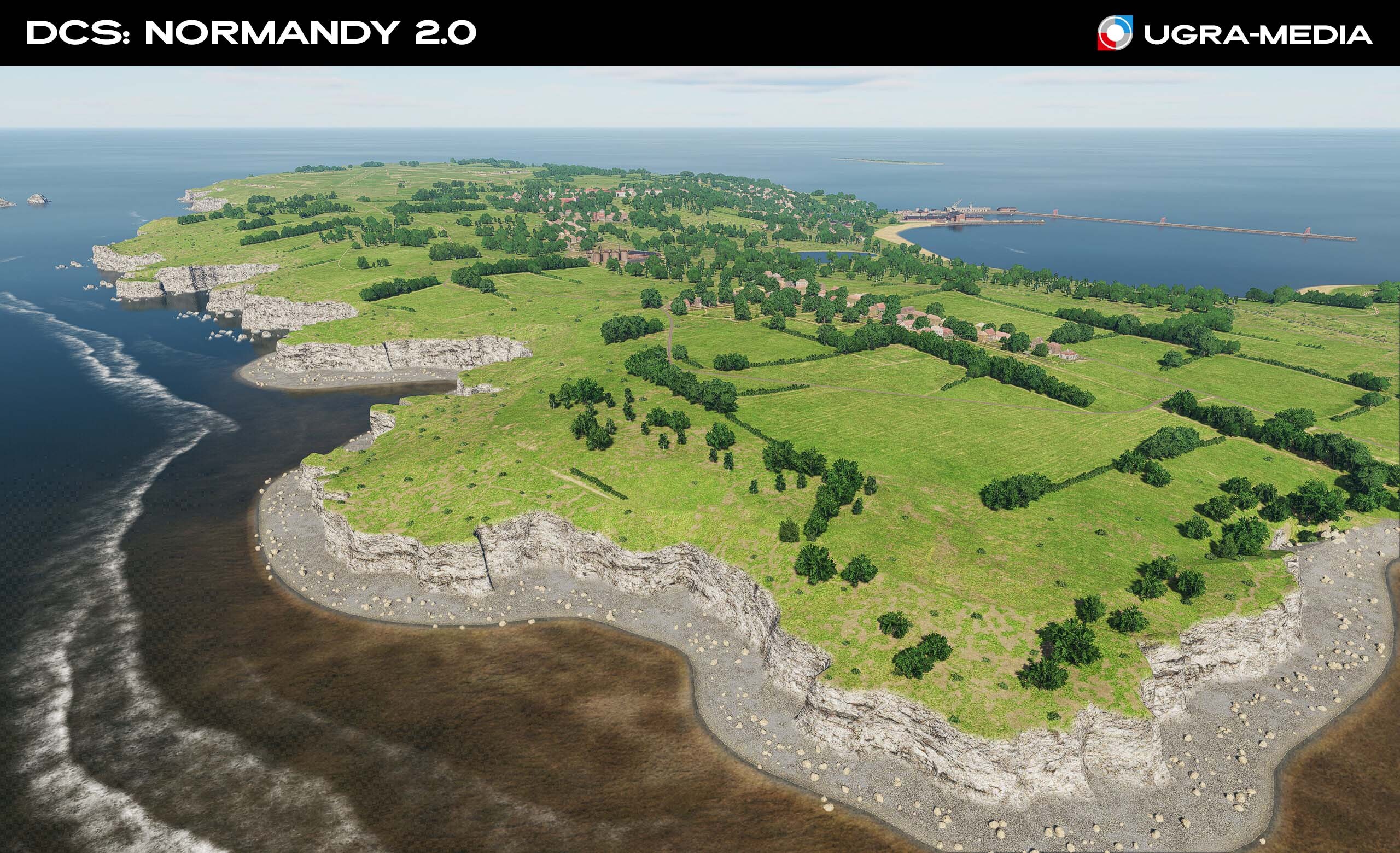
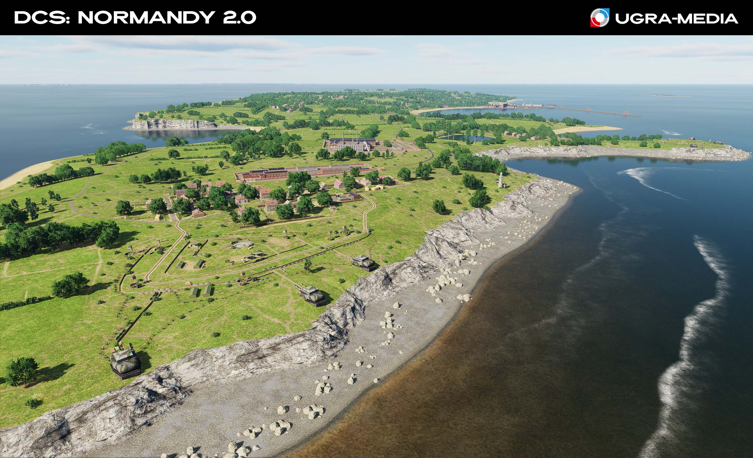
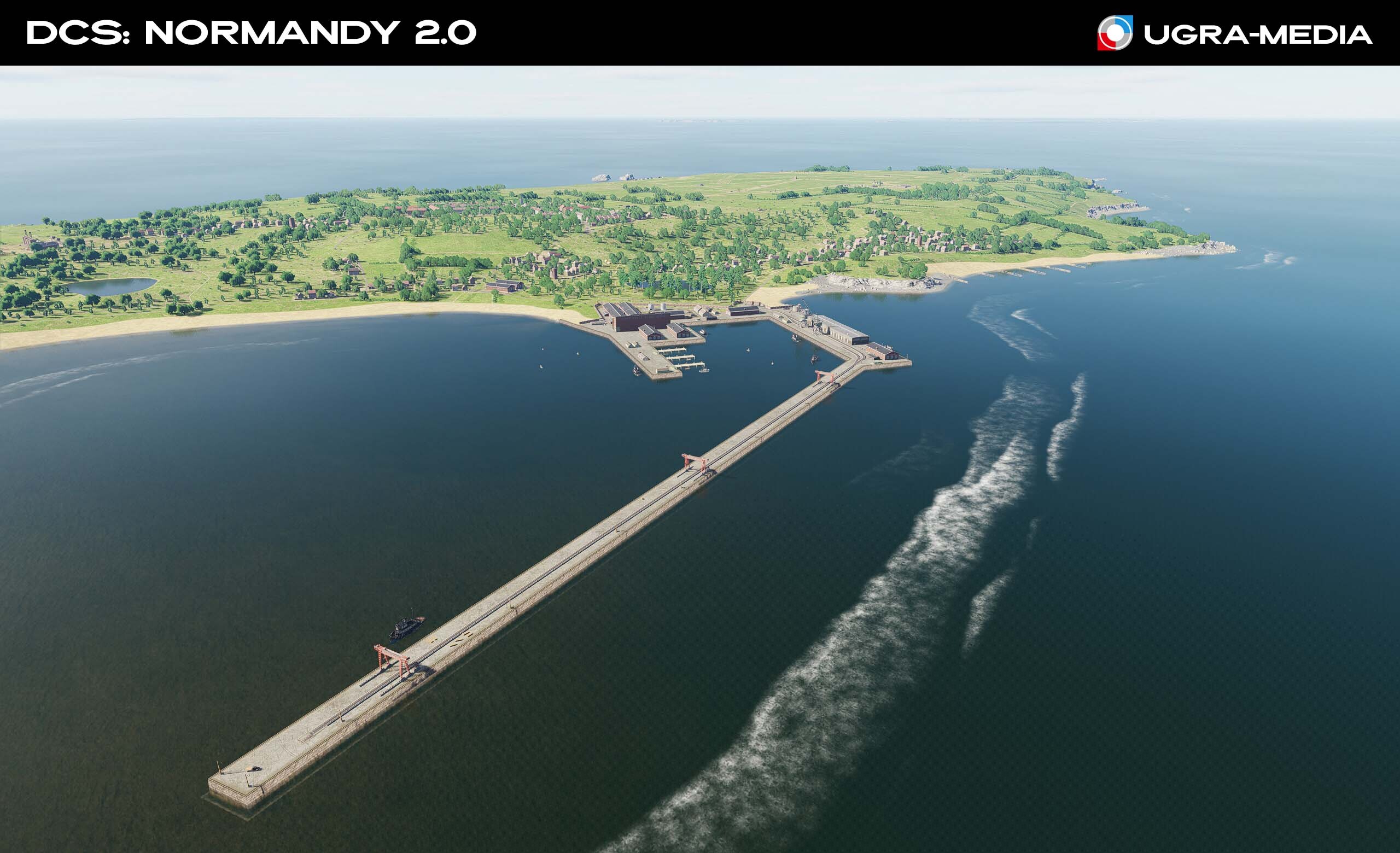
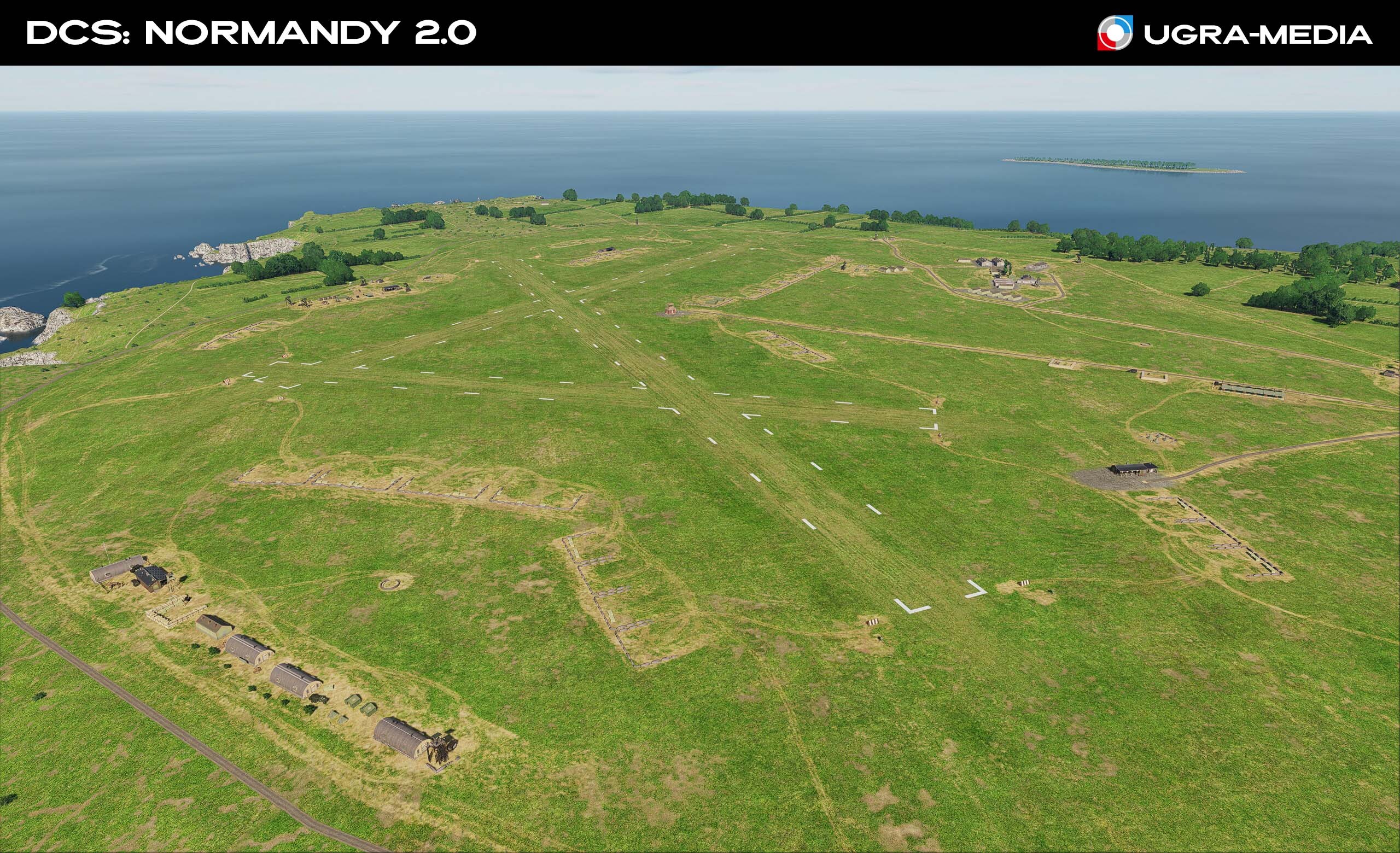
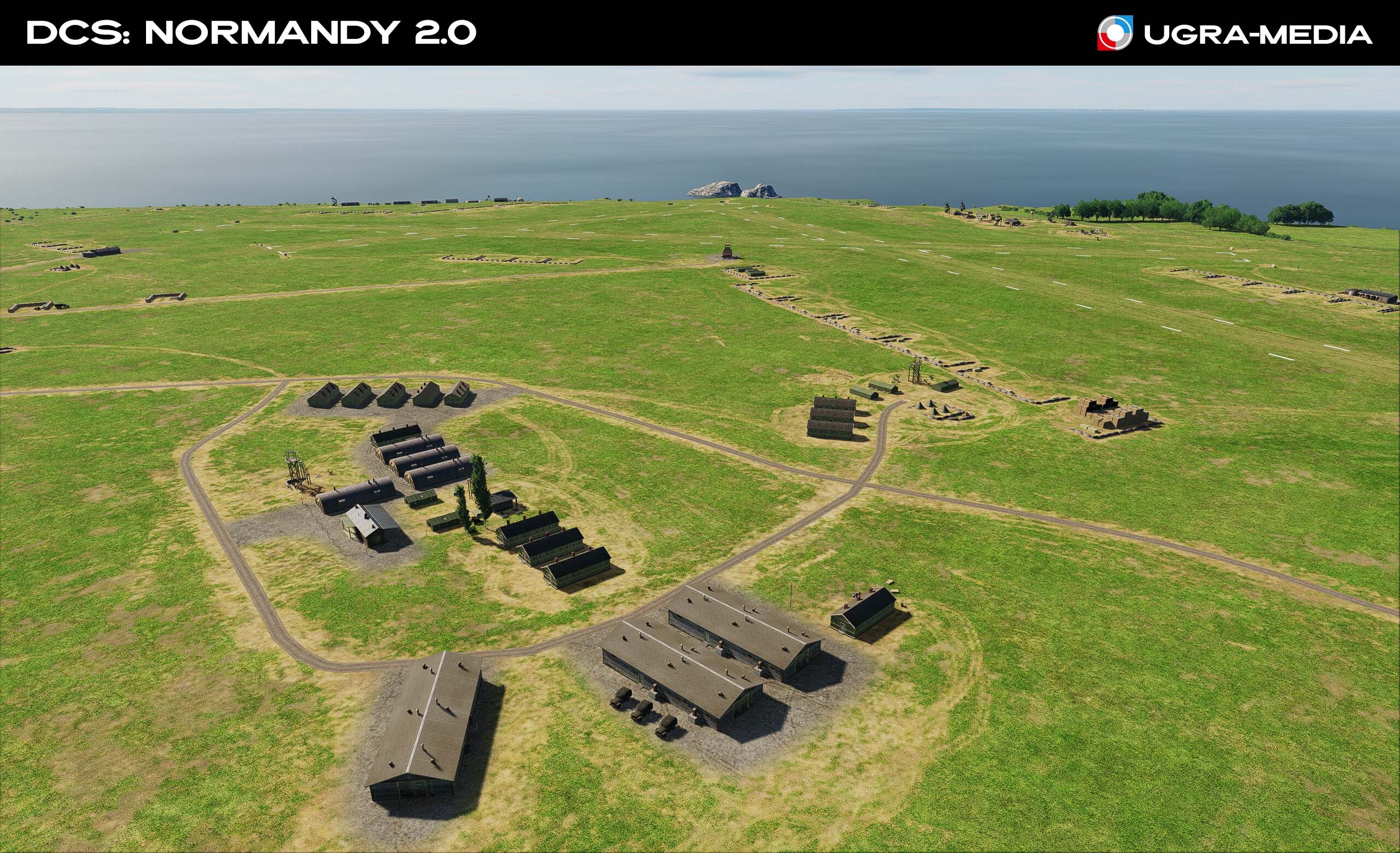
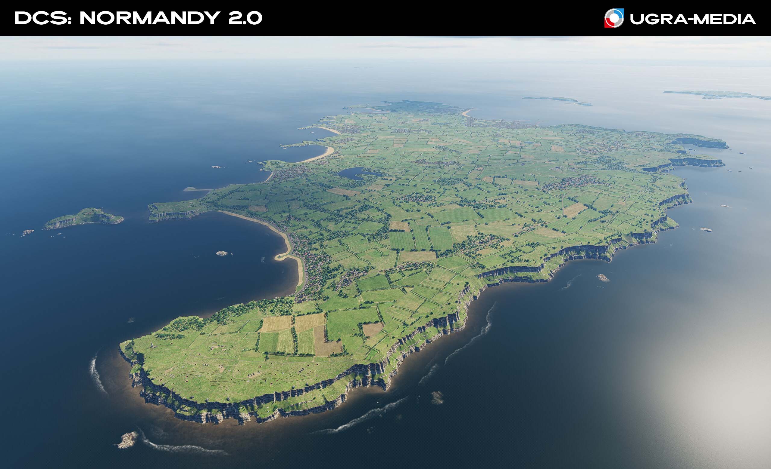
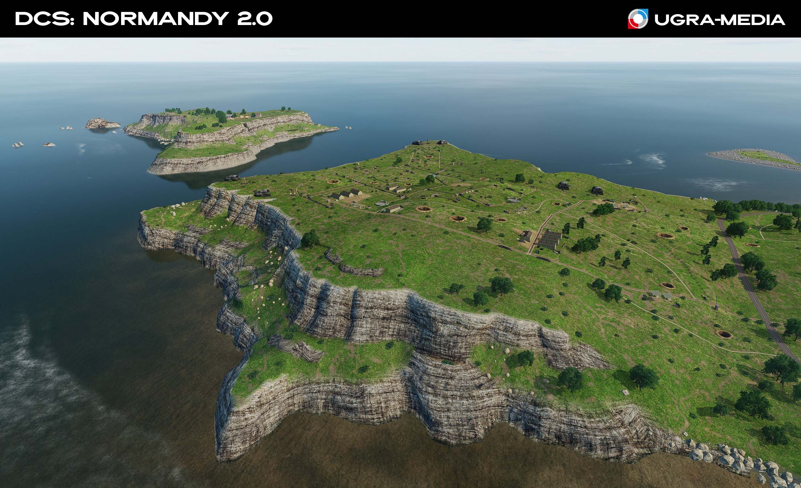
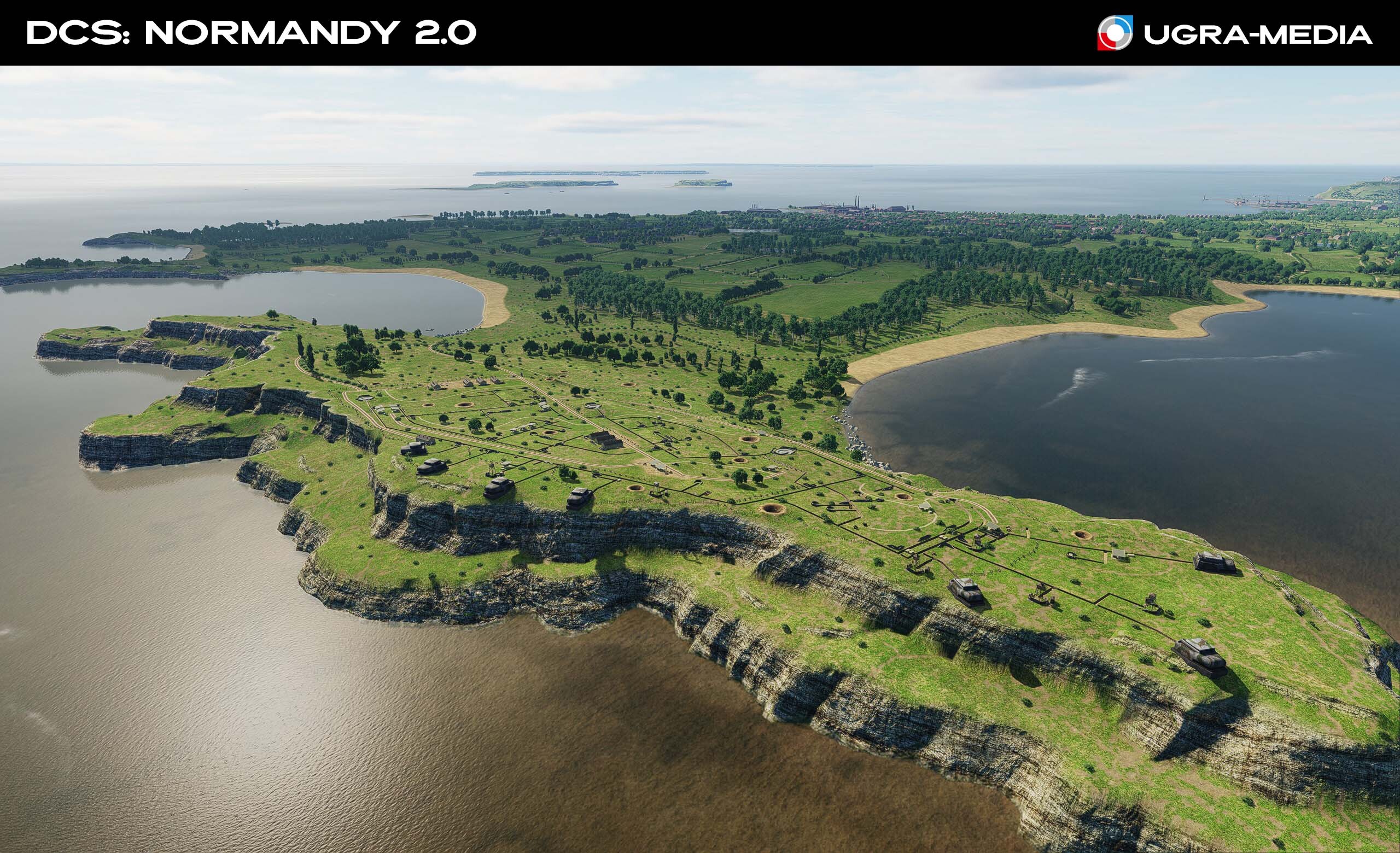
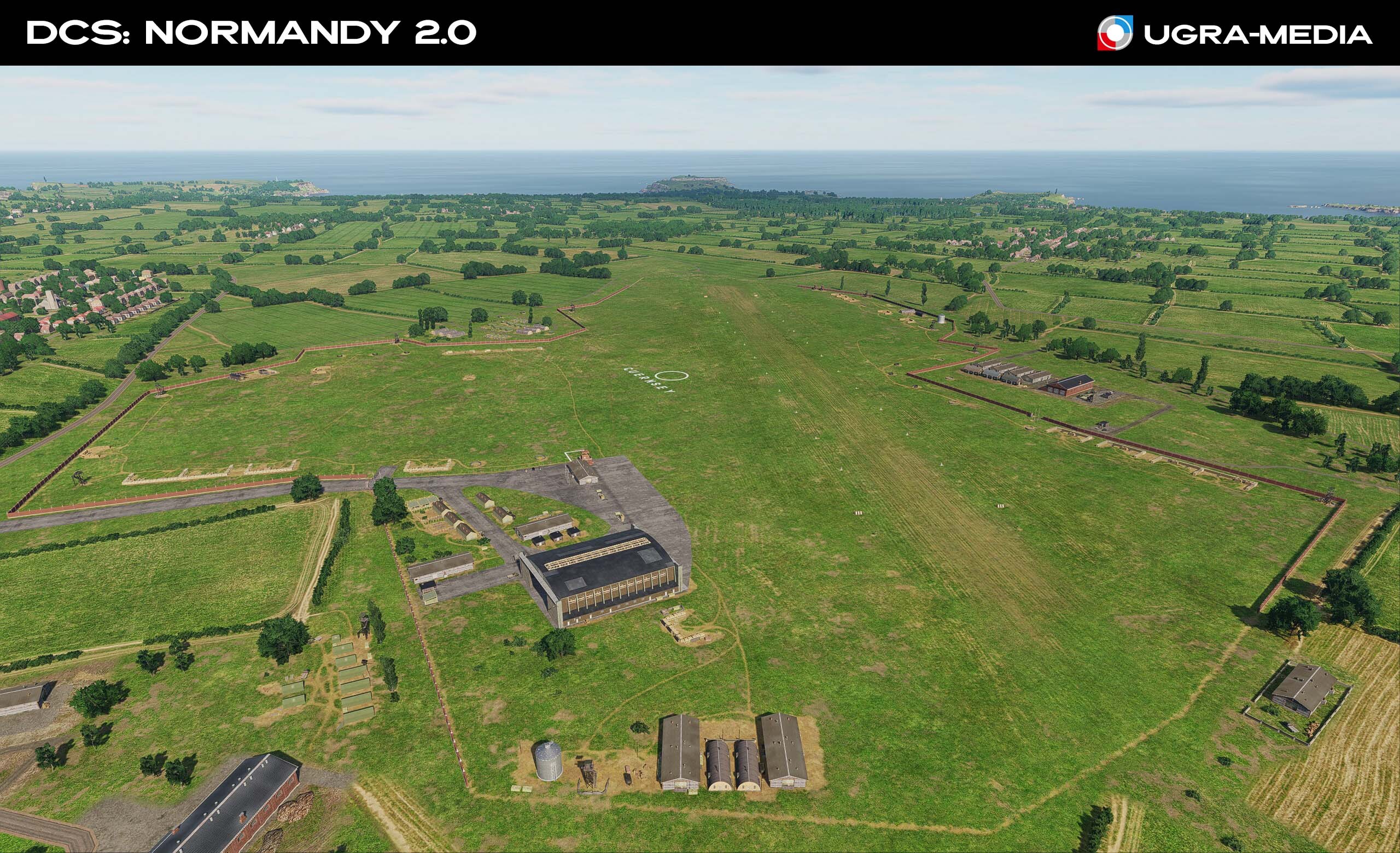
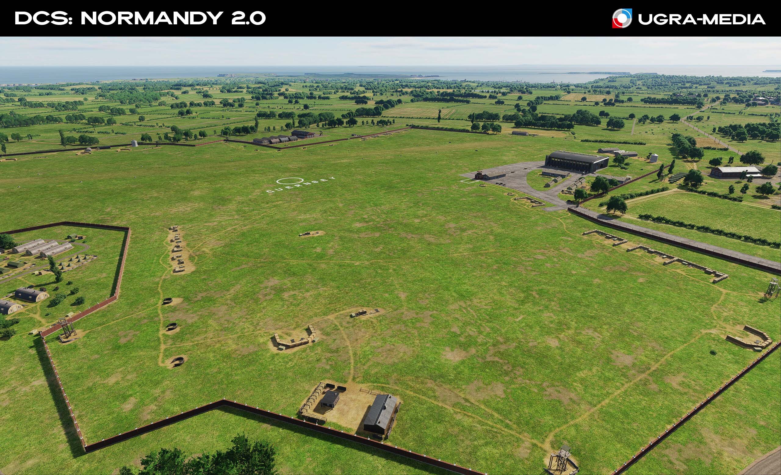
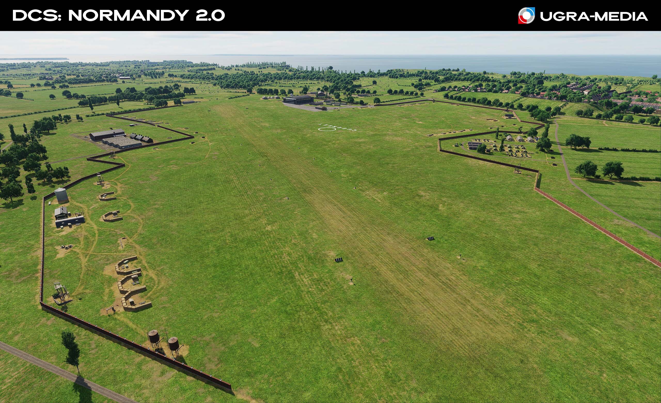
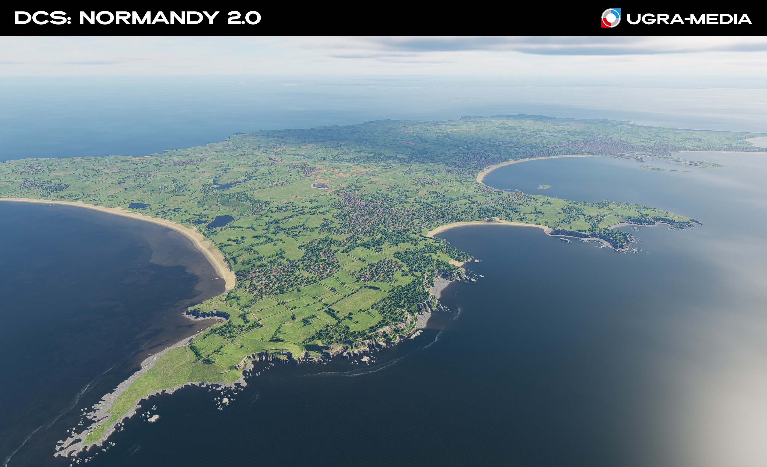
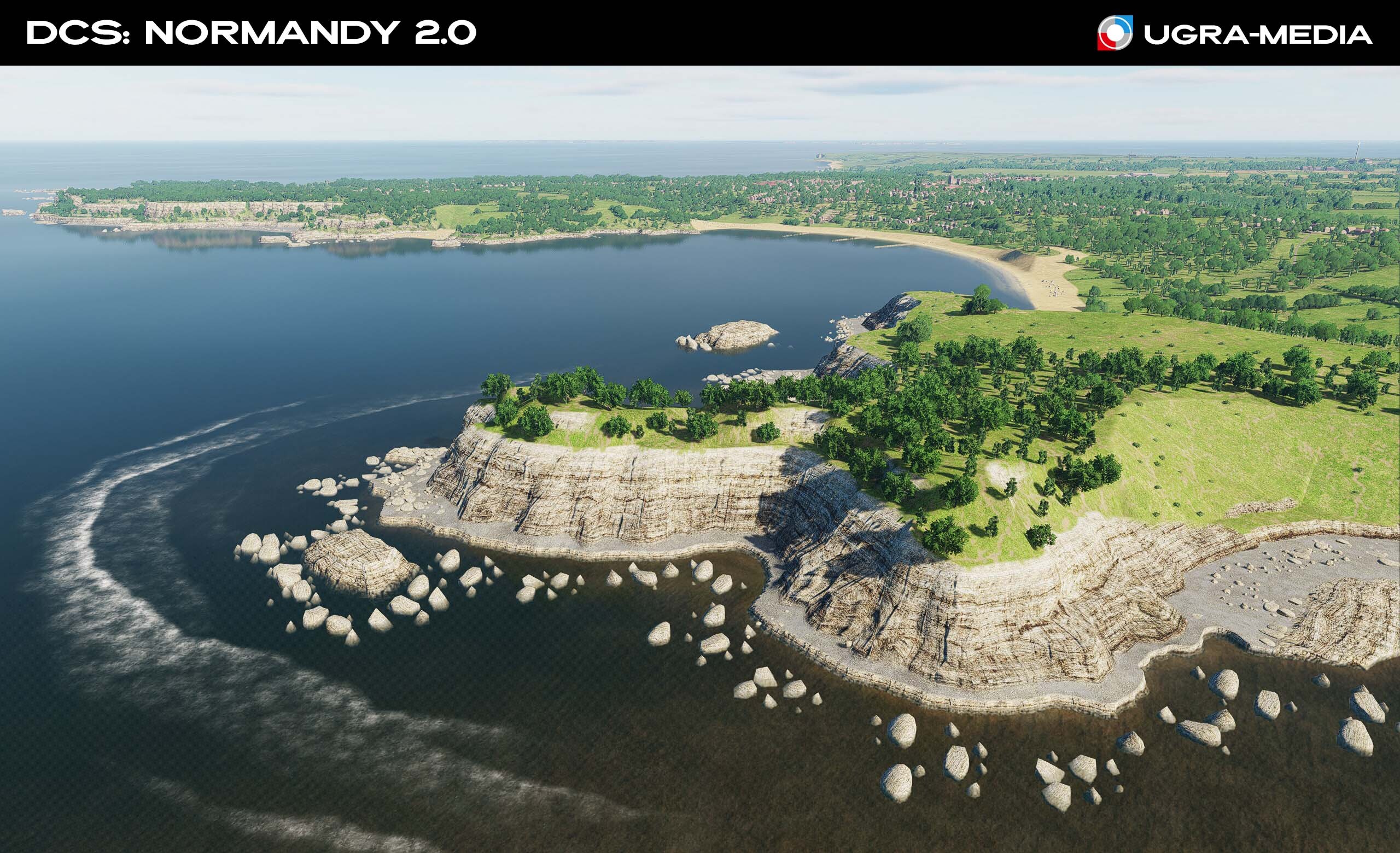
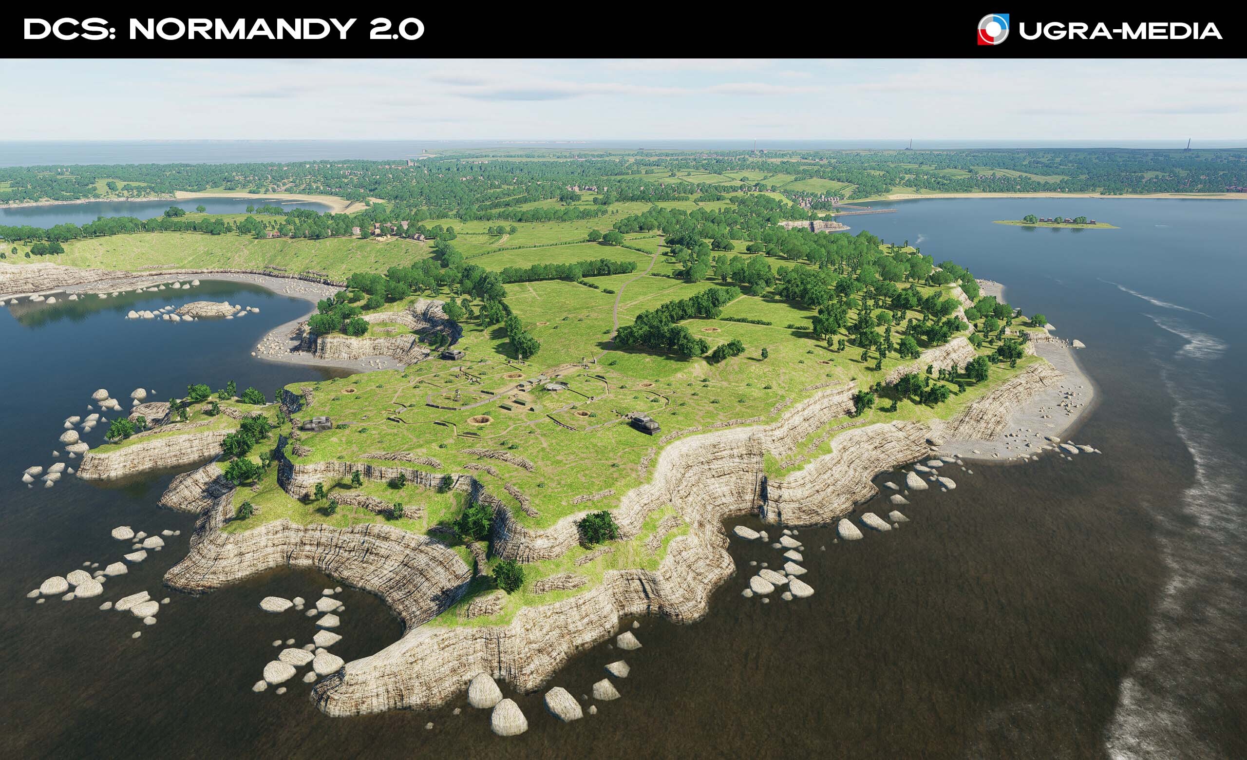
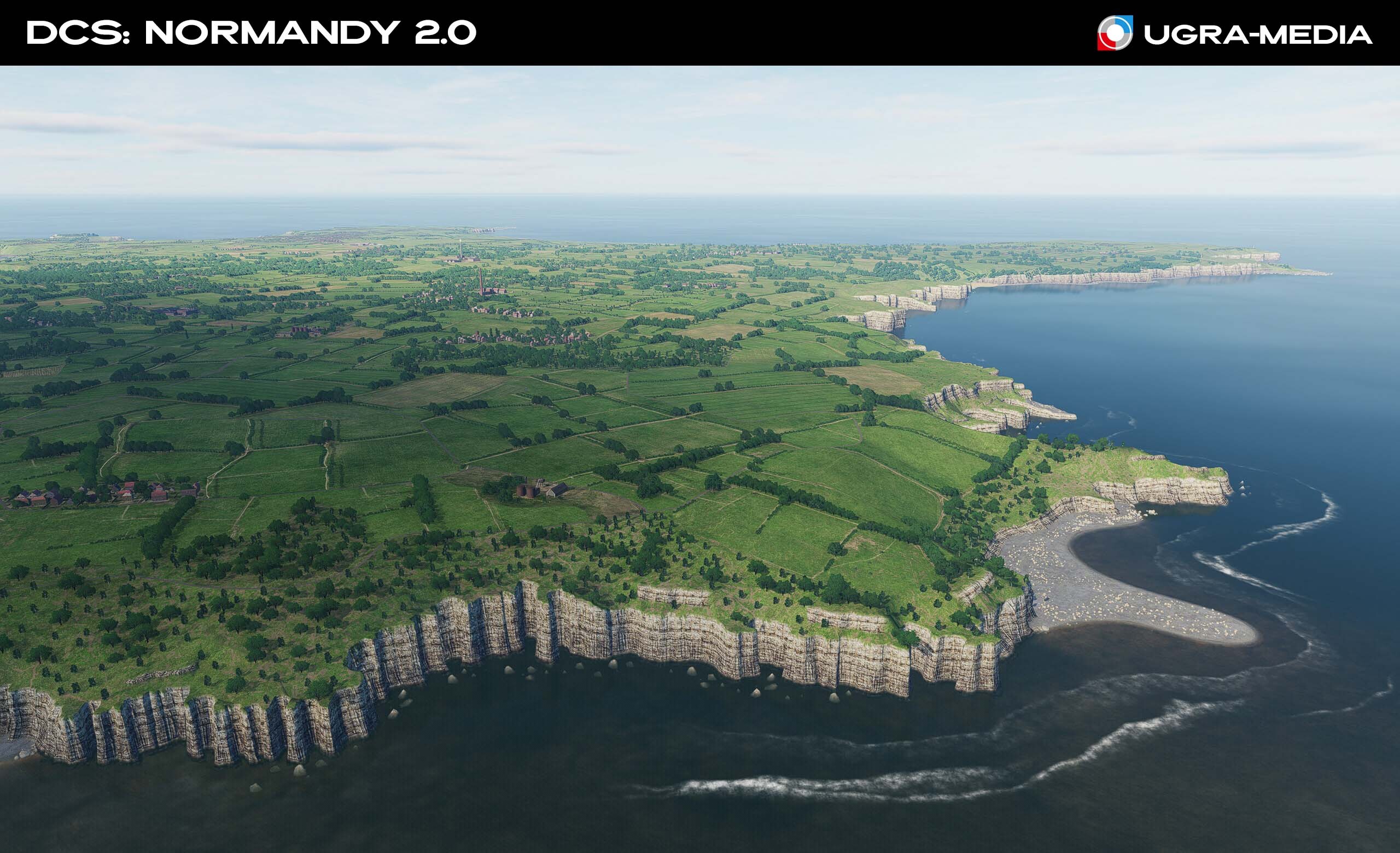
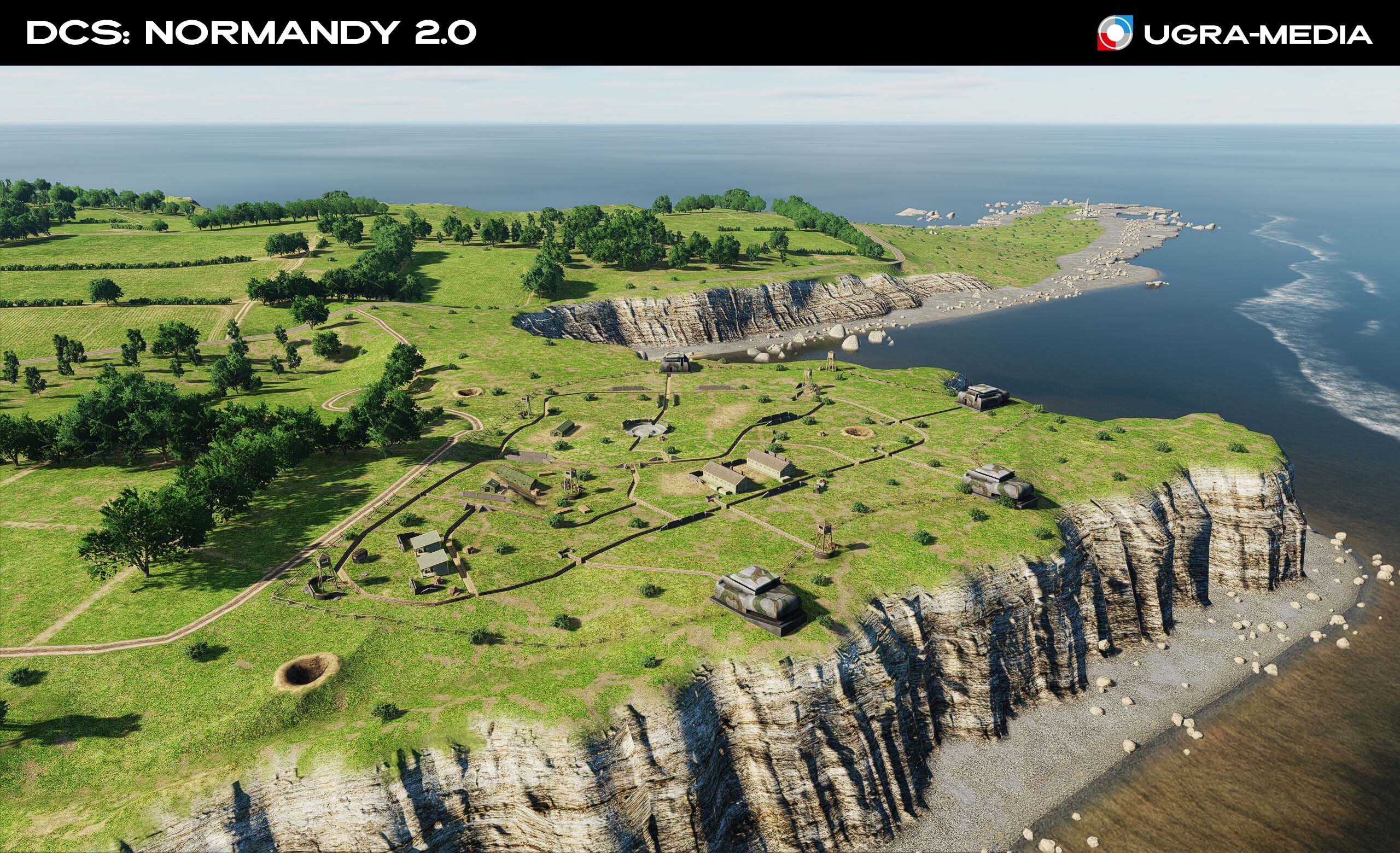
The update pays special attention to the islands, each of which has its own airfield, ready for use in missions: Alderney Island is the northernmost of the Channel Islands. Guernsey Island is an important strategic point. Like Jersey, the island became part of the Atlantic Wall. Jersey Island is the largest of the Channel Islands, with an area of 116 km2. From July 1, 1940 to May 9, 1945, the island was occupied by Germany. The islands' challenging weather conditions and interesting locations can add variety to your missions. These additions not only visually enrich the game world but also provide a wealth of new flight opportunities and interesting missions—whether taking off from the limited runways of island airfields or operations around iconic fortifications steeped in history.
-
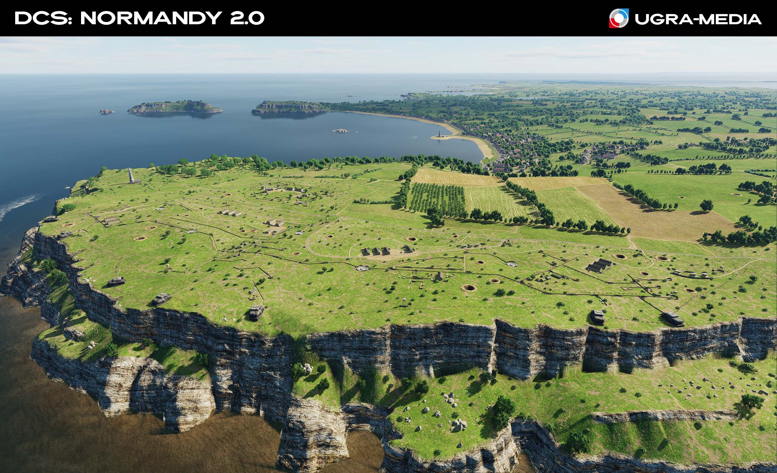
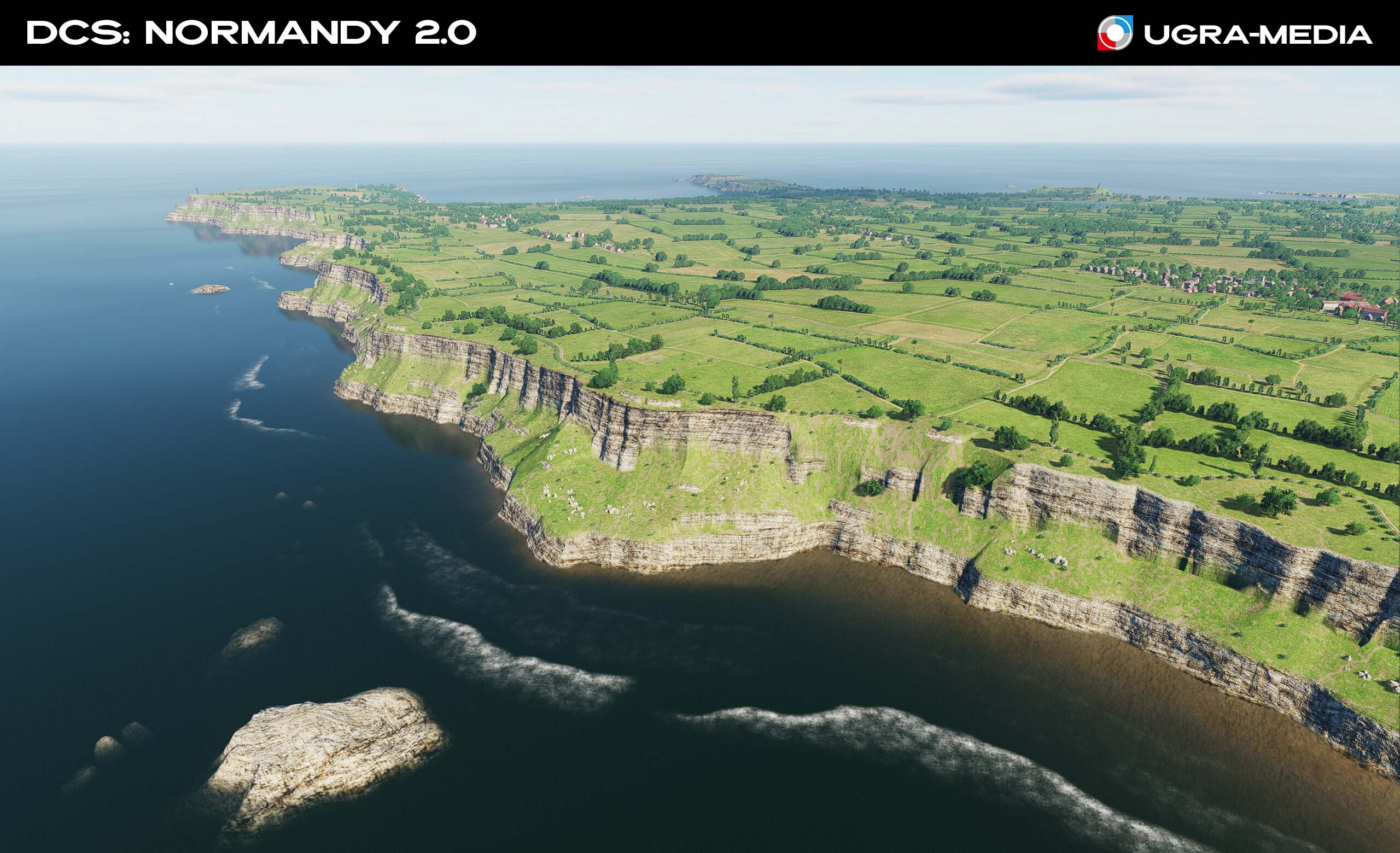
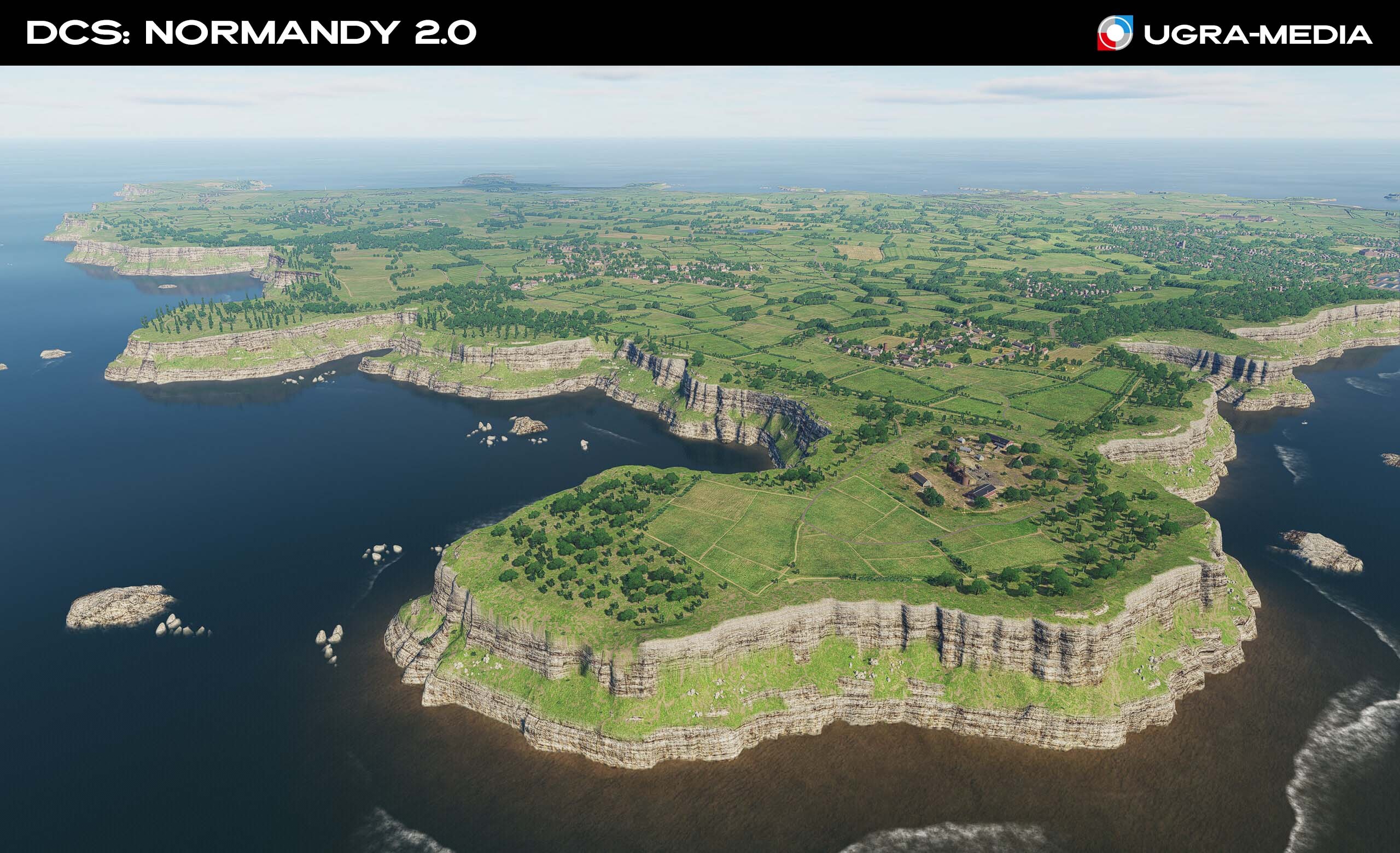
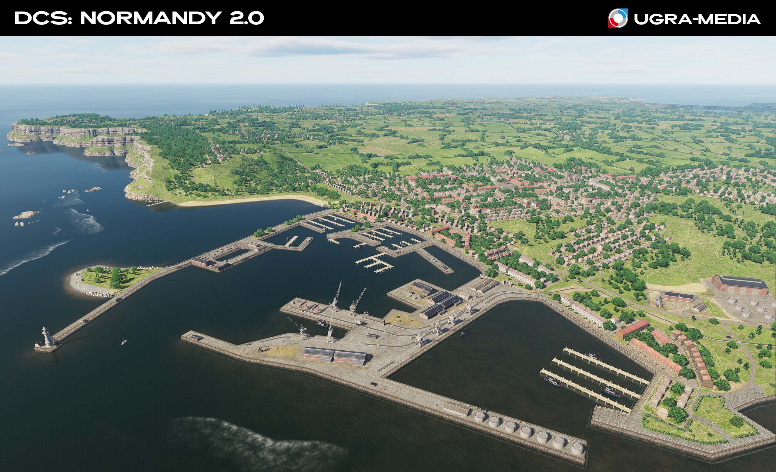
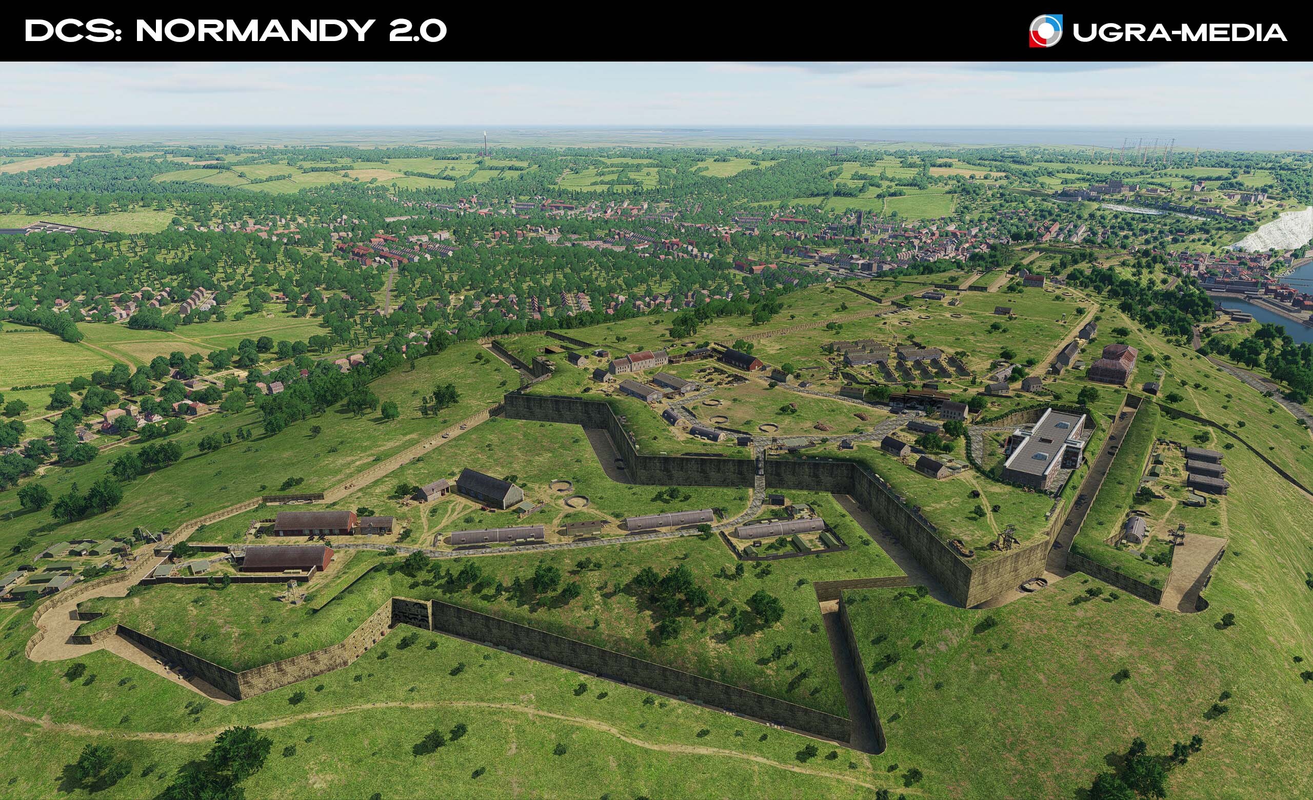
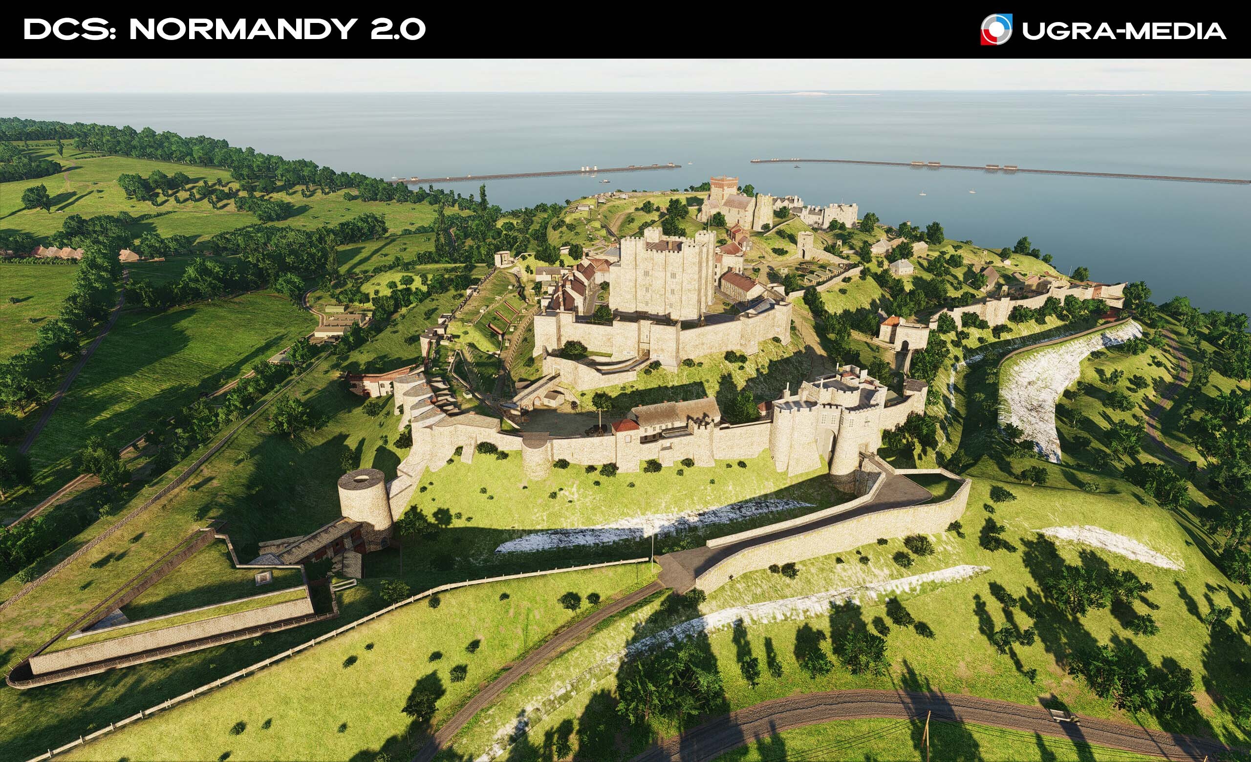
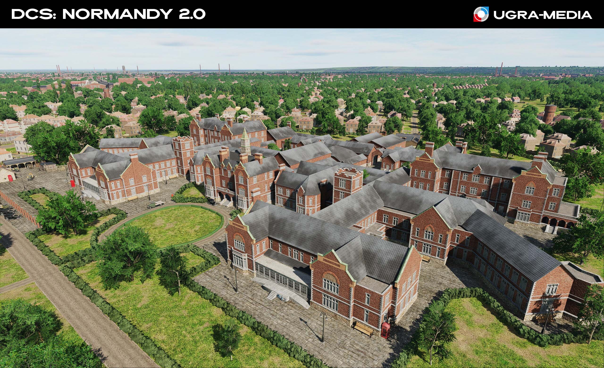
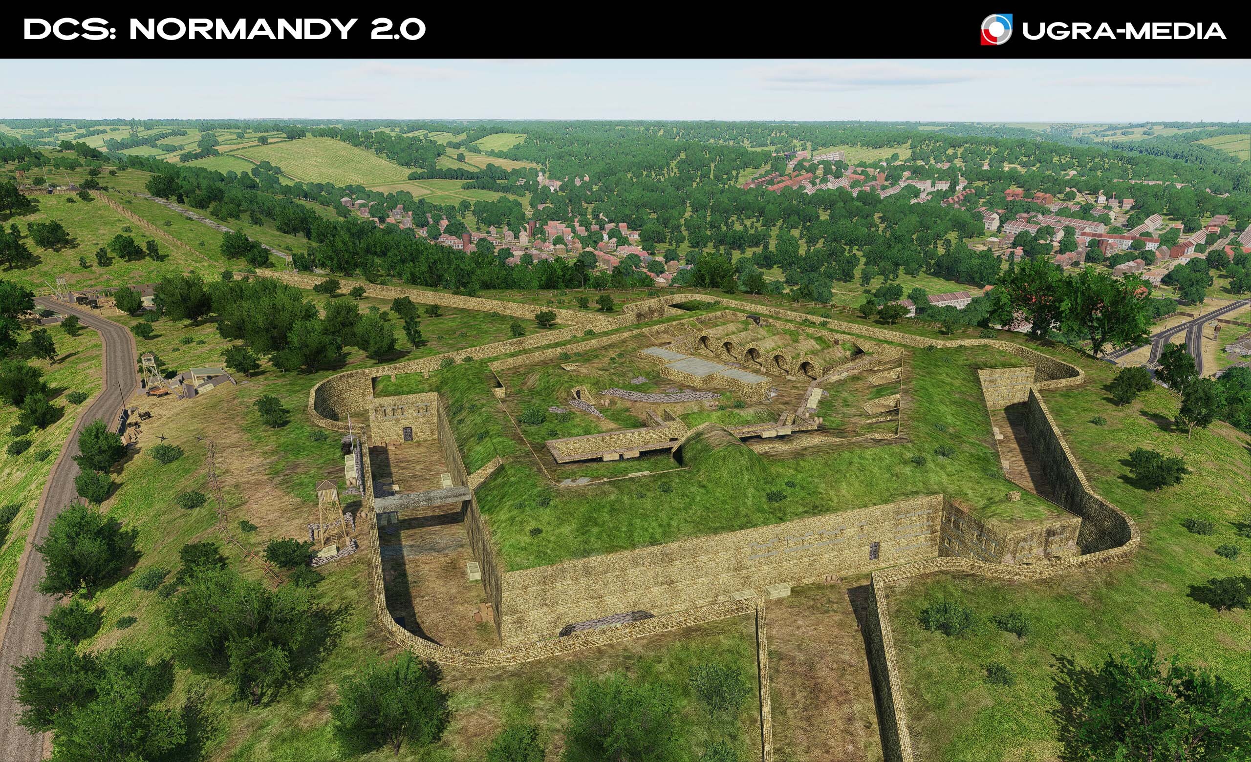
Alright, let's roll! As requested today, England. The DCS: Normandy 2.0 update will add new original objects and islands with airfields. Today we'll show you key objects of England and the islands, which have received significant detail. Each of these objects not only decorates the map but also serves as an important tactical and navigational landmark. Dover Castle is one of the most famous and largest castles in England. It has long been considered the "Key to England." Citadel Western Heights is a powerful fortification in Dover. The Citadel contained barracks, stores, and magazines arrayed around a large parade ground. It later housed a prison. Western Heights of Dover is a complex of defensive fortifications with a rich history. Royal Hospital Haslar is a historic naval hospital in Gosport. During World War II, the hospital established the country's first blood bank, treated casualties from the Normandy landings, and deployed clinicians to field hospitals in Europe and the Far East. It was also a key medical supplies center for the fleet. St. James Hospital is another important infrastructure facility and is popularly known as Jimmy's. HMP Winchester is a prison in Winchester. Its shape makes it easily recognizable from above.
-
Hi Is there any chance of creating a pre-invasion version of the map, without ALG? We've been answering this question for a while now: airfields are built into the map, and there's no tool for creating different versions. As soon as the engine adds this capability, we'll be able to make them switchable. @REDEYE_CVW-66 We're constantly improving airfields: in each update, we make subtle adjustments to avoid disrupting existing missions. You'll notice them gradually changing, just like in real life. In this update, we've fixed and improved the logic of some old airfields and added some new ones. And this is just the beginning: we have a lot of work planned for airfields ( @Fred901 provided a lot of useful material, and there is a lot of work to be done on it). So enjoy your flights—familiar places might even surprise you over time!
-
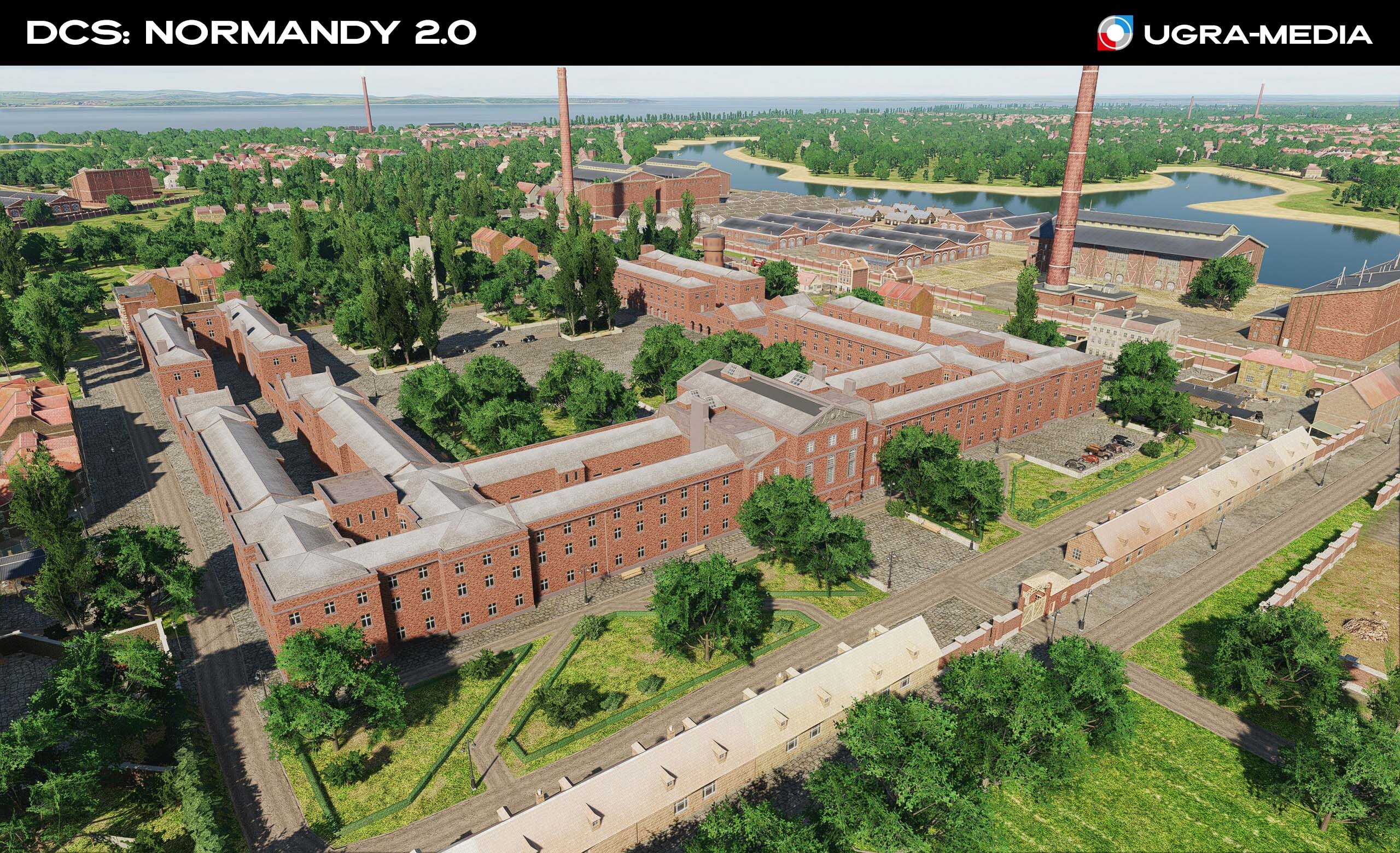
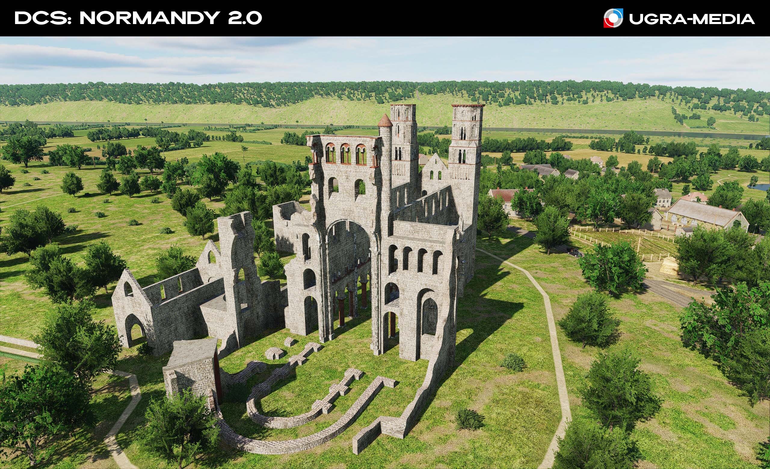
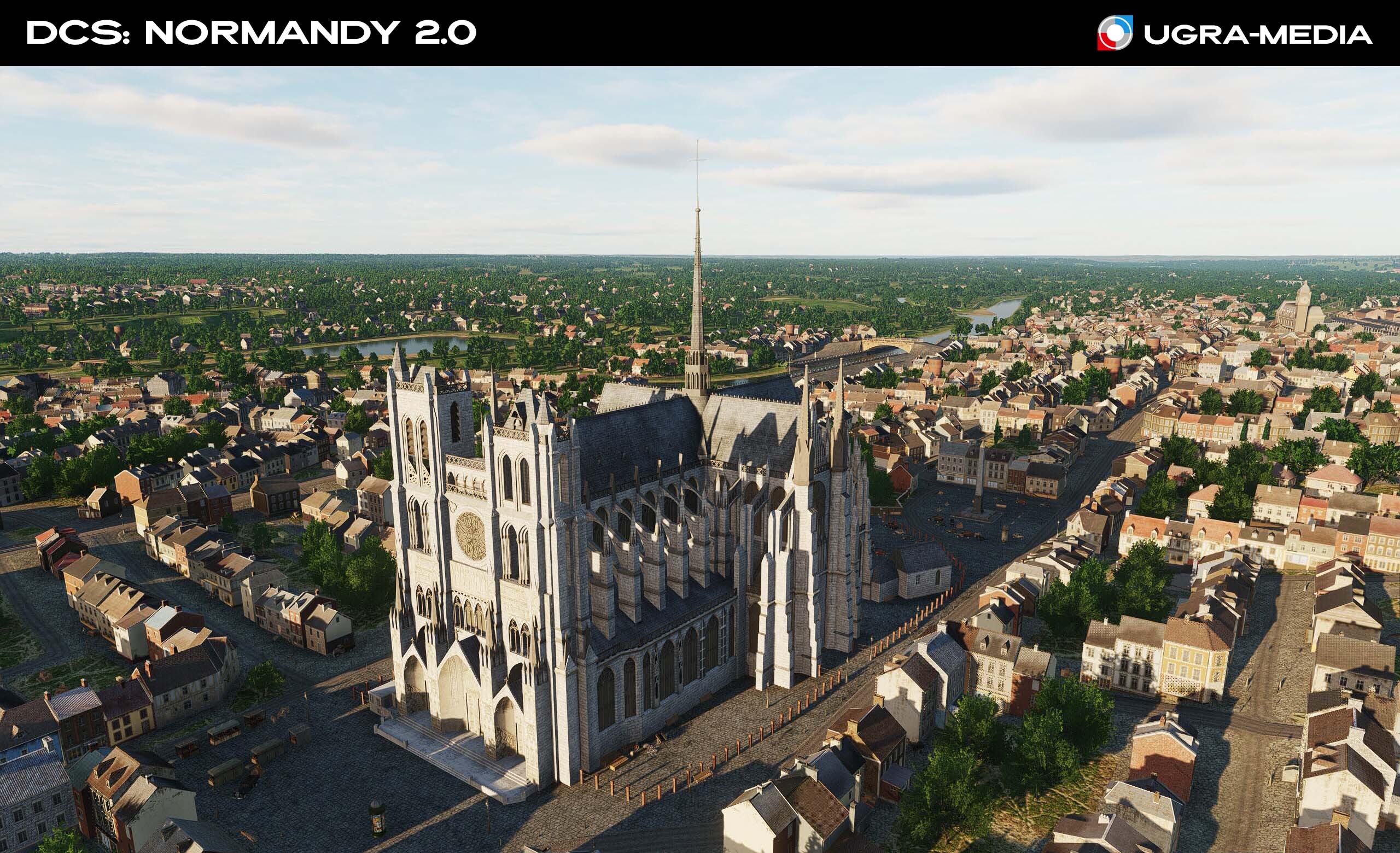
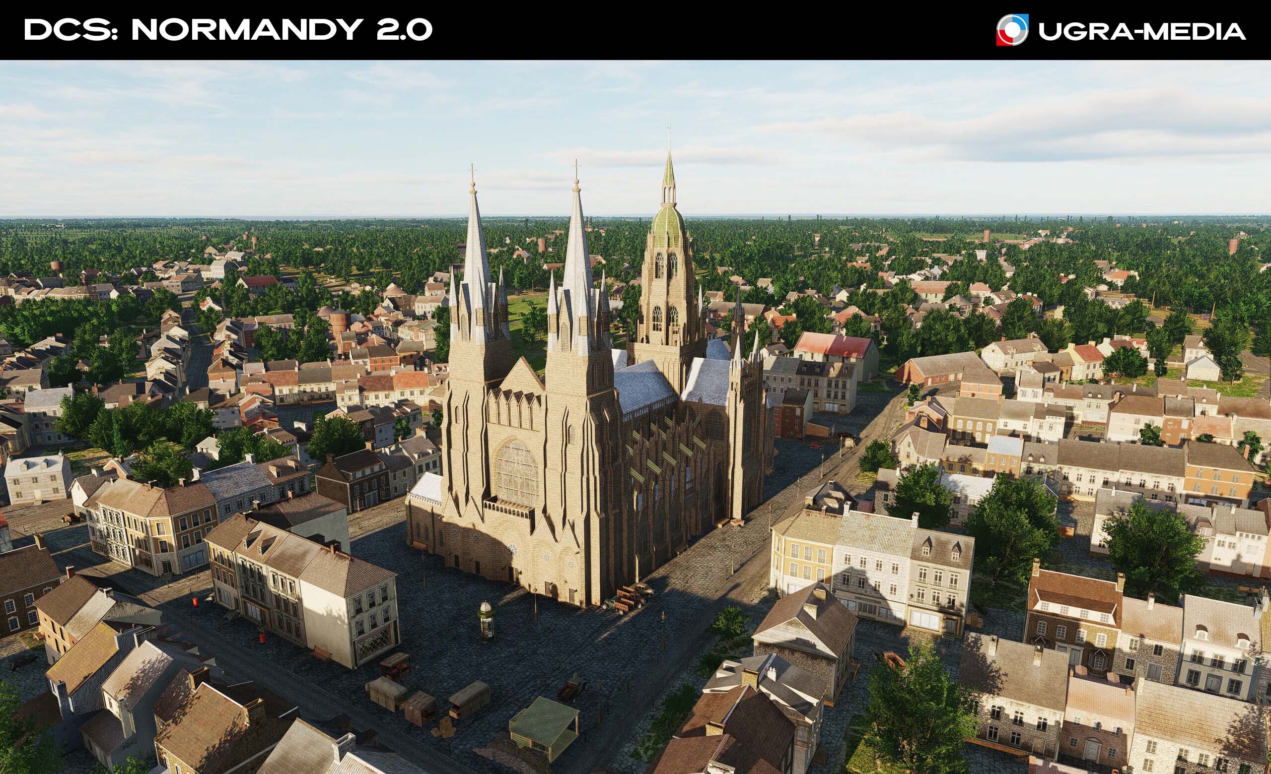
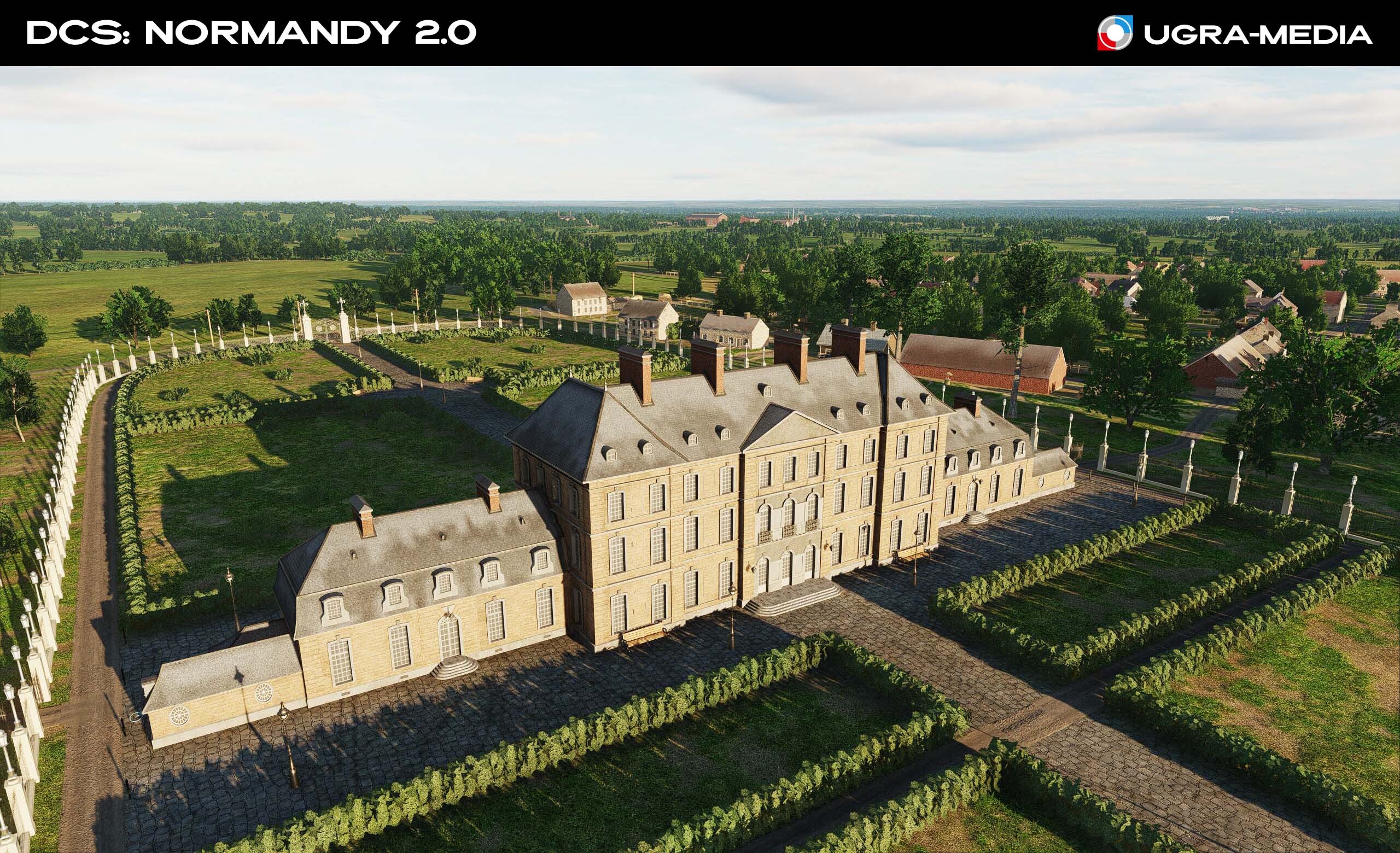
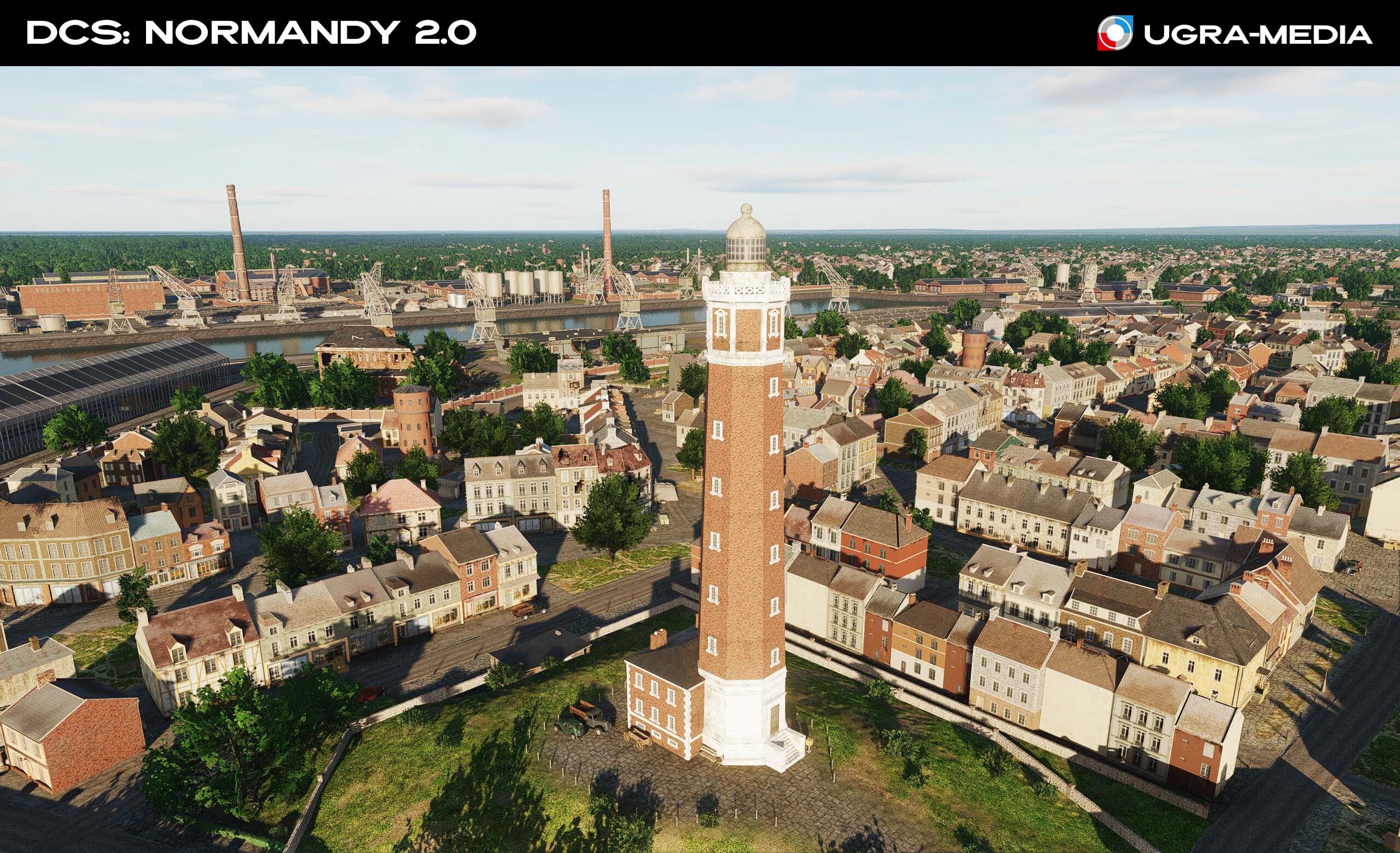
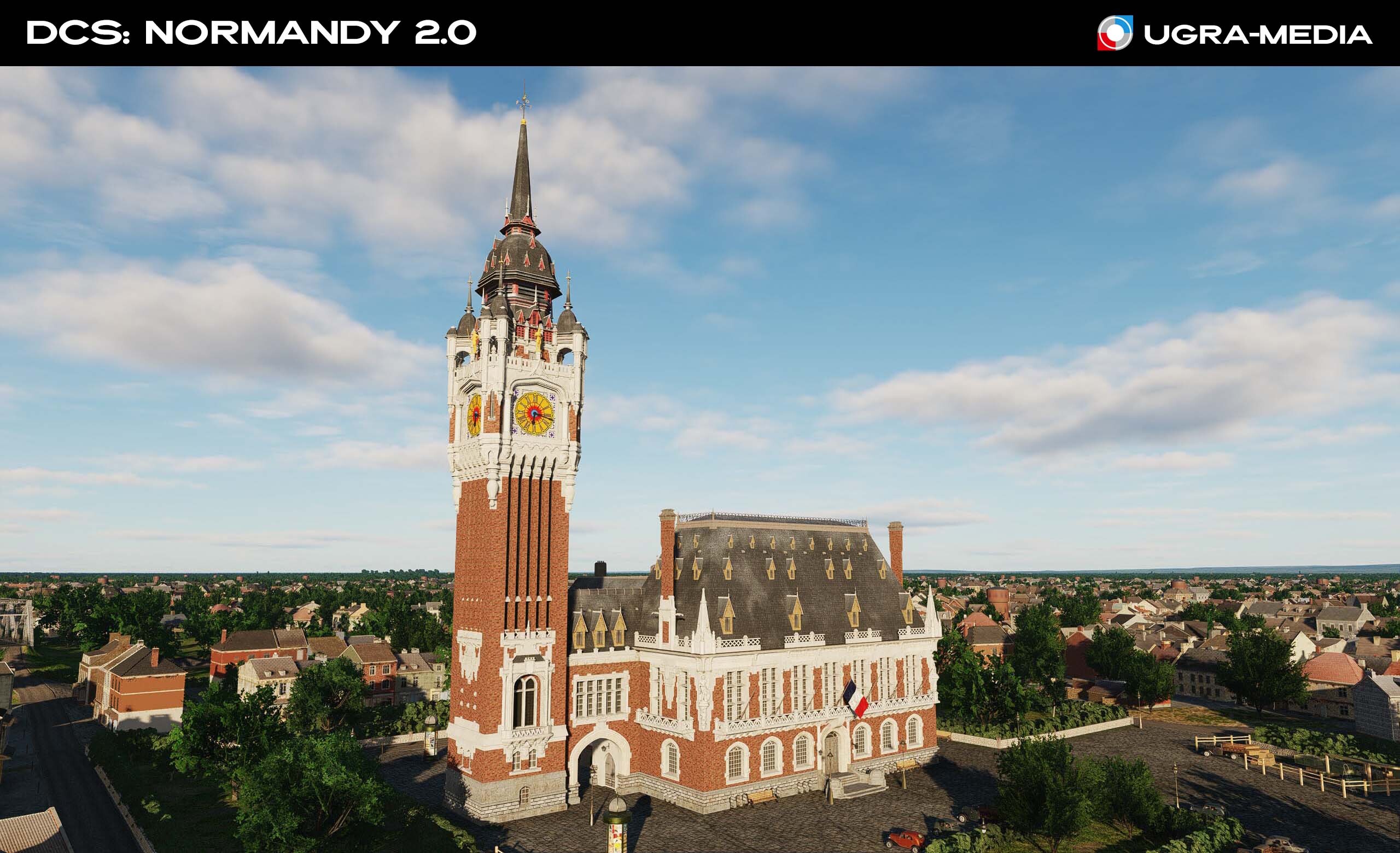
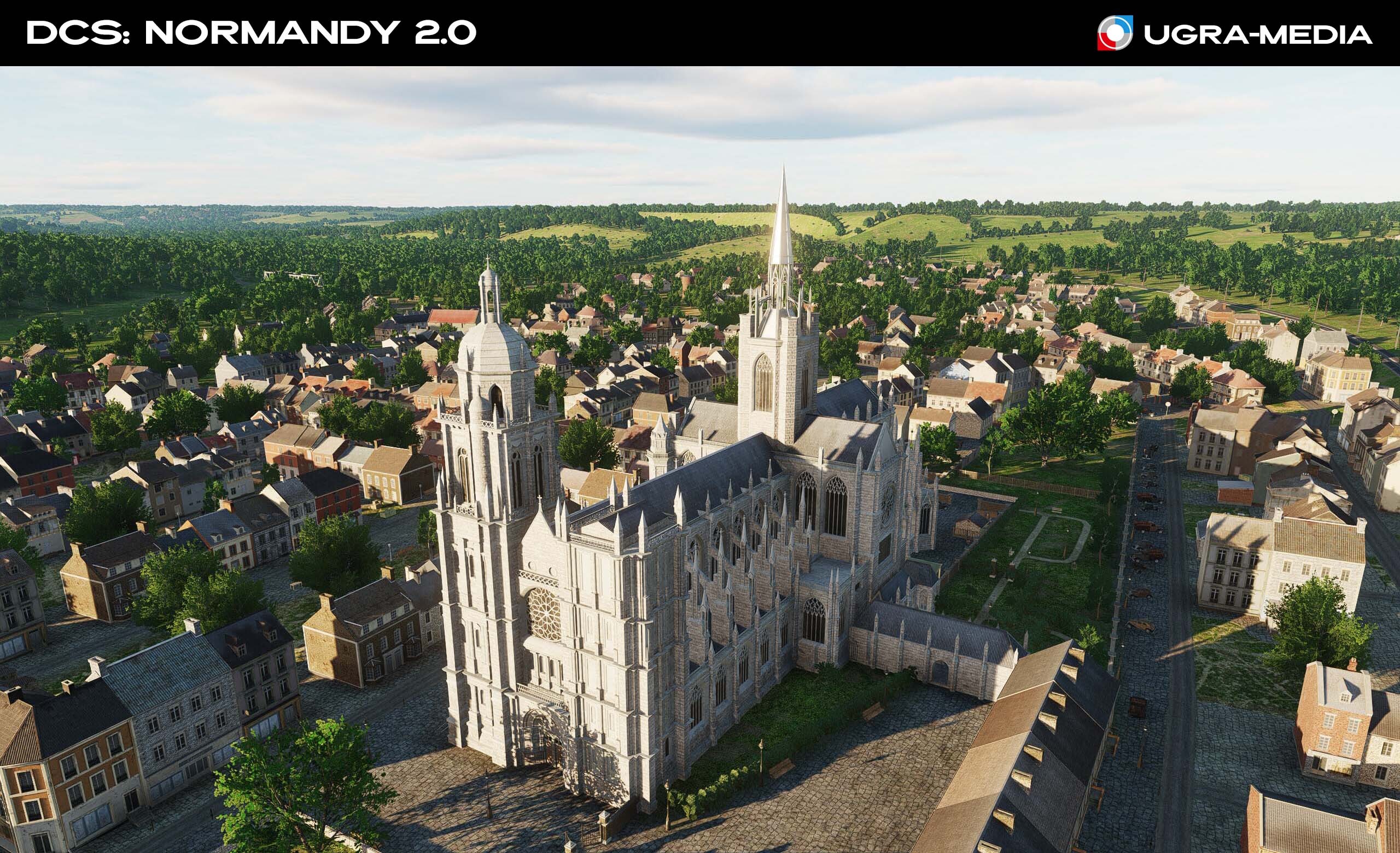
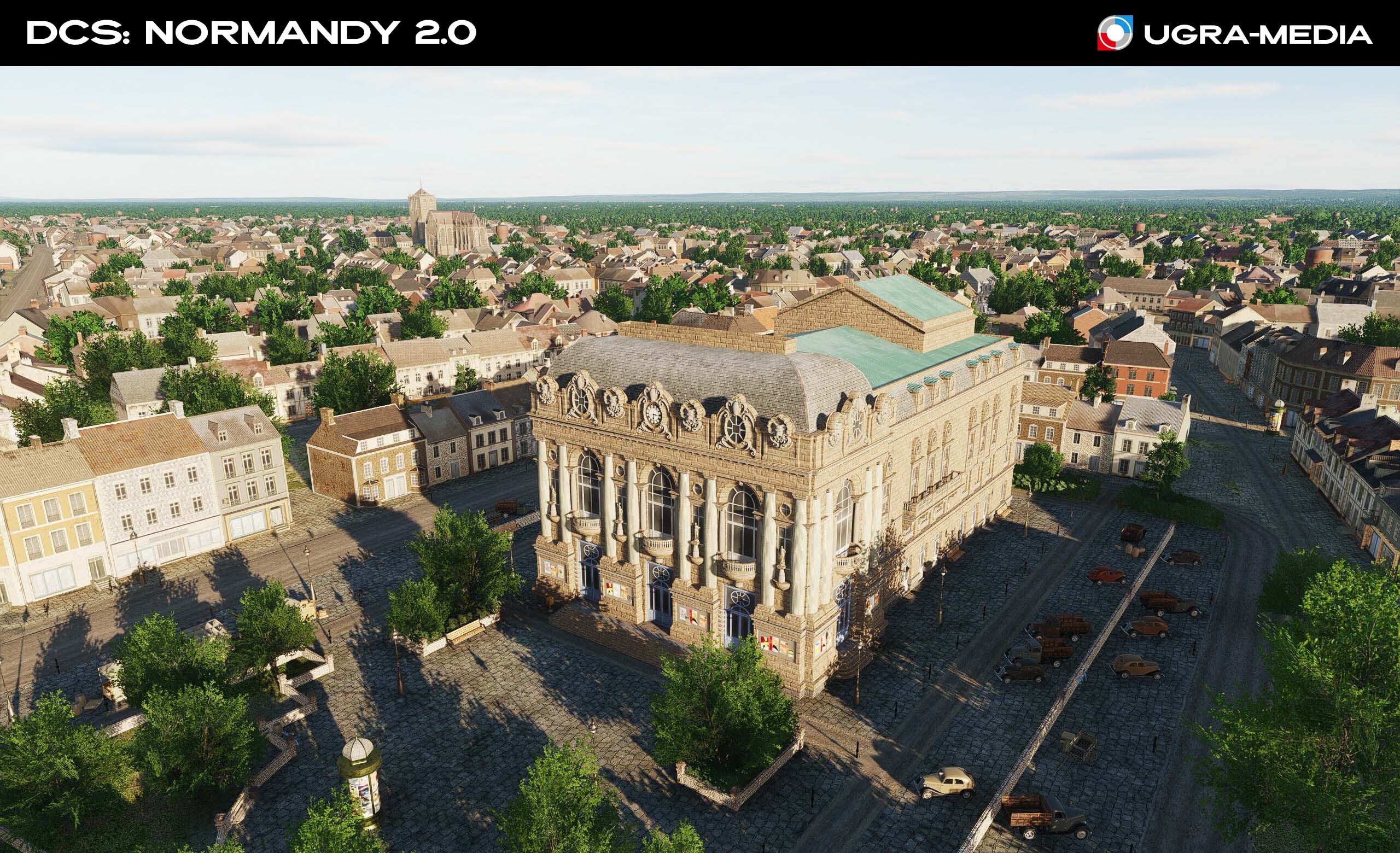
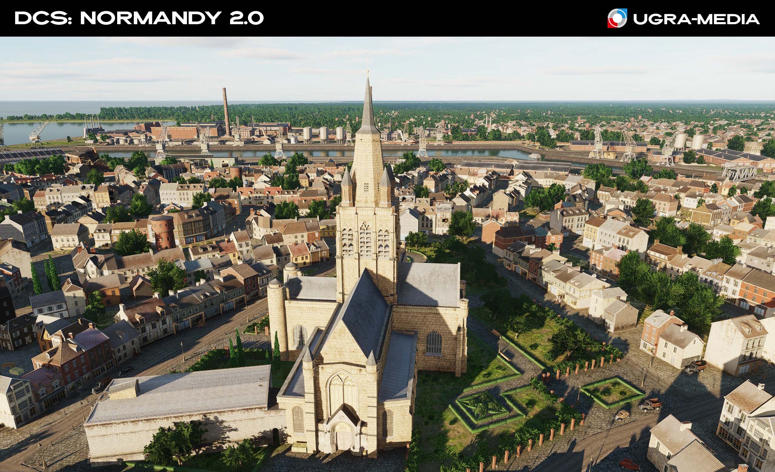
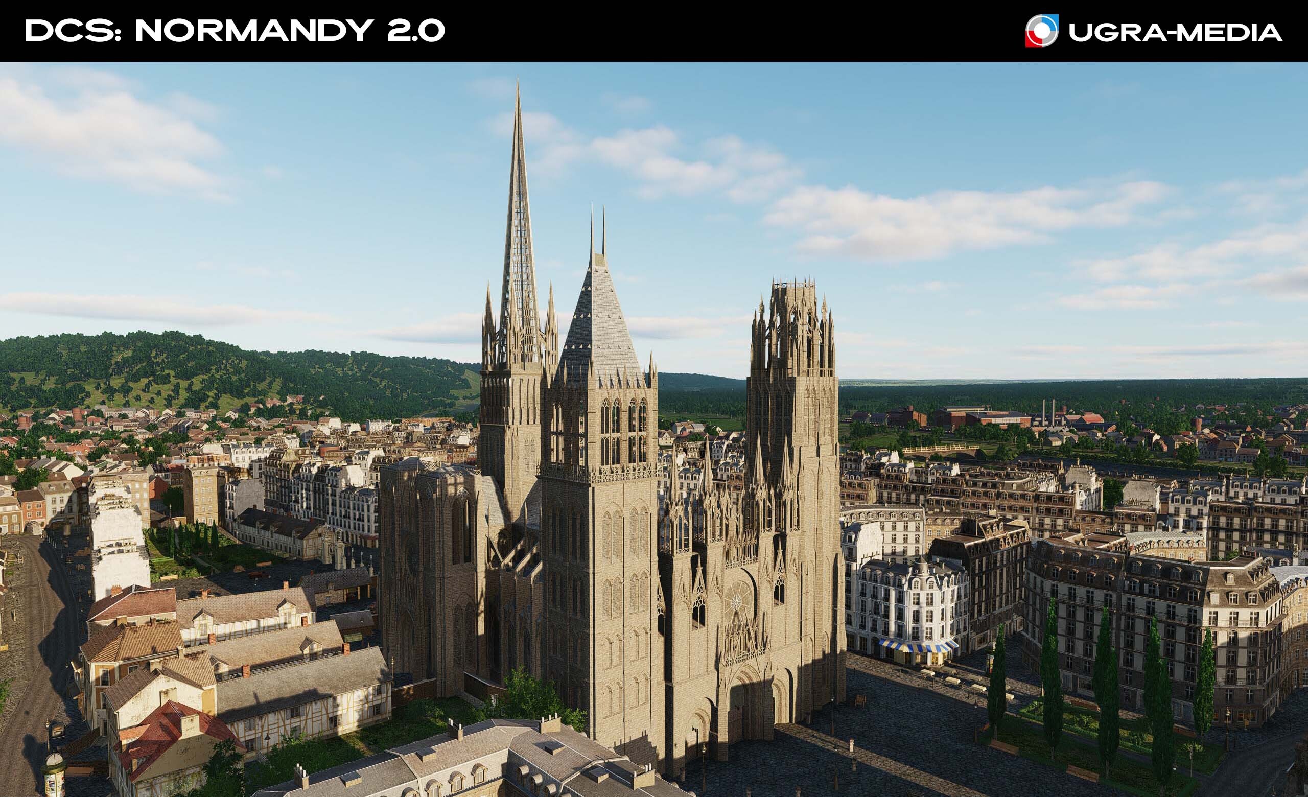
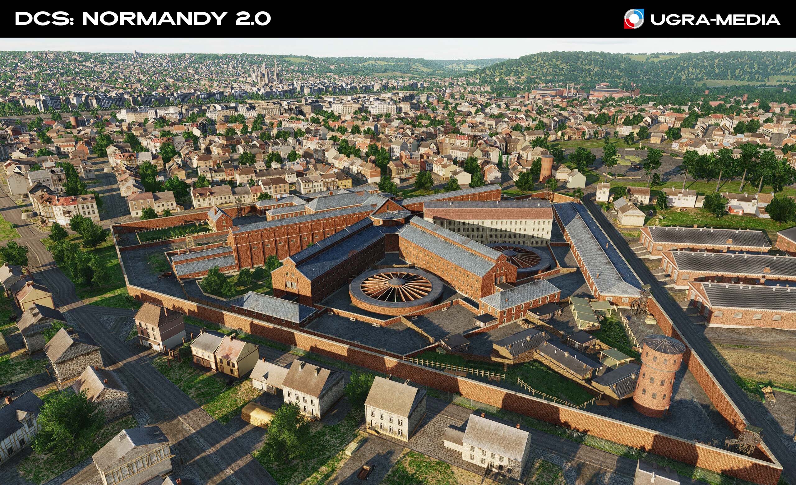
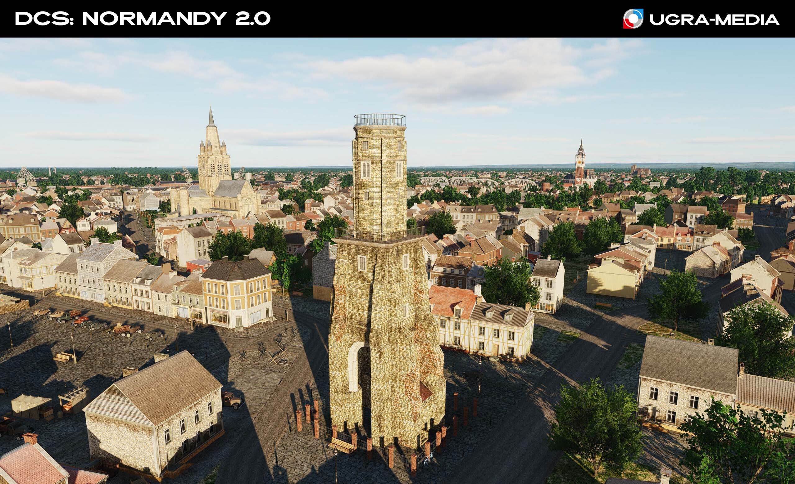
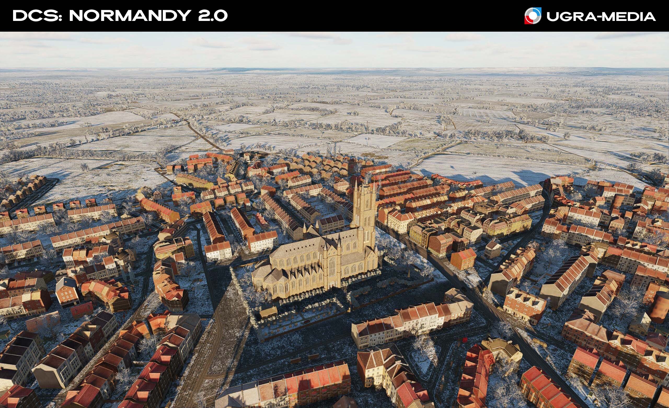
In this update, you will find carefully designed historical objects that will make every flight even more alive and immersive. Each object from majestic cathedrals to fortifications was modeled with reference to its real historical appearance to make your flights over France truly unique. This is history coming to life under the wing of your aircraft. Explore, plan operations and enjoy incredible detail! Architectural gems of Normandy and beyond: Abbaye de Jumieges - majestic ruins towering above the trees. Amiens Cathedral - A masterpiece of Gothic architecture, visible for many kilometers. Bayeux Cathedral - An architectural monument of the 11th-15th centuries, combining features of the Romanesque style and Norman Gothic. Bertangles Chateau - An exquisite French castle. A good place for a walk. Calais and Rouen landmarks: Calais Lighthouse — a 53-metre (178 ft) lighthouse on the coast. Calais Town Hall — a 72-metre (236 ft) bell tower Grand Theater de Calais — a magnificent Italian-style theater. At the time of its opening, it was the third largest in France and one of the few theaters with iron stage mechanics. Notre Dame Catholic Church at Calais — The church is large and has a fortress-like appearance. Arguably, it is the only church built in the English perpendicular style in all of France. Tour du Guet — is a 13th-century watchtower in Calais NotreDame de Rouen — A recognizable silhouette immortalized by Claude Monet. Rouen Prison - Historical prison of Rouen Evreux Cathedral - The cathedral is one of the most outstanding buildings in Evreux. The cathedral is a national monument
-
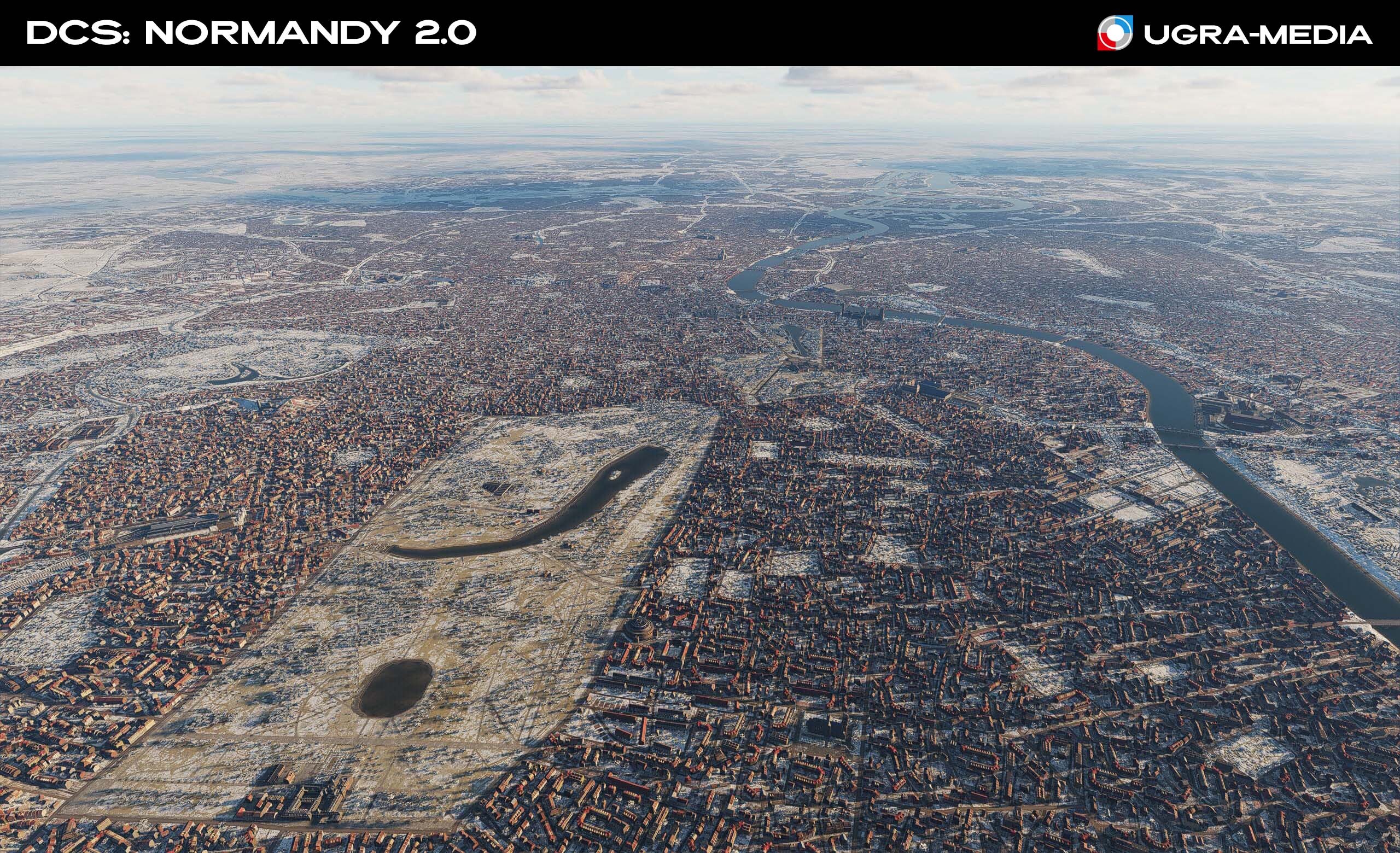
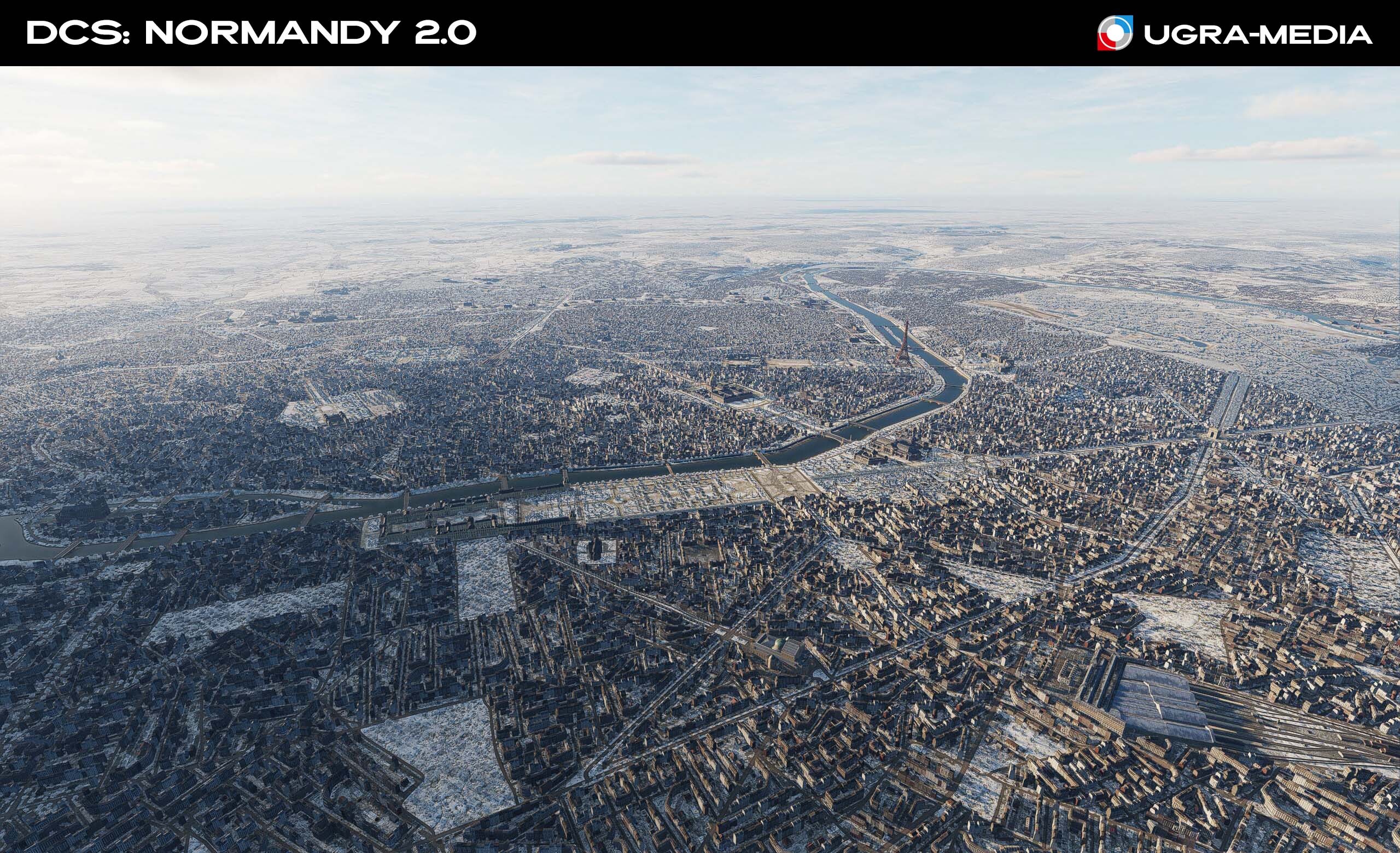
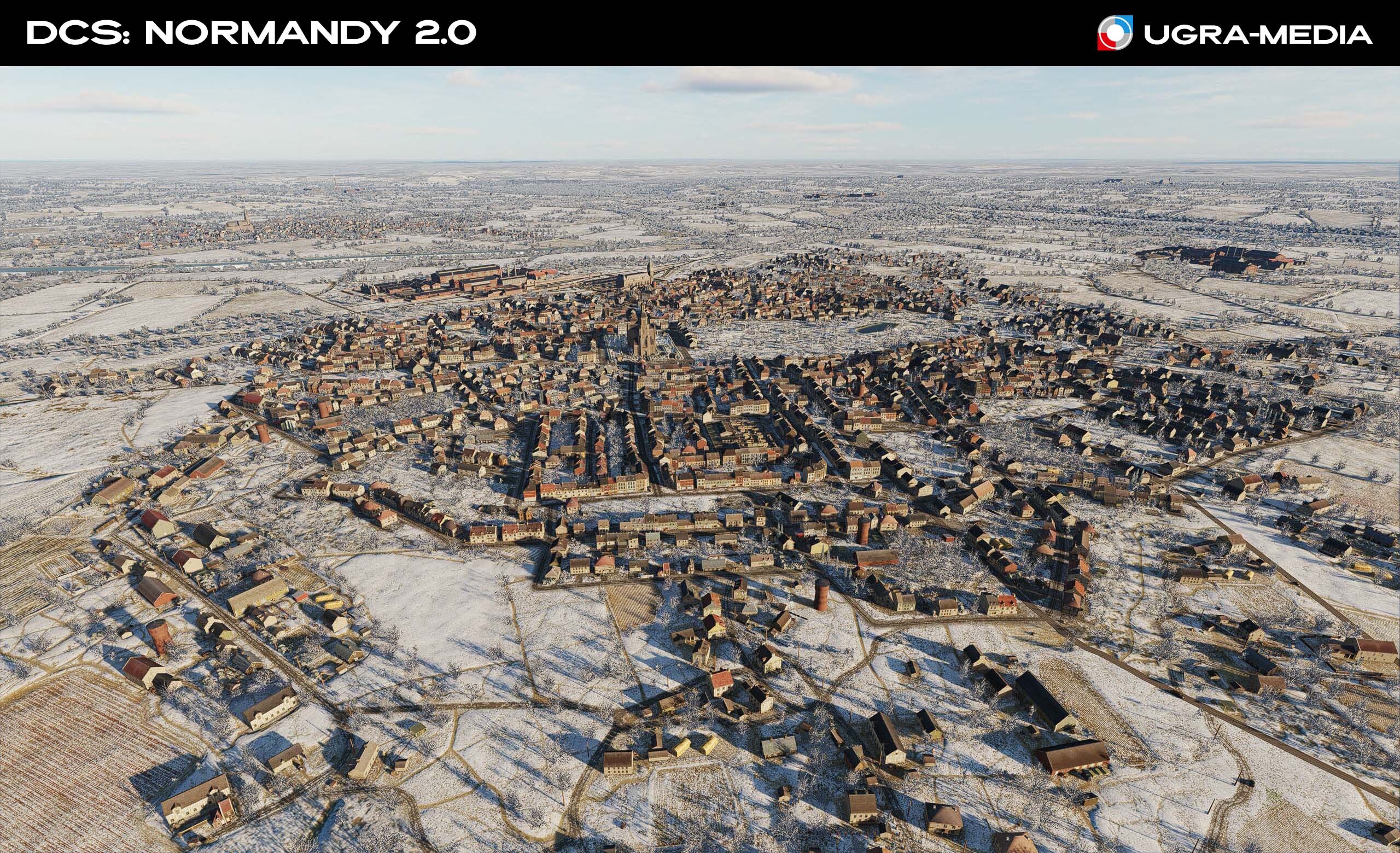
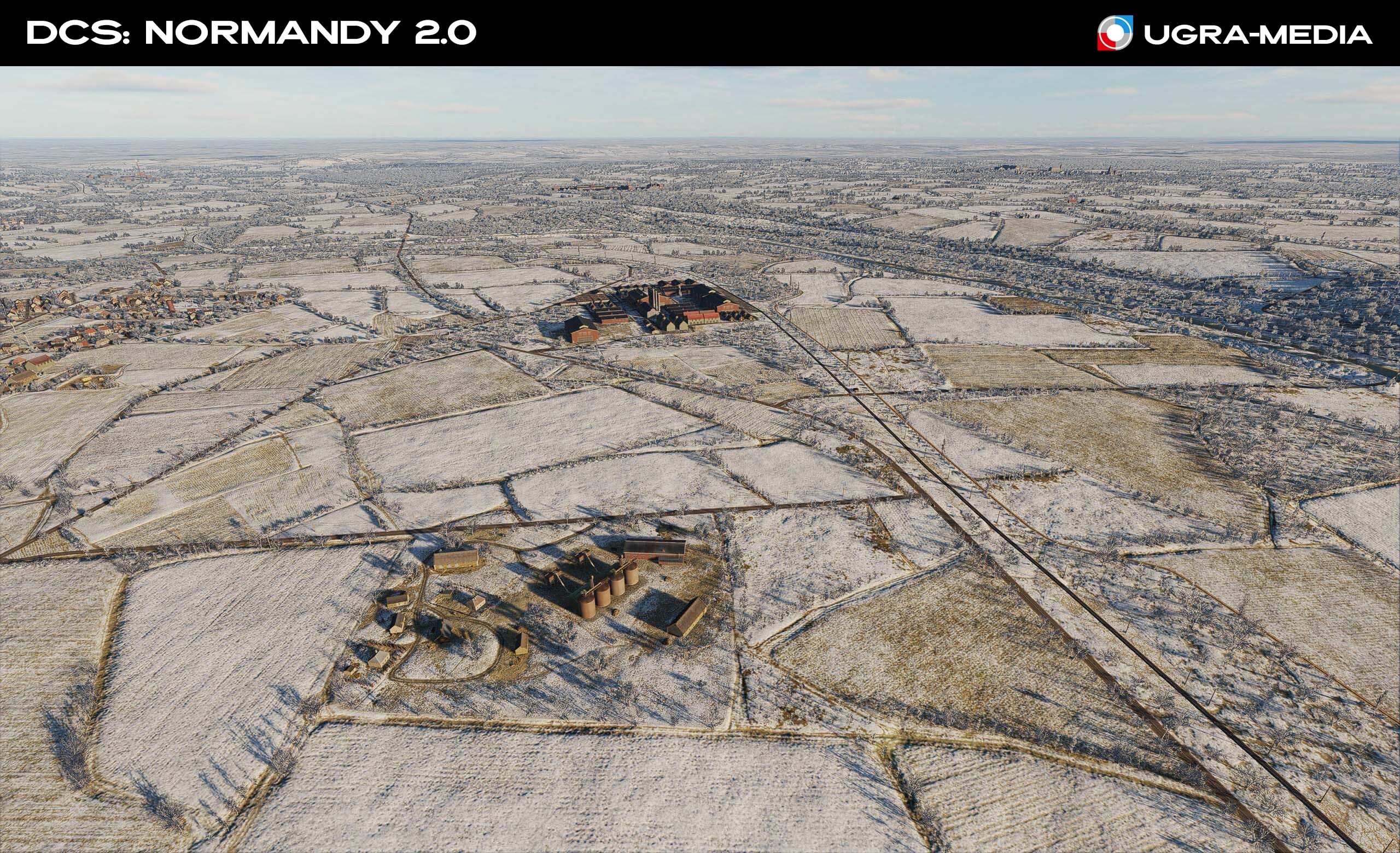
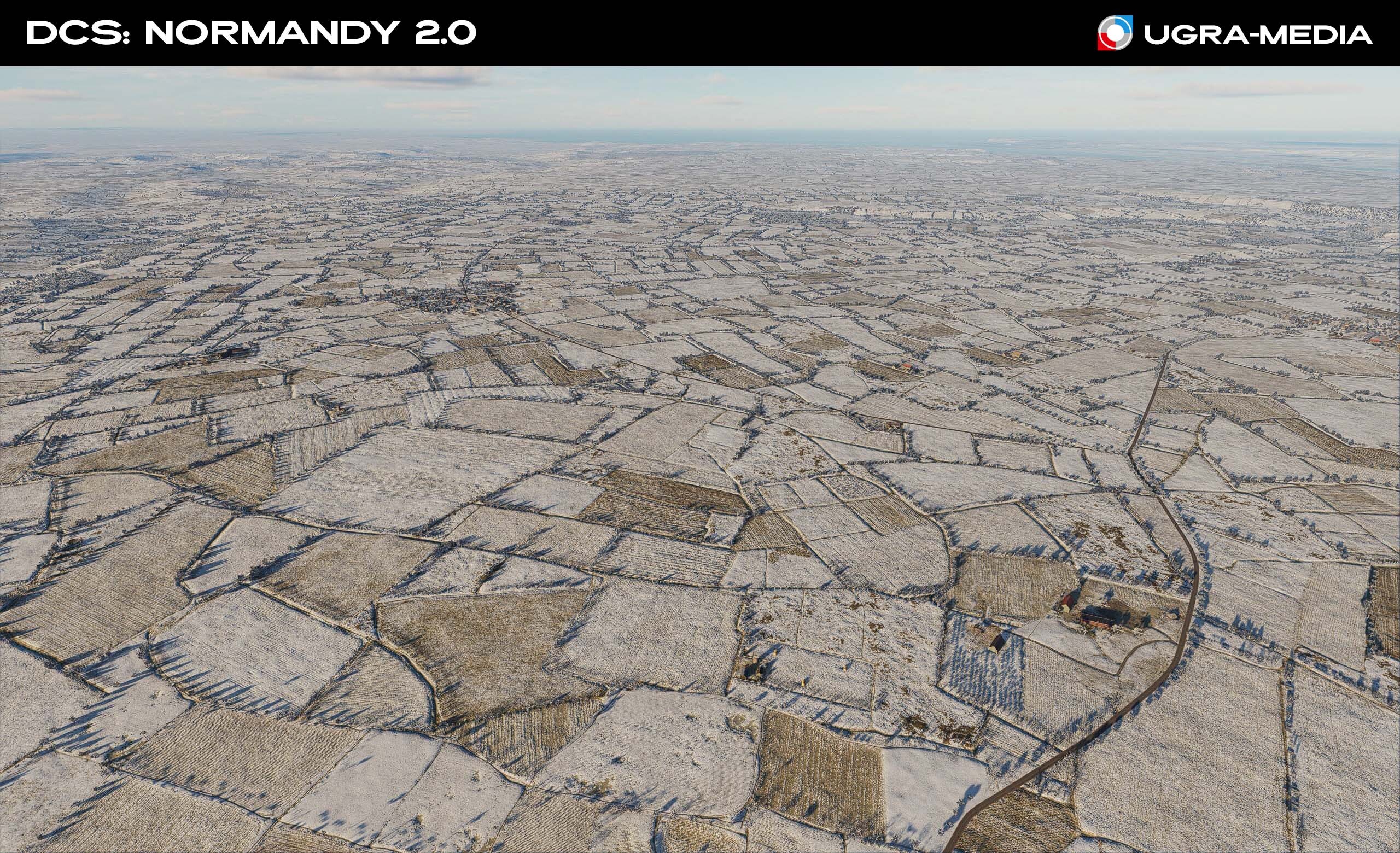
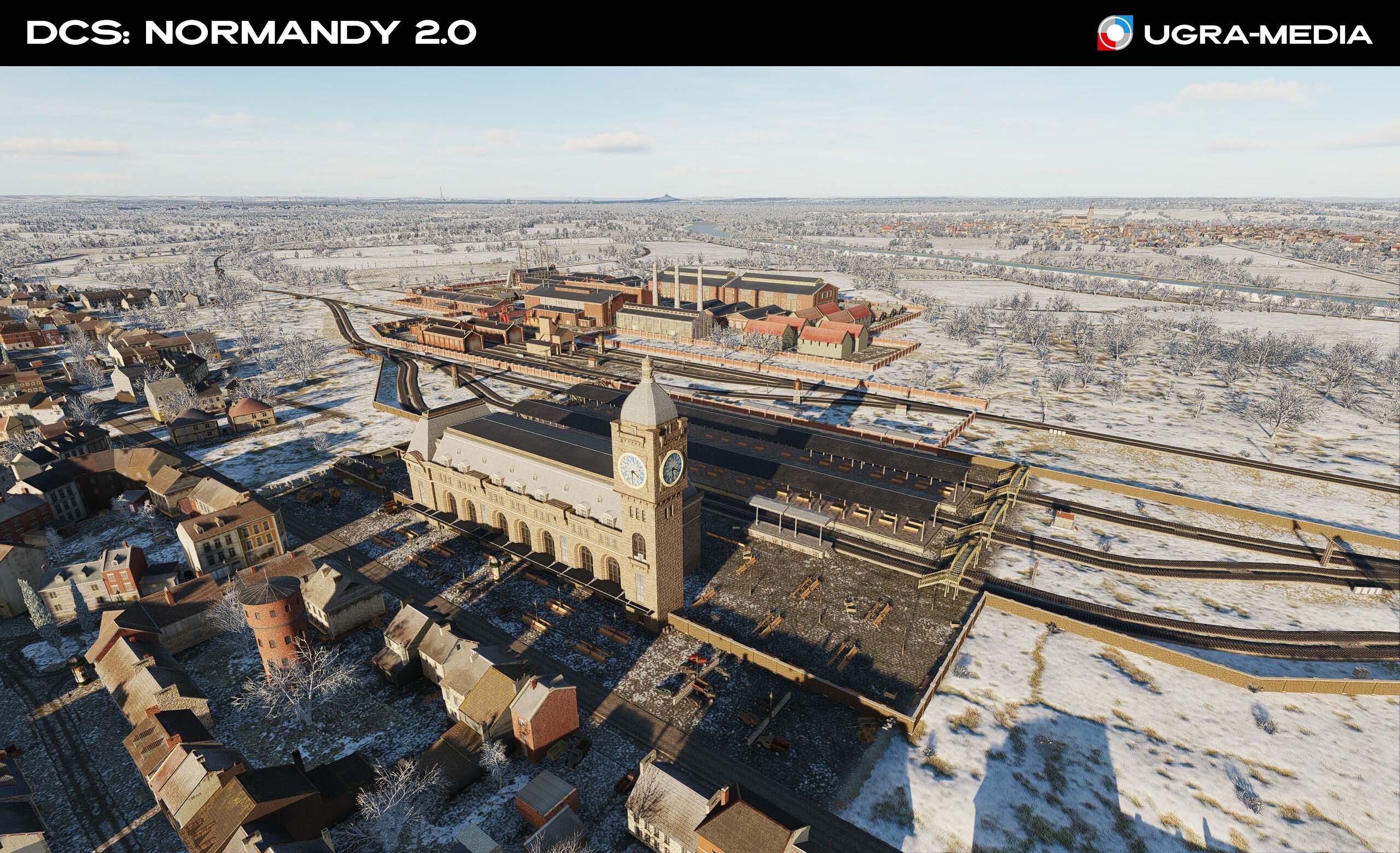
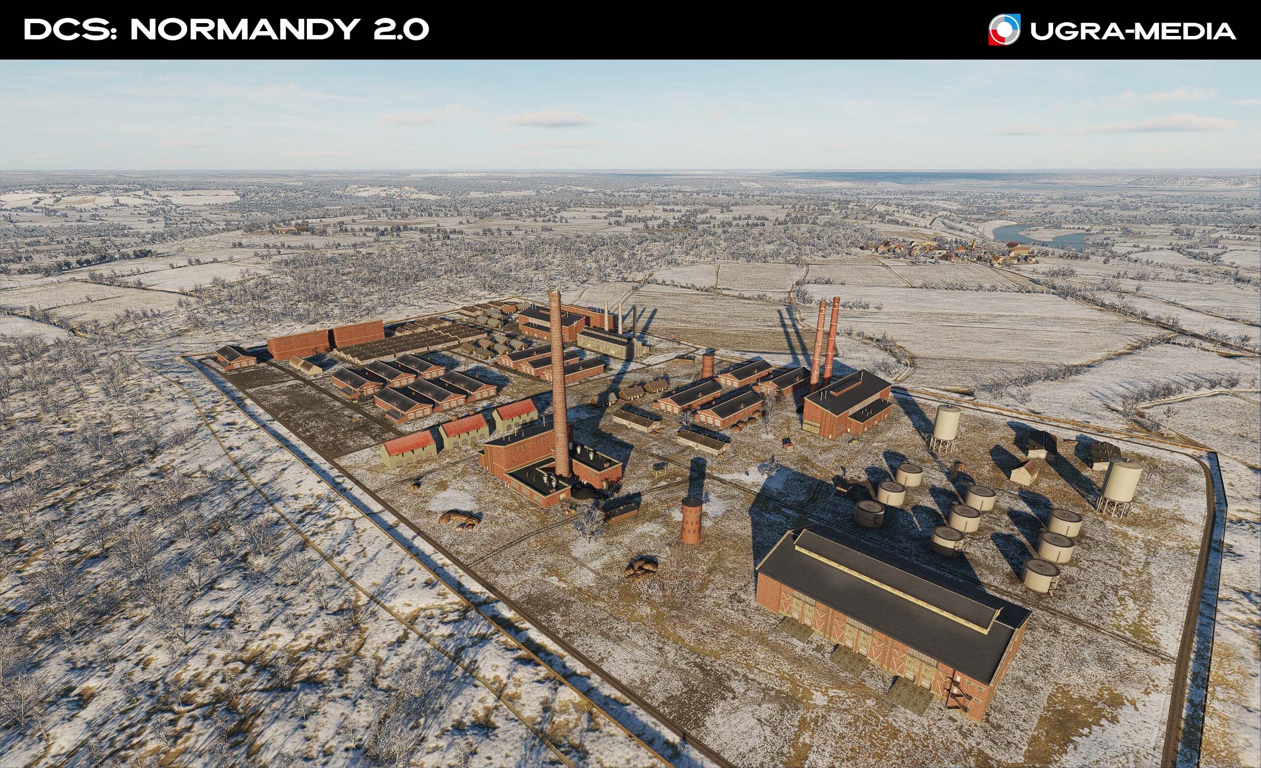
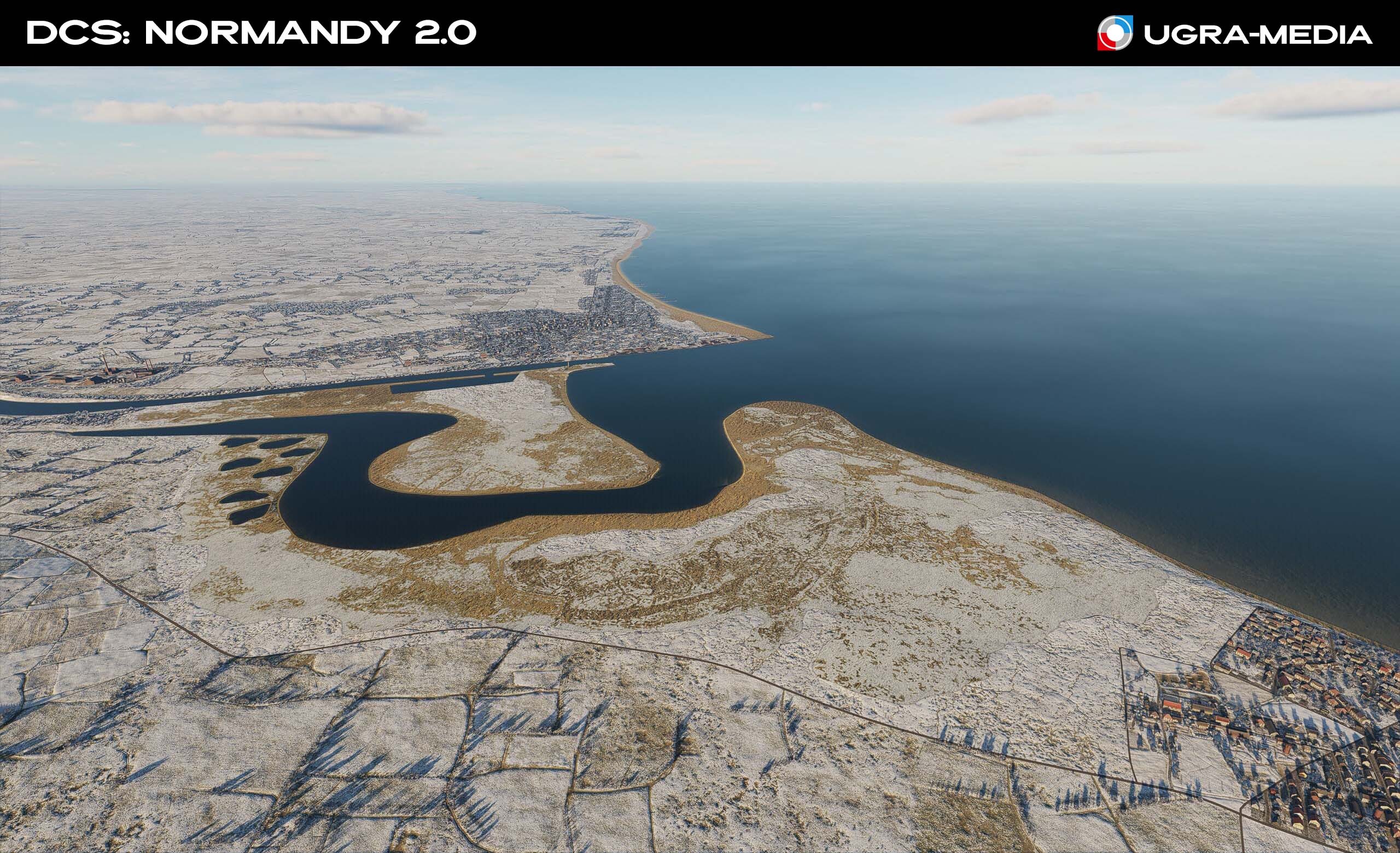
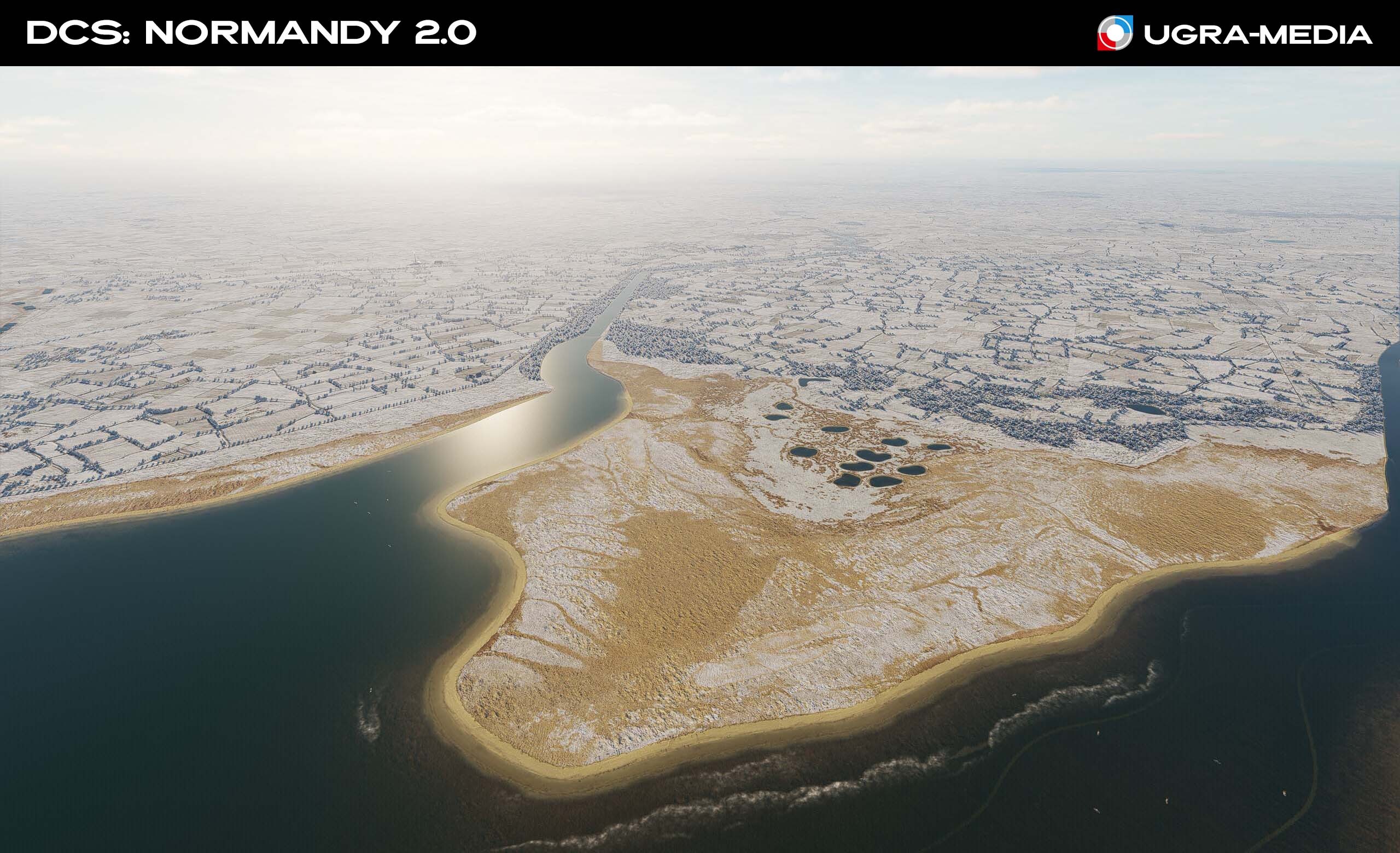
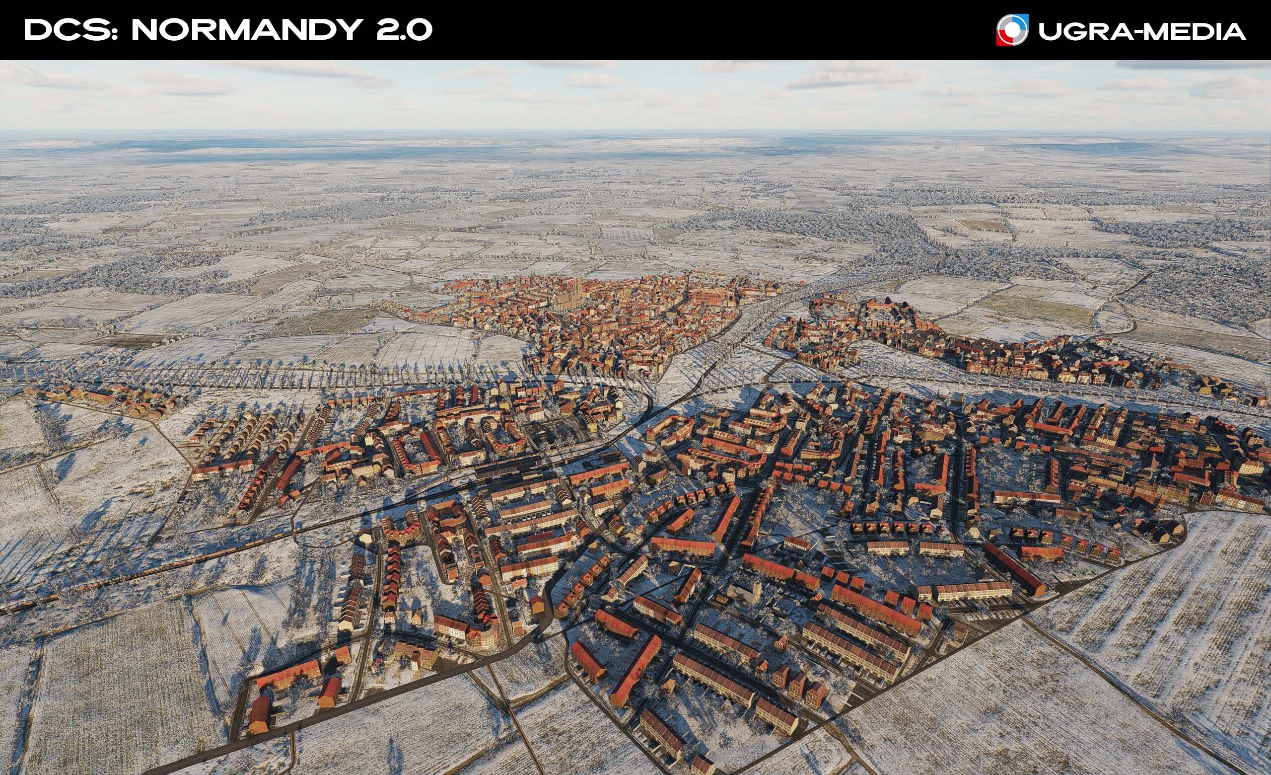
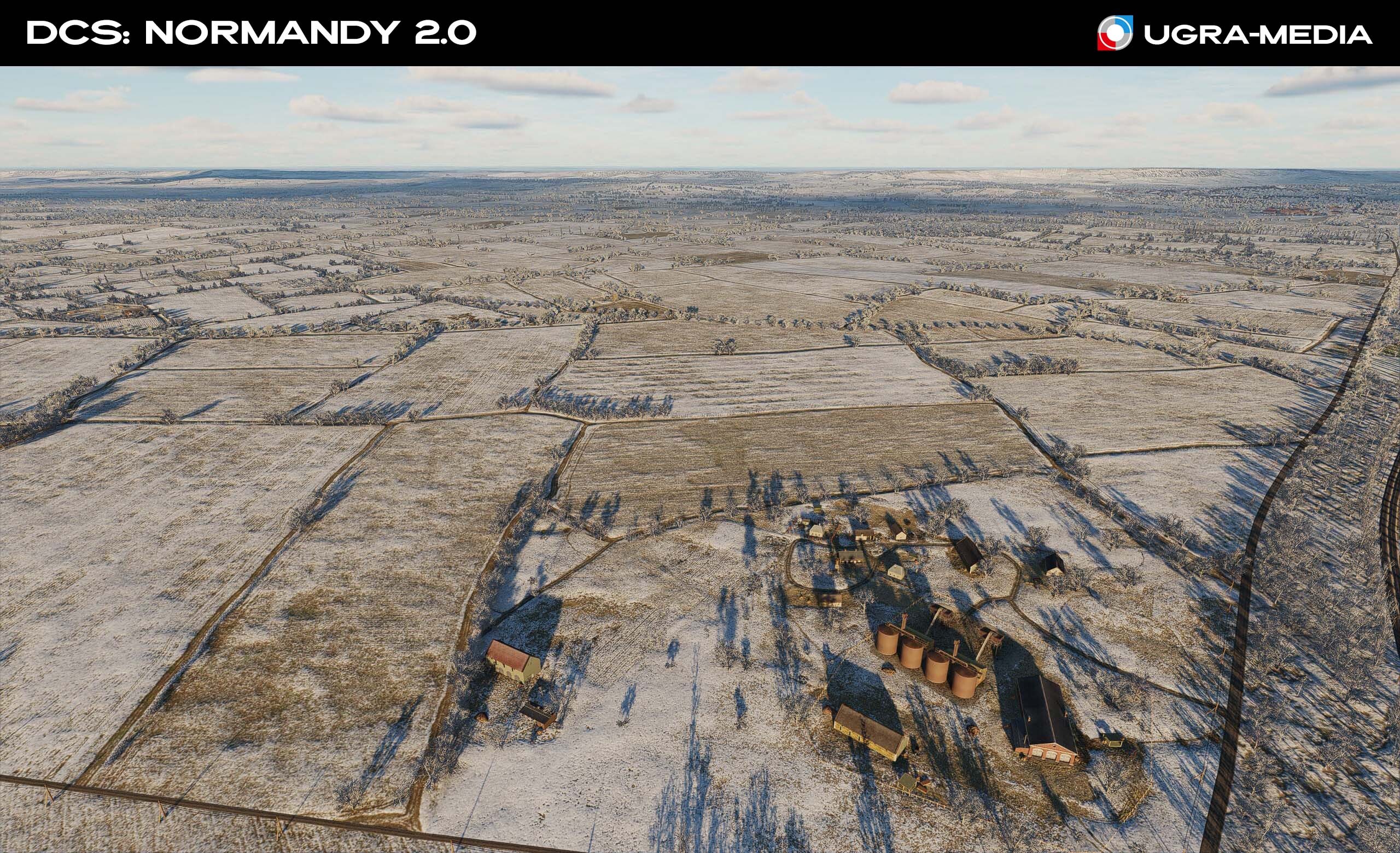
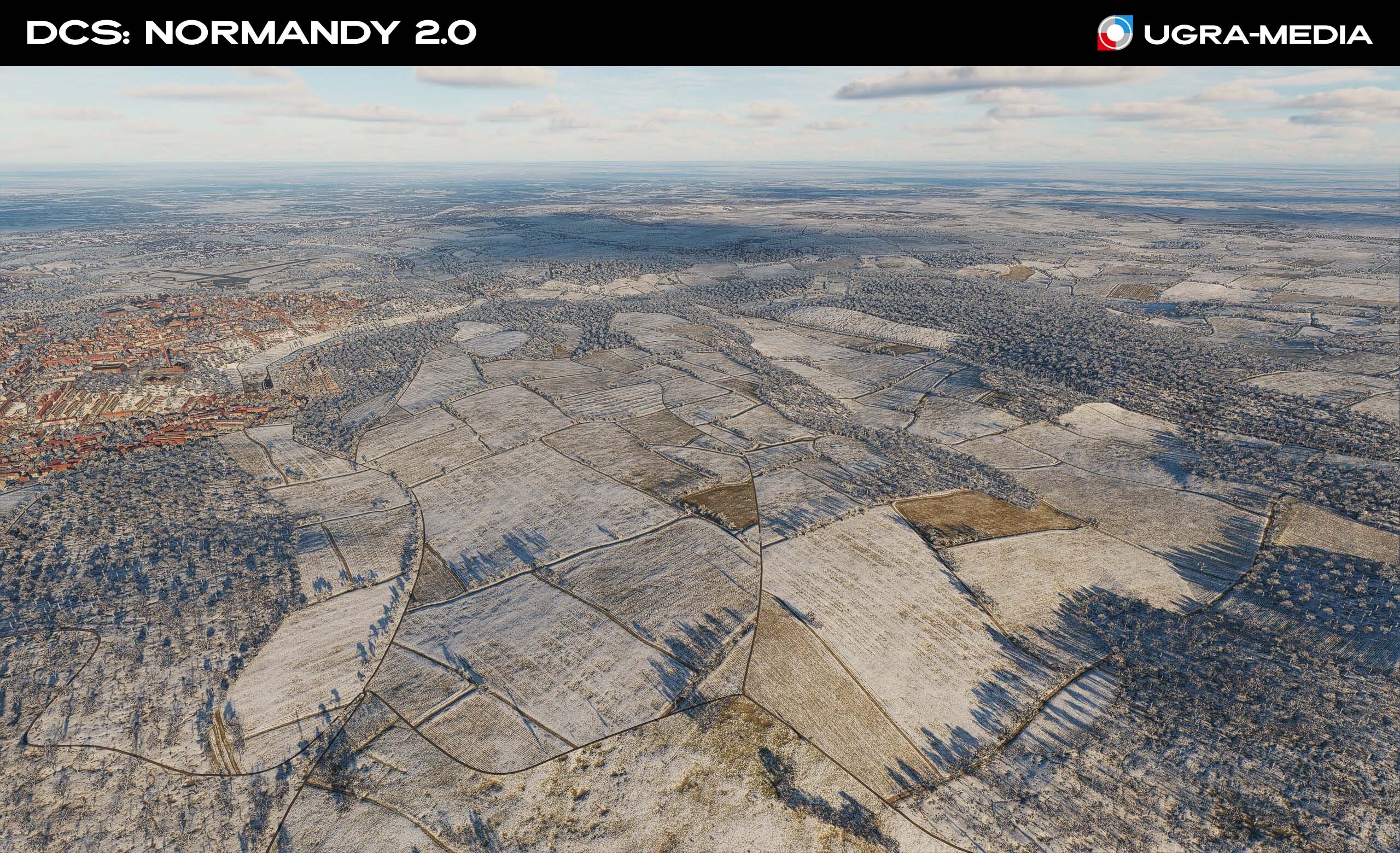
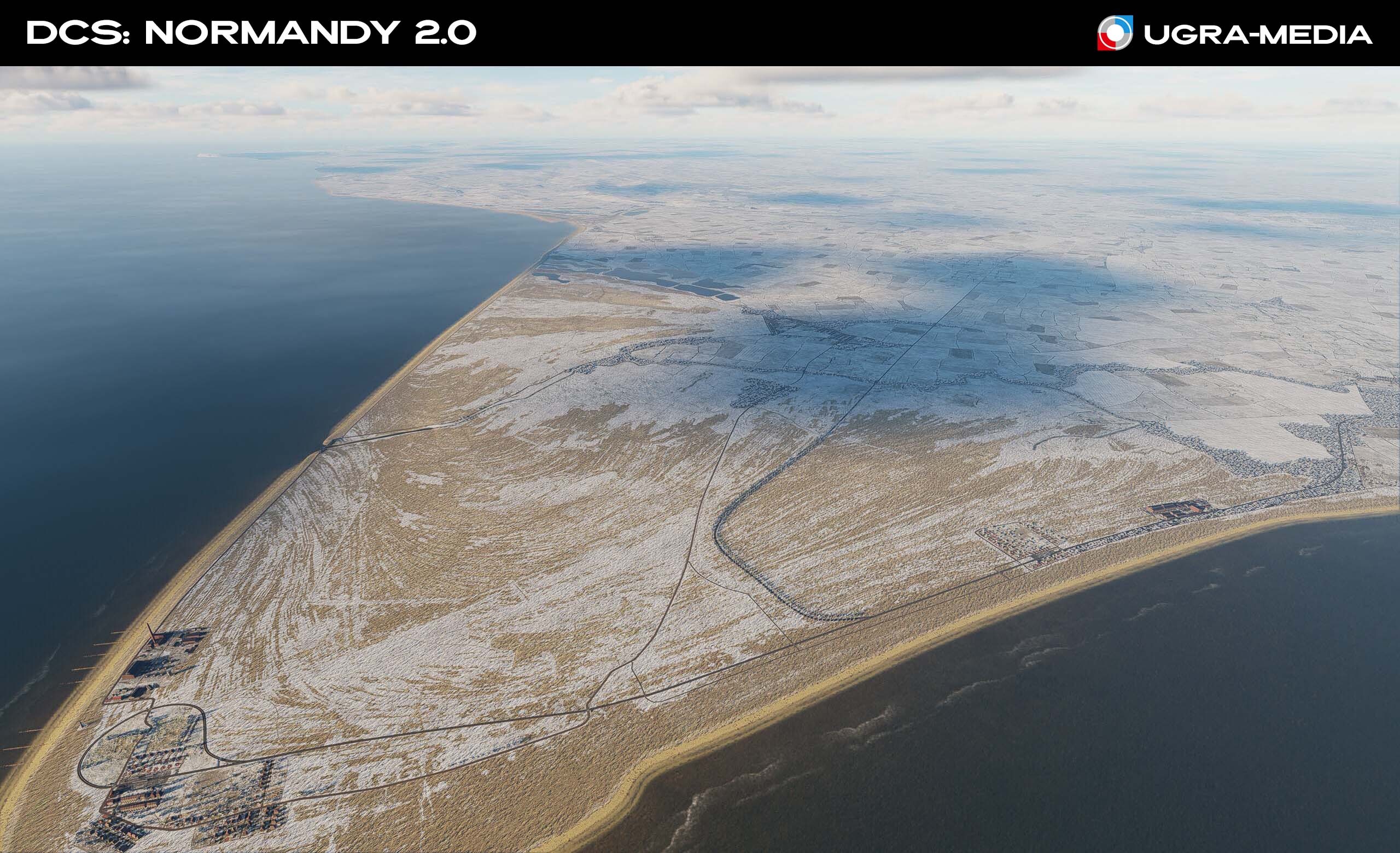
Hi, fighters! We have been steadily developing the Normandy 2 map for two years, and now it is time to announce a new major update - with a lot of new additions and improvements! We are proud to present a major update for DCS: Normandy 2, which will immerse you not only in the epicentre of great battles, but also in the rich historical heritage of Europe. Get ready for new tactical possibilities and incredible depth of visual embodiment! NEW SEASON: WINTER For the first time for the Normandy map! War knows no breaks, and now you will have to fight in harsh winter conditions. Snow-covered fields and airfields will create a completely new experience of piloting and navigation. Now you will be in conditions where you need to watch out for the enemy and for icing. Greenery is now hidden under a blanket of snow. A new atmosphere, new conditions for missions, it will be available soon. The Big Smoke and the "City of Light" under the snow Winter France Winter England
-
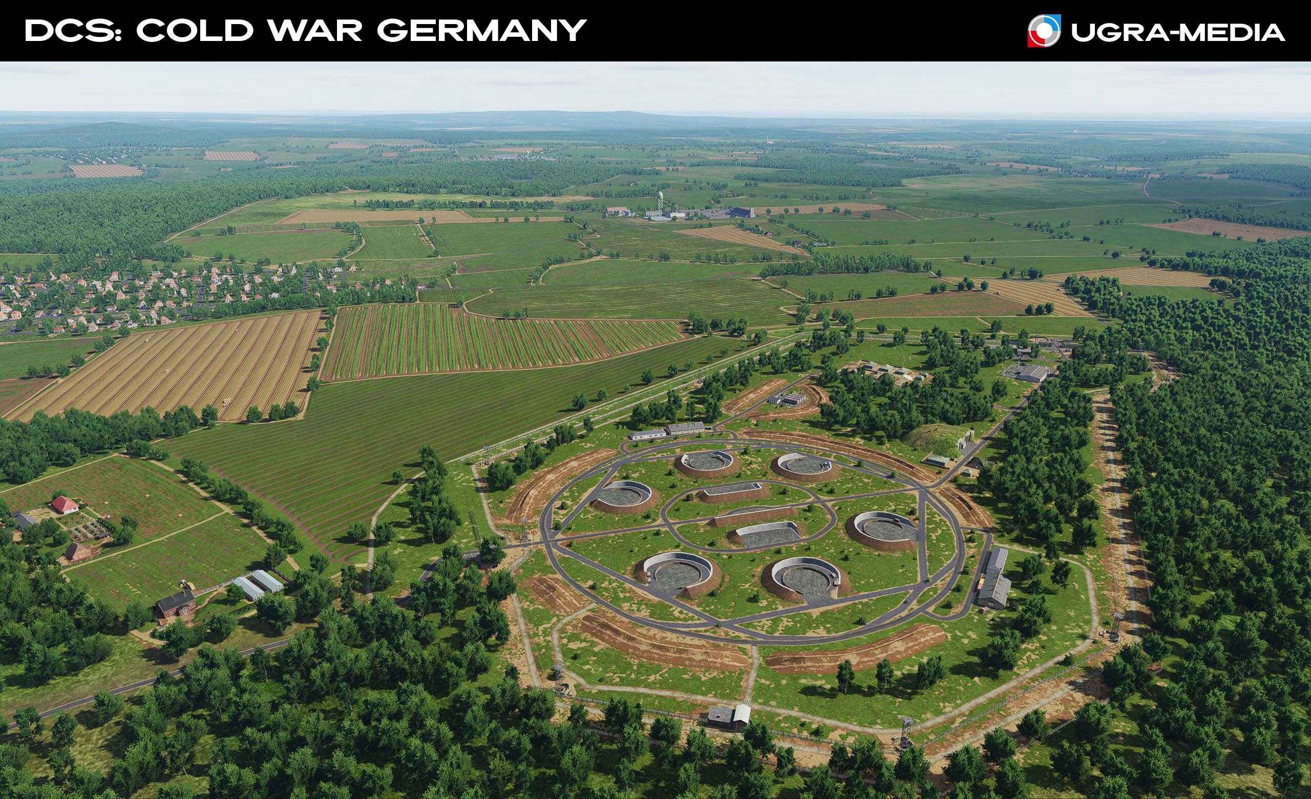
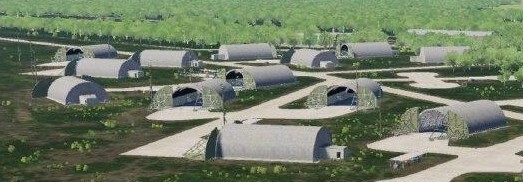
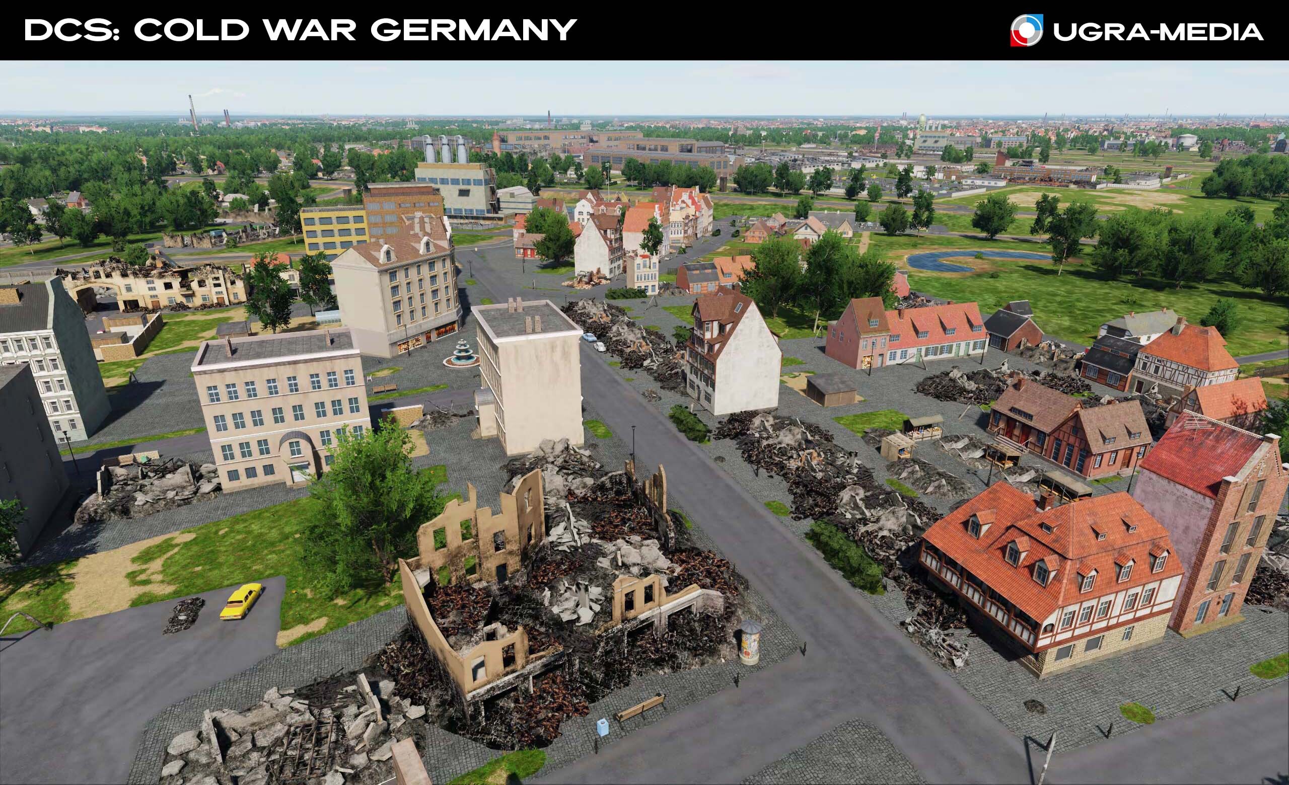
Hi We are currently actively working on Cold War Germany phase 2 and decided to find out your wishes in order to find original objects/locations that we can additionally include in the list and without which it is impossible to release phase 2. Your wishes for phase 1 were very valuable, hints from local residents, guys who served in the service were very informative. Based on them, we adjusted the list: airfields, hangar types and much more were added. The goal of this topic: to find objects that are most important for the map: they played a significant role in the Cold War, it can be a landmark for navigation (antennas, towers, etc.), quarries without which the territory does not look like itself, a warehouse or a base. Or maybe some landmark without which the city loses its appearance? The idea with the city of Mannheim and “Kalimandscharo” seemed interesting to us. If you previously wrote wishes, you can duplicate the link to the topic. Let me remind you that we are looking at the entire Wishlist section, and in this topic we want to collect what you think is necessary to release Phase 2, and based on the responses and likes we will determine what to do first.
- 72 replies
-
- 22
-
-
-
Hi! We made helipads to give helicopter pilots the opportunity to feel not as guests on the map, but as if they were at home. This feature is not provided by the engine, so there are a lot of helipad icons on the map. We can convert helipads into regular places without parking places and add H icons on the map. What we see as a disadvantage: in the mission editor you will not be able to use "takeoff from parking hot" and "takeoff from ramp". You will only be able to use "takeoff from ground" What do you think about this?
-
We will check. If it is not fixed in this patch, yes, please write.
-
Hi fighters HotFix has been delayed, but it will be on your computers soon. We have received amazing feedback from you. We have tried to fix everything we saw and even more. If you created a topic in the bugs section and your problem was solved - write about it, because we read it. Check the ILS, RSBN for interference - everything should work. So let's look at the list: - RAM and video memory usage has been reduced - optimized traffic: the amount of harvester traffic is reduced, vehicle traffic is shifted to cities and airfields - fixed normals on road intersection textures - corrected errors in frequencies and beacon locations: Briest RSBN is set to terrain, added Mendig NDB 331.0 NMN, Tempelhof VOR/DME changed to VORTAC, added Kirn VORTAC 117.5 KIR ch 122, added Solling NDB 374.5 SOG - corrected errors in taxiways of the following airfields: Allstedt, Bitburg, Bremen, Hahn, Hannover, Merseburg, Neubrandenburg, Neuruppin, Peenemunde, Pferdsfeld, Ramstein, Schonefeld, Schweinfurt, Sembach, Spangdahlem, Stendal, Tegel, Tempelhof, Tutow. - Ramstein taxiway signage corrected - removed trees on helipads: H_GDR_34, H_FRG_46, H_FRG_51 - color correction of airfield ground textures: Bitburg, Buckeburg, Frankfurt, Finow, Giebelstadt, Gutersloh, Holzdorf, Ramstein, Sembach, Spangdahlem, Werneuchen - fixed bugs in models - disabled unused models and textures - increased height of tank bridge on ranges - added straight electric wires on poles along streetcar and railroad tracks - added marine passenger ship in the scenes of ports and traffic - corrected incorrect display of icons and names on the map - added markings of air defense points, radars and hospitals on the map - improved image quality for the main menu
- 169 replies
-
- 18
-
-
Hi We had a hotfix ready for the next day after release on navigation aids, but its release is delayed. Also in DCS World the algorithm of RSBN operation has changed, we initially had channels assigned, but then we reworked them by analogy with Kavkaz: the beacon needs to specify the frequency 8XX, where XX is the RSBN channel. Now again there is work to clarify the operation of RSBN.
-

Tempelhof and Schonefeld main runway switch please
MAESTR0 replied to grim_reaper68's topic in DCS: Cold War Germany
Hi Write how it will work after the update, because I see that it is assigned as you ask: in Schönefeld 1#25L and 2#25R in Tempelhof: 1#09R and 2#09L I indicated the main courses and numbers for these runways. 1# and 2# are the runway numbers. So in Schönefeld the first runway is 25L/07R with the main course 25L -
Hi Try testing again. I see two runways in Headcorn: 1: 18-36 2: 09-27 The main directions for these runways are "18" and "09". It is unclear why the controller gives such a direction in calm weather. But everything is correct with the wind: With a wind of 286, the controller will give runway 09. On takeoff/landing, the wind should be headwind Please write the test results.
-
Hardened Aircraft Shelters and Bunkers Strenght
MAESTR0 replied to MBot's topic in Bugs and Problems
@MBot Thanks for the info, the shelters will be stronger. -
A different type of shelter was installed on the western part of the airfield. This has now been fixed. Soon you will be able to start flying the A-10 in a shelter without getting wet in the rain. Developer's night screenshot: In the meantime, your squadron is being transferred to Sembach.
- 25 replies
-
- 24
-
-
-
DCS: Cold War Germany is now available! YES! The line between peace and war is erased. Now your sky, your rules. DCS: COLDWaR is not just a map, but a living, breathing world of the era when the whole world was on the brink. Now it is a home for your flights. We tried to show everything in a month, but you still have something to see. We read your comments and saw those who wrote that they wanted Germany during the Cold War period as their next project, when no one knew about it yet. And we were happy, because we knew that this dream would come true. THANK YOU for watching, prompting and dreaming with us. Now we will enjoy and develop this map together. This project is for you! P.S. Remember our flights through cranes, docks, car factories. Find them all! ) BUY HERE https://www.digitalcombatsimulator.com/en/shop/terrains/germany_cold_war_terrain/ Fighters, man your planes!
- 489 replies
-
- 23
-
-
-
absolutely right. We updated the information in the first post: Phase 1 - 110 Gb, total size, including Phase 3 - 205Gb
- 169 replies
-
- 14
-
-
-
1. What are the system requirements - We recommend 32 GB of system RAM and 8 GB of VRAM 2. How much disk space is required? - 205Gb (Phase 1 - 110 Gb) 3. How much does DCS: Cold War Germany cost? - $55.99 USD at early access release and then later $69.99 USD at final release with all three phases. 4. How will the map be sold, as a whole or in parts? - The Cold War map will be released in phases, with each phase adding more terrain, airfields, cities and other features. Three phases in total are planned. The map will only be sold as the entire map. 5. What are the dimensions of the map? - 980 x 800 km 6. Will assets be released and when? - We have received many such requests. Ugra-Media will do everything possible to release a Cold War Germany assets pack with objects and equipment following the release of Phase 3. 7. Why are there static objects on the map if I can place them myself? - We were guided by the interests of the users. First, we did it for the sake of performance and FPS, and this is the best solution. You immediately get a polished product that allows you to fly without additional work in the Mission Editor. The world is already filled with life and details, but at the same time, free spaces are left open for your creativity; you can add your own objects without interfering with the rest of the map. 8. When will the seasons be released? - Autumn and Spring will be released with Phase 2. and Winter will come with Phase 3 9. Will there be destructible buildings? - Yes, most buildings have destruction models. Traditionally, this does not apply to original objects. 10. Will there be RSBN beacons on the maps? - Yes, East German airbases are already equipped with RSBN beacons. 11. Will you make SAM sites? - 40 SAM sites have been placed on the map, and some air bases include prepared SAM sites. 12. What airfields will be on the map? Full details on Phase 1 here (Cold War Germany Phase 1 Airfields and Bases) Phase 1 (59 airfields) @Hidden list@ Helicopter bases 4 and a lot of helipads: Airfields for small aircraft (27) : Phase 2 (10 airfields): Phase 3 (51 airfields): 13. Where can I see the progress of development? Here is our topic where we post information about the map, screenshots and videos:
- 169 replies
-
- 51
-
-
-
Hallo! Wie geht's? Ja, RSBN ist auf der Karte. We are creating this map so that you can immerse yourself in the atmosphere of the Cold War, which could become Hot at any moment. So that you can feel the adrenaline - when your MiG-21 flies low over the Berlin Wall, and the F-4 pursues you in the clouds. And beauty - when the sunset over Ramstein paints the tower in crimson tones, and it seems that time has stood still. The Cold War is an era when the whole world held its breath. Where every flight could be the last, and any mistake could rewrite history. But DCS: Cold War is not only war. It is a world of adventures where you can: Arrange air races between the skyscrapers of Frankfurt, in the seaport or at the car factory. Take a helicopter tour along the Rhine. Take part in tank exercises. Just relax at a small airfield, listening to the noise of the propeller and the radio broadcast of the 1980s. Mi-24 flies through the dock - because in COLDWaR even the laws of physics obey your courage! See you in the sky... in the sky of the Cold War. Kannst du es wiederholen?
- 489 replies
-
- 25
-
-
-
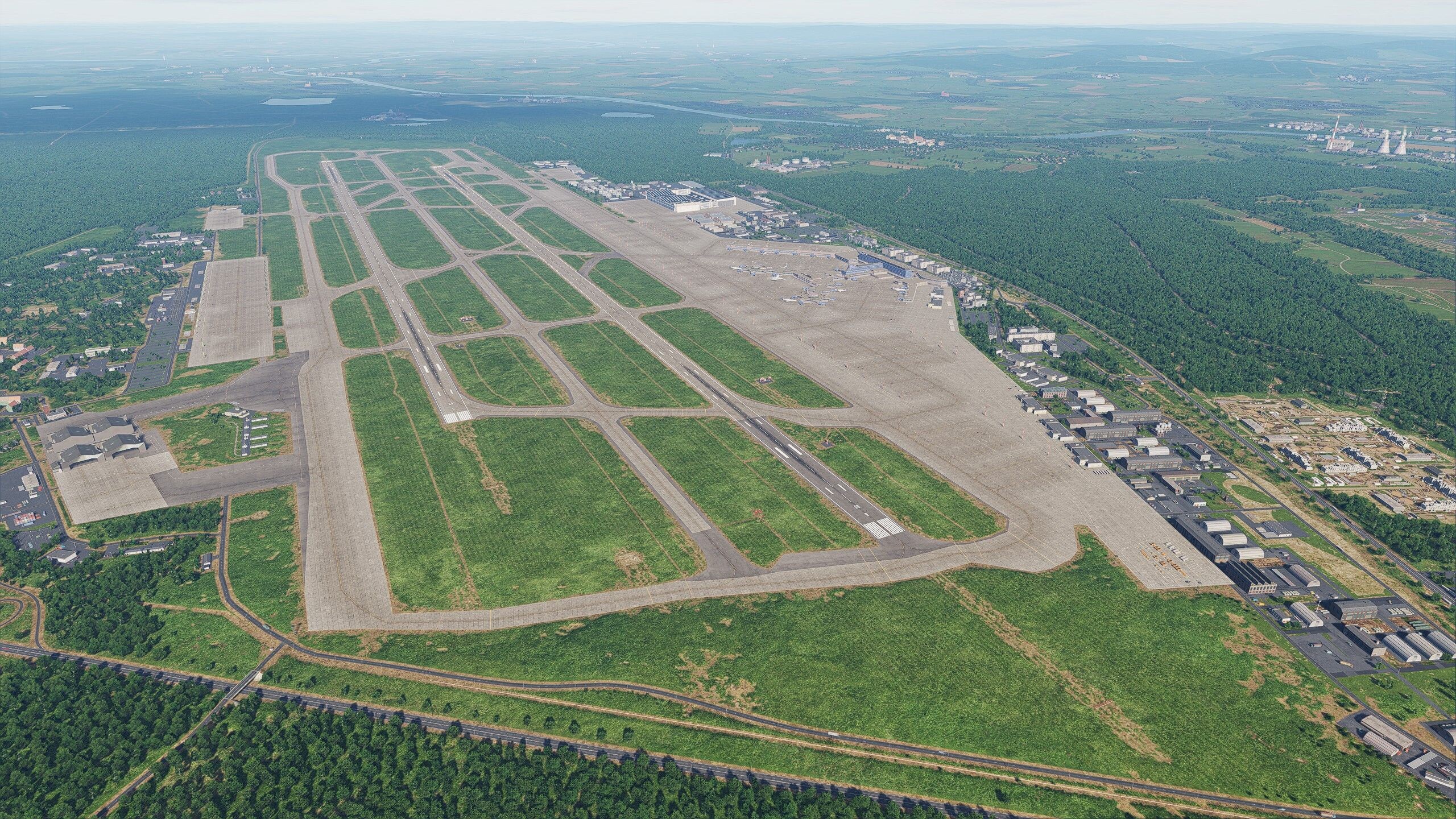
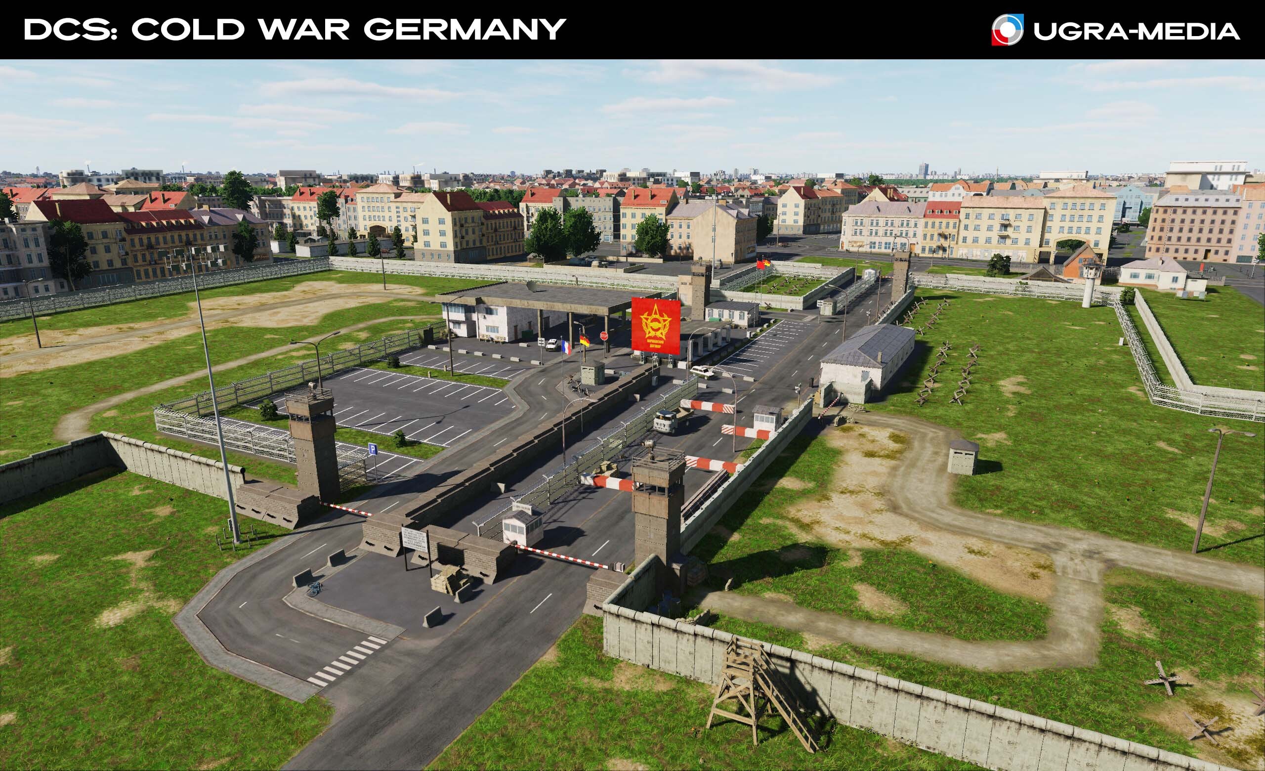
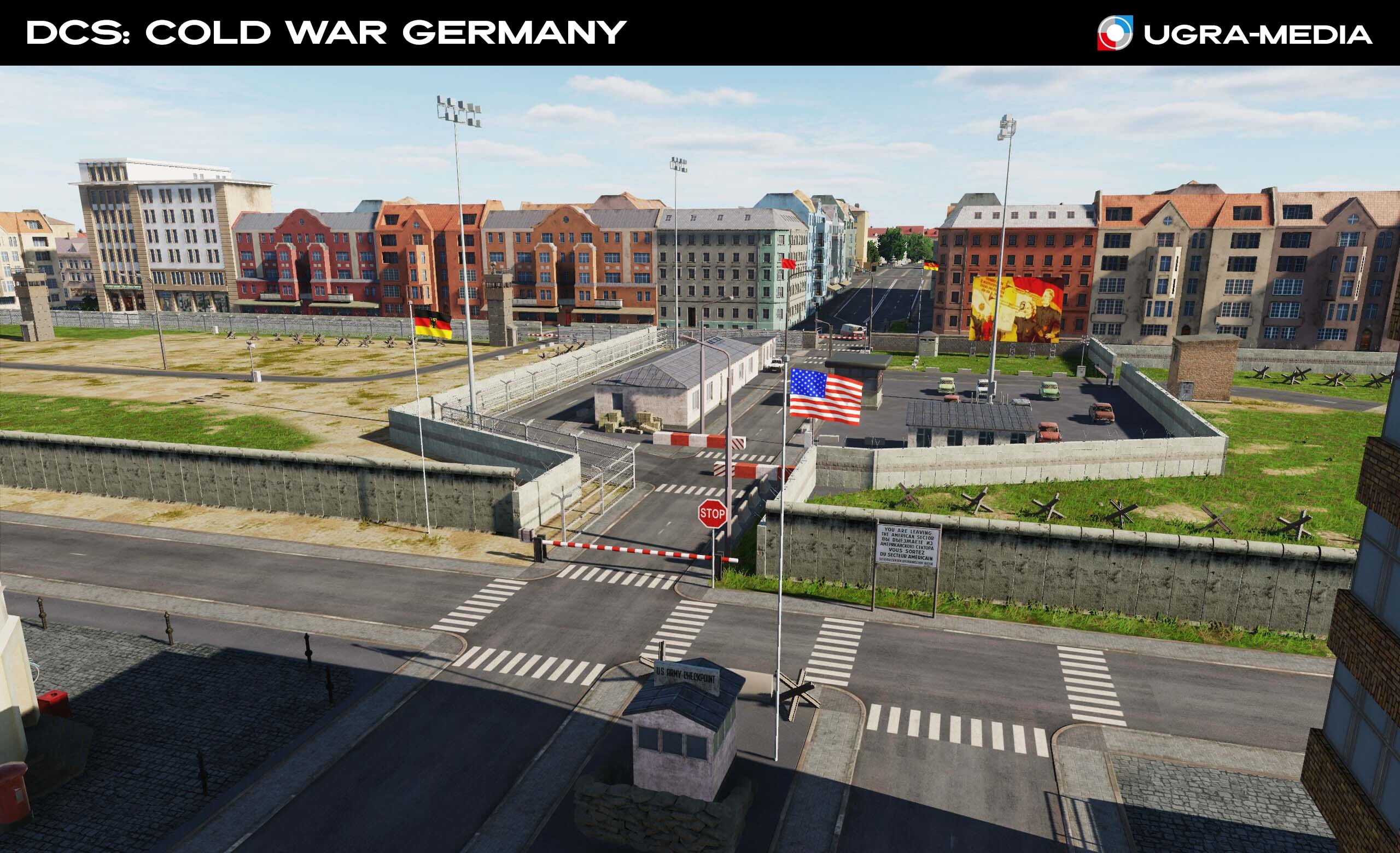
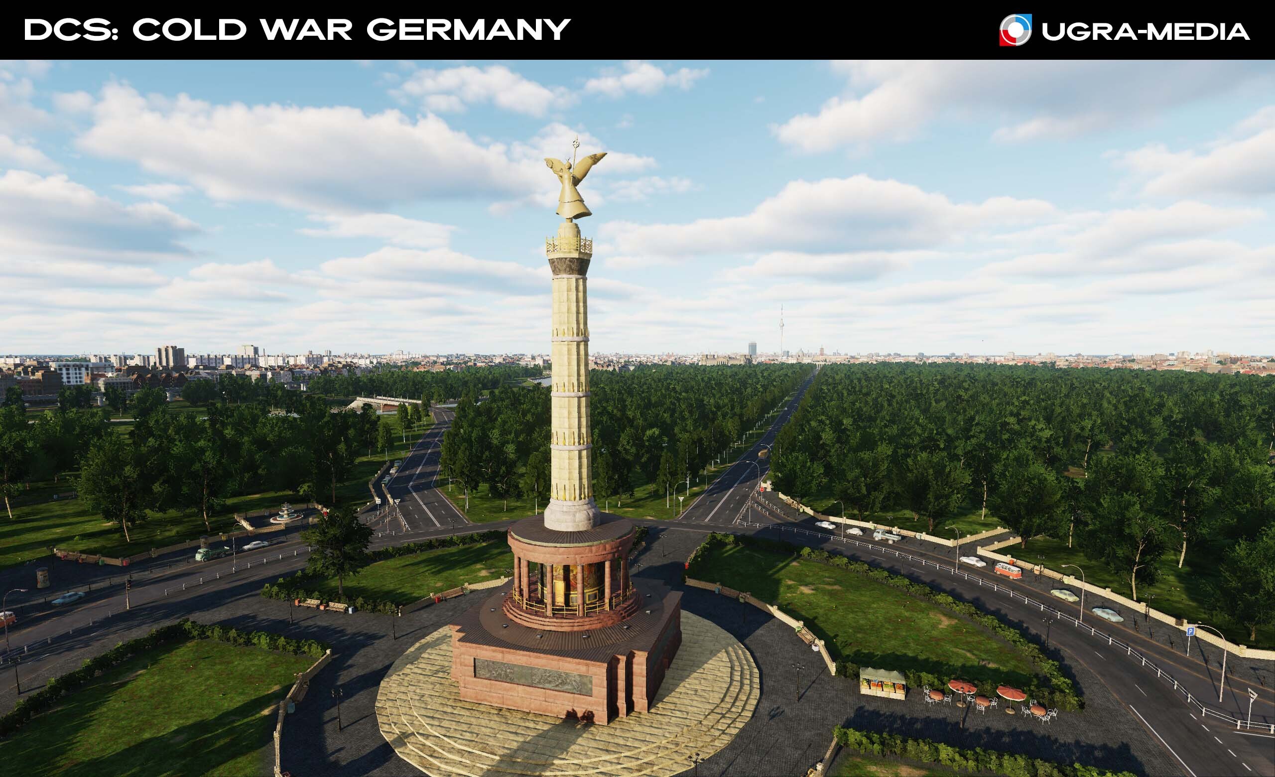
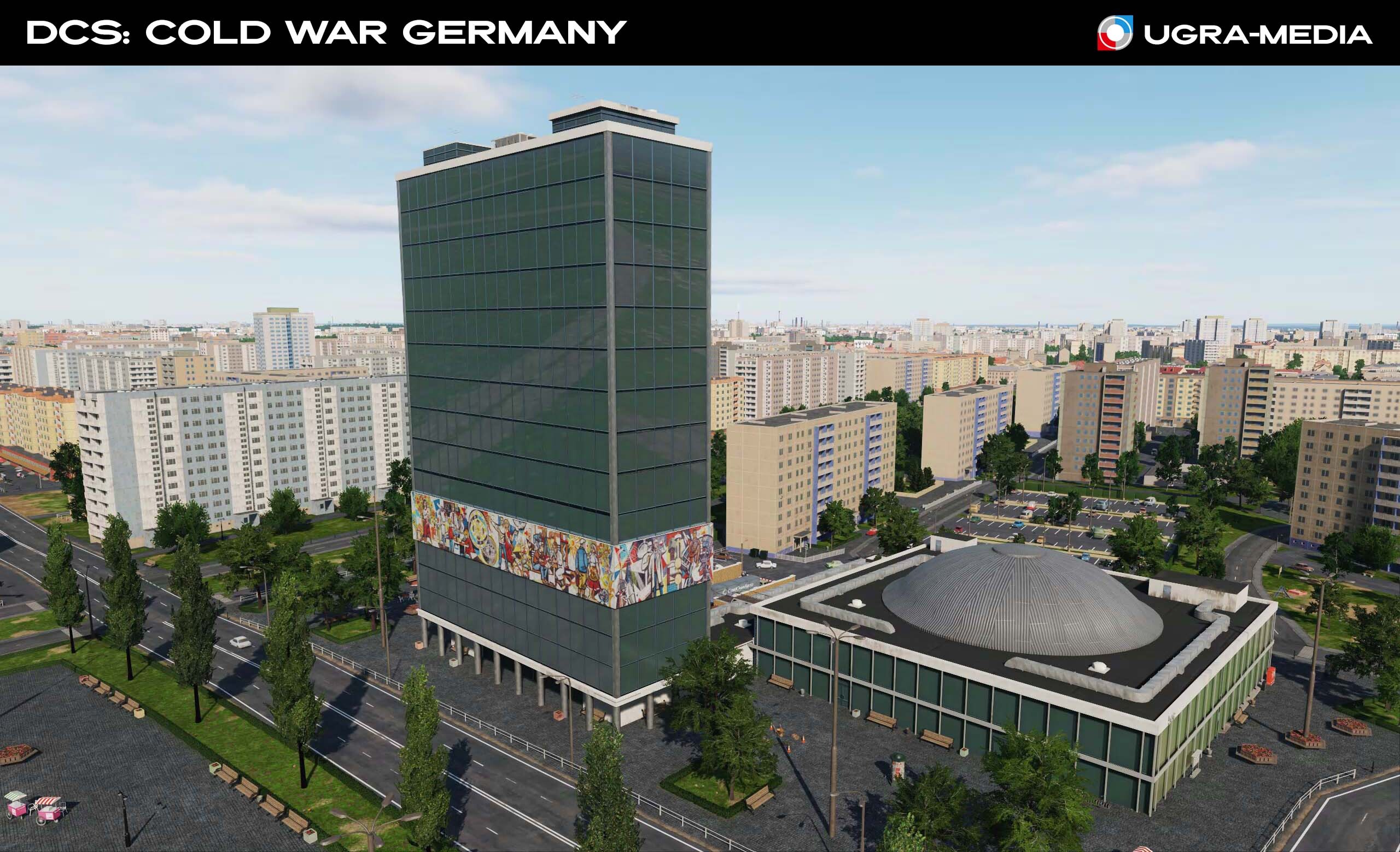
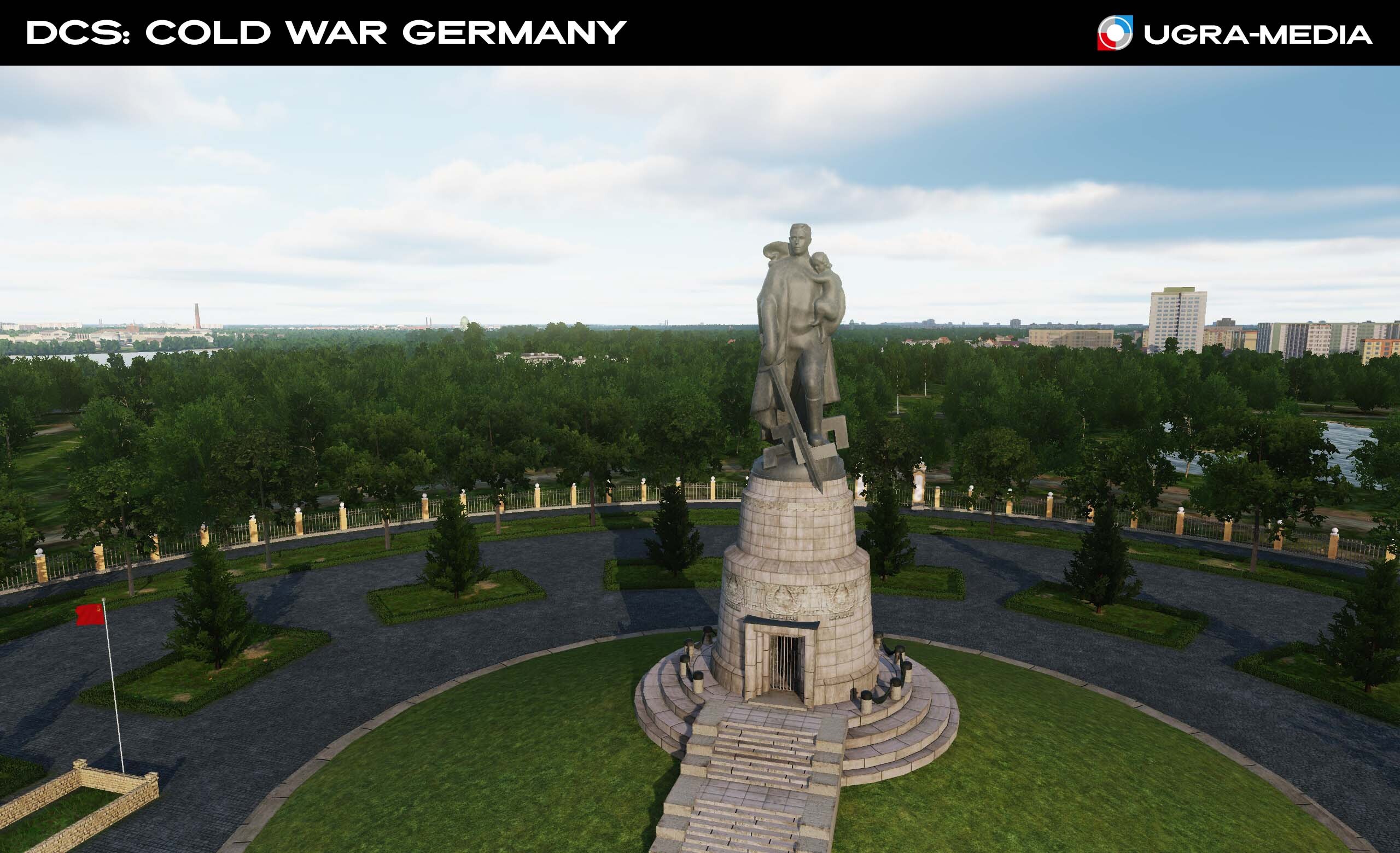
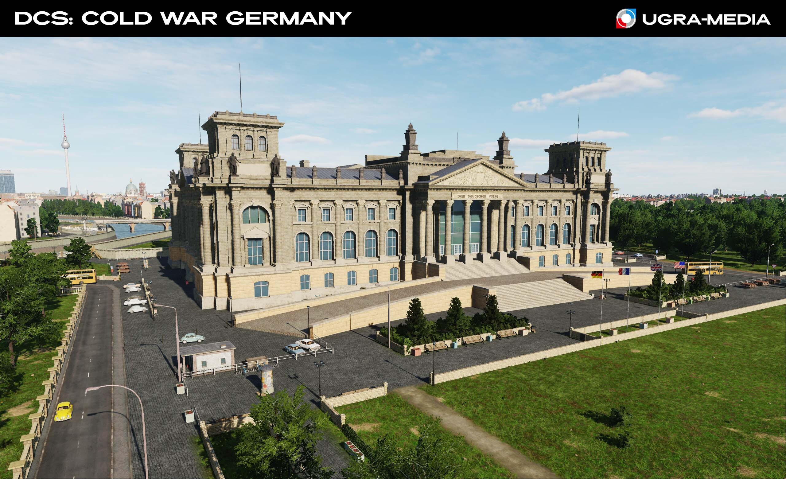
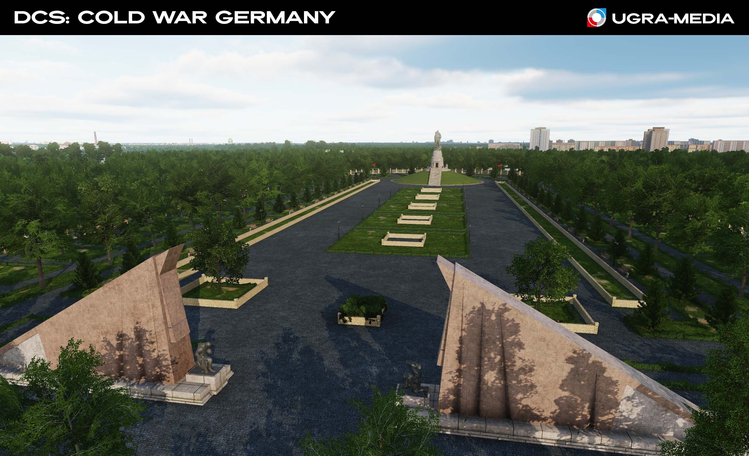
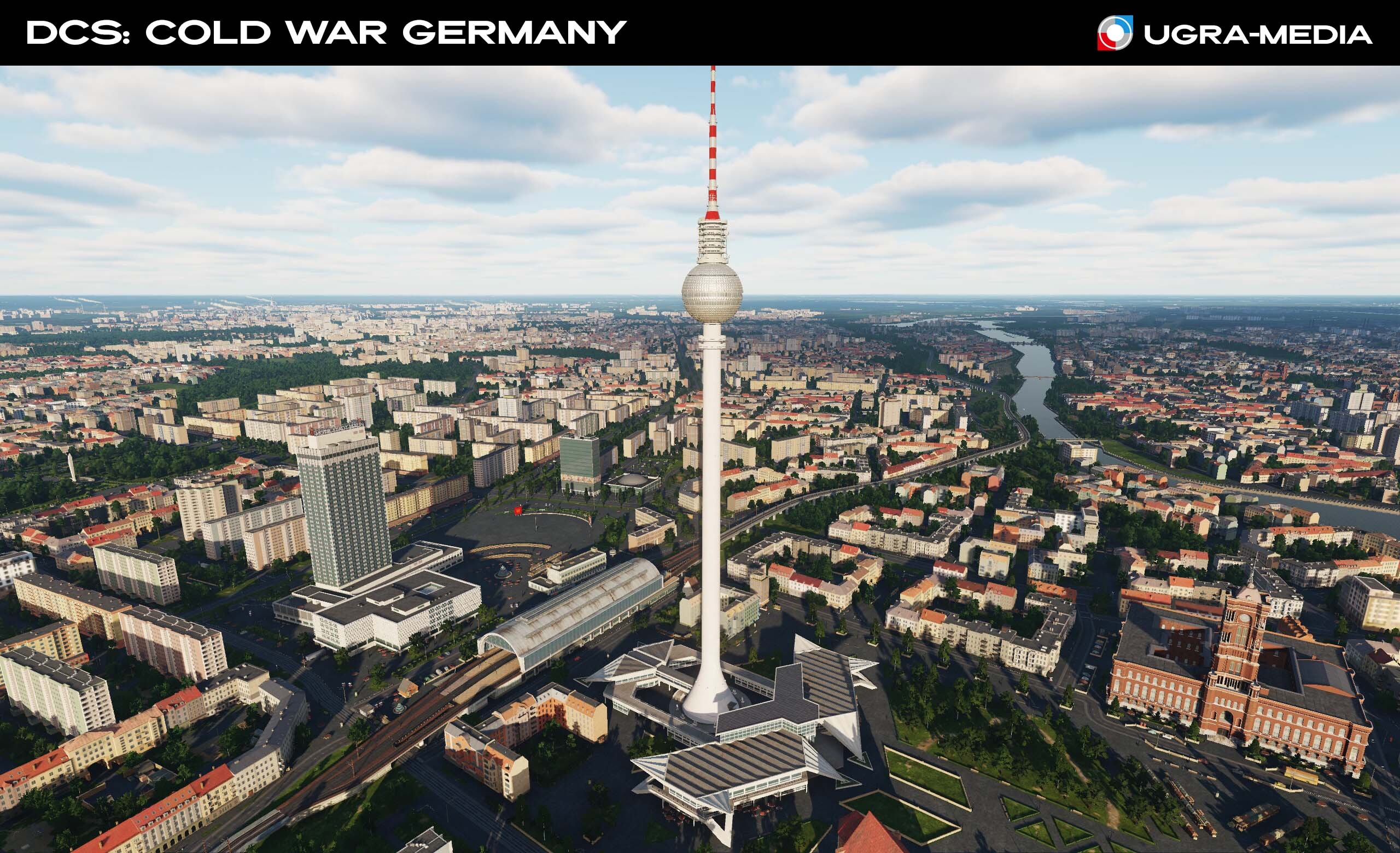
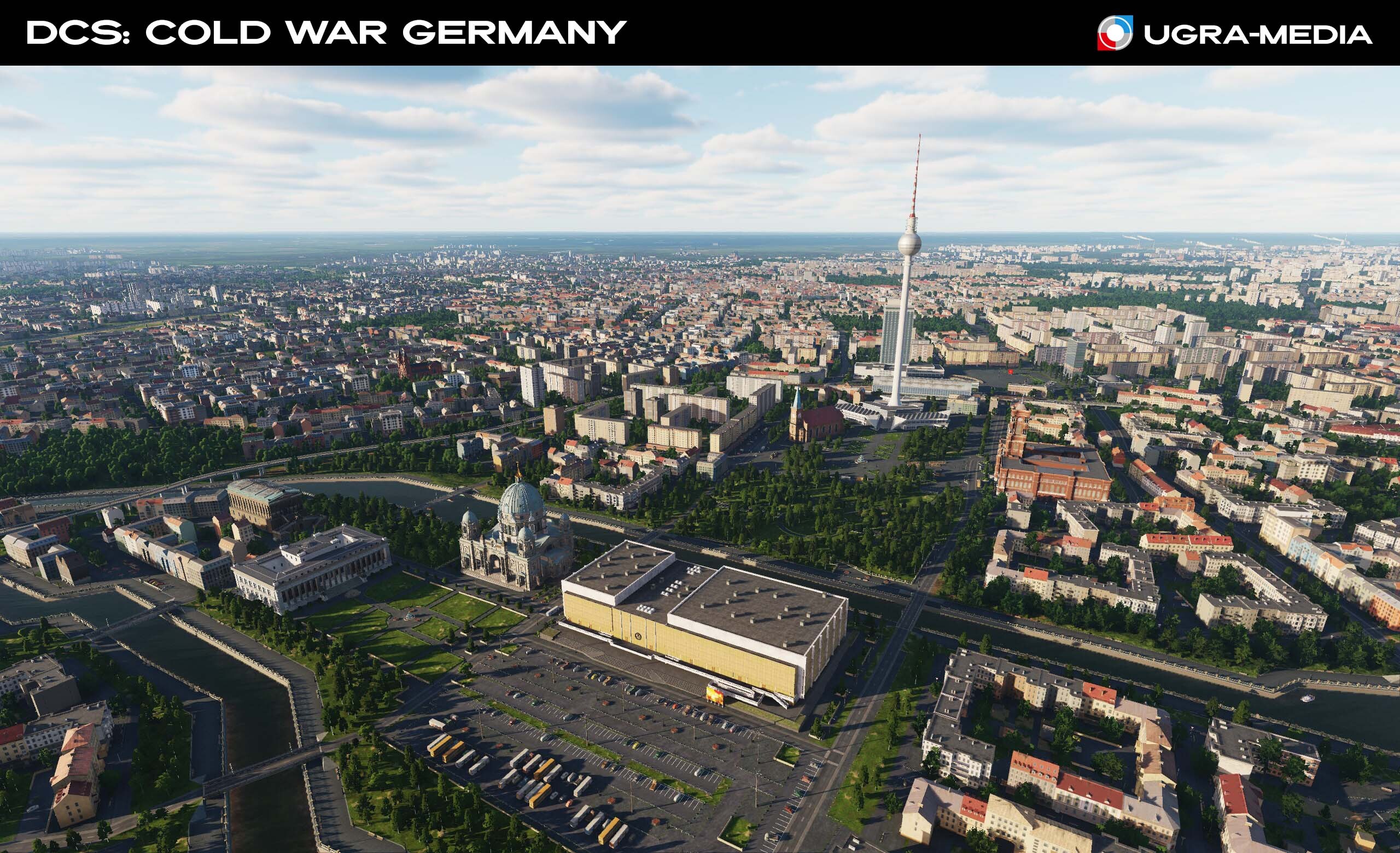
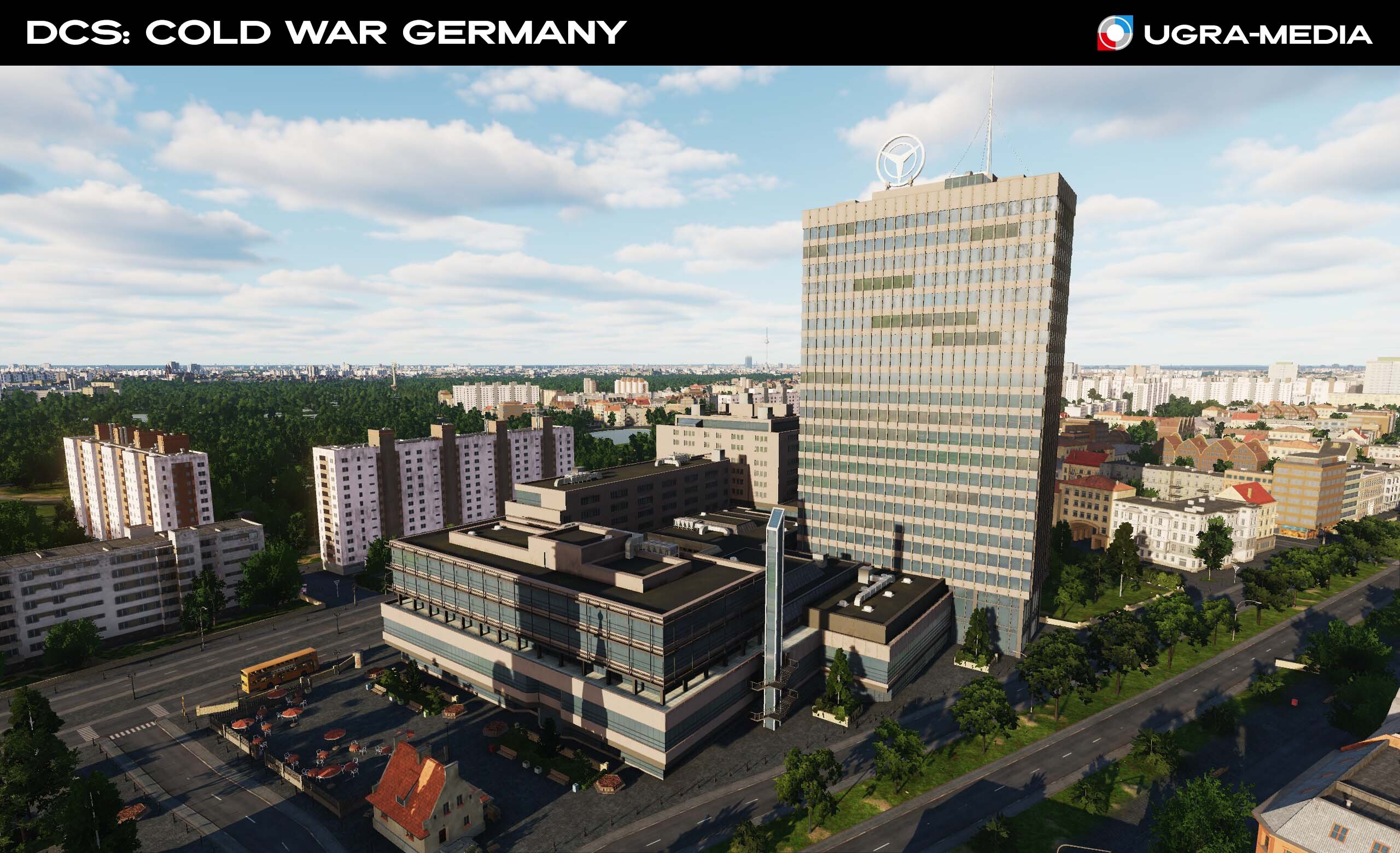
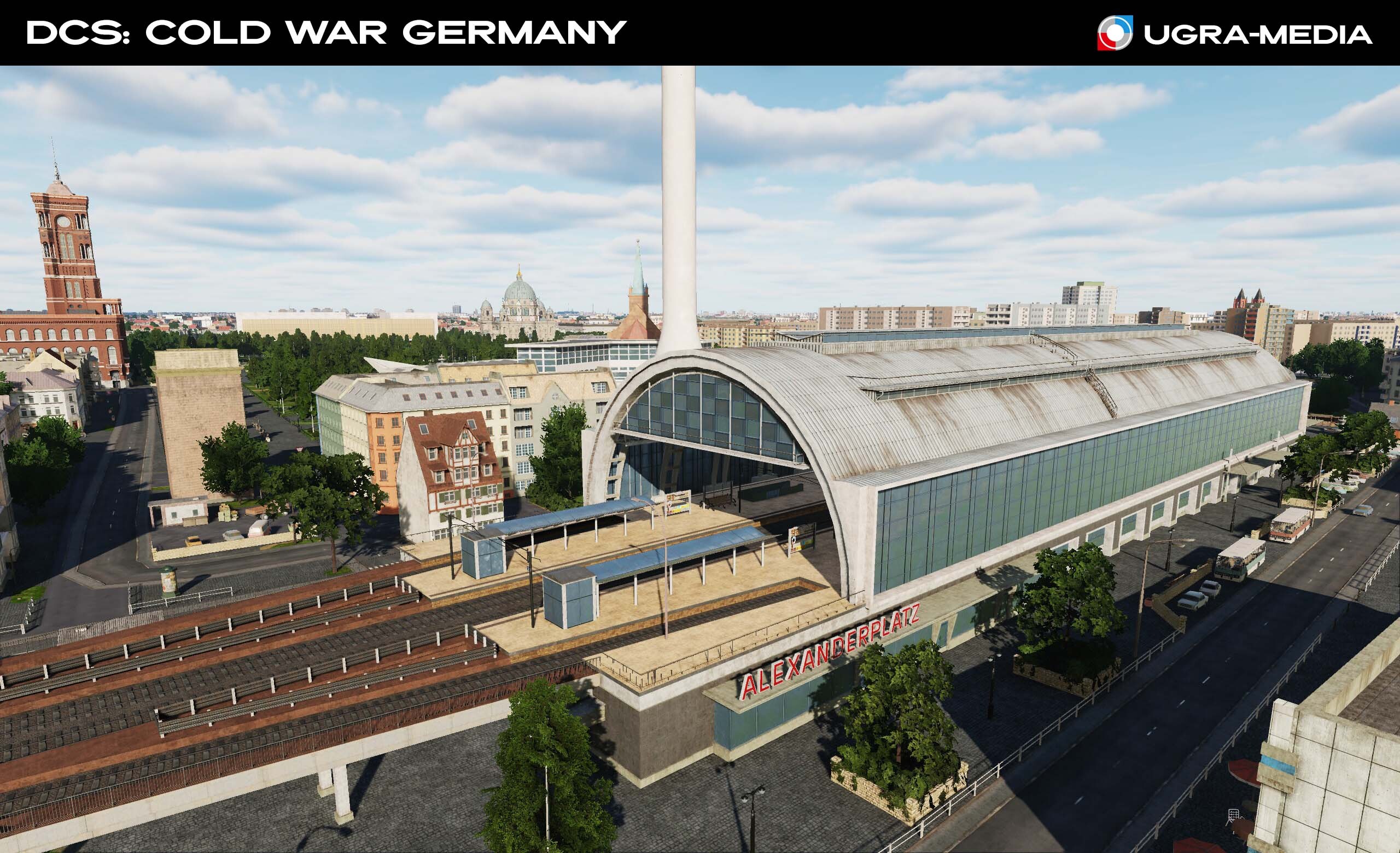
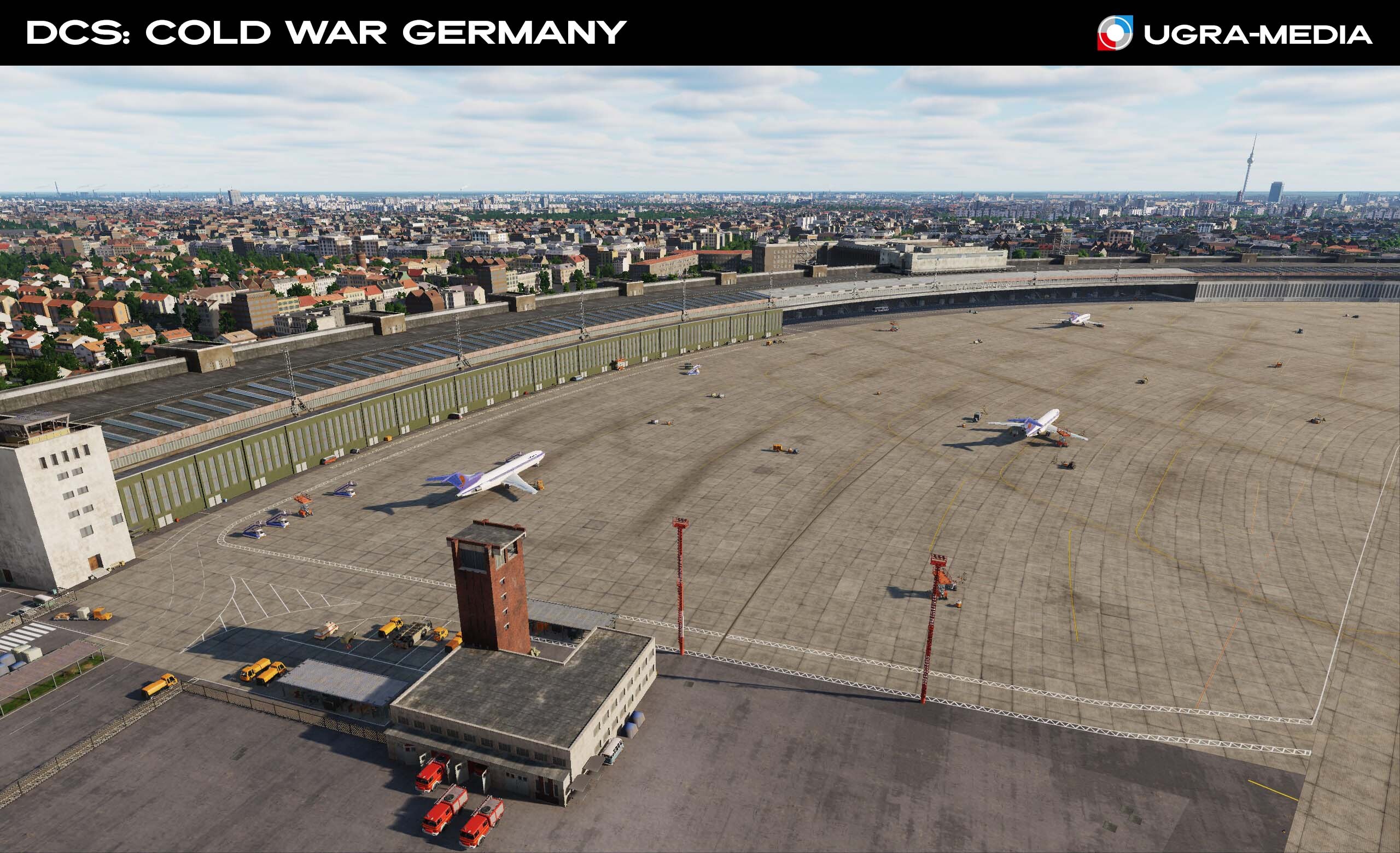
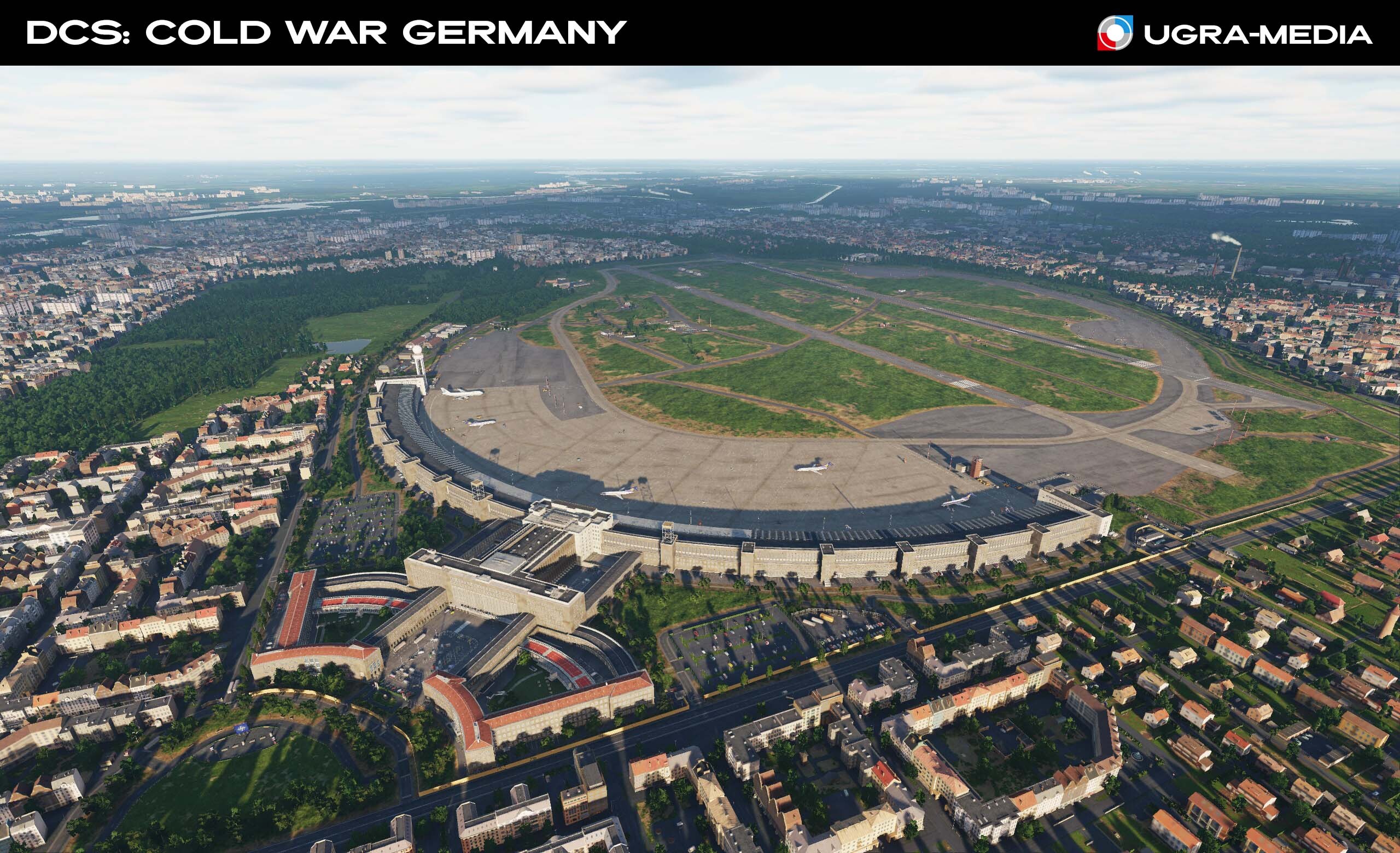
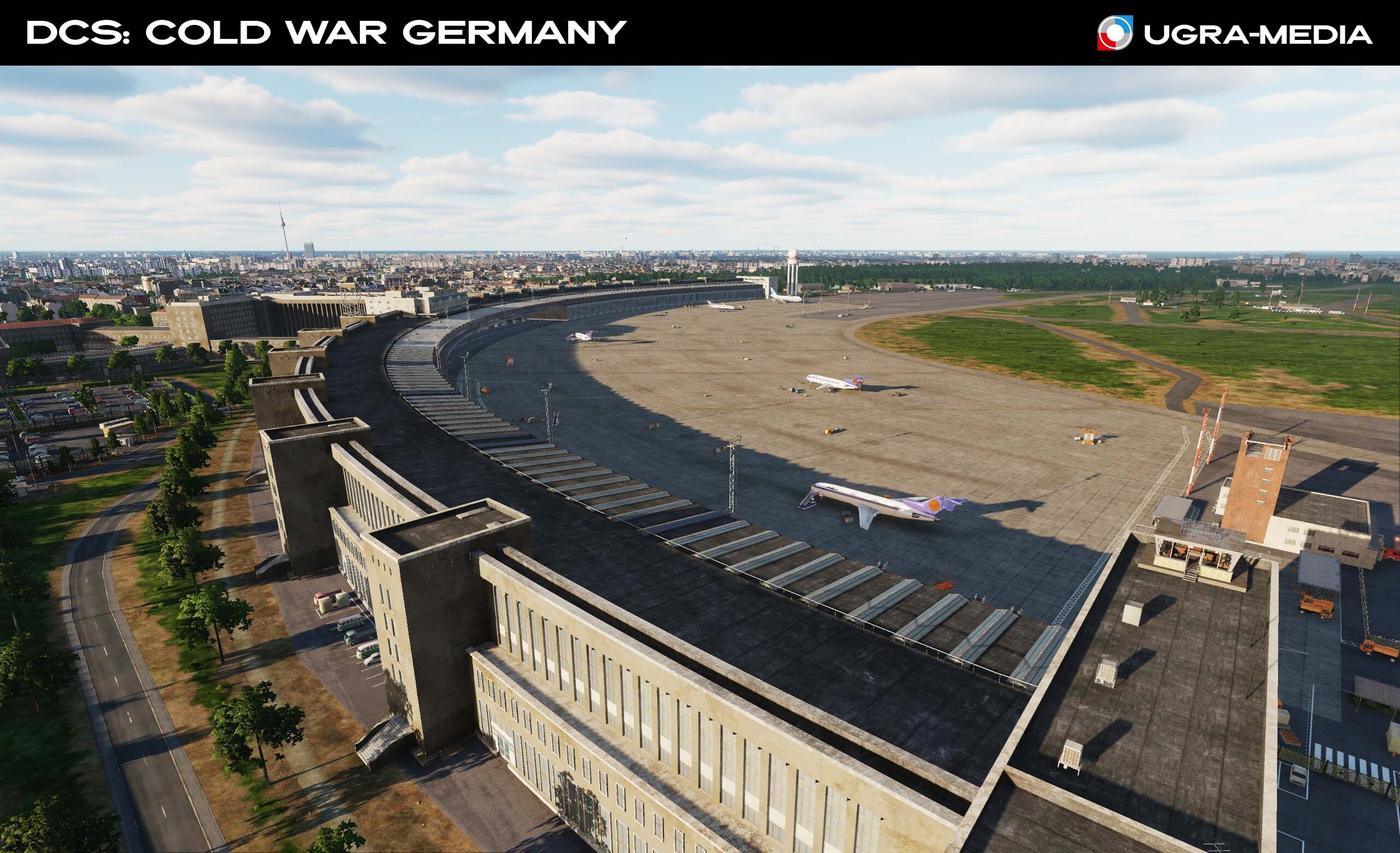
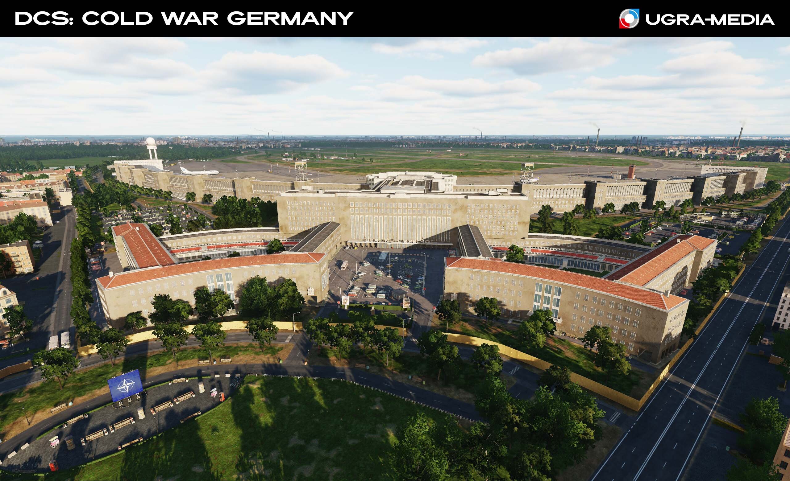
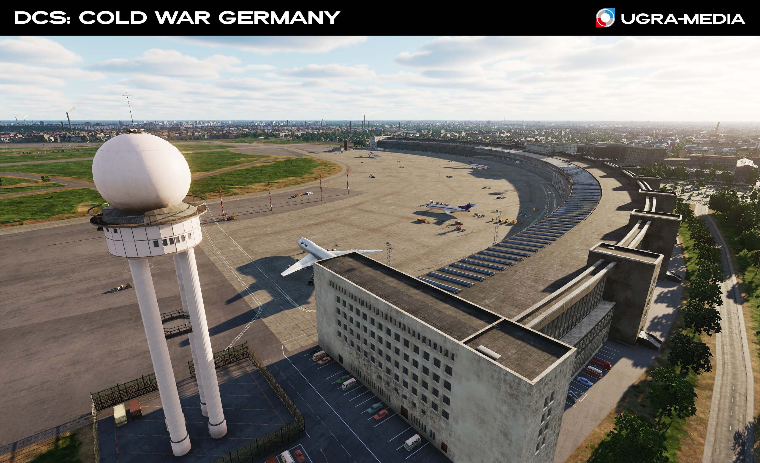
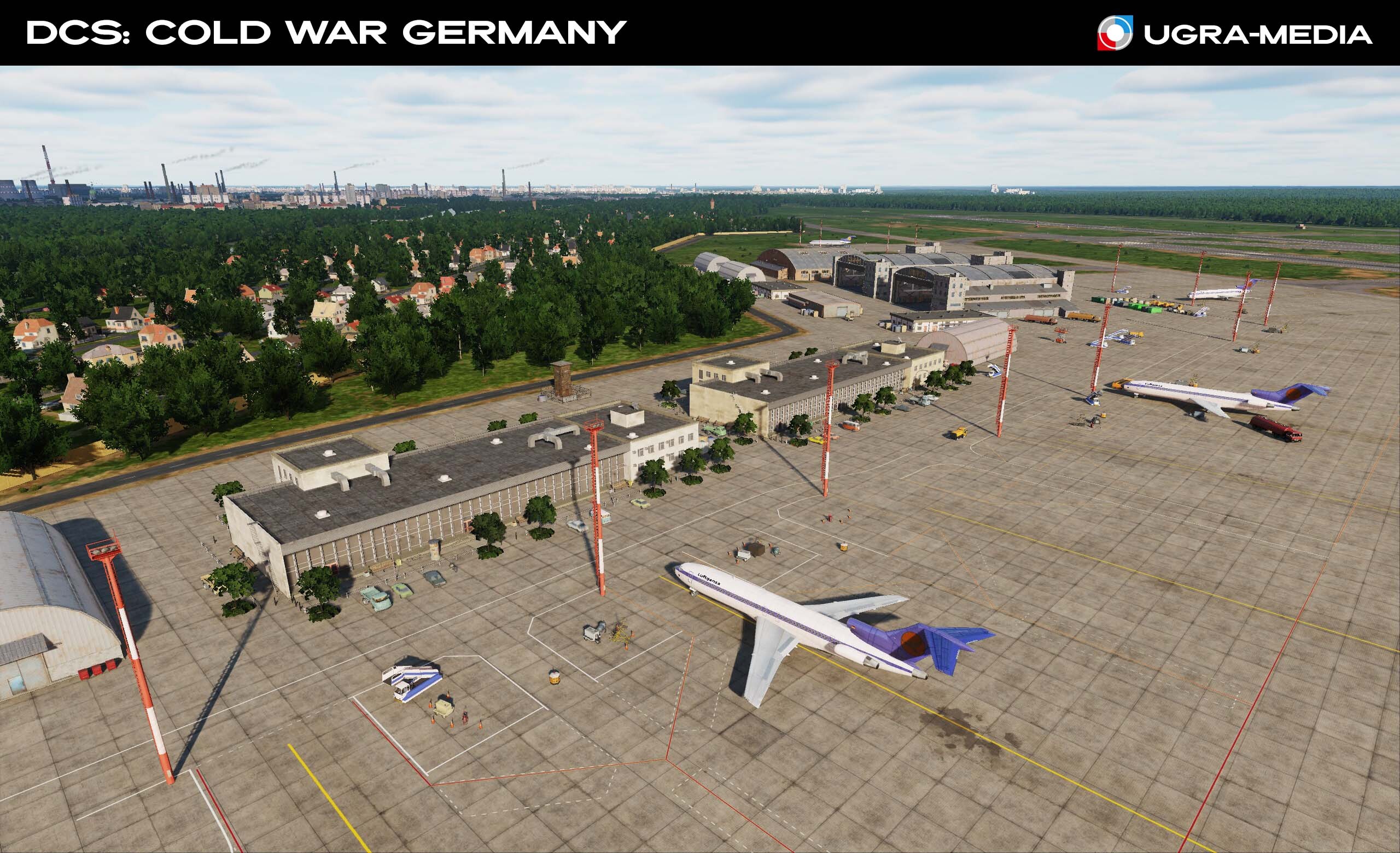
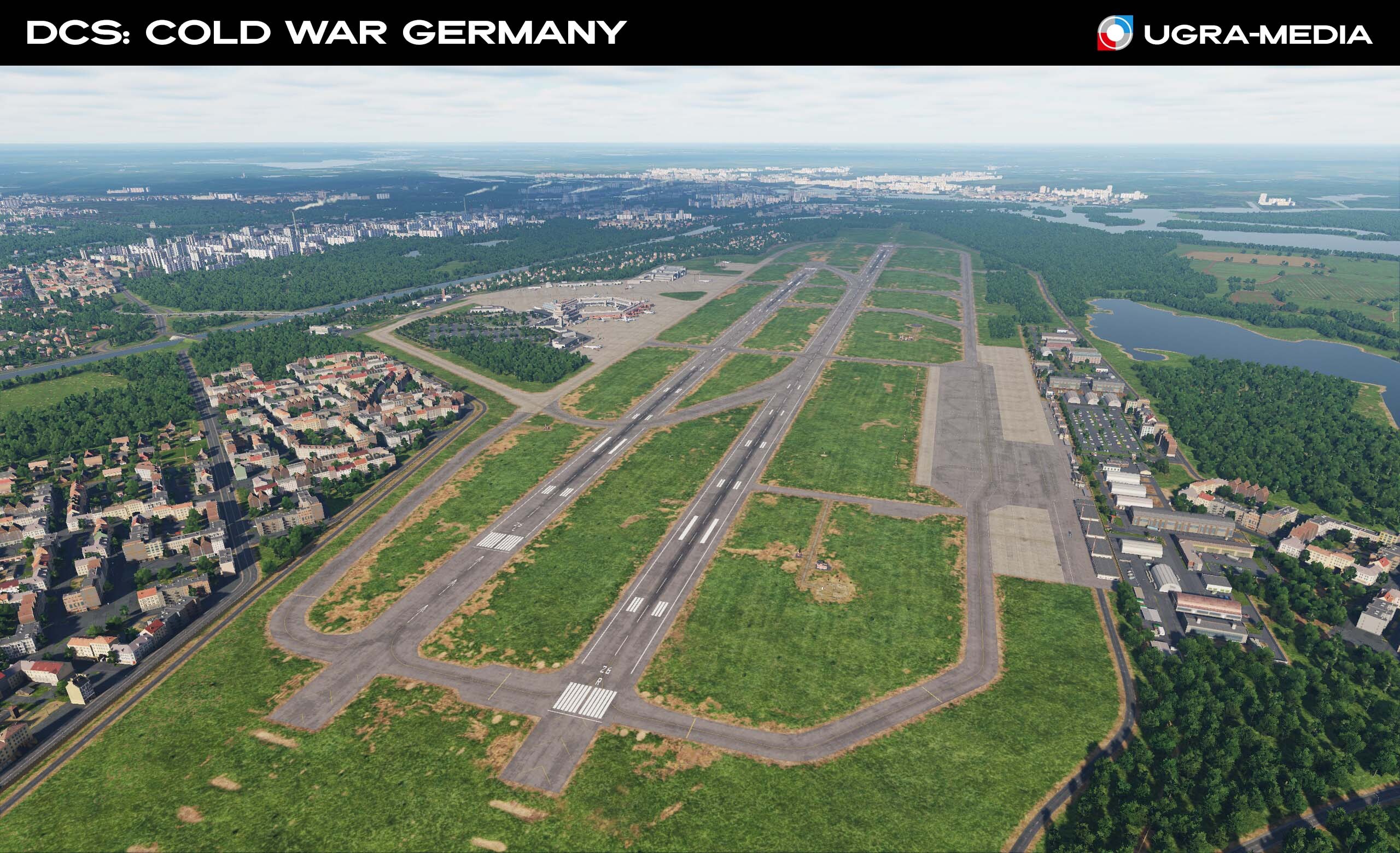
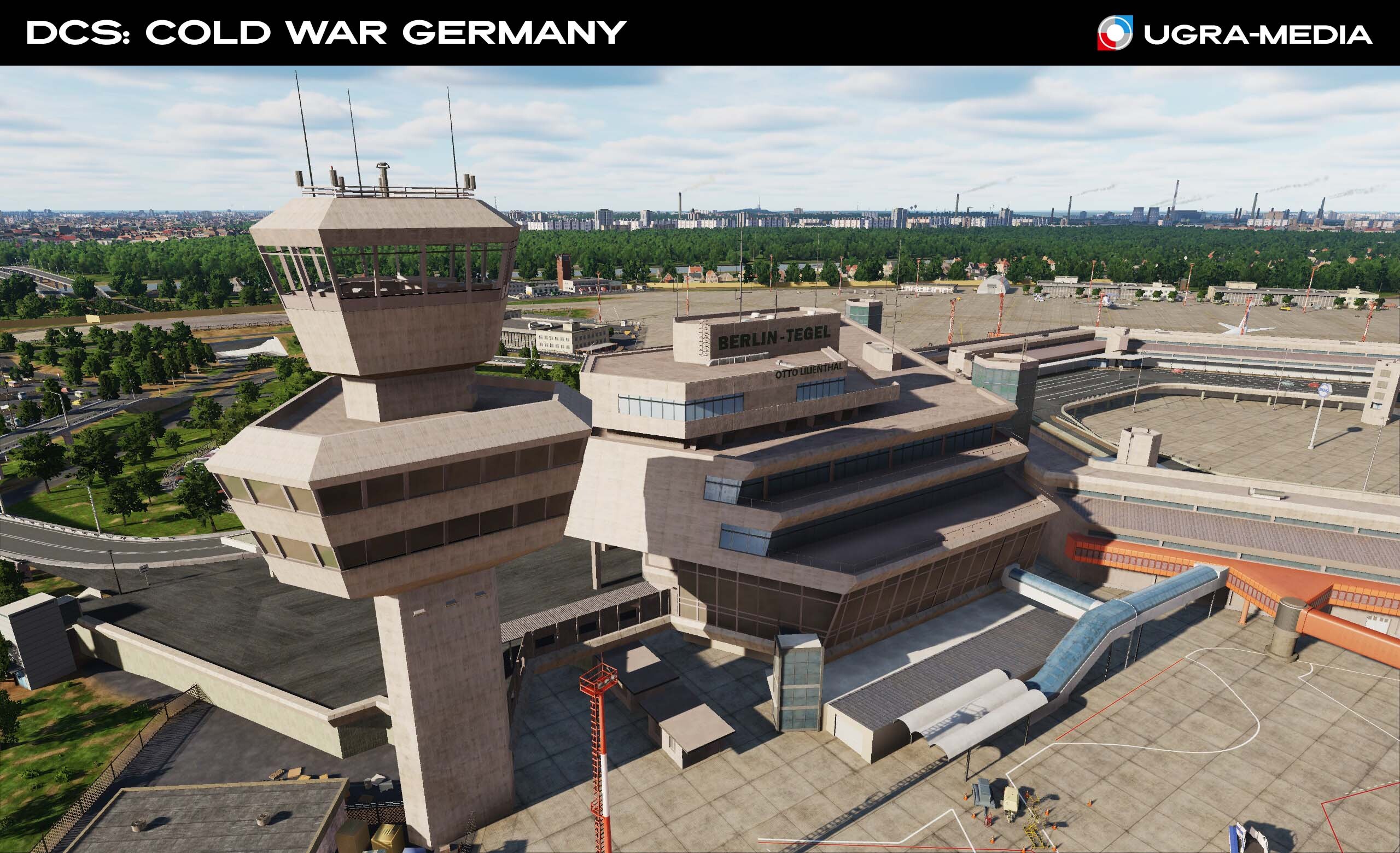
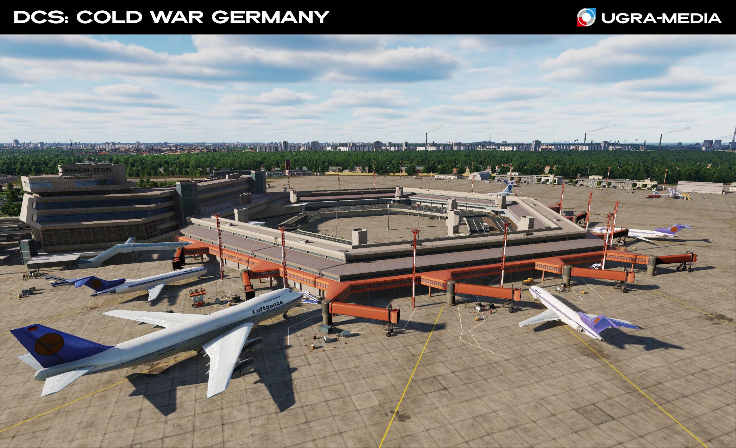
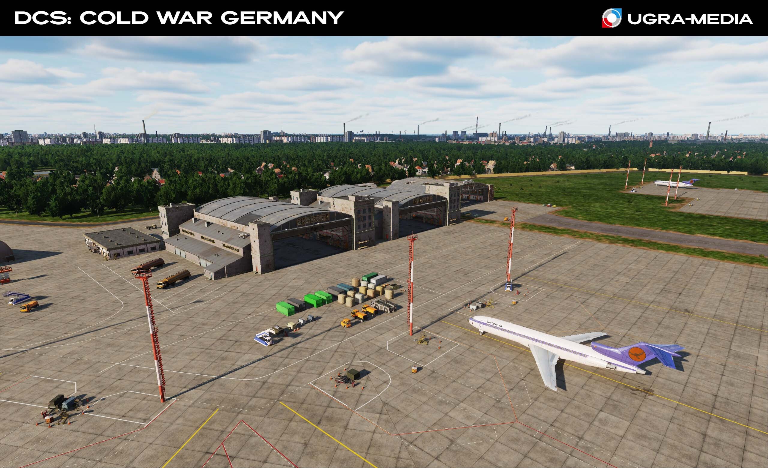
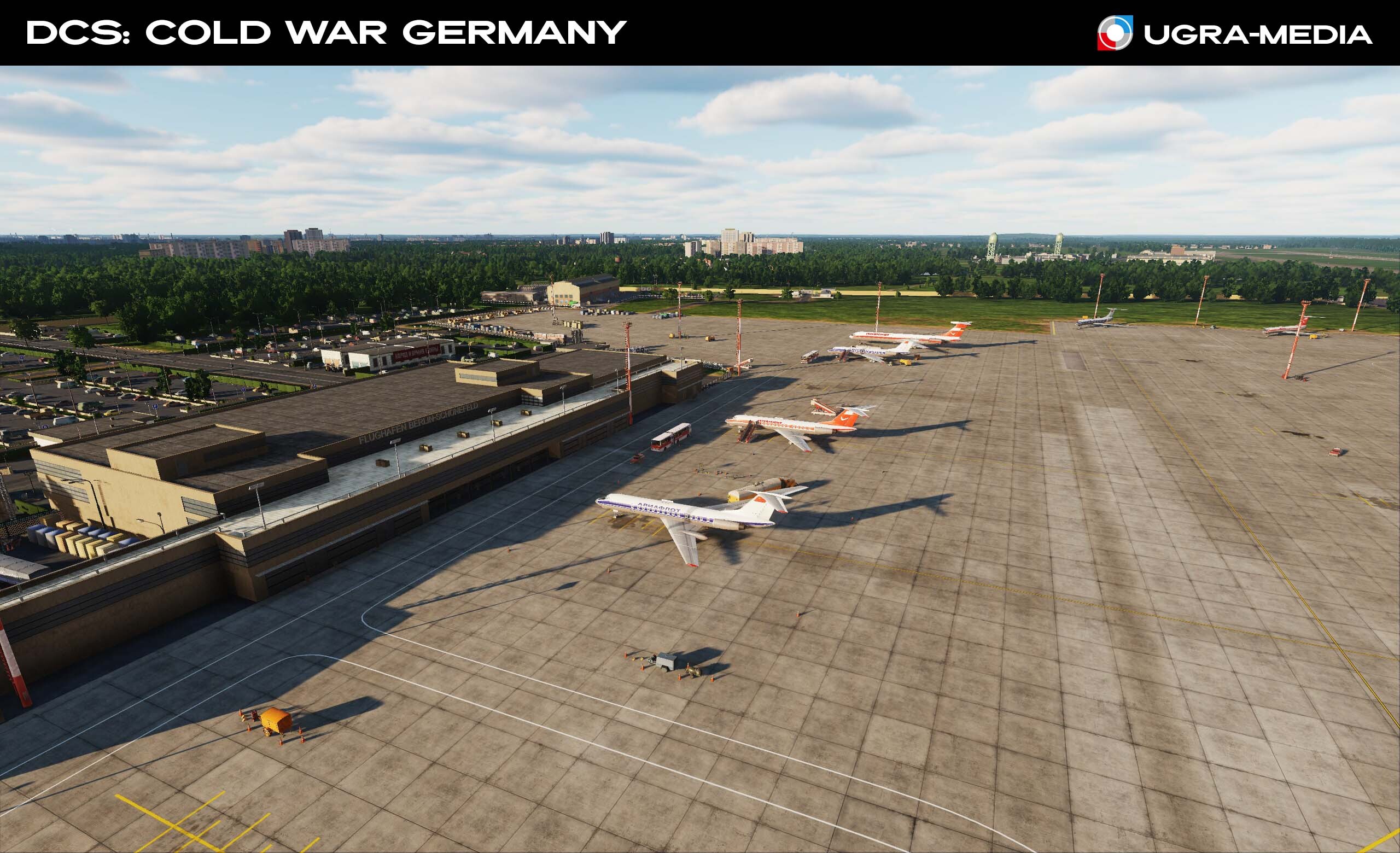
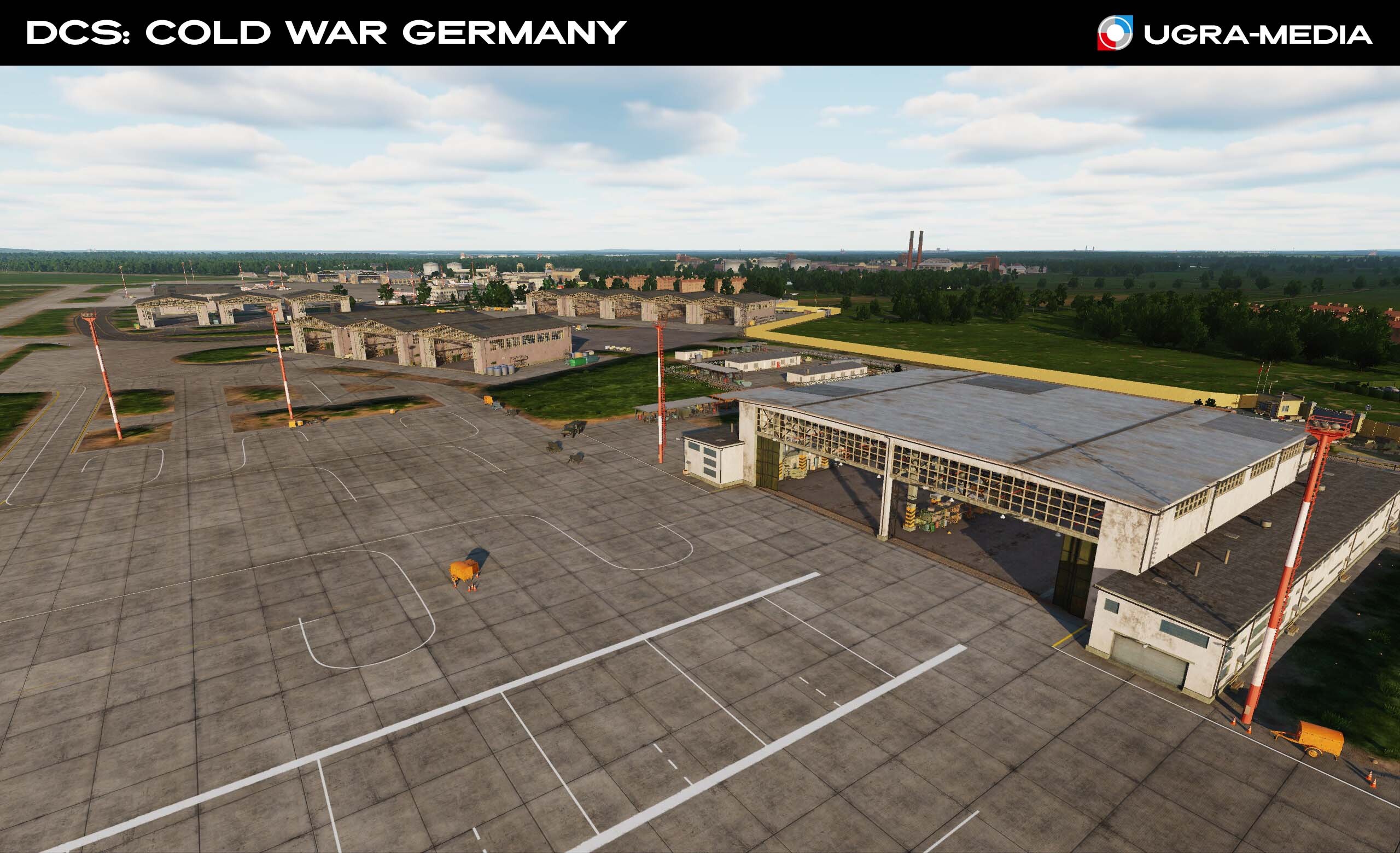
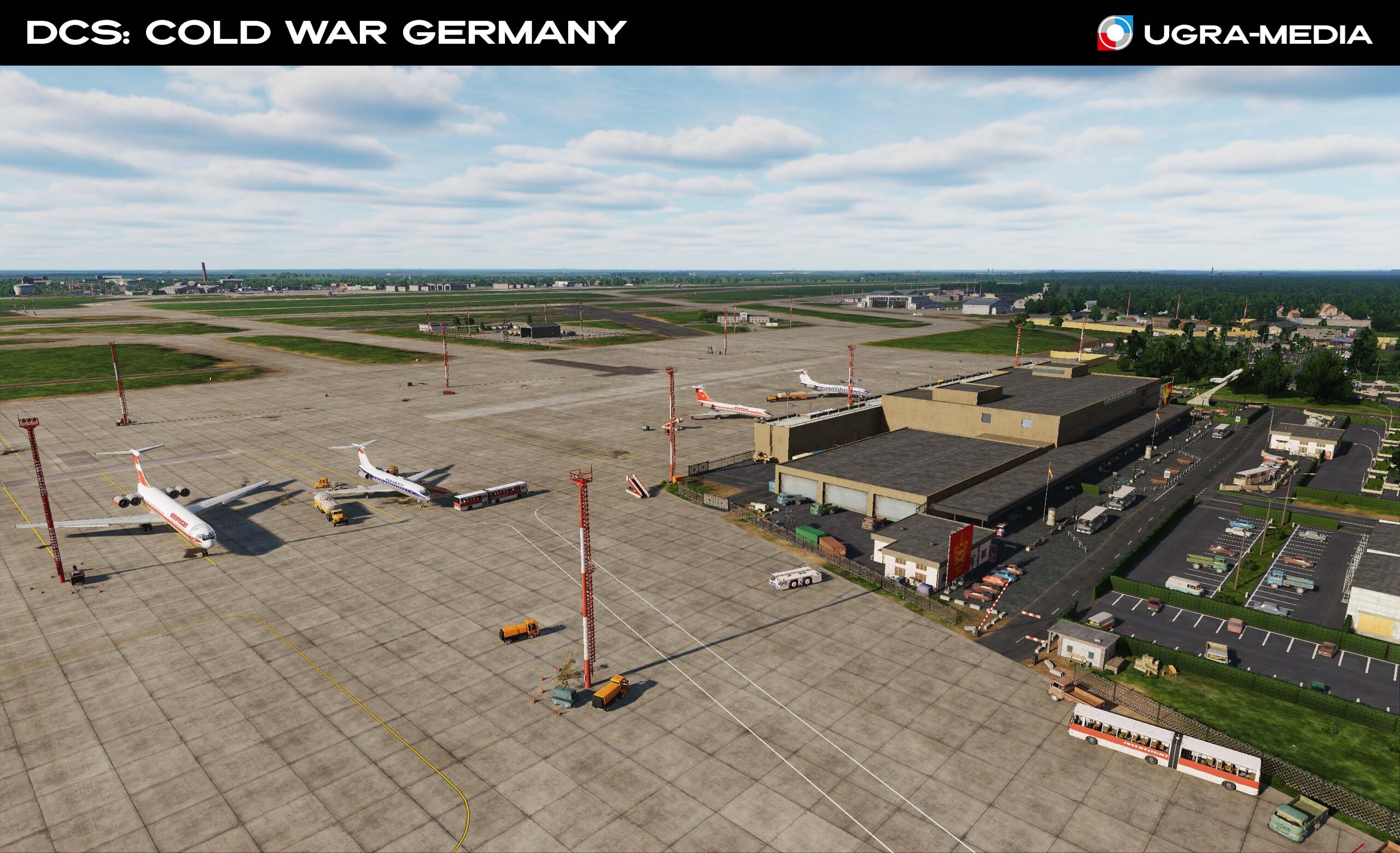
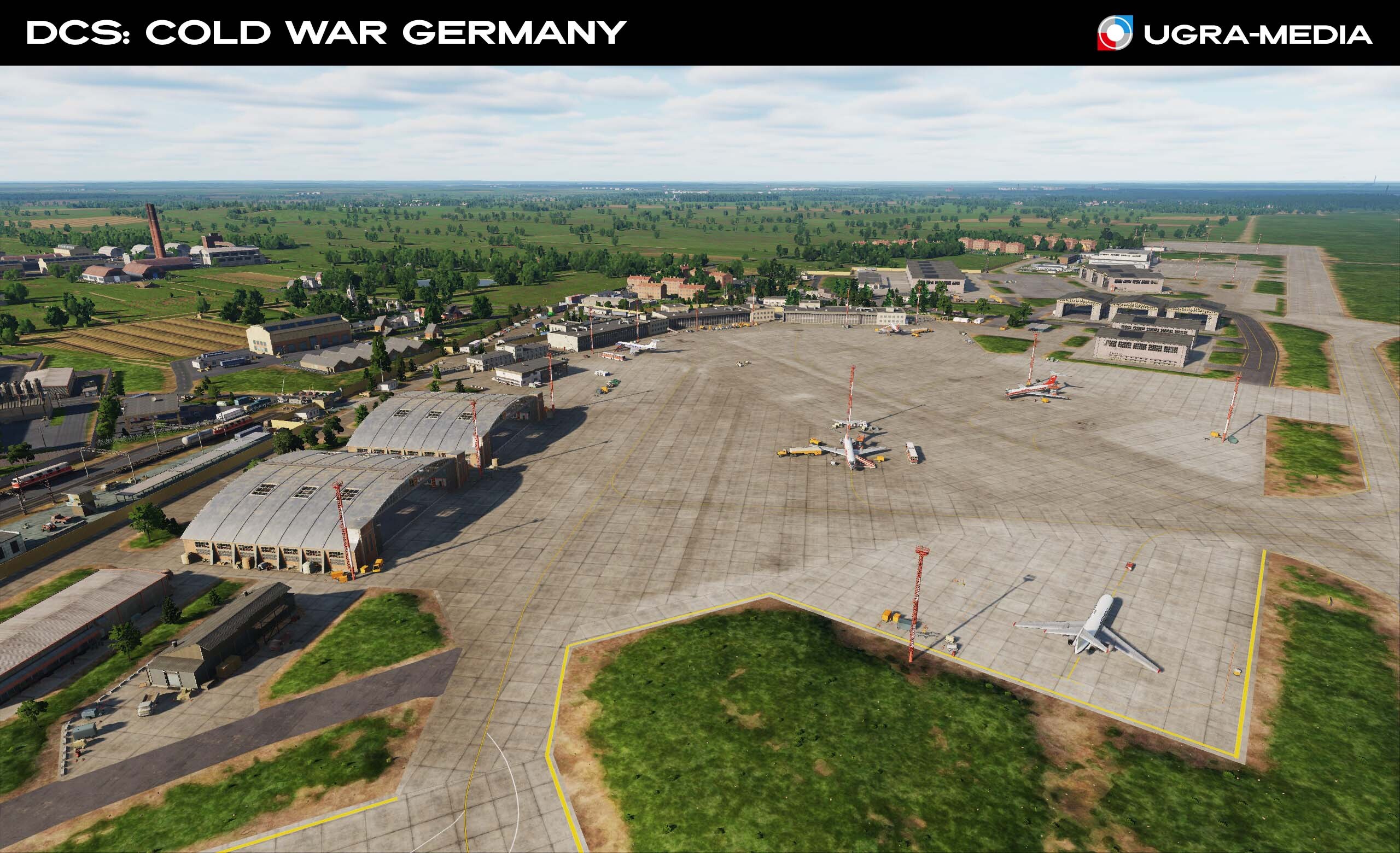
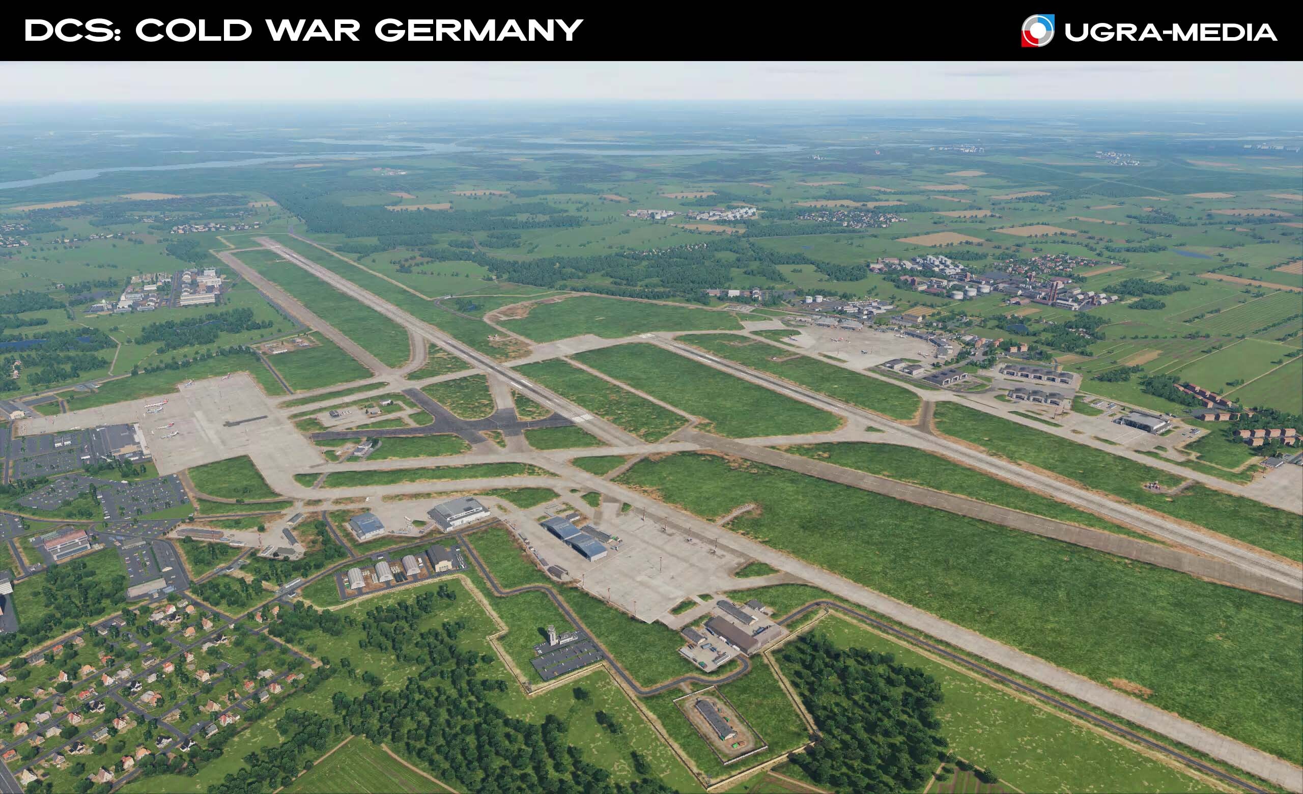
Hi fighters Today is the cherry on top of our reviews! BERLIN is a divided city on the border of two worlds! The epicenter of the confrontation between NATO and the Warsaw Pact, where every district, airport and monument becomes part of your missions. Berlin: two capitals in one city Alexanderplatz is the heart of East Berlin with the TV tower The Berlin TV Tower is the tallest in Germany (368 m) and the most recognizable symbol of the capital of the GDR and FRG The Reichstag is a legendary building, in the 1980s - a museum on the border with the West. The Brandenburg Gate is a no man's land between the GDR and FRG. Europa-Center is an iconic skyscraper of West Berlin. "-Get in a taxi and say: Europa-Center. Get back and say: Airport. Not difficult." The Berlin Wall is a symbol of the Cold War. The memorial to Soviet soldiers is a reminder of the past war in the center of a new confrontation. Berlin airports – three key points: Tempelhof Airport – the legendary airfield of the "Berlin Air Bridge", then civilian. "British Airways" and "Pan American World Airways" operated flights to Tempelhof Airport until August 31, 1975. "British Airways" and "Pan American World Airways" operated flights to Tempelhof Airport until August 31, 1975. After that, the flights were transferred to Tegel Perhaps you can implement the "Berlin Blockade 2.0" scenario – try to repeat the "Air Bridge of 1948", but this time on a C-130. Tegel (West Berlin) ICAO: EDDT – From 1975 to 1985, Tegel was West Berlin's only passenger airport: Tempelhof was closed to civil aviation. The airport, located in the French sector of Berlin, handled scheduled flights by Air France as well as charter flights by American and British airlines. Schönefeld Airport was the major civil airport of East Germany (GDR) and the only airport of the former East Berlin. The airport was home to Interflug, the state airline of the German Democratic Republic, which in the vast majority of cases used Soviet-made aircraft. Interflug's routes provided mainly Eastern European countries, but also operated flights to Cuba, China, North Korea, Vietnam, and some African countries. The airport received aircraft from Eastern Bloc airlines: Aeroflot, Tarom, Malev. The terminal's distinctive feature was the airport's visitor terrace - These are forgotten inventions of more advanced civilizations. In its place, the new Berlin Brandenburg Airport was built - today the only commercial airport serving Berlin.
- 489 replies
-
- 31
-
-
.jpg.961dfae80da228e69e3cc8ab9cee8a49.jpg)