Ghostrida9
-
Posts
411 -
Joined
-
Last visited
-
Days Won
3
Content Type
Profiles
Forums
Events
Everything posted by Ghostrida9
-
@Rick Mave yea you right, flat is also a problem, that makes Pferdsfeld also a nogo for me so far, it's those things that i could never fix, I would need to get access to the terrain editing tools they use. Elevation and all that can only be changed by UGRA, and ED can only fix the problem to make AI Aircraft less scared when you place something above them for a ramp start. So far when you create lets say a new Shelter, even without a collision model the Aircraft will automatically be moved to the next parking spot, something i really hope ED fixes cause it's annoying. Thanks @TheBigTatanka that would be nice, maybe you can also take a look into the last sentence i wrote since you with the closed Beta testers team, maybe you can adress this problem. Another Update. Textures added, small changes need to be done from this stage on.. Next shoots will be ingame footage

-
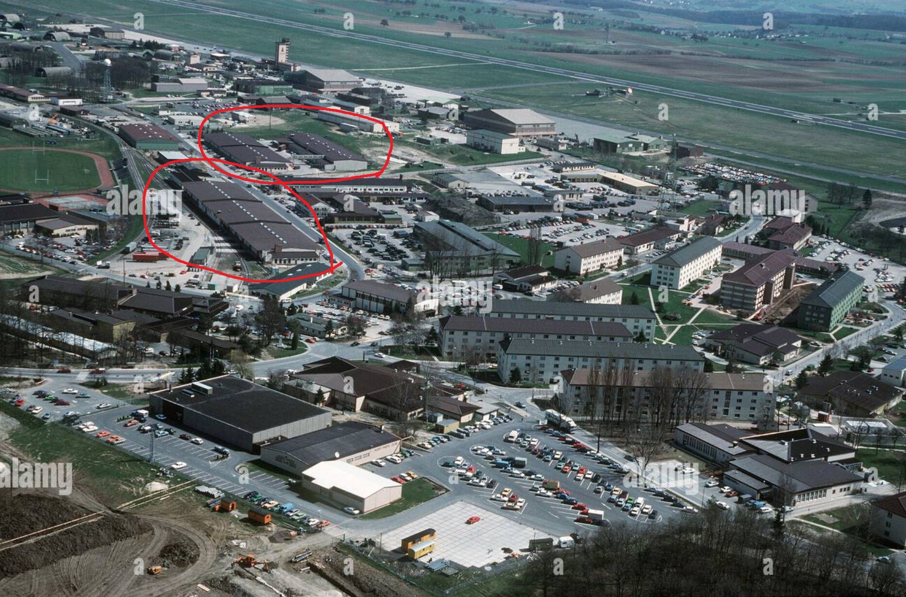
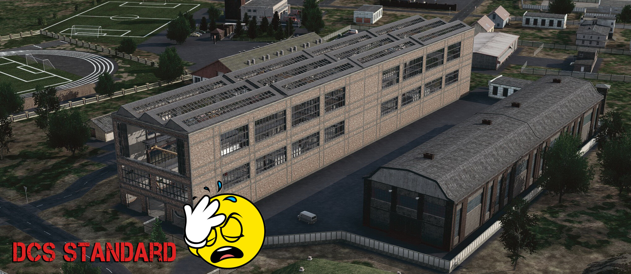
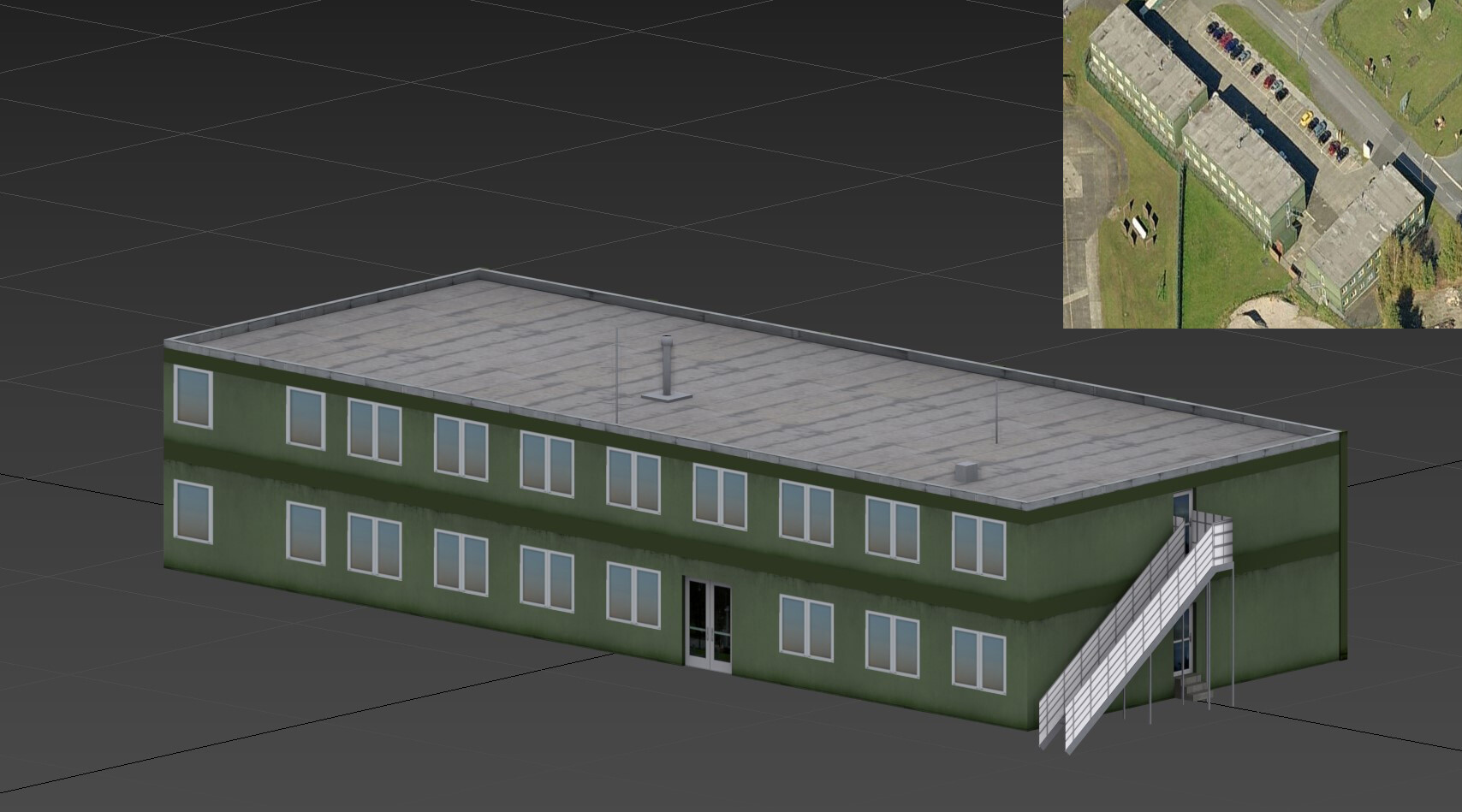
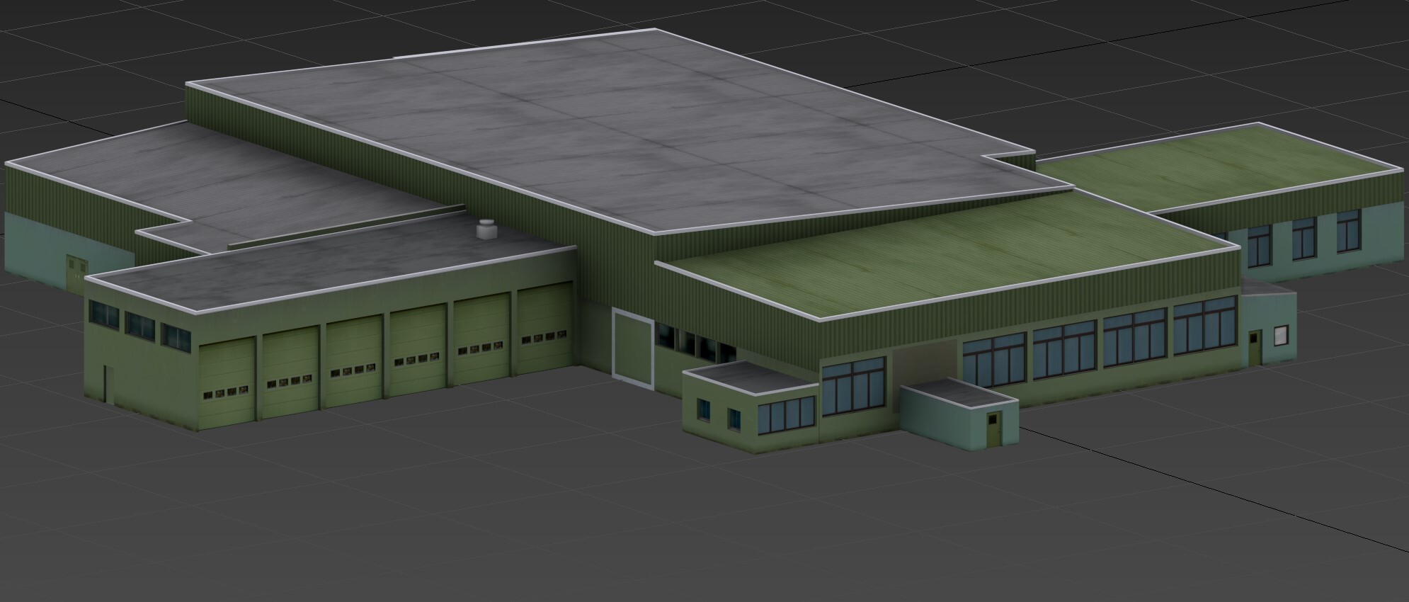
@Rick Mave Thx Rick.. long story short, u already figured that almost every building is wrong, they should stick to a correct layout and let "us" do the job, a lot of time will pass before i can even think about to finish Gütersloh and maybe Bitburg. I looked at Pferdsfeld ones... even the layout is wrong so Pferdsfeld is a nogo for me until they fixed the layout. I saw they started to post Phase II stuff.. why?? Phase 1 is far from beeing a Cold war Germany map, at best it's a fictional Germany Map, and yes i live here and i'm born here so i know how it looks first hand. @TheBigTatanka I think trees is the least problem this map has so far.. but i get what u mean, it's a problem with all DCS maps, most Trees are still to big, or a bit wrong. MSFS handled this problem beautifully Back to Bitburg.. so back then the Base looked like a US AB right.. with storage facilitys and all that. you get what i mean in this shot.. still today you can see most of the buildings on Google maps.. Now DCS.. some old WW2 factorys placed at the spot of the Storage facilitys...Ouch.. Here my model with some textures so far..
-
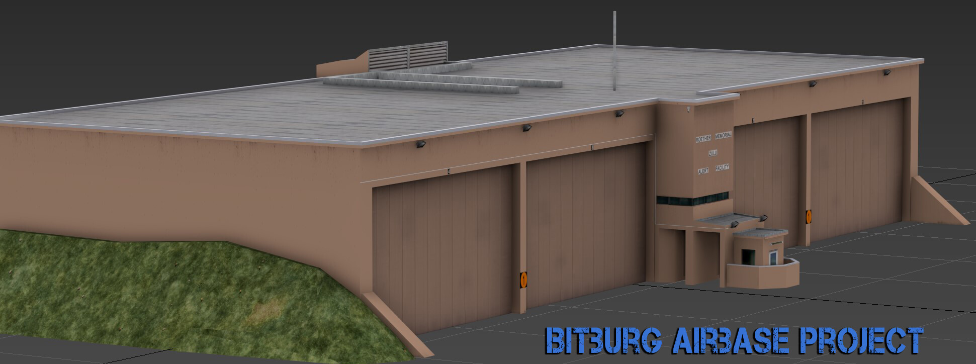
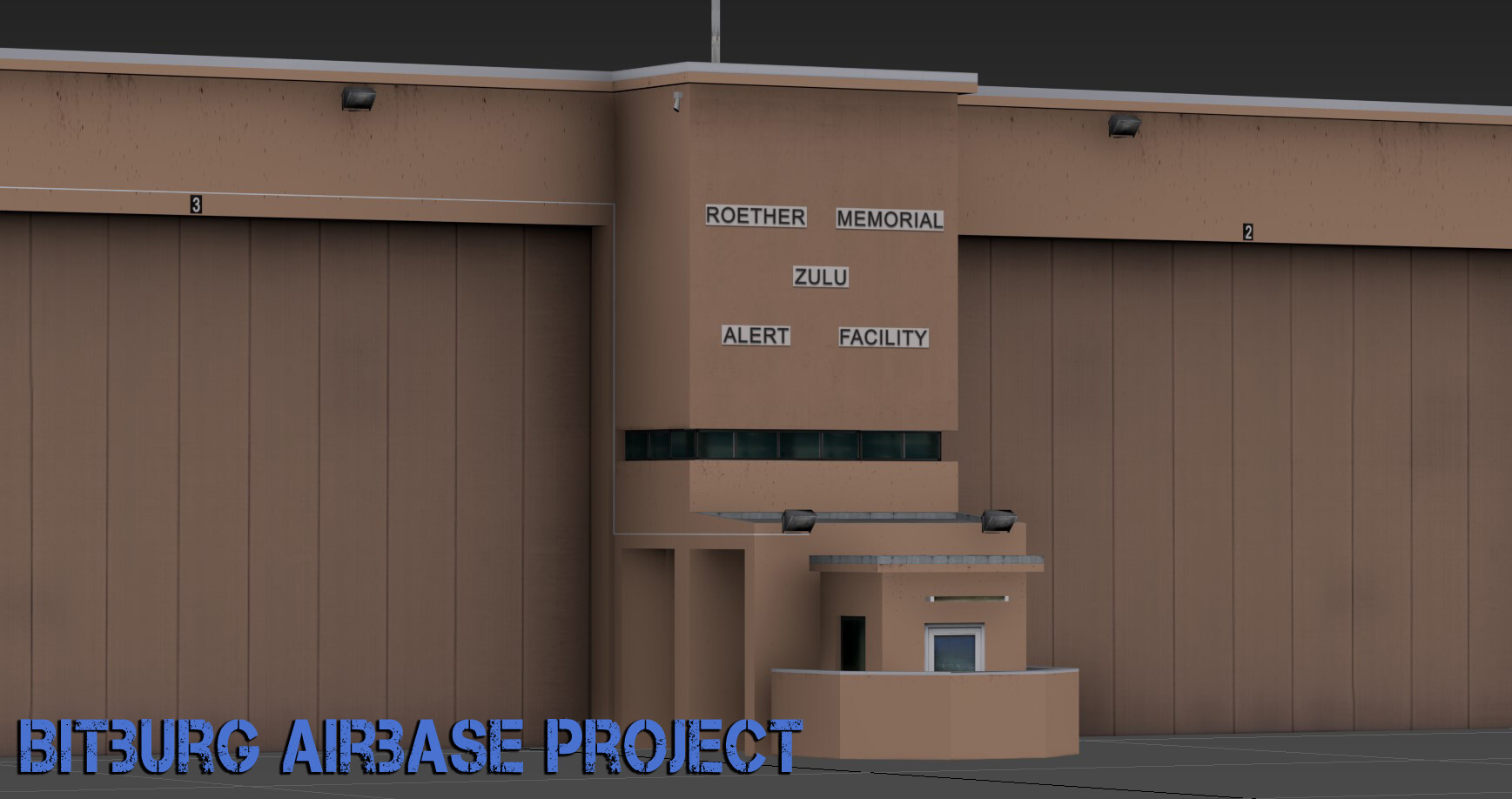
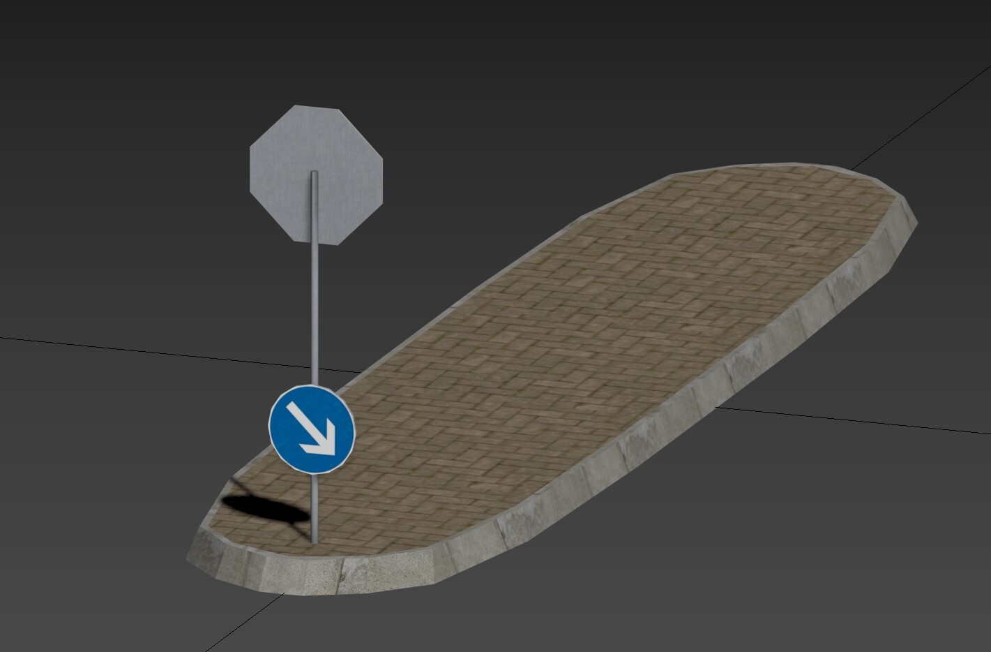
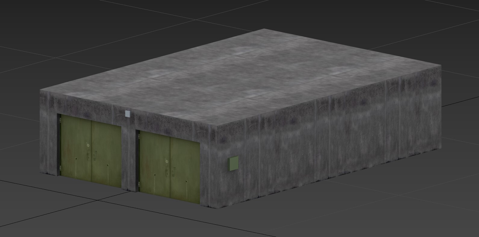
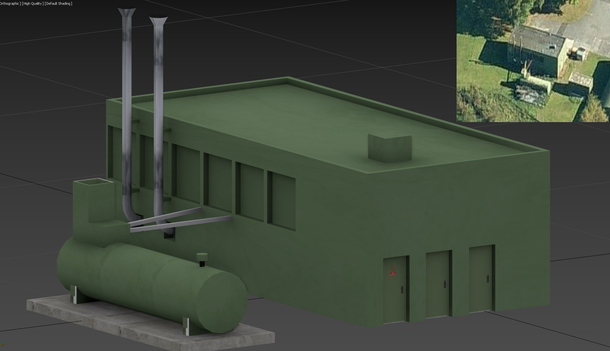
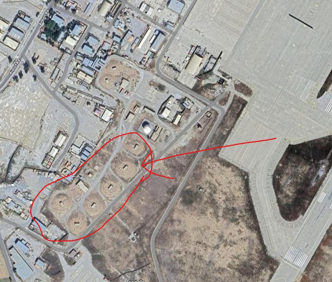
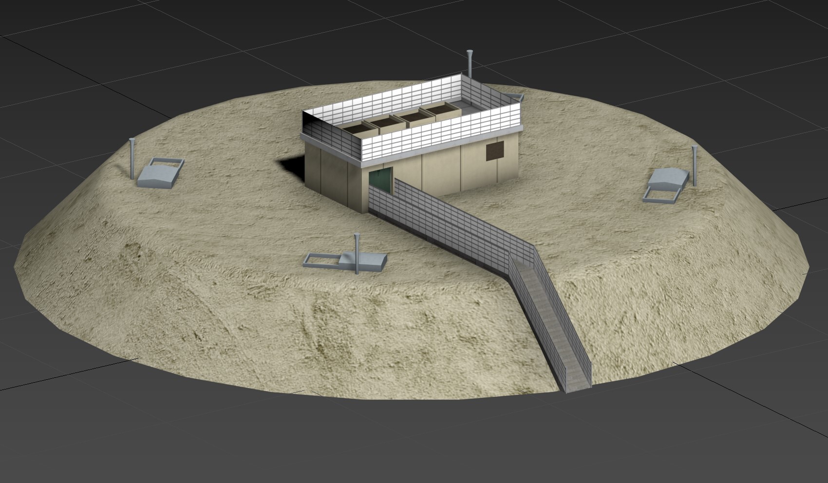
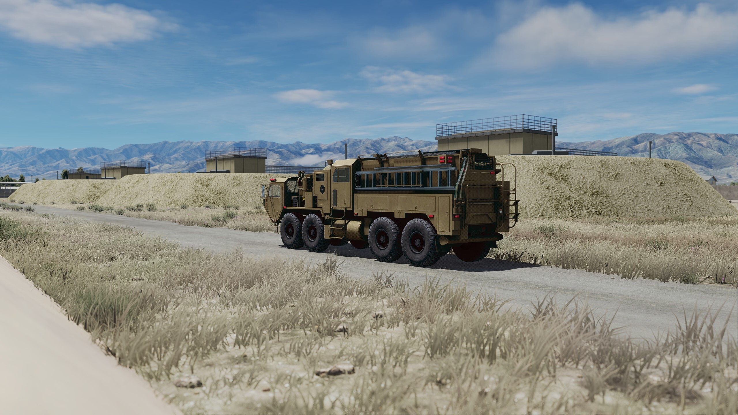
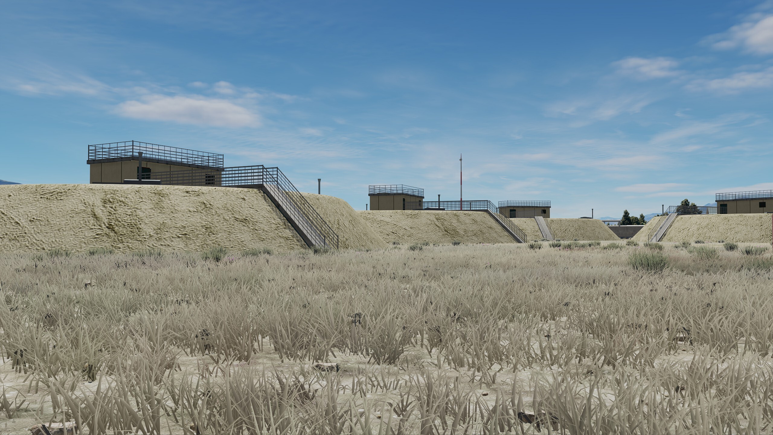
Came to check out Bitburg Airbase.. layout seems to be ok.. far from perfect but ok, of course most building are inaccurate, wrong or missing as usual. What i hope so far is that 3 things will be fixed for now. 1: There're 2 huge Hangars at a spot where 4 Concrete Shelters should be. I can pinpoint that later. 2: The whole Bunker area is completely missing ?!! (Picture bellow) 3: Please add "Windows" to the Main Tower But now... lets start with the first building.. Model is work in progress of course. "Roether Memorial Zulu Alert Facility"
-
Gütersloh Airbase Project (Screenshots & resources)
Ghostrida9 replied to Ghostrida9's topic in DCS: Cold War Germany
Sorry for the late reply, I'm still here, still watching whats going on and there's some things need to be fixed before continue my work on Gütersloh AB, still Harriers start to burn inside the shelters for a Ramp start.. still the New Shelters and the small building on the side of it is one model.. I hope they fix it and seperate those two.. would be needed to make this base much more accurate. @Leg2ion I've been focused on 3DSMAX most of the time, i tryed blender ones but couldn't figure even the simplest things so i deinstalled it. Sorry i'm not much of a help here.. -
Gütersloh Airbase Project (Screenshots & resources)
Ghostrida9 replied to Ghostrida9's topic in DCS: Cold War Germany
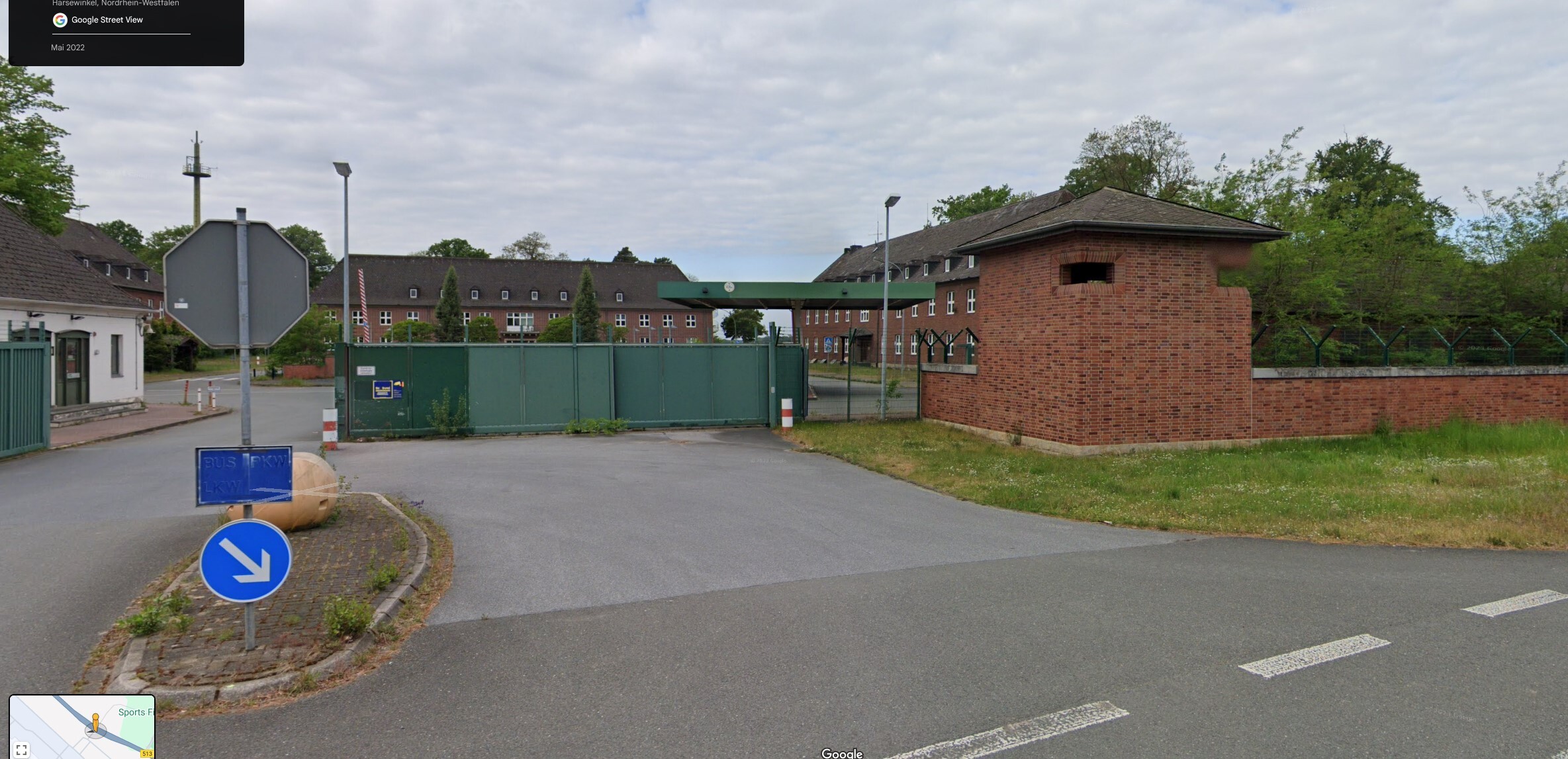
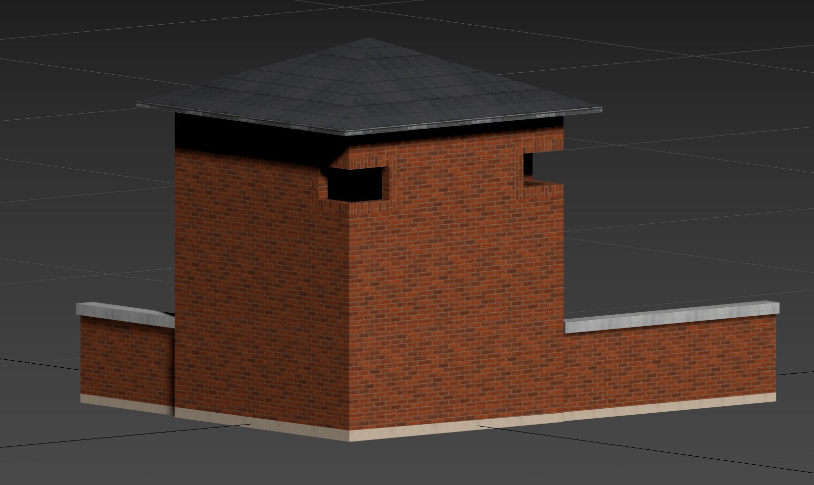
Working a bit on the Main gate..
- 70 replies
-
- 12
-

-
make a backup, and put this file into your bazar/effects/LUT folder, inside the game menu: color profile, choose the color called with the Orange 2 name.. should be much less comical green looking.. try it, just backup the ..tealorange2.png before overwritin'...
-
Not dead, not alive, it all was on hold.. had to learn alot with the new project about DCS. Sadly, so far UGRA has not fixed the layout of the base yet to make it all accurate according to satelitte images, its tremendous work to fix it all without acess to the scenery editing tool, but i'm not giving up. I fixed many textures, all the objects are still on my computer so nothing got lost. i try to post some updates soon... hopefully i got the webpage online soon cause no matter what i can't do it without support.. i'm on my own
-
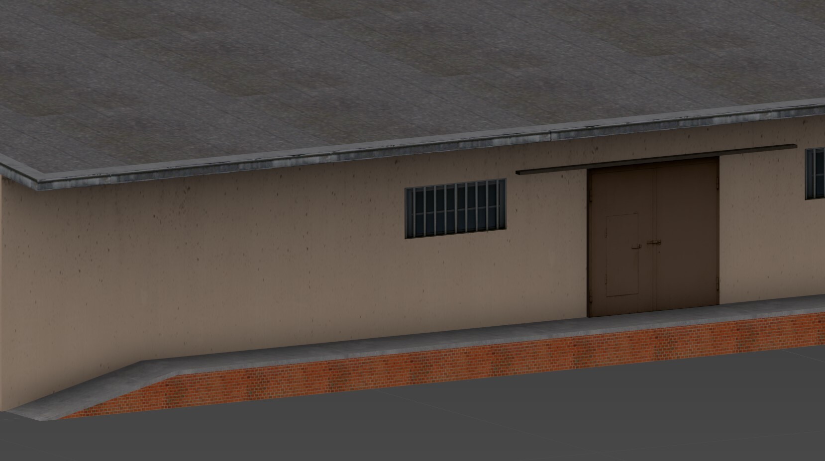
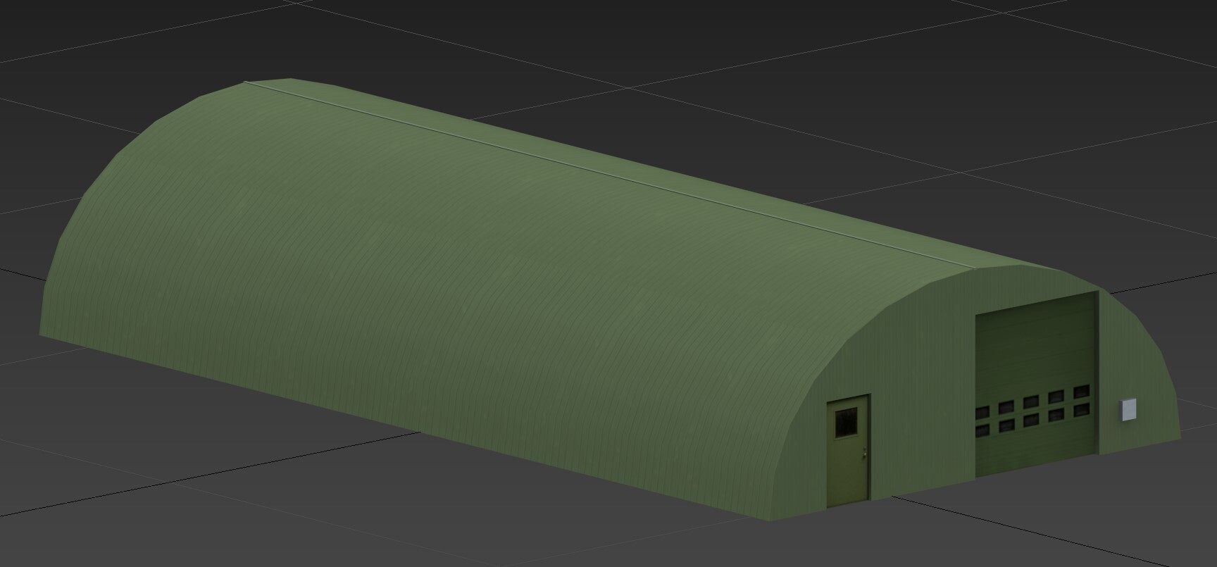
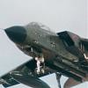
was thankfull for the fix, still this shelter has some problems, the fire seems to be caused by an overall too big or wrong collision shell, i tryed stuff with the scenery remove object tool and something is very wrong. Other then that, the shelter is still a bit too big in size, should be a bit smaler, (lenght and width) not a big issue but hope it get fixed too. Keep in mind this Shelters were only used to house: Tornado GR1/GR4, Harriers and Jaguars, not sure about the F4 Phantom..
-
Gütersloh Airbase Project (Screenshots & resources)
Ghostrida9 replied to Ghostrida9's topic in DCS: Cold War Germany
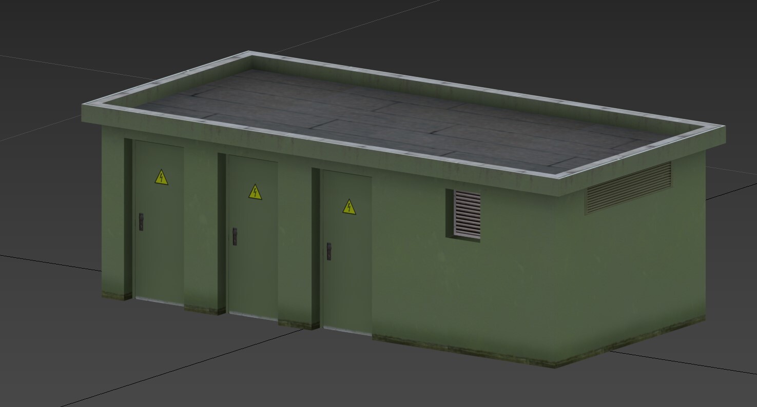
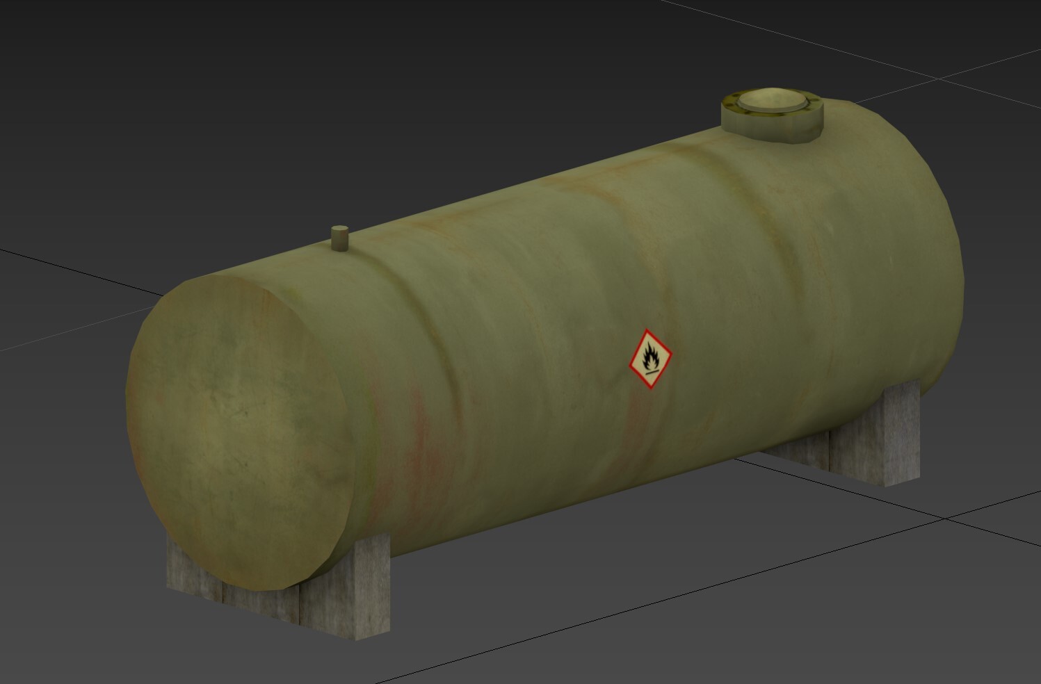
Thanks a lot for the flowers @Esac_mirmidon yes, you kinda got that right, if i'll ever finish this.. then yes, the package will contain a mission file, a zip folder called RAF_Gütersloh, a few triggers..everything needed. I will set up a homepage for the whole project real soon, plus add stuff to a youtube channel cause i got a few ideas up my sleeve The goal might be to work on more bases like Büchel, Pferdsfeld.. and lets see what will happen in phase 2.. and hopefully a big update for phase 1 cause so far all airbases are very inaccurate when it comes to the layout..i'm not even start to mention buildings.. @asinartThx, i knew this video allready... working on some Small stuff.. gas tanks, electric boxes.. offices.. you name it
- 70 replies
-
- 10
-
-
Gütersloh Airbase Project (Screenshots & resources)
Ghostrida9 replied to Ghostrida9's topic in DCS: Cold War Germany
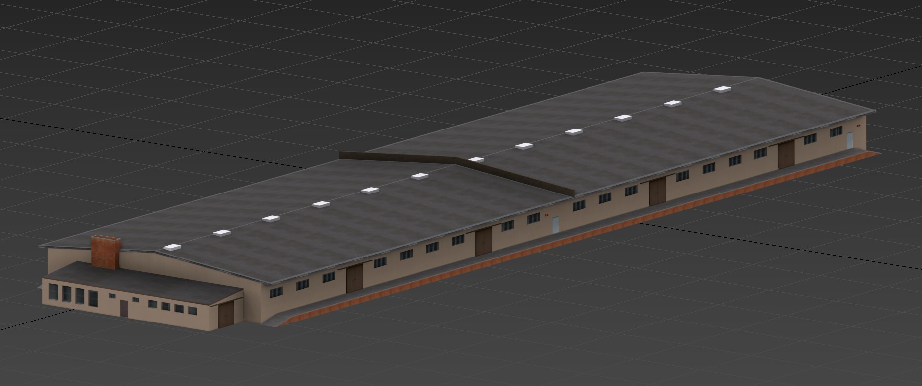
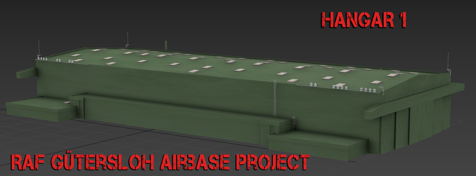
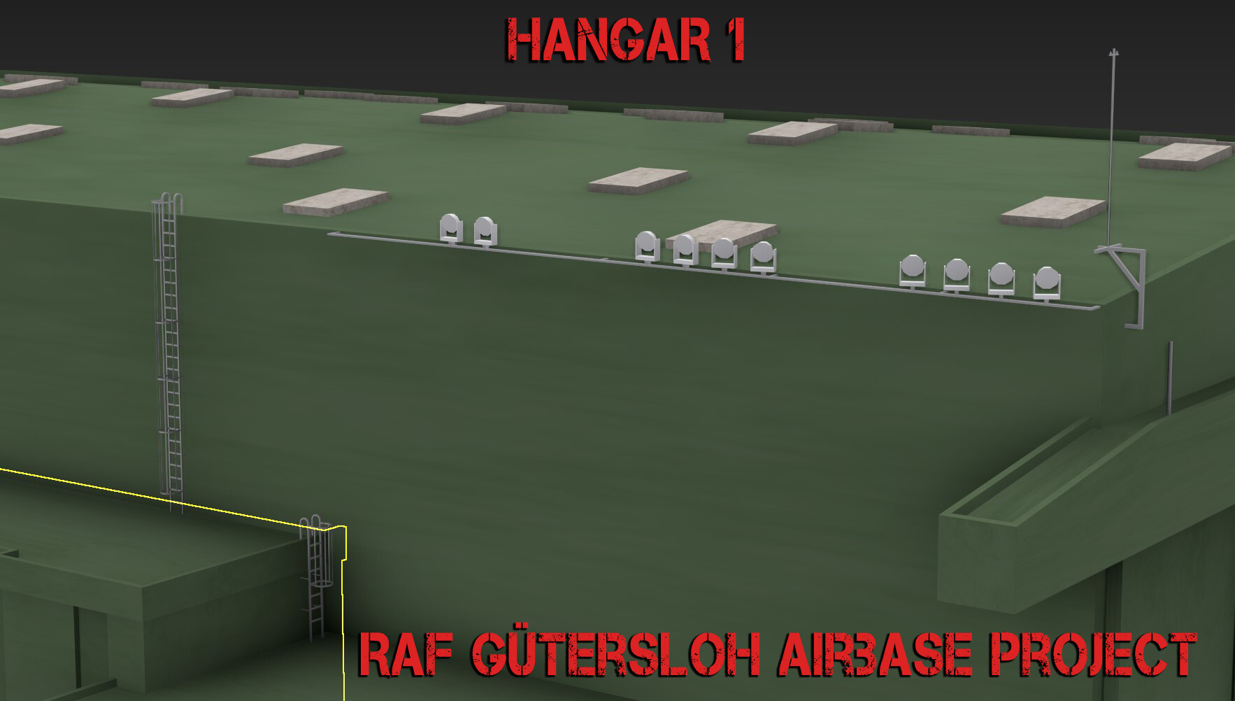
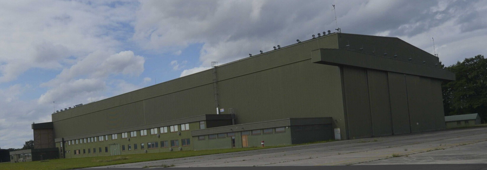
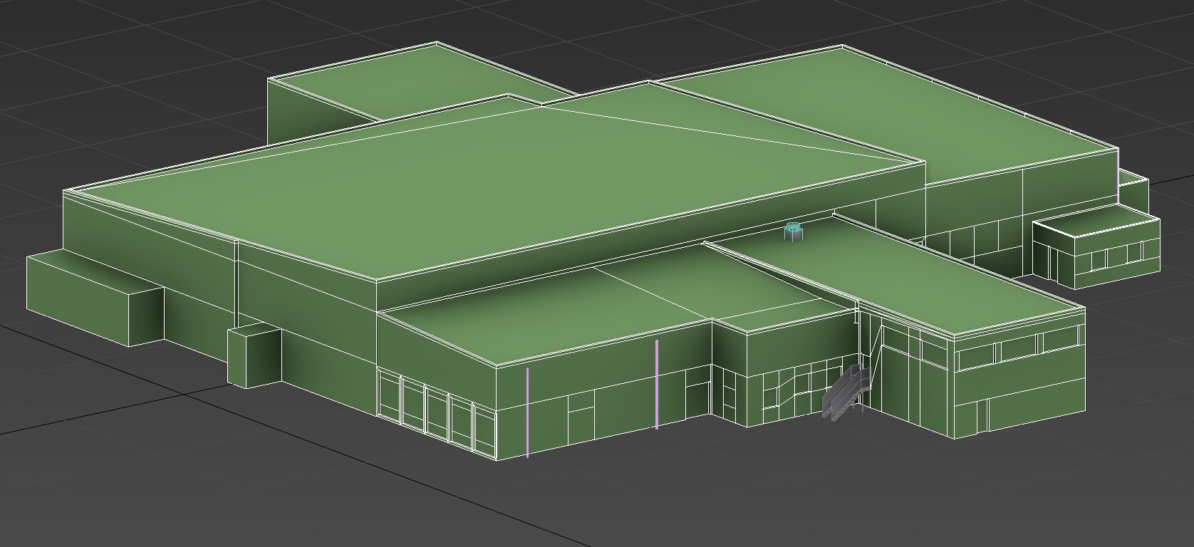
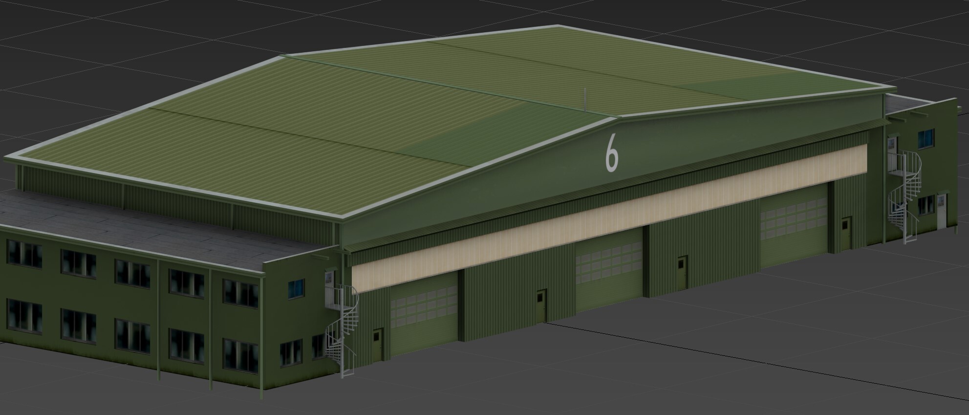
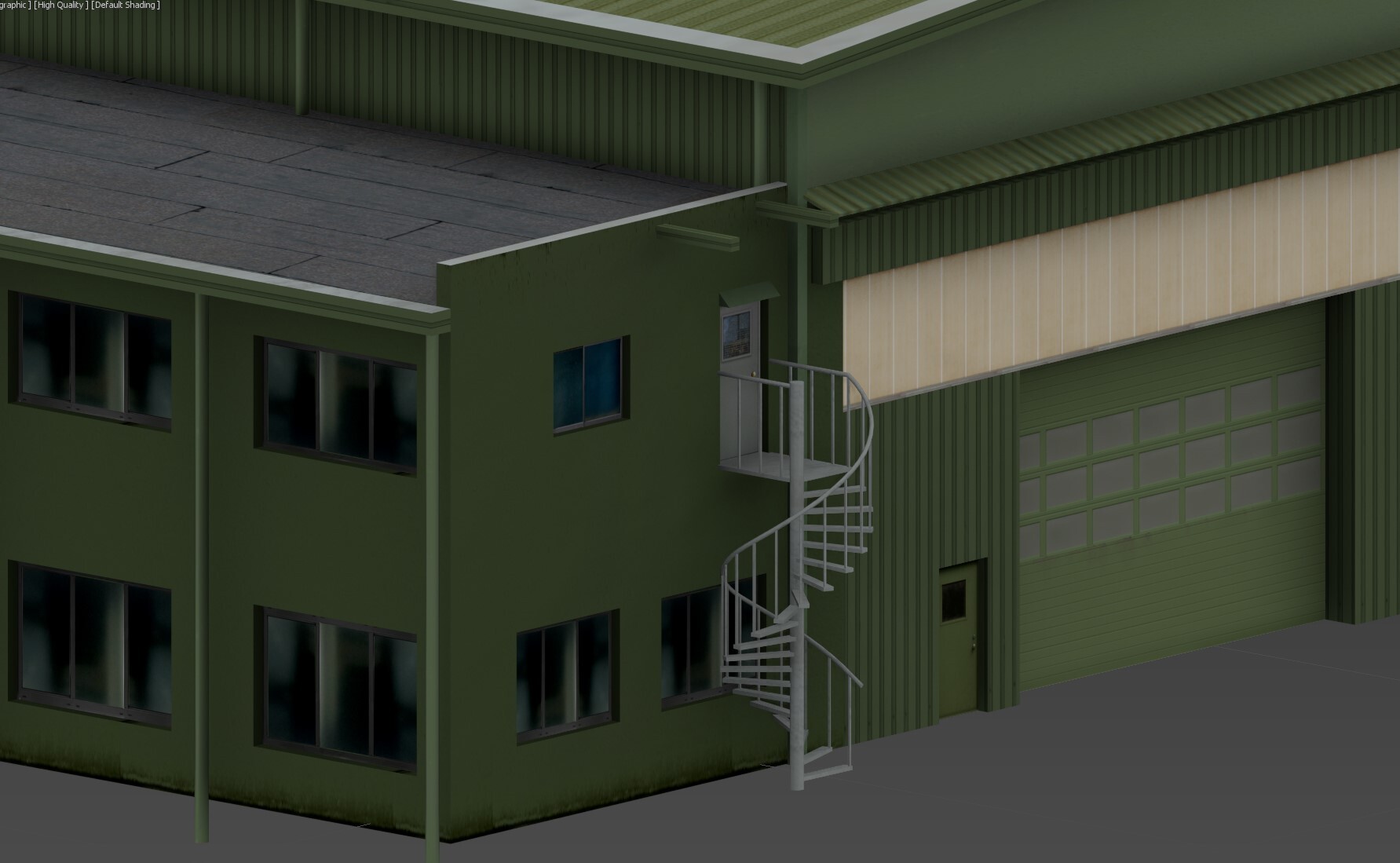
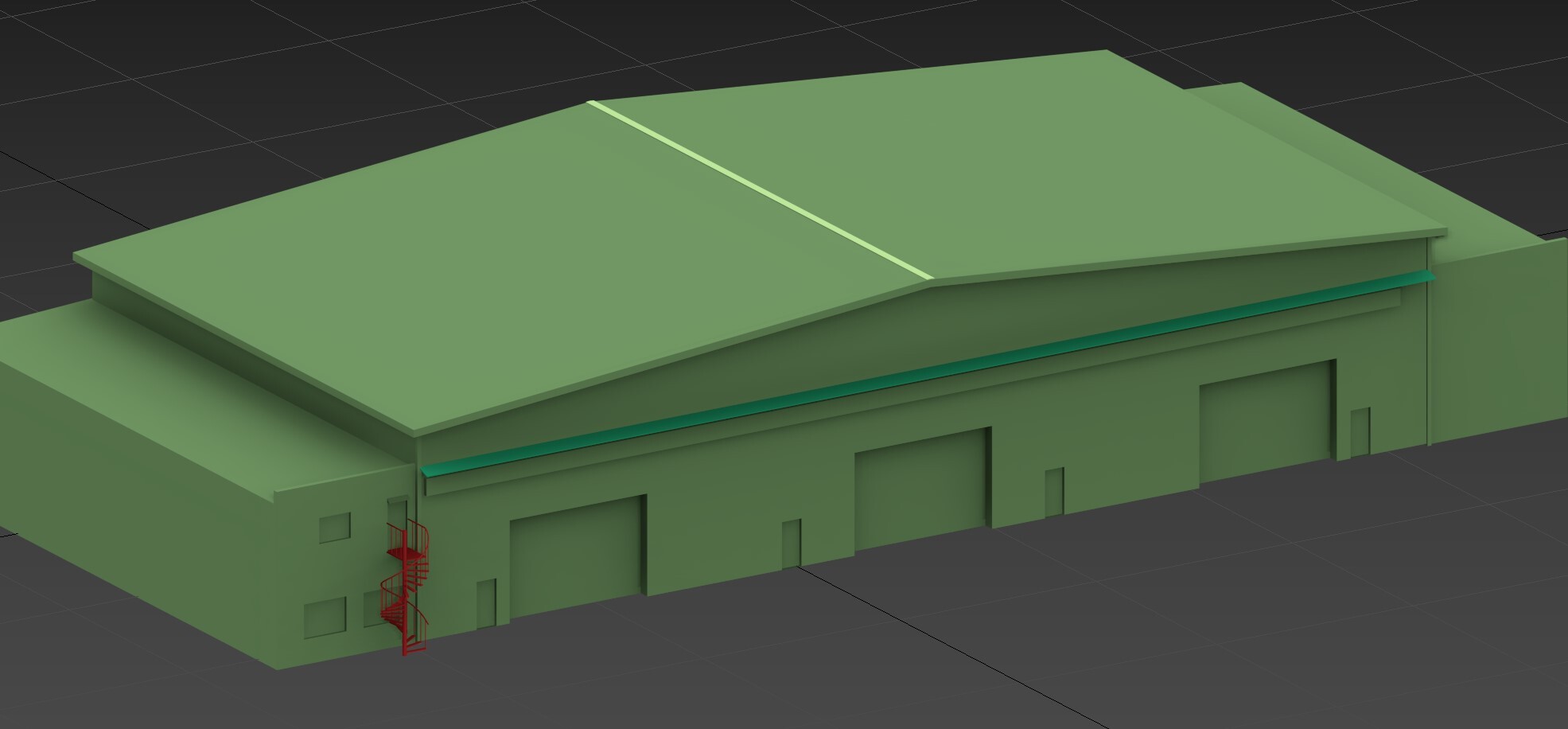
Working on the big one: HANGAR 1 – by far the most dominant and massive building at Gütersloh Airbase. It still puzzles me why UGRA Media released a map without modeling such a central structure. This one really defines the airbase.
- 70 replies
-
- 12
-
-

-
Gütersloh Airbase Project (Screenshots & resources)
Ghostrida9 replied to Ghostrida9's topic in DCS: Cold War Germany
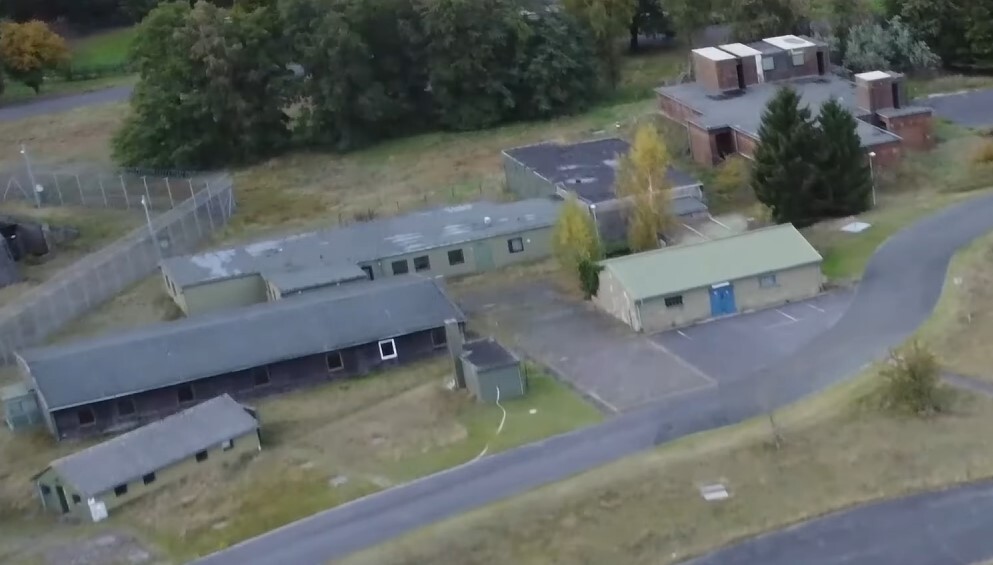
Thanks @Manschy @Harry.RThx alot, yea i go with what i got, thats a few pictures and mostly bing maps (bird view) https://www.bing.com/maps?cp=51.930275~8.2987&lvl=19.7&style=g&dir=-90... still not easy to make out some details.. but better then nothin', i wrote a message to the local Airbase museum, maybe they can provide some detailed pictures or someone is close by and got access to the base.. i'm too far away Anyway.. next building in the works.. its close to the previous one.. don't know what this is either..looks interesting tho..
- 70 replies
-
- 10
-
-
Gütersloh Airbase Project (Screenshots & resources)
Ghostrida9 replied to Ghostrida9's topic in DCS: Cold War Germany
@Harry.R Thx alot for the info, appreciate it alot... Texturing done so far.. more news in a minute
- 70 replies
-
- 10
-
-
-
Gütersloh Airbase Project (Screenshots & resources)
Ghostrida9 replied to Ghostrida9's topic in DCS: Cold War Germany
Thanks to everybody... I'm back at it.. yea i first thought it was a storage shelter but figured it was/is an QRA Shelter... @Manschy Started working on this area.. guess its a repair workhshop or some.. i don't know.. other important building which is of course not modeled....
-
Working a bit on Bagram Airbase... the Fuel Bunkers are missing in DCS, there's also a smaller version at the base.. (model coming soon). so far...
-
What can't we release Cold War Germany Phase 2 without?
Ghostrida9 replied to MAESTR0's topic in Wish List
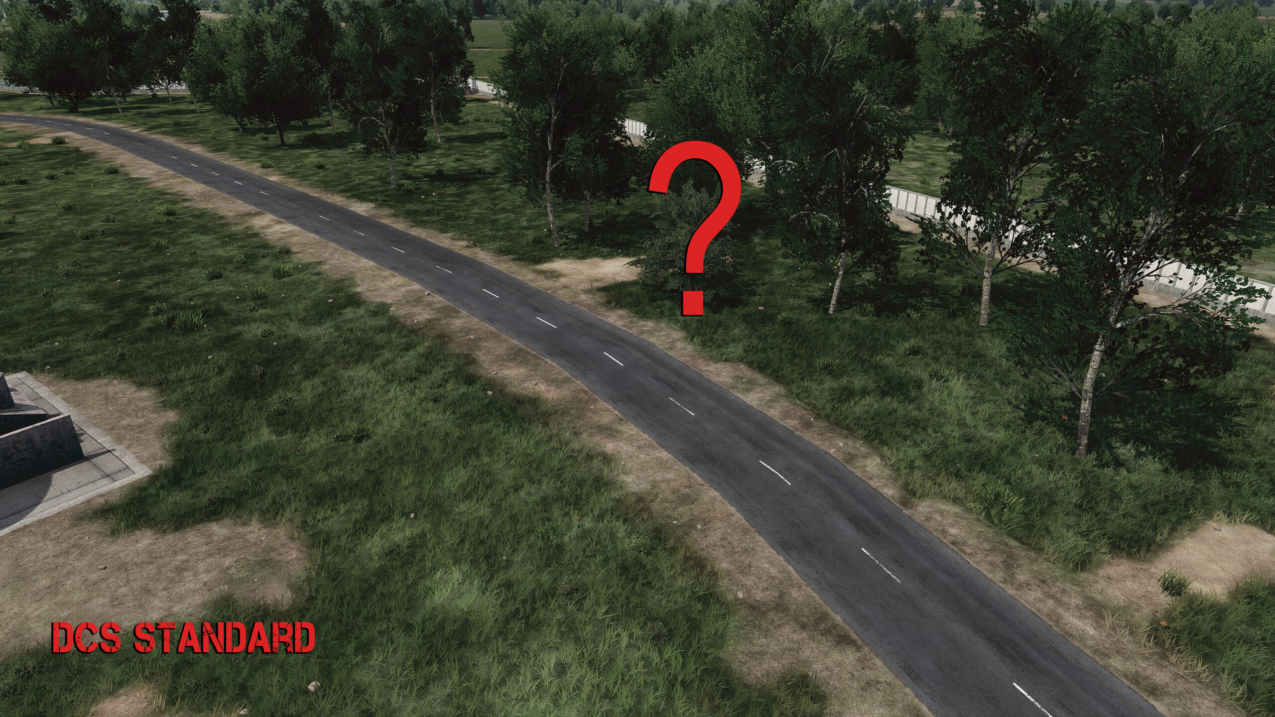
Reduce the Killer High Grass by at least 80%, it's driving me nuts to say the least, should not be difficult to reduce the model file in speedtree and implement it into the scenery file. And please, make the Airbases more accurate before even thinkin' bout Phase 2 or 3, at least the ground tiles and road map, up to the gates of all bases. Google maps, Bing maps will help you alot. Havin satellite images like the Afghanistan map remains a dream... Thanks... -
Eastern propaganda at Pferdsfeld road entrance
Ghostrida9 replied to gulredrel's topic in Bugs and Problems
LOL those billboards are hillarious... even the NATO ones... first time i saw them i burst out in laughter.. i thought about to do a mod with the Southpark cartoon on it.. use the Scenery remove object tool and remove them... -
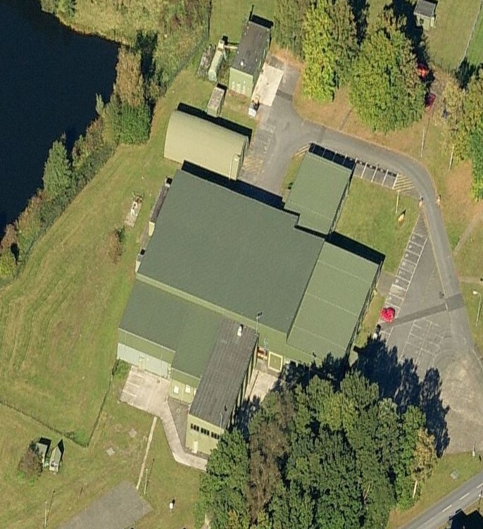
same goes for Büchel Airbase, and while we at it, the Tower is wrong, the Main Radar Tower is completely missing...
-
Gütersloh Airbase Project (Screenshots & resources)
Ghostrida9 replied to Ghostrida9's topic in DCS: Cold War Germany
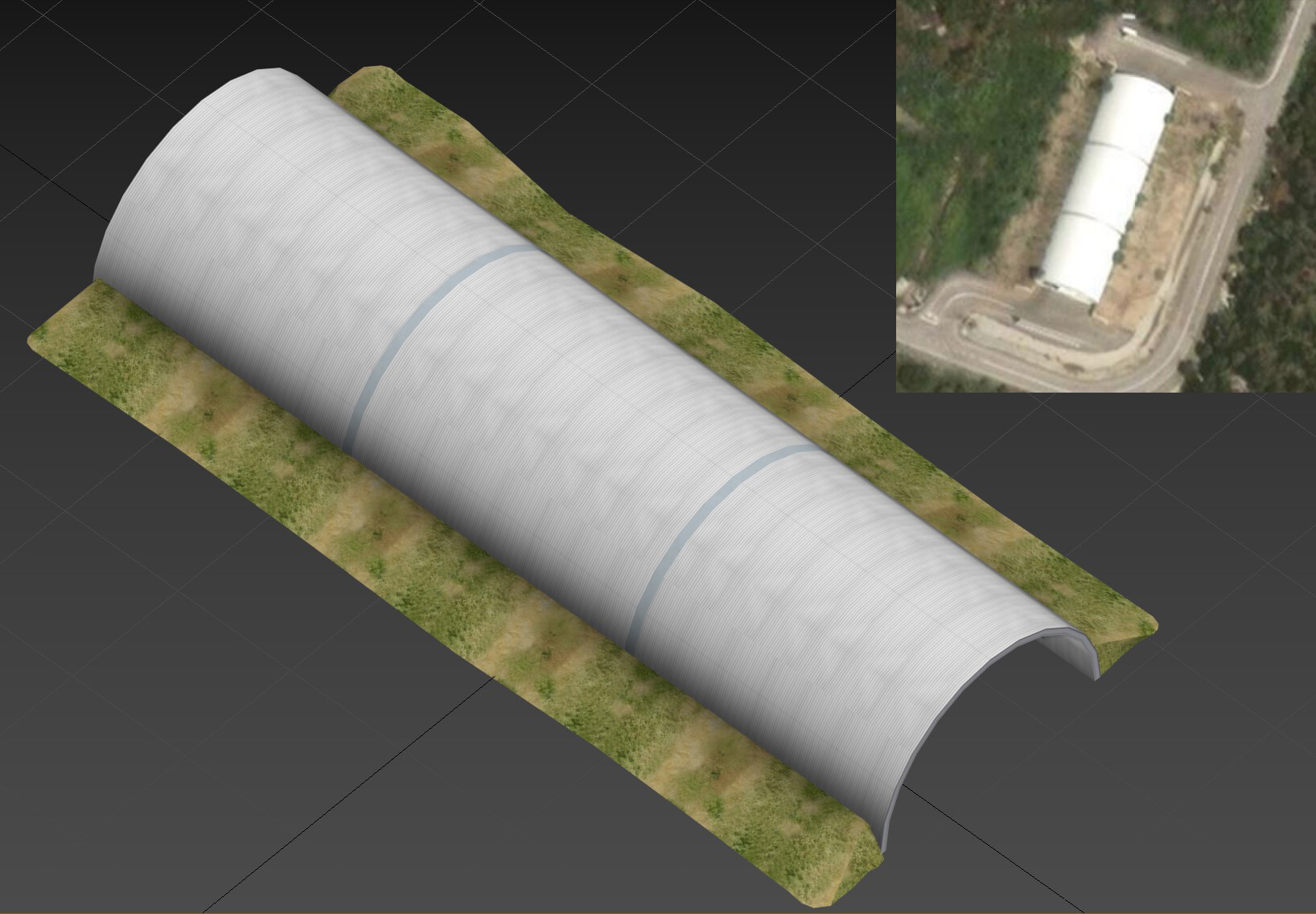
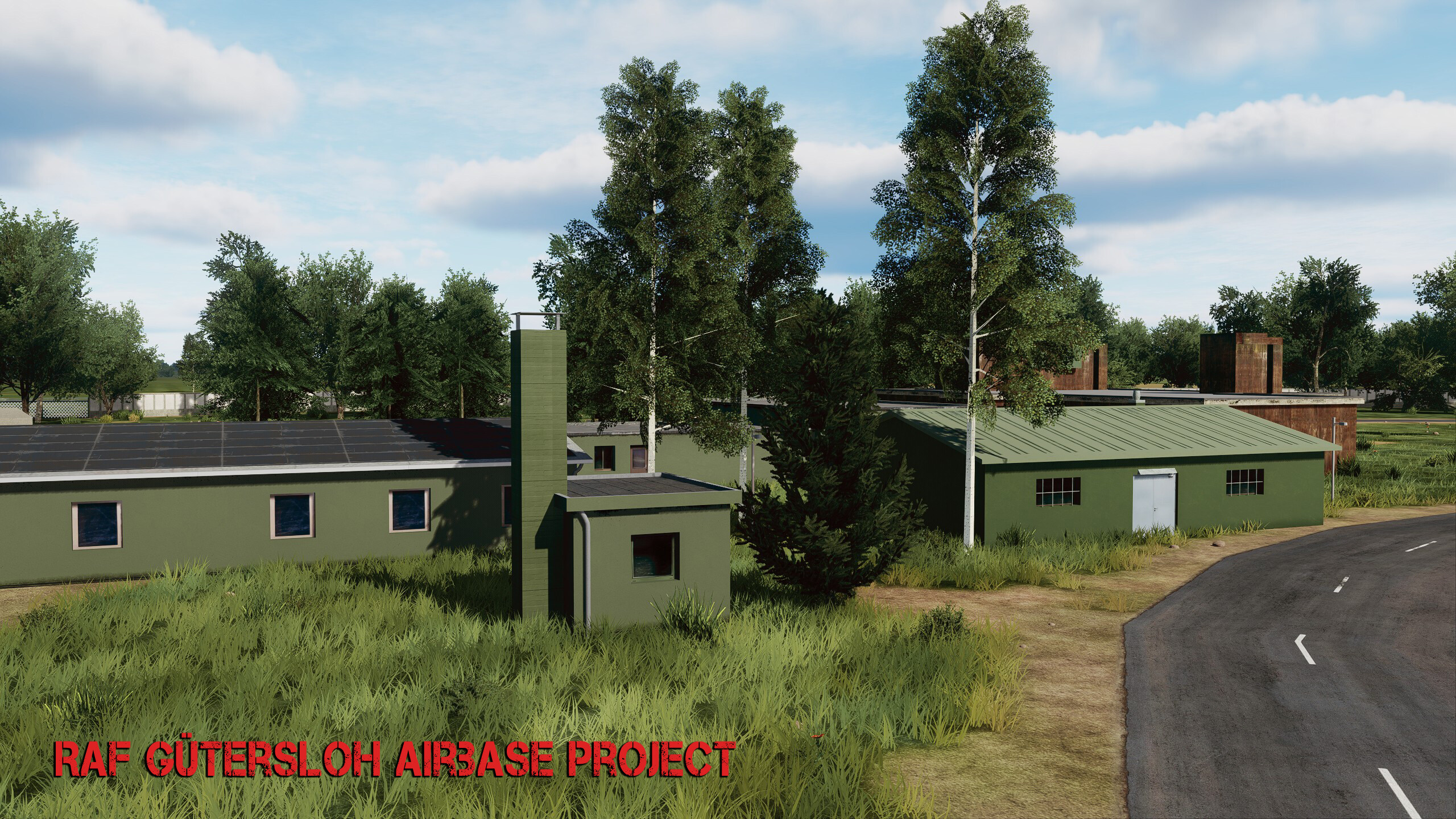
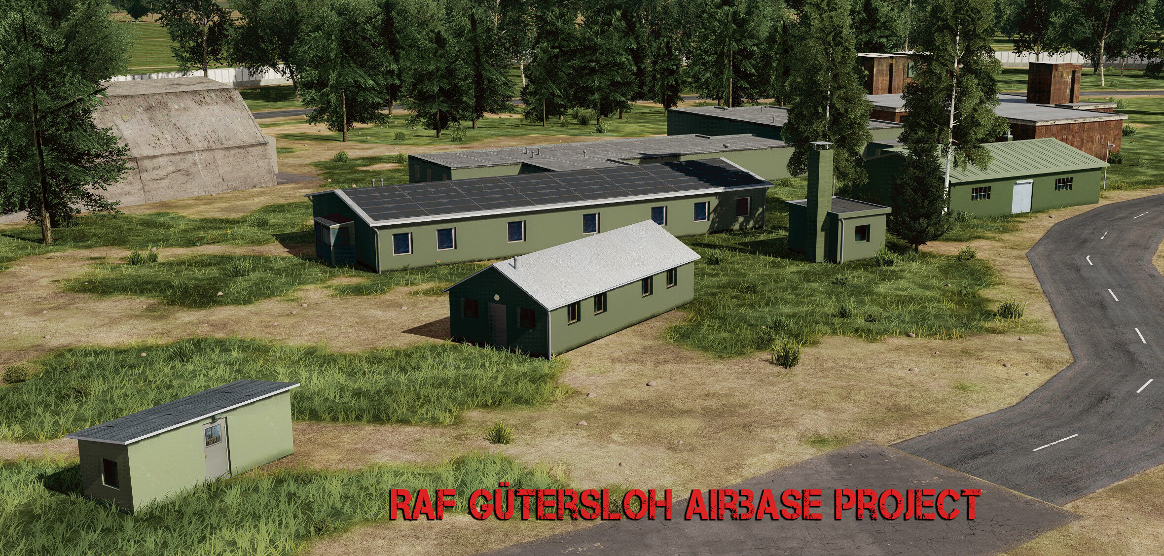
@Esac_mirmidon Thx.. @skywalker22 you probably know the basics but.. 1. Research, research..research 2. Create models and textures / Roughmets/ Normal maps and render them as dds/EDM files 3. create lua files 4. Headache...because you figure that the Airbase/Airport layout is inaccurate... 5. Thinking until you get headache again... 6. Headache..the Killer High grass is drivin you nuts... 7. A lot of trial and error.. Back to work. I'll be away for a week, but some more updates for now.. Again, UGRA has not yet created most of the critical military infrastructure like those huge "grass" bunkers...there're at least 3 of them at Gütersloh, the place is completely empty on their map.. no layout.. nothing !! Creating the ground layout above the "Killer Grass" is really annoying work to say the least...
- 70 replies
-
- 10
-
-
-
Gütersloh Airbase Project (Screenshots & resources)
Ghostrida9 replied to Ghostrida9's topic in DCS: Cold War Germany
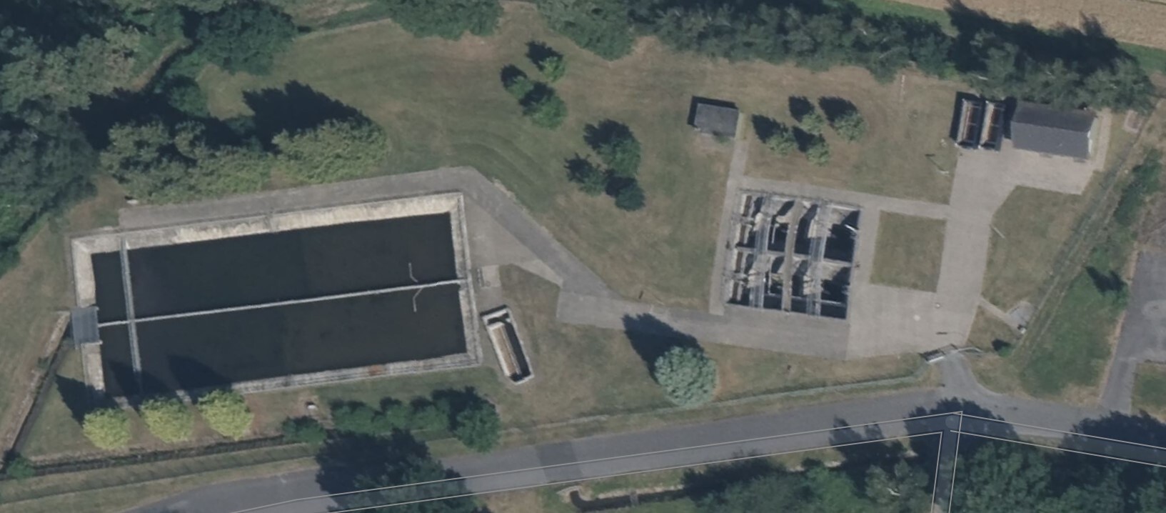
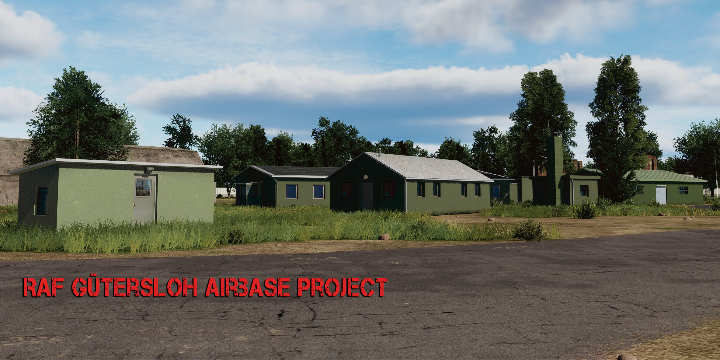
Thanks to all of you, Thx @Manschy, i allready have the "old" shelter door as texture so it's easy to change it, a good idea is to have maybe Hangar 6 and & 7 with the old doors and the rest with the new ones, so it's a bit of the base in it's transition. Regarding inaccuracy.. there's a waste water plant at the base located north west, close to the shelters.. i can understand that Ugra has not created the buildings or something.. ok, but not even creating the concrete ground tiles..?! just trees and thats it !!!!, They should really work with Satellite images, would be much much better. I tryed what i could to create this spot, still small parts of the KILLER HIGH GRASS is coming through... but, anyway you get it..
- 70 replies
-
- 11
-
-
-
Gütersloh Airbase Project (Screenshots & resources)
Ghostrida9 replied to Ghostrida9's topic in DCS: Cold War Germany
a lot is going on lately but i keep creating my own PBR textures when i get to it, it takes time but the good thing is that many of those textures can be used for many buildings. Just a few more normal maps and roughmets are missing. I also created a few more models allready.. anyway... a small update.. more soon
- 70 replies
-
- 19
-
-
-
yea, but on Airbases, its totally wrong. sure when the base should have that "many years abandoned look" then it's spot on... if this should represent a operational Airbase, then it's all wrong. So far the height of the grass is only accurate for the fields..
-
i fully agree, they should skip Phase II and III so far until the Airbases are fixed, lakes are missing around some bases, the Road map on bases is mostly inaccurate. Spangdahlem looks totally wrong, they even put a german village into the base almost, at a spot where the main gate is, and where storage buildings and military infrastructure should be. Also please add more parklng lots and more accurate detail according mostly to bing or google maps.. the detail we have right now is pretty inaccurate or unnecessary. I hope they give all Airbases a major overhaul. Radar Towers are missing and so much more...
-
Gütersloh Airbase Project (Screenshots & resources)
Ghostrida9 replied to Ghostrida9's topic in DCS: Cold War Germany
Ugra media has yet not created even one of the major buildings for this Airbase.. hope they skip Phase 2 and 3 until everything looks much more realistic, also the road map on this airbase is kinda off.. again, google maps is your friend to some degree. Same goes for all the other bases so far... work in progress model for the large Main hangars 2, 3, 5, and 6..
-
Gütersloh Airbase Project (Screenshots & resources)
Ghostrida9 replied to Ghostrida9's topic in DCS: Cold War Germany
Thanks a lot !! I had to create my own PBR textures and tryed different colors schemes that would work, I still need a few more but so far, things are going well. For the first time i also played around and created some Roughmets. Sure there's a lot when it comes to the landscape detail itself which is missing, even the small lake which is located north west of the base is missing and yes the Ems river is wrong.. don't know UGRA should work with Google or Bing maps so at the least the landscape and roads would be accurate. The "Killer High Grass" is a problem no matter what you try.. Roughmet..
- 70 replies
-
- 15
-
-