EFGross
-
Posts
68 -
Joined
-
Last visited
Content Type
Profiles
Forums
Events
Everything posted by EFGross
-
Switching to the front seat and we bob up from 20 feet to 100 feet.
EFGross replied to cobrabase's topic in Bugs and Problems
he also appears to increase altitude significantly if you switch him from AGL reference to Barometric reference -
Doesn't work well with mapping in voiceattack. Had every function in the old menu fully mapped using only the W, S, A and D keys, including changing speeds and elevation. Can't figure this one out fully. Especially the new search functions.
-
Please add keybinds for all the George functions available in the AI menu.
-
Ok thank you
-
And nothing has changed since Tuesday and now the getting same error with the folder on my desktop
-
The desktop is fine for now. I'd be up to trying this new version if you need a guinea pig but need to finish getting the current one set up. Haven't even tried it with VA yet other than to verify the plug-in is loading.
-
Thx for that link. I'll keep playing with the file location to see if I can figure out another spot to put it
-
I have it excluded in my antivirus software and everything is there except I don't see the example VA profile that's referred to in the instructions. THat being said, I've tried with the folder in the root of my C drive, my documents folder, program files, program files (x86) and desktop. The only location it works that I don't get that error is my desktop....
-
Anyone seen this before? Just installing WA for the first time. Have the WA folder in my saved games/DCS folder, plugin is in place and shows in voice attack, VCP set to VSPX. Just have to set the WA start and stop in VA. The settings.cfg file is in the WA folder.null WhisperAttack.log

-
DTC for DCS - new version 7.2.0 - Apache added
EFGross replied to SFJackBauer's topic in DCS Modding
any chance for adding in the ability to load laser codes for the Apache? -
Not so lucky here
-
anyone with link cable connection issues?
-
I didnt know incorrect maps because the imagery was not interpreted correctly is a wish list item. Go Figure.
- 1 reply
-
- 2
-

-
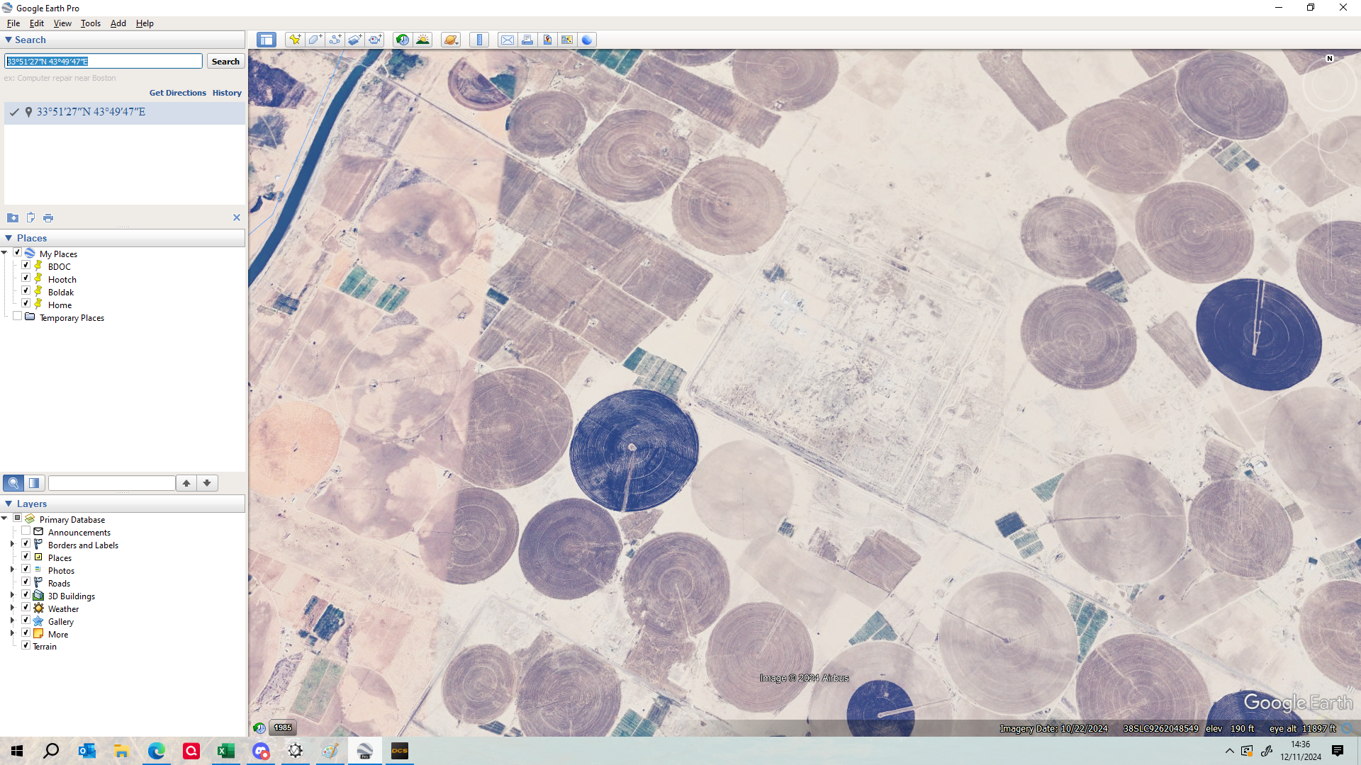
Muthanna Chemical Complex missing the berm around the entire complex and the actual bunkers. Looks like an imagery issue. The bunkers were ~ 50-60 tall with each part of the cross about 360 feet long. Berm was a good 10-15 feet tall. Should be destructible since this was a major target at the start of Desert Storm. We were there in 2007-2008 still guarding the sealed bunkers that contained munitions that couldn't be removed.nullnullnullnullnullnullnullnullnull
- 1 reply
-
- 1
-
-
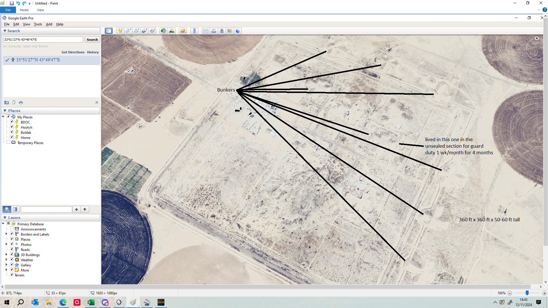
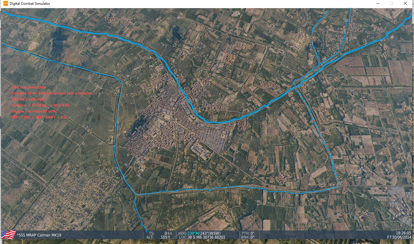
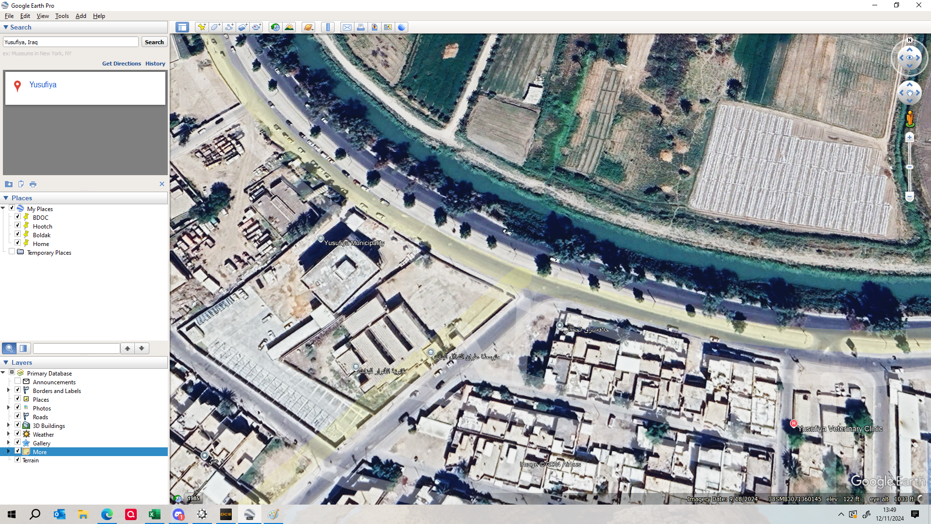
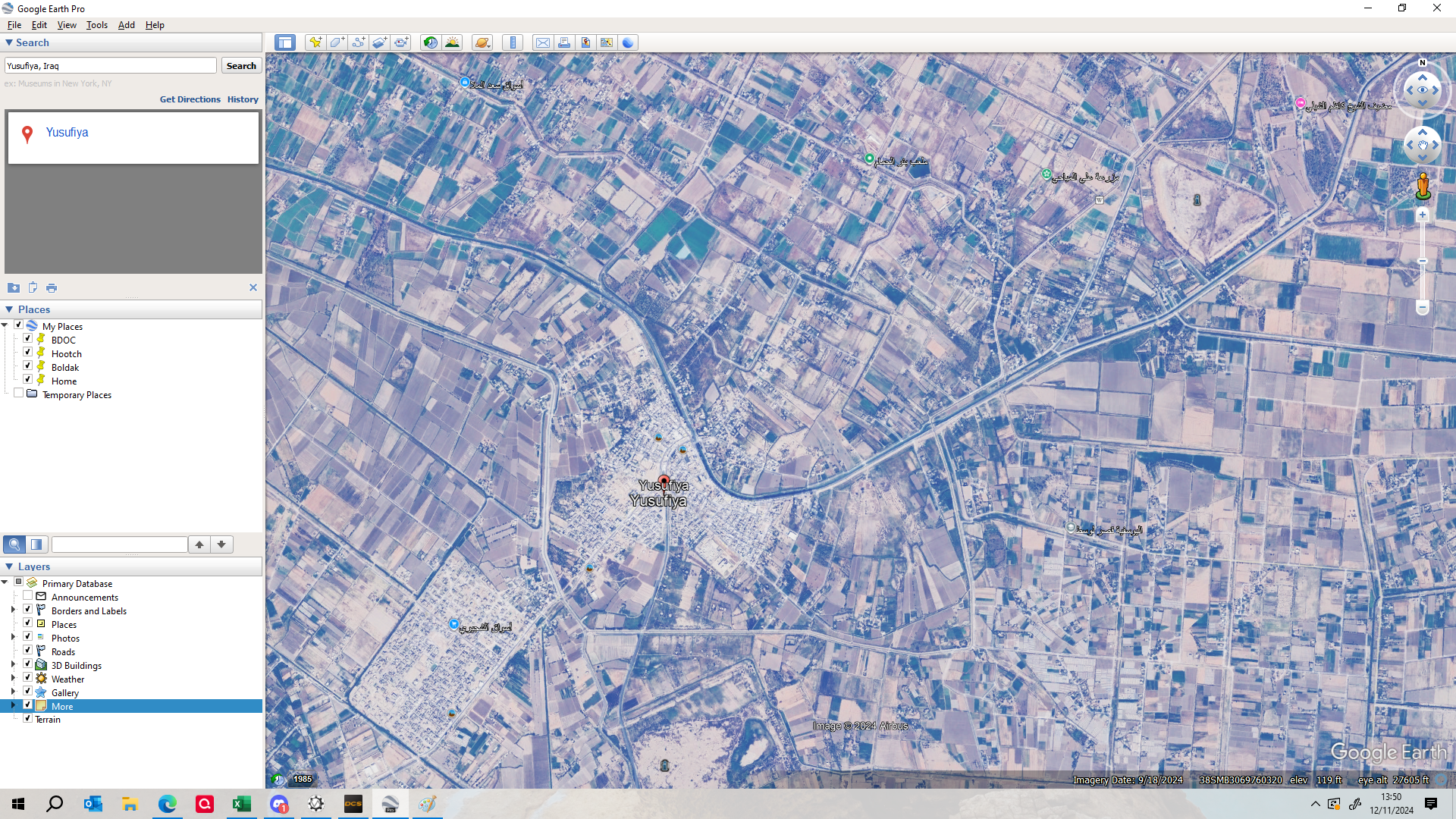
I found an understandable error if you all could look at it when you can. There is a major canal to the north of the main E-W road through town you all have as grass (which could be mistaken for grass as you all have it if you were looking at something like GoogleEarth and didnt know any better). I placed a MRAP on the intersection next to the local school we were based out (in DCS its the one to the SW of the MRAP and has tables and chairs on the roof - GoogleEarth is the 3 sectioned large building). Also, there's a lot of minor canals all over the Triangle of Death region that are showing as roads. The area was nulllittered with them coming off the main canal. The 3d DCS pic has some of the larger side canals marked in the Yusufiya area. They all had canal roads alongside but the water is missing in DCS. nullnullnullnullnull
- 1 reply
-
- 4
-
-
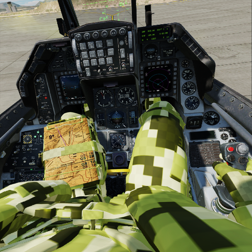
OpenKneeboard with one of its tabs set to DCS Web Viewer would give you what you're asking about. I use that because I suffer from the F10 back to F1 FPS loss issue. pic is what shows with the Apache Afghanistan Runway Start Instant Missionnull
-
I gave it a shot using Taz's instructions link. It took the stock texture files for the 47 in Mods\aircraft\CH-47F\Cockpit\Textures\ and CoreMods\aircraft\CH-47F\Textures from 4.6? GB total to 1.23 GB. Not seeing any visual glitches (the weird missing texture camo pattern) in 2D or VR, in cockpit or external views. Got about 0.9 GB VRAM improvement in the Cold Start at Camp Bastion instant mission after an auto start was complete. I haven't been able to fully test and this is my first time so don't get your hopes up. Link is set up for OVGME. MI - Optimized CH-47F - Google Drive
-
Thank you much Majick, that was it.
-
I was flying around in the F16 last night for the first time since the patch and all the pilot textures are showing the green, white and black checkerboard textures. It's fine when I disable the optimized F16 textures (standalone, doesnt appear to be from the ones in the core mods. Anyone know which files in the zip are for the pilot?null
-
Per previous posts, they had been holding off on posting videos because of only wanting to do them once since some of the functionality and features (e.g. some cockpits gauges in this case with the cockpit views) needed to be fixed first. Original plan was concurrent or just after release but this is likely due to the backlash, and his wording could be construed as a 'legal disclaimer' that stuff is going to change.
-
Is Bastion and Helmand supposed to look like this?
EFGross replied to Gunfreak's topic in DCS: Afghanistan
Gunfreak - posted this up on one of the other posts. There is another post below mine from someone else with some zoomed in imagery, then another by me with zoomed out imagery -
Here is a zoomed out view of the GoogleEarth Pro April 2013 imagery. Has the trash burn area to the SW of the BDOC, you can barely see the disturbances and traffic rutting in the west just outside the west boundary of the base where we used to test fire weapons if you're zoomed into that area, and (although I cant say if its the average number) there is a representation of where the aircraft were staged over on Bastion. If you're zoomed in you can get a much better view of the zig zag and berms on the south gate straight down from the BDOC as well as the guard tower locations around the base (aka elevated sand-bagged posts built into the outer berms - see 2nd pic for an inside view of one). MEF headquarters is clearly visible if you know what you're looking at in addition to the main gate to the north (to the right of the N325214.88 mark). Since Leatherneck/Bastion was infiltrated in 2012 by the Taliban and again in 2013 and 2019 some people might find it useful if they're looking to recreate these events in any fashion. Another issue in the DCS map (once again, not easy to know if you weren't there), are that the heads are modeled as open air buidlings with just posts and a roof. Also there are trees which werent there IRL. null