ASAP
-
Posts
550 -
Joined
-
Last visited
Content Type
Profiles
Forums
Events
Everything posted by ASAP
-
The text book answer is that it is that weaponeering and tactics are primarily the aircrews responsibility. JTACS don't dictate what ordinance they want, they dictate what the ground commander's intent is for the target. JTACS ask the aircraft for a specific effect (complete destruction, suppression, destroy an artillery piece vs the people using it, etc...). They might recommend or request a specific ordinance, but the pilot is the one who decides the best way to get that effect with what they are carrying. The JTAC can make restrictions like "save at least 1xGBU-54 for follow on targets", "No cluster bombs", or "Don't use any cratering munitions on the runway" or something like that. In theory at least, the pilot has a much better understanding of the weapons they are carrying, and their aircrafts specific tactics and ability to deliver it considering accuracy, probability of destruction, threat exposure, etc... While picking that weapon though they have to come to an agreement with the JTAC because of issues like theater ROE, special intructions (SPINS), run in restrictions, danger close considerations and collateral damage, just to name a few. If the JTAC doesn't like the plan they wont clear the aircraft to release, but they shouldn't be dictating specific weapons. Generally speaking though, as long as the ground commander is getting the desired effect it should all be the same to them. I'm sure there are probably plenty of real world examples where it has happened before, but that's a different topic.
-
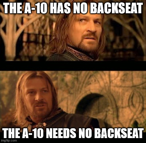
Watch: The World's Only Two Place Warthog in Action
ASAP replied to King39's topic in DCS: A-10C II Tank Killer

-
Not so much a systems functionality question, but what is your normal dwell state regarding what screen you have called up and what mode its in during each phase of flight if its not being needed for anything specific at the moment. There's a ton of different screens and options to get lost in.
-
Watch: The World's Only Two Place Warthog in Action
ASAP replied to King39's topic in DCS: A-10C II Tank Killer
As far as I know there were two ever built. One is in the boneyard at DM, the other is in an air museum somewhere. The A-10 community decided there was no need for a back seater to assist the pilot executing the FAC-A role, and it wasn't any value added for training so it was determined to be a big waist of money and they scrapped it. And the Air Force has never been overly enthusiastic about throwing money at the A-10 anyway... -
Yeah the seeker biting off specifically on runway lights for some reason is a bug, especially if you can't slew off of it and lock onto the target or it always insists on only locking onto the light. I meant in the bigger context of maverick behaviour this would actually be pretty realistic. The seeker looks for points of contrast in an image and bounds on them so small objects like bushes, trees, fences, and especially shadows, even the targets shadow are things the maverick could lock onto. It would be far more realistic if DCS players have to contend with those issues like in the real world (as opposed to slave all to SPI, TMS forward short = lock on exactly what your TGP was looking at with no issues).
-
I'd also like to point out that a maverick locking onto fences, shadows, bushes near the target is not a bug at all. Thats a realistic problem that has to be accounted for by real pilots. The seeker is just looking for points of contrast on the video. The pilot has to verify that it is indeed locked onto the correct target and if not, they need to not rifle/slew the seeker onto the correct target. Its only a bug if it does have a good lock w/ the good lock logic talked about by everyone else above, and then bites off on the wrong thing after being rifled... Although from my understanding that's not entirely unheard of in real life either.
-
My first guess would be that you don't have a good lock on what you are trying to shoot at. How are you locking the target up? You need to slew the tracking gates onto the target to get the maverick seeker to get a lock. DMS UP & HOLD to space stabilize the seeker helps a lot, you have to release the DMS switch once you've slewed the tracking gates in order for it to lock. If done correctly you should see the tracking gates close in on the target indicating a good lock on the thing that's in the center of the crosshairs. Its up to you to determine if that thing is what you are trying to shoot. Also at least with a real maverick you'd want to ensure that the cross symbol floating around the screen isn't flashing because that indicates the missile wont be able to keep its lock during the launch transients. BUT I don't think it's accurately moddeled in DCS because the cross never stops flashing for me and it doesn't seem to care, the missile still hits the target.
-
Thats the exact opposite of what you should get. In the A-10 you should get DME but no bearing to the tanker.
-
This made my day
-
Interesting testing results. Thanks, I wouldn't have expected that. I suspect that is pretty unrealisticly modeled in DCS. In real life it's primarily used for moving targets and armor. Its only got a 300 lb warcranium that is designed to punch through armor. It is specifically not desgined to do a lot of splash damage like what DCS is demonstrating. It hits a small point target very percisely and very hard. It's not going to do anywhere near the same amount of blast or frag damage as a 500lb GP bomb (which is what you'd want to kill soft skinned vehicles or troops in the open), especially if the bomb is an air burst. Since the maverick is contact fuzed it'd probably hit the ground near infantry and most of the explosive, fragmentation force would go into the ground and downrange of the impact. You'd probably injure or kill a few unlucky guys close in, but nothing close to GP bombs.
-
Unfortunatley, you can't drop JDAMs in CCIP they are CCRP only. The only PGM you can drop CCIP is the GBU-10/12. The GBU-31/38/54 has to communicate with the jet, get good coordinates, verify good parameters with the jet and only then will the jet allow the weapon to release. If you're outside the launch acceptability region the bomb wont drop, and if you quick pickle like the OP was talking about the bomb cant complete that whole cycle and it wont release. It seems like a pretty big oversight on the part of the engineers that there isn't an option to drop it like a Mk-82/84, it would make the weapon a lot more flexible, but it is what it is.
-
Watch: The World's Only Two Place Warthog in Action
ASAP replied to King39's topic in DCS: A-10C II Tank Killer
-
What was your altitude? even at 15 degrees of dive depending on altitude it might not be able to compute. for the A-10, unless you are down low (<1000AGL) 15 degrees is a really shallow dive angle it could be the aircraft was unable to do its look-aside ranging properly if you were too high/shallow. Try pointing the nose 30-45 degrees nose low and you'll probably get a CCIP solution. If that doesn't work then I'd need to see a video or something to figure out what you're doing. CCIP doesn't care about your SPI, you should get accurate symbology even if your SPI is on the other side of the planet. One other thought: were you in GUNS mode in the HUD vs CCIP with some other weapon profile called up? Its possible have the gun pipper in the HUD while you have CCIP rockets or bombs selected at the same time. It could be the CCIP INVALID was for the rocket solution or something... I'm just spitballing ideas what could cause it really. Like I said, try getting lower/steeper with your guns passes and see if that helps. If it doesn't work then maybe theres some other switch error somewhere with EAC or LASTE.
-
Most likely a quick pickle. When you try to release the bomb make sure you hold the pickle button until the bomb leaves the jet. If you hit and release the button to quicly you'll get the release aborted WCN It might release if you immediatley hold the pickle down and the weapon is still in LAR but you've only got a couple of seconds. After that, like you said, the bomb is a paperweight along for the ride. You should get the pipper once you roll in and point your nose at the ground. The CCIP invalid means IFFCC can't calculate a solution based on where your nose is currently pointed (and a bunch of other parameters). Your SPI doesn't have anything to do with your CCIP solution, that only impacts CCRP deliveries (CCRP is always based on your SPI). If you are using CCRP to drop bombs the elevation of your SPI needs to be 0 ft AGL. if you drop steerpoint SPI and your steerpoint is at 12K MSL the only guarantee is that your bomb is going anywhere but the desired point of impact. In the rare instance when you are shooting at something on the side of a mountain and your target is above the actual horizon, you'd need to change your gun pipper to the 4k wind corrected because the IFFCC can't compute look up shots like that.
-
I'd go with what the thick line says. Best turn rate is at 320 ish knots. turn radius is pretty consistent through most of the flight envelope around.
-
Wow, thanks everyone! Looks like there are a couple of good examples of uses for IFFCC SPI. From what you guys shared and i've been able to find since I asked that question it looks lFFCC SPI just gives you another set of options to do stuff that you can already be done by other methods (i.e. mark Z to share what you shot with flight members, dropping steerpoint SPI instead of waypoint ID in the DSMS, etc). I haven't found anything that makes IFFCC SPI uniquely better or worse than the other methods, so it probably comes down to pilot preference. If there is a situation where IFFCC SPI is the only or best option please let me know. Like I said, I always want to learn better ways of doing things. I'm going to guess based on what my A-10 pilot friend said that IFFCC SPI is not a normal part of his habit patterns and probably just prefers to uses the other tools available on the jet. Based on the fact that IRL the A-10 hasn't been used for AI in a long time, and the dynamic nature of CAS, I'm curious how often the WAYPT ID on the JDAM profile gets used.
-
You've piqued my curiosity, like what? (< Not sarcasm, I'm legit curious)
-
If you're HUD SOI TMS aft short will make IFFCC SPI, and it will say IFFCC SPI on the bottom left of your HUD. From what I can tell, and what I've gathered from talking to the A-10 pilots IFFCC SPI is pretty much useless from a tactical/weapons delivery standpoint. It is only important to know how to recognize you accidently set IFFCC SPI so you can immediatley change it to something else.
-
In aviation winds are always expressed in the direction its coming from.
-
Maybe a better post for the wishlist, but it would be great if DCS actually had realistic instrument approach procedures created for each of the modeled airfields that mirrored real world procedures, but are actually guarunteed to work in DCS. If actual approach plates do exist somewhere for the in game runways please someone let me know.
-
What runway? How do you have the NMSP set up and is the the correct course for the runway dialed in on the HSI?
-
You're right, I just went back and tried it and coordinate ranging worked the way I'd expect. Im not sure what was going on the other day when I tried it. I might have missed a switch or something that was screwing that up. As far as the mission planning goes, I agree it can be done. And I get why its necessary to have altitudes for waypoints so the AI can follow it. To ammend exaclty what my wishlist request is: they should make the A-10 like the mirage is apparently is already and in the jet the steerpoints should be clamped to 0 feet AGL, regardless of what was put in the mission planning tool.
-
yeah I noticed that too. I wish their was an option to keep it visibile, it'd be more realistic. I think I read about them doing something like that with the AH-64.
-
The DMS Left Long HOTAS is realistic to the jet. It just turns the projection in the monocle on and off. It pretty much just puts it into standbye mode. That way it can be switched off if its a destraction and not a help.
-
My original post wasn't very well worded. ^ This is exactly the behaviour that I was saying the A-10 needs. In the jet there is no real reason to have the waypoint floating in the sky thousands of feet above the ground. If the player should be flying at 10 thousand feet, put that in the brief, or have the scripted ATC clear them to that altitude. I guess it gets into the debate of what makes sense for a simulator for the masses vs whats more realistic. Maybe there should be an option in the settings for the behaviour that Frederf was talking about. IRL the A-10C is not authorized terminal RNAV/VNAV procedures. They always have their waypoints at 0 AGL. Waypoints at altitude is more of a DCS thing (at least for the A-10). I get it for DCS, it makes things a lot simpler for people to follow flight plans since in game ATC and JTACS can't manage everyone's altitudes, and the AI obviously need it. IRL hawg pilots know what altitude to fly at either because they are being vectored or controlled, or its part of their mission planning/local procedures. The hud already provides a steering cue at the bottom of the HUD which is all you need to steer to it. Yes, they'd see the steering container at some point fly under their nose, but that doesn't really matter. The point being stabilized on the ground gives them an exact piece of terrain to fly over.