graveyard4DCS
-
Posts
162 -
Joined
-
Last visited
Content Type
Profiles
Forums
Events
Everything posted by graveyard4DCS
-
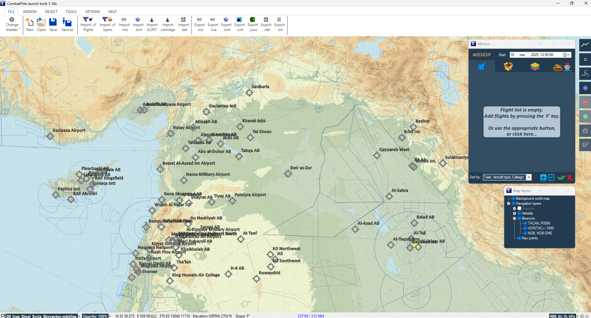
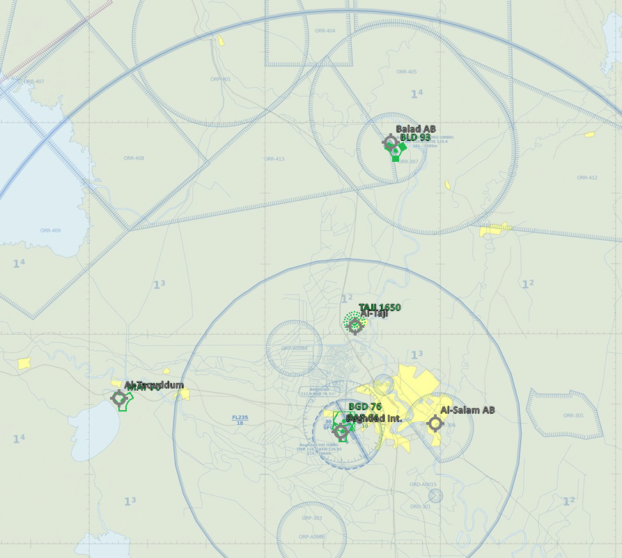
Hello, You'll find attached the syria.xml file with all airfields and beacons for both Syria and Iraq theaters. You can now use CombatFlite on both of them! Enjoy!null syria.xml

-
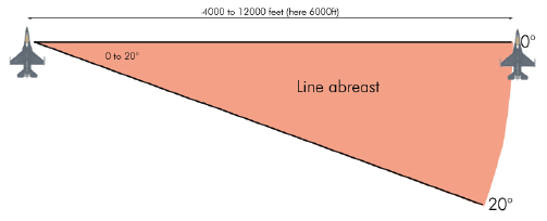
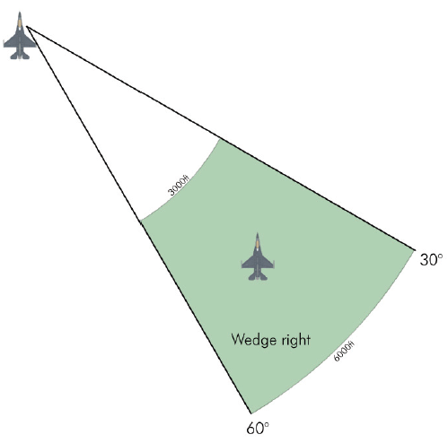
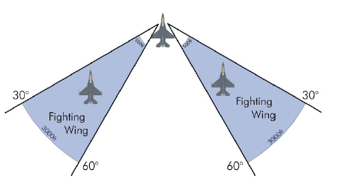
After a previous post on runway attacks — “Is (Almost) Everyone Doing It Wrong???” — I thought it was time to look at another area where fundamentals are often misunderstood: formation flying. Yes, it’s fun to fly tight and get the perfect screenshot, but tactical formations aren’t about looking good — they’re about mutual support, survivability, and combat performance. And just like with runway strikes, a lot of DCS players are unintentionally flying in ways that greatly reduce their effectiveness. This post intends to highlight two of the most common mistakes that show up again and again in MP flights and training servers. Tactical 2-Ship Formations: Quick Overview Line Abreast: the default combat geometry. Both aircraft fly side by side, offering full radar separation, 360° visual coverage, and flexibility for offensive or defensive turns. Wedge: wingman is 30–45° back and offset. More maneuverable, better for terrain or fluid situations, but reduces rearward lookout — especially for the wingman. Fighting Wing: tight and offset behind the lead. Works for training, weather, or short strike runs, but has nearly no place in contested airspace. Limits visibility, and reaction time. Common Mistake 1: Flying Too Close Flying tight may look sharp, but in combat it kills effectiveness. The wingman becomes fixated on avoiding the lead, leaving little mental bandwidth for scanning threats or managing weapons. Visual scan collapses. Radar coverage overlaps. Mutual support disappears. Tactical spacing should allow: A break turn toward your six without risk of collision. Enough distance to remain outside minimum range for your own weapons. As a rule: the faster and higher you go, the more spacing you need. 1.5 –2.5 Nm at low level is normal. At altitude or during supersonic cruise, 4–5 Nm may be required. If you're flying that close in combat, you're too close... Common Mistake 2: Flying on the Wrong Side Wingman position is tactical, not cosmetic. You're not just mirroring your lead — you’re scanning a specific part of the sky. The wingman is responsible for a visual and radar sector. Flying on the wrong side creates blind zones and ruins mutual support. Here’s how to choose the correct side: If there's a known threat — fly opposite. If not — position opposite the most significant air traffic. Still nothing? — avoid terrain hazards like antennas or cities. Clean airspace? — fly opposite the sun. That old trick of diving out of the sun still works, especially when nobody’s watching. Want More? This post just scratches the surface. Read the full article to know more!
- 1 reply
-
- 8
-

-
 You can see the CGRS map of Iraq here. You'll see the KB naming system for Desert Storm and for OEF. The naming system for OIF and OEF were the same for the whole CENTCOM AOR so it can easily be derived from the OEF one. You can contact me in PM if you'd like a custom map.
 -
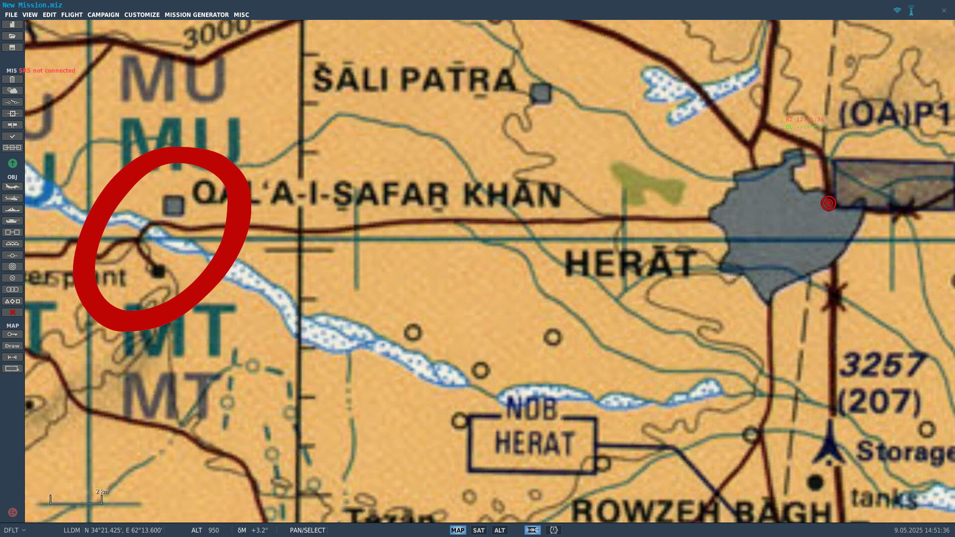
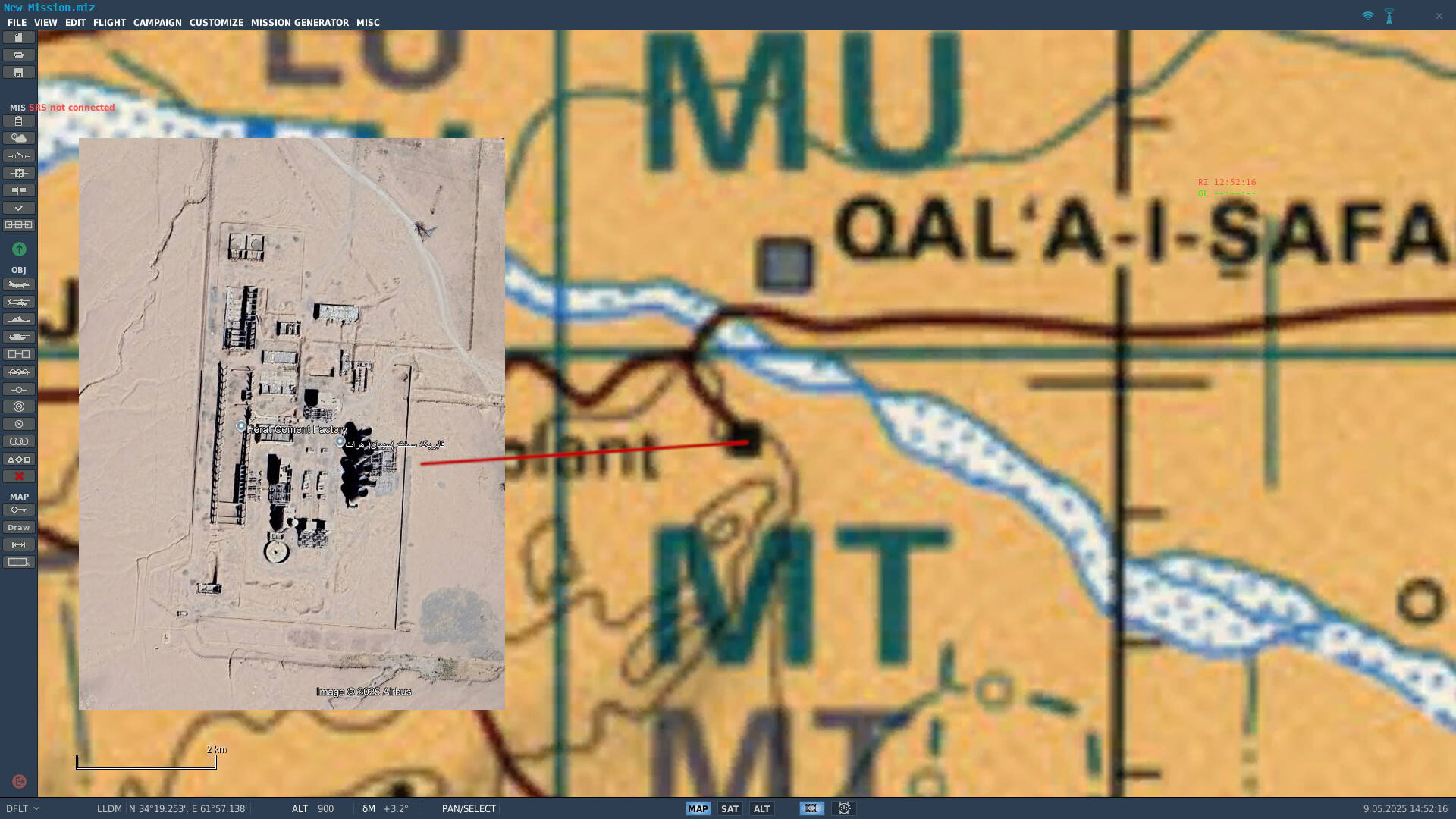
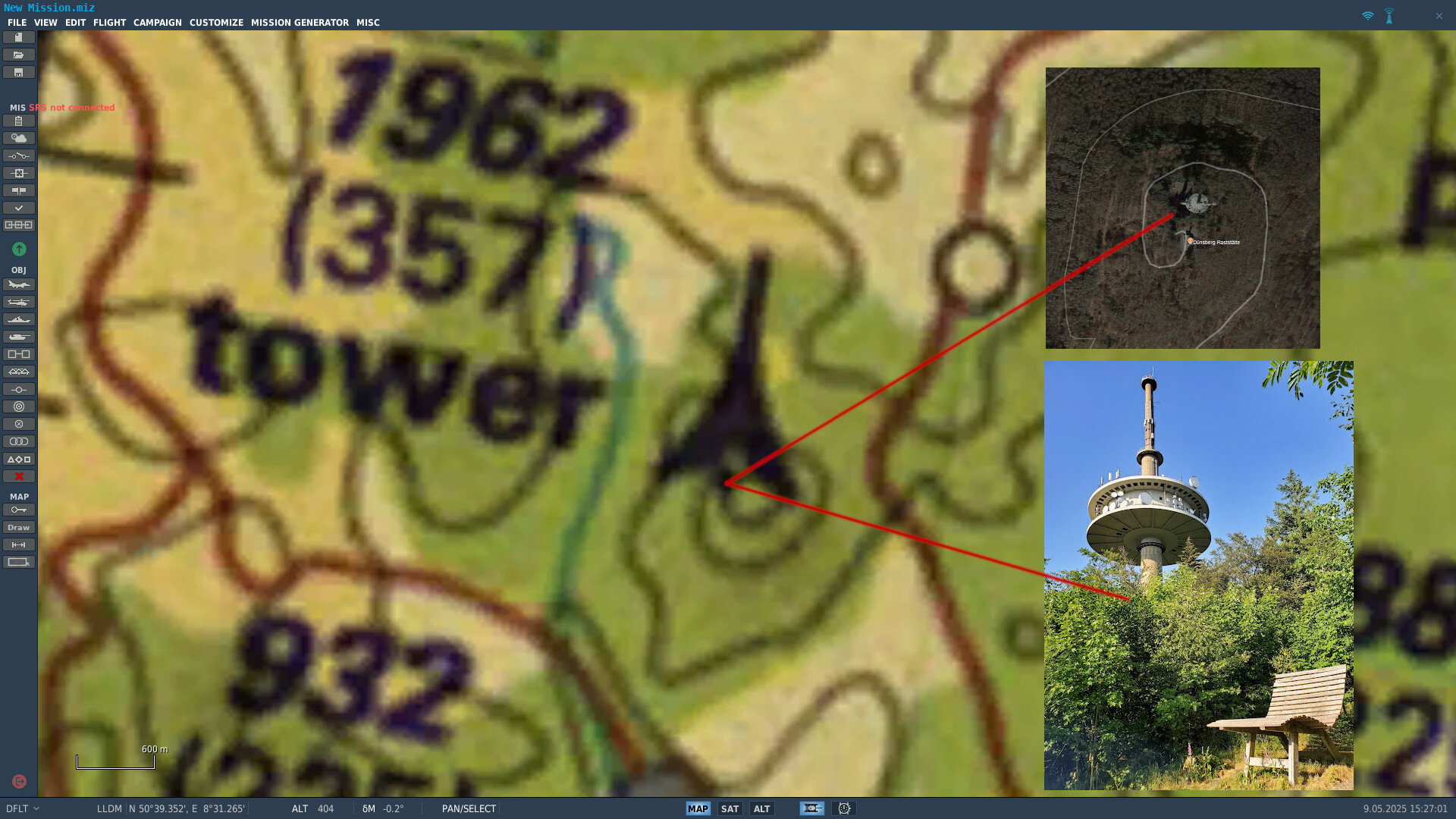
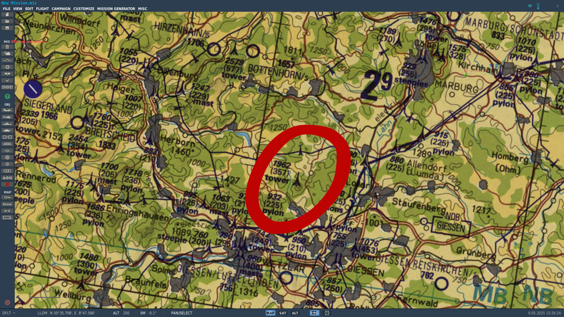
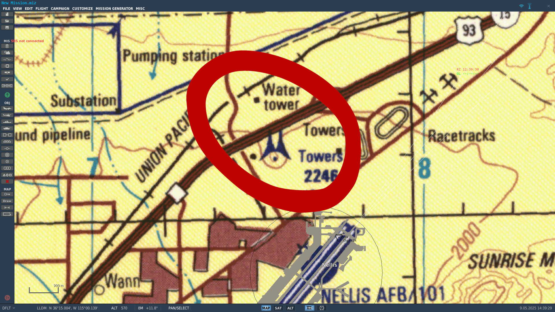
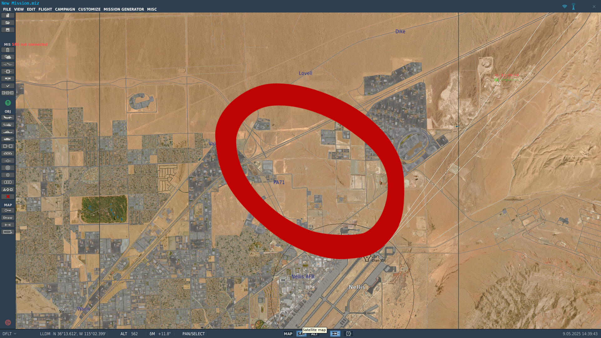
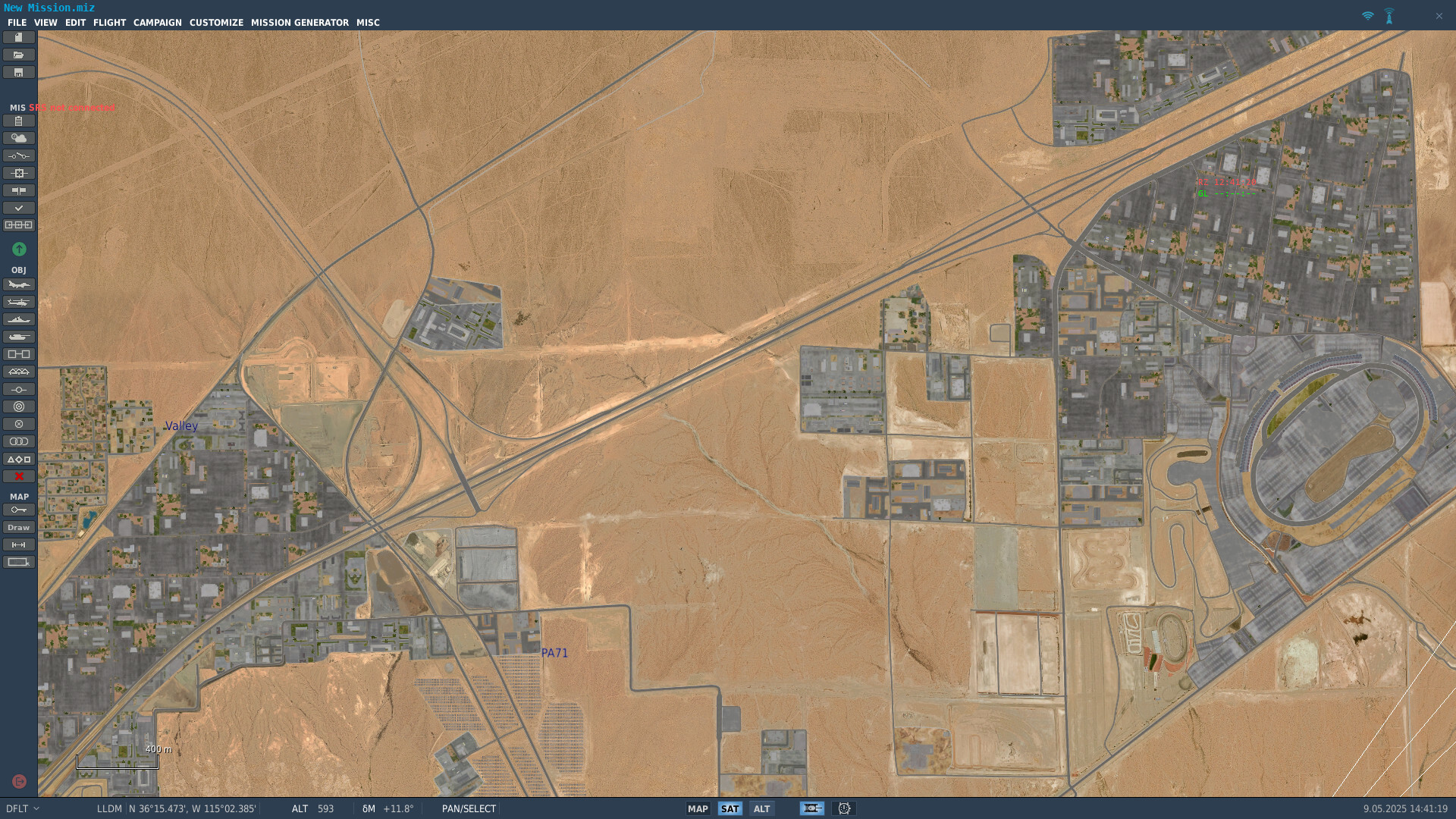
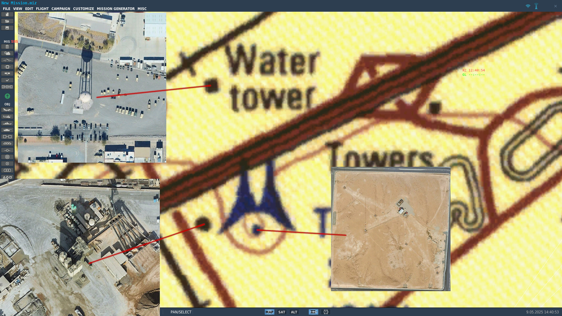
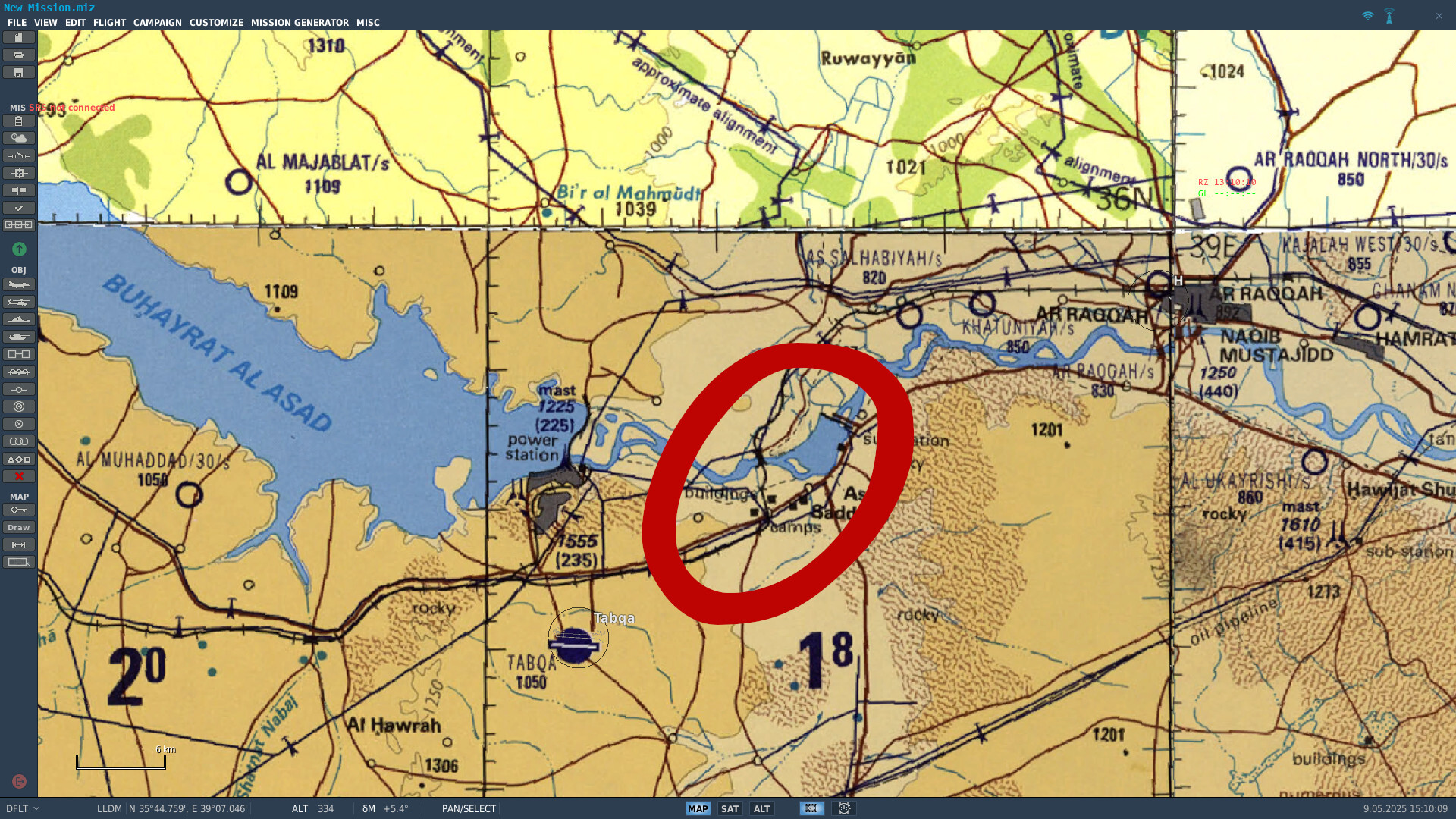
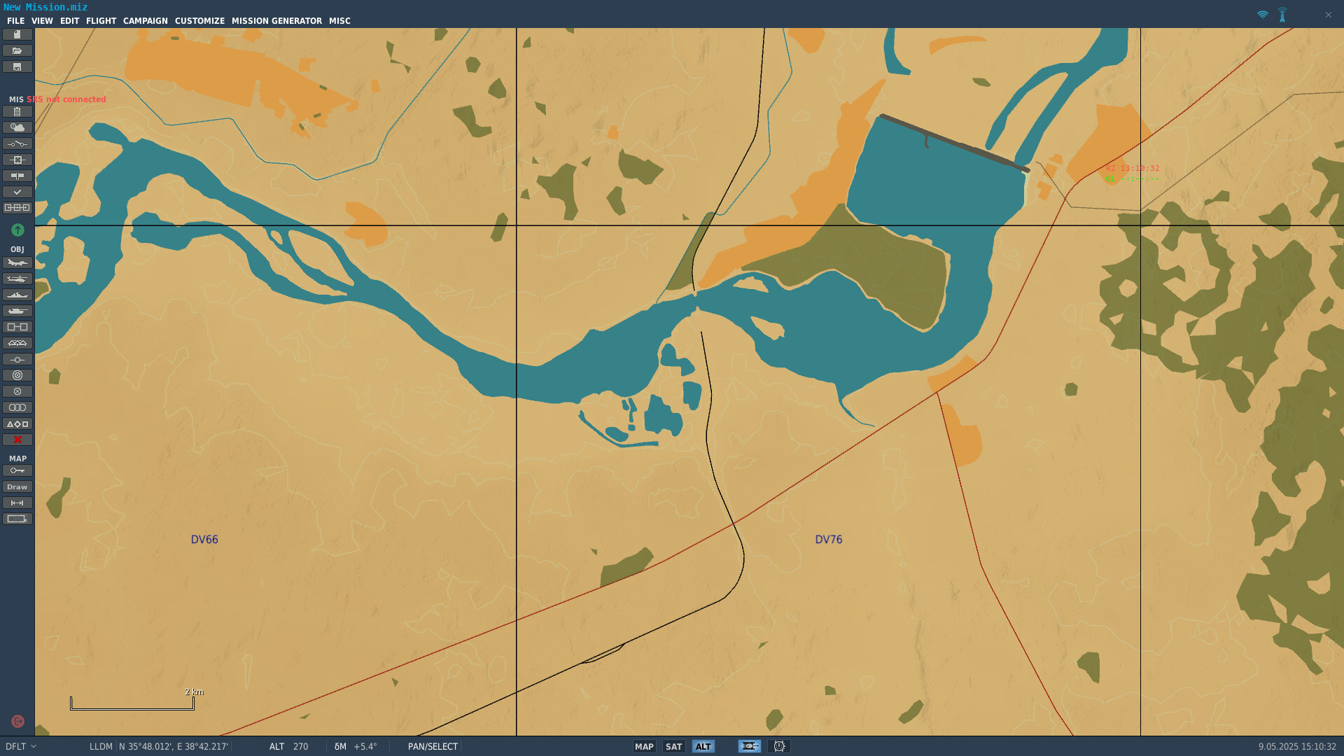
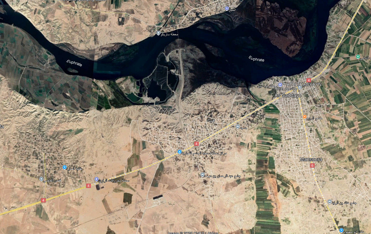
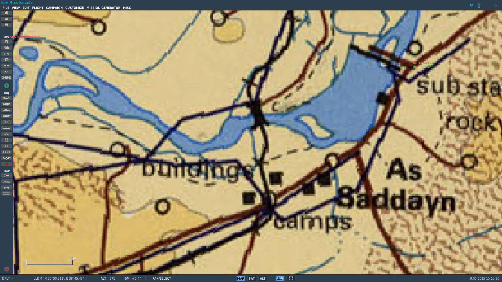
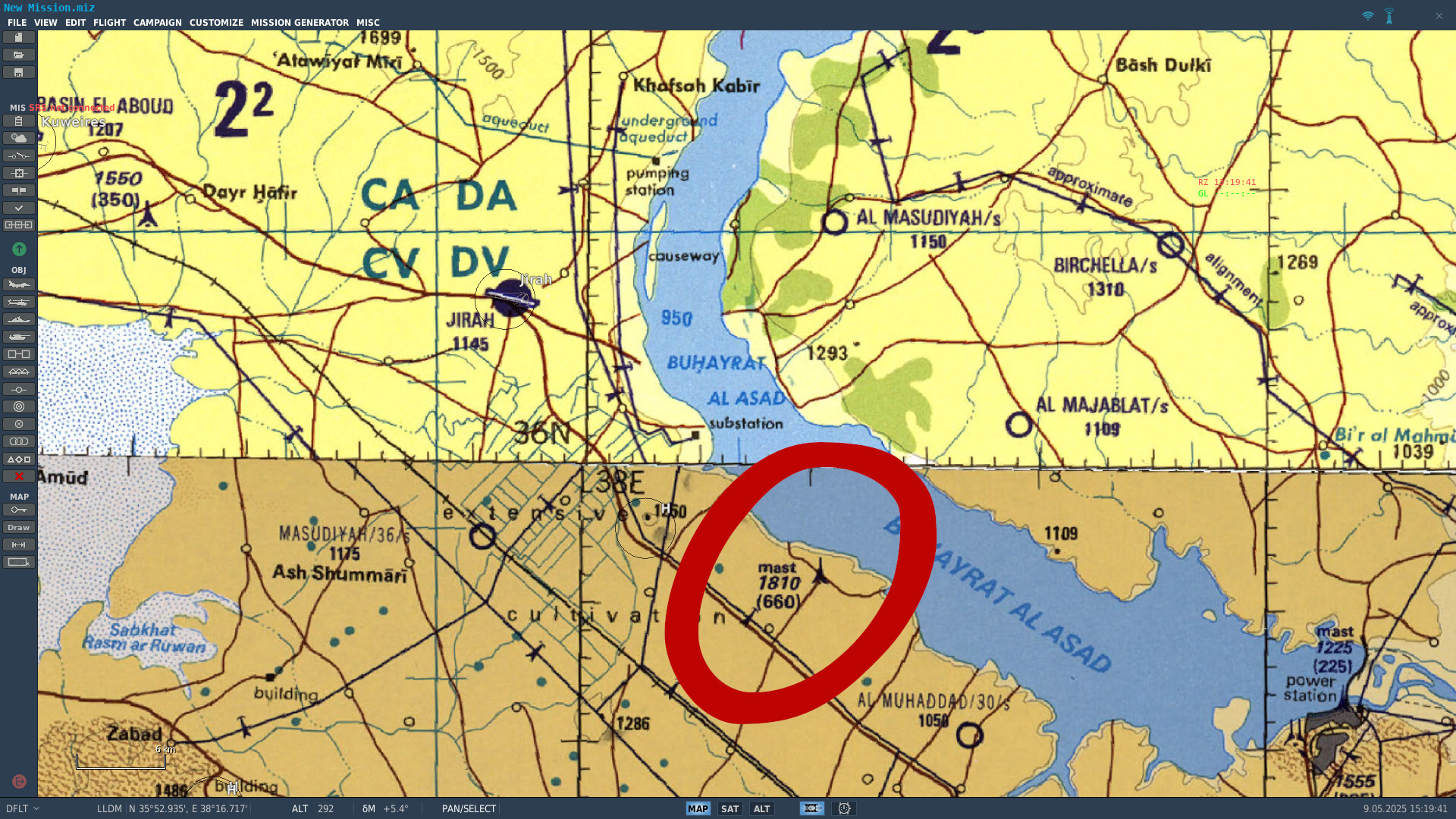
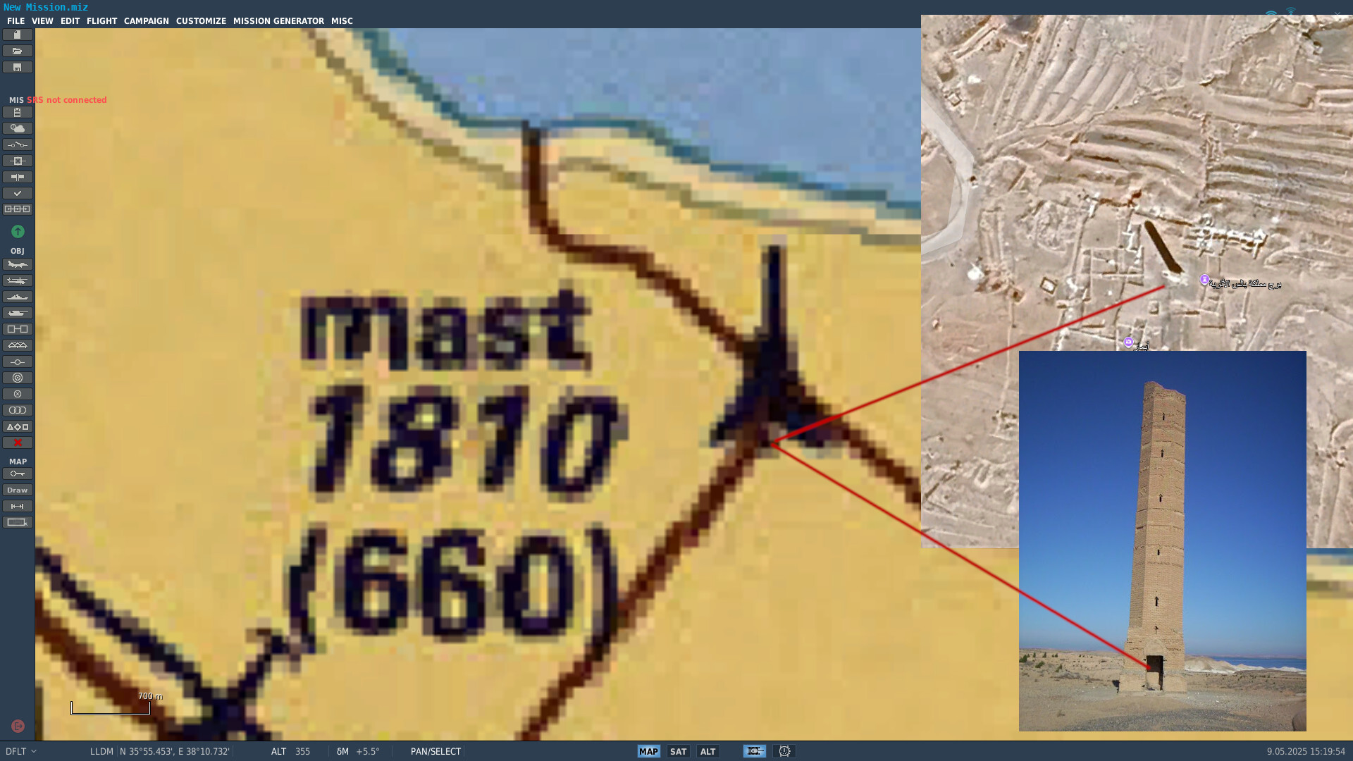
Dear ED Team, First of all, thank you for your continued work on providing new theaters. I’d like to raise a terrain-related issue that affects all maps in DCS and has a critical impact on mission planning and visual navigation: DCS currently displays Tactical Pilotage Charts (TPCs) as the base map layer in the Mission Editor and F10 view—but the actual in-game terrain does not reflect the contents of this chart. This is not a minor discrepancy. Entire features visible on the TPC—towns, roads, airfields, railways, dams, power lines, smokestacks, vertical obstructions—are completely missing from the terrain. This breaks both immersion and function for players who expect the TPC to be an authoritative reference, as it is in real-world aviation. This is the key point: DCS is explicitly showing the TPC as a reference map, which implies that what you see is what you get. But that is not true in practice. Pilots and mission creators plan based on that chart, only to find that key features simply do not exist in-game. We are not concerned if some features exist in-game and aren’t on the TPC chart. The concern is the opposite: if a feature is shown on the TPC, it must exist in-game. Examples of missing TPC features: Towns (even large ones) shown on the chart, but no buildings or textures in-game. Roads and railways that appear on the chart, but do not exist in the terrain mesh. Dams, bridges, smokestacks, or power lines visible on the TPC but entirely absent from the map. These are not minor decorative details—they are tactical elements for low-level visual navigation, mission timing and leg planning, target area identification and IP selection, and obstacle avoidance. What we’re asking: We understand this is not a trivial fix. But we ask for a long-term, map-by-map effort to bring terrain data up to par with the TPC reference layer already used in the Mission Editor and F10 view. Specifically: If a feature is shown on the TPC, include it in the terrain. Start with key navigational aids and obstacles: roads, towns, power lines, railways, airfields, vertical obstructions. This would greatly improve realism, usability, and trust in the mission planning tools provided within DCS. Why this matters: You chose to display the TPC chart as the reference map in both mission planning and live operations (F10). That choice is excellent—but only if the game world matches it. As it stands, the chart becomes misleading, which hurts gameplay and immersion. We’re not asking here for new assets or visual upgrades—we’re asking for basic terrain consistency with the chart DCS already uses. Thank you for your time and consideration! Examples: Eagle Dynamics - Old Map - NTTR No towers, antennas or water tower. Eagle Dynamics - New Map - Afghanistan No power plant. Category 2 city is missing. Ugra Media - Old Map - Syria The railway bridge is missing, as well as all the villages to the south. Ugra Media - New Map - CW Germany No large antenna.
- 1 reply
-
- 6
-
-
Hi, I'm also regularly updating the .xml files for CombatFLite, in particular to add new theaters (Kola, Germany, etc...). I'll be happy to help you with the update on Syria .xml files as well. I'll work on it in the coming days if you want.
-
Kola - 1:1.000.000 ONC map for CombatFlite
graveyard4DCS replied to graveyard4DCS's topic in Orbx Simulation Systems
For those struggling to import .miz files in new theaters: -
For those struggling to import .miz files in new theaters:
-
For those struggling to import .miz files in new theaters:
-
Cold War Germany Theater for CombatFlite
graveyard4DCS replied to graveyard4DCS's topic in DCS: Cold War Germany
For those struggling to import .miz files in new theaters: -
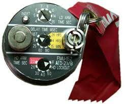
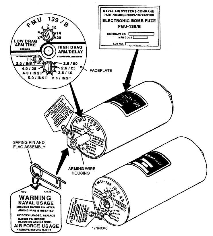
Current state High drag bombs like Mk-82 Snake Eyes and Mk-82Y have only one fuze setting for High Drag employment. None of these bombs can be actually set up for a low drag employment, even if the RET/FF option is still an option (Hornet for example). Expected state When selecting high drag bombs, two fuze setting options should be available: one setting for Low Drag (LD) and one setting for High Drag (HD) Reason: It would replicate the real fuzes The HD settings are not safe for LD bombs (weapon-aircraft separation at the end of the arming delay is too low) Examples: Old FMU-139: LD arming delay is selected on the top. HD arming delay is selected on the bottom. Impact delay is always selected on the HD rotator, even in LD mode. New FMU-139: LD arming delay is selected on the right. HD arming delay is selected on the left. Impact delay is always selected on the HD rotator, even in LD mode. FMU-152: LD arming delay is selected on the top. HD arming delay is selected on the bottom. Impact delay is selected on the middle.
-
Hello everyone, I'm glad to announce that the Cold War Germany CombatFlite theater is now available! If you don't know how to use CombatFlite on new theaters, you can find more details here: Creating a Cold War Germany Theater (Patreon) Additionally, a first map using this theater has been released on ED User Files: Cold War Germany - Elevation Map (ED User Files) Please note that due to maximum file size in ED User Files, most of the maps won't be published here. Thank you!
- 4 replies
-
- 6
-
-

-
- combatflite
- cold war germany
- (and 2 more)
-
A new Marianas VFR Map for CombatFlite has been released. It's available in ED's users files. Enjoy your planning!
-
A booklet of procedures for Bagram is available here on the same model as the ones for Kandahar.
-
reported GBU-12 Wrong Lasercodes.
graveyard4DCS replied to TheGhostOfDefi's topic in Bugs and Problems
-
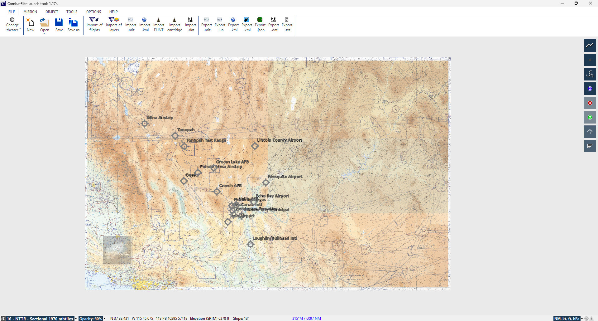
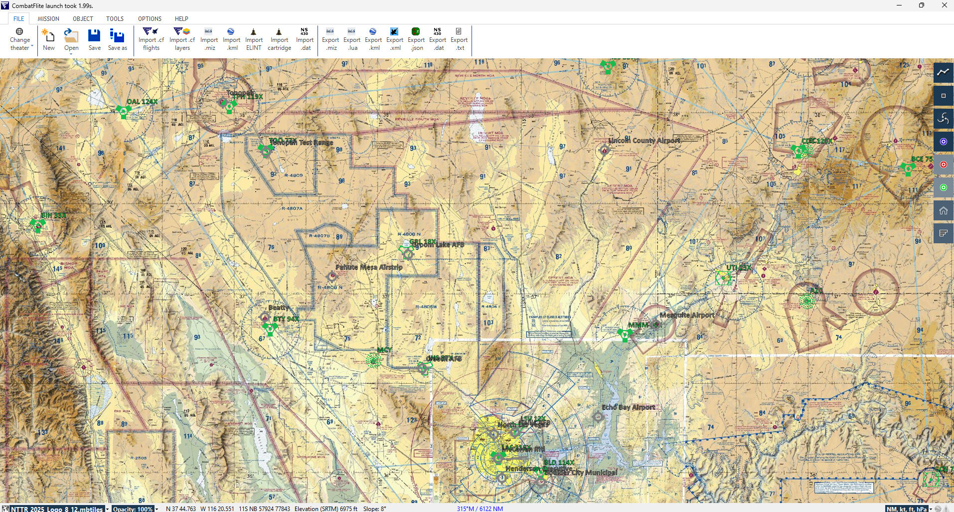
New NTTR map for CombarFlite
graveyard4DCS replied to graveyard4DCS's topic in DCS: Nevada Test and Training Range
Yes, still usable, absolutely no difficulties for older theaters, and with some easy work-arounds for the new theaters like Afghanistan (cf. below).
-
The JP233 drawing is very interesting. What is the original source?? The number of sub-munitions made it possible to make nearly perpendicular cuts without fearing the "perfect miss". Interestingly, we can see that the 4th aircraft is exactly in the situation described in my mathematical analysis (around 20° offset).
-
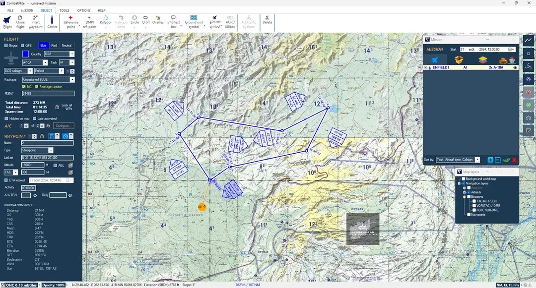
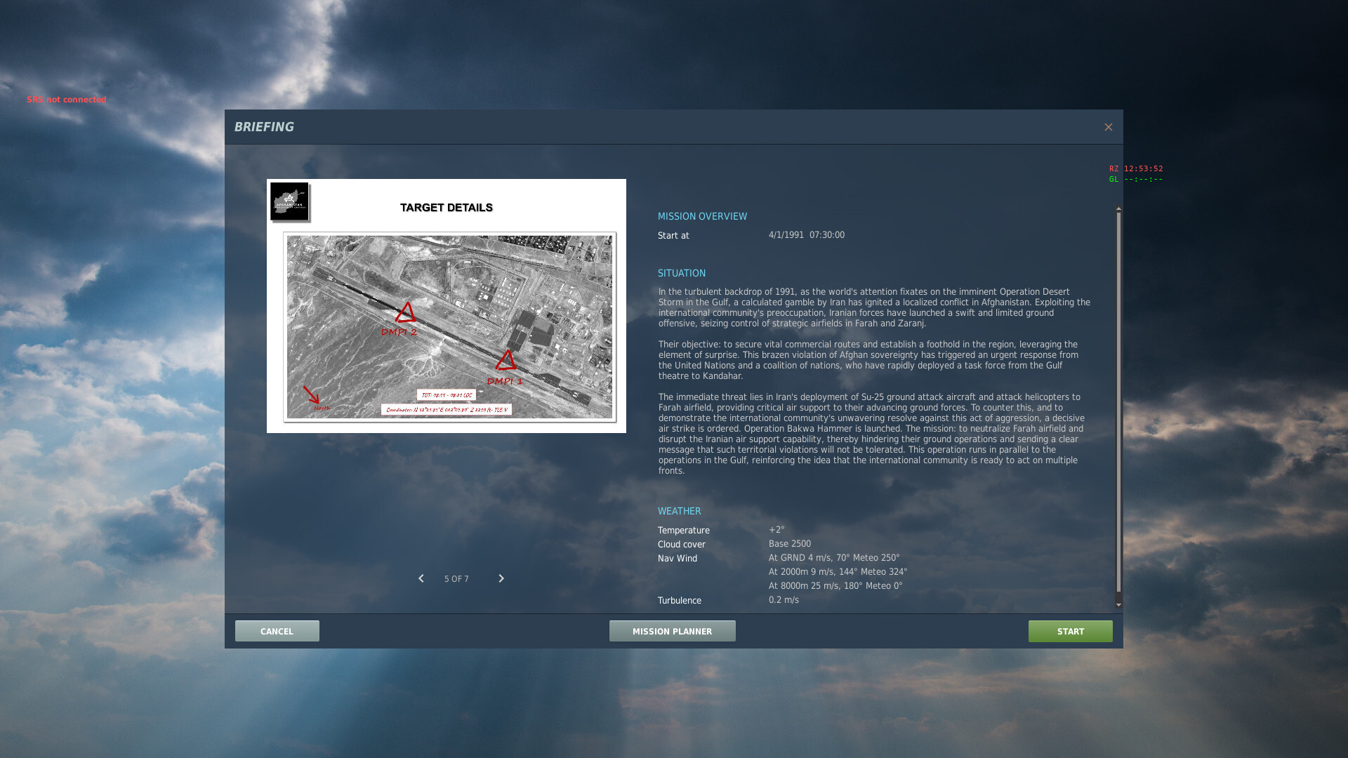
A new mission, Operation "Bakwa Hammer", is now available on ED user files. This runway strike mission is designed to demonstrate optimal runway attack strategies based on the principles discussed in Runway Attacks in DCS World: Is (Almost) Everyone Doing It Wrong ??? A detailed analysis of the mathematical aspects of runway strikes, applicable to other elongated targets, can be found my personal page. Key findings indicate that non-PGM ordnance is most effective when delivered at a slight offset angle to the runway, rather than a parallel approach. The optimal angle is dependent on aircraft type and weapon CEP. You can fly "Bakwa Hammer" with any of your favorite DCS high-fidelity aircraft, either solo or with a wingman in MP. This mission challenges you to prepare your own flight plan from scratch, rewarding meticulous pre-flight planning. To cater to different playstyles, each aircraft is available in standard and "immortal" modes, allowing you to focus on the mission's tactical aspects without fear of premature mission failure. Eventually, remember that you can definitely use CombatFlite on the Afghanistan theater for your mission planning.
-
New NTTR map for CombarFlite
graveyard4DCS replied to graveyard4DCS's topic in DCS: Nevada Test and Training Range
Perfect for all Cold Ward enthusiasts, and in anticipation for the new Red Flag 81-2 Campaign by Reflected Simulations, you'll find here the 1:500.000 1970 VFR Sectional Charts for NTTR.
-
Hi, Technically speaking, the LASER code is not entered on a fuze, but on the nose part of the Paveway kit. The Paveway kit ensures the guidance of the bomb and doesn't play a role in the pyrotechnic chain, as a fuze does. The fuzes are inserted on the nose and/or the tail part of the bomb body, and have a role both in terms of safety and terminal effects. More details here if you are interested.
-
South Atlantic Theater for CombatFlite
graveyard4DCS replied to graveyard4DCS's topic in South Atlantic
I'm fairly sure it's even easier than that, and we can make a small .exe to choose the correct theater.xml file version (orignal or new theater) before launching the actual CombatFlite .exe. I'll give it a look. -
JPF page gives the same options regardless of FMU fuse
graveyard4DCS replied to Gomez919's topic in Bugs and Problems
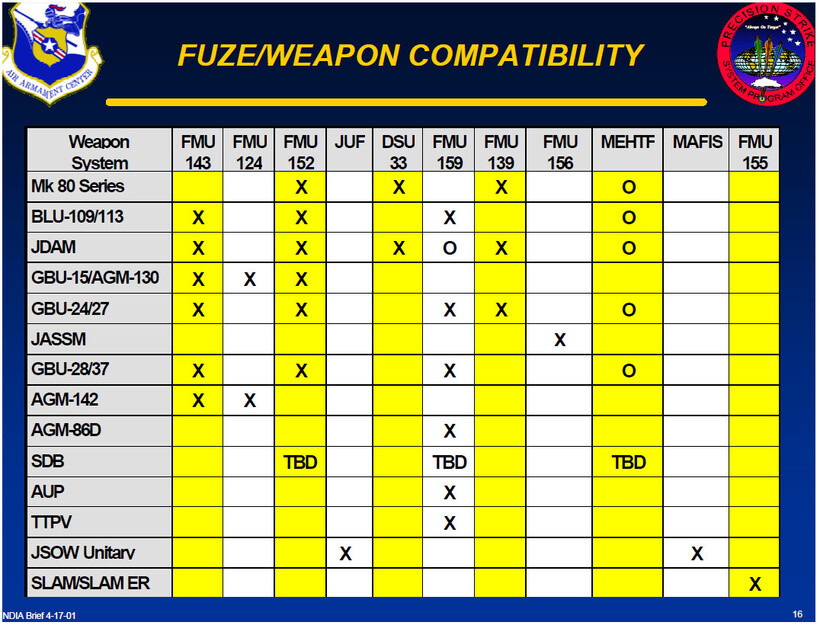
I totally understand your questions regarding bomb fuzes, since I had exactly the same... I tried to understand how they're supposed to work IRL and I wrote a post about it. For example, you can learn that FMU-143 is specifically designed for use with BLU-109 and should not be used on any other bomb body. Your conclusions are correct : in its current state, DCS is reproducing weirdly fuze options, with settings that should not be available for example (like the example of DLY2). At this point, I think we should take these options as more cosmetic than anything else. Still, it's always nice to understand the logic behind. -
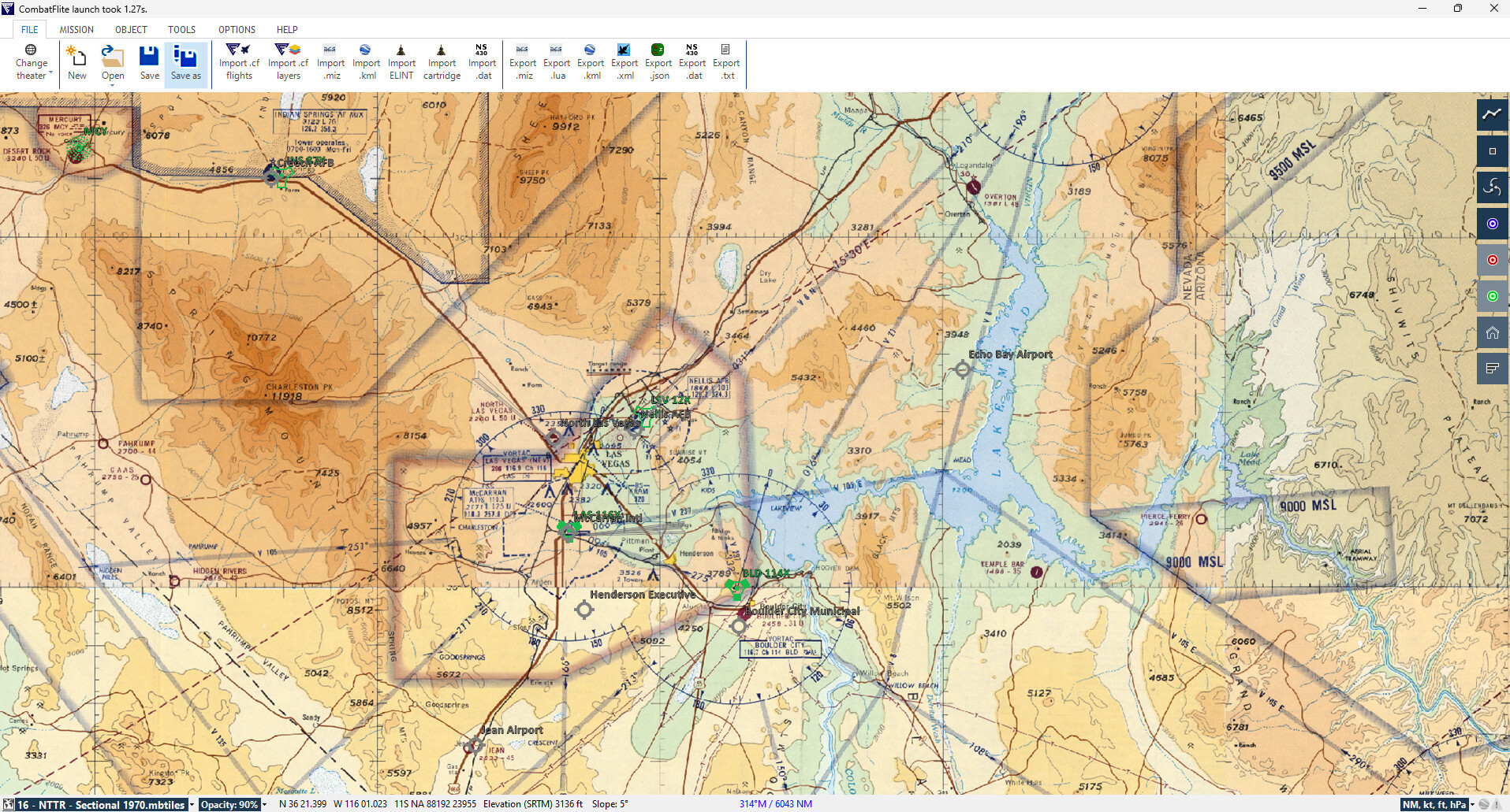
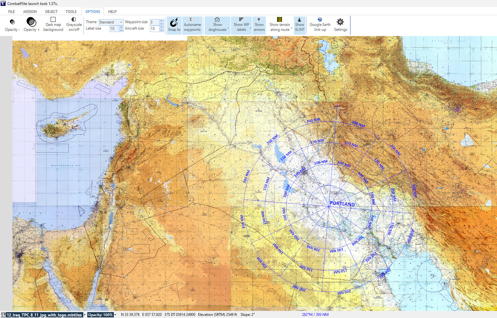
Hi, A new map for CombaFlite has been released: it's a 1:500.000 FAA VFR Sectional Chart as of 02/2025. It's available either in ED's user files, or on my personal page. More NTTR and other theater maps (Kola, Afghanistan, Iraq, South Atlantic, etc...) have or will be released, but most of them cannot be shared in ED's user files due to maximum file size restrictions. Enjoy your planning!
-
You can also look at russian ressources, there is plenty of information regarding the Cold War era. For example, this website about DDR air defense is a gold mine : https://rtv-pvo-gsvg.narod.ru
-
You can also look at russian ressources, there is plenty of information regarding the Cold War era. For example, this website about DDR air defense is a gold mine : https://rtv-pvo-gsvg.narod.ru
-
Bombing Trajectory Planner (WIP)
graveyard4DCS replied to Boagord's topic in Utility/Program Mods for DCS World
Excellent tool, thank you. I confirm that your data are accurate enough for GBU-12 delivery profiles when using the Mk-82 data. The impact angle is fairly high compared to the GBU due to the final lasing phase, that seem to let the bomb have a constant dive angle once laser spot is acquired (so theoretically we could also estimate it from bombs position at lasing start, eg 8 seconds before impact for auto lase). Let me know if you'd like me to share the limited data I have.