Valium
-
Posts
528 -
Joined
-
Last visited
1 Follower

-

VP-Airfield Equipment 0.8.2 beta
Valium replied to Hawkeye60's topic in Utility/Program Mods for DCS World
What's the name of it? null
-
Check BATC by DummyPilot.
-
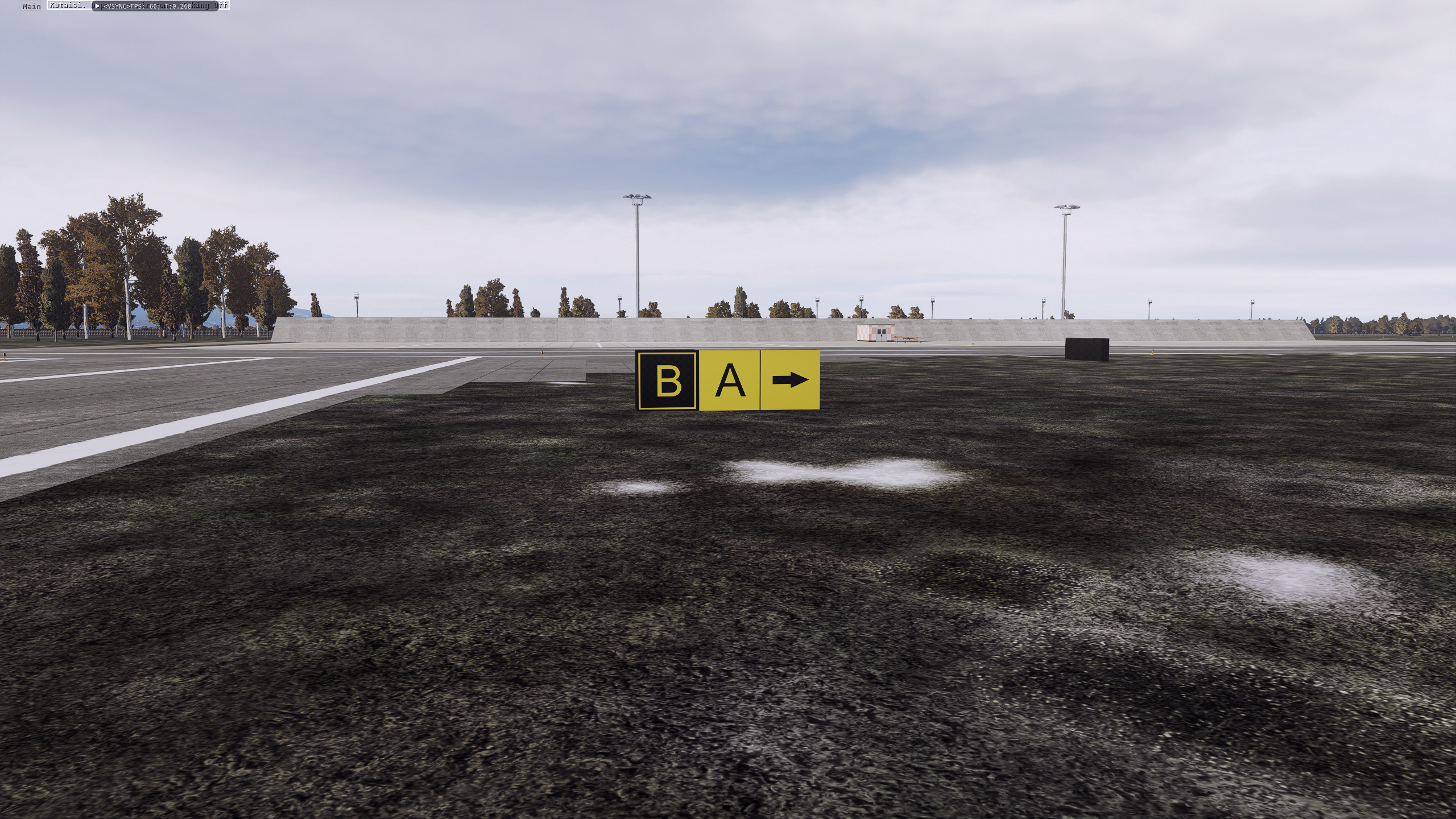
ARP Pack - Airfield Signs Mod [v2.1]
Valium replied to Valium's topic in Utility/Program Mods for DCS World
I'm going to upload the next version. I haven't enough time for that but I passed ATPL exams, so it should be done soon. I can make M but as I remember arrows can be added manualnullly.null
-
Probably not. The only one plane which has in DCS is MiG-29A and S (km/h, m) and MiG-29G (kts, ft). But it's caused because of the fact that some countries which joined to NATO and had MiG-29s before just changed units. For example Germany and their MiGs sold later to Poland. Poland also had some MiGs from Germany, Czechia and Russia, so the rest was also changed to imperial units. NATO airplanes using imperial units, so knots for speed, feet for altitude, nautical miles for distance, meters for distance (visibility e.g. in METAR, RVR). Also for pressure it depends - mostly inHg but hPa too.
-
Only as static objects or fortifications. You can add it as template and then load to any new mission. For example, I made a mod which adds signs or airports.
-
ARP Pack - Airfield Signs Mod [v2.1]
Valium replied to Valium's topic in Utility/Program Mods for DCS World
3rd session soon. Unfortunately, my internet is really weak and I can't even update DCS. Any feedback if it works properly with latest update of game? -
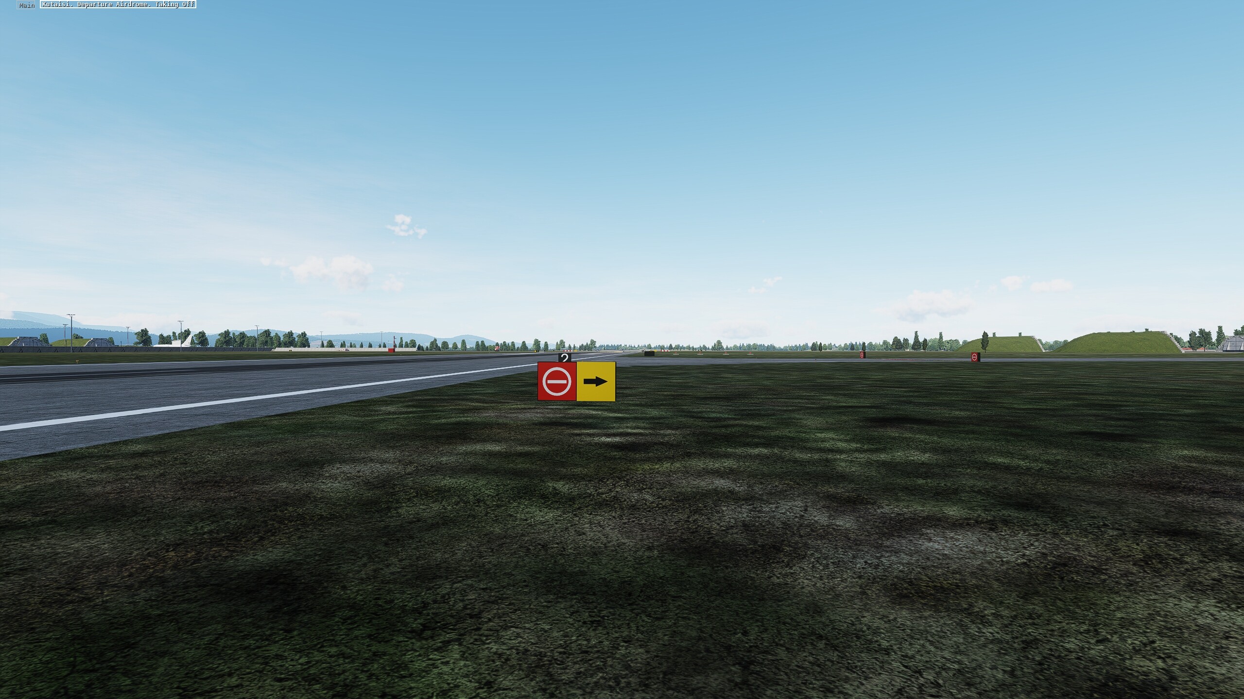
ARP Pack - Airfield Signs Mod [v2.1]
Valium replied to Valium's topic in Utility/Program Mods for DCS World
I'm going to update it because I added new signs and made some changes. But soon because I'm going to next ATPL session in a few days. -
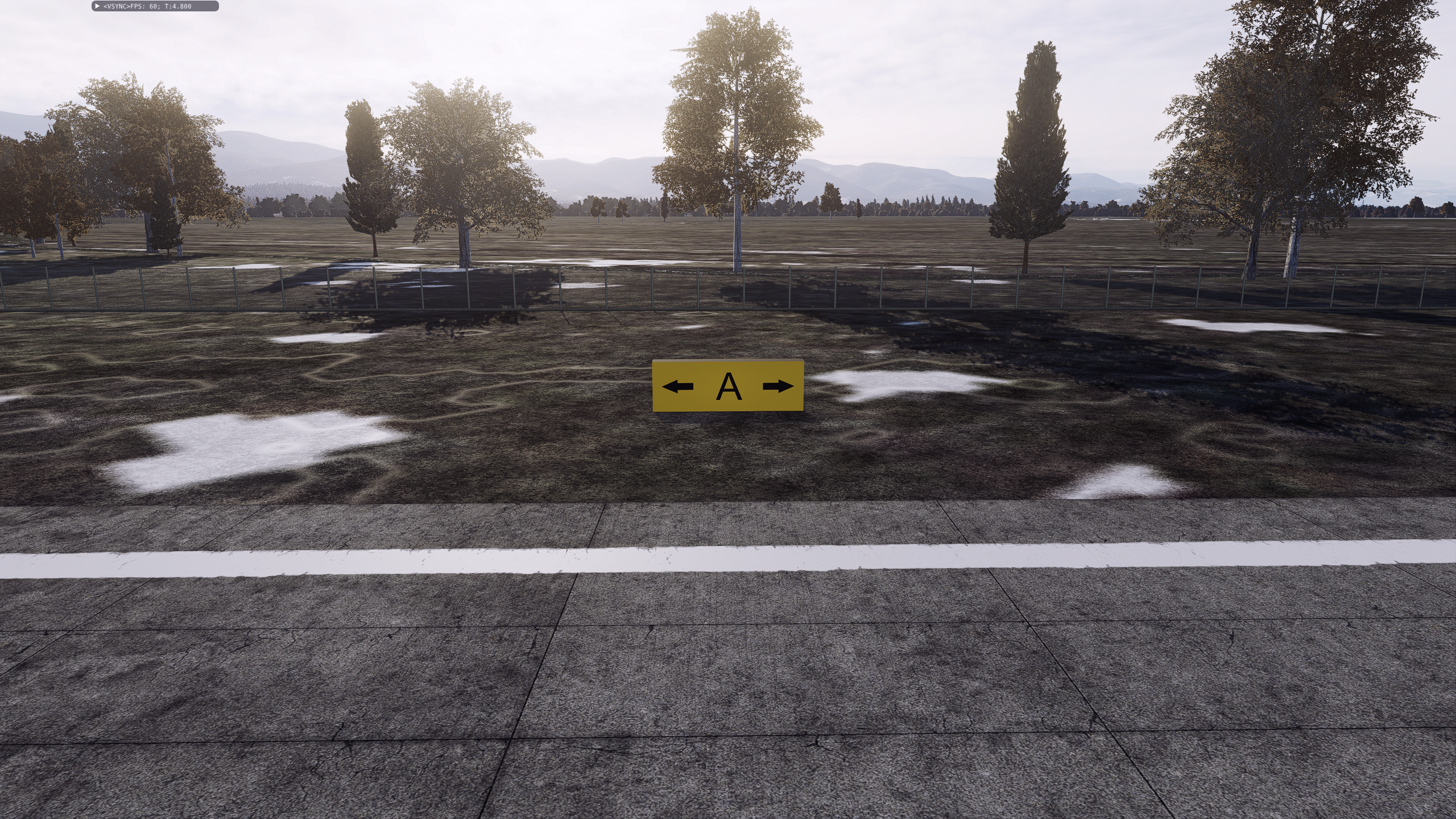
ARP Pack - Airfield Signs Mod [v2.1]
Valium replied to Valium's topic in Utility/Program Mods for DCS World
At this moment, I'm working on improved signs. Direction signs and their locations where added too. Some changes in all airports - military have less horizontal signs. There' some plans to decrease size of signs and edit them a little bit but in nearest future. I have no license for 3D Max anymore and lack of time.
-
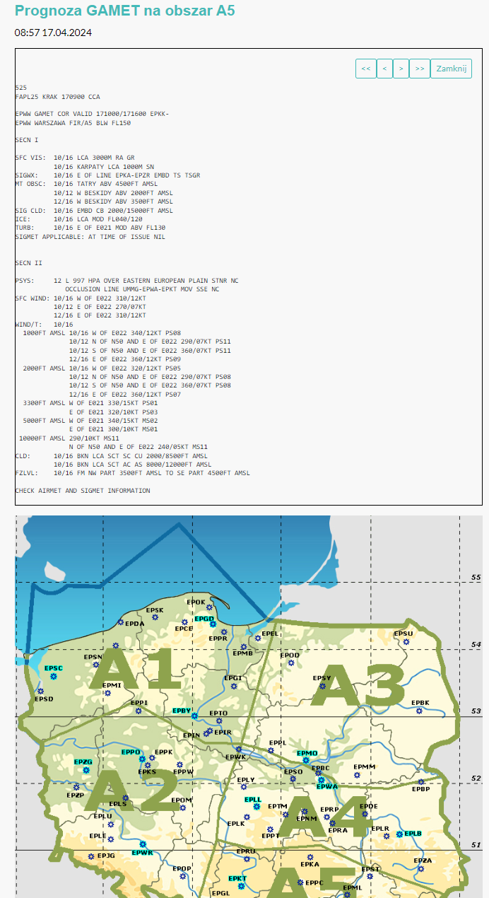
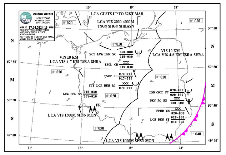
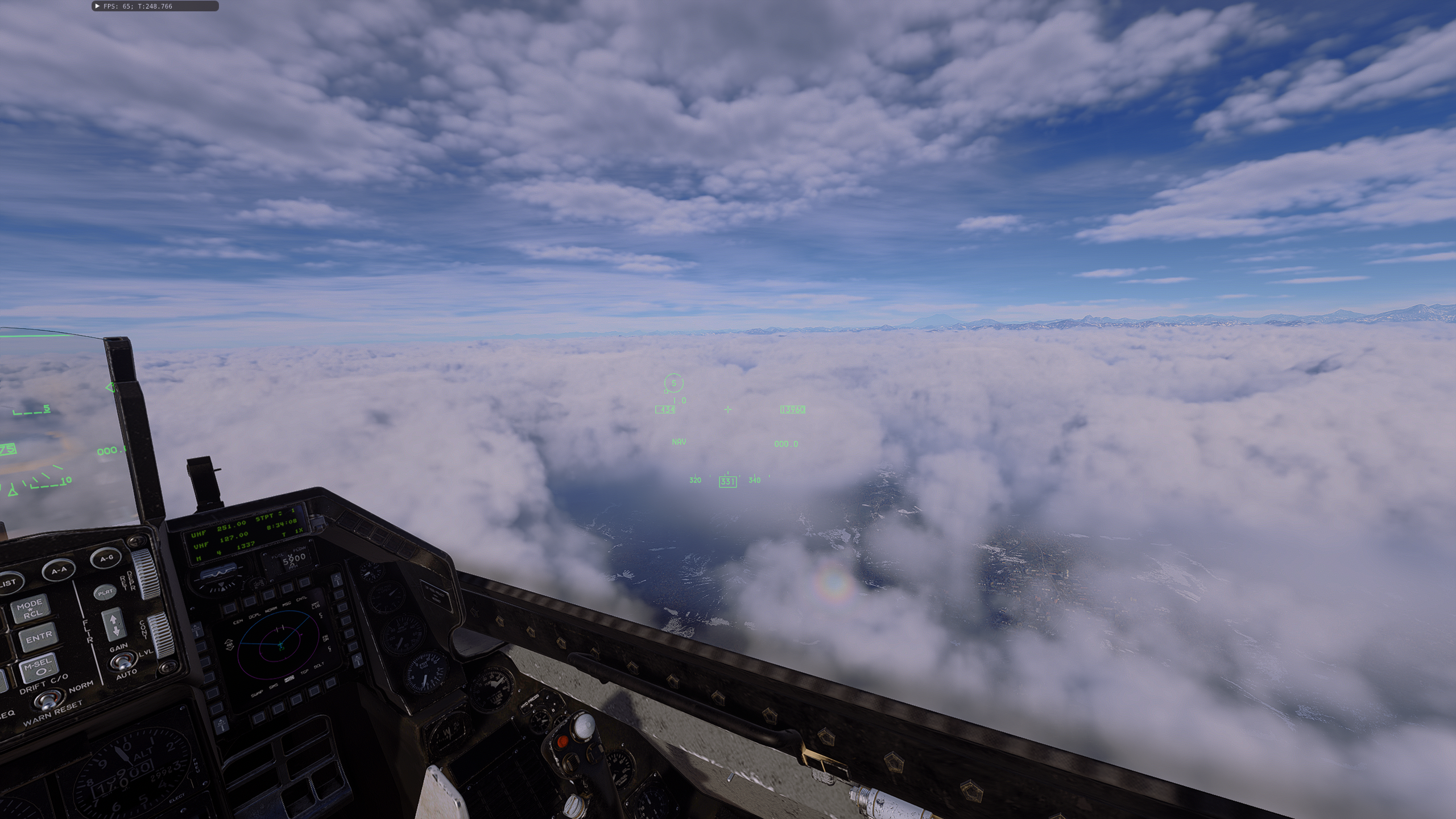
The answer is not simple. If OAT is near DP, that means that humidity is high and (not always) it means that clouds will be low. We have also something like ELR, DALR, SALR. We have Lows, Highs, air masses, humidity, specific heat release with altitude, etc. If we talk about METAR - it's for aerodrome and usually (not always again) it contains important information about almost everything to 5000 ft above aerodrome (not always). Than we have GAMET - regional, TAF - forecast, VOLMET, AIRMET, SIGMET, Significants and also ATIS. That's all in case of EASA. And yes, you're right. METAR should not include all these information, just these in area to height of XYZ. In my opinion, all these bases/ceilings are for AMSL in case of DCS. If you set BKN020, you'll notice that in regions with higher elevation have clouds on ground. null In case of my home town.
- 306 replies
-
- 1
-

-
- thunderstorms
- rain
- (and 3 more)
-
3.5x is the best setup for me. Good looking, no major fps loss although Ultimate is beautifull.
-
Any chances when could settings are set to Ultra or High?
-
Any forest suggestions according to extreme and ultimate?
-
Thanks. In my case Extreme is the best way. No fps loss at all and it's 2.0 times better than default extreme. Ultimate (1st photo) Extreme (2nd photo) In both cases Elbrus well visible which wasn't possible in default extreme. I didn't change forest visibility but it seems it also increases it. Because I see more distance and I see forest there. Love it
-
ARP Pack - Airfield Signs Mod [v2.1]
Valium replied to Valium's topic in Utility/Program Mods for DCS World
Far plans but we're thinking about making whole new airbase.