
gulredrel
-
Posts
1365 -
Joined
-
Last visited
Content Type
Profiles
Forums
Events
Everything posted by gulredrel
-
and some shots of a "Splitterschutzbox" side wall from front: side wall detail blast deflector seen from the side behind rear of the side wall blast deflector and rear of side wall blast deflector seen from inside the box
-
and some more details I guess some of the HAS were used in the late 90s early 2000s for some Techno / rave events and have been painted inside. near the back wall, some anchors in the ground rear exit rear exit from outside rear side door from a different shelter Magnetic location information? Door details
-
There's a hand pump to the left of the seat to increase hydraulic pressure for opening and closing cowl flaps without the engine running.
-
Hello, just wanted to share some pictures I took today on my local tour. These are the remains of what was former airfield Welzow. Airfield hosted Su-24 before the Soviets left East Germany in the 1990s. For reference: https://www.mil-airfields.de/deutschland/welzow-flugplatz.html Image of the runway approach lights has been taken here: https://maps.app.goo.gl/n2etMFriaet9SBss8 Following images are from objects on the eastern and southern decentralizing spaces. door track details a number engraved in the concrete of the shelter door sliding panel backing up the front wheel. and from the outside. Cables for the door mechanism are missing a long time I guess... Details of the remains of the electrical compartment on the side of the HAS to be continued...
-
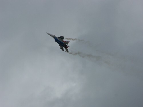
Flying east of Spangdahlem.
-
DCS: F-16C Viper Screenshots and Videos (NO DISCUSSION)
gulredrel replied to wilbur81's topic in DCS: F-16C Viper
-
Must love it how they avoid trade marks
-
Hello, found a falling wall in Frankfurt Main Airport, where there is a road bridge going to the airport. Coordinates in the screenshot Thanks Jens
-
- 1
-

-
Thanks for the detailed description, will try.
-
Great news. Will modern day Marianas map also benefit from such changes?
-
Would love to see these kind of camouflage on the buildings without mods. I've seen them pretty weathered on some old abandoned installations from the era.
-
I've a similar problem drawing free polygons. It sometimes creates just triangles as you describe above. Sometimes it stops after the second point and so it's just a line. In some instances I think it's a jittery mouse position when clicking, so sometimes keeping the mouse more steady helps to set the corner points. Changing to select option and back to drawing option free polygon helps. Definitely a weird non really reproducible behavior. As this thread is quite old. Is there an option in the meantime to export draw items from one mission and import them into another?!
-
There is a logistics storage at a very steep slope around 4 NM from Pferdsfeld. Would be nice if it was at a flatter place or the terrain at tis point could be changed. Coordinates in the screenshot: Thanks Jens
- 1 reply
-
- 1
-
-
Hi ugra team, Could you please remove the eastern propaganda billboard from Pferdsfeld road entrance? Or have GDR spies taken over the base Coordinates in the screenshot: Thanks Jens
-
Autopilot override - How does it work or needs to be used?
gulredrel replied to gulredrel's topic in MiG-29 for DCS World
Thanks. These oscillations are huge. So I guess I'll disable attitude hold and than re-engage after being on the new track. -
Despite being a serious topic, I had to giggle like a teenager when I first read the original title on Thursday Thanks for pointing out the snap view functionality. Only having 2D monitor, the custom views could be handy. Need to look for the controls and set up some things.
-
-
Thanks for adding multiple RSBN stations now. Will there be further work on the beacons lua? Would be nice to also have the display names so the beacons info page in view menu gets populated even further. One thing I noticed, Damgarten has a problem with the new update. Channel is 32 but the frequ. is marked as 820 MHz. 820MHz / Ch 20 RSBN pairing is Parchim. So this will conflict.
-
When zoomed in, just switch to satellite view. It's for me the only way really placing units. But yes, would be nice if the symbols would be just the small icons when zoomed in maximum.
-
Hi, flying with attitude and altitude hold mode on the plane flies straight and level. There is the autopilot override button which I've assigned to my stick. Pressing and holding it the two lamps for attitude and altitude hold modes start blinking and I'm able to change course and or altitude. I now let go of the autopilot override button expecting that the MiG is now holding attitude and altitude with the new parameters (e.g. like in the Mirages). But the MiG now dives a bit, recovers aggressively back up and goes into a climb. How do I use the autopilot override? Are my expectations wrong what it should do?! Only messed around in the S variant currently, hopefully it's the same behaviour for FC A and G too. Thanks Jens
-
Something needs to be sacrificed... It definitely would be nice to have a handful of different objects for this kind, but doing it there, they would have to also multiply other objects and the map size will explode even more I'm very pleased with the map. I encountered Hammelburg training area yesterday. Awesome compromise for the game aspect. Did some Hind flights in Colditzer Heide training area before where's open wide flat land and Hammelburg you have the small hills and training houses located between them. Need to improve Apache flying skills to faster stop behind hill tops tree lines and such things for cover.
-
Some low level in the western part. Hammelburg training area: on the way back to Schweinfurt
-
Wow, this looks like the template for the map's towers.
