
Recoil16
-
Posts
1294 -
Joined
-
Last visited
-
Days Won
1
3 Followers


About Recoil16
- Birthday September 3
-
Already requested to be changed to 108.95, thanks.
-
Already reported, thanks.
-
I do not anticipate that being an issue.
-
Right, 107.7 is an invalid frequency for an ILS. This regression is reported.
-
Already reported.
- 1 reply
-
- 1
-

-
Already reported.
-
previously reported
-
Already reported, thank you
-

Approach and Departure charts, AIP and Enroute Charts
Recoil16 replied to ViFF's topic in DCS: Sinai Map
The latest domestic AIP can always be found here: https://www.gov.il/he/Departments/Guides/aip?chapterIndex=1 The link in question says "פמ"ת בקובץ יחיד - הורדה" ("PMT in a single file - download", according to Google Translate). That being said, the current direct link to the PDF is here: https://www.gov.il/BlobFolder/guide/aip/he/aip_Full PAMAT 3-23.pdf -
Just to be clear, while this will "fix" it in the sense that you can then use the TACAN, the problem is not actually with the Hatzerim TACAN. It is confirmed to be on 96X by Israeli Air Force documentation. It's rather the Wadi Al Jandali TACAN that is either on the incorrect channel, or (in my opinion more likely) it should not exist at all, as there is no antenna visible on real world satellite images where the Wadi TACAN is placed in game. So yes, while this is an interim "fix" you can do for yourself in the moment, this should not be the long term solution to be implemented for the map as a whole.
-
Yeah, as pointed out by Ahmed, this is not a bug, rather it is expected behavior that has (finally) been implemented after it was missing for so long. The DME component of a TACAN beacon is functionally the same as the DME component of a VOR/DME. @BIGNEWY I think we can close this as "correct as is".
-
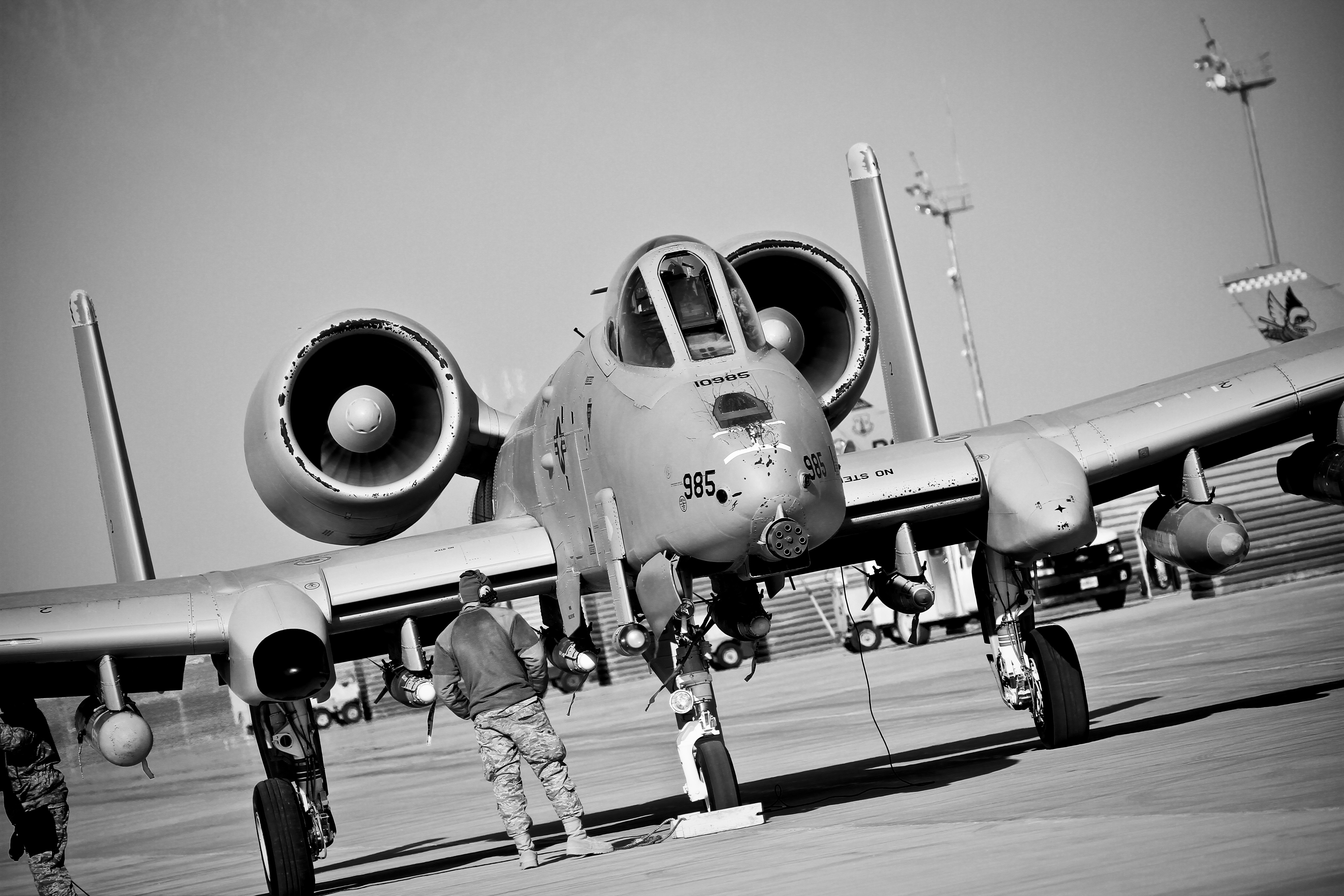
reported A bug in the taxiway damaged A-10 landing gear.
Recoil16 replied to Heliflyr's topic in Bugs and Problems
An excellent point actually. DMS coordinates without decimal seconds as given here are only accurate to about 30 meters (in latitude, with longitude precision differing depending on the latitude but let's not get into that right now), which is 100ft as you say. -
reported A bug in the taxiway damaged A-10 landing gear.
Recoil16 replied to Heliflyr's topic in Bugs and Problems
It's an easy way to show to the devs exactly how, where, and under what circumstances damage is occurring, which is presumably why Flappie is asking for it. A coordinate - while it points out the bump - doesn't do that. -
Runway lights not visible at distance; overall too dim
Recoil16 replied to Nealius's topic in Bugs and Problems
Previously reported internally- 1 reply
-
- 1
-

