grim_reaper68
-
Posts
791 -
Joined
-
Last visited
Content Type
Profiles
Forums
Events
Everything posted by grim_reaper68
-

Weather mod v2.0 for DCS
grim_reaper68 replied to bandit648's topic in Utility/Program Mods for DCS World
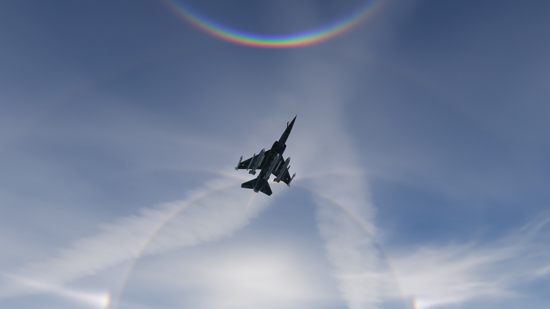
Hi I tested it on Kola map on sunrise and din't have this issue with Cirrocumulus 3. Here is a wonderfull screen with this preset with a great rainbow effect.
- 540 replies
-
- 2
-

-
- thunderstorms
- rain
- (and 3 more)
-
Je ne pense pas. Puisque à priori le nouveau Super Étendard ne devrait pas avoir besoin de FC3 pour fonctionner. Si j'ai bien tout suivi.
-
No problem, as told i understand off-beat humor (in french "second degré"). And no, the french wouldn't be offended if you don't speak french. No need to apology. Do you know, in France we have an expression that say "parler anglais comme une vache espagnole" literally translated: speaking english like a spanish cow . I often use google translate to be sure that the words I'm writting is correctly writen. But french expressions are difficult to transpose in other languages. As I could imagine US or English expressions are difficult to translate directly in other languages. I can understand that this section if the forum should be in english only, and on my side I try to make my best to be understandable with my own knowledge and google translate. And I can also understand that foreign languages are sometimes hard to understand. Even when using translate apps or being on mobile phone, where it could be less comfortable to use translate tools. So keep in mind that, maybe @juanjo answerded to the post on his mobile and had the same difficulties to translate the post as those who were reading it, and would translate it on their mobile phone. Of course there is a spanish section, but he added some precious information for those, as me, hadn't saw the section about AERGES having acces to the Mirage F1-M simulator. @Ornithopter Don't apologise, as told, I can sense when it's off-beat humor (Google translation, which I hope is accurate enough), and I could feel after reading your second post that You weren't aggressive at all. . As a native, and living in Alsace ( on the Far East of France), Humour and off-beat humour are well known, even if it comes from foreigners . I didn't felt offensed, maybe a little bit disappointed about the lack of links . Maybe You don't know, but Alsace is a little apart from France, as we call the rest of french people the french people from inside (in french: "les français de l'intéreieur" ), so don't worry Be happy as Bobby Mc Ferrin's song.
-
Sorry that I bothered you with my stupid question. I didn't look their website for a while, and when, then I look the News and development page. I didn't scrolled the main page down. I'm sad that I made you angry just asking for the source of your information, and instead of sharing it, you just make joke about me. Sorry that my native language isn't English, I would say "se foutre de la gueule", you can use google translate to maybe, better understand the sense of my words . By the way, maybe in the US or wherever you live the VW Beetle is as big as a semi truck trailer, but as I could access to the Mirage F1CT simulator IRL, it doesn't fit in a VW Bettle. I hope you understand off-beat humor as good as i can @juanjo Thanks for sharing the link / Gracias por compartir el enlace. (google translate )
-
Hi where did you get those infos from?
-
Confirmed! Tested with wind of 10kts 270° IA took of from runway 27 and the ATC told me to take off on runway 09. Second test with wind direction of 90° (So I should take off on runway 27), ATC told me to taxi to runway 09. And IA took of from runway 27. But strangely the IA always take off from runway 27 but always lands on the runway 09, despite the wind direction...
-
Weather mod v2.0 for DCS
grim_reaper68 replied to bandit648's topic in Utility/Program Mods for DCS World
Bandit648, your mod should have an donation link as it's so beautyful! here is my tribute to your wonderful mod Ugra Cold war Germany- 540 replies
-
- 5
-
-
- thunderstorms
- rain
- (and 3 more)
-
no idea about the Mirage F1M air-ground abilities. But maybe they could be better than the EE. I understand the frustration about the M2000 Razbam vs ED conflict, and that there is no more updates on the M2000. Take a look about the real Mirage F1M about air-ground abilities, and for sure, they will comes out with the Mirage F1M when it will be finished. As told above, developping the F1M is in my opinion, a new challenge for the AERGES dev team. So they take the necessary time to develop and test everything, to bring out a new module that is almost perfect. Of course they could be some bugs or errors that would be revealed by pro pilots. But I'm pretty sure, all functions would be approved by IRL Mirage F1 pilots before they would be validated on DCS, and before a release. Keep in mind that for the price of one mod, You have 3 working mods that were updated on most of every DCS update and that the upcoming F1M will be included too. As I touched the world of modeling and developing for a little bit compared to what AERGES brought out, I can only say, thanks to them and just encourage them for the future developement of the Mirage F1. I personnaly would love to have the Mirage F1-CT with working telemeter and working Corail pods (chaff flare pods) and with the dedicated panels as real flyable aircrafts into DCS and why not the Miage F1-CR with a real recognition aerial photos working one day, but I4m still happy to use the F1-EE with skins to fly the "virtual" Mirage F1-CT from the RC 2/30 Normandie-Niémen where I did my military service in 1998-1999. AERGES make me dream and let me be a virtual Mirage F1-CT pilot as I couldn't make it IRL. So I would thank them for the great work again, and wait patiently for the next update of the Mirage F1. And tell them that all my minds are with them to the development of the next generation of the Mirage F1M, and maybe, one day, we could have a full functional French Mirage F1-CT and CR too. As a French enthusiast of the Mirage F1-CT (I spent 10 mounth of my life with pilots of the Mirage F1-CT from the 2/30 Normandie-Niémen, when I did my service in France), I dream to have a full fidelity F1-CT in DCS but that is on the wish-list; more than an order. Every update of the Mirage F1 from AERGES is for me a gift that make me feel alive and make my dream comes true.
-
Just be patient, in my mind, they will let us know when the F1M is ready for release. As the systems would be completely different from the "older" mirage F1, it must need some time to have them work as they should be. Just keep in mind that this module cames out with almost all systems working. Of course there were some bugs, but generally operational. And they were reacting rapidly to any feedback of broken systems or functions. So, let them just work on the F1M and wait until they announced the release. It will be a great upgrade of the Mirage F1, I'm sure. They don't need any additional pressure from outside and the +1 posts just will be counterproductive. Have faith in AERGES dev team and tester. As they would release a module as near as possible to the real one. Keep having pleasure flying the CE, EE and BE while waiting for the F1M to be released. IMHO asking every day about the progression of the F1M wouldn't make it faster to release, but just add pressure to the dev team. And I'm sure they don't need this. I prefer that they keep the mystery about the development and having the surprise to see screens and videos when they're close to the release date, than having 2 screens every week and waiting for months and having an unfinished early acces plane full of plenty of bugs. Trust them and wait patiently for the release announcement. They've done an amazing job so far. Let them surprise us when the time comes. With all my respect, appreciation and support for the AERGES development team. You guys are doing a really great job. Take your time to perfect the module and to deliver us a great F1M as you gives us the 3 other ones.
-
Hi you searched on the wrong side of the runway. It's on the left
-
Hi New update out, including the RSBN modification from Ugra. No more frequencies, only channels.
-
Weather mod v2.0 for DCS
grim_reaper68 replied to bandit648's topic in Utility/Program Mods for DCS World
Don't laugh please, in fact it cames from it. IDK how or why OVGME switched to saved games as I only have 2 mods installed with it, and both in the root folder... Thanks- 540 replies
-
- 1
-
-
- thunderstorms
- rain
- (and 3 more)
-
Weather mod v2.0 for DCS
grim_reaper68 replied to bandit648's topic in Utility/Program Mods for DCS World
Nope I only use the weather mod -
Weather mod v2.0 for DCS
grim_reaper68 replied to bandit648's topic in Utility/Program Mods for DCS World
I just tested a new install after making the archive again. Same result, the EffectTexture.zip hasn't change in the DCS/Bazar/Effects folder. -
Weather mod v2.0 for DCS
grim_reaper68 replied to bandit648's topic in Utility/Program Mods for DCS World
Hi Is the mod still working? After the latest DCS update I can't see them in the ME? It seems OVGME won't install them. -
unfortunatelly not. I will try it tomorrow again. The second time, I used a brake pedal bend to the brake axis and braked softer, and had no issue. I noticed that the axis didn't apply full pressure compared to the key pressing (L_shift W) as it goes only up to 6 bar compared to the 8bar while applying full brake. Could it be that the axis only works on the main gearn and the keybind on all 3 gears?
-
Hi Thanks for the Mig-29. It's seems to be a great module. But I'm not a Mig-29 expert, so let the professionnals of the Mig -29 talk about it. I've the first training mission and as I was taxiing to the runway, I applied full brake (L_shift W) at a speed of 16kts, and the front gear just bend down. Is it normal?
-
thanks for the information
-
What seems strange, is that in the file above, Spangdhalem ILS freq are 109.15 and 108.10, and Hahn ILS freq are 109.30 and 111.30, so they couldn't interfer. Maybe you're flying the F16 where the default ILS frequency is, if I could remenber, 108.10. So it's "normal" to receive it. I will run a test with the F16 and A-10CII. Edit: In fact the F-16 default ILS frequency is 108.10 and as Spang is not so far from Hahn, the ILS from Spang is in range, but not usable as the signal is too weak, but you can hear the morse code. The A-10CII default ILS frequency is 108.95, so no issue with it, I tested it at 108.10 and have the same result. Morse code audible but the signal isn't strong enough, as I had both flags on the HSI. So as told it comes from the F-16 and is not an issue at all. Just turn of the sound or change the ILS freq. I just saw that there is a new update on the CWG map, so I have to work on the beacons file again. Surely a new release of the corrected file this week-end.
-
I will take a look ASAP
-
Since I switched to AMG GPU, I have horrible ghosting issues in DCS, MSFS 2020/2024. using TAA... MSAA is better, but it has less antialiasing... I almost regret my RTX 2070 super OC...
-
Weather mod v2.0 for DCS
grim_reaper68 replied to bandit648's topic in Utility/Program Mods for DCS World
take a look page 15. I had the same issue with another preset. Do you have an amd GPU? -
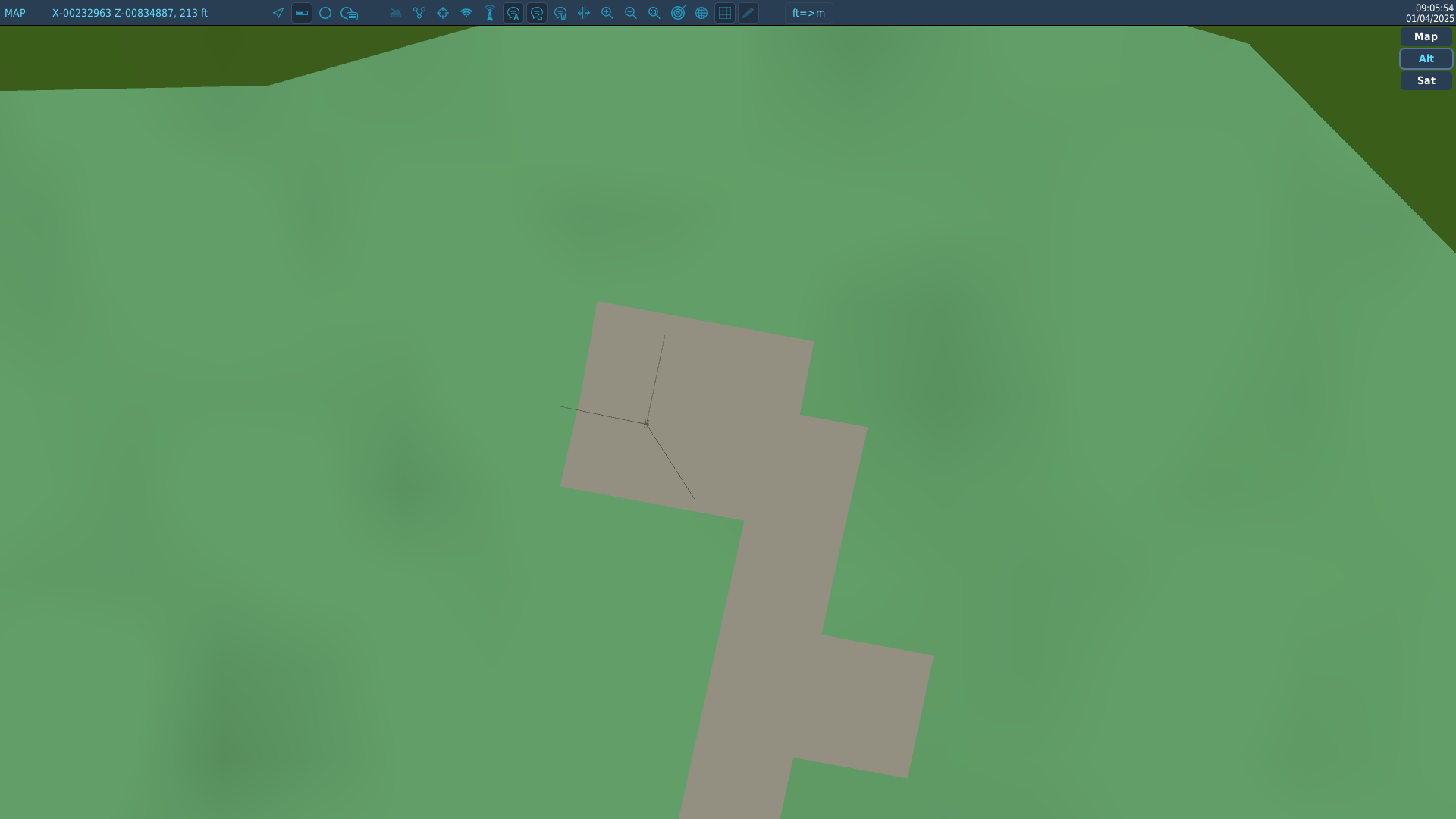
Hi already demanded here, I added a map with some airbase in or next to their zone 3 polygon.
-
As child, my first flight was in a C160 Transall in Fürstenfeldbruck. And in fact, extendind the map up to Munich would be great so that after a flight, we could go on the Oktoberfest or any Biergarten to drink a refreshing drink.
-
Hi take a look here, I've made some correction of the original file. Tested with F-16, A-10CII and Mirage F1. Any bug or information for more accuracy welcome. Hope it will help you. But as told in the related post, DON'T FORGET TO BACKUP THE ORIGINAL FILE!