Search the Community
Showing results for tags 'ugra media'.
Found 8 results
-
Normandy 2 Introduction We are delighted to announce that Ugra Media’s next map will be DCS: Normandy 2. Using the skills developed whilst creating the outstanding DCS: Syria map, the new Normandy 2 map will use the latest DCS mapping technologies to create an epic World War II battlefield. The DCS: Normandy 2 map enlarges the DCS: Normandy 1944 map to 400 x 600 km to include London, Paris and the surrounding regions. Normandy 2 will feature over 130 original map objects and a detailed area six times larger than DCS: Normandy 1944. The Normandy map has been redesigned to include new churches, train stations, market squares, and gas stations, plus many other cultural and natural features. The United Kingdom region has been completely redone to a much greater level of detail and accuracy. This is in addition to also updating the French region. Key Features of DCS: Normandy 2 Recreation of London and Paris. Improved ground textures, roads, rail lines, fields, forests and new trees. Additional telegraph and power poles, semaphores, fences and new buildings More accurate rivers and coastlines, including the chalk cliffs of southern England. Updated and unique airfields with greater details and more equipment to better match the period. Normandy 2 brings the number of unique airfields to 50. DCS: Normandy 2 will benefit from new technology that allows existing maps to be extended with low-detailed areas. If you wish to pass on the upgrade, you may still join multiplayer servers and compatibility with campaigns will remain. Please note that the Normandy 2 upgrade is required to experience a much higher level of detail. DCS: Normandy 2 will be available as a complete map for $59.99 USD. If you have either DCS: Normandy 1944 or DCS: The Channel maps, you can purchase Normandy 2 for $14.99 USD. If you own both, you can purchase DCS: Normandy 2 for only $9.99 USD. Bye Phant
-
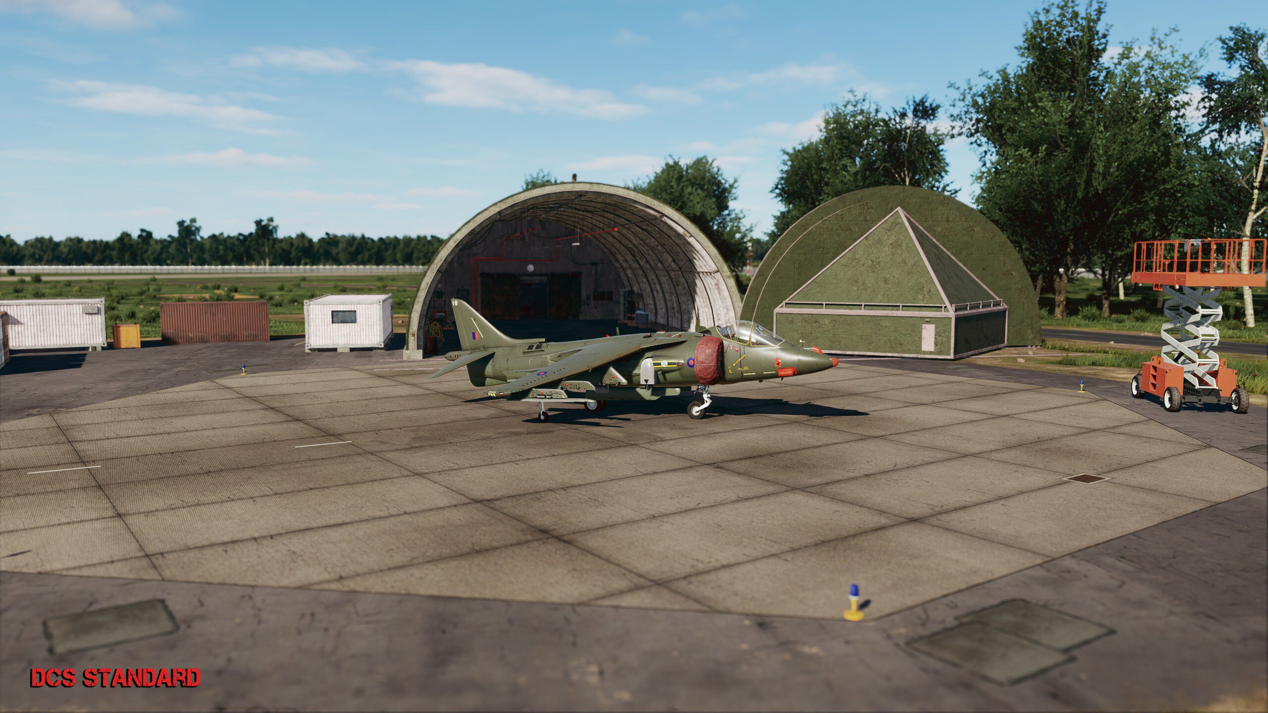
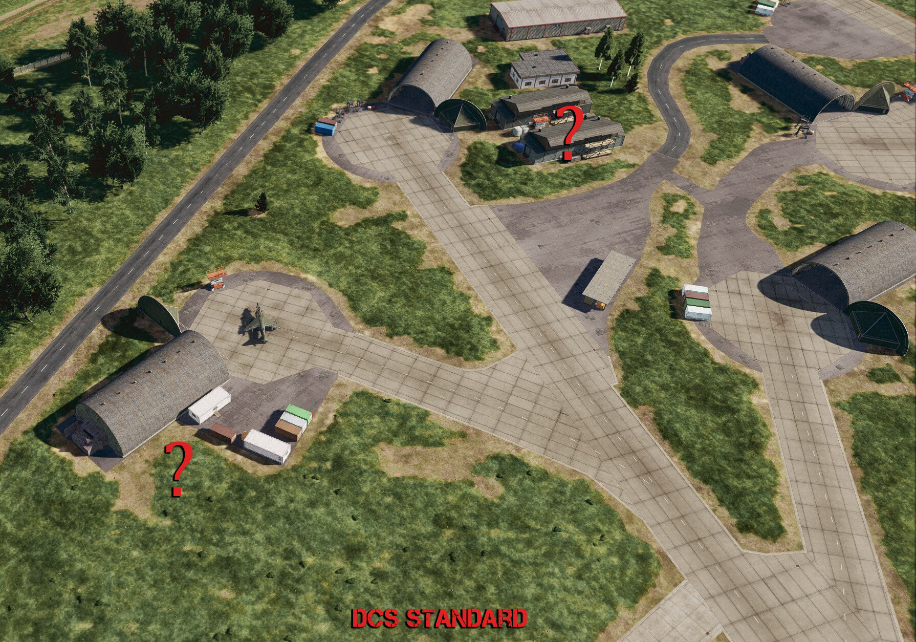
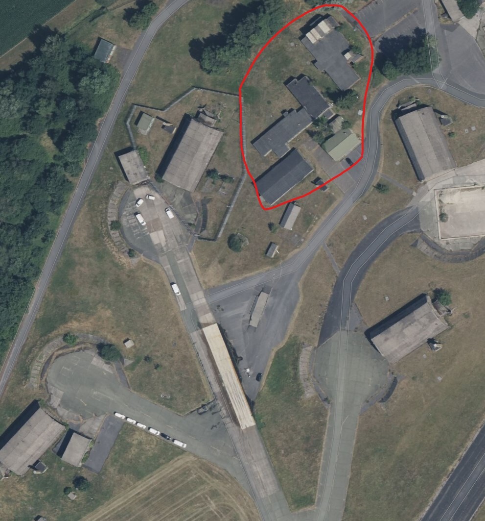
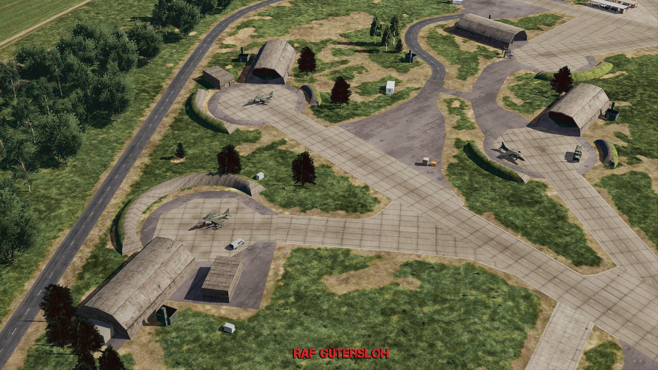
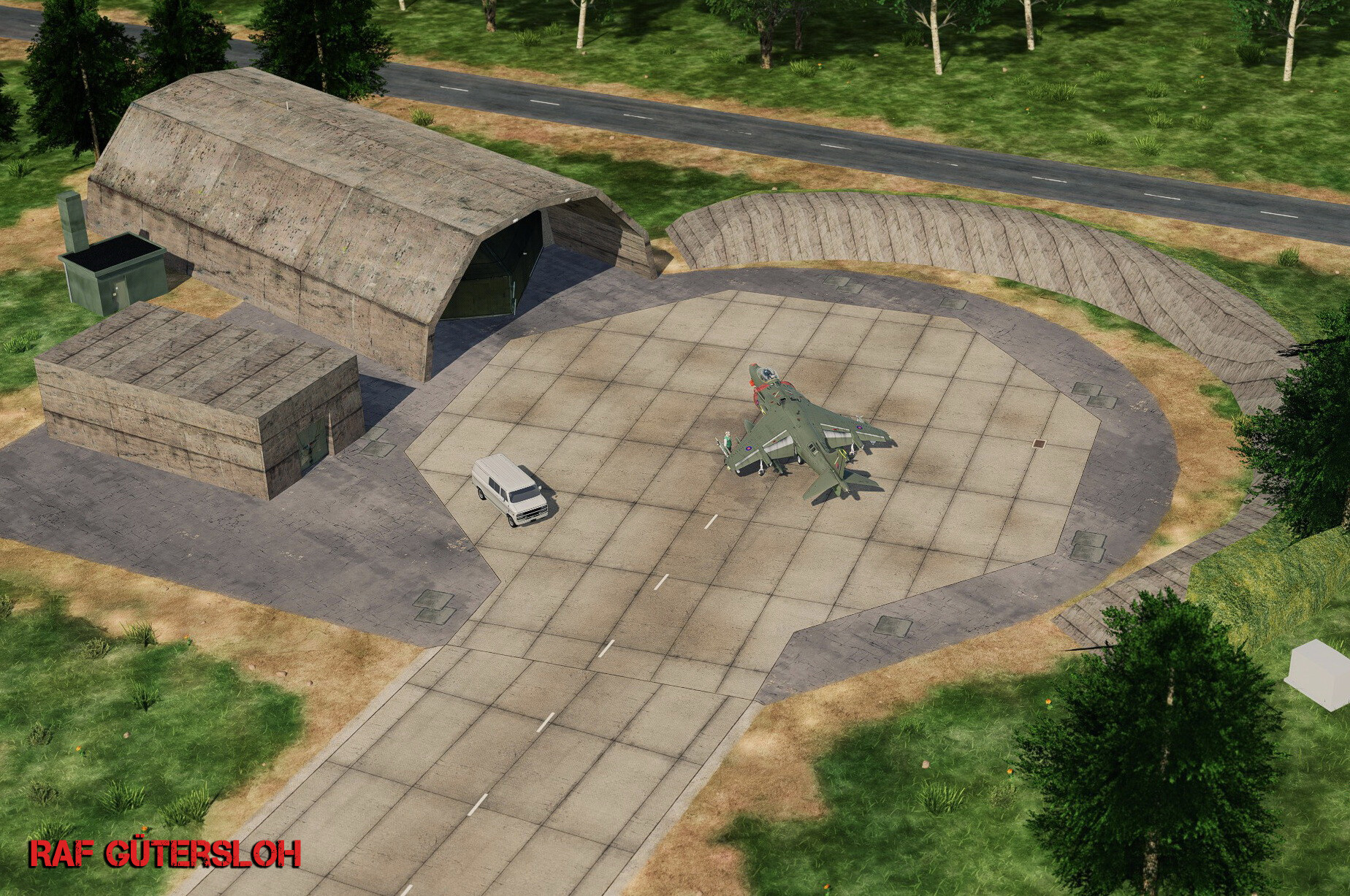
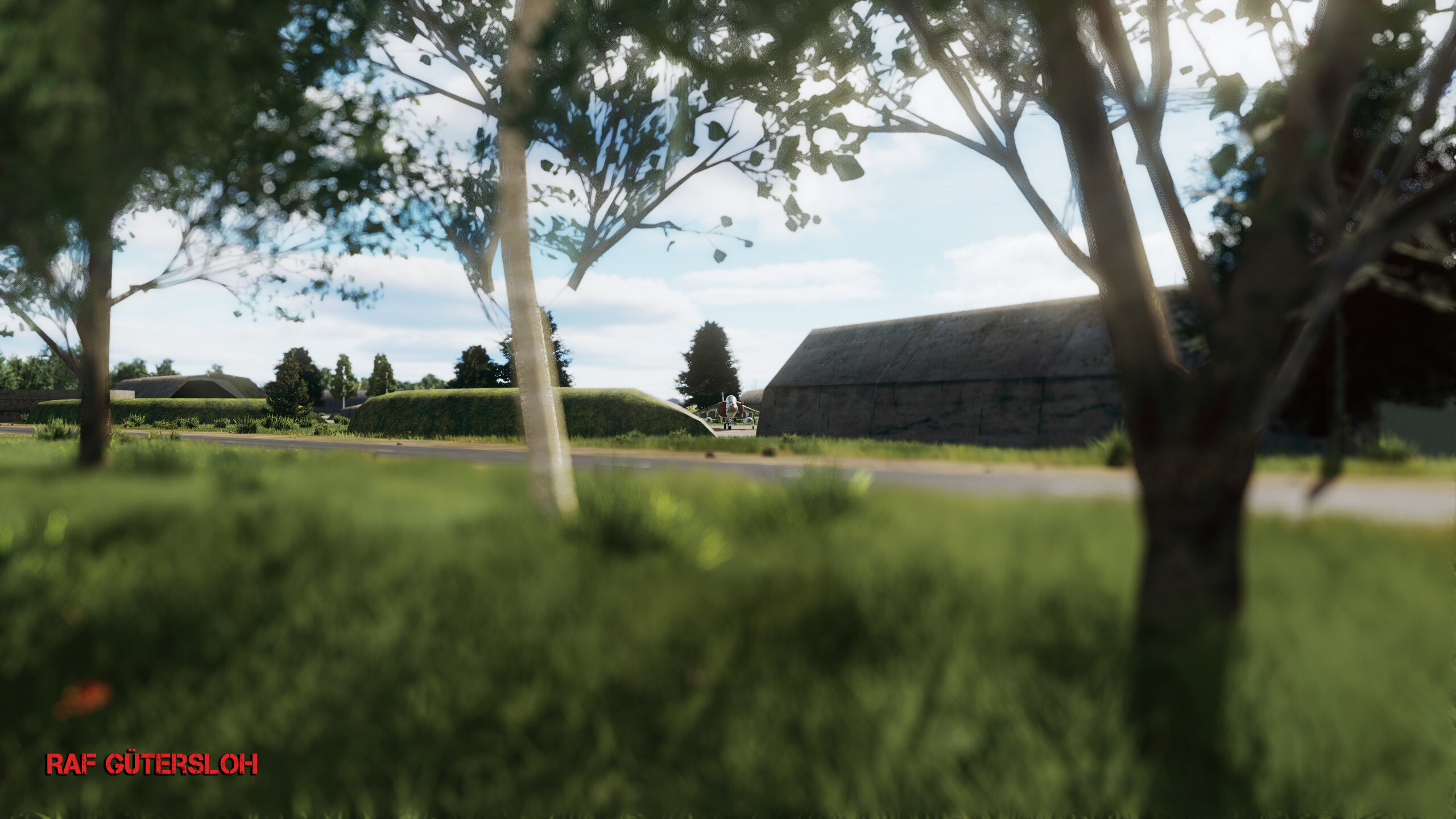
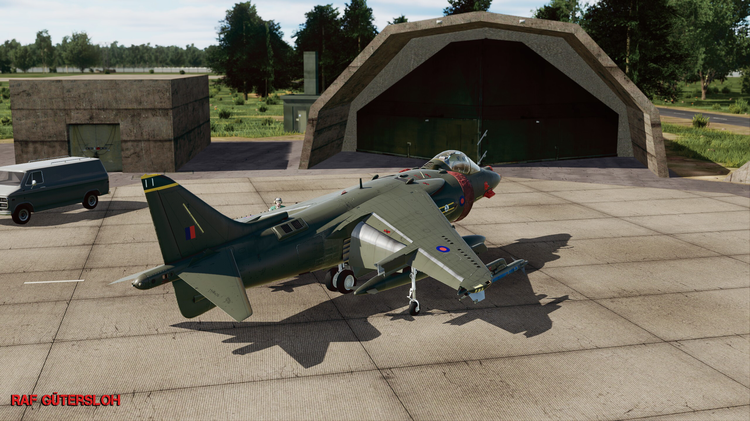
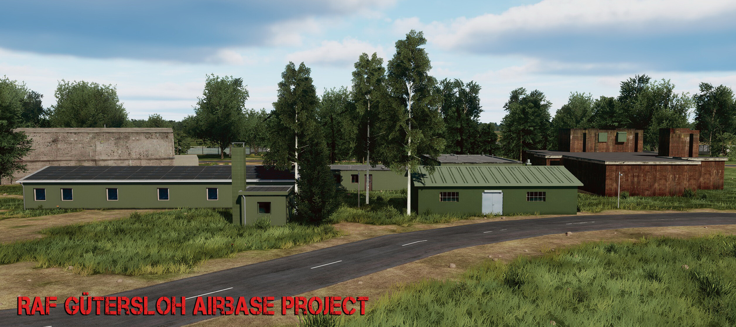
 Bought this map 2 days ago. First off, thank you for doing this, UGRA! I know I'm early with this, since a lot will hopefully be added or fixed, but anyway, here we go again... I decided to get back into modding as much as possible. I know I never really finished what I started back then, but I can say I learned a lot. This time it feels different, because it's Germany — I live here on the westide if germany, grew up here, and know many of the bases since I was a little kid in the early '90s. So there's a personal connection to it to some degree. (Even if LA is my second home.) This isn't meant to bash anyone, but I did pay $55 for this map, so yeah — while I don't expect much accurate cities or villages (it's not possible without satellite data or AI generating detailed roadmaps and building placements), I do at least expect the airbases to be accurate. Right now, RAF Gütersloh looks like a civilian airport, with 99% inaccurate buildings. Also, the shelters are wrong — too many colorful buildings and so on. It's fun to have a bike at all the main gates, but I'd prefer accuracy over little details like that. So, I decided to start this project. And yes, it will take time and resources — I'm on my own doing this. More about that later. This is just a start — models are not finished yet, it's all work in progress. The only thing that's finished right now is the shelter concrete texture. Sad thing already: the AI gets scared when you place something "over" their "heads" — jets automatically choose the next available ramp start spot to take off from, even though the shelters don't even have a collision shell yet. Choosing ground start is no option since the Harrier go full speed and just crash somewhere.. very buggy So the idea with Shelters is, to some degree, useless until one of the following happens: - UGRA Media adopts my hardened shelter model, - or they create their own, - or ED tweaks the AI so they're less "scared". (Also hoping the scenery remove object tool gets enhanced too.) enough talk for now... very early stages shots
- 67 replies
-
- 14
-

-

-
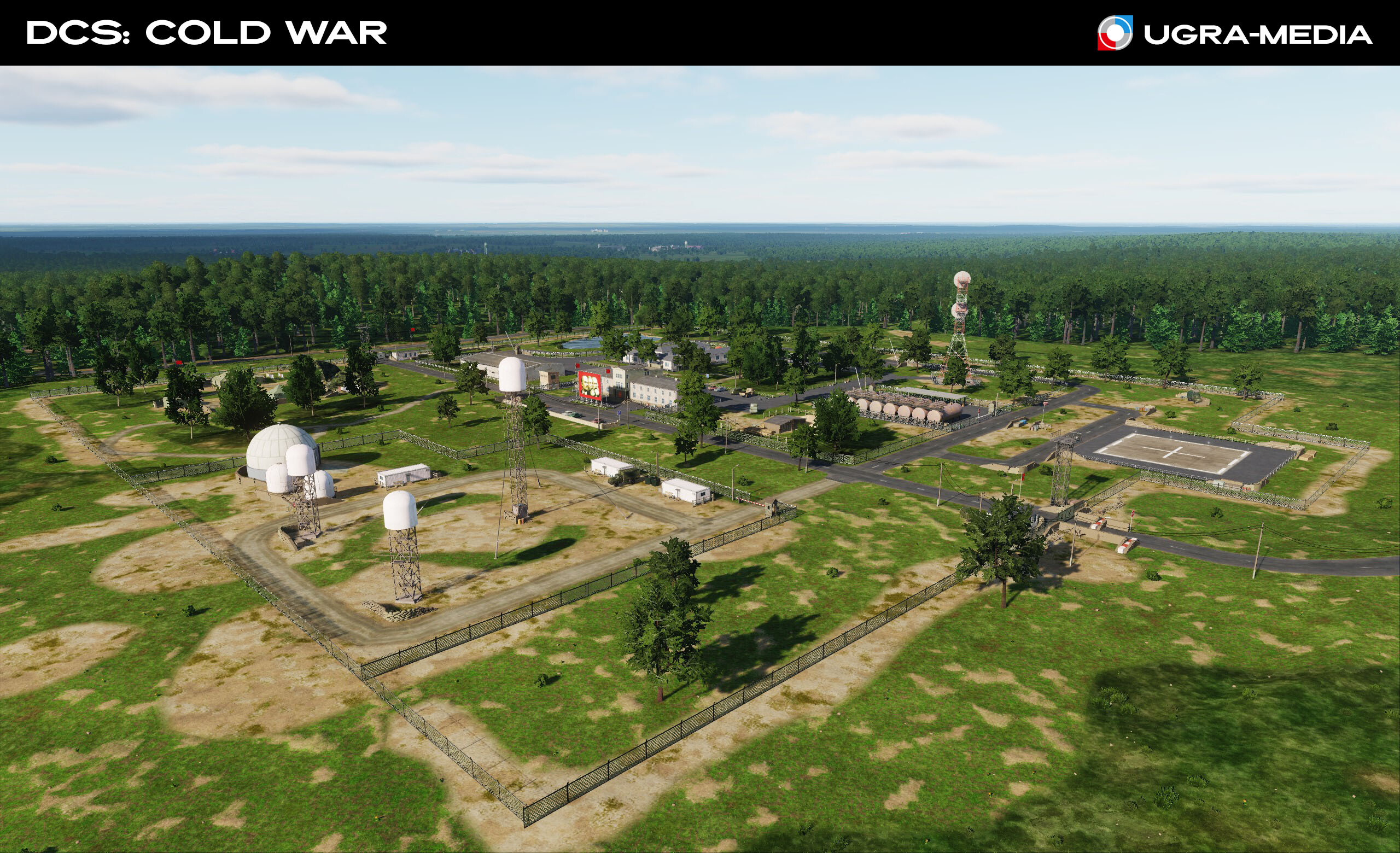
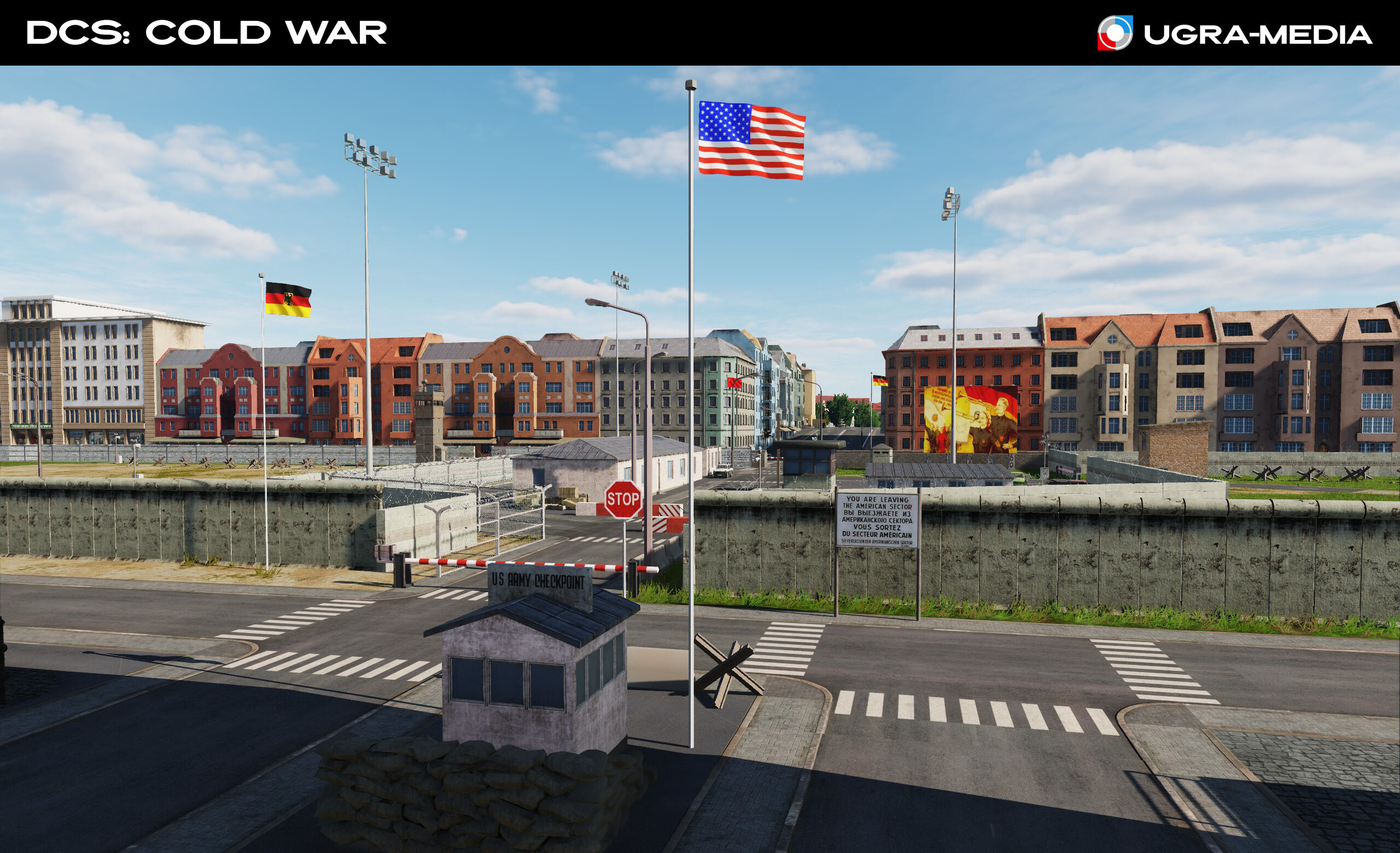
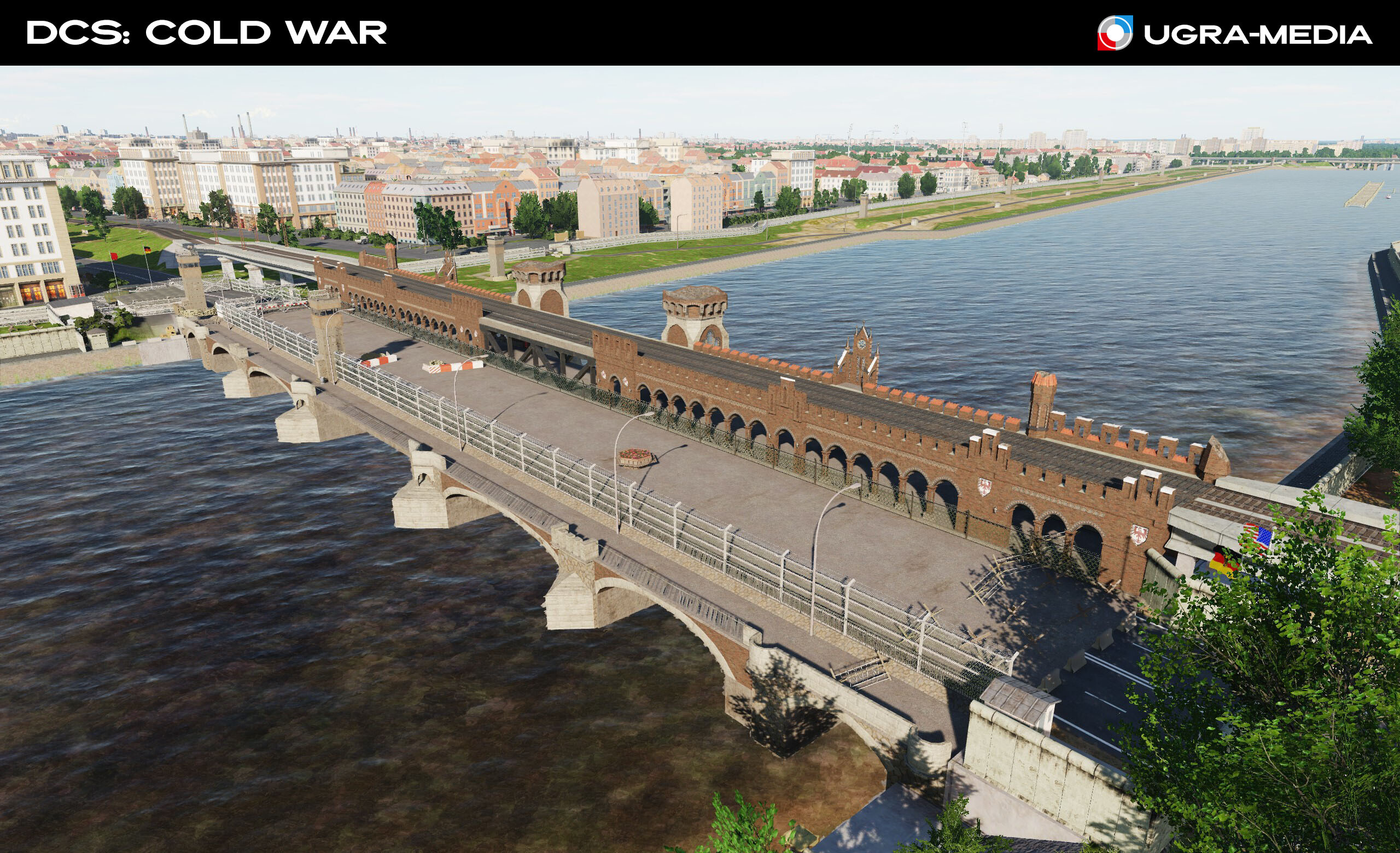
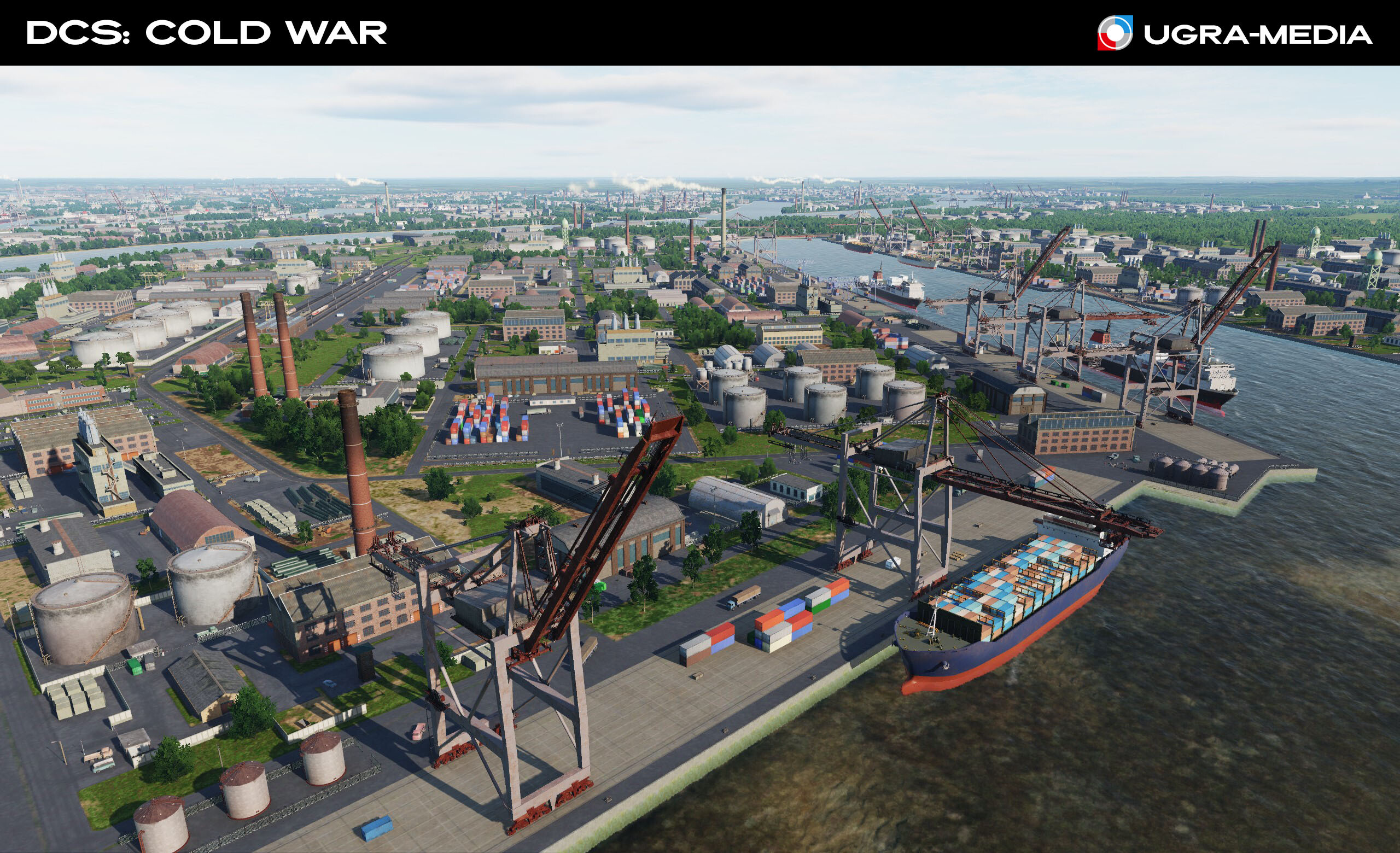
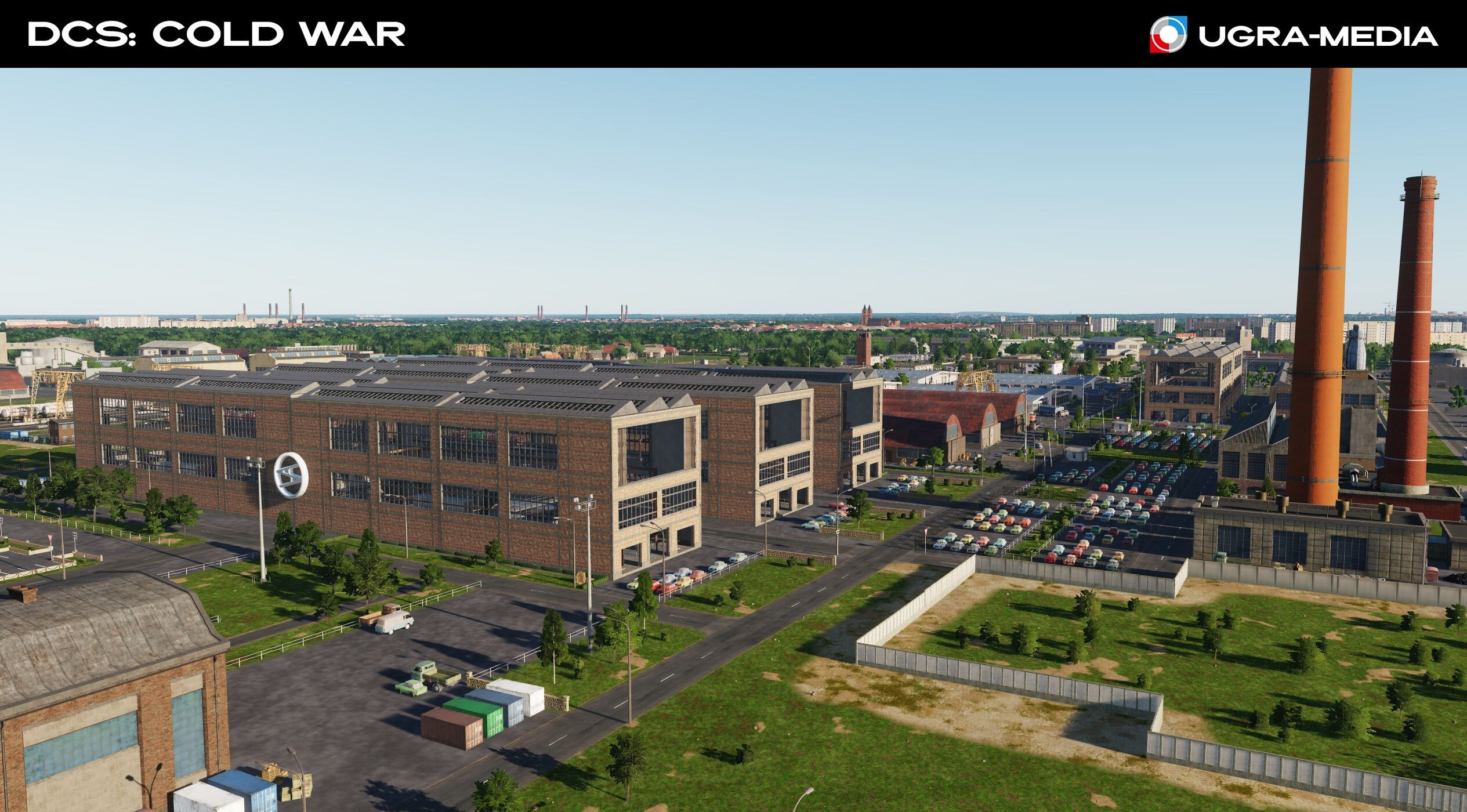
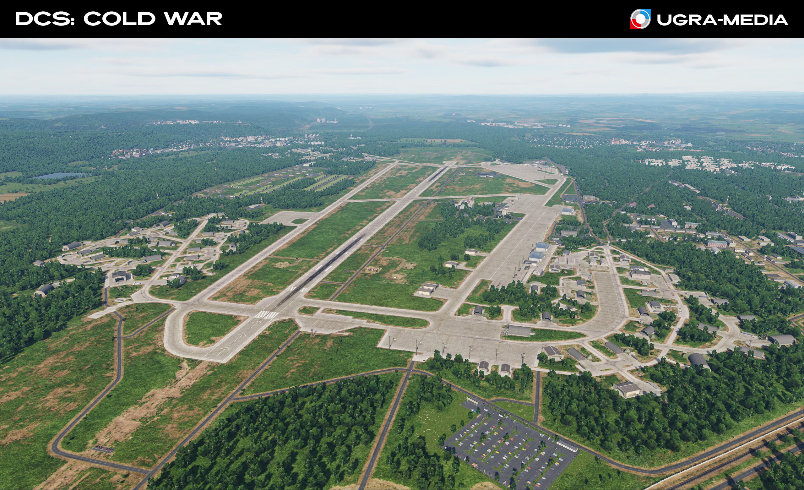
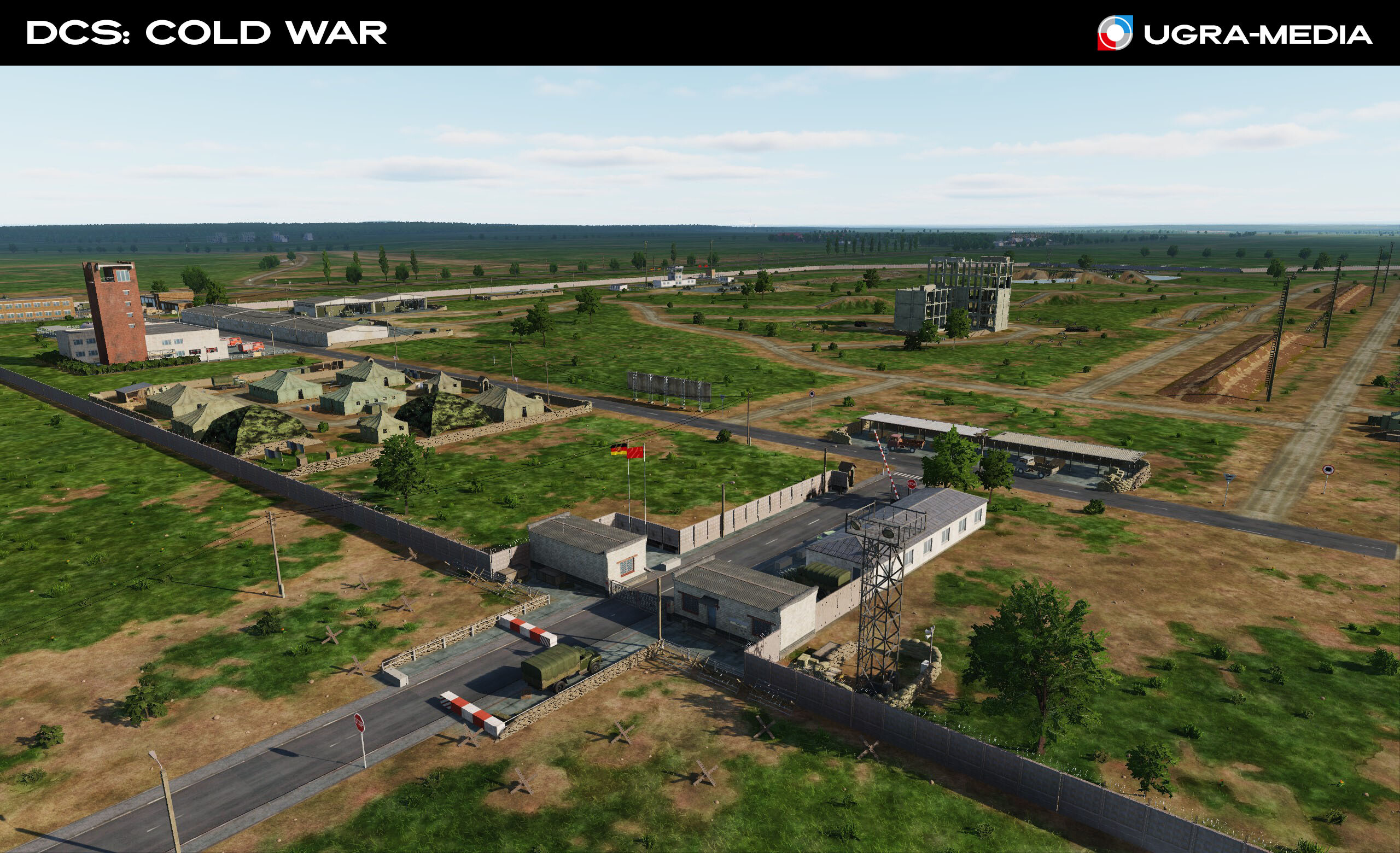
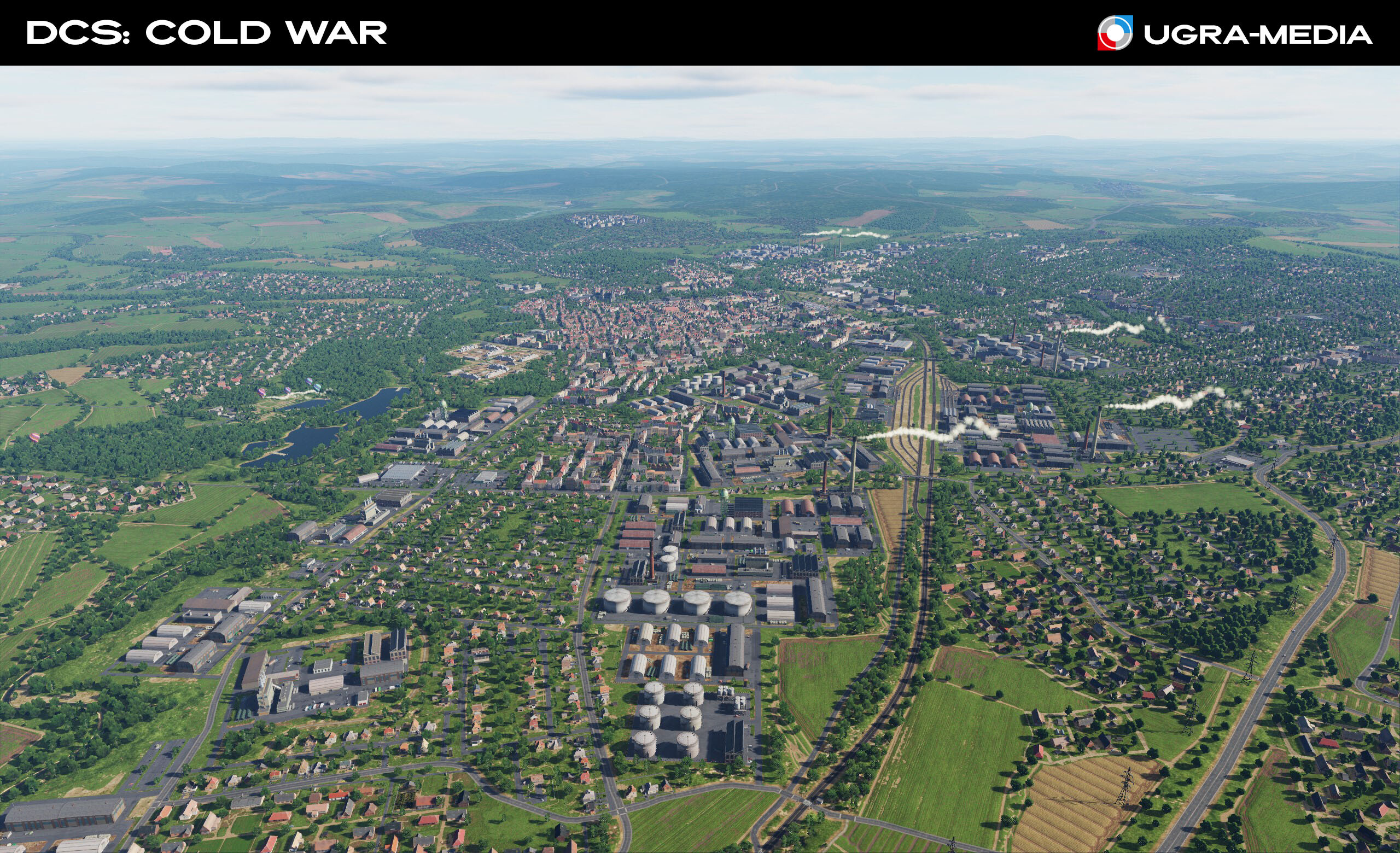
Hallo! Wie geht's? We are pleased to present our new project — the Cold War map, which will take you to Central Europe during the confrontation between NATO and the Warsaw Pact. Expect historical accuracy, unique locations, and the atmosphere of the era! Central Europe was the epicenter of the Cold War. We recreated the key locations of this period and tried to convey the atmosphere of that time, and we have big plans for this territory. Take a look at the first screenshots of the Cold War map. On this map, you will find historically accurate locations, including Berlin — a symbol of the Cold War, divided by a wall, dense forests of the Fulda Gap, key airfields and military bases. Immerse yourself in the atmosphere of the era when the world was balancing on the brink of a global conflict. Stay tuned — there is still a lot of interesting things ahead! We are just getting started. Tomorrow we will tell you about some airfields and opportunities for you. Let's start, of course, with Berlin — a symbol of the Cold War The Berlin Wall (Checkpoint Charlie). The wall that divided families, the nation and the world Barbed wire "decorated" the border area of Berlin Berlin at night. Look at the color of the street lighting in the western and eastern parts weiter... Fulda (here begins the Fulda Gap - the probable place of movement of the ground forces of the opposing sides) There are many military facilities located on the map. Military training areas Port of Hamburg Automobilwerk und natürlich Ramstein Air Base - the main NATO air base. You will be a frequent guest here ... or will this be your target The Brocken Transmitter on the Brocken, the highest mountain in Northern Germany Nun, tschüss!
- 489 replies
-
- 87
-
-
-
 Link to my post in "Object Bugs"
 -
FONTE https://youtu.be/4Q37cbS0XKY Bye Phant
- 55 replies
-
- 4
-
-
- ugra media
- germany
- (and 1 more)
-
Are there any land based gunnery and bombing ranges anywhere on the Syria map? Are there any on the Turkish part? What about sea based training zones?
-
Bye Phant
-
Ugra-media “Middle East” project The “Middle East” project is a unique theater of operations, which includes missions and companies of military confrontation in the Middle East from the mid-1970s to the present. This project allows users to use virtually the entire arsenal of military equipment and DCS aircraft and includes the reproduction of the events of one of the largest military conflicts of our time: - The War of the Doomsday of 1973; - Lebanon war of 1982; - The release of Syria from the terrorists in 2017. The project will present a map of 610 * 440 km in size, which includes almost all the states on the eastern coast of the Mediterranean Sea. It will present such large cities as Israeli Haifa and Shefaran, Lebanese Beirut and Tripoli, Turkish Adana and Gaziantep, Jordanian Irbit and Jerash, and of course the cities of the Syrian Arab Republic - Damascus, Homs, Hama, Lattakia, Iglib, Aleppo, Raqka and etc. In the project you can see the real monuments of ancient architecture - the colonnades and the amphitheater of Palmyra, the citadel of Allepo, the fortress of Krak de Chevalier, the mosque of Muhammad Al - Amin and others. More than 20 airfields will be implemented on the map, including the international airports of Damascus and Beirut, the US airbase Incirlik. And of course, the base of the Russian VKS Hmeymim and the Navy base Tartus will be presented. Recall that Syria is a state in the Middle East, bordering Lebanon and Israel in the southwest, with Jordan in the south, with Iraq in the east and with Turkey in the north. Washed by the Mediterranean Sea to the west. The modern statehood of Syria has a little more than 70 years, but civilization originated here as far back as the 4th millennium BC. the capital is Damascus, one of the oldest, constantly inhabited cities in the world. In addition, Damascus is also the oldest of all modern capitals in the world. Bye Phant
.jpg.edc5f90bb5fe9ff3eb7c0e7c9bbb4aa8.jpg)