Leaderboard

Popular Content
Showing content with the highest reputation on 06/29/11 in all areas
-
I posted the below in another thread but thought it actually might be of benefit as a thread of its own to help explain things for those who are interested in the who, what where and why! Please bear in mind I'm no instructor and my way of explaining things might not be as clear or easy to understand as I'd hoped. But please read and enjoy. Apologies for inaccuracies. I'm quoting what I can remember from my own past studies. Also, apologies if this has been covered before. I haven't found a thread similar and maybe it will spark interest or resolve mis-understandings to a new wave of simmers. Enjoy! ------------------------------------------------------------------------ There is a lot of confusion for peeps as to what QNH, QFE, QNE and QFF settings all mean. Not sure if it's been explained before but I'll just do a quick info filler post for those new to altimeter pressure functions. Its a lot of info to take in but hopefully will ease the pain and I will summarise at the end. History -These 'Q codes' originate from days way back when. Voice radio was hard to make out clearly at times, especially on HF frequencies. The reversion back to using morse code was then required to establish a clear method of communication. These Q codes were a set of 3 letters beginning with a Q. They were set up to transmit a sentence quickly with just morsing 3 letters. The Q originally was to signify a question. QRB = What is your distance. QRC = what is your true bearing etc. As the codes developed they also incorporated statements such as QFE = Pressure at particular observation station (an airfield/port/oil rig/etc). Just out of interest, Q codes reserved for aviation use are QAA–QNZ. There are reserved sets of codes for maritime and sets used by all services. Q codes we use on a day to day basis in aviation relate to headings too, QDM, QDR, QTE, QFU and QUJ. They all have a standard meaning attached to them and allowed the old morse operators to transmit info far more quickly. I wont go into these in this thread... maybe another future thread if there is enough interest ;) So, history lesson out the way... what do the pressure setting Q codes actually mean? ------------------------------------------------------------------------ QNH = The pressure measured at station then reduced down to mean sea level pressure. When set on your altimeter it will read your ALTITUDE. Sat on the tarmac at your airfield the altimeter will display the airfields elevation above mean sea level. This is the most commonly used pressure setting in the commercial world. Its probably the most useful setting to have, as nearly all aviation references to elevation are in relation to mean sea level. The mountain peaks on a map, airfield elevation, target elevation, minimum safe altitudes enroute etc. Incidently, QNH is given as a regional pressure setting and should be updated with new ones if you leave its area of reference into a new QNH pressure region. The QNH is the LOWEST FORECAST pressure at mean sea level for a given day to ensure that safe terrain seperation is maintained regardless of the days variation in pressure. ------------------------------------------------------------------------ QFE = Is mean sea level pressure corrected for temperature, adjusted for a specific site or datum like an airfield, being the most obvious example. When this is set on your altimeter, it will read your HEIGHT not altitude. It will read zero at airfield elevation and after take off will read your HEIGHT above that specific airfield. If you fly to another airfield of different elevation and/or different QFE pressure, you will have to ensure you reset that particular airfields QFE if you want your altimeter to read zero on touchdown. QFE is very good for new pilots who are remaining in the circuit around an airfield and keeps things simple for that task. ------------------------------------------------------------------------ QFE Example: Airfield A with elevation 250ft above mean sea level. Airfield B elevation 300ft AMSL. A to B = 10miles. Assuming a uniform atmospheric pressure in the region. Take off from A, altimeter reads 0ft on runway and after take-off reads HEIGHT above airfield A. Go and land at B and your altimeter will read 50ft on the runway. This is because B's HEIGHT is 50ft higher then A. In this example, if we set the regional QNH, then the altimeter will read ALTITUDE and therefore the airfields altitude AMSL. Airfield A, altimeter will read 250ft. Airfield B will read 300ft. This is why QNH is the primary pressure setting used in aviation at lower levels. It is far simpler working in a setting that gives ALTITUDE, so you can reference your vertical position from everything on a map or chart. (All airfield plates (charts) have their altitudes AMSL on the plate.) ------------------------------------------------------------------------ This is all good and well knowing that QNH is the best pressure setting to use in a region for vertical situational awareness. But it is not always possible to get the regional pressure setting QNH from accurate means and a reliable network of meteo stations. Remote airfields and isolated combat zones are just 2 examples where it'd be difficult to get an accurate QNH when you dont have access to good forecasts and numerous pressure sensing stations. If pressure info isn't available then you can get QFE easily by selecting an altimeter setting that reads zero on the airfield. The number in the altimeter pressure window is your QFE. To get QNH, you just need to know your elevation AMSL and set that in your altimeter. Airfield elevation = 250ft. Set altimeter to read 250ft. Pressure in the altimeter pressure window shows your QNH. (You have to remember that this wont be the lowest forecast QNH pressure for the day and just be cautious at low level. But thats why a radio altimeter is handy!) ------------------------------------------------------------------------ There are 2 other Q codes used for aviation pressure settings QNE = the Internation Standard Atmosphere (ISA). It is the average mean sea level pressure around the globe. It is planet earths mean atmospheric pressure at sea level basically. This pressure setting is refered to as STANDARD in aviation. STANDARD is set from QNH when climbing up through the "Transition Level". Your altimeter will then read your FLIGHT LEVEL. A reading of 25,000ft is FL250. 5,000ft = FL050. 13,500ft = FL135. ------------------------------------------------------------------------ The last one isn't really used in day to day aviation knowingly by pilots. To avoid info overload I have hidden it if you feel the above is alread a lot to digest ;) ------------------------------------------------------------------------ Summary QNH = Altitude (AMSL) QNE = Flight Level QFE = Height (AGL) QFF = Not used for altimeter settings In reality, QNH and STANDARD are the 2 most commonly used pressure settings. The other 2 - QFE is good for very local aerial work such as circuits at a specific airfield but not much use for wide area flight. QFF is used in meteorological weather charts. Hope this helps at least one person out there ;) Fly fast, take risks! Happy flying! ------------------------------------------------------------------------5 points
-
Здравствуйте! Хочется представить релиз-кандидат редактора пилонов для FC2. С помощью данной утилиты можно подвесить например лишнюю пару Р-77 на крайние пилоны к Миг-29С. Или имитировать Су-27СМ и подвесить Р-77 на штатный Су-27. Или дополнительные 2 ФАБ-500 на Миг-29... Или... -- ну в общем у кого на что фантазии и совести хватит. Для тех, кому страшно -- на каждое действие создается бэкап lua-файла самолета в ..\Scripts\Database\planes\backup (для самолетов) и в ..\Scripts\Database\helicopters\backup (для вертолетов). Загрузить и попробовать можно здесь: http://code.google.com/p/fc2editor/downloads/list Список изменений по версиям здесь: http://code.google.com/p/fc2editor/ На данный момент нет инсталлятора. После распаковки архива нужно поправить config.xml и указать путь к игре. Для корректной работы нужен .NET Framework 4, который можно взять здесь Если у кого есть десять минут, просьба попробовать запустить редактор на вашей машине. В случае возникновения ошибок, все они логируются в файл fc2editor.log. Можно присылать мне его по почте или в ЛС. Спасибо!2 points
-
----------------------------- 07/08 Important Update ----------------------------- Please download the Combined Document Pack from HERE to obtain this file UPDATED FOR VERSION 1.1.0.9 Start Up Guide v1.2 - 27/07 Mission Data Card v.1.7 - 05/08 After reading all of the excellent Start Up Guides out there, I wanted to make one that is simple and easy to use for flying missions and campaigns, for beginners, like me, who have gone through the tutorials but need a helping hand starting up their machines. It was important for me to be able to print this checklist out on 2 sides of Din A4 so that it fits in a transparent sleeve, which is easy to use and store. I don't have much free time, so as much as I respect the official start-up procedures, this guide aims to get you in the air as quickly as possible. I have also redesigned the Mission Data Card and tailored it for missions and campaigns, as I don't fly online. This is also included below and I hope that it helps some of you as it has me. Print two to a page and you should have a handy reference card during your missions. Many thanks to Snoopy for his excellent Real Life Checklists upon which my guide is based. It's great to have someone who works with these planes on board here and helps to make it feel all the more real. This wouldn't have been possible without the information you have shared with us. Thank you. Happy hunting1 point
-
Herewith a quick guide I put together that firstly illustrates the setup of a SADL network prior to a Flight by looking at the Call-Sign, OWN and GROUP ID entries and thereafter Illustrating the use of the SADL network in an Operational Multiplayer Environment, specifically focusing on A - The Creation and Transmission of Target Assignments between Players utilizing Markpoints, B - SPI Broadcasting and C - Instant Messaging. I have intentionally focused this guide on markpoints only insofar as Target Assignments are concerned as I have found that it's quick and easy. **Disclaimer: Any and all erors are mine alone and not indicative of the SIM and attendant content. If I aid one fellow Virtual Aviator by this guide then I consider it Time Well Spent** [ATTACH]53165[/ATTACH]1 point
-
:glare: :shifty: :D1 point
-
Всем спасибо за помощь, вроде со старыми дровами работает! Очень ценный совет по поводу "только чем сильнее применен фильтр!!! тем силенне загружен ТРЕКИР. Рекомендую дальше середины ползунок не двигать"! И последний вопросик, нужно ли из USB выключать трекир если комп выключен(просто в проклипе красные точки светятся после выключения компа)?1 point
-
"A U.S. Navy F/A-18 Hornet pilot's point of view launch from the aircraft carrier USS Abraham Lincoln (CVN 72)." FDGvQHru8-o Could this be us in DCS one day...1 point
-
хатка на джойстике не шумит?1 point
-
We are ready1 point
-
да нет... я не рокфеллер ниразу. 1000 руб это пол рабочего дня для меня :weight_lift:1 point
-
Funny....I was just going to say the same thing. Although it would be nice to see the Jane's brand revived, EA will never let it go. Besides, that's what we have ED for1 point
-
why not....:thumbup:1 point
-
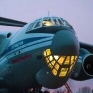
A10-F15-Su27 Jointpack Стандартный v1.7 - GeK39 Ил-76МД Кандид - 8K14 Скад-Б Launcher v1.01 - SA-3 S-125M Печорского SAM батареи Совместимость FC-2 A10-F15-Su27 Jointpack Standard v1.7 - GeK39 IL-76MD Candid - 8K14 Scud-B Launcher v1.01 - SA-3 S-125M Pechora SAM battery Compatibility FC-2 Свободное место на пользовательских файлов http://files.lockon.ru/en/84652/ Available at http://files.lockon.ru/en/84652/1 point
-
Never mind - obviously not what's required, but nevertheless was useful at the time.1 point
-
He said that he will fly 1x F-15C against the whole 51st and beat them all.1 point
-
hope it helps.1 point
-
You're gonna hate this, but airbat flies with one of those 8 button gaming mice.1 point
-
ED's way Step 1: DCS: BS (40 USD) Completely rewrite the mission editor Add triggers for scripting logic. Numerous changes to AI Step 2: FC2 (30 USD) Removed 100 flag limit Made compatible with DCS:BS Step 3: DCS: WH (60 USD) Implement fast mission generator Added several new trigger conditions and actions Improvements for AI fighters and land units Added event based triggers Added number counter for scripting logic Step 4 DCS WH+BS Compatibility Patch Owners of Black Shark get all of the new stuff added from WH. Step 5: Nevada DLC (? USD) New Terrain ? Step 6: DCS: CF-18 (60 USD estimated ---- Thrustmaster CF-18 HOTAS 300 USD) More improvements to the mission editor More improvements to the fast mission generator So to summarize: Iterate Profit Iterate Profit and so on. The other way. Build Dynamic Campaign from the ground up without releasing anything else. ???? Feed off hope Profit?1 point
-
After playing a few missions from each campaign all I can say is, meh. Without a DC it is truly...meh, but I wont go into that here. I was wondering if anyone has made any additional campaigns for A-10 and where I might find them. Also, as a suggestion for future campaigns, please set them up like the Devils Cross campaign where you start on the ramp cold and dark. The others where you start already on the runway kinda sucks what little immersion there is out of the sim. Just a thought. Oops, didnt mean to put this in the tech support area.1 point
-
There is a lot of confusion for peeps as to what QNH, QFE, QNE and QFF settings all mean. Not sure if it's been explained before but I'll just do a quick info filler post for those new to altimeter pressure functions. Its a lot of info to take in but hopefully will ease the pain and I will summarise at the end. History -These 'Q codes' originate from days way back when. Voice radio was hard to make out clearly at times, especially on HF frequencies. The reversion back to using morse code was then required to establish a clear method of communication. These Q codes were a set of 3 letters beginning with a Q. They were set up to transmit a sentence quickly with just morsing 3 letters. This originally was to signify a question. QRB = What is your distance. QRC = what is your true bearing etc. As the codes developed they also incorporated statements such as QFE = Pressure at particular observation station (an airfield/port/oil rig/etc). Just out of interest, Q codes reserved for aviation use are QAA–QNZ. There are reserved sets of codes for maritime and sets for all services use. So, history lesson out the way... what do the pressure setting Q codes actually mean? ------------------------------------------------------------------------ QNH = The pressure at mean sea level. When set on your altimeter it will read your ALTITUDE. Sat on the tarmac at your airfield the altimeter will display the airfields elevation above mean sea level. This is the most commonly used pressure setting in the commercial world. Its probably the most useful setting to have, as nearly all aviation references to elevation are in relation to mean sea level. The mountain peaks on a map, airfield elevation, target elevation, minimum safe altitudes enroute etc. Incidently, QNH is given as a regional pressure setting and should be updated with new ones if you leave its area of reference into a new QNH pressure region. The QNH is the LOWEST FORECAST pressure at mean sea level for a given day to ensure that safe terrain seperation is maintained regardless of the days variation in pressure. ------------------------------------------------------------------------ QFE = Is mean sea level pressure corrected for temperature, adjusted for a specific site or datum like an airfield, being the most obvious example. When this is set on your altimeter, it will read your HEIGHT not altitude. It will read zero at airfield elevation and after take off will read your HEIGHT above that specific airfield. If you fly to another airfield of different elevation and/or different QFE pressure, you will have to ensure you reset that particular airfields QFE if you want your altimeter to read zero on touchdown. QFE is very good for new pilots who are remaining in the circuit around an airfield and keeps things simple for that task. ------------------------------------------------------------------------ QFE Example: Airfield A with elevation 250ft above mean sea level. Airfield B elevation 300ft AMSL. A to B = 10miles. Assuming a uniform atmospheric pressure in the region. Take off from A, altimeter reads 0ft on runway and after take-off reads HEIGHT above airfield A. Go and land at B and your altimeter will read 50ft on the runway. This is because B's HEIGHT is 50ft higher the A. In this example, if we set the regional QNH, then the altimeter will read ALTITUDE and therefore the airfields altitude AMSL. Airfield A, altimeter will read 250ft. Airfield B will read 300ft. This is why QNH is the primary pressure setting used in aviation at lower levels. It is far simpler working in a setting that gives ALTITUDE, so you can reference your vertical position from everything on a map or chart. (All airfield plates (charts) have their altitudes AMSL on the plate.) ------------------------------------------------------------------------ This is all good and well knowing that QNH is the best pressure setting to use in a region for vertical situational awareness. But it is not always possible to get the regional pressure setting QNH from accurate means and a reliable network of meteo stations. Remote airfields and isolated combat zones are just 2 examples where it'd be difficult to get an accurate QNH when you dont have access to good forecasts and numerous pressure sensing stations. If pressure info isn't available then you can get QFE easily by selecting an altimeter setting that reads zero on the airfield. The number in the altimeter pressure window is your QFE. To get QNH, you just need to know your elevation AMSL and set that in your altimeter. Airfield elevation = 250ft. Set altimeter to read 250ft. Pressure in the altimeter pressure window shows your QNH. (You have to remember that this wont be the lowest forecast QNH pressure for the day and just be cautious at low level. But thats why a radio altimeter is handy!) ------------------------------------------------------------------------ There are 2 other Q codes used for aviation pressure settings QNE = the Internation Standard Atmosphere (ISA). It is the average mean sea level pressure around the globe. It is planet earths mean atmospheric pressure at sea level basically. This pressure setting is refered to as STANDARD in aviation. STANDARD is set from QNH when climbing up through the "Transition Level". Your altimeter will then read your FLIGHT LEVEL. A reading of 25,000ft is FL250. 5,000ft = FL050. 13,500ft = FL135. ------------------------------------------------------------------------ The last one isn't really used in day to day aviation knowingly by pilots. To avoid info overload I have hidden it if you feel the above is alread a lot to digest ;) ------------------------------------------------------------------------ Summary QNH = Altitude (AMSL) QNE = Flight Level QFE = Height (AGL) QFF = Not used for altimeter settings In reality, QNH and STANDARD are the 2 most commonly used pressure settings. The other 2 - QFE is good for very local aerial work such as circuits at a specific airfield but not much use for wide area flight. QFF is used in meteorological weather charts. Hope this helps at least one person out there ;) Fly fast, take risks! Happy flying! ------------------------------------------------------------------------1 point
-
A few more from Lypetsk. Credits: SergeyL from Aviaforum1 point
-
Thanks for the feedback. You might be too close to the edge of the MOA and exiting without authorization. Check your map references. I didn't encounter it in testing but it could be possible if you have a slow climb to angels 15 or if your other maneuvers take up too much room. How wide a turn is your defensive spiral? I tried to match the MOA on the diagram with the actual MOA trigger zone in the mission but I could be off by some amount. It is part of the mission to know where you are relative to the MOA boundaries. If it looks like a serious problem for many folks I can increase the size of the MOA to give everyone more room. Please let me know how it goes and thanks for playing.1 point
-
ну наконец-то, благодарю1 point
-
Could be a bug. I'll check. If you don't make angels 6 at 200 knots on heading 300 before the turn to 040 that could be the problem. Looks like the 300 heading check came in after the turn to 040. Try staying on 040 and ignore the 300 heading instructions after the turn for now. Once you complete the turn to 040 angels 6 at 200 knots the mission should play out properly.1 point
-
Есть предложение - дать окончательный, т.е. крайний ответ начинающему вирпилу, а то он так и не определится, что же ему нужно. (Правда, мало информации о самом претенденте, но всё же). Моё мнение - прежде чем выбрать Сквад надо полетать на всех доступных серверах, разобраться, что к чему, подружиться с сетевыми pilotami-istrebitelyami (в Сквадах это звание надо заслужить) и возможно вопрос разрешится сам собой. С уважением1 point
-
1 point

-
Recently Browsing 0 members
- No registered users viewing this page.