Ramsay
-
Posts
3752 -
Joined
-
Last visited
Content Type
Profiles
Forums
Events
Everything posted by Ramsay
-
There are a couple of 1984 DoD FLIP Wunstorf VFR charts available via the WaybackMachine site https://web.archive.org/web/20150216004956/http://pennula.de/spezialthema-flight-information-publication-usa-air-force.htm Note: The full 1984 DoD FLIP .pdf document is payware but the individual airfield .jpg's are free to view/download.
-
The mission file can be edited to run mission 3 without the civilian ship mod (that adds ambiance to the port but isn't required for the mission to work). See this post for the exact details on how to edit the "mission" file.
-
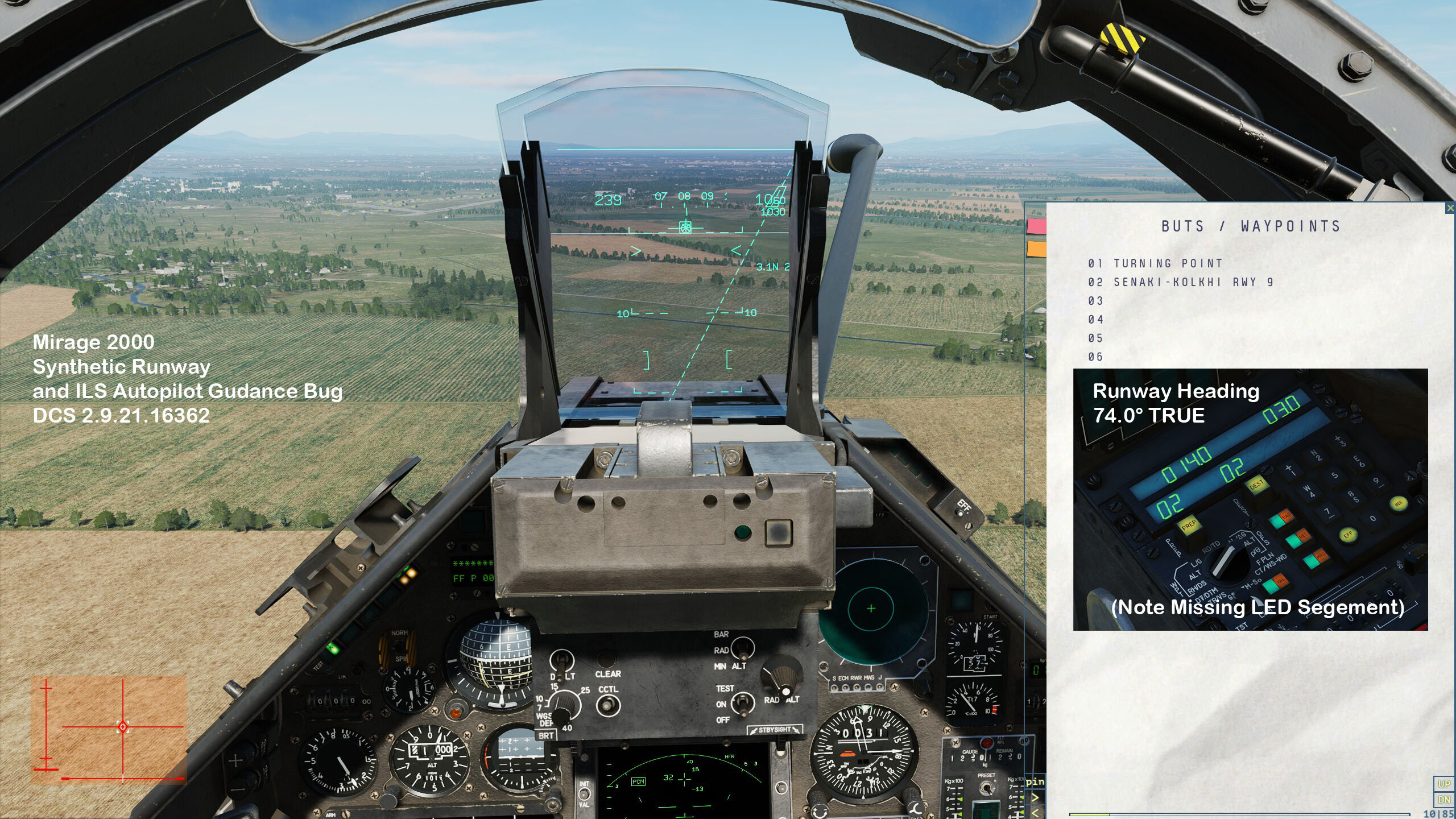
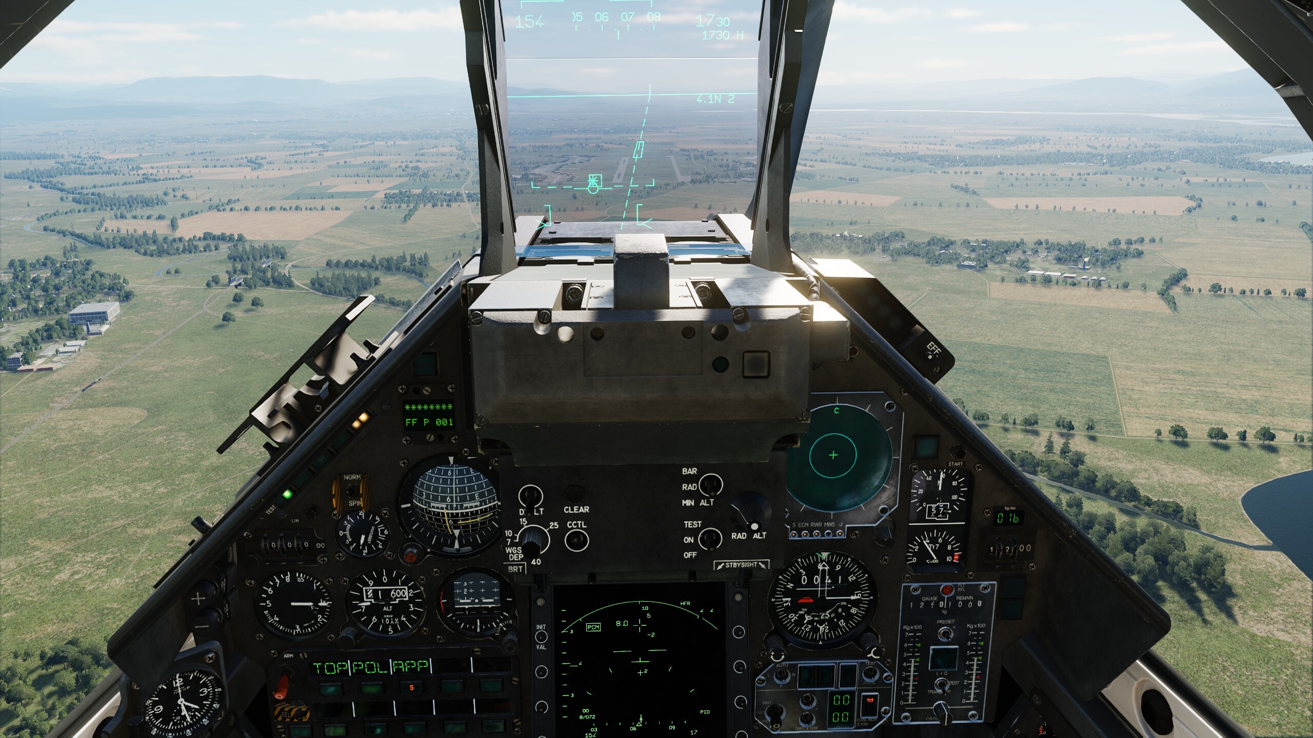
Thank you - yes, I see the issue now - both in your track and in my own missions that previously worked fine. I suspect ED have changed something with how the ILS beam(s) are coded/modelled and this effects both the drawn synthetic runway and autopilot guidance. I have yet to test the Aerges Mirage F1 to see if it's ILS guidance is similarly effected. Tested Senaki RWY 09, DCS 2.9.21.16362

-
Unfortunately your example track file doesn't make assisting you easy, as it starts in the F10 map and switches between simulation speeds and viewed aircraft, before you even enter the Mirage 2K (not sure if you do as I quit the replay after 5 min of watching). Is it the track file you intended to upload ? Can you submit a shorter track demonstrating the problem (perhaps using the default Caucasus map so more people can view / help) ?
-
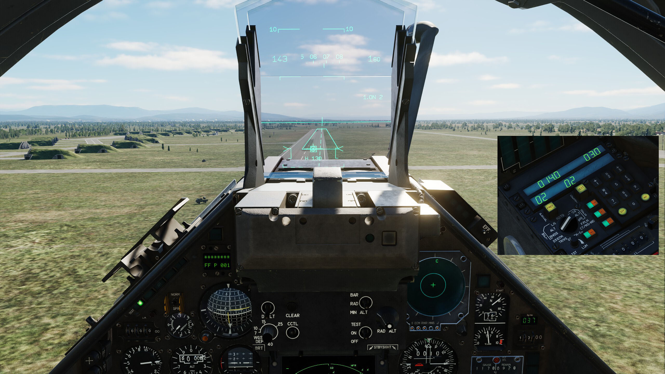
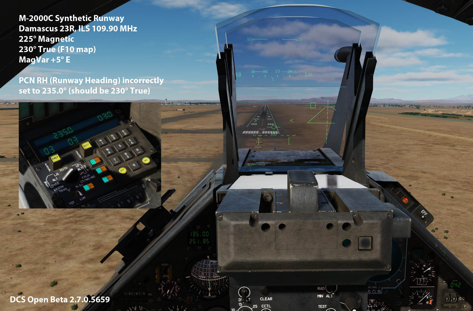
Your picture of the APP HUD with a misplace ILS Localiser Line and Synthetic Runway is typical when using a PCN "Landing" waypoint that has an incorrect Runway direction i.e. the runway heading entered should be it's TRUE heading. I'm currently reinstalling the Sinai Map to view your posted track before providing further feedback. Additional Info Here is an example of what happens when the runway heading is set incorrectly
-
AFAIK the EHSD bug is not new (~2022), a work around for the misplaced EHSD AWLS TACAN station is to change MAPM to TRUE. More detail about the "old" bug is found in this thread :-
-
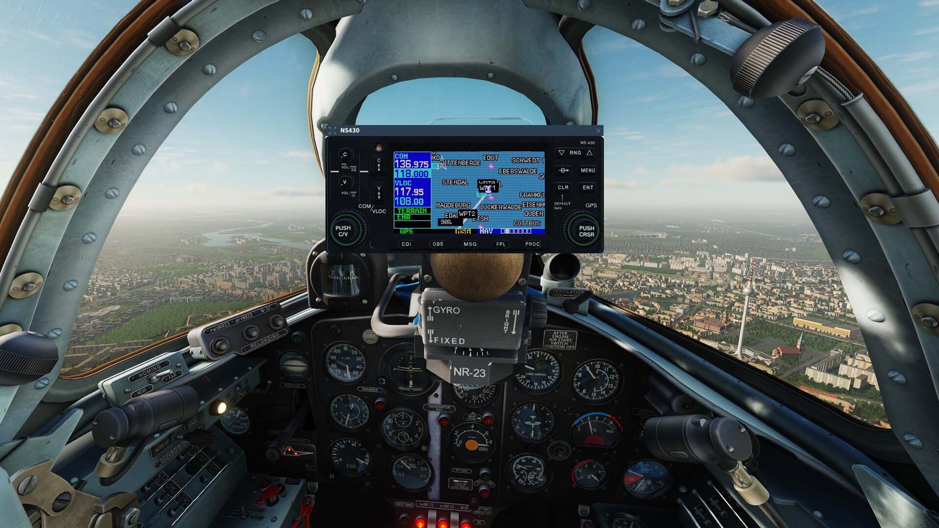
Yes, but both the 2D popup module (which has the NS430's "logic", etc.) https://www.digitalcombatsimulator.com/en/shop/modules/ns430/ and MiG-29 Cockpit NS430 Plugin (which enables the DCS "hooks" that support the 3D NS430 in cockpit model) are required for the "best" VR experience. https://www.digitalcombatsimulator.com/en/shop/modules/ns430_mig-29a/ Correct, the 3D model also has less of a FPS impact than the 2D popup when in use.
-
Here's a link that should work
-
The core logic of the NS430 is part of DCS NS430's Base 2D Module. https://www.digitalcombatsimulator.com/en/shop/modules/ns430/ https://store.steampowered.com/app/1725570/DCS_NS_430_Navigation_System/ Cockpit plug-ins i.e. for the L-39C, Mi-8, C-101 and Gazelle, add the 3D model to cockpit and are usually separate purchases. These are compatible with VR and have less of a FPS hit than the 2D popup. https://www.digitalcombatsimulator.com/en/shop/modules/ns430_mi8mtv2/ https://store.steampowered.com/app/1690512/DCS_NS_430_Navigation_System_for_L39S/ On ED's own store - it's possible there may be MiG-29A package that combines the MiG-29, NS430 2D Base and NS430 MiG-29 Cockpit plug-in. However on Steam - it's likely a NS430 MiG-29 Cockpit plug-in, would be kept as a separate purchase, as that is how other NS430 Cockpit plugins are sold.
-
TL;DR: Can you share a short track or video of your engine start procedure - this will greatly help in diagnosing why you are having an issue(s). Thanks. Detail: Common fuel control lever issues are duplicate (axis) control bindings and/or a lack of dead zones at the end/start of the fuel control lever's movement (when bound using an axis). However ... ... sounds like you are starting the rotor spinning with the collective lever "FULLY UP", rather than "FULLY DOWN". This causes the centrifugal clutch to slip under load (as the rotor and engine RPM aren't in sync) and it will quickly overheat/disintegrate both IRL and in DCS. So also check you flight control control bindings/settings when starting i.e. using RCTRL+ENTER to display the DCS controls indicator. Tested using the SA342 Caucasus Cold Start Tutorial in DCS 2.9.18.12899
-
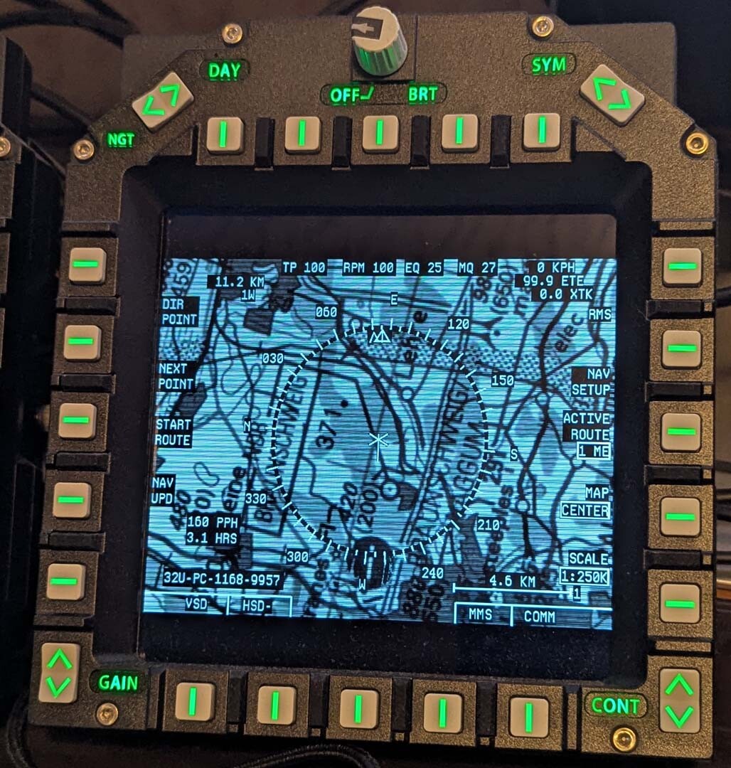
Thanks for sharing your work. Looks like there may be error on the Buchel (ETSB) Chart for the "ENTRY WEST" Radial i.e. "R-010/15" is the same as ENTRY NORTH.
-
The MiG-21 doesn't use the Cold War Germany "beacon.lua", it uses it's own definitions files and requires a user mod.
-
The default "MiG-15bis - GermanyCW - Free Flight.miz" mission (GDR REDFOR) is set on 16th August 1990, so before the full GPS Satellite Constellation was in orbit/operational (March 28th 1994 in DCS). With ... 1. Mission date adjusted to 16th August 1994 and 2. Options>Gameplay --> Unrestricted SATNAV = CHECKED ... the NS430 popup worked as expected.
-
CWG Sandbox - Rotorhead Edition 45 missions in 1
Ramsay replied to Don Rudi's topic in DCS: Cold War Germany
This is common/normal behaviour due to how DCS and Windows interact if Windows is allowed to automatically manage virtual memory. Hence this DCS recommendation :- https://www.digitalcombatsimulator.com/en/support/faq/startup/ -
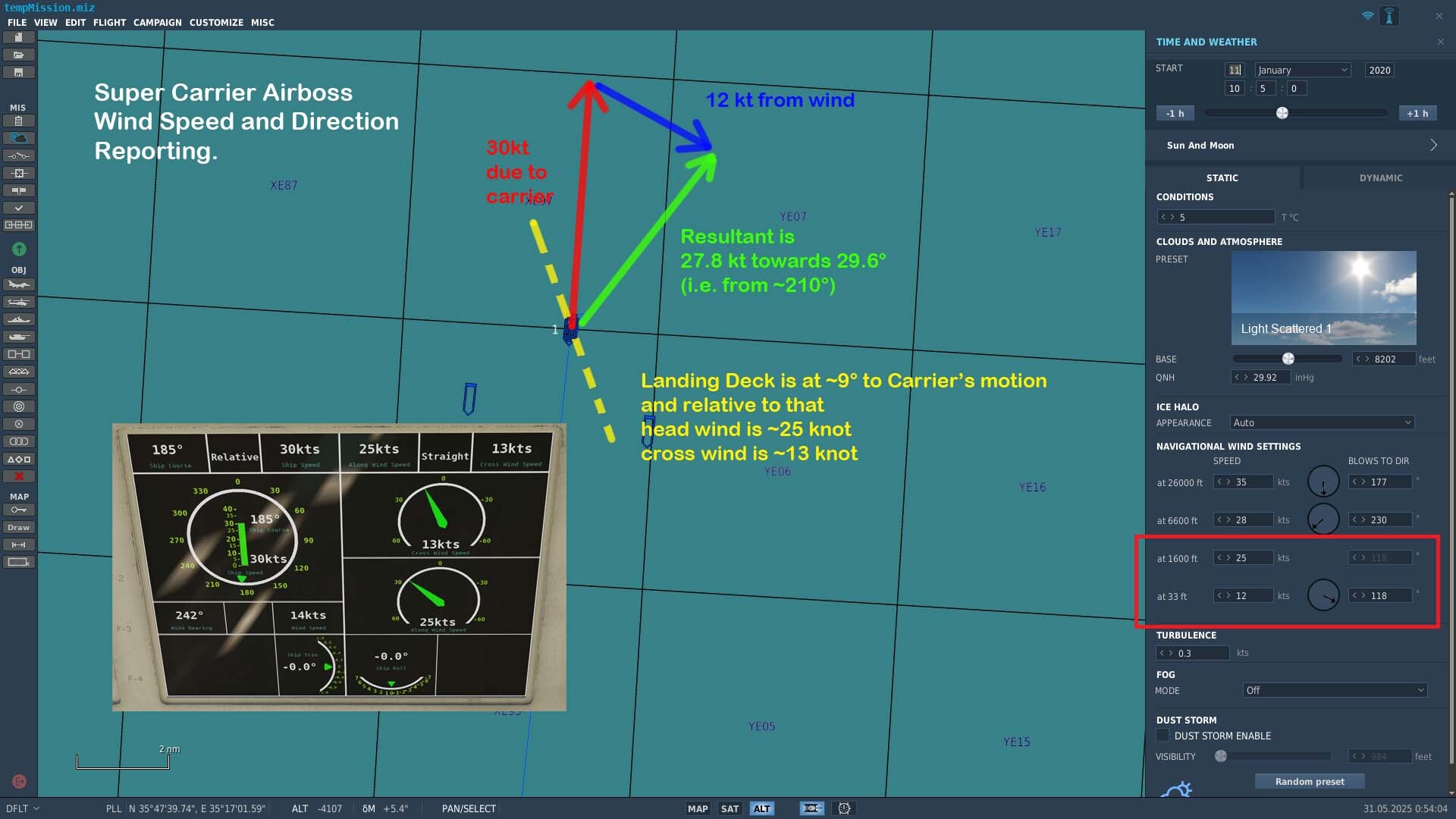
Just did a quick check - there's nothing fancy (or relative) here, it's just wrong. • wind to 90° is reported as 270° (correct) • wind to 118° is reported as 242° (wrong i.e. 118 + 180 = 298) • wind to 45° is reported as 315° (wrong i.e. 45 + 180 = 225) Looks like it was pure chance the Airboss's relative wind bearing of 242° in the OP's mission was in the same quadrant as the actual "relative wind" !!!
-
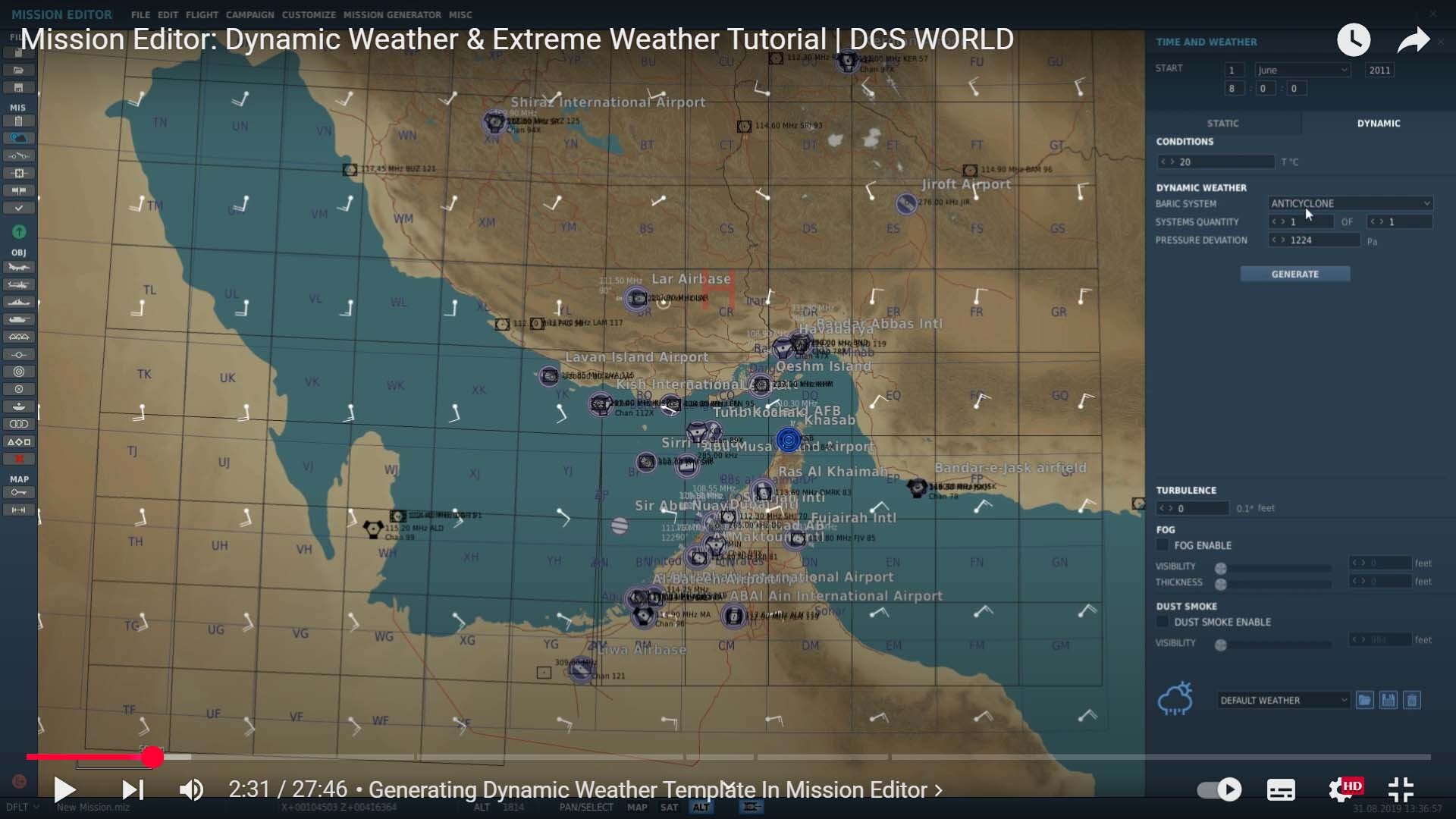
Apparent wind: Apparent wind is the wind experienced by a moving object, like a sailboat or an aircraft, and is a combination of the true wind and the object's speed and direction. Relative wind is the direction of the airflow relative to the moving object (carrier), rather than the true wind direction. Comment: AFAIK the Airboss screen's "relative wind" direction is only calculated at mission start and doesn't update when changing the carrier's speed/direction or switching to a new player slot. The magnitude of the Airboss's "relative wind" only considers the metrological wind component (perhaps adjusted for deck height) and doesn't include the additional component due to the carrier's own speed/direction. Dynamic weather adds cyclone type weather systems to DCS and metrological wind direction and speed can/will vary with the carrier's location i.e.
-
This is incorrect. The "Relative Wind" direction shown in the bottom left appears to be calculated at mission start? and won't necessarily be the metrological to/from direction i.e. the OP's mission has a 12 kts wind towards 188°T, yet the Airboss screen shows the direction as 242°
-
Yes, in this test mission 12 kts @ 33ft increases to 25 kts @ 1600ft (and I'm guessing the 72 ft deck height is responsible for the increase to 14 kt in DCS).
-
Unfortunately the Relative Wind direction and magnitude on the Airboss's screen doesn't update when changing the carriers speed or direction - so even if you bring the carrier to a full stop, you can't see the meteorological wind across the deck. Here, I've turned the carrier into the meteorological wind and adjusted the course so the crosswind needle is centered i.e. at 0 kts ... this is far from ideal, but I'm at a loss for what else you can do if the briefed wind direction changes and isn't updated in the mission brief (LALT+B).
-
It's the relative wind across the carrier deck i.e. a helicopter taking off into a hover or flying parallel, would fly 242° at 28 knots to remain stationary relative to the moving carrier. The relative wind across the deck is dynamic and will change with changes to carrier's speed/direction. The meteorological wind is usually static (in DCS) and/or slow to change - so matches the mission briefing. Not sure on the exact maths but I'd turn the carrier into the meteorological wind (305°T) and add a "fudge" factor to compensate for the angled deck, OTOH in DCS I general consider "into the wind" close enough when making missions.
-
Is that what is/should be displayed at the Airboss's "station ? Do you have a real life example/link for US carrier operations you can share ?
-
Not sure if everything is reported correctly on the "Airboss's Windspeed/Direction Screen" but neither 118° or 298° is close to the resultant wind across the deck due to the carrier's speed/direction combined with the meteorological wind in the mission. This diagram might help ? Comment ARCTAN (25/13) = ~62° so the wind direction from 242° in DCS is perhaps derived from the "measured ?" landing deck headwind/ crosswind components (and ED are modelling real life rounding errors, instrument limitations or similar ?) However, the magnitude (14 kts) of the wind doesn't make sense (to my eyes) as (from Pythagoras theorem) the landing deck wind components equal 28 knots i.e. • √ ( 25² + 13² ) = √ ( 625 + 169 ) = √ ( 794 ) = 28 kts but perhaps I'm misunderstanding what is being displayed in the bottom left of the Airboss's screen ?
-
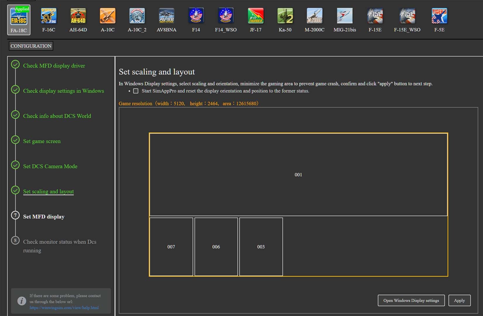
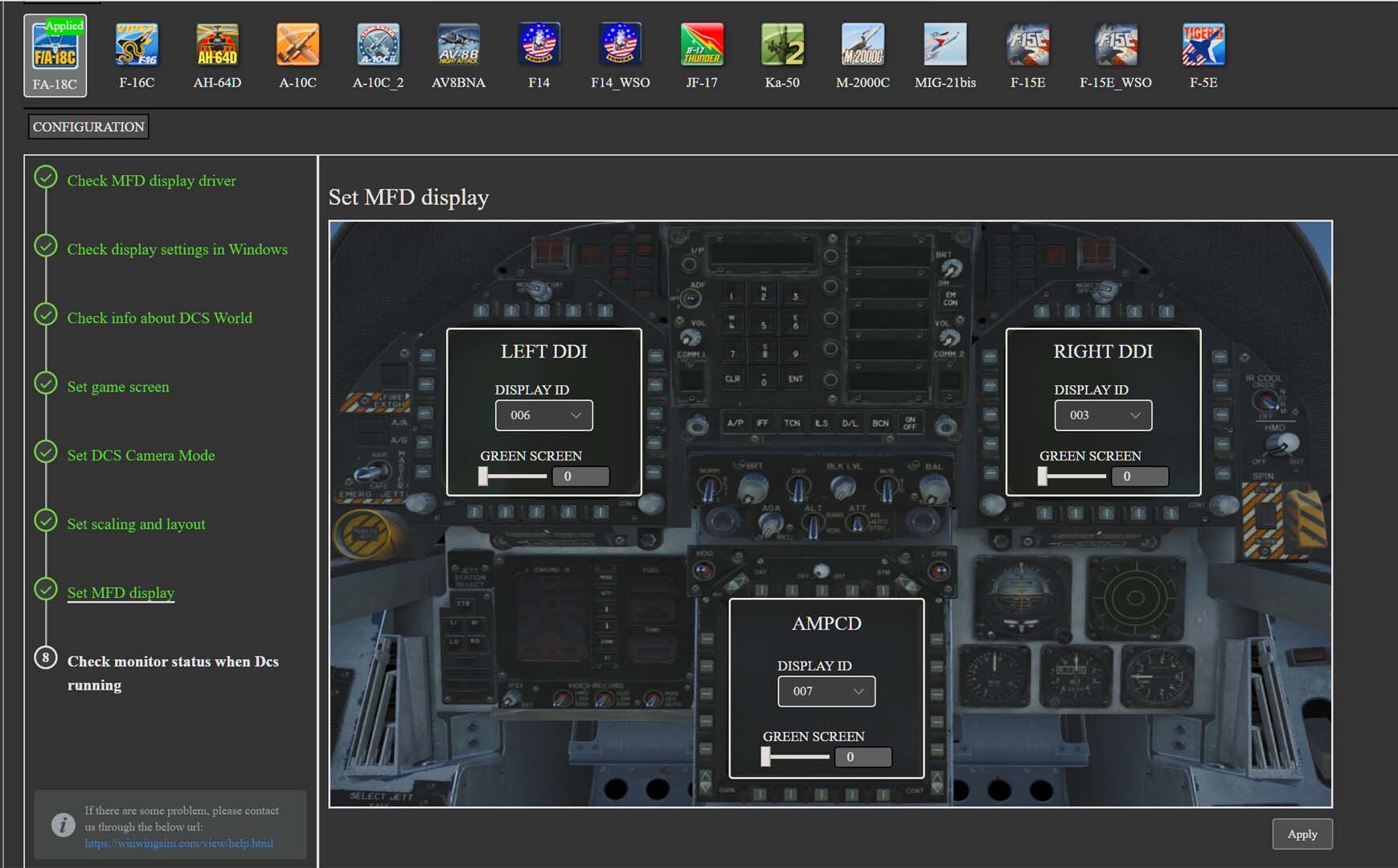
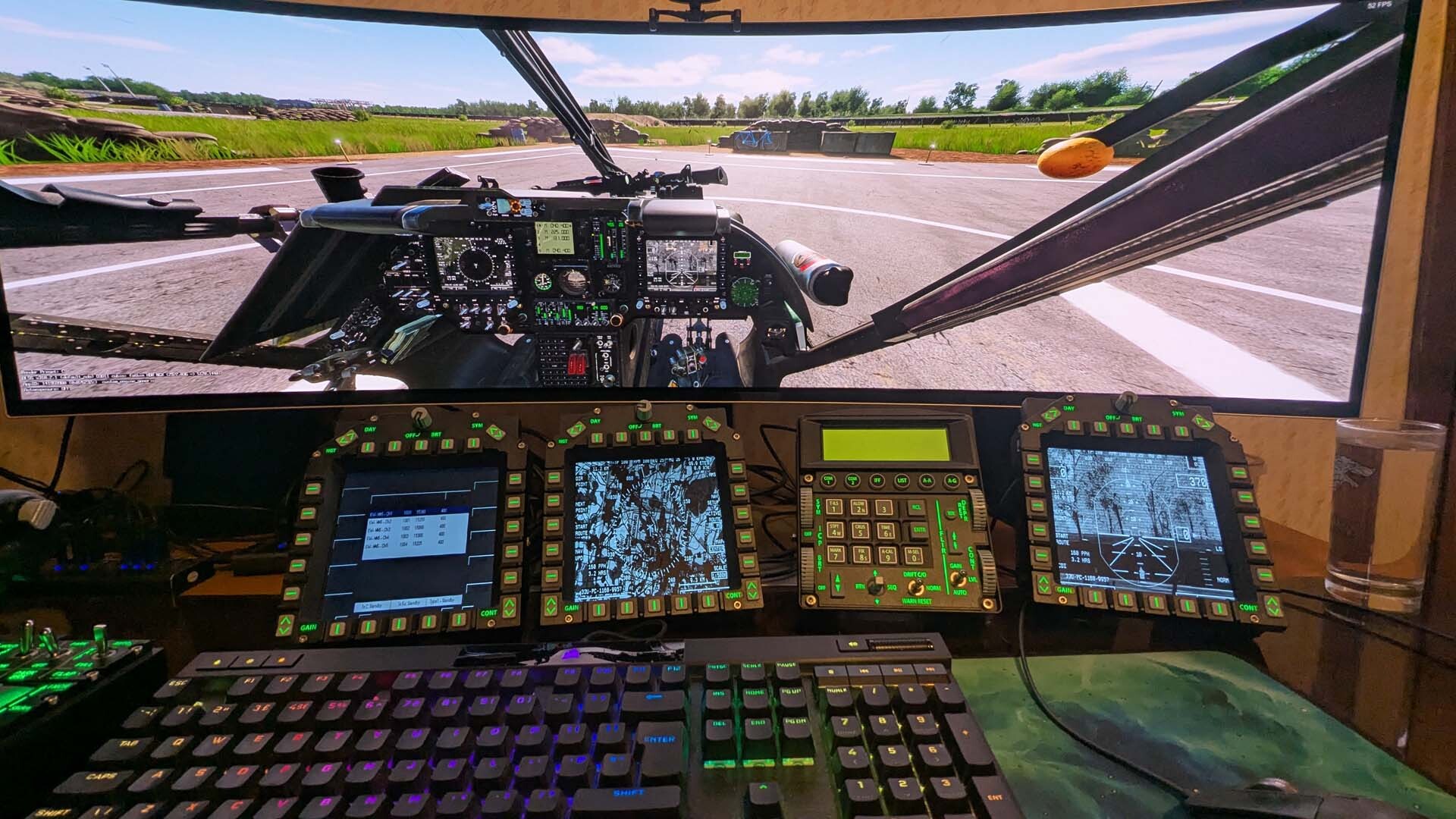
The Kiowa MFD's (LEFT_MFCD and RIGHT_MFCD) will export (with a stretched ratio) using most? SimAppPro display profiles i.e. A-10C, F-16C, F/A-18C or similar. TL;DR: https://forum.dcs.world/topic/371974-radar-on-an-mfd/#findComment-5632094 Detail: Here is a Kiowa example using the WinWing F/A-18C profile. Monitor setup F/A-18C Cockpit Profile (CENTER_MFCD, LEFT_MFCD and RIGHT_MFCD) DCS Kiowa export to WinWing MFD's Copying WinWing's Export .lua ("DCS World\Config\MonitorSetup\wwtMonitor.lua") to "Saved Games\DCS\Config\MonitorSetup", allows the exported displays to be adjusted to a 3:4 ratio (the HSI, etc. isn't stretched but instead has black bars top and bottom). Custom Export .lua (positions require adjusting to fit your own monitor resolutions/arrangement) _ = function(p) return p; end; name = _('OH-58D_3xMFD_4x3_Aspect'); Description = 'Custom positions and sizes for 3x Winwing MFD.' --created 2025-04-10, Exported Displays given 4x3 Aspect, RB Viewports = { Center = { x = 0; y = 0; width = 5120; height = 1440; aspect = 3.5555555555555554; --32/9 } } UIMainView = Viewports.Center GU_MAIN_VIEWPORT = Viewports.Center --L2MUMS is mapped to CENTER_MFCD (and permamently displayed) CENTER_MFCD = { x = 8; -- 0+8 offset y = 1794; -- 1440+256 offset +20 for Kiowa +78 to centre width = 752; -- 768 - (8+8) height = 576; -- 4x3 aspect for Kiowa (was 732) } --Custom MFD sizes and positions to fit inside button bevels. LEFT_MFCD = { x = 776; --768+8 offset y = 1794; -- 1440+256 offset +20 for Kiowa +78 to centre width = 752; -- 768 - (8+8) height = 576; -- 4x3 aspect for Kiowa (was 732) } RIGHT_MFCD = { x = 1544; --(768x2)+8 offset y = 1794; -- 1440+256 offset +20 for Kiowa +78 to centre width = 752; -- 768 - (8+8) height = 576; -- 4x3 aspect for Kiowa (was 732) } More detail on viewport exporting can be found in this excellent Export FAQ OH-58D_Monitor(4x3MFDAspect).lua
-
Sorry if I wasn't clear in my feedback, I wasn't seen the the inverted F-16 localiser when using a modified beacon.lua file. Thanks, I'll copy and paste your changes to my copy to fix the non-working glide slope on 25L.
-
When the localiser is "inverted" in the F-16C - it means you are flying a "back course" i.e. the wrong localiser direction is activated. This is similar to when the glide slope is "missing" and only appears after overflying the far end of the runway. Although I don't have "inverted" localisers for 25R and 25L, I'm still working out how to configure a working glide slope for 25L (wrong end/frequency is activated) - so cannot offer a comprehensive Frankfurt config yet.