raus
-
Posts
218 -
Joined
-
Last visited
Content Type
Profiles
Forums
Events
Everything posted by raus
-

F/A-18C Kneeboard Suite - Updated 23 October 2025
raus replied to Minsky's topic in Utility/Program Mods for DCS World
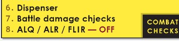
@Minsky sorry to be nitpicky, but a typo has slipped into the latest update: null"Damage chjecks"
-
I will have a look into alternate layouts, as I‘ve always been testing at 2K resolution. I think, in the meantime, you could seitch into single pane mode (only 1 datacard visible), and it would free up space. But I will check
-
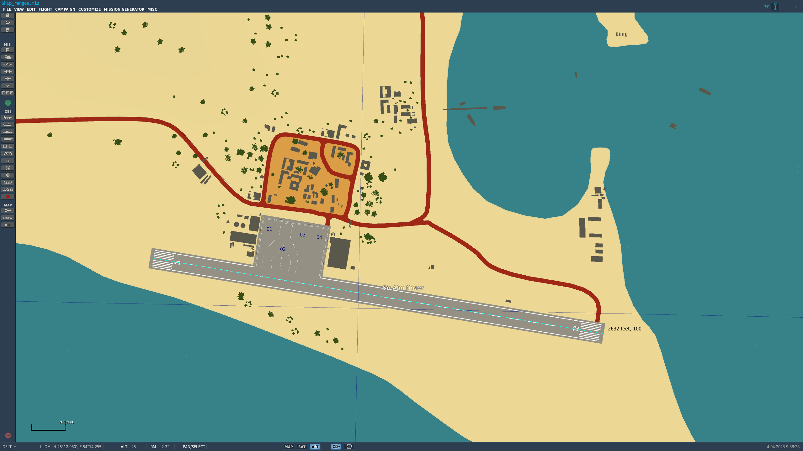
Hi @shu77 I think there's a mistake with Sir Abu Nuayr runway. If I am reading it correctly it says "12817 x 197 ft" (worth noting, exact same dimensions as Abu Dhabi runways). There's no way that runway is over 2nm long. It is actually under 0.5nm long. According to this resource it would be 2592 × 105 ft (790 × 32 m). Don't ask me how I learnt about the mismatch between this chart and the actual length...
-
So, finally, v1.7 is here (since some time already, if you've been updating regularly). I've been pushing some new versions, as I have been working in the new map functions, to enable creating some flightplan, threat, orbits and generic drawings, and even doing it full-screen, for online briefings. I have been polishing the functions and, therefore did not yet want to announce the version, but now it is, at least, usable. I will continue with the refinements, though, and have a lengthy backlog of bug fixes and improvements on my to-do list... So far, this has been the life cycle of v1.7 features (inverse chronological order): v1.7.11 Changelog: [Feature]: Added Instruction field on menu bar to explain mechanizing of drawing functions [Feature]: Color changing of user-drawings [Change]: Several improvements to drawing functions [Fix]: Fixed a regression on flight plan colors v1.7.10 Changelog: Dev. Only Release (internal) v1.7.9 Changelog: [Feature]: Added "drawings" tab to map panel, to show added drawings and control visibility/color v1.7.8 Changelog: [Feature]: Added "measurement ruler" to map. Select with button, use middle mouse button to select start and end point [Feature]: Added "draw line" to map. Select with button, use middle mouse button to select start and end point [Feature]: Added "polyline" to map. Select with button, use middle mouse button to introduce points, finish selection with double click (left button) [Feature]: Added "Orbits" to map. Select with button, use middle mouse button to select start and end point [Feature]: Floating panel in Map View can be resized dragging the handle in the lower right corner [Change]: Moved RAMROD field in Commcard to the top, for better visibility v1.7.7 Changelog: [Feature]: Added new tab in map panel, for naval units [Feature]: Added naval unit threat ranges into SAMs tab (individual per ship) [Change]: modified threat circles transparency updates to avoid glitches [Change]: minor improvements on stability (WiP) [Fix]: Fixed (again!) Discord Webhook save function v1.7.6 Changelog: Dev. Only Release (internal) v1.7.5 Changelog: [Feature]: Added Ground Unit icons for SAM Launchers and radars [Feature]: Added AWACS orbits to map [Feature]: Reworked Tanker Orbits, to have a better outline, and show Tanker details (recovery tankers still WiP) [Feature]: Added a dialog to customize flight plans/orbits color [Feature]: Added a range of new SAM and AAA units [Change]: Changed waypoint marker style to better follow color changes in flightplans [Change]: Improved SAM site components recognition, including SA-2/SA-3 and SA-11/SA-17 discrimination [Fix]: Prevent wrong coalition Tanker Orbits from showing v1.7.4 Changelog: [Feature]: added more SAM units and refined threat ranges [Feature]: added distinctive icon for EWR sites in map [Fix]: Exception thrown when trying to use 3rd Discord Webhook slot (hopefully fixed) v1.7.3 Changelog: [Feature]: added ground units to map, with their own tab [Feature]: SAM sites tooltip label will show all units belonging to same site [Change]: Added icons to context menu options in map [Change]: enabled On Mouse Over behavior for SAM sites tooltip labels [Fix]: Map would not export with header when selecting the Discord button [Fix]: WP icons inconsistenciy when using the show/hide option with different levels of zoom v1.7.2 Changelog: [Feature]: increased number of units supported per .miz file [Feature]: added airbase information to map (when zoomed out) [Change]: modified size of WP markers depending on zoom level [Change]: modified Discord Webhook dialog to have a "Save and close" button [Change]: fixed map export labe position to center [Change]: enforced consistency of RAMROD label between Mission Datacard and Commcard [Fix]: checking "show WPs" in map won't show WPs from hidden flights [Fix]: North pointer rotation incorrect - fixed [Fix]: Map tab header not being exported - fixed [Fix]: Minor fixes: exception catching, sanitization of arrays between mission loads... (WiP) v1.7.1 Changelog: [Fix]: internal fixes in project dependencies v1.7.0 Changelog: [Feature]: Added Map Tab [Feature]: Added selectable flight plans for the map [Feature]: Added selectable threat circles [Feature]: Added option to maximize Map Screen [Change]: modified Commcard to load 251.000 on Radio 2 ch.1 if selected to use 5Js standards [Fix]: residual code showing an exception - removed [Limitation - WiP]: Orbits for recovery tankers are still not shown in the map
-
Following the trend set by M-2000C and Tomcat (and I guess F-15E will follow)… it would be very nice to be able to get adjustable mirrors in the Hornet. to monitor other planes in the formation, they are very useful, and adjusting formation positions/distance to the current mirror position renders visual references invalid. Cherry on top: make them bindable. Maybe 2 axis per mirror, so people building cockpits can fit a couple pots behind.
- 1 reply
-
- 3
-

-
+1 for sun visor. Looking into the hud against the sun is a pain, and that would mitigate it, to some extent
-
Probably not. 5js file are longing for a revamp after some other featured were added, so probably not useful at the time. I have to look into it next, and have already some ideas for them…but only so many hours in a day
-
Has been on the works for some time now. Whenever I gind the time/energy to extract all IDs gor each store, it will be in. For the time being only the (aim-120, sparrow, sidewinder, cannon) format for AA. But it will come Indeed, the way I did it first means that I would need to calculate an offset for each new allowed font, so they line up. And if I am including them, they have to be free IP…
-
I will do it for the v1.7 that will be ready very close...and brings some more interesting features!!! Anyway, you can always download that version, and it will prompt you to update itself, so no need for links
-
Buenas! La verdad es que no me paso mucho por esta sección del foro, siempre pensé que no había mucho movimiento... De todos modos, acabo de subir un pequeño video a Youtube con las novedades en versión 1.6 del programa y un mini-tutorial de cómo utilizarlas. En caso de que a alguien pueda resultarle útil, aquí lo dejo. Si podéis darle un like o subscribiros, para que llegue a cuanta más gente...pues genial
-
- 4
-
-

-
New version available!! (v1.6.2) Although I could not spend time in completing checklists, I hope the new incoming feature will be worth it From now on, it is possible to work in a complete Package mode, with common Commcard, Coordination, Notes... but up to 5 different Mission Datacards, that can be temporarily stored (same session), and recalled, to complete. Also an auto-update function will take care (hopefully) of updating TACAN, TOT and Laser codes for the different flights in the package. This will probably need some time until it is fine tuned, but so far it is working pretty well in my limited tests. I will try to record a couple videos and upload them, to show the intended behavior. Enjoy!
-
I've just flown yesterday night a Liberation mission using a Tanker in 37Y. I configured Tacan 37-Y T/R and IDN in RNAV, and had perfect indications
-
Hi, With the latest update getting OpenXR, I guess we (G2 users, using WMR without SteamVR) don't need OpenComposite to bridge from OpenVR to OpenXR any longer... If we are using the OpenComposite app that lets you switch OpenComposite/SteamVR, how do we disable it (there is no uninstall, as it is not an "installed" app), to ensure it does not fiddle with the DLL any longer? Thx!
-
@YbuQc sorry, running a bit late with checklists update. Probably in the next update... For the time being I just had time to add a new function to directly upload datacards to Discord. I plan on making a detailed video showing usage, and maybe refine the GUI a bit more... time providing
-
I mean, I know there were some issues in the past. I stopped using those for some time (spoiled by viper‘s CBU-97 and CBU-105, I guess). However, I decided to give them another try and see if they improved… Long story short, either they are very bad bombs/poorly modelled, or I can‘t find the effective way to use them. I have tried different height of burst (usually I try to set 1500ft, as I recall reading that was the hardcoded value). Anyway, even when I get direct hits, they struggle to destroy anything, even lightly armored vehicles or trucks. so, does anyone have some hints to test again and see if they can be effectively employed? Or did we just gave up on them, assuming they are either borked or useless? thx!
-
Am I understanding this wrong? null I am up to date with 4.8, unless not backwards compatible. Or did you refer to the .NET Desktop runtime? In that case it would be 6.0.10... and I also have that up to date... I am unsure how to proceed with this, if you have any idea/clarification it would be welcome
-
Actually, I do have them (double checked right now, though). Any specific version I should be targeting? I do have the latest .NET 4.8 Framework version installed, as I use that with Visual Studio 2022 C#, and just installed the latest .NET Desktop Runtime (6.0, right?) just in case...
-
@SkateZilla I am no longer able to launch the app (tried the last two versions of it)... and not sure if it is related to my pc or the app, but I am getting this exception and, no matter if I hit Quit or Continue, the app closes automatically afterwards:
-
Font change is quite involved, the way it is done right now. I don‘t rule it out, eventually, but I will have to find the time for it. Sadly not too much time right now. eegarding the coordinates, I do not see the issue. If you hve one figure too many for the seconds, you can easily cut it and round, right? Sure. I will be adding checklists progressively. But I have to validate them first and then put in the common format. If you habe some suggestion to be used as guideline for the M2000, just link me to it
-
Indeed, in AZimuth and ELevation... but at what distance? The volume covered by the radar is not a parallelogram, and you will not be covering the same height 2nm away from your plane, as 80nm away from it. That is what I meant, I think the yellow box represents the radar coverage at a given distance, which might or might not be the same at which you put your Attack Radar cursor, and therefore the mismatch.
-
I am not really sure at which range is the FOV of the AZ/EL displayed, I guess, in this case, at 80nm?? Anyway, the height bracket on the Attack Radar is displayed at the exact distance of the radar cursor, in the examples, roughly 40-50nm (one is further away than the other). So, it might very well be, IMHO.
-
Use threaded inserts, and pres them in with a solder iron: https://www.ruthex.de/collections/gewindeeinsatze/products/ruthex-gewindeeinsatz-m3-100-stuck-rx-m3x5-7-messing-gewindebuchsen
-
Hi all, First of all, @BIGNEWY and @NineLine, I am not pointing to a bug here (hence, no track, no docs). I am genuinely asking if our current implementation is correct: What do we have: a Wing Fold lever that can be stowed in the Spread and Hold positions, but not in the Fold position I have been reading through the NATOPS manual (let me know if it is ok to paraphrase the section and reference it, please), and got the impression that it should be possible to stow the lever in Spread and Fold, and that Hold is just a temporary position, non-stowable, used just to stop motion of the Wings in whatever position they are at the moment. I have been looking for videos, but could not find anyone, I guess that would be a definitive proof, though...
-
I'd say 30kts over the deck are a combination of wind and the carrier's speed, so if it is sailing at 15kts against the wind, you'd just need 15kts wind