GrafRotz
-
Posts
210 -
Joined
-
Last visited
Content Type
Profiles
Forums
Events
Everything posted by GrafRotz
-
35863 @1640UTC seems getting worse, but no effect on my side.
-
Glaubensfrage. Das Portmonee entscheidet da, wie stark Dein Glaube ist. Ich bin seit immer schon Intel Nutzer und habe vor zwei Jahren auf AMD gewechselt. Frag mich nicht nach Zahlen, aber der alte war ein I7 um die 10 Jahre alt. Was mir aufgefallen ist, das subjektiv Spiele super laufen, aber wenn ich mit Adobe unterwegs war, alles sich ein wenig langsamer anfühlte. Haben die noch immer die Temperaturunterschiede? Ein AMD will traditionell besser gekühlt werden, aber auch das ist heute nicht wirklich ein Thema, wenn groß genug dimensioniert. Persönliche Empfehlung: Kaufe, was Du Dir leisten willst.
-
same here for the Warthog, toggle is not toggeling. OFF and ON are working.
-
also grundsätzlich nicht, weder A2A noch A2G. Danke für die Info, ich dachte, dass ich wenigstens Bombs und Rockets mixen kann.
-
Ehemals Lotus, dann IBM, jetzt HCL Notes, letzte Version April 2025. Und wer Outlook wirklich kennt, weiß, dass es nicht für Kolaboratives Arbeiten gedacht ist. Die Krücke über Sharepoint ist zwar nett, aber ... eben nett.
-
- Autopilot geht, aber das lassen wir lieber bis zum nächsten Patch! - Handbuch gefunden, ich Horst dachte, dass wäre das für die FC3, nicht nachfragen, es muss spät gewesen sein. - Bomben gehen. Achtung, die Zünder sind - ich glaube es waren 27 Sekunden - per default ETWAS hoch eingestellt. € - und die Kurven passen auch, besten DANK! weiß wer, wie sich das mit Ground mixed loadaut verhält? Air und Ground lässt sich ja nicht mixen, dass ist klar, aber z.B. S24 innen und Rockets aussen?
-
das stand aber in den PatchNotes, auf die Geschwindigkeit achten! Bei mir waren gestern die Flaps nicht drin, obwohl ich den switch am Throttle umgelegt hatte. Ich schiebe das auf Dummheit, aber sie schüttelte sich ein wenig
-
Ich möchte behaupten, dass ich alle Kombinationen durchgehämmert habe, aber muss beim Attitude nicht ein Lämpchen nebenan leuchten, wenn dieser aktiv ist? Da war jedenfalls nix. Trotzdem werde ich es nochmal probieren, dass waren gestern eben nur ein paar wenige Stündchen zum probieren.
-
wo sie immer liegen... Knöppe aufe Augen undso. Danke!
-
Naja komm, so sehr, wie die gepushed haben, war das auch absehbar. Wobei ich nicht mit mitte September gerechnet habe, insofern... Glückwunsch, der Kandidat hat einen Gummipunkt gewonnen ^^ Nächster: Release der C-130 Um nicht den Thread zu derailen, 1. hat irgendwer den Autopiloten aktiviert bekommen? Dampener klappt, aber Altitude Hold will nicht. 2. AG bomben über den CCIP pipper will irgendwie nicht und die Bomben an den äusseren Stationen waren einfach "weg", Wie wähle ich die inneren aus? Auch über den Kipphebel an der Linken Boardwand für die Raketen? Und Die Symbolik ändert sich in etwas, was für mich - noch jedenfalls - unverständlich ist. Das runde auf das eckige und drücken ist wohl nicht, oder? Führt aber auch zu 3. Wo ist das Handbuch? Im Installationsordner hab ich nicht finden können, hab gelesen, dass es wohl eines gibt, der Fulcrum Ordner ist aber leer, was die Doku angeht. 4. Wie verschiebe ich den Afterburner Detend? Bei fast allen 3rd Party Flugzeugen kann ich den unter Special Options verschieben, ED hält es aber nicht für nötig, oder ich bin zu dumm. Auf dem Warthog beginnt der AB bei - sagen wir - 80% Schubweg, im Flieger springt der aber bei 70% schon an. Ist übrigens bei den FC3 Fliegern auch so. Löse ich das über die manuellen Kurven? Dann verschiebt er aber auch Werte, die ich eben nicht ändern möchte.... 5. Radar/IR Lock. Habt ihr das auch, dass er mal aufschaltet, mal nicht, mal sofort wieder rausspringt? IR könnte ich noch verstehen, aber Radar, direkt vor der Nase sollte doch sofort aufschalten. (Geschwindigkeitsdifferenz und andere Parameter beachtet.) Da kommt bestimmt noch mehr
-
finished right now just finde. Also the speed went higher again. But something else. Anyone recognize the Aircraft, Wags is shooting at in the latest video? Just asking... Hun? Draken?
-
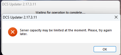
works fine by me now, except the 1MB/s... I guess, CDN servers went warm a bit ^^
-
nullnever had that one before....

-
nope, never did and I recommend no one to do that, because... aviation things. There is no need to be anything in ye ole deutsche sprache. Beside your english is not the yellow from the egg and you use the tutorials a lot. So, thats not the reason for having german Bettyin Mig-29G(!)
-
Mig-29G from FC3 has German Betty, tried yesterday. Achtung Höhe, Treibstoff 1500, Maximale Geschwindigkeit. oderso If there was any settings to change, I do not rember, if so, I did decades before.
-
Not gonna happen, ED stated more than once. Its a ethical thing if i remember correctly. Nevertheless, at least dummys would be nice to have. A Impact of these could just end the mission.
-
First Forum first thread ,on the forums page
-
The elephant in the room, - if nothing changes - will the patch include the Mig-29?
-
Viel spannender wäre gewesen, wenn man die Higgins bereits beladen spawnen könnte. Ich habs nicht geschafft. So könnte man auf der Normandie Map Normandie Dinge tun. Oder mit den Landungsschiffen, aber nein... intuitiv jedenfalls nicht. Vielleicht weiß da jemand mehr.
-
nö, muss er nicht. Windows gibt den Pfad vor, DCS sucht nach der Vorgabe und speichert dort. NUR den DCS Ordner kannst Du mit symbolischen Links auf einen anderen Ordner zeigen. Such im Forum, da gibt es einige Beiträge zu. Ich habe z.B. die Corld War Germany von der SSD auf die NVME verlinkt, weil sie unheimliche Lesezugriffe hatte, die meine SSD nicht mehr packte, aber das ist ein persönliches Hardware Problem.
- 1 reply
-
- 1
-

-
truth is, they have other abilities, than we have. e.G. B-52 low level flyby a carrier as seen in 2023 and beyond. Impossible to recreate, as the AI does not fly lower than 300 feet. As far as I could find out.
-

LUA Function for Lat/Lon to World Coordinate Conversion
GrafRotz replied to Leviathan667's topic in DCS: Sinai Map
in general i asked for converting DMS to XY in this thread: never tried the mentioned funcition, because it does not solve my problem, but the work around was made by the DCS MAPVIEWER Guys. Still searching for a solution outside of lua. What you need is at least a reference point, where the the map creator started counting. E.g. Germany Map is the harbour at Kaliningrad, which is way outside the map itself. Then there are so many variables that i lost track and knowledge. Is the map rotated? Is a sphere to be recognized? Try Chatgpt for a Excel Spreadsheet and start working from that. Again I gave up on the Germany Map. There are smarter guys but not really sharing their knowledge. -
ED schiebt immer mehr an Updates durch, als in den Patchnotes beschrieben wurde. z.B. wurde der MP Bug mit dem desync des Fahrwerkes der F4U wohl behoben. Wenn Karten dabei sind, wird es sehr schnell sehr groß. Ich verpasse es leider immer wieder den Download Ordner zu beobachten, aber alles, was irgendwie verschlüsselt ist, scheint jedes Mal mit geupdated zu werden. Mag aber auch sein, dass mein erster Satz dort greift. Die Updatephilosophie ist wie so vieles andere einfach nur grottig. Es gibt Änderungen oder neue features in den scripten, die undokumentiert sind und vielen von uns wirklich hilfreich wären. Das passiert leider immer wieder. Ein Patchlog wie er jetzt erscheint plus eine ausführliche Dokumentation wäre nett, aber wo sind wir denn, es gibt ja hoggit. Im letzten Patch war ein größeres Update für die Sinai Map dabei, das erklärt jedenfalls, warum es so viel war.
-
to be hones, i dont know, BUT: - in the ME you can change their skills. What ED does in the background, i dont know. Best guess: longer and later aquisition and therefore later engagement. They may roll the dice if they got a lock or not. - within skynet you can change the range when they engage, which is not exactly what you want, but you can... from the documentation: Just read this: https://github.com/walder/Skynet-IADS?tab=readme-ov-file#warm-up-the-sam-sites-of-an-iads dont get scared by the code, it comes together snippet by snippet.
-
IADS with Skynet is pretty active, at least on their Discord. Love these features but to be honest, is struggle sometimes or do not understand, why things happen the way they happen and should not. Aside that, Skynet - if properly set up - turns off their systems and relys on EWR radars. If you are in engagement range they turn on and angage you. The impact is so far, that you don't know where they are - if hidden by the mission creator - unless it is too late. Also you cannot engage by harm unless they turn on, thus allows wild weasle tactics. Aside the existing Harm tactics like shoot on known position and trigger them to turn on. So yes, there is a lot of possibilities and many more if you are eager to dive into lua scripting. What i am really missing is the DEAD component. Jamming is also a thing which is not simulated in a way, a jamming flight would make sense. I know, there are some nice scripts, but the do not satisfy the way we all need. e.g. ELINT pods. Really done by the viggen only, but the evaluation is not implemented. The old ELINT map is not working anymore. I dug into some git pages where people seems to do nice things but never found a online place, or mod which supports our needs. I totally understand, that a company needs to make money by selling stuff, but there is still a huge amount of possibilities which are not addressed yet which needs to go to the core features. Edit: A revisit on Hound seems to be a good idea! Still, those things really should be core features.