.png.106163b2ff8ba3c8a044143ab5fd143e.png)
winghunter
-
Posts
741 -
Joined
-
Last visited
Content Type
Profiles
Forums
Events
Everything posted by winghunter
-
.thumb.png.d43db0aa51621a39a2161ec5c6fff372.png) Check if theres anything in the DCS log Maybe its just blocked by a another service on the same port Try in OpenKneeboard as web dashboard, their browser is less restrictive
Check if theres anything in the DCS log Maybe its just blocked by a another service on the same port Try in OpenKneeboard as web dashboard, their browser is less restrictive -
I guess the script isnt running, make sure you put it in the right folder, restart DCS
-
If the health endpoint doesnt work, it means DCS mission isnt running on the same machine. Or your browser or firewall is blocking. Try an incognito tab.
-
Only chrome is supported. firefox usually works. opera mostly doesnt work
-
Yes the runway coordinates are flipped, so it goes end-end start-start instead of start-end start-end. Fix soon Thats from the DCS data, not sure why they picked 21deg E. Maybe they plan to expand eastwards into Poland. Or maybe for WWII where germany expanded further east Yes, the paper maps are usually lambert conformal, which is similar to TM. Maybe thats even what they use for DCS in game, LC seems to have the same params of false easting/northing and central meridian like TM
-
LAHR near Freiburg was an important French, Canadian and US base up into the 90s https://www.mil-airfields.de/deutschland/lahr-flugplatz.html
-
This is 1988 1970. So it depends. Some 80s Autobahns had the emergency lane, while others may not. The east german ones were surely smaller.
-
The same issue exists for Caucasus, so I'm not sure theres an easy fix. Havent checked other maps yet. It may break all existing missions if they fix it
-
Why didnt they use the elevation of Thüringer Wald and Harz for setting up elevated defenses
-
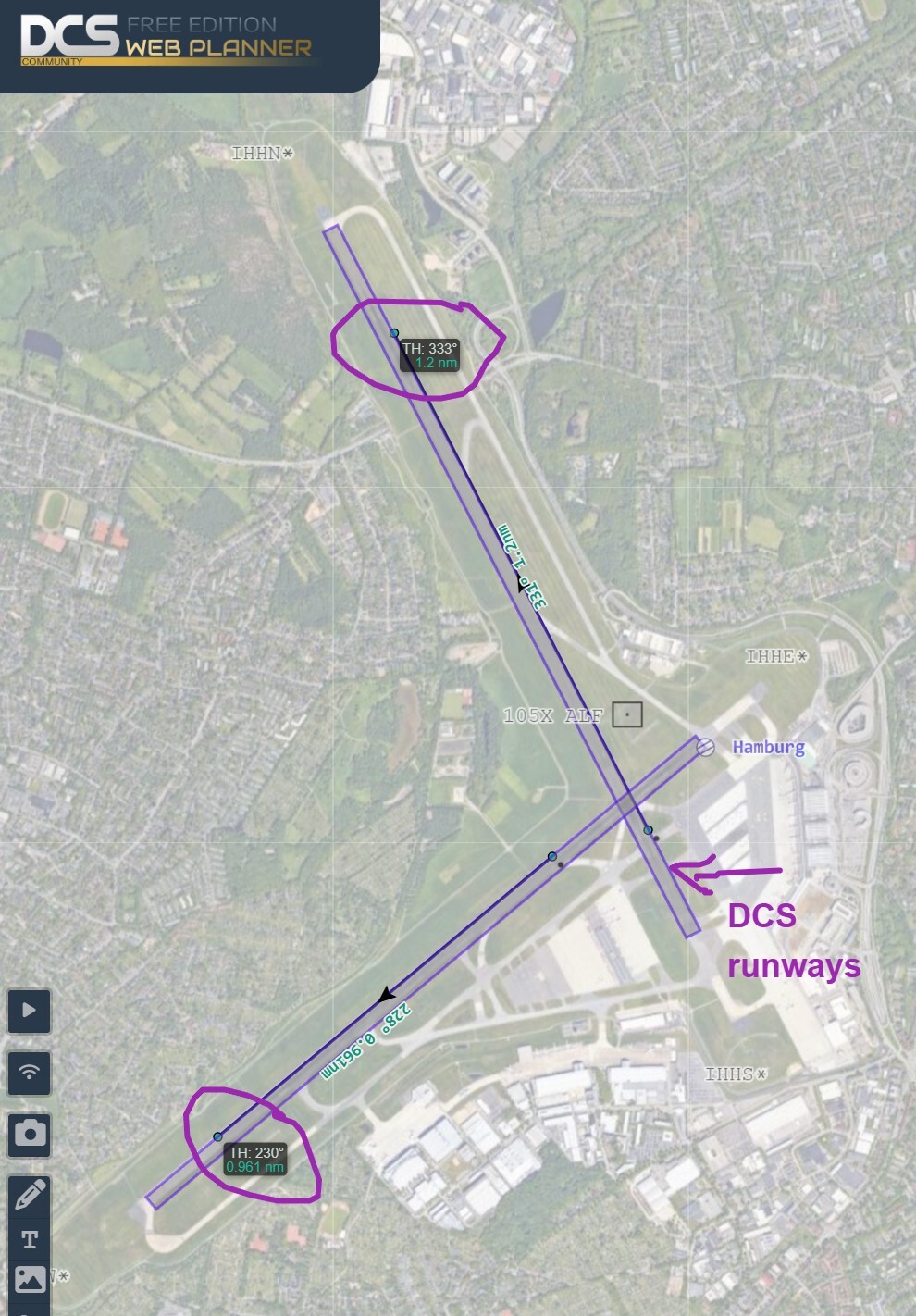
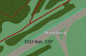
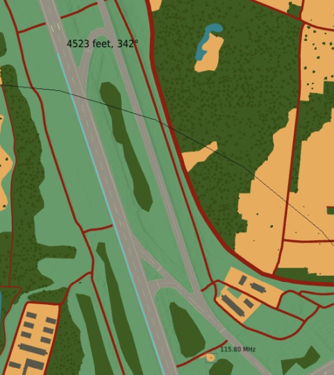
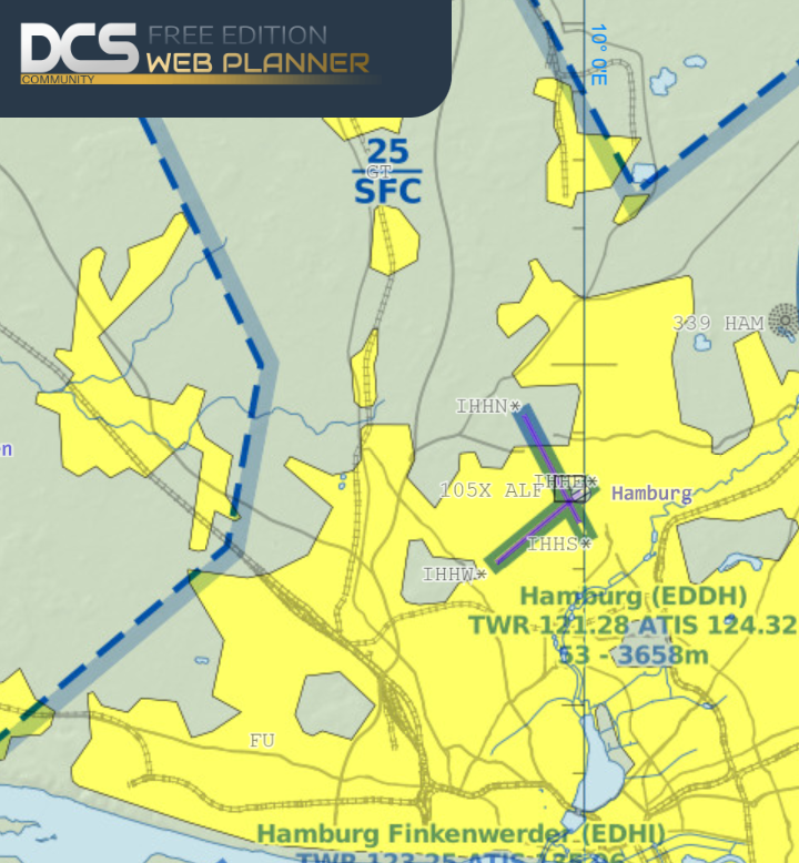
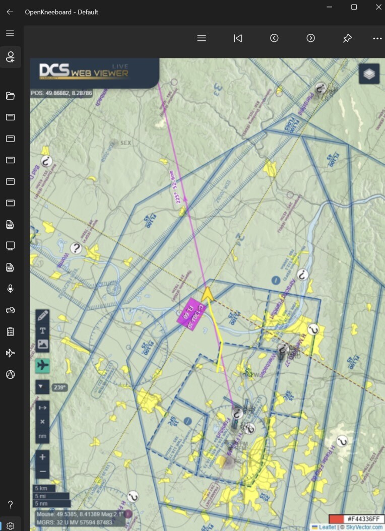
DCS uses Transverse Mercator projection. In the case of CWgermany the central meridian is 21° E The runway locations are correct and match the real world sattelite imagery. I know this, because we export the runway coordinates and render them inside DCS Web Planner (purple rectangles) https://dcs-web-editor.github.io/dcs-web-viewer-deploy/?lat=53.63664895322603&lon=9.98785972595215&zoom=14# What is incorrect, is the TH as well as the MH reading inside DCS and DCS ME. So it appears to be rather a bug with DCS than this particular map.

-
The airports are mostly correct (purple lines), some may also have changed since the 80s. But the TH indicated in the dcs mission editor is off. And possibly ingame too.
-
Seems like the attachments are even smaller now It says max total size: 238 kB This is tiny by today's standards
-
Still exists, its really annoying
-
Hope this helps
-
PLANNER https://dcs-web-editor.github.io/dcs-web-viewer-deploy/ LIVE MAP https://dcs-web-editor.github.io/dcs-web-viewer-deploy/live/
-
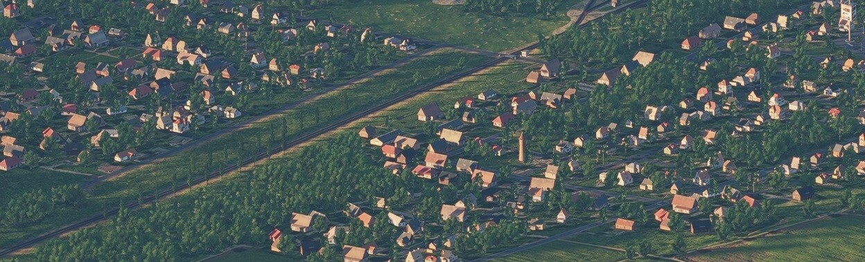
Old city center VS new areas around it
-
You're talking cities, I'm talking towns though "Dorf" Towns are different from cities, they predate city planning. The towns are generally very old, hundreds or thousands of years, were built very densely, often surrounded by a city wall for defense. It makes it very easy to spot a town from the air, you'll see the bright red roofs and white walls from very very far. While in the game it is currently very hard to spot a town in the distance. IRL it's also easy to spot the city center in a bigger city, because in the center the houses are packed very dense, while the new areas "Neubausiedlung" is typically more spaced out. At least that's my experience flying in this area.
-
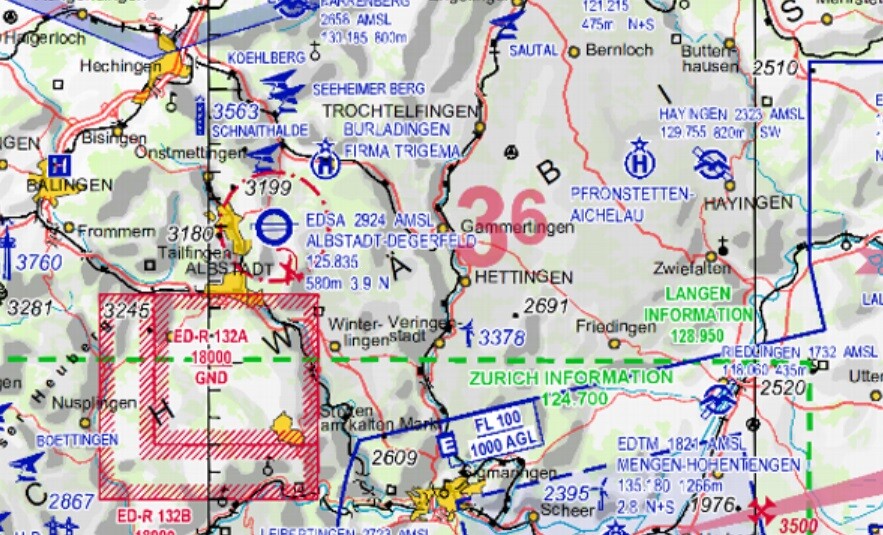
There is a huge military base, training and defensive area in ED-R 132A That was the NATO HQ for Southern Germany in cold war
-
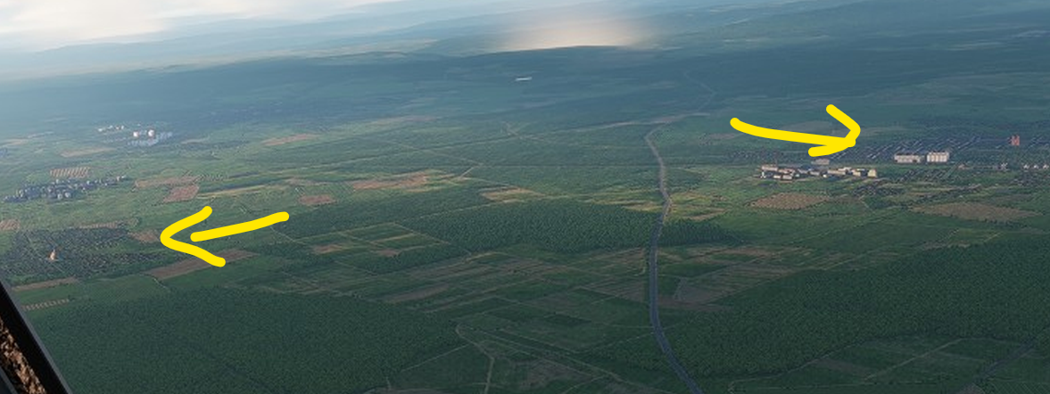
Or maybe the trees inside towns are simply too big. Whatever the reason, it makes cities really hard to spot tat distance, while its much easier IRL nullnullnullnullnullnullnullnullnull
-
Towns almost vanish at low level, as they have so many trees that they disappear on the horizon. It makes VFR flying harder than IRL. At a distance, they become very hard to spot, and easily blend with forests. Overall, you'd see less tall trees in german towns, they are mostly grassy gardens with bushes. Especially older towns dont have much green.
-
Upgrade Ram from 32 to 64gb
winghunter replied to felstrikeraut's topic in PC Hardware and Related Software
I have 2x16 of brand A, and bought 2x32 of brand B. Both brands are 6000Mhz DDR5 Since I have 4 slots, can I use all of these ? Or will 2x32 perform better. Also, does the placement order matter ? 16 -32 -32 16 vs 16 -16 - 32 -32 -
what does the 127.0.0.1/health endpoint say when you open it in the browser
-
Try this file instead. Are you on wifi or ethernet? dcs-web-viewer-api-4-test60.lua(1).zip
-
Which script have you installed? dcs-web-api-lua-4? or 3
-
Do you have the F-4 ? Then open its ingame browser Otherwise just use Chrome browser outside DCS https://dcs-web-editor.github.io/dcs-web-viewer-deploy/live/