celestHawk
-
Posts
118 -
Joined
-
Last visited
Content Type
Profiles
Forums
Events
Everything posted by celestHawk
-
Typical F-16C Block 30 had the AN/APG-68 family (earlier V-series software/hardware typical of 1980s/early 1990s OFP). Block-50 commonly built or retrofitted with later AN/APG-68(V) upgrades (V5/V7 depending on lot and MLU), providing improved range, modes and SAR/GMTI growth options. Also the Block 30 Often fitted with the GE F110 on many (Block-30 introduced the “big-mouth” MCID inlet for GE engines on GE-powered examples). Some early Block-30s mixed engines but most GE-powered Block-30s have the larger inlet. I guess that is some what good starting point: https://www.digitalcombatsimulator.com/en/files/3330321/
-
It seems that every time someone complains about performance issues with AH-64 the 'best' answear is to Disable the HotPlug Well it seems that this sale will not be the time I'm buying Apache module!
-

Significant performance drop in 2.9.11.4686
celestHawk replied to Limaro's topic in Bugs and Problems
Hello, does the issue still preside after later update of the game? -
You probably noticed that the altimeter works as RALT up to 1500m and if you don't bank too much which make it to lose ground (pun intended ) will show BALT. It is not a bug but a mere feature of the airframe as smaller brother to the Su-27 this is common behavior for all fighter jets from the Soviet era.
-
Dear Eagle Dynamics Team, While exploring the Afghanistan map, I noticed that Zahedan Airport (OIZH) is already partially represented with a functioning TACAN beacon. What immediately stood out is that this beacon perfectly aligns with the Persian Gulf map, meaning Zahedan sits in a unique geographic position that could serve as a bridge between the two maps. Currently, players who own both maps face a limitation: each map is vast, but they exist in isolation. Adding Zahedan as a fully modeled airfield would allow us to land and take off from the same location when transitioning between maps — a feature that would dramatically enhance immersion and realism. We already have precedent for this kind of implementation. For example, when the Syria map was released, H3 Air Base was later recreated for the Iraq map after players requests. This demonstrated how shared airfields can increase value across multiple maps, especially when they touch or overlap geographically. Right now, older maps such as NTTR and Persian Gulf are often described by the community as “complete,” which sometimes translates into “no longer updated.” This has created a perception that ED isn’t investing in improving legacy maps, despite continued demand from players. Addressing requests like this one would be an excellent way to show that older maps can still evolve in ways that benefit both new and existing products. Why Zahedan Matters: Strategic Location: Connects Persian Gulf and Afghanistan maps. Immersion & Continuity: Enables realistic long-haul flights and operations spanning both maps. Precedent: H3 AB demonstrates feasibility and value of shared airfields. Community Benefit: Owners of both maps gain an additional layer of realism and utility. Soviet Tech Relevance: The region is historically tied to Soviet-built aircraft. Many of the flyable Soviet airframes in DCS (Su-25, Su-27, MiG-29A, etc.) lack aerial refueling capability, making local forward bases like Zahedan critical for realistic missions. Module Synergy: With the released the MiG-29A Fulcrum as a full-fidelity module — a platform strongly associated with this region. Zahedan would give it a natural and historically plausible operating hub, tying new content directly into the map ecosystem. Visuals & References Coordinates (Google Earth): Zahedan International Airport (OIZH): 29°28′00″N 60°54′00″E Runway: 13/31 (4260m x 45m, concrete) Map Overlap: 1: Location of Zahedan on the Afghanistan map with TACAN visible. 2: Same TACAN on the Persian Gulf map, confirming geographic overlap. 3: Google Earth overlay showing Zahedan’s position between Afghanistan and the Persian Gulf theater. Immersion Example: Image: Route example from Al Dhafra AB (PG) to Kandahar AB (Afghanistan) with Zahedan as a midpoint. This demonstrates how it could serve as a natural operational hub for aircraft with limited range e.g., MiG-29A, Su-25 or F-16C even the possibility for deploying helicopters exploiting FARPs positions. In short, implementing Zahedan Airport would not only increase the longevity and value of the Persian Gulf map but also strengthen the Afghanistan map by giving it a natural gateway to the west. This single addition would create a much more seamless and immersive experience for the community, while also directly supporting the use of newly released modules like the MiG-29A. Thank you for considering this request, and I hope you’ll take this opportunity to show the longevity of your existing maps.
-
- 4
-

-
Dear Eagle Dynamics, While exploring the Afghanistan map, I noticed that Zahedan Airport (OIZH) is already partially represented with a functioning TACAN beacon. What immediately stood out is that this beacon perfectly aligns with the Persian Gulf map, meaning Zahedan sits in a unique geographic position that could serve as a bridge between the two maps. Currently, players who own both maps face a limitation: each map is vast, but they exist in isolation. Adding Zahedan as a fully modeled airfield would allow us to land and take off from the same location when transitioning between maps — a feature that would dramatically enhance immersion and realism. We already have precedent for this kind of implementation. For example, when the Syria map was released, H3 Air Base was later recreated for the Iraq map after players requests. This demonstrated how shared airfields can increase value across multiple maps, especially when they touch or overlap geographically. Right now, older maps such as NTTR and Persian Gulf are often described by the community as “complete,” which sometimes translates into “no longer updated.” This has created a perception that ED isn’t investing in improving legacy maps, despite continued demand from players. Addressing requests like this one would be an excellent way to show that older maps can still evolve in ways that benefit both new and existing products. Why Zahedan Matters: Strategic Location: Connects Persian Gulf and Afghanistan maps. Immersion & Continuity: Enables realistic long-haul flights and operations spanning both maps. Precedent: H3 AB demonstrates feasibility and value of shared airfields. Community Benefit: Owners of both maps gain an additional layer of realism and utility. Soviet Tech Relevance: The region is historically tied to Soviet-built aircraft. Many of the flyable Soviet airframes in DCS (Su-25, Su-27, MiG-29A, etc.) lack aerial refueling capability, making local forward bases like Zahedan critical for realistic missions. Module Synergy: With the released the MiG-29A Fulcrum as a full-fidelity module — a platform strongly associated with this region. Zahedan would give it a natural and historically plausible operating hub, tying new content directly into the map ecosystem. Visuals & References Coordinates (Google Earth): Zahedan International Airport (OIZH): 29°28′00″N 60°54′00″E Runway: 13/31 (4260m x 45m, concrete) Map Overlap: 1: Location of Zahedan on the Afghanistan map with TACAN visible. 2: Same TACAN on the Persian Gulf map, confirming geographic overlap. 3: Google Earth overlay showing Zahedan’s position between Afghanistan and the Persian Gulf theater. Immersion Example: Image: Route example from Al Dhafra AB (PG) to Kandahar AB (Afghanistan) with Zahedan as a midpoint. This demonstrates how it could serve as a natural operational hub for aircraft with limited range e.g., MiG-29A, Su-25 or F-16C even the possibility for deploying helicopters exploiting FARPs positions. In short, implementing Zahedan Airport would not only increase the longevity and value of the Persian Gulf map but also strengthen the Afghanistan map by giving it a natural gateway to the west. This single addition would create a much more seamless and immersive experience for the community, while also directly supporting the use of newly released modules like the MiG-29A. Thank you for considering this request, and I hope you’ll take this opportunity to show the longevity of your existing maps.
-
- 1
-
-
Thank you all for the support! For weeks thought that I'm the only one noticed the missing points. If I could choose I would give my full support for Zahedan airport. My reason is because ED actually placed their beacon in Afghanistan map and it is on the border between two maps, i.e. H3 for Syria and Iraq and they actually populated Iraq map on request recently. And then is a military installation and who knows what asked ED so they must obey by law. In matter of fact I'll make a request on Zahedan latter! I would imagine that having a AB in the middle of the dunes is an epic experience no doubt
- 10 replies
-
- 1
-
-
- persian gulf
- airfield
- (and 2 more)
-
Exactly! Same situation with Iraq map. Yeah, tell me about the $90+ full map No thank you, sir!
-
Doesn't matter, you get access to whole map regardless which part you bought! Difference is which part you get the high resolution textures based on your purchase. Myself bought the Easter Afghanistan - why bc is had much more places to get advantages of high res textures. Will it change in the future I'm not aware and after flying a while I don't care. All I wait now is winter textures. No point in such heresy and despite my attempts there is no way to save space with this product.
-
Weather mod v2.0 for DCS
celestHawk replied to bandit648's topic in Utility/Program Mods for DCS World
Hey guys, I have even worst experience with those presets and I'm utilizing nVidia GPU. null
- 451 replies
-
- 1
-
-
- thunderstorms
- rain
- (and 3 more)
-
Weather mod v2.0 for DCS
celestHawk replied to bandit648's topic in Utility/Program Mods for DCS World
Hello again, How should I do that so they don't come out at all throughout the mission? I really hate those white scratches on the sky and spend a good part of the week looking how to get rid of them! Thank you! Edit: Here is the way to get rid of cirrus wisps: The cirrus clouds are generated by a shader and are not controllable from the mission editor settings unfortunately. One workaround for this would be: 1.) Disable the mod in your mod manager 2.) Make a copy of the mod folder and rename it "bandit648 Weather Mod v15 - no cirrus". 3.) Edit the file \bandit648 weather mod v15 - no cirrus\Bazar\shaders\enlight\cirrus.fx change line 32 to this: static const float cirrusThickness = 0; When you want to fly the middle-east region with no cirrus, just enable the "no cirrus" version of the mod in your mod manager. The "Default" preset will have a completely clear sky. The line in question now is 36 but still is all we need to make the change!- 451 replies
-
- 1
-
-
- thunderstorms
- rain
- (and 3 more)
-
Cross-Map Asset Porting for Overlapping Map Sections
celestHawk replied to celestHawk's topic in DLC Map Wish List
Why that is a problem -
Great topic so here I am asking the same question: how to remove those sprites from the sky?! nullDo we need a 'whish' which to vote for so ED put it on the TODO list or do we able to fix it ourselves?null
-
This thread should help: However from what I saw so far I would leave the haze as is
-
Fair enough
-
If there are not the correct ones then is a bug of the feature they include
-
One of the things that makes DCS maps so special is the level of detail and immersion, but as more maps are released, many of us are starting to notice the growing overlap between them. This creates a lot of potential—but also some frustration—for both mission creators and users who own multiple maps. The wish: Going forward, I hope ED finds a way to allow assets and detail improvements from newer maps to be ported or shared across overlapping areas on older maps. This would benefit: Every map → keeping them visually consistent and up to date. Mission creators → providing a richer, more unified sandbox to build in. Users who bought overlapping maps → rewarding their investment with an improved experience across all the terrain they already own. I would personally be happy to pay for enhancements to my existing maps if that’s what it takes. If there’s one thing ED is very good at, it’s convincing us to open our wallets —and this would be a worthy cause! Such a system would significantly improve the map ecosystem as a whole, reduce fragmentation, and future-proof our investment in DCS terrain. P.S. Thank you for adding H3 bases to Iraq map and finish Liwa AFB for PG!
-
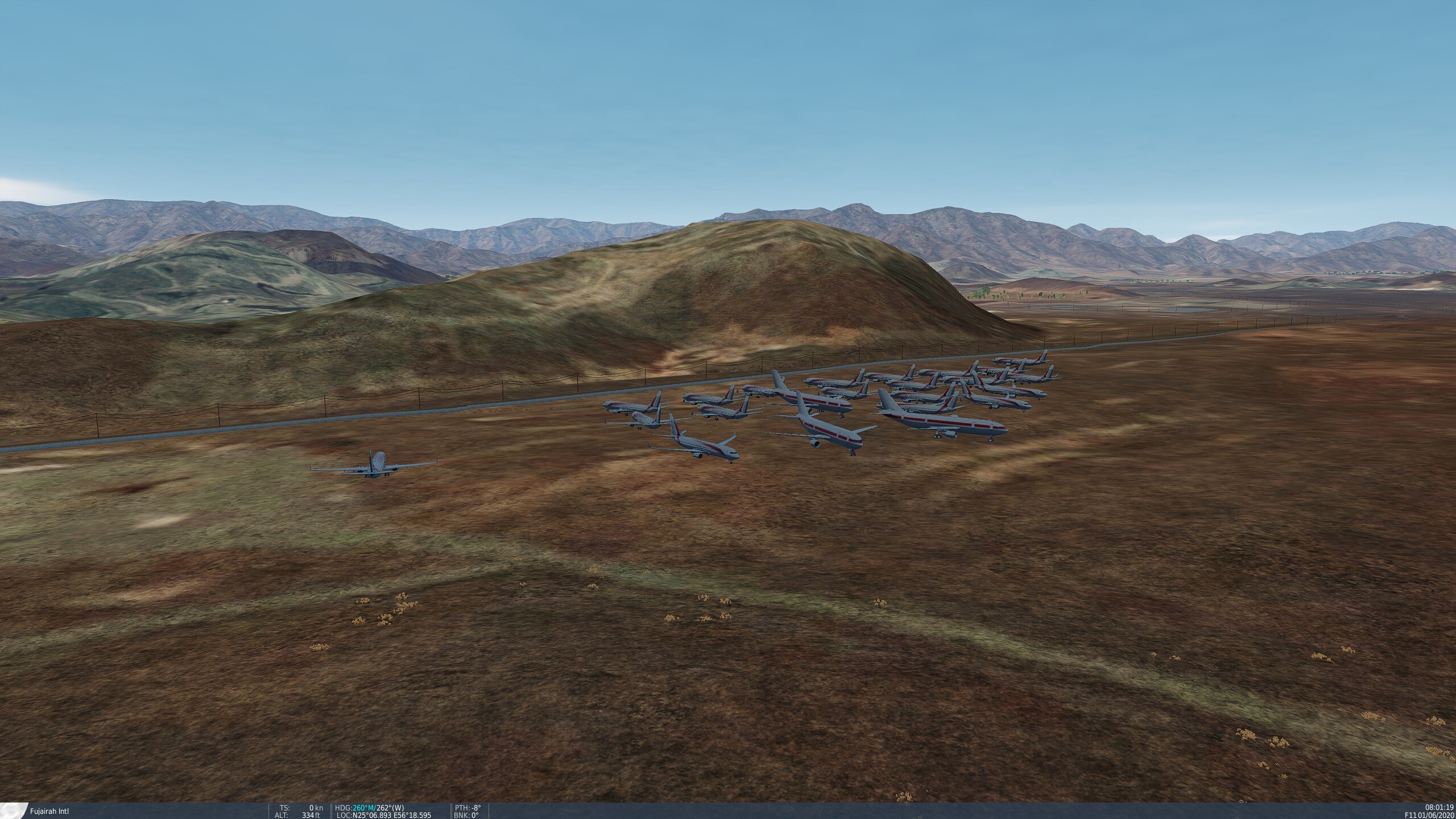
Checked weather settings and while browse the area with F11 noticed this looked like an Aircraft Boneyard. Coordinates in the picture.
-
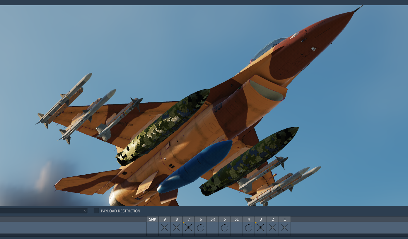
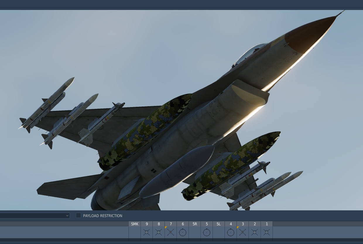
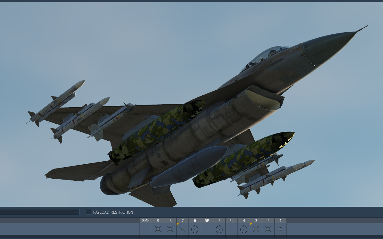
Hello, As I'm flying primarily desert maps I'm forced to download a user liveries for F-16C as it lack one. I download quite a few of skins for a desert environment and few of them are missing same textures for the fuel tanks. nullI was looking for some tutorials to fix it myself but more I'm looking into this matter the dipper the rabbit whole gets and I give-up. Also noticed that other liveries are mentioning that 'fixed tanks' so I guess is a thing must be...fix. So any guidance how to do it myself will be much appreciated! nullnull
-
Weather mod v2.0 for DCS
celestHawk replied to bandit648's topic in Utility/Program Mods for DCS World
Guys, please share your settings for such weather environments. I just discovered this mod and as I already mentioned I'm very illiterate in that subject. I had some hits and mesmerized myself with it but is pure luck.- 451 replies
-
- 2
-
-
- thunderstorms
- rain
- (and 3 more)
-
Hello, Is there a guide how to hide an module from the main menu so I can see only those I would like without - South Atlantic, China Asset and in my case Echo 19 icons. Not to remove them or not to use them anymore but just to hide them from the menu? Most of the modules I don't have I deleted from DemoModes folder. null
-
Don't have time to test it in DCS but I'll take a look on the files out of curiosity. The reason I don't have any rotary is the lack of controlling it with a Xbox controller. I joined because of Tuuvas guide but I'll probably stick around bc of you
-
Weather mod v2.0 for DCS
celestHawk replied to bandit648's topic in Utility/Program Mods for DCS World
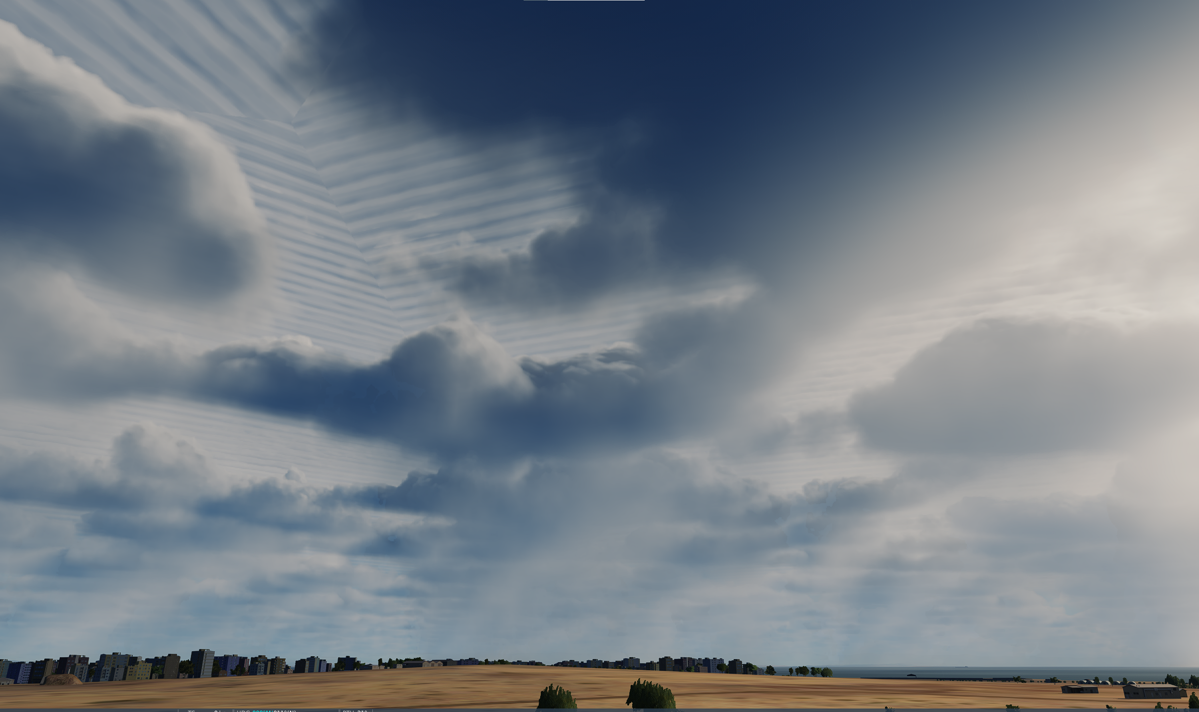
This time I wont mention the perfect work you did as 'when the facts speak even the Gods are silent'. What I wonder and wish to ask from you is totally created by my own ignorance and lack of any knowledge about cloud formations and weather conditions. So the questions is what type of clouds are typical for which map and weather/seasons? The other day I tried your Thunderstorm mod with Marianas map and it was astonishing (shared few screenshots) but as stupid as I am couldn't imagine that I can use such clouds and settings for Afghanistan or Iraq, even can't think is realistic for Kola maps either. End goal for myself is to recreate the look and feel of the region I'm flying and have yet another template for the conditions whilst executing a mission...cus taking of a carrier with a hornet in a rain is one experience none of us can pass nor to make a HD bombing in a foggy weather Thank you once again and please do keep your great work!- 451 replies
-
- 1
-
-
- thunderstorms
- rain
- (and 3 more)
-
Can't wait to see how that embarkation would look like in POV
- 1 reply
-
- 1
-
-
Welcome to the club brother