birkenmoped
-
Posts
160 -
Joined
-
Last visited
Content Type
Profiles
Forums
Events
Everything posted by birkenmoped
-
It was indeed part of LUTRANS — specifically HLUP B within the Bundeswehr’s Lufttransportkonzept 74. The LUTRANS network defined a chain of Haupt-Luftumschlagpunkte (main air transshipment points) across West Germany — Ahlhorn sat right between Hohn and Köln-Bonn in that system. So those flights weren’t a separate operation; they were integrated NATO/Bundeswehr logistics runs, using aircraft like the Transall C-160 to shuttle materiel and troops between the designated HLUP bases.
-
If Ahlhorn needed a pitch, then that could be it: - The Ahlhorn Air Base was an important part of NATO air logistics, as it served as a transshipment point (HLUP B) Flight route section “Hohn → Ahlhorn → Cologne-Bonn → Stuttgart-Echterdingen → Landsberg” - The stationing of the 81st TFW Detachment with 18x A-10s provided a concrete component of frontline proximity and operational readiness. - HTG 64 provided mobility, training, and rescue capabilities with helicopters Bell UH-1D – just as relevant for alliance operations as for everyday life. - Air defense systems (Flugabwehrraketenbataillon 25 (FlaRakBtl 25) – Stellung Varrelbusch), fuel (NATO pipeline (Line 09 as a branch of Line 05 Bramsche - Oldenburg)) and material infrastructure, and training facilities made the site multifunctional. Overall, Ahlhorn was not just “any military airport,” but a connecting element in NATO's air superiority, mobility, and logistics-oriented strategy in northwestern Germany.
-
Sadly (as of August 7), it still hasn't been fixed/revised, so it's still unrealistic. I was hoping that deleting incorrect “things” would be way easier and therefore somehow faster. The completely incorrect tower (incorrect in terms of time) has already been mentioned in another thread, so I won't mention it here! (Wink wink). However, I was very pleased to note that, almost regularly, other important things on the map have already been changed/fixed. Thank you, @MAESTR0, for that!
- 1 reply
-
- 1
-

-
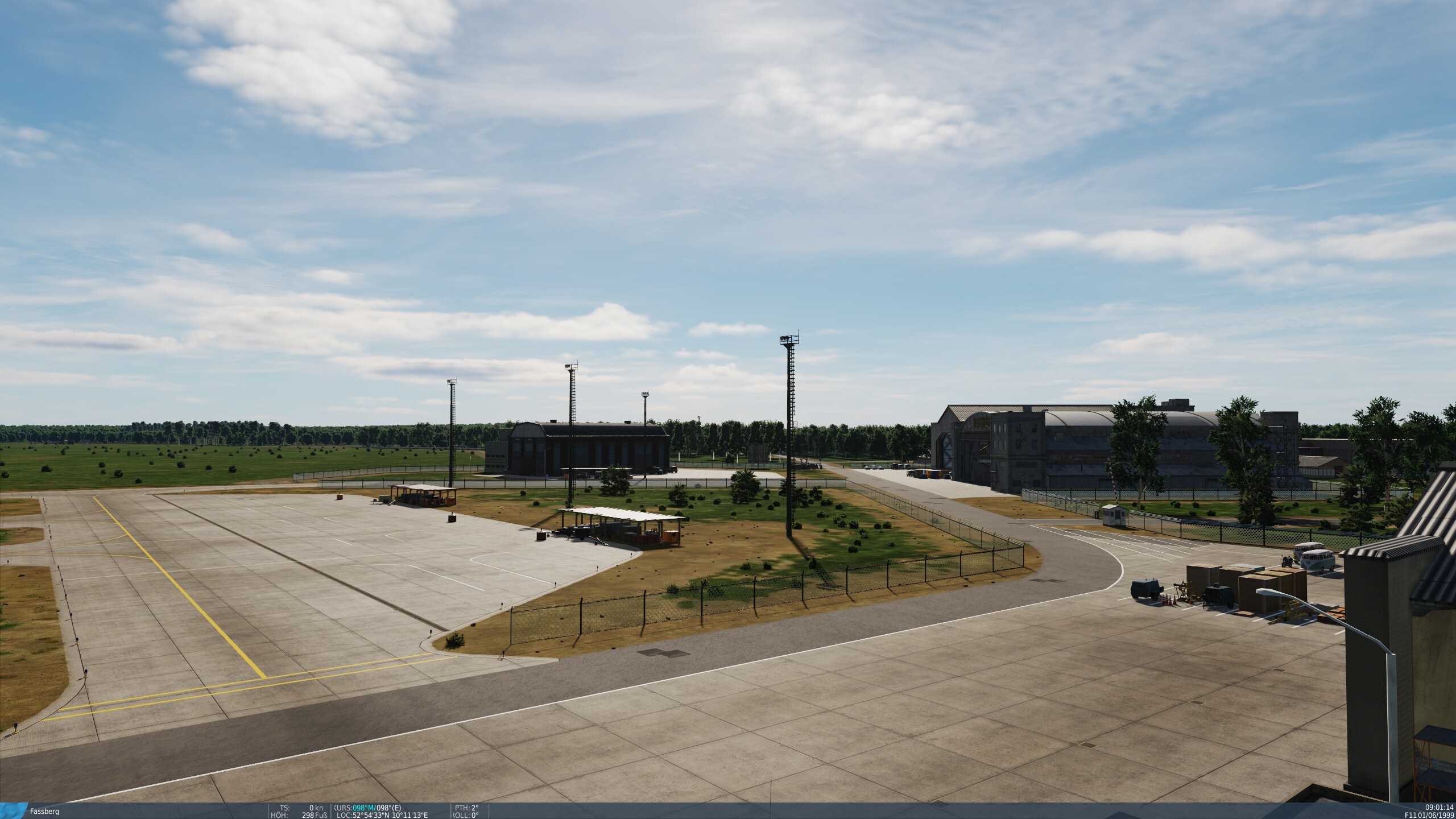
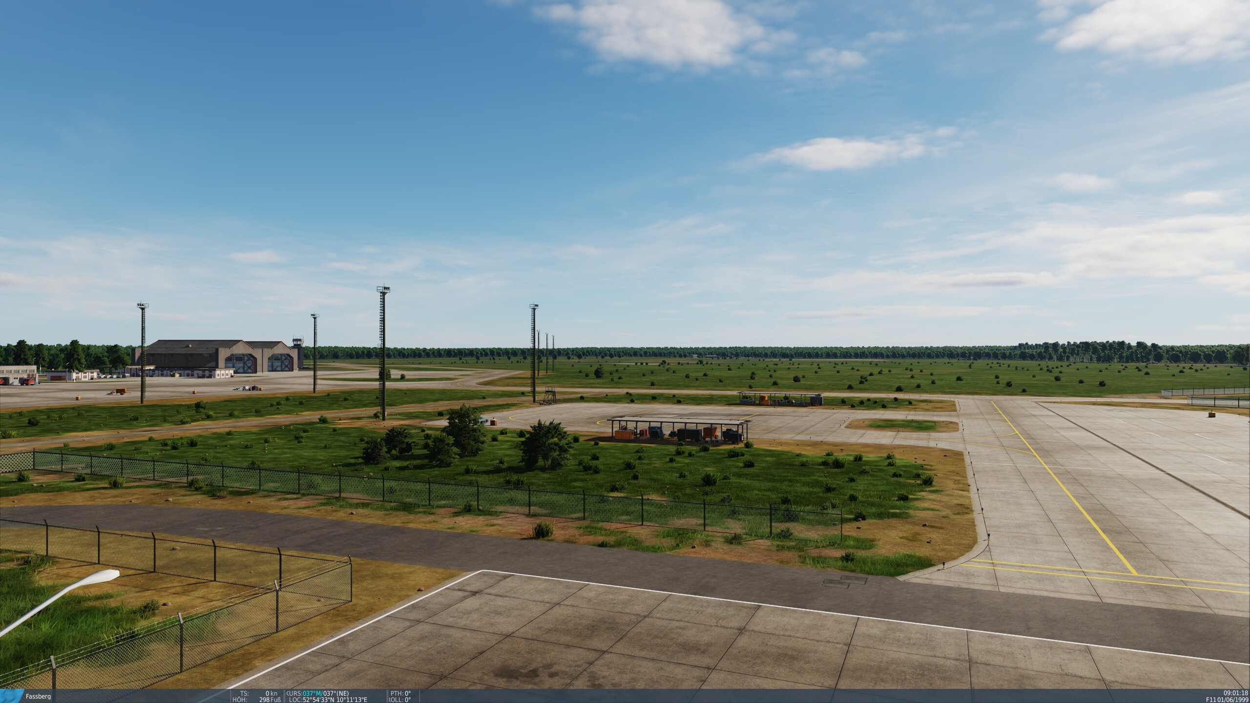
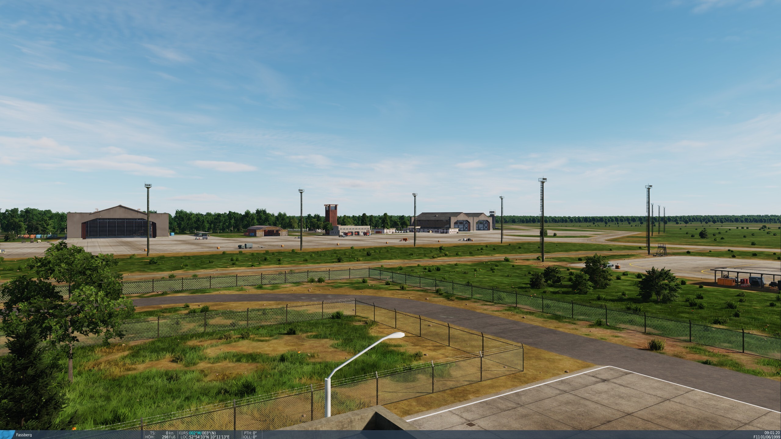
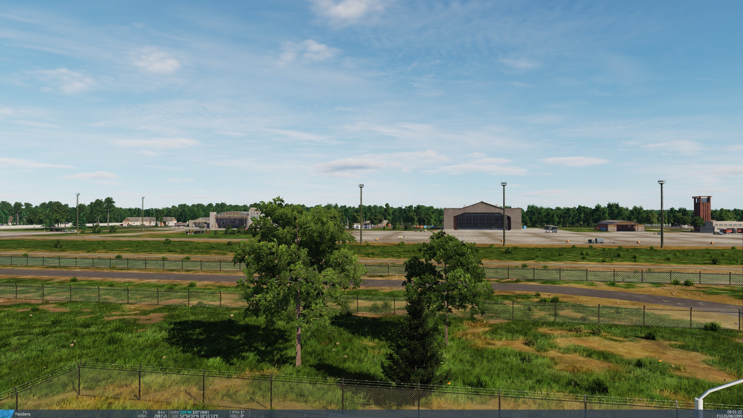
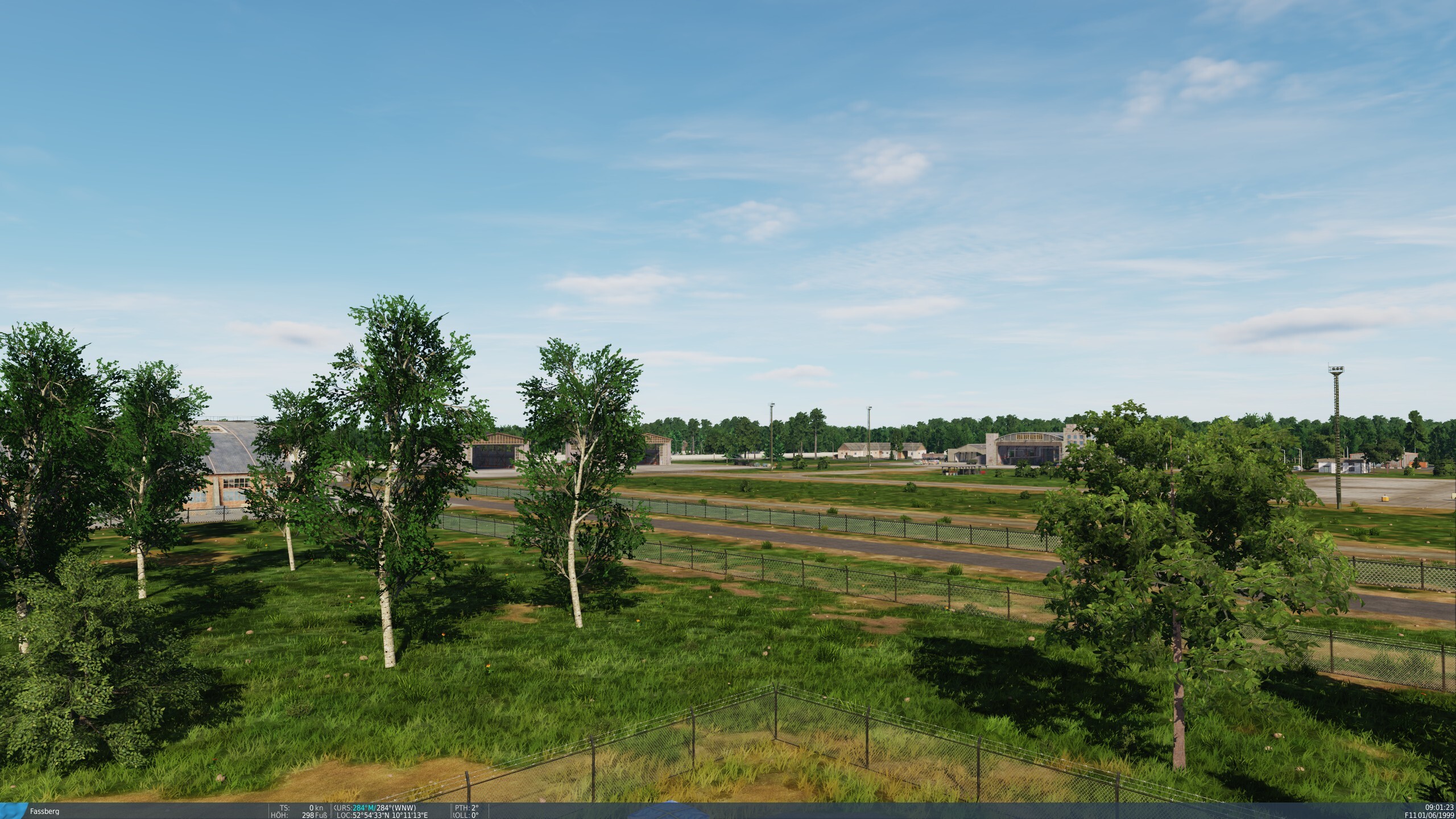
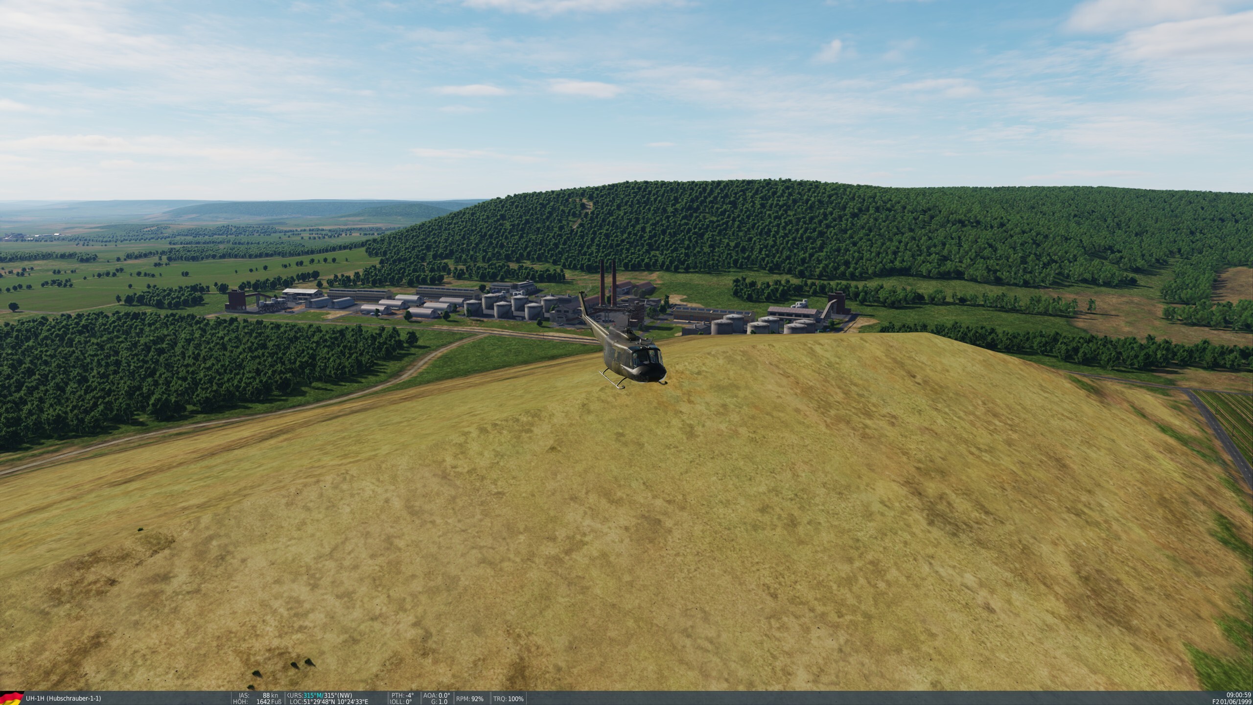
Light masts - EDNF (ETHS) Fassberg Now that Bückeburg has already had its light poles/masts removed, I would like to point out the same problem at Fassberg EDNF (ETHS) airfield! None of the light masts on the flightline were actually there (see also video evidence from 1990/91). Here, too, the removal of the light masts would be desirable and, above all, realistic. Greetings birkenmoped

- 1 reply
-
- 4
-
-

-
 I didn't try it because all the airfields I was interested in were accessible via the URL display in the WaybackMachine.
-
Not as old as desired, but still over 20 years old, freely accessible via WaybackMachine: DoD FLIP (ENROUTE) SUPPLEMENT EUROPE, NORTH AFRICA AND MIDDLE EAST 6 SEP 2001 Oh, I forgot, no maps but information on airbases, such as dimensions and positions of runways and information on navigation hardware, frequencies, identifiers, positions etc. And a WaybackMachine link to parts (as an example here Bittburg/Spangdahlem) of a DoD FLIP (TERMINAL) VFR ARRIVAL/DEPARTURE ROUTES EUROPE 19 JANUARY 1984 The other airfields/maps can be found, for example, by displaying the list of all URLs of the website on WaybackMachine.
-
Maybe you can fix someone with this partly long-winded, badly edited, blurred and out-of-focus video from 1990/91?
-
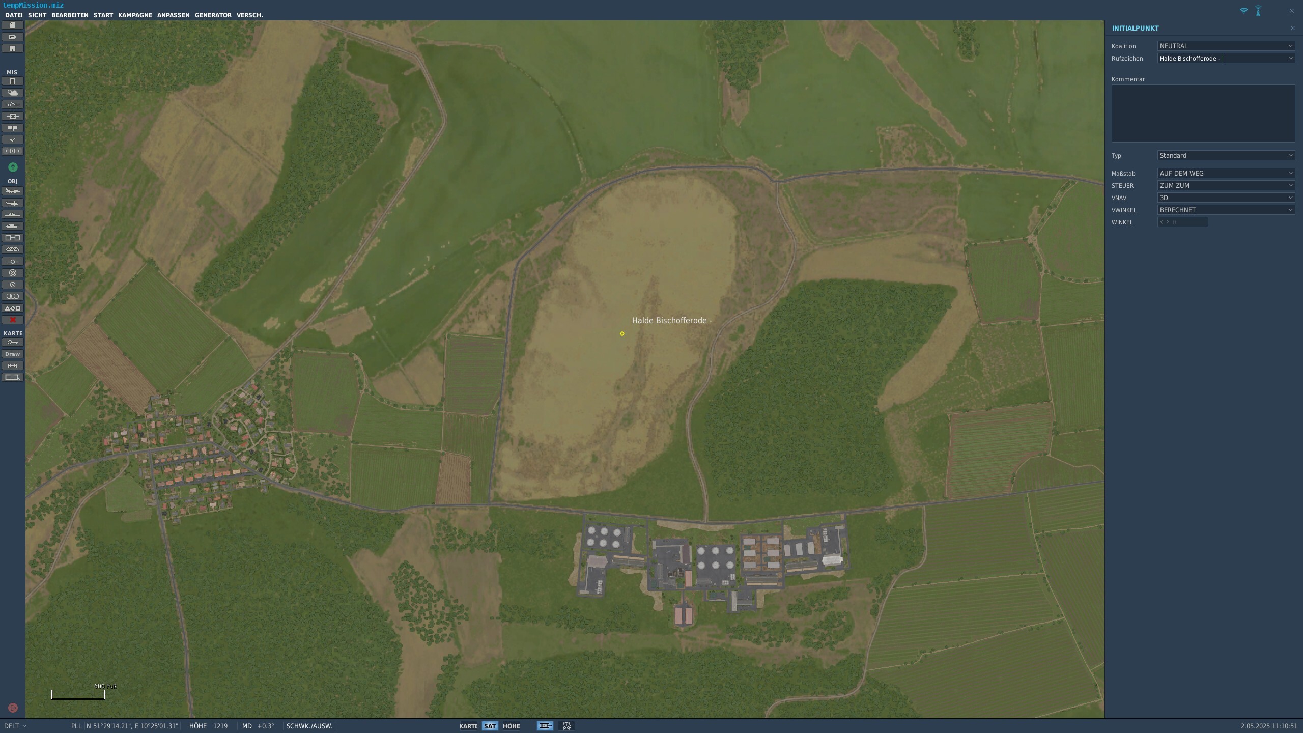
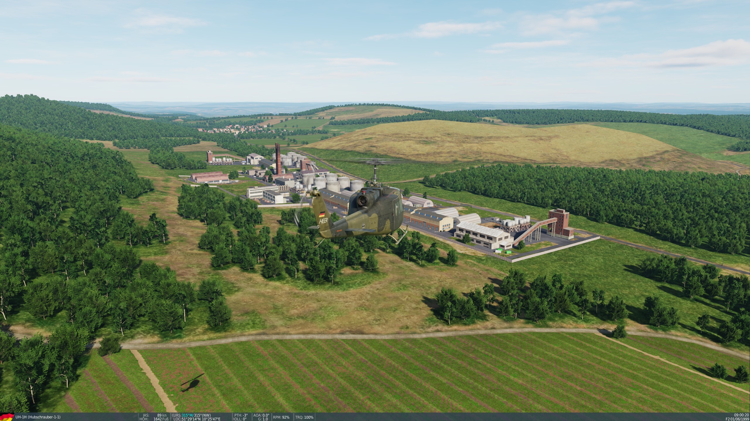
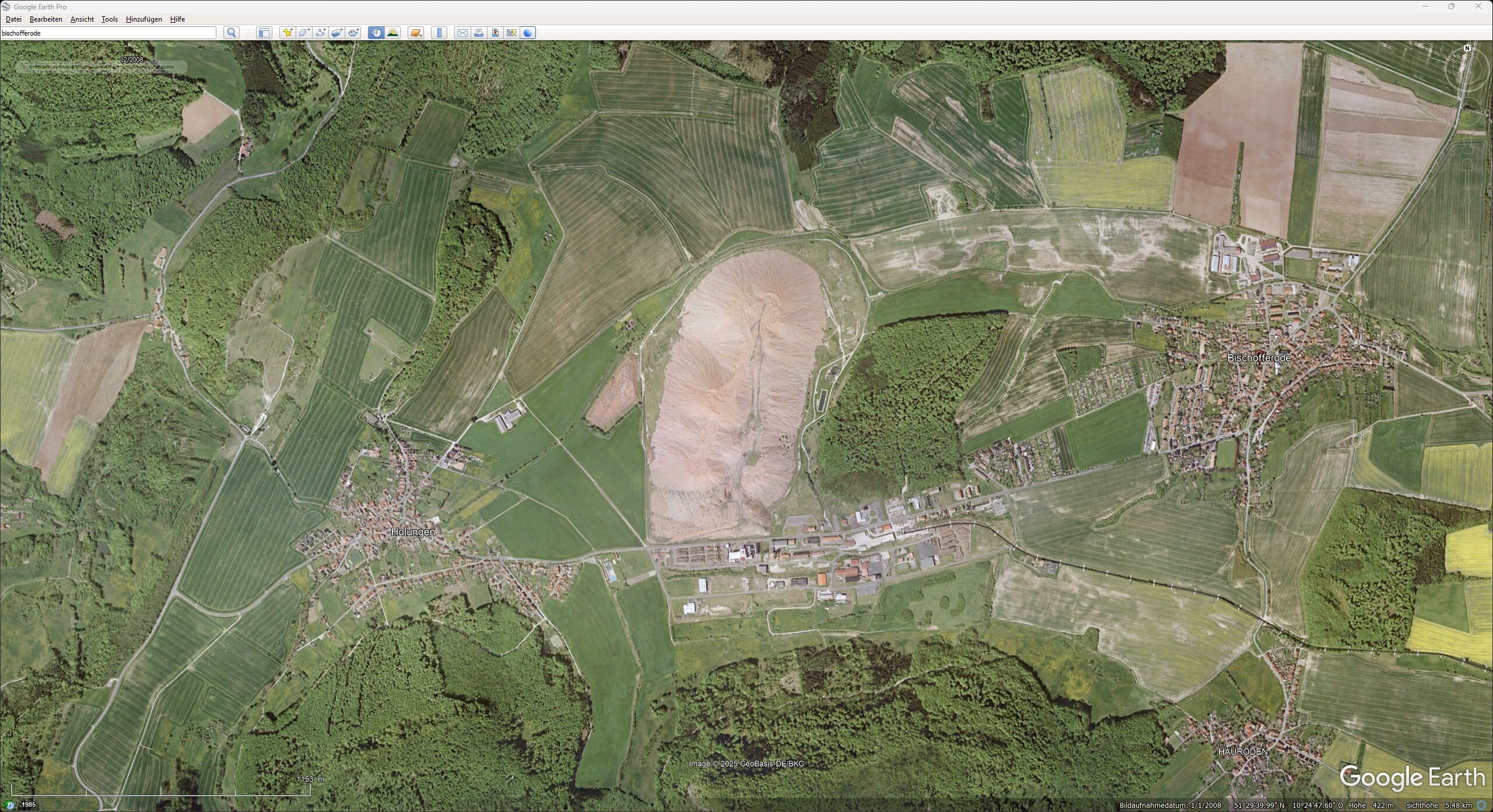
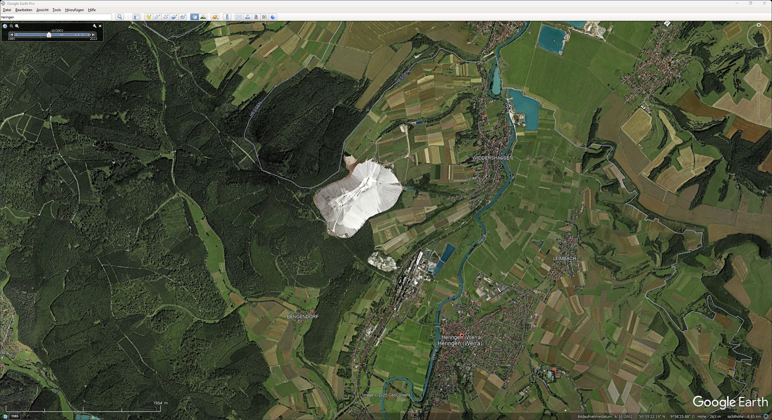
Small comment: Only the Bishofferode potash stockpile is present on the map, unvegetated and textured differently. All the other spoil tips shown in the previous post are either overgrown and/or do not appear to have the correct height or do not exist at all. German: Kleine Anmerkung: Nur die Kalihalde Bishofferode ist auf der Karte vorhanden, unbewachsen und andersartig Texturiert. Alle anderen im vorherigen Posting gezeigten Halden sind entweder überwachsen, scheinen nicht die richtige Höhe zu haben oder sind gar nicht vorhanden. Von Kassandro - Eigenes Werk, CC BY-SA 3.0, https://commons.wikimedia.org/w/index.php?curid=11506144
-
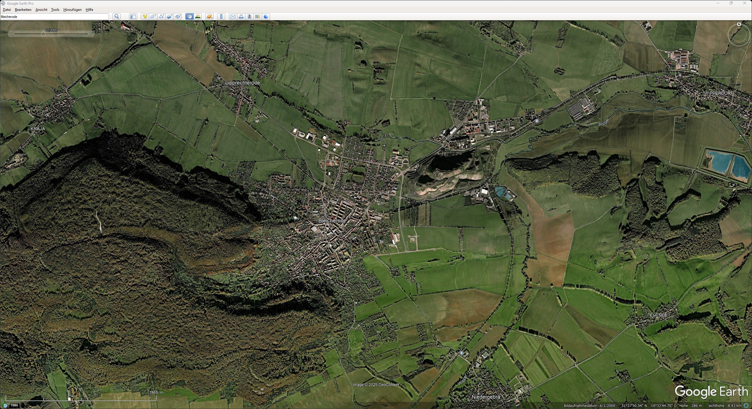
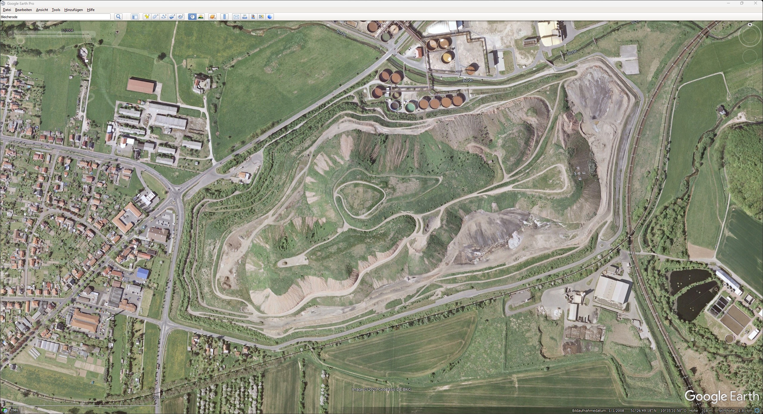
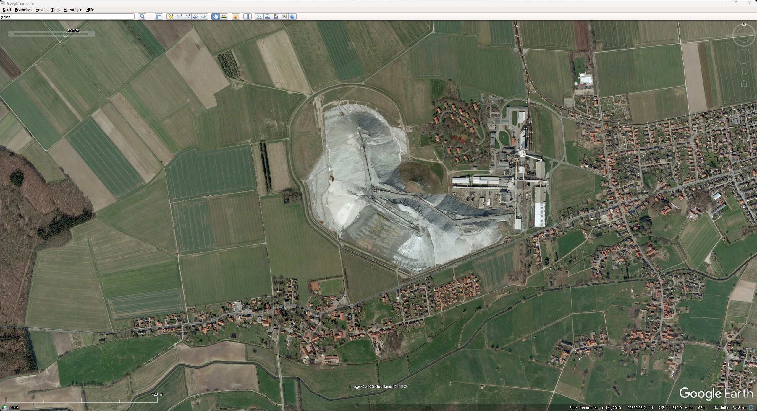
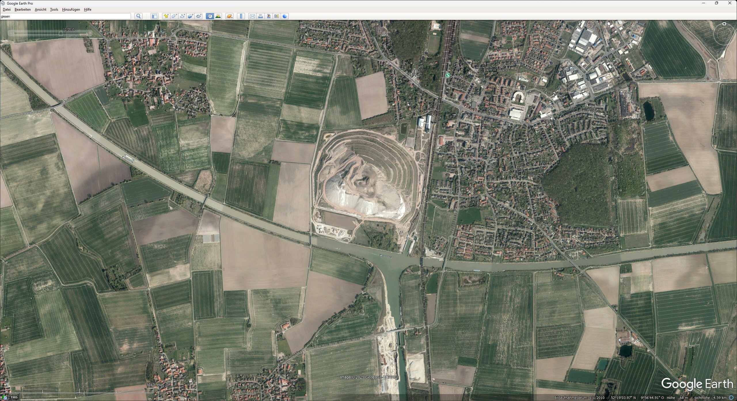
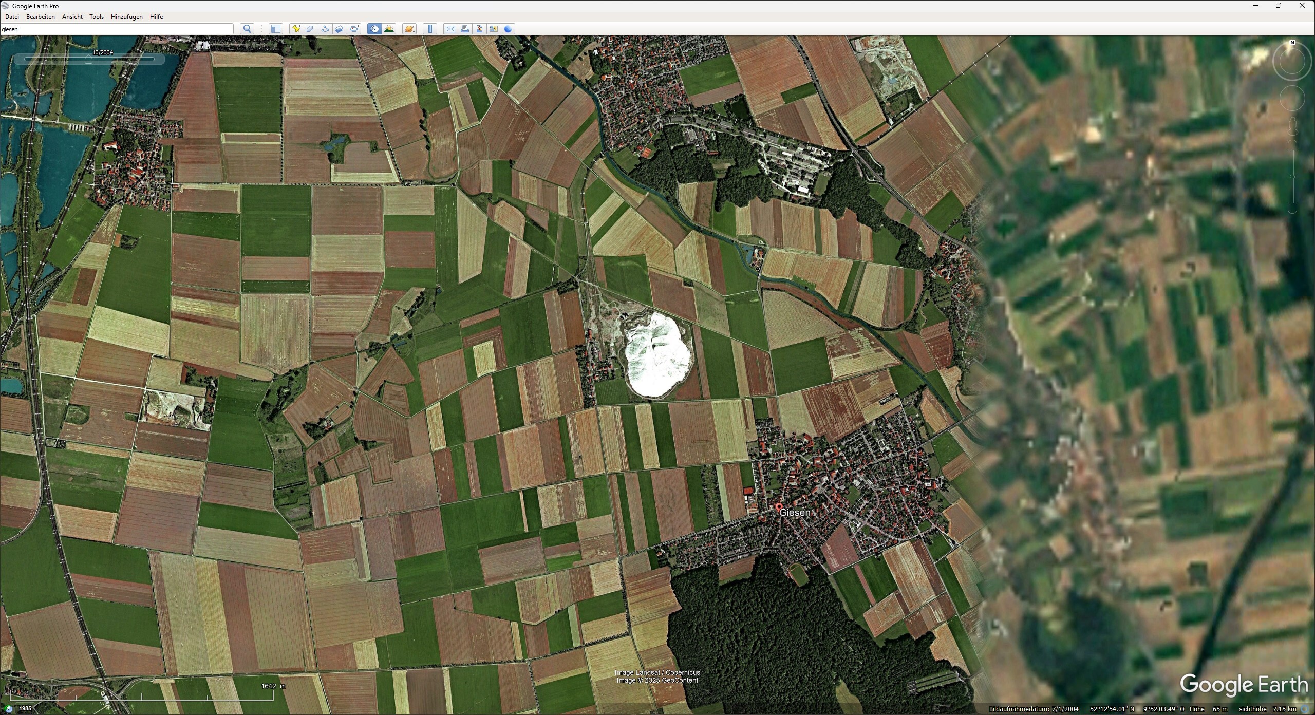
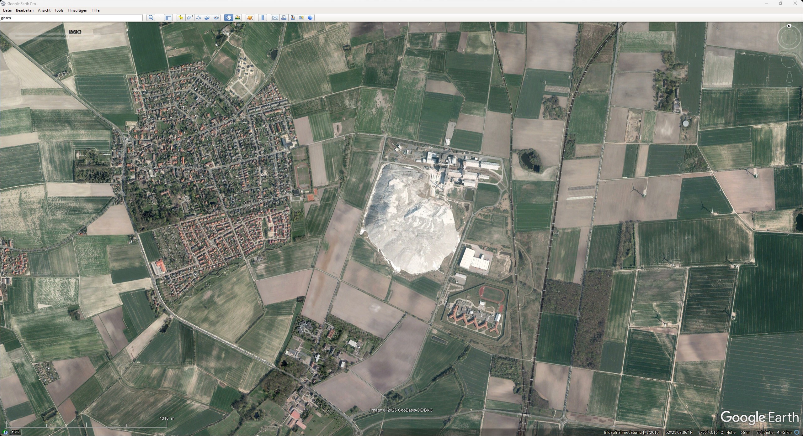
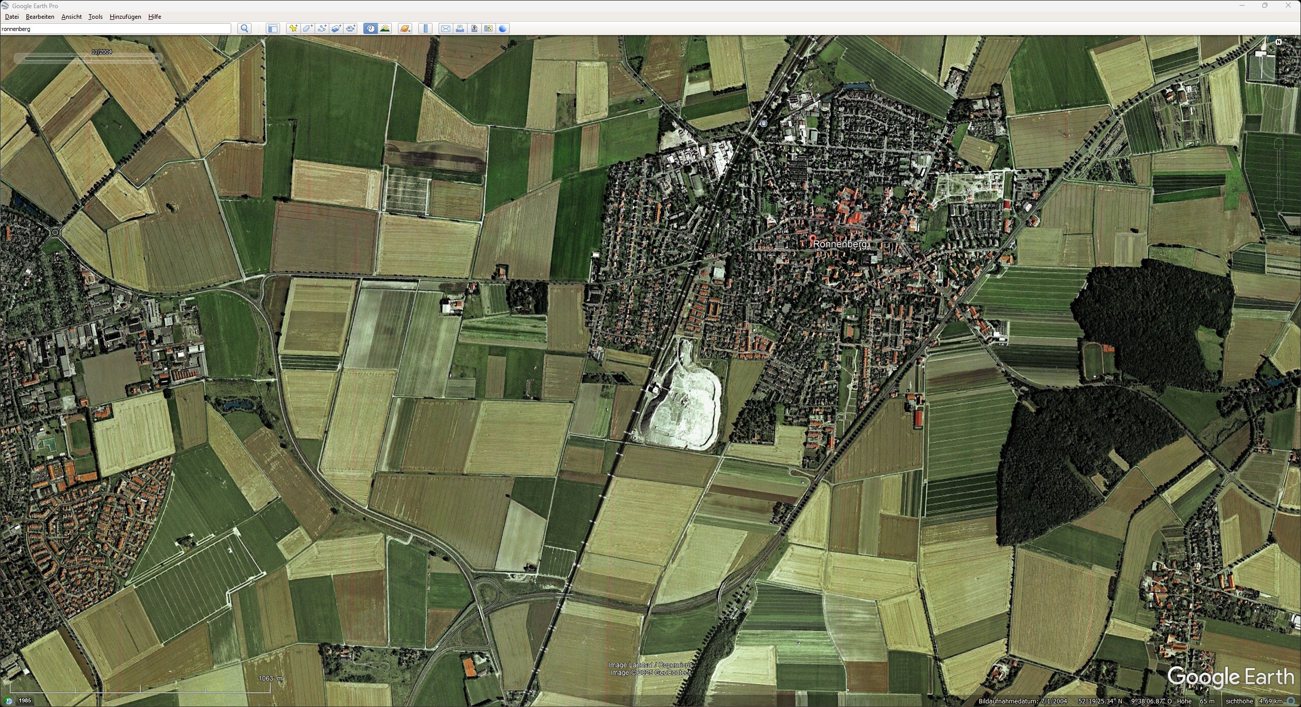
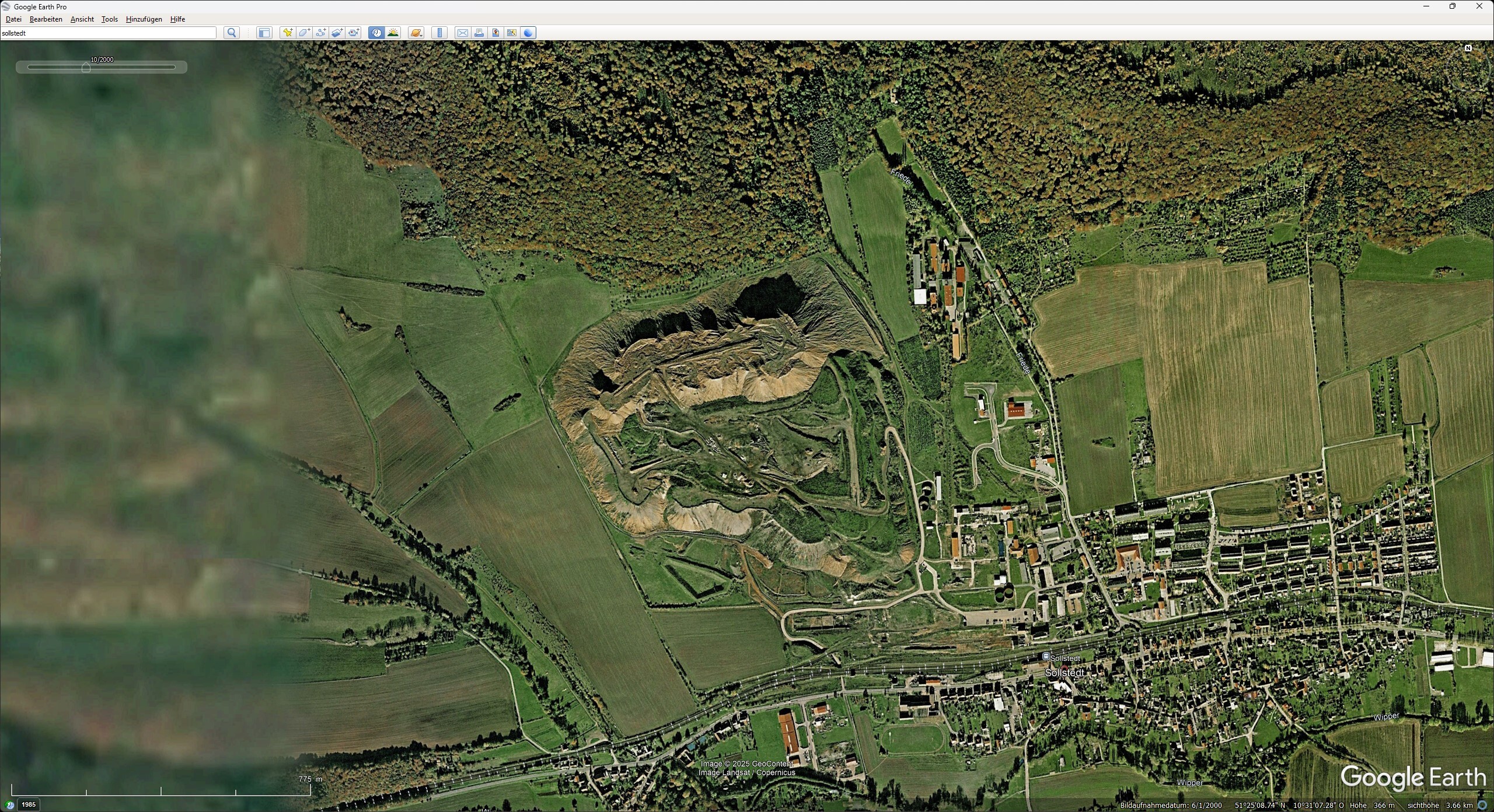
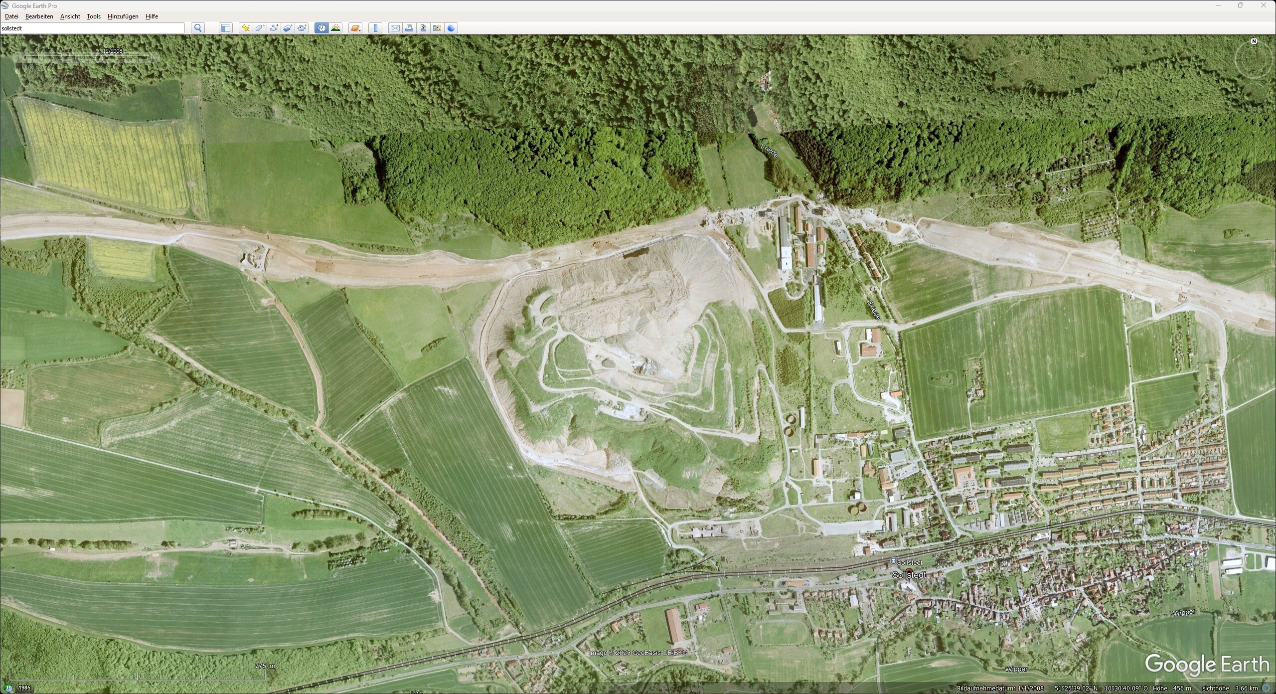
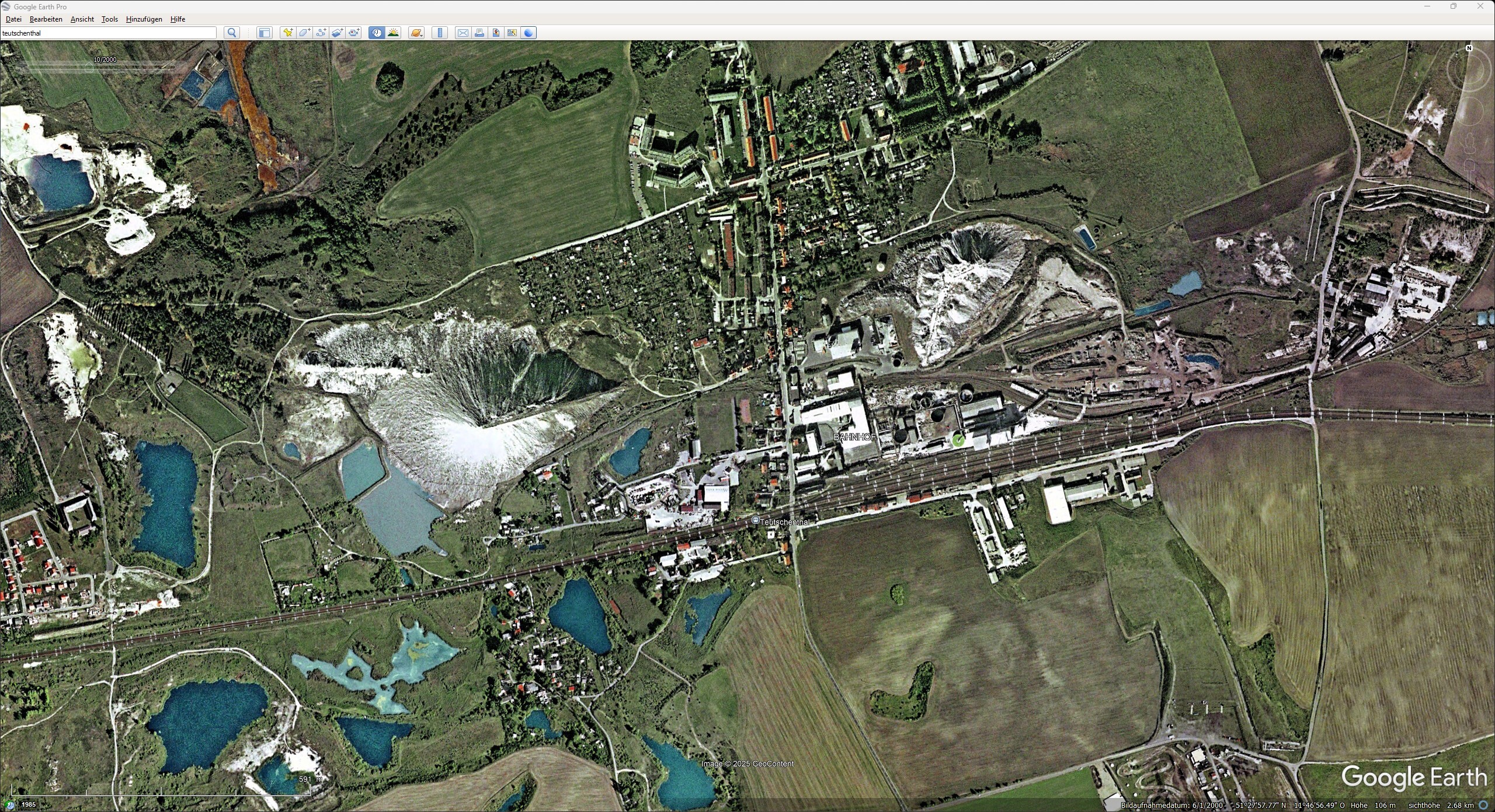
They are known as the kings of mining slag heaps, rising up like pyramids and popularly known as “Monte Kali” or “Kalimandscharo”. These imposing slag heaps, which reach heights of up to 250 meters, can be seen from afar thanks to their often bright white, light grey or, more rarely, reddish color. Many of these slag heaps have been or will be extensively renaturalized in the coming decades - some will be partially removed or planted with vegetation - but all the slag heaps listed below were visible in their full glory and unwooded during the Cold War (see also Google Earth images). While potash mining continued in the Federal Republic of Germany, East Germany experienced a wave of closures of many potash mines after reunification. In West Germany, the systematic renaturation of waste rock piles began in the 1980s, but was only implemented on a large scale in the 1990s. The main aims of these measures were to reduce the environmental impact of salt deposits and to integrate the waste tips into the landscape in the long term. Interestingly, many slag heaps that have not (yet) been renaturalized remain completely unvegetated. This is mainly due to the high salt content of the material, which makes plant growth extremely difficult. Salt extracts water from plant cells, so that hardly any vegetation can thrive. In addition, the natural leaching caused by precipitation means that the surrounding soil is also salinated. The steep slopes of many slag heaps also make spontaneous greening practically impossible. Only through targeted renaturation measures - such as the application of a suitable layer of soil - can artificial greening be successfully implemented. Today, the mountain has a different green-yellowish color, as both the base material for the greenery and special protection against wind drifts have been applied. More information and pictures of Germany's potash dumps: https://www.ruhrgebiet-industriekultur.de/kalihalden-in-deutschland/ https://de.wikipedia.org/wiki/Monte_Kali I noticed it during a flight around Wunstorf. A very conspicuous, high and wooded ground elevation with associated industry seemed unnatural in this region, which is known for its flatlands. Those familiar with the area know that such a slag heap should actually be almost dazzlingly white here. Such a striking location that is recognizable from afar could be particularly helpful for visual flights. Perhaps Ugra could make some improvements! German: Der "weisse" Elefant im Raum, oder was sie schon immer über Kalihalden wissen wollten (oder auch nicht). Sie werden Könige der Halden des Bergbaus genannt, pyramidenähnlich erheben sie sich und tragen im Volksmund Namen wie „Monte Kali“ oder „Kalimandscharo“. Diese imposanten Halden, die Höhen von bis zu 250 Metern erreichen, sind durch ihre häufig strahlend weiße, hellgraue oder seltener rötliche Farbe schon von Weitem erkennbar. Viele dieser Halden wurden oder werden in den nächsten Jahrzehnten aufwendig renaturiert – manche werden teilweise abgetragen oder begrünt –, aber alle weiter unten aufgeführten Halden waren im Zeitraum des Kalten Krieges in ihrer vollen Strahlkraft und unbewaldet zu sehen (siehe auch Google Earth Bilder). Während der Kalihalden-Betrieb in der Bundesrepublik Deutschland kontinuierlich fortgesetzt wurde, erlebte Ostdeutschland nach der Wiedervereinigung eine Welle von Schließungen vieler Kalibergwerke. In der BRD begann die systematische Renaturierung von Halden bereits in den 1980er Jahren, wurde aber erst in den 1990er Jahren großflächig umgesetzt. Die Hauptziele dieser Maßnahmen waren die Reduzierung von Umweltbelastungen durch Salzablagerungen und die langfristige Integration der Halden in die Landschaft. Interessanterweise blieben viele Halden, die (noch) nicht renaturiert wurden, völlig unbewachsen. Das liegt vor allem am hohen Salzgehalt des Materials, der Pflanzenwachstum massiv erschwert. Salz entzieht Wasser aus Pflanzenzellen, sodass kaum eine Vegetation gedeihen kann. Zusätzlich führt die natürliche Auswaschung durch Niederschläge dazu, dass das umliegende Erdreich ebenfalls versalzen wird. Auch die steilen Hänge vieler Halden machen eine spontane Begrünung praktisch unmöglich. Erst durch gezielte Renaturierungsmaßnahmen – wie das Auftragen einer geeigneten Erdschicht – kann eine künstliche Begrünung erfolgreich umgesetzt werden. "Heute zeigt sich der Berg in anderen grün-gelblichen Farben, da sowohl Grundmaterial für die Begrünung und spezieller Schutz gegen Windverwehungen aufgebracht wurde." Mehr Informationen und Bilder zu Deutschlands Kalihalden: https://www.ruhrgebiet-industriekultur.de/kalihalden-in-deutschland/ https://de.wikipedia.org/wiki/Monte_Kali Aufgefallen war es mir bei einem Rundflug um Wunstorf. Eine sehr auffällige, hohe und bewaldete Bodenerhebung mit angeschlossener Industrie wirkte in dieser Region, die für ihr Flachland bekannt ist, unnatürlich. Ortskundige wissen, dass eine solche Halde hier eigentlich fast blendend weiß erstrahlen sollte. Gerade für Sichtflug könnte so ein markanter und von weiten erkennbarer Ort hilfreich sein. Vielleicht könnte Ugra da ja nochmal nachbessern?! Halde Bischofferode - Google Earth 12.2008 Halde Bleicherode - Google Earth 10.2000 Halde Bleicherode - Google Earth 12.2008 Halde Bokeloh - Google Earth 12.2010 Halde Friedrichshall - Google Earth 12.2010 Halde Giesen - Google Earth 10.2004 Halde Lehrte - Google Earth 12.2010 Halde Ronnernberg - Google Earth 10.2004 Halde Sollstedt - Google. Earth 10.2000 Halde Sollstedt - Google. Earth 12.2008 Halde Teutschenthal - Google Earth 10.2000 Monte Kali - Google Earth 10.2002 Kalihalden in Deutschland.miz
-
FlaRak-Stellung(en?) - Hawk - 1991
-
A little Fassberg vibes from 1990/1991. Caution, long and uninteresting for the majority of people! But fetishes are individual
-
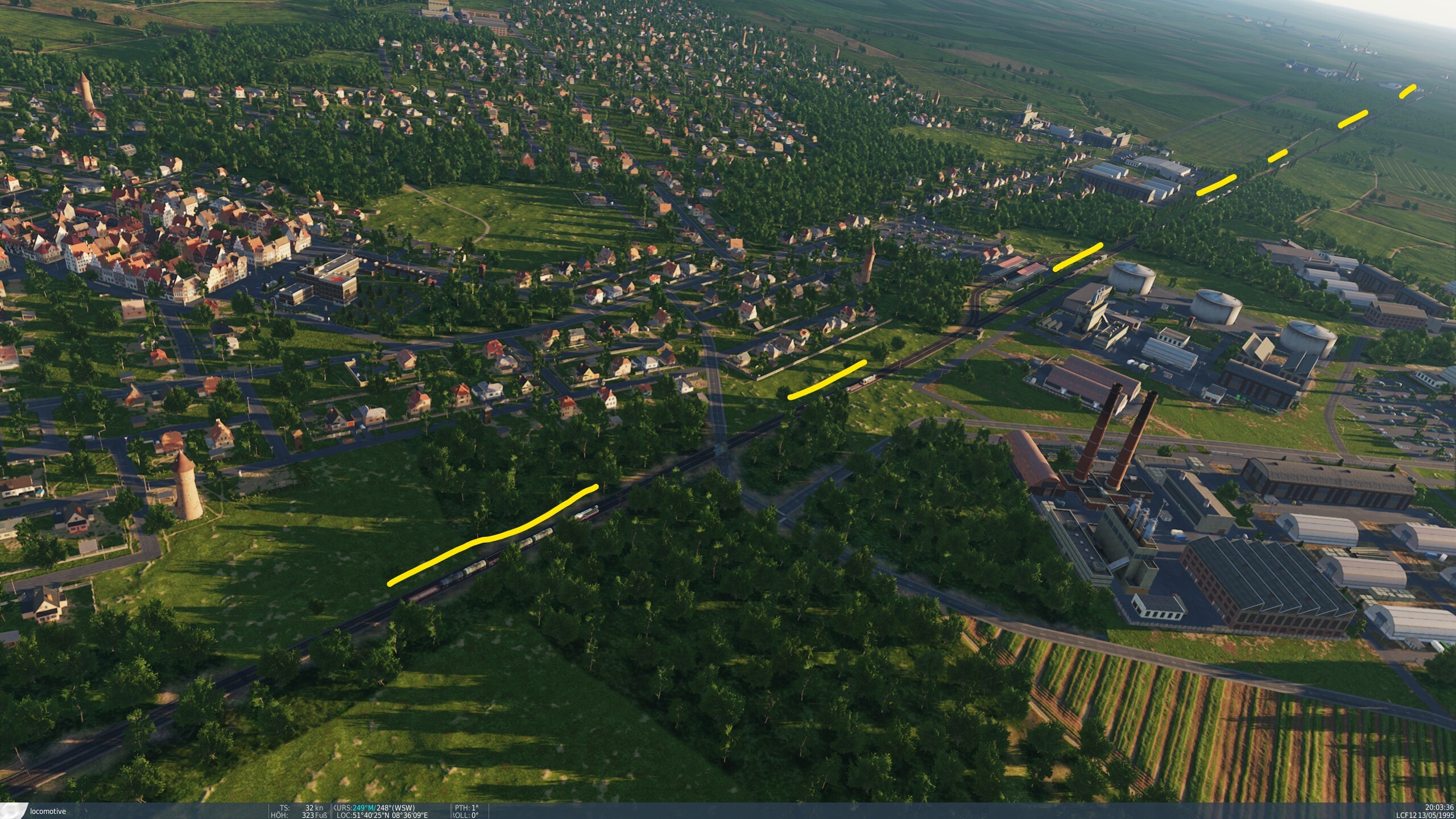
Nothing to do with the actual topic, just the location.
-
Define “Neubausiedlungen”? In terms of time? Perhaps also special features of the region, here (in the video) Lower Saxony, more precisely the area around Ahlhorn, Cloppenburg, Wildeshausen, where there are both old town centers and new housing estates.
-
Examples of German air bases (1990) - Attention: poor quality / old “Super8?” videos. But the details of the well-kept lawns on the airfield are recognizable!
-
-
Faßberg Air Base - Source: https://www.mil-airfields.de/de/fassberg.htm The actual request to remove the bushes and stones from the green areas of the airfield is nevertheless justified!
-
In support of this statement - see screenshot...
- 1 reply
-
- 4
-
-
-
DDR Strategic Air Defense: A Cold War Case Study
-
In one F-117 cruising over Baghdad, a stealth pilot carefully kept the crosshairs of his laser designator on a building the principal master attack planner had dubbed the AT&T building: a telecommunications center vital to Iraqi military command and control. The weapons bay snapped open, disgorging a 2,000-pound laser-guided bomb (LGB), which sank away from the black arrowhead, streaming wisps of vapor off its fins as it maneuvered to pick up the “basket” and plunge at high speed toward a little spot of laser light fixed unerringly on the top of the center. In Riyadh, Gen Charles Horner and his Black Hole staff were waiting for Cable News Network (CNN), broadcasting via telephone from Baghdad, to go off the air. In Washington, planners and senior defense officials alike counted the minutes, fascinated at the irony of events about to unfold. If all went well, the first bomb-damage assessment (BDA) would be inadvertently transmitted in real time directly to the people most responsible for executing the strike as well as to the world at large. In Baghdad, CNN correspon- dents Bernard Shaw and Peter Arnett were reporting the antiaircraft fire over the city to American audiences. Observed Shaw, “We have not heard any jet planes yet, Peter.” To which Arnett responded, “Now the sirens are sounding for the first time. The Iraqis have informed us. . . .” Nothing but abrupt static. CNN’s link went off the air. The US Air Force had delivered the first air weapon to strike into the heart of Saddam Hussein’s city. In both the Black Hole and in the depths of the Pentagon, wild cheers erupted. Source: AIRPOWER IN THE GULF WAR - ESSAYS ON AIR AND SPACE POWER, VOL. II - Air and Space Power Mentoring Guide Essays (Volume 2)
-
Regarding the search for the radar positions of Taskforce Normandy, I can perhaps make the following contributions: I found a “Task Force Normandy Virtual Staff Ride” on the website of the “Army University Press” including accompanying documents. Task Force Normandy Read Ahead Guidance and Packet Task Force Normandy Visuals (Exportable) The documents provide some good information, including MGRS coordinates from the used VBS3. However, the coordinates did not quite match the time and/or distance information. A search in the immediate vicinity via. Bing-Maps, Google-Maps and Apple-Maps produced a position for the western destination that actually matched quite well: Target West: Bing Maps: 32.47863, 40.178294 Apple Maps Beta: 32.47863, 40.178294 There is even a flight plan in the documents for the eastern target, which I was able to match quite well with the maps available in DCS, except for the actual target. The actual possible target area is very “rugged”, but even there I was able to find a possible position that would fit quite well with the distance information: Target East: Bing Maps: 31.825167, 41.040554 Apple Maps Beta: 31.825167, 41.040554 The target positions should be compared using the following information from the sources mentioned above: • The early warning radar targets were just north of the Saudi-Iraqi border. • The sites were separated by approximately 40 miles of open desert. • The two Teams (White and Red) lift of from Al Jouf, a joint airfield with a small single runway staging strip, northeast of Tabuk, and it was the closet Saudi airfield to the Iraqi border • The planned times were: Team White, would lift off at 12:56 a.m., followed five minutes later by Team Red. If all went according to plan, both teams would arrive at their destinations at exactly 2:38 a.m. • At 0056 on 17 January 1991, the first helicopters took off from Al Jouf headed toward their assigned targets. • Taskforce White had 10 Waypoints (See slide 23 in the visuals download (PowerPoint)): WP1 Starting point at Al Jouf, WP2 checkpoint, WP3 checkpoint with a course change, WP4 last checkpoint prior to crossing the border, WP5 green chem light, WP6 target location, WP7 checkpoint after re-crossing the border with a course change, WP8 checkpoint and course change at or next to Ar Ar, WP9 final checkpoint and course change, WP10 landing at Al Jouf end of mission • At 0212, the Task Force Normandy helicopters crossed into Iraq, varying their flight path as necessary to avoid known or suspected enemy observation posts or Bedouin locations. • The western target was 13 miles farther; the eastern target, 23 miles. - (If the above-mentioned positions, or the positions to be found in the training documents, are even approximately correct, then this information (seen from the border) is exactly the opposite, namely the western target is further away from the border than the eastern target!) • To help the Apaches navigate during their final approach, the Pave Lows would drop a bundle of green infrared chemical lights at a preset point 9 miles from each target. • Taskforce White: After traveling approximately 5-7 kilometers north, they reached their planned release point, which was northeast of the target site. Coming in from this direction would hopefully help confuse any Iraqis on site who may have seen or heard the Apaches prior to execution. • Taskforce White: At exactly 0237:50, White Team Apache pilot Lieutenant Tom Drew keyed his radio and broadcast, “Party in 10.” • Taskforce White: Precisely ten seconds later, all crews began firing their Hellfire missiles. Twenty seconds later, the deadly weapons began to detonate against the structures. • The target sites each consist of 1x Spon Rest radar, 1x Squateye radar, 1x Flatface radar, 1x troposcatter communication shelter and antenna, 2-4 Generators, 1x operation van, 1x electronic warfare van, barraks and 3x ZPU-4 antiaircraft guns, divers fuel containers and additional trucks with trailers • The final configuration for the TF Normandy aircraft was decided to be 1200 rounds of 30mm, one 2.75-inch rocket pod, two Hellfire missile launchers, and one 230-gallon Extended Range Fuel System tank • The concept for the attack was to engage the target with Hellfires at approximately 6 kilometers. After all of the Hellfires were expended, the Apaches were to move to 4 kilometers and started firing Multipurpose Sub-Munitions (MPSM) rockets and at 2 kilometers from the sites, they were to engage with their 30mm chain guns to destroy whatever remained of the compounds until they were out of ammunition. • Taskforce White: The Apaches then flew south, crossed the border, and linked back up with the Pave Lows, who led the team back to Al Jouf. And yes, I know there's a lot of speculation in the whole thing!
-
Hi, during further "research" I found the following illustration/map: Picture description says: British map of the German radio measuring positions (Channel and Normandy), status: 20 days before the invasion. * = unrecognized positions. If I see it correctly, then a mammoth is registered for Fecamp... 20 days before D-Day Source/Quelle: Die deutschen Funkmeßverfahren bis 1945 - Fritz Trenkle
-
@Night Owl Hi Night Owl! No, I couldn't find any really clear sources. The German Wikipedia entry on Cape Fagnet (https://de.wikipedia.org/wiki/Kap_Fagnet) goes in the same direction as the English entry, but it also mentions a possible reason why the Mammoth may not have been built and/or used...! [...] Bunkers In 1942, in anticipation of an Allied invasion, the Cape was fortified by the German occupying forces with bunkers as part of the Atlantic Wall. The control center of the Würzburg radar station and several smaller bunkers can be found on the cape today. three large concrete pedestals, which were used for a 300 km radar system of the Mammut type radar system. However, this was never put into operation, as German troops had to withdraw in August 1944. [...] However, many websites dealing with the Atlantic Wall (https://www.atlantikwall-frankreich.de/2_aok_15/kva_f/1_fecamp/fe_08/fe_08.html , https://www.gyges.dk/FuMO locations and types Channel ver 5.pdf , https://www.geschichtsspuren.de/forum/viewtopic.php?p=59663&hilit=fecamp#p59663 ) list various radio measuring and locating devices under "AOK 15 - KVA F - KVGr Fecamp - Fe 08", e.g. Würzburg Riese, Freya and also a Mammut V143 device.