drPhibes
-
Posts
1182 -
Joined
-
Last visited
-
Days Won
2
Content Type
Profiles
Forums
Events
Everything posted by drPhibes
-
No.
-
Looks more like two lift engines in the front to me: ...but the rear nozzle swing mechanism is nearly identical:
-
Ukraine Boeing 737 with at least 160 aboard crashes
drPhibes replied to Weta43's topic in Military and Aviation
You fire two in case the first one misses the target. At short ranges you don't necessarily have the time to re-engage if your first missile doesn't hit. -
The list you posted is a mix of DME reply frequencies, Localizer frequencies and VOR/VDB frequencies. Everything before channel 17X is a DME reply freq., between 18X and 56Y every even channel number is a localizer frequency (with the odd numbers being VOR), 60X-69Y are all DME replies, and 70X and up is VOR/VDB.
-
You are confusing VOR and DME. VOR is completely incompatible with TACAN. A TACAN receiver can interrogate a DME beacon and vice versa, giving the range between the two.
-
The F-16C doesn't have a VOR receiver.
-
Ukraine Boeing 737 with at least 160 aboard crashes
drPhibes replied to Weta43's topic in Military and Aviation
TOR-M1 (9M330?) debris, allegedly found near the crash site. A reverse image search shows no hits older than 24 hours, so the pictures may be legit, but they could of course be from somewhere else. -
Ukraine Boeing 737 with at least 160 aboard crashes
drPhibes replied to Weta43's topic in Military and Aviation
No. -
It's almost impossible to figure this out. Someone should invent a search engine so we could look up stuff on the internet.
-
Plans for Block 2 J-11 ? (adds air-refueling probe)
drPhibes replied to D4n's topic in Deka Ironwork Simulations
There's nothing secret about 1553B. The specifications have been available for decades. -
https://pcpilot.keypublishing.com/the-magazine/view-issue/?issueID=7968 A TL;DR: There are two WW2, and a free modern day Pacific region theatres in development. One of the WW2 maps is the channel map, which includes parts of southeastern England, northeastern France, and the low countries.
-
P(Y) compatible receivers generally only use the C/A signal for time synchronization when acquiring the P(Y) PRN code.
-
AGM-114.
-
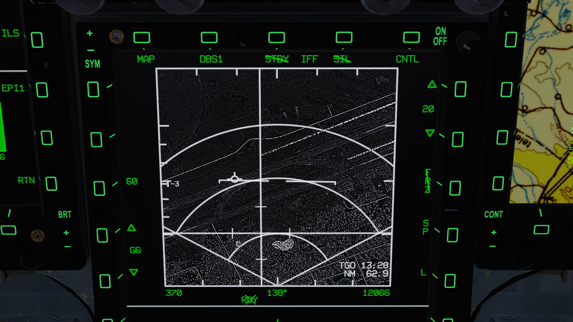
No copying or pasting, but it is a screenshot from the JF-17. I haven't seen any screenshots showing the current state of the DBS mode, so it gives an indication of what we can expect when we get the same features in the 18.
-
I think you may be onto something:

-
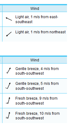
Set a headwind (e.g. 10kt) in the mission editor.
-
The DCS mission editor doesn't operate with METAR messages (which, just for the record, I do know how to read) as input/output. Ideally it would, but it doesn't. The point is that you have an arrow showing the wind direction in the mission editor. The arrow shows the direction the wind is blowing, and you cannot claim that this is wrong just because the bearing indicated by the arrow is contrary to a standard that the sim doesn't use.
-
Wrong how? The arrow on the wind direction knob shows the direction in which the wind is blowing. No weather report I have ever seen has an arrow pointing towards where the wind is coming from...
-
The ILS is interlocked, so if the wind direction is wrong, the ILS for the inactive runway direction is switched off. Set a headwind (can't remember what the threshold is, but around 5-7 knots), and you should be good to go. IRL ILS availability for inactive runways is usually up tp the local ANSPs to decide for CAT I or lower, but CAT II and III systems are always interlocked.
-
Aerial rockets converted with guidance kits are often classified as guided rockets (case in point, the AKPWS).
-
request to increase the current list of AI aircraft
drPhibes replied to Xilon_x's topic in DCS Core Wish List
That video demonstrates nothing other than the 3d animation skills of the people at ciaas.no -
The opnes on the left do have front control surfaces/canards, which aren't really needed on unguided rockets, so my guess would be that they are BRM1s.
-
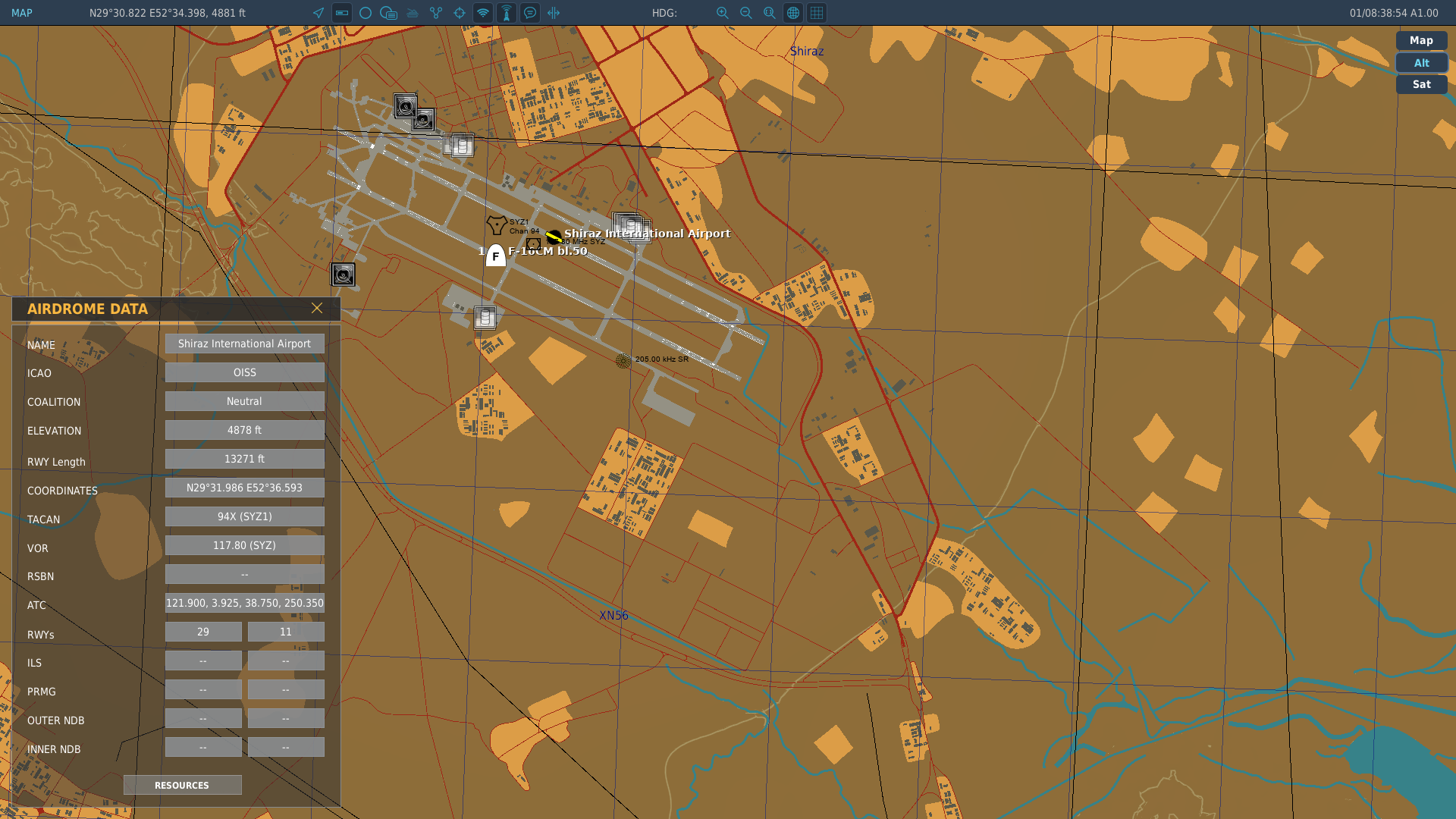
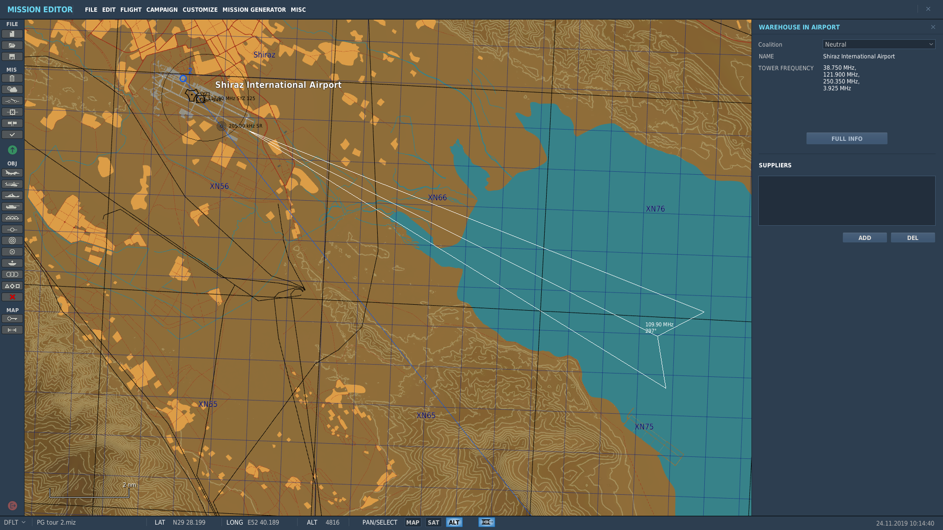
The ILS frequency for Shiraz Intl. RWY 29L is missing in the aerodrome data box in the F10 map: The mission editor shows the localizer frequency and heading as it should:
-
A status update was given in the newsletter two weeks ago.
-
This old demo of the ED terrain tools might be relevant: The area in question: https://goo.gl/maps/LGFZwskA5ps3Umc26 But it could of course be an area selected just for the demo, a cancelled project or something else. I guess time will tell...