Andrew8604
-
Posts
408 -
Joined
-
Last visited
Content Type
Profiles
Forums
Events
Everything posted by Andrew8604
-
I'm with you on that. I want the F-4B. But the F-4 Phantom II is one of those that I think really needs to be developed into multiple versions. If a developer is making an F-4E, I just can't believe they would have to start from scratch to make an F-4D, F-4C and F-4B. There has to be a lot of instrumentation and systems that are the same. The flight model might only need slight tweaking. The F-4F should be nearly identical to the E. The F-4G Wild Weasel would be different mainly only in radar detection and countermeasures from the E. The F-4J should be very near to the B and quite similar to the C & D. The B & J were single flight controls like the F-14, but the C & D were dual flight controls. The F-4K should be quite similar to the F-4J, but with different engines and I don't know what else. I'd like the F-4K (FG1)...if we can get functional carrier models of HMS Eagle and HMS Ark Royal of the Audacious class. ...and S2 Buccaneers to go with.
-
F-106A? I would buy it! We probably would need a Century Series developer. The F-100D would be an essential module for a Vietnam map. I just think aircraft modules should be built to go with maps, not just built for some whim...the way it partially seems to be now. The MiG-21. People wanted one. They always want the latest and greatest of any model aircraft. So we got the MiG-21bis. But what map, what theater does it belong to? If we were to have a Vietnam map, for instance, the MiG-21PF should be the module...and it might actually fly better. F-106A: I'd love it, but what map does it fit with? It is a cold war interceptor. It's job was to shoot down Soviet bombers...that's about it. Well, I guess you could fly THAT mission on about any map...if you are doing an "Intercept strategic bombers" scenario. For the rest of the Century Series: I think the F-100D and F-105D would be best, because they would go along with a Vietnam map...which had an awful lot of historical missions take place. F-101, F-102, F-106?...interceptors. The F-104 can be a few different things. CF-104 was a nuclear strike aircraft. F-104S was multirole tactical. F-104A and C were interceptors, mainly. They were adapted to do things they weren't really designed for, but then that happens with a lot of aircraft. Historically, I think the F-100D and F-105D are the most important of the Century Series. But I'd love to fly the F-101B, F-102A, F-104 and F-106A, too. Maybe instead of a Century-series developer, they should be an Interceptor developer. Because there was also the F-86D Sabre Dog and F-89J Scorpion and F-94 Starfire that were "interesting" interceptors. And I haven't even mentioned interceptors of countries other than the US. What is really needed is a financial model that allows for a dedicated team of aircraft module developers to make it their day job. We, as customers, would have to shell out more money. I wonder if a sort of customer "bidding" system would work. You want an F-106A, for instance? All who do would have to place bids on one in, say, $25 increments. Not as in an auction, but as an investment. You really want that 106? You might purchase 20 bids on it for $500. Expensive? Well, do you want the 106 in your lifetime? And not only that, you'd want to convince as many others as possible to join you in placing their bids on it. These would be "paper" bids. You don't actually lose money...not at first. Let's say 2000 bids come in. Maybe that would be a threshold amount that would then trigger a "put your money where you mouth is" campaign. A developer wants to produce the F-106, let's say. Now everyone who bid would need to actually spend the money, as an investment, to confirm to the developer that the module can be built. If the real bids evaporate, then the deal falls through, and the module doesn't get built. In that way, popular modules would get built. Maybe more of them, more quickly. --is this possible?-- If a mixed full-time/part-time developer team could be kept busy for a year, or three, making modules that provides a living for the right, dedicated, enthusiast developers...maybe 3 to 5 modules could be produced per year instead of just 1. Now, an F-105D, for example, might get a lot more bids due to its legendary place in history in the Vietnam War. There might be some Instrument and engine systems similarities between the 105 and 106 that allows the F-106 to then be produced afterwards...J-75 engine, "tape" instruments, for example. And for the F-100D...its instrument panel has a similar layout and instruments and gunsight to the existing DCS F-86F. The F-100D flew more missions in Vietnam than any other aircraft type, I believe, and was never shot down by a MiG. It has 4 of the same guns the F-5E has. But it's going to be "manual" bombing with the F-100D just like it is in the F-86F. Would enough people place enough bids on it? There are a lot of interesting aircraft that had significant use in history that deserve to be built. But we will never see them in DCS if some new funding/production scheme isn't devised.
-
This Falklands map would be great, as you have it, with that span from mainland Argentina to the "Falkland" Islands. But try to make sure there is ample open ocean space around the Islands...like a 250 nm radius around the islands. (I really don't see how stark, flat-bottomed at 300m, open ocean can cost file size significantly. "Ocean isn't free?") I will buy this map, for sure. But I wish there would be an array of appropriate modules to go with it. Hence... I think this map would make for a lot of awesome air-sea-land battles using 1960's-70's "Cold War" hardware. For Example: Falklands Conflict of 1982: UK: In addition to the two carriers that were historically present, I like this hypothetical idea: What if the last 3 British CATOBAR carriers were still in service in 1982? Never mind the financial/political arguments against, just what if? In other words, we don't stick strictly to history, but bend it a little...realistically. CATOBAR carriers: HMS Victorious R38 - Sea Vixens - 35,500 tons, 778 ft, 30.5 knots (not sure of displacement tonnage) HMS Eagle (R05) - Phantom IIs - 55,000 tons, 804 ft, 31 knots HMS Ark Royal (R09) - Phantom IIs - 54,000 tons, 804 ft, 31 knots Phantom FG1 (F-4K) Buccaneer S2 Sea Vixen FAW2 Gannet AEW3 (AI) Gannet COD4 (AI) Wessex HAS.1 & HAS.3 (AI) (until it could be made a flyable module) V/STOL carriers: HMS Hermes (R12) - 28,000 tons, 744 ft, 28 knots Sea Harrier FRS1 Harrier GR3 (AV-8B N/A's could probably be substituted--but if making the FRS1, I think that makes the basis for the GR3.) Sea King HAS5 & HC4 HMS Invincible (R05) - 22,000 tons, 689 ft, 28 knots (maybe renumbered R13, because Eagle would still have R05?) Sea Harrier FRS1 Sea King ...and the various UK escort destroyers and frigates and task force ships. Hypothetical Addition: US assistance with... USS Coral Sea (CV-43) - 67,000 tons, 973 ft, 33 knots F-4B/N A-7E - already being made a module A-6E KA-6D (AI) - but when an A-6E module is made, this needs to be an included variant as a tanker. EKA-3B (AI) - Tanker E-2B (AI) SH-3 Sea King ...and an accompanying escort group of Spruance-class, Perry-class and Leahy-class ships? Argentina: Aircraft: A-4B/Q & A-4C Skyhawks -- could modify the A-4E-C -- mainly the different engine, J65 IAI Dagger & Mirage IIIEA MB.339 - already being made a module Super Etendard (and why not add Etendard IV) S-2E Tracker (AI) SP-2H Neptune (AI) ex-HMS Venerable (R63) - Veinticinco de Mayo - 14,700 tons, 695 ft, 25 knots (is that tonnage right? Seems like it should be more like 20,000 tons) Hypothetical: What if these Essex-class carriers were not scrapped but sold to Argentina in the 70's, along with these aircraft? Never mind the prohibitive expense and politics, just what if? I mean, I think it's plausible enough. ex-USS Hancock and ex-USS Ticonderoga - 36,000 tons, 888 feet, 33 knots...with these aircraft... -- F-8J Crusader -- already being made a module -- A-4Q Skyhawk -- modify A-4E-C, or just use it as an A-4E. Could A-4Q's be made as AI Tankers? -- S-2E Tracker -- AI -- E-1 Tracer -- AI -- H-3 Sea King -- AI (until it can be made a module) -- KA-3B Skywarrior -- AI (until it can be made a module) - Tankers -- A-7E Corsair II -- already being made a module -- A-1J Skyraider -- AI (until it can be made a module) -- as well, or alternatively, Super Etendards/Etendard IV's should be able to be used. And what if some of these escort ships were sold to Argentina? The guided missile cruisers might never have been sold to any country, but what if Argentina had some of them...or a lot of them? And then having fairly modern anti-submarine destroyers, helicopters and the S-2 Trackers, might they not have been able to operate a substantial carrier battle group out to sea? Which is why I then supposed some hypothetical US assistance to the British with the Coral Sea battle group. Of course, anyone could use a Supercarrier to assist either side, but that might tip the balance too far one way or the other. ex-US Forrest Sherman class destroyer, modified as guided missile DDG (Tartar missile) ex-US Gearing-class, FRAM I, destroyer ex-US Allen M Sumner-class, FRAM II, destroyer ex-US Boston-class guided missile heavy cruiser - Terrier and 6 8-inch guns ex-US Galveston-class guided missile light cruiser - Talos and 6 or 3 6-inch guns ex-US Providence-class guided missile light cruiser - Terrier and 6 or 3 6-inch guns ex-US Albany-class guided missile cruiser - Talos and Tartar, ASROC, 2 5-inch guns With all of these aircraft modules...and ships...some of which are already in works...wouldn't this make the Falklands map quite interesting? Provided the DCS AI can receive a major overhaul. Could probably set up "Argentina" with some land-based Su-17's and MiG-23's, too? This whole idea requires quite a number of ships to be made...someone must have fun doing that, right? And it requires about 8 or 9 major aircraft modules. I think the end result would be quite worth it, though, for some "Cold War Era" battles. There just has to be some way to increase the rate of production of these aircraft modules for DCS! We can't wait until 2028 for this all to come to be. :) And all of these modules would fit right in with use in a Vietnam map, as well. And in the Marianna's map, too.
-
I wish someone with the knowledge could expound upon what limits the size of a DCS "map". --Is it the coordinate system used in DCS? Or is that not an issue? --Is it the memory required to depict the terrain and features? --Wouldn't a stretch of 500km x 500km open, deep blue Pacific...no land or shoals or rises or sea mounts...in excess of 2 km depth. So say a simulated flat bottom at 300m depth. Wouldn't that essentially be zero memory? --All depths beyond about 40m would be essentially black and so the sea color would be the same. Surely wouldn't see the bottom from any depth. WWII submarines could only go to about 550' or about 170m, I believe. I suppose modern subs might go to no more than 300m, if that. The Falkland Islands appear to sit on the South American continental shelf, so about 200-300m depth, at most, as far as I can tell by maps I can find. It's not the deep. But since this is primarily a flight simulator, do 99.9% of us care how deep the ocean is where it is deeper than 20 or 30m? Now, if we are going to be able to command submarines and conduct anti-submarine warfare from the surface and air...then bottom contour might be important. But it doesn't have to be very highly detailed all over, even at that. And while flying, does bottom contour even need to be rendered? I'd sure like to know more.
-
If you could pick any map next, what would it be? (Poll Vote)
Andrew8604 replied to dimitri18's topic in DLC Map Wish List
There was no choice for Falklands map. Is that still in works by RAZBAM? What is holding it up? They should at least let us play on the map, even if the proper aircraft and ships aren't yet available. As well, it would be a place for 60's and 70's British CATOBAR carriers...Victorious R38, Eagle R05 and Ark Royal R09, along with the Phantom FG1, Buccaneer S2, Sea Vixen FAW2, Gannet AEW3/COD4 and Sea King and Wessex helicopters. In an alternate timeline in which those ships and aircraft were still in service. Along with, say, an American carrier such as Oriskany or Coral Sea operating with the British side, or as if sold to the Argentina side, along with aircraft (Crusader/Phantom II, Skyhawk/Corsair II, E-1 Tracer and S-2 Tracker) and US escort ships of the time...Gearing-class FRAM I destroyers for anti-submarine, Charles F Adams Class guided-missile destroyers, and Albany-class, Galveston-class and Providence-class guided-missile cruisers. I mean, I wish that the war had never taken place. But as a historic wargame scenario...could be quite interesting with all these ships and aircraft, I think. Not to mention that Soviet ships could be included in the mix. This way--maybe-- it wouldn't be a forgone conclusion that a British submarine would just go in and sink the fleet. And all of these aircraft and ships could be used just as fittingly in a Vietnam map! -
If you could pick any map next, what would it be? (Poll Vote)
Andrew8604 replied to dimitri18's topic in DLC Map Wish List
The SAM system of that era was the SA-2...oh, and SA-7 "shoulder fired". But who's to say it must be limited to that era? AAA guns are what's needed. I believe 37mm, 85mm, and 100mm with optional radar directors. -
OH-58D Kiowa Warrior November News
Andrew8604 replied to Polychop Simulations's topic in DCS: OH-58 Kiowa
At the end of which month in 2021 would you say you can be 90% certain it will be released by? Even pad it out a month, if you want. That should then be a pretty good aim point we can look forward to? Of course, things can always come up and you get to that month and it isn't quite ready. But which month would you say? Could you say? Beyond that, is there a plan for the next project? Because, if the OH-58 comes out well, as I expect it will...you keep building them and I'll keep buying them! Westland Wessex HAS.1? Westland Sea King HAS.1? These would be nice. -
The map offered above by Southernbear should be about 600 nm wide by 500 nm or 600nm tall. You HAVE to include Udorn, Korat and Takhli bases in Thailand. Those are where all the Route Pack V and Route Pack VI A missions of F-105's and F-4C's originated from. Don't necessarily have to have full detail level of vast stretches of land in between, though. Most of that would be overflown at high levels. (Except, of course, by the AI limping back at 500 feet AGL with a smoking plane...argghh) Yes, the AI in DCS needs major attention! It is one of the weakest links in DCS. Particularly in the way AI flies aircraft and goes about missions. "I said attack only the tanks within the zone...and then go home." AI:"Ok, I will fire all my Maverick missiles at unarmored trucks and then go outside the zone and attack SAM and AAA sites. Then, if still alive, come back and attack the tanks with remaining 20mm cannon fire...being sure to fly within kill range of their 12.7mm, dead-on-accurate, hand-guided machine guns. Got it!" Me: "Arrgghhh!!" Unless I just don't understand the way the AI logic is arranged.
-
I wouldn't get too caught up in which DCS aircraft or versions actually flew there. Remember, we can create scenarios/missions with later or earlier model aircraft, or a mix. But yes, I would purchase each and every one of a good-sized set of aircraft modules for DCS that represent those of the Vietnam era. What is really needed is a new method of producing DCS aircraft and maps. At current rate, I wouldn't expect a Vietnam Map until about 2026, at the earliest. That's too long!! Problem is, there doesn't seem to be a dedicated team working full-time on the modules and maps. It's apparently not a money-making thing. They need "day jobs" to survive. Perhaps there could be a DCS-Fan Funding/Investment scheme. Motivated fans purchase shares in their favorite aircraft to be developed. Perhaps $25 per share. The more you want a particular module, the more shares you purchase in advance (keeping in mind it's a risk and you are purchasing a reduction in time). Once a module's share sales reaches a certain quantity, production would begin, by what I'd hope would be a team of half a dozen or so dedicated, full-time developers. They won't replace or "take away from" the current 3rd party developers. But maybe they could produce two to four aircraft modules per year, depending on complexity. The return to the DCS fan is desired aircraft, sooner. Those who invest 2 or more shares in a module wouldn't have to purchase it when released. It needs more details than this, but maybe this is a good start on the idea. The map itself needs to be about 700 nm wide by 900 nm north-to-south. But at varying levels of detail. Many areas would be just terrain and trees. Some of the flat areas away from the normal flight routes might be "photo" scenery. The F-4 Phantom II has to be the primary aircraft of this Vietnam theater. And I don't think it should be created as only the F-4E. I would prefer a variety...the F-4B, F-4D and F-4E, at least. And there is not a tremendous difference between the C & D, so why not both? I would say the MiG-19P we already have would fit right in, even if it's not the exact version that was used, historically. Leatherneck Simulations should produce a MiG-21PF, since they already have the MiG-21bis. And DCS should produce the MiG-17F, since they already have the MiG-15, which is very similar. The F-8J is already in progress by Leatherneck Simulations, we believe. I think that could represent the Crusader well enough. Unless they want to produce an F-8E, as well, while they're at it. I would hope they would release an Essex-class carrier, too. This would have to be an SCB-27C modernized variant, with angled deck and 2 steam catapults. USS Oriskany would be an ideal example. The Phantom II does not operate from the Essex-class ships. Only the Crusader, Skyhawk, Skyraider, Skywarrior and Corsair II. The A-7E is currently in production by FlyingIron Simulations. This will be awesome! It would be really awesome to have an A-7D version for the Air Force, as well (difference in air refueling system, for one thing). The A-6A (or A-6E would do) is rumored to be on the list by someone...I haven't seen anything solid on that. The A-4E Skyhawk needs to be made into a full module, by someone. Update: A-4E Community Mod is free and good-to-go!! No need for "full" module. The A-1 Skyraider. The makers of the P-47D Thunderbolt should be well experienced to make the A-1E, A-1H & A-1J Skyraiders...these would play key roles in close air support and downed-pilot rescue missions. The H & J being very similar single-seaters. The E version being a significantly different multi-seater. The KA-3B (or EKA-3B) Skywarrior might be introduced as an AI-only aircraft and serve as ECM and Tanker for the carriers. The Air Force used essentially the same aircraft designated the EB-66 for ECM jamming. Now for the Air Force: The F-105D has to be the primary aircraft, after the "dual-service" Phantom II. The 2-seat F-105F and G models were used, too, as "Wild Weasel" aircraft. But the "D" is the one to concentrate on. And with these go the 3,000-lb, M118 bomb...a much larger cousin of the M117 750-lb bomb we have in DCS. Not to be confused with the Mk-118 bomblet used in Mk-20 Rockeye cluster bombs. In 1972, F-4D's carried a laser-guided version of the M118, known as the GBU-11 (in case anyone wanted to know what preceded the GBU-12 in the numbering system). The F-100D is also an important aircraft for a Vietnam theater. The F-100D "Hun", flew more bombing missions than any other aircraft in Vietnam, I believe. The instrument panel and gunsight of the F-100 is very reminiscent of that of our F-86F Sabre. The F-100D carried 4 of the same, rapid-firing M39 20mm "revolver" cannons as the F-5E, producing a combined rate of fire similar to that of the M-61 Vulcan. But with only 200 rounds per gun, gave about 8 seconds of firing time. Well, that's eight 1-sec bursts. Finally, revert the KC-135R in DCS to a KC-135A, with the old J-57 turbojet engines. I haven't touched on the helicopters, observation and reconnaissance aircraft and the ships and ground vehicles.
-
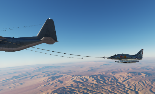
Well, the AI A-4E-C's can refuel in flight. I suppose you all knew this, though. Two of them in my mission each took on about 3,400 lbs. Don't anyone get excited, it still doesn't work when you're the pilot. :) It sure looks sweet, though.

-
I have heard that before. I don't understand why a license can be obtained for an F-18C, an AV-8B, and A-10C (all in active duty) but not an old, obsolete A-4E Skyhawk.
-
Is the A-4 potentially a future project for IndiaFoxtEcho? I can understand if you will be doing nothing but MB-339 for quite some time. But is it in the realm of possibilities once the MB-339 is complete, long range...no promises?
-
It doesn't say what hit Kim's A-10. My guess, a single 23mm shell that exploded on contact? But I'm not an expert. It depressurized both hydraulic systems, but did not 'kill' the engines! I am aware of the lethality of being within effective range. Although, the gun mount that got me was a surprise. I had assumed, incorrectly, that the armor group the fire came from was out of action...completely realistic, on that point! It's not so much accuracy but that a visually directed mount like this has a firing solution at all, except by luck. Do these DShK-38's(?) have a range-sensor, like radar, and maybe a lead-computing sight? When I visually direct an M2 50-cal on a humvee, I can't get any hits. Even after firing a few thousand rounds. Because I don't have much of an idea what amount of lead and elevation to apply and whether tracers are going under the target aircraft or over it, in front of it or behind it...just can't see well enough in DCS. Even when firing at an Mi-8 doing 100 kts, it's difficult. But fly a helicopter within range of an AI machine gun and you're dead, practically every time. The AI gunner seems to always know the required elevation and lead to apply. Even after a 500-lb bomb explodes 100 meters away. There seems to be no human factors worked into the AI...sun-glare, sound dislocation, visual acuity, shock waves, shrapnel, smoke and dust obscurations, and plain old shock and panic. Seems like in some way, these factors could be programmed in, even if a bit crudely. The AI gunners never seem to say "I didn't see it." They never get fooled by looking at where the jet sound is coming from. Nonetheless, this thread was about A-10A vulnerability. It couldn't have been more than a few rounds of 12.7mm and it took out both engine, completely. It could happen, sure. But the likelihood? Very rare, I think. Perhaps my gripe is more with the AI and not so much the A-10A's damage model. But I would think the near engine would have shielded the far engine from damage, and I'd have returned to base on one engine...maybe.
-
Bring A-10A up to "near" A-10C DCS standard
Andrew8604 replied to Andrew8604's topic in A-10A for DCS World
I did. A lot of those commenters said they would pay for an enhanced A-10A module. Me too. I wish I could have greater insight into how these modules are made...how they do what they do. I'm sure that would improve my assessment of how feasible a clickable cockpit A-10A would be. Since we have a clickable A-10C, could it not be modified to be a clickable A-10A? Take away the UFC and the MFCD's. Add the click-ability for the A-10A's weapons panel. Swap out the CDU for the INS. In other words, dumb-down the A-10C into an A-10A. Then the two modules would seemingly have a lot of code commonality, to ease module debugging and maintenance. I would think the A-10C flight model (currently being tweaked?) would be essentially identical to the A-10A flight model. If the current Flaming Cliffs3 A-10A module is so different from the A-10C module, then no, don't put any more work into it if you can spawn the A-10A off of a current A-10C module. Then they could 'sunset' the FC3 A-10. But I can't assess how feasible that is. It's not just that the A-10C takes so much study just to be able to power it up and enable its weapons. It's that when all is said and done, you have such a computerized monster in the "C". I just have an affection for the less computerized "A", its lesser capabilities, and more rounded instrument panel. Nostalgia, I guess. Imagine all the fun aircraft we'd miss out on if DCS only had currently "real-world" operational modules in it. -
Looking at the 80-pages explaining the CDU in the A-10C, I really like "kickin' the tires and lightin' the fires" in the A-10A. But the A-10A is too simplified. NON-CLICKABLE cockpit! I like the "old '80's" look of the A-10A cockpit. I like that simpler to understand armament panel. And just a single "SFMD"...single-function, monochrome display for the Mav's. :) Could DCS either take the A-10C and 'demote and simplify' it back to A-10A model; or upgrade the A-10A? The F-16C is a fun plane to fly. You can get it up and flying pretty quickly...but it doesn't have that GAU-8 gun! For the A-10A module... Phase 1 -- clickable cockpit with most basic panels functioning, and upgrade to the A-10C flight model, if applicable. Aerodynamically, I think they are the same aircraft. Phase 2 -- implement the more complex avionics and targeting/navigation systems...which should be similar to those in the A-10C, but with less capabilities...and therefore, simpler and more fun. Even if they called it the A-10A+ and charged $29.95 for it...I'd purchase it. The A-10C is like the avionics of a Strike Eagle in a Cessna Citation I airframe. :)
- 16 replies
-
- 12
-

-

-
I agree. My A-10A was hit by a few rounds of 12.7mm from a BMP-1 (I think it was), at more than 3/4-mile range, off my 4 o'clock, at down around 180 kts, and it took out both engines!! Dead. No throttle response. One on fire. Really? Now, how can they get me with that hand-guided deflection shot? Yet, I try to shoot down MiG-15's with the 12.7mm (50-cal) MG on a Humvee, from a similar range, and I can fire all day and not get any hits! Do I suck that badly at gunnery? Or are the AI gunners in "radar/laser precision" visually-guided, "can't miss" mode? Such gunners are either upper-body exposed on top of a turret firing a hand-guided machine gun, or buttoned down inside a turret firing a MG with very limited vision. If exposed, explosions and rounds hitting nearby should be almost certain to have negative impact on their moving-target marksmanship. But, no. ...and these were the "average" skill-level AI guys in that armored vehicle. It's as if the AI has the exact firing solution and exact aim at all times, only thwarted by pilot maneuvering after rounds are in the air, or by ballistic limits.
-
I am here because last time I flew the MiG-21 was on June 3rd, this year, and I thought it flew pretty good. That was in the Normandy map (flying there because is looks a little more Vietnam-like). Now, Sept 6th, I fly it again, but in the Nevada map, and v2.5.6.53756. I agree with comments here: Before reading any comments my impression of the MiG-21bis is that it now seems sloppy in pitch and and the pitch trimmer seems overly sensitive, or coarse...difficult to find that "just right" position. Roll seems okay, though. I'm just trying to fly a gentle practice cruise profile, from Nellis, up to 33,000-ish feet/10km, with 800-L centerline tank and 2 R-3S (sidewinders). Went out 250nm and made it back with only about 500-ltrs of fuel. My comments to myself were, "It feels like someone put a big block of lead in the nose." The 800-ltr centerline tank was empty before I could get through 20,000', without using AB and trying to keep speed about 600kmh/M0.72. I used AB from takeoff through 350 kts in a gentle climb. I kept looking to see if the speed brakes were out or flaps or gear or something...like something was holding 'er back. Doesn't seem like a fuel tank and two "Sidewinders" would make that much difference. It sure doesn't on the F-5E, which flies nice, same version, same route, same weather. I could get about 500NM out of it in practically the same config, and get back with 1,100 lbs...and the MiG-21 used to be a 'hotter' jet than the F-5E...not no more. So, something must have messed up the -21 flight model, between June and now. I know my remarks are subjective. It's difficult to be a test pilot and bring back objective results. So updating to .54046 to see if that helps, somehow. Although, by the changelog, it doesn't appear that it should.
-
I like adding Fallon and China Lake to Nevada Map. But how about extending the detailed area of the Nevada Map southward over the deserts to MCAS Yuma and then straight west over San Diego to include about a 1976-1990 version of NAS Miramar -- "Fightertown USA", Top Gun? And then extend the map over the Pacific Ocean out about 250 NM, to include San Nicolas, San Clemente and Santa Catalina Islands. This would make a good long stretch of Map to fly long missions in requiring inflight refueling...from 200 NM off shore San Diego to NAS Fallon in northern Nevada. That should be some 700 NM. Don't include high details north of about 30 NM north of Miramar, to save drive space. So just a rough satellite image of the Los Angeles basin, not really meant to be flown over at low altitudes. Make NAS Miramar a very detailed air base with animated ground vehicles and personnel, so that we can operate F-14's, A-4's, F-5E's and F-18's just like they belonged there. Visiting F-15's, F-16's, A-10's and AV-8B's would fit right in, too. And future F-4 Phantoms and F-8 Crusaders, as well as A-7 Corsair II's and A-6 Intruders would be right at home there, as well. And tie-up a couple moderately-detailed supercarriers to North Island, in San Diego Bay, containing NAS North Island. Can somewhat minimize the details of San Diego suburban areas to save on drive space. The details would be concentrated around NAS Miramar, NAS North Island, and Lindbergh Field. This would all go great with Supercarrier. And, of course, Nellis AFB is right in the middle of it.
-
-
F-14 horizontal stabilators missing anhedral
Andrew8604 replied to mtpiperpilot's topic in Bugs and Problems
I wish they would also allow removal of fuel tank pylons. Seems rare to see F-14's with the pylons without fuel tanks on them. I'd imagine that also has already been pointed out? -
In a nutshell -- I contend that real F-14 Nav/Position lights flashed in unison with Anti-collision lights, most of the time. (As well as on the F-4B/N and F-4J/S Phantoms) Living near NAS Miramar "Fightertown USA", I observed a lot of F-14's from about 1976 to 1987 (most likely all F-14A's). I was a fanatic! (before Tom Cruise) I watched a lot of them at night, through a 40x , 60mm, f/15 refractor telescope, with image erector...believe it or not. I was good at manual acquisition and tracking. I could resolve the split nav lights on the wing gloves from about 4 miles. I could quickly recognize an F-14 at night by its lights because they were so distinguishable. I could see them turning in their PAR patterns while listening on a UHF radio to Approach Controllers giving them vectors and their short responses with noticeable engine whine in the background. Wingtip and glove lights told very well how they were banking in their turns. And then the Final Controller would come on frequency and give glide-path and course status/corrections with no need for pilot responses. I could see the color of the approach lights...amber, red, green (sort of bluish-green). Now, it was a long time ago, but I'm pretty sure I remember seeing all lights blink off-n-on in unison, except landing/taxi light, approach lights (usually) and formation lights (green strips). They seemed to be illuminated longer than off when flashing...assuming a flash rate of 1 cycle per second, they seemed to be on for about 70% of that second...and their illumination didn't cut instantly off like modern LED lights, it faded down to off in like a 1/10th of a second and came back on with about the same delay. So not 50/50, on/off, but more like 70/30. Those were incandescent bulbs. The lights on this Heatblur F-14B seem just as I remember as far as positions, I'm sure they got them exactly right. But I'd swear I remember seeing all Nav/Position lights, including wing glove lights, flashing in unison with the nose and tail anti-collision lights. When the F-14 would make its high speed descent for the overhead break, at night, I could see a 'slanted' line of three, evenly spaced red lights flashing in unison, viewed from the port side. That had to be the nose light, wing glove lights, and left vertical tail red light. I can't replicate this distinguishable feature in the Heatblur F-14B. Not to mention that the DCS graphics engine does not seem to be able to display lights properly from a distance in DCS. It seemingly tries to draw them real size with limited contrast, when human visual acuity sees them larger than they really are due to their intensity against the black sky from a distance at night. They need to be 'artificially' brightened and enlarged just a bit at a distance. But that may be difficult when dealing with the limited number of pixels in our displays.
-
Yep, I agree. As well, for jets. People want the F-4 Phantom. Mostly used in combat in Vietnam. But then want the F-4E, which was only used near the end of the Vietnam war. Whereas, the F-4B and J and F-4C and D did most of work. So I would want the F-4B Phantom, with all the limitations it had. So, for the F4F Wildcat, I'd want the F4F-3 and F4F-4. Already pointed out here that the difference is the F4F-4 was to have powered folding wings and six 50-cal guns. That was too heavy so they made the wings non-powered where the flight deck crew had to fold them and unfold them (and I think limited the ammo). Then the FM-1 was made by GM as identical to the F4F-4 but with only four 50-cal guns...I believe while Grumman started building the F6F. The F4F-3/4 and FM-1 had the Pratt & Whitney R-1830 (14-cyl) with two-speed supercharger (not turbo) for use at high altitude (like the P-51D in DCS has a 2-speed supercharger, non-turbo. In contrast, the P-47D has a turbocharger and a 1-speed supercharger). Later, the FM-2 was made for use on the smaller escort carriers, having the more powerful Wright R-1820, single-row (9-cyl) engine with 1-speed supercharger for low altitude, close air support and ASW work. It was more powerful until it got up to 15,000 feet or so, I believe. BTW: escort carriers were generally intended to escort slow amphibious task force ships and could only do about 19 knots. The old slow battleships where assigned to the amphibious forces. In contrast, the light carriers were fast ships (31.5 knots) and could serve in the fast carrier task forces, escorted by fast battleships when North Carolina arrived. And so, light carriers and Essex carriers (and surviving Enterprise) received F6F Hellcats while escort carriers got the FM-2, in '44. We really need two versions of the Wildcat in DCS: The F4F-4 (and very similar F4F-3 and FM-1) and the significantly different FM-2. I think the best known battle of the Pacific was the Battle of Midway. I think there should be a Pacific Map for that. Very little land...it's a carrier-battle map. That was fought mainly with the F4F-4, TBD-1, and SBD (not sure which version of the SBD), and one class of carrier, the 3 Yorktown's. I'd love to fly the TBD-1 Devastator. (while others would insist on using F-18's with Harpoon missiles) I'd like to see those, along with the appropriate Imperial Japanese ships and planes. The Yamato was part of this battle's forces, I believe. I'm sure people would want to bring that ship into action in user-created scenarios in such a map. That was June '42. Thereafter, the F4F-3's and -4's made Navy and Marine Corps aces over Guadalcanal and the Solomon's, in '42-43. Sure the Wildcat isn't the best fighter...the F-22 is much, much better. :smilewink: But it was the best the US had to do that job at that place and time. Good pilots made it work. And so, we want to re-create and experience (and experiment with) the planes of that time and place. ...not use F8F Bearcats and mop it up! Although, the neat thing about DCS, is that you could use Bearcats and F4U-1D Corsairs in the Battle of Midway, if you wished. :) (once we get all that)
-
Can there be some anomalous propagation bending of the radar beam around the surface of the Earth?
-
The question is really: How big can a DCS map be? And how large is the memory footprint of a 500km x 500km map that has no land at all, just sea, with a flat sea bottom at about 1km depth? Would it be less than 1 GB? I would think so. If that's the case, why not make an arctic map? Or a generic ocean-only map where you choose the Lat-Lon and wind and weather. Just for carrier aviation, surface and sub-surface naval vessels. Oh, but the ice would have to be essentially like barren land surface. So, lets see...nuclear submarine below the ice, aircraft above the ice...never to interact with each other. Ok! WTF? LOL What are "winter speed trees"? Now, an Aleutian Islands map might be good. How about a frozen Falklands map? Are we ever getting a Falklands map?
-
Are we not allowed to know what the maximum map dimensions can be? I haven't seen anywhere how large a map of nothing but ocean can possibly be and what the limiting factors are. I wonder if it has something to do with curvature of the Earth and the current DCS terrain model or coordinate system may be flat-Earthed? Also, I think ocean area should be contoured where depth is less than 500 feet and textured where depth is less than maybe 100 feet, putting a flat floor at maybe 2000 to 3000'. Much of the Pacific ocean is on the order of 8,000 to 12,000 feet deep, I think. Practically bottomless. Nothing goes down there, as far as I know...or if it does, it doesn't come back. I think WWII Balao-class submarines could dive to about 500-feet before things started breaking. Wikipedia says Test Depth 400 feet. But in the book about the USS Tang, the captain said he took it down to where something finally sprung a leak and that was around 500 feet. Only the crew of that sub knew how deep they went. They did not tell anyone else, not even brass. Although, the engineers that built it, probably had an idea. It was a closely guarded secret. I know this is a "flight simulator" but being able to command submarines and surface ships would be a whole new ballgame for DCS. That would be pretty danged cool. It should take less computing power than simulating an aircraft. Although, sub patrols are lots of boredom getting into a firing solution. Not much in the way of scenery when submerged...like absolutely none below periscope depth. :) I very high fidelity sonar simulation might be cool. And being able to move to all the various compartments in the boat would be a cool thing, too. Not a thing for the arcade-minded, blow-it-up-again-and-again DCS flyers. :)