
Rongor
-
Posts
1603 -
Joined
-
Last visited
-
Days Won
3
Content Type
Profiles
Forums
Events
Everything posted by Rongor
-

Best way to recover lost alignment after loss of power?
Rongor replied to Rongor's topic in DCS: C-130J
some irregularities with LSGI Thanks for the hint. Found the solution right next to it: MAIN MENU > NAV SELECT > EGI POWER > MASTER EGI OFF > VERIFY EGI OFF resets alignment and resets AUTONAV in the CNI-MU back to big font, so you can initiate fresh alignment there. -
Placing the new C-130J for cold start form ramp onto Wunstorf airfield auto-moves it to Hannover airport, so I guess the parking positions if Wunstorf don't accept the Hercules (by size)...
-
fixed internally C-130J is not available if you choose germany in the ME
Rongor replied to Butcher59's topic in Bugs and Problems
If you run out of patience until this is patched, you can add in "Germany, " into line 864 of Eagle Dynamics\DCS World\Mods\aircraft\C130J\Entry\C_130J_30.lua or replace that file with the attached C_130J_30.lua... No idea what the Integrity check will say to this though, so might not work when joining your favorite MP server. This file then should automatically be replaced again when the patch is coming. -
are you sure you are in the correct subforum? This here is for issues around the C-130 module, which is a payware DLC for the free DCS World. Regularly in DCS, you alternate mouse control use between moving either the cursor or the view. If you are in view mode, you can't click on anything. If you are flying a low fidelity module such as any Flaming Cliffs aircraft or the Su-25 in the basic free DCS, you also can't click on anything as these don't have clickable cockpits.
-
Say I am still sitting on the ground and a brief power outage corrupts the EGI alignment, what is the procedure to realign? Initiating the Autonav again isn't possible since it doesn't return to the big sized format...
-
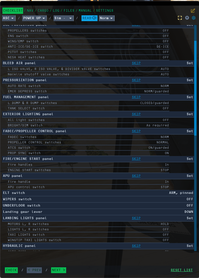
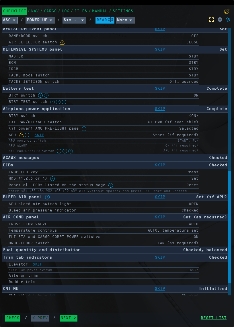
This is valid for the "sim - no tests" realism setting. Checklist wants the crew to power up the AIR COND (2nd image). This will fail because the Pressurization switch to Auto item is missing in the preceding Pressurization panel section (1st image). Hence the switch will still be in AUX VENT setting (which is the current default for cold ramp start spawns), which will deny setting AIR COND to ON. Only on the following Before starting engines checklist this gets remedied, as both systems get addressed again, this time with the correct Pressurization mode switch setting mentioned.

-
- 2
-

-

-
Mouse polling rate bug / in external view camera movement and turning button
Rongor replied to eror85's topic in General Bugs
Logitech g502 hero, same issue. With 1000 Hz I had total freezes as long as I moved the mouse while sitting in cockpit. When I stopped moving the mouse, all went back to normal. Could reliably solve it by restarting my PC and/or restarting DCS. Appeared randomly, but when it did, then only with the very first launch of DCS. Only now I did install the Logitech Gaming software, as this is the only way to adjust the poll rate. Reduced it to 500 Hz and currently don't run into this issue anymore. -
If you fetch resources from an airfield to generate cargo, the cargo always adds 3300 lb when loaded into any aircraft. No matter if you only order a single Sidewinder or 23xGBU-24, the resulting package will have a mass of 3300 lb. While I can assume this might still be w.i.p., I couldn't find any mention of it in the forums, so to make sure its getting attention I provide this report with attached (short) track. The calculated mass total of selected stuff in the resources window is correct, yet when the package is created, it only ever has a standard mass of around 3300 lb. Besides it being unrealistic to be able to carry 100k lb of ordnance with this method it causes problems for the lighter weights too, as for example even with zero fuel a Huey is instantly overweight when loading a cargo of 3300 lb. Attached track demonstrates this with a Huey, loading a Sidewinder (189 lb) and also 23 GBUs (55k lb) and in both cases receiving 3300 lb additional load.Foothold-GERMANY-COLDWAR_V3.81_mad_v3-20251030-175227.trk Also tested with CH-47, same results. I could take off with 80 AIM-54C on board, no problem...
-
Tbh I wasn't aware the A-10C II did ever receive a gateway function already, be it with the implementation of the ARC-210, before or afterwards. So in my world, seeing a L16 Viper, Hornet or any flight's PPLI on the TAD seems wrong at this point, regardless A-10C or A-10C II, so I think the OP has a valid point. ED's manual for the A-10C II doesn't mention any gateway at all. Regarding datalink and TAD, it specifically focuses on SADL, which is incompatible to L16. I don't see how the fact that we can see L16 PPLIs on the TAD is basis for the assumption that we received a gateway capability. For now its a bug, unless ED confirms this is intended as simulating a gateway in any of the both A-10Cs we have.
-
No idea what DTC issue you are assuming, since the partition containing navigational points hasn't been implemented so far. As above, its a result of a wrong utilization of the route tool. Enter elevations, otherwise any point will default to 6523 ft. Also FIX would be the wrong method to "fix" this, as 1. this is an altitude issue and 2. you would only adjust a correct alignment to a different one (with a wrong system altitude).
-
What you describe there is the result of you not entering elevations in the route tool. You seem to assume the route tool will set each new STP at ground by default. It doesn't. By default its at some 6500 ft or so. I can agree this isn't optimal but you just have to deal with it. If you ignore this and load in your route with all STPs at 6532 ft, its only correct to expect the TGP pointing into higher elevations, touching the ground only in the distance if at all.
-
You never mentioned exact boresight distances and stations. Also you didn't mention these for your handoff attempts. So this could still all be coincidental. For each of the both smart stations carrying Mavericks, you have to boresight independently. After both boresightings, both stations' Mavericks will point exactly at the TGP's POV only at the exact distance, relative nose bearing and elevation as both the TGP and the respective station's Mavericks were in the moment of boresighting. If you boresighted the left station at 4 NM and then later attempt to handoff to a Maverick at 8 NM, a maverick hanging under your port wing will point to the right of the target. If you boresighted the starboard station at 8 NM distance and 4000 ft altitude and then later try to handoff to a maverick on that station from 20000 ft and in 4 NM distance, the Maverick will also point to the right of the target and the chance of seeing errors in elevation will be be high.
-
With today's 2.9.19.13478 this seems to be fixed.
-
Can confirm this has been fixed with today's 2.9.19.13478
-
check procedures weapons not ready with George
Rongor replied to mla306's topic in Bugs and Problems
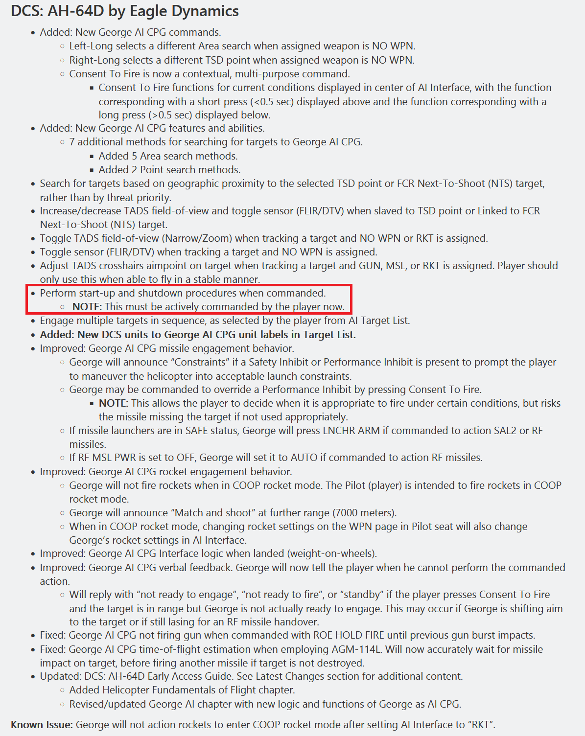
DCS 2.9.18.12722 - 22.07.2025 A lot of nice stuff has been added in July. Read more about how George as CPG is managed on pages 582-603 in the manual. \Eagle Dynamics\DCS World\Mods\aircraft\AH-64D\Doc\DCS AH-64D Early Access Guide EN.pdf
-
I can replicate this. Precondition for this to happen is that George has armed the weapons at least once before you end your flight. Then ordering to shut down after landing will end up in his "aircraft is armed" loop, regardless if you wait for him to finish shutdown before cutting power or not. less than a minute trackfile attached. Hot start on runway. Brief takeoff, random PHS slave search (so George does arm), landing. Ordering shutdown. Waiting until completed, cutting engines. "aircraft is armed" loop. George shutdown aircraft armed.trk
-
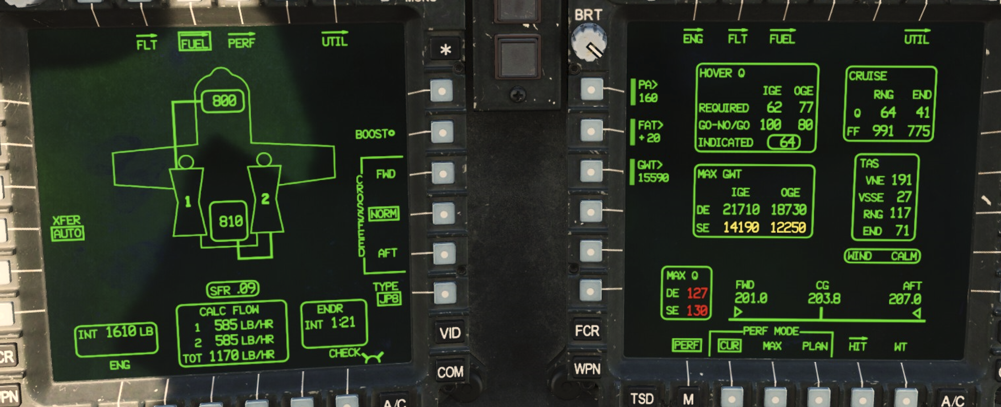
Cruise and TAS boxes don't really correspond well in regard to RaNGe and ENDurance. In my example best range Q is shown as 64% TRQ in the Cruise box, while the TAS box is showing 117 kts as the maximum range speed. Max endurance Q is supposed to be 41% at a speed of 71 kts. Lets focus on maximum range speed, 64% at 117 kts. Bottom line is, these tandem values are impossible to achieve in DCS. With a TRQ of 64% I merely achieve 104 kts in level flight (I even allowed a slight descend to keep that speed), so around 12% lower speed than required for maximum range as per the TAS box info. Also the fuel flow in the Cruise box for 64% Q is predicted 991. Checking on the Fuel format page, the calc flow for the current 64% is 1170 in total, which is 18% above the prediction of the PERF format page. Brad mentioned in discord that drag can affect the values. But I am a bit surprised to see the deviations being that enormous. Even in case the prediction fails to be accurate, how can predicted Q and speeds mismatch that far? No, I can't provide any real world data on "how it should be". Rather I am clueless if this is wanted as designed and want to bring this to your attention in case a further refinement is required. Its the size of difference, which lets me doubt that this is correct. Yet maybe it is? If these deviations are realistic, I am curious how the PERF data can be of use in any meaningful way IRL when in fact the values are unreliably off from the actual state of your flight. I wouldn't even know what to actually aim for when attempting maximum range flight, 64% torque or 117 kts? Or are these parts of the PERF page ignored IRL due to their inaccuracies and at least for maximum endurance I rather have to rely on the SFR of the FUEL page? This is a few moments of my flight, before the screenshot above was made. (unlisted video)
-
- 1
-
-
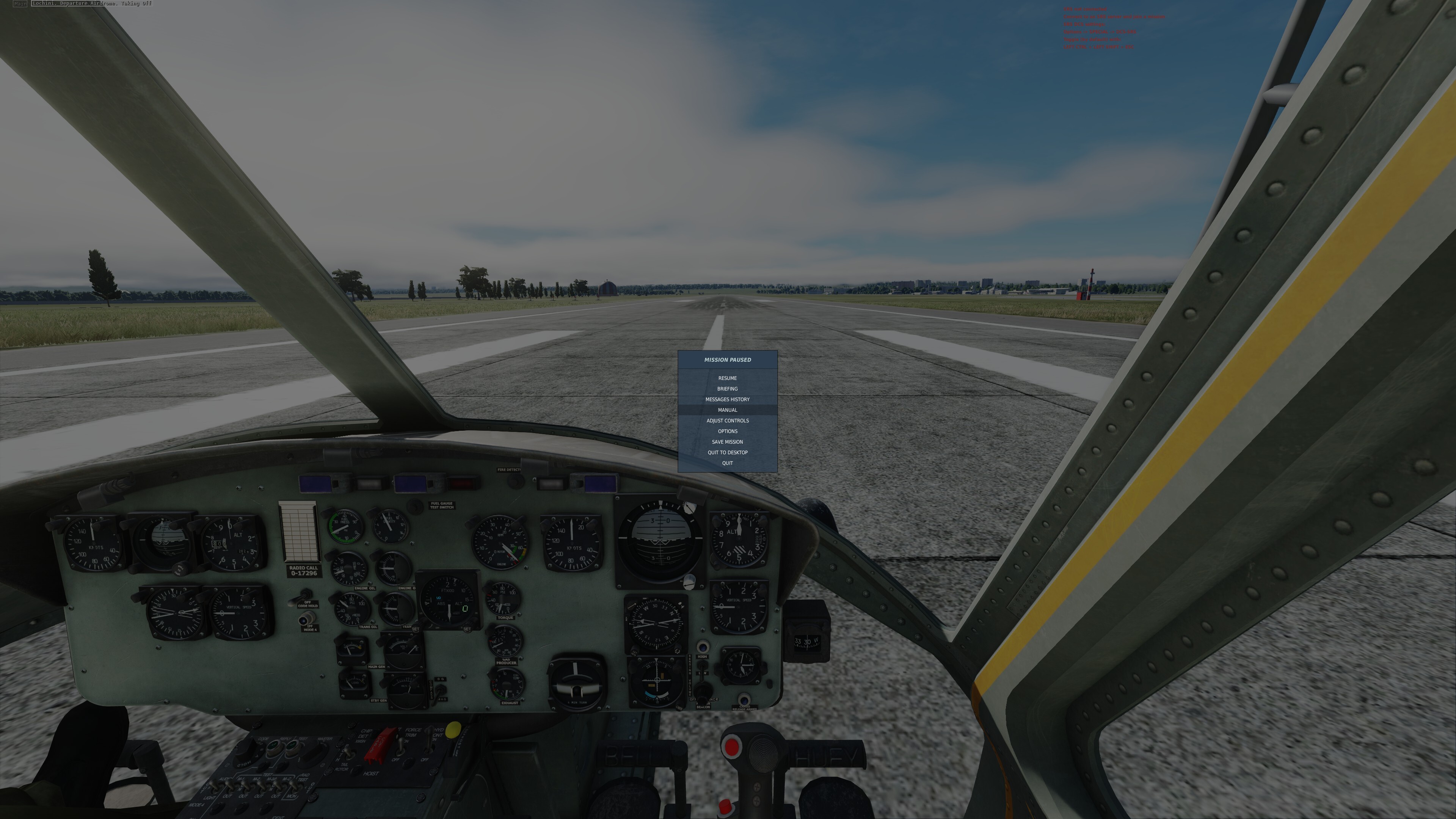
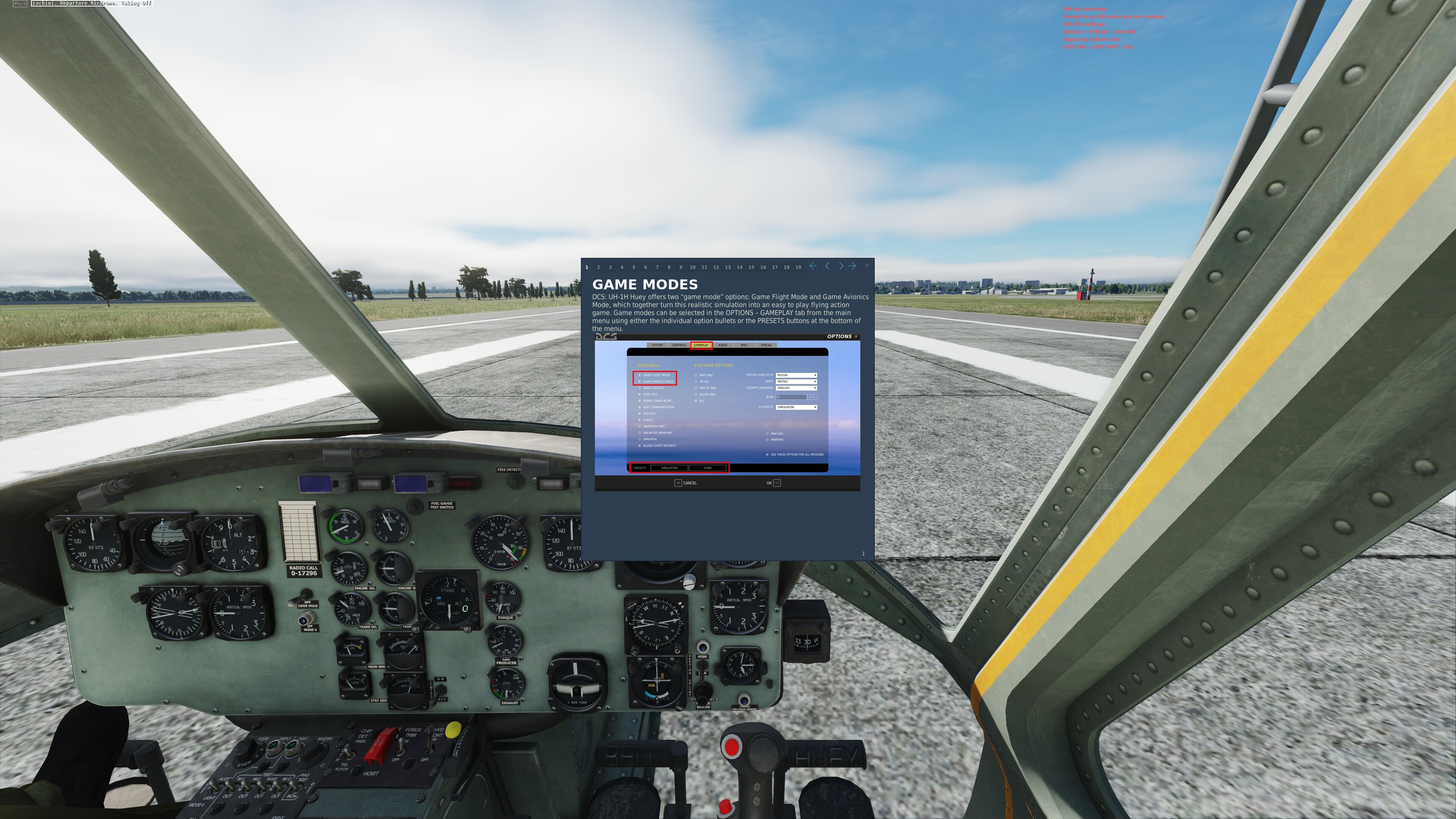
A new guy stumbled over this and reported it in the discord. I never did notice this myself so I am not sure its a (recent) bug or has been like this all the time... For some reason the Escape menu lists "manual" in the Huey and when opened it does introduce the player to game modes. Is this intended?
-
I remember how at some point ED implemented the TGP needing a full restart (manually chin station power off/on) after rearming on ground (since its counted as a new TGP). Now the AAQ-33 isn't affected by this. Landing with a working ATP and then rearming doesn't affect the AAQ-33 at all. It simply continues to operate just fine. I have no idea if this is intended to work differently for the ATP now (well thanks if it is, so we don't have to endure the ATP's 12 minutes initialization after each rearming) but in case ED has simply forgotten to apply the same logic as with the AAQ-28, I just wanted to give notice
-
Dropped LGBs don't track moving targets in point track. Impact is around the area the target has been put into point track. Not sure the laser is active at all. I did see this issue with auto lase and manual lase. Stationary targets in area track/INR have no issues when attacked with laser guidance. Even manually slewing of the laser spot across the ground is changing bomb trajectory as expected. Issues only arise in point track. Trackfile shows GBU-12 attack on moving tank. Tank is getting point tracked. Laser is auto-lasing 15 seconds before impact. GBU-12 doesn't show any sign of steering attempts. A-G is on CMBT. TGP code and bomb code are default 1688. AAQ33_PointTrack_no_Laser.trk
-
no workaround needed. Offset Aimpoint is what its called.
-
You create an offset aimpoint for that steerpoint. Get into the Destination Offset Aimpoint DED pages and add the given range and bearing. Procedure is explained in the manual page 204.
-
When spawning a Hornet, regardless hot or cold start, selecting the Guard channel in any of the two radios will show an empty frequency. Players won't be able to transmit or receive on Guard. Workaround is to load the DTC Comm partition via the MUMI page (default DTC will do, without entering and selecting a DTC in the manager) I am not sure this should be required. Same issue for the C-preset. 2 radio G and C.trk
-
Thanks, regarding the TMS aft, that will do. Why though? It is supposed to maintain line of sight to coordinates, which it can do fine (within accuracy limits) during masking and switching steerpoints. What would be the purpose of a single TMS aft to exit POINT or AREA correlation if even basic INR is also requiring an image to correlate? So far I understood that INR is maintaining the line of sight to coordinates, even when slewed. That is exactly why it is recommended to switch from AREA or POINT to INR before the TGP is getting masked. This is contradicting the manual, which clearly states that there isn't any image processing in INR. Which only makes sense: Since the TGP doesn't need an image to stabilize on a set of coords when switching steerpoints, why would it need an image to maintain line of sight (of course this won't be pin point accurate) on the most recent coords we slewed on? This is basically the idea behind exiting the correlation track modes into INR, so I am a bit confused now about your comment claiming otherwise. page 382:
-
I might be willing to believe that this is accurate only I can't see any argument presented why this should be the case. What you describe is exactly what I described before. I am glad you experienced the same as I did. Only how is this any hint that this is accurate? I know that the TGP is attempting to correlate an image, only I don't see how this is a reason to prevent TMS AFT from functioning. On the contrary, TMS AFT would be the logical method to stop the failing correlation by putting it into basic INR. Also the CZ next to OSB9 is evidence there is a Cursor Zero available. You can achieve it by pressing that OSB, so what is the benefit of locking out TMS aft to force the pilot to take his hand off a control to press it? This effectively means an unnecessary degradation of HOTAS capability (admittedly a temporary and arguably unimportant one) and I can't see why avionic designers would intentional prevent TMS aft to function in this very moment. I don't. What I expect is the TMS functions to work normal. Which in this case TMS aft doesn't for unknown reasons. It may be accurate yet I don't see how we know it is.