
Rick Mave
-
Posts
193 -
Joined
-
Last visited
Content Type
Profiles
Forums
Events
Everything posted by Rick Mave
-
Yeah it's in need of some refinement ^^
-
Great resource on NLP Operations: https://www.geschichtsspuren.de/artikel/luftfahrt-luftwaffe/113-autobahn-notlandeplaetze-nlp.html Various military sites in and around the city of Bremen but including one NLP: https://www.relikte.com/uebersicht.htm
-
Yessir, will do!
-
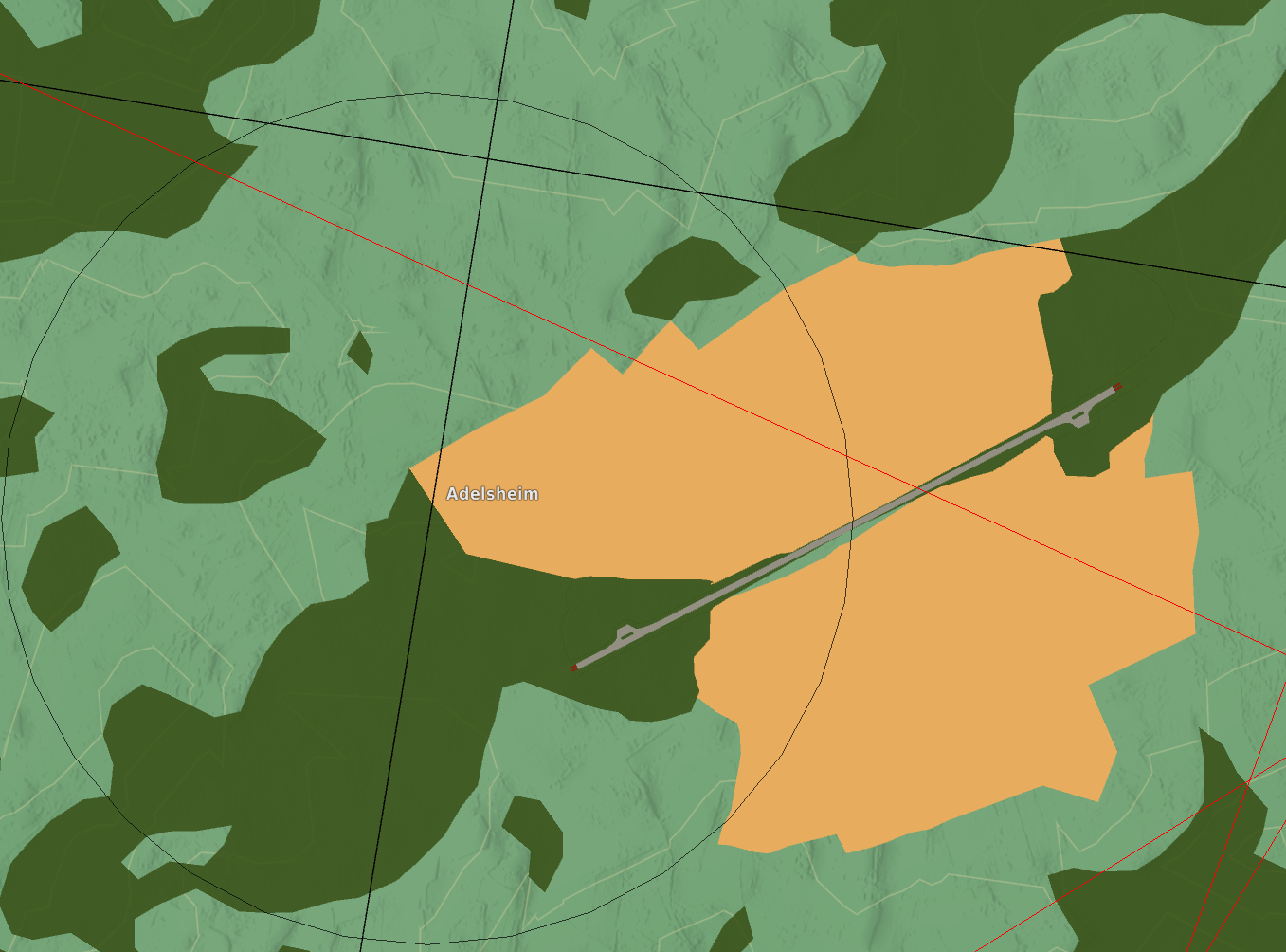
Has the Adelsheim NLP been fixed? There were trees on the runway and the map icon was not on the NLP. It was also not connected to a road and the terrain surrounding it looked very odd. I can write a bug report if that's needed.
-
You can change it if you'd like you know.
-
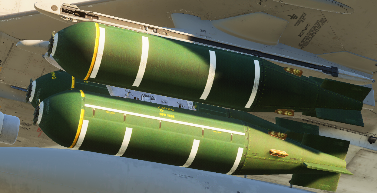
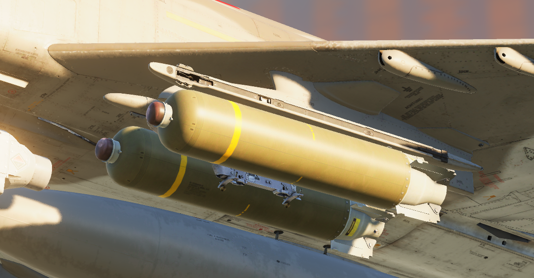
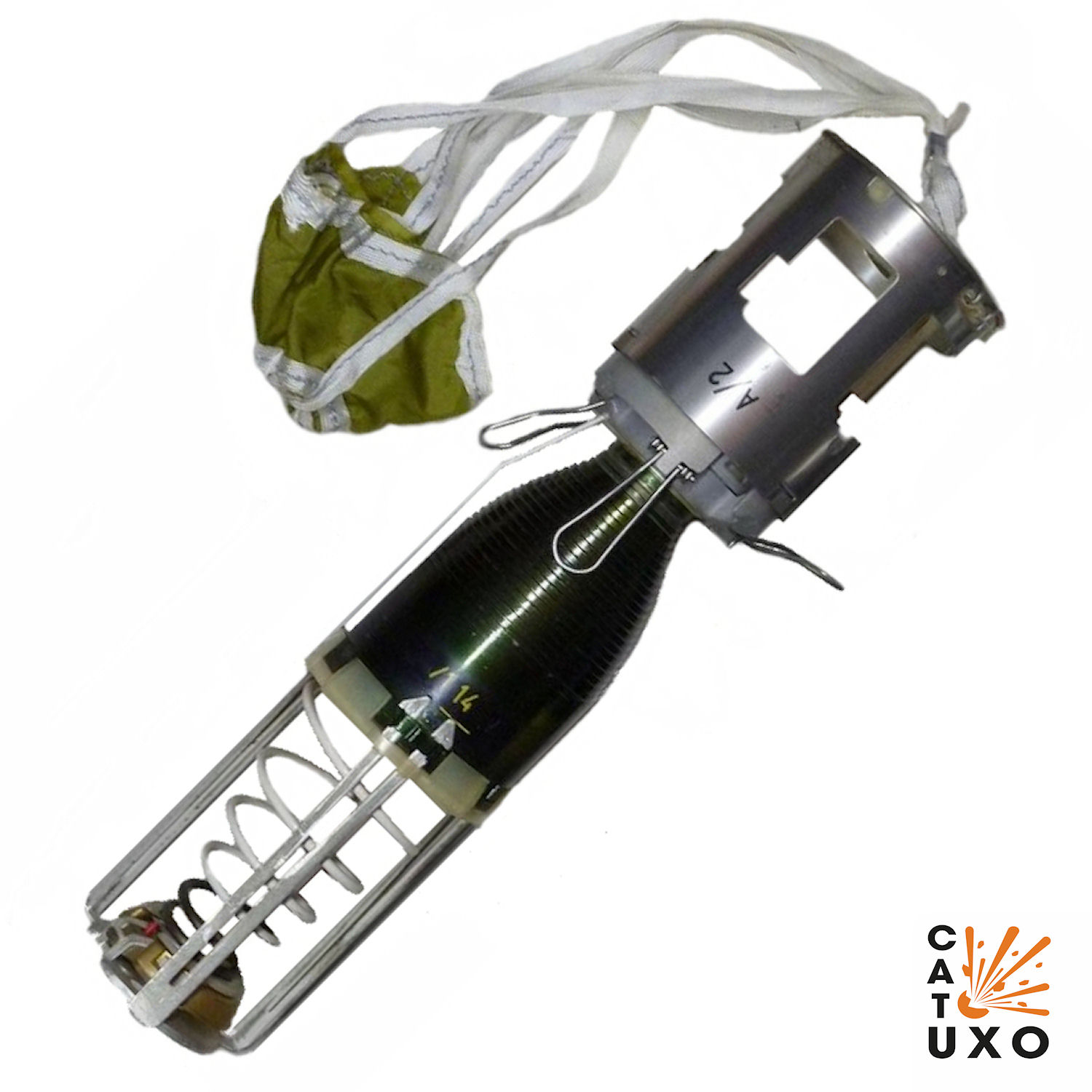
 I want to propose a rework of the BL-755 bomb and the addition of the mkii variant with chute retarded submunitions. The BL-755mk2 saw extensive use in the GAF and RAF, and is currently missing from DCS entirely. Currently we are encountering some hurdles when trying to recreate the low level ingress bombing runs that the GAF favoured in the 80s, using the BL755 that is in the game. The BL755 that is in DCS has an arming delay of 2 seconds, resulting in the frequent deployment of duds as it forces us to go above the realistic run in altitudes. This results in a run in of around 300ft, as opposed to the would be realistic ~150ft altitude at release of the bombs, as well as puts the aircraft at increased risk due to the free fall submunitions reaching the target significantly faster than a chute retarded submunition would. Would it be possible to implement this bomb in DCS? Further, the current model of the bomb is in a pretty poor state visually, compared to the more recently reworked CBUs like the CBU-87 https://cat-uxo.com/explosive-hazards/submunitions/bl-755-mk2-submunition
-
Honestly, like I said before: None of them really need it. The map is great as it is, especially the airfields. What I would love to see, are some historically accurate layouts for FARPs, artillery positions, field C2 posts, etc. Either way, some of the more popular airfields so far are definitely Ramstein, Spangdahlem and the Fulda Heli Port.
-
We absolutely need the French corner that housed the POLYGONE EW Range around Ramstein. https://de.wikipedia.org/wiki/Multinational_Aircrew_Electronic_Warfare_Tactics_Facility_Polygone
-
If you have the .hgt data files for the region from the SRTM Mission (Publicly available data from NASA), you can get terrain data for basically any region on earth to be displayed in TacView. That will NOT have the airfield locations and runways displayed though obviously.
-
Finally there will be a Fitter with more than eight Polygons on its 3D model! Looking forward to this one!
-
Yellow Follow-me hummer livery
Rick Mave replied to RWC's topic in Flyable/Drivable Mods for DCS World
The little guys inside have the default green digital texture unfortunately. Other than that the skin is great! -
-
I found one! There are currently trees growing on it and there is no road going through, but it is something. I suspect @MAESTR0 and team made an infrastructure "module" similar to the SAM positions that they are going to place around the map where they were located historically? Maybe you can shed some light on this. Here it is for comparison: https://www.mil-airfields.de/deutschland/autobahn-notlandeplatz-nlp-adelsheim.htm If anyone finds any more of these, post them here!
-
- 3
-

-
Looks like you can get the entire thing for around 80 EUR. Do you know if that link is dead or if this still works?
-
Nice, I will take a look at those @Otulf
-
Hi everyone, since there are no charts maps or diagrams included in the Germany CW map by Ugra Media, I want to open the topic here and share/discuss any possible sources and charts we can use for our awesome missions on this map! If you have any period correct charts and you are willing to share them, please do so here. I am aware of the MilAIS.org page which publicises the CENOR FLIPs and other charts, however these are not particularly usable any more since there are several severe discrepancies between them and the map we have in the game. Thanks in advance and I am looking forward to see what you have to share, Rohrkrepierer o7
-
Table of Frequencies / Runway Lengths, Elevations
Rick Mave replied to Avio's topic in DCS: Cold War Germany
https://www.digitalcombatsimulator.com/en/files/3344398/ -
Just some observations as a German living near Fulda
Rick Mave replied to Fauda's topic in DCS: Cold War Germany
I noticed last night that the Jettenbach Quarry north of Ramstein Airbase is missing. It's used as a VRP for northbound departures. -
Personally, I'm suuper happy with the map, however there are some points In ouod like to see refinements/improvements applied to: - SAM site infrastructure: there are 40 in total, but there are only 4 different templates as far as I can tell, which have been placed in the historically accurate locations (HAWK, PATRIOT, SA-3 and SA-5(I think that's it, please correct me if I'm wrong)). I'd have appreciated some NIKE SAM site infrastructure as well even though we do not yet have a NIKE SAM itself (same with the SA-4 which was all over the place in the East). - Historical Airfield charts and approach/departure documentation is completely missing. I think it is very important to provide these for a map that is not set in the present or recent history, or at least provide sources where one could get these from. - Shelter types used in East and West Germany looked different, yet on the map there are shelters that are both on the east and west side of the iron curtain (example: Pferdsfeld) - Some of the terrain can look like it's stitched together with very differing levels of fidelity. Farmlands that look very very nice are bordering others that are just the satellite image with a normal map overlay. I have no doubt this will be improved upon in the future, however at the moment it can look a little distracting in low level flight. All in all though, fantastic map and very much worth the purchase. I'd rate it.
-
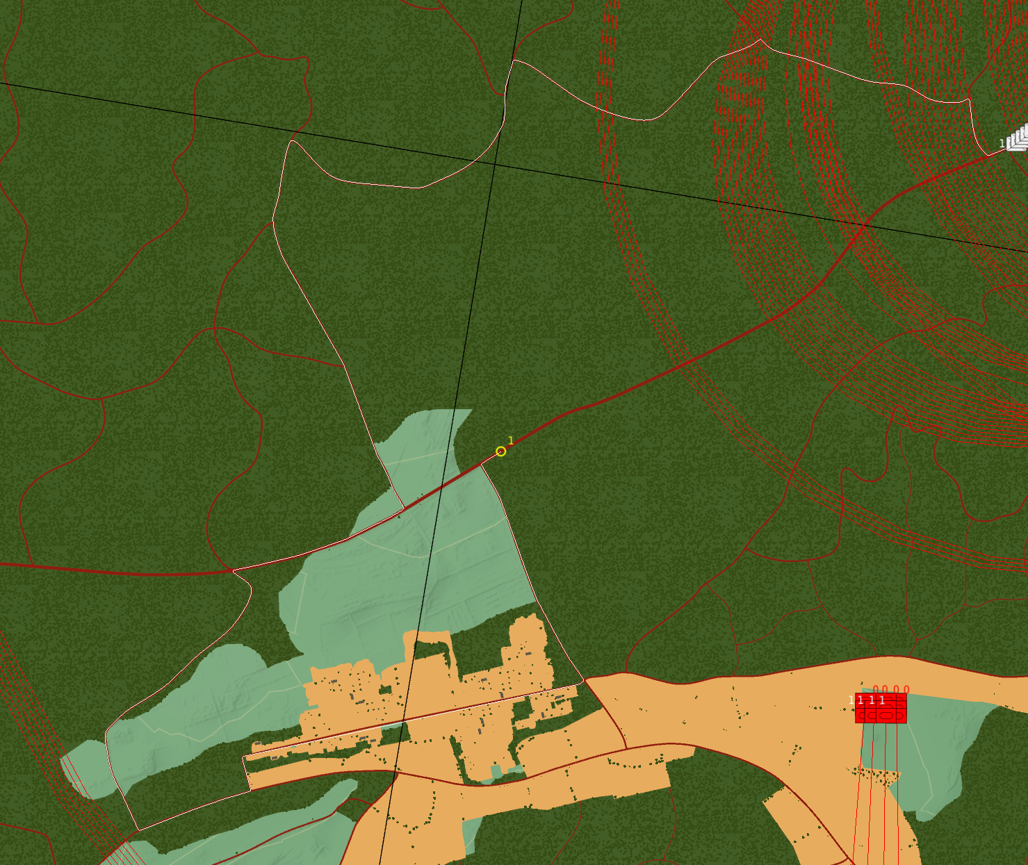
Anyone else experiencing very weird pathfinding decision by ground units when set to "On Road" and moving on the Autobahn? Specifically this is happening in my mission along the A4 and A64 near Bad Hersfeld, Alsfeld and Fulda.
-
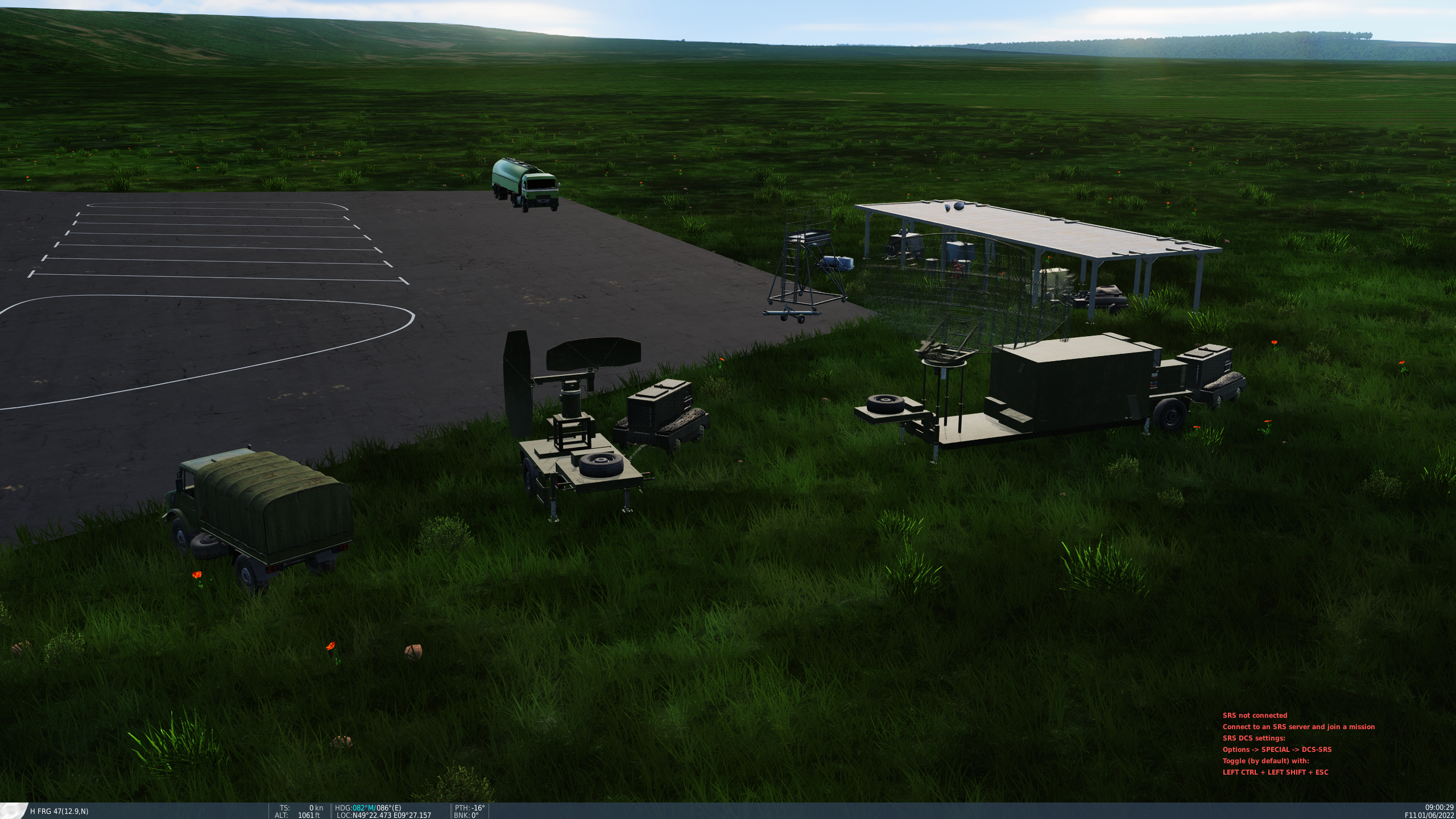
Does anyone have photos of HOW exactly the different Systems would be placed around the two different types of compounds? I have yet to figure out where exactly to place the Patriot in one of these since there are two elevated platforms for both the HAWK site compound and the Patriot one. The Patriot only has one S/TR Radar and the HAWK has three different types of radars. The HAWK template even comes with two tracking radars. For now, since there are so many HAWK sites, I reduced them all to one TR each. Would be interesting to know how exactly this was supposed to be set up. Same with the soviet sites. Usually they come with a mobile EWR. Which one would be placed on TOP of the revetment? The Search or the TR? (I assumed the TR if it was not a mobile system like SA-4 or SA-6).
-
I took a look. Currently trying to work out if I can port over the Cold War IADS project to a miz file without manually marking down all the sites myself. It should be possible but it probably requires a little more fenagling at the moment.