shu77
-
Posts
1689 -
Joined
-
Last visited
-
Days Won
6
Content Type
Profiles
Forums
Events
Everything posted by shu77
-
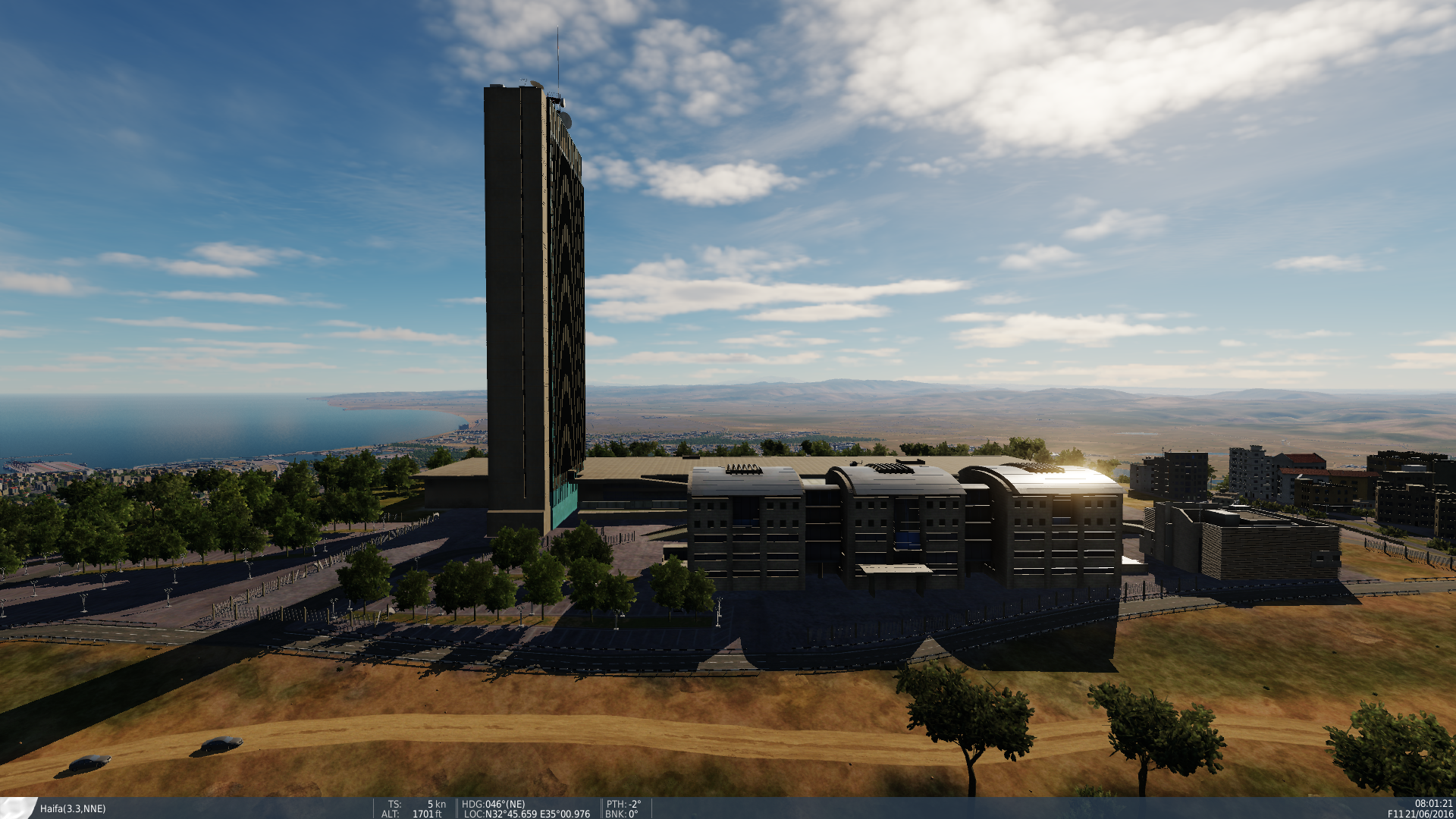
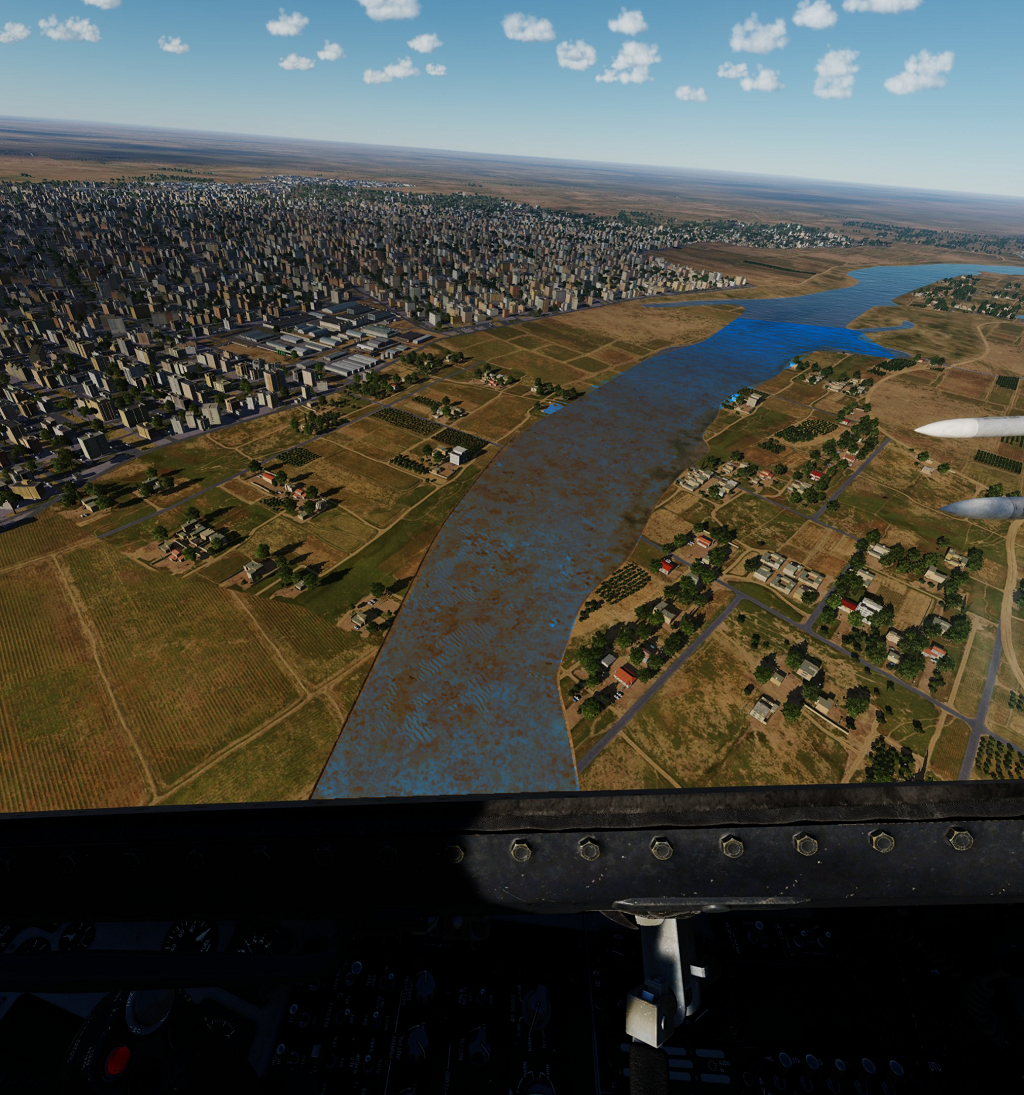
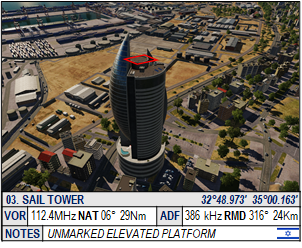
Came across this the other day. Not sure what the building is called but noticed some issues with terrain placement, Picture one identifies the location, Picture two the problem.

-
Personally I think the issue could likely be resolved by giving the Riverbed/ocean floor texture an aqua or Yellow tinge/filter, In particular I figure the Medeteranian coast line does not have the Azure look I imagine. I dont undertand how the textures work well enough to do a Proof of concept or where else that specific texture is used. Here's a rudimentary example by throwing a very quick filter over one of the examples above, I just adjusted the color balance for the section, but I think it would resolve the issue of the transparency:
-
Looking forward to seeing Cyprus come into the game, but also quite keen to see the mainland airfields finished out.
-

Are there plans to include wave foam on the coastline?
shu77 replied to Bigounet's topic in DCS: Marianas
More to that point I think the coastline texture needs a bit of a rework, with the updated transparency of the water it seems any shallow body including the ocean looks brown rather than blue. -
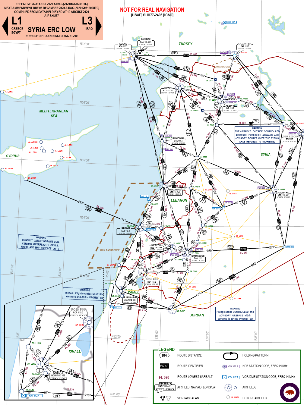
Thanks, pretty much all of my content is mastered through Powerpoint, but I've been increasingly formatting in Excel so I can just pull it across. The main reason I havent implemented more data in the ERC is the issues in keeping it updated so this would help
-
All good, got a copy from one of the other links after I said that. Top work guys thanks for releasing!
-
Dropbox link is now throwing a 404 error, was it removed?
-
Which file are you looking at to find that? It would be much nicer to be able to pass that and automate some of the collation rather than having the easter egg hunt with Bailey and ther other regulars each time
-
Thank you. ED Seems to periodically change these for some reason, it becomes a real challenge to catch them each time
-
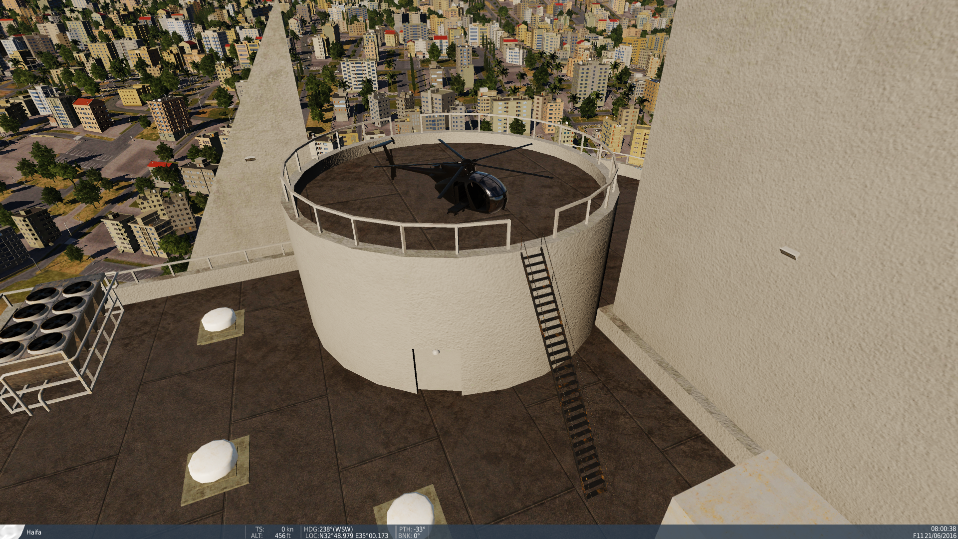
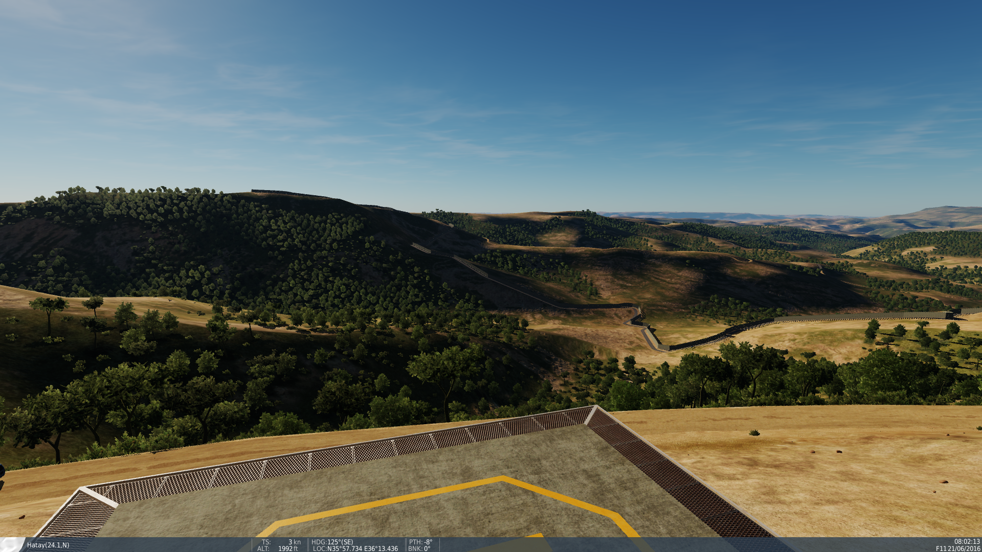
Found a new Helipad Spawn Clips through the surface
-
Can confirm its not on my install, Have you tried a DCS repair or a reinstall of the map?
-
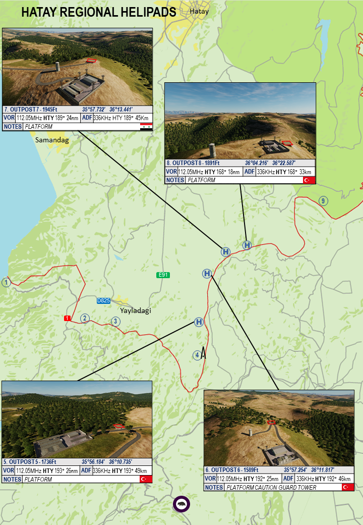
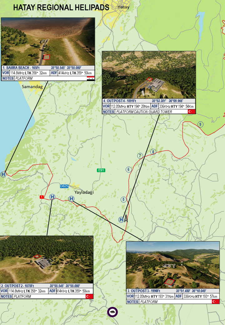
Finished my run through, Diagrams updated to include all current helipads.
-
Airfield Diagrams 4.5 and Helo Supplement 1.6 Released, includes photos of all Helipads
-
I gave up posting updates last night, but have visited all of these now with the exception of the Kiryat/Rosh Pina pads to the east of the Sea of Galilee, which will be their own little effort over the next day or two as they outnumber the rest of the map. Let me know if you'd like to Keep getting updates here as there are a couple I havent published, or would just like a link back to the updated documents when complete.
-
Jaber Crossing Jordan Listed as Jaber North and Jaber South
-
Dortyol Refinery, listed in the Chart as Karsi 1 and Karsi 2
-
I would assume so, Honestly though until there is some update to the ATC engine there is not a lot of point in trying to progress. Similarly a large number of the airfields DCS tries to replicate are either non-existent in 2020 or purposely obscured from public documentation sources due to national security interests and for example not present in the other sim and are also as I mentioned elsewhere being used over a conservative 60 year date range so subject to massive shifts in Magnetic variation, so trying to produce accurate approach plates is an exercise in imagination.
-
Hatay 2, more trees on landing pads, number 8 has an awesome view from the landing pad though.
-
Hatay 1 Worth noting 2,3,4 currently have trees spawning in the landing pads.
-
I am perhaps missing something as NDB is a little before my time for flight planning, but why is it listed in Km and the VOR in Nm?
-
I have been following the 'Ocean only' thread over in the map wishlist and I am wondering if someone can help me a little with some mission editor design. I am wondering if someone can point me in the direction of some documentation on how to spawn a red/blue carrier either dynamically or as a player controlled action across a variety of grid squares and then to add a number of support ships and escorts into other squares, essentially setting up the old game of 'battleship' which you could then fly from the carriers and try and find and sink the opponents fleet. This kind of S&D mission seems to be the main goal of a predominantly ocean map so I am thinking the concept could be tested with Caucaus or Syria, but I have no idea where to begin to learn how to do this so Im wondering if someone can point me in the right direction..
-
- 1
-

-
known Caucasus Map using real life magnetic heading as true heading in game
shu77 replied to Cookie01's topic in Bugs and Problems
The challenge I find with these constantly is that the MAGvar is dependent on the year, which I believe DCS models to an extent. I find this issue when doing charts a lot, I can put in a MagVar and a heading but given the maps will all be used over a conservative 60 year period. the reality is that even at .1 degree change per year you will see wild variations depending on the year. Personally I use 2020 when drawing maps and I have noticed more than a few Syria maps where the runway numbers dont correspond to the true heading on the field. I think it is mainly a limitation of the scenario that is trying to be modelled more than anything else, but also as Ironhand mentions the flat/round earth thing is also a bit of a nuisance and something I dont think the engine is really built to accomodate. -
I was kind of expecting it before July. the real question is will we get it or Cyprus first.
-
I did see this, however I think if you list the terrain height it makes its pointless for any roof mounted fields. if you place/land a helo on the pad would the external camera not give you an accurate altitude? Accepting of course that you cant spawn one with the current bug. I did try doing a flyby in the freeview camera as I have a similar issue in trying to determine obstruction heights like the radio masts, but thats not very accurate. I think with the new clouds obstruction heights and Min safe altitude will start to play a much greater role in the sim
-
I noticed ALT was absent as I was mapping the other day. Should this be the alt of the landing pad rather than the ground?