drPhibes
-
Posts
1182 -
Joined
-
Last visited
-
Days Won
2
Content Type
Profiles
Forums
Events
Everything posted by drPhibes
-
Will FA-18C Continue with development now that F-14 is on the horizon
drPhibes replied to captflyby's topic in DCS: F/A-18C
https://en.wikipedia.org/wiki/Highlighter -
Will FA-18C Continue with development now that F-14 is on the horizon
drPhibes replied to captflyby's topic in DCS: F/A-18C
Why on earth would ED stop development of their own module because someone else is making a F-14? That makes absolutely no sense at all. -
Two of my IRIAF skins were added to the default F-5 skins (the Azaraksh and the camo scheme with the palest colors in the screenshot below), so if you PM Chizh you might get some of these great skins added as well.
-
What happened to the RIOs after the Tomcat retired?
drPhibes replied to sobe's topic in DCS: F-14A & B
I'm pretty sure they all went to live on that farm in the countryside where all the dead pets go. -
First of all, the last video is NOT a B61. The last atmospheric nuclear test in the US happened before the B61 was designed and built. No live B61 has ever been dropped from a plane. Second: what are you trying to prove with this post? That you know how to use google image search and youtube?
-
For regular Paveway-IIs (GBU-10/12/16) the only change would be a different ballistics table. No other parameters are programmable form the cockpit (there is no data connection between the pylon and the bomb).
-
Open \DCS World\CoreMods\tech\USS John C Stennis\USS_John_C_Stennis.lua and scroll to line 35. Does it say "GT.ICLS = true;" ?
-
There are no indications that the situation described here has changed during the past three years: https://forums.eagle.ru/showpost.php?p=2953369&postcount=3968 https://forums.eagle.ru/showpost.php?p=2615877&postcount=4 So to put it simple, forget the 2000-5. It won't happen anytime soon.
-
Make sure you have the correct unit name selected in the "Activate ICLS" command. It defaults to "NOTHING" instead of the actual carrier (unlike the TACAN, which automatically sets the correct unit).

-
ICLS = manual. The pilot steers the aircraft according to the localizer and glide path (slope) bars. Basically comparable to regular ILS. ACLS = fully automatic. Input for the aircraft's autopilot is provided via datalink from the carrier. A tracking radar on the carrier tracks the aircraft, the ACLS determines the necessary course corrections, and transmits the steering commands to the aircraft. So it's not like a regular CAT III ILS automatic landing where the onboard avionics do all the work, it's basically a remote control.
-
Just FYI, the term "weekend" usually refers to saturday and sunday in the western world.
-
Khasab is 84X @ 113.70 MHz, and Sirri is 84Y @ 113.75 MHz
-
To quote Wags: Until then, your only option is to use my ICLS mod: https://forums.eagle.ru/showthread.php?t=217594 (only available for the PG map atm, but I'll do Caucasus when I get the time)
-
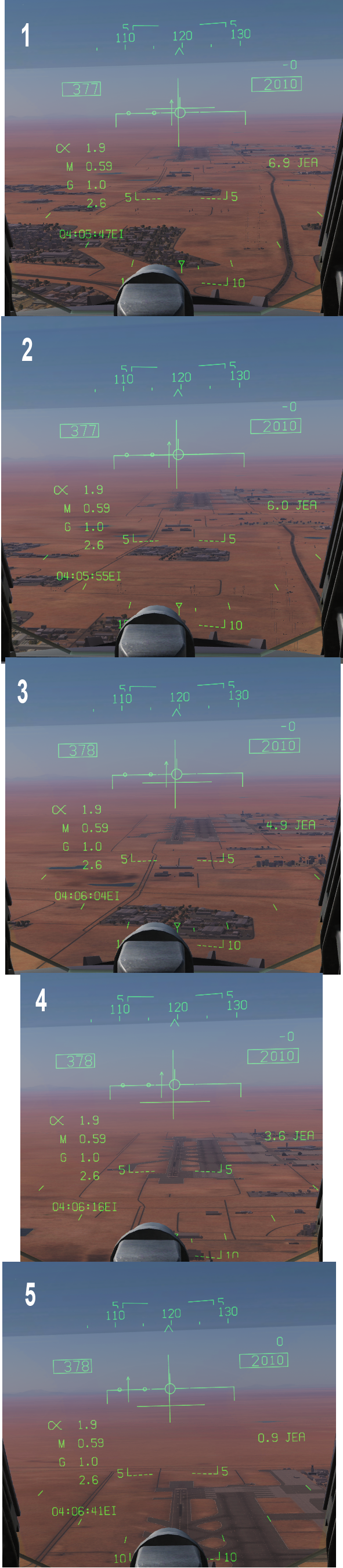
I did a quick test at Jebel Ali. Constant speed/altitude (377kt/2000ft). 1. Where the GP bar first appears. 6,9NM out 2. On GP, 6NM out. This corresponds quite well with the theoretical value (3° GPA @ 6NM slant range = 1908ft above THR, 3,5° GPA @ 6NM = 2226ft) 3. The GP bar drops lower as the range decreases. 4-5. Maximum deflection down So it seems to be working here.
-
So you want ED to spend loads of extra money developing a game for a platform almost nobody uses. Seems like a great idea. And while the "I'll just have to recompile the kernel"-Linux nerds apparently like to think so, people are not just sticking with windows because their favorite application or game isn't available for linux yet. OT: For the record, long transaction times combinedwith large fluctuations in exhange rate mean that Bitcoin IS worthless as a currency. As an investment object it might be feasible (for those who prefer high risk investments), but not for actual daily use. If the 1$ BTC equivalent you paid for a cup of coffee is only worth 95¢ by the time the seller receives it, it serves no use as a practical currency.
-
Now that definitely doesn't sound right. I'll look into it after work. It was working fine last time I checked, but that was a few updates ago, so things may have changed since then.
-
I haven't looked into this myself, but the behaviour of the LOC/GP bars is part of the F-18 avionics and core sim ILS simulation (ICLS is simulated as a regular ILS, just with different frequencies), so there isn't really anything to do about that without digging deep into the various luas. The ICLS GP angle is also fixed at 3.5°; this seems to be set in BeaconTypes.lua. For the carriers (Stennis & Tarawa), the ICLS GP angle is defined in the "GT.ICLS_Glideslope_position"-array, but there is no such setting that I can find for use in the beacons.lua. As for the GP coverage, I don't know what the specs for the ICLS are, but if it is anything like civilian ILS in the sim, it should give coverage in a ±8° azimut sector, up to 1,75xGPA and down to 0,45xGPA above the horizontal plane (so with a 3° GPA (=glide path angle), you would have coverage up to 5,25°, and down to 1,35°).
-
A few tips: * Extend the airbrake. This gives you much finer control of your speed, so it's easier to stay connected to the tanker. * When approacing the tanker, use the radar in gun-mode (master arm off) for accurate distance and approach speed info in the HUD. * Practice. A lot!
-
It's still there, but it's only available if you set the country to Spain. Open the description.lua in \DCS World\CoreMods\aircraft\Yak-52\Liveries\Yak-52\Pobeda\ and change the "countries"-line to -- countries = {"SPN"} to make it available for all countries. -- is the lua syntax for commenting out a line.
-
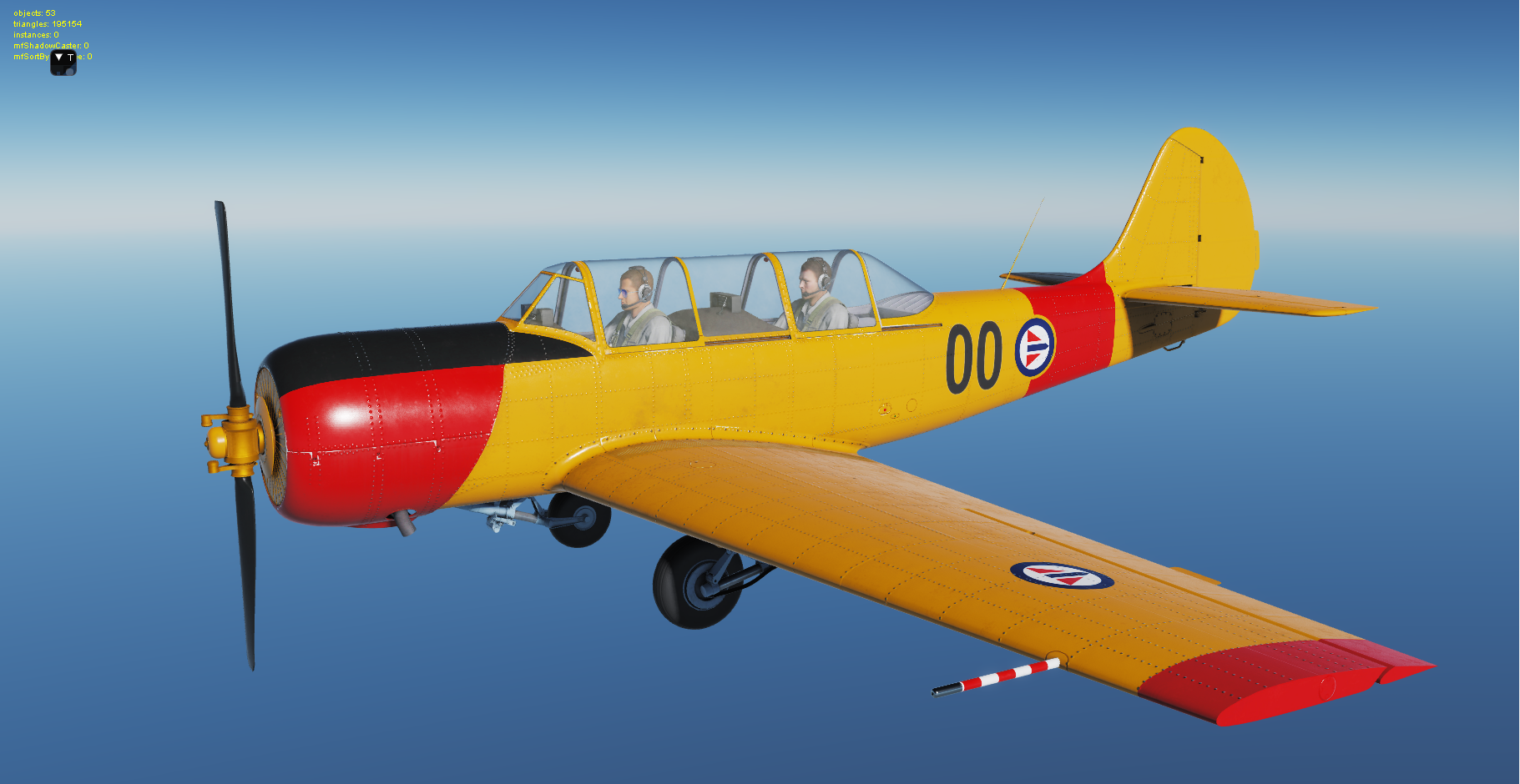
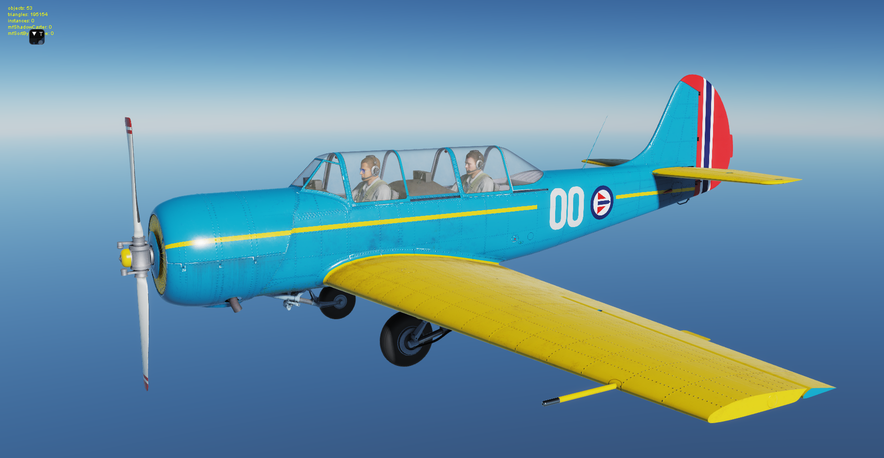
WIP. Loosely based on various SAAB Safir and Fairchild Cornell liveries used in the RNoAF:
-
Actually, the way the AWLS is implemented in the sim is based on regular ILS and not ICLS. The channels are defined in \DCS World\Mods\aircraft\AV8BNA\Cockpit\Scripts\RadioNav\AN_ARN128_config.lua Using ICLS channels would be the correct way of doing things, but this option was probably not available when the Harrier was released.
-
There is no TACAN at Kerman, only VOR+DME. 57 is the DME channel.
-
TL;DR. No. https://forums.eagle.ru/showthread.php?t=204693&page=2
-
The fix was included in yesterday's update, so my mod described earlier is no longer necessary. https://forums.eagle.ru/showthread.php?t=217594
-
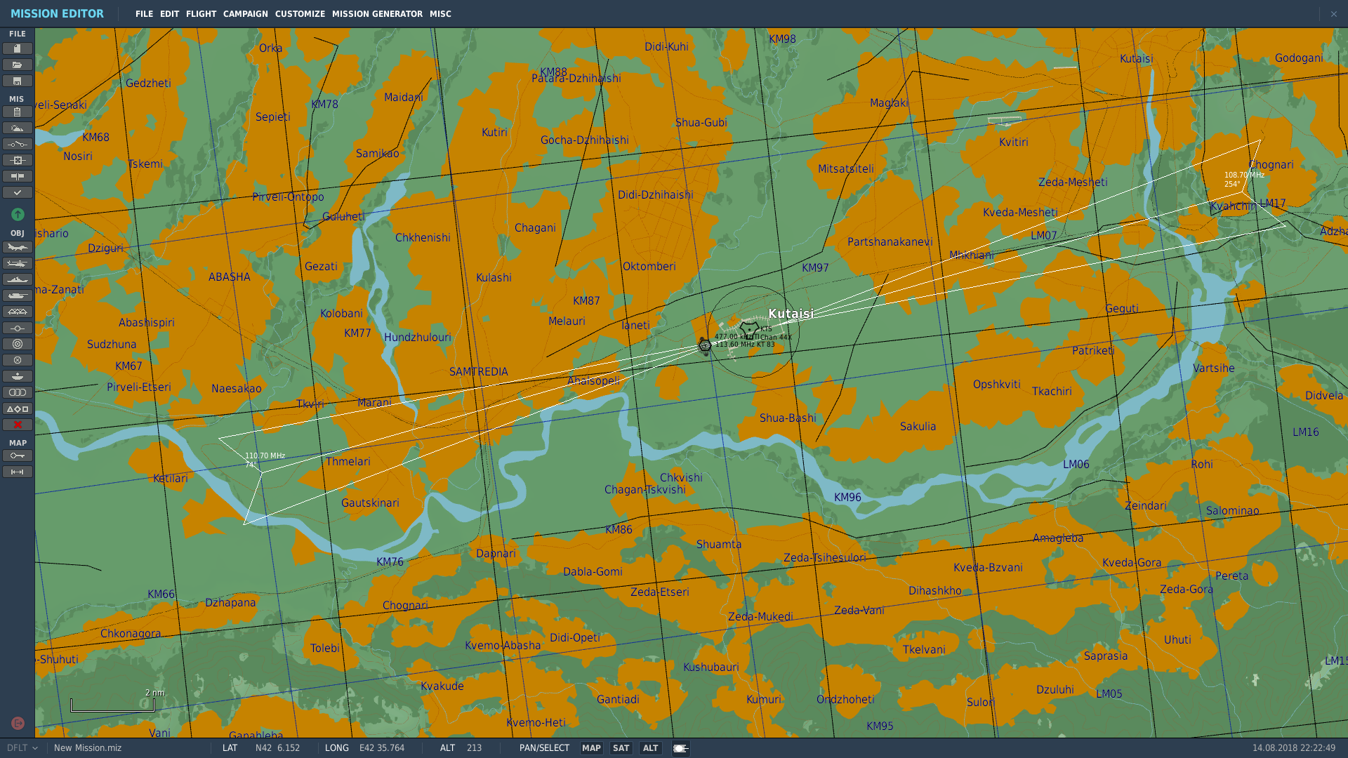
ILS for Kutaisi RWY 26 added, and the frequency for 08 is corrected (Edit: oops. A small typo. It should be 110.1, not .7).