Leaderboard

Popular Content
Showing content with the highest reputation on 07/13/24 in all areas
-
I tried to find lots of ways to phrase this that were more polite, but it boils down to - why the F*** do people keep buying early access products - that are clearly labelled as unfinished - then go into emotional meltdowns and paroxysms of forum post rage when they discover the unfinished product they bought is ... unfinished? All the maps were of poorer quality when released than they are now - ALL OF THEM. Frame rates on the Mariannas map were so poor when it was released that after trying the day I downloaded I didn't even bother looking at it again for months & until it had been patched a few times. It's a nice map now, but wasn't when released. Afghanistan is in its first day of Early Access & people are complaining that it's not as polished as maps that have been being patched and de-bugged for years - in some cases a decade or more. After the tsunami of whingeing that appeared on the map's release, I downloaded & started it with a heavy heart, but I'm pleasantly surprised. There are some rough bits but on the whole - it looks an interesting map & geographically varied (even the north-east part of the initial release is far from being 'another desert map'), the frame rates are good, bits of the map are beautiful, and at 0m to 50m altitude, and from a couple of thousand m AGL it looks very nice. In between there are a few things to work on - but that's why they repeatedly, all over the forum, all over the download page and all over every social media channel and internet site it's mentioned on, say 'IT'S NOT FINISHED" If, when they say it's 'finished', you think its's not up to scratch - complain then. If it takes too long to get to 'finished' complain about that (but please wait at least a week from today) But for God's sake please stop complaining that the product you consciously bought in the full knowledge that it is unfinished, is unfinished, & do the rest of us a favour by not buying any more early access products. Please. We'll all be happier16 points
-
So, in tandem to the other thread, I cant say enough how dissapointed I am to have shelled out more money for the supposed "cutting edge" tech and latest improvements in DCS terrain rendering....to get what is simply put yet another example of blurry textures laid over terrain mesh with -really, definition points measured in the hundreds of metres rather than the centimetres that I was getting in FSX 15 years ago......mountain ranges with dead straight ridgelines hundreds of metres apart....mountain sides comprising flat planes with low res testures pasted over. Repetitive low res textures with detailed areas plonked over the top with no blending. Its really, really dissappointing after the same crap in Kola and SA. Check out these screen shots. Honestly, there are areas of the Caucusus and NTTR that look better than this. Is this really 15 years progress in scenery development in DCS? Why oh why oh why are the devs fixated in pumping out low res massive scale maps that are really terrible when they could make the map a quarter of the physical size with the same number of GB and have nice high res textures, more detailed terrain mesh and a lot more happy punters.......
 16 points
 -
My recommendation is to skip the band-aid and to keep making noise for ED to fix the real issue. There's never going to take responsibility and commit to deliver a robust product if they keep getting bailed out by 3rd party developers.13 points
-
First video from Wags is up!9 points
-
Addressing this separately btw - I left the VR industry about 1.5 months ago. What I mean by "left the industry" is I quit my job as a professional XR developer. Why did I? I don't really believe in this industry at this time. Point proven as follows: - game developers don't care. I think today's situation is an evidence. PCVR gets very little attention from them. For most developers today it appears that "VR support" means "the game runs (even poorly) on a Quest 2". This is because of the volume on the market. - platforms vendors don't care. You can see that Varjo, Microsoft, left. As for Meta they are clearly only interested in wireless (standalone) and glasses, and they haven't really done anything positive for PCVR in forever. Worse: they are currently creating a silo'ed ecosystem with the help of game developers, through something called "OVRPlugin" which basically nullifies all of the benefits and work that the industry has done with OpenXR in the last few years. Most games released so far in 2024 use OVRPlugin instead of OpenXR: this means they cannot run with OpenXR on non-Meta headsets. - game developers and platform vendors really don't care. I've brought attention about the problems above on many occasions, reported issues, I've created "band-aids" for these issues, and nobody else in the industry has cared. The amount of details you saw on my report of the bug to ED, that's about the large majority of what I've been doing for over 8 months now. Spending hours of my personal time at 1:00 in the morning documenting other people's issues and recommending fixes. And none for them get acted on by game developers and platform vendors. For over 8 months now I had no opportunity to innovate and do the things I actually enjoyed doing (like back in the early OpenXR Toolkit and QVFR days). Instead it's been trying to salvage what I now believe is unsalvageable (again, I am speaking broadly, not specifically about ED/DCS). This week is the most time I've spent on XR stuff since I left my job, and it was unsurprisingly, negative and uninteresting to me. I'm currently doing some wrap-up/life support on VDXR, but my plan is a full exit, not only professionally, but also from all of this open source/community work, in the next few months, so that I can focus on my new job (which is the real gaming industry and not the XR farce), my sleep/health, my new house, my hobbies and my future. That's a lot of "my" stuff I haven't done in 3 years now.9 points
-
Maybe you need to go to the first page and first post of the Afghanistan map announcement and actually read what this map was going to release like including extensive performance testing. You sound like someone who just had his favourite sports team insulted. These modules are not cheap and customers have every right to complain if they’re not happy. If you’re happy go fly a plane instead of white knighting on the forums.9 points
-
Hey mate, you can come with the EA song and all the screenshots and lectures you want but here are people just expressing a reasonable level of disappointment. At the end these are personal points of view and part of the feedback the EA process provides for the good of all. If you can not deal with opinions that don't match your own there is a 'praise the map' topic.9 points
-
Afghanistan was hailed by ED themselves as showcasing the best of EDs map technology. And it looks worse almost all other maps. (And that's just the high detail area) The building assets and a few of the new trees etc look good. But on the whole it looks worse then other maps. South western Afghanistan was also touted as feature complete. And so one would assume the early access parts are for the none finished parts of the map and not south western Afghanistan.9 points
-
I feel the same sadly, disappointed and refunded for now. Looking at the quality from Mariannas, Syria, Sinai, Nevada and now Caucasus, this new standard used on SA, Kola and Afghanistan is something i personally don’t like. Feels like flying over a stretched image with bad rendering and bad depth depending on altitude. Afghanistan is known for a lot of low level assets Rotary and even Fixed like A-10 in Air-Ground situations. On this one i have to stay at least above 15k without losing immersion. I can fly hours on the other maps though, at low and high altitudes with great textures and immersion. Love ED but personally just don’t like the new technology building an map over image. As deployment to Afghanistan myself, i was looking forward on this one for many many years… I do respect and understand people with different opinion and maybe like the new standard as used in MSFS and FS2004 for maps, i just don’t; feels like we are getting into the BMS style providing world map.8 points
-
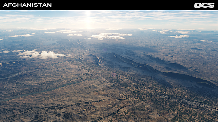
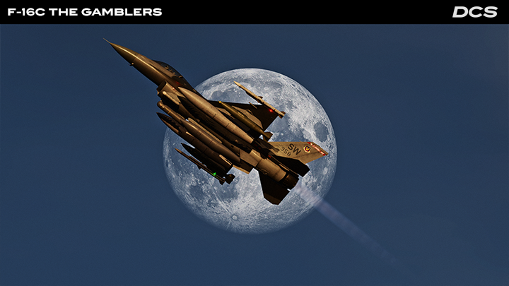
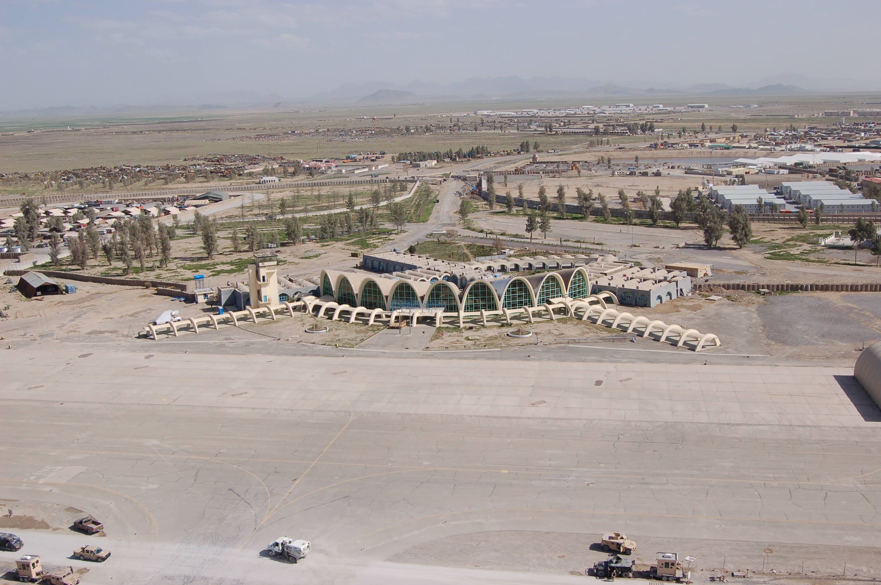
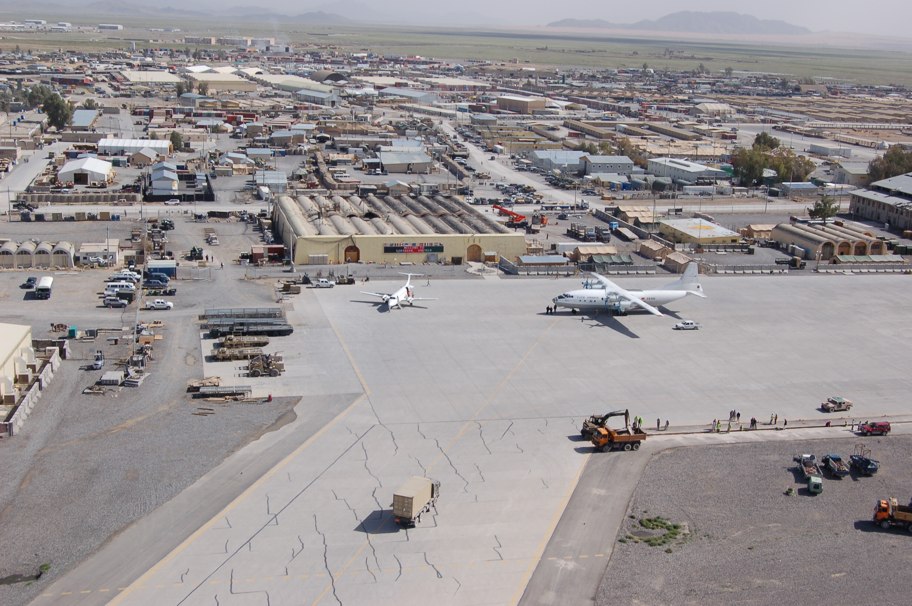
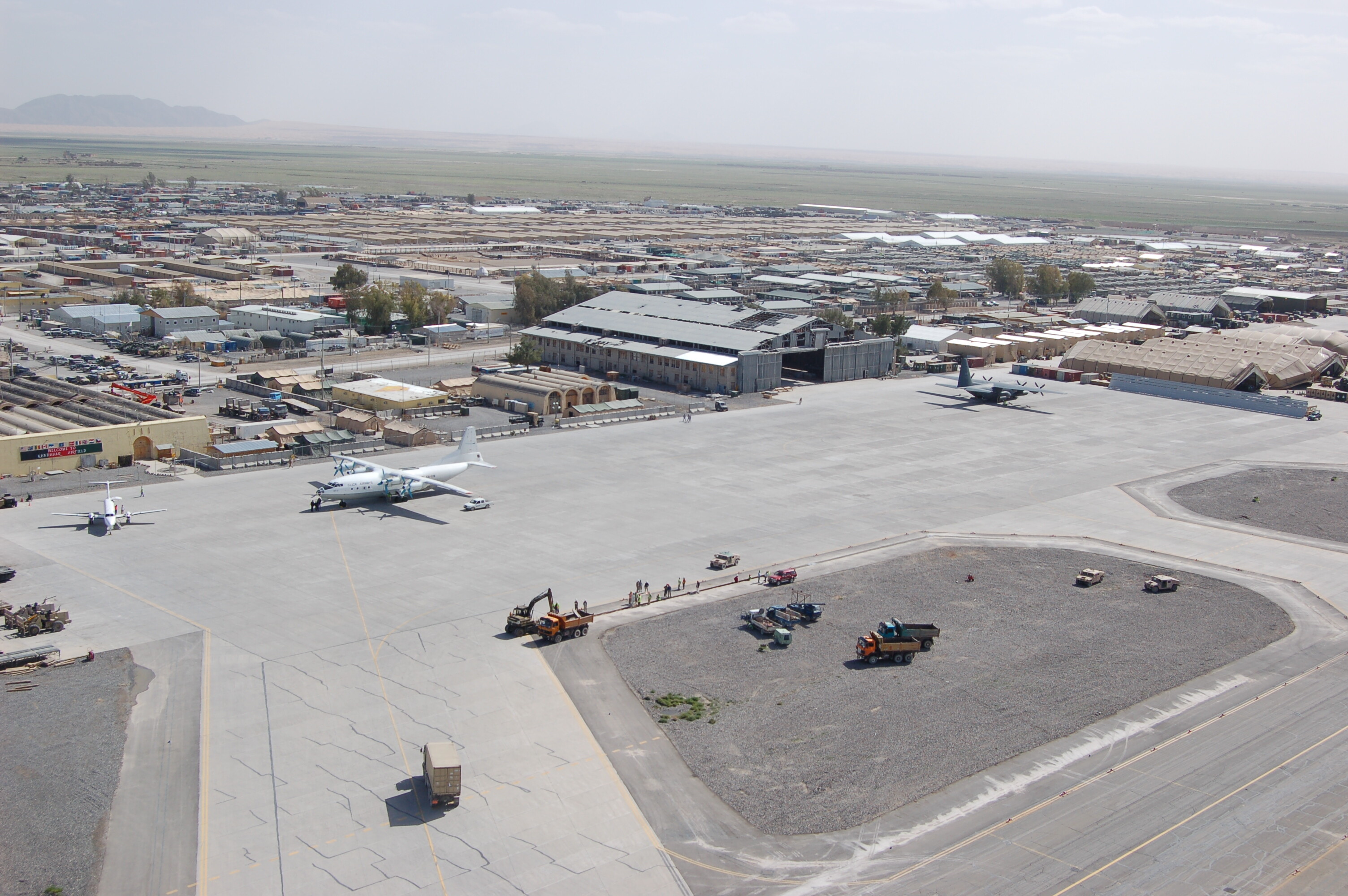
12 July 2024 Dear Fighter Pilots, Partners and Friends, At last we made it. Once again, please accept our apologies for the delayed release of the 2.9.6 version of DCS which includes our new Launcher, DCS: Afghanistan map, DCS: Supercarrier features, Flaming Cliffs 2024, several new campaigns, and much more. Please update now and enjoy! Check out the Flaming Cliffs 2024 video here and for those of you who own Flaming Cliffs 3, you can upgrade to FC2024 for only $9,99 for the coming month, thereafter the upgrade price will increase to $14,99. Thank you. Afghanistan has been one of the most important combat theatres of the past half century with the War on Terror and the Soviet operations of the 1980s. Few war zones have ever seen more A-10C, AH-64D, F-16C, F/A-18C, CH-47F, OH-58D, Mi-24P, Mi-8MTV2, and Su-25 action than here. Afghanistan offers a highly varied landscape consisting of vast deserts, towering mountains, and lush river valleys. The initial release is focused on the southwest region of the country and includes regions around Kandahar and Herat. DCS: Afghanistan is now available, don’t miss our biggest and most detailed map to date. Watch the trailer and enjoy! The DCS: F-16C The Gamblers Campaign by Baltic Dragon, developed in collaboration with John ‘Rain’ Waters from the Afterburner Podcast, is now available on the DCS eshop and Steam. Also in the latest update are two more exceptional new campaigns. Check out the details below! Please remember that the DCS Summer Sale is coming to a close soon, so don’t miss up to 50% savings on most of our aircraft, terrains, important add-ons, and campaigns. The sale ends on the 14th of July at 15:00 GMT. Thank you for your passion and support. Yours sincerely, Eagle Dynamics DCS 2.9.6 Available now! The latest version of DCS contains an impressive range of new products and features, enhancements, and fixes. A notable addition is the DCS: Afghanistan map! Also included are the new Launcher, the Air Boss deck for DCS: Supercarrier, Flaming Cliffs 2024, and three new campaigns. Flaming Cliffs 2024 Flaming Cliffs 2024 is designed for new virtual and veteran players looking to expand their collection. In addition to the existing Flaming Cliffs 3 aircraft. F-15C, A-10A, Su-27, J-11, Su-33, Su-25, MiG-29, and MiG-29S, FC2024 now includes three new aircraft: F-5E, F-86F, and the MiG-15bis. It can be purchased as a full product for $59,99 or as an upgrade for Flaming Cliffs 3 owners for only $9,99. This special launch price will be available for the upcoming month, thereafter the upgrade price will increase to $14,99. If you haven’t already seen it, check out the launch trailer! New Campaigns DCS: F-16C The Gamblers Campaign by Baltic Dragon DCS: UH-1H Worlds Apart Stormfront Campaign by Low Level Heaven DCS: AH-64D The Four Horsemen Campaign by Fight’s On Simulations DCS Key Updates The DCS Launcher allows players to configure and manage DCS before DCS start up as well as during the DCS runtime. In addition, we have completed a new multiplayer interface which greatly improves respawn functionality by providing dynamic spawn points along with the ability to select spawn locations directly from the mission map. These dynamic respawn slots have been added to allow more flexible mission join management. SAM units are smarter now, and based on their skill level, can turn off their radars and reposition if they detect an incoming anti-radiation missile. Several new ground units have been added such as the MRAP, M1A2 SEP3 and MaxPro. AI and System Enhancements AI systems now include more realistic target detection based on alert status and ability to scan area. Combat landing options for helicopters have been added. Various bug fixes and enhancements across the DCS Core and many modules. The T72B3 tank and others are now available for you to control. The update includes better AI ground unit pathfinding and engagement behaviours. Graphics and Mission Editor Graphics have been improved with detailed terrain rendering and new material for fields and towns. Various fixes and enhancements have been made to the mission editor, map interactions, and static object handling. Weapons Updates Several weapons, including the AIM-7E/E2 and AIM-9X, have received performance tweaks and bug fixes. Improvements have also been made to other missiles, rockets, and bombs. The WWII Assets Pack has also seen updates to the Wurzburg radar. 2.9.6 is a huge update that includes a long list of fixes and enhancements to DCS: F/A-18C, DCS: F-16C Viper, DCS: F-14 Tomcat, DCS: F-4E, DCS: AJS-37 Viggen, DCS: AH-64D, DCS: Mi-24P Hind and DCS: UH-1H Huey. For a full list of all the latest updates, please read the changelog. Southwest Afghanistan Available in the latest DCS version Afghanistan, often called the “crossroads of Asia” is a landlocked country located at the intersection of Central and South Asia. It shares borders with Pakistan, Iran, Turkmenistan, Uzbekistan, Tajikistan and China. Historical Significance In the 19th century, Afghanistan became a buffer state in “The Great Game” between the British Empire and Tsarist Russia, both of whom sought control over Central Asia. Later, the Soviet-Afghan War (1979-1989) highlighted the strategic importance of Afghanistan in the Cold War geopolitics. The rugged terrain also played a pivotal role in the resistance mounted by Mujahideen fighters against the Soviet forces. Post September 2001, Afghanistan became a central theatre in the Global War on Terrorism, leading to a prolonged conflict involving the United States and NATO forces, who aimed at dismantling terrorist groups whilst stabilising the region. Operational Challenges Operating in DCS: Afghanistan presents unique challenges due to geography, climate and socio-political dynamics. The combination of high altitude environments and limited infrastructure requires adaptive strategies from foreign military forces and highlights the importance of local knowledge and alliances. Key features: 14 airfields including: Bost, Camp Bastion, Chaghcharan, Dwyer, Farah, Herat, Kandahar, Maymana, Zahiraddin, Faryabi, Qala i Naw, Shindand, Tirinkot, Zaranj Improved clipmap technology Improved Field and town materials The Afghanistan map is highly detailed with fields, cities, towns and thousands of smaller settlements. We implemented a new method of collecting, processing, importing and exporting data are being OSM type data, as well as determining surface types from satellite images, which are processed, optimised and vectored for subsequent implementation into the terrain module. You can purchase only the DCS: Southwest Afghanistan region offering you a 471’381 km2 area and 12 highly detailed airfields or the full region 1’449’216 km2 terrain which will be offering 28 highly detailed airfields, check out DCS: Afghanistan. F-16C The Gamblers Campaign by Baltic Dragon The Gamblers campaign was developed by Baltic Dragon and John ‘Rain’ Waters, a former Viper Demo Team pilot, member of the 77th Fighter Squadron, and host of the Afterburn Podcast. In 13 varied missions, you will relive some of the sorties that Rain and his squadron flew during their deployment to Syria, as well as some of the other most iconic moments of the allied involvement within the theatre, including the Battle of Raqqa in 2017, the US TLAM strike against the Shayrat Airbase, and the standoff between US forces and the notorious Wagner group, which is now known as the Battle of Khasham. This campaign also introduces a new, more immersive way of interacting with the environment using the HOTAS. DCS: F-16C The Gamblers Campaign by Batic Dragon. We hope that this vast DCS 2.9.6 update is to your satisfaction. Please rest assured knowing that we are carefully monitoring the initial feedback of the DCS: Afghanistan, as well as the brand new Flaming Cliffs 2024. We look forward to your comments. Thank you again for your passion and support, Yours sincerely,
7 points
-
You are missing the point - the underlying problems that detract so much are NOT going to changed with updates…such as slab sided polygon mountains, rough textures. NONE of the other maps I own have ever had these issues addressed. All I can say is that you must be very easily pleased and if one of your plus points is that “its geographically varied” then your struggling for positives my friend…… It does however, look pretty nice from high up, I think in its current stae, its more suited to jet operations than helos....7 points
-
I guess I spoke too soon. We have steam/smoke. It needs to be thinner so I will try tweaking it.6 points
-
I would suggest some of us are upset because of what BIGNEWY posted in the forum under: Afghanistan Map FAQ. ”DCS: Southwest Afghanistan will receive some updates post release but FOR ALL INTENTS AND PURPOSES BE FEATURE COMPLETE. This is the only reason I purchased this map at this period. I feel this was not honest. The SW map needs a lot more work. If it’s for all intent and purposes feature complete I’m not impressed. Neither should you be. Touch your own grass, I’m in the pool right now!6 points
-
My wife and I rescued a 2nd abandoned bunny from the street last year. I think we have full house now6 points
-
You are getting this error because you must have OpenXR Toolkit installed. When you followed the instructions for Varjo-Foveated, you disabled OpenXR Toolkit for "DCS World". Because they renamed the game "name" to "DCS" in this release, you now have to go back to OpenXR Toolkit Companion app and disable it for "DCS". This should resolve your problem and let you use Varjo-Foveated without issue. The band aid that was provided by another community member, as I explained, will break every other OpenXR game that uses anti-cheat (due to digital signing issues). So that's not really a good band-aid. Most people will forget that they have the bandaid and will start getting unexplained errors in those games. That's not a very good solution. Stop bleeding in one place and start bleeding on others, I don't even call that a band-aid I don't have an option to do code signing at this time, but @actually_fred is sharing his expertise on the topic with me so perhaps I will be able to do that again in the future.6 points
-
6 points
-
Well, if the map is going to be some giant monster, then I get the logic of wanting it to include open water for carrier ops. As the map is now, it's a monster, but doesn't have much in the way of gameplay variety. Heck, Wags acknowledged the map's limitations in gameplay during his interview with CasmoTV. My logic is to go the other way, since it's so limited on gameplay variety, smaller, and more detailed would have been the better option. Since this is a counterinsurgency map, much of the action is going to be down low, so the map needs to look good. As things stand now, I'm not sure that this map is going to be all that popular. I'm sure some will love it, but it isn't going to be replacing Syria as the go to map, that's for sure.6 points
-
But it's not bugs though. A lot of it is just how DCS engine is. It's exactly the same on Kola and South Atlantic map. Low quality textures. Texture meshes overlapping. And incomplete again can obviously be related to missing parts of the map.6 points
-
COMING SOON In this DCS video, I’m pleased to introduce you to our CH-47F and instruct you on how to start it up. Please note that the cold start instructions are valid for July 2024 but may change during development during the early access period. The CH-47F is a powerful and fast heavy-lift helicopter with a tandem rotor arrangement that can operate at high elevations. It has a long and distinguished service dating back decades, but our CH-47F is based on one operating in the 2011 to 2013 period. It has the capability to haul internal loads, including infantry, pallets, small vehicles, and it’s capable of moving large cargo using the external triple cargo hook system. It is powered by two T55-GA-714A engines that are each rated at 4,869 shaft horse power. You call, we haul! For self-defense, the CH-47F includes side-door and tail ramp gunners. It will also include a radar warning receiver, a missile warning system, and countermeasures. Please note that some of these will be included later in the early access period. The CH-47F is an exceptionally easy and natural helicopter to fly and includes a force trim system to alleviate sustained controlled forces on the cyclic and pedals. The Digital Advanced Flight Control System, DAFCS, will see feature additions during early access development like the flight director. As the mission of the CH-47F centers around transport, you’ll also be able to load and unload cargo. Let’s jump into the cockpit now. The pilot sits here in the right seat and the co-pilot sits in the left seat. Both seats feature cyclic for pitch and roll control, thrust control levers for adjusting rotor lift, and directional pedals to control yaw. The pilot on the controls is responsible for flight controls during Visual Meteorological Conditions, VMC, and maintains focus outside the aircraft to navigate, maneuver against threats, and avoid terrain hazards. The co-pilot, not on the controls, has the job has all the pilot in command controls and can assist with situational awareness and manage the navigation and communication systems, among other tasks. The cockpit can be broken down into four primary areas. The Center Console, the Canted Console with the Control Data Units, or CDUs, the Instrument Panel dominated by two Multi-Function Displays, or MFDs, for each pilot and a center, shared MFD, and the Overhead Panel. We’ll come back to these in the startup. Behind us is a mass of circuit breaks on the two Power Distribution Panels, or PDPs. Please consult the manual for a complete description of all the cockpit controls. Okay, that’s a brief introduction and general layout of the cockpit, let’s know how we start this bird up. Again, though, as the module develops, some of this may change. You can find a comprehensive list of all the interior prechecks, but for the sake of keeping this video short as possible, we’ll jump to starting up the hook. We’ll first need to start the Auxiliary Power Unit, or APU. This is a small engine in the aircraft that we’ll use to start the two engines. Looking up, we’ll use the overhead panel for the bulk of getting the engines started. ● Set the Battery (BATT) switch to ON. ● Verify that the UTIL PRES light is on. ● Set the APU switch to the RUN position for five seconds, then to the START position for two seconds, and then back to the RUN position. ● If you’ve successfully started the APU, the green APU RDY light will illuminate, and UTIL PRES light should extinguish within 30 seconds. ● Set the APU generator switch to ON. Now it’s finally time to start the engines. We’ll start with engine 1 and then engine 2. It’s best to start engine 2 within three minutes of starting engine 1 to avoid engine damage. ● Set the L MAIN FUEL pump switches to ON. ● Set the XFEED switch to OPEN to allow the left tank to feed both engines fuel. ● ENG COND lever to GROUND. ● Now press and hold the ENG START switch until the Ng is greater than 12% as indicated on the Powertrain MFD page, here. You can then release the switch and the engine 1 Ng should stabilize around 55% within 45 seconds. Oil pressure for engine 1 should be greater than 5 PSI. ● We’ll now repeat these steps for engine 2, again, within three minutes of starting engine 1. ● Next, advance the ENG COND levers to FLIGHT and the NR value for the rotor both engines should be 100%. ● With both engines running up to speed, set the GEN 1 and GEN 2 generator switches to ON. Wait two seconds between turning them on. ● We can now turn off the APU GEN as the engine generators provide all the power we need. ● Turn off the APU. ● Finally, we’ll check that all POWERTRAIN indications are in the green. In the next CH-47F video, we’ll learn about ground operations, taxi, and takeoff.5 points
-
Definatly not a helo map as it stands. just took the Hip up to Kajaki Dam from Bastion and its awful. All the way up (as soon as you get outside the obviously hand built areas just looks like 2d stickers stuck onto the mesh). All straight lines and triangles etc. Even something as important as the dam itself looks half painted on. You can see where the painted on areas are supposed to be changes in elevation in the ground but when you land on them there flat. I'm presuming they have plastered satellite images over the mesh but its so immersion breaking under 1000 ft that its just awful for Helo pilots. I understand that its early access but theyve also said that this section is close to completion. I would suggest it's nowhere near and if this is any indication of the new standard for maps then I wont be buying anymore of them.5 points
-
@BIGNEWY Has this been resolved yet???? You make us spend a fortune on models and maps, motion rigs etc, and all of a sudden you make the whole soup totally unplayable for so many players. I am getting really really fed up with it. This weekend two friends actually flew in to try the rig with DCS. Worst timing ever. I have a feeling they were not so very impressed by this. The only thing that I am very impressed of is @mbucchia who actually helps you keeping this simulator alive... Sorry, but you need to do things different futurewise to keep simmers interested....5 points
-
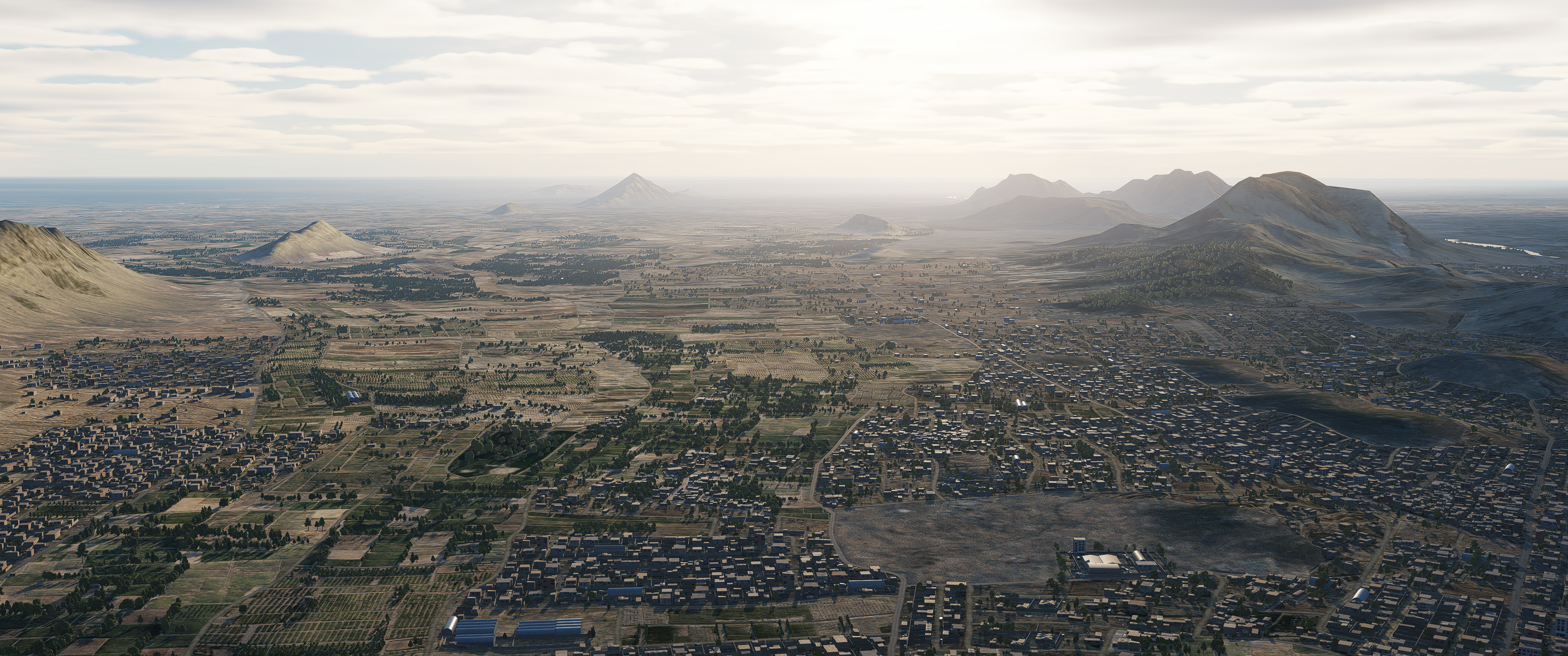
So, ok - after a longer flight over Afghanistan I have mixed feelings about it Pros - very nice colours - the mountain tops and general appearance from altitude - the detailed proximity around airfields, including the vegetation and ground clutter Cons - the breakup of ground textures when you get lower - the (apparently) procedural from satellite imagery created ground textures are poorly blended into handcrafted regions - small settlements look like randomly thrown onto the satellite images and totally out of place That does all pretty much go into the same problem. The problem that I called the SA-situation. (The use of satellite imagery isn‘t well executed imho, at this state I absolutely prefer handcrafted maps. Case in point - the handcrafted parts of the map look awesome).5 points
-
There is something that keeps you here trying to make your points instead of enjoying the map.5 points
-
so the last update 2.9.6 was pretty big with all kinds of fixes and such for the Fancy Jet Jockey's .. how about something for the WWII crowd ? we spend $$$ too .. some info / pics / idea of release date of Marianas World War II / F6F would be really nice .... what's the point of keeping us in the dark ??? could be considered abuse of the elderly ?? we don't have forever to wait ?? come on throw a bone or two .... not getting any younger here !!!!...5 points
-
See the unsigned DLL will screw up ALL OpenXR games that have anti-cheat, regardless of whether these games use or not use quad views. It will make them fail in a way that will also pop up my name on the screen "failed to load XR_MBUCCHIA_quad_views...." aka pointing fingers at me This is why I'm not distributing the unsigned DLL. Some examples of games using OpenXR and Anti-cheat that will break with an unsigned DLL system-wide: Pavlov, WRC, Contractors Showdown, Roblox... In others words: people are going to copy this file, forget about it, then eventually they will run some game that will crash, point to me, and people will come and complain that I broke their games On top of that, PLEASE, we have to stop bailing out Eagle Dynamics. They wrote some buggy OpenXR code. They need to fix it. By having people adding more and more duct tape to "hide" their problems, we are removing their accountability and continuing to deepen the problem. They're not going to take this seriously and do the proper fix, if we keep bailing them out:5 points
-
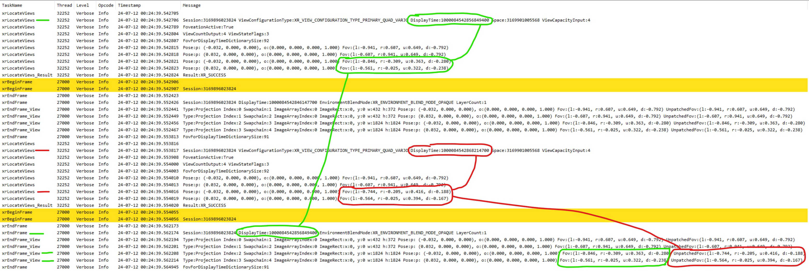
@BIGNEWY I am going to write this up one more time, especially since it looks like my message from March 2023 was partially lost. The following trace is captured today with DCS MT and quad views enabled on a Varjo. But it doesn't matter, it's the same issue with Pimax, Quest Pro, etc. The trace shows 2 consecutive OpenXR frames (xrBeginFrame -> xrEndFrame). As reminder, with quad views, per OpenXR 1.0 spec section 12.143.1 > The first two views (XrViewConfigurationView) will be for the left and right eyes for the outer viewport. The views 2 and 3 are for the left and right eyes for the inner viewport. This means in the trace below, when you are seeing 4 consecutive "xrEndFrame_View", the bottom two are for the inner viewport (the region that moves with your eye gaze). This trace clearly exhibits the bug in DCS frame submission code. The order of operation might look confusing at first: this is because in MT mode, the processing (on CPU) of frame N+1 begins before the processing (on both CPU and GPU) of frame N ends. 1) The top of the trace corresponds to frame N's pre-processing. Frame N has a predicted display time of 1000084542856849400, and the tracking data needed in order to render that frame is queried through the xrLocateViews() API call. This call returns the data necessary to compute projection matrices for all 4 viewports that need to be rendered. We observe, circled in green, the values for the FOV of the inner viewports. 2) Meanwhile, DCS performs rendering and submission of frame N-1, with a "display time" of 1000084542846147700. This is the xrEndFrame() call that we see in between the green and red annotations. We sort of don't care about frame N-1 here, so let's just move on to frame N and N+1 to understand the problem. 3) The engine is now going to perform two things in quick succession: it will begin pre-processing of frame N+1, through a call to xrLocateViews() similar to what we've already described, and it will render and submit frame N. Remember frame N: the one we pre-processed earlier, at the very top of the trace in 1). a) We see the call to xrLocateViews() for frame N+1, annotated in red, with a predicted time of 1000084542868214700, and that returns a new set of FOV values for the inner viewport: this is because the eye gaze moved between frame N and N+1. b) Right after that, the succession of xrBeginFrame+xrEndFrame() corresponds to frame N being rendered and submitted. You can see a jump in time of about 8ms... that's our frame time. We can tell this is the submission for frame N because we look at the value of "displayTime" circled in green, and it is the same value 1000084542856849400 that we saw being used in step 1). 4) Now here is the bug: when you look at the FOV values that DCS was returned in step 1) and computed its projection matrices with, and you compare them to the "UnpatchedFov" values that DCS is submitting in step 3)b), they are not the same. DCS is telling OpenXR: "you know the inner viewport you gave me earlier to render into? well I didn't use that! I used other values instead, so you will have to perform reprojection from the viewport I used into the viewport you need to display on screen". This reprojection causes the freaky glitches we are seeing. You can also observe next to these "UnpatchedFov" values, the "Fov" values that are the correct ones: this is the workaround that Varjo-Foveated and Quad-Views-Foveated implement to mask this bug. It keeps track of the displayTime used in 1), then it stores the FOV value and retrieve them in step 3)b) based on that same displayTime. This is the workaround that today is only enabled when XrInstanceCreateInfo.applicationInfo.applicationName is set to "DCS World" - the value you were passing for 1.5yr, and that today you changed to "DCS", which causes the workaround to not turn itself on. But what we need really, is DCS to submit the correct values here. Now to go even further into it, and to tell you exactly what line of code you need to look into, here the other observation: in step 3)b), instead of submitting the FOV values acquired for frame N in step 1), you are instead submitting the FOV values acquired in step 3)a) for frame N+1. This is the result of a very simple bug. As you can see looking at the Thread column, there are two threads working here: thread 32252 which is doing the pre-processing (xrLocateViews) and thread 27000 which is doing the rendering and submission. My guess is that your code is using a single set of a shared variable between the two threads to "carry" the XrPosef/XrFovf values from the calls to xrLocateViews() into the calls to xrEndFrame(). This approach is fine when you are doing single-threaded, sequential frame processing. But since here you get started on frame N+1 before frame N is submitted, you overwrite the content of the XrPosef/XrFovf that you have stashed between your two threads. Note that you do not have this problem for the value of the displayTime: you are correctly retrieving this value from xrWaitFrame(), passing it to xrLocateViews() on your pre-processing thread, and eventually carrying it into xrEndFrame(). So whatever logic you are doing today for the predictedDisplayTime/displayTime between your two threads, you want to replicate that logic for the XrPosef/XrFovf values as well. You need a latching mechanism for these values between the moment you use them for computing your projection matrices and to carry them along with your rendering into your submission thread, WITHOUT overwriting these values with the "most recent" values when you start pre-processing frame N+1.
5 points
-
I am just judging the track that was being provided. If you have an issue, you need to supply a track that is demonstrating it so others can reproduce it. Otherwise the chances that your issue can be resolved is next to zero. I am not saying you don't have a problem. But the track you provided is not demonstrating a problem.4 points
-
Hello Ivan, yes it told me I had too many messages. I'm in the process of deleting them so you should be able to send me a message soon. I will send you a message and you can just reply back. Hello Penquin625. So far so good with a couple of mods but I only tested a couple of them. So I will work on finishing up the mods and releasing them in no particular order. Today I was testing the submarines before release and I noticed Ed's new submarines and I noticed they release steam. That's a new feature and would be great for the ships but I can't find the code for them. Even underwater they release steam which is not good because you can clearly see them. Stay Tuned. Thanks for your patience.4 points
-
So according to you any product in EA should be exempt from any kind of criticism ? I think it would be REALLY helpful if ED were upfront about EXACTLY what is scheduled to be improved, what wont and why ......then, people will be able to fully judge the product before they buy. As it is, we are being given smoke and mirrors and no definitive information which make quite a few of us paying clients feel like we are being had a little. Whats wrong with presenting the product warts and all, pointing out the warts and saying which ones are going to be operated on and which are going to stay?4 points
-
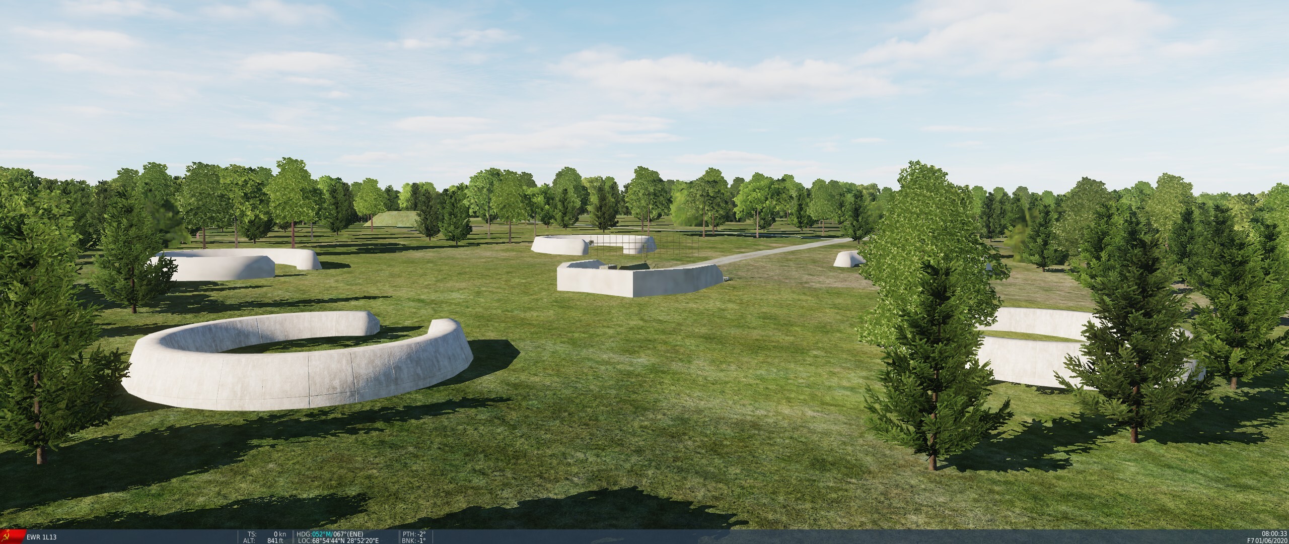
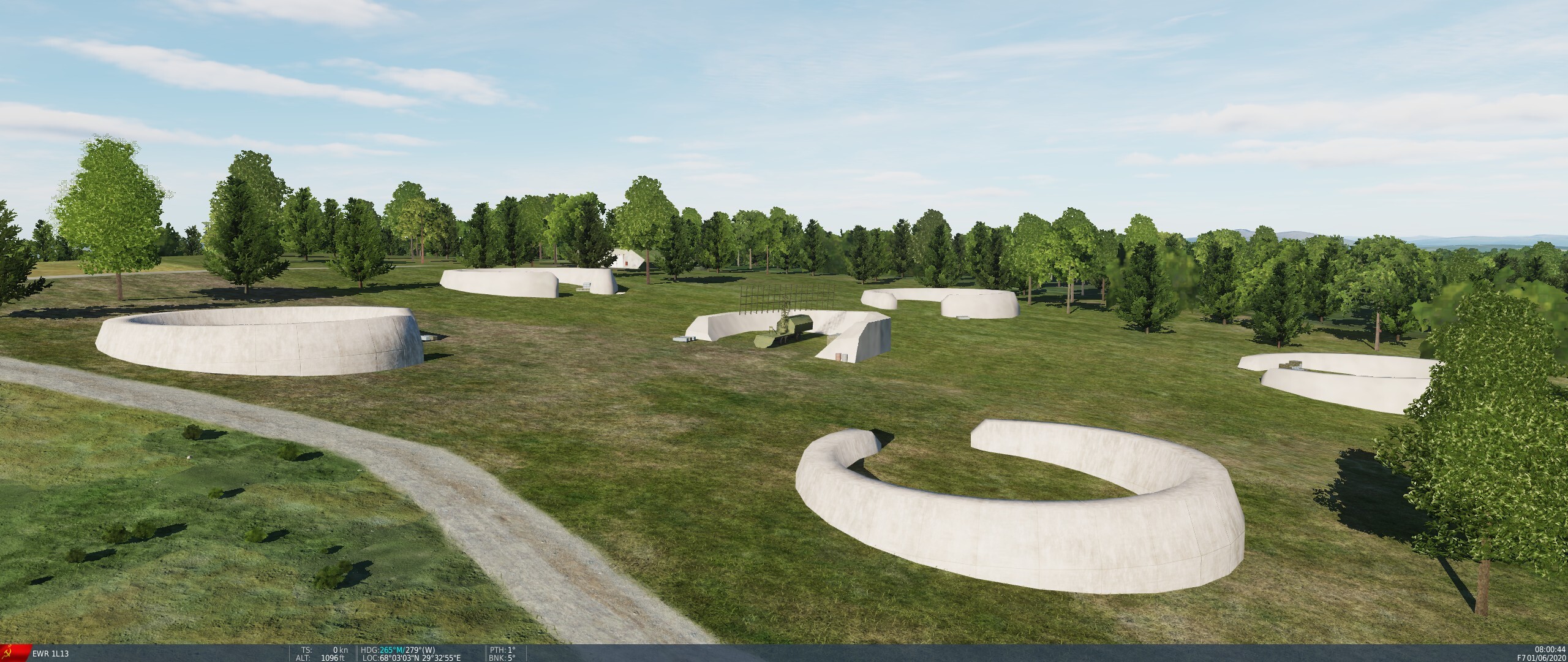
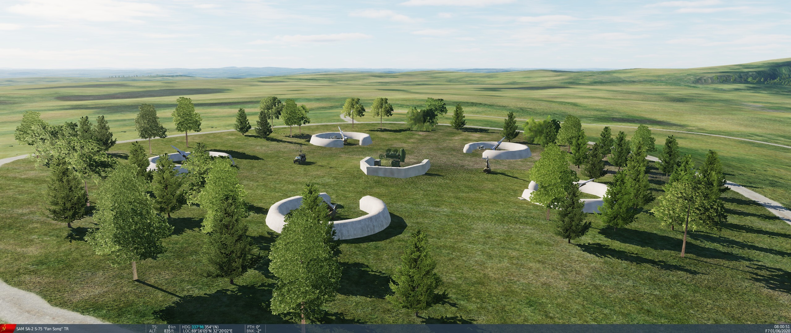
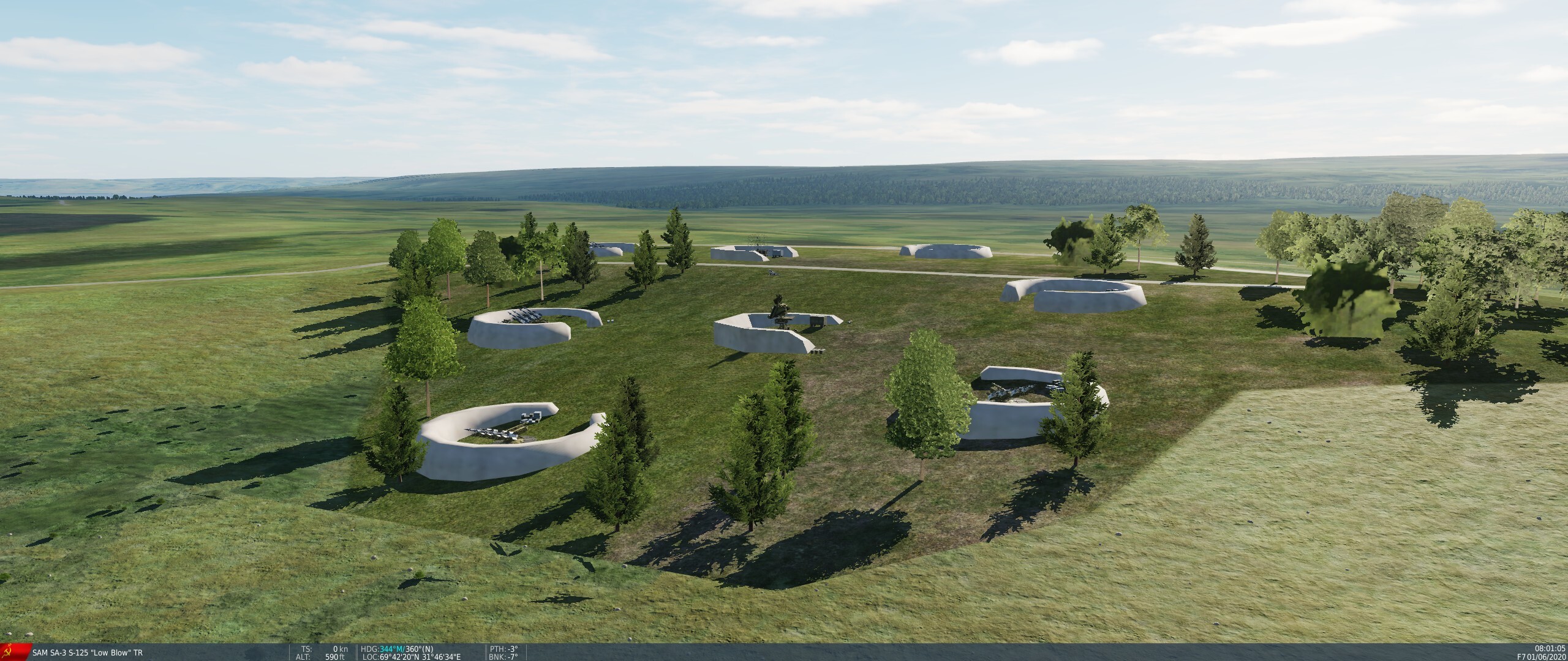
Sites are often on slopes with no proper fields of view, even if the site should clearly be on a hilltop (especially the EWR sites). Trees are placed right around the launcher revetments. SA-2 sites have revetments for just 5 instead of 6 launchers. EWR Sites: SA-2 Site: SA-3 Site:
4 points
-
Вот тоже доволен лаунчером. Очень удобно и приятно пользоваться! Карта Афганистана тоже замечательная. Я вот даже не особо люблю в воевать. Можно сказать, что вообще не люблю войну (пусть и виртуальную). Нравится именно летать, работать с самой техникой и системами. Но гражданские симуляторы снес нафиг и оставил у себя только DCS. Нигде, кроме, такого удовольствия от полетов и общения с техникой не получаю. Спасибо, ED!4 points
-
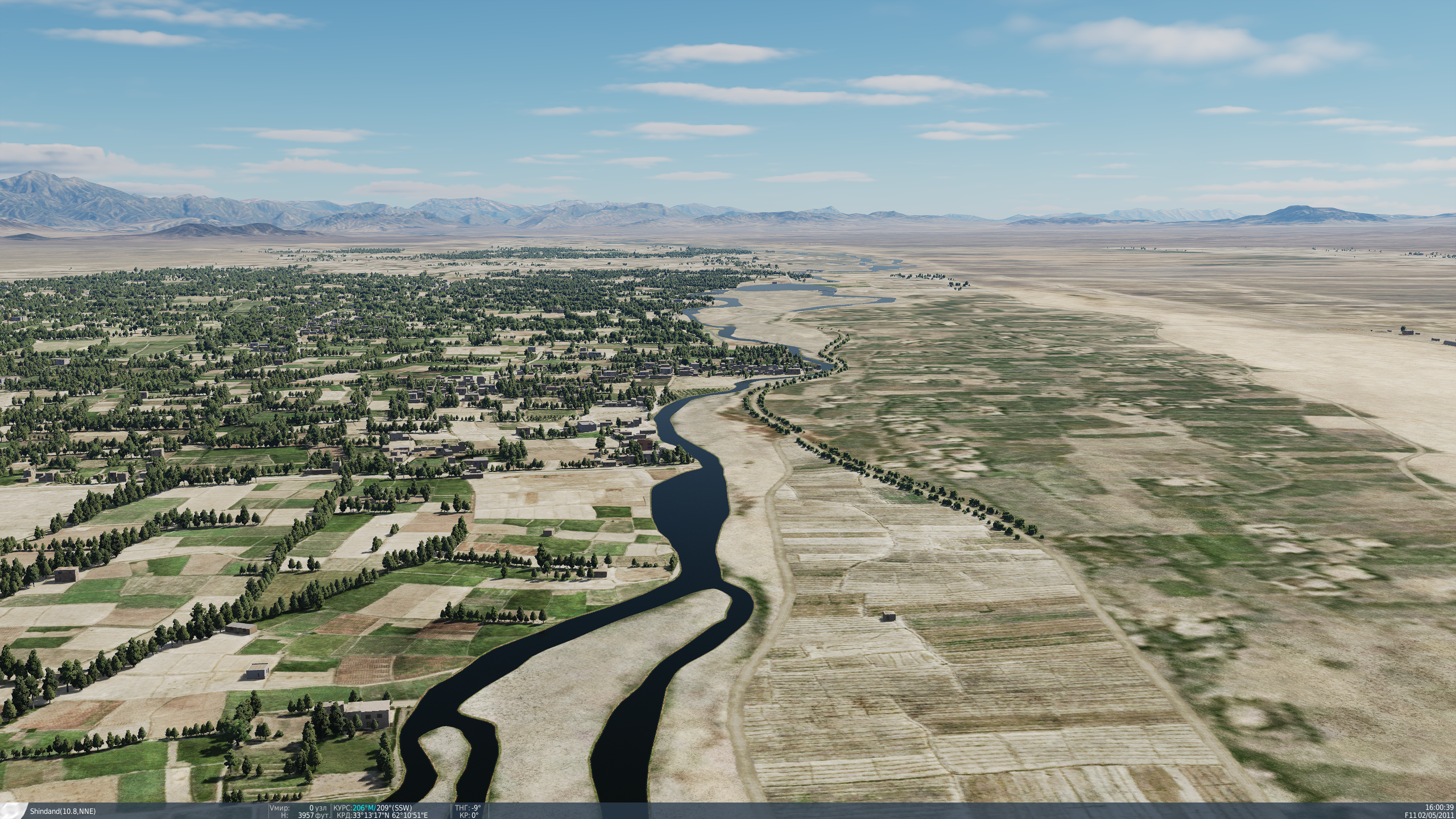
Myself and a squad mate DD_Fruitbat flew a couple of quick recon missions I knocked up last night and I have to say flying from Tarinkot and Chaghcharan we both found the scenery stunning with fantastic detail. We first flew north from Tarinkot escorting a small convoy until it was spotted an insurgent mortar team waiting to ambush them. The compound I could put them in seemed exactly like those described in the book "Apache Dawn". Then as we continued on our patrol the mountain ranges rose and fell with great detail in the towns and villages. We found ourselves at one point pushing 11,000 feet, defiantly not a happy place for the Kiowa and Apache! We were enjoying our flight so much the Kiowa ran out of fuel on the way home and the Apache got just got to the landing area before both engines died with no fuel. Its a big thumbs up from us.4 points
-
I agree with those saying they aren't impressed by this map, that's why I'm passing on it for now, and waiting to see how it develops. I also agree with the op, that maybe the map would have been better if it was smaller, and more detailed (and a smaller file size). The map is super repetitive, flat, or mountainous. frankly making it all the more logical to have it be much smaller, we don't need this much of the same thing over, and over again. I think ED spent so much time wondering if you could, they never stopped to think if you should.4 points
-
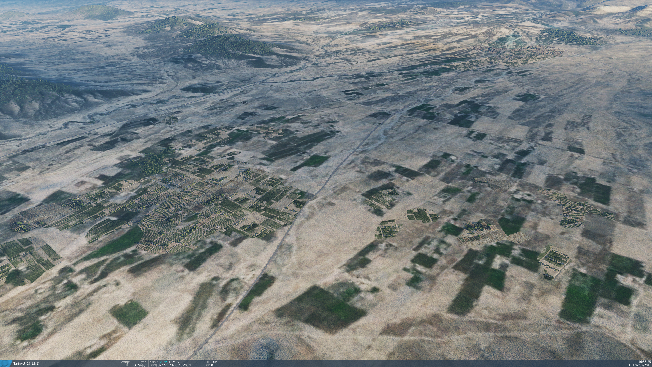
Very low texture resolution map and low poly mesh, looks terrible. The google maps textures are not well suited for a game like this.4 points
-
So let me see if I've got it... You believed from previous experience - & before purchase - that this is how the DCS graphics engine renders maps - & you don't like it... & you knew - again, before purchase - that this map was unfinished... but you still find it necessary to complain loudly after purchasing it that the map is unfinished & doesn't render terrain to your satisfaction? ¯\(°_o)/¯ Nope - I don't get it (& you probably shouldn't have)4 points
-
Keep in mind guys who already bought it from ED shop based on cherry-picked teaser media published before, cannot refund it. I'd say the issue is not the matter of "black and white" perception, but rather a question of what one gets for his money here compared to other products. It's one of the most advertized releases from ED and yet, many of current 3rd party maps (or even some older ED ones) are simply superior as far as low altitude quality is concerned (where it really matters for majority of players who are going to use it). And they offer that better quality for equal or lower price. Comparisons with other DCS maps are unavoidable then, especially when people expect ED to proudly lead in fidelity race rather than lag behind or even step back. Granted, the region depicted is in EA phase indeed, so it can certainly be improved. However, if you stay with DCS as long as some of us, you will eventually notice that modules tend to stay in EA / "kinda-sorta-good enough" state for years, with only game crashing bugs being dealt with swiftly while the rest of the issues usually end up in "low priority" development barrel, rarely to be fished out of it again, if ever. At the same time bulk of ED workforce immediately moves to other projects (remaining Afghan parts, Iraq and WWII Marianas in this case I presume), 'cause that's what keeps DCS business running. As such, "it will only get better from here" should rather be rephrased as "it might only get better from here". But will it - remains to be seen, though everyone obviously hopes it will. Still, If you enjoy the map already in its current state, that's the most important thing. Have fun!4 points
-
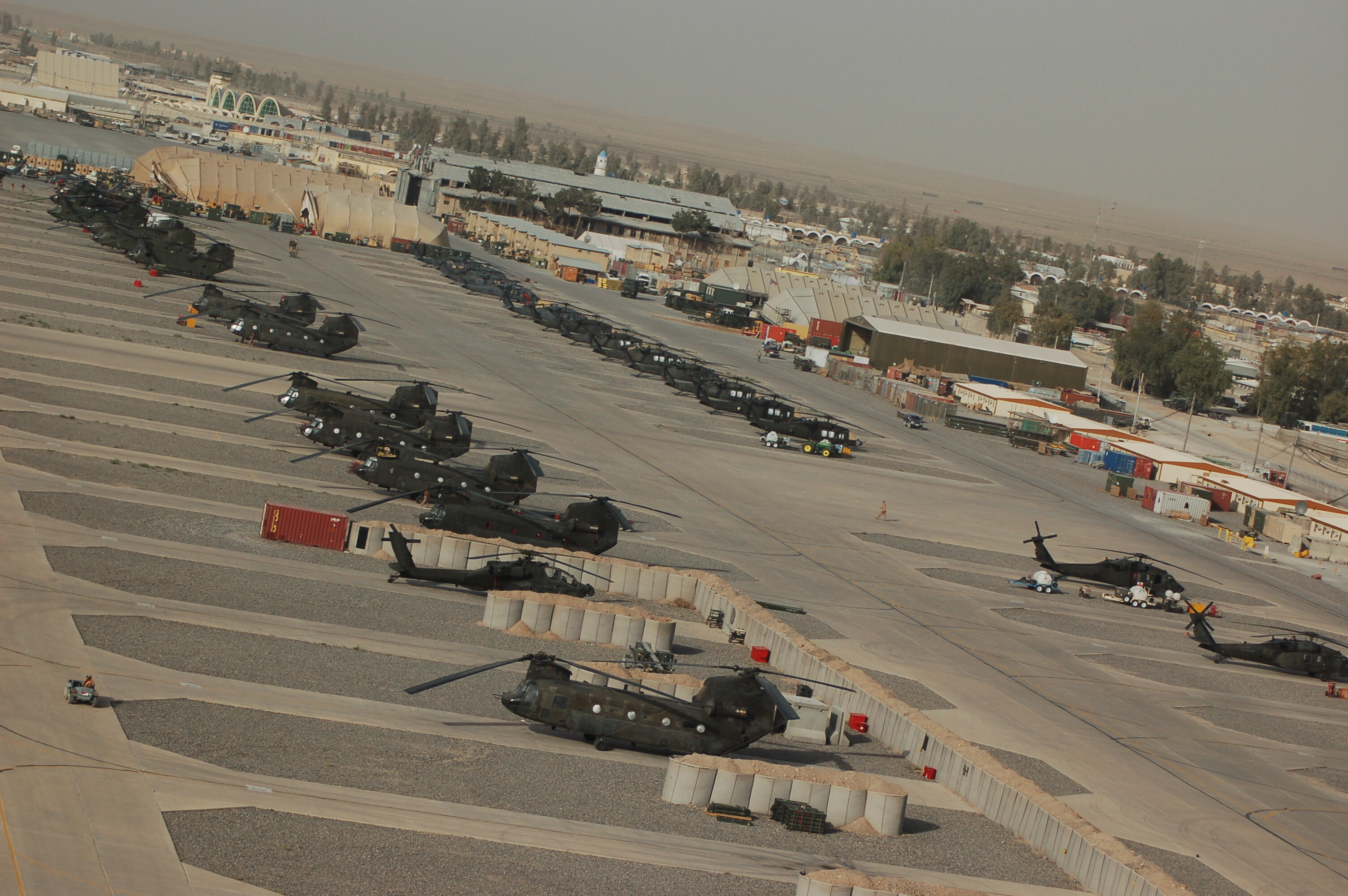
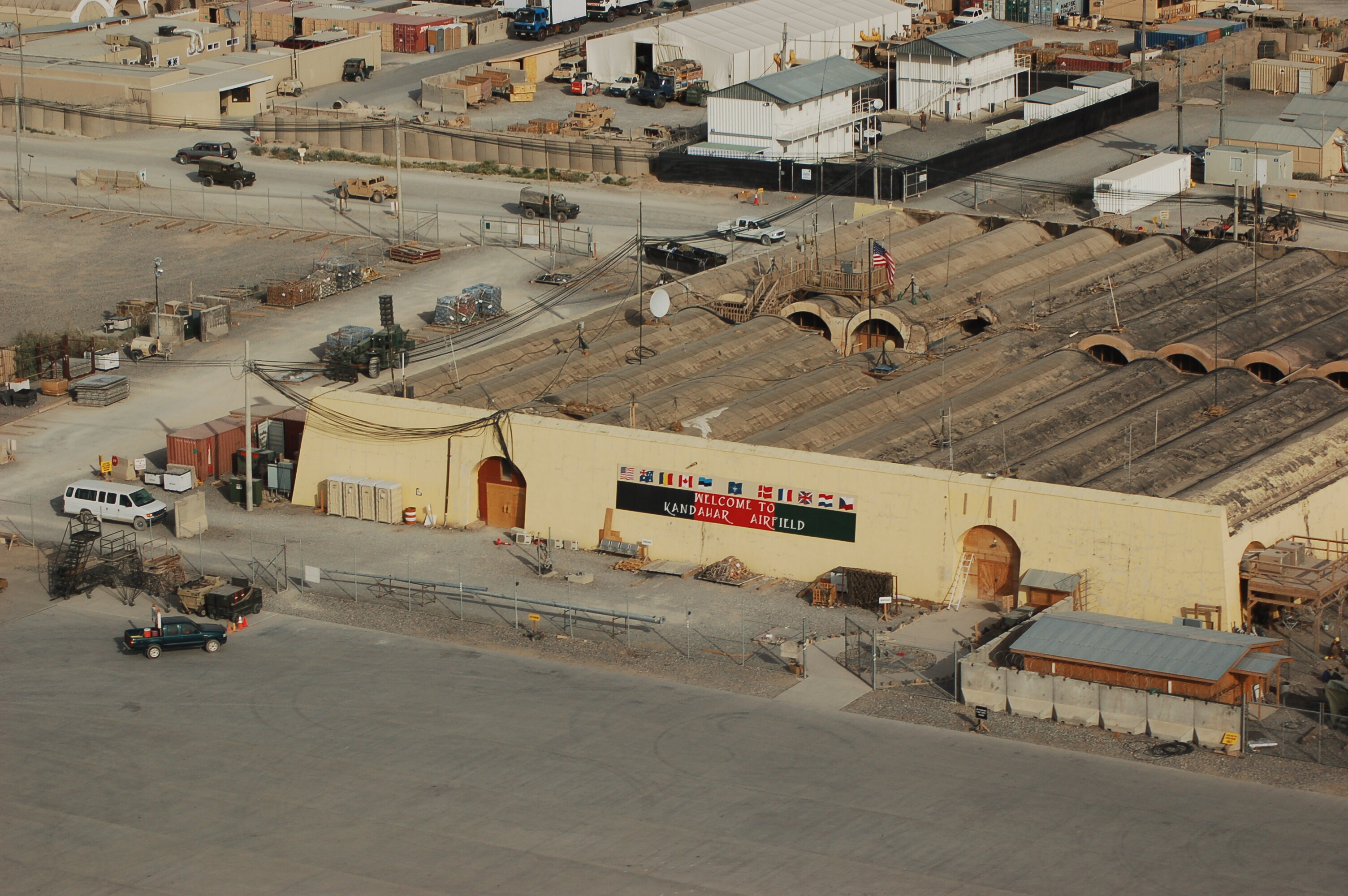
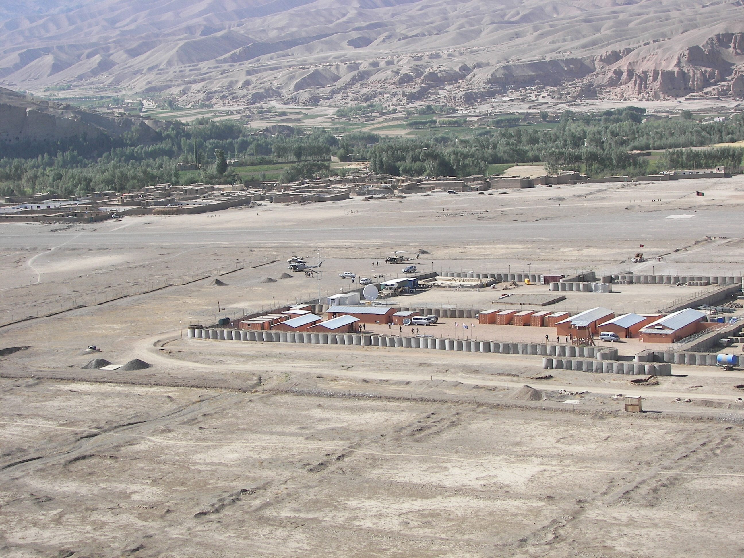
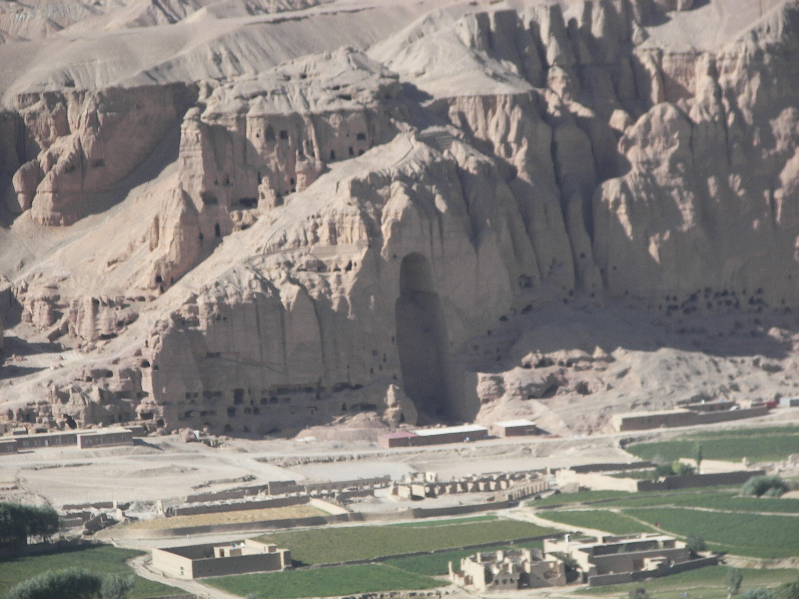
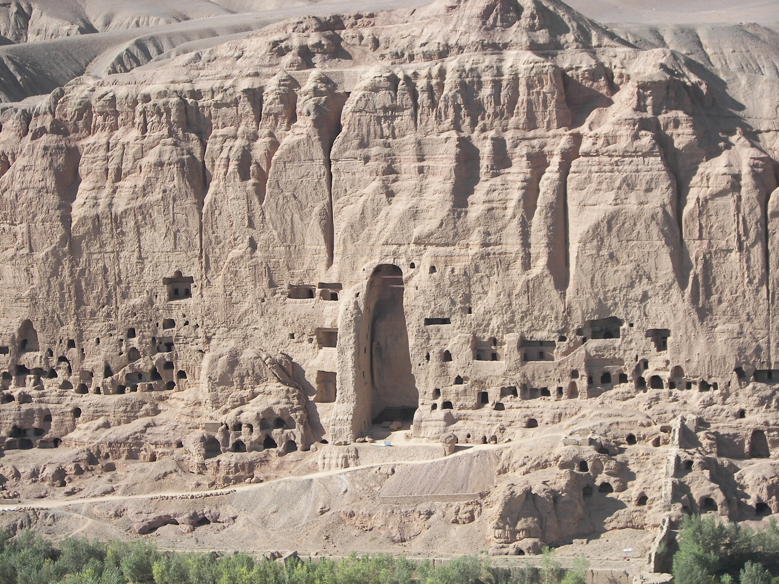
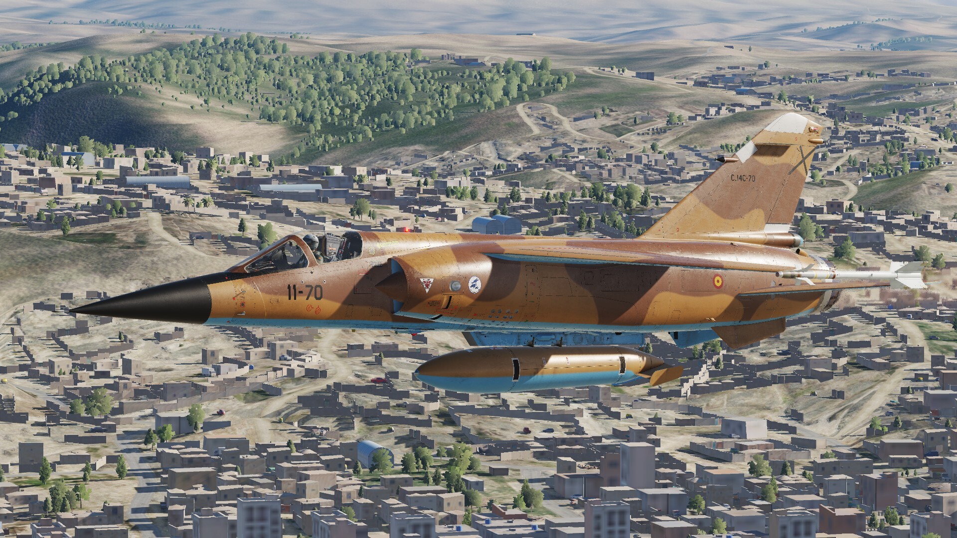
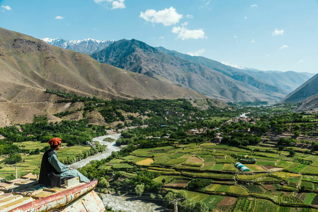
Here are a variety of pics from around the southern part of AFG. They are in no order, just attached them as I found them... Enjoy! Jolly
4 points
-
Why do people keep stating "early access" as an excuse. The whole map is considered early access but the S/W is not. People don't seem to know the BIGNEWY posted in the Afghanistan Map FAQ that the S/W Afghanistan portion will release with future updates but FOR ALL INTENTS AND PURPOSES BE FEATURE COMPLETE. This is the issue.3 points
-
Well, when I look at all the negative comments on the patch, I actually feel compelled to say a few words about the whole thing. I think I'm pretty lucky, because I have absolutely no problems with the current patch. Everything is running great, but the new slot implementation in multiplayer still needs a bit of work. The same goes for the Afghanistan map. Yes, of course, the map was a bit rough when it went into EA. But first of all, it's Afghanistan and the map is anything but bad. I have really good performance on the map, even when I'm flying the F-4E in a pretty intense mission from Kandahar. The same goes for the Apache on the same map. The lighting effects are also great. What is quite negative, however, are the transitions. The transitions between urban areas and what follows are sometimes very borderline. They urgently need to be worked on. The sand dunes near Kandahar should also be looked at more closely. But overall I can't really say anything too negative. It certainly is a patch with great features. The launcher is great, I like it. The SA map has had a great update, Kola with the new winter textures is incredibly beautiful. The radar updates for the F-16 and the F/A-18 are pointing in the right direction. Sure, we still need the promised part 3 of the radar update...but I at least see the good will to move things forward. What can I say, sure, there are a few negative things we can talk about in this patch. Basically, though, I see the necessary step forward. And it's exactly this step that counts. Thanks to the ED team for that and above all, have a nice weekend everyone here...3 points
-
You can see my earlier post. I installed today's version of DCS and provided a very specific capture of the problem, proving without any possible doubt that the issue is still there after 18 months.3 points
-
Yeah we need green faction...ANA and ANP3 points
-
Yes the new and updated skins look really good even on my old system.
3 points
-
Good points are: (SW Afghansistan only being talked about here) Areas such as the bases at Kandahar, Bastion etc are pretty nice. The houses and buildings are not bad, however, most lack the traditional compound walls that are ubiquitous throughout the region It does look good from 10,000 ft or so up Bad points: Polygonal mountains and flat sides to hills with no detail - I took a comparison flight in SA & Kola this morning, both of which are rocking much better mountains Very little variety in the desert textures & these are pretty low resolution The colours are quite washed out and very light looking compared to the reality:
3 points
-
Понравилась карта. Пролетел по маршруту Шинданд - Кандагар через предгорья. Да, не везде всё проработано, но там где проработано - радует. Почему-то сразу на север от Шинданда некрасивостей много, не надо туда летать))). Проработанные холмы выглядят именно холмами, а не многоугольниками, даже тень мягко ложится на поверхность. Пестрые ковры возделываемых земель годно смотрятся, населенные пункты. Швы между детализированной частью и недетализированной видны, но не везде. С высоты примерно 400-600 метров вообще классных видов полно. В Кандагаре заходишь на посадку и прямо веришь. Кстати, качество картинки отражения в зеркалах поднялось и, на глаз, не уступает обычному виду. Падений производительности не обнаружено. При переключении с F10 подгрузка детализации земли занимает 4-5 секунд, каждый раз, это бросается в глаза, но не приводит к просадке кадров. Недопонял тоже, зачем предлагается быстрый холодный старт именно в Шинданде, на север от которого не очень красиво, есть косяки в аэродромной разметке и надо проруливать под крылом некорректно припаркованного Ил-76. Впечатления выше ожиданий, особенно после прочтения яростного негатива. Для первого показа в раннем доступе очень даже хорошо. Карта, кмк, соответствует имеющимся приемам их создания. Лучше Колы. Не хуже Сирии в целом. Намного лучше Невады и Персидского залива. Наша любимая Сирия, к слову, тоже имеет местами некрасивые и странные места. Всё вышесказанное - личное восприятие. Будьте культурными людьми, народ. Накидал скриншотов пачку. На всякий случай напомню, что на картинку надо нажать, чтобы в максимально доступном качестве посмотреть!!!
3 points
-
In places where the procedural textures are consistent it looks really quite good down low, while still remaining quite good up high . I think there's a lot of potential to be the best looking map. They just need to sort some of the texture jank down low, which I hope will just come with time.
3 points
-
Облетал вывод таков - в районах крупных аэродромов и городов, карта сделана нормально, но вот стоит отлететь чуть дальше от них, начинается порнография с автогеном и текстурами. Видно что рука картодела туда не "ступала". Пример проработанной местности: Доходит до смешного как в рекламе - одну половину мы чистили обычной зубной пастой, а другую блендамед. И да непонятно зачем делать "быстрый страт" для самолетов вот в таких местах, если известно что они недоработаны. По таким местам и сложилось мое первое впечатление о карте.
3 points
-
ИИ. Пехотные юниты могли произвести всего лишь единственный выстрел из РПГ по вертолету противника - исправлено. А вот теперь летать действительно стало страшно...3 points
-
Same issue here, will test the solution tomorrrow. Thanks for the find. How is this even possible? It's getting comical at this point, having to change mouse settings in order to have a playable experience, wtf.3 points
-
The post was a well-thought-out and descriptive explanation one what this person thought was missing or not working, so I want to take our time and give the best answers on everything I can.3 points
-
Under the current circumstances, here is your “sniper” pod:
3 points


.thumb.jpeg.b9a38a8127c434fd6eba974eb2776d00.jpeg)


.thumb.jpeg.b9ff15b72ff07e280909e7493bd18523.jpeg)


-
Recently Browsing 0 members
- No registered users viewing this page.