
NineLine
-
Posts
32878 -
Joined
-
Last visited
-
Days Won
103
Content Type
Profiles
Forums
Events
Everything posted by NineLine
-
Yes, we always request this. How long it takes is generally up to the creator of that map. Thanks.
-
 We have been doing some heavy testing on this and have decided for this upcoming patch to roll back the changes so that we have more time to prepare a system that will adjust the don't based on what headset you are using (or if you are on 2D). We are also looking to see if some options to adjust yourself would make sense as well. We are sorry for the delays on this but trying to test across a broad sample of setups does take time.
 -
Very nice template, thanks for doing this!
-
These are created by the team that makes the specific map. Thanks.
-
They are still there, although very subtle. We are working on standardizing these effects and then looking at the possibilities of user options for strength. Thanks.
-
investigating Hornet's Slow-State Energy Bleed?
NineLine replied to wilbur81's topic in DCS: F/A-18C
The thread is marked as investigating, let the team investigate. We were addressing another user about the document mentioned. We are well aware of it and BN responded. Thanks. Edit: The team is investigating this, I will lock it for now and when/if we need more info we will share it. Thanks. -
DCS F-16C Early Access, what's left, what's next.
NineLine replied to RyanR's topic in DCS: F-16C Viper
Sorry all, this seems to have gonna off the rails now. Closing. Thanks all. -
Please keep the discussion on the newsletter, thanks.
-
Slip up, was supposed to be a M-2000 campaign, not the module, we are waiting on the Steam person to fix.
-
It depends on the surface, areas around runways and such do not throw up dust, this is a known issue with terrains. Other locations should show it just fine. Thanks

-
fixed internally MSI trackfiles generated despite radar in MAP (A/G) mode
NineLine replied to Ahmed's topic in Bugs and Problems
It should be in the next release, so you can check again then. Thanks. -
DCS F-16C Early Access, what's left, what's next.
NineLine replied to RyanR's topic in DCS: F-16C Viper
It's a Combat Simulator, it's a game, many games are simulators, and nothing needs to be changed or noted. People should understand that we are not making a military-grade sim for their living room. You are buying a game, it's a Simulator game no more or less than any other type of simulator game found on any other platform for sale for Windows PCs. I am not sure if that is a serious question. Once again, these modules were never meant to be 1:1 replications of the real aircraft for an assortment of reasons. I am not saying that this means any of the listed modules are finished, I am only pointing out that they will never be exact. Whether its unavailable documents, protected systems, requests from manufactures, etc. -
LOD tables are being redone, but this is also a huge undertaking, so things are being worked on even if it takes time. Understand that some of these changes need to be made before moving forward, such as multithreading, etc.
-
DCS F-16C Early Access, what's left, what's next.
NineLine replied to RyanR's topic in DCS: F-16C Viper
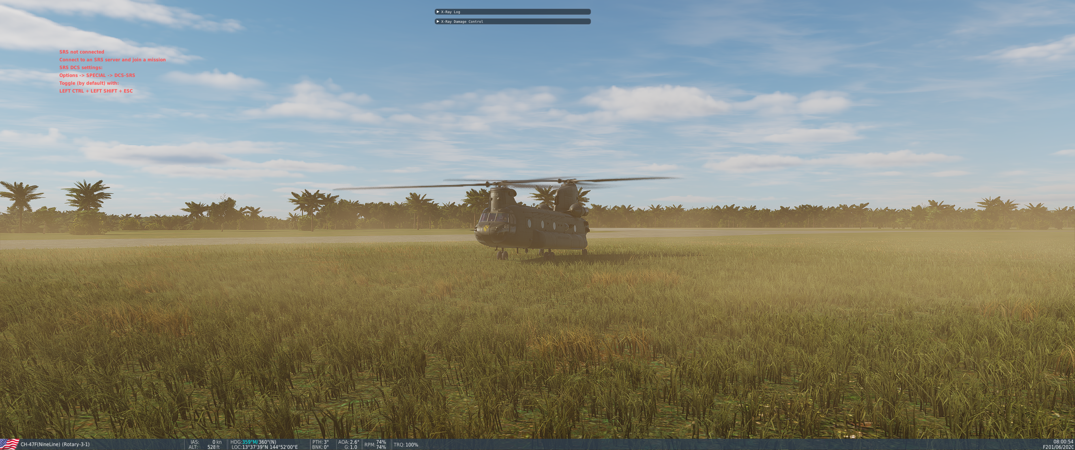
There are a few things to consider with this though. 1) The A-10C and Ka-50 benefited from other work outside of DCS that afforded much more detail and the permission to have that detail, not every module has this sort of access and we MUST be careful what we model and what we don't. 2) If you expect a 1:1 simulation of a military aircraft that are still in service or recently in service you will be disappointed. Even the A-10C as much as it had/has is still missing a lot of things that are simply not allowed to be included. This includes flight modelling, weapons and systems. We are not making something that can be used to train pilots to fly, and we are especially not making something to train pilots to fight against. 3) This is an entertainment product, a game. It is also very complex for many things that we are allowed to model, it doesn't mean that the instructions on how to model it are in a manual somewhere, in that the code needs to be created for any source material we can use. You cannot copy and paste that into DCS and it magically works. Many of the systems on the F/A-18C, AH-64D and F-16C are more complex than many things seen in the early modules. Even the CH-47F has a completely different Flight Model than we have ever done, so it has its own challenges. DCS is and always will be a journey, especially when you get in on day 1 of Early Access, some days it can be frustrating but I think I can safely say that all our modules, even the ones not complete are still a ton of fun. And even though they are not 1:1 simulations, we hope you find them to be, when completed, to be a very faithful and immersive experience. All the aircraft listed above are still being worked on. We are not done with them and they will continue to get better. Thanks -
fixed internally MSI trackfiles generated despite radar in MAP (A/G) mode
NineLine replied to Ahmed's topic in Bugs and Problems
Guys, I just checked our development build and it seems there is no track shown there so it's possible this was fixed already, I was only able to check the release earlier. It's possible that's the reason for some crossed wires in my earlier response. Sorry. Release version: Dev Build at the same time as above
-
Yes, FLAK seems broken right now, and I have seen its reported internally already, will chase it up. Thanks!
-
Thanks I will check this as well, with new fog coming visibility tuning will need to be done.
-
fixed internally MSI trackfiles generated despite radar in MAP (A/G) mode
NineLine replied to Ahmed's topic in Bugs and Problems
We believe this is correct based on available, public references. If you have contrary, public evidence, please message me with it. -
Thats interesting if true, that shouldnt be. I will check this mission shortly. Thanks!
-
fixed SU-25T's Command Post Strike Bug
NineLine replied to shiromisosoup's topic in Aircraft AI Bugs (Non-Combined Arms)
I think its more of a mission issue, but I am looking into it. Thanks! -
I will need a track without any mods required. If you can recreate it on the Caucasus map, even better. Thanks.
-
Can you share you mission or a track and I will take a look.
-
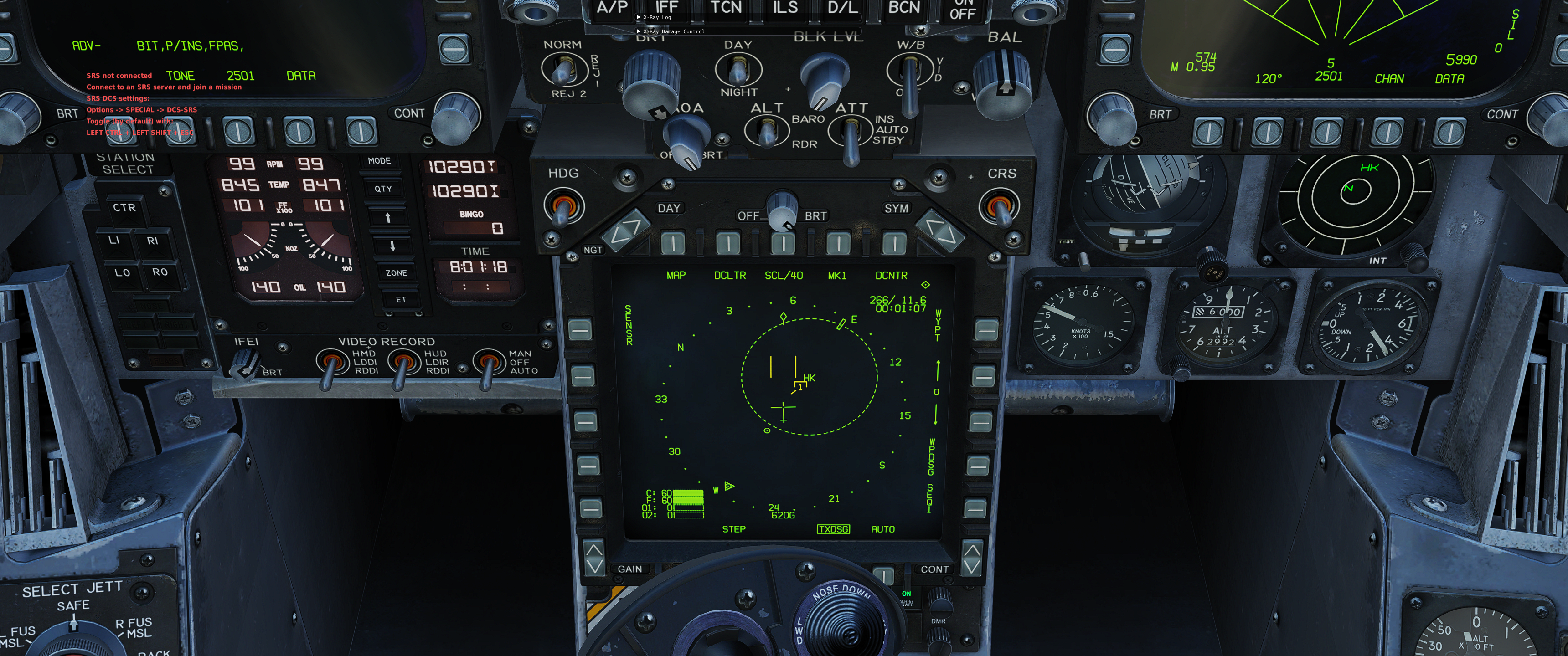
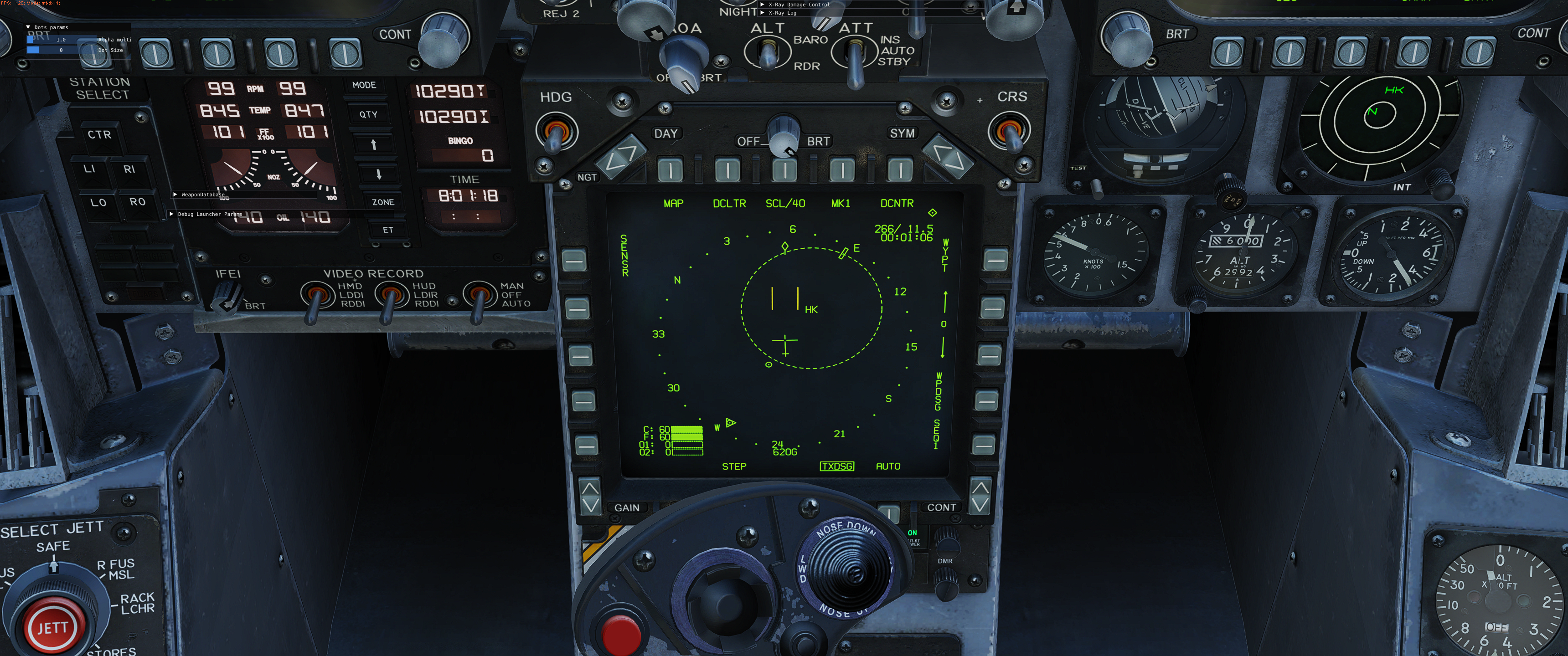
DCS: AH-64D | Radar Map Mode In this DCS: AH-64D video, we’re back to the Fire Control Radar, or FCR. We’re going to go over the Radar Map, or RMAP, mode. Like the FCR GTM mode we discussed earlier, we can still use the FCR to detect and classify ground targets and low-flying aircraft, but we’ll also be able to generate a radar-image of the terrain to provide target reference and situational awareness. Let’s get started. I’m at a 60-foot hover and we’ll first get the FCR up and running by bringing up FCR and then the Utility page. From here we’ll unpin the Mast Mounted Assembly, MMA, override the BIT to save some time, and exit the utility page. We’ll now make the FCR our sight. By default, we’re in the familiar GTM format, but let’s switch to the RMAP format by adjusting our controls on the CP/G left handgrip. You can also set on the Pilot’s collective mission grip. Set LHG FCR Mode Switch – RMAP (Radar Map) to the binding of your choice. We can now see the FCR format on the left display. Let’s discuss it. The main display, or FCR Footprint, is in a traditional B-Scope format of azimuth and range, just like most air-to-air radars you’ll find in DCS. Note that when scanning, the scanning azimuth will stay stabilized along that azimuth, regardless of aircraft maneuvering. With the left and right arrows, we can shift our scan left or right, just like in GTM. Remember that you can only do this when the FCR is not transmitting. The top of the display represents 8km and 45-degrees to either side when the scan size is in Wide. There are three horizontal range lines that indicate 2, 4, and 6 km. In between, along the left side of the FCR Footprint are small lines indicating 1, 3, 5, and 7 km in between ranges. Sweeping back and forth when the FCR is transmitting is the Scan Wiper alternating between near and far scans. At the top center of the FCR RMAP display is a small line, this is the FCR Center Line. To the far left and right of the FCR Center Line are three additional lines that indicate medium, narrow and zoom scan sizes. Medium is a total of 45-degrees, Narrow is a total of 30-degrees, and Zoom is a total of 15-degrees. These can be selected either from the CPG Right Handgrip FCR Scan Size Switch or the Pilot’s collective mission grip. [Using ZOOM (button R1) enters a 6:1 zoom area, but this is different than the Zoom Scan size.] You can adjust display brightness with the Brightness (BRT) knob and brightness of the radar video image using the Video (VID) knob. I generally max-out the VID knob. You’ll notice many similar functions in RMAP as we saw in GTM, they all behave the same. These include the Next to Shoot (NTS), C Scope (C SCP), number of detected targets, ZOOM, RF Handover (RFHO), Acquisition Source, antenna elevation control, and storing Target points (TGT). Please see my earlier FCR GTM video on these. Regarding antenna elevation control, one particularly useful function of RMAP is to see whether your FCR is reaching the intended area on the battlefield, which may not always be the case in areas of hills and valleys. If you have dark bands of radar dead space running along the top or bottom of the FCR Footprint, you may wish to manually adjust the antenna elevation. For example: if the bottom of the FCR Footprint is entirely dark, you may need to manually adjust the antenna elevation down until you have a complete picture, which may happen if you are hovering over a hill and attempting to scan down into a valley below. Target detections in GTM and RMAP are interchangeable when not transmitting. Meaning, you can perform a scanburst in one mode, switch to the other mode, and the targets would still be displayed. You’ll note that we have a few target detections and indentations. These operate just the same as in GTM. The big difference is that we can also make out the terrain in relation to them. As you can see, the targets lie between lighter areas that indicate terrain relief (reflected radar energy). Because we are so low, the display is quite dark. However, looking outside, we can see the valley indicated on the RMAP. So, we can determine that the targets are in the valley ahead of us. Dark areas on the RMAP indicate surfaces that are not reflecting radar energy, or they are in a radar blind spot. Meaning, obstructions from terrain elevation make the area appear as black. You never know what may be waiting for you in one of these “dead spaces”. Beware. Just like GTM, we can send a radar-Hellfire down range using RMAP. I’ll switch to LINK to get my eyes on it. From this angle, I’m not getting a good look at it on the TADS. I’ll still WAS my Hellfires and fire off a couple. As mentioned, the RMAP picture is not fantastic when scanning very flat terrain at shallow angles. I’ll bring ‘er up to 300 feet and you’ll see a dramatic difference. Particularly with the VID knob up, you have a much clearer terrain picture using RMAP, and we can detect several more targets with the higher vantage point. This is a great tool for building battlefield awareness. Let’s use our last two Hellfires on them.
- 71 replies
-
- 19
-

-

-
I'm looking into this, thanks.